
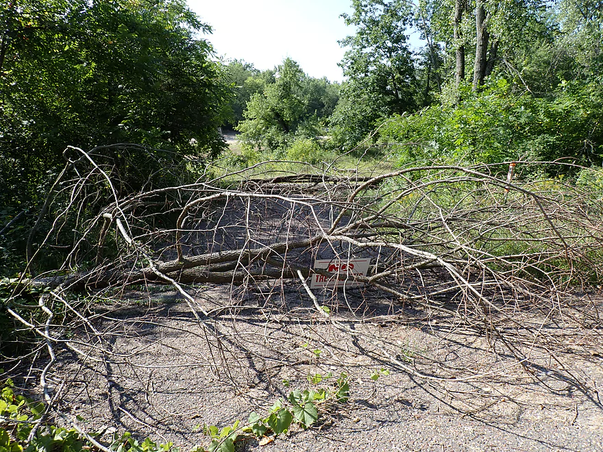
Cancelling my plans to use Grinde Landing as a take-out
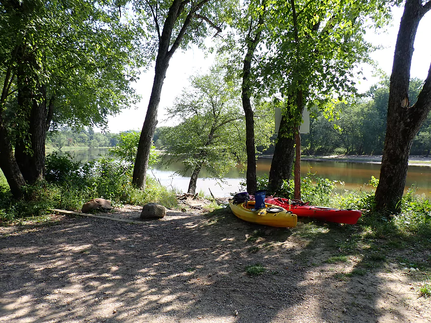
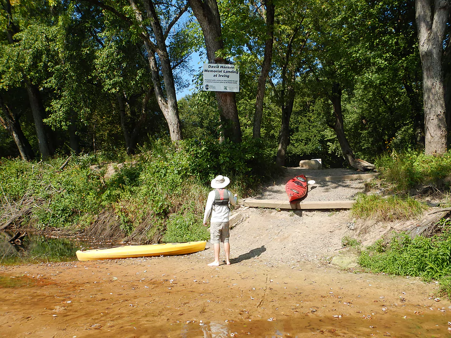
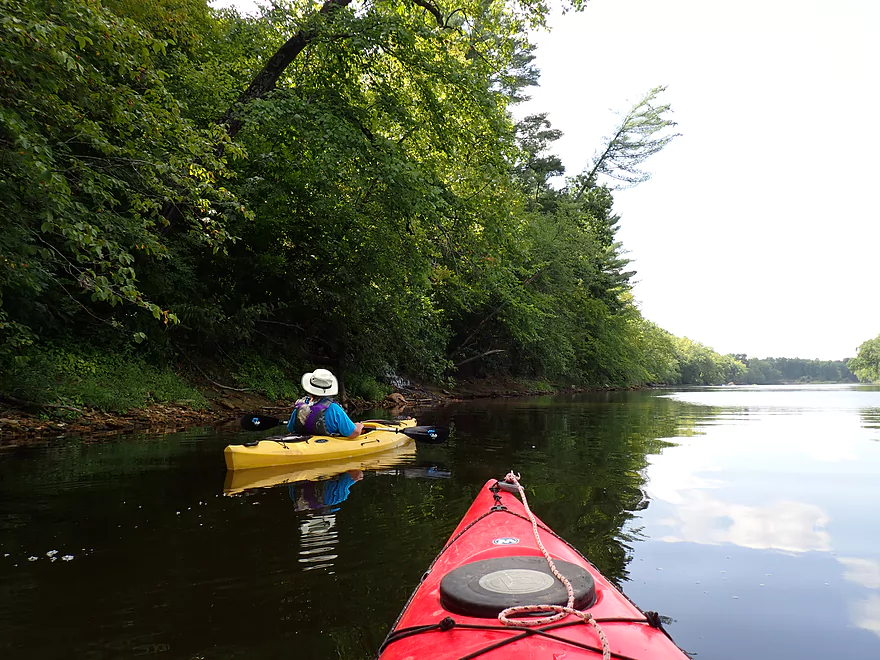
Launching upriver at the Irving Landing (David Hanson Memorial Landing)
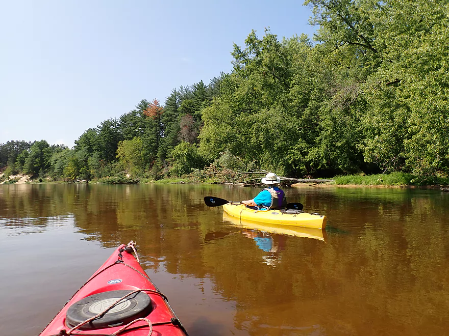
Nice access
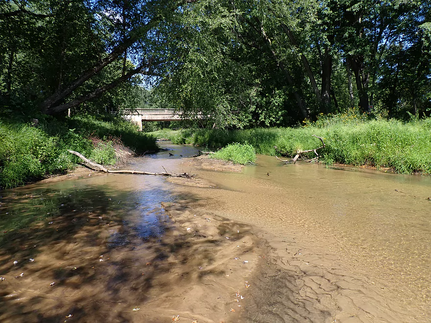
Next to Trout Run Creek
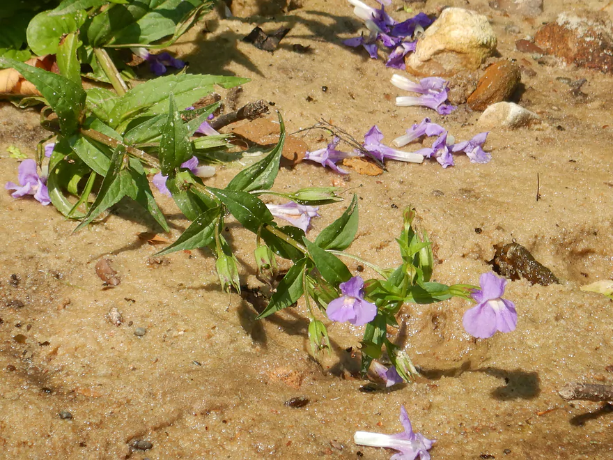
This is monkey flower
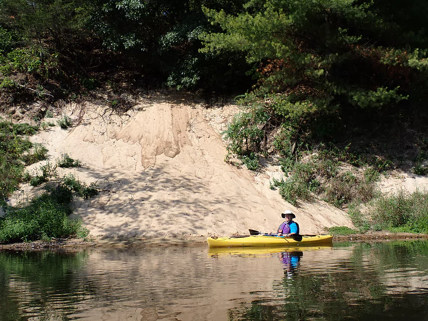
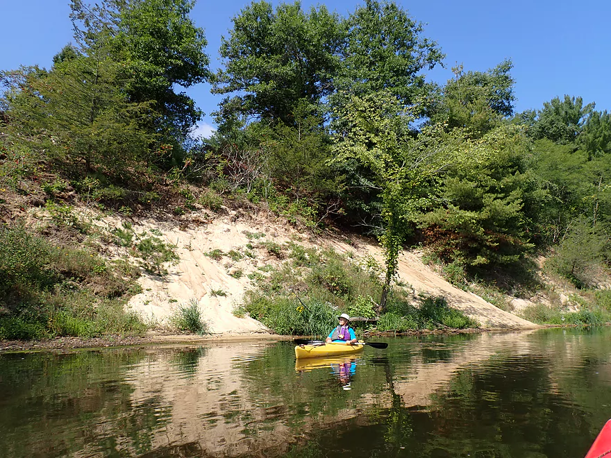
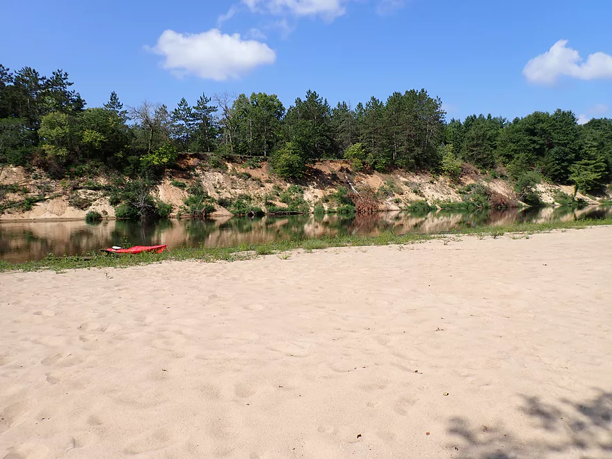
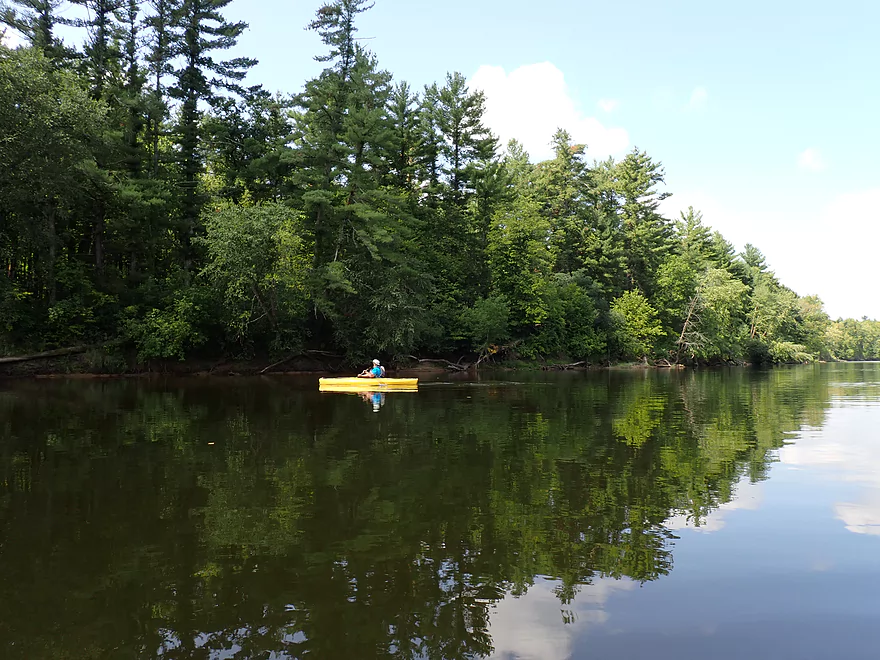
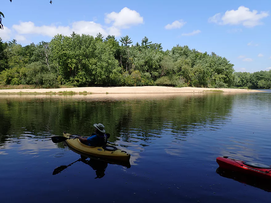
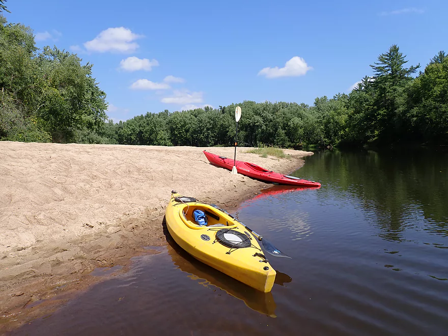
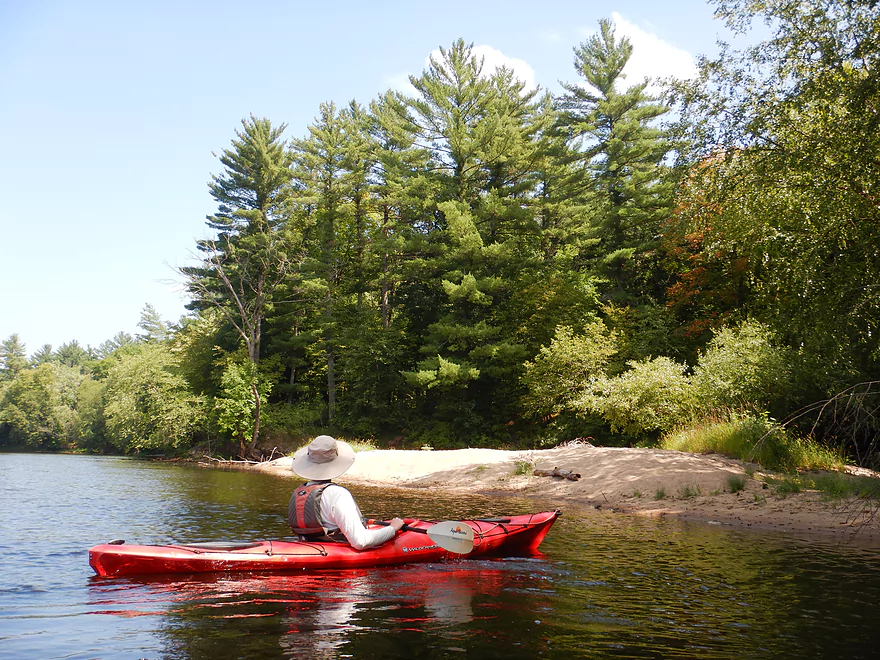
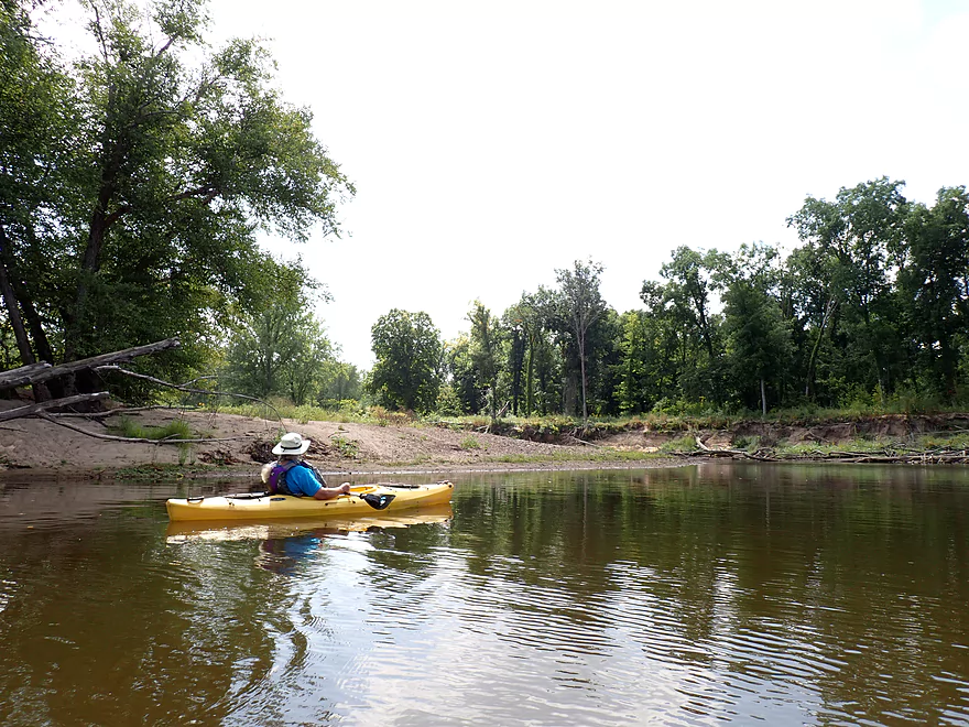
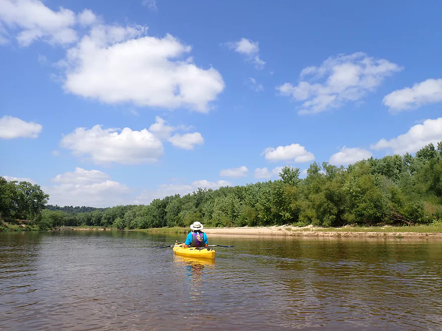
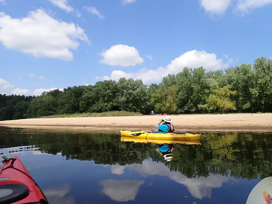
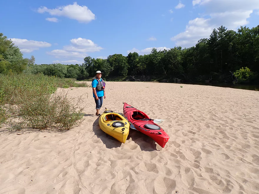
Nice sandbank
Sandbank reflection
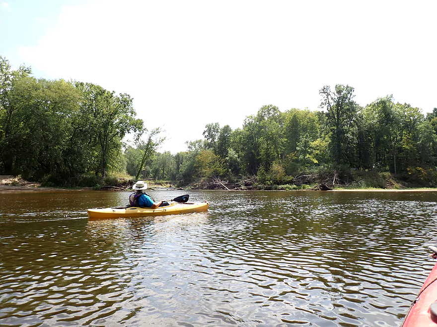
Reminded us of the huge sandbanks on the Wisconsin River above Petenwell
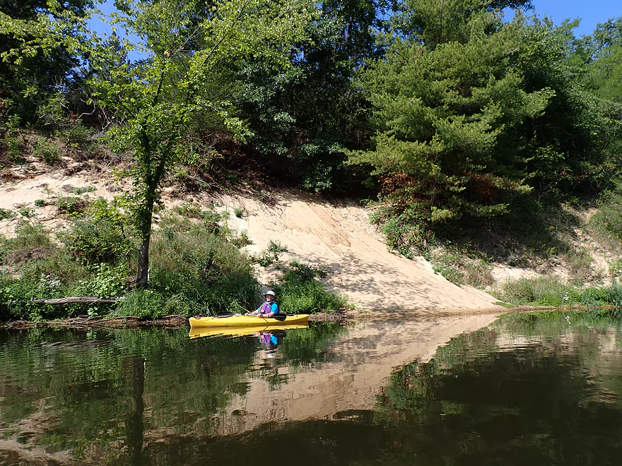
The sand bank was across from a massive sandbar
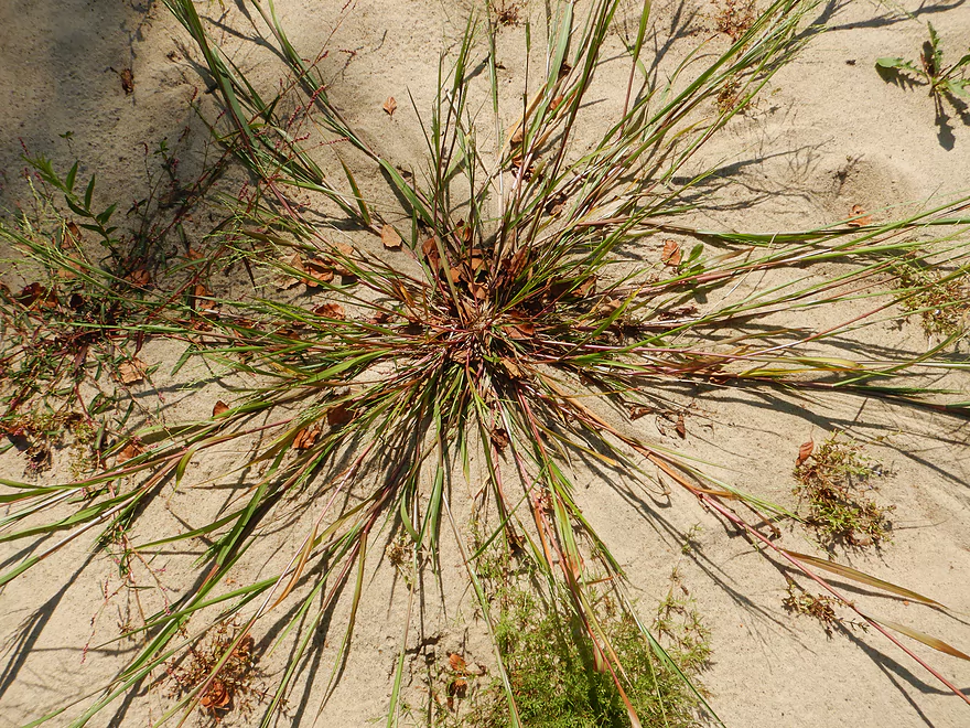
A photogenic grass species
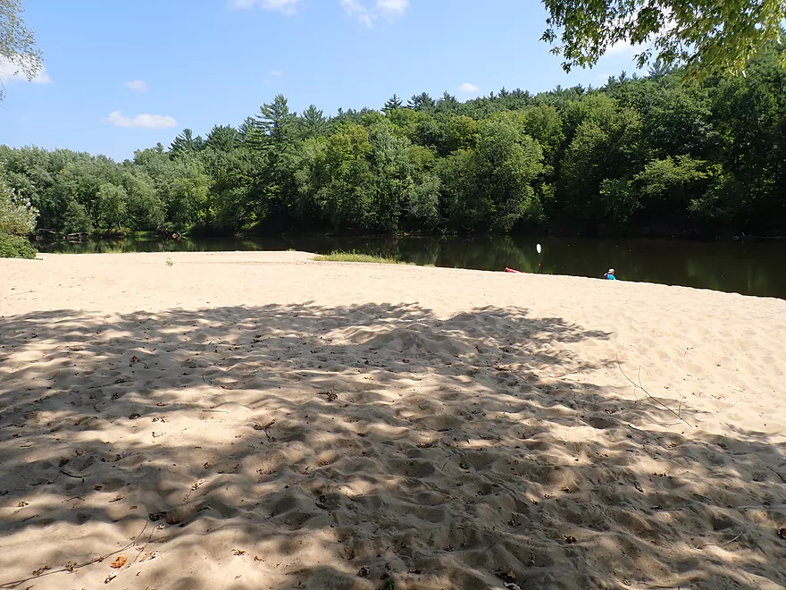
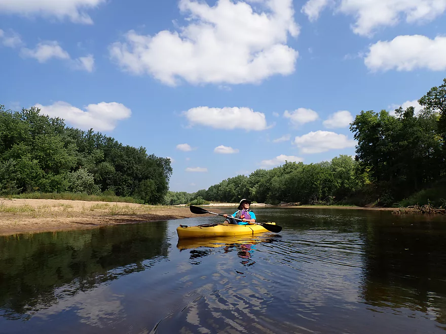
A great spot on the river
Leaving the sandbanks behind
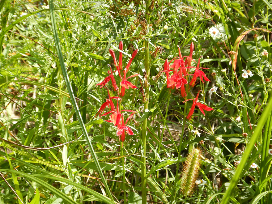
Cardinal flowers
Lot of great white pines
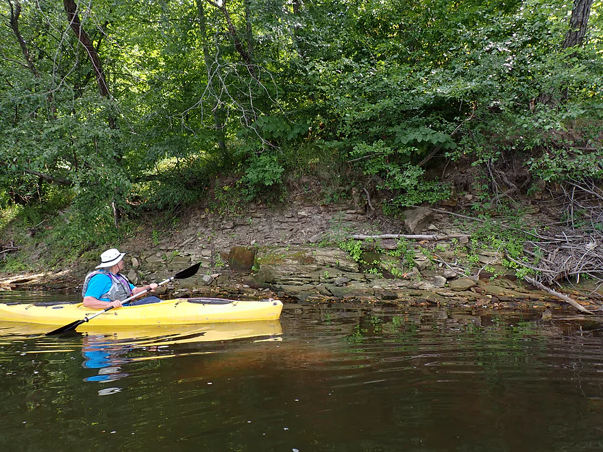
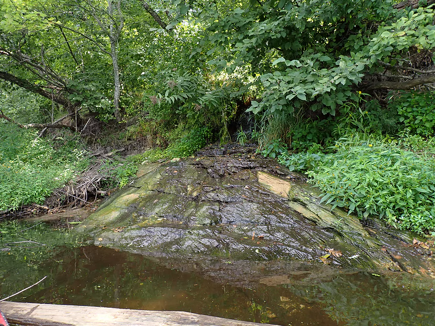
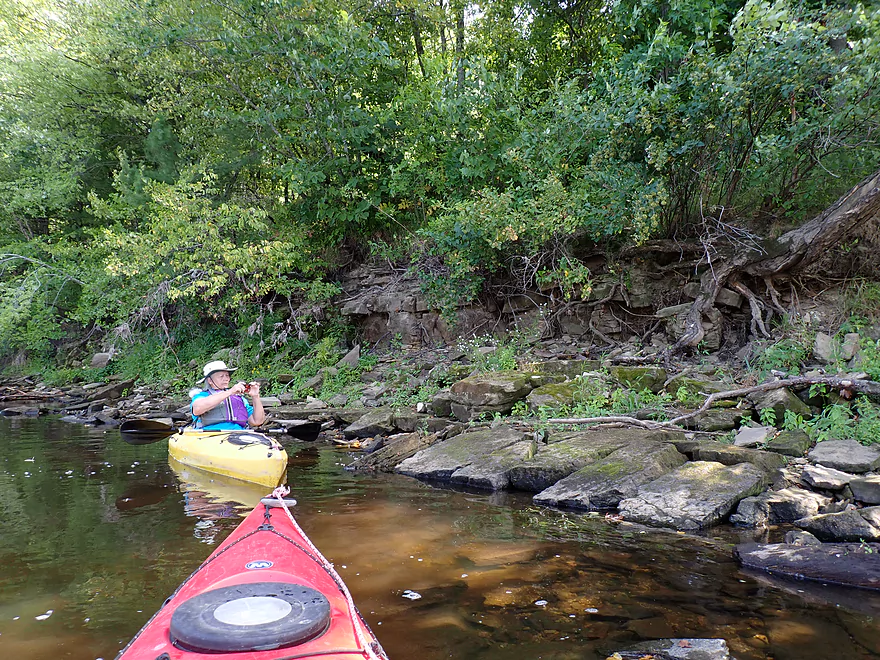
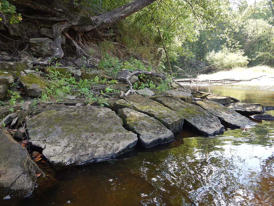
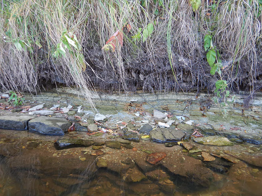
Some small outcrops on the left bank
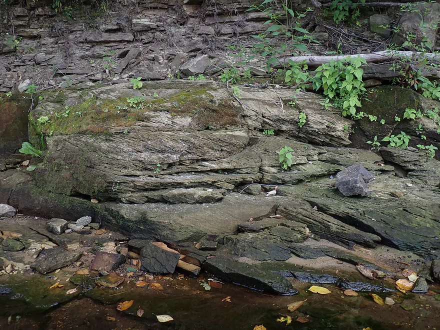
Diagonal rock layers between horizontal ones
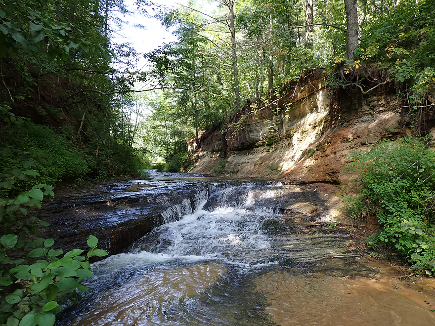
Micro waterfall #1
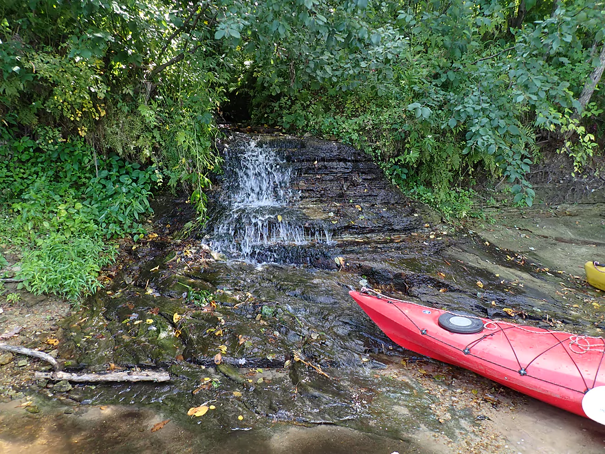
Micro waterfall #2
Another sandbar
This is a really nice one
It’s huge
Shattered bedrock
Interesting patterns
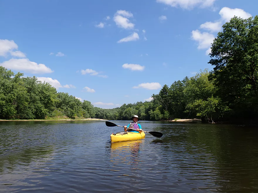
A classic Black River view
This fallen log has become a mini garden
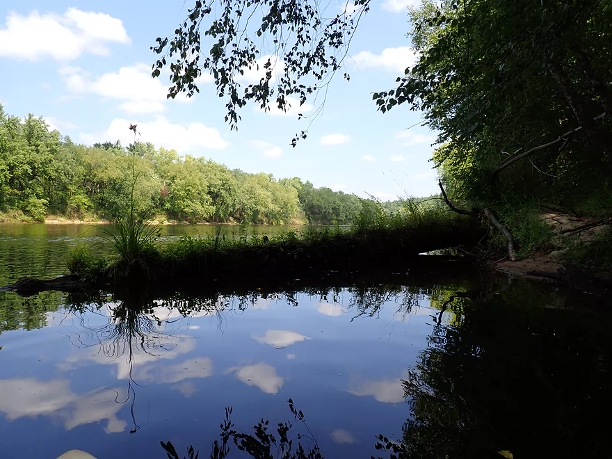
Black River splits around another large island
Huge gravel bar
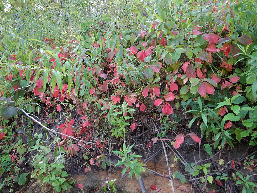
These Virginia creeper leaves were turning color a bit early
One of the taller sandbars we passed
Someone’s private landing
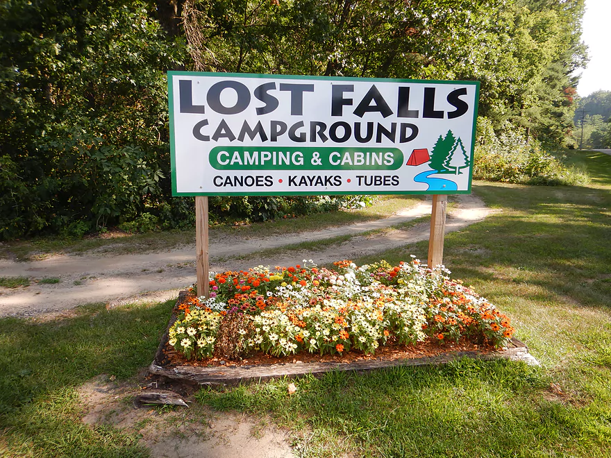
A sign for Lost Falls Campground
Another side channel goes around a huge island
Our take-out location at Lost Falls Campground
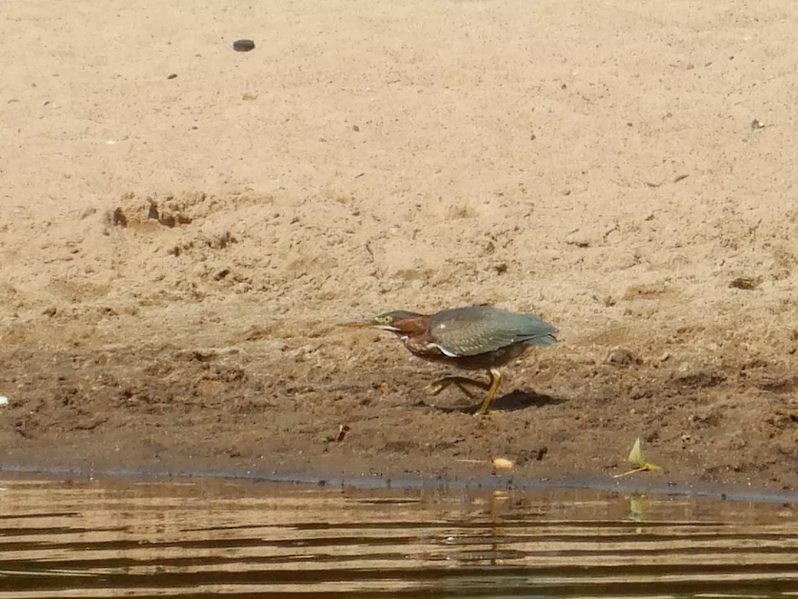
This friendly green heron caught minnows that spooked toward shore from our boat
Overshooting the campground on purpose to explore downstream
Very shallow stretch
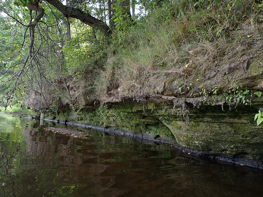
Small outcrop
The mouth of Roaring Creek (which is hiding to the right–you will hear it long before you see it!)
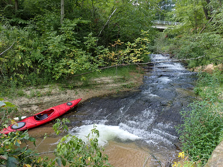
Roaring Creek Falls is just a short hike up the canyon
A longer (and very scenic) hike up the canyon will take you to “Lost Falls”
Heading back upstream to the campground
Taking out
Terrific beach by the campground
Loading up next to the tent camping area
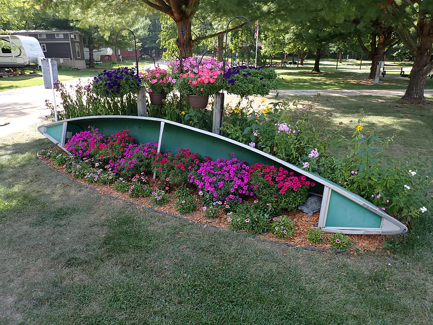
A canoe-themed flower bed next to the campground office
Lost Falls Campground also does boat rentals and shuttles
Black River – Irving

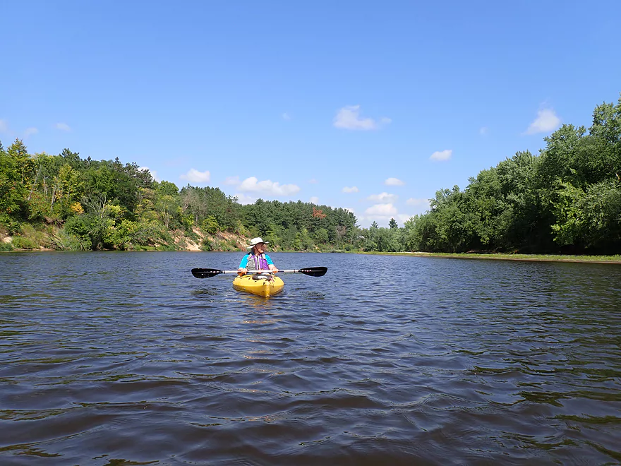
The Lower Black (located south of Black River Falls) is a classic for kayaking and canoeing. I’ve done much of it already, but not yet Irving to Melrose. That’s a bit long when you are taking pictures/video, so for this trip I decided to do just part (Irving to Grinde Landing).
Unfortunately when we arrived at Grinde Landing, it was blocked by two intentionally downed trees and multiple No Trespassing signs. Passing bicyclists explained the situation to us. Apparently Grinde Landing was always private, but the owner was nice and let the public use it for free. But one day, somebody stole his deer stand and he reacted by closing the landing. That was unfortunate for a number of reasons, but mostly because it meant a long 12.6 mile span between the two remaining public landings (Irving Landing to Melrose Landing). Hopefully in the future some remedy can be found to keep Grinde Landing open and available to the public.
Also worried about shallow water, we decided to salvage the trip by putting in at Irving, but then just taking out at a private campground (Lost Falls) which would be a very short trip. We talked to the campground and they said we could use their beach as a take-out as long as we purchased a $10 visitor pass, which we did.
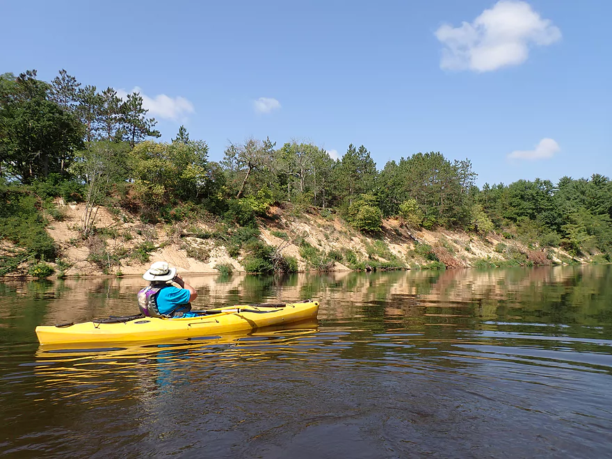
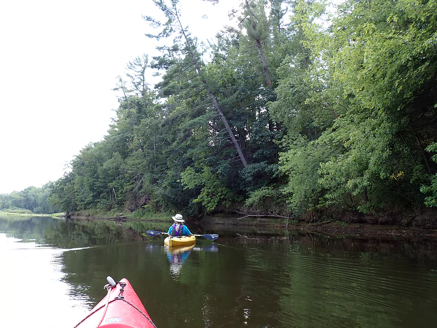
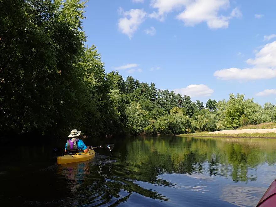
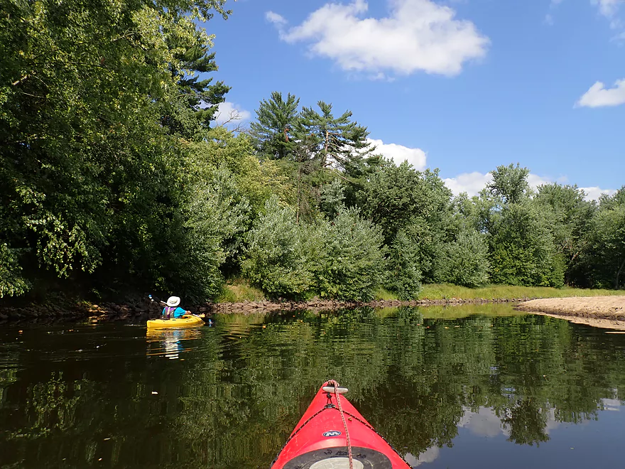
We started the trip at the Irving Access which is a great landing. Multiple signs warn paddlers not to park at the landing, but instead to leave their cars by the nearby community center. We would see several other kayaking groups and several tubers launch from here.
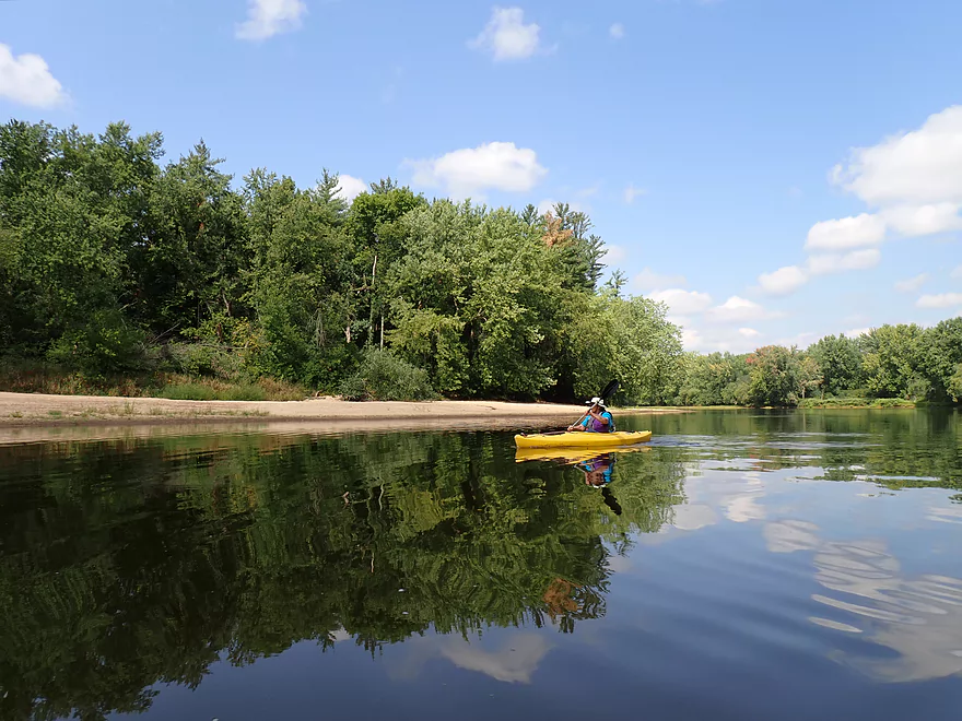
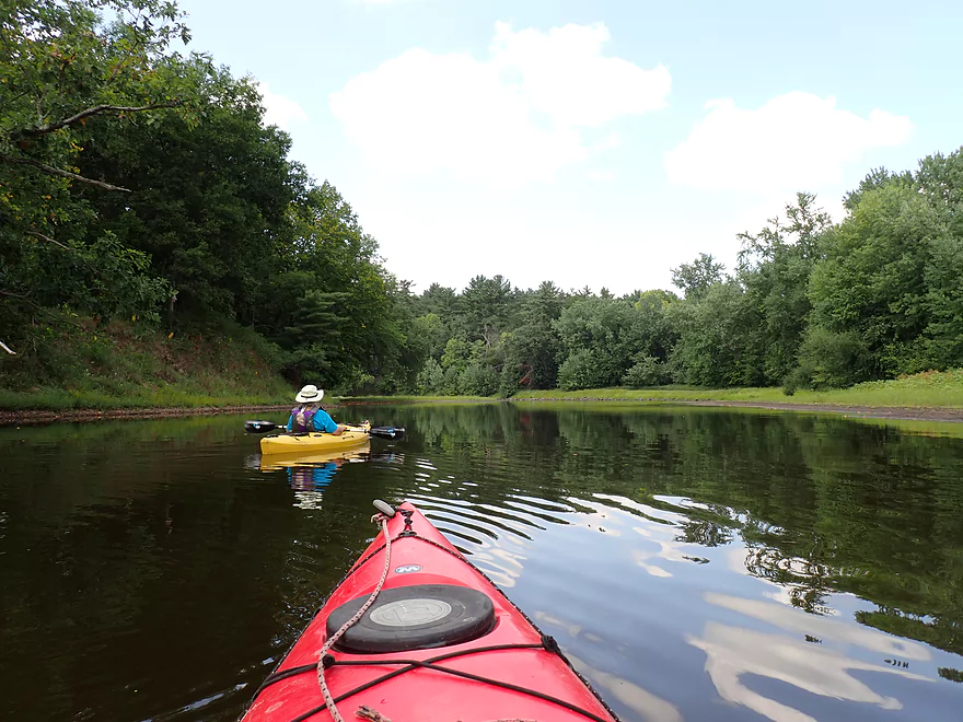
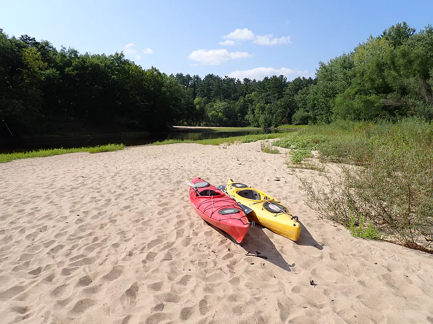
Just downstream from Irving was a terrific large sandbank on the west shore which was opposed by an impressive sandbar along the east shore. There is some debate online as to whether the Black’s many fine sandbars are open to the public and can be camped on. From my research it appears anything that is administered by the BLM can absolutely be used by the public. A sandbar that isn’t posted, is likely fine to be used by the public (and many are). If you do see No Trespassing signs, I would stay off the sandbar…although technically I think even some of these are in a legal gray area, and if you stay below the high water line you probably are ok.
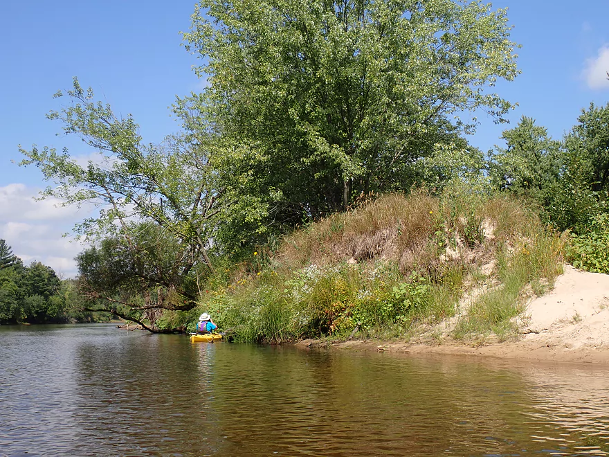
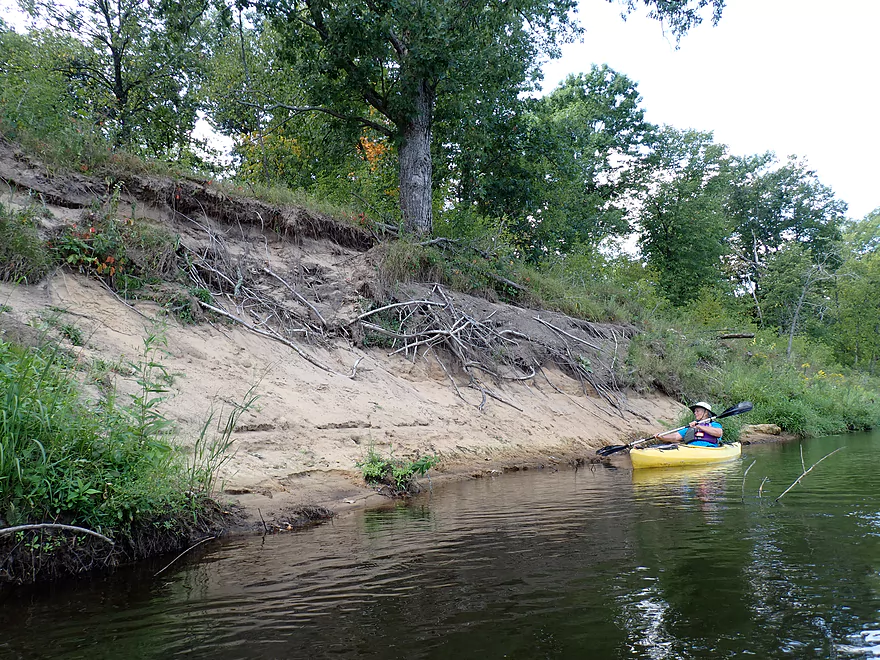
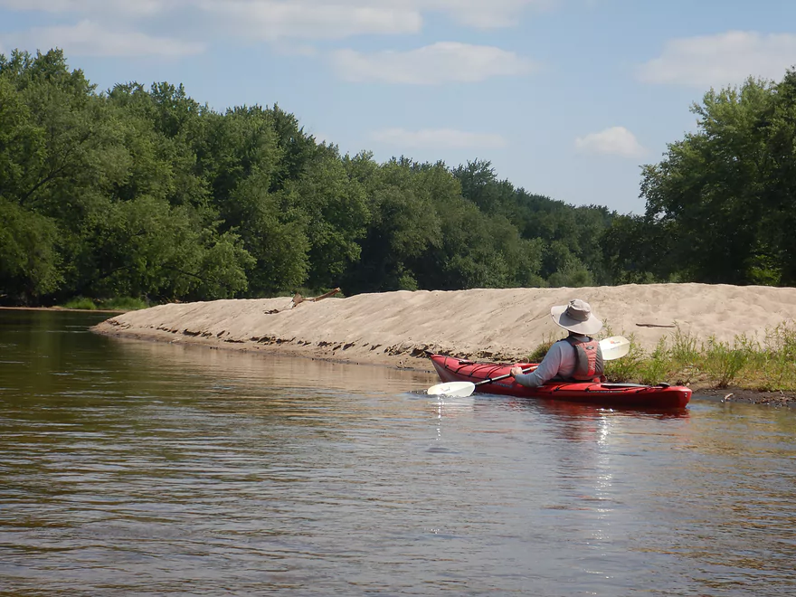
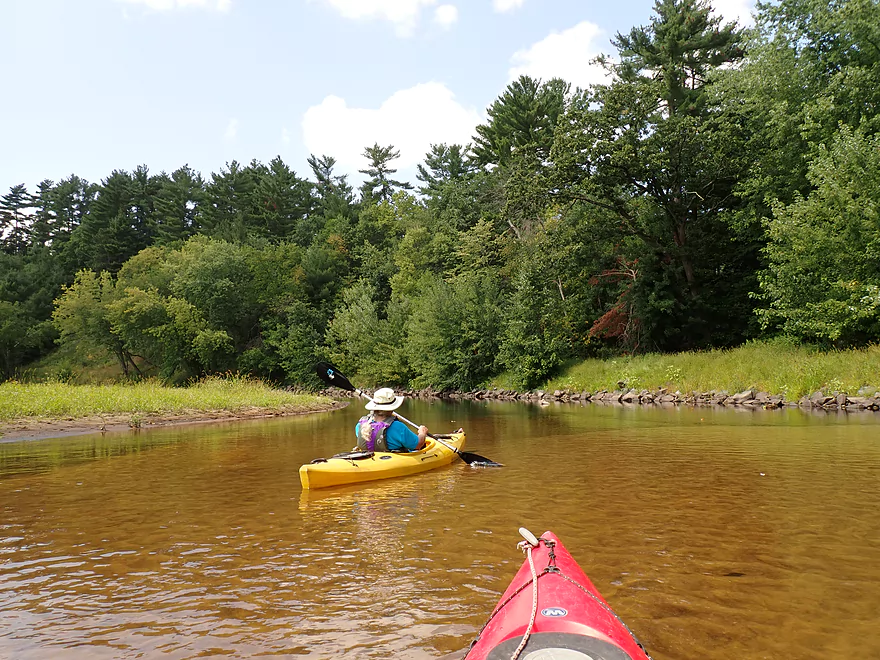
A quarter mile after the sandbank, the river is redirected sharply west by a scenic bluff with fantastic white pines. At its base were two small mini-waterfalls and a few small outcrops. Along the opposite shore was a fantastic sandbar.
A significant side channel splintered the river after the bluff. These are common on the Lower Black and paddlers should choose carefully which way to go around these massive islands. Typically the smaller channels will have some deadfall and may be quite shallow, so often taking the bigger/large channel is recommended which is what we did here.
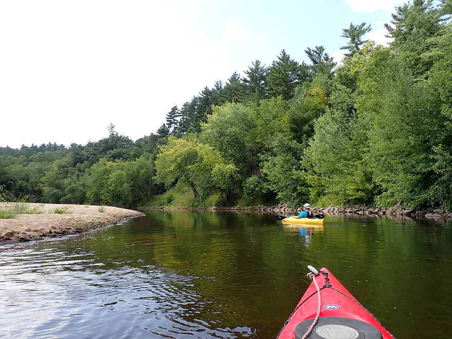
Following yet another impressive sandbar (more gifts from our recent drought), a second more significant side channel appeared and this appeared more viable than the first, but we decided to stick to the main channel.
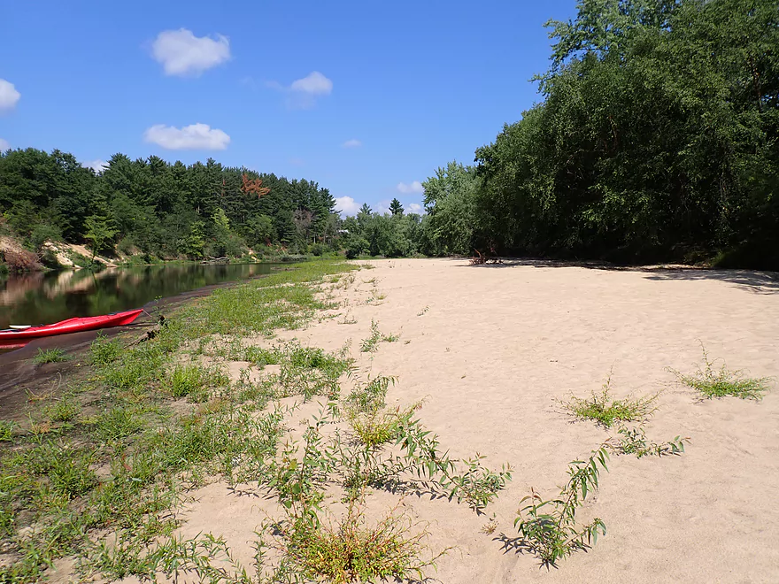
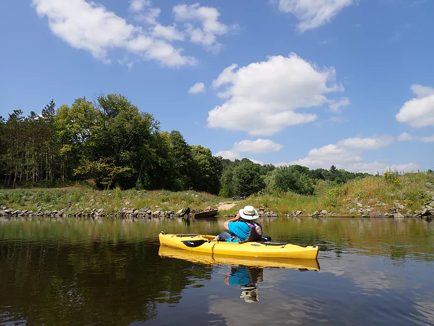
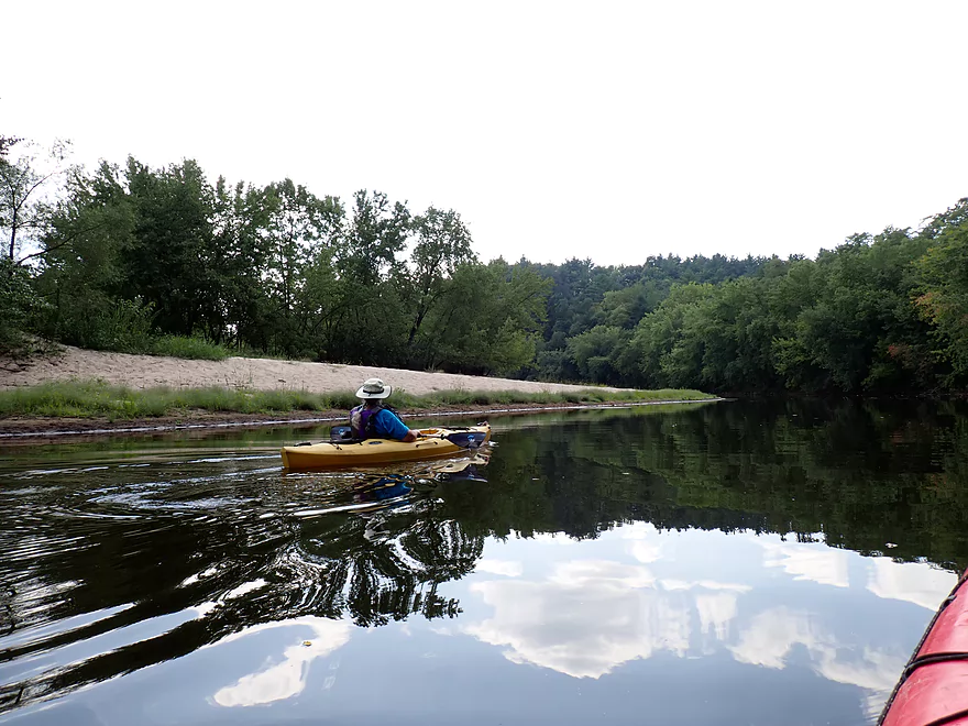
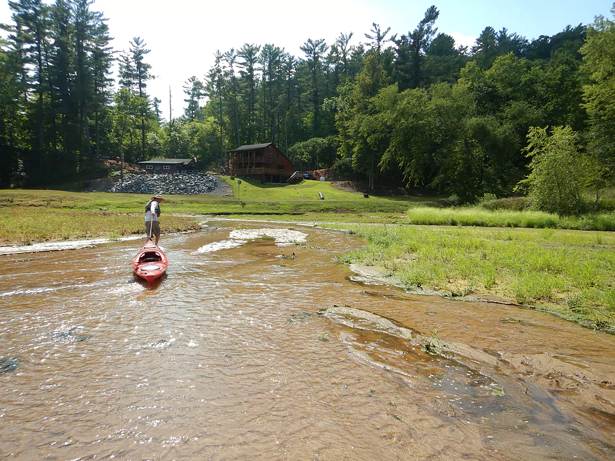
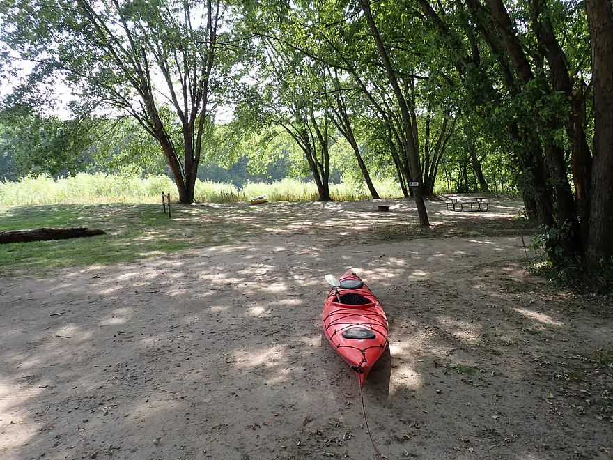
A large beach popped up on the right which was part of Lost Falls Campground. My car was parked at the take-out, but ending the trip then would have made for a ridiculously short trip, so we decided to overshoot it on purpose to explore downstream. A scenic bluff with white pines redirected the river south after the campground beach. At is base were runty outcrops on the west bank and a sandbar on the east bank.
We starting hearing the roar of Roaring Creek, but didn’t see its mouth until we had almost entirely wrapped around south end of the main bluff. The creek was too shallow to kayak up, so we waded up the ice cold water instead where we encountered the Lower Falls, an impressive slot canyon and the Upper Falls. I’ll expand more on Roaring Creek in a later separate standalone review.
After Roaring Creek we paddled upstream back to Lost Falls Campground. This was easier than it sounds, as the current was very slow. We ended the trip at the campground which was very nice. Most private campgrounds are very open and crowded…but Lost Falls was quite wooded and has some great campsites. Some of which are located along the water, and could provide a great way to do a multi-day trip or a sunrise/sunset paddle.
In summary this was a nice section of the Black River, but was very short. Again our original plans were for a long trip, but were disrupted by the closure of Grinde Landing. Oh well. I doubt most paddlers will try to recreate our exact trip, but rather opt to do a longer trip to Melrose which is a scenic but lengthy section.
Sights included several eagles, songbirds getting ready for migration, lots of kingfishers, and one clever green heron who seemed to follow our boats as we flushed small fish toward shore. Most of the fish were just small minnows, but there were a few large flopping fish.
David Hansen Memorial Canoe Landing (aka Irving Landing): This is a very good public access. But note, you can only drive down to the landing to drop off/pick up your boats. To park, you must drive down to the community center (signs point the way).
Alternate Put-ins:
- Mason’s Landing (8.9 miles upstream from Irving): A good section with a fantastic slot canyon.
- Lost Falls Campground (2.6 miles downstream from Irving): This is a decent access, but it is private and you must purchase a guest pass to use it.
Alternate Take-outs:
Grinde Landing (6.1 miles downstream from Lost Falls Campground): This is now closed. The owner was upset after his deer stand was stolen, so shut down the landing for the public. Hopefully some accommodation can occur which will allow it to reopen in the future.- Melrose Landing (10.0 miles downstream from Lost Falls Campground): This is a major canoe access with outhouses and a large parking lot. If the parking lot fills up, you should be able to park on the Hwy 108 shoulder. The stretch from Lost Falls to Melrose should have some nice sandbars and a few good rock outcrops. I suspect Wolf Creek may have a nice slot canyon.
Bike Shuttle – Lost Falls Campground to Irving Landing: 1.6 miles with 46′ of ascent. This is a very easy bike shuttle. Because it is so short, a hiking shuttle would actually be viable.
Kayak Shuttle – Lost Falls Campground: This is both a canoe/kayak rental establishment and a shuttle service. Call 715-284-7133 for more information.
Current: The current was pretty slow. Carefully planned round trips may be viable.
Logjams: None. Although I suspect if you take a side channel, that may have some portage caliber deadfall.
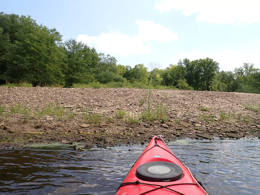
Shallow Water: This leg was fairly low because of the drought. For the most part it wasn’t a big deal, but we did ground out in a few spots and had to get out for some boat dragging.
Wind: This is a wide open river, where wind can be a factor. Before doing a trip, carefully monitor the forecasted wind speed and direction.
Closest Gauge: Black River @ Galesville
Trip Depth: 470 CFS or 3.18′
Navigability Estimates: The following are very rough estimates. Always use your own judgement.
- < 3.1′: Maybe too low.
- 3.1-3.3′: Low depth with may be a few ground-outs, but mostly navigable.
- 3.4-3.7′: Average late summer depth.
- 3.8-4.0′: Average spring depth.
- 4.1-4.4′: Above average depth. Some sandbars may be underwater.
- 4.5-4.8′: High’ish depth. Should be doable.
- 4.9-5.5′: High depth…most sandbars will be underwater.
- 5.6′: Very high water levels. May not be ideal for paddling.
Quick Overview
Black River:
- Upstream of Hwy 73: Obscure sections of the Black with little known about them. Some legs will have logjam issues.
- Hwy 73 to Lake Arbutus: 48 miles. Good legs with a mix of rapids, boulder gardens and undeveloped banks. Only reason these legs don't receive more paddling traffic is because they're located away from population centers.
- Lake Arbutus: 3 miles. A scenic but challenging lake because of the waves.
- Hatfield Dam to Halls Creek Landing: 7 miles. Some of the best and most fun whitewater on the Black River.
- Halls Creek Landing to Black River Falls Dam: 6 miles. An impounded part of the river, but nice with cool cliffs.
- Black River Falls Dam to North Bend: 37 miles. This is the heart of the Lower Black and sees the most paddling traffic. No major rapids, but there are many scenic cliffs and creek inlets.
- North Bend to Mouth: 30 miles. This is the second half of the Lower Black. While not as scenic, there are still cool sandbars and sandbanks. Few paddle these stretches.
Noteworthy Tributaries:
- Robinson Creek: One of the best paddles in all of Wisconsin.
- Halls Creek: Also one of the best and with amazing sandstone walls.
- Morrison Creek: Very scenic creek with some fun whitewater.
- Wedges Creek: Great paddle with amazing boulder gardens.
- East Fork of the Black River: Some fun riffles and unique granite geology.
- Perry Creek: Shallow but a super scenic creek.
- Dickey Creek: A wonderfully scenic creek with fantastic sandstone…but too many logjams.
- Beaver Creek: Some fun rapids and amazing sandstone in Galesville, but logjams on the downstream portions.
- Popple River: A shallow whitewater river that is very nice.
- Arnold Creek: A pleasant tributary to Lake Arbutus with really nice reflections.
- Rock Creek: Many scenic boulder gardens, but usually this creek is too shallow to run.
- Roaring Creek: Very scenic creek with a great waterfall at the mouth, but might be a challenge to paddle.
- Vismal Creek: Super scenic but has a lot of logjams and is shallow. Requires very high water conditions.
- Plus countless small creeks that are too small to paddle but quite fun to explore by foot. If you know of viable paddling options, let me know! Am very curious to know more about Douglas Creek, Levis Creek, O’Neal Creek, and Crawley Creek.
Detailed Overview
Headwaters to Neillsville:
- Upstream of Division Drive: Likely too many logjams to be navigable.
- Division Drive to Sawyer Ave: (6.5 miles) Rocky and a few light rapids. Maybe 4 logjams.
- Sawyer Ave to Hwy 64: (2.5 miles) Rocky and a few light rapids.
- Hwy 64 to Bridge Road: (14.4 miles) Solid prospect reviewed by Mike Svob. Some Class 1 rapids and nice gravel bars. Intermediate access points at Bahnkes Ave and Hwy AT.
- Bridge Road to Hwy X: (6.0 miles) Little is known of this section…likely pretty simple.
- Hwy X to Colby Factory Road: (6.0 miles) Little is known about this section…likely some rapids and outcrops. Intermediate alt access points at Hwy 29 and Hwy N.
- Colby Factory Road to Popple River Mouth: (7.9 miles) This stretch has far fewer rapids than downstream legs with only a few minor rapids. It should still be pleasant though.
- Popple River Mouth to Reese Ave: (5.3 miles)
- Popple River Mouth to Warner Drive: (1.0 miles) This is a slower and less interesting stretch, but does include 4 Class 1's and scenic Hemlock Rapids which are Class 3.
- Warner Drive to Greenwood Park: (3.4 miles) A good leg with many rapids (3 Class 2's and 17 Class 1's).
- Greenwood Park to Reese Ave: (0.9 miles) A slower stretch with just 2 Class 1's. Part of this passes through the community of Greenwood.
- Reese Ave to Twenty Six Rd: (5.1 miles)
- Reese Ave to Sladich Rd: (0.7 miles) A mostly nondescript wooded stretch. The exception is Greenwood Rapids where an island splits the river. The right side is scenic, but the left side has fun Class 3 rapids.
- Sladich Rd to Willard Rd: (1.6 miles) A somewhat slow and relatively uninteresting leg. Highlights include one nice outcrop, a few gravel bars and a 400' stretch of Class 1 rapids.
- Willard Rd to Twenty Six Rd: (2.8 miles) A great leg with 10 Class 1's and 2 Class 2's. Highlights also include scenic boulder gardens and a few outcrops.
- Twenty Six Road to Hwy H: (5.0 miles) Multiple Class 1 & 2 rapids.
- Hwy H to Grand Ave/Hill Road: (8.0 miles) A great trip with several Class 2 rapids and scenic granite outcrops.
Note, for more details on the Upper Black, I highly recommend “Indian Head Rivers” by Michael Duncanson.
Alternate Black River Trips – Neillsville to Black River Falls:
- Grand Ave/Hill Road to Opelt Road Landing: (6.7 miles)
- Grand Ave/Hill Road to Hwy 10: (2.2 miles) Nice section with a handful of rapids. These are mostly Class 1 at lower depths, but strengthen to Class 2 during high flow rates.
- Hwy 10 to River Road Landing: (4.3 miles) Fantastic whitewater section. Maybe six Class 2’s and two class 3’s. Scenic boulder gardens and a few outcrops.
- Opelt Road Landing to Bryan Ave Bridge: (1.1 miles) Not sure there is anything special about this stretch.
- Opelt Ave Bridge to Hwy 95: (4.4 miles) Ok…nothing special.
- Hwy 95 to West Arbutus County Ramp/Hatfield Dam: (4.8 miles)
- Hwy 95 to North Arbutus Boat Landing: (2.4 miles) Includes a scenic gorge, boulder gardens and rapids including the Class 3 Red Granite Rapids. River slows after rapids.
- North Arbutus Boat Ramp to West Arbutus County Ramp: (2.4 miles) A large open water paddle on Lake Arbutus that can feature challenging waves on summer afternoons.
- Hatfield Dam to West/East Channel Confluence: 0.2 or 0.3 miles.
- West Dam to West/East Channel Confluence: 0.3 miles. There is a large boulder field and Class 2 rapids below the west dam. At the outlet of the west channel is a Class 4 drop. This is easy to scout and portage.
- East Dam to West/East Channel Confluence: 0.2 miles. Perhaps the most extraordinary rapids in the state with Class 4/5+ rapids. The action starts below the dam where steep granite banks narrow the river significantly and force it down deep chutes. The gorge starts with Class 2-3 rapids but ends with two significant drops. American Whitewater warns “between the dam and this point lie some serious drops which contain near inescapable boiling cauldrons at moderate to high flows”.
- Hatfield Dam Confluence/West Clay School Road to Powerhouse Road Landing: (3.1 miles)
- Hatfield Dam Confluence to Hwy K: (0.3 miles) One of the most scenic paddling areas in the state with massive granite outcrops. There is one set of Class 2 rapids.
- Hwy K to Powerhouse Road Landing: (2.8 miles) The first half mile by Hwy K is very scenic and contains one Class 3. The second mile is mostly flatwater. The third mile is almost continuous rapids and features one Class 3.
- Powerhouse Road Landing to Halls Creek Landing: (4.0 miles) Scenic section with a few Class 2 rapids and a steep ledge.
- Halls Creek Landing to Black River Falls Dam: (6.2 miles) Wonderful sandstone cliffs.
Alternate Black River Trips – Black River Falls to Mouth:
- Black River Falls Dam to Mason’s Landing: (4.7 miles) A great little section.
- Mason’s Landing to Irving Landing: (9 miles) A good section.
- Irving Landing to Lost Falls Campground (2.3 miles) A popular stretch. Highlights include a few small outcrops, two tiny waterfalls, several impressive sandbars, and one large sandbank. A side hike to Roaring Falls can be arranged. Note Lost Falls Campground is private and you must purchase a pass from them to use their access.
- Lost Falls Campground to Grinde Landing: (6.4 miles) A popular section with some nice outcrops and a waterfall by Roaring Creek. Wolf Creek may also have a cool slot canyon. The river splinters into multiple channels, some of which may be quite shallow in later summer. As of 2023, Grinde Landing is closed because somebody stole the owner's deer stand.
- Grinde Landing to Melrose Landing: (3.9 miles) A shorter section but with a really nice rock outcrop before Melrose Landing. As of 2023, Grinde Landing is closed because somebody stole the owner's deer stand.
- Melrose to North Bend: (10.1 miles) Likely the most popular stretch with the best sandbars on the river, three sets of outcrops, and a few waterfalls.
- North Bend to Hwy 53: (13.3 miles) Likely a nice paddle with sandbars, large sandbanks and maybe a few outcrops. Unfortunately it is very long.
- Hwy 53 to Hwy 35: (8 miles) A nice section with epic sand banks.
- Hwy 35 to Lytle Road: (4.0 miles) Goes through the Van Loon Floodplain Forest. This can be a shallow trip but features many nice sandbars.
- Lytle Road to Fred Funk Boat Landing (Mississippi): (5.0 miles) Multiple options because of the river delta.
Trip Map
Overview Map
Video
Photos Size: