
Welcome to Whitewater
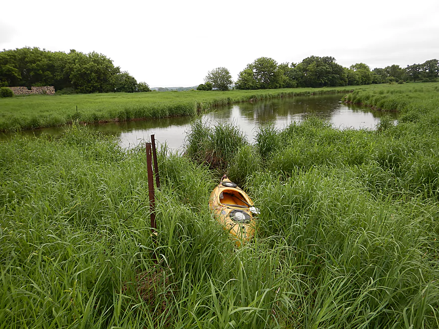
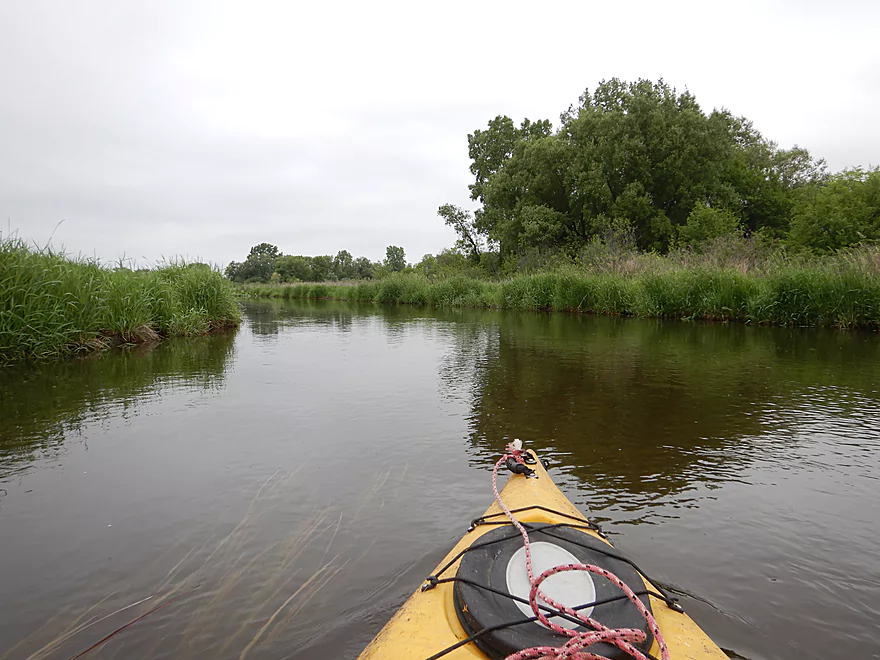
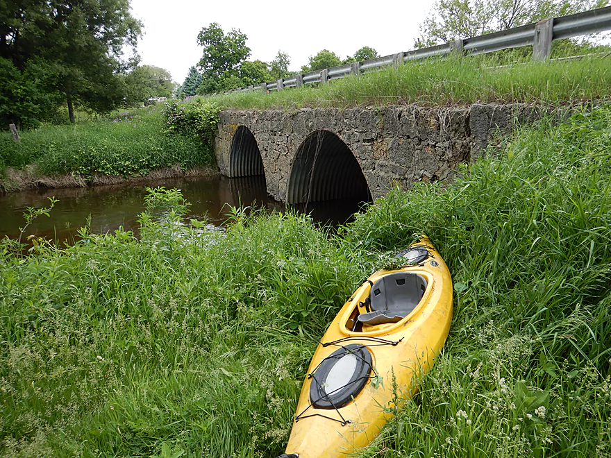
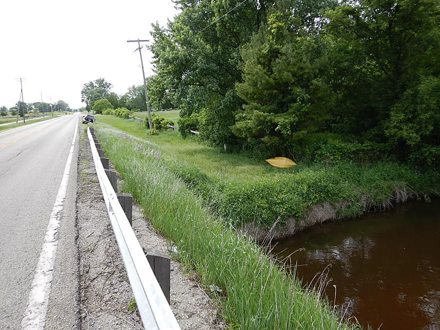
Weedy but ok put-in at Willis Ray Road
Battling some spiderwebs
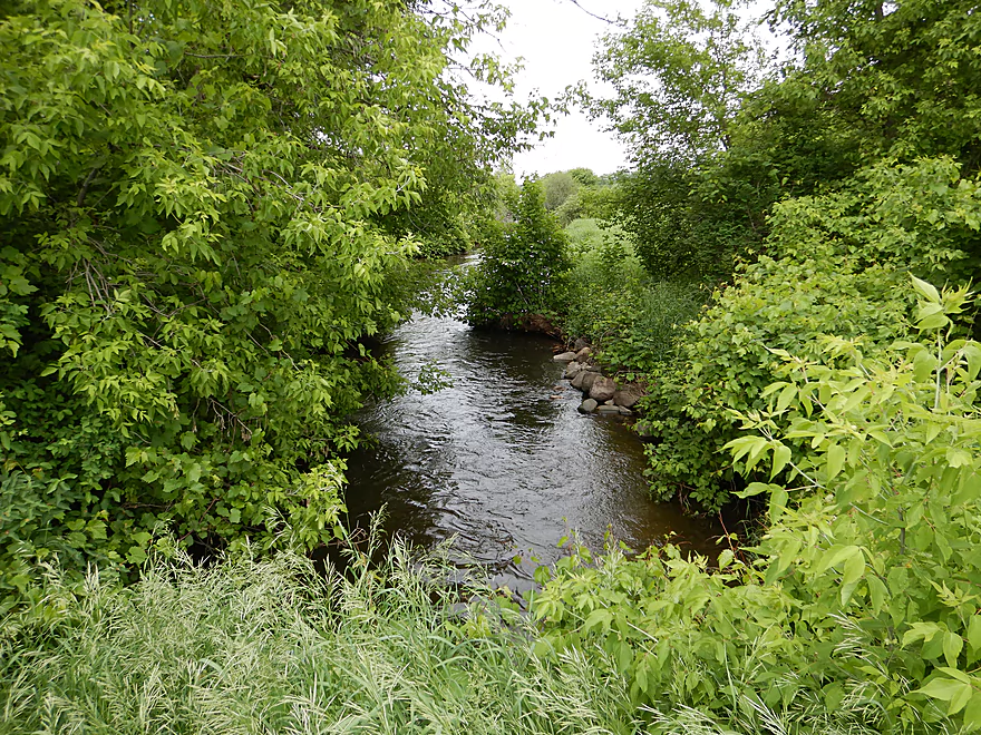
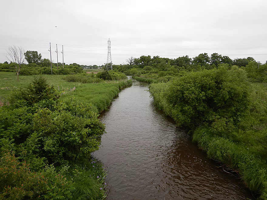
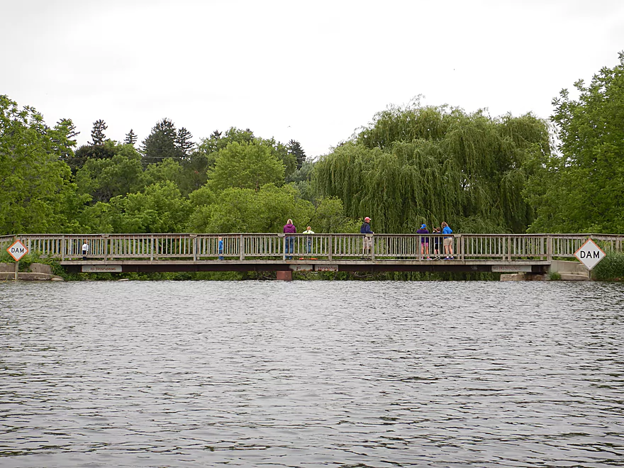
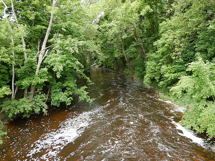
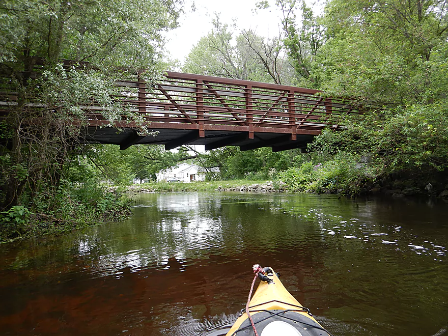
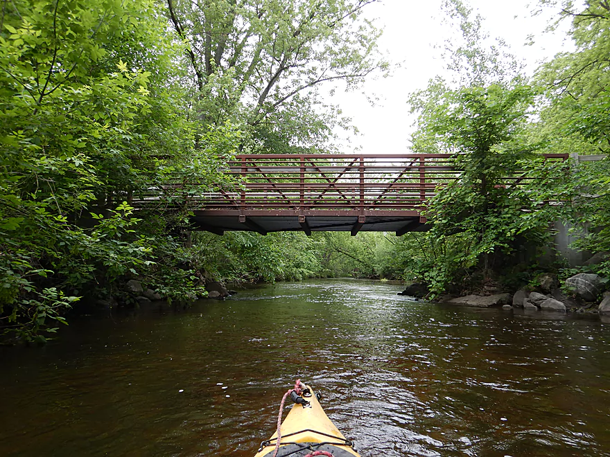
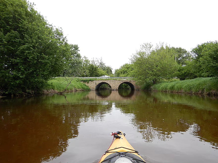
View from the bridge
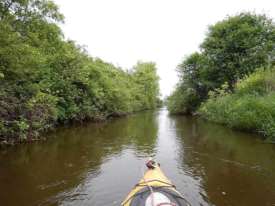
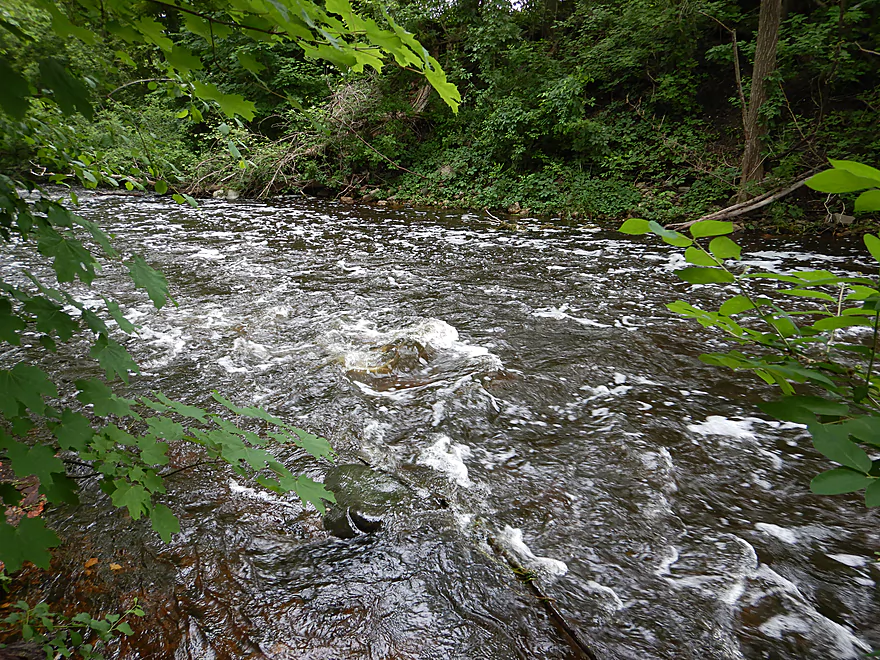
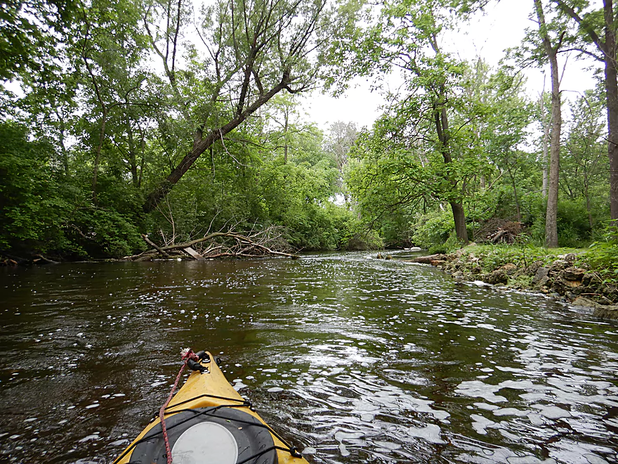
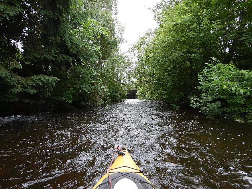
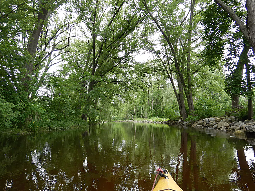
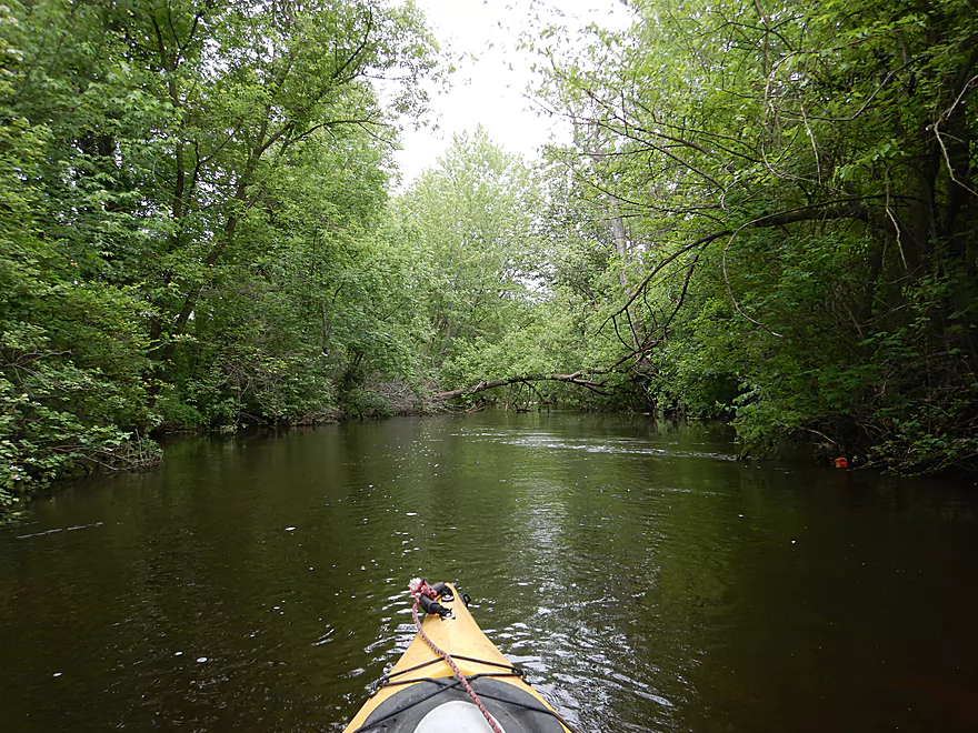
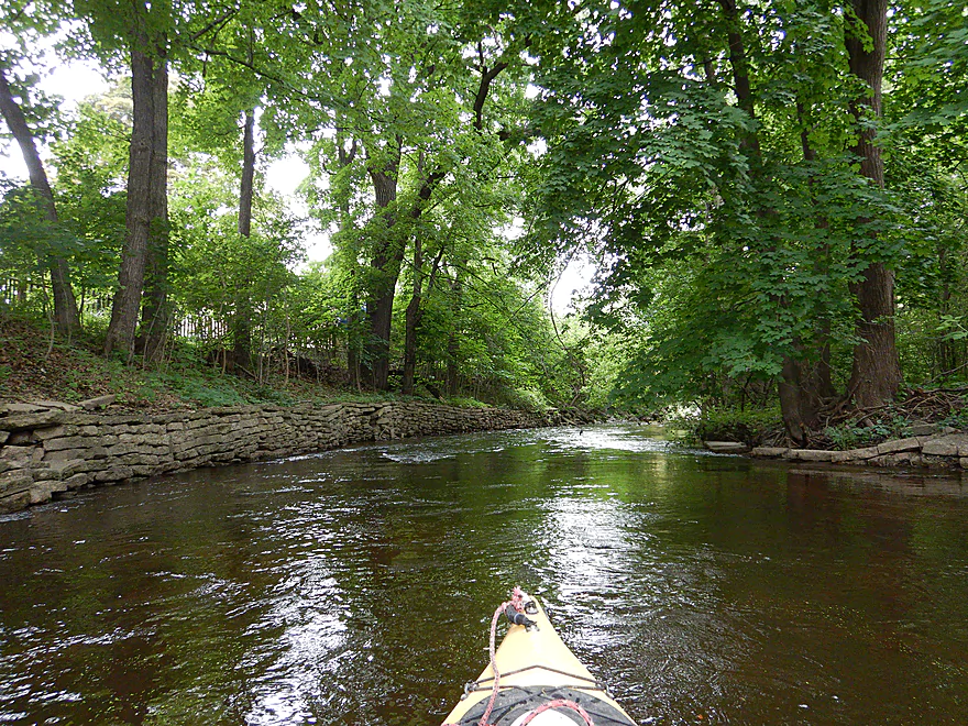
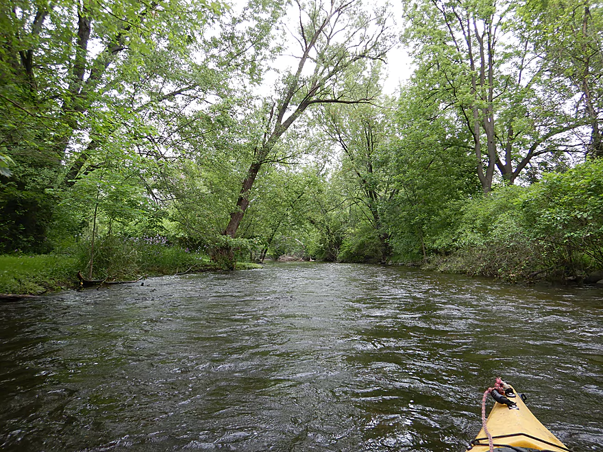
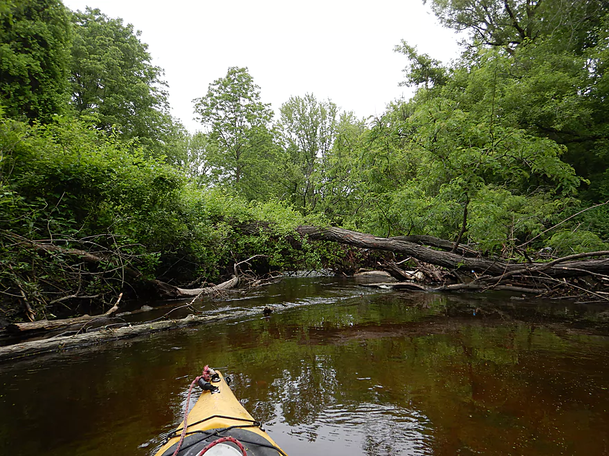
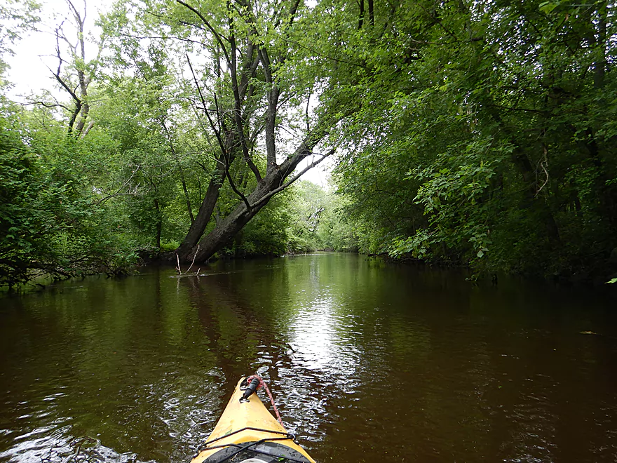
The creek starts narrow and fast
Even some riffles
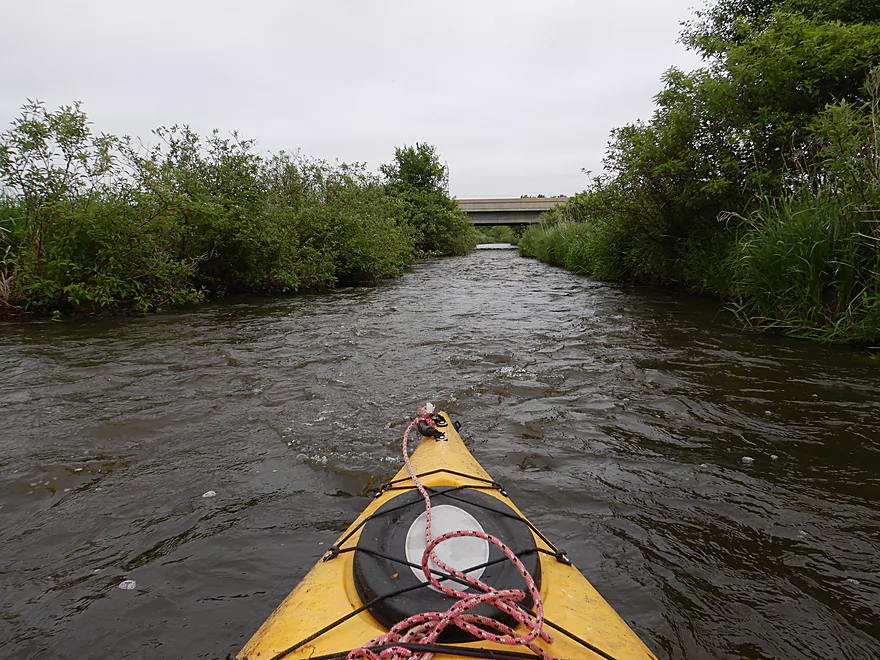
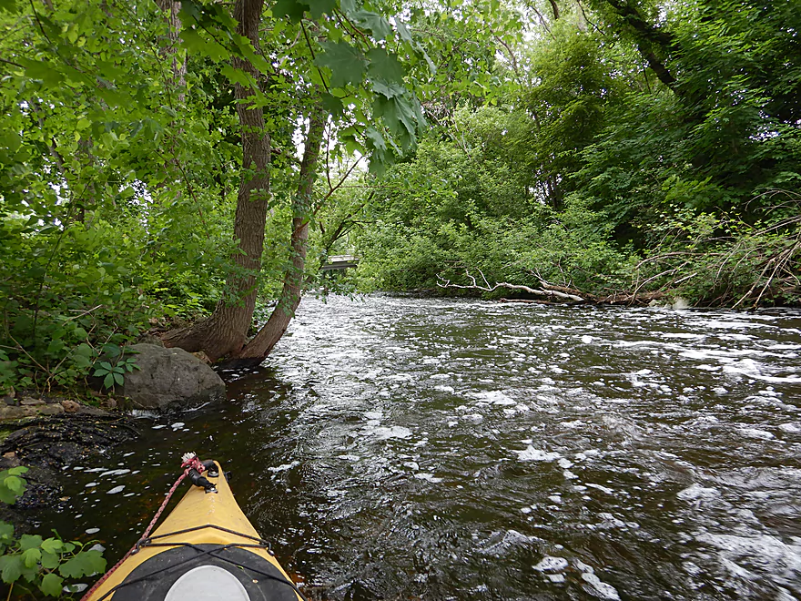
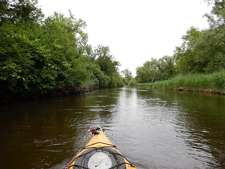
Looking downstream from Hwy 12
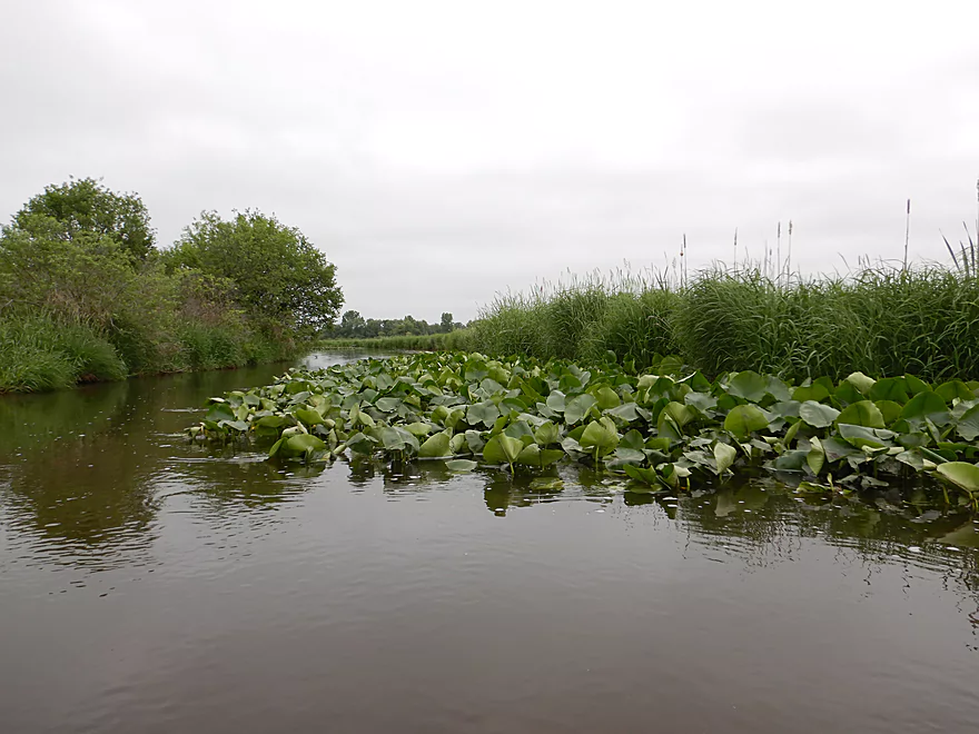
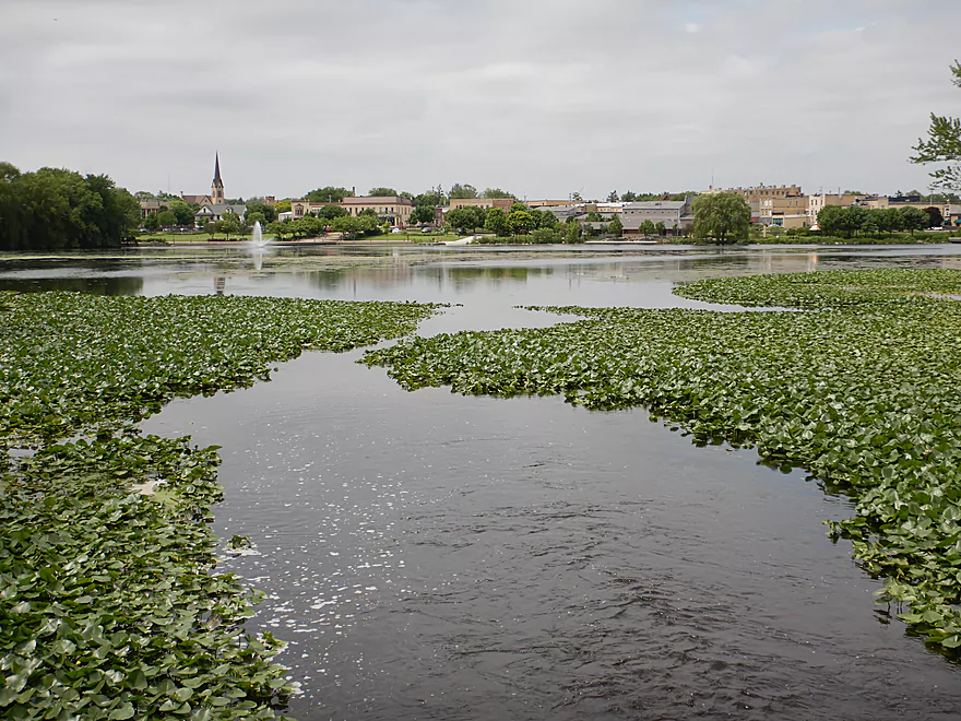
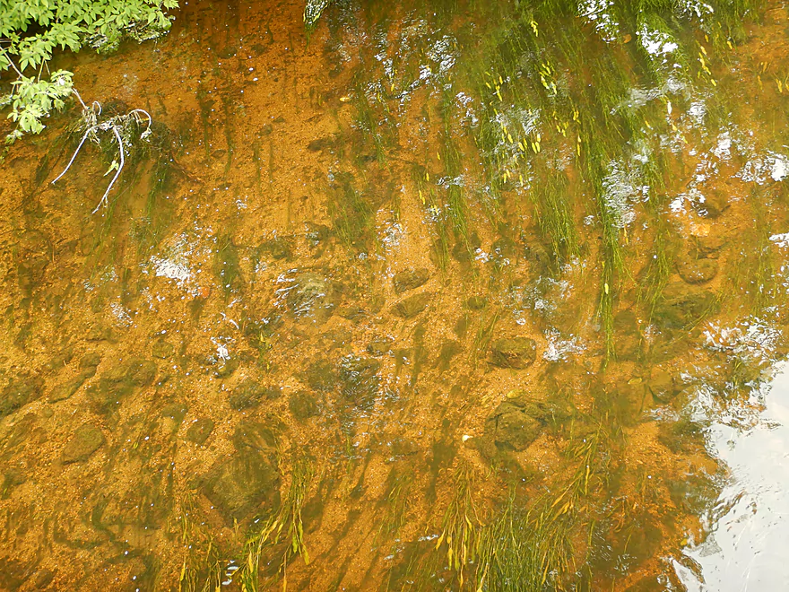
One of several nice lily beds
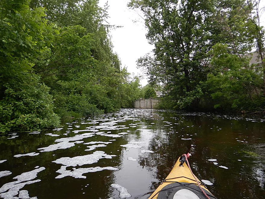
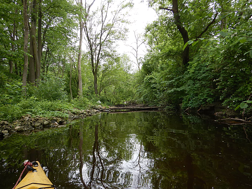
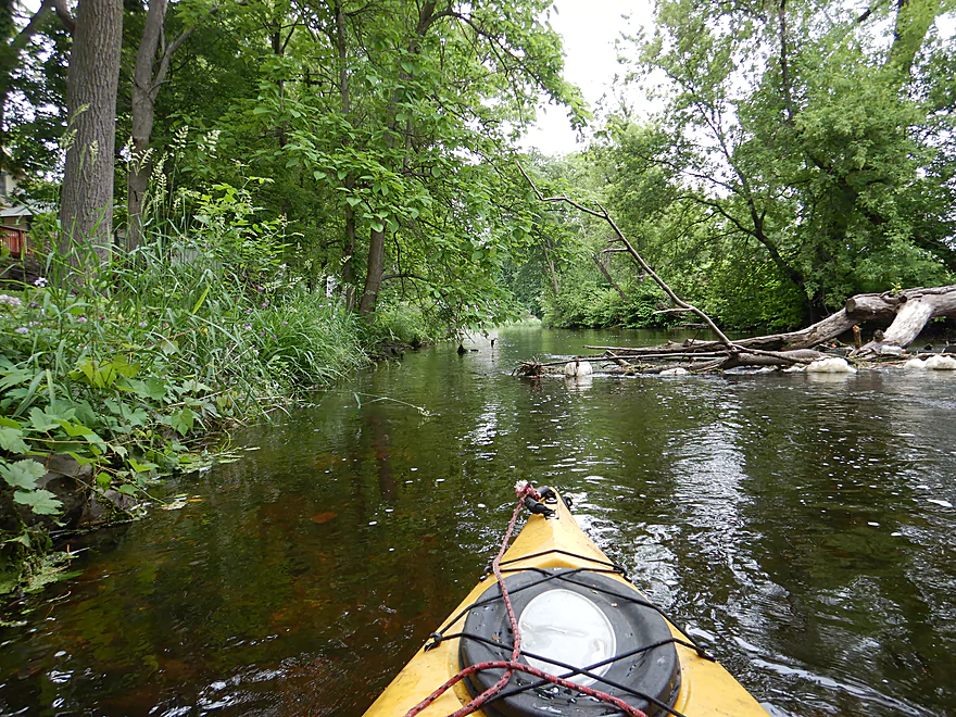
Creek starts to broaden and slow
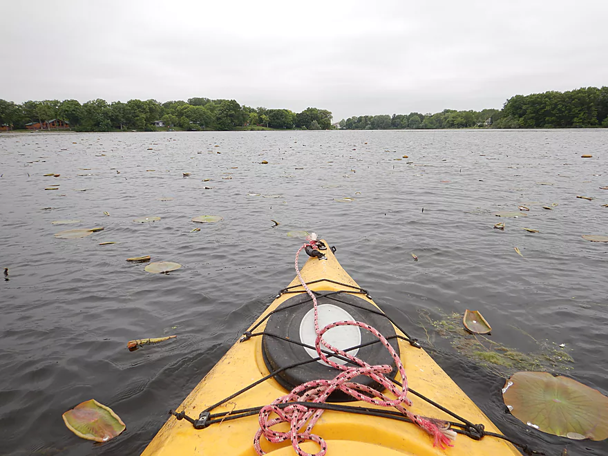
Entering Tripp Lake
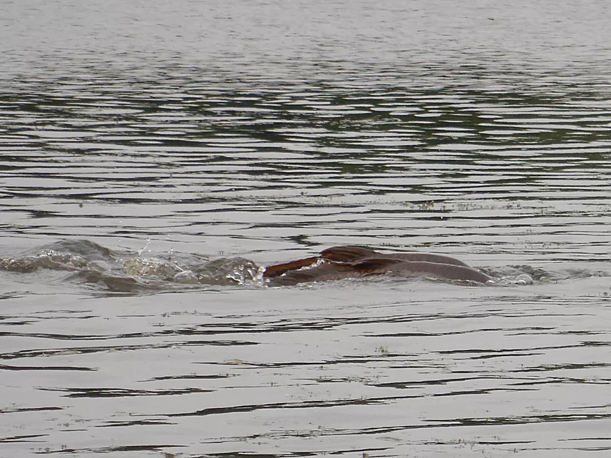
A pair of spawning carp…they were everywhere on the lake
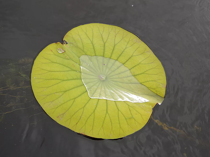
Lot of nice lilies
Coming to the end of the lake
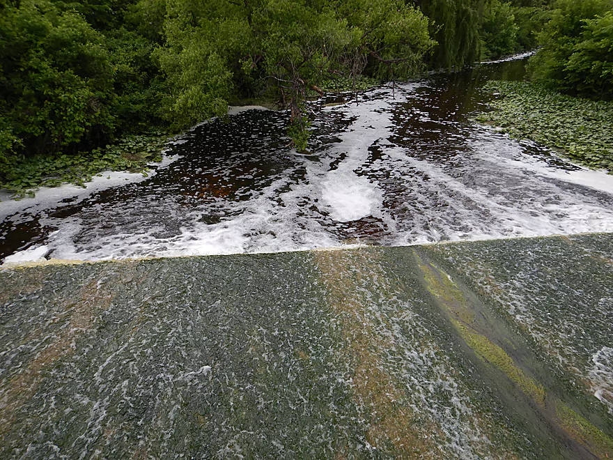
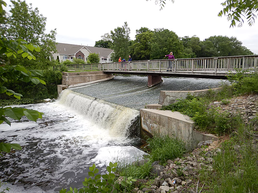
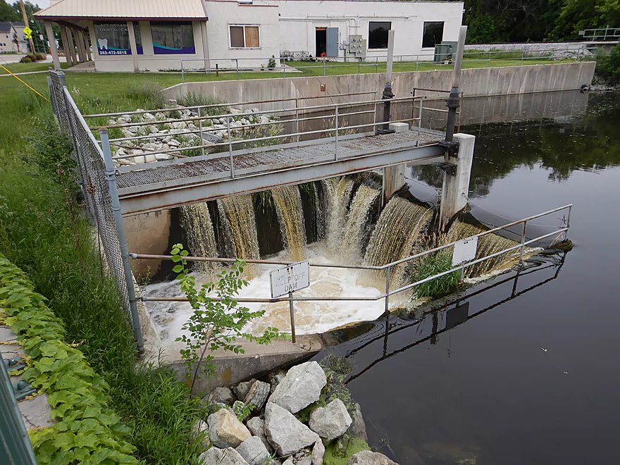
The dam that creates Tripp Lake
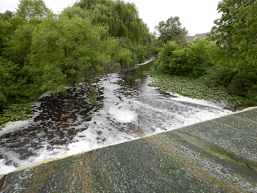
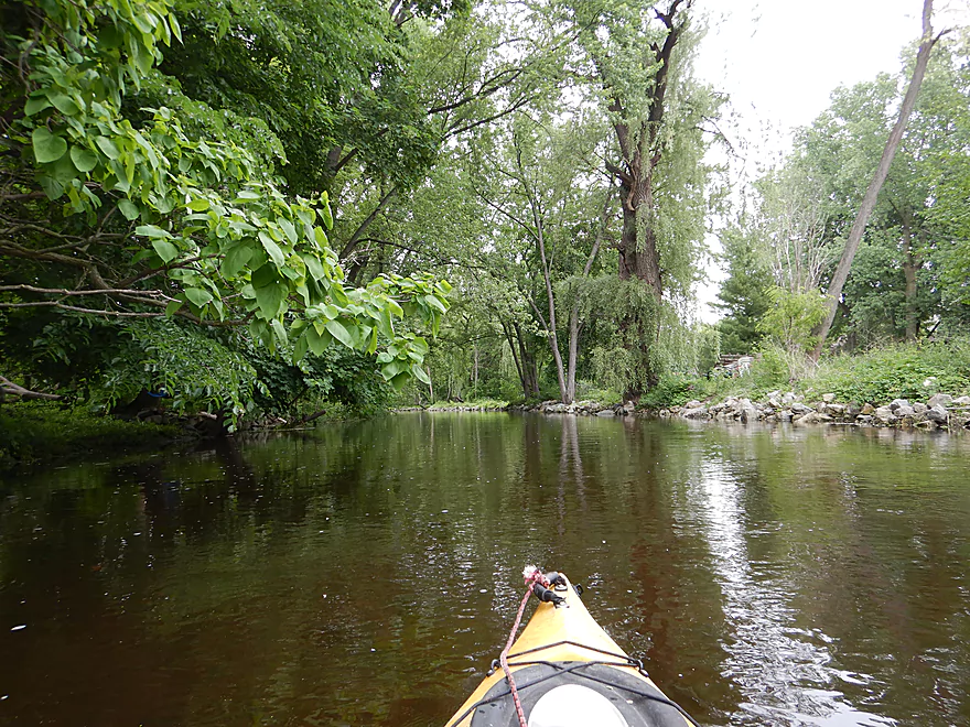
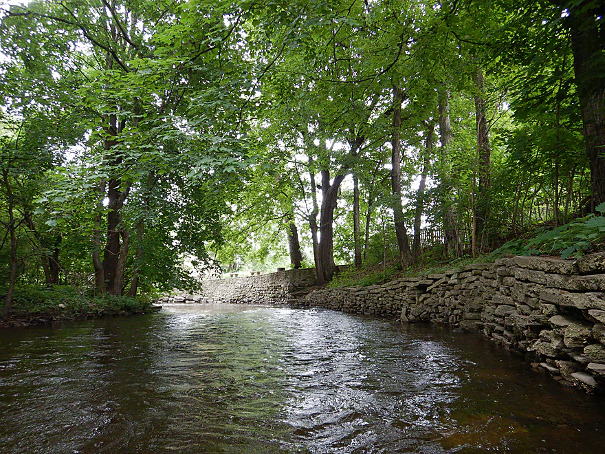
Nice creek section downstream from dam
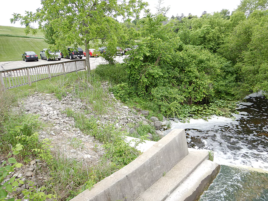
But first I needed to portage…steep but not bad
Reverse view
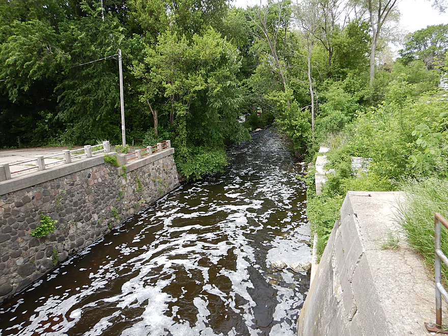
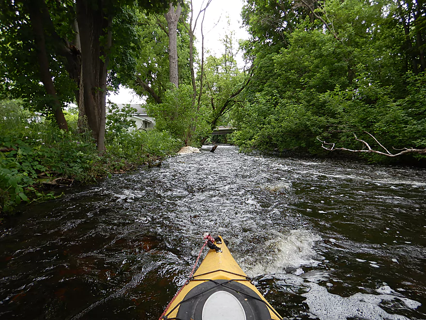
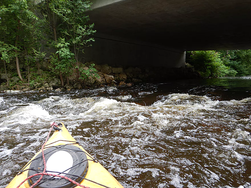
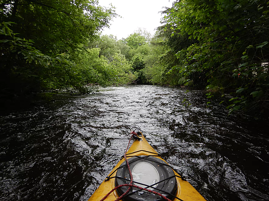
White water on Whitewater Creek
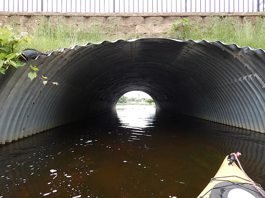
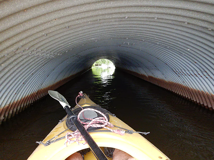
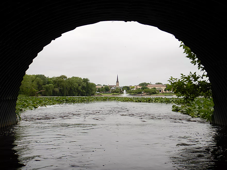
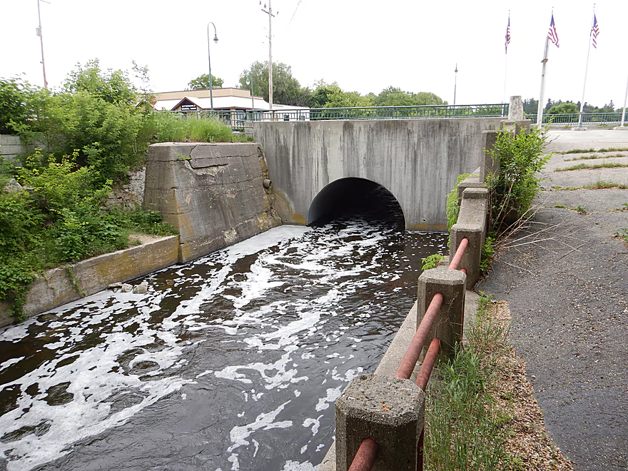
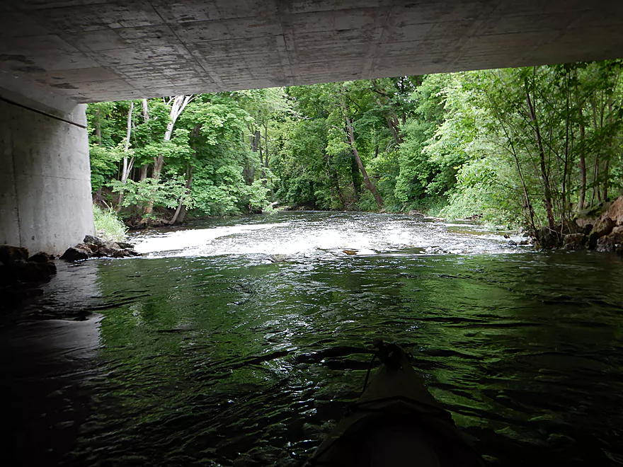
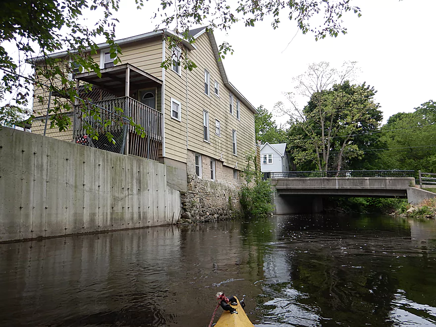
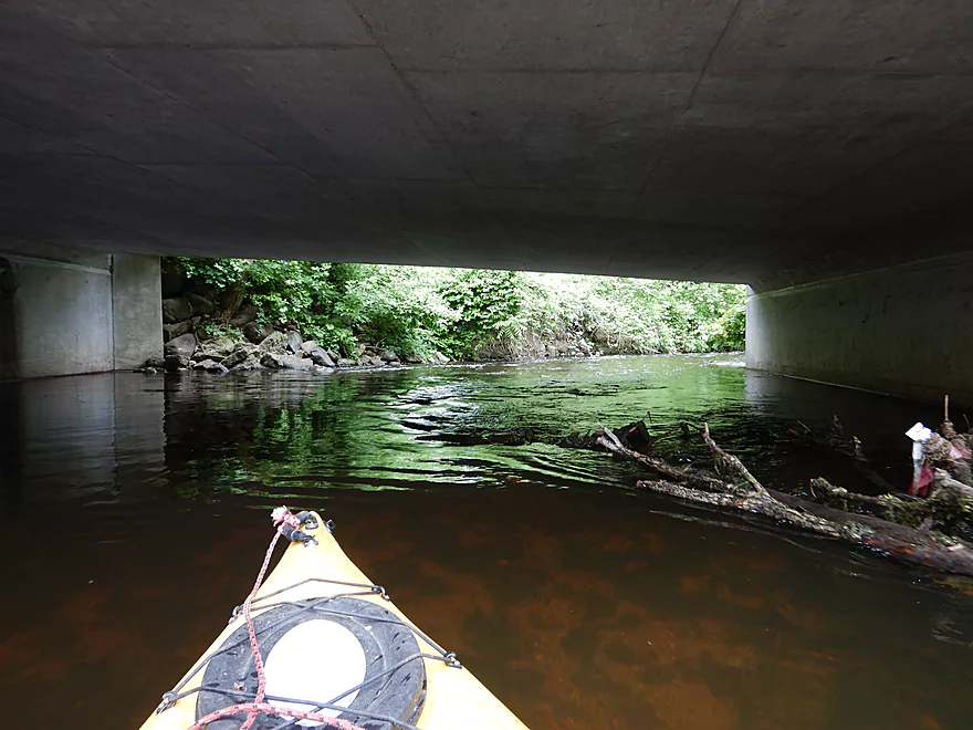
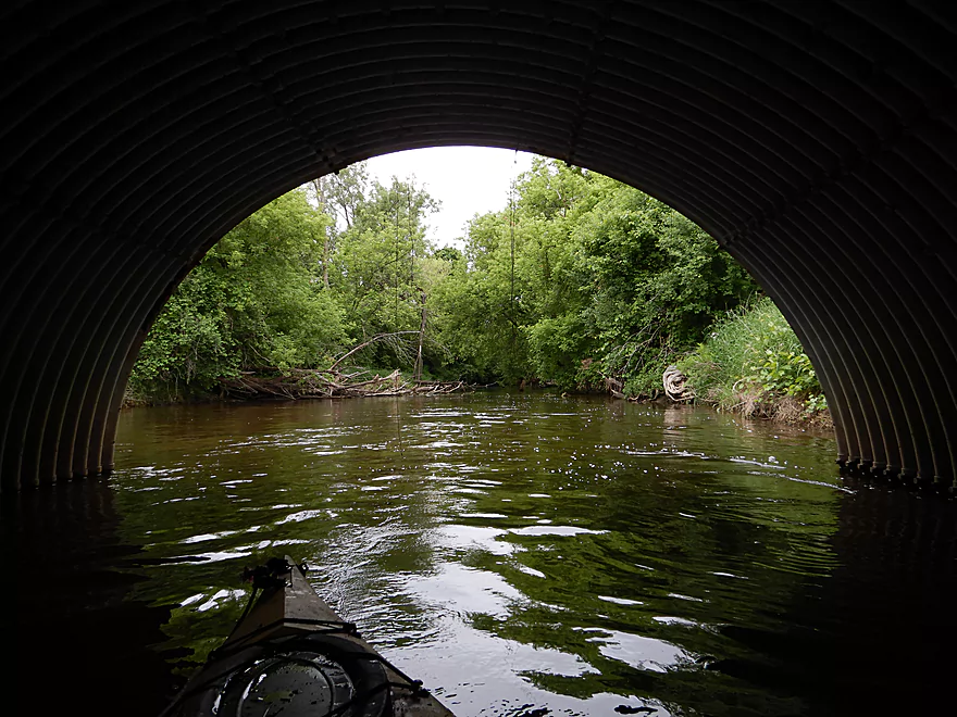
Tunnel under Wisconsin Street
Downtown Whitewater is on the other side
Neat scene
A large kayak shower
A closer view of the downtown
Do not want to paddle too close to this
The dam that creates Cravath Lake
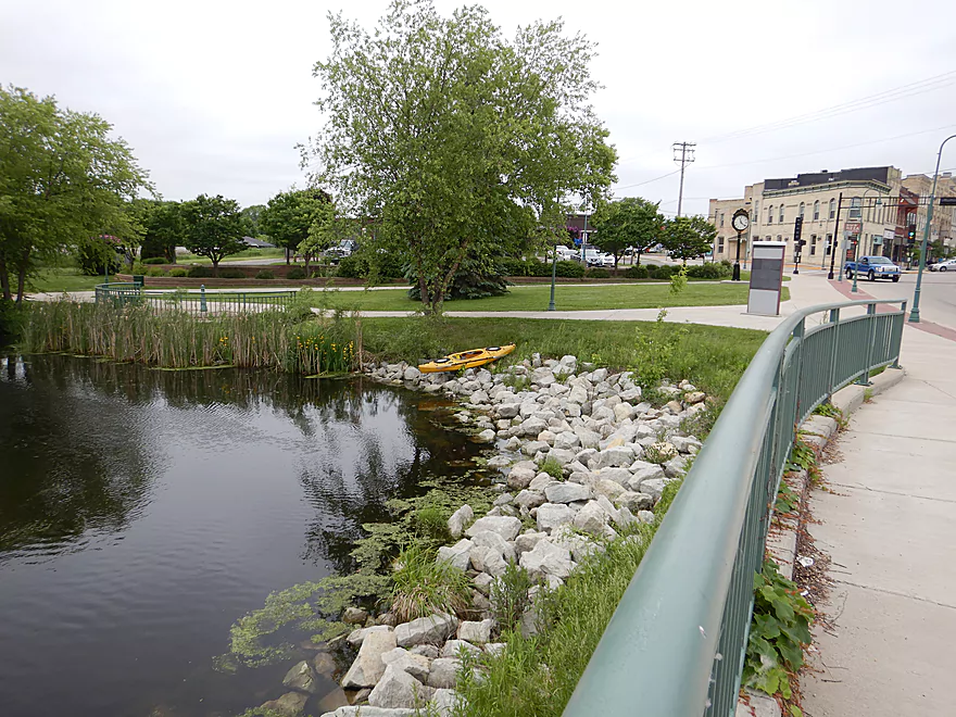
Easy to take out by Lakefront Park
Portaging Main Street to reenter the creek
Reverse view…more white water on Whitewater
Some stronger rapids
Finally back on the water
Zipping along quite fast
Coming up on a horizon line under North Street
Fun rapids
View from the bridge
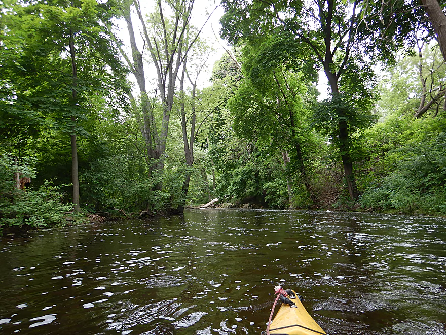
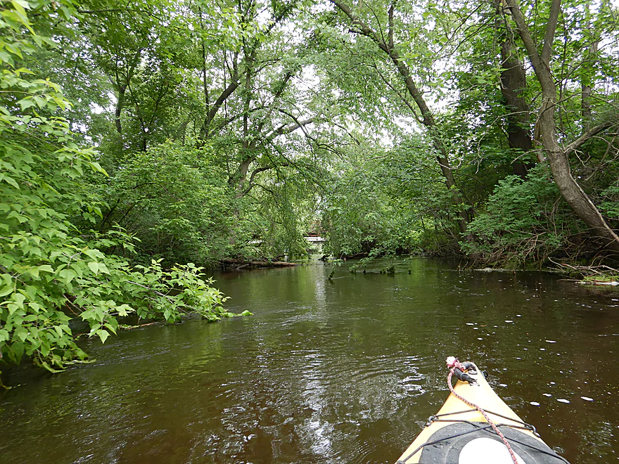
Entering a really cool part of the creek
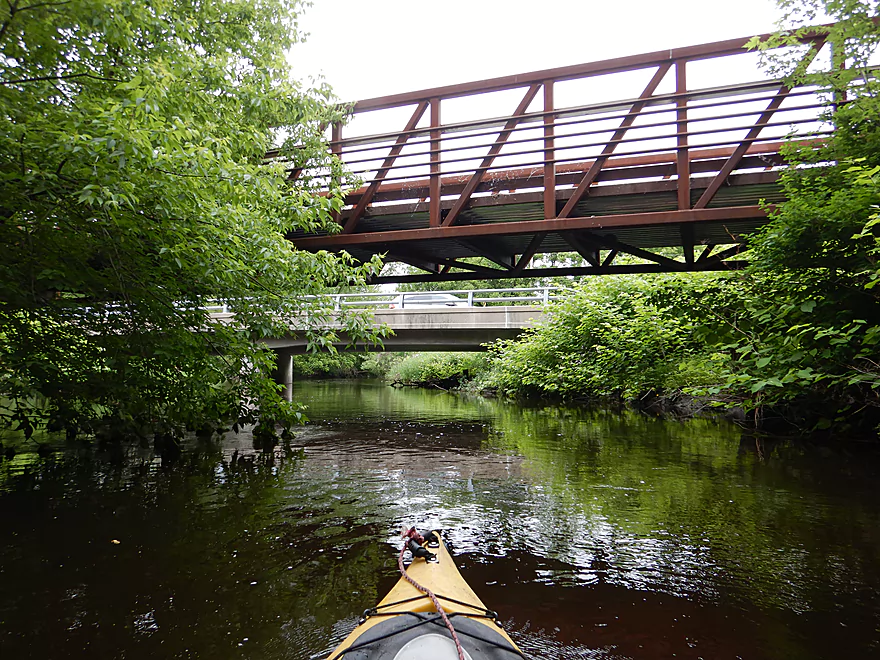
First of several bike bridges
Millrace joins the main channel…looks like it has logjams
The millrace would have been an alternative route
With clear water too…but no rapids
Interesting house
Paddling under George Street
Poorly pictured, but there are tricky strainers and light rapids here
Reverse view
Somebody has done some cleanup work
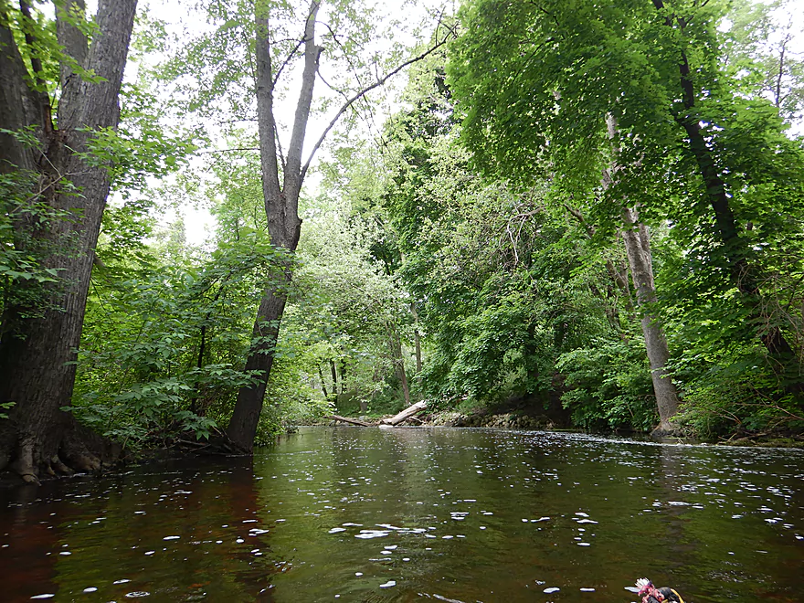
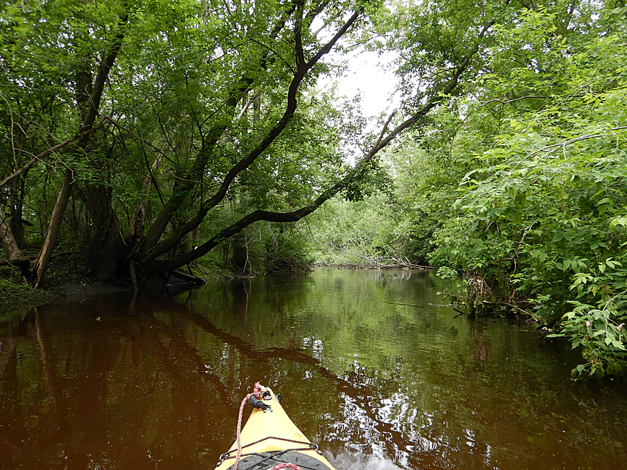
Arching trees give the creek an enclosed feeling
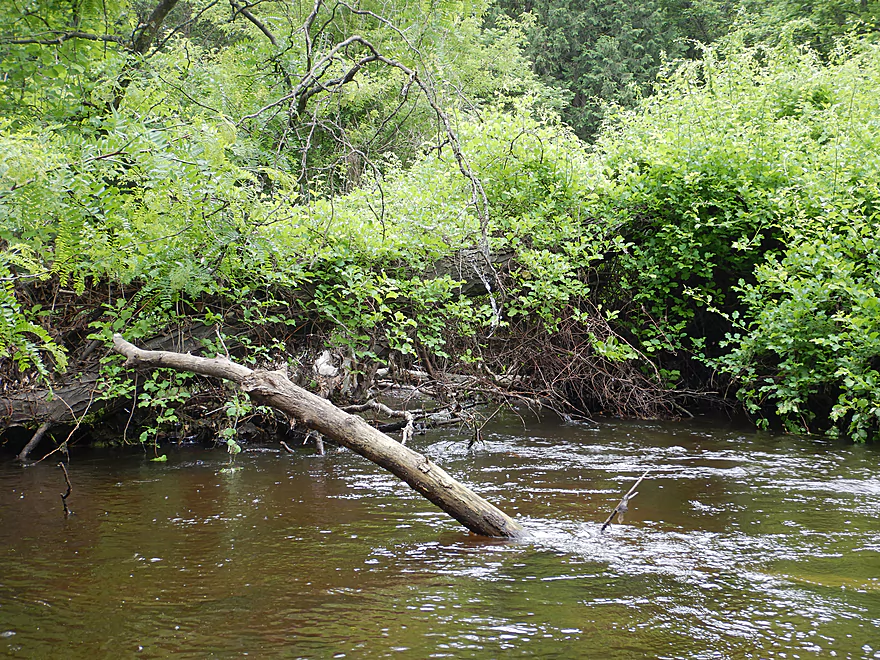
Another strainer to avoid
Coming up on Starin Road
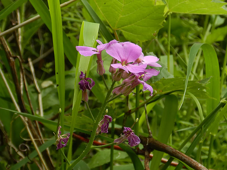
Some attractive bankside flowers
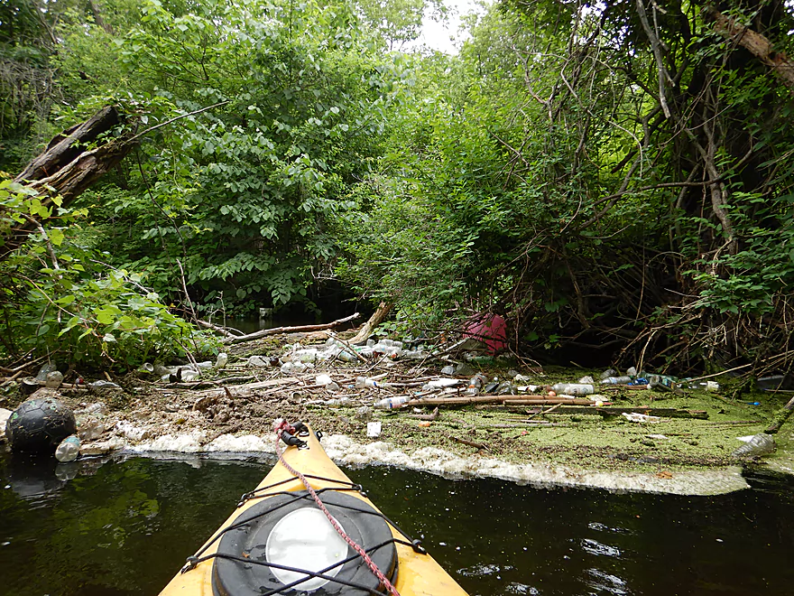
First portage of trip…kind of yucky
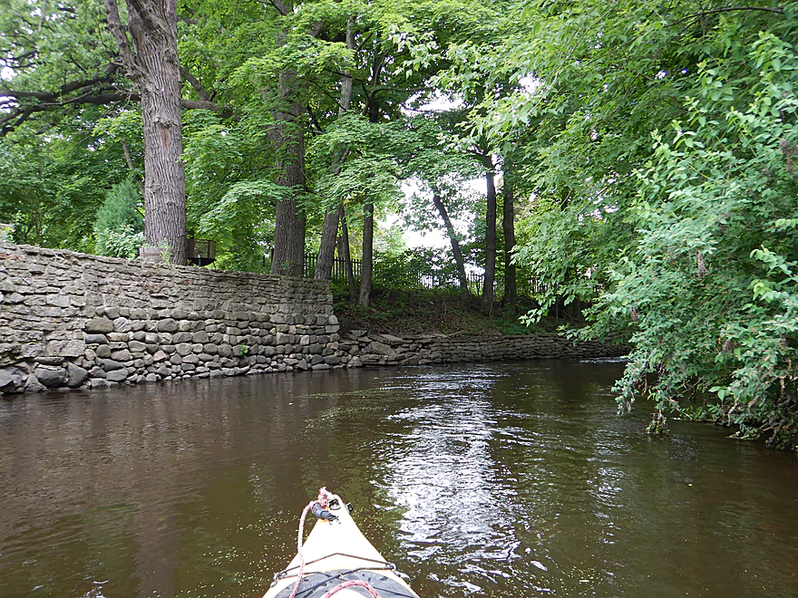
Coming up on a stone wall
Kind of cool
Reverse view
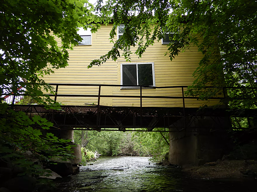
This bridge has a house on it!
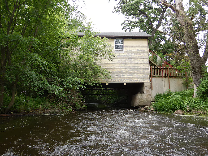
Reverse view
Bike bridge by Ray Trost Nature Preserve (recommended take-out)
At times fantastic clarity
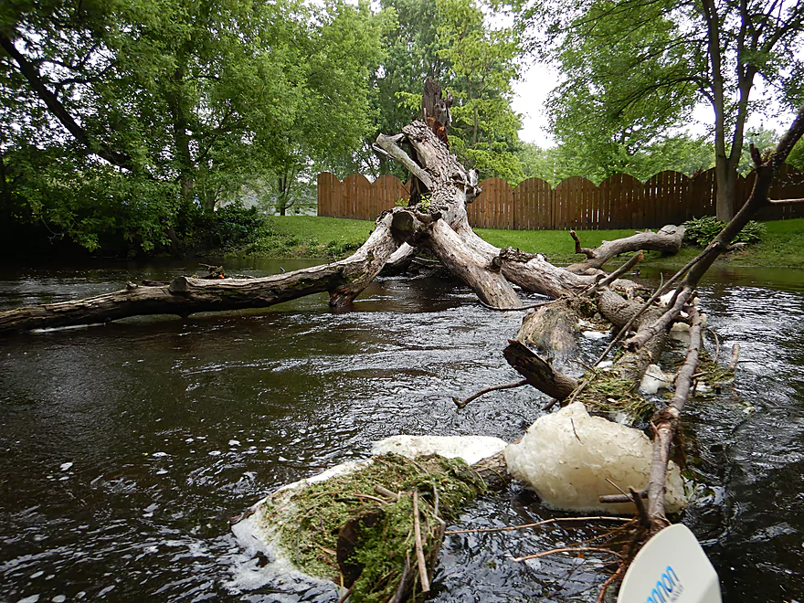
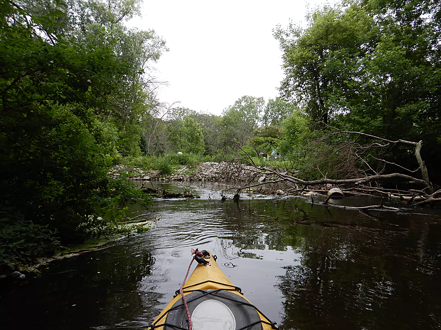
Logjam #2
I ducked under a pair of low branches…quite difficult
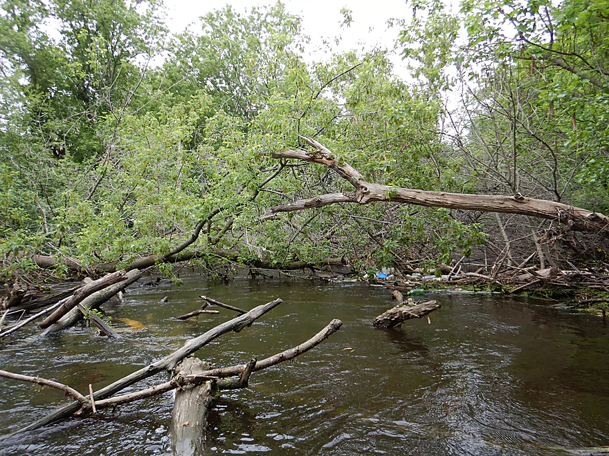
Logjam #3…a difficult portage
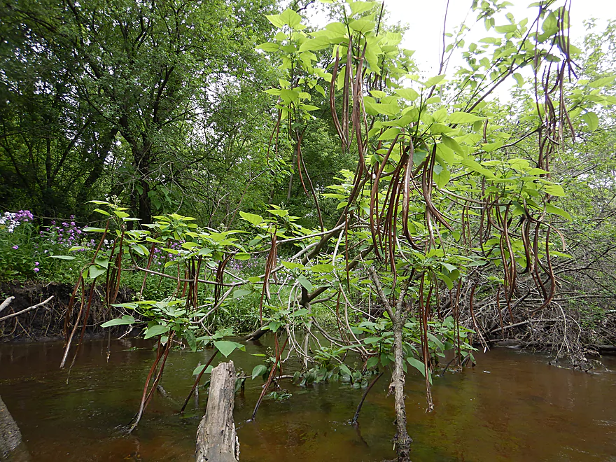
These wild beans were a neat sight
Dreading the next corner…
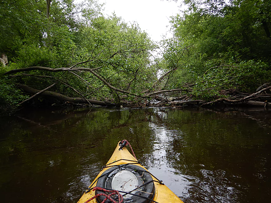
Logjam #4…also a difficult portage
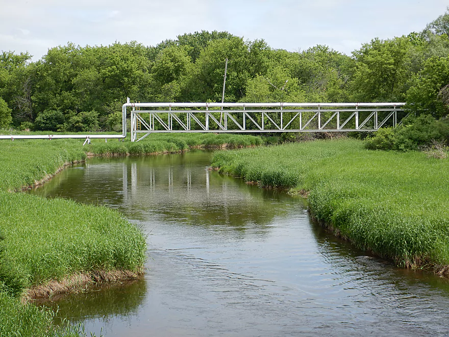
Massive pipe system for a nearby factory
I do not think Freemont Road is a viable access option
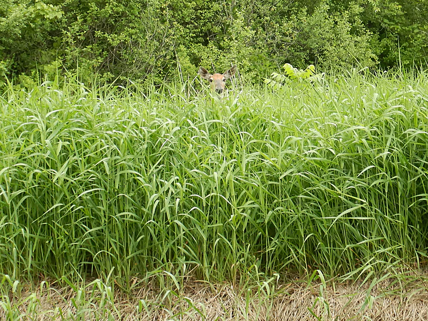
Being spied upon
Last stretch was nice and logjam free
This bridge looks like eyes
Another photogenic tunnel
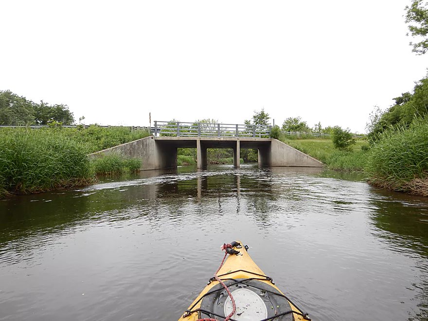
Taking out at Hwy U
A difficult take-out, but I chose the wrong corner
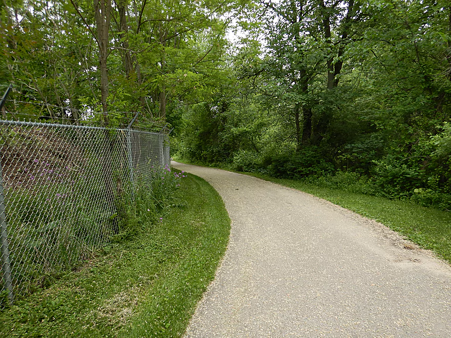
Biking back to the car on a great bike trail
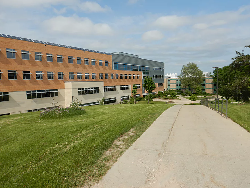
Checking out the UW-Whitewater campus
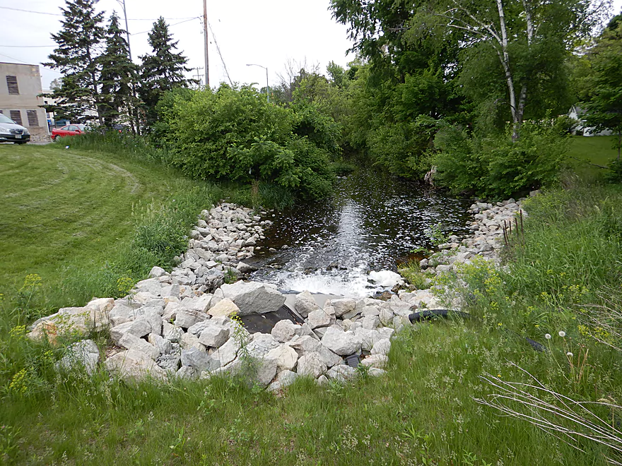
No, this is not part of the creek….
Scouting upstream…Millis Road would have been a great put-in
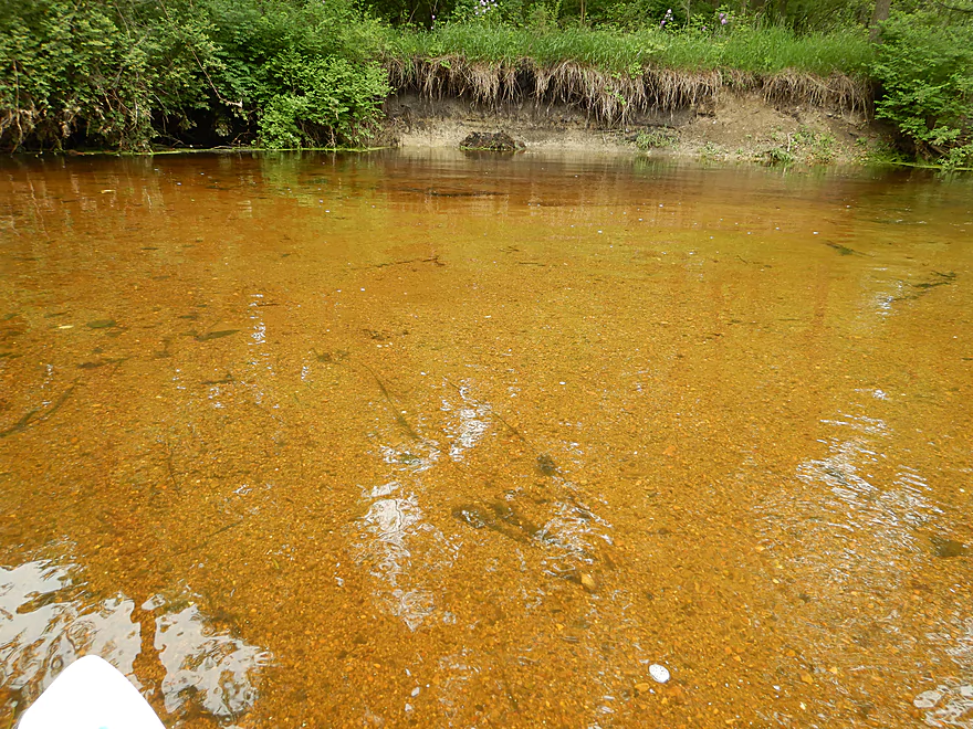
Hwy P is another access option with fantastic water clarity
Whitewater Creek

Whitewater Creek is located in southeast Wisconsin and is a tributary to the Bark River. This region is geologically unique as it once marked the southernmost border of the Green Bay Lobe, which resulted in a number of glacial hills and deposits. The creek’s headwaters consist of a number of natural springs that result in good water clarity. One brief section even earns the coveted Class 1 trout designation. As a former UW-Whitewater student, I was quite familiar with the creek, having walked along it numerous times. Fifteen years later I have finally gotten around to exploring it properly by boat.
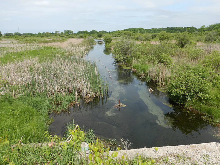
The trip started at Willis Ray Road which was an ok put-in but did entail paddling through a low culvert with multiple spider webs. The current was surprisingly fast with a few riffles. After Hwy 12 and the high voltage power line, the channel slows, widens, and becomes more marsh-like. Unfortunately it was very overcast (horrible for marsh photography, but good for shady woods which came in handy later).
Soon the creek empties into Tripp Lake which is a somewhat silted-in flowage lake with a heavily developed shoreline. I paddled this trip in high water so got through ok, but in low water, you’ll want to pick your route wisely (left/south is better). This wasn’t a bad lake as it had some fantastic lilies and is a popular paddle with locals. A huge number of carp were spawning in close proximity to my kayak which was quite the sight.
Portaging the Tripp Lake dam wasn’t too bad. There were countless fishermen here by the park and judging by their stares, I’m not sure many had seen a kayak portage a dam before. Following the dam there was a short but really nice section of creek with beautiful weeping willows and a tall retaining wall.
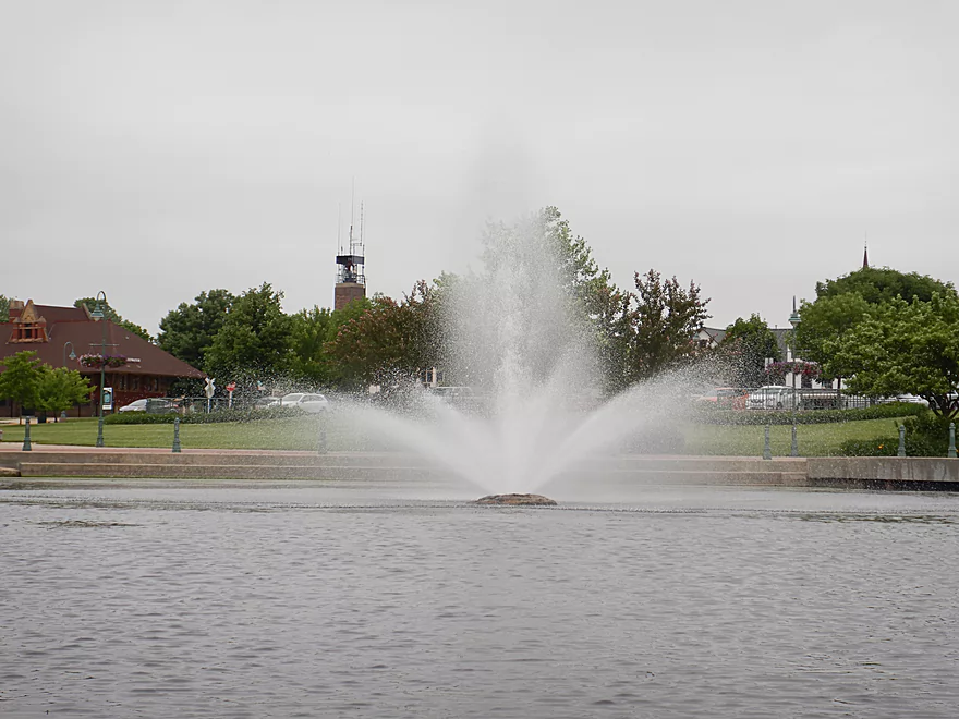
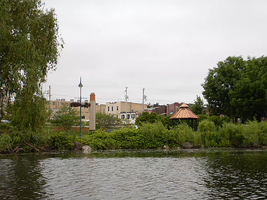
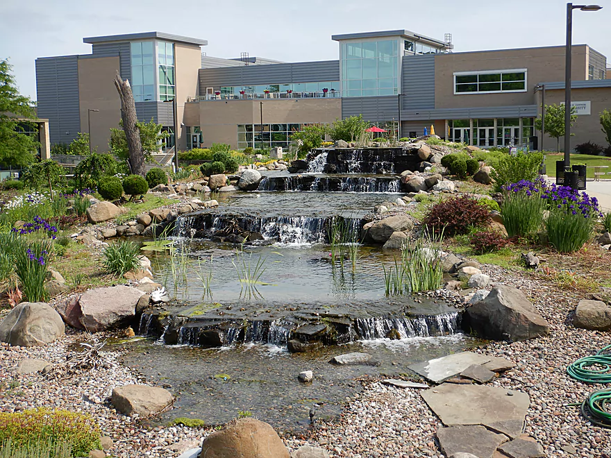
I soon came to a tunnel under Wisconsin Street and on the other side was Cravath Lake. It was a very photogenic spot with the tunnel acting as a frame, a narrow lily path acting as leading lines and downtown Whitewater on the horizon. Beyond this grand entrance and a fountain, there was nothing super special about the lake.
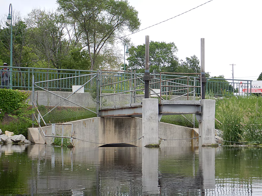
By Main Street is the second dam that must be portaged, which I did by crossing a busy road with all my gear in hand. Paddling author Rick Kark in his trip actually put in at the millrace which parallels the main channel. This is a nice little stretch with clear water…but does have logjams. Instead, I put in the extra effort to re-enter on the main channel which was much bigger and nicer.
Here the creek finally lived up to its namesake as there were some serious rapids and “white water” from streams of white bubbles. Supposedly the “Whitewater” name came from the Potawatomi describing white sands in the creek (which I never saw). I do wonder if instead the name actually came from the white bubbles or the actual rapids on the creek (which used to be much larger). The twin dams in just a half mile span hold back 22′ of water, which means significant rapids and perhaps even a waterfall are submerged by the flowages.
Following Main Street was the best part of the trip. Here the creek whisked quickly through town with multiple Class 1 rapids while enveloped by large tree canopies, making this feel like a jungle paddle. The water was clear and the substrate consisted of light gravel (likely a glacial byproduct). This very much reminded me of the Bark River by Rome. There were some snags to dodge and one logjam to portage, but it was all manageable. There were several attractive road and bike bridges that cross the channel, and following a long brick retaining wall was the surprise of the trip in a house built entirely on top of a bridge. It was difficult to photo because of rapids directly under it, but it was quite the sight. Immediately following this house was a bike bridge that connected to the Ray Trost Nature preserve.
Unfortunately the trip went downhill after that. The current slowed, the gravel was replaced with mud, and downed trees started to fill the channel. There were three nasty jams that required portaging, all of which were difficult and mosquito-ridden. The trip lost several stars at this point, and I was bummed as I thought I had found a good paddling prospect.
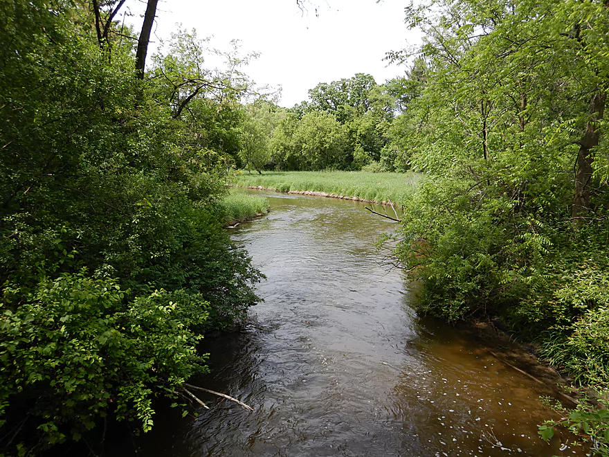
Following the Whitewater Creek Nature Area, the creek lost its logjams and was much better. I soon paddled past a large pipe apparatus and creek, which I believe connect to a nearby industrial plant. The last half mile was much more open and pleasant with even a few glacial erratic rocks in the channel.
During the bike shuttle, I paddle past the Ray Trost Nature Preserve and it hit me…I (and others) could have simply taken out here and avoided the nasty logjams downstream. To compensate for the lost mile, paddlers could add a nice upstream section by Millis Road or even further upstream off Hwy P on Bluff Creek. With this in mind, I had a much better feeling about the creek and my ability to recommend it.
The trip started at Willis Ray Road, which was weedy with narrow parking but doable. I saw a fishing sign here, so assume this area is used by fishermen.
An alternative upstream put-in would be the fishing wayside east of the Millis Road Bridge. This would add 1.8 miles to the trip and be a nice leg with good current, clarity, and likely be logjam free.
Another alternative put-in even further upstream would be the Hwy P fishing wayside, which would add 1.5 additional miles to the trip. Technically much of this is “Bluff Creek” which is a crystal clear spring-fed creek that is really nice, but a bit small for bigger boats. I wish I had started here.
The trip ended at Hwy U which was a difficult take-out because of the steep bank, mud, and deep channel. In hindsight, I realized I had taken out on the wrong location (NW side) and the SE side would have been much easier.
An alternate upstream take-out would be the bike bridge by the Ray Trost Nature Preserve which would shorten the trip by 1.1 miles. I HIGHLY recommend taking out here, as there are three very difficult logjams downstream from this bridge. This wouldn’t be a conventional take-out, but should be doable. Soon after the house on the bridge is the bike bridge. Paddle under the bike bridge and take a sharp right to disembark on the rocks. Then drag your boat 200′ west along the bike trail until your reach Fremont Street. Carry your boat across the road to your car (at either the softball parking lot or the dorm lot/Lot 20. If you are on a weekend, you should be fine to park here.
The bike shuttle route was really nice…flat, only 4.2 miles, scenic, and at times paralleled the creek. If you do this shuttle make sure to take advantage of the local bike trails which are paved and really nice.
Logjams: There were four on this trip that will require portages. The first is just north of E. Starin Road. This was medium difficult and not too bad if you are willing to wade to more easily get in and out of your boat. The next three are between the Ray Trost Nature Preserve and the Whitewater Creek Nature Area. These were very difficult to portage because of deep water by the jams, swift current, steep muddy banks, and overgrown shoreline. I highly advise skipping this section and taking out at the Ray Trost Nature Preserve. This would leave you with only one logjam the entire trip. Webmaster’s Update…a comment was recently submitted suggesting the logjam situation is much worse. See bottom of the page for more information.
Strainers: There are a few strainers in fast current located in the downtown section. I was able to avoid them no problem, but this paddle shouldn’t be a attempted by inexperienced paddlers or by those in bigger boats.
Dams: There are two dams. The first is by Trippe Lake Park, and while the re-entry bank was a bit steep, I thought it was an easy portage. The second dam is under busy Main Street. It is easy to get out of your boat because of the rocks to the west…but you will need to cross a busy street with your boat to get to the other side. Relaunching in the millrace would be super easy, but I don’t recommend the millrace because of its logjams and lack of rapids. Instead, hug Main Street, cross an abandoned building to relaunch on the west bank of the main channel (on technically the east bank of an island).
Current: Outside of a few riffles the upper stretch is mostly slow flowage paddling. The lower stretch through downtown was very fast though with several strong Class 1 rapids…maybe even a Class 2. Most of the difficulty resides in dodging branches, not rocks.
This trip was done at above normal depths. This meant that getting hung up wasn’t an issue, but it did mean the current was pushier and clarity not as good. I think the most approximate gauge is the one on the Bark River near Rome. The following are rough estimates.
- 0-20 CFS: This might be too shallow (I don’t know though).
- 21-50 CFS: This would be an average depth. The rapids would likely be bumpy and Tripp Lake might be shallow, but the clarity would be excellent.
- 61-100 CFS: Above average depth. Likely a good target range.
- 101-130 CFS: High levels. This trip was done at 119 CFS and dodging some strainers in fast current could be tricky.
- 131-160 CFS: Very high levels only suitable for experienced paddlers.
- 161+ CFS: Likely too high to be enjoyable.
I did see an egret, a great blue heron, many blackbirds, a few clams, quite a few ducks (including a domestic commingling with wild mallards), and a deer in the channel that let me get pretty close. Unfortunately the last mile had a lot of mosquitoes. The highlight of the trip was actually the carp on Tripp Lake. It was quite the spectacle to see so many huge fish cruising with their dorsal fins exposed like killer whales, while thrashing around and creating huge splashes.
Flowing Well: This artesian well is part of the whitewater creek watershed and is popular with locals wanting good tasting and uncontaminated drinking water.
Bluff Creek State Natural Area: This is another tributary to Whitewater Creek located to the southeast and is really cool because of its large bubbling springs and flowing seeps which originate from a morainal ridge. You can read more about this at the DNR website. Be careful of dangerous sink-holes and quicksand.
Kettle Moraine State Forest – South Unit – Whitewater Lake: Practically speaking this is a state park (some call it Whitewater Lake State Park). The highlights are two flowage lakes in Rice Lake and Whitewater Lakes which are part of the Whitewater Creek watershed. This is a nice area known for its glacial hills and can be best experienced by its hiking trails (map and a nice hiking review).
UW-Whitewater: It can be novel to see a college campus. I don’t think of UWW as a spectacularly scenic campus (lacking say the hills of Platteville, the bluffs of La Crosse, the architecture of Madison, or the river valley of Eau Claire)…but it has nice parts including an attractive stadium built into the side of of a hill. Alongside the stadium are several nice hiking trails which I spent a lot of time on as a student. The main mall itself is ok, but nothing special.
Ghosts: The city and campus are considered to be among the most haunted areas in the state, and there are many stories of strange and unexplainable phenomena. Supposedly even the creek is haunted. Here is a short documentary on the subject.
- Bluff Creek Springs/Headwaters to Hwy P Fishing Access: 1.3 miles. Very small creek free of logjams with gorgeous crystal clear water. The headwaters contains seepage slopes and bubbling springs (some of the largest in the region). You might need to wade upstream to access the springs, as there is no put-in here. Be careful of dangerous sink-holes and quicksand.
- Hwy P Fishing Access to Millis Road Fishing Access: 1.5 miles. A small prospect that may require high water. Maybe 1-2 logjams, but mostly open. Technically half of this is Bluff Creek which is an amazing spring-fed creek with nearly perfect water clarity. Hwy P access is good, but will require lifting your boat around a concrete block.
- Millis Road Fishing Access to Willis Ray Road: 1.8 miles. A small but good prospect that should be logjam free, and have good current with amazing clarity.
- Willis Ray Road to Hwy U: 4.2 miles. Reviewed Jun 2018.
- Willis Ray Road to Trippe Lake Park/Dam: 1.6 miles. A small fast stretch followed by a wetland and then a developed flowage lake. Alternative access options available on Hwy 12 and on Tripp Lake.
- Tripp Lake to Mill Race Park: 0.4 miles. A short but pleasant creek section followed by Cravath Lake and downtown Whitewater. Ok, but nothing special.
- Mill Race Park to Ray Trost Nature Preserve: 1.0 miles. An amazing section through downtown Whitewater with fun rapids and clear water. There are a few strainers and one logjam, so only suitable for intermediate paddlers in maneuverable boats. Note, you can take the millrace instead, but this has several logjams and lacks the fun rapids of the main channel.
- Ray Trost Nature Preserve to Whitewater Creek Nature Area: 0.5 miles. Not recommended because of three difficult logjams and muddy portages.
- Whitewater Creek Nature Area to Hwy U: 0.6 miles. A pleasant section free of logjams. Hwy U is not a great access option, but should be doable. Best access on SE side of bridge.
- Hwy U to Fremont Road: 5.3 miles. Maybe 9 logjams, almost all of which are within the first mile. A shame as the downstream sections look really nice.
- Freemont Road to Mouth on Bark River: 1.5 miles. Maybe 21 logjams….way too many.
- Mouth to Burnt Village Park: 1.1 miles. A simple section on the Bark River.
- Bark River: For more paddling options on the Bark River, click here.
Notable omissions:
- Spring Brook: A significant tributary to Whitewater Creek and Cravath Lake that appears to have too many logjams to recommend.
- Whitewater Creek (upstream of Bluff Creek): Even though it would be easy to launch on Clover Valley Road by “Flowing Well”, I suspect this would be too small to be enjoyable.
- Clover Valley Fen Creek: This creek is the outlet of Rice Lake and Whitewater Lake, and a tributary to Whitewater Creek. While a neat prospect that flows by some impressive pine stands…this is likely too small to paddle.
- Whitewater Lake and Rice Lake: These are very nice paddling lakes and part of the local state park system. A dam separates the two lakes.
Trip Map
Overview Map
Video
Photos Size:
The description is quite accurate. But I would not give this 4 stars. 2.5 would be more like it. The jams were so bad on our trip yesterday (10-15-19) that we HAD to give up and carry out at a fourth portage with more to follow. This needs cleaning up. If I have time and equipment’ I’d do it. But it will take more than two hands. This is a mess!
Thanks Eric for the comment. Where did you take out? I took out at Hwy U but that was too far. My suggested take out was to disembark at the pedestrian bridge by Wells East. I wonder if the logjams you faced were before that? If so, this is unfortunately a new development and a problem.
The put in at the Millis Road bridge is good and easy. There is a public parking lot close by. I had done short trips on this creek many times as a kid. There is another put in from Millis Road (south and west from the bridge) that is upstream. There is a restored prairie area on the north-south oriented portion of Millis Rd. and a short gravel trail through it on WDNR land goes down to the creek where a gas line ROW crosses. From there you can also easily paddle upstream to where there is a fork in the creek. Years ago the upstream right fork would bring you to a beaver dam. Doubtful they are still there though.
I appreciate the information. the creek up by Millis Road is definitely on my todo list.