
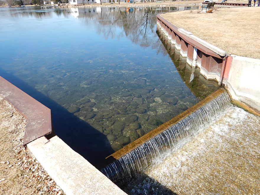
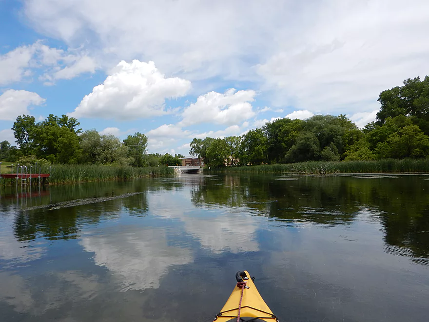
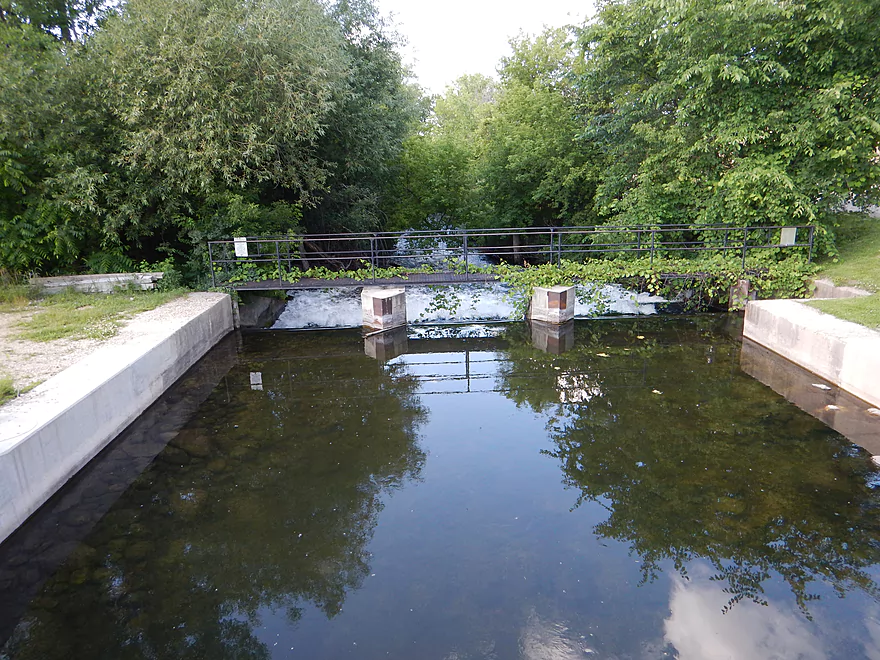
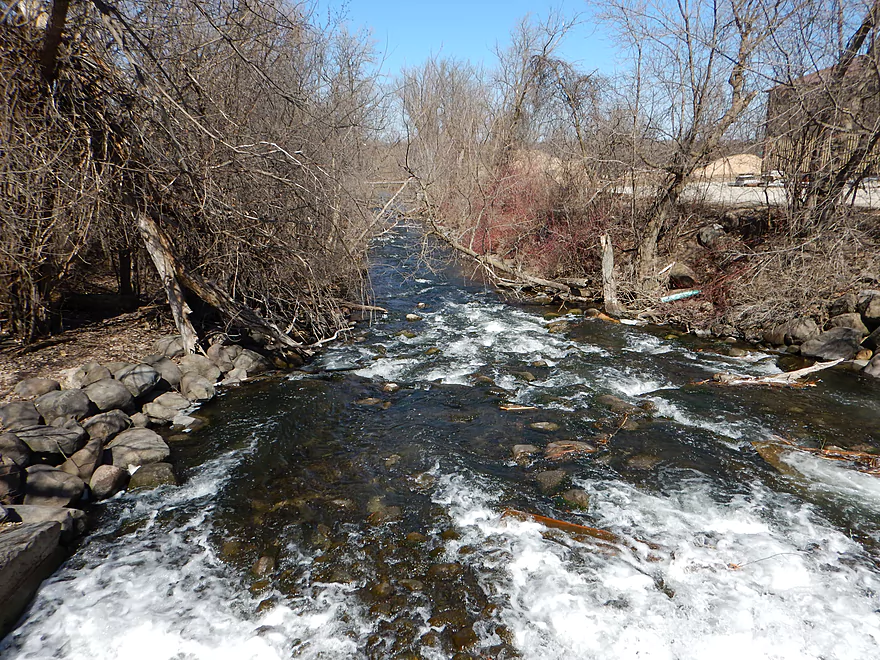
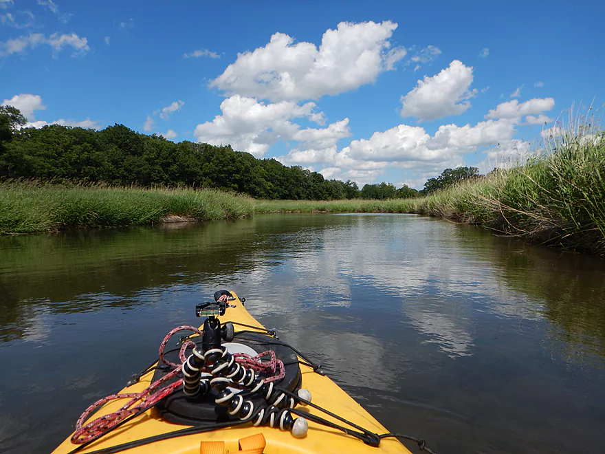
Good access at the Green Lake Dam
Checking to see if the north mill race is runnable…
Nope
The main middle chute is not runnable either
The southern chute was not runnable at 19 CFS
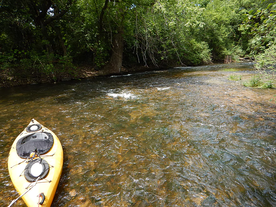
But today was 39 CFS
So I ran it, which was great fun
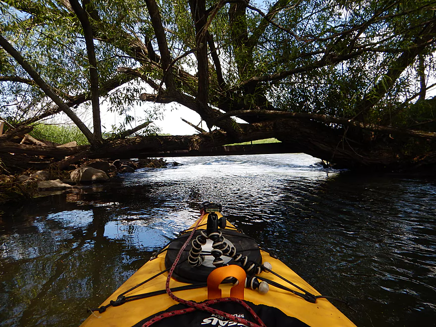
And got spewed out under a low bridge
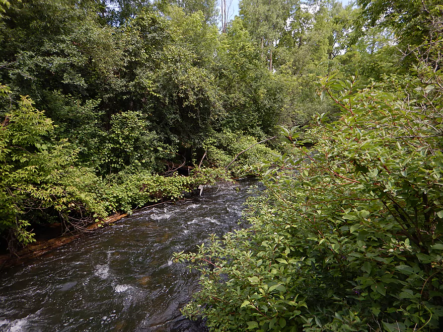
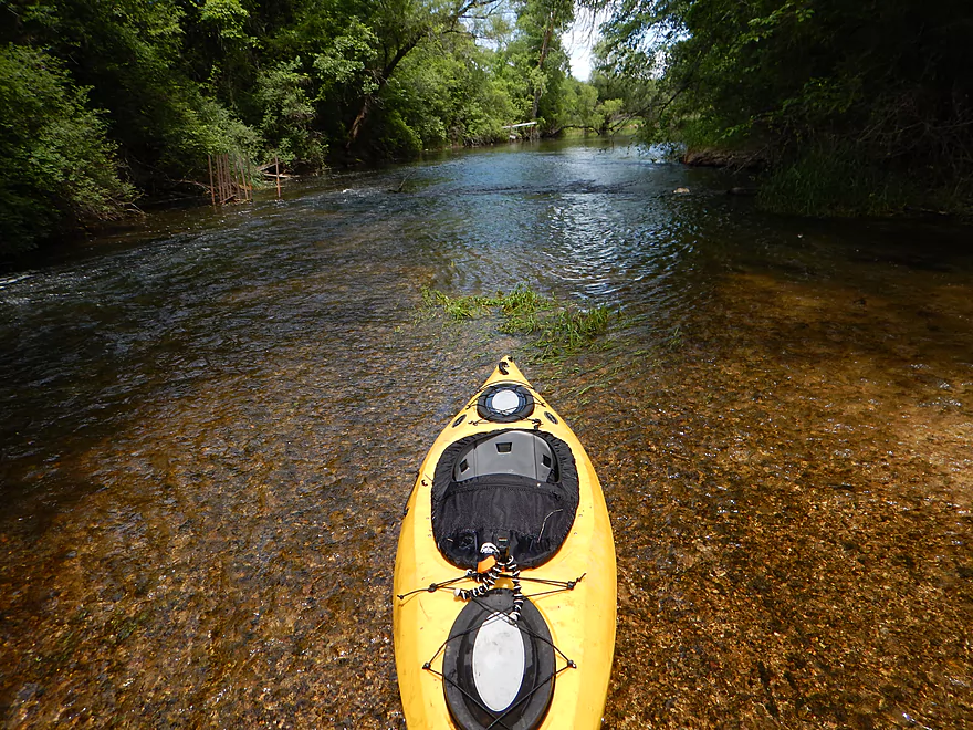
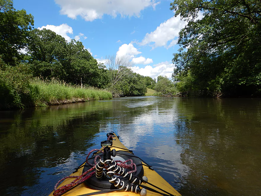
Current stays quick
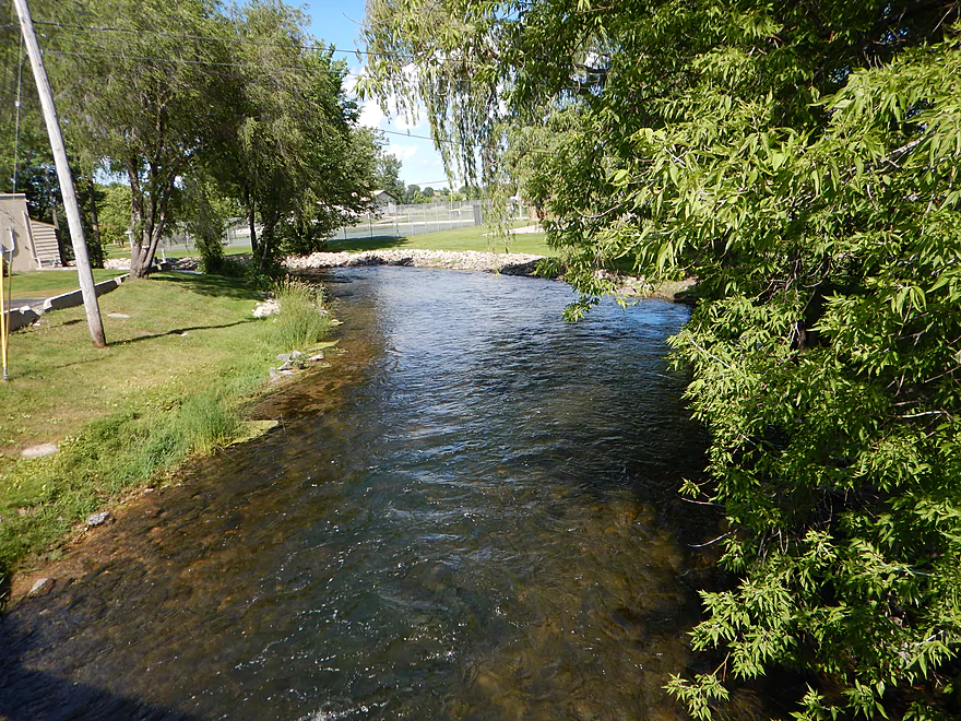
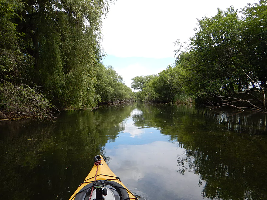
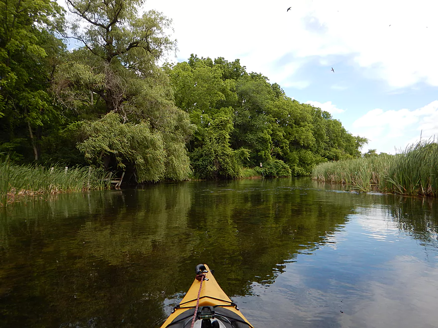
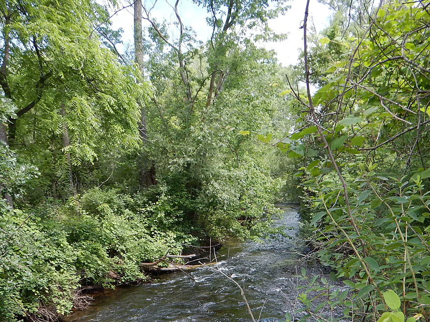
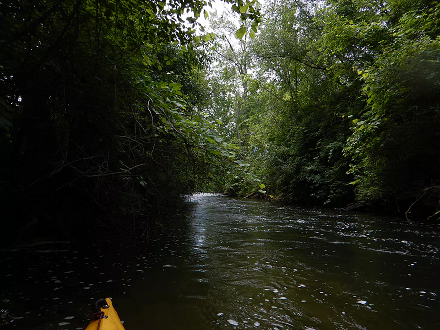
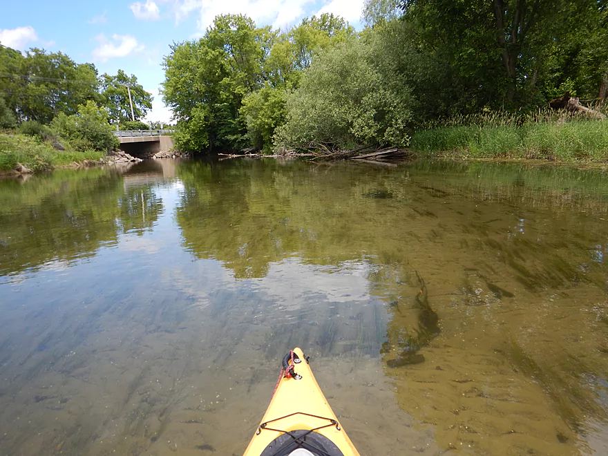
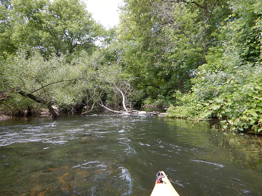
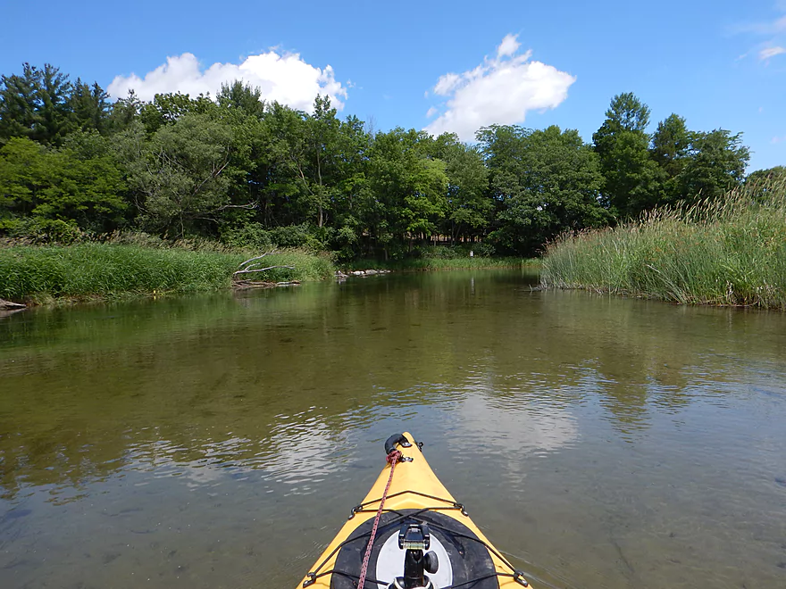
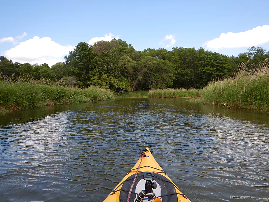
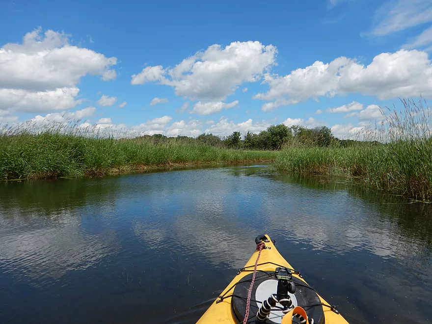
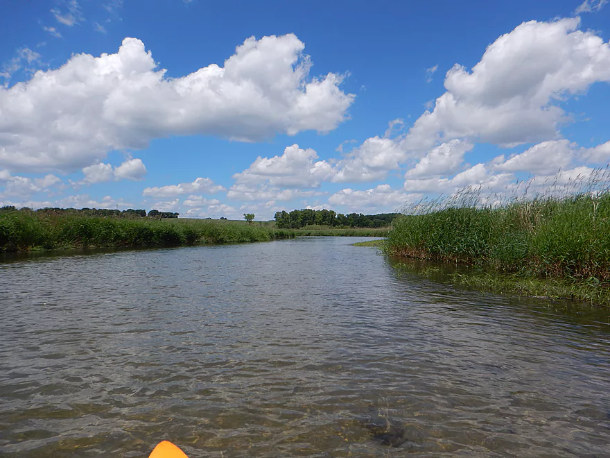
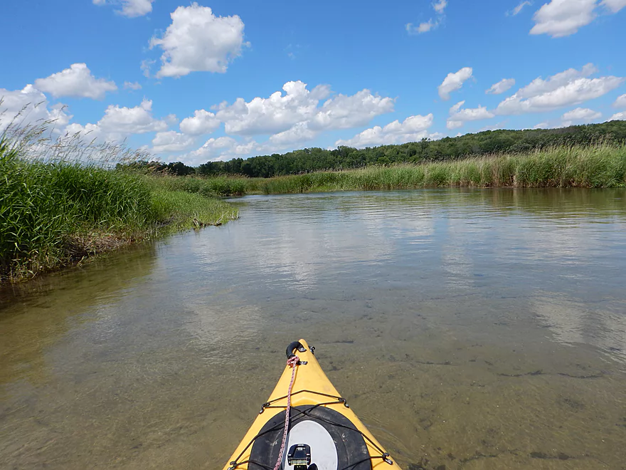
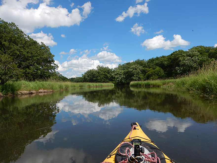
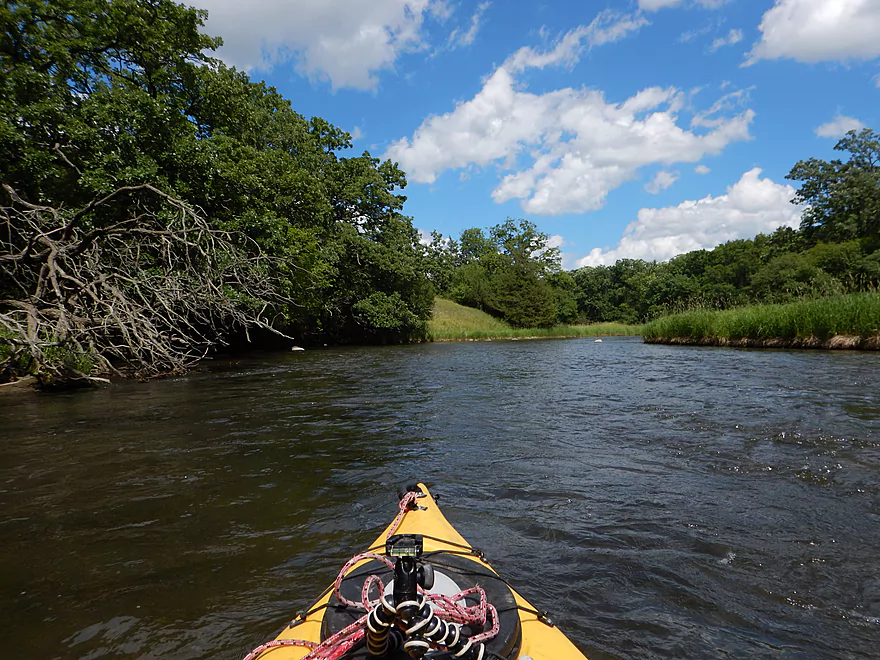
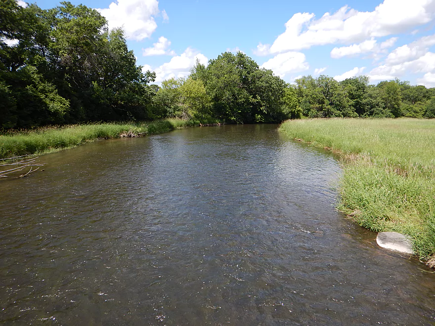
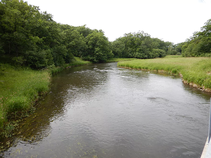
Very scenic section
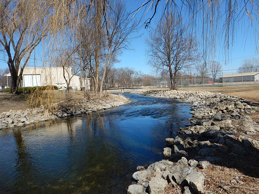
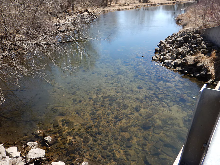
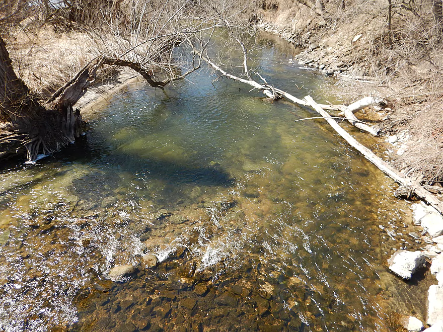
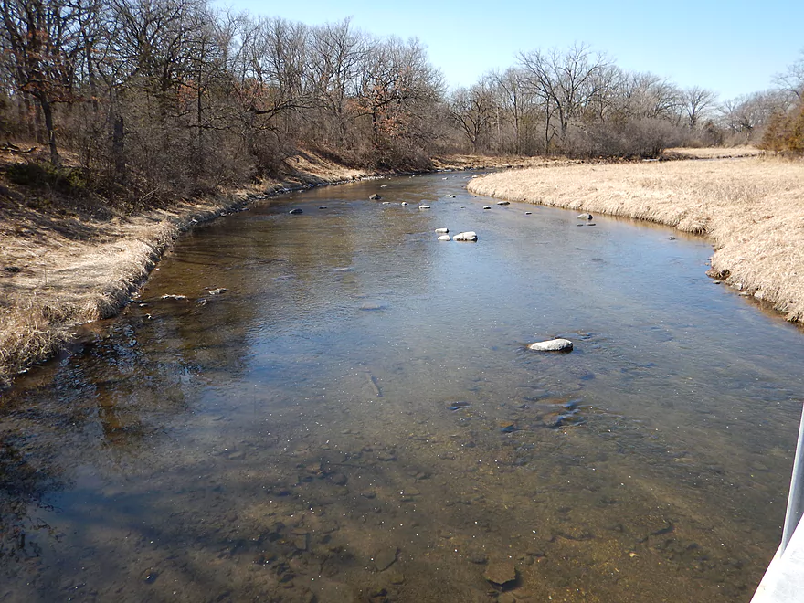
Old shot from March (very shallow)
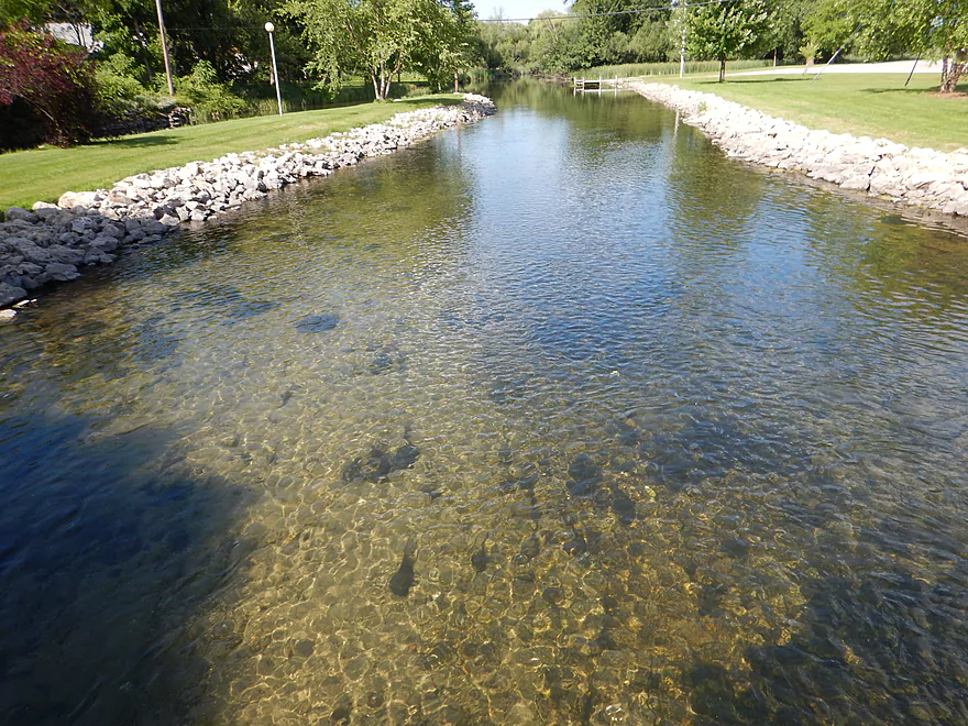
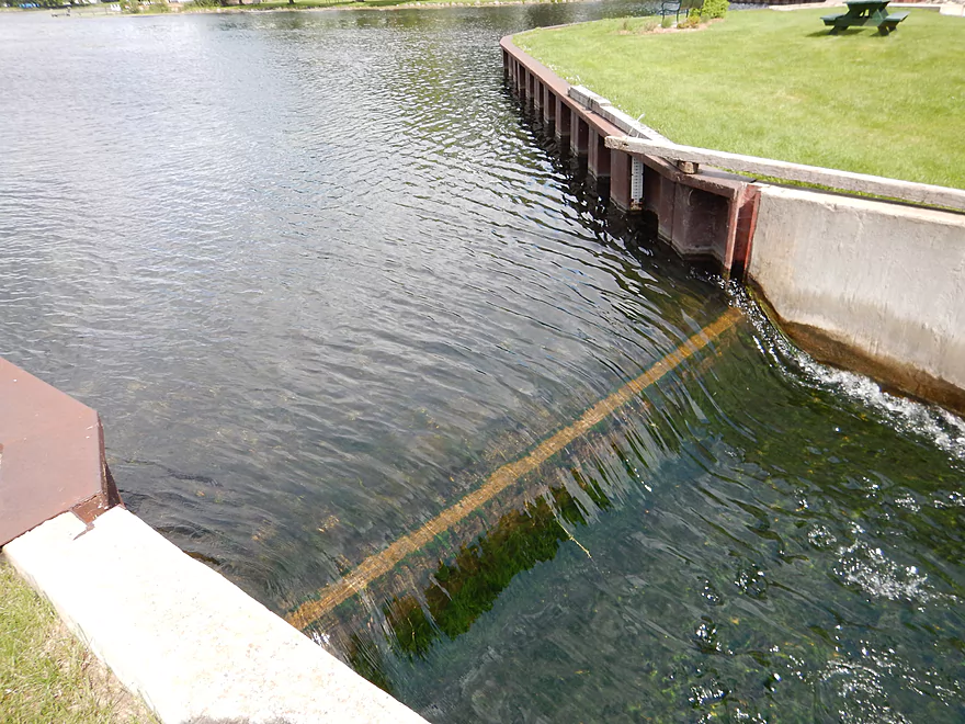
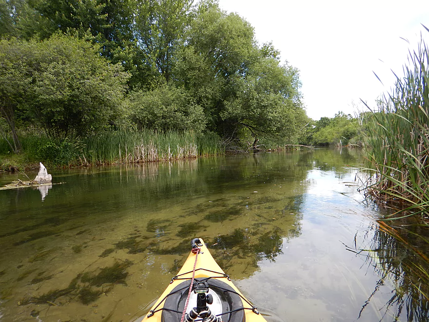
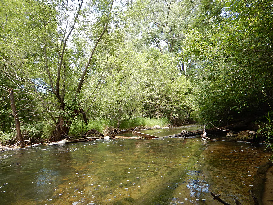
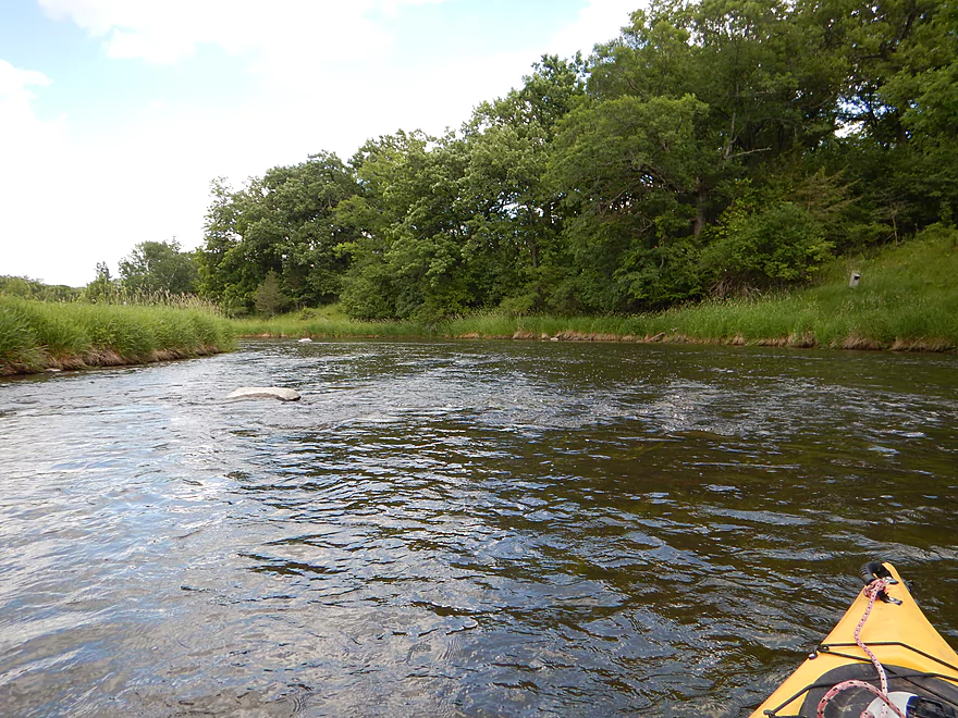
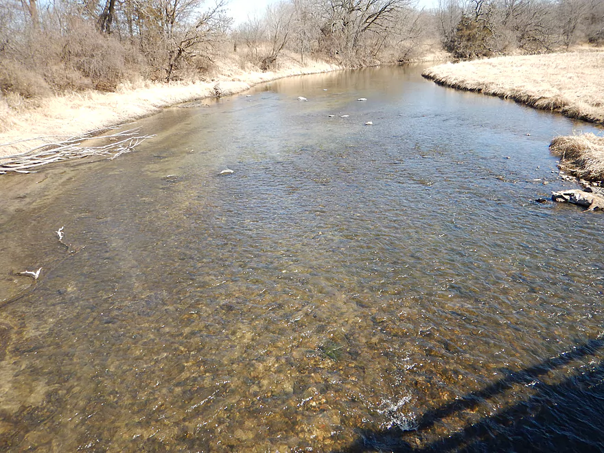
Great water clarity at 39 CFS
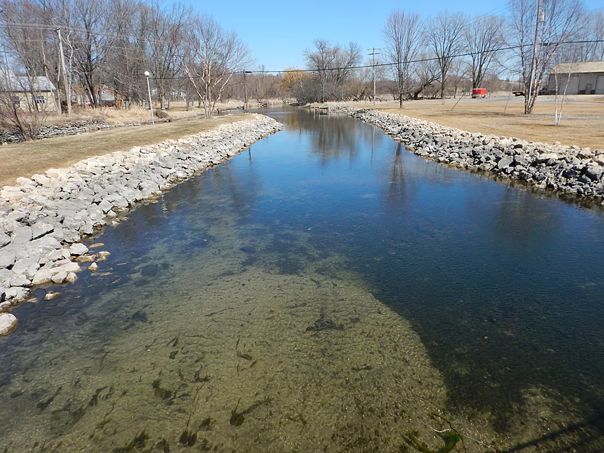
But was even better in March at 19 CFS
Clear water and substrate reminded me of Devil’s Lake
Simply amazing water clarity
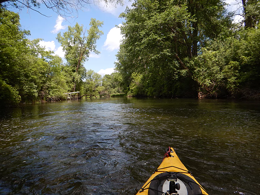
Attractive wooded banks
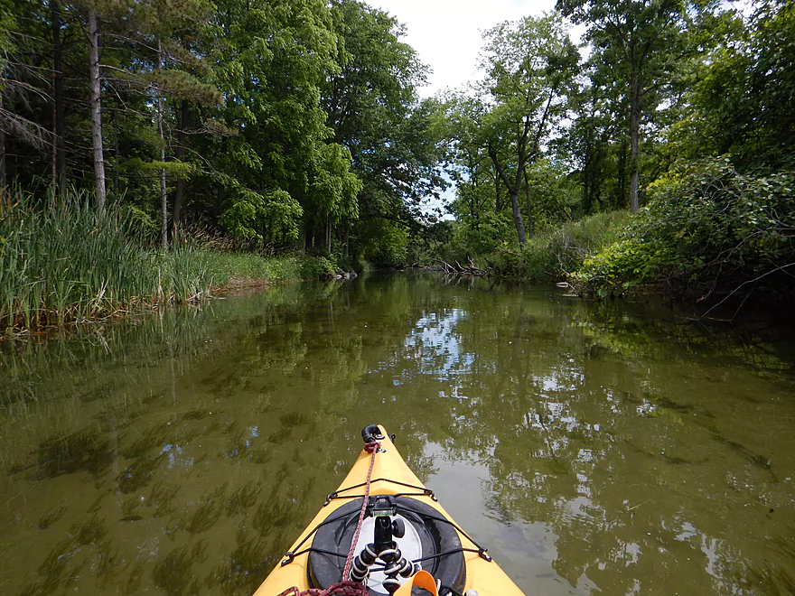
Good current + clear water + wooded banks = great water trail
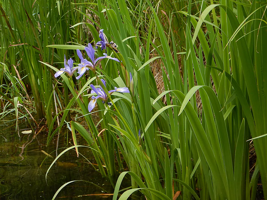
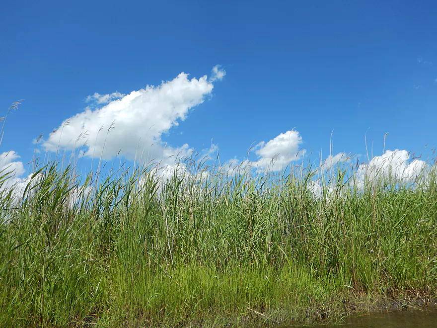
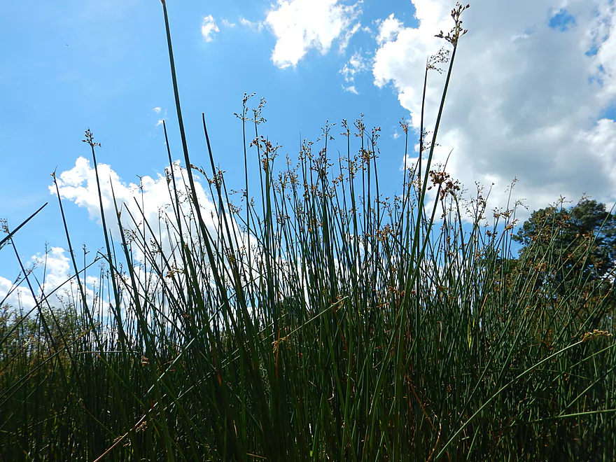
Blue flag (aka wild iris)
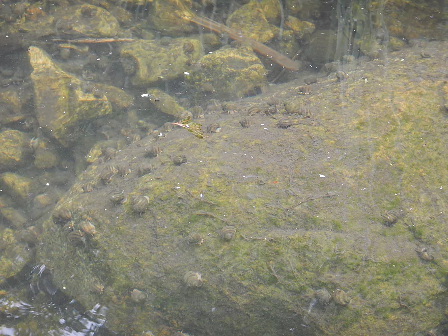
So many crayfish…but I couldn’t photo them so you get snails
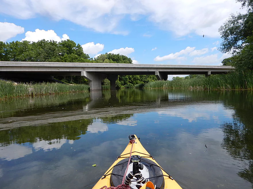
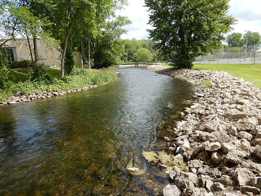
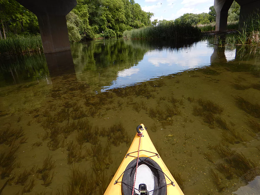
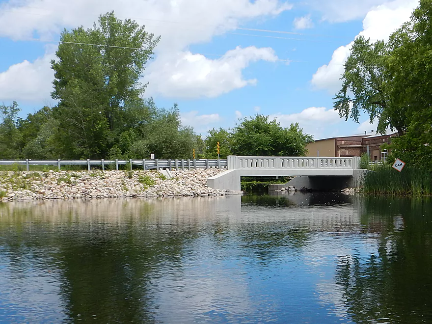
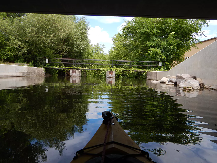
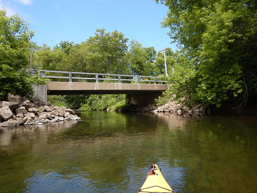
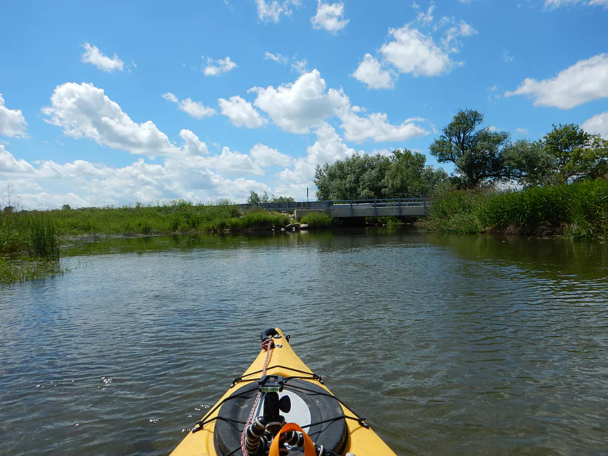
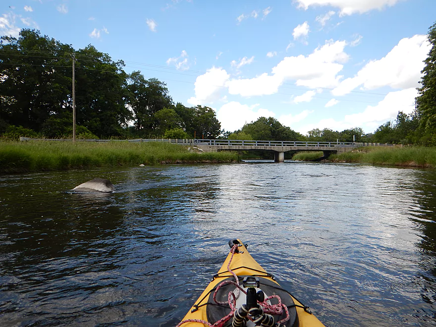
Hwy 23 bridge
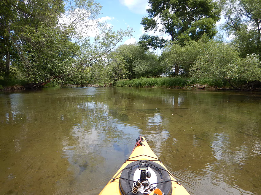
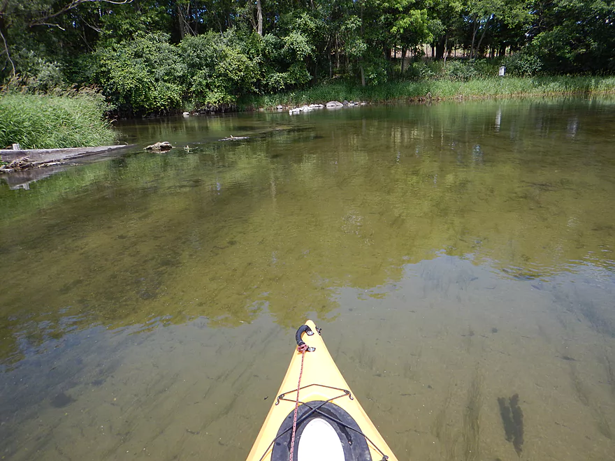
Clarity was top-notch but would have been better in shallower water
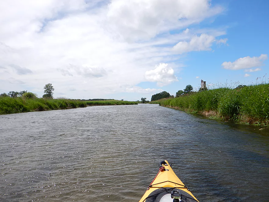
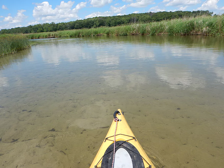
River starts to slow and get wide which means…
We have a flowage :(
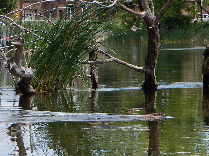
Somewhat tame muskrat
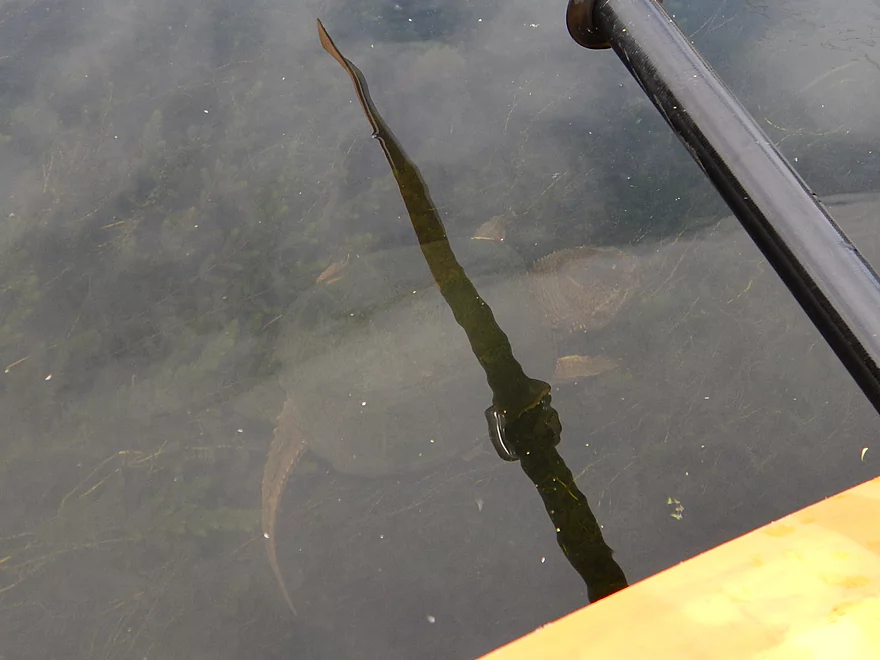
HUGE snapper (deceptive because of how deep/clear the water was)
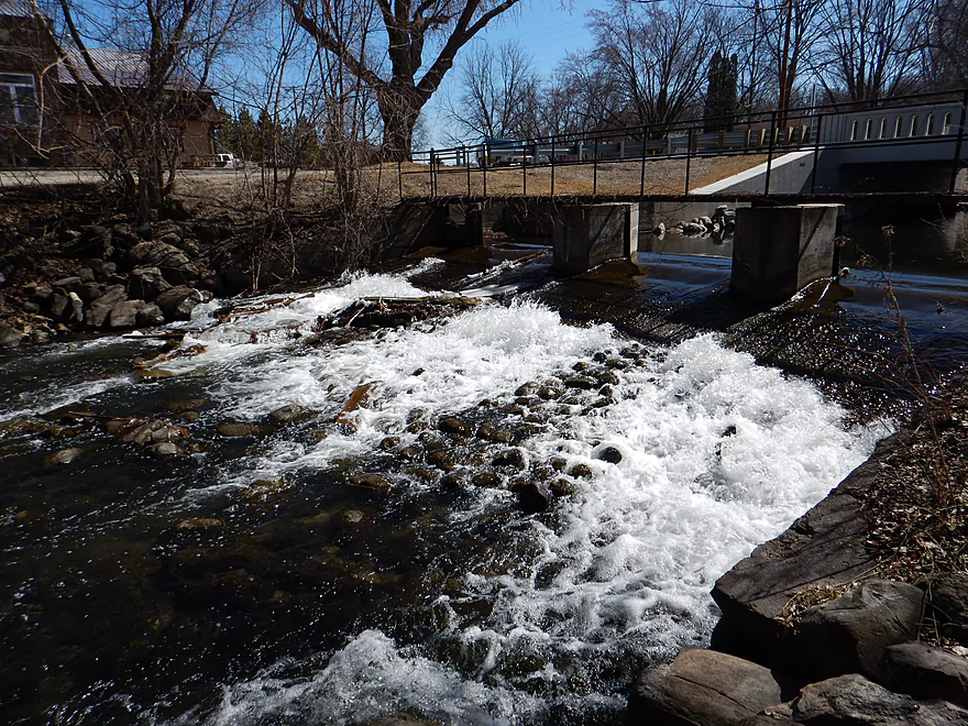
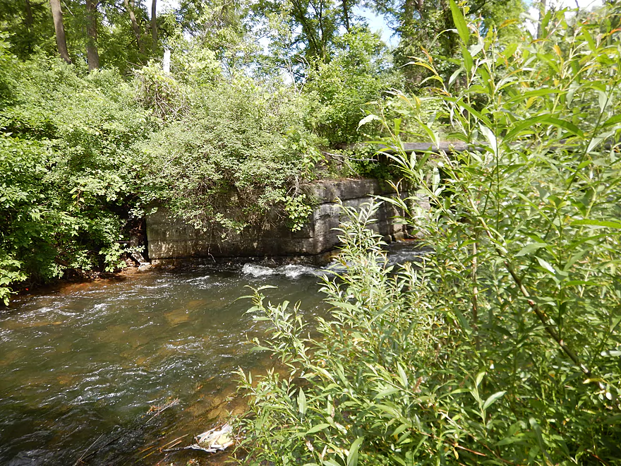
You should portage the dam here despite annoying guardrails
Difficult to portage the dam after the bridge
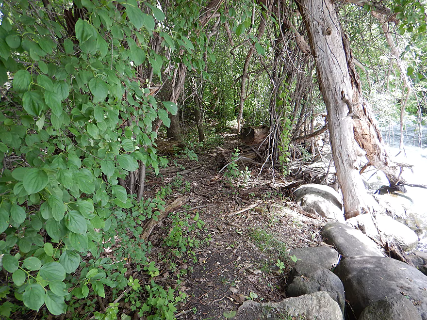
Small dirt path west of the dam you can kind of use for a portage
I’m not in a portaging mood
Very fun, but I advise most paddlers not to do this
What the rapids looked like in March at 19 CFS
Was tough to photo the dam proper
March version of dam at 19 CFS
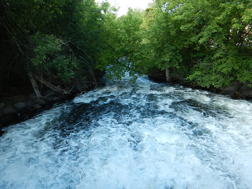
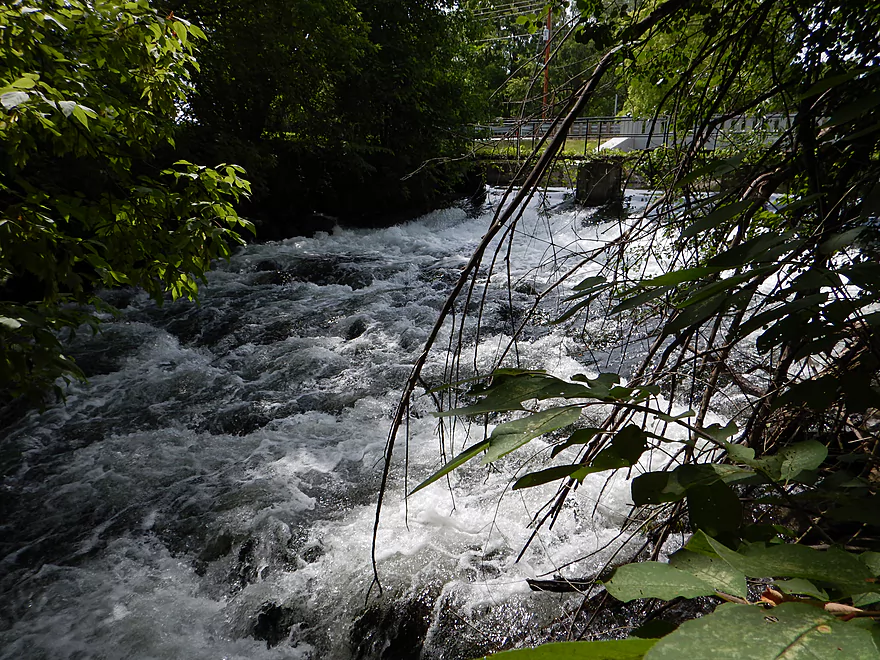
Class 2 rapids follow the dam with tricky sticks to dodge
Cool class 1 rapids through narrow woods
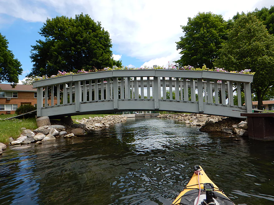
Strong current before an old pedestrian bridge
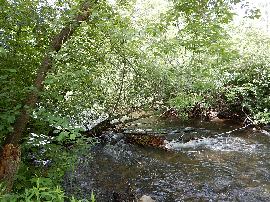
Be cognizant of hanging branches
Favorite part of the trip
Thick vegetation creates an intimate effect
Where the river forks, do not go straight

Go left through this obstacle instead
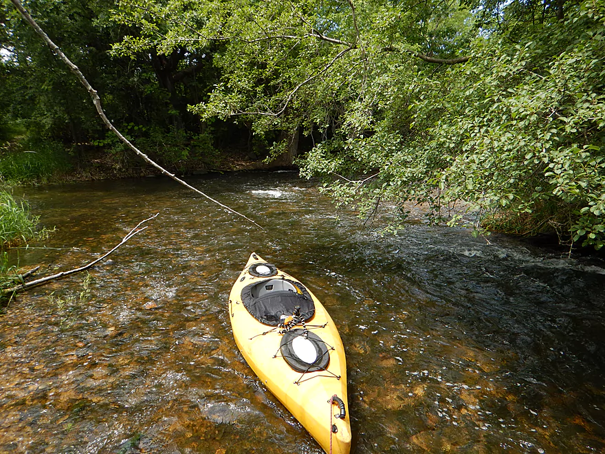
Was deep enough…I just got out for photos
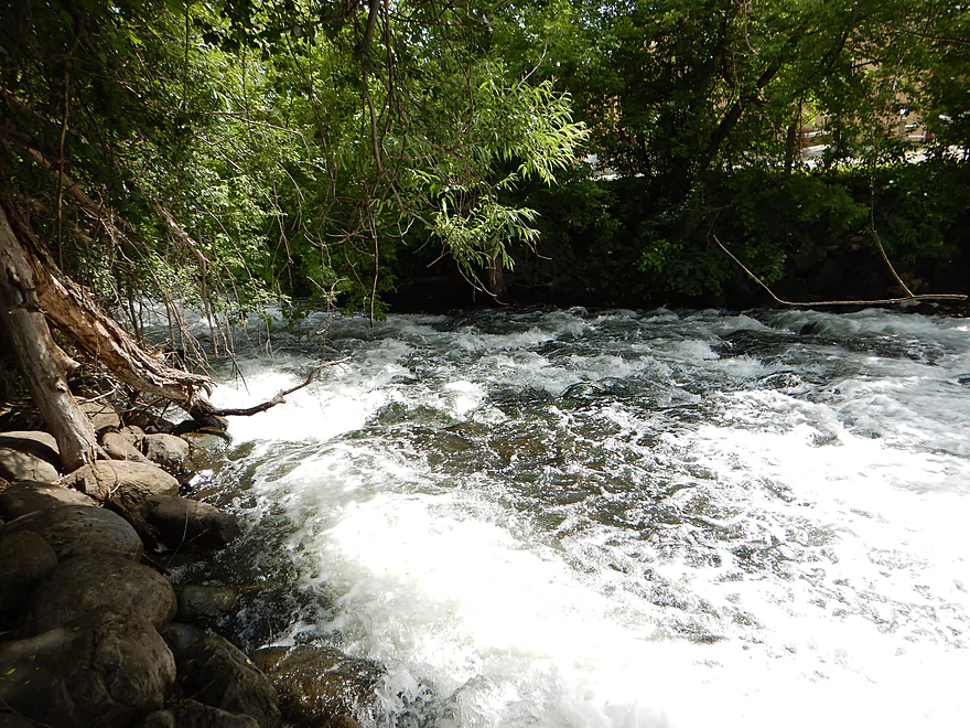
More fun rapids in this section
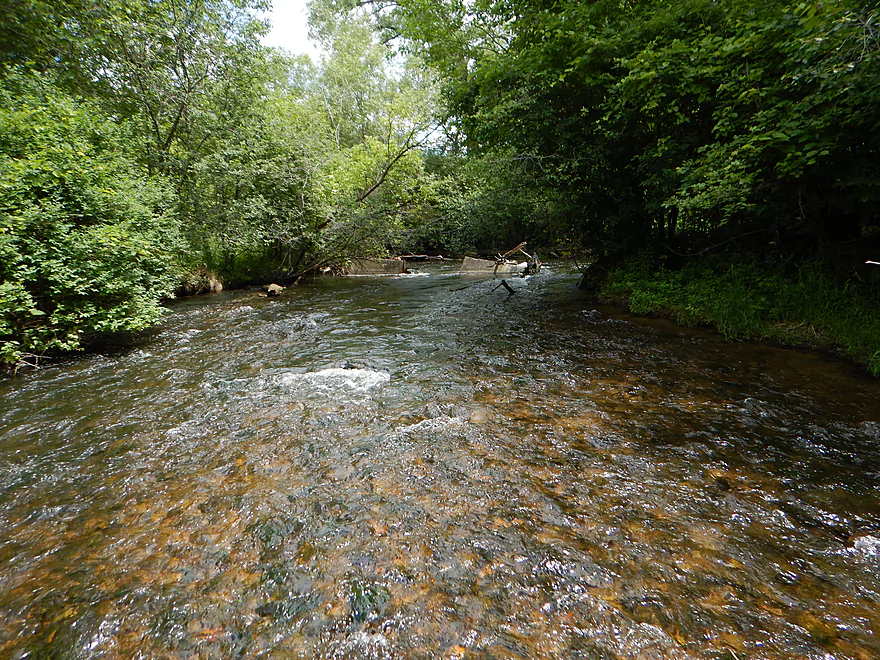
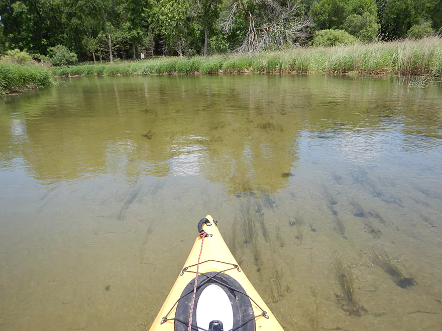
More nice water clarity
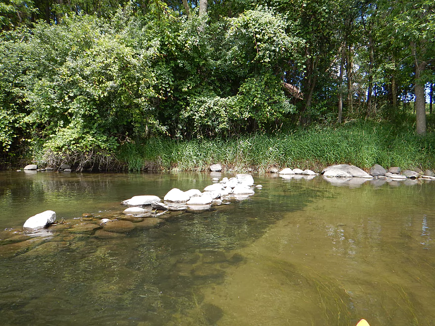
Very pretty red pebbles
And that concludes the best 1.5 miles of the trip
Still nice sections remaining
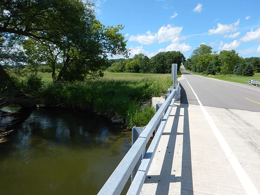
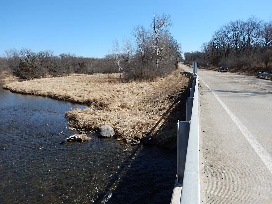
Berlin Road
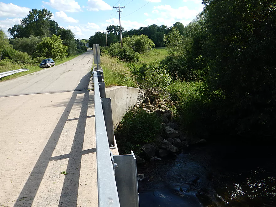
A take-out option
Shot from the bridge (from March)
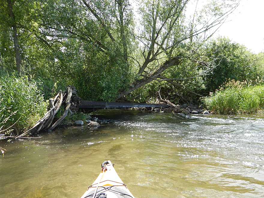
This log jam was actually easy to get around
As you will see from my March version
River now puts on its marsh hat
Some of the last trees
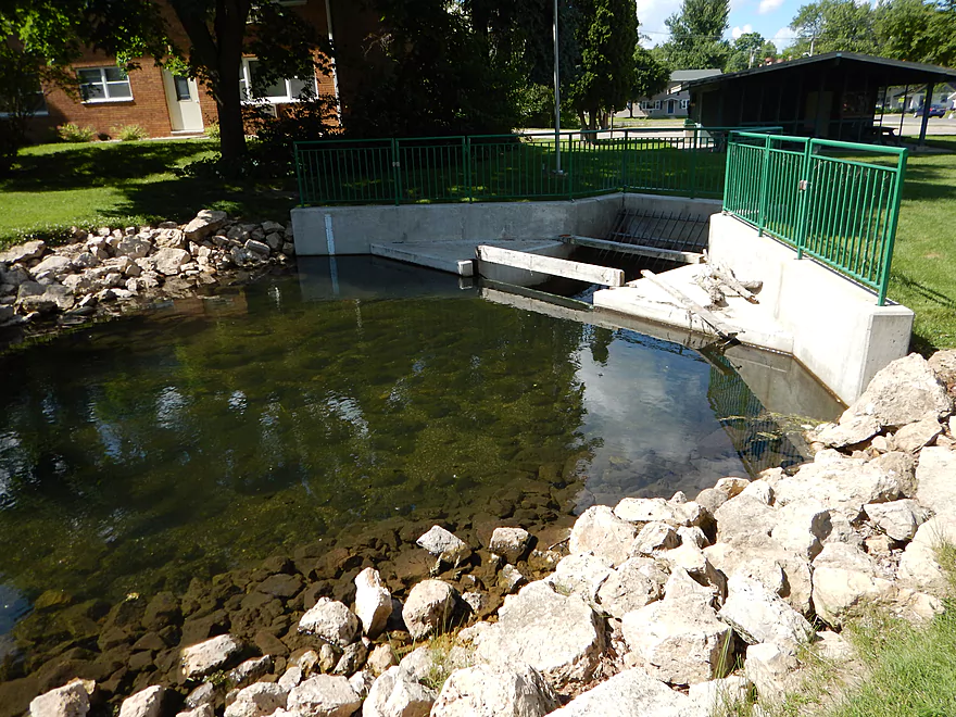
An old wing dam
Would have been even clearer at lower levels
Rapids under a low bridge
Easy portage (which I didn’t do)
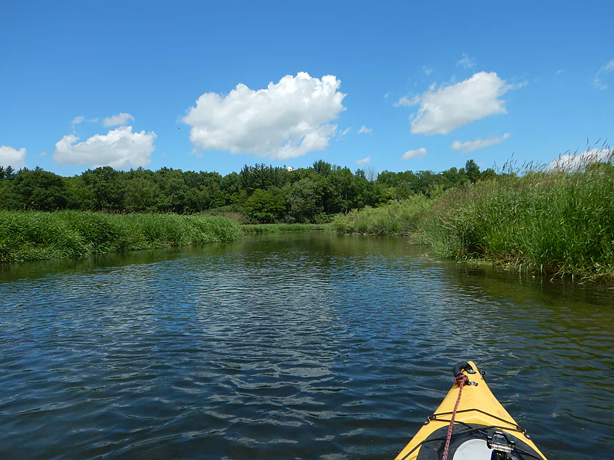
River is mostly an open wetgrass paddle now
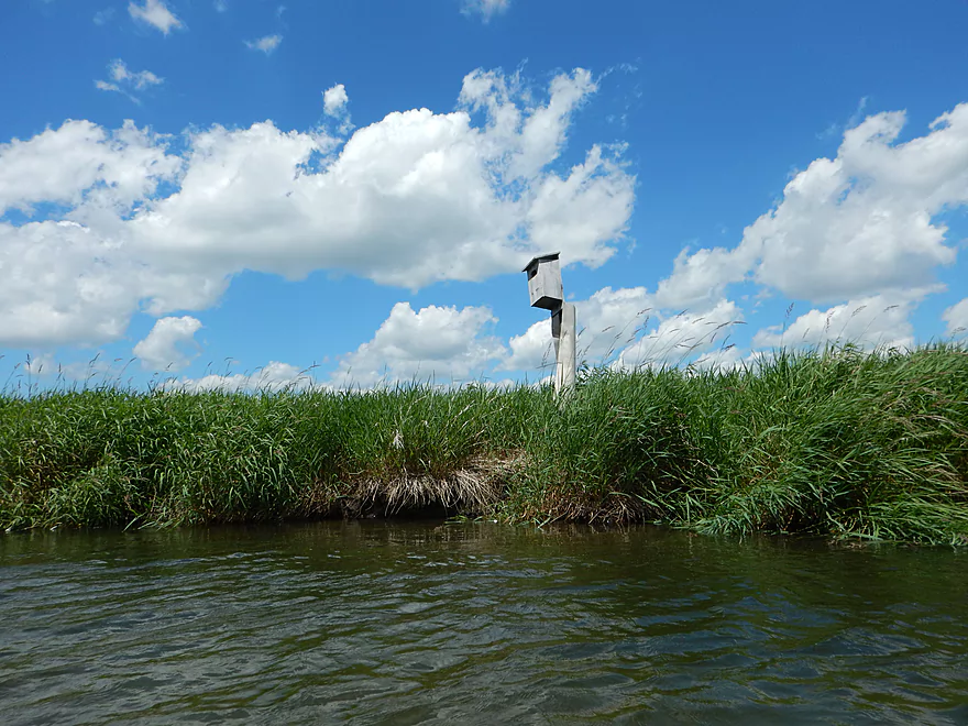
Many of these
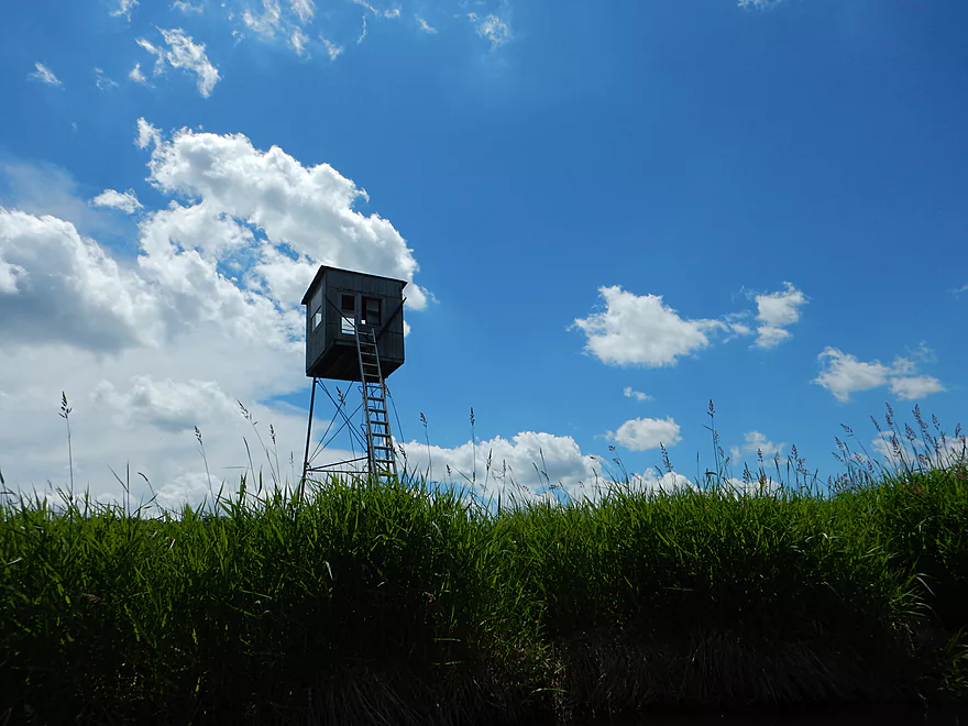
And in juxtaposition many of these

Just missed photographing my second snapper
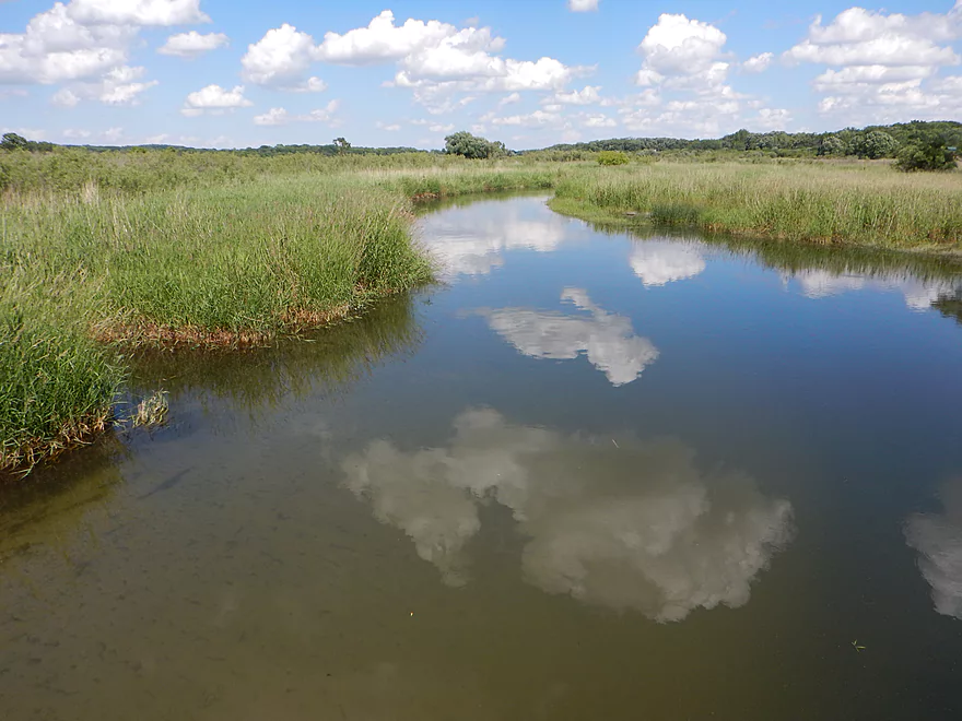
A vanity mirror for the clouds
Hwy A is where I suggest you take out
Ok access here
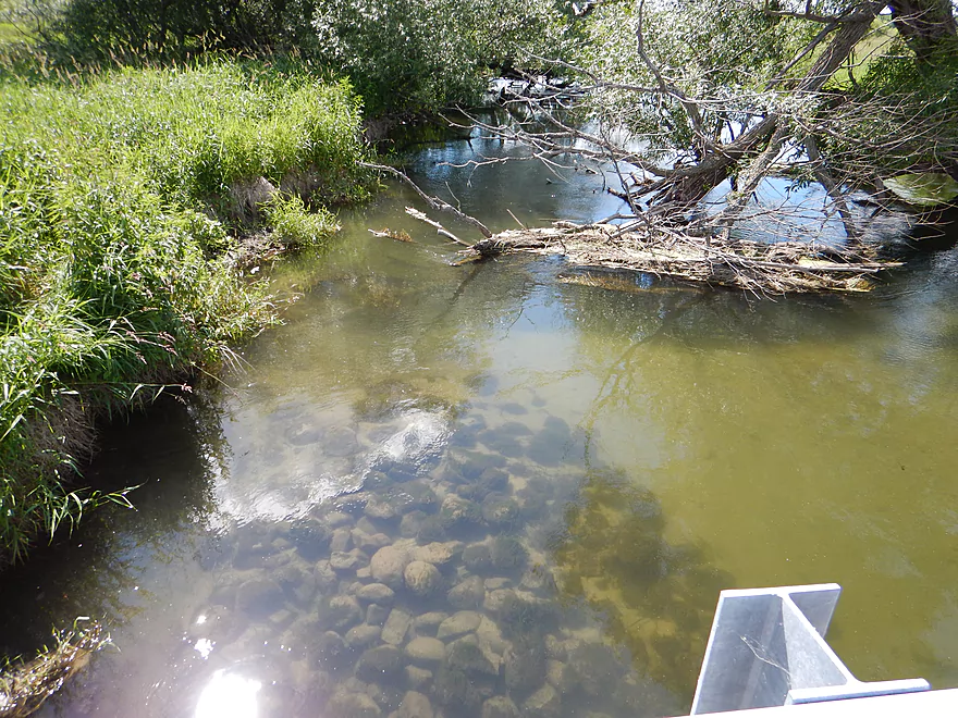
There have been jam clearing efforts
The almost 4 miles after Hwy A are very repetitive
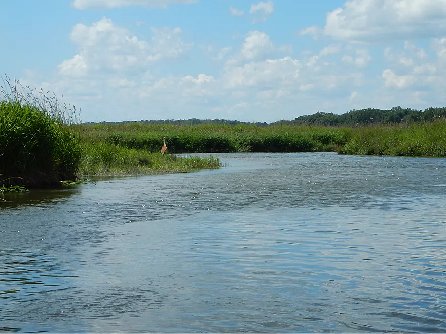
Sandhill crane
Nice colorful day
Thought it was wild rice…actually bulrushes
Finally…the trees come back!
And the banks…
And the riffles…
And the rocks…
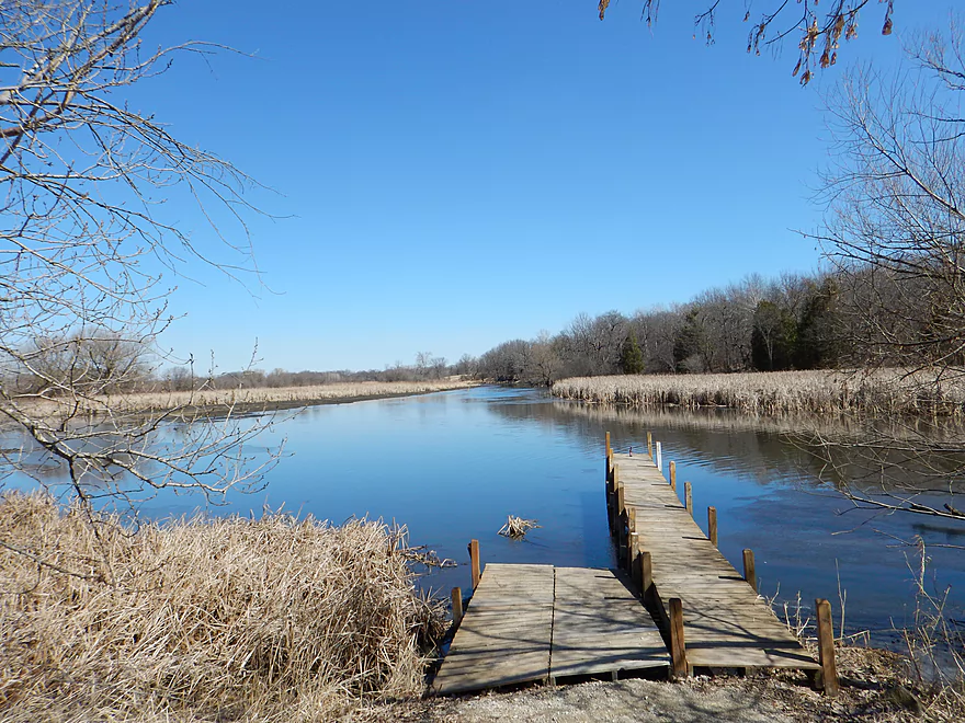
Hwy CC was my take-out
Good access & parking
Looking upstream at the riffles
Was so much more scenic in March
Looking downstream
Yet another March 19 CFS contrast shot
Scouting Silver Creek canoe access at Spaulding Road
Puchyan River

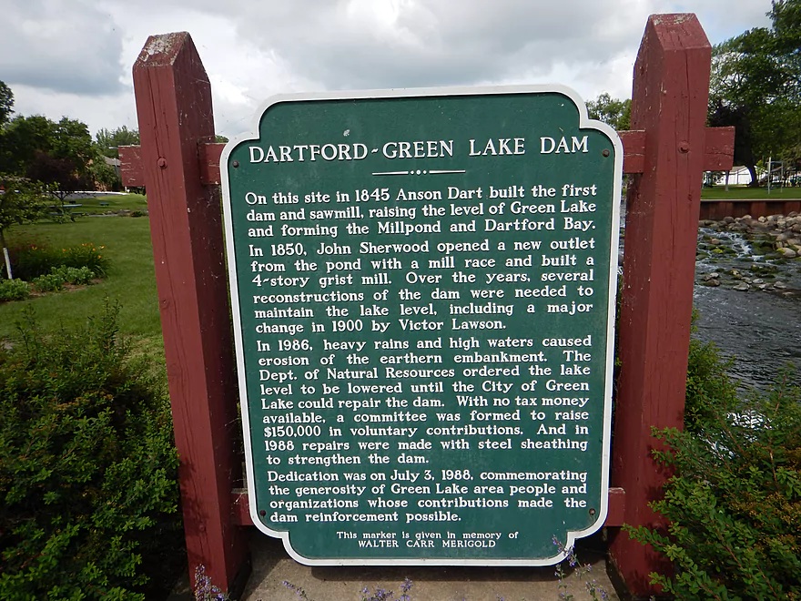
Trip begins on an exciting note by the main Green Lake dam and you’ll have a decision to make. Do you run the dam and subsequent chute, put in below the chute, or bypass the rapids altogether and put in by the tennis/basketball courts. I should clarify first there are three dams/ledges by Mill Street. You can’t run the northern one, the middle one is too steep/rocky, but the southern one is an option. It is somewhat slanted, not tall and does not have any backrollers. More of a concern is the chute that follows as it takes a hard 90 degree turn to the left, ducks under a very low bridge and spits you out like a water park ride over a last ledge and onto the main channel. I went with option #3, much to the astonishment of the onlookers (the video at 0:07s is entertaining). If you run the chute, make sure to measure the bridge height to see if you’ll fit and can limbo under (which I did).
So that was fun… The next mile until N. Lawson Street is a really cool stretch of the river. Water clarity is fantastic, with beautiful rocky areas and sandy substrate. It felt like Devil’s Lake if Devil’s Lake were to ever flow like a river. Plus the current here was great too and the banks had attractive woods. Just prior to N. Lawson Street, the river slows down and opens up into a small flowage.
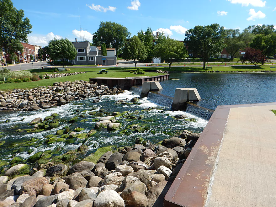
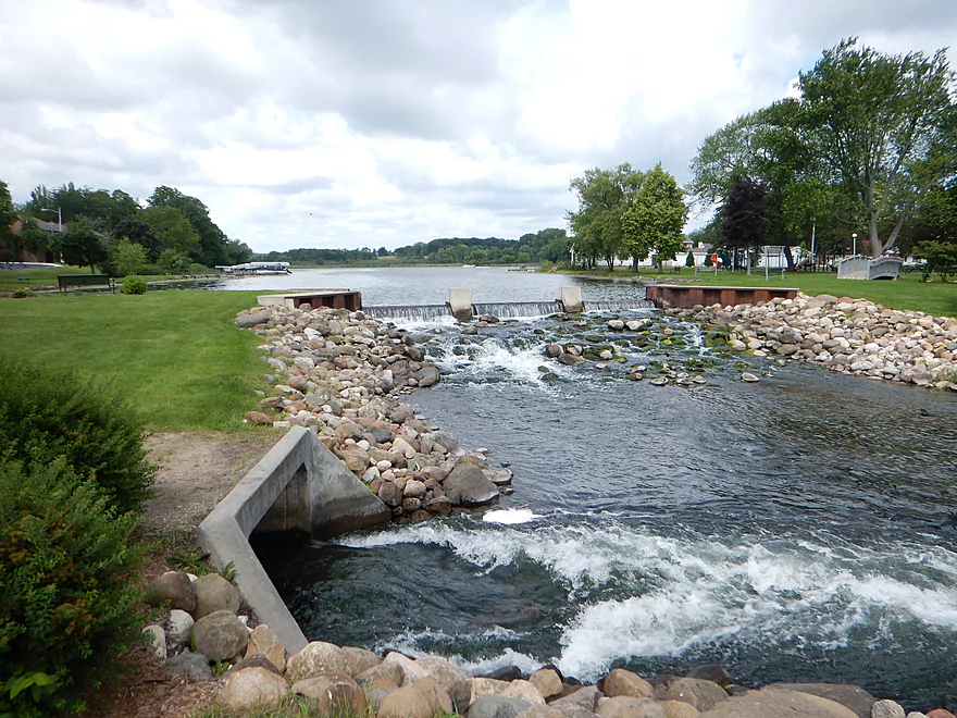
The dam off of N. Lawson Street is very new and very tragic for paddlers. Canoers used to be able to run through this section with little problem, but this is now a major obstacle. You now have your second big decision to make. Do you portage the dam to the left, portage it to the right or run the dam. None of the options are easy.
If you portage, you have to get out prior to N. Lawson Street as the retaining walls afterwords are too high to haul a kayak over.
If you portage left/west, you’ll have to drag your boat over the rocky banks, over the guardrail, over the road, then you’ll find a very faint dirt path that leads below the dam and through thick brush (this is really for small boats only). Here you can put in below the dam out-wash. Launching might be a trick in fast water…but you’ll still get to run the remains of the rapids. This is what I planned to do after heavily scouting the dam before the trip (you MUST scout this area beforehand).
Option #2 is to portage on the right/east bank. This has a steeper wing wall and guardrail to contend with but is doable (I suggest using rope). You then drag your boat across the road, then 100 yards along the river by a nearby construction company until you get to a rickety log bridge. Here it should be easy enough to re-enter. There are no-trespassing signs here, but navigation laws are very clear that you can tresspass in these circumstances to get around hazards like dams. Not ideal, and I really hope the city works on creating a proper portage path around the dam…or better yet to get rid of the dam monstrosity as it serves no purpose.
Then there is option #3. You can run the dam as there are no backrollers and it is somewhat slanted, but there are rocks at the bottom which you’ll hit at decent speeds. Do not run the dam if you do not have whitewater experience, skirt, the correct type of boat, life jacket and have scouted first. The dam itself is maybe a class 3 obstacle and there are class 2 rapids below that. Class 1 rapids follow with low branches being a major hazard. Given how easy the first dam was to run, I decided to run this too at the last second…and was glad I did. I got bounced around (and hit a decent rock on the descent), but my boat is super stable/maneuverable and I handled this ok. Did not have time to take pictures, but took a video of the entire run (video at 1:49) which was pretty cool. If you run this (only with a whitewater boat/experience/correct water levels), I recommend bringing a handsaw and clearing out some of the “clotheslines” beforehand.
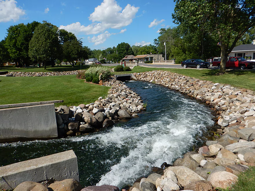
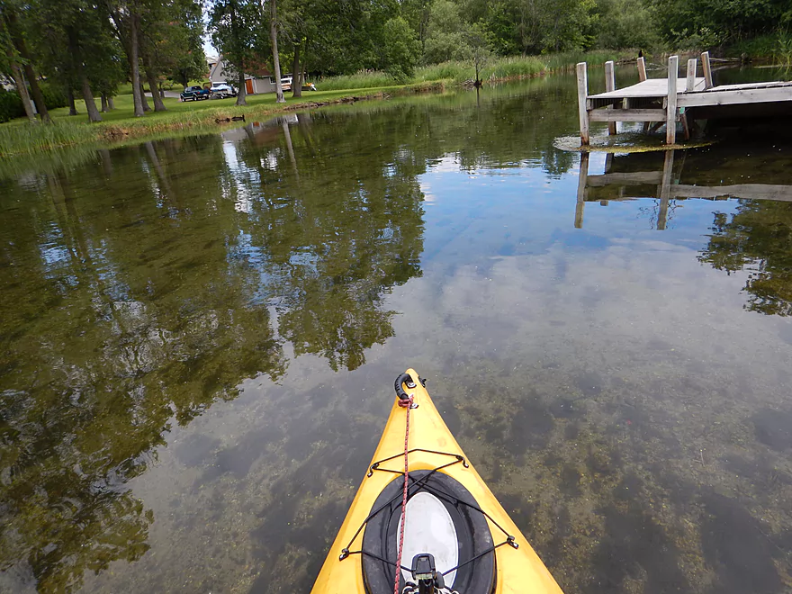
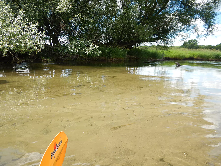
The section following the N. Lawson Street dam was quite amazing. Narrow and swift through a wooded canopy, this was a five star section and my favorite part of the trip. The rapids eventually die prior to Berlin Road onto an attractive bank of pebbles. Here you’ll enjoy really nice water clarity until Berlin Road, which is a take-out option but would cut the trip short at just 1.5 miles. Parking is ok here, with the southwest side of the bridge being best for launching (bit rocky but ok).
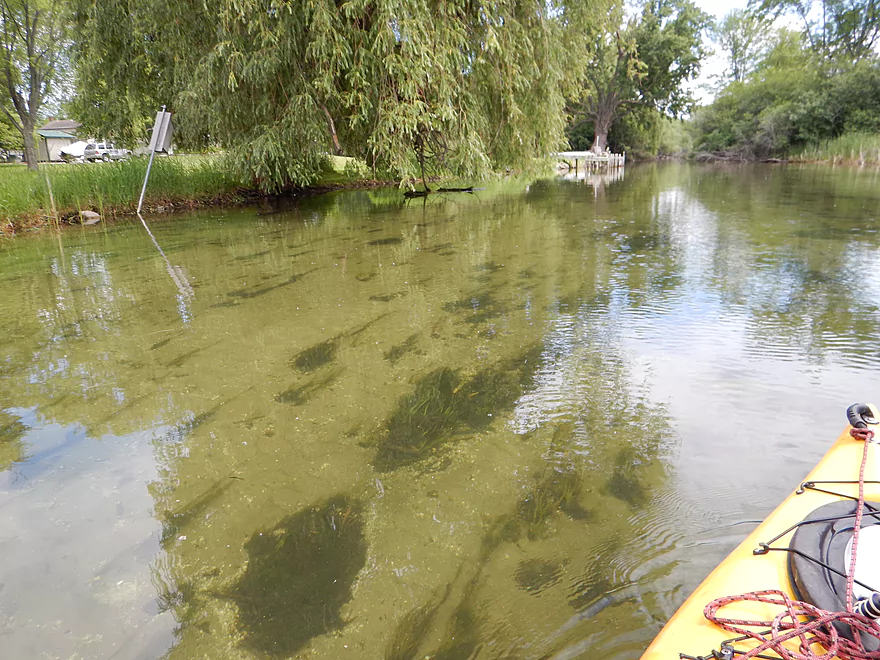
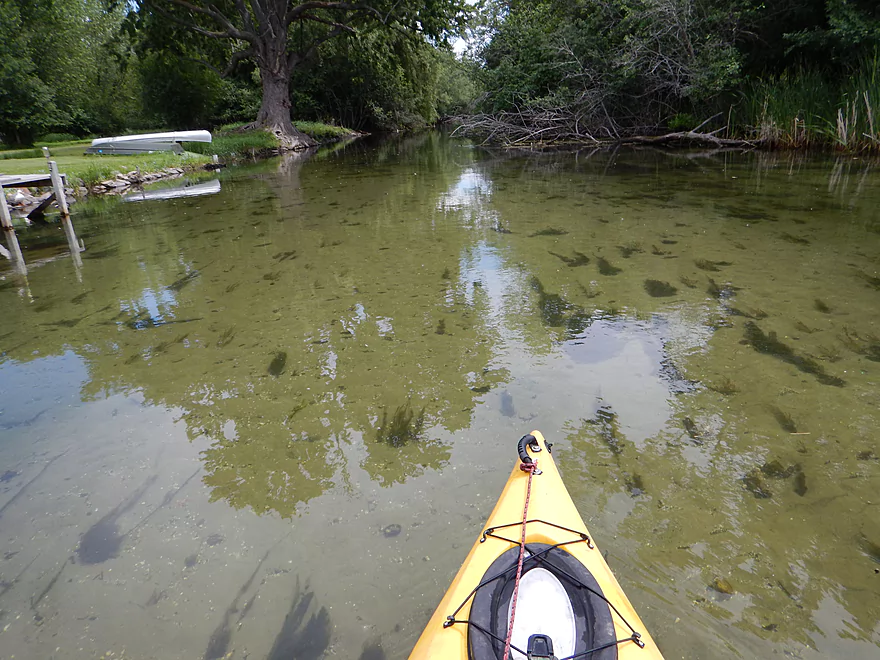
The next 2.7 miles until Hwy A is a pleasant but non-exotic wetgrass paddle. Good water clarity and nice scenes of the surrounding hills through rustling grass and blue skies…but not very varied. You lose your banks, trees, current, rapids and sense of mystery. Water clarity is still very good and would have been fantastic at lower levels. This very much reminded me of the White River (a neighbor next door that I recommend). I do recommend taking out at Hwy A, which is an acceptable access and will cut the trip to just 4.2 miles (perfect).
About a mile prior to Hwy A, I encountered a VERY low bridge running over some light rapids. I highly recommend portaging this through the grass to the north (which I didn’t do…but I haven’t led a very good example for much of this trip).
You can continue as I did from Hwy A to Hwy J but there is nothing really special about this section. It’s as if somebody just copied and pasted the same 100′ of river and reused it to excess (Slartibartfast style). Still pleasant, but a little repetitive. I got buffeted by wind and was gassed after the trip, so always make sure to check the wind direction and speed for open water paddles like this.
The final half mile prior to Hwy J is a pleasant reprieve though. The banks, woods, rocks and rapids come back for a final curtain call before you take out.
There is a public park at the intersection of Mill Street and Water Street that is a very good access area with good parking. This will allow you to run the dam if you wish or to put in below the dam and run what is left of the rapids. If swift water is not your thing, just put in east of Mill Street which is still part of the park. Park by the basketball courts for easy access to the Puchyan River (pronounced Pucky Ann). There is a bathroom located just south of the tennis courts.
Good scenic bridge access at Hwy J with adequate roadside parking. Bit of a brushy walk to get to the water, but doable. Attractive scene by the bridge with little rapids and a minor boulder garden. During low levels, the clear water here is quite striking.
I don’t know of any local livery services. Bike shuttle was hillier than expected (rises 157′ and drops 180′) but doable and only 3.6 miles. Bikers beware…the city of Green Lake requires that bikes be registered. I am not a fan of this (which many cities do) as it is very inconvenient for out-of-town visitors and seems a little Big Brotherish.
There are two dams to contend with, multiple rapids (some of which are class 2 with low hanging branches) and two low bridges to squeak under. All of which is detailed below and mapped. On the plus side…I didn’t have to portage a single log jam!
I had scouted this river earlier in the spring and was really impressed with the water clarity and rocky substrate. It did look very shallow though so decided to wait until the main gauge was somewhat higher before running. This gauge though is extremely erratic. It’s located on Silver Creek (which is pretty much the Puchyan River upstream of Green Lake). It should be somewhat correlative given how close it is to the put-in. I suspect the dam operators in Ripon do haphazard dam releases which really affect the already small Puchyan River downstream.
I ran this at 39 CFS which allowed me to run the rapids and still enjoy some water clarity. When I scouted this in spring at 19 CFS, the water clarity was sublime, but I would have had to portage some of the more fun rapids. A trade-off…depends on what you prefer. Anything higher than 40 CFS is probably too rough and murky IMO. Current was very good at 12.5′ per mile from the put-in to Berlin Road, but falls quickly after that to a slower 2.44′.
Many of the same culprits… ducks, great blue herons, cranes, clams, dragonflies, snails, turtles, small fish and a deer (teaching its fawn to eat algae).
Highlights would be the large “herds” of crayfish scooting through the clear water like squid (1:23 in the video). The other highlight being two massive snapping turtles. Of the duck families I encountered, there tended to be a small number of ducklings…one has to wonder.
Thanks to Paul Meuer of the Green Lake Association for his tips regarding this specific section. Also helpful was information provided by Derek Kavanaugh who is a local conservationist for Green Lake County. Also thanks to Timothy Bauer for the log jam cleanup he had done on this section.
- Upstream of Dead End Road: To the east, the Puchyan River is just known as Silver Creek. It runs through the city of Ripon and looks really cool and a lot of fun. But the incidence of log jams appears to be too high from my scouting.
- Dead End Road to Spaulding Hill Road: 2.8 miles. There are log jams near Dead End Road, which with some clever dragging you may be able to launch around. Shortly after, the creek clears up into a wetgrass paddle.
- Spaulding Hill Road to Sunset Park/Hwy A: 1.7 miles. Good canoe launch at put-in and a popular segment with locals, but the stretch is very open and more of a marsh/lake paddle.
- Sunset Park to Green Lake Dam: 3.0 miles. This is the very large Green Lake, and is probably not ideal for paddling, especially when windy. It does have cool sandstone cliffs on the south end which I’ve marked on the map.
- Green Lake Dam to Hwy CC/J: 8.1 miles.
- Green Lake Dam to Berlin Road: 1.5 miles. Best part of the river with rapids, good scenery, and clear water.
- Berlin Road to Hwy A: 2.7 miles. An ok section with one low bridge to duck under (or portage).
- Hwy A to Hwy CC/J: 3.9 miles. Kind of a repetitive wetgrass paddle, but scenic by the Hwy CC bridge.
- Hwy CC/J to Mouth: 8.0 miles. More repetitive wetgrass paddling.
- Fox River Take-Out Options:
- Mouth upstream to Huckleberry Road: 0.5 miles. Not 100% sure this is a public take-out. Fox is slow during low water and can be paddled upstream on.
- Mouth upstream to White River Locks: 2.4 miles. A longer upstream paddle to reach a better take-out.
- Mouth to Landing Road: 7.4 miles. A slow probably uninteresting stretch of the Fox River.
Trip Map
Overview Map
Video
Photos Size: