
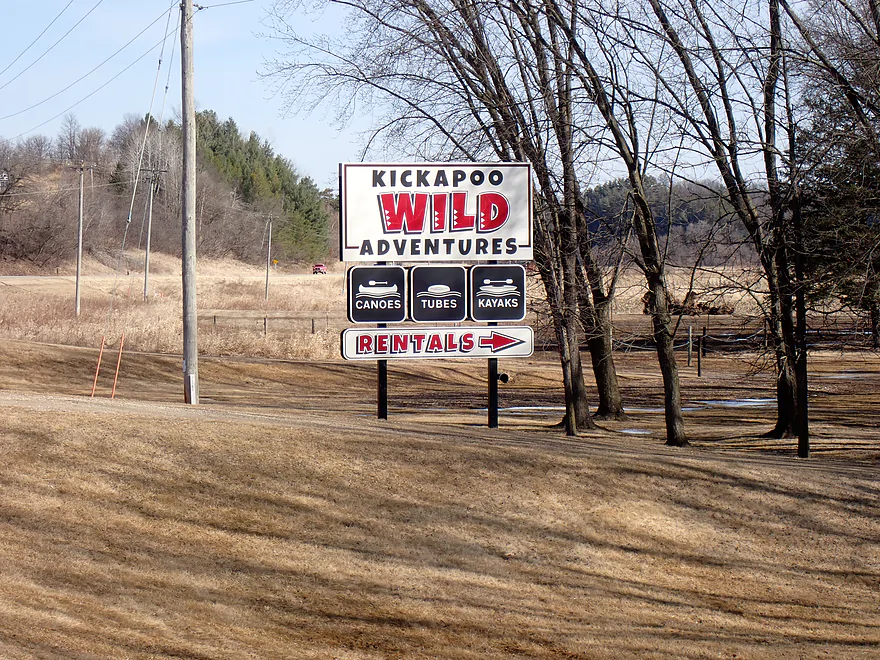
Starting the trip at Kickapoo Wild Adventures
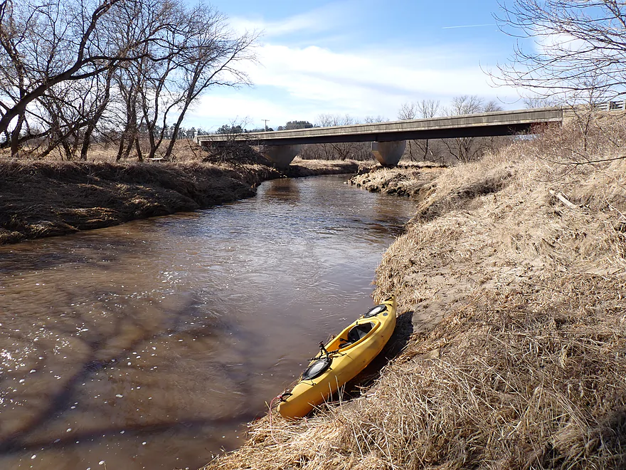
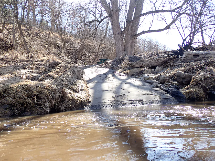
They were closed so I launched by the 131 bridge instead
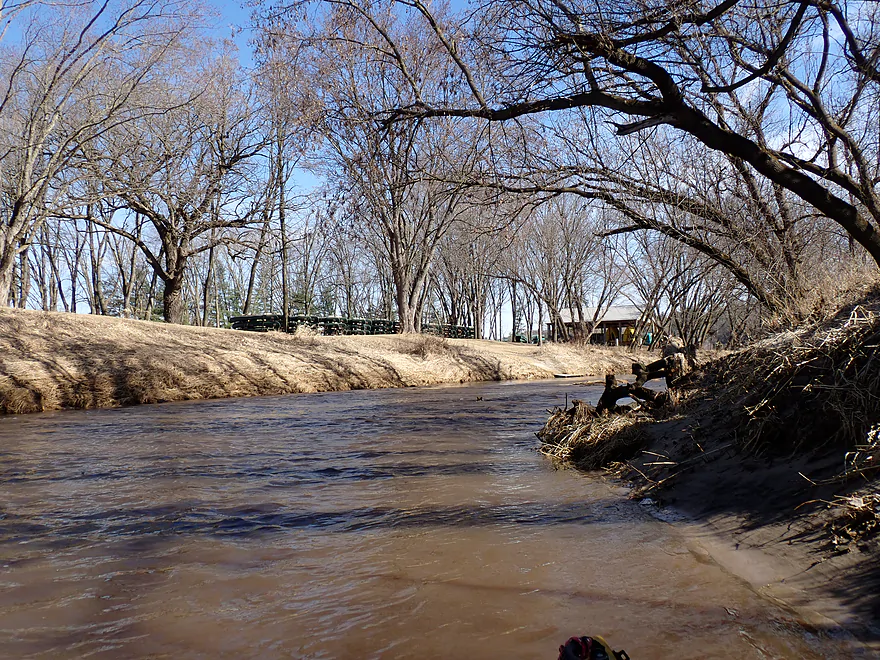
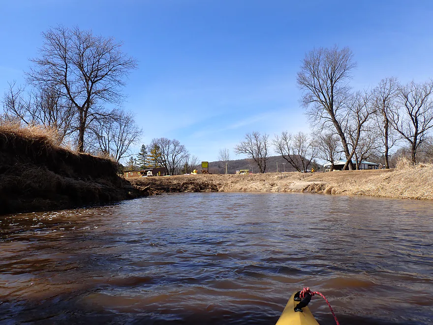
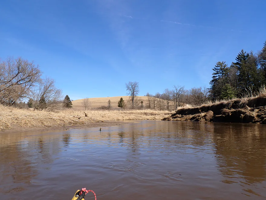
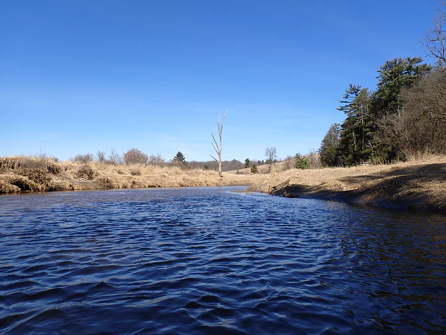
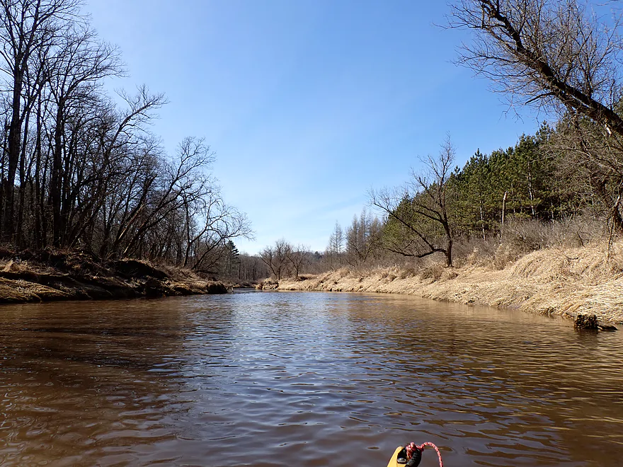
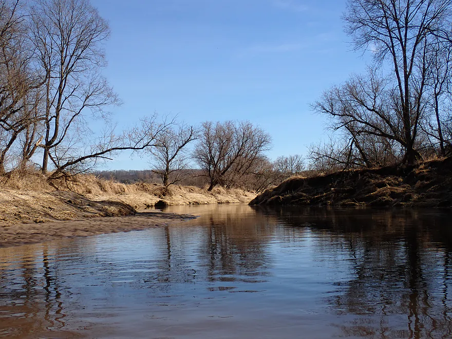
View upstream (stacks of rental canoes hiding in the distance)
Degraded banks to start the trip
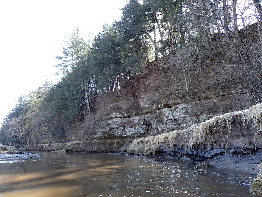
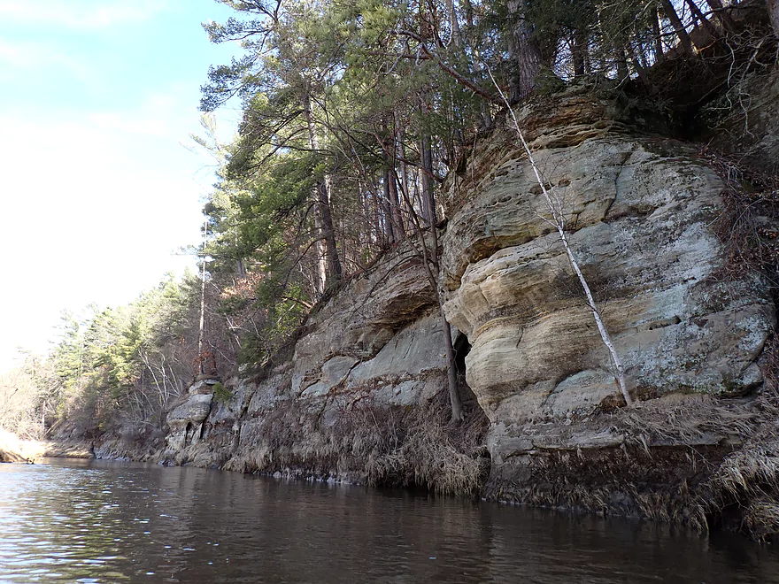
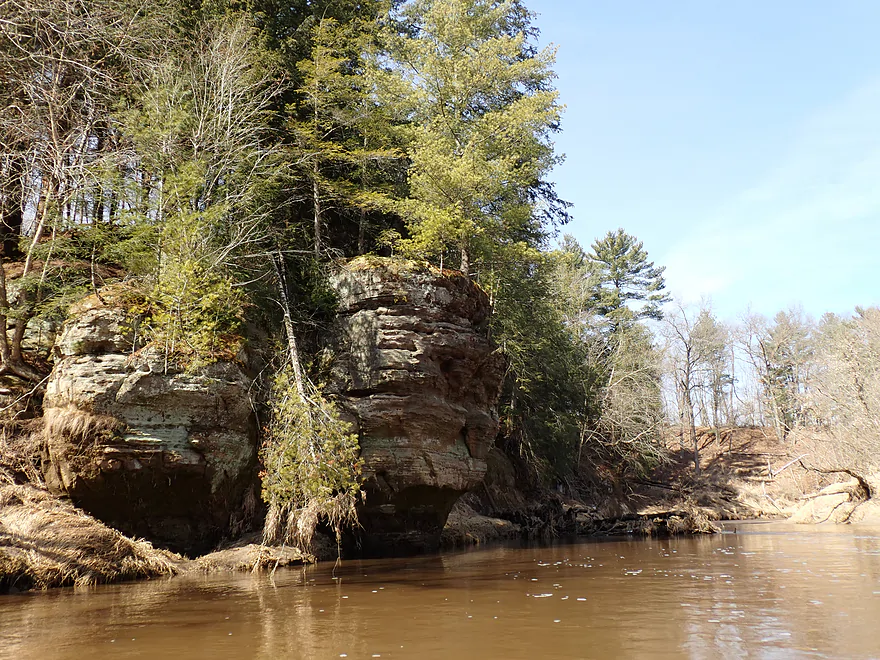
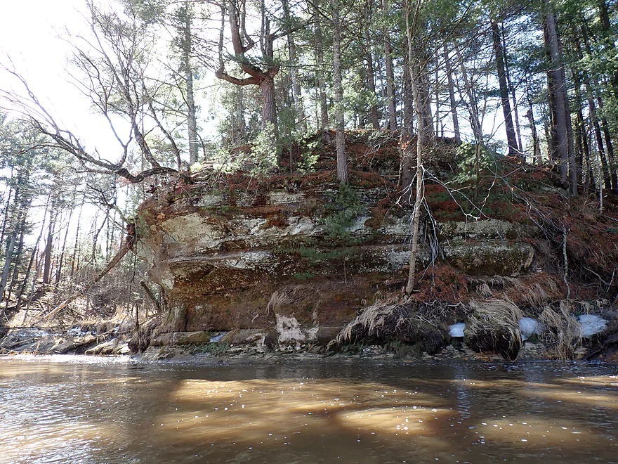
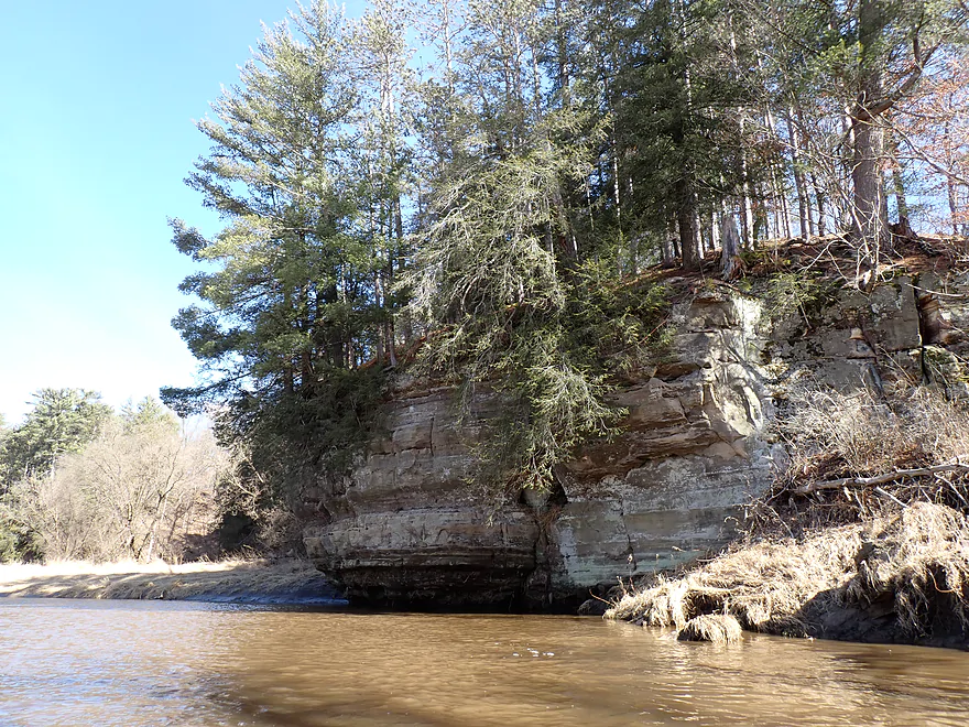
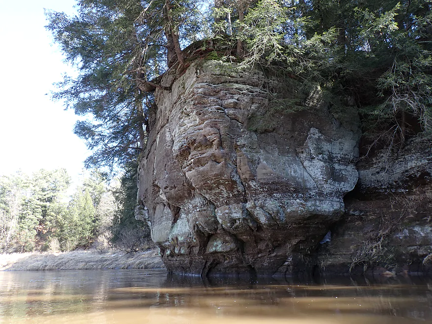
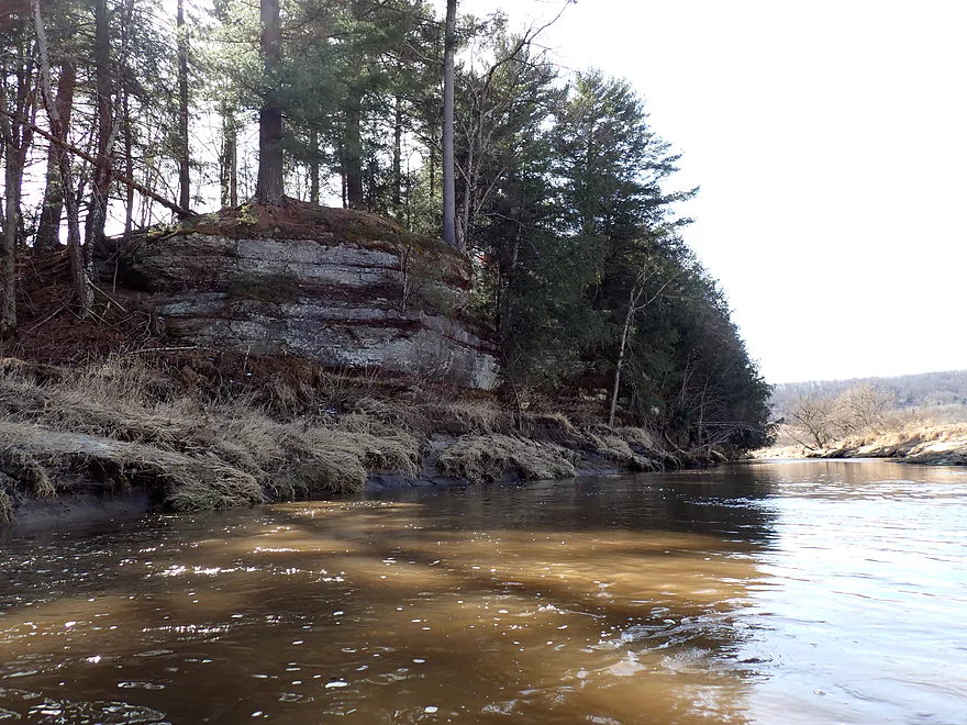
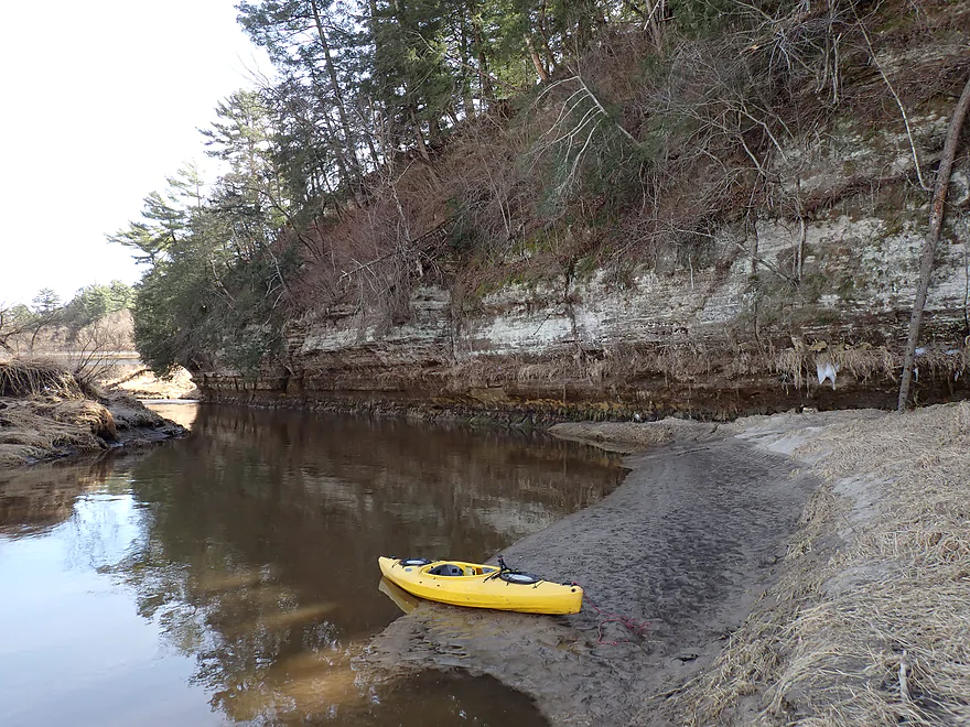
Outcrop #1
Outcrop #2
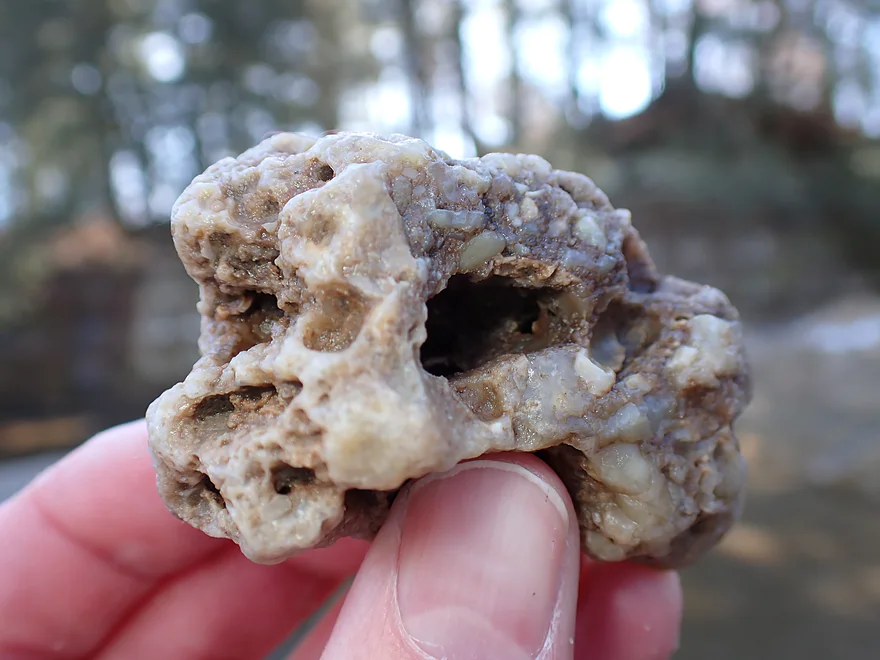
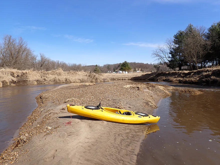
Really cool rocks on the gravel bars
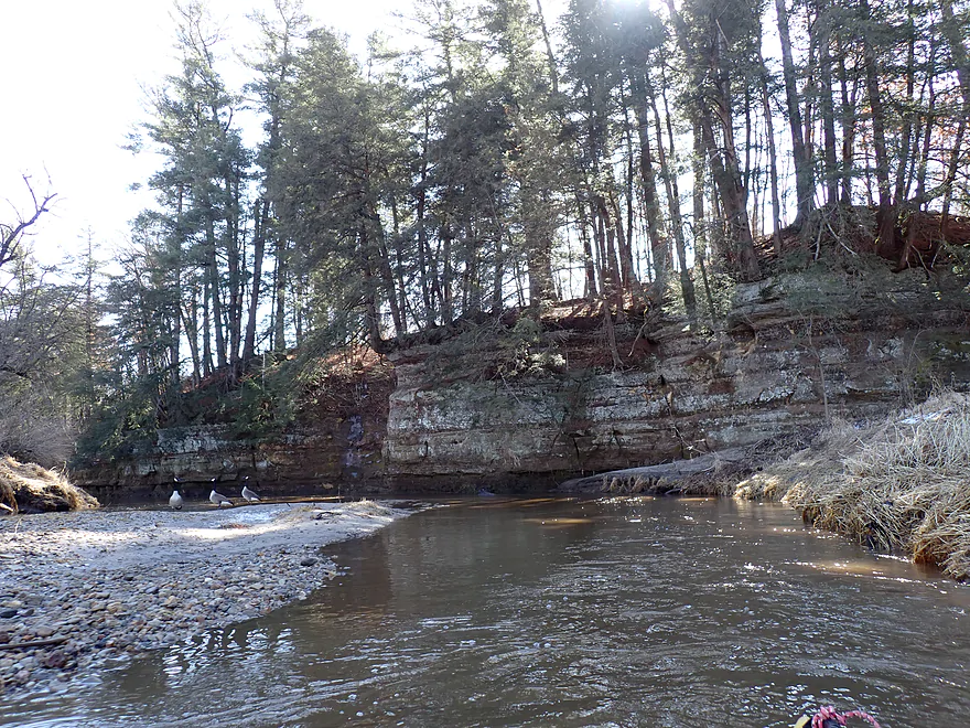
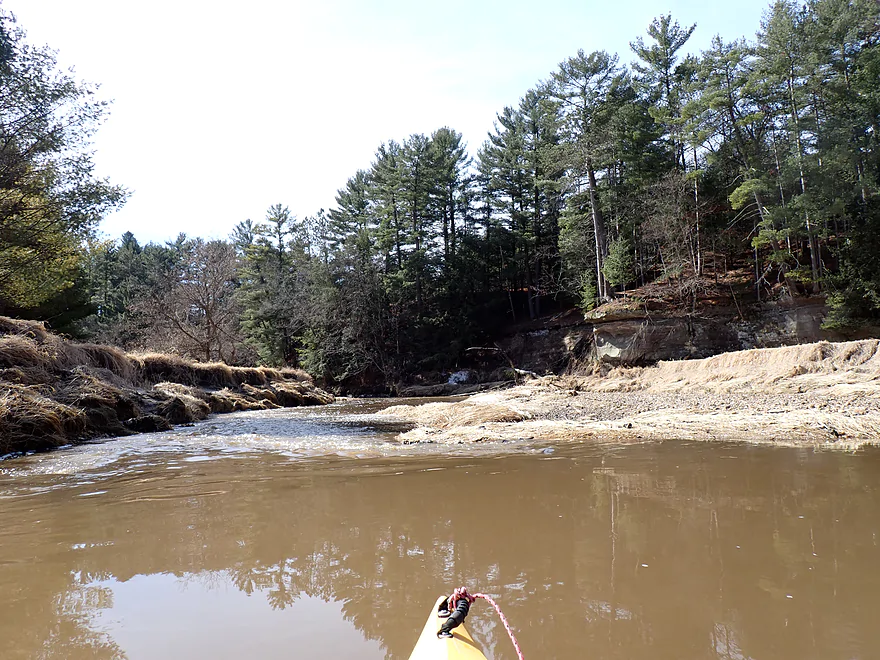
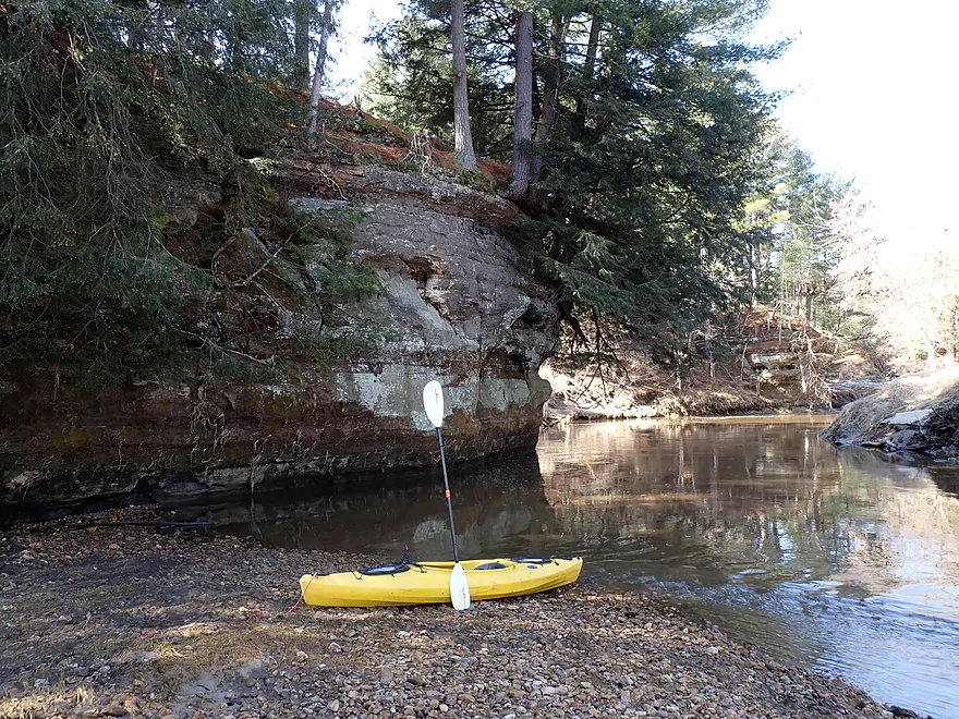
Taking a picture break
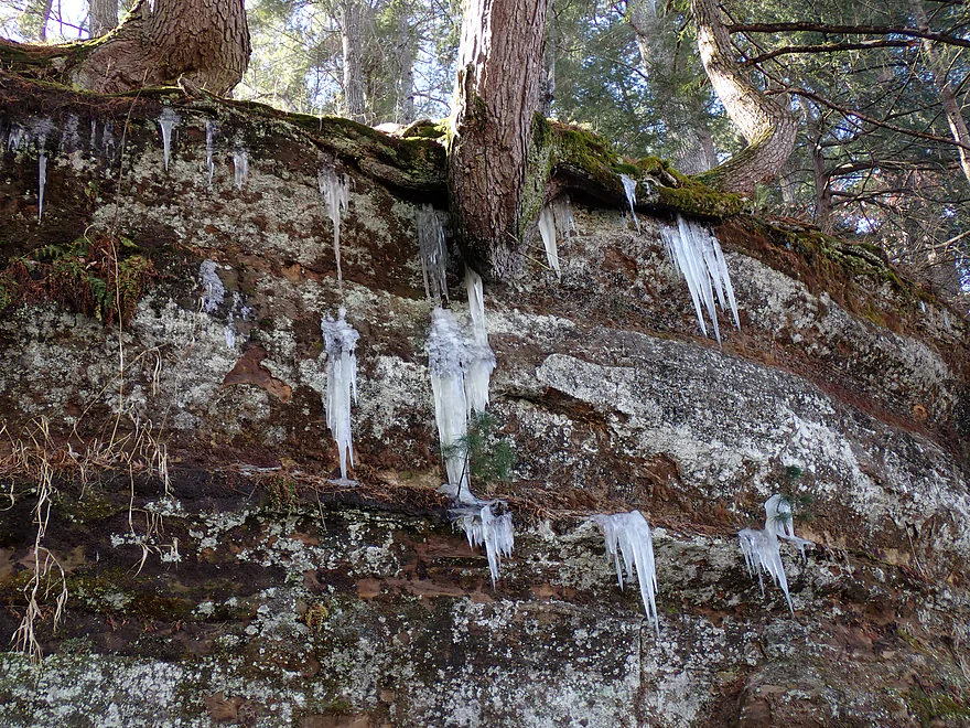
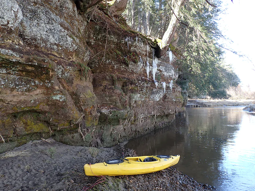
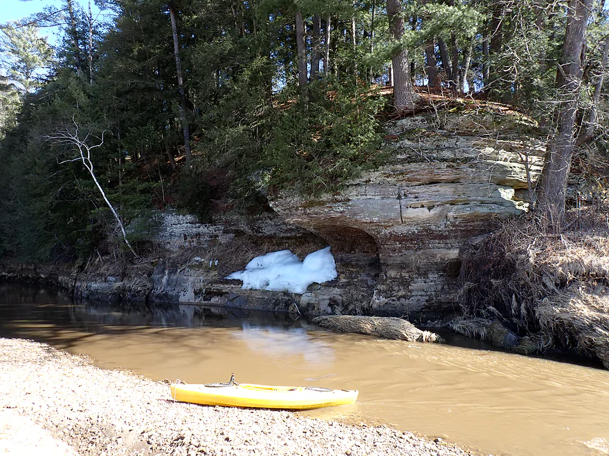
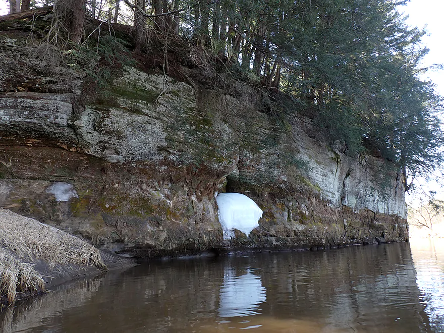
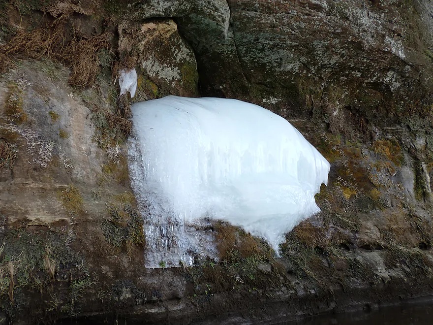
The icicles were nice…but I was expecting them to be 10x larger
Hwy 131 again
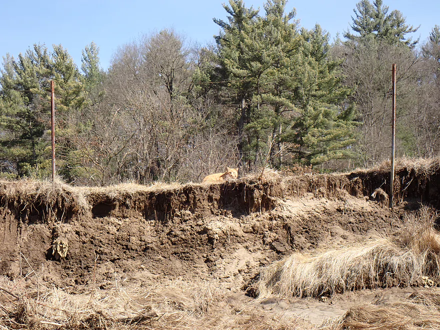
Tabby cat hiding behind ugly eroded banks
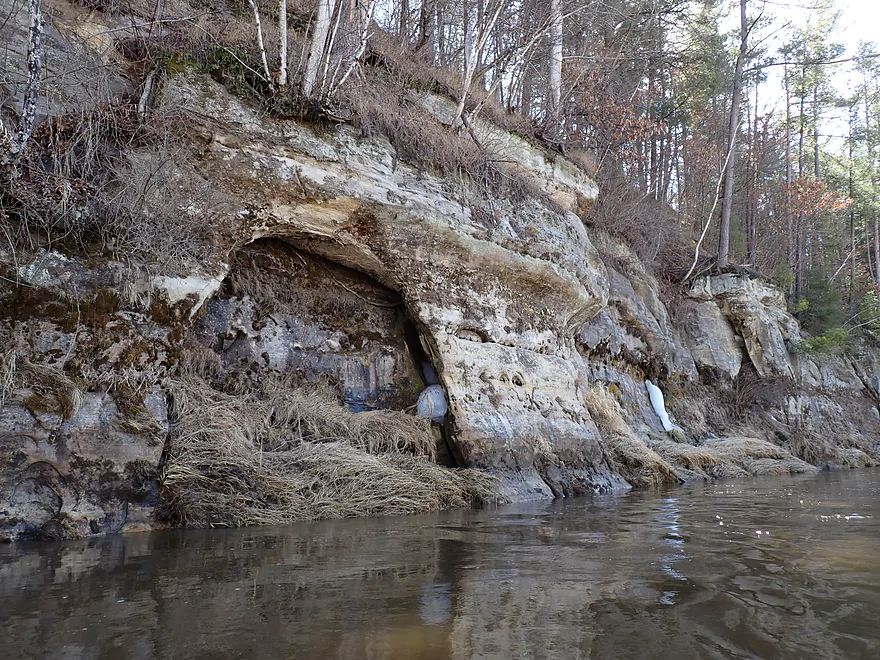
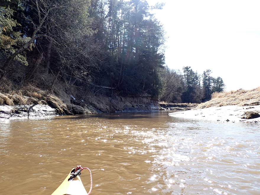
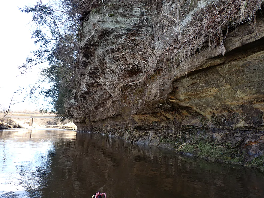
Outcrop #3
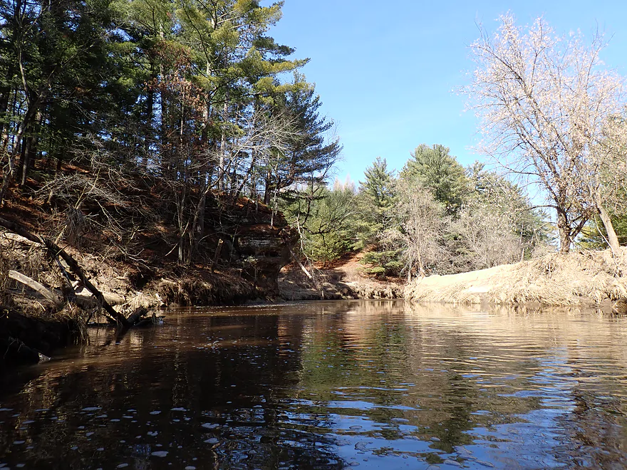
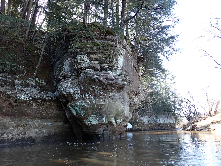
Reverse view
Entering the small town of Ontario
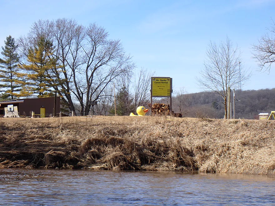
A riverside ad for Mr. Duck’s Canoe Rental
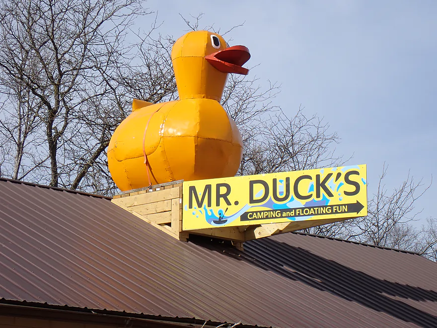
There is a second massive duck atop a nearby building
There is a public access on the east bank
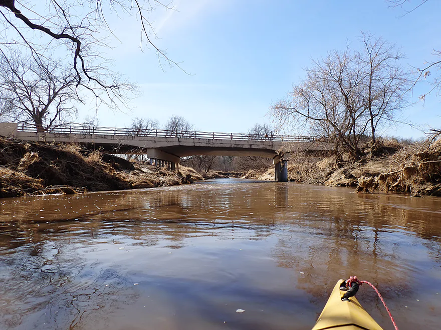
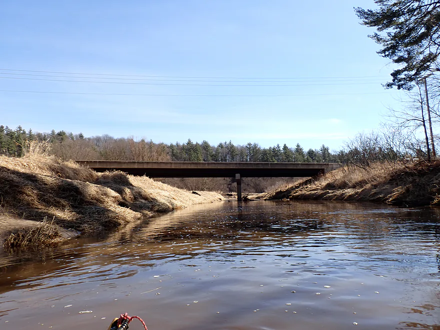
Bridge #1 (bridges are marked numerically for paddlers)
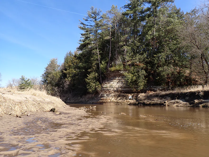
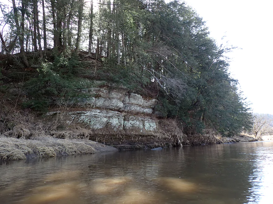
Outcrop #4
Outcrop #5
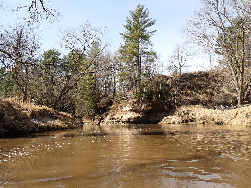
Terrific pine trees
Outcrop #6
Taking another picture break
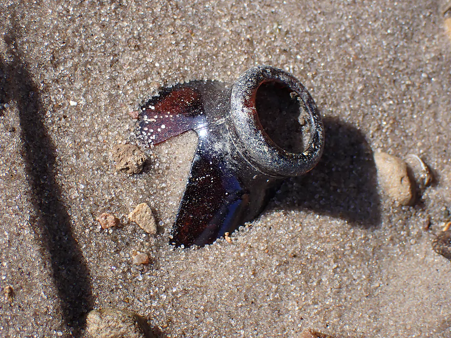
Sadly, broken glass was common on the river
Outcrop #6
More cool rocks
Would be cool to see these polished up in a rock tumbler
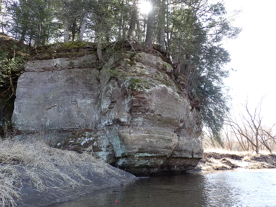
Outcrop #7
Outcrop #8
Reverse view
Outcrop #9
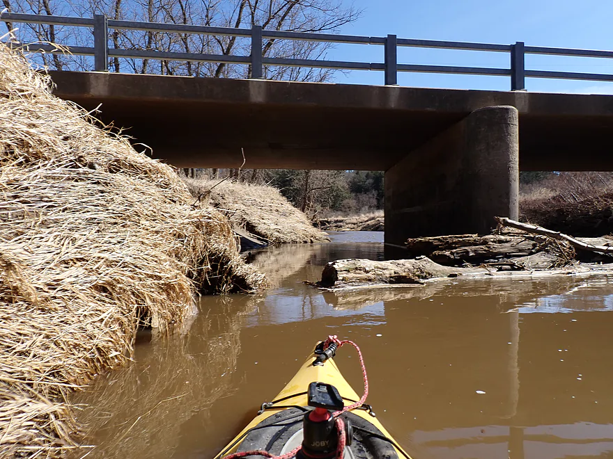
A partial logjam by Bridge #2
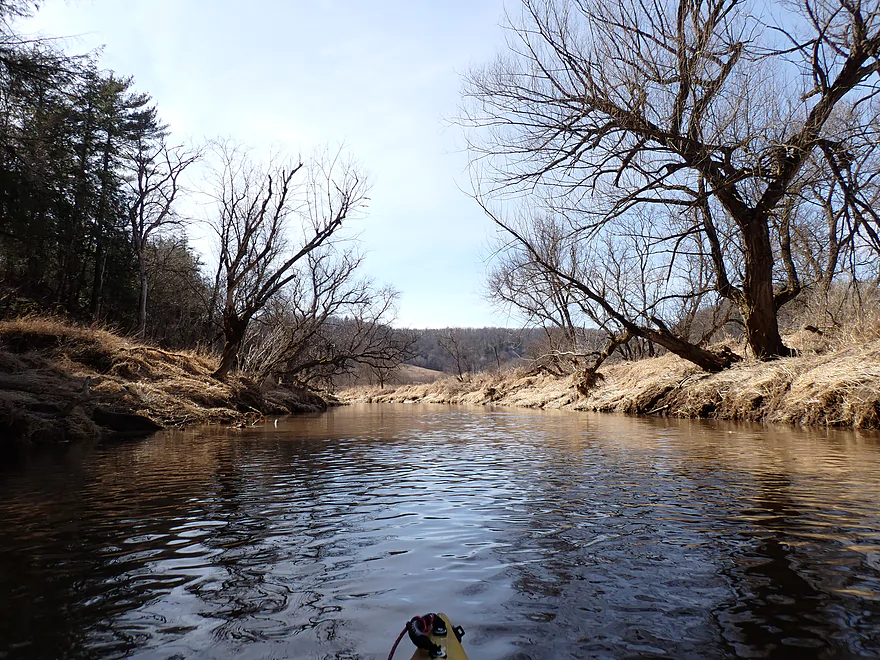
Terrific hilly vistas
Outcrop #10
Reverse view
Outcrop #11
This view looks completely different in summer
Reverse view of #11
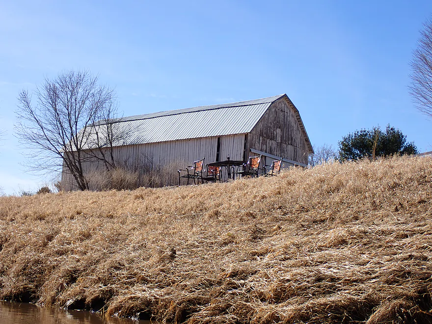
Viewing chairs?
For the rapids of course…pretty easy
Outcrop #12
Cool red crystals inside the bigger rock
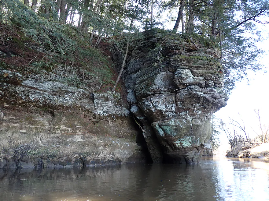
Outcrop #13
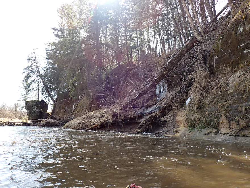
Part of a massive outcrop (the blue color is from a type of lichen)
Really cool
Outcrop #14
This one has its tongue sticking out
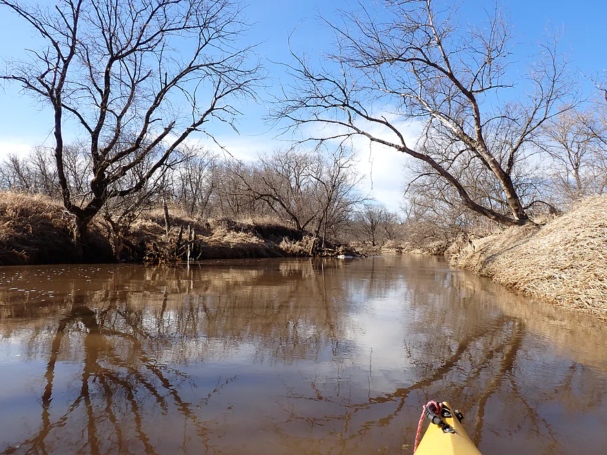
Paddling a longer stretch without outcrops
Best sandbar of the trip
Outcrop #15
Outcrop #16
Paddling another longer stretch without outcrops
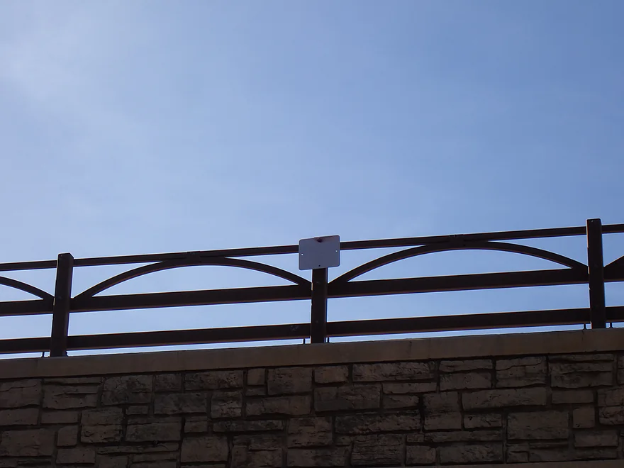
Bridge #3
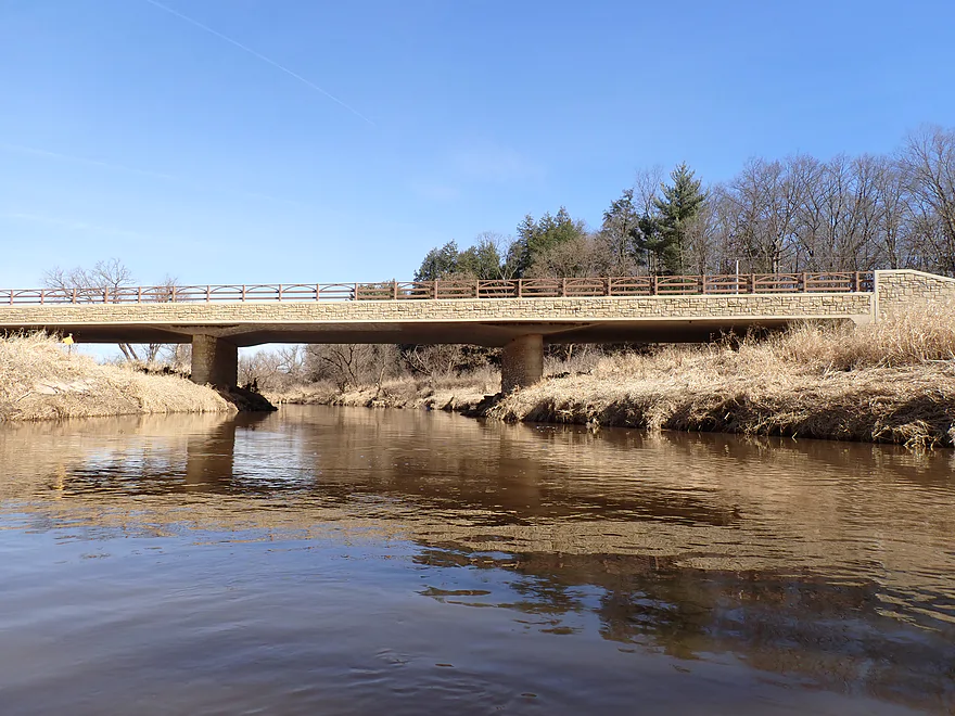
Stonework is fake, but still looks nice
Pleasant stretch
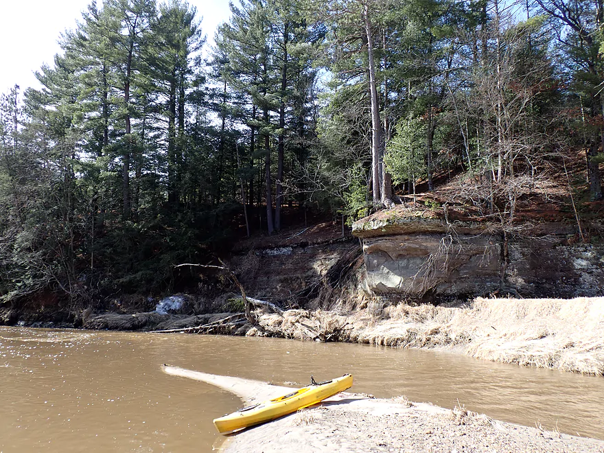
Outcrop #17…last of the trip
Cool how the river undercuts the rock face
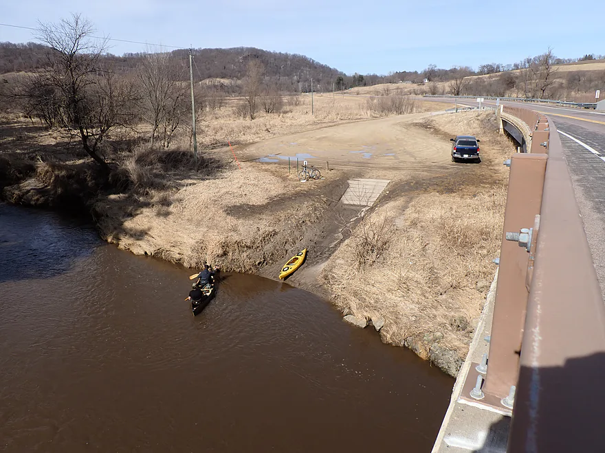
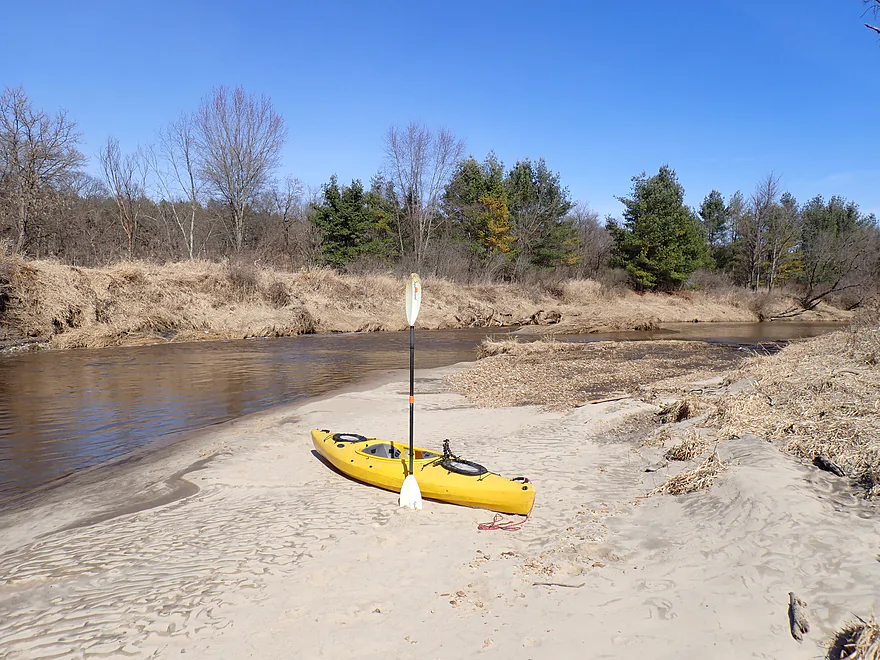
Ending the trip at Bridge 4 Landing (shocked to see another paddler)
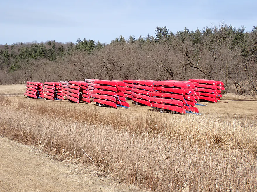
Passing huge rows of canoes on my bike shuttle
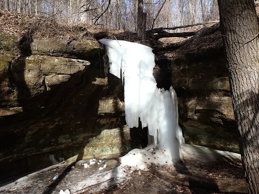
Checking out the Ice Cave Trail at Wildcat Mountain State Park after the trip
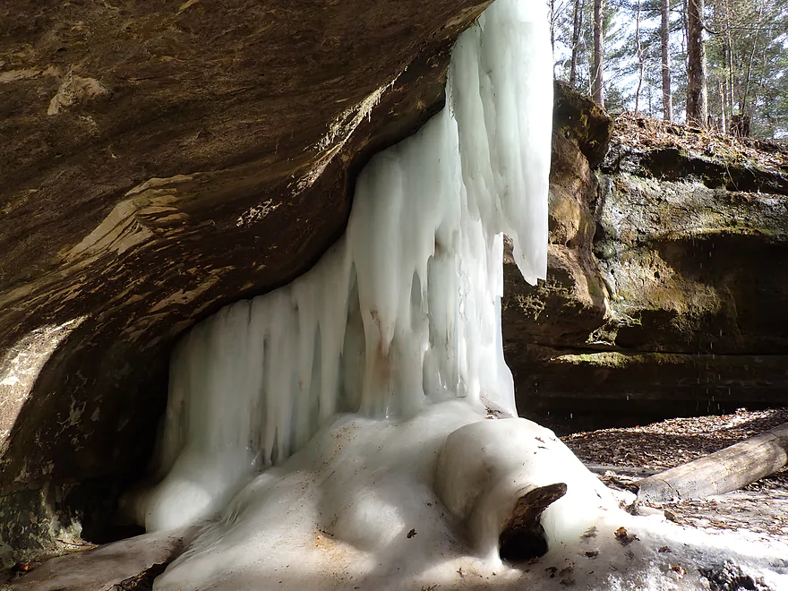
It lives up to its namesake…very cool
Kickapoo River – Ontario

Of all water trails in Wisconsin, the Upper Kickapoo is one of (if not the) most popular. It’s quite deserving of this honor because of its many terrific sandstone cliffs. Other rivers also feature waterside cliffs…but not at the Kickapoo’s frequency. The river is somewhat long, and most paddlers focus almost exclusively on its upper part between Ontario and La Farge, as this 25-mile stretch features the best outcrops. That’s too long for one trip, so most subdivide this…and the most popular subleg starts from Ontario and ends at bridges 4,5, or 7. The goal this week was to repaddle the Ontario stretch in March to avoid the summer mobs, see the spring ice flows, and to take in the cliffs without obstructing summer foliage.
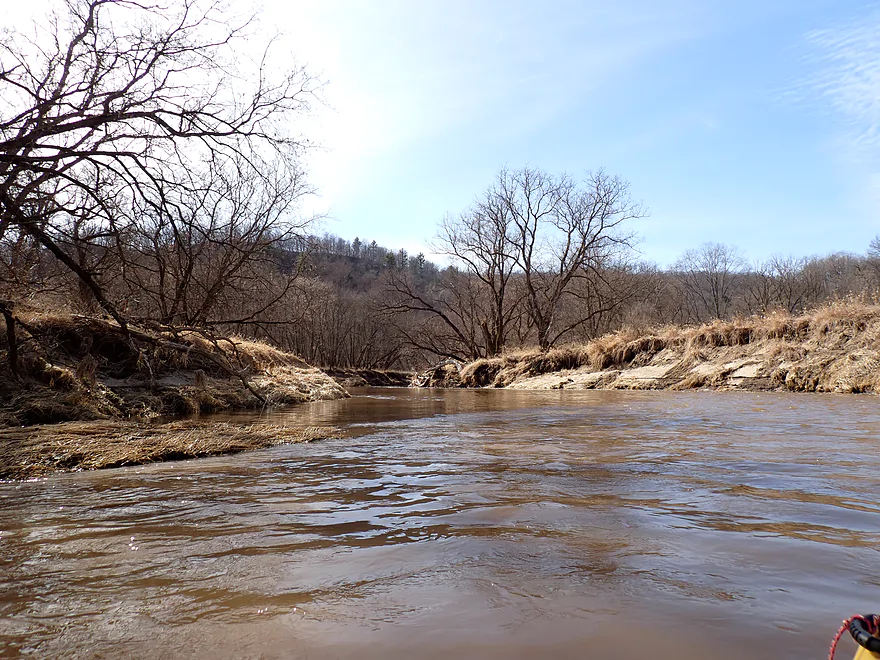
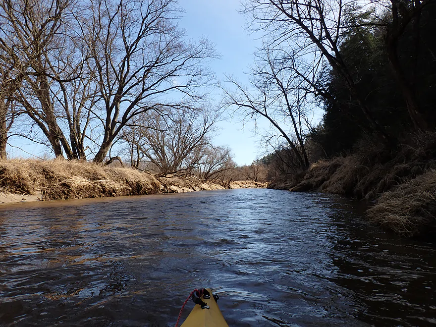
I first considered launching from Ontario, but that seemed like a short trip, so instead I launched a few miles upstream by “Kickapoo Wild Adventures”. Nobody seemed home at the livery, so I simply launched from the bridge instead. My first impression was surprise at seeing how high and muddy the river was. The banks also seemed to be more disheveled and muddy…most likely damaged by flooding from the past two years. Lastly it seemed like the upper river was larger in general (aside from the high water). It used to be that the river upstream from Ontario was a shallow creek…but IMO, because of climate change is now a small river. The good news is this means the far upper Kickapoo is now much more consistently navigable, which wasn’t the case 15+ years ago.
After Cook Creek, I encountered the first series of sandstone cliffs. These were impressive, but….were lacking ice flows, which was the main point of the trip. Timing ice flow paddles on the Kickapoo is really tricky…too early and the main channel is iced up…but too late and the spectacular icicles hanging over the cliffs vanish. Typically the first two weekends of March are best, but it always varies. I had called Wildcat Mountain State Park just prior and asked if the cliffs still had ice flows on them and was told (apparently incorrectly) they did. Drat.
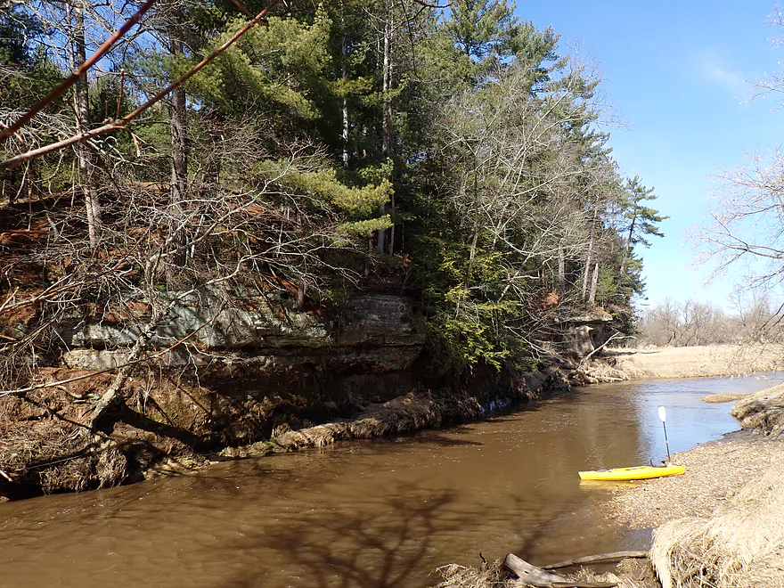
After the Hwy 131 bridge, I encountered a long stretch of cliffs topped with scenic white pines (Google calls this “Bee Hollow”). This was one of my favorite parts of the trip. But what is interesting is that most paddlers start their Kickapoo trips in Ontario, so completely miss out on nice outcrops like these located just upstream from Ontario.
Following the pine-topped cliffs I paddled into the community of Ontario. It’s famous for being the main paddling and livery hub for the Kickapoo River. I passed huge rows of dormant canoe trailers just waiting for warmer weather. During summer weekends, the liveries dump massive numbers of people into this small river…making it one of the most densely paddled stretches in the entire state. In recent years, tubing has been marketed by the liveries. That’s not a good thing…because tubers don’t go very fast and their occupants get bored easily. This results in excessive drinking and noise. Yet another reason to save Upper Kickapoo trips for off peak times.
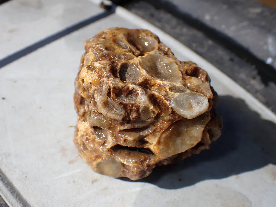
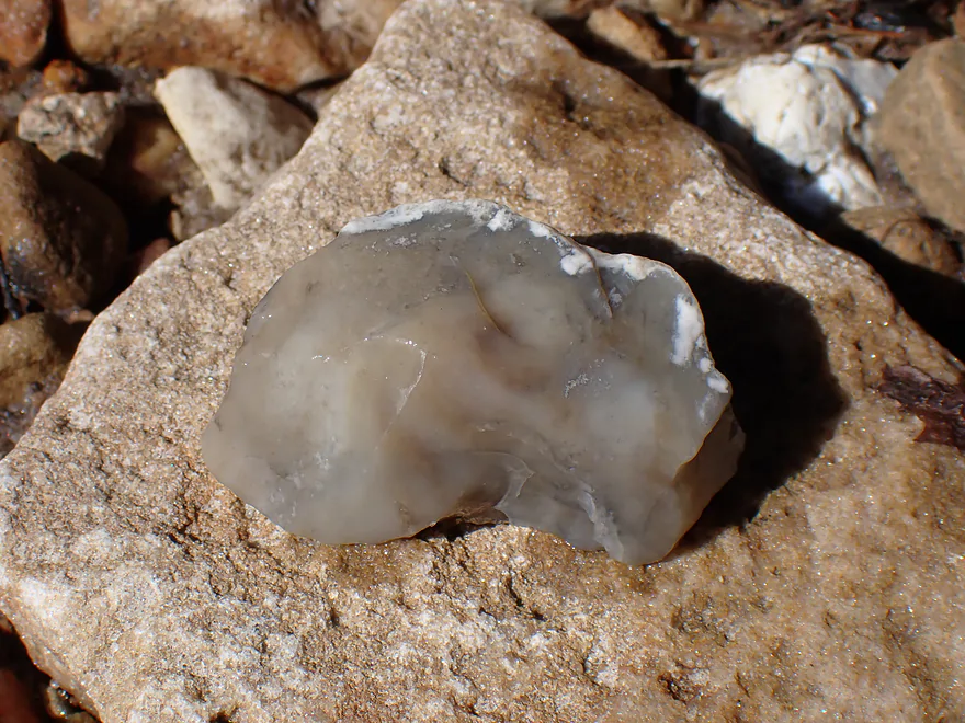
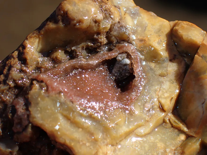
The next leg (between Bridge 1/South Street and Bridge 2/Gibson Valley Road) featured a great collection of sandstone outcrops and pine trees. Many of these just can’t be seen that well in the summer because of the overhanging leaves. I also saw quite a few sandbars and gravel bars. These were littered with interesting specimens, including marine fossils, quartz, conglomerates and other interesting pebbles I didn’t quite recognize. Unfortunately there was also a lot of broken glass (mostly beer bottles). It’s not uncommon for paddlers to take breaks on these mini sandbars, but sadly it appears some don’t pick up after themselves.
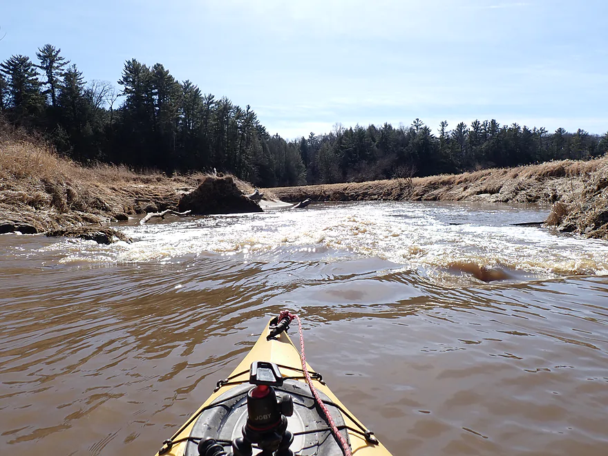
Under Gibson Valley Road I was surprised to encounter a logjam…I barely squeaked through and suspect most canoes wouldn’t fit. Typically the local liveries do a great job of keeping the river open and I’m assuming this will be gone in the next few months. The scenery stayed good after bridge 2, with a few more (not as many) outcrops, more terrific pines, and some great Driftless Area hills.
This is a fast stretch of river, but there aren’t too many rapids. The only noteworthy section is a ledge by “Lamb Valley”. IMO it is an easy Class 1, but paddlers do get splashed here. Local “spectator seats” were located on the west bank where I think the local farmer likes to watch newbies get wet.
The area upstream/downstream from bridge 3 unfortunately has a bit of an outcrop dry spell. But closer to Bridge 4 they return with some really nice ones.
I ended the trip at bridge 4 where I was shocked to see another paddler also taking out at the exact same time (and also crazy enough to be paddling in early March). Typically Bridge 4 is a great landing but that day it was insanely muddy. I presume in the next few months locals will clear this out with a skid steer (like they do with the other landings).
All in all this was a nice trip. I counted up the outcrops I saw, and it added up to 17…for 5 miles that is a lot! I was, however, slightly disappointed that I poorly timed such a nice part of the river. Water levels were too high, there were almost no ice flows, and lighting for pictures was not as good as expected. Live and learn. As a consolation prize, I did stop by the famous Wildcat Mountain Ice Cave and that was still flowing and really “cool” (see photos below). If you want to see what a proper Kickapoo Ice paddle looks like, check out my 2021 review or my 2023 review.
Sights included a redtail, a few clam shells, countless geese, one tabby cat, many flopping fish, a beaver slide, and two massive 4-foot high yellow ducks. The highlight were the marine fossils which could be found on the numerous gravel bars and have probably washed into the river from hilltop limestone deposits.
Elroy-Sparta State Trail: This bike trail is famous for its three tunnels, two of which are located north of Ontario. In fact the largest tunnel is just a mile west of Wilton and would be a fun side adventure to do after a paddling trip. The Elroy-Sparta Trail requires a state trail pass, which you can purchase from the DNR or any state park. The exact location of all three tunnels is shown on Google maps.
Ice Cave Trail: This is part of Wildcat Mountain State Park. In February and March a large amount of ice “overflows” a sandstone alcove creating an impressive frozen waterfall (see main photo album).
Valley of Ice: Closer to La Farge there are a series of sandstone outcrops you can hike to which can produce attractive ice flows in early spring.
Kickapoo Springs: This is one of the primary sources for the Upper Kickapoo. I have not checked it out, but it seems intriguing. There is a DNR access area where you can hike to the springs.
Hwy 131: Hwy 131 crosses the Kickapoo many times, which is confusing for referencing access points…but the bridge I launched from was by “Kickapoo Wild Adventures”. They were closed and I couldn’t use their shuttle service, so I instead bike shuttled and launched off the DOT right-of-way next to the bridge. The bank here was a bit steep and weedy, so not ideal…but doable.
Alt Put-ins:
- Hwy 131 by the High School (3.7 miles upstream from put-in): This is a bit weedy for a bridge access, but plenty doable. This bonus stretch will include many nice outcrops.
- Hwy 131 South of Oil City (1.4 miles upstream of put-in): There is a nearby goat farm and fence to deal with. This seems a bit weedy and tricky, but I think you could make it work as a bridge access if you really wanted to. This stretch would include more nice cliffs.
- Ontario Public Landing (1.5 miles downstream from put-in): This is a good public access located in the community of Ontario. Note: the private landings are on the west bank and the public landing is on the east bank. The public landing is not well marked. From the parking area, you have to drive a bit north on a small access road, where at the end you’ll find a hidden landing. This is a good access option…I presume this might be preferred by those wanting to take out further downstream.
Bridge 4 Landing: This is a large access area with a scenic vista of the nearby cliffs…it’s very nice. Unfortunately, this being March, it was crazy muddy with the main ramp being buried by about a half-foot of soft mud. I presume that’s just a price for paddling in March and come summer it will be cleaned out.
Alt Take-outs:
- Wildcat Landing (3.1 miles downstream from Bridge #4): My favorite stretch of the Kickapoo, featuring many outcrops (~16). A state park sticker is required for this landing.
- Bridge #5 (4.0 miles downstream from Bridge #4): The above plus a mile stretch of 3 more super outcrops. Bridge #5 is a popular access.
- Bridge #7 (6.1 miles downstream from Bridge #4). The above stretch plus seven more outcrops and a cave. Bridge #7 is a popular access spot.
Bike Shuttle – Bridge #4 to Kickapoo Wild Adventures: 3.0 miles with 89′ of ascent. Outside of one hill, this was a relatively short and easy bike shuttle. As a general rule the Kickapoo is great for solo paddlers, because its squiggly channel translates into very short shuttle distances.
Rentals/Shuttles: There are a number of local rental and shuttle liveries with most based in Ontario. Call in advance to ensure availability:
- Kickapoo Wild Adventures: (608) 337-4522 – 30352 State Hwy 131, Norwalk, WI 54648
- Drifty’s Canoe Rental: (608) 337-4288 – Highway 33 & 131, North Ontario, WI 54651
- Fred Flasher’s Canoe Camping Trips: (608) 435-6802 – PO Box 114, Wilton, WI 54670
- Mr. Ducks Canoe Rental: (608) 337-4711 – 100 Main Street, Ontario, Wisconsin 54651
- Titanic Canoe Rental: (877) 438-7865 – 300 State Highway 131, Ontario, WI 54651
Current: The current was fast, with two noteworthy rapids. Both are easy Class 1’s, although the second, by the barn (and coincidentally viewing chairs), has been known to splash paddlers.
Fences: None.
Logjams: 99.9% of the trip was wide open and easy to navigate. The only exception was a logjam just upstream of Bridge #2 (Gibson Valley Road). Currently narrow boats can squeak through, but wide boats would have to portage by the bridge. I presume this will be cleared out soon by the local liveries (likely gone by April of 2025).
Strainers: When the river is high (as it was during this trip), the fast current combined with a few partially downed limbs can create strainers. These are typically easy to avoid, but paddlers should stay careful…especially during high water.
Quicksand: It’s not uncommon for paddlers to take breaks on the small sandbars and even do a little bit of swimming. However, you should be careful where you wade as quicksand (more so quickmud) is not uncommon in the area.
Cold Water Advisory: This trip was done in early March when the water temperature was still very cold. For your average paddler, this is not recommended. For those determined to do a cold water paddle, there are simple safety steps you can take to dramatically improve your safety.
- Wear a life jacket.
- Wear protective clothing that will keep you warm even if immersed.
- In March avoid big rivers and lakes…those warm up last and can still have ice blockages. Generally speaking the smaller, faster, shallower, and further south rivers warm up first. Most lakes and big rivers won’t be properly open up until mid-April…so March is a great time for small rivers (like the Upper Kickapoo).
- Stick to calm waters…avoid winter paddles with waves, tricky current, rapids, or where you need to be far from shore.
- Always be vigilant for ice jams…typically the slowest and widest parts of a river will be the most likely to be iced up.
- Many paddlers follow the 120 rule…basically the water and air temperature should add up to 120. I think for experienced paddlers on safe waters this is a bit excessive (especially if you have protective gear), but for beginner paddlers it is a good base guideline. There is a temperature gauge downstream on the Kickapoo at Readstown and it was about 41 degrees for this trip. So I was 14 under this rule, but compensated by taking other precautions.
Closest Gauge: Kickapoo River @ Ontario
Trip Depth: 11.15′.
Navigability Estimates: River levels, despite being low the prior day, spiked unexpectedly for my trip due to melting runoff. This resulted in the river being WAY higher, faster, and dirtier than normal…but it was still runnable.
- 8.7-9.0′: Average late summer depth. Relatively low but a good target for paddling.
- 9.1′-9.5′: High depth…still viable though, but the river won’t be as appealing.
- 9.6-10.5′: Very high depth. Still viable…be careful about strainers though. Water quality will be poor and swimming won’t be advised.
- 10.6-11.5′: Not quite flood stage, but getting close. Doable for paddlers, but they should stay vigilant.
- 11.6’+: This is starting to get close to flood stage and likely isn’t a good time to do a paddle.
Quick Overview
- Wilton to Ontario: 12 miles. This stretch is seldom paddled, but is cleaner and faster than downstream legs. Those willing to endure weedy bridge accesses and occasional snags will be rewarded with spectacular outcrops. A very underrated part of the river.
- Ontario to Rockton: 13.5 miles. This is the most popular section for kayaking on the river (if not the entire state). Highlights include many spectacular sandstone outcrops. This stretch can easily be subdivided. Shuttle services are plentiful, but this leg can get crowded and noisy during summer weekends.
- Rockton to La Farge: 11 miles. This is the second most popular stretch of the river. While the outcrops here aren’t as numerous as the Ontario leg, they do tend to be larger and more impressive.
- La Farge to Mouth: ~90 miles. After La Farge there are few rock outcrops and the river becomes much less interesting. The Lower Kickapoo is a generic hardwood floodplain that is at best a mediocre paddle.
- Tributaries:
- Kickapoo River – West Fork: While lacking the outcrops of the main branch and a bit shallow in spots, this is a very underrated river with many fun rapids.
- Billings Creek: I actually like this creek better than the main river itself. There are just as many outcrops, and the water and banks are much cleaner.
- Tainter Creek: While not very big and lacking in outcrops, it’s still a cool creek with very swift current.
Detailed Overview
- Upstream from Lincoln Ave: The river is likely too small and degraded by open pasture to have much appeal for kayaking. Although "Kickapoo Springs" (the primary source of the river and a public DNR area) might be interesting.
- Lincoln Ave to Keystone Road: 2.5 miles. The river is small here (likely too small for most paddlers) and more scruffy with fewer outcrops. Figure 1-2 logjams and 3 outcrops. Several of the Elroy-Sparta Trail bridges over the river are quite scenic/rustic. High water will be required to do this stretch.
- Lincoln Ave to Hwy 131 (East of Midge Road): 6.3 miles.
- Lincoln Ave to Hwy 71: 1.6 miles. This section includes five outcrops, including one really nice one. The river is shallow here with many Class 1 rapids. There is one strainer that has to be portaged, but no other logjams. I encountered a bull on this stretch (here) which might be a deal breaker for most paddlers. You could possibly portage around the farm in question along the Elroy-Sparta Trail but it would be a long and difficult portage.
- Hwy 71 to Wilton Campground/Library: 0.7 miles. A nice stretch with ~3 mediocre outcrops and one really nice one. Water clarity is stunning here. There is a low tree that requires some tight ducking to get under.
- Wilton Campground/Library to Hwy 131 (by Posey Creek): 1.4 miles. Less attractive stretch but still ~4 mediocre outcrops. There is a serious logjam by Water Street that must be portaged.
- Hwy 131 (by Posey Creek) to Hwy 131 (by Mica Rd): 1.3 miles. A terrific stretch with scenic pine trees, several mediocre outcrops and one fantastic sandstone outcrop.
- Hwy 131 (by Mica Rd) to Hwy 131 (East of Midge Rd): 0.7 miles. More of a scruffy stretch, but still a few mediocre outcrops. The Black Valley hills in the distance are very scenic from this leg.
- Hwy 131 (East of Midge Road) to Hwy 131 (near Nicollet Ave): 4.1 miles.
- Hwy 131 (east of Midge) to Hwy 131 (by Michigan Ave): 0.5 miles. A good leg with one nice set of outcrops.
- Hwy 131 (by Michigan Ave) to Hwy 131: 0.6 miles. Another good leg with 3 outcrops. Some minor rapids, including a 4-6" ledge.
- Hwy 131 to Hwy 131 (by Nisswa Rd): 0.6 miles. One of the best legs on the Upper Kickapoo which features 6 noteworthy outcrops and terrific ice flows in February and early March.
- Hwy 131 (by Nisswa Rd) to Hwy 131 (by Nordale Ave): 1.1 miles. Not as scenic as other legs with messy shorelines and eroded banks. There are still a few nice outcrops.
- Hwy 131 (by Nordale Ave) to Hwy 131 (by Nicollet Ave): 1.3 miles. Another one of the Upper Kickapoo's best legs with ~6 outcrops, including a small natural bridge you can paddle through.
- Hwy 131 (near Nicollet Ave) to Ontario: 5 miles.
- Hwy 131 (by Nicollet Ave) to Hwy 131 (Oil City): 2.3 miles. Two long stretches of bluffs contain great outcrops.
- Hwy 131 (Oil City) to Hwy 131 (Kickapoo Wild Adventures): 1.4 miles. Terrific stretch with two major outcrops. One set of Class 2 rapids.
- Hwy 131 (Kickapoo Wild Adventures) to Ontario (Brey Valley Road Park): 1.5 miles. Three sets of outcrops.
- Ontario to Hwy 131/Bridge #4: 3.6 miles. A more open and flatter stretch of the Kickapoo. There are still 3-4 outcrops. This is THE most popular leg on the entire river.
- Bridge #4 to Bridge #7: 6.0 miles.
- Bridge #4 to Wildcat Landing: 3.1 miles. A super popular stretch and the most scenic on the Kickapoo. The river flows past steep hillsides and many outcrops (at least 16).
- Wildcat Landing to Bridge #5: 0.9 miles. The river opens up a bit, but still has three super sandstone outcrops.
- Bridge #5 to Bridge #7: 2.1 miles. A good stretch with seven major outcrops and one cave.
- Bridge #7 to Bridge #14: 7.7 miles.
- Bridge #7 to Bridge #8: 1.2 miles. From bridge #7 onward, the Kickapoo becomes much less interesting. There are still some good spots though. This stretch has maybe 3 outcrops.
- Bridge #8 to Bridge #10: 2.5 miles. A good stretch with 5-6 outcrops.
- Bridge #10 to Rockton/Landing #12: 1.4 miles. This stretch is more open, and less interesting. But there are still 3-4 mediocre outcrops.
- Rockton to P/Bridge 14 Canoe Landing: 2.4 miles. A scenic stretch with 5 noteworthy outcrops–three of which are huge.
- Bridge #14 to Bridge #18: 5.1 miles. A great stretch with a covered bridge and 5+ outcrops...several of which are huge (the largest on the river).
- Bridge #18 to La Farge: 4.1 miles. This is a more open stretch with just 2-3 outcrops. It's more open and less interesting, but not bad and includes a historic stretch past the uncompleted La Farge dam.
- La Farge to Hwy 131 (by Ski Hill Road): 6.8 miles. Nice section but with a few jams.
- Hwy 131/Ski Hill Road to Viola (Banker Park): 7.0 miles. Maybe 2 bluffs, but mostly open I think. Have been told there are 26 portages between La Farge and Viola, so beware.
- Viola to Hwy 131 - Bridge 1: 5.8 miles. Maybe one outcrop and 14 major logjams.
- Hwy 131 - Bridge 1 to Hwy 131 - Bridge 2: 4.3 miles. Maybe one outcrop and 13 major logjams.
- Hwy 131 Bridge 2 to Readstown Tourist Park: 3.0 miles. Maybe one outcrop and three major logjams. The river grows significantly with the addition of the West Fork.
- Readstown Tourist Park to Soldiers Grove: 6.9 miles.
- Readstown to Hwy 61: 3.1 miles. A surprisingly nice stretch with impressive hills and good current. On the downside there is a lot of tree debris although it is always avoidable. Hwy 61 is not a good access.
- Hwy 61 to Soldiers Grove: 3.8 miles. Not as good as the previous leg with fewer hills, muddier banks, and slower current, but still not bad. The highlights include a few impressive bluffs and two minor rapids in Soldiers Grove.
- Soldiers Grove to Hwy B: 9.0 miles. I doubt there are logjams, but I think this stretch would not be very interesting. The river flows through one of the wider flood bottoms on the river.
- Hwy B to Hwy S: 8.6 miles.
- Hwy B to Gays Mills: 4 miles. Fast stretch with some strainers. Bank quality is poor, but the bluffs are attractive. A dam in Gays Mills slows the last mile of this leg.
- Gays Mills to Hwy S: 4.6 miles. A pleasant but not elite leg with some nice bluff vistas.
- Hwy S to Haney Valley Road: 5.8 miles.
- Haney Valley Road to Taylor Ridge Road: 3.6 miles. Likely an ok prospect. Note, Taylor Ridge Road is aggressively fenced by the local farmer and would be a difficult access.
- Taylor Ridge Road to Steuben Landing: 5.0 miles. A good prospect with likely some nice bluffs. Note, Taylor Ridge Road is aggressively fenced by the local farmer and would be a difficult access.
- Steuben Landing to Hwy 179: 2.9 miles. A mediocre prospect.
- Hwy 179 to Plum Creek Landing: 11.8 miles. A good prospect with nice bluffs.
- Plum Creek Landing to Hwy 60: 6.7 miles. Starts uninteresting with fast current, but features some surprisingly nice bluffs and overall was a decent trip.
- Hwy 60 to Lowell Geitz Memorial Boat Landing: 2.7 miles. This stretch mostly lacks interesting bluffs but does feature wetgrass and floodplain forests as part of the Wauzeka Bottoms State Natural Area.
- Take-out options on the Wisconsin River:
- Lowell Geitz Memorial Boat Landing to Adiantum Woods State Natural Area: 2.5 miles. This is mostly a downstream trip on the Wisconsin River.
Trip Map
Overview Map
Video
Photos Size:
FYI, Landing 4 was recently cleaned up. Special thanks to Kickapoo Wild Adventures for their hard work. Photos at: https://www.facebook.com/permalink.php?story_fbid=pfbid02TfDsQJxhf8fXPyXhgojeb1Ki76cWf4VH5BgHZb6NUsd6gAfFL963qq7eMiwPJ3nml&id=100063469275393