

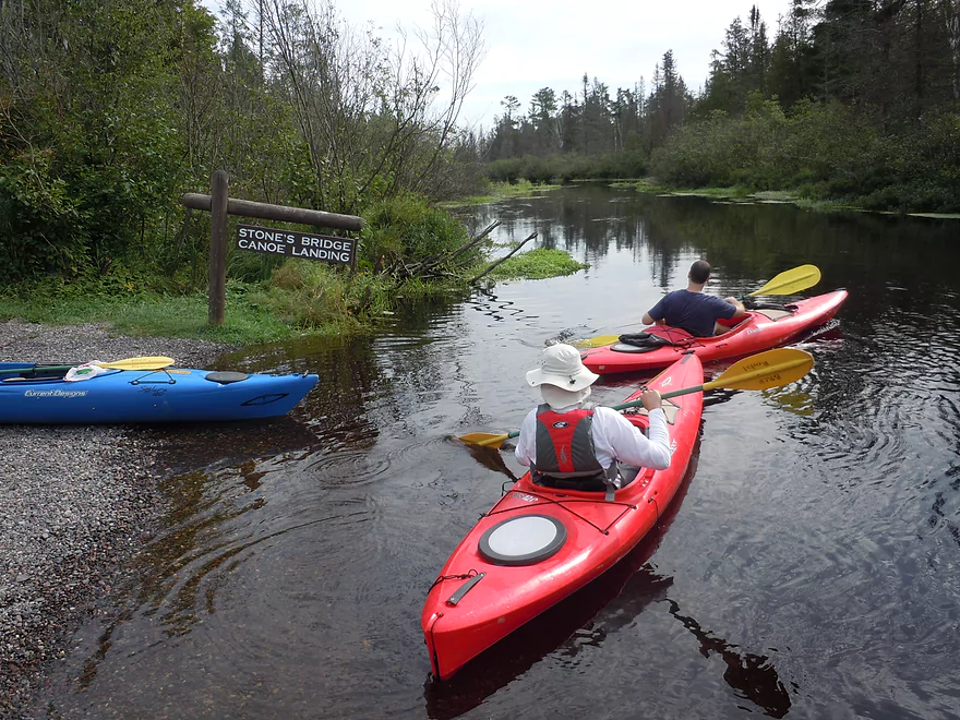
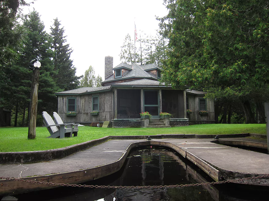
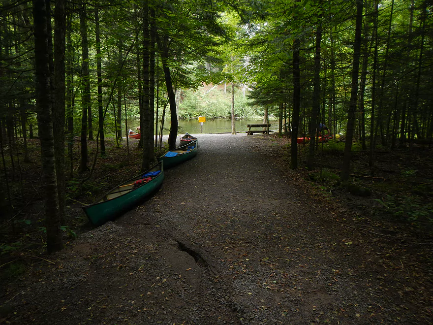
Stone’s Bridge landing
More rivers need this rule!
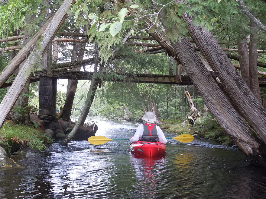
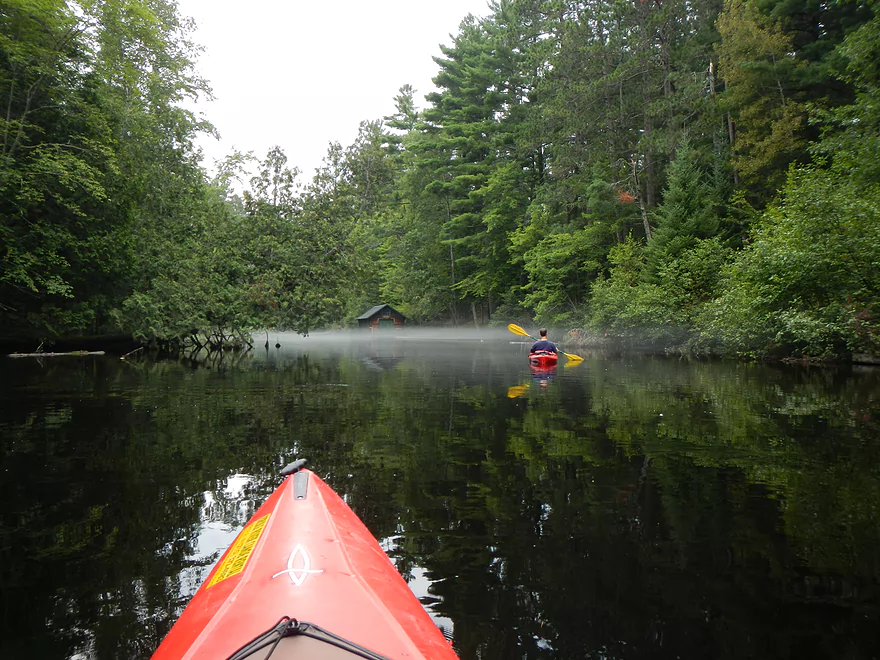
Exploring upstream of the landing
One of multiple wing dams on the river
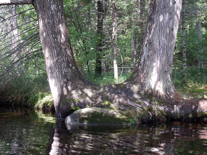
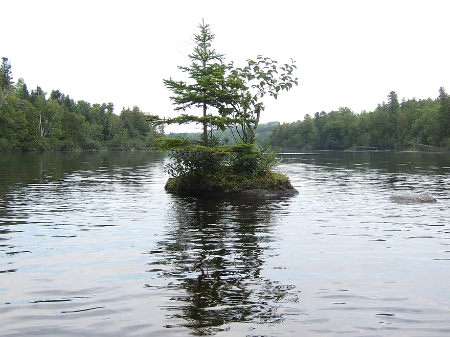
Siamese tree eating a rock
Natural kaleidoscope
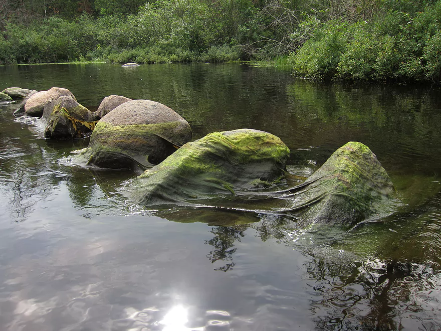
Hard to see…but that is aluminium from previous boats
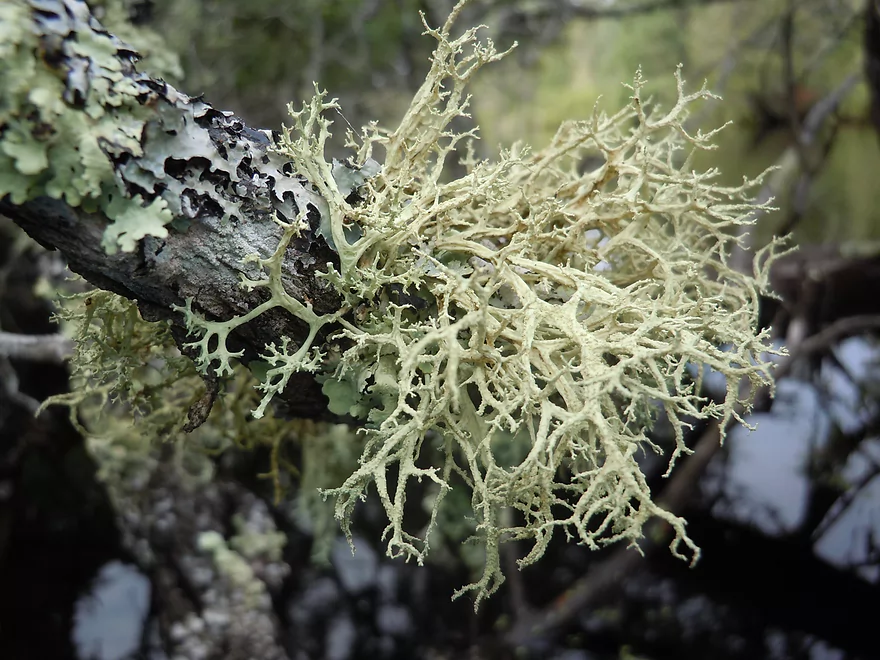
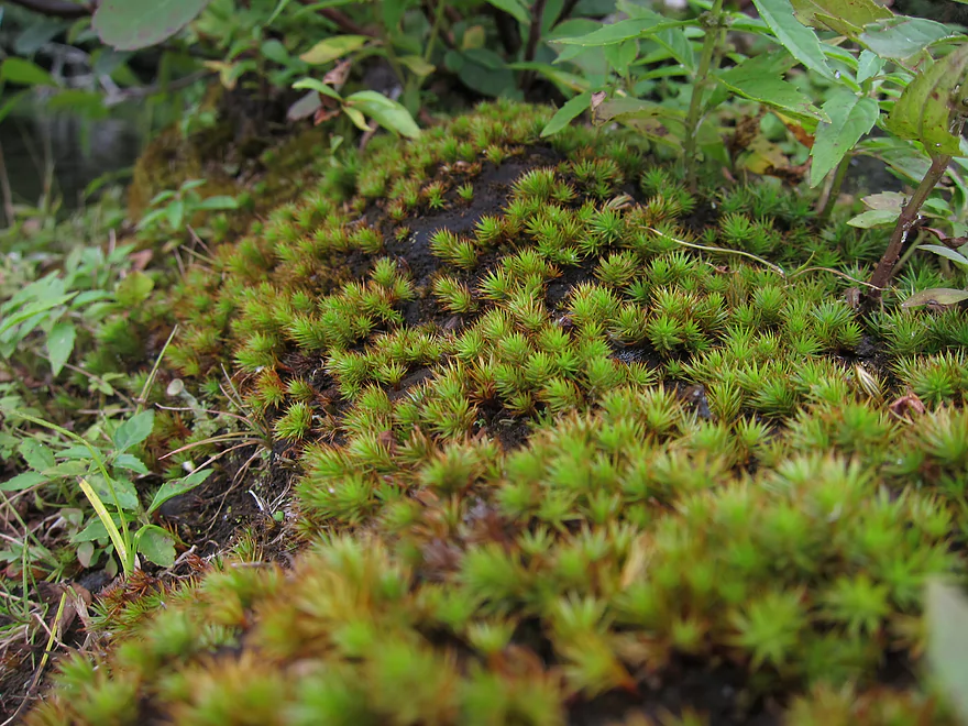
Amazing lichens
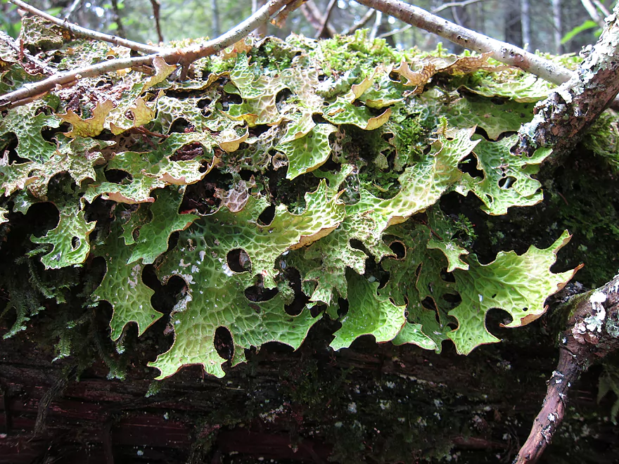
Tree Lungwort
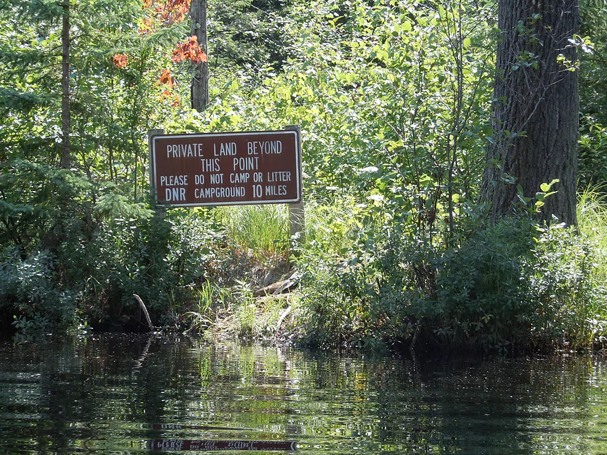
Start of private land
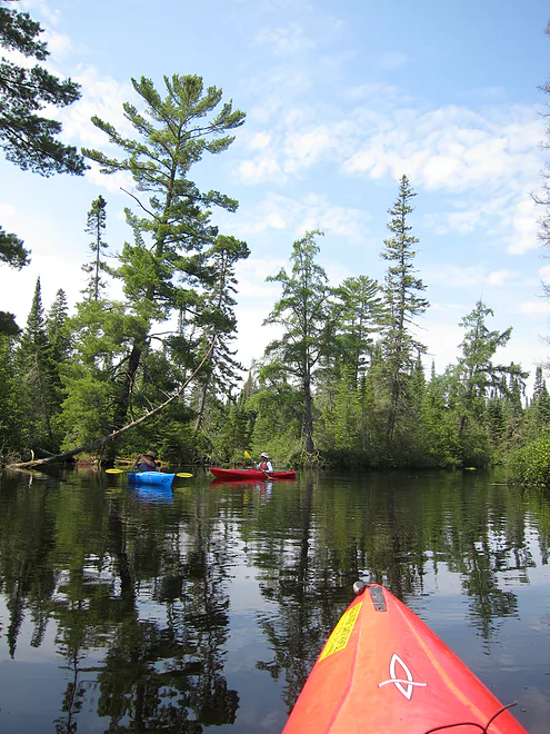
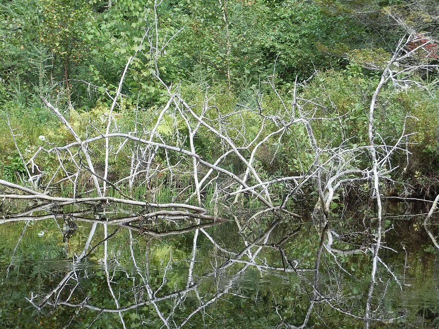
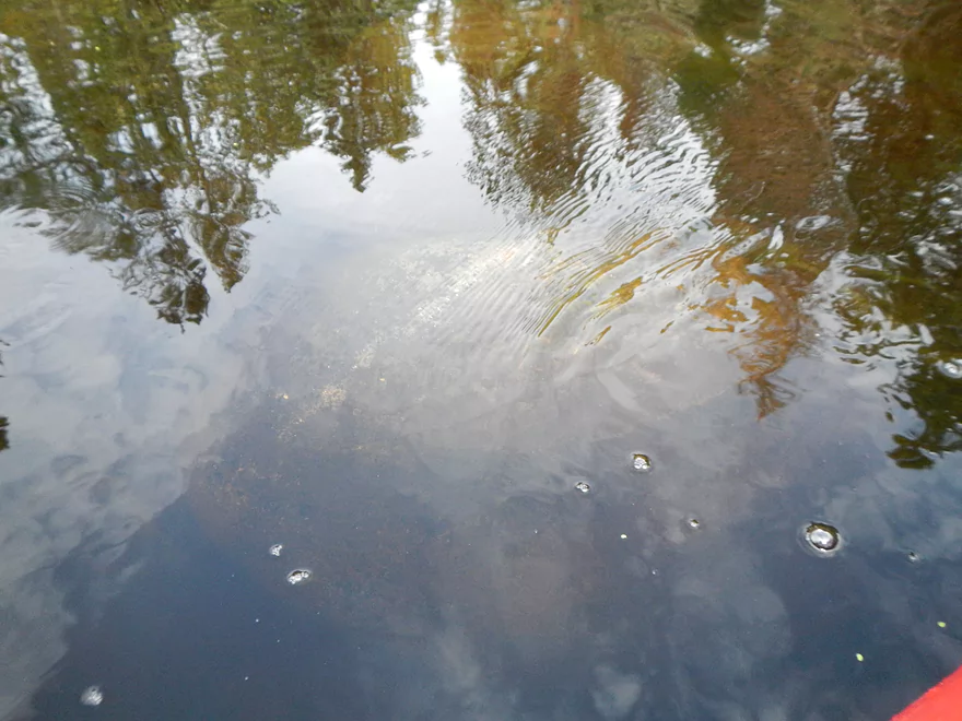
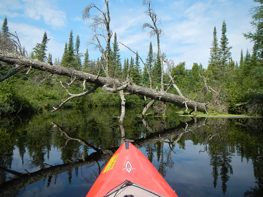
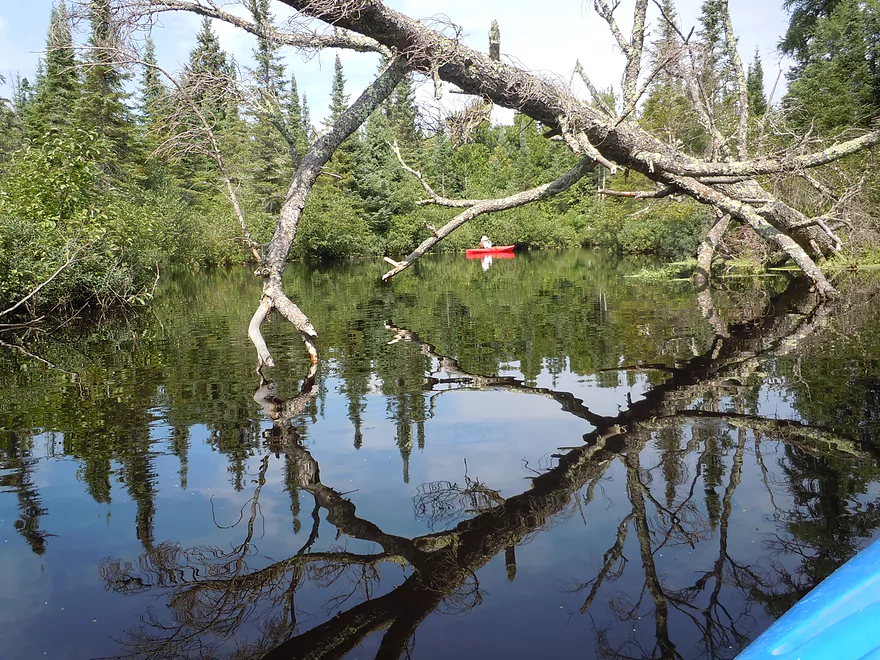
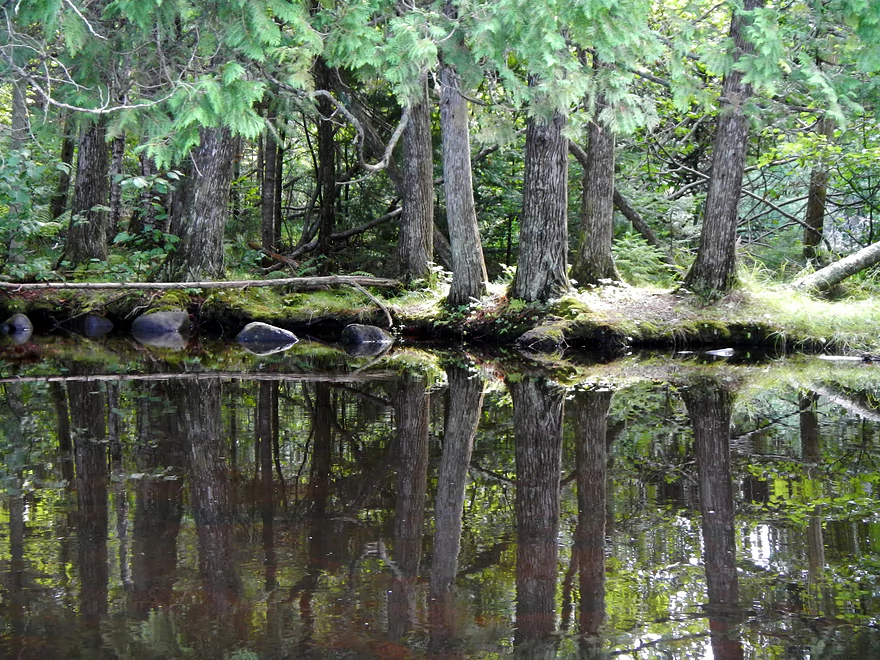
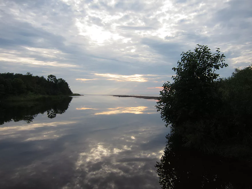
Amazing reflections from the calm water
Mountain Holly
Nice shoreline
Start of Cedar Island Estate
Believe five presidents have stayed at the estate
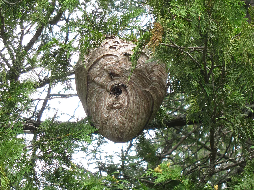
Bald-faced hornet nest
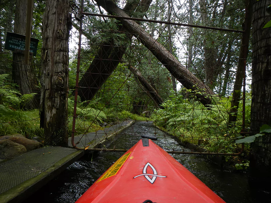
Nearby fish hatchery (gated to keep boaters out)
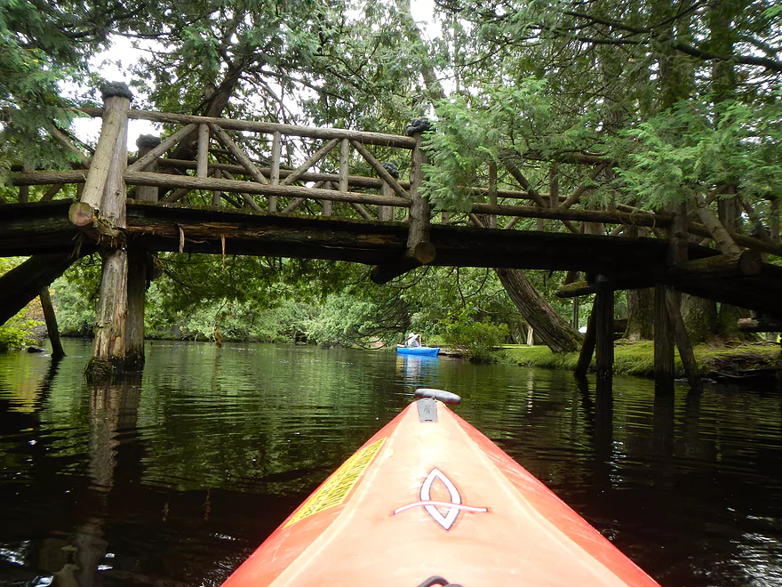
Second nice walk bridge on the estate
Current starting to pick up
Yet another nice walk bridge
Entering Sucker Lake (not a flowage)
Big Falls (only class 2 on this segment)
We ran these 3 times!
Not too bad
Not everybody survived “Big Falls”
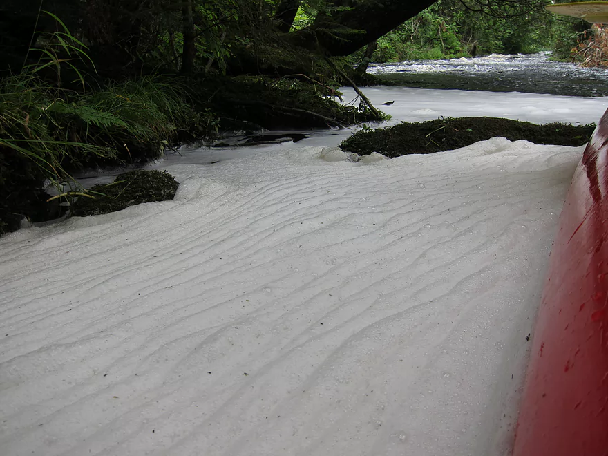
Cool foam from the rapids
More class 1 rapids
Overhang + rapids = issue. Paddle hard to the right.
Pixie Cups (lichens)
Entering Big Lake (none of these lakes are flowages)
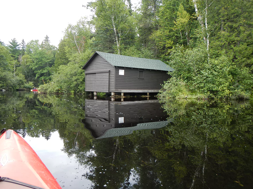
Another old boathouse
More rapids
Evidence of heavy rain
Cool fog
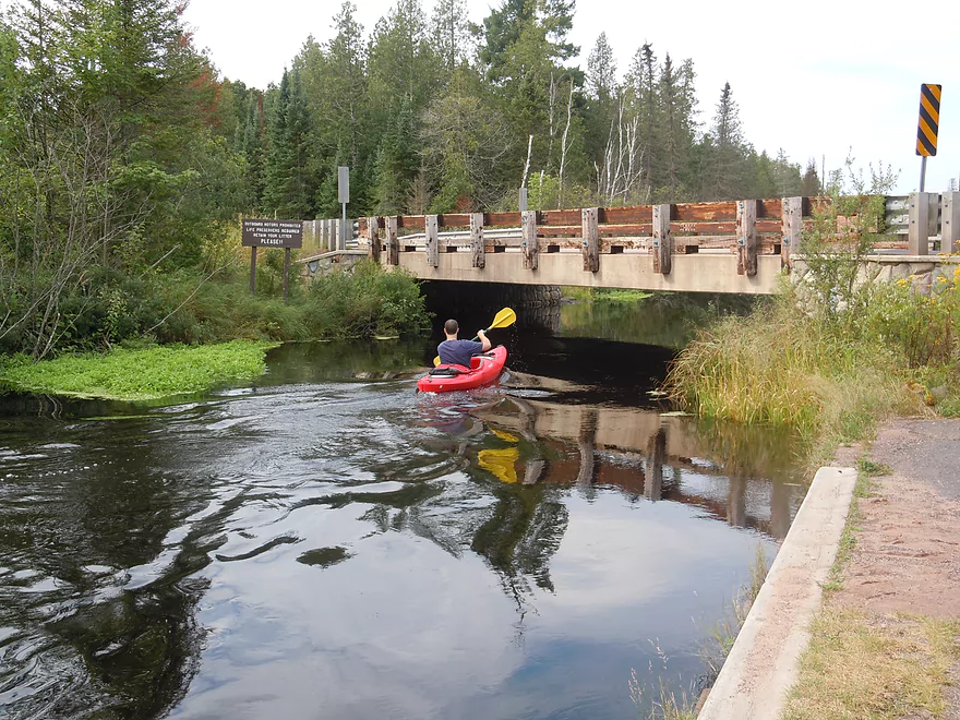
Snowmobile bridge?
Iconic Bois Brule building
Don’t think it liked yesterday’s floods…
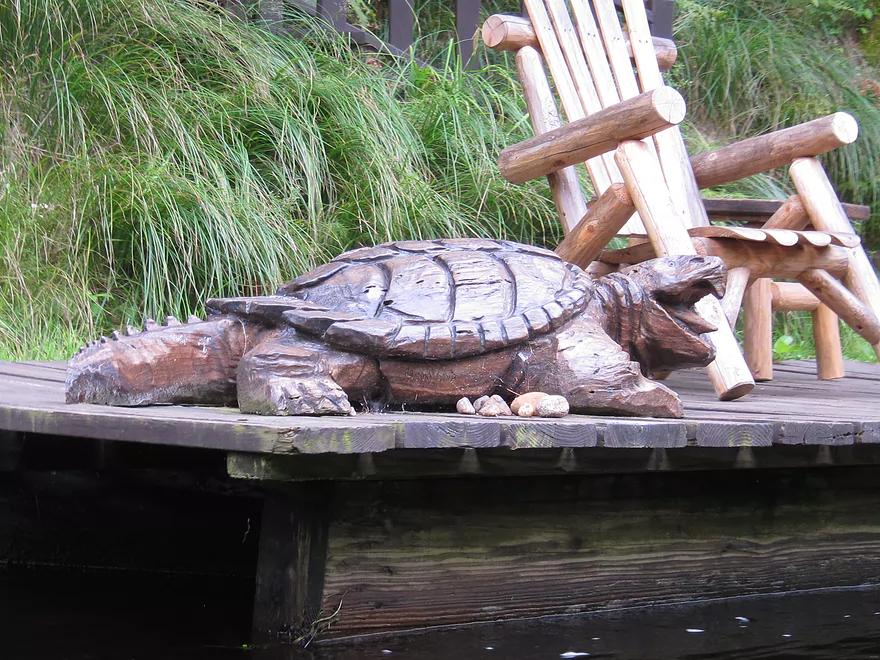
Snapping Turtle
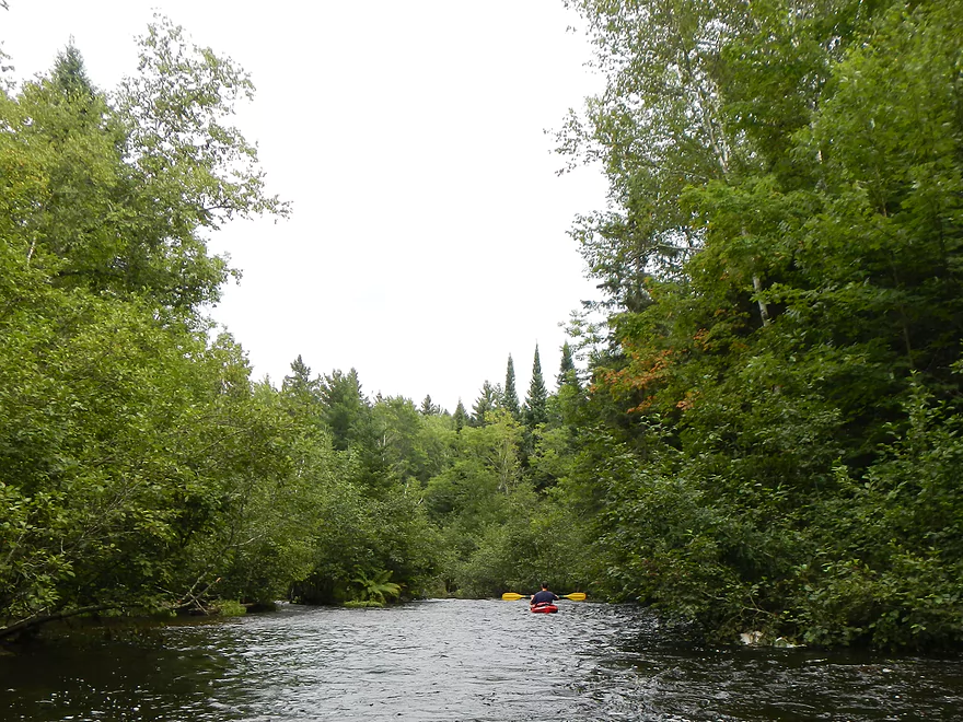
Home stretch…fast and scenic
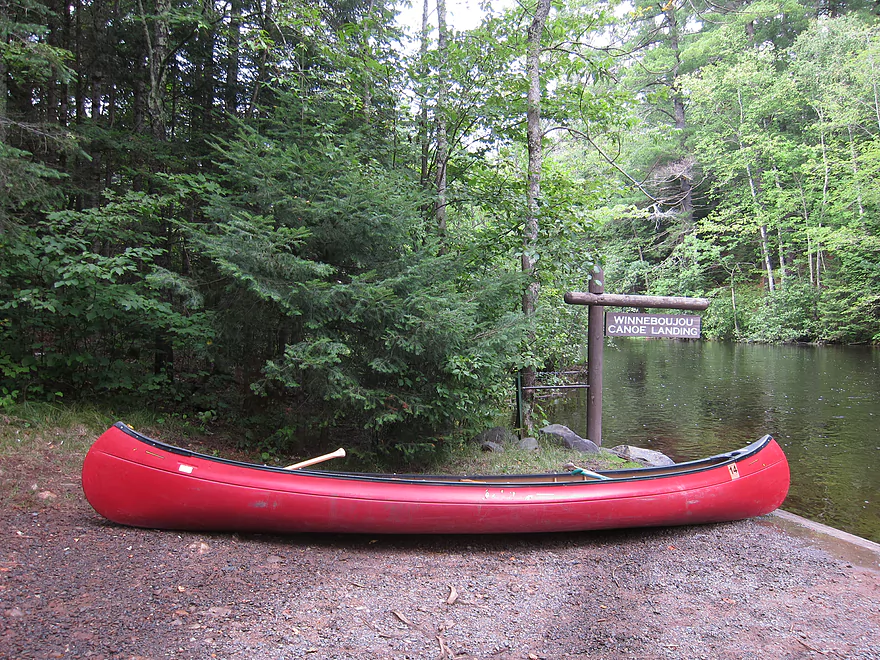
Winneboujou Landing
Very attractive
Rental canoers weren’t supposed to leave their boats here…
Driving to the mouth of the Bois Brule
River left, lake middle, sky top
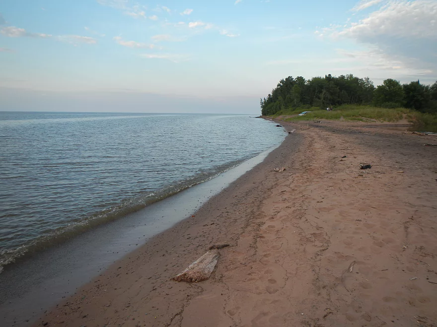
Nice Lake Superior beach
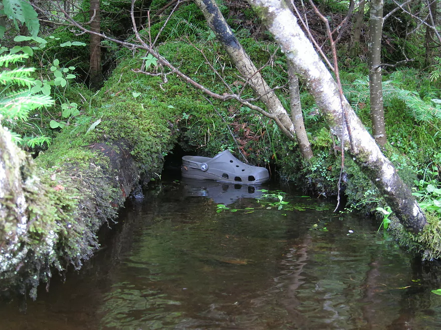
Somebody left this…very nice!
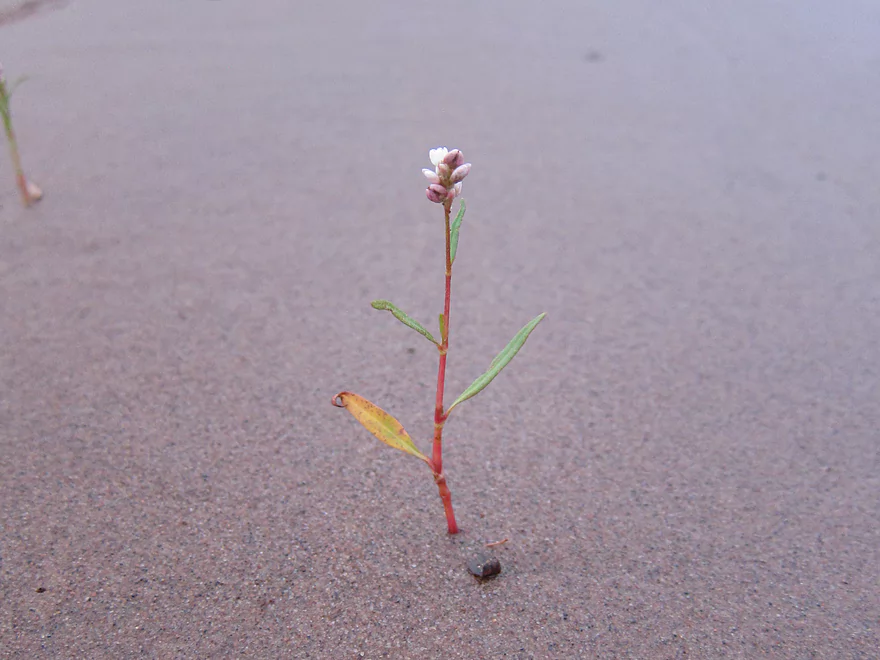
Smartweed
Nice end to the trip
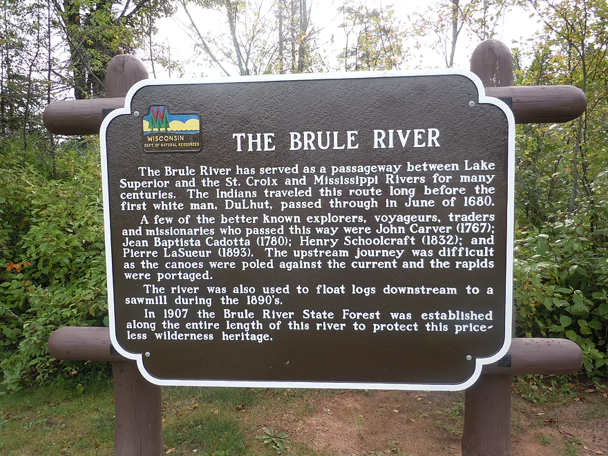
Bois Brule

This is one the cleanest, nicest paddling prospects in Wisconsin. Never getting very big before it empties into Lake Superior, the river is filled with fun rapids, clear pools, historic resorts, attractive banks, and wonderful plant life. In fact…I would rank this as the best paddling prospect in Wisconsin (the Kickapoo had that honor before this trip).
The plan for this trip was to run the “classic” Stone’s Bridge to Winneboujou segment, which has the historic resorts and famously clear water. Along the way there are class 1 rapids and one class 2…but nothing like the class 3’s further downstream (more on other paddling segments later). Prior to this trip we were a tad worried, as this was late August and the water level was running somewhat low at 140 CFS (normal for late summer). While somewhat bony, the local livery service assured us it would be runnable.
Plans changed, however, when we got a surprise downpour the night prior to our trip. While the Brule tends to be a very stable river because it is mostly fed by springs and bogs…this was the exception, and the river spiked up to about 600 CFS, putting it at flood stage (which was not good). The water was dirty, fast, and brown, and didn’t look very runnable. Looking at the USGS charts, we were able to surmise that as fast as the river had risen…it would fall almost as fast. So, with that in mind, we changed plans and paddled the Namekagon just to the south, which (already super low) easily absorbed the extra rainfall.
The next day, the river had fallen to 265 CFS. While high by my standards, as this would cover up some of the low-lying banks, obscure the clean water, and hide some of the boulder gardens, it was somewhat a normal level for the Bois Brule during early summer. On the plus side, it would pad the shallows and rapids, which had been rumoured to be boney at 140 CFS. After doing a last second scouting mission, we decided to go forward with the trip. For this trip we used the Brule River Canoe Rental. I think this is the only livery that services the Bois Brule. The people are nice and willing to service the entire river from Stone’s Bridge to Lake Superior, including the sections with class 3 rapids. Reservations are recommended for weekend runs.
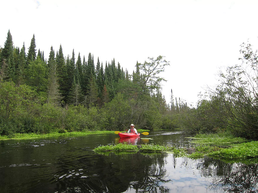
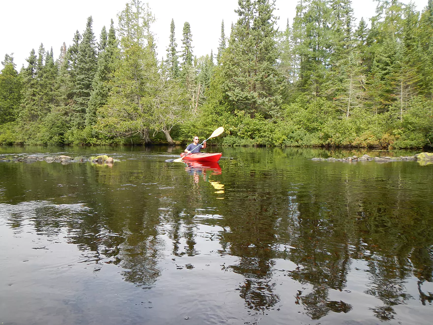
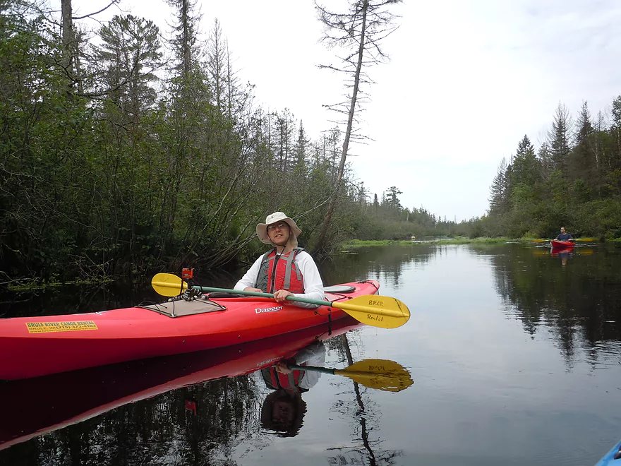
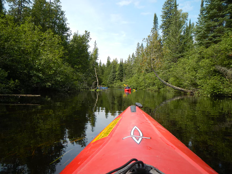
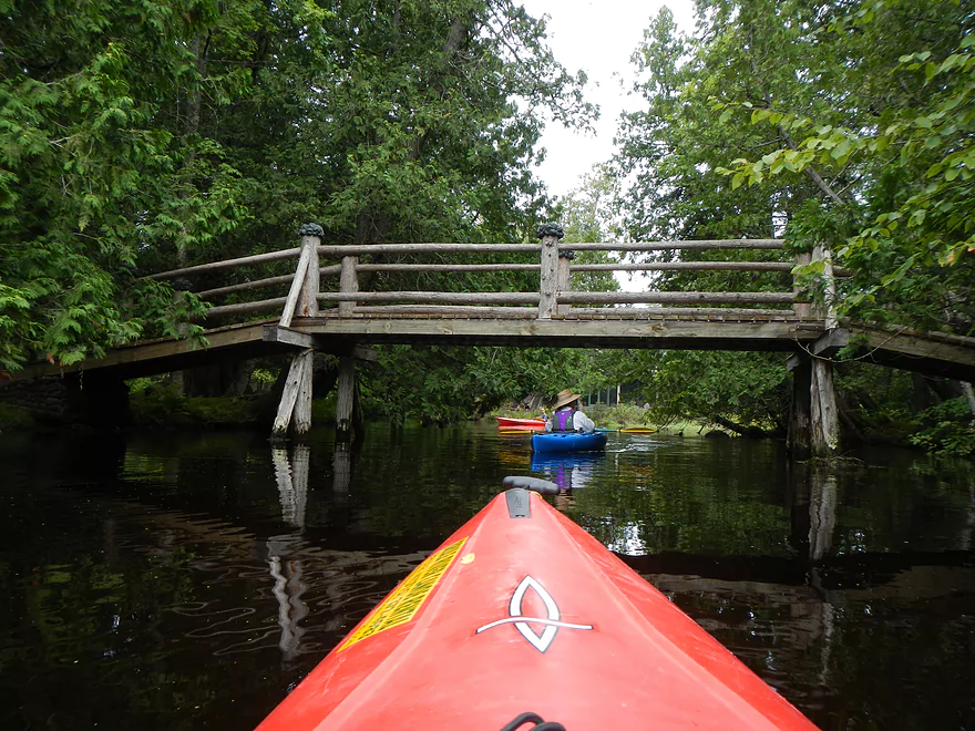
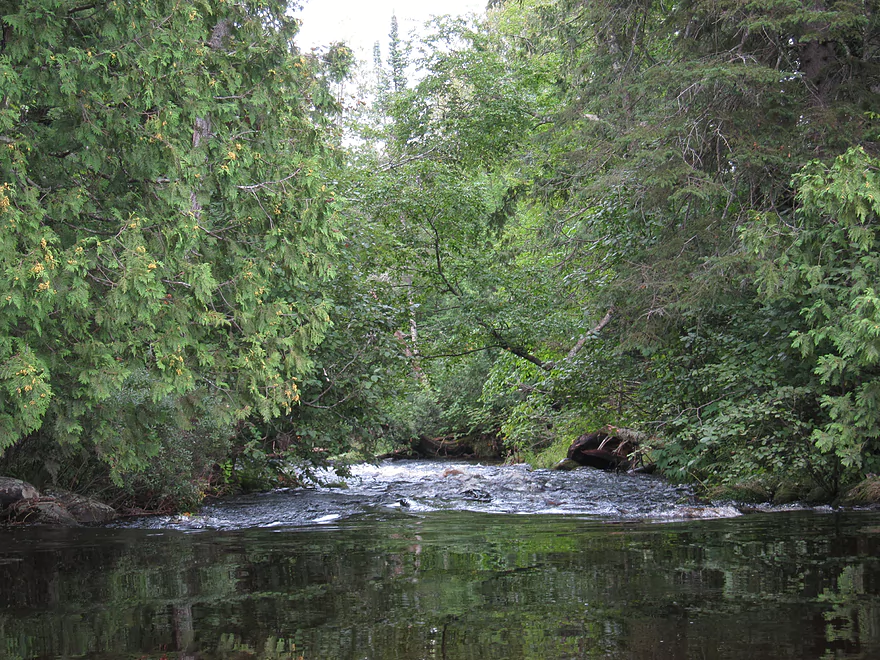
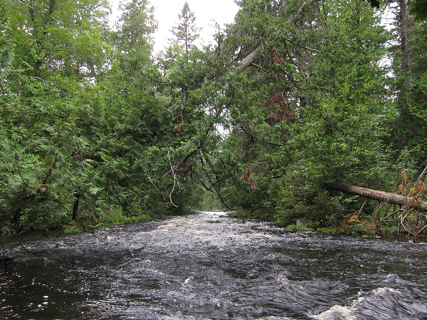
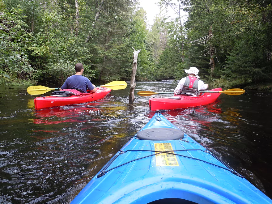
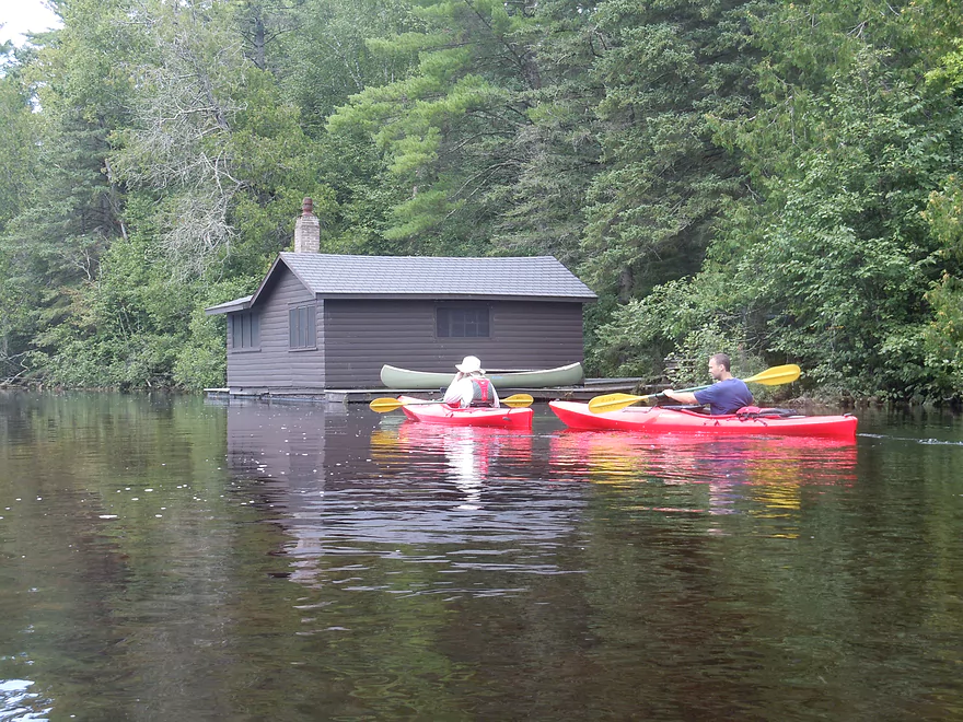
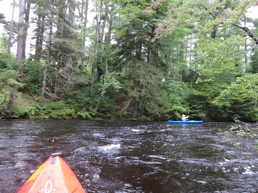
We put in at the classic Stone’s Bridge landing, which I assume 90% of paddlers use. Great landing, with bathrooms, map, nice parking and launch area. Right away you’ll notice how clear the water is. Out of curiosity, we paddled upstream and under the bridge to explore the upper section of the river. Not too many people paddle this area, as I think the river gets to be very close to the headwater springs that feed it. You might be able to put in at Highway P, and I think there are rapids up there…but have no idea if the headwaters above Stone’s Bridge are runnable. We didn’t paddle very far upstream…but far enough to enjoy the sight of large beds of watercress and blue forget-me-nots flanking the banks, with attractive pines in the background.
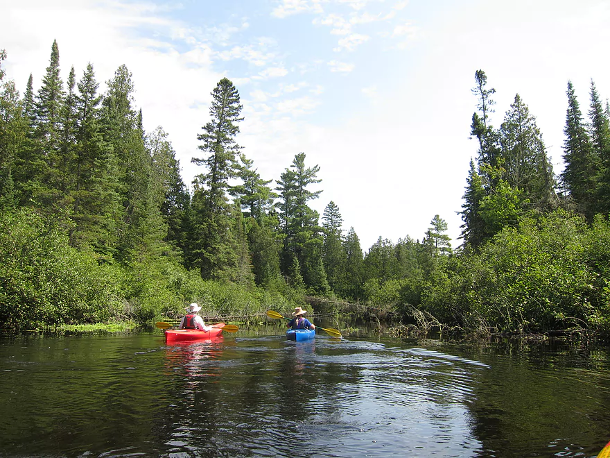
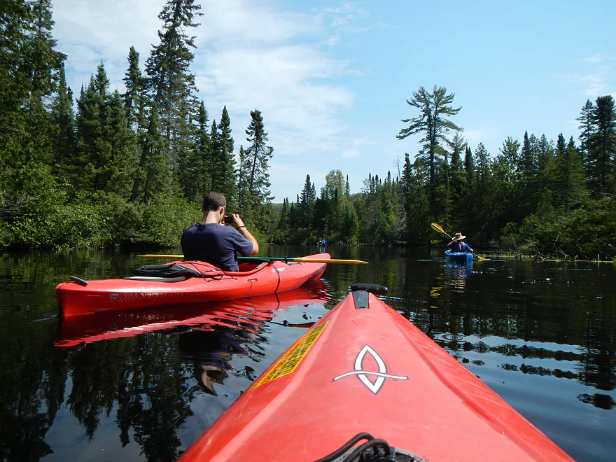
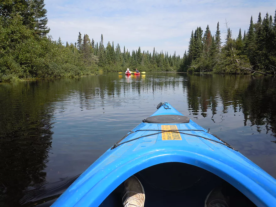
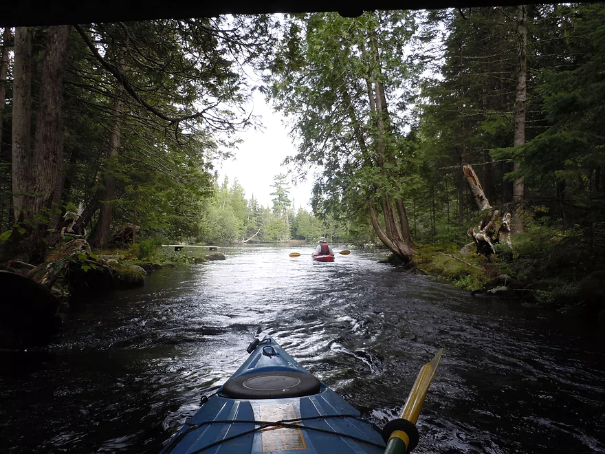
Paddling back downstream, we passed the landing again and encountered several canoers. This was not a weekend, but we still saw maybe 4-6 canoes on the river. During summer weekends this river can be packed…one advantage of going during off-peak periods. Paddling along, we came across several wing dams, which I presumed are engineered to deepen the river for boaters, as it can get quite shallow up here during low water. Since we went during high water, shallows were never an issue, but we did see aluminum scrape marks on the submerged boulders below, so we knew it could be. This upper section does have some nice boulder gardens but they were covered, unfortunately, by the high water. The water quality was still good and transparent in areas to the river bed…but was not nearly as clear as it normally is during late summer.
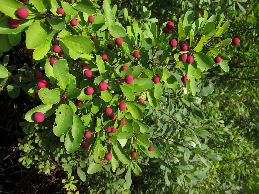
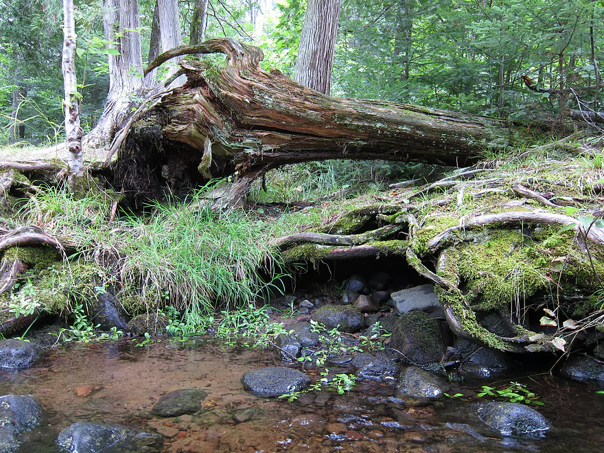
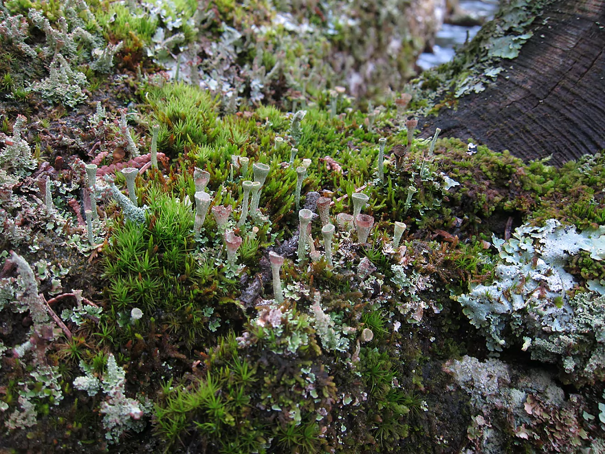
Just a bit further is McDougal Springs, which will be on your right. Thanks to the high water, we were able to explore this a bit, but not too far, as it was still shallow. The water here was perfectly clear and really showed off the strange plant life growing below. It was also icy cold and you could feel it through the kayak walls. Back on the main river there were more nice water plants, including a long green plant which flows in the water like hair and is very cool. This reminded me somewhat of the Platte River, Badfish Creek, and Cedar Creek, where this is also prevalent. The lichens and fungi were amazing as well (see pictures). What would happen is that a tree would fall into the river and an entire colony of exotic plants would grow on it like coral on a sunken ship. These are called nurse logs and were somewhat common on the upper stretch.
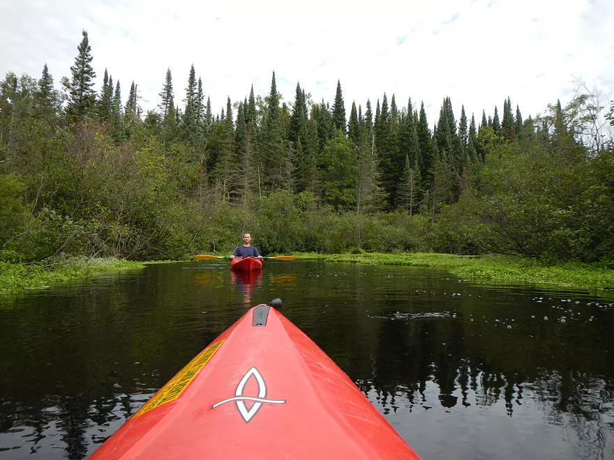
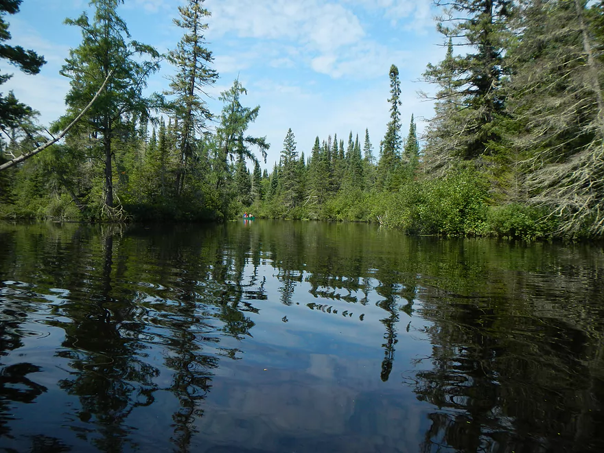
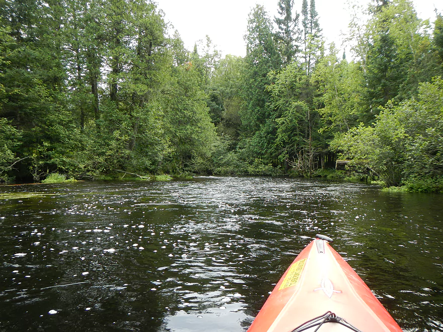
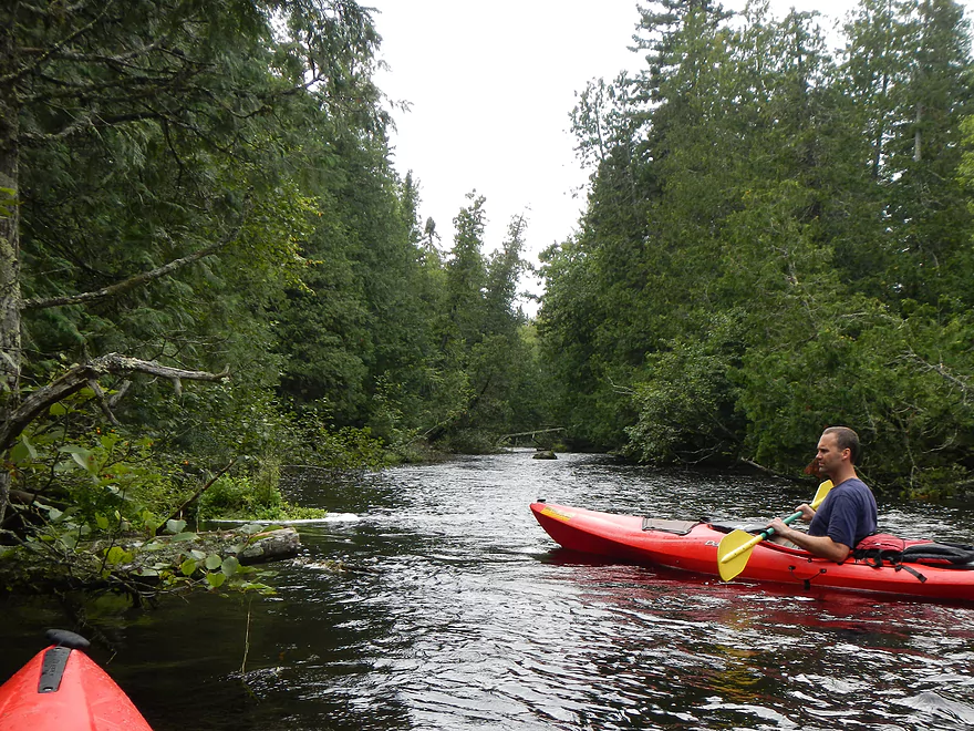
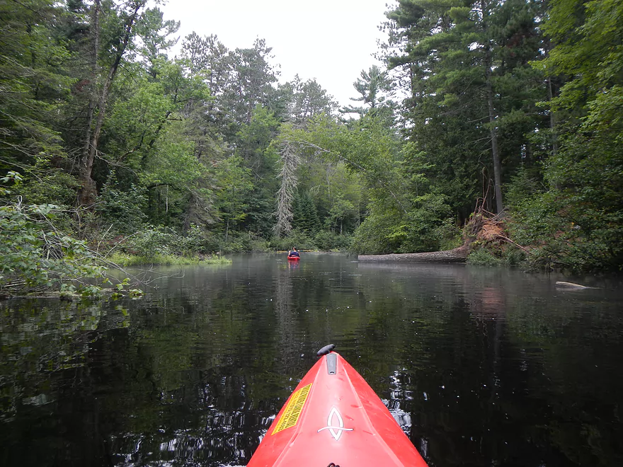
After the springs, there isn’t too much that is exciting on the river. In fact, the next few miles might be the achilles heal of the trip. While there are occasional pines and boulders, it is mostly flat, slow paddling, with scrubby alders along the banks. At times the river does narrow and you do go through smallish corridors between open waters and those are cool though.
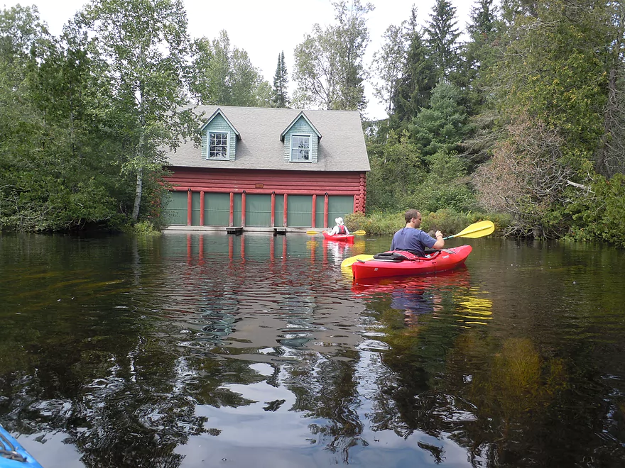
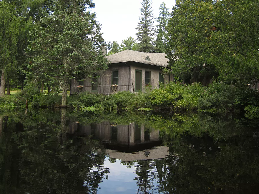
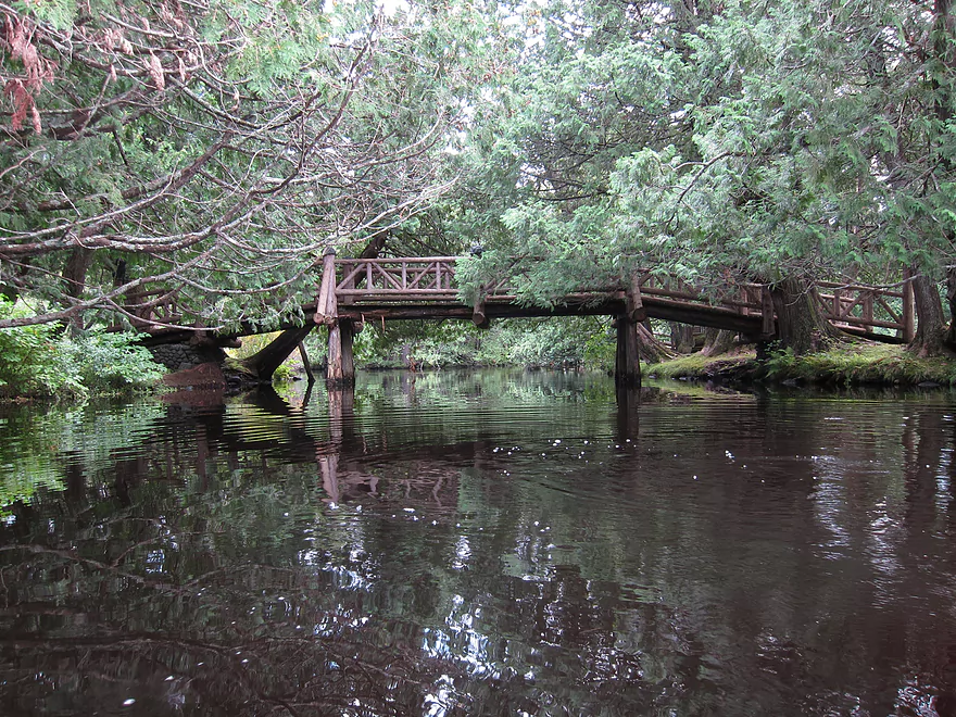
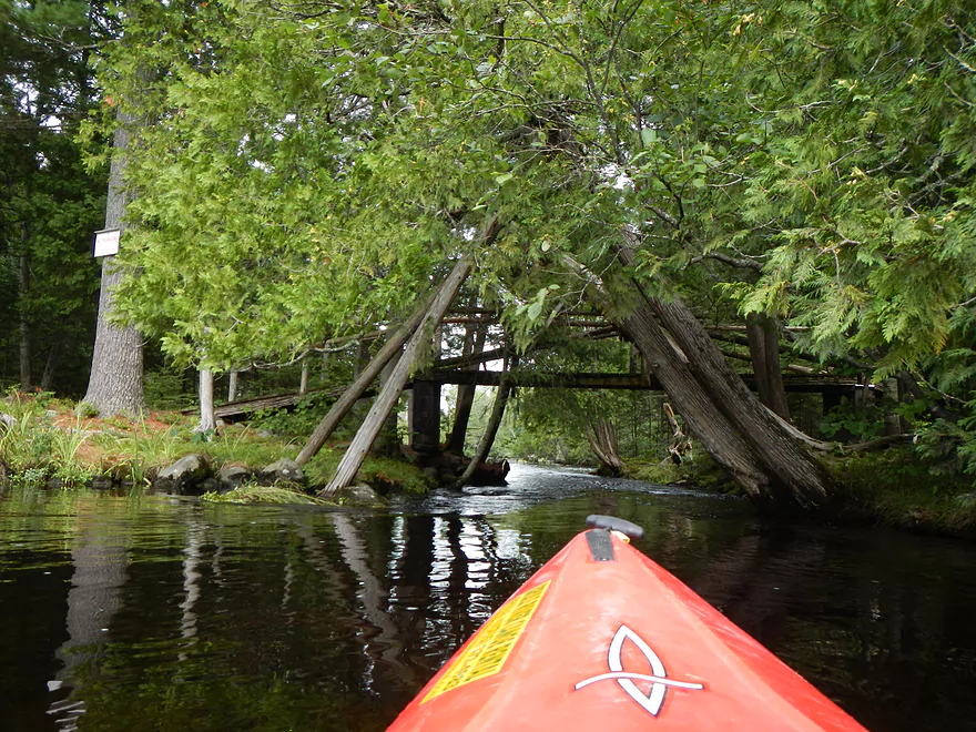
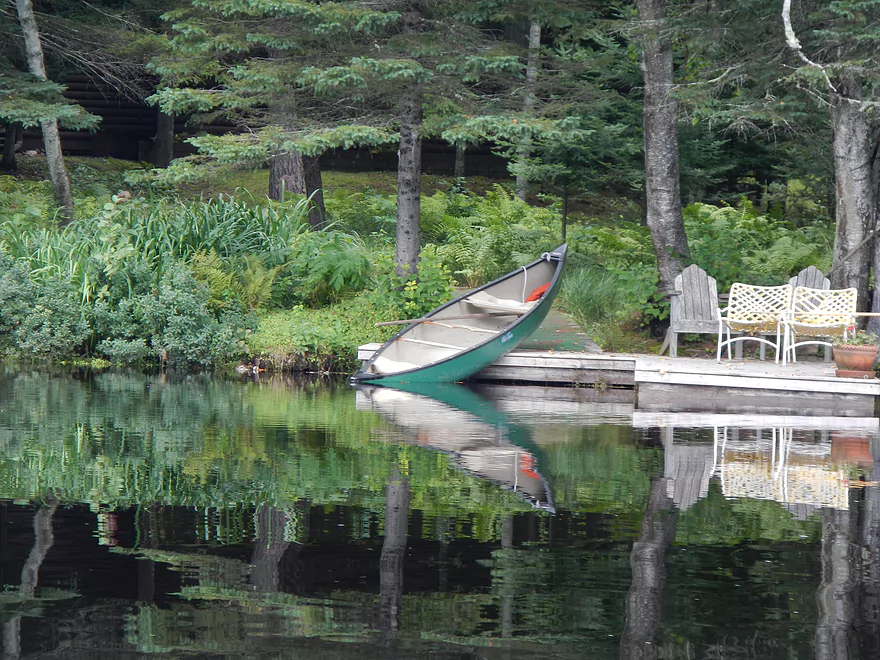
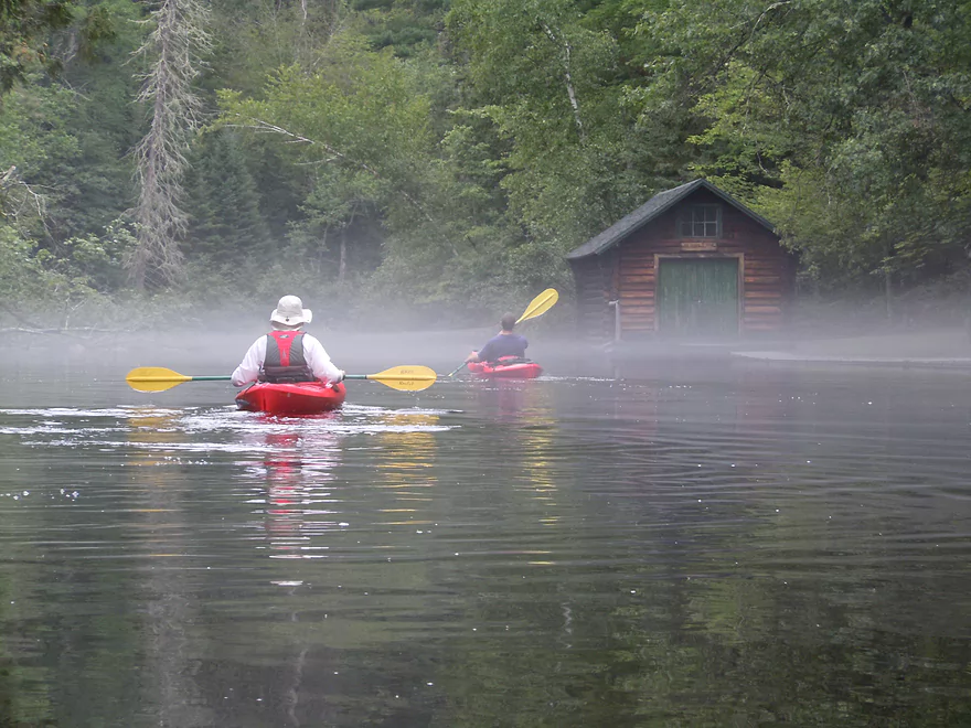
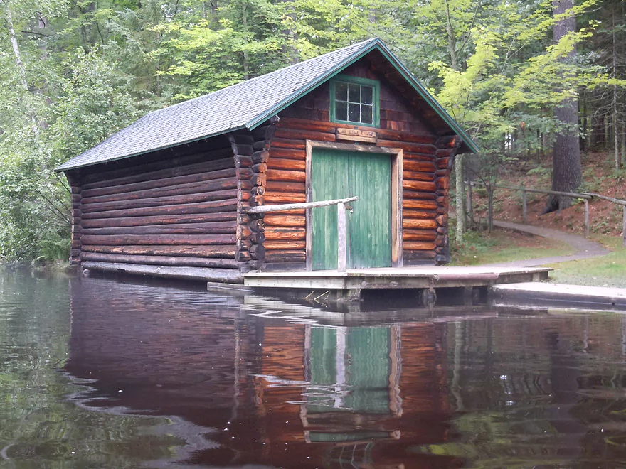
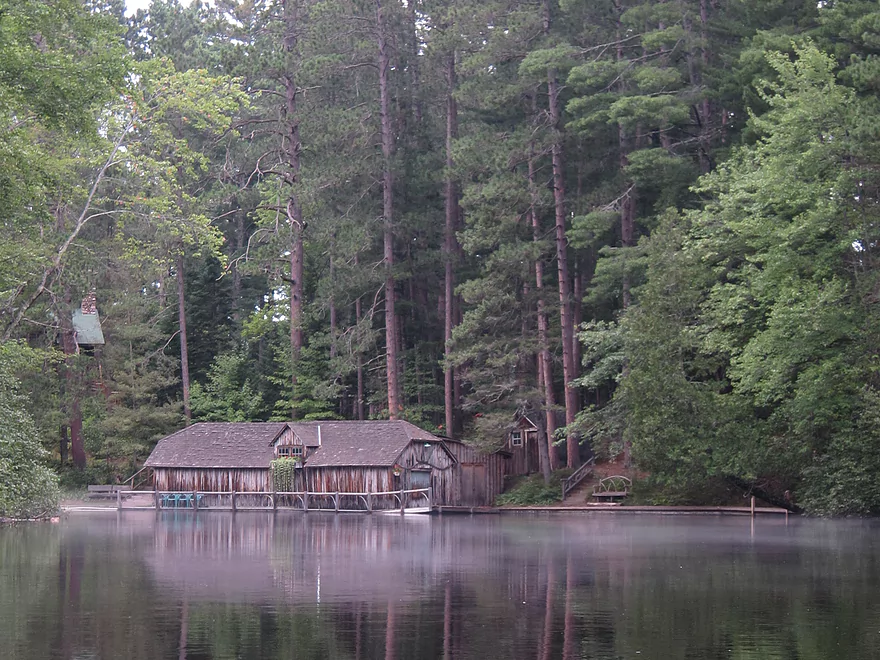
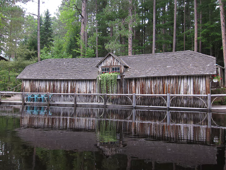
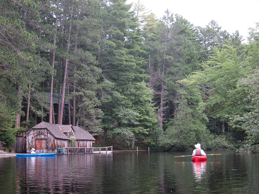
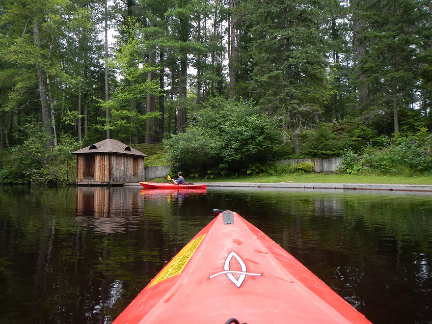
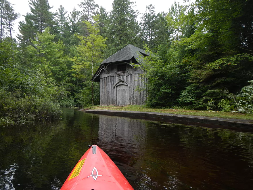
The next marquee site on the trip will be Cedar Island Estate. This is perhaps what made the river famous. I believe five presidents have stayed at the estate and you’ll see historic and rustic lodges, boathouses, and three walk bridges. Most of the estate is very scenic and it’s worth putzing around the islands to check it all out. If you sneak to your right under two wooden walk bridges, you can find the hidey exit of the local fish hatchery. The water was high enough to enter, but a gate over the “creek” and a no trespassing sign blocked further exploring.
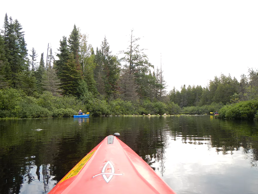
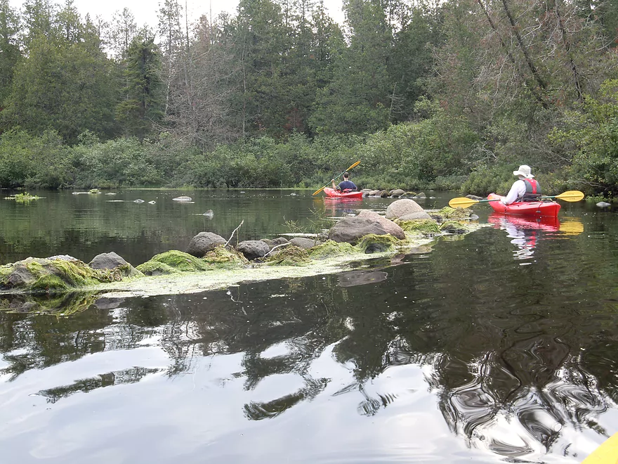
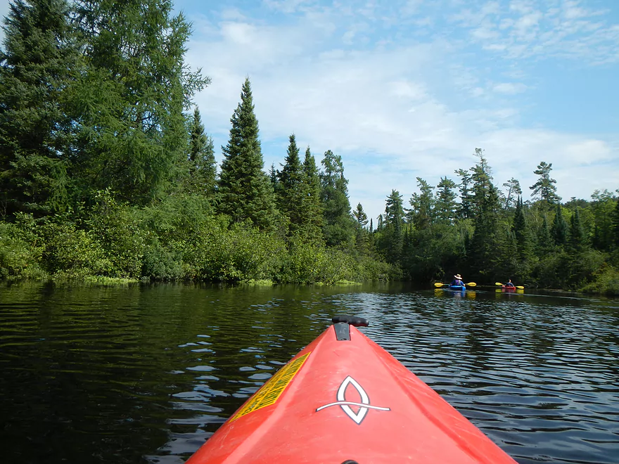
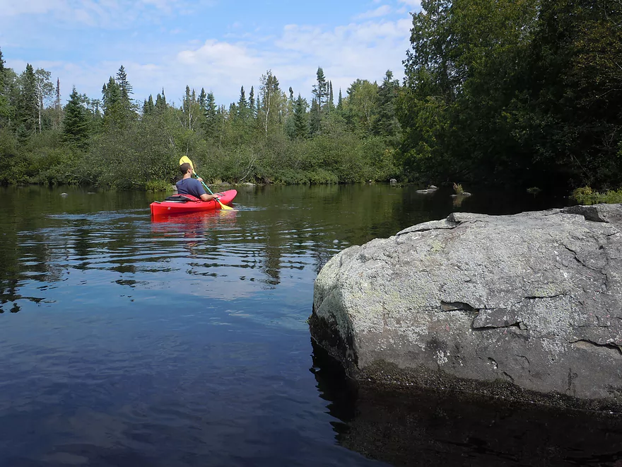
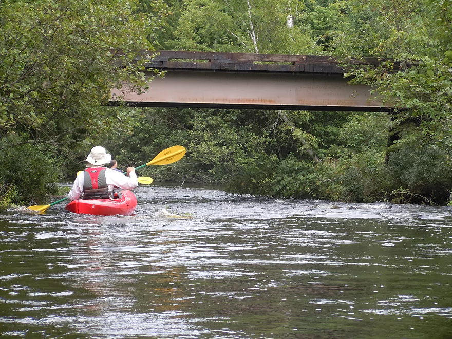
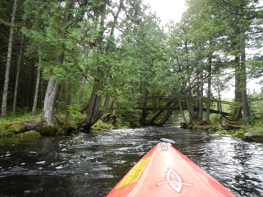
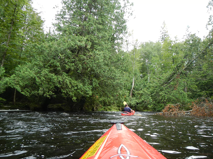
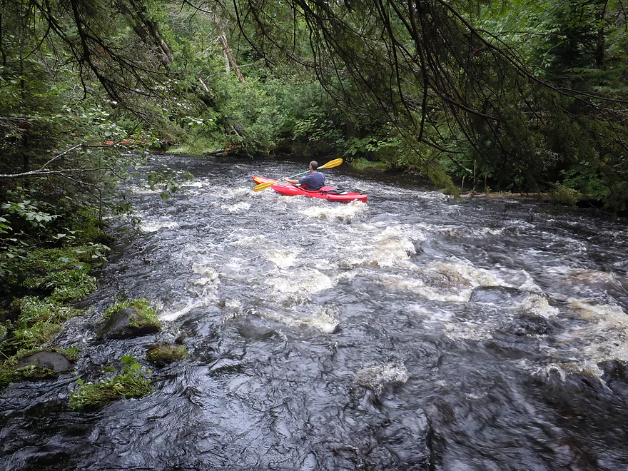
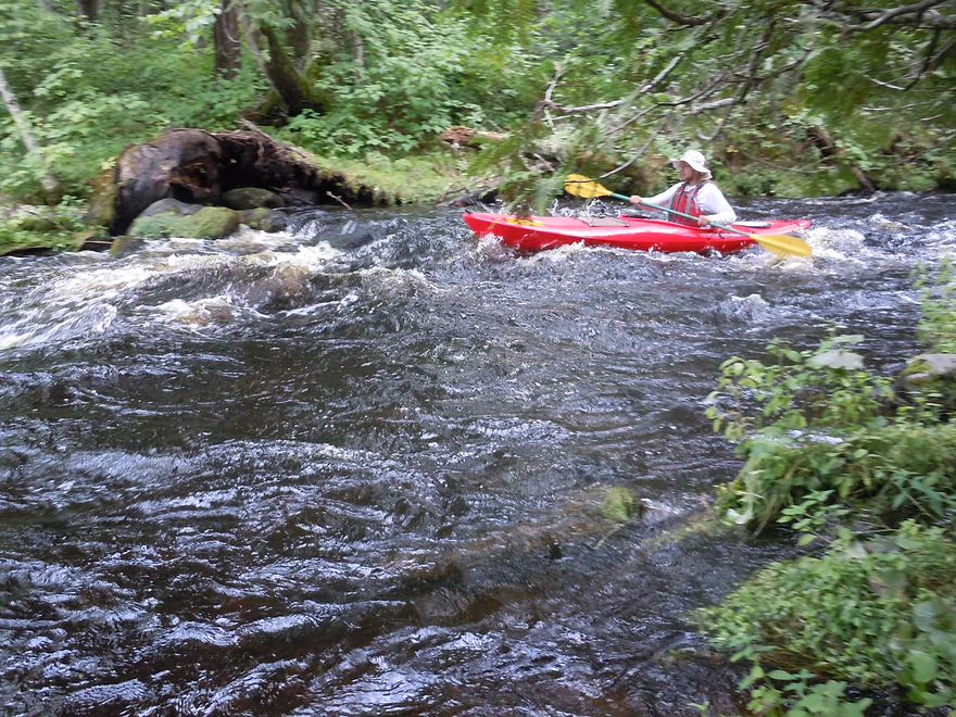
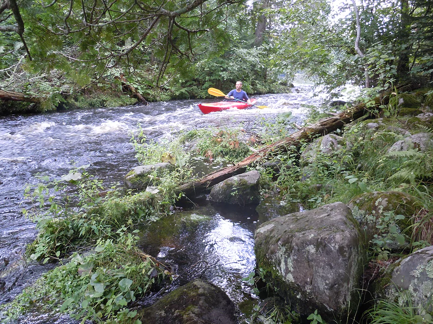
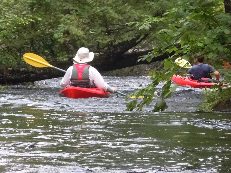
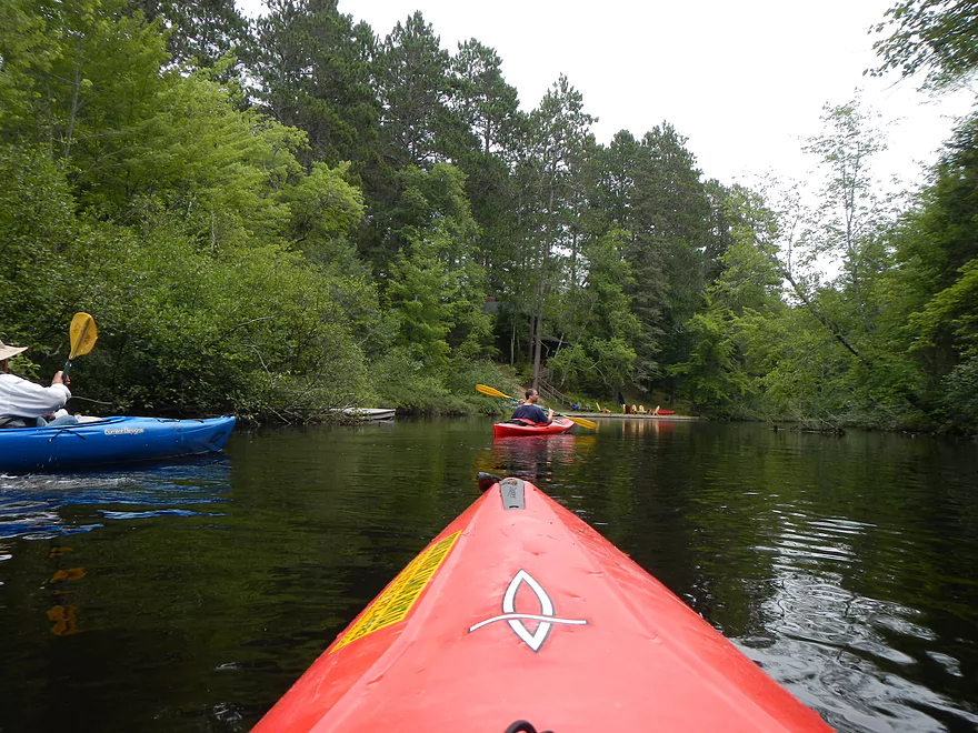
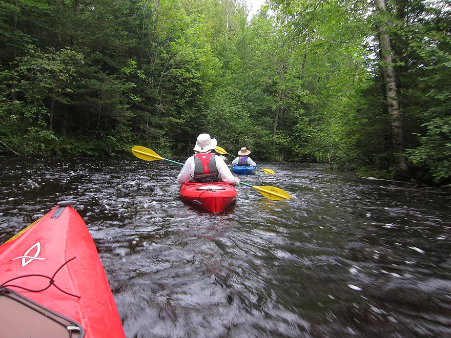
From Cedar Island Estate on, the river is at its best. The bank quality improves immensely and you’ll enter a series of smallish lakes (none of which are dammed flowages) and connecting corridors. The corridors were my favorite part of the trip. Small, narrow, and running under tree canopies, these were where the rapids resided. Most of the rapids are class 1 and are quite safe even at our higher water level (I wouldn’t have trusted them a day earlier though at 600 CFS). There is one class 2 rapids (“Big Rapids”) that I’ve marked on the map. This is easy to portage to the left if need be. Otherwise, it is a lot of fun and I put the portage path to use to run the rapids 3 times. This didn’t seem too bad but could be rough in lower water. There is a nearby class 1 rapids that is probably more dangerous though because it runs under a low hanging tree and you have to paddle hard right to avoid it (in the pictures).
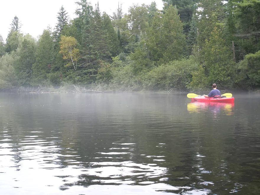
The river alternates between slow pools and fast narrow riffles for a while. Maybe two-thirds into the trip you’ll enter your largest lake, “Big Lake,” which is nice despite being wide and slow. Normally there would be a boulder garden to contend with here, but we floated straight over this. After another connecting corridor, we paddled into the second largest lake, “Lucius Lake”. This was a scenic lake with the fog, pines in the background, and reflections on the calm, clear water…but for the entire distance of the lake we constantly heard a leaf blower from one local private property owner. He apologized for the noise, which was nice…but then went back to blasting away with his blower for the duration of our lake paddle.
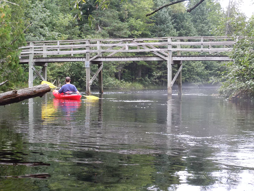
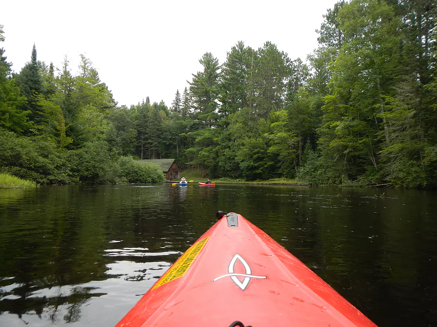
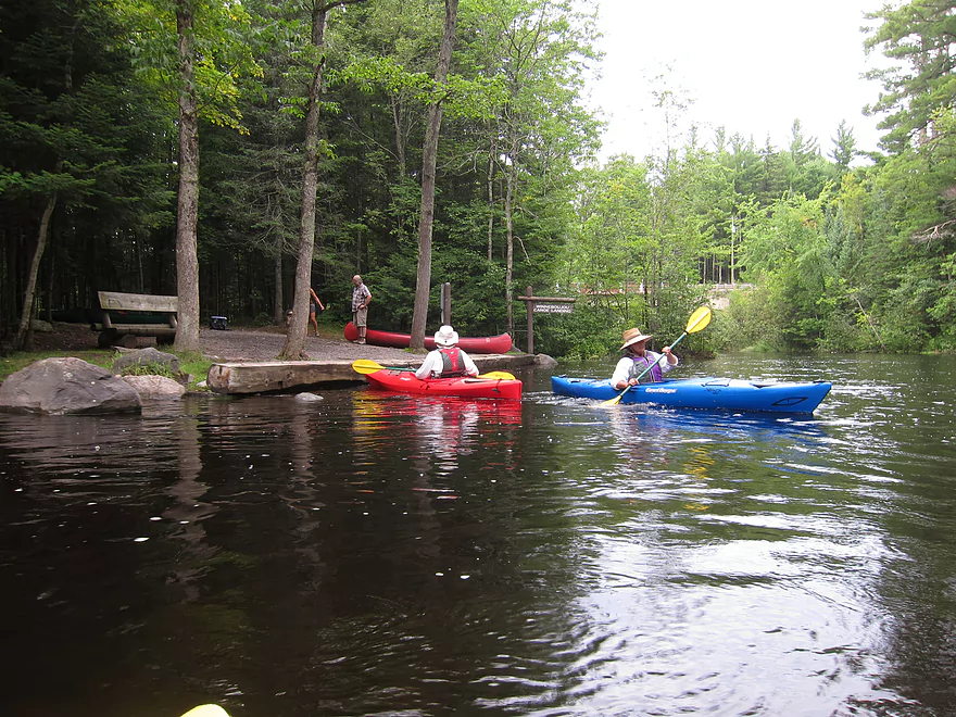
Continuing on, you’ll come across more iconic buildings, including the large grey boathouse with window boxes (see photos) that you see in so many Brule River pictures. The final mile or two is the best. The river stays narrow and sends you zipping around tight bends and through narrow, wooded corridors. There is some development on this section and most houses aren’t too bad, with some exceptions. The take-out at Winneboujou Landing is easy to spot on your left. In fact, there is a sign right above the landing which makes this perfectly clear. This, like Stone’s Bridge, is a great landing, with bathrooms/parking/maps.
According to canoe author Mike Svob, this segment of the river is 8.5 miles. But this doesn’t seem right and the local livery service lists this as 12 miles, which I believe. Mike is a great canoe author…but he does have the unfortunate habit of underestimating paddling distances.
If this is still too short for you, a popular extension to this trip (or a trip on its own) is from Winnie (as the locals call it) to the Town of Brule landing on Hwy 2. This is 4 miles and has a lot of rapids, including one class 2 (“Little Joe”). From Hwy 2 to Pine Tree landing is maybe 8 more miles–a solid section that is a little slow, but still scenic. This is not a good section for rapids, however, and I don’t think is super popular with the local livery service. The next section, however, from Pine Tree to Hwy 13, is packed with rapids, including multiple class 3 segments. This section you probably want to run in a covered canoe or skirted kayak. The whitewater makes this the second most popular segment on the Brule. From Hwy 13 to Lake Superior is maybe 8 miles and is still quite zippy, but has no dangerous ledges/rapids that I know of other than a lamprey dam, which you can portage.
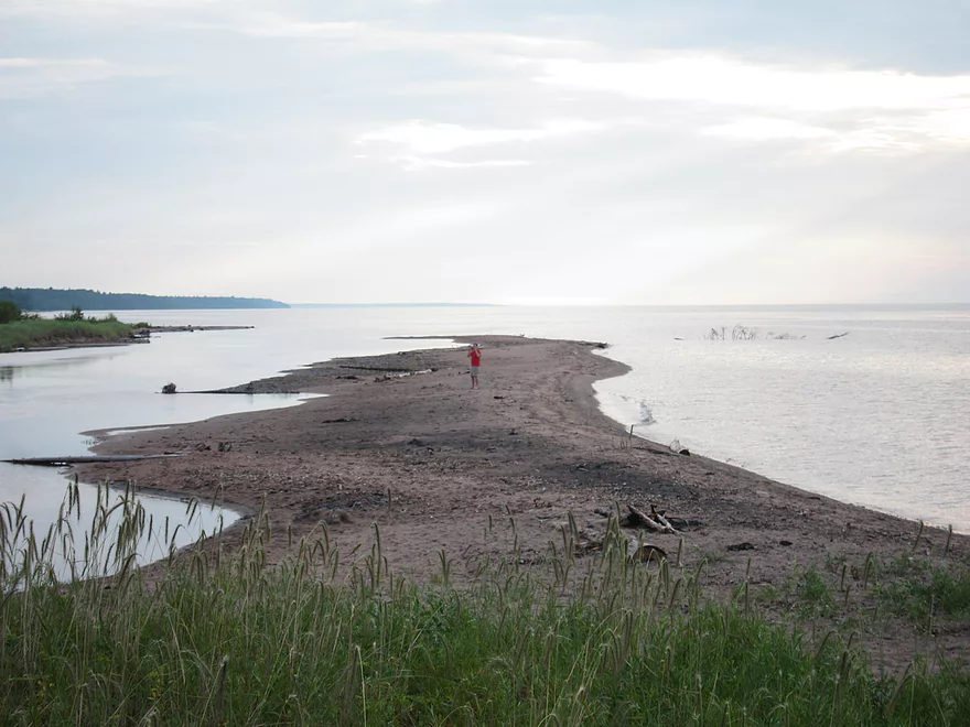
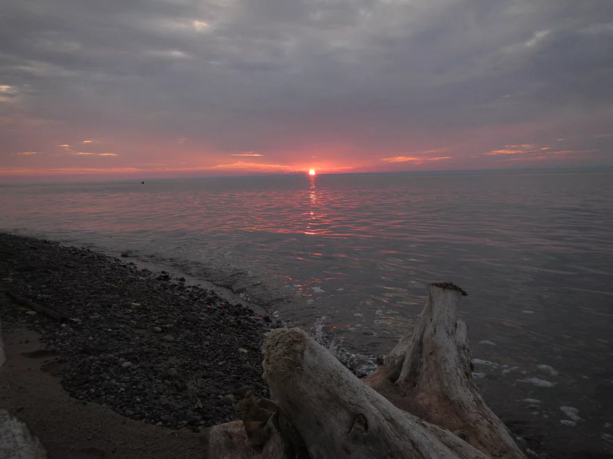
Once you reach Lake Superior and the mouth of the Brule, there is a nice beach area where you can take out. While you can drive up to the mouth from both sides of the river, the main landing is on the east side of the river. We didn’t have time/energy to paddle 13 additional miles to Lake Superior, but we still wanted to check out the mouth of the Brule and the beach, which were very nice and definitely worth scoping out if you’ve come this far. If you can time this perfectly, you can catch a sunset, which is always a treat on Lake Superior.
- Hwy P to Stone’s Bridge Landing: 9 miles. There is a small launch area off Hwy P. This section is a narrow creek running through a marsh and you may need extremely high water to get through.
- Stone’s Bridge Landing to Winneboujou Landing: 9.3 miles. The most popular section on the entire river. Very scenic with several Class 1 and Class 2 rapids.
- Winneboujou to River Road Landing: 2.8 miles. A good prospect with one set of Class 2 rapids.
- River Road Landing to Hwy 2 Landing: 1.7 miles. A pleasant section with one set of Class 1 rapids.
- Hwy 2 to Pine Tree Landing: 9.2 miles. More open and slower, this is one of the least popular sections of the river.
- Pine Tree Landing to Mouth on Lake Superior: 18.2 miles.
- Pine Tree to Hwy FF Landing: 2.9 miles. A faster section with more Class 1 Rapids. There is one set of strong Class 2 rapids prior to Hwy FF.
- Hwy FF to Hwy 13/Town Park Road Landing: 6.1 miles. Rapids increase in strength. Some strong Class 2’s and a 3 foot ledge.
- Hwy 13 to Brule Dam/Loveland Road: 2.3 miles. Mostly minor rapids.
- Brule Dam to Mouth: 6.7 miles. A good flatwater section with the highlight being Lake Superior itself at the end. Take-out is east of the beach.
For additional details on the Lower Bois Brule rapids, see WisconsinTrailGuide.com.
Trip Map
View Bois Brule in a larger map
Overview Map
Video
Photos Size:
We did this trip on 8/8/22 and had a great trip. I did a bike shuttle, and other than the first hill up from the Winneboujou Landing, I felt it was a relatively easy and very pretty shuttle. Water levels were low, 121 CFS, but seemed totally fine. We were a bit surprised that these levels were good, because both this site and the Wisconsin Trail Guide site recommend 125 CFS as a minimum suggested flow. Interestingly, the river was above the recommended 4.1 ft, so perhaps the correlation between CFS and ft has changed for this river, or river height is better than CFS for determining favorable conditions. We did three different sections of the river over three days, all between 120 -110 CFS and 1.5 – 1.4 Ft, and found all the sections totally fine at these levels. One other thing to note is that just a mile or so off the shuttle route is what claims to be the World’s Heaviest Ball of Twine, at 8009 S Oakdale Road, Lake Nebagamon, it is well worth a stop especially if you are lucky enough to meet the proprietor himself. Here is a link to a short video with maps and pics of our trip. https://www.relive.cc/view/vYvEAwxX5Gv
USGS does occasionally change their CFS calculations which is incredibly frustrating for those us that that base paddle trips on its historical data. Thanks for the information.
Do you have anything similar for Upper Peninsula of Michigan rivers?
Unfortunately not.