
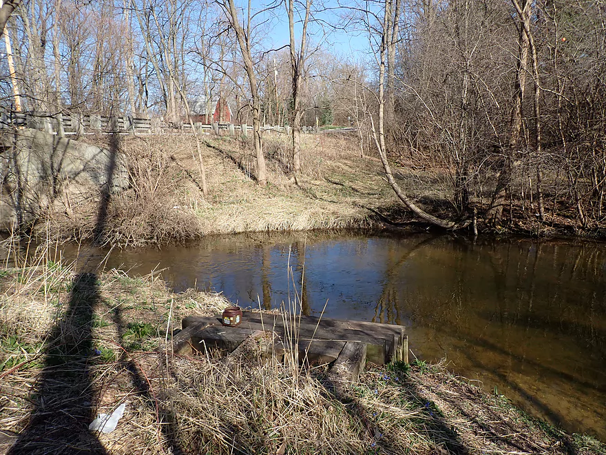
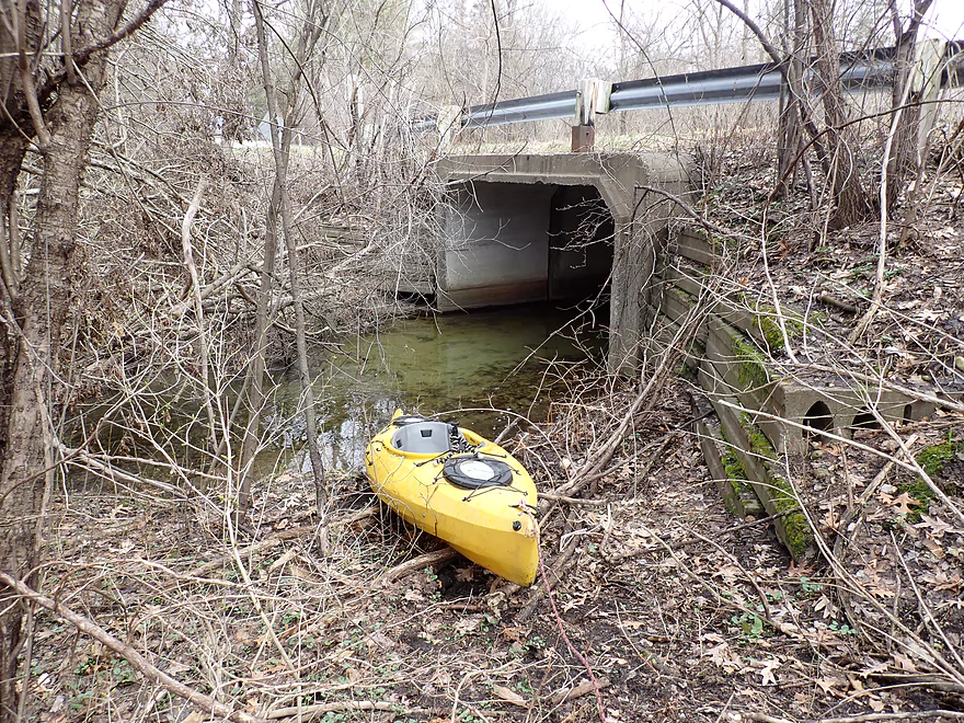
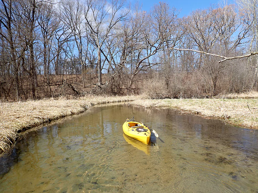
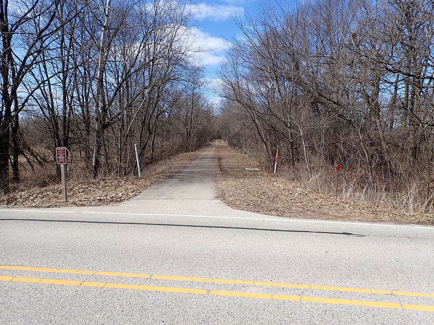
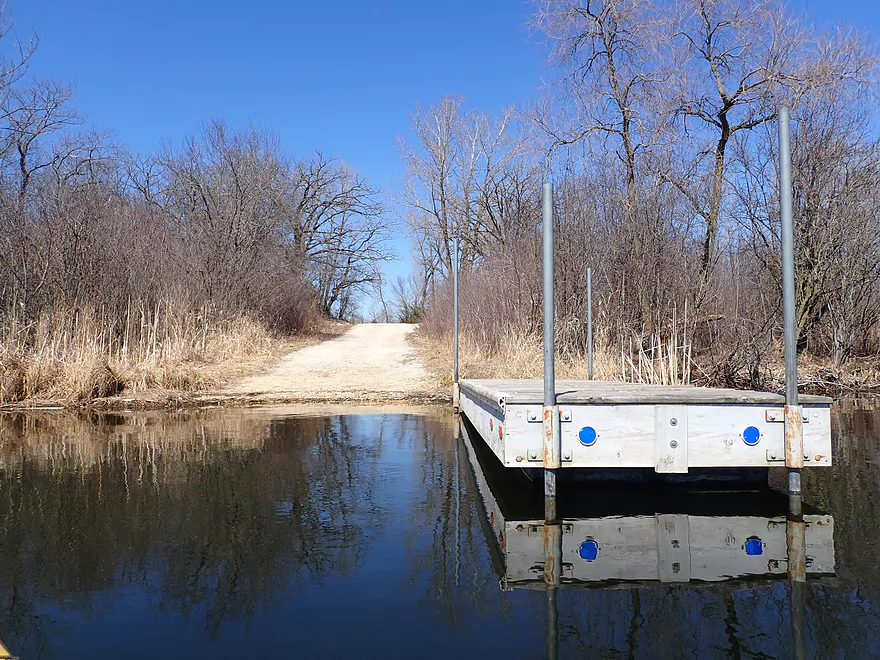
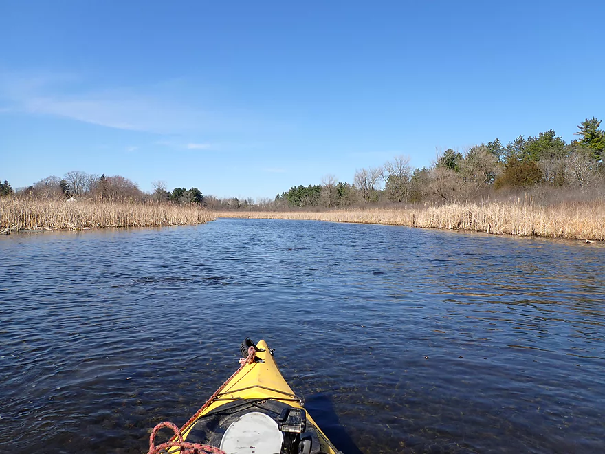
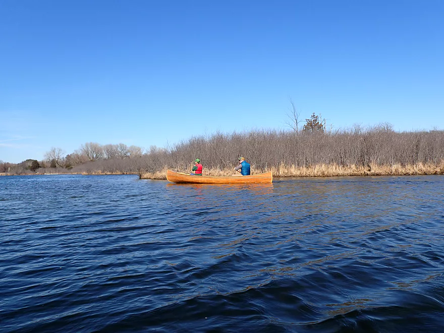
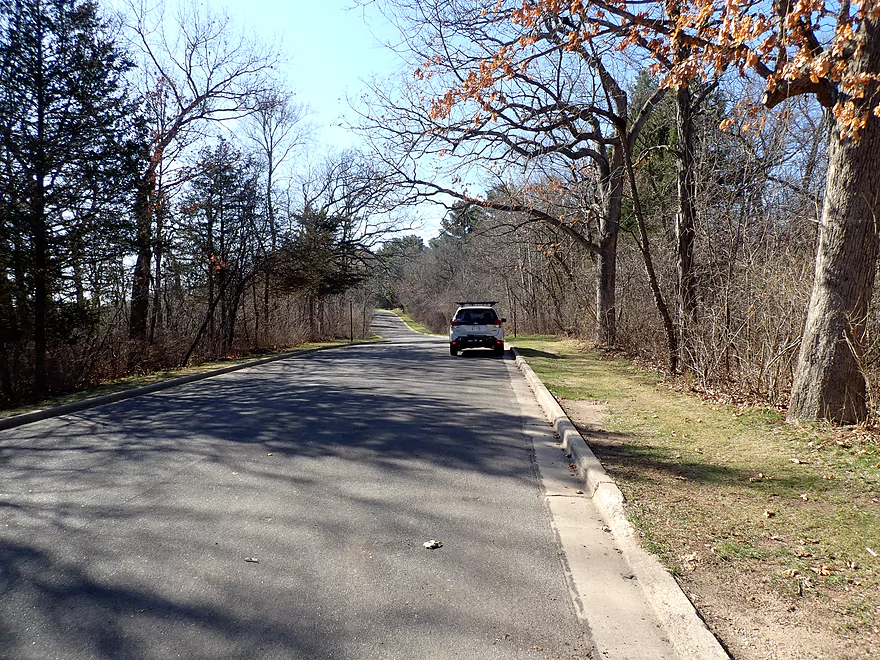
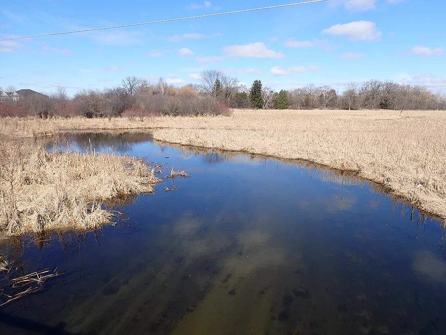
Starting the trip at Sunset Drive
There is a nice public launch here
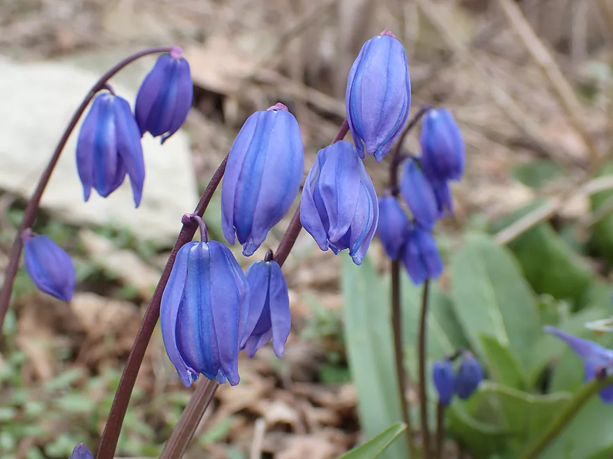
Squill blooming early
Paddling upstream to explore
Upstream of the dam is Waterville Lake
Heading back downstream
Sunset Drive again
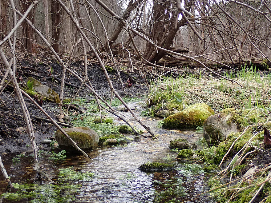
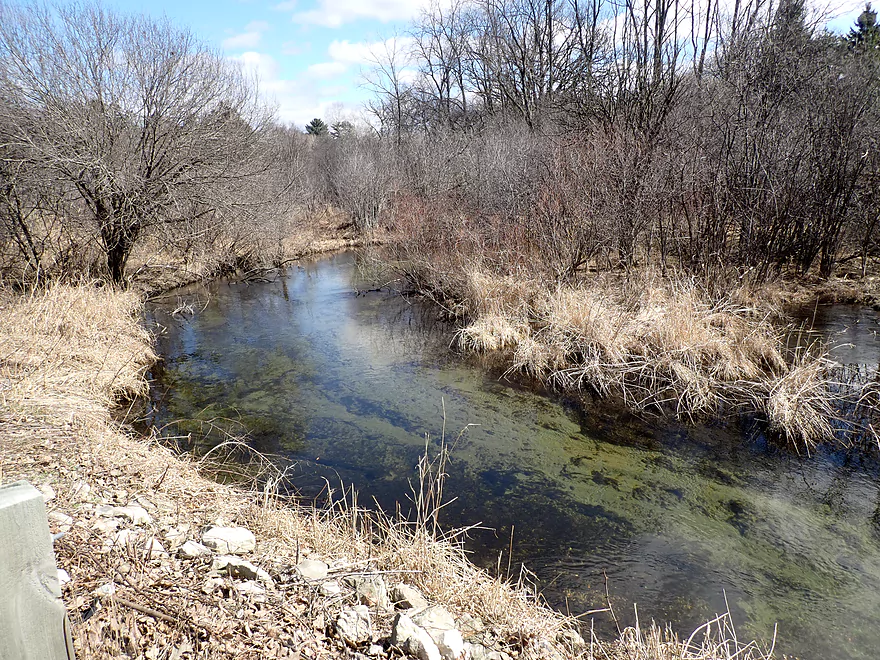
The creek is fed by a number of quaint watercress-lined springs
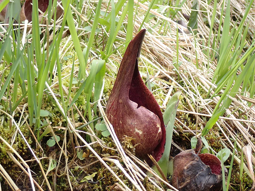
Early flowers of skunk cabbage–a common plant near springs
A few bumps but not bad
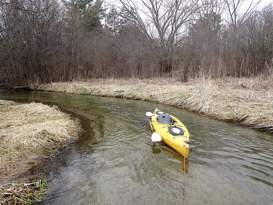
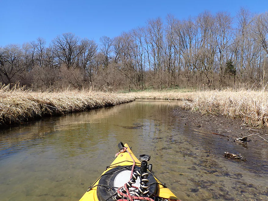
Creek is a bit small to start
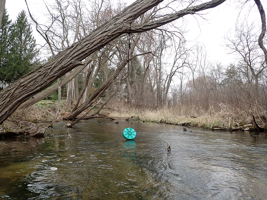
Nice spot for a swing
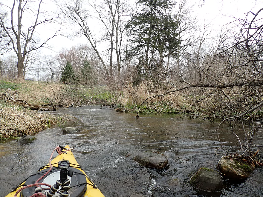
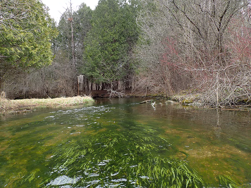
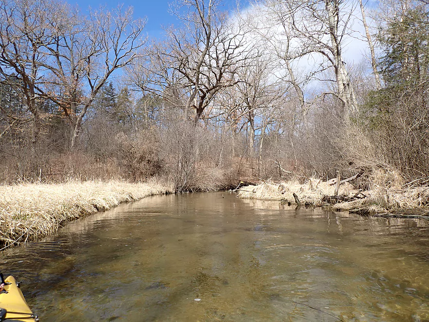
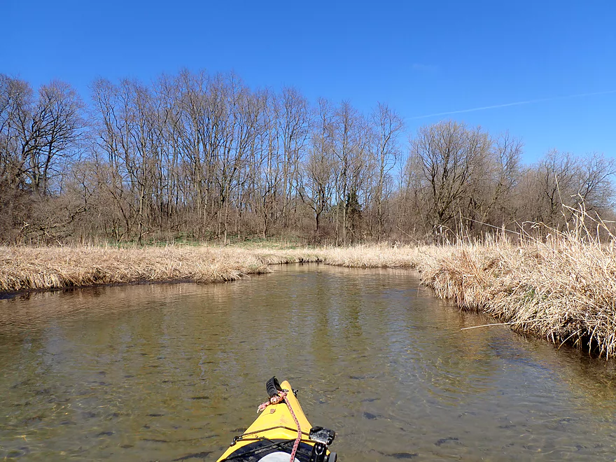
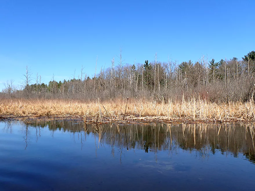
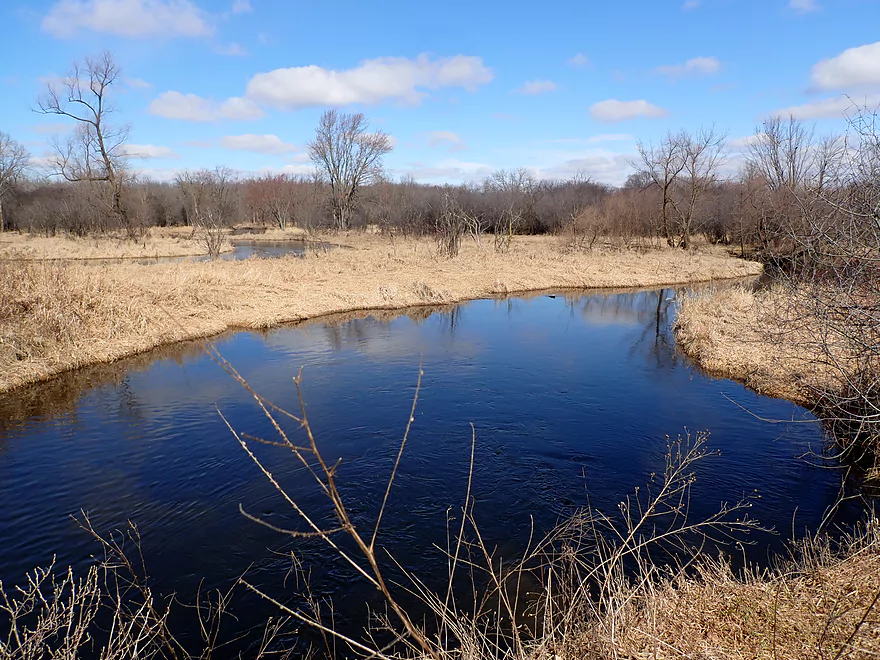
Very scenic creek with occasional white cedars
Reminds me of Cedar Creek
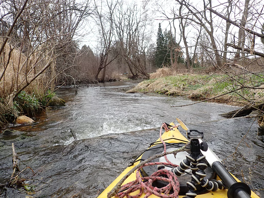
The strongest rapids of the trip
This will look very different in the summer
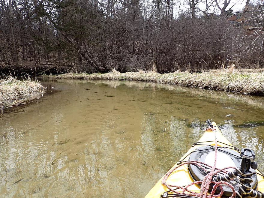
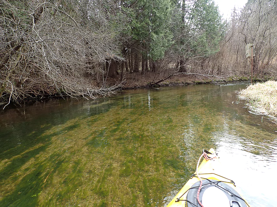
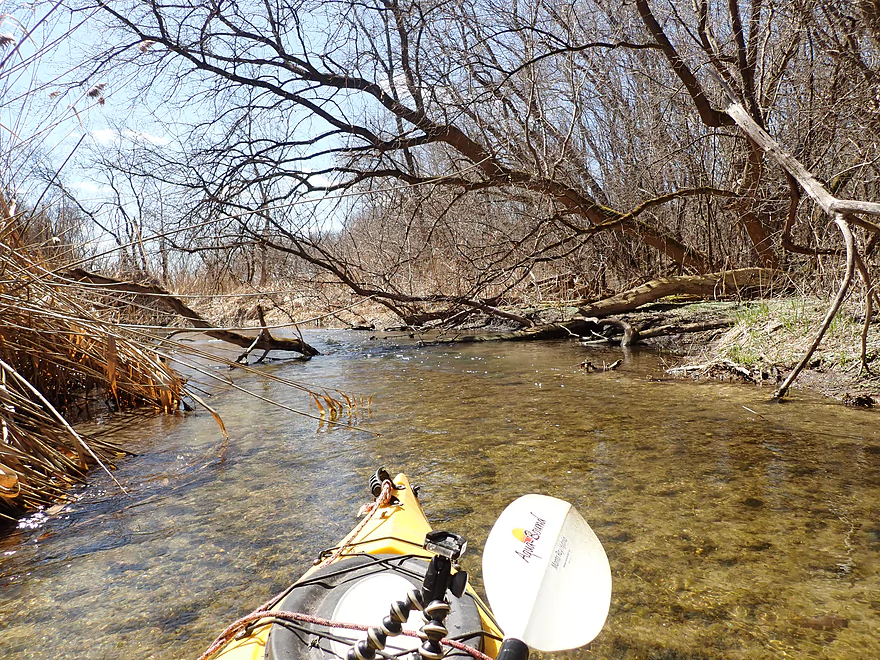
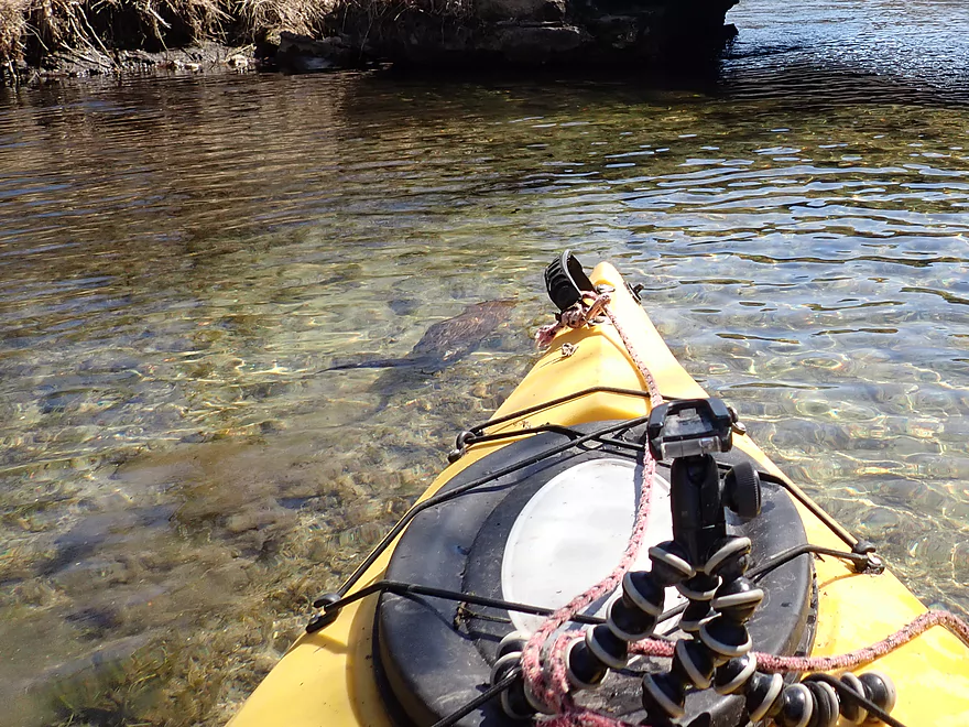
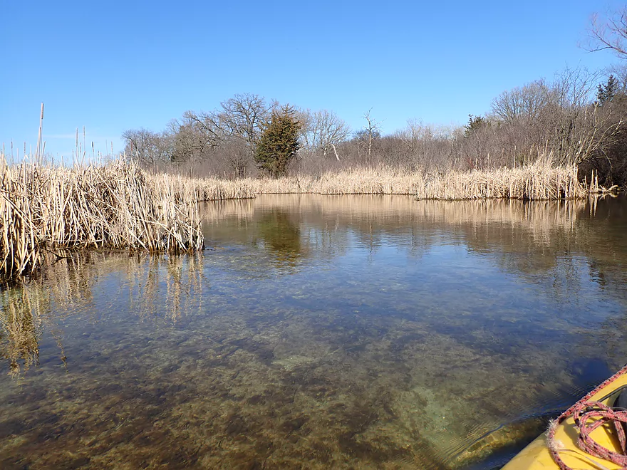
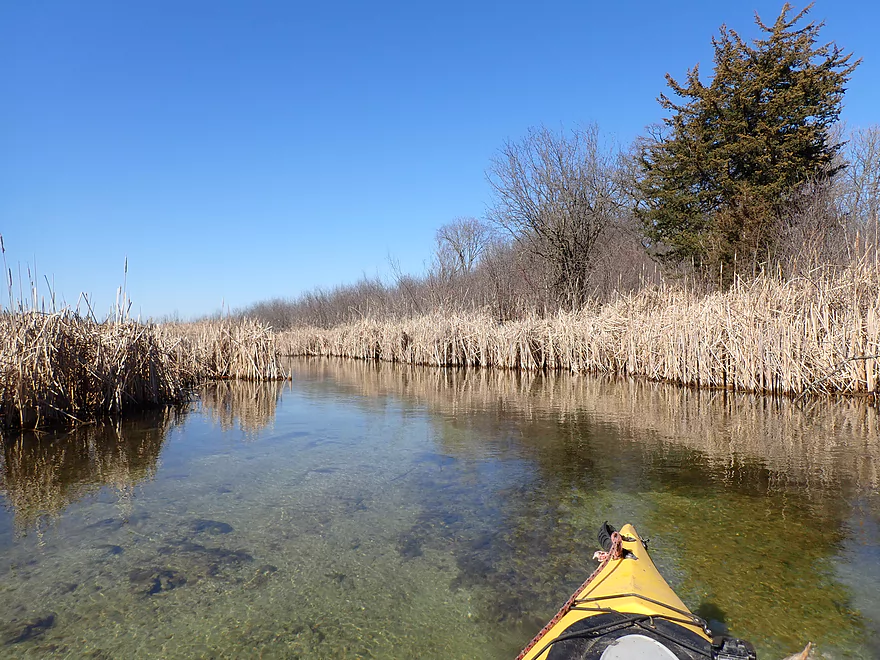
Fantastic clarity
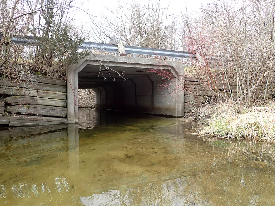
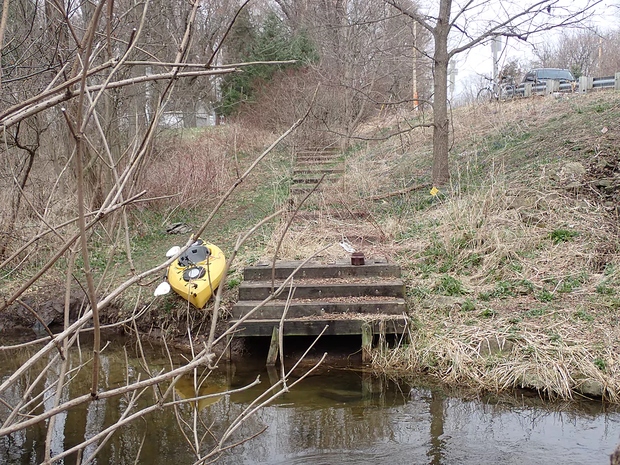
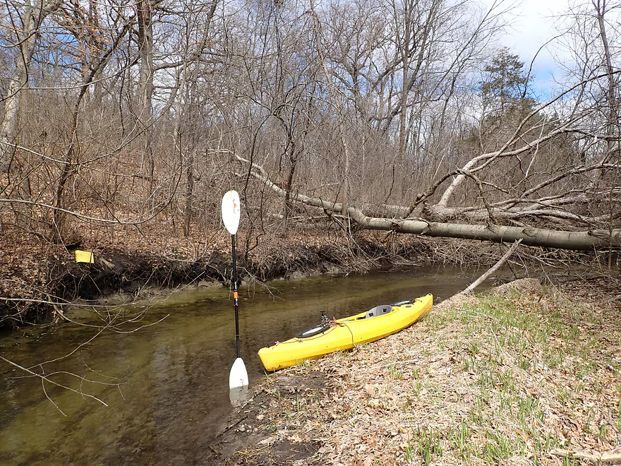
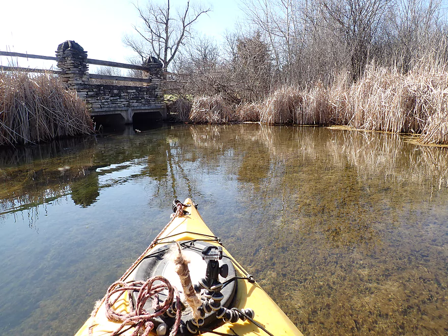
Waterville Road
View from the bridge
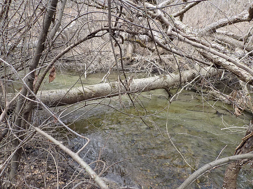
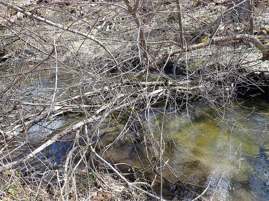
There is a downed tree after the bridge
Not a difficult portage
Easy re-entry
Attractive oaks

This REALLY reminded me of the upper Mecan River
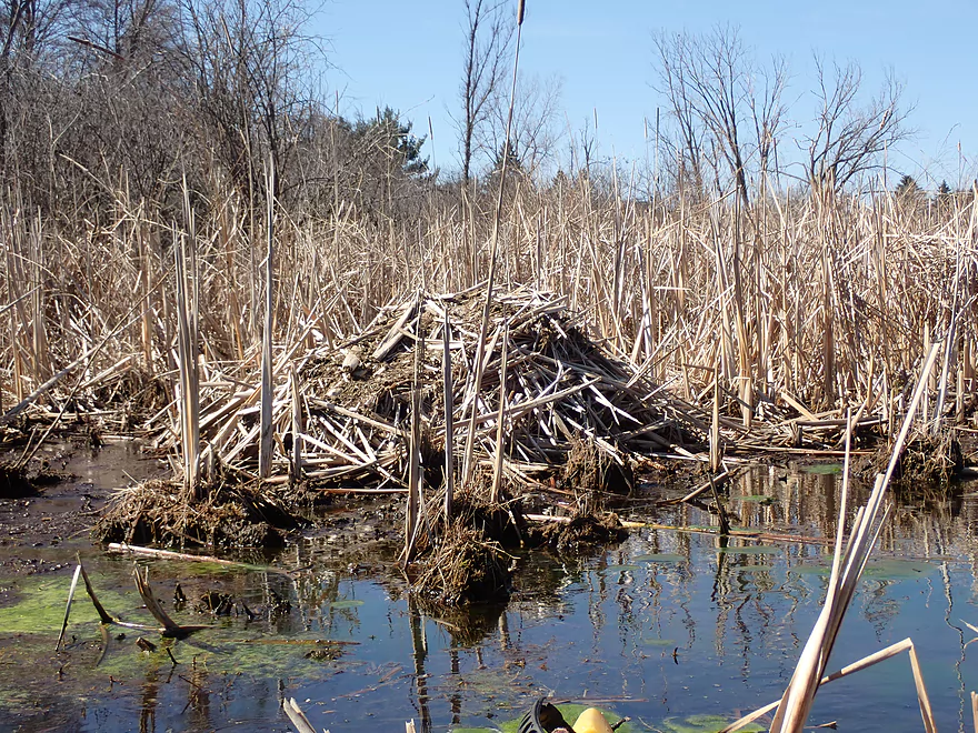
Another logjam (or in this case, a sapling jam)
An excuse to get out for pictures
Super easy portage
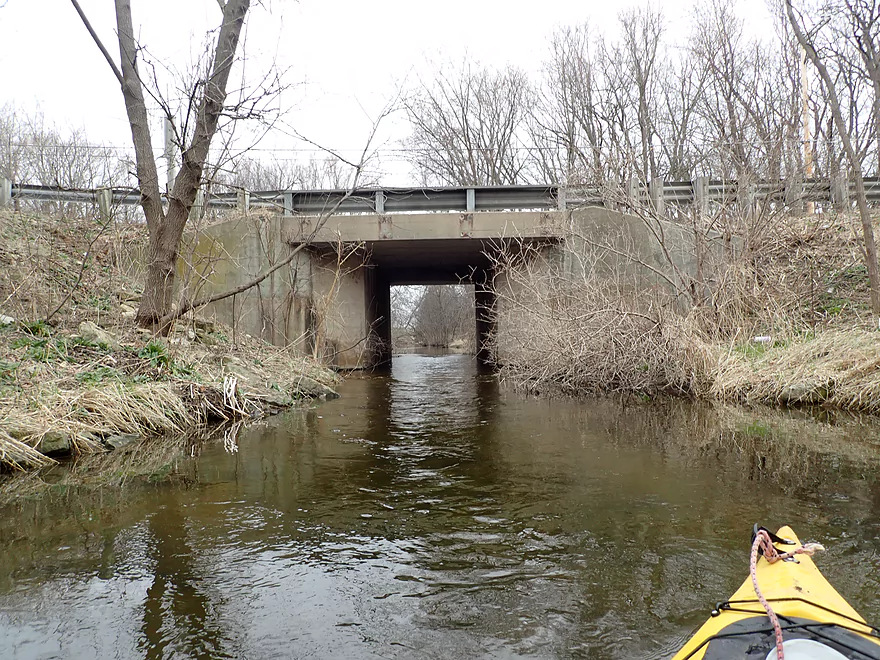
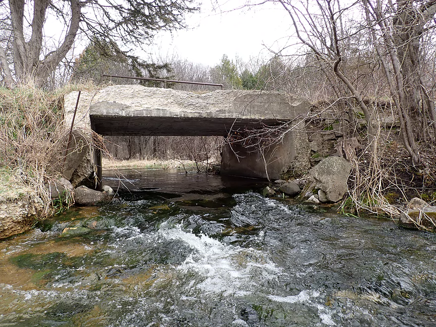
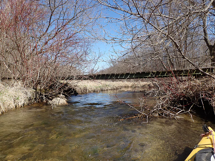
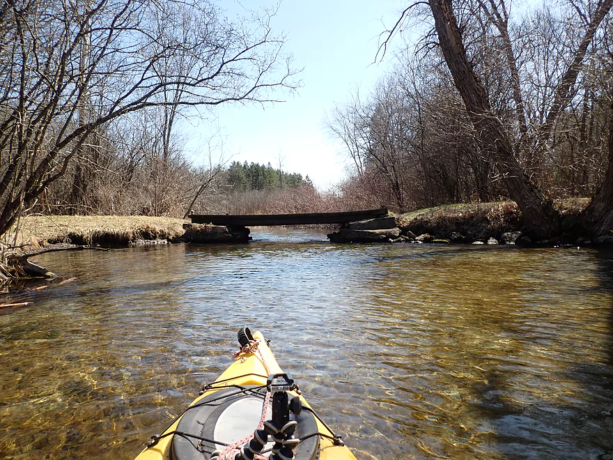
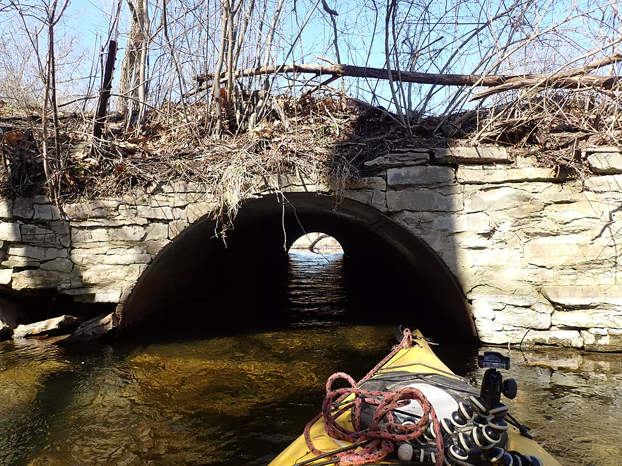
Approaching an old railroad bridge
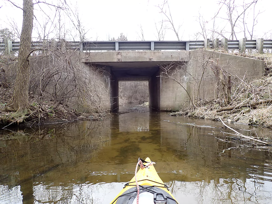
Built in 1915!
Part of the Glacial Drumlin State Trail
Some snags…nothing major
Very clean substrate
Some limbo-ing required, but not bad
Another remarkably “Mecan” like scene
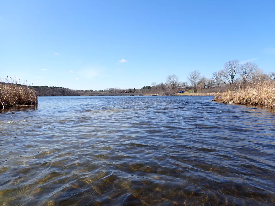
Entering Dutchman Lake…a natural kettle lake
The Lad Lake Campus is located on the north shore
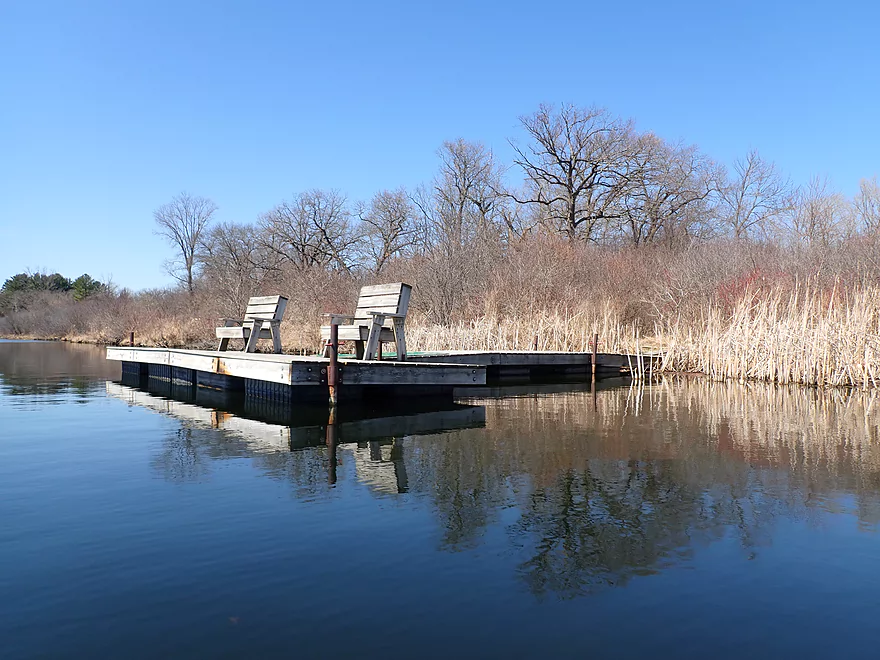
There is a nice boat landing here, but I think it is private

Kind of shallow for boats
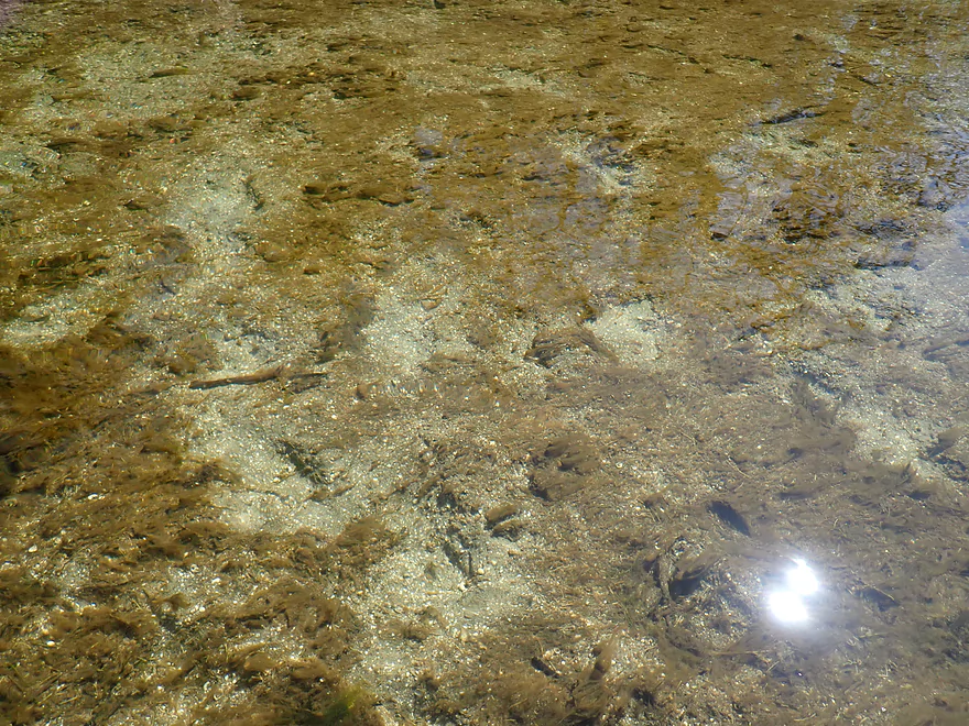
Great clarity…but some nutrient growth appears after the lake
Reverse view
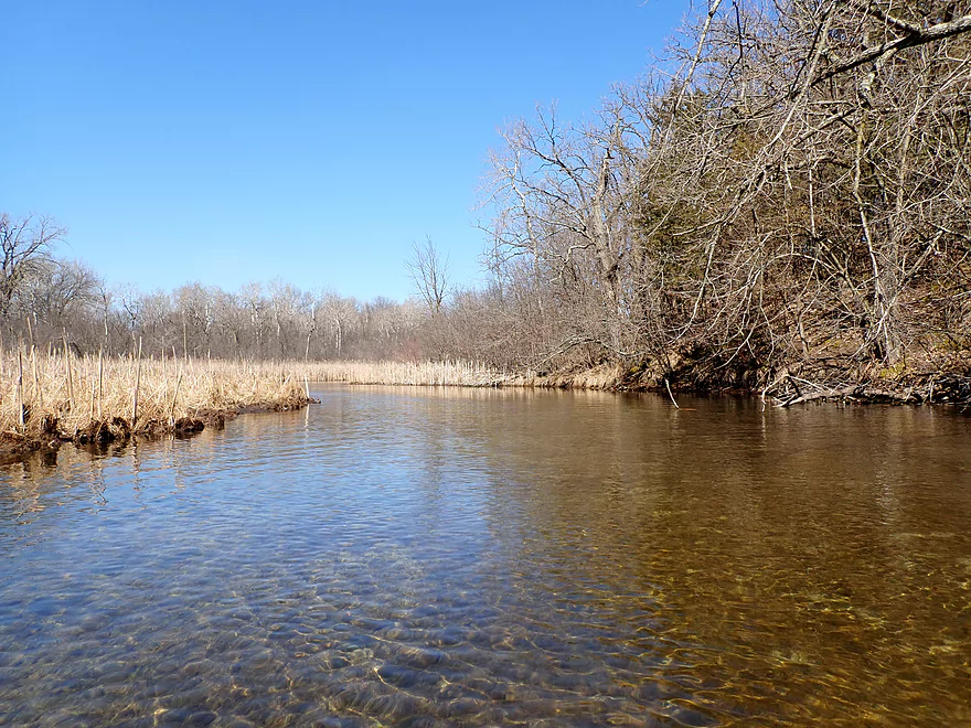
So scenic
Being passed by a muskrat torpedo
An absurdly low farm bridge
Easy portage
View upstream
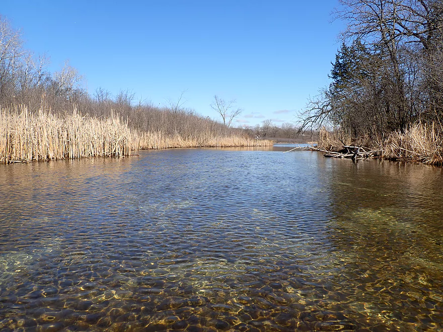
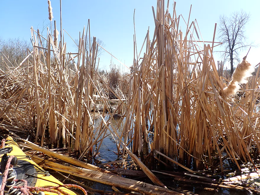
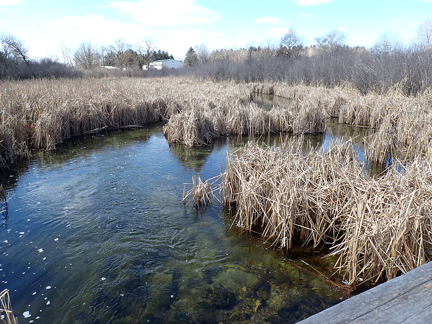
Entering cattail country
Some shoreline development but not too much
Something you’d expect to see up north…not in the Milwaukee metro area
More cattails
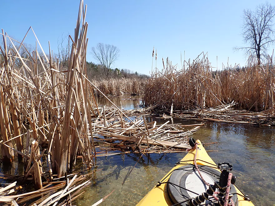
At one point they constricted the channel
…but it was easy to punch through
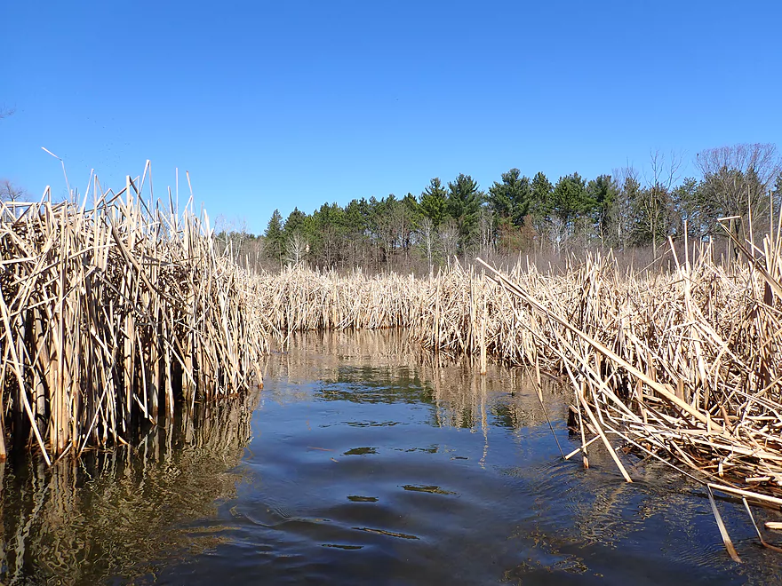
A cool cattail corridor
Another low farm bridge that must be portaged
Creek starts to slow and widen
Perhaps home to that muskrat torpedo I saw earlier
I think these are dead ash trees…victims of emerald ash borer
I fit under Parry Road…but this isn’t for the claustrophobic
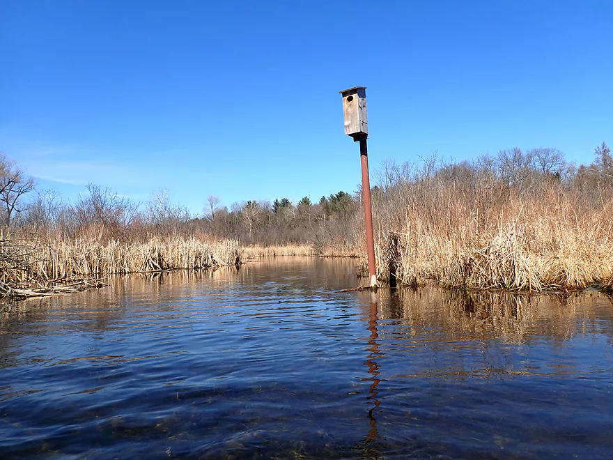
A very raccoon-proof bird nest
Entering Hunters Lake…another kettle lake
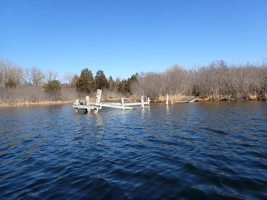
This pier has seen better days
It appears I’m not the only one into pandemic paddling
I won’t fit under Manor House Road
Oh well…future trip
Turning back to enter Hunters Lake again
More great scenery
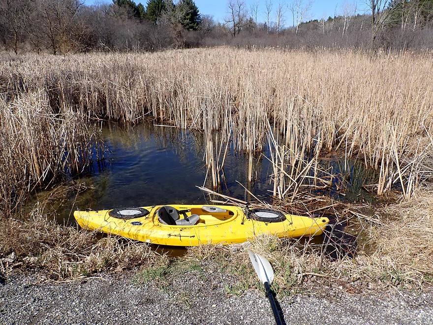
Taking out at the south end of Hunters Lake
Part of a larger public boat ramp
Parking is a bit tricky…another paddler parked here but was a bit exposed
Scouting Summit Ave/Hwy 67…doable but a busy road
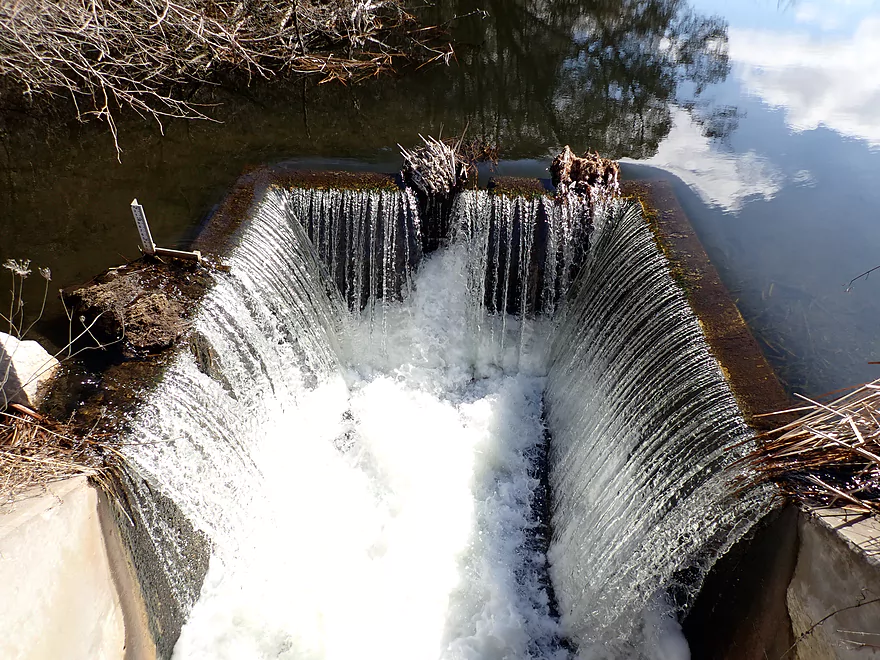
Scouting Mill Pond Road…doable…the dam must be portaged
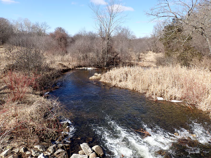
Downstream view
Hwy Z is a great bridge access option
Gramling Lane has a public launch…the Bark River is hiding in the upper left corner
Scuppernong Creek

Scuppernong Creek was a new prospect I was excited to explore for 2020. I didn’t know anything about it…only that it joined the Upper Bark (which I really liked) and satellite pictures appeared promising. It’s an easy creek to overlook given it is in the overdeveloped Milwaukee Metro area (just west of Waukesha and south of Delafield) and its name is confusingly similar to its more southerly and bigger neighbor, the Scuppernong River. In fact even Rick Kark who put together a fine paddle guide for Wisconsin accidentally conflated the two. Scuppernong is a Ho Chunk word meaning “sweet-scented land.”
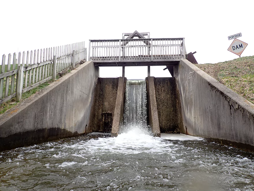
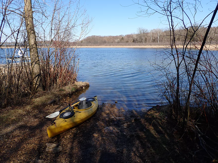
My trip started at Hwy 18 where there was an improbable public access. After launching, I headed upstream to see if I could find any alternate access points on Waterville Lake, but met a dam and had to turn around.
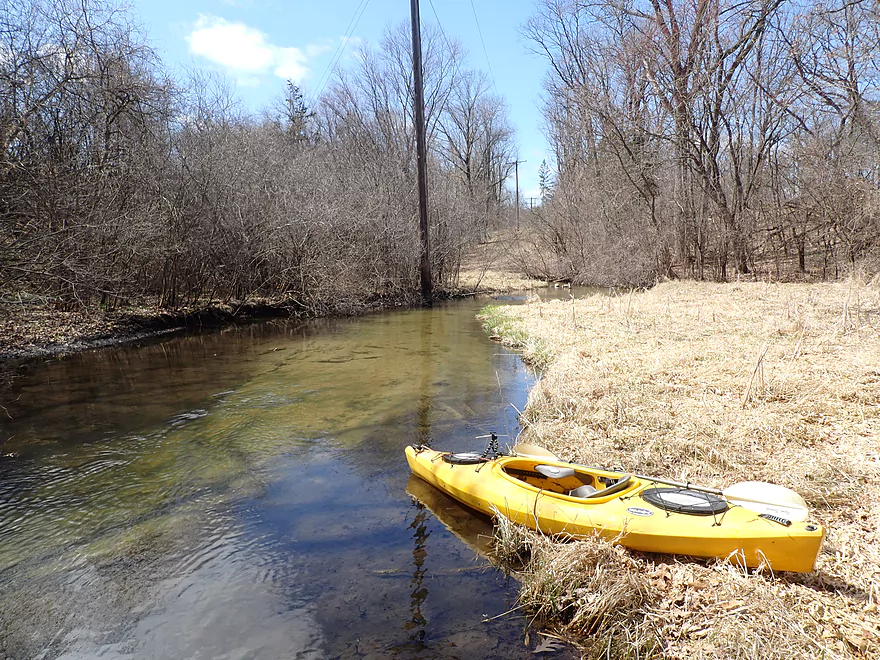
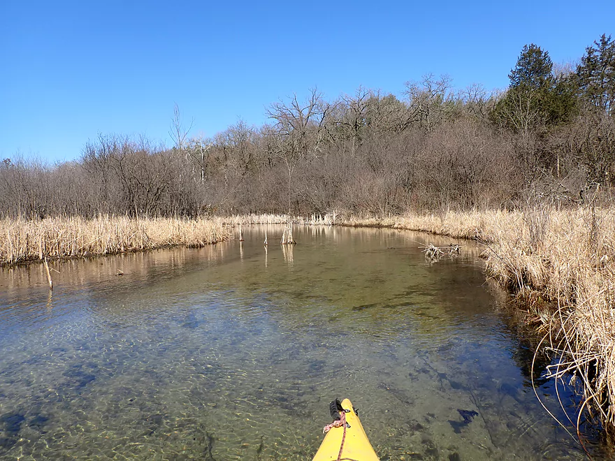
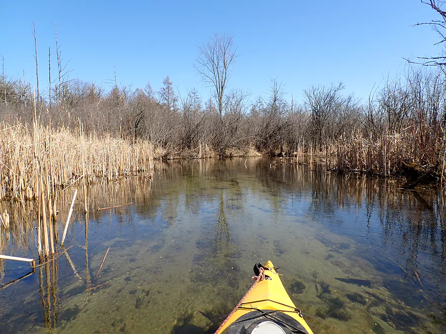
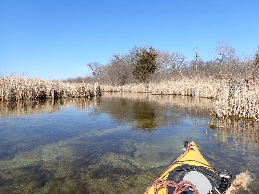
The first half mile of the trip was the most wooded and rugged. Highlights included light riffles, “Cedar Creek”-like cedars, natural springs and skunk cabbage. Scuppernong Creek (like the Bark) is located along the terminal moraine. Like most Ice Age paddles, this has left the watershed surprisingly clean with little mud. The moraine also created many springs which help keep the flow rates stable and the stream banks healthy.
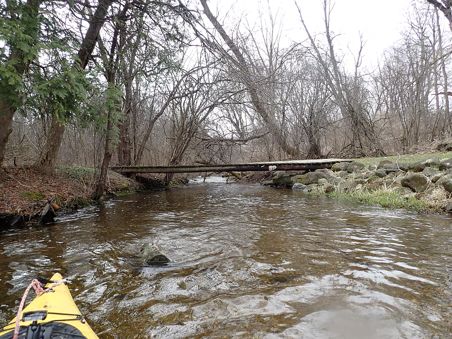
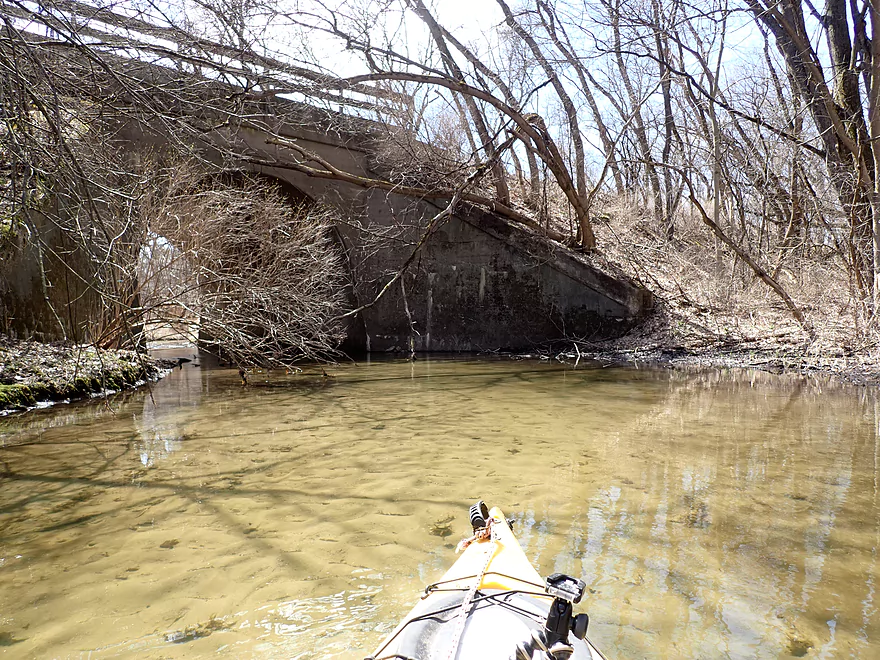
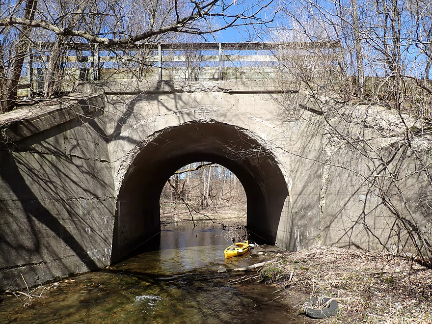
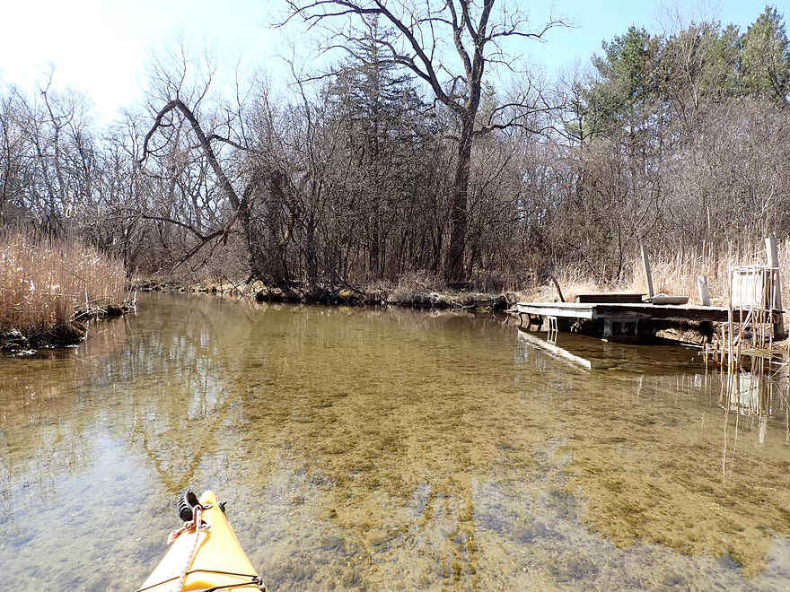
Just past Waterville Road, I encountered my first logjam, but it was a manageable portage along the left bank. The water quality here was fantastic but up until this point I couldn’t properly appreciate it because of the bad lighting (it was almost completely overcast). But once I passed Waterville Road everything changed…the entire sky transformed from a gloomy gray to bright blue skies in a matter of about 10 minutes. This revealed the clarity and color of the creek in all its glory. Another cool sight was paddling under a large stone arch bridge built in 1915 that is now part of the Glacial Drumlin State Trail.
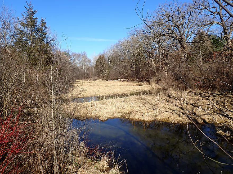
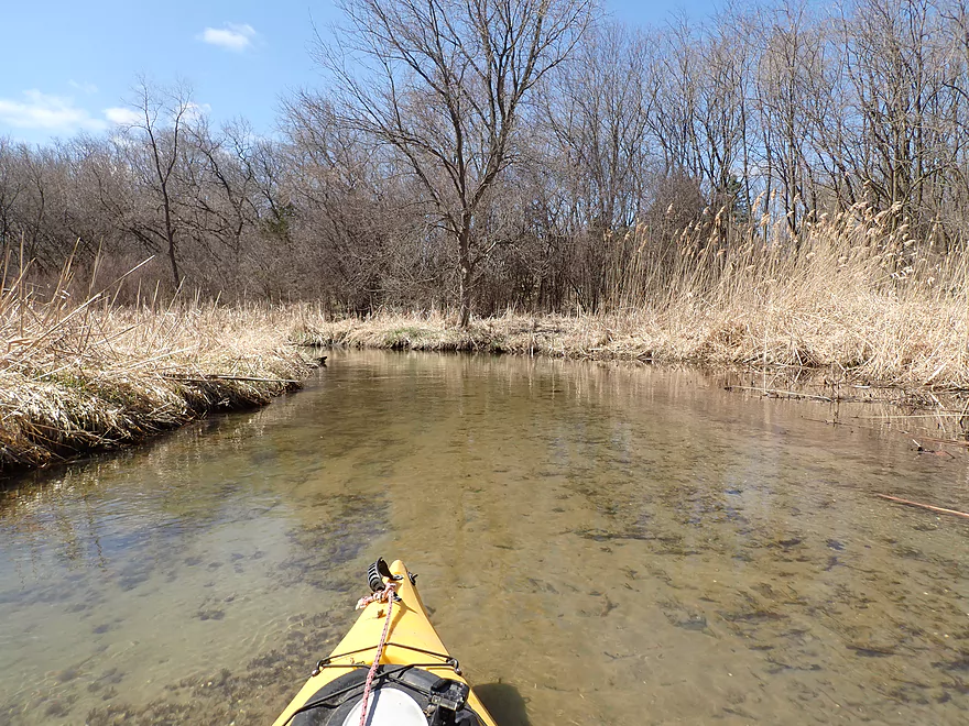
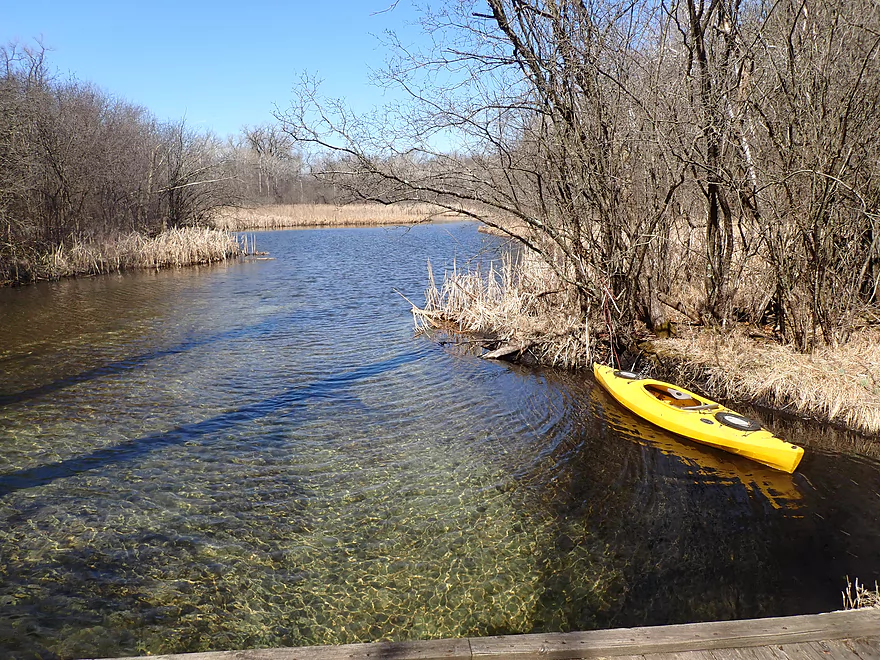
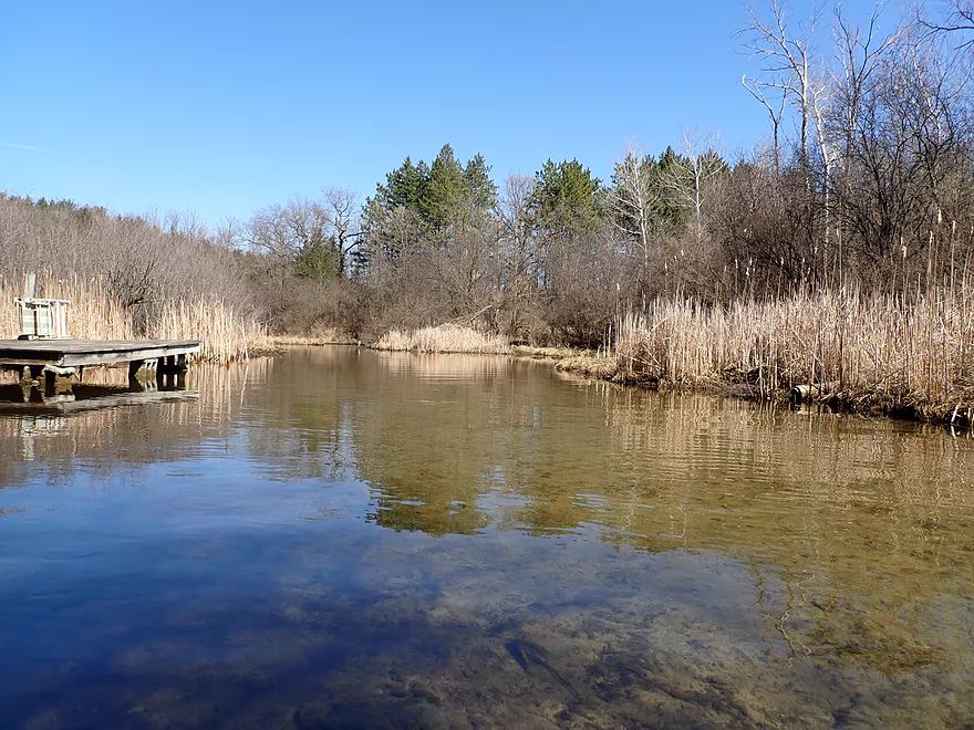
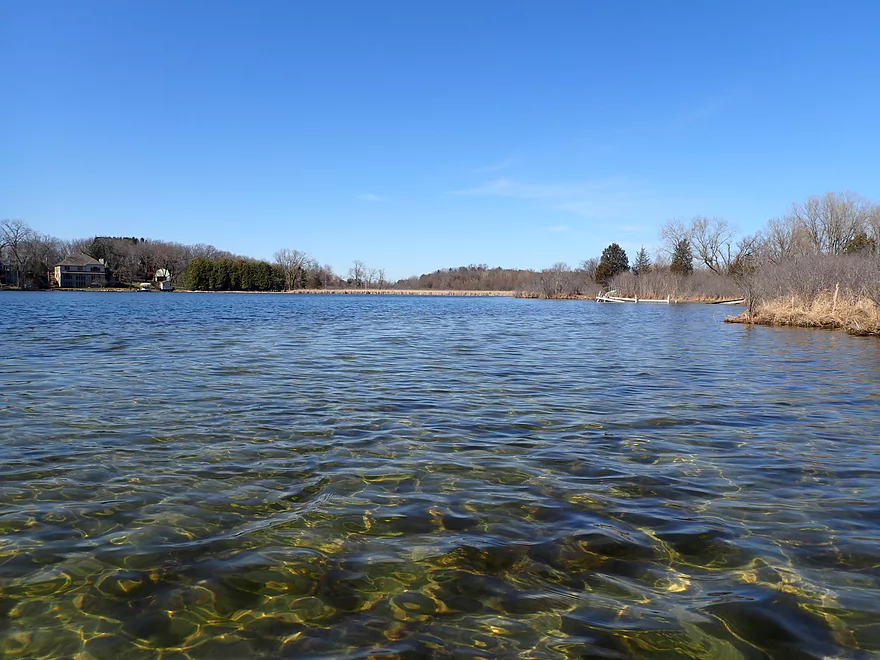
About one mile into the trip the woods started to recede and the creek began to open up into more of a wetgrass paddle, but the scenery was still good. I then entered Dutchman Lake…which unlike 99.9% of “stream lakes” was not a dam flowage but rather a kettle lake formed when melting chunks of glacial ice left depressions in the landscape. The lake itself was pleasant but not super exotic. Along the north shore is the Lad Lake Campus which hosts troubled youth. It’s a large complex with shoreline facilities but I didn’t see anybody there. Unfortunately some nutrient growth did appear in the channel following the campus and I suspect the facility’s septic system is leaking into the otherwise pristine watershed.
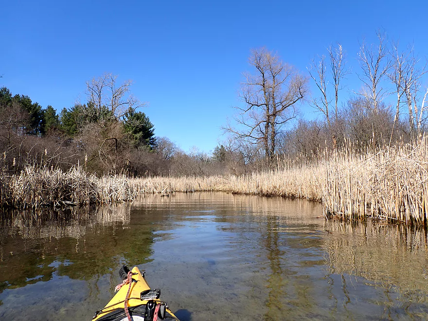
The creek soon resumed from a westerly outlet and was followed by some incredible Bark-like scenery. But like the Bark, Scuppernong Creek does suffer its fair share of low low bridges, and I soon had to portage my first. Cattails then started replacing the grassy shoreline. The clear water, narrow channel and tall cattails created a bit of a tunnel effect which was a neat experience. But the problem with cattails is they do occasionally engulf a channel and that did happen briefly here…but it was minor and I was able to punch through with little effort.
Following another absurdly low farm bridge, the creek opened up and straightened out. I then arrived at Parry Road which is a doable access option…but was unfortunately also low bridge #3. I did paddle through the culvert, but it was a bit disconcerting as the downstream side was lower than the upstream side, and it was difficult to maneuver in the fast current. I fit ok, but for other paddlers I recommend portaging along the left bank.
Following a short stretch of cattails, the creek opened up into Hunters Lake, which is yet another natural kettle lake. The western end of the shore was heavily developed and filled with awful smoke from locals burning their leaves. But the eastern shore was quite rugged and scenic with several unique inlets, springs, and a creek tributary coming from the famous Parry Spring artesian well. Much to my surprise I passed a canoer also enjoying a “pandemic paddle”. At the southern end of the lake is a hidden but very nice public boat ramp.
But before I took out, I continued a bit to the lake outlet and Manor House Road. Here the old creek channel joins the new creek channel and creates a spectacular scenic stretch of cattails. Manor House Road like so many other Scuppernong bridges was way too low. I could have easily portaged had I wanted to continue downstream, but instead headed back to the lake landing to take out.
As I took out I met several other kayakers who were taking out. One had a face mask on…honestly I’m not sure this is a good idea. If I tip over, the last thing I want is a wet mask around my mouth when I’m trying to breath. At any rate the masked kayaker told me that a warden disapproved of my parking job. The boat launch consisted of a Y-like layout and I had parked at the far base with what I believed left plenty of room for boat trailers to turn around. At least I didn’t get a ticket. The parking situation is confusing here…another kayaker practically parked on the main road because of the lack of space.
In summary, this was a surprisingly nice trip with the highlights being the lack of mud, shallow banks, rugged but tidy scenery, and fantastic clarity. If you decide to do this trip…absolutely save it for a sunny day, otherwise you will not properly appreciate the clear water. Many of the scenes were eerily similar to another Ice Age paddle — the Upper Mecan River. Aside from the cattails I could have swapped images from these reviews without noticing the difference, which is a high compliment. I suspect most paddlers won’t give this five stars like I did, because of the two logjams and two low bridges…but don’t let this deter you as they were easy portages. I look forward to paddling the rest of the creek at a later point in time.
—
Webmaster’s update as of June 2024. Upper Scuppernong now has serious cattail issues and some major logjams. See comments below for details.
Parry Spring: It’s outlet feeds Scuppernong Creek but it’s not accessible by boat. There is a public pull-off here if you want to stop and fill your containers. The water tastes pretty good and I do understand why it’s so popular with locals.
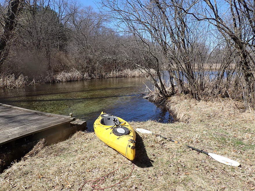
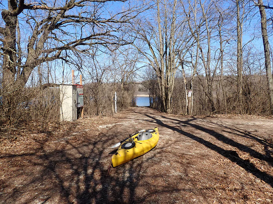
Hwy 18/Sunset Dr: Despite having a private vibe, this is a good public access option. There is shoulder parking for three cars southwest of the bridge and a trail leads to the water where there was a nice launch area.
Alternate Put-ins: There really aren’t any. Upstream is Waterville Lake which is surrounded by private land with no sign of a public access. Then downstream of Hwy 18, Waterville Rd isn’t a practical access, and while there is a nice boat ramp on Dutchman Lake, I believe it is privately owned by Lad Lake Campus.
Manor House Road Boat Landing: There is a hidey but nice boat landing located at the south end of Hunters Lake. The only issue is parking. I thought I parked plenty out of the-way, but apparently a warden felt I was blocking boat trailers that needed to turn around (I wasn’t). Alternatively you could park on the street but because the roads have curbs, your car would kind of be exposed to traffic. I saw a Suburu park here so maybe that is ok. You definitely can’t park by the bridge as there are No Trespassing signs there.
Alternate Take-outs: You could certainly disembark on any of the downstream bridges. What I ultimately suggest is to do the entire Scuppernong Creek experience in one trip and paddle all the way to Gramling Lane. Here there is a public pull-off and canoe launch…and it’s within sight of the mouth on the Bark River. This “complete” trip would be 8.9 miles and could be almost completely shuttled on the scenic Glacial Drumlin bike trail.
The bike shuttle was a bit hilly, but short at just 2.8 miles. Pretty easy.
Note, the Glacial Drumlin State Trail does cross the creek, however for my short trip it wasn’t a viable bike shuttle route. But as noted earlier, if you take out further downstream at Gramlin Lane (which I suggest), the route can be be almost completely shuttled on the Glacial Drumlin bike trail. This trail does require a state trail pass.
Note, while I list a lot of things…don’t be too worried. There are a few portages but they are all really easy.
- Logjams:
- Logjam #1: Just downstream from Waterville Rd, a downed tree blocks the creek. The portage isn’t difficult because the banks are flat but there is some undergrowth to plow though. I didn’t find this difficult.
- Logjam #2: Just upstream of the Glacial Drumlin Trail bridge is a minor logjam that could be cut through with a handsaw. This is a super easy portage.
- Low Bridges:
- Low Bridge #1: After Dutchman Lake is a low bridge that has to be portaged. There is a super easy portage on the east bank.
- Low Bridge #2: A half mile upstream from Parry Rd is a ridiculously low farm bridge that has to be portaged. This is super easy to do along the east bank.
- Parry Rd: I made it through ok, but this isn’t for the claustrophobic. The clearance is low, the current quite fast, and the culvert is lower on the downstream side. There is a nice portage path on the east side of the bridge so don’t feel pressured to go under.
- Manor House Rd: This isn’t on the main route, but if you check this out (as I did) you’ll notice you can’t paddle under it. There is a small portage path on the east bank.
- Cattail Walls: One of the low farm bridges acts as a sediment trap allowing invasive cattails to engulf the channel. There is a way through though and the narrow cattail corridors are kind of cool…but in say five years, this leg might become sealed in.
- Rapids: There are a few minor Class 1 rapids just downstream of Sunset Dr. Nothing to be concerned about.
- Strainers: There were a few minor strainers and low branches, but nothing I found noteworthy. If in doubt you can always portage which is easy to do because of the flat banks.
Webmaster’s update as of June 2024. Upper Scuppernong now has serious cattail issues and some major logjams. See comments below for details.
Scuppernong Creek is largely spring-fed so is relatively stable throughout the year. There is a nearby gauge on the Bark River that should be a rough analogue.
- 0-25 CFS: A low depth and perhaps too shallow for paddling.
- 26-50 CFS: An average flow rate. There might be a few shallow spots but it shouldn’t be too bad. Clarity should be exceptional.
- 51-80 CFS: A higher flow rate, but still with good clarity. I did the trip at 58 CFS which was a good depth.
- 81-110 CFS: A very high depth, but I suspect the creek would still be navigable.
- 111+ CFS: I don’t think the creek would be attractive for paddling at this point.
For further information on access options, see the overview map.
- Upstream of Waterville Lake: There might be some sections ok for paddling, but I suspect there will be some serious logjams to deal with.
- Waterville Lake: There is a dam at the outlet with a portage path, but the lake is heavily developed with no sign of a public access.
- Sunset Drive to Manor House: 3.3 miles.
- Sunset Drive to Waterville Road: 0.6 miles. Cool leg with natural springs, pine trees, and a few light rapids. Super scenic. There are two logjams but they are easy to portage.
- Waterville Road to Parry Road: 1.7 miles. Great stretch with a mixture of lake and creek paddling with a lot of cattails. Two low bridges require easy portages.
- Parry Road to Manor House Road: 1.0 miles. Mostly a lake paddle (Hunters Lake) but does include some really cool cattail corridors.
- Manor House Road to Summit Ave: 0.8 miles. A great stretch with good scenery. Manor House Road is a low bridge and must be portaged. There is a slight path east of the bridge.
- Summit Ave to Mill Pond Road: 1.4 miles. A good prospect with more clear water. Some flowage paddling and a dam portage to deal with at the end.
- Mill Pond Road to Hwy Z: 2.0 miles. An open marsh paddle that looks nice.
- Hwy Z to Gramling Lane: 1.4 miles. A simple and open section. A solid prospect.
- Bark River: Just downstream from Gramling Lane is the mouth on the Bark River. For more information on Bark River paddling options click here.
Trip Map
Overview Map
Video
Photos Size:
We paddled from Hwy18/Sunset Rd to Mill Pond Rd. on July 16, 2020. I don’t think the Bark River at Delafield gauge is useful because the water was much higher than your April 4, 2020 photos, despite the gauge being lower for our trip. For instance, the Parry Rd. culvert that you paddled through only had a foot or so of clearance between the water and the top of the culvert for our trip.
The several portages weren’t bad, but paddling through the wild rice downstream from Parry Rd. in July was not for the faint of heart. At times all we could see was wild rice, so we had to paddle hard, pulling on wild rice with every stroke until we emerged next to the cattails on either side of the creek.
If you want to avoid slogging through the wild rice, it’s probably better to paddle this scenic creek in spring or fall.
Link to 4 photos: https://photos.app.goo.gl/d5EcPqQRMNKcm8KbA
Thanks Jon for the info…very helpful and interesting. It’s too bad that the Bark gauge isn’t a good analogue. The congestion issues after Parry are also unfortunate…and it wasn’t really a problem when I did the trip. Love the pictures! It really does look like a different creek though.
Don’t paddle this section of Scuppernong Creek unless you’re sure the cattail leaves haven’t emerged yet. It might be doable in April? Or November?
We paddled from Hwy 18/Sunset Rd. to Mill Pond Rd. on June 23, 2024. The cattails have completely blocked the creek between Dutchman Lake and Parry Rd. Even with unusually high flow, paddling through the cattails was impossible. At first we grabbed cattails near the base and pulled our solo canoes forward, but eventually had to get out and wade. The cattails were at least 7 feet tall, and the mud went from ankle deep to knee deep unpredictably as we waded.
The section downstream from Parry Rd. might be navigable if the wild rice isn’t tall. Maybe put in at Hunter Lake instead, to avoid the wild rice? We only made it though the rice bed because the water level was unusually high. (For comparison, the culvert at Parry Rd was completely submerged.)
There are also new logjams and stream-wide brush jams, mostly upstream from Parry Rd. We did this same trip in 2020. Then it was OK if you didn’t mind portaging and fighting through the rice bed. This year is was a sufferfest. Here’s a link to a photo of one of the new logjams, which required sliding our canoes over downed trees: https://photos.app.goo.gl/ZVK1BoViRsGCt9Fg6
In 2020 Aaron correctly predicted the cattail wall: “…but in say five years, this leg might become sealed in.”
Ugh…this is awful news. Sounds like only the Lower Scuppernong is viable now? I’ll update the main review to include your notes.