
Putting in at White Crossing Road
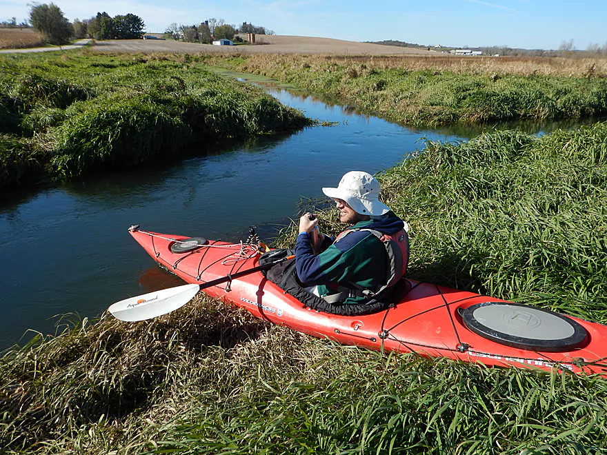
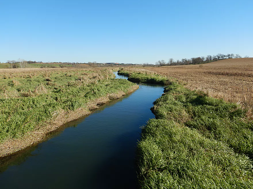
Pretty easy launch
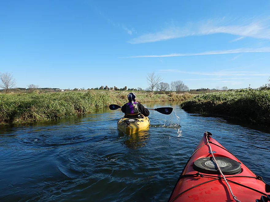
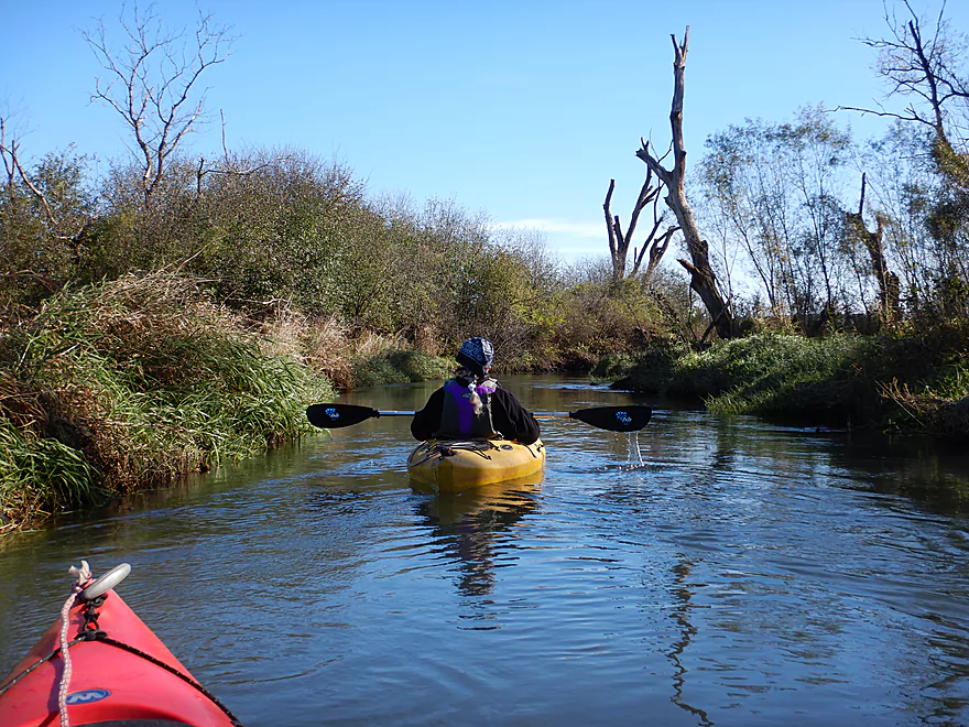
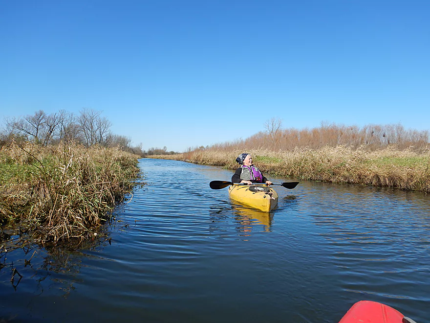
Reverse view
Reed canary grass everywhere
The first mile was surprisingly fast
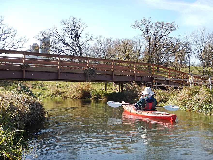
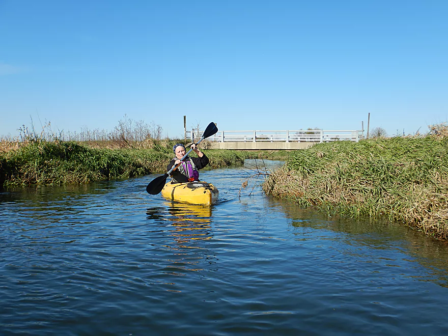
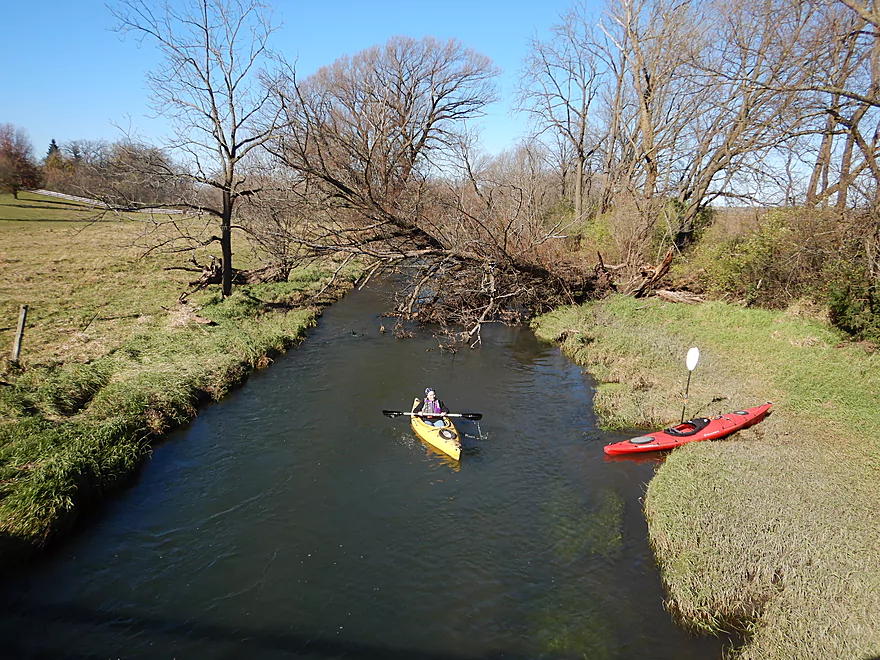
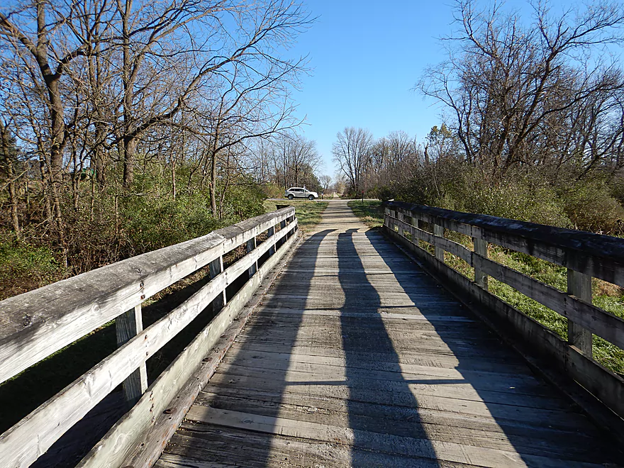
An attractive trail bridge
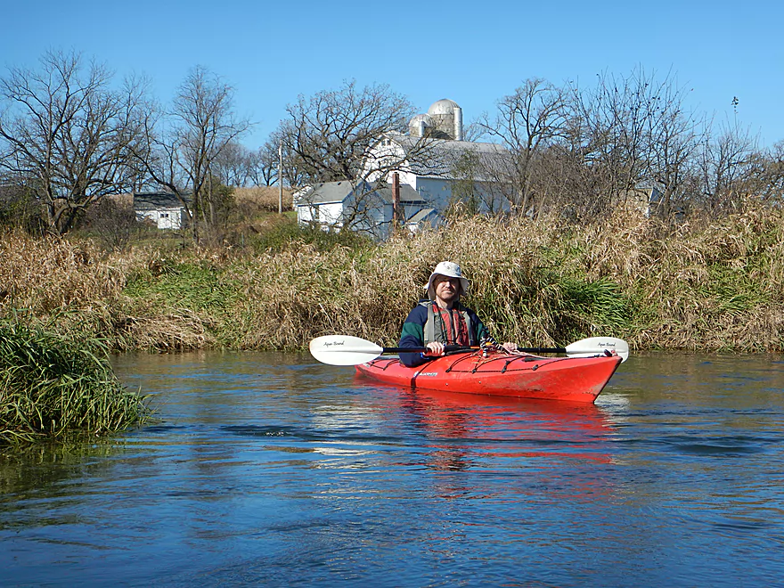
One of only a few homes on this stretch
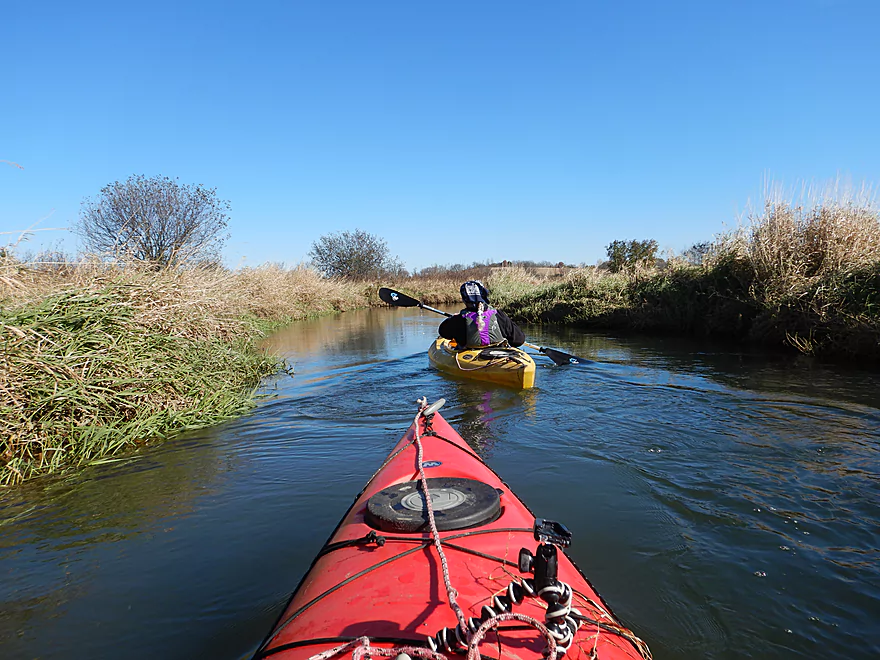
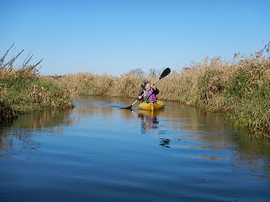
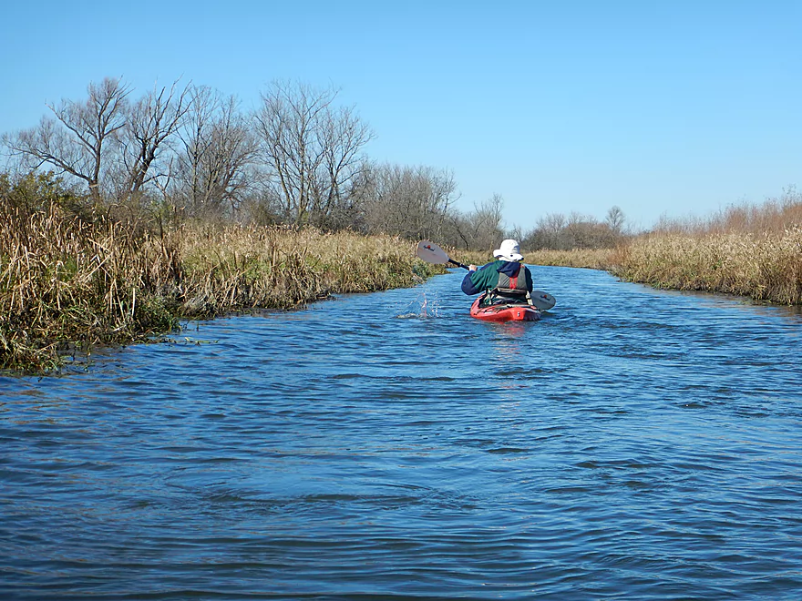
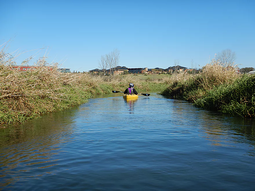
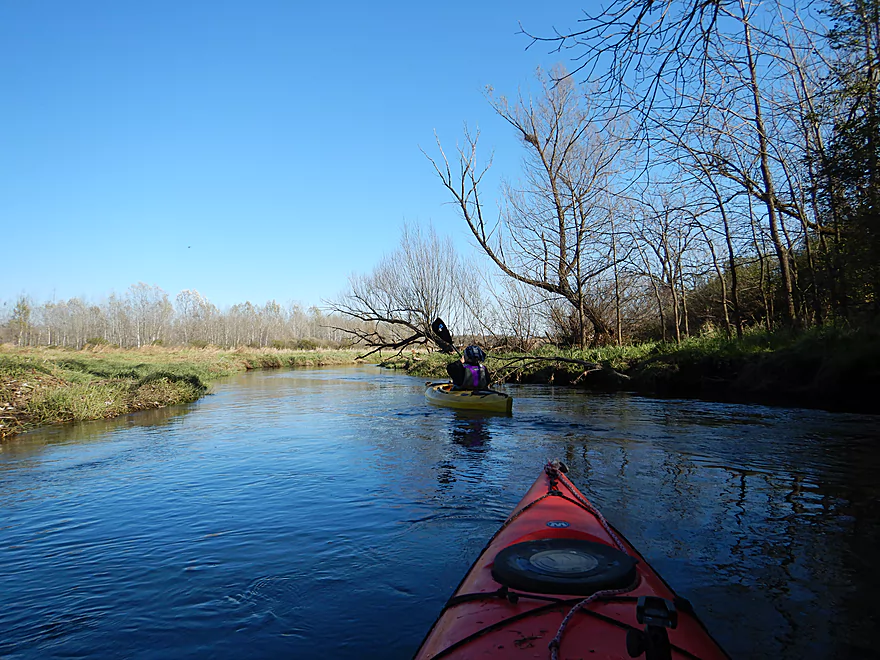
Mostly flat and open
But some buckthorn and black willow
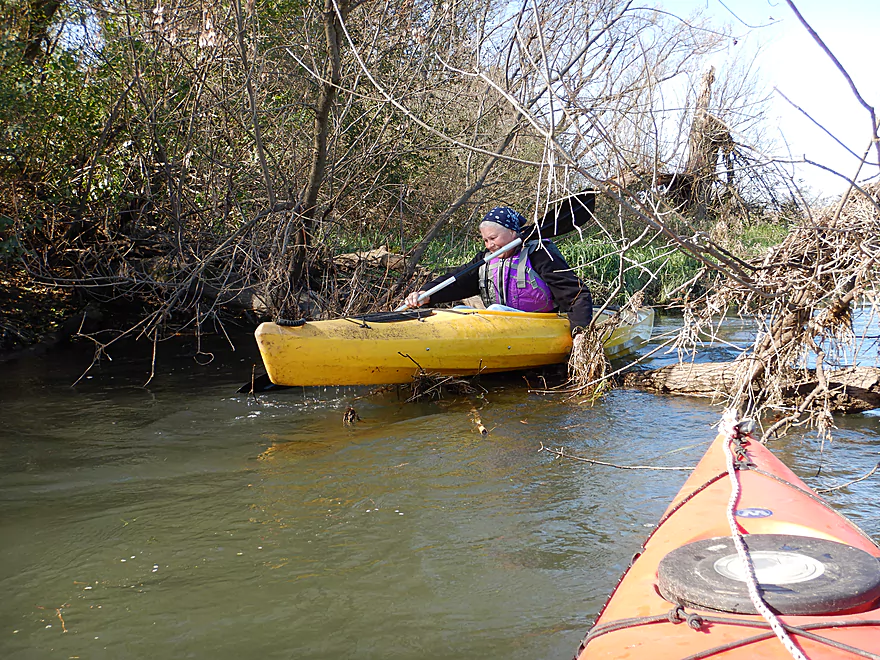
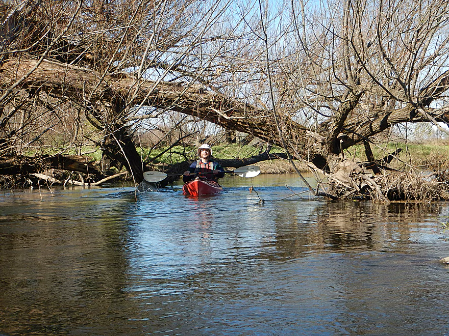
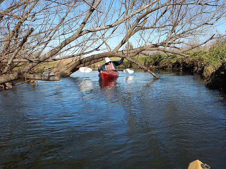
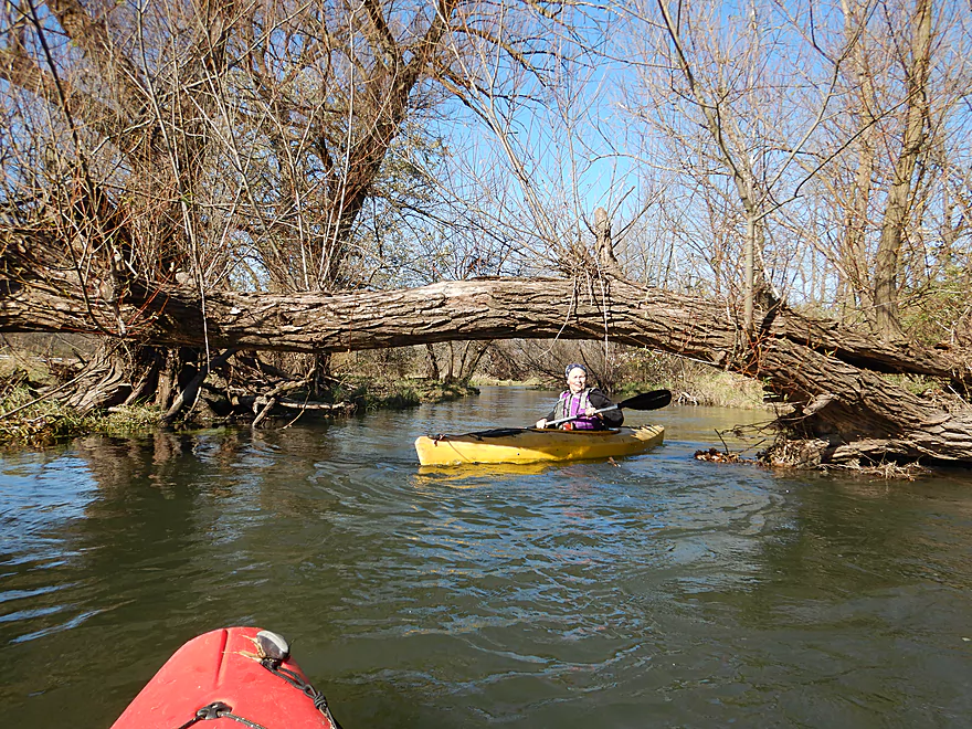
First logjam…we hopped over
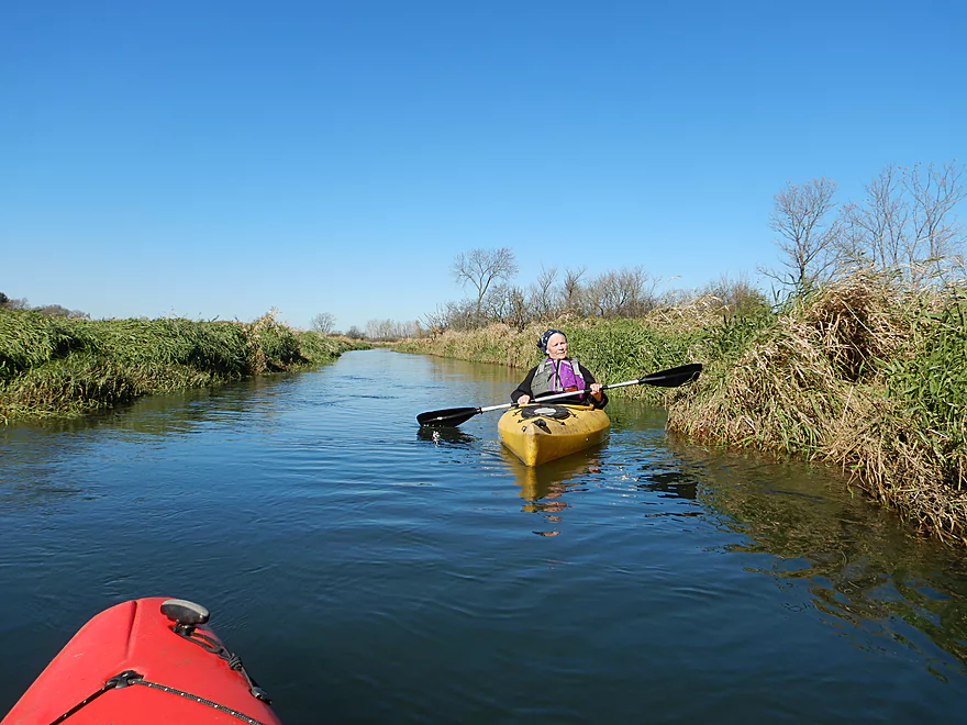
Parts of the river have been artificially straightened
Logjam 2a…another hopper
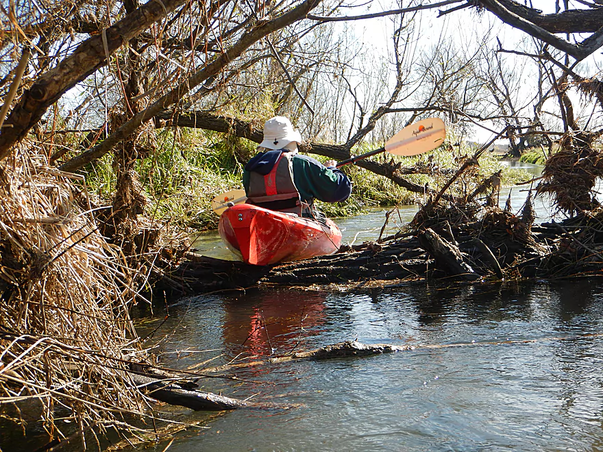
Getting airborne for logjam 2b
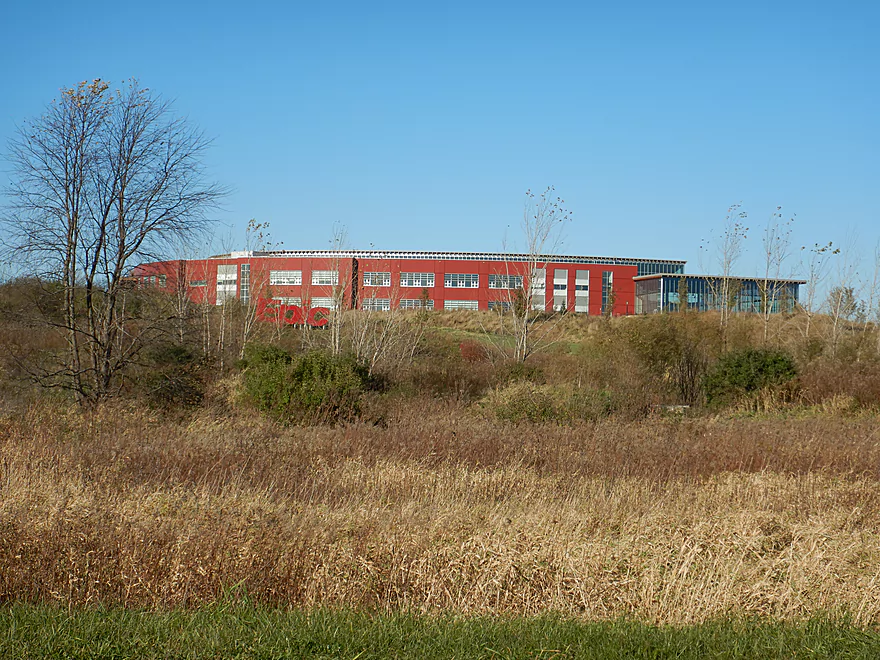
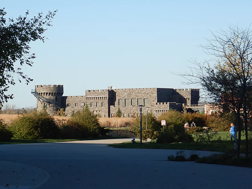
The Epic campus was a frequent sight
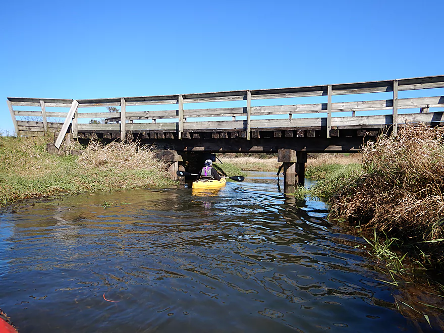
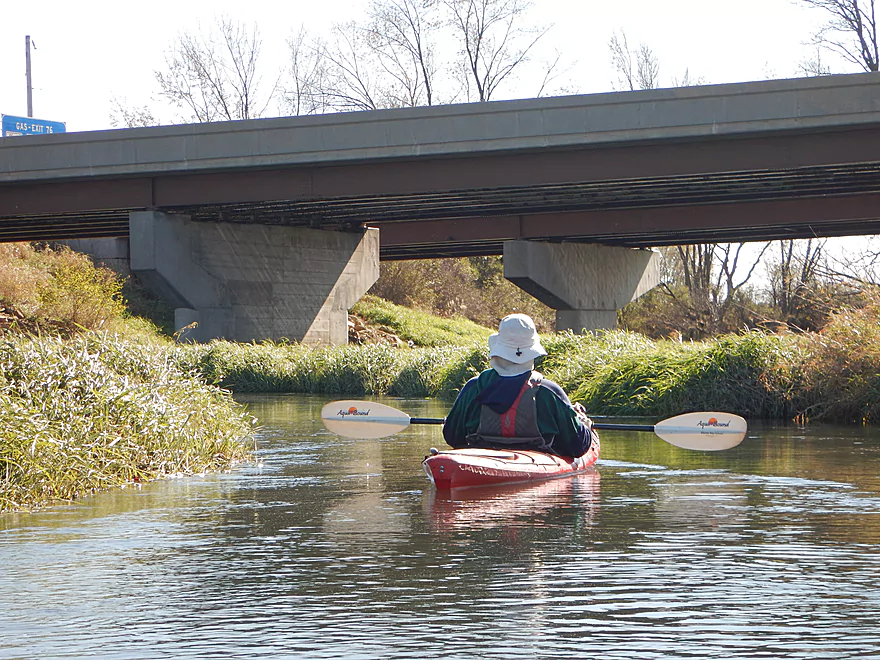
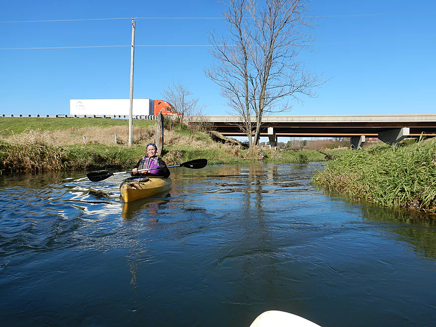
Paddling under the Military Ridge State Trail
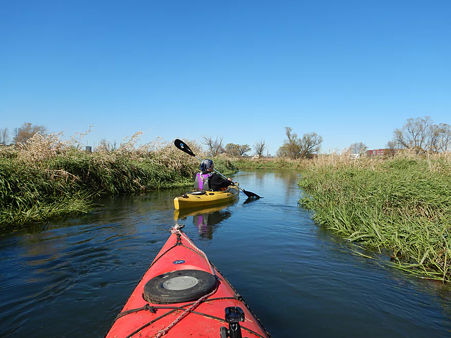
Checking out a tributary
Little wildlife on the upper portions of the river
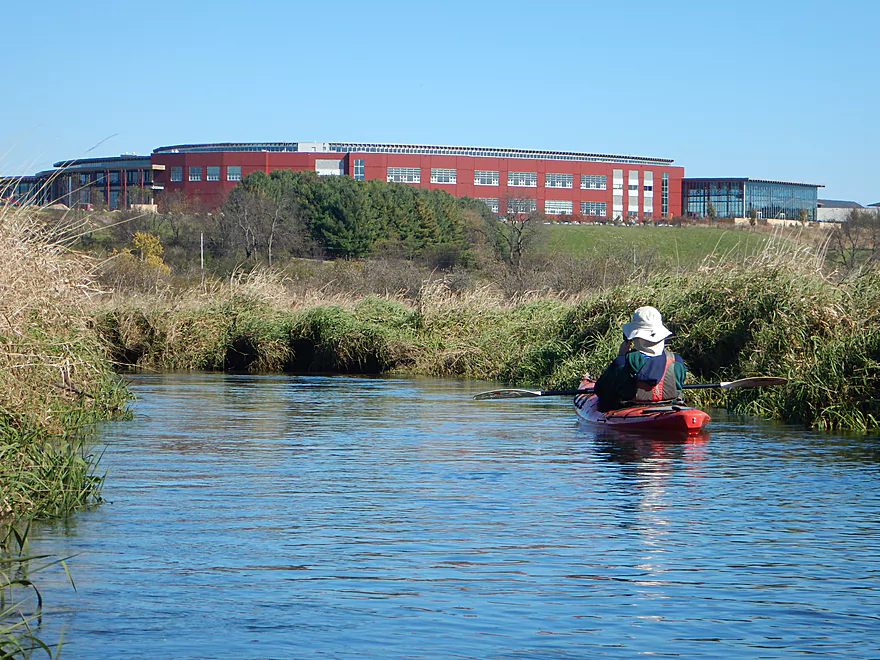
Starting to paddle closer to Epic
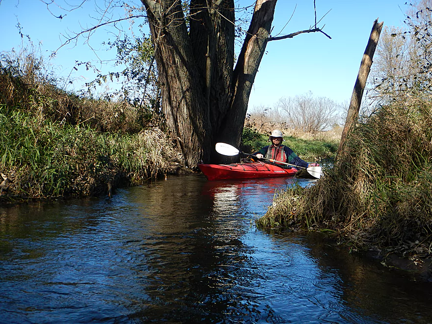
One of the only trees in the first half of the trip
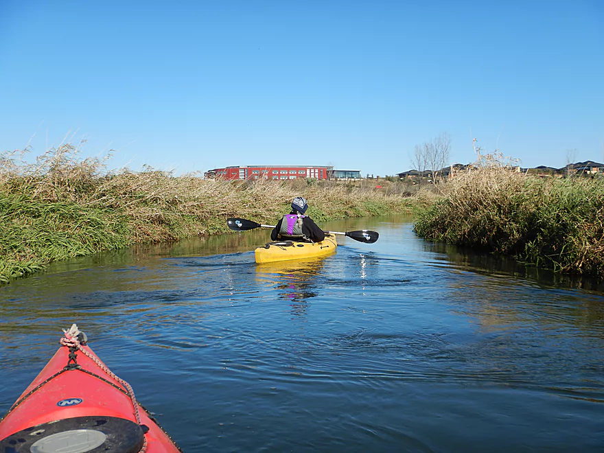
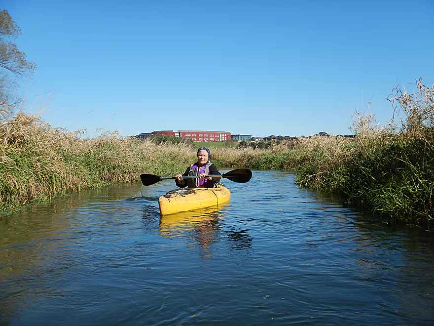
More Epic
Those tan buildings are also part of the campus (small part)
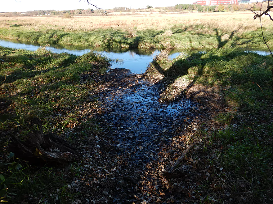
Bobcat Lane is a good launch option…but a bit muddy
Approaching Hwy 151
A very noisy highway
River gets very twisty after the freeway

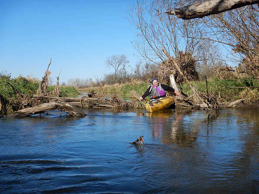
Some great cleanup work
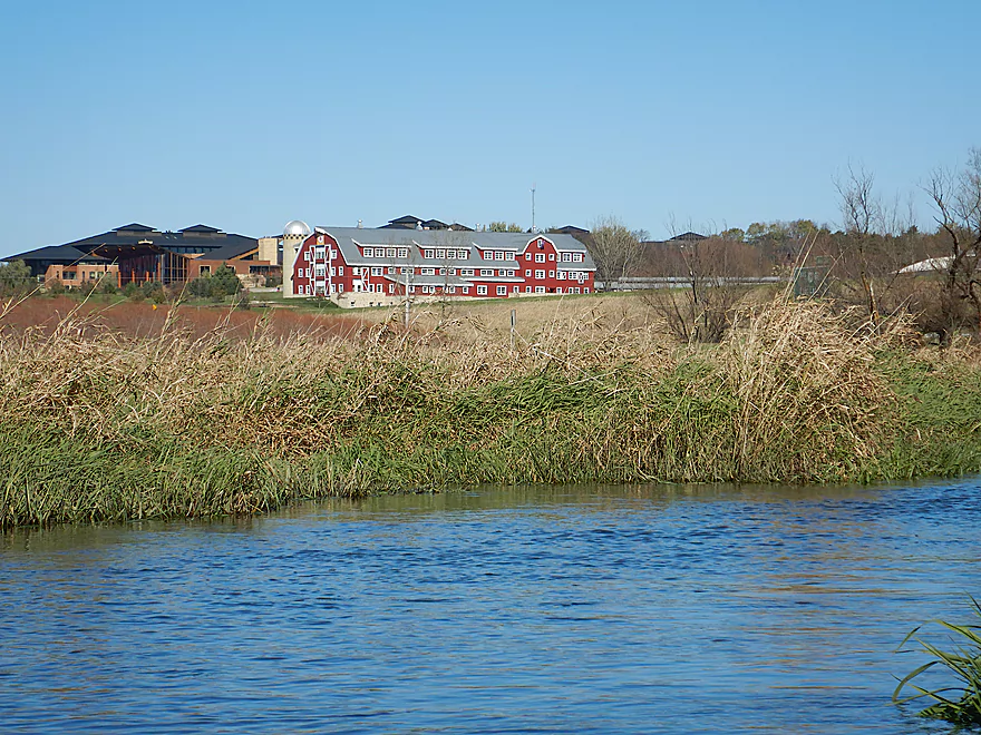
Barn with over 150 windows (more Epic)
This area was recently hit hard by floods
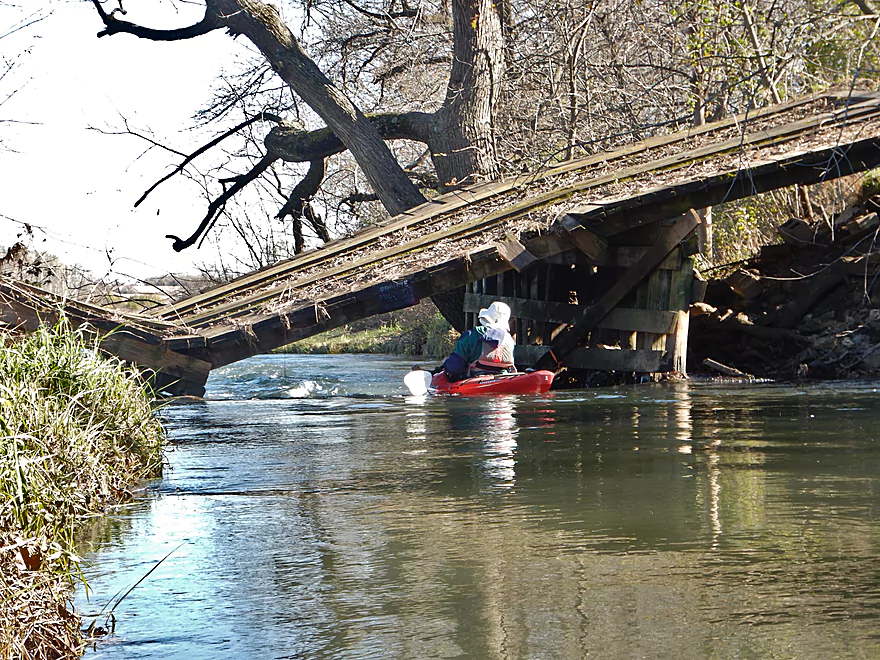
This farm bridge was partially destroyed by them
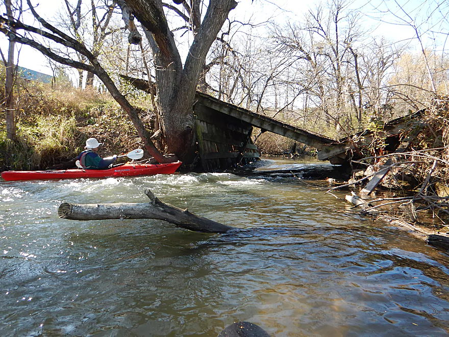
Some fun rapids underneath
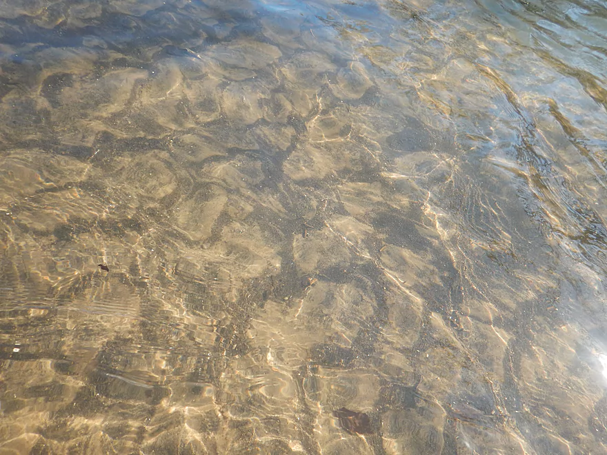
At times, surprisingly clear water
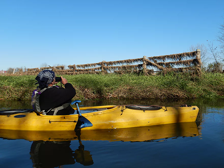
Hidden in those trees were countless blackbirds
Some downed trees…but always a way though after Hwy 151
A pretty easy ducker
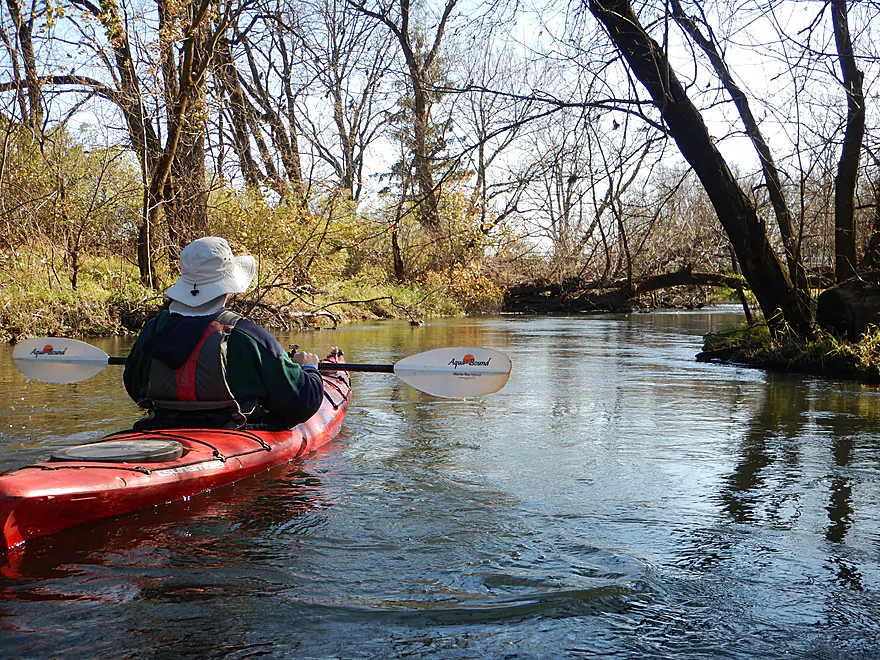
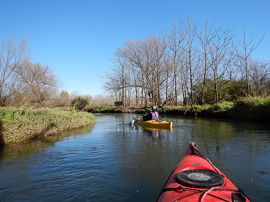
On the home stretch
A squirrel bridge
Taking out at Valley Road
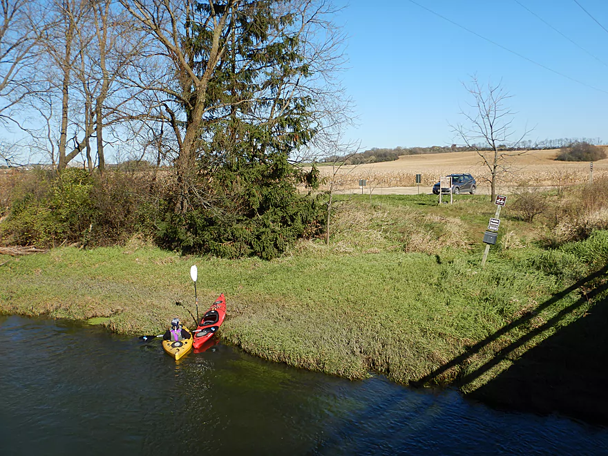
Good landing with signs visible from the water
Good parking too
Bike shuttlers can return on Military Ridge State Trail
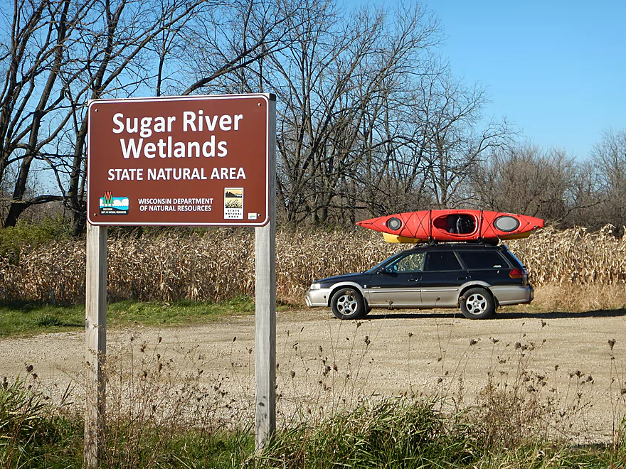
Time to tour the nearby Epic campus
Their themed conference rooms were great
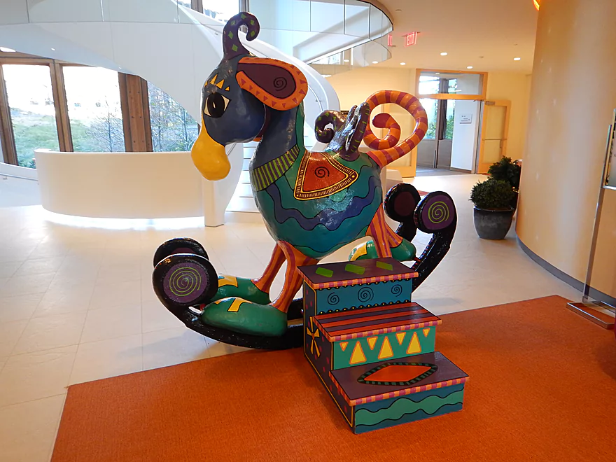
A nearby sign warns to use a spotter when riding “Rocking Ralph”
Sugar River – White Crossing Road to Valley Road

Not much typical for this time of year. We did hear some cranes and saw a great blue heron. The highlight was the huge and noisy blackbird flocks that were staging for migration.
A predominant visual for much of the trip was Epic Systems. From its huge red Learning Center to its 150+ window barn, it was quite the sight from the river. Being curious we decided to check out the campus after the trip. It turned out they had public self-guided tours which we partook in. What we saw was jaw dropping…and not something you typically associate with a corporate office complex. Sights included:
- Countless art pieces and sculptures
- An indoor tree house (there is also an outdoor treehouse)
- Themed conference rooms
- There was the Ice Palace (with “penguins” and “icicles” on the ceiling)
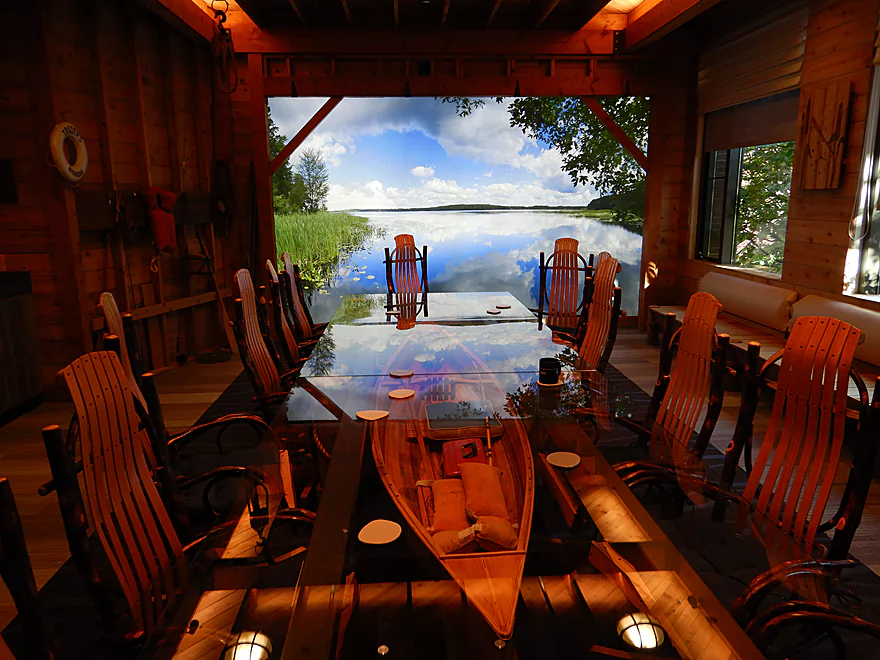
- The “Boathouse and Cavey Den” had a canoe under the conference table and a nice lake shot on the wall
- There was the “Farm” with all sorts of farm paraphernalia..
- And much more…
- A castle with a drawbridge
- An Indiana Jones themed hall
- In one location a waterfall ran over the building
- A huge tunnel complex connected the buildings and the parking lots
- The campus was so large it even had its own bus system
- A giant 8′ rocking horse (“Rocking Ralph”) with a sign…not prohibiting its use…but suggesting a spotter
- Next to some stairs were slides (these were fast too)
- A space theme was common…in one hallway there was a giant moon
- The “Deep Space Auditorium” seats 11,400, is underground, and has a prairie growing on top of it
If you are interested in a tour, just park in the main visitor parking lot under the solar panels (those giant wind turbines you see on Hwy 12…those are Epic’s). After you park, proceed to the main reception area in the Andromeda building where you can request a self-guided tour. The available times are usually 3-5 M-F, and 10-3 on weekends. You will be asked to sign in, wear a name tag, and to follow their rules. Then you are given a self-guided tour sheet. The easiest tour (and what we did) is the “Prairie Campus Tour”, but the “Farm Campus”, “Central Park Campus” and the “Wizard Academy” seem interesting and it was unfortunate we didn’t have time for those.
Click here for a video tour of the campus (well a very small part).
The put-in was at White Crossing Road which was a good bridge access option.
Alternatively, you could put in 0.4 miles upstream at Hwy PD. But this may not be a good idea as this leg would be narrow and may have 1-2 logjams.
You could also put in 2.1 miles downstream by Bobcat Lane. This would skip the three logjams we faced, but you would miss out on a nicer part of the trip.
We took out at Valley Road which has an excellent public canoe launch (although it is a tad muddy).
Alternatively, you could continue 1.8 miles downstream to Riverside Road. But this extra leg may include several tricky logjams and fences (if you know more about this, let me know).
One bike shuttle option would be to take Military Ridge Trail which mostly parallels the river. This would stretch 5.7 miles and require 135′ of climbing. The surface is crushed limestone and a state trail pass would be required.
Another bike shuttle option would be to take Hwy G. This actually would be shorter than the state trail (4.5 miles) and be completely paved. But as a trade-off would require more hill climbing (249′ vs 135′).
Fences: None!
Rapids: Almost none. There is a partially collapsed bridge by Sugar River Road which overhung a strong Class 1 chute, but this was fairly straight forward to run.
Current: In low water, this will be a slow river. In high water, the artificially straightened parts of the river can be pretty quick.
Logjams: There are no logjams below Bobcat Lane. Above Bobcat Lane, there are three noteworthy logjams that I was able to hop over (not easily) because of the high water. Portaging would be possible, but the channel is annoyingly deep by these jams. Lower flow rates may reveal new logjams.
This stretch does have a local river gauge. We did the trip at 161 CFS.
- 0-20 CFS. A traditional fall average. The section above Bobcat Lane may be a bit small to run. Several logjams may appear at these low depths. Clarity should be excellent.
- 21-50 CFS: A traditional summer average. Because this is a deep creek, I would think that this entire leg should still be navigable.
- 51-90 CFS: An above average depth. Quite doable.
- 91-130 CFS: A high average. Quite doable.
- 131-170 CFS: A very high average. You should be able to hop over some of the logjams.
- 171-200 CFS: Still navigable.
- 201-300 CFS: Some banks might overflow at this level.
- 301+ CFS: Perhaps too high for enjoyable paddling. I’m not sure.
Detailed Overview
- Upstream of Hwy PD: Likely too many logjams.
- Hwy PD to White Crossing Road: (0.4 miles) Mostly straight and likely channelized. Perhaps a few logjams. Could be a tight fit during low water.
- White Crossing Road to Valley Road: (4.9 miles)
- White Crossing Road to Bobcat Lane: (2.2 miles) Open, straight and channelized…this is a simple but pleasant paddle with frequent vistas of Epic Systems (at the edge of Verona). There are a few logjams here that can be hopped over in high water.
- Bobcat Lane to Valley Road: (2.7 miles) Slower, twistier and more wild than the upstream section, but less interesting. No noteworthy logjams.
- Valley Road to Riverside Road: (1.8 miles) There might be a logjam or two, as well as a problematic cattle fence.
- Note from Wade at Uppersugar.org: “The fence has been redesigned to be more paddling friendly. Both sections of the fencing now have a gap with vertically hanging PVC pipes that boats can pass through. It’s my understanding that this has worked well, but if you go down the river and have a different experience, please let me know.”
- Riverside Road to Hwy 69: (1.6 miles) There were fences and logjams here, but I think they have been cleared out.
- Hwy 69 to Hwy A: (7.7 miles)
- Hwy 69 to Paoli (Montrose Town Hall): (3.5 miles) Fantastic section.
- Paoli to Hwy A: (4.2 miles) Good section….but not as scenic as the previous leg.
- Hwy A to Belleville Park: (6.6 miles) Trip starts nice but becomes less interesting at the end by Belleville where the river is impounded by a dam.
- Belleville Park to Exeter Park: (4.8 miles) Nice paddle with scenic put-in and take-out. Highlights include a few sand and gravel bars and an attractive wooded section with good current.
- Exeter Park to Hwy X: (5.4 miles) A good prospect.
- Hwy X to Hwy C (Attica): (5.0 miles) A simple leg. There is nothing really scenic about it...but it's not a bad paddle.
- Hwy C to Hwy EE: (6.4 miles) A mediocre prospect. Maybe logjams.
- Hwy EE to Albany Boat Ramp: (2.5 miles) A weak prospect because of the lake paddling.
- Albany Boat Ramp to Decatur Albany Road: (2.9 miles) A weak prospect.
- Decatur Albany Road to Decatur Park: (4.5 miles) A weak prospect with some flowage paddling.
- Decatur Park to Hwy F: (2.2 miles) Good prospect.
- Hwy F to Clarence Bridge Park: (4.6 miles) Good prospect with an exposed rock outcrop.
- Clarence Bridge Park to Hwy T: (5.9 miles) A good prospect.
- Hwy T to W. Beloit Newark Road: (1.9 miles) A good prospect.
- W. Beloit Newark Road to Nelson Road Boat Ramp: (4.6 miles) Avon Bottoms Wildlife Area is probably nice but there might be some downed trees to negotiate.
- Nelson Road Boat Ramp to Haas Road: (6.6 miles) Good prospect.
- Haas Road to North Street: (4.1 miles) Good prospect.
- North Street to Harrison Road: (5.0 miles) Good prospect which ends at the Pecatonica River.
Trip Map
Overview Map
Video
Photos Size:
Just for curiosity’s sake I decided to try a pretty far upstream segment of the Sugar River, from County Highway J (Riley) to White Crossing Road. To my surprise, there are signs someone has cleared the largest obstructions on multiple occasions, some possibly fairly recently based on the color of the sawn wood. I was able to get through without having to portage or get out of my kayak (wouldn’t recommend a canoe). I did have a mishap in one place where there’s a drop of a foot or two through a narrow opening without room for doing anything with a kayak paddle – the current hustled me under the riverbank before I could change direction, where I was able to hold out for several seconds but ultimately turned my vessel into a bathtub while attempting to extricate myself. A few bumps and scratches otherwise. I wouldn’t recommend it to most.
Other than that ledge, it sounds like a great section. It’s now on my todo list!