
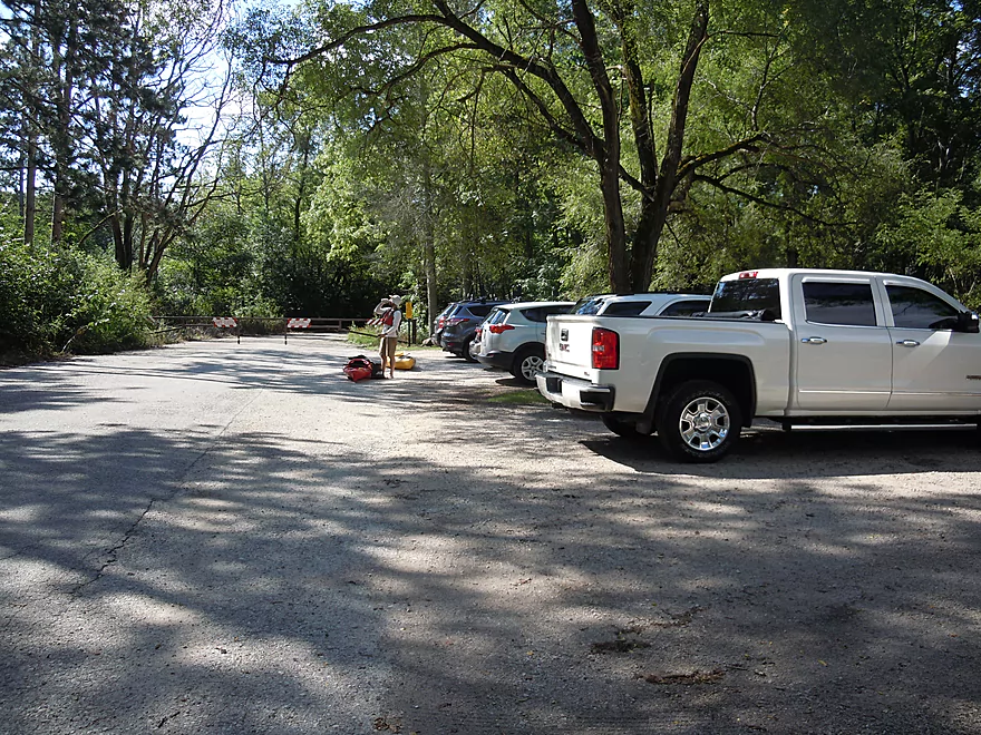
Put-in parking by the old Rainbow Springs Golf Course Road
Good access below the bridge
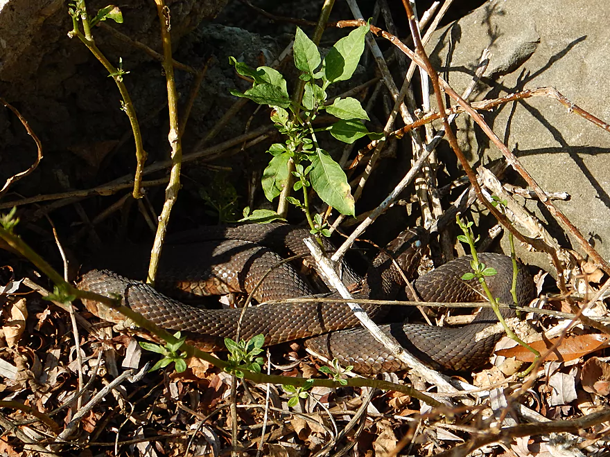
A dark phase water snake?
Just a little too fast to paddle up through
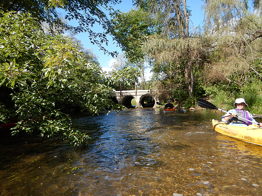
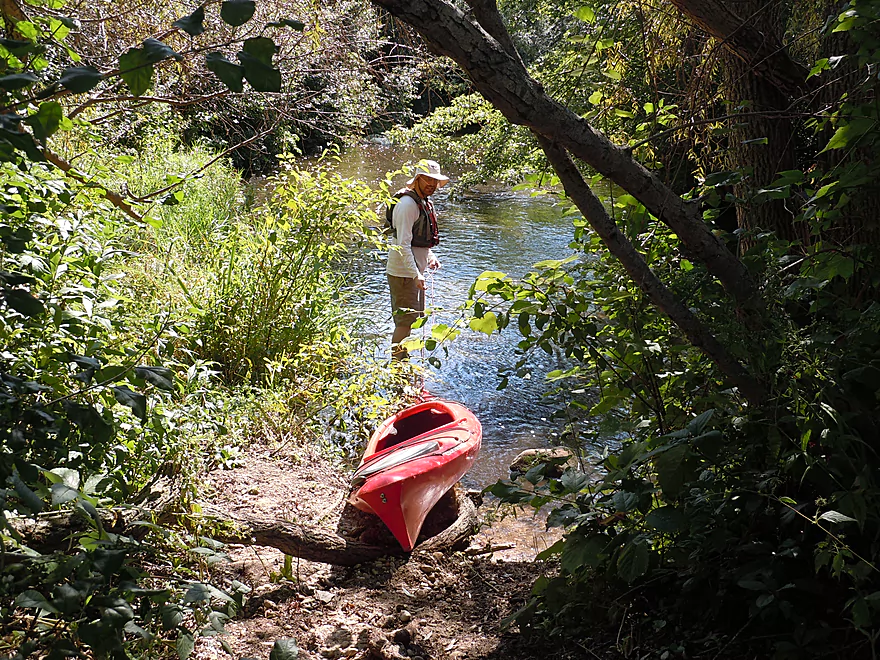
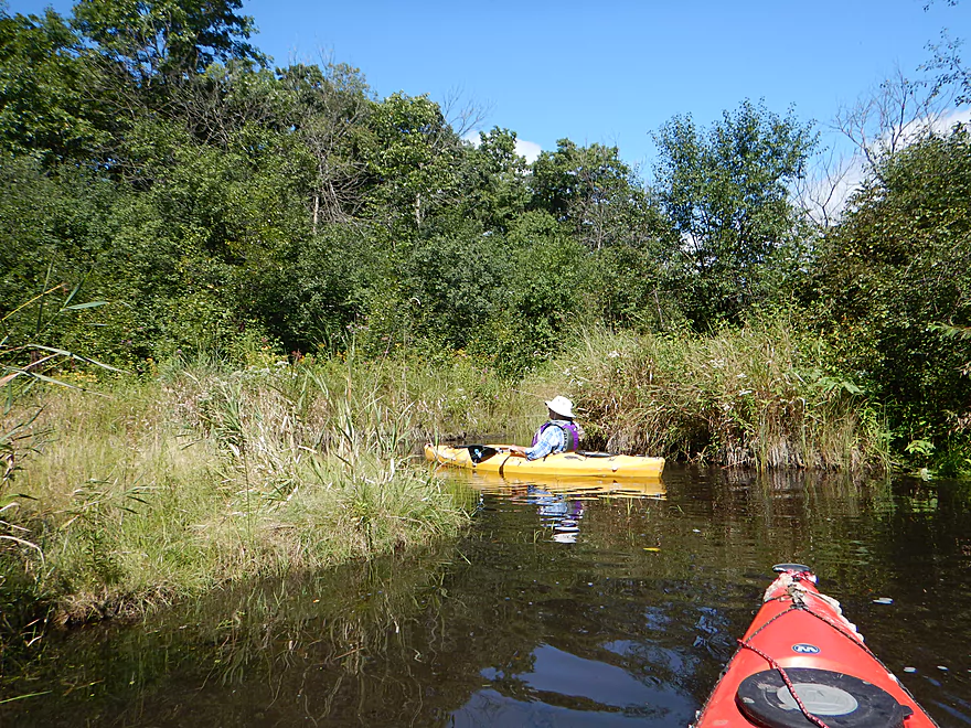
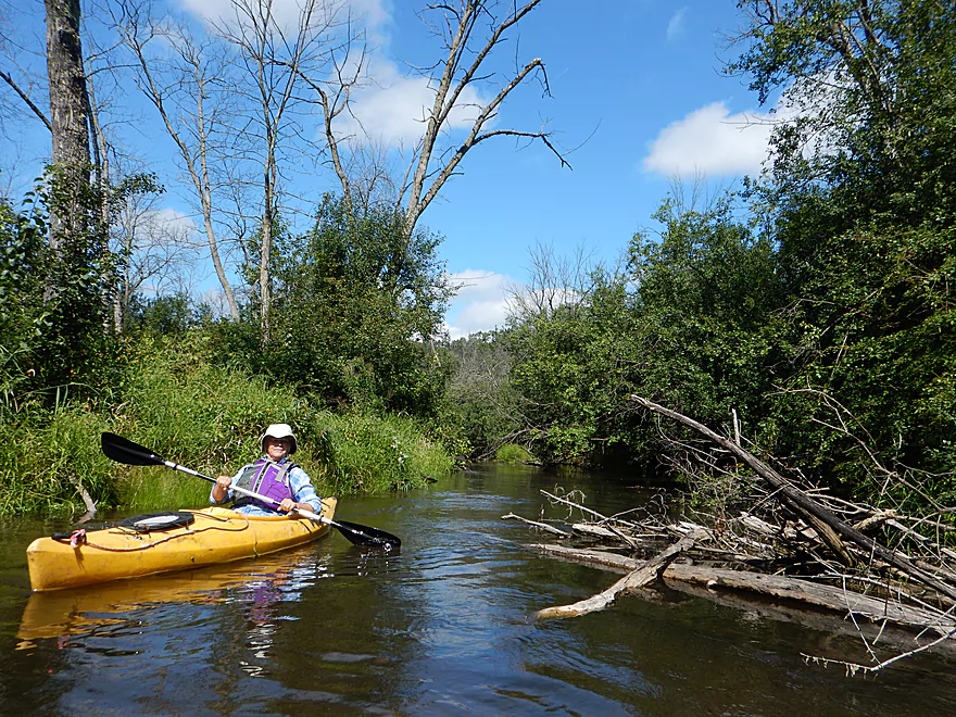
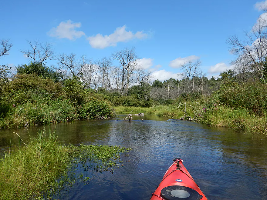
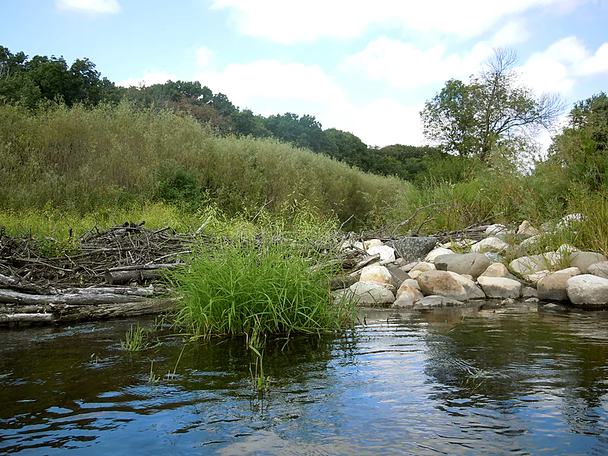
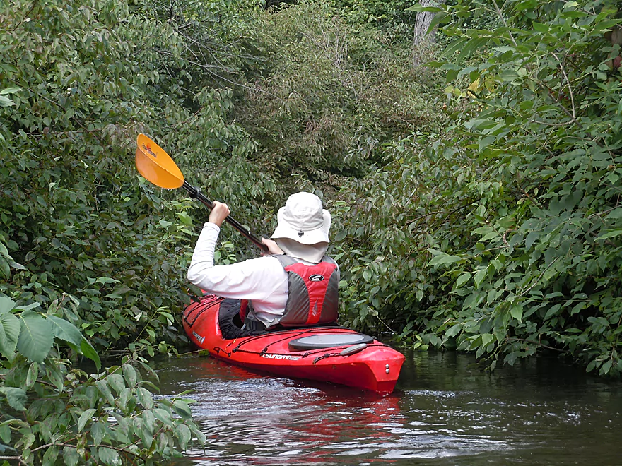
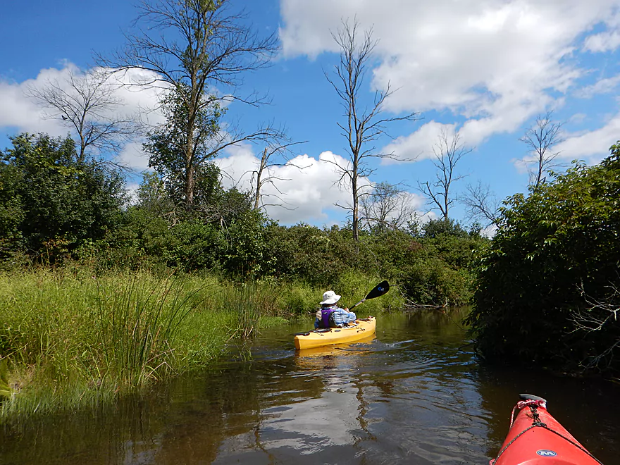
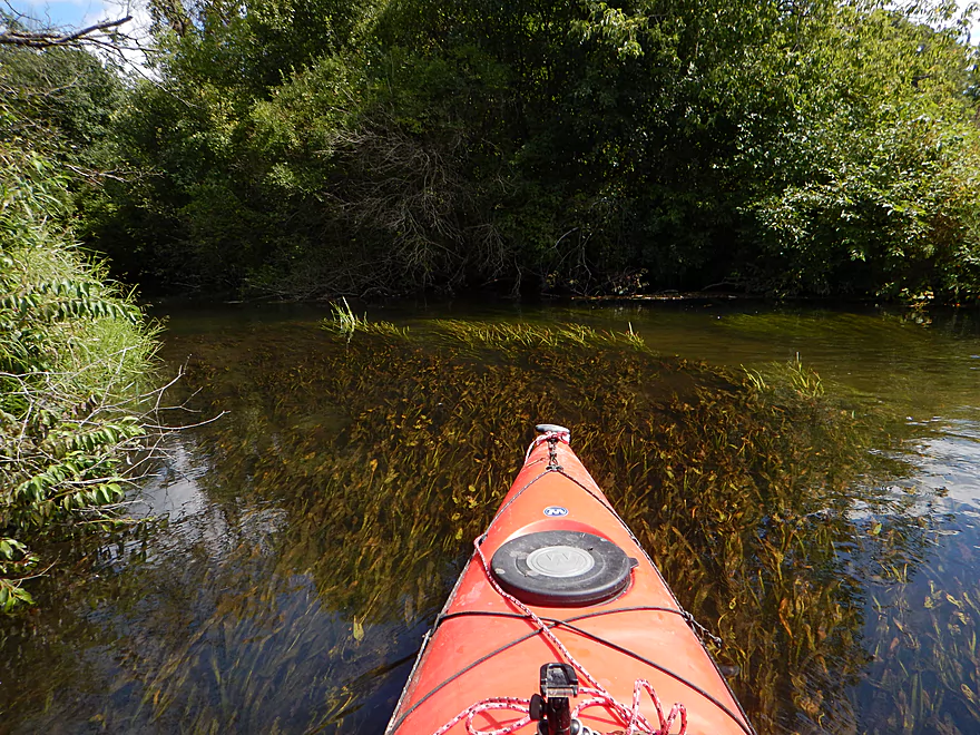
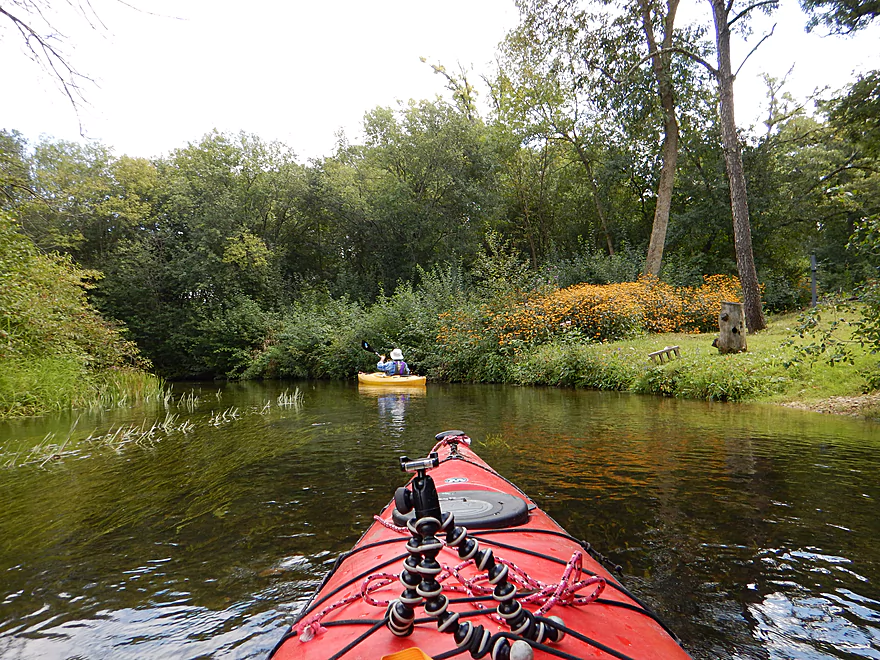
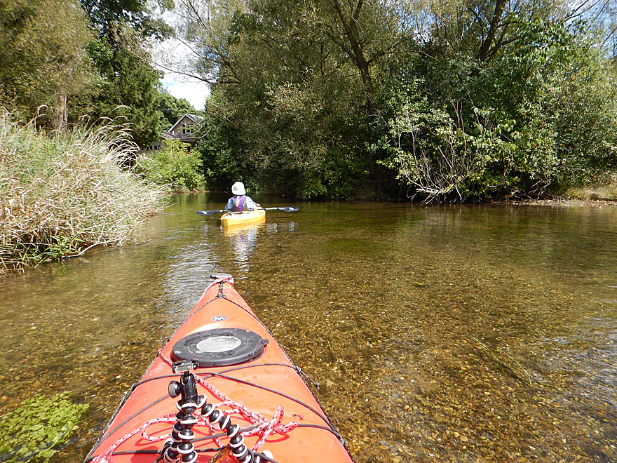
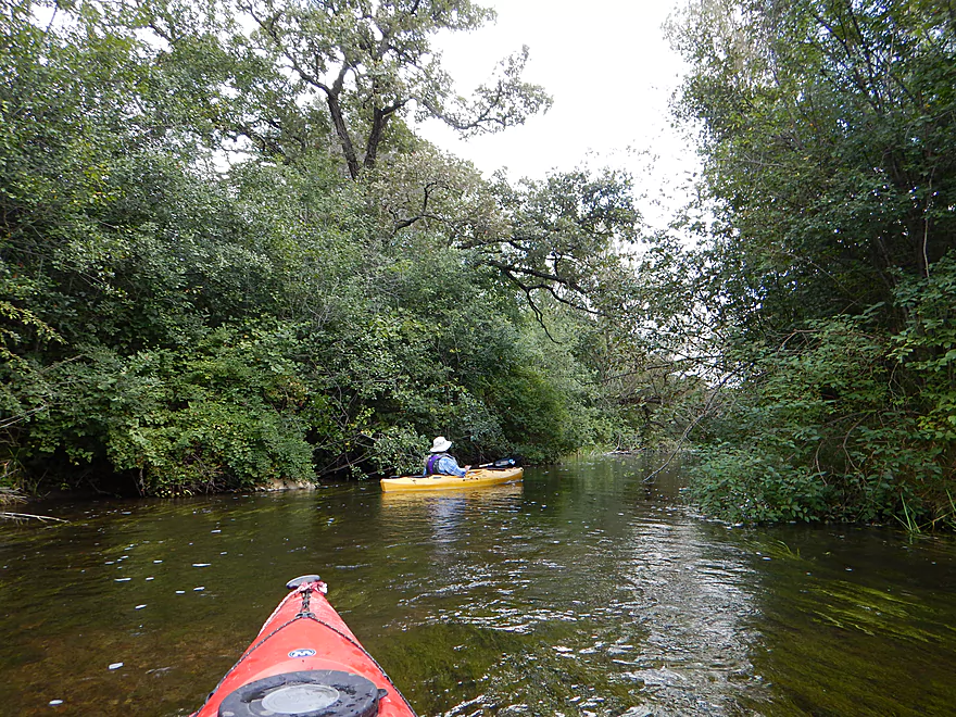
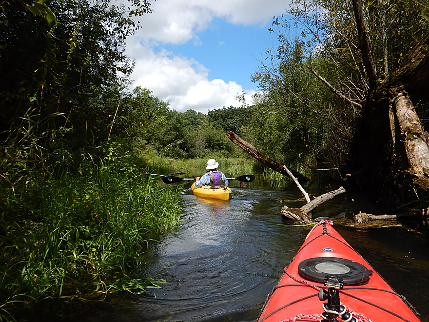
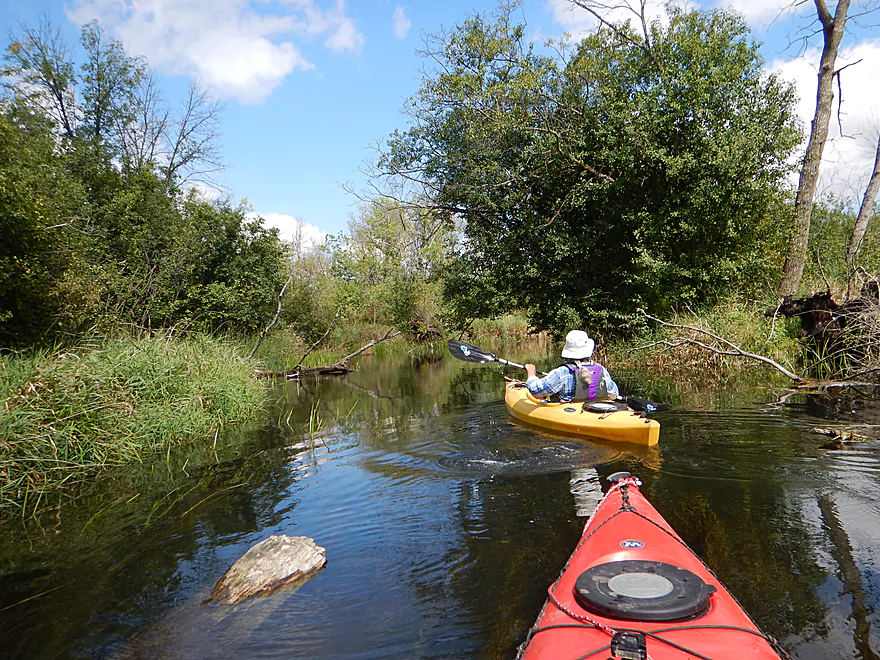
Very scenic start to the trip
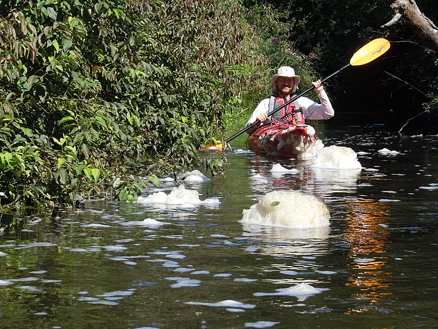
Trying (unsuccessfully) to dodge some foam
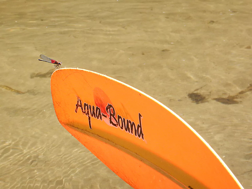
Very tame rubyspot damselfly
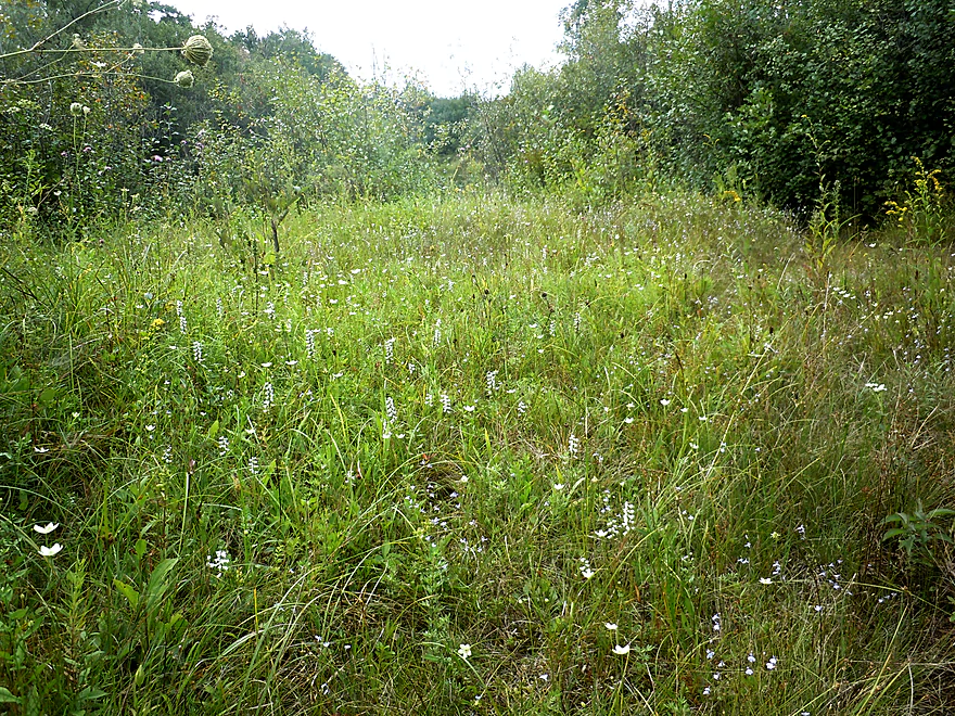
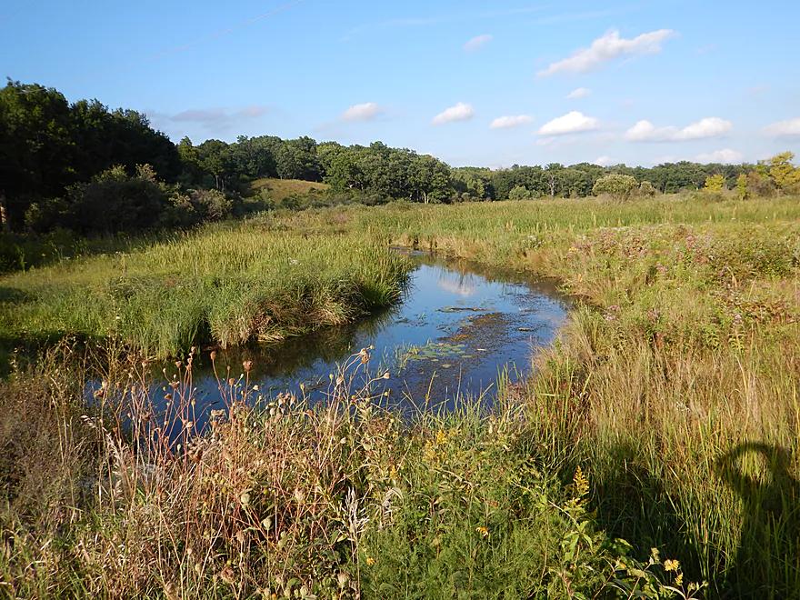
A scenic fen or calcium-rich spring
There are a lot of natural springs on the river
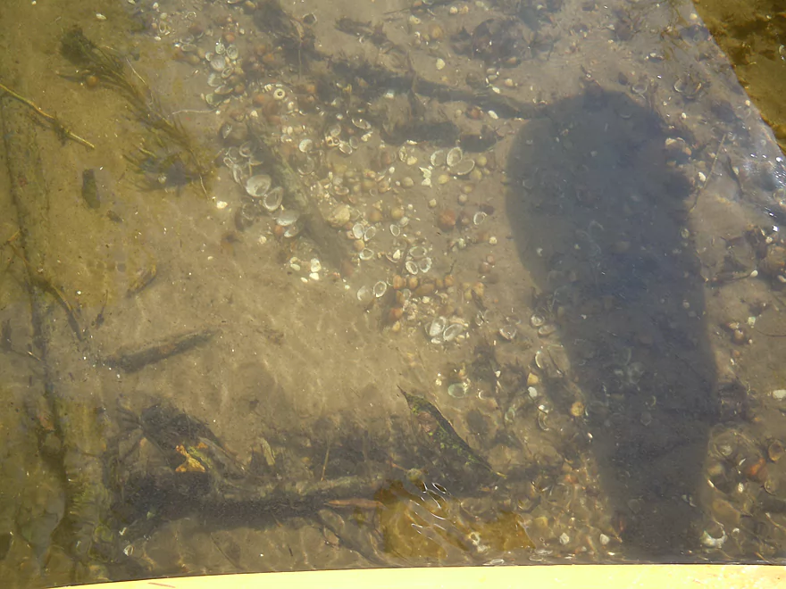
Oodles of fingernail clams
Locals have done a good job clearing the river
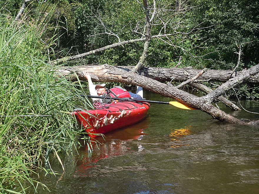
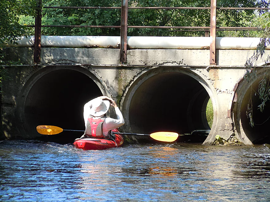
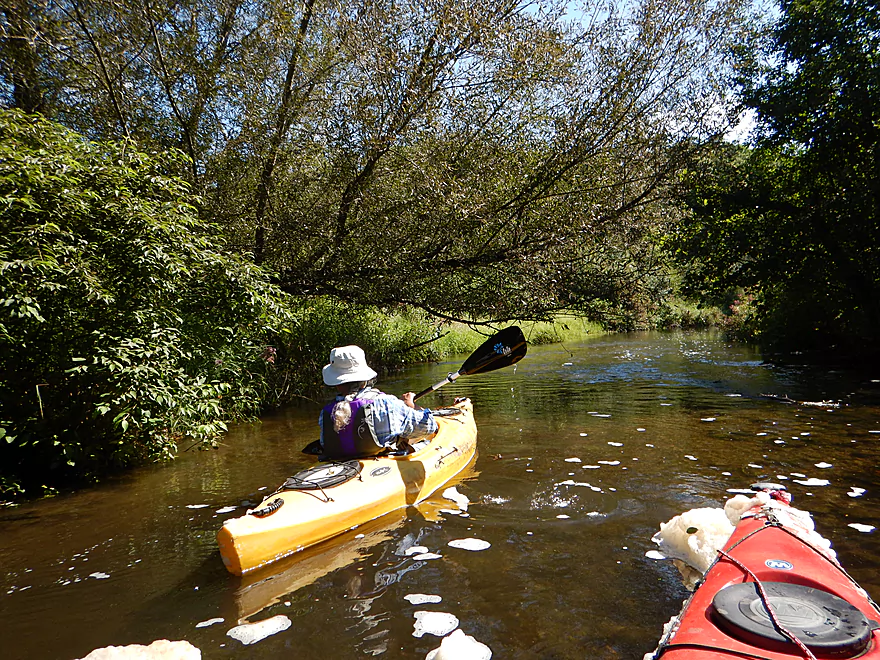
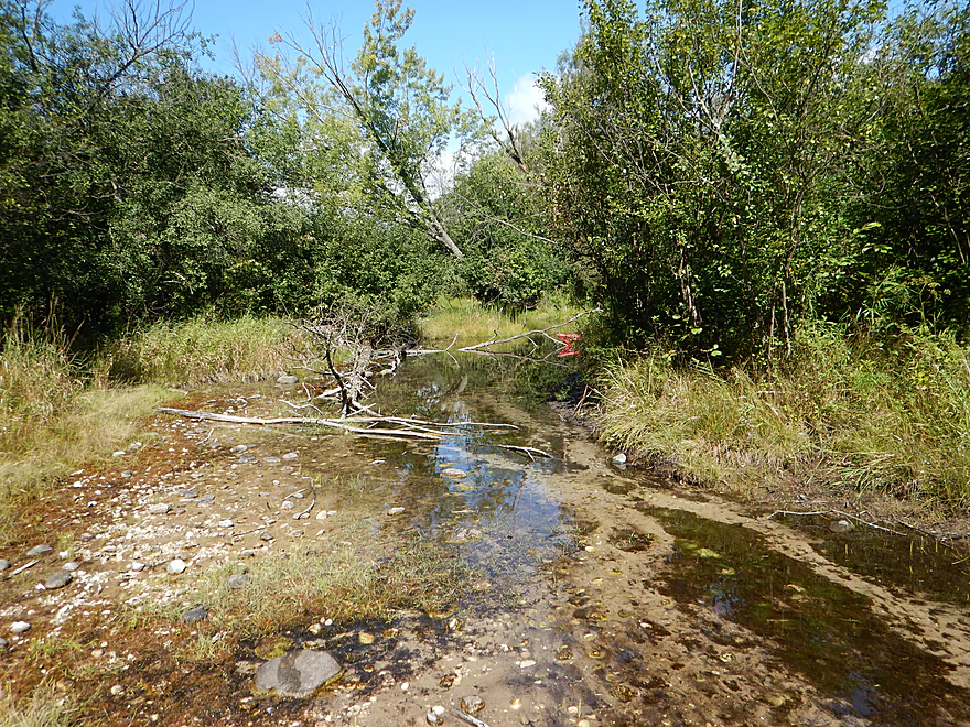
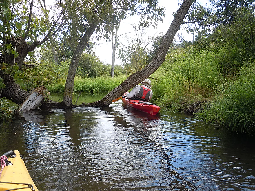
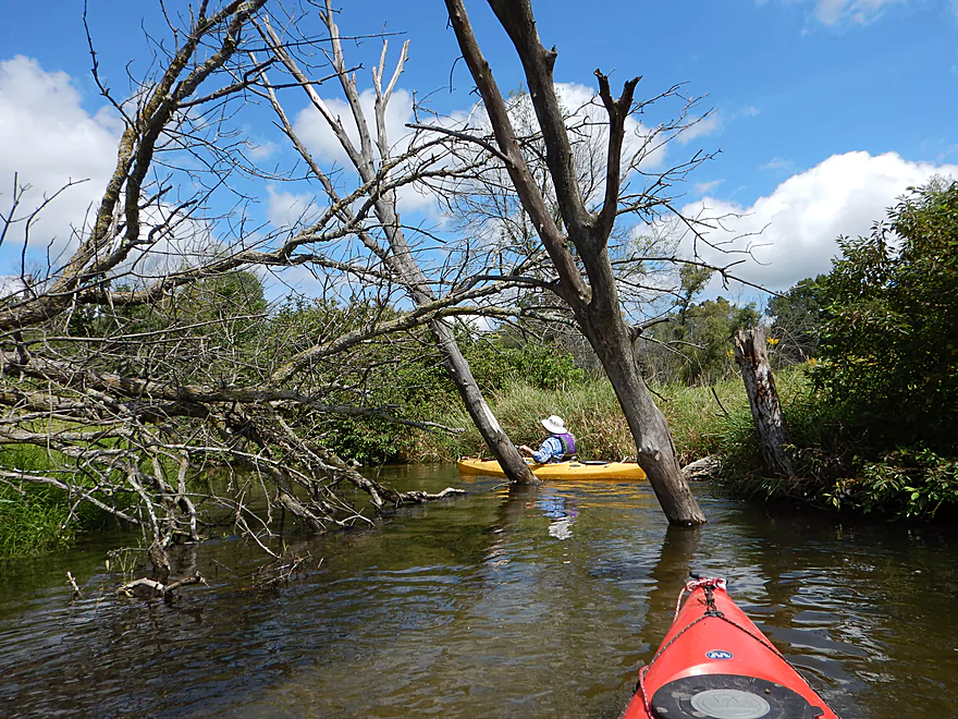
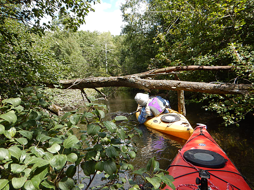
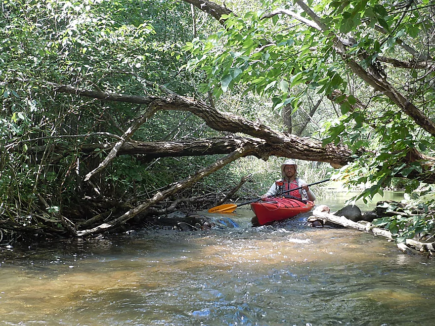
Some ducking required
A large cluster of dead ash trees (emerald ash borer)
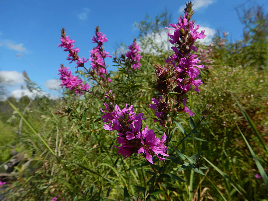
Purple loosestrife
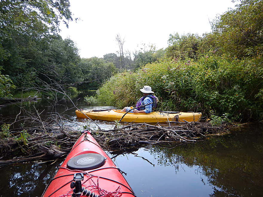
Easy to get over the beaver dam with enough speed
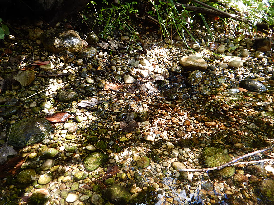
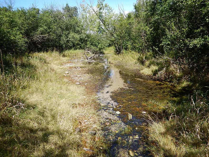
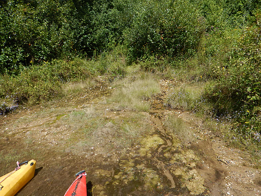
The seeps expose glacial pebbles
I do not think these were deposited by glaciers though…
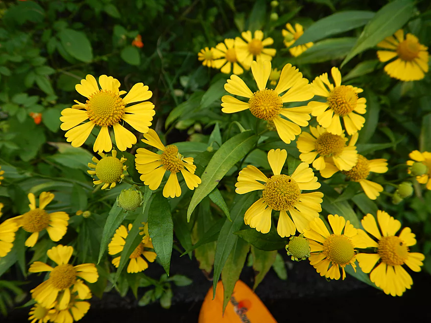
Sneezeweed in all its glory
Streambank stabilization work
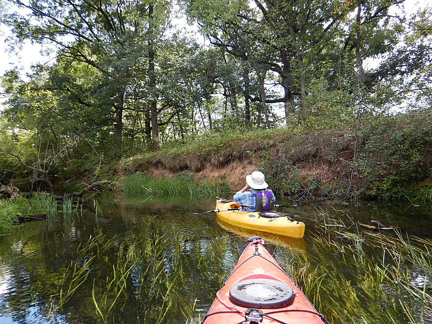
A scenic kame
Squeaking under the trident
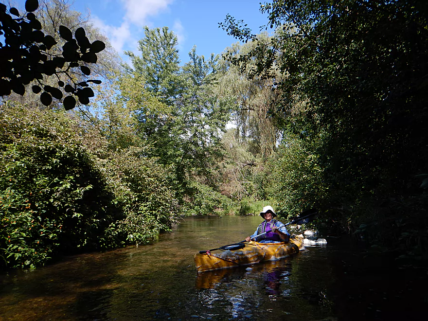
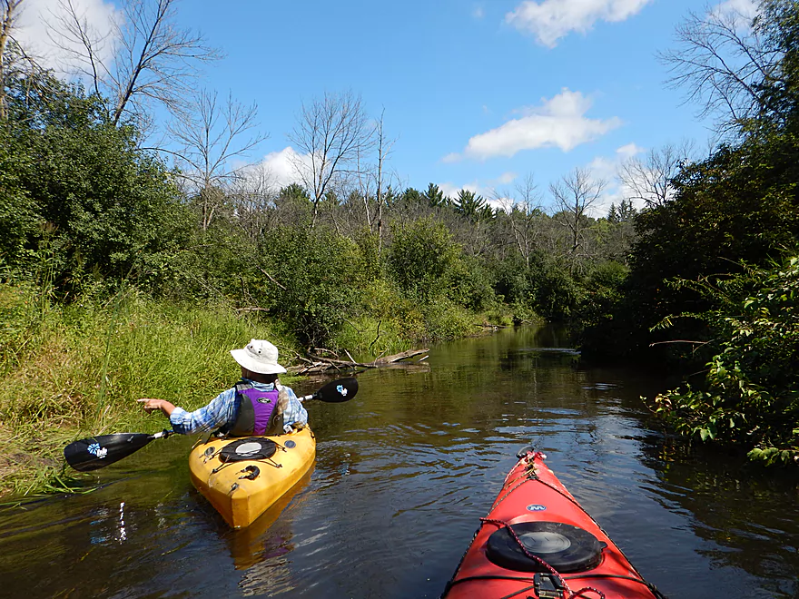
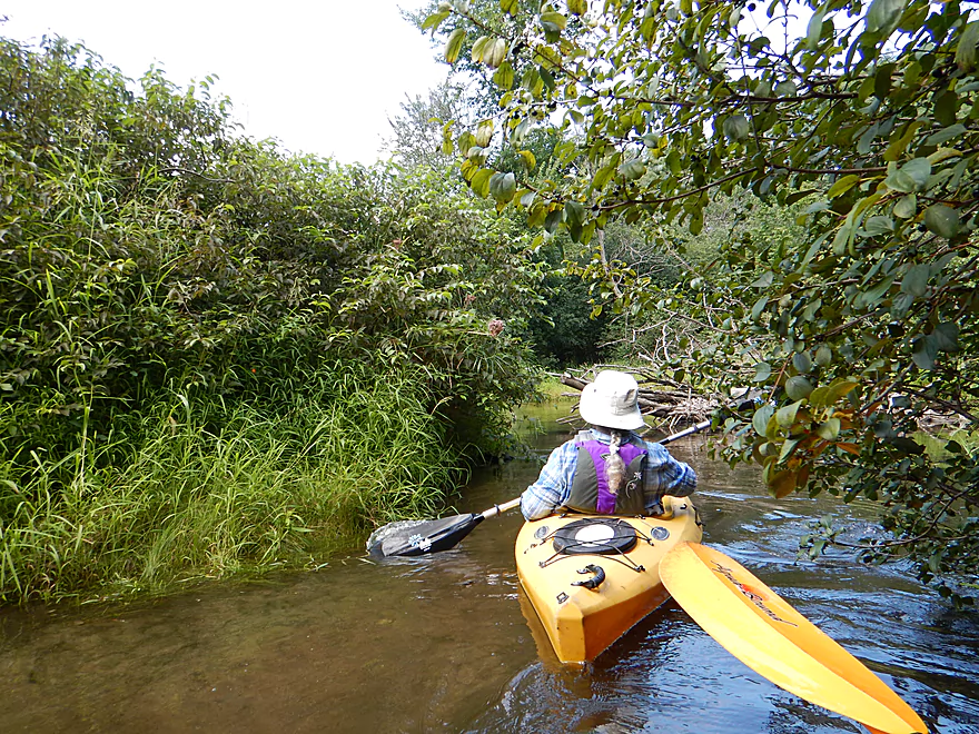
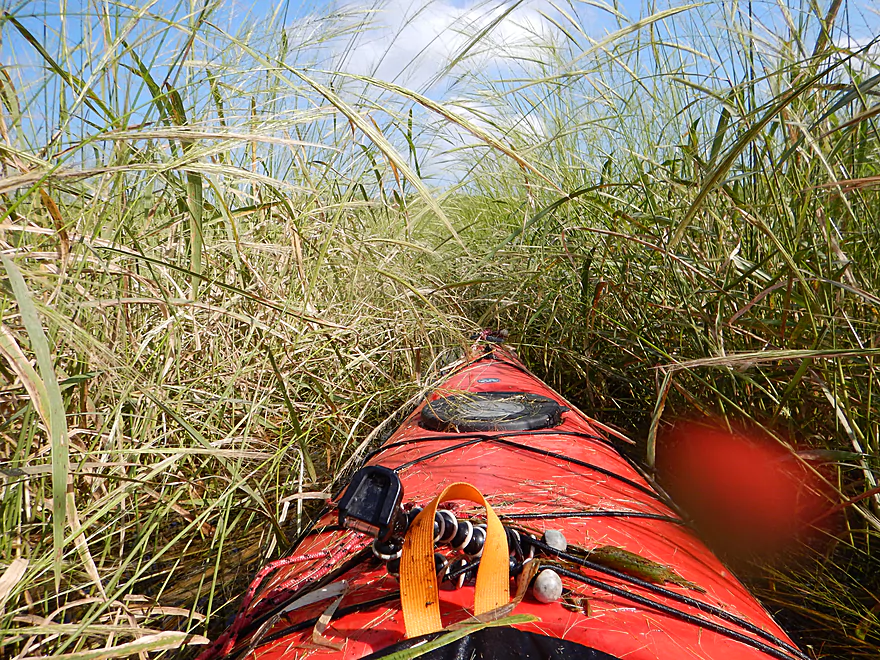
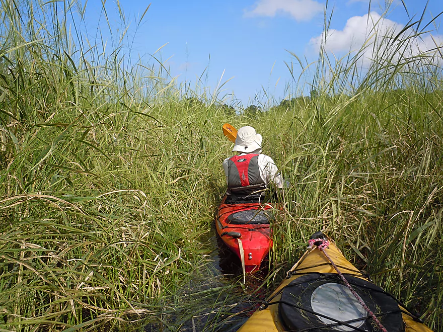
At times the shrubs really constrict the river
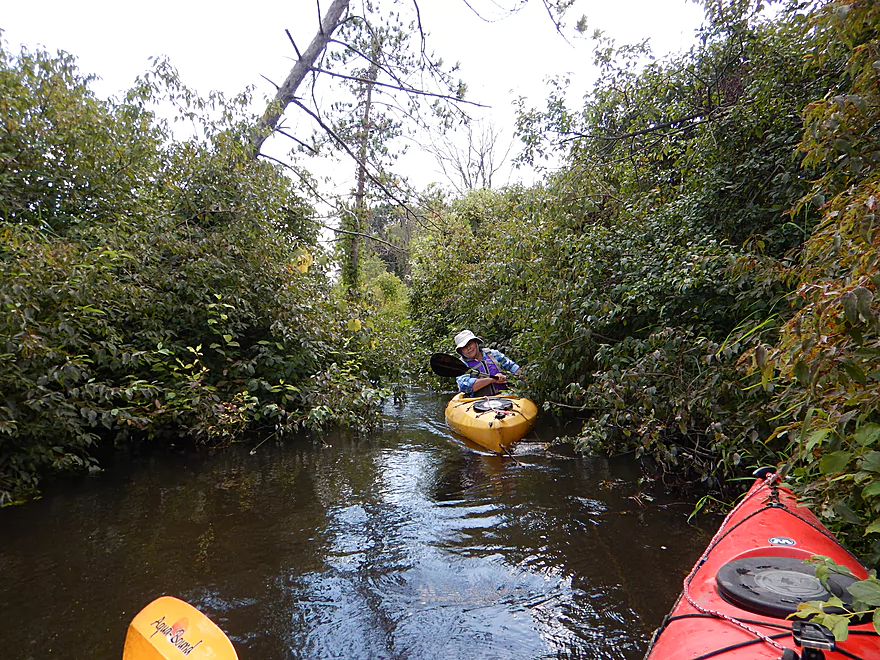
Never a problem though
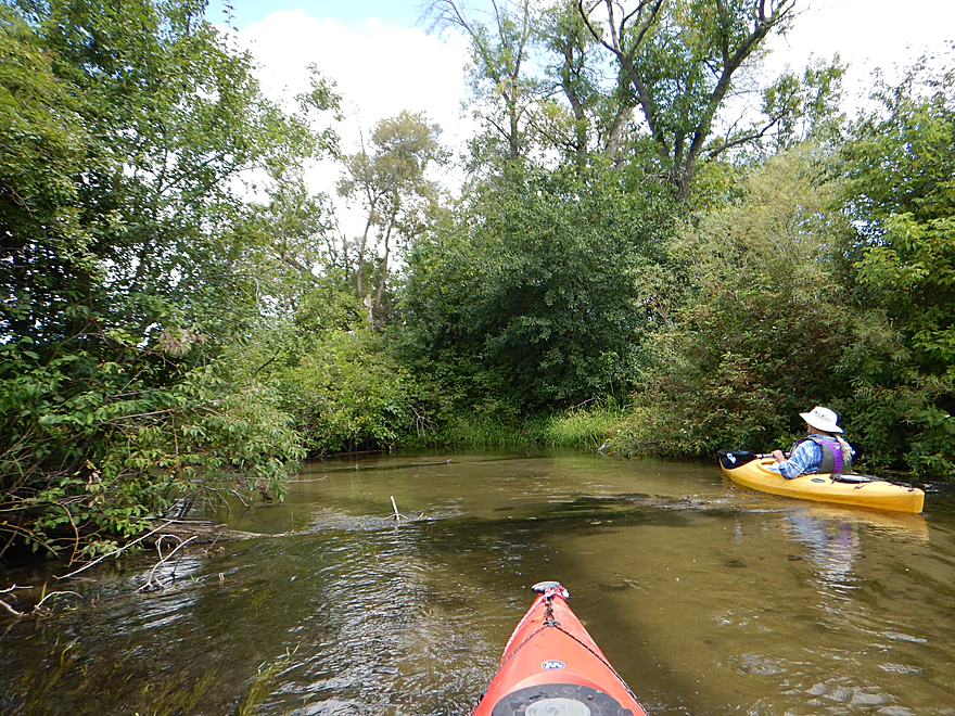
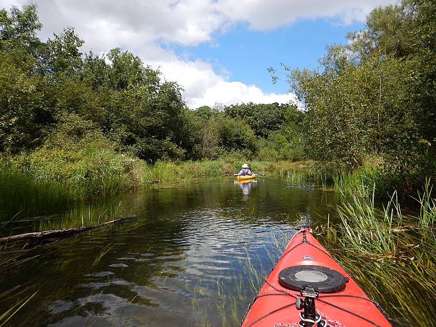
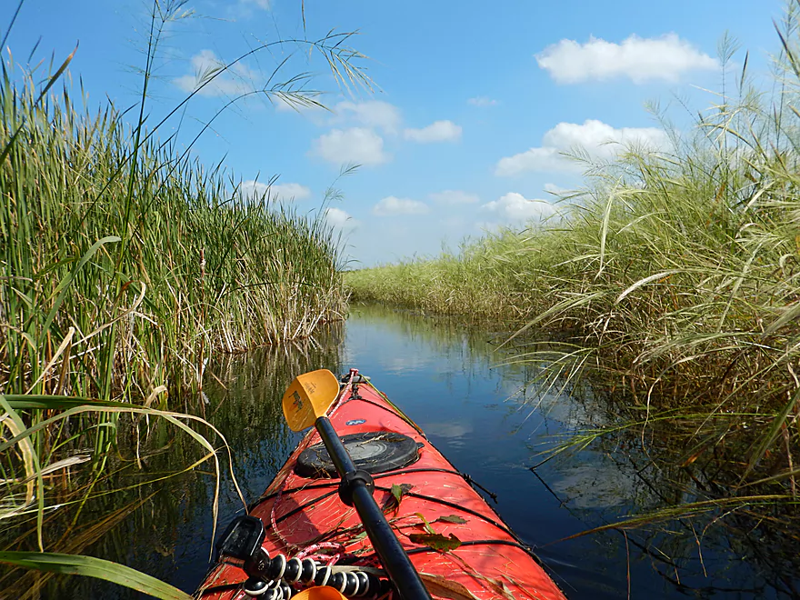
Water clarity was this good the entire trip
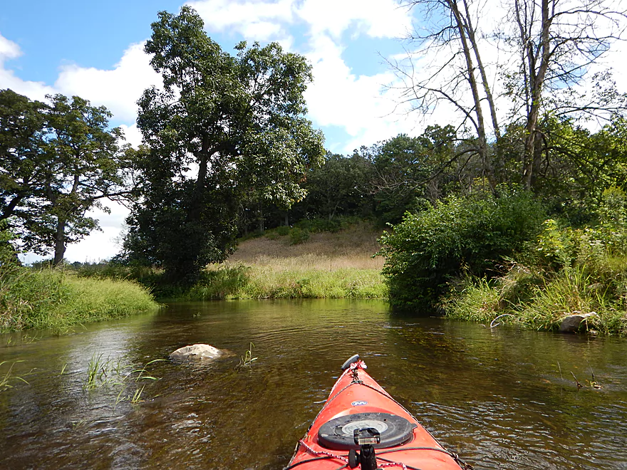
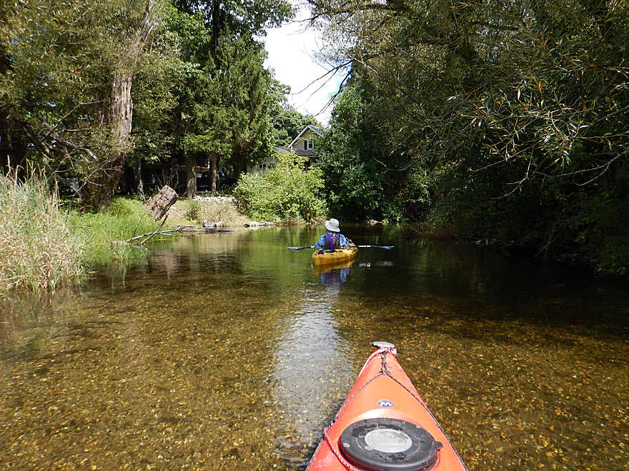
Hmmm….this must be where the old golf course was
More dead ash trees
A dead tree slalom
More good cleanup work
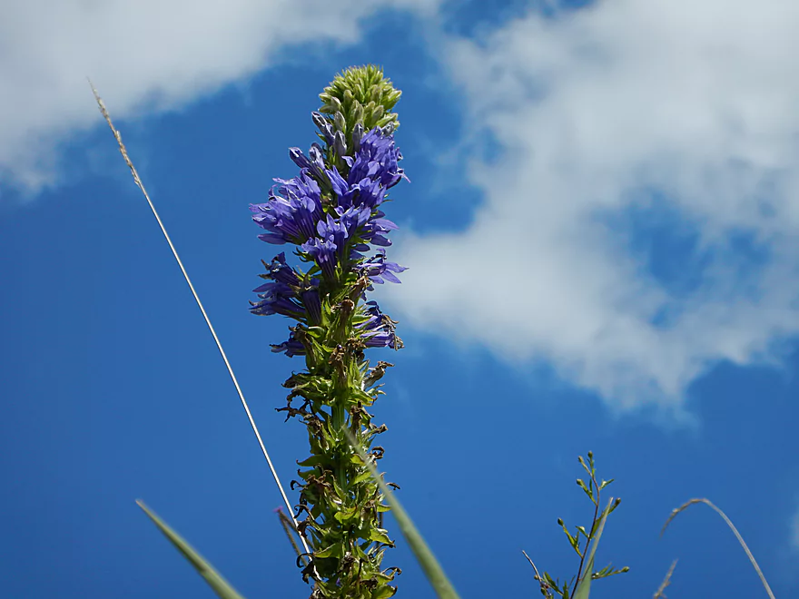
Great blue lobella
Flowing pondweeds
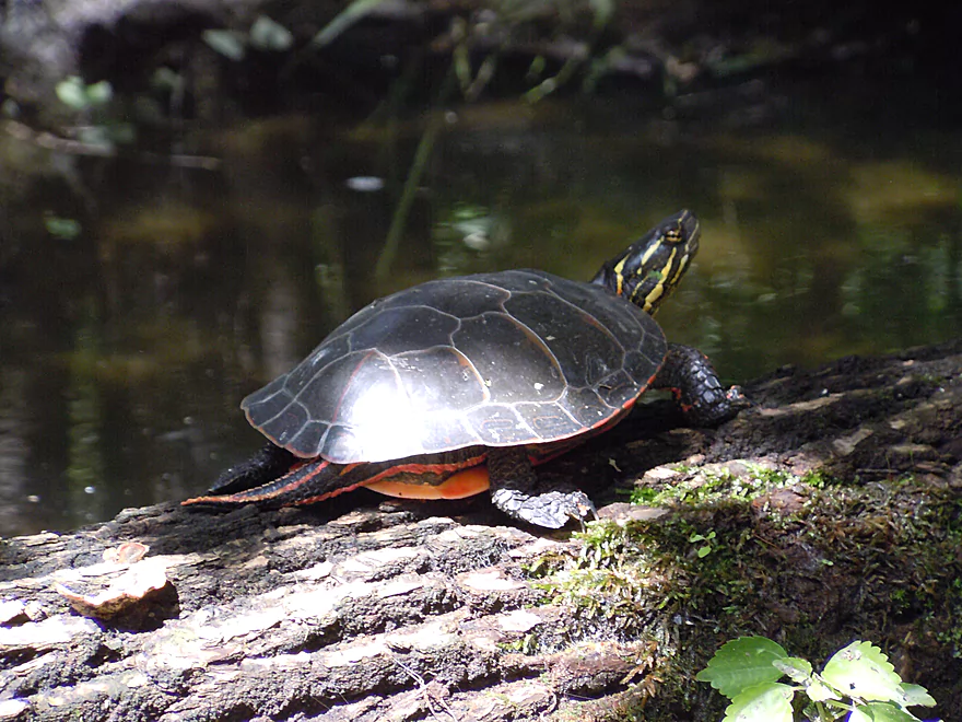
This painted turtle did not want to get wet
This trip could be an issue for taller boats
A patch of bur reed
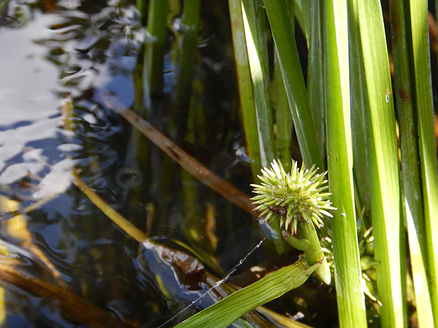
Cool looking bur reed fruit
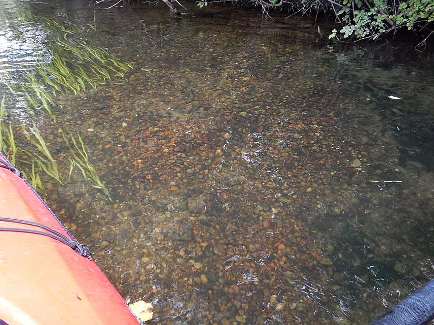
Gorgeous pebble substrate
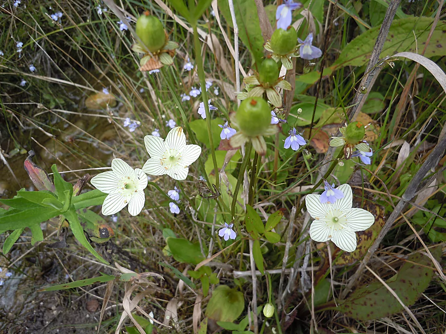
Striped flowers are grass-of-parnassus (with blue brook lobelias)
More fen flowers, including white spires of ladies’ tresses, a tiny orchid
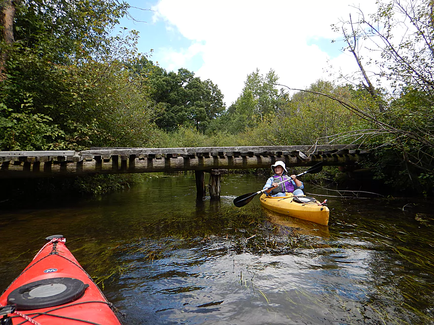
Another tight duck-under
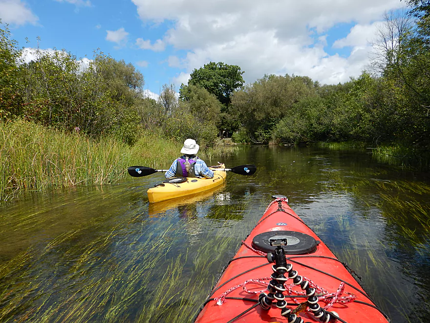
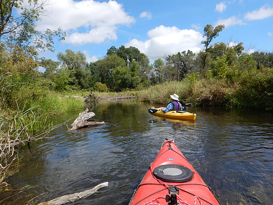
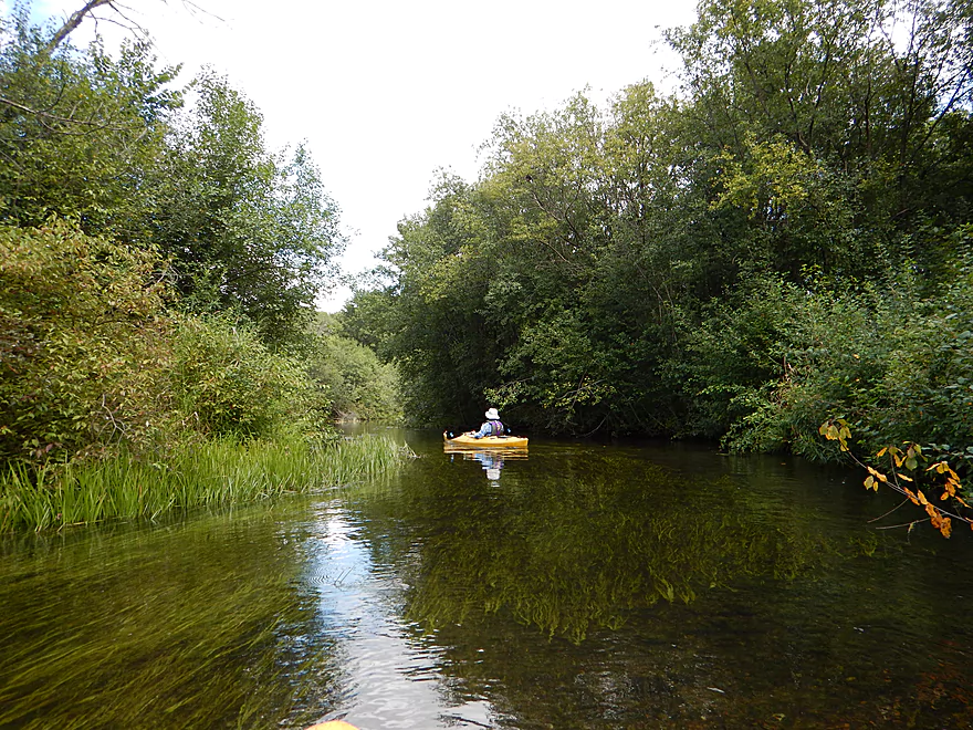
One of the clearest sections
One of only a few homes on the river
The “toughest” rapids on the trip
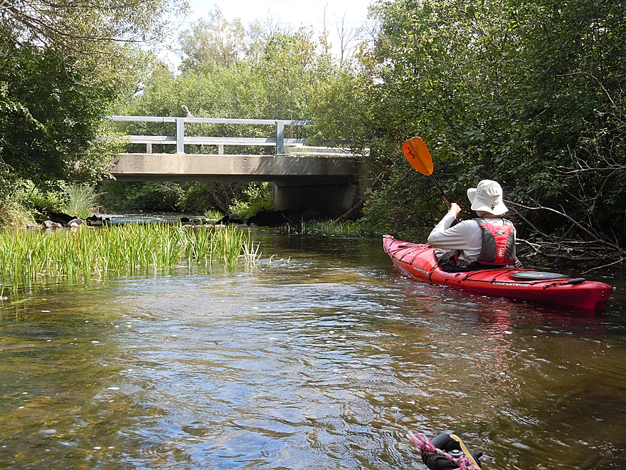
Approaching Beulah Road
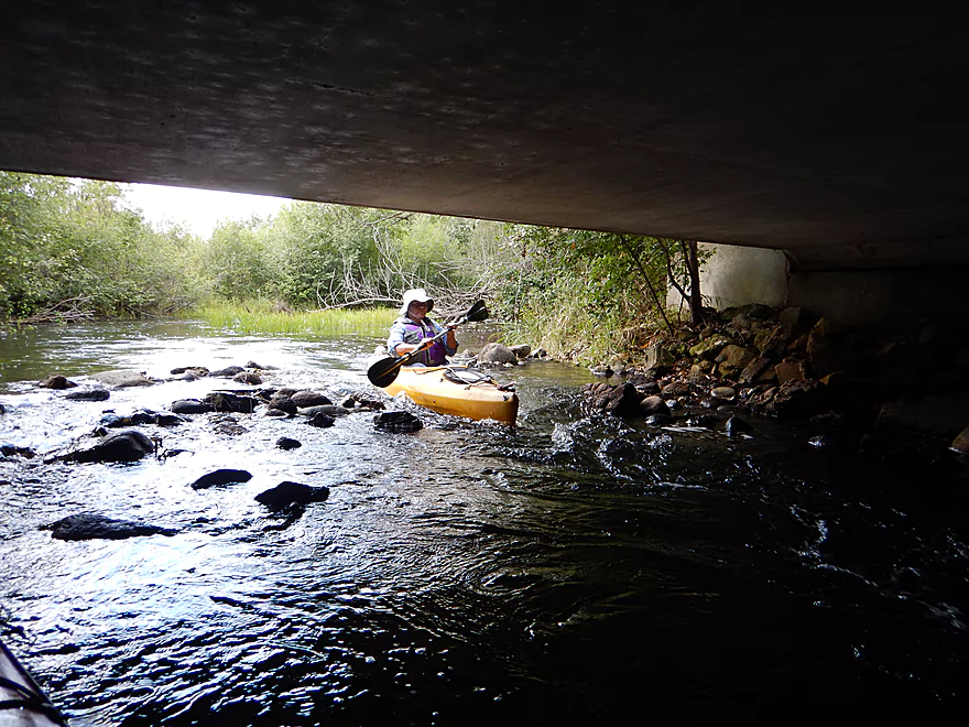
Good current under the bridge
A fine alternate access
Lots of sand here
Another spring
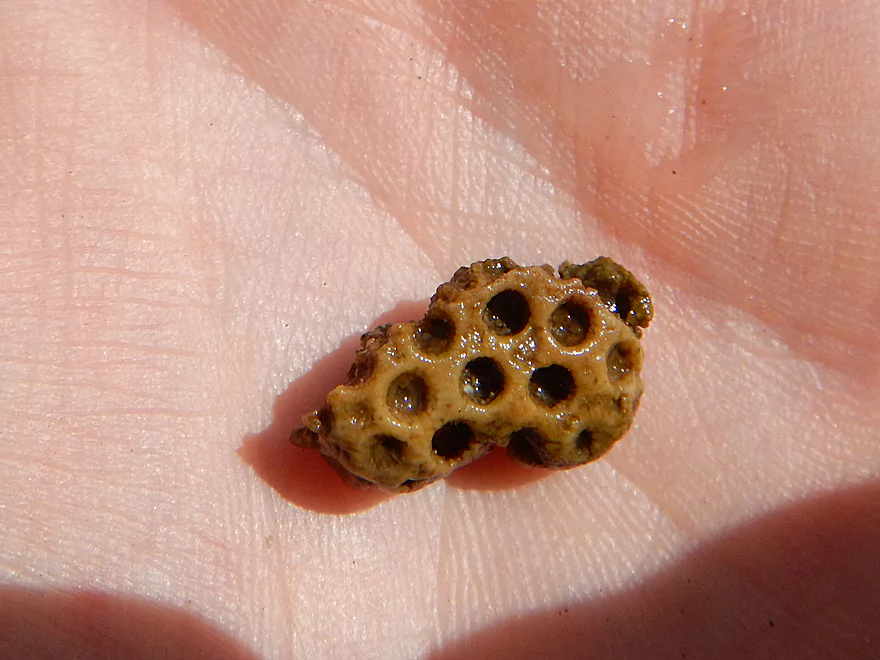
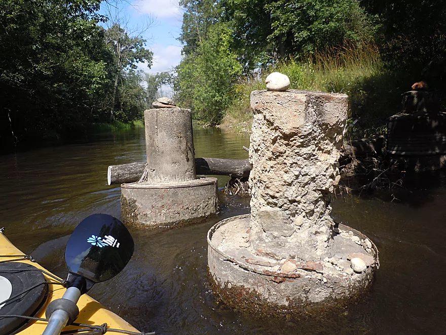
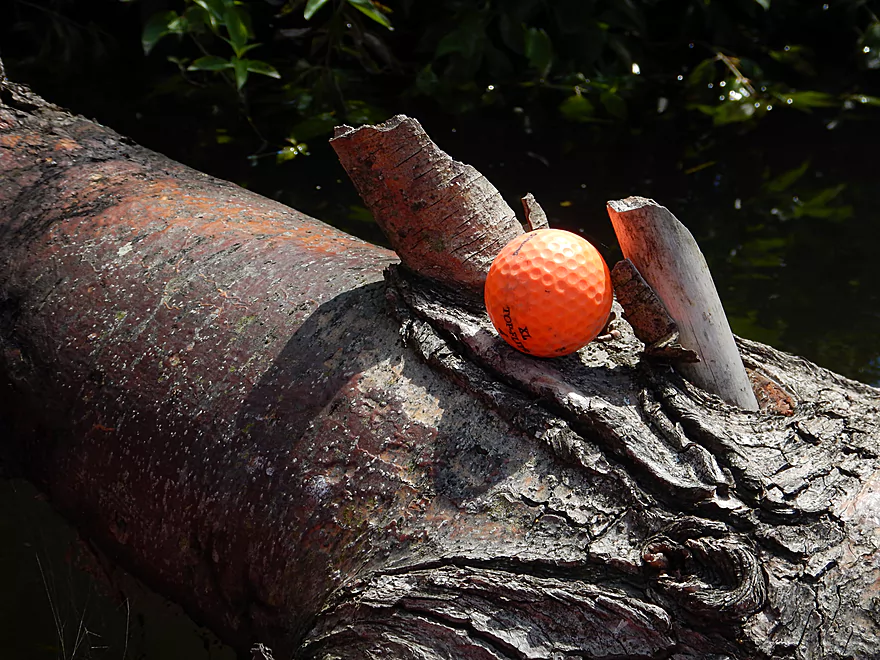
Actually not part of a golf ball but fossilized coral
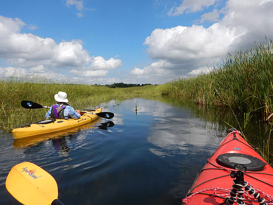
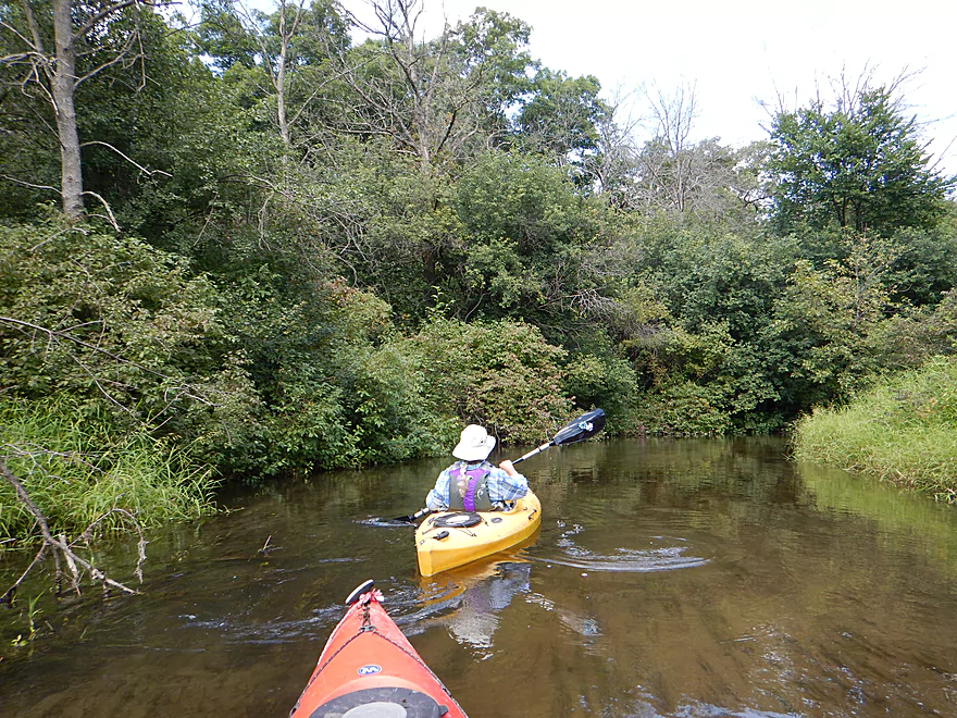
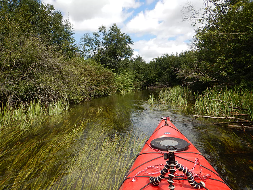
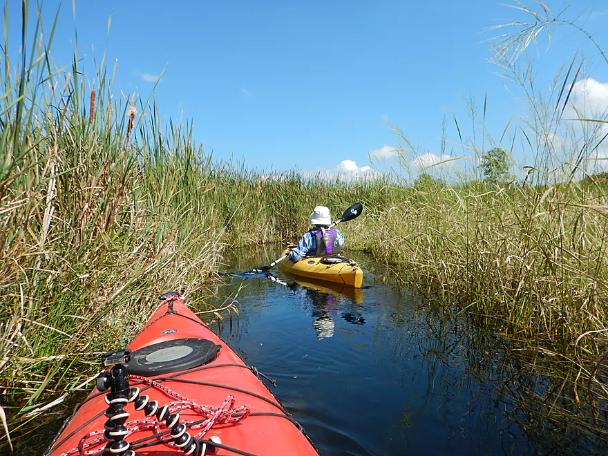
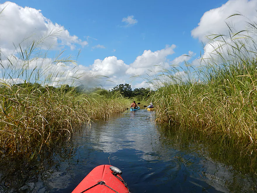
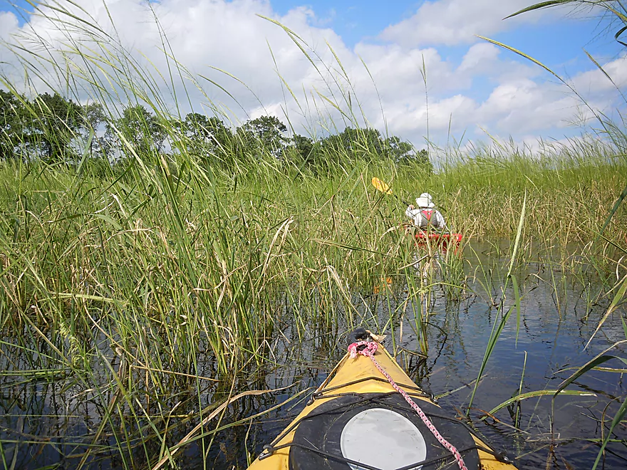
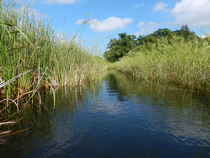
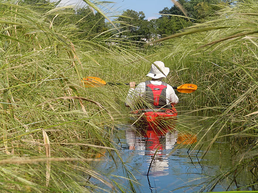
River starts to open up here
Really cool wild rice corridors
Cattails growing in the shallows
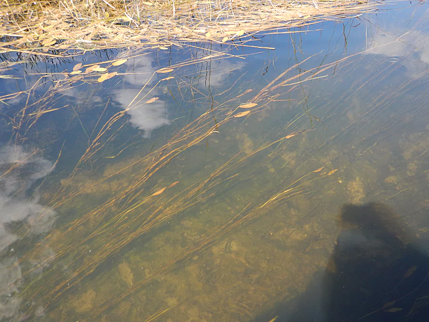
Despite being 4-5 feet deep, the clarity was perfect
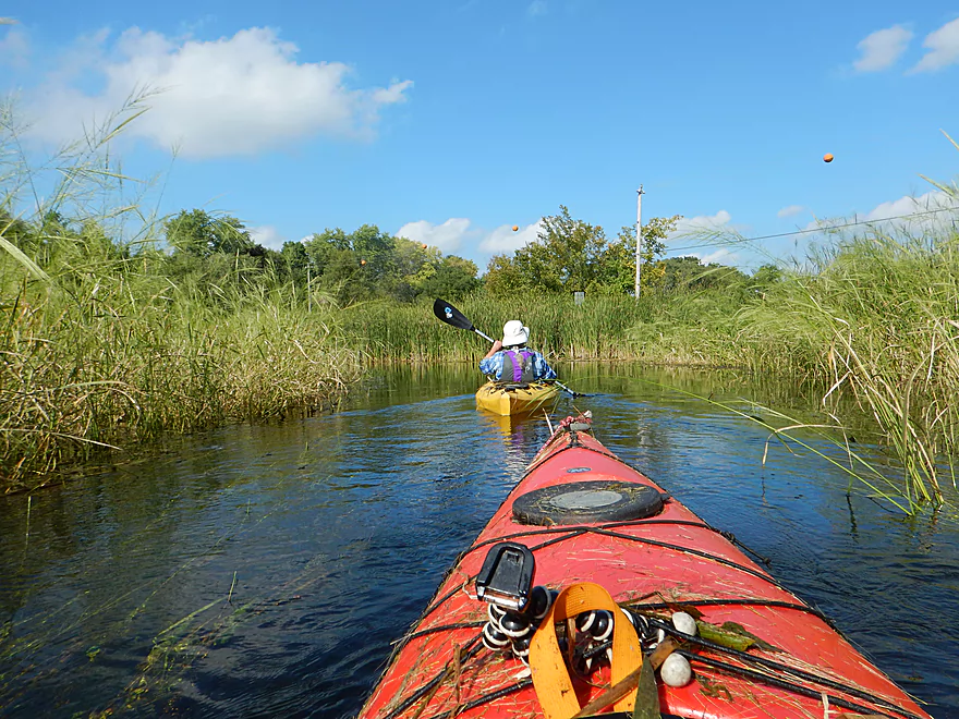
Uh oh…other kayakers are backtracking
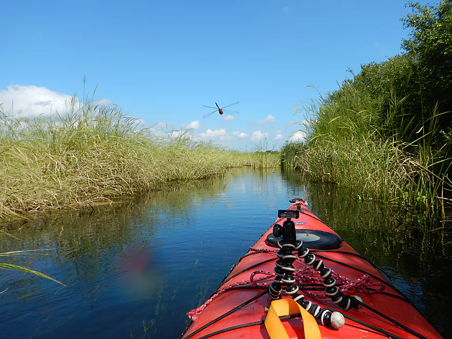
Dragonfly escorting me to trouble
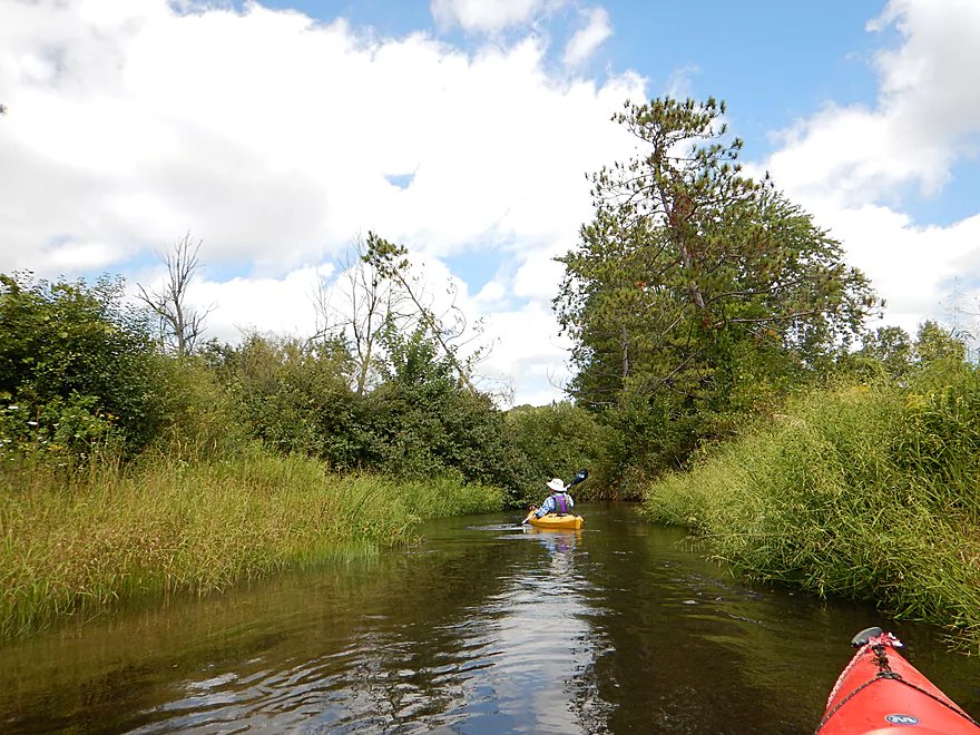
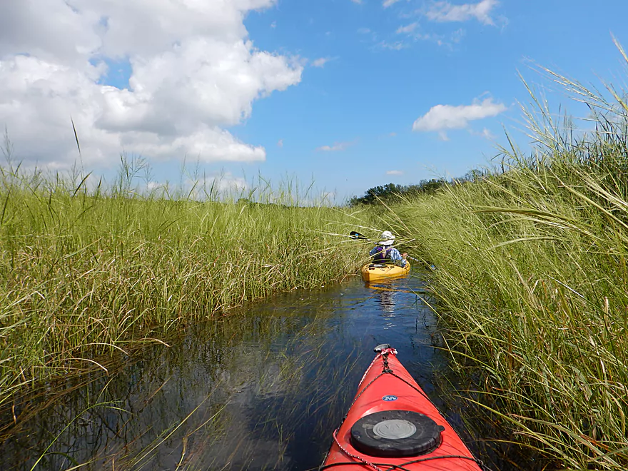
River really starts to narrow
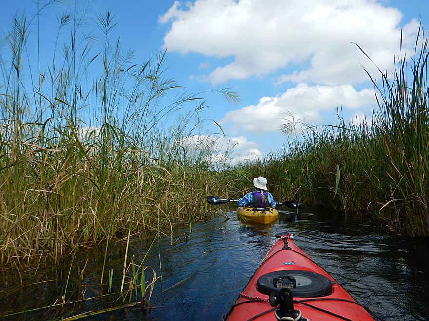
The wild rice is quite tall and beautiful
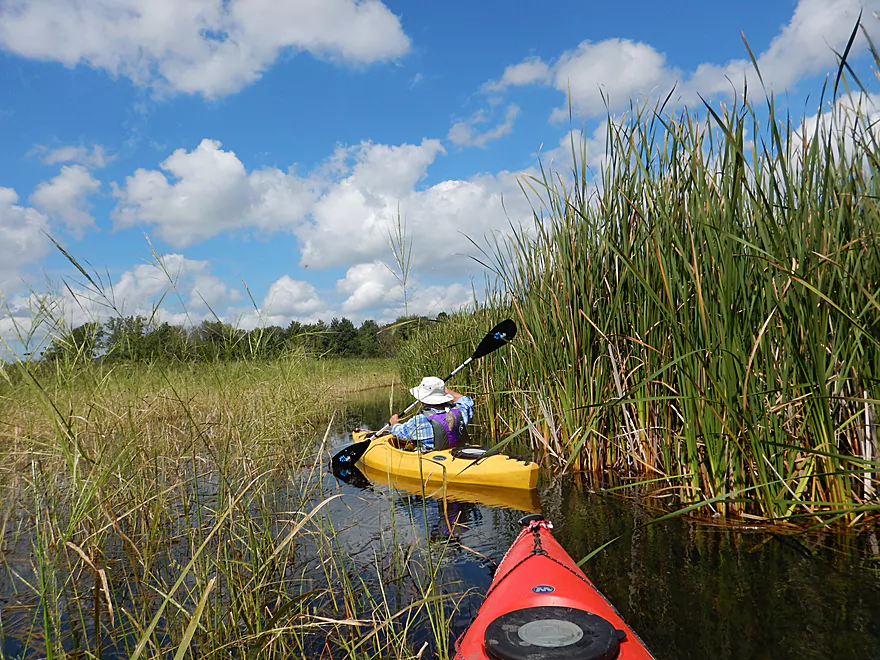
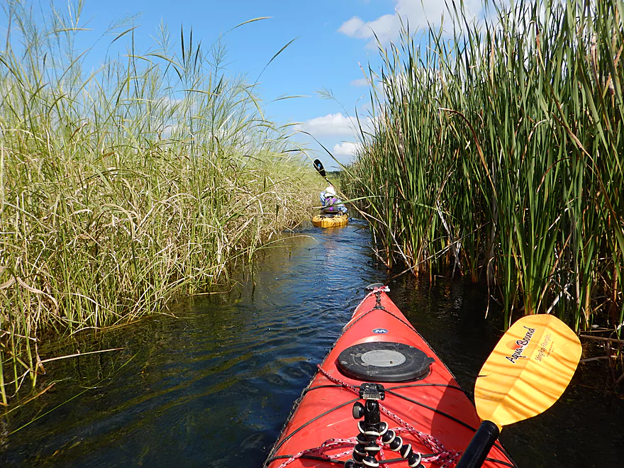
Channel is getting smaller…
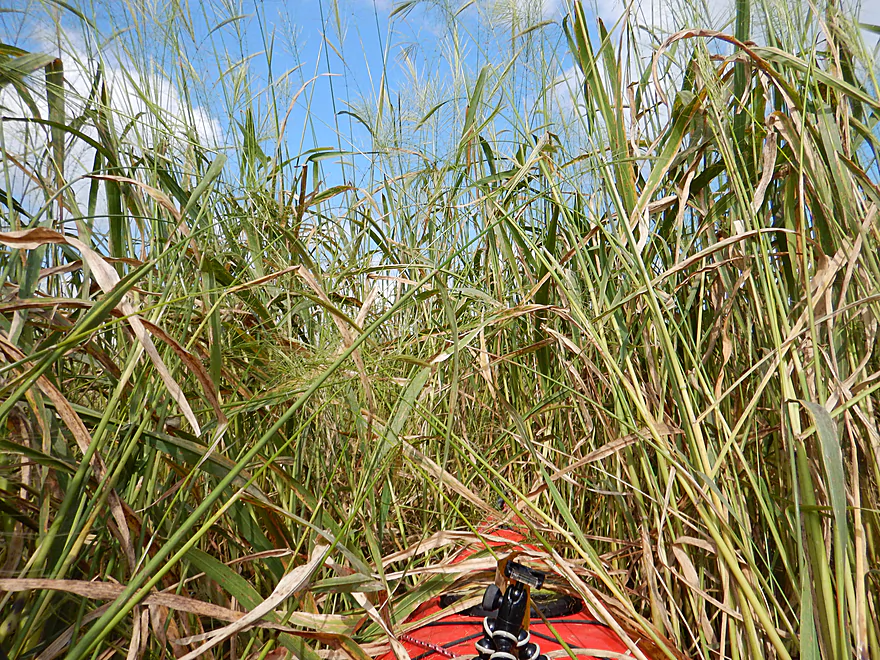
Then this happens
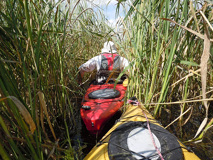
Which required lots of this
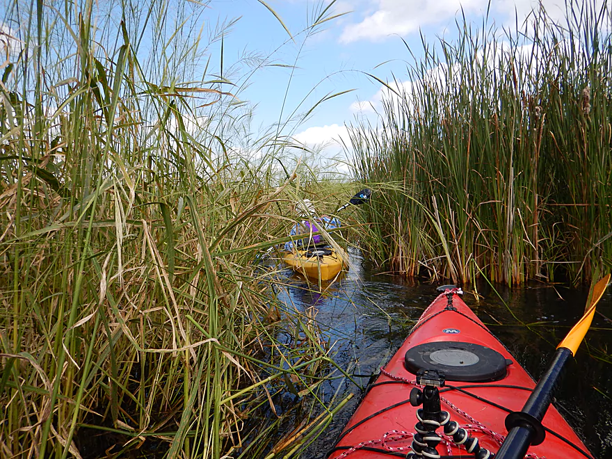
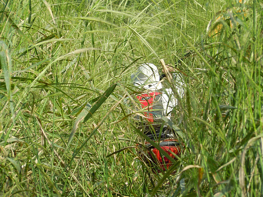
A rare respite from wild rice trailblazing
We were a little lost here…
Those trees are a good landmark
But not good enough…
Are we back on the main channel?
Nope
Actually, there IS NO channel
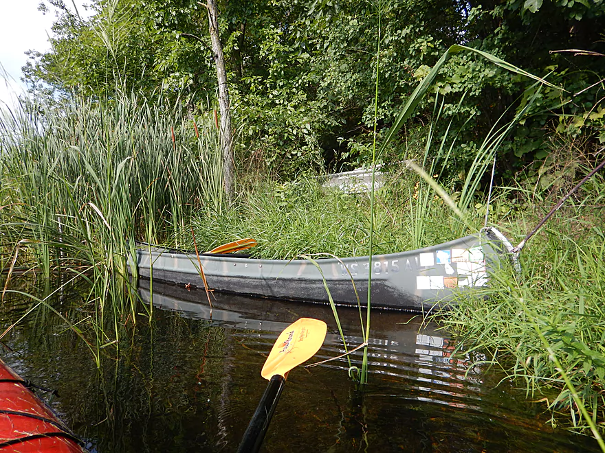
A disused canoe (wonder why…)
Finally, the road is in sight!
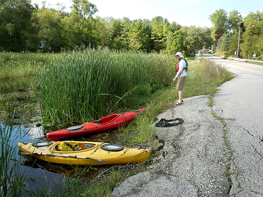
A nice take-out at Hwy I
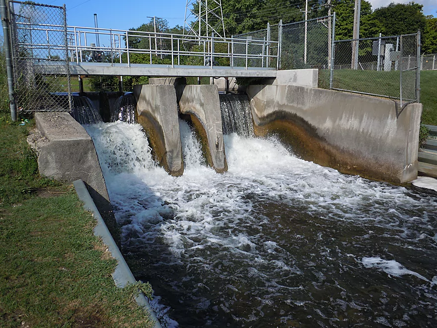
You can also take out further downstream at the Mukwonago dam
Scouting the river upstream by Nature Road
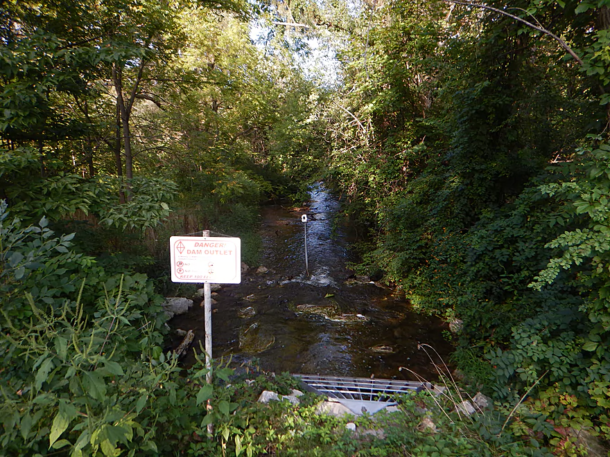
Hwy E looks like a portage option at the Eagle Spring dam (despite the dam warnings)
Mukwonago River

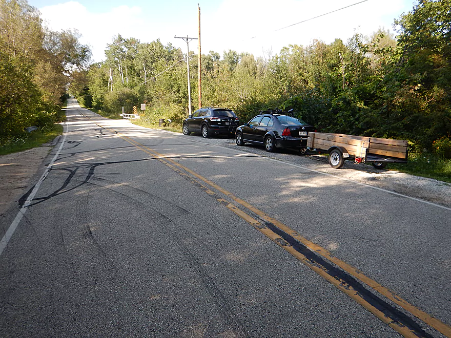
Just south of Hwy LO is the old Rainbow Springs Golf Course driveway. Although the road is closed now, there is a public parking lot at the entrance where you can then drag your boat 400′ south to the old bridge. This is a good access option with free parking but no outhouse.
There is a pull-off southwest of the Hwy I bridge that provides very good access.
Relatively easy bike shuttle. A few hills, but only 2.9 miles.
There are a few low limbs and a low bridge to duck under, but nothing too concerning. During high water these might require portages, which shouldn’t be too difficult.
- Not doing Beulah Road to Hwy I (a shame, as this is a scenic marsh)
- Going only when the rice has died back (i.e., spring)
- Bringing a GPS with satellite images (most are not up-to-date though)
- Going when the water is higher
- Do not use a sit-on-top kayak or a canoe…long, skinny kayaks cut through the wild rice the best
- If you attempt this, keep in mind that cattails can’t grow in deeper water whereas the wild rice can, which clues you somewhat where to go.
Don’t underestimate the wild rice! There was actually a case a few years ago in which a paddler got lost in these fields and had to call 911 from his boat.
This trip was done at 29 CFS per a local gauge. An average flow rate is perhaps 35 CFS. 19 CFS might be a yearly low and 60 CFS is probably on the higher side.
What is the ideal flow rate? Good question. Lower flow rates (under 40 CFS) will allow you to duck under obstructions, of which there are several upstream of Beulah Road, and will highlight the clear water, but high water will allow you to better traverse the rice fields downstream of Beulah Road.
As for current, it was moderate with a few riffles but no rapids.
Despite the DNR descriptions of plentiful wildlife along the river, we actually didn’t see much (just unlucky timing, I guess). We did see a painted turtle, several small fish, a muskrat house, and a beaver dam. The high quality waters of the Mukwonago are home to over 50 species of fish–an unheard of diversity, even for much larger rivers. The highlight was a pair of black snakes sunbathing by the put-in.
This was definitely a neat river for plants. Many unique species grow in the fens, including some rare orchids. A diverse collection of shrubs grew along the upper portion of the river, whereas the lower portion flowed predominantly through cattails and wild rice.
For more information on why the Mukwonago River is so ecologically unique and to learn more about preservation efforts, check out “Friends of the Mukwonago River“.
- Lulu Lake State Natural Area West Access to Nature Road: 0.8 miles. Nice open section of the river that starts with some spectacular springs. Put-in at the SNA is somewhat speculative.
- Nature Road to Eagle Spring Lake ramp: 3.1 miles. Parking is restricted on Nature Road, so you’ll have to leave your car 1600′ to the north at a public pull-off (west one, not the east one). Otherwise this is a good marsh prospect with a section through the Lulu Lake State Natural Area and the very busy Eagle Spring Lake.
- Eagle Spring Lake ramp to Rainbow Springs Golf Resort Road: 1.7 miles. You must portage a dam at the start and there will be a few downed trees, but this is otherwise an interesting small creek prospect.
- Rainbow Springs Golf Resort Road to Beulah Road: 2.4 miles. Great creek prospect with clear water and little development. Reviewed here.
- Beulah Road to Hwy I: 3.0 miles. Good shoulder access SE of bridge. Great prospect…BUT in late summer wild rice can clog the channel, which is a big problem. Reviewed here.
- Hwy I to Indianhead Park: 2.3 miles. Mostly flowage paddling. Parts of the channel can completely fill in at times with wild rice.
- Indianhead Park to the mouth: 2.5 miles. Easy to launch below the dam. A solid prospect with clear water and a wide channel.
- Mukwonago mouth to National Ave: 0.6 miles. A short upstream paddle on the Illinois Fox. Doable because of the slow current. Good access at National Ave.
Trip Map
Overview Map
Video
Photos Size:
Paddled Rainbow Springs Golf Resort access road off LO to Hwy I on Sept. 3, 2017. USGS Gauge was at 73 CFS, which meant getting out of kayaks for at least one bridge.
On the plus side, it made the wild rice beds more navigable, with wider channels and clearer water movement to follow. Only had to punch through thick rice a few times.
That’s interesting and might be the key to the river. Simply going at a higher flow rate might be the trick to getting through the wild rice.
Hey I’m thinking of doing the Mukwonago this weekend, any idea if the wild rice has died back yet?
I actually heard a rumor that the wild rice isn’t as bad this year because of the higher water. I think you’ll be ok…bring a gps and mentally prepare to backtrack though. The water levels now are twice what they were from my previous trip, so I think that is a good sign. If you do this, consider leaving a comment letting other readers know how this is.
Do not do this trip in July. The deer flies are atrocious. 90% of our time paddling we were swarmed by at least a dozen of these little jerks. Also the water is pretty high so it required us to portage twice, once over a large fallen tree and then around the bridge. Other than that it is a beautiful route, just don’t go during deerfly season ?
I did this section on 8/30/19 the creek was high 140 CFS and about 3.1 ft, the part from the put-in to Beulah Rd was fantastic, clear water, nice current. only 2 small blockages, shortly after the Beilah things were not so great, after about 1/2 mile either we lost the main channel or it disappeared, but we had to fight are way to shore through rice and cattail that were to thick to paddle and to wet to walk so we pulled ourselves to shore. We ended up in the back yard of the house just to the south of the takeout. The woman was very nice and let us portage through her back yard and load in her driveway. She mentioned that we were the fourth kayaker to come through her yard recently, so perhaps we have followed/made an accidental water trail to her backyard.
If levels stay high I would recommend doing the section from Cty E to Belulah, from what I could see it looks doable at these levels. Unless you are an expert at finding your way through a marsh I would strongly discourage anyone from doing the marsh at this time.
Yikes! It would be great to see the local government or DNR drone scout this periodically and post warnings at the access points.
SNA was not publicly accessible… lots of signs saying private, no trespassing, etc. We thought we’d take a look, and the road down to the water/river was also gated off. Put in at Nature road instead, which was very easy. That stretch to Eagle Spring Creek was beautiful! Beware of the low hiking trail bridge (maybe a mile after putting in?), which came up fairly quickly in a strong section of current.
Thanks for the update.
Paddled from Rainbow Springs Rd. at LO to I. ~95 CFS. One portage around a downed tree (climbing onto the tree and pulling boat over might be possible with the right boat and skills). At this water level I almost got stuck trying to duck under a low pedestrian bridge, so would recommend caution.
After Beulah Rd bridge there were no obstructions, and channel was very wide all the way through the marsh. Wild rice doesn’t emerge until July or so, and it’s possible that high flows last year washed it out? In any case, it was very easy to navigate through the marsh section before the takeout at Hwy I.
We tried our 2-person inflatable kayak on Apr 03 2021 from Rainbow Springs Rd to Beulah Road, first time for us on the river. The water was only at ~38 CFS/2.3′ and we got stuck on the bottom a few times. There was one downed tree we had to portage around, one other spot we portaged due to underwater obstructions, and at least one spot where I had to get out to pull the kayak through the shallow water. The water was low enough that the pedestrian bridge was easy to get under. The culverts mentioned in the first post from 2016 have all been removed.
Overall it was enjoyable but still really early in the season, little in the way of plant life, saw a few ducks but not much else. My 9-year-old daughter gave it a 3/5 but said it would be 5/5 if we had not got stuck so many times :-). We will definitely try it again, and will make the Beulah to I route at some point as well.
Thanks for the feedback!
Did the stretch from rainbow springs road to cnty hwy I on 29 May 2021. Weather was beautiful, still have to portage either around or climb over the downed tree in the beginning. Water was beautiful and clear, there were two stick piles or dams. One had flow over it which you could use or go around them. After beulah road the river was nice and open. We also saw the biggest mudpuppy in our whole lives. Luckily our group is always up for a good adventure so I would give it a 9/10 since we missed deer fly season this time.
That’s interesting that you were able to paddle to I. You didn’t encounter any wild rice issues? Maybe that is only an issue later in the year.
Hi Jen, can you tell me how many hours it took from Rainbow Springs to I?
We traveled from Rainbow Springs Rd. to Beulah Rd. because incoming weather. It had a little of everything. A portage around a tree that was very easy, 2 beaver dams that was easy to cross. Only about 2 foot drop. Was fun and made for great pictures. lots of smaller fish. We didn’t see any wildlife but we were laughing and had such a great time. Very peaceful quite and didn’t see any garbage anywhere. Very pristine. Did see a bunch of golf balls. For beginners, this is a great introduction to river paddling. I have paddled a lot of rivers and I don’t know why, but this is one of the best. It was so relaxing and just FUN.
Mukwonago is a great river! Glad you had a nice trip.
Paddled from Rainbow Springs Rd. to Beulah Rd. on 02Jul2021. In addition to the expected deadfall. the beavers have been busy since our last trip in May of 2020. A few pull-overs plus the 2 ft. drop (or portage around it.) Level was low, but we expected lower flow because the area is in “moderate drought” according to: https://droughtmonitor.unl.edu/CurrentMap/StateDroughtMonitor.aspx?WI
I question how useful the gauge below the dam in Mukwonago is. The recent graph had near vertical rises and falls: https://on.doi.gov/2V2qk2O
I wouldn’t call this a beginner trip, at least at this level and with current obstructions, but a beautiful river in any case.
Saw large owls a few times, probably Barred Owls? Also Cedar Waxwings along one stretch.
Yeah, I don’t trust that gauge either. I appreciate the update!