
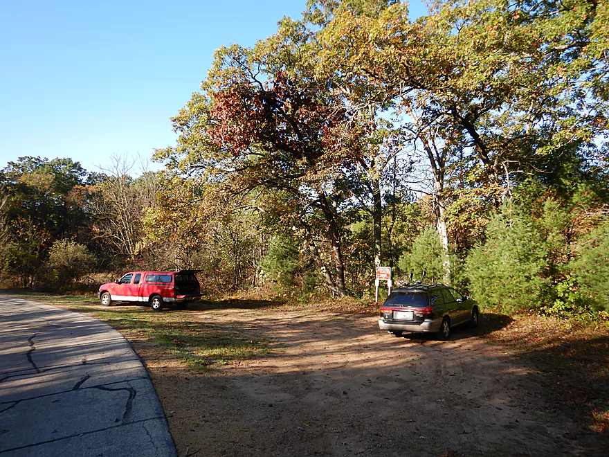
Nice public parking lot near Cumberland Road
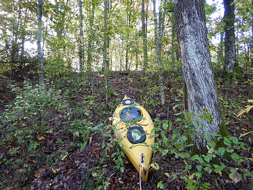
There is a hidden trail leading to the water
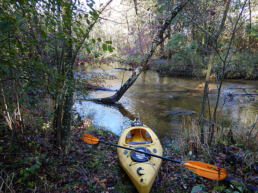
Nice launch area by the water
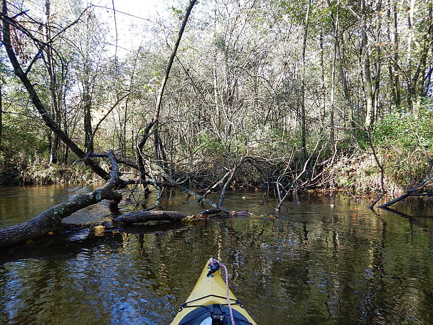
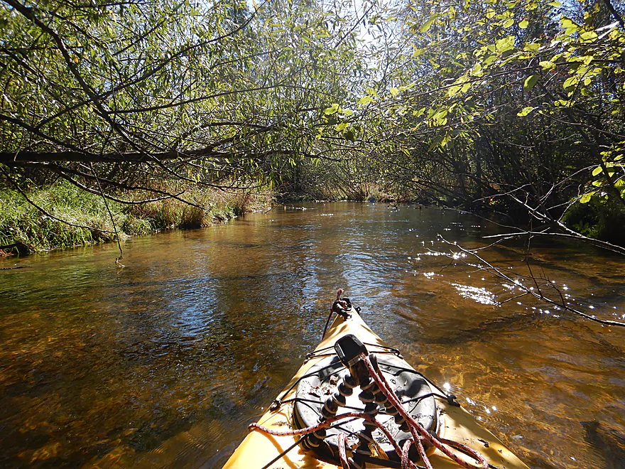
First couple hundred yards have a lot of snags
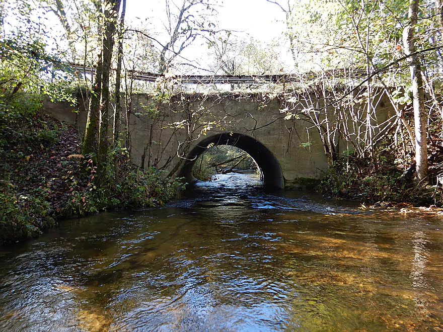
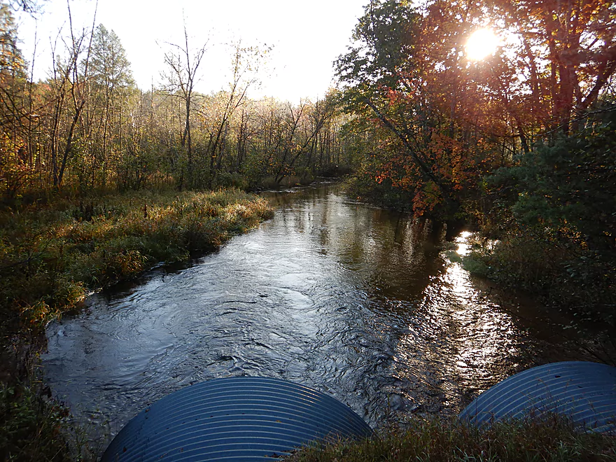
The culvert under Cumberland Road
I suggest starting your trip here instead
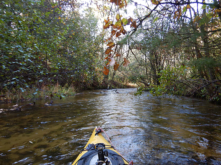
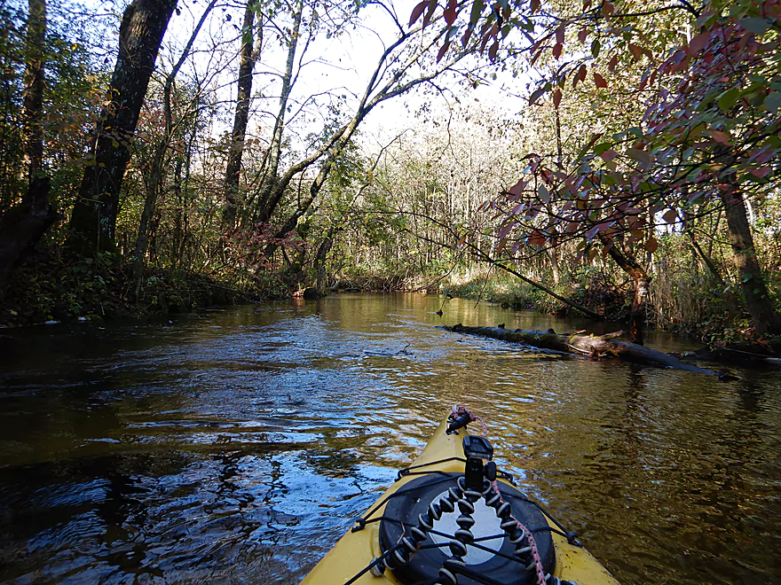
Zipping along in fast current
One of many snags I had to squeak through
More snag dodging
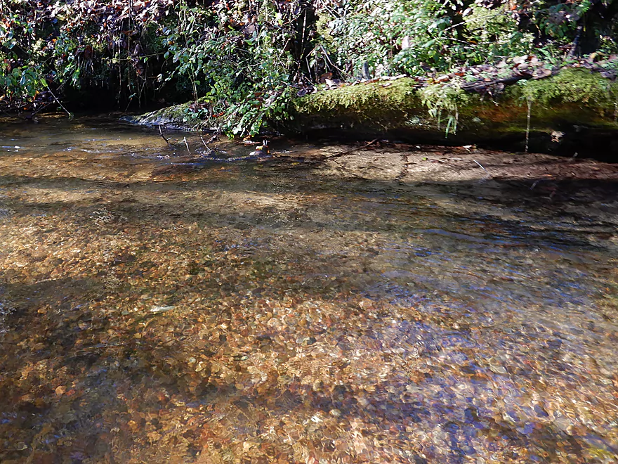
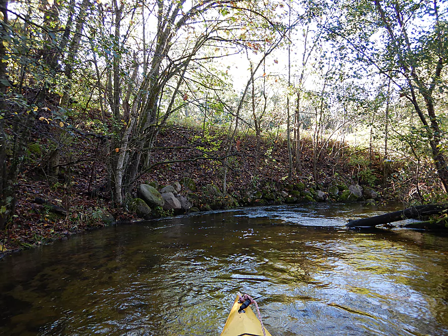
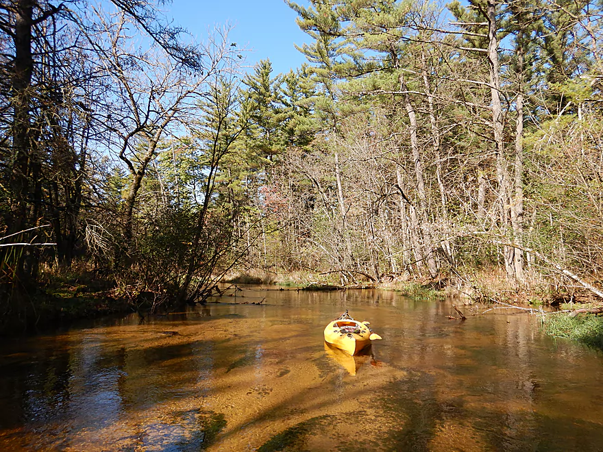
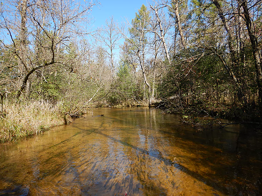
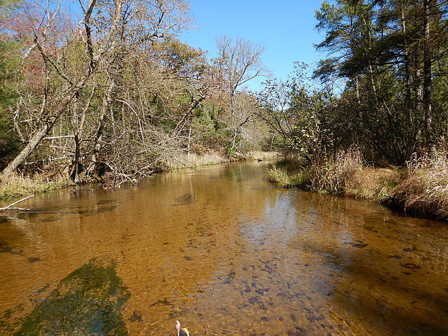
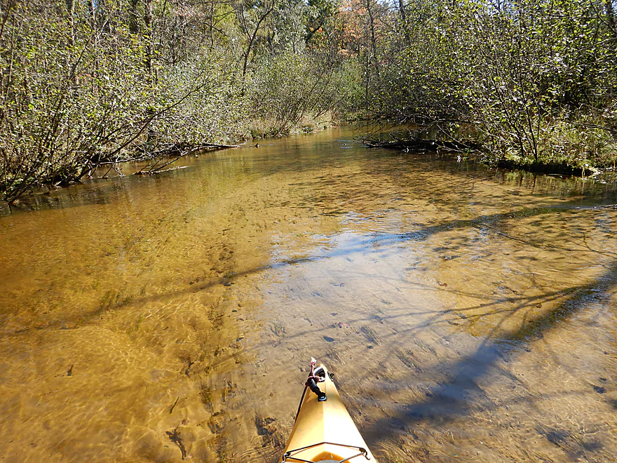
Attractive pebble bottom
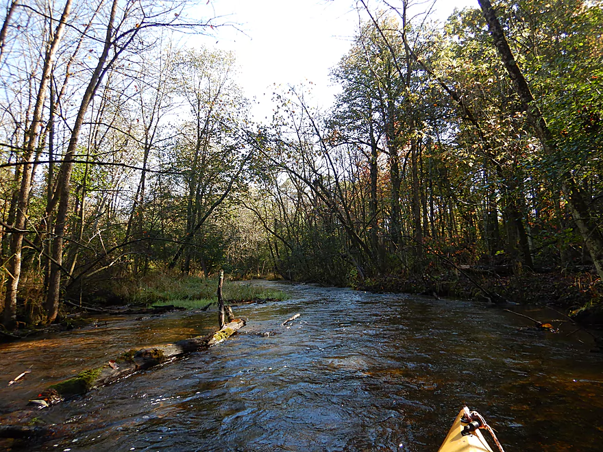
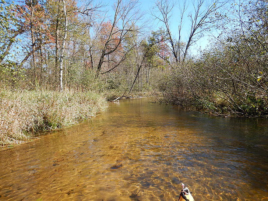
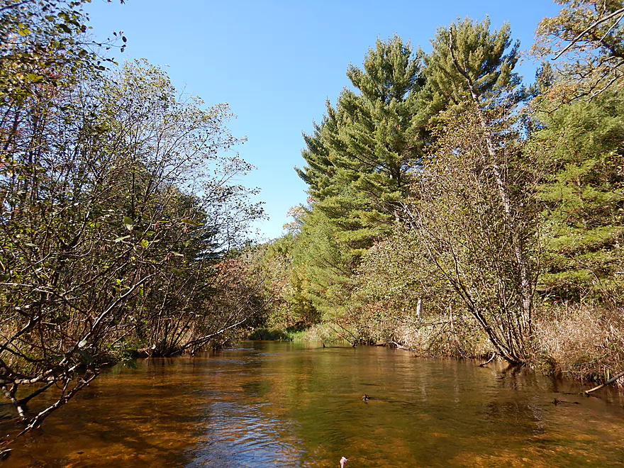
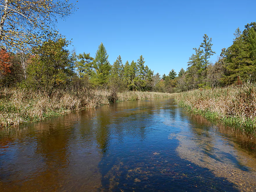
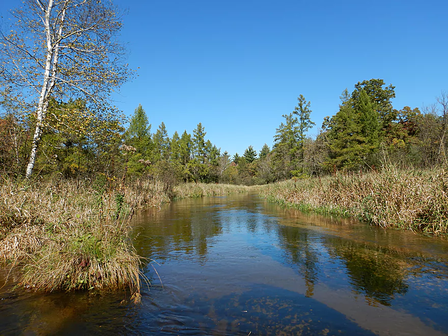
The river starts to open up
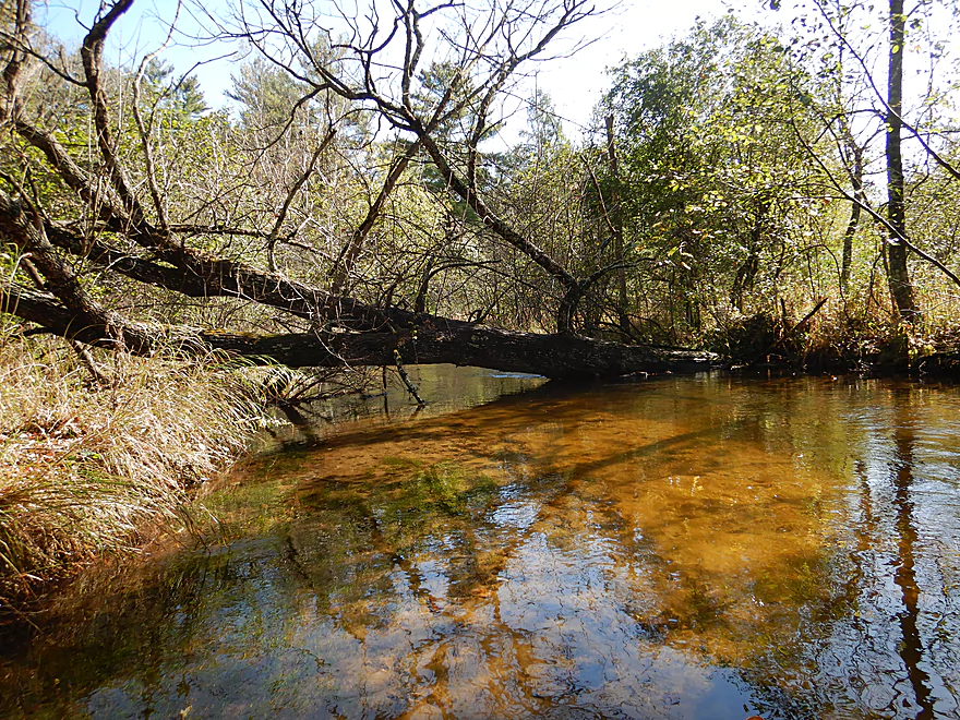
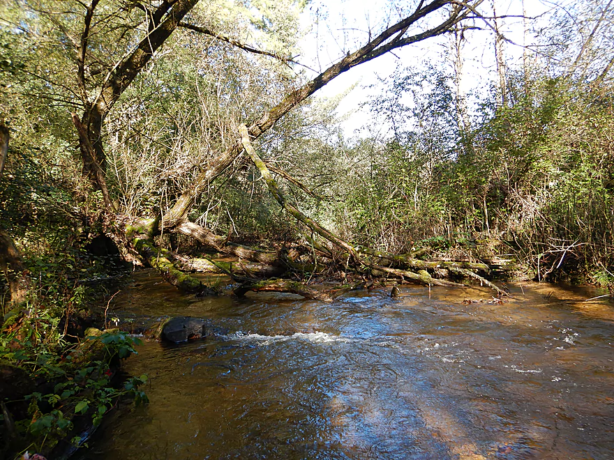
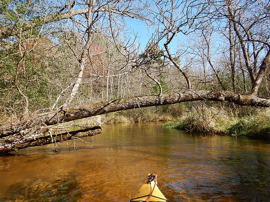
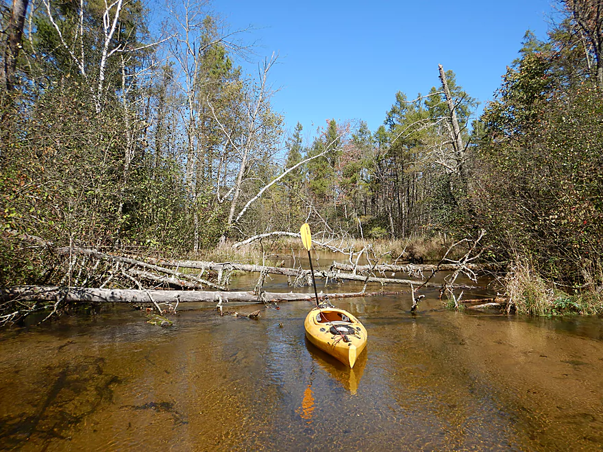
First logjam (easy portage)
Second logjam (easy portage)
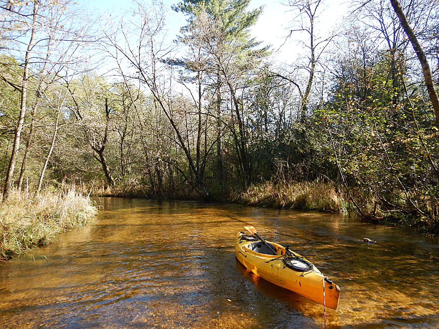
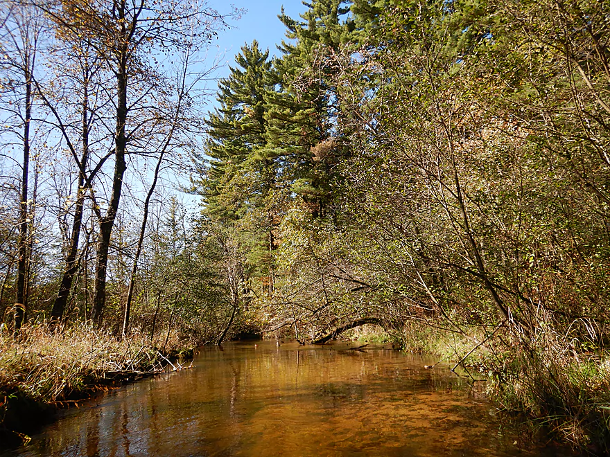
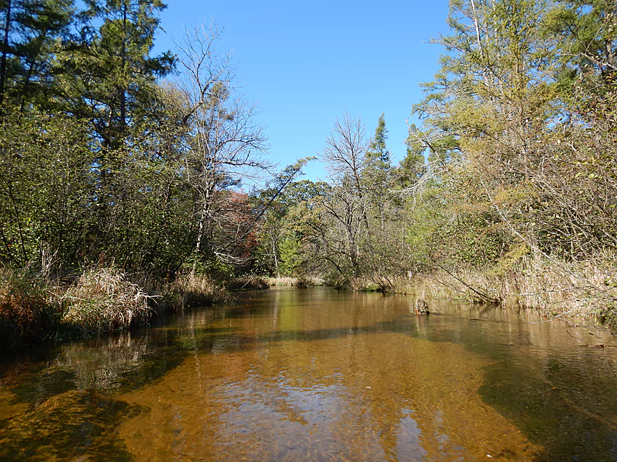
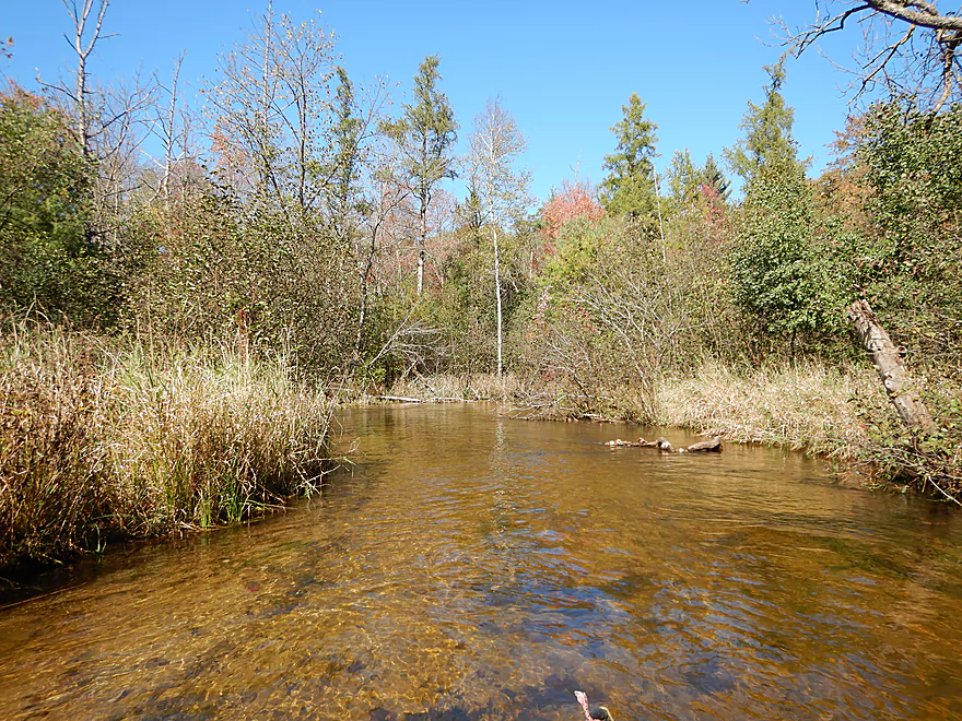
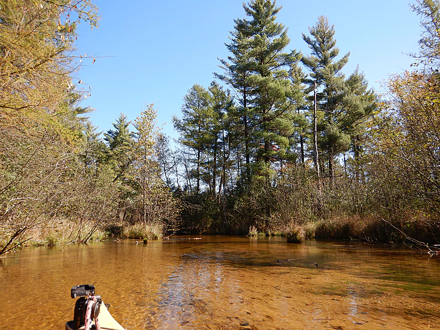
Starting to see more white pines
Really cool scene
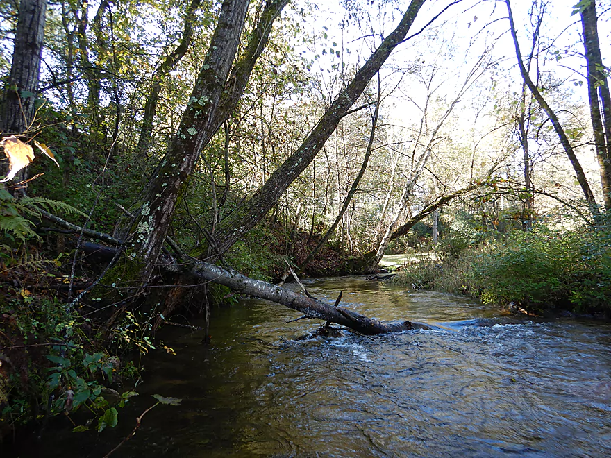
The third logjam (super easy portage)
There has been some great chainsaw work
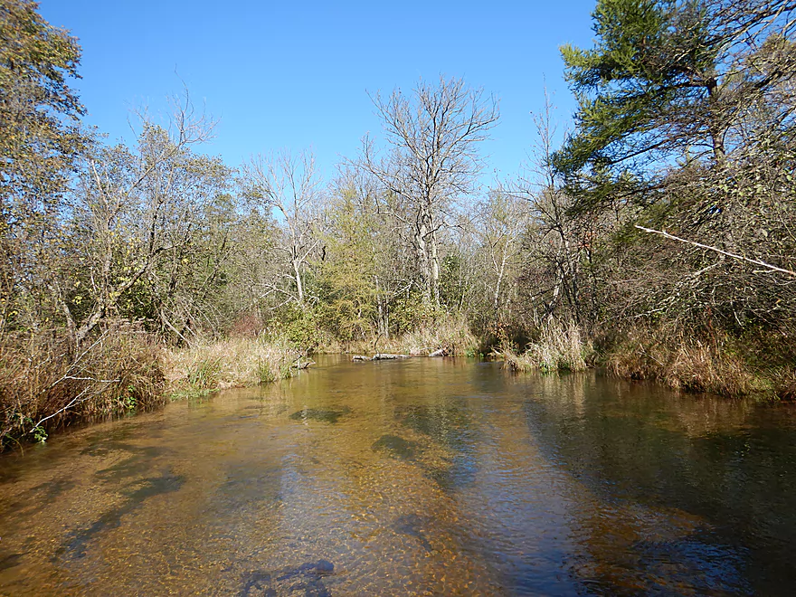
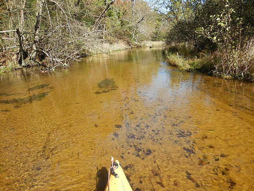
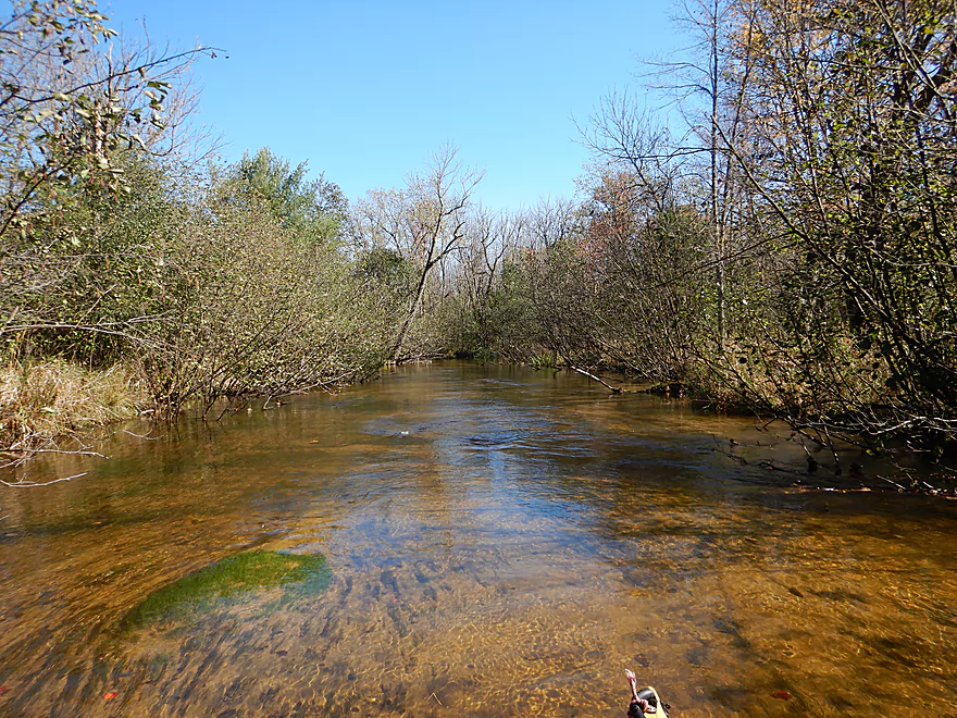
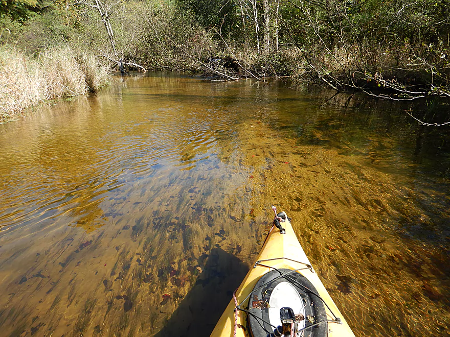
Terrific clarity
Fourth logjam (easy portage and scenic)
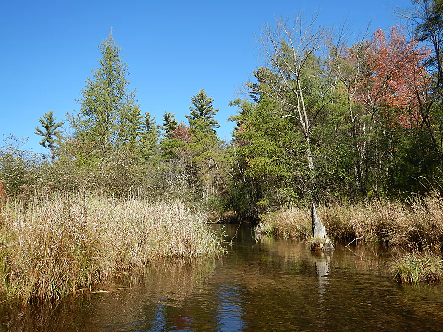
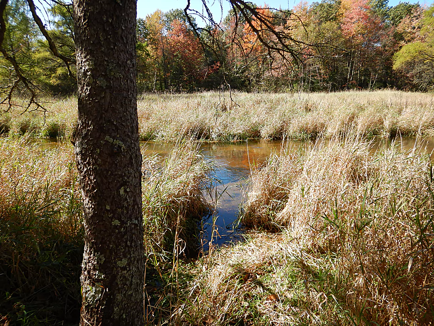
Lot of alders along the banks
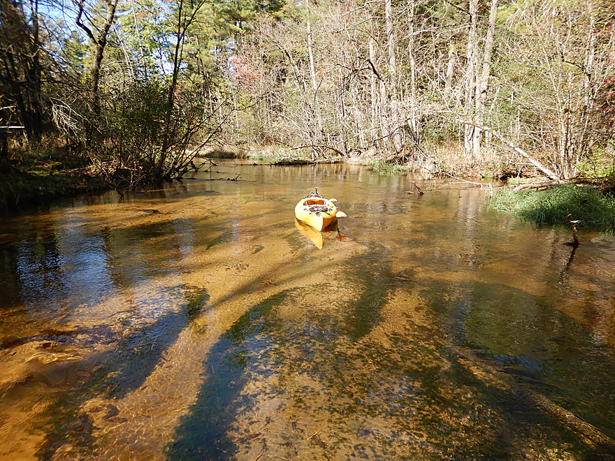
The clarity was almost perfect
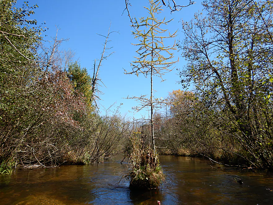
Baby tree growing out of the dead stump
Some fall color
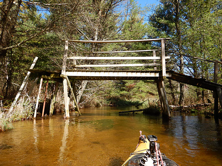
One of several pedestrian walk bridges
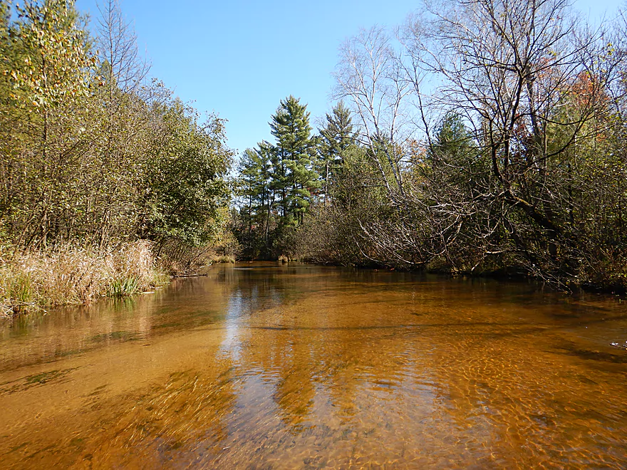
Water has a red hue from tannin stains
More towering white pines
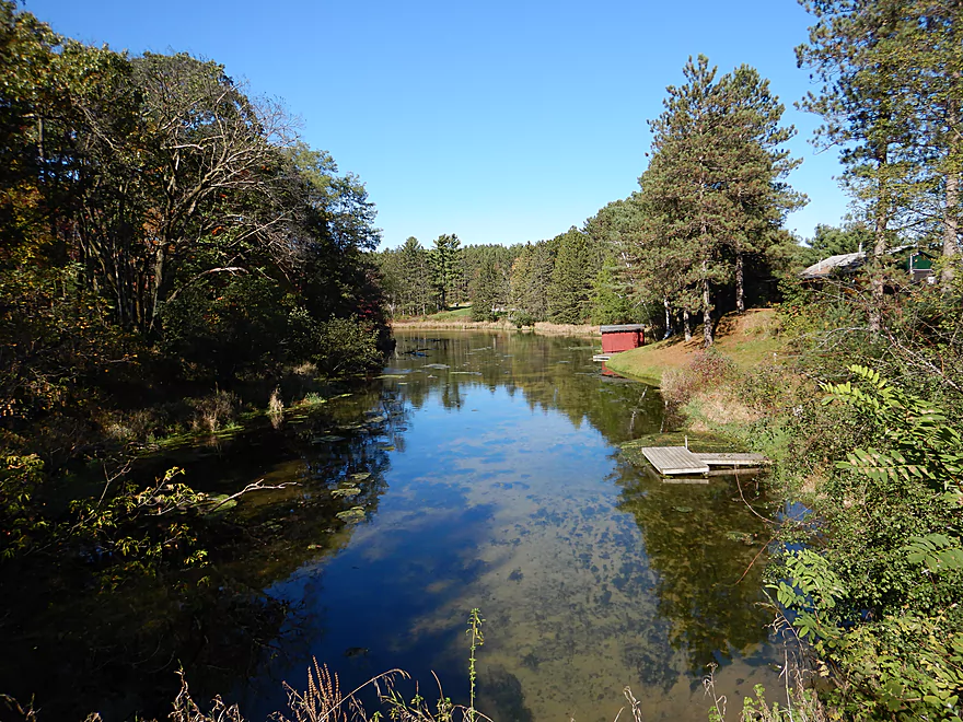
Spring inlet from Zinke Lake
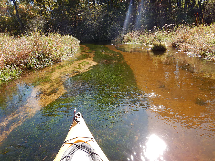
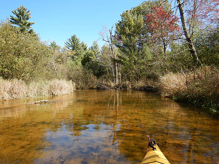
A ribbon of pondweeds
A take-out option by the Hwy 11 parking lot
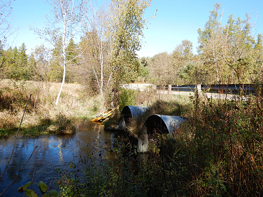
Alternatively, you can take out by the Hwy 11 culverts
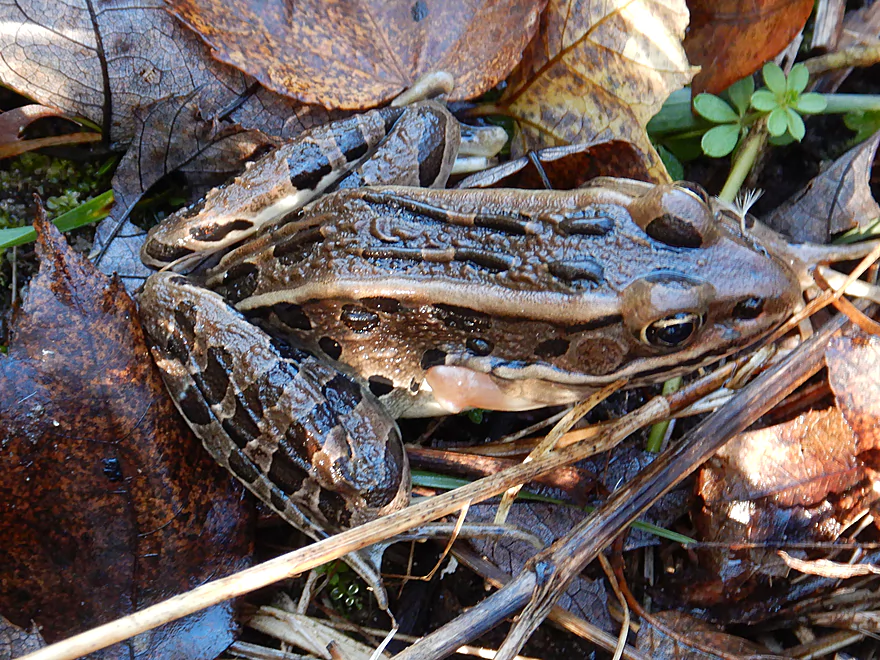
A pickerel frog
Nice public parking lot by the bridge
Looking downstream from the bridge
Checking out Mecan Springs…the headwaters of the river
Mecan River – Cumberland Road

Located halfway between Stevens Point and Wisconsin Dells, the Mecan is a popular paddling river known for its clear water. Most paddle its central or lower sections, but hidden in its far upper sections are some of its best features.
I started the trip at Cumberland Road where the river was but a small creek. For the first mile the channel races along like a pinball with sharp narrow turns and extremely fast current. If there were boulders in the river it would have serious whitewater. This was somewhat stressful, as often the low branches clotheslined parts of the creek which necessitated Johnny-on-the-spot hard turns to avoid getting whacked. All that said, I likely would have enjoyed this, but was in a grumpy mood when my trusted LensPen stopped working, the October morning light was too dark for photography, and the fall colors were a disappointment (2017 in general has been a disaster for fall color).
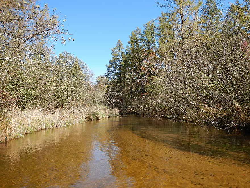
The neat thing about this segment was how crystal clear it was (almost perfectly so). There was virtually no mud, and the banks were flat and mostly sediment free. The substrate consisted of a clean sand intermixed with attractive pebbles, which is I believe a byproduct of pitted outwash from glaciers. Nearby is an Ice Age Trail segment that runs along the river from its headwaters at the springs to Cumberland Road, which would be a great hiking idea.
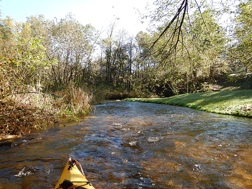
About a mile into the trip, the creek widens and slows significantly. The gravel bottom goes away and is replaced with pure sand, while white pines and spruce start to nudge out the alders. The white pines were fantastic! Often they and the spruce would grow at corners of the river, which created scenic alleys which backdropped the clean red-hued water and sand. A little up-north in southern Wisconsin. Another bonus to the scenery was the lack of development (no agriculture, industry and only a few small homes).
The Mecan is unique in that it is largely a spring-fed river. The headwaters are located at Mecan Springs State Nature Area (one of Wisconsin’s largest natural springs), but there are also numerous additional side springs along the river. There were 3-4 spring inlets that I paddled past but most were too shallow to explore. The largest of which is Zinke Lake, which I tried to paddle up to but was blocked by logjams. Supposedly there is a public access for Zinke Lake along its north shore.
The take-out at 11th Road was very good. To my surprise I saw at least three other cars parked here for downstream trips. A stark contrast to three years ago when I did the 11th road to Hwy JJ section and hardly saw a soul (hopefully word is getting out).
In summary, this was a great trip, but did start on a bit of a sour note because of the obstructions I had to deal with. But after the first mile it really cleared up and was quite nice. For new Mecan paddlers, I suggest doing 11th Road to Hwy JJ, or Hwy JJ to Dixie Ave first. This is a trip best suited for Mecan veterans in small boats looking for a new adventure and willing to put up with a few logjams and low branches.
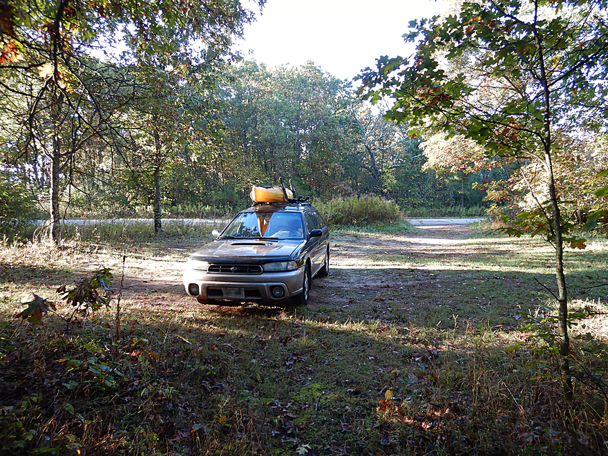
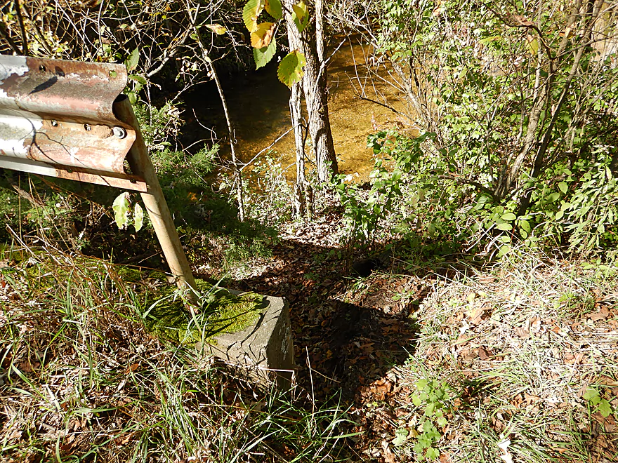
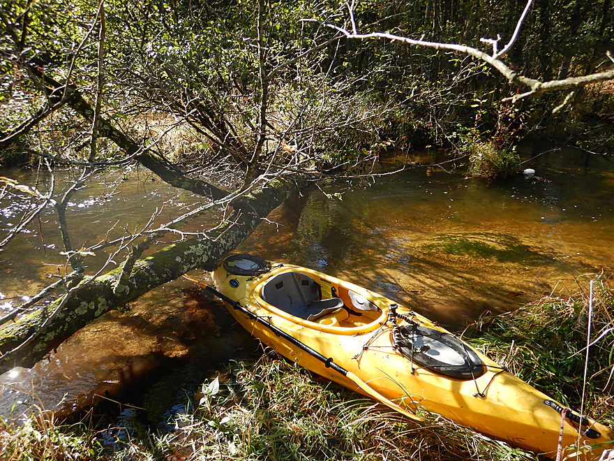
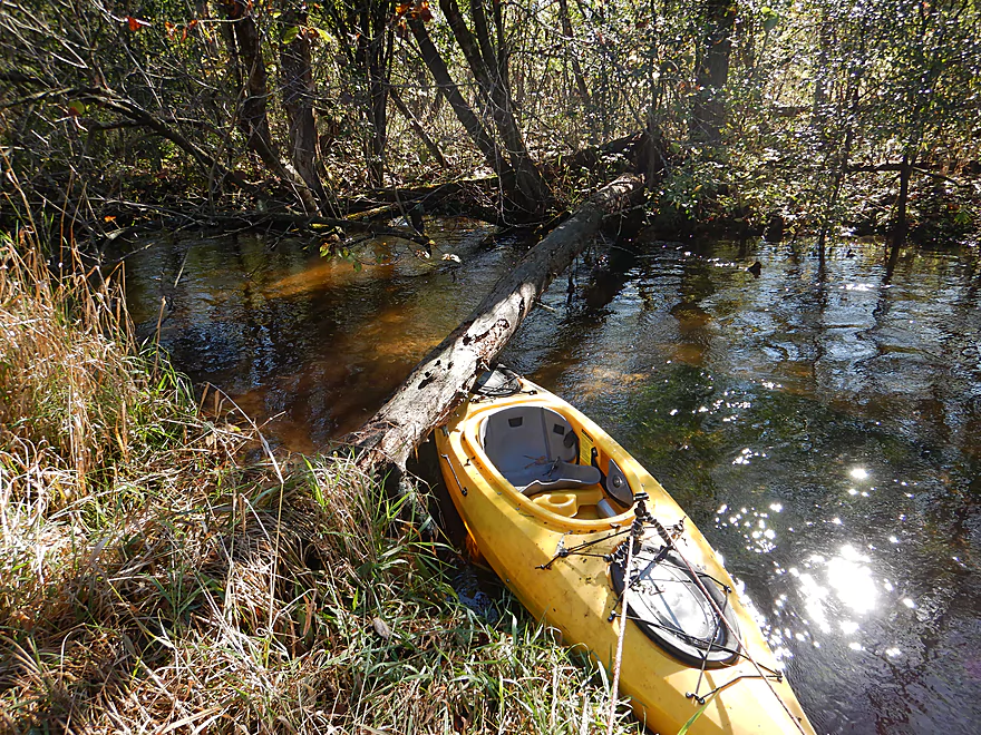
I launched at a public fishing wayside by the Cumberland Road bridge. Just north of the parking area is a hidey trail where you can drag your boat 80′ down a hill to access a nice launch area on the river.
In hindsight I don’t recommend this. From this north side access to the bridge is a 500′ section of river filled with a lot of congestion. I didn’t have to portage but it it still entailed an annoying amount of ducking and hopping. Instead…I recommend launching immediately upstream of the Cumberland Road culvert, which is a steeper launch in faster current, but is plenty doable.
Take-out was at 11th Road, which was a good access option. You can disembark just upstream of the culvert, or you can take out a hundred yards upstream at the fishing trail.
Parking is a little tight by the bridge, but there is is a nearby public parking lot for fishermen which you can use.
Mecan River Outfitters primarily services the lower Mecan and charges extra for the upper Mecan. But this is the far upper Mecan and I’m not sure they are willing to go this far upstream. You can ask them at 920-295-3439.
Otherwise this is a really nice bike shuttle. Only 3.0 miles, pretty flat, and little traffic. Chances are you’ll see an Amish buggy which is quaint, but not so quaint was the amount of horse manure I had to pedal around.
For the first few hundred yards prior to Cumberland Road there are multiple snags. I didn’t have to portage, but it still was annoying. I advise launching directly above Cumberland Road to avoid this.
For the first of the four miles, the river is quite narrow and fast. There are many low branches to duck and dodge. Four downed trees require portaging, which is easy to do because the river is not deep and there is virtually no mud.
For the remaining three miles, the river slows and widens and you mostly don’t have to worry about logjams.
There has been some serious chainsaw work done on this section by somebody which is appreciated.
Because the upper Mecan is spring-fed, its levels tend to be remarkably stable. Often while neighboring rivers are too high or too low, the Mecan is just perfect for paddling.
Generally speaking, I doubt it ever gets too shallow to run. On the flipside it can take a big rain (2-3 inches) to significantly push up levels. I went after a 1.5″ rain and the river was only say 30% above normal. The ideal depth will be a bit on the shallow side for the best clarity. After 2-3 inches of rain, it will likely be too high.
There is no gauge on the Mecan, but one of its tributaries (Chaffee Creek) does have a new gauge. The following are my rough estimates.
- < 3.55′: Likely still navigable…maybe some shallow areas in spots.
- 3.56-3.6′: Average fall depth. Good range.
- 3.61-3.65: A higher than average depth. Should still be navigable, but a smidgen less scenic. I went at 3.62′.
- 3.66-3.7′: Perhaps doable, but likely not enjoyable.
- 3.71’+: Very high depth. Banks might burst at this point.
Not too much. A pickerel frog, a great blue heron, and maybe 10-15 small fish (likely trout). Along the shore was some skunk cabbage and wild spearmint which was a treat.
Detailed Overview
Generally speaking, the further upstream you go on the Mecan, the better. Upper Mecan segments tend to have less mud, better current, better clarity, and more attractive shorelines.
- Mecan Springs to 9th Ave: 1.4 miles.
- Mecan Springs Boat Launch to Hwy GG: 0.6 miles. The river starts as a spring-fed lake sandwiched between two moraines. This is a neat lake paddle with clear water and visible springs located mostly along the western end. Trip length can be expanded by 1-2 miles if you explore the various bays throughout the lake.
- Hwy GG to 9th Ave: 1.4 miles. The first mile of the river has a few snags to dodge, but is super scenic with nearly perfect water clarity.
- 9th Ave to Hwy 21: 2.3 miles. Satellite maps indicate there could be many logjams and portages.
- Hwy 21 to Cumberland Road: 2.3 miles. Satellite maps indicate there could be many logjams and portages.
- Cumberland Road to 11th Ave: 3.9 miles. A great section with fast current, clear water and scenic white pines. A few logjams to portage but not bad.
- 11th Ave to Hwy Y/JJ: 3.7 miles. A fantastic section and my favorite on the entire river.
- Hwy Y/Dakota to Dixie Ave: 5.4 miles.
- Hwy Y to 14th Ave: 2.8 miles. An excellent section with white pines, tamaracks, narrow twisty turns and crystal clear water.
- 14th Ave to Dixie Ave: 2.5 miles. While not as good as the previous leg and more open, this is still a good stretch. This includes the "Mecan River Pine-Oak Forest State Natural Area".
- Dixie Ave to Hwy 22: 4.5 miles.
- Dixie Ave to Dover Ave: 2.0 miles. An ok section, but not as good as upstream sections. Even more open and slower, with far fewer pines.
- Dover Ave to Hwy E: 1.8 miles. River starts to become less interesting but is still ok.
- Hwy E to Hwy 22: 0.7 miles. Nothing special about this section. Open and somewhat simple.
- Hwy 22 to Germania Marsh Dam: 5.8 miles.
- Hwy 22 to Duck Creek Road/Electric Fence: 4.2 miles. More open and not as interesting, but the brisk current and good clarity are enjoyable.
- Duck Creek Road/Electric Fence to Dam: 1.6 miles. River slows and empties into a mile long shallow marsh. The Germania Marsh features nice scenery and good wildlife. Take-out is on a small access road off Hwy N.
- Dam to Elk Road: 6.3 miles. The most popular section on the Lower Mecan.
- Dam to Hwy N: 5.2 miles. River turns into a flowage pond and marsh. Take-out is on a small access road off Hwy N.
- Hwy N to Elk Road: 1.1 miles. The river completely moves east, creating a really cool corridor.
- Elk Road to Hwy 23: 2.4 miles. Traditionally a section with many logjams, but it does get cleared out periodically by the local livery. Hwy 23 is a poor access option.
- Hwy 23 to Hwy C: 2.7 miles. Again, this usually has logjams but they are often cleared out by the locals. Hwy 23 is a poor access option.
- Hwy C to Mouth: 1.1 miles. Simple open stretch leading to the Fox River.
- Mouth to the Princeton Locks: 3.1 miles. An uninteresting stretch on the Fox River.
For further information on the Fox River, see my Fox River review.
Trip Map
Overview Map
Video
Photos Size:
We three gals just did the Cumberland to Dakota section of the Mecan on October 8th, 2019. In the first 30 minutes we only encountered two easy trees to deal with…actually with wearing my knee high neoprene chota boots i just stayed in the water and dragged the boats over the low lying limbs. After that the three of us headed easily down to 11th. Took us 90 minutes total for that upper section and then continued for another 90 minutes (including a 15 minute lunch break) down to Dakota. Note that our 3 kayaks were 9.5′-10.5′ in length. We were laughing that the curvy upper section below Cumberland made the section below 11th seem ‘straight’. Might try using my 12′ kestrel next time….but will wait till summer when it is warmer.
Sure, there are a few other limbs to duck under in these two sections but the current is reasonably slow and the water is shallow….so it is no big deal. Will maybe go even further upstream next summer to explore.
Thanks for the feedback Gaila!
We did this section on May 27, gage was at 12.5 CFS which seemed to be a great level. fantastic trip, no bugs, no portages, and only a few things to slide over/duck under. A short trip for sure, only 4.1 miles, it took us just over 2 hrs but we stopped once to empty a boat that got a lap full of water and once to stretch our old man legs. You could easily extend this trip by going down to the next bridge at Hwy Y and JJ in the Town of Dakota, where you can get a drink and a meal at Blader’s Dakota Inn. Either of these trips are great places to do a bike shuttle, as the route is on small paved country roads in the heart of Amish country. Depending on your route, you may go past several Amish farms,a sawmill, and a school. Depending on the time of the year, some of the farms may also have small produce stands. Here is a link to a map and pics using the Relive app, which I highly recommend. https://www.relive.cc/view/vE6J9jErpxO
Logjam update…as of Sept 16, 2024 Cumberland to Y was recently cleared of jams by Mad City Paddlers, but there are still some low trees that have to be ducked under.
I did the section from Cumberland to JJ/Y/Dakota on Fri 10/10/25, happy to report that while there are some things to duck under there were no complete blockages and it is open all the way.
Appreciate the update!