
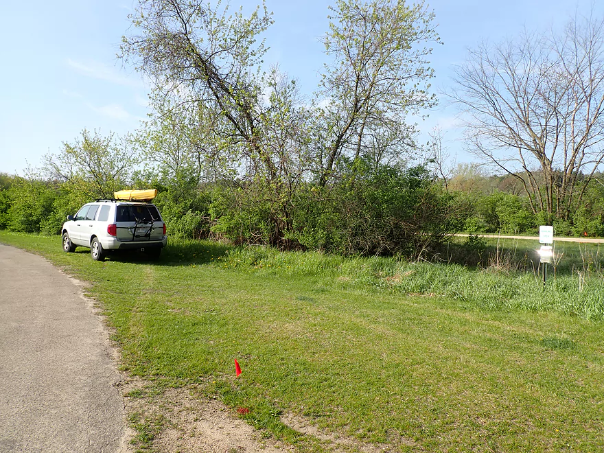
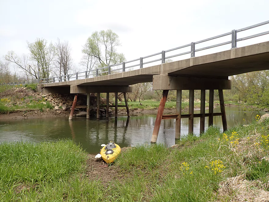
Public DNR parking area at the end of Kalepp Road
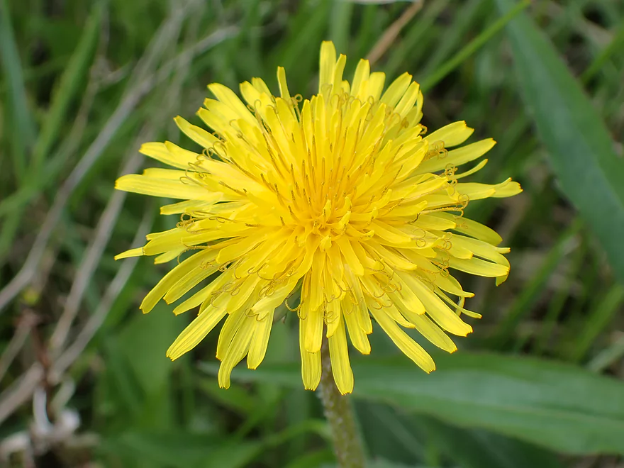
First dandelions of spring
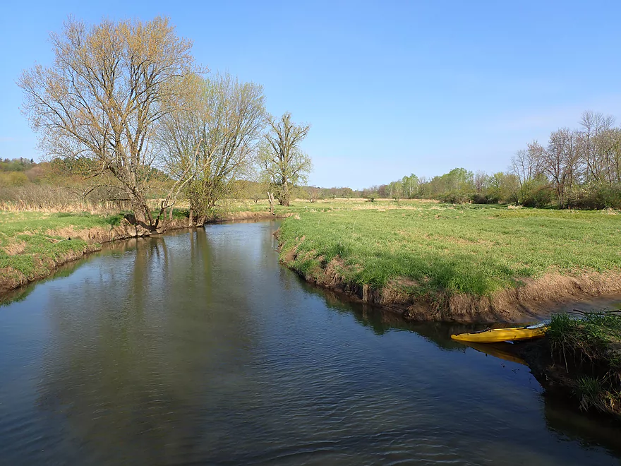
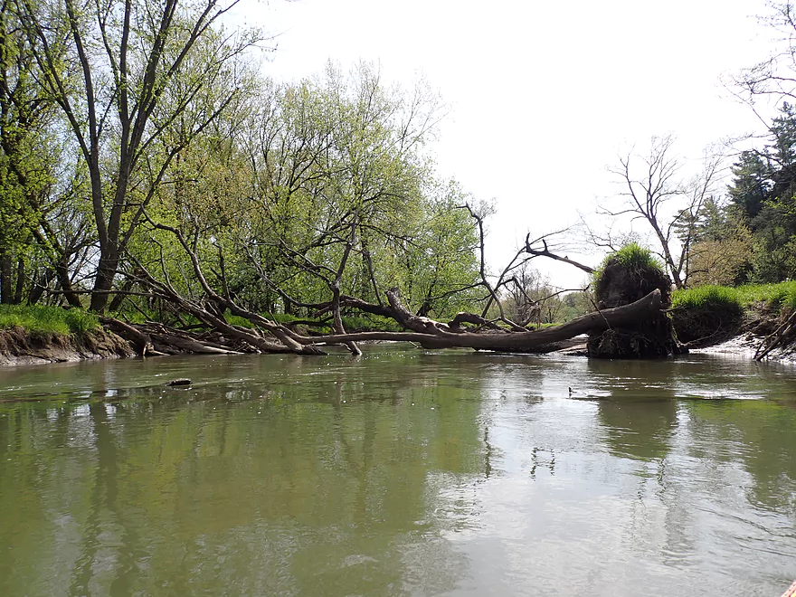
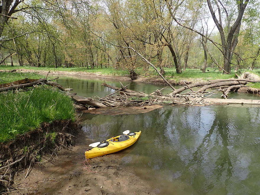
I launched from a side creek which was muddy (a future launch here is planned)
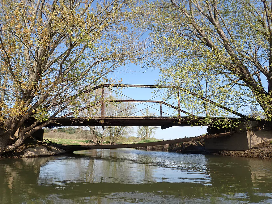
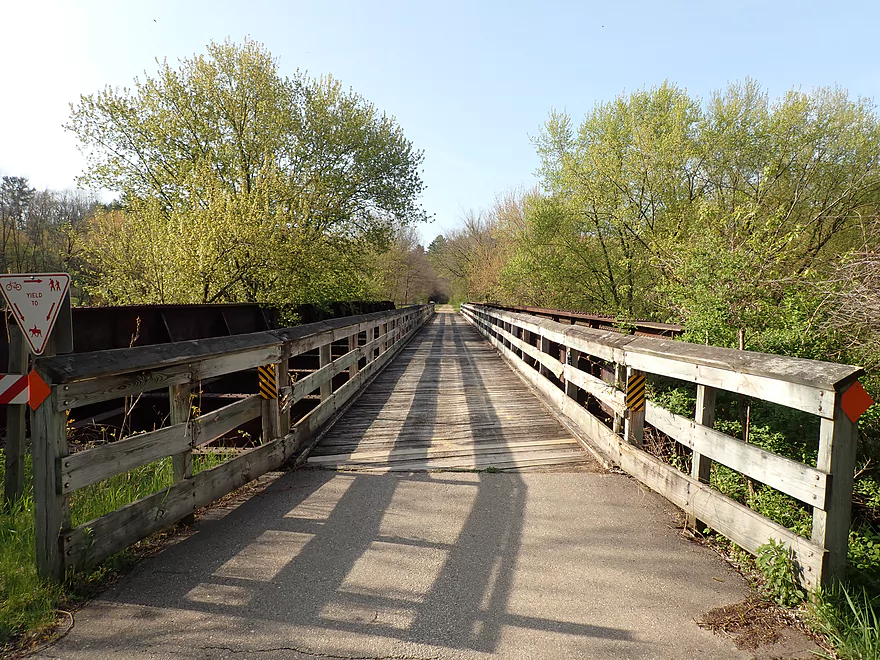
Attractive iron trestle bridge
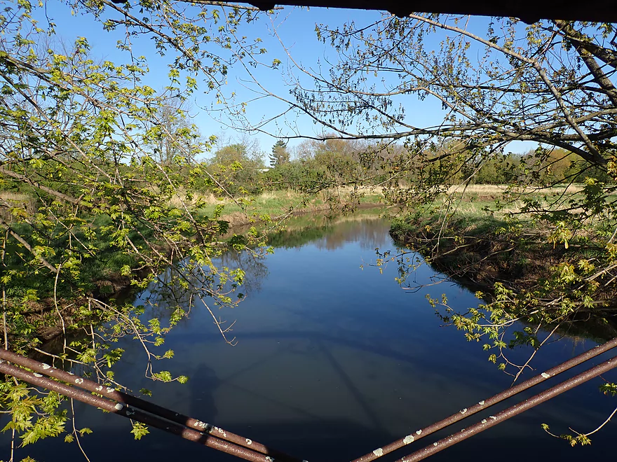
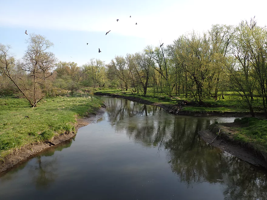
Looking downstream
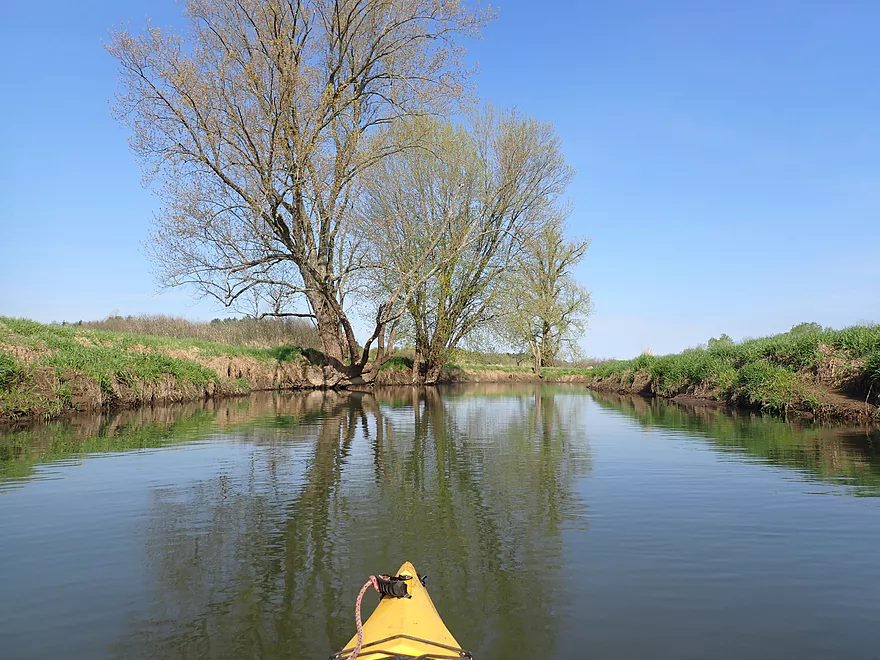
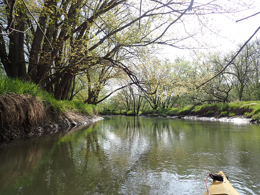
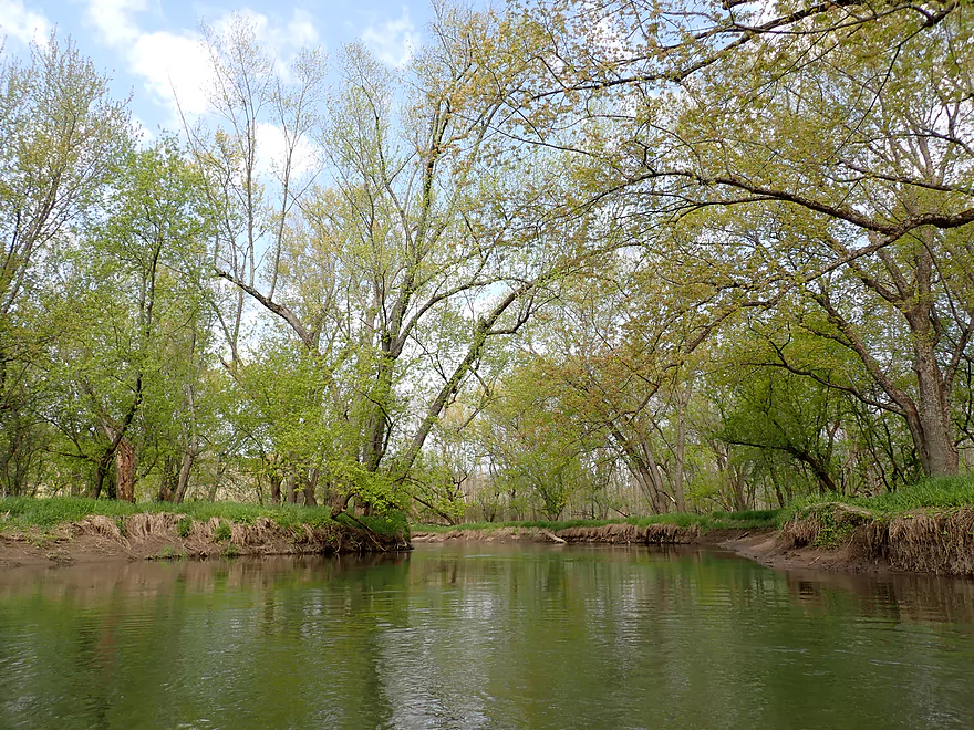
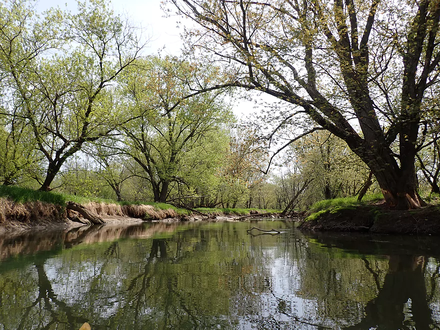
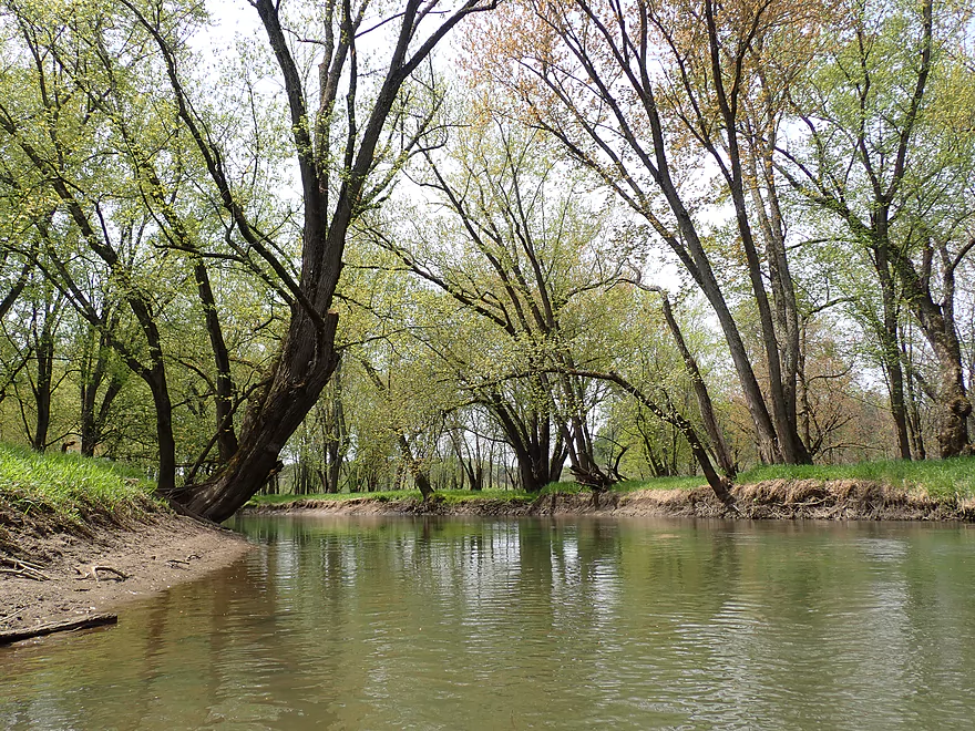
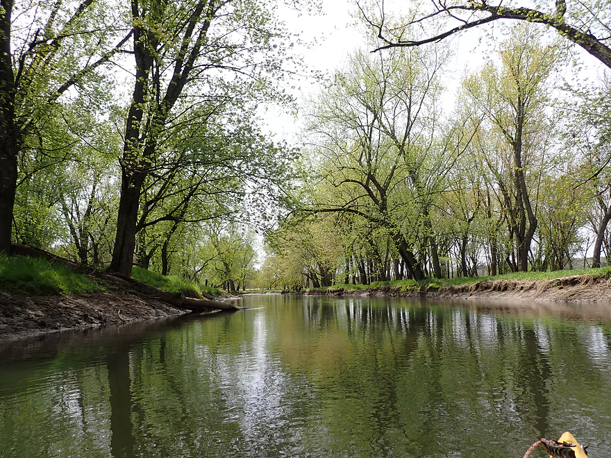
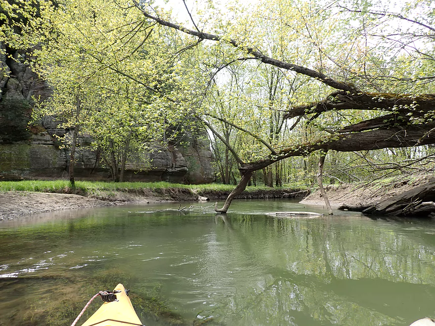
First part of the trip was open and peaceful
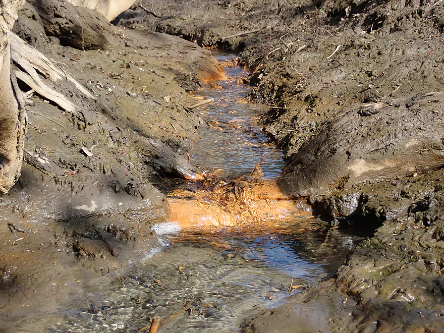
Some iron-tainted seeps
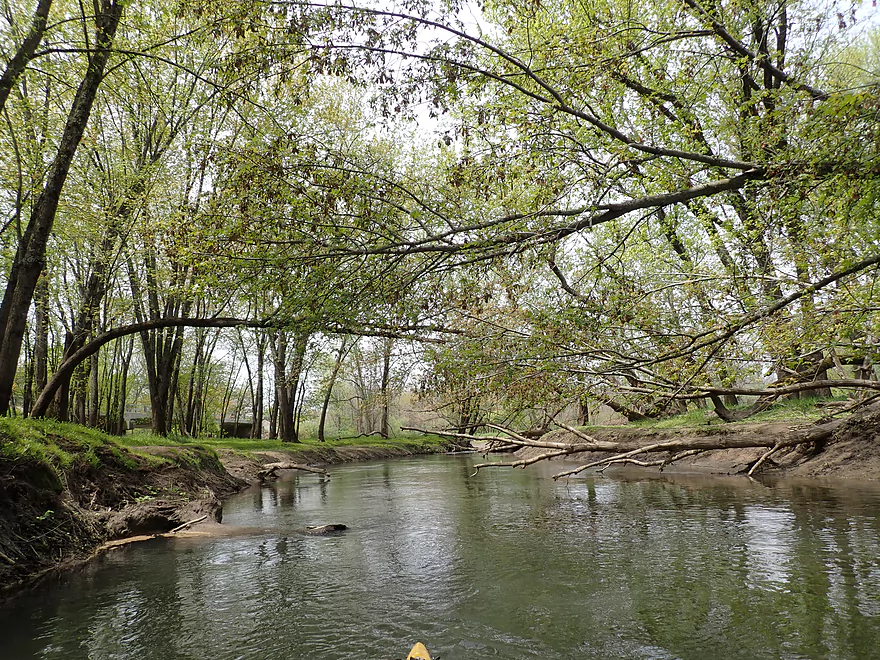
The rest of the trip was pretty wooded
Skinned knees from spring ice flows
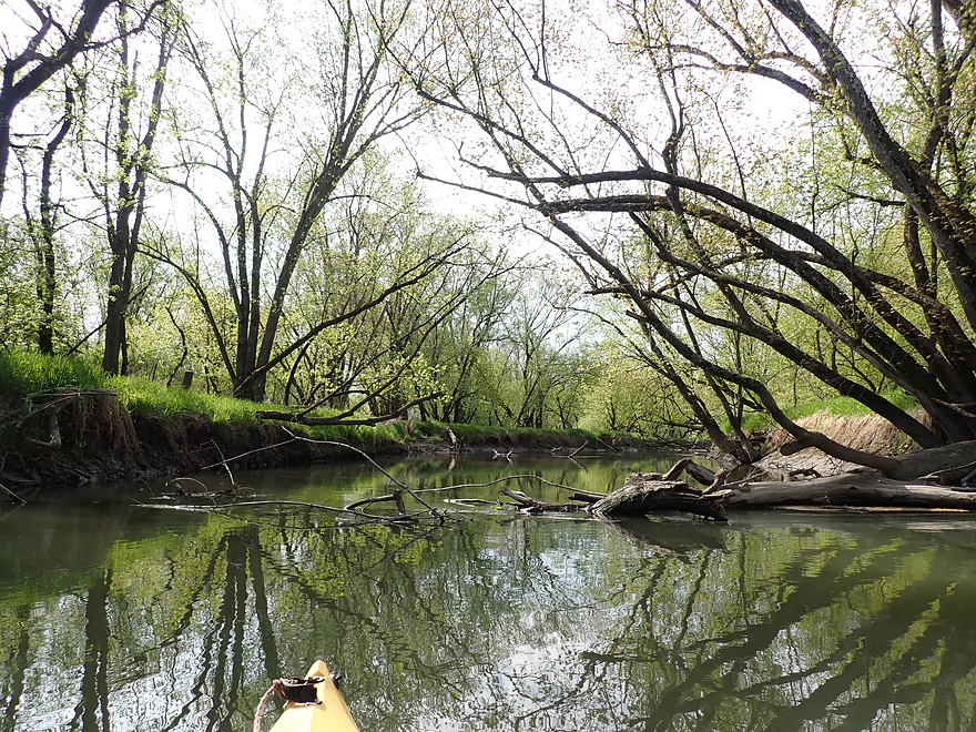
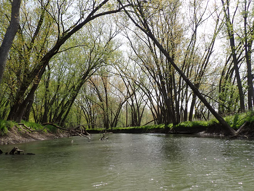
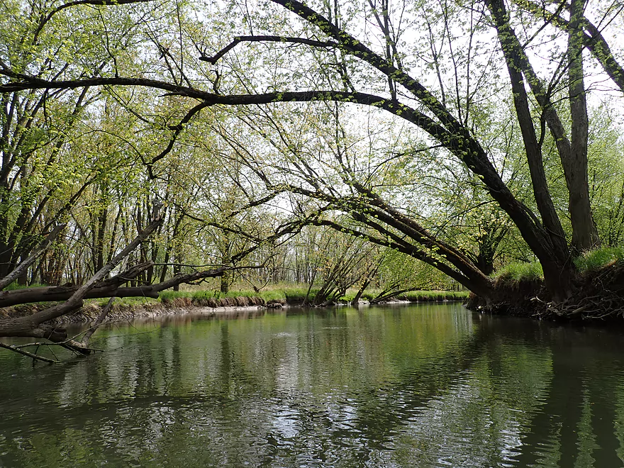
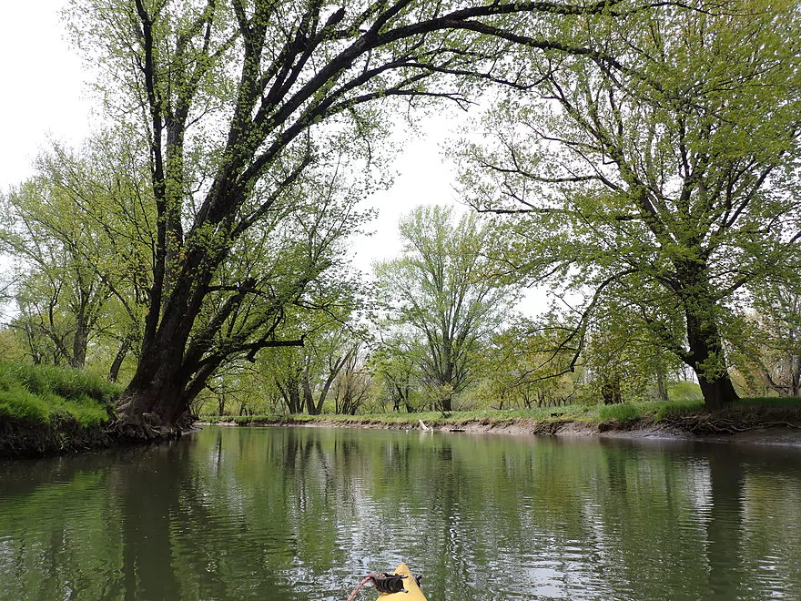
Many trees arched over the channel
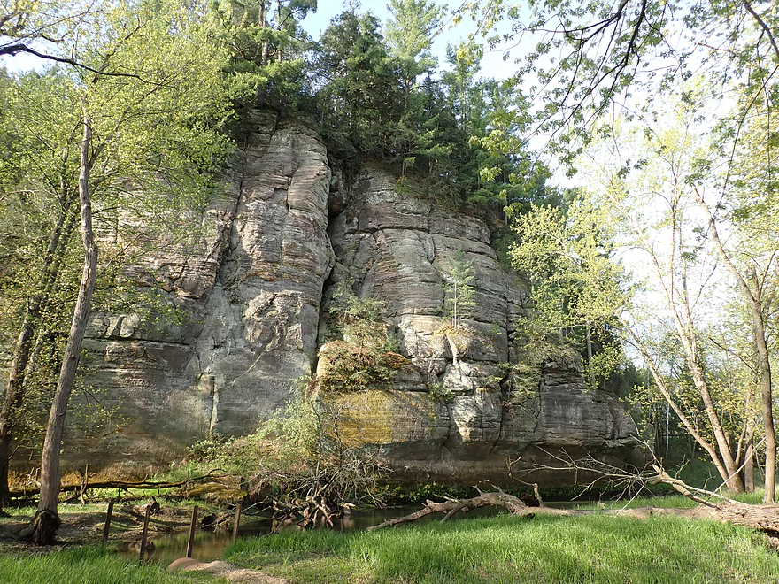
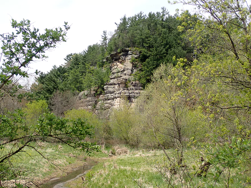
The first outcrop of the trip
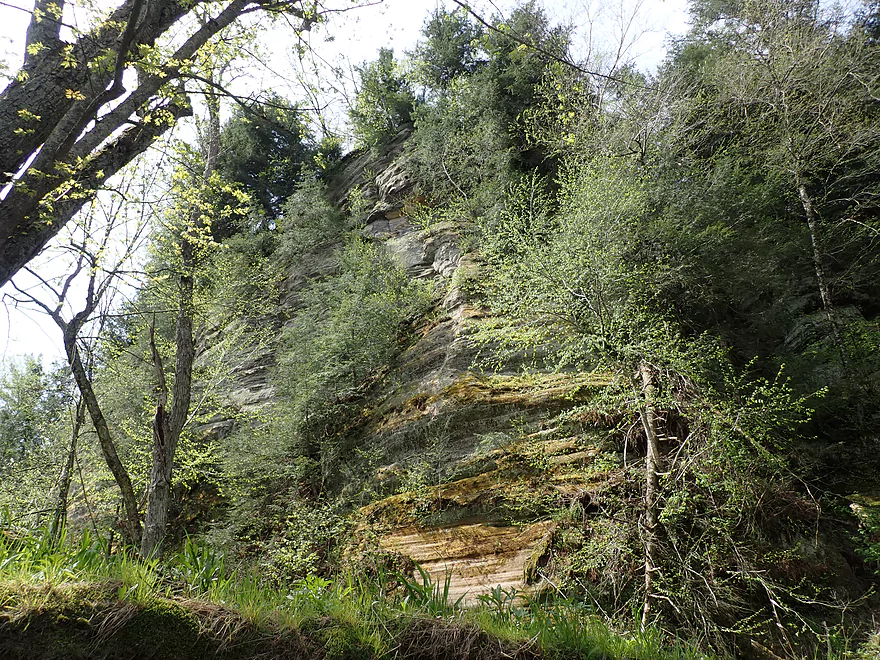
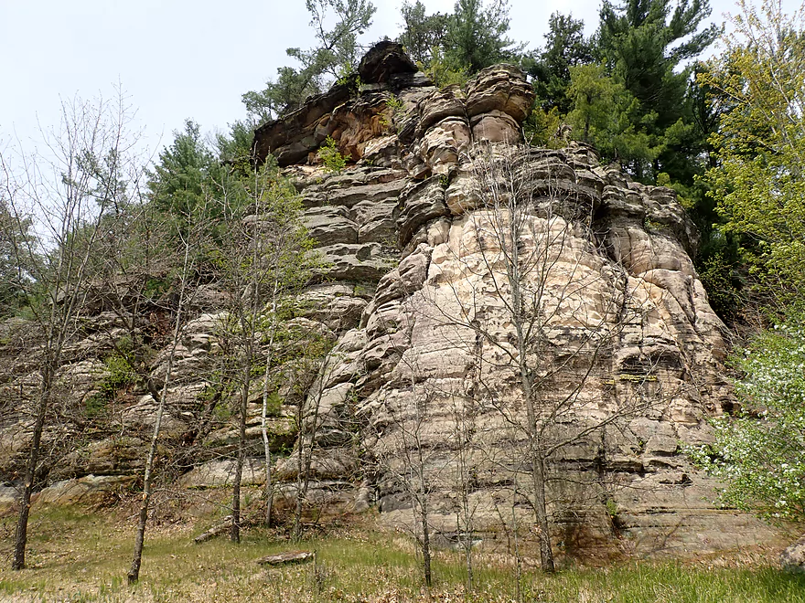
This was one of the nicer ones

The banks were so muddy…at times like thick chocolate pudding
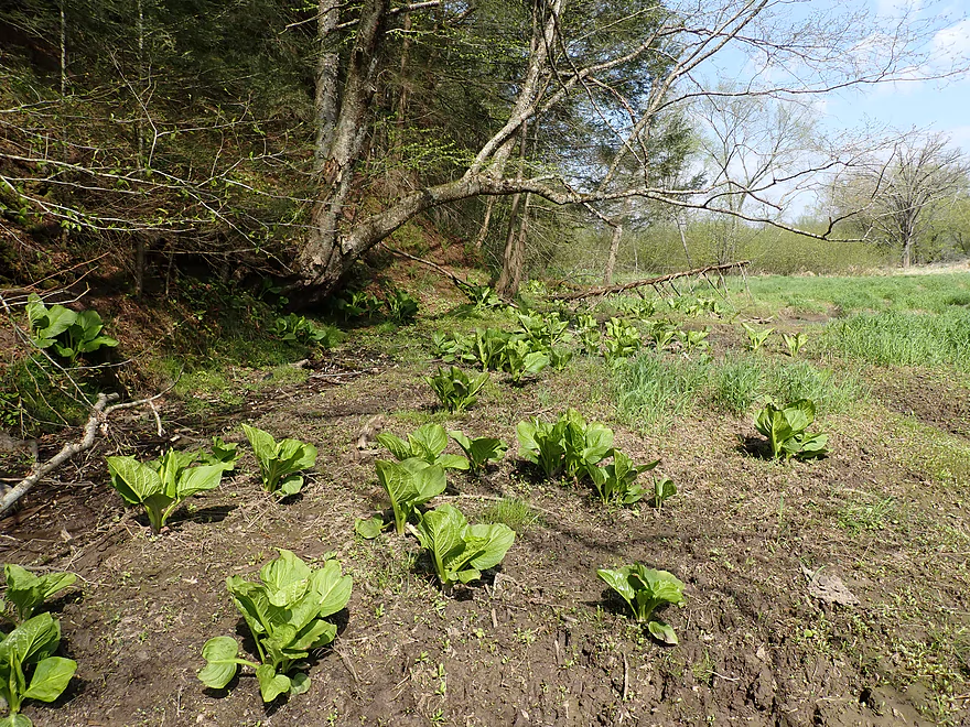
Skunk cabbage hanging out at a natural spring
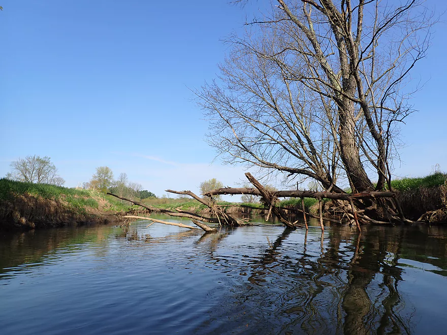
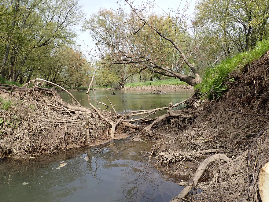
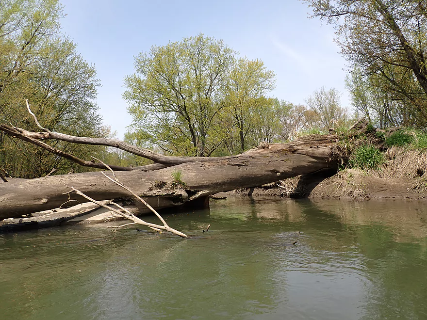
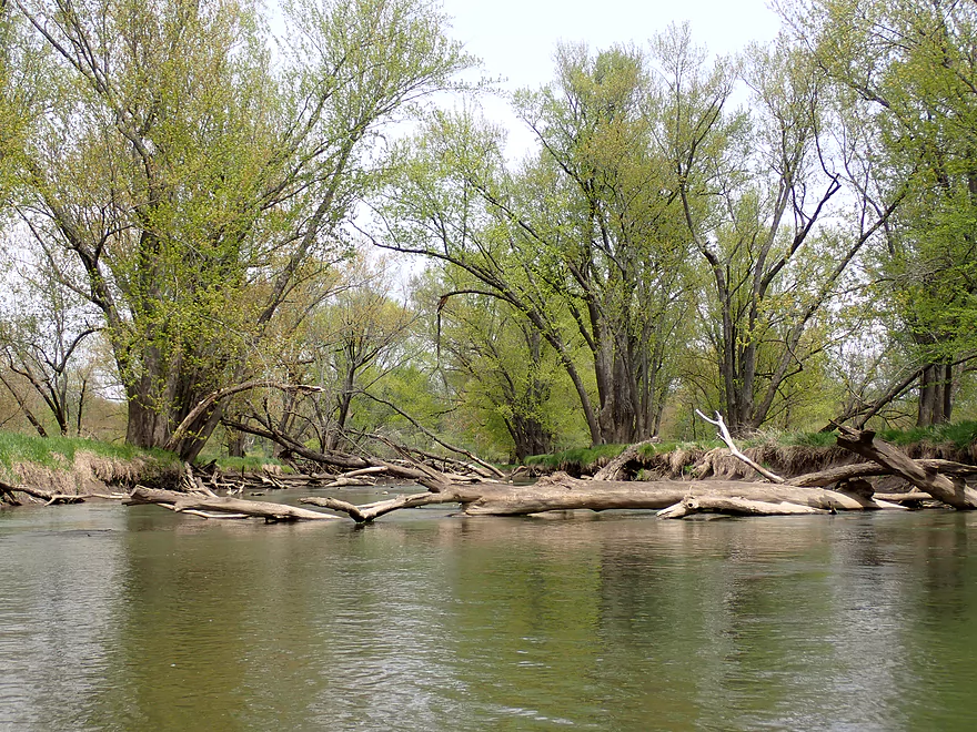
Many intimidating logjams…but almost always a way through
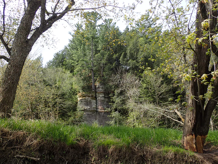
Several of the outcrops were recessed from the banks and difficult to see
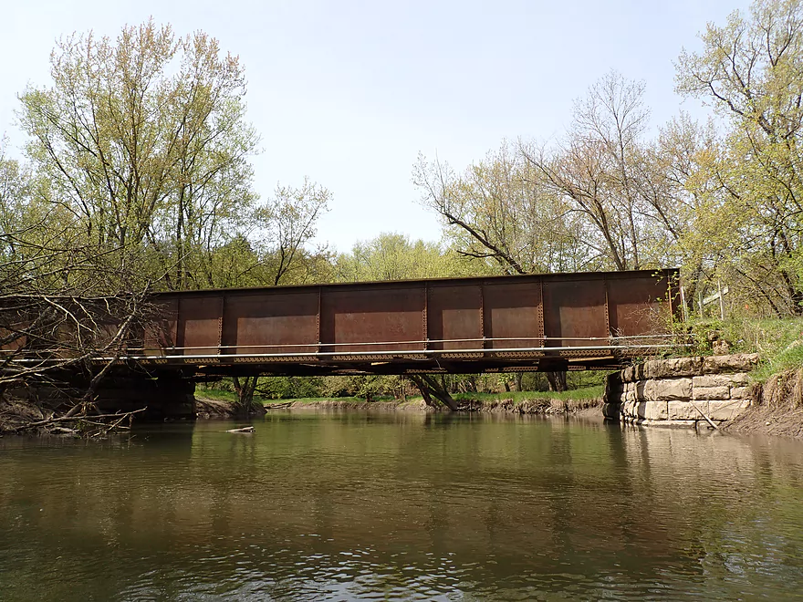
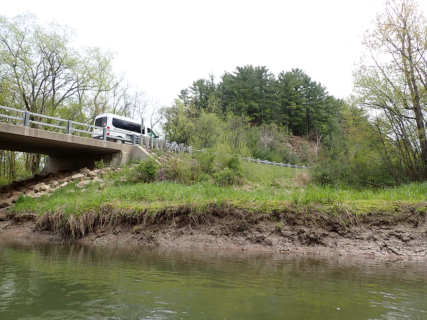
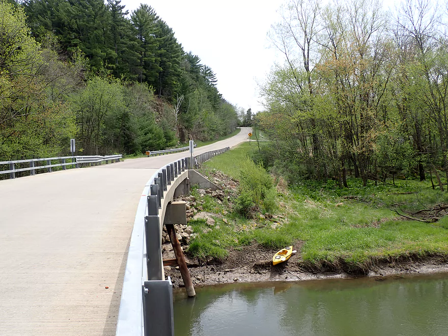
400 Bike Trail bridge
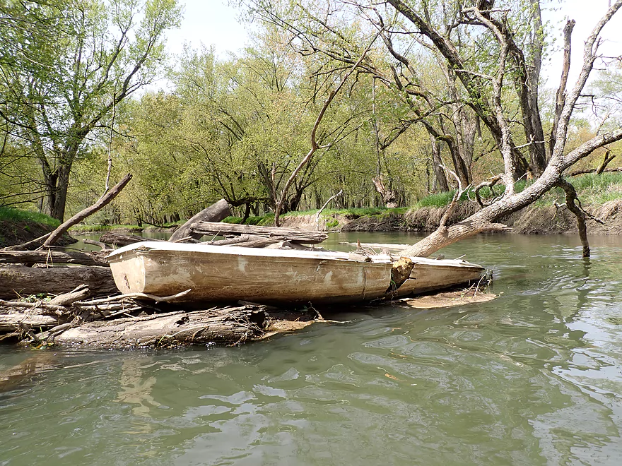
Somebody lost their boat…
The river cutting through the bank like a blow torch
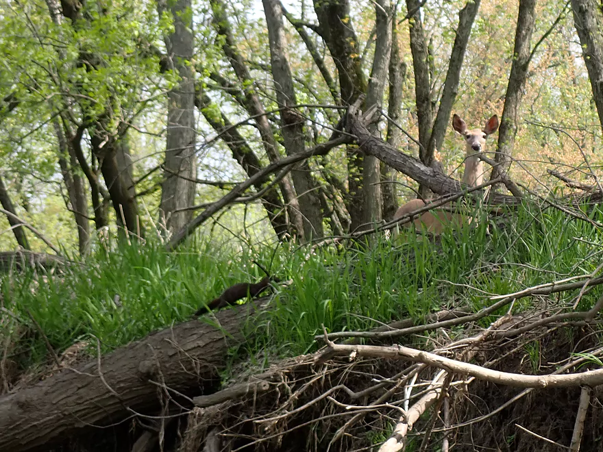
This mink photobombed my deer shot
That was a little tricky to get under
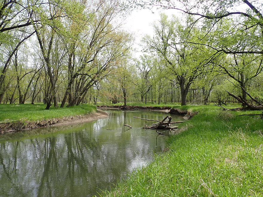
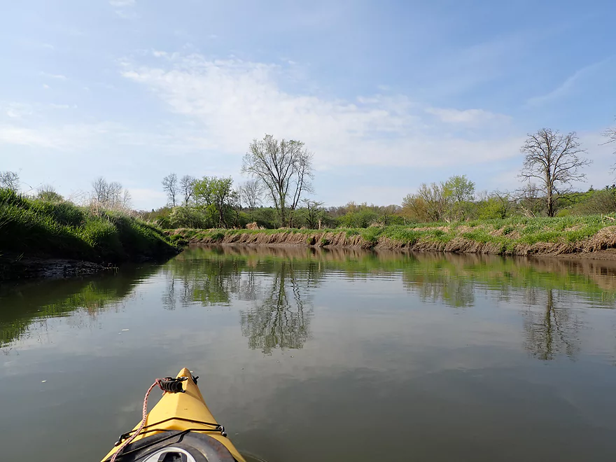
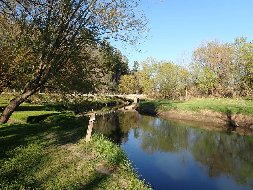
Nice stretch on the river
Only logjam portage of the trip
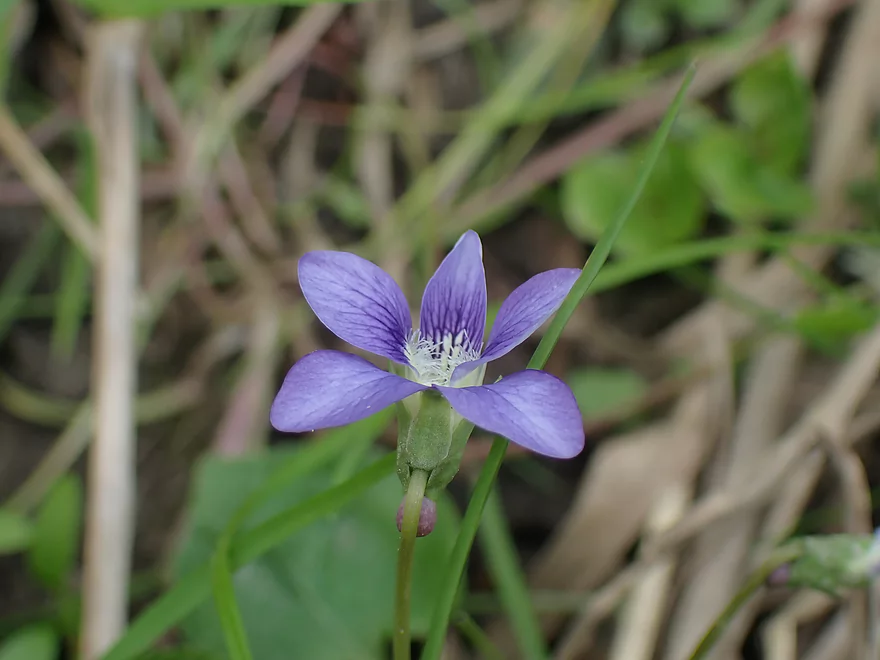
Blue violet
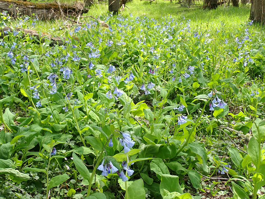
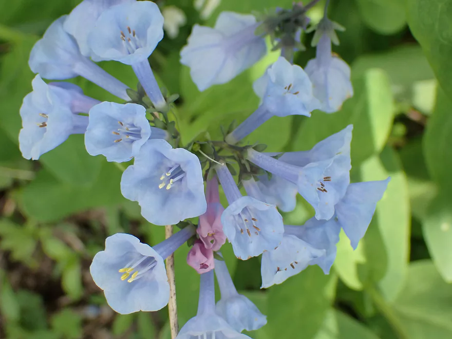
A large field of bluebells
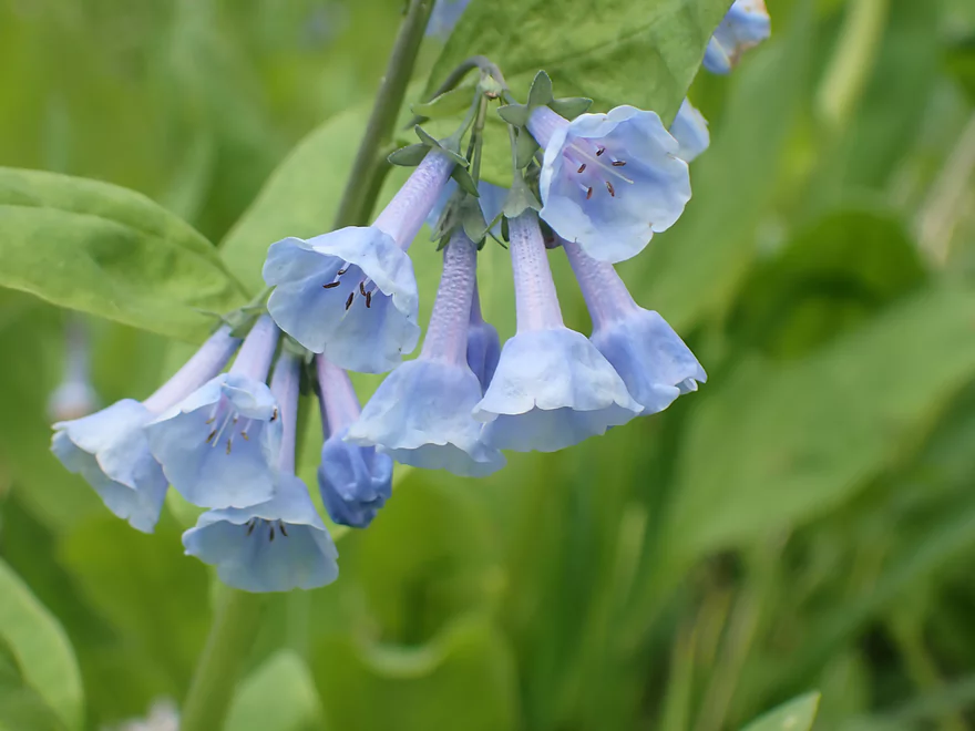
Very photogenic
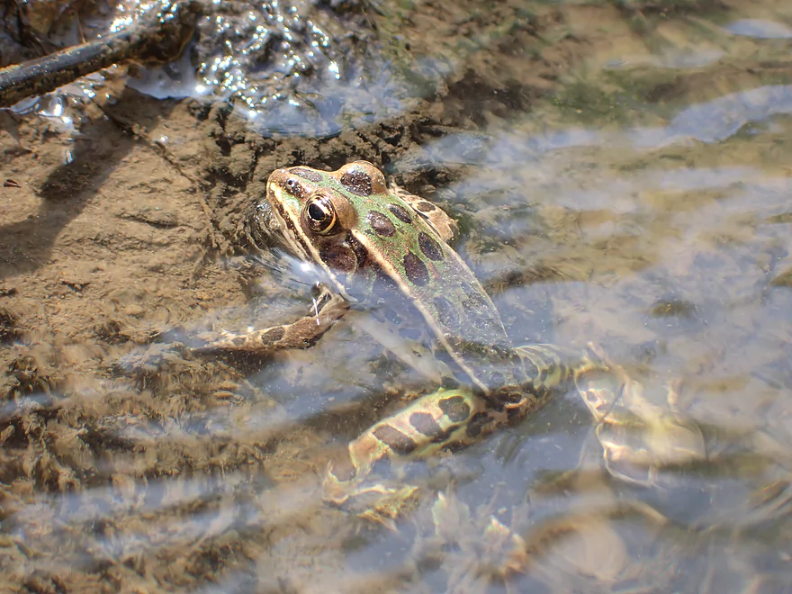
Leopard frog
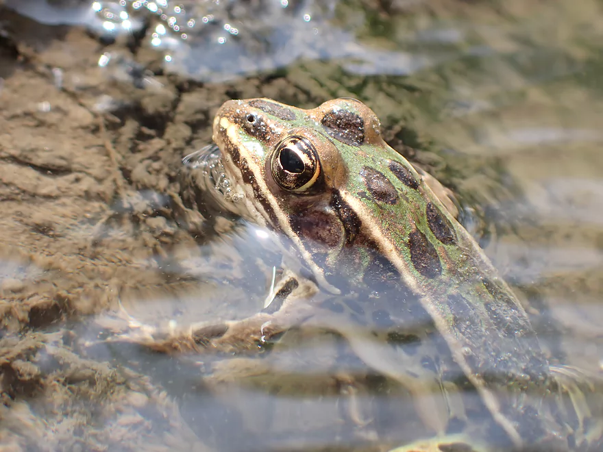
Cool eyes
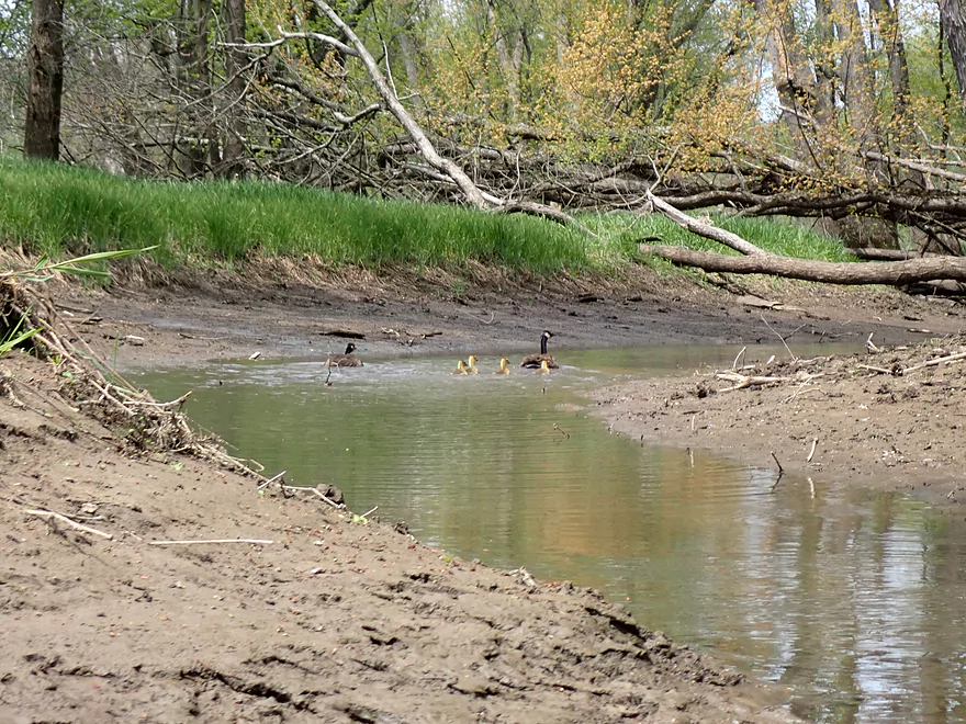
Geese and goslings escaping down a side channel
Quite the minefield…but there was a way through
Taking the left channel around a large island
Best outcrop of the trip
The island area was scenic
Coming up on a muddy take-out at North Dutch Hollow Road
A doable take-out
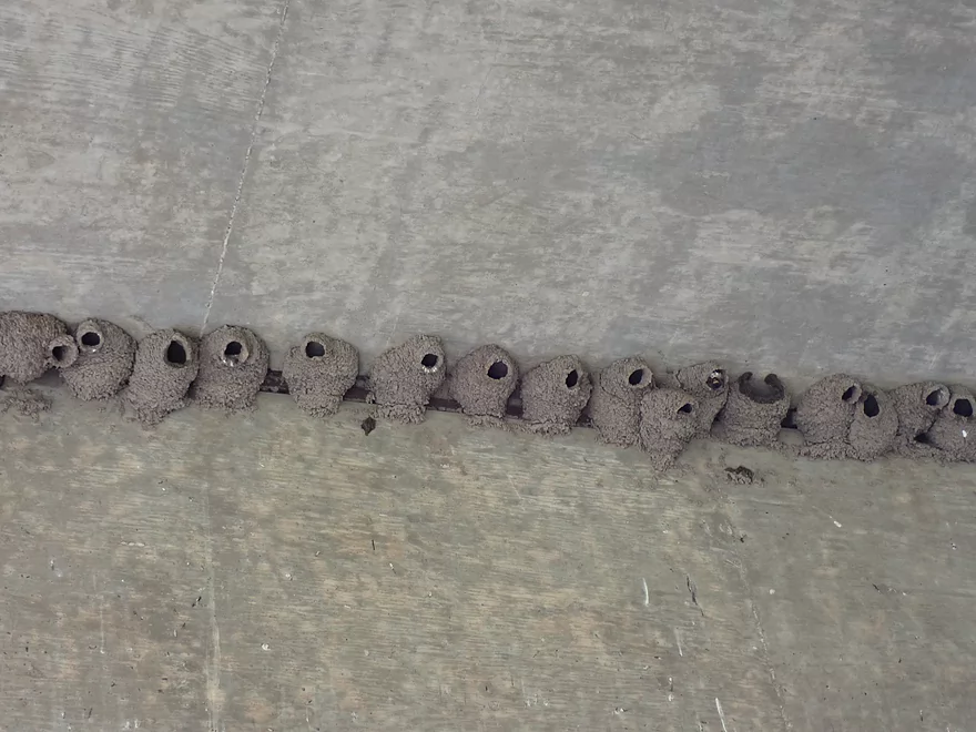
The cliff swallows are back
Panned out view of the take-out area
Scenic area
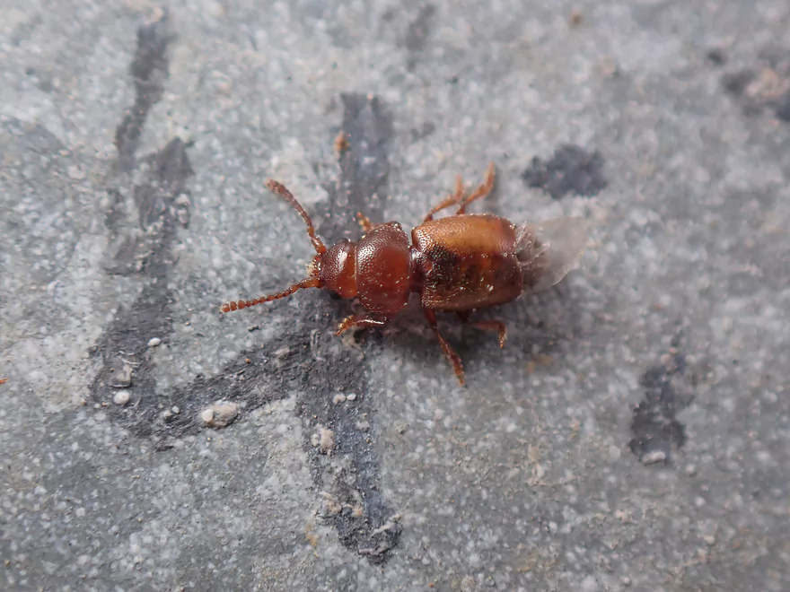
An interesting red beetle
Swarms of angry cliff swallows encircle me from the bridge
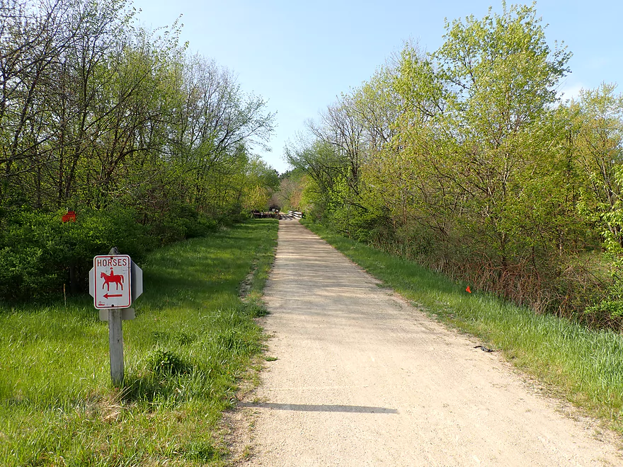
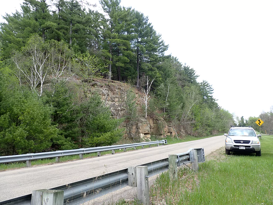
The bike shuttle on the 400 State Trail
This is a terrific shuttle option
And scenic
A side trail leads to the base of this outcrop
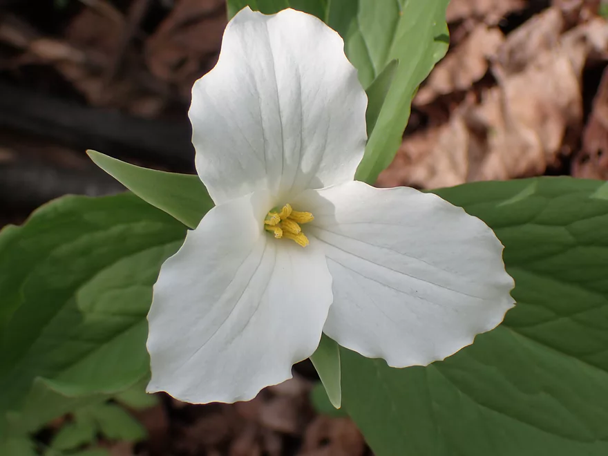
Large-flowered trillium
Scouting Wayside Park…a future put-in
A scenic drive home
Baraboo River – Kalepp Road

The Baraboo River is a classic paddling river located in south central Wisconsin. Most paddle its most popular leg through downtown Baraboo where there are fun rapids. However many upstream sections of the Baraboo are overlooked and quite underrated. While not in the same league as the Kickapoo (a neighboring driftless paddle), the Upper Boo does have some really nice sandstone outcrops. One specific section I’ve had my eyes on for some time has been Wonewoc to La Valle, but the lack of intermediate access points and the likelihood of logjams were a big deterrent. I did change my mind though after receiving a tip (thanks Eric!) that the logjams here weren’t as bad as I feared and that Kalepp Road was actually a viable access.
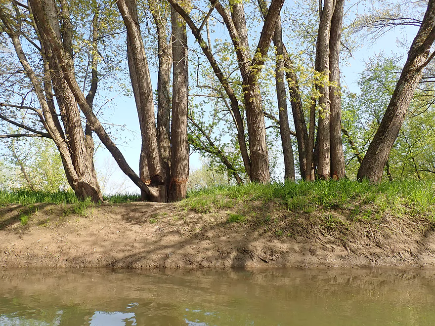
The first half mile of the trip was quite open and pleasant. Singing frogs and birds made for a nice paddling soundtrack…unfortunately I could also hear busy Hwy 33 for almost the entire trip. This open stretch was short-lived as the river soon entered a woods that would mostly persist for the remainder of the trip. At times the woods were scenic as newly-leafed hardwoods arched gracefully over the river. At other times it wasn’t…as tall mud banks lined the shore and downed trees semi-blocked the channel. Granted there was almost always a way around each downed tree, but it was tedious at times given the swift current.
The Baraboo River watershed suffers from some of the worst topsoil erosion in the state. The problem is simple. Most of its tributaries lack natural shoreline buffers to seprate the water from the adjacent farm fields….while an excessive number of farm drainage ditches mean the Boo watershed drains too fast. This results in faster current and higher water levels that erode the soil and result in tall muddy banks. Tree roots can’t get a proper grip in the soft mud so they inevitably fall in.
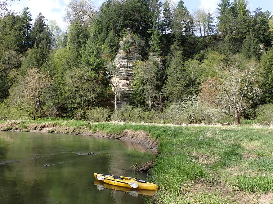
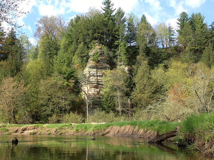
About a third into the trip I encountered one of the trip highlights in a tall sandstone outcrop. There would be several additional outcrops on this trip, but most were recessed away from the river or partly obscured by vegetation. At the base of several of these outcrops were natural springs and groves of skunk cabbage. I debated getting out to explore them but the shoreline here was ridiculously muddy…think thick chocolate pudding. Not something you want to wade in.
Following the 400 State Trail bridge the outcrops were no more and the woods became more dense. I feared this would be the most congested leg of the trip, and while I did have to hop and dodge past a few tight fits it wasn’t so bad. Ultimately I only had to portage once the entire trip. While it wasn’t easy because of the mud, it happened to be quite scenic because of several large patches of wildflowers including newly-blooming Virginia bluebells.
I did report this logjam to the “Friends of the Baraboo River” using their new app and logjam reporting tool. I highly advise other Boo paddlers do the same. You can download the app here or alternatively use their web form. In a nutshell, this friends group received a $25k grant from Sauk County to clear up logjams, but they need paddlers to tell them where they are. So by reporting these logjams you can help clean up the river.
If you do this trip, you’ll encounter a large island near the end of the trip as I did. I highly advise going east (left) as not only as that channel is more clear of deadfall, but it also goes past one of the better sandstone outcrops on the entire Upper Boo. I ended the trip at muddy N. Dutch Hollow Road and finished the day with a nice bike shuttle back to my car on the 400 State Trail.
In summary this was a nice trip that I enjoyed because of the fantastic wildlife and occasional outcrops. However it wasn’t and can’t be an elite paddle because of the amount of mud and downed trees. If you’re a newbie to the Upper Boo, I suggeset doing instead Union Center to Wonewoc or N. Dutch Hollow Road to La Valle both of which are better paddles. But locals or those looking for a new adventure and who don’t mind a few downed trees will find this an enjoyable paddle.
Note, the future is bright for the Upper Baraboo River. A year ago the Baraboo River Corridor Plan – Phase 2 was announced. This is a remarkable project which includes a number of planned paddling improvements including extensive logjam removal, erosion reduction, and new landings. This plan extends as far upstream as Elroy and Hillsboro. This means several scenic stretches of the Upper Boo that were previously not viable for paddling, will be…which is great news.
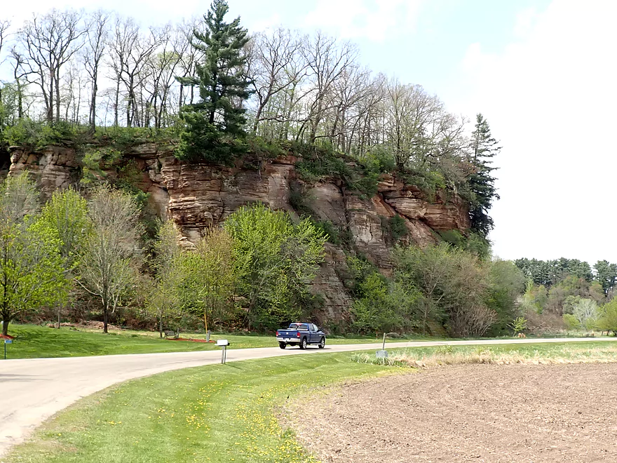
Kalepp Road: There is a DNR public parking area at the end of Kalepp Road. Just on the other side of the “400 State Trail” is the Baraboo River. I launched from a side creek which was a bit muddy but doable. Note, much of the land west of the Old 400 State Trail here is part of a large “Voluntary Public Access Easement” intended mostly for turkey hunters. These public easements, while administered by the DNR, are technically private so be respectful when you’re on them. Note the Baraboo River Corridor Plan – Phase 2 has future plans to convert this area into a proper kayak launch.
Alternate Put-ins:
- Wayside Park (4.5 miles upstream of put-in): This is a great public access option. Launching here will add a nice stretch with some scenic rock outcrops. There will be some tight fits on this leg, but likely no portages will be needed.
N. Dutch Hollow Road: I took out on the downstream/east side which was muddy but doable. I did have to drag my boat up a steep embankment and rope is recommended. Note, most paddlers cheat and use a small grassy path on the upstream side of the bridge. This is quite convenient but likely on private property (hence why I didn’t use it).
Alternate Take-outs:
- La Valle/Main Street Landing (3.6 miles downstream of take-out): Good take-out and one of the more underrated stretches on the Baraboo River with several scenic outcrops.
- La Valle/River Street Access (3.7 miles downstream of take-out): Same as above, but this access is located below the former dam. Taking out here allows you to run some fun Class 2 rapids.
N. Dutch Hollow Road to Kalepp Road: 2.1 miles. This is a terrific bike shuttle almost entirely on the “400 State Trail”. While the path isn’t paved and has some horse/snowmobile damage, it’s still a good surface for biking. The shuttle is very scenic with many wildflowers and an impressive outcrop located by Dutch Hollow Creek.
Note, there is a livery and rental located in nearby Wonewoc called “Beyond Boundaries“. They typically service Union Center to Wonewoc…but I believe they go down to La Valle which would include this segment.
- Current: There were no rapids, but the current moved at a brisk pace. You needed to be on your toes to keep from getting pushed into a downed tree.
- Tight Fits: There were many downed trees but almost always a way around. In some cases I had to “hop” or “duck” past a log, but at different water levels these may be logjams.
- Logjams: There was only one logjam that I had to portage. The portage was muddy but doable.
Gauge: Baraboo @ Baraboo – Trip done at 493 CFS
- 0-200 CFS: A low depth but plenty navigable.
- 201-350 CFS: An average depth and a good target.
- 351-500 CFS: Above normal depth. At times pushy, but manageable for experienced paddlers.
- 501-700 CFS: A high depth. River would be very pushy at this point.
- 701-1000 CFS: A very high depth. River will be quite dirty and tough to maneuver in.
- 1000+ CFS: This might approach flood stage.
Detailed Overview
- Nutmeg Road to Hwy PP: 6.2 miles. Flows by the historic Elroy-Sparta Trail and is mostly open, but there are a few logjams. This is a narrow small stretch that will need very high water to be runnable. There are scenic outcrops on this stretch….maybe 3.
- Hwy PP to 2nd Main Street: 1.6 miles. Maybe 3 logjams.
- 2nd Main Street to Franklin Street: 0.9 miles. Maybe 1-2 logjams. Trip starts at a scenic covered bridge and on Class 1 rapids.
- Franklin Street to Hwy 82(South of Lincoln Street): 0.5 miles. A good stretch that is mostly open and has maybe one outcrop.
- Hwy 82(South of Lincoln Street) to Schultz Park: 0.6 miles. Maybe 2 logjams.
- Schultz Park to Hwy 82(South of Snyder Road): 4.0 miles.
- Schultz Park to Hwy 82(North of Lumsden Road): 0.6 miles. One outcrop, one logjam portage and a few tight fits.
- Hwy 82(North of Lumsden Road) to Hwy 82(South of Snyder Road): 3.4 miles. Three outcrops, three significant logjams and several tight fits. A section with good potential but needs cleanup work.
- Hwy 82(South of Snyder Road) to Hwy W: 1.9 miles. Maybe 2-3 jams…think this is doable though.
- Hwy W to Hwy 82/Union Center: 1.3 miles. Good prospect by the golf course with maybe 2 outcrops. Maybe 1-2 logjams.
- Hwy 82 to Hwy FF Landing/Wonewoc: 7.1 miles. A great section with one of the largest rock outcrops on the river.
- Hwy FF Landing to Wayside Park: 2.9 miles. There used to be a lot of logjams here. I think it might be doable…maybe 2-3 major portages.
- Wayside Park to Kalepp Road: 4.5 miles. An uninteresting part of the river with weedy, muddy banks. But…there are three fantastic sandstone outcrops.
- Kalepp Road to N. Dutch Hollow Road: 5.3 miles. One logjam portage with several “hoppers” and “duckers”. There are some outcrops but most are recessed and away from the river. Mud and downed trees are a bit unsightly, otherwise a pleasant paddle.
- N. Dutch Hollow Road to La Valle: 3.8 miles. Second best section on the entire river with great rock outcrops.
- From La Valle to Lake Redstone: 3.6 miles. One of the more underrated sections of the Boo, which I really liked.
- Lake Redstone to Monument Park/Reedsburg: 9.0 miles. Supposedly kind of boring, but the logjams should be cleared out.
- Monument Park to South Park: 1.4 miles. Spanning the length of Reedsburg, this should be a nice section mostly free of jams.
- South Park to Golf Course Road: 4.7 miles. Maybe 4-5 logjams. Probably one too many. Should be 1-2 small sandstone outcrops. Golf Course Road might not be a good access.
- Golf Course Road to Hwy 136(by Beth Road): 3.6 miles. Maybe a few jams. Likely mostly floodplain paddling and probably uninteresting.
- Hwy 136(by Beth Road) to Hwy 136(by Ableman’s Gorge): 6.0 miles. Maybe some outcrops at the end, but mostly uninteresting paddling I suspect. Likely several serious logjams with difficult portages because of the high muddy banks.
- Hwy 136(by Ableman’s Gorge) to North Freedom Boat Launch: 8.2 miles.
- Hwy 136(by Ableman’s Gorge) to Rock Springs Boat Launch/Firemen’s Park: 1.3 miles. One of the most scenic parts of the entire Baraboo River. Highlights include a steep gorge, riverside boulders and scenic outcrops.
- Rock Springs Boat Launch to North Freedom Boat Launch: 7.1 miles. This is a nice paddle, but with some downed trees to dodge and one to portage. Highlights include historic railroad bridges, scenic outcrops, and seeing the railroad museum from the river.
- North Freedom Boat Launch to Giese Park: 7.4 miles.
- North Freedom Boat Launch to Kohlmeyer Road: 4.3 miles. Stretch starts nice as the river naturally curves and has many shade trees. There is a scenic long outcrop after Seeley Creek. River becomes boring after that except for a scenic railroad bridge and a few rocky banks. Kohlmeyer Road isn't a great bridge access.
- Kohlmeyer Road to Giese Park: 3.1 miles. Some longer and less interesting stretches. There is however a unique large volume artesian well, and a historic railroad tunnel you can wade under.
- Giese Park to Gander Outdoors: 2.9 miles. A pleasant but simple farm country paddle. Highlights include the Skillet Creek bridge, the towering Hwy 12 bridge, and a rock outcrop upstream of Hwy 12.
- Gander Outdoors to Glenville Landing: 4.9 miles. A fantastic stretch through the heart of Baraboo with many light rapids.
- Gander Outdoors to Haskins Park: 0.6 miles. A good stretch with some fantastic rapids upstream of Hwy 136.
- Haskins Park to Maxwell-Potter Conservancy: 3.3 miles. The best section on the entire river with many rapids.
- Maxwell-Potter Conservancy to Glenville Landing/Hwy 113: 1.1 miles. A pleasant stretch, but lacking in rapids.
- Glenville Landing to Luebke Landing: 5.1 miles. A pleasant trip, but a little boring at times. I would rate this as one of the more uninteresting sections of the Baraboo. On the plus side it had no logjams (as of 2023) and remains plenty navigable even during big droughts.
- Luebke Landing to Hwy 33: 3.5 miles. This might be one of the better legs on the Lower Baraboo.
- Hwy 33 to Wayside Park: 8.0 miles. A stretch I’m curious about.
- Wayside Park to Hwy U: 3.9 miles. Simple but pleasant short section flanked by busy interstates.
- From Hwy U to the mouth: 5.3 miles. The final leg running through floodplain forest.
Notable Baraboo River Tributaries:
- West Branch of the Baraboo River: For the most part, too many logjams, but the flowage by Hillsboro is navigable with scenic outcrops by the dam.
- Dutch Hollow Lake: A heavily developed lake and popular with locals. Not as great as Lake Redstone but still nice. Dutch Hollow Creek is likely too shallow to run, but it (and the bike trail) goes past a fantastic and huge exposed rock face.
- Hemlock Slough: A nice little lake paddle with many rock outcrops and attractive hemlocks.
- Little Baraboo River: For the most part too many logjams. However the small flowage by Cazenovia Memorial Park is navigable and there are small outcrops both below the dam and on the northwest corner of Lee Lake.
- Lake Redstone: Definitely a fun paddle with fantastic red rock formations, a swimming beach, and a spillway waterfall.
- Big Creek: You can’t get too far upstream because of logjams, but there is a nice outcrop by Hwy F and this can be combined with a trip on the north side of Lake Redstone.
- Narrows Creek: There is a neat section by Weidman Memorial Park with boulders and light rapids with I believe nearby outcrops downstream. Unfortunately there are likely too many logjams. I did partly paddle a nice downstream portion from the mouth on the Baraboo before I hit a logjam and turned back.
- Seeley Creek:
- Hwy PF to Seeley Lane Boat Landing: 3.6 miles. A mix of creek and flowage paddling. Ok…maybe 2 logjams.
- Seeley Lane Boat Landing to Freedom Road: 1.7 miles. Probably too many logjams on this section.
- Freedom Road to Mouth: Neat stretch of the creek, but some logjams.
- Skillet Creek:
- From Gasser Road to Pewit’s Nest: Gorgeous, but filled with logjams.
- Pewit’s Nest: Stunning scenery, but the ledges are likely too steep and narrow for kayaking. Best experienced as a hike.
- Pewit’s Nest to Hatchery Road: A bit of nice geology, but likely small with several logjams. Neither endpoint is a great access.
- Rowley Creek: A scenic creek, but shallow and with hostile locals.
- Leech Creek: From Hwy U to Tritz Road would be 2.5 miles. Likely open and an easy paddle, but uninteresting because of the artificial channelization.
- Long Lake: A very slow creek that empties into the Boo close to the Wisconsin. There could be serious logjams by the mouth, but the upper sections are plenty navigable and are paddled by locals.
Trip Map
Overview Map
Video
Photos Size:
River update from ‘Friends of the Baraboo River’: “Loggers spent a week clearing 30+ logjams from LaValle upstream towards Wonewoc. The river is cleared almost to Kalepp Road. Clearing efforts have been temporarily suspended due to high water. The next section to be cleared will be from North Freedom to Rock Springs.” https://www.facebook.com/friendsoftheboo