
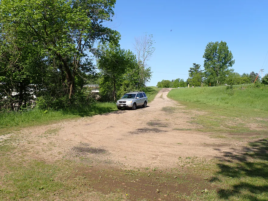
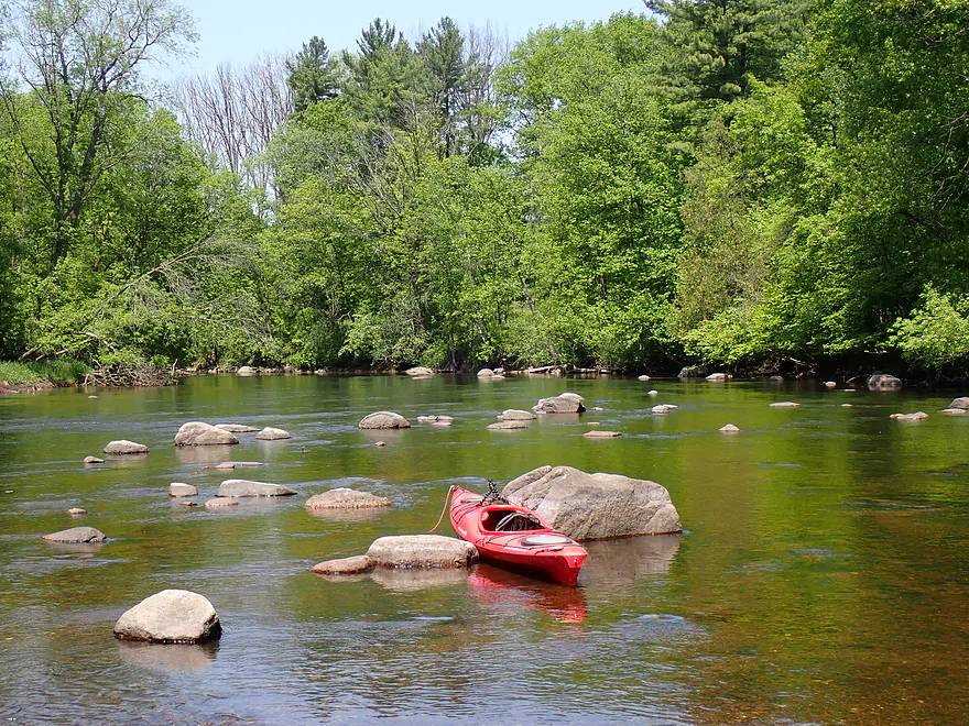
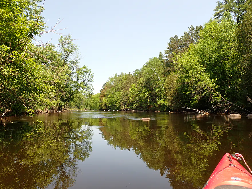
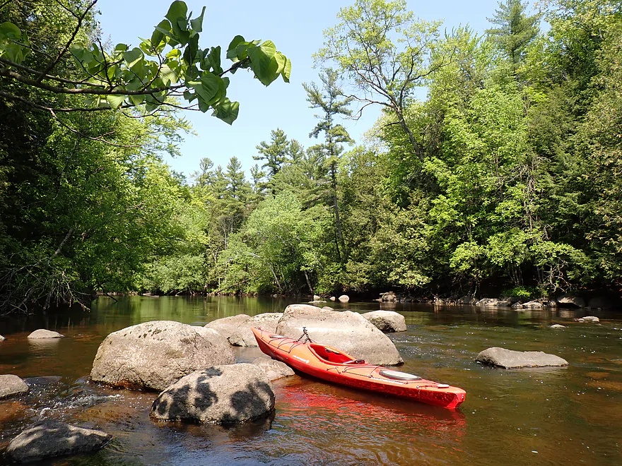
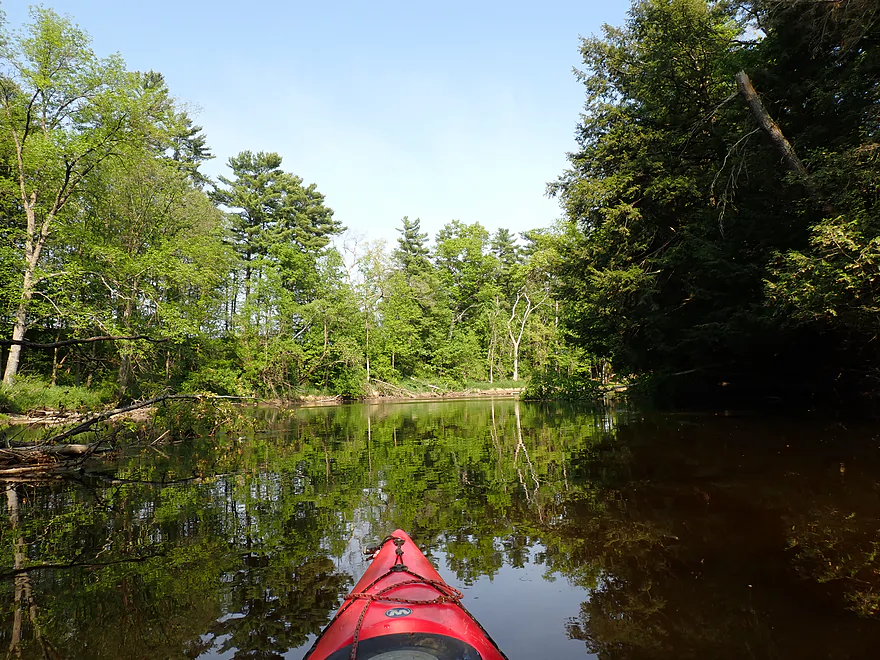
Starting in Pella on an island between the dam and millrace
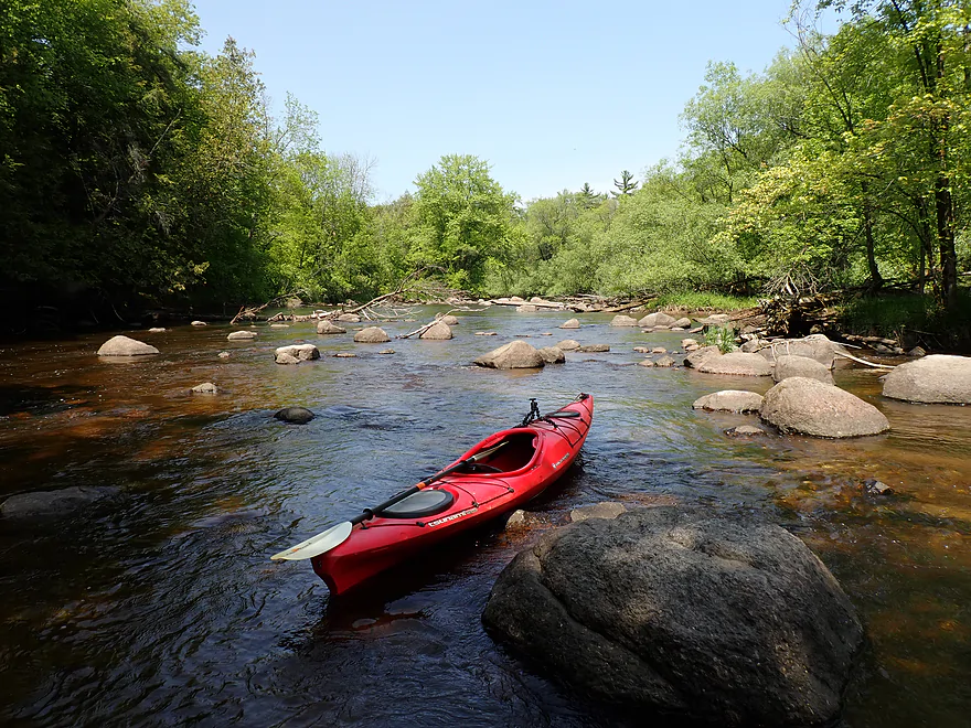
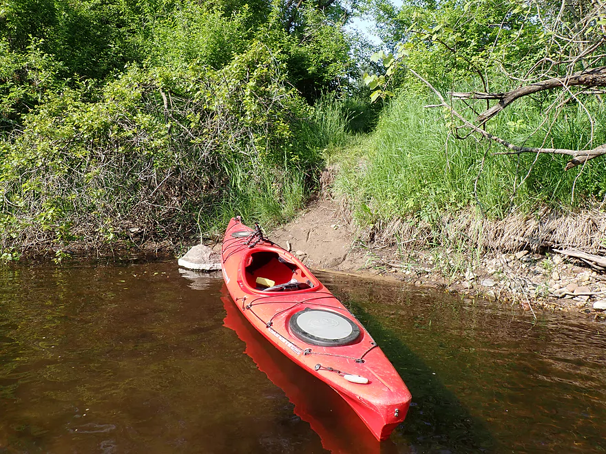
Great put-in
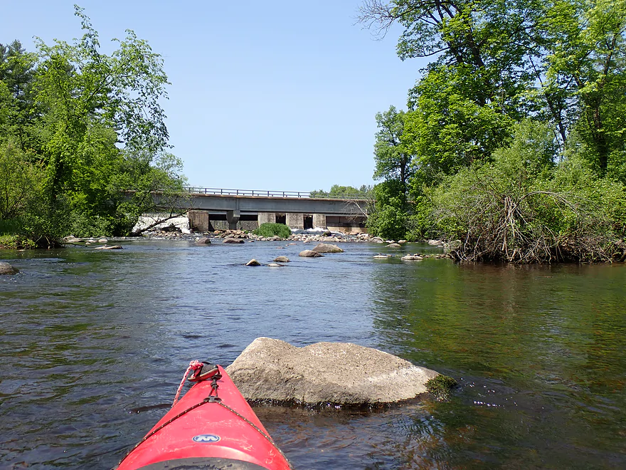
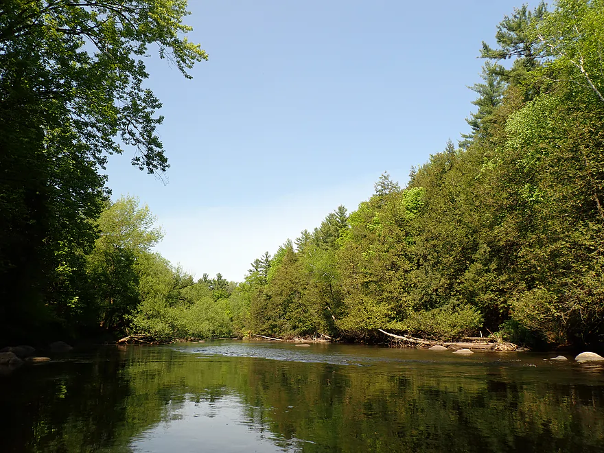
Looking upstream at Stony HIll Road and the Pella dam
Scenic rocky rapids closer to the dam
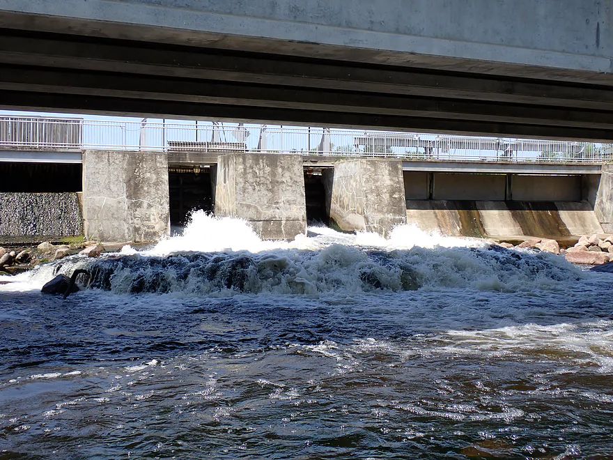
Closer view of dam
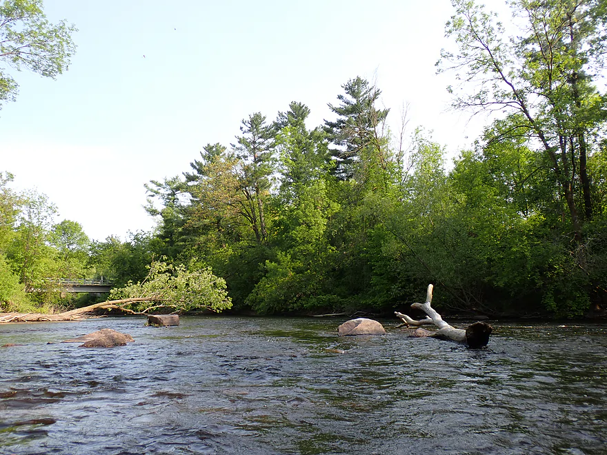
View from Stony Hill Rd bridge looking at boulder field below the dam
Was tempted to run some of these rapids but decided not to
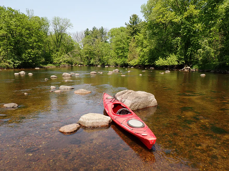
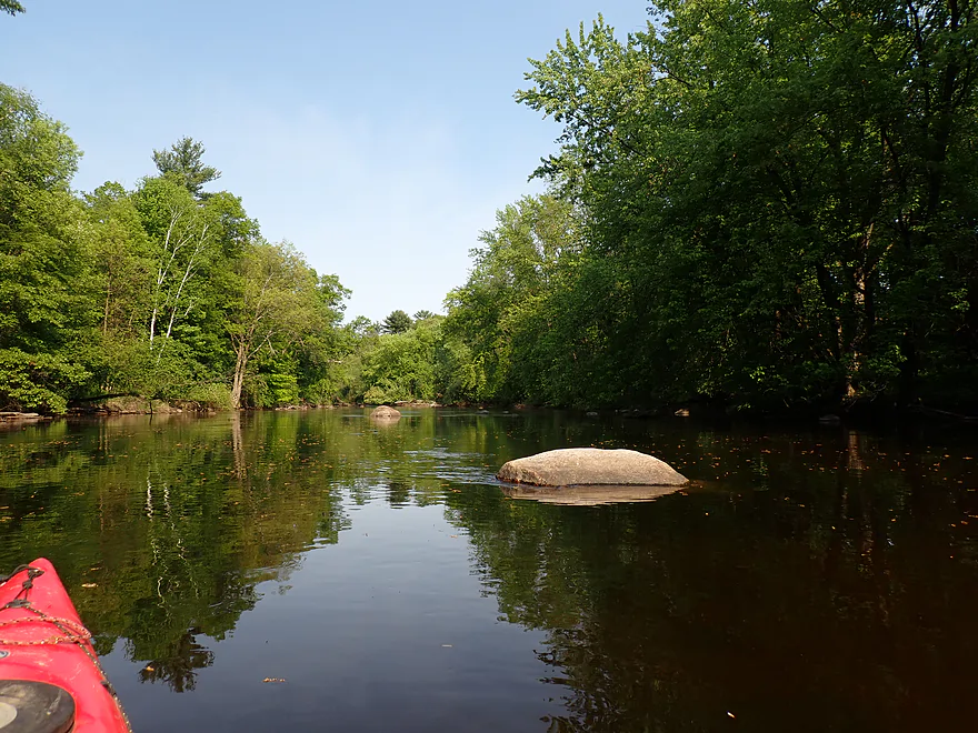
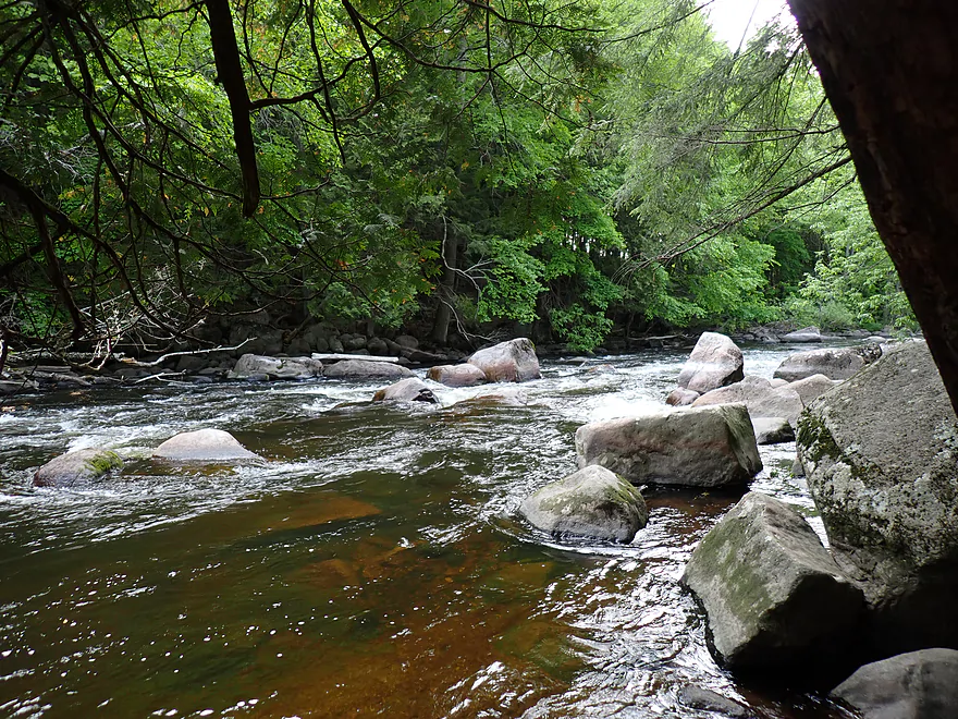
Very photogenic spot
Last view of the dam area…I promise
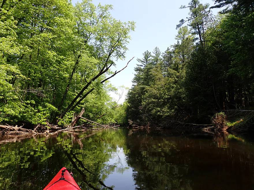
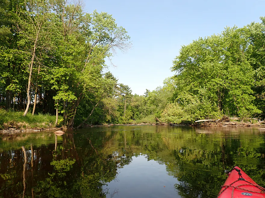
Paddling around a rocky island
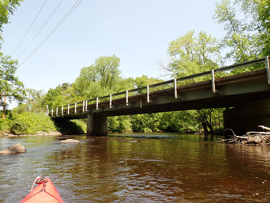
Hwy M
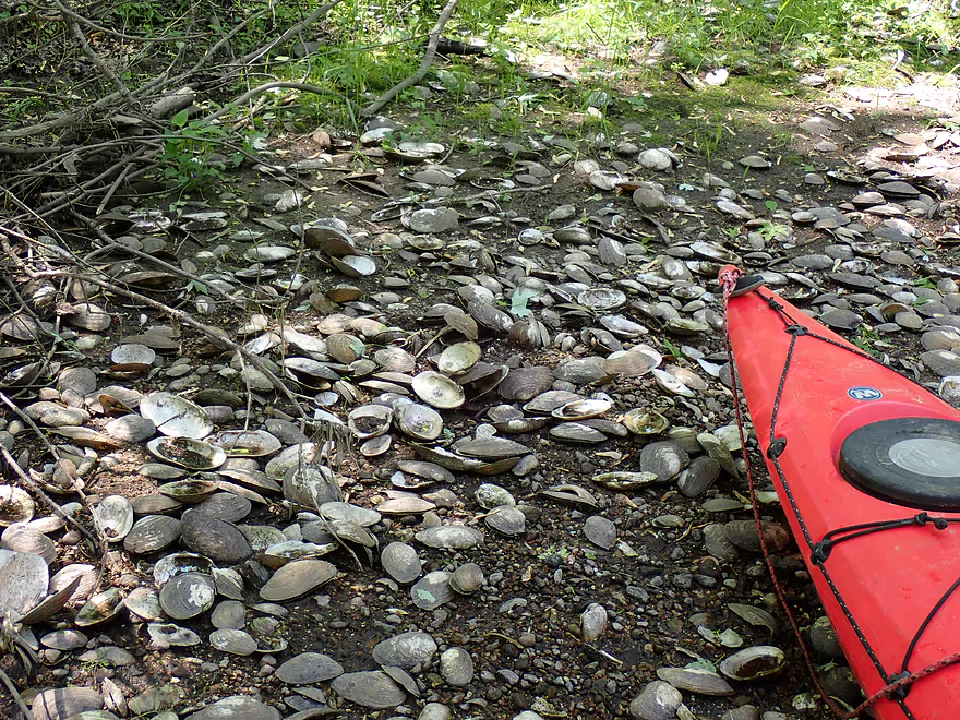
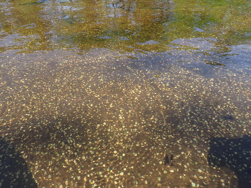
There were many clam shells on this trip (but almost none were living)
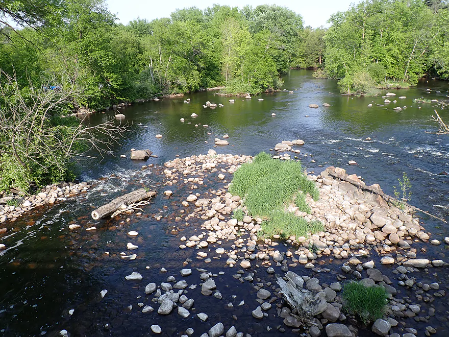
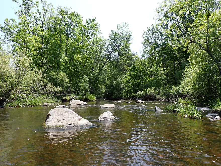
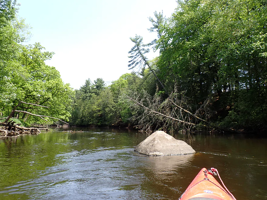
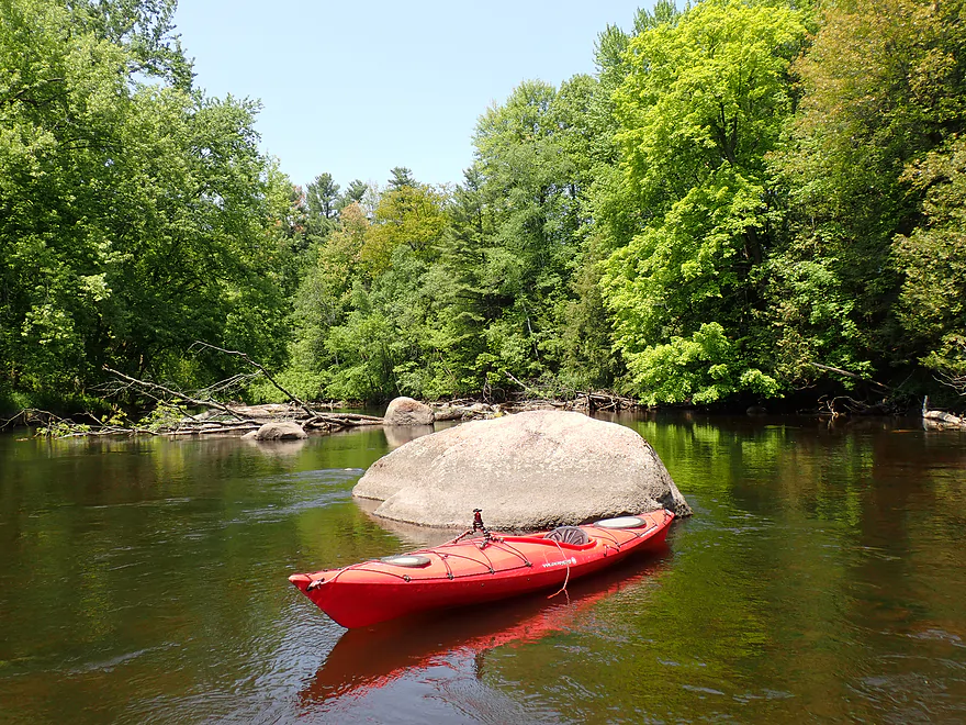
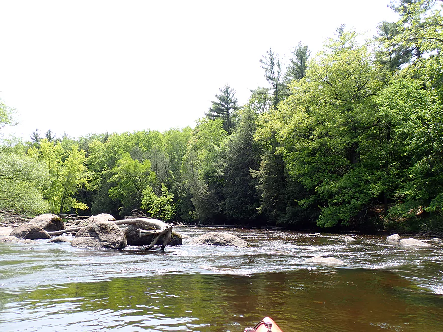
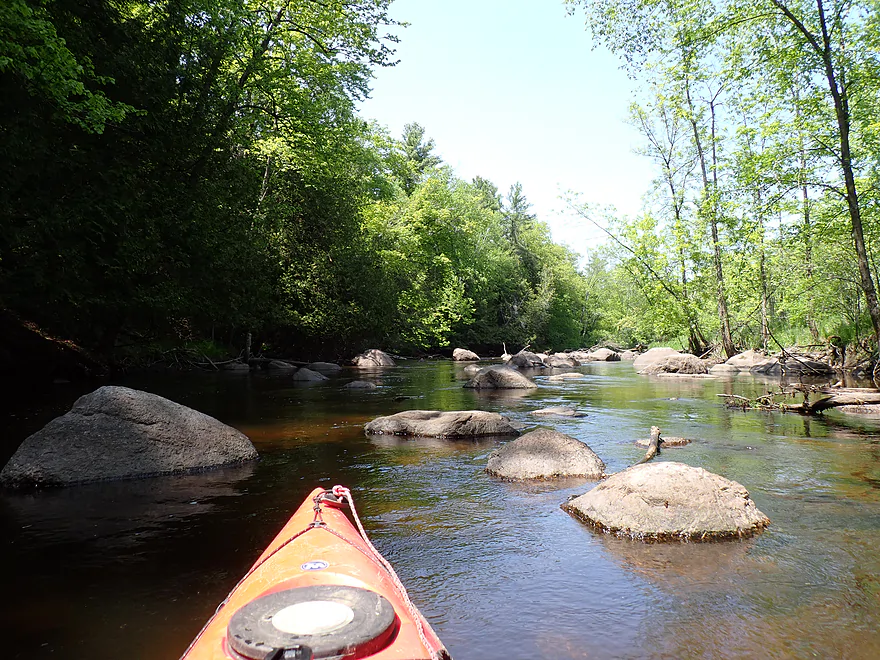
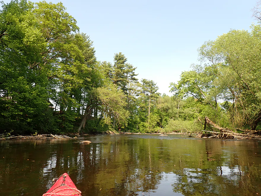
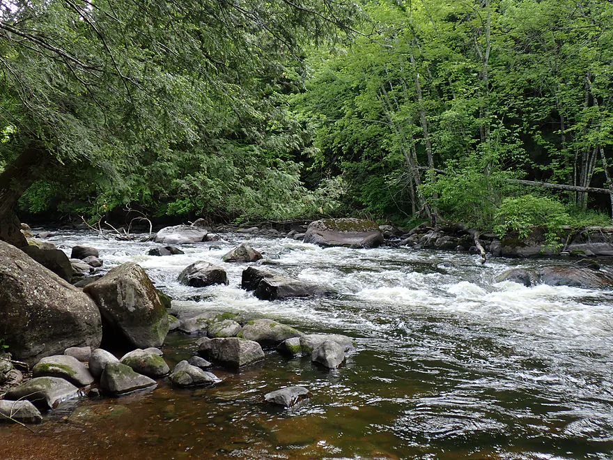
Another major boulder field
There were some nice pines on this trip
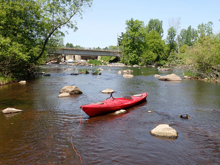
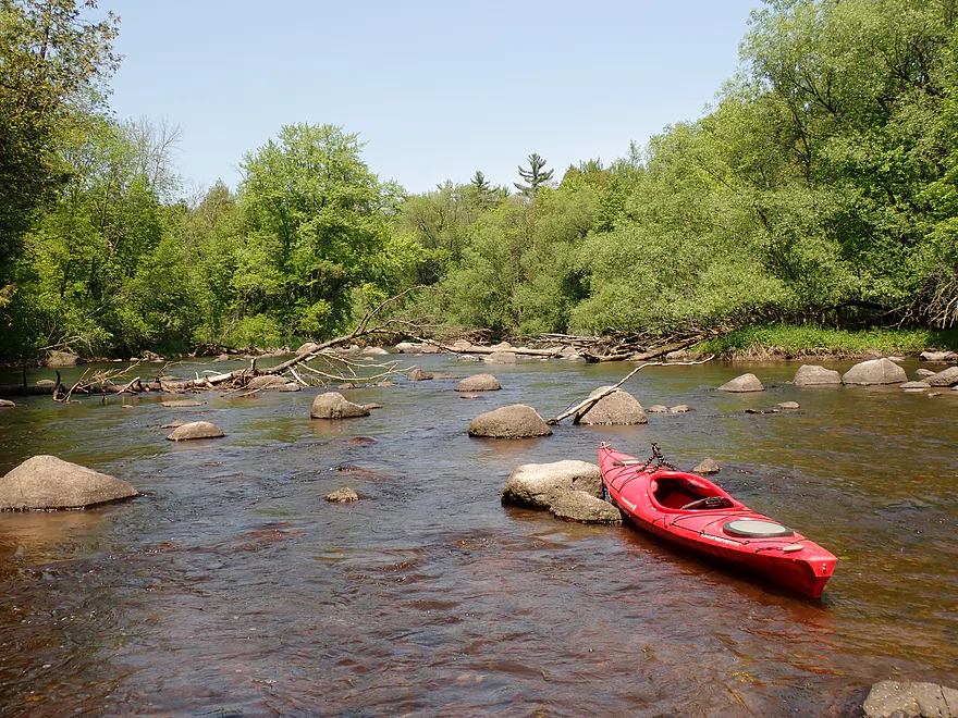
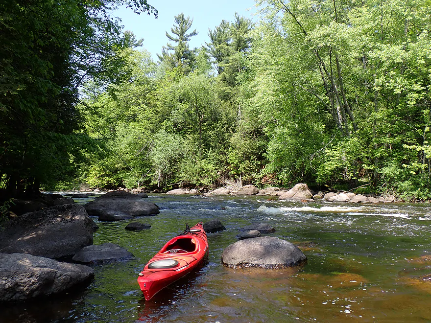
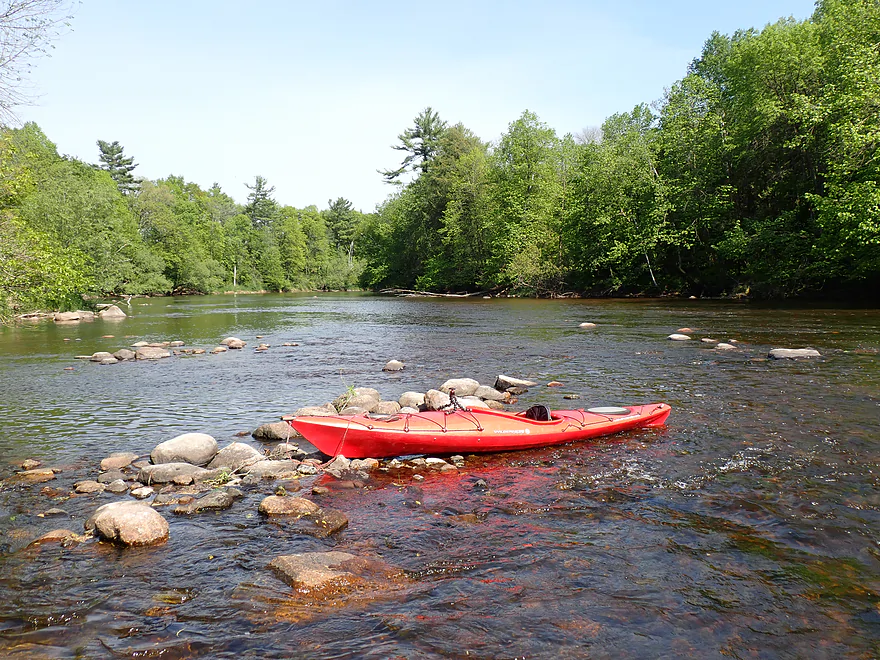
Taking a gravel bar break
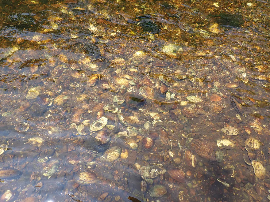
So many clam shells
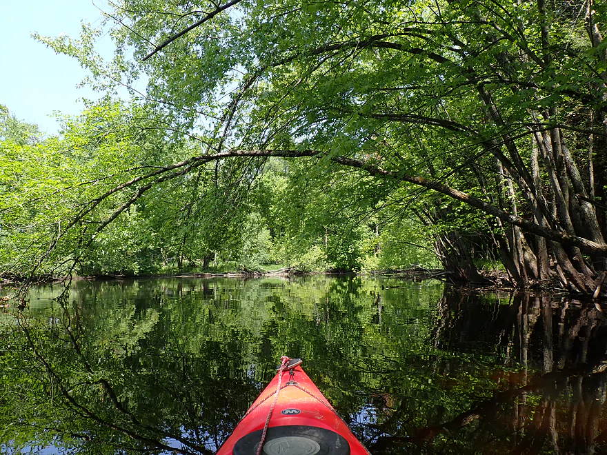
Attractive side creek
Poorly pictured…but a massive sturgeon with a red gash on its forehead
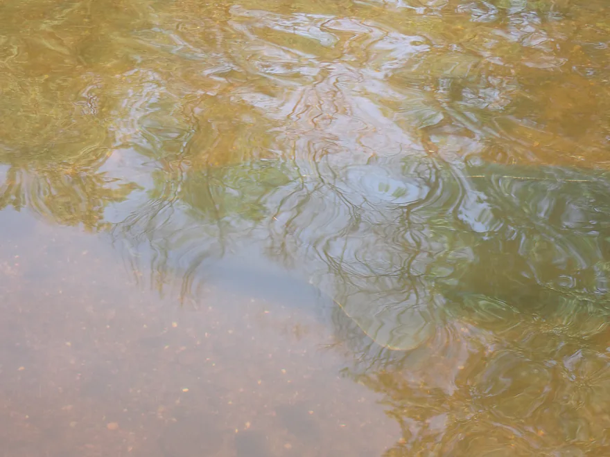
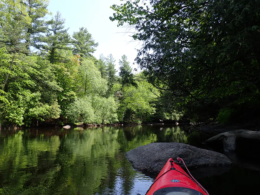
Great clarity
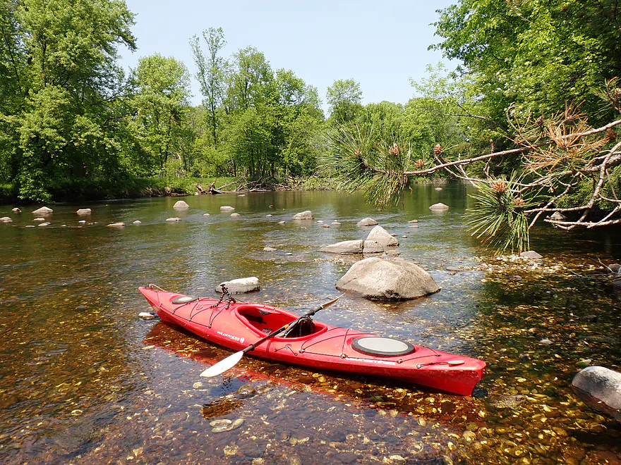
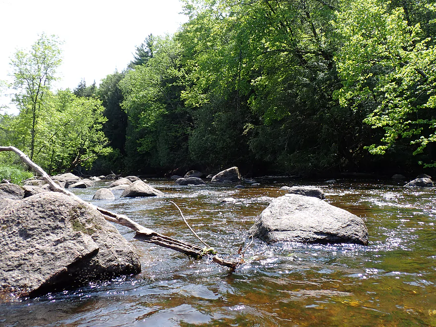
Some of the bigger boulders
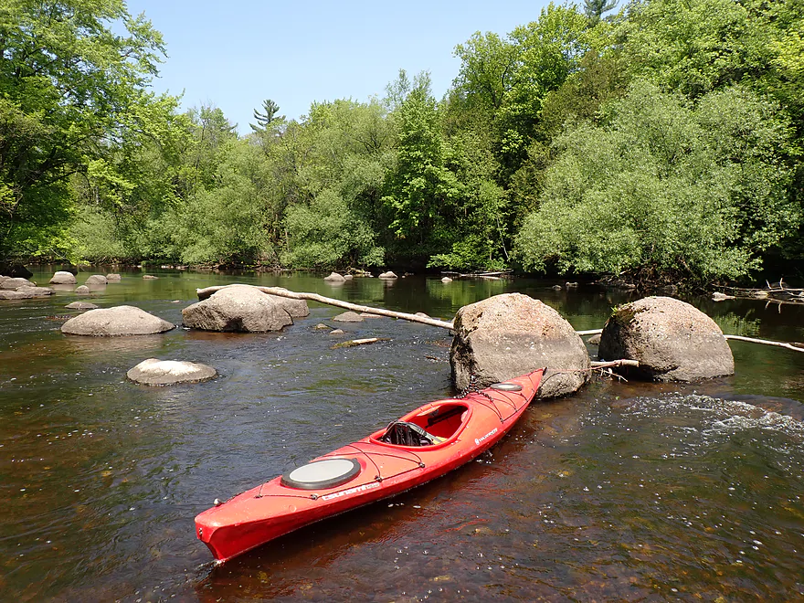
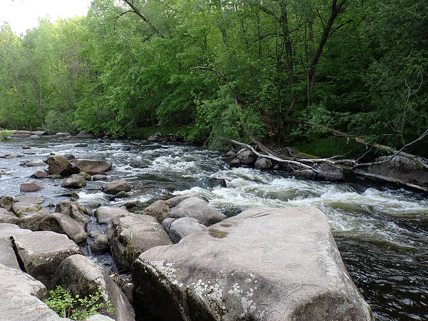
Attractive boulder garden
Light rapids
Looking back on one of the larger boulder fields
Paddling around another rocky island
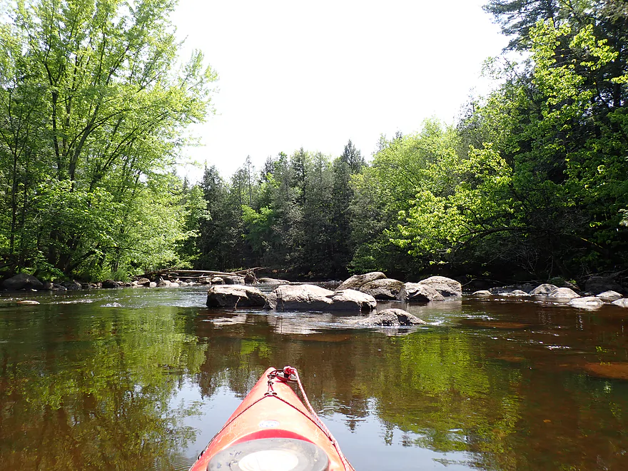
Yet another boulder field
One of my favorite parts of the river
Current starts to pick up
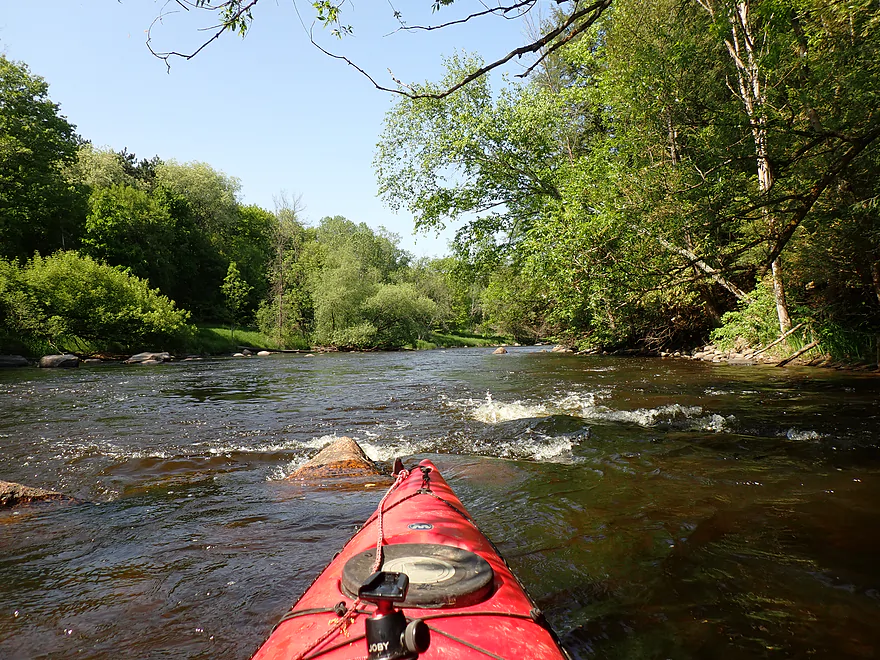
Approaching Clam Rapids
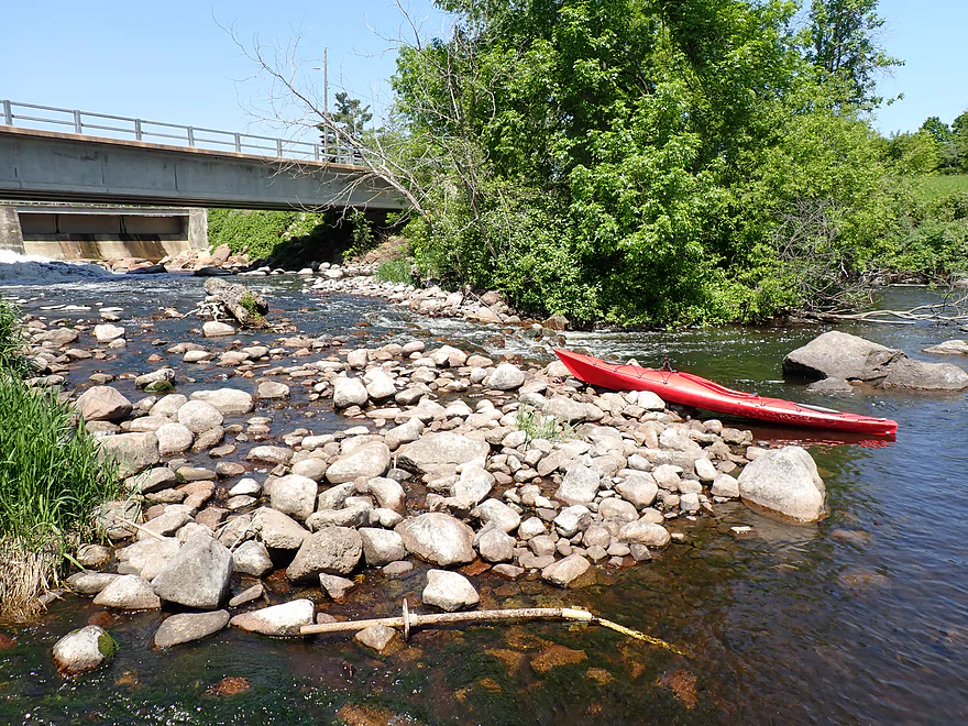
Reverse view of first pitch
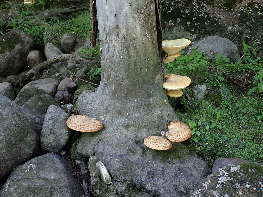
Cool fungus–these are Pheasant back mushrooms (aka Dryad’s saddle)
Reverse view of second pitch
Very scenic
Last photo of Clam Rapids
Second half of the river wasn’t as scenic, but was still nice
More good clarity
A sunbathing plumper
Last decent-sized boulder garden
Current remains swift
River starts to widen…one of the few shallow spots on this trip
Dead snail shells start to replace the dead clam shells (a total mollusk catastrophe)
More nice pines…but the Embarrass starts to lose them as it exits the “Northern Highland” region
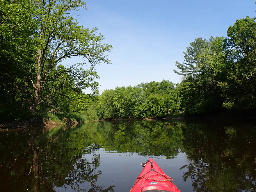
Peaceful stretch
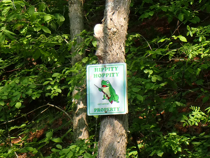
Avoid the gun-toting frog
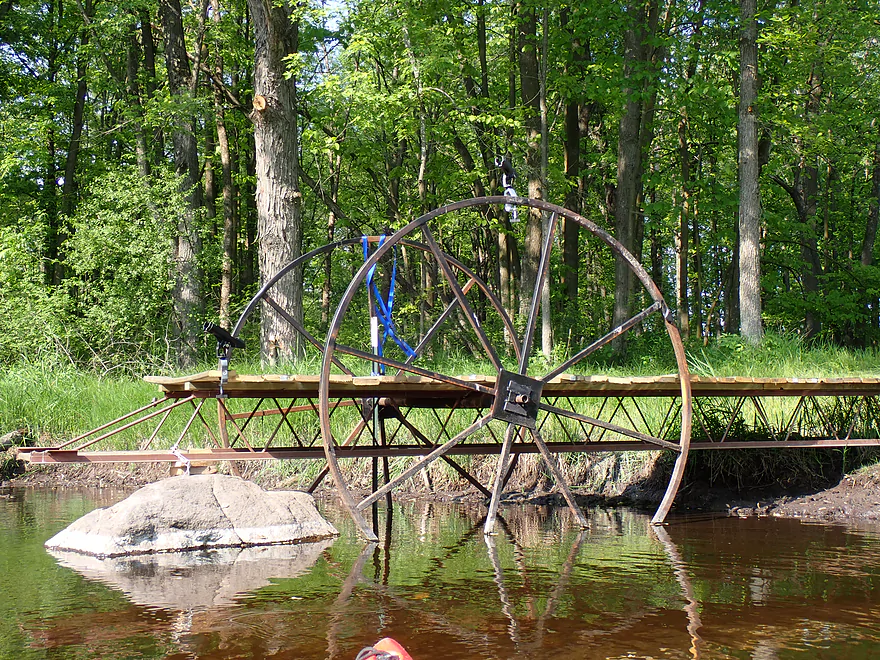
Cool pier
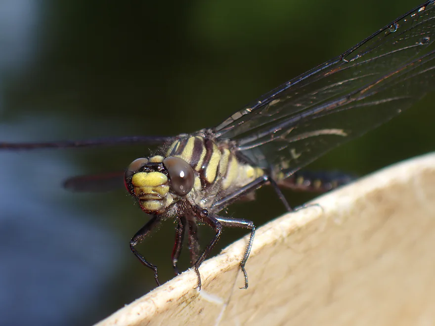
Gomphurus fraternus (clubtail dragonfly)
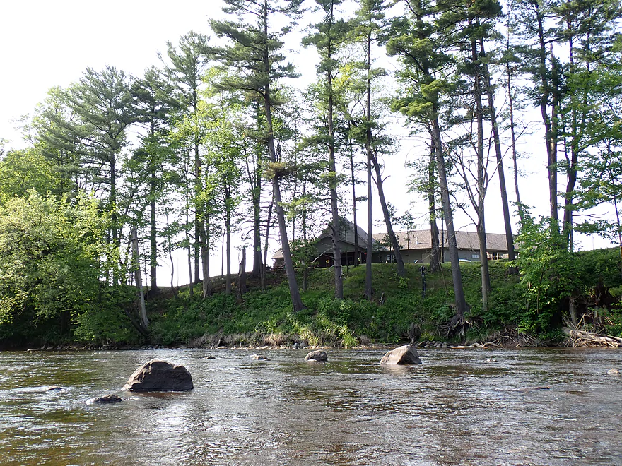
Some homes, but not too many…it was mostly undeveloped
Final stretch
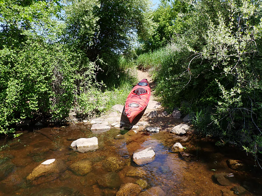
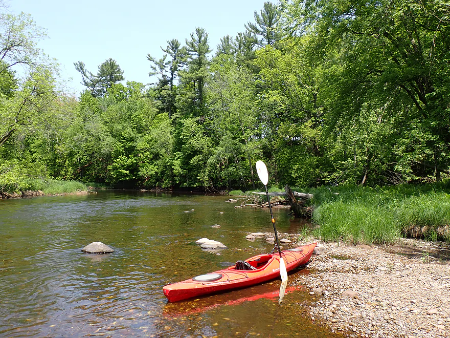
Taking out at E Range Line Road using a hidden path
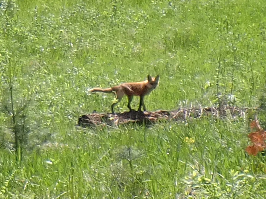
A fox on my bike shuttle
Scouting Hayman Falls (above Pella) after my trip
These are Class 3 rapids
Tempting…but maybe a bit above my skill level
Embarrass River

Located halfway between Green Bay and Wausau, the Embarrass is a neat river often overlooked by paddlers. The upper portions splinter into three branches (North, Middle and South) and flow through the “Northern Highlands”, which are very rocky. These stretches are the most scenic and most popular with whitewater paddlers, but can be difficult because of downed trees and tricky rapids. The lower portions of the river flow through the “Central Sand Plain” and are very different. Here the fast current, boulders, and rapids give way to (IMO) uninteresting bottomlands.
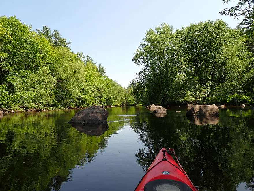
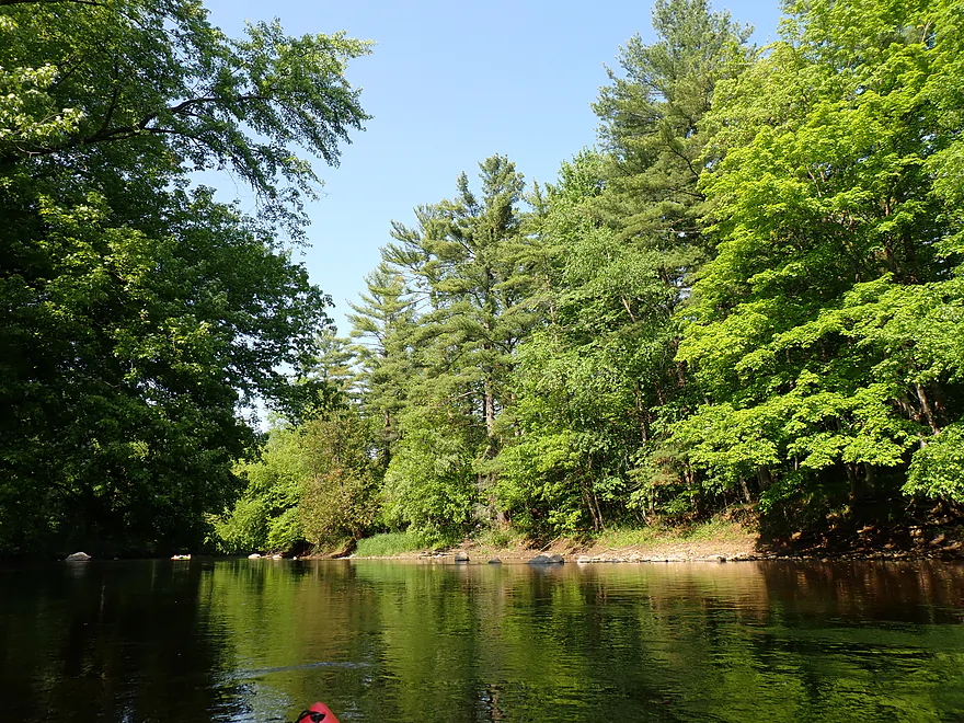
The small town of Pella represents roughly the transition point between the “Northern Highlands” and the “Central Sand Plain”, and my hope was that by starting here I would get the best of both worlds (navigability of the lower river and scenery of the upper). I launched below the Pella dam where there is a convenient public access on a small island. The area below the dam was really scenic, with a large boulder field, and is a popular fishing spot for locals.
The first thing about the river that jumped out at me were the clams. For this trip I saw not tens, not hundreds…but hundreds of thousands of clam shells. I’ve never seen so many in my life. In spots you couldn’t wade without stepping on multiple clams at once. Unfortunately nearly all were dead. I asked the DNR about this. Apparently they did observe a mass mortality event in 2018 and there was a significant fish kill on the North Branch in 2023. They are not sure what is causing the die-off and hope to revisit the site later this year. Some theories suggest a combination of parasites, bacteria, hydrocarbons and/or chemical pollutants are to blame.
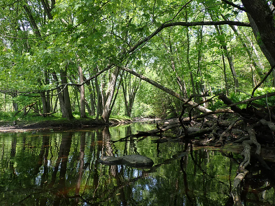
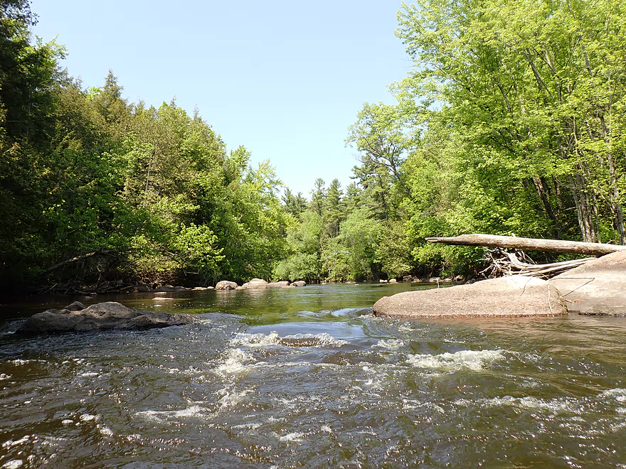
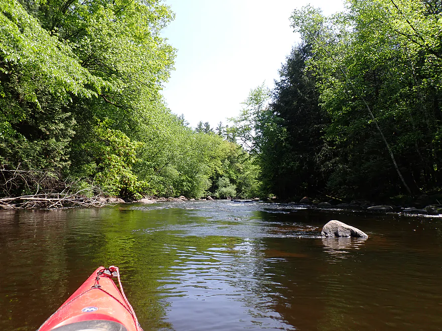
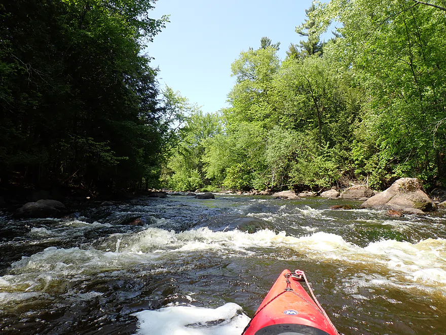
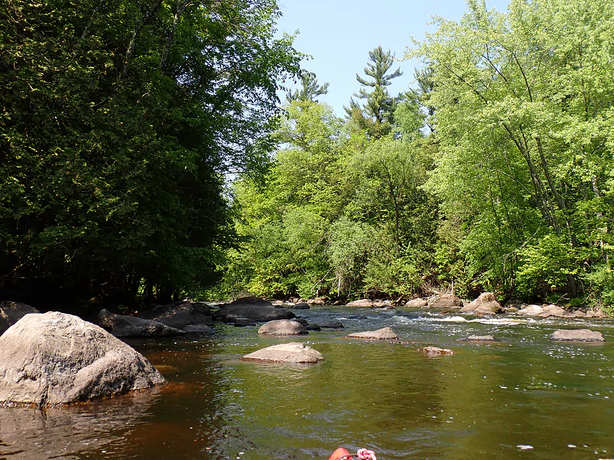
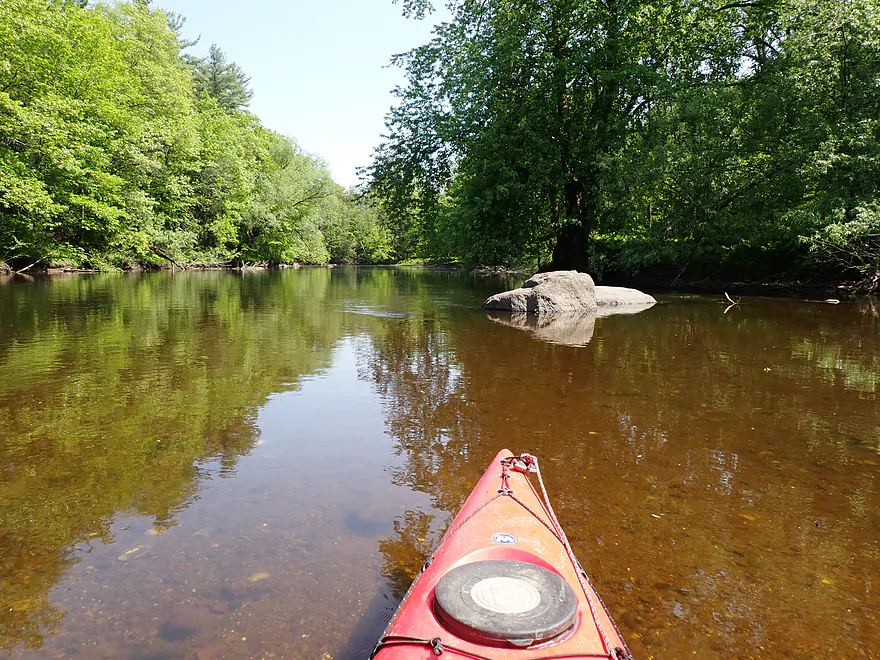
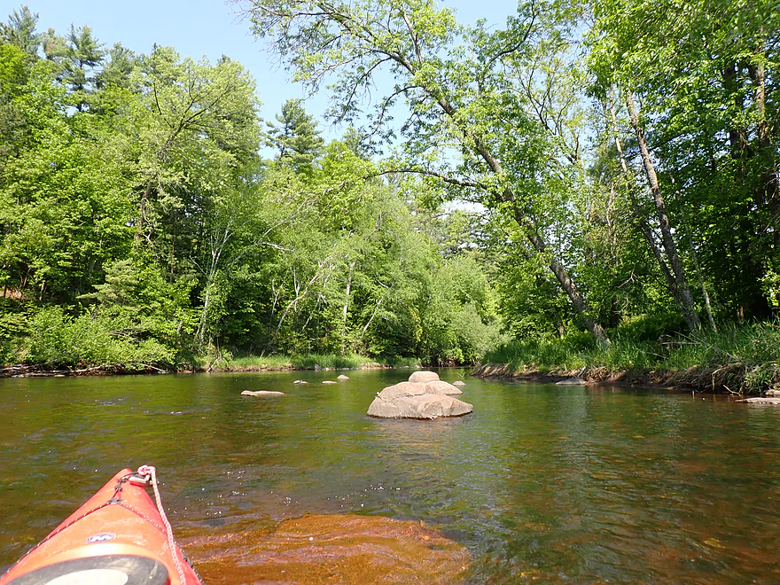
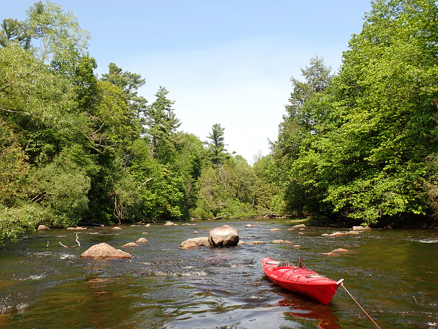
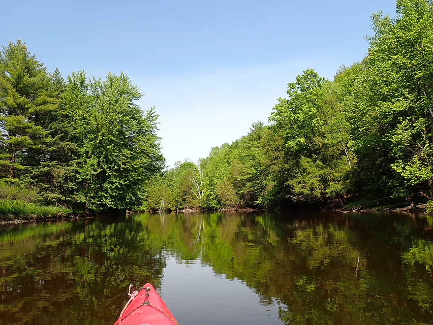
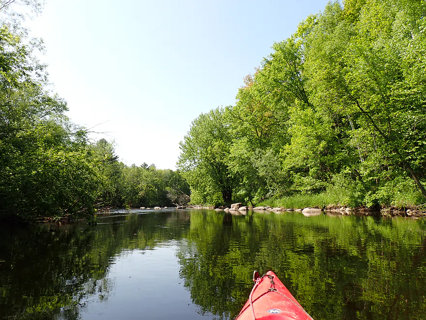
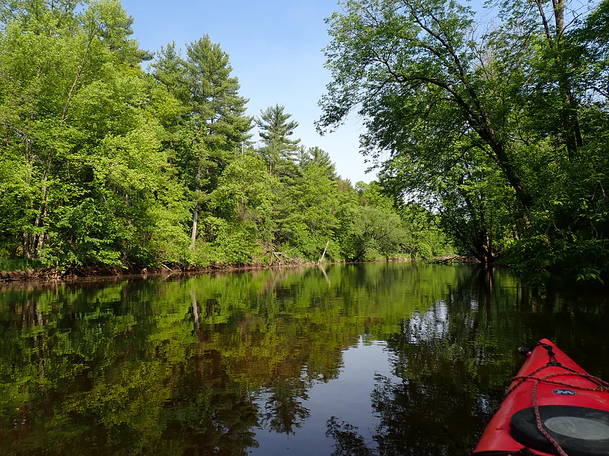
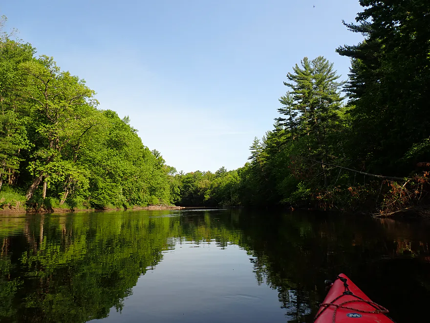
The river itself was really nice and had that classic Northern Highland vibe. The channel flowed clear with a slight reddish hue. The shoreline had a mix of hardwoods and softwoods with occasional nice pines and hemlocks. Ferns were not uncommon. A trip highlight were the boulder gardens (glacial drift deposits) which were really nice. The current moved at a nice clip and there were a number of light, easy rapids.
Maybe a mile downstream from the put-in I was passed by what at first looked like a shark. It turned out it was a lake sturgeon that must have swum up from Lake Winnebago and the Wolf River (there are no dams downstream from Pella). Sadly most of my pictures and video of him did not turn out. Sturgeon are incredible fish. They have a prehistoric profile with what looks like armor and their faces have tendrils which are used to bottom-feed prey (like snails). These are HUGE fish (the largest in Wisconsin) and can live over 100 years. Given this and their rarity, it’s surprising that the DNR allows them to be fished and speared in limited seasons (which special interest groups are trying to expand). This one was lucky so far…but it did have a large red gash on its forehead…maybe a propeller accident on the Wolf River?
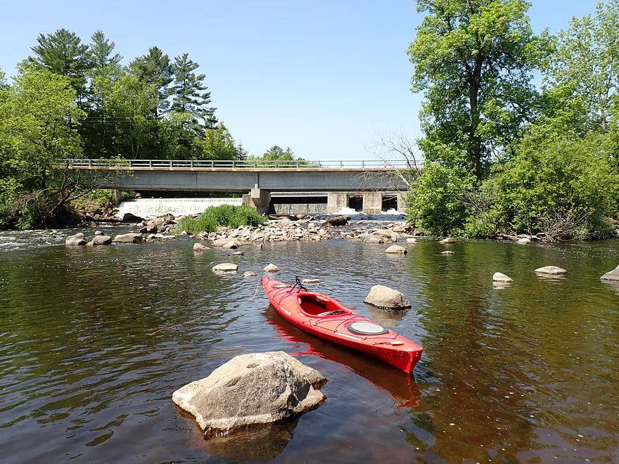
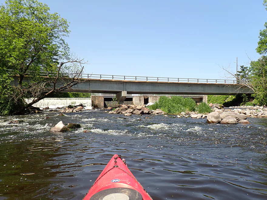
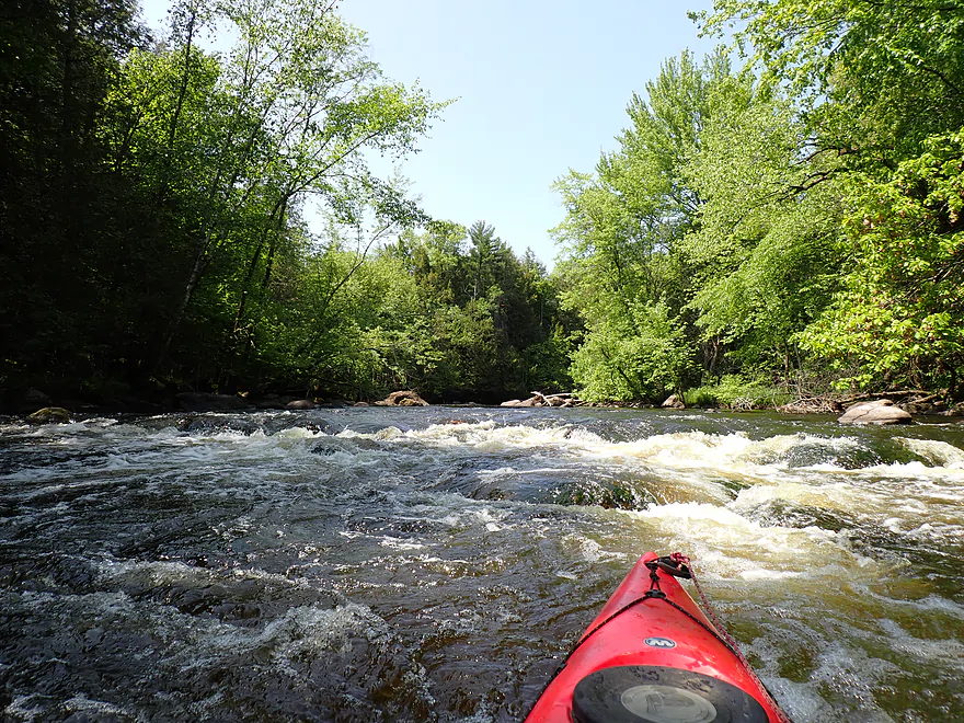
I had only expected minor rapids, so was surprised at roughly the halfway point to encounter a Class 2. It consisted of two pitches and made a lot of noise, but wasn’t too bad and was actually kind of fun (2:25 in the video). I believe these are unnamed so I’ll presumptuously dub them Clam Rapids (there were literally clam shells in the rapids). We’ll see if this name sticks.
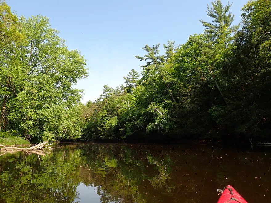
For the second half of the trip there were fewer boulder gardens and fewer clams as the Embarrass started its transition into the Central Sand Plain, but it was still scenic and enjoyable. While no major paddling publications review this stretch, I can’t pretend I was the first to float it as a I saw several parked canoes along the shore and passed a group of tubers.
I ended the trip at E Range Line Road, which was a decent bridge access. A trail northwest of the bridge indicates it’s not uncommon for other paddlers to get out here.
In summary, this was a really nice trip I can recommend. The rock gardens, clear water, good current and safe rapids make this a good intro paddle for kayakers wanting to know the Embarrass River. I look forward to exploring more of the Embarrass in the future.
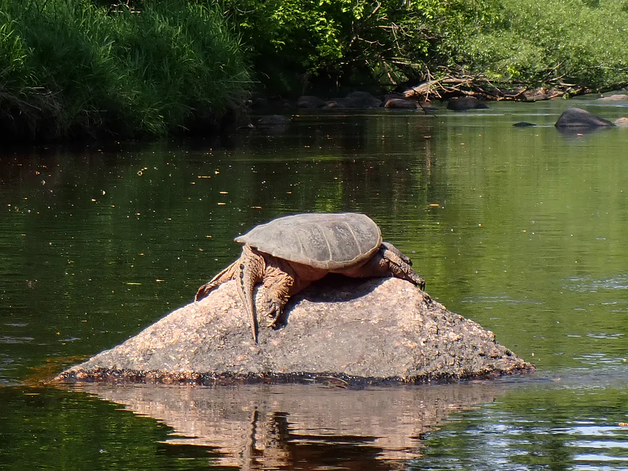
Sights included eagles, ducks, dragonflies, some flopping fish, a great blue heron, one sunbathing snapping turtle, many snail shells, and a fox on the bike shuttle. There were a jaw dropping number of clam shells (like 100k+), but almost all were dead. Something caused a massive “clam holocaust” (the DNR is actually looking into this).
The highlight was being passed by a huge sturgeon about a mile downstream from the Pella dam. These are impressive prehistoric fish that can grow to be over 100 years old (if not harvested by a human).
Hayman Falls: Located about five miles upstream from Pella is a scenic stretch of Class 3 rapids and boulders. East of the river is a public park, trail network and campground which is popular with locals. Kayakers can use the trails to portage and/or scout the rapids which look fun but tricky.
Old Mill Park: This was a great put-in. Basically there is a public island between the millrace and dam which you can park on and then launch via several access trails.
Alternate Put-ins: None really. I mean you could in theory launch upstream of the mill pond and portage the dam, but it didn’t seem worth it IMO.
E Range Line Road: This was a decent bridge access. Park northwest of the bridge where you’ll find a faint but well used trail leading to the water. It’s a bit steep and somewhat weedy but not bad.
Alternate Take-outs:
- Hwy 22 (5.8 miles downstream from E Range Road): Hwy 22 is an inferior bridge access (busy road, long guard rail), but should be a doable take-out. This bonus leg will be good with some more boulder gardens, but it likely won’t be as nice as previous stretches.
Bike Shuttle – E Range Road to Old Mill Park: 5.2 miles with 102′ of ascent. I thought this was a pretty easy bike shuttle with just a few minor hills. You can shuttle north of the river or south of it (as I did). The south route is a bit longer, but is less hilly.
Logjams: None…this is a pretty navigable stretch. There are a few downed trees but they are easy to get around because of the width of the river.
Current/Rapids: The current moves at a good pace and there are a handful of light rapids. The only significant rapids are “Clam Rapids”, a Class 2 located about 40% into the trip (marked on the map and 2:25 in the video). There are two pitches, with the second having a 1-2′ drop. I thought it was manageable, but the ability to run Class 2’s will depend on your boat type and experience. Portaging/scouting can be done along the west bank.
Closest Gauge: Embarras River @ Embarrass
My Trip Depth: 280 cfs of 3.18′
Gauge Guide: The following are just rough estimates.
- < 100 CFS: A low depth common in fall. Some parts of the river will be shallow and will have to be waded. Should be scenic though with terrific clarity and pronounced boulder fields.
- 101-200 CFS: More of an average depth. There will be a few shallow spots, but the vast majority of this stretch should be plenty navigable.
- 201-350 CFS: Slightly above average. Still ok clarity with nice boulder gardens. Ground-outs won’t be an issue, with maybe 1-2 exceptions if you don’t read the river correctly.
- 351-500 CFS: High levels with likely meh clarity. Clam Rapids might get rough at this point and become a Class 3.
- 501-1000 CFS: Very high levels. Likely mostly navigable, but not attractive and you might have to portage Clam Rapids.
- 1000+ CFS: Perhaps too high for recreational paddling.
Click here to see an overview map of the Embarrass River.
North Branch:
- Upstream from Schoolhouse Road: Close to Bowler, the river is no more than a small creek and flows through dense forest. It might be navigable, but logjams could be an issue.
- Schoolhouse Road to Airport Road: 5.7 miles. Paddling author Rick Kark paddled this and noted it was a bit shallow but featured scenic northwoods with Class 1 and Class 2 rapids and boulder gardens.
- Airport Road Access to Hwy D: 1.1 miles. Launch on Tilleda Pond and then portage around the dam. After the dam the river looks really scenic with some nice rocky woods.
- Hwy D to Hwy G: 1.5 miles. Start and end look uninteresting…but the middle portion has some large stretches of exposed bedrock and boulders that look neat .
- Hwy G to Zimdars Road: 1.6 miles. Other than a large sand bank, this doesn’t look too interesting from satellite images.
- Zimdars Road to Leopolis Dam: 4.2 miles. Little is known about this section. I think I can see some nice boulder gardens and two scenic ledges from satellite…but also the potential for some logjams. Tough to tell.
- Leopolis Dam to N Branch Road: 1.9 miles. Scenic, narrow and wooded. About a third into the trip is a 5-6′ slanted ledge (pictured on American Whitewater ). Maybe a Class 3…could have a hole in high water…scout before running. This is followed by a stretch of Class 2 rapids.
- N Branch Road to Mouth on Embarrass River: 0.5 miles. Narrow wooded stretch that is likely scenic. There is a cool boulder pier below the N Branch Road bridge.
Middle Branch:
- Panic Park to Robin Road: 0.9 miles. A few boulder gardens, but relatively speaking this is a slower and more open stretch.
- Robin Road to Cardinal Lane: 1.9 miles. A more open leg relatively speaking, but there appears to be a dense wooded stretch above the golf course which could have some tricky rock and tree constrictions.
- Cardinal Lane to Hwy Q: 1.0 miles. Aside from a boulder field upstream from Q this should be a pretty generic stretch.
- Hwy Q to River Road: 5.4 miles. A scenic stretch, but there are some difficult parts through dense forest that feature Class 2-3 rapids and major logjams. This can be very dangerous during high water, but too bumpy when shallow. This is reviewed by American Whitewater.
- River Road to Boldig Road: 0.9 miles. Another dense, narrow stretch through thick woods. There are likely logjams and Class 2-3 rapids. Only suitable for skilled paddlers. There is also a dam just upstream from Boldig Road which whitewater paddlers sometimes run.
- Boldig Road to Hwy J: 1.4 miles. Not much is known about this leg. I’m skeptical about it as I don’t see many boulders from satellite, but I do see what looks like 3 logjams. I could be wrong.
- Hwy J to Berg Road: 1.4 miles. A generic stretch that didn’t look too interesting when I drove over it on Hwy 29. Could be a few logjams. This likely lacks the interesting geology featured in the other legs.
- Berg Road to Townline Road: 3.9 miles. A handful of rapids and rock gardens…but outside of that mostly a simple flatwater paddle.
- Townline Road to Weasel Dam Road: 3.9 miles. Reviewed by Rick Kark who called it “nifty”. The first mile featured a constant Class 1-2 rapids and boulder garden, while the second half proved much slower and flowed through silver maple bottomland where several downed trees had to be portaged.
- Weasel Dam Road to Caroline Pond Ramp: 6.7 miles. The last leg of the Middle Branch and reviewed by Frank Piraino. He indicated there were 3-4 logjam portages. After the now-removed dam, he said there were: “Thrilling grade 2-3 rapids with a fast 3′ drop over a ledge thru boulder gardens that ends in a rock dam blocked in center! Scout LB then another long grade II and several grade I=II rapids before flatwater cabins and a flowage.” This section sounds like it would require good boat skill and some whitewater expertise but it seems scenic and a lot of fun. Higher water levels will make it more dangerous but could pad the boulders.
South Branch:
- Upstream from Hwy 45: There is a millpond, but west of that are some incredible exposed bedrock formations. I don’t know much more…launching from M might be an option, but satellite images suggest dense woods which might mean logjams and/or rock constrictions.
- Hwy 45 to Hwy M: 2.8 miles. An incredibly scenic stretch with impressive boulders. The highlight is the famous Tigerton Dells. But note, this has a number of Class 2-3 rapids. When high this is a Class 4 stretch and is very dangerous. Reviewed by Rick Kark.
- Hwy M to Lenz Road: 3.7 miles. This leg is very different as the river slows and goes through a bedraggled forest mostly lacking in boulders. There are likely a few logjams. Satellite images suggest a few nice rocky hillsides that might be scenic though.
- Lenz Road to Hasse Road: 3.2 miles. This is a good prospect on my todo list. Boulders become common again and this is likely a scenic stretch. I don’t think there is major whitewater, but there are likely a handful of Class 1 and 2 rapids.
- Hasse Road to Caroline Pond Ramp: 3.0 miles. Another rocky and good prospect, but maybe not as nice as the previous leg. There might be 1-2 logjams on this stretch.
Embarrass River: This starts at the confluence of the south and middle branches.
- Caroline to Romberg Road: 1.1 miles. Caroline marks the official start of the Embarrass River and the confluence of the Middle and South Branches. This is a nice leg with attractive boulder fields and a few Class 1 rapids. There are multiple access options in Caroline.
- Romberg Road to Hayman Falls County Park: 2.7 miles. Flatter and open with some low density boulder fields and a few Class 1 rapids. Closer to Haymen Falls the boulder fields get thicker and there may be some Class 2 rapids.
- Hayman Falls County Park to Hayman Falls Lane: 0.5 miles. This is a long stretch of Class 3 rapids with some tricky constrictions on the upstream side. Scout before running, which is easy to do via the public trail network along the east bank. Portaging would be easy.
- Hayman Falls Lane to North Branch Mouth: 0.4 miles. This is a more open stretch, but still has some minor rapids and rock gardens.
- North Branch Mouth to Pella Dam: 2.9 miles. The river slows and then widens into the Pella Pond. This likely isn’t as interesting for kayaking.
- Pella Dam to E Range Line Road: 6.9 miles. A terrific beginner leg on the river. Highlights include clear water, good navigability, and attractive boulder gardens. There are a number of rapids, but most are easy Class 1’s. “Clam Rapids” is a Class 2 located about halfway into the trip, but this can easily be portaged/scouted from the bank.
- E Range Line Road to Hwy 22: 5.8 miles. River transitions from the Northern Highland to the Central Sand Plain. Scenery will become less interesting with more dead trees in the water and fewer boulders. There should still be some nice boulder gardens and good clear water though. Satellite images show a massive logjam upstream from Hwy 22.
- Hwy 22 to Main Street: 4.5 miles. River completes its transformation into a slow, sandy, silver maple paddle. Likely pleasant, but not special like the upstream legs and lacking in boulders. From satellite I can see a massive sand bank that looks cool…but also a possible logjam.
- Main Street to Hwy 156: 4.5 miles. Likely a generic silver maple stretch with nothing special about it.
- Hwy 156 to 7th Street: 2.3 miles. Mostly a generic silver maple paddle, but on sunny days and when water levels are low clarity should be nice. The Pigeon River joins up here and increases the size of the Embarrass River.
- 7th Street to Hwy I: 1.7 miles. Mostly a generic silver maple paddle. Likely somewhat boring.
- Hwy I to Hwy XX: 1.5 miles. Again, mostly a generic silver maple paddle and likely somewhat boring.
- Hwy XX to Hwy F: 10.8 miles. Paddling author Frank Piraino describes this as a peaceful flatwater trip through pastoral countryside with overhanging hardwoods and a sandy bottom. He does say “scenery not terribly inspiring”.
- Hwy XX to Cherry Road: 7.0 miles.
- Cherry Road to Hwy F: 3.8 miles.
- Hwy F to Hwy 76: 5.3 miles. Rick Kark did this section and said he enjoyed the late day scenery of the willows, silver maple and walnuts.
- Hwy 76 to Spur Road: 11.7 miles. Frank describes this as a lovely flatwater trip through a vast and twisty hardwood bottomland. He suggests it is more scenic than the previous stretch and one of the best legs on the Lower Embarrass, with a highlight being the good wildlife. Downed trees are common but you can typically paddle around them.
- Spur Road to River Road: 5.2 miles. Likely a generic flood-bottom paddle and maybe not that interesting.
- River Road to Pfeifer Park: 0.7 miles. Generic stretch through the outskirts of New London.
- Pfeifer Park to Mouth on Wolf River: 0.9 miles. The final leg of the Embarrass River, which flows past the city of New London.
Trip Map
Overview Map
Video
Photos Size: