
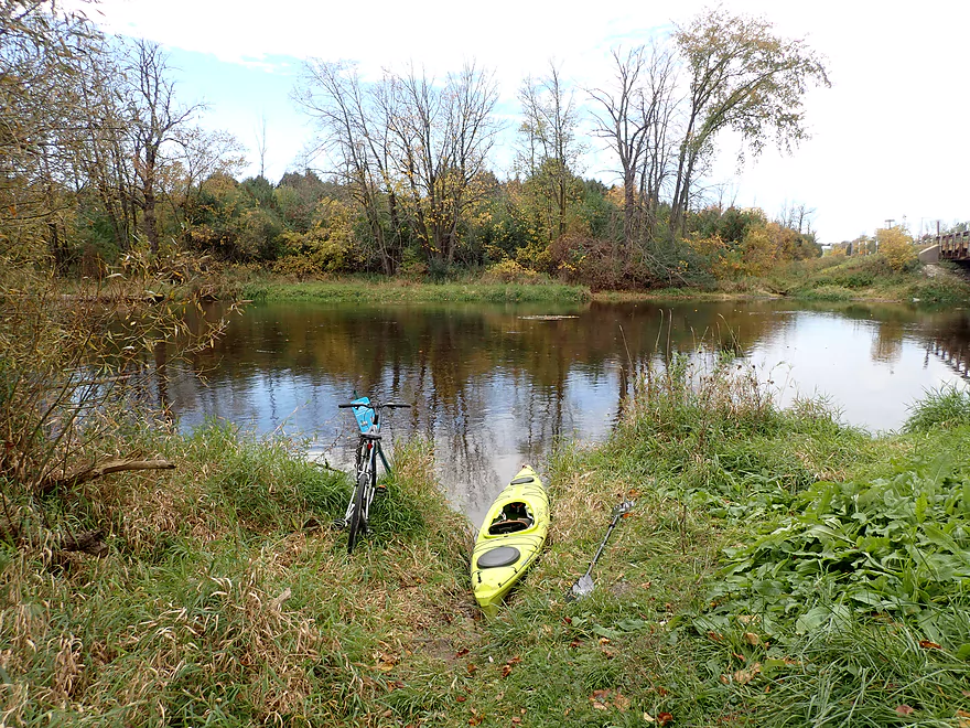
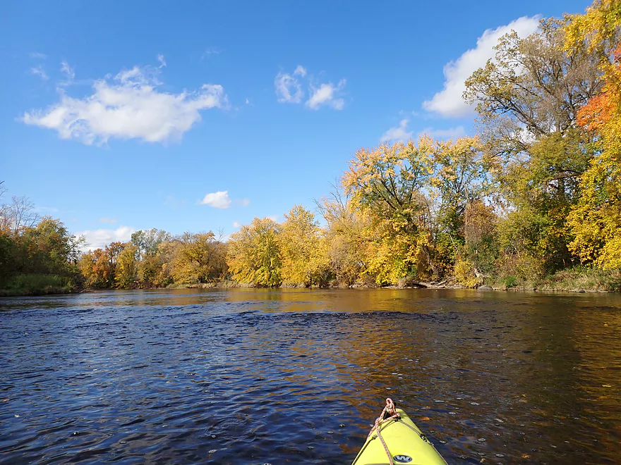
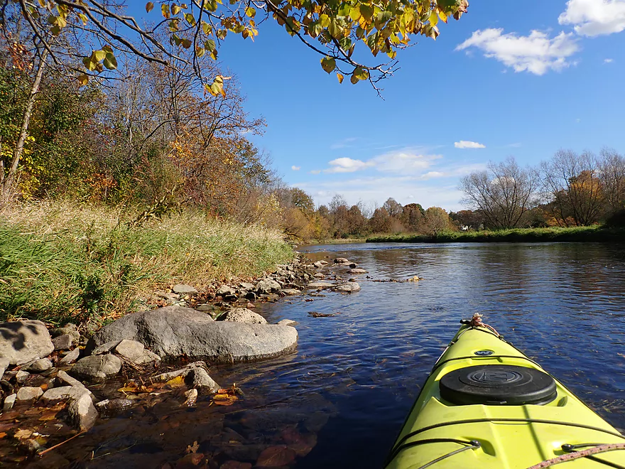
Starting the trip at Hwy A
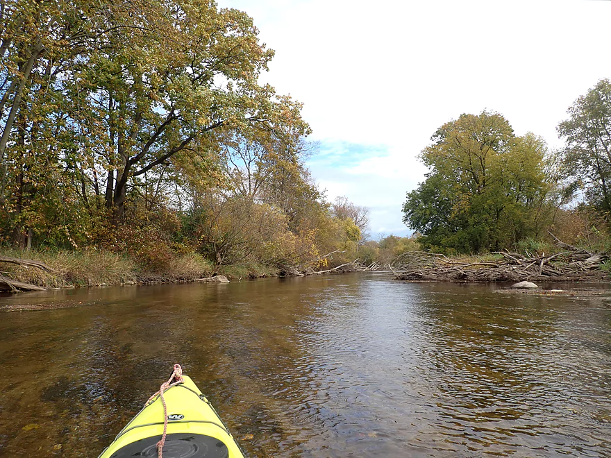
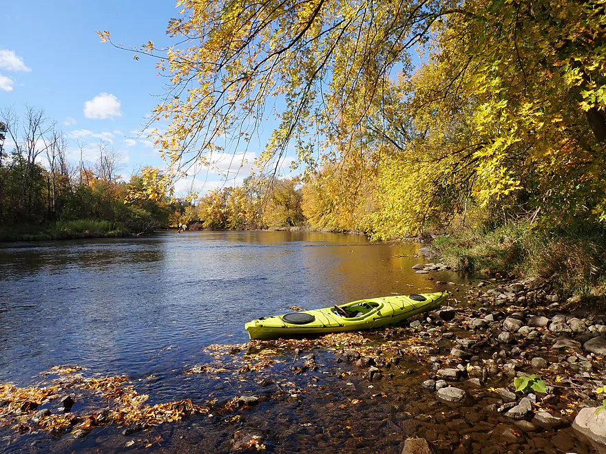
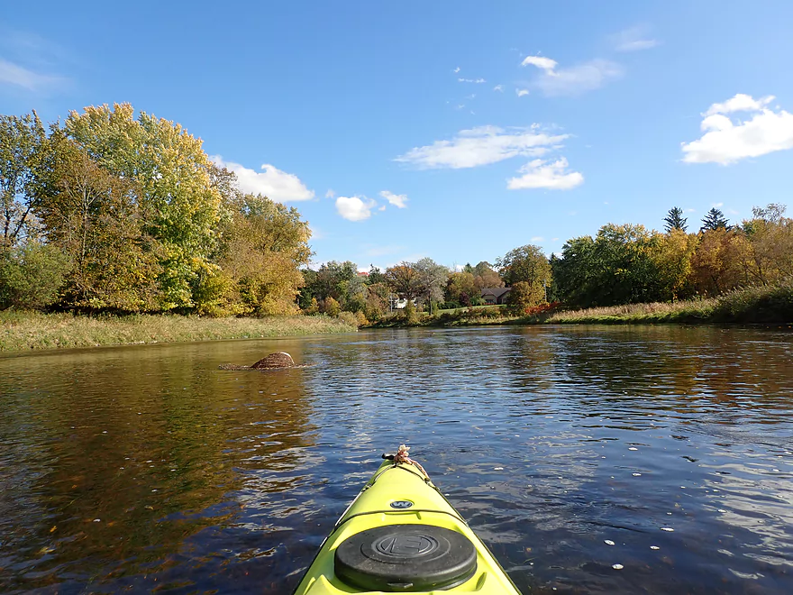
Good water clarity
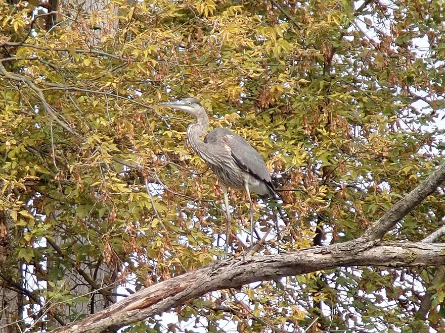
Great blue heron
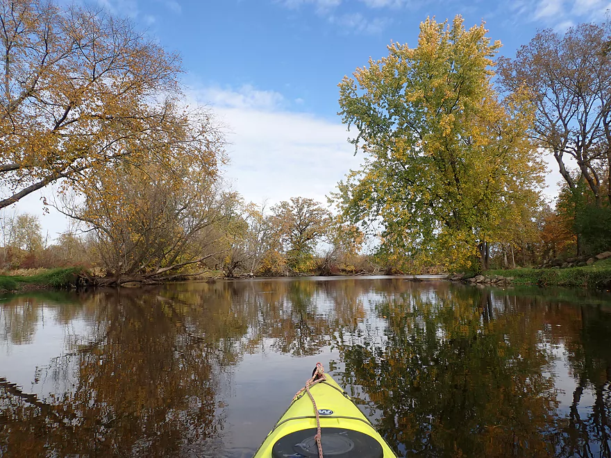
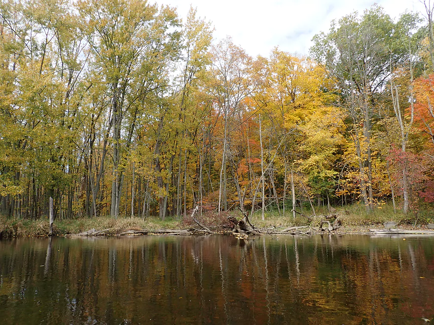
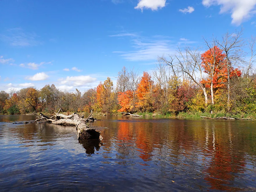
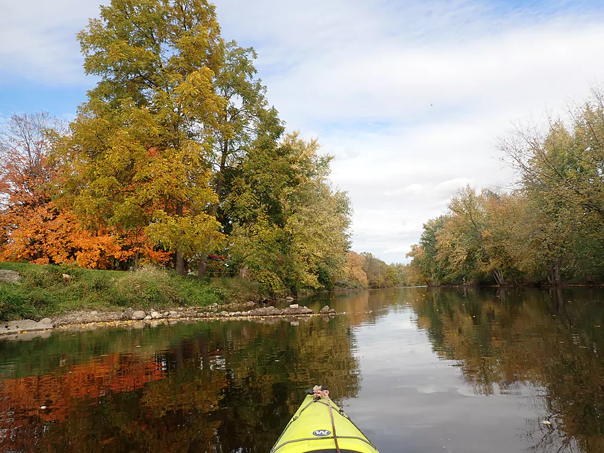
Nature’s mirror
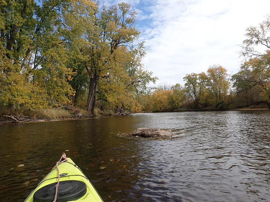
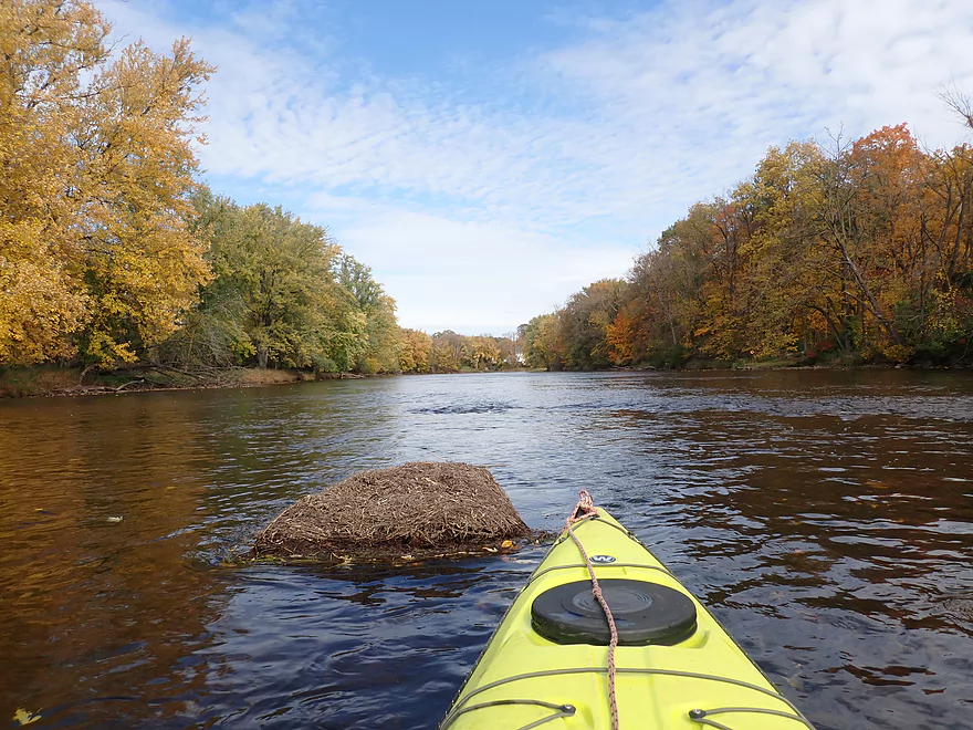
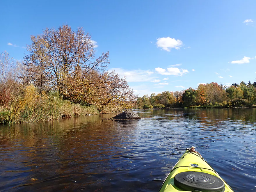
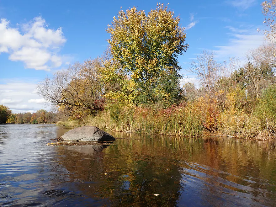
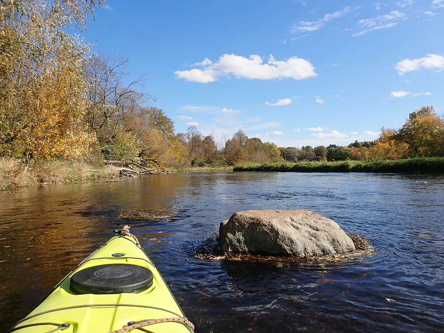
Occasional glacial erratics
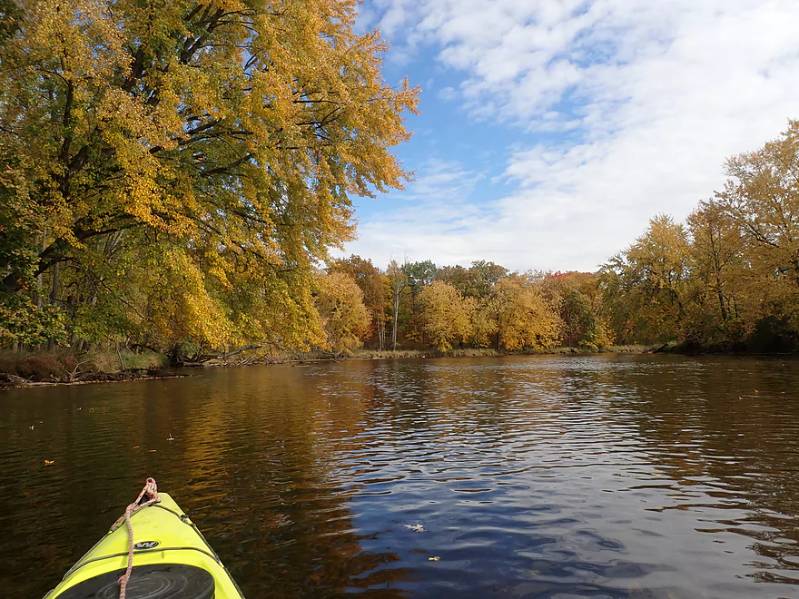
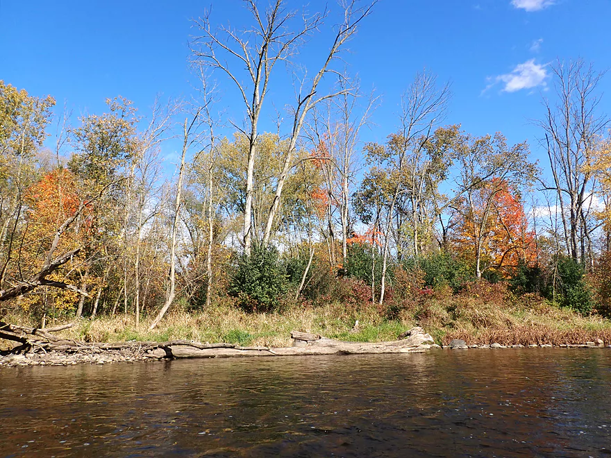
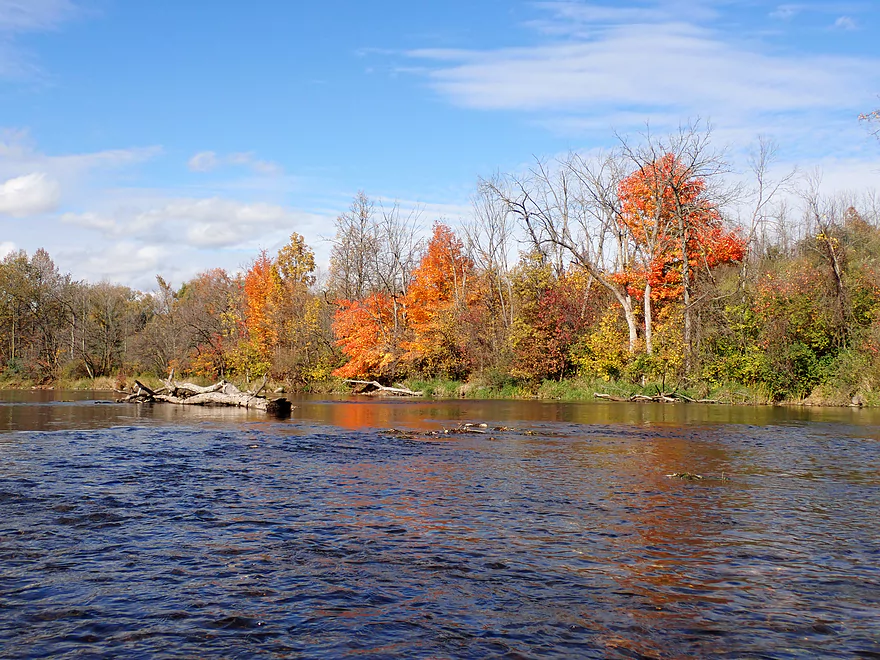
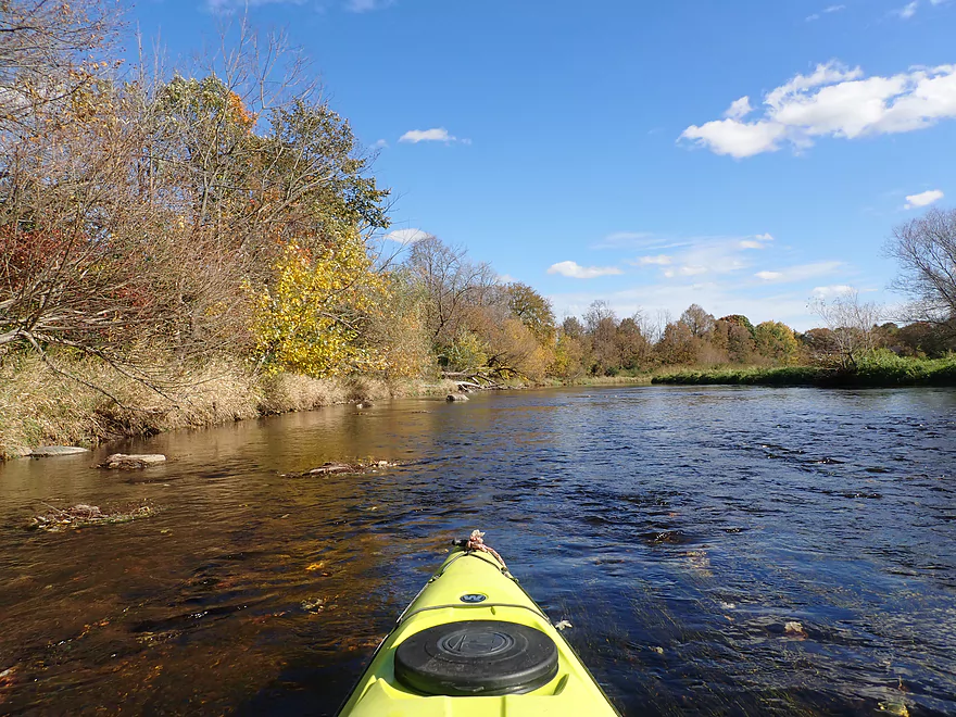
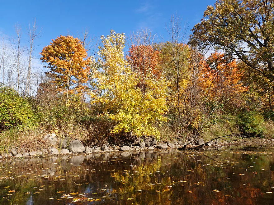
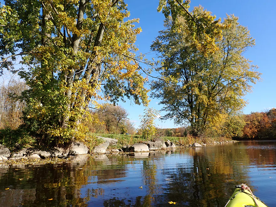
Some good color on this trip
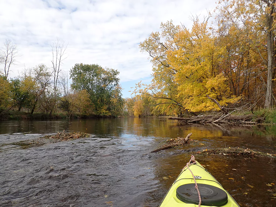
No major rapids, but many light riffles
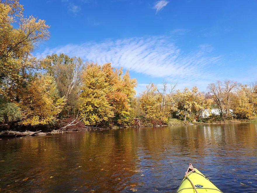
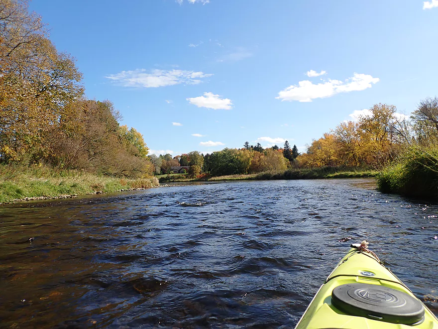
River really widens out after the North Branch joins up
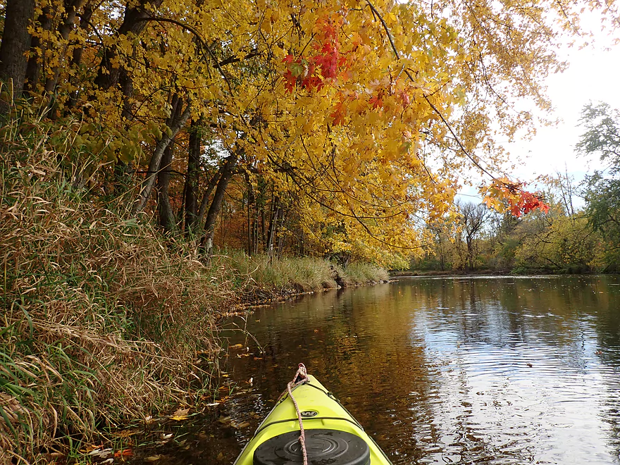
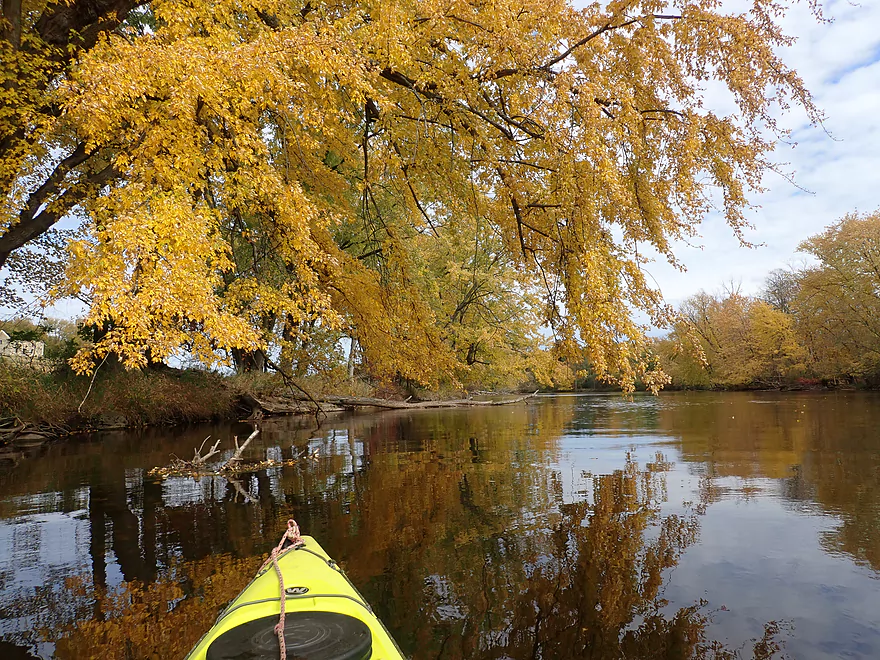
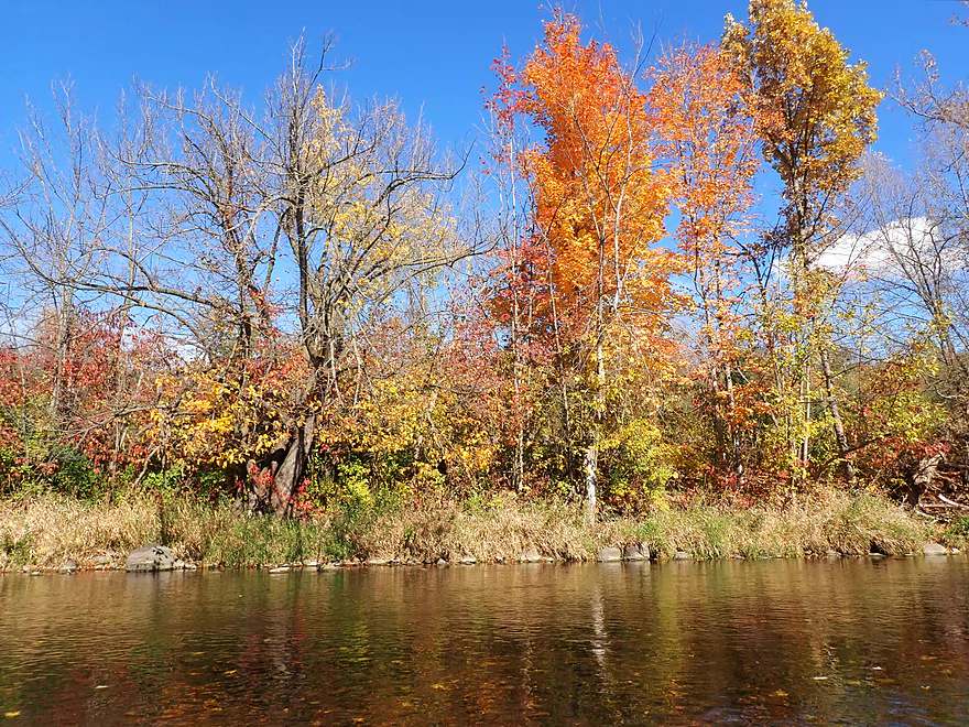
More good color
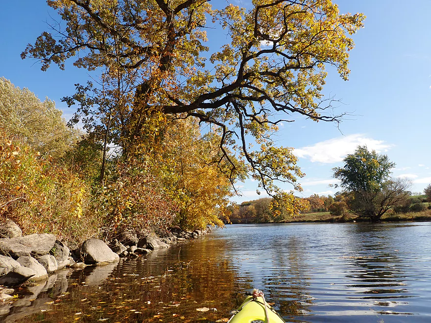
Scenic area
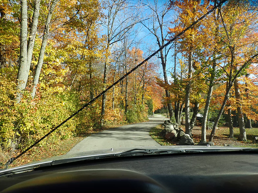
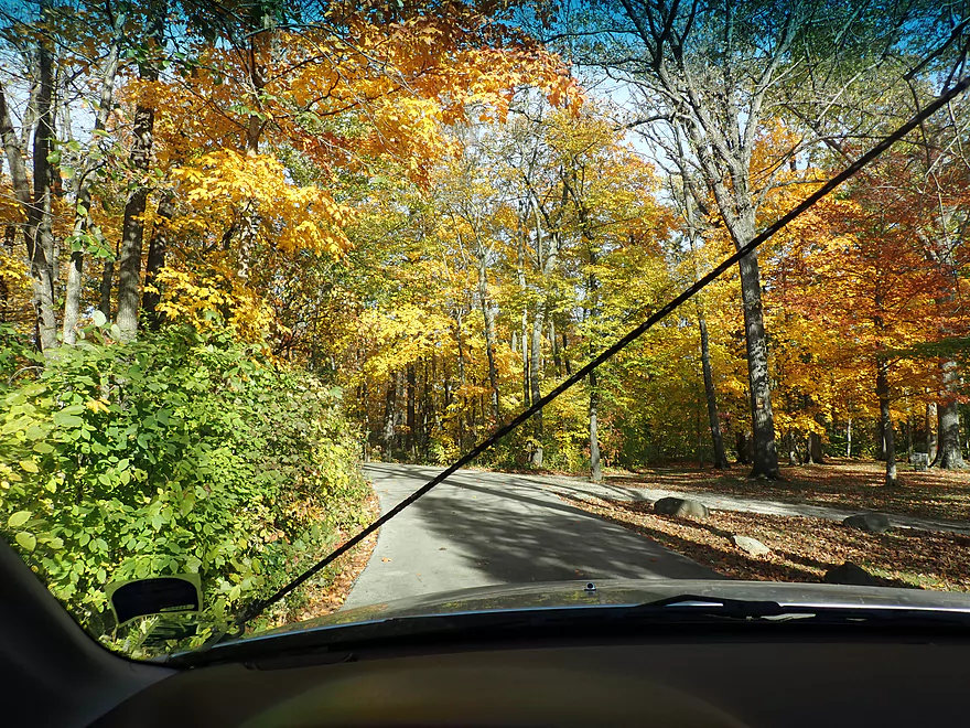
This is a great trip to do in the fall
Upper Milwaukee is somewhat rocky
More light rapids
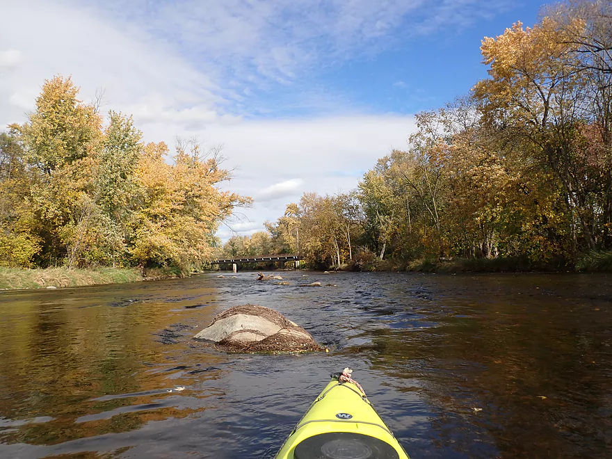
Small boulder garden
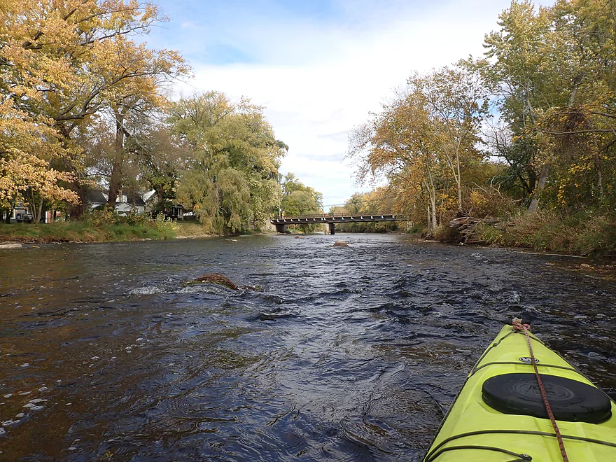
Class 1 rapids under Cigrand Drive
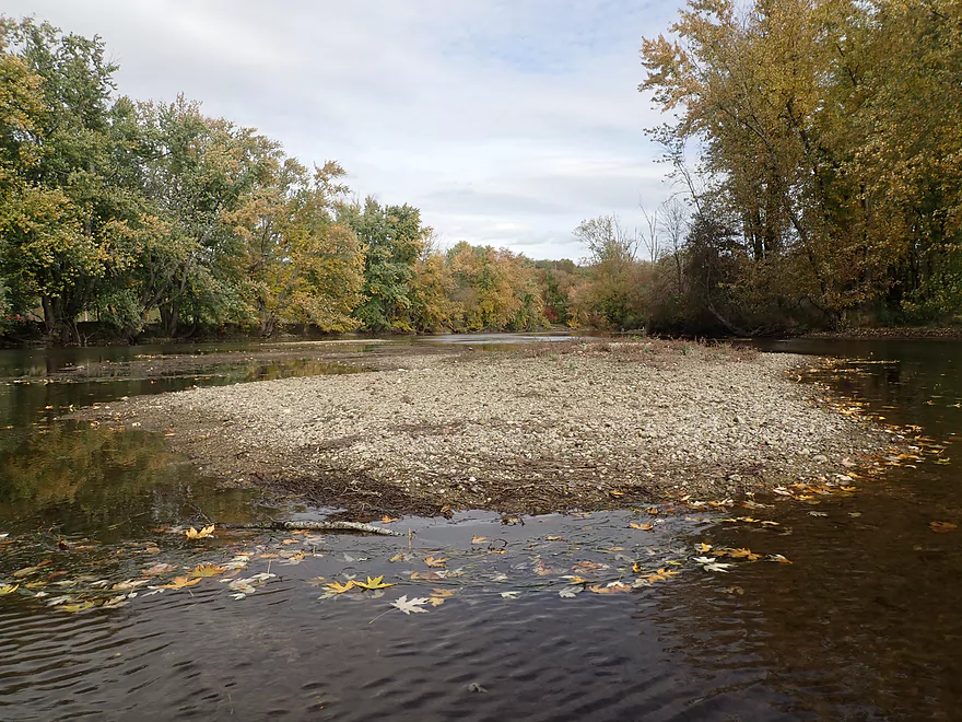
Large gravel bar
Final stretch
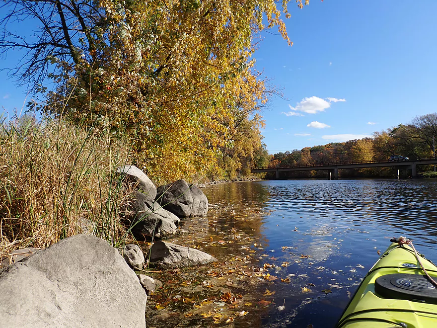
Fredonia Ave
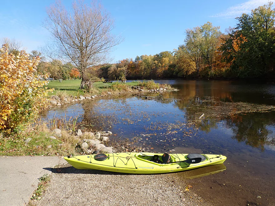
Entering Waubedonia Park
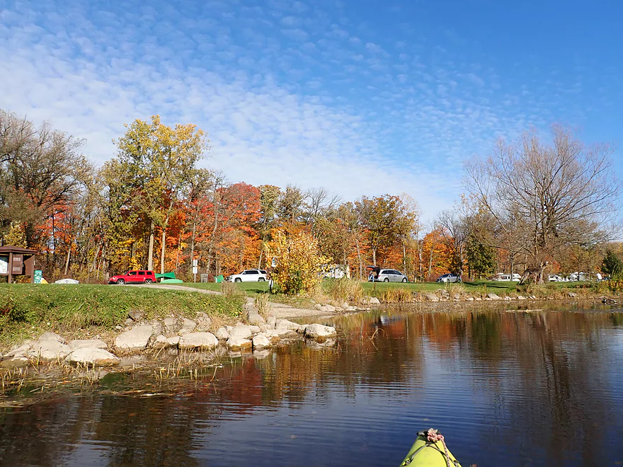
Attractive park
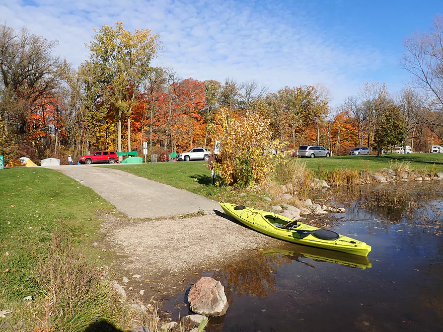
Great ramp for paddlers
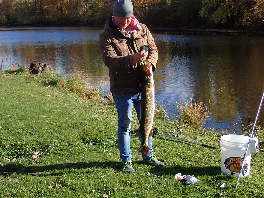
Fisherman caught a massive northern pike by the take-out
Looking downstream at a possible future trip
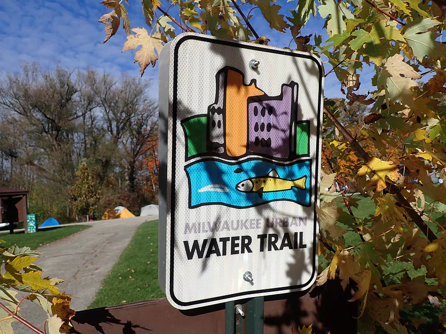
Part of the Milwaukee Urban Water Trail
Color in the park was fantastic
Great way to end the day
Milwaukee River – Waubeka

The Milwaukee River is one of the longer and larger rivers in southeast Wisconsin. Many of its segments are viable for paddling and my eventual goal is to paddle all of them. For this trip, I decided to focus on the Waubeka stretch which is an obscure upstream leg located east of Newburg.
The trip started on a sour note, as I had first completed the bike shuttle which was cold, windy, somewhat hilly, and brutal. On top of this, the “mostly sunny skies” that were forecasted didn’t materialize. Everything was cloudy, gloomy and cold (a big deal when you do a lot of photography).
The river itself though was really nice. The channel is relatively shallow for its wide depth, yet moves at a good clip with excellent clarity. It was fun to watch the crayfish and fish scurry about below the boat. The shoreline was surprisingly clean (well for somebody used to say the Baraboo River) with little mud. The substrate contained a lot of very fine gravel and sand which was nice. For comparison’s sake this stretch reminded me of the Lower Yahara, Sheboygan River, and Turtle Creek.
For most Wisconsinites, if you think “Milwaukee River”, you think of a fairly urban and developed river corridor, but in reality much of the upper river is undeveloped and surprisingly wooded. This being mid-October color was pretty good. If you’re considering a fall color paddle, this isn’t a bad choice.
About a third into the trip, the North Branch joins up from the north and significantly enlarges the main branch. The North Branch suffers more from logjams and topsoil erosion so likely isn’t as interesting, but it is on my eventual todo list to paddle.
As I neared Waubeka the trip improved as the sun came out and I encountered some fantastic fall color along the shoreline. Under the Hwy H/Cigrand Drive bridge I faced some light rapids where there used to be a dangerous low-head dam. In 1990 there was a canoeing accident here and the inspection that followed revealed that the dam was in poor shape. Locals (as they usually do) resisted removing the dam, but it was thankfully eventually demolished in 2003. By my count eight of the 16 dams on the Milwaukee River have been removed and these projects have been resounding successes. They’ve improved current, water clarity, reduced nutrient growth, improved wildlife, and made paddling much more enjoyable. Sadly with most dams a loud vocal minority (usually pier owners on the upstream flowage) fight it tooth and nail because they think it will affect their property values.
After Waubeka the river encountered an attractive bluff that redirected the channel sharply south. Despite the Milwaukee River here just being ~10 miles west of Lake Michigan, it thereafter travels 40-50 miles south to reach its mouth. I ended the trip at Waubedonia Park which was a great access and place to end a trip.
In summary this was an enjoyable trip with little shoreline development, clean water, good current and enjoyable fall color. In many ways this is a great trip for beginners…good access points, no logjams, good current, yet no major rapids. The other unique thing about this leg is it runs west-to-east. In Wisconsin that’s where the prevailing winds blow so on many windy days this can be a great trip to do for lazy paddlers who appreciate a little assistance.
Hwy A: This is a good bridge access with adequate shoulder parking. Most paddlers will launch from the southeast corner where there is a well worn path.
Alternate Put-ins:
- Newburg (6.3 miles upstream from Hwy A): There is a decent launch option by the bridge (Main Street). Putting in here though would make for a long trip but this add-on leg is very nice.
Waubedonia Park: This is a terrific park and access option. I disembarked south of the bridge where there is a concrete canoe ramp and a public outhouse. You can also get out north of the bridge which isn’t as crowded.
Alternate Take-outs:
- River Road (~2.5 miles upstream from Waubedonia Park): There is a small shoulder pull-off located just west of Waubeka.
- Ehlers Park (5.3 miles downstream from Waubedonia Park): This is a nice leg of the river and ends with a good take-out option. Tendick Park is on the opposite shore and is also a good access.
Bike Shuttle: 4.0 miles with 79′ of ascent. This was an unpleasant bike shuttle as it was cold and I was pedaling into a strong headwind. Hwy A is busy, somewhat hilly, and I constantly smelled exchaust. Maybe in the summer this is a better shuttle.
Current/Rapids: The current moves at a good clip, but there aren’t that many rapids. There is a handful of minor riffles that almost aren’t worth mentioning. The only significant rapids are located by the Hwy H bridge, but these are really mild.
Logjams/Hazards: None. This is a pretty easy & safe leg (as long as levels aren’t crazy high).
- 0-100 CFS: Exceptionally low. Some sections may require walking.
- 101-200 CFS: Likely a good depth with fantastic clarity. Expect some ground-outs.
- 201-300 CFS: An average depth with good clarity. With good navigation you can avoid most ground-outs, but expect 1-2.
- 301-400 CFS: A decent paddling depth, but you start to lose some clarity.
- 401-600 CFS: Likely little to no clarity and not as interesting, but should be plenty navigable.
- 601-800 CFS: A high depth. Likely navigable but the river won’t be attractive.
- 801+ CFS: Maybe too high for enjoyable paddling.
Detailed Overview
Additional access options are visible on the overview map. Special thanks to Milwaukeeriverkeeper.org which has some detailed information on the river, including this great map.
- Upstream from Happy Road: Not viable for kayaking.
- Happy Road to Meadow Road: (0.7 miles) Small but mostly open stretch partly straightened by farmers. Likely ok.
- Meadow Road to Cty W: (1.5 miles) Very open stretch that flows past wetgrass marshes and farms. Likely an ok prospect with no logjams.
- CTY W to CampbellSport: (4.5 miles)
- Hwy W to Campbellsport Wayside: (4.1 miles) Starts as a narrow wet grass marsh and widens into a slower cattail marsh. Marsh recedes when sandwiched between two drumlins and becomes rockier and faster with some rapids. Overall a varied and scenic paddle. As of 2025 one logjam will have to be portaged.
- Campbellsport Wayside to Columbus PARC: (0.4 miles) A pleasant and scenic leg flowing past the outskirts of Campbellsport and a local town park.
- Campbellsport/Columbus PARC to Cty Y: (2.8 miles) Maybe 2-3 logjams. Otherwise this is a scenic stretch.
- Cty Y to Hwy 45: (1.7 miles) Maybe 3-5 logjams.
- Hwy 45 to Auburn Ashford Drive: (1.3 miles) Maybe 1-3 logjams...some riffles.
- Auburn Ashford Drive to Old Bridge Road: (0.7 miles) Maybe 1-3 logjams.
- Old Bridge Road to West/Main Branch Confluence: (2.0 miles) Maybe two logjams. For those launching above Kewaskum, I think they will start on the West Branch instead.
- Alternate - Hwy 45 to West/Main Branch Confluence: (0.7 miles) Probably one logjam...but more viable than starting from Old Bridge Road.
- West Branch/Main Branch Confluence: (2.8 miles) A mediocre prospect. Maybe one logjam..I don't know much more.
- Kewaskum Dam/Park to Cty H: (2.9 miles) Solid prospect.
- Cty H to First West Bend Dam: (6.3 miles) A solid prospect with some flowage paddling at the end. The take-out entails dragging your boat across a private parking lot.
- First West Bend Dam (Barton Ave) to the Second West Bend Dam: (1.3 miles) Mostly an urban flowage paddle. The first dam is a difficult portage or put-in.
- 2nd West Bend Dam to Quaas Creek Park: (3.8 miles)
- 2nd West Bend Dam (Washington Street) to South River Road: (2.1 miles) Terrific section with a restored prairie, fast current, light rapids, and good urban scenery.
- South River Road to Quaas Creek Park: (1.7 miles) A paddle through urban woods...pleasant but not top-notch.South River Road to Cty M: (6.3 miles) A pleasant stretch with little development and clear water.
- Cty M to Main Street Bridge (Newburg): (3.4 miles) Good prospect with small boulder gardens in shallow water.
- Main Street Bridge (Newburg) to Cty A Bridge: (6.3 miles) A popular paddle with great water clarity.
- CTY A to Waubedonia Park (Waubeka): (5.7 miles) A decent leg with good current, some rocky stretches, and nice color in the fall. North Branch joins up and significantly enlarges the river.
- Waubedonia Park to Ehlers Park/Mink Ranch Road: (5.3 miles) A good stretch with a number of light rapids.
- Ehlers Park to Peninsula Park: (2.5 miles) A suburban stretch with maybe one set of rapids.
- Peninsula Park to Grafton Canoe Launch (south Saukville on Cty O): (1.9 miles) Kind of a suburban paddle.
- Grafton Canoe Launch to Veterans Memorial Park (Grafton): (4.1 miles) Some suburban and flowage paddling, although I think there are minor rapids in the upper stretch.
- Grafton Dam (SW of Bridge Street) to Lime Kiln Park: (1.3 miles) A terrific section with class 2-3 whitewater and scenic dells.
- Lime Kiln Park to Hwy T: (1.6 miles) A good section with the scenic 'Grafton Dells' and some Class 1 whitewater. I'm not sure Cty T is a good take-out.
- Cty T to Pioneer Road: (1.9 miles) A solid prospect.
- Pioneer Road to Thiensville Park: (6.9 miles) A solid d prospect but with some flowage paddling at the end.
- Thiensville Park to Badger Meter River Park: (4.8 miles) This is a less popular stretch of the Milwaukee. While not bad, it had somewhat repetitive scenery and lacked unique features.
- Badger Meter River Park to Kletzsch Park: (5.3 miles) This is a solid prospect.
- Kletzsch Park to Estabrook Park: (4.1 miles) Some flowage paddling and a nasty low-head dam to portage. A second dam has been, I believe, recently removed so this section might be very different now.
- Estabrook Park to Riverside Park: (3.1 miles) A number of decent rapids in this wooded but urban paddle.
- Riverside Park to McKinley Marina: (6.3 miles) A great trip on the last section of the Milwaukee.
- Riverside Park to Bruce Street Boat Ramp: (3.9 miles) A scenic paddle through downtown Milwaukee featuring some skyscrapers and great architecture.
- Bruce Street Boat Ramp to McKinley Marina: (2.5 miles) A bonus add-on section along Lake Michigan that features scenic vistas of the downtown.
Trip Map
Overview Map
Video
Photos Size:
A kayak was flipped and lost by Waubedonia Park on the Milwaukee river. If you find a light blue kayak please contact Ashley. https://www.facebook.com/ashley.wilke For reference, the Milwaukee River was well above normal and despite dropping these past days is still dangerous.