
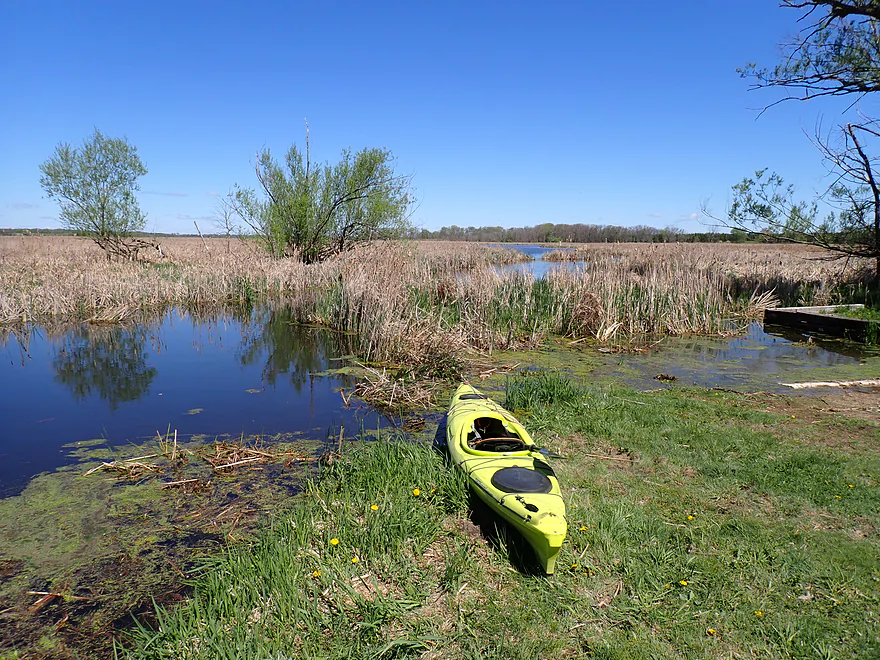
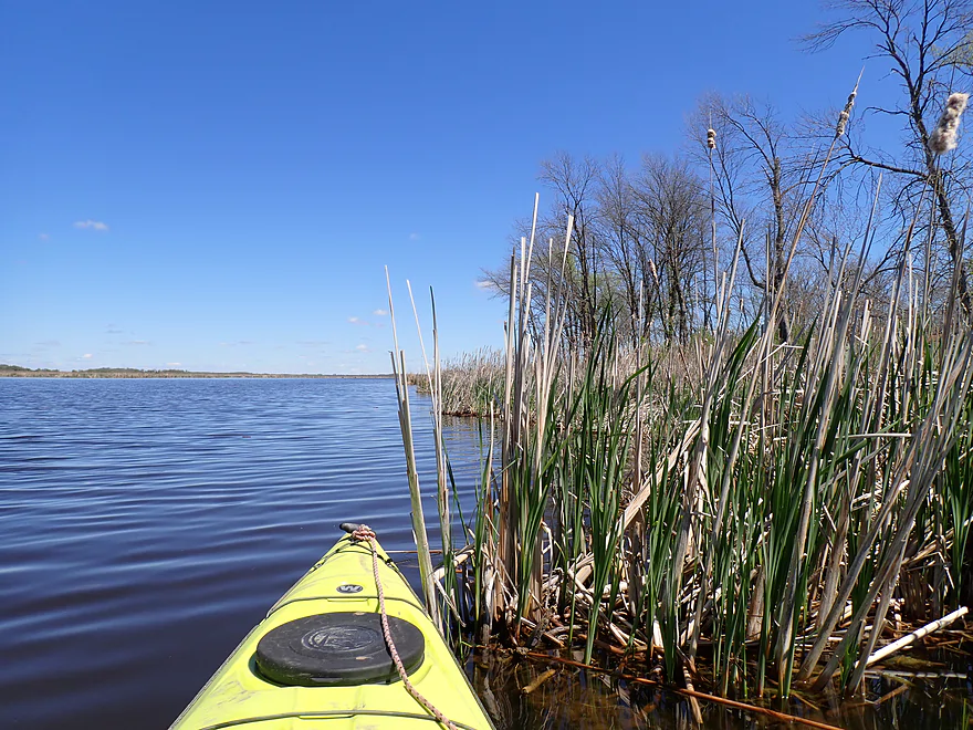
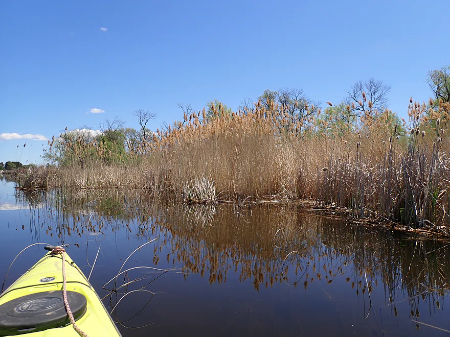
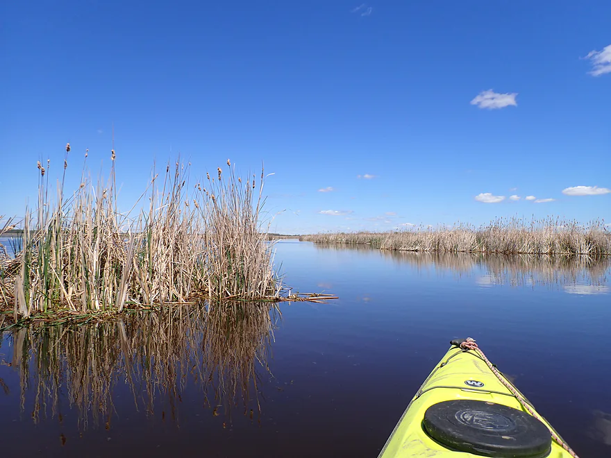
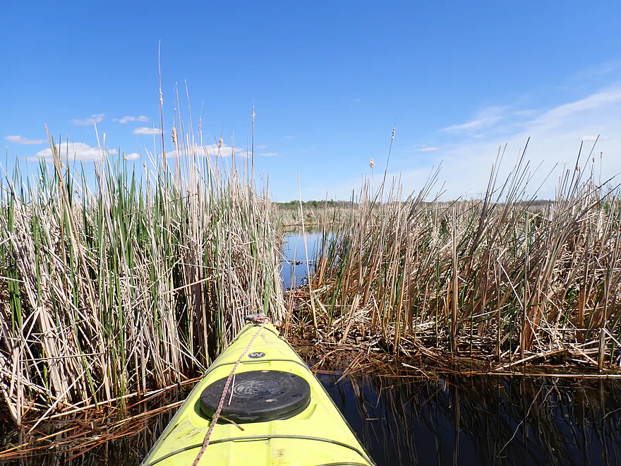
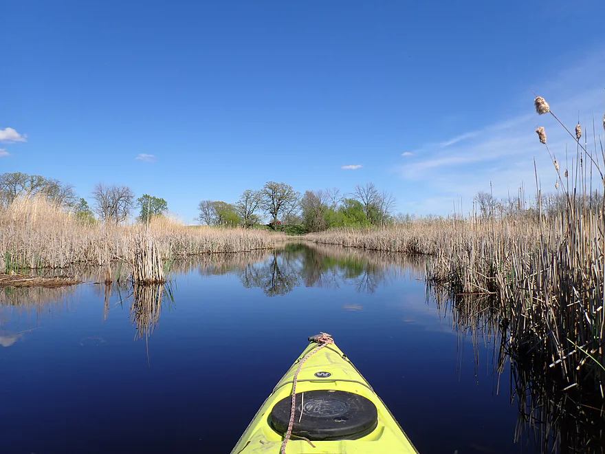
Starting at the South Launch (cattails have sealed in the ramp)
Paddlers can easily get around this
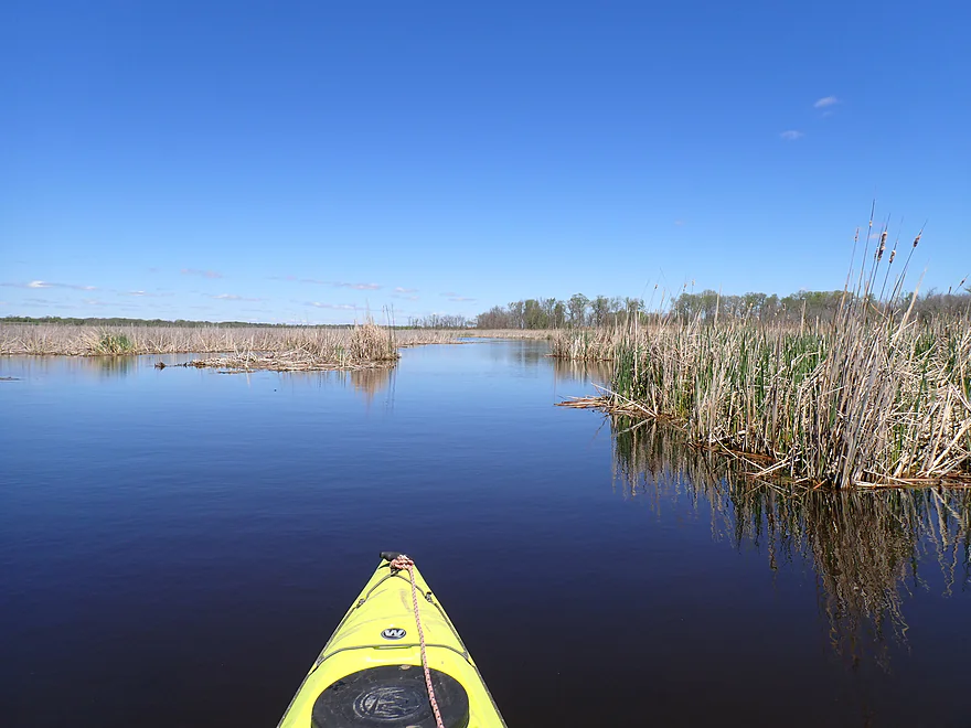
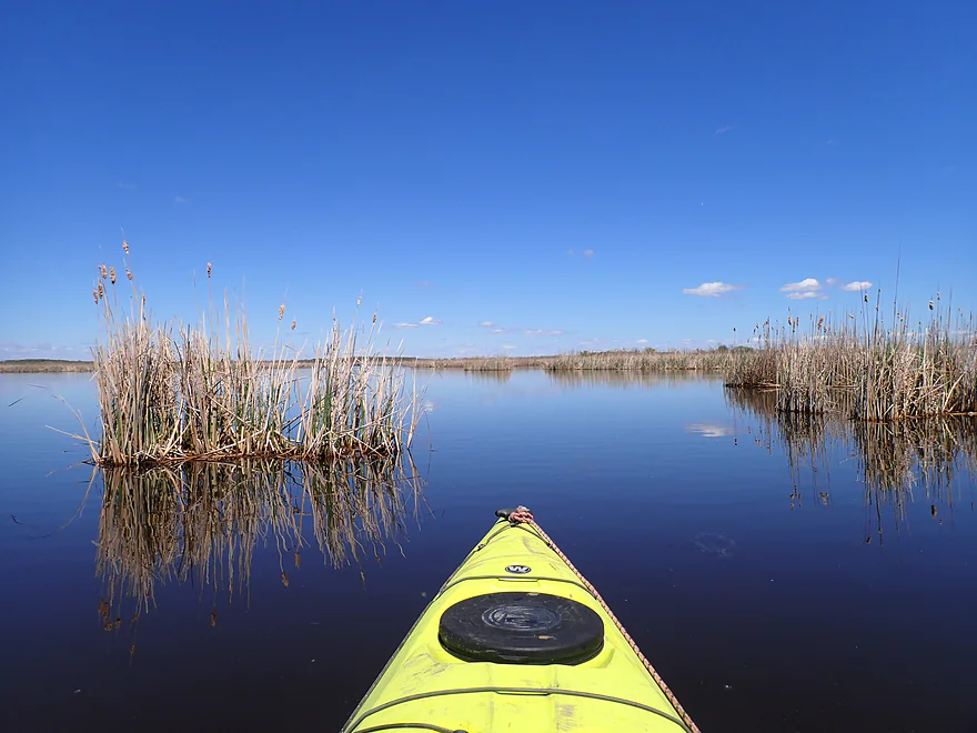
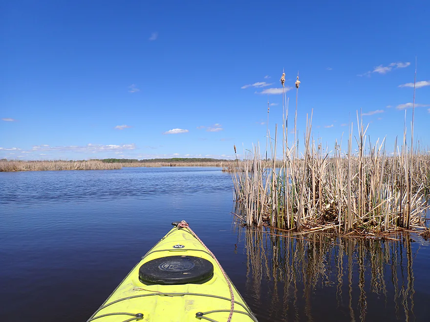
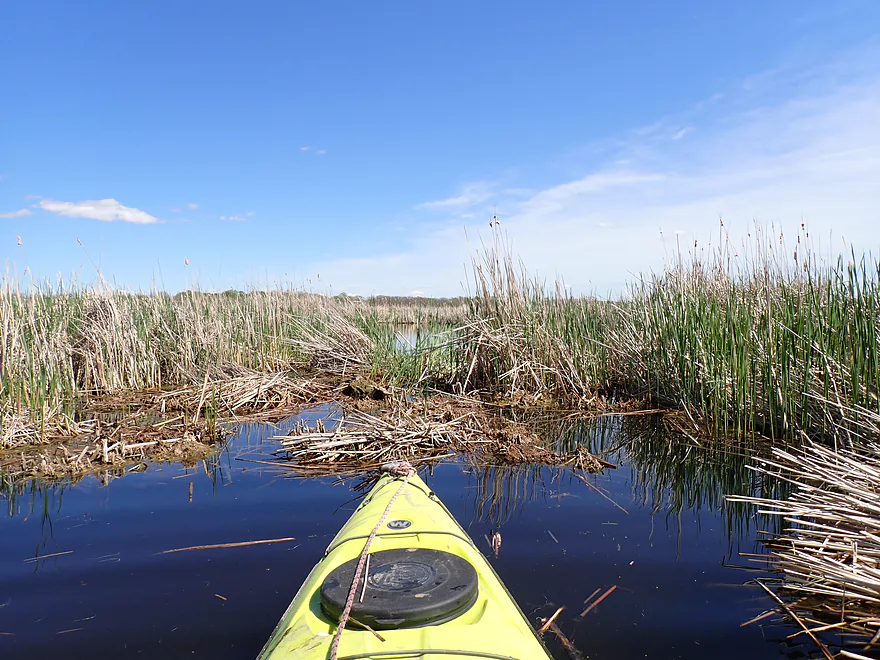
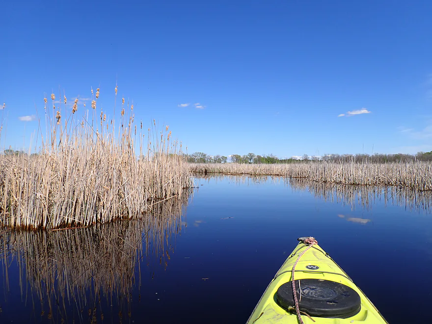
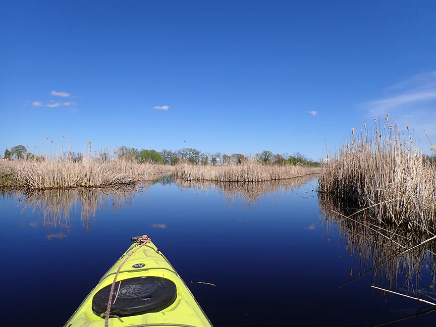
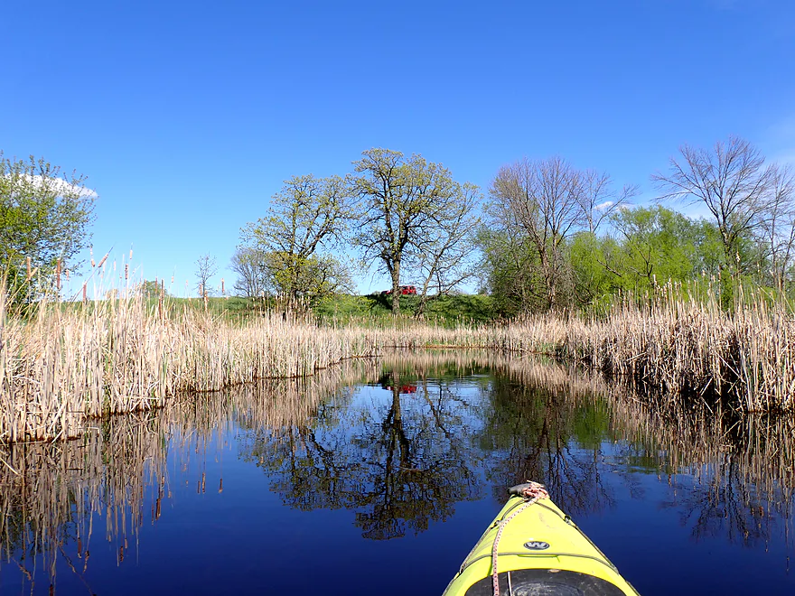
Leaving the “port” area and entering open water
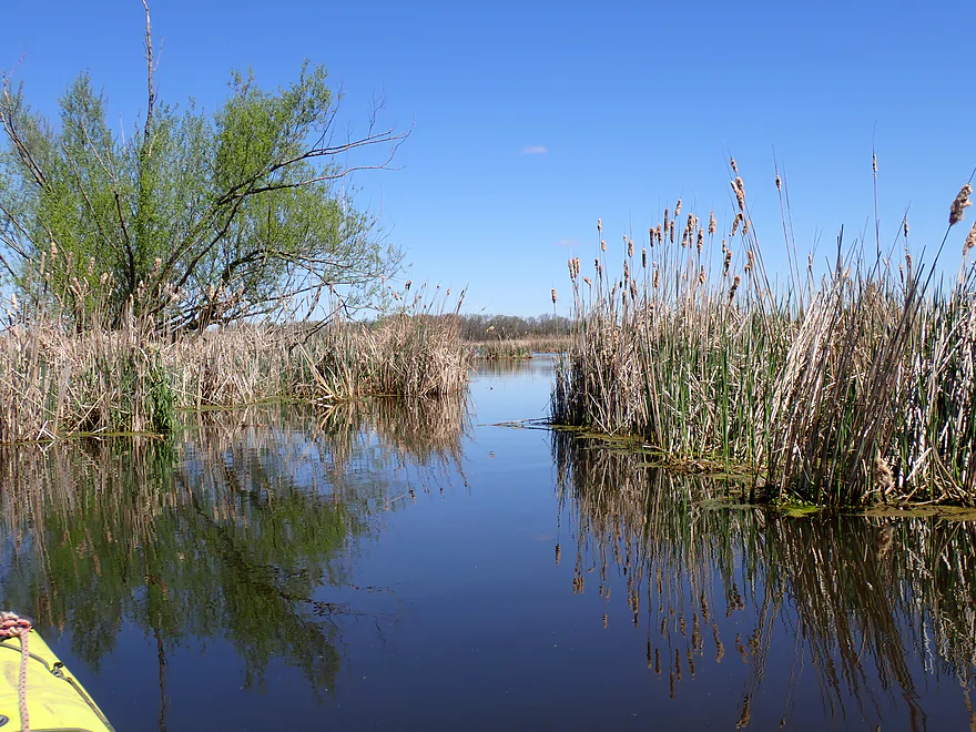
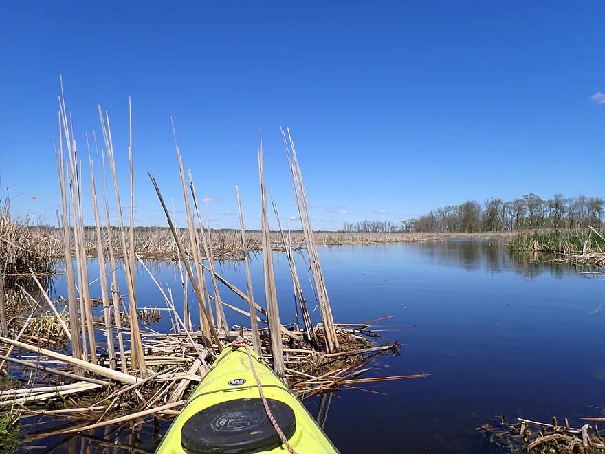
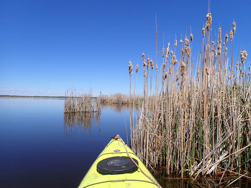
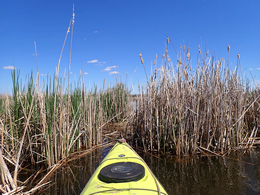
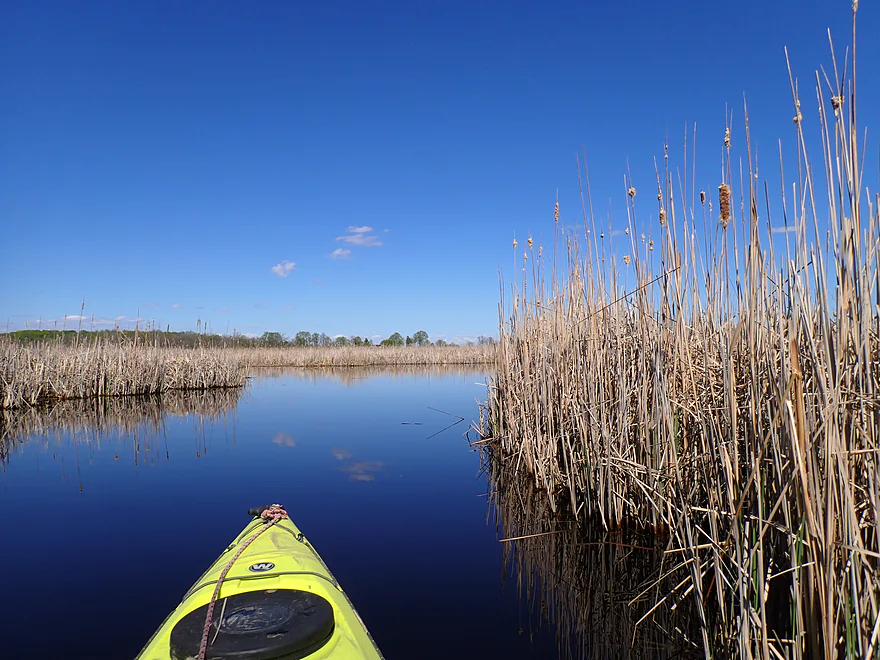
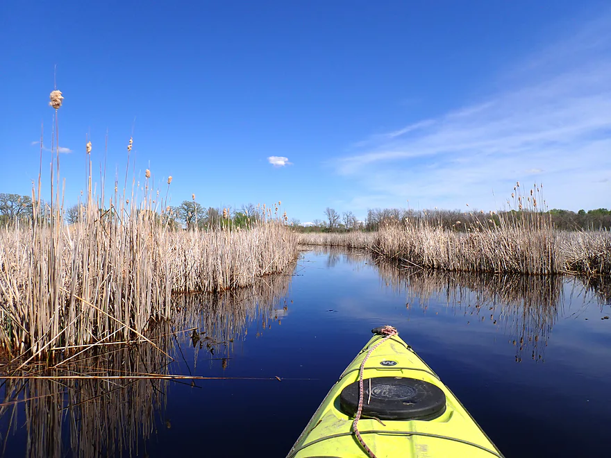
Paddling through a cattail constriction on the east side of the lake
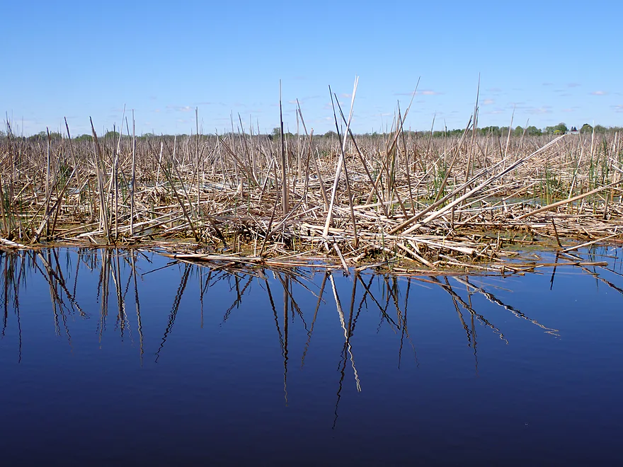
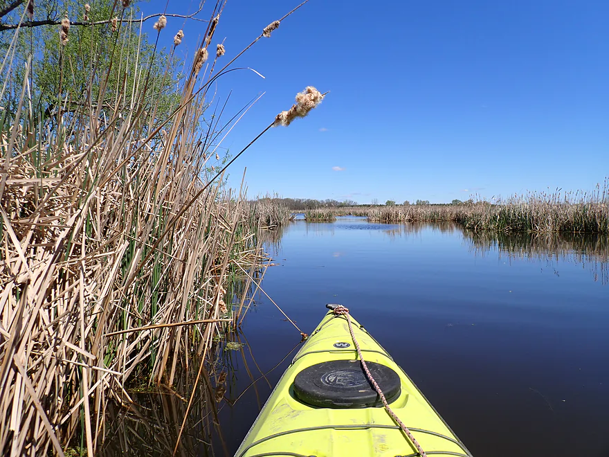
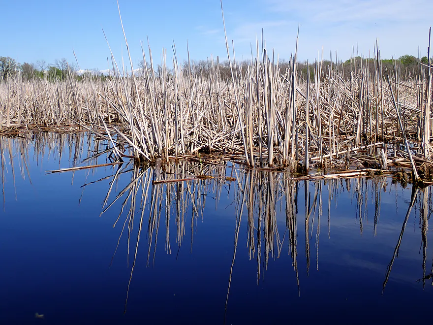
A spikey cattail bed
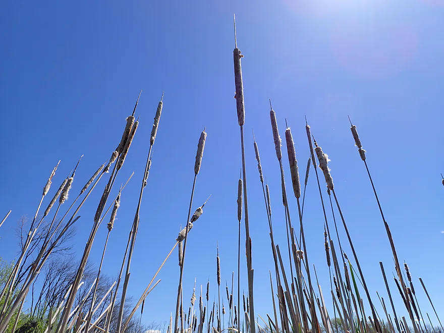
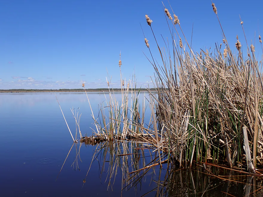
And some tall ones
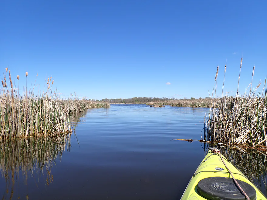
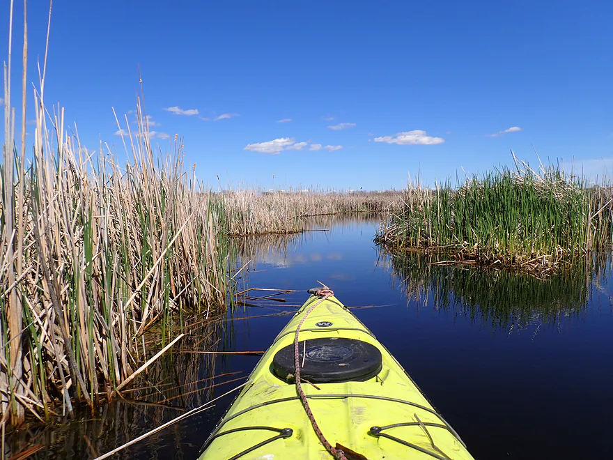
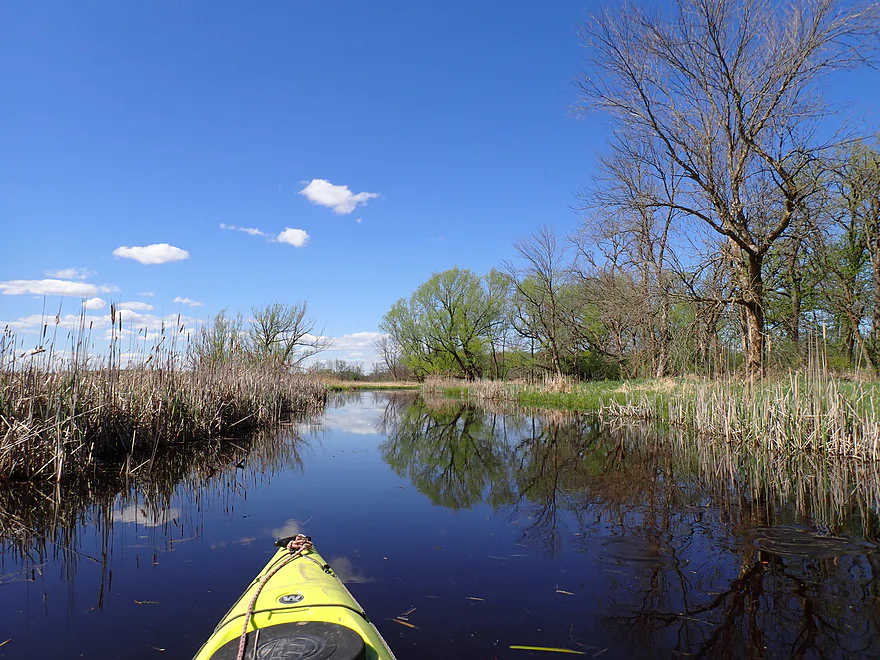
One of the wider parts of the lake
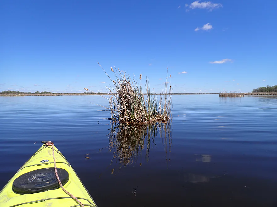
This little island will likely be massive in a few years
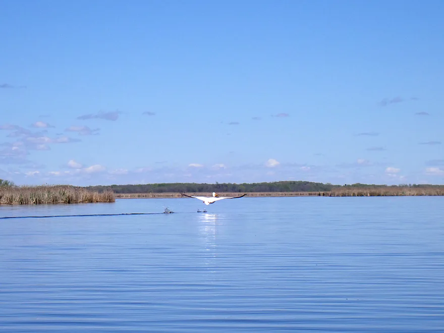
Pelican taking off with something large in its beak
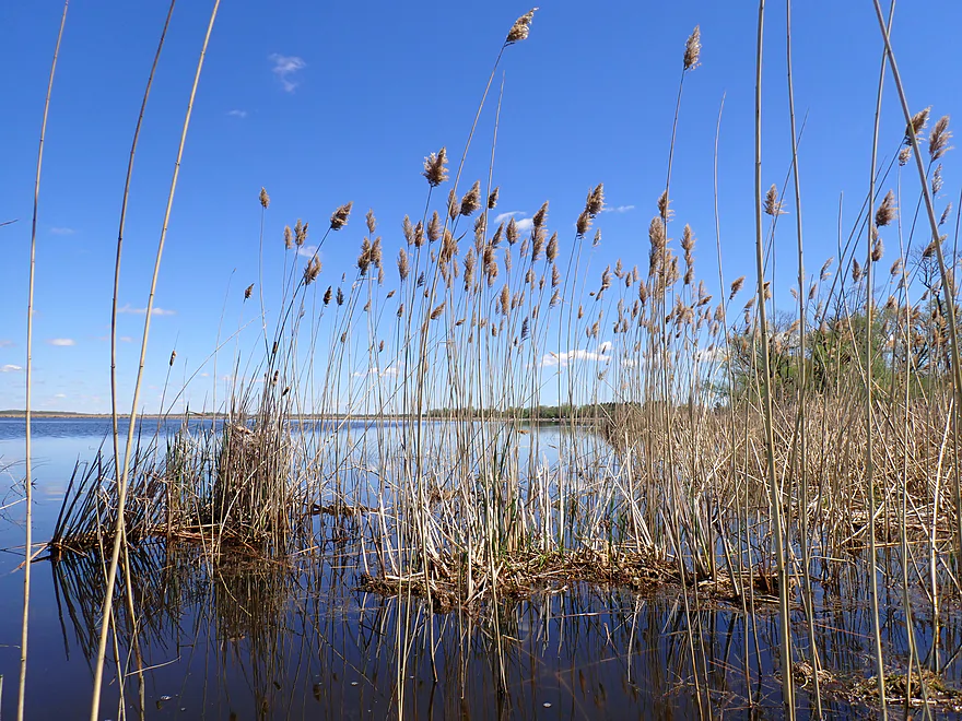
Entering Gleason Bay…these might be wintering rushes
Invasive but photogenic phragmites growing on the shore
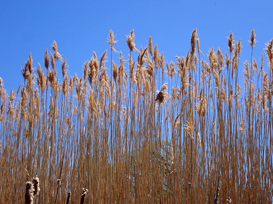
I think these were at least 10′ tall
Some shorter ones growing out on the water
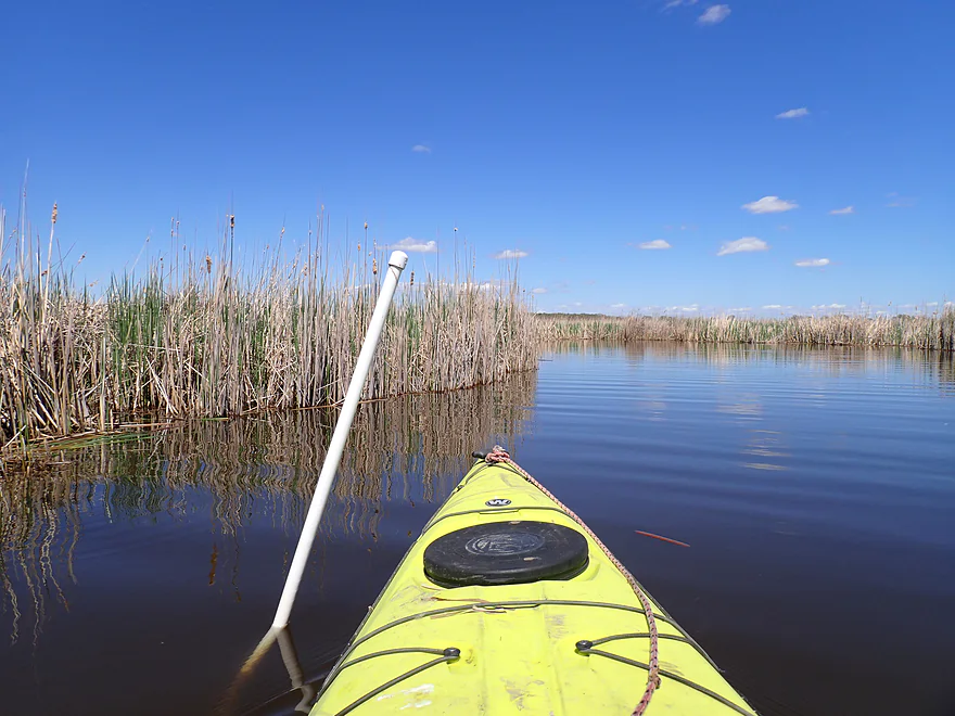
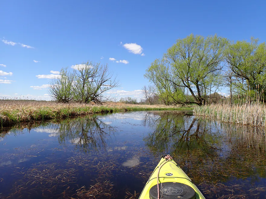
Exploring a side inlet
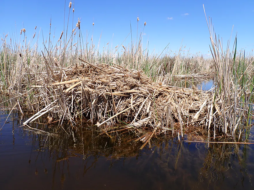
One of a handful of muskrat lodges I saw on the trip
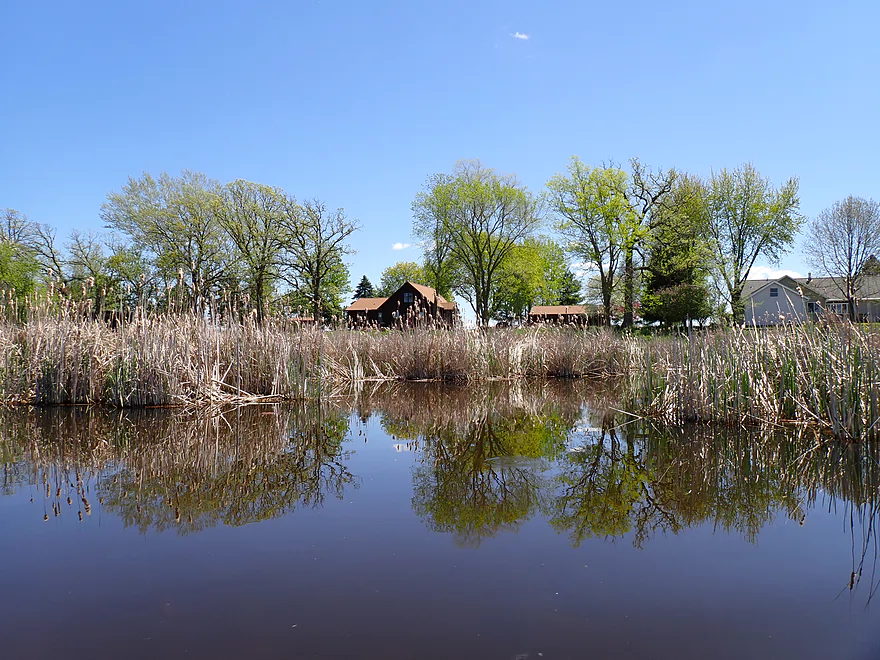
Small shoreside community…cattails have sealed in most docks
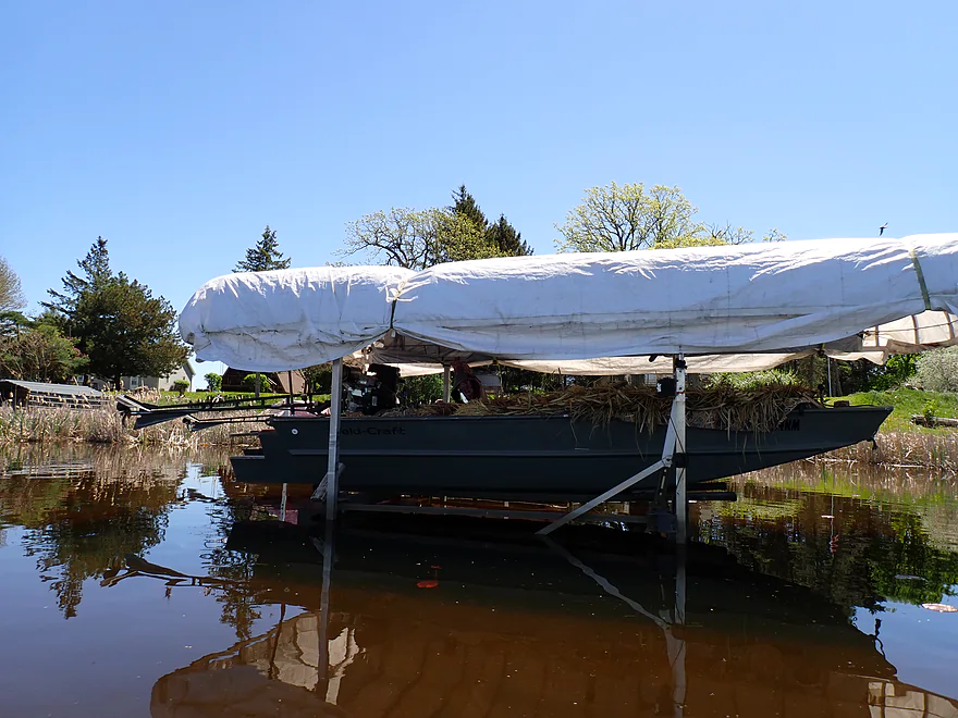
Now that’s a duck hunting boat…
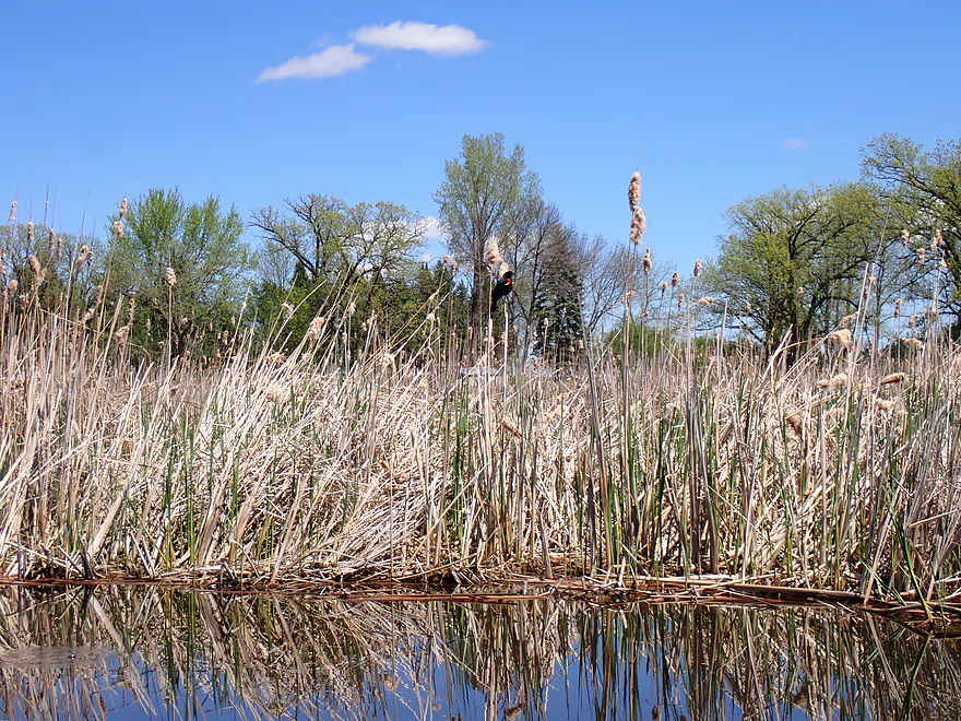
Blackbirds were everywhere precariously balanced on the cattails
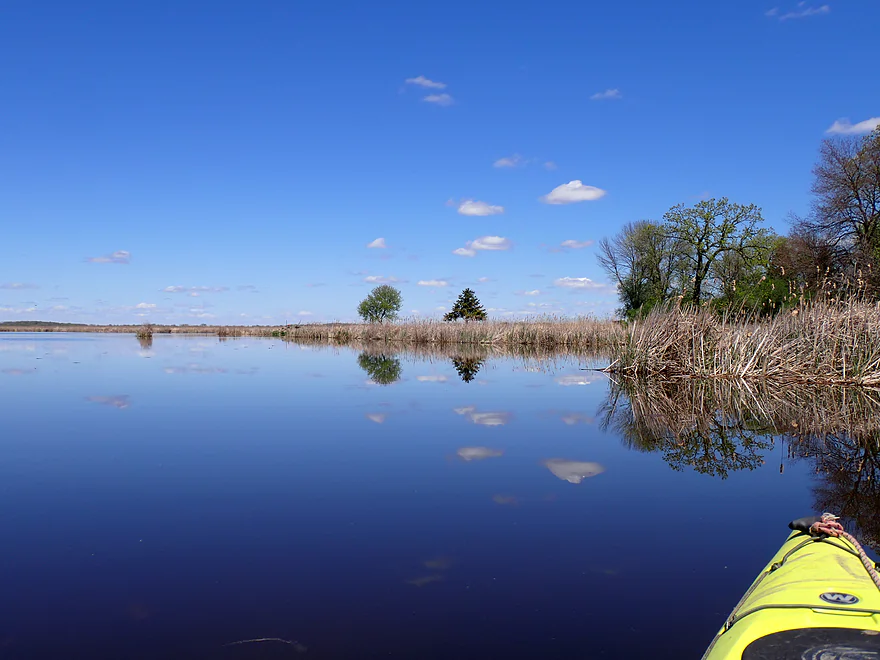
Wind was down which helped create nice reflections
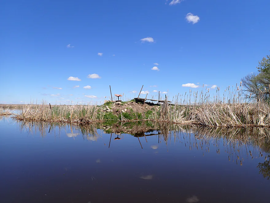
A fishing spot with a chair
Past this point is “Green Bay” which I could have explored
Entering the northern half of Rush Lake
Another baby cattail island with a bright future
Blue on blue
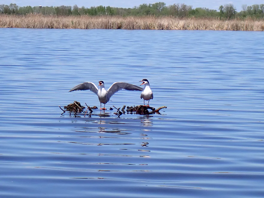
Terns (and possibly endangered Forster’s Terns)
A white post marks the outlet to Waukau Creek
It was kind of sealed in…I could have continued but decided to go for the East Ramp instead
Backtracking into the lake
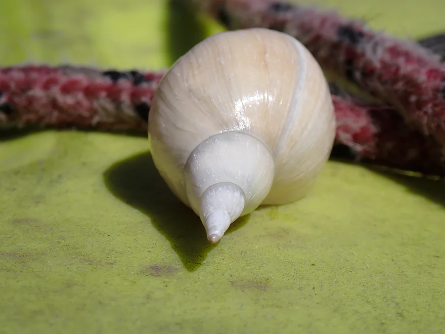
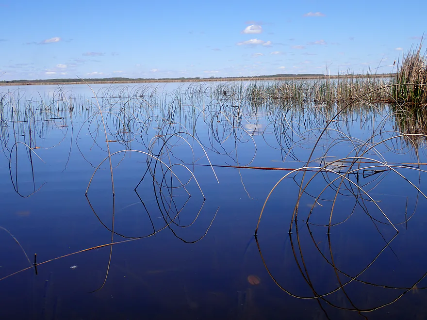
One of several snail shells that were floating on the water
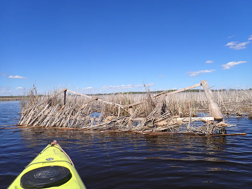
An old duck blind
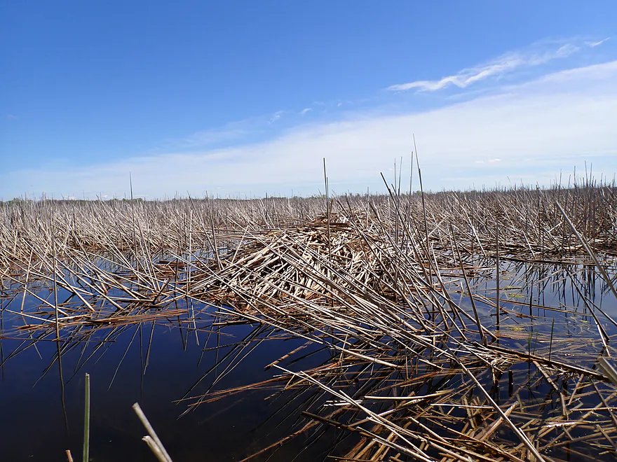
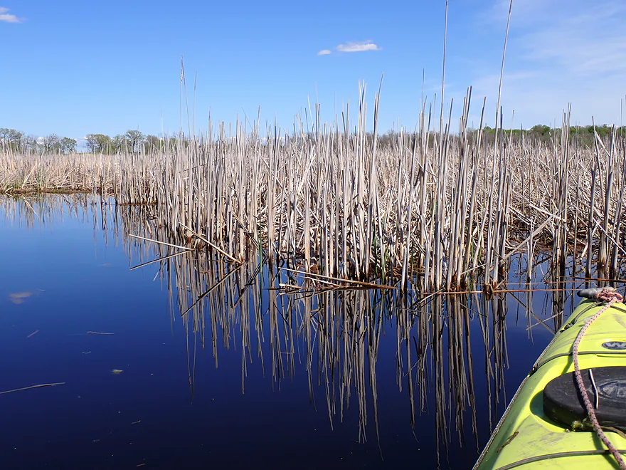
First major cattail jam
I sliced through and found a muskrat lodge on the other side
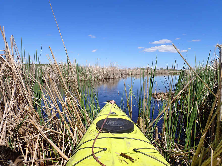
Finally back on open water
But then another cattail jam
…and another (these weren’t too bad to paddle through though)
Last cattail jam…looks worse than it was
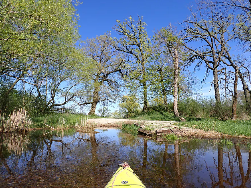
It was clear sailing from here to the take-out
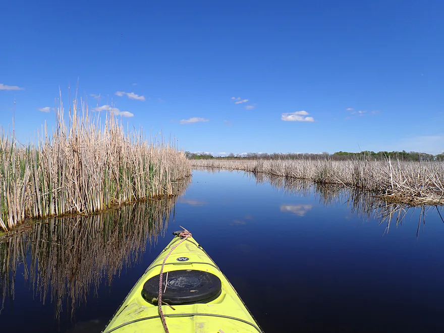
Nice reflections
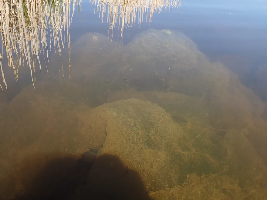
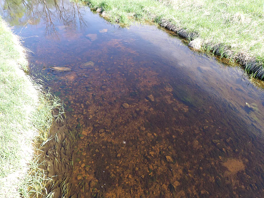
The underwater algae growths were kind of cool
This is a side channel which leads to Waukau Creek…I I didn’t use it
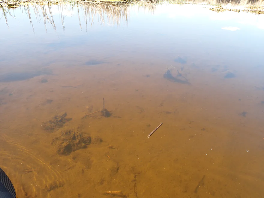
Good clarity
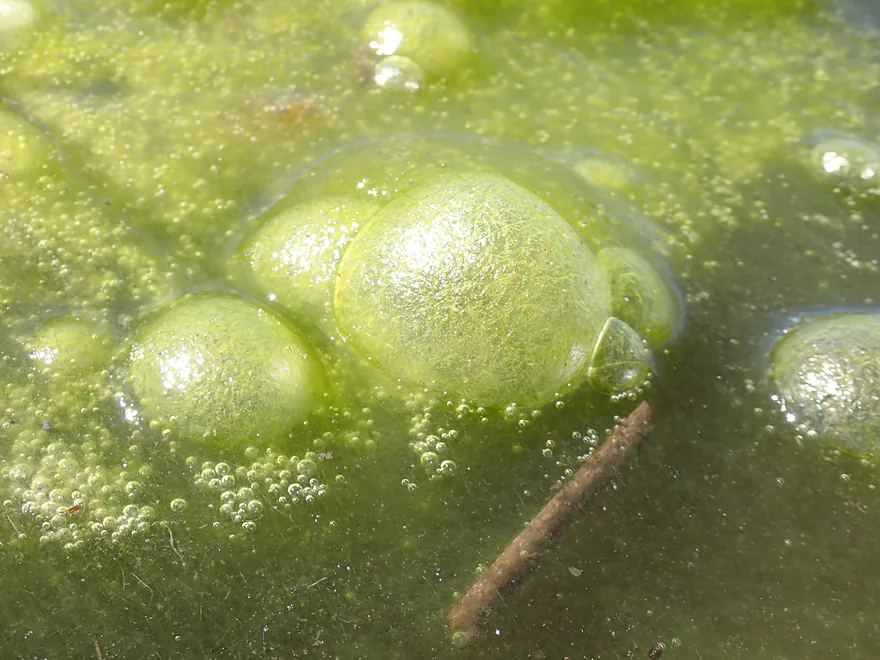
An algae bubble
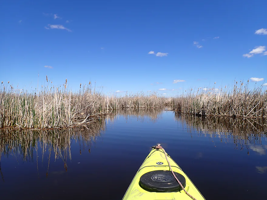
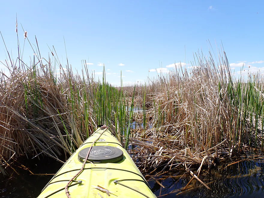
My favorite part of the trip
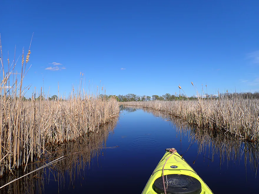
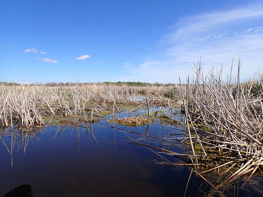
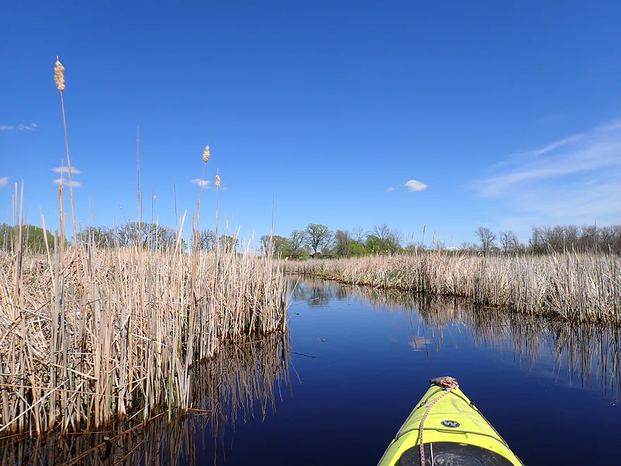
The cattails created these tidy corridors through the lake
Guy was watching me from his red truck
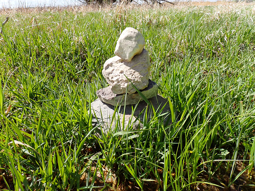
Neat little cairn
East Landing
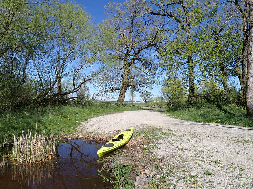
Good take-out
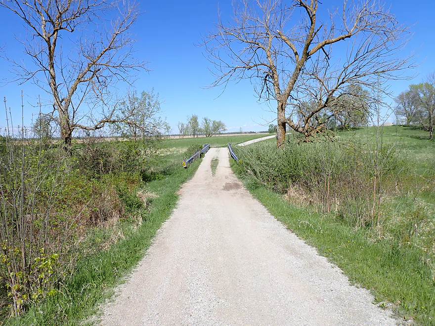
Starting the long bike shuttle back to the South Landing
Passing over a Waukau Creek bridge…looks really nice
Good clarity
View from Deer Drive…future trip
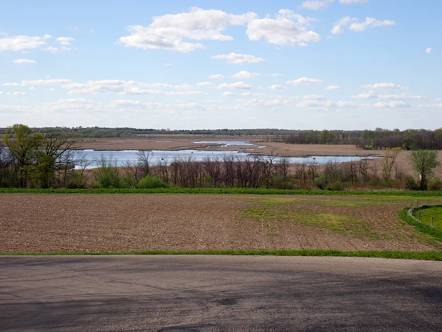
View of the marsh from my bike shuttle
Rush Lake

Rush Lake was formed by glaciers and moraines during the last Ice Age and is located just west of a massive drumlin field (near the city of Oshkosh). It is known as a prairie pothole lake, and is in fact the largest one east of the Mississippi. Lacking any major inlet, water levels were historically volatile and at times the lake would dry up entirely (such as during the Dust Bowl). Despite this, it’s always been a rich oasis for wildlife and in 1903 an archeologist cited evidence that it once had the highest density of prehistoric life in the entire state.
Early settlers, seeking to improve boating and hunting options, dammed the lake at the Waukau Creek outlet. Rush Lake would become extremely popular with duck hunters, but soon water quality issues became problematic and it even started to stink. In the early 2000’s the DNR undertook a plan to revitalize the lake using input from locals. One of the main changes they made was to modernize the dam (to allow for more depth adjustments). At first the plan worked and there was really good clarity and open water. But then the plan failed spectacularly as invasive cattails took over the lake at unprecedented levels. You can actually track how cattails started taking over the lake year by year starting from the early 2000’s using Google Earth. Today the lake is 90% cattails, which is both a blessing and a curse for paddling as we will find out.
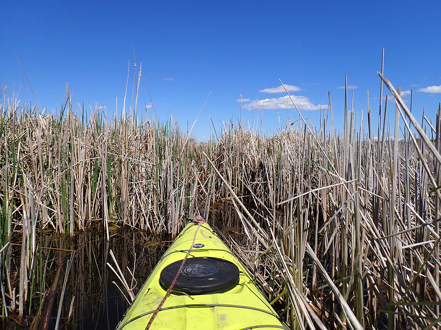
Rush is a long vertical lake with boat launches at both the north and south ends. Either are suitable for paddlers, but I chose the south launch with the plan to paddle north (away from the sun) and then bike shuttle back to the south side. The south ramp is a great access (and scenic). But the main ramp is sealed in by cattails which makes it difficult if not impossible for large boats to launch (maybe not a bad thing). Paddlers though can easily launch to the side and go around the sealed in ramp.
After a short open stretch, I encountered the first of several “constrictions” of the trip. Here extensive cattail growth consumed all but a narrow corridor of the lake. Careful navigation here (and elsewhere) was required to find a path through. But really this southern constriction wasn’t so bad. As long as you stay right/east and don’t fall for too many false inlets, this one was pretty easy to get through.
Continuing north, the lake opened up again. More cattails could be seen in the distance though as well as distant moraines that flanked both the east and west shorelines. I followed a pelican for a while which seemed to have something large stuck in its beak (maybe a carp).
Historically Rush Lake has been extremely popular with duck hunters. So much so, it is estimated there is 300 tons of lead gunshot at the bottom of the lake. Lead poisoning is believed to have caused a mass die-off in 1989 of 1,270 birds. I’m not sure duck hunting is as popular anymore because of the obstructed landings, but I’m not sure I would want to be on the water during hunting season. I did hear gunshots during the trip, but assumed those were just locals target practicing.
Paddling north I passed Gleason Bay, which was filled with rushes. It was surprising to see a marsh plant that wasn’t a cattail. The lake is actually named after rushes and was called “Appucaway” by the natives (“where the rushes and flags grow”). In hindsight this little oasis actually might have been mostly phragmites, which is invasive, but are still cool looking and grew to almost 10′ high, which dwarfed my boat.
North of Gleason Bay, I passed a string of houses and a small shoreline development. Many of the homes had lakeside piers, but cattail growth had blocked all but a few. It’s ironic…most shoreside homeowners lobby hard for dams to be built to provide stable water levels for pier use. But Rush Lake is too big relative to its outflow, so the Waukau Creek dam has allowed cattails (as well as algae, bacteria, carp, and other invasives) to survive, thrive, and deprive access to the lake. Of the boats I did see docked, most (called mud boats) had long shafts perhaps specifically designed for shallow running.
Following another massive cattail island, the lake opened up again and I entered the north end of Rush Lake. In general, the north side of the lake is much more interesting than the south side. There is less open water, more wildlife, and the cattail islands and inlets are more varied and interesting. Some of the side channels like “Green Bay” looked like a maze. I actually think literal kayak cattail mazes could be a thing and a tourist attraction. Most of the cattail beds look very similar to each other, so often you don’t know if you’re looking at an inlet, outlet, deadend, ditch, turn, split, etc… I relied heavily on my GPS and would have been lost without it.
Ultimately my goal was the “East” Landing (located in the north). I knew there would be an outlet bay and then a long ditch/creek leading the way. I first checked out the Waukau Creek outlet which I wanted to explore but I knew I couldn’t do both this and the East Landing outlet. A white post marks the start of Waukau Creek (kind of). Right now it’s just a dead-end bay that has been sealed shut by cattails. I checked my GPS and sure enough I was in the right spot…but it seemed like the Google maps were outdated. Had I wanted to I could have rammed through maybe five feet of cattails and reached the main creek, but I decided to backtrack and continue north.
The East Landing outlet proved tricky to find, but after some heavy GPS usage I finally found it. In hindsight there is a house with green shingles that roughly marks where the landing is and I could have (kind of) used that as a “lighthouse” to navigate through my cattail storm. The main outlet entrance though was sealed shut by cattails. The Bing Maps are actually better (more updated) and do show this. I realized I was fine as long I was willing to knife through a few feet of cattail walls. I did reach open water, but did encounter two more “cattail jams”. These weren’t too bad to get through. Note it didn’t used to be like this. Local paddlers used to use the East Landing to access and enjoy the north side of Rush Lake without these “cattail jams”. Things are getting progressively worse, and maybe in the future cattail hopping won’t even be an option. Hopefully the East Landing outlet and Waukau Creek get dredged in the future.
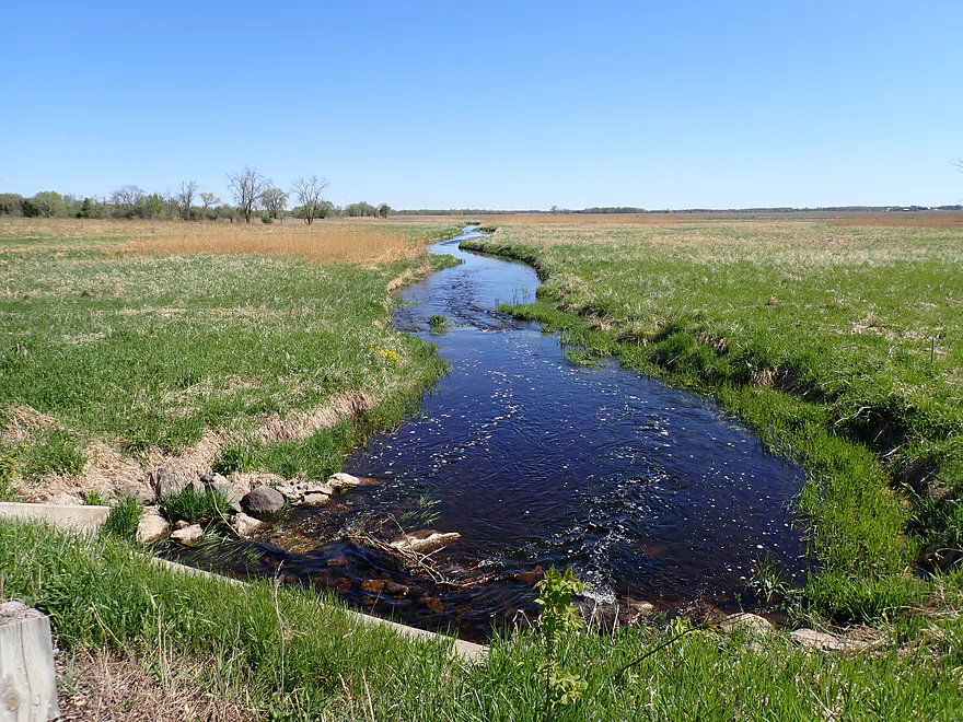
The final mile flowed through what seemed like an artificial marsh canal, but it was really nice. The channel opened up with no more obstructions and the water became incredibly clear. In spots 3′- high algae colonies looked like underwater pillows. Even the cattails were scenic…they formed tidy walls and directed the stream gracefully left and right. This was the best part of the trip.
I ended the paddle at the “East Ramp” (really should be called the Northeast Ramp). This too was small, and I’m not sure it gets much use from powerboats, but I’m sure duck hunters will make the attempt in the fall. This too has some vegetation starting to block the ramp, but it might still be usable for small boat trailers. The area by the take-out is really scenic with a small hill/moraine that overlooks the marsh.
In summary this was a trip I really enjoyed. I know most paddlers aren’t fans of marsh paddles. They can be an acquired taste. Some paddlers have been disappointed by say Horicon Marsh which has vast and monotonous open water sections (a byproduct of its dam). But Rush Lake is actually much more interesting and is my favorite marsh paddle to date. Not only is the wildlife fantastic, but the cattails have transformed the “lake” into an a “river” with a lot of character, mystery and adventure.
All that said, I doubt most paddlers will recreate my exact trip, which was kayaking end to end, and then doubling back with a bike shuttle. Most will likely do just the south end as a round trip, or just the north end as a round trip. The south end is easier and more navigable, but the north end is more scenic and challenging. Pick your option. The “canals” (both inlets and outlets) are really cool and I suggest exploring these if you can. But again these are apt to have “cattail jams”. Waukau Creek itself looked really nice and that might have been fun to explore and an preferable alternative take-out option.
Lastly, paddlers should be cognizant of not only where they paddle on Rush Lake but when. Lilies (which I didn’t see in May) are likely terrific in midsummer. But by late summer algae growth could be an issue. Like most lakes, you want to stay off when windy. Duck season in fall could be problematic as well. The biggest consideration will be again the cattails. Keep an eye on both Google and Bing maps to see where the growths are expanding. It’s quite probable these will become even more problematic in the future unless the DNR does something.
Rush Lake is terrific for wildlife. Sights (and sounds) included painted turtles, singing frogs, pelicans, great blue herons, carp, snails, and a handful of floating muskrat houses. Rush Lake is known for its rare species and I think I might have seen/photographed two endangered Forster’s terns. Red-winged blackbirds were common and often would sit precariously on bouncing cattails that at any moment looked like they could catapult them over the horizon.
It was surprising to see a few butterflies and bumblebees in the marsh. Something is killing the insects in Wisconsin…they used to plaster car windows and had to be constantly scraped off (biologists call this the windshield phenomenon). Maybe it is the latest pesticides farmers use or all the EMF pollution we have now. But whatever the source, neither major political party is treating our current insect die-off as a serious issue.
Rush Lake South Boat Ramp: This is a great public access located at the south end of the lake. The main concrete ramp has been overtaken by cattails and is unusable, but this is more of a problem for powerboaters. Kayakers can simply launch and paddle around the cattails.
Alternate Put-ins:
- Rush Lake East Boat Ramp: This is located at the northeast corner of the lake (here). It’s a great access and overlooks a scenic part of the cattail marsh. But as of 2024, the “canal” that connects the landing to the lake is partially obstructed by cattails and some “hopping” is required to get through.
- Rush Lake North Boat Ramp. This is walk-in access located off a “canal” at the far north end of the lake (here). I don’t think many use this public access, and I believe cattails may partially block the “cattail stream” that connects the ramp to the lake. If you’re willing to hop through some cattails though it’s likely a scenic paddle.
Rush Lake East Boat Ramp: This is located at the northeast corner of the lake (here). It’s a great access and overlooks a scenic part of the cattail marsh. But as of 2024, the “canal” that connects the landing to the lake is partially obstructed by cattails and some “hopping” is required to get through. The access has a public parking lot and a turnaround area for trailers. The drive leading to the landing has a crazy narrow bridge, but I think most vehicles should fit ok.
Alternate Take-outs:
- Rush Lake North Boat Ramp: This is walk-in access located off a “canal” at the far north end of the lake (here). I don’t think many use this public access, and I believe cattails may partially block the “cattail stream” that connects the ramp to the lake. If you’re willing to hop through some cattails though it’s likely a scenic paddle.
- Rush Lake South Boat Ramp: I suppose you could paddle the lake in reverse or do a round trip as there is no current.
- Hwy M/Waukau Creek: This is a leg I was very curious about. Waukau Creek looks really nice and this would have been fun to do, but there are likely a few cattail obstructions to knife through. Exiting the marsh via Waukau Creek will also require a dam portage and possibly 1-2 logjam portages.
Bike Shuttle – East Landing to the South Landing: 10.4 miles with 125′ of ascent. Again, most paddlers will prefer round trips over shuttles because of the lack of current. But for those who want to recreate my route, you can do a bike shuttle, but it is on the long side. I suggest staying off Hwy 44 (busy with narrow shoulders) and staying off Mountain Road (rough gravel). The best bike route is highlighted in the above link.
Dams: None…while the entire lake is affected by the downstream Waukau Creek dam, I didn’t encounter it on this trip.
Rapids/Current: None. Round trips are very viable and likely preferred.
Bathroom Breaks: Paddlers seeking long trips should be warned there really isn’t anywhere to use a bathroom on the marsh. The lake is typically ~3′ deep and the shoreline is usually inaccessible because of the cattails. Your “best” bet would to find one of the large floating muskrat lodges in the marsh. You could get out and balance on these soft floating huts…although I’m not sure the muskrats would appreciate it.
Getting Lost: This is a huge concern. The cattails create a lot of twists, turns, inlets and false inlets in the lake. This is part of the lake’s magic but also part of its problem. Paddlers should bring a GPS unit with updated batteries…heck maybe two GPS units in case one fails. The Bing Maps are more accurate, but the Google Maps are higher definition. Generally speaking the south side of the lake isn’t that confusing. The north end (which is the most scenic part) can be disorienting, and that part will require a GPS. Be warned that satellite maps lag real time, so they can be and often are inaccurate. You may encounter a cattail jam you didn’t see on the map. But the maps should still give you a good idea of where and how you can punch through the cattails to reach open water.
Cattail Obstructions: The outlets on the north end of the lake (as of May 2024) are all partially obstructed in spots. Because I had GPS and a sharp, pointy kayak, I was able to punch through these “cattail jams” with little difficulty. It was nothing like the misadventure I had 10 years ago on the Grand Marsh. But…cattails are unpredictable and this may get worse in the future. Also boats and canoes with blunt bows may have difficulty knifing through the vegetation.
Closest Gauge: Fox River @ Princeton
My Trip Depth: 1200 CFS or 8.632′
Gauge Guide: Note this is a river gauge, so it likely is not a good indicator. In reality lake levels will always be more stable than a river. Also Rush Lake gets drawn down every two years to “control” cattails. I don’t know when the drawdowns happen, but you probably shouldn’t paddle the marsh during this time.
- < 400 CFS: Very shallow. Maybe too shallow During the 2023 drought the Fox gauge dipped to about 320 CFS. A local boater said the lake then was the lowest it had ever been, but that might have been a drawdown?
- 401-700 CFS: Low depth…the lake should be navigable, but a few cattail obstructions could close off some of the inlets.
- 701-1000 CFS: Average depth. Some of the cattail obstructions may be difficult to deal with.
- 1001-1400 CFS: Above average depth and a good target range.
- 1401+ CFS: High depth. Likely a great target depth. The higher water should allow you to get over some of the cattail obstructions.
Click here to see an overview map.
- Rush Lake – South Ramp to Rush Lake – North End: 4.5 miles. This spans the length of Rush Lake and is a nice trip. Highlights include good wildlife and fun cattail inlets to explore.
- Rush Lake – North End Exits:
- North Bay to Rush Lake – North Ramp: 1.8 miles. A narrow cattail stream connects the north bay to the North Ramp. This is likely incredibly scenic, but could be obstructed by cattails in a few spots. Paddle at your own risk and bring an updated GPS so you don’t get lost.
- North Bay to Rush Lake – East Ramp: 1.1 miles. This is a narrow canal through a vast cattail field. There are a few cattail obstructions to deal with, but I didn’t have difficulty knifing through. This may get worse in the future. This leg is incredibly scenic, with clear water and attractive “cattail walls”. If you do this leg, bring an updated GPS so you don’t get lost. Google maps has the best definition, but Bing maps better shows where the obstructions are.
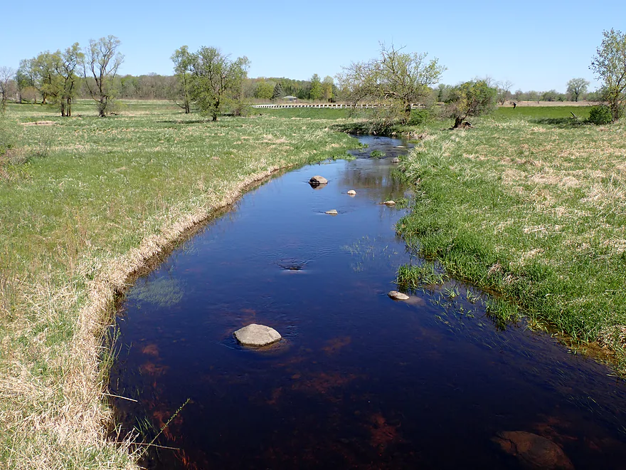
- North Bay to Waukau Creek/Hwy M Wayside: 1.2 miles. The main entrance to the creek has been blocked by cattails, but I don’t think it would be difficult to punch through with a kayak. There may be a few more obstructions on the creek itself. The cattail scenery should be good upstream from the dam. The dam (and maybe a logjam or two) will have to be portaged. Downstream the creek loses its cattails and becomes really nice with clear water and little boulders.
- Hwy M Wayside to Hwy 91: 3.3 miles. This is an attractive stretch of Waukau Creek. The upper parts are rocky, riffley, and have great clarity. Most of the lower creek flows through an open wet-grass marsh and is heavily channelized. There may be be one logjam, but this section is relatively open. This leg is on my todo list.
- Hwy 91 to Hwy 116: 1.7 miles. A more wooded stretch with maybe 7 logjams.
- Hwy 116 to Senn Road: 1.8 miles. Leg flows through a wooded nature preserve. Logjams are likely an issue (maybe 6).
- Senn Road to 4th Street: 1.7 miles. This stretch is relatively more open…but figure still ~4 logjams.
- 4th Street to Mouth on Fox River: 0.9 miles. Maybe 3 logjams.
- Mouth on Fox to Omro/Stearn’s Park: 2.4 miles. A few extra miles on the generic Fox River to reach a take-out.
Trip Map
Overview Map
Video
Photos Size: