
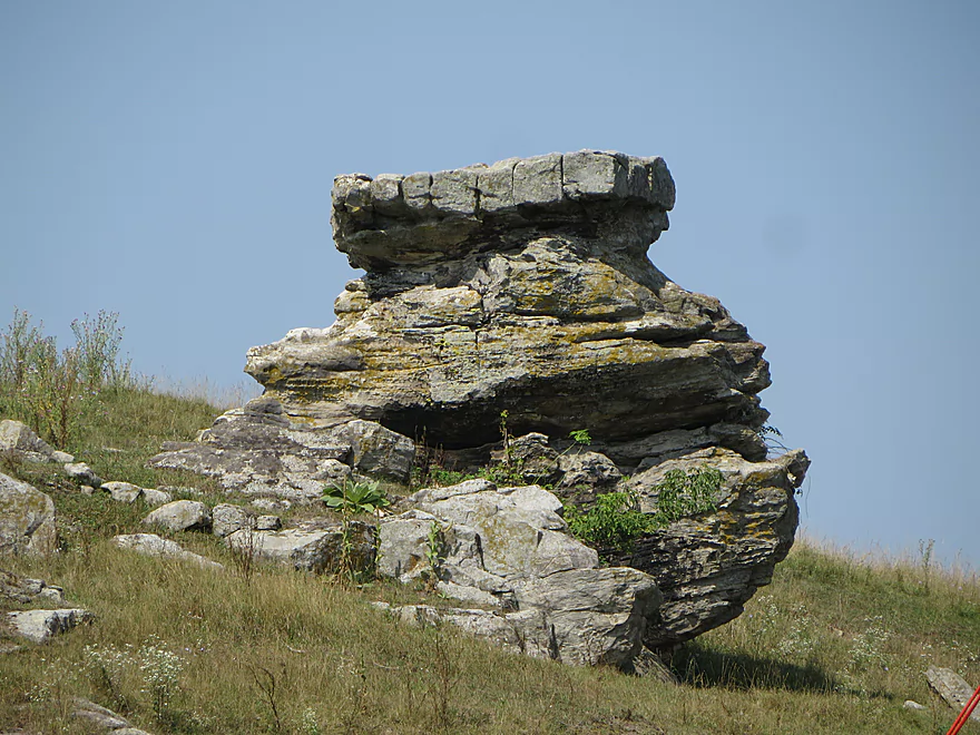
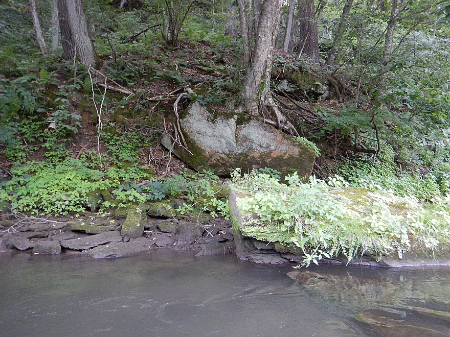
Rock table near put-in
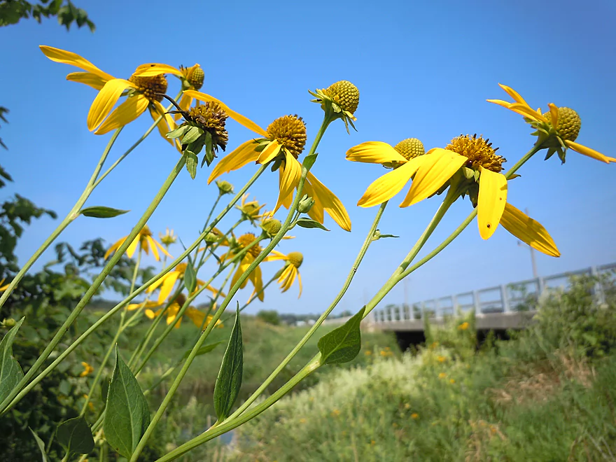
Cut-leaved coneflower
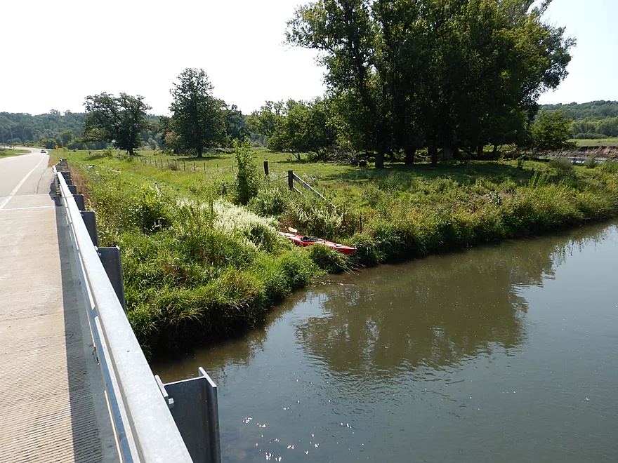
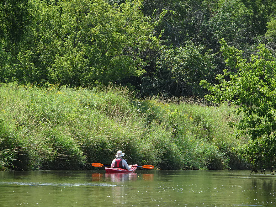
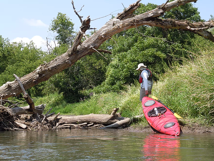
Good launch area
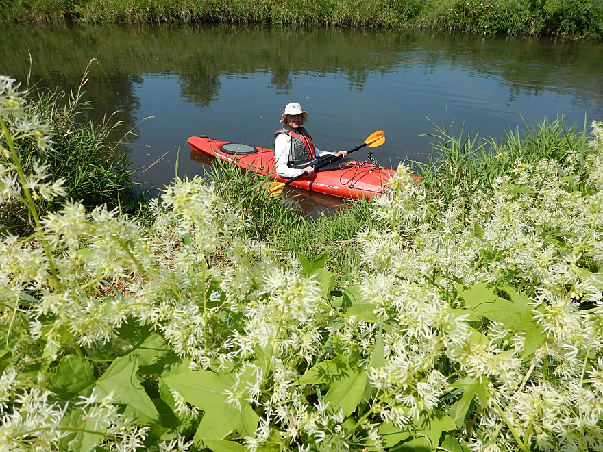
Wild cucumber in the foreground
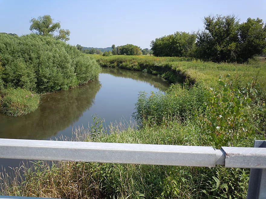
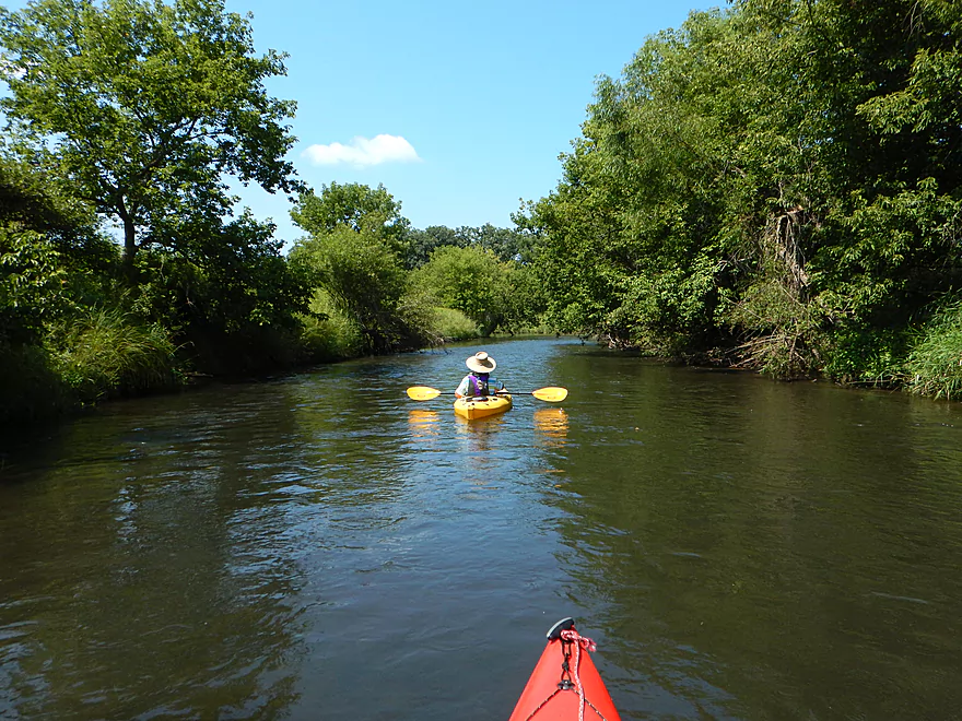
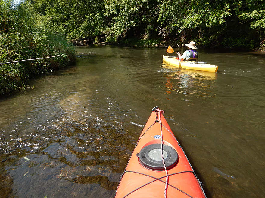
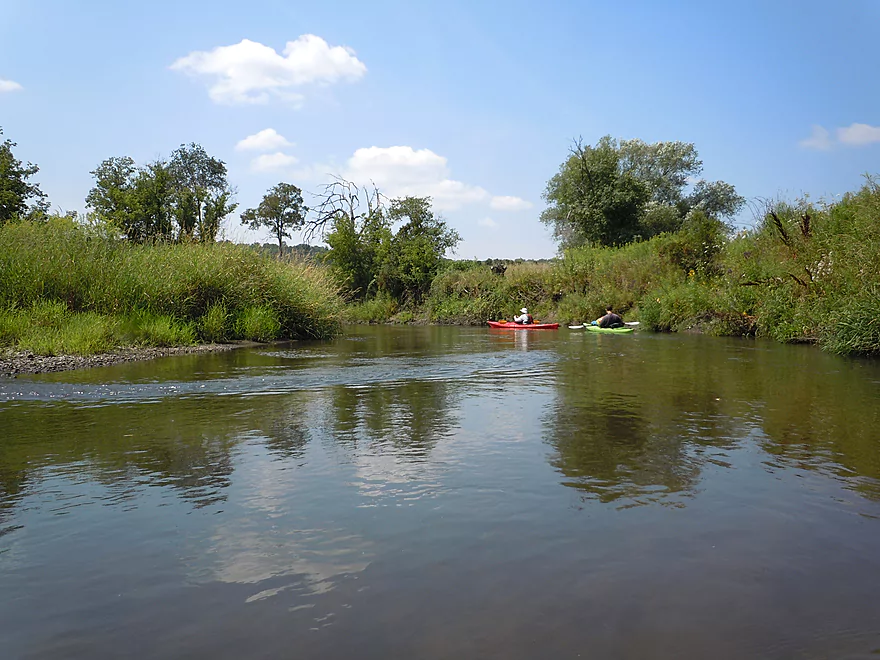
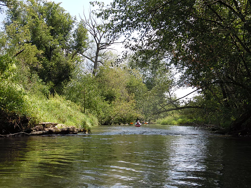
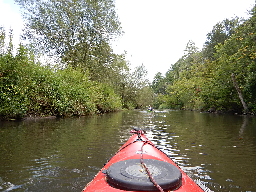
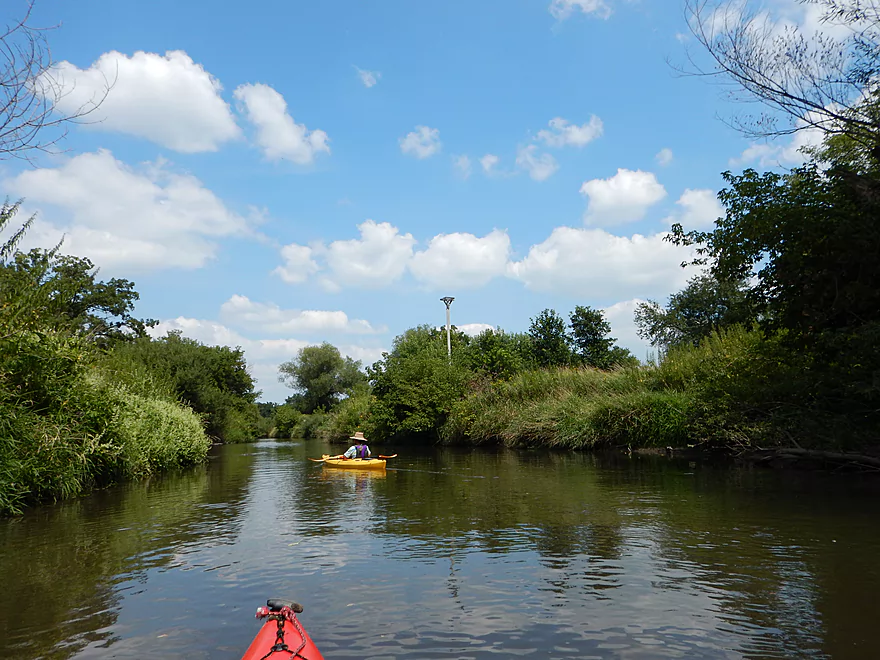
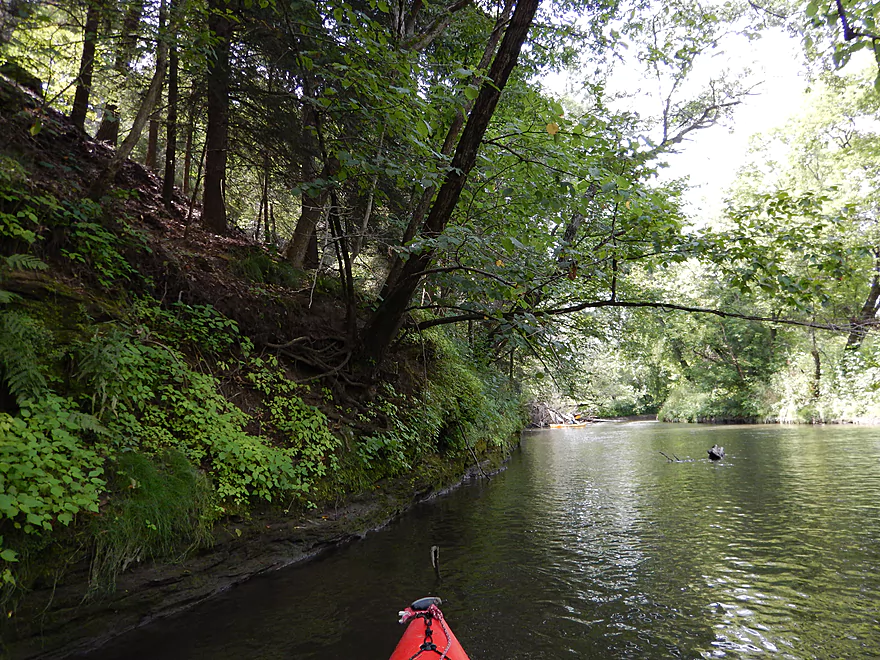
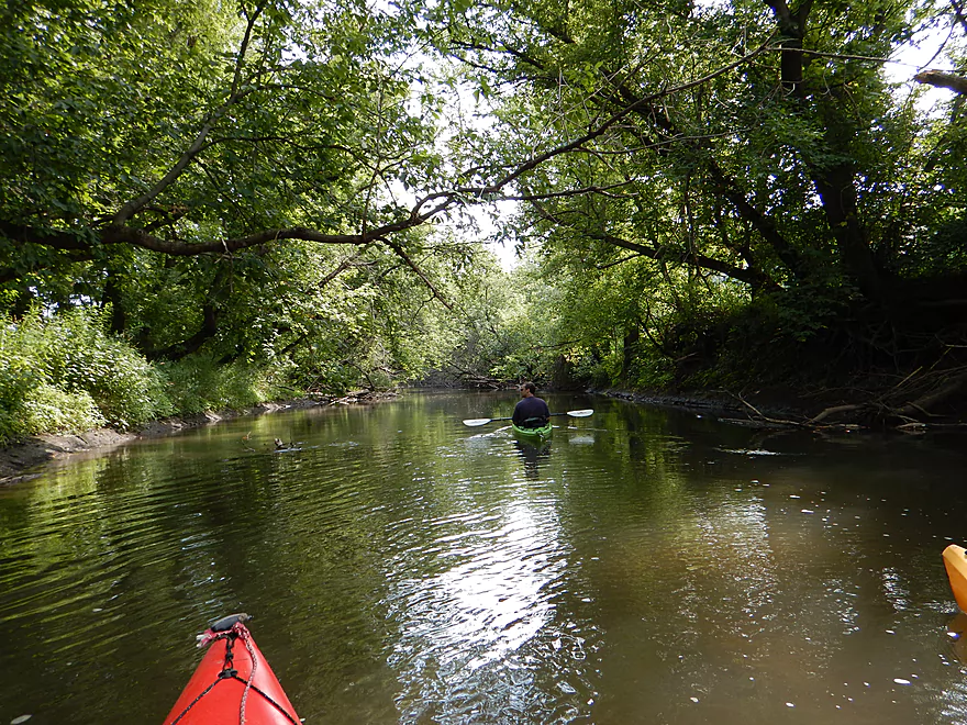
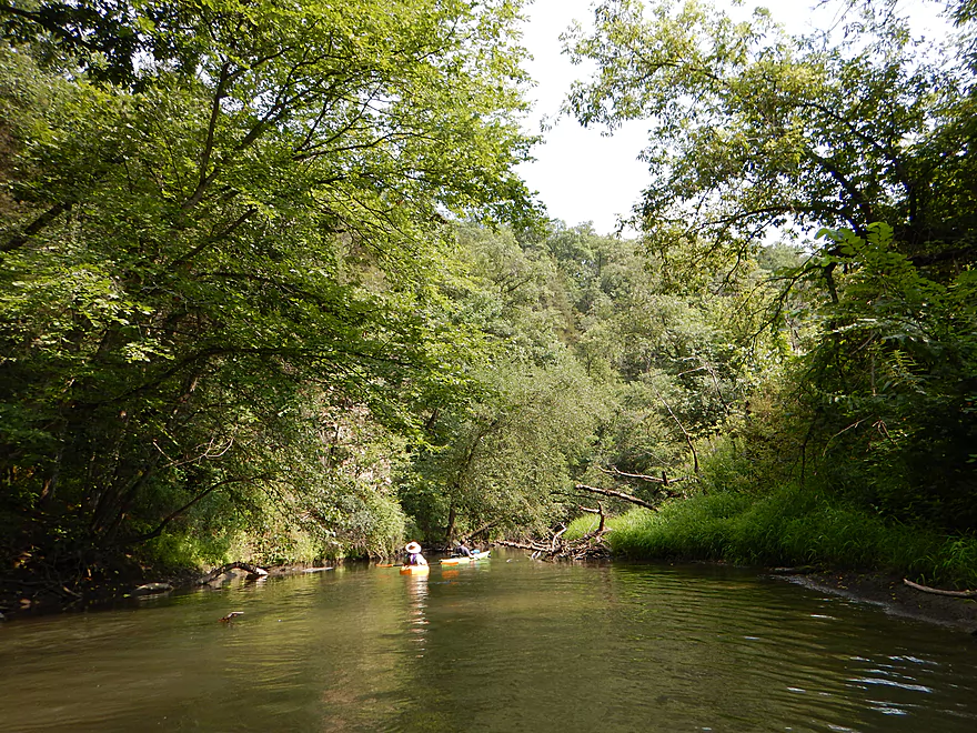
Looking upstream
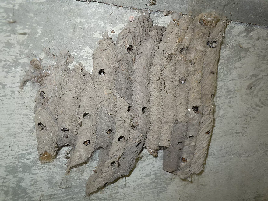
Mud dauber nest
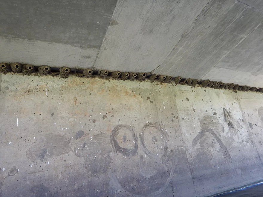
Cliff swallows are gone for the summer
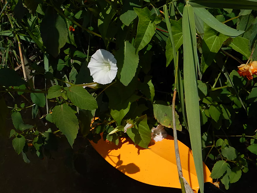
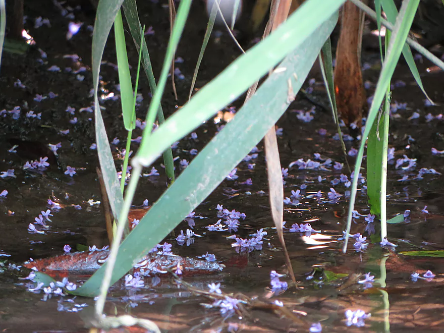
Bindweed flowers
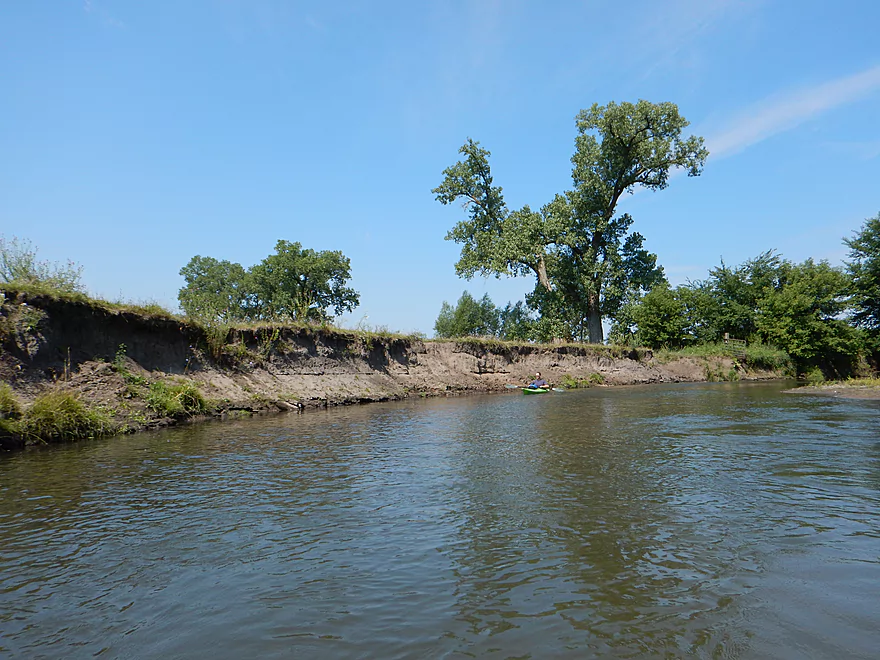
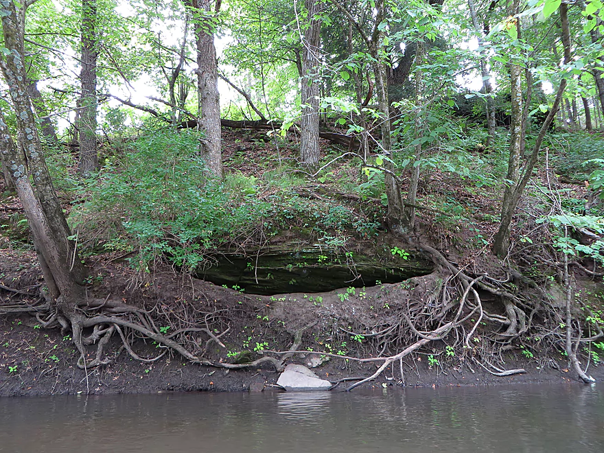
Banks from farm erosion
Kind of scenic though
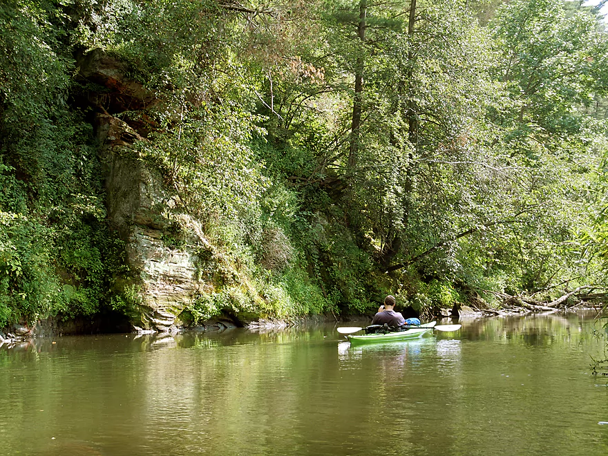
Tree vs rocks
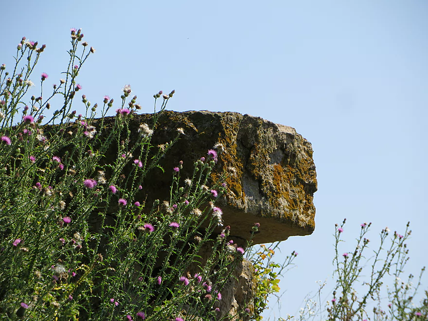
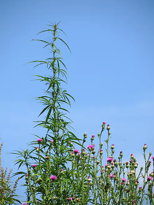
Canada thistles
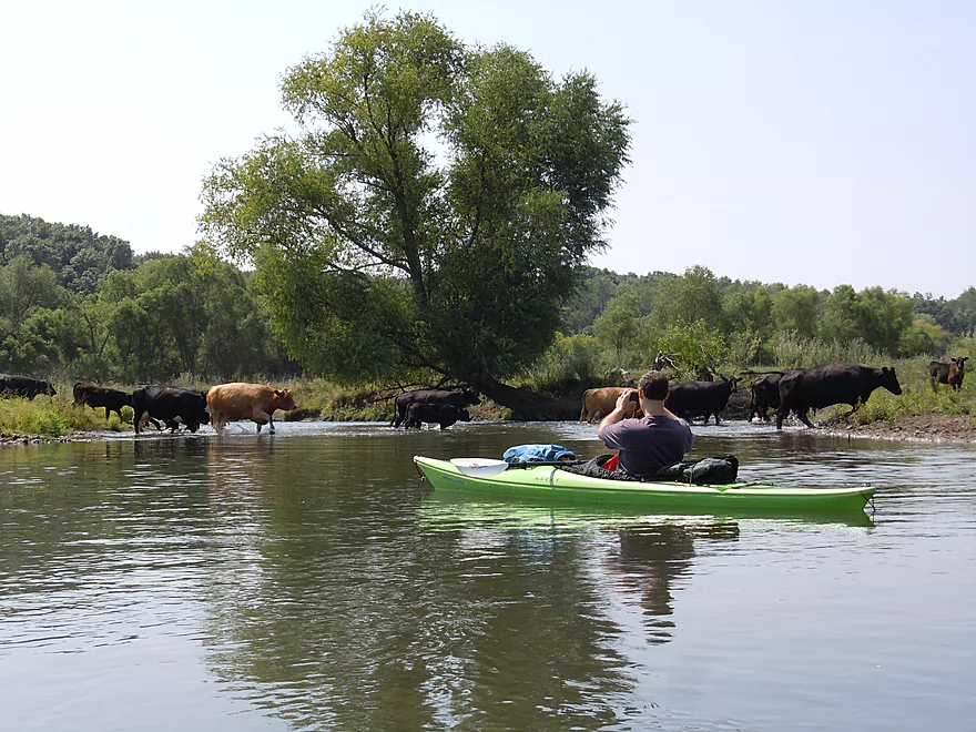
Quite the cow crossing
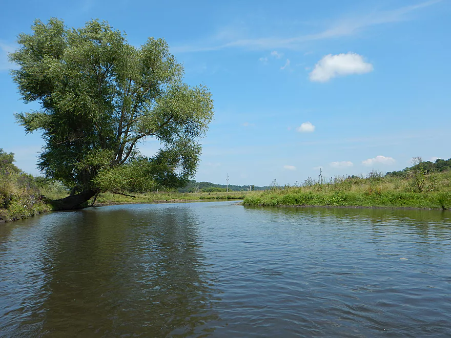
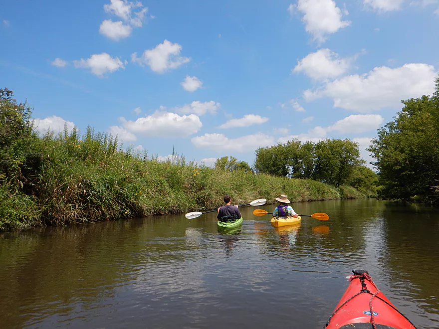
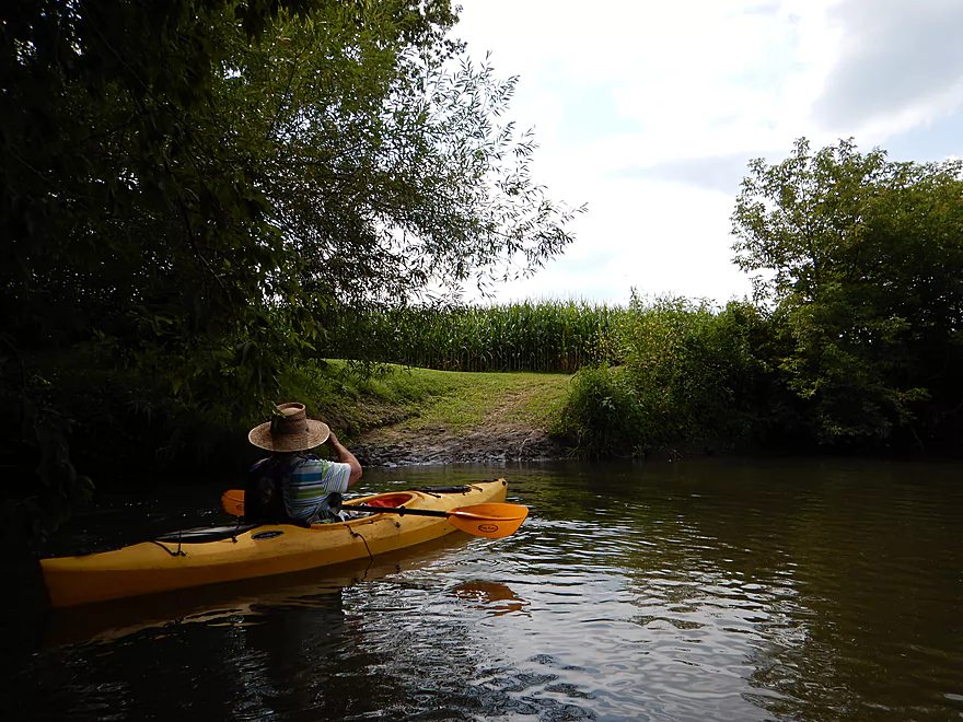
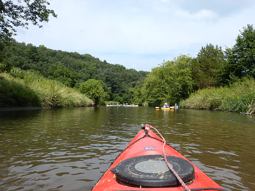
Open country to start
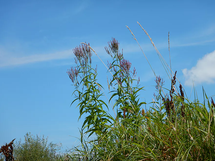
Blue vervain
Yep, it is…but makes for an artsy shot
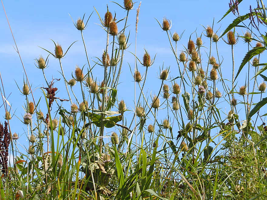
Teasels–beautiful, but invasive
One of very few shallow areas
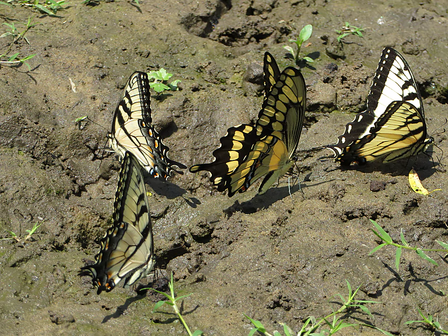
Swallowtail butterflies getting their mineral supplements
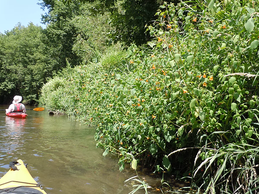
Touch-me-not (jewelweed)
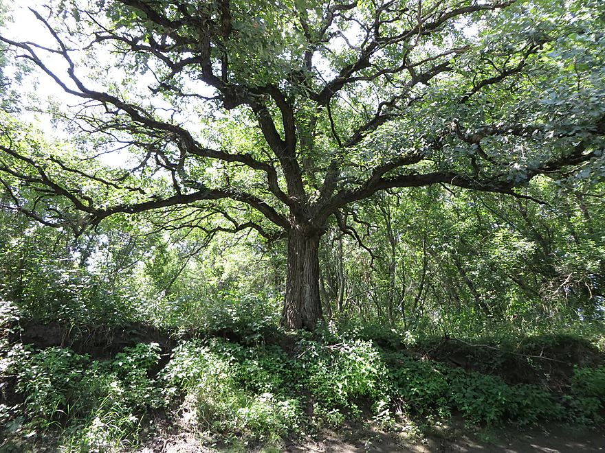
The mighty oak
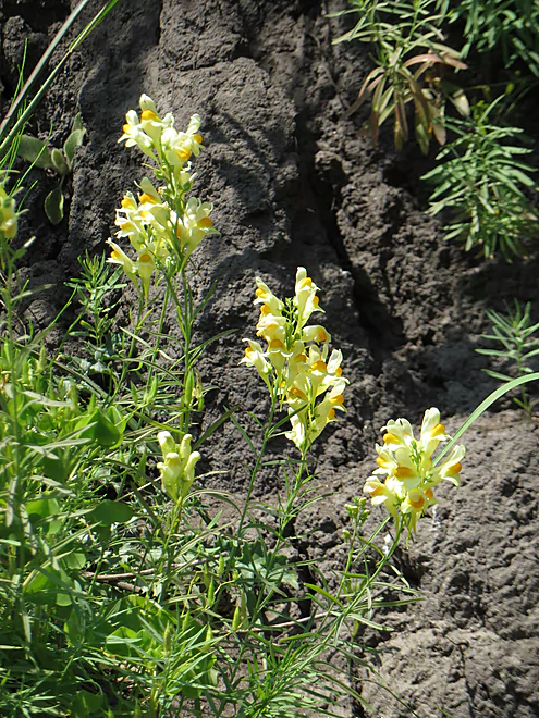
Butter and eggs (toadflax)
Lot of grass on the river
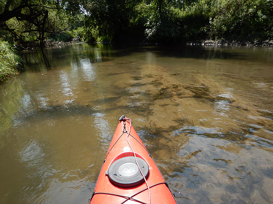
At times milky clear
Blue vervain petals
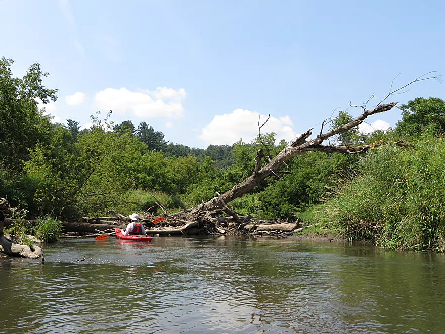
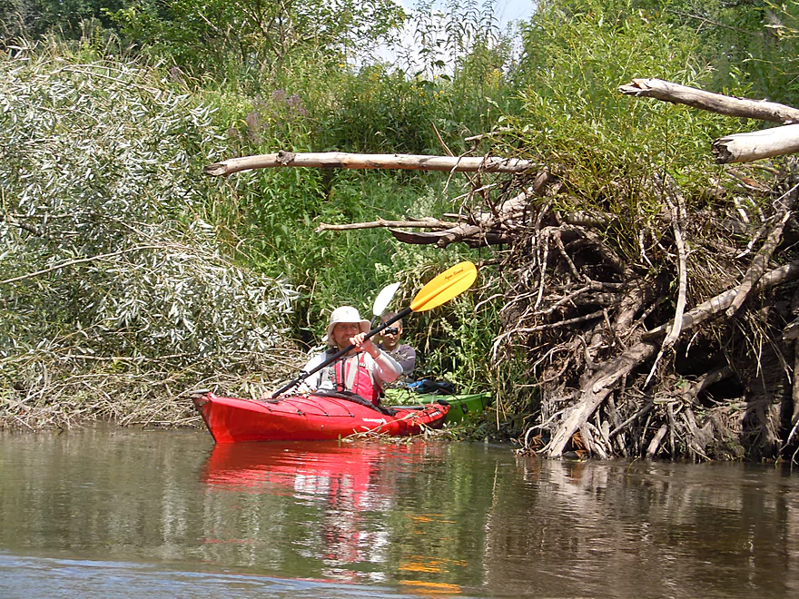
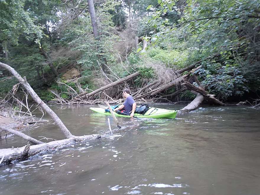
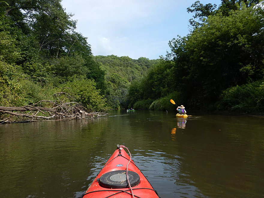
Only log jam
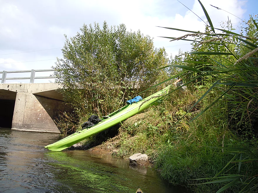
Deceptively difficult portage because of the mud
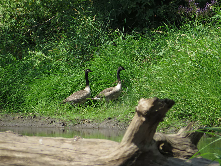
Geese watching on in amusement
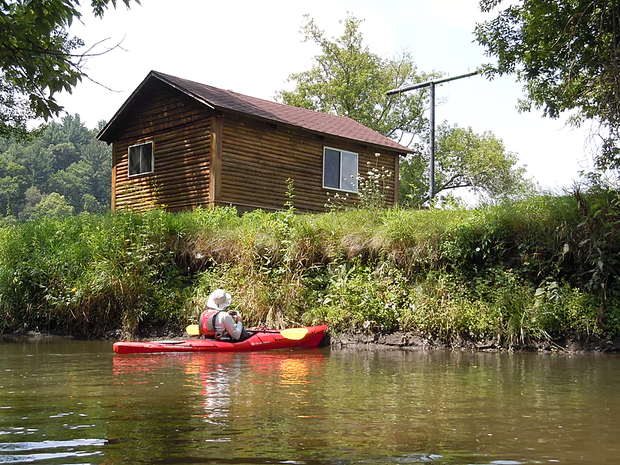
Only home I think we saw
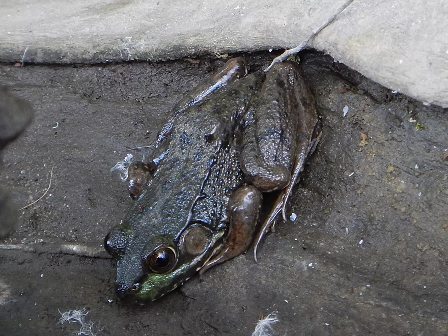
Green frog
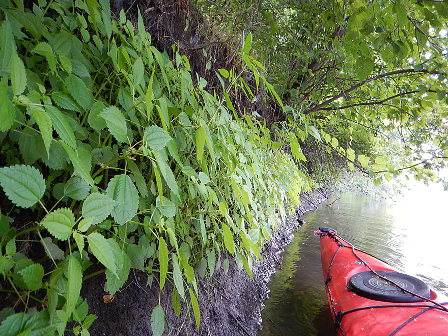
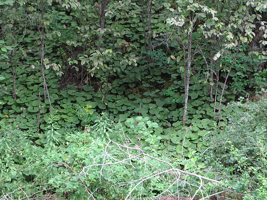
A wall of clearweed
Osprey nesting platform
Minor squeaker
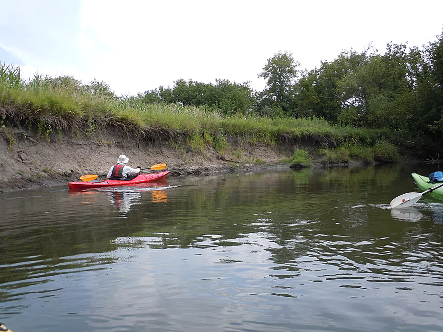
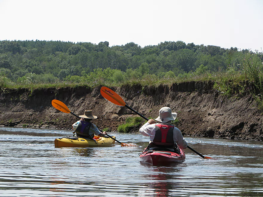
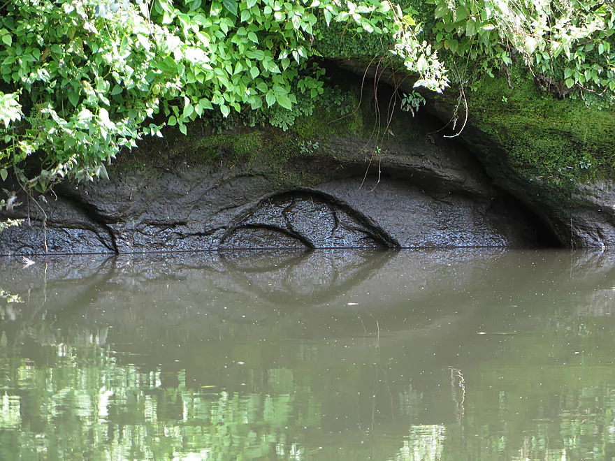
Another mud bank (product of decades of erosion)
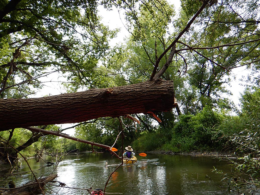
A hop-over to contend with
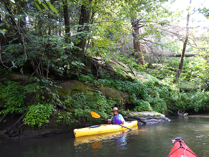
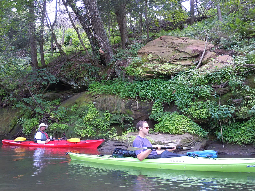
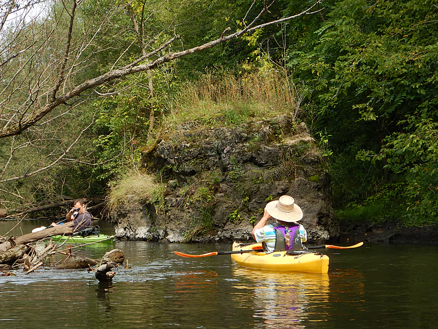
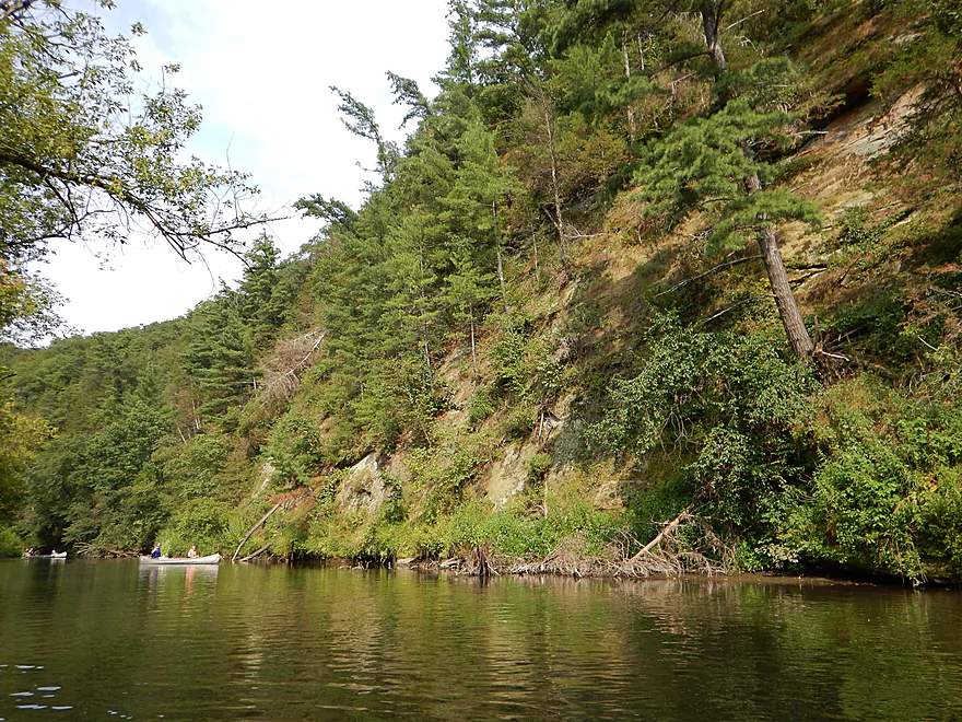
Very cool rock wall with great plant life
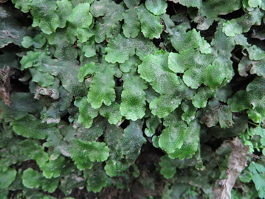
Liverwort close-up
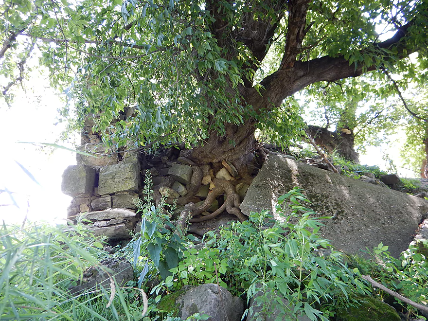
Cool root pattern
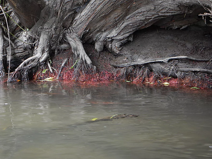
Nice red roots
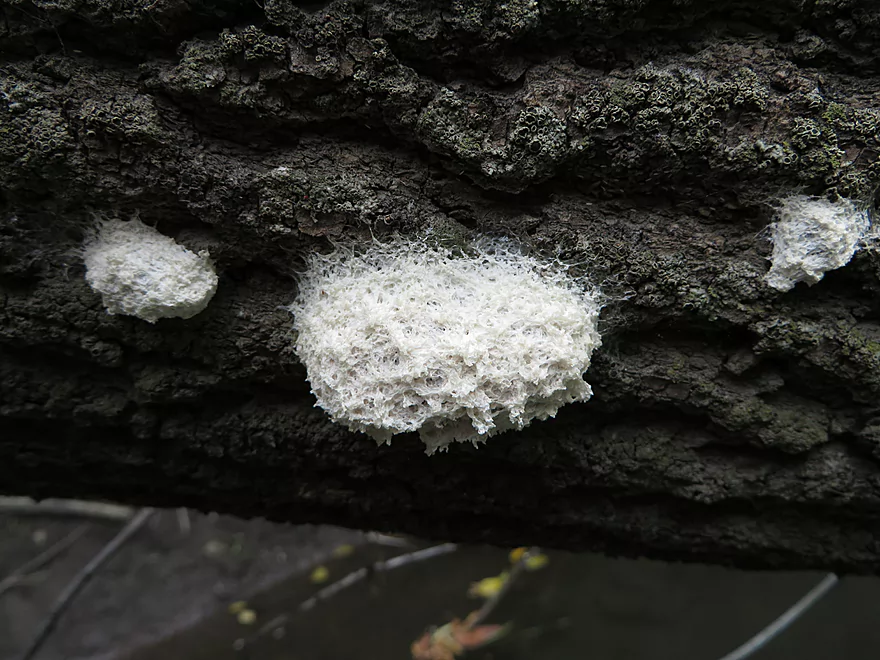
Some kind of insect case or fungal growth (interesting)
A simple fire hydrant
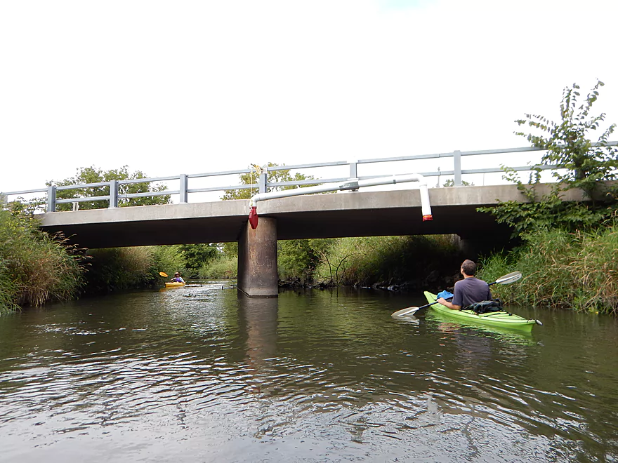
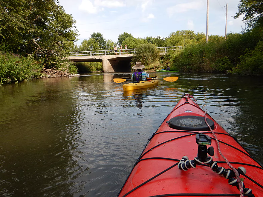
McKenna Road bridge is a good alt access
This section of river has had cleanup work
Liked the contrast between the plants and the rocks
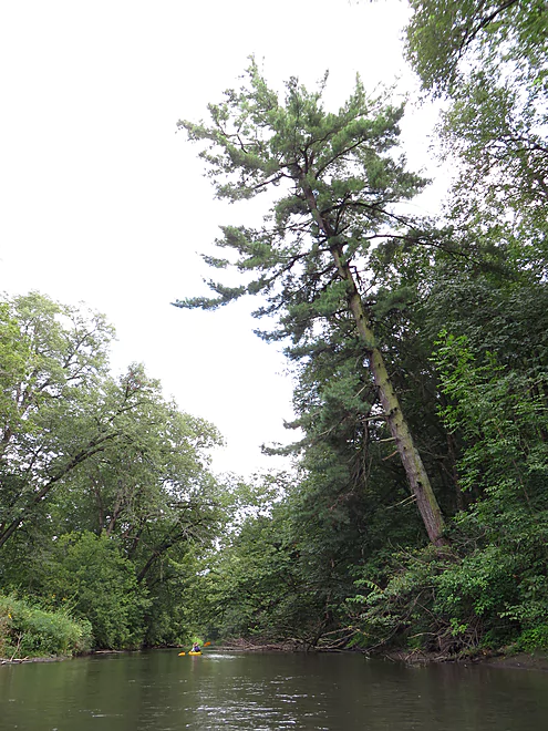
Some nice white pines on this trip
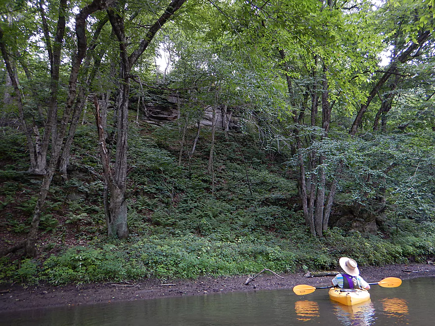
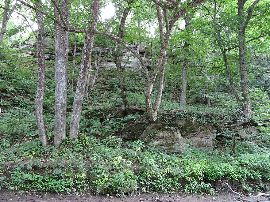
More rock outcroppings (would be easier to see in the fall without leaves)
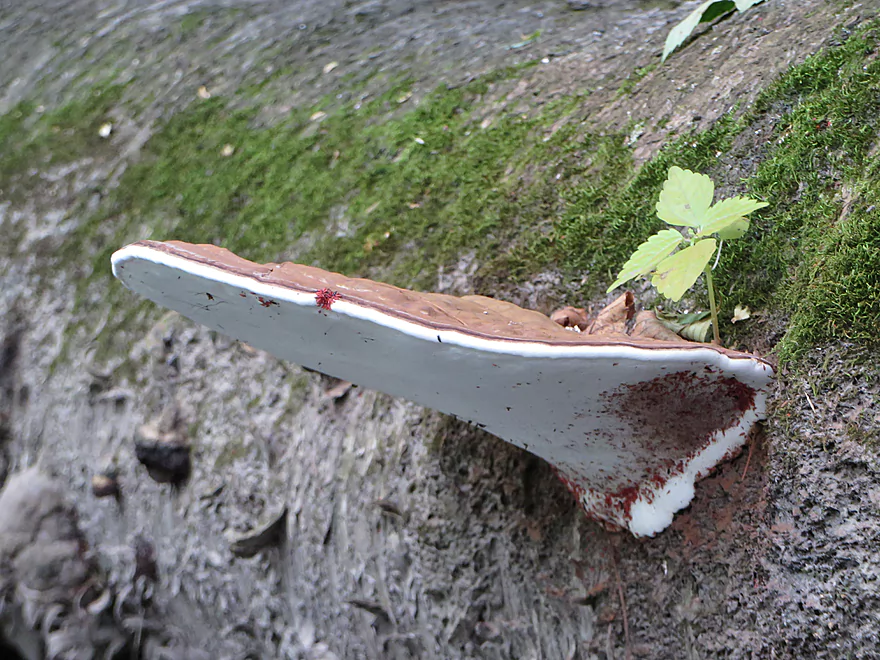
A duck-billed fungus
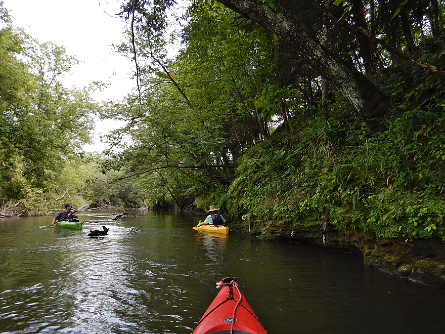
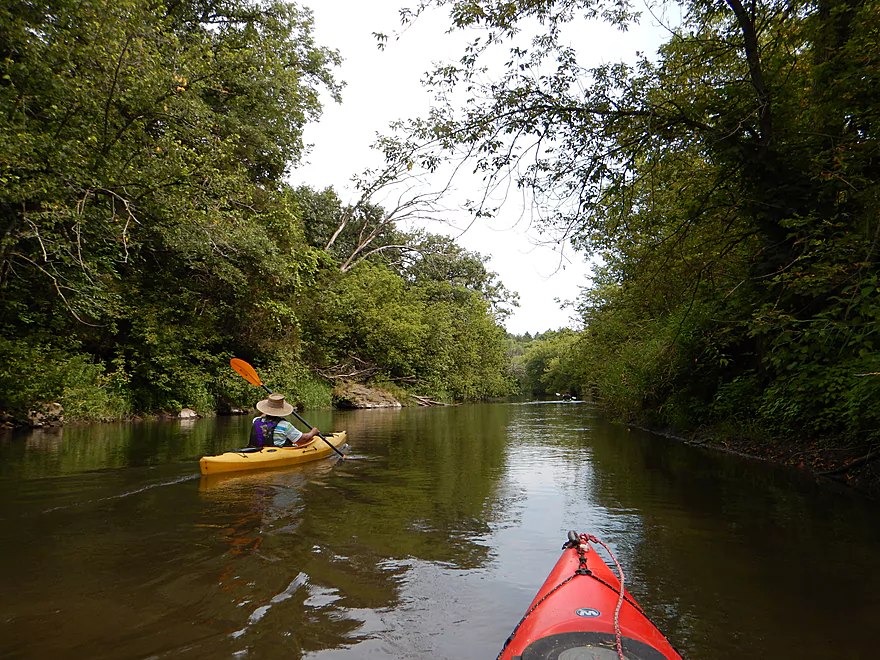
Large number of canoes on the river
Some spiky hair
Looks like little green hearts, but actually wild ginger
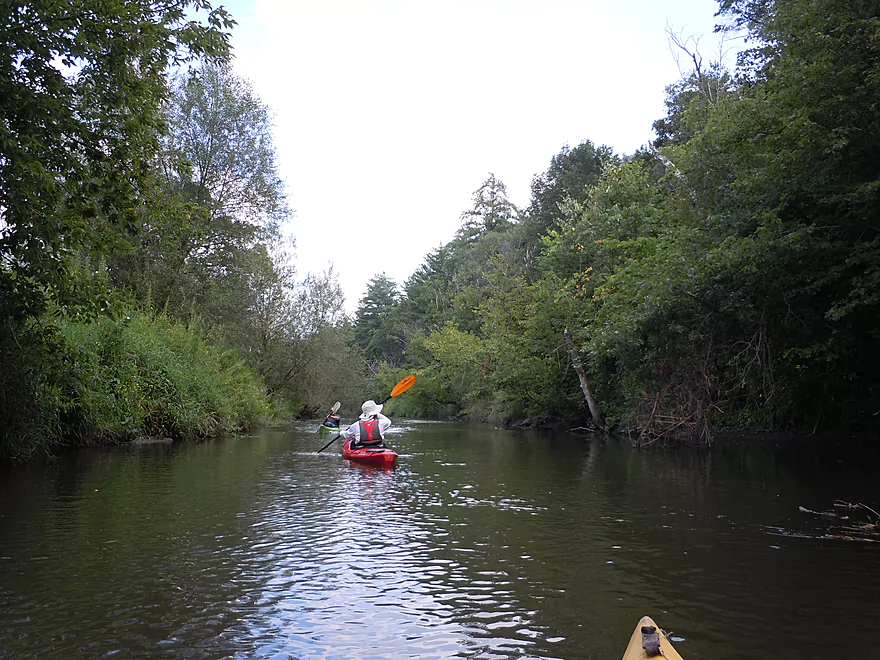
More canoers
Scenic bluff and river bend coming up
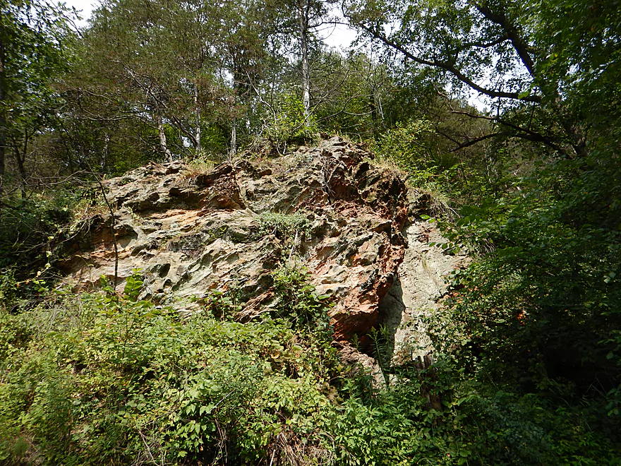
Best section for rock outcroppings
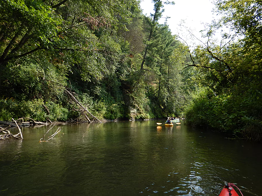
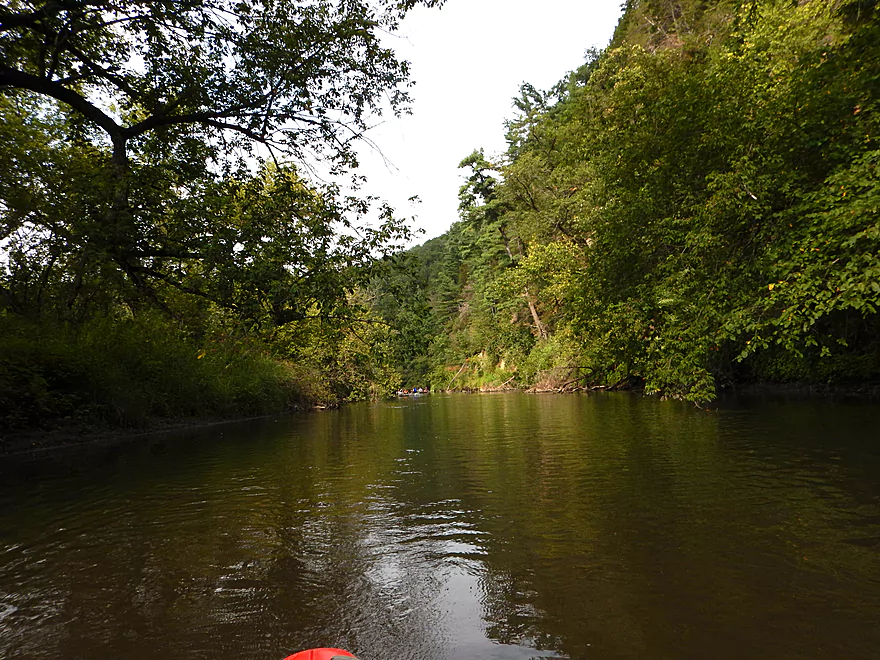
Cool corridor effect with massive rock wall to left
The Pecatonica monster
My favorite picture
Take-out at Horseshoe Bend Road
Steep, but manageable
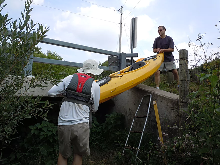
Helps to have two people here
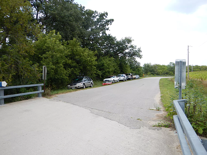
Good parking and popular!
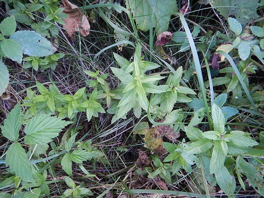
Great wild mint fragrance at take-out
Pecatonica River – East Branch


An underrated prospect located 40 minutes southwest of Madison, with nice plantlife and tree canopies, but most of all, some splendid rock bluffs.
There is a decent chance you haven’t heard of the East Branch of the Pecatonica River, as many paddle review sources do not cover it. This is odd…but kind of a consistent trend, as rivers having the words “branch,” “fork,” or “little” in their title tend to get mysteriously overlooked by paddle reviewers. The Pecatonica River itself (the main channel) is an okay prospect…a little too much cow country, but certainly superior to the Sugar River to the east.
For the East Branch, there are a number of paddling options to choose from. But roughly speaking, the best trips are from Hollandale to Horseshoe Bend Road and Blanchardville to Argyle. Hwy HK to Hollandale is very scenic, but has nasty log jams. Special thanks to Timothy Bauer who has done a terrific job of mapping out the East Branch and whose information served as inspiration for this trip.
Our trip started at the Hwy 39 bridge just east of Hollandale. Very nice put-in area (for a bridge), with a path to the river where others had put in before. I think you can just park your car alongside the road, but if in doubt, there is a nearby DNR parking lot “for fishermen only” ;) that you could park at instead. No facilities, but there is a gas station just down the road in Hollandale almost within sight of the landing.
First impression in the water was how open the river valley was (it won’t stay this way) and the cows. There was a bull at the landing (well next to it) giving us the stare down. Soon into the trip, a number of his friends (cows and little calves) made quite the commotion crossing the river (perhaps in a hurry for lunch) and we wisely let them cross ahead of us. Needless to say, cattle should never have direct access to a stream or river as they are very destructive and bridges/fences/buffer zones should always be used to protect waterways from this invasive species.
On the river you’ll see large dirt banks from the decades of erosion in the watershed, which are horrible, but kind of artsy in their own right. I don’t want to overstate the cow issue though, as most of the trip was cow-free and the problems were really just on the opening leg of the trip. In fact, at times, the water was pretty clear (at our flow-rate). Not totally…had a bit of a milky appearance, but nice enough that you could see the substrate below (at times rocky, sandy or mucky). The current was lazy but swift. A contradiction perhaps…but the best I can describe it. In fact, there were occasional riffles (but very minor).
This is certainly a good river for beginners, as there are few hazards to note. There was one nasty log jam (marked on map) that we had to get out for and was a pain to get around because of the muck. There was also a “hop-over,” but minor, with nothing else really of note. We went at 139 CFS, which was plenty deep, and think the river could be run much shallower (ideal, as there is an inverse relationship between depth and water cleanliness). There was perhaps one bumpy shallow area, but that was super minor and we didn’t have to get out. On the flip side, this river can be mean (and muddy) during high times, so keep an eye on the gauge and don’t go when it is too high.
One of the highlights of the trip was the wildflowers. Too many to name, but my favorite was the teasel plant (think pin cushion). Wild cucumber was also very striking (it looks like an upside-down chandelier). Lot of nice trees on the trip, with some occasional mighty white pines, oaks and attractive tree canopies enveloping the river corridor. White pines are normally not this common in SW Wisconsin and to see them in these numbers reminded one of northern Wisconsin. Did not see much in the way of fish, but knew they were around as we saw some great blue herons and what appeared to be two artificial osprey nesting platforms on poles. Other animals included some brown dragonflies, a frog, number of geese (no doubt teenagers), butterflies eating mud (getting their mineral supplements), multiple mud dauber nests, cows and some humans. Thankfully, biting insects were not an issue on this trip.
For being so rarely reviewed….boy, did we see a lot of paddlers on the river. All canoers…no kayakers, but there were a lot of them. Most were nice and friendly, but dare I say several were quite noisy and could be heard a fair distance down the river. This is an easy mistake to make, as most people don’t realize how far sound travels on a river (especially after drinking). This can annoy local property owners and kind of detracts from the wilderness experience other paddlers are hoping to have. I’m not saying the East Branch of the Pecatonica is at the Kickapoo stage yet…but hopefully readers of these reviews will be more self-conscious when it comes to noise pollution on the water.
Now, for the best part of the trip. You will on occasion come across some fantastic rock outcroppings and bluffs on the banks flanking the river. I’ve marked my favorite ones on the map for reference. Some of the rock outcroppings are, unfortunately, somewhat hidden by the summer foliage. This is actually one trip you might want to do in the spring or fall so the leaves don’t block the nice views. It’s kind of a trade-off, really. If you go during the summer you can see the nice plants (especially the mosses/fungi/ferns/tree canopies and other shady species by the rocks, which are terrific). But…I would have preferred views of the rock bluffs this time and regret my timing (still a nice trip). The biggest bluff and highlight of our trip is located on Horsehoe Bend by Hwy F. You approach a massive turn in the river with a large 120′ overshadowing rock wall. Quite impressive, this reminded me of the Kickapoo River between Rockton and La Farge, but unfortunately the summer growth blocked what could have been a much more epic view of this special area.
The take-out is at Horseshoe Bend Road bridge and is okay as far as bridge take-outs go. Nice parking and trail leading to the take-out ledge. But…this is a steep take-out and at one point you (and your kayak) will have to climb over a concrete wing wall to get to the road (not too bad, as a ladder is provided which you can use…but your yak might struggle with it).
You can take out further down in Blanchardville (north bank upstream of the dam), but these three additional miles don’t sound too exciting. If you like short trips (canoers usually do), you can put in at McKenna Road bridge, which splits this trip in half. You can still access the most prominent rock formations…just paddle 1000+ feet upstream (not bad in the current there). You’ll miss some other rock outcroppings by skipping the first half of this trip, but these are tough to see with the leaves on the trees. McKenna is a very good bridge launch, with great parking and a fine launch area. I’m pretty sure every single canoer we saw (and we saw a lot), put in here.
We car shuttled, but you could certainly bike shuttle this route, as I didn’t see gravel roads…but honestly, I would prefer not to. If you do bike, make sure your brakes are in good order, as flat areas are few and far between. Only ~5 miles though, so I suppose if you walk the steep hills you should still have enough time for a paddle trip. I also believe there is a livery that services the East Branch in “Yellowstone Valley Canoe Rental.” Call 608-543-3220 or 608-214-7229 for more details (think they only do big groups, but do get this far north).
All said, a very nice trip, but I can’t quite give it four stars, as it was a bit mundane and a tad dirty at times. While the plantlife was terrific, there was a ton of grass and that gets old on paddling trips in a hurry. Still a fine trip though and should be on a to-do list for those living in Madison and southwest Wisconsin. For comparison’s sake in the region, I would say this is a better prospect than the Yahara and Sugar rivers, but I found the Badfish, Platte and Fever to be more varied and clean. Had I gone in the fall with the leaves off, this easily could have been a higher-rated trip.
Detailed Overview
- Upstream of Hwy HK: Too many logjams to recommend.
- Hwy HK to Burma Road: 1.3 miles. An ok prospect with perhaps some obstructions.
- Burma Road to Star Valley Road1st: 2.0 miles. An interesting prospect with good scenery and not too many logjams.
- Star Valley Road1st to Hwy 39: 3.1 miles. Good scenery potential but too congested.
- Hwy 39 to Horseshoe Bend Road: 7.6 miles.
- Hwy 39 to McKenna Road: 3.9 miles. A pleasant section with a rock outcrop near the take-out.
- McKenna Road to Horseshoe Bend Road: 3.7 miles. Another pleasant section with a massive rock wall.
- Horseshoe Bend to Blanchardville Dam: 3.6 miles. This is a less interesting section of the East Branch that lacks the river's iconic outcrops. It's not bad though, and may appeal to locals who want to paddle through Blanchardville. But most other kayakers will prefer other stretches of the river.
- Blanchardville Dam to Hwy 78: 3.9 miles.
- Blanchardville Dam to Gordon Creek Landing: 0.3 miles. A short, but pleasant stretch through the outskirts of Blanchardville.
- Gordon Creek Landing to Hwy 78: 3.5 miles. While not bad, this is one of the less interesting stretches.
- Hwy 78 to River Road: 6.4 miles. A pleasant stretch with open scenery, Driftless Area hills, and a handful of rock outcrops. On the downside some parts are a bit boring and open pasture has degraded some of the river.
- River Road to Argyle Boat Launch: 7.4 miles. A good stretch with impressive outcrops.
- River Street in Argyle to Hwy M in Woodford: 9.3 miles.
- Argyle River Street to Blackhawk Memorial Park: 8.3 miles. No outcrops and a lot of farm scenery. Not as nice as previous sections but still decent.
- Blackhawk Memorial Park to Hwy M: 1.0 miles. Section includes a very large island. You must take the east channel to reach the access on M.
- Hwy M to Cisserville Road: 6.4 miles. Probably uninteresting.
- Cisserville Road to Mouth: 2.2 miles. Probably a weak prospect.
- Mouth to Hwy 11: 3.2 miles. A leg on the Pecatonica River (main branch) to reach a take-out.
Trip Map
View Pecatonica River - East Branch in a larger map
Overview Map
Video
Bonus video below of butterflies siphoning minerals from mud and beating their wings as a hydraulic mechanism.
Photos Size:
Wow, great site! My husband and I are new to kayaking. We went on our first camping/kayaking trip last year to Pattison State Park and kayaked the Bois Brule. It was great. We both tipped, I lost my sunglasses, but it was great.
We’re going to kayak the Pecatonica this August.
Paddled Hollandale to Blanchardville 5/19/17. Many downed trees along the way. If water was any lower we would have been dragging boats over trees, thankfully we were able to slip over them.
Really nice few hours spent on the river, looking forward to doing other sections of the Pecatonica.
Thanks for the feedback! Too bad about the downed trees…probably came in from our recent storms.
Attempted Highway 39 to Blanchardville on September 2, 2017. Encountered Five complete blockages before McKenna Road where we called it quits. Recommend avoiding this section.
Thanks for the update Chris…this really helps out other paddlers.
Did this section with a bike shuttle, the river was at 212 CFS and about 5.3 ft. Great trip, very quiet and peaceful, saw lots of wildlife but not a single person the entire way. A few duck unders, slide overs, and tree branches to slip through, but I never had to get out of my boat. I cleaned up a few spots so its a pretty clean trip right now. One strange thing to note, about 25 yards downstream from the put-in there is a white and orange buoy, like the ones marking swimming areas, that says KEEP OUT NO BOATS. Knowing Wisconsin laws about navigable waterways I ignored it. But you may want to add a note about it for other kayakers and canoeist.
Hello! Thanks for the write up. Did it really take 4+ hours or is that a typo?
Rich
No typo…it took 4+ hours. I’m slow though…3 hours might be more typical.
I did the trip on 10/20/19. with a bike shuttle, there were a few tough hills but very little traffic and it is only 5 miles with some great ridge top views so all in all not too bad. Water levels were fairly high (approx 390 CFS and 7.2 FT) so there was a good current the whole way and the trip only took us a bit over 2 hours. The put-in/take-out were easy and thanks to the high water not too muddy. There were a few tight spots that required a bit of ducking under and or sliding over and one spot just north of McKenna Rd where we had to get out of the boats to pull them over a blockage but we never had to get off the river. some of the obstructions that we were able to float over might be more difficult at more typical water levels The rock outcroppings and fall colors were fantastic, especially the section between McKenna and Horseshoe Bend Rd. I think this section would be suitable for any level paddler, and the section from McKenna to Horseshoe Bend, would make for a great short after work fall/winter paddle.
Thanks as always. Consider taking pictures on some of your trip and posting to an online album (such as Google Photos or Flickr). You could then easily insert the album url in the comment and others could see what you saw.
We paddled from Hwy 39 (near Hollandale) to Horseshoe Bend Rd. on 28June2020. Gauge was 270 CFS and 6 ft. After scouting, we chose to put in upstream river right (nearest to the parking lot), which was muddy. Quite a bit of wild parsnip to be careful of as well.
Not far upstream from the McKenna Rd. bridge, there were three sets of downed trees. Depending on water levels, boat length and commando skills, these three jams require some combination of portaging, exiting to climb over logs, and sneaking through tight thickets of branches. The portage route had some stinging nettles.
Downstream from McKenna Rd., there were no jams, although boat control is still essential.
Compared to the photos from previous years, the river seems to have eroded quite a bit, with more mud at put-ins/take outs.
That’s too bad…the East Branch has really endured a lot of flooding in the past five years and it sounds like it isn’t in great shape.
did this trip on 8/6 with a bike shuttle, levels were at about CFS 225 and 5.5 which seemed almost perfect. There were several obstacles to go over/under/through but only one complete blockage, just upstream of Mc Kenna Rd. that required a portage, we did the left bank but had to walk a ways (50 yards?) to find a place to put back in that was not too steep and muddy, perhaps right bank would be better. The river is much less obstructed after McKenna Rd. This would be a great trip to do in the late fall or early spring to take advantage of the lack of foliage so the rock outcroppings would be more visible. Yes the shuttle has a few hills, but it also has great views from the ridge tops. A stop at Nick Engelbert’s Grandview is a must for anyone who likes outsider or quirky art environments and it is less than 2 miles from the put-in
Appreciate the update as always. I’m quite curious about the lower sections of the East Branch and will have to check those out some time…
Took advantage of a sunny 50+ late Nov day and paddled this section with a few friends on 11/28/20 (220 CFS and 5.4 ft) The trip took us about 2 hours and 45 min, started at 11:45 and finished at 2:30. Conditions were great, good water clarity, decent current, and just a bit of mud at the take out and at the 1 portage. The portage, just upstream of McKenna, is still there and and is a series of 3-4 groups of trees completely blocking the river. We portaged on river left, bank is muddy and slippery and the pretty steep where you put back in. River right looks like it might be easier to put back in but I did not see an easy place to get out. After McKenna the river is unobstructed all the way to Horseshoe Bend Rd. I agree with your earlier comment, and next trip I will put in at McKenna, where there is what appears to be an old concrete slab landing, and go down to Blanchardville
I would definitely be curious to know what the latest logjam situation is below McKenna. High on my todo list for 2021 will be 78 to River Road, which I hope is logjam free.
A big update for the East Branch from the Pec River Clean-Up Group:
“It was a couple rough days on the Pec but the River rats got it done. The river from Blanchardville down to thunder bridge is open. Also the most popular stretch for canoes and kayaking, McKenna to Blanchardville is also open. I will warn that if the water level is high, the tree in the first picture will be an issue on that stretch . As of today we had no problem getting our boats under it but the river is extremely low for this time of year. Please don’t forget to thank all the river clean up helpers for donating their time and equipment to this cause. Last weekend was Nate Dammen, Chad McGowan and Kevin Phillips. Today we had Ron Krause, Chad and Wyatt McGowan, Jeff Love and Kevin Phillips. There are many others that also contribute throughout the year and I personally want to thank them for their time.”
https://www.facebook.com/pecriverrats/
Here’s an update from 2021! We went on June 5 from Hwy 39 to Blanchardville (155 CPS & 4.72 ft @ Blanchardville).
We accessed on the NW side of the bridge as others have. This access OK, but there wasn’t really a path, and getting down is pretty steep and rocky. Wild parsnip was further to the left. My boyfriend almost lost his muck boots in the quicksand-like muck, so be careful how far you wade in!
The highlight of the first section were the bald eagles + nest ~3 miles. The low lights were a downed log that we balanced on to pull the boat over, and then the massive log jam others have mentioned before McKenna Road. To get around, the left side of the river had stinging nettles and more wild parsnip. The right side had grass and wild cucumber, so we scrambled up the steep right bank and bushwhacked a trail ~30 m to a fairly nice put in, actually – some branches to lower yourself back down into the boat instead of dealing with the muck! It didn’t seem like we were the first to go this way. The rest of the trip was clear, and we appreciate the efforts of volunteers who made it so!
We saw the paved launch at McKenna road and kinda wished we had put in there instead. The exit at Horseshoe bend road looked very steep with some stairs to get up to the road. The highlight of the next section was definitely the cliffs at Horseshoe bend.
As we got closer to Blanchardville, the current really slowed down, which made the last few miles kind of a slog. And there was very little shade (vs the first sections that had very nice tree cover!), which made for a hot and sunny 90+ section.
We had planned a bike shuttle from the park in town by the dam, but then noticed a paved ramp ~0.2 mi north of there, where we took out instead. Getting out by the dam would be doable; the banks were almost 2 ft above the water, but it looked like there were some rocks to step on to help. We highly recommend the paved launch with parking! Portaging the dam would be challenging, because of the exit and also the put in – the banks just below the dam are very steep. The next access point looks to be a paved ramp at McKellar park, as mentioned.
One of my main goals for 2021 is to return to the East Branch. I appreciate all the intel you provided on this river!
Another update from Pec River Clean-Up Group: “Quick update! Got the lower portion of the river from McKenna to Blanchardville opened up a bit today” https://www.facebook.com/pecriverrats/
We took advantage of a nice fall day and did trip on Oct 29, 2022. We dropped are boats on the South side of the Hwy 38 bridge on river left, drove down and parked our car at the Horseshoe Bend Rd bridge, then biked back to our boats. Although it is a bit hilly this is a beautiful shuttle because it runs along a ridgetop with some fantastic views of the countryside. It was especially nice because the road was technically closed for “through traffic” due to construction,so there was very little traffic and it had just been paved so it was one of the smoothest roads I have ever biked on. The trip itself was equally beautiful. This is a fantastic trip to do in the late fall because it is much easier to see all the gorgeous rock formations after many of the leaves have fallen. I am happy to report that the muti-tree blocake just north of the Mckenna bridge has now been cleared up, so the river is open all the way from Hollandale to Horseshoe Bend and according to other reports all the way to Blanchardville. This is an easy and fun trip that I tink is doable by anybody unless levels are high. Here is a link to a map and pics of our trip https://www.relive.cc/view/vQvxpnjJnBv
The pictures look fantastic! Late fall is a terrific time to see rivers like this.
Did this trip mid June 2023 in kayaks. Did not check river gauge at the time, probably about 4.6, water was low comparing to past years at the McKenna landing (looking at the concrete ramp). Very little problem with bottoming out. A bit muddy getting in at Hollandale as the weeds are high under the bridge, so just did an otter slide down the grass into the mud. Very nice trip except for three total blocks. Two between Hollandale and McKenna Road, one between McKenna and Horseshoe Bend. The last one has been there for years but we can no longer squeeze under, even in low water. The second block in the first section was downstream of the old block just before the bridge. We were able to climb over all three blocks with some effort. Hesitant to try again. Will require a large chain saw to clear as the trees are rather big. There were a couple other blocks but we could squeeze through them. Did a little cutting but only had a small hand saw.
I appreciate the river updates which other readers should find helpful.
Update from https://www.facebook.com/pecriverrats…”Update, a group of volunteers went down the river from McKenna launch to Blanchardville and have gotten it opened up for your paddling pleasure”
I did this section on Oct 1 2023, ( USGS 4.4 ft 125 CFS), Overall the levels were good, a few shallow spots and a bit bumpy in some of the riffles, but on the upside we were able to get under a few things that might have been more difficult with a few more inches. There were certainly things to avoid, but nothing too difficult, and no complete blockages. A few of the leaves were just starting to turn, so I hope to be back in a few weeks as it is a fantastic trip during peak colors as well as a beautiful trip after all the leaves fall and you can see all the bluffs that have been hidden. Here is a link to my trip using the Relive app, that I highly recommend https://www.relive.cc/view/vrqDY9ANpwv