
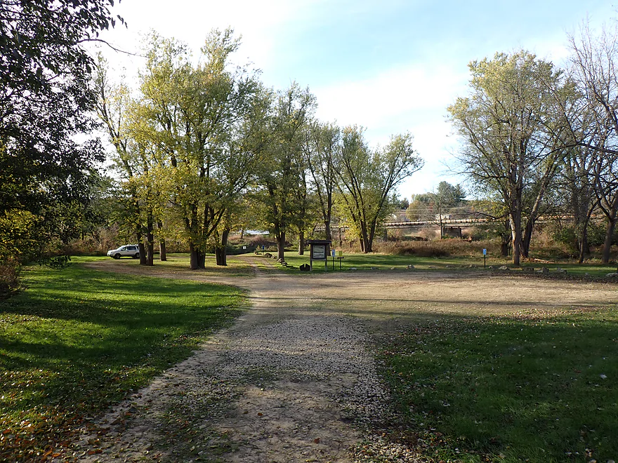
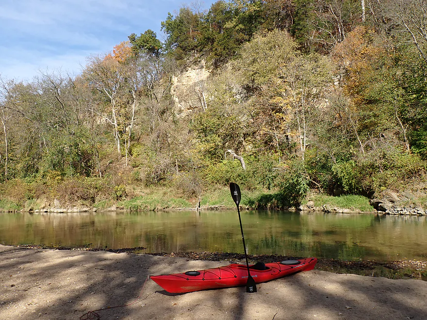
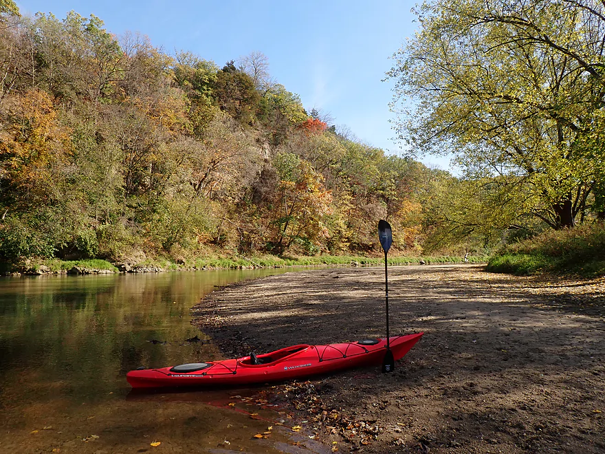
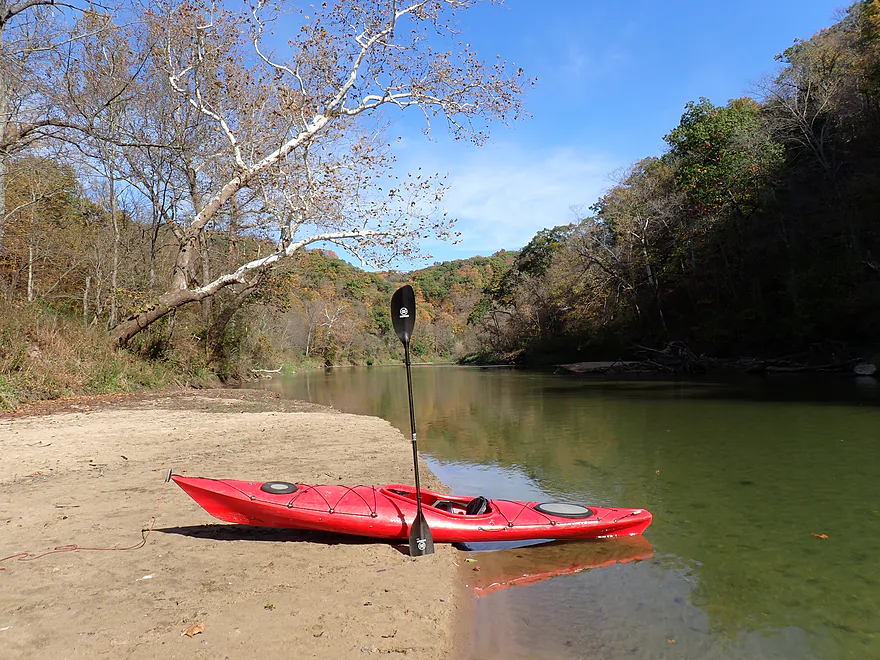
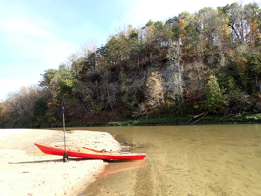
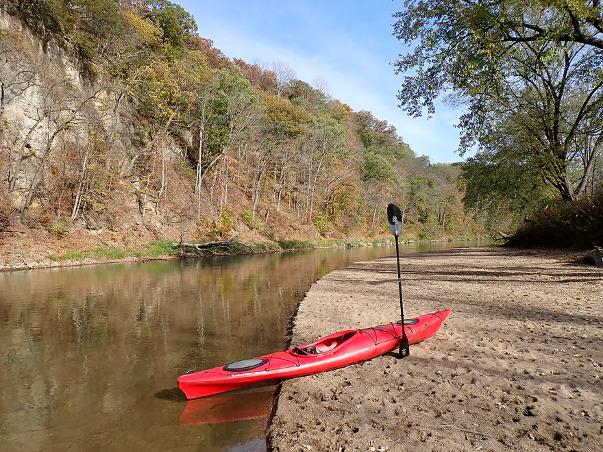
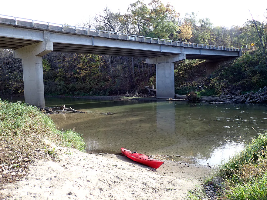
Starting the trip at Canton County Park
Great public access
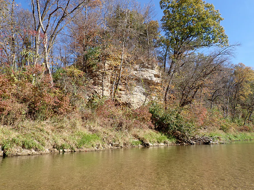
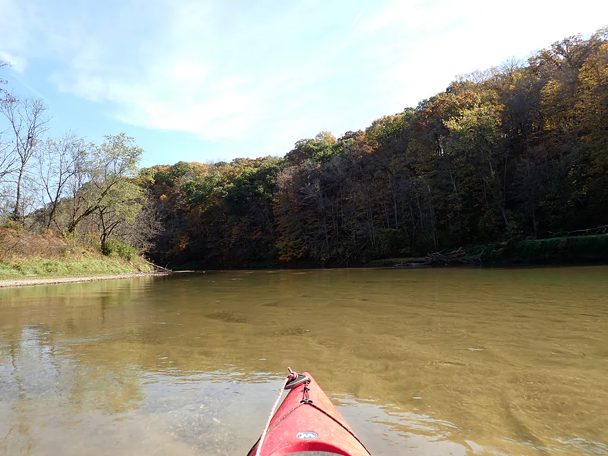
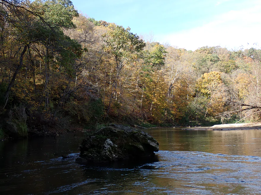
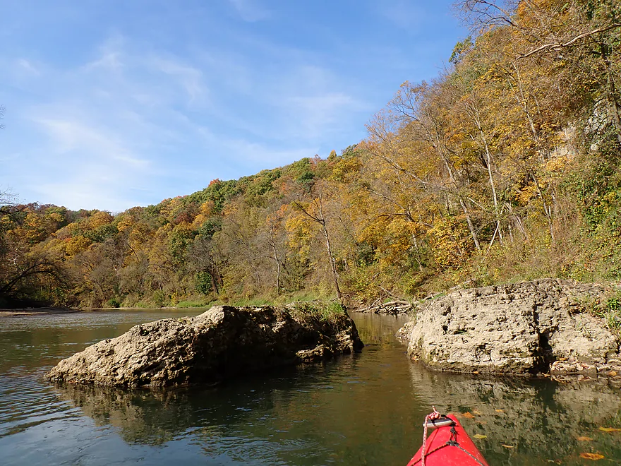
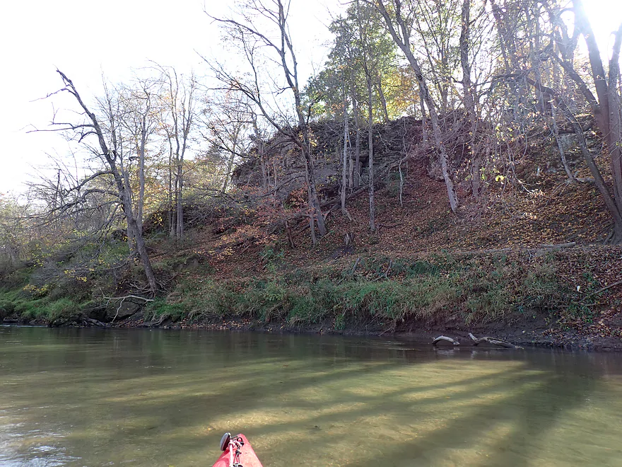
An outcrop within eyesight of the put-in
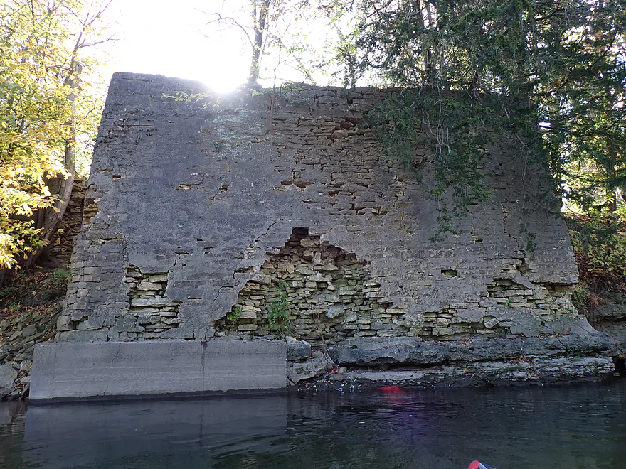
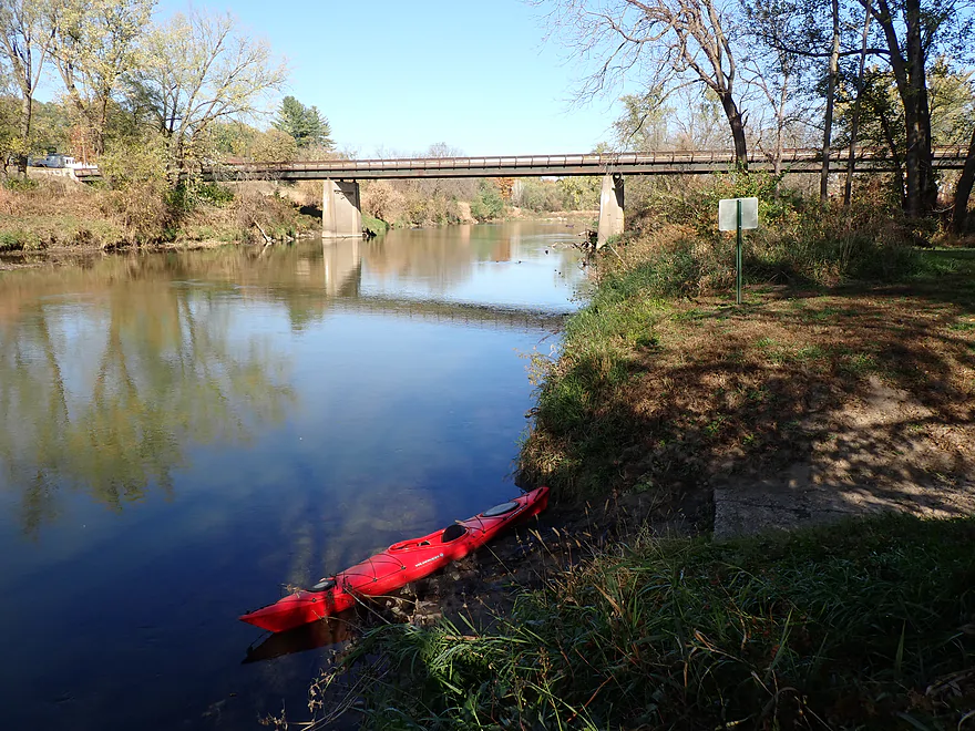
Old bridge abutment
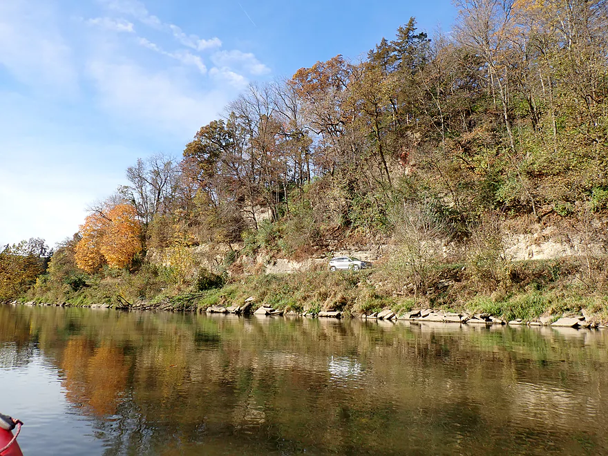
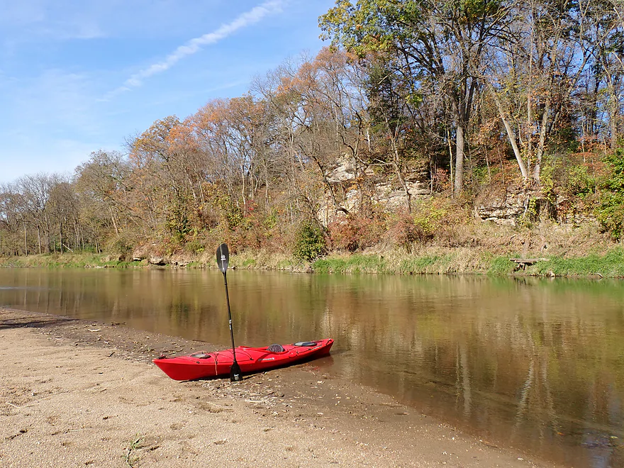
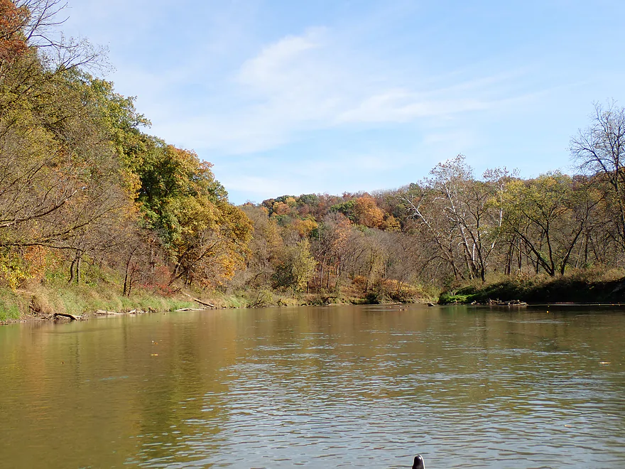
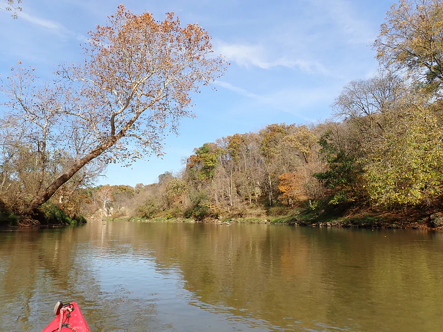
Attractive hillside
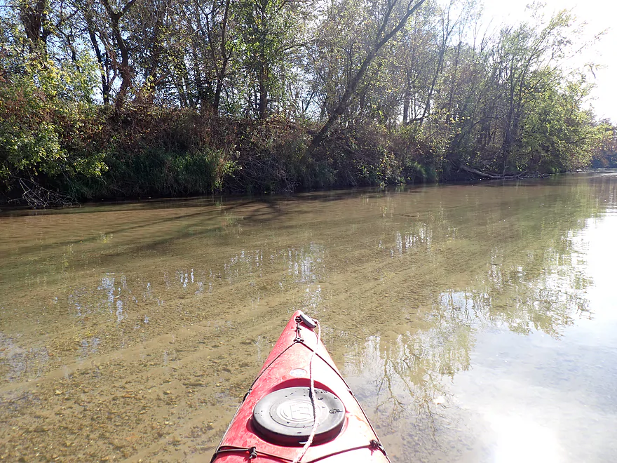
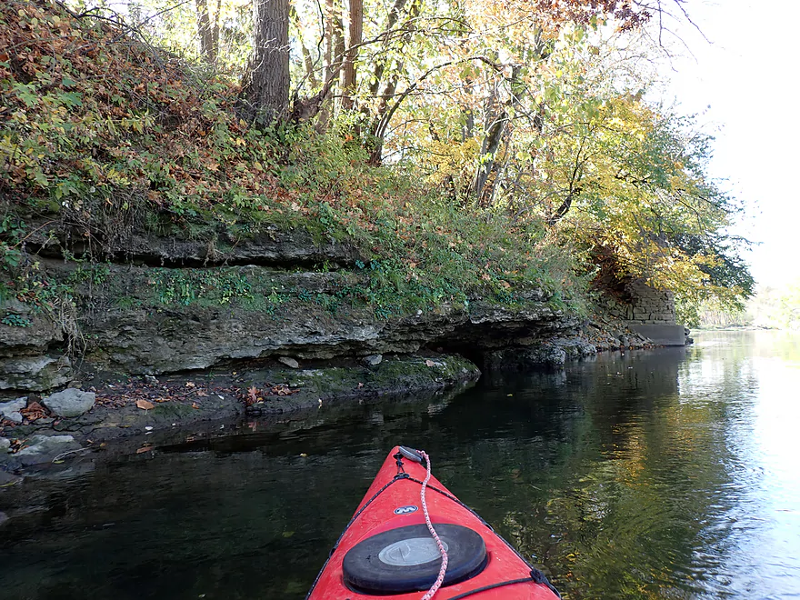
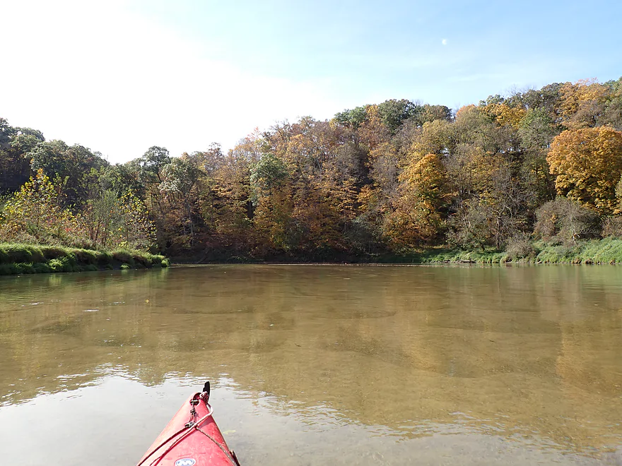
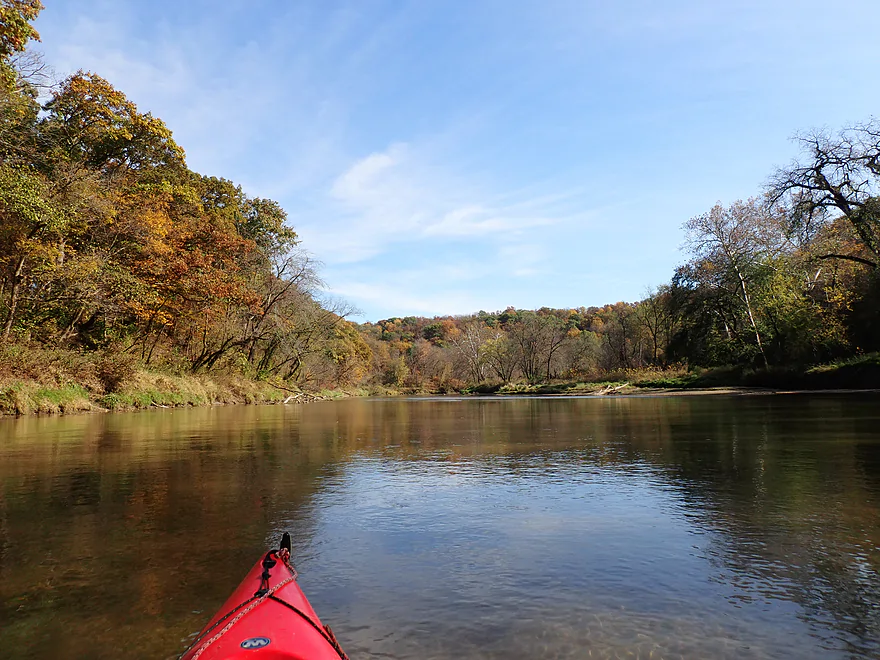
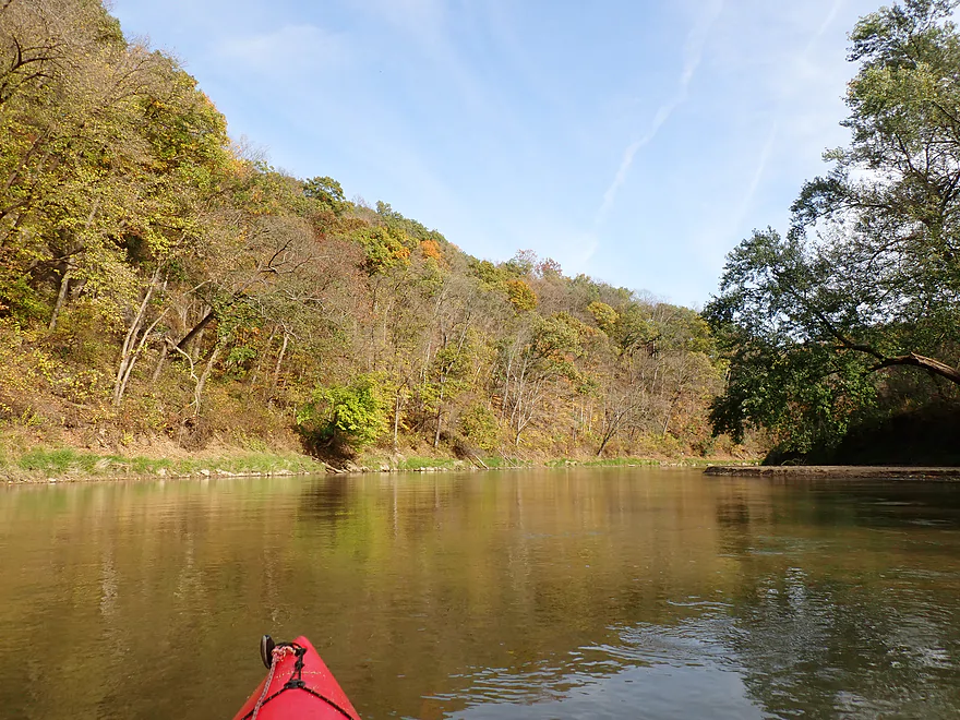
Terrific clarity
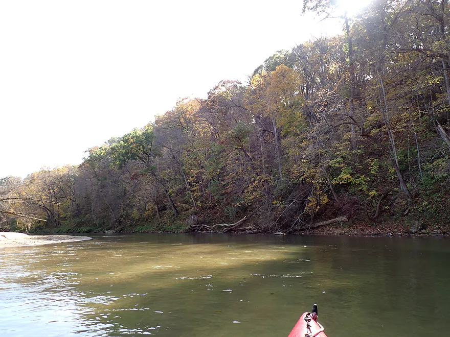
A lot of the outcrops were obscured by vegetation
Still nice though
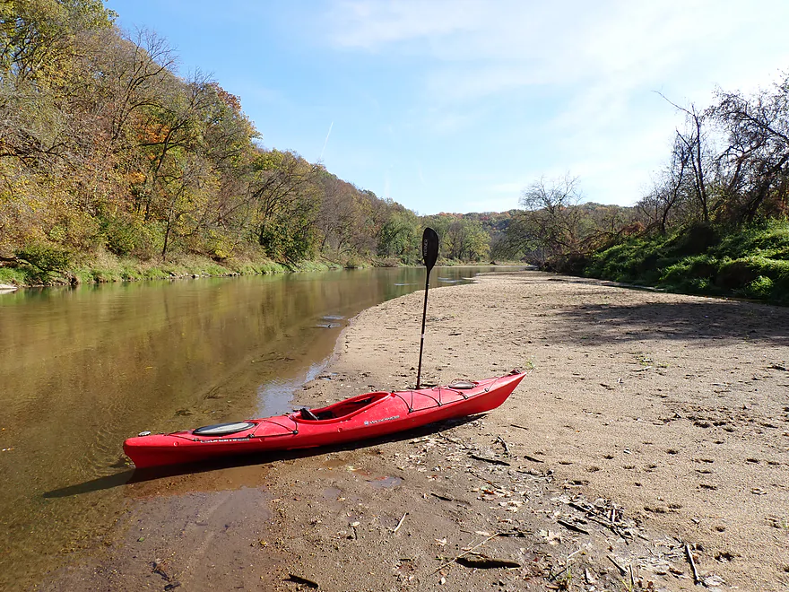
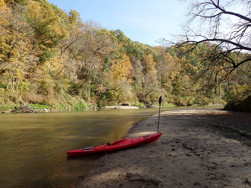
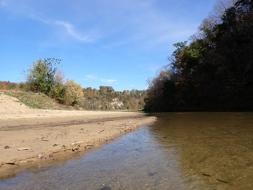
One of many sandbars
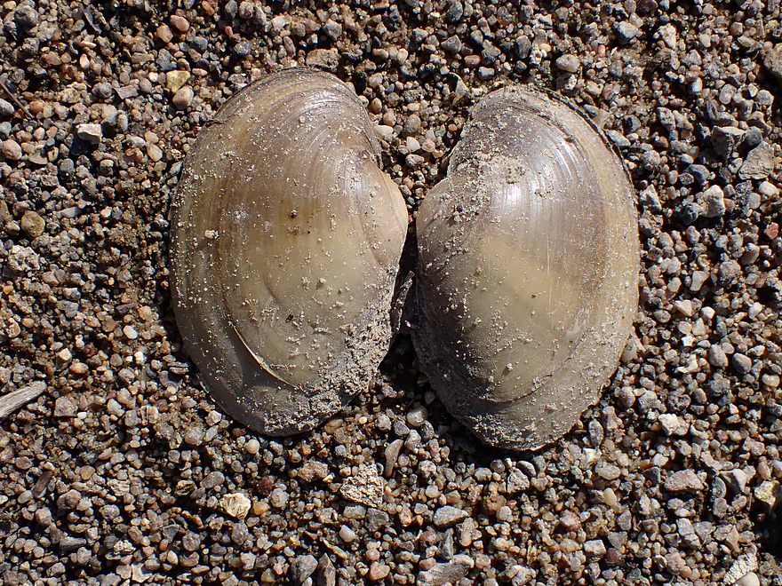
Some clams on the river
Normally the sandbars aren’t this big (water levels were low)
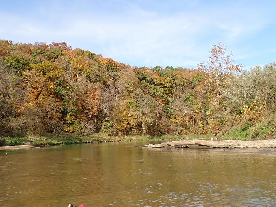
Entering the Buzzard Ridge Wildlife Area
Rugged boulders lined parts of the river
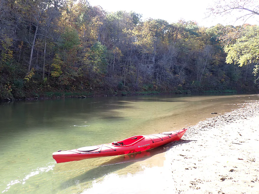
Getting out for pictures
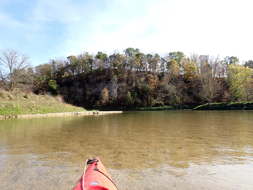
One of the nicer sandbars
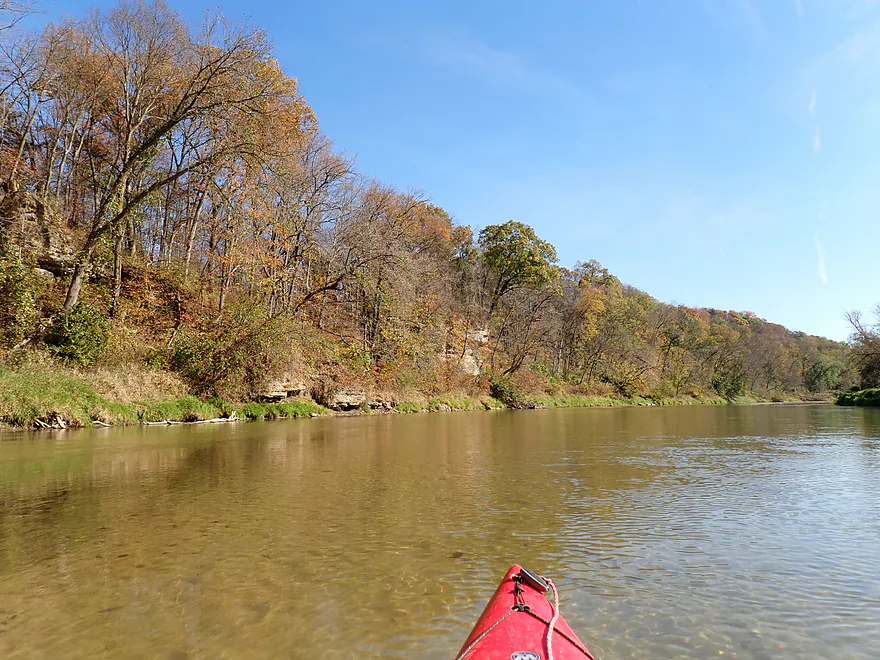
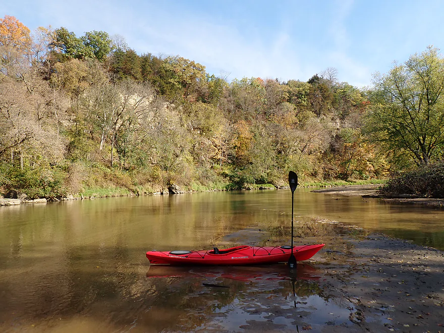
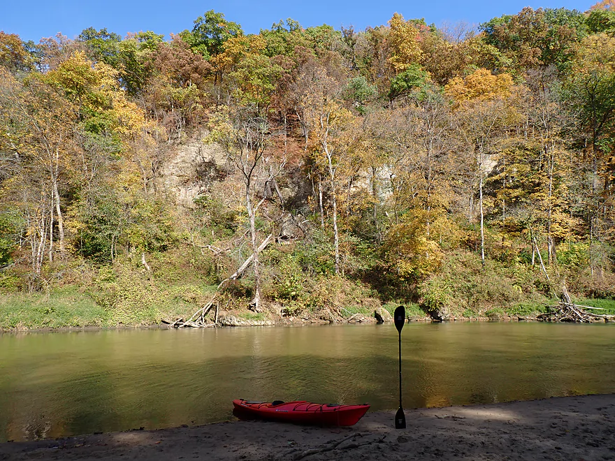
River was constantly twisting past these bluffs
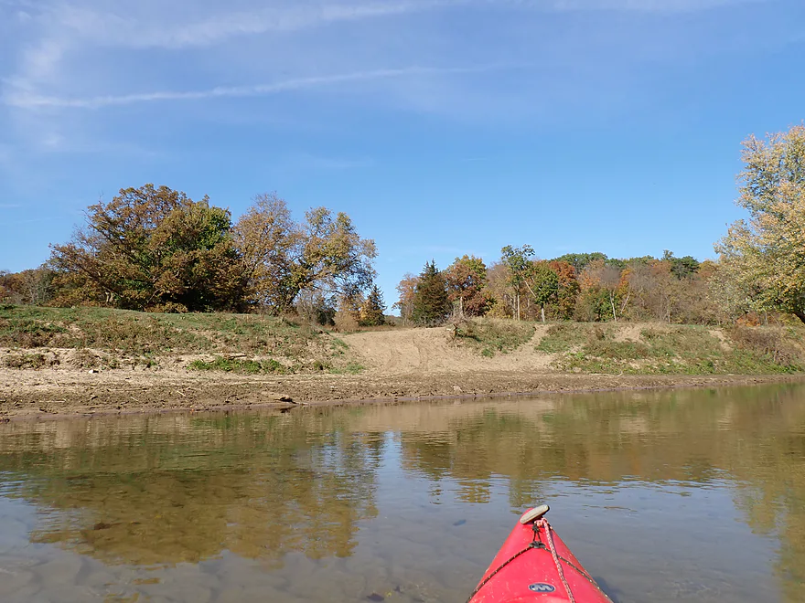
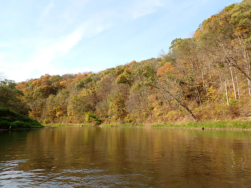
Some decent fall color
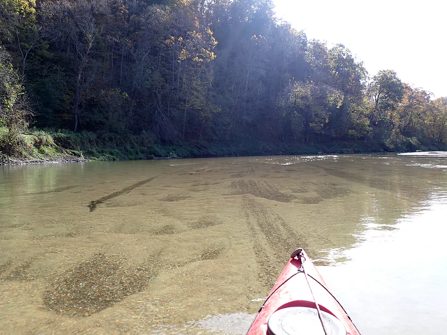
Substrate was a mix of gravel and sand
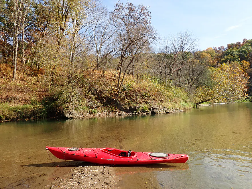
Clarity was so good it looks like the kayak is floating
Occasional sycamore trees
No longer in the Buzzard Ridge Wildlife Area…still nice bluffs though
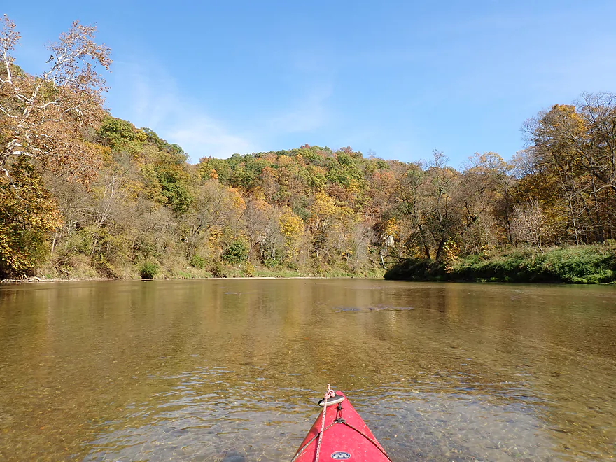
Kind of reminded me of the Turkey River
Reverse view
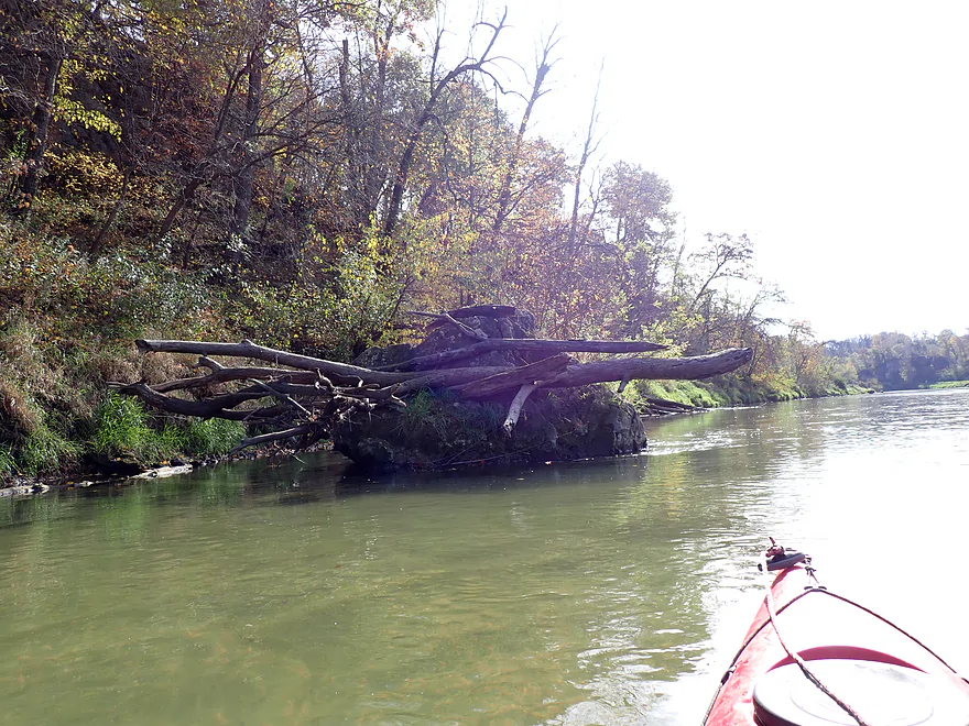
Balanced logs show the high water line
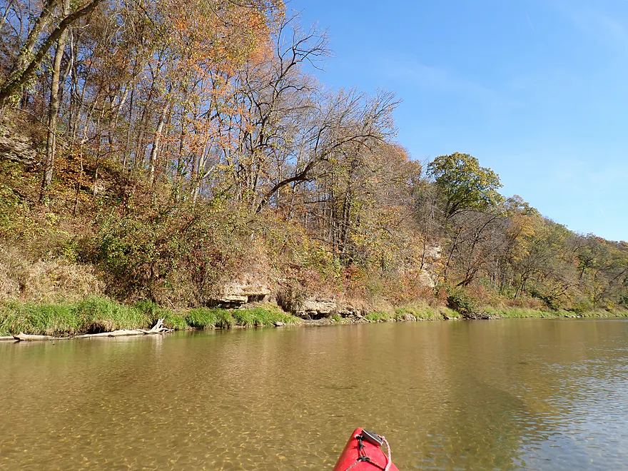
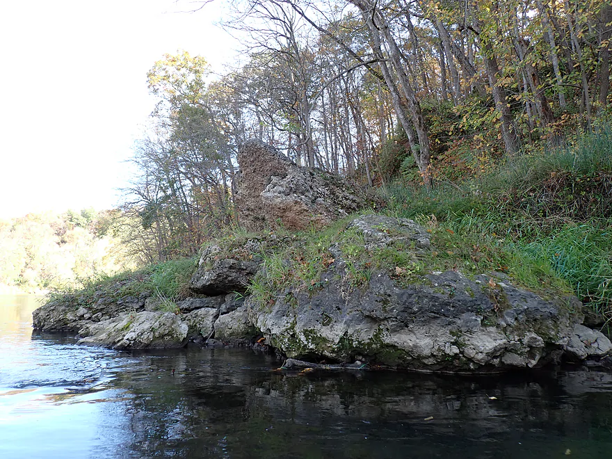
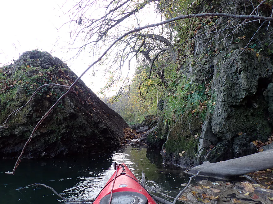
Still more outcrops and boulders
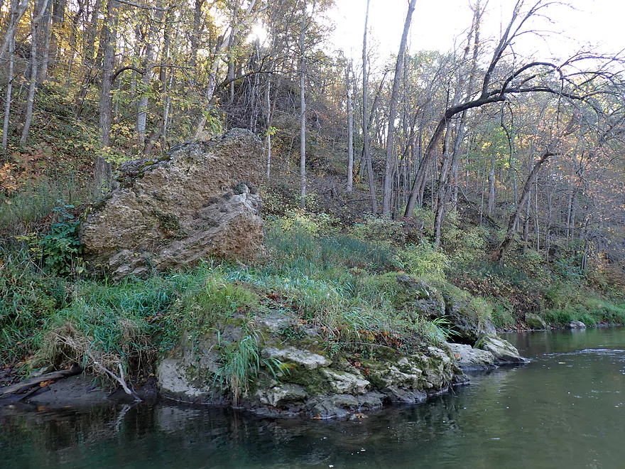
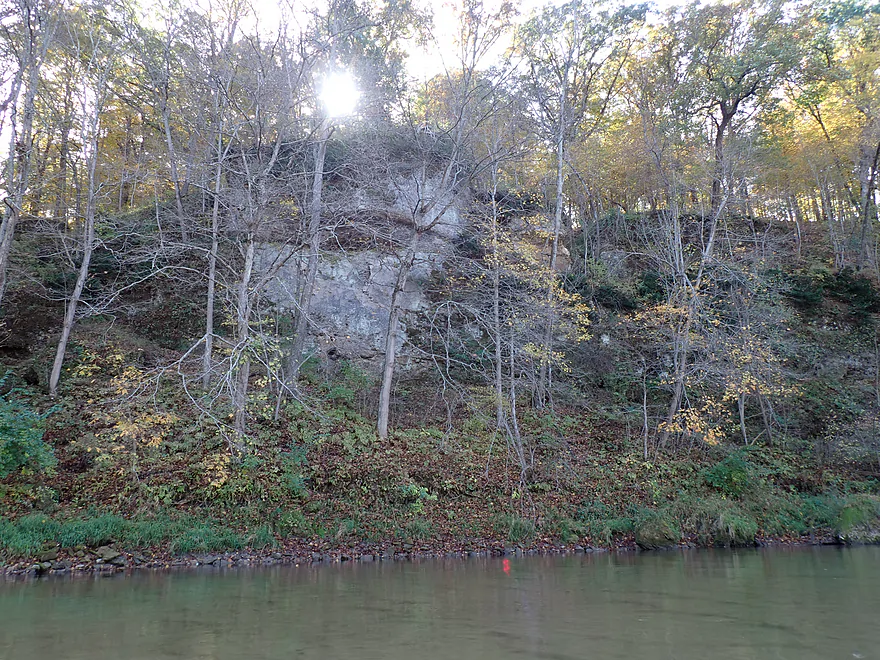
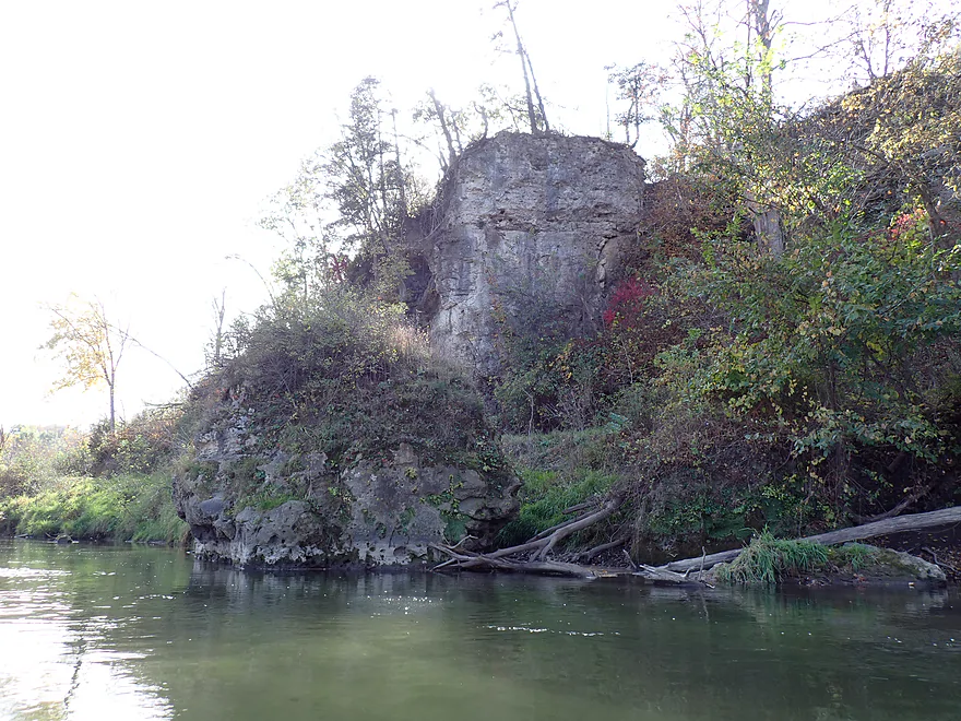
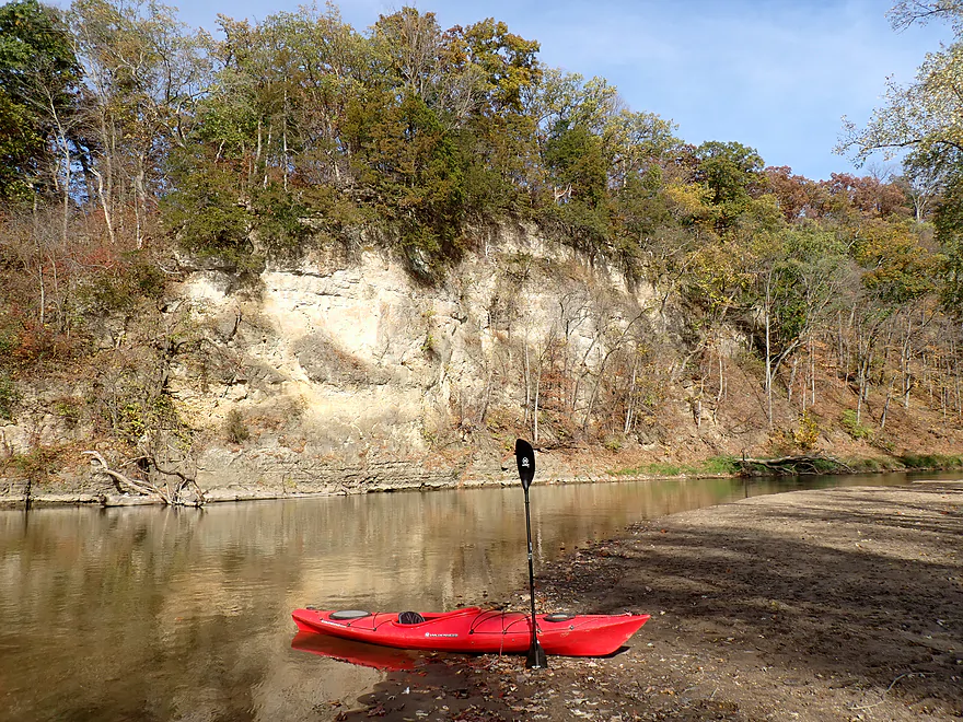
One of the taller outcrops
A sandbar with cowpies on it
Cow trails leading to the river
Another great outcrop
30th Ave
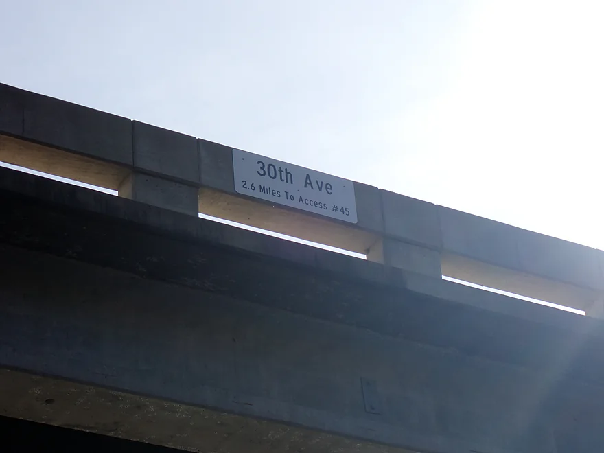
Well marked for paddlers
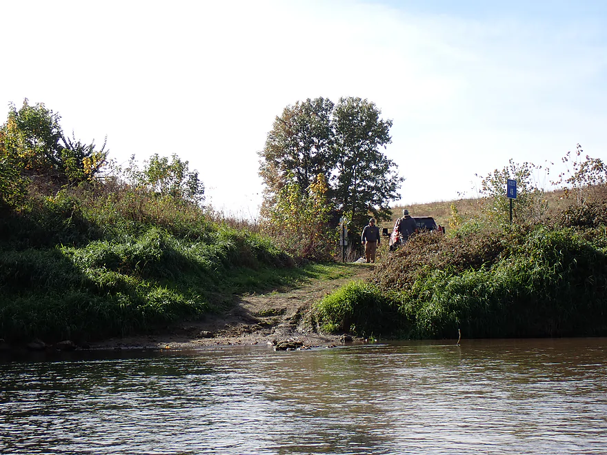
There is a public access here
A lot of trees had already lost their leaves
My favorite part of the trip
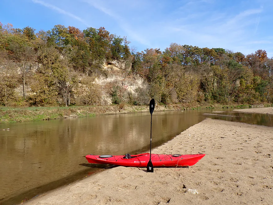
Very impressive sandstone outcrop (trip was a mix of limestone and sandstone)
Part of a larger scenic river bend
Lots more bluffs
Large boulder split neatly in half (back to limestone)
Ending the trip at 50th Ave
Good public access
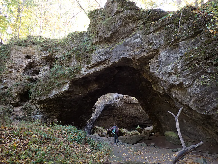
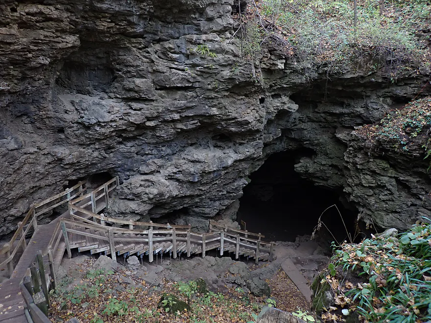
Exploring Maquoketa Caves State Park after the trip
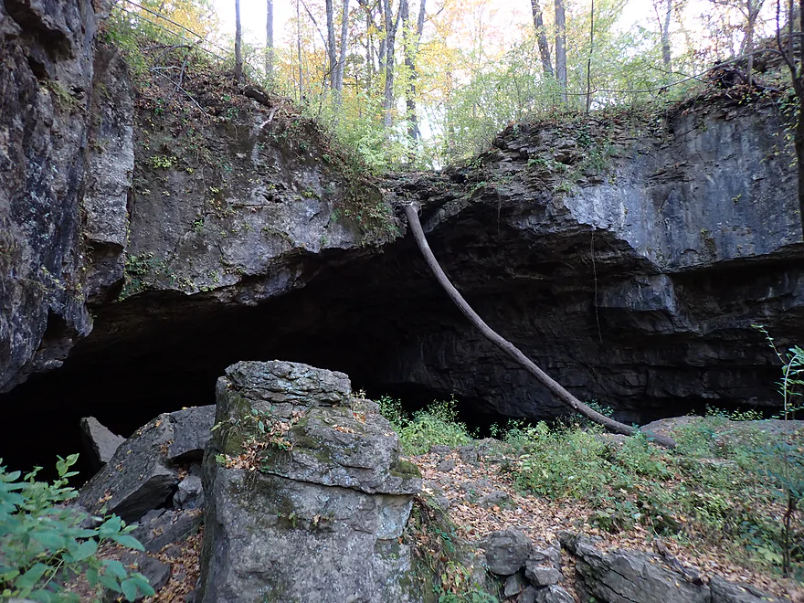
This is the “Natural Bridge”…very impressive
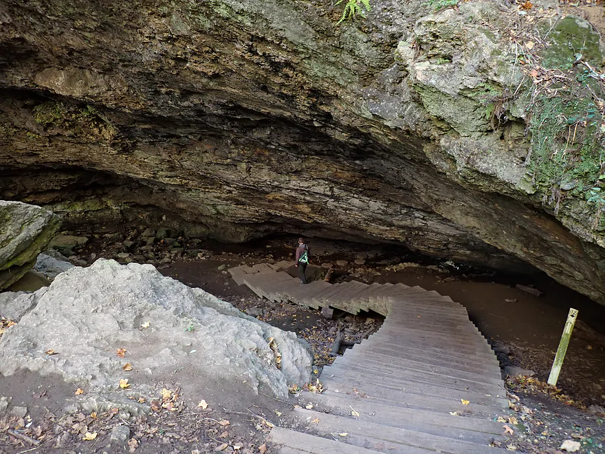
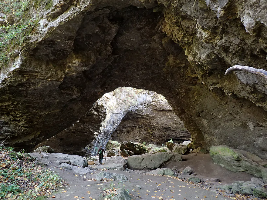
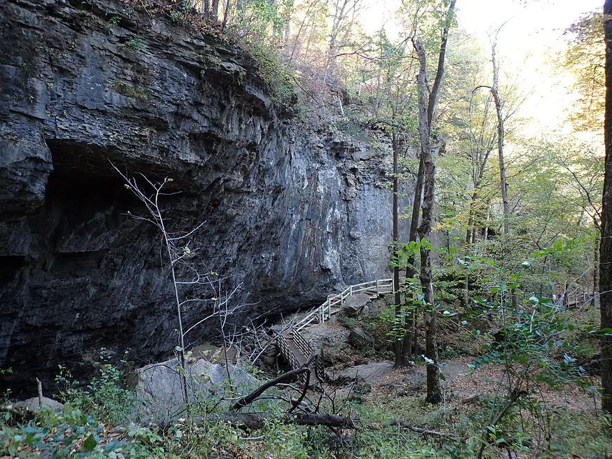
Looking down at the Upper Dancehall Cave Entrance
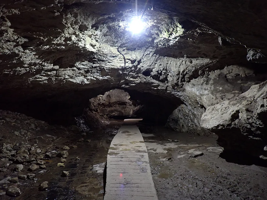
Then entrance leads to a cave tunnel
Really cool…this actually goes under 98th Street
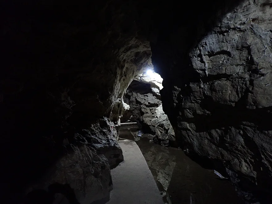
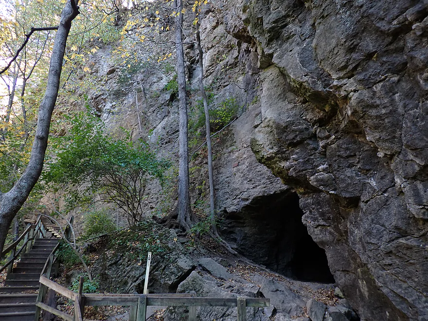
The first cave exit is the “Middle Dancehall Cave Entrance”
Both views looking up or down are terrific
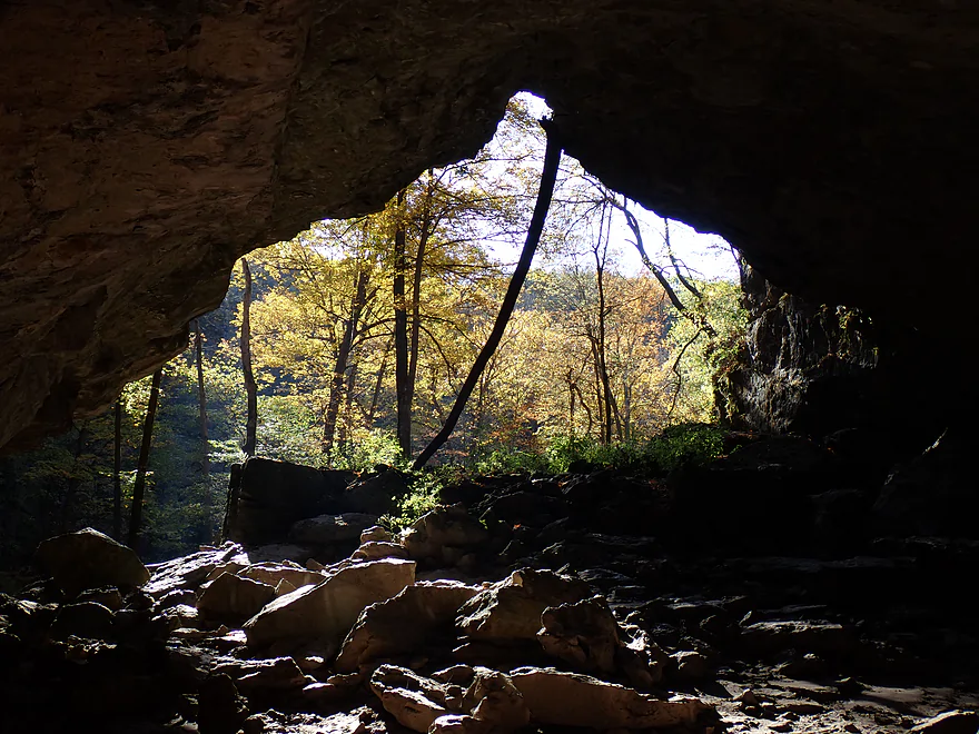
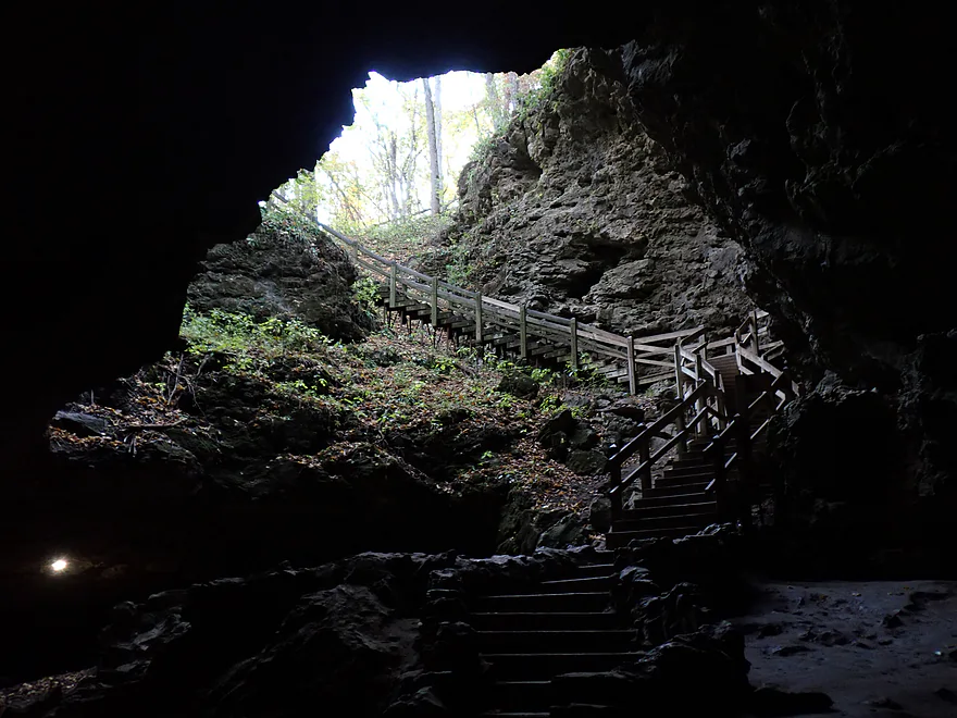
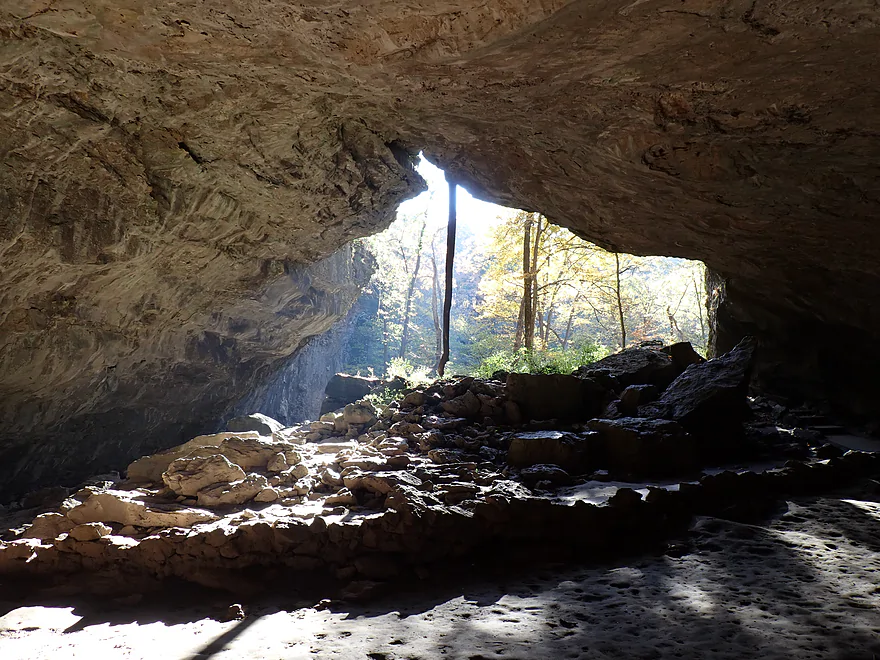
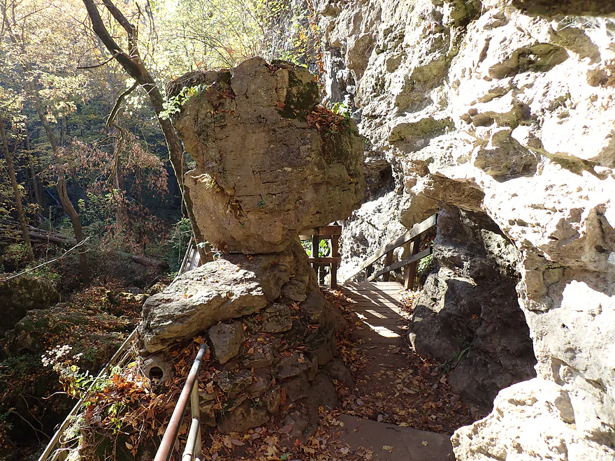
Or you can keep following the cave tunnel to the “Lower Dancehall Cave Entrance”
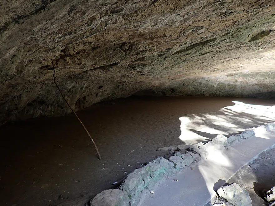
Large flat area in the cave (likely where the dancehall reference comes from)
Natural light entering the cave
South of this is a large cliff
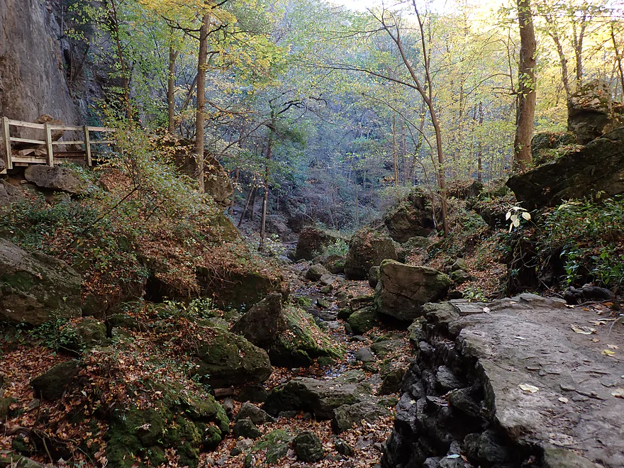
A small creek exits the cave and will become Racoon Creek
Rainy Day Cave (one of the park’s smaller caves)
This is “Balanced Rock”
One final view of the outside of the “Lower Dancehall Cave Entrance”
Maquoketa River – Buzzard Ridge Wildlife Area

The Maquoketa River is one of Eastern Iowa’s most popular paddling rivers. Many of its stretches are quite nice…but the best and most popular are between the Monticello Dam and 50th Ave (although Backbone State Park is really cool, too). I hemmed and hawed over which leg to do, but ultimately opted for Canton County Park to 50th Ave because of the rugged hills, potential fall color, and lack of gravel roads for bike shuttling (a not uncommon issue in rural Iowa).
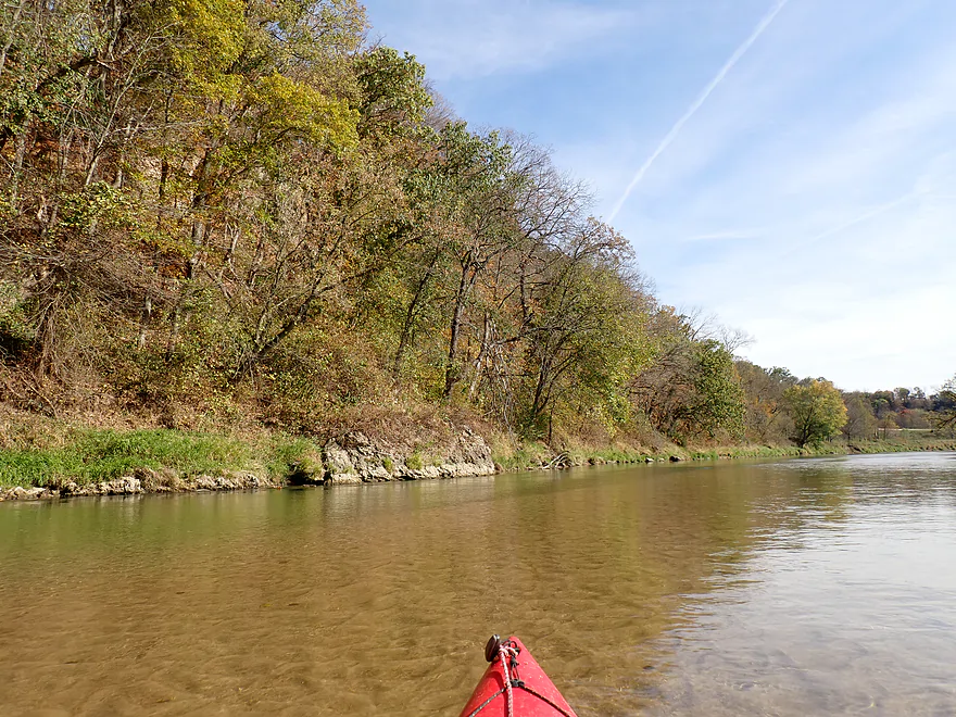
Canton County Park, where my trip began, had a well-marked and fantastic public access. Right away the river impressed me with its terrific clarity, sandy/gravel substrate, good current, sandbars and even a small outcrop just within eyesight of the put-in. Walnuts were everywhere (in the park, floating downstream, and on the shore) and added a bit of flavor to the trip. The only downside to the first mile+ were the banks were a bit ratty (kind of a common feature, unfortunately, of some Iowa rivers).
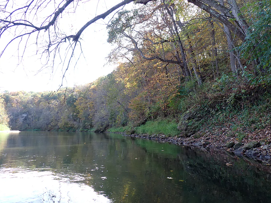
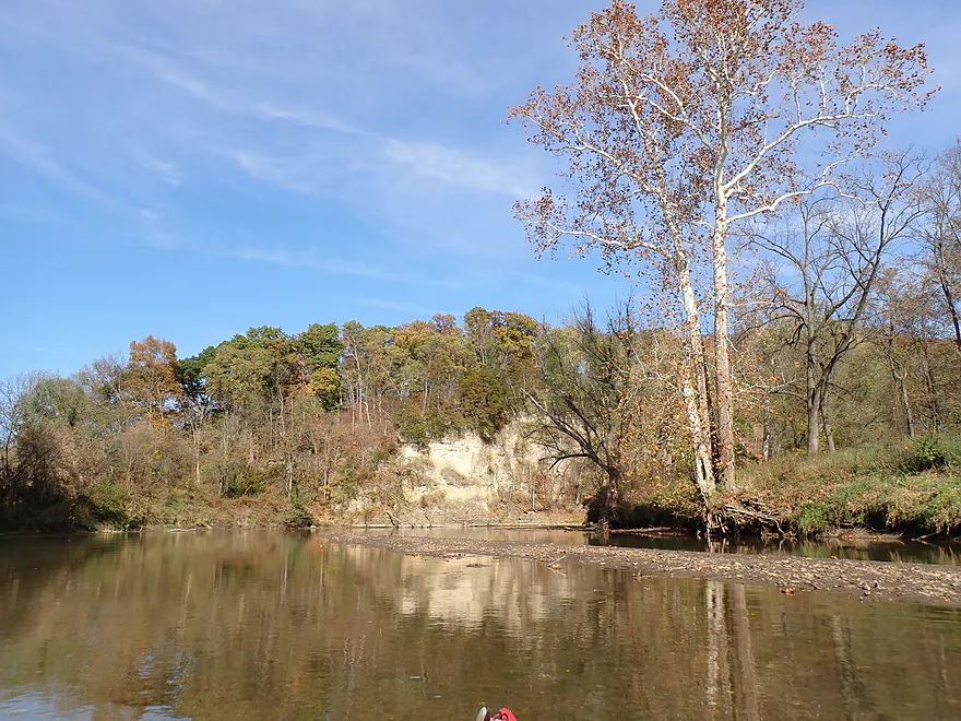
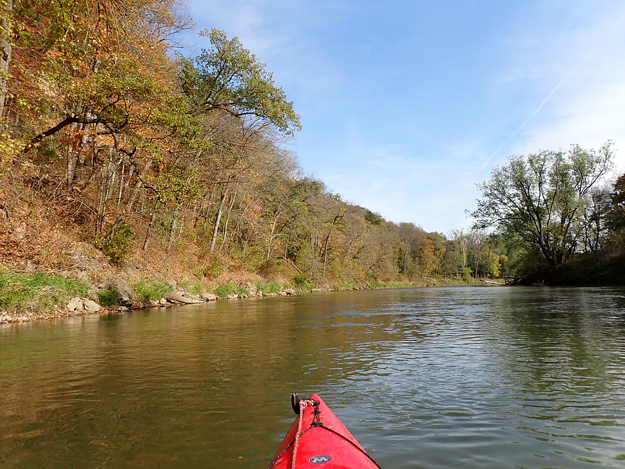
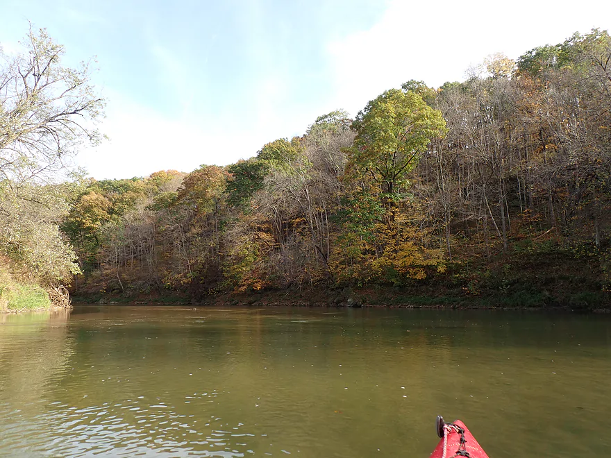
I soon entered the “Buzzard Ridge Wildlife Area” (bluff country) and the scenery improved dramatically. Here the river twisted sharply back and forth through a labyrinth of steep hills. Many of the bluffs had small sandbars or boulders at their base. The banks were wooded and undeveloped and reminded me of the North Fork of the Maquoketa River (just next door to the north).
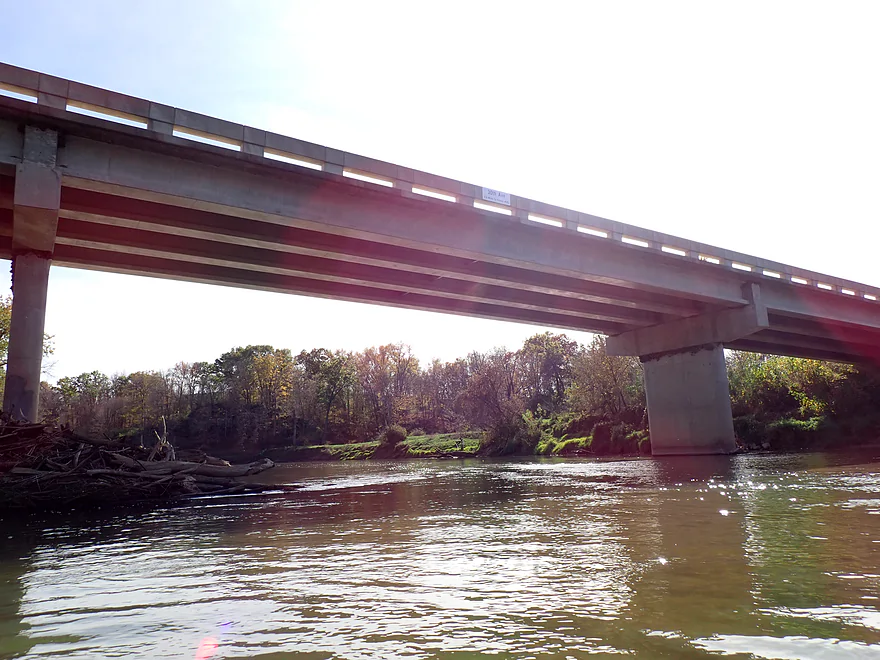
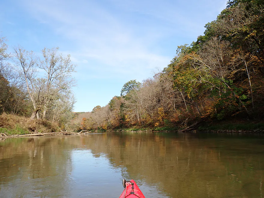
The bluffs continued past the borders of the wildlife area, but then receded as the river made a long turn south. Following a final pair of outcrops, I came to the 30th Ave bridge where I saw a pair of canoers taking out at a public ramp. I initially considered ending my trip here as well…but 30th Ave is gravel, which I didn’t want to bike shuttle on.
The final 3 miles of the trip were really nice…in fact, maybe the best part of the trip. It seemed like the bluffs became steeper, the woods more tidy, and the rocks more attractive. While the Maquoketa River has a number of riverside cliffs, most are not next to the river they are elevated atop a hillside and somewhat obscured by trees. A nice exception was an impressive ~50′ cliff that descended all the way to the water line. Following a few more twists and turns past steep bluffs, I ended the trip at 50th Ave where there was a nice public access.
In summary, this was a great trip that I can recommend. One minor issue was that water levels were a bit low and I had to “scooch” over a few spots. Typically the river is much higher…but regardless, you will be fine as long as you pay attention to where the deep parts of the river are (usually where it’s fastest). The fall color was good…but I must say the Turkey River trip I did a few years ago had WAY better color. As for the bluffs, I actually prefer those on the North Fork a smidge better, but they are both great. I think most paddlers will still prefer the main branch over the North Fork for its access points, which are light years better.
Despite its namesake I didn’t see any “buzzards” along “Buzzard Ridge Wildlife Area”, but I did see a lot of eagles. There were several large schools of fish which tended to hide in the deep areas of the river (safer from eagles, I suppose). Other sights included songbirds, turkeys, and one horse. After the Wildlife Area I saw a number of cowpies along the bank, so I presume cattle occasionally frequent the lower parts of the river.
Maquoketa Caves State Park: This is Iowa’s most popular state park and is a perfect after-trip excursion for Maquoketa River paddlers (the park is very close by).
The park itself has about 15 caves…but if you’re not up for a long hike, you can simply check out the three main caves (referred to as the Dancehall Entrances). These are the most impressive and popular features of the park. The following is a sample short itinerary that would allow you to efficiently hit the main park highlights (don’t forget to print out a park map).
- Hike north to the top of “Natural Bridge” for a great view of the Upper Dancehall Cave Entrance.
- Check out the Window Cave to the north and then descend down to and cross under “Natural Bridge” (a fantastic arched rock).
- Enter Upper Dancehall Cave Entrance…at first it just seems like a big cavern…but it keeps going and connects to an 1100′-long cave tunnel you can explore.
- Follow the cave tunnel south, which will literally go under the main park road (98th Street). There will be a paved path and lights. Even though you are in a cave, there is plenty of room– although the northern entrance is a bit low (about 5′) and will require a bit of ducking. A small underground creek parallels the path and will eventually become Racoon Creek.
- The first exit will be the “Middle Dancehall Cave Entrance”. A steep set of stairs lead out…and from the top looking down is one of the iconic photos of the park.
- The tunnel continues south to the next exit “Lower Dancehall Cave Entrance”. Here there is an impressive alcove and the framed view looking out is fantastic.
- You can continue a bit south to check out “Rain Day Cave” which is one of the smaller caves in the park.
- After Rainy Day Cave, I climbed north up steep stairs and past “Balanced Rock”.
- Then it was a short hike back to 98th Street and the main parking lot.
Note: the actual caves are closed from November 15th until April 1st to accommodate overwintering bats.
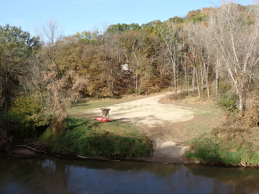
Canton County Park: This is a very good public access.
Alternate Put-ins:
- Supples Bridge Access (6.4 miles upstream from Canton): Supples is a decent public access. This leg starts flat, but winds its way through some nice bluffs. Likely not as scenic as other stretches of the river, but still good.
50th Ave: This is sometimes referred to as the Royertown Canoe Access or Water Trail Access #45. Whatever you call it, it’s a great public access (and scenic). The only qualm is the access drive is a bit steep and rutted. Worst case scenario you could just leave your vehicle on the 50th Ave shoulder.
Alternate Take-outs:
- Millertown Access (2.9 miles upstream from 50th Ave): This is a public access upstream from the 30th Ave bridge…it’s a bit muddy but plenty fine for launching. The leg between Millertown and 50th is very nice, with some of my favorite bluffs and one of the best cliffs on the river. Bike shuttlers though may want to avoid 30th Ave as it is mostly gravel.
- Chenelworth Bridge Access (2.4 miles downstream from 50th Ave): I didn’t scout this, but I believe there is a public access on the north side of the 82nd Ave bridge. This bonus stretch would be a bit flatter, but there should still be some nice bluffs.
Bike Shuttle – 50th Ave to Canton County Park: 5.9 miles with 315′ of ascent. This was a very hilly bike shuttle and a bit on the challenging side. But the good news is, it is all paved and there is no gravel to worry about (part of the reason I chose this stretch over other Maquoketa stretches).
Logjams/Dams/Hazards: None really…this is a pretty safe and simple trip.
Wind: The trip is in the open, so you’ll want to stay off the river when there are strong headwinds.
Current: There really aren’t any rapids, but the current tends to be consistent and moves at a good clip.
Closest Gauge: Maquoketa River @ Maquoketa
Trip Depth: 620 CFS or 10.49′
Navigability Estimates: These are just rough estimates.
- < 500 CFS: Likely too low for enjoyable paddling.
- 501-700 CFS: Mostly ok but there are a handful of low spots that you might ground out on. Clarity is excellent.
- 701-1000 CFS: An average fall depth and good target range. Clarity won’t be as good.
- 1001-1400 CFS: Average summer depth…fine for paddling.
- 1401-2000 CFS: High depth…should be fine for paddling.
- 2001+ CFS: Very high depth…at this point the river might get a bit pushy and dirty for enjoyable paddling.
Click here to see an overview map of the Maquoketa River.
- Upstream from 400th Street: I think the river might be navigable, but I don’t know for sure.
- 400th Street to Hwy 410: 3.4 miles. Likely a nice stretch with a number of sandbars, impressive outcrops, and steep bluffs. There might be some logjams to deal with.
- Hwy 410 to Dundee Access: 6.2 miles.
- Hwy 410 to Dam Landing 4.1 miles. Flows through the heart of Backbone State Park. First half flows by incredibly scenic bluffs, while the second half is an impounded lake.
- Dam Landing to 129th Street: 0.2 miles. The section between the dam and 129th Street is split into two channels. Both are narrow, fast, and congested. Not for beginner paddlers and should be scouted before running. I ran the west channel and dealt with an unpleasant two-foot ledge below the bridge. The east channel may be easier.
- 129th Street/Dam to Dundee Access: 2.1 miles. Attractive stretch with nice bluffs and some outcrops. Not as scenic as the preceding section.
- Dundee Access to 165th Street: 5.0 miles. This is a flatter section with many sandbars and far fewer bluffs.
- 165th Street to Quaker Mill Dam Access: 4.5 miles. This should be nicer than the preceding leg and features a return of some bluffs. A dam was removed relatively recently which has opened up this leg to paddlers. There are some rapids on this stretch.
- Quaker Mill Dam Access to Tirrill Park: 2.2 miles. A wooded stretch with lots of sandbars. River doubles in size from new tributaries.
- Tirrill Park to Manchester Whitewater Park – Upstream Access: 0.5 miles. Short leg that wraps around the town of Manchester.
- Manchester Whitewater Park – Upstream Access to Downstream Access: 0.2 miles. The famous Manchester Whitewater Park includes about 6 pitches of Class 2+ rapids.
- Manchester Whitewater Park – Downstream Access to Schram Park Access: 0.8 miles. Short leg through some suburban woods.
- Schram Park Access to Pin Oak Access: 2.6 miles. Includes some shallow but fun riffles. Per paddling author Nate Hoogeveen, some stretches have exposed bedrock.
- Pin Oak Access to Bailey’s Ford Park: 1.9 miles. Heavily wooded stretch with some riffles.
- Bailey’s Ford Park to Turtle Creek Park: 4.7 miles. The river here has been impounded by a dam and the shoreline is heavily developed. I’m not sure this would be a positive paddling experience.
- Turtle Creek Park to Delhi Access: 3.8 miles. This is Hartwick Lake…slow, wide, developed, and likely not interesting. Take-out is downstream from the dam (and requires a portage).
- Delhi Access to Pioneer Road Access: 4.5 miles. Likely a nice prospect with some scenic bluffs and supposedly a small canyon. Much of the bank is wooded and protected from development.
- Pioneer Road Access to Dunlap Park/Hopkinton: 5.3 miles. This stretch is flatter, sandier and more open than the previous leg. Still might be a few nice bluffs. The old dam was partly removed. What remains is a tricky stretch of boulders and rapids that may have to be portaged.
- Dunlap Park to Hard Scrabble Access: 1.8 miles. Simple stretch with wooded hills. There are irregular rapids by the put-in where the dam was removed.
- Hard Scrabble Access to Monticello Dam Upper Access: 10.2 miles. This is a longer wooded stretch. The first half has a lot of wooded hills and the second half is more open. A dam by the take-out slows the current, which may make the last few miles somewhat boring.
- Monticello Dam Lower Access to Pictured Rocks Boat Ramp: 8.1 miles. The start of one of the more popular and scenic stretches on the river. This stretch includes many bluffs with elevated, exposed limestone outcrops. Crowds might be an issue on summer weekends.
- Pictured Rocks Boat Ramp to Indian Bluffs Access: 4.2 miles. Paddling author Nate Hoogeveen argues this is one of the prettiest and most dramatic stretches on the river. Highlights include more limestone bluffs and undeveloped wooded banks.
- Indian Bluffs Access to Eby’s Mill Access: 2.7 miles. The river flattens out somewhat and there aren’t as many steep, scenic bluffs, but there should still be some nice ones.
- Eby’s Mill Access to Hwy 136 Access: 5.5 miles. This is the last of the great Monticello sublegs. It still has good bluff scenery, but there are longer and flatter stretches that likely won’t be as interesting.
- Hwy 136 Access to Supples Bridge Access: 3.1 miles. River becomes much flatter, less hilly, and less interesting. Farm fields will become a common sight. On the plus side, there will be some nice sandbars.
- Supples Bridge Access to Canton County Park: 6.4 miles. The bluffs finally return and provide good scenery. While likely not as dramatic as the Pictured Rocks stretch, this is a solid leg enjoyed by paddlers.
- Canton County Park to Millertown Access: 6.2 miles. This is a favorite stretch for some paddlers. Here the river flows between steep bluffs. Limestone boulders, cliffs, and bedrock are a common sight.
- Millertown Access to 50th Ave: 2.9 miles. The river continues to wind between steep bluffs and is one of my personal favorite stretches. A highlight is a large riverside cliff.
- 50th Ave to Chenelworth Bridge Access: 2.4 miles. River starts to open up and straighten out…likely less interesting. Still some nice bluffs.
- Chenelworth Bridge Access to Morehead Canoe Access: 1.9 miles. A flatter and less interesting stretch. The famous Maquoketa Caves State Park is located nearby and is worth checking out.
- Morehead Canoe Access to Joinerville Park: 3.7 miles. This is a terrific stretch with fantastic cliffs. Note, powerboats might start to become an issue at this point. Paddlers can overshoot Joinerville Park on purpose to check out some nice downstream cliffs and then double back.
- Joinerville Park to Lake Hurst Dam: 4.4 miles. First half of the trip goes past incredible bluffs and cliffs. Second half is slower and less interesting (Lake Hurst). Note, the take-out is downstream from the dam, so a portage is required. The DNR discourages portaging because of the lack of a formal portage path. Other sources indicate you can portage on the left bank. The dam is dangerous and you shouldn’t get close to the edge.
- Lake Hurst Dam to Maquoketa City Access: 1.6 miles. A generic stretch that passes the outskirts of the city of Maquoketa.
- Maquoketa City Access to Bridgeport Access: 3.7 miles. The North Fork joins up and significantly enlarges the main branch. From here on the river is much flatter, wider, shallower, siltier, and less interesting.
- Bridgeport Access to Iron Bridge Access: 8.8 miles. Despite being at best a mediocre stretch, this is relatively popular with local paddlers. The second half of the trip is more interesting with more bluffs and woods.
- Iron Bridge Access to Spragueville Access: 8.9 miles. Likely a bland section with lots of farm fields.
- Spragueville Access to Damon Bridge Access: 4.3 miles. Likely a mediocre section.
- Damon Bridge Access to Hwy 52 Ramp: 4.6 miles. A siltier stretch with lots of cornfields.
- Hwy 52 Ramp to Mouth on Mississippi: 2.8 miles. Last leg of the river…mostly straight. The Black Oak Dunes on the Mississippi might be interesting. Finding a take-out on the Mississippi might be a trick. Maybe you can get out at the end of 501st Ave, but don’t quote me on that.
Special thanks to Nate Hoogeveen and the Iowa DNR for much of this information.
Trip Map
Video
Photos Size: