
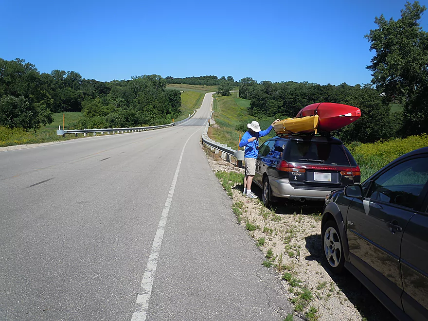
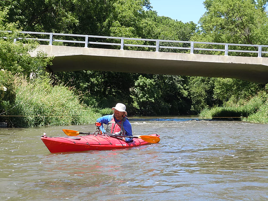
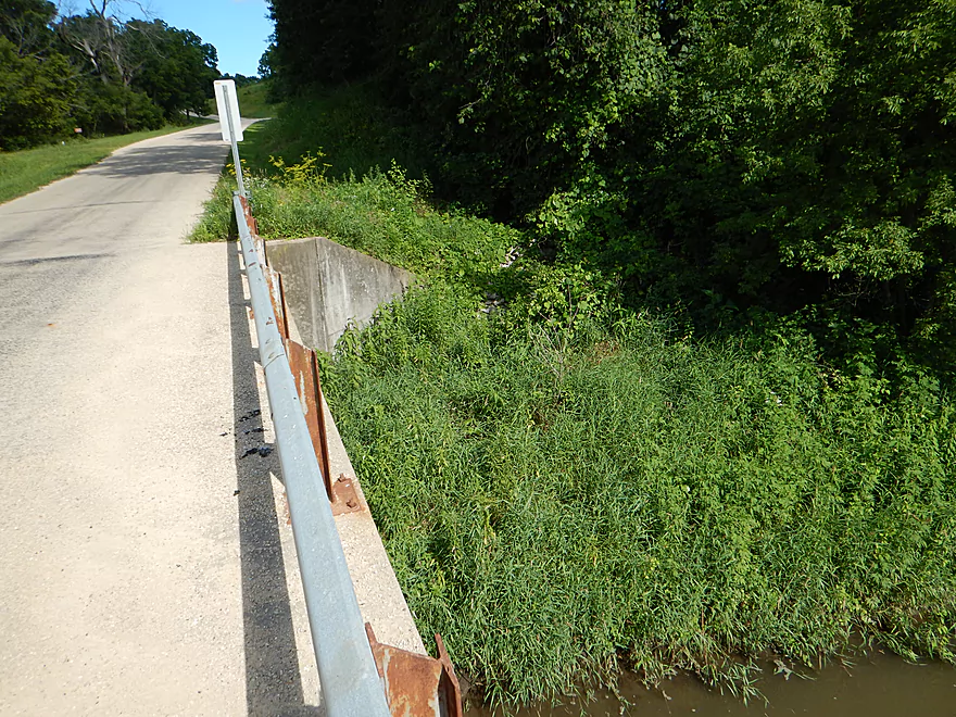
Annoying guardrails at Hwy A bridge
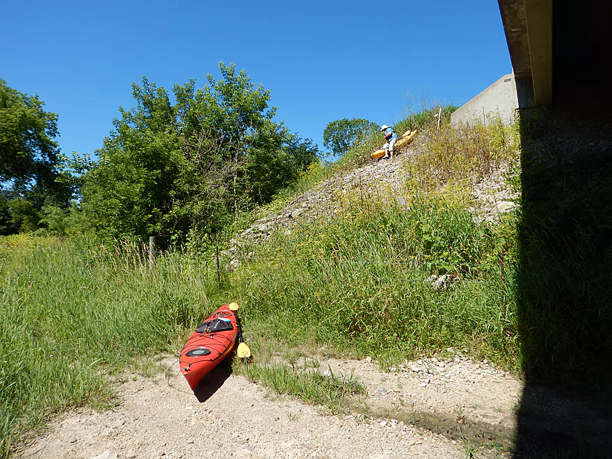
Very steep embankment under the bridge
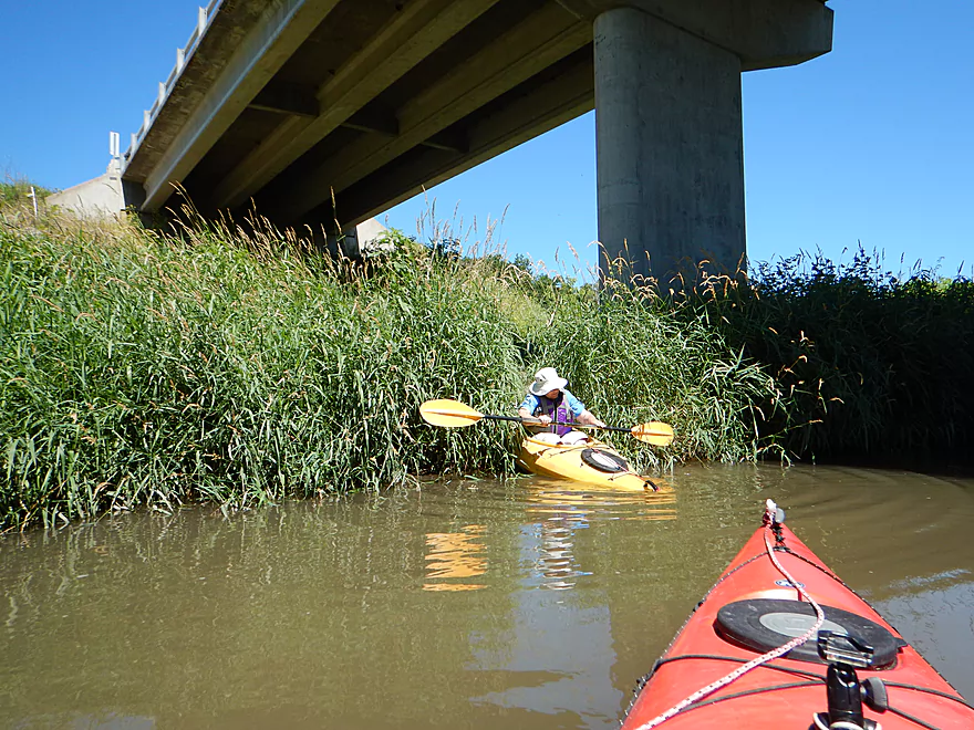
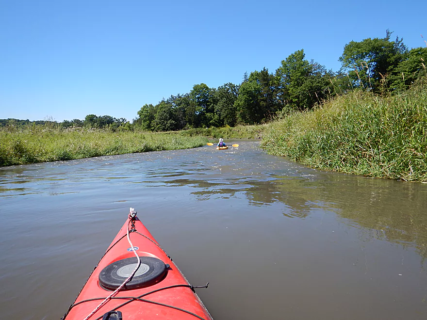
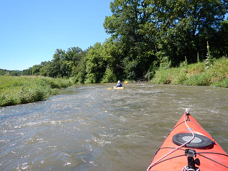
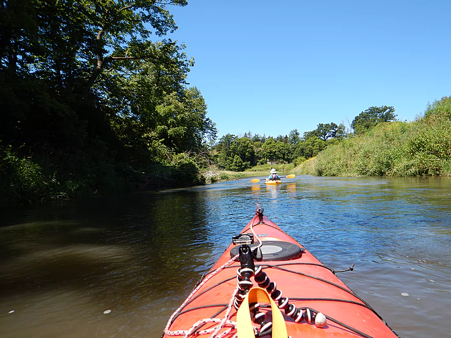
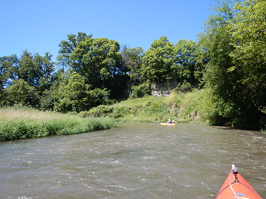
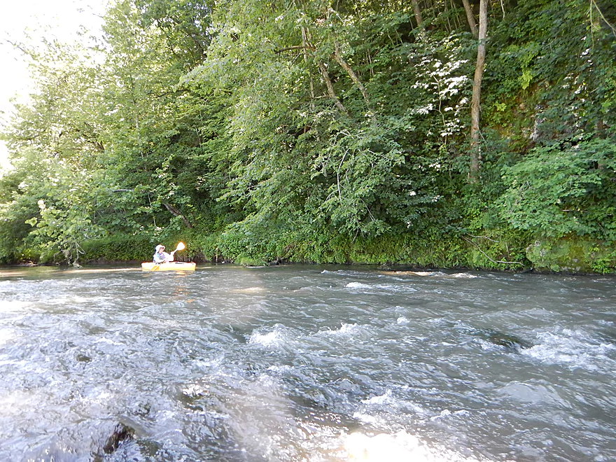
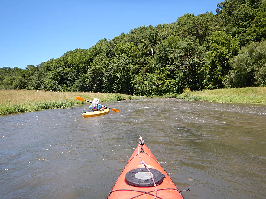
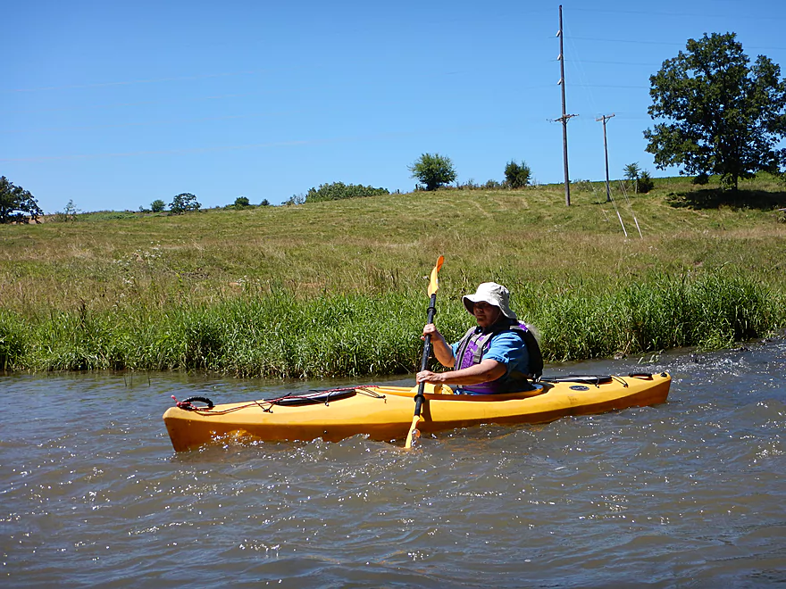
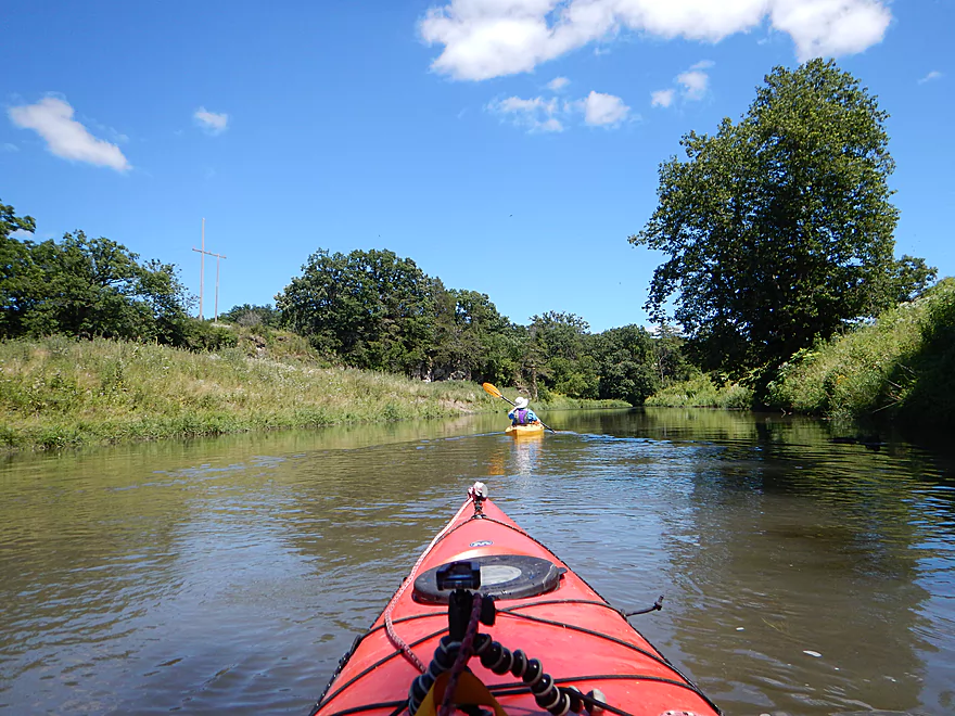
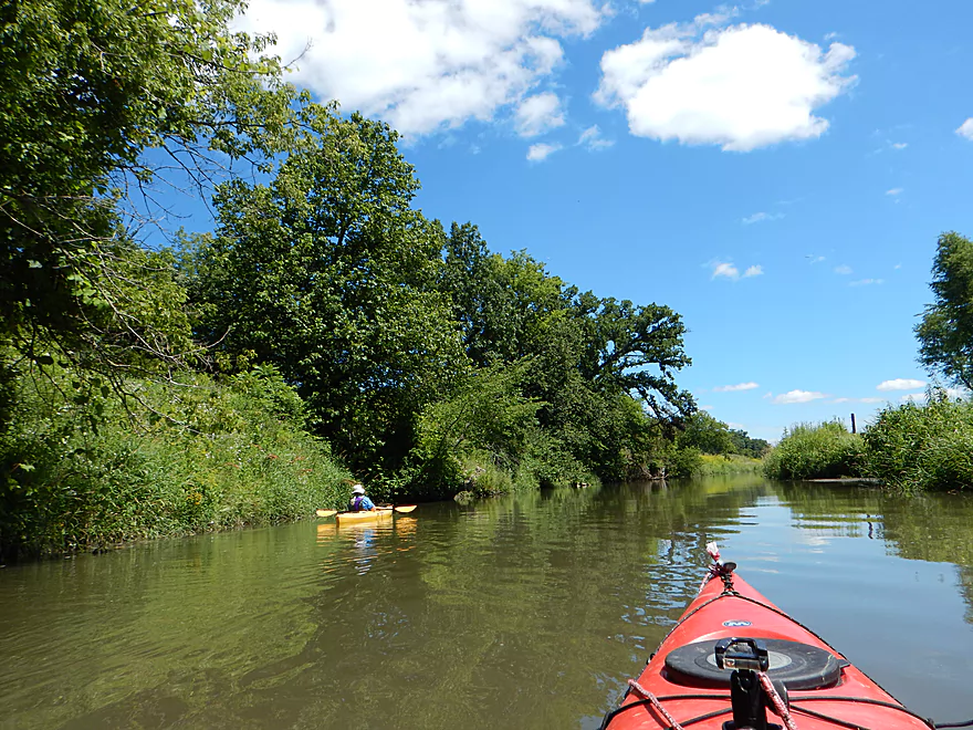
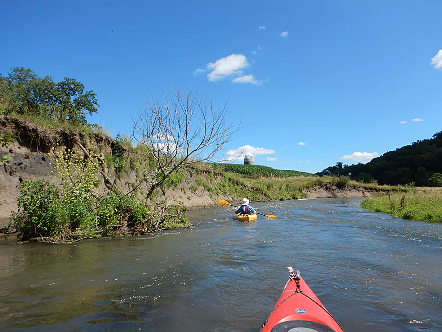
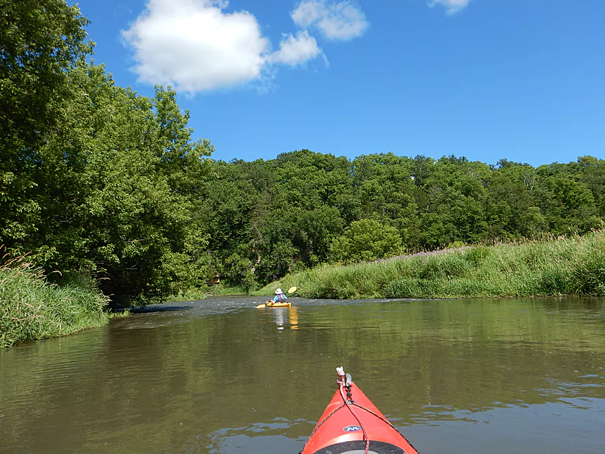
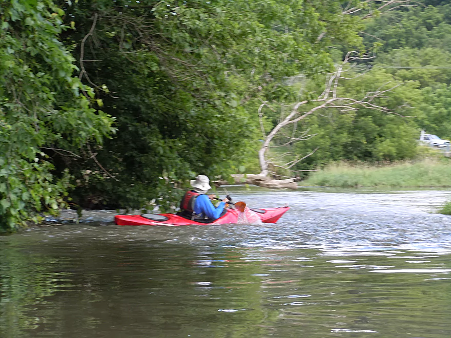
Finally onto the water…
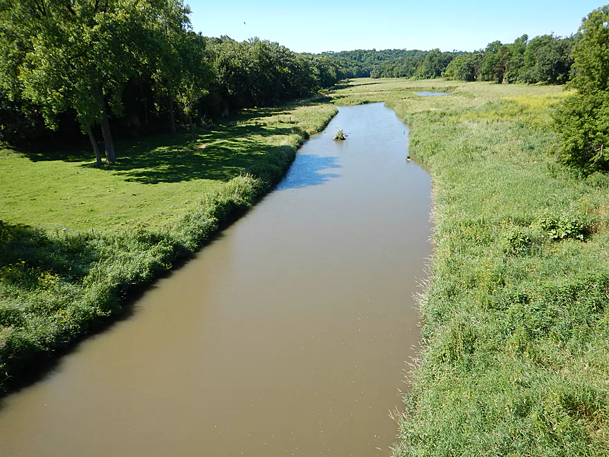
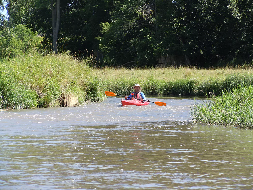
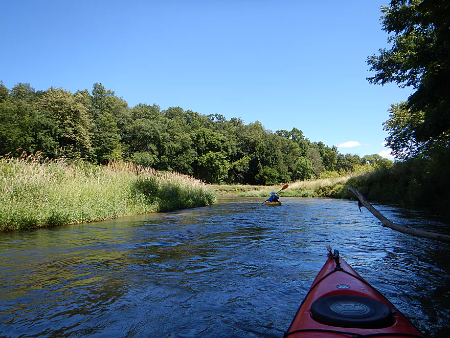
The river looks ho-hum to start
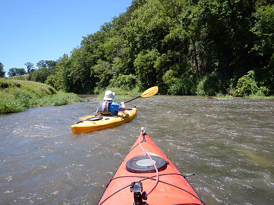
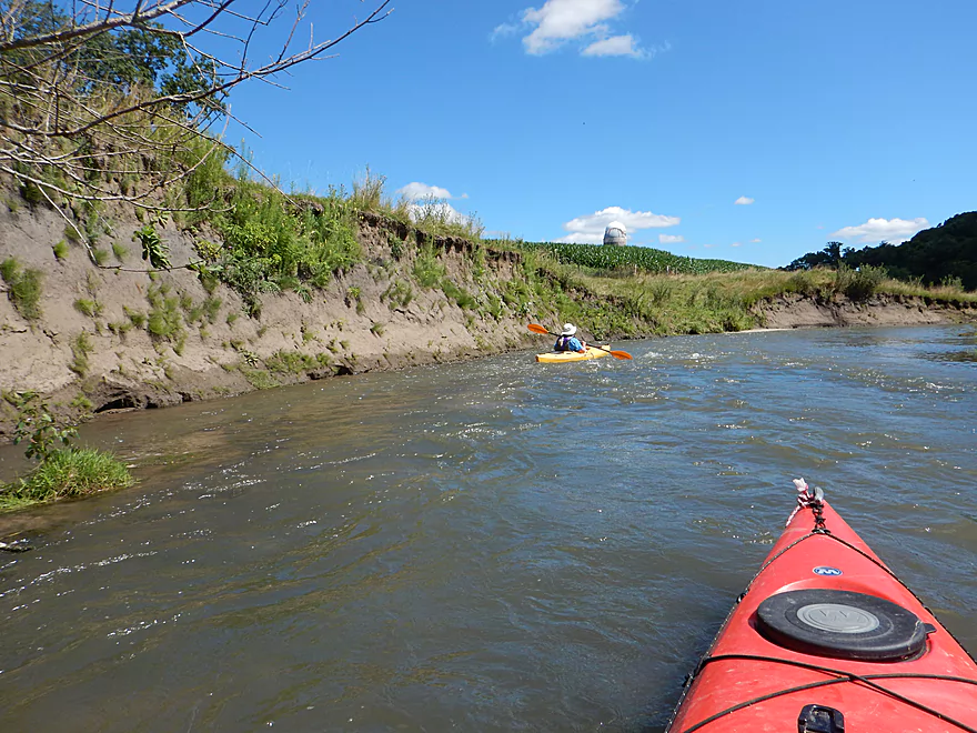
Things start to pick up
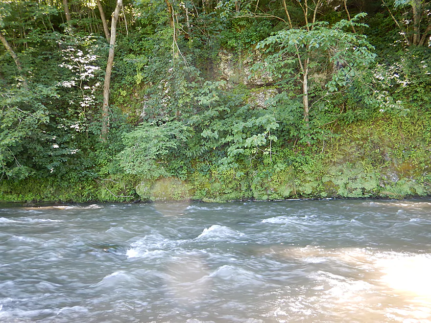
One of countless riffles
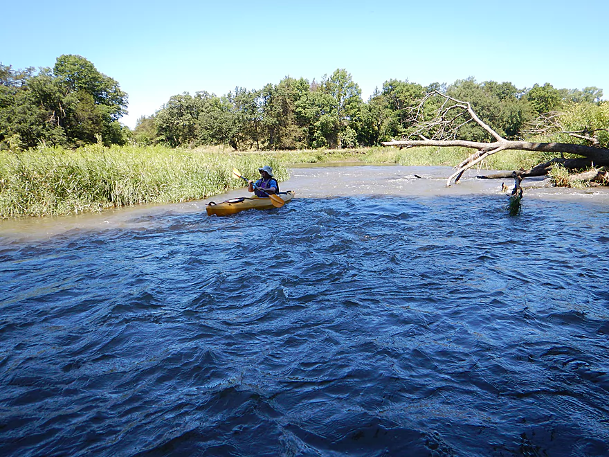
Very fun
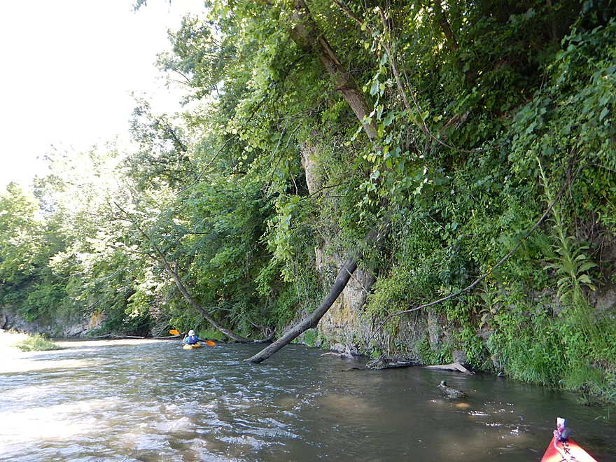
The upcoming farm fences are much worse
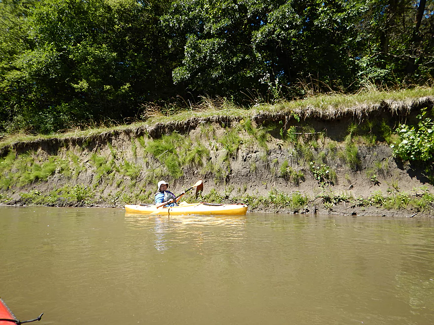
Huge mud banks!
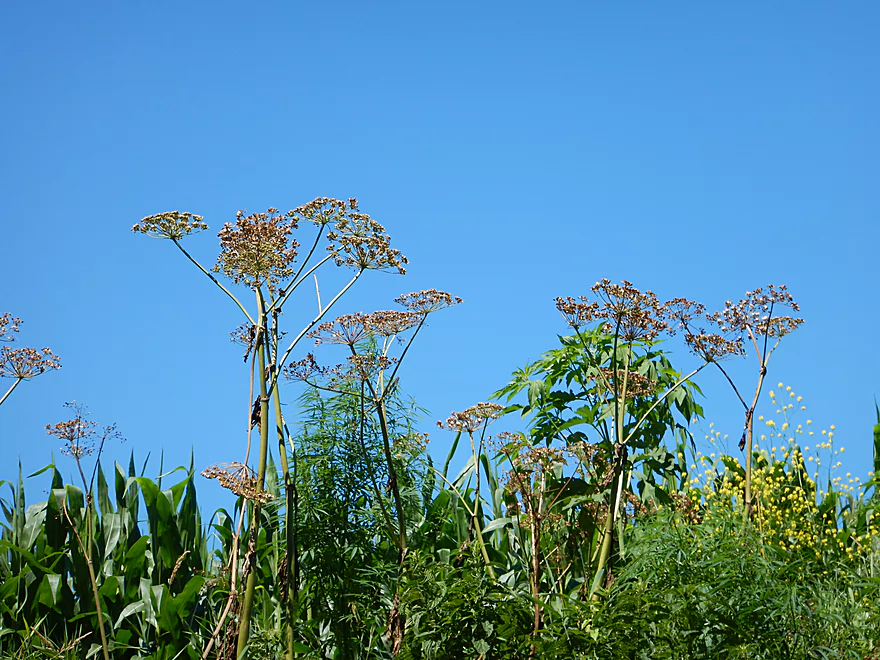
Interesting bankside vegetation
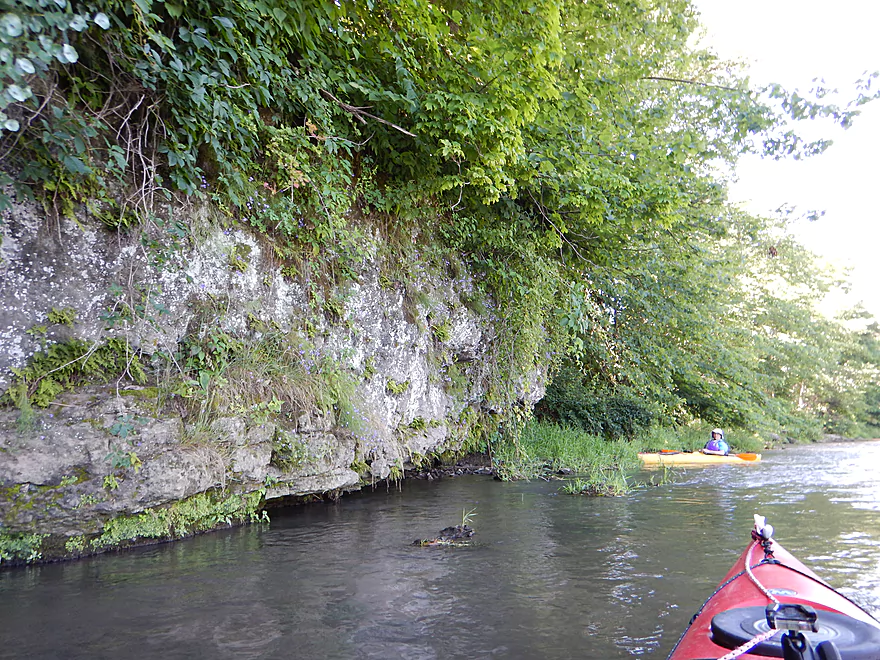
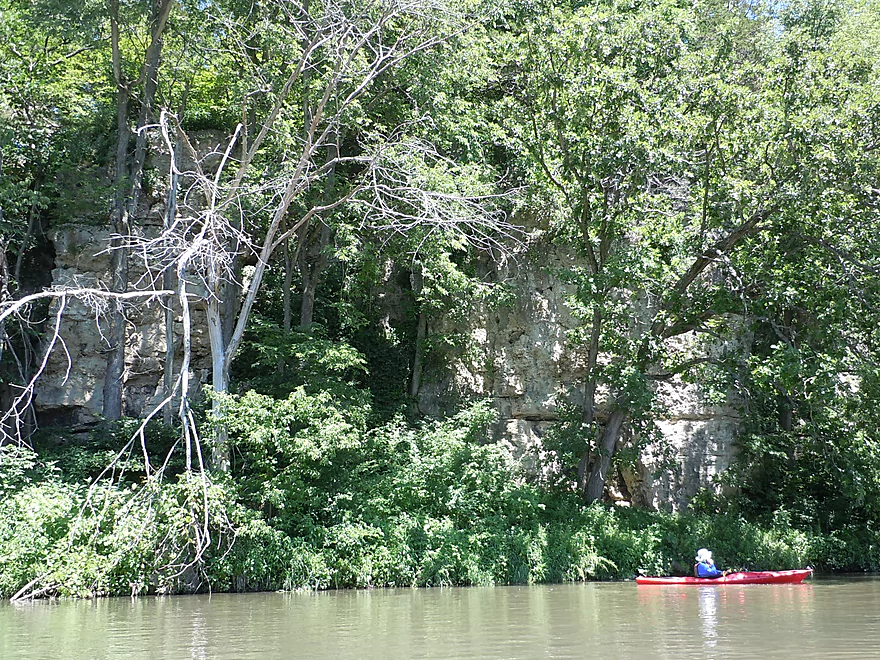
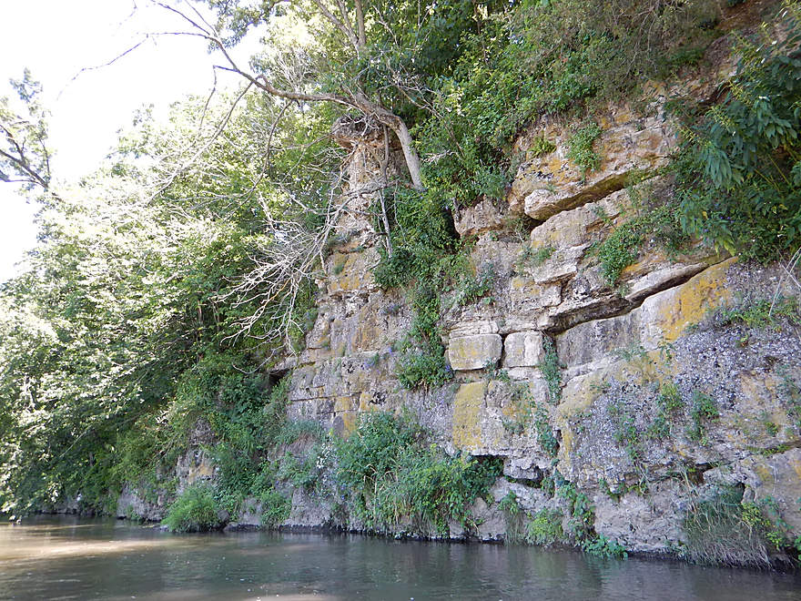
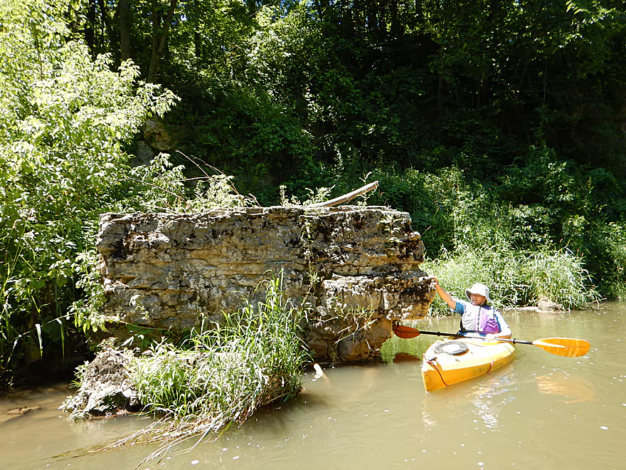
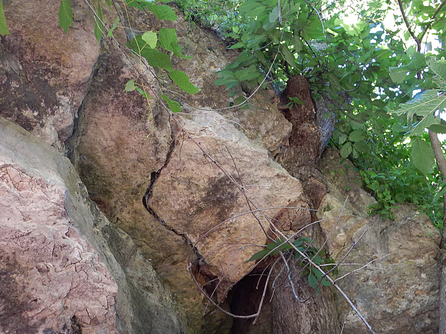
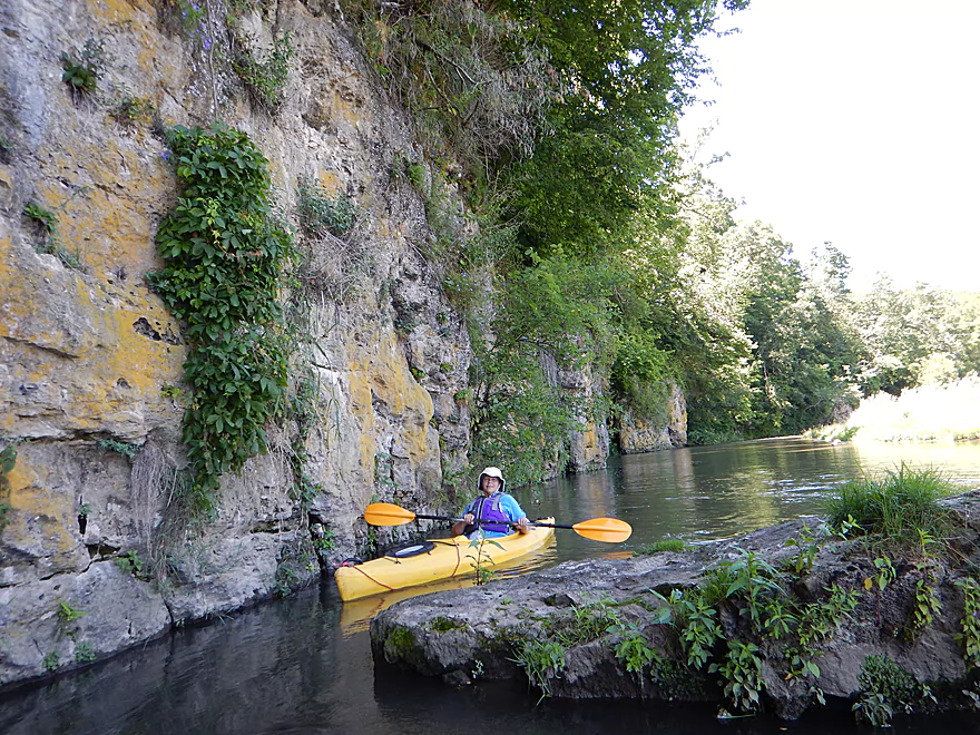
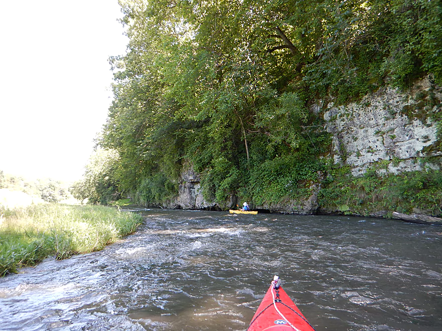
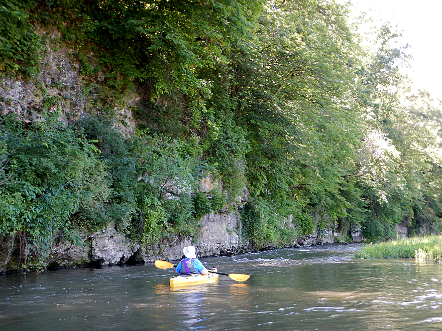
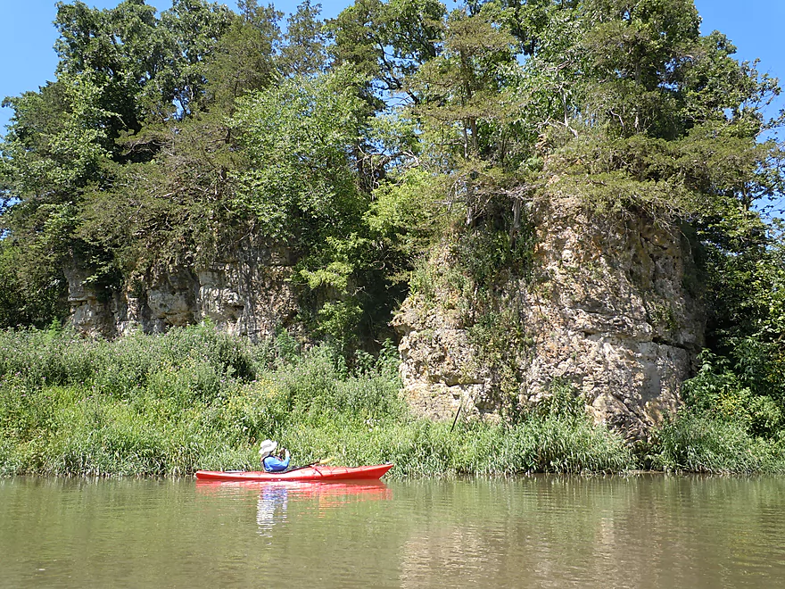
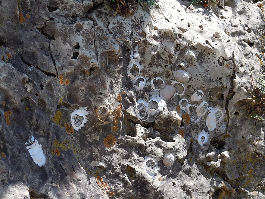
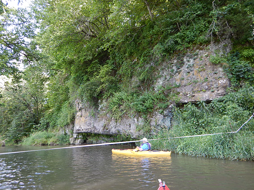
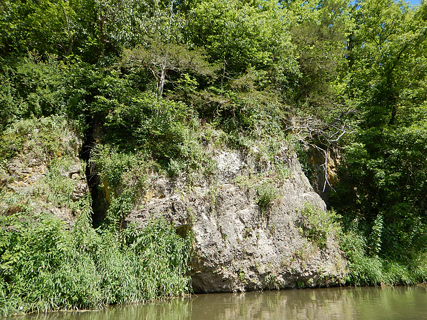
The first of the limestone outcrops
This is the reason you do the upper Platte
Third favorite outcrop
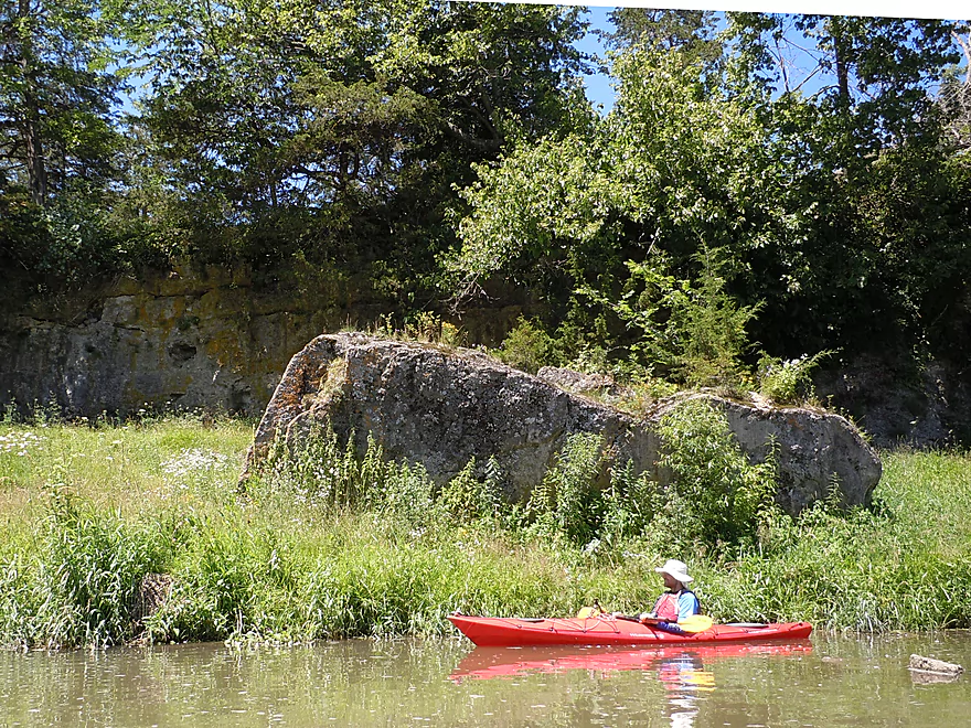
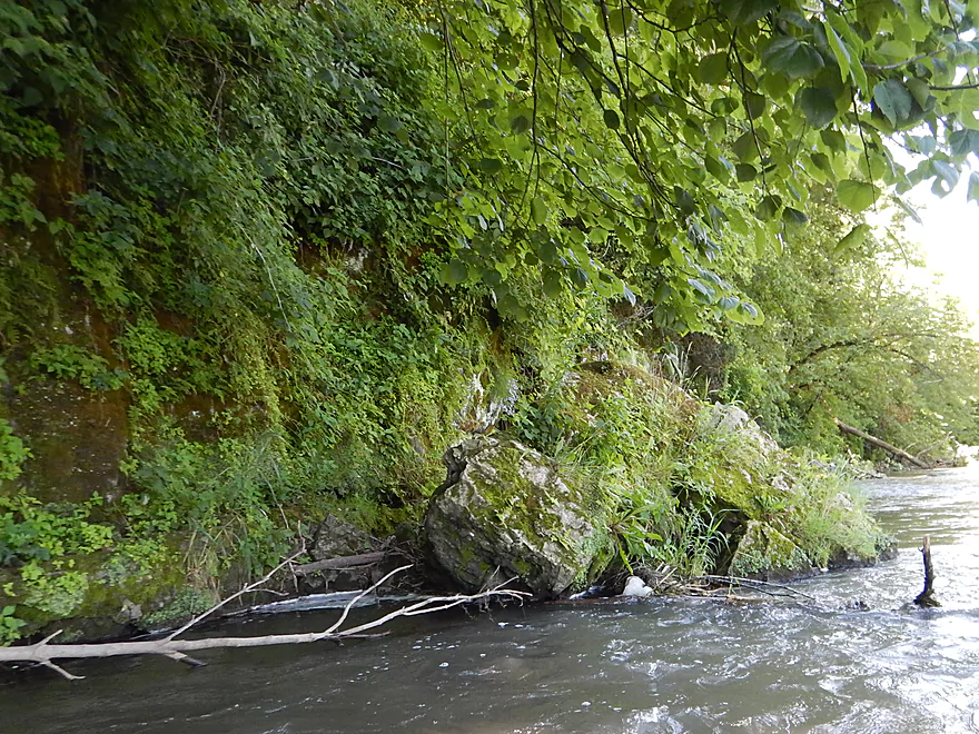
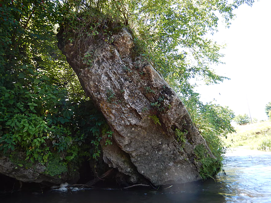
Many massive boulders along the river
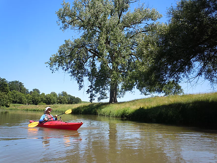
A majestic cottonwood
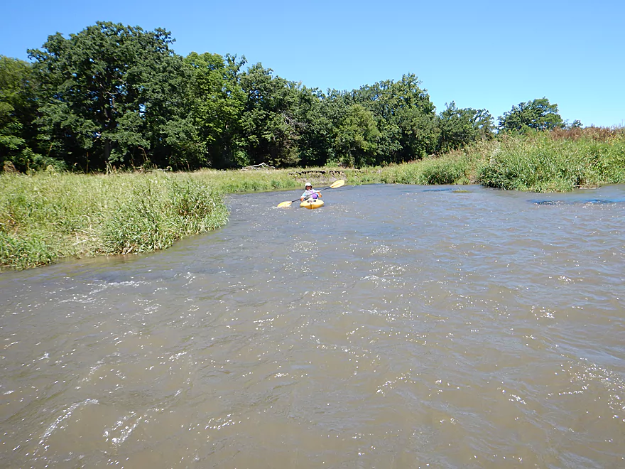
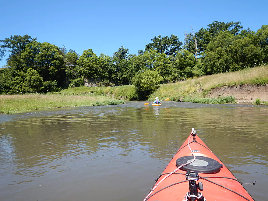
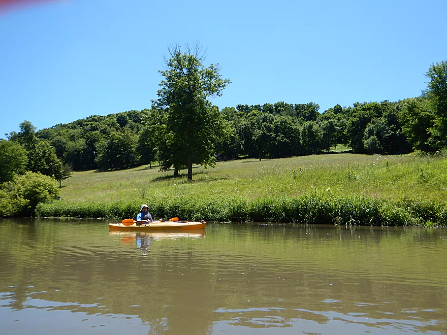
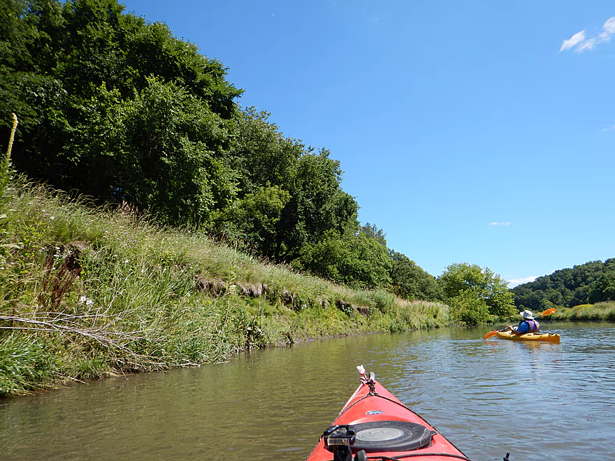
Many pastures and open meadows line the banks
This would be bumpy in lower water
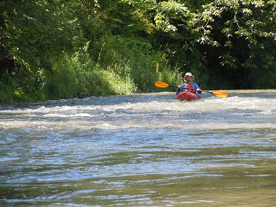
Rapids next to the limestone is a cool effect
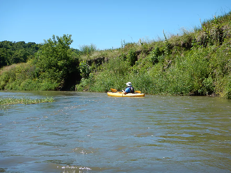
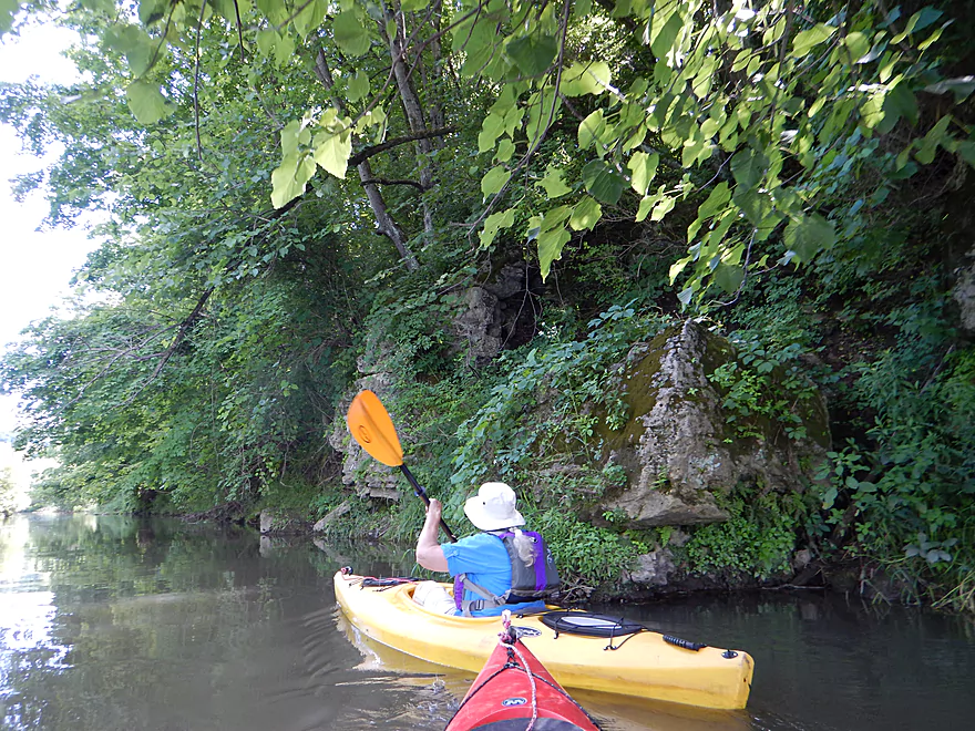
The river and tree roots work to erode the bluffs
While mostly deep, you could still get hung up in select spots
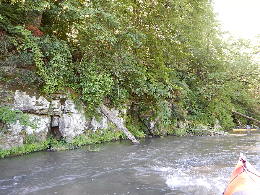
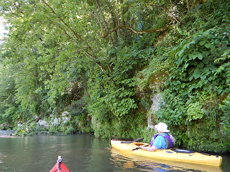
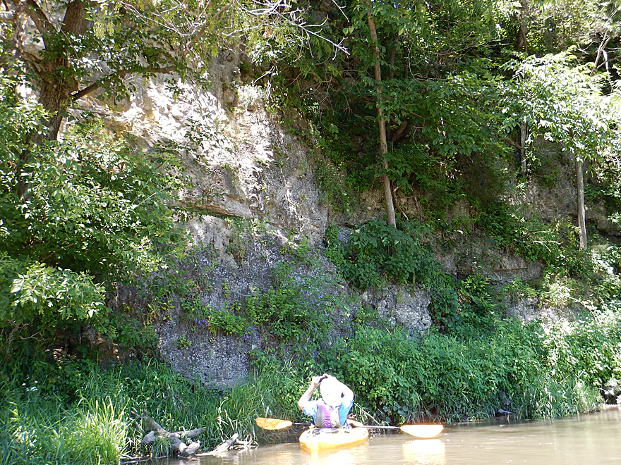
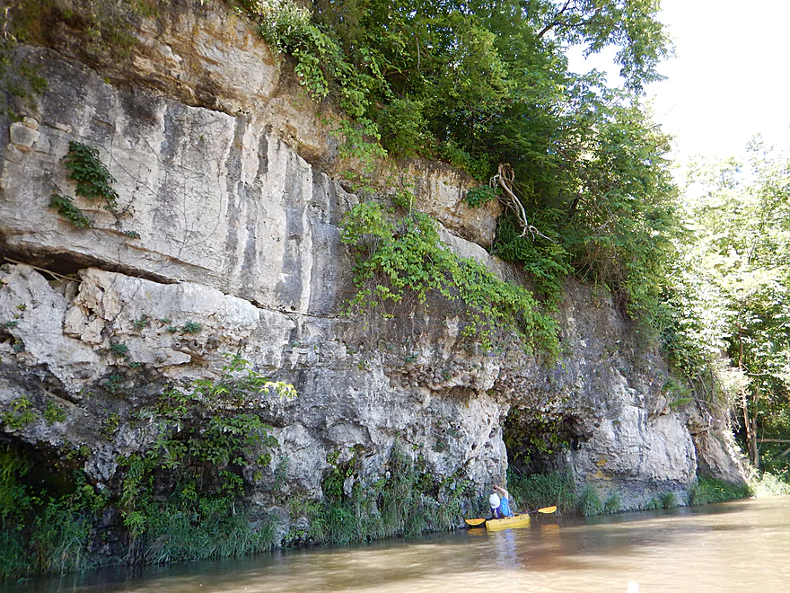
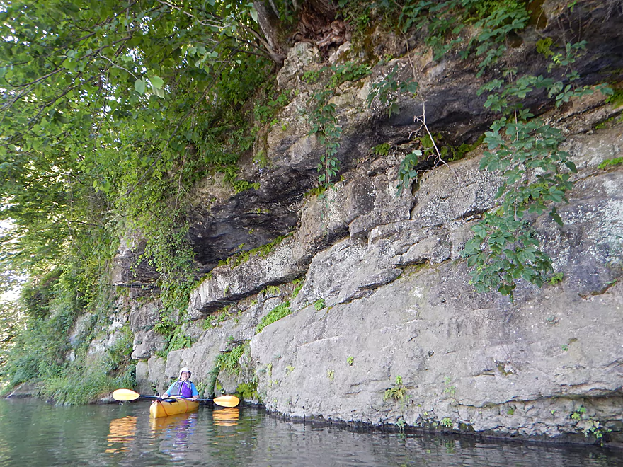
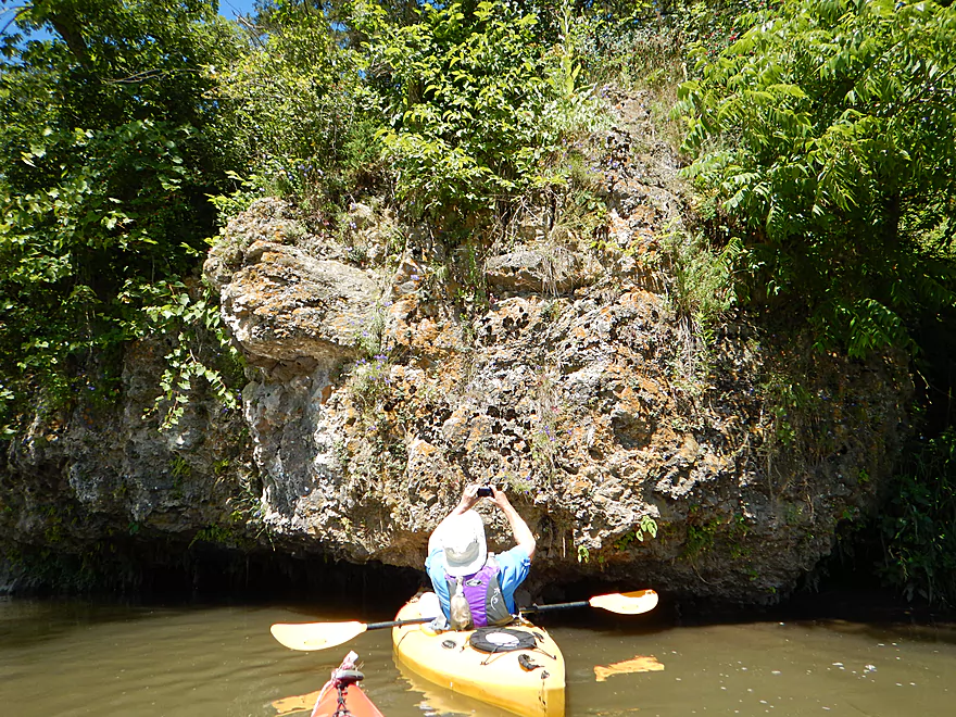
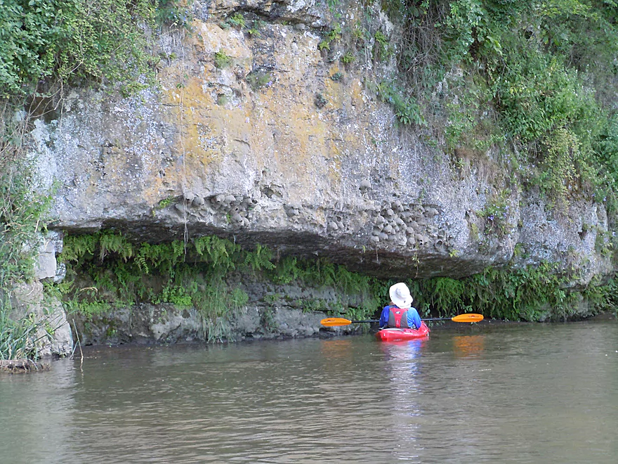
A very lush, attractive limestone wall
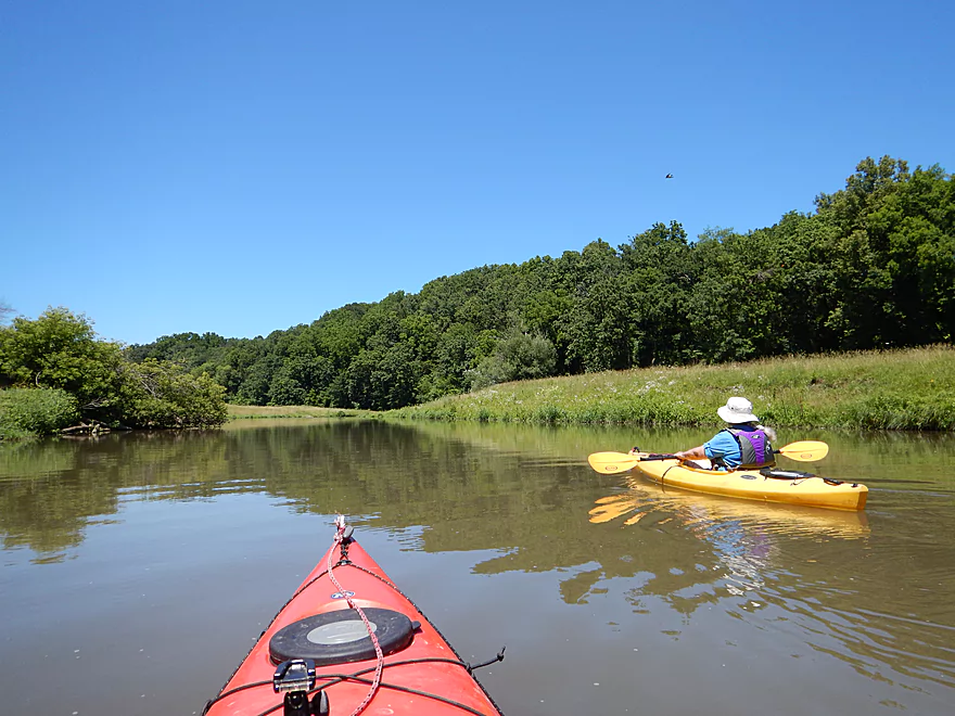
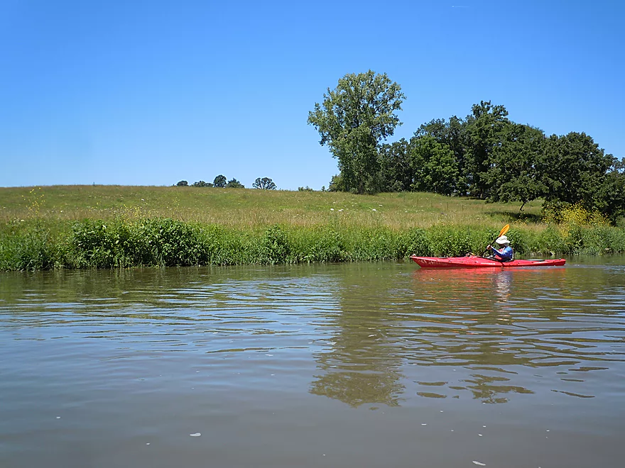
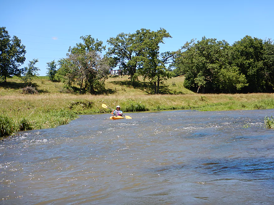
Back to a prairie paddle
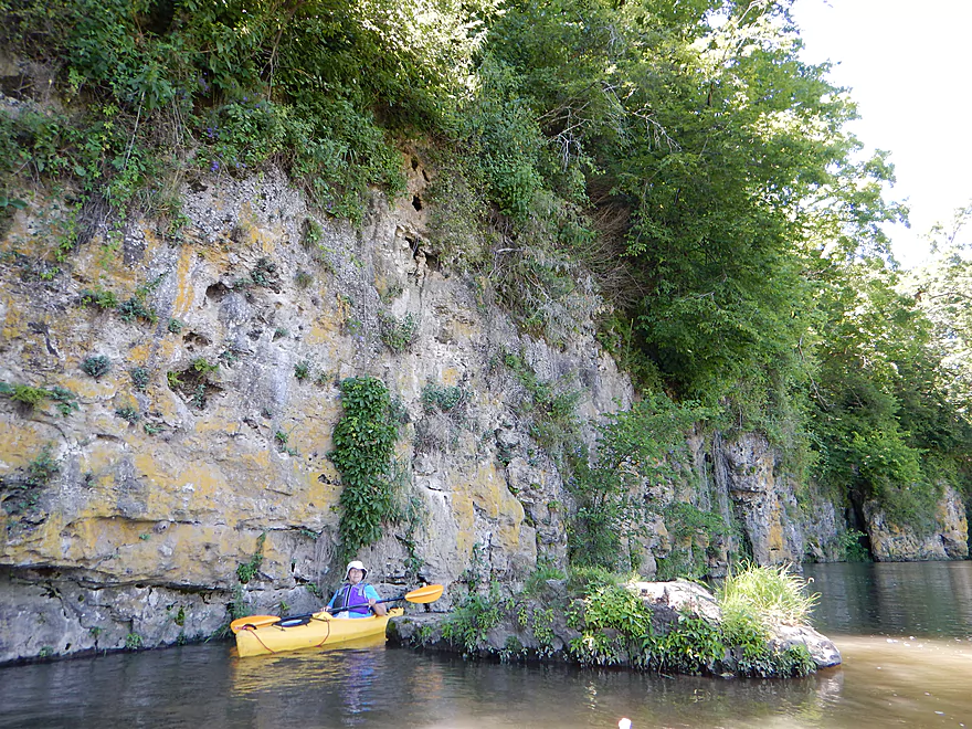
Bluffs are starting to get larger
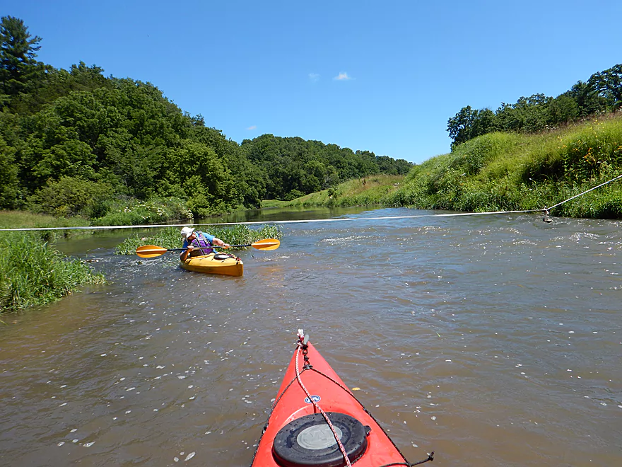
One of many cow fences
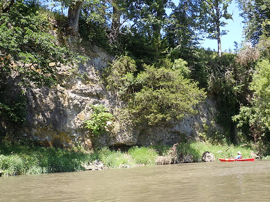
Second favorite limestone outcrop
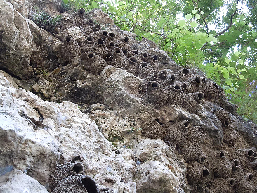
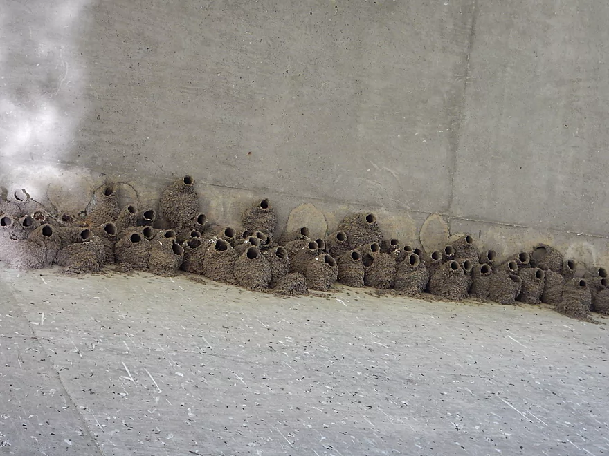
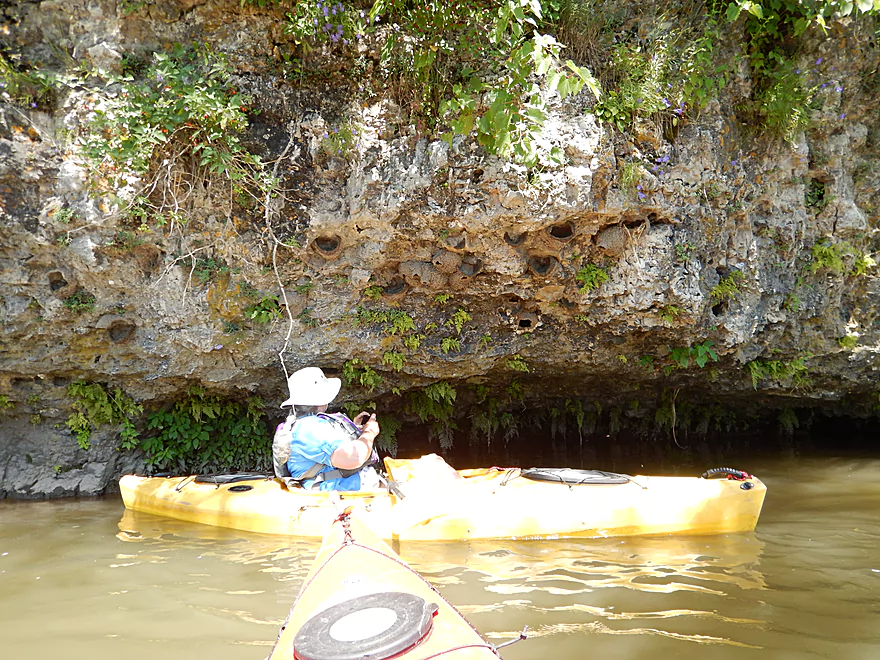
Condo highrise for cliff swallows
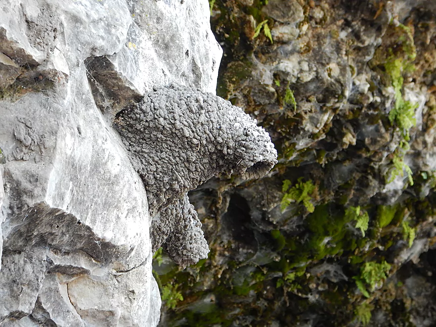
Pointed down to protect from the rain or from droppings?
A lot of cow pasture along the banks
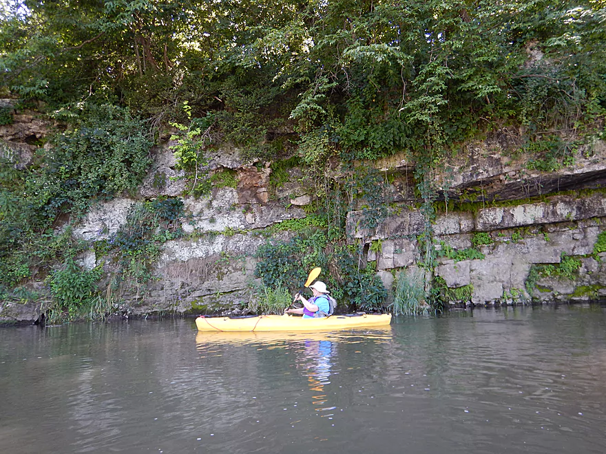
The wall is slowly cracking apart
Probably used to be a cool overhang over the river
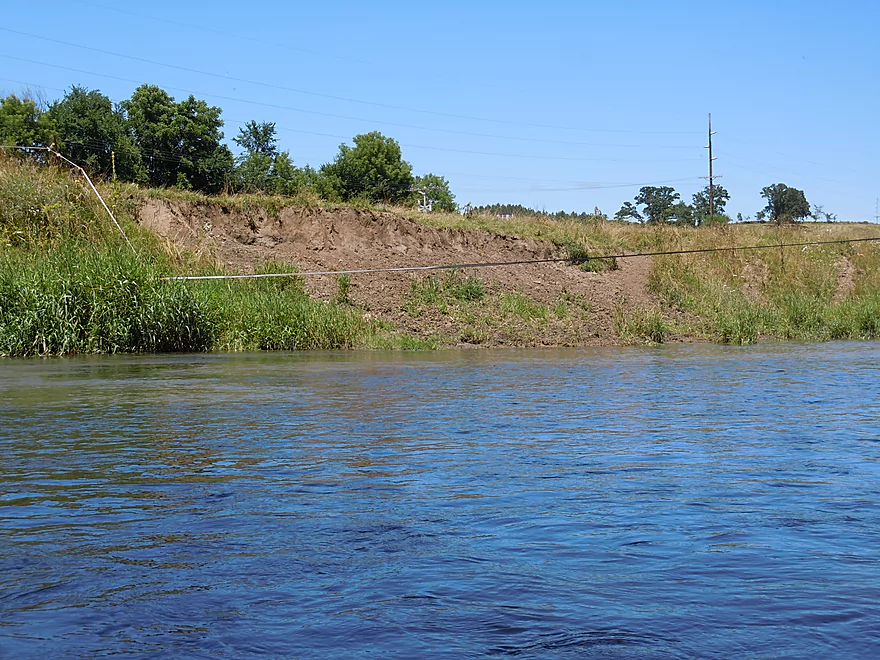
Farm erosion is a serious problem
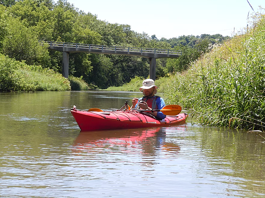
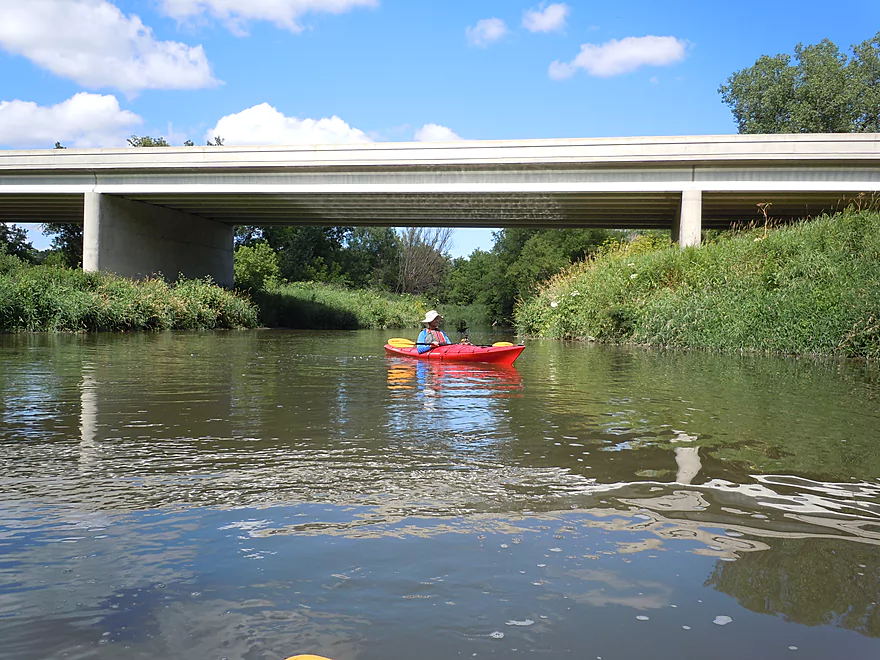
Graney Road is another ridiculously tall bridge
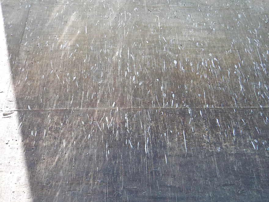
A Jackson Pollock style splatter painting
The painters…
Really cool geology
Future boulders in the making
Kingsford Road might be an access option
Yet another annoying fence
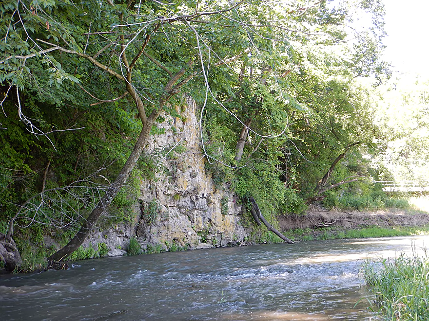
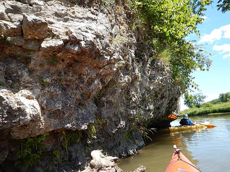
Striking limestone just downstream of the bridge
Rock wall continues for over a 1000 feet
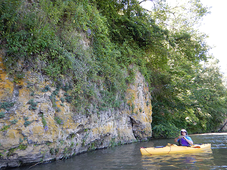
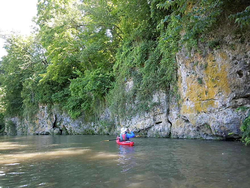
Orange lichens color the walls
Unique plant ecosystems inhabit the limestone
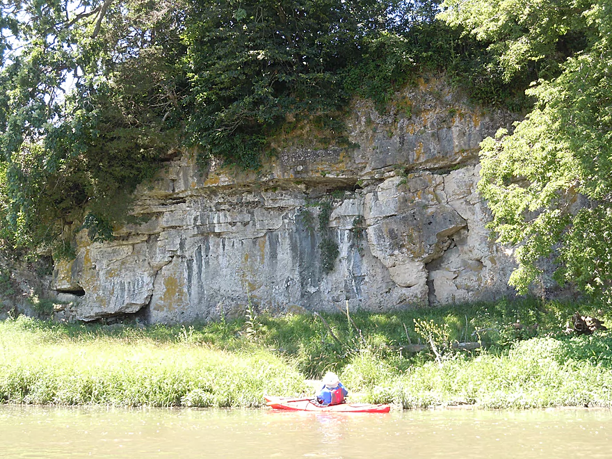
My favorite limestone outcrop
Zoomed out
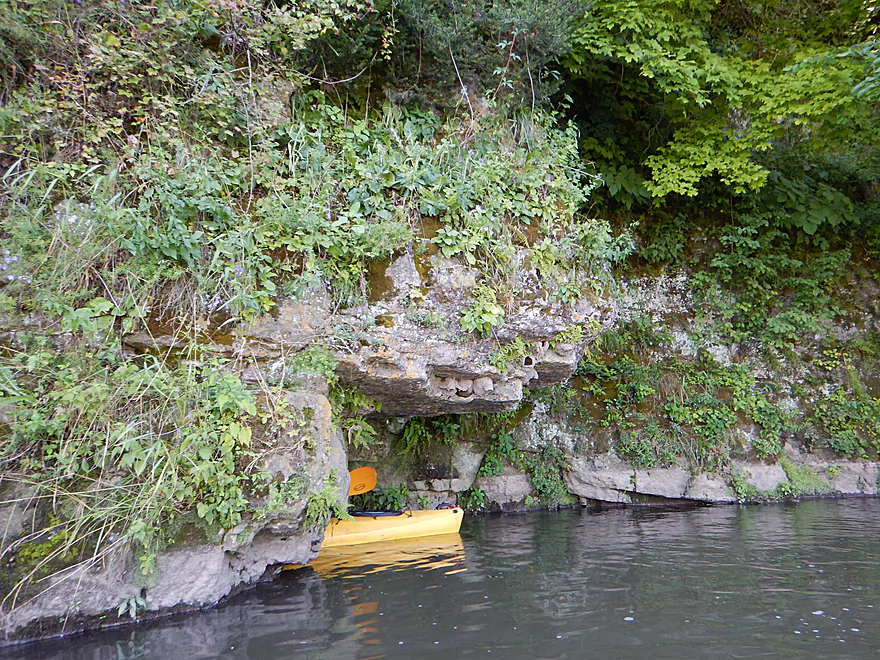
Limestone gobbles up a kayak
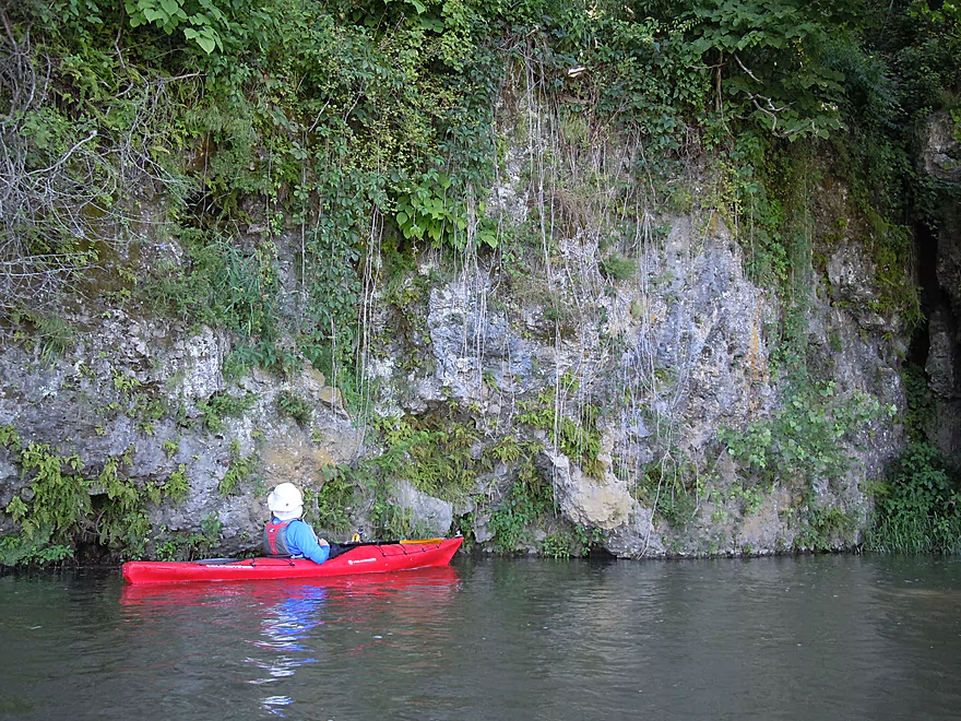
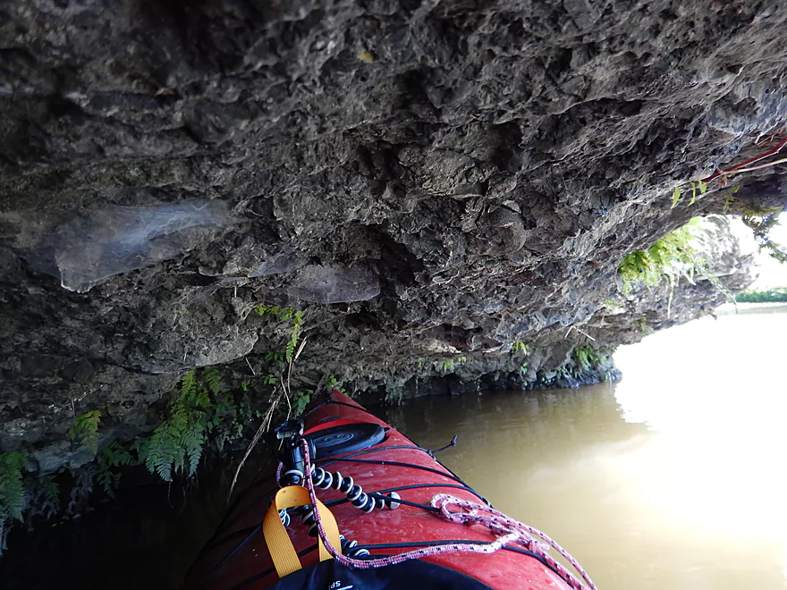
Actually a cool cave
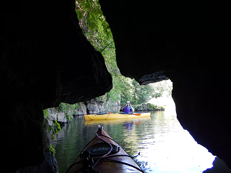
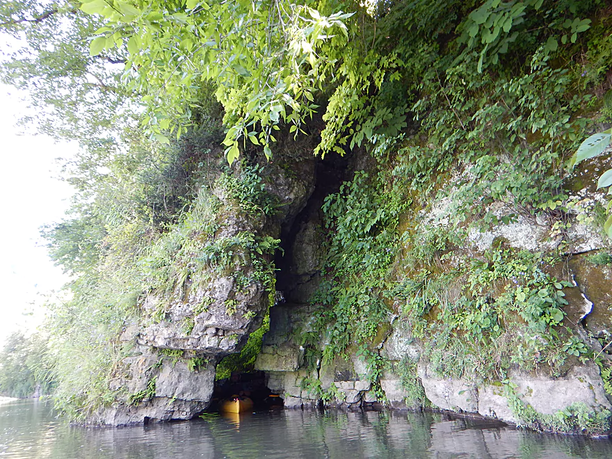
Looking out
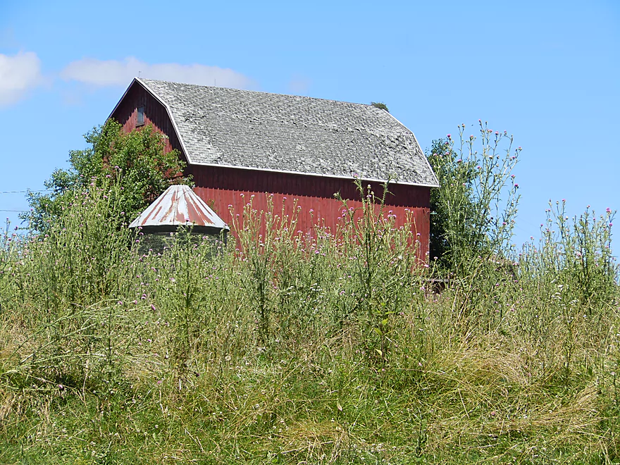
One of several farms visible from the river
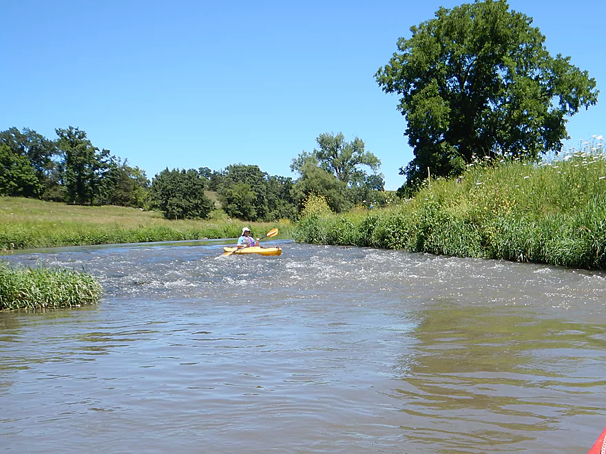
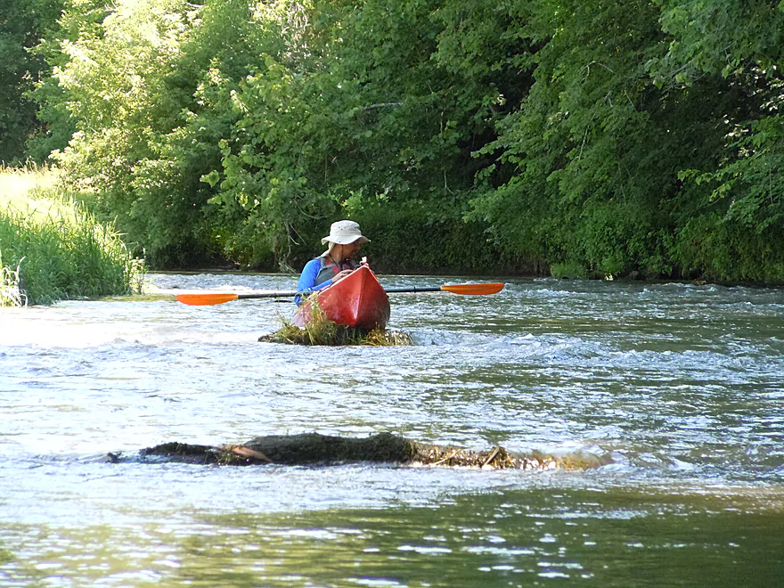
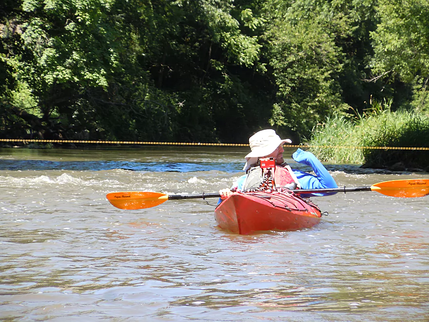
More fun rapids
Quite zippy
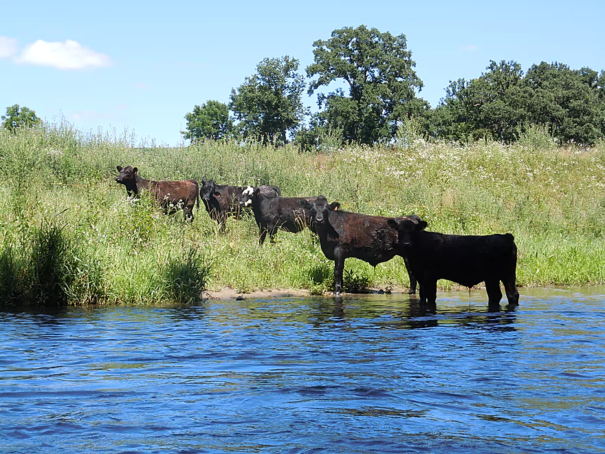
Cows lined up to watch us run the rapids
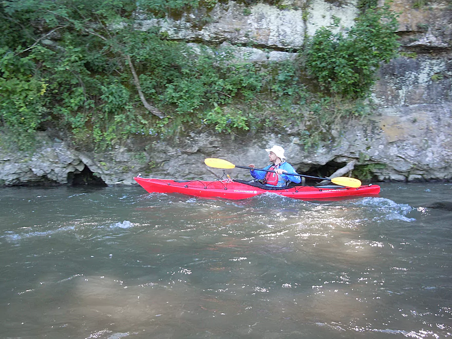
Looking back upstream
Interesting how the rock layers angle down
The outcrops are smaller from now on
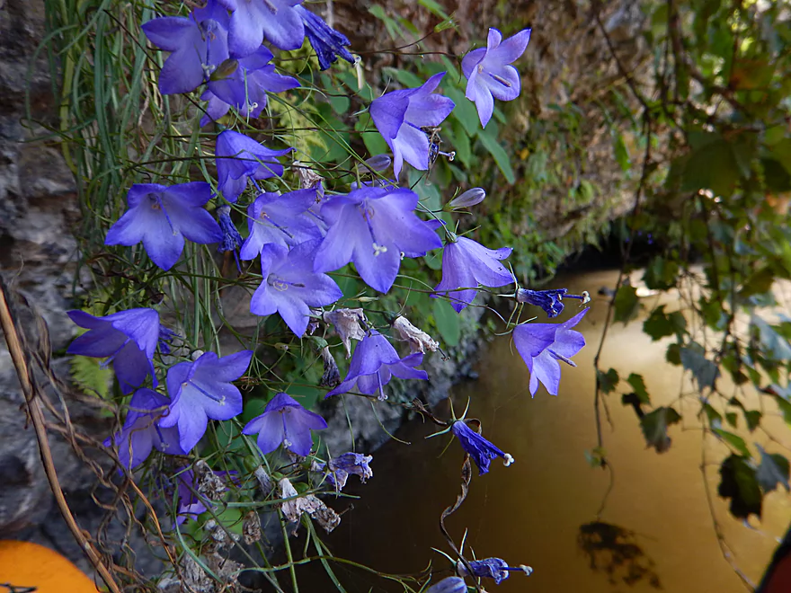
Harebells hanging over the water
Hiding under a rock shelf
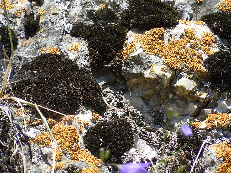
Black rock moss and orange rock lichen
Another rich micro-limestone plant and lichen ecosystem
Amazing texture
Dobsonfly egg cases
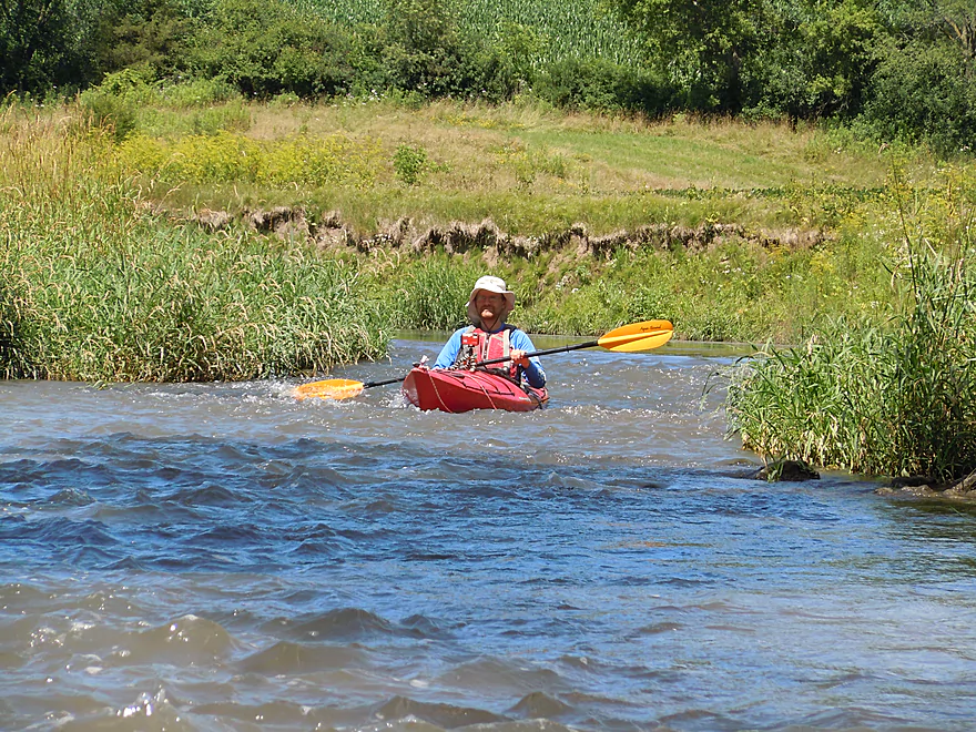
Still many riffles
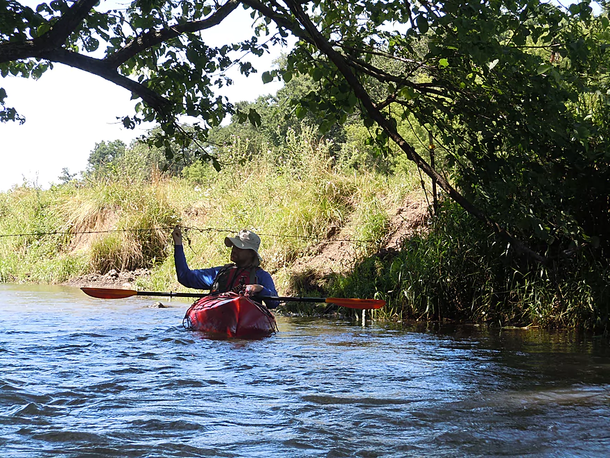
Lucky for me this was not electrified
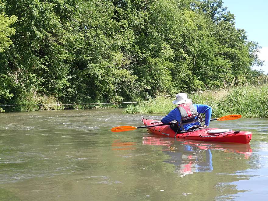
Sigh…time to lower the seat again
A certain beauty to the mud banks
Typical upper Platte…another wire and another outcrop
This one has a cool overhang
Last decent outcrop
Do not take out at Hwy 81 by mistake
Trying hard to avoid a strainer over rapids
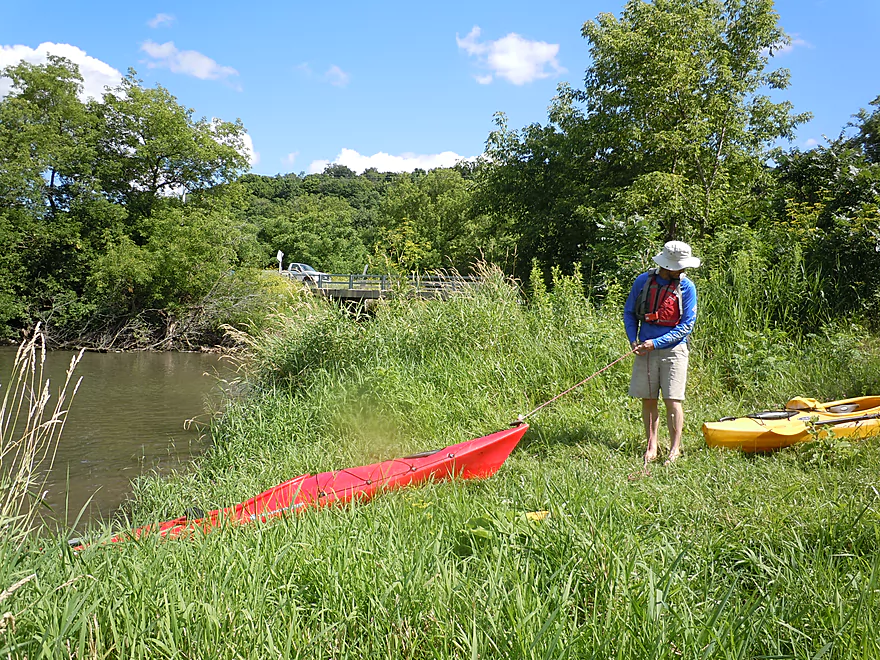
Taking out at Airport Road
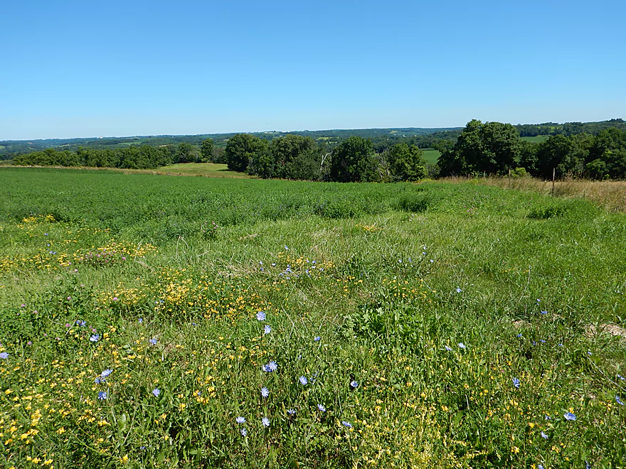
Hilltop shuttle feels like you are on top of the world
Coon Hollow Road might be a preferred put-in
Platte River – Hwy A


The Platte is an under-rated river for paddling located in southwest Wisconsin. Not a huge river, it is known for its good current, driftless topography, attractive limestone bluffs, and being heavily impacted by local agriculture. Previously, I did a trip from Airport Road to Platte Road (which I really liked) and then did a later a trip from Platte Road to Big Platte Road (which was good but not as nice as the upstream section). For my third time on the Platte, the plan was to explore a far upstream section from Hwy A to Platte Road (Ellenboro) to take advantage of higher water levels caused by recent rains.
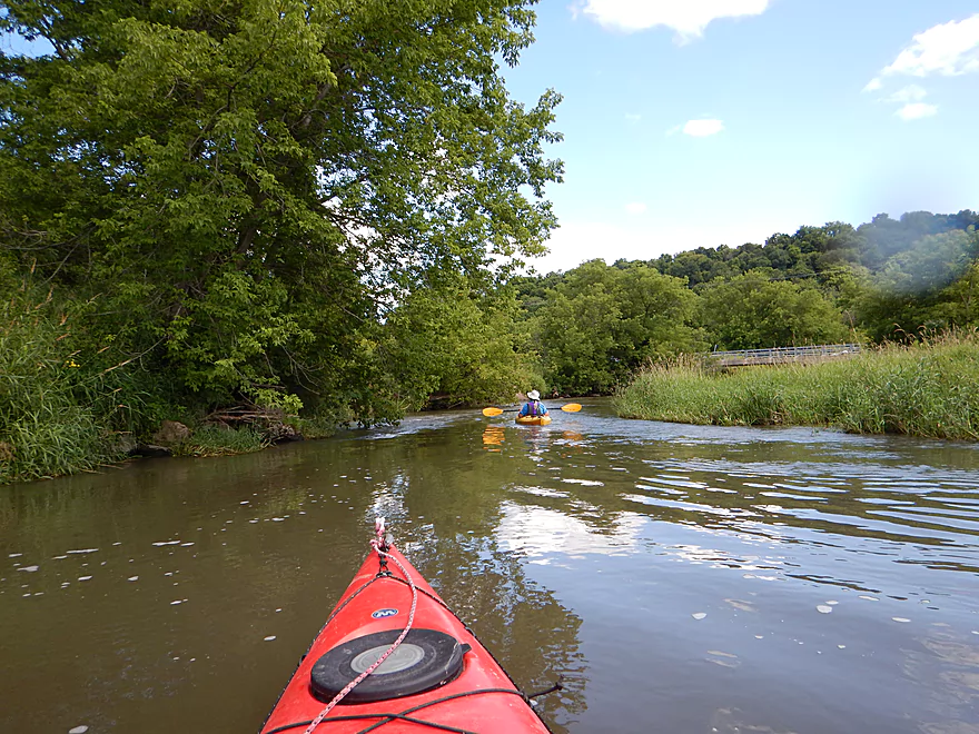
One of the unique aspects of the Platte (like other nearby Grant County rivers) is the driftless topography. The river runs through deeply dissected terrain in which a meandering channel bounces across the river valley from one bluff to another. Opposite each bluff or wall, was often a vast open meadow or pasture, which gave the river a very open feeling and provided nice vistas of the distant rolling hills.
The Platte substrate has a bit of mud but is very rocky, with random angular limestone boulders sprinkled throughout the river. This is not a super deep river, with pool sections typically 2-3′ in depth, but the riffles were shallow and might require some bumping or walking at lower water levels.
One of the negatives of this trip was the impact agriculture has had on the river. Almost all the riverside meadows are heavily grazed and there isn’t much tree cover. Cows are allowed free access to the river, which destroys vegetation needed to prevent erosion, and indeed the river was very muddy. Expect to paddle by a few cows in the water… With cows come fences, and there are a lot crossing the river on this stretch (maybe 5-6). You were never sure which were electric which was quite disconcerting.
On the flip side, the highlight was the limestone bluffs and cliffs. There were many and several were quite large. Frequently, rapids would run along the cliffs to neat effect. Many cliffs had attractive mosses, ferns, flowers and huge colonies of mud cliff swallow nests (quite the sight!). Of all the cliffs, my favorite was the 1000′ stretch located just south of Kingsford Road and reminded me somewhat of the Upper Iowa (granted on a much, much smaller scale).
So despite the muddy water, the cows, the fences and the over-grazed meadows, I am giving this trip 4.5 stars. A one-trick pony that you really do for the limestone outcrops, but the class 1 rapids were fun and the open vistas of the river valley were enjoyable as well.
Lousy put-in. Ok parking, but because of the length of the guardrails, shoulder parking is some distance away from the river. So fine…we double parked and quickly hoisted our boats over the guardrail. Next issue is the steep embankment, and you’ll want to be gentle leading your boat down, lest it run away from you (or vice versa). Finally, at the bottom there is a cow fence which you (and your boat) will have to slide under (be careful not to stretch or damage the fence). It’s not like any of this is super difficult, but it was kind of annoying.
Very nice bridge access off the second Ellenboro bridge (Airport Road) that is popular with paddlers. No outhouse, but good shoulder parking. Northeast of the bridge is a nice “deep water port” which is closer to the car. Northwest of the bridge is a second more obscure trail that leads to a “shallow water port” more suited for tippy boats.
This would be a very difficult bike shuttle, stretching 6.1 miles with a lot of hill climbing (623′ of climbing and 594′ of descending). Plus, a mile of this would be on compact gravel. Only suitable for hard core bikers. Otherwise find a buddy to car shuttle with.
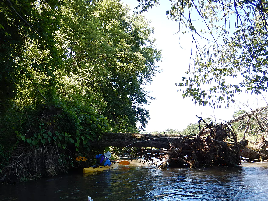
No logjams. Well one down tree, but very easy to scoot under. Maybe a few leaning branches in fast current, but alert paddlers will have no problem getting around these.
No dangerous rapids either. Countless class 1 rapids, but nothing serious.
Many farm fences cross the river. You can see they are connected to an electric grid, but they appear to be turned off or inactive for the most part. Many of the fences were very low and over rapids, necessitating using your hands to push yourself under. The ones I did lift thankfully were not live, but be mindful that this may not always be the case.
There is a downstream gauge on the Platte at Rockville. We ran the trip at 120 CFS which is a bit above average. The average is perhaps 110 CFS and the river will spike up to 150 to 200 CFS after a rain. 100-200 CFS is a good target range. You can go lower (and I did a trip at 77 CFS years ago with great water clarity), but you will bump into a lot of rocks and you will probably have to walk several of the rapids. The Platte can actually get very high very quickly including up to 1000 CFS after a heavy rain (which it did recently). My unscientific guess is the river becomes a bit too ugly to paddle above 200 CFS. The current is very pool and riffle. Either fast and riffly or very slow.
Notables included a tame muskrat, a barred owl, several blue herons, kingfishers, a cormorant, cows (in the river) and a woodchuck. The highlight was the huge number of cliff swallows and their nests which were abundantly plastered to the numerous limestone walls.
Detailed Overview
- Upstream of Rock Church Road: The river here is likely too small and degraded by pasture to be enjoyable for paddling. I don't know for sure though.
- Rock Church Road to Hopewell Road: (3.0 miles) Very small...likely needs high water. Maybe 4-6 logjams. Likely mostly a pasture paddle, but a few really nice outcrops and maybe an intriguing gorge.
- Hopewell Road to Annaton Road: (4.2 miles) Small creek. Mostly open with a mixture of wetlands and pasture. Maybe 1-2 outcrops and 4-6 logjams. Maybe some fences.
- Annaton Road to Hwy E: (0.9 miles) Maybe 1 jam. Mostly an open paddle.
- Hwy E to Sleepy Hollow Road Bridge 1: (1.8 miles) River grows from creek to small river with addition of two major tributaries. Might be a few down trees.
- Sleepy Hollow Road Bridge 1 to Sleepy Hollow Road Bridge 2: (1.6 miles) A good prospect that is mostly open. Probably a few limestone outcrops. The second Sleep Hollow Road bridge is not a viable access because of a fence.
- Sleepy Hollow Road Bridge 2 to Coon Hollow Road: (1.8 miles) A good prospect a few nice limestone outcrops.
- Coon Hollow Road to Hwy A: (3.9 miles) A good leg with many scenic outcrops (including one massive one) and multiple fun rapids. Unfortunately this stretch can only be run at high water levels and suffers from serious shoreline degradation. Hwy A is a horrible access.
- Hwy A to Airport Road: (6.4 miles) An excellent leg with great limestone outcrops.
- Hwy A to Kingsford Road: (3.3 miles) A good leg with 6 mediocre outcrops and one really nice one.
- Kingsford Road to Airport Road: (3.2 miles) An excellent leg with multiple outcrops and perhaps the best outcrop on the entire Platte River.
- Airport Road to Platte Road: (5.0 miles) An excellent leg with fun riffly current.
- Platte Road to Big Platte Road Bridge #1: (5.1 miles) An ok leg with fun riffles, limestone outcrops and nice valley vistas.
- Big Platte Road Bridge #1 to Big Platte Road Bridge #2: (3.2 miles) An ok prospect.
- Big Platte Road Bridge #2 to Hwy O: (1.3 miles) An ok prospect.
- Hwy O to Indian Creek Road: (7.6 miles) A mediocre prospect.
- Indian Creek Road to Mouth at Mississippi: (1.6 miles) A mediocre prospect.
- Mississippi Options: Tricky. The Grant River Recreational Area is 3.4 miles upstream of the mouth (that can be tough sledding especially in high water). Downstream you could take out at Eagle Point Lane (very scenic), but that is 5.5 miles on a big Mississippi.
-
Replica air king watches offer an affordable alternative to the iconic luxury timepiece. With meticulous craftsmanship and attention to detail, these replicas mimic the original’s design and functionality, providing a stylish option for watch enthusiasts who appreciate the timeless aesthetic without the hefty price tag.
Trip Map
Overview Map
Video
Photos Size:
Hi, This may be off subject, but I noticed your references of cows and fences crossing the river. Do you have any insight on the legality of this? If the river is technically public land, can cattle and fences have free access? I live right next to the Rush River in Western Wisconsin, which is heavily used for kayaking and fishing. A local farmer has his land adjacent to a long stretch of river. He freely lets his cows have access and has strung live electric fence across river. However, the biggest concern is he has put a bull in with the cows creating a very dangerous situation for unwitting river users.
Thanks Ken for the question.
Fences that block navigation are not allowed. In fact the DNR has cracked down on these in the past (like on the Fever River). The current DNR however maybe apathetic to this issue. You can always contact them and ask. If this is a safety issue, they may be more apt to act.
The cows…that might be a grey area…as is letting a bull wonder to close to a public waterway. I mean it wouldn’t be permissible to allow a bull to wonder near a public playground, so perhaps the same logic protects paddlers.
BTW, if you ever want to share information on the Rush River, I would be happy to post it.
We paddled from Coon Hollow Rd. to Airport/Ellenboro Rd. on 10July2020. The Rockville gauge was about 300 CFS at 5 ft., a fun level with the right boats and skills. We got hung up a few times, but didn’t have to walk our boats.
It was a scenic paddle on a gorgeous day, but there’s one hard-to-spot wire below Kingsford Rd., and the put-in at Coon Hollow is a bit tricky.
Just downstream from the Coon Hollow Rd. bridge, there were two strands of barbed wire, one just above the water, and another about a foot above it. (See link to album of wires photos below). The only good option appeared to be to slide our boats under the electric fence and launch downstream of the wires.
I drove a bit downstream to scout other options, and noticed someone sitting on the porch of a house nearby. Not wanting to trespass, I asked her if she was the owner of the fenced-off area, but she wasn’t. She said that paddlers put-in downstream of the wire frequently, and that 7 or 8 Amish folks with canoes had done so about a week ago.
She helpfully noted that the person who mows the park area just downstream from the bridge prefers that people park on the mowed shoulder on the upstream side of Coon Hollow.
I was able to spot and most of the electric fences and sneak under them, but my buddy sitting upright in a canoe used a PVC “y-er” to lift the wires.
Just downstream from the Kingsford Rd. bridge I was startled to feel a wire across my neck. I turned my head and leaned back, and the wire slid up and off my face. I pulled over just downstream of the wire to warn my friend.
Despite my shouting, he couldn’t see the wire until too late, so did a wet exit from his canoe, then hauled his water-filled boat to shore.
We were both fine, largely because I was wearing a neck gaiter and a Kool-Tie around my neck, and had the cape of my sunshade ball cap tucked under them. The wire scraped fabric, not flesh, and I was drifting rather than paddling. However, a paddler sitting higher in a boat with no neck or face protection could get injured. The current speeds up near the wire.
Here’s a link to photos of the wires at Coon Hollow, Kingsford, and an example of an easy-to-spot electric tape upstream of Hwy 81: https://photos.app.goo.gl/JDsrj3aShaP49GxC6
I would not recommend that beginners paddle the stretch below the Kingsford Rd. bridge without scouting it first. Scotty, (the DriftlessKayaker) posted this June 12, 2020 video of Coon Hollow to Ellenboro:
https://youtu.be/u_GR-ukTTBM (There were no wires at Kingsford on June 12.)
On a brighter note, here’s an album of scenic photos/videos: https://photos.app.goo.gl/2jrG4VFPZJBVGuBcA
Yikes…some of those wires are very difficult to see. These fences shouldn’t exist on the river…and at a minimum should be well taped/marked so people can see them. That’s horrific. I have marked that Kingsford Road wire as a hazard on both my maps. Despite that I’m super enthused to do this section…plus the preceding which should also have nice outcrops. I appreciate tips about the parking situation for Coon Hollow which I didn’t know about.