
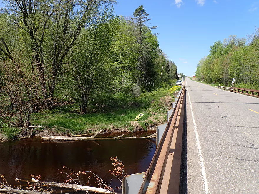
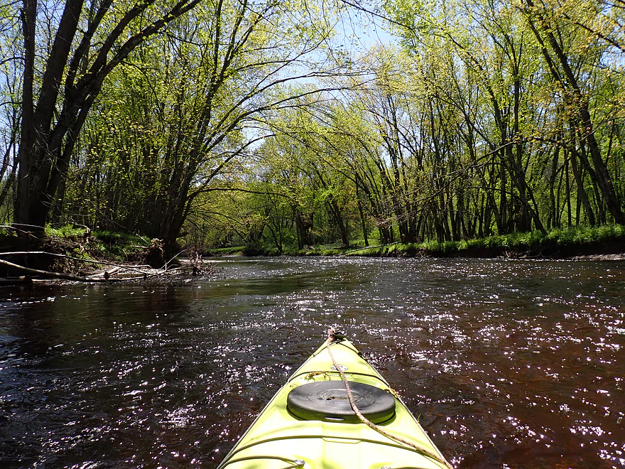
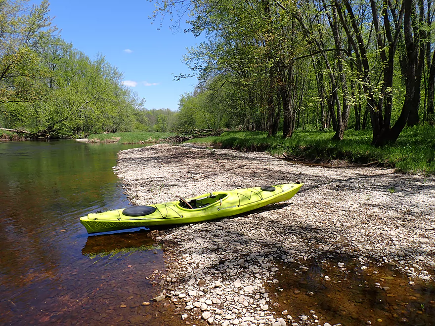
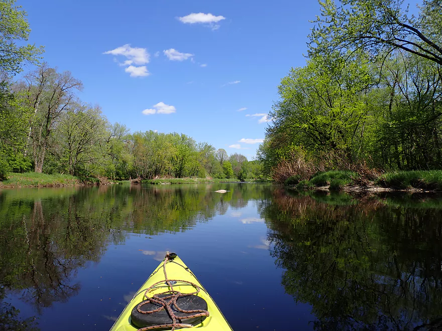
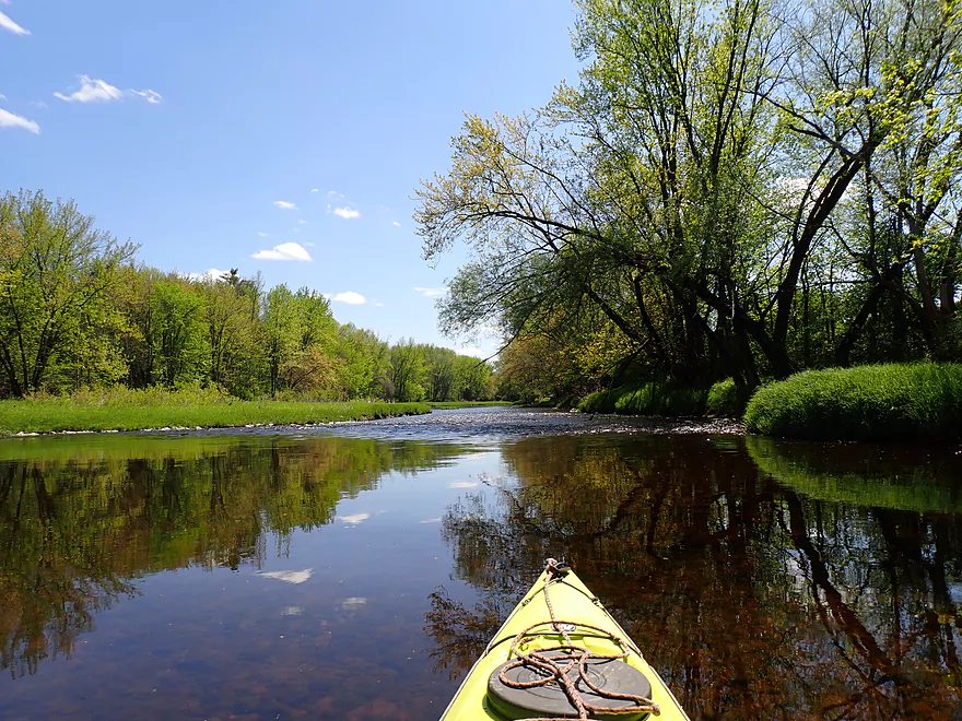
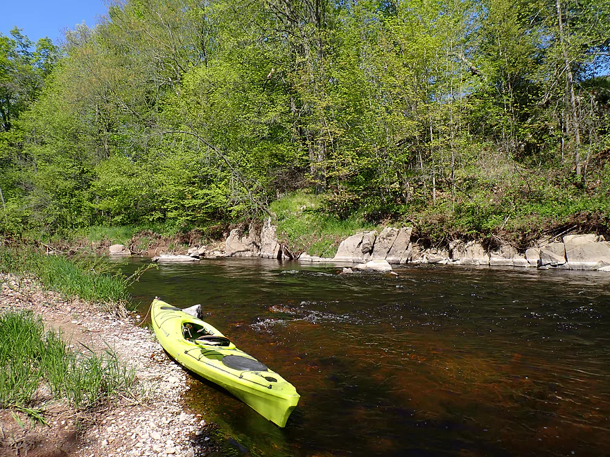
Putting in at Hwy A
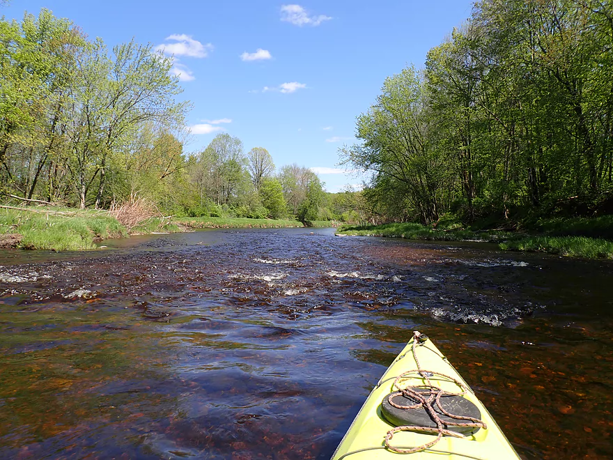
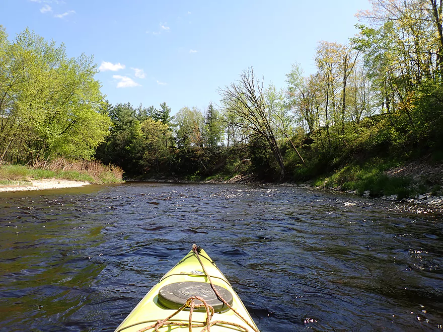
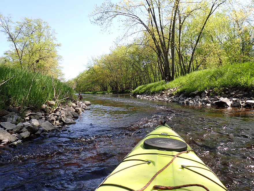
Much rockier than the previous trips I did
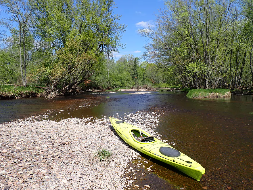
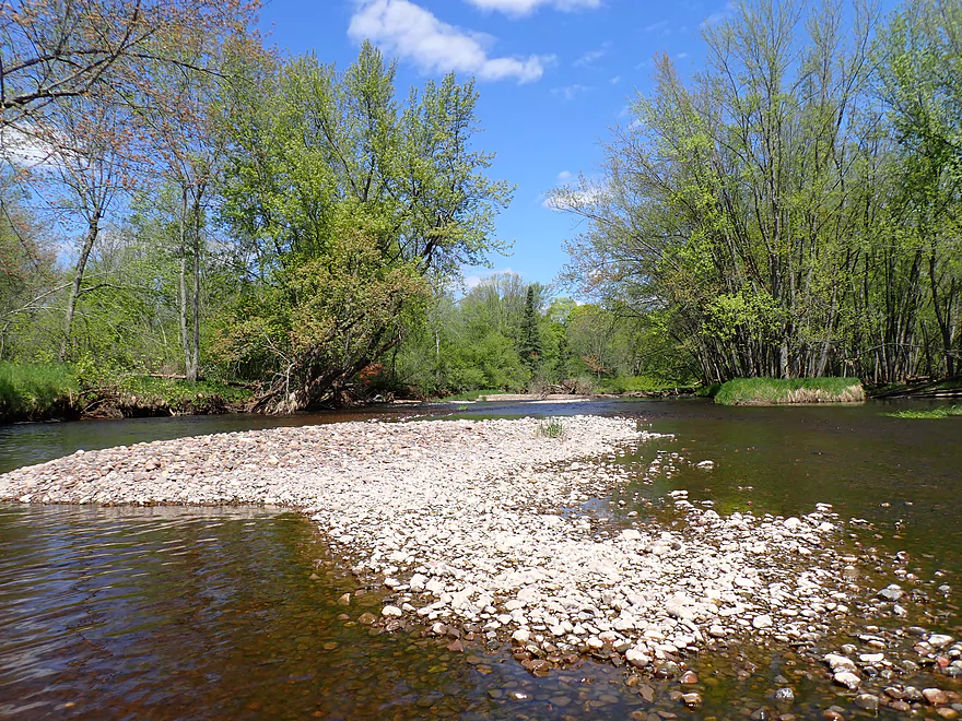
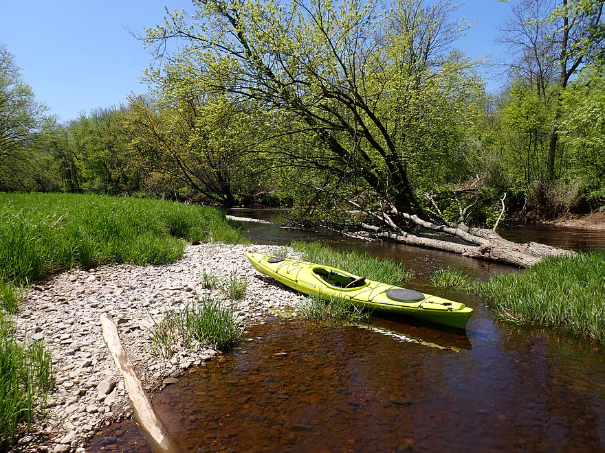
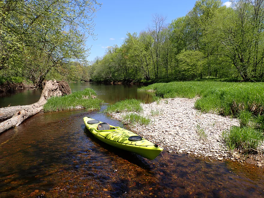
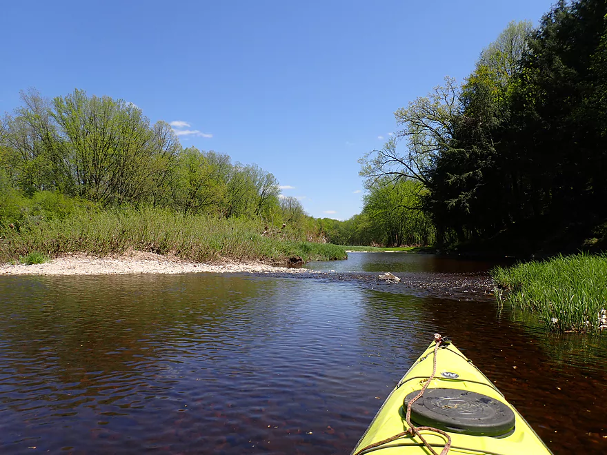
Terrific gravel bars
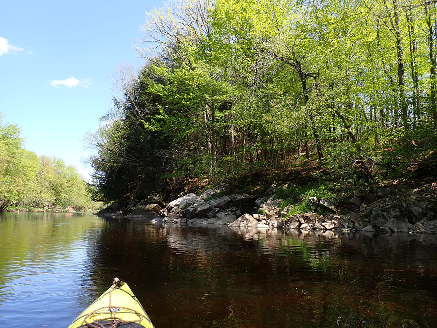
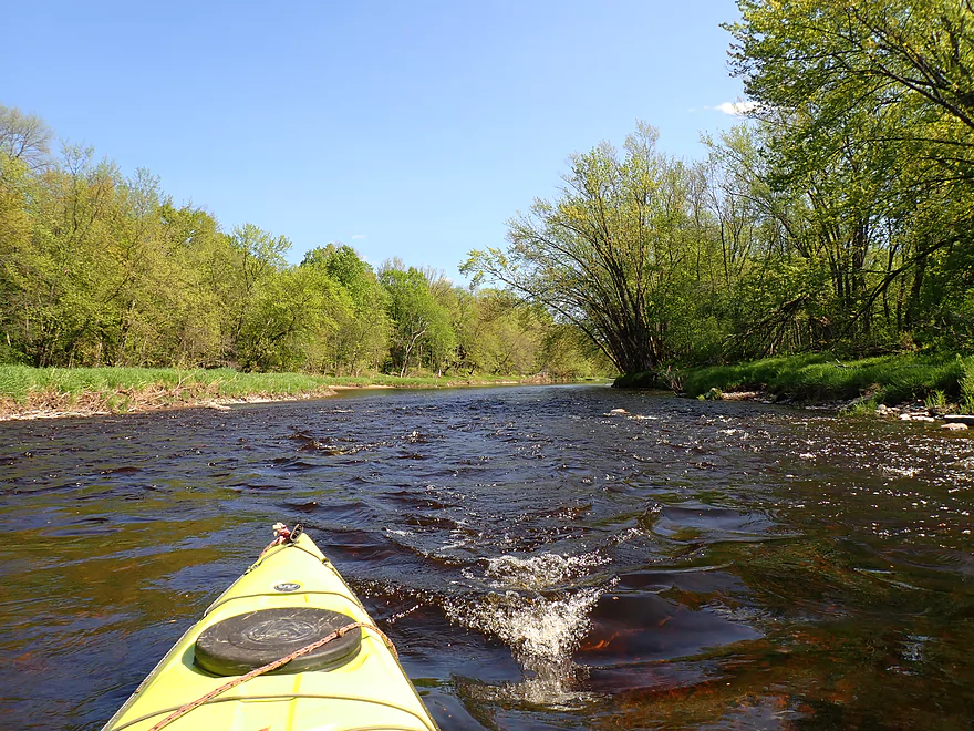
Nice to see blue skies after a week+ of smoky haze
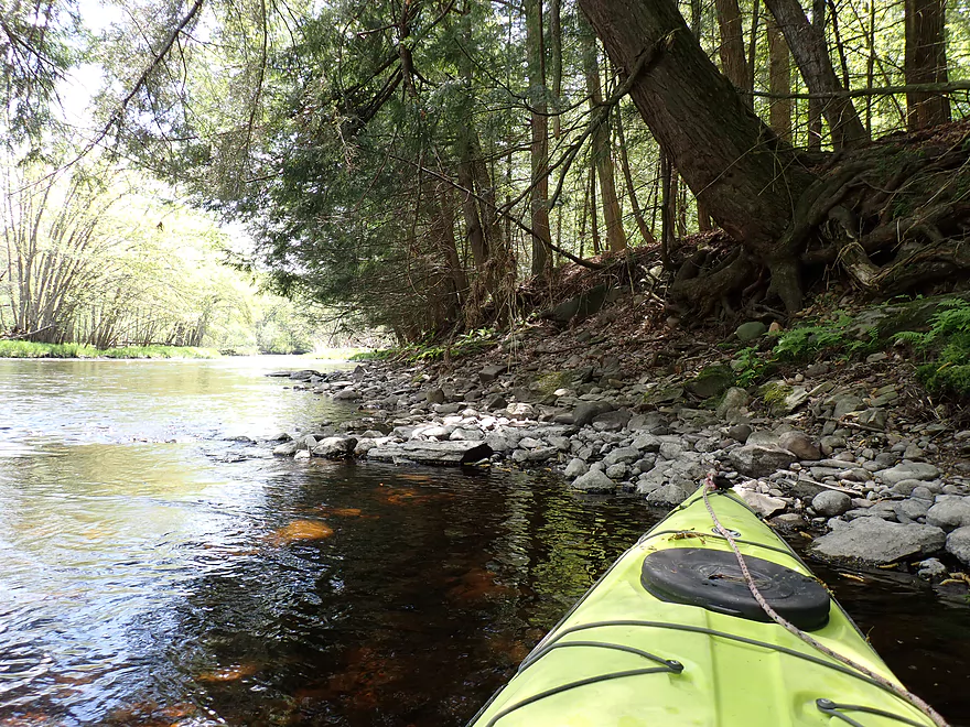
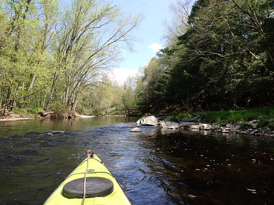
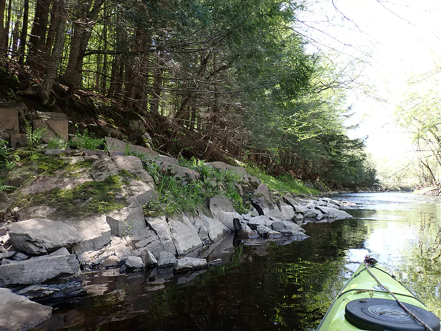
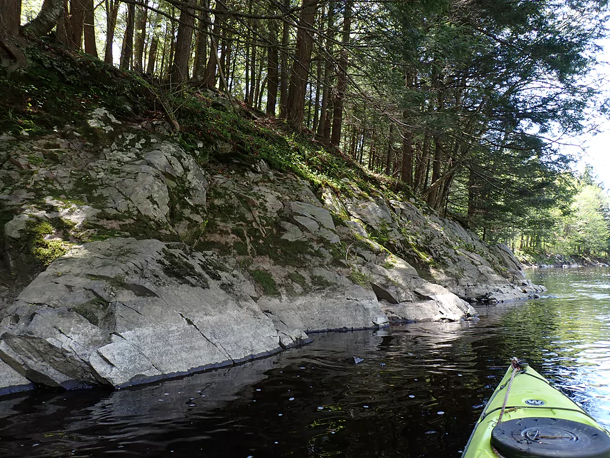
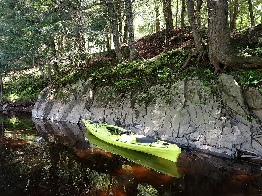
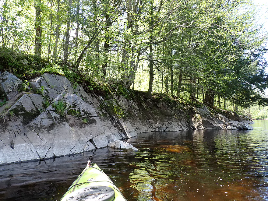
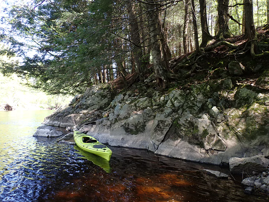
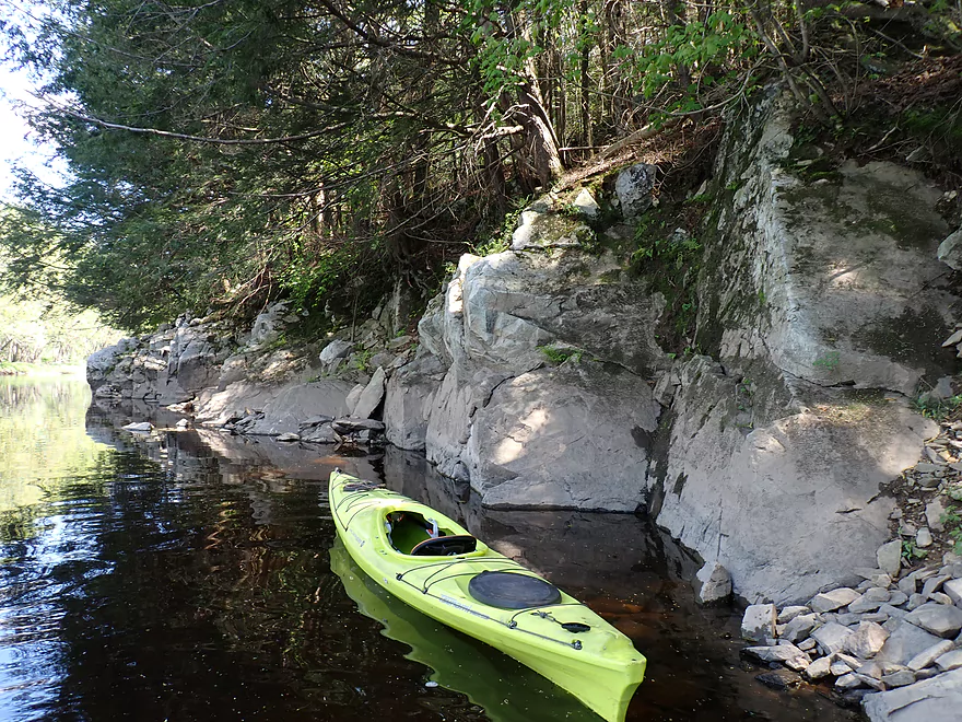
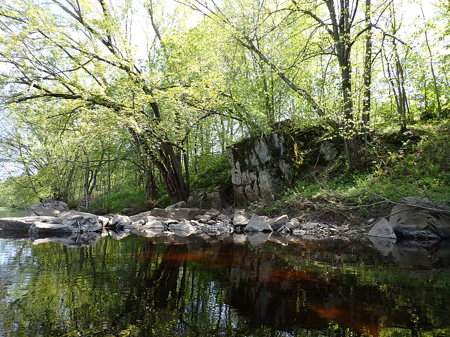
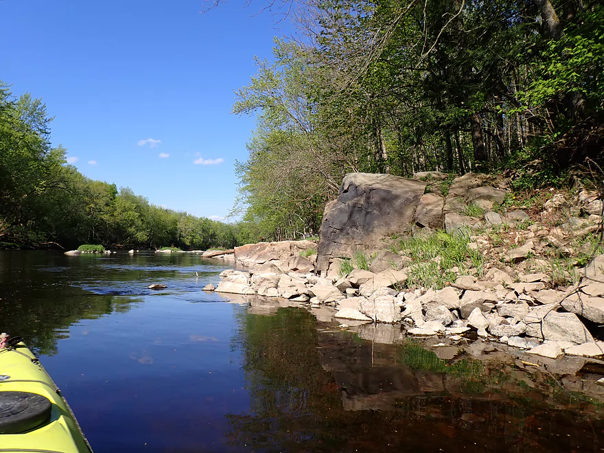
One of many nice rocky banks under hemlocks
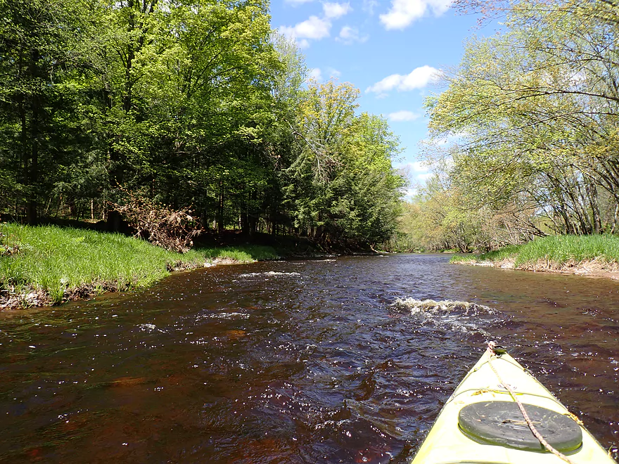
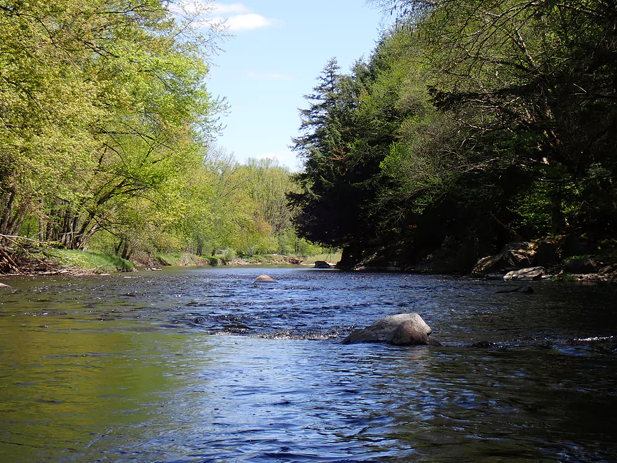
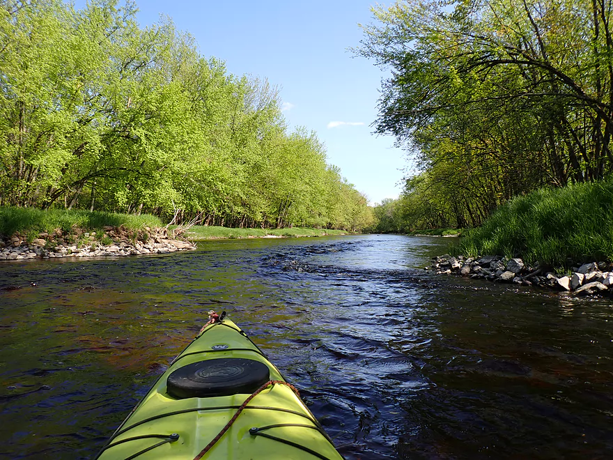
One of countless light rapids
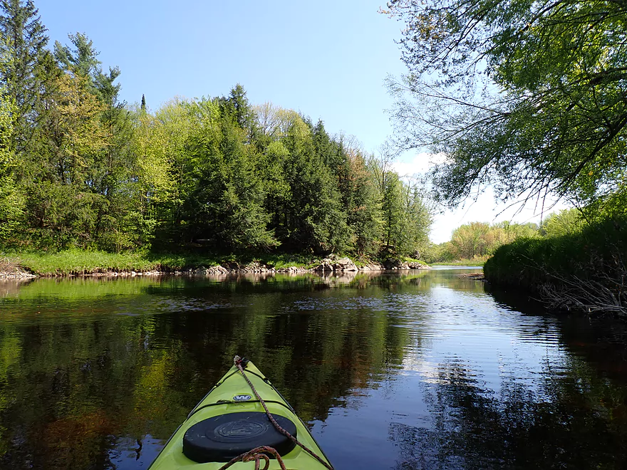
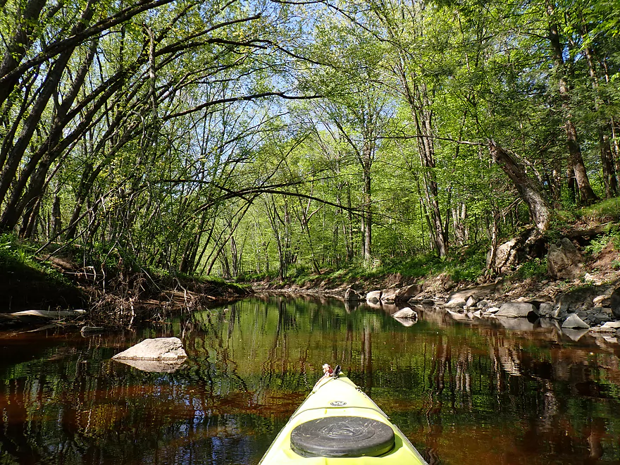
Tree canopies like this would be great in fall
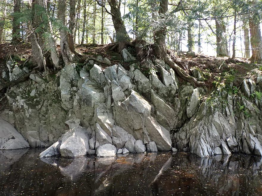
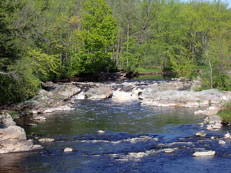
First major outcrop
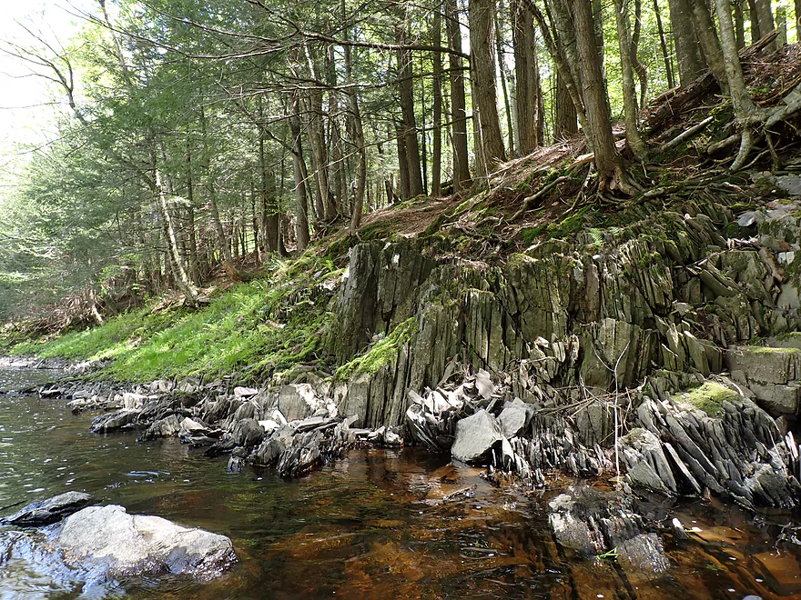
Cool layering
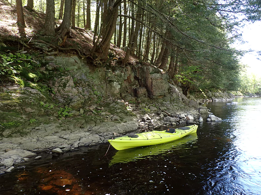
Getting out for pictures
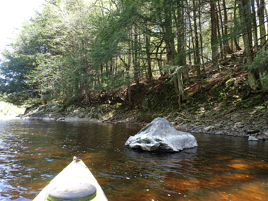
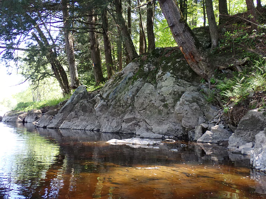
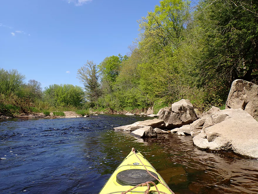
Large mounds of granite
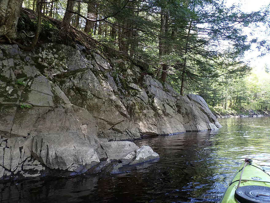
Very sharp edges
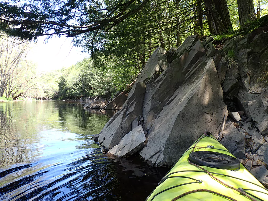
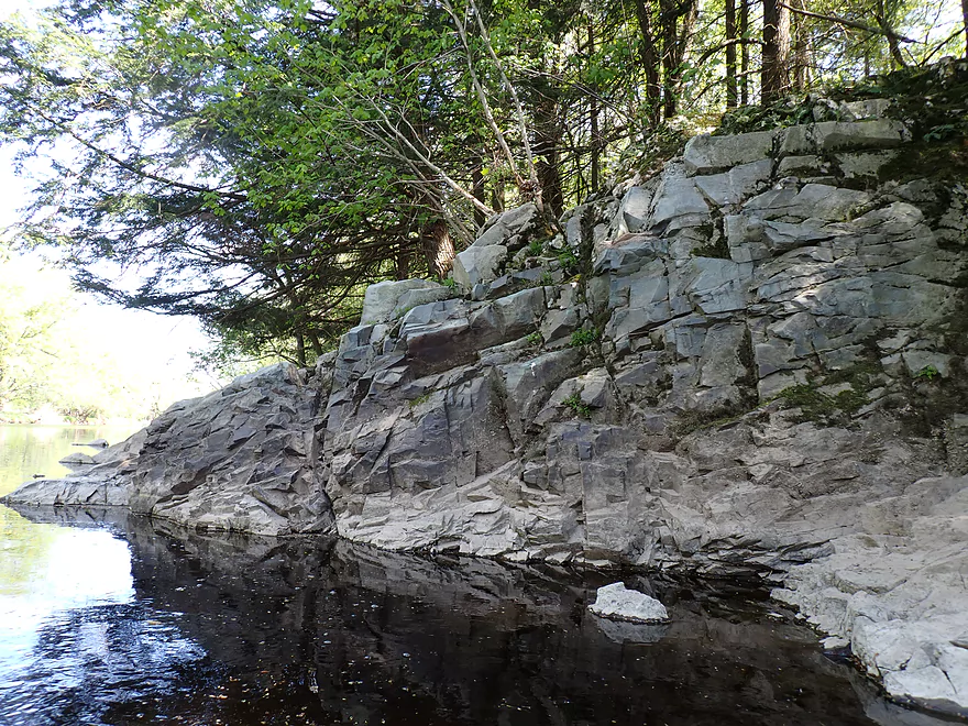
One last shot of this long series of granite outcrops
Only portage of the trip
Easy
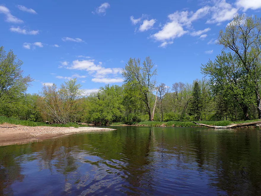
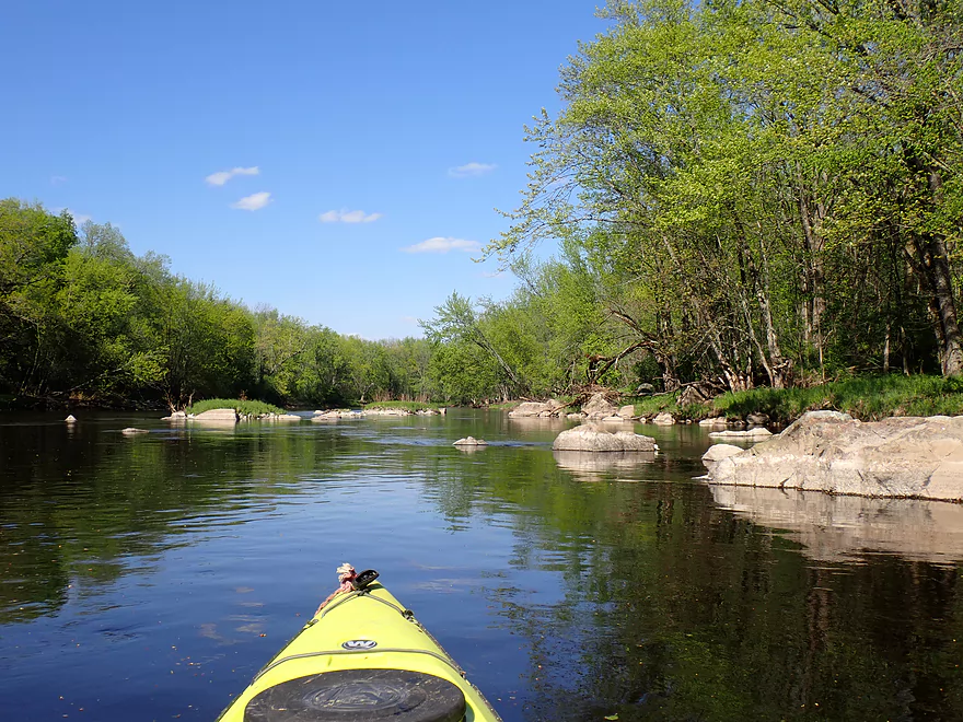
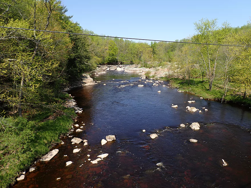
More great gravel bars
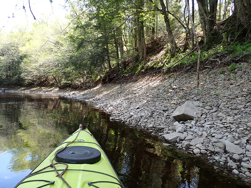
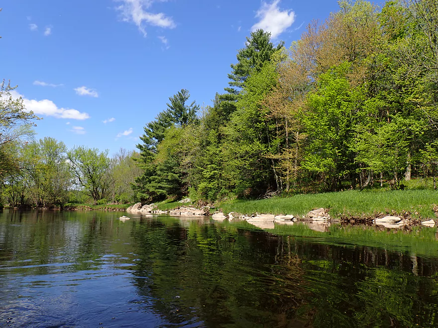
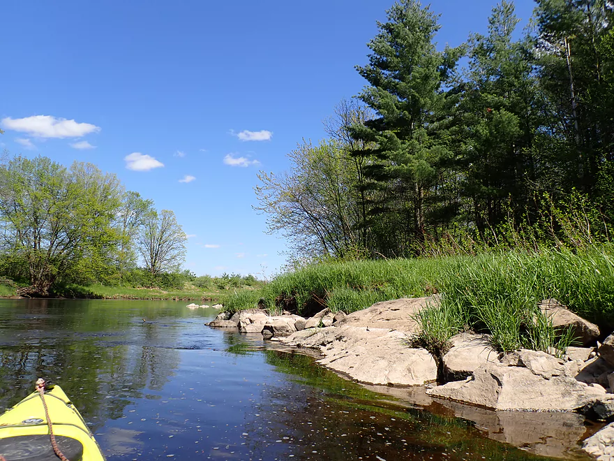
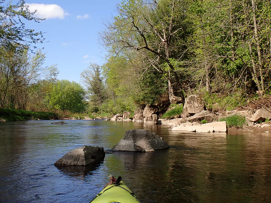
Rocky shoreline
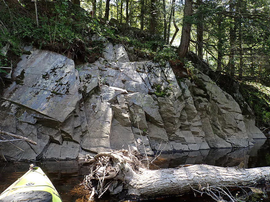
Second granite outcrop
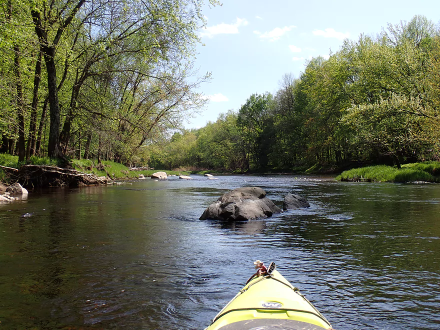
Few shallow spots but mostly plenty deep
Third set of granite outcrops
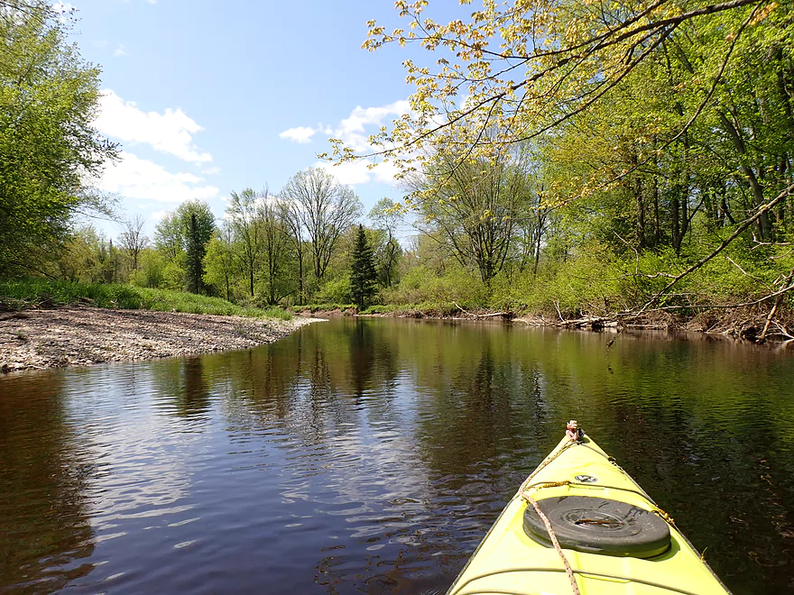
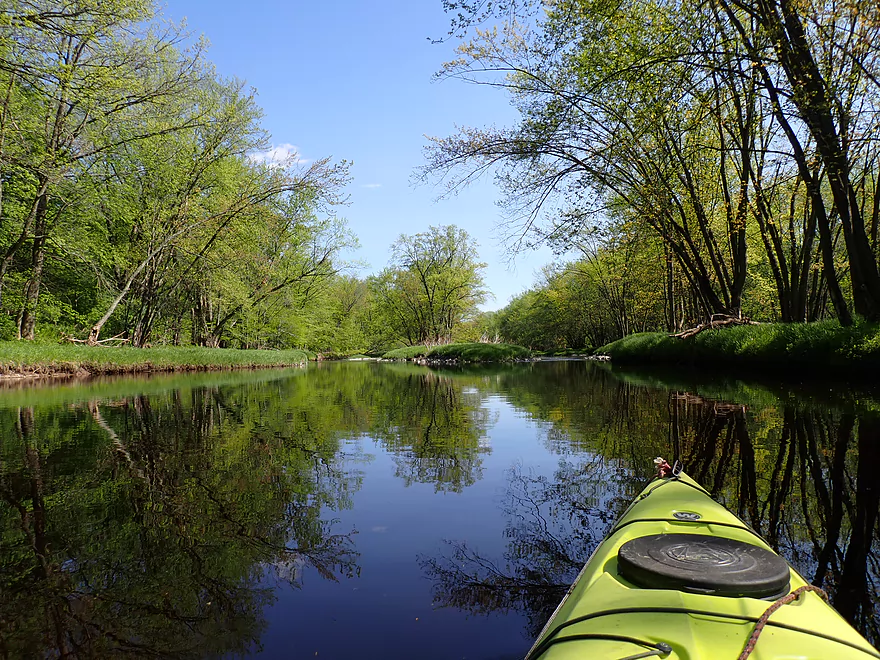
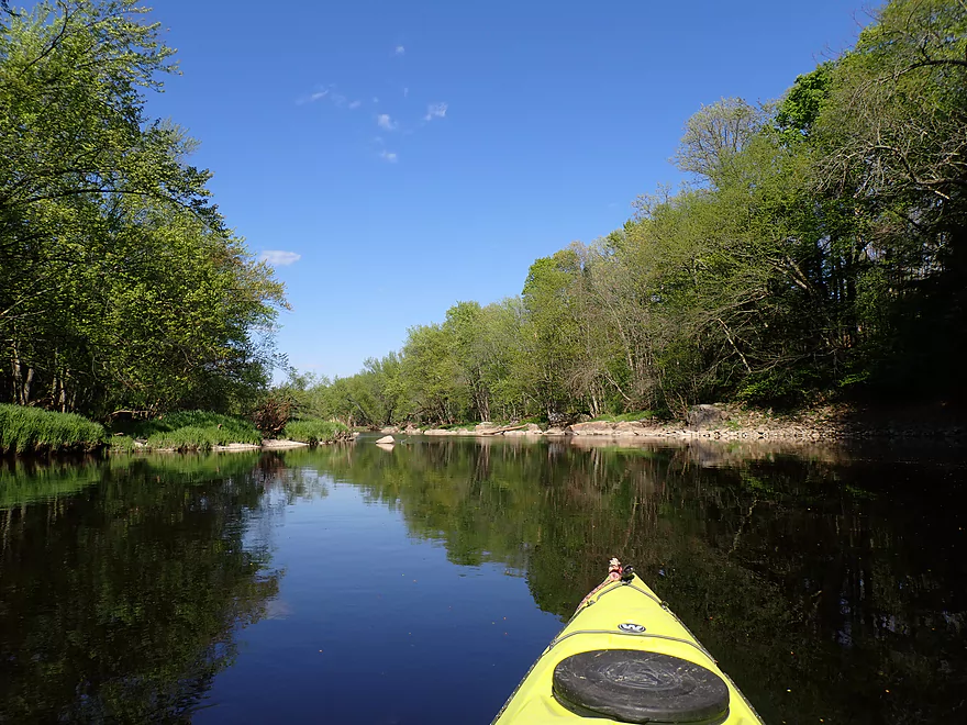
Start of a longer open stretch

Rustic looking wagon
Forth set of outcrops
Soon followed by outcrop #5
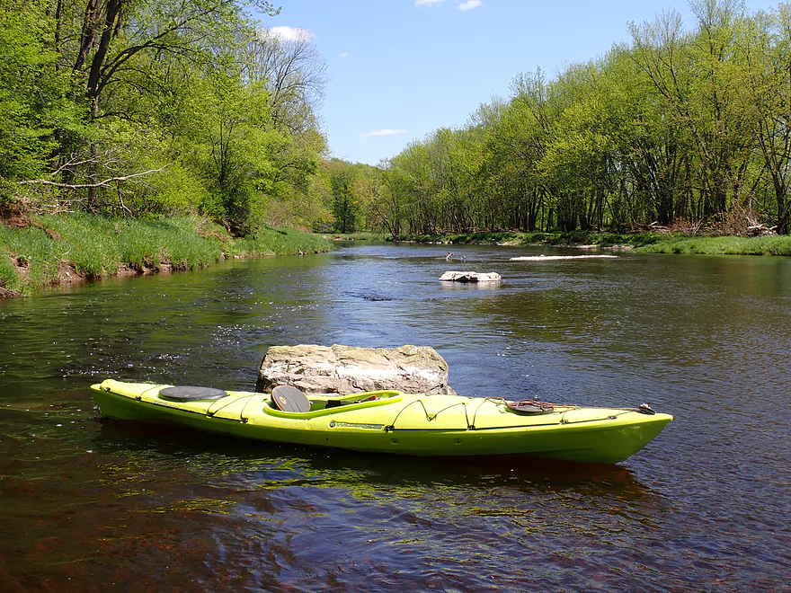
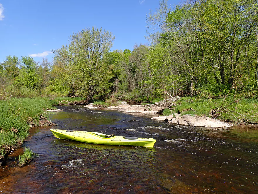
Fun rapids
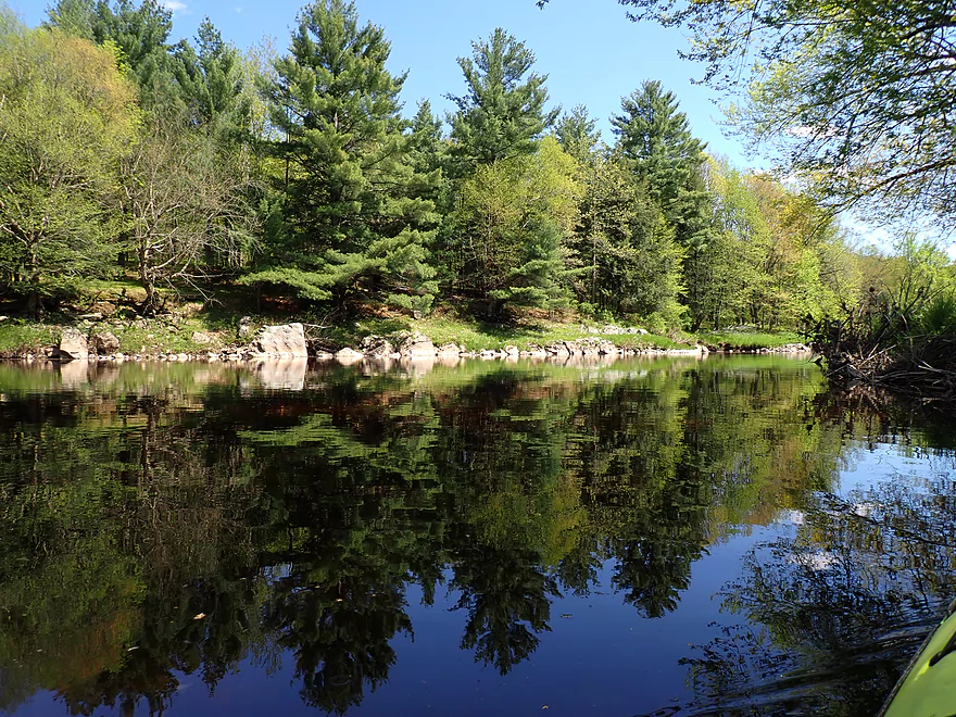
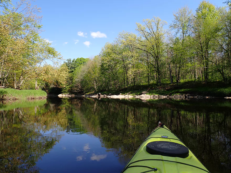
Still water provided nice reflections

Getting out again for pictures
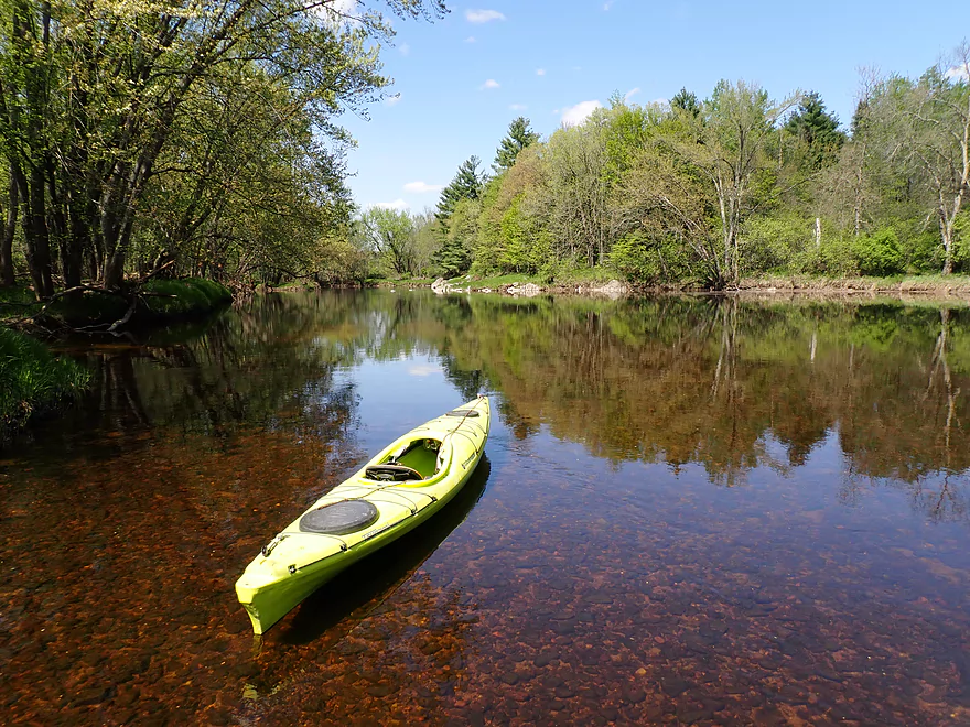
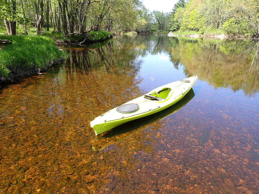
Great clarity
Nifty side shoot
Outcrop #6
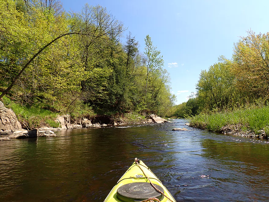
Narrow fast stretch
River is starting to get rockier
Outcrop #7
Scenic side creek (this might be Black Creek)
Zipping around rocky bends
Nice litte boulder garden
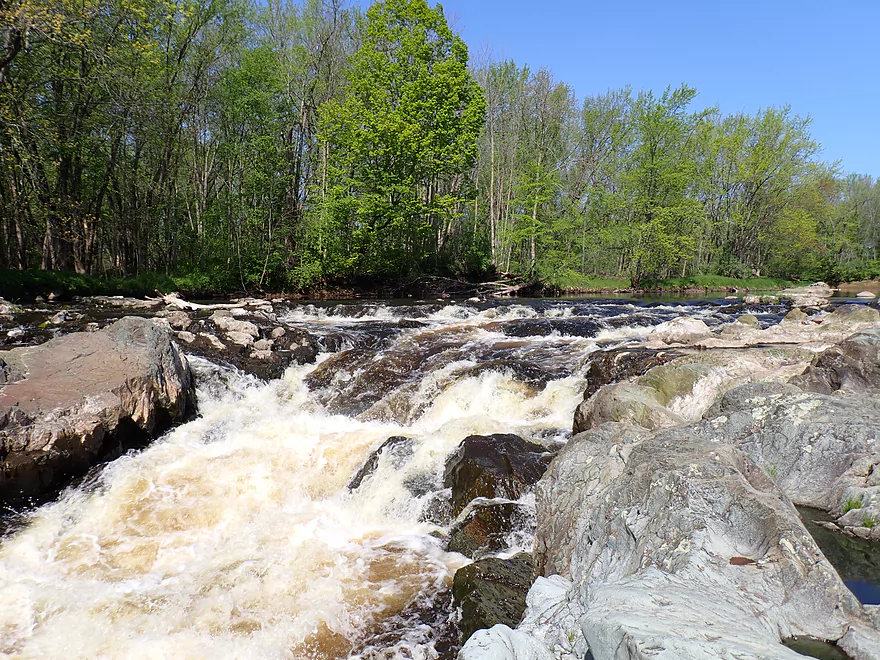
Overlooking Rib Falls
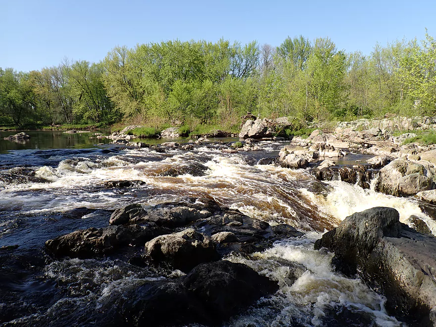
I decided not to run it
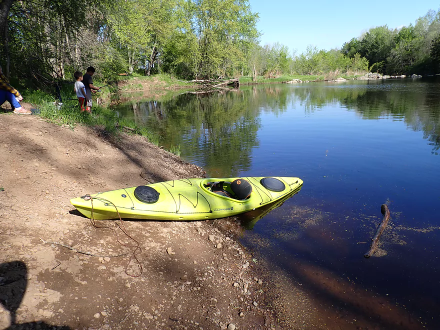
Taking out
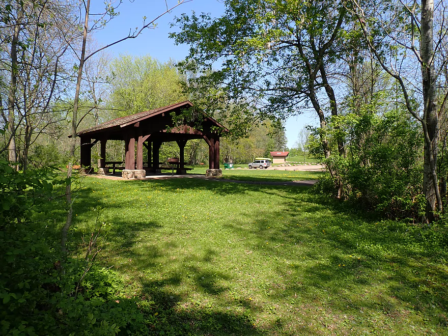
Rib Falls County Park is a nice access
View of the falls from the north shore
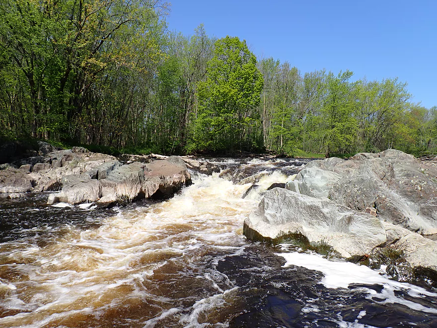
Zooming out
…zooming out more…
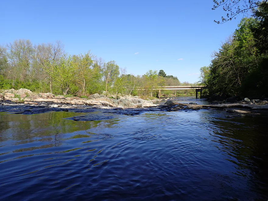
View from the S bridge
Big Rib River – Rib Falls

The Big Rib despite its name, is a smaller river that joins the Wisconsin near the city of Wausau. Central Wisconsin has a lot of elite water trails (like the Eau Claire River), and while the Big Rib just isn’t in that top tier, it’s still quite nice and popular with local Marathon County paddlers.
For this trip I put in at Hwy A, where I ended an upstream trip five years ago. The trip to start honestly wasn’t super interesting. While the banks are heavily wooded for almost the entire trip, there were many thin spots and I suspect the area has been logged in the past few decades. There were early highlights including some light easy rapids and some really nice gravel bars which could be nice picnic stops. Water quality was very good…clear with a strong red tint.
As I proceeded downstream, the scenery got progressively better. One of the main highlights of the trip were the multiple rocky banks topped with hemlock trees. At the base were incredible granite outcrops with sharp angles and exotic cracks. By my count there were seven stretches of granite cliffs including a very long one upstream of Black Creek. Besides the occasional hemlock, there were also many sugar maple, which means this could be a nice fall color paddle.
The second half of the trip would prove much better than the first. Here the current picked up and the river became rockier with more boulders. There were several decent sized islands and paddlers should carefully choose their options. Sometimes one channel would be a bit too shallow while the other plenty deep. Or one channel might have interesting granite boulders, while the other didn’t. While I was worried about shallow levels for this trip, this proved mostly not to be a concern. The rapids were also all easy and I would rate this a very suitable trip for beginners. The only real obstacle was a minor logjam, but that was a super easy portage via an adjacent gravel bar.
Fishermen on the banks signaled to me that I was coming up on Rib Falls County Park and my take-out. But before I ended the trip, I decided to head downstream a bit to check out Rib Falls which is kind of a hybrid between rapids and a waterfall. Before the 1960’s a dam covered up the falls, but thankfully it washed out and wasn’t replaced. There are likely other cool falls/rapids hidden in Wisconsin by pointless dams that should have been removed long ago.
I didn’t run Rib Falls as it is a dangerous pitch of Class 4 rapids. Not only is the descent steep, but there are some tricky rocks and holes at the bottom you don’t want to get stuck in (see video). But I did get close and got out on foot along the south bank for pictures with optimal lighting. This required some tricky boulder climbing but was worth it (I felt like Link from “Tears of the Kingdom”). After I took 100+ photos of the falls, I doubled back and took out on the north bank to end the trip.
In summary this was a great trip and far better than I expected. I didn’t realize there would be so many granite outcrops or hemlocks. The previous Big Rib River trips I did were honestly a bit boring even though they were pleasant. This in contrast was way better and might be the best leg on the river (although I haven’t paddled the Dells yet which might be the best leg). This segment has the potential to be popular with local Wausau paddlers. It is easy, lacks major hazards, is scenic, and can be done at relatively lower depths. In contrast other central Wisconsin paddles “dry up” much sooner (eg Upper Black, Upper Plover, Eau Claire, both Yellows, Big Eau Pleine, Little Eau Pleine).
Sights included a few clams and many songbirds. The highlight was all the crayfish that zipped around backwards at high speed.
Rib Mountain State Park: Some of the oldest rock in the entire world–and a great view of the countryside.
Hwy A: This is a decent bridge access. A faint dirt trail southwest of the bridge leads to the water. But note…the embankment is steep (more a problem for taking out than putting in), and parking on the sloped shoulders is tight. Paddlers may be tempted as an alternative to use an adjacent snowmobile road that leads down to the water. I don’t recommend this, as I’m not sure it is public and I’ve seen cars parked at the mouth of the drive (which could get you trapped).
Alternate Put-ins:
- Amco County Park (4.3 miles upstream from Hwy A): Amco Park is a very good put-in. This preceding leg is a bit slower and much less interesting, but is still pleasant.
Rib Falls County Park: This is a nice public park with outhouses and a good take-out option. Note the shoreline by the falls is too rocky…so you’ll have to take out much further upstream where there is a shallow bank. From here drag your boat and follow a trail ~250′ to the main parking lot.
As a side note, the county recently purchased an adjacent quarry and will be upgrading the park to include campsites. They will also open the adjacent quarry lake for paddling which could be really cool as quarry lakes have fantastic clarity.
Alternate Take-outs:
- Marathon Lion’s Riverside Park/Hwy 107 (7.7 miles downstream from Rib Falls): Riverside Park is I believe a new park located next to the Hwy 107 bridge (Google doesn’t have it marked yet). This is an ok take-out option, but extending a trip this far would make for a very long trip and would require a long portage around Rib Falls.
Bike Shuttle – Rib Falls Park to Hwy A: 7.5 miles with 230′ of ascent. I considered this a difficult bike shuttle because of its length and large number of hills. You should definitely be in good bike shape before attempting a shuttle like this. Also the road is very open and at a higher elevation, which means wind can be more of an issue (I faced an unpleasant headwind). On the plus side, this shuttle is not on any gravel roads (which are common in the area).
Rapids/Current: The upper leg is mostly slow with a handful of light rapids. The lower leg though speeds up with faster current and many more rapids. But none of the rapids were that strong or greater than Class 1.
The exception is Big Falls which I consider a Class 4. Only skilled whitewater paddlers who have scouted the falls and have proper equipment should attempt the descent which is steep and has a tricky hole between boulders you DON’T want to get stuck in. For whitewater kayakers, higher water may be required to pad the boulders/holes…but not too much water as the falls gets boisterous when high.
Logjams: There were a few downed trees but they were almost always very easy to get around. There was one tree I portaged, but it was super easy because of an adjacent gravel bar.
Closest Gauge: Big Rib River @ Rib Falls
Trip Depth: 170 CFS or 2.65′
Navigability Estimates: The following are rough estimates.
- 0-100 CFS: A very low depth. Many of the riffles would likely be too bumpy to be enjoyable.
- 101-200 CFS: Some of the riffles would be bumpy, but I believe this would be a doable depth as most of the river (outside of the rapids) is plenty deep. You may need to wade just a few spots.
- 201-300 CFS: A common average flow rate and a good target range.
- 301-400 CFS: The river is above normal but likely still quite doable. Clarity would likely be poor.
- 401-500 CFS: This would be a pretty high level. Some of the snags could be difficult to circumvent at this depth.
- 501+ CFS: These are very high levels and not recommended for casual paddlers.
Detailed Overview
- Upstream of Cty M: Likely navigable paddling, I just don’t know much more.
- Cty M to Lemke Drive: 4.5 miles. An unknown prospect…might be interesting. Could be some downed trees.
- Lemke Drive to Hwy 64: 4.6 miles. Pleasant, but not a special trip.
- Hwy 64 to Silver Fox Road/Greiner Road: 3.7 miles. Famous section that contains the dells, the most rapids and a tough section with Class 3 rapids. Likely 5 stars. Note, the bike shuttle for this section is poor. Reviewed by AmericanWhitewater.org, but note that their flow estimates are very aggressive.
- Silver Fox Road to Cty F/Amco Park: 3.3 Miles. A pleasant section with some light rapids.
- Amco Park to Cty A: 4.5 miles. Slower than upstream sections but pleasant and wooded with a few small outcrops.
- Cty A to Big Rib Falls County Park: 7.7 Miles. A great stretch and maybe the best leg on the entire Big Rib River. Highlights include attractive hemlocks, light rapids, boulders, and seven separate sets of gorgeous granite outcrops. This section ends with a bang with Rib Falls, which is very scenic.
- Big Rib Falls Park to Marathon Lion's Riverside Park/Hwy 107: 6.6 miles. Attractive stretch with exposed sand banks, small boulder gardens, gravel bars, and a handful of Class I rapids. The second half of the trip is more of a slower silver maple floodplain forest, but is still nice.
- Marathon Lion's Riverside Park to Sunnyvale Lake: 9.0 miles. Here the river flows through thick floodplain forest. There are no known rapids or rock formations, but the woods should be nice (especially in fall). Sunnyvale Lake is a speculative access: it is a man-made lake located by the river. You would need to portage the dike, and then paddle a third of a mile north on the lake to reach the beach and public park access.
- Sunnyvale Lake to Little Rib River Landing: 5.7 miles. A squiggly floodplain forest paddle with the highlight being massive sandbars. Technically speaking, the take-out is located on the Little Rib River (just a bit upstream from the mouth).
- Little Rib River Landing to Rookery View Park: 2.0 miles. Here the current finally dies (courtesy of the Rothschild Dam). This is still a nice wooded paddle. There are multiple take-out options on the Wisconsin River. Here is a really cool video taken during fall color.
Not listed are several of the Big Rib tributaries. The most interesting one is Black Creek, running from Erbach Park/Athens to Meridian Road (5.8 miles). This contains neat boulder gardens and rocky gorges but could also have unknown hazards. This creek has been paddled before, with the most popular section being a whitewater stretch by Athens per reviewer Rick Kark. Also reviewed by AmericanWhitewater.org. The Little Rib River should be partially navigable by the mouth as part of a round trip, but if you go too far upstream, you'll likely face logjams.
Trip Map
Overview Map
Video
Photos Size: