
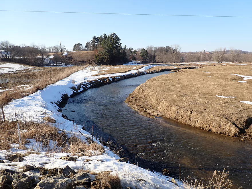
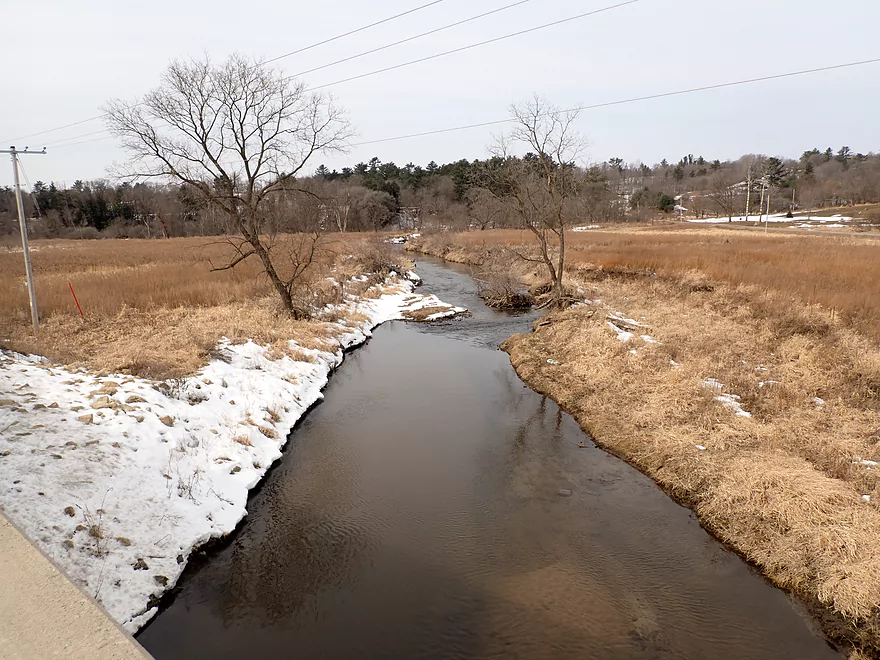
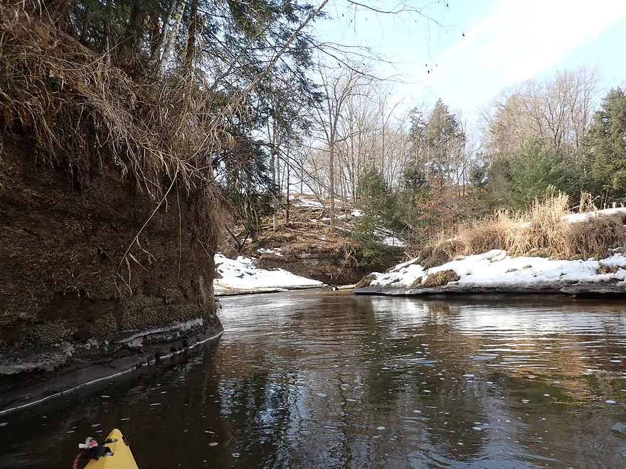
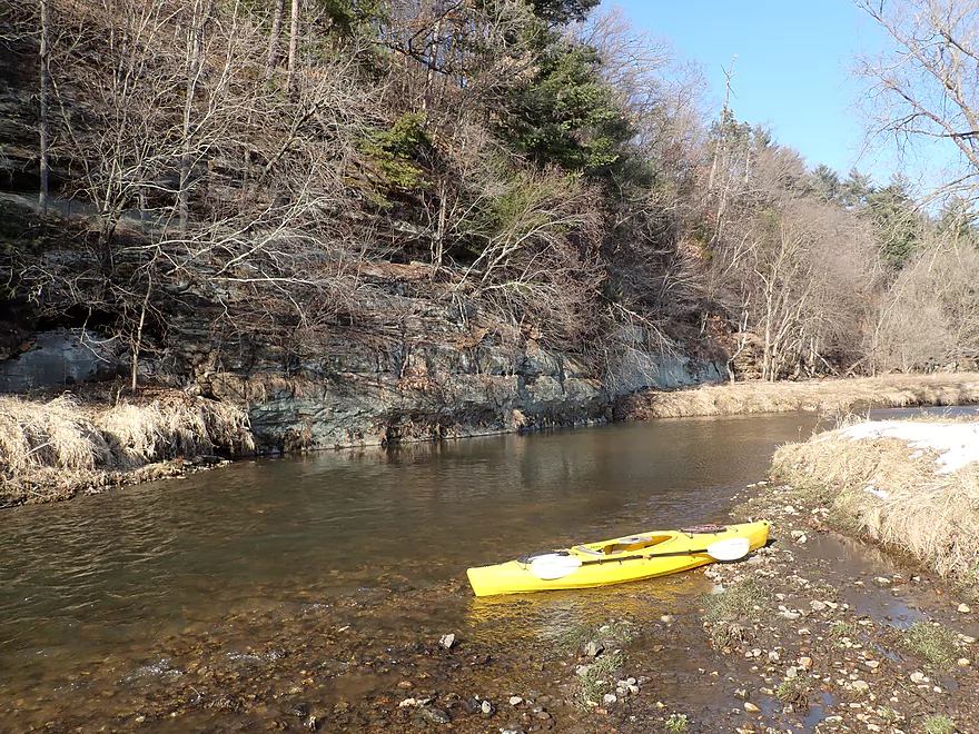
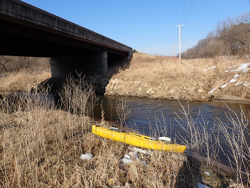
Putting in at Hwy 131 (near Z)
Embankment was a bit steep but was doable for launching
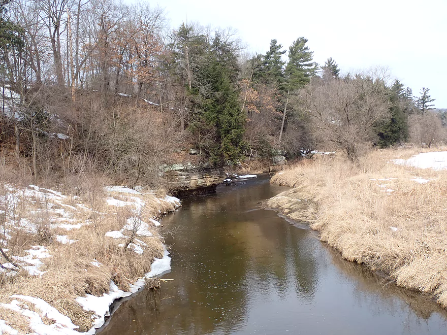
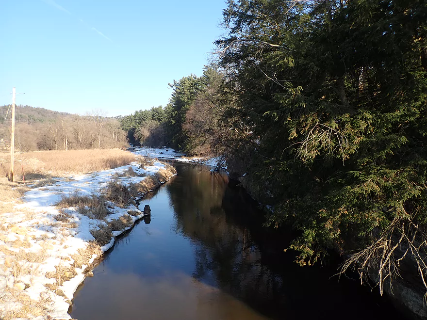
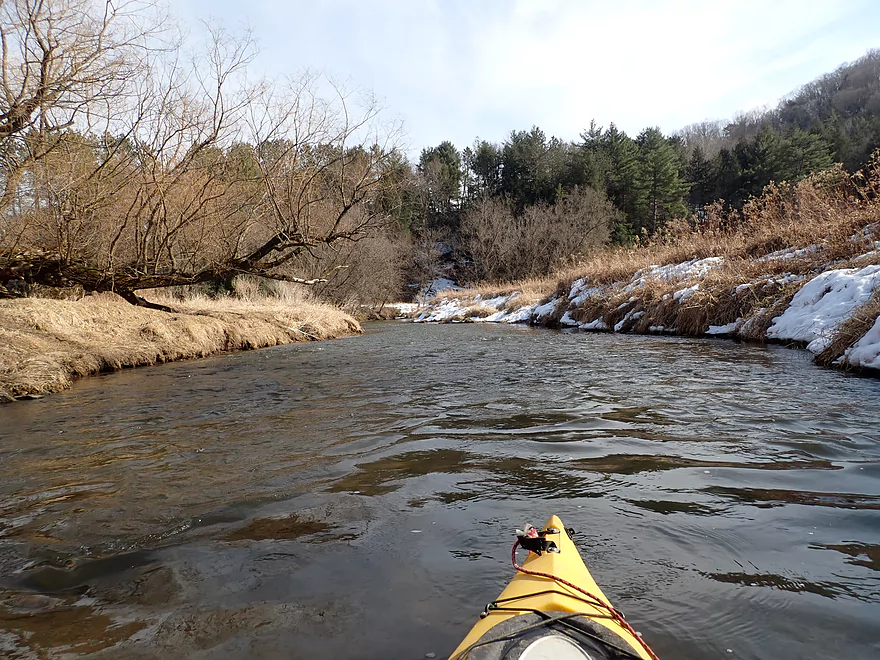
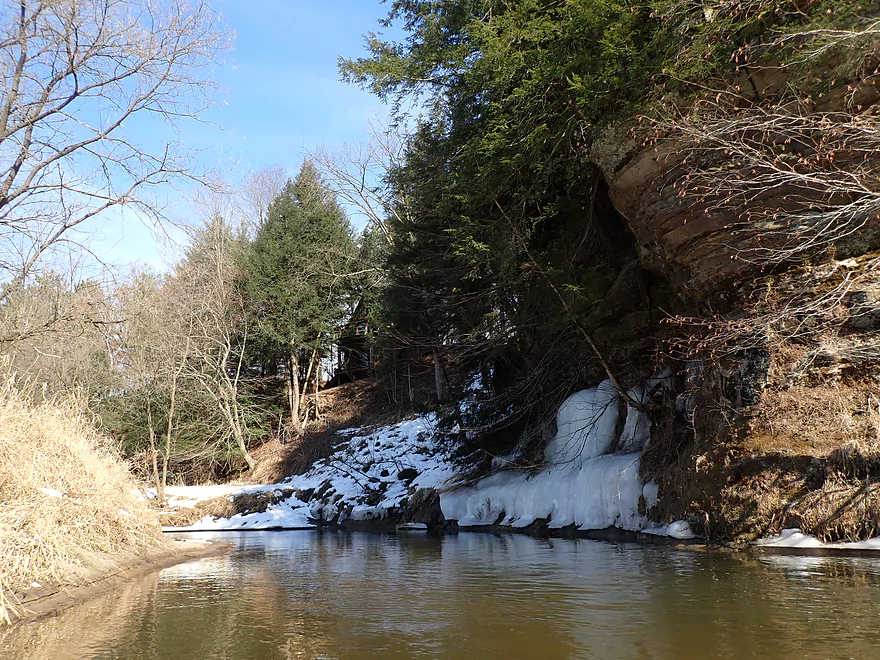
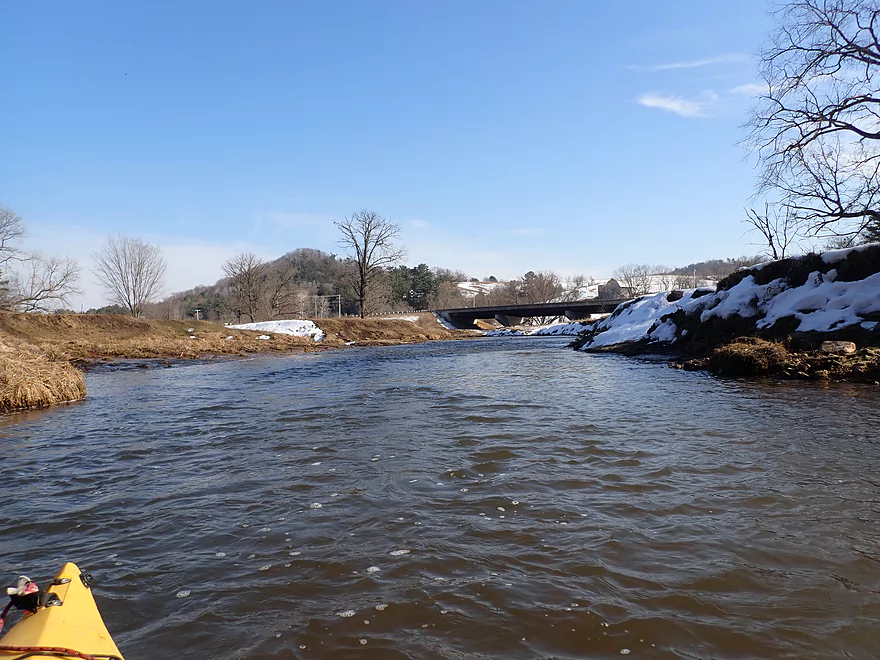
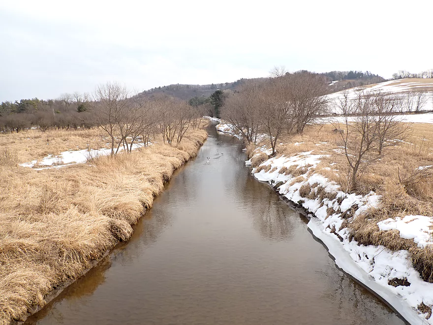
View from bridge
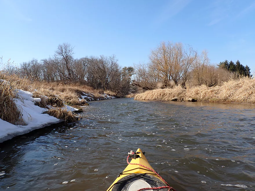
Same view 5 years ago (note the logjam)
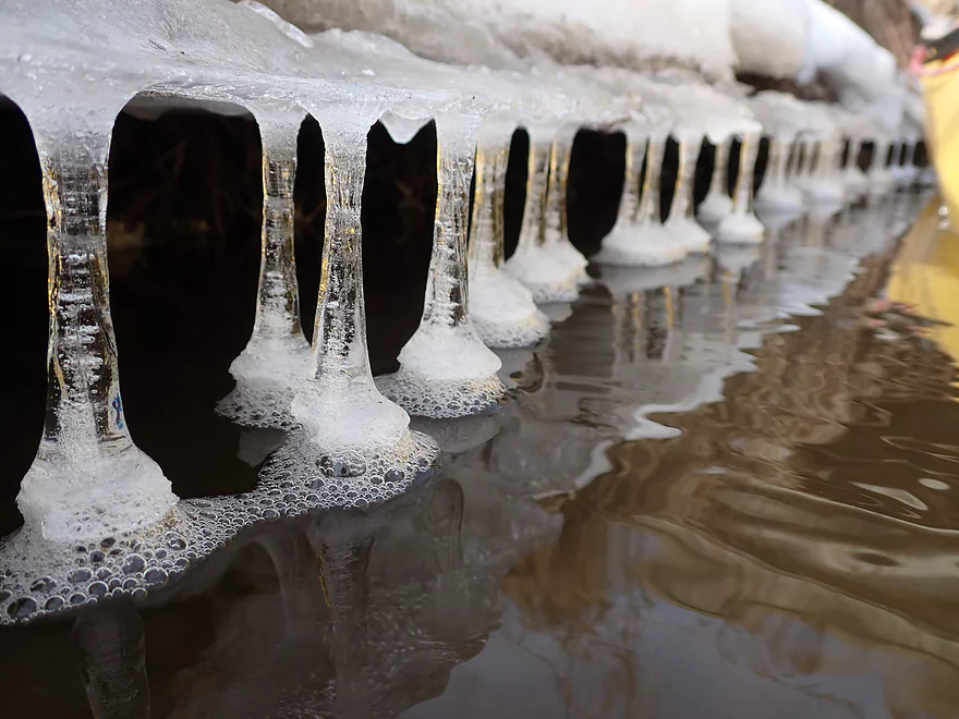
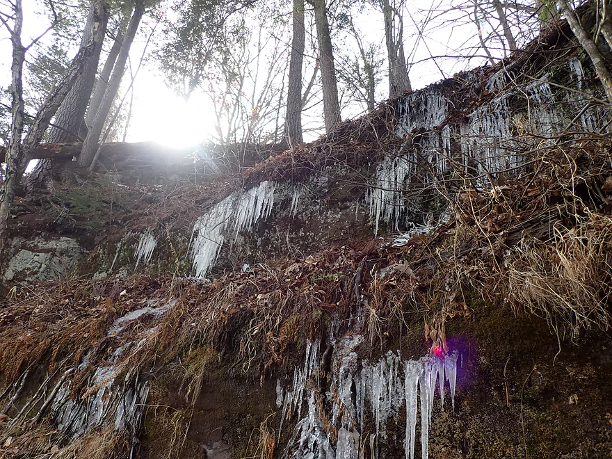
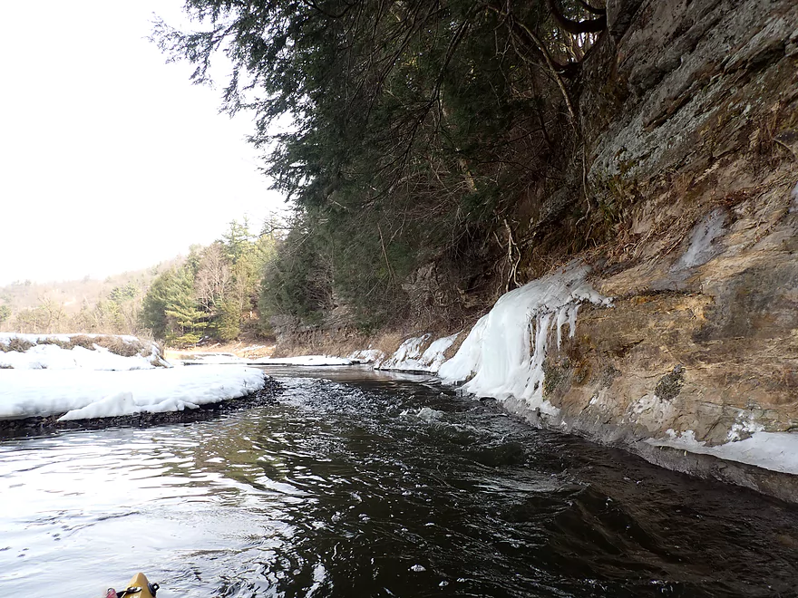
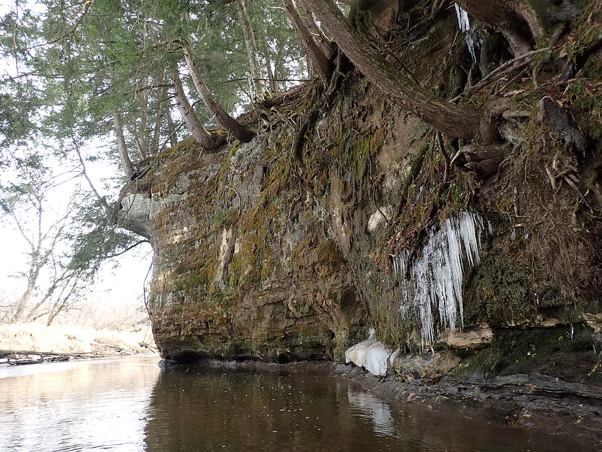
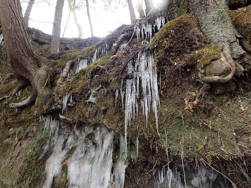
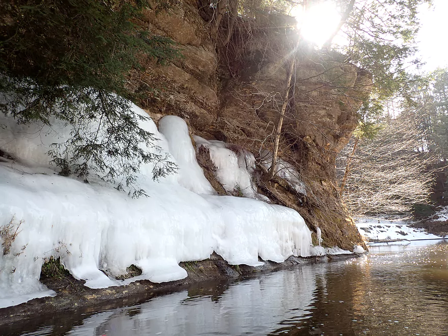
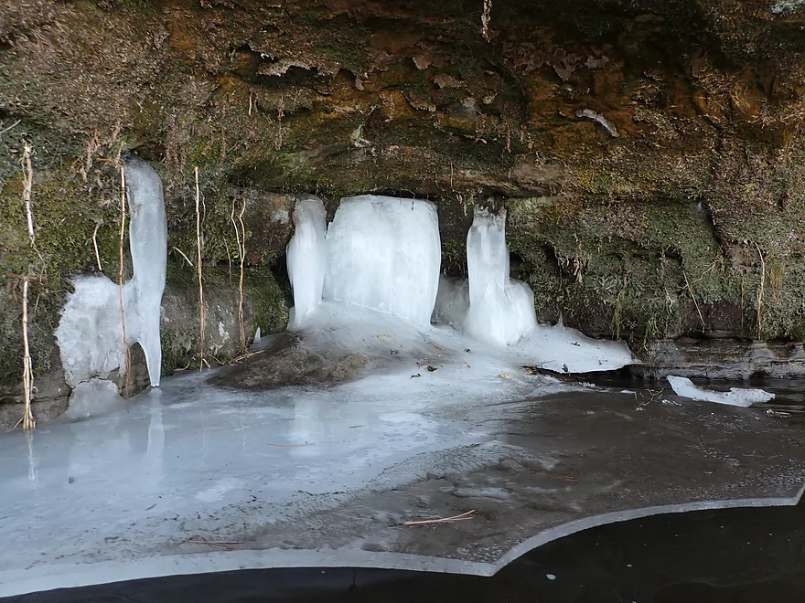
Pillars of ice
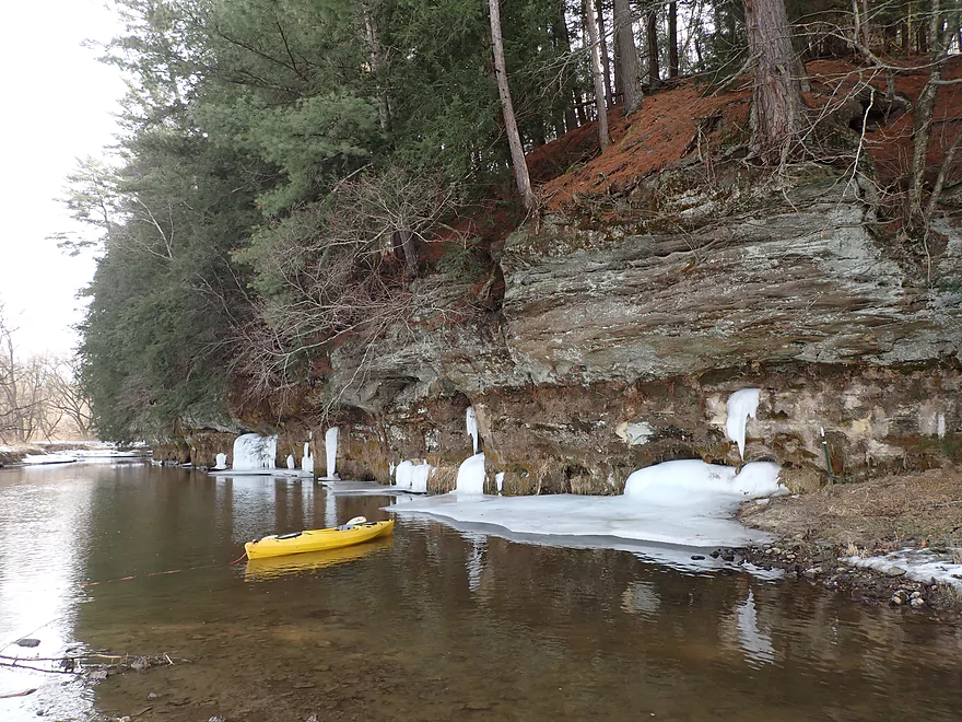
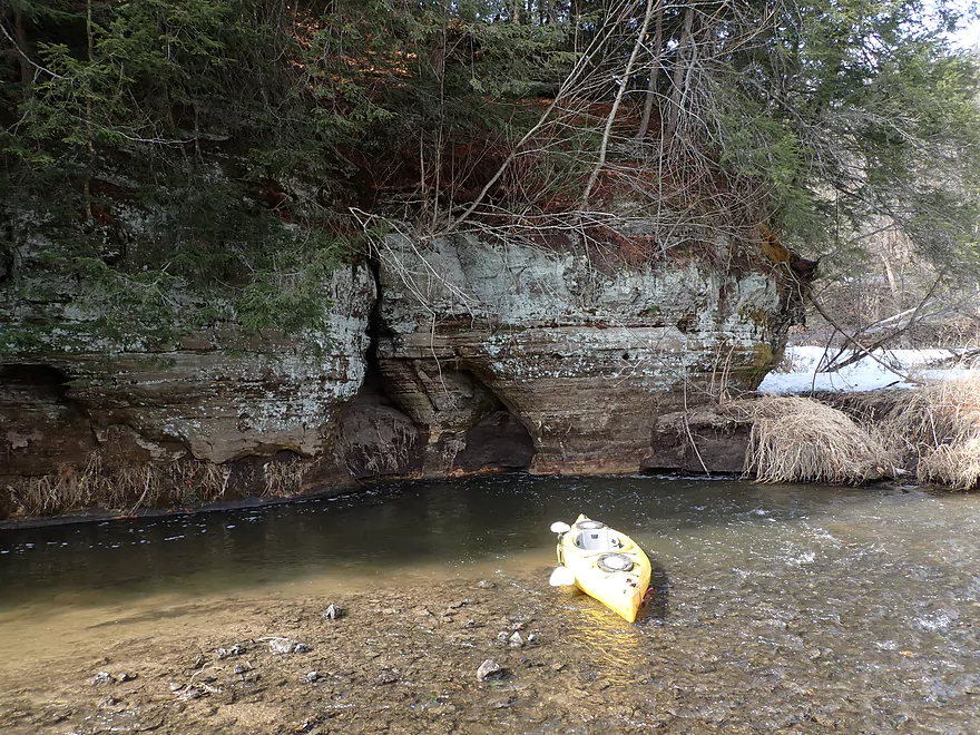
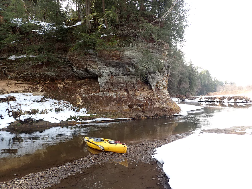
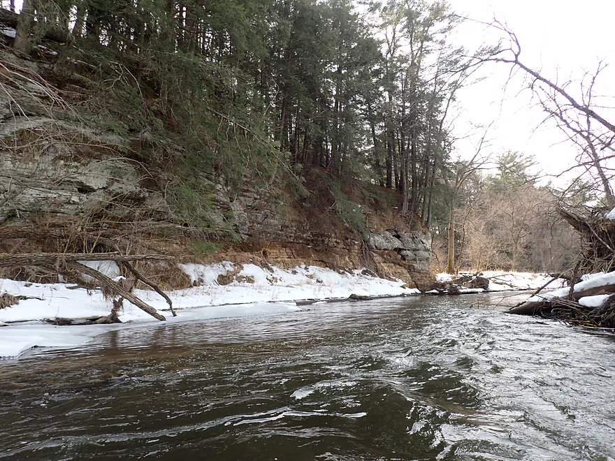
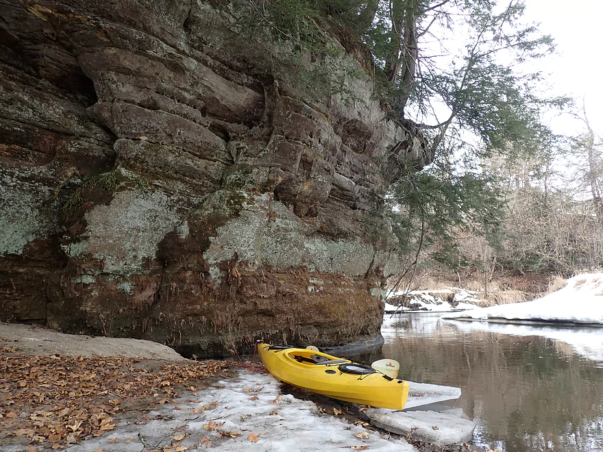
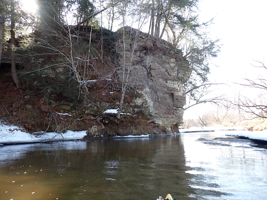
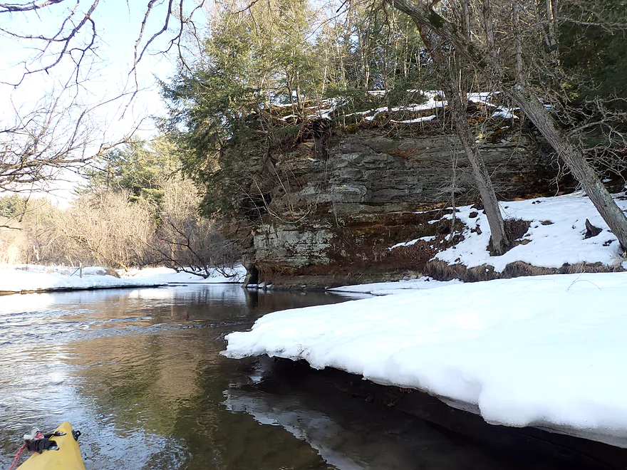
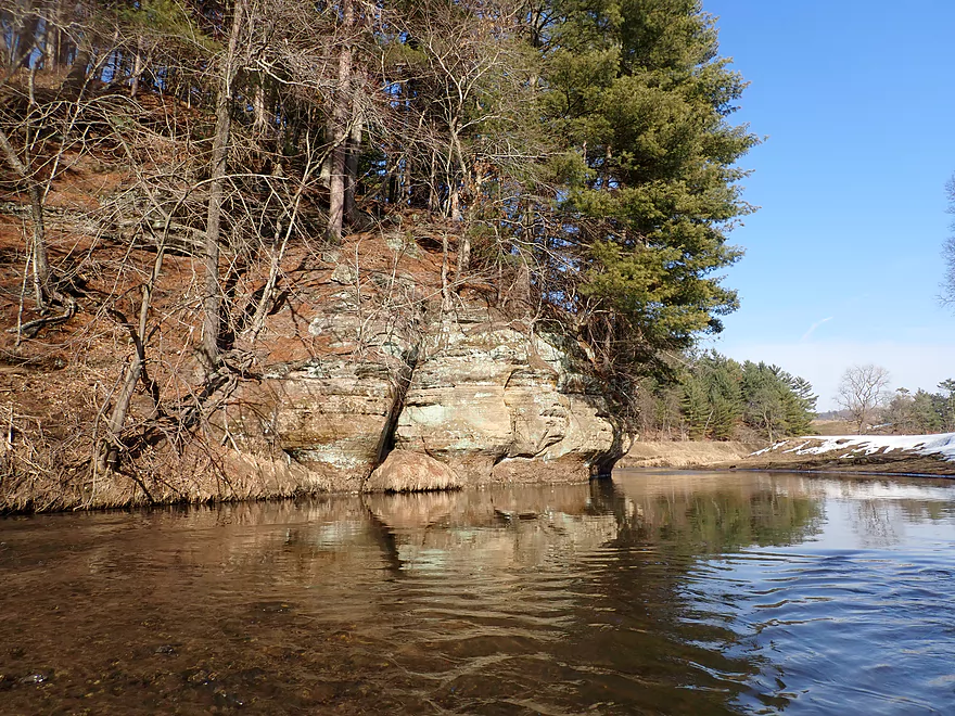
First outcrop of the trip is a nice one
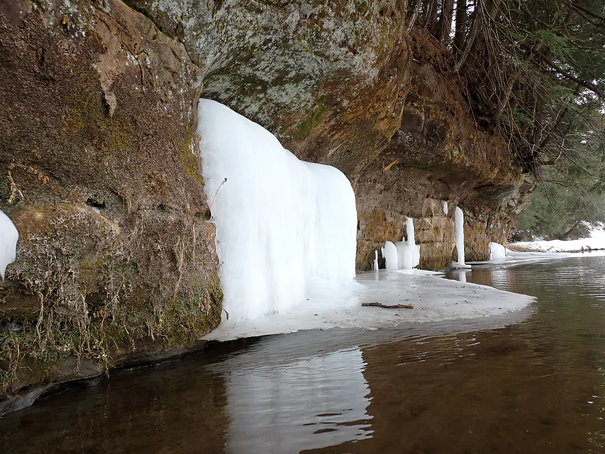
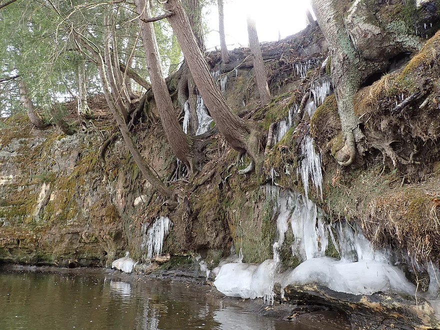
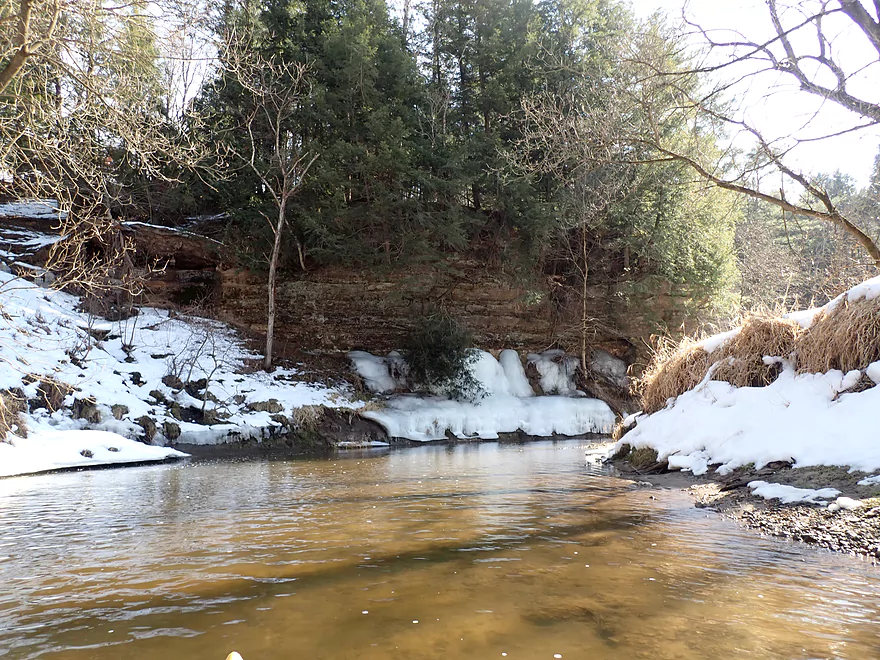
An ice waterfall
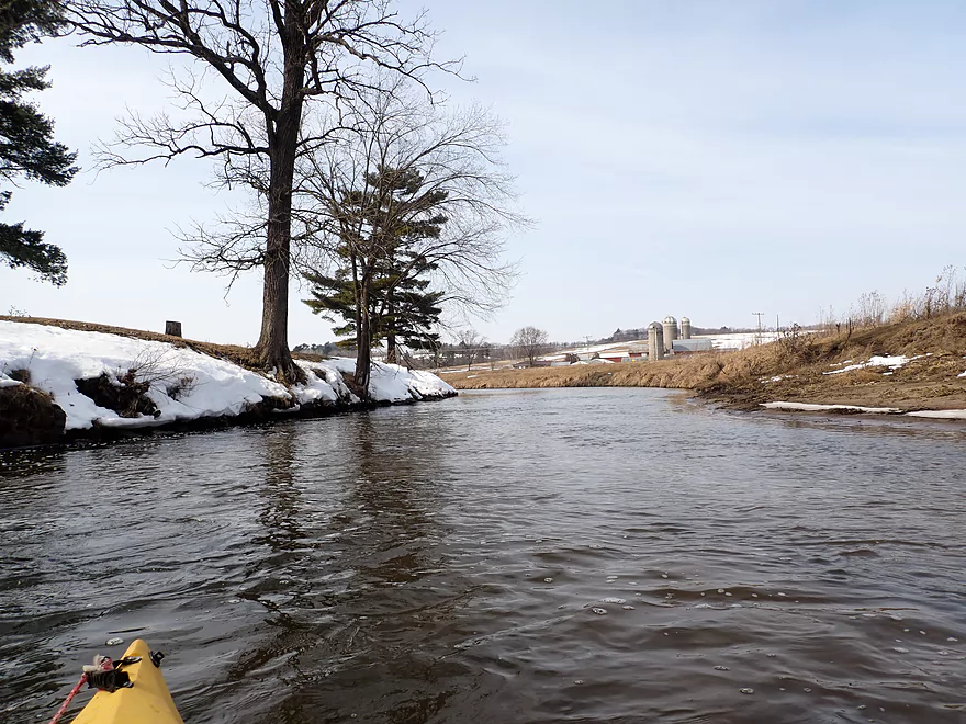
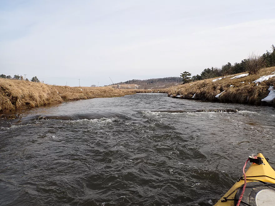
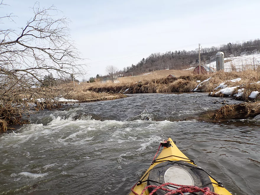
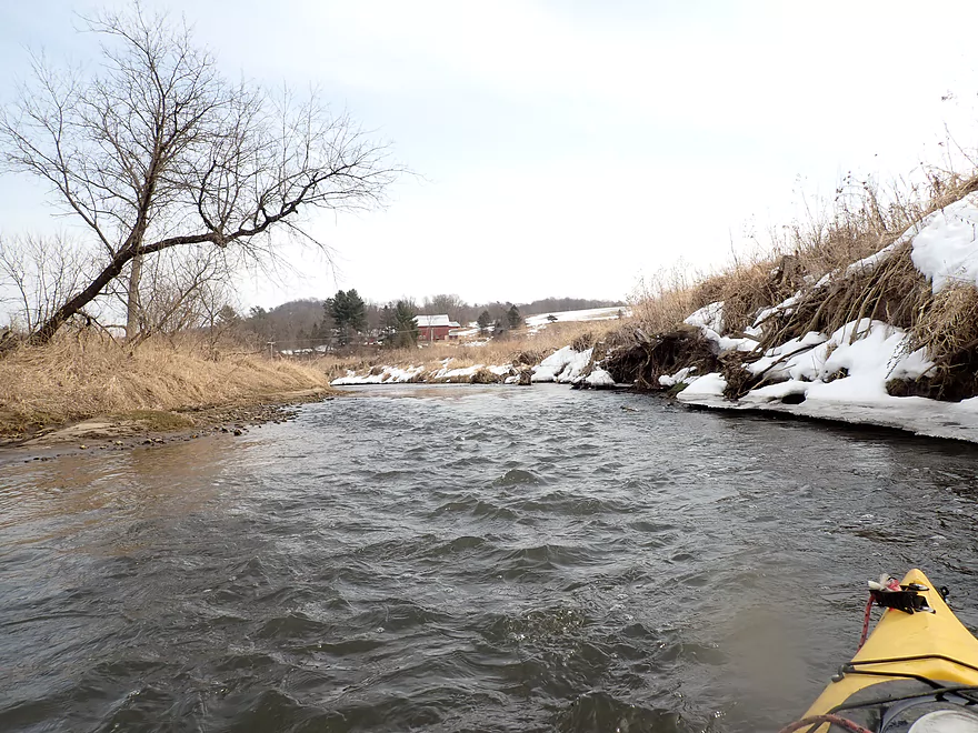
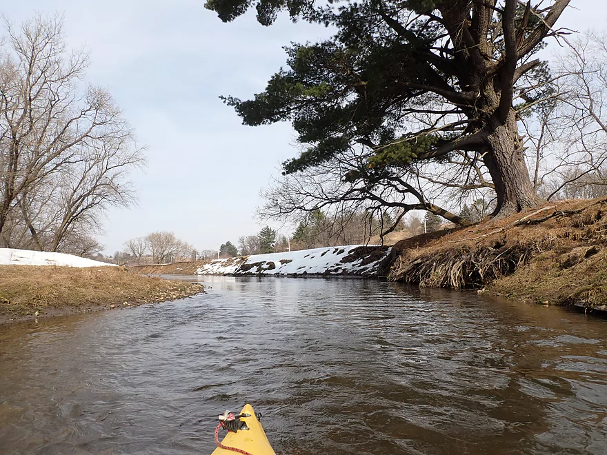
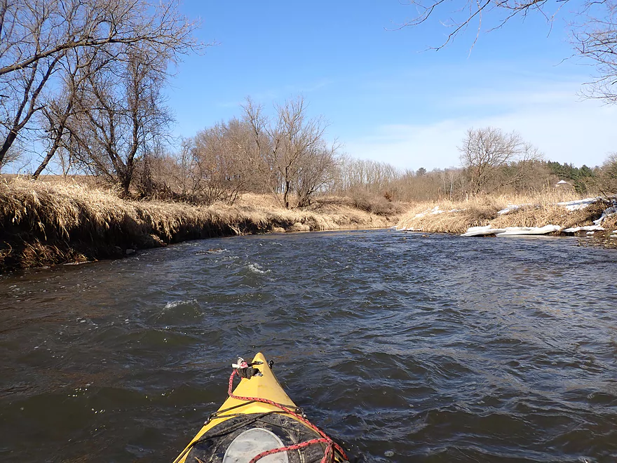
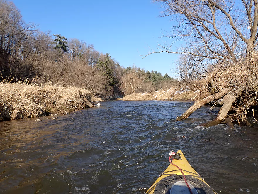
A fast stretch of the river
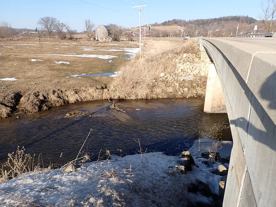
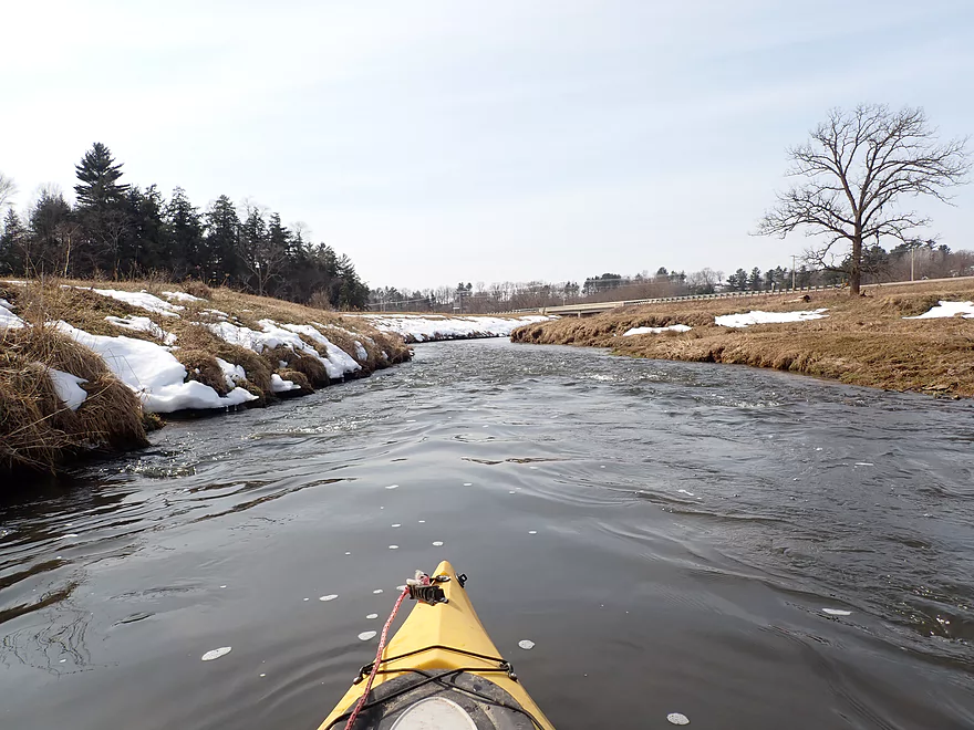
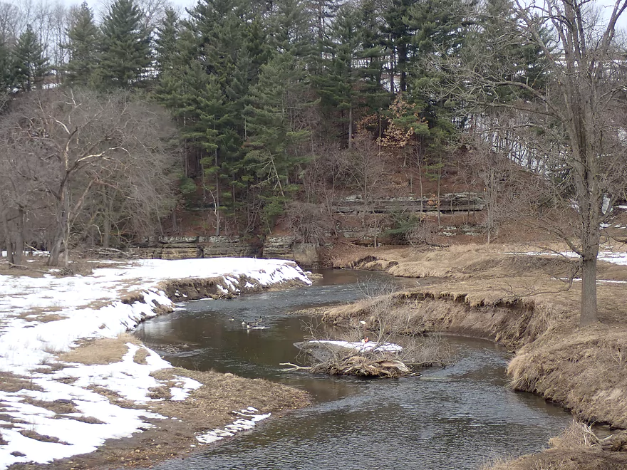
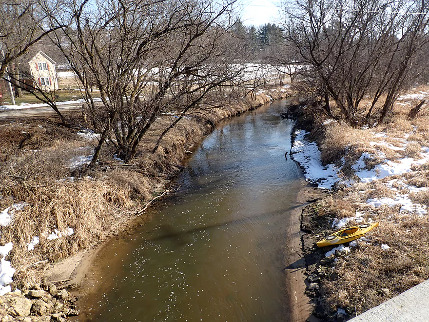
View from bridge near Michigan Road
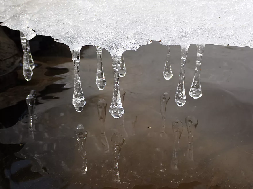
Frozen tear drops
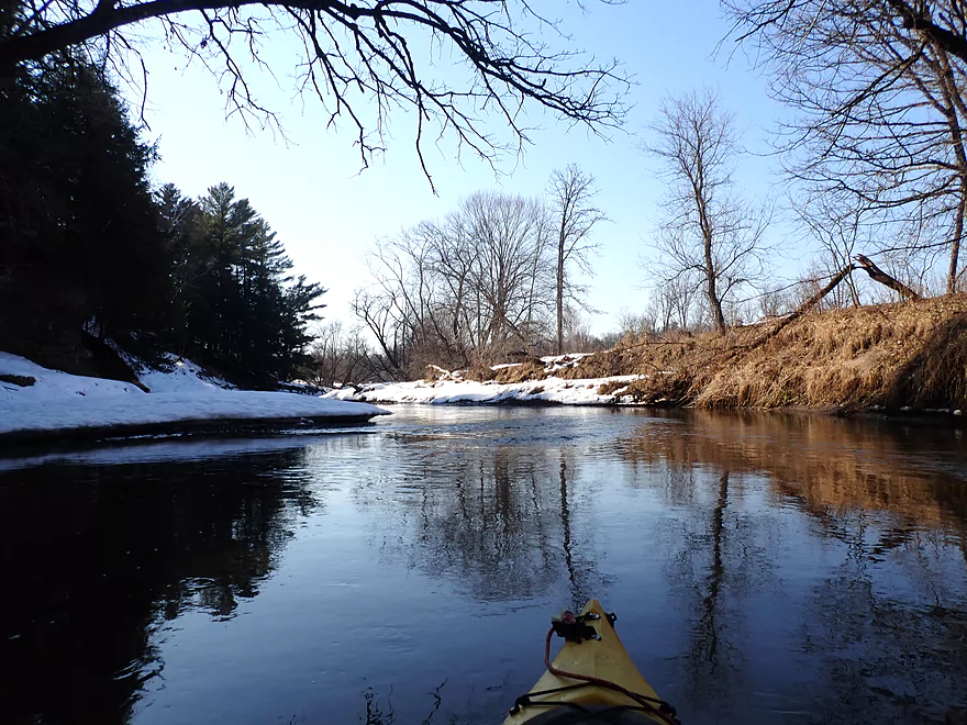
Cool reflections
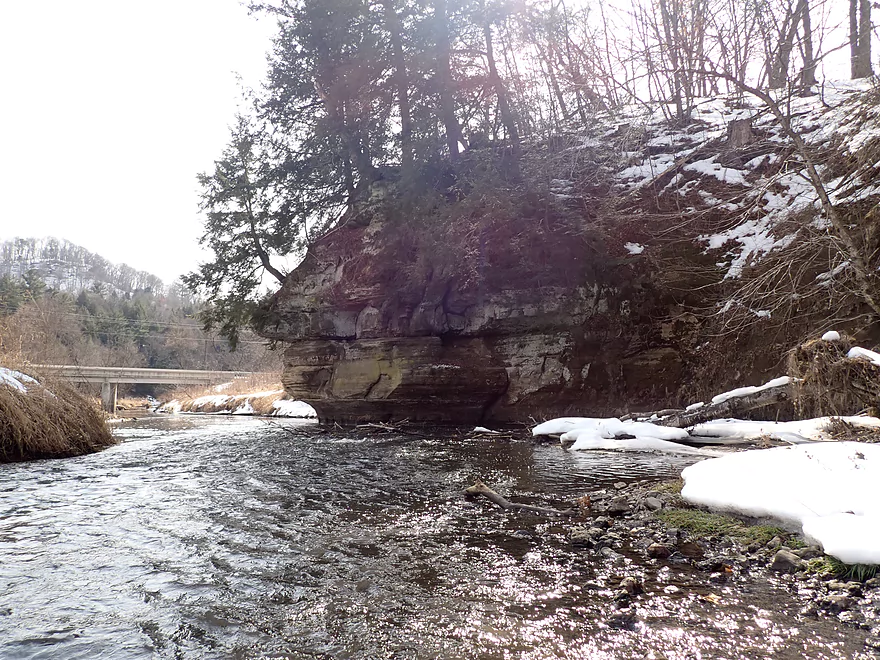
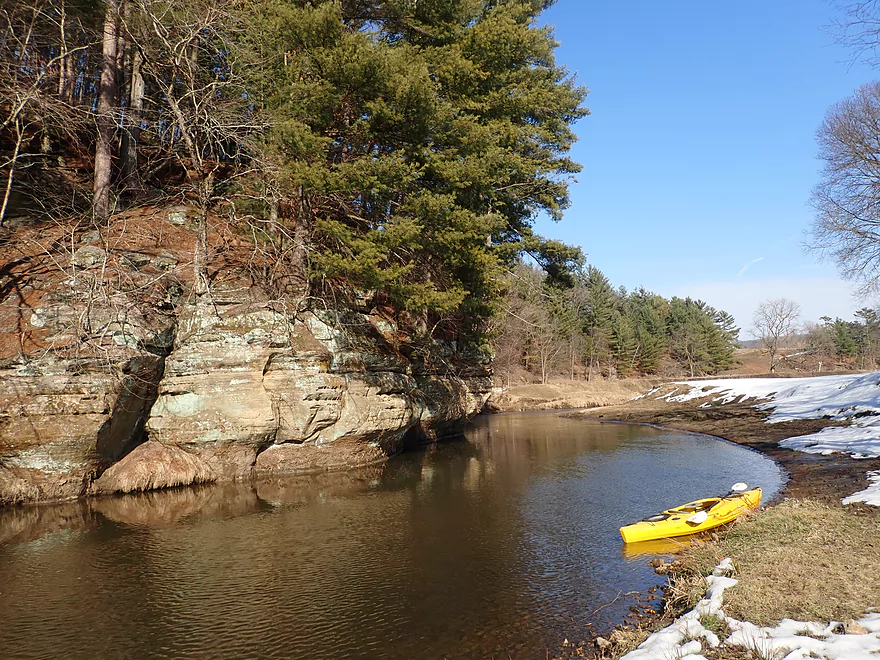
The biggest ledge of the trip
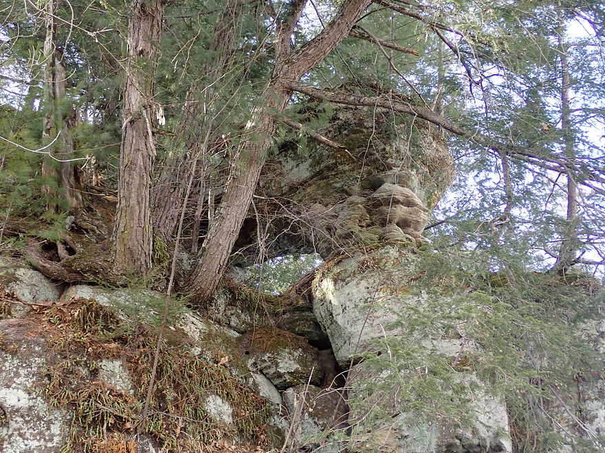
Hemlocks crowd the top of this rock
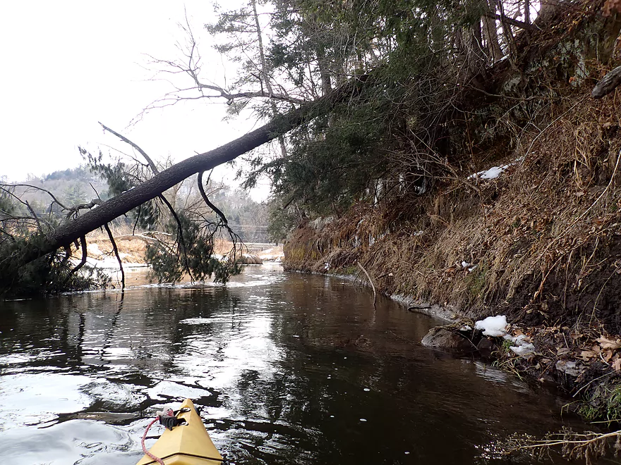
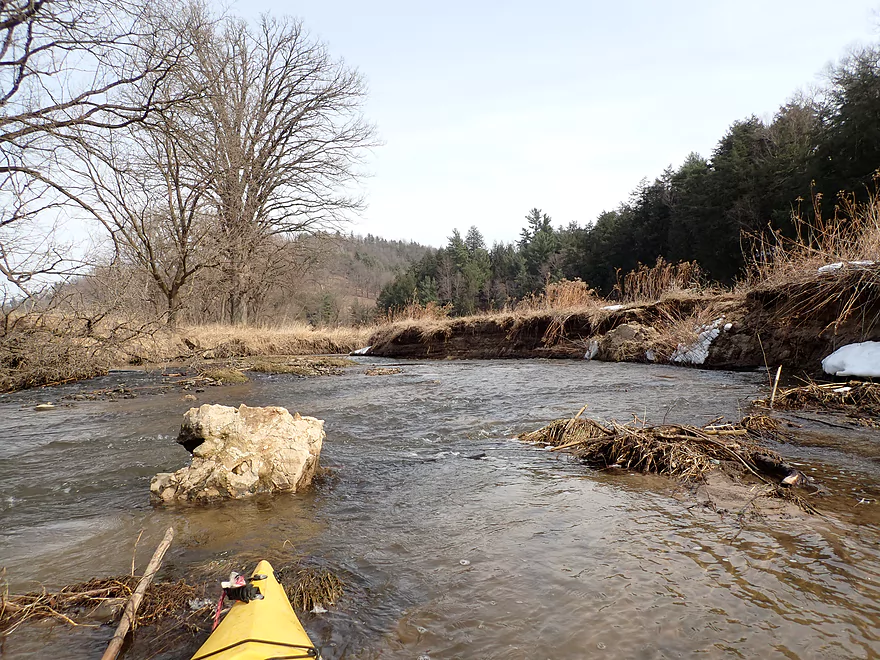
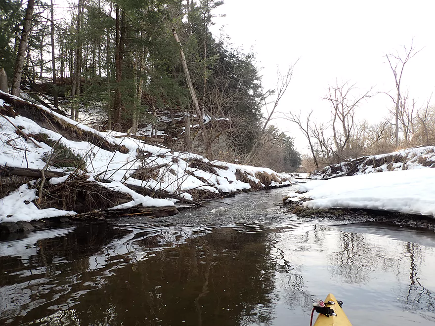
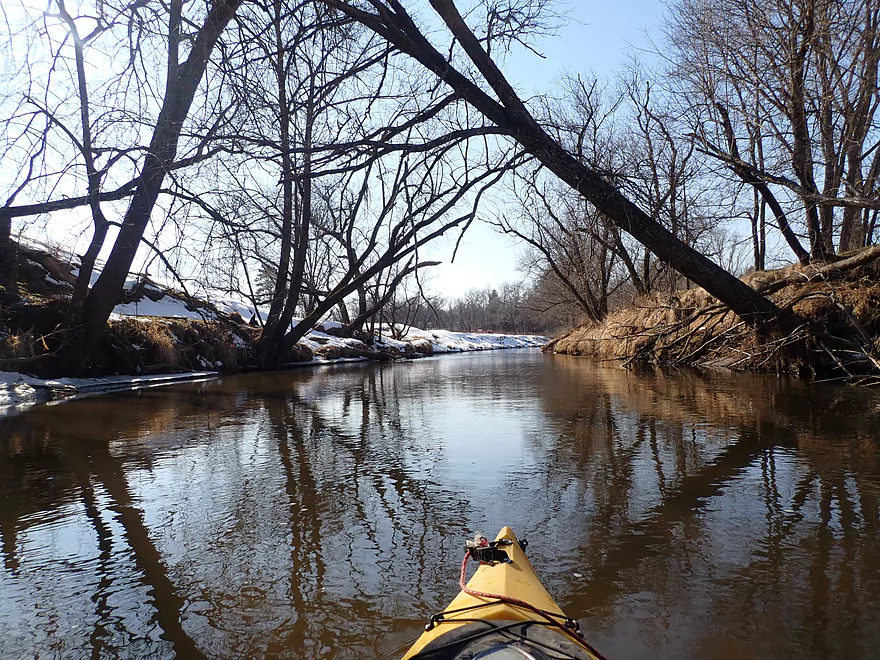
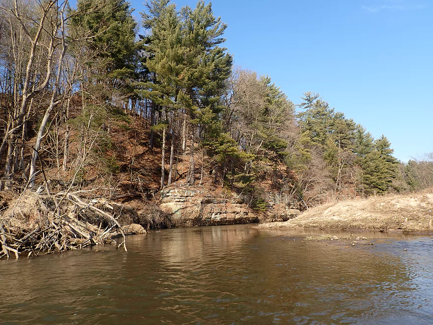
Downed trees weren’t really a problem on this trip
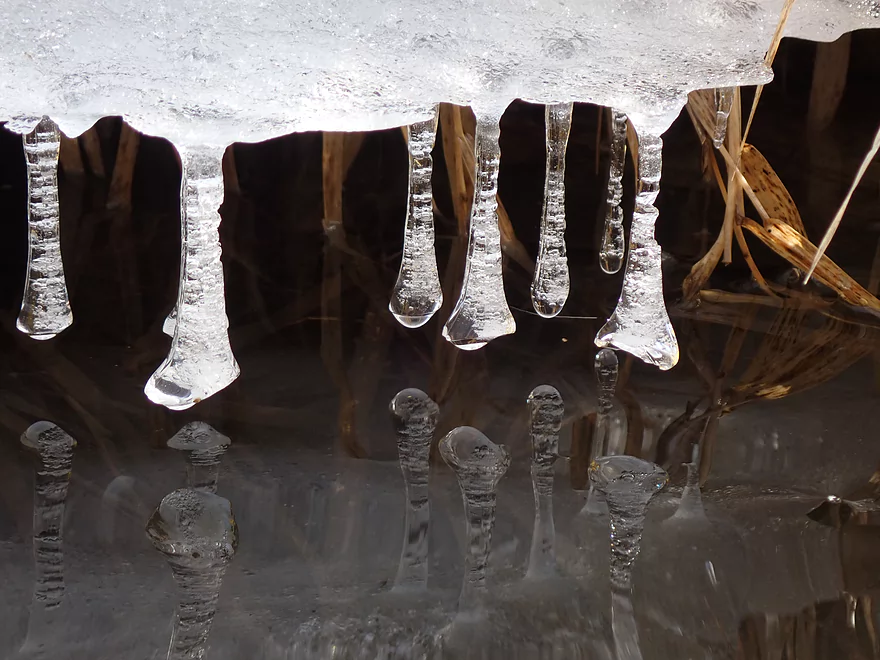
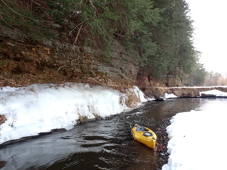
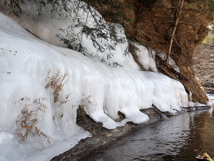
Rows of Icicles decorate this cliff face
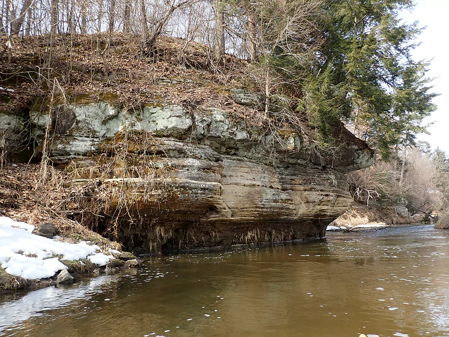
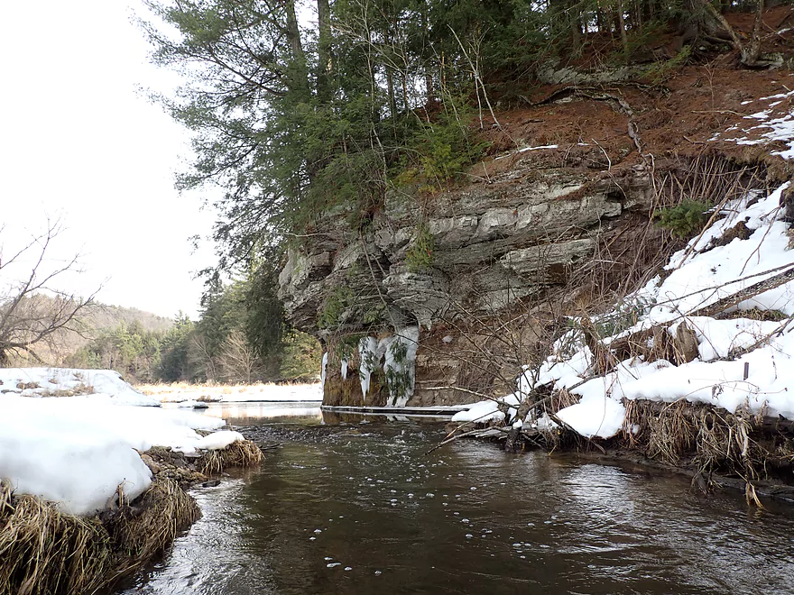
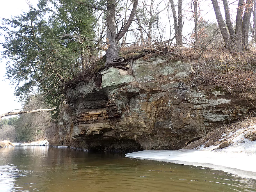
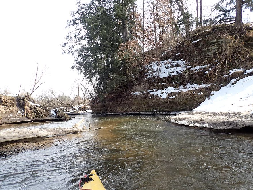
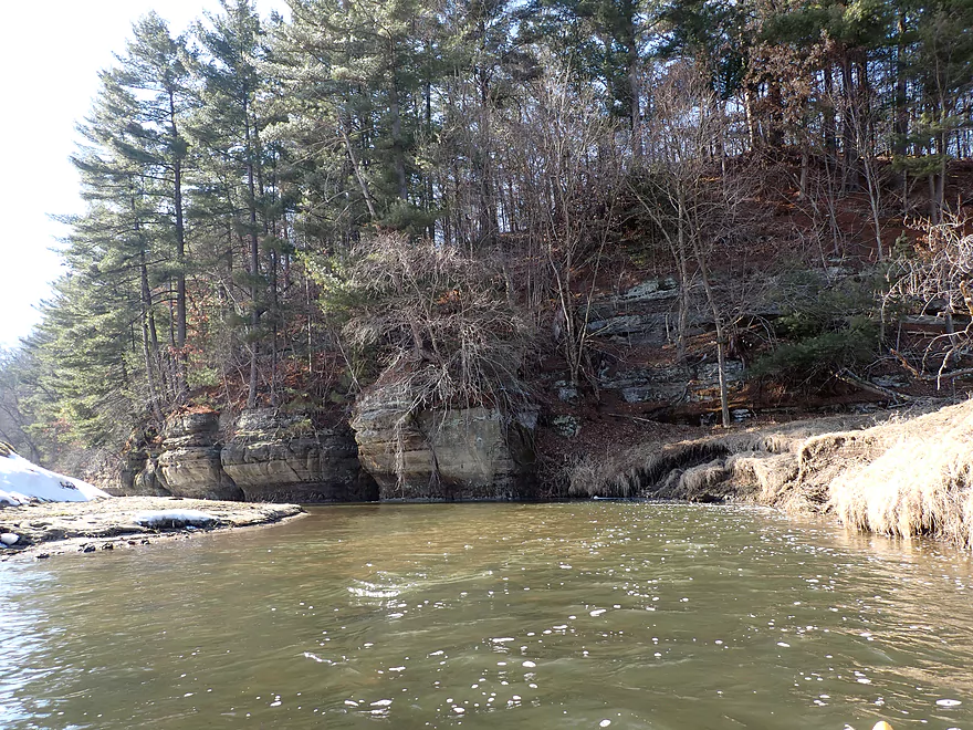
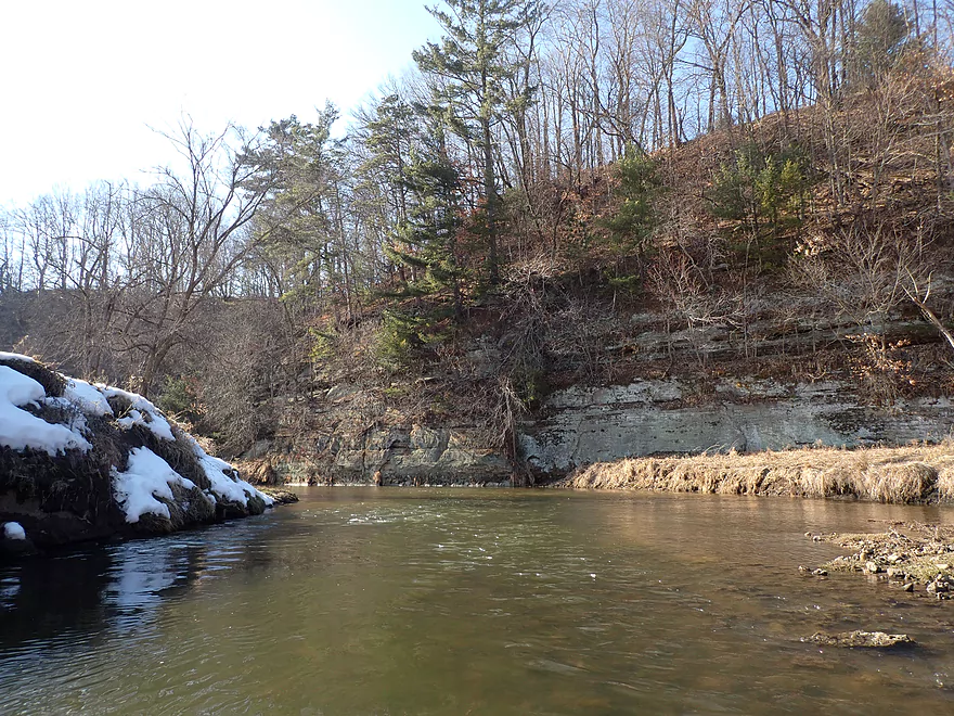
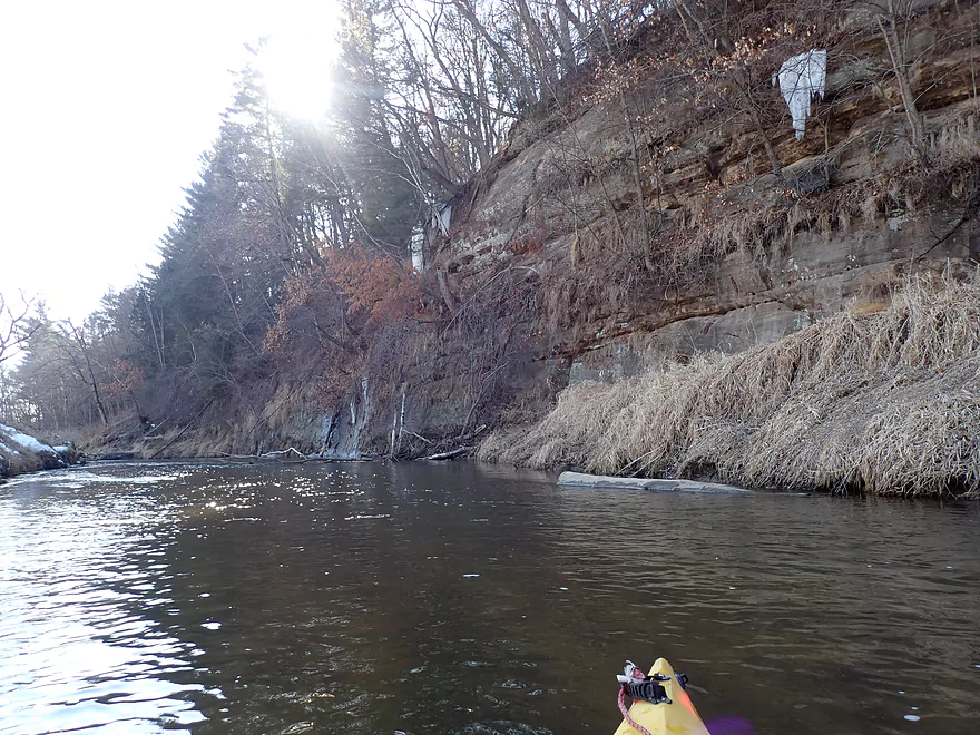
The river really undercuts these cliffs
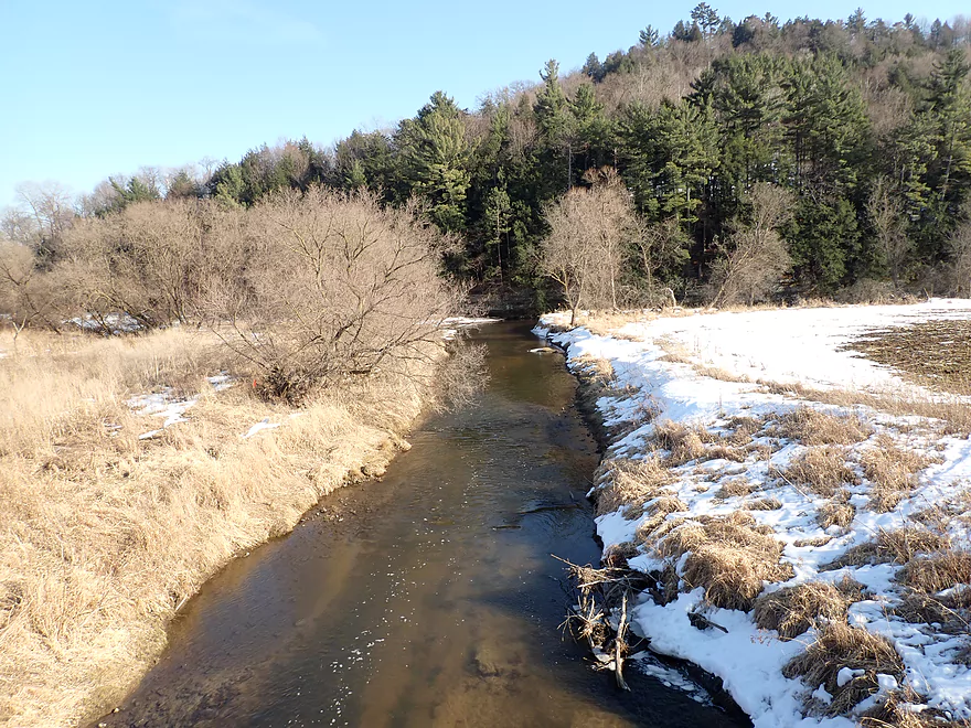
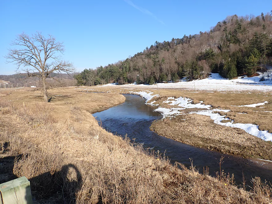
View from Hwy 151 bridge
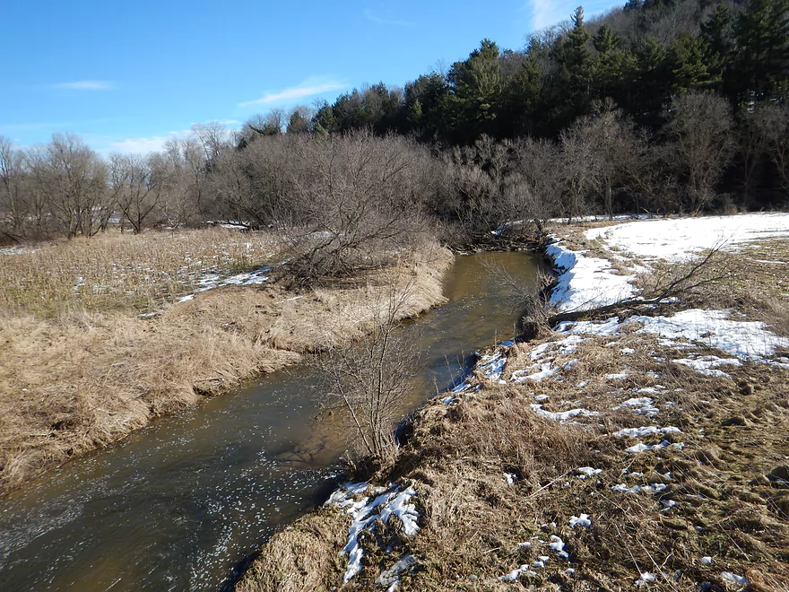
One of my favorite parts of the trip
An island channel zipping past a hemlock-covered wall
Reverse view
River was mostly deep enough…this was a shallow spot
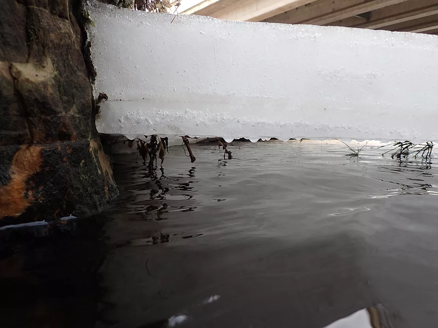
A suspended ice shelf
Upstream view from bridge by String Swing
Downstream view
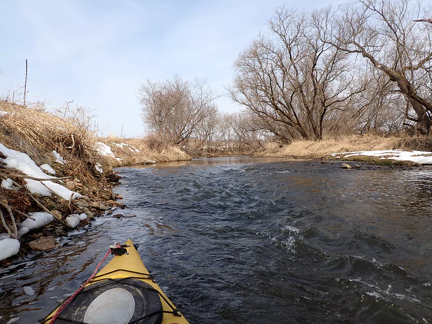
More fast current
Cliffs sheltered from the sun had the best ice
Trees growing out of the side
Timing is everything…this ice was likely gone a week later
March on the Kickapoo
A less interesting stretch that is more eroded
Still some outcrops
This outcrop has a hole in it
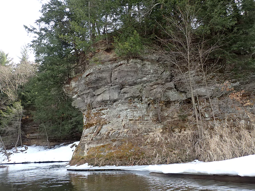
Zoomed in view
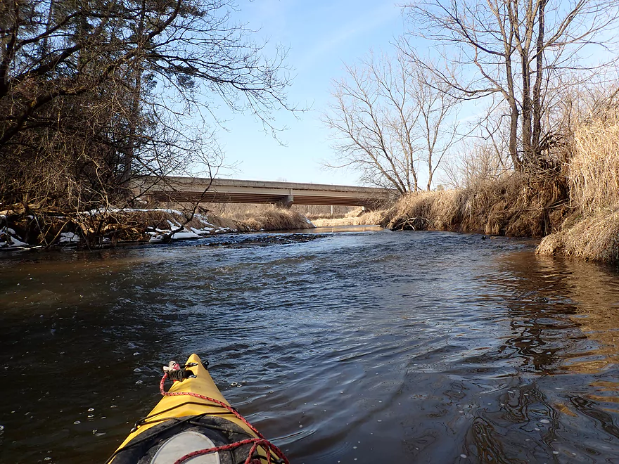
Another bridge…this is by Nordale Ave
Another favorite stretch of mine
Huge ice flows
A frozen waterfall onto suspended ice
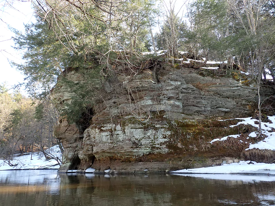
Best outcrop of the trip
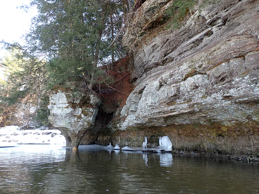
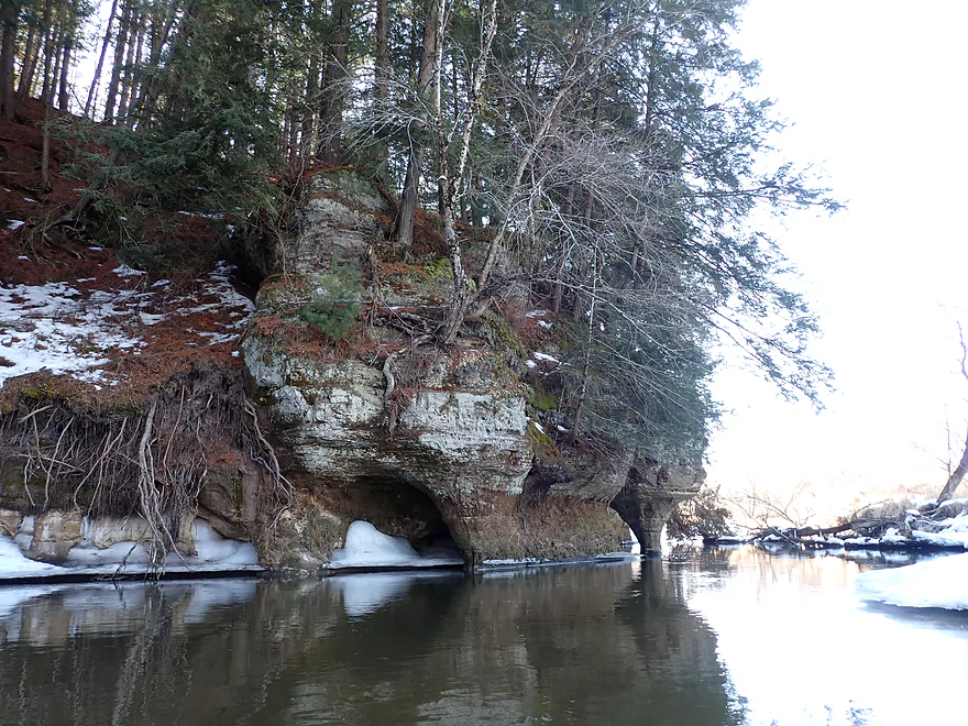
Erosion has created a natural bridge/cave
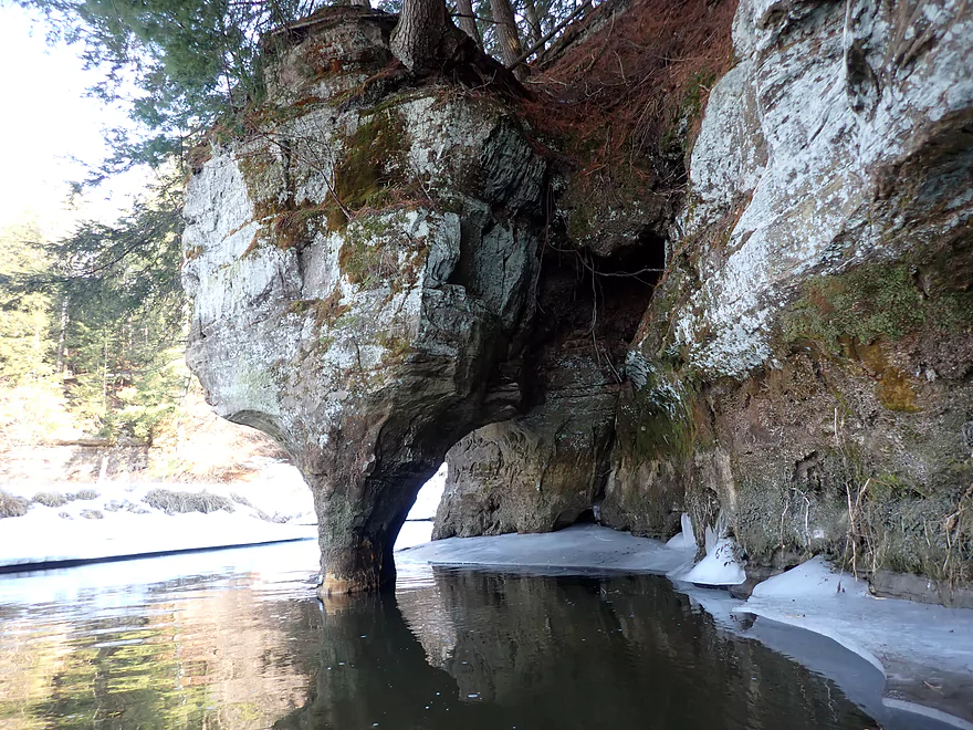
Looks a little precarious
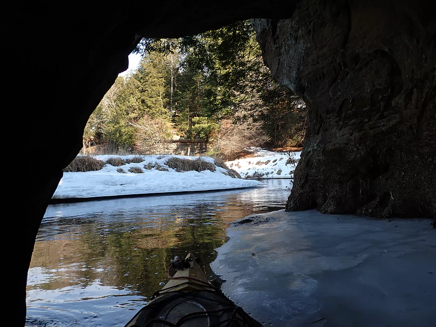
I was able to paddle through
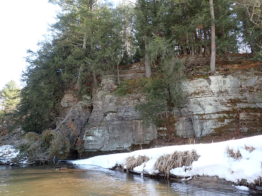
More great outcrops
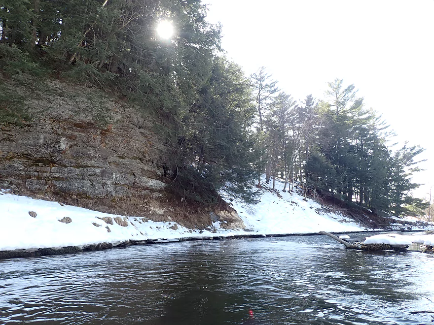
A lot of pines and hemlocks on the trip
Major contrast…right bank is snow covered while the left bank is bare
Bridge by Nightingale Ave is not a viable access
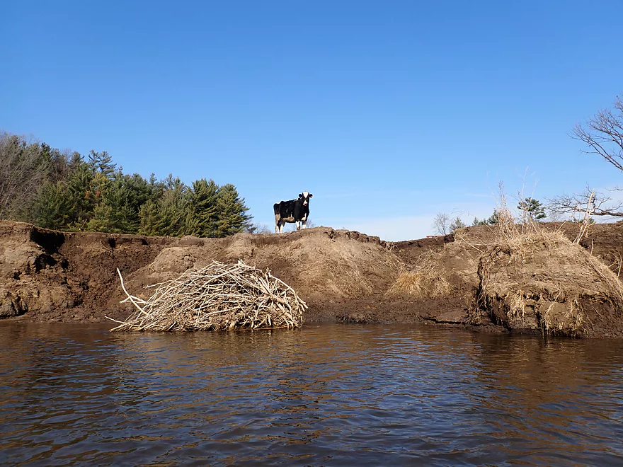
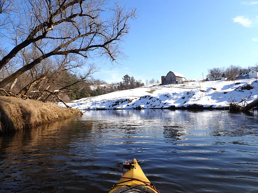
I saw a few cows on this trip
Approaching another great series of sandstone cliffs
Sun finally comes out to shine a little color onto the cliffs
Final stretch
Taking out by Nicollet Ave
A doable access
In the summer this same location can be super weedy
Scouting the river upstream by Wilton/Mead Ave…future trip!
Kickapoo River – Black Valley to Brookwood High

The Kickapoo is a popular river known for its scenic sandstone outcrops. Most who paddle it stay between Ontario and La Farge. What’s less well known is that the stretch upstream of Ontario also has many outcrops, but most paddlers avoid it over concerns of possible logjams and shallow water. In 2016, I had a guest review (thanks Posie!) who paddled the Upper Kickapoo from Wilton to Ontario. Sadly she found it a trying experience because of the many logjams.
But times and rivers change… When browsing updated satellite images I was shocked to see how much more open the Upper Kickapoo now was. Why I’m not sure. Perhaps local paddlers/farmers cleared out the jams? Southern Wisconsin’s climate has actually significantly changed in the past five years in that we now get much more rain. The Upper Kickapoo flows consistently wider and deeper and that may have been enough to elevate many jams up and out of the channel and onto the banks.
So I put this at the top of my todo list for 2021. The entire leg from Wilton to Ontario however was a bit long (~13 miles), so I opted for a shorter four mile sub-stretch in the middle that appeared promising.
Almost immediately after launching, I experienced my first outcrop. It was terrific and the first of many. In fact I would estimate this trip had 5 sandstone outcrops per mile (which is a lot). Tall pine trees on each outcrop acted as a proverbial flagpole which let me know far in advance when the next outcrop would appear.
Something that made these outcrops extra special was that many had ice flows coming out of the rock faces. This can be a real treat to experience when paddling. But ice flow paddles can be difficult to time as they often appear in a very narrow window (~last week of February + ~first week of March). These were a bit past their prime, but still fantastic. Along the shore suspended ice shelves hovered over the river and at the bottom were teardrop-shaped icicles…I had never seen anything like it before (see photos).
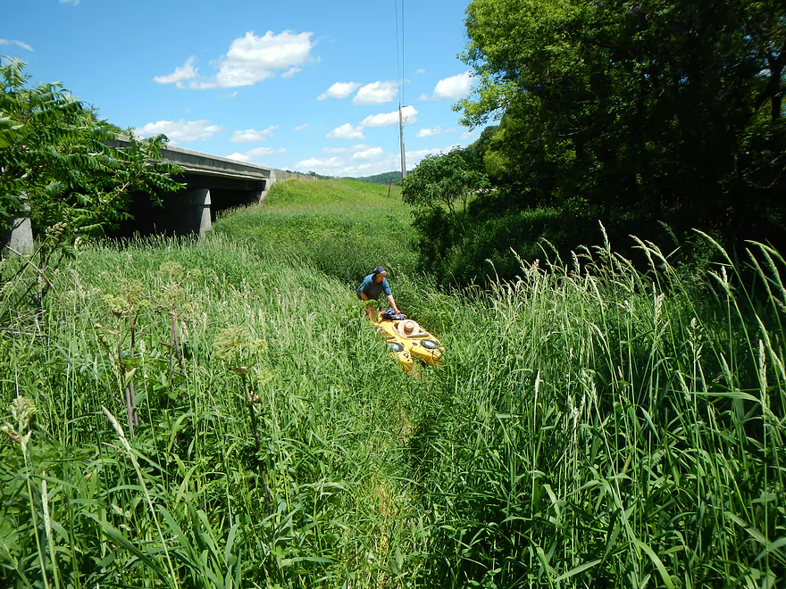
Something else that made this trip special was how open and exposed the cliffs were. Typically when I (or practically anybody else) paddles this river, they do so in the summer when the leaves are out and thick weeds crowd the banks. The Kickapoo Valley can be a proverbial jungle then which sadly obscures its best scenery. Savvy paddlers know to paddle this river late fall or early spring…not in midsummer when it is least attractive.
The Kickapoo is famous for its number of bridges, and this leg was no different. In just a four-mile trip, I encountered 7 bridges! Unfortunately these are not numbered (the ones below Ontario are) so in theory a paddler could become confused as to which bridge was their take-out. Remember your landmarks if you do this trip. Hopefully in the future, the local community will add the same numbering system to these upstream bridges and perhaps even develop some nicer landings for the Upper Kickapoo.
One of the trip highlights was a natural bridge and cave near the end of the trip which I was able to paddle through. The roof of the cave was supported by a giant sandstone pedestal with a very narrow base. Sadly this support looked very precarious and will likely be naturally destroyed in the near future by erosion.
In summary, this was a fantastic trip. Everything turned out better than expected, including the rapids, lack of of logjams, and outcrops. In fact, I suspect this leg would be a major tourist attraction if not already overshadowed by its downstream neighbor. The only downer was some unsightly erosion in a few select spots, but in general the Upper Kickapoo is much cleaner and has far less erosion than the Lower Kickapoo which can get quite messy and muddy.
Something else I would recommend would be for paddlers to experience an “ice flow paddle”. These are not unique to the Kickapoo and will be a feature of practically any river with bankside cliffs somewhat sheltered from the sun. Obviously if you do any type of winter paddling you should wear appropriate protective clothing.
Sights included deer, geese, a bird of prey (red-tail?), and a few cows. The highlight was a pair of muskrats hanging out on the riverbank.
Elroy-Sparta State Trail: This bike trail is famous for its three tunnels, two of which are located quite close to Wilton (a few miles north of my trip). In fact the largest tunnel is just a mile west of town and this would be a fun side adventure to do after a paddling trip. The Elroy-Sparta Trail requires a state trail pass which you can purchase from the DNR or any state park. The exact location of all three tunnels is shown on Google maps.
Hwy 131: Note Hwy 131 crosses the Kickapoo countless times. The bridge I used was by “Black Valley” (or south of Hwy Z or just upstream of Poe Creek…not to be confused with nearby Posey Creek). Despite a neighbor’s dog barking at me from a distant home, this was an ok bridge access. Note the embankment is a bit steep so rope may be helpful for leading your boat to the water. This bridge (like many Hwy 151 bridges) can become a weedy jungle in the summer.
Alternate Access Options: Because there are so many bridge crossings, paddlers have many options to choose from. The most adventurous will likely start upstream at the Wilton Public Campground/Library…but be warned there are likely logjams closer to Wilton. For more information on access points, see my overview below.
Hwy 131: This Hwy 131 bridge is just east of Brookwood High School and near the intersection of Nicollet Ave. This was a decent bridge access, but this too can be a weedy jungle in the summer. When I started a trip here in June 2013, the weeds were so tall and dense it made launching difficult.
Alternate Access Options: Again there are many bridges to choose from. Those willing to do a longer trip, will likely take out at Ontario (there is a public park in town).
Brookwood High School to Black Valley – Bike Shuttle: 2.7 miles with 30′ of ascent. Because the Kickapoo “squiggles” so much, it is an incredibly easy river to bike shuttle. In fact at 2.7 miles one could simply do a walking shuttle (Google estimates that would take 50 minutes).
Rentals/Shuttles: There are a number of Kickapoo liveries, most of which are based in Ontario (just to the south). I’m not sure if any will service the river this far north, so call in advance to ensure availability:
- Kickapoo Wild Adventures: 608.337.4522 – 30352 State Hwy 131, Norwalk, WI 54648
- These guys are the furthest to the north, so may be the most willing to service the far upper Kickapoo.
- Drifty’s Canoe Rental: 608.337.4288 – Highway 33 & 131, North Ontario, WI 54651
- Fred Flasher’s Canoe Camping Trips: (608) 435-6802 – PO Box 114, Wilton, WI 54670
- Mr. Ducks Canoe Rental: (608) 337-4711 – 100 Main Street, Ontario, Wisconsin 54651
- Titanic Canoe Rental: 1-877-438-7865 – 300 State Highway 131, Ontario, WI 54651
Current: The river was pool and riffle, but overall moved quickly (much faster than the Kickapoo below Ontario).
Fences: There is a fence upstream of my put-in. Because I didn’t need to go under it, it wasn’t an issue. Had I been coming from upstream, I don’t think it would have been difficult to duck under. There was a second fence but it was so high up I couldn’t even touch it with my paddle extended.
Logjams: None! This was a big surprise, but a pleasant one. They used to exist on this leg (I have a photo to prove it!) but I suspect locals and floods have cleared them out.
Rapids: There were countless light rapids. Most of which were pretty easy. About a mile into the trip, there was maybe a half-foot ledge caused by a downed tree, but that wasn’t difficult.
Strainers: This stretch of the Kickapoo was fairly open, but there were a few cases where fast current moved quickly past partially submerged trees. I didn’t find these difficult to deal with, but they could be more problematic in high water. If in doubt, simply portage any strainer you don’t think you can squeak past safely.
Closest Gauge: Kickapoo River @ Ontario
Trip Depth: 8.97′ – 8.94′
Navigability Estimates: Note, my estimates could be way off. Typically I use CFS from the Ontario USGS gauge. But USGS rudely stopped reporting these metrics. I’ve switched to NOAA’s report but they lack historical data and only use feet so it is a bit of a transition.
- < 8.75′: I think too shallow for paddling. It should be noted that a guest reviewer did this stretch at 8.5′. She implied it was doable but more water would have been preferred. That was five years ago and I don’t know if things are different now.
- 8.75′-8.95′: Very shallow…you might have to wade a handful of rapids at this depth.
- 8.95′-9.05′: A good target range. I did the trip at ~8.95′ and grounded out only twice. V-bottom kayaks may require more depth.
- 9.05′-9.2′: This is a higher depth and the current may be a bit pushy around some of the partially-downed trees.
- 9.2′-9.4′: A high depth perhaps only suitable for skilled paddlers.
- 9.4’+: Perhaps too high for paddling.
Quick Overview
- Wilton to Ontario: 12 miles. This stretch is seldom paddled, but is cleaner and faster than downstream legs. Those willing to endure weedy bridge accesses and occasional snags will be rewarded with spectacular outcrops. A very underrated part of the river.
- Ontario to Rockton: 13.5 miles. This is the most popular section for kayaking on the river (if not the entire state). Highlights include many spectacular sandstone outcrops. This stretch can easily be subdivided. Shuttle services are plentiful, but this leg can get crowded and noisy during summer weekends.
- Rockton to La Farge: 11 miles. This is the second most popular stretch of the river. While the outcrops here aren’t as numerous as the Ontario leg, they do tend to be larger and more impressive.
- La Farge to Mouth: ~90 miles. After La Farge there are few rock outcrops and the river becomes much less interesting. The Lower Kickapoo is a generic hardwood floodplain that is at best a mediocre paddle.
- Tributaries:
- Kickapoo River – West Fork: While lacking the outcrops of the main branch and a bit shallow in spots, this is a very underrated river with many fun rapids.
- Billings Creek: I actually like this creek better than the main river itself. There are just as many outcrops, and the water and banks are much cleaner.
- Tainter Creek: While not very big and lacking in outcrops, it’s still a cool creek with very swift current.
Detailed Overview
- Upstream from Lincoln Ave: The river is likely too small and degraded by open pasture to have much appeal for kayaking. Although "Kickapoo Springs" (the primary source of the river and a public DNR area) might be interesting.
- Lincoln Ave to Keystone Road: 2.5 miles. The river is small here (likely too small for most paddlers) and more scruffy with fewer outcrops. Figure 1-2 logjams and 3 outcrops. Several of the Elroy-Sparta Trail bridges over the river are quite scenic/rustic. High water will be required to do this stretch.
- Lincoln Ave to Hwy 131 (East of Midge Road): 6.3 miles.
- Lincoln Ave to Hwy 71: 1.6 miles. Section includes five outcrops, including one really nice one. River is shallow here with many Class 1 rapids. There is one strainer that has to be portaged, but no other logjams. I encountered a bull on this stretch (here) which might be a deal breaker for most paddlers. You could possibly portage around the farm in question along the Elroy-Sparta Trail but it would be a long and difficult portage.
- Hwy 71 to Wilton Campground/Library: 0.7 miles. A nice stretch with ~3 mediocre outcrops and one really nice one. Water clarity is stunning here. There is a low tree that requires some tight ducking to get under.
- Wilton Campground/Library to Hwy 131 (by Posey Creek): 1.4 miles. Less attractive stretch but still ~4 mediocre outcrops. There is a serious logjam by Water Street that must be portaged.
- Hwy 131 (by Posey Creek) to Hwy 131 (by Mica Rd): 1.3 miles. A terrific stretch with scenic pine trees, several mediocre outcrops and one fantastic sandstone outcrop.
- Hwy 131 (by Mica Rd) to Hwy 131 (East of Midge Rd): 0.7 miles. More of a scruffy stretch, but still a few mediocre outcrops. The Black Valley hills in the distance are very scenic from this leg.
- Hwy 131 (East of Midge Road) to Hwy 131 (near Nicollet Ave): 4.1 miles.
- Hwy 131 (east of Midge) to Hwy 131 (by Michigan Ave): 0.5 miles. A good leg with one nice set of outcrops.
- Hwy 131 (by Michigan Ave) to Hwy 131: 0.6 miles. Another good leg with 3 outcrops. Some minor rapids, including a 4-6" ledge.
- Hwy 131 to Hwy 131 (by Nisswa Rd): 0.6 miles. One of the best legs on the Upper Kickapoo which features 6 noteworthy outcrops and terrific ice flows in February and early March.
- Hwy 131 (by Nisswa Rd) to Hwy 131 (by Nordale Ave): 1.1 miles. Not as scenic as other legs with messy shorelines and eroded banks. There are still a few nice outcrops.
- Hwy 131 (by Nordale Ave) to Hwy 131 (by Nicollet Ave): 1.3 miles. Another one of the Upper Kickapoo's best legs with ~6 outcrops, including a small natural bridge you can paddle through.
- Hwy 131 (near Nicollet Ave) to Ontario: 5 miles.
- Hwy 131 (by Nicollet Ave) to Hwy 131 (Oil City): 2.3 miles. Two long stretches of bluffs contain great outcrops.
- Hwy 131 (Oil City) to Hwy 131 (Kickapoo Wild Adventures): 1.4 miles. Terrific stretch with two major outcrops. One set of Class 2 rapids.
- Hwy 131 (Kickapoo Wild Adventures) to Ontario (Brey Valley Road Park): 1.5 miles. Three sets of outcrops.
- Ontario to Hwy 131/Bridge #4: 3.6 miles. A more open and flatter stretch of the Kickapoo. There are still 3-4 outcrops. This is THE most popular leg on the entire river.
- Bridge #4 to Bridge #7: 6.0 miles.
- Bridge #4 to Wildcat Landing: 3.1 miles. A super popular stretch and the most scenic on the Kickapoo. River flows past steep hillsides and many outcrops (at least 16).
- Wildcat Landing to Bridge #5: 0.9 miles. River opens up a bit, but still has three super sandstone outcrops.
- Bridge #5 to Bridge #7: 2.1 miles. A good stretch with seven major outcrops and one cave.
- Bridge #7 to Bridge #14: 7.7 miles.
- Bridge #7 to Bridge #8: 1.2 miles. From bridge #7 onward, the Kickapoo becomes much less interesting. There are still some good spots though. This stretch has maybe 3 outcrops.
- Bridge #8 to Bridge #10: 2.5 miles. A good stretch with 5-6 outcrops.
- Bridge #10 to Rockton/Landing #12: 1.4 miles. This stretch is more open, and less interesting. But there are still 3-4 mediocre outcrops.
- Rockton to P/Bridge 14 Canoe Landing: 2.4 miles. A scenic stretch with 5 noteworthy outcrops–three of which are huge.
- Bridge #14 to La Farge: 8.0 miles. A great stretch with a covered bridge and 4-5 outcrops...several of which are huge (the largest on the river).
- La Farge to Hwy 131 (by Ski Hill Road): 6.8 miles. Nice section but with a few jams.
- Hwy 131/Ski Hill Road to Viola (Banker Park): 7.0 miles. Maybe 2 bluffs, but mostly open I think. Have been told there are 26 portages between La Farge and Viola, so beware.
- Viola to Hwy 131 - Bridge 1: 5.8 miles. Maybe one outcrop and 14 major logjams.
- Hwy 131 - Bridge 1 to Hwy 131 - Bridge 2: 4.3 miles. Maybe one outcrop and 13 major logjams.
- Hwy 131 Bridge 2 to Readstown Tourist Park: 3.0 miles. Maybe one outcrop and three major logjams. The river grows significantly with the addition of the West Fork.
- Readstown Tourist Park to Soldiers Grove: 6.9 miles.
- Readstown to Hwy 61: 3.1 miles. A surprisingly nice stretch with impressive hills and good current. On the downside there is a lot of tree debris although it is always avoidable. Hwy 61 is not a good access.
- Hwy 61 to Soldiers Grove: 3.8 miles. Not as good as the previous leg with fewer hills, muddier banks, and slower current, but still not bad. The highlights include a few impressive bluffs and two minor rapids in Soldiers Grove.
- Soldiers Grove to Hwy B: 9.0 miles. I doubt there are logjams, but I think this stretch would not be very interesting. The river flows through one of the wider flood bottoms on the river.
- Hwy B to Hwy S: 8.6 miles.
- Hwy B to Gays Mills: 4 miles. Fast stretch with some strainers. Bank quality is poor, but the bluffs are attractive. A dam in Gays Mills slows the last mile of this leg.
- Gays Mills to Hwy S: 4.6 miles. A pleasant but not elite leg with some nice bluff vistas.
- Hwy S to Haney Valley Road: 5.8 miles.
- Haney Valley Road to Taylor Ridge Road: 3.6 miles. Likely an ok prospect. Note, Taylor Ridge Road is aggressively fenced by the local farmer and would be a difficult access.
- Taylor Ridge Road to Steuben Landing: 5.0 miles. A good prospect with likely some nice bluffs. Note, Taylor Ridge Road is aggressively fenced by the local farmer and would be a difficult access.
- Steuben Landing to Hwy 179: 2.9 miles. A mediocre prospect.
- Hwy 179 to Plum Creek Landing: 11.8 miles. A good prospect with nice bluffs.
- Plum Creek Landing to Hwy 60: 6.7 miles. Starts uninteresting with fast current, but features some surprisingly nice bluffs and overall was a decent trip.
- Hwy 60 to Lowell Geitz Memorial Boat Landing: 2.7 miles. This stretch mostly lacks interesting bluffs but does feature wetgrass and floodplain forests as part of the Wauzeka Bottoms State Natural Area.
- Take-out options on the Wisconsin River:
- Lowell Geitz Memorial Boat Landing to Adiantum Woods State Natural Area: 2.5 miles. This is mostly a downstream trip on the Wisconsin River.
Trip Map
Overview Map
Video
Photos Size:
I did the section from Nordale to Bridge #5 on 3/30/21, the trip was about 14 miles and took was about 5 hours including a 30 min lunch break The gauge was at 8.94 ft, which was OK, there were a few shallow spots,but we never had to get out of the boat. There were a few obstacles to avoid but no complete blockages, and we cleared out a few partial blockages and did some lopping of low hanging branches so this section is in pretty good shape right now. We enjoyed the upper section as much if not more than the section from bridge #1- #5, and would recommend it to anyone looking for something a little smaller, intimate and less crowded than the typical sections serviced by all the commercial canoe/kayak operations on the Kickapoo. We did a car shuttle, it would be a pretty bike shuttle but there are a couple of decent hills to contend with. Parking is $5 but it goes to a good cause….according to the parking form “All fees go directly to maintaining, improving, and protecting the Reserve”
I agree…I think the pre-Ontario section is as good as the post-Ontario section despite it not being as popular. Great to hear about the cleanup efforts…thanks as always for the updates.