
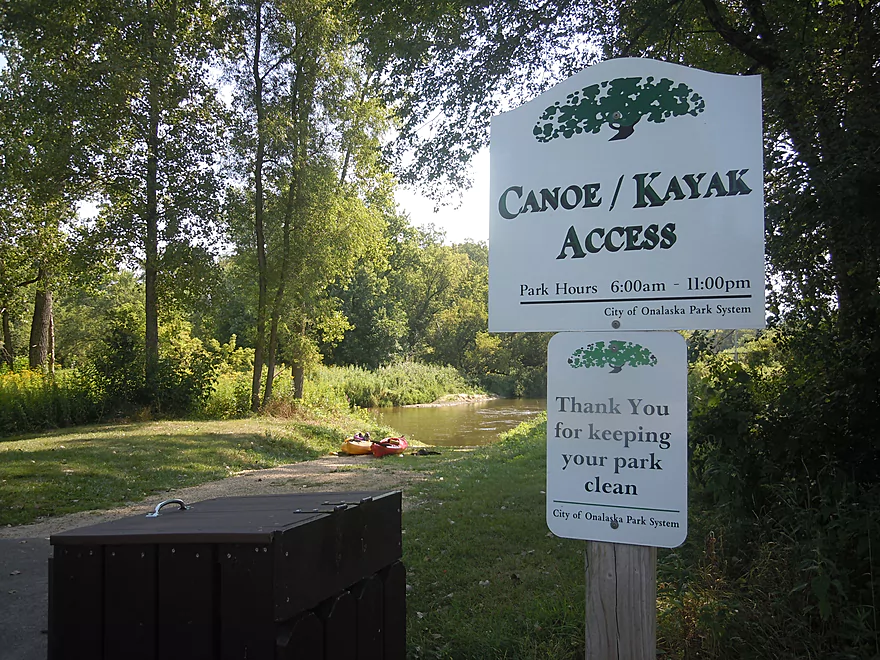
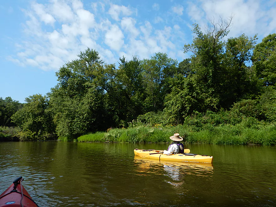
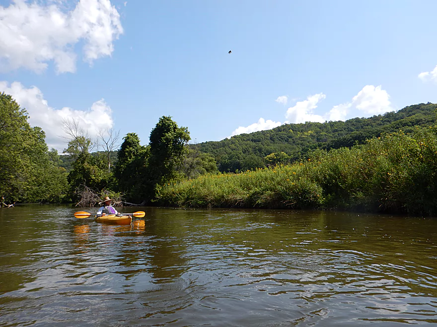
Brand new Holiday Heights Landing
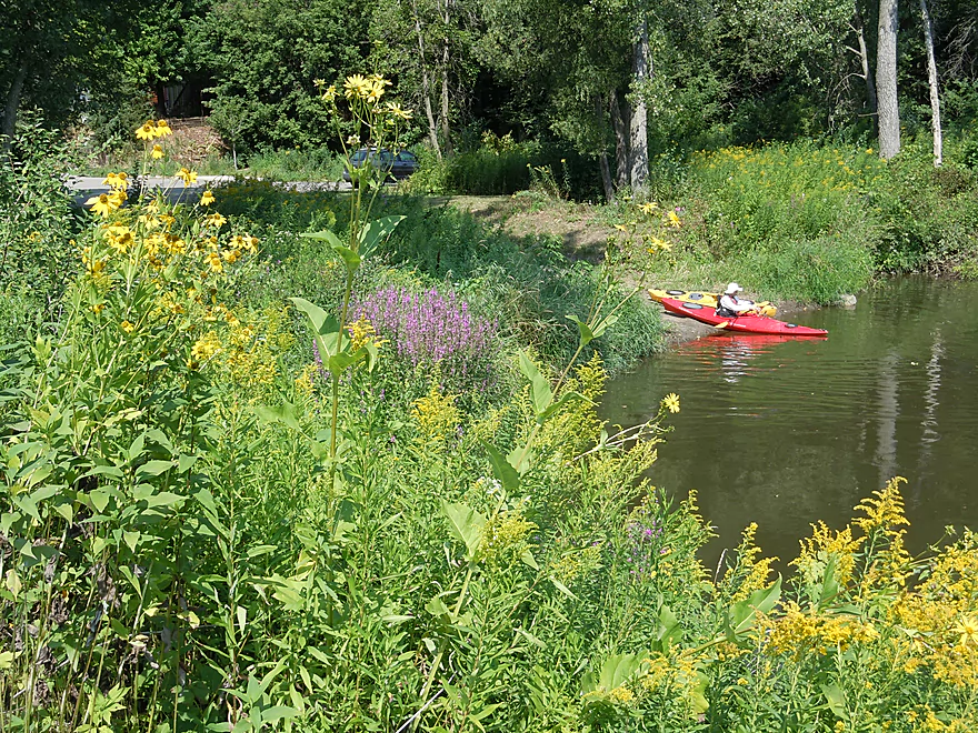
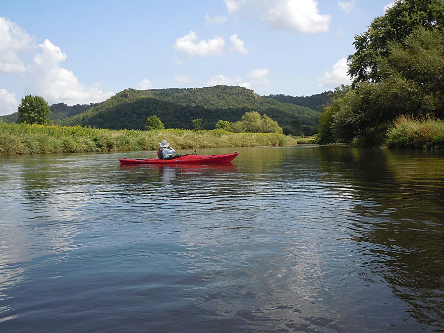
Nice scenic access
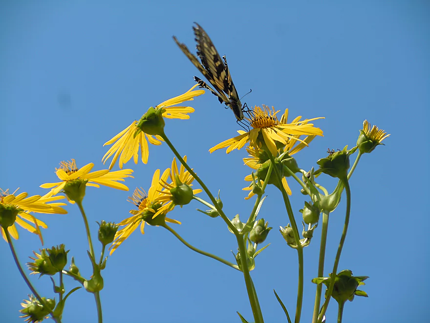
Tiger swallowtail and cup plant flowers
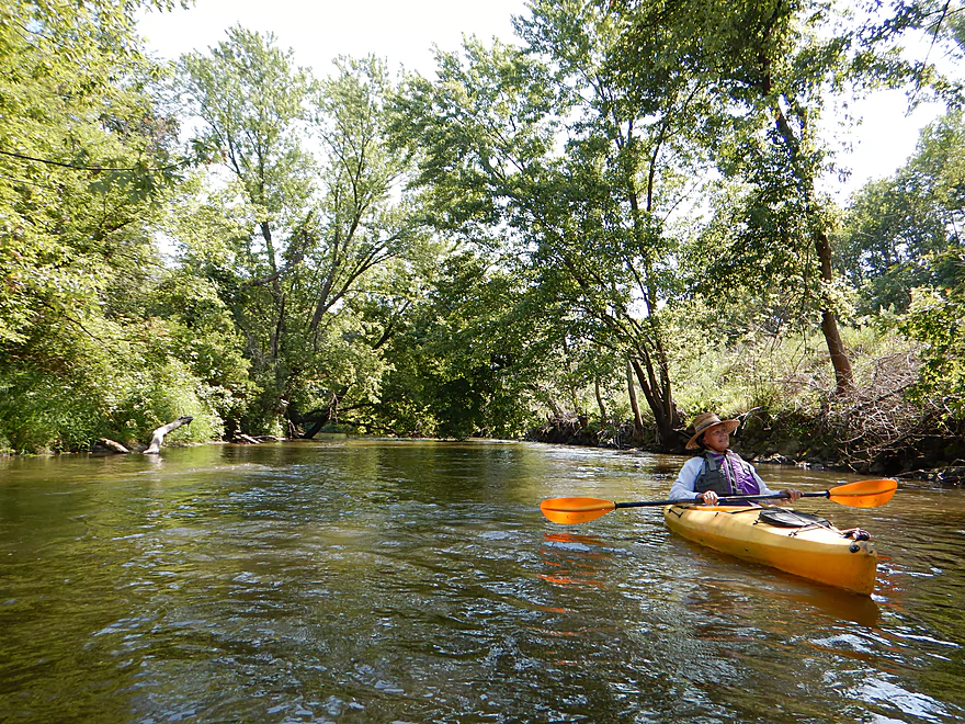
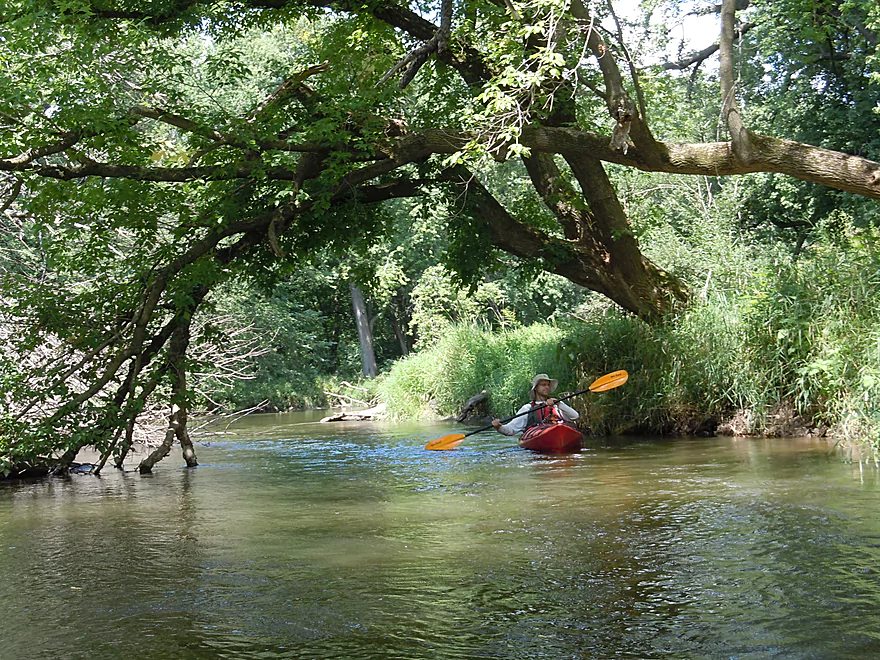
Mixture of woods and grass to start the trip
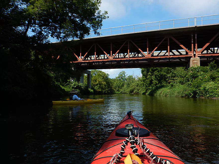
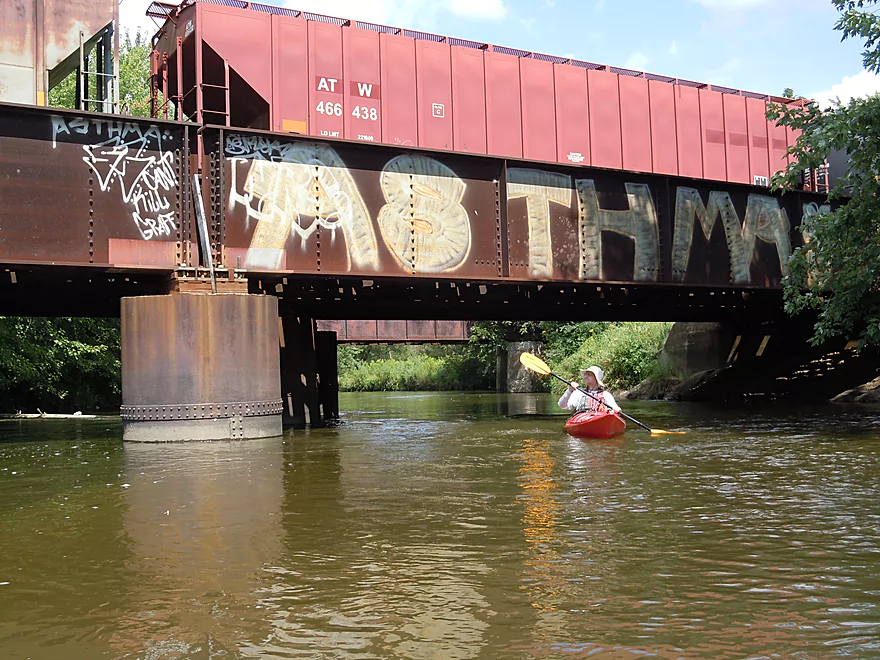
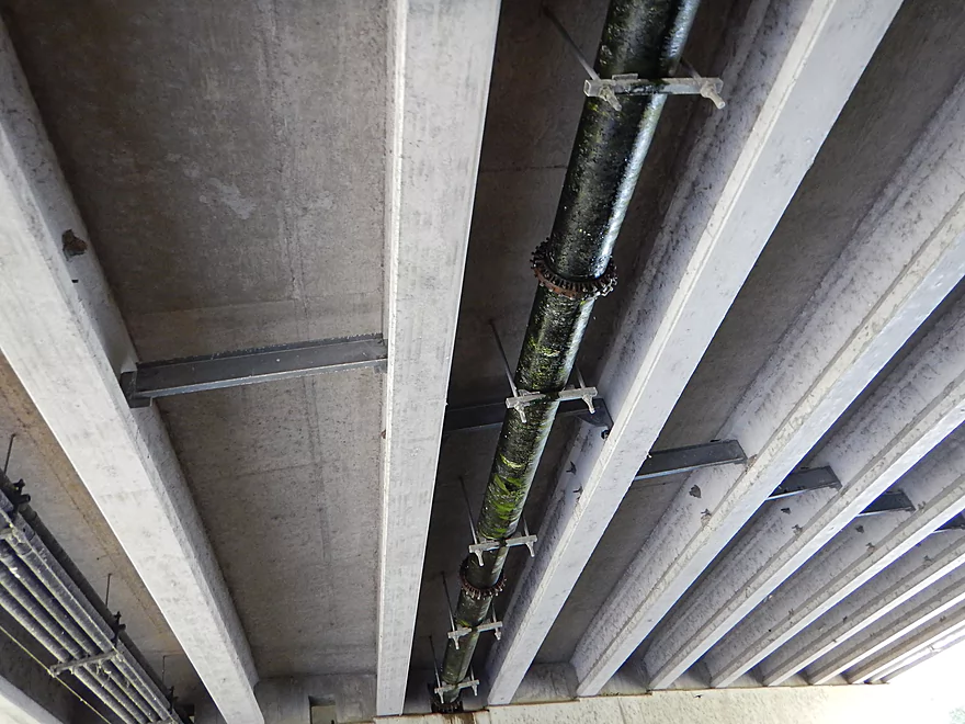
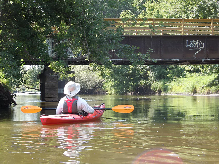
Railroad overpass on La Crosse River State Trail
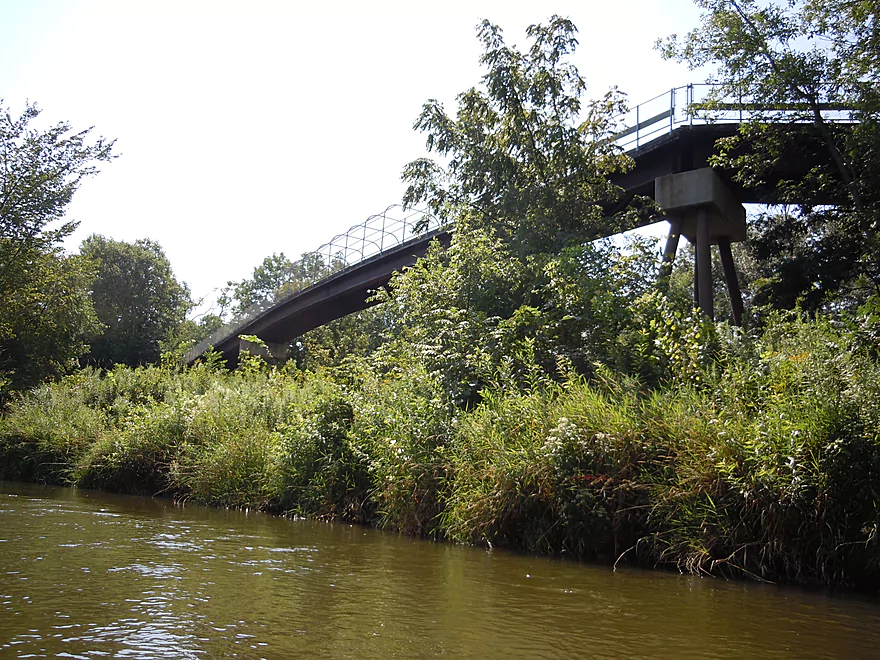
Hwy 16 bridge
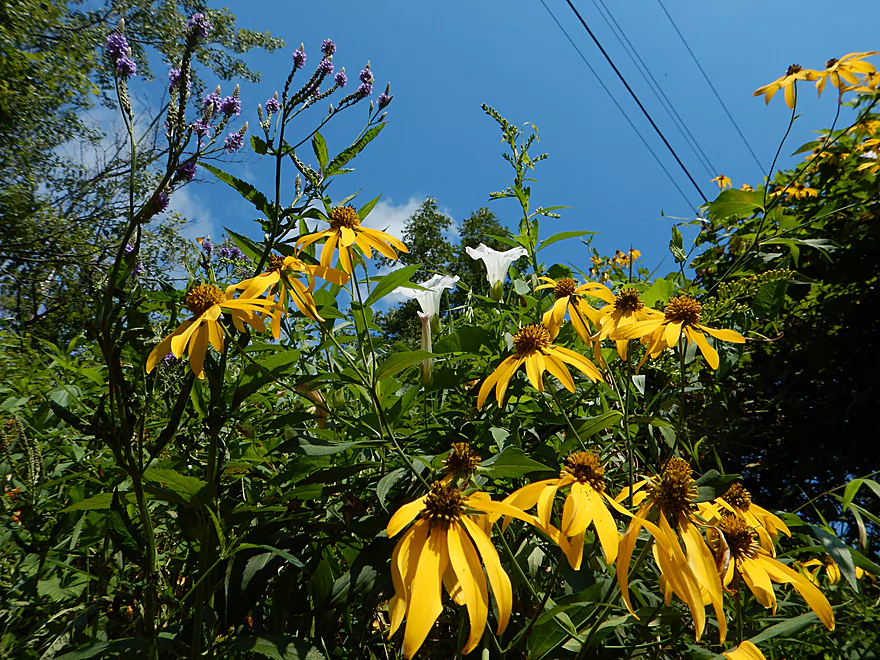
Vervain, bindweed, and split-leaf coneflower
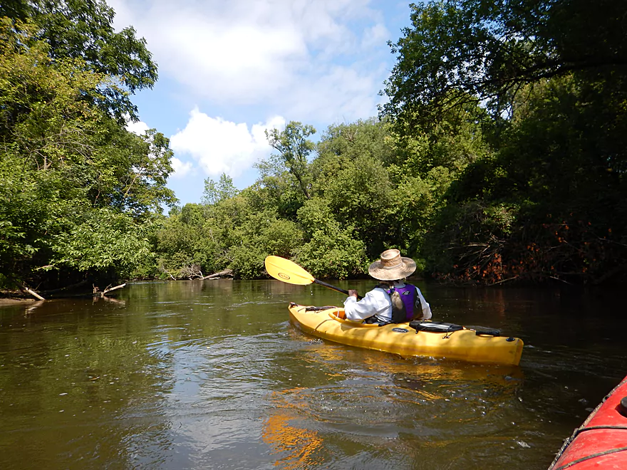
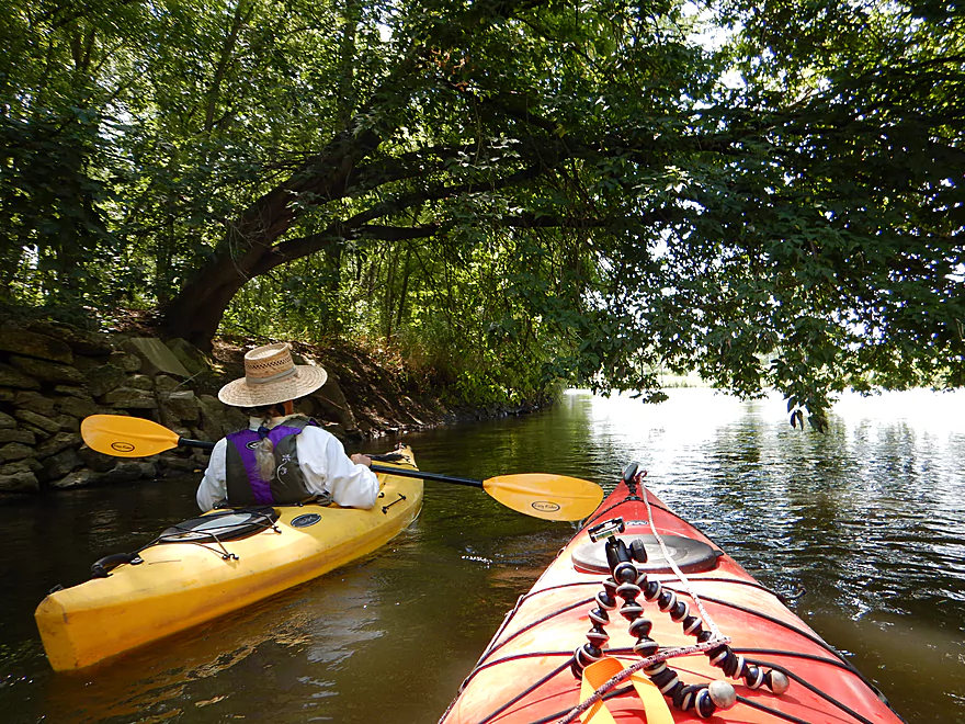
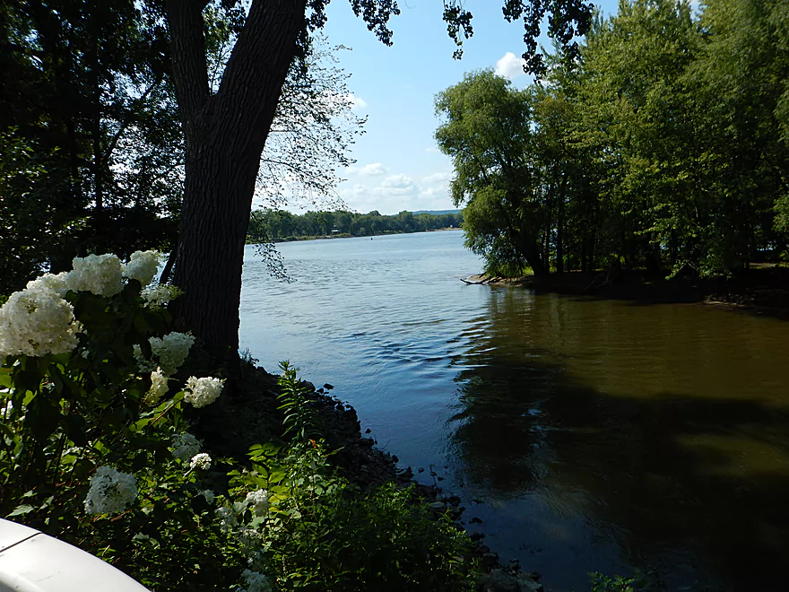
Thick bankside vegetation
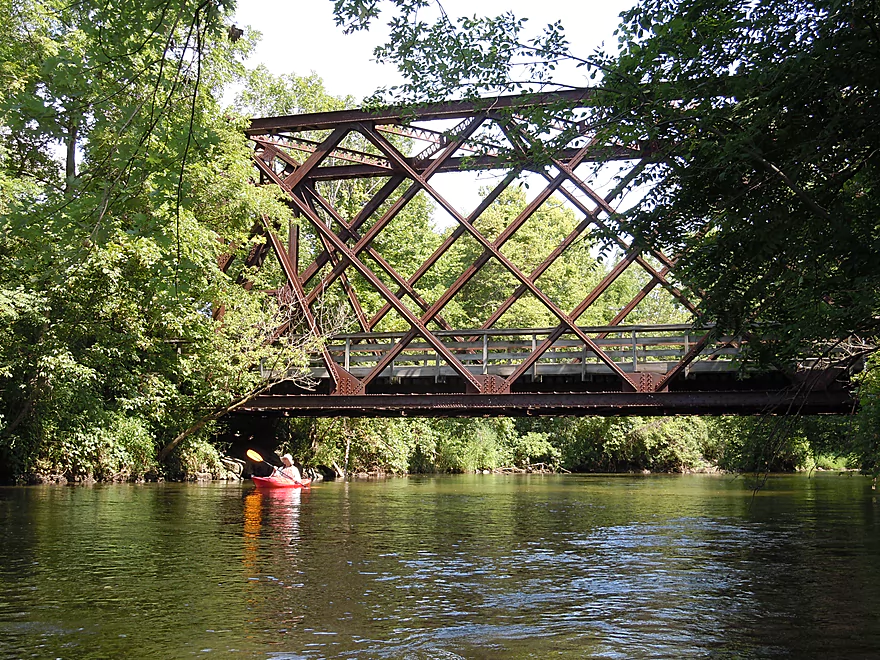
One of many railroad bridges
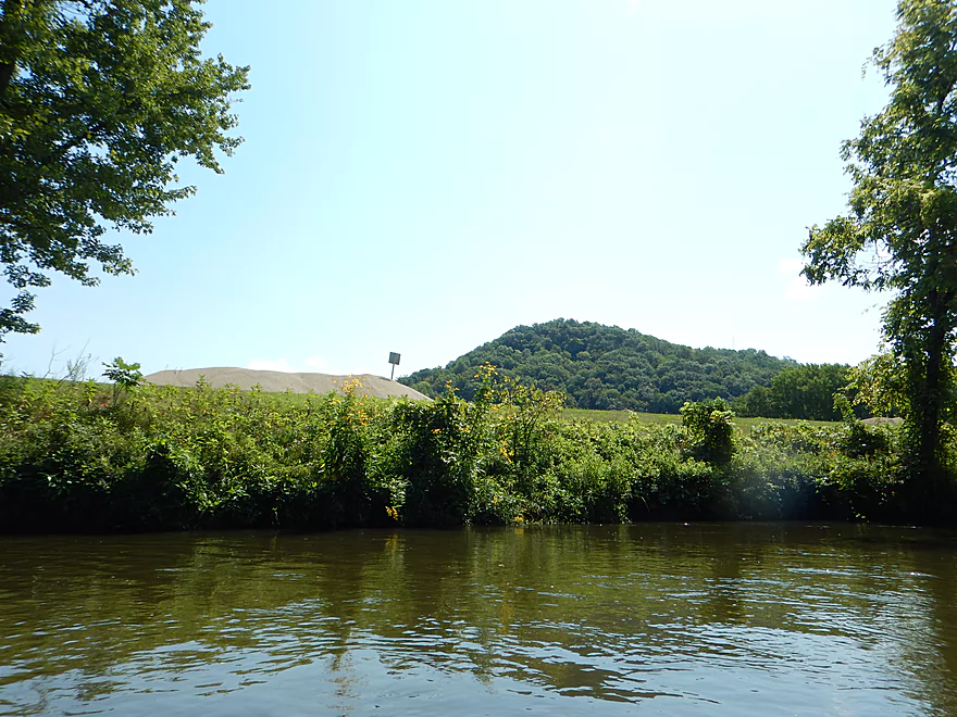
Juxtaposition…gravel from a bluff and a bluff in the background
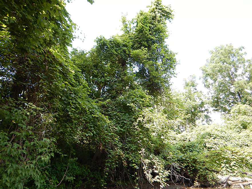
Massive grapevine network is smothering a tree
A double railroad bridge with cars on it (likely frac sand)
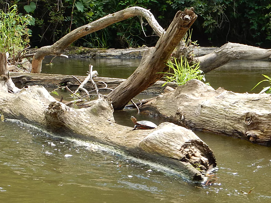
Friendly painted turtle
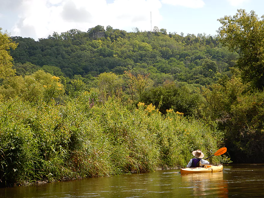
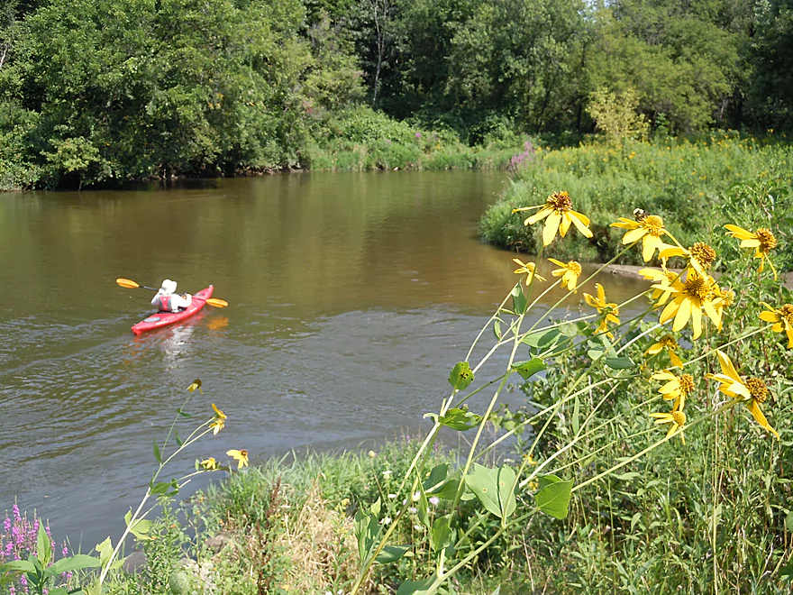
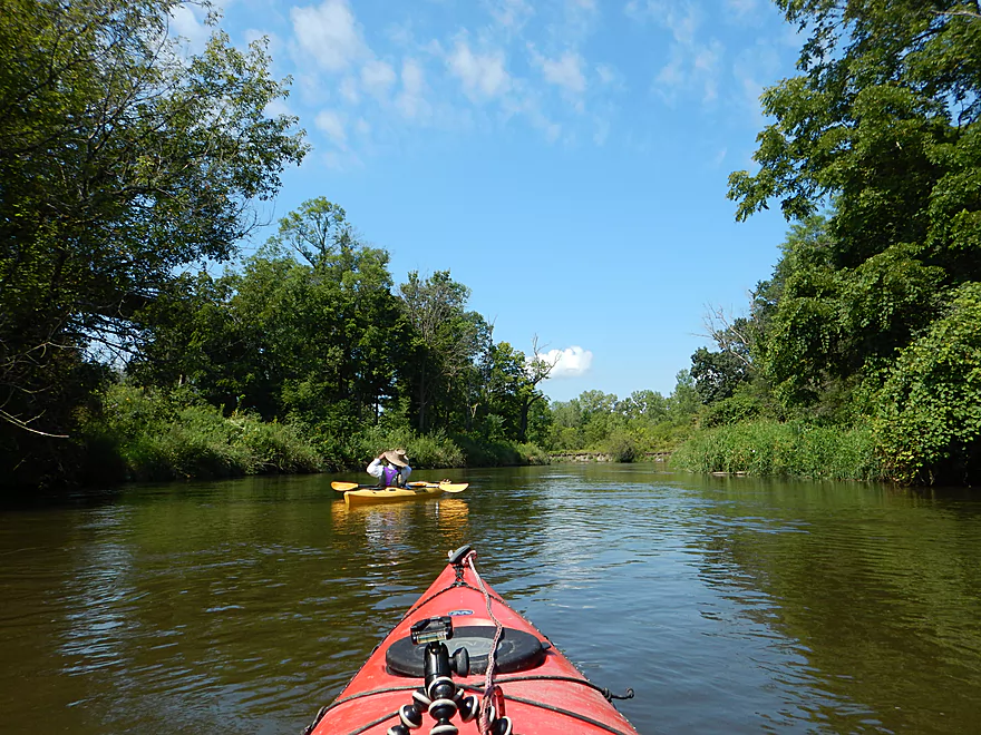
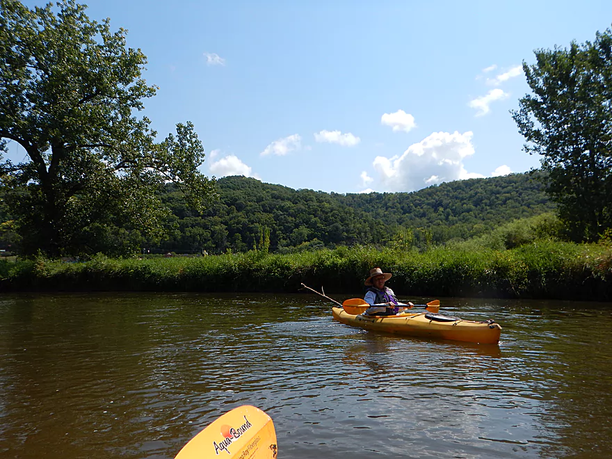
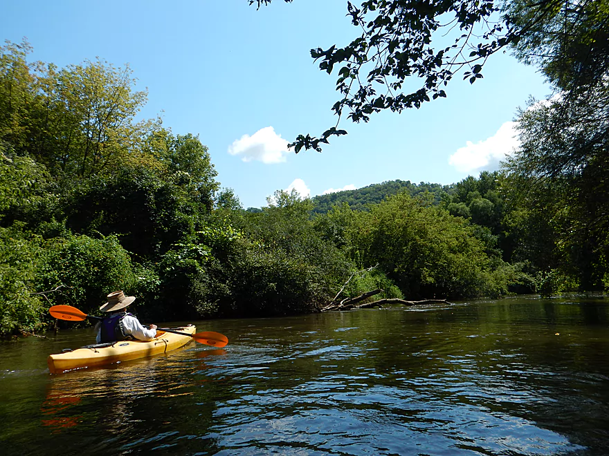
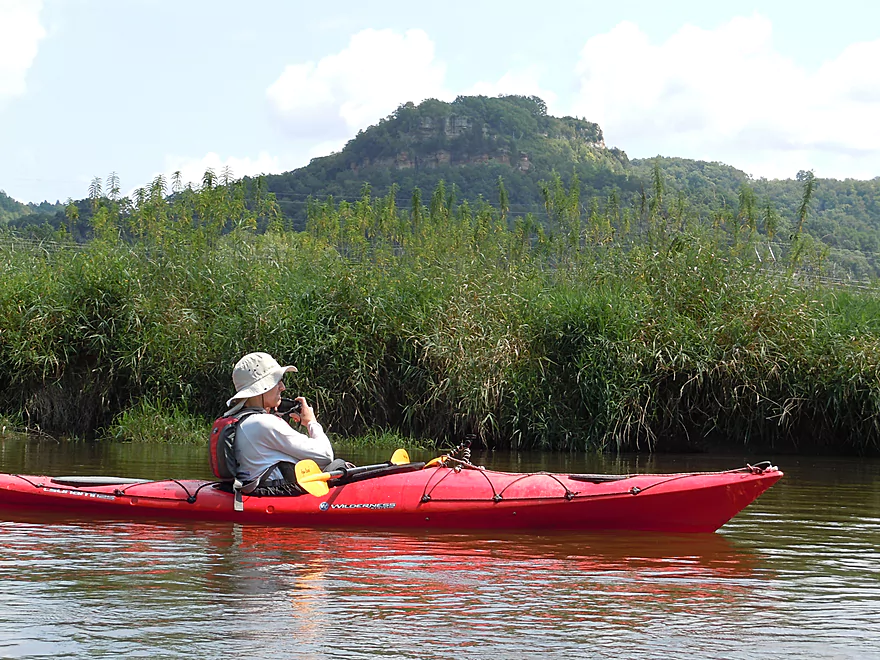
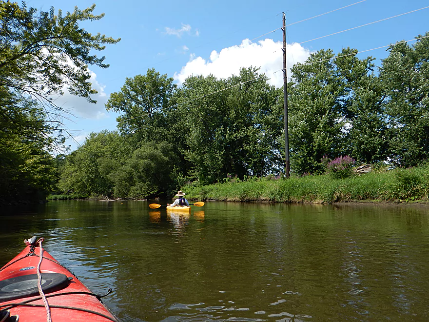
Starting to get nice views of the background bluffs
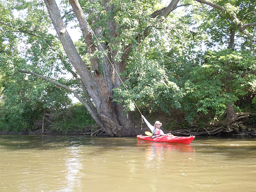
Tarzan’ing doesn’t work well in a kayak
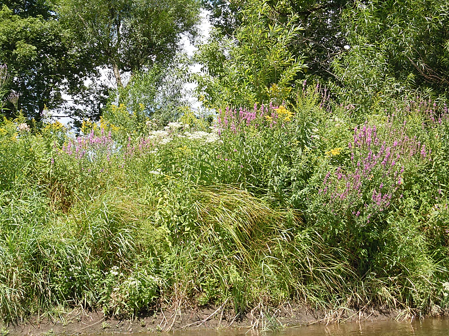
Purple loosestrife, boneset, and goldenrod
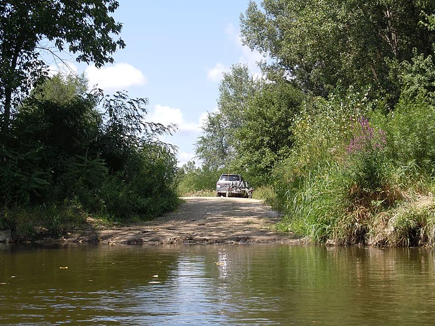
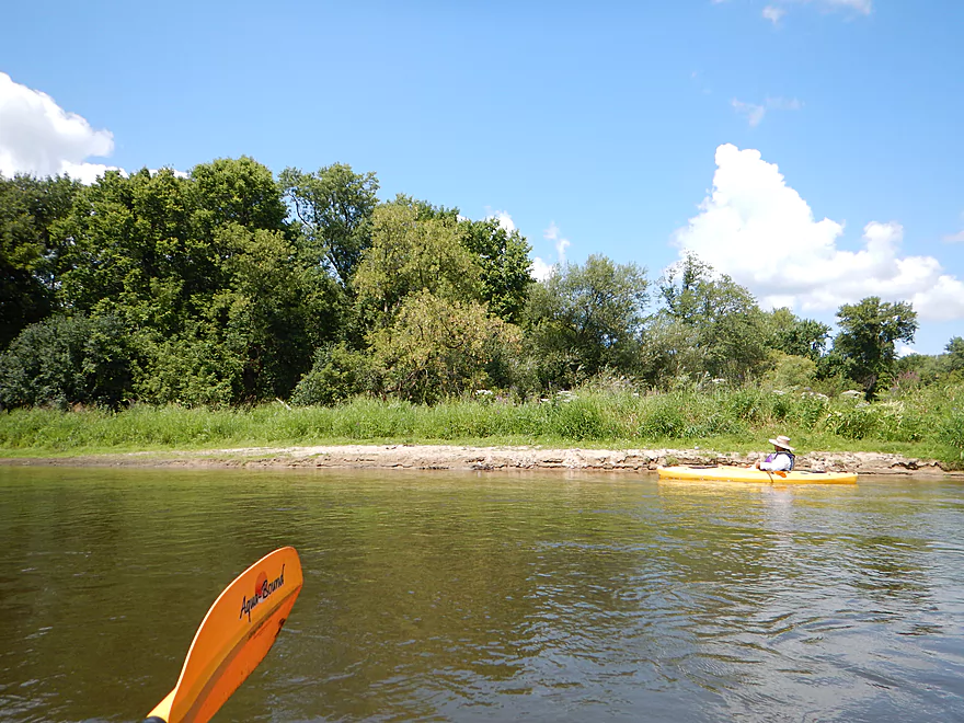
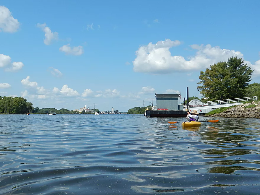
Public launch by Hwy B
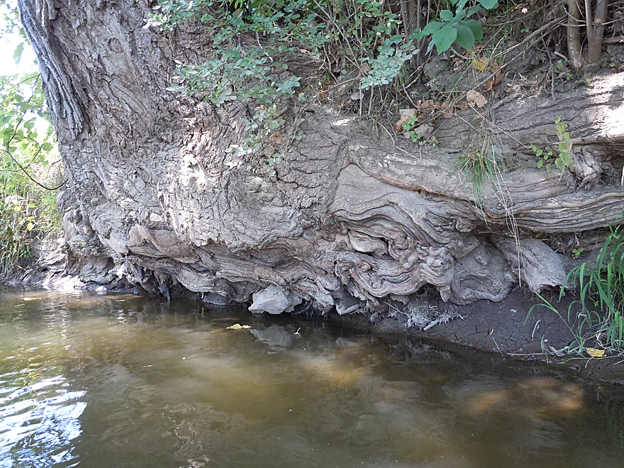
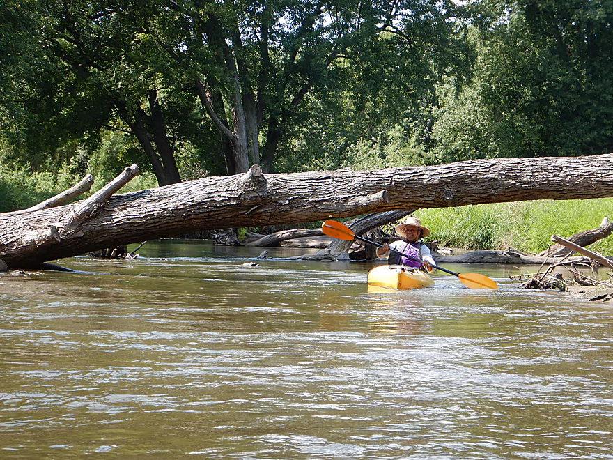
Talk about gnarly roots
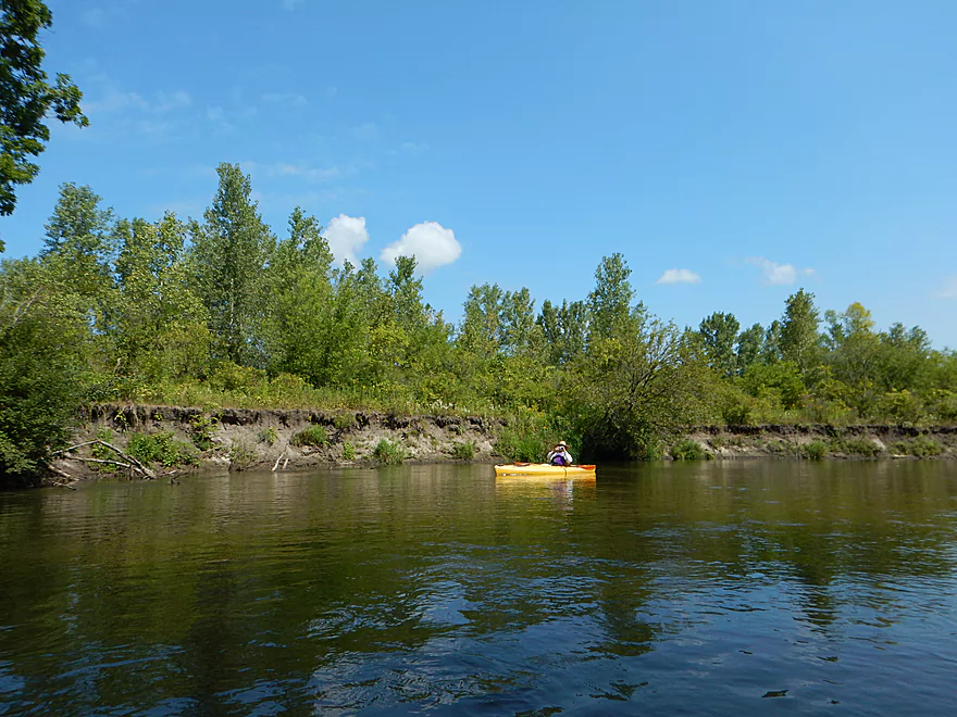
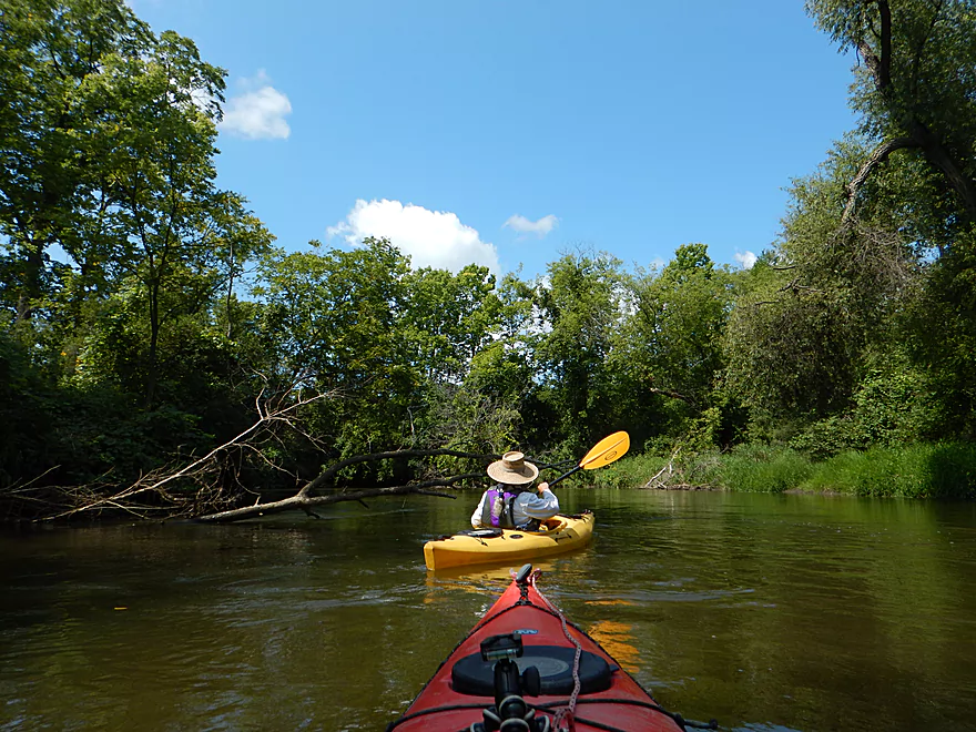
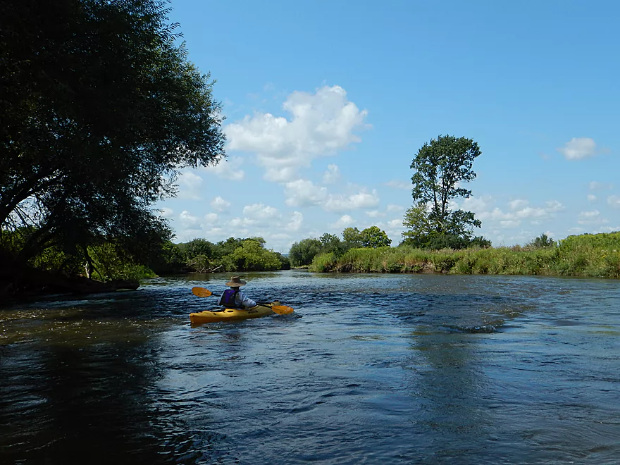
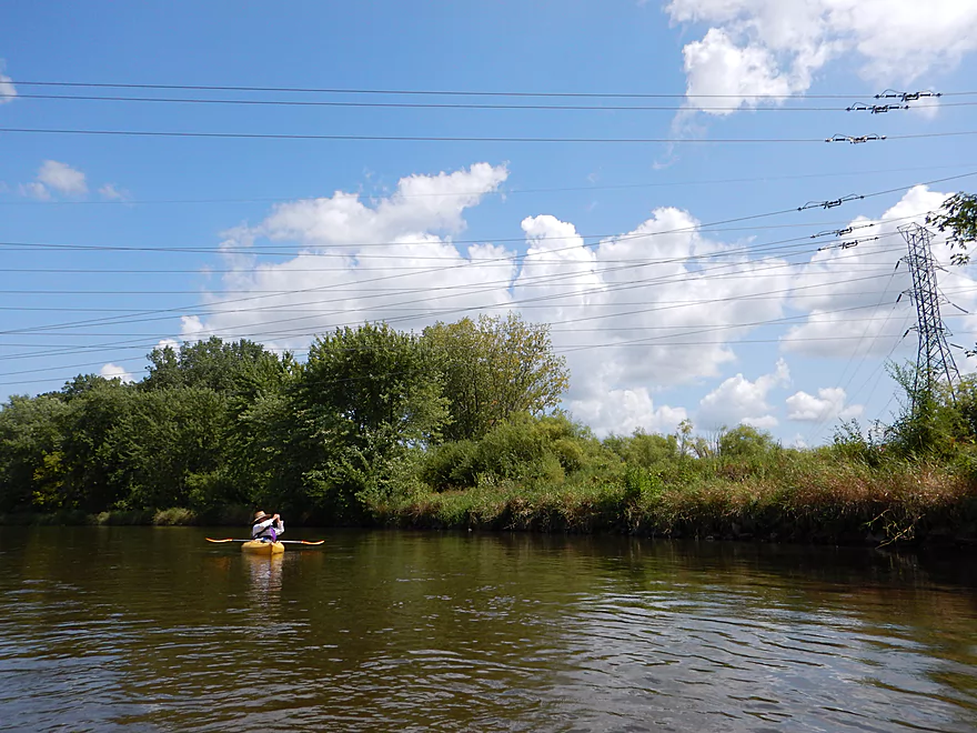
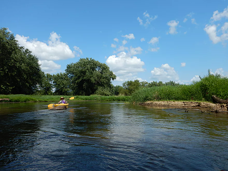
River starts to open up here
A rare riffle
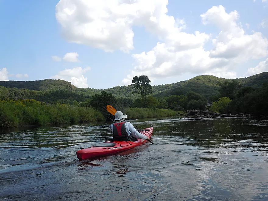
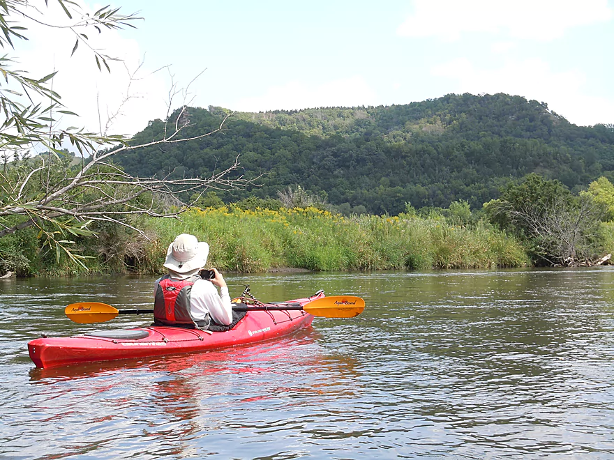
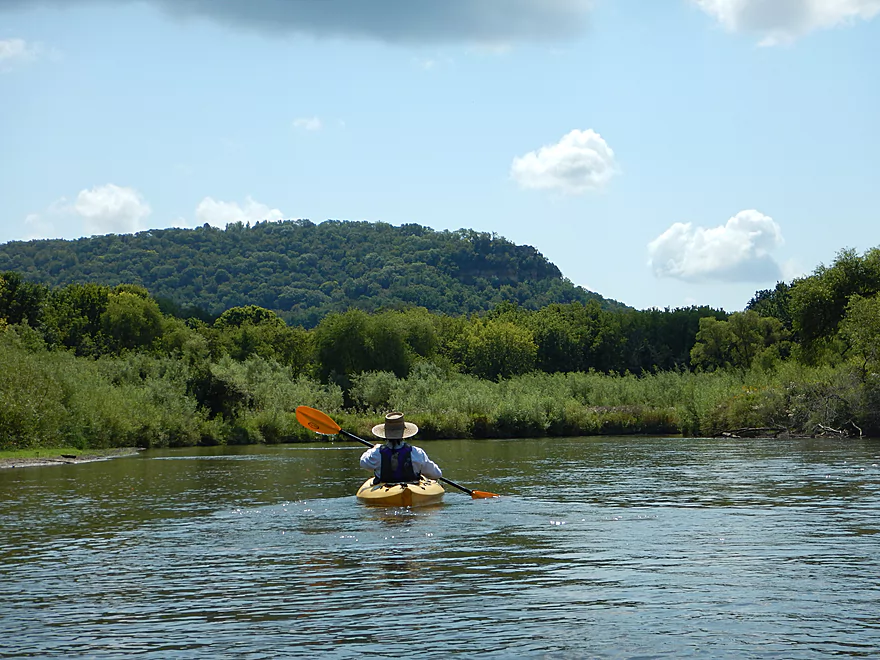
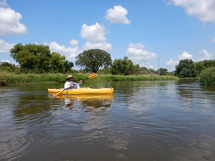
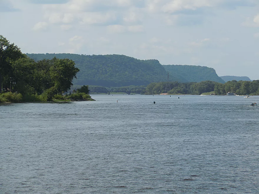
This section had the best views
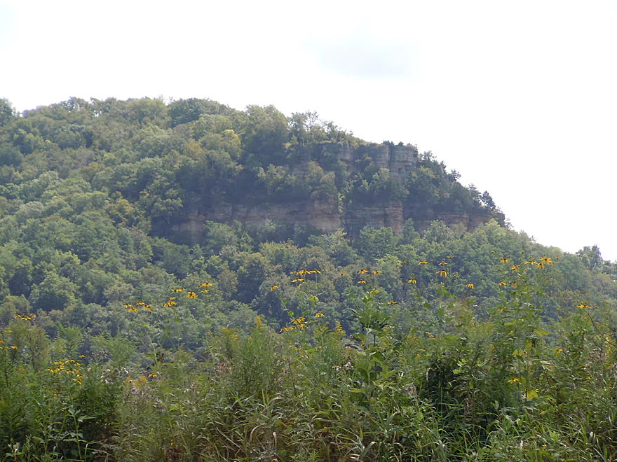
You could frequently see the exposed rock bluff face
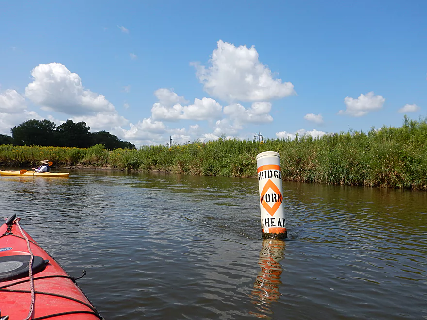
A construction sign for paddlers (seriously!)
Now in the La Crosse River marsh, I believe
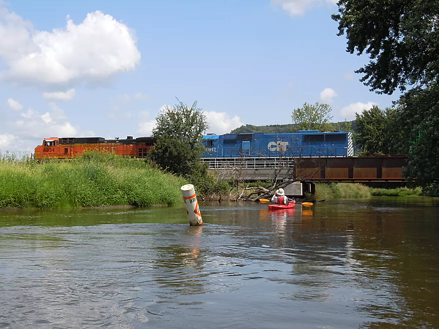
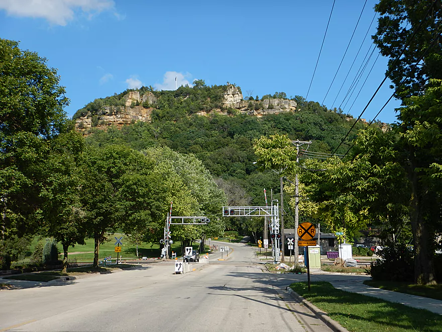
The conductor was too busy with his smartphone to see us
Several nice overhangs
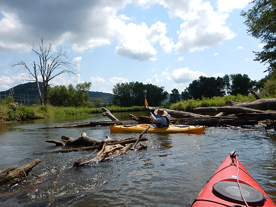
This is the ‘worst’ log jam we faced (a clear river)
Several small sandbars on the trip
The last great view of a river valley bluff
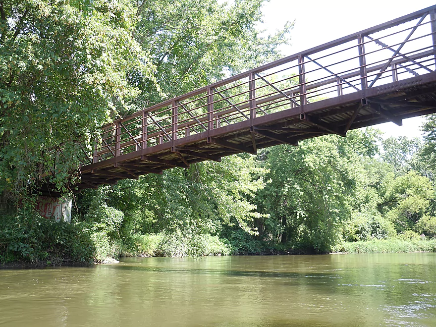
Red Cloud Park pedestrian bridge
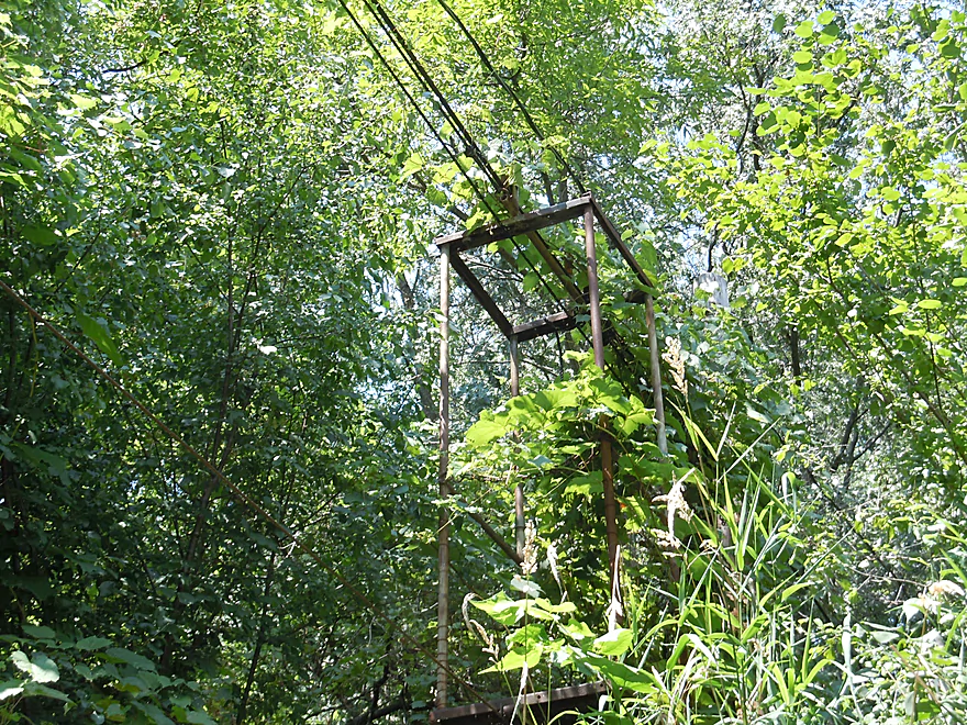
Some curious cable cage system for crossing the river
At least 18 wires…
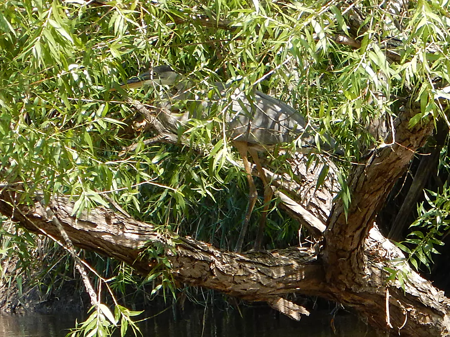
Somebody is hiding behind the leaves
A break from the woods as the river opens up again
Paddling through the La Crosse River Marsh
Might be a difficult ducker in high water
A leaky pipe with heavy algae growth…wonder what is in it…
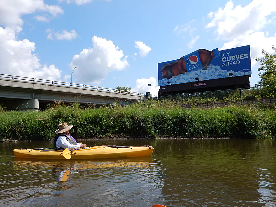
One of many unfortunate riverside billboards
Footbridge right before take-out
Proper take-out is just after the bridge
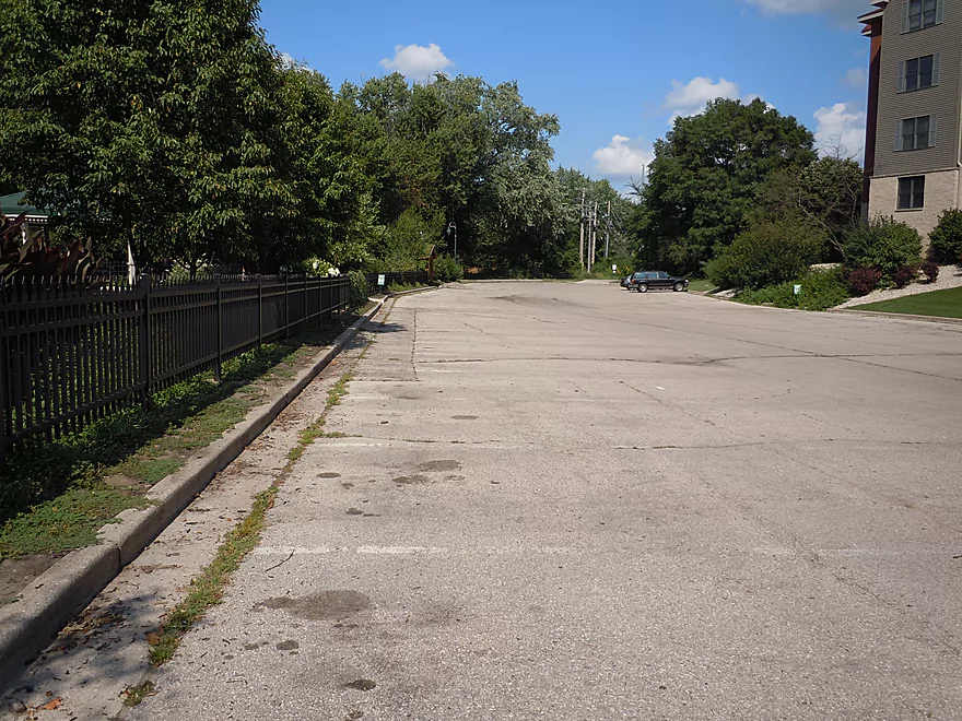
Good nearby parking, but do not park in the steamboat section (marked)
I do suggest paddling out on the mouth though
Looking north at the Black River
Looking northwest at the Mississippi and its incredible bluffs
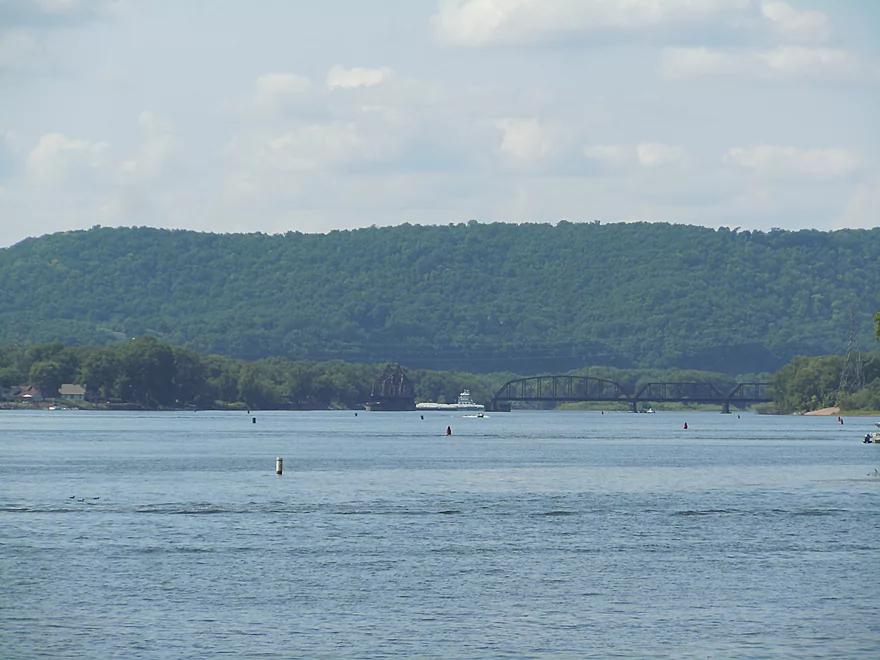
An entire bridge turning to let a barge through
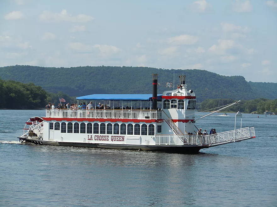
Local steamboat
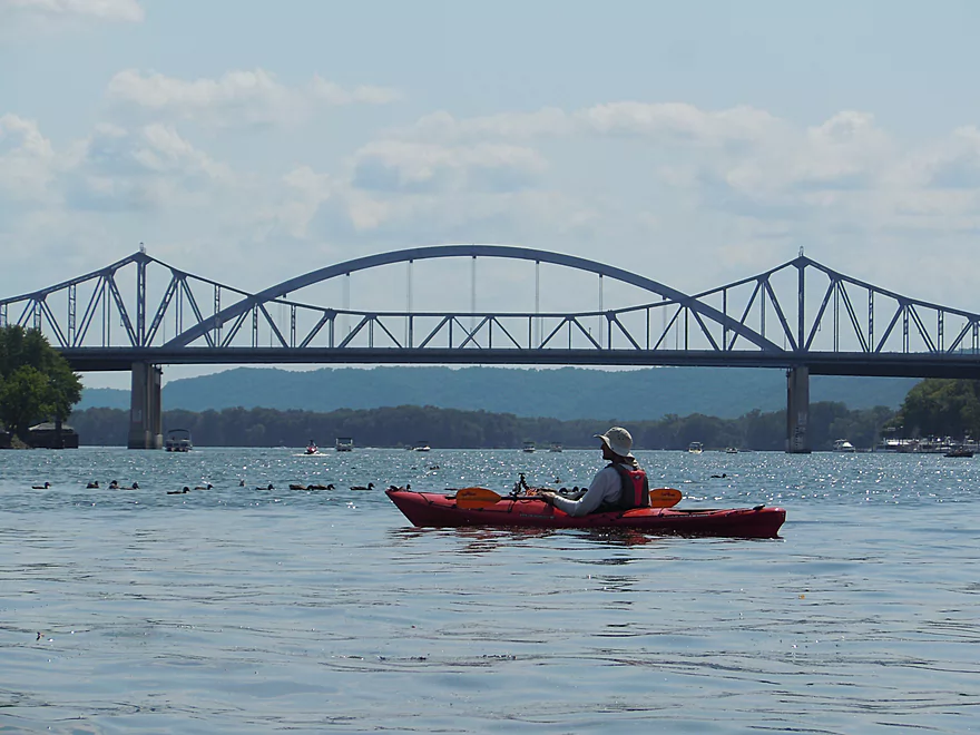
Massive (and beautiful) Hwy 61 bridge
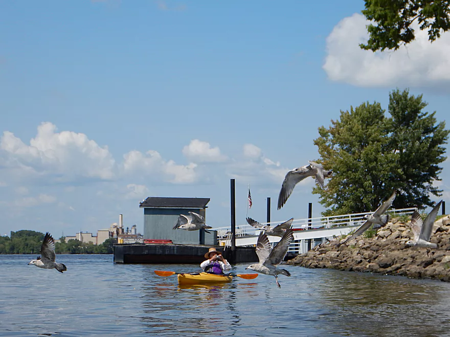
Lots of gulls in the area
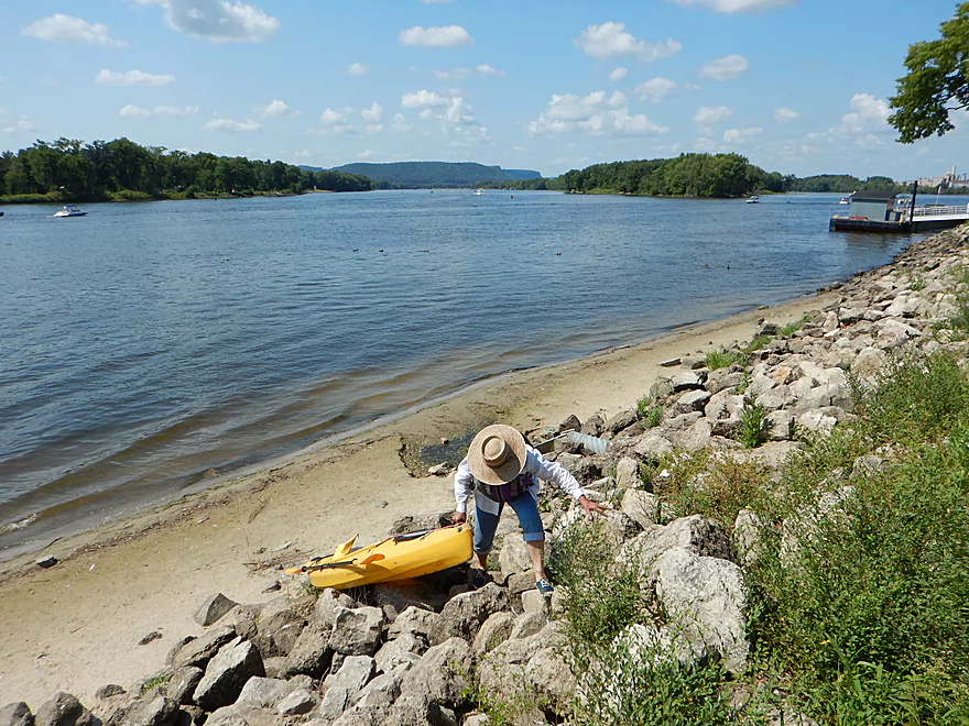
If you take out on the Mississippi, you will have to pull your boat over rocks
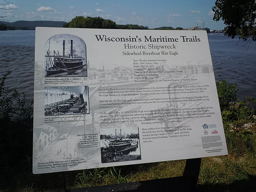
A steamboat wreck is hiding nearby
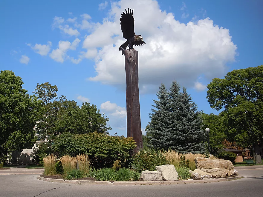
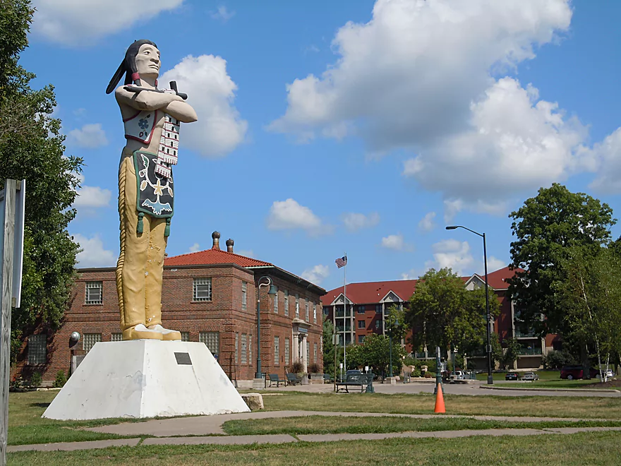
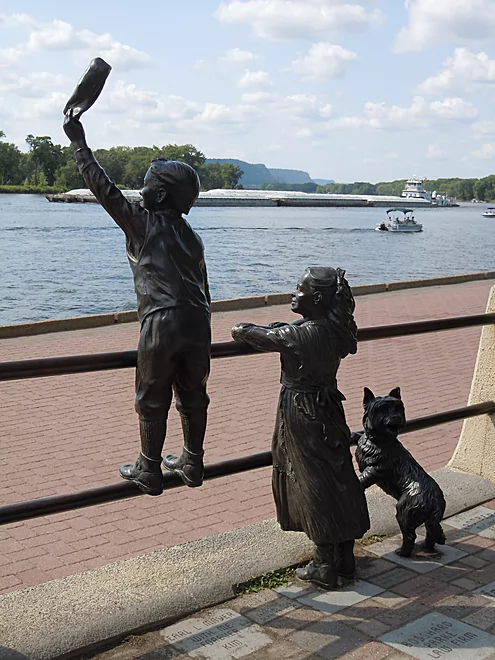
Riverside Park is a nice park with unique scultpures
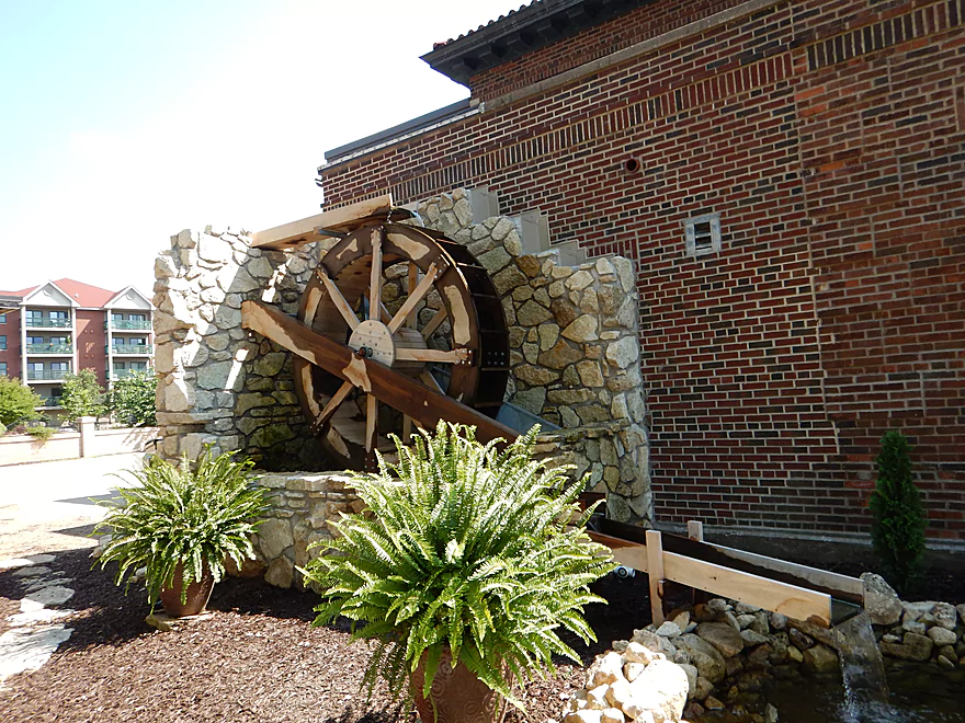
Nice waterwheel
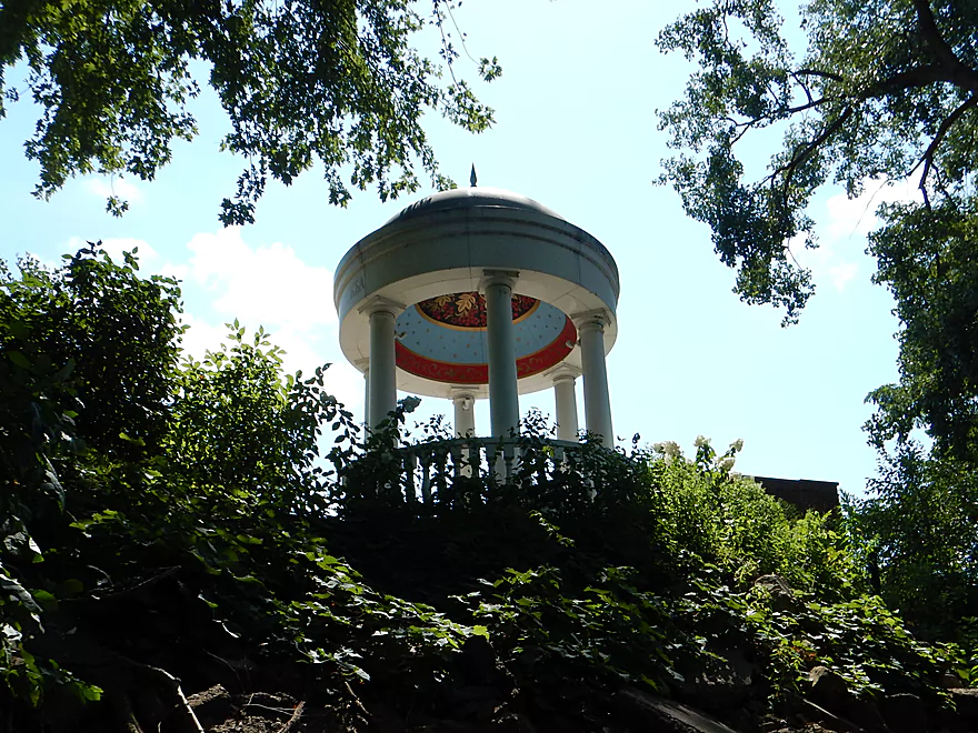
Interesting besedka temple
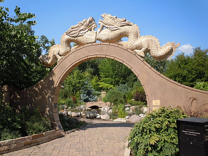
Attractive moongate and Chinese garden
This, on the other hand, belongs in the Dells
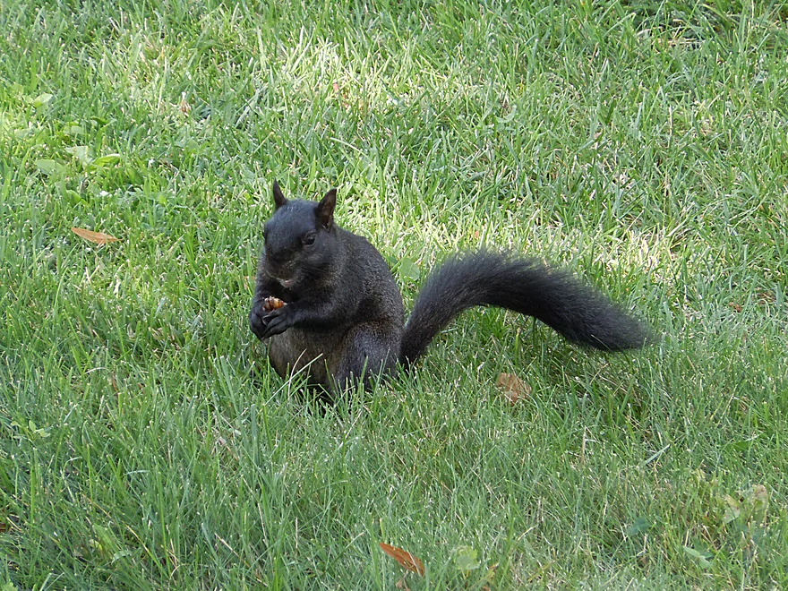
Rare black squirrel
Saying goodbye to the Mississippi
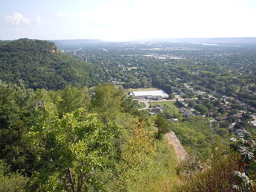
Time to check out Grandad Bluff
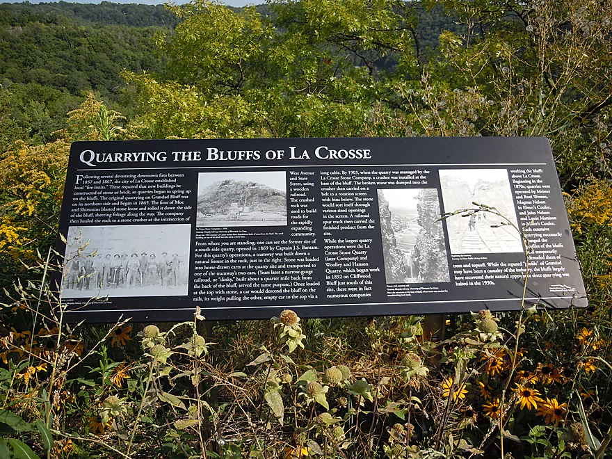
It was much more impressive before it was quarried…
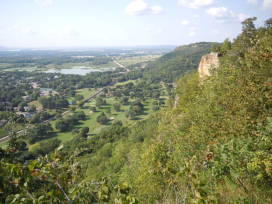
Great view to the north
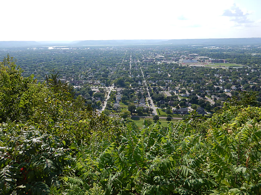
And west…
And south…
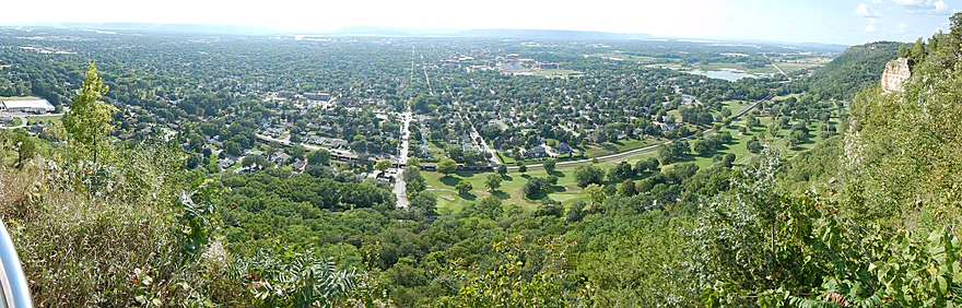
Panorama of La Crosse (viewable only in the photo grid)
La Crosse River – Onalaska

This is the last stretch of the La Crosse River before it empties into the Mississippi. Much of this flows through the La Crosse metro area which you largely wouldn’t know from the lack of houses along the banks, but would definitely know based on the amount of street noise you’ll hear (it is much quieter in the second half of the trip though). This river segment is somewhat unlike its upstream siblings as the mouth portion is significantly deeper, somewhat more turbid and the current is slower (no noteworthy rapids, although there are some fast spots in the first half).
To be honest, this is mostly a mediocre trip. But not bad because there are no log jams, a few small sandbars, a mostly sandy substrate and no heavy development despite this being in the city.
The best thing about this river segment are the distant bluffs rising high above the Mississippi valley. The first and last third of the paddle are through generic hardwood floodplain forest (not bad, not exotic). But the middle third of this trip goes through an open wetgrass area called the La Crosse River Marsh which affords fantastic views of the La Crosse bluffs. You’ll want to periodically check behind you as the most scenic vistas you will actually be paddling away from. This could be a terrific fall color paddle. The most famous bluff, Grandad Bluff, you won’t be able to see from the water, but you do want to explore it after the trip. From its overlook, you have an exceptional view of the La Crosse Metro area, the La Crosse River valley, the Mississippi and the many trains.
I lost count of the number of trains I either heard rumble by or were parked on the tracks. So kind of a unique experience for a paddle. Also unique was the number of bridges. Pedestrian, bike, road and rail…there were lots and many were photogenic.
Ironically, the best part of this trip was when we got off the La Crosse River and onto the Mississippi. Normally paddlers take out at Riverside Park, just a little prior to the mouth, but we thankfully missed this and instead disembarked on the Mississippi banks. The scene at the mouth is quite something. You have the Black River coming in from the north, the Mississippi coming in from the northwest (backdropped by terrific bluffs), a massive highway bridge to the south, a massive railroad bridge spinning on its support to let a barge through, a train going over this very railroad bridge, a historical replica steamboat giving rides, the typical flurry of recreational boaters you see on the Mississippi and, oh, a local bike-a-thon going through park. Very energetic and cool scene to experience even if you disembark on the La Crosse River.
Riverside Park itself is worth exploring after the trip. It has a number of statues (some classy, some cheap), but also a nice garden area and a nearby visitor center for tourists.
So three stars in summary. Pros: epic bluffs, lots of trains, bridges, thick wooded banks, good current, lack of muck and the Mississippi at the end. Cons: highway noise, billboards, highline wires and a lack of anything too exotic.
There is a brand new boat launch in Onalaska called “Holiday Heights Landing.” Great (and under-utilized) parking and launch ramp, but no nearby outhouse.
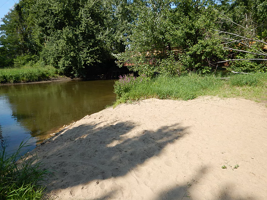
The main take-out is a nice sandy access area just prior to the mouth proper (just after the last bike bridge). Plenty of nearby parking, but there is a section reserved for the paddle boat customers with tow-away warnings if you park there. You’ll see the signs…just park south of the warning signs and you’ll be fine. There are nice facilities nearby (this is all part of Riverside Park).
Being oblivious we totally missed this take-out and paddled out of the mouth for our big Mississippi adventure (more on this later). We then pulled our boats out on the west side of Riverside Park (Mississippi side) over the rocks to our waiting car (good parking here too). The first landing is better, but you should explore some on the Mississippi.
There are a number of rental and livery options in the area. Call in advance to ensure that they service this section of the river.
- La Crosse Canoe Outfitters – 608-317-7942
- City of Onalaska Parks & Rec Department – 608-781-9560
- Schafer’s Boats & Bait – 608-781-3100
- University of Wisconsin La Crosse Rec Sports – 608-785-8860
- Perrot State Park – 608-534-6409
- Goose Island Campground – 608-788-7018
- Black River Express – 608-488-7017
For biker shuttlers, this is a treat. Only 4.9 relatively flat miles on almost entirely dedicated bike trails.
None. No log jams and while sometimes the current clips along, it is all plenty manageable.
River was run at 335 CFS (per a local gauge), which is relatively low but still plenty deep (much of it 5-6′). I doubt this stretch ever gets too low to run. What’s too high? I don’t know, but guestimate anything over 500 CFS would be too high for pleasant paddling.
Not much. Map turtle, many painted turtles, green heron, blue heron, wood duck and dragonflies (interesting general absence of insects).
Detailed Overview
- Fort McCoy - Upper Leg: The river looks nice here, but this goes through the heart of military training grounds so is not likely suitable for paddling.
- Fort McCoy - Lower Leg: (2.5 miles) This is technically part of a Federal Army base. You can navigate the river, but only if you register with the Fort McCoy Natural Resources department and follow their rules.
- Squaw Lake Dam to Buckley Ct: (1.4 miles) Very interesting prospect with clear water, one small waterfall, and a few nice Robinson Creek style cliffs.
- Buckley Ct to Hwy BB: (1.1 miles) An ok prospect.
- Hwy BB to Sparta: (7.1 miles)
- Hwy BB to Angelo Wayside: (5.3 miles) Clean sandy water with little development. Ends in a small flowage.
- Angelo Wayside to Sparta/Fisherman's Park: (3.3 miles) Not as interesting...but ok. River widens and has more of a messy feel with more hardwoods.
- Sparta to Hammer Road Bridge: (5.4 miles)
- Fisherman's Park to Ben Bikin Park: (0.4 miles) Nice open stretch though Sparta with some rocks.
- Ben Bikin Park to Amundson Park: (3.5 miles) The most popular and best section on the entire river. Very nice with clean water and good current. As of 2024-04-30, a number of logjams have popped up upstream from Amundsen Park. Some portages will be required.
- Amundson Park to Hammer Road: (1.5 miles) A more wooded stretch. Includes a fun ledge to kayak over.
- Hammer Road Bridge to Hwy J: (5.6 miles) Likely a good prospect...but I bet it isn't as nice as upstream sections.
- Hwy J to 17th Ave: (6.8 miles) Mediocre prospect. Upstream sections are likely nicer.
- 17th Ave to Neshonoc Lake Dam: (6.6 miles) Half the trip goes through a slow flowage. The lake is nice as far as lakes go...but I suspect this is a relatively weak section.
- Neshonoc Lake Dam to Veterans Memorial County Park: (4.2 miles) An ok paddle with some fun ledges and a nice box canyon.
- Veterans Memorial County Park to Holiday Heights Launch: (8.4 miles)
- Veterans Memorial County Park to N. Kinney Coulee Road/I90 Bridge: (2.6 miles) A mediocre stretch with some sandbars and Class 1 rapids under I90, but mostly generic eroded banks that have been heavily straightened by the railroad. Road noise here is pretty loud.
- N. Kinney Coulee Road to Holiday Heights Launch: (5.8 miles) A good leg. Features include fast current, some sandbars, mostly open banks with some nice bluff vistas, and a few really nice sandbanks. Be mindful of strainers in fast current.
- Holiday Heights Launch to Mouth on Mississippi: (6.9 miles)
- Holiday Heights Launch to Hwy B/Earl's Landing: (2.2 miles) A more wooded stretch with mediocre floodplain trees. Train traffic is heavy in this area and chances are good you'll paddle under a moving train.
- Hwy B/Earl's Landing to Mouth/Riverside Park: (4.7 miles) This is a good leg. It's more open and has really nice views of the distant bluffs.
Trip Map
Overview Map
Video
Photos Size:
Aaron,
For what it’s worth, I paddled the La Crosse River today (11/1/16) from Veterans Park to Riverside Park and there were no fewer than 4 serious obstructions. I cleared out and cleaned up what I could with pruners and a handsaw, but this trip would require a couple portages in high water, and those paddling a canoe would have a hell of a time.
Sincerely,
Timothy at milespaddled.com
WOW!!! Thank you so much for taking the time in documenting this trip. I have lived in LaCrosse for 16 years and I am just now planning a down river trip but I have no idea where all of our drop in sites are. Thank you for having such a detailed trip of what to expect.
Thanks for the feedback! Unfortunately the La Crosse River now is a bit high…hopefully it comes down here pretty soon.