
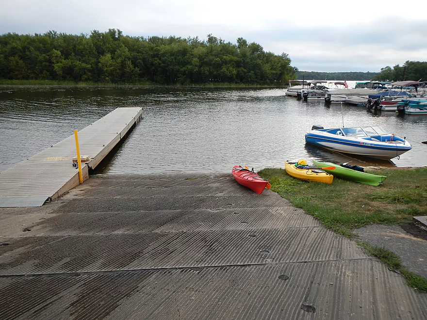
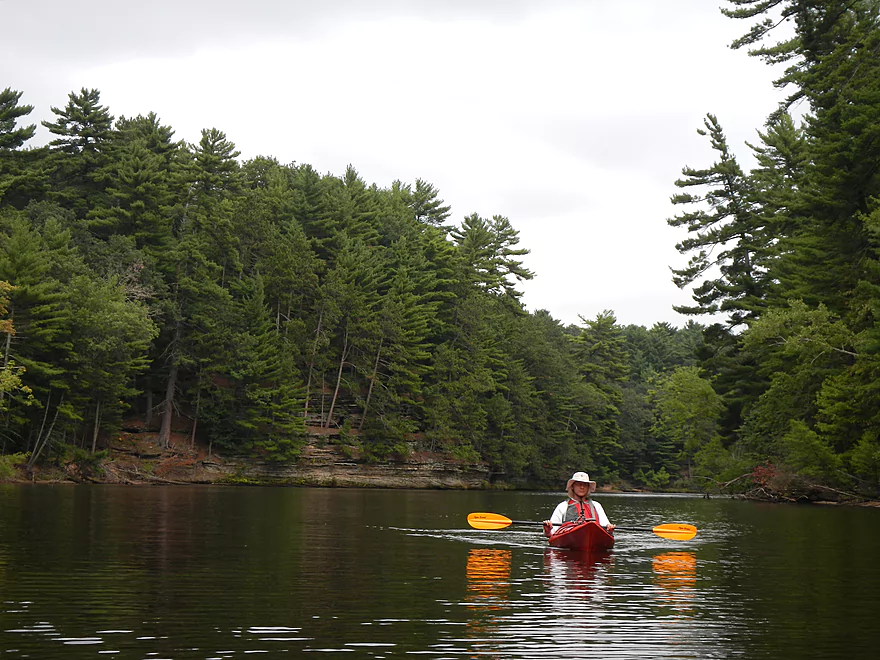
Public launch next to River Bay Campground
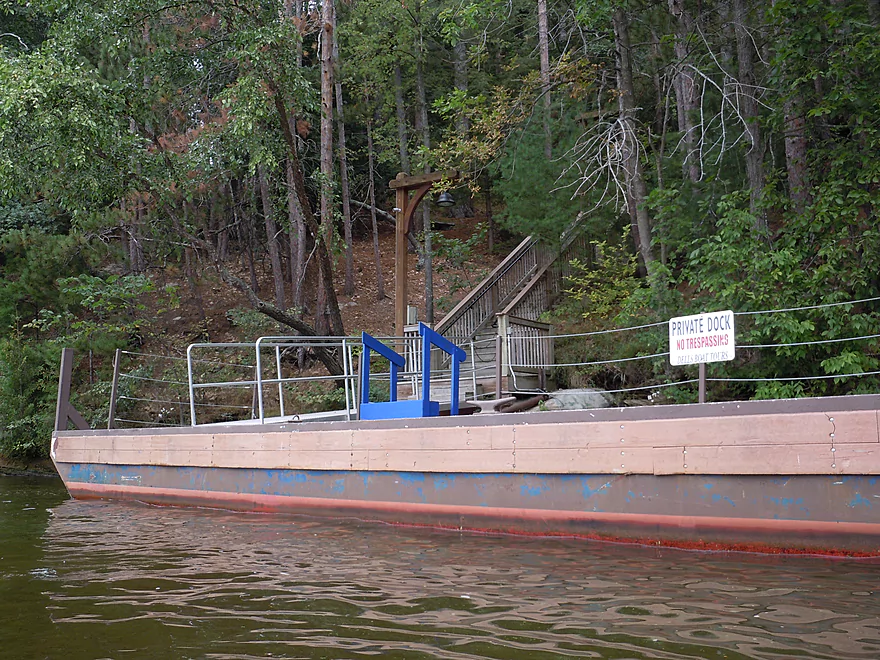
Interesting boat parked next to the ramp
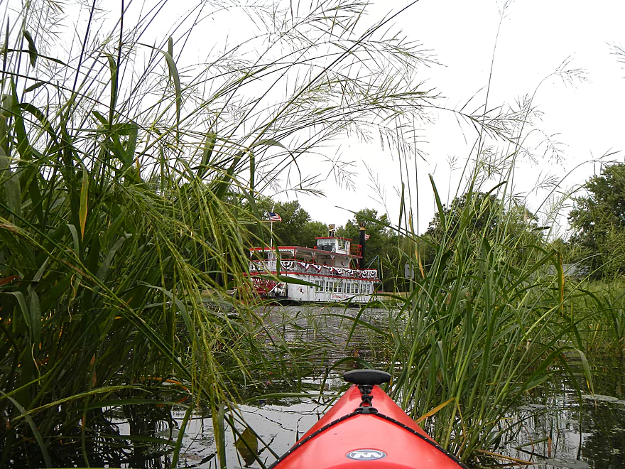
Lot’s of wild rice in the area
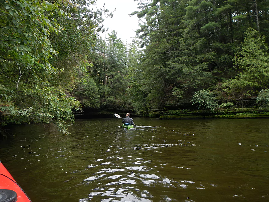
Exiting the bay
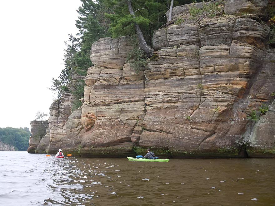
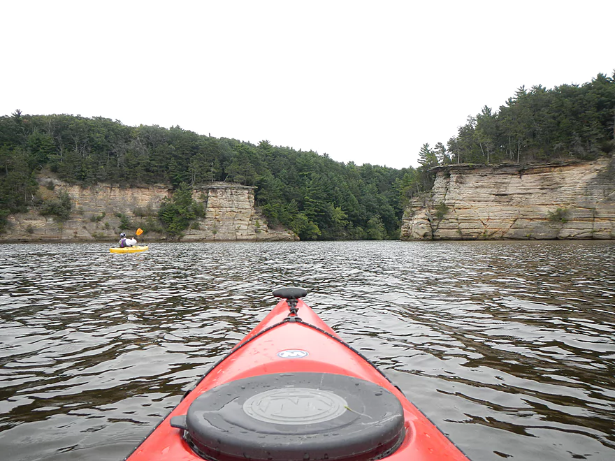
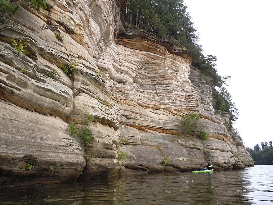
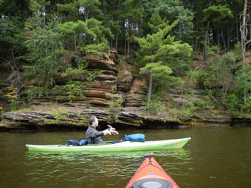
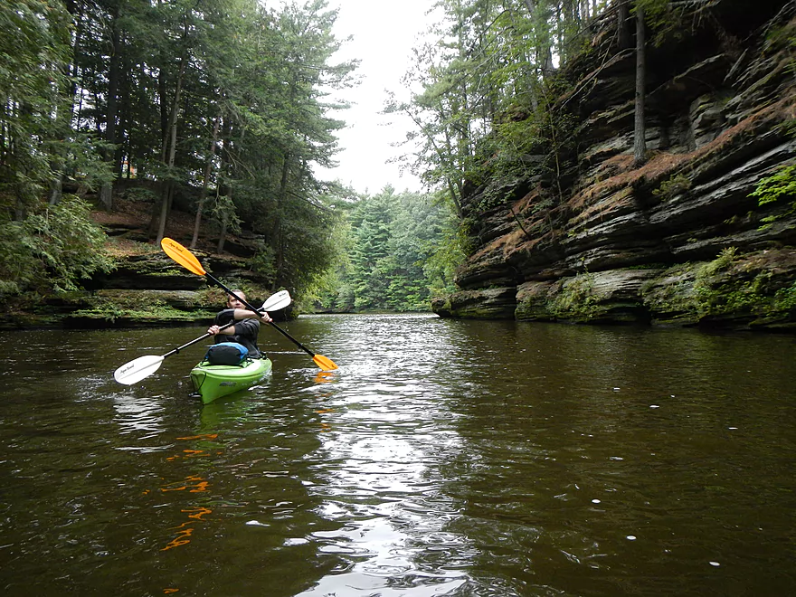
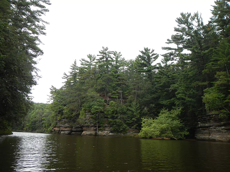
Heading toward the first group of bluffs at Stand Rock
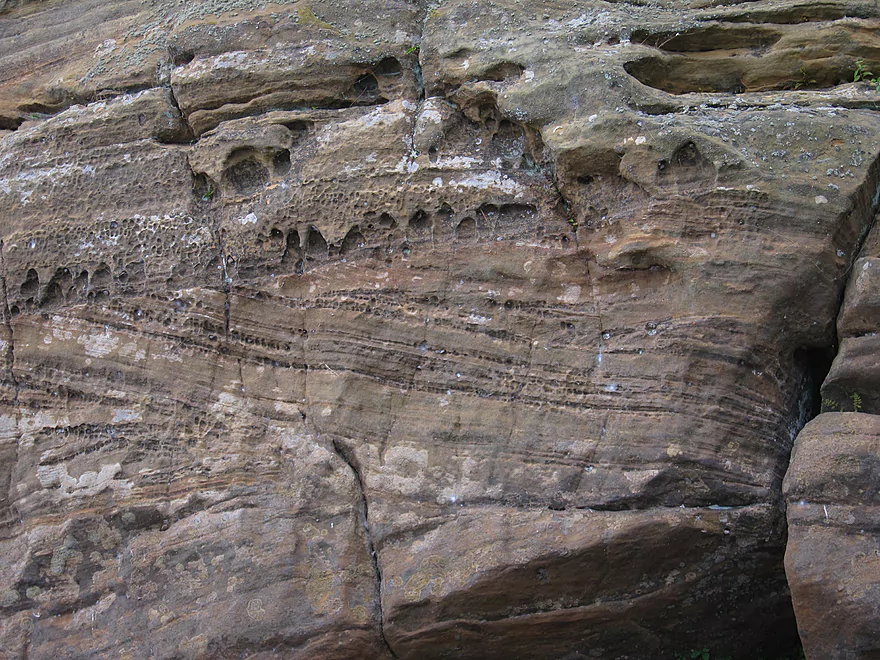
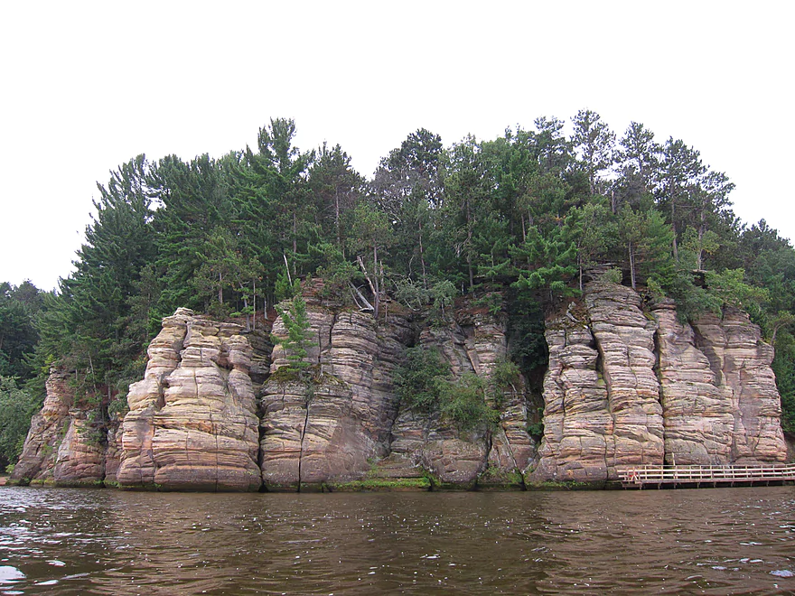
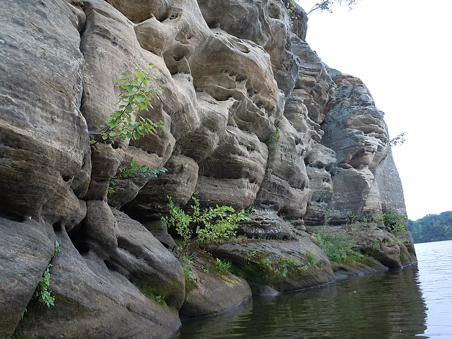
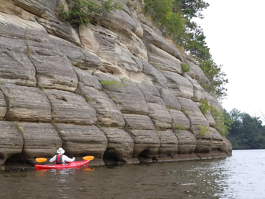
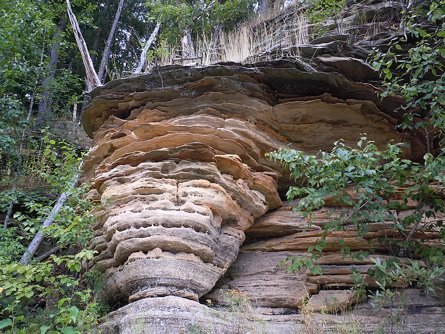
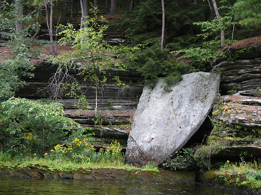
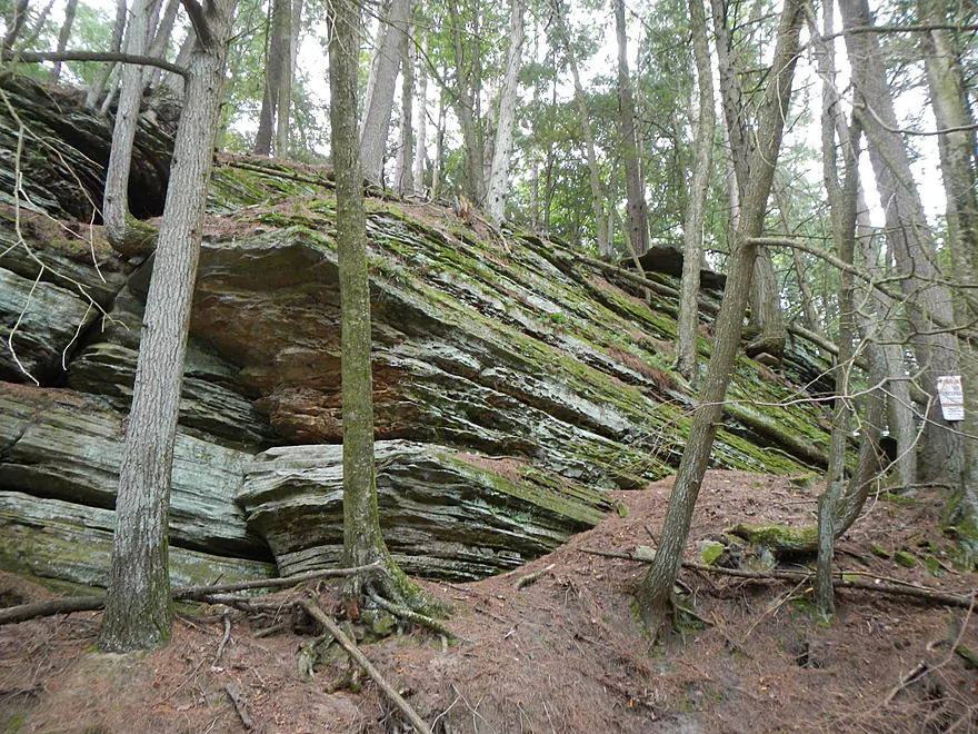
Amazing rock texture
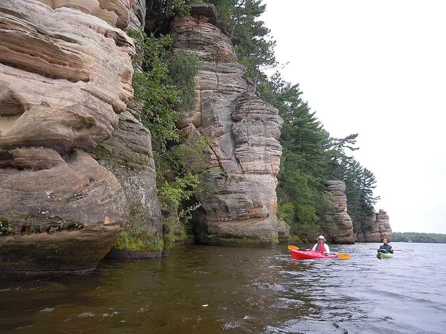
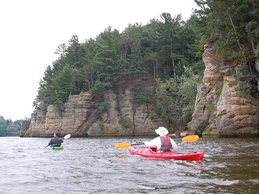
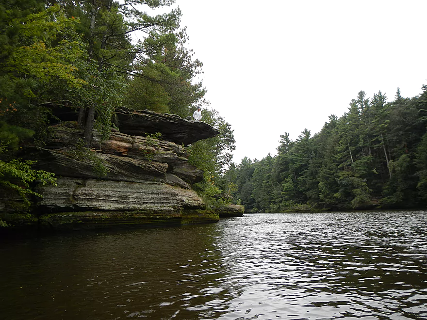
Looking back on Stand Rock
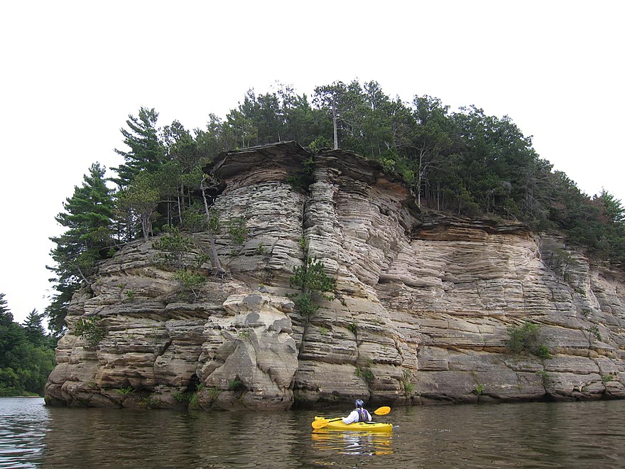
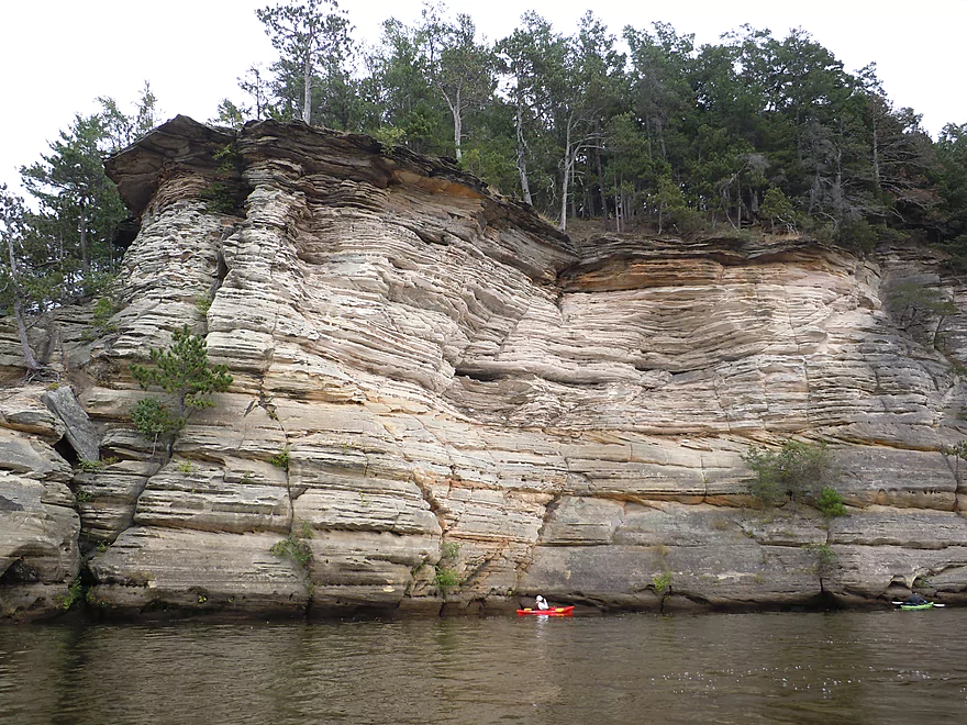
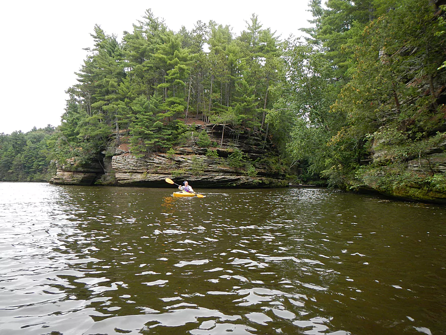
Next highlight – Grand Cambrian
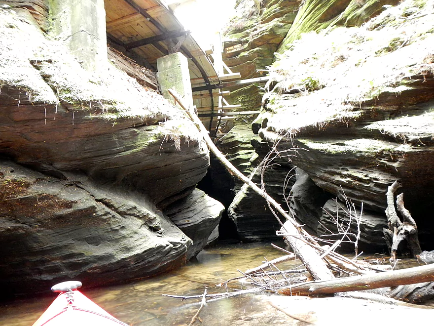
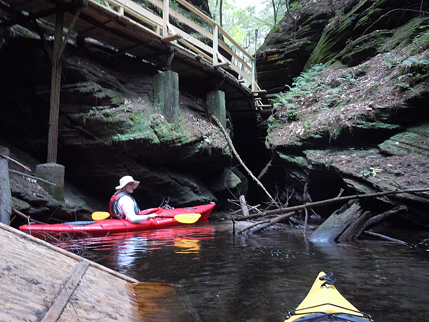
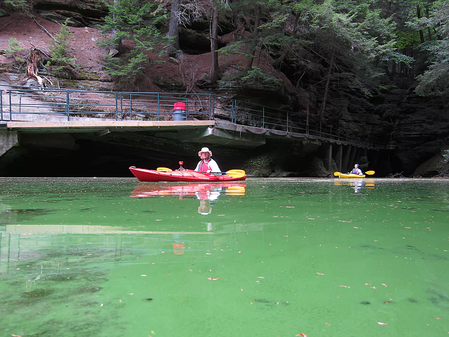
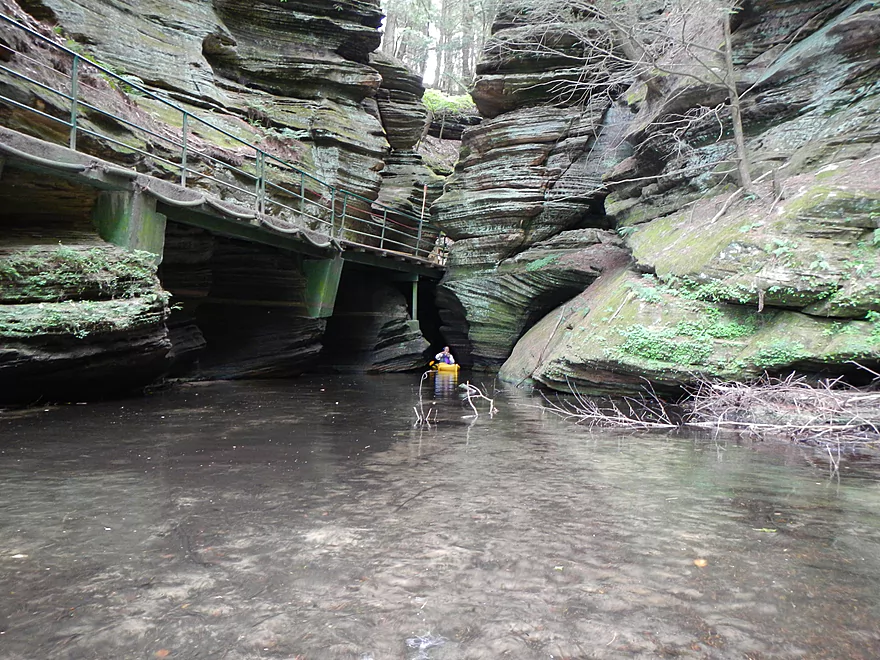
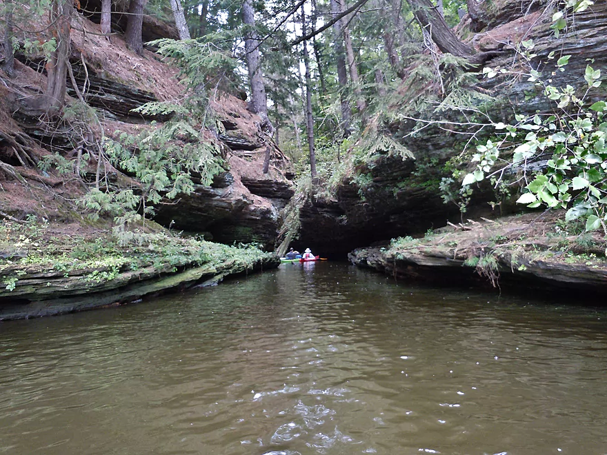
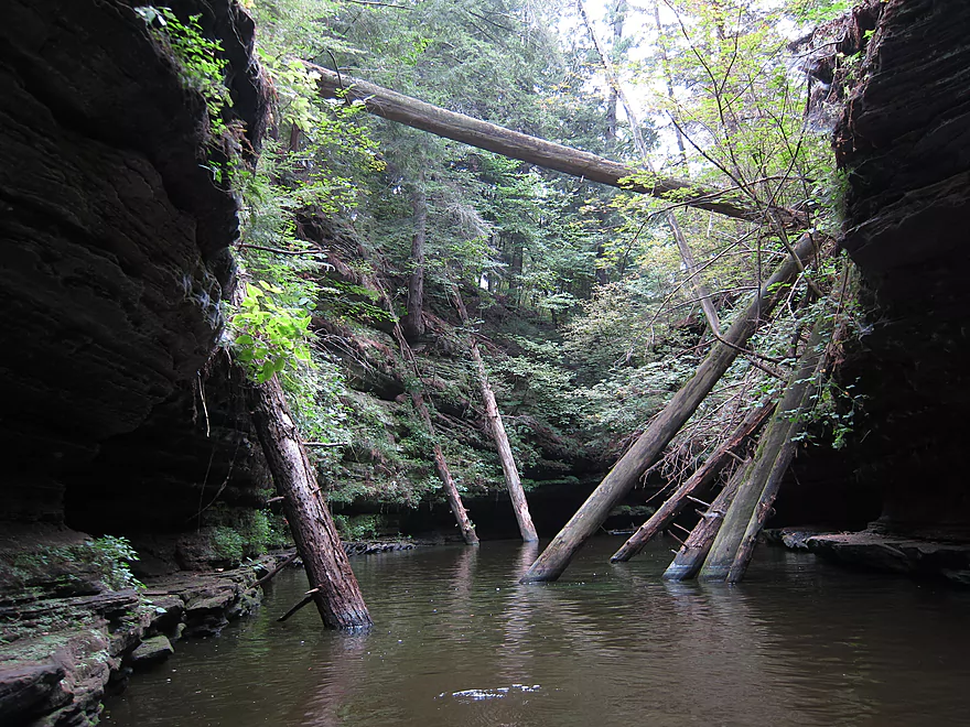
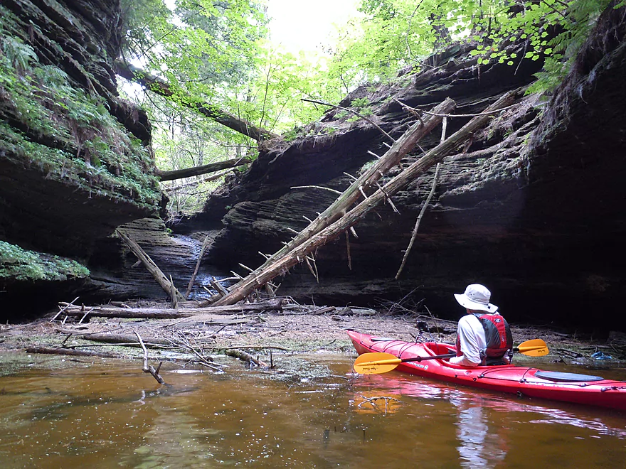
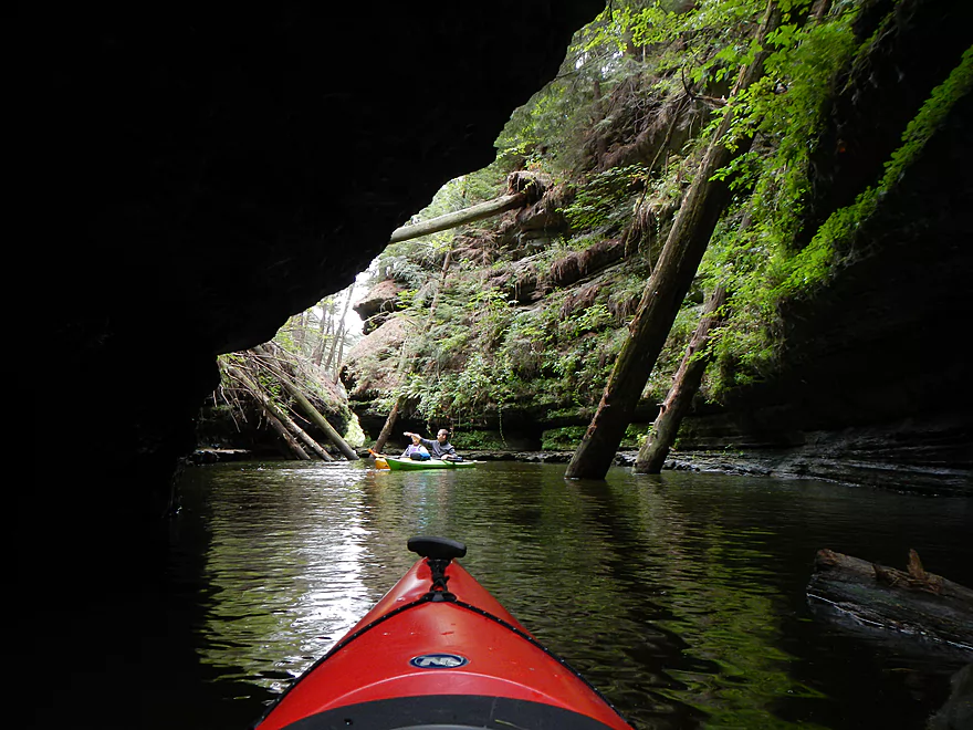
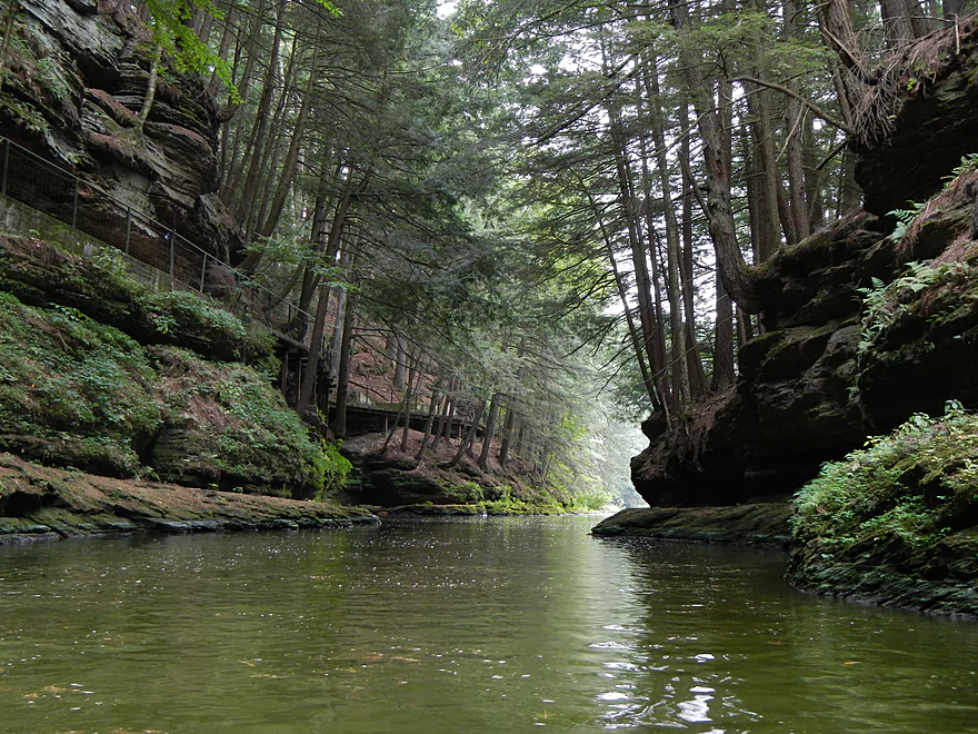
The gates to Witches Gulch
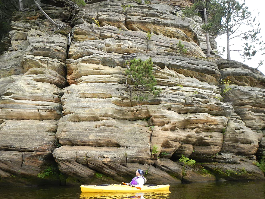
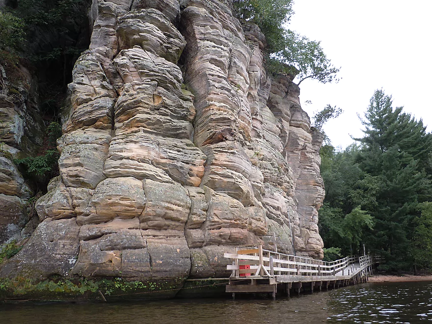
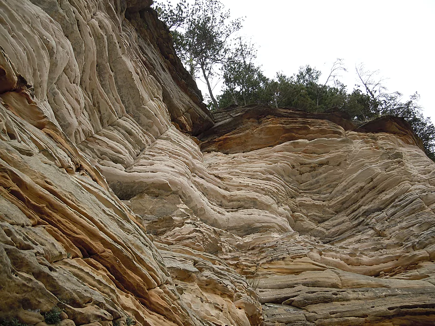
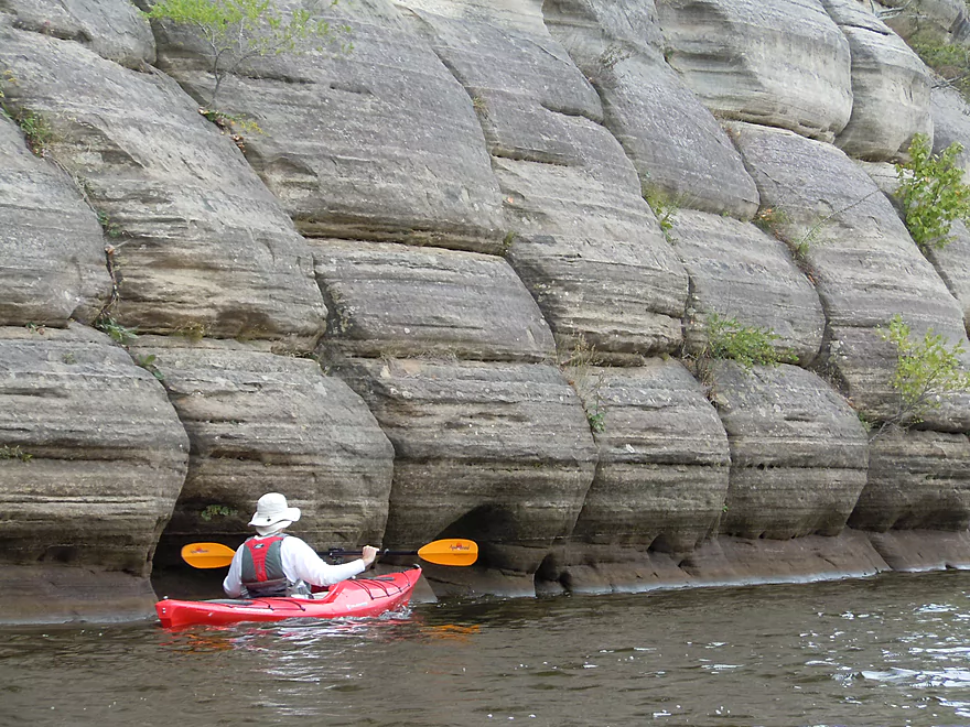
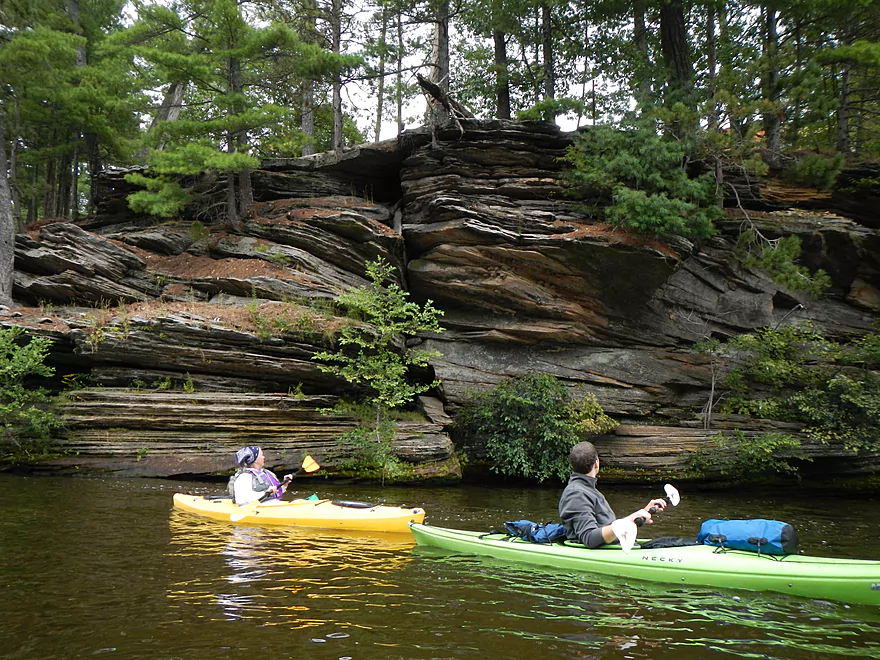
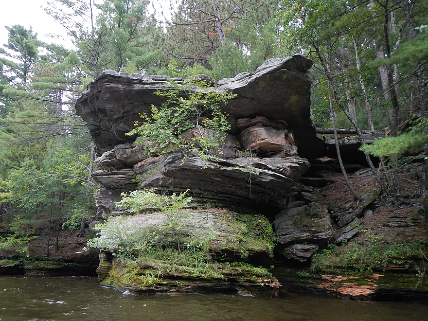
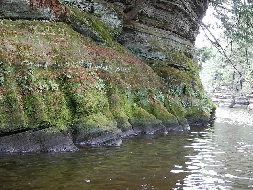
Dramatic change in the layering
Great texture
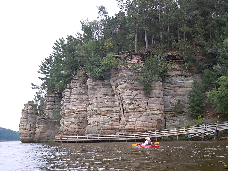
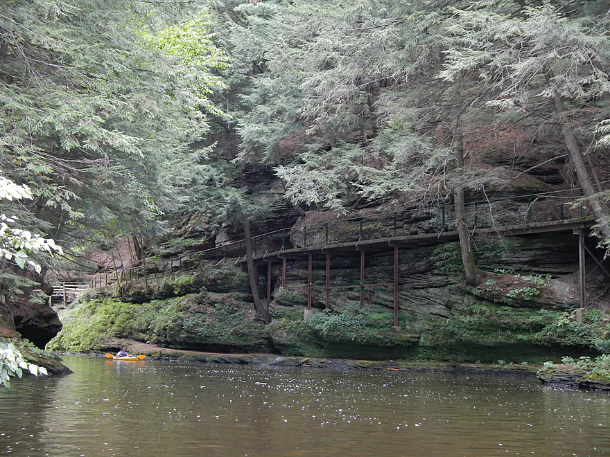
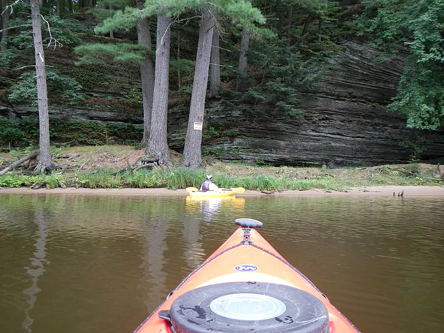
Witches Bay Boat Docks
Neat effect
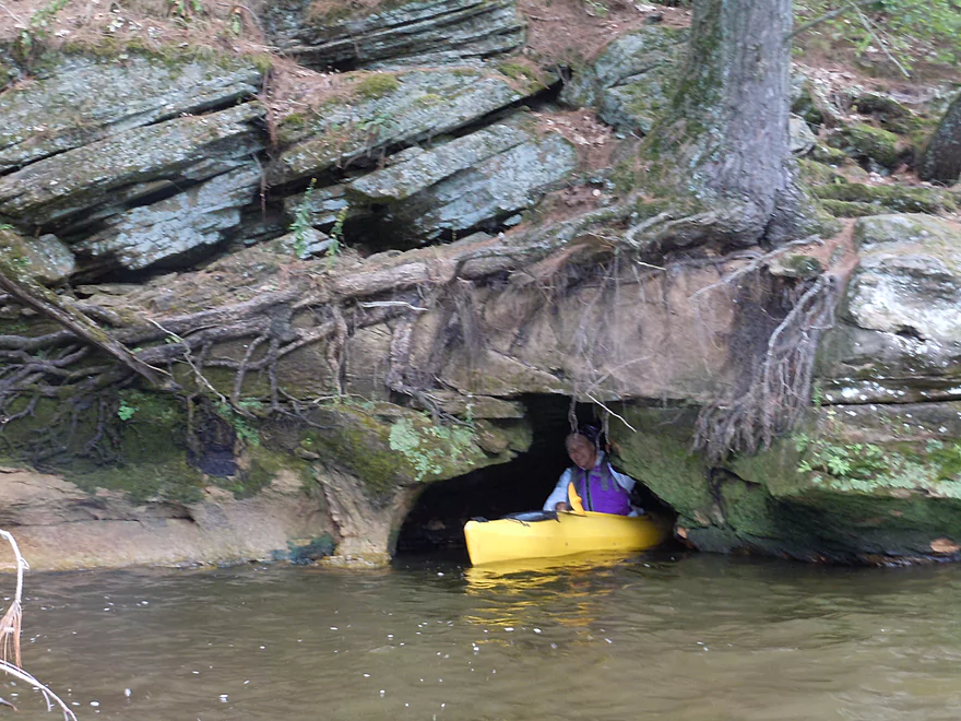
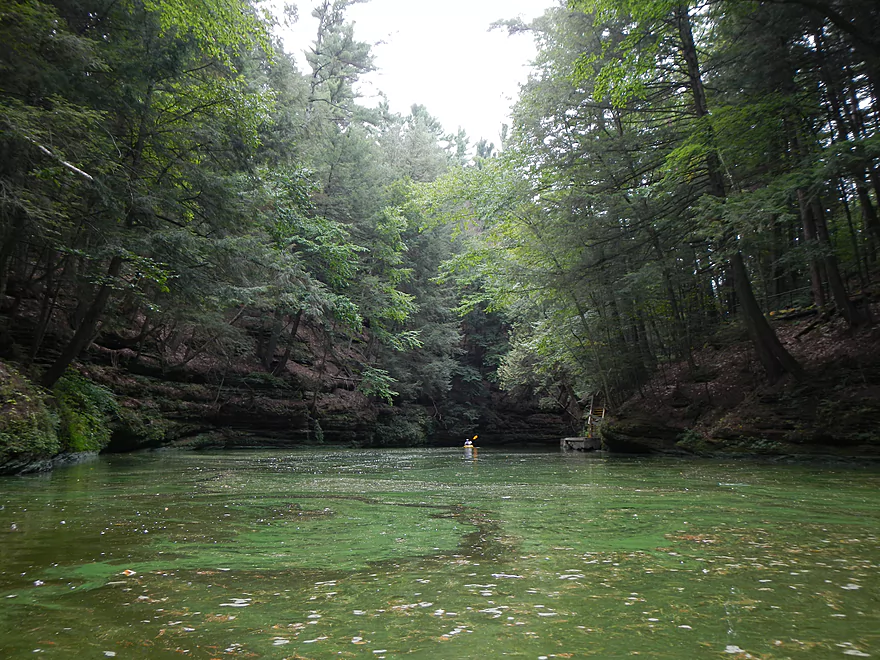
Think this is Witches Cauldron
You can make it up a little ways into the creek
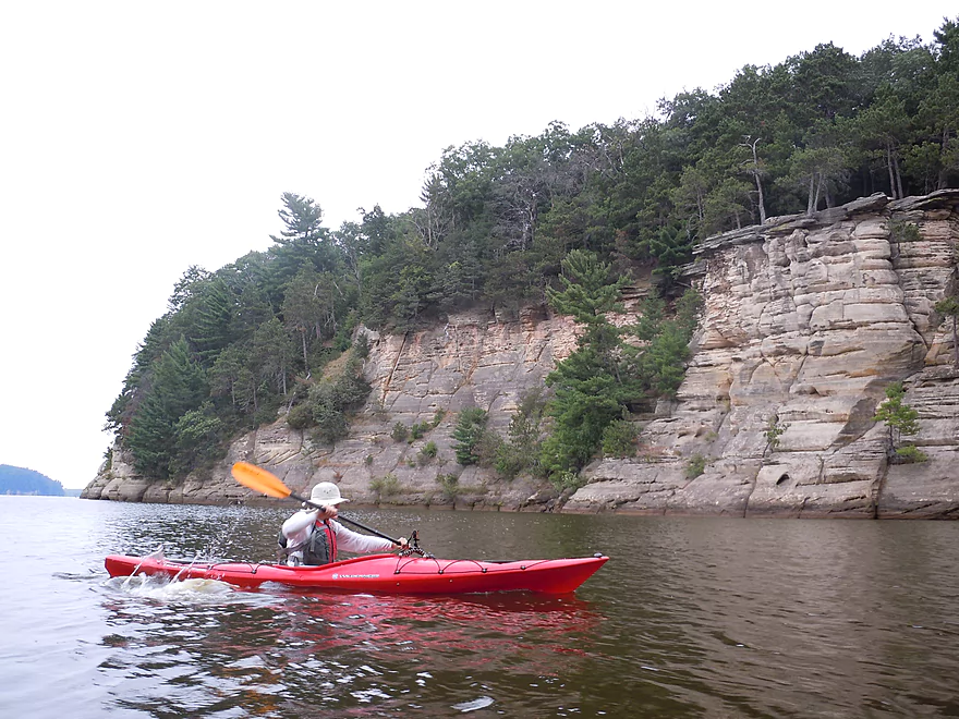
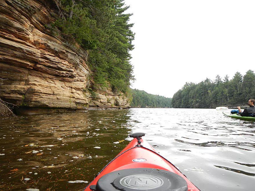
Tallest bluffs I think are here
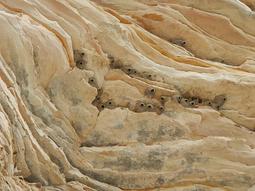
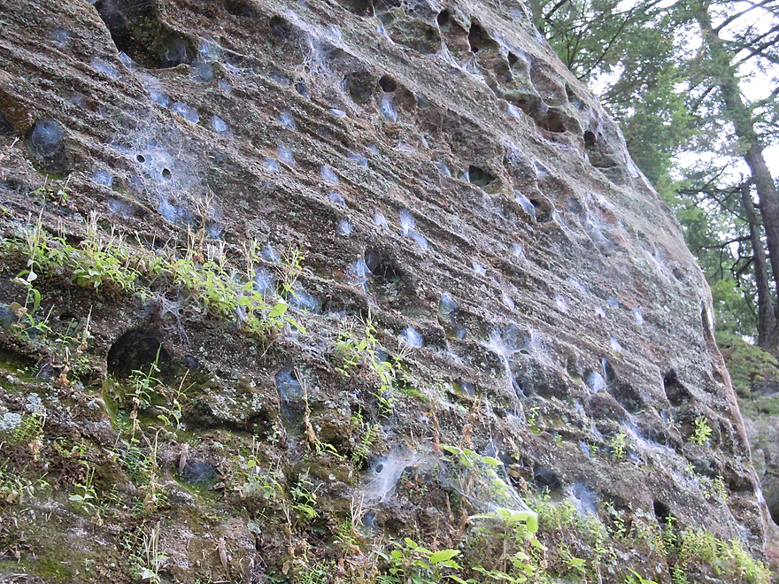
Cliff swallows not under a bridge!
Pillow Rocks!
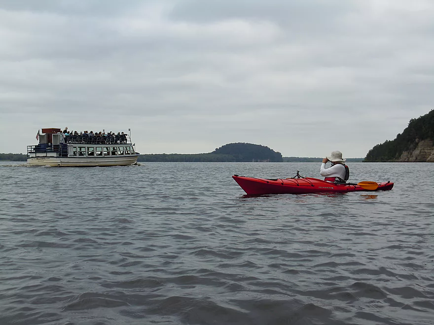
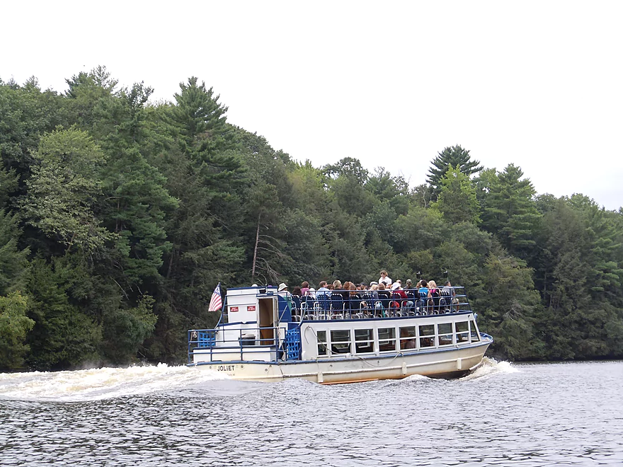
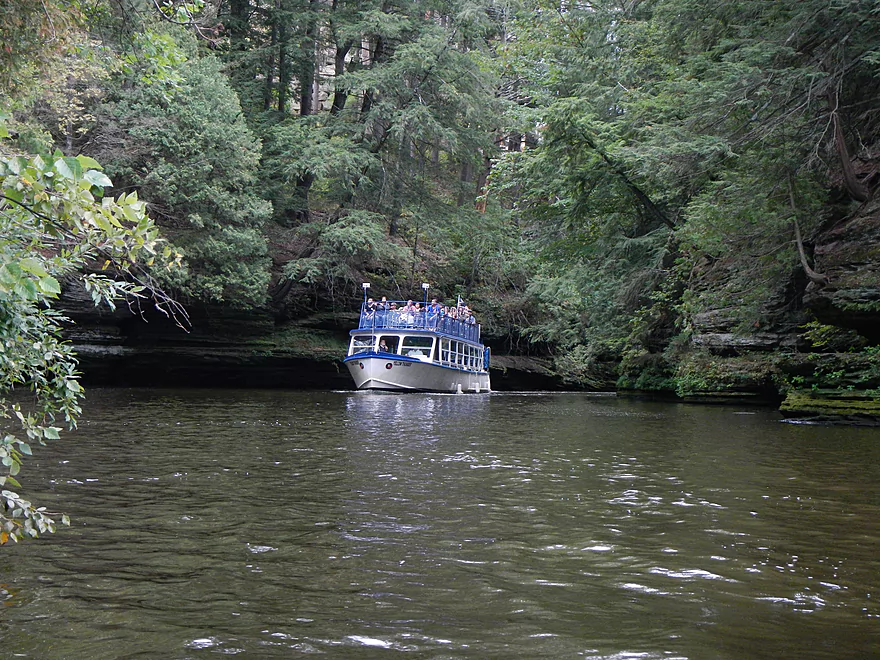
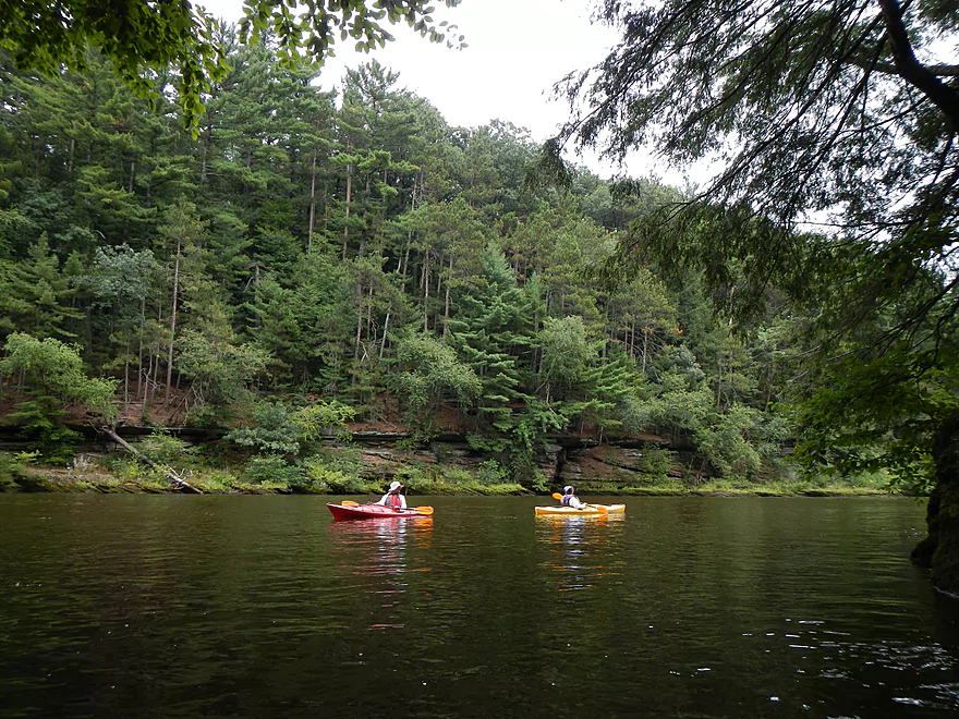
First of many tour boats
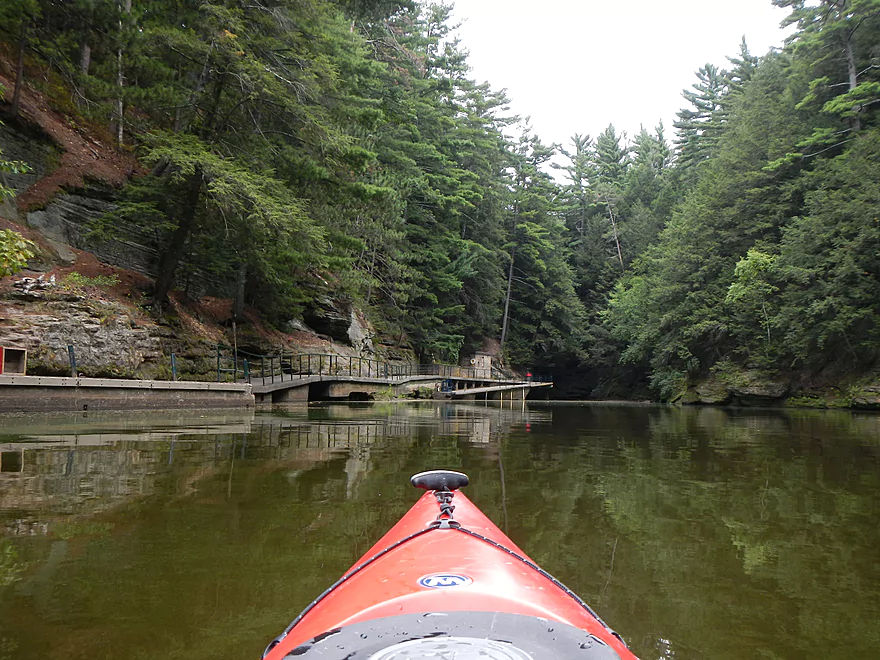
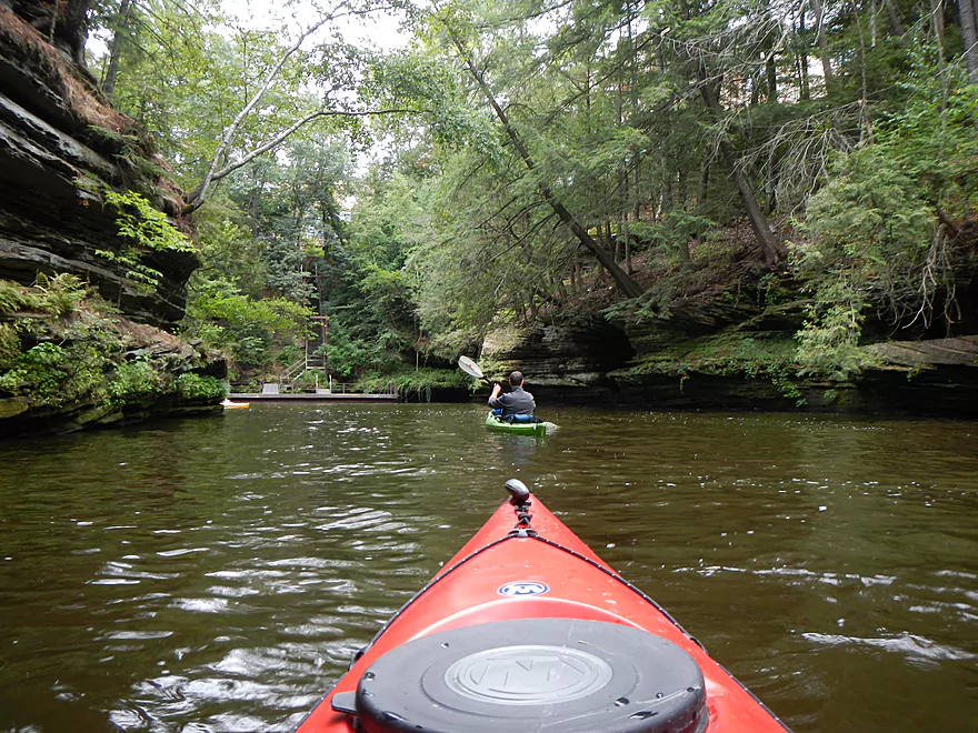
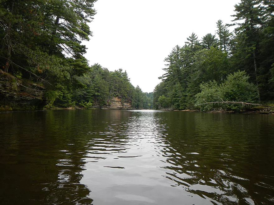
Entering the famous narrows
He gunned it after he passed us…huge wake.
A glen before Steamboat Island
Perfect to keep boats out but let kayaks in
End of the glen
Very scenic
Chula Vista Resort peaking behind Steamboat Island
Another dock
The tour boats squeeze in here…it can be a tight fit
Somebody stole my paddle…
Looking back on the island
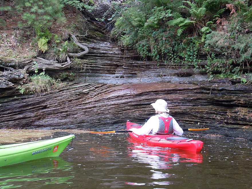
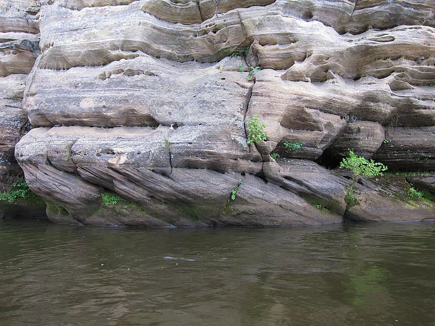
Cool little micro waterfall and rock stratification
Great little cave
The entrance is to the right
Lunch time in one of the bays
I think this is called diving board rock
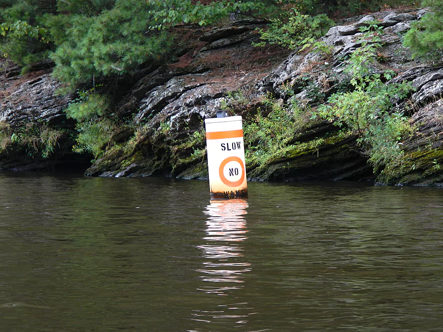
No wake zone marks the entrance to Black Hawk Island
Stone shield
But first we need to check out Coldwater Canyon
Very scenic
A bad joke from the Dells Boat Company handiwork…(it’s state land BTW)
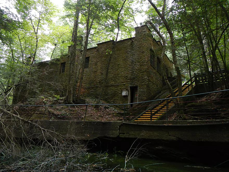
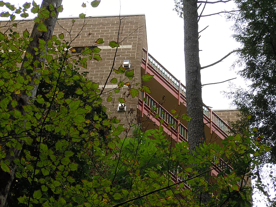
Old building at the end of Coldwater Canyon
Much smaller channel around the island
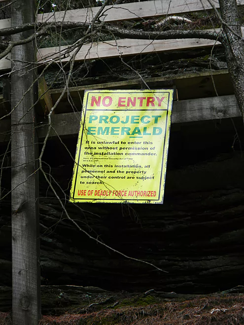
Lost count of all the no-tresspassing signs put up on state land
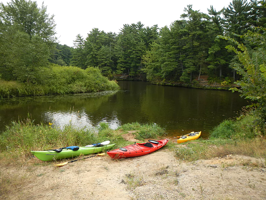
Take-out west of Blackhawk Island (now closed)
Upper Dells – 2

Of the many areas in the Dells to paddle, this is the best and is a must paddle for Southern Wisconsinites. In a previous review, I paddled the first half of the Upper Dells from Two Rivers landing to about halfway on the flowage lake (take-out at River Bay Campground). For this trip, I’ll pick up where I left off and paddle down to a nice take-out next to Black Hawk Island.
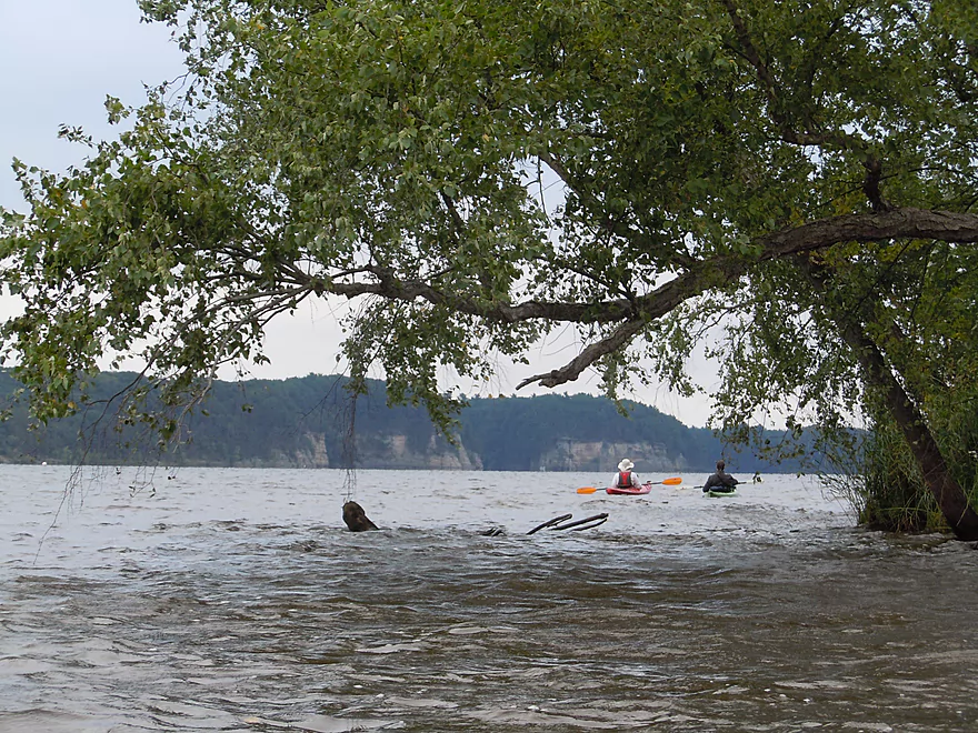
There are multiple options for putting in, of course. See my other review for more upstream options. For the lower section, I would prefer to launch somewhere on the large flowage/lake created by the Kilbourn Dam. There is a small public landing on the NE side of the lake that is hidey and requires some channel paddling but would be a good option. Halfway down the lake on the left/west side is River Bay Campground and a local public ramp (Town of Lyndon Landing). This costs five dollars and can be somewhat busy during the summer. Parking can fill up during the summer, too, so you might want to arrive early if you go on a weekend. Another put-in option is on the east side of the lake in the Holiday Shores Campground, but this can be extremely busy and might be the most pricey put-in option.
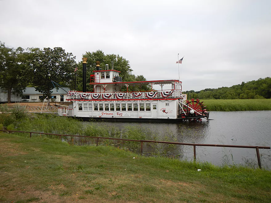
One bonus of the Town of Lyndon Landing is you’ll get to see a cool steamboat parked there. It’s a nice sheltered area from the lake with abundant wild rice. Once you are on the lake, things can get choppy and windy. Make sure you are comfortable with open lake paddling before you embark on this trip, and it might not be a bad idea to check the weather for the wind direction and speed. You should see bluffs almost all around you. Louis Bluff is upstream, but we didn’t hit that on this trip. The Stand Rock Bluffs will be south of the landing, the Cambrian Overlook south of that, and Witches Gulch SE/across from those (it’s all marked on the map). All three of these locations have land access points. The Cambrian Overlook is public, but you do have to pay a small fee to visit Witches Gulch or Stand Rock from land. The gates for the latter two have poor hours, so check ahead of time with the boat company before planning a visit.
Witches Gulch will be the first highlight of your trip. You’ll enter a massive entrance that reminded me of the Gates of Argonath from the Fellowship of the Ring! The channel itself is very nice, and at the end is a tour boat dock and boardwalk leading into the gorge. They don’t tell you this on the tour…but you can actually kayak under the boardwalk and into the gorge a bit–possibly further during high water. I ran out of navigable water, I think, by “Witches Cauldron.” Would have taken more pictures but lighting was beyond horrible, even with a kayak-mounted tripod (taking pictures inside of Witches Gulch is always a challenge). The water in the gorge is not too dirty…but incredibly green from the algae (which actually looked kind of cool). The carp must have loved it, as they were plentiful and splashing about in the bay.
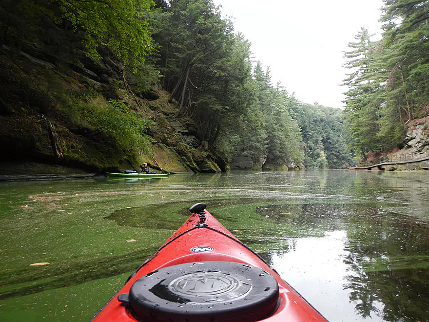
Continuing on… It will be almost nonstop bluffs to the take-out next to Black Hawk Island, so no shortage of scenery on this water trail. After you exit Witches Gulch, you’ll enter a ~7 mile stretch called the “Narrows” which, simply put, gets its name from the river being so narrow at this point. Reading reviews of this in advance, almost all them are adamant that this is a super dangerous area for kayakers. We went 7:00 in the morning on a Packer game day in September and still saw our share of boat traffic, but it was nothing like it would be normally. I think if you are an experienced paddler and go during off times, you’ll be all right. The main problem is the bus-sized jet boats–very fast and produce a huge amount of wake that can easily swamp a kayak or really bang you against the rocks if you’re not careful. For this trip, we checked with the Dells Boat Company and they didn’t run the jet boats on the upper Dells this late in the season. But the competing boat company (Dells Army Ducks) did. But the only one we saw was at Black Hawk Island, which is safely protected by a no-wake zone. From my experience on the lower Dells… some jet boats will slow down and give you space…some will not. Be vigilant.
The second problem is the large tour boats. They can also produce massive wakes, but it largely depends on how fast they go. Most gave us room and slowed down as we went by. After one tour boat went by, there was nobody else on the river so he gunned it and the wake was incredible and really smashed against the bluff walls…that would have been dangerous had we been close or hidden from the captain’s sight. Power boaters can be a nuisance as well. I don’t want to scare you away from doing this section though, as, for the most part, despite some boat traffic, I never felt remotely in danger. Wear your life jacket and go during off-peak times and you should be fine.
There aren’t really any houses/buildings you’ll see on this segment. There are four major wooden docks that the Tour Boats use though (Stand Rock/Witches Gulch/Steamboat Island/Coldwater Canyon). The one exception is the massive Chula Vista Resort you’ll see before Steamboat Island on the narrows. While I’m sure it’s nice for resort guests to book rooms that overlook the river…it kind of stands out from the water. Before you get this far, there will Roods Glen on your left that you should check out. The nice thing about this one is that it is too shallow/narrow for bigger boats, so is perfect for kayaks and is kind of secluded (except where you can see resort windows looking down into the glen).
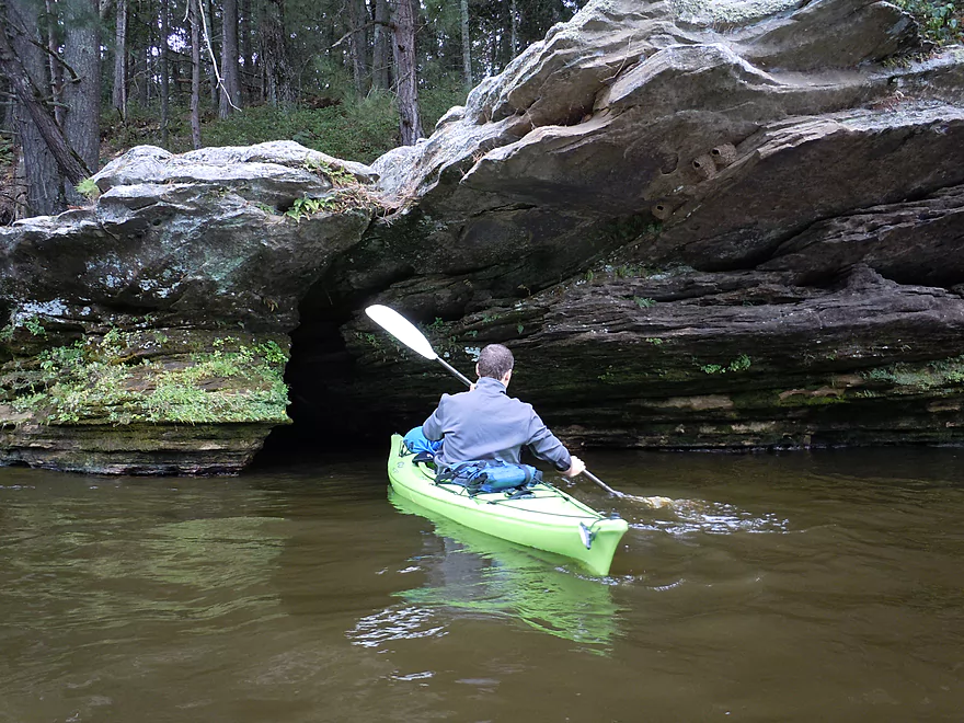
Steamboat Island is your next marquee river attraction. Go left and you’ll enjoy a scenic narrow channel through the bluffs. Big tour boats also love this narrow channel, so be careful. On the left side will be a cool micro-water fall running over stratified rocks.
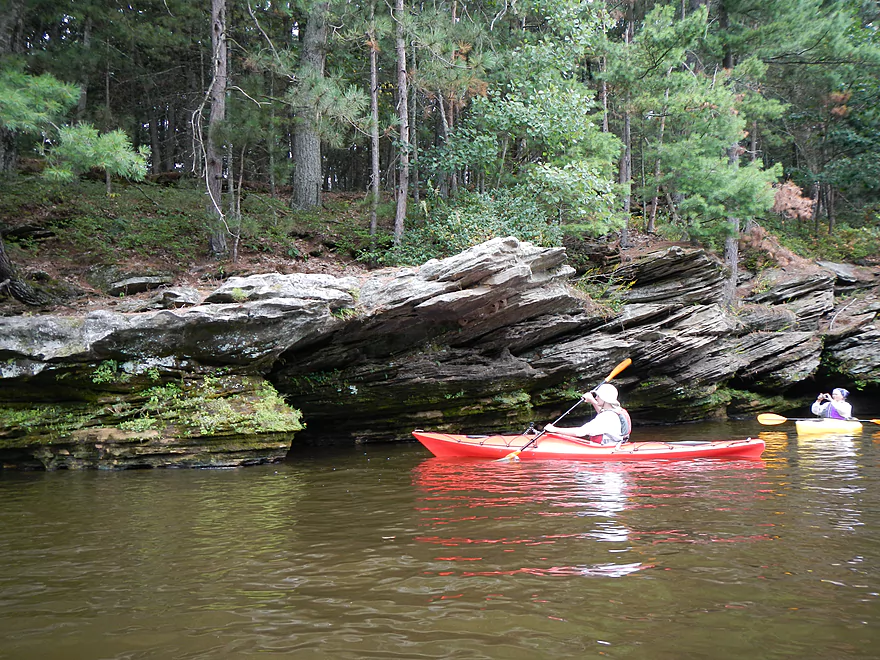
Soon after Steamboat Island, on your right, will be a cool cave that really only a kayaker can enter (I barely fit at 12.5′ though). Don’t get trapped in here while power boats are going by as you could get bounced around inside the cave. It’s kind of hidey, so be on the lookout for it….it has an entrance and exit (see pictures).
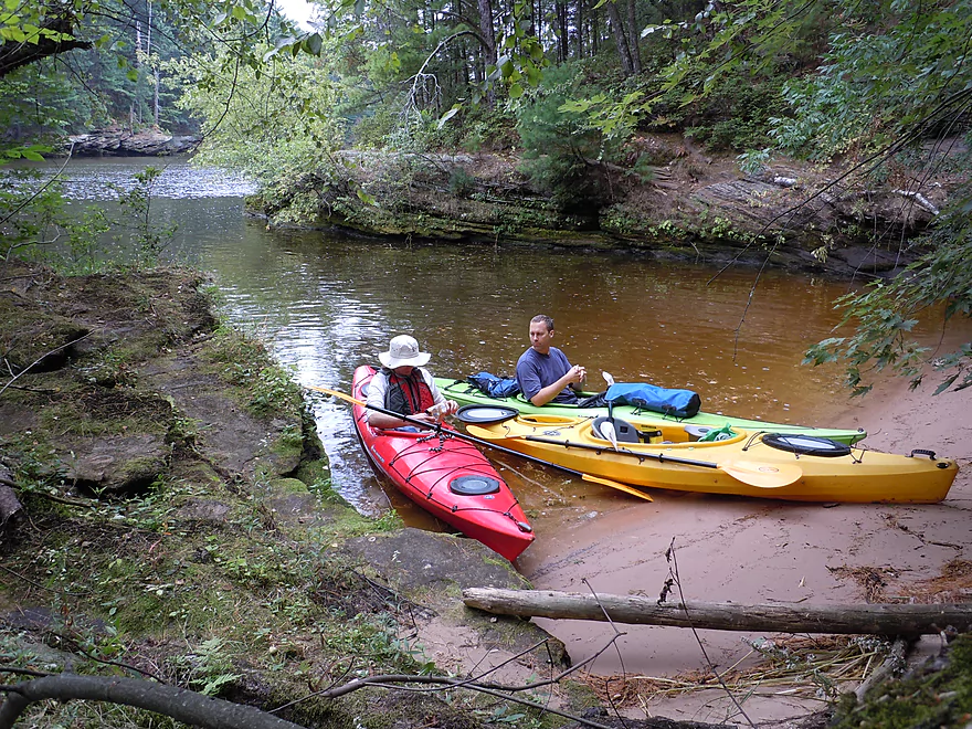
There will be a couple more small bays/gullies you can check out as well on the narrows that can be nice spots for lunch breaks. Your next marquee river attraction will be on your left (right near Black Hawk Island/No-Wake sign) in Coldwater Canyon. Super cool, this is definitely worth checking out, but be very vigilant about tour boats. While you can fit in Witches Gulch just fine with the Tour Boats…this is a tighter fit. And these tour boat drivers can get very upset with smaller boats in these channels (these are public waters though). Definitely try to time Coldwater Canyon when a tour boat isn’t there.
Exiting Coldwater Canyon, you can continue down either the east or west channels of Blackhawk island. I prefer the west channel, and our landing was there for this trip. Blackhawk Island is very nice and I actually liked the river here better than the upper Narrows because the river loses its excess girth and it becomes more intimate. This would have been very cool to see before the dam was put in as it was said to have fierce rapids….you can kind of get an idea from these old pictures here. It also would have been interesting to see the Dells if the plan in the 30’s to make it a national park had gone through.
Blackhawk Island is very scenic on both sides of the river. There is some boat traffic on the west channel but it is light because of the shallow water, which is perfect for kayaks. The no-wake zone around the island really helps a lot (but is ignored by some boats we saw). The Island itself has a super nice trail system that runs around the island and is a great way to experience those bluffs. But, despite the island being public/state property, there are no trespassing signs everywhere and 4H (which is a private institution) is given pretty much exclusive access/control of the island. I asked if I could land my kayak on one of the island docks and explore their trails and they told me no…I would have to sign up for a 4H event and go as part of a large group. Most people don’t realize this…but many of the Dells areas are publicly owned–Stand Rock, Witches Gulch, Coldwater Canyon, Blackhawk Island, much of the Lower Dells… But for the most part there are no trespassing signs everywhere and these areas have been set aside for companies to use largely exclusively.
Take-out west of Blackhawk Island (see map) is very nice. This is one of the few free launches in the Dells area and has a public pull-off area. No bathrooms though. The pull-off area is small and this does fill up in the summer though, so you might want to park your car early here if possible. Editor’s update…this landing has recently been closed (for no good reason). Very tragic…paddlers will now need to continue down to the Wisconsin Dells boat ramp, or portage the dam and take out at the landing below it.
All in all, this is a terrific trip that is absolutely a must do for any serious paddler. You can, of course, extend this trip or loop around Black Hawk Island. There is a public beach just southeast of Blackhawk island, but it is about a mile walk to the parking lot, so that is not feasible for kayakers. There is a public lanuch in the city of Wisconsin Dells (see map), but this does have a fee. Further down, I suppose you could portage the dam, as I believe there is a portage path on your left. People have done it, but I think it might be a decent hike for most paddlers. You may inquire with the local power company regarding the best portage options around the Kilbourn Dam.
For non-kayaking excisions, Stand Rock, Witches Gulch, Grand Cambrian Overlook, and Blackhawk Island are worth checking out. Lost Canyon also is one of the marquee canyons in the Dells, but it requires you pay to go on a horse drawn wagon tour to see it. There is a public trail SE of Blackhawk island that leads down to a beach that is so-so. The trail upstream of this is nicer and leads through a path with very big trees. There is a side-path (that you are not supposed to go on) that leads from this trail to the top of Witches Gulch. This is risky because the rocks up there are so thin, it would be easy to break them and tumble down to your doom. Besides the rest of the upper Dells, the lower Dells are worth checking out for kayaking as would Mirror lake. Spring Brook has some gems but is tough to recommend to the general public because of access issues.
Webmaster’s Update – 2020
Four years ago, UW Extension shut down a key landing on the Upper Dells located at Blackhawk Island because of “safety” concerns. To this day the landing is still not available to the public…but a new “paddle pass” program has been implemented. If you pay five dollars, take an orientation class, and check in at the main office beforehand…then you can put in or take out here.
Quick Overview
- Upstream of Stevens Point: I don't have information yet on these stretches.
- Stevens Point to Lake Petenwell: ~42 miles. This stretch in Central Wisconsin used to have many natural rapids, but most have been buried under 8 dams, some of which are now difficult portages. Despite this there is still some good paddling to be had in this region.
- Lake Petenwell: 14.9 miles. This is a large flowage lake that is challenging for paddlers because of frequent strong winds and big waves.
- Castle Rock Lake: 14.5 miles. Another large flowage lake that is likely too big for enjoyable paddling.
- Castle Rock Lake Dam to Lemonweir River: 9.4 miles. This pre-Dells leg isn't elite, but is a pleasant stretch.
- Lemonweir River to Indian Trails Landing: 21.7 miles. This includes the famous Upper Dells and Lower Dells which feature many scenic sandstone outcrops.
- Indian Trails Landing to Portage: 16 miles. This is an overlooked section sandwiched between the Dells and Portage. While the scenery isn't top-notch, it does have many sandbars and few people, which is a nice combination.
- Portage to Lake Wisconsin: 14.3 miles. This is a neat stretch of the river with many sandbars and cliffs, but the shoreline is very developed and motorboat traffic can be heavy on weekends.
- Lake Wisconsin: 14.5 miles. This is a challenging lake for paddling because of the huge and frequent waves created by motorboats.
- Prairie du Sac Dam to Port Andrews: 57 miles. This is the first half of the famous Lower Wisconsin Riverway. This is a super popular stretch for paddlers with the highlights being large sandbars, big bluffs, occasional cliffs, and fun side sloughs to explore.
- Port Andrews to Wyalusing: 40 miles. This is the second half of the Lower Wisconsin Riverway which has far fewer paddlers and sandbars. But the bluffs and sloughs are larger and more interesting.
Detailed Overview
- Upstream of Merrill: I don't have enough information yet on these legs to comment.
- Merrill Dam to Riverside Park: 0.5 miles. Might include some light rapids below the dam.
- Riverside Park in Merrill to Wisconsin River Forest Landing: 8.6 miles. A good prospect.
- Wisconsin River Forest Landing to Brokaw Boat Landing: 5.7 miles.
- Wisconsin River Forest Landing to Jesse Park: 1.4 miles. A terrific stretch with small boulder gardens, one set of Class 1-2 rapids, gravel bars and a nice sand bank.
- Jesse Park to Brokaw Boat Landing: 4.3 miles. A good stretch with scenic wooded banks and occasional gravel bars.
- Brokaw Boat Landing to Gilbert Park: 5.1 miles. River slows down and becomes hillier. This stretch is an ok prospect and goes past the old Brokaw paper plant that has been shut down. Paddlers must navigate Class 1 rapids and a 2' drop where the old Brokaw dam used to be.
- Gilbert Park to Wausau Boat Dock: 1.5 miles. An impounded stretch through Wausau. There are numerous alternate access options to choose from.
- Wausau Boat Dock to Oak Island Boat Ramp: 1.2 miles. A nice stretch that includes Barkers Island and Isle of Ferns Park. But the Wausau dam does require a portage. This stretch parallels the famous Wausau Whitewater Park.
- Oak Island Boat Ramp to Rothschild Dam Access: 5.8 miles. Likely mostly uninteresting flowage paddling. There are many alternate access options to choose from.
- Rothschild Dam Access to Zimpro Park: 1.0 miles. This might be a nice stretch.
- Zimpro Park to River Road Boat Landing: 7.6 miles. The first half of this leg is likely nice river paddling, but the second leg is probably just an uninteresting flowage.
- Chucks Landing/Mosinee Dam to Bean's Eddy Boat Landing: 2.8 miles. Likely a nice leg. You might be able to launch by the dam where there should be some nice rapids and boulders.
- Bean's Eddy Boat Landing to Seagull Boat Landing: 5.1 miles. Mostly uninteresting flowage paddling. Although there might be some nice sand banks on the eastern shore.
- Seagull Boat Landing to Dubay Dam Access: 5.3 miles. Mostly uninteresting flowage paddling.
- Dubay Dam Access to River Road Landing: 5.5 miles. This could be a nice stretch of river.
- River Road Landing to Old US 10 Landing: 2.3 miles. Likely an ok leg.
- Old US 10 Landing to Stevens Point Dam: 5.6 miles. Probably uninteresting flowage paddling. Many alternate access options closer to Stevens Point.
- Stevens Point Dam to Blue Heron Boat Landing: 4.2 miles.
- Steven Point Dam to Whiting Dam: 2.6 miles. Starts slow and uninteresting, but the river becomes very scenic after the Hwy HH bridge. The rock formations below both dams are very striking. Many alt access points.
- Whiting Dam to Kimberly Clark Dam/Al Tech Park: 0.6 miles. Incredible scenery with exposed bedrock and boulder gardens below the Whiting Dam. Some rapids, but nothing major. The Kimberly Clark Dam is a dangerous low-head dam and should be treated carefully.
- Kimberly Clark Dam to Blue Heron Landing: 1.0 miles. Class 2 rapids below the dam, but after that the river slows dramatically and splits into many sub-channels and islands. Round trips on this leg are possible. I chose the far western channel where there were some nice rocky stretches.
- Blue Heron Landing to Mill Creek Landing: 4.1 miles. Likely a mediocre paddle with nothing special. Galecke Park is an alternate access.
- Mill Creek Landing to Biron Dam North Gate: 7.6 miles. Mostly uninteresting flowage paddling. Several alternate access options on route.
- Biron Dam North Gate to Veteran's Memorial Park: 4.5 miles.
- Biron Dam North Gate to Biron Landing: 1.0 miles. Super scenic stretch by two islands with many granite boulders.
- Biron Landing to Legion Park: 3.0 miles. A nice stretch by Big Island. The west channel is more undeveloped...but the east channel has several scenic granite islands.
- Portage through Legion Park: 680'. A steep wall separates the park from the river but in two locations the wall is short enough to get over (see map). Paddlers may want to consider a longer portage to bypass some of the shallow rocky stretches by Legion Park.
- Legion Park to Veteran's Memorial Park: 0.4 miles. A scenic stretch that features a large boulder field and the powerhouse for a large paper mill.
- Veteran's Memorial Park to Port Edwards Landing: 3.8 miles
- Veteran's Memorial Park to Demitz Park: 0.8 miles. A pleasant stretch that includes Belle Island.
- Demitz Park to Ben Hansen Park: 1.2 miles. This leg goes by Garrison Island and Edwards Island. Lyon Park is located across the river from Demitz Park and is another access option.
- Ben Hansen Park to Port Edwards Landing: 1.8 miles. Above the Centralia dam there are several small but nice islands. Portage the dam on the left bank (follow the 1000' trail through the golf course). Below the dam there are scenic rock formations. Close to the Port Edwards dam are a few more scenic islands you can explore.
- Port Edwards Landing to Nekoosa/Riverside Park: 3.6 miles.
- Port Edwards Landing to Port Edwards Powerhouse: 1.3 miles. A half-mile portage is required (east bank). A very scenic boulder field is located below the dam. At high levels, the rocks are submerged and produce a half-mile stretch of rapids (some strong).
- Powerhouse to Moccasin Creek Landing: 1.8 miles. A generic wooded stretch that isn't super interesting.
- Moccasin Creek Landing to Riverside Park: 0.5 miles. During the Nekoosa dam drawdown, this stretch had nice boulder fields and rapids.
- Riverside Park to Hwy 73: 0.8 miles. An ok stretch of the river. There are scenic cliffs south of Hwy 73, but these are past the dam warning line. Hwy 73 is not a good access option.
- Hwy 73 to Point Basse Ave (Portage of the Nekoosa Dam): 1.5 miles. A difficult 1.5 mile portage through downtown Nekoosa. Don't try to portage the south bank. There is a steep hill, cliffs, and large Domtar paper mill fences to deal with.
- Point Basse Ave to Jim Freeman Memorial Boat Landing: 0.8 miles. A generic stretch going by historic Point Basse. If you're willing to backtrack to the dam, you can see scenic boulder fields (during low flows) and a few cliffs. Point Basse Ave is a somewhat speculative access, but it seems public and doable for launching.
- Jim Freeman Memorial Boat Landing to Plank Hill Small Boat Access: 2.0 miles. A generic stretch.
- Plank Hill Small Boat Access to 19th Drive Landing: 5.3 miles. Features two epic sand banks. The main channel has some minor sandbars. Several of the side sloughs can provide fun side adventures.
- 19th Drive to the Petenwell Dam: 14.9 miles. This is Lake Petenwell which is a large and challenging lake for paddling. Waves and strong winds are frequently an issue. But when calm there are nice sandbanks on the northwest shore, hidden sloughs, and large islands to explore. See the overview map for more info.
- Petenwell Dam to Ganter Lane Landing: 3.8 miles. This stretch isn't too impacted by dams and may have nice sandbars at low levels.
- Ganter Lane Landing to Castle Rock Lake Dam: 10.7 miles. Castle Rock Lake is likely too big (wind/waves) for enjoyable paddling. There are many alternate launch options along the shore.
- Castle Rock Lake to the Lemonweir River: 10 miles. An ok section.
- Lemonweir River Mouth to River Bay Landing: 7 miles. The first half of the classic Upper Dells.
- River Bay Landing to Blackhawk Island: 6.5 miles. Second half of the classic Upper Dells, known for its fantastic outcrops. Note, the Blackhawk Island landing is no longer accessible without special permission from the Upham Woods Outdoor Learning Center.
- Black Hawk Island to Wisconsin Dells Dam: 2.0 miles. More nice sandstone outcrops. You can take out at a public ramp off Indiana Ave or portage the dam and take out SW of the dam by a launch off Wisconsin Dells Pkwy/Hwy 12.
- Dells Dam to Indian Trails Landing: 6.2 miles.
- Dells Dam to Newport Park: 2.2 miles. This is the heart of the famous Lower Dells with many scenic outcrops. Unfortunately jet boats are a serious plague on this stretch.
- Newport Park to Indian Trails Landing: 4.0 miles. Features the famous "Sugar Bowl" formation and four super cool caves. The outcrops soon disappear and this stretch is mostly uneventful (but peaceful) big river paddling.
- Indian Trails Landing to Pine Island Boat Ramp: 9.8 miles. Few paddle this stretch as it isn't as interesting. But...it does have a good concentration of sandbars and few competing paddlers for them.
- Pine Island Boat Ramp to Portage/Hwy 33 Access: 6.0 miles. Not an elite section that is lacking in cliffs and bluffs. It does have good sandbars though.
- Portage to Dekorra Park: 7.7 miles
- Portage to Baraboo River/Thunderbird Road: 5.2 miles. A good section with great sandbars. Close to Portage there are few motorboats.
- Baraboo River to Dekorra Park: 2.5 miles. River splits around massive Lib Cross Island. West channel has nice sandbars. St Lawrence Bluff has scenic sandstone outcrops and includes a cave you can paddle into.
- Dekorra Park to James Whalen Memorial Park: 6.6 miles.
- Dekorra Park to Camp Rest Park: 5.1 miles. A terrific section with rock outcrops, large island deltas, hidden sloughs, and nice sandbars. Unfortunately this part of the river is popular with motorboats and jet skis which can be a plague. Multiple alternate access options.
- Camp Rest Park to James Whalen Memorial Park: 1.5 miles. Not a great section because of the open water paddling, powerboats and big waves. The west shore though does have nice outcrops.
- James Whalen Memorial Park to Merrimac Memorial Park: 4.4 miles. River turns into "Lake Wisconsin". Generally speaking this isn't ideal for kayaking as motorboat traffic can be heavy and waves can be surprisingly big. The most direct route is the north shore which has a few bluffs, but generally speaking isn't that interesting.
- Merrimac Memorial Park to Veterans Memorial Park/Prairie du Sac: 9.6 miles.
- Merrimac Memorial Park to Moon Valley Landing: 3.3 miles. Includes a lot of developed shoreline. The ferry, railroad bridge, and Moon Bay are highlights.
- Moon Valley Landing to Veterans Memorial Park/Prairie du Sac: 6.3 miles. Other than Moon Bay and the dam, this is a boring stretch. There are numerous alt access options on this route.
- Prairie du Sac to Mazomanie: 8 miles. An ok section of the Wisconsin but lacking in sandbars.
- Mazomanie to Arena: 9.7 miles. A great section with nice sandbars and scenic bluffs.
- Arena to Hwy 14: 8.0 miles. Good section with a high concentration of sandbars. One of the more popular legs on the Lower Wisconsin.
- Hwy 14 to Hwy 23/Spring Green: 2.2 miles. Neat mini-section with sandstone outcrops. Very popular in the summer.
- Spring Green to Lone Rock: 7.4 miles. Another fine sandbar/bluff section with some nice rock outcrops too.
- Lone Rock to Gotham: 8 miles. This stretch has super impressive rock outcrops and sand banks.
- Gotham to Muscoda: 7.6 miles. This leg includes more large sandbars and great outcrops. Bonus highlights include fast current and not seeing as many people.
- Muscoda to Port Andrew: 7 miles. A good stretch with many islands and sandbars.
- Port Andrew to Boscobel: 9 miles. Wooded islands start to get massive.
- Boscobel to Woodman/Big Green River: 9 miles and start of the less paddled stretch of the Lower Wisconsin. Far fewer sandbars from here to the mouth, but good bluffs and side sloughs to explore.
- Woodman to Millville: 7.7 miles. A good stretch with large bluffs and sandbars.
- Millville to Bridgeport: 5.3 miles. Huge islands, bluffs and sandbars are the highlight on this second-to-last leg on the Wisconsin River.
Bridgeport to Wyalusing (the mouth): 9 miles.
Trip Map
View Upper Dells - 2 in a larger map
Overview Map
Video
Photos Size:
For the last few weeks my partner and I were planning a paddle on the Wisconsin River. We had seen a few beautiful photos online from the water, including the glens like Witches Gulch and Coldwater Canyon, and knew we needed to check this place out. Your blog post was BY FAR the most helpful resource we could find! There’s so little information out there about this waterway… and not unintentionally, I think. The boat tour industry certainly seems to have a monopoly on the area. Thank you so very much for all the photos and detail you provided about this trip. We went this past Friday and I already want to go back.
By the way, the take-out beside Blackhawk Island is indeed inaccessible now. We went to check it out first and a fence has been built there. Ironically, when we pulled up with our kayaks atop the car, a gentlemen waved us down and told us about how he’d enjoyed this paddle many times, but on his most recent trip, he actually got arrested for trespassing at the landing. What a ridiculous shame, in my opinion. You’d think law enforcement would have higher priorities to attend to. Anyways, I digress. The river was even more gorgeous than we thought it would be. Thanks again for your resource, it was a fantastic help!
Thanks for the great comment!
Yes it is so tragic that that landing was shut down as its location was so important. Ironic as this is technically government land and should be public anyways.
I do this trip with slightly different put-in and takeout that I think makes for even a better trip as it cuts off some of the lake paddling and you start directly across for Witches Gulch. It is about a 2-3 hour paddle, and the shuttle is only about 4 miles so it makes for a great bike shuttle, plus both the launch and take out are free and open to the public,a rarity in the Dells area. I recommend putting in at the Upper Dells Kayak launch and taking out at the Illinois St Bridge at the mouth of Crandall’s Bay, just before the dam.. The put in is marked as “61st landing” on your map, and is a really beautiful place to launch,as it has a nice level beach in a fairly sheltered cove. It is DNR land with facilities, a big paved parking lot, and an old paved road down to the water, but it appears to be closed at the present time. I am not sure if it is due to covid 19, or budget cuts, but all the buildings are locked and the gate to the big parking is chained and locked. There is another small parking lot just outside the main gate with room for 6-8 cars and room for more cars along the road. It is about a 300 yard walk to the landing, and you have to go around 2 gates, but it is all downhill on an old blacktop road, so it is really quite easy if you have a cart. The fantastic scenery starts right at the launch and is non stop for the entire trip with lots of stuff to explore. I have only done this trip in the late fall, after the tourist season is pretty much over, so I can’t speak to what it would be like in high season,with Jet boats,Ducks, and tour boats, but on a sunny late fall day it is a truly spectacular trip. An additional thing to note is that this trip includes an area called the Narrows, that can be a bit turbulent in certain conditions. Luckily this section can be easily avoided by simply going around Black Hawk Island. The take out will be on river left, once you see the dam and start seeing buildings, you can either go under the Illinois St Bridge and then left into a little marina where they have a nice floating kayak launch, or just before the bridge there is a small beach that is just steps a small free parking lot.
Thanks for the tips. The put-in you refer to is pretty good…but it would mean a longer trip. I need to scout the new take-out by Illinois Ave. Another option would be to take out at the dam itself…just take out by the portage path on the left and hike up the public parking lot (but it would be a long hike).
The following is a recent video/map reply of a recent trip on the Upper Dells done by Eric Guderyon: https://www.relive.cc/view/vKv2yowDG4q It’s done in late October but there is still some nice color on the cliffs. The Dells can be a terrific fall paddle.
Put In – Upper Dells Kayak Launch (61st st)
Take Out – Upham Woods
Date – Fri Sept 12, 2025
The put-in required a state park sticker and required carrying our boats down a long incline (very doable, though).
The Upham Woods take out works well – you just need some advance planning (call a day or two ahead of your trip). We drove by before the office closed at 4:30, the day before our trip, and talked to someone there who directed up to the website to register for the Paddle Pass program.
https://uwmadison.co1.qualtrics.com/jfe/form/SV_9GZaNBdZv5MSWlU
The concern here is that they want to manage interactions between children and the public… so they want to know when you are coming and going and keep the public separate from the children as much as possible. Our trip was on a Friday in September and a group of kids had just left. We had use of the restrooms in the main building.
The bike shuttle was a breeze – just a couple miles, not too much traffic and one big incline.
Boat traffic was minimal, as it was a weekday in September. We saw a couple fishing boats, a couple jets skis and some tour boats, but no jet boats.
Aside from Chula Vista and a few docks, you don’t see any buildings on shore… gorgeous run! Wildlife consisted mainly of ducks, and maybe a couple turtles. We took the north & west route around Blackhawk island… it was good to get in the shade after padding south into the sun for so long.
Beautiful trip!
Thanks for the comment and the updated information on the Upham Woods launch!