
Starting the trip at Riverside Park
Where there is a long hike to the canoe landing
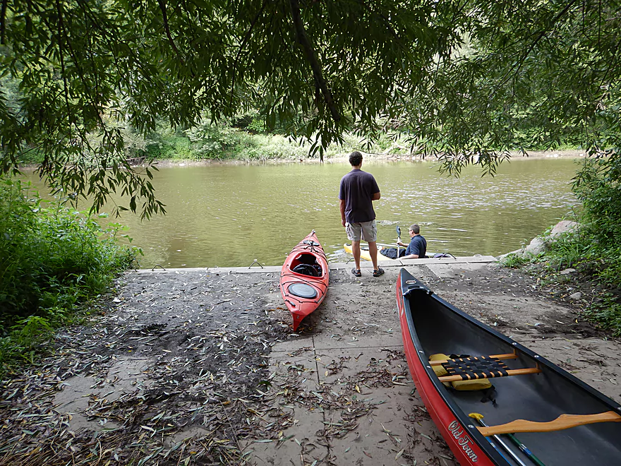
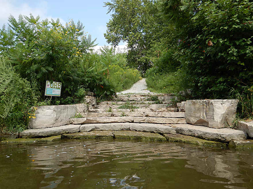
Nice landing area
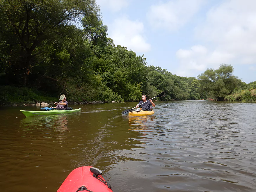
The first mile of the river was quite wooded
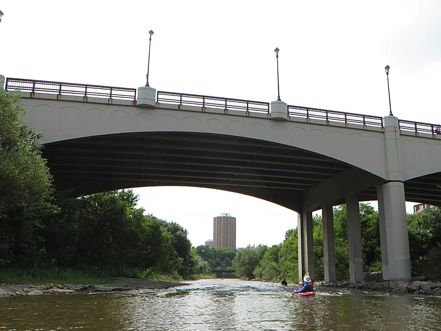
Coming up on North Ave
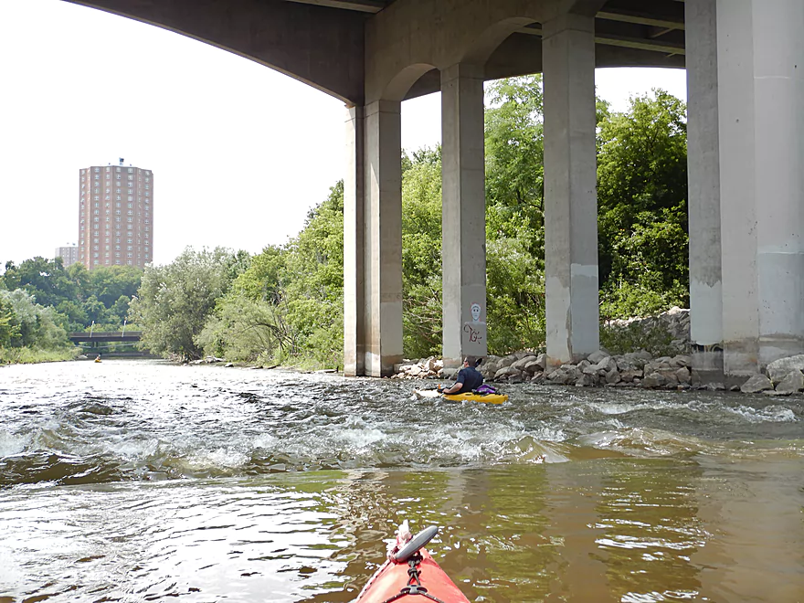
Where there are rapids underneath
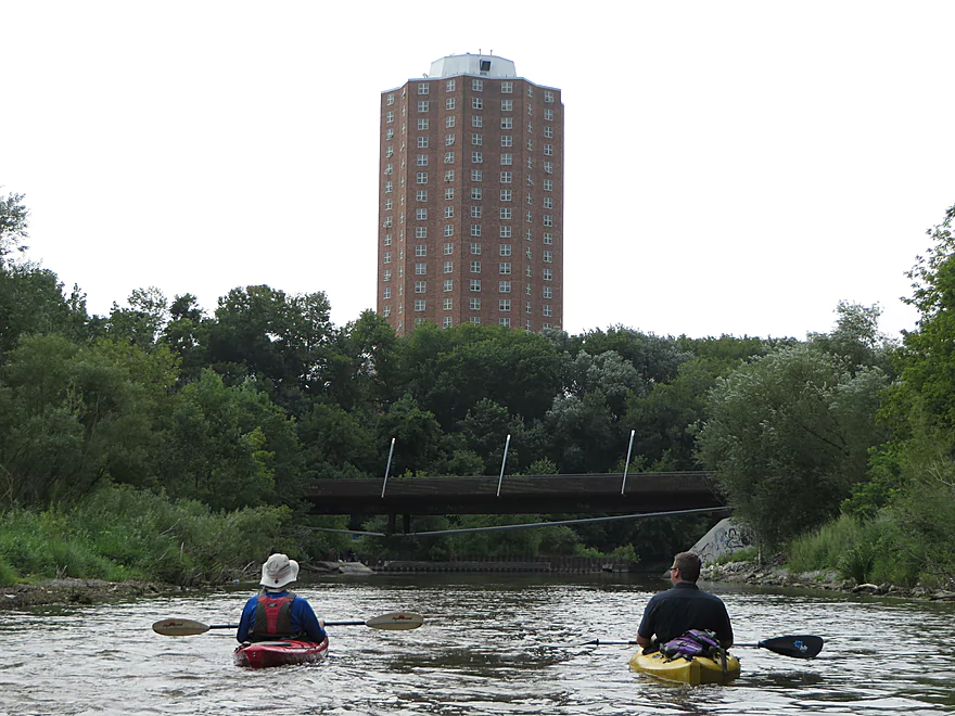
Riverview Apartments
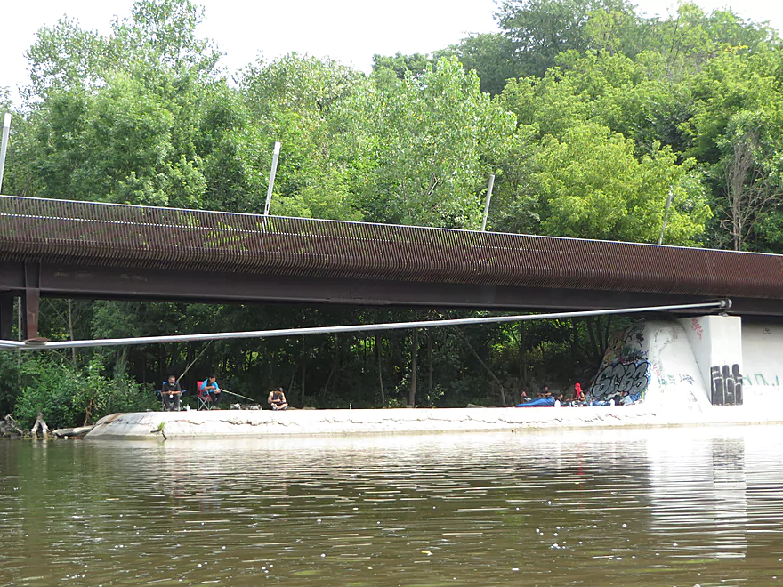
There were homeless camped out at Caesars Park by the dam remnants
The Kiwanis Landing is an excellent access
No more woods…entering a residential district that is relatively new
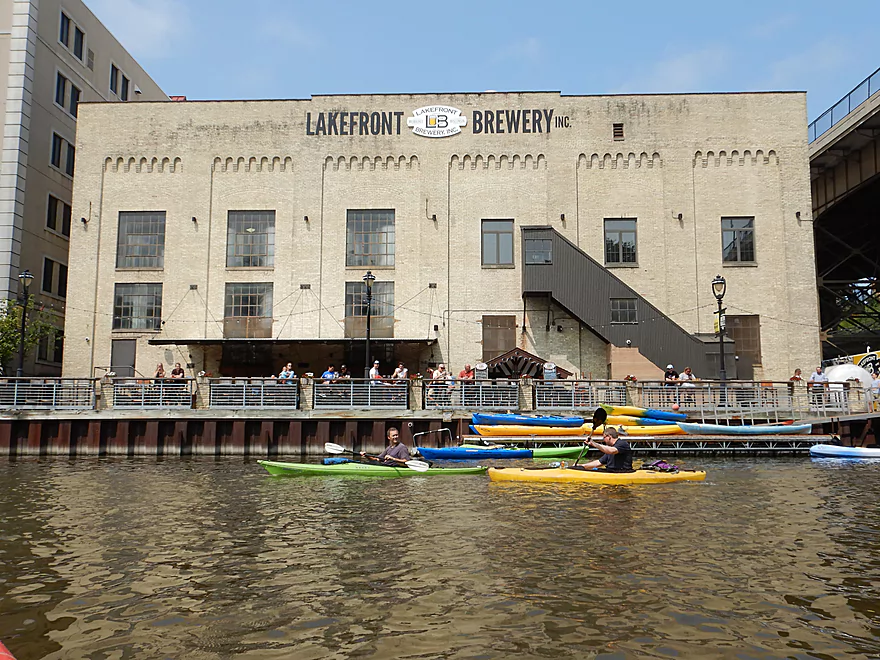
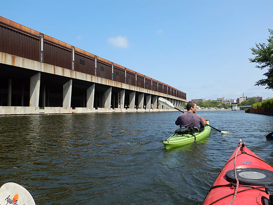
Lakefront Brewery is popular with paddlers
A suspension trail bridge was added under Holton Street
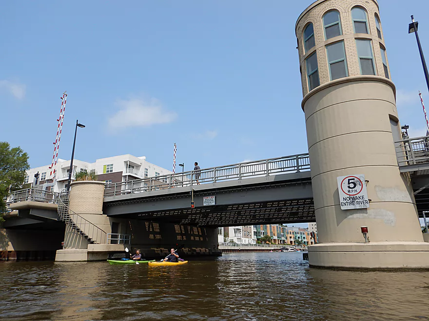
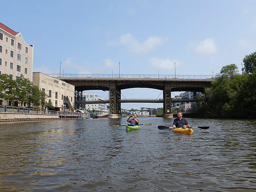
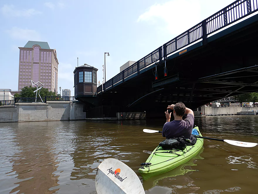
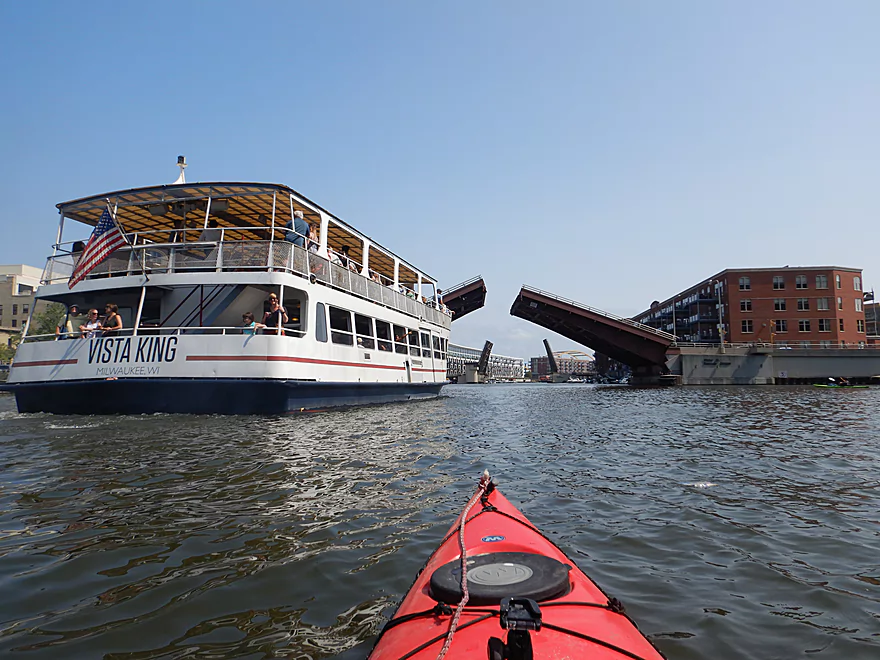
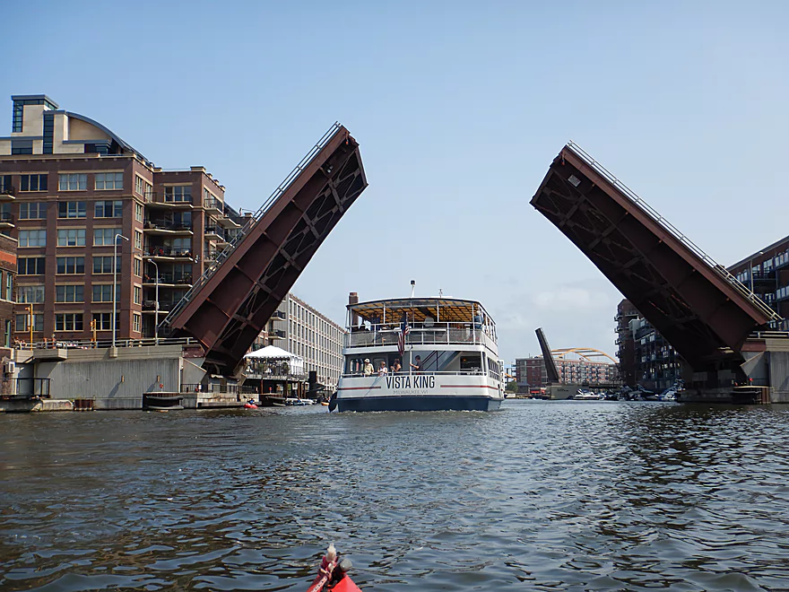
The first of many movable bridges
A really well done mural
Looking back at the channel
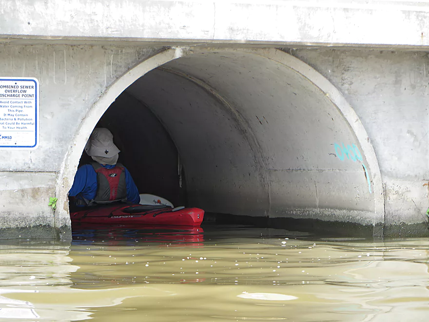
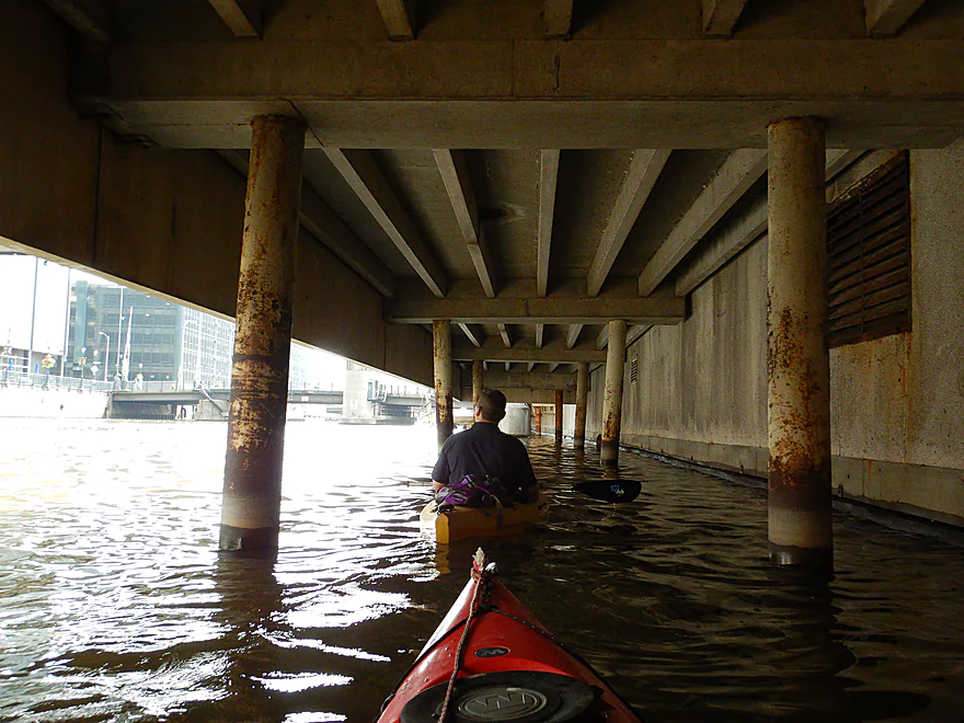
If you want to, you can paddle up the sewer pipes some ways
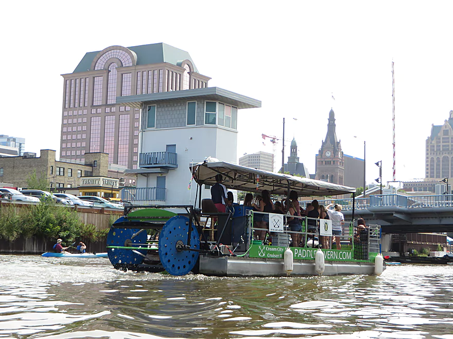
These pedal-powered pontoons were everywhere
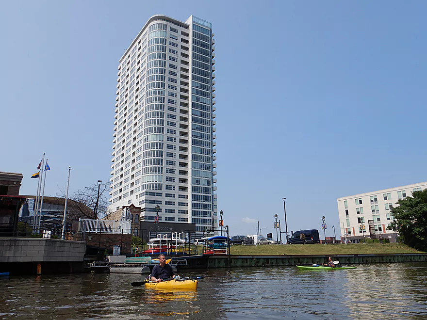
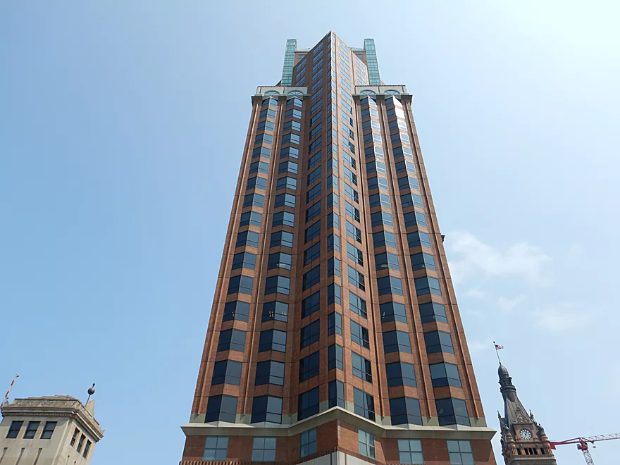
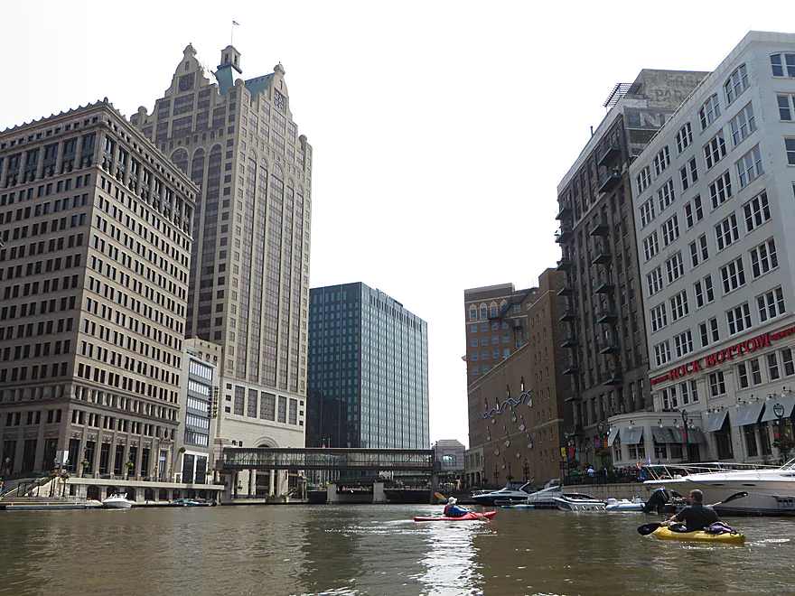
University Club Tower…4th tallest building in the state
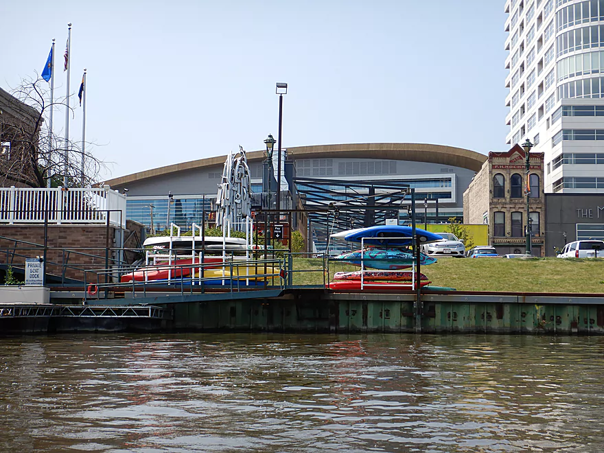
The new Bucks arena is right next door
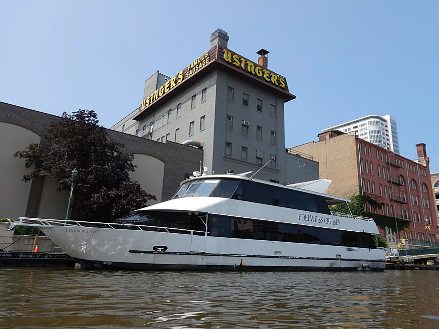
A local sausage factory
The bridge operators have these little huts
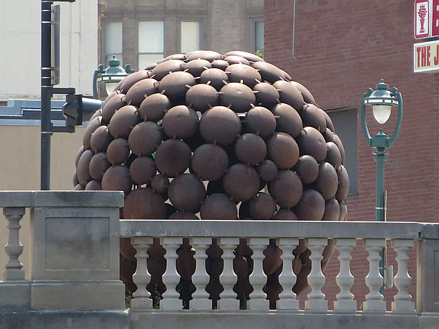
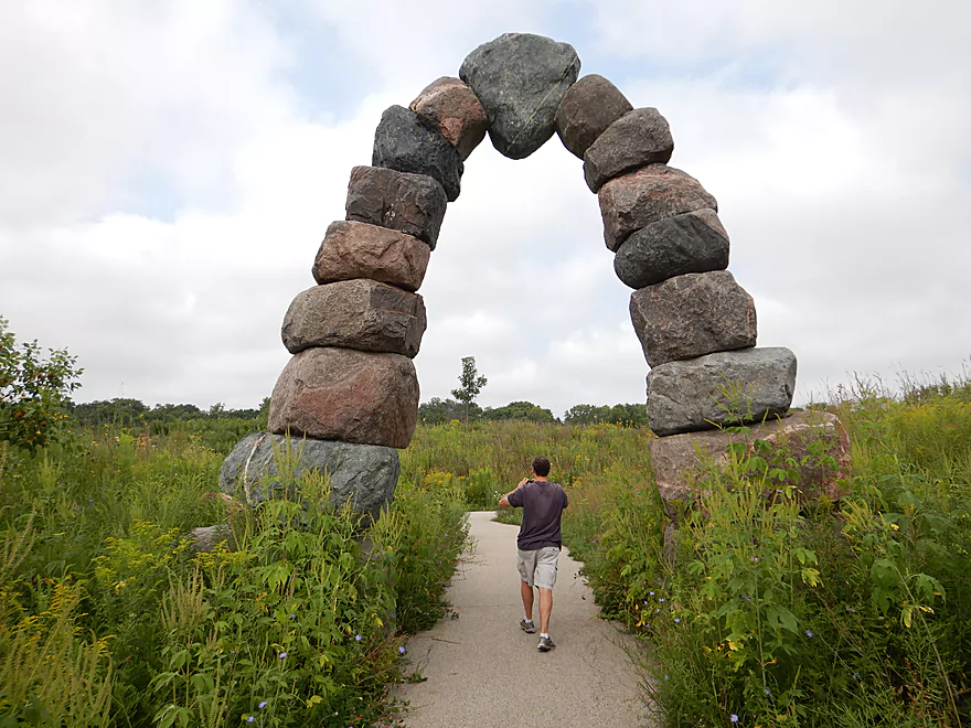
Neat sculpture
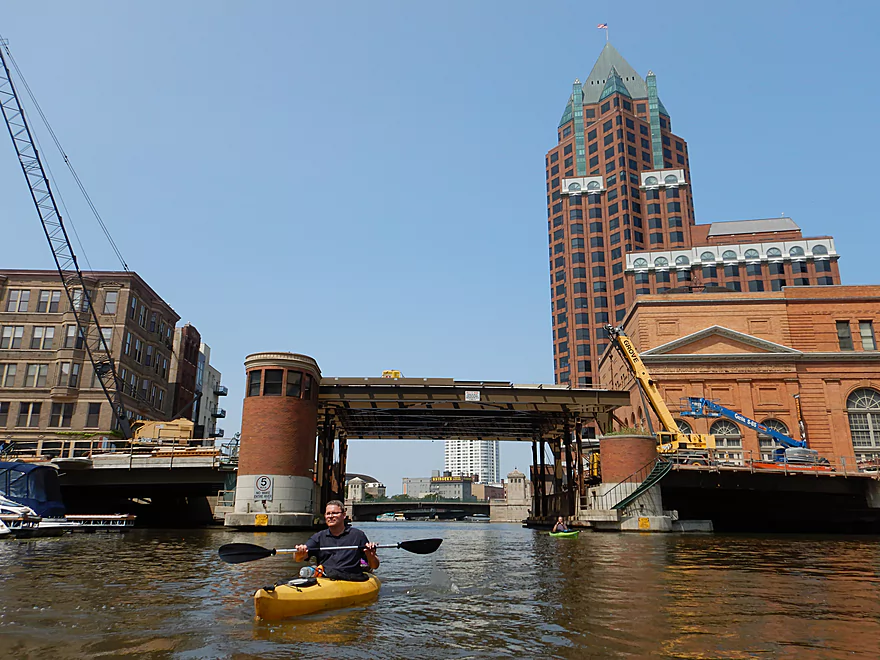
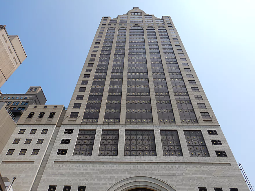
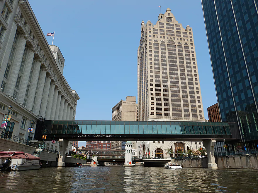
The Milwaukee Center (5th tallest in the state)
A lift bridge under construction
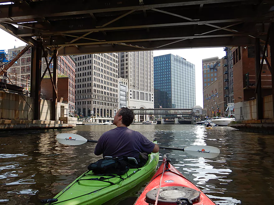
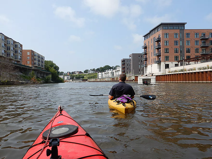
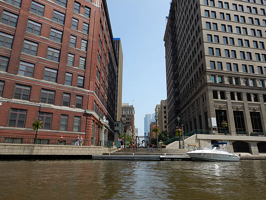
Entering the downtown area
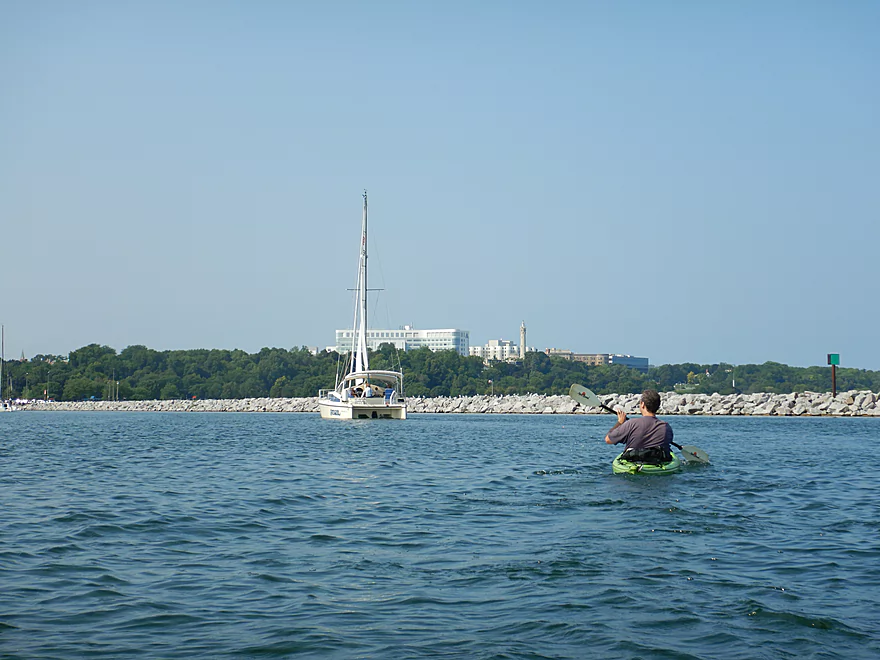
Best part of the trip
Cool vista looking down Mason Street
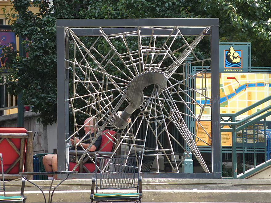
There were many attractive sculptures along the banks
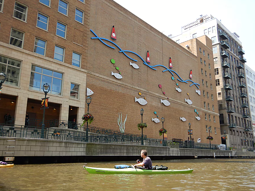
This fish mural used to light up at night
The “100 East Wisconsin” building (3rd tallest in the state)
Kayaks were everywhere
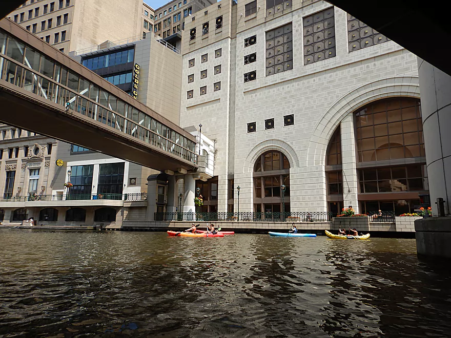
Paddling under the Milwaukee RiverWalk
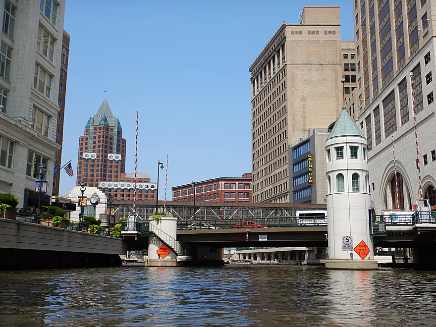
These downtown bridges were constantly closing and opening
A nifty skywalk
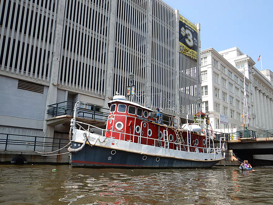
An attractive tug
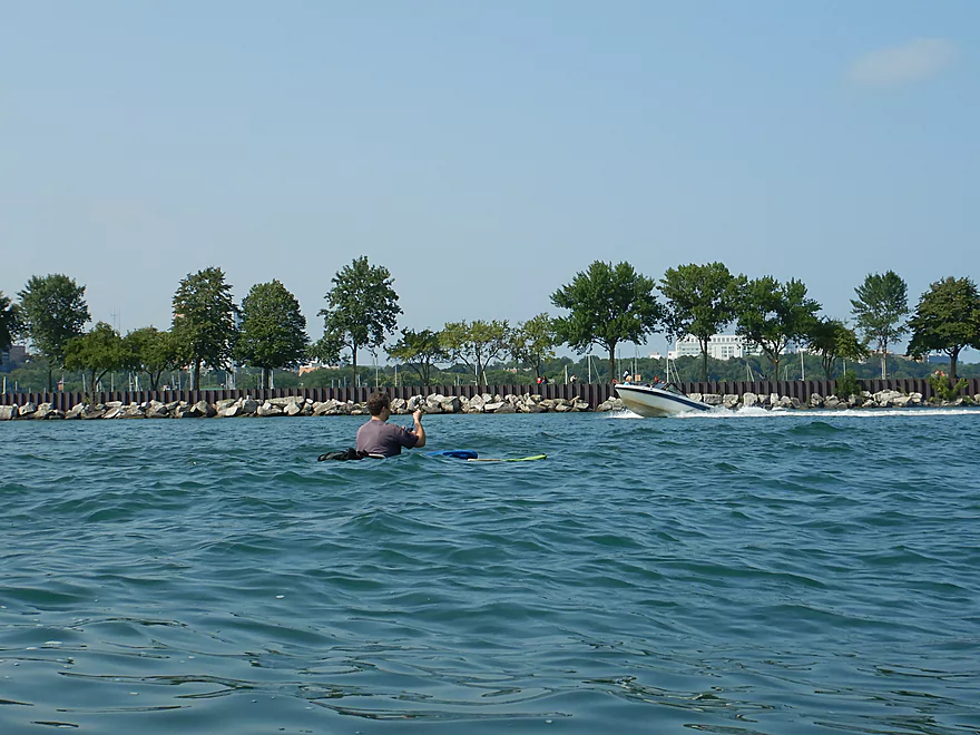
I am trying not to get run over here
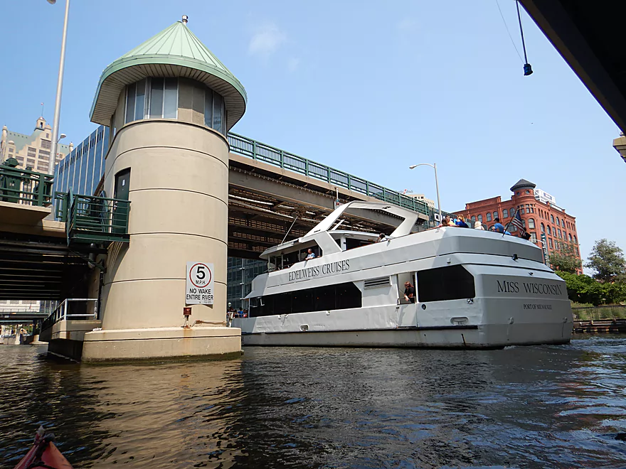
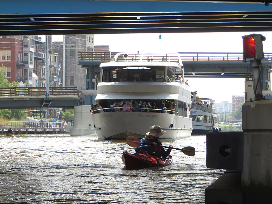
One of the bigger boats going under one of the bridges
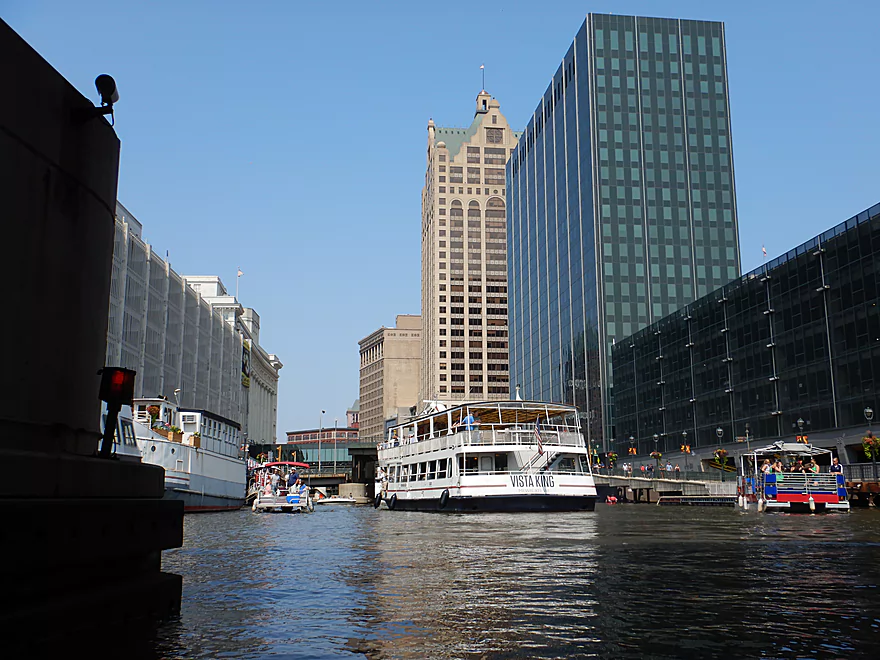
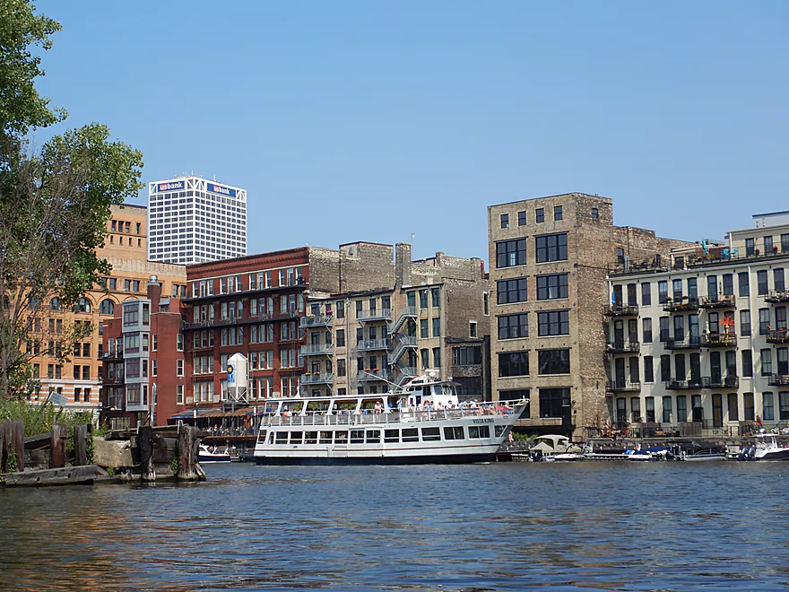
Quite the sight seeing these tour boats in the downtown
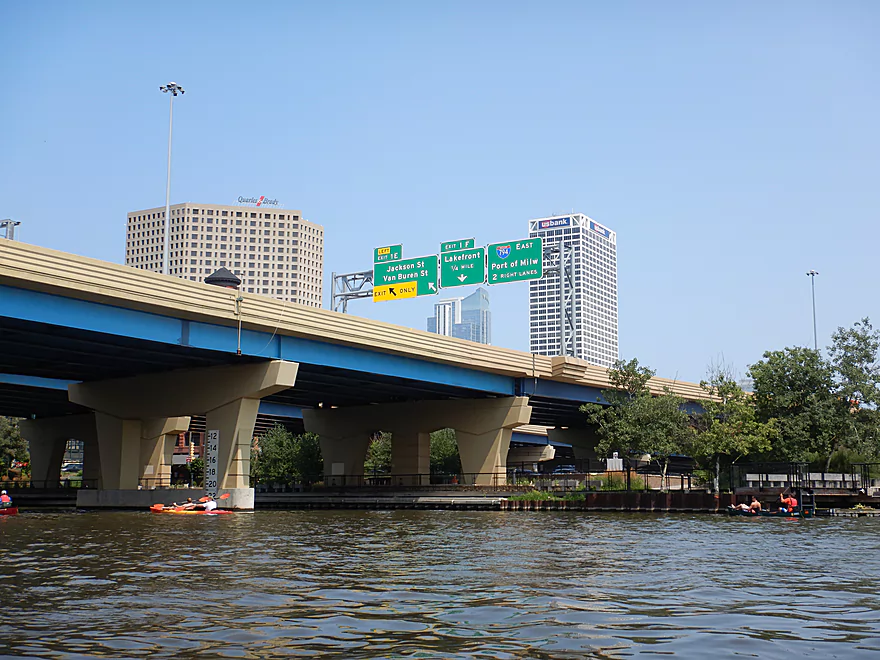
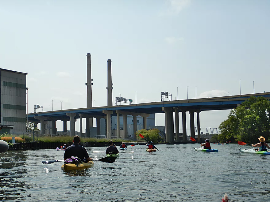
Paddling under I94
Starting to leave the main downtown behind
Now entering the historic Third Ward
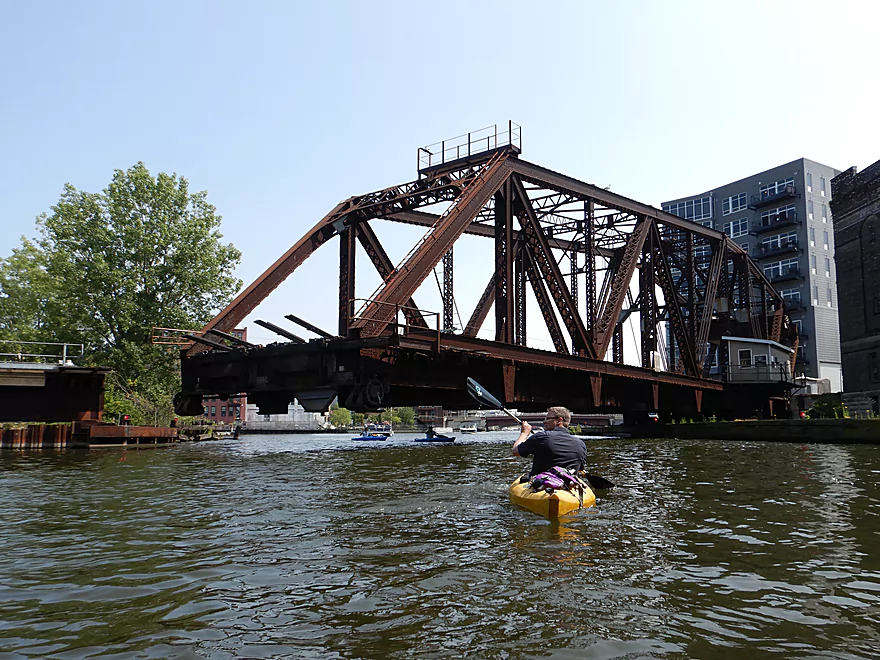
Where there is a huge swing bridge over the Menomonee River
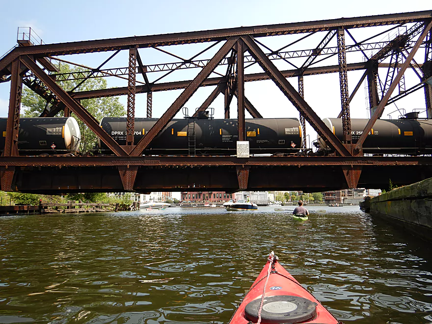
The train waiting patiently for the bridge to close
Pretty cool
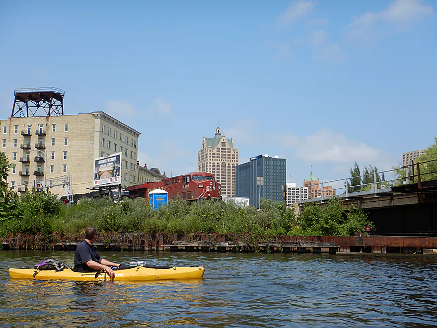
Exploring upstream on the Menomonee River
A huge 1000 foot long post office
We turned around at the Marquette Interchange
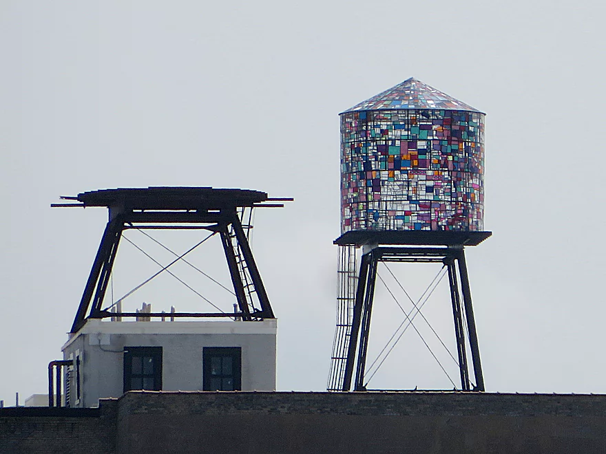
A glass water tower
Plenty more movable bridges
Paddling the last stretch of the river
One of many boat tour companies
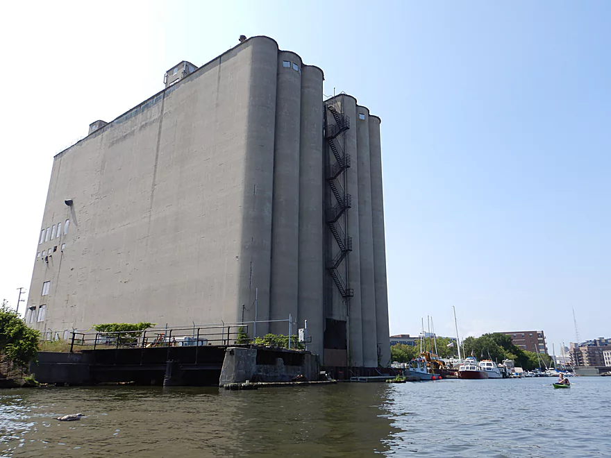
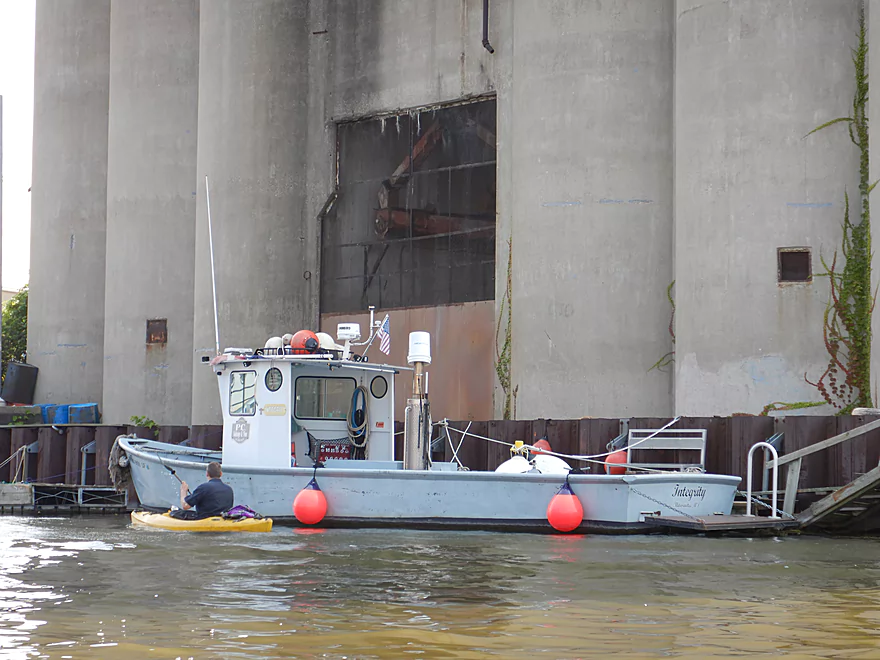
A huge abandoned grain elevator
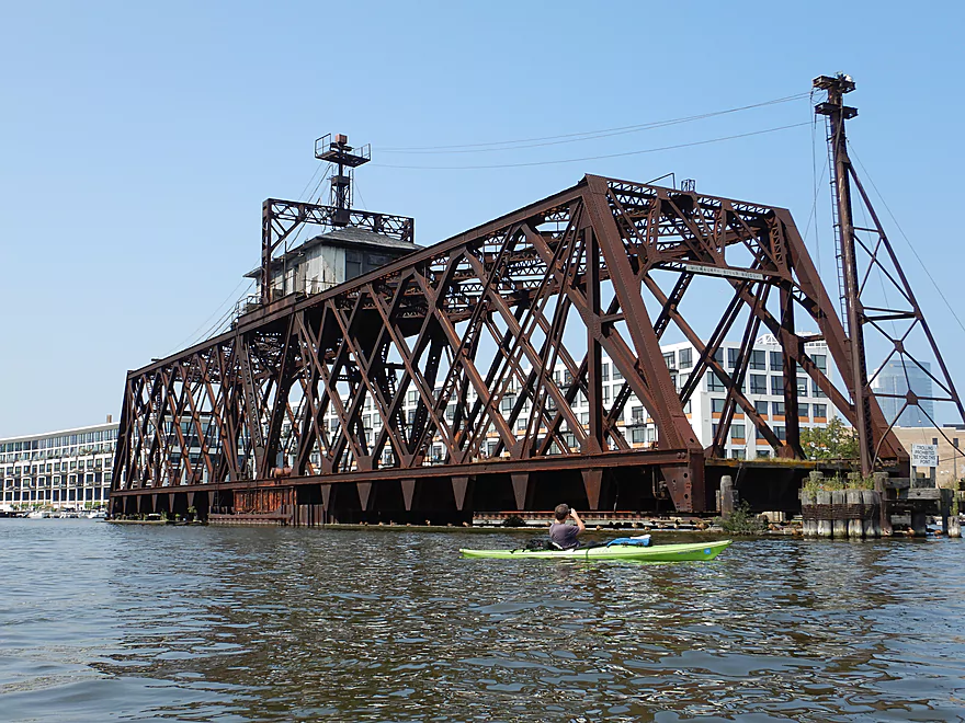
It used to be serviced by this large swing bridge
Trains no longer enter the silo
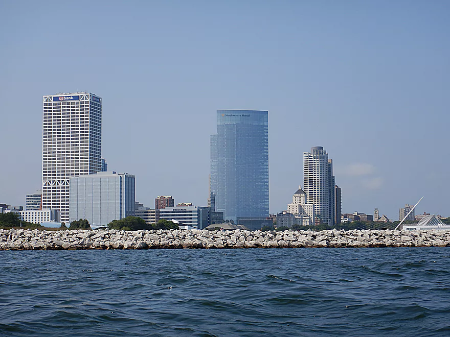
US Bank Center and the Northwestern Tower (1st and 2nd tallest)
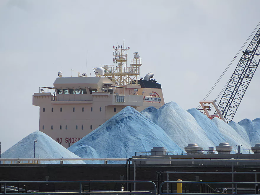
Approaching the docks…a large freighter is in the background
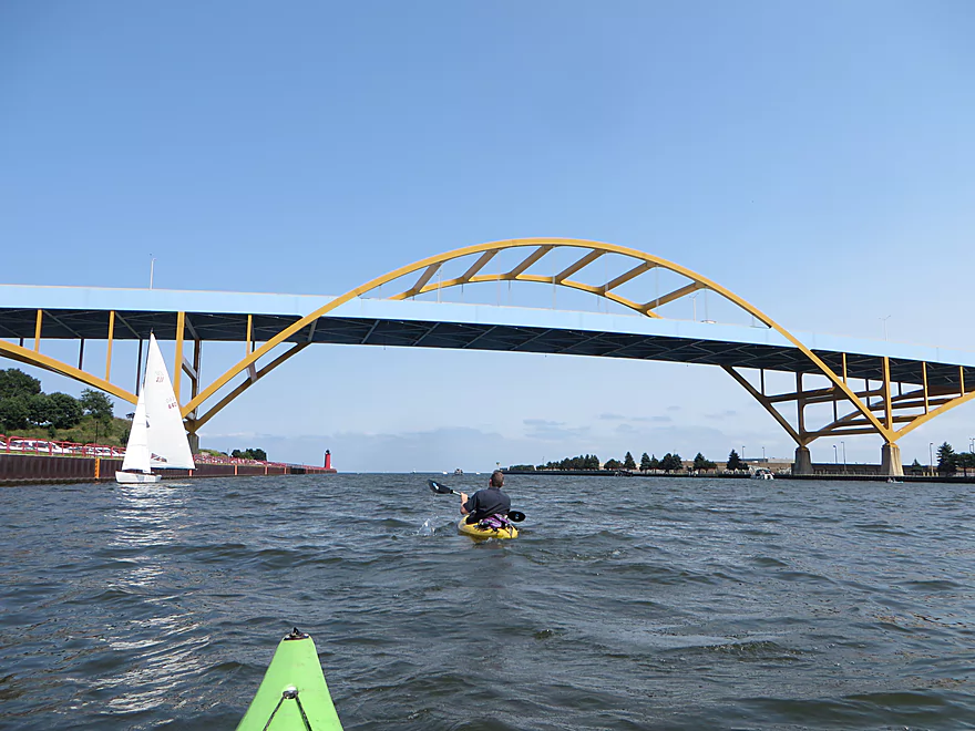
Paddling under the Hoan Bridge
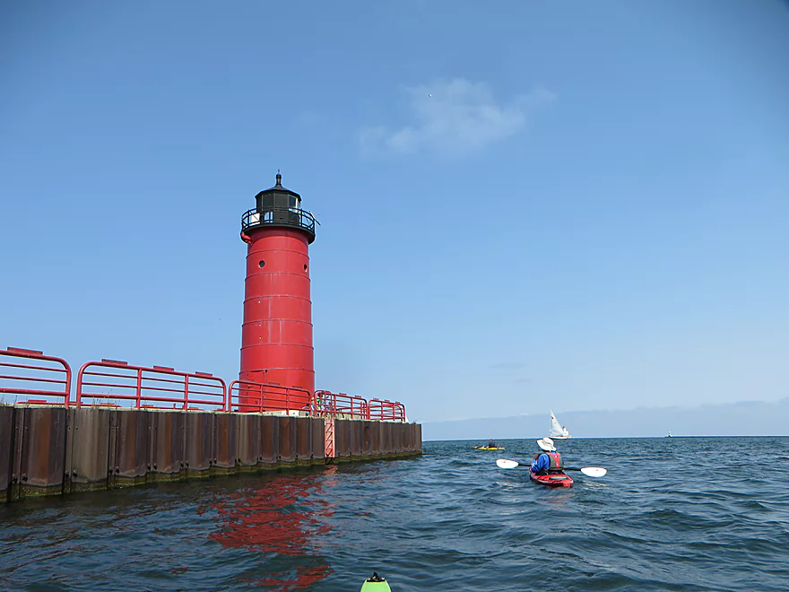
The Pierhead Lighthouse is still active
Finally on Lake Michigan
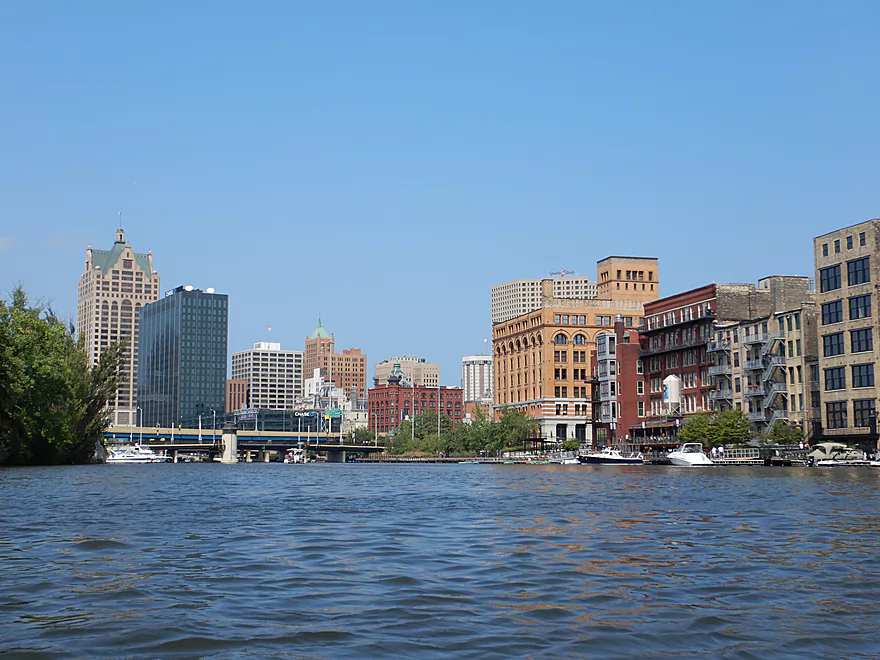
A hazy but good view of the downtown
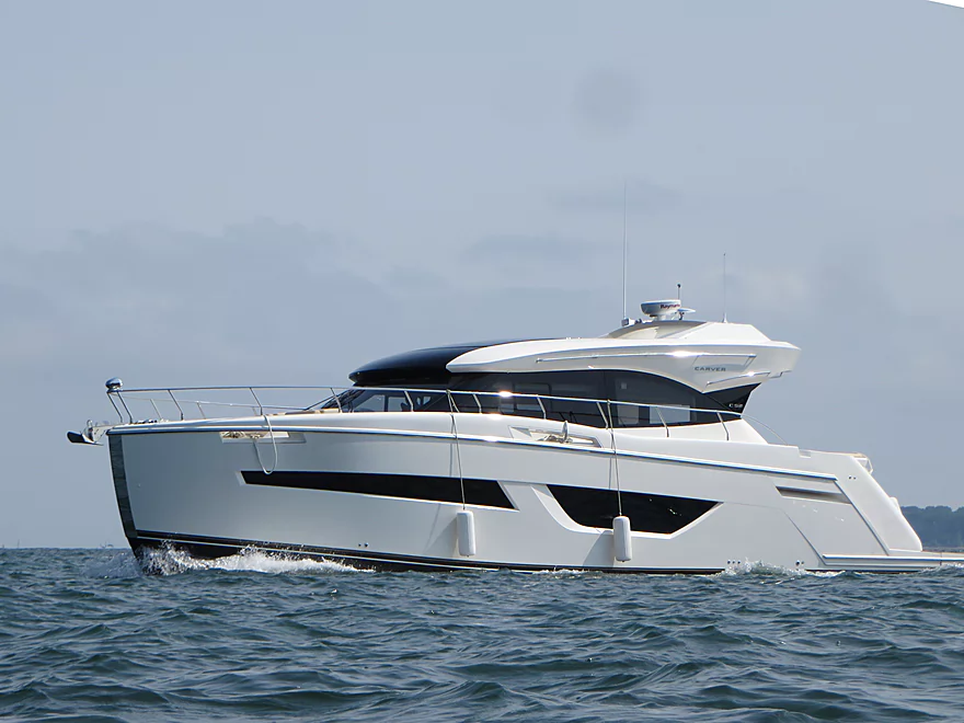
Boats like this created huge wake
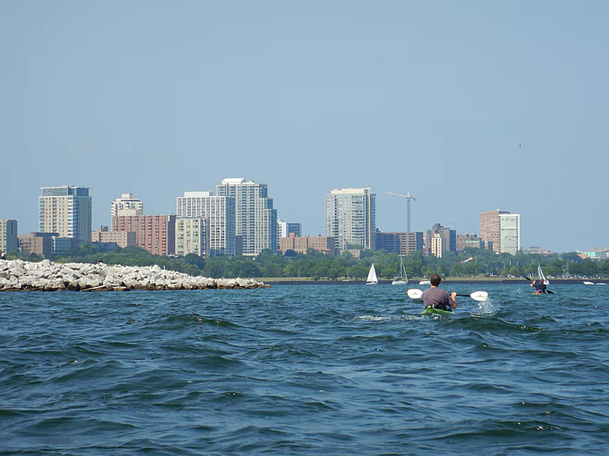
Paddling toward residential high-rises on the Lower East Side
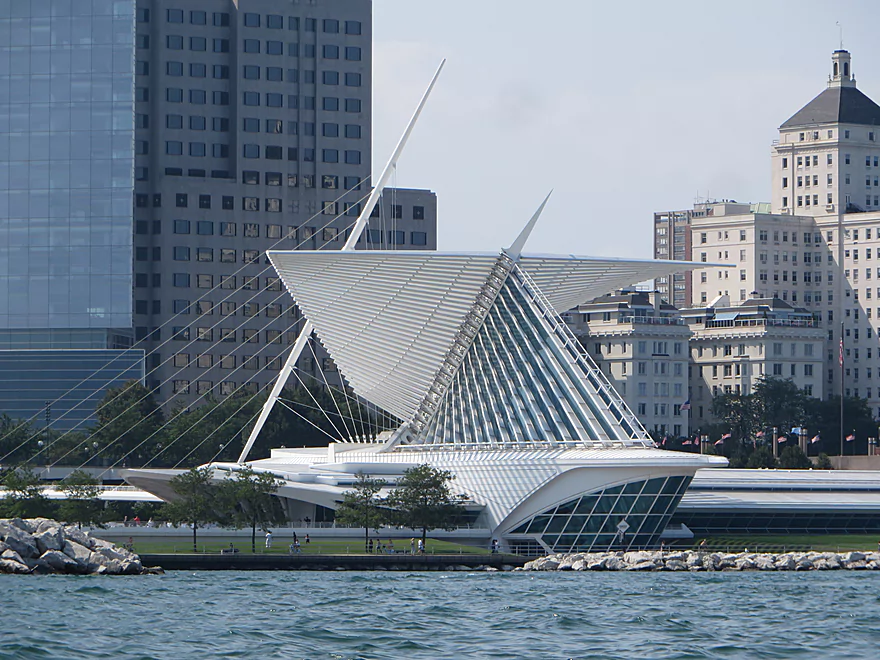
The Milwaukee Art Museum
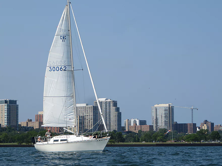
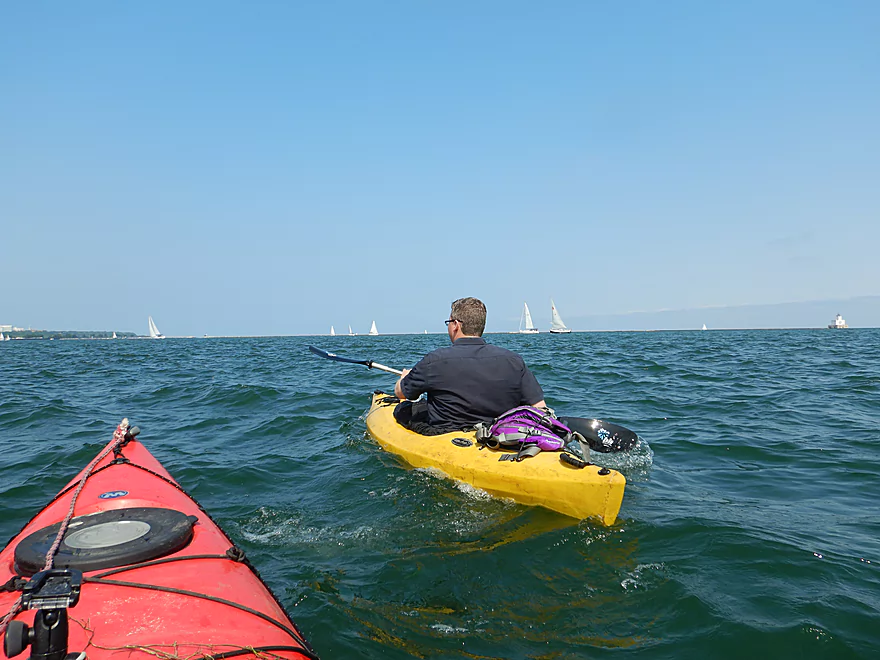
We saw countless sailboats
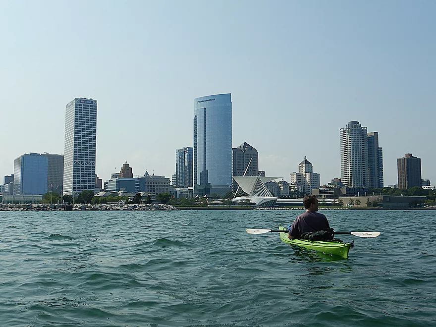
Another view of the downtown
Pictures do not convey how bouncy the waves were
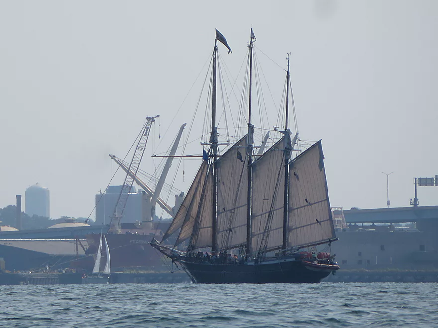
A 19th century replica schooner
Paddling along the north edge of the breakwater
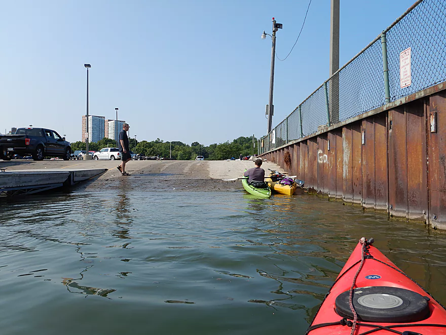
Taking out at McKinley Marina
Milwaukee River – Downtown

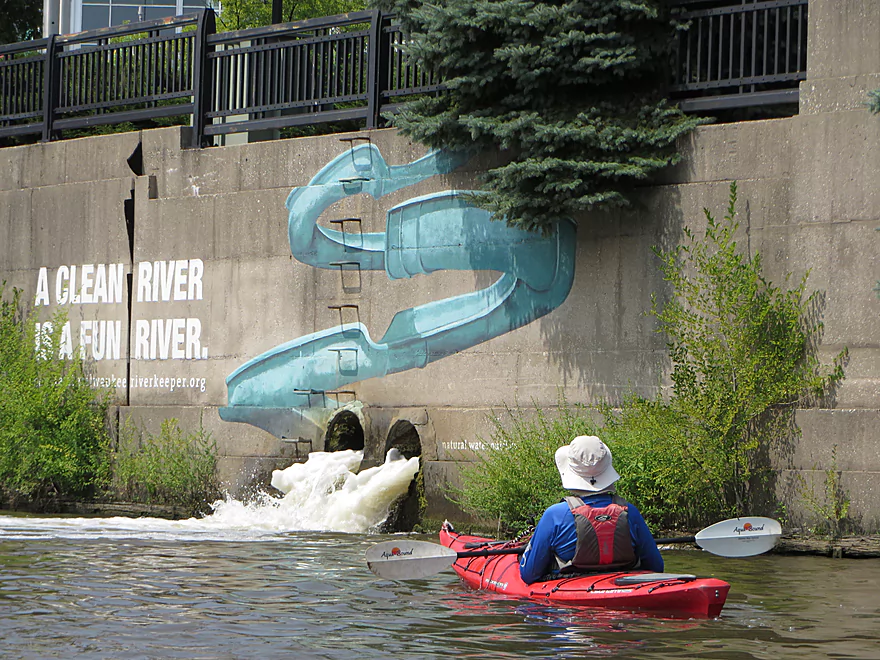
We started our trip at Riverside Park where we followed a confusing nature trail to reach a public canoe launch. Despite being in the heart of Milwaukee, the first mile was a wooded oasis and surprisingly undeveloped. Things got interesting when we reached North Ave and encountered some rapids. While at high levels these can be dangerous and must be portaged (east bank), they were easy for us at our low levels and only Class 1. In fact a canoe ahead of us went down them sideways… Another surprise was under the Caesar’s Park bridge where we saw some homeless people and their sleeping bags. Near this park is the old Lake Michigan canal that was used to flush the river of pollutants, but the pipe didn’t look large enough to paddle up.
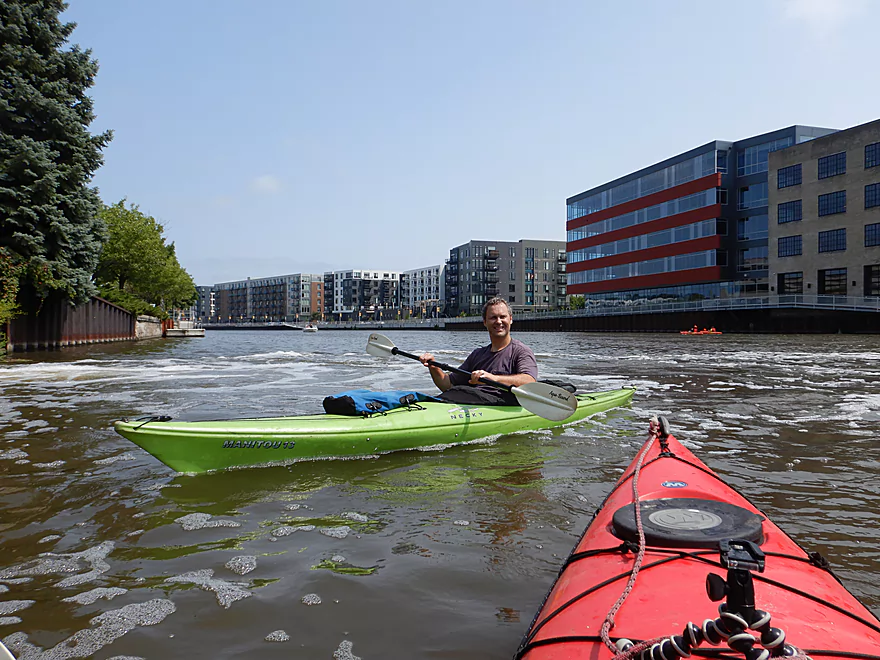
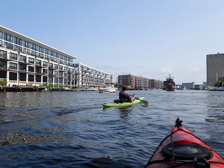
Past Humboldt Ave, the shoreline became heavily developed and we lost most of our trees. Traditionally, the Milwaukee River served as a kind of socioeconomic divide, with the more affluent living east of the river, but there has been a recent development surge on the west side of the river that has resulted in many new expensive apartments and trendy restaurants. Here the river has a frenetic energy to it and was bustling with kayakers, powerboats, and huge tour boats. Most did not seem to mind the occasional MMSD discharge pipes that empty into the river. One tunnel was quite large and we could have paddled quite far into it had we wished. Humboldt Ave also marks the start of the fantastic Milwaukee RiverWalk which is a scenic public trail system that hugs the river continuously all the way to Lake Michigan (map).
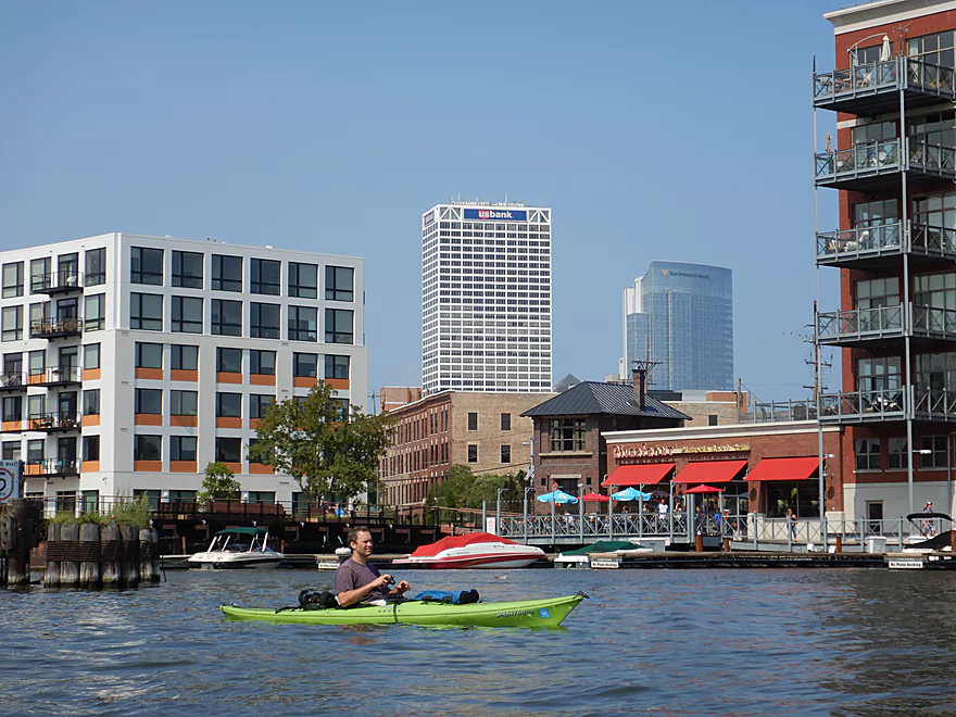
Past Knapp Street, the buildings became much larger and we started seeing our first skyscrapers. We saw eight of the ten tallest buildings in Wisconsin just on our paddle! One of the first was the University Club Tower (446′), and just below it a strange asymmetrical building that turned out was the new Milwaukee Bucks stadium. The two best skyscrapers were the “100 East Wisconsin” building and the “Milwaukee Center” which are both close to the water and have really cool pyramidal roofs. Also visible from the water were many attractive sculptures including a wall with fish on it and a glass water tower. The river in the downtown portion was quite deep, thanks to extensive dredging which allows large tour boats upstream access.
Milwaukee is unique in that it has a large number of movable bridges (2nd only to Chicago). Basically the bridges are too low for large boats, yet by law must yield to them. This results in many bridge openings including 23,000 in 2017! There are three types of movable bridges, and we saw them all in action. There were lift bridges that went straight up like an elevator, there were drawbridges that separated in the middle and angled up, and then there were swing bridges which spun on massive turrets to let traffic through. The most entertaining bridge was at the mouth of the Menomonee River where a large railroad swing bridge swung sideways to let a train over the river. This was quite the operation and involved large gears and a shim system to seal the bridge connection.
Adventurous paddlers can continue up the Menomonee River if they wish (there is no appreciable current here). Noteworthy sites include several side canals and a strange abstract looking building that is the Harley Davidson Museum (there is a decent access option by the dock here). More impressive was the 1000′ long post office which was the largest I’ve ever seen. We paddled up to a spaghetti tangle of elevated ramps known as the Marquette Interchange before turning around. The upstream portions of the Menominee River can be an interesting paddle and go by Miller Park, bit does have its challenges.
Back on the Milwaukee River, we passed under more movable bridges and by what appeared to be a huge abandoned grain silo next to a large and unused swing bridge. At the mouth of the Kinnickinnic River we got to see Jones Island which serves as a port for the big freighter ships. We did see one freighter docked next to some huge piles of sand, but none on the lake. In theory you could explore upstream on the Kinnickinnic but it would be very industrial, polluted, and not as interesting. Interestingly, although the Milwaukee River enters Lake Michigan on the north end of Jones Island, this is actually an artificial channel that was dug in 1857. The original mouth was at the south end of Jones Island.
While we could have ended the trip at the Bruce Street Launch, we decided to paddle past the Hoan Bridge to check out Lake Michigan. The Hoan Bridge was quite striking and towered 120′ over our heads. Recently several supports failed and the bridge almost collapsed, but these have since been repaired. Once we passed the lighthouse we were officially out of the Milwaukee River and onto Lake Michigan…well kind of…as we were in a large breakwater. But really the breakwater didn’t help much as the waves would just bounce off the rock walls and back into the bay…this was all made worse by powerboaters who created massive wake. We got bounced around pretty good by 2 foot waves. On the plus side we did have a great view of the downtown, the Milwaukee Art Museum, the residential high rises of the lower east side, and even a 19th century replica schooner. The trip concluded at McKinley Park which was a decent public access option.
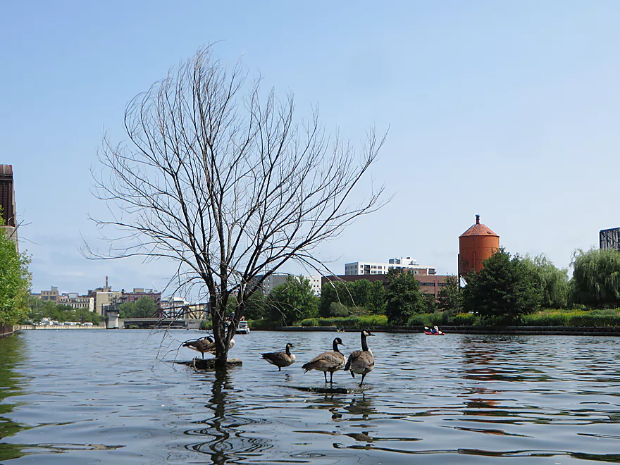
We did see many geese, a bank beaver den, and some freshly caught trout on hooks. One of the more impressive sights was seeing a gull drag a dead fish (roughly its size) out of the water and onto the pier for a snack. If you time this trip right (say mid-October) you can see large salmon trying to spawn upriver.
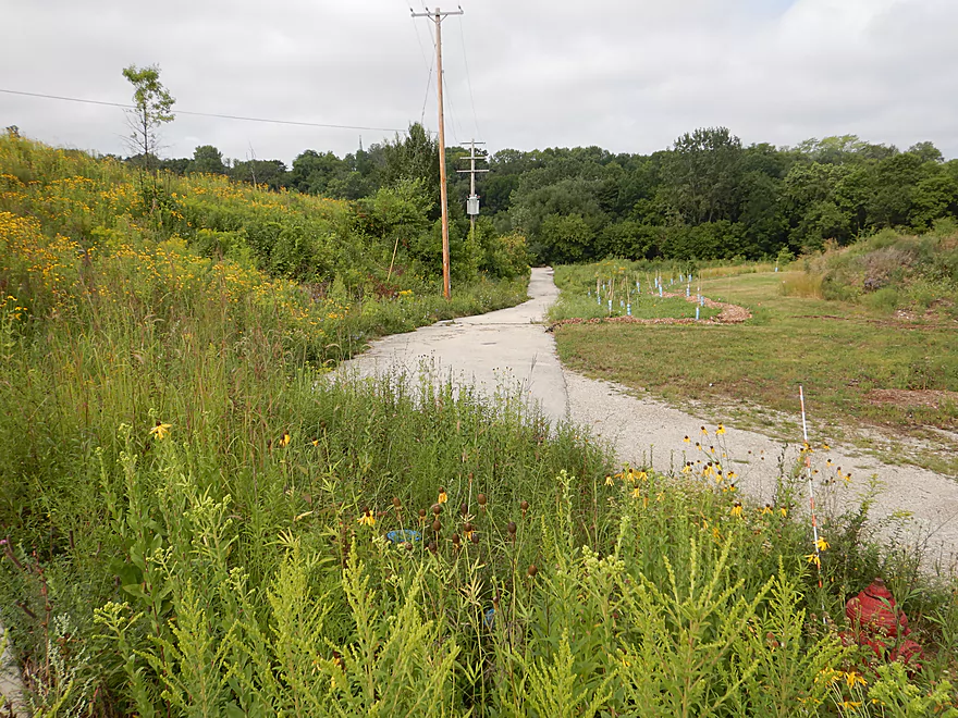
We started the trip at Riverside Park. At the end of E. Park Plaza and just west of the Urban Ecology Center is a public parking lot with no fees. From there we followed a trail system 900′ to reach the water. It may seem odd to have to walk so far to reach the waterfront, but other canoers were doing the exact same thing. Otherwise this is a good access with decent privacy. I do suggest studying a trail map ahead of time so you don’t get lost.
An alternative upstream access would be Estabrook Park which would add 3.1 miles to the trip. That segment would lack the scenic architecture of the downtown but have some fun rapids.
There are numerous alternative downstream access options. See my overview map for more ideas. All things being equal, I do suggest putting in where we did (Riverside Park) as it will include all of the downtown plus the fun rapids under North Ave.
We took out at McKinley Marina which was an ok public access. There are two parking lots…the one to the north is free and open to the public. The one to the south has gated access and you will need to show your permit, or you will be ticketed. You do have to pay to use the boat launch (roughly $7). The nice thing about McKinley Marina is, it is just far away enough from the summer festival grounds that its parking lot usually doesn’t fill up. Also, by taking out here we were able to extend our trip onto Lake Michigan which has scenic vistas of the downtown.
A very good alternative access would be the Bruce Street public ramp located at the mouth of the river. This would allow you to paddle the entire downtown stretch, but skip 2.5 miles of Lake Michigan which can on occasion be rough. There should be parking nearby, but you will have to pay to leave your car here.
There are numerous other upstream take-out options. For more information, see my overview map.
Bike Shuttles: From McKinley Marina to Riverside Park is an excellent bike shuttle. It is only 2.0 miles and be entirely on the scenic Oak Leaf bike trail. If you take out at Bruce Street (which I suspect most would), then this would mean a longer 3.9 mile shuttle and require some road pedaling in the busy downtown…but there are many bike lanes and sidewalks which can assist bikers.
Commercial Shuttles: While there are a number of commercial kayak rental locations, I’m not aware of any that shuttle. However, if you have your own boat, you can simply lock your gear at the put-in, drive to the take-out, leave your car, and use Uber or a taxi to go back to the put-in.
Commercial Rentals:
- Milwaukee Kayak Company: A popular rental business with multiple locations. I don’t believe they do shuttles so you would be required to do a round-trip. You might be limited to 4 hours. Base cost is $35. Call 414-301-2240.
- Brew City Kayak: I believe this is also a rental only business. They cost $40 for 4 hours or $70 for a full day. I don’t believe they allow you to paddle on Lake Michigan. Call 414-939-5443.
- Urban Ecology Center: Members are allowed free access to a fleet of kayaks and canoes conveniently stored by the Riverside Park landing. Annual membership is $35. They do not allow you to paddle on Lake Michigan. Call 414-964-8505.
- Clear Water Outdoors: Another rental only place. Rates vary from $25 to $100 based on your time on the water.
Edelweiss Boats: A popular boat tour company with routes along the Milwaukee River and Lake Michigan Shoreline. Costs $19.
Milwaukee Boat Line: Another tour boat company that explores both the river and lake, but also features live narration. Their boats are huge. Costs $19.88.
Riverwalk Boat Tours: This tour company uses much smaller boats (in essence large pontoon boats). Most of their cruises seem to have a bar theme. Costs $10-30.
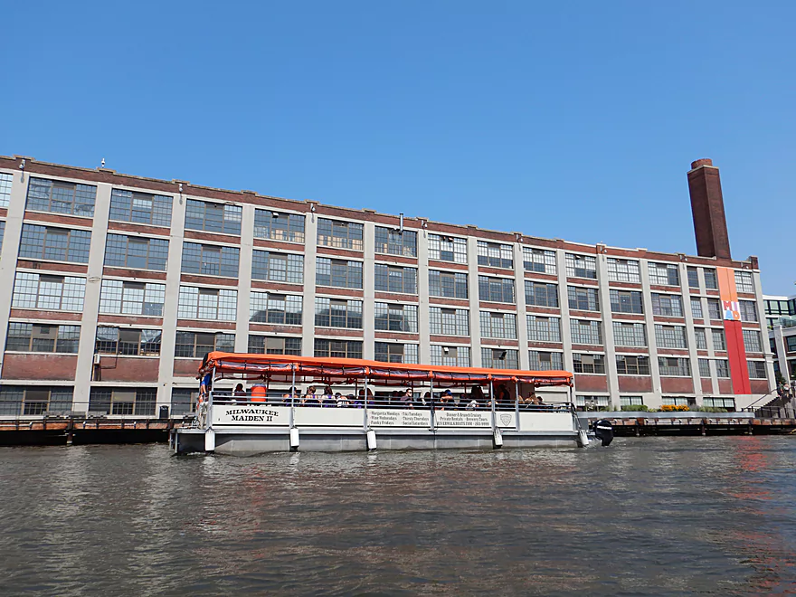
Milwaukee Paddle Tavern: We saw more of these tour boats than anything else. Basically they are pontoon boats where the crew (that’s you) power a paddle wheel with pedals. This would be novel…except it appears the outboard engines do most of the work. These cruises have a bar/alcohol theme to them. Costs $30-45 with group charters available.
Seadog Sailing: An option to sail on Lake Michigan aboard a 38′ yacht. Costs $49.
Current: For the most part there was none (which makes round-trips very feasible). The only exception would be the rapids under North Ave. In low water conditions these are easy Class 1 rapids…maybe Class 2 in higher water. But in very high conditions these rapids are extremely dangerous and should not be paddled.
Boat Traffic: There are numerous large tour boats that could run you over if you are not careful…but for the most part these are super easy to avoid and all boats on the river are limited to no-wake speed.
Pollution: There are several effluent outlets in the downtown. You should be fine to kayak here, but swimming is not advised. You may want to avoid the river during discharges.
Wind: Only a factor once we got to the Hoan Bridge and Lake Michigan. If you paddle Lake Michigan be mindful of forecasted headwinds (anything greater than 10 mph is an issue).
Waves: Lake Michigan paddlers need to be very conscious about swell height as this can occasionally be strong. During our trip we had primary swells of about 2 feet which was uncomfortable for a kayak. Yes, we were in a breakwater but that mostly didn’t help, especially as many large boats would buzz by at high speeds and the rock walls would simply bounce their waves back into the bay. Paddling in groups, life jackets, and kayak skirts are recommended. For wave forecasts I highly suggest MagicSeaWeed.com.
- Less than 0.5′ is ideal.
- 1′ is pretty bouncy.
- 2′ can be very strong for paddlers.
- 3’+ waves can swamp a kayak.
Generally speaking this won’t matter too much because the river has been heavily dredged and is flanked by tall retaining walls. The rapids under E. North Ave can be dangerous at high water levels though. Also after a big rain the MMSD will dump untreated sewage into the river, so that may be a bad time for a paddle. There is a gauge just upstream of the put-in which should be pretty accurate.
- 0-100 CFS: Very low depth. Upstream of North Ave the river will have many exposed rocks, but the river will be navigable.
- 101-500 CFS: A common depth. The North Ave rapids will likely be just Class 1.
- 501-1000 CFS: The river will be on the high side, but that shouldn’t matter too much. North Ave rapids might be Class 2 now.
- 1001-1500 CFS: A very high depth. North Ave might be up to Class 3. Water quality would likely be awful at these flow rates.
- 1501+ CFS: This might be too high to be enjoyable…I’m not sure though.
Detailed Overview
Additional access options are visible on the overview map. Special thanks to Milwaukeeriverkeeper.org which has some detailed information on the river, including this great map.
- Upstream from Happy Road: Not viable for kayaking.
- Happy Road to Meadow Road: (0.7 miles) Small but mostly open stretch partly straightened by farmers. Likely ok.
- Meadow Road to Cty W: (1.5 miles) Very open stretch that flows past wetgrass marshes and farms. Likely an ok prospect with no logjams.
- CTY W to CampbellSport: (4.5 miles)
- Hwy W to Campbellsport Wayside: (4.1 miles) Starts as a narrow wet grass marsh and widens into a slower cattail marsh. Marsh recedes when sandwiched between two drumlins and becomes rockier and faster with some rapids. Overall a varied and scenic paddle. As of 2025 one logjam will have to be portaged.
- Campbellsport Wayside to Columbus PARC: (0.4 miles) A pleasant and scenic leg flowing past the outskirts of Campbellsport and a local town park.
- Campbellsport/Columbus PARC to Cty Y: (2.8 miles) Maybe 2-3 logjams. Otherwise this is a scenic stretch.
- Cty Y to Hwy 45: (1.7 miles) Maybe 3-5 logjams.
- Hwy 45 to Auburn Ashford Drive: (1.3 miles) Maybe 1-3 logjams...some riffles.
- Auburn Ashford Drive to Old Bridge Road: (0.7 miles) Maybe 1-3 logjams.
- Old Bridge Road to West/Main Branch Confluence: (2.0 miles) Maybe two logjams. For those launching above Kewaskum, I think they will start on the West Branch instead.
- Alternate - Hwy 45 to West/Main Branch Confluence: (0.7 miles) Probably one logjam...but more viable than starting from Old Bridge Road.
- West Branch/Main Branch Confluence: (2.8 miles) A mediocre prospect. Maybe one logjam..I don't know much more.
- Kewaskum Dam/Park to Cty H: (2.9 miles) Solid prospect.
- Cty H to First West Bend Dam: (6.3 miles) A solid prospect with some flowage paddling at the end. The take-out entails dragging your boat across a private parking lot.
- First West Bend Dam (Barton Ave) to the Second West Bend Dam: (1.3 miles) Mostly an urban flowage paddle. The first dam is a difficult portage or put-in.
- 2nd West Bend Dam to Quaas Creek Park: (3.8 miles)
- 2nd West Bend Dam (Washington Street) to South River Road: (2.1 miles) Terrific section with a restored prairie, fast current, light rapids, and good urban scenery.
- South River Road to Quaas Creek Park: (1.7 miles) A paddle through urban woods...pleasant but not top-notch.South River Road to Cty M: (6.3 miles) A pleasant stretch with little development and clear water.
- Cty M to Main Street Bridge (Newburg): (3.4 miles) Good prospect with small boulder gardens in shallow water.
- Main Street Bridge (Newburg) to Cty A Bridge: (6.3 miles) A popular paddle with great water clarity.
- CTY A to Waubedonia Park (Waubeka): (5.7 miles) A decent leg with good current, some rocky stretches, and nice color in the fall. North Branch joins up and significantly enlarges the river.
- Waubedonia Park to Ehlers Park/Mink Ranch Road: (5.3 miles) A good stretch with a number of light rapids.
- Ehlers Park to Peninsula Park: (2.5 miles) A suburban stretch with maybe one set of rapids.
- Peninsula Park to Grafton Canoe Launch (south Saukville on Cty O): (1.9 miles) Kind of a suburban paddle.
- Grafton Canoe Launch to Veterans Memorial Park (Grafton): (4.1 miles) Some suburban and flowage paddling, although I think there are minor rapids in the upper stretch.
- Grafton Dam (SW of Bridge Street) to Lime Kiln Park: (1.3 miles) A terrific section with class 2-3 whitewater and scenic dells.
- Lime Kiln Park to Hwy T: (1.6 miles) A good section with the scenic 'Grafton Dells' and some Class 1 whitewater. I'm not sure Cty T is a good take-out.
- Cty T to Pioneer Road: (1.9 miles) A solid prospect.
- Pioneer Road to Thiensville Park: (6.9 miles) A solid d prospect but with some flowage paddling at the end.
- Thiensville Park to Badger Meter River Park: (4.8 miles) This is a less popular stretch of the Milwaukee. While not bad, it had somewhat repetitive scenery and lacked unique features.
- Badger Meter River Park to Kletzsch Park: (5.3 miles) This is a solid prospect.
- Kletzsch Park to Estabrook Park: (4.1 miles) Some flowage paddling and a nasty low-head dam to portage. A second dam has been, I believe, recently removed so this section might be very different now.
- Estabrook Park to Riverside Park: (3.1 miles) A number of decent rapids in this wooded but urban paddle.
- Riverside Park to McKinley Marina: (6.3 miles) A great trip on the last section of the Milwaukee.
- Riverside Park to Bruce Street Boat Ramp: (3.9 miles) A scenic paddle through downtown Milwaukee featuring some skyscrapers and great architecture.
- Bruce Street Boat Ramp to McKinley Marina: (2.5 miles) A bonus add-on section along Lake Michigan that features scenic vistas of the downtown.
Trip Map
Overview Map
Video
Photos Size: