
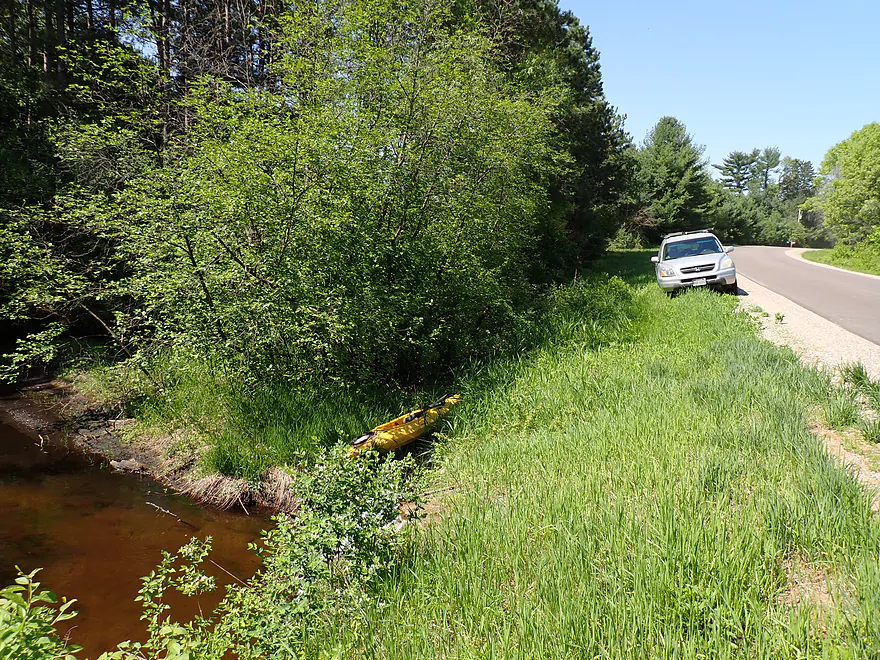
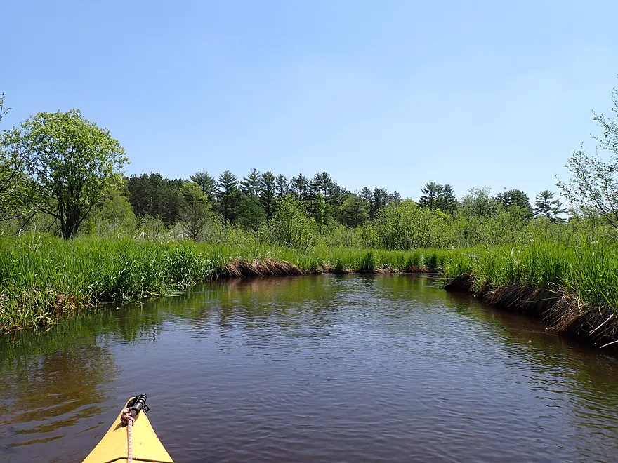
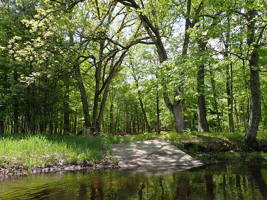
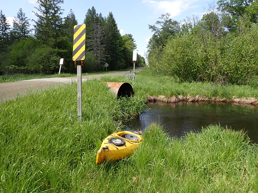
Putting in at Dakota Ave
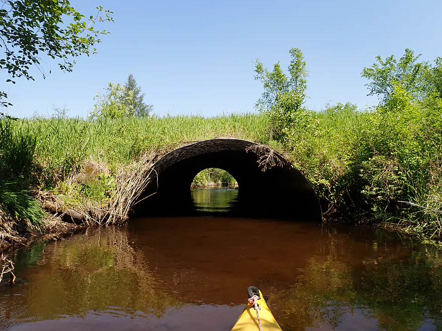
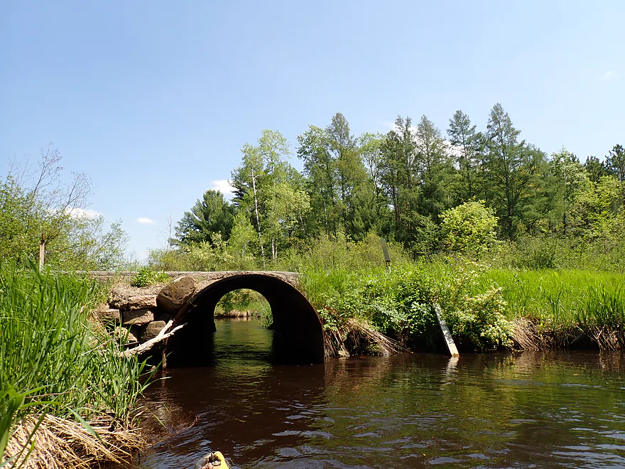
Fun tunnel to kayak through
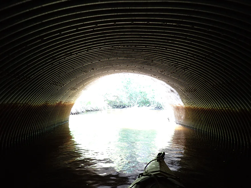
Into the light…
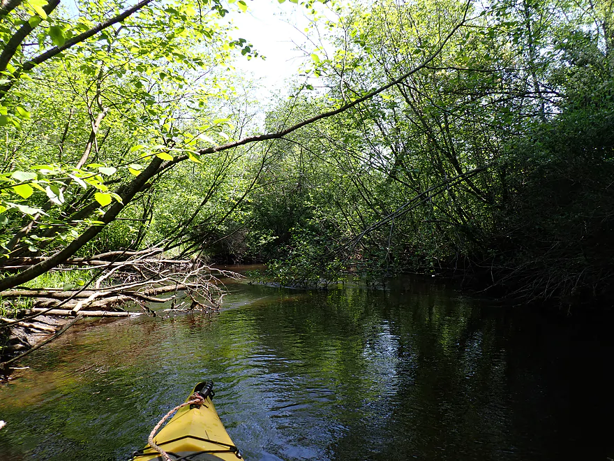
…and entering purgatory (early stretch was very congested)
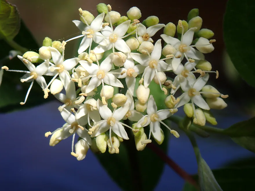
A cluster of red-osier dogwood flowers
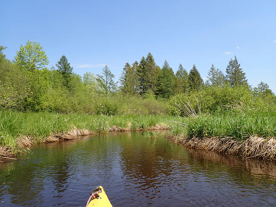
Multiple this by 10x…
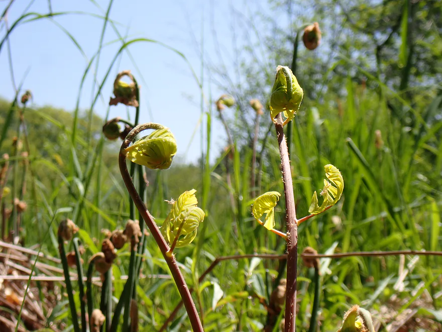
Fern fronds starting to unfurl
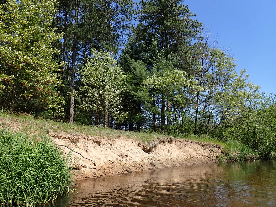
This is sand country
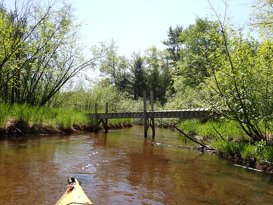
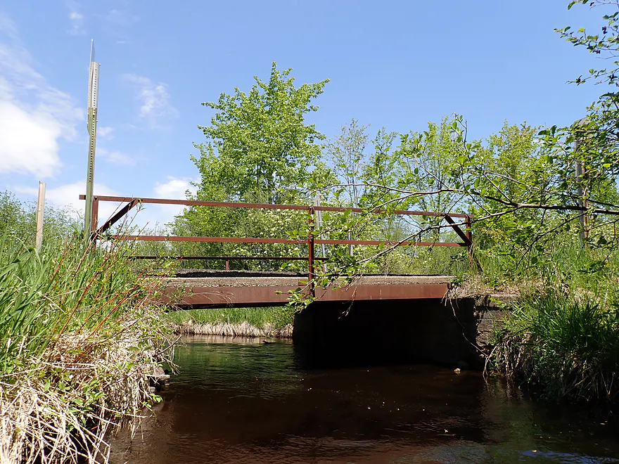
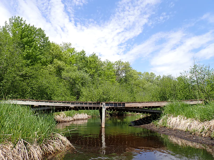
Lot of small pedestrian bridges in the middle of nowhere
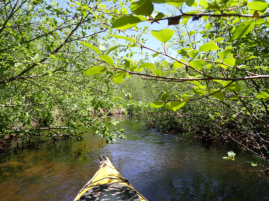
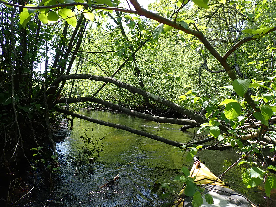
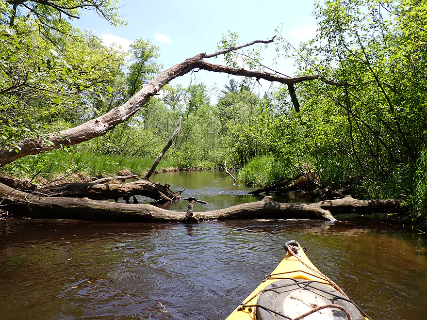
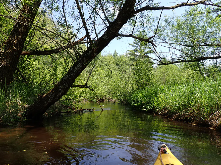
Braving the alder gauntlet
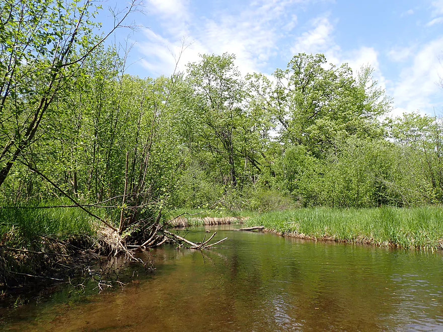
Creek had good clarity
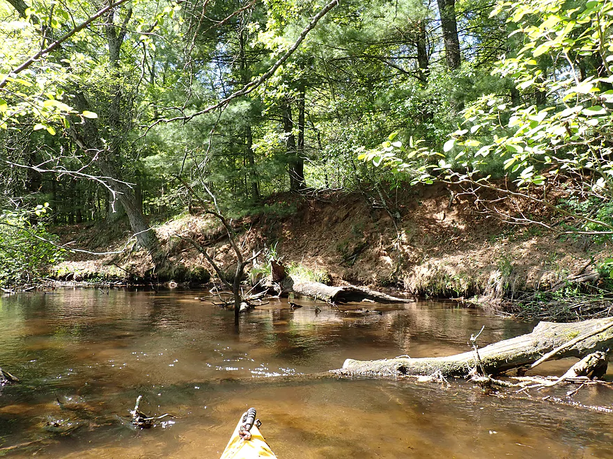
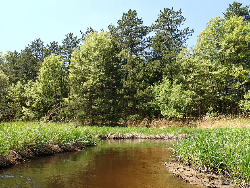
Pine stands were really nice
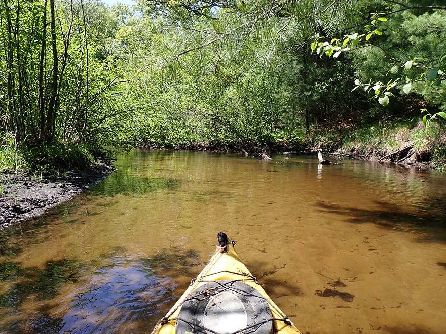
Sandy banks
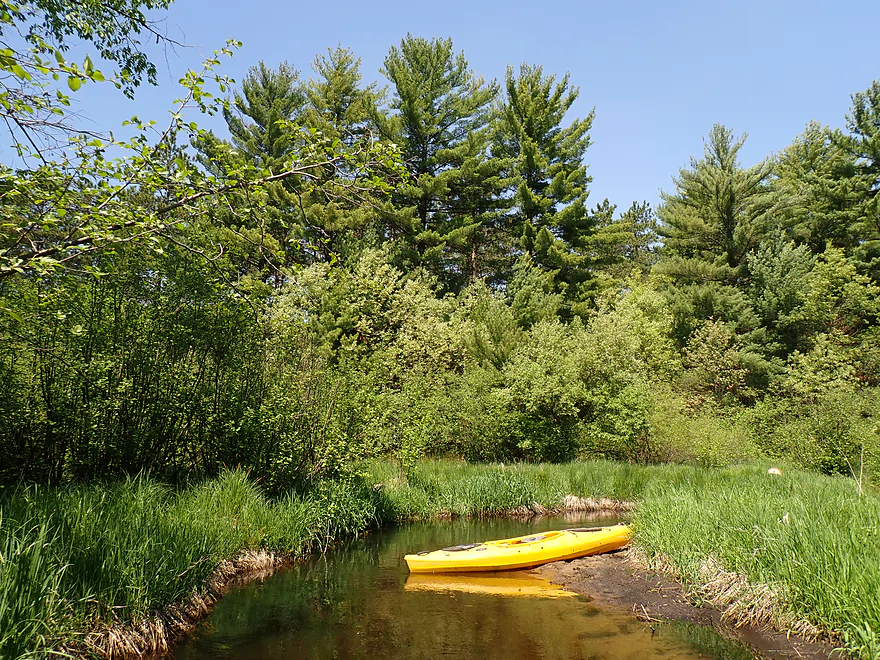
Getting out for pictures
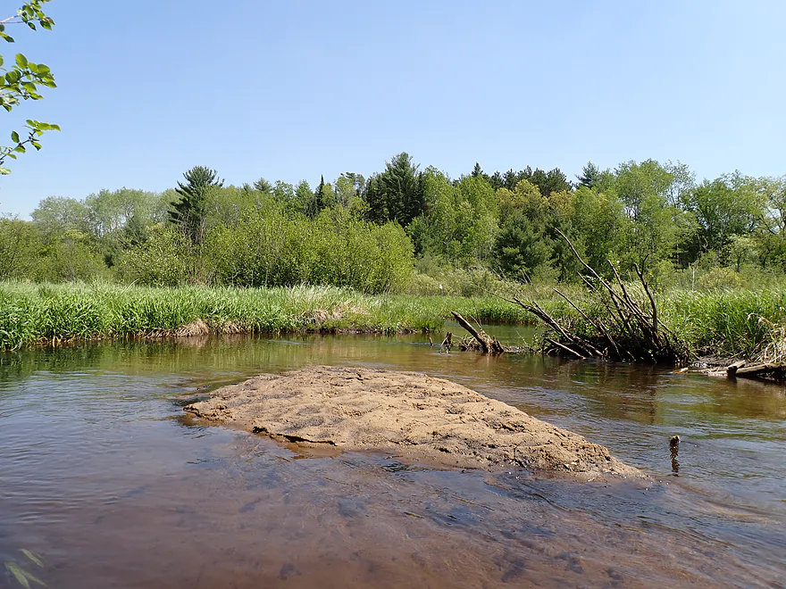
One of several micro sandbars on the trip
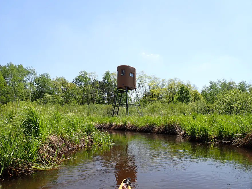
Elevated hunting blinds
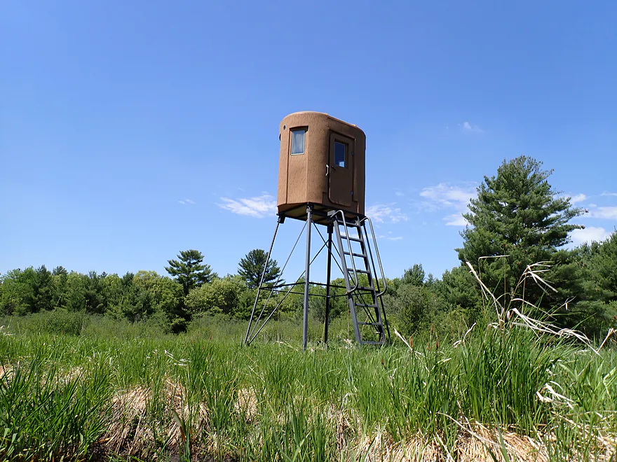
They look like the lunar module
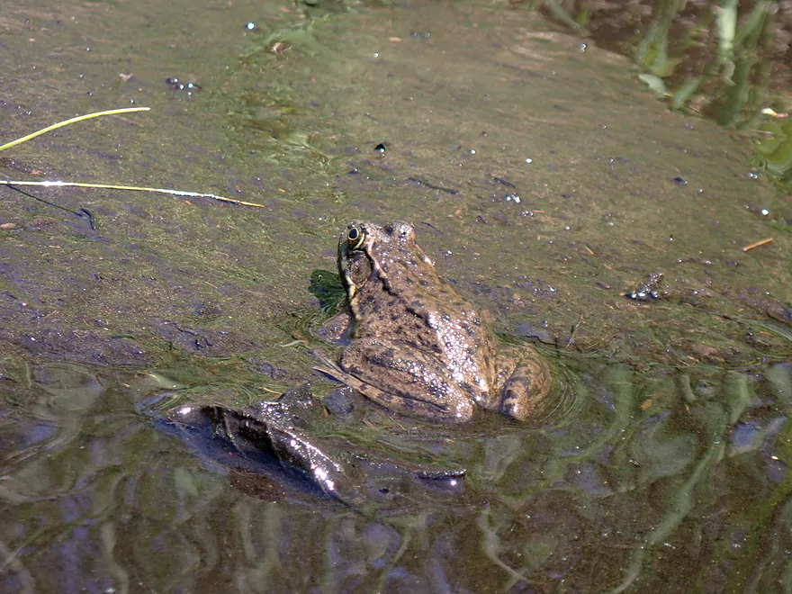
Leopard frog
Occasional red pines
Dakota Lane has a crazy thin bridge
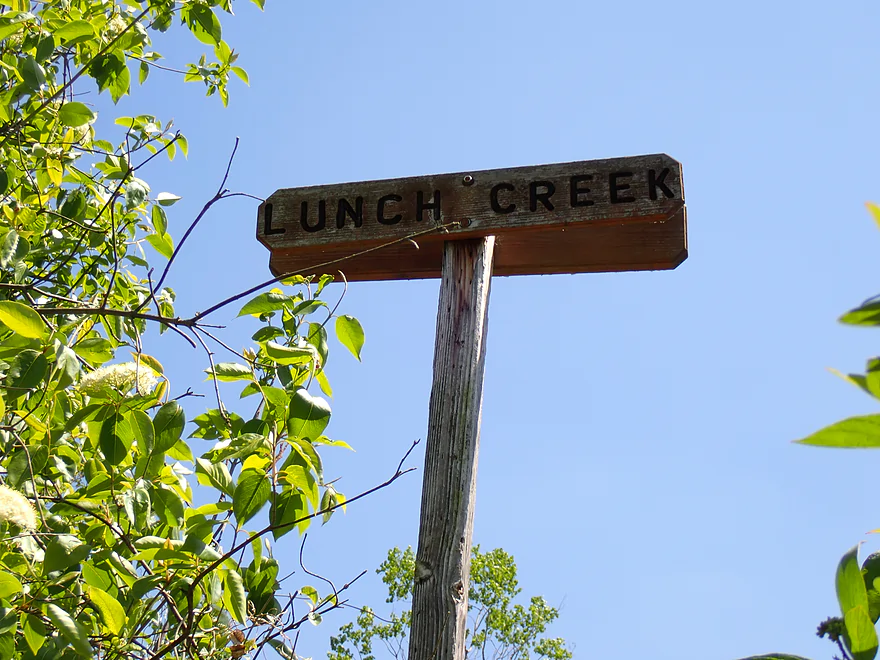
I like these rustic wooden river signs…more rivers need these
Clouds starting to roll in
Surprise ramp in the middle of nowhere
Getting out for a photo opportunity
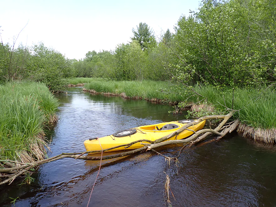
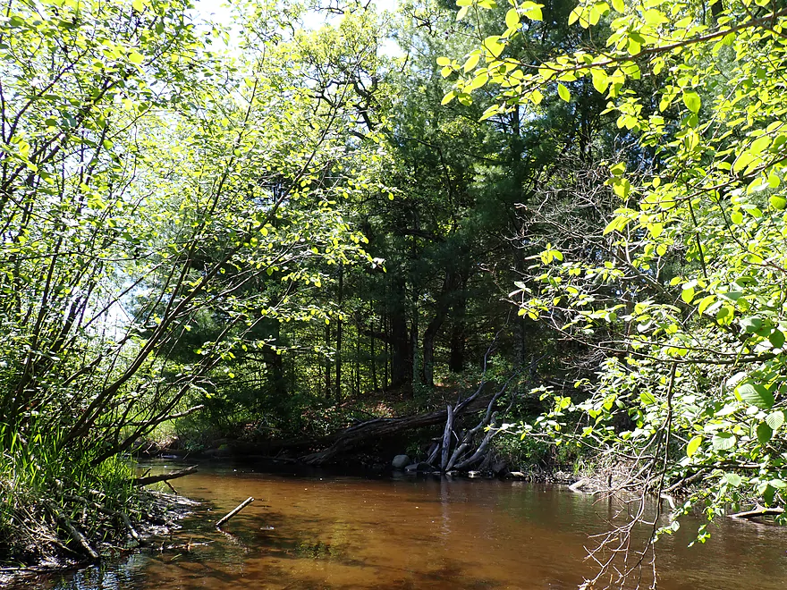
Getting out for a logjam

And another
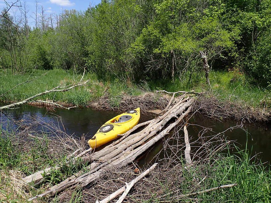
And another…this logjam looks “sus”
Not again…
Some of the logjam portages were difficult
Oh joy…
No more logjams for the rest of the trip!
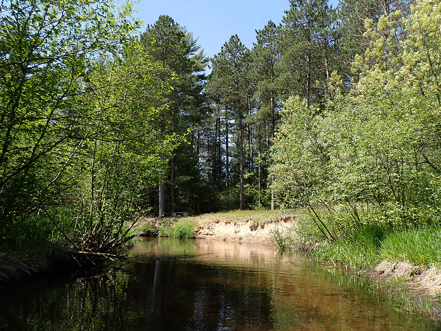
Entering pine country
Fantastic pine and spruce trees
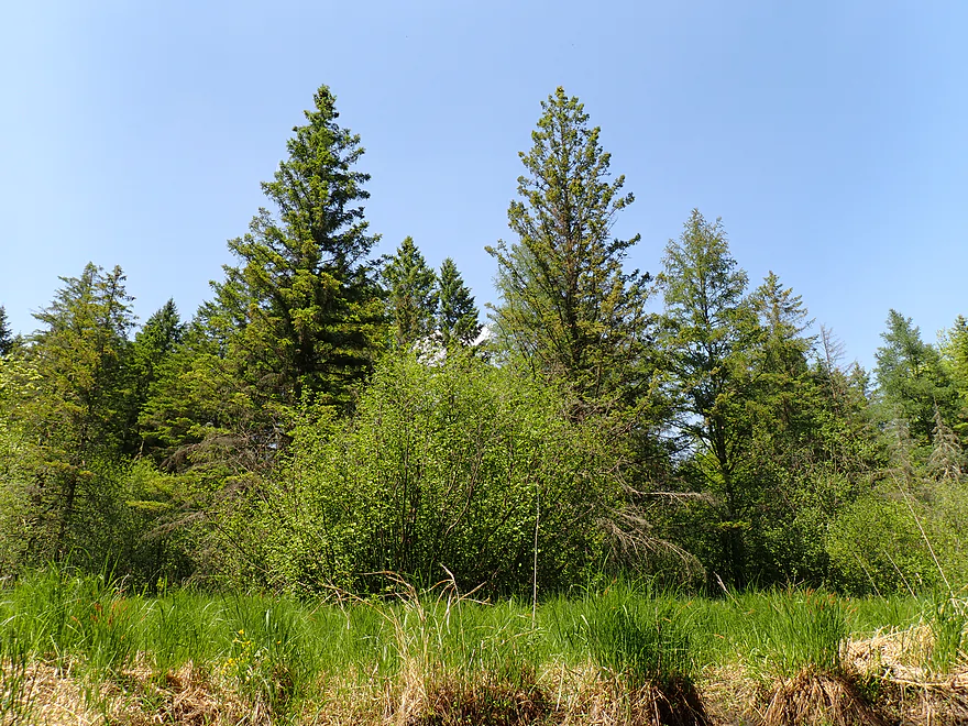
A group of black spruce
Reverse view
I think these are tamaracks
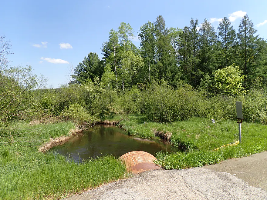
Taking out at 16th Ave
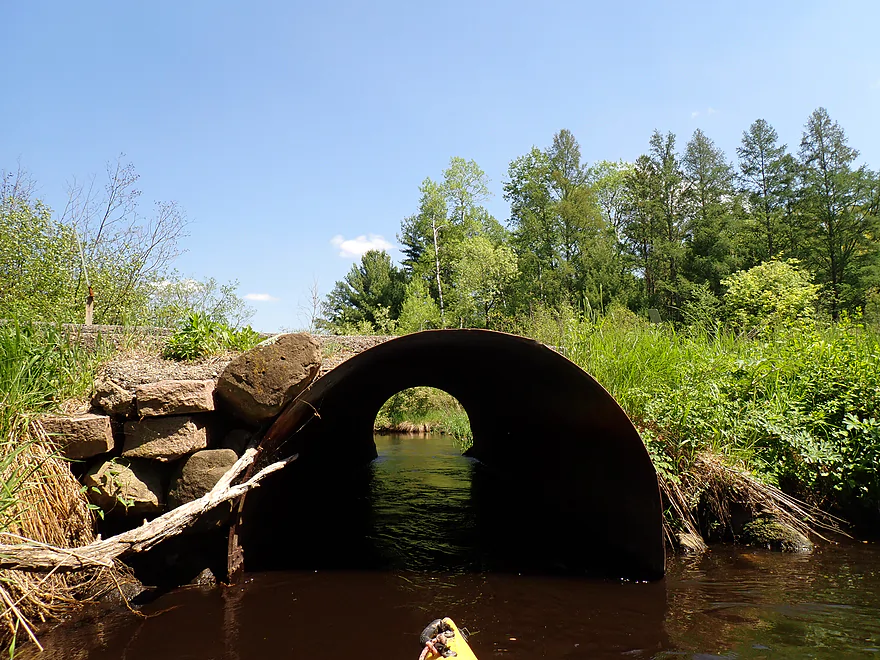
Marquette County loves its culverts
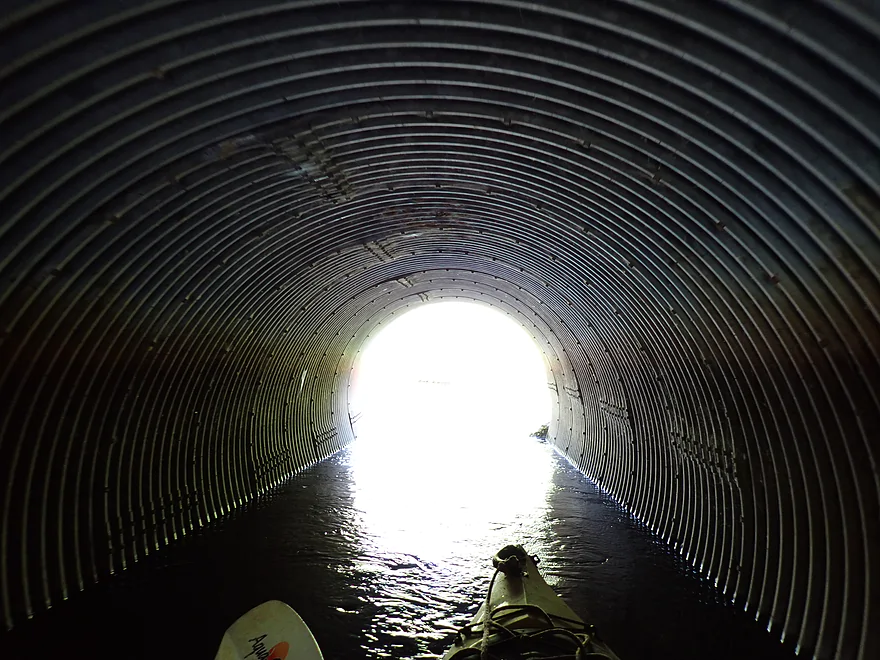
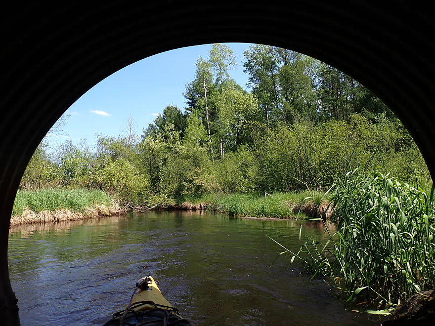
Photo trick: underexpose in a culvert to get a framing effect
Those warning reflectors would bounce back and forth on springs
Last view downstream
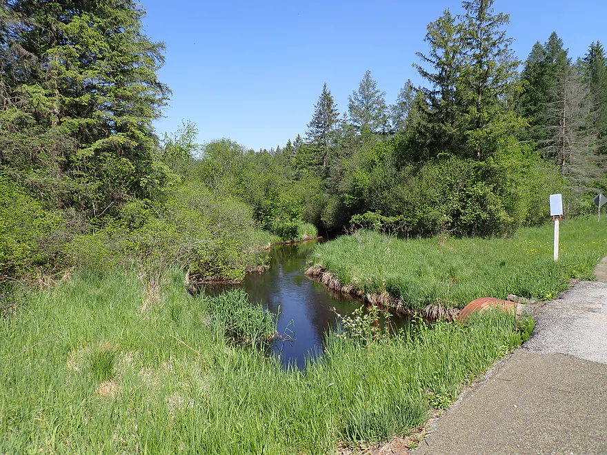
Last view upstream…I doubt I will ever return to Lunch Creek
Lunch Creek


Lunch Creek is a tributary to the White River located just east of the more popular Mecan River. It’s been on my radar for a while, and with spring winding down I decided to roll the dice on one “last” small stream before I switch into big river paddling for the summer.
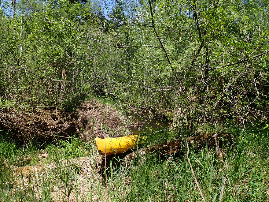
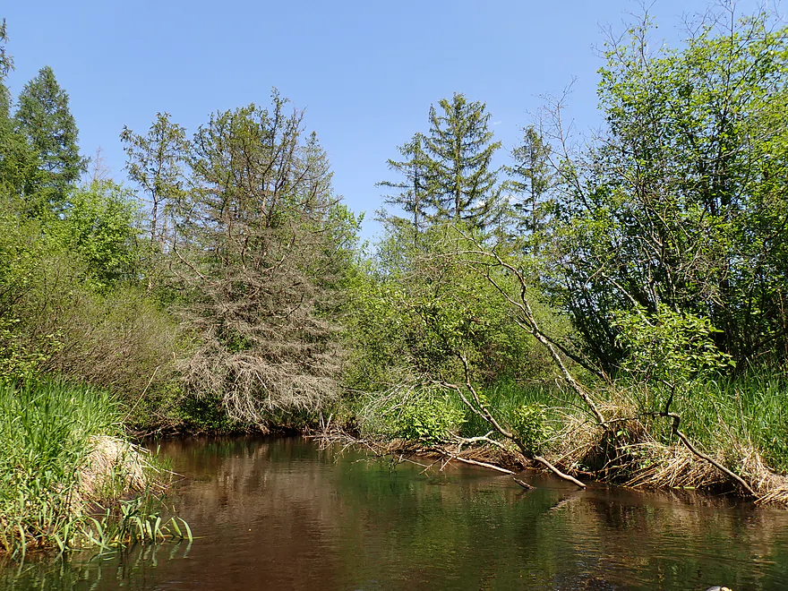
I started the trip at Dakota Ave, which was a bit overgrown but a doable bridge (well culvert) access. The culvert was a fun tunnel to paddle through, but just downstream there was a tangle of alders and ultimately a logjam that had to be portaged, all within sight of the road/put-in. In my experience it’s a bad omen to see a logjam from either the put-in or take-out bridge (and this will prove prophetic as we will find out later).
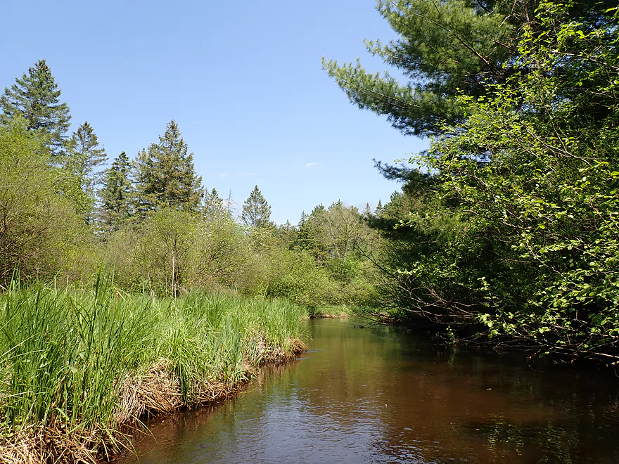
The first half mile of the trip was unpleasant. Low-hanging alders were common and annoying. The river twists a lot, and often the right (west) bank featured some type of tangle or partial jam to get through. Usually I could hop or duck through the mess, but it wasn’t fun. Sometimes obstacles on a kayak trip can be worth it if the scenery is good, but aside from a few pine stands, it was mostly boring, overgrown alders and grasses. It could have been worse. There was evidence someone had cut/removed a number of low branches and minor logjams already. That was much appreciated.
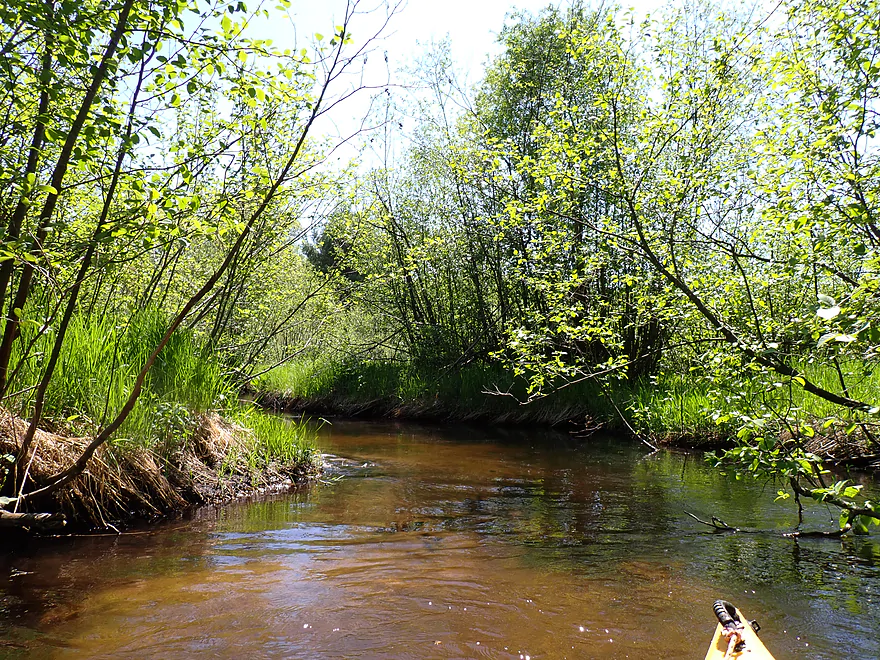
The substrate was a mix of sand and muck. The sandy parts were really nice (and there were even a few small sandbars), but the muck was nasty. Test probes from my paddle indicated some of it might have been quick mud (always be careful where you wade on some rivers and creeks).
The next mile to Dakota Lane was much nicer as the creek opened up with far fewer alders or downed trees. One nice thing about this trip was lack of human civilization. An exception were a couple of hunting blinds on stilts which towered over the creek like something you would see in a science fiction movie. I thought about exploring one of them, but thought better of it.
Dakota Lane (one of the thinnest bridges I’ve ever seen) represented the halfway point in the trip, and I suppose it might be an access option.
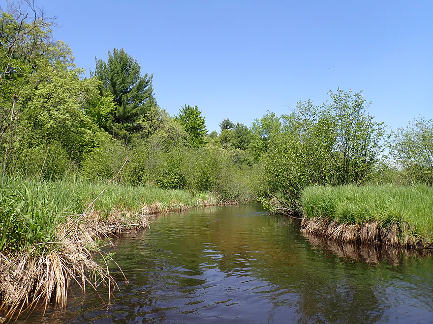
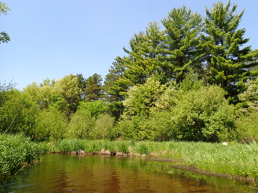
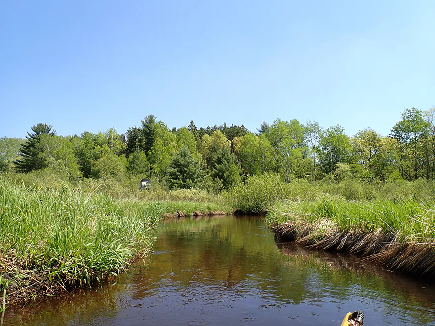
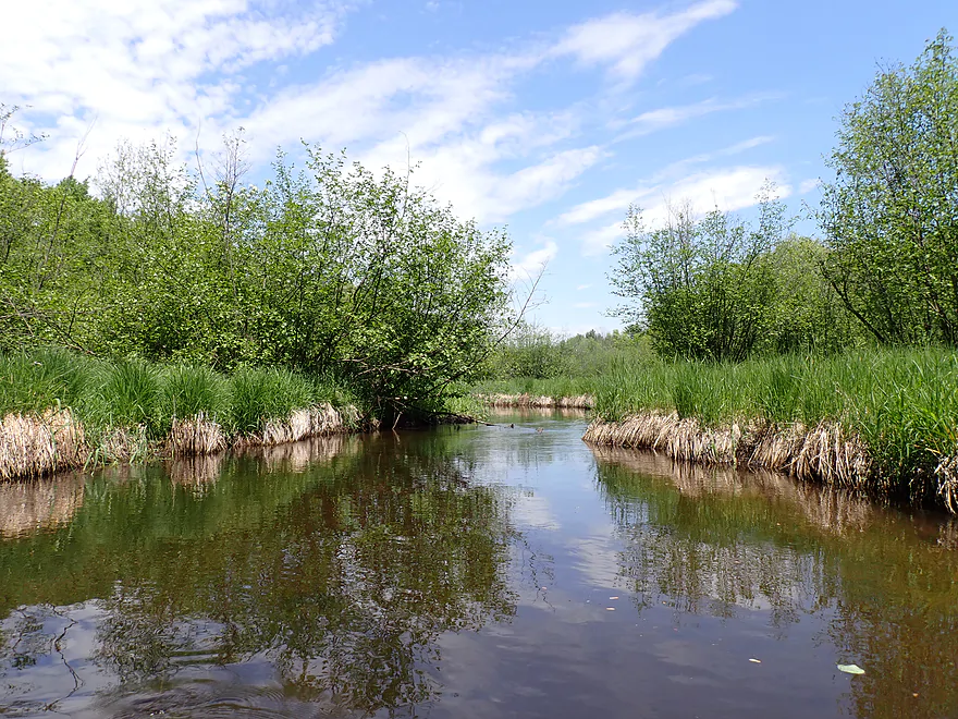
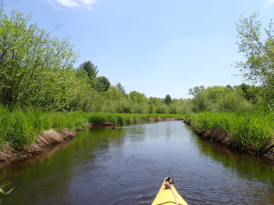
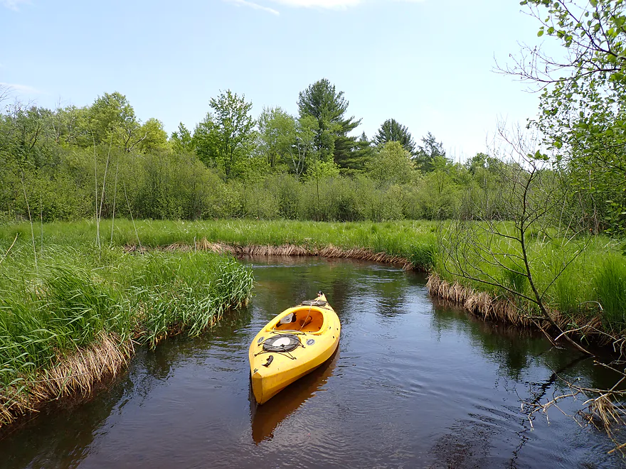
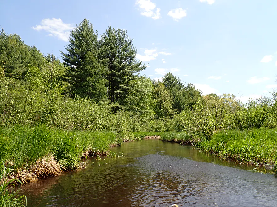
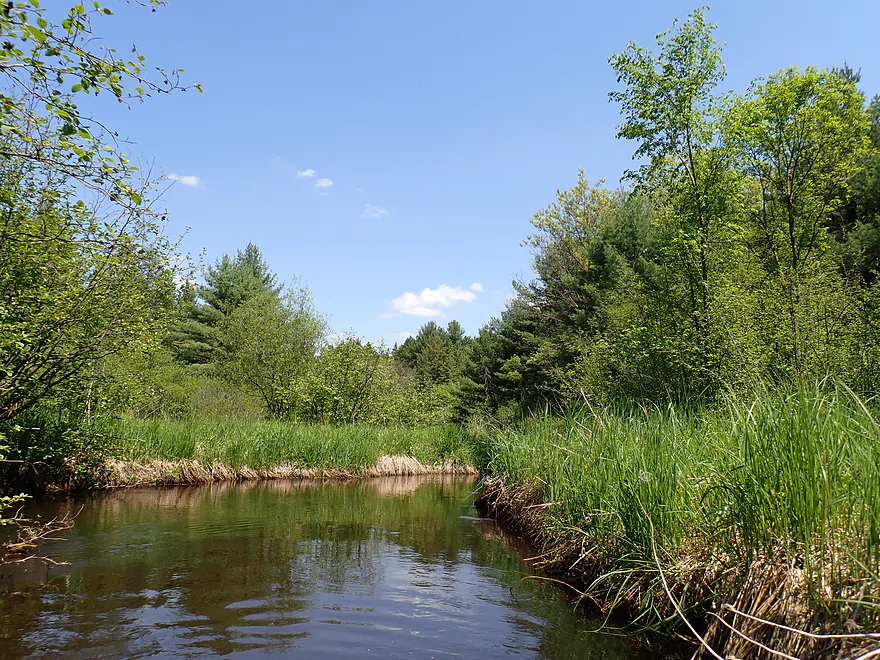
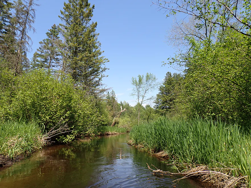
The next mile was pleasant and open. It very much reminded me of the nearby Mecan River. I could sneak a picture of Lunch Creek into my Mecan reviews, and likely most wouldn’t notice the difference.
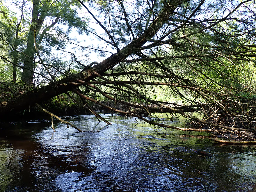
But then the logjams started. Prior to this I had faced unpleasant snags, but only had to get out of my boat once. But the last half mile flowed through some congested woods and it seemed like there was one major logjam after another. I probably only portaged six total times on this trip but it seemed like more than that. Some portages were difficult because of the overgrown banks and mud. The creek typically wasn’t that deep….but coincidentally right around the jams it became very deep.
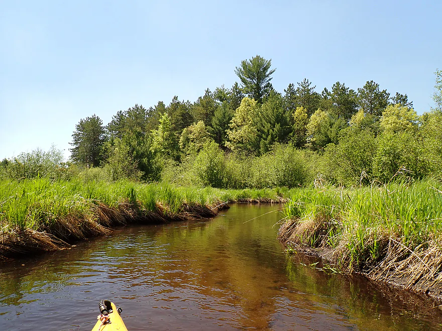
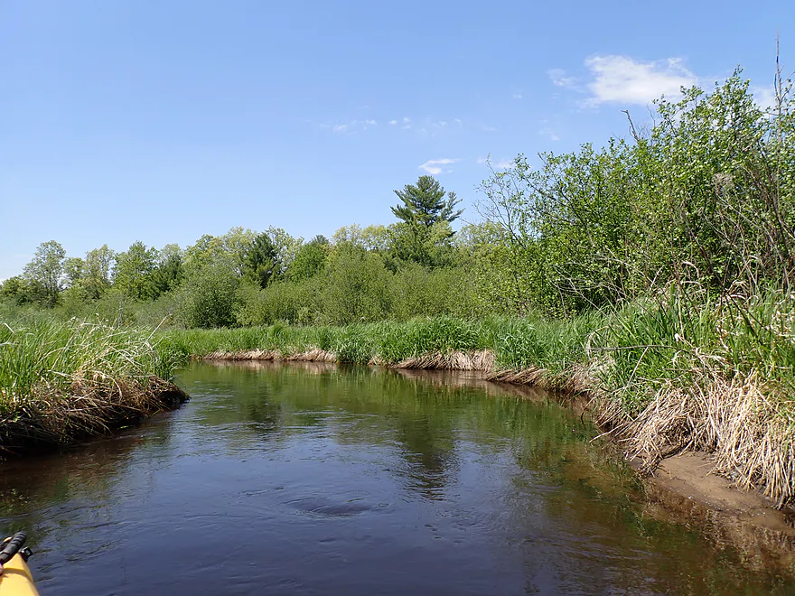
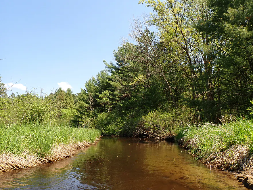
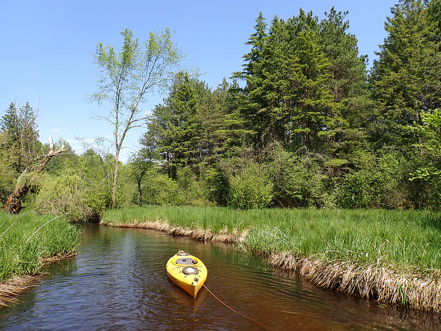
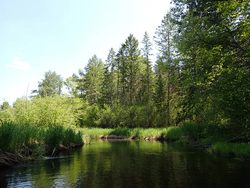
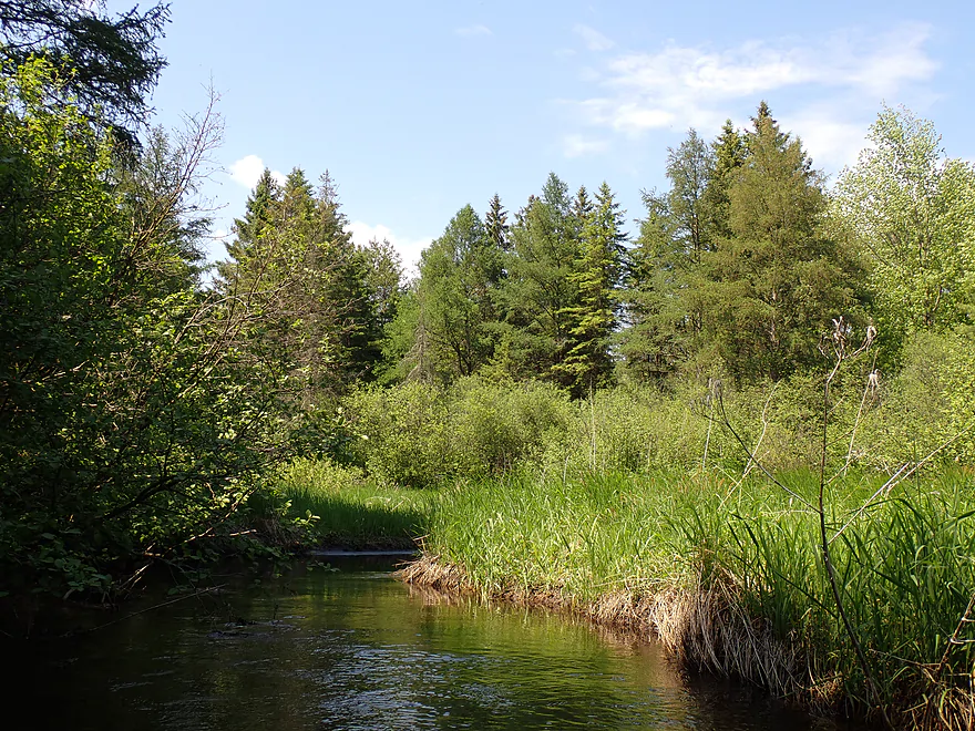
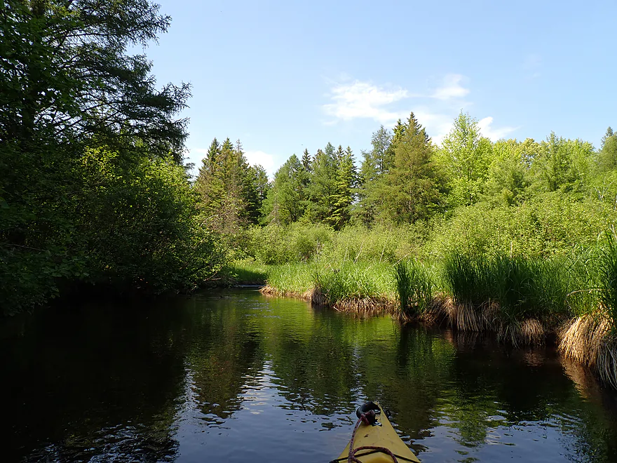
It wasn’t all bad though. In the last mile, the conifer trees were fantastic and incredibly scenic. In fact I suspected this and it was the main reason I did the trip. It was great to see a variety (red pines, white pines, tamaracks, spruce, etc…). The wind picked up and when this happened the pines would make a really soothing sound. The pine stands were the highlight of the trip.
I ended the paddle at 16th Ave which is a doable bridge culvert access. It’s a very scenic and striking area (and the reason I got tricked into doing this trip).
In summary this isn’t a trip I can recommend. There are just too many snags and logjams. The only highlight were the incredible pine stands. With such nice weather it was a wasted kayaking weekend. Live and learn.
Wildlife included ducks, geese, dragonflies, and a larger snapper…but strangely enough no fish. The highlight were the many singing songbirds.
Lunch Creek Wetlands SNA: The creek area upstream from this trip contains one of the richest and best-quality wetland complexes in southern Wisconsin (i.e., one of the few places in Wisconsin that has not been invaded by reed canary grass). In the fall, thousands of cranes use this wetland as a staging area before heading further south.
Dakota Ave: This is a decent bridge/culvert access. But there is a congested tangle just downstream from the bridge that will require a portage. I suppose you might be able to bypass this by launching to the east by the power-line corridor.
Alternate Put-ins:
- Czech Ct (1.5 miles upstream from Dakota Ave): The shoulders are narrow by the bridge, but I suspect this would be a doable bridge access. I wouldn’t recommend it though as there are likely alders and logjams downstream from it.
- Dakota Lane (1.5 miles downstream from Dakota Ave): This wouldn’t be a great access, but should be doable. Launching here would skip a less interesting part of the trip, but still means dealing with a lot of logjams.
16th Ave: This is a doable bridge access and a scenic area. Note, there is a No Trespassing sign in the nearby woods, so make sure to stick within the DOT right-of-way.
Alternate Take-outs:
- Dakota Lane (1.6 miles upstream from 16th Ave): This wouldn’t be a great access, but should be doable. Ending the trip here, would omit many of the major logjams, but also the most scenic part of the trip.
- Deerborn Drive (1.5 miles downstream from 16th Ave): I suspect alders would be a serious problem on this bonus leg.
Bike Shuttle – 16th lane to Dakota Ave: 2.3 miles with 23′ of ascent. This was one of the easiest bike shuttles of the season…short, flat, and paved.
Low bridges: There are 4-5 bridges/culverts to get under. Most are pretty easy. One required a bit of ducking. I didn’t find any to be too difficult.
Alder Gauntlets: In parts of the creek, alders overhang and block partial navigation through. At no point did I have to portage them, but they were very annoying. The worst alders were in the first half mile of the trip.
Current/Rapids: In general the current is pretty lazy. There are no rapids.
Logjams:
- Dakota Ave to Dakota Lane: Only one logjam had to be portaged on this stretch (just downstream from Dakota Ave). But beyond this there were several tricky jams that required tight maneuvers to get past.
- Dakota Lane to 16th Ave: First part of the trip is actually open and nice. But the last half mile has a number of major logjams (about five) that have to be portaged. Beyond that there are some annoying duckers and hoppers to deal with.
Quick Mud: Most of the creek is actually pretty sandy…but there are some mucky stretches and some of that muck doesn’t seem to have a bottom (based on paddle tests). If you wade in creeks/rivers, be careful where you step.
- < 3.59′: The creek rarely gets this low.
- 3.59-3.60′: A relatively low depth.
- 3.61-3.63′: An average late fall depth.
- 3.64-3.68′: Above average depth.
- 3.69-3.72′: High depth.
- 3.73’+: A very high depth.
Click here to see an overview map.
- Upstream from Hwy 22: This flows through the Lunch Creek Wetland State Natural Area, but I suspect it has too many logjams.
- Hwy 22 to Czech Court: 2.0 miles. Maybe 8 logjams and likely many alders. Too congested for paddling.
- Czech Court to Dakota Ave: 1.5 miles. I suspect this leg is too congested by alders.
- Dakota Ave to 16th Ave: 3.1 miles.
- Dakota Ave to Dakota Lane: 1.5 miles. Creek is narrow and generally uninteresting. Alders and deadfall are annoying.
- Dakota Lane to 16th Ave: 1.6 miles. A scenic stretch with terrific pine stands. But…logjams are a major issue. A handful will have to be portaged.
- 16th Ave to Deerborn Drive (1): 1.5 miles. Mostly clear of logjams but there are some stretches with congested alders.
- Deerborn Drive (1) to Deerborn Drive (2): 2.6 miles. Maybe 3 logjams…some alder issues.
- Deerborn Drive (2) to 19th Court: 2.5 miles. Somewhat open, but there might be a logjam or two, as well as a few alders. Likely the most open stretch on the creek.
- 19th Court to West Street Ramp: 1.4 miles. Likely a generic millpond paddle on the White River.
Trip Map
Overview Map
Video
Photos Size: