
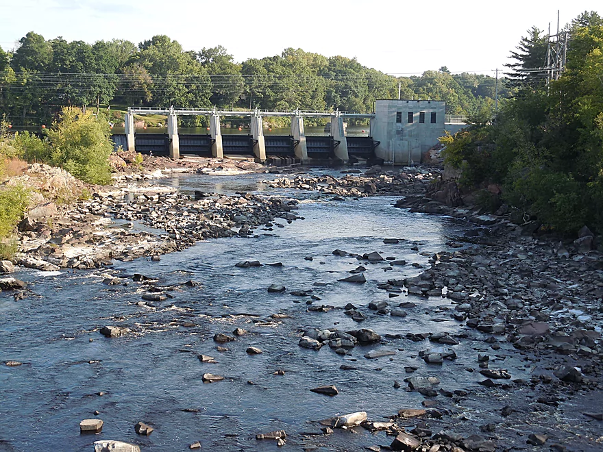
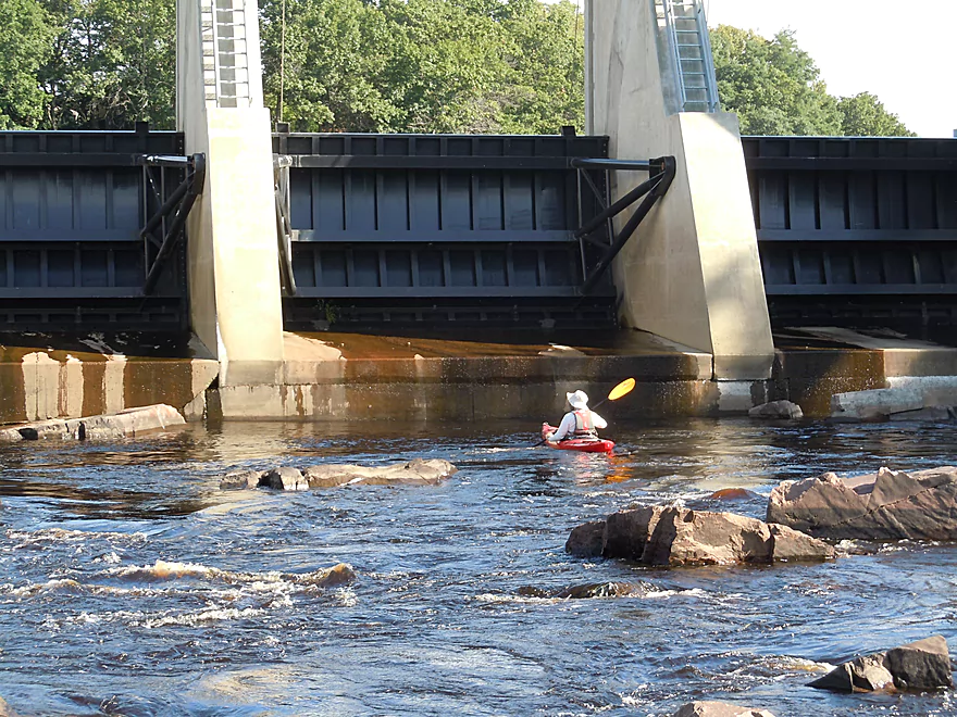
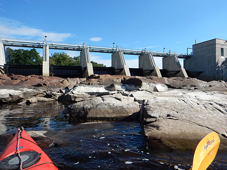
Dam at Black River Falls
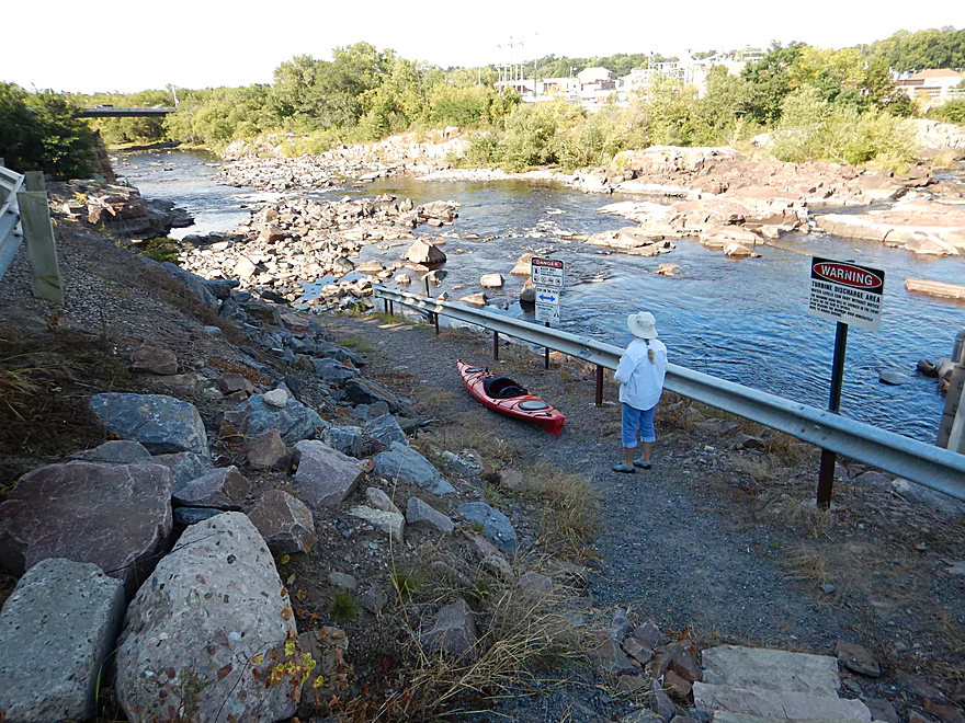
Public portage path
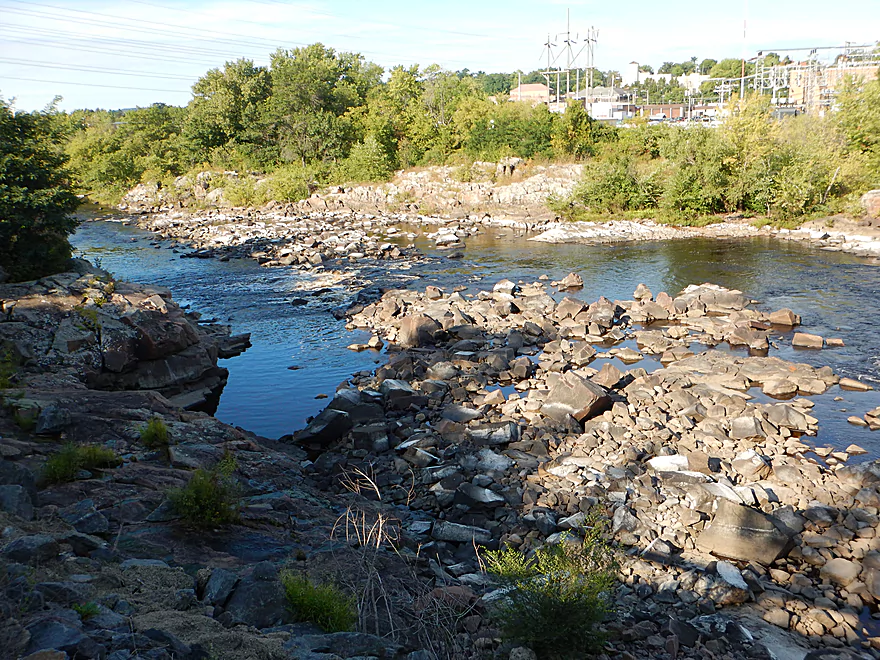
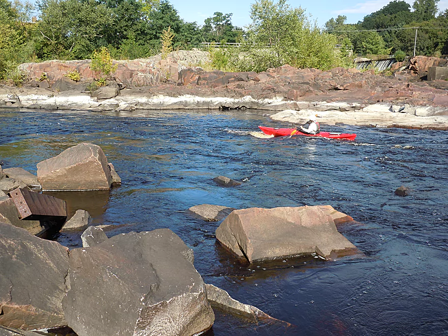
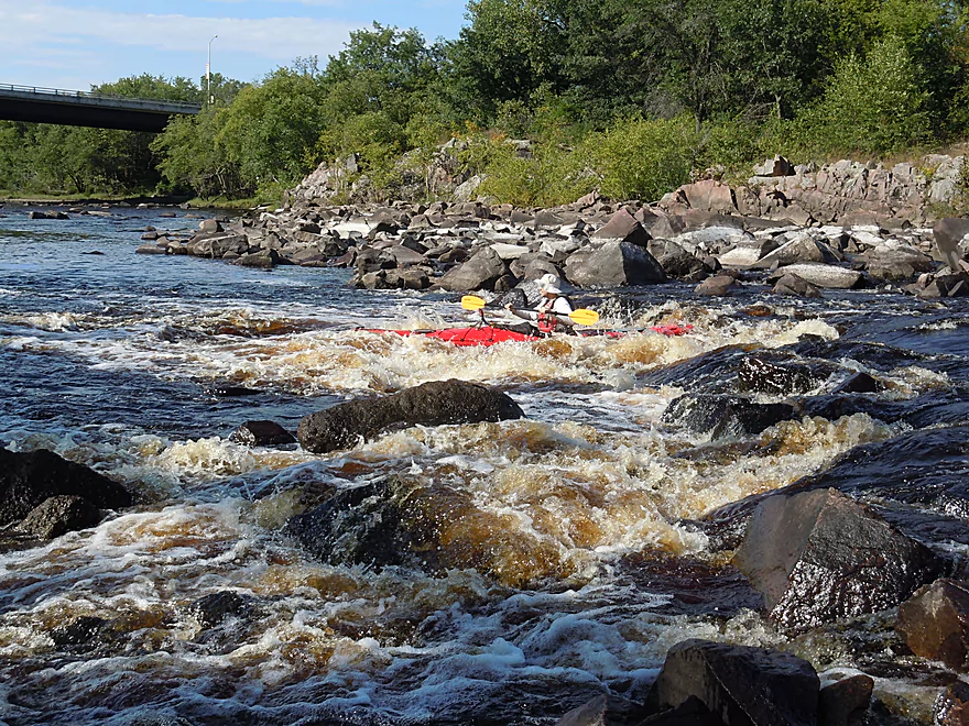
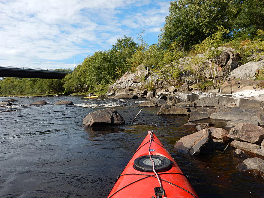
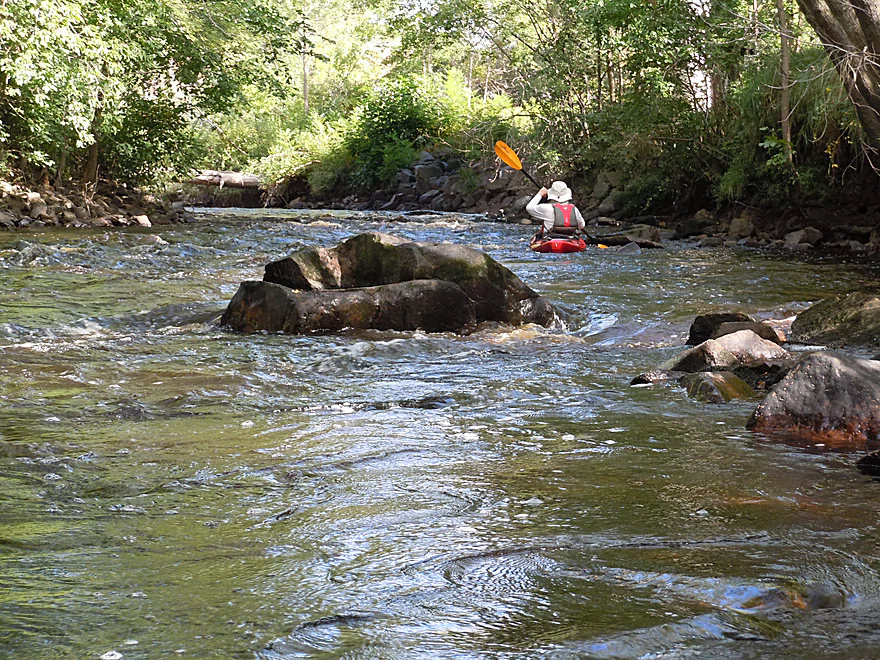
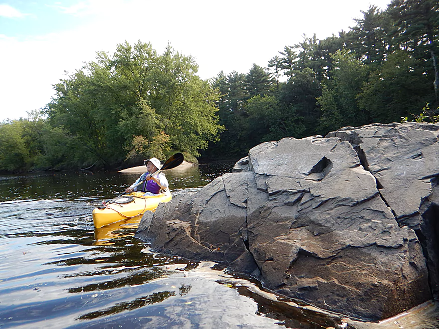
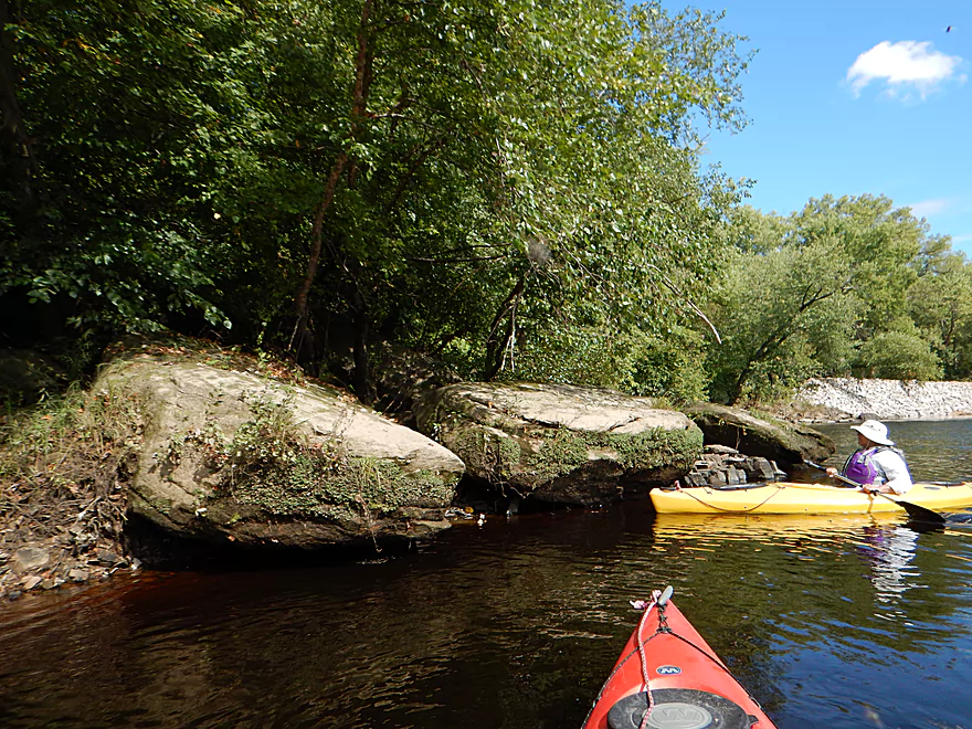
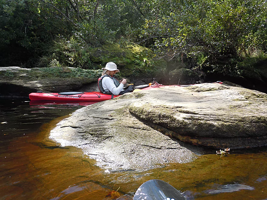
Gorgeous boulder garden
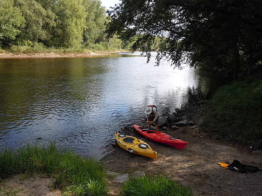
Rocky launch
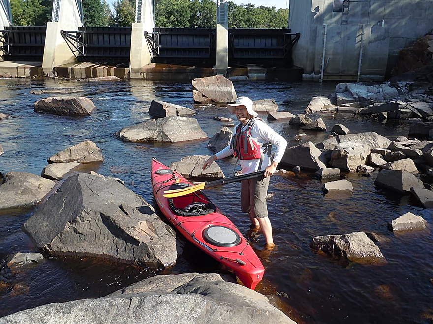
Fighting the current to get close to the dam
Do not do this during a release
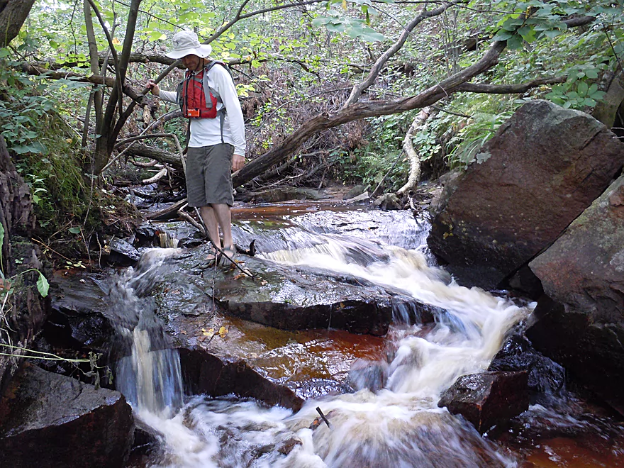
First fun chute
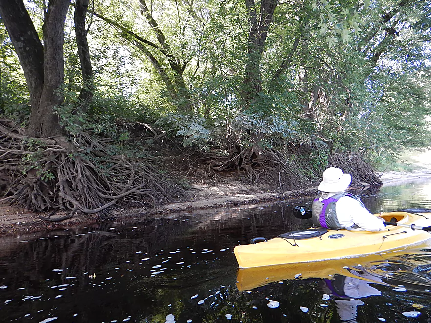
White marks the high water line
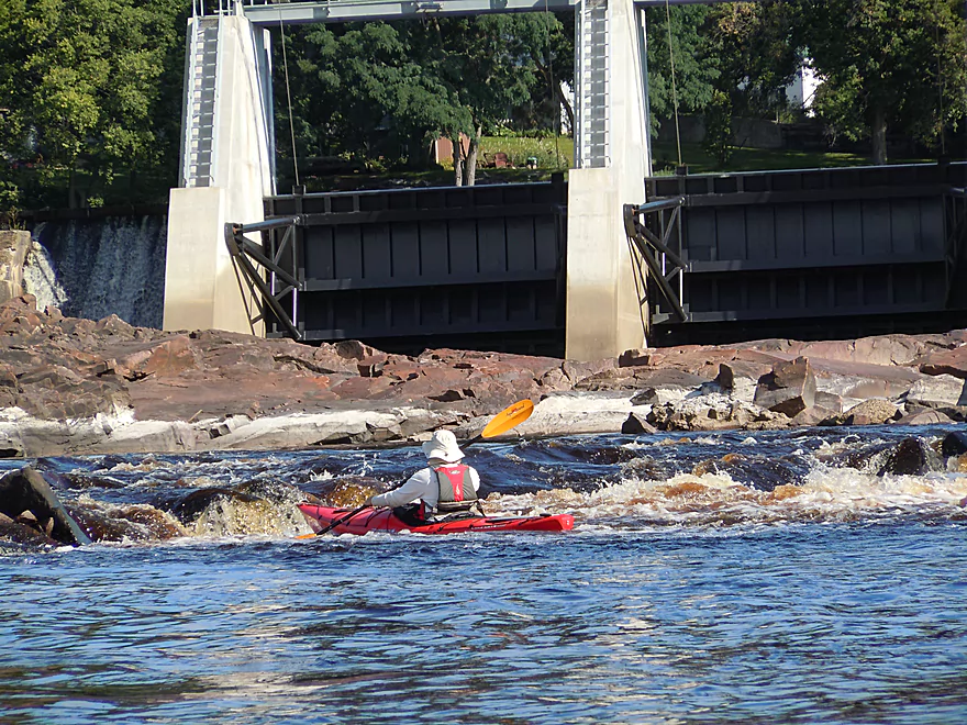
Reverse view of the dam
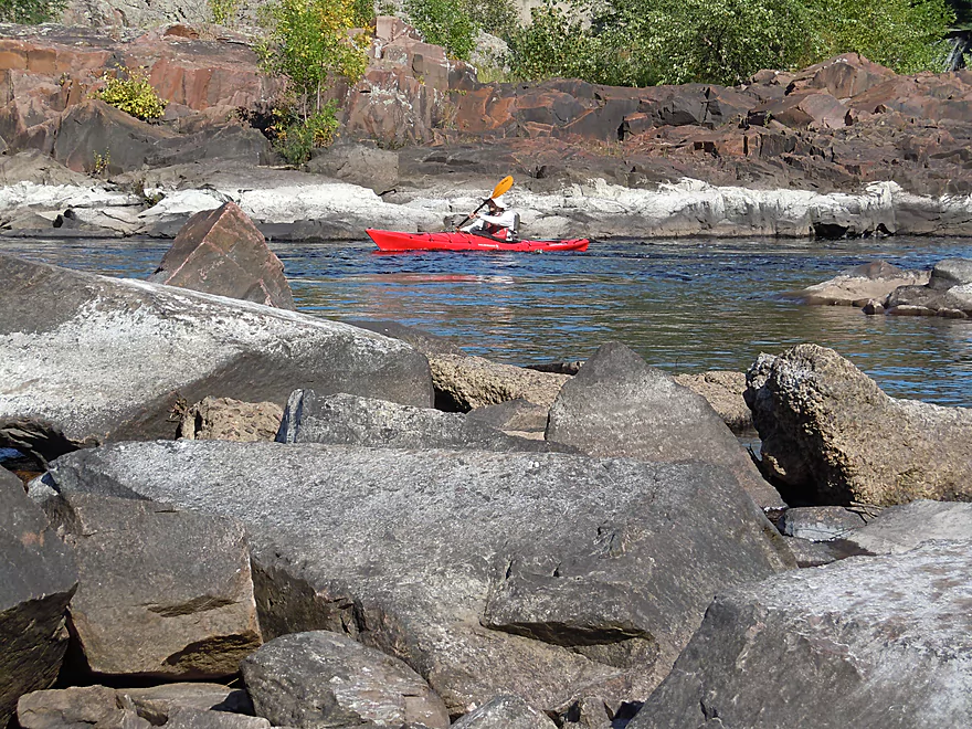
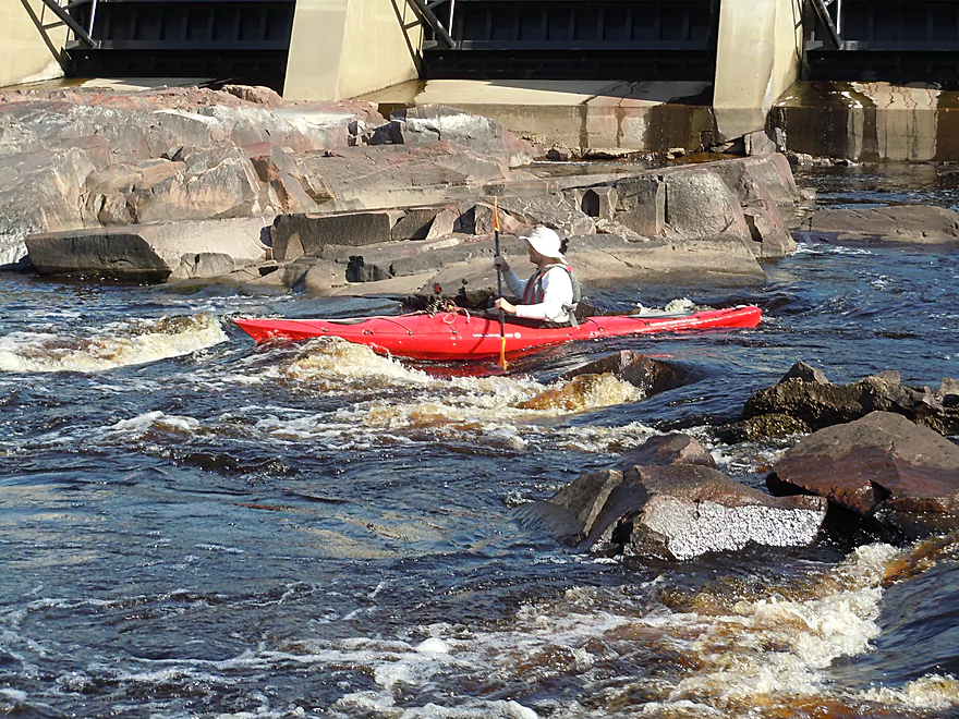
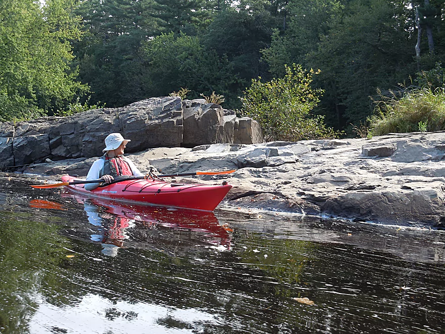
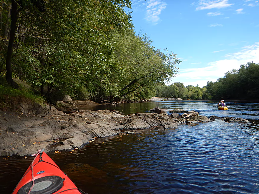
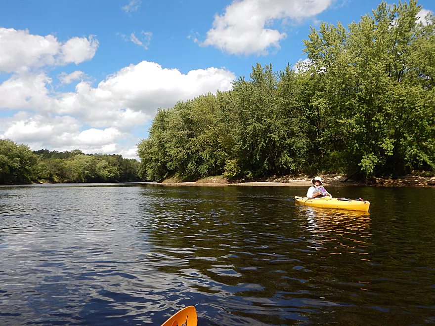
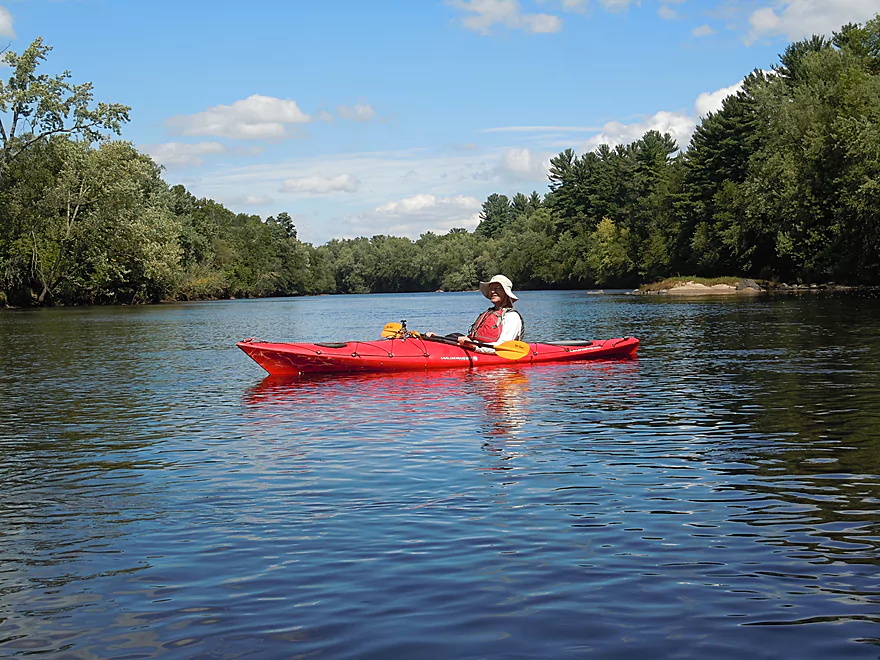
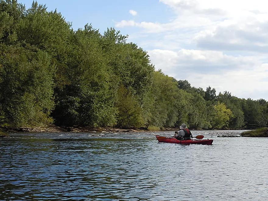
Super scenic
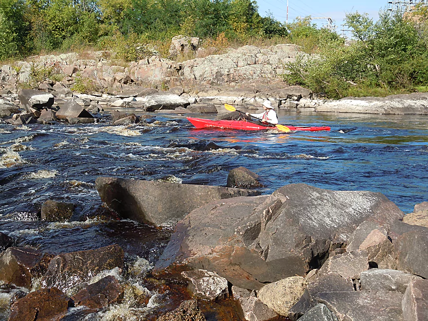
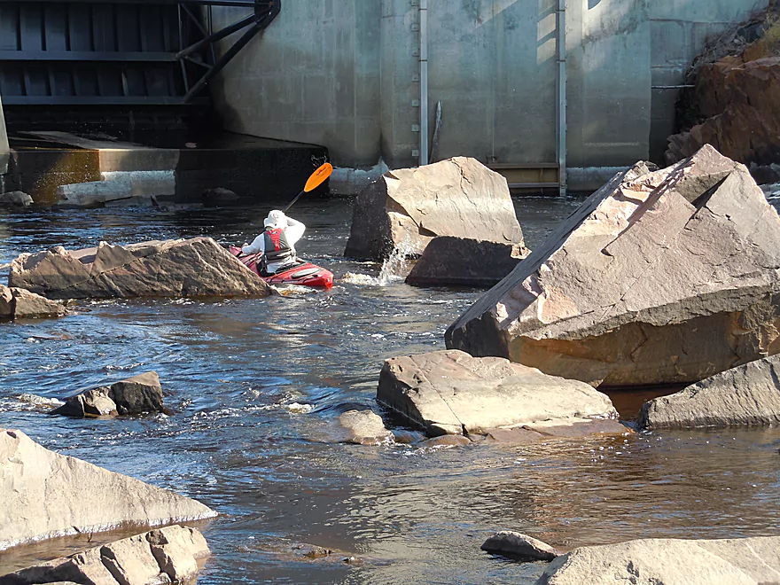
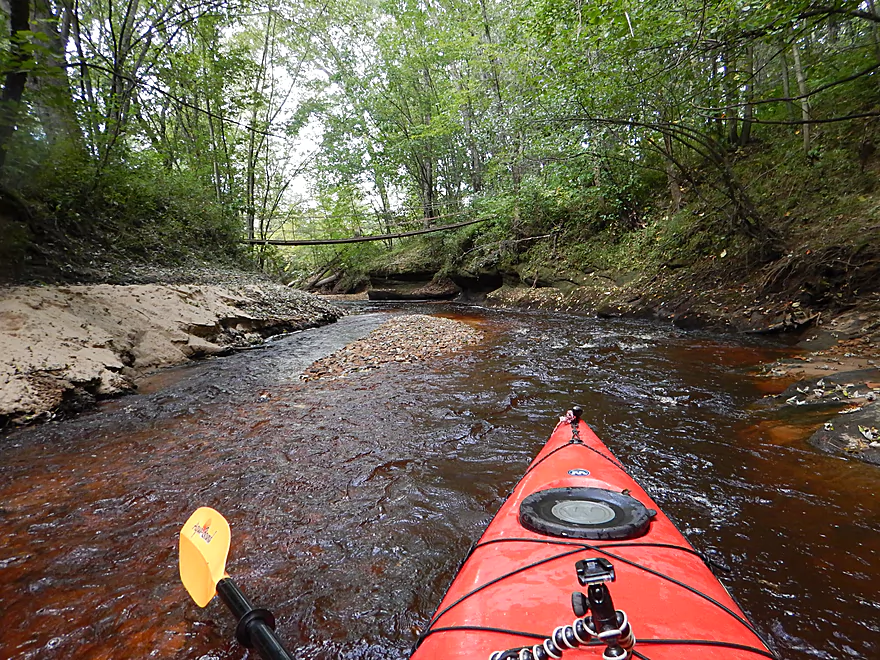
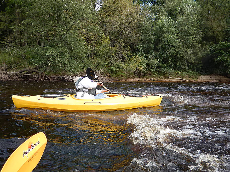
Coming up on a Class 3 ledge
I went too far right
And got wet…
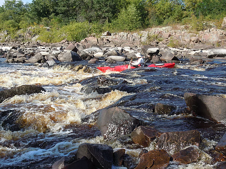
The ledge is at least 2 feet high
You can launch below the Class 3
More good scenery
And more fun rapids
View from Main Street
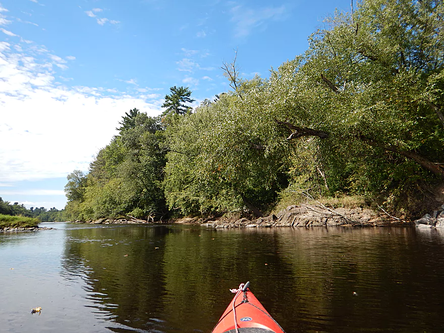
Continuing on downstream
The spillway looks like a fun run
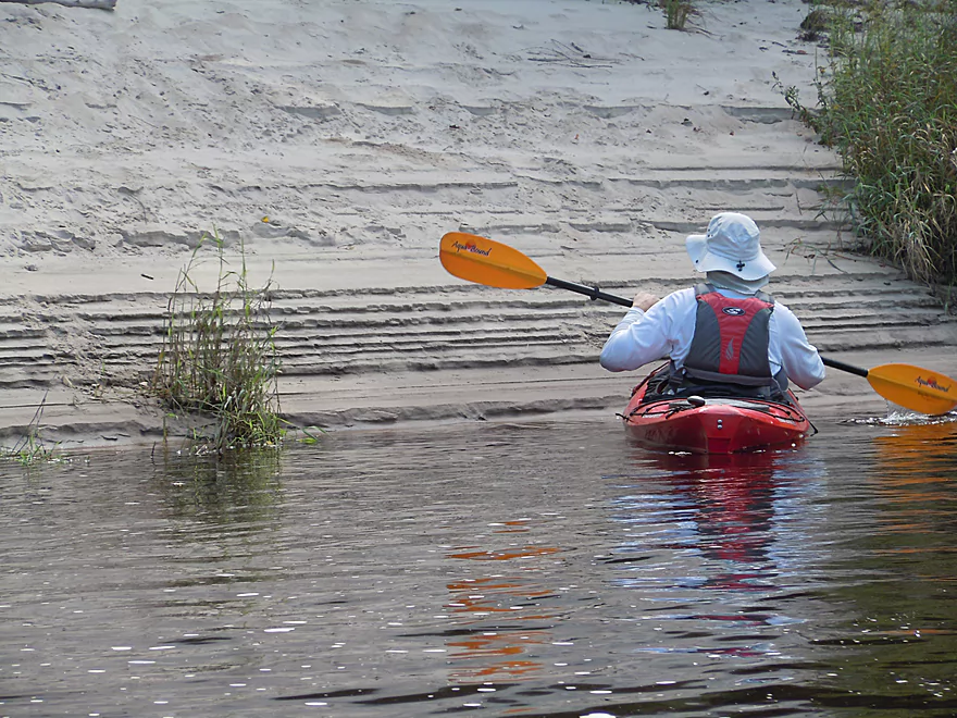
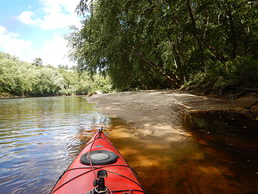
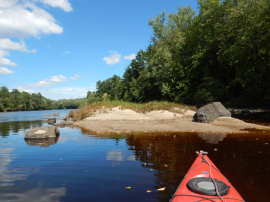
Scenic sand ridges
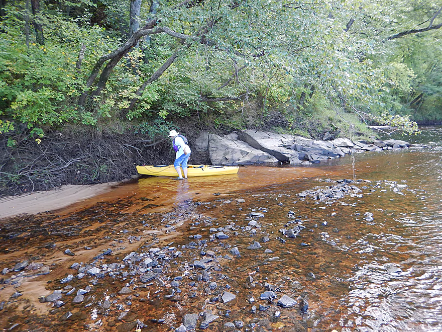
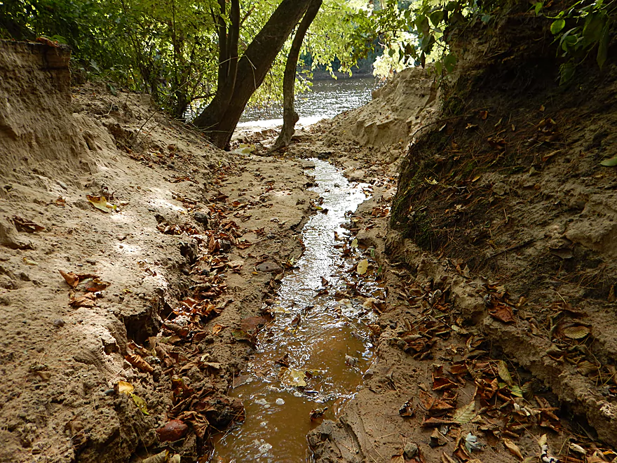
Getting out by root beer water…
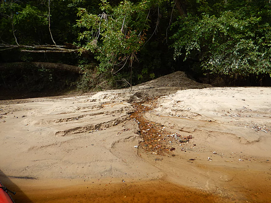
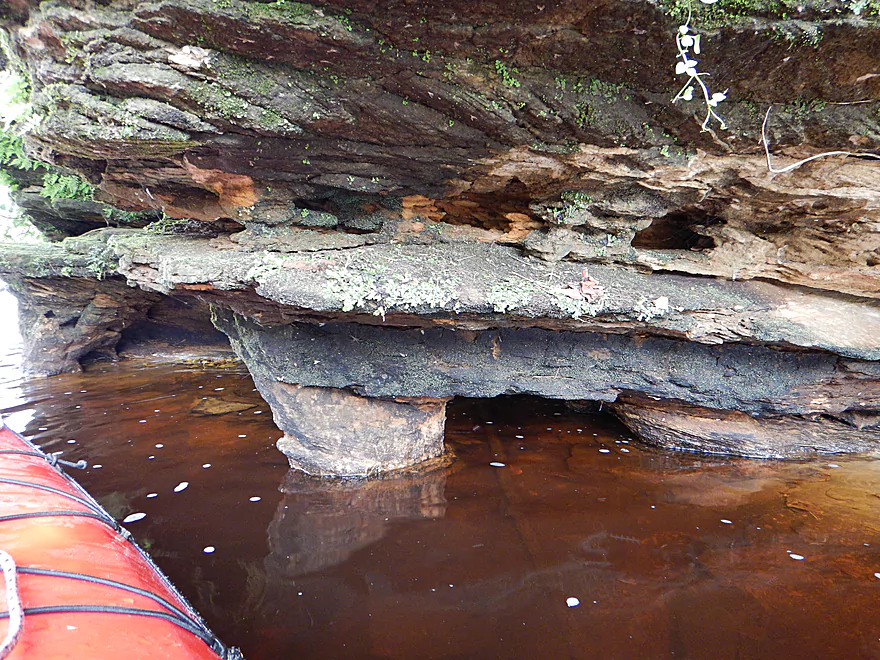
To check out Coffee Creek
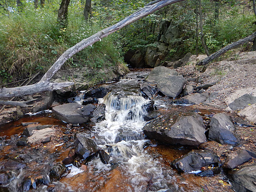
A second waterfall is further upstream
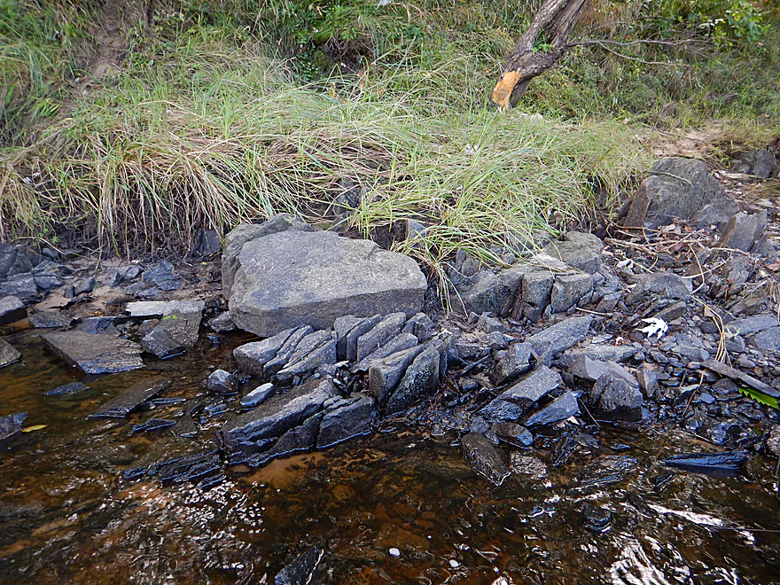
Cool how the rock fractures
Paddling by a huge island
Granite bedrock funnels the river
Reminded me of the East Fork
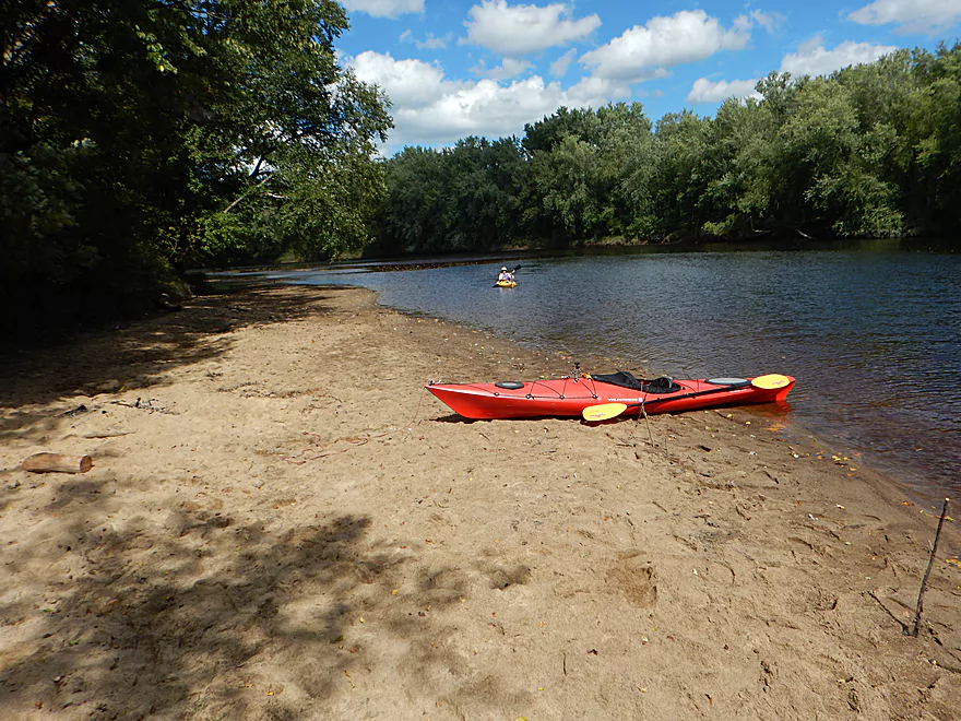
One of several nice gravel bars
Naked roots
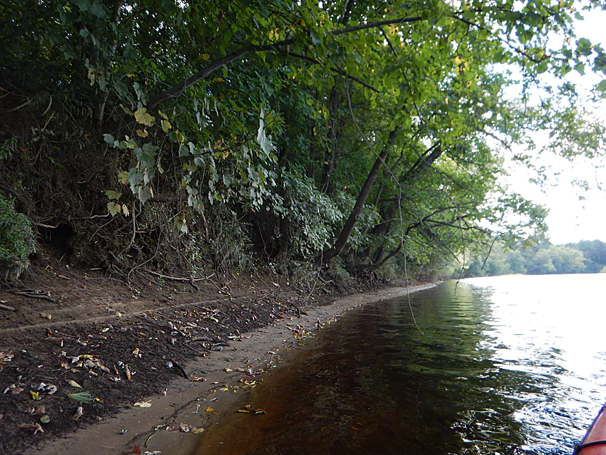
Lot of rip rap….
Bruce Cormican Landing is an access option
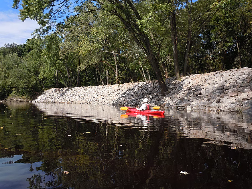
Part of the dike that protects Black River Falls
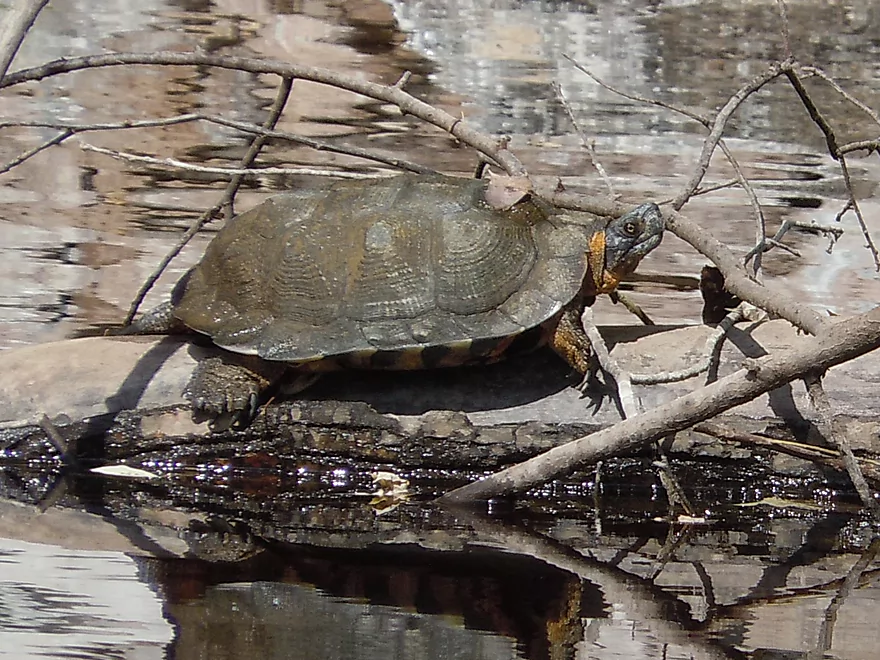
Grumpy looking wood turtle
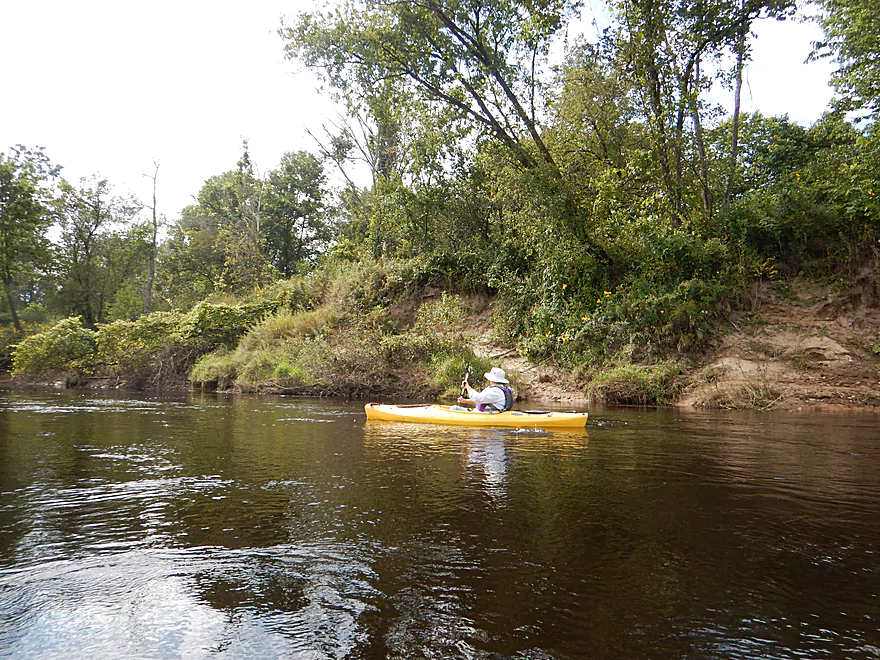
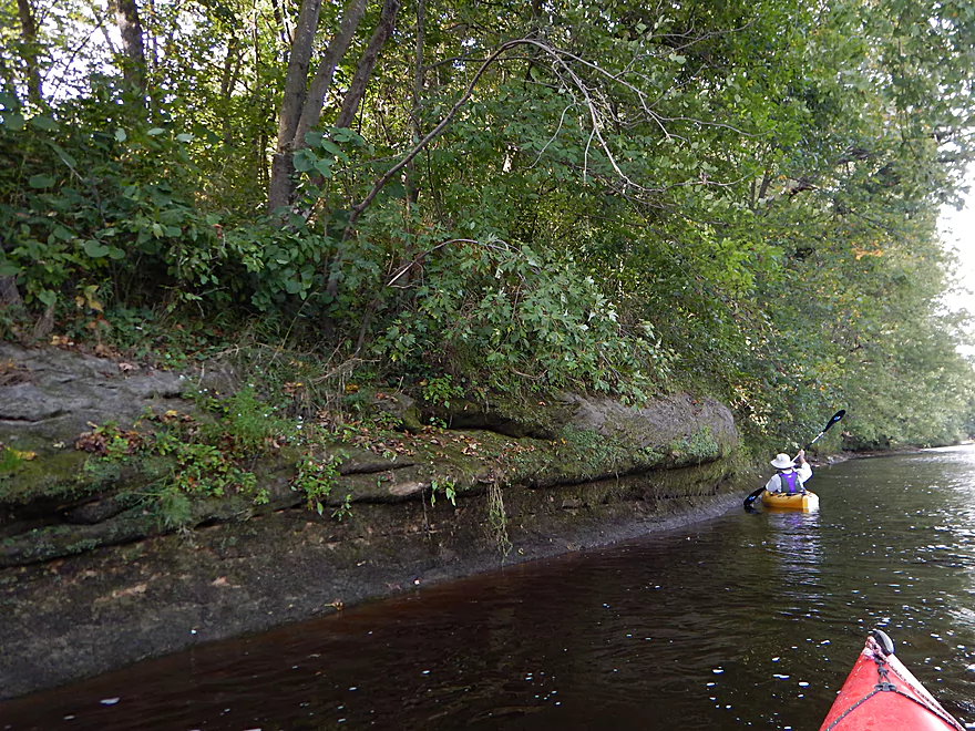
Shoreline stays interesting
In high water you would miss these features
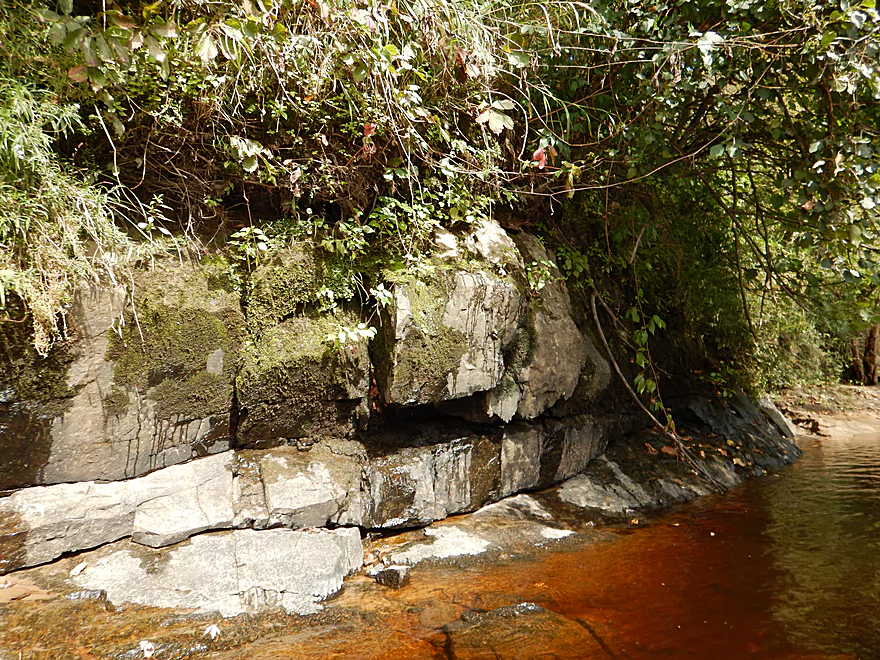
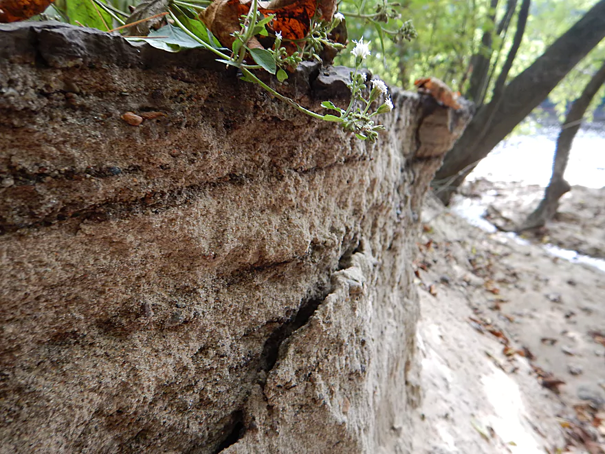
Weeping blocks of stone
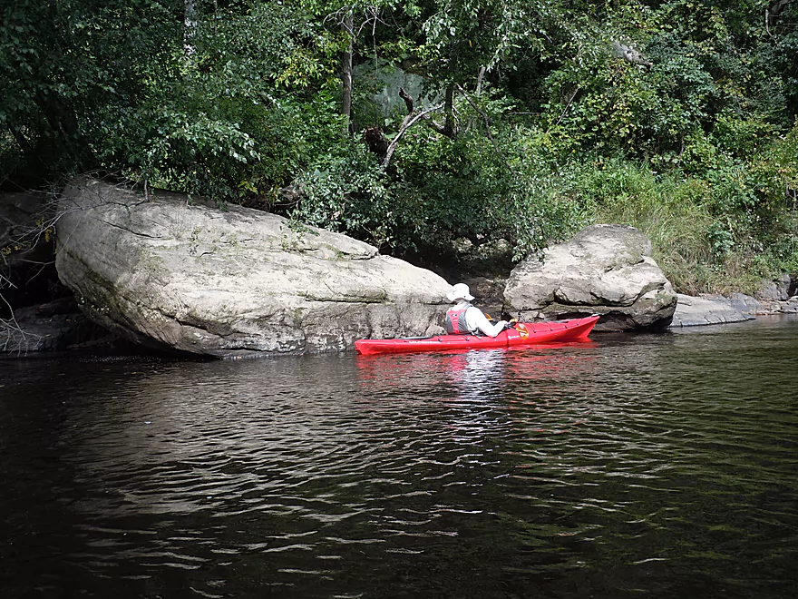
Some of the boulders are huge
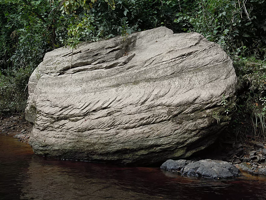
Curious slant patterns
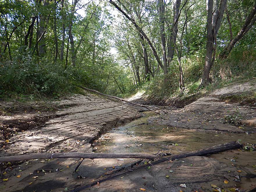
A cute little creek
That created a huge sand canyon
…and cake
Channel starts to slow
One of several nice sandbars
Time for a lunch break
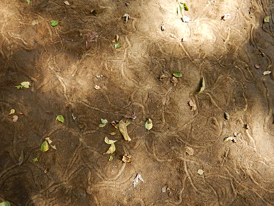
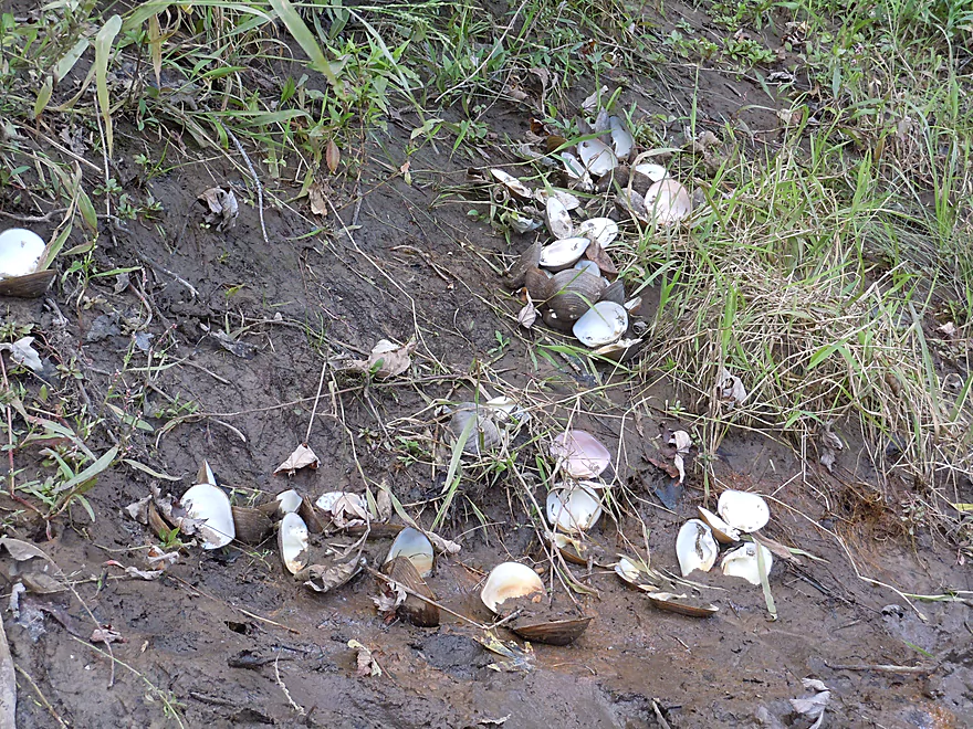
Clam trails…on land
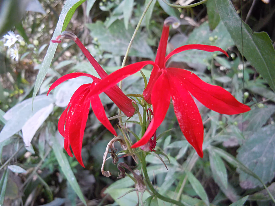
Vivid red cardinal flowers

Trees losing their leaves early
Paddling by the shore to avoid the wind
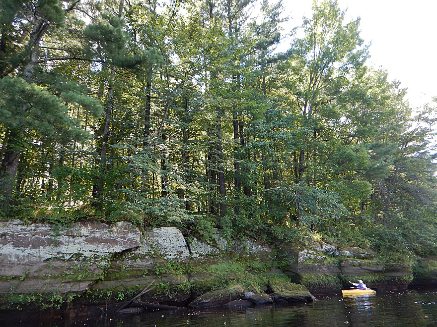
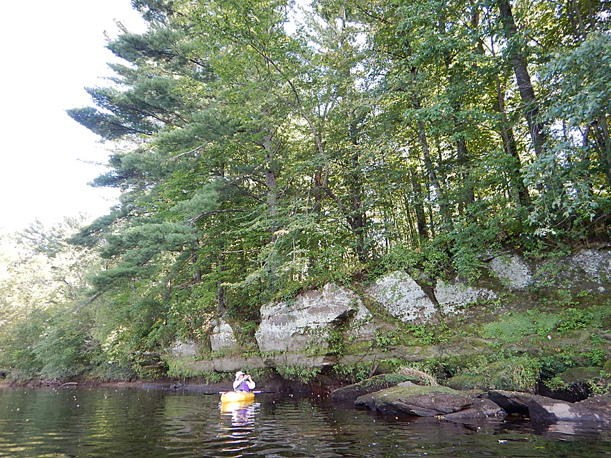
One of several nice sandstone walls
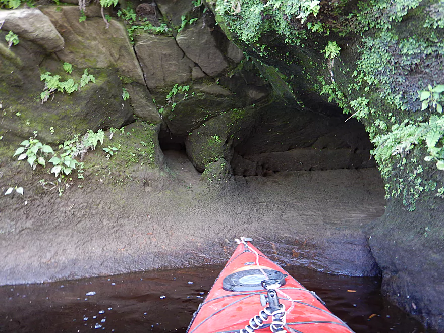
Small little cave
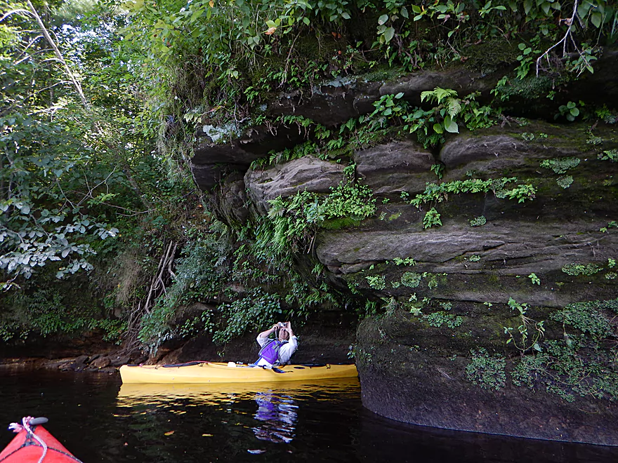
Great plant life growing on the face
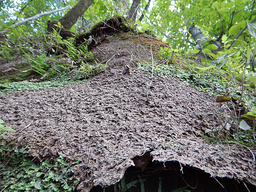
A large area of dead liverworts (curious)
Mouth of Perry Creek
Well worth exploring
There is a nearby public launch
A very sandy river
A super clear Squaw Creek
Future sandbar under construction
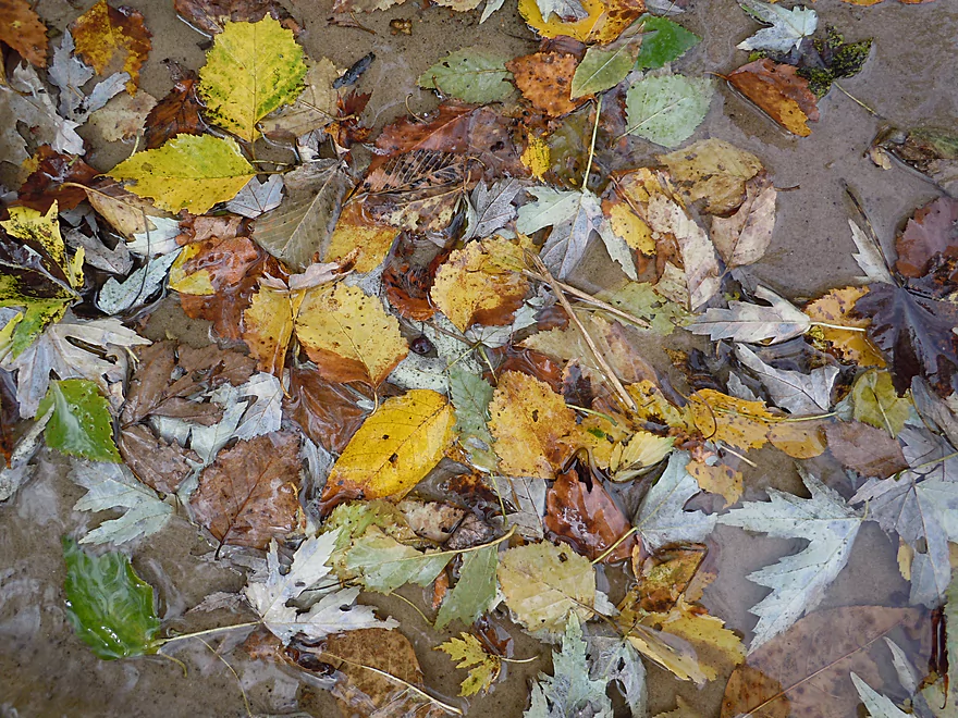
Very early fall color
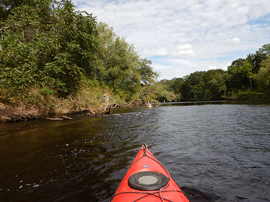
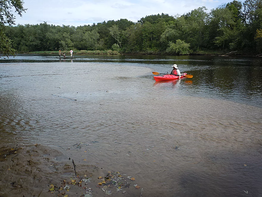
Paddling west of Hawk Island
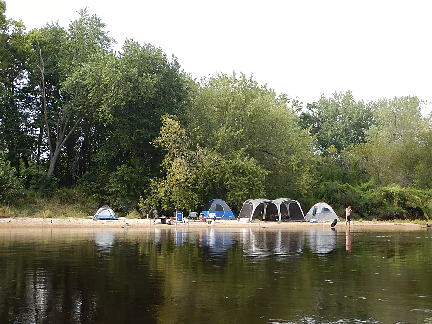
A nice camping sandbar
Micro sea caves
One of many interesting side creeks
Approaching some rapids
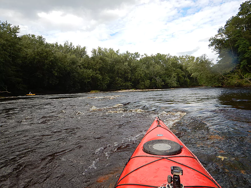
Pretty safe and easy
Just do not get stuck on the wrong chute
Final sandstone outcrop
Somebody had a big dinner
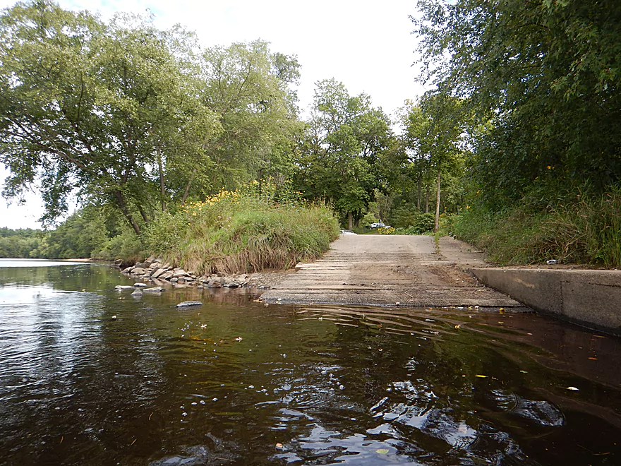
Great take-out at Mason’s Landing
Black River – Dam to Mason’s Landing


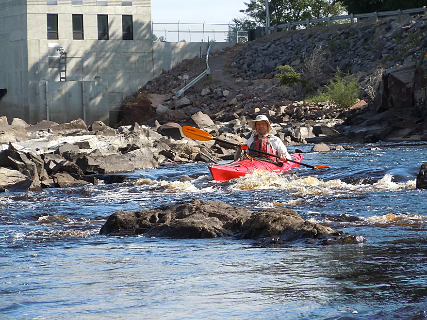
One of the highlights of the entire trip is the put-in. The dam here has buried some scenic falls, but a rocky portage path lets you launch by a truly spectacular granite boulder garden. The more adventurous can launch closer to the dam which allows you to paddle through more of the boulder garden and rapids (Class 1 + Class 3). The Class 3 should be run dead center and scouted beforehand. I veered a bit far to the right, hit a rock and almost got jackknifed (all in the video). Even if you launch below the Class 3 ledge, you’ll still immediately enjoy some fun Class 1 rapids and scenic geology.
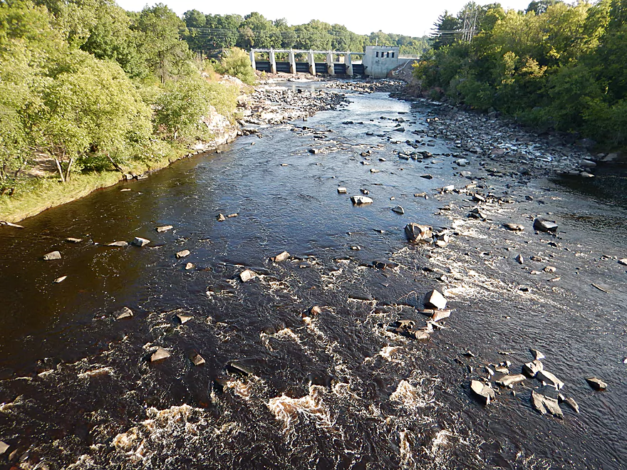
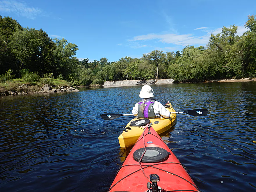
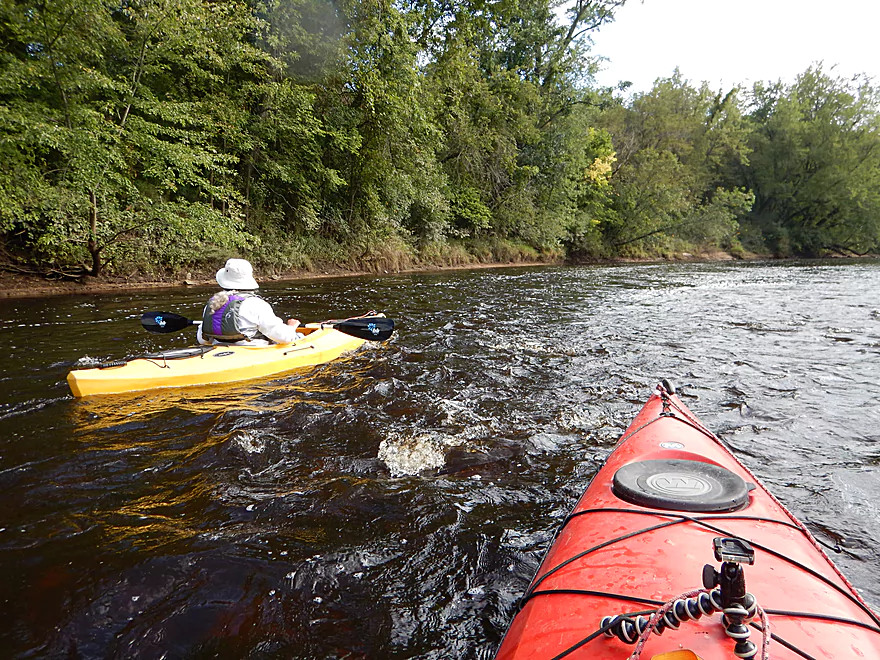
After the E. Main Street bridge, the major rapids and boulder gardens go away. The dam spillway joins the river here, which is scenic in its own right with some Class 1’s. In theory you could park by the powerhouse and launch southeast of the access bridge to experience the full length of the spillway which might be entertaining (but then you miss out on the boulder gardens).
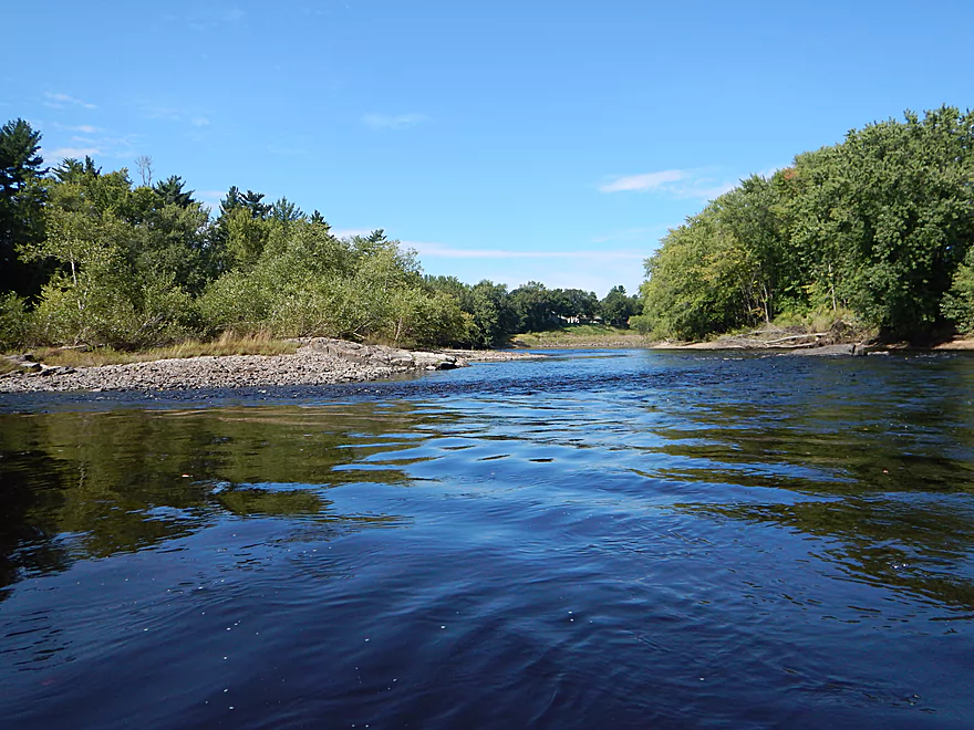
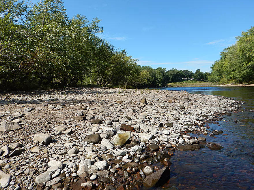
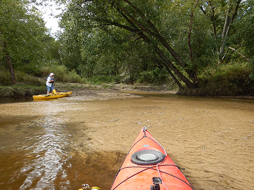
Back on the main channel, you’ll see a massive gravel bar (well depending on the depth) and some light rapids along the eastern bank. Don’t run these yet as nearby Coffee Creek joins the Black and is worth checking out. The creek is too small to paddle, but is scenic with several natural waterfalls.
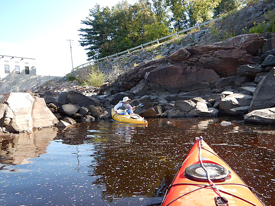
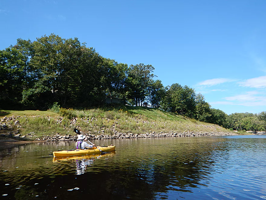
The river then wraps sharply to the right with a large rocky dike on the right protecting the city of Black River Falls from flooding. After you scootch through a cool granite constriction in the river, you’ll see a large sandy bank on the right. Most paddlers put in here (technically Bruce Cormican Landing), which is a shame considering all the cool things just upstream.
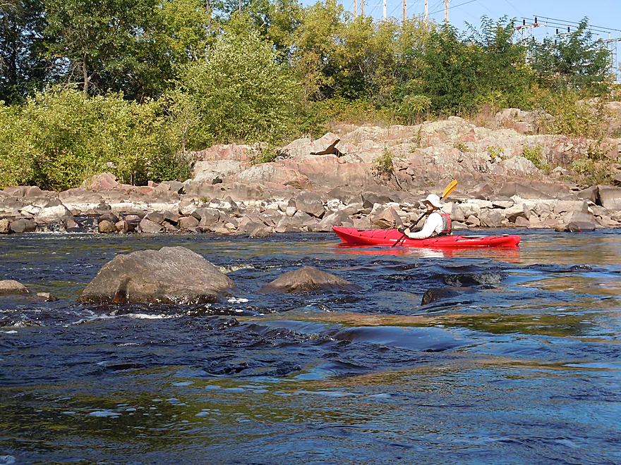
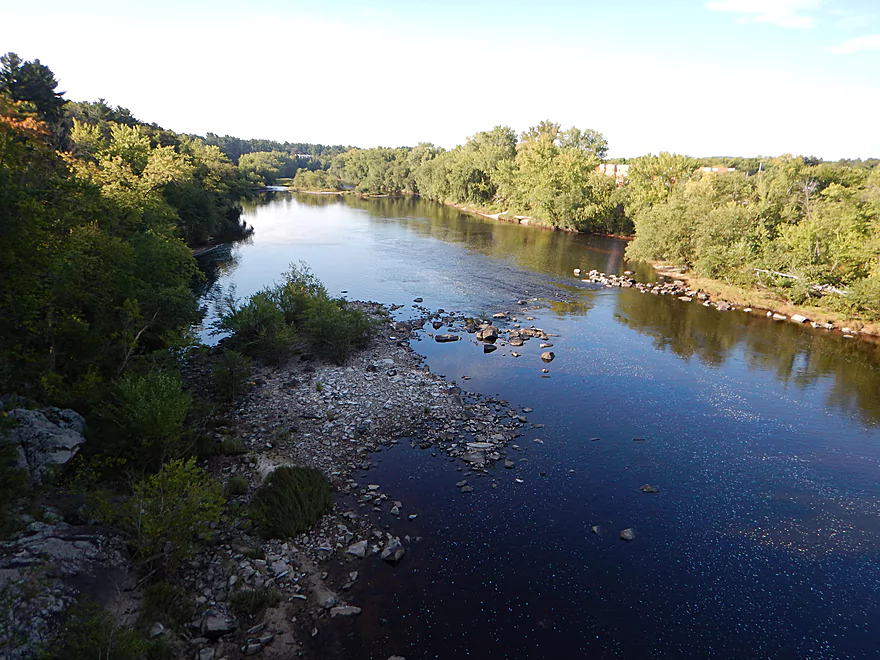
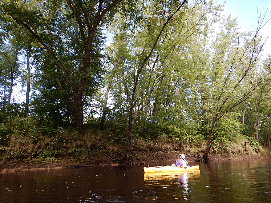
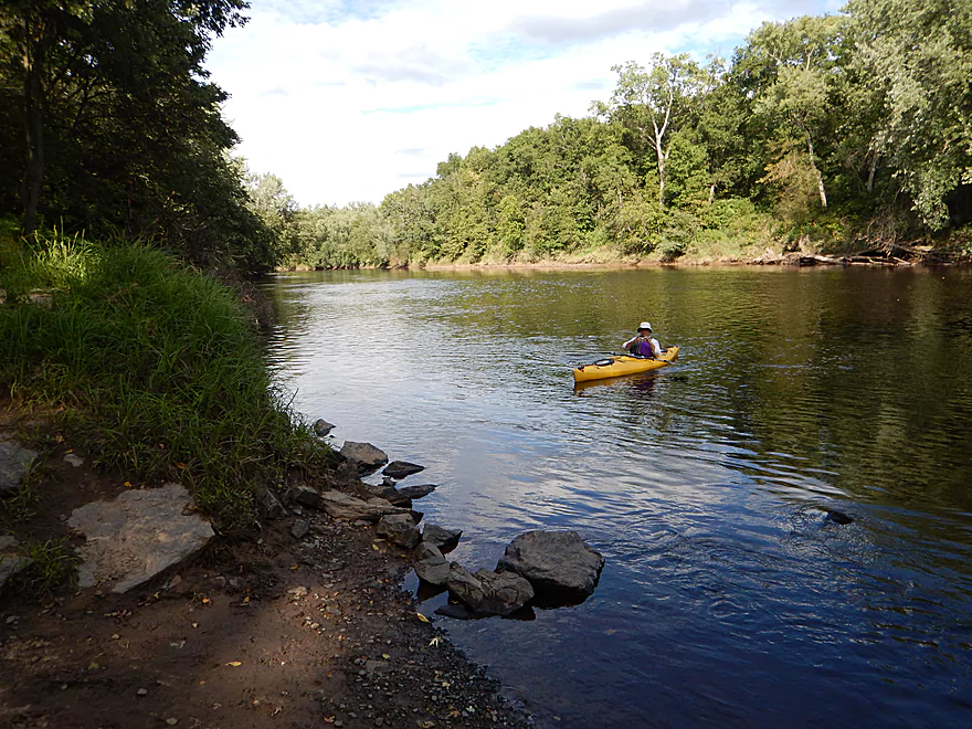
For the next few miles, the Black slows down and becomes a bit more predictable, but is still a neat river. You’ll see occasional rock outcroppings, sandbars, gravel bars, and seeps. Several of these sandbars are created by gorgeous little micro-creeks whose channels carve cool canyons through the sand. This is not a bad river for picnic options and if you view the map in satellite view, you’ll see the best sandbars.
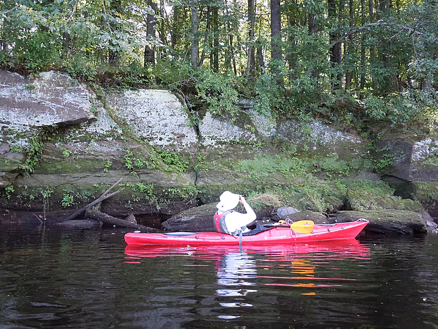
Just prior to Perry Creek, you’ll see beautiful rock walls on the south bank. Lush mosses and plants grow on the exposed sandstone, while white pines tower overhead. It is interesting to see how the river transitions from granite in the upper portion to sandstone in the lower portion.
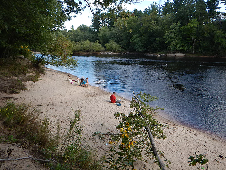
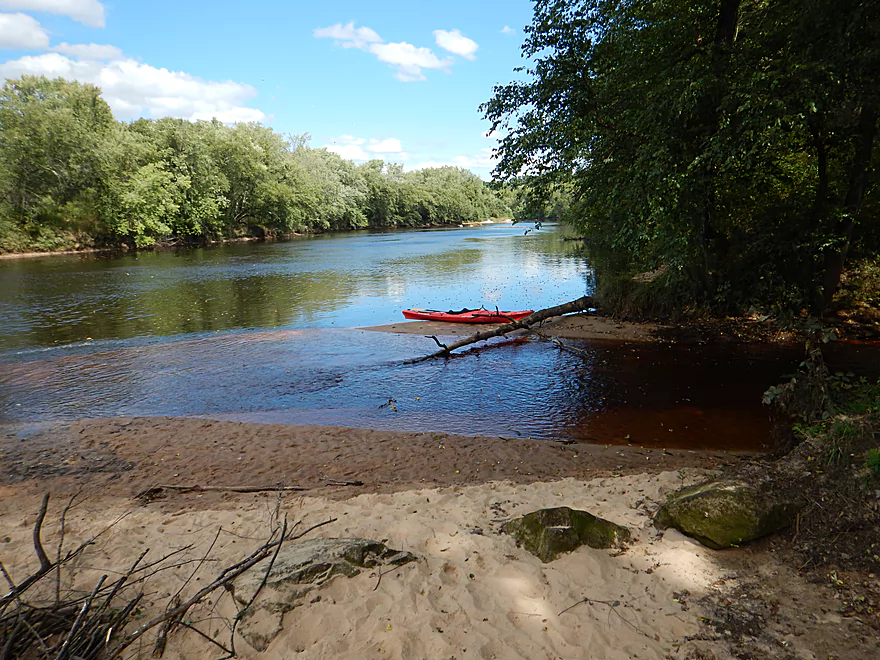
Soon after, you’ll see Perry Creek entering the Black in a jutting sand delta. If you just paddle by this, you’ll have missed one of the best reasons to do this trip. I absolutely suggest wading upstream with your boat as far as you can to experience the rock canyons and clear root beer water. There is a nearby trail system that runs along the creek that you can use as well (but the experience isn’t the same as being IN the creek). Below the mouth is a public landing and a park, which is an alternate access option.
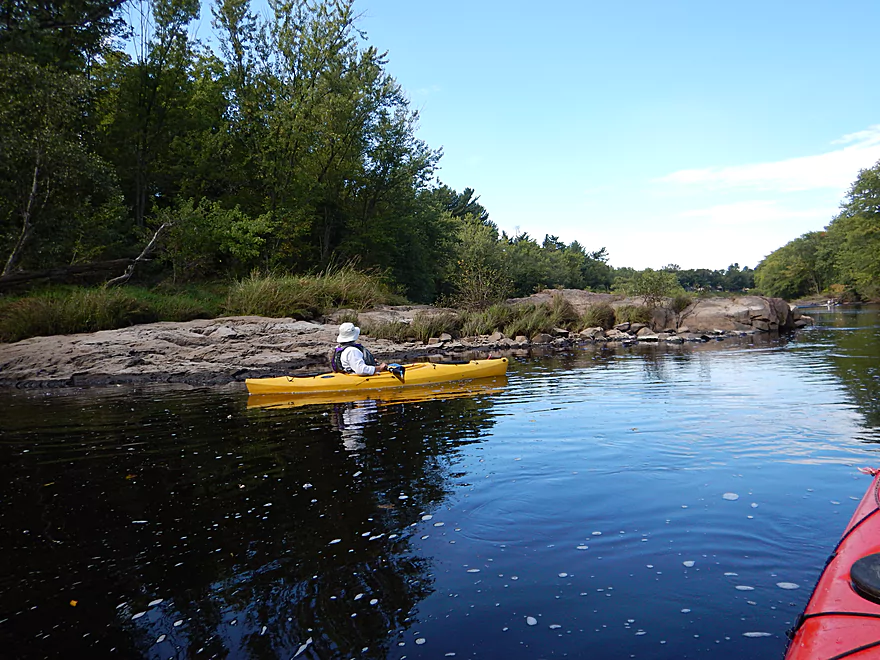
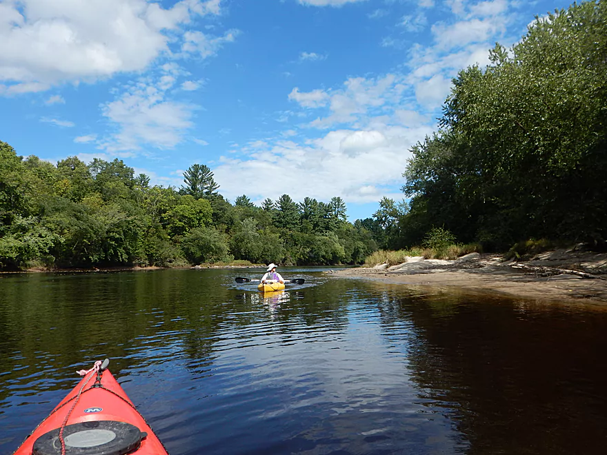
Continuing on, you’ll shortly come across Squaw Creek on your right and its crystal water. This is a significant landmark as soon after is the massive Hawk Island and a strategic choice to make. Most paddlers go right/west. Here there are a few fine sandbars, and the rapids make a return but are nothing greater than Class 1. If you choose to go left/east, then expect a much longer detour, narrower channel and slower current. This could be nice with some rock outcrops on the far eastern edge, but I haven’t explored it.
The trip concludes at Mason’s Landing which is a great canoe launch. If you are willing to go 9 miles further, there is another great stretch of the Black that you can do and that I have previously reviewed (a good section, but I liked this upstream section better).
There is a public parking lot east of the Black River Falls dam. No fees to park here, but it can fill up, forcing you to park on the road. You can walk down the portage path to launch your boat. Note, this path is VERY rocky which some might find annoying (I didn’t mind). You can launch upstream of the Class 3 rapids or below. There is no outhouse.
Mason’s Landing is a great take-out. Good parking and no fees, but no outhouse. Mosquitoes can be a problem here.
For bike shuttlers, this should be a relatively easy 4.1 mile stretch.
Otherwise, here are a few local liveries:
- Black River Canoe Rental: (715) 284-8136 – N5399 Wisconsin 54, Black River Falls, WI 54615
- Black River Express Canoe & Kayak Rental: (608) 488-7017 – 301 S Washington St, Melrose, WI 54642
- Lost Falls Campground: (800) 329-3911 – N2974 E. Sunnyvale Road, Black River Falls, WI 54615
No logjams, no low bridges, no wild rice… There are rapids though. The rapids west of Hawk Island are easy Class 1’s. There is a Class 3 downstream of the dam, but you can also launch below this. Do scout this as you do need to miss the rocks below. Immediately following this, there are some fun Class 1 rapids, but these quickly peter out by the time you get to the E. Main Street bridge.
Moderate current with a number of riffles and a few rapids.
The trip was done at a slightly above normal flow rate of 500 CFS per a local gauge. Because the river has nice sandbars and gravel bars, you might miss much of these at 550 CFS and up. Even at its lowest (~300 CFS), I doubt the river ever becomes to shallow to paddle. The river probably gets too ugly at 1000 CFS and up. At peak times the Black can reach flow rates of 3000 CFS.
A few eagles, many clams (and clam trails), dragonflies, and countless mosquitoes. The highlight was two tame wood turtles which are relatively uncommon on Wisconsin Rivers.
Castle Mound is nearby and offers a good view of the state forest if you are willing to hike up to the mound.
Quick Overview
Black River:
- Upstream of Hwy 73: Obscure sections of the Black with little known about them. Some legs will have logjam issues.
- Hwy 73 to Lake Arbutus: 48 miles. Good legs with a mix of rapids, boulder gardens and undeveloped banks. Only reason these legs don't receive more paddling traffic is because they're located away from population centers.
- Lake Arbutus: 3 miles. A scenic but challenging lake because of the waves.
- Hatfield Dam to Halls Creek Landing: 7 miles. Some of the best and most fun whitewater on the Black River.
- Halls Creek Landing to Black River Falls Dam: 6 miles. An impounded part of the river, but nice with cool cliffs.
- Black River Falls Dam to North Bend: 37 miles. This is the heart of the Lower Black and sees the most paddling traffic. No major rapids, but there are many scenic cliffs and creek inlets.
- North Bend to Mouth: 30 miles. This is the second half of the Lower Black. While not as scenic, there are still cool sandbars and sandbanks. Few paddle these stretches.
Noteworthy Tributaries:
- Robinson Creek: One of the best paddles in all of Wisconsin.
- Halls Creek: Also one of the best and with amazing sandstone walls.
- Morrison Creek: Very scenic creek with some fun whitewater.
- Wedges Creek: Great paddle with amazing boulder gardens.
- East Fork of the Black River: Some fun riffles and unique granite geology.
- Perry Creek: Shallow but a super scenic creek.
- Dickey Creek: A wonderfully scenic creek with fantastic sandstone…but too many logjams.
- Beaver Creek: Some fun rapids and amazing sandstone in Galesville, but logjams on the downstream portions.
- Popple River: A shallow whitewater river that is very nice.
- Arnold Creek: A pleasant tributary to Lake Arbutus with really nice reflections.
- Rock Creek: Many scenic boulder gardens, but usually this creek is too shallow to run.
- Roaring Creek: Very scenic creek with a great waterfall at the mouth, but might be a challenge to paddle.
- Vismal Creek: Super scenic but has a lot of logjams and is shallow. Requires very high water conditions.
- Plus countless small creeks that are too small to paddle but quite fun to explore by foot. If you know of viable paddling options, let me know! Am very curious to know more about Douglas Creek, Levis Creek, O’Neal Creek, and Crawley Creek.
Detailed Overview
Headwaters to Neillsville:
- Upstream of Division Drive: Likely too many logjams to be navigable.
- Division Drive to Sawyer Ave: (6.5 miles) Rocky and a few light rapids. Maybe 4 logjams.
- Sawyer Ave to Hwy 64: (2.5 miles) Rocky and a few light rapids.
- Hwy 64 to Bridge Road: (14.4 miles) Solid prospect reviewed by Mike Svob. Some Class 1 rapids and nice gravel bars. Intermediate access points at Bahnkes Ave and Hwy AT.
- Bridge Road to Hwy X: (6.0 miles) Little is known of this section…likely pretty simple.
- Hwy X to Colby Factory Road: (6.0 miles) Little is known about this section…likely some rapids and outcrops. Intermediate alt access points at Hwy 29 and Hwy N.
- Colby Factory Road to Popple River Mouth: (7.9 miles) This stretch has far fewer rapids than downstream legs with only a few minor rapids. It should still be pleasant though.
- Popple River Mouth to Reese Ave: (5.3 miles)
- Popple River Mouth to Warner Drive: (1.0 miles) This is a slower and less interesting stretch, but does include 4 Class 1's and scenic Hemlock Rapids which are Class 3.
- Warner Drive to Greenwood Park: (3.4 miles) A good leg with many rapids (3 Class 2's and 17 Class 1's).
- Greenwood Park to Reese Ave: (0.9 miles) A slower stretch with just 2 Class 1's. Part of this passes through the community of Greenwood.
- Reese Ave to Twenty Six Rd: (5.1 miles)
- Reese Ave to Sladich Rd: (0.7 miles) A mostly nondescript wooded stretch. The exception is Greenwood Rapids where an island splits the river. The right side is scenic, but the left side has fun Class 3 rapids.
- Sladich Rd to Willard Rd: (1.6 miles) A somewhat slow and relatively uninteresting leg. Highlights include one nice outcrop, a few gravel bars and a 400' stretch of Class 1 rapids.
- Willard Rd to Twenty Six Rd: (2.8 miles) A great leg with 10 Class 1's and 2 Class 2's. Highlights also include scenic boulder gardens and a few outcrops.
- Twenty Six Road to Hwy H: (5.0 miles) Multiple Class 1 & 2 rapids.
- Hwy H to Grand Ave/Hill Road: (8.0 miles) A great trip with several Class 2 rapids and scenic granite outcrops.
Note, for more details on the Upper Black, I highly recommend “Indian Head Rivers” by Michael Duncanson.
Alternate Black River Trips – Neillsville to Black River Falls:
- Grand Ave/Hill Road to Opelt Road Landing: (6.7 miles)
- Grand Ave/Hill Road to Hwy 10: (2.2 miles) Nice section with a handful of rapids. These are mostly Class 1 at lower depths, but strengthen to Class 2 during high flow rates.
- Hwy 10 to River Road Landing: (4.3 miles) Fantastic whitewater section. Maybe six Class 2’s and two class 3’s. Scenic boulder gardens and a few outcrops.
- Opelt Road Landing to Bryan Ave Bridge: (1.1 miles) Not sure there is anything special about this stretch.
- Opelt Ave Bridge to Hwy 95: (4.4 miles) Ok…nothing special.
- Hwy 95 to West Arbutus County Ramp/Hatfield Dam: (4.8 miles)
- Hwy 95 to North Arbutus Boat Landing: (2.4 miles) Includes a scenic gorge, boulder gardens and rapids including the Class 3 Red Granite Rapids. River slows after rapids.
- North Arbutus Boat Ramp to West Arbutus County Ramp: (2.4 miles) A large open water paddle on Lake Arbutus that can feature challenging waves on summer afternoons.
- Hatfield Dam to West/East Channel Confluence: 0.2 or 0.3 miles.
- West Dam to West/East Channel Confluence: 0.3 miles. There is a large boulder field and Class 2 rapids below the west dam. At the outlet of the west channel is a Class 4 drop. This is easy to scout and portage.
- East Dam to West/East Channel Confluence: 0.2 miles. Perhaps the most extraordinary rapids in the state with Class 4/5+ rapids. The action starts below the dam where steep granite banks narrow the river significantly and force it down deep chutes. The gorge starts with Class 2-3 rapids but ends with two significant drops. American Whitewater warns “between the dam and this point lie some serious drops which contain near inescapable boiling cauldrons at moderate to high flows”.
- Hatfield Dam Confluence/West Clay School Road to Powerhouse Road Landing: (3.1 miles)
- Hatfield Dam Confluence to Hwy K: (0.3 miles) One of the most scenic paddling areas in the state with massive granite outcrops. There is one set of Class 2 rapids.
- Hwy K to Powerhouse Road Landing: (2.8 miles) The first half mile by Hwy K is very scenic and contains one Class 3. The second mile is mostly flatwater. The third mile is almost continuous rapids and features one Class 3.
- Powerhouse Road Landing to Halls Creek Landing: (4.0 miles) Scenic section with a few Class 2 rapids and a steep ledge.
- Halls Creek Landing to Black River Falls Dam: (6.2 miles) Wonderful sandstone cliffs.
Alternate Black River Trips – Black River Falls to Mouth:
- Black River Falls Dam to Mason’s Landing: (4.7 miles) A great little section.
- Mason’s Landing to Irving Landing: (9 miles) A good section.
- Irving Landing to Lost Falls Campground (2.3 miles) A popular stretch. Highlights include a few small outcrops, two tiny waterfalls, several impressive sandbars, and one large sandbank. A side hike to Roaring Falls can be arranged. Note Lost Falls Campground is private and you must purchase a pass from them to use their access.
- Lost Falls Campground to Grinde Landing: (6.4 miles) A popular section with some nice outcrops and a waterfall by Roaring Creek. Wolf Creek may also have a cool slot canyon. The river splinters into multiple channels, some of which may be quite shallow in later summer. As of 2023, Grinde Landing is closed because somebody stole the owner's deer stand.
- Grinde Landing to Melrose Landing: (3.9 miles) A shorter section but with a really nice rock outcrop before Melrose Landing. As of 2023, Grinde Landing is closed because somebody stole the owner's deer stand.
- Melrose to North Bend: (10.1 miles) Likely the most popular stretch with the best sandbars on the river, three sets of outcrops, and a few waterfalls.
- North Bend to Hwy 53: (13.3 miles) Likely a nice paddle with sandbars, large sandbanks and maybe a few outcrops. Unfortunately it is very long.
- Hwy 53 to Hwy 35: (8 miles) A nice section with epic sand banks.
- Hwy 35 to Lytle Road: (4.0 miles) Goes through the Van Loon Floodplain Forest. This can be a shallow trip but features many nice sandbars.
- Lytle Road to Fred Funk Boat Landing (Mississippi): (5.0 miles) Multiple options because of the river delta.
Trip Map
Overview Map
Video
Photos Size: