
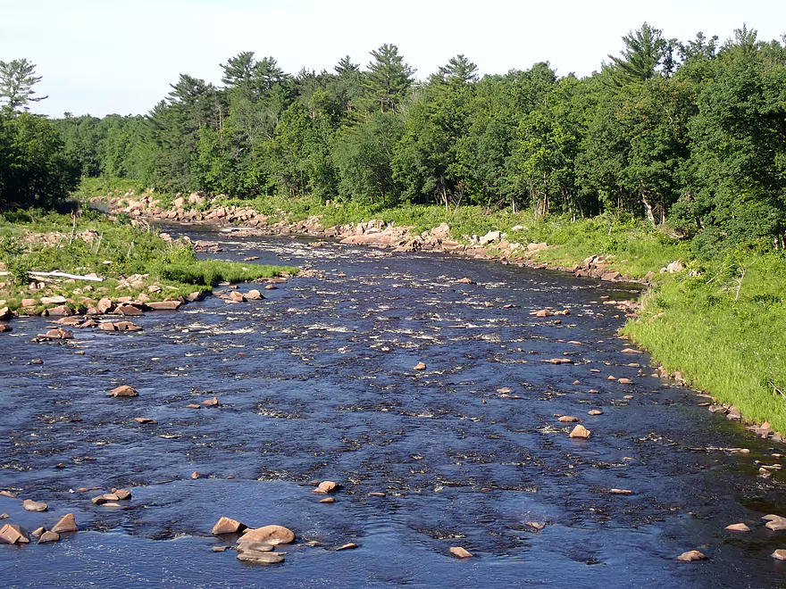
View from Hwy 95
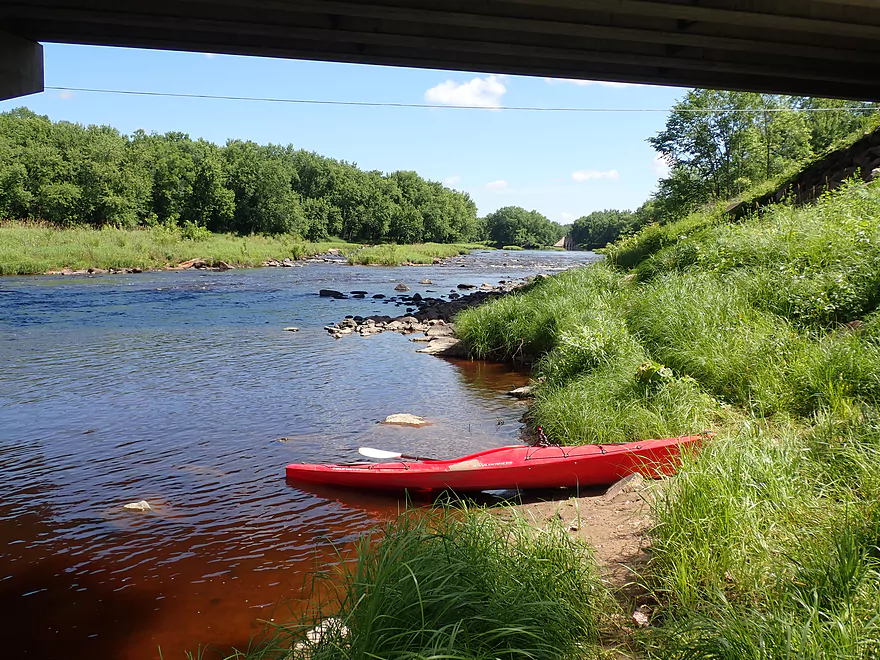
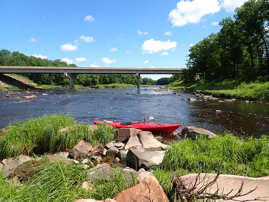
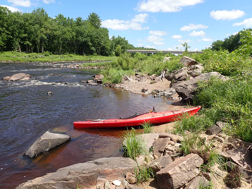
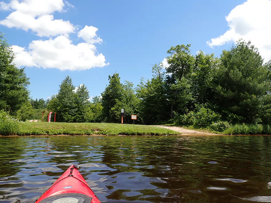
Nice put-in below the bridge
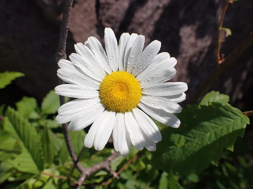
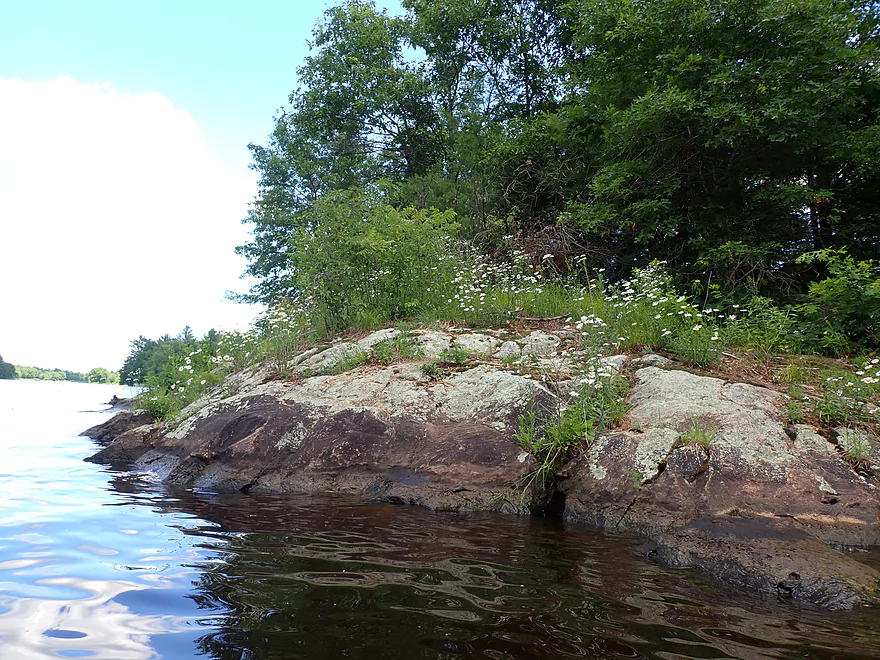
Ox-eye daisy at the put-in
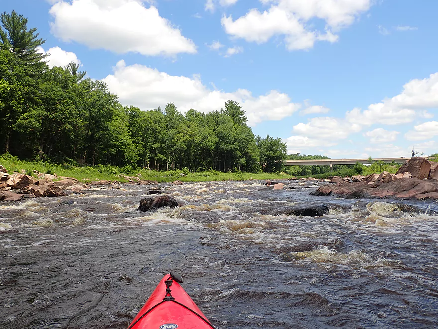
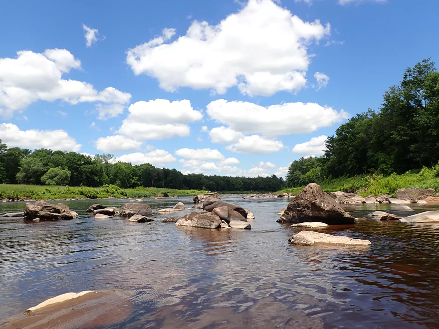
Some Class 1 rapids right off the bat
Getting out on an island to scout and take pictures
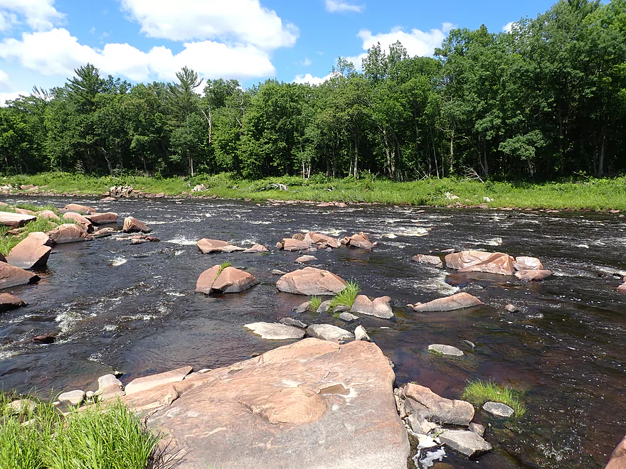
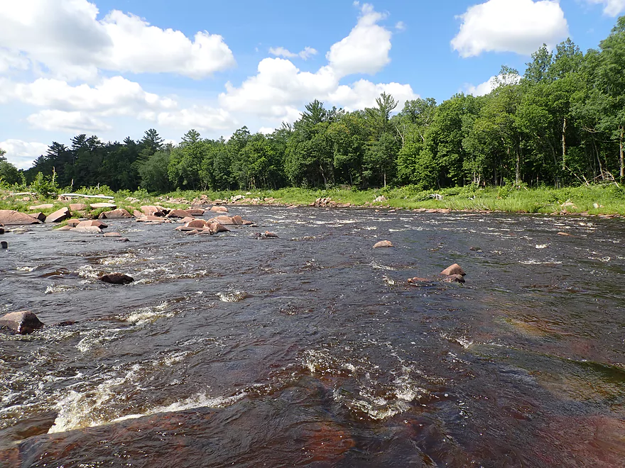
Fun and manageable rapids to start
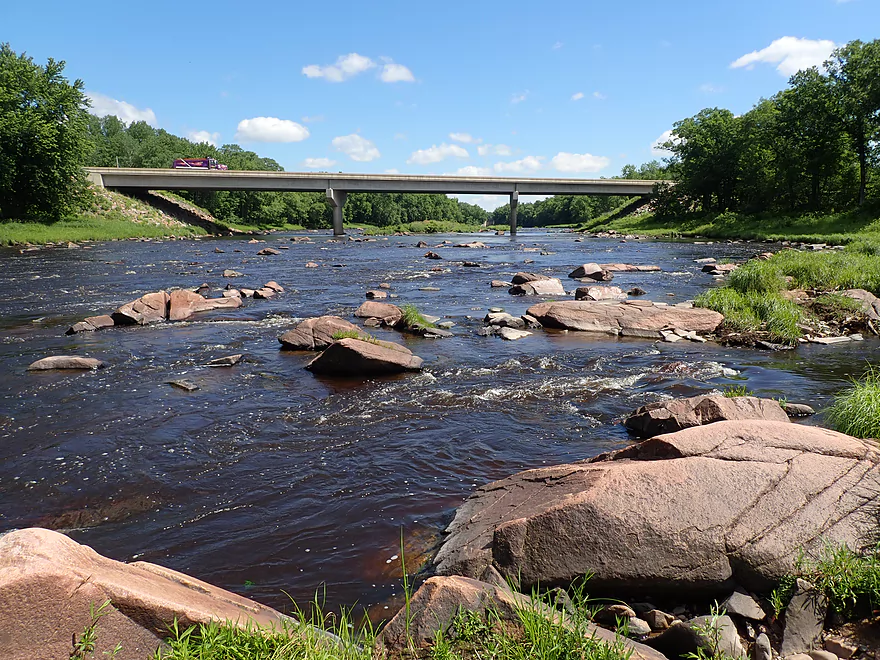
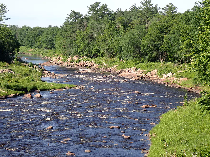
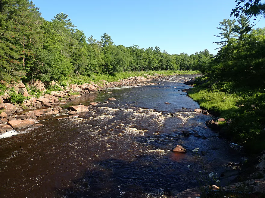
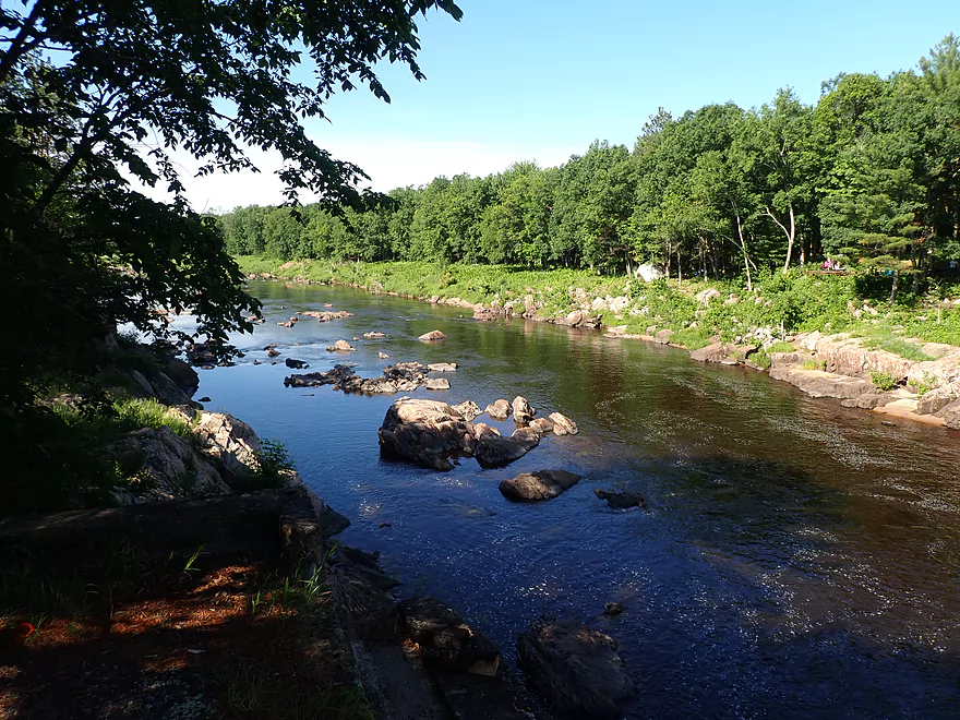
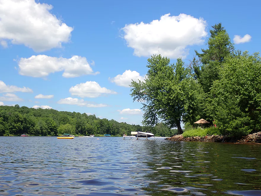
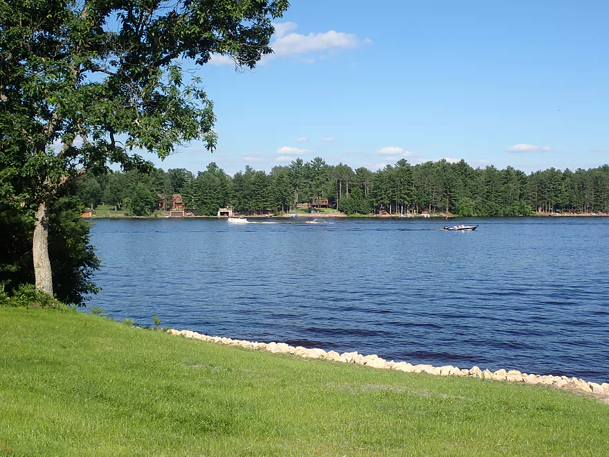
Scenic view back to bridge
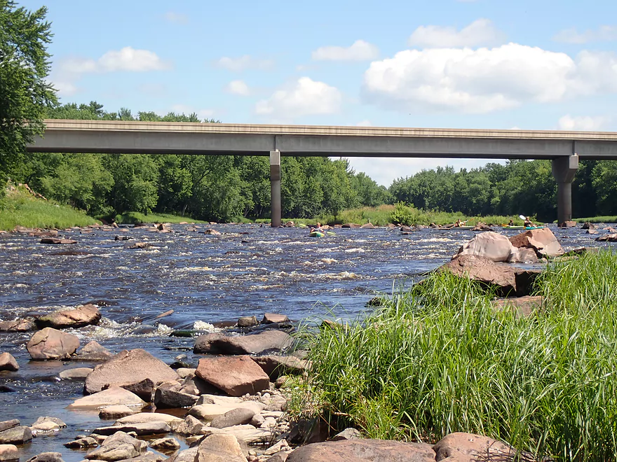
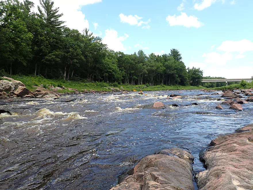
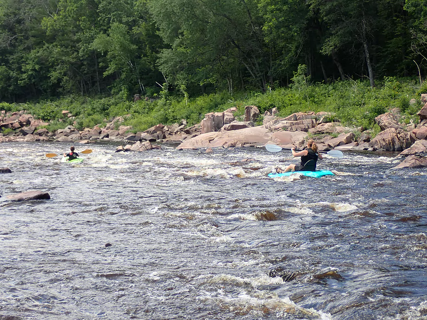
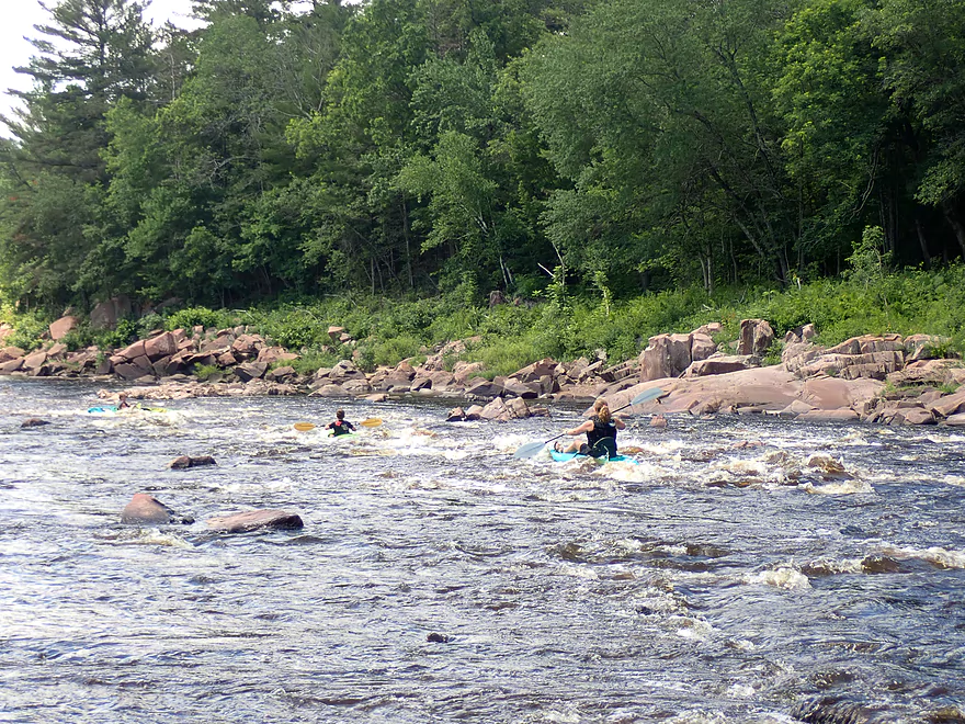
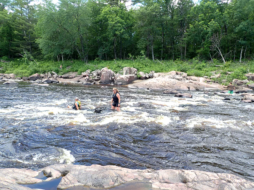
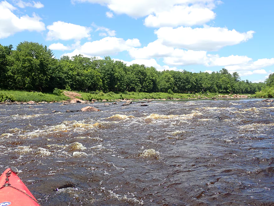
A family of kayakers running the rapids
Class 2’s follow the Class 1’s
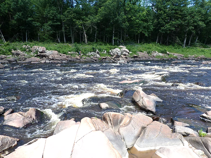
Side view of the Class 2’s
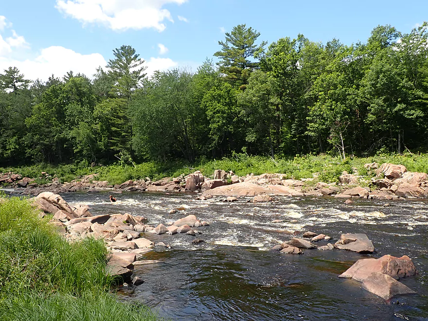
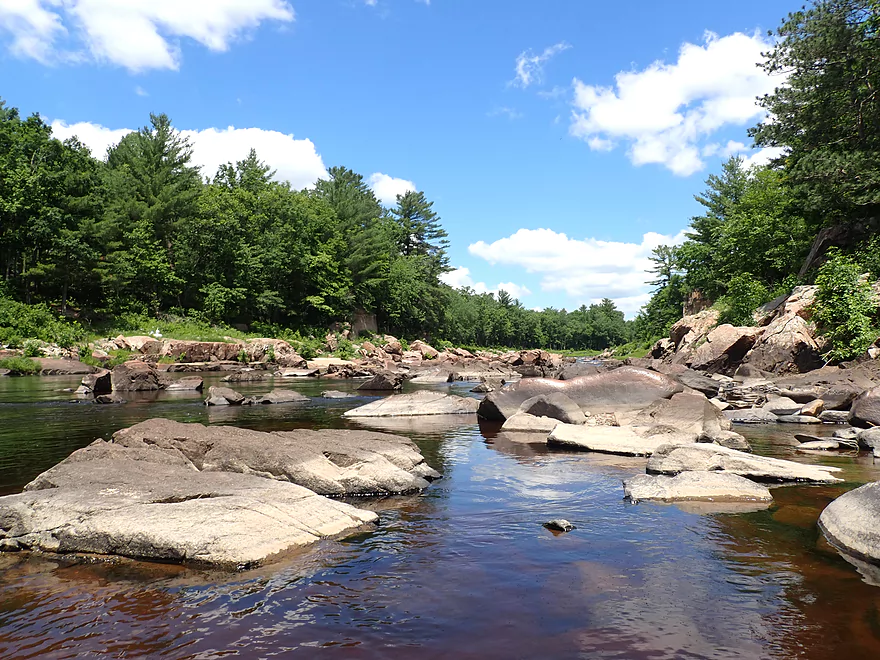
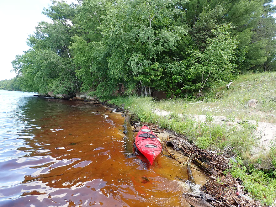
Downstream from the Class 2’s are the Red Granite Rapids
These are Class 3
Not completely visible…but the far left kayak hits a rock and goes over
Trying to free the pinned boat
I bring my kayak down to help
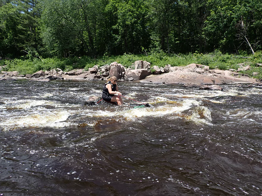
Trying to free the boat with my rope…no luck
Help arrives and it’s finally freed
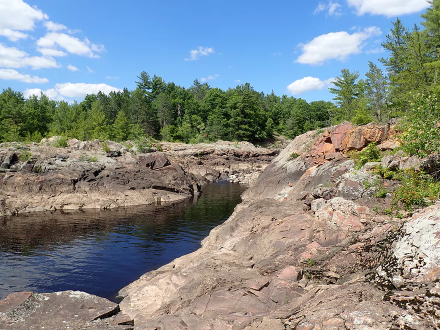
Reverse view of Red Granite Rapids…that middle boulder is where the pin happened
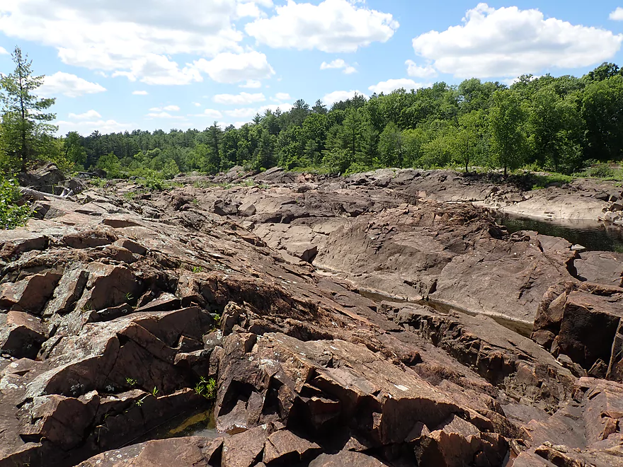
Zoomed out view
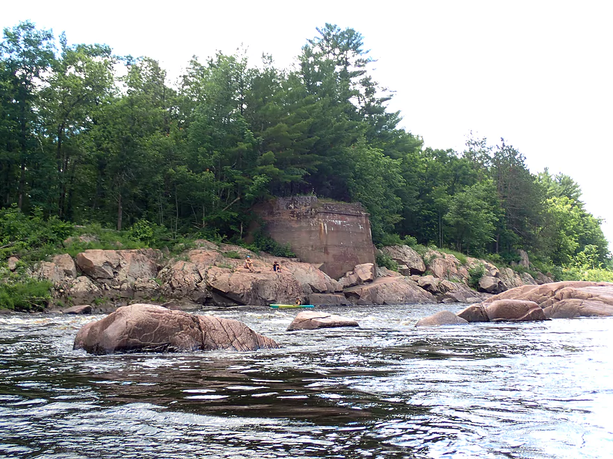
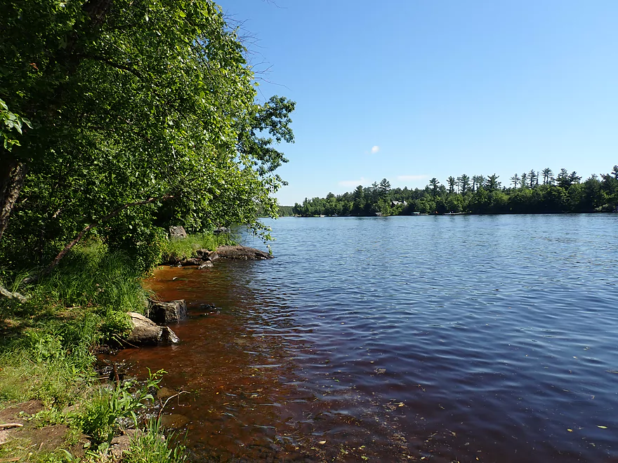
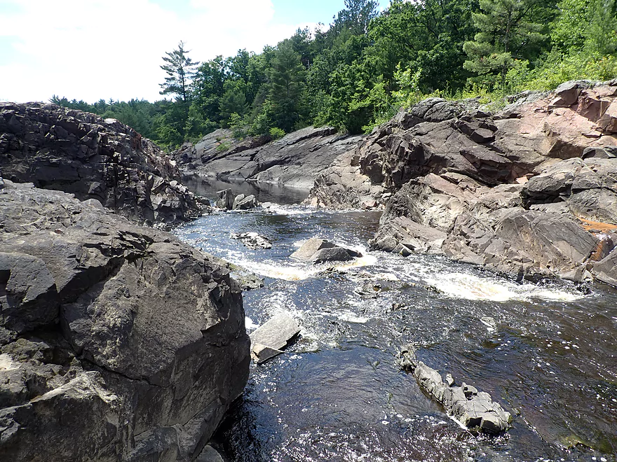
An attractive gorge follows Red Granite Rapids
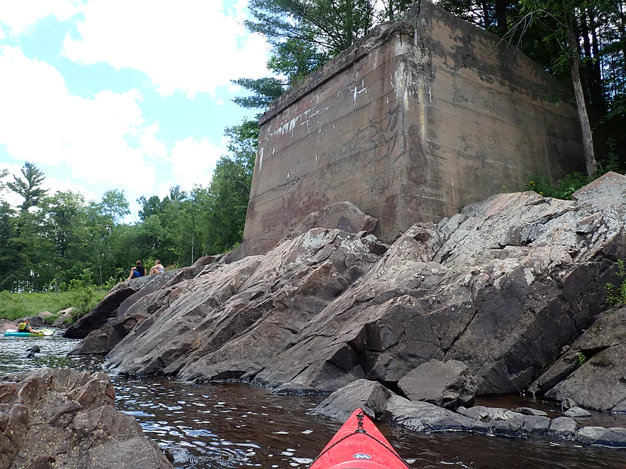
The remains of an old bridge abutment
View downstream
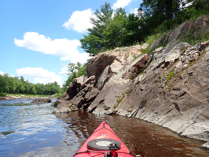
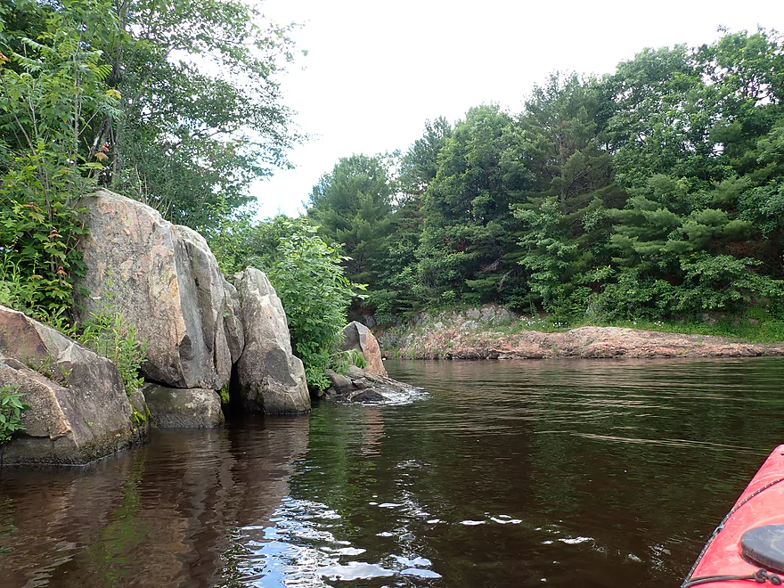
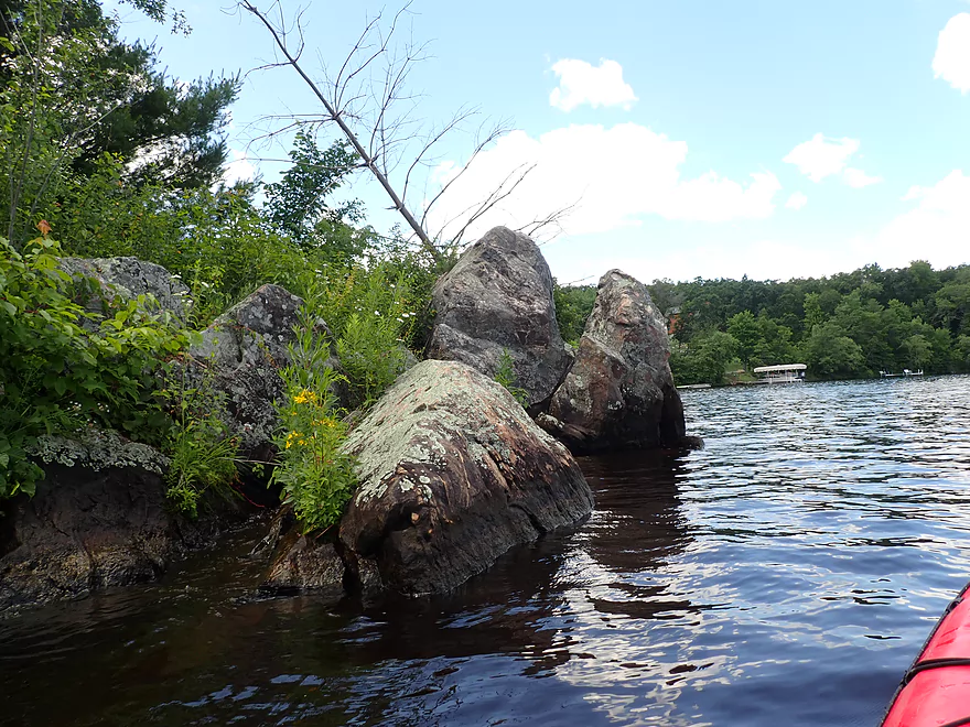
Very rugged shoreline
Reverse view of gorge
My favorite photo
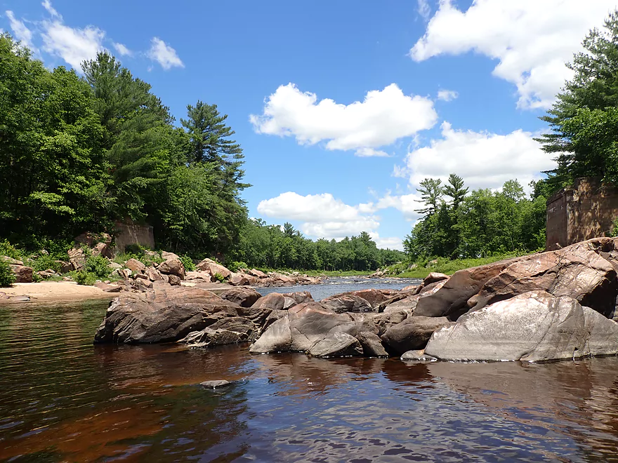
Last of the rapids
It’s flatwater from here on
Last of the nice boulder gardens
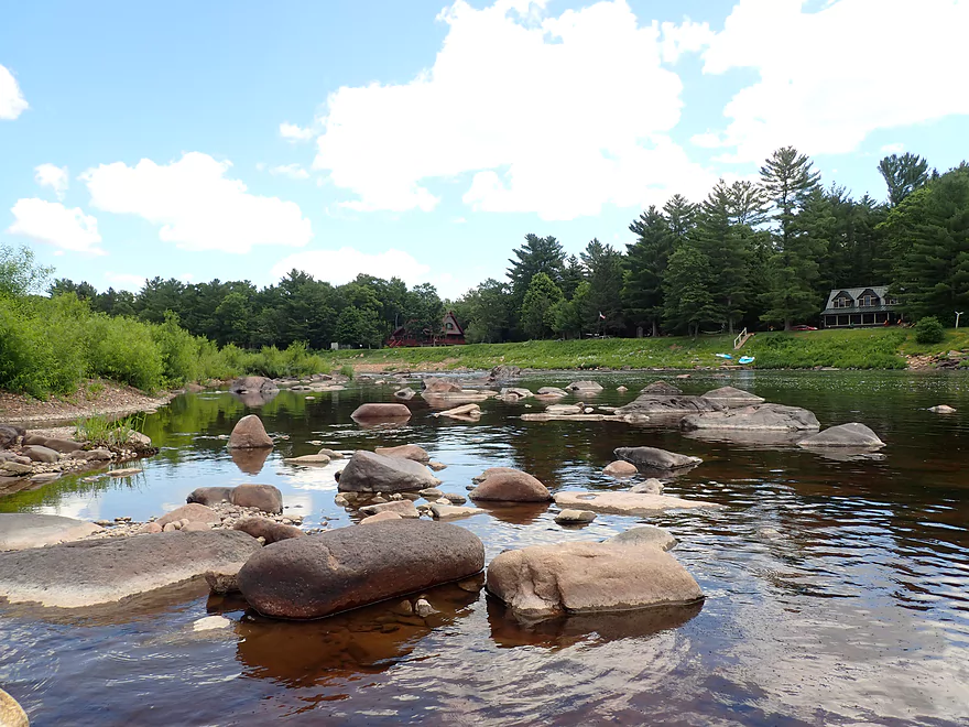
Dilly’s Landing (a private, but possible access option)
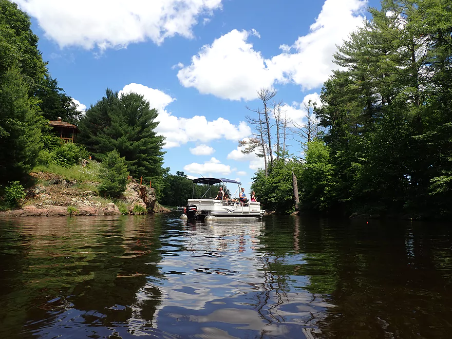
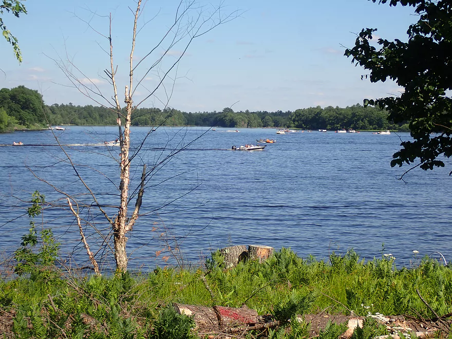
Starting to see motorboat traffic
French Island is pretty cool
Hiding behind the island…
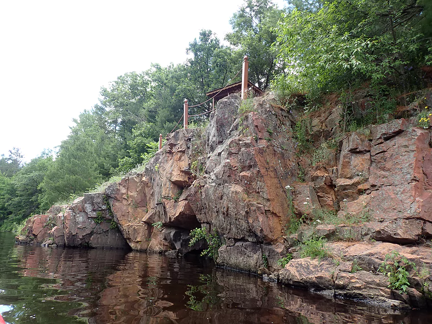
Is a cool granite outcrop
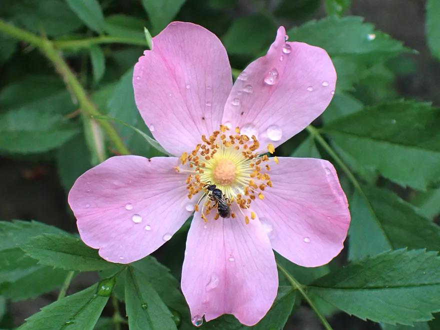
A wild rose on French Island
Nice quiet backwater
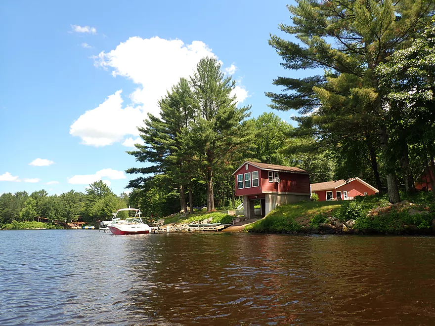
At this point the banks become heavily developed
All the landings were busy except for this one (Windy Point Boat Landing)
Another small island
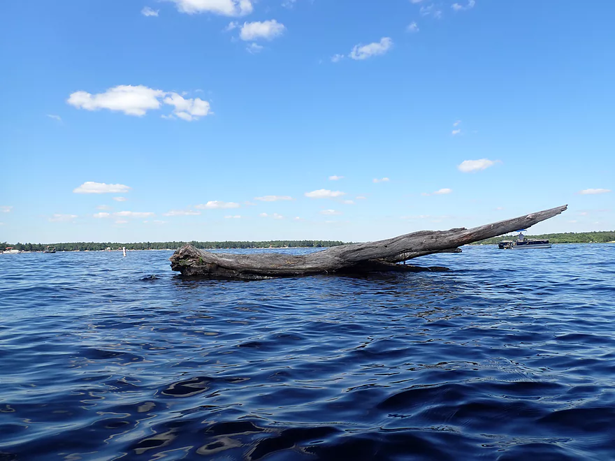
The tip of the iceberg…many scenic outcrops are likely submerged by the dam
Pretty wooded shoreline despite the development
The North Arbutus Boat Landing is a good access
Arnold Creek
Scenic area…there is a nearby launch here
River starts to widen
The East Branch coming in from the east
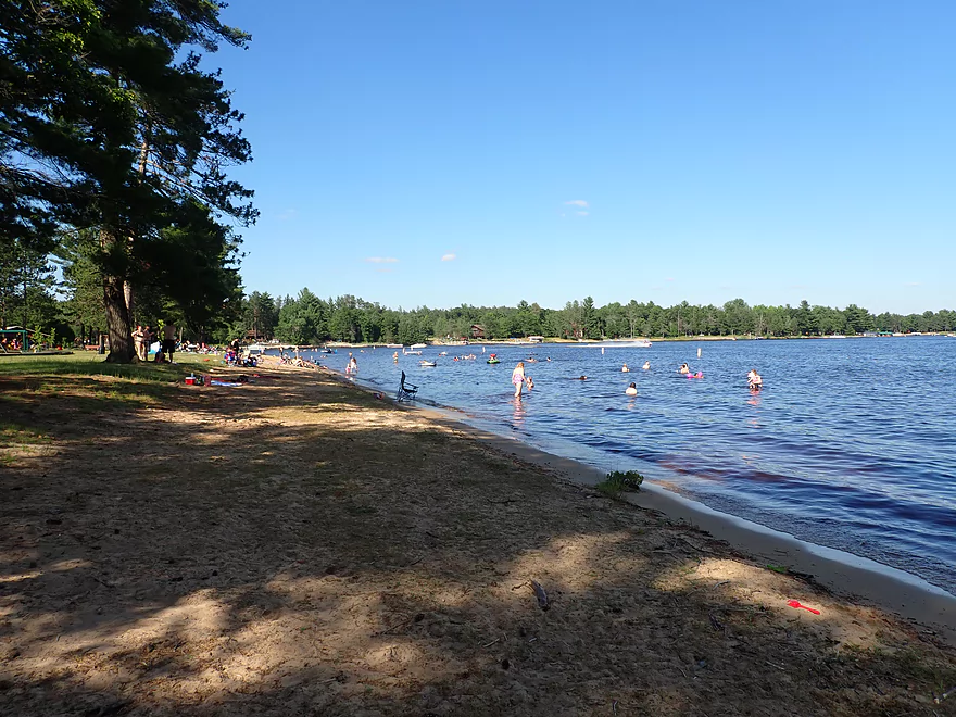
Russell Memorial Park is a popular beach and launch
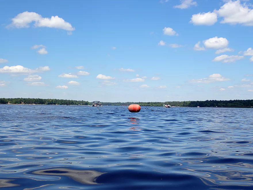
Safety buoys separate motorboats from the dam (but not nimble kayaks!)
Taking a break east of the dam
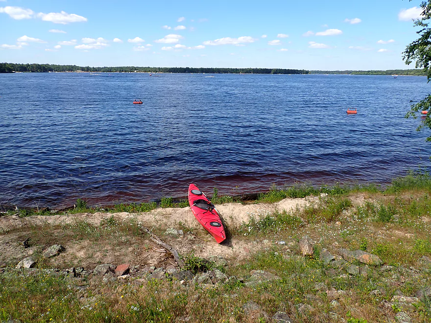
View of Lake Arbutus
Exploring below the dam
The east gates were mostly shut outside of some small leaks
Very rugged granite
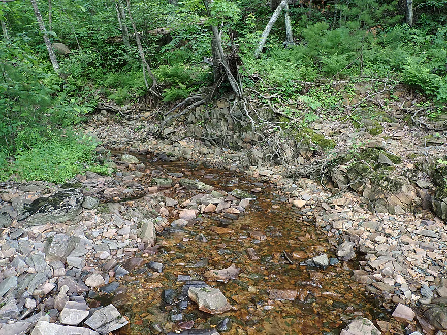
In high water this is major whitewater…now it’s just a little creek
Daredevil kayakers are known to paddle down this gorge
The most scenic section on the entire Black River IMO
Reverse view…it’s bigger than it looks
A very neat area
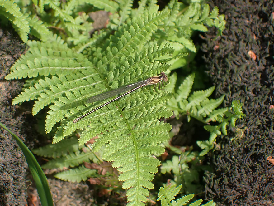
A damselfly perched on a fern
Returning to my parked boat on Lake Arbutus
Some flood debris close to the dam
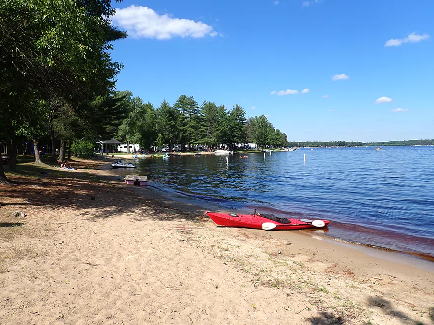
Taking out at the West Arbutus County Ramp
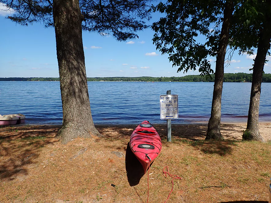
Nice take-out area
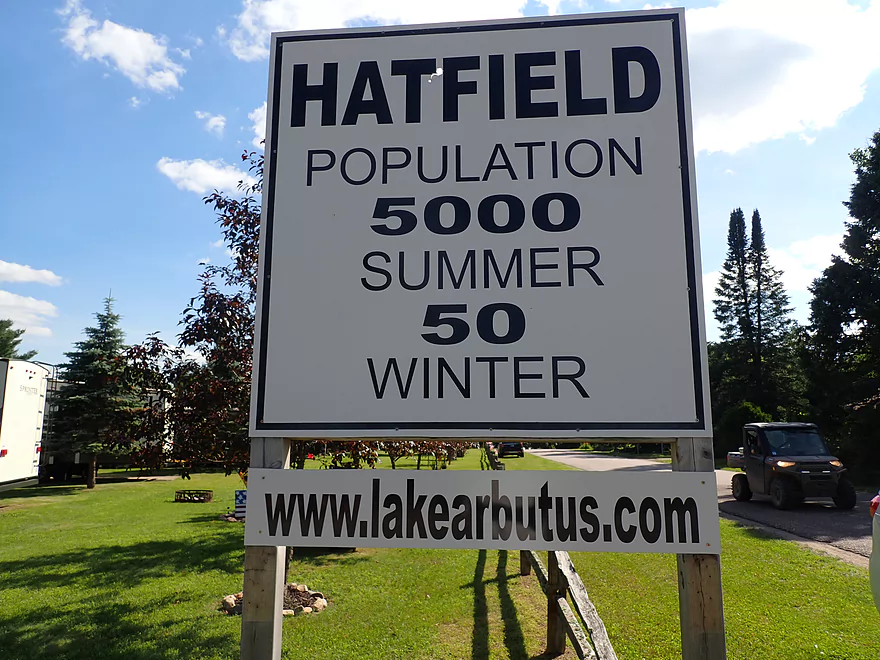
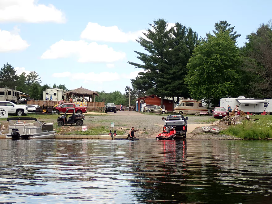
Looks like Hatfield’s pretty quiet in the winter
Lake Arbutus


Lake Arbutus is a large impoundment on the Black River located 15 miles north of Black River Falls. The shoreline is a heavily developed summer community known as Hatfield. While its winter population is only 50, it’s summer population can swell to 5000! Despite the development and motorboats, the lake has appeared intriguing the few times I drove past it…so I finally decided to try it out as a paddle.
My plan though was to first do a mile of river paddling on the Black River prior to Lake Arbutus starting from Hwy 95. This is a special section of the Black that has a 1500′ continuous stretch of rapids and some fantastic boulder gardens. Shortly into my paddle I disembarked on a rock island to scout “Red Granite Rapids” and take pictures. While it was a bit difficult to navigate around all the boulders, it did provide a unique perspective of the river.
As I was scouting the river, I was met by a family of four that ran the rapids (which happened to be a fortuitous photo-op). Unfortunately, while the lead pitches were straight forward Class 1’s and Class 2’s, they were followed by Red Granite Rapids which are more difficult (IMO a Class 3). The lead boat got pinned against a boulder at the base of Red Granite Rapids and the occupant had to swim. Several of the kayaks that followed shortly after crashed into the pinned kayak but made it through ok.
The mother of the family was able to land on the boulder and tried to free the pinned boat, to no avail. I waded back upstream to get my boat which had rope I hoped would help. I quickly ran the rapids and after the Class 2’s made a hard turn left to take out before the Red Granite Rapids. Unfortunately my rope wasn’t sufficient to dislodge the boat. Eventually her husband arrived in another kayak. He landed on the boulder and together the two of them were finally able to free the boat.
The lessons to learn from this were many… 1) Never go down rapids sideways. 2) Avoid getting pinned at all costs. 3) Bring longer rope 4) When whitewater paddling consider locking your valuables in your car…as you never know if you will permanently lose your boat in rapids
Finally, with that over with, it was my turn to run Red Granite Rapids. From my scouting (and rescue mission) I had a pretty good idea where the clean line was (just to the right of the main boulder) and I made it though no problem. It is highly advisable for paddlers to always scout Class 3’s before running them. Following the major pitch there was a rocky gorge lined with red granite that was quite scenic. On either shoreline were old concrete abutments…perhaps from a washed out bridge.
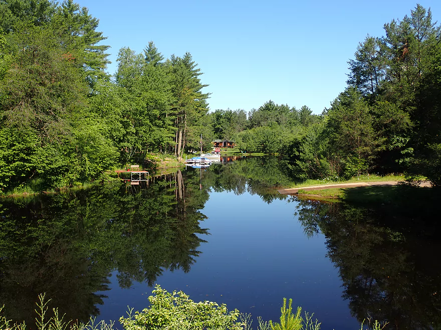
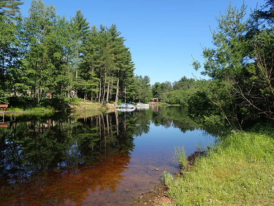
The river still stayed somewhat interesting following the gorge, with some nice boulder gardens and a few Class 1 rapids. But soon the effects of the Hatfield dam kicked in. The current slowed and most of the interesting geology and rapids disappeared underwater. The shoreline, which had been undeveloped, started sprouting houses and piers, and I encountered my first motorboats. Despite the high density of homes along the shore, it was still scenic and featured some attractive white pines. One of the highlights was French Island, which had an attractive collection of boulders, and pines and was flanked by a granite cliff on the east shore.
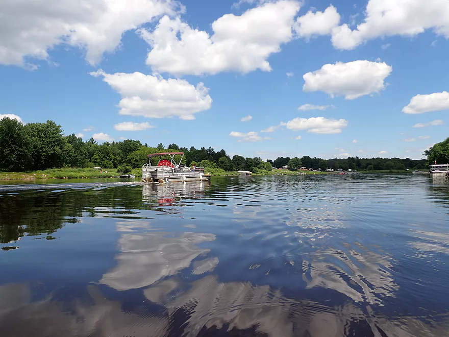
By the North Arbutus Boat Landing, the channel stopped resembling a river and morphed into a wide lake. It was here where things got unpleasant. There wasn’t any wind, but the many powerboats created significant wake (among the biggest I’ve ever had to deal with). My Tsunami 125 has excellent primary and secondary stability and dealt with the waves well….but it became tiresome after a while. I frequently had to adjust my course to make sure I met the big waves head-on to avoid swamping. The open water portion of Lake Arbutus also had more of a party atmosphere, with occupants being towed on inflatables by powerboats at crazy speeds and loud pop music being played. So it was not exactly an “escape to nature” moment.
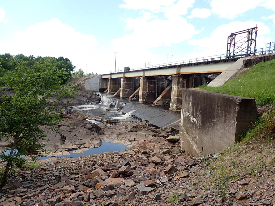
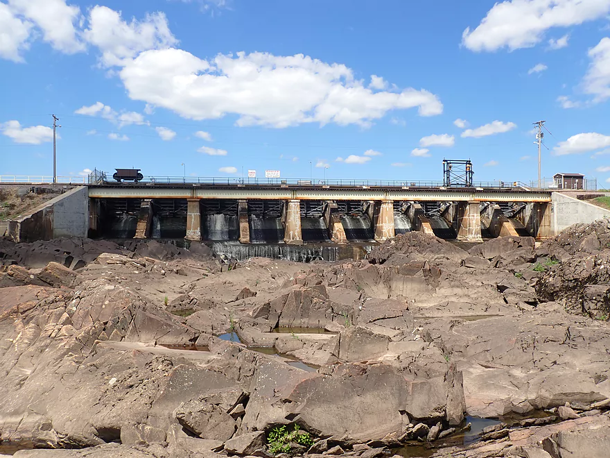
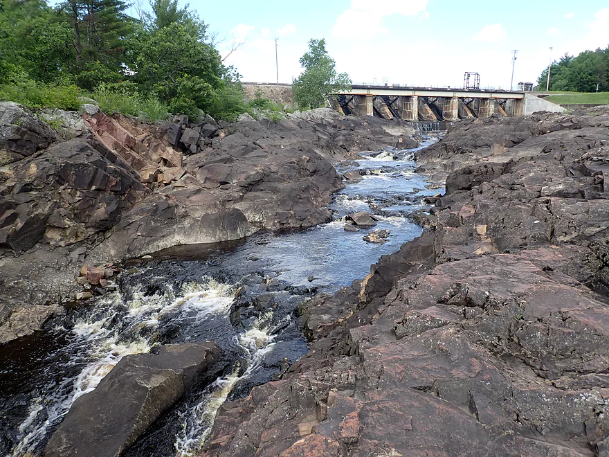
After 2+ miles of open lake paddling, I paddled under a floating steel cable guarding the dams and took a break along the shore. There are actually three outlets located at the south end of Lake Arbutus. There is the historic millrace which feeds the Hatfield Powerhouse 3 miles downstream and is one of the largest canals in the entire state. Then there is a larger middle dam and a secondary smaller dam east of that. The far east dam is usually sealed up and only leaks from its gates allow water to flow through the original river channel here.
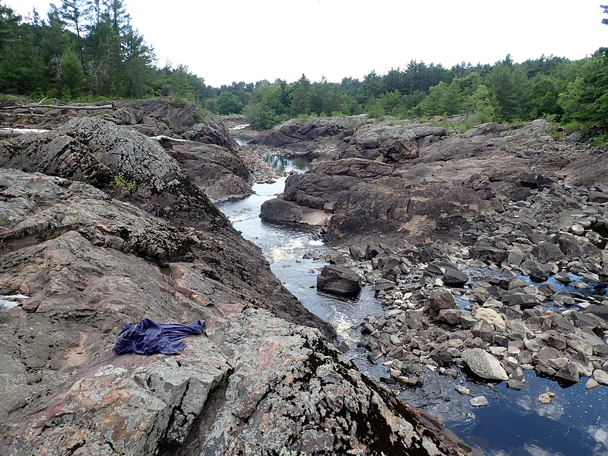
Downstream from the east dam is a spectacular series of granite mounds. Carved through the granite is an impressive canyon where the original river used to flow (before the dam). On occasion, the Hatfield dam will do special releases which result in Class 4-5 rapids. Daredevil whitewater paddlers will attempt to run through the granite gorge during these releases, but it is dangerous because of the steep drops and sticky holes. When I scouted this, the gates were shut and just a small stream trickled through the gorge. Despite the lack of water, I would still rank this as the most scenic section on the entire Black River (which is high praise).
I continued to head downstream by foot by climbing over the boulders (which wasn’t always easy) until I came to the confluence of the main dam channel with the smaller dam channel. Here there is a public path that descends from W. Clay School Road and the area is a popular put-in with paddlers that want to start downstream trips. After all my scouting, I hiked back to the dam where I left my boat and paddled to West Arbutus Park where I took out.
In summary this was a disappointing trip, but a difficult one to judge. The river before and after the lake was spectacular and five stars, but the lake itself was just too rough for good kayaking. Maybe the secret to enjoying Lake Arbutus is to simply do it when it isn’t so busy. If so, it could be a pleasant lake paddle…especially the upstream sections. My one regret was not paddling up Arnold Creek, which looked really scenic…perhaps another trip.
As beautiful as Lake Arbutus is, one can’t help but wonder about the spectacular rapids and granite formations that are currently submerged under 50′ of water. The lake has actually been partially drawn down several times this past decade, but only to do dam repairs. Hatfield’s best scenery is probably still underwater.
Hwy 95: There is public fishing access here which made for a great put-in.
Alternate Put-ins:
- River Road Landing (4.4 miles upstream of Hwy 95): For those wanting more river paddling this is an option. Although IMO this is the least interesting section on the Upper Black and has hardly any rapids.
- Other Lake Landings: There are too many to list…for more information see my trip map where I mark them all and provide context. Most lake landings will require a small fee for access.
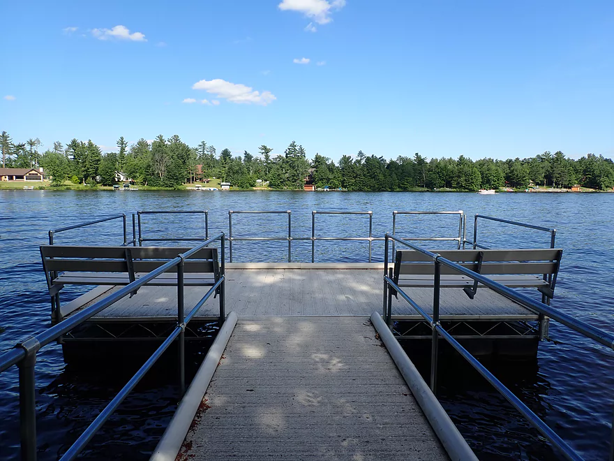
West Arbutus Park: This is a public boat ramp located close to the dam. A $5 entry fee is required which you can pay to the gate agent. This is a popular launch and the parking lot can fill up on summer weekends. I didn’t see outhouses, but Russell Memorial Park to the north does have them.
Alternate Take-outs:
- Dilly’s Tiki Bar (upstream of lake). If you just want to run the rapids and avoid the lake paddling, then this might be your ideal take-out option. But note, it is private and you must get permission to take out here – (715) 333-6600.
- North Arbutus Boat Landing (north end of lake). This is another option if you mostly just want to run the rapids and explore the narrow parts of the flowage (including French Island) but skip the big water paddling. A parking fee is required to use this launch. Outhouses are available.
- Other Lake Landings: There are too many to list…for more information see my trip map where I mark them all and provide context. Most lake landings will require a small fee for access.
Hwy 95 to West Arbutus County Ramp: (6.2 miles – 128′ of ascent) Despite being a longer bike shuttle than what I’m used to it was actually quite pleasant. Note…Google will want you to shuttle J and Hwy 95. Don’t listen to Google…those roads have heavy traffic which would make for a miserable bike shuttle. Instead take Riviera Drive as far as possible which hugs the river/lake. This is a scenic road with less traffic and it is more shaded from the wind and sun.
Hatfield Sports Shop: This business used to rent kayaks and do shuttles…but their Facebook page is down, so I’m not sure if they are in business anymore. Call (715) 333-5009 for more information.
Waves: Powerboat traffic can be quite heavy on the lake which can create significant wake. This is most apt to be an issue midday on summer weekends. There are no-wake zones along the shoreline, but boaters tend to ignore these.
Wind: Like any open water paddle, you should carefully review the forecasted wind speed and direction before doing this trip.
Rapids: The lake portion has no rapids, but the half mile of river that precedes it does have multiple sets of rapids (mostly Class 1 and Class 2). The strongest pitch is “Red Granite Rapids” which I would rate as a Class 3. I highly advise scouting these before running them. At certain water levels there won’t be a clear line through the boulders and it can be easy to get pushed sideways into the rocks. I did help another kayaker rescue her pinned kayak here so it should be taken seriously. There are serious rapids located below the dam, but I assume most paddlers won’t run those. Here’s a video of the Hatfield Rapids.
Open Water: At its widest, Lake Arbutus is almost a mile wide. Always assume you will be forced to swim when furthest from shore. For safety, beginner paddlers should stick close to shore and life jackets are recommended. In early spring, Lake Arbutus can get dangerously cold as well.
Dams: At the south end of Lake Arbutus are a pair of dams. Here’s a video of an unlucky pontoon going over the west Hatfield dam. A steel cable separates motorboats from the dam but it is possible for nimble kayakers to duck under this. If the gates are open you don’t want to be near the dams. I believe (but am not 100% sure) that a warning siren will sound prior to a release.
Nearest Gauge: Black River @ Neillsville – Trip done at 250 CFS (2.2′ on the visual gauge below Hwy 95). Note, levels won’t matter for the lake paddling portion…but are relevant for the river portion with rapids.
- 0-120 CFS: A low depth. Some of the rapids may need to be waded.
- 121 – 200 CFS: A low, bumpy depth, but likely doable.
- 201-300 CFS: A good target range. I did this at 250 CFS which I thought was perfect (although I did see a kayak get pinned at these levels).
- 301-500 CFS: An above average flow rate. Likely manageable but paddlers should be careful.
- 501-800 CFS: Most of the features will wash out at this level
- 801-1800 CFS: A very high flow rate only suitable for experienced paddlers.
- 1801+ CFS: An extremely high flow rate that should only be attempted by expert whitewater paddlers.
Quick Overview
Black River:
- Upstream of Hwy 73: Obscure sections of the Black with little known about them. Some legs will have logjam issues.
- Hwy 73 to Lake Arbutus: 48 miles. Good legs with a mix of rapids, boulder gardens and undeveloped banks. Only reason these legs don't receive more paddling traffic is because they're located away from population centers.
- Lake Arbutus: 3 miles. A scenic but challenging lake because of the waves.
- Hatfield Dam to Halls Creek Landing: 7 miles. Some of the best and most fun whitewater on the Black River.
- Halls Creek Landing to Black River Falls Dam: 6 miles. An impounded part of the river, but nice with cool cliffs.
- Black River Falls Dam to North Bend: 37 miles. This is the heart of the Lower Black and sees the most paddling traffic. No major rapids, but there are many scenic cliffs and creek inlets.
- North Bend to Mouth: 30 miles. This is the second half of the Lower Black. While not as scenic, there are still cool sandbars and sandbanks. Few paddle these stretches.
Noteworthy Tributaries:
- Robinson Creek: One of the best paddles in all of Wisconsin.
- Halls Creek: Also one of the best and with amazing sandstone walls.
- Morrison Creek: Very scenic creek with some fun whitewater.
- Wedges Creek: Great paddle with amazing boulder gardens.
- East Fork of the Black River: Some fun riffles and unique granite geology.
- Perry Creek: Shallow but a super scenic creek.
- Dickey Creek: A wonderfully scenic creek with fantastic sandstone…but too many logjams.
- Beaver Creek: Some fun rapids and amazing sandstone in Galesville, but logjams on the downstream portions.
- Popple River: A shallow whitewater river that is very nice.
- Arnold Creek: A pleasant tributary to Lake Arbutus with really nice reflections.
- Rock Creek: Many scenic boulder gardens, but usually this creek is too shallow to run.
- Roaring Creek: Very scenic creek with a great waterfall at the mouth, but might be a challenge to paddle.
- Vismal Creek: Super scenic but has a lot of logjams and is shallow. Requires very high water conditions.
- Plus countless small creeks that are too small to paddle but quite fun to explore by foot. If you know of viable paddling options, let me know! Am very curious to know more about Douglas Creek, Levis Creek, O’Neal Creek, and Crawley Creek.
Detailed Overview
Headwaters to Neillsville:
- Upstream of Division Drive: Likely too many logjams to be navigable.
- Division Drive to Sawyer Ave: (6.5 miles) Rocky and a few light rapids. Maybe 4 logjams.
- Sawyer Ave to Hwy 64: (2.5 miles) Rocky and a few light rapids.
- Hwy 64 to Bridge Road: (14.4 miles) Solid prospect reviewed by Mike Svob. Some Class 1 rapids and nice gravel bars. Intermediate access points at Bahnkes Ave and Hwy AT.
- Bridge Road to Hwy X: (6.0 miles) Little is known of this section…likely pretty simple.
- Hwy X to Colby Factory Road: (6.0 miles) Little is known about this section…likely some rapids and outcrops. Intermediate alt access points at Hwy 29 and Hwy N.
- Colby Factory Road to Popple River Mouth: (7.9 miles) This stretch has far fewer rapids than downstream legs with only a few minor rapids. It should still be pleasant though.
- Popple River Mouth to Reese Ave: (5.3 miles)
- Popple River Mouth to Warner Drive: (1.0 miles) This is a slower and less interesting stretch, but does include 4 Class 1's and scenic Hemlock Rapids which are Class 3.
- Warner Drive to Greenwood Park: (3.4 miles) A good leg with many rapids (3 Class 2's and 17 Class 1's).
- Greenwood Park to Reese Ave: (0.9 miles) A slower stretch with just 2 Class 1's. Part of this passes through the community of Greenwood.
- Reese Ave to Twenty Six Rd: (5.1 miles)
- Reese Ave to Sladich Rd: (0.7 miles) A mostly nondescript wooded stretch. The exception is Greenwood Rapids where an island splits the river. The right side is scenic, but the left side has fun Class 3 rapids.
- Sladich Rd to Willard Rd: (1.6 miles) A somewhat slow and relatively uninteresting leg. Highlights include one nice outcrop, a few gravel bars and a 400' stretch of Class 1 rapids.
- Willard Rd to Twenty Six Rd: (2.8 miles) A great leg with 10 Class 1's and 2 Class 2's. Highlights also include scenic boulder gardens and a few outcrops.
- Twenty Six Road to Hwy H: (5.0 miles) Multiple Class 1 & 2 rapids.
- Hwy H to Grand Ave/Hill Road: (8.0 miles) A great trip with several Class 2 rapids and scenic granite outcrops.
Note, for more details on the Upper Black, I highly recommend “Indian Head Rivers” by Michael Duncanson.
Alternate Black River Trips – Neillsville to Black River Falls:
- Grand Ave/Hill Road to Opelt Road Landing: (6.7 miles)
- Grand Ave/Hill Road to Hwy 10: (2.2 miles) Nice section with a handful of rapids. These are mostly Class 1 at lower depths, but strengthen to Class 2 during high flow rates.
- Hwy 10 to River Road Landing: (4.3 miles) Fantastic whitewater section. Maybe six Class 2’s and two class 3’s. Scenic boulder gardens and a few outcrops.
- Opelt Road Landing to Bryan Ave Bridge: (1.1 miles) Not sure there is anything special about this stretch.
- Opelt Ave Bridge to Hwy 95: (4.4 miles) Ok…nothing special.
- Hwy 95 to West Arbutus County Ramp/Hatfield Dam: (4.8 miles)
- Hwy 95 to North Arbutus Boat Landing: (2.4 miles) Includes a scenic gorge, boulder gardens and rapids including the Class 3 Red Granite Rapids. River slows after rapids.
- North Arbutus Boat Ramp to West Arbutus County Ramp: (2.4 miles) A large open water paddle on Lake Arbutus that can feature challenging waves on summer afternoons.
- Hatfield Dam to West/East Channel Confluence: 0.2 or 0.3 miles.
- West Dam to West/East Channel Confluence: 0.3 miles. There is a large boulder field and Class 2 rapids below the west dam. At the outlet of the west channel is a Class 4 drop. This is easy to scout and portage.
- East Dam to West/East Channel Confluence: 0.2 miles. Perhaps the most extraordinary rapids in the state with Class 4/5+ rapids. The action starts below the dam where steep granite banks narrow the river significantly and force it down deep chutes. The gorge starts with Class 2-3 rapids but ends with two significant drops. American Whitewater warns “between the dam and this point lie some serious drops which contain near inescapable boiling cauldrons at moderate to high flows”.
- Hatfield Dam Confluence/West Clay School Road to Powerhouse Road Landing: (3.1 miles)
- Hatfield Dam Confluence to Hwy K: (0.3 miles) One of the most scenic paddling areas in the state with massive granite outcrops. There is one set of Class 2 rapids.
- Hwy K to Powerhouse Road Landing: (2.8 miles) The first half mile by Hwy K is very scenic and contains one Class 3. The second mile is mostly flatwater. The third mile is almost continuous rapids and features one Class 3.
- Powerhouse Road Landing to Halls Creek Landing: (4.0 miles) Scenic section with a few Class 2 rapids and a steep ledge.
- Halls Creek Landing to Black River Falls Dam: (6.2 miles) Wonderful sandstone cliffs.
Alternate Black River Trips – Black River Falls to Mouth:
- Black River Falls Dam to Mason’s Landing: (4.7 miles) A great little section.
- Mason’s Landing to Irving Landing: (9 miles) A good section.
- Irving Landing to Lost Falls Campground (2.3 miles) A popular stretch. Highlights include a few small outcrops, two tiny waterfalls, several impressive sandbars, and one large sandbank. A side hike to Roaring Falls can be arranged. Note Lost Falls Campground is private and you must purchase a pass from them to use their access.
- Lost Falls Campground to Grinde Landing: (6.4 miles) A popular section with some nice outcrops and a waterfall by Roaring Creek. Wolf Creek may also have a cool slot canyon. The river splinters into multiple channels, some of which may be quite shallow in later summer. As of 2023, Grinde Landing is closed because somebody stole the owner's deer stand.
- Grinde Landing to Melrose Landing: (3.9 miles) A shorter section but with a really nice rock outcrop before Melrose Landing. As of 2023, Grinde Landing is closed because somebody stole the owner's deer stand.
- Melrose to North Bend: (10.1 miles) Likely the most popular stretch with the best sandbars on the river, three sets of outcrops, and a few waterfalls.
- North Bend to Hwy 53: (13.3 miles) Likely a nice paddle with sandbars, large sandbanks and maybe a few outcrops. Unfortunately it is very long.
- Hwy 53 to Hwy 35: (8 miles) A nice section with epic sand banks.
- Hwy 35 to Lytle Road: (4.0 miles) Goes through the Van Loon Floodplain Forest. This can be a shallow trip but features many nice sandbars.
- Lytle Road to Fred Funk Boat Landing (Mississippi): (5.0 miles) Multiple options because of the river delta.
Trip Map
Overview Map
Video
Photos Size: