
Mineral Point Branch doubles the Pecatonica
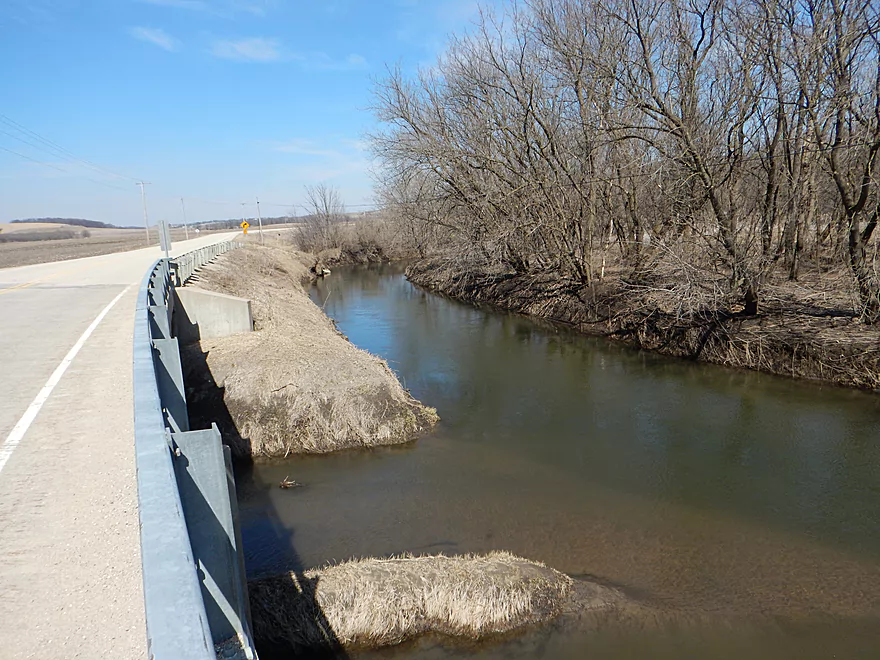
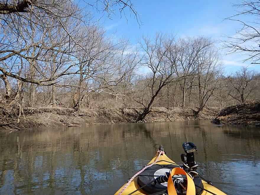
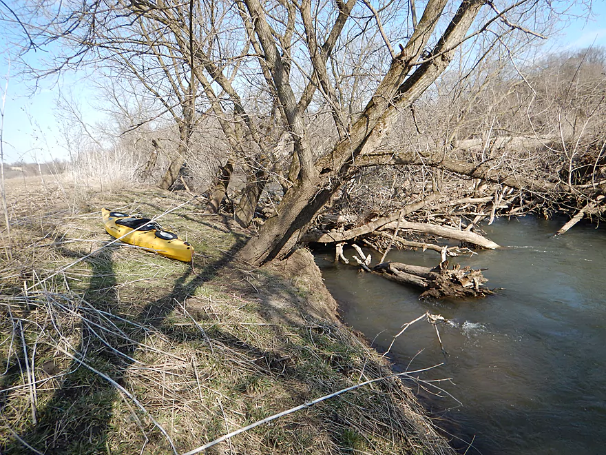
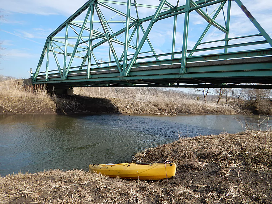
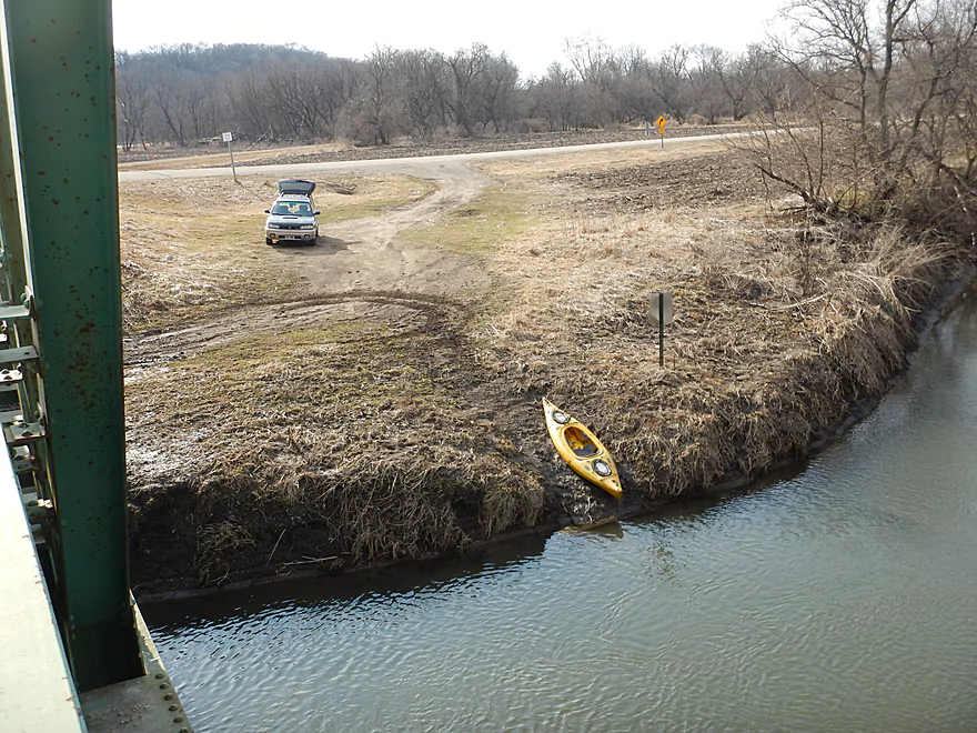
Decent put-in at Hwy O
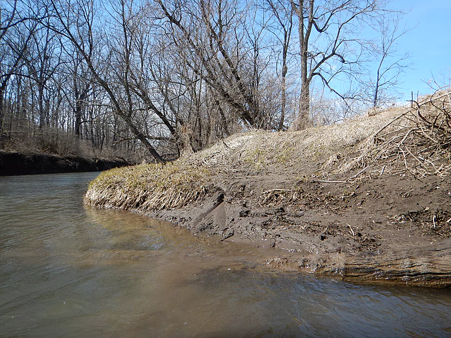
But it is muddy
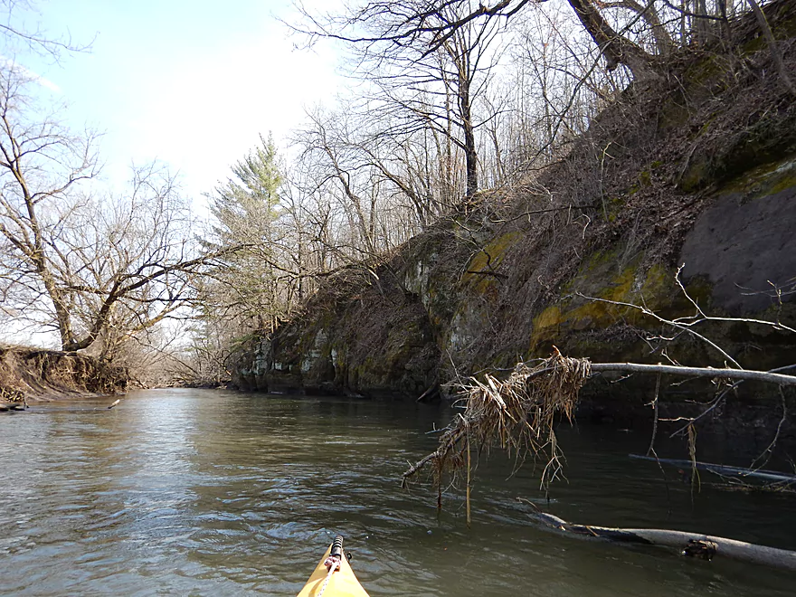
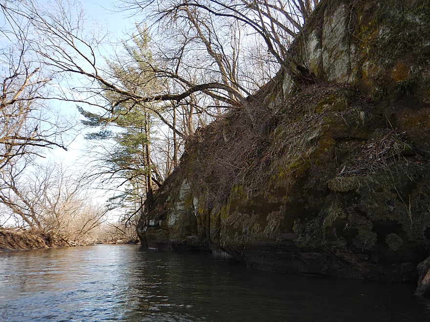
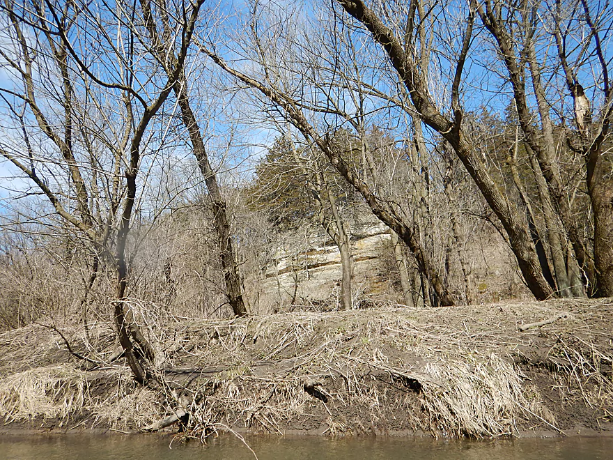
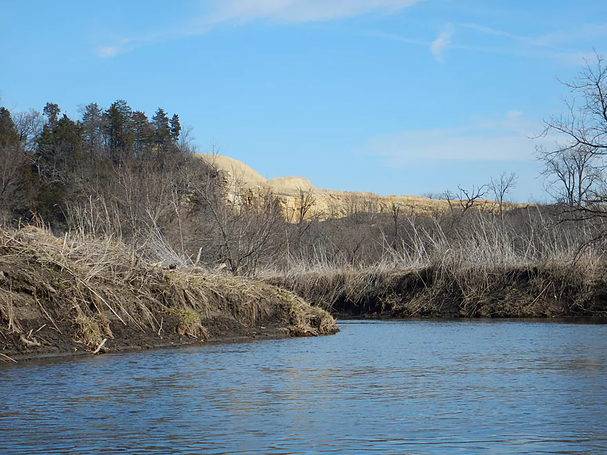
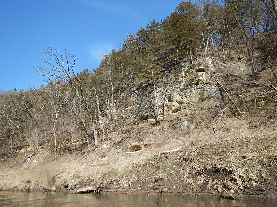
Very nice sandstone outcrop
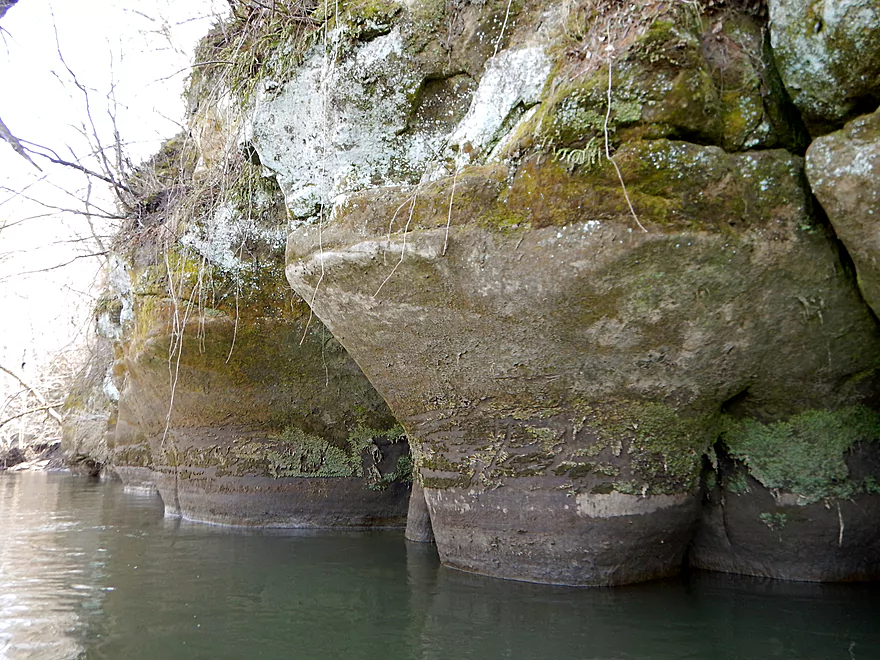
Natural sculpting
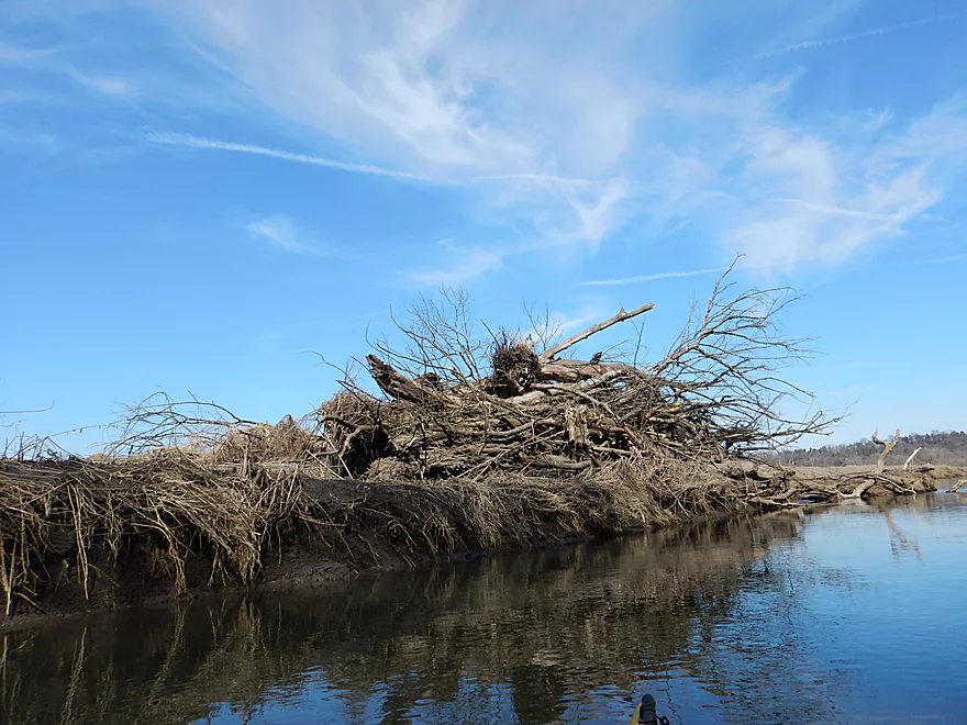
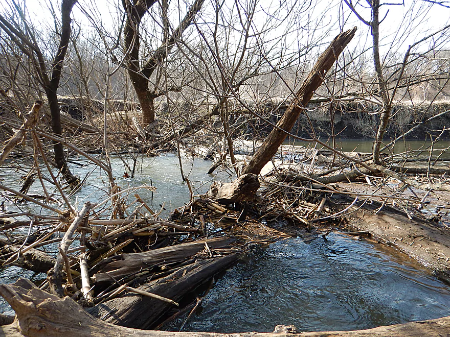
So many future logjams…
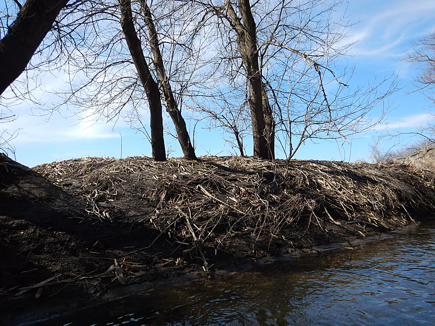
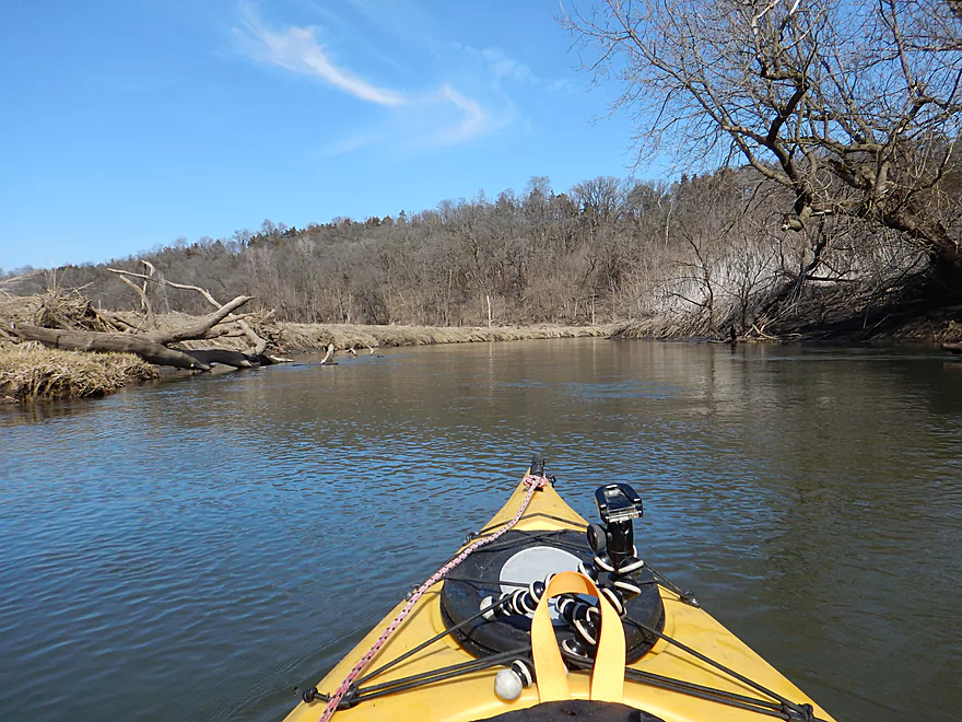
And these are actually some of the smaller mud banks
The thinnest of tree layers
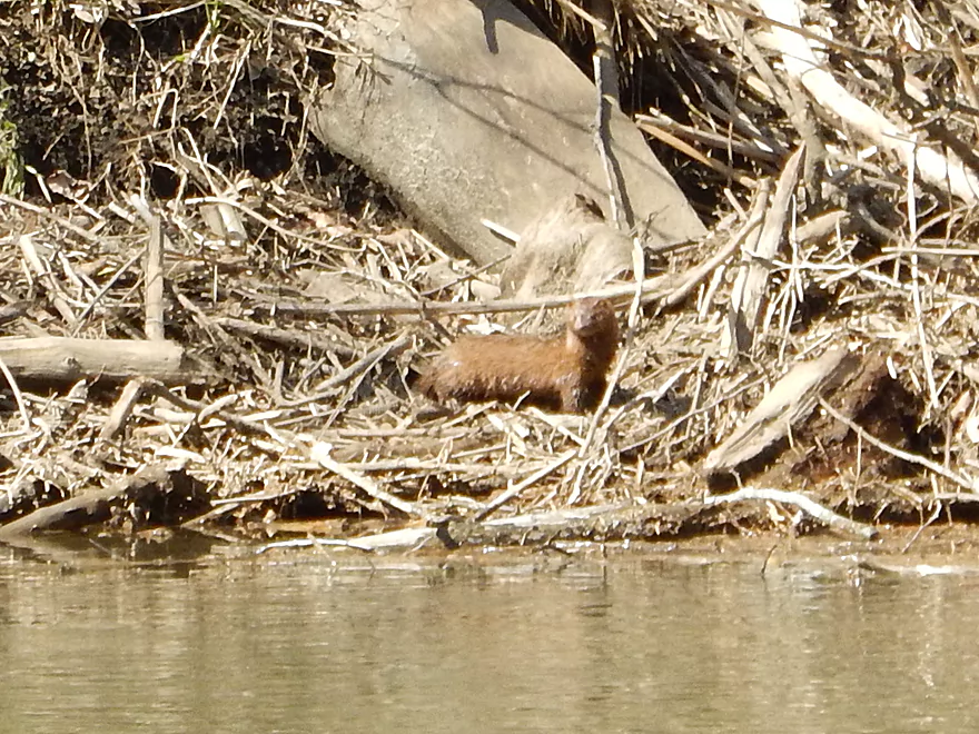
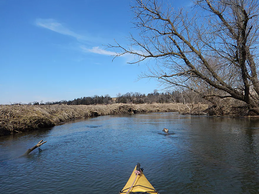
Being stalked by a mink
The Cheese Country Trail flanked by sandstone cliffs
Corn planted ridiculously close to the river
If you were determined, you could use Ferndale Road as an access
One of many clear-cut piles
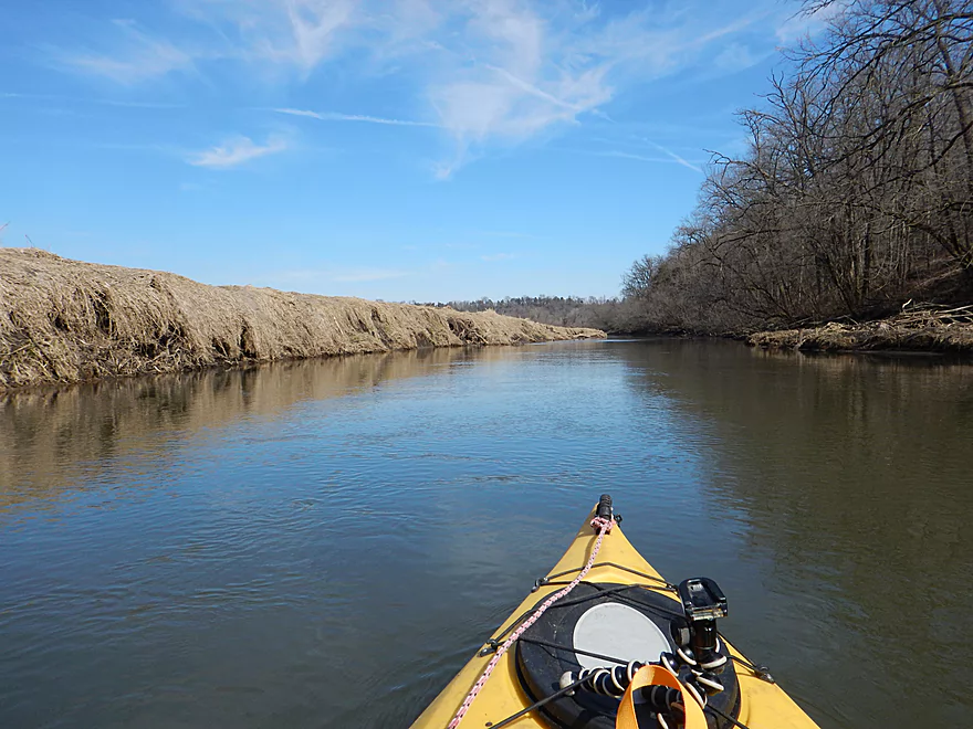
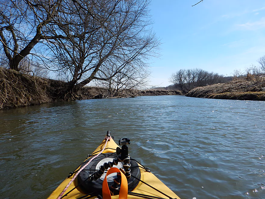
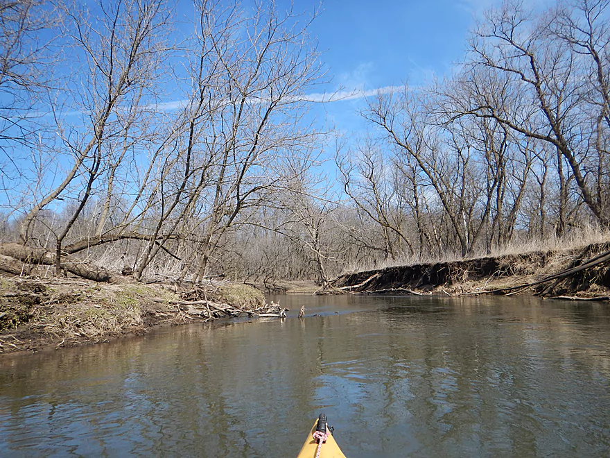
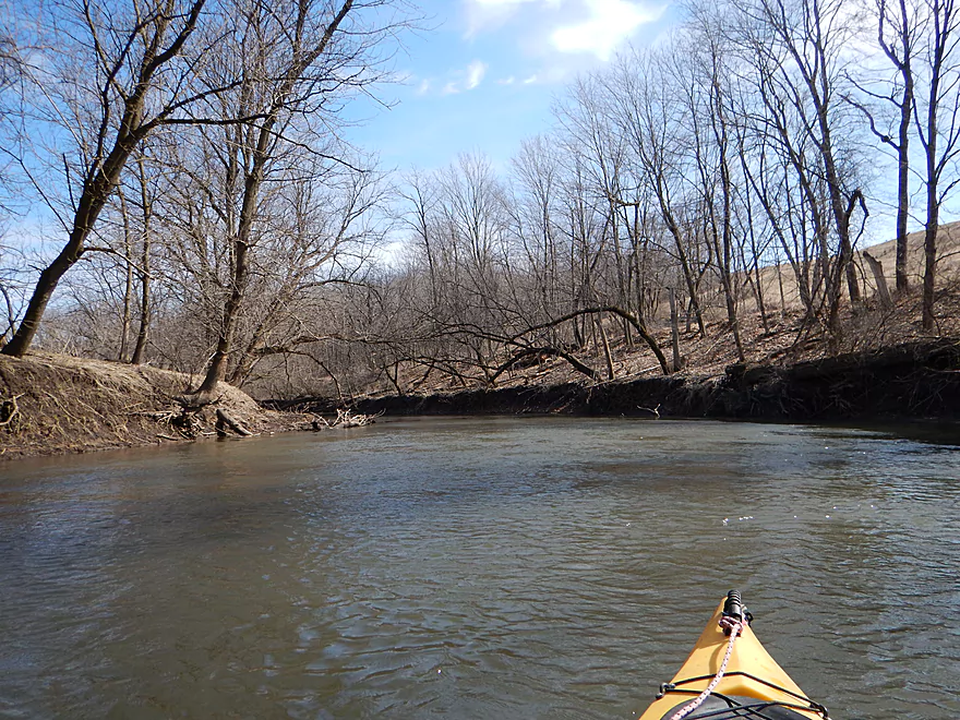
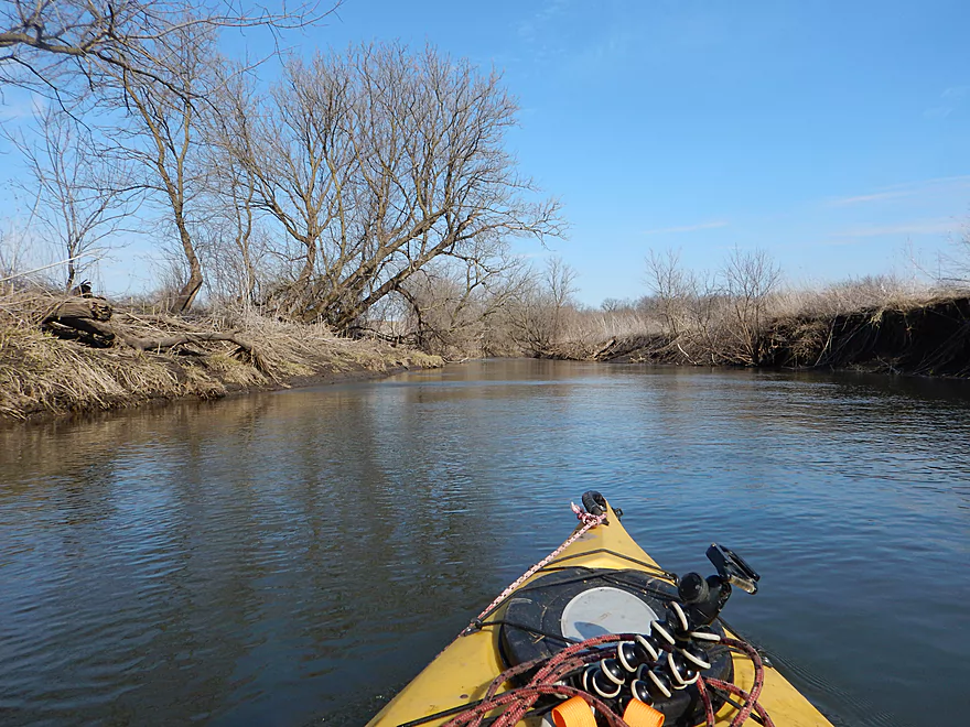
A very big and open river
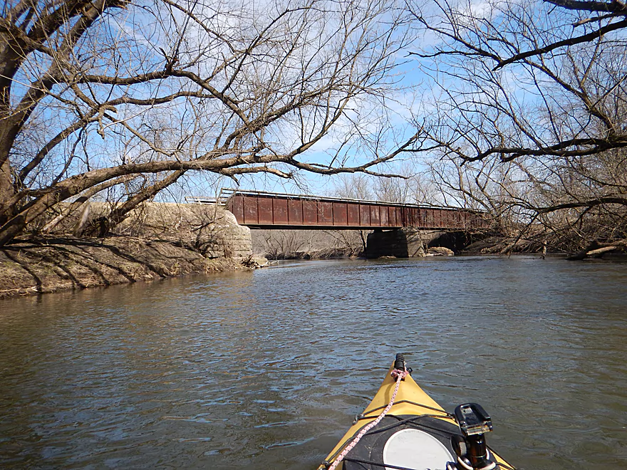
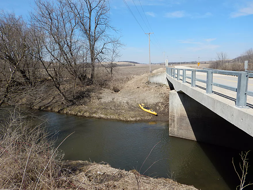
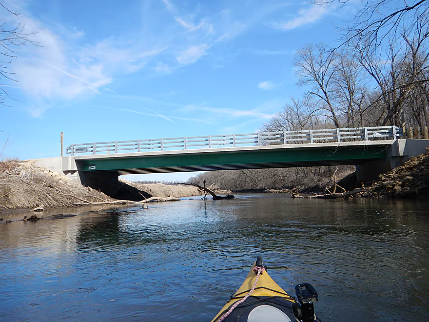
Scenic bridge for the Cheese Country Trail
Massive quarry hovers over the river
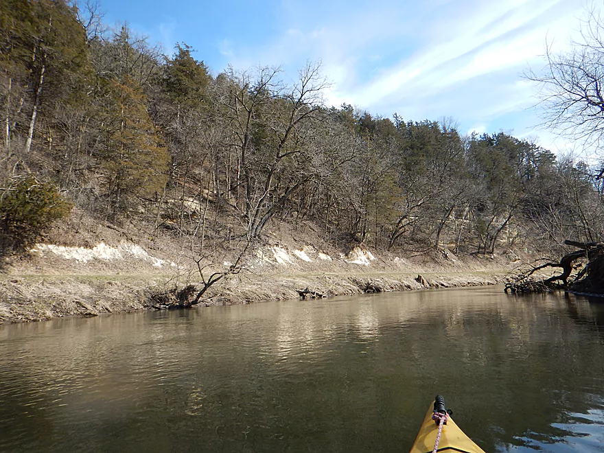
More neat sandstone
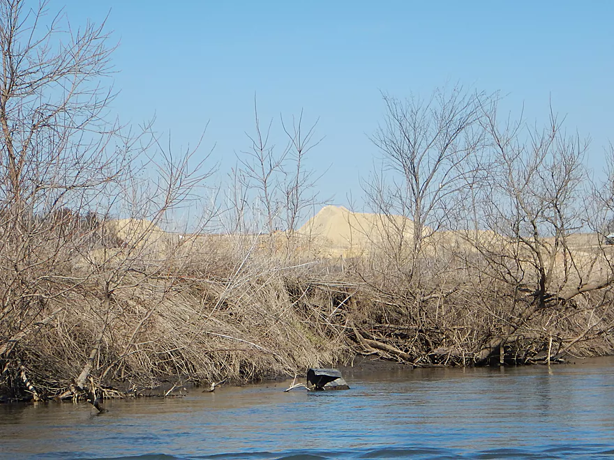
Largest gravel mound I have ever seen
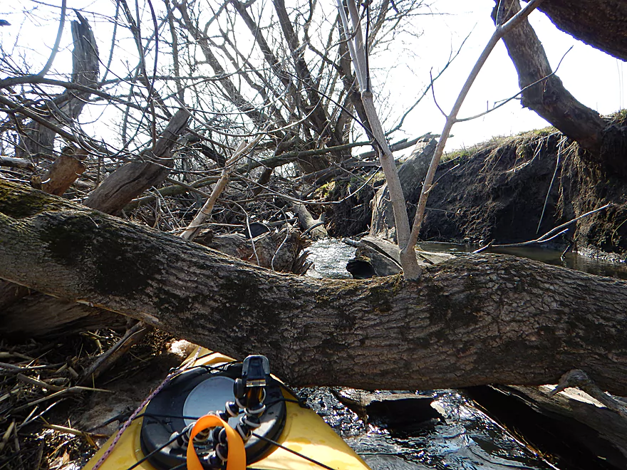
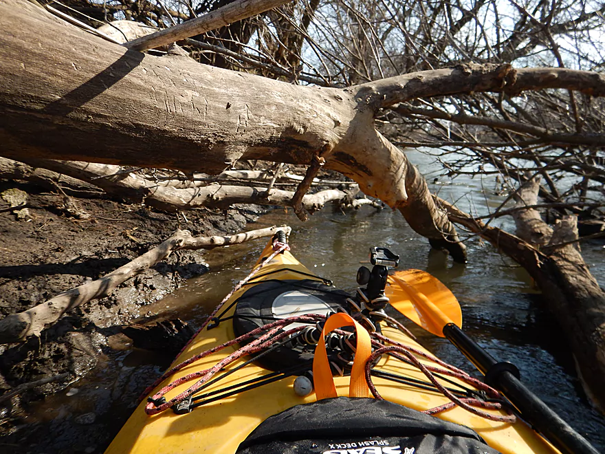
First logjam
You will need rope for this one
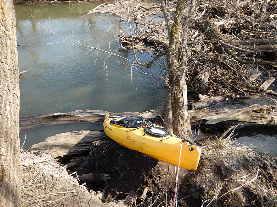
Steep muddy banks make re-entry difficult
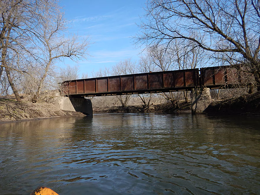
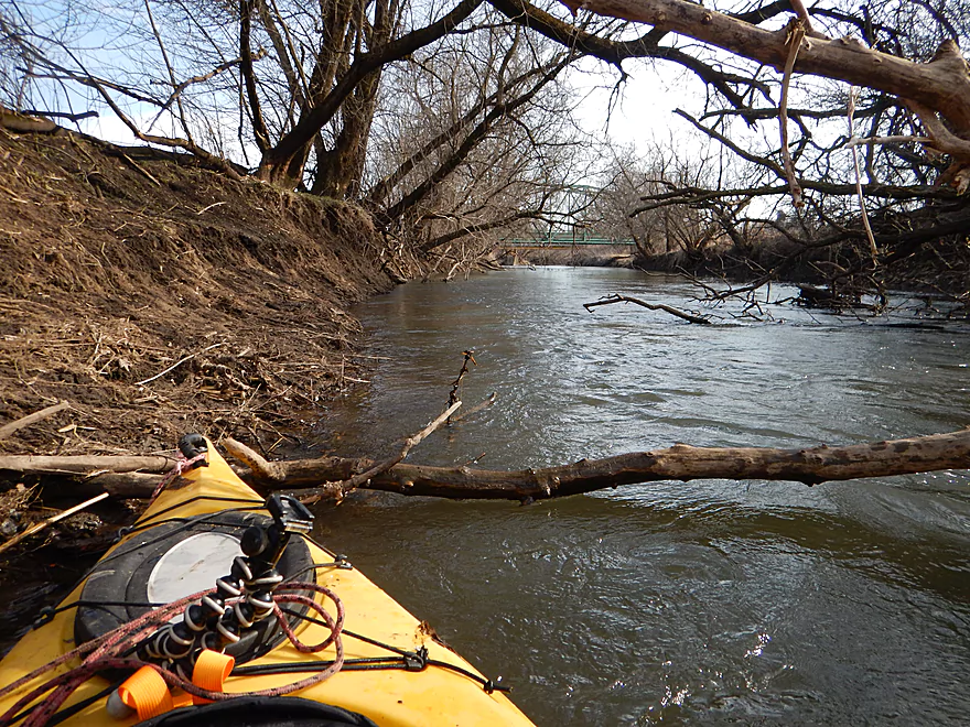
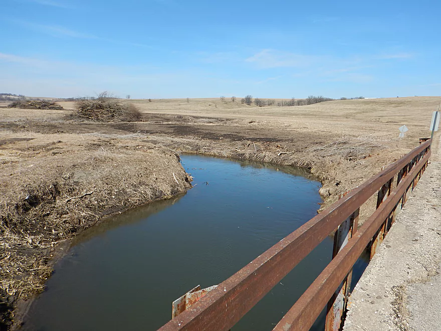
Another nice Cheese Country bridge
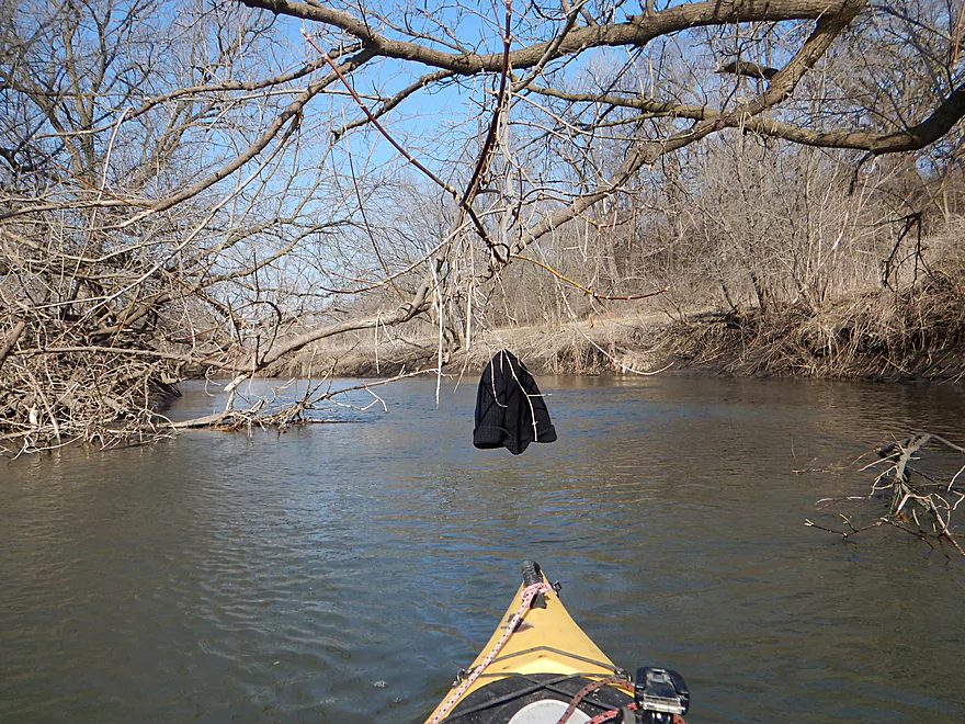
Sneaky branch almost stole my hat
Logjam #2
Smelled like cows…I barely fit through
Logjam #3…small but mighty

Not a fun portaging river
Coming up on Hwy G
There actually is a canoe ramp here
But it is hidden under the mud
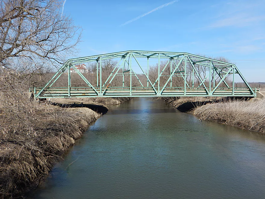
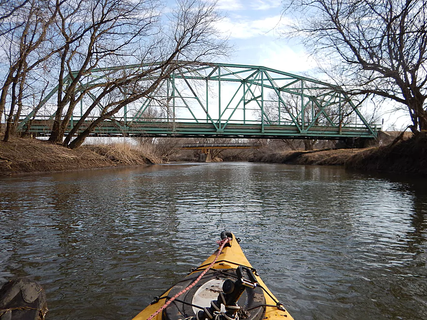
Very scenic road bridge
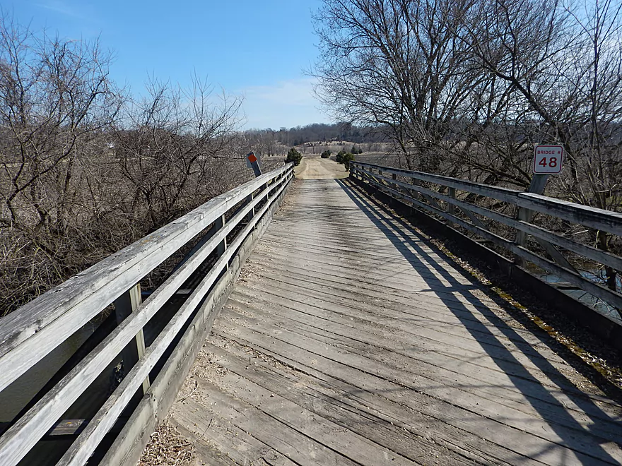
The Cheese Country Trail is a shuttle option
Scouting Oak Park Road…doable but freshly clear cut
Pecatonica River


Long overdue, I finally get around to paddling and reviewing the Pecatonica. This is a farm country paddle located in the driftless region west of Madison which is popular with paddlers. Most however prefer to paddle the Pecatonica’s sweetspot near Darlington. Here it is big enough to thwart most logjams yet small enough to retain character and interest. For this trip, I opted for a leg from Hwy O to Calamine inspired by a Morrall River Films review and also my desire to save better sections (aka Darlington) for better conditions. At Hwy O, the Mineral Point Branch joins and doubles the river (which in theory should mean less logjams).
The trip starts on an inauspicious start with a hilly bike shuttle, a muddy put-in, finding a local yokel “inspecting” my kayak at the put-in (thankfully locked), and enduring a strong (and cold) headwind to begin the trip. A quarter mile downstream of Hwy O, I encountered a really nice sandstone outcrop which was probably the trip’s highlight. There are a few more outcrops on the river, but most are recessed and lacking in grandeur.
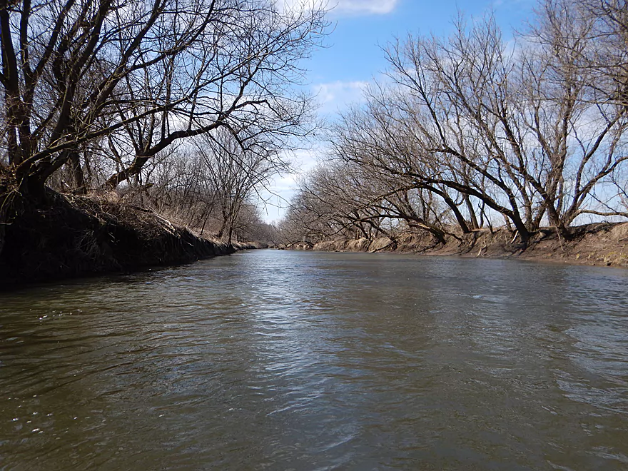
What is most striking about this river is how muddy it is…as in this might be the muddiest river I’ve ever paddled. Not only is the water clarity horrible, but the steep banks are piled high with exposed mud. The cause is pretty obvious. Farmers let cattle trample shoreline vegetation and clear-cut riverside trees for that extra row of corn. The result is a LOT of erosion. Are farmers doing anything to stop this? Nope. In fact when I paddled the river, I saw evidence of recent shoreline clear-cutting and bulldozed tree piles being ready to be burned. This is a shame, as a loss of top-soil will eventually come back to haunt these landowners.
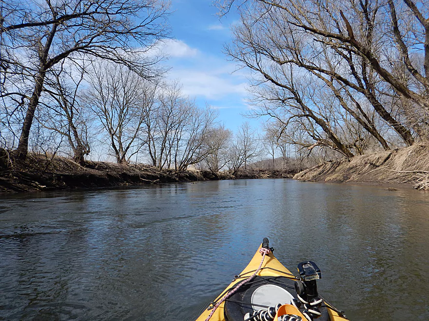
Maybe I had unrealistic expectations, but this trip was disappointing. The channel was broad, consistently deep (usually 4′), and homogeneous. No riffles, shallow areas, sandbars, islands, boulders, etc…just a big muddy ditch flanked by mud walls. If you are lucky, there will be a thin layer of trees between the river and farmland, but typically the view is of adjacent corn fields. For comparison, all of the Pecatonica’s neighbors are better paddling experiences (East Branch, Platte, Grant, Little Platte, Fever, Sugar, Yahara, Badfish, etc…).
On top of this, there are three major logjams which require muddy portages and maneuvering. If you bring a handsaw you can maybe cut through #2 and #3, but not #1. This will require a lot of chainsaw work, and you’ll have to settle for a difficult portage with extremely steep, muddy banks (bring rope and boots!).
That’s not to say this river has no redeeming qualities. I went in spring which might have been bad timing. In the summer the river will come alive with birds and insects singing, wind whistling through the trees, and shady branches arching over the river. The few rock outcrops were nice and a unique site on the river was a massive quarry mound that towered over the river like a Saharan sand dune.
It’s a neat scene at the take-out with Amish clip-clapping over a majestic green steel trestle bridge, a white church spire towering over the village of Calamine, and a large public canoe launch. But here too, the mud leaves its mark. The original ramp was buried under inches of mud and you’re sure to get dirty at the take-out.
One final thought. If you haven’t already make sure to check out my recently created “News & Events” section. Here I’ll compile interesting paddling stories from throughout the state and you’re welcome to share your own.
Hwy O isn’t that bad for a bridge access with good shoulder parking and a nice shallow incline for launching. However, it is muddy and would typically be far worse after a rain so step carefully…
Calamine has a canoe launch off the Hwy G bridge that is pretty good. Great parking, scenic vista of the nearby bridges, and a ramp for launching. No outhouse though and the mud here can be a serious issue as well.
No local livery that I’m aware of. Bike shuttlers will have an “Amazing Race” style of choices.
- You can bike on the “Cheese Country Trail”. This is a scenic 5.5 mile bike trail that is pretty flat, but… You will need to purchase a $15 trail sticker, many fast ATV’s share this trail, and the gravel is extremely rough (only suitable for hardcore mountain bikers).
- You can bike on Hwy C & Hwy O which are nicely paved and only 3.8 miles, but… The hills are steep (220′ of climbing) and chances are you’ll need to walk your bike most of the first mile. But…after that it is all flat or downhill and the view from on top of the ridge is pretty neat (which is what I chose).
This was shaping up to be an easy-peasy, hazard free paddle that I was going to recommend to even canoers, but then three major logjams popped up in the last mile and ruined everything. All three jams are marked on the map. Here is the lowdown…
- Logjam #1 is the most serious. Completely impassible and tricky to portage because of the steep muddy banks.
- Logjam #2 is mediocre. I was barely able to sneak through but 9/10 paddlers will portage this which is doable on the left bank but muddy.
- Logjam #3 is within sight of the the take-out. Not a huge jam, it is impassible though. The shore is flat here, but muddy and flanked by deep fast water.
As for current, it was mostly average with some uptempo spots here and there. No rapids, though I could easily see this being a pushy and obnoxious river after a big rain.
According to the downstream gauge at Darlington, the trip was done at 270 CFS which is above the average of 230 CFS for this time of year. In planning a trip, try to wait a few days after a rainstorm so the excess mud will dry out (it still will be muddy regardless though). Here is my completely unscientific depth guide to the river.
- < 100 CFS: The river infrequently gets this low, but even so navigability shouldn’t be an issue. Per Mark Morrall, the Pecatonica is unlikely to ever get too low to paddle.
- 101-210 CFS: Very ideal conditions and target range for the river. This should reduce the mud and add character to the river.
- 211-250 CFS: An average depth, fine for paddling.
- 251-290 CFS: A bit above average, and less ideal (my trip was done at 270 CFS).
- 291-350 CFS: High water and unideal circumstances.
- 351+ CFS: I suspect some banks might burst at this point and everything is a mudfest. Note in 2016, the peak was 1800 CFS.
Flock of 10 turkeys, a friendly mink that followed my boat for a couple hundred yards, and a muskrat. Not much waterfowl, but a few cranes, ducks and geese including a white one.
Detailed Overview
- Upstream of Hwy X: I think the river up here is too shallow to run.
- Hwy X to Hwy G1st: 4.2 miles. This section is a small creek and may need high water. Some logjams and probably small outcrops. Hwy X is not a great access and lacks privacy.
- Hwy G1st to Hwy E: 3.4 miles.
- Hwy G1st to Hwy G2nd/Mifflin: 2.9 miles. Great section with many rock outcrops and light rapids. Shallow, but becomes much deeper after the Livingston Branch joins up. Two fences, but easy to get past.
- Hwy G2nd/Mifflin to Hwy E: 0.5 miles. Short, open section heavily grazed by nearby beef cattle. Some fun rapids and outcrops are on this segment. One fence to duck under (quite manageable).
- Hwy G2nd/Mifflin to Hwy A: 4.4 miles. An excellent prospect with good current, outcrops, a state natural area, and few logjams. Martin (reader comment) kayaked this section and wrote a nice summary here that you can read.
- Hwy A to Peniel Road/Hwy J: 1.7 miles. Maybe two outcrops and two major logjams.
- Peniel Road/Hwy J to Jones Branch Road: 2.5 miles. Some congested woods with maybe 3 logjams and 2-3 outcrops.
- Jones Branch Road to Powell Road: 3.1 miles. A nice peaceful stretch with a few outcrops, 2 sets of light rapids, and one serious logjam.
- Powell Road to Oak Park Road: 8.0 miles. A very open section with no logjams. Highlights include green rolling hills, oak savannas, a few rapids, and one outcrop. Lowlights include four low fences.
- Powell Road to Hwy 151/Blackstone Cattle: 4.4 miles. The more scenic of the two sections with scenic hills and one outcrop. There are two low electric fences to duck under.
- Hwy 151 to Oak Park Road: 3.6 miles. This section had more corn and trees and wasn’t as interesting, but still was decent. There is one low electric fence and one super low barbed wire fence.
- Oak Park Road to Hwy O: 3.7 miles. Likely some logjams but also some outcrops at the end. Oak Park Road is a muddy but doable put-in.
- Hwy O to Hwy G: 6.0 miles. Some scenic moments, but mud and logjams are detractions. Put-in and take-out are muddy.
- Hwy G to Darlington/Black Bridge Park: 8.5 miles. A decent prospect. As of 2020, there is a large logjam on this leg that requires a difficult portage up steep and muddy banks. This might be cleared out for the 2021 Darlington Canoe Festival.
- Darlington/Black Bridge Park to Roller Coaster Road: 4.9 miles.
- Black Bridge Park to Wells Street Access: 0.7 miles. A great stretch though the town of Darlington. The highlight is a section of Class 1 rapids where the old mill dam used to be.
- Wells Street Access to Roller Coast Road: 4.2 miles. A decent stretch, but no outcrops, the banks are steep/muddy and there are two partial logjams to circumnavigate around. Not bad...not great.
- Roller Coaster Road to Walnut Road: 7.3 miles. While one of the nicer legs on the lower Pecatonica, the river has been too badly damaged by erosion to be an elite paddle. The highlight is a sandstone outcrop.
- Walnut Road to Riverside Road: 5.5 miles. Mediocre prospect flanked by a lot of farmland. Excellent put-in and take-out.
- Riverside Road to Hwy 78 Canoe Landing: 3.2 miles. Likely an uninteresting leg with lots of farmland and large mud banks. I doubt there are many bluffs. There may be one major logjam.
- Hwy 78 Landing to Gratiot Conservation Club Landing: 5.8 miles. A mediocre stretch. Much of this is wide, slow, and straight...but there are a few nice wooded bluffs.
- Gratiot Conservation Club Landing to Sargent Road: 4.7 miles. Maybe a weaker section.
- Sargent Road to Hwy D/N: 4.6 miles. Flows partly through a SNA and by a valley ridge so might be interesting.
- Hwy D/N to Hwy 11 Boat Ramp/Browntown: 8.8 miles. The East Branch comes in and doubles the river (now pretty big).
- Browntown to Brewster's Landing: 12.2 miles.
- Hwy 11 Boat Ramp/Browntown to Hwy B: 4.8 miles. Generic stretch with farm fields and a thin layer of trees. Take-out might be tricky because of a guardrail but I think it’s doable.
- Hwy B to Hwy M: 4.6 miles. A good leg with scenic bluffs and outcrops. Put-in is meh…take-out might be bad.
- Hwy M to Brewster's Landing: 2.9 miles. Mediocre stretch that crosses into Illinois.
- Brewsters Landing to McConnell Bobtown Landing: 7.2 miles. Mostly straight and boring. But there is a wooded section with bluffs that might be nice. Could be an outcrop or two.
- McConnell Bobtown Landing to McNeil's Damascus Landing: 8.5 miles. River flows through a more rugged and varied part of Stephenson County. Still some boring parts, but also some nice bluffs and limestone outcrops.
- McNeil's Damascus Landing to Wes Block Trailhead: 8.3 miles. Mostly a straight and muddy paddle. But there should be a few nice bluffs on the west bank.
- Wes Block Trailhead to Tutty's Crossing: 6.4 miles. River enters Freeport (IL). This should be a pleasant stretch with fewer farm fields, nicer woods, and a few attractive trail bridges.
- Tutty's Crossing to Hancock Ave Boat Ramp: 0.7 miles. Wooded urban stretch.
- Hancock Ave Boat Ramp to Junior's Place/VFW: 2.3 miles. River leaves Freeport. This is likely a mediocre stretch.
- Junior's Place/VFW to Ridott Fishing Park: 14.8 miles. A very long stretch that I'm not sure would be that interesting. There are rapids by the Brown's Mill Dam that may have to be portaged.
- Ridott Fishing Park to Attens Landing: 6.7 miles. I don't know much about this stretch. It meanders more and has thicker woods so may be nicer.
- Attens Landing to Winnebago County Fairgrounds Ramp: 7.5 miles. Much of this flows through the Pecatonica Wetlands Forest Preserve.
- Winnebago County Fairgrounds Ramp to Sumner Park: 0.4 miles. There are tricky rapids where a dam was mostly removed. Depending on water levels, you may have to portage this.
- Sumner Park to Pecatonica River Forest Preserve Ramp: 6.0 miles. A north flowing leg of the river that is mostly undeveloped and contains some floodplain forests.
- Pecatonica River Forest Preserve Ramp to Trask Bridge Ramp: 7.0 miles. This is a relatively good prospect with large clay banks and a few nice woods.
- Trask Bridge Ramp to Two Rivers Ramp: 12.6 miles. Paddling author Mike Svob seemed to like this leg. Here the river meanders and twists more. The woods are also more impressive. Much of this is still likely wide, slow, and boring though. The take-out is close to the mouth of the Sugar River.
- Two Rivers Ramp to Boat Launch Mactown: 9.8 miles. The last leg of the Pecatonica before it empties into the Rock River. Significantly enlarged by the Sugar River, I suspect this is a big and boring leg.
Trip Map
Overview Map
Video
Photos Size:
I did this trip today 7/16/19 The river was at about 320 CFS and 4.2 ft..a bit below optimal but totally doable. I put in about at the bridge a mile north on Hwy O near the intersection with Rock Rd. There were enough rocks directly under the bridge that I was able to get in without geting muddy. I chose that as a put in because I was doing a bike shuttle and the Cheese County trail meets Hwy O just 100 yds north of the bridge and runs straight to the take out at Calamine. The trail is not paved, but it is level and was in pretty good shape, but does get a lot of use by ATV’s. There were only 2 major log jams, one just north of the Mineral Point branch come in and one where you have the first one marked, there were a couple of other small jams but nothing that required portaging or getting out of the boat, just had to push ,pull, slide, or duck under. A few good rock formations but too much foliage to see them all, but still a nice way to spend a 90 degree day
I’ve been curious about the logjams on this and the previous stretch, and appreciate the info. A reporter for the Milwaukee Journal Sentinal did the downstream leg one year ago and had a miserable experience for contrast: https://www.jsonline.com/story/travel/wisconsin/2018/05/24/kayaking-pecatonica-river-through-darlington/635032002/
We thought we’d try the Pecatonica from Calamine to Darlington. River at 220 cfs. We assumed it would likely be free of obstruction from the work to clear the river for the annual canoe race. About 0.5 miles from put-in, we came across an impressive obstruction of large trees from both sides, crossing the entire river. Steep river banks made portaging challenging. Not sure if was passable (high risk of getting caught up in a strainer while zig-zagging thru) but we assumed the canoe race had been cancelled this year due to COVID (which I later confirmed it had been) and that there might be additional major barriers if no clean up had occurred since 2019. Thus, we called it a day and worked back to the put-in sight.
That’s too bad to hear :( Thanks Jason for the update.
I didn’t realize it was the farmer’s job to make sure the trip was up to your standards. He/she doesn’t owe you anything and the more you people bitch and moan to them is the reason certain other boaters don’t respect you and the “high-horse” attitudes. SMH