
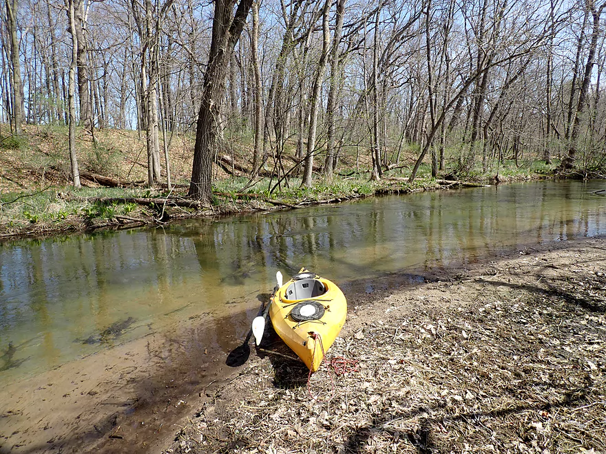
Starting the trip below Lawrence Lake
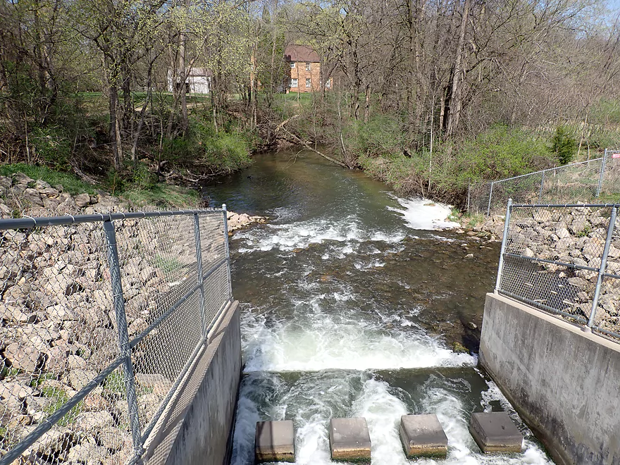
Just below the dam outlet
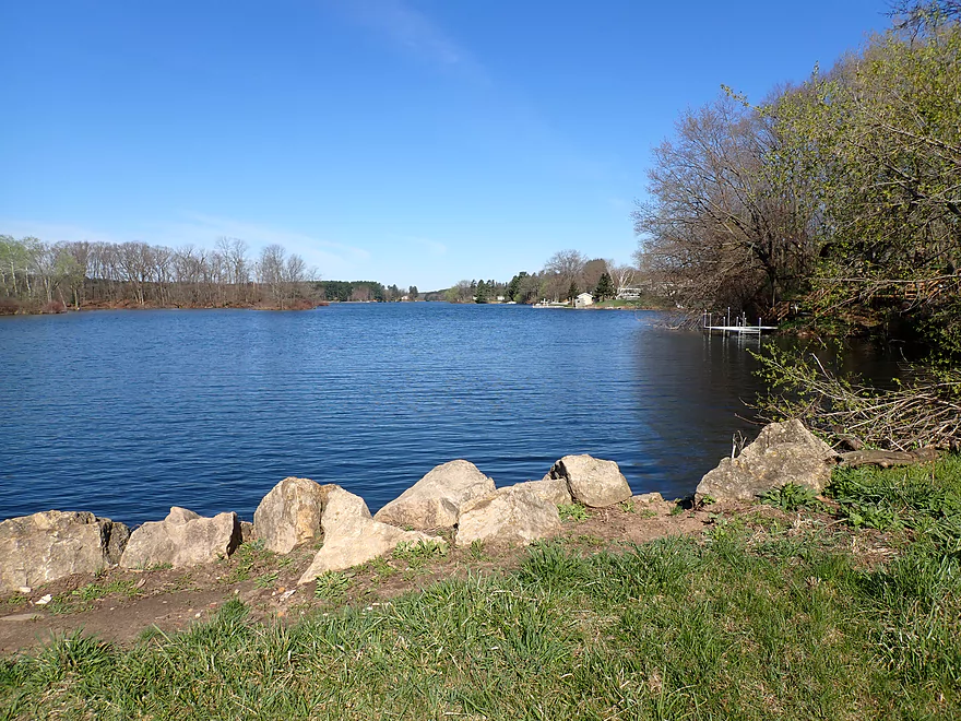
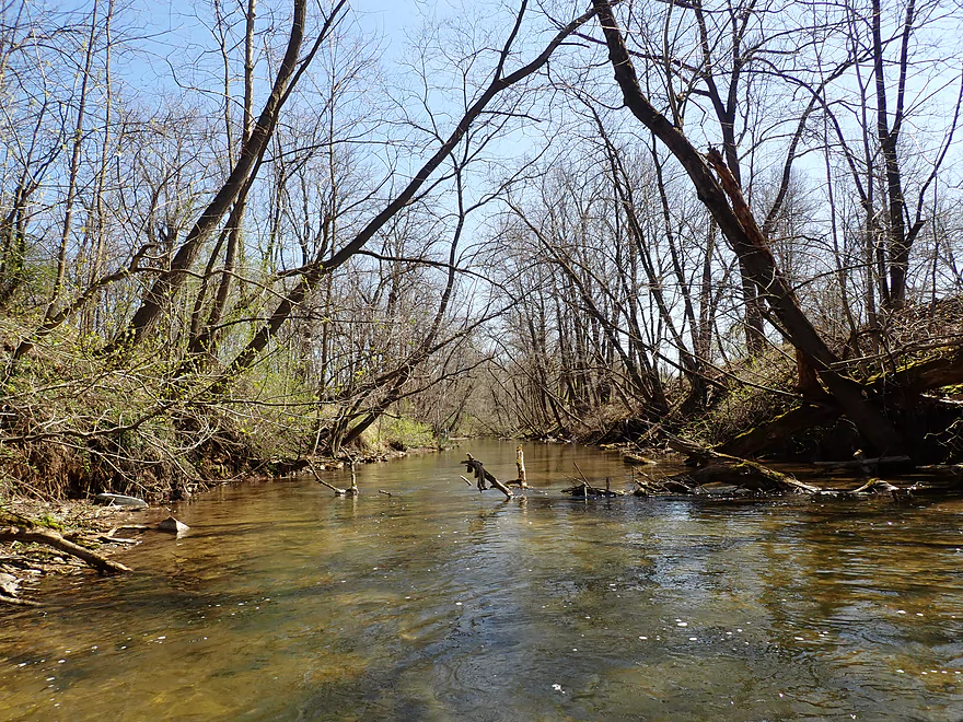
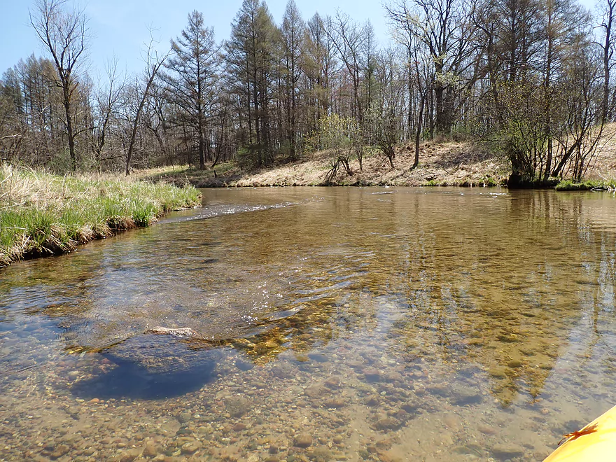
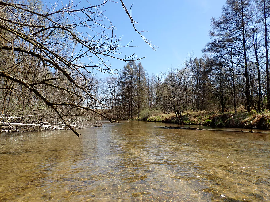
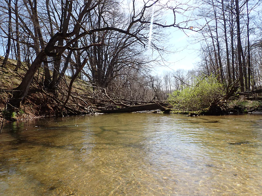
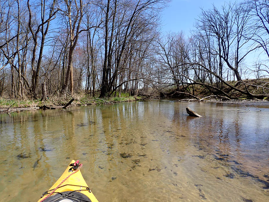
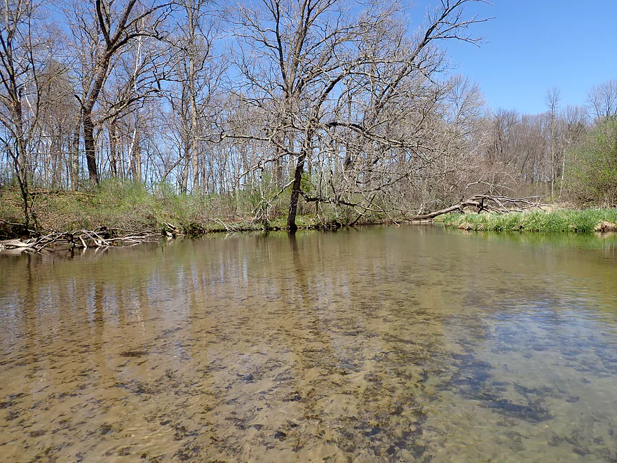
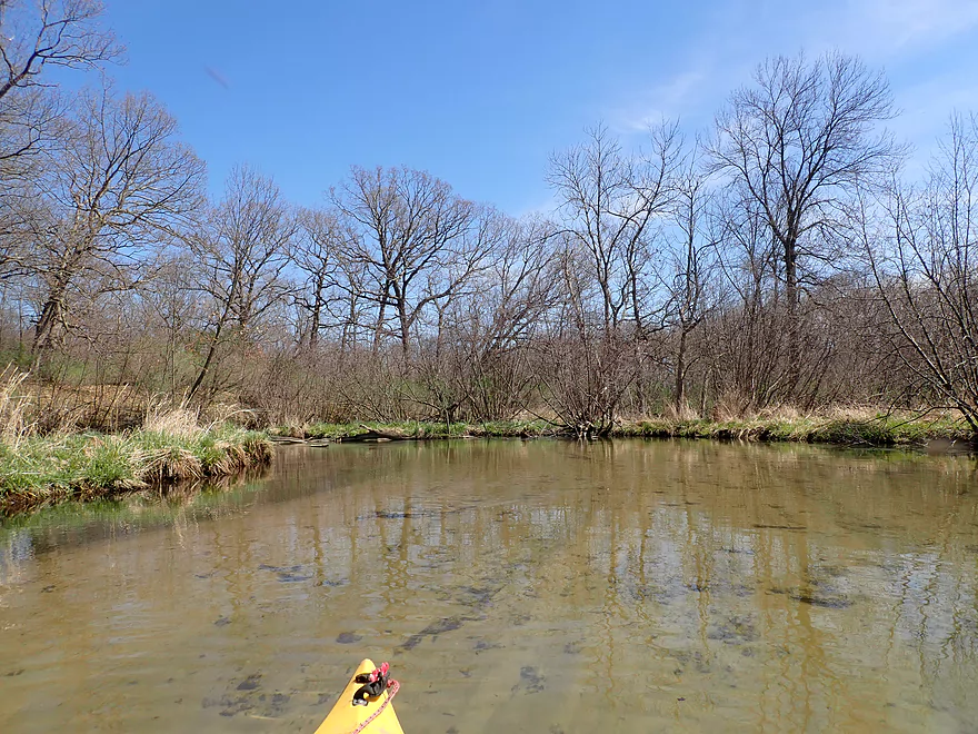
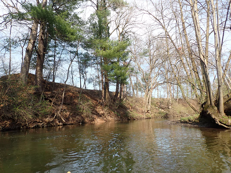
Scenic area
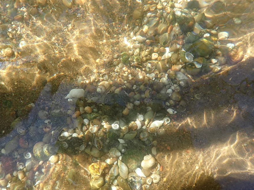
So many snails
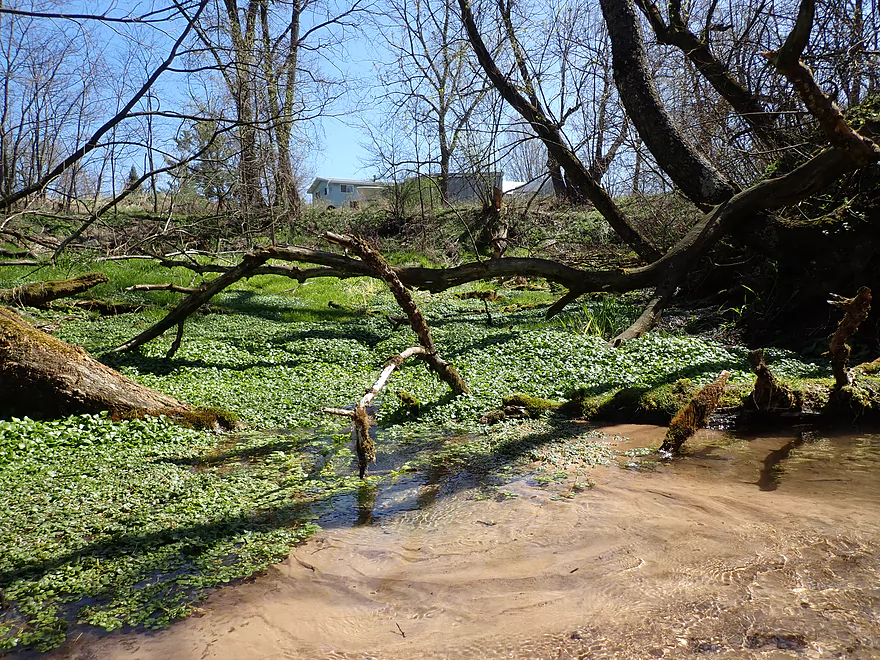
A bubbling spring and tons of watercress
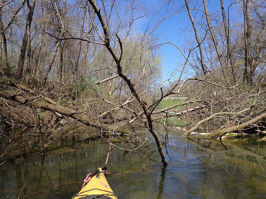
Some snags in the first quarter mile
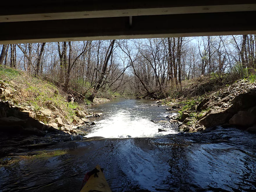
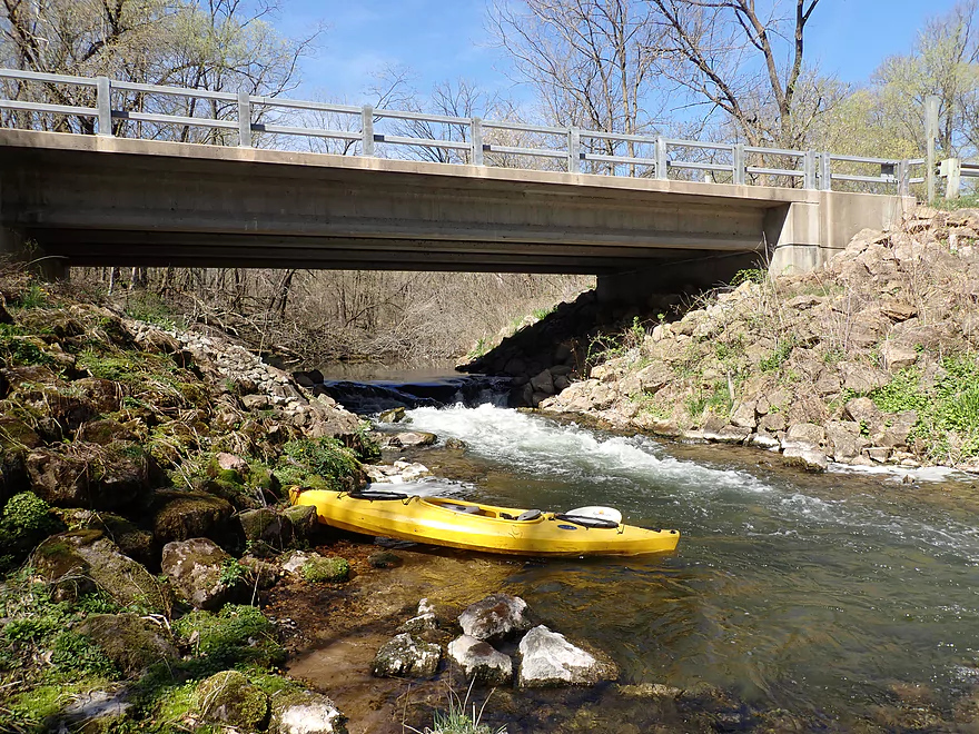
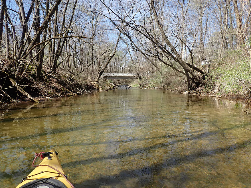
Some rapids under the 4th Ave bridge
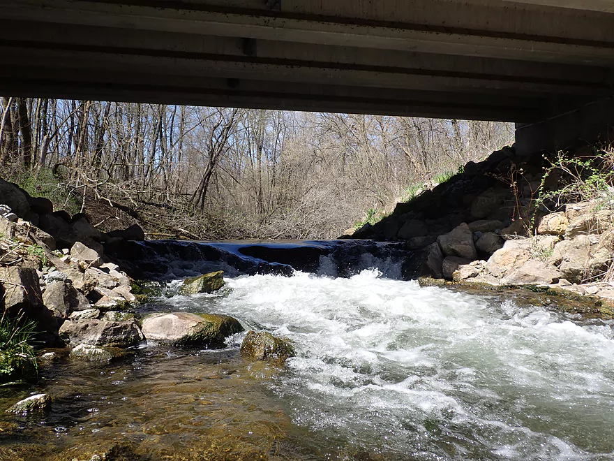
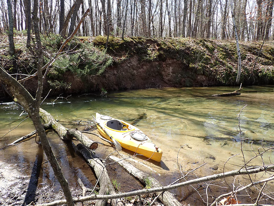
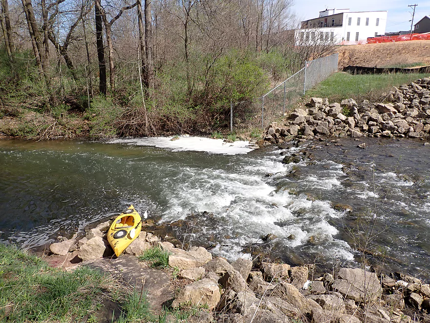
Maybe a two-foot drop
A portage over the rocks would be tricky but doable
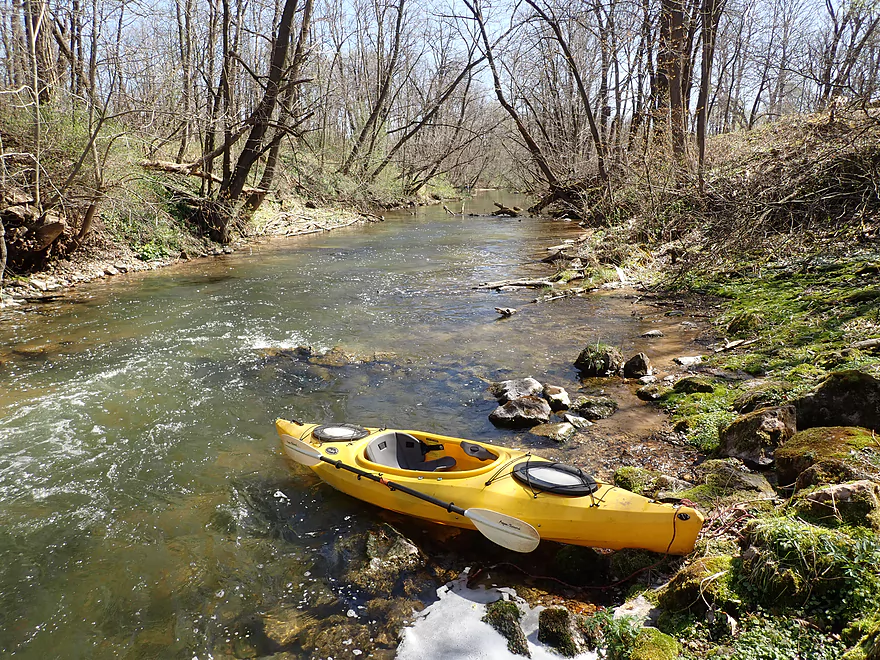
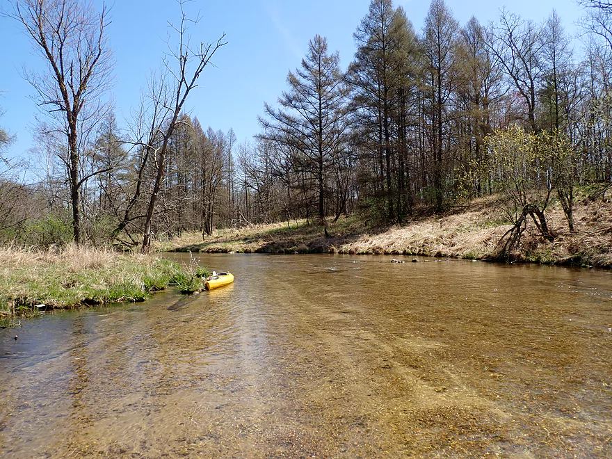
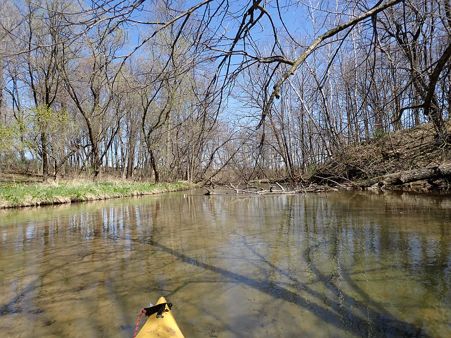
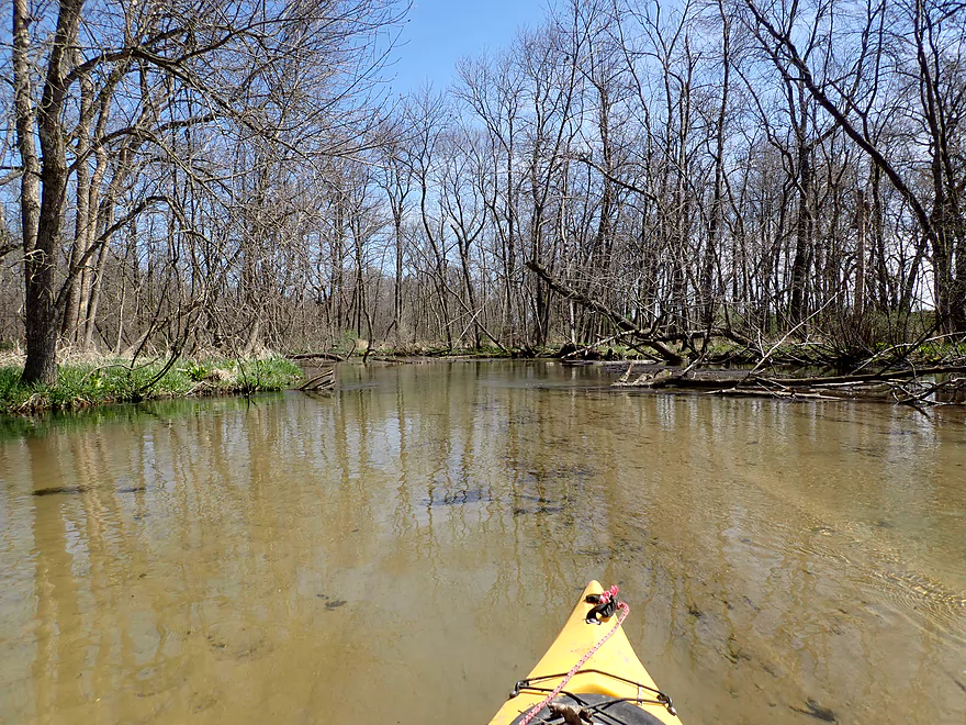
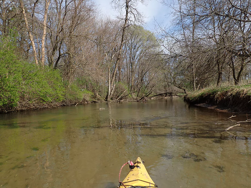
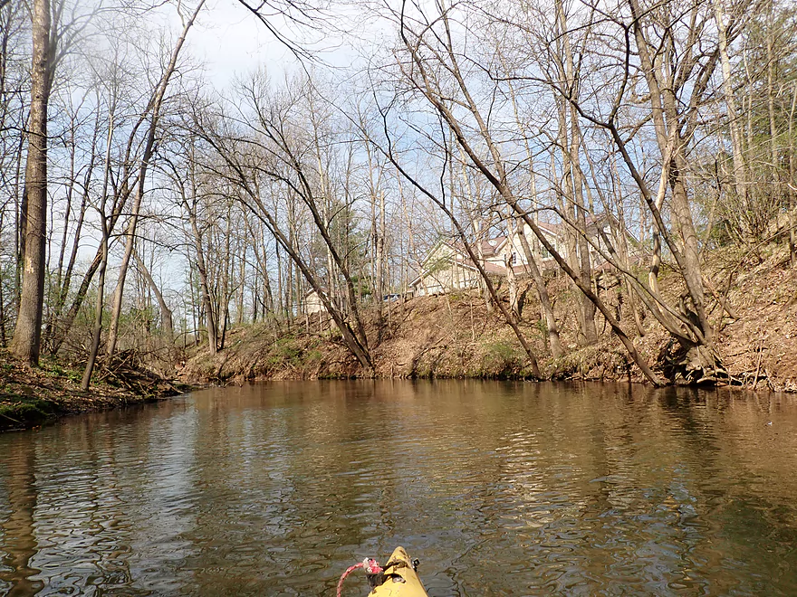
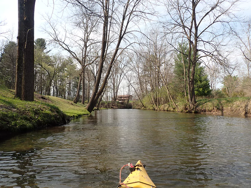
View downstream
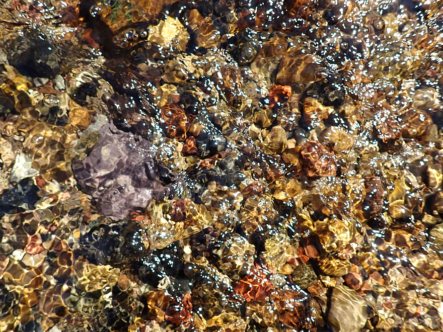
Bright colored pebbles
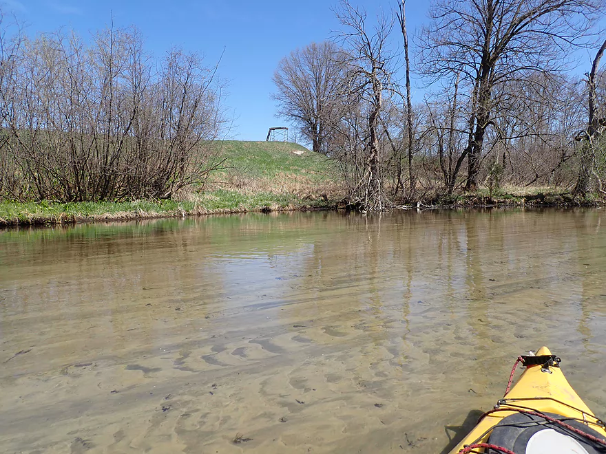
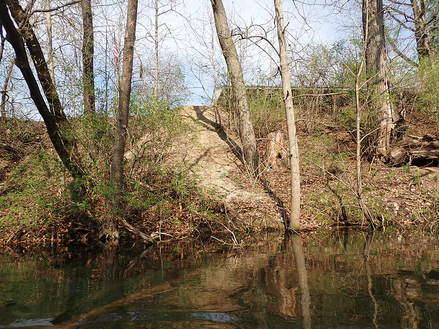
Artificial berms created in case the dam washed out
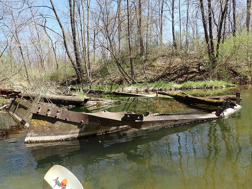
Some type of odd structure
Tamaracks coming up
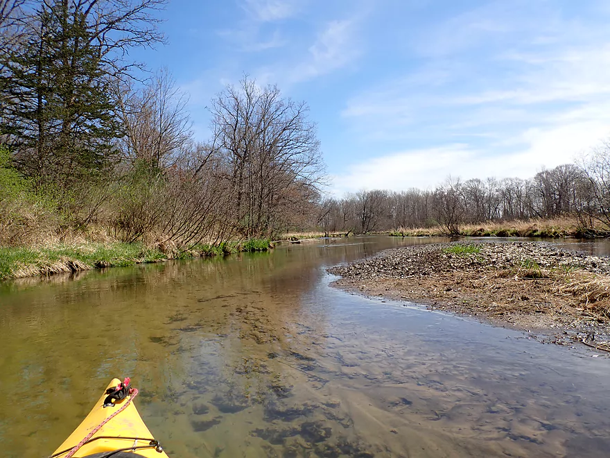
A really nice gravel section
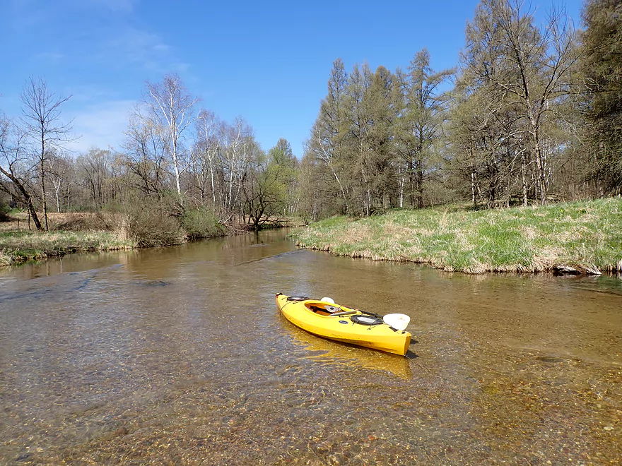
Getting out for pictures
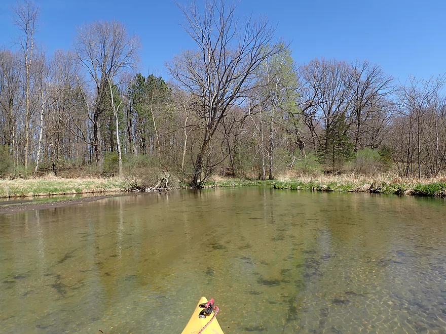
Very scenic
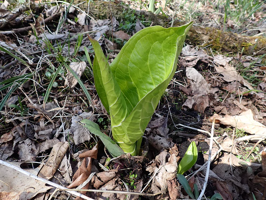
Skunk cabbage was a common sight
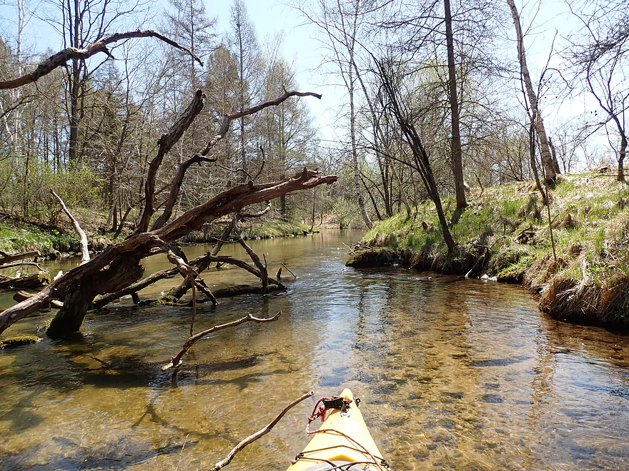
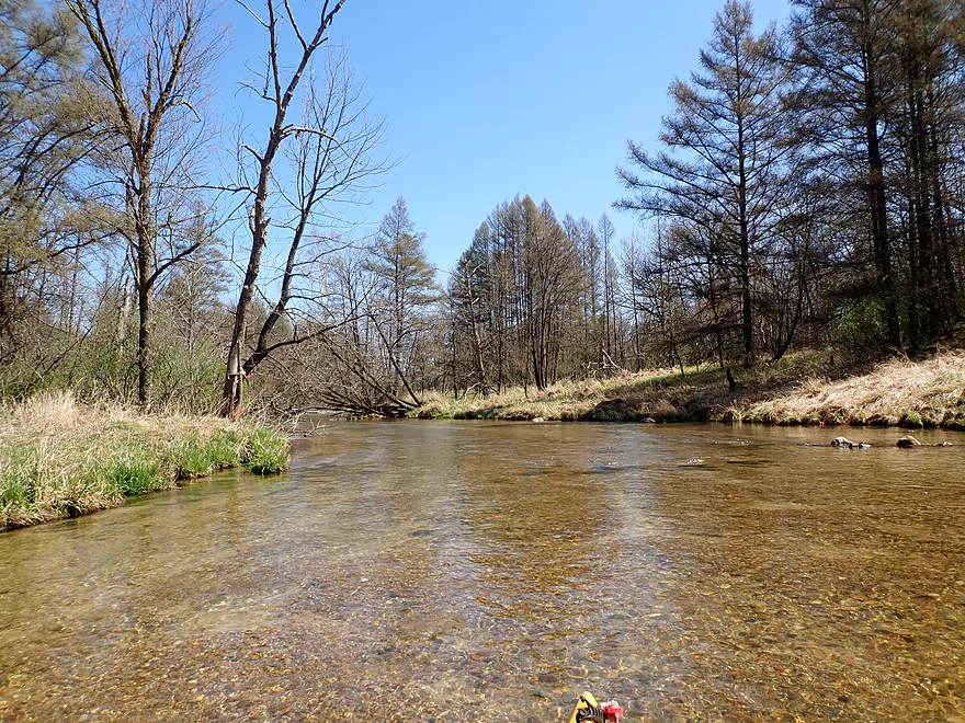
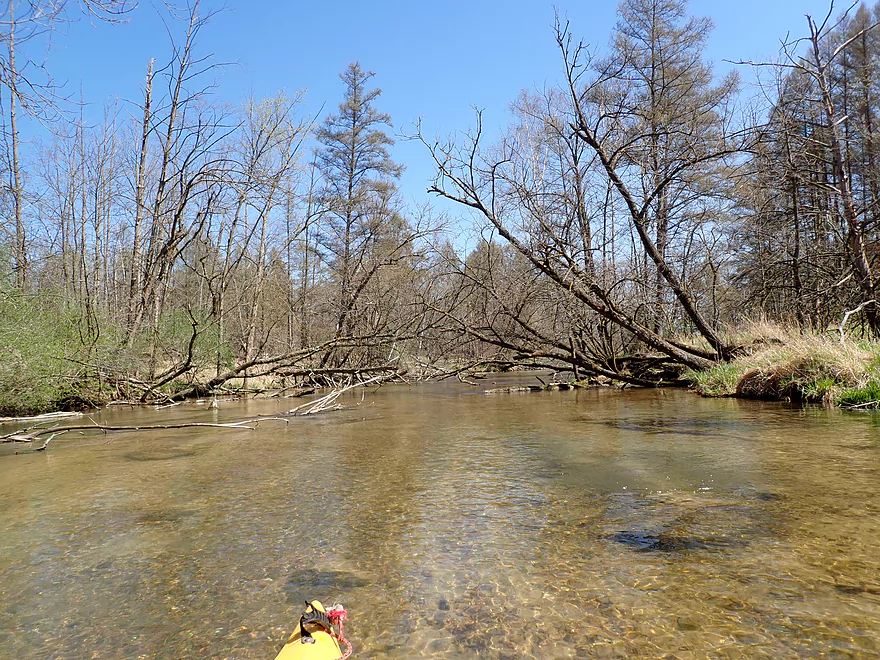
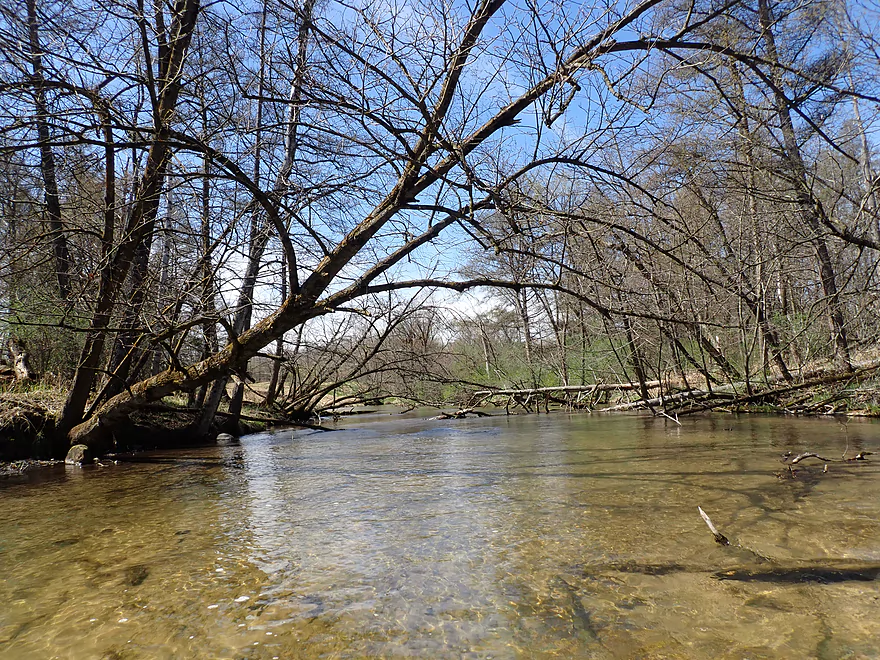
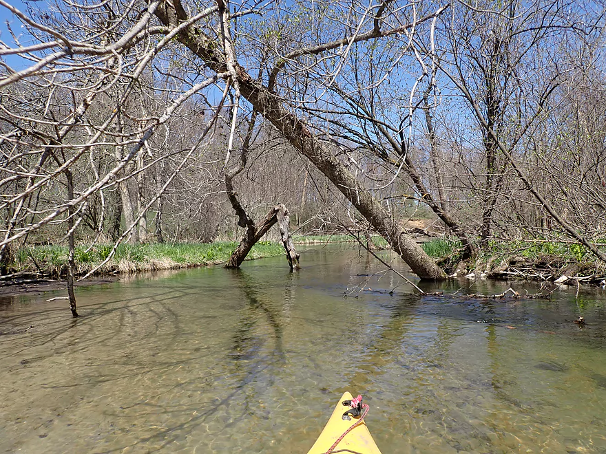
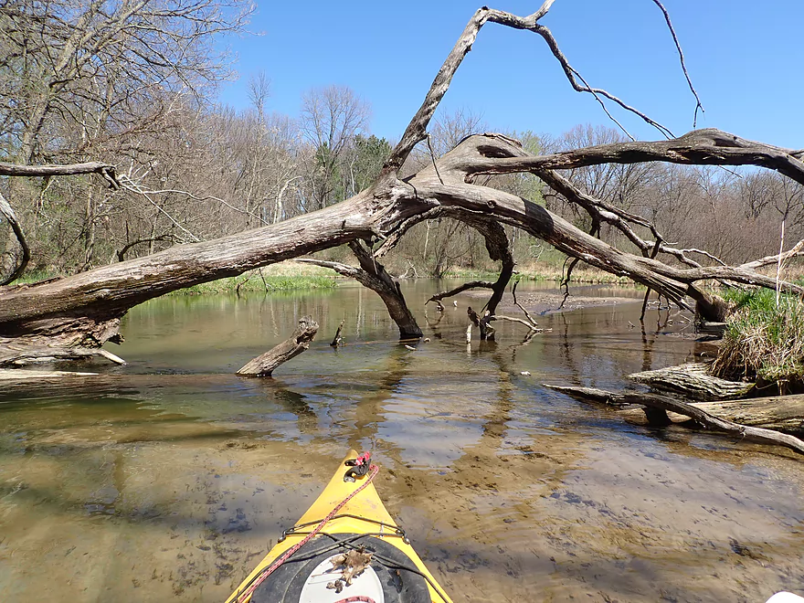
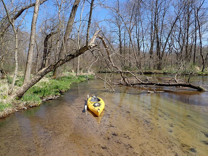
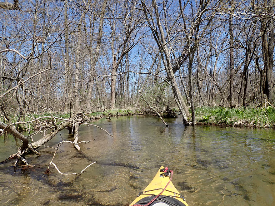
The first major logjam
Super easy portage
Neat patterns
Second major logjam…easy portage
Cool substrate patterns
Getting out for pictures
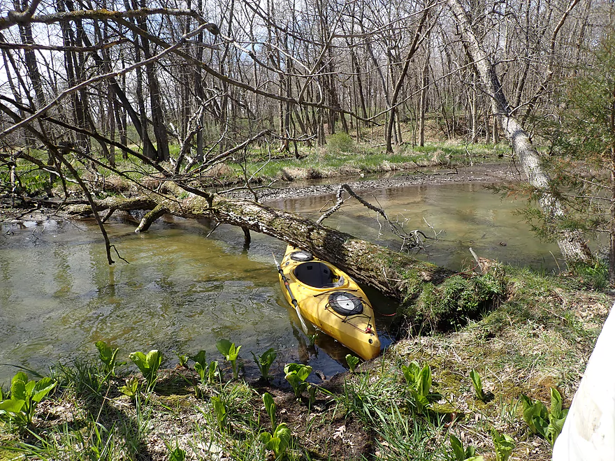
Third major logjam
Easy portage
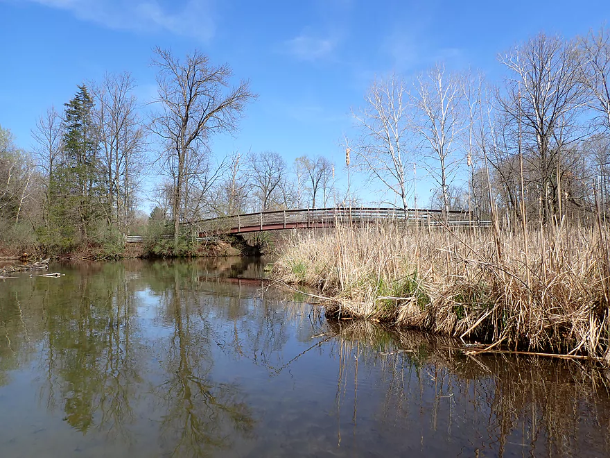
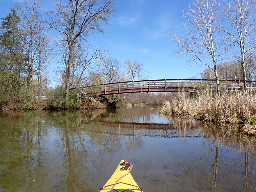
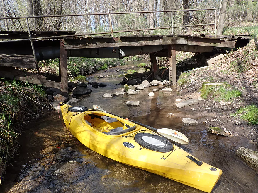
Attractive bridge
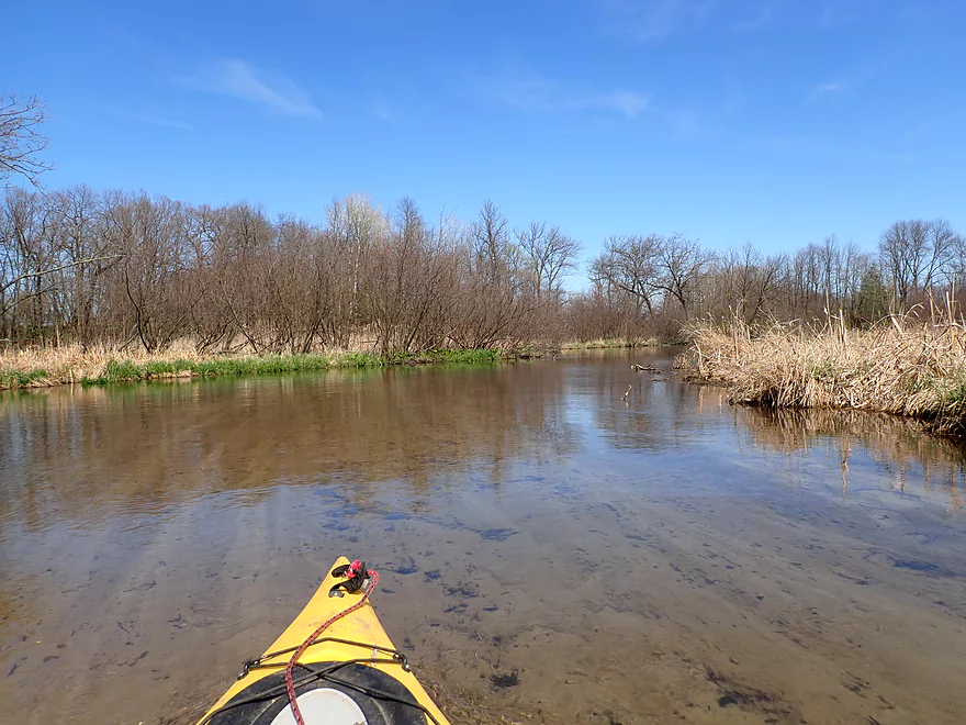
Entering the Westfield Millpond
4th Street is not a viable access
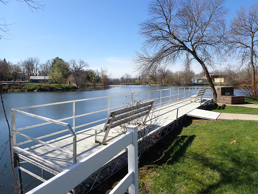
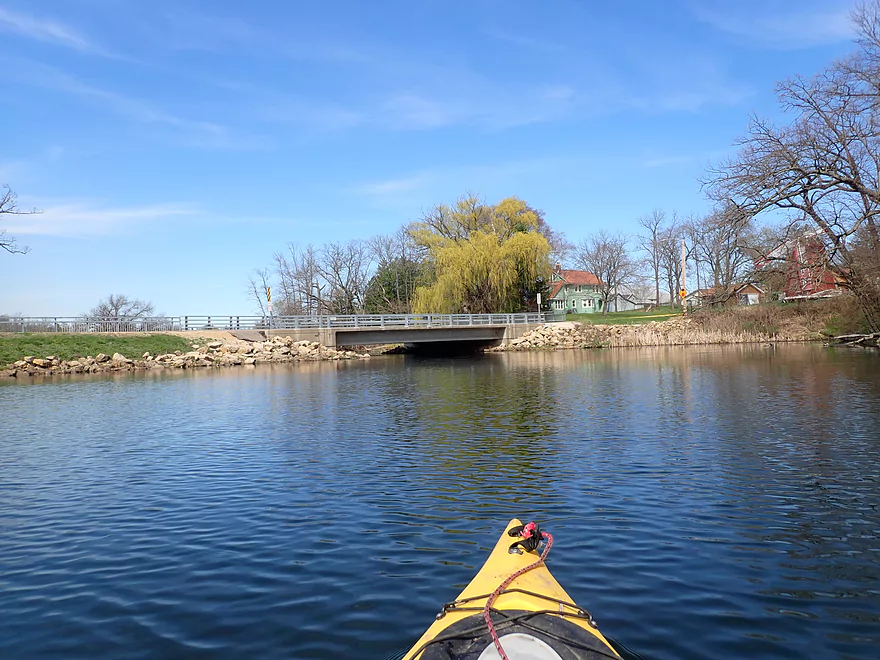
Westfield Veterans Park though is a good access
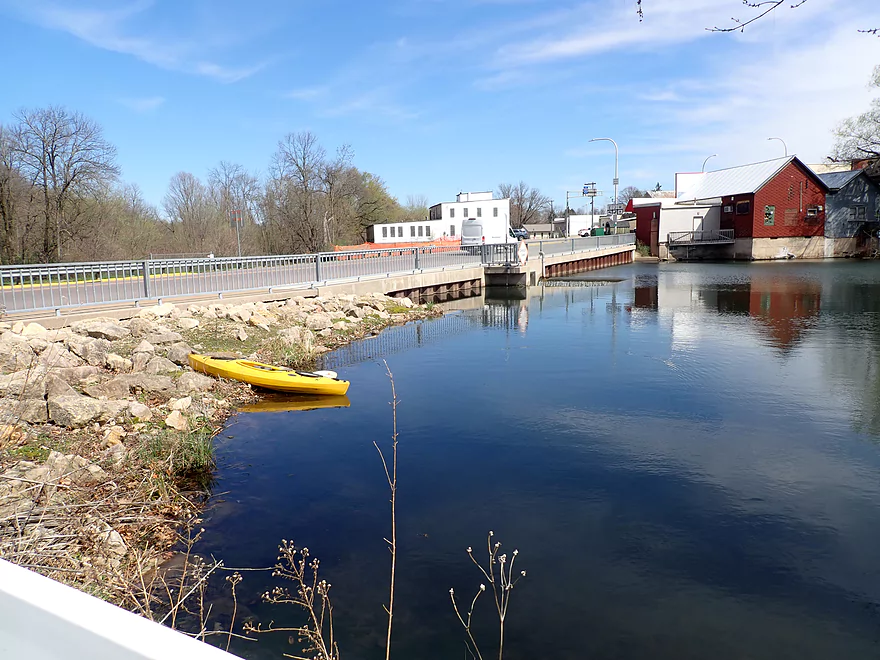
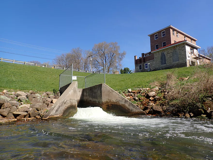
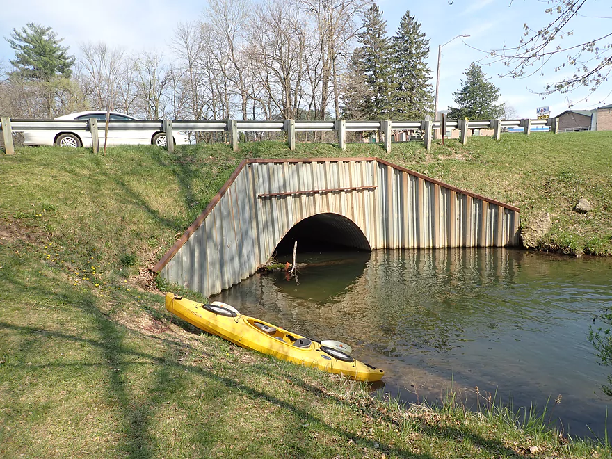
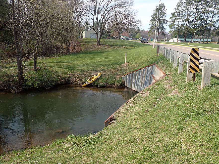
Portaging the dam at Main Street
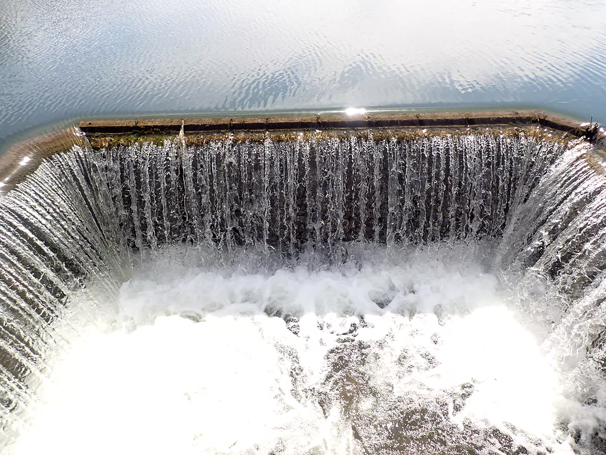
Dam inlet
…and outlet
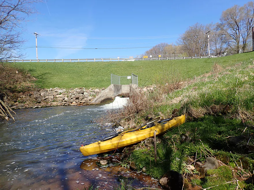
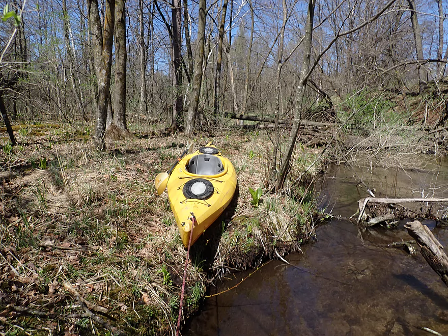
A manageable put-in
A spring inlet
And another…this runs over clay
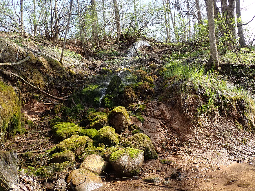
Lush moss growing under a high pressure artesian well
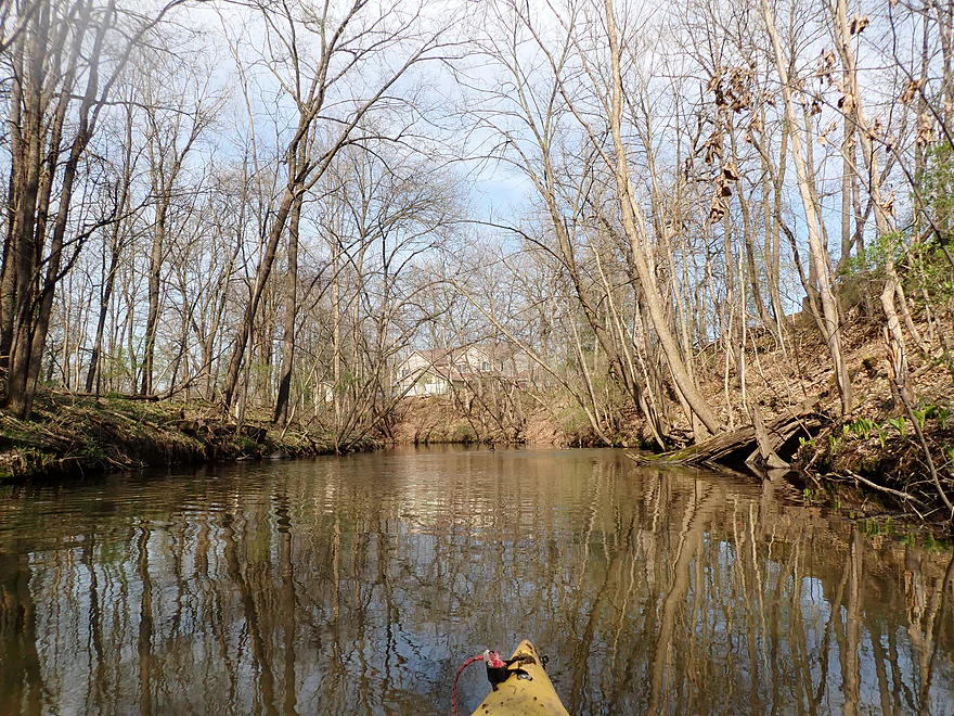
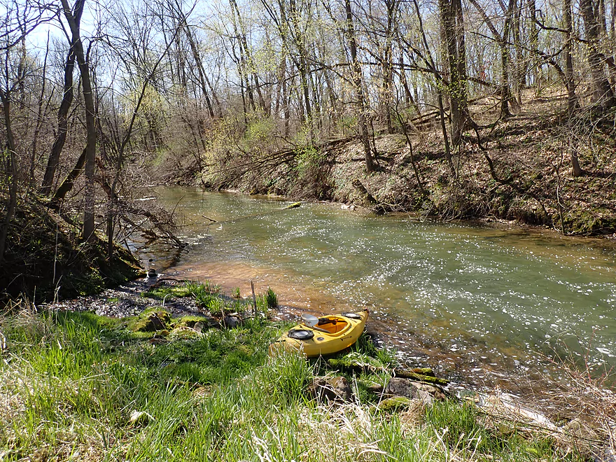
Nice stretch after the dam
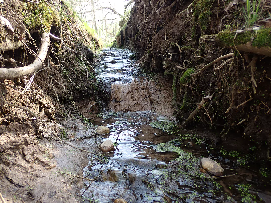
Creek is constrained by steep clay banks
More clay
This fishing access at Pioneer Park is an access option
I took out just downstream at the next bridge
The parking lot is just up that short hill
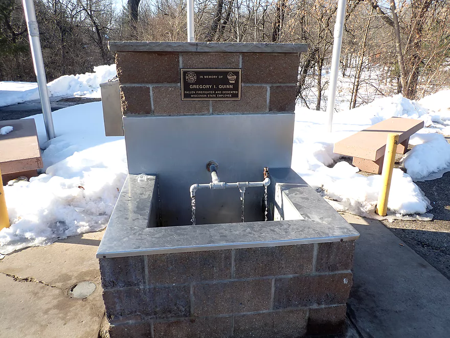
At the park is a popular artesian well where locals fill up their jugs
Westfield Creek

The Montello River is an obscure watershed located in central Wisconsin. It has three names depending on where you are. Near the headwaters it is known as “Lawrence Creek”. After Lawrence Lake it becomes “Westfield Creek”, and then after Harris Pond it becomes the Montello River. Despite some logjams here and there, it’s actually a cool river and underrated for paddling.
Five years ago I did Lawrence Creek which had some of the best clarity I’ve ever seen, thanks to its many natural springs. I ended the trip at Lawrence Lake because I assumed anything further downstream towards Westfield would just have too many logjams. But updated satellite maps suggested the logjam situation below the dam wasn’t as bad as I initially feared and I decided to give it a try.
As I dropped off my boat at the Lawrence Lake dam to start my bike shuttle, I was greeted by a local who gave me a dire warning about Westfield Creek. He said he knew it very well and had hiked significant portions of it. In his opinion the logjam situation was too problematic for paddling (especially above 4th Ave). When I told him that I still not only planned to paddle the creek but hoped to go all the way to Pioneer Memorial Park, he said I was crazy! While I respected his opinion, I also respected my own experience in analyzing satellite images and paddling logjam infested creeks. My gut instinct told me it would be all manageable and thankfully that turned out just to be the case.
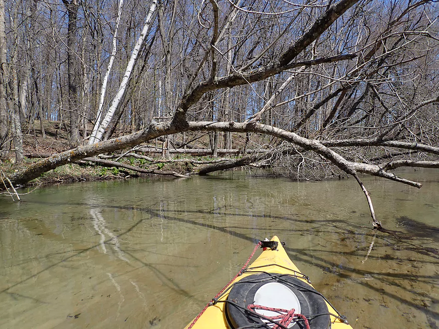
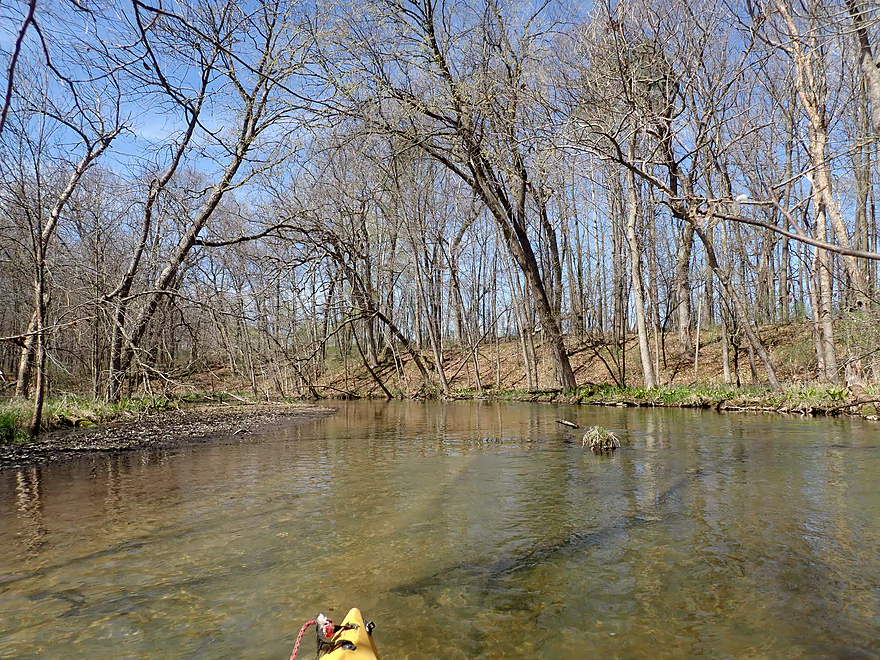
From the dam at Hwy E to 4th Ave was a short 1000′ stretch. Here the banks had been artificially bermed with the idea being if the dam burst, the nearby homes would be somewhat protected. The steep berms on either side created a cool wooded corridor that the creek cut through. Along both banks springs, seeps and skunk cabbage were a common sight. Unfortunately the first 1000′ of the trip also had the most downed trees. While I had to do a bit of ducking and hopping, I never had to portage on this leg.
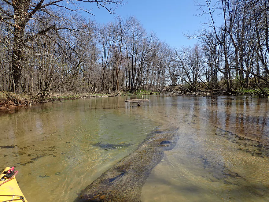
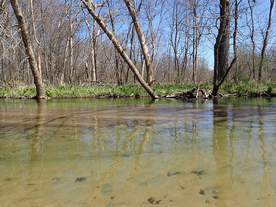
One of the remarkable attributes of the first leg was the incredible clarity (among the best I’ve paddled over). I could easily see the sandy bottom and many schools of fish. I must have seen over a 100 fish just on this trip. Most were pretty small, but a few looked to be over a foot long.
Directly under the 4th Ave bridge, there was a surprise two-foot drop and what I would consider Class 2 rapids. I found these pretty fun, but did take a bit of water into my cockpit. The scene looking downstream from the rapids between two steep berms was among the best of the trip.
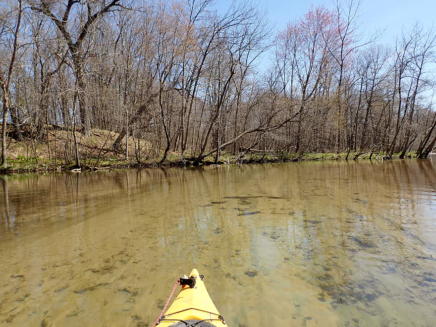
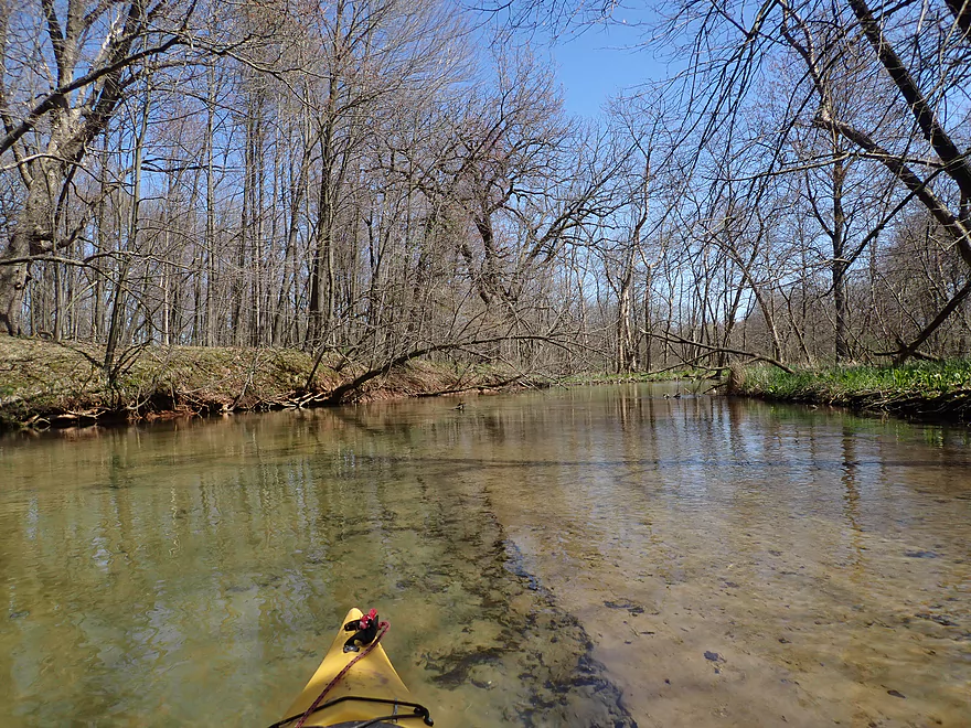
The artificial berms soon vanished, and the creek became wider and shallower. The shallower depth really accented the clarity which would be incredible for the next three miles. This trip very much reminded me of two nearby trips I did previously in Upper Neenah Creek and the Upper Mecan River. In fact it was remarkably similar to the Upper Mecan, although it was a bit slower, wider, and not as twisty. Upper Mecan River fans will definitely like this stretch.
One of the downsides to this trip were a few logjams, but they weren’t as bad as I feared. In total, I got out of my boat just three times for jams, and each portage was pretty easy because of the flat banks.
I suspect the reason this river doesn’t have steep muddy banks is because the springs keep water levels relatively stable which in turn reduces erosion. There were springs throughout the trip, but most were located close to Lake Lawrence. The local I talked to warned that they weren’t drinkable because of pollution caused by a local creamery. The exception was the artesian wells in Westfield which were good for drinking.
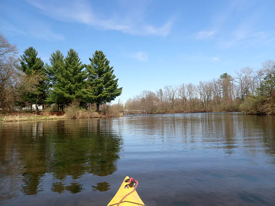
Eventually the effects of the Westfield dam kicked in and the creek started to widen and slow into a millpond. I could have taken out at the dam where Westfield Veterans Park is conveniently located, but instead decided to portage it and continue another mile to the next park (Pioneer Memorial Park).
After the dam, the creek really changed in character. Water clarity was still ok, but wasn’t quite as good. The channel became narrower and deeper, and I suspected the Westfield Dam was in the midst of doing a scheduled release. This last mile flowed past steep clay banks topped with trees and had a very different vibe from the first part of the trip. But it was still very cool and I was glad I explored this stretch. Here too there were several natural seeps and springs, including a high pressure artesian well that sprayed water in a high jet toward the creek.
I ended the trip at Pioneer Memorial Park which was a decent take-out. Most who frequent this wayside do so to fill up their water jugs at the local artesian well. The locals I met there were surprised that I had just paddled Westfield Creek. I don’t think it sees a lot of paddling traffic, but it does see some.
In summary this was a very nice trip quite comparable to the Upper Mecan River. Yes, it does have a few logjams, but they were all manageable portages and I didn’t consider them a big deal. In fact some had already been cleared out by locals and hopefully they’ll finish the job in the future. If you do this, definitely time your trip for relatively low levels and sunny conditions. This will most ideally show off the creek’s incredible clarity. Very adventurous paddlers might consider combining this trip with Lawrence Creek, which would make for a long 9.4-mile trip but would also showcase the best of the best that theUpper Montello River has to offer.
Sights included white-tailed deer, an eagle, turkey vultures, and a red-tail. I saw what looked like a muskrat/beaver trap, so assume they live on the river (or used to). The highlight was the many fish I saw…among the most ever seen on a kayak trip.
Hwy E: Hwy E crosses over the Lawrence Lake dam. There is a pull-off on the south/upstream side of the dam which fishermen occasionally use. In my case I launched downstream of the dam, which requires crossing the road with your boat and then pulling it down a steep embankment. It sounds more difficult than it is.
Alternate Put-ins:
- Lawrence Lake – North Ramp (0.8 miles upstream of Hwy E): This is an ok boat landing. It’s a nicer launch option than Hwy E, but would require some lake paddling and a later portage to get below the dam.
- 1st Ave (3.8 miles upstream): This includes Lawrence Creek which despite having a few logjams is a super scenic water trail with perfect clarity.
Pioneer Memorial Park: This was a pretty good take-out option and has a dedicated parking lot. You have two options for disembarking. You can climb out onto a fishing trail which directly leads to the parking lot, but that is pretty steep. The second option is nearby N. Pioneer Park Rd bridge which was an easy take-out, but you need to drag your boat 290′ over grass to reach your car.
Alternate Take-outs:
- Westfield Veterans Park (0.8 miles upstream of Pioneer Park): For those not wanting to portage the dam, it would be easy to take out just above it by Veterans Park. A public parking lot is available across the street. The stretch below the dam is nice though, and I suggest paddling it if possible.
- Hwy E (0.6 miles downstream of Pioneer Park): This is a nice little add-on section and in hindsight I wish I had explored it. Hwy E isn’t a very private bridge access, but is likely doable.
Pioneer Memorial Park to Hwy E: 3.4 miles with 69′ of ascent. This was a really easy bike shuttle. The only downside was a dog that chased me in Westfield.
Fences: None.
Current: Current was consistent but not too fast. The dam at Westfield impounds the river for about a mile.
Rapids: Almost none…but there was a Class 2 chute below 4th Ave (maybe a 2′ drop). I thought it was fun, but others may disagree. You can portage it by climbing over the rocky road embankment…tricky but doable.
Logjams: There were a few logjams that required portages, but all were very easy because of the shallow banks. I’ve marked the location of the major logjams on the following map. Click the respective icon for more information.
Poison Sumac: I was warned by a local that poison sumac could be a big issue on this river, but I didn’t encounter much of it.
Best Approximate Gauge: Chaffee Creek @ I-39 – 13.5 CFS or 3.78′
Note, this gauge is on a different watershed and may not provide the best estimates. Always use your own judgement when choosing to paddle a water trail or not.
- 0-12′: Maybe too shallow.
- 12-13′: A good target range with exceptional clarity.
- 13-14′: An ok target range with good clarity.
- 14-15′: Likely ok for paddling but clarity won’t be as good.
- 15’+: Maybe too high for good paddling.
Detailed Overview
- Headwaters to 1st Ave: 1.0 miles. In theory, there should be a spring located at the headwaters a mile upstream from 1st Ave. This might be more viable as a roundtrip.
- 1st Ave to Lawrence Lake (North Ramp): 3.0 miles. Technically Lawrence Creek, this is a small paddle with some logjams, but is really nice with stunning water clarity and virtually no mud. A very underrated paddle.
- Lawrence Lake (North Ramp) to Lawrence Lake Dam: 0.8 miles. A simple lake paddle.
- Lawrence Lake Dam to Pioneer Memorial Park: 5.6 miles.
- Lawrence Lake Dam to Westfield Veterans Park: 4.8 miles. A terrific paddle because of the incredible clarity and natural springs. Only downside are a few logjams, but they are easy portages.
- Westfield Veterans Park to Pioneer Memorial Park: 0.8 miles. The river here is faster, deeper, more wooded and less clear. It's a scenic stretch flanked by steep clay banks.
- Pioneer Memorial Park to Hwy E(by Charles St): 0.6 miles. A nice little prospect. Mostly within earshot of busy I39.
- Hwy E(by Charles St) to Hwy E/B(by Maynard Dr): 5.1 miles. Maybe 15-20 logjams.
- Hwy E/B(by Maynard Dr) to 10th Lane: 1.4 miles. This section should be mostly clear with I believe the only jam being the one you’ll see from the Hwy E bridge.
- 10th Lane to Hwy E: 0.7 miles. Nice open marsh paddle. Good access at both the put-in and take-out.
- Hwy E to Water Street Dam: 1.7 miles. A boring flowage.
- Water Street Dam to Hwy J: 600'. There are cool rapids between the two bridges in this short stretch, but a nasty strainer and a No Tresspassing sign by the dam make this a difficult leg to access.
- Hwy J to Ember Lane: 5.1 miles. A very scenic stretch of river with clear water and a sandy bottom. Currently there are too many logjams here to recommend, but it may get cleaned out in the future.
- Ember Lane to 11th Rd: 4.0 miles. Likely a scenic stretch of river, but I bet it has too many logjams.
- 11th Rd to Lake Montello (park on south shore): 3.7 miles. A simple section with some lake paddling.
- Montello Dam to the Fox River: 0.6 miles. A nice little urban stretch.
Trip Map
Overview Map
Video
Photos Size:
Back around 1986 the dam at Laurence lake failed, washing out Cty rd E. They ended up draining the lake (Laurence). Not sure but I don’t recall much damage to Westfield or Harrisville from the sudden surge of water. Also Westfield had a water contamination problem from a local Manufacturer dumping solvent on the ground for several years. I will definitely do this trip. Thanks for the review. Your site is so well layed out with Pics Vids and river gages, it’s the first place I go when planning a trip. Thanks again.
I didn’t know about the breach (which would explain the subsequent over-engineered banks that now follow the dam). If you do this trip, let me know how it turns out. Sadly things are kind of overgrown now on the creek, so it may not be as scenic. It could be a cool paddle to save for October when things have thinned out.