
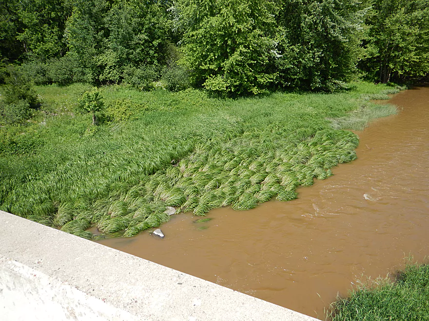
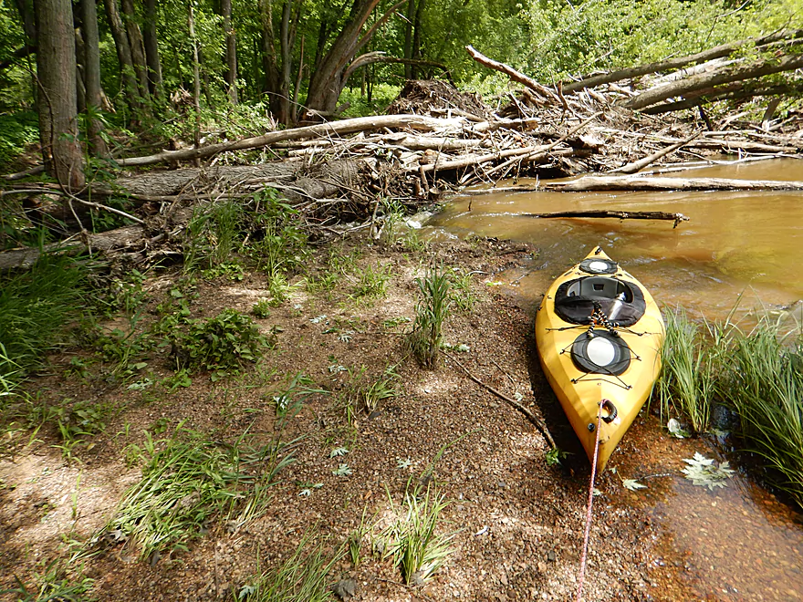
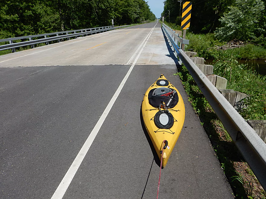
Putting in at Hwy 80
Bit of a hike to the water
And brushy
Slight riffles to get things started
While high, the river had receded significantly from overnight
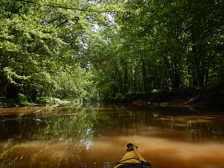
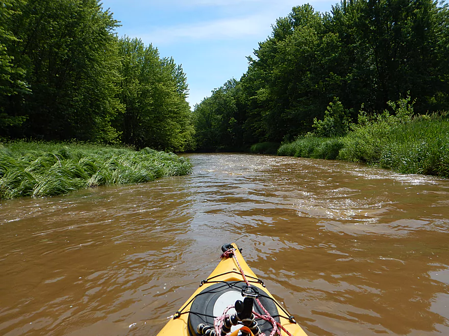
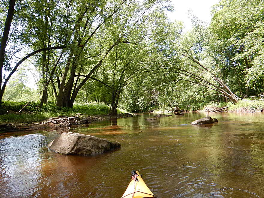
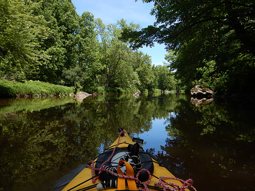
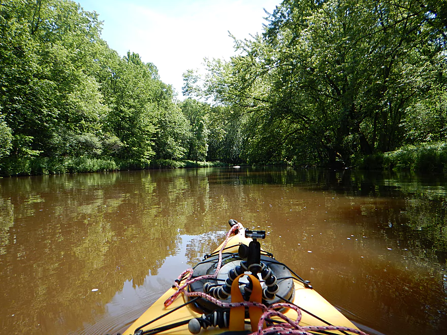
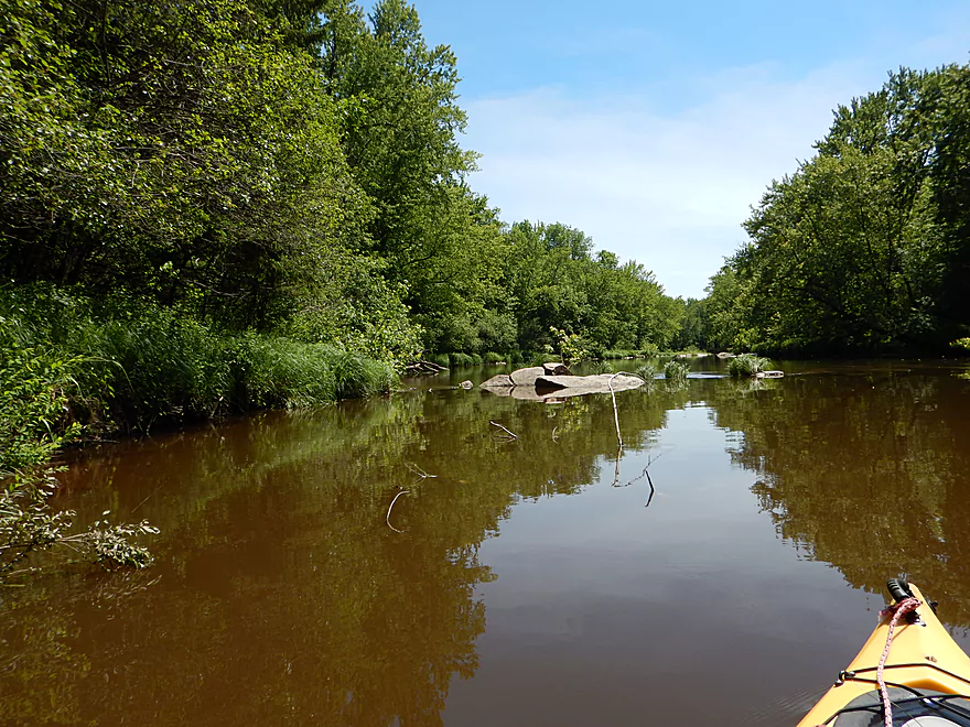
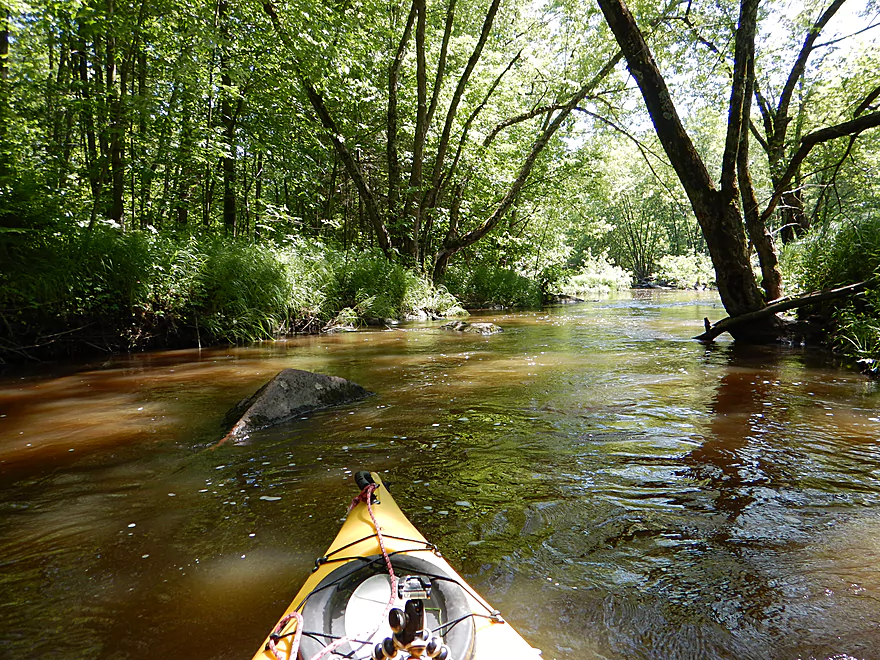
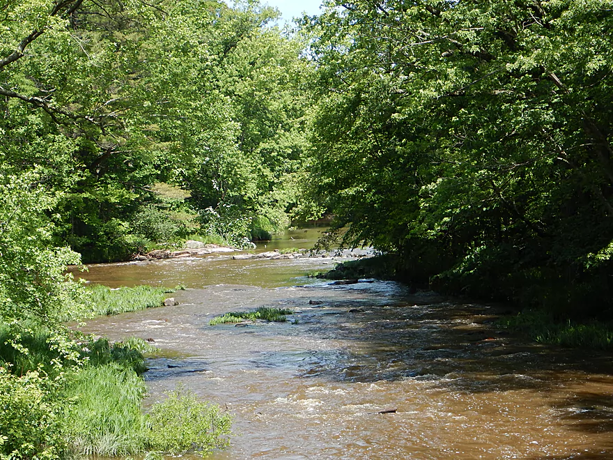
A very shady and enclosed river to start
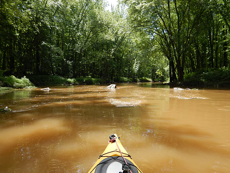
Mostly slow to start, but a riffle here and there
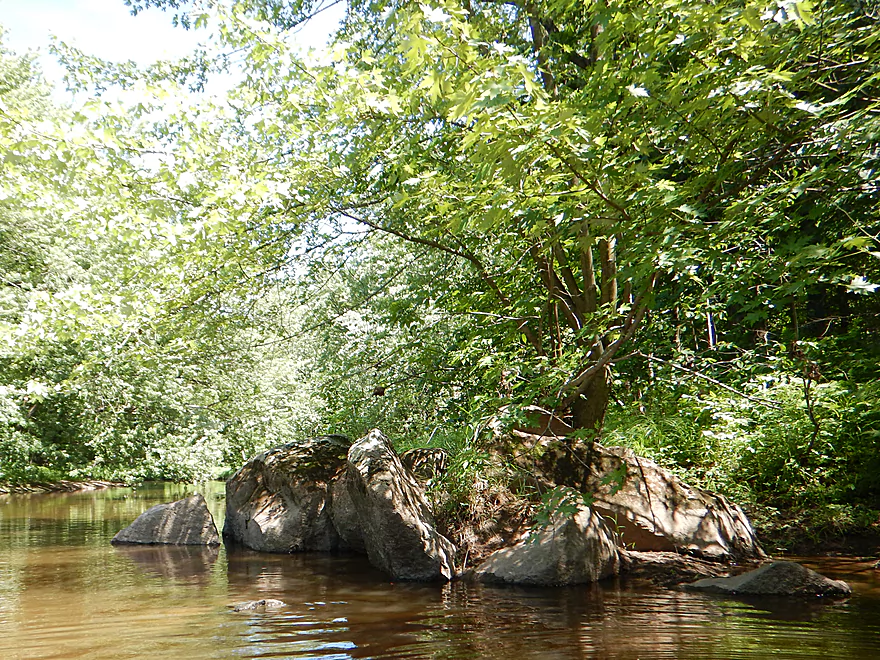
Boulder gardens are a little runty for now
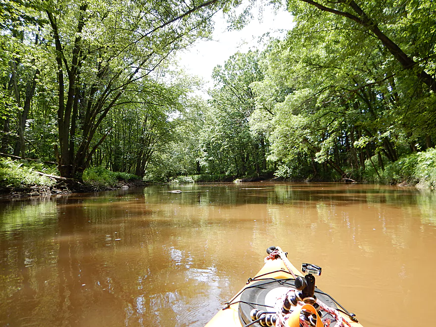
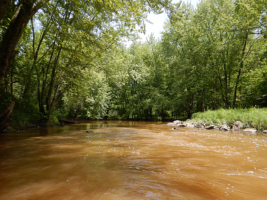
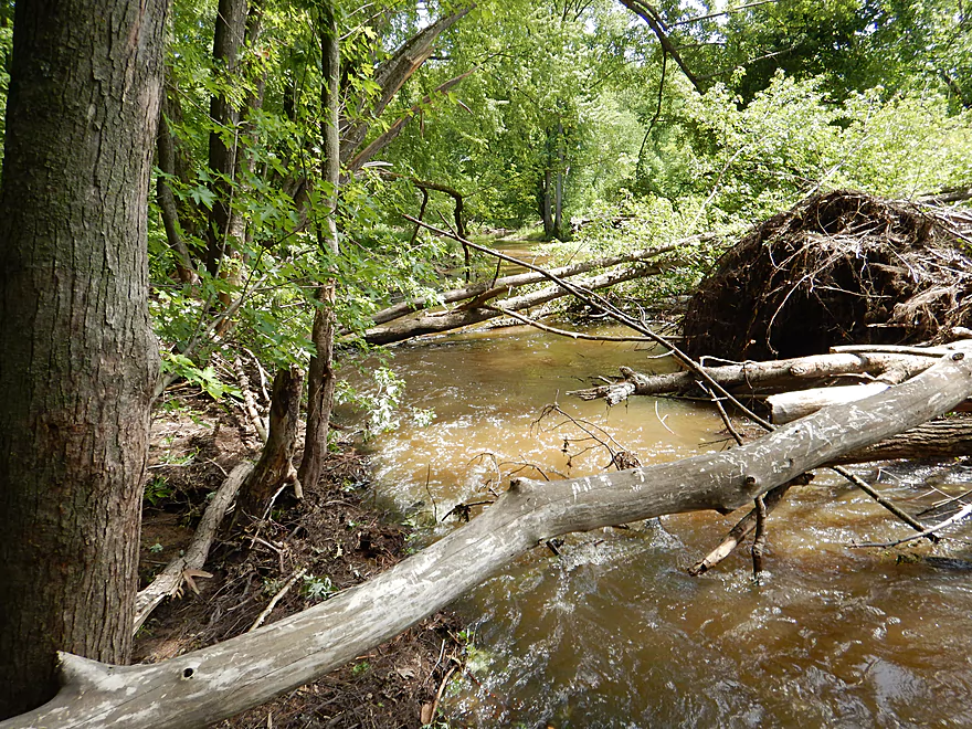
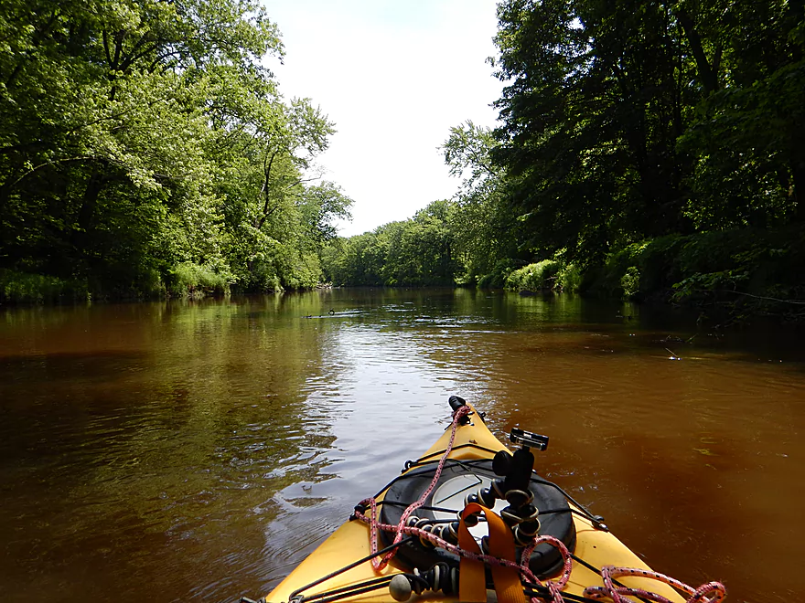
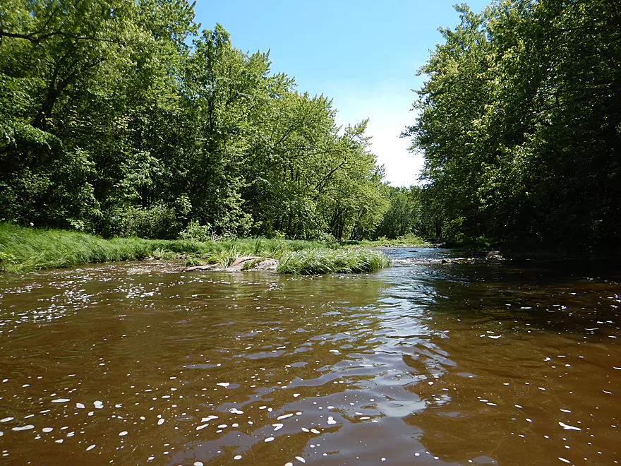
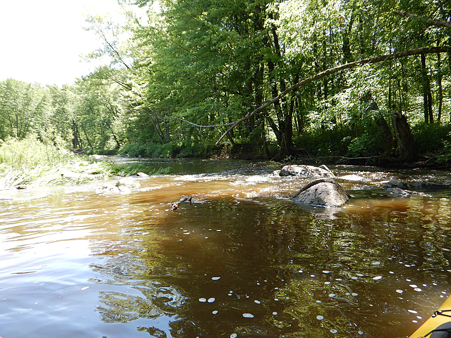
Such a muddy river
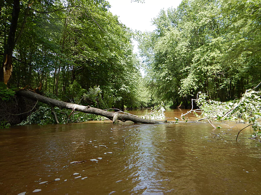
Freshly down tree I was able to thread through
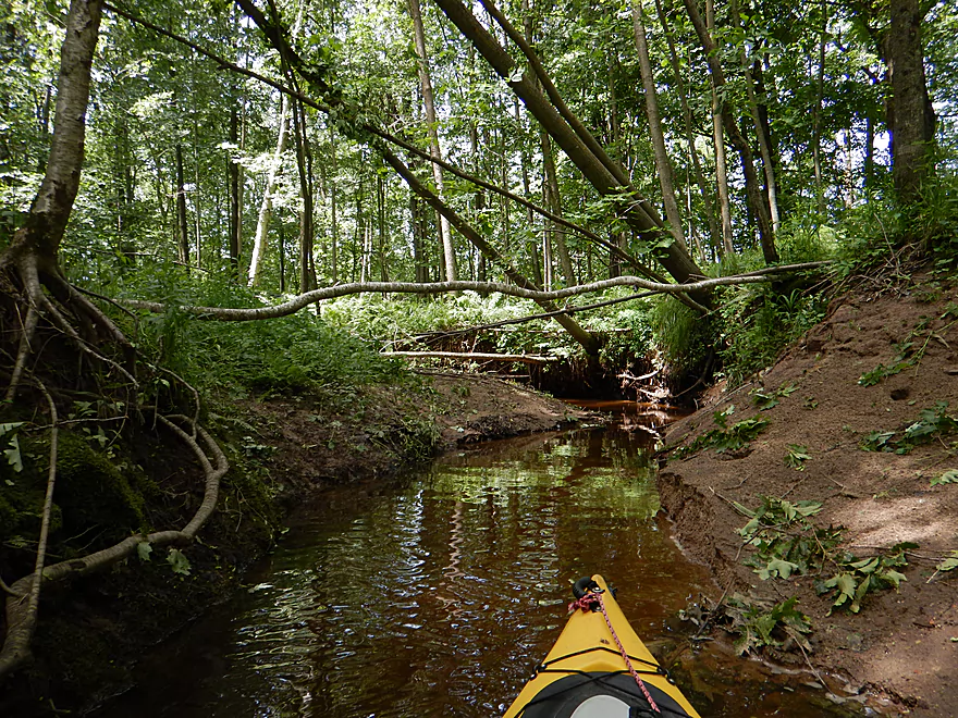
Small tributary carved through the sand banks
Only portage of the trip
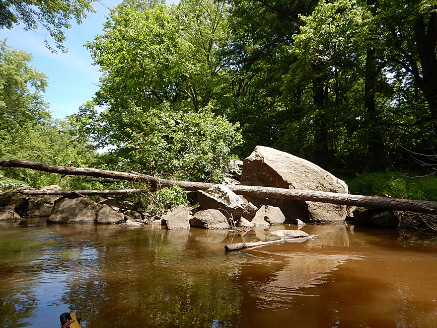
Rapids + log jams = bad mix
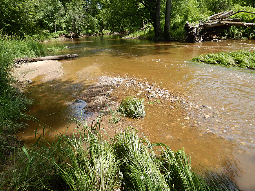
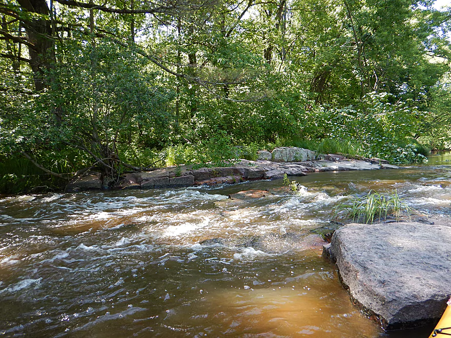
Gravel bar makes doing the portage easy
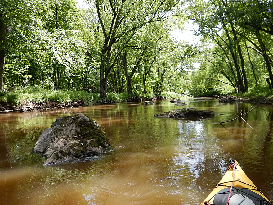
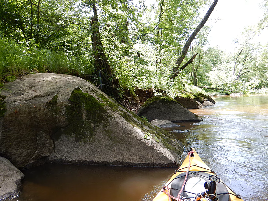
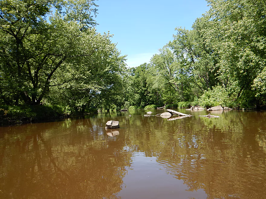
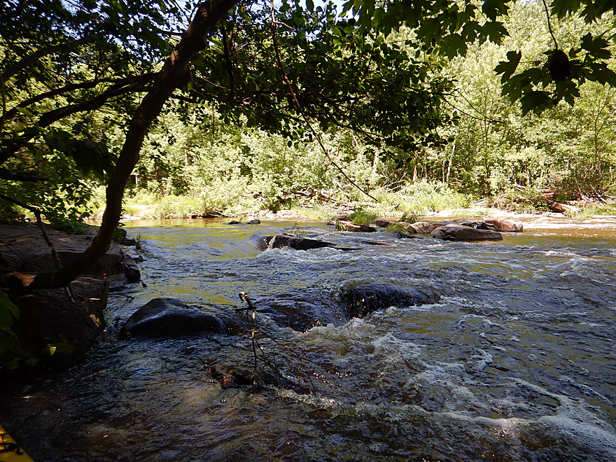
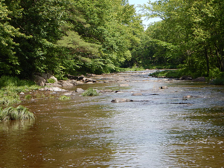
Starting to get nicer boulder gardens
Quite the mess but easy to get around
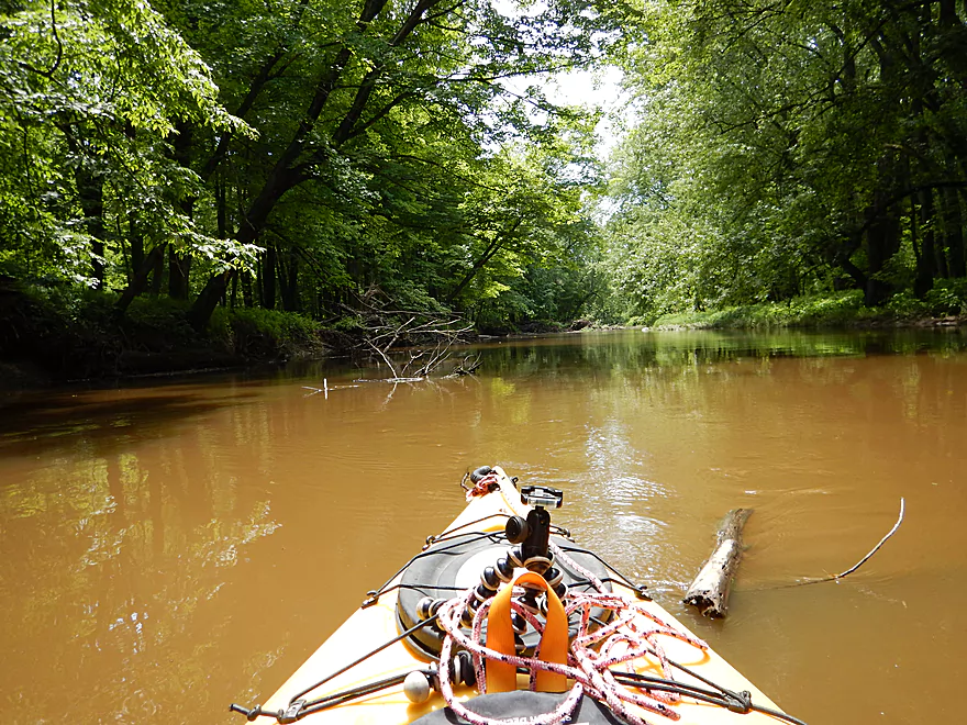
River finally starts to open up
Channel starts to get rockier
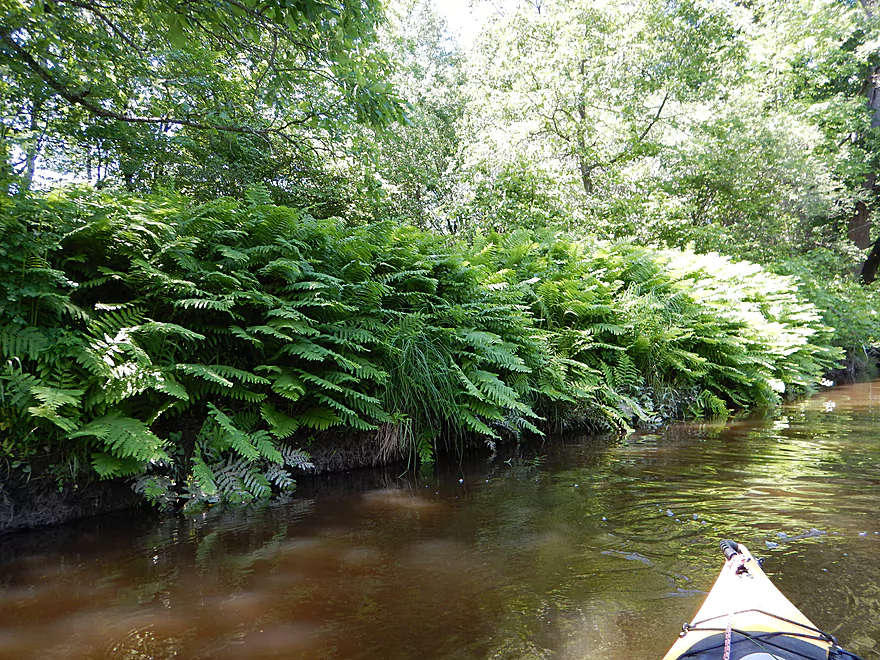
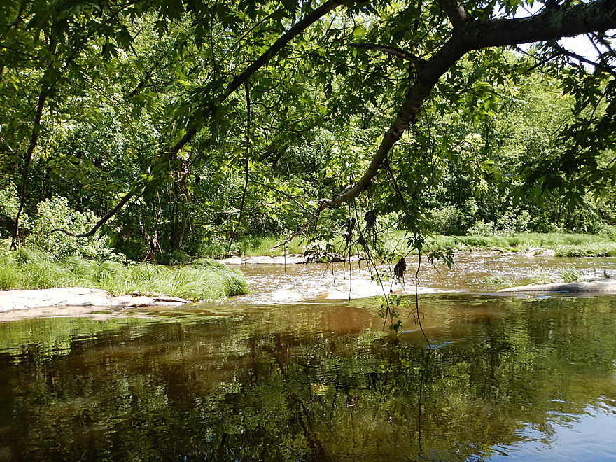
Many nice fern colonies on the trip
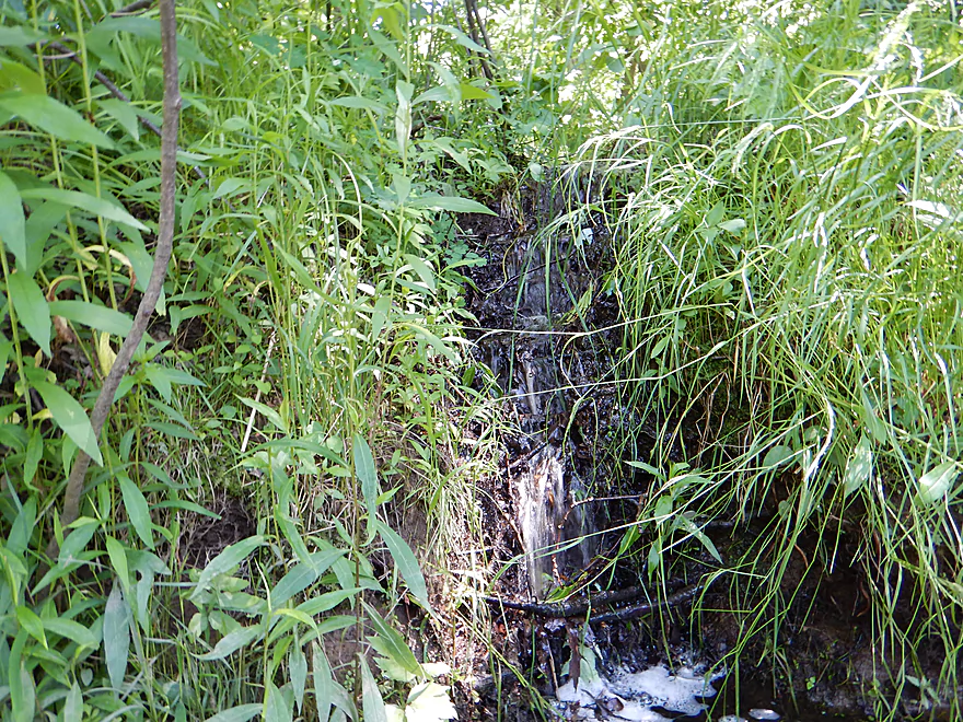
Cute little waterfall
Rocks getting bigger
This one has spiky hair
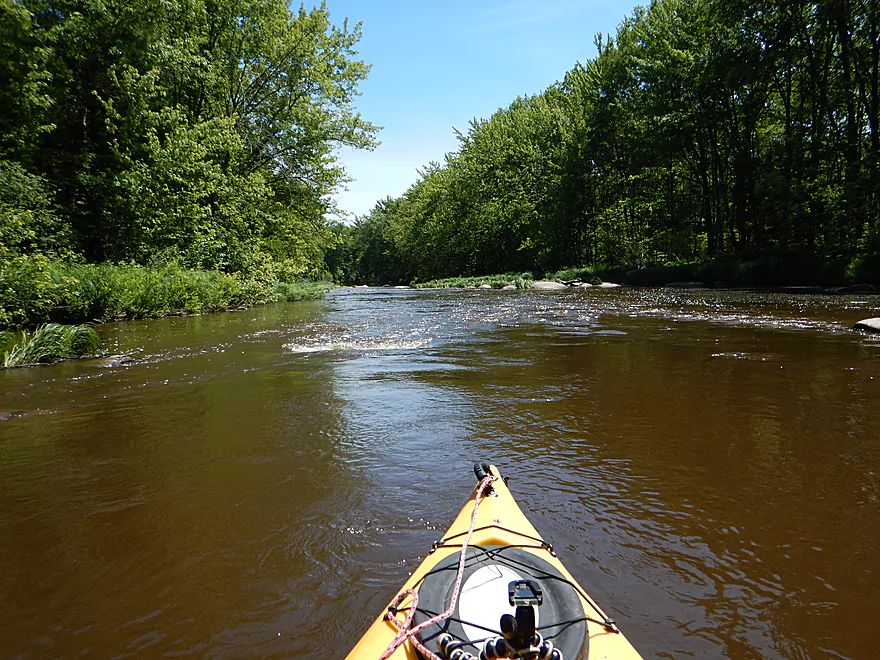
Current starts to pick up
Channel starts to narrow
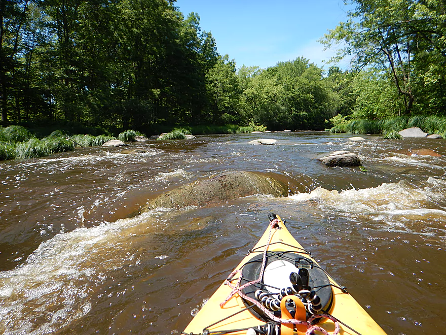
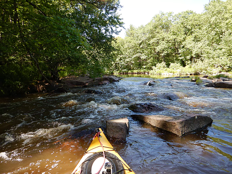
First decent rapids of the trip
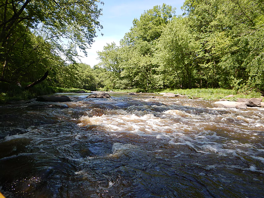
Another set of rapids
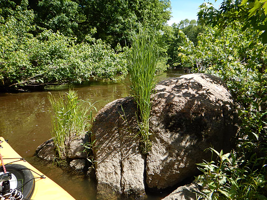
Weeds hatched from a rock

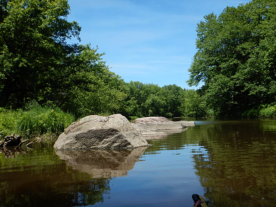
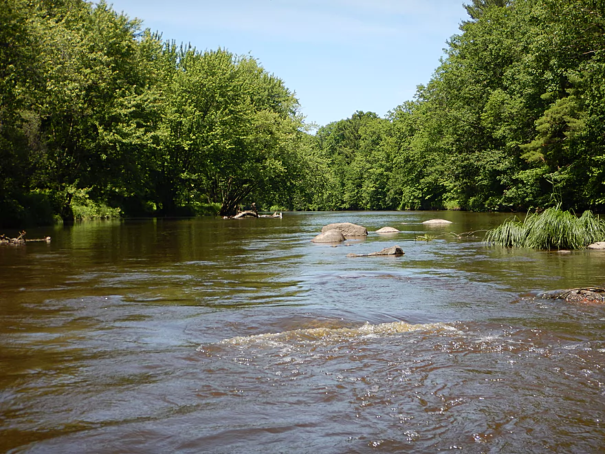
A bigger boulder field
One of several small islands
One of the steeper drops
Reverse view
Another island
And more fun rapids
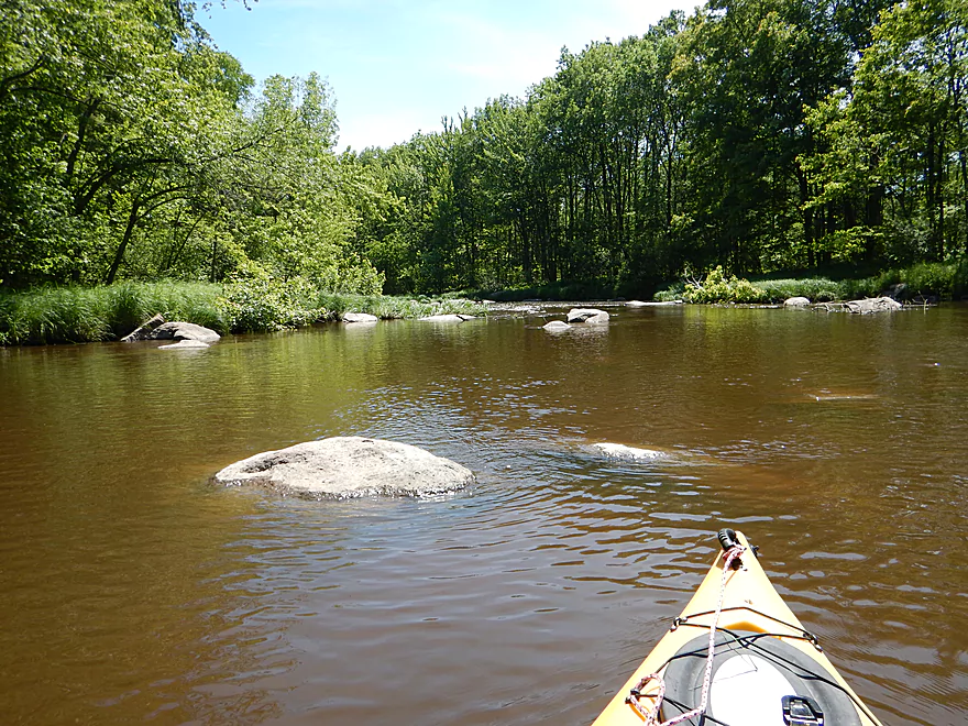
This is a big boy
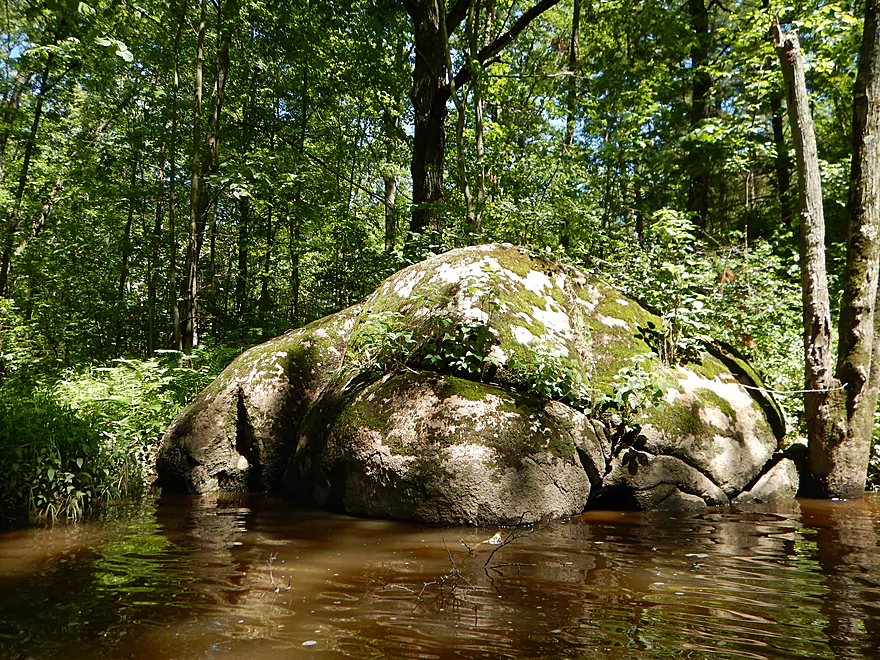
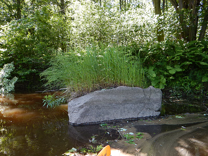
Manatee rock
This one is throwing up
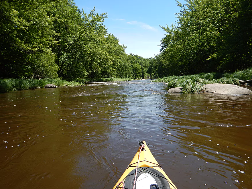
Coming up on the last rapids
Reverse view
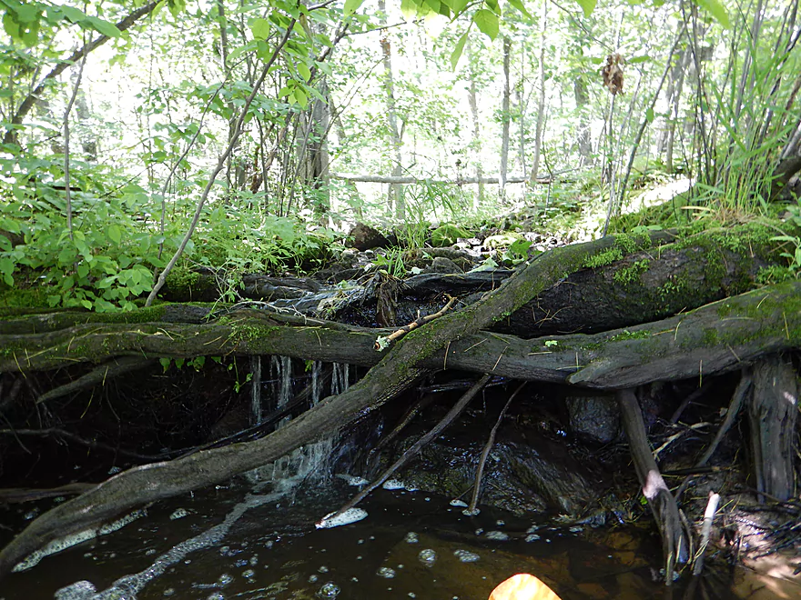
Another nice micro-waterfall
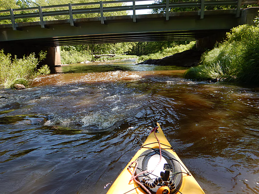
Hwy N bridge
There are rapids by the take-out
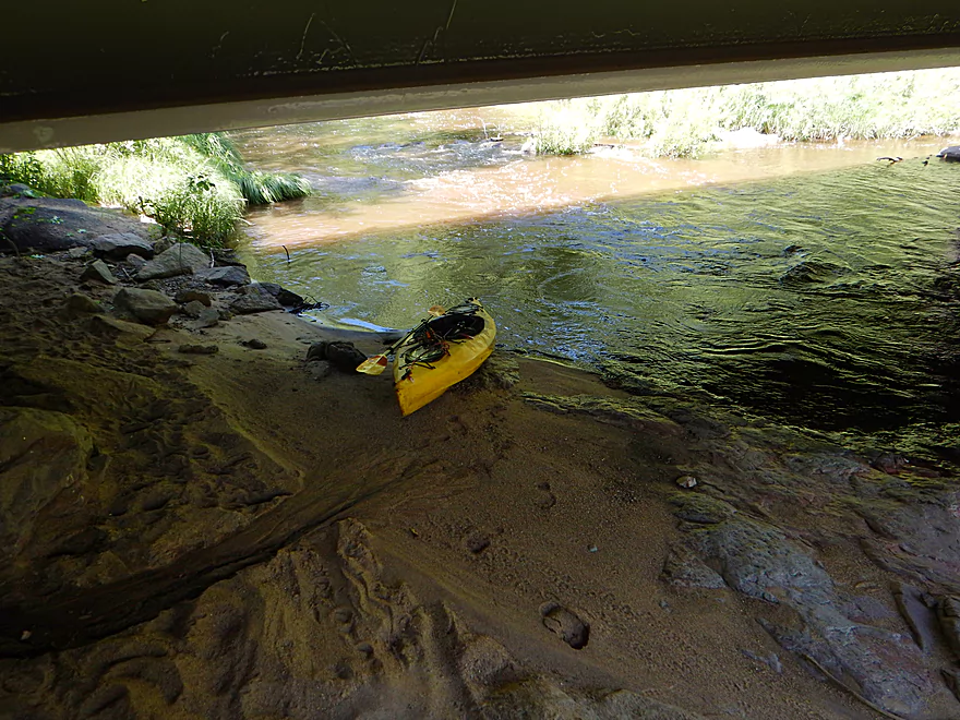
But there is a nice eddy and sandbar to take out directly under the bridge
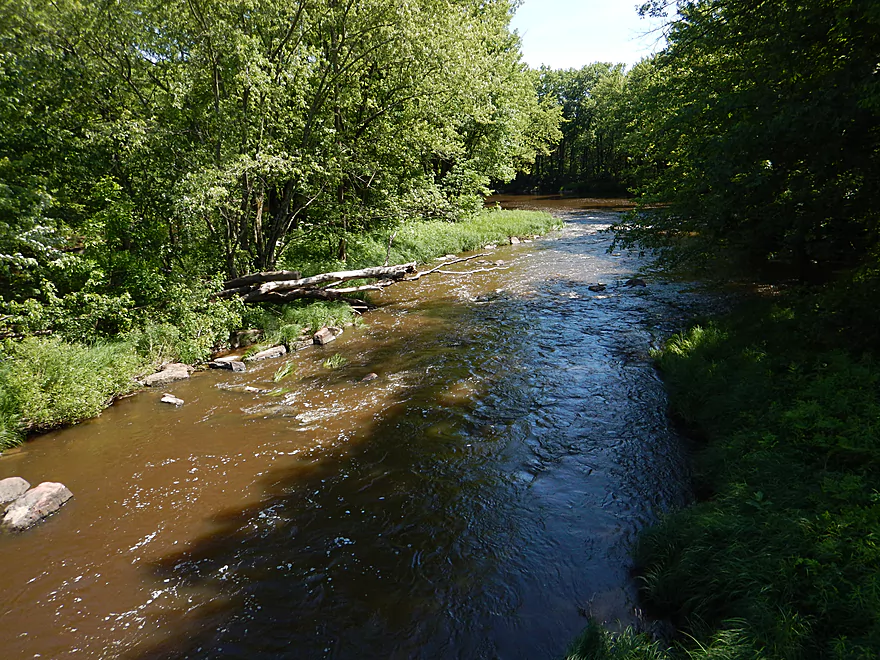
Looking downstream (the Dells rapids are just around the corner)
Ok take-out, but small shoulders for parking
Scouting North Wood Park
Many nice rapids between Hwy N and the park
Very rocky and shallow though
North end of the park (Park Road) is a good take-out option
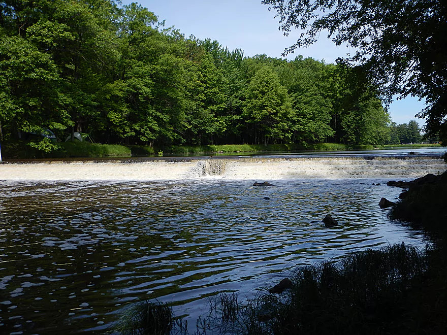
You can take-out at the south end of the park by the 2nd dam
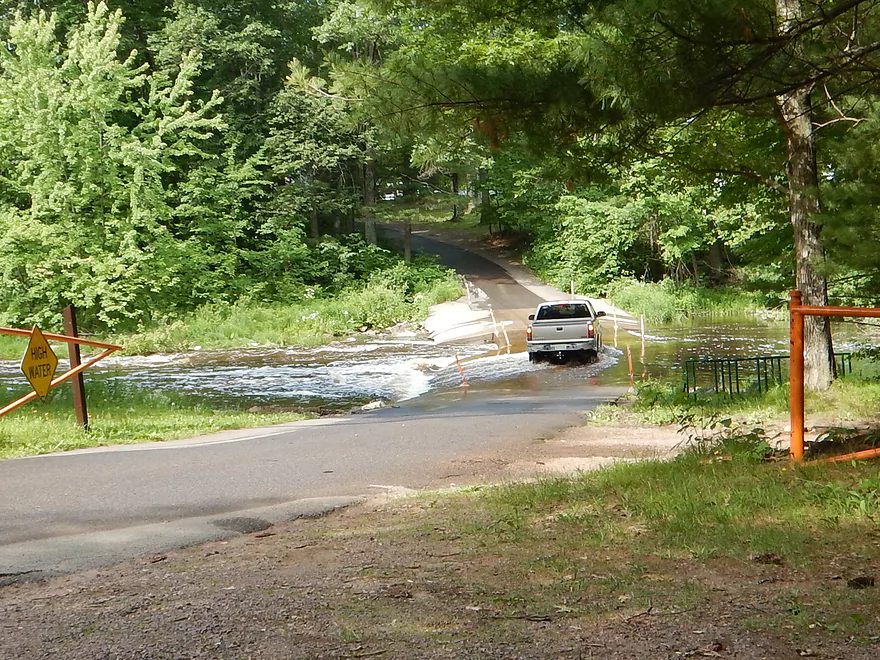
Week later…Park Road submerged at 300 CFS
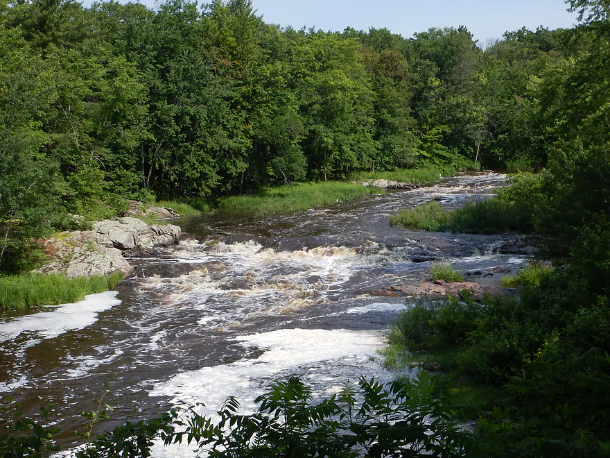
Little Bull Falls at 300 CFS
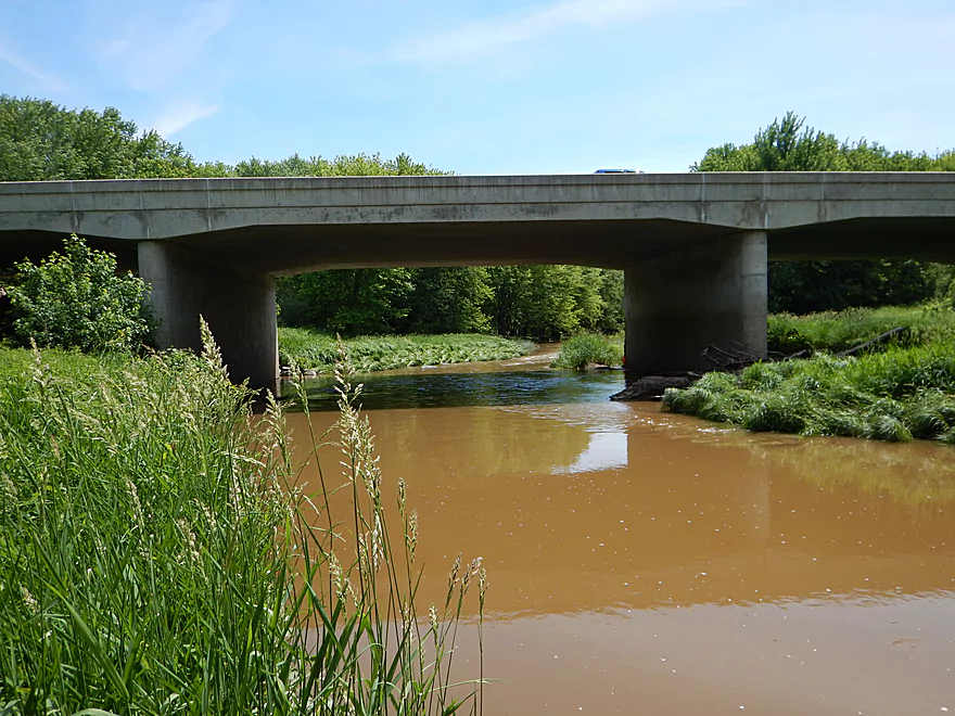
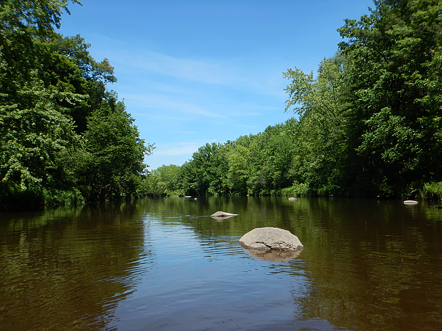
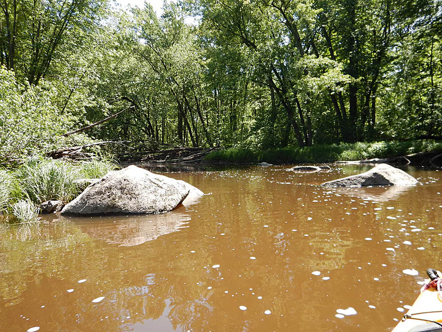
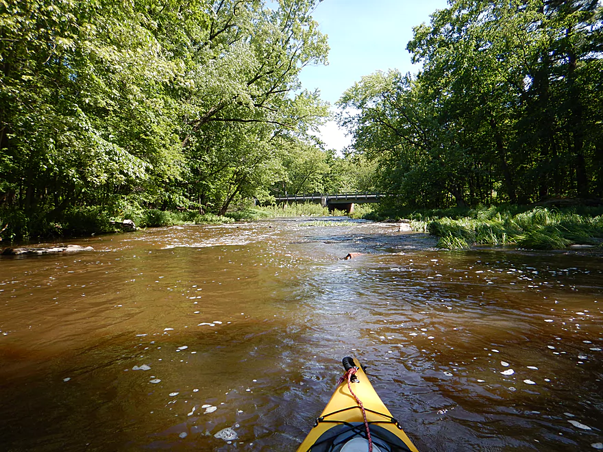
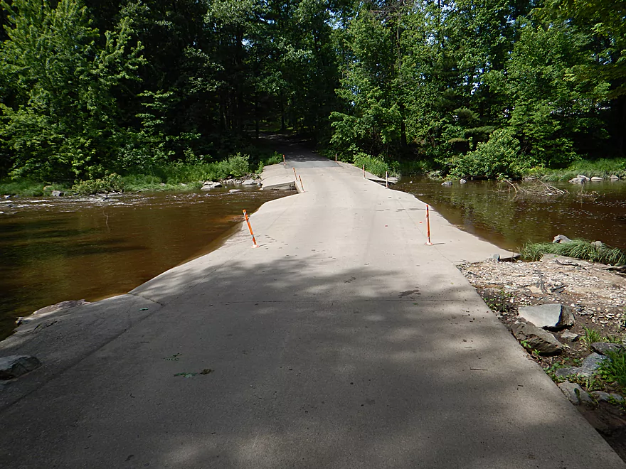
Yellow River – Hwy 80


The Yellow River is a very long north/south tributary of the Wisconsin River running through central Wisconsin. The southern section flows through historic Glacial Lake Wisconsin which is actually a very bad thing, because the sandy soil doesn’t hold the trees very well which translates into a lot of log jams. The northern section however is almost a completely different river as it is much rockier and actually has rapids. I had done the far southern section before and I wanted to try a far northern section this time for contrast.
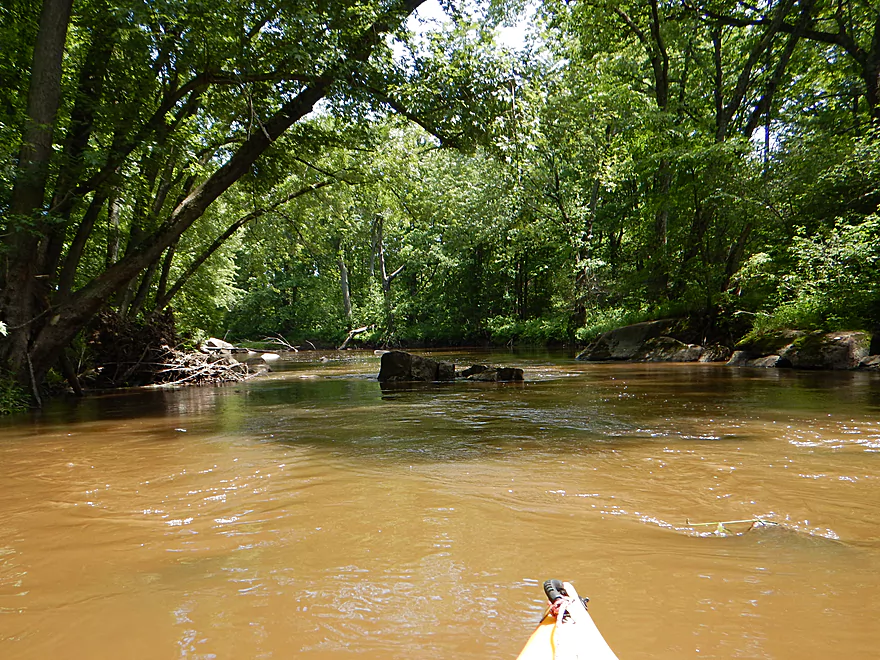
While I was pretty excited for this trip, it had rained heavily 18 hours earlier which changed the river dramatically. It had probably risen in just this time two feet and then subsequently fell a foot (based on the grass line) which made things a little damp and muddy. Right away, I was a little disappointed in the trip as the put-in was not ideal and the river didn’t have a great vibe to it. The shoreline had a damp, gloomy feel to it and deadfall loitered ominously along the banks. I had hoped for crystal clear water (like I enjoyed on the nearby Big Eau Pleine), but the water was as muddy and brown as can be. Much of this was probably unlucky timing on my part. I suspect normally the water levels are typically lower and the clarity is probably excellent by late summer. But not today. I had also hoped for nice boulder gardens, and while there were a few rocks poking above the surface, most were submerged under the high water.
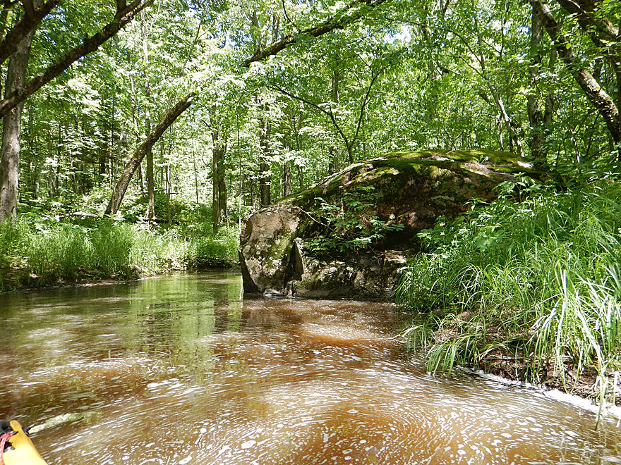
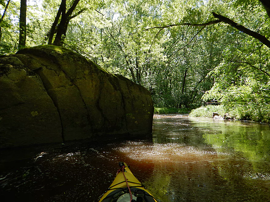
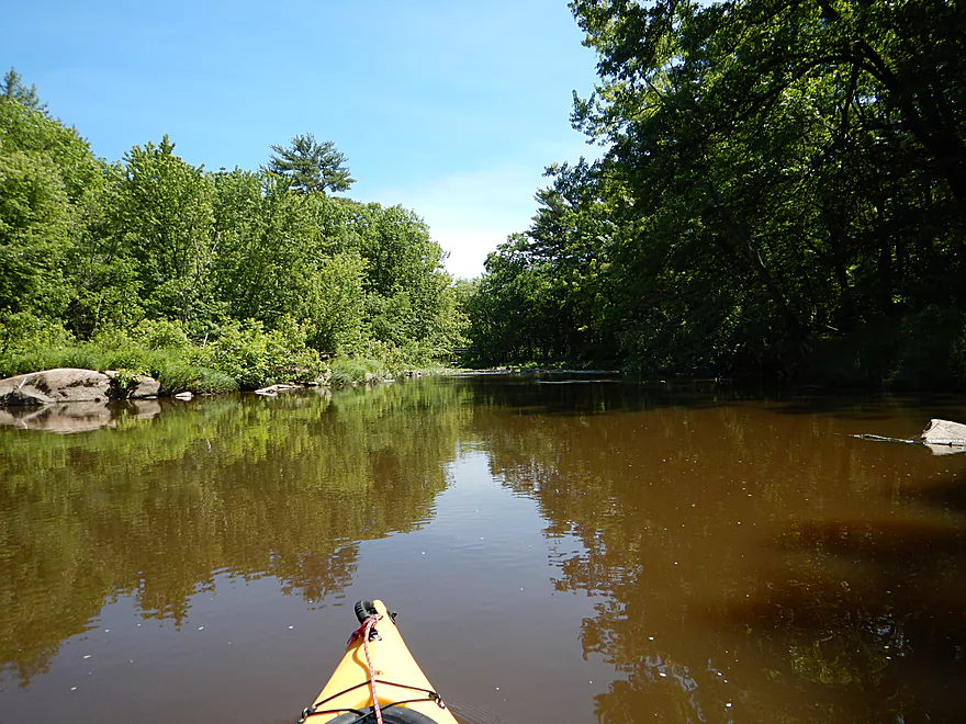
I shouldn’t complain too much though. It was a peaceful trip to start with little development (just one house). The thick tree canopies (which while choking out light for photography), gave an enclosed feeling to the river and allowed large fern groves to prosper.
After hopping over one logjam, I came across some logjam rapids (the worst type) which had to be portaged. This wasn’t too bad for a portage, but I wasn’t in a good mood and the trip was at two stars at this point.
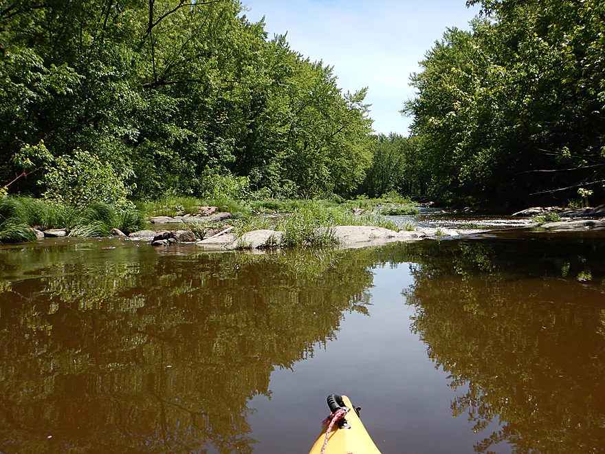
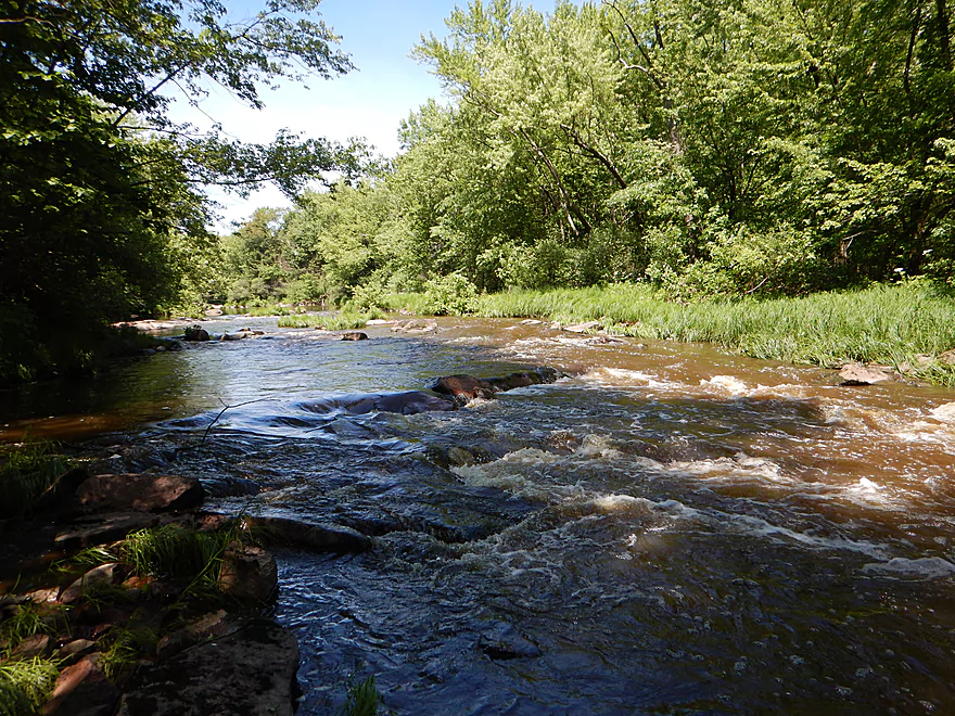
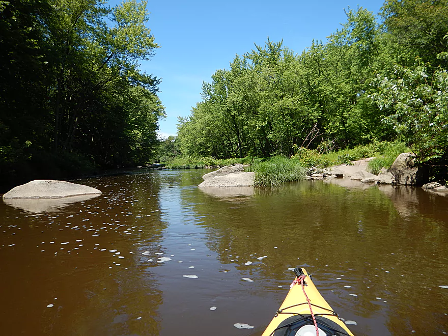
But then after this the river changes. The channel widens out significantly and there are more and larger boulder gardens sprinkled throughout the river. The current is still slow, but the banks are clean now with less deadfall and things are more scenic.
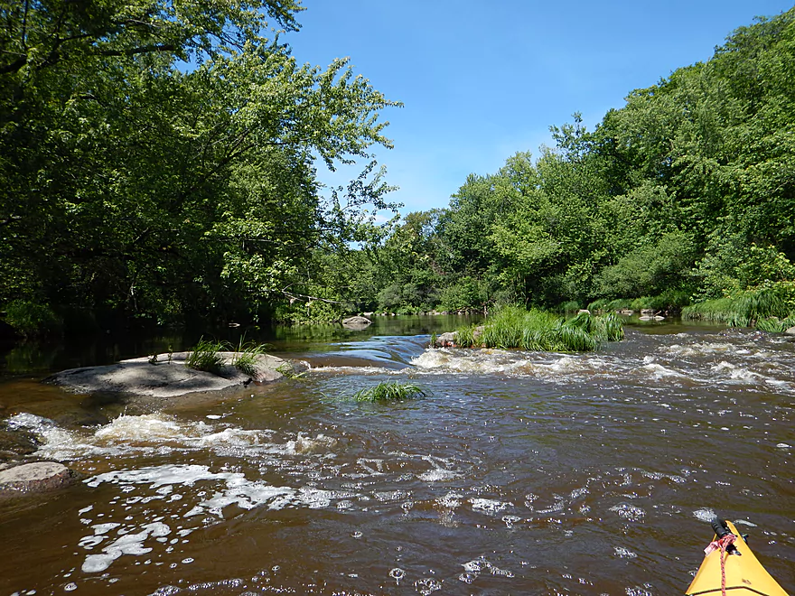
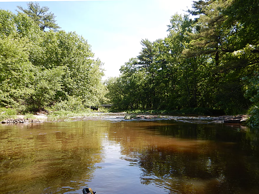
Then in the last mile (at the top of the “nose”) to my utter surprise the river changes again with wonderful boulder gardens (including some big boys) and fantastic rapids. A few were class 2, the rest were class 1. This was a terrific section and redeemed the trip in my eyes. The first third is “two stars”, the second third “three stars” and the last section “4.5 stars” hence the 3.5 star compromise.
While this trip ended on a nice note, I regret going at a higher depth which while perfect for not getting stuck on the rapids, obscured some of the beauty of the river. I also very much regret taking out too early. Had I instead taken out 2.8 miles later at the bottom of North Wood County Park, I would have gotten to run and see the Dells (class 2-3 rapids), paddled a number of class 2 rapids, seen nice boulder gardens and gotten the chance to paddle through the park. Oh well. This trip was a complete shot in the dark, and I like to keep my pioneer paddles short in case something goes wrong. A nice review of the Yellow after Hwy N can be read at American Whitewater.
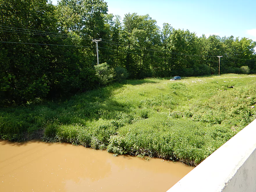
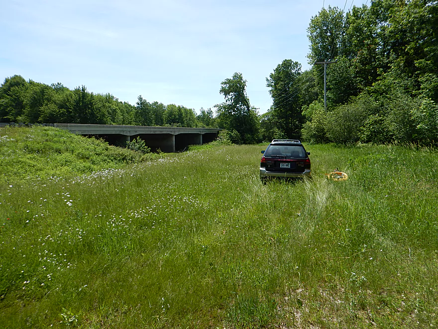
Poor, but doable. Northwest of the Hwy 80 bridge, there is a pull-off (presumably for launching), but it doesn’t go all the way to the water. So you have to drag your boat down an incline through thick grass to get to the water which wasn’t ideal, but it could have been worse. Parking was at least good.
Hwy N actually isn’t bad for bridge access. While there are rapids above and below the bridge, there is a nice eddy, sandbar and rock shelf directly below the bridge that you can’t see from the road but is perfect for getting out. There is a small hidey path southwest of the bridge that leads to the guardrail where you can then hoist your boat over. Parking is not great here (I double parked to take out), but for long term parking, the shoulder off Polish Road should work ok.
Very easy bike shuttle at 3.2 miles, relatively flat and best of all paved (a stark contrast to the Yellow’s westerly neighbor in the “East Fork of the Black River”). Much of the Yellow River north of Dexter Park is actually pretty easy to bike shuttle.
There were two log jams. One I could sneak though (portaging it wouldn’t have been fun because of the steep banks). The second log jam was a mess and was predictably located where the river does its first significant bend. This jam was actually pretty easy to portage because of the nearby gravelbar.
There are of course rapids on this trip. Maybe 4 class 1’s and 2-3 class 2’s (almost all within the last mile). I thought these were very easy but judge for yourself based on the photos. The river of course gets much higher and these rapids may become more trickier then.
Again, it had rained heavily 12 hours earlier which pushed water levels up two feet (rough guess), but then they quickly dropped a foot (so we were still a foot above normal). Not flood stage per say, but definitely well above normal. If you don’t care about water clarity and boulder gardens, and like running rapids without hitting rocks…then this was actually a perfect depth.
But if you like clean water and beautiful boulder gardens, this was too high. I suspect the majority of the river never gets too low to run (I had plenty of depth on the trip). The exception would be the rapids, which need more flow to pad the rocks. I think I could have done them at a third less of the current flow rate but not much less. The section between Hwy N and North Wood Park actually needs more water for reference, and (if that is actually your preference) should actually not be paddled at much lower levels than what I did.
There is a gauge on the river, but I think this is too far downstream to be accurate. I suspect this upper stretch rises and falls fast in reaction to rain. For what it is worth, I went at about 150-200 CFS at Babcock (the depth crested significantly in one day), but again I can’t vouch for this gauge. The Nielsville gauge on the upper Black is second opinion and that at 550 CFS.
Some deer, mosquitoes, ducks and an eagle. This section had a lot of large fern colonies which were the highlight.
- Dexter County Park – This is a large park located on a Yellow River Flowage just north of Hwy 54. There is a nice beach on the west shore that is perfect for doing a post-trip swim.
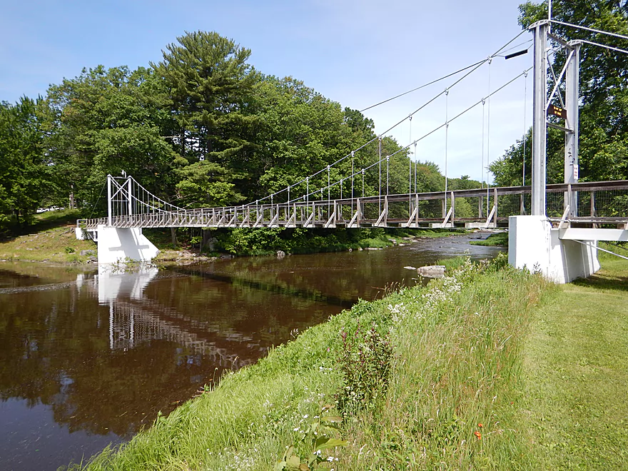
- North Wood County Park – This is another flowage park on the Yellow River that is very pleasant despite its two dams. There is a cool suspension bridge in the middle of the park. Both of these parks have nice campsites.
Detailed Overview
- Eagle Road to Yellow River Road: 4.3 miles. Background provided by WisconsinRiverTrips.com contributor Daniel Akin.
- Eagle Road to Hwy HH: 2.2 miles. This is a dangerous section with Class 3 and 4 rapids. There’s also a wire fence across the river to deal with.
- Hwy HH to Yellow River Road: 2.1 miles. A more wooded stretch that I don’t know much about. Nice street view image.
- Yellow River Road to Hwy 10: 4.3 miles.
- Yellow River Road to Hwy BB: 1.3 miles. A nice wooded stretch with no major rapids.
- Hwy BB to Robin Road: 0.8 miles. A scenic stretch of the river. The South Branch joins up by the BB bridge and adds significant volume.
- Robin Road to Hwy 10: 2.1 miles. A great stretch featuring several fun rapids and small outcrops. Much of this flows by a large golf course which can be scenic in the fall because of all the maple trees.
- Hwy 10 to Hwy 80: 4.0 miles.
- Hwy 10 to Lincoln Ave: 2.2 miles. Very narrow and wooded. At times little light reaches the river, which is really cool. Neat boulder gardens and a great stretch, but there are two logjams.
- Lincoln Ave to Hwy 80: 1.7 miles. Good stretch with a number of scenic boulder gardens and one nice outcrop.
- Hwy 80 to Hwy N: 3.4 miles. Starts slow, but ends with nice boulder gardens and rapids.
- Hwy N to North Wood County Park (2nd Dam): 2.9 miles. A rocky stretch with some rough whitewater, including a Class 3 near the put-in by the “dells”.
- North Wood County Park (2nd Dam) to Little Bull Falls Grill: 4.2 miles.
- North Wood County Park (2nd Dam) to Hwy C: 2.8 miles. Scenic stretch with many boulder gardens and rapids. The most serious rapids are near Hwy C and include Jenny Falls, which is a Class 3.
- Hwy C to Little Bull Falls: 1.2 miles. More rapids and boulder gardens. There is a logjam shortly after Hwy C. Little Bull Falls is a Class 4 and is preceded by a Class 3.
- Little Bull Falls to Dexter Park: 7.5 miles.
- Little Bull Falls to Hwy 73: 1.6 miles. Many rapids on this stretch with some nice rock outcrops. Launch below the falls and at a private access.
- Hwy 73 to Riverside Park: 1.7 miles. More rapids and the biggest and best outcrops. Hwy 73 is a weedy but doable access option.
- Riverside Park to Dexter Park: 4.2 miles. Far fewer outcrops and rapids, but a nice wooded section. Two miles in the flowage kicks in which is less interesting.
- Hwy 54 (Dexter Park) to Hwy 80 (Babcock): 9.7 miles. While you could launch by the park, your best bet will be to launch SW of the dam off Hwy 54. Paddling author Frank Piraino liked this section and said it had no logjams, but I think it has since filled in...could have 10+ logjams. Can be pushy when high and only for adventurers. Not too many sandbars.
- Hwy 80 to Hwy F: 10.6 miles. Good sandbars. Am not sure about jams....maybe 6.
- Hwy F to 9th Street: 8.3 miles. A nice stretch with good sandbars. 2024 update...this stretch now has many logjams (~8?) because of recent storms.
- 9th Street to the dam (Necedah): 16 miles. A lot less sandy and many oxbows. Jams are a question mark. I suspect this is a weak section.
- Necedah to Yellow River Bay: A nice stretch with good sandbars.
- Castle Rock Lake: Blah. A big , open and dangerous flowage (3rd largest in the state).
- Buckhorn State Park: You can explore the back channels and they seem nice, with interpretive signs…but with no current and only 1.5 miles. Here is a map of the official water trail in the park.
Trip Map
Overview Map
Video
Photos Size: