
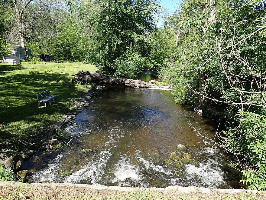
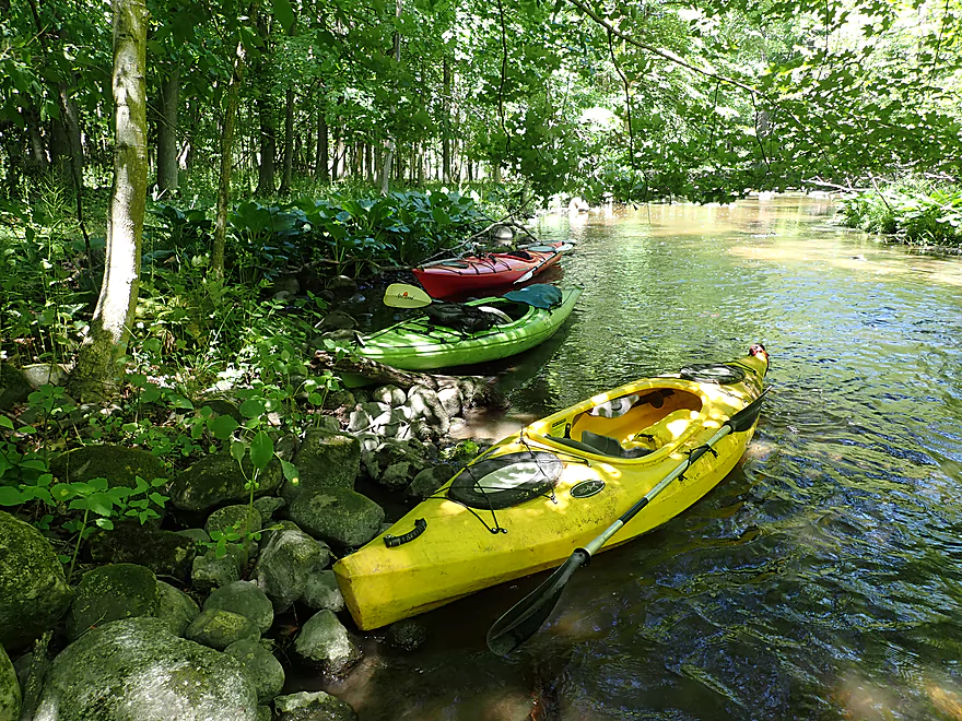
Putting in at St. Augustine Road
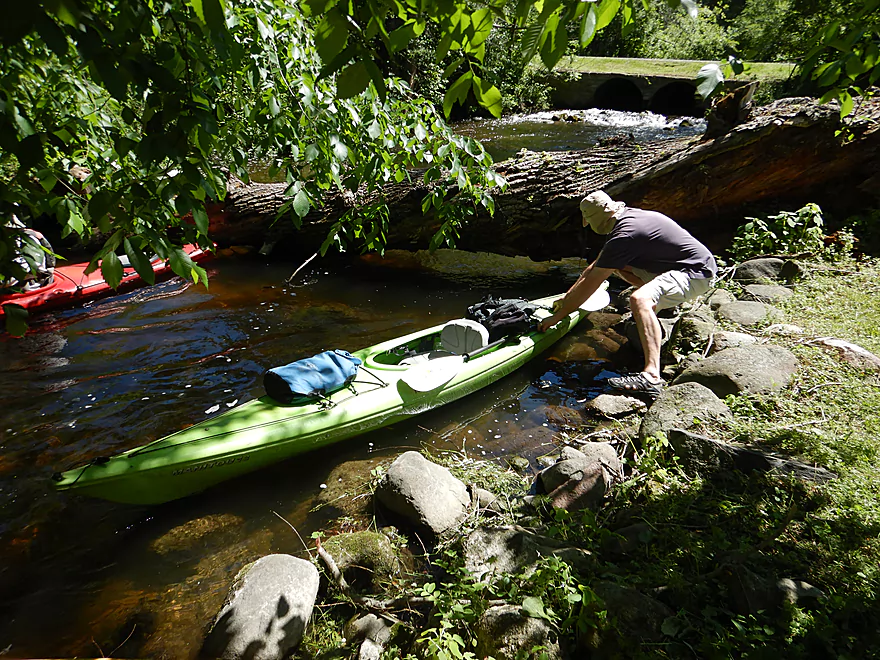
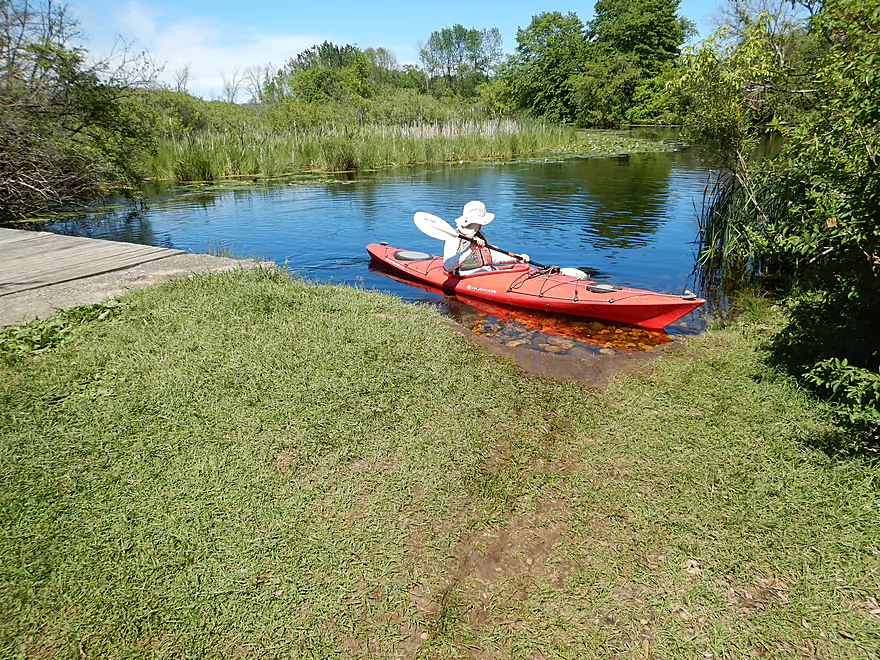
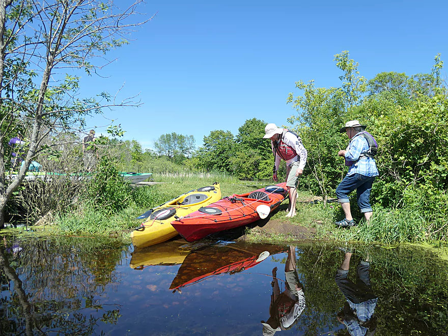
Launching from a private lawn (with permission)
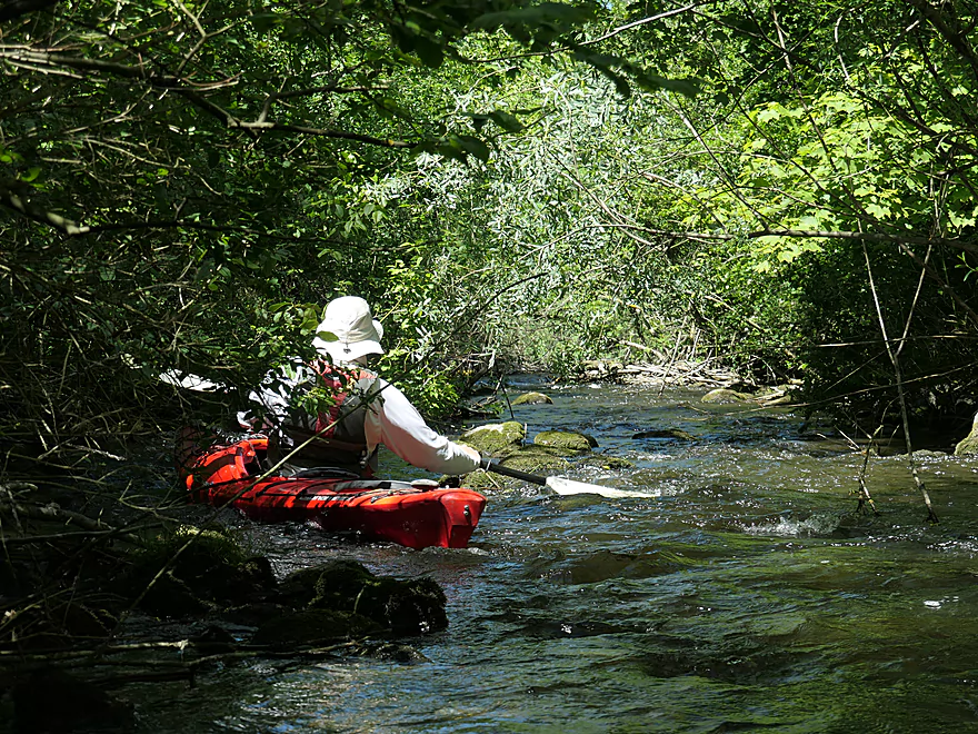
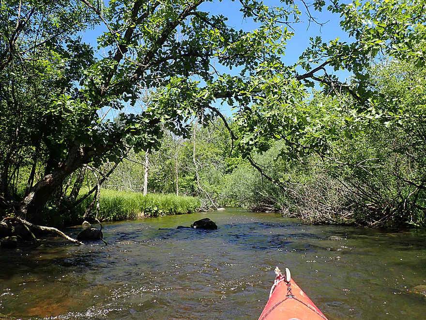
Fun rapids to start
Where’s Waldo…frog edition
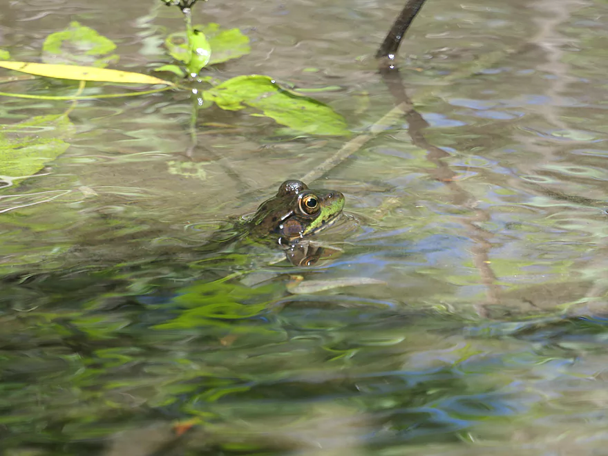
He was on the moss covered rock…now he’s in the water
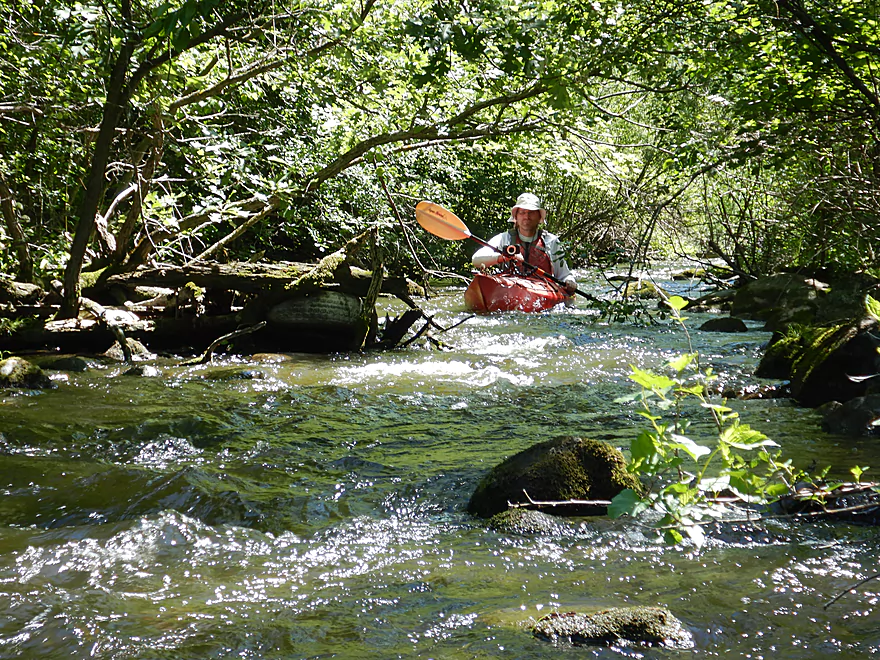
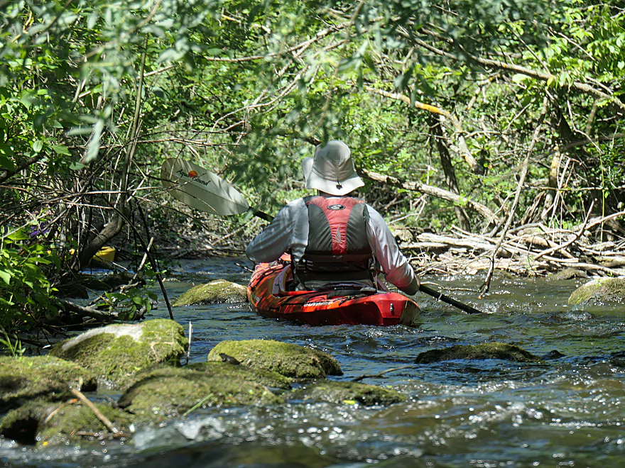
More rapids
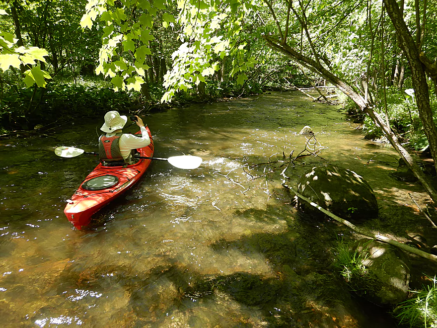
Good clarity
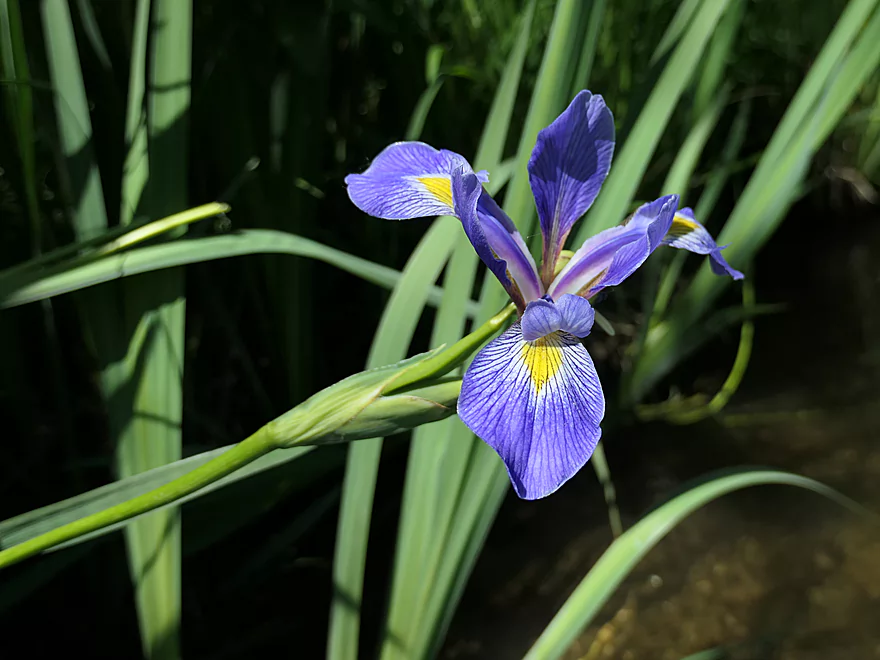
Blue Flag (a wild iris)
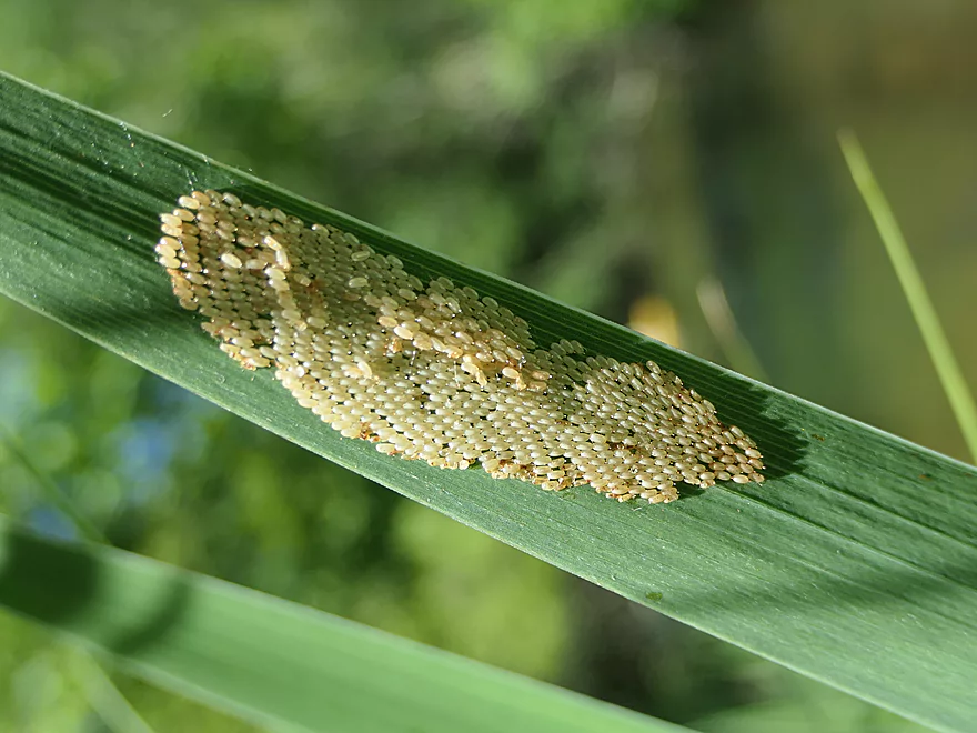
Interesting insect eggs
Very rocky in the first half mile
The top of a large island
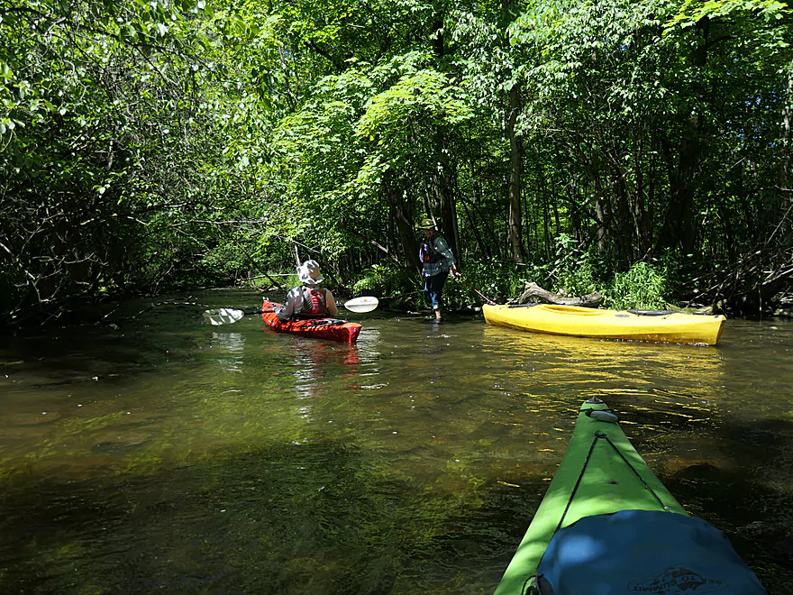
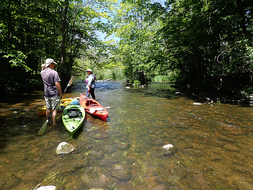
Things getting a little tight…
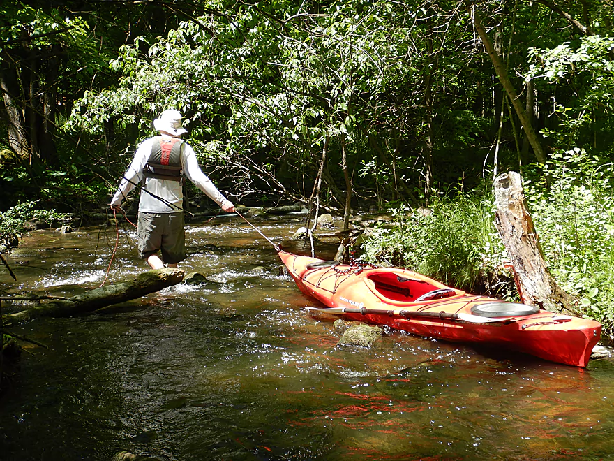
I had to wade the south channel
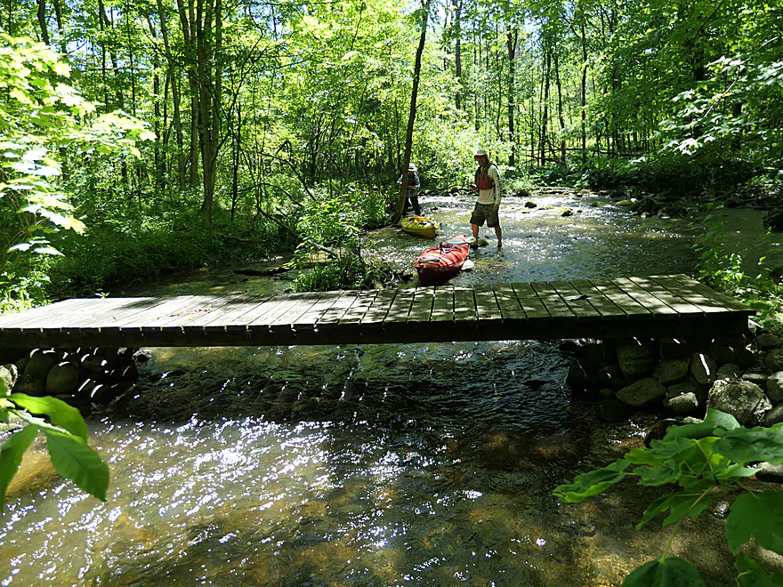
Attractive pedestrian bridge
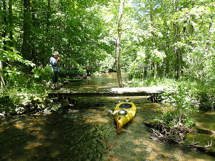
Letting the kayaks glide under
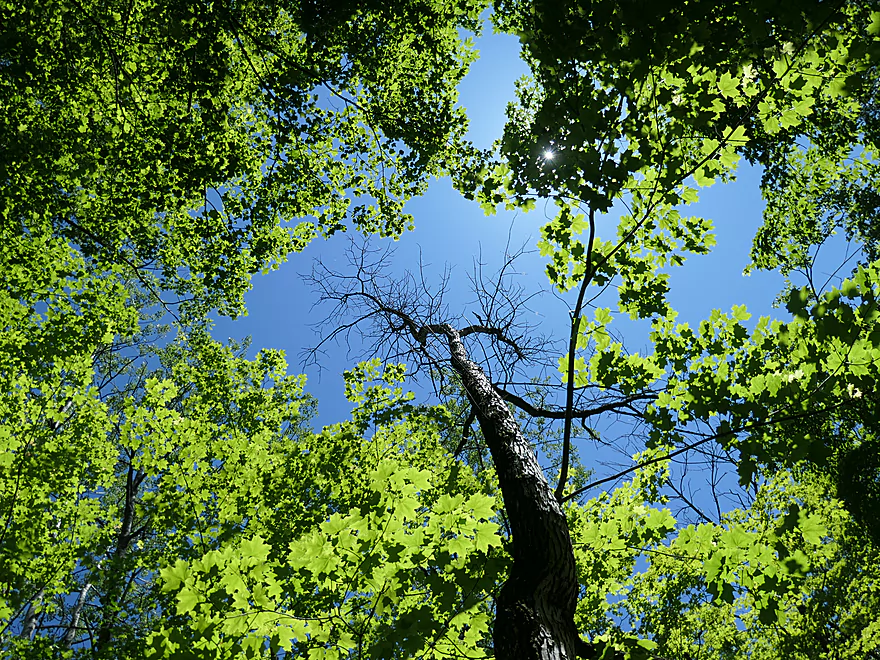
One of many, many dead ash trees we saw on our trip
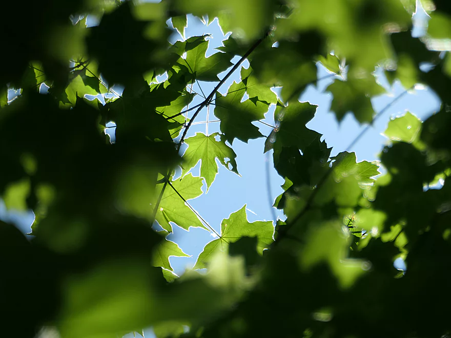
Maple leaves outlined by the sun
At the bottom of the island
A small boulder garden
Too shallow to run
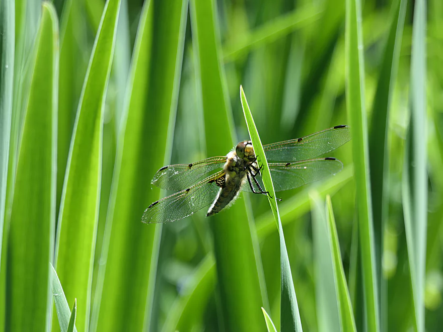
Libellula quadrimaculata
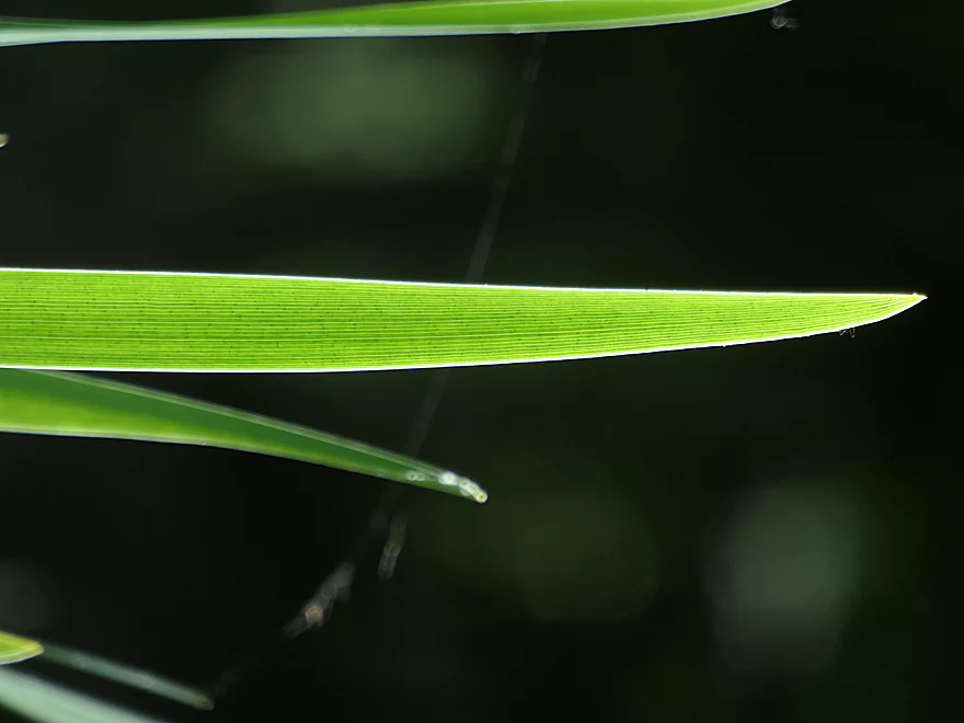
A “blade of grass”
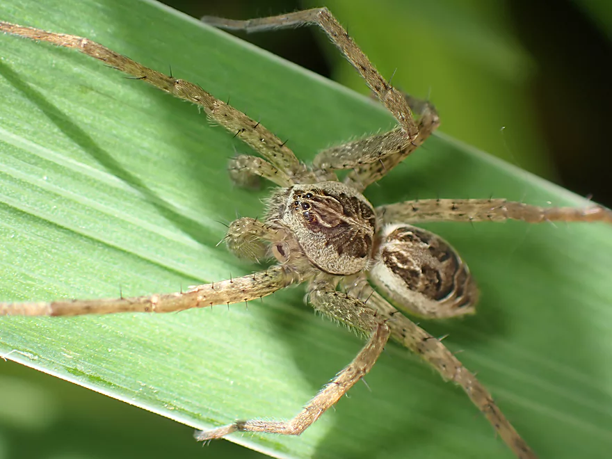
I think this is a baby fishing spider
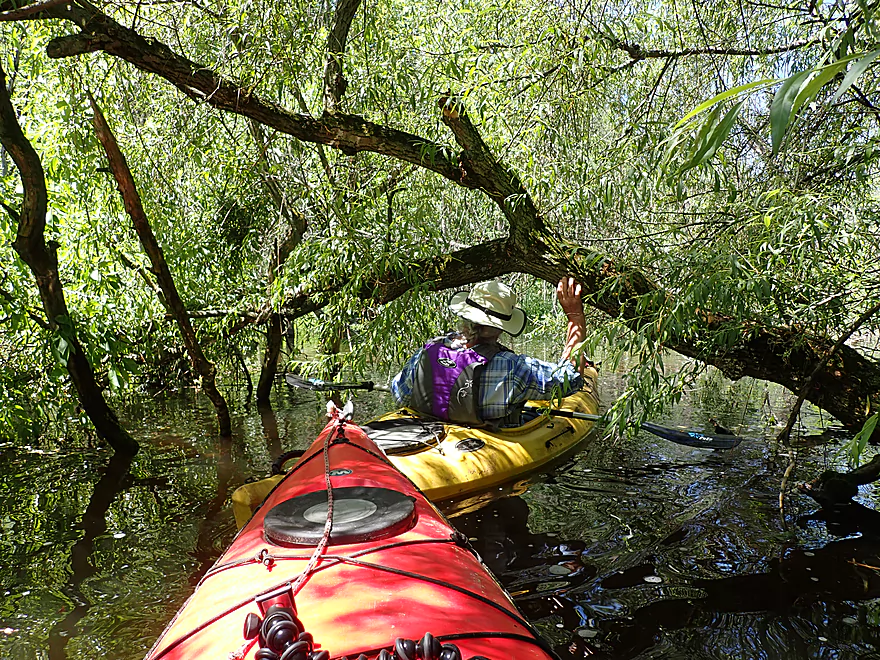
A few low branches but no logjams outside of the put-in
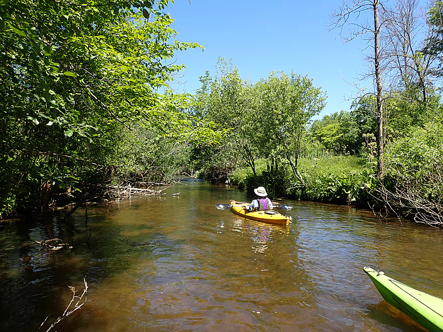
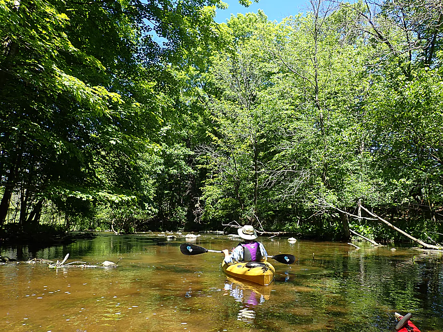
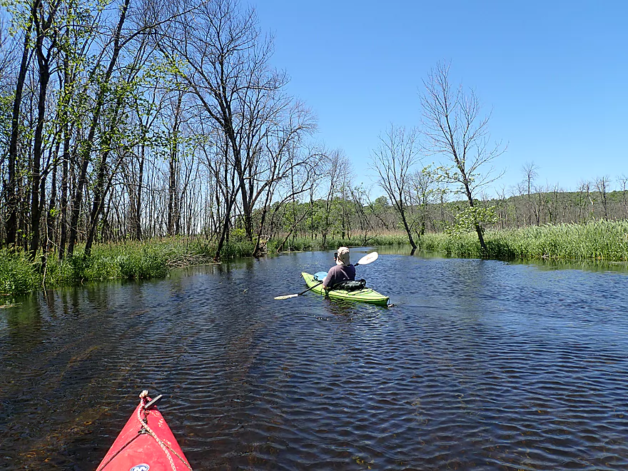
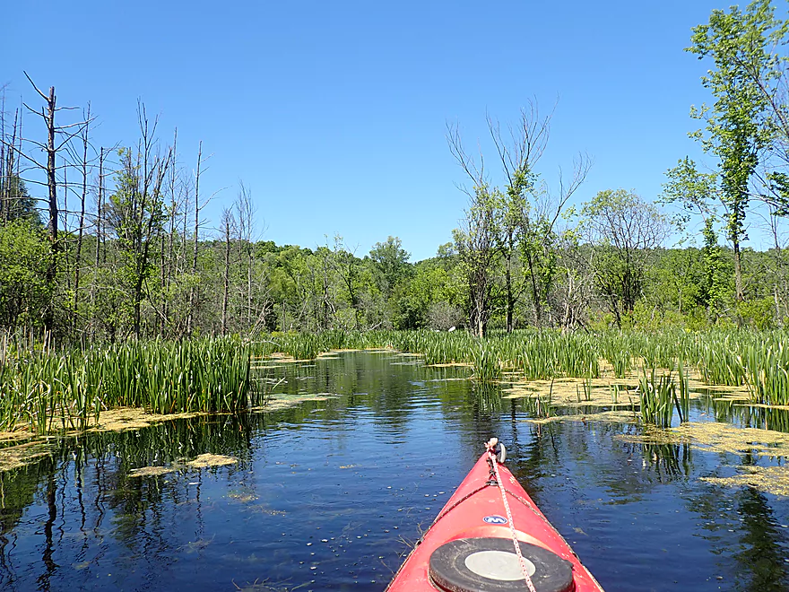
Creek starts to open up
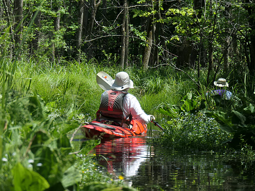
Entering a spring inlet lined with forget-me-nots
Really reminded me of Upper Token Creek
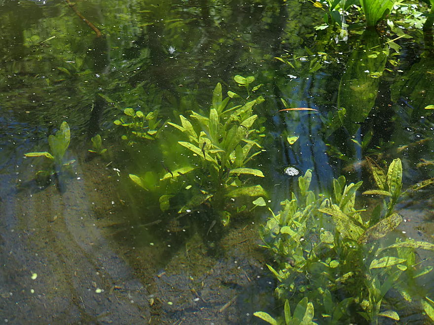
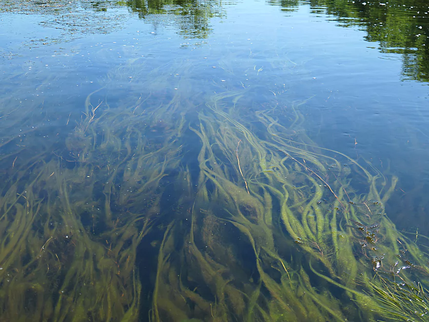
Great clarity allows aquatic plants to grow well underwater
Heading out of the inlet
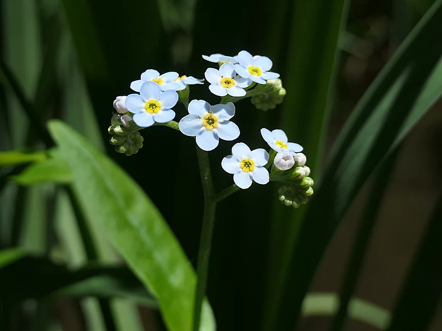
A close-up of forget-me-not flowers
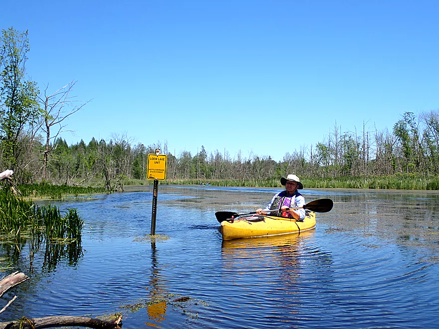
Now entering the Loew Lake Unit of the Kettle Moraine Forest
The river really slowed and widened at this point
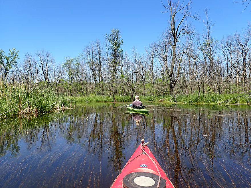
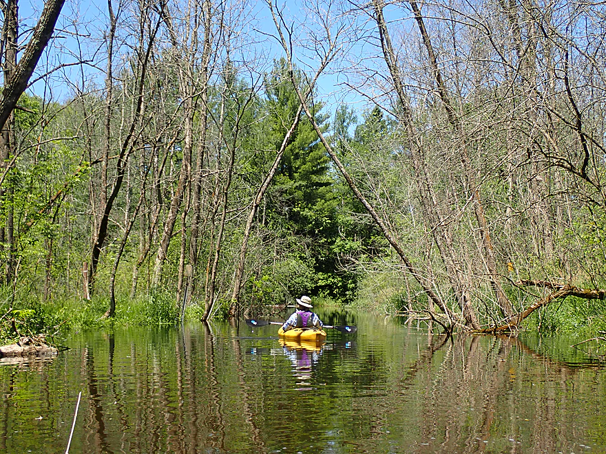
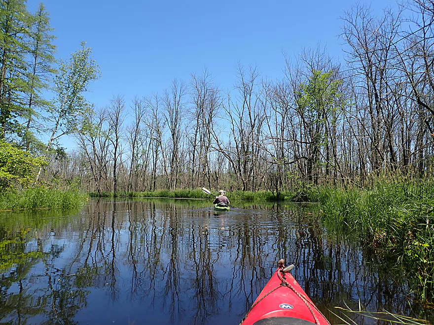
Entering a vast graveyard of dead ash trees (thanks emerald ash borer)
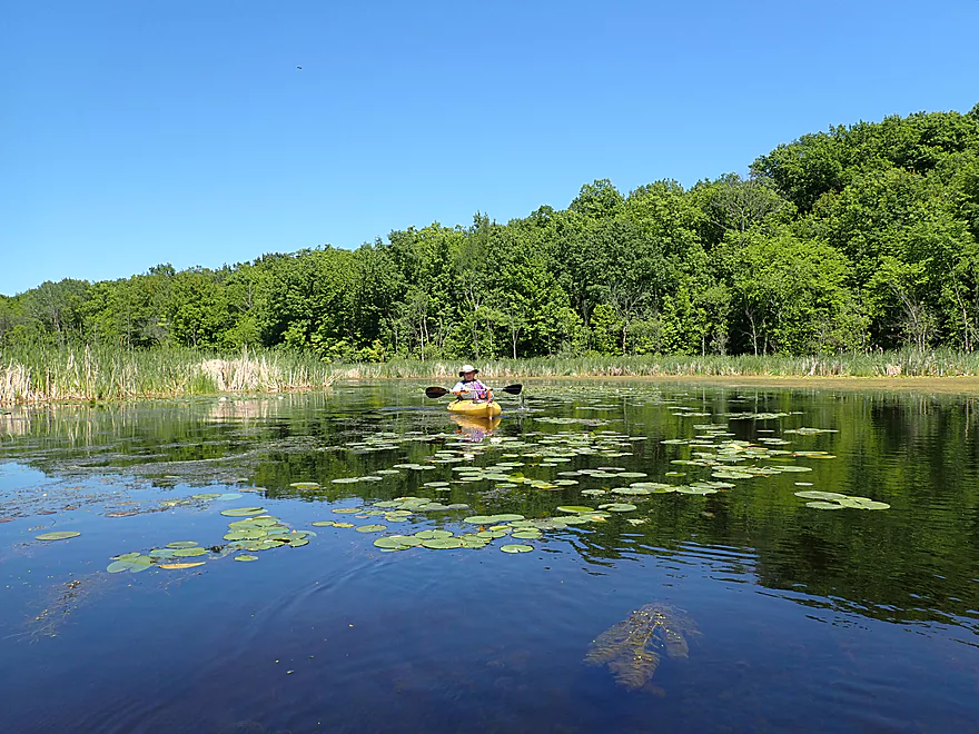
Entering Loew Lake…a natural kettle lake
A tree-covered moraine lies in the distance
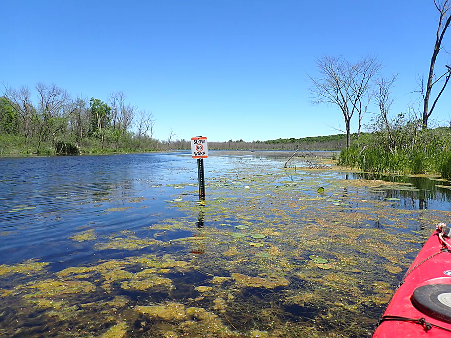
No wake allowed on the lake
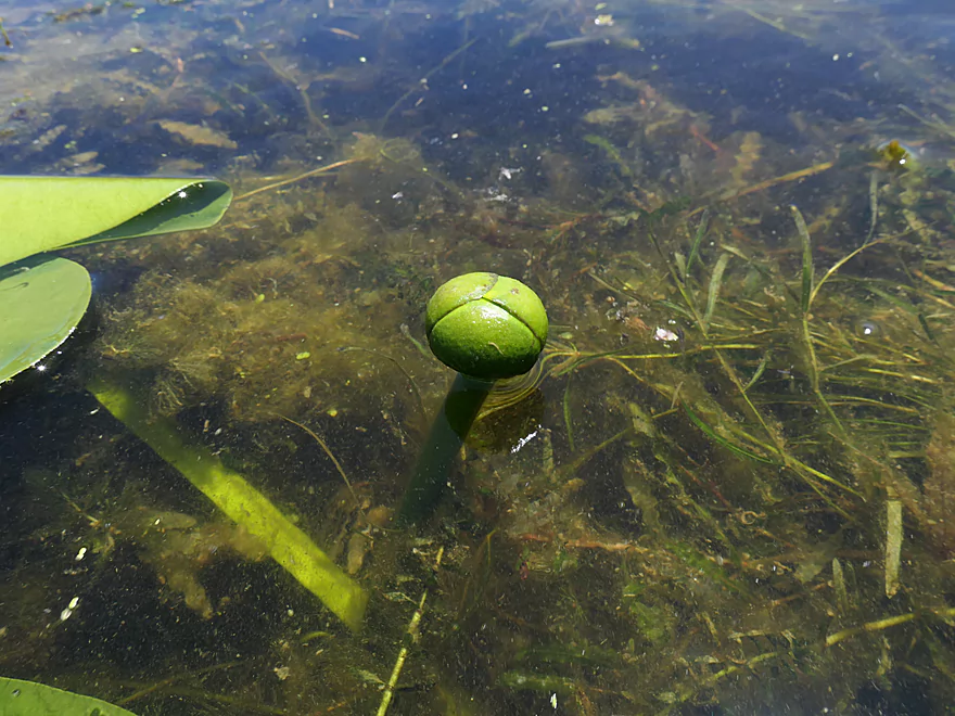
A bullhead lily closed
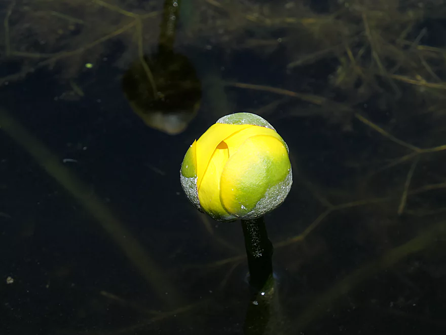
A bullhead lily partly open
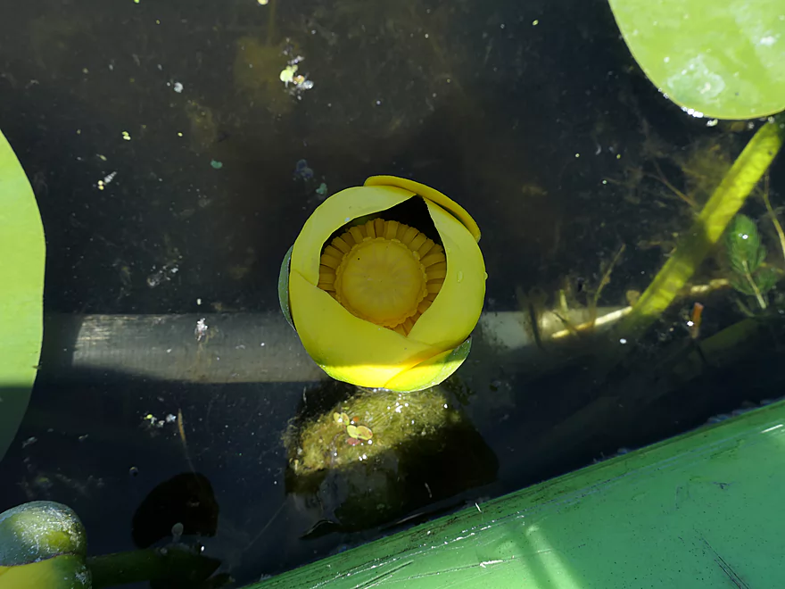
A bullhead lily open
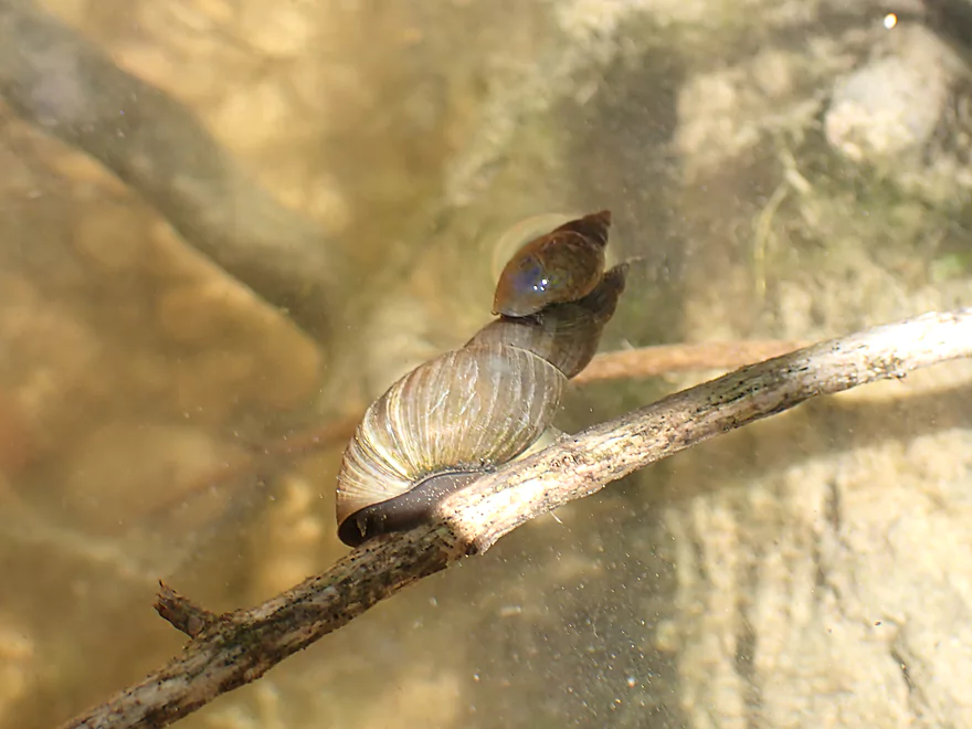
Little snail attached to a big snail
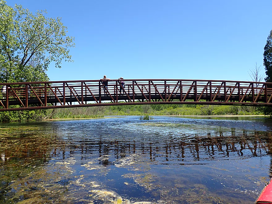
A scenic trail bridge by Loew Lake
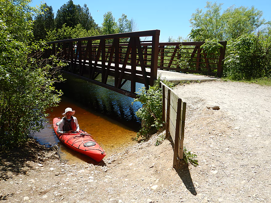
There is a take-out a the north end
A great view from the bridge looking upstream
…and downstream
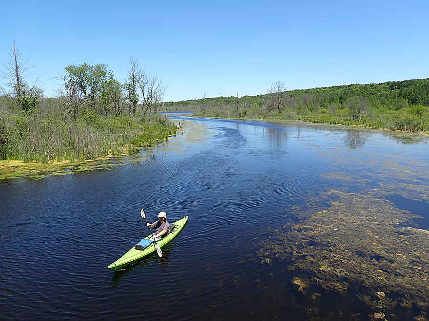
River slows and widens even more after the bridge
A group of tamarack trees
The river here has an up-north vibe
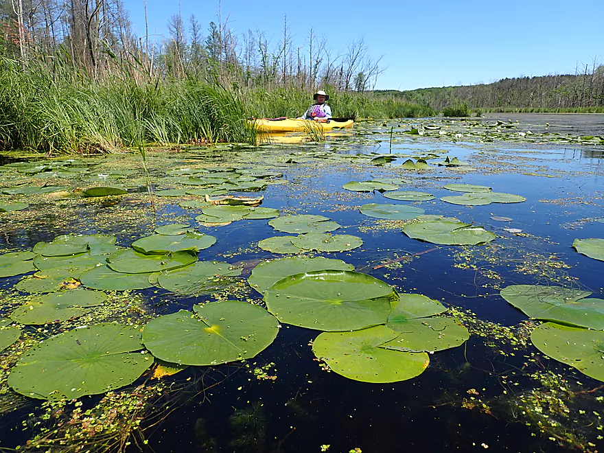
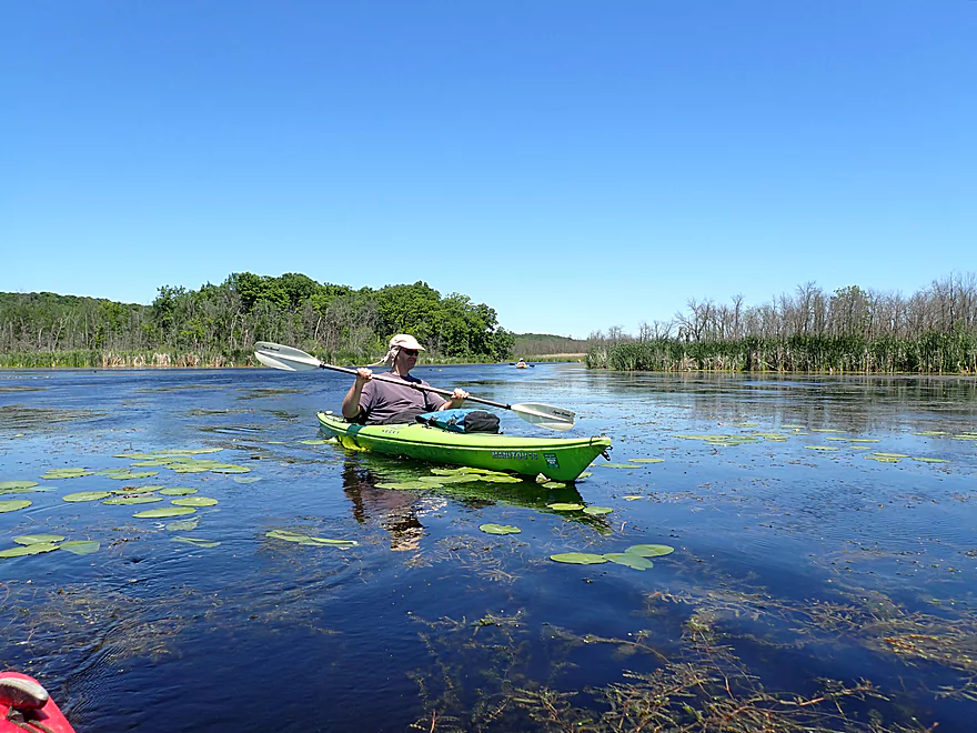
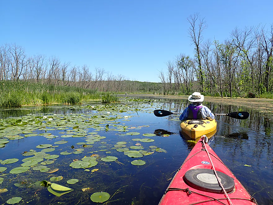
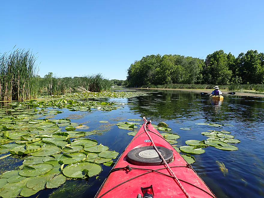
Lot of cool lily beds
Exiting the Loew Lake State Forest Unit
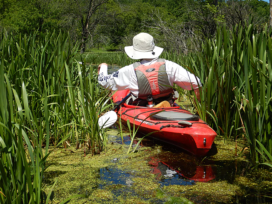
Exploring a side channel
Lots of cool nooks and crannies for curious paddlers to check out
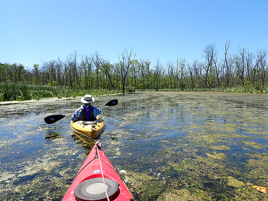
Entering some very thick pondweeds and algae
Virtually no current at this point (caused by the Monches dam)
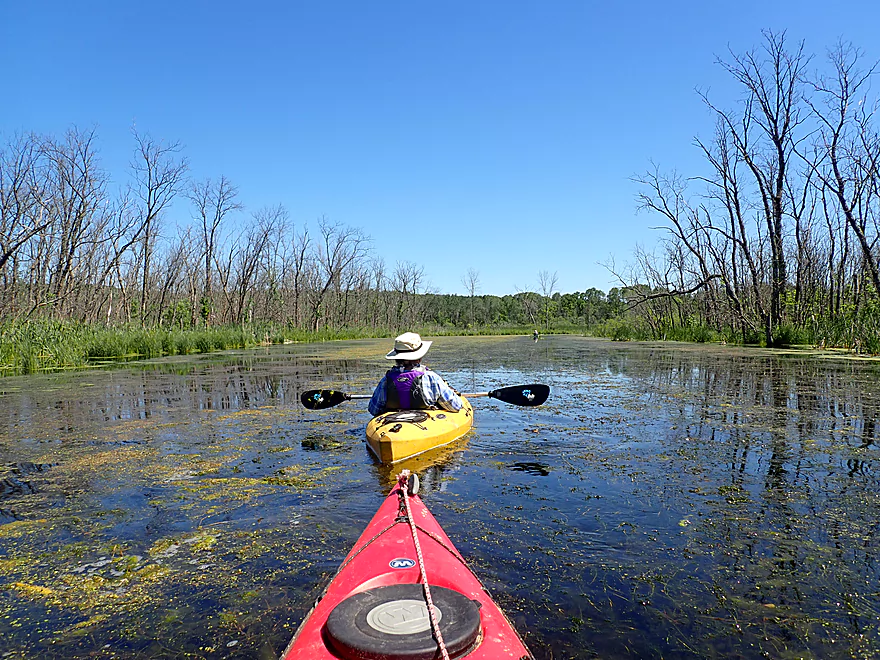
More aquatic weeds to plow through
And more ash tree graveyards
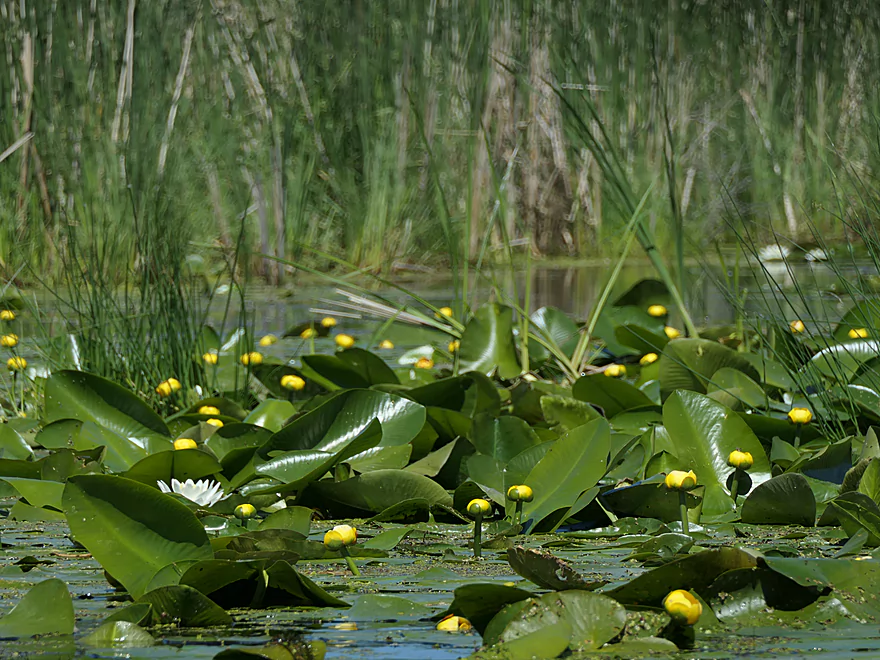
A beautiful field of bullhead lilies, with a single white waterlily
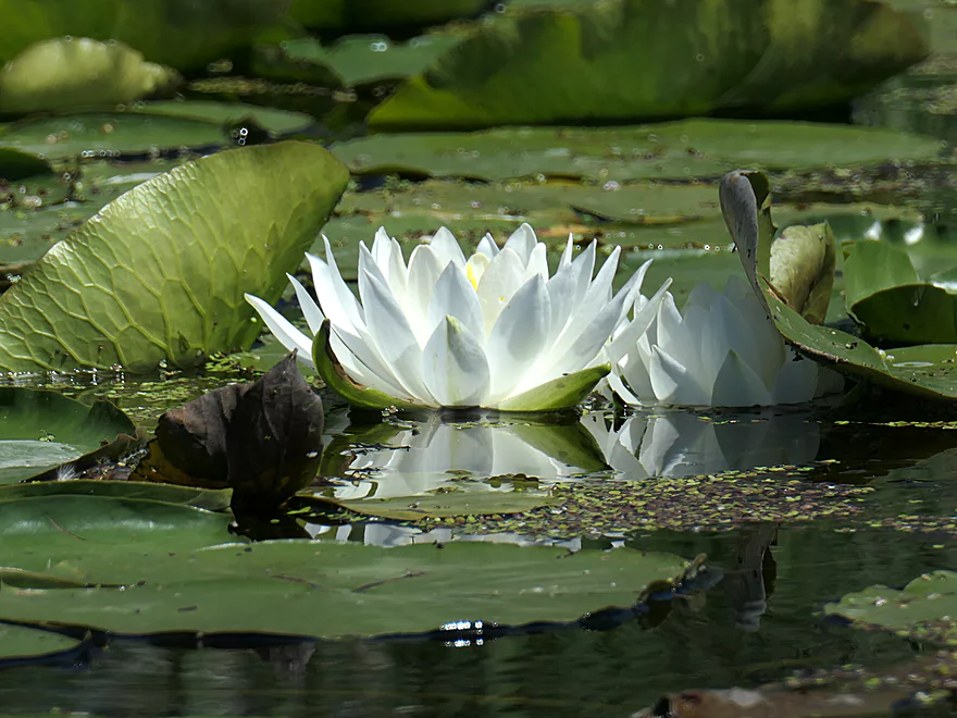
A reflection of perfection
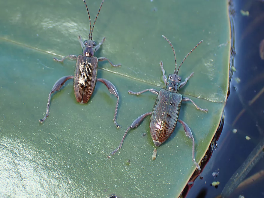
Waterlily beetles
Approaching a low walk bridge
Easy portage take-out upstream of the bridge
…and easy re-entry
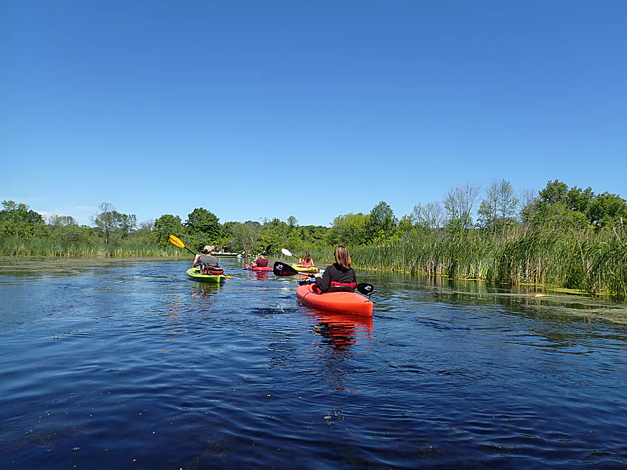
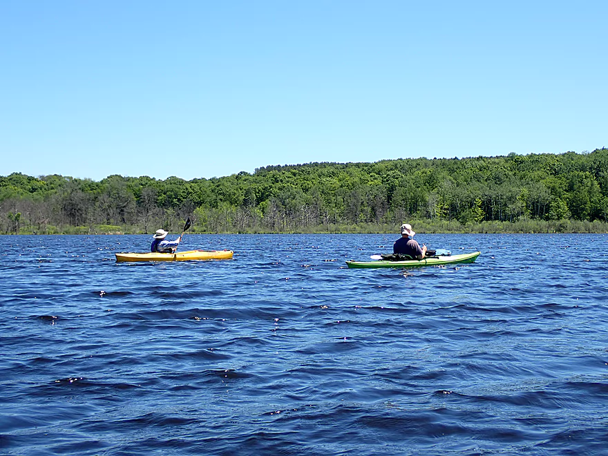
We saw a lot of kayakers
Cattails became more common as we got closer to the Monches dam
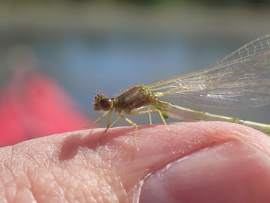
A newly emerged damselfly
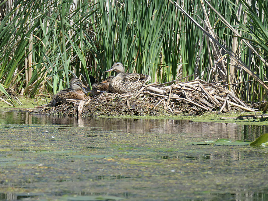
This duck family has commandeered a muskrat lodge
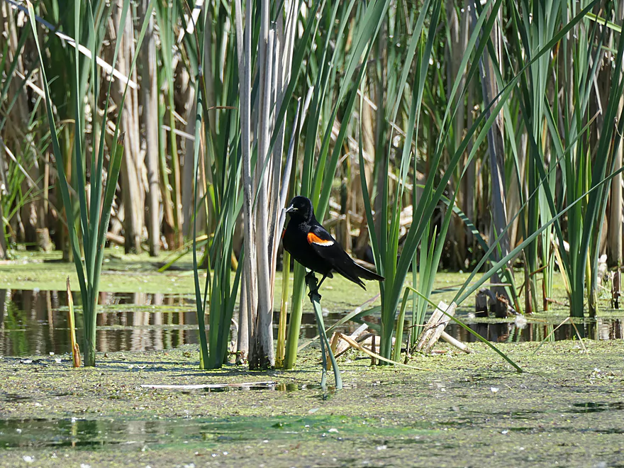
A red-winged blackbird
Part of the Ice Age Trail
Long flowing strands of algae
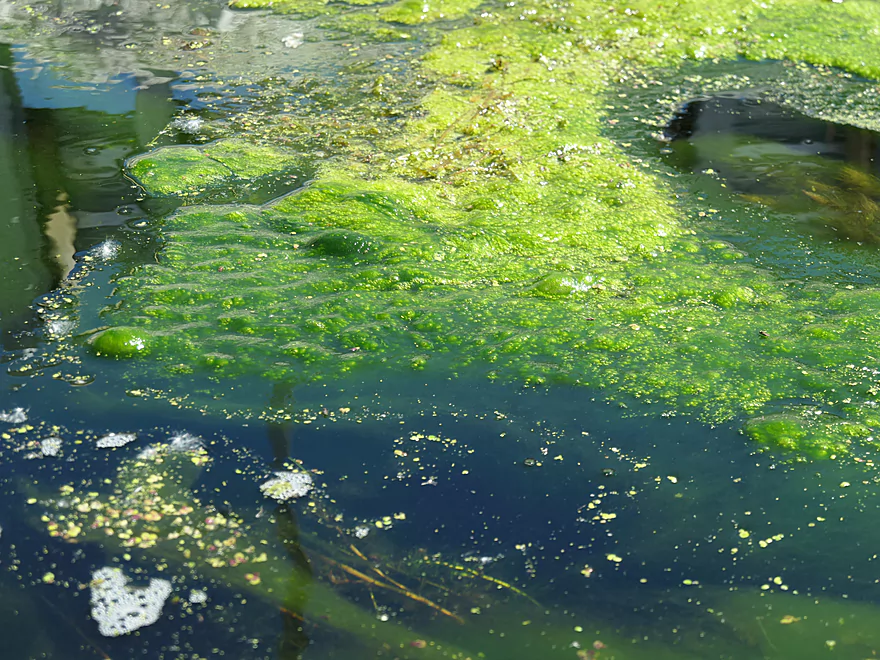
Blue green algae was an issue in spots
Nice reflections
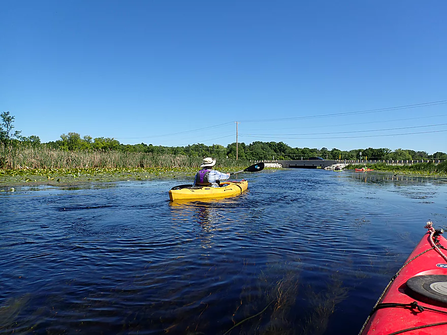
Coming up on County Line Road
Where there is a great take-out
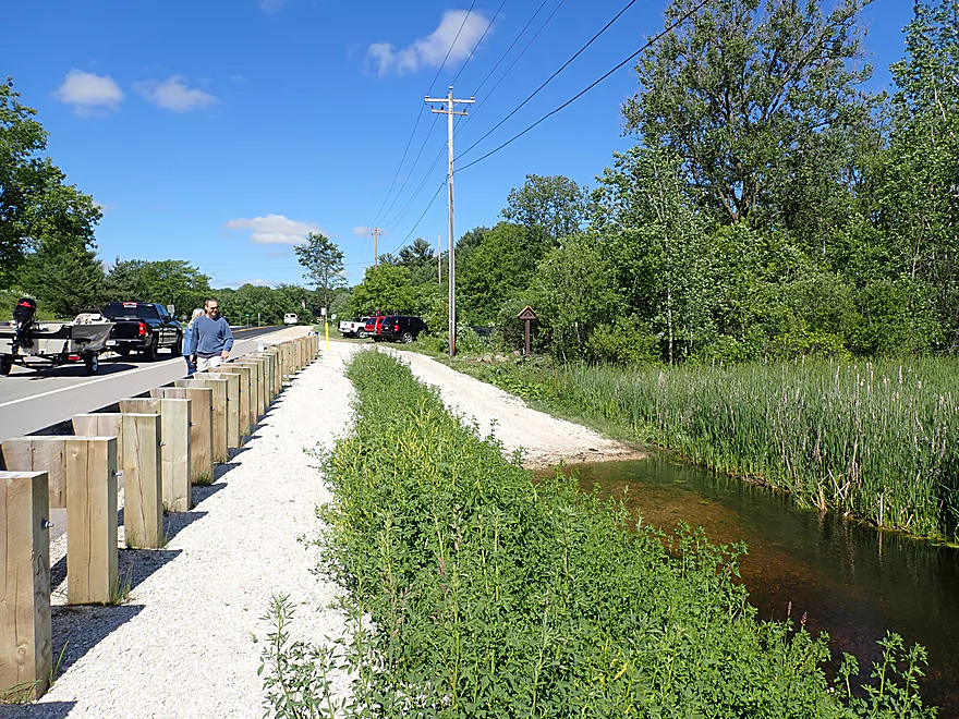
Parking is available west of the ramp
View upstream
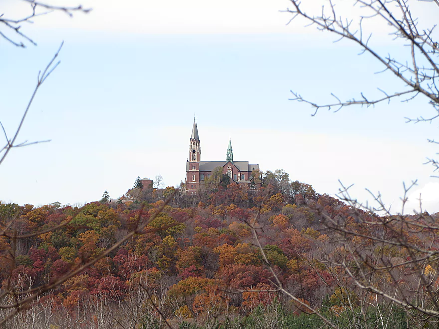
Holy Hill is visible from the take-out
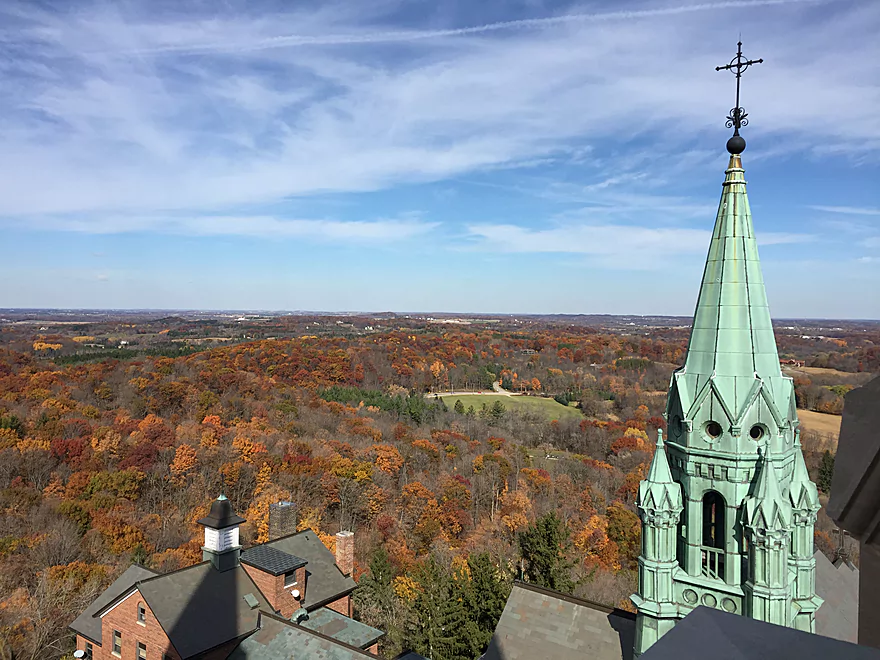
There is a great view atop its towers of the Kettle Moraine State Forest
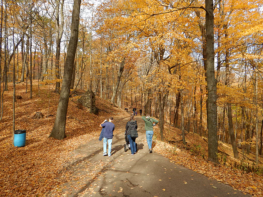
The hiking trails around Holy Hill are also top-notch
Scouting Elmwood Road as a put-in…which looks viable
But it looks very cluttered upstream of St. Augustine Road
Oconomowoc River – Loew Lake

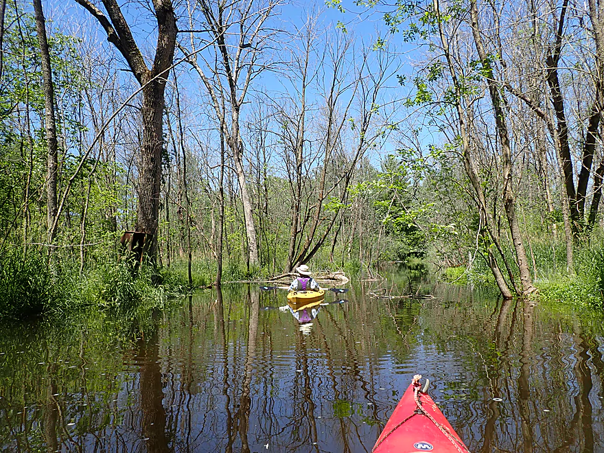
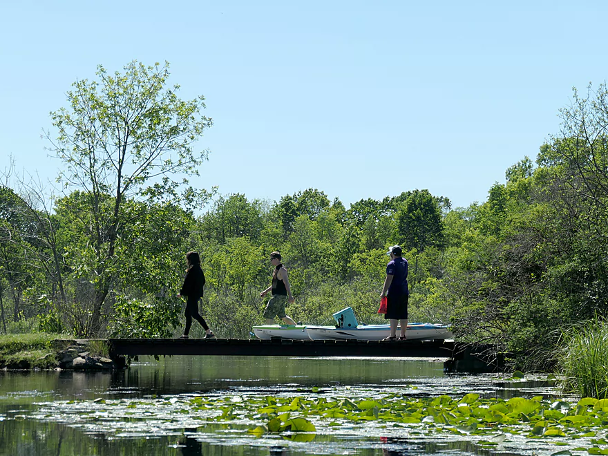
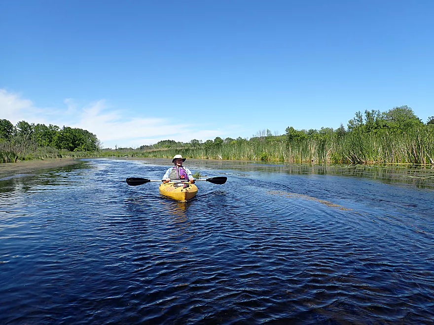
One of the most popular stretches on the Oconomowoc River is the Loew Lake section. Most paddlers put in at County Line Road, paddle up to Loew Lake, and then turn around. I’ve wanted to do this trip for a while, but with a twist… The idea was to do a one-way paddle starting from St. Augustine Road and concluding at County Line Road which very few paddlers (if any) attempt. However, my plans were a bit dashed when I actually saw the St. Augustine Road bridge…it was a bad access with the only practical launch area being over a private lawn. Fortunately the homeowner was home and graciously agreed to let us use his lawn.
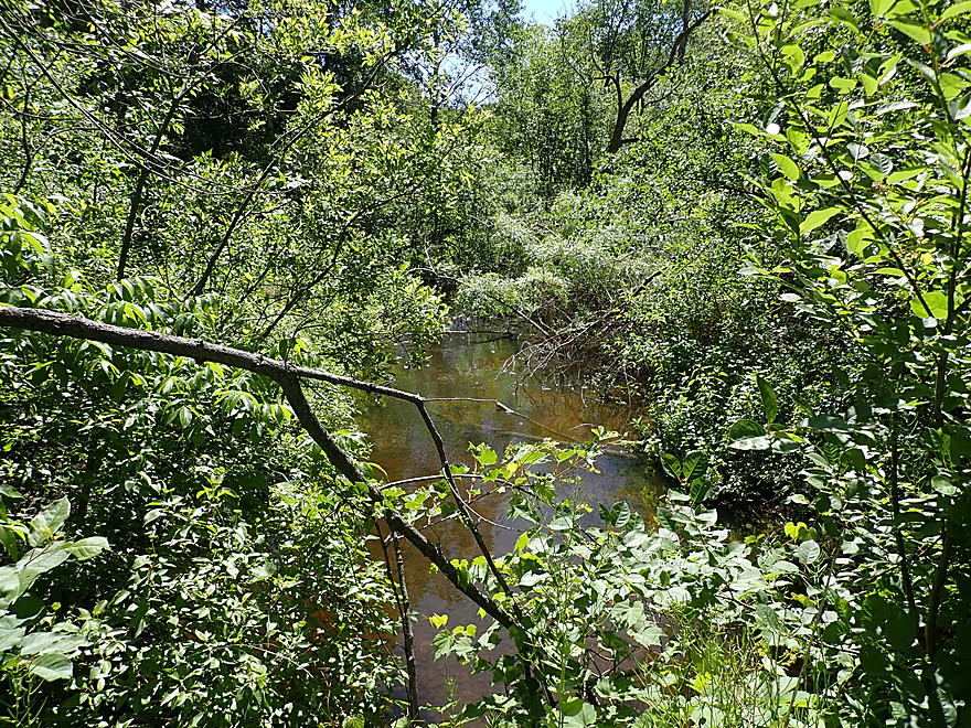
The first quarter mile of the trip was quite unique. Here the river was narrow, rocky and densely wooded. There were a number of Class 1 rapids as the Oconomowoc appeared to descend down an Ice Age feature (perhaps glacial outwash or the edge of a moraine). However the rapids were a bit shallow with some needing to be waded or scooted….but it was worth it. This stretch was very scenic and enchanting as you didn’t know what was around the bend. One of these surprises was a 200′ scenic island spanned by two wooden mini-bridges.
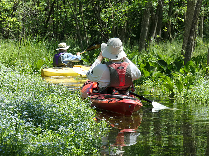
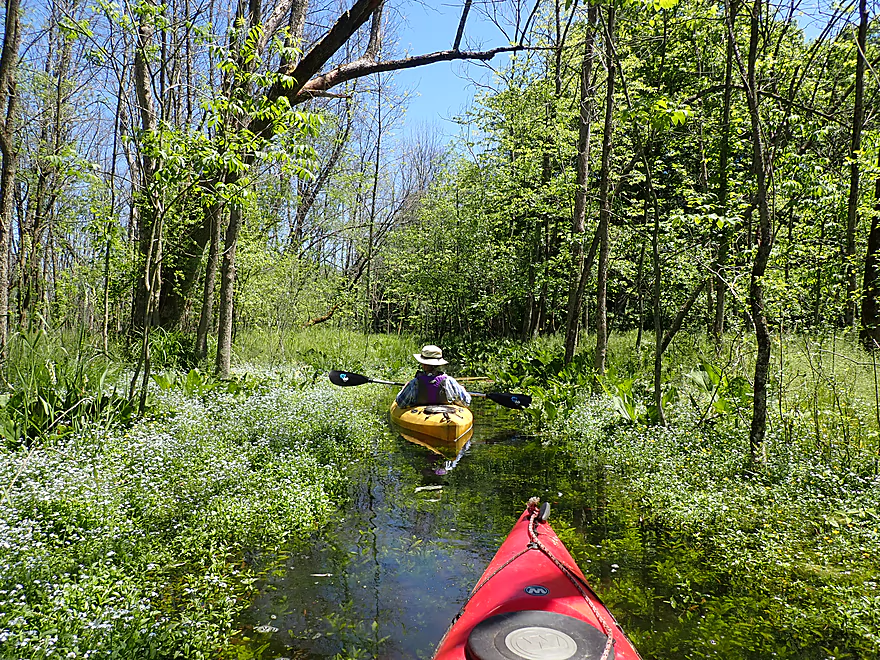
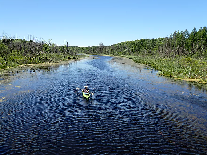
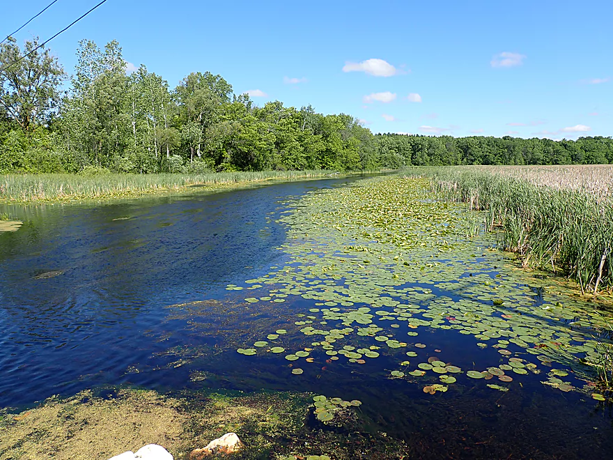
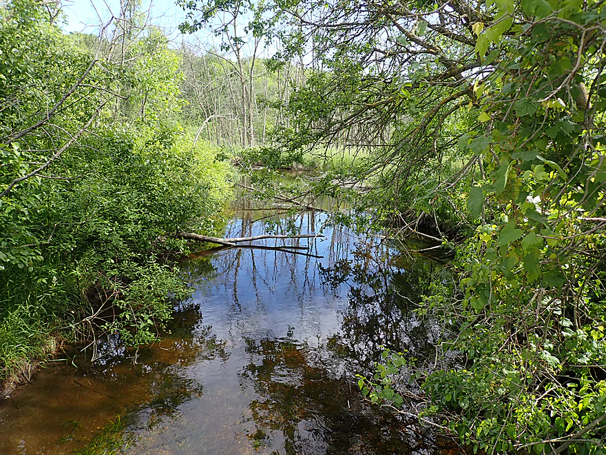
After that the river did slow and widen significantly. Several spring inlets entered the river which were quite cool. The water from these inlets was perfectly clear and calm which allowed attractive aquatic plants to grow deep under the water (very reminiscent of Upper Token Creek). Along the banks were patches of wildflowers and large skunk cabbage fields sitting on spring-fed ground. We were able to paddle ~200′ up one of the inlets between corridors of forget-me-nots and buttercups which was a trip highlight.
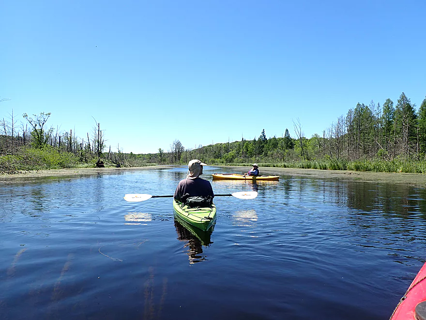
Following the spring inlets, the river metamorphosed into a marsh paddle. Here the current slowed and the woods receded into the distance. In several spots were proverbial ash tree graveyards…victims of the emerald ash borer.
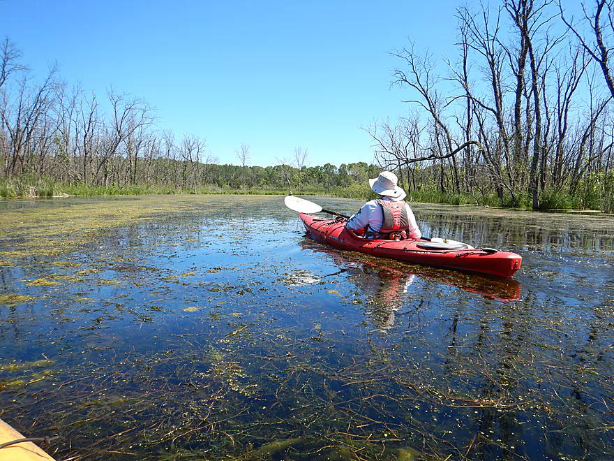
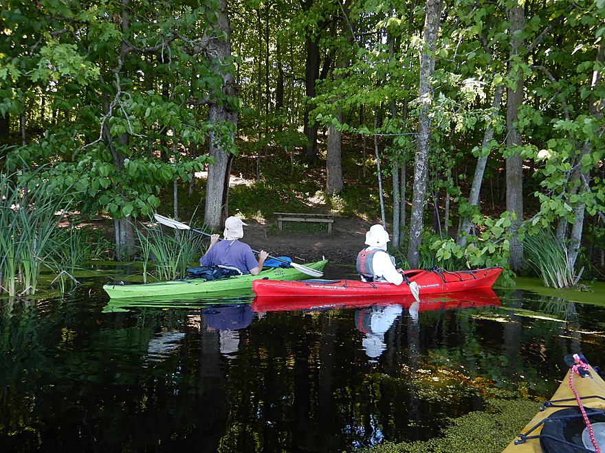
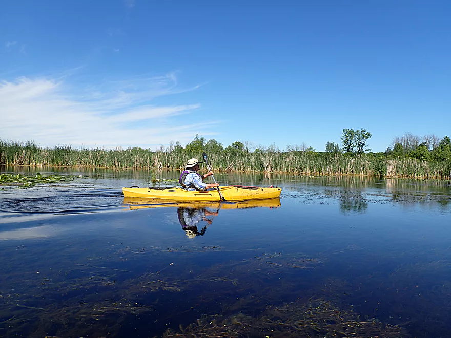
We then entered Loew Lake, which was a surprisingly deep kettle lake and a pleasant paddle…but nothing too exciting. Most paddlers that enter the lake do so from the southern outlet and then promptly turn around, perhaps not even knowing there is a northern inlet (which is somewhat hidden). This IMO is a mistake as the stretch above Loew Lake is much more interesting than the stretch below it.
Just south of Loew Lake was a large horse trail bridge that is popular with local hikers. There is a small take-out at the north end of the bridge, where I highly suggest paddlers disembark to enjoy the scenery from atop the bridge (another trip highlight). The river valley here served as a spillway for glacial meltwater. There is not a sign of houses or civilization as far as you can see and the view is magnificent!
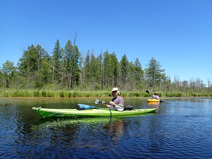
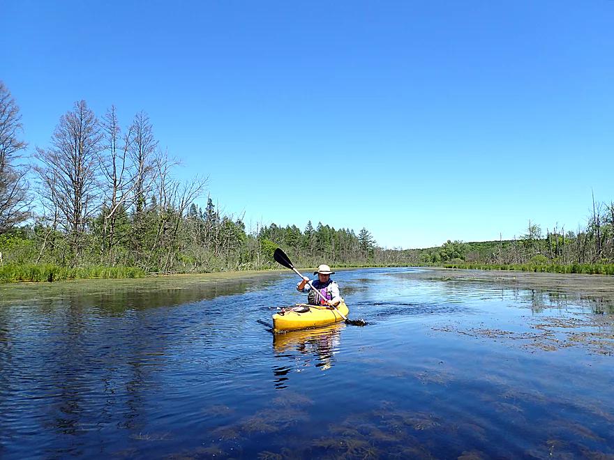
Downstream from the bridge, the Oconomowoc lost much of its magic. It was still a pleasant marsh paddle, with decent clarity and attractive marsh plants, but the current was practically nonexistent and the channel became congested with pondweeds and blue-green algae. In fact, had we done this paddle later in the year, I’m not sure we could have made it through so easily. It’s my understanding that this “weed” issue is relatively new and not considered normal. I wouldn’t be surprised if there is a septic leak in the large upstream lake community off of Friess Lake. This combined with the downstream dam at Monches would create perfect conditions for the river to be choked with “weeds”.
The scenery was still decent with occasional stands of tamaracks and several moraines in the distance topped with clusters of pines and bur oaks. Underwater pond-weeds and long strands of algae swayed gracefully in the clear current like the dementors from Harry Potter. Close to the end of the trip we encountered a low walk bridge that blocked the river. A sign warned paddlers that the bridge was private property, but stated paddlers could rest on the bridge (which a group ahead of us with their boats literally did). There is a well worn path along the shore that makes portaging the bridge very easy.
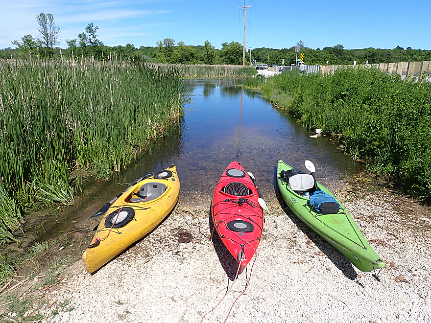
We ended the trip at County Line Road where there was a nice public kayak launch. This access is relatively new and super popular. At the start of the day there were just a few cars parked here…but when we took out, we counted 20! In the distance Holy Hill could be seen on the horizon like an ancient castle dropped onto the Wisconsin landscape.
In summary, this was a pleasant trip but with some unpleasant surprises. For most paddlers, I advise doing this as a round trip from County Line Road to avoid the bad put-in and shallows near St. Augustine Road. But…paddlers would be encouraged to at least paddle upstream of Loew Lake as far as they can go, as that did contain the best scenery of the trip. The pondweeds were the other unpleasant surprise…a problem that likely will only get worse in the future. But aside from all that, this was a nice trip with “up-north” scenery despite being located in the Milwaukee Metro Area.
St. Augustine Road: This was a really bad put-in. To the east was a patch of muddy skunk cabbage and a tangle of overhanging branches that practically blocked access to the creek. If I was doing a solo trip I might have tried to access the water directly below the culvert itself which wouldn’t have been easy. The northwest corner is somewhat viable, but is close to a house and through some congested brush.
The southwest corner is perfect for launching…and even lets you bypass a large downed cottonwood. But…it is over a private lawn. We asked for and obtained permission to launch here from the homeowner. If you wish to launch here you need to also get permission. Note as a courtesy, you should usually offer a small amount of money when asking to use somebody’s land.
Alternate Put-ins:
- Elmwood Road (0.9 miles upstream of put-in): Shoulder parking is a bit tight but is doable. This is a more secluded and better access than St. Augustine Road. The stretch downstream is very scenic with some likely nice boulder gardens. But…this is a shallow section that will likely have some snags and possible logjam portages.
- County Line Road (4.7 miles downstream of put-in): Most paddlers launch here, go upstream to Loew Lake and then circle back as a round-trip. This is an easy option.
County Line Road/Hwy Q: This was an excellent launch and is open to the public at no charge. But note…there are no outhouses and the main parking lot does fill up quickly. You can park on the shoulder but not where prohibited (signs will tell you where you can’t park). There is a public overflow lot northeast of the bridge.
Alternate Take-outs:
- Hwy E (0.4 miles downstream of put-in): You can park west of the dam and take out here. But honestly County Line Road is much nicer and the preceding Monches Mill Pond isn’t super interesting.
St. Augustine Road to County Line Road: 3.6 miles – 135′ of ascent. While we car shuttled, a bike shuttle would certainly be viable and be along a scenic route. There would be some hill climbing but nothing drastic.
Wind: Much of this trip is in the open and is quite susceptible to wind. Be very mindful of forecasted wind speed and direction.
Logjams: We only had to portage one logjam and that was at the put-in. There were also some low-hanging branches to deal with in the first quarter mile of the trip.
Creek Size: The first quarter mile was very fast and rocky…but also narrow and shallow. We did have to wade our boats past a few spots.
Rapids: There were a number of Class 1 rapids in the first quarter mile….pretty mild and safe, but bumpy. Some of the rapids had to be waded.
Low Bridges: There was a low bridge near the put-in and another near the take-out that had to be portaged. Both were easy portages.
Nearest Gauge: Bark River @ Delafield – Trip done at 42 CFS.
- 0-15 CFS: Very low depth. All the pre-Loew Lake rapids would likely have to be waded. The post-Loew Lake river should be fine and have good clarity…but weeds could be a navigational issue in later summer.
- 16-35 CFS: An average depth. Most pre-Loew Lake rapids would have to be waded. The river portion should be good for paddling outside of later summer weed issues.
- 36-60 CFS: Above average, but a good depth. Some of the pre-Loew Lake rapids will have to be waded. The downstream river should be fine for paddling but will lack some of its trademark clarity.
- 61-80 CFS: A high depth, but likely a good target range.
- 81+ CFS: A very high depth. The river may overflow its banks at this point which would be a different type of paddling experience.
Detailed Overview
- Hwy 164 to Holy Hill Road: (0.9 mile) Mostly unknown. Appears pretty open, but with one wooded section that probably has logjams.
- Holy Hill Road to Hubertus Road: (2.2 miles) Pretty open marsh paddle and should be no downed trees. Some lake paddling to contend with.
- Hubertus Road to Elmwood Road: (0.9 miles) Downed trees are definitely an issue in the first half, but the second half is open and has some nice rocky sections with clear water.
- Elmwood Road to St. Augustine Road: (0.9 miles) A good prospect with nice rocky sections. There will be portages for downed trees, but am not sure how many.
- St. Augustine Road to County Line Road: (4.4 miles)
- St. Augustine Road to Loew Lake: (1.0 miles). A scenic stretch with glacial boulders, rapids and springs. Some parts of the creek here are shallow and will have to be waded.
- Loew Lake to County Line Road: (3.3 miles). A popular wetland paddle with locals. Most do this as a round trip from County Line Road.
- County Line Road to Kettle Moraine Drive/Monches Dam: (0.3 miles) A slow large millpond.
- Kettle Moraine Drive to West Shore Drive: (5.9 miles) A great trip with clear water, boulder gardens, scenic bridges, fun rapids and attractive marshes. Only a few logjams prevent this from being five star.
- Hwy E to E. Kilbourn Road: (2.6 miles) Starts with some light woods and boulder gardens then opens into a marsh before closing with some rapids. There are three logjams, but the portages aren’t difficult. 2024 update...the logjam situation is now significantly worse because of downed ash trees. Paddling this stretch is not recommended.
- E. Kilbourne Road to Hwy 83: (1.2 miles) Fun wooded section with the longest rapids and several scenic bridges. There are three logjams and one tricky strainer. Note Hwy 83 used to be a good landing, but new owners have declared it private property and put up No Trespassing signs. 2024 update...the logjam situation is now significantly worse because of downed ash trees. Paddling this stretch is not recommended.
- Hwy 83 to West Shore Drive: (2.2 miles) Mostly lake paddling (North Lake). The short river section goes through a scenic marsh.
- West Shore Drive to Hollywood’s Roadhouse Bar: (1.3 miles) Section with good potential. Might be a downed tree to portage. The bar is private and you must get permission to disembark here.
- Hollywood’s Roadhouse Bar to Wisconsin Ave Launch: (3.5 miles) Probably an uninteresting paddle through Okauchee Lake, but the one mile river portion looks interesting. The Okauchee Lake Boat Launch is an alternate take-out.
- Wisconsin Ave Boat Ramp to Fowler Lake Park: (3.95 miles) A great lake and river prospect with amazing water clarity.
- Wisconsin Ave Boat Ramp to Wisconsin Ave Fishing Access: (1.7 miles) Mostly a lake paddle on Oconomowoc Lake, but some nice connecting river sections and a scenic railroad bridge.
- Wisconsin Ave Fishing Access to Fowler Lake Park: (2.3 miles) Half of this is through a nice marsh and half runs though a nice attractive suburbs.
- Fowler Lake Park to N. Golden Lake Road: (4.2 miles) Another good lake/river combo trip with good clarity.
- Fowler Lake to Veterans Memorial Park: (0.4 miles) A neat lake paddle with stunning clarity and attractive lakeside buildings.
- Veterans Memorial Park to W. Wisconsin Ave/Dam: (1.3 miles) A short section on Lake Lac La Belle. Heavily developed, this was a mediocre experience. Easy portage or take-out at end by dam, but parking is difficult. Ask permission from Paddleboard Specialists to park in their lot or park one block to the south at Chaffee Road Park.
- W. Wisconsin Ave/Dam to Chaffee Road Park: (0.3 miles) Terrific section with perfect water clarity.
- Chaffee Road Park to South Concord Road: (0.9 miles) Great section with clear water and scenic bridges.
- S. Concord Road to Concord Rd(2nd Bridge): (1.6 miles) Section starts good, but gets mucky after the sanitation plant. Still an ok section. Take-out at North Golden Lake Road is good, and apparently open to the public but can’t be 100% sure of this.
- Concord Rd(2nd Bridge) to N. Morgan Road: (2.6 miles) Some ok clarity, but the river starts to slow down and become less interesting.
- N. Morgan Road to Elm Drive: (2.2 miles) Ok prospect (river is getting slower and wider). For Elm Drive, you should be able to launch NE of the bridge, but must park further to the north to clear the No Parking signs.
- Elm Drive to Hwy F: (1.8 miles) Ok prospect. Hwy F is not great, but one of the more secluded bridge accesses on the lower section.
- Hwy F to W. River Drive: (2.6 miles) Weaker prospect. No Trespassing signs beyond the ditch by W. River Drive and a sign that limits parking doesn’t make this an appealing access. Probably doable for access though.
- W. River Drive to Northside Drive: (1.4 miles) River is getting less interesting and muddy. You must portage by an electric fish barrier under Northside Drive (plenty doable but a bit brushy and super muddy…do scout this before running). Parking is good at Northside Drive.
- Northside Drive to mouth on Rock River: (1.0 miles) Probably an uninteresting section.
- Mouth to Hwy P: (2.6 miles) The lower Rock River is not an interesting prospect IMO (too wide and muddy). Hwy P should be adequate for taking out if you do this section.
Trip Map
Overview Map
Video
Photos Size:
Excellent trip report.
I am interested in buying a kayak to paddle similar small streams like you did. What advice would you give in regard to type, size, etc.?
I currently own 2 dual sit-on-top kayaks (used with my wife & kids numerous times on the Hwy Q – Loews Lake segment ~8 years ago) but would prefer to get a single.
Thanks!
Hi Paul…I’ll contact you via email for more info. For anybody else interested I have a kayak buying guide at: https://www.wisconsinrivertrips.com/tips-tricks.html