
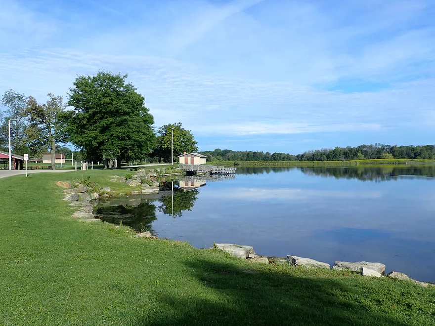
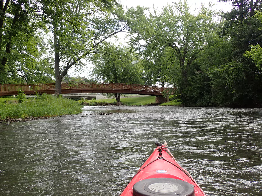
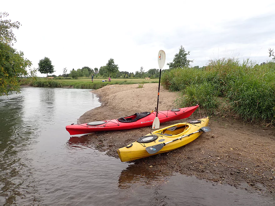
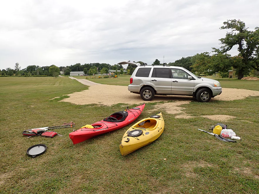
Starting the trip at Belleville Community Park
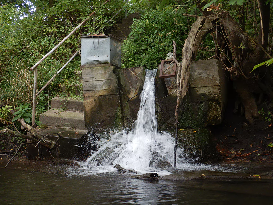
A new dike separates the lake from the river
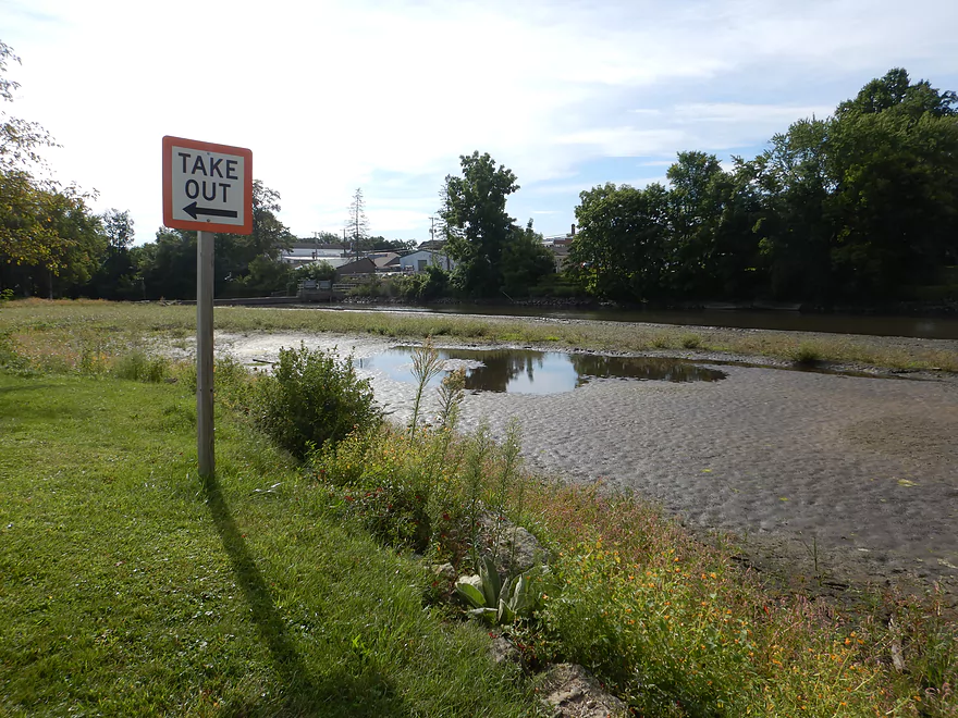
The river has been recently drawn down
As evidenced by this pier
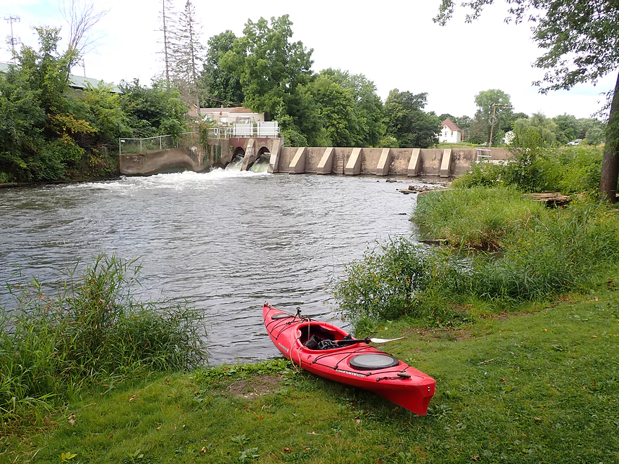
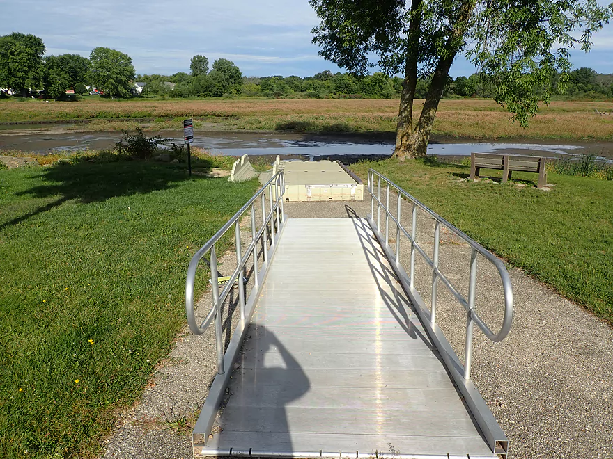
Doesn’t matter to us as we launched below the dam
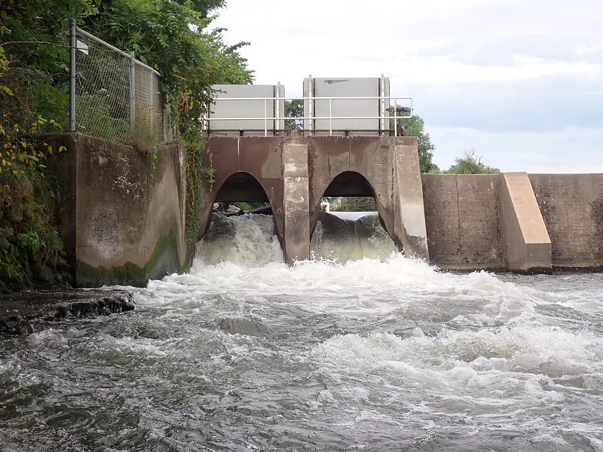
The dam has a leak which is why the flowage has been partly drained
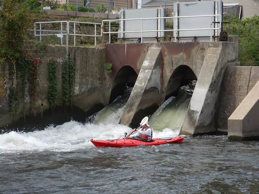
Riding some fun rapids
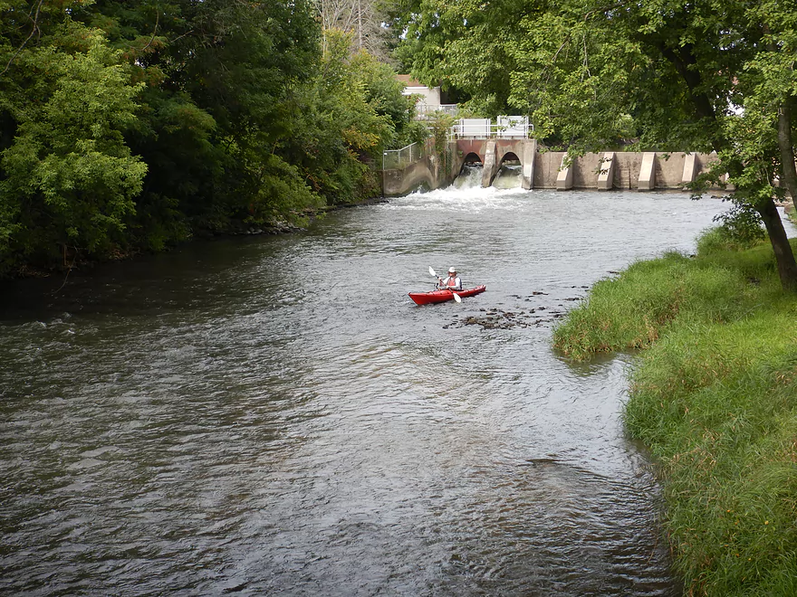
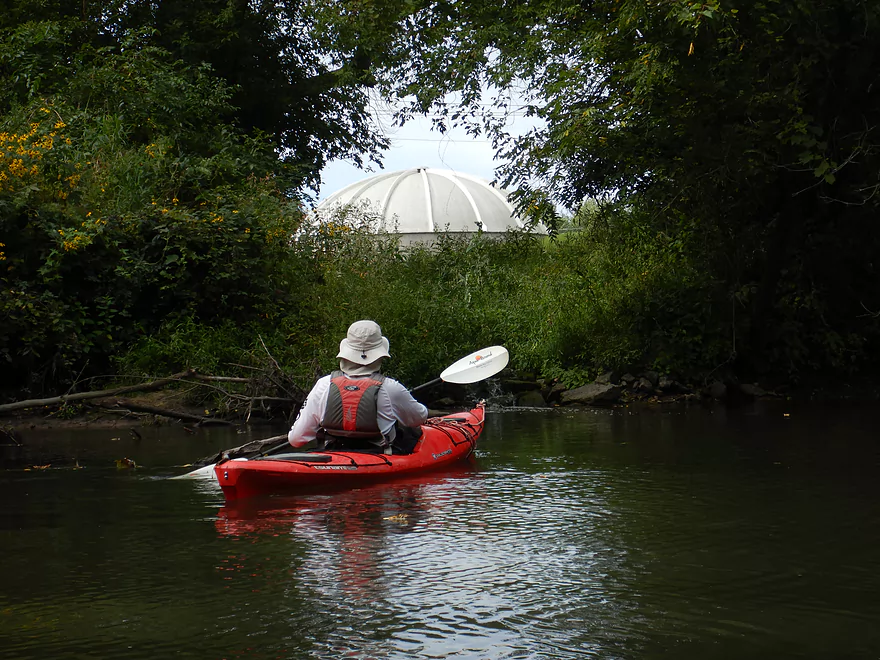
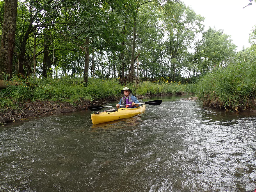
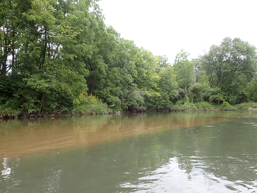
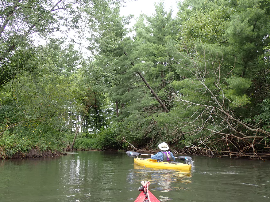
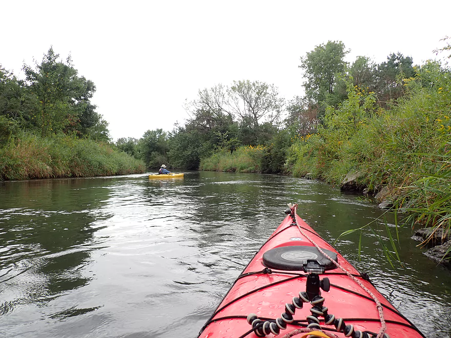
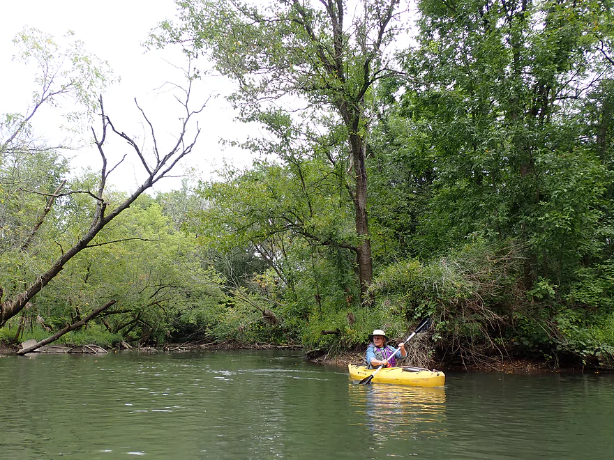
Scenic area
Zipping along on some light riffles
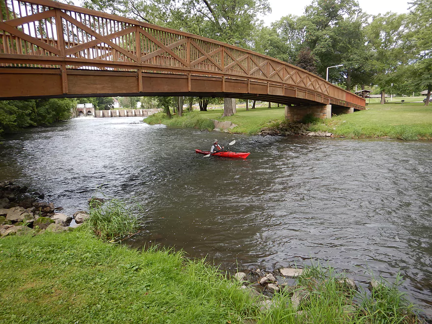
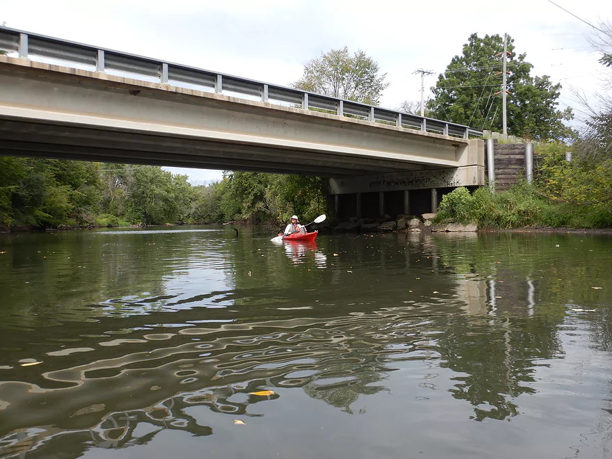
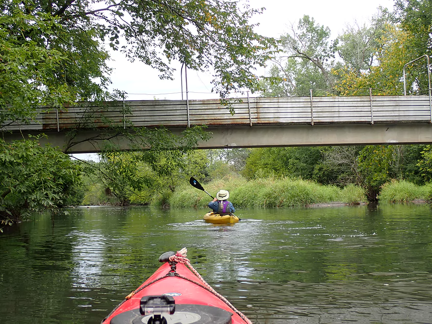
Attractive walk bridge
Quite the party
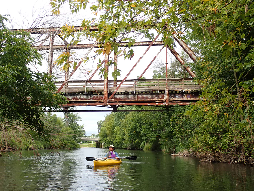
This railroad trestle…
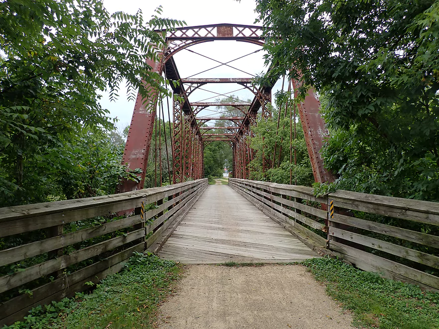
Has been converted into the Badger State Trail
Byproducts from a whey factory…didn’t smell great
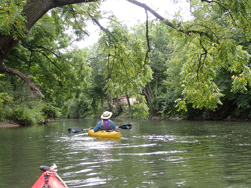
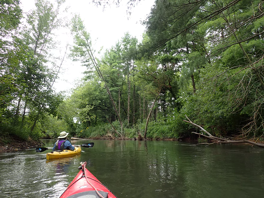
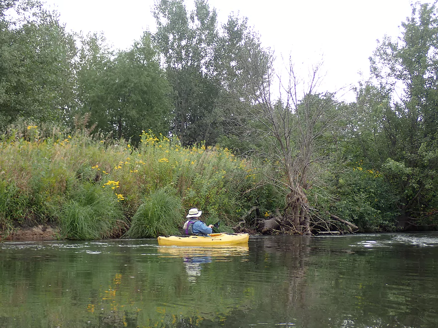
Nice wooded stretch on the outskirts of Belleville
Belleville’s effluent is added to the Sugar
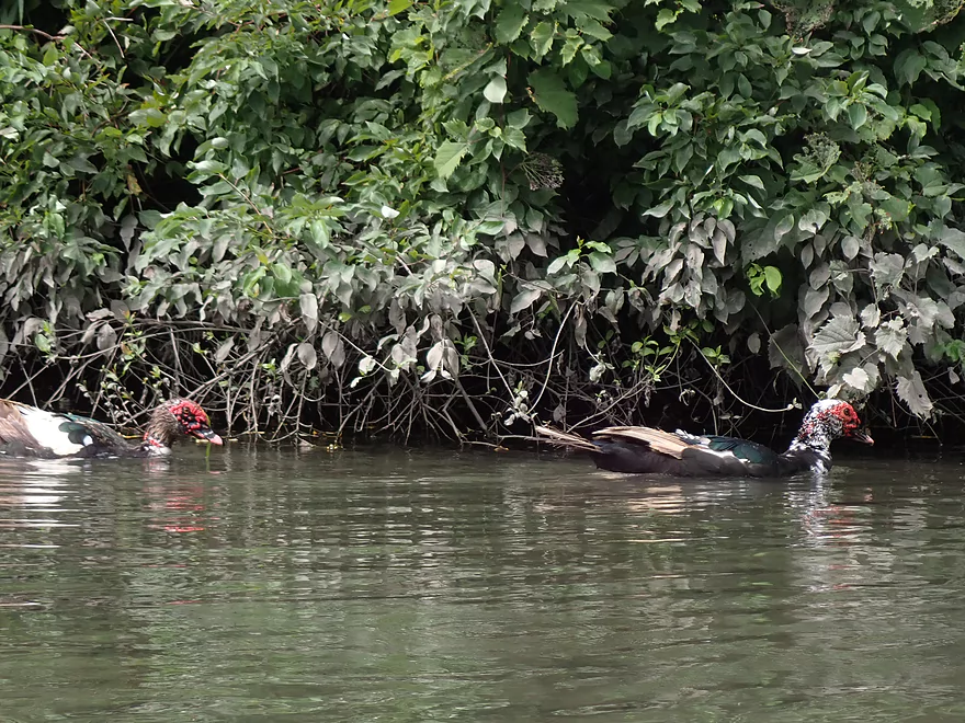
Some odd-looking ducks
Remy Road
A small island
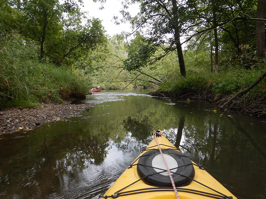
Both channels are navigable
A few light riffles
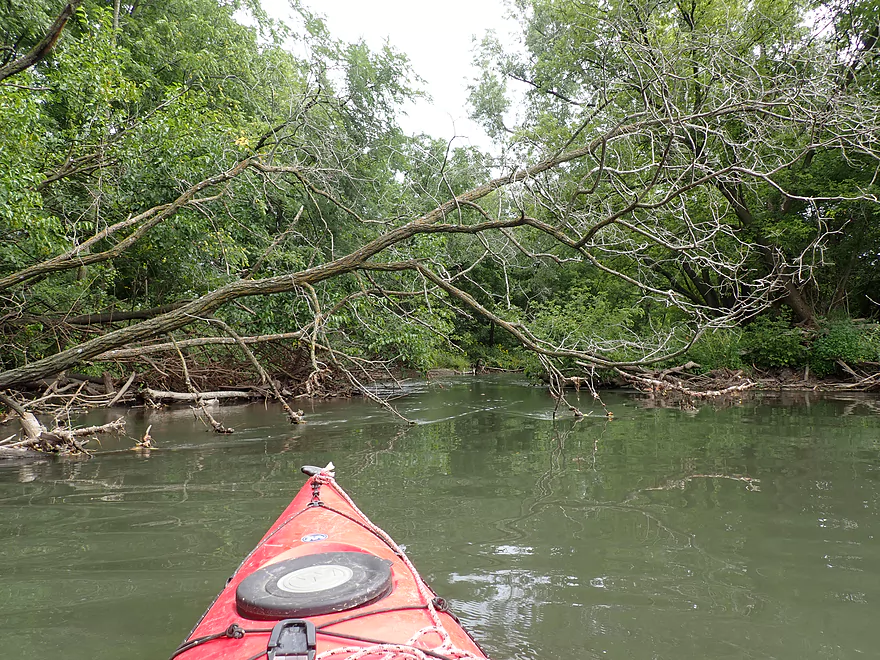
This part of the river has been beat up by floods
Trees pushed to the side by high water
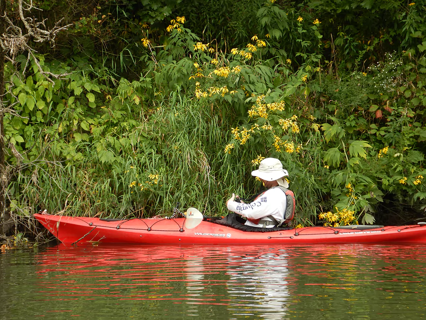
This was a fantastic trip for late summer wildflowers
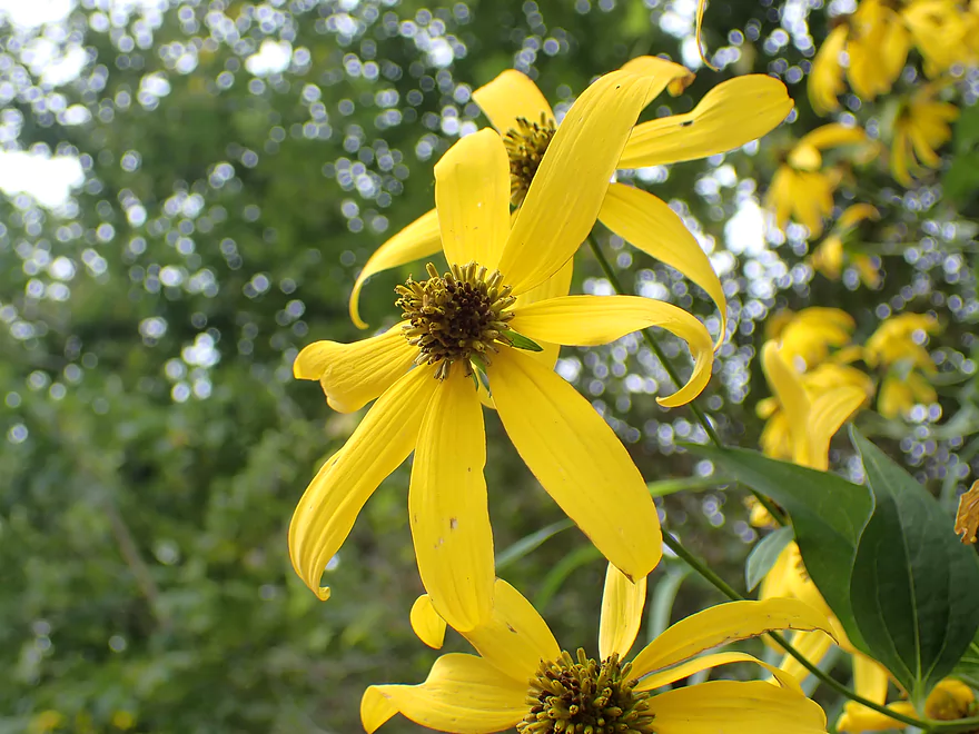
These are coneflowers
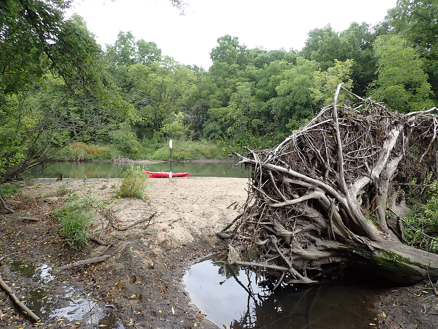
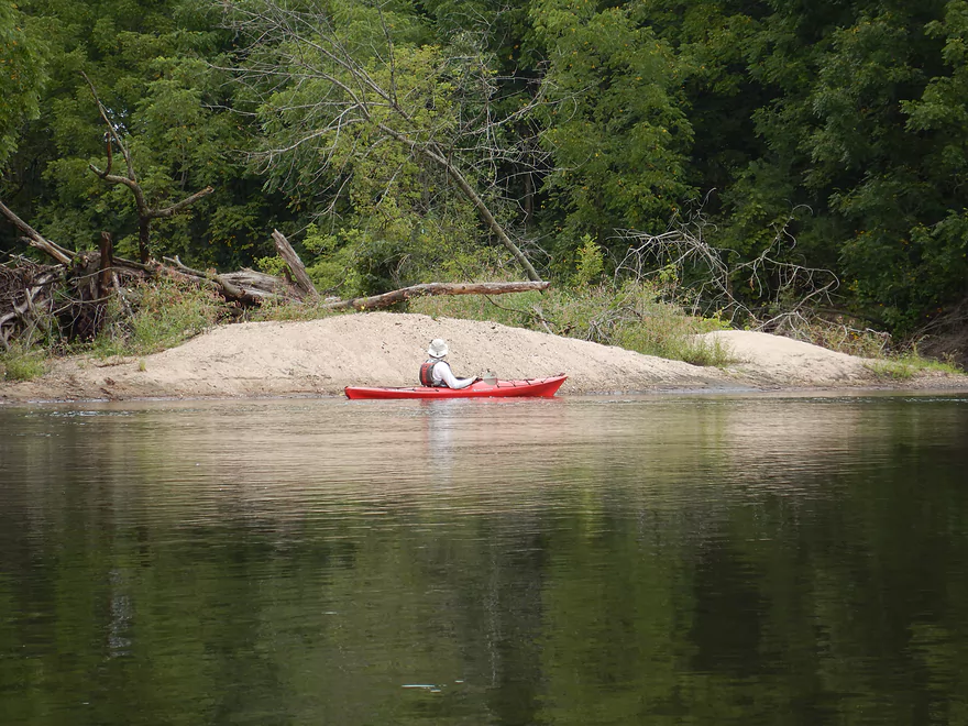
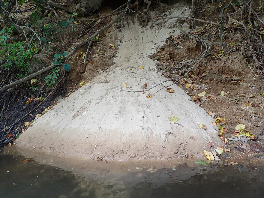
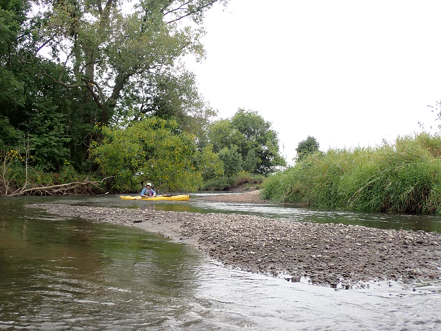
Coming up on a surprise sandbar
Really nice

Japanese beetle munching on a leaf
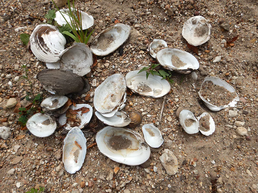
Somebody had a dinner
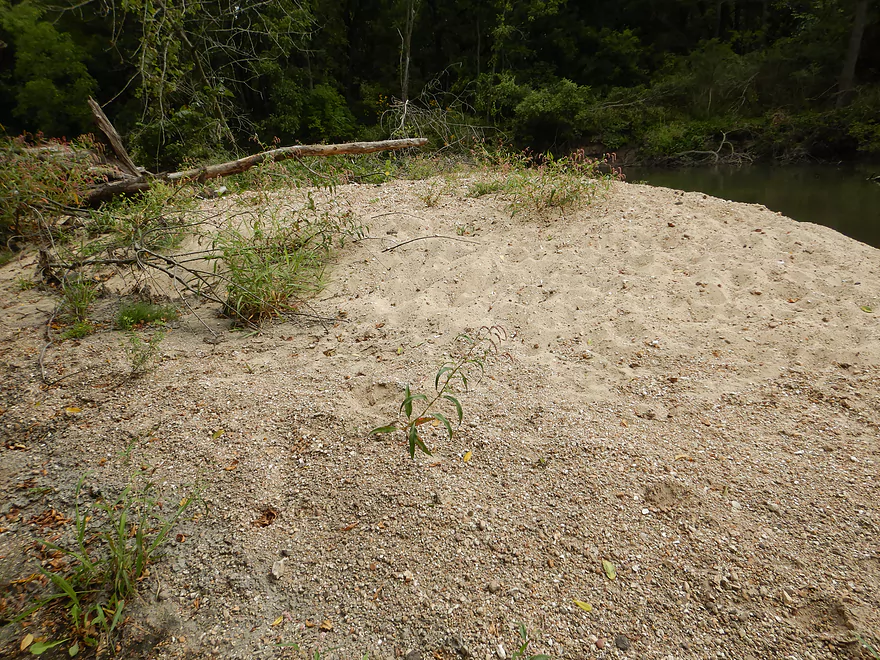
Very nice sandbar…campsite worthy
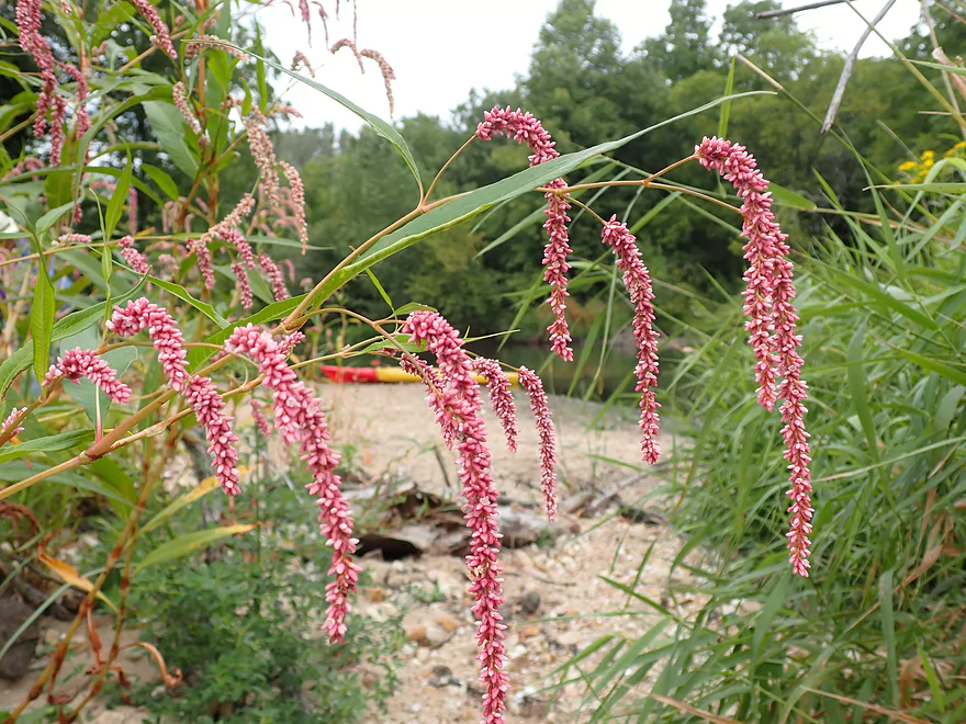
Photogenic smartweed
Back on the road
Reverse view
Ross Crossing Creek is much cleaner than the Sugar
Entering a nice wooded section
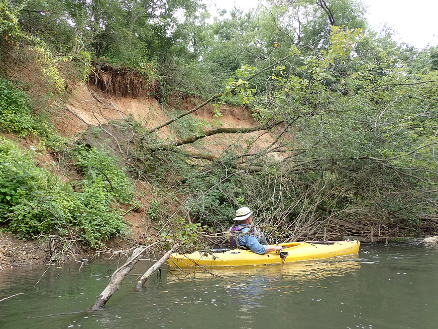
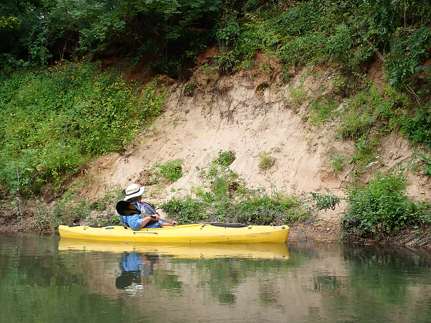
Nice exposed clay bank
Evidence of cleanup work
Surprise pines on the Sugar
Very scenic
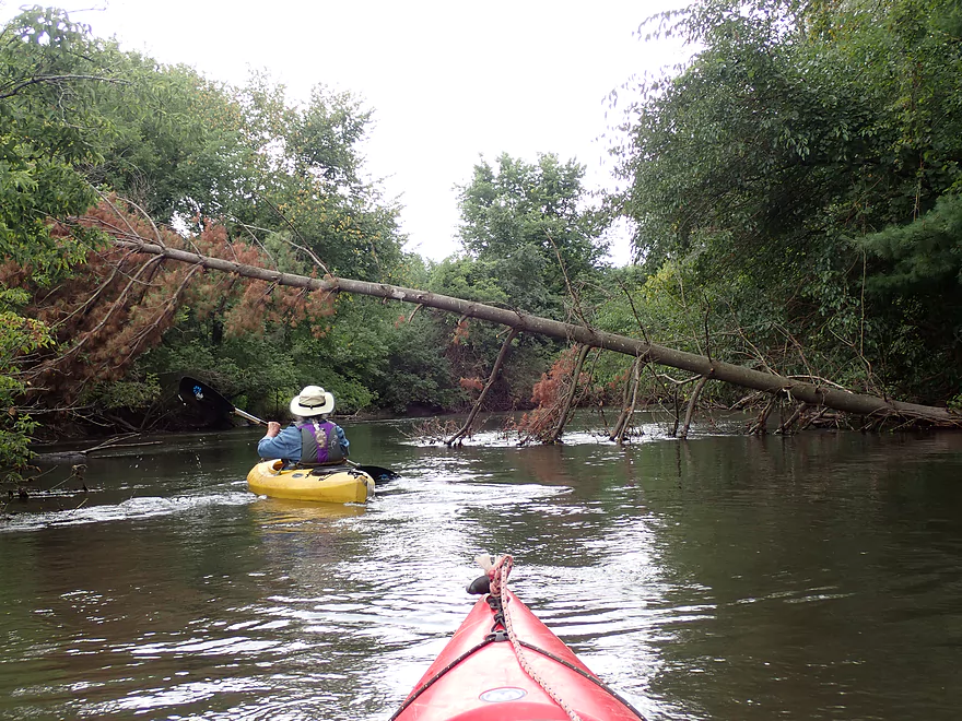
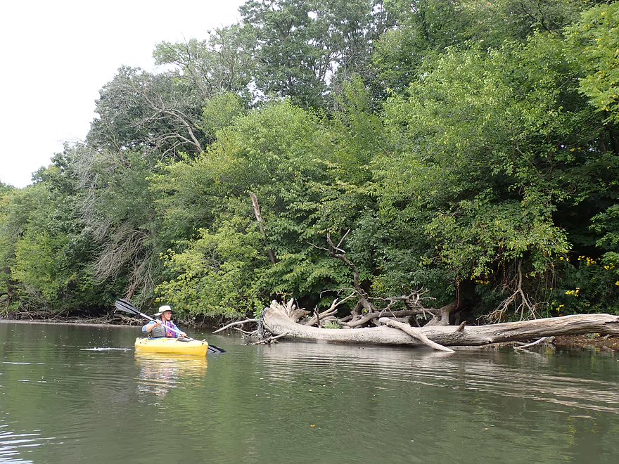
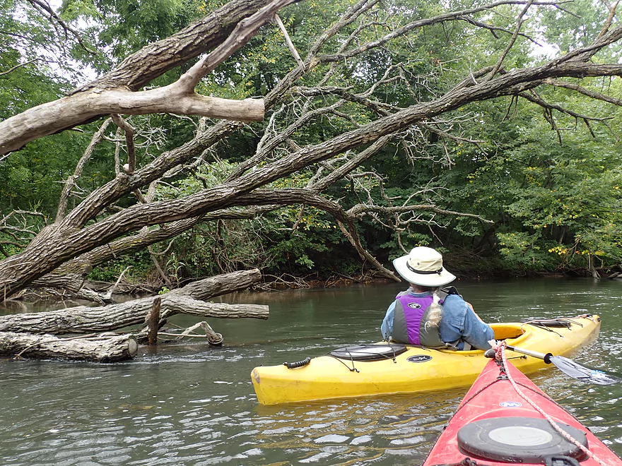
Downed trees were never a problem
Some of the pines appeared artificially planted
Entering an open stretch
Exploring one of several side sloughs
The main channel likely flowed through here in the past
A large exposed sandbank
Such a surprise to see sand on the Sugar
Entering another wooded section
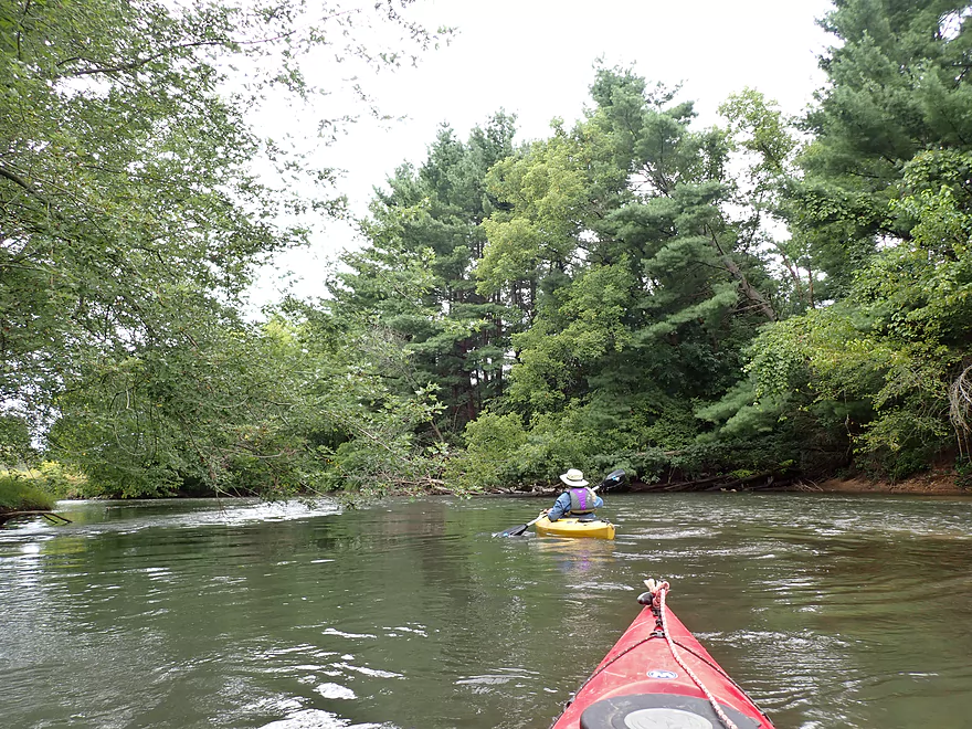
Nice stretch
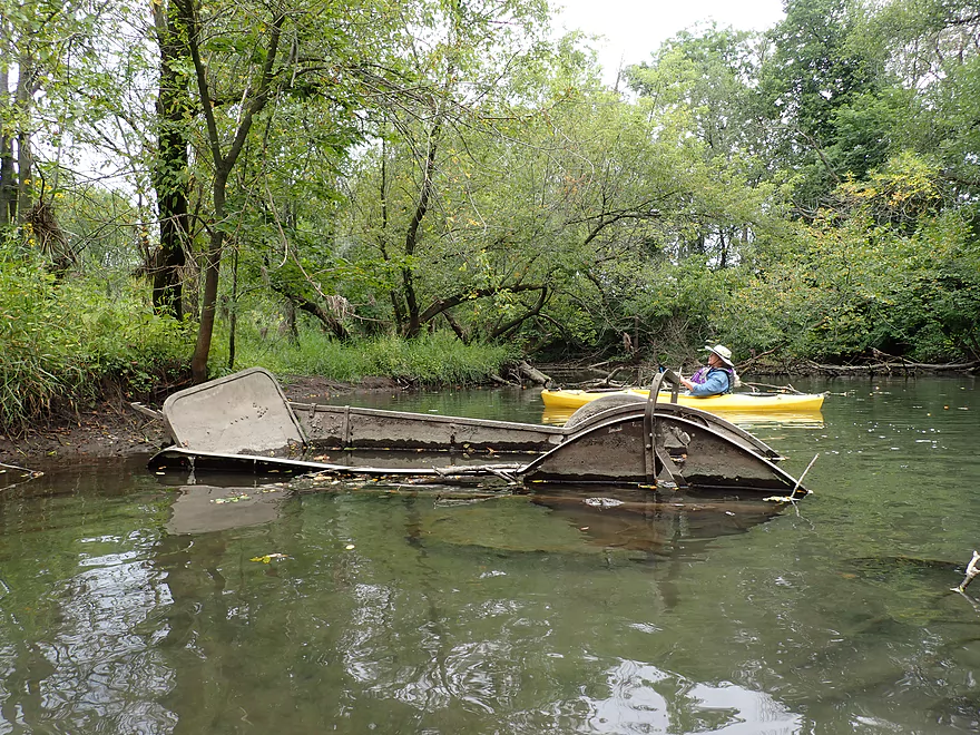
What is a manure spreader doing in the river?
Continuing on…
Looks like an abandoned trail bridge
On the home stretch
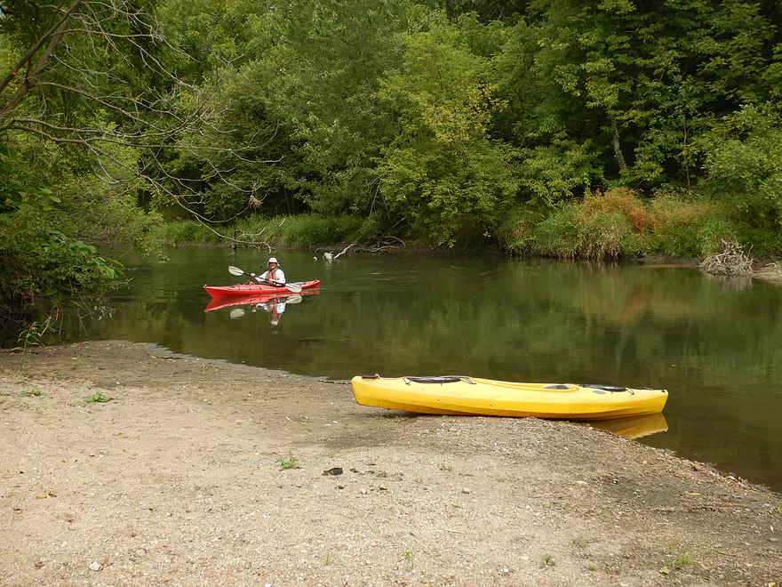
Taking out at Exeter Park
Great take-out
You can unload by the take-out but must park at the far end of this road
Sugar River – Belleville


The trip started at Belleville Community Park, which was a terrific put-in. One of the remarkable features of the park is Lake Belle View which seemingly is part of the Sugar River, but is not. At one point it used to be an old flowage lake, but it silted in and got mucky. The community dredged the lake and created a long dike to separate it from the Sugar River. Except for this dike, the park is practically an island with the Sugar River to the south and the lake to the north.
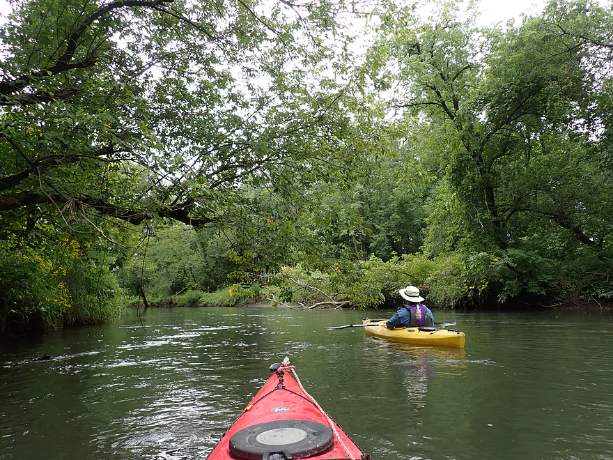
We launched just downstream of the dam which happens to be suffering some structural issues. Specifically a side wing sprung a leak and the community has partly drawn down the flowage as a result. This has exposed some large flats of mud upstream, but also has revealed part of the original river channel. I’m not a fan of dams or flowages, so hope they don’t “fix” this anytime soon. Following the dam there are some light rapids and a series of three scenic bridges. The third is a striking old railroad trestle that has been converted to the Badger State Trail.
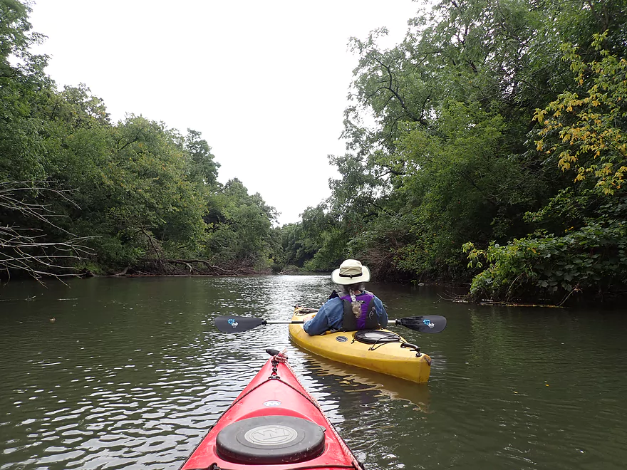
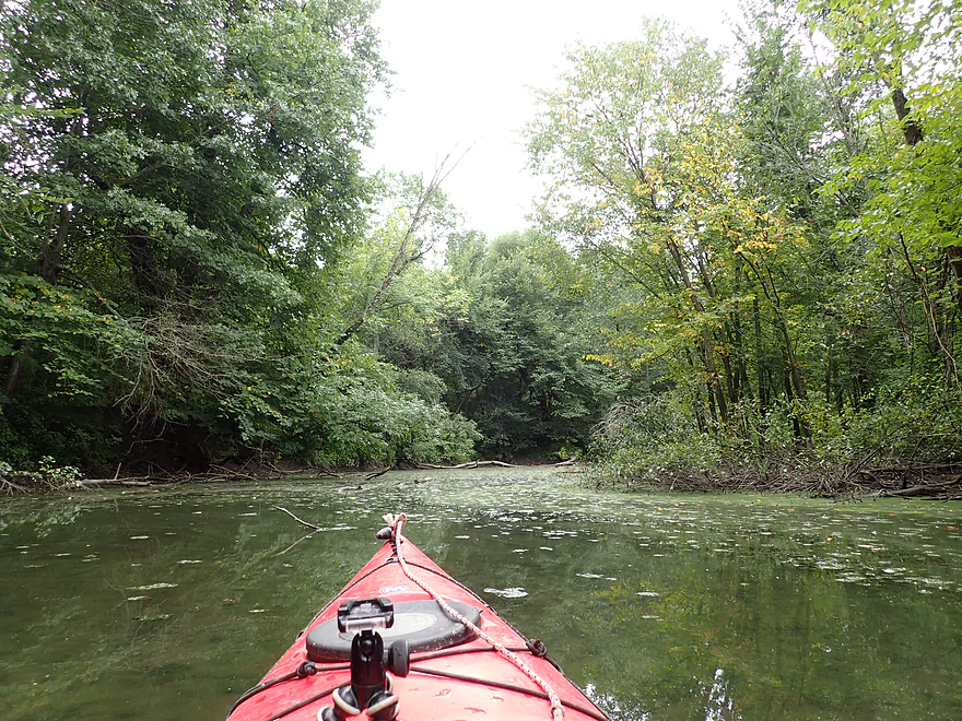
While the river by the park was terrific, honestly things became significantly less interesting after that. A whey factory dumped its smelly effluent into the river…Belleville soon followed suit by dumping its own wastewater into the Sugar. The channel was fairly blah…deep (3-5′ on average), muddy, and with messy wooded deadfall along the banks.
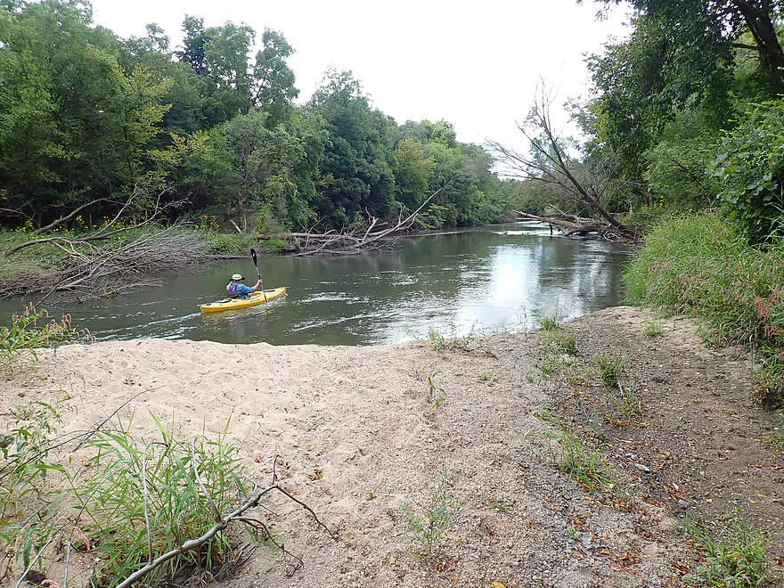
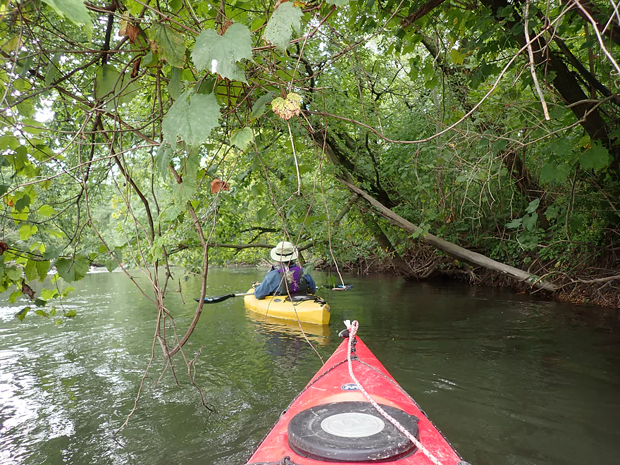
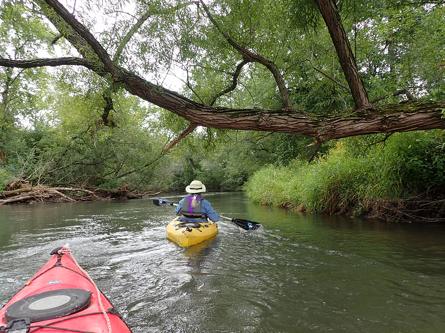
But…by about mile two, the Sugar started getting interesting again. To our surprise we encountered several sandbars and gravel bars. There was a particularly nice one that would actually be an interesting camping idea (we did see evidence other paddlers had camped there). Following the sandbars, everything improved. The current picked up, gravel replaced mud, the bank quality improved, and the shoreline morphed into healthier and denser woods. This was a great sub-section that included several exposed clay banks and some fun riffles.
By about mile three, the river opened up as it came in contact with adjacent farm fields. This was followed by another wooded section and a brief residential neighborhood. We didn’t see that many homes, but did hear the occasional urban sounds. The latter portions of the river were very reminiscent of lower Turtle Creek as well as Badfish Creek. We finally took out at Exeter Park, which was a very good access.
In summary this was a trip that started a bit blah, but by mile two became a very nice wooded paddle. Most woodland paddles are obstructed with logjams, so paddling one that isn’t is a unique experience. However, if you are new to the Sugar River, I actually suggest doing the Paoli segment first, which I liked more. But this isn’t a bad option for those looking for a new adventure south of Madison. Special thanks to Capitol Water Trails in their efforts to make this route navigable.
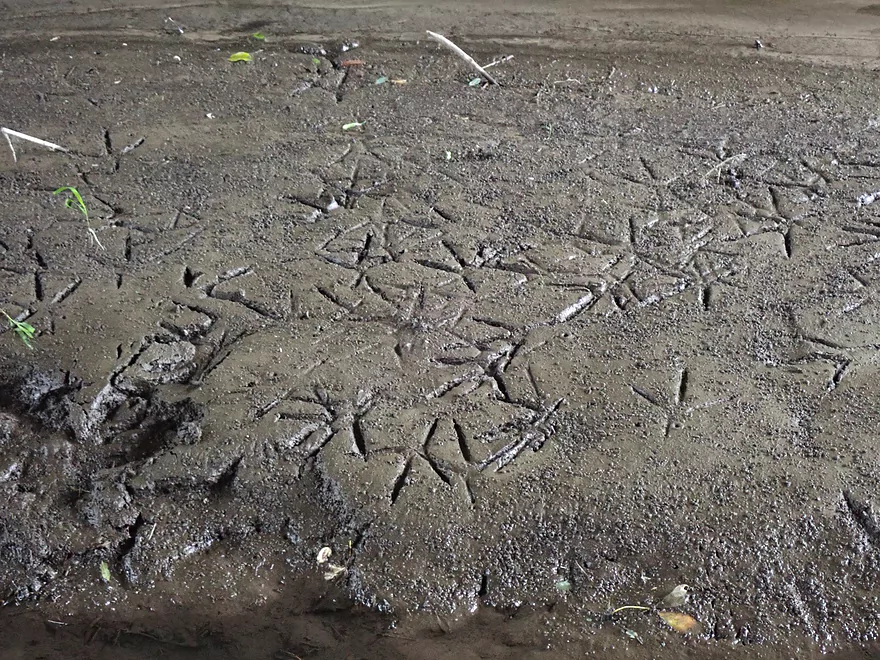
Sights included painted turtles, clams, a barred owl, one eagle, two cranes, and a kingfisher. There were a handful of blue herons along the river as well…they made cool calligraphy footprints in the mud.
Stewart Tunnel: Located just SW of the take-out is the famous Stewart tunnel. This is a scenic bike tunnel that is unique because it bends in the middle creating complete darkness. But be warned…the connecting bike trail (Badger State Trail) is in poor shape and there rumors that the tunnel is currently closed. Here are pictures.
Paoli: Just upstream of Belleville is the community of Paoli. It’s a quaint European style town with a number of unique shops and cafes which cater to tourists and bikers of the Badger State Trail.
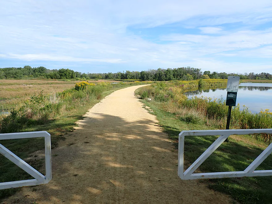
Belleville River Walk: A half mile trail that connects Belleville Community Park to N. Shore Drive. This is unique because it runs along a narrow dike separating the Sugar River from Lake Belle View. You can connect to this trail from the nearby Badger State Trail.
We started the trip at Belleville Community Park which is a great put-in. Parking is free, outhouses are available, and there are a number of landings in the park. We launched just below the dam which worked well.
There are numerous upstream access points that can extend this trip upstream. County Road Pb and Frenchtown Road are certainly options. Hwy A is a popular access and would add a nice 5.6 mile leg to the trip.
We took out at Exeter Park located just south of the Hwy 92 bridge. This is a very good public access with free parking, picnic facilities, and outhouses. There is a small beach along the shore which makes getting out very easy. The only downside is that the launch is 650′ away from the parking lot. You can load/unload next to the launch, but you must leave your car in the main parking lot which isn’t convenient.
Paddlers looking for a longer trip could continue 5.4 more miles to Hwy X where there is a small pull-off landing NE of the bridge. That segment is a bit more wooded and wild…but should be a solid paddle.
Livery/Rental: It appears Sugar River Outfitters services a good portion of the upper Sugar including the stretch by Belleville. You can contact them at (608) 692-7910 for more information.
Bike Shuttle: Bike shuttlers have two decent options. The first would be to take Hwy 92 which would be 3.7 miles, relatively flat and have no serious traffic issues. The second option would be to take the Badger State Trail which would be 4.8 miles. About half of that route would be on Hwy W though. Also note, there are reports that the Badger State Trail is in poor shape and in serious need of fresh gravel…whether that includes this segment, I don’t know. You need a state trail pass to use the Badger State Trail (available at any nearby state park or at the Belleville Library).
Current: Despite the minor gradient, the river seems to move at a good clip. The middle section was the fastest and featured several small riffles.
Hazards: There are occasional strainers but these should be easy to dodge unless paddled at high water levels.
Logjams: None…these get cleaned out by the annual sugar river cleanup. Note, this is a woodland paddle so there is always a chance that new jams could appear.
There is a gauge upstream at Verona. We did the trip at 83 CFS.
- 0-20 CFS: A typical fall average. There may be some shallow riffly sections, but the river should still be navigable.
- 21-50 CFS: A typical summer average. A good depth.
- 51-90 CFS: Above normal depth, but plenty fine.
- 91-130 CFS: Also above normal depth, but should be fine.
- 131-200 CFS: A high depth. Water clarity will not be as good and the current could get pushy. Likely a doable depth but be careful.
- 201+ CFS: A very high depth. Likely only suitable for very adventurous paddlers.
Detailed Overview
- Upstream of Hwy PD: Likely too many logjams.
- Hwy PD to White Crossing Road: (0.4 miles) Mostly straight and likely channelized. Perhaps a few logjams. Could be a tight fit during low water.
- White Crossing Road to Valley Road: (4.9 miles)
- White Crossing Road to Bobcat Lane: (2.2 miles) Open, straight and channelized…this is a simple but pleasant paddle with frequent vistas of Epic Systems (at the edge of Verona). There are a few logjams here that can be hopped over in high water.
- Bobcat Lane to Valley Road: (2.7 miles) Slower, twistier and more wild than the upstream section, but less interesting. No noteworthy logjams.
- Valley Road to Riverside Road: (1.8 miles) There might be a logjam or two, as well as a problematic cattle fence.
- Note from Wade at Uppersugar.org: “The fence has been redesigned to be more paddling friendly. Both sections of the fencing now have a gap with vertically hanging PVC pipes that boats can pass through. It’s my understanding that this has worked well, but if you go down the river and have a different experience, please let me know.”
- Riverside Road to Hwy 69: (1.6 miles) There were fences and logjams here, but I think they have been cleared out.
- Hwy 69 to Hwy A: (7.7 miles)
- Hwy 69 to Paoli (Montrose Town Hall): (3.5 miles) Fantastic section.
- Paoli to Hwy A: (4.2 miles) Good section….but not as scenic as the previous leg.
- Hwy A to Belleville Park: (6.6 miles) Trip starts nice but becomes less interesting at the end by Belleville where the river is impounded by a dam.
- Belleville Park to Exeter Park: (4.8 miles) Nice paddle with scenic put-in and take-out. Highlights include a few sand and gravel bars and an attractive wooded section with good current.
- Exeter Park to Hwy X: (5.4 miles) A good prospect.
- Hwy X to Hwy C (Attica): (5.0 miles) A simple leg. There is nothing really scenic about it...but it's not a bad paddle.
- Hwy C to Hwy EE: (6.4 miles) A mediocre prospect. Maybe logjams.
- Hwy EE to Albany Boat Ramp: (2.5 miles) A weak prospect because of the lake paddling.
- Albany Boat Ramp to Decatur Albany Road: (2.9 miles) A weak prospect.
- Decatur Albany Road to Decatur Park: (4.5 miles) A weak prospect with some flowage paddling.
- Decatur Park to Hwy F: (2.2 miles) Good prospect.
- Hwy F to Clarence Bridge Park: (4.6 miles) Good prospect with an exposed rock outcrop.
- Clarence Bridge Park to Hwy T: (5.9 miles) A good prospect.
- Hwy T to W. Beloit Newark Road: (1.9 miles) A good prospect.
- W. Beloit Newark Road to Nelson Road Boat Ramp: (4.6 miles) Avon Bottoms Wildlife Area is probably nice but there might be some downed trees to negotiate.
- Nelson Road Boat Ramp to Haas Road: (6.6 miles) Good prospect.
- Haas Road to North Street: (4.1 miles) Good prospect.
- North Street to Harrison Road: (5.0 miles) Good prospect which ends at the Pecatonica River.
Trip Map
Overview Map
Video
Photos Size: