
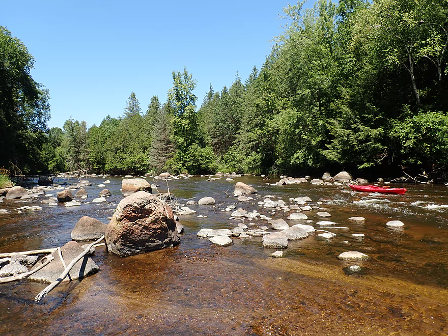
Starting the trip at Kretchner Road
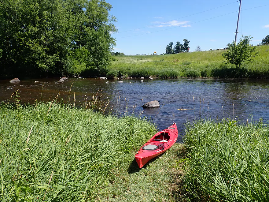
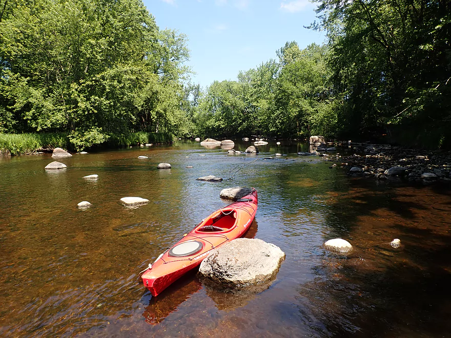
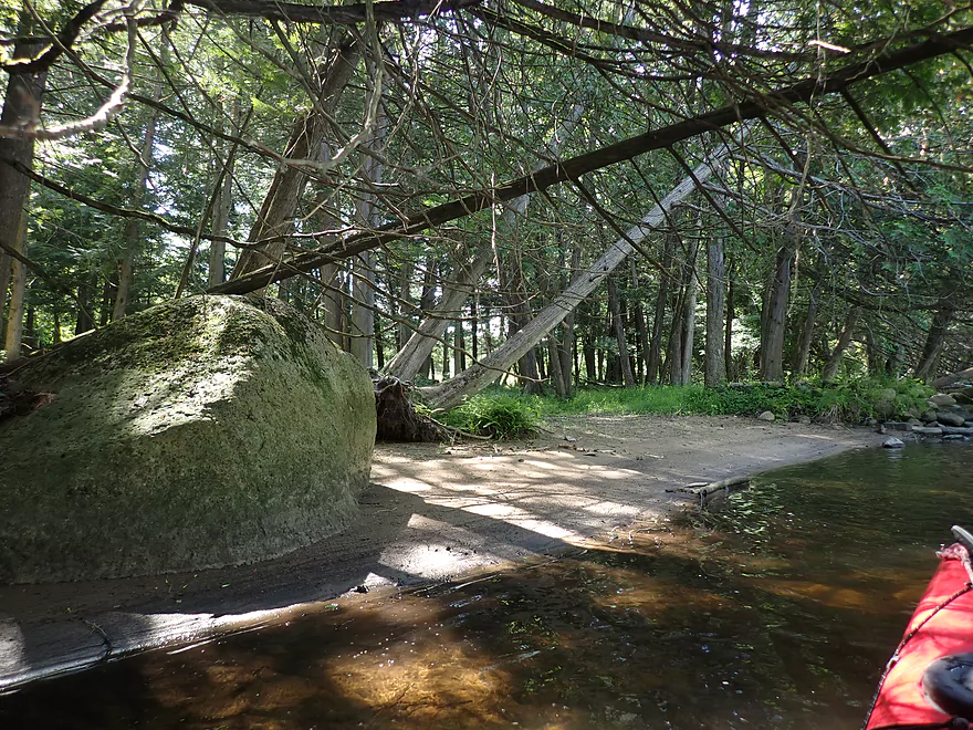
Good access
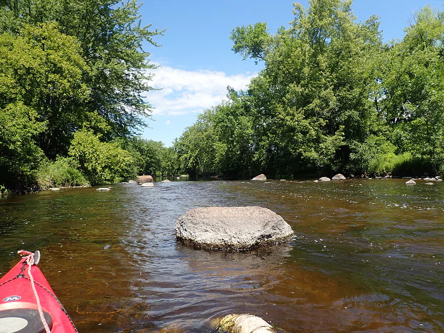
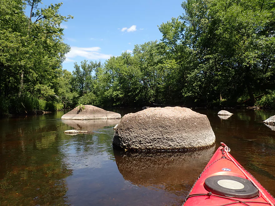
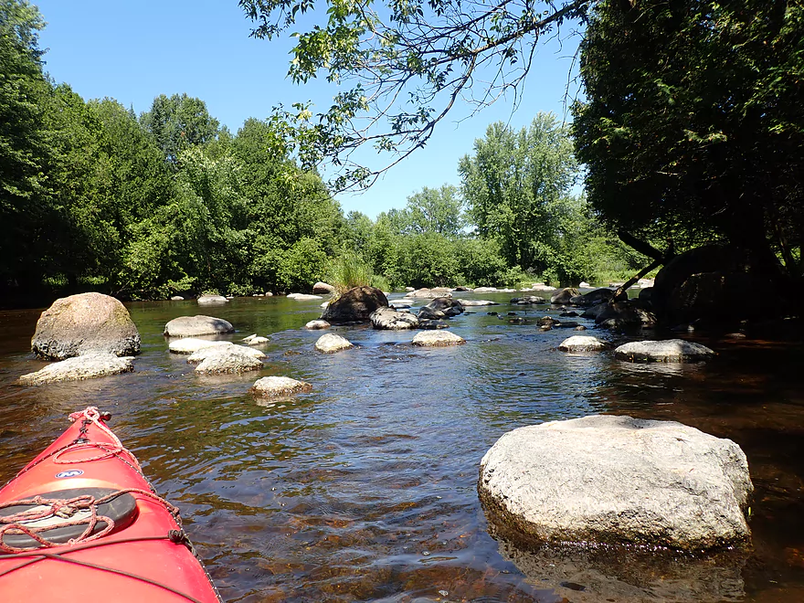
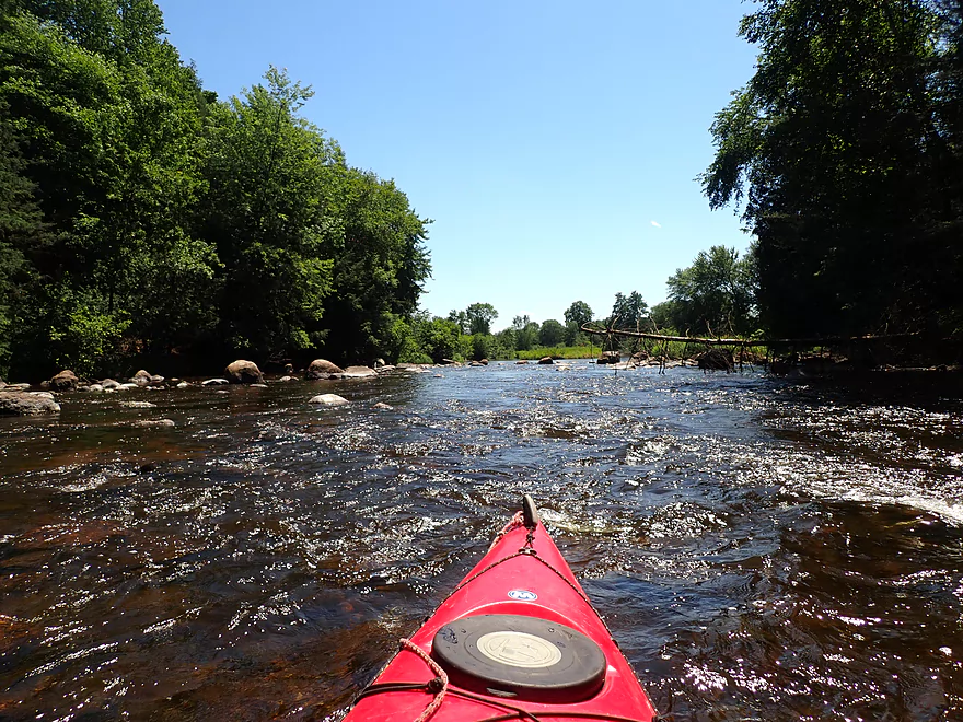
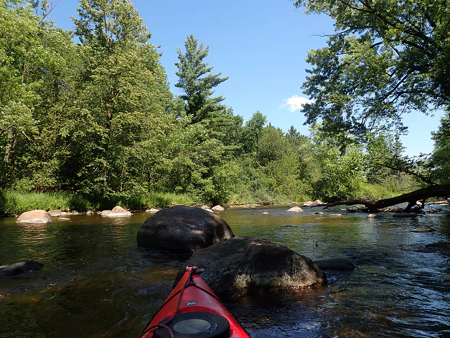
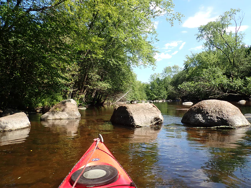
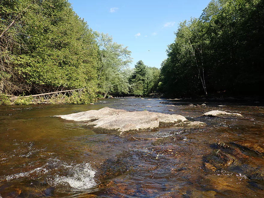
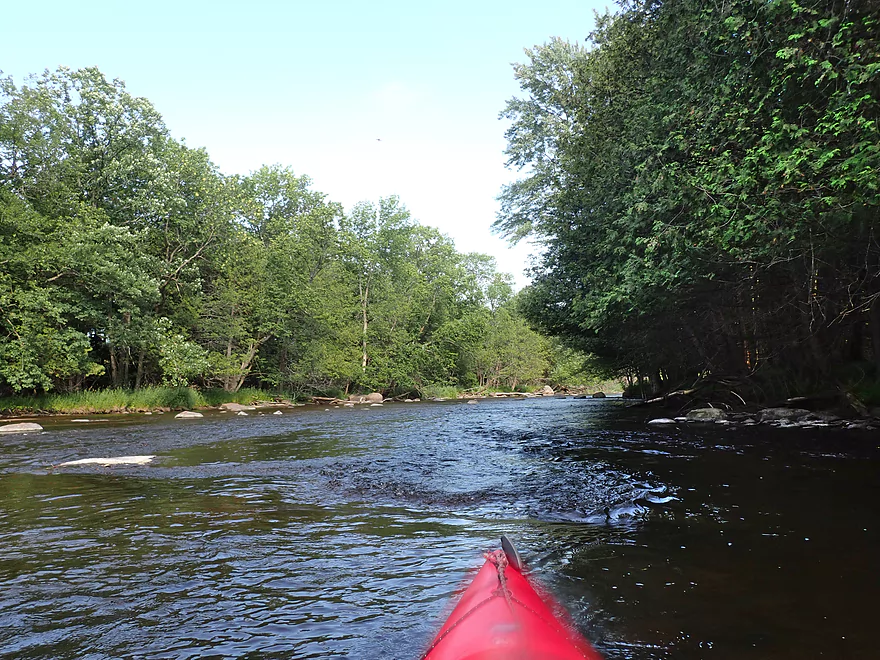
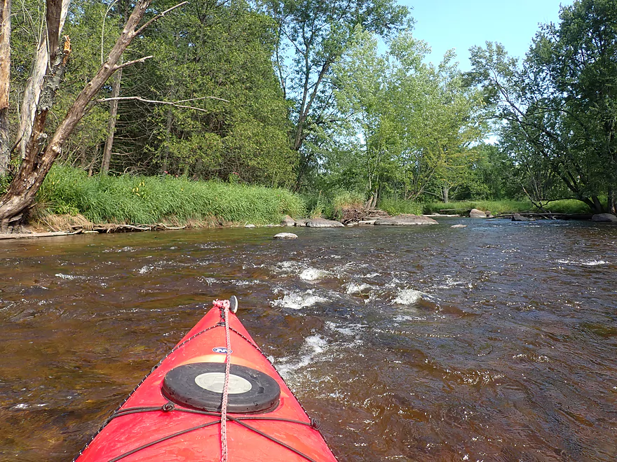
First of many boulder gardens
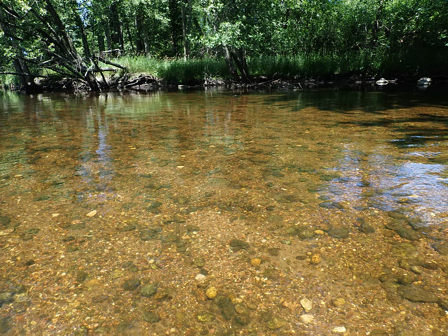
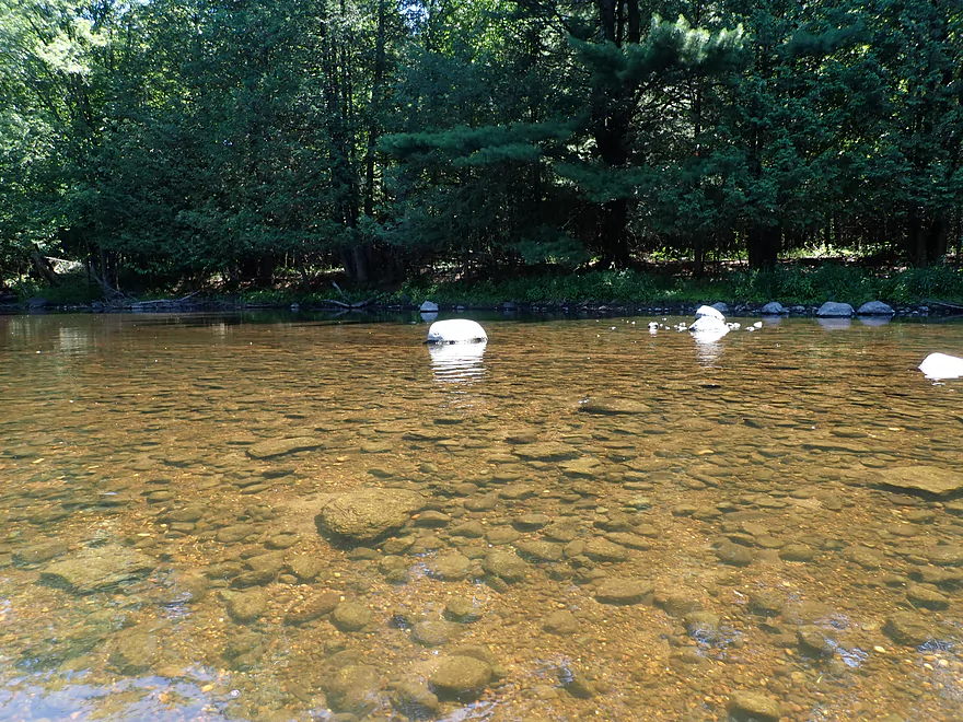
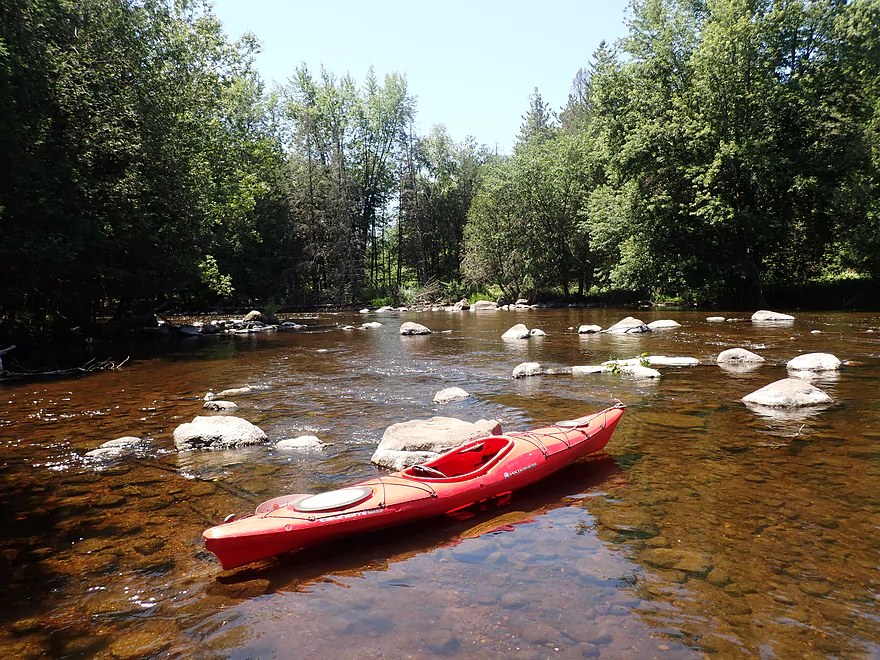
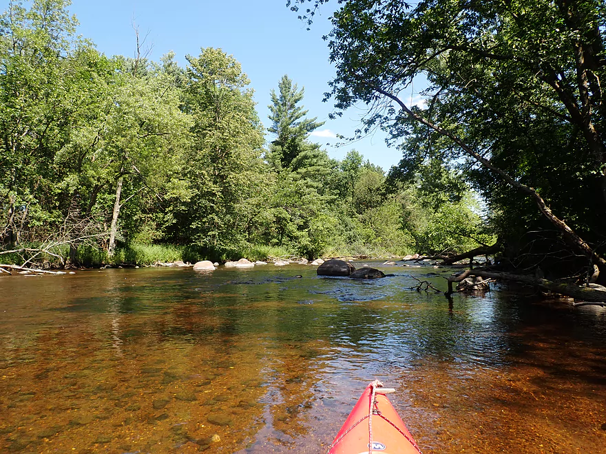
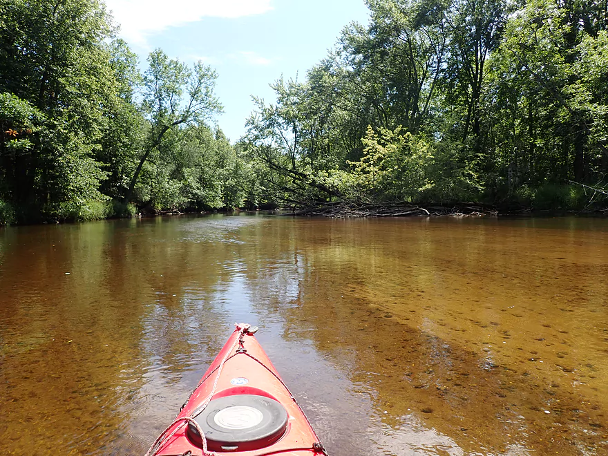
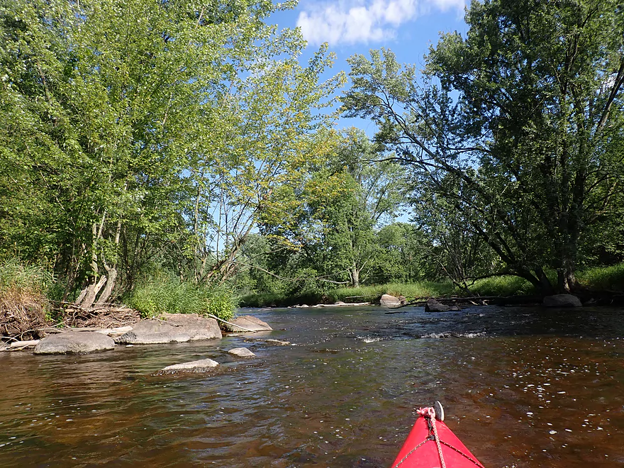
Great clarity
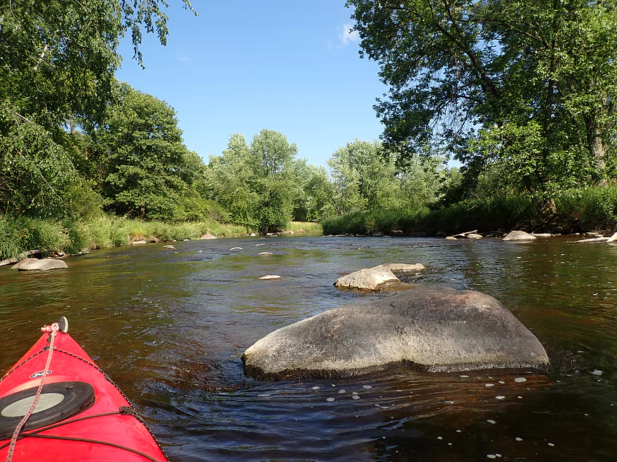
Another boulder garden
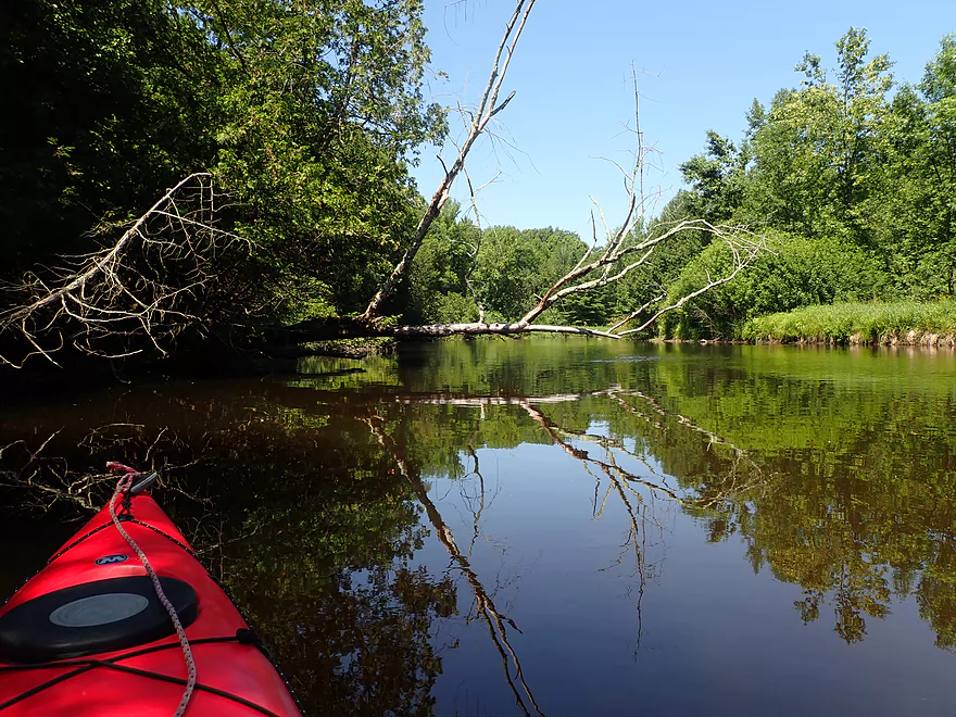
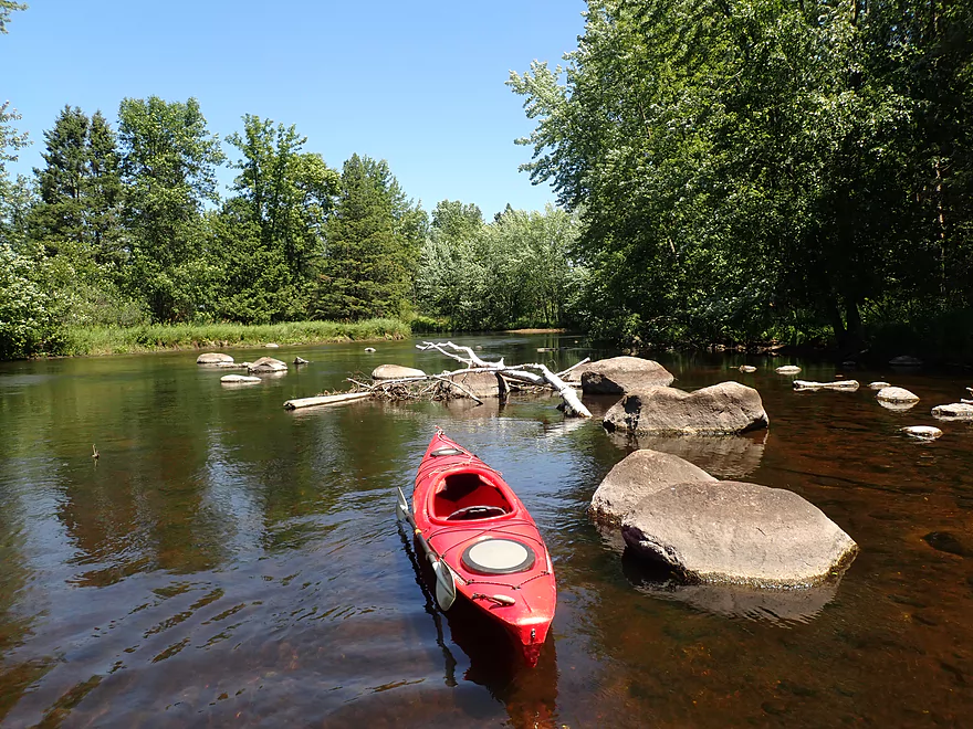
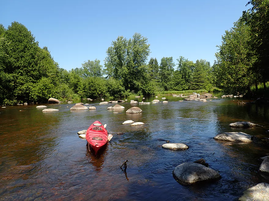
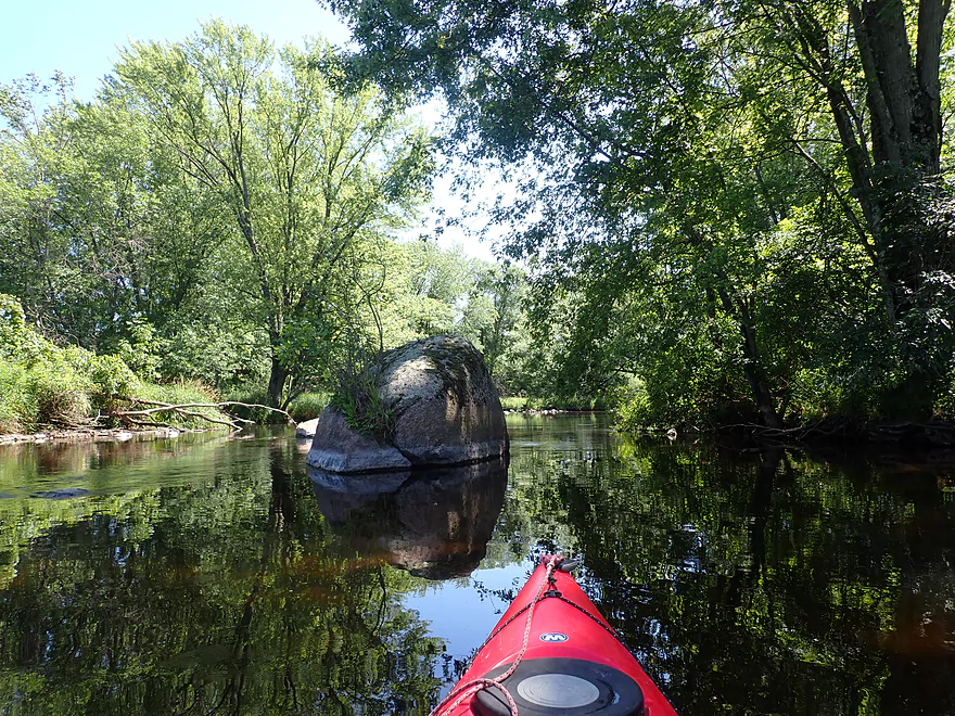
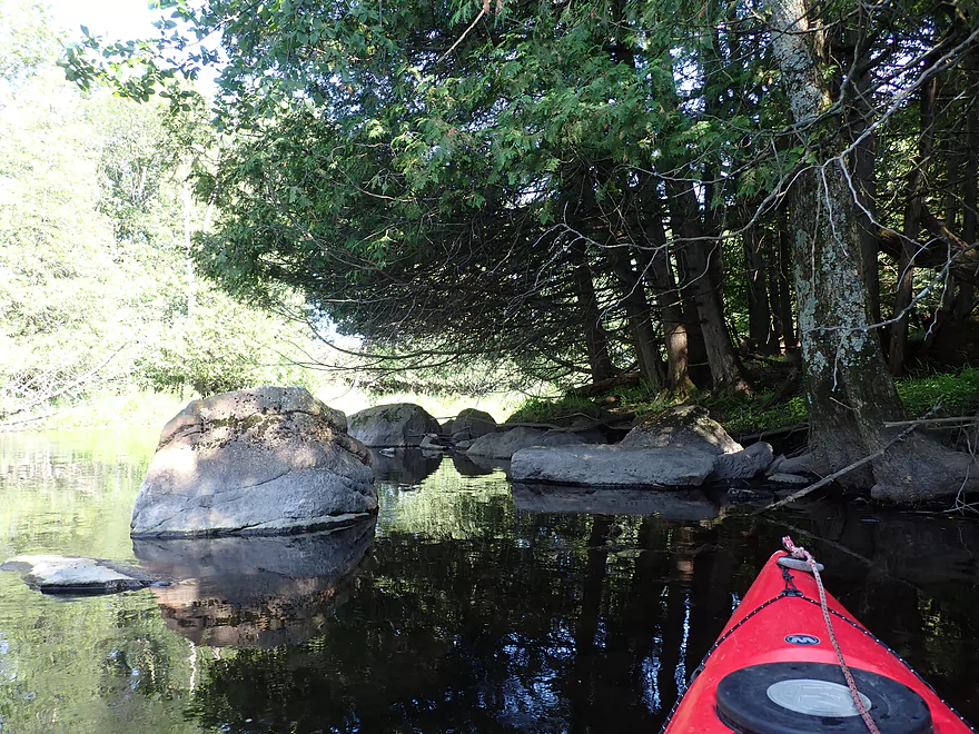
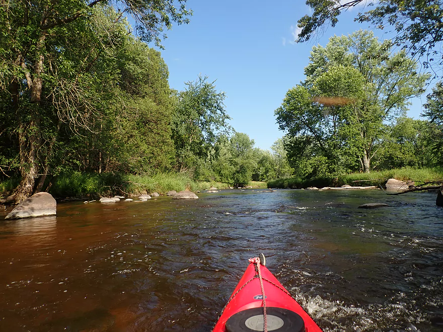
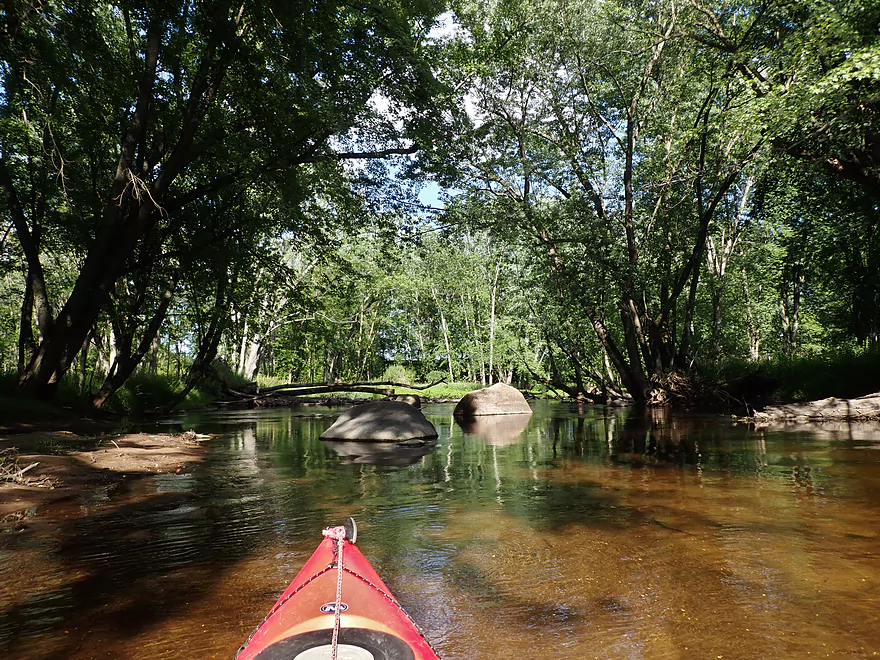
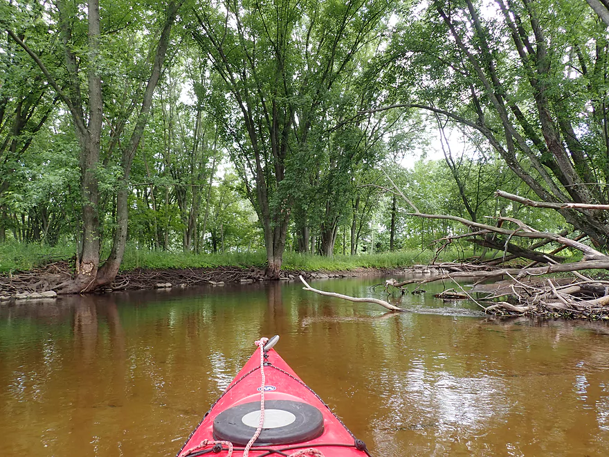
Nice reflection
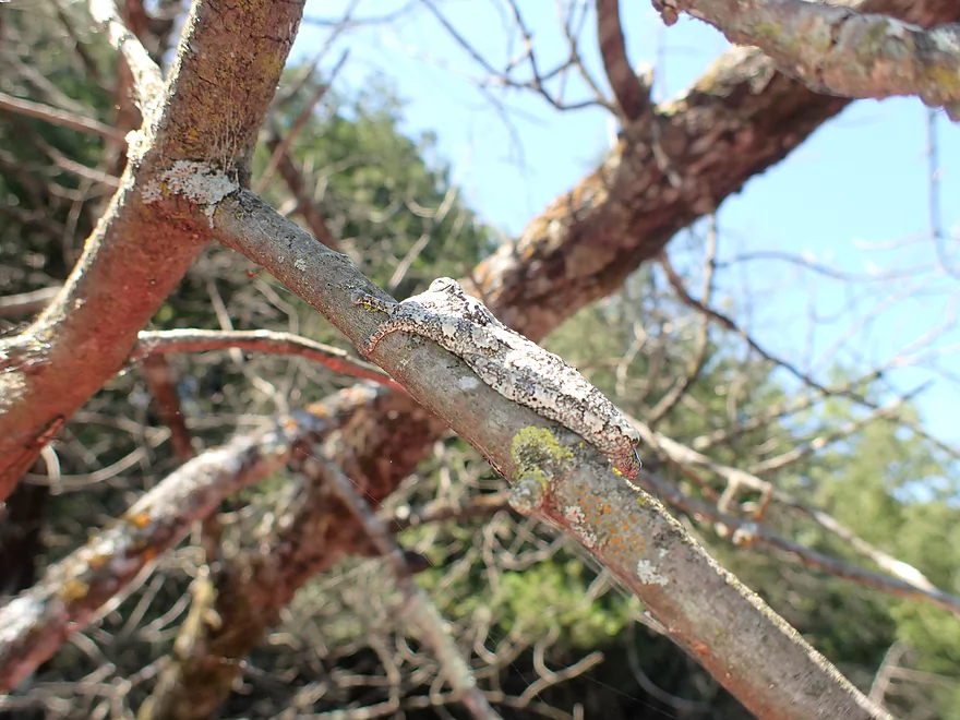
A gray tree frog, which has changed color to match the branch it is on
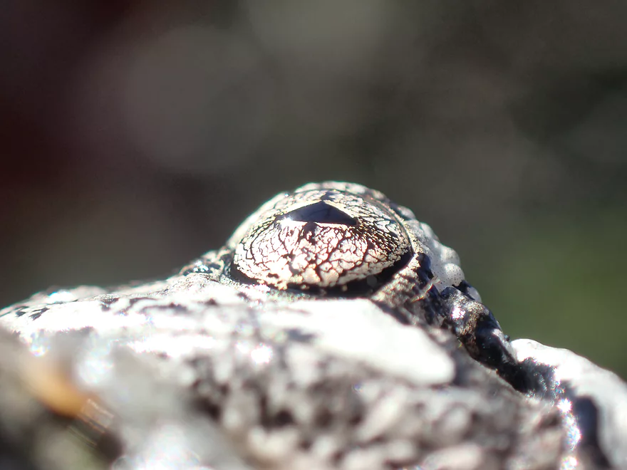
Even his eyes blend in with his background
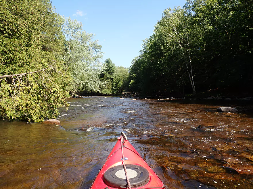
Clarity was fantastic
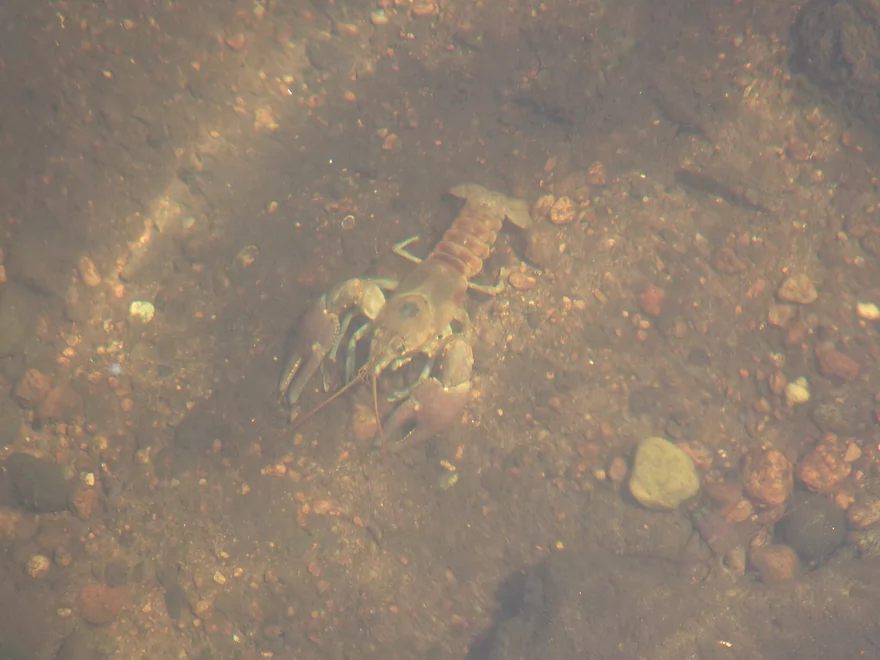
So many crayfish
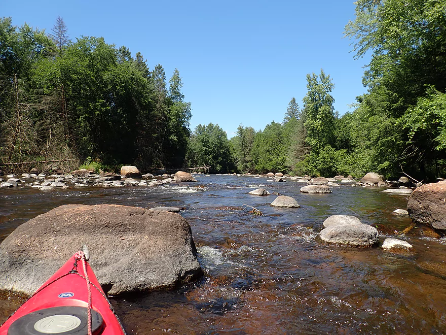
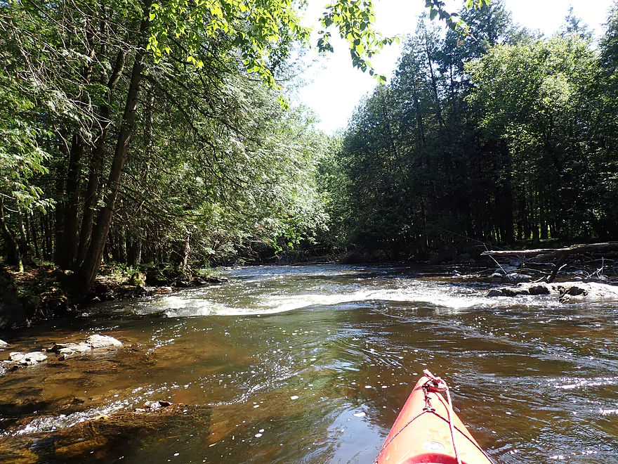
Start of a major boulder garden
Like one long obstacle course
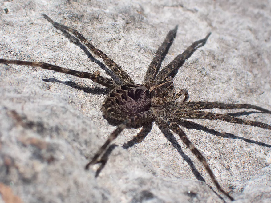
Large fishing spider
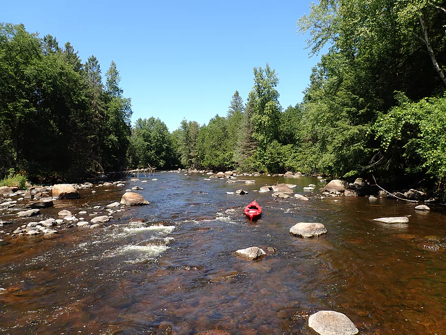
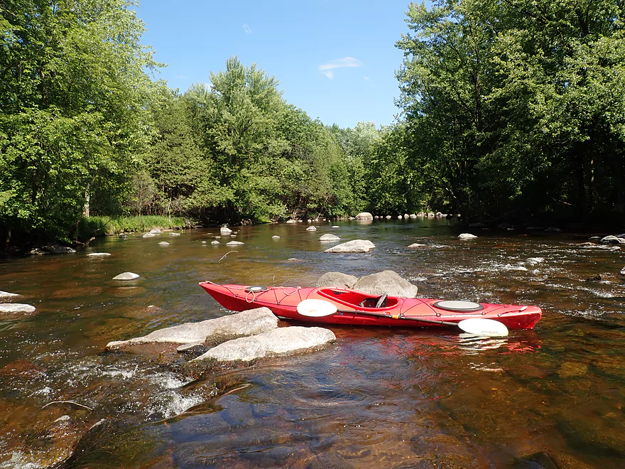
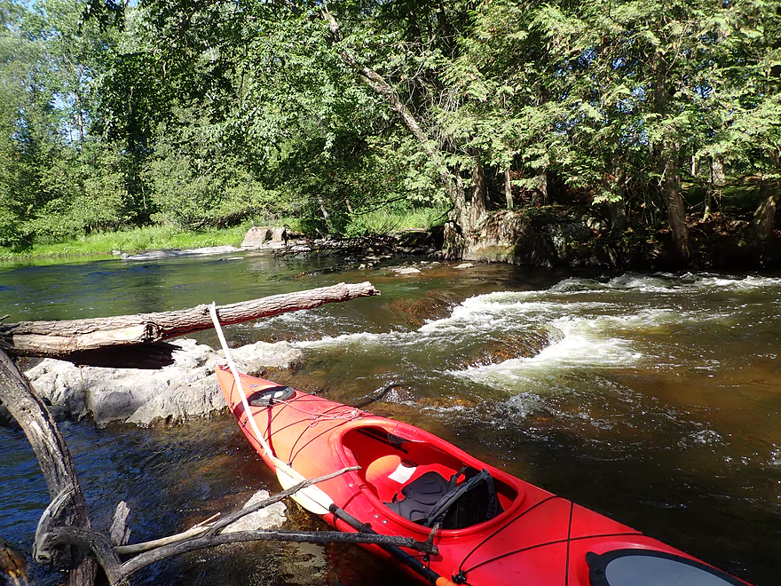
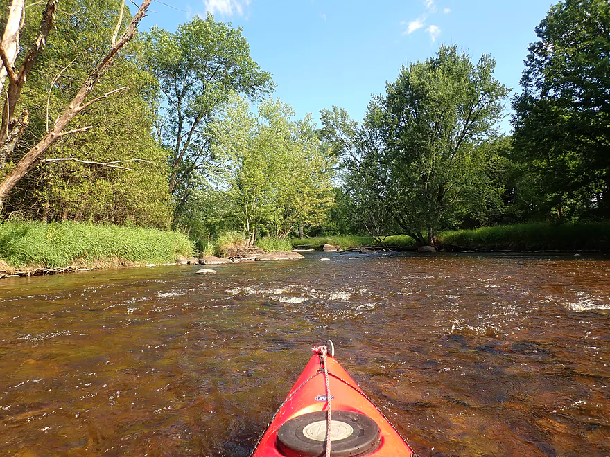
Finally a longer stretch of rapids (only Class 1)
Favorite boulder garden of the trip
Attractive pines and balsam firs in the background
Another smaller garden
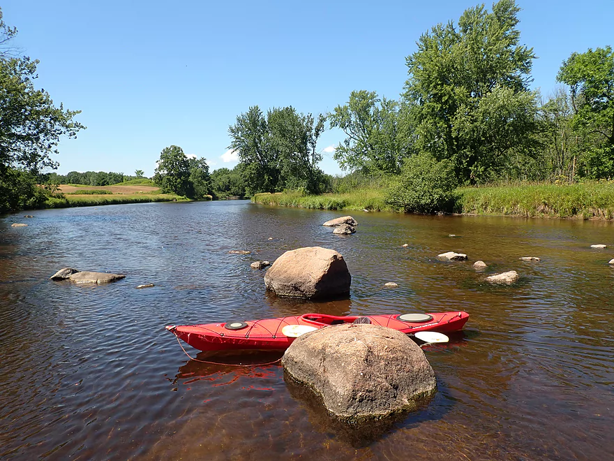
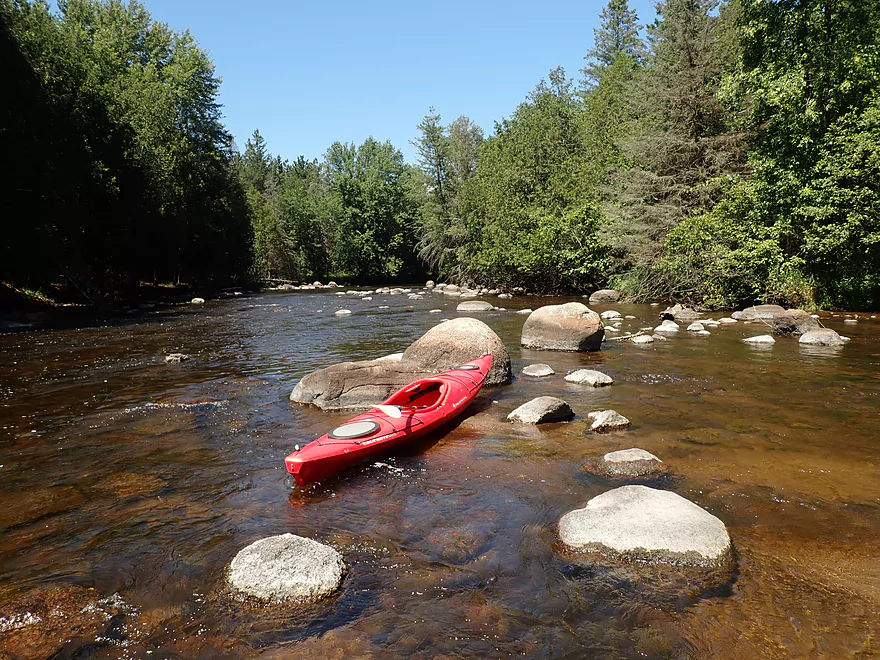
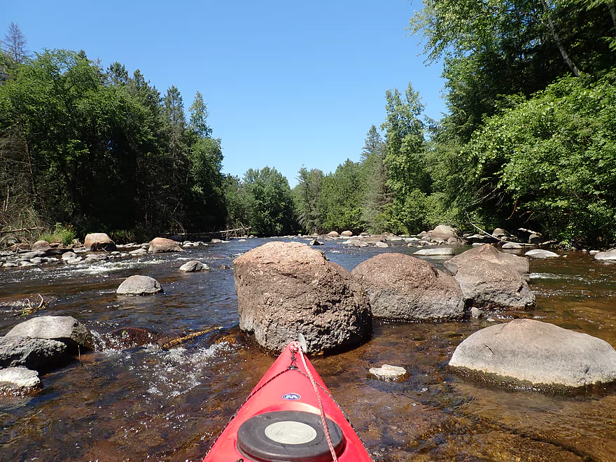
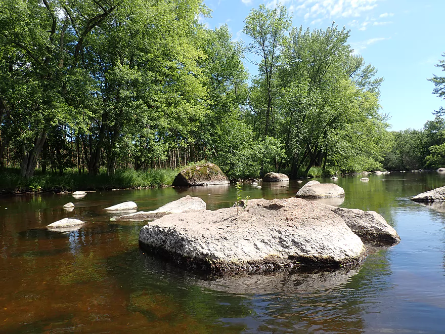
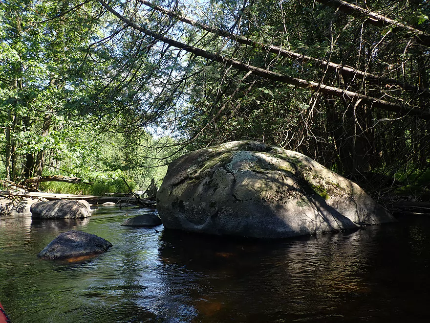
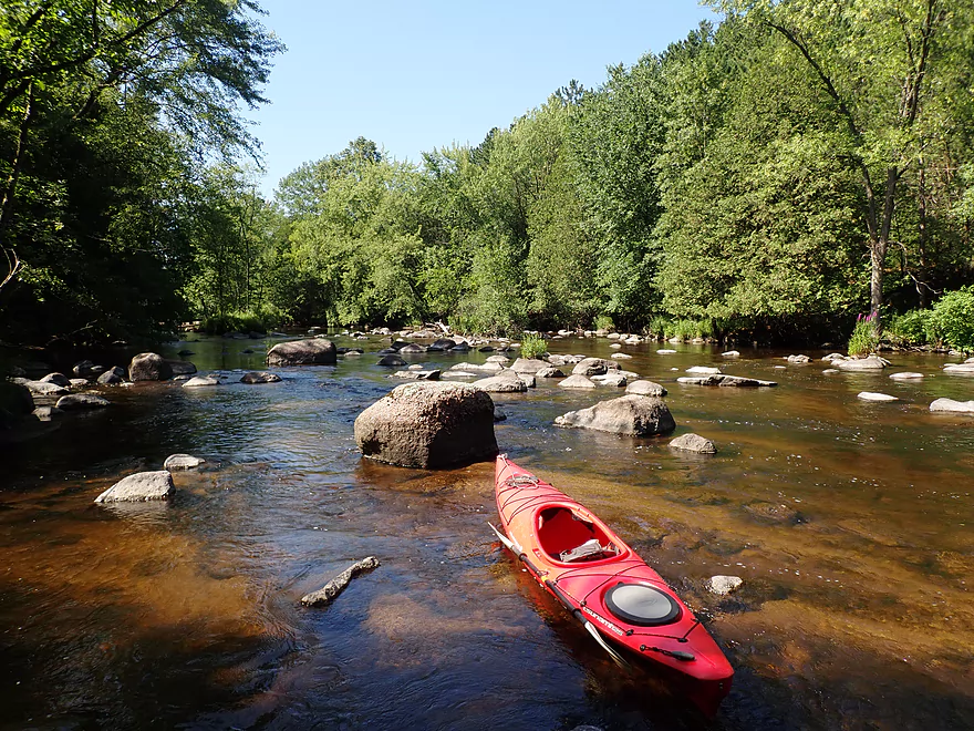
Some of the glacial erratics were quite large
Water had a red hue to it
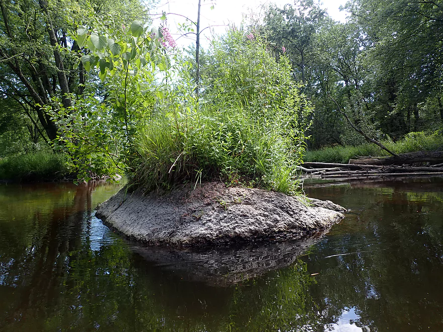
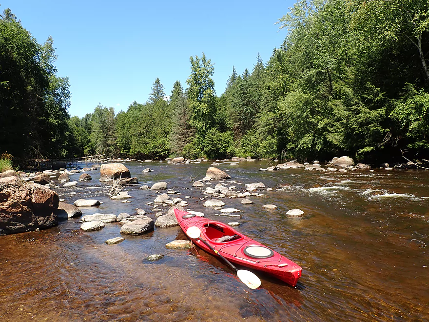
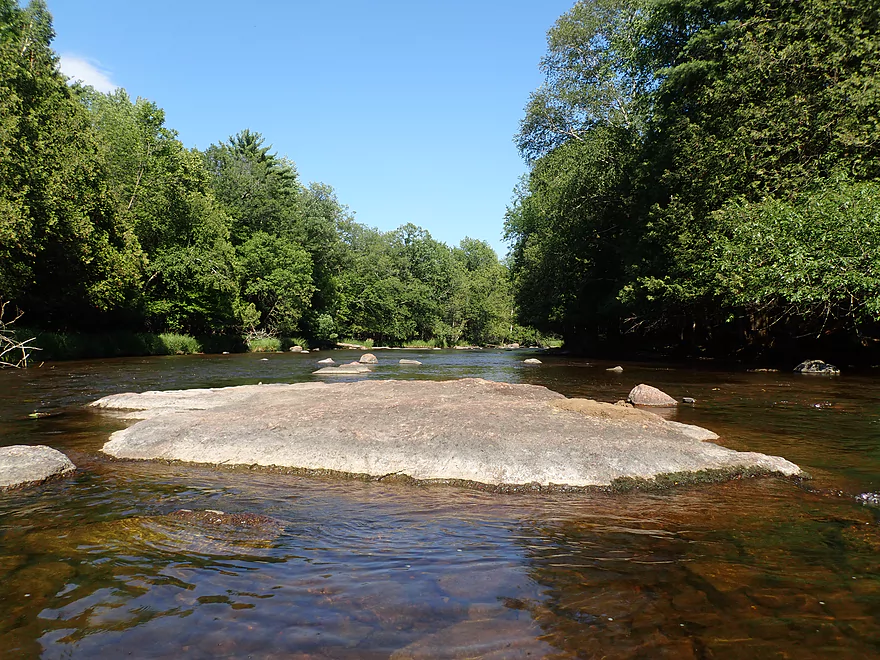
Cute little island
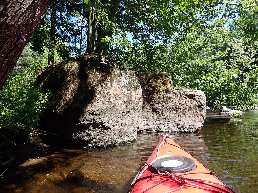
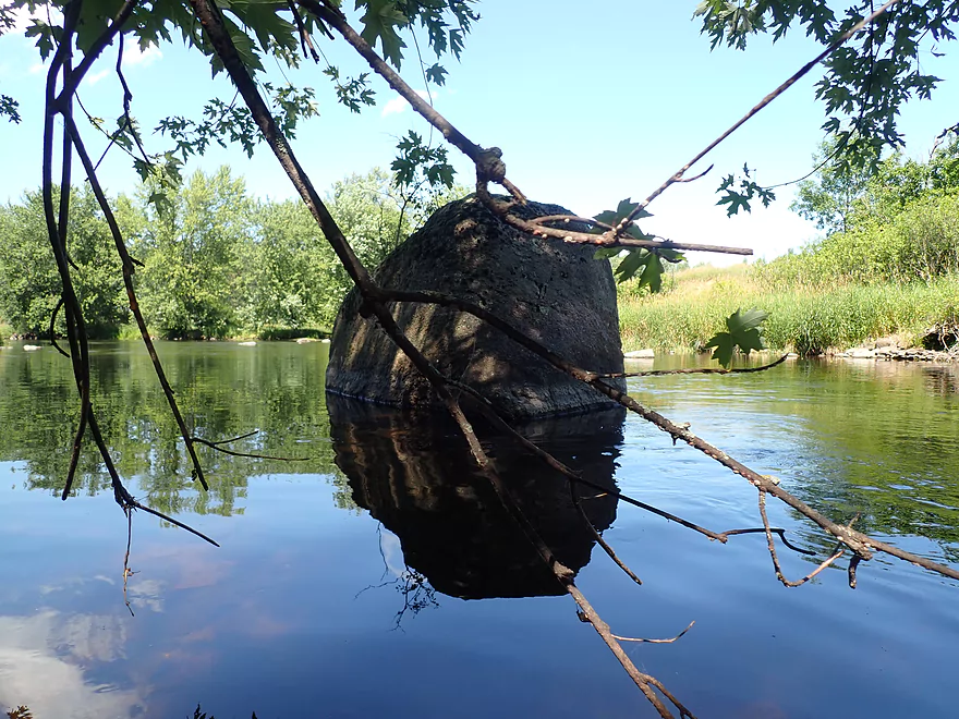
Bilbo’s stone trolls
Easy Class 1 rapids
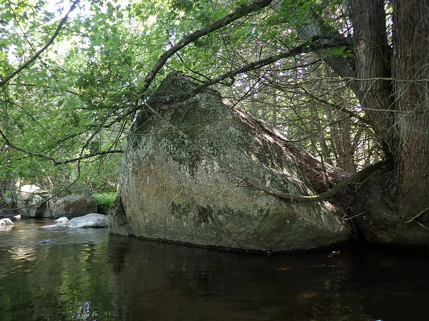
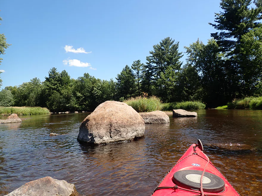
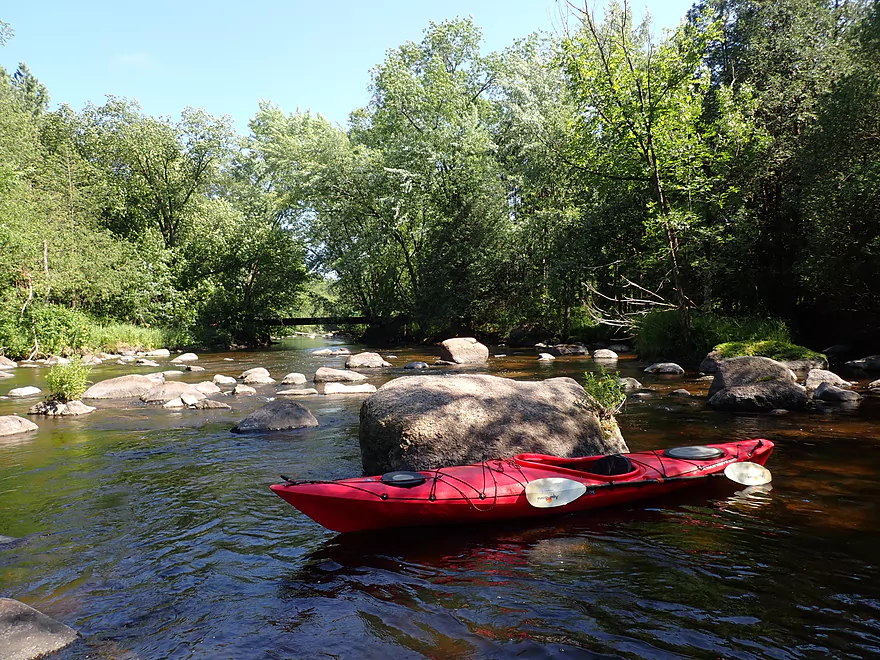
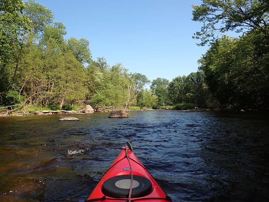
Largest boulder of the trip
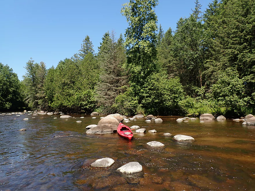
A grove of white cedars
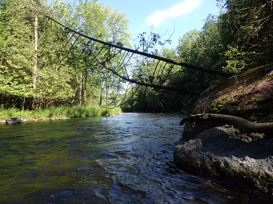
Small but nice outcrop
Fun little ledge
Reverse view
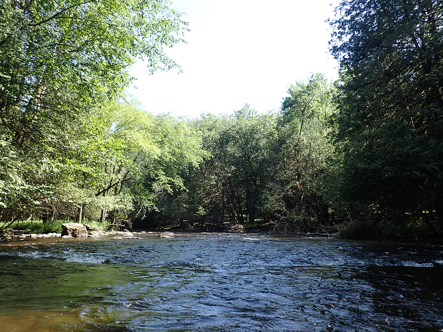
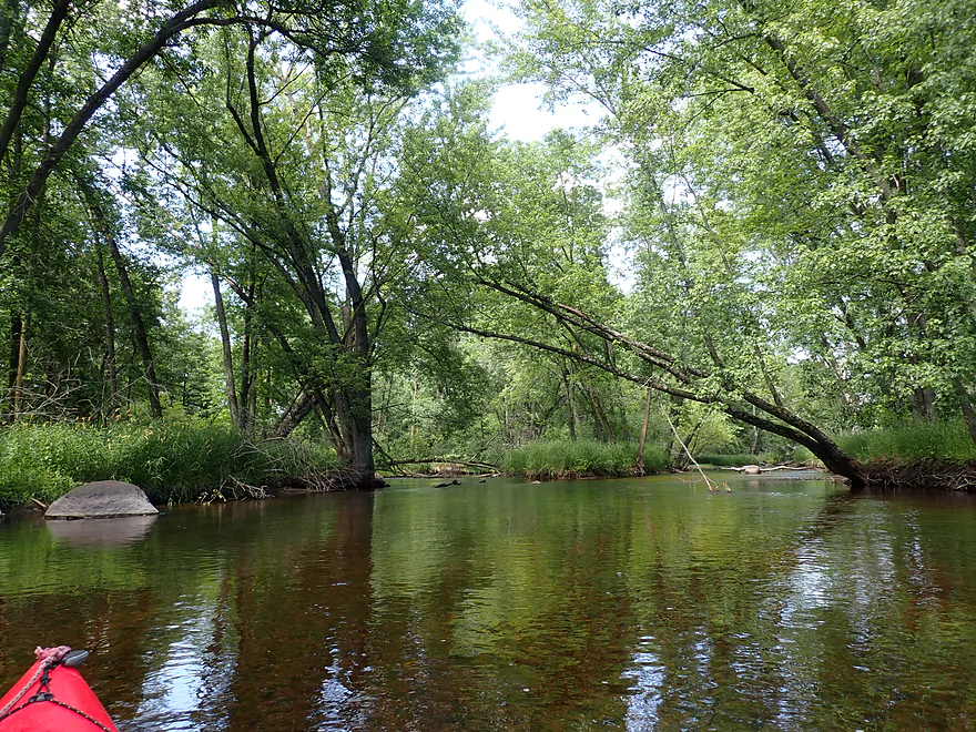
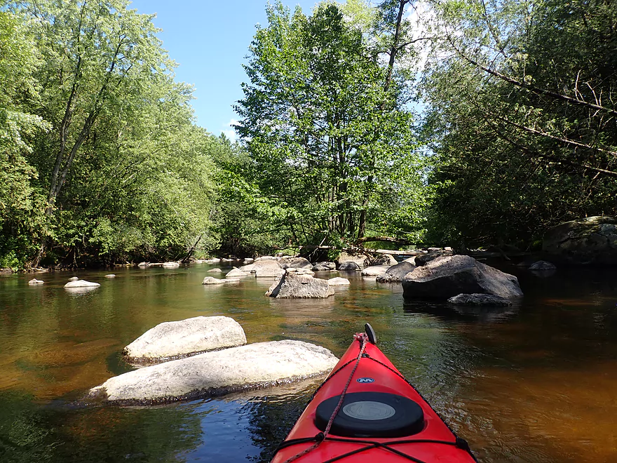
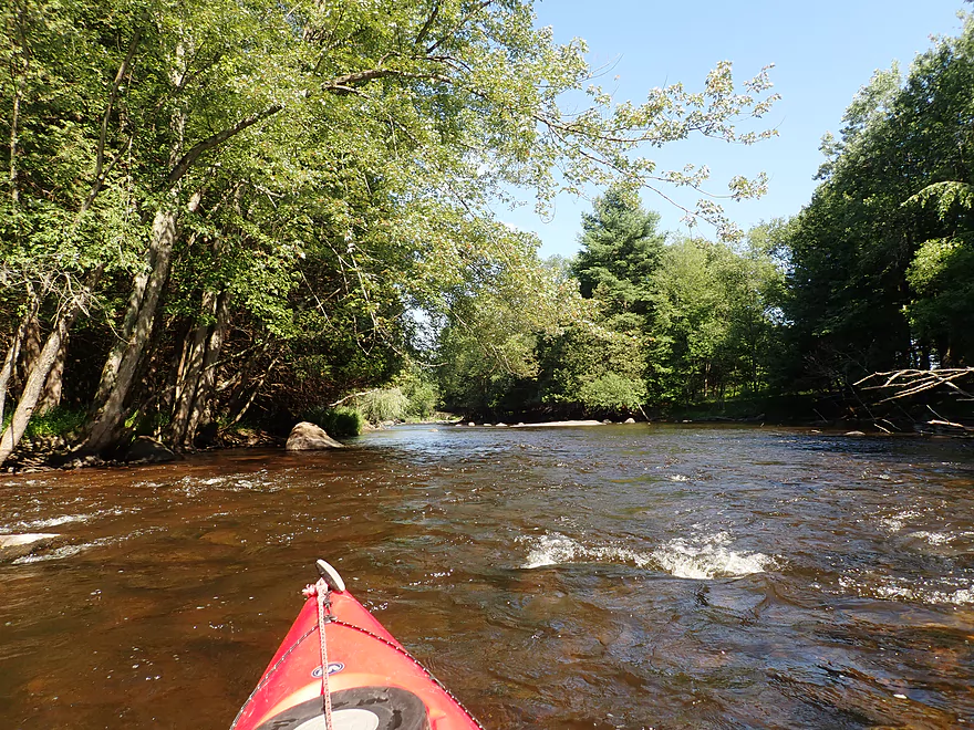
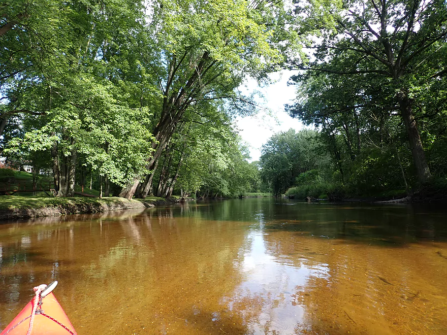
Scenic stretch
Small sandbar
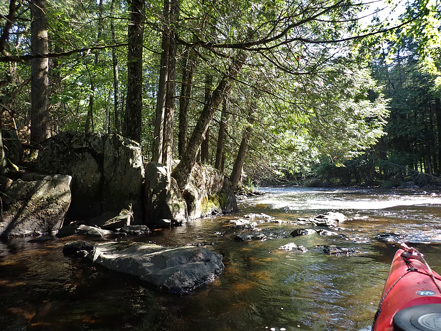
Part of a longer stetch of rapids
Exposed granite bedrock
Last of the rapids
Last of the major boulder gardens
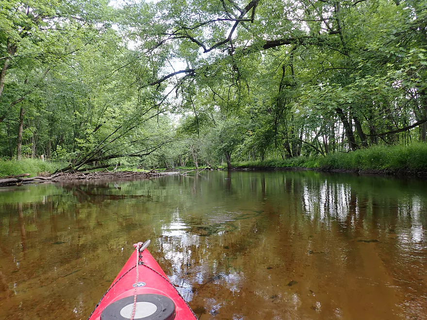
Entering a more wooded stretch
River character really changes…more sand, fewer rocks
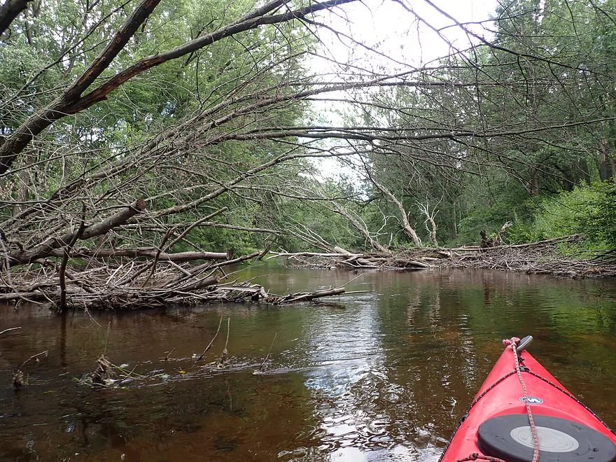
Locals cleared this spot of jams
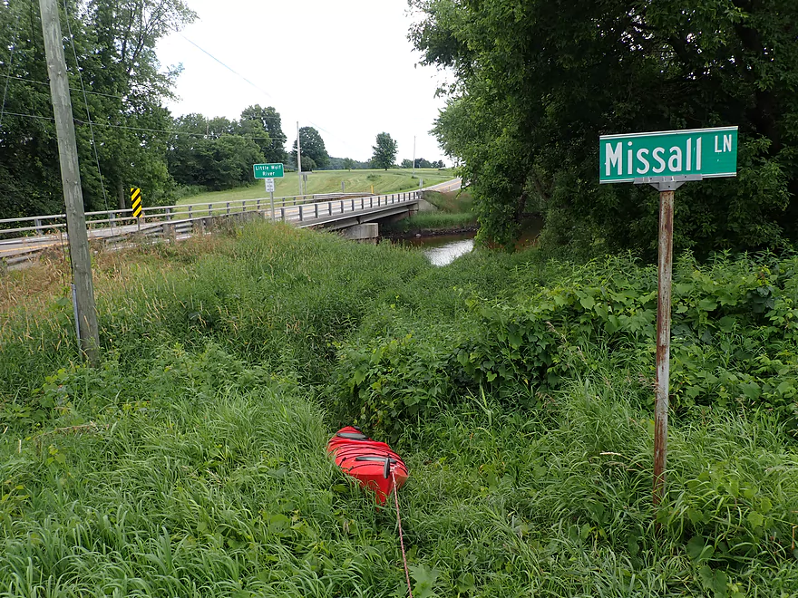
Take-out at the corner of Missall Lane and Hwy 110
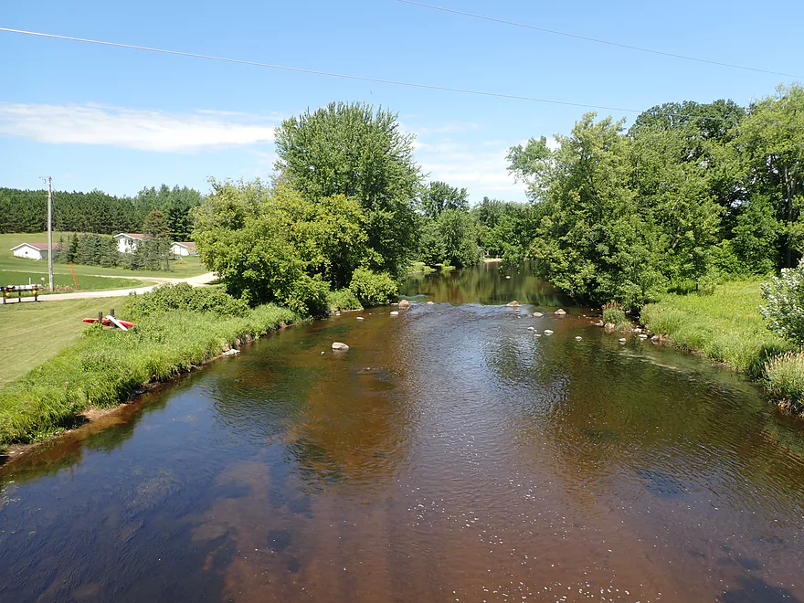
Little Wolf River – Kretchner Road

Located in northeastern Wisconsin, the Little Wolf is a classic for kayaking. Its upper stretches have some of the best Class 2 rapids in the state, while its lower stretch is one of the most popular tubing sections in the state. Few though venture onto its middle section. Last year I did a “middle leg” by Little Falls and that turned out surprisingly nice. The idea for this trip was to do another “middle leg” and to put in where I took out last year.
I launched at Kretchner Road which was a decent bridge access. To be honest, the river to start wasn’t super interesting. Aside from a few minor boulder gardens, there weren’t any major features like rapids or large boulder gardens. The clarity though was fantastic and it was fun to watch all the crayfish zipping about in the clear red water below my boat.
Things would change though at roughly the half-mile mark. Here after a sharp bend, I encountered the largest boulder field of the trip which included a longer stretch of Class 1 rapids. With white cedars growing along the shore, this was incredibly scenic and really reminded me of the Upper Plover.
After that, the river slowed and became less rocky. But from then on boulder gardens would become common and I lost count of the number I paddled through. This included some with huge boulders which I suspected were glacial erratics.
The boulders were great, but the rapids were disappointing. The upper Little Wolf is famous for its rapids, but while this leg had a number, most were short and very minor. This changed a bit after the farm bridge. Here the river narrowed and was constricted by scenic white cedars. An easy half-foot ledge was fun to scoot over, and this was followed by a half mile of entertaining and almost continuous Class 1 rapids. This would be the second most scenic part of the trip.
Once the river approaches Missall Lane things change dramatically as most of the boulders and gravel disappear. Here the river flowed through a large hardwood forest with a clear sandy substrate. Locals had cleared out what otherwise would have been logjams, which was appreciated. I ended the trip at Hwy 110 where a local trail led to shoulder parking on Missal Lane.
In summary, this trip wasn’t as good as upstream legs (Wolf River Road to Big Falls or Big Falls to Kretchner Road). Those stretches have exciting whitewater stretches which this leg lacked. This trip though did have fantastic boulder gardens and was quite a bit less crowded than other parts of the Little Wolf (I only saw one truck parked at the take-out). IMO this would be a good beginner stretch for rec paddlers wanting to introduce themselves to the Little Wolf before they tackled a more difficult upper leg.
Sights included clams, dragonflies, many snail shells, a few decent-sized fish, and a few eagles. The highlight was all the crayfish. They were everywhere and plentiful…the most I’ve ever seen on a paddling trip.
Kretchner Road: This is a decent bridge access. An open grassy area leads to the water where I believe most paddlers park. Note the grassy area is likely not within the DOT right-of-way and may be private, so you might want to park closer to the bridge instead. Also note, there is a fire hydrant here which your car shouldn’t block.
Alternate Put-ins:
- Little Falls Park (3.0 miles upstream from Kretchner): This is a great put-in and would be a terrific add-on leg. Below the park are fantastic boulder gardens and rapids. This includes Class 3 (“Little Falls”) which runs through a gorge.
- Wall Street/Big Falls (4.4 miles upstream from Kretchner): This is also a good public access. The route would be the above^ plus a few more epic boulder gardens.
Hwy 110: A fishing trail leads from the northwest bank to the shoulder on Missall Lane. This is a decent bridge access, but shoulder parking is a bit tight (on either Missall Lane or Hwy 110).
Alternate Take-outs: None really. I mean you could continue a long 8 miles to Symco, but that stretch is more sandy with fewer boulders. It also likely has a number of downed trees.
Bike Shuttle Route – Kretchner Rd to Hwy 110: 4.1 miles with 59′ of ascent. This is mostly a nice rural bike shuttle with little traffic and only minor hills. It was a bit miserable for me though as I pedaled into a strong headwind.
Rental/Shuttle – Big Falls Kayak Rentals: I don’t know much about this business, but I think they service this leg of the river. They can be contacted at 715-846-0078. Note, one report I just read indicated they might now be permanently closed.
Logjams: None
Current/Rapids: This current is mostly lazy with a few riffles. There are a few stretches of rapids, but nothing significant and nothing I would rate as stronger than Class 1. This is a good Little Wolf stretch for beginners.
Trip done at 1.33′ per the Royalton gauge located downstream on the river. Note, I don’t trust this gauge because it is located too far downstream and is influenced by a dam.
- 0-1.21′: The river rarely gets this low, but when it does paddlers can enjoy great clarity. A handful of sections might have to be waded though.
- 1.21′-1.5′: An average later summer depth good for paddling and having good clarity. This is likely a decent depth, but some of the rapids will be bumpy. At 1.33′, I did “ground out” a few times but mostly because I was taking pictures. With good navigation you should be able to mostly avoid the seriously shallow spots.
- 1.5′-1.7′: River is above normal. Clarity isn’t as good but most rapids will be well padded. Last year I did Little Falls at 1.63′ which wasn’t a bad depth.
- 1.7′-2.4′: A high depth only suitable for experienced paddlers.
- 2.4’+: Perhaps too high for enjoyable paddling.
Detailed Overview
- Wolf River Road to Ness Road: (3.0 miles) Very narrow, heavily wooded, shallow in spots, and very rocky. Maybe 2 logjams. This is an intriguing prospect on my todo list.
- Ness Road to Wolf River Road: (2.5 miles) A good trip with clear water, boulders, and a few easy rapids.
- Wolf River Road to Big Falls Dam: (7.7 miles)
- Wolf River Road to Hwy J: (3.6 miles) Scenic section with some strong Class 2 whitewater. Good put-in.
- Hwy J to Big Falls: (4.1 miles) Also scenic and with whitewater, with perhaps a Class 3 by the Dells. Good launch by Hwy J.
- Big Falls Dam to Big Falls Powerhouse: (700') This is a steep chute of exposed granite that can create Class 4 rapids when it has sufficient water. But typically the dam penstock robs Big Falls of 99% of its flow. Access to the top of the falls is available from either the east or west shore.
- Big Falls Powerhouse to Kretchner Road: (4.4 miles)
- Big Falls Powerhouse to Little Falls Park: (1.7 miles) This is a good stretch with the highlight being a 2000' stretch of rapids.
- Little Falls Park to Hwy C: (0.3 miles) Features a Class 2 under a bridge, and then a 1500' stretch of boulders and Class 1 rapids. Hwy C isn't a great bridge access.
- Hwy C to Kretchner Road: (2.7 miles) Just below Hwy C is a series of rapids including a Class 3 that runs through a scenic gorge. After that the river slows down and becomes less interesting
- Kretchner Road to Hwy 110: (4.3 miles) A great leg with many scenic boulder gardens. Rapids on this stretch are mild and suitable for beginners. While nice, this leg isn't as terrific as Little Falls or Big Falls legs located upstream.
- Hwy 110 to Hwy 22/Symco: (8.0 miles) Unimproved bridge put-in but should be ok. This section likely has some deadfall issues (not sure how much though).
- Hwy 22/Symco to Manawa Dam: (5.9 miles)
- Hwy 22/Symco to Bridge Road: (2.0 miles) Looks like a nice section with some rapids and boulder gardens near Symco. Good put-in at Symco.
- Bridge Road to Manawa Dam: (3.9 miles) Likely a mediocre section with some flowage paddling at the end. Some of the flowage paddling can be avoided by taking out at Waupaca Park. Bridge Road is a good put-in.
- Manawa Dam to Road Bb: (3.9 miles)
- Manawa Dam to Hwy B: (1.9 miles) Honestly an uninteresting section with slow current and bland flood-bottom woods. Aquatic weeds are an issue (thanks to the Manawa Septic plant). River does get a bit more interesting after the railroad tracks and features a small boulder garden.
- Hwy B to Hwy 110/B: (0.9 miles) A good stretch with some boulder gardens and good clarity. There are Class 2 rapids by the "Rapid View" island.
- Hwy 110/B to Road Bb: (2.1 miles). A great stretch with several impressive boulder gardens and a few minor rapids.
- Road Bb to Hwy X: (7.6 miles)
- Road Bb to Royalton: (3.5 miles) Very good put-in. Nice clarity and boulders until the South Branch joins (almost doubling the river). Very nice boulder garden and rapids 2/3rds in.
- Royalton to Ostrander: (2.7 miles) After the brief rapids under Hwy 54/O, the Little Wolf goes back to sleep, with pleasant but monotonous scenery (the highlight being sporadic boulders). Finally, maybe a half mile prior to Ostrander Road, there is another set of rapids (Class 1) and an attractive boulder garden. Paddlers will have to deal with many tubers.
- Ostrander Road to Hwy X: (1.4 miles) Busiest tubing section probably in the state. Very nice boulder gardens and rapids at end. Public landing NE of Ostrander Road.
- Hwy X to the Mouth (Junction at Wolf River): (2.0 miles) Part of the Mukwa Bottomland Forest SNA
- Mouth to Dey Road/Shaw Road Boat Ramp: (0.8 miles) A short stretch on a now large Wolf River.
Trip Map
Overview Map
Video
Photos Size: