
Pecatonica River – East Branch
The East Branch is a solid river for paddling. As a general rule the further upstream you go, the better the scenery…but also the greater the likelihood of logjams.
Trip Reports
Hwy 39 Bridge to Horseshoe Bend Road
Date Paddled: August 9th, 2014
Distance: 7.4 Miles
Time: 4 hours 35 minutes
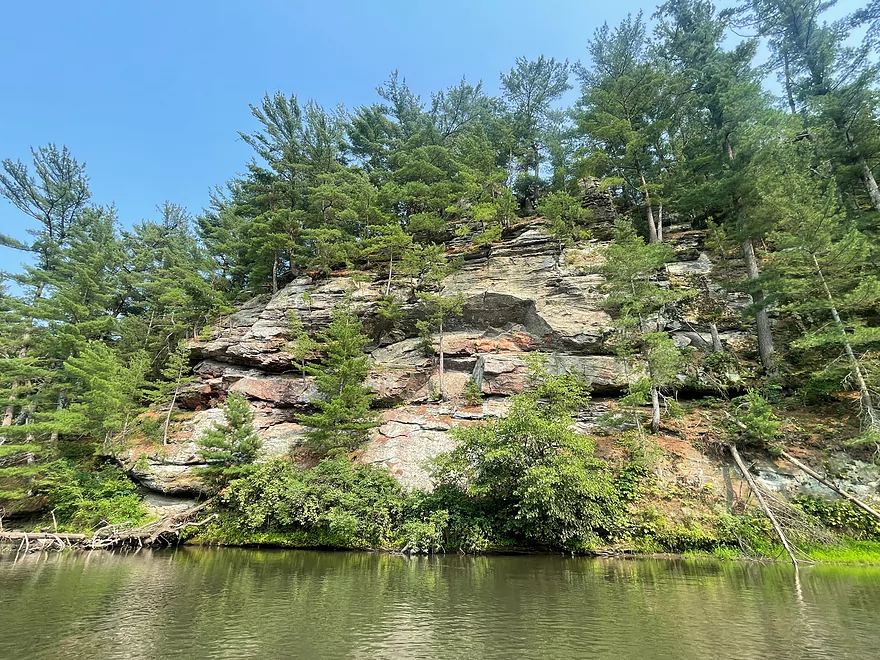
An underrated prospect located 40 minutes southwest of Madison, with nice plantlife and tree canopies, but most of all, some splendid rock bluffs. There is a decent chance you haven’t heard of the East Branch of the Pecatonica River, as many paddle review sources do not cover it. This is odd…but kind of a consistent […]
Read More...Horseshoe Bend Road to Gordon Creek Landing
Date Paddled: May 18th, 2025
Distance: 3.6 miles
Time: Expect 1-2 hours
This is a less interesting section of the East Branch that lacks the river's iconic rock outcrops. It's not bad though, and may appeal to locals who want to paddle through Blanchardville. But most other kayakers will prefer other stretches of the river.
Read More...Blanchardville Dam to Hwy 78
Date Paddled: September 18th, 2021
Distance: 3.8 miles
Time: Expect 2 hours
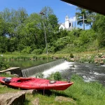
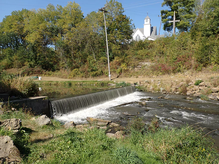
This is a weaker stretch of the East Branch, but it wasn't a bad paddle. It's most memorable feature was the Blanchardville dam at the put-in which is photogenic.
Read More...Hwy 78 to River Road Landing
Date Paddled: September 30th, 2023
Distance: 6.2 miles
Time: Expect ~3 hours
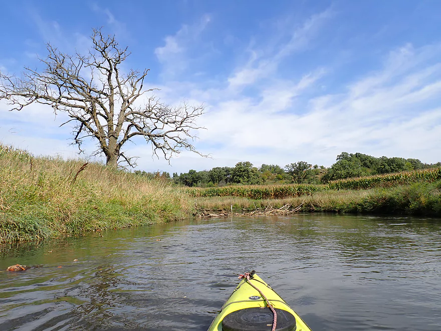
A pleasant stretch with open scenery, Driftless Area hills, and a handful of rock outcrops. On the downside some sections are a bit boring and open pasture has degraded parts of the river.
Read More...River Road to Argyle Boat Landing
Date Paddled: July 16th, 2023
Distance: 7.2 miles
Time: 3.25 hours
A guest review for a scenic stretch of the East Branch which features impressive outcrops.
Read More...River Road in Argyle to Hwy M in Woodford
Date Paddled: July 22nd, 2023
Distance: 9.2 miles
Time: 3.5 hours
A guest review for a scenic stretch of the East Branch between Argyle and Woodford.
Read More...Overview Map
Detailed Overview
- Upstream of Hwy HK: Too many logjams to recommend.
- Hwy HK to Burma Road: 1.3 miles. An ok prospect with perhaps some obstructions.
- Burma Road to Star Valley Road1st: 2.0 miles. An interesting prospect with good scenery and not too many logjams.
- Star Valley Road1st to Hwy 39: 3.1 miles. Good scenery potential but too congested.
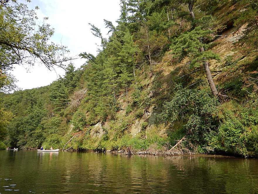
- Hwy 39 to Horseshoe Bend Road: 7.6 miles.
- Hwy 39 to McKenna Road: 3.9 miles. A pleasant section with a rock outcrop near the take-out.
- McKenna Road to Horseshoe Bend Road: 3.7 miles. Another pleasant section with a massive rock wall.
- Horseshoe Bend to Blanchardville Dam: 3.6 miles. This is a less interesting section of the East Branch that lacks the river's iconic outcrops. It's not bad though, and may appeal to locals who want to paddle through Blanchardville. But most other kayakers will prefer other stretches of the river.
- Blanchardville Dam to Hwy 78: 3.9 miles.
- Blanchardville Dam to Gordon Creek Landing: 0.3 miles. A short, but pleasant stretch through the outskirts of Blanchardville.
- Gordon Creek Landing to Hwy 78: 3.5 miles. While not bad, this is one of the less interesting stretches.
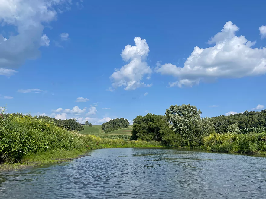
- Hwy 78 to River Road: 6.4 miles. A pleasant stretch with open scenery, Driftless Area hills, and a handful of rock outcrops. On the downside some parts are a bit boring and open pasture has degraded some of the river.
- River Road to Argyle Boat Launch: 7.4 miles. A good stretch with impressive outcrops.
- River Street in Argyle to Hwy M in Woodford: 9.3 miles.
- Argyle River Street to Blackhawk Memorial Park: 8.3 miles. No outcrops and a lot of farm scenery. Not as nice as previous sections but still decent.
- Blackhawk Memorial Park to Hwy M: 1.0 miles. Section includes a very large island. You must take the east channel to reach the access on M.
- Hwy M to Cisserville Road: 6.4 miles. Probably uninteresting.
- Cisserville Road to Mouth: 2.2 miles. Probably a weak prospect.
- Mouth to Hwy 11: 3.2 miles. A leg on the Pecatonica River (main branch) to reach a take-out.
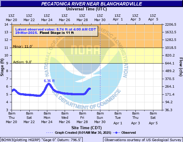
Nearby Guages
Videos
Bonus video below of butterflies siphoning minerals from mud and beating their wings as a hydraulic mechanism.