
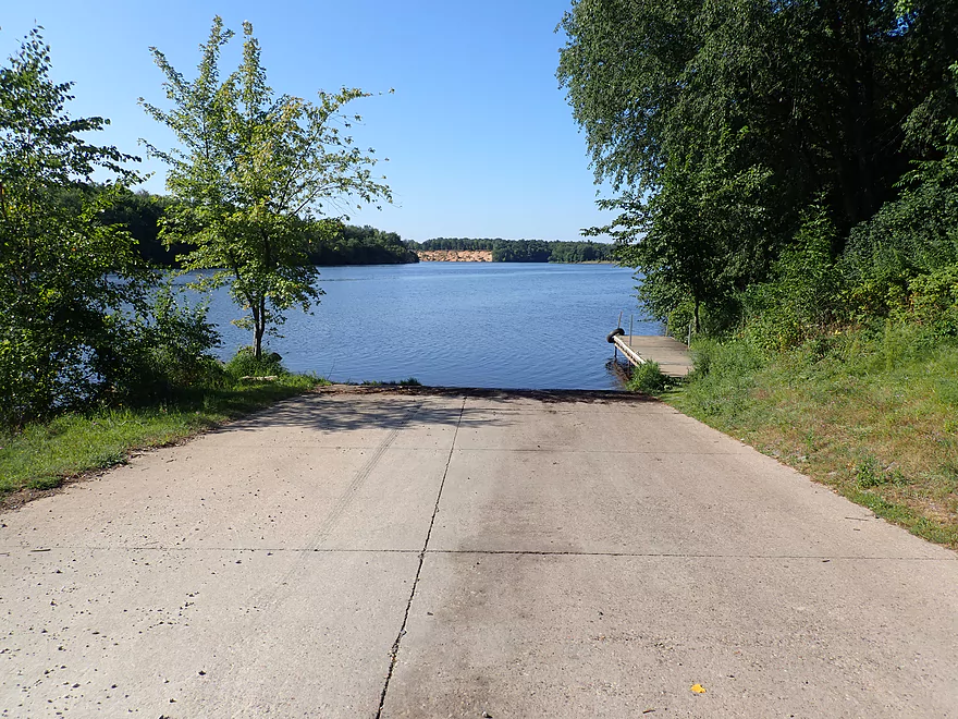
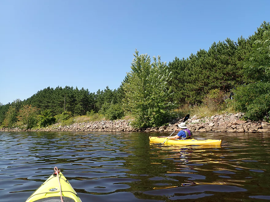
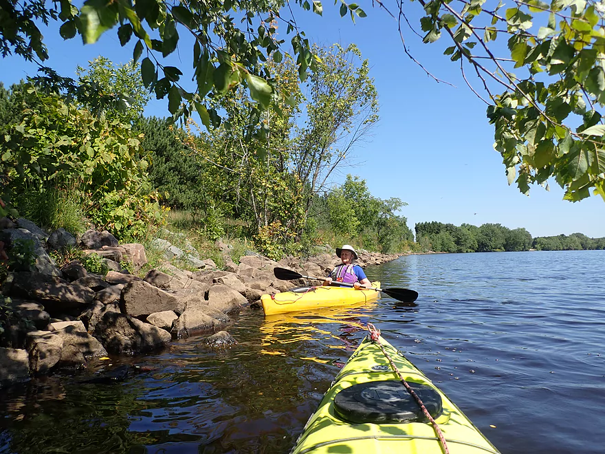
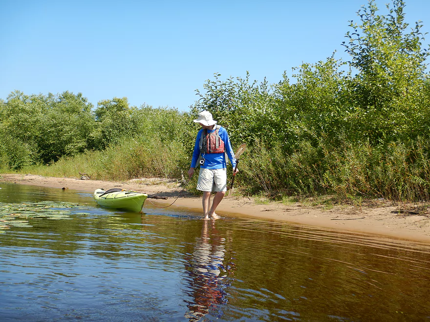
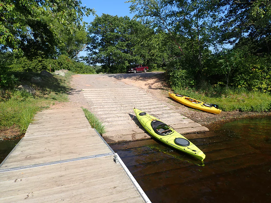
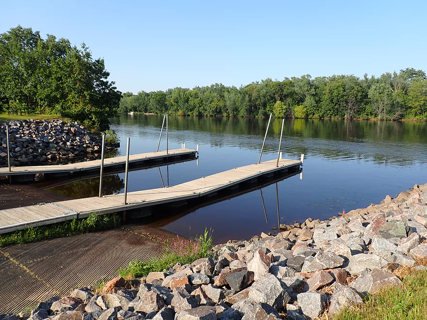
Putting in at the Plank Hill boat launch
Nice access
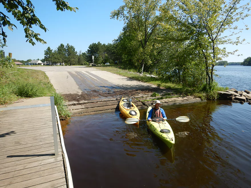
You can also launch from the adjacent sand pit
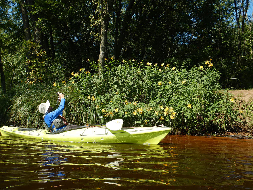
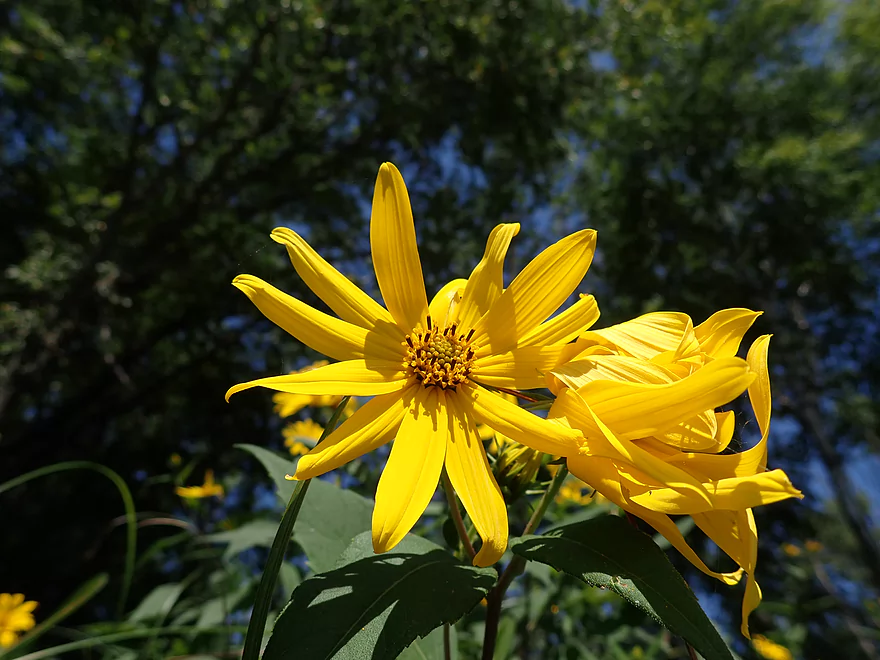
A bank of wild sunflowers
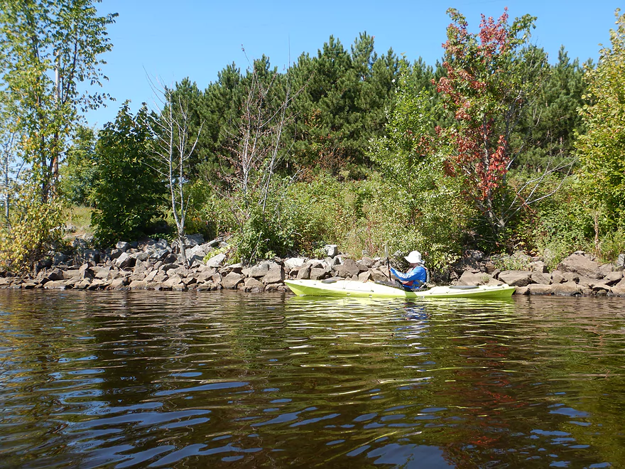
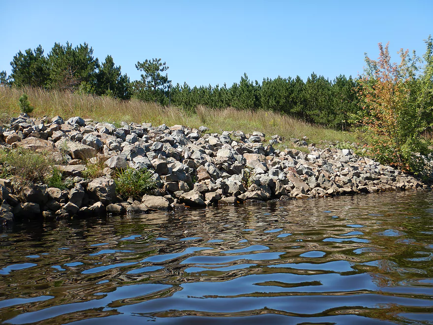
Rocky shoreline
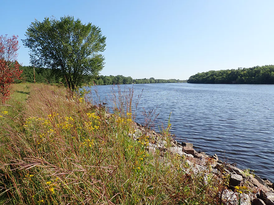
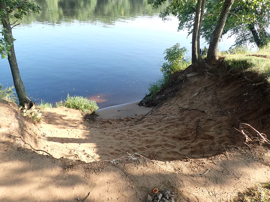
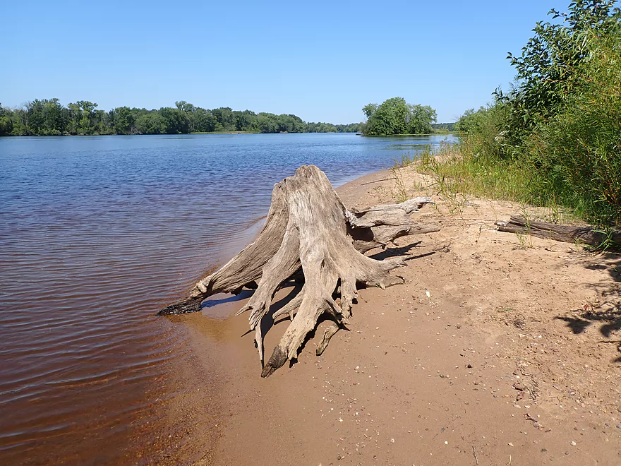
View from shore
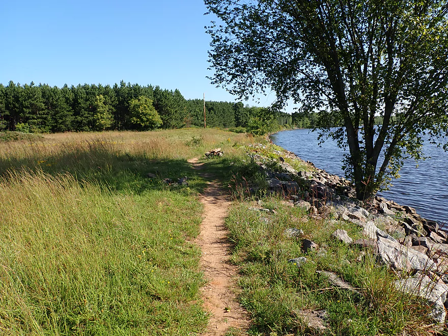
There’s a nice public trail here that passes through a dry sand prairie
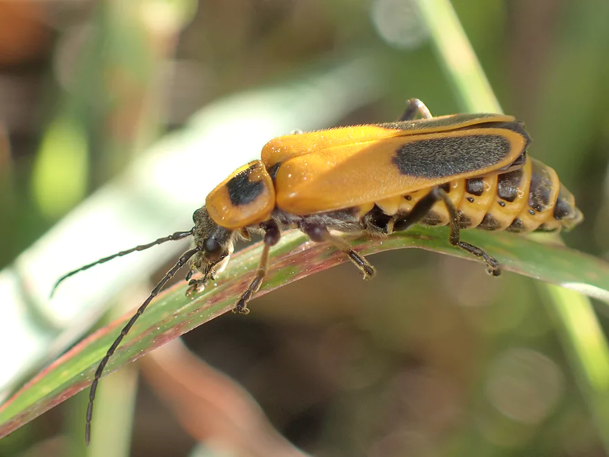
Soldier beetle
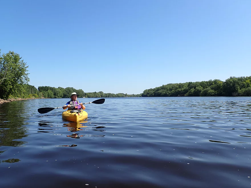
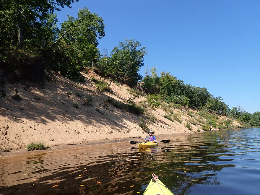
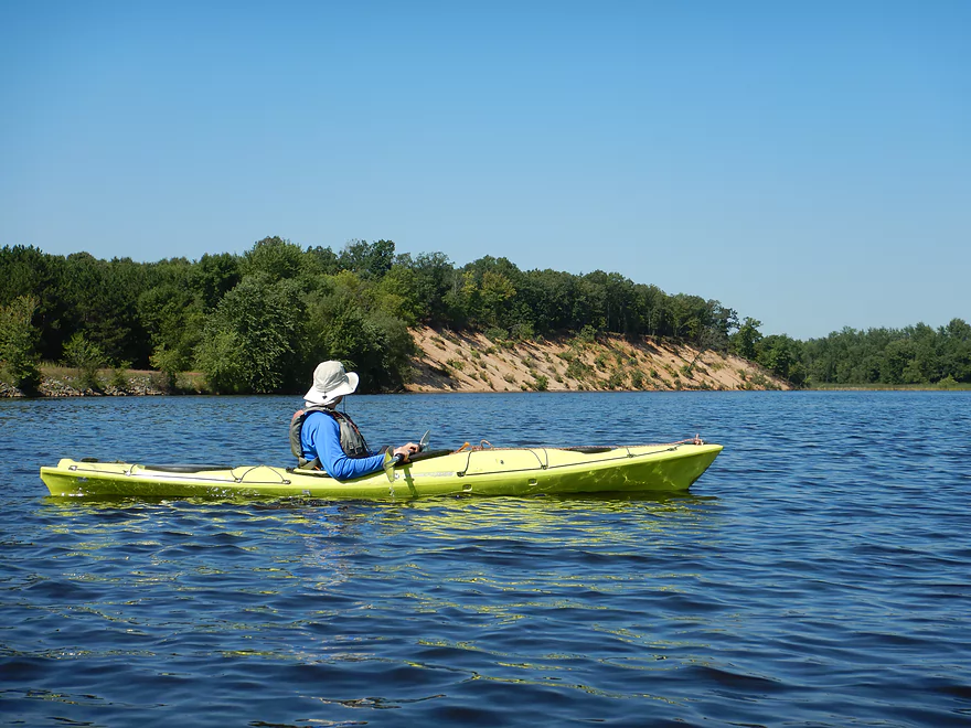
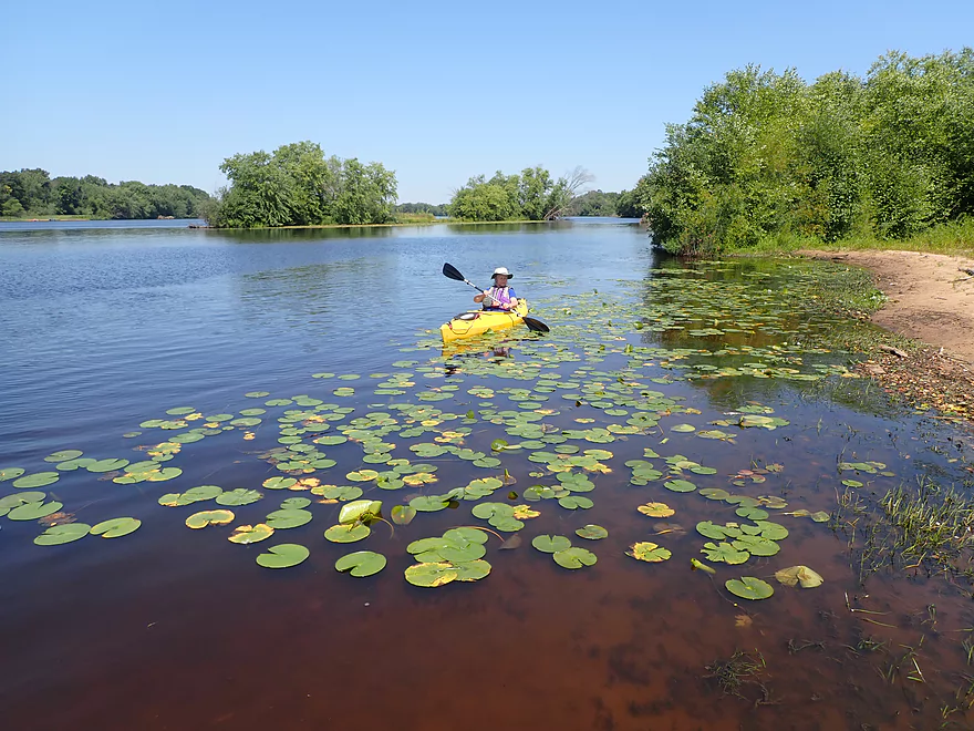
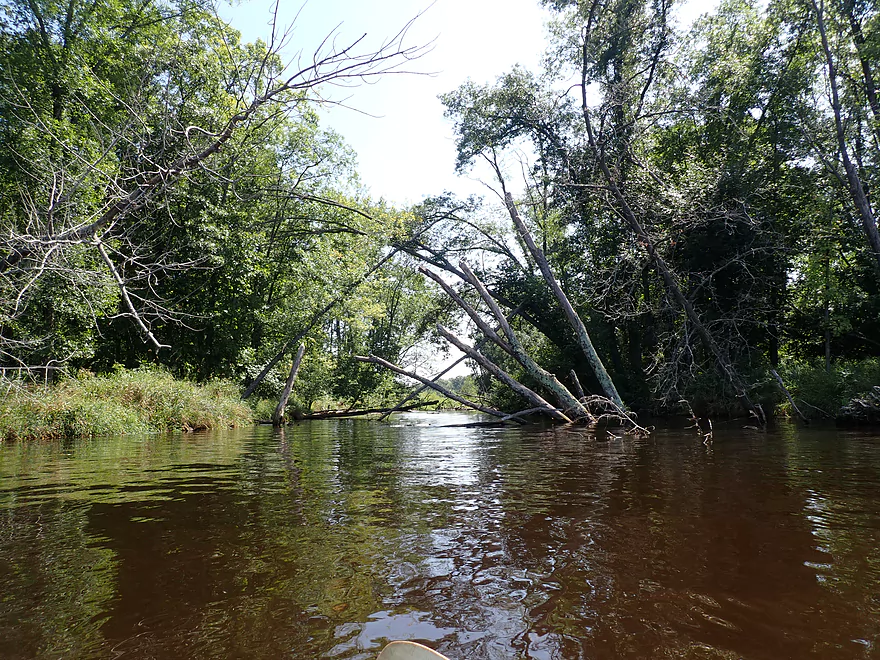
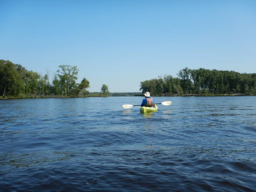
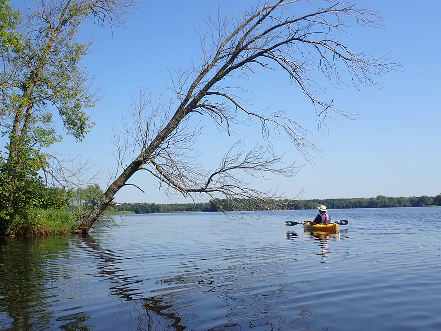
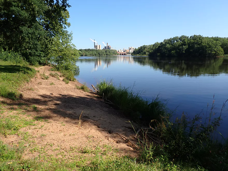
The river here is wide and slow
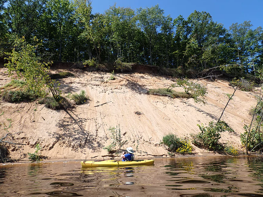
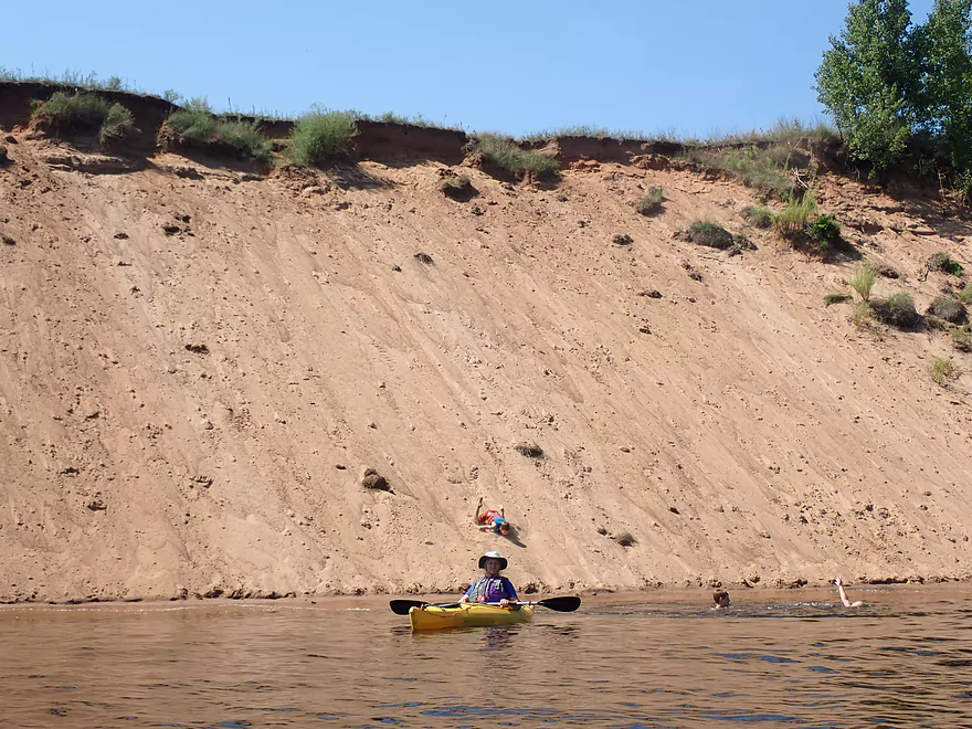
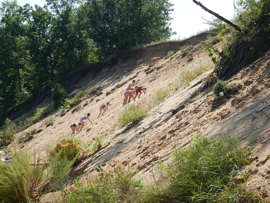
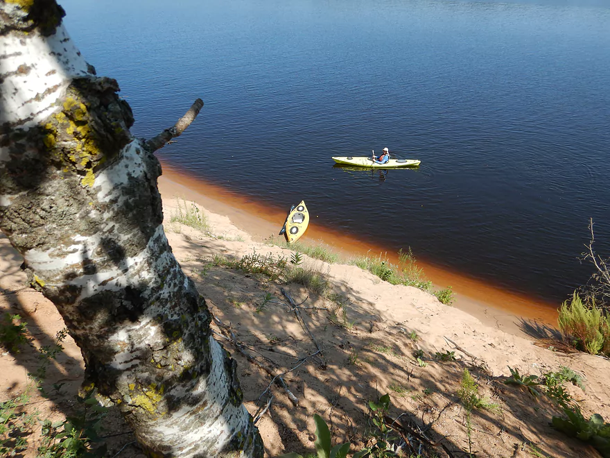
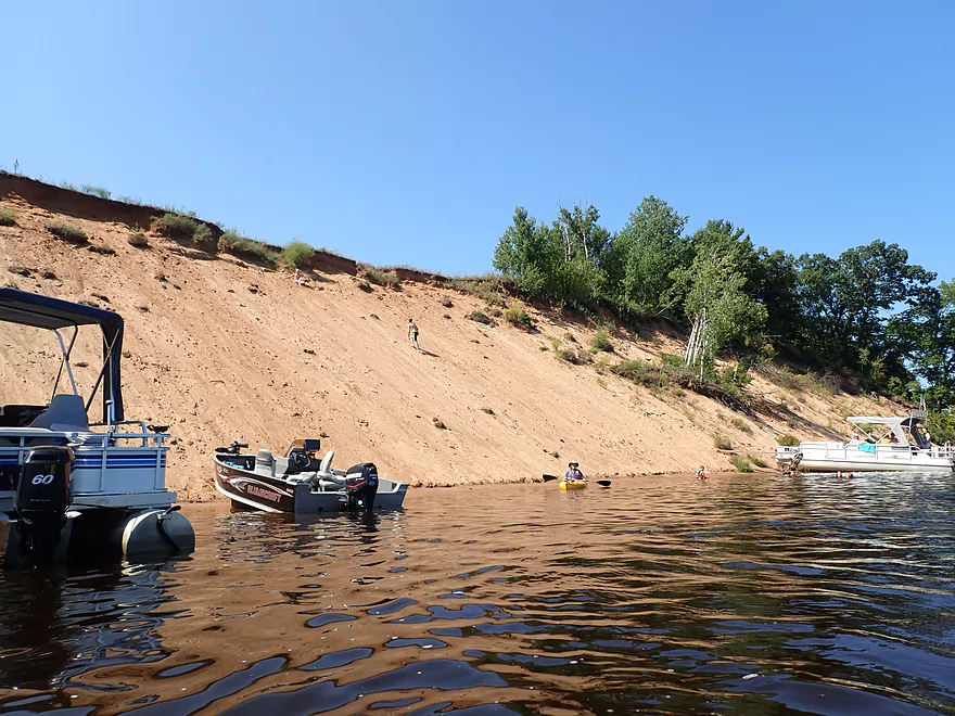
The first huge sand bank
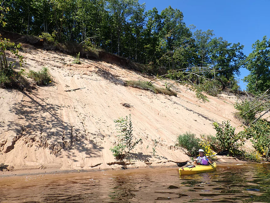
Trees sliding down in slow motion
Over 40′ high
And 700′ long
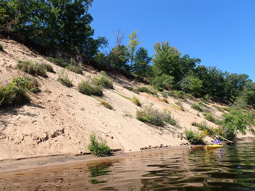
Some of the banks here look artificial
Looking back
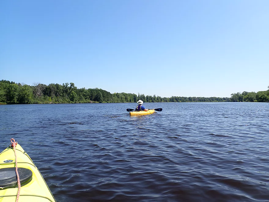
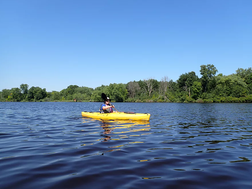
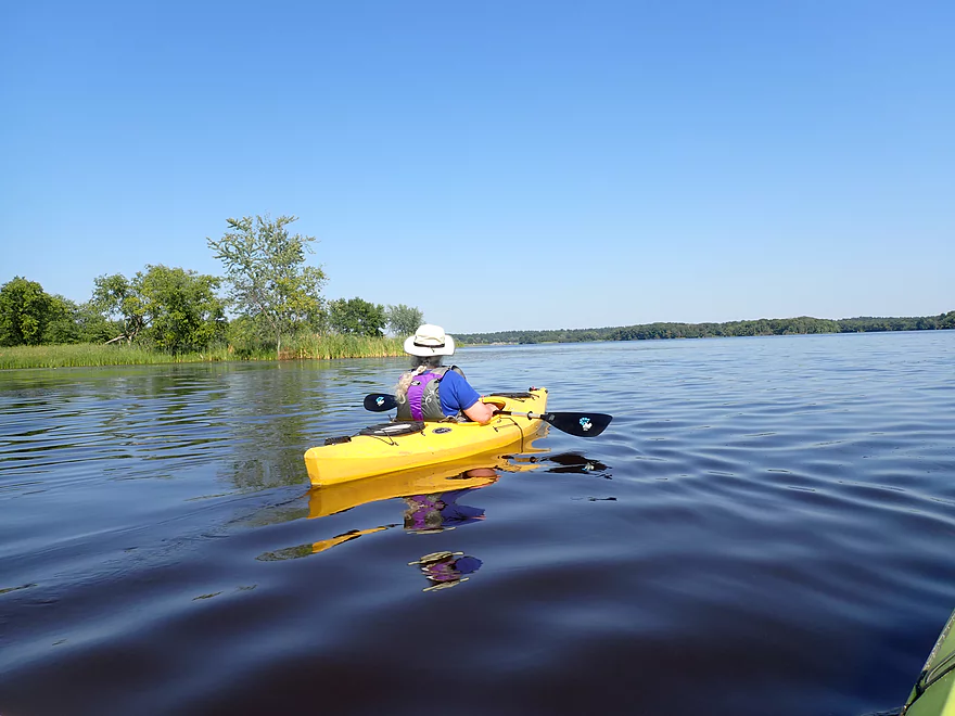
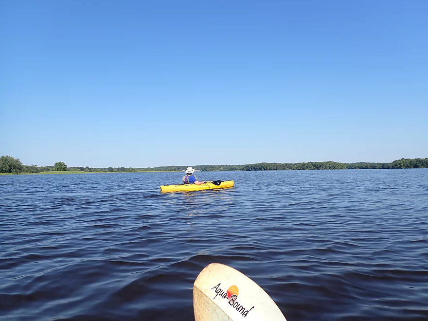
Next few miles featured more wide, slow river
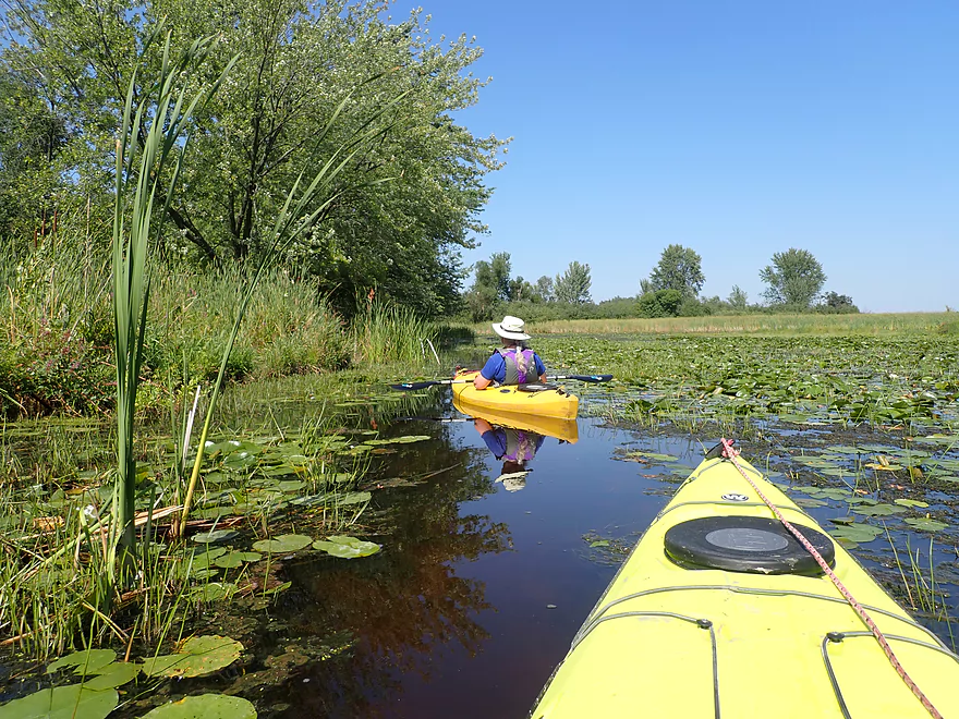
Hiding between two islands…
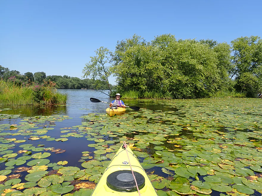
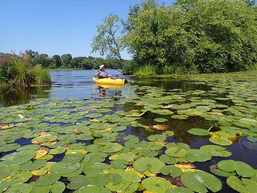
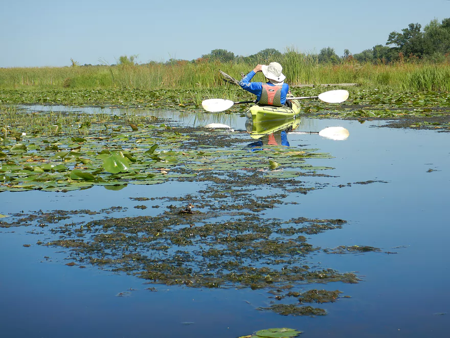
Is a cool bed of lilies
Not many sandbars on the trip
But this might have been the best
Stump posing for a photograph
There are several “off-ramps” where you can escape the main channel and explore side sloughs
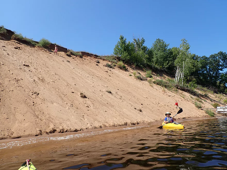
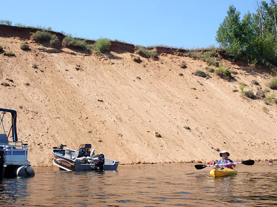
A second impressive sand bank
This one had sand monkeys on it
Monkey see, monkey do
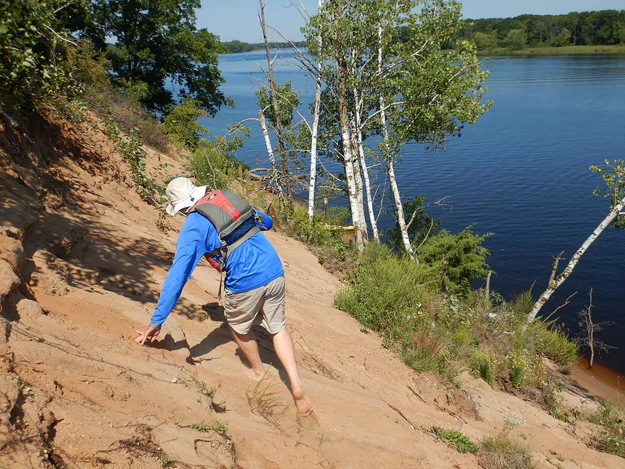
View from top
Looking upstream
And back down to our parked boats
Scenic area
Looking back
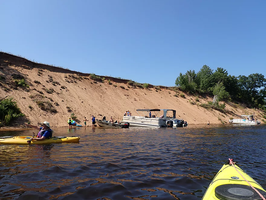
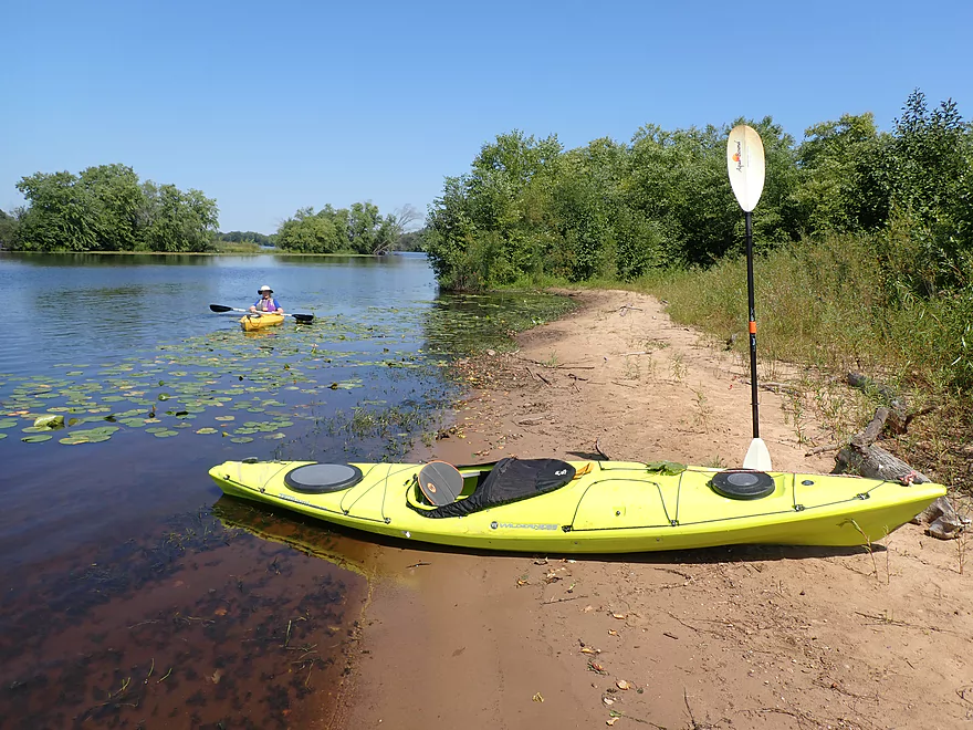
This was a popular pit stop
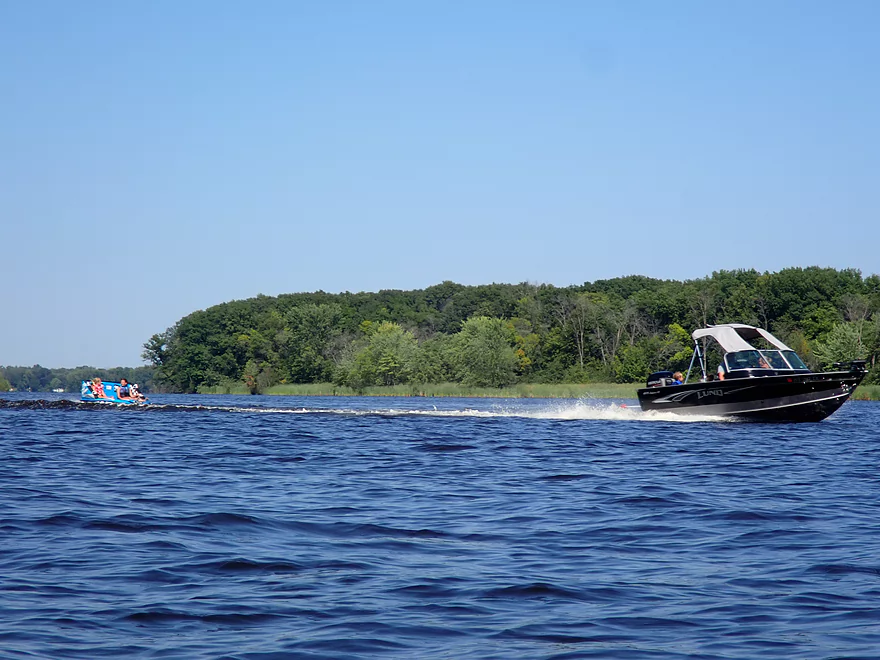
This part of the river has some motorboat traffic
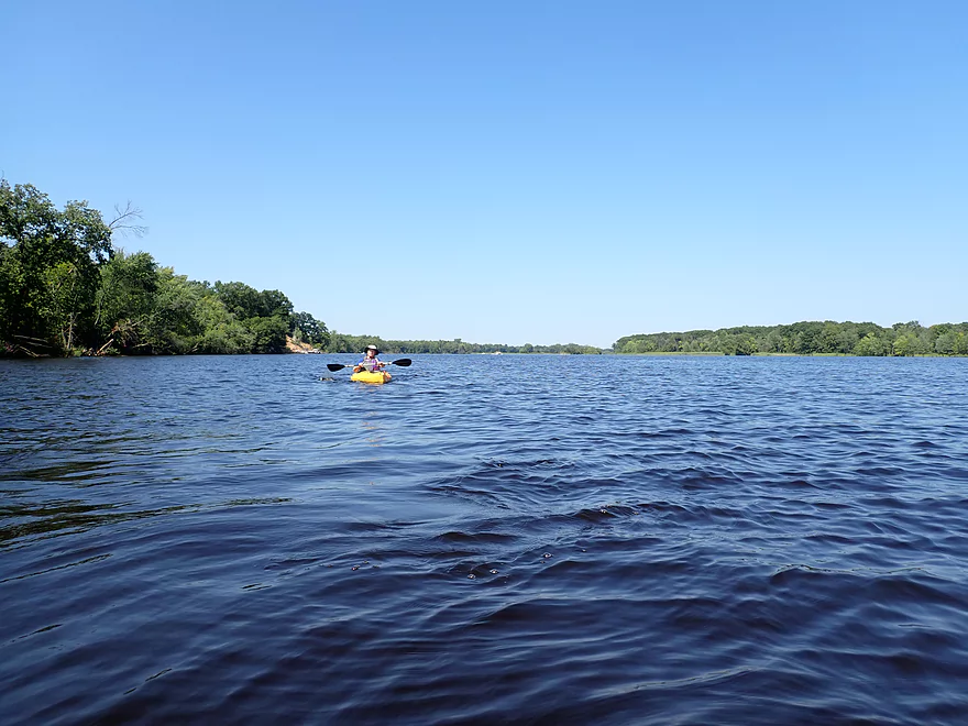
More open river paddling
We decided to take this “off-ramp” from the main channel
Which led to a nice marshy area
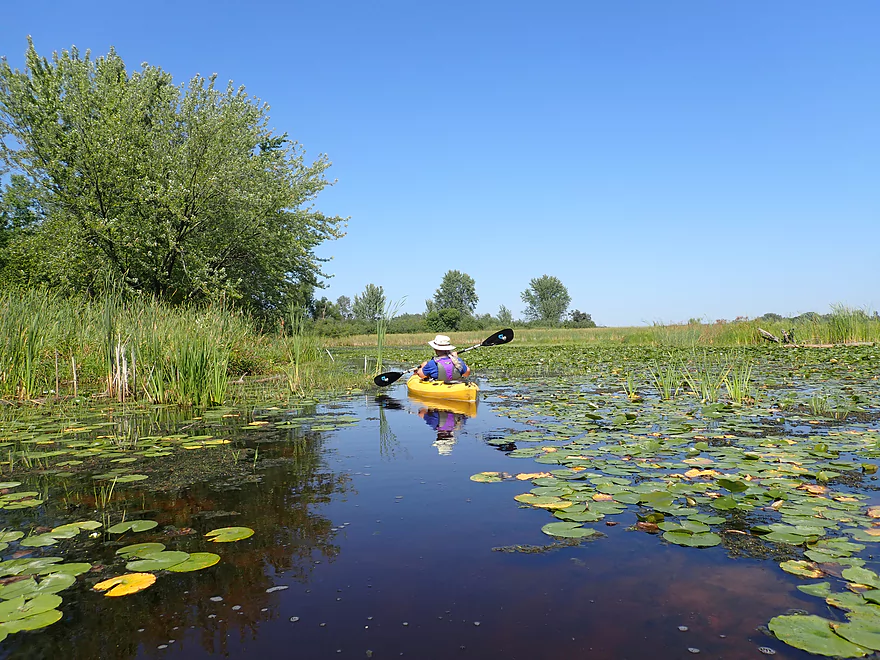
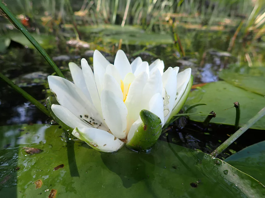
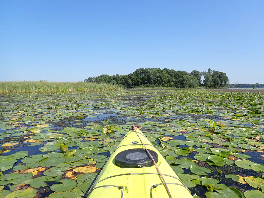
Dense bed of lillies
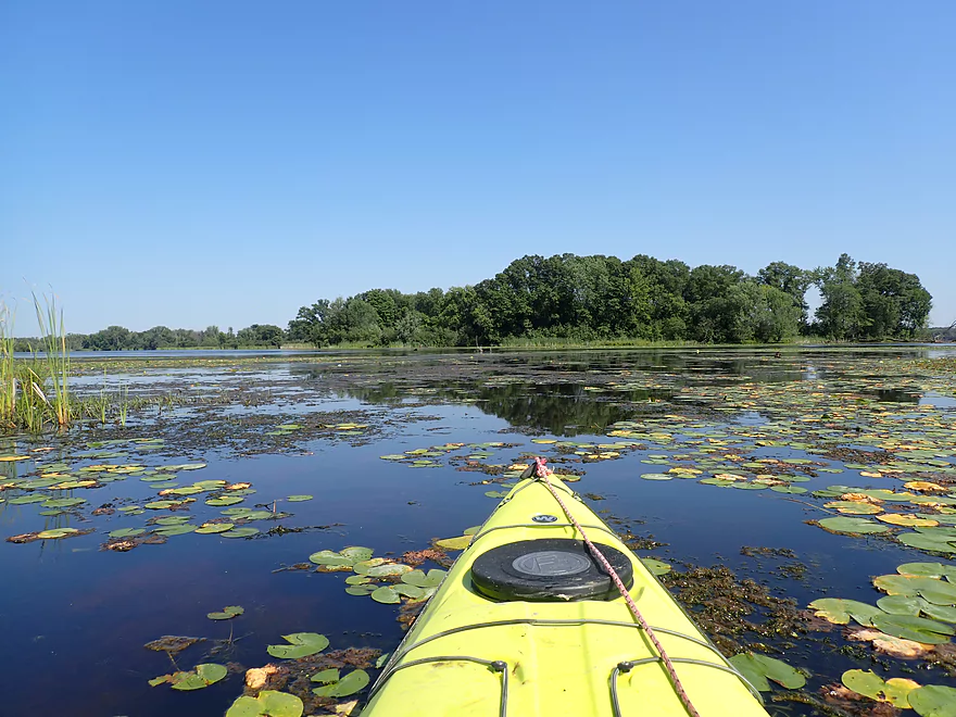
But I was able to punch through
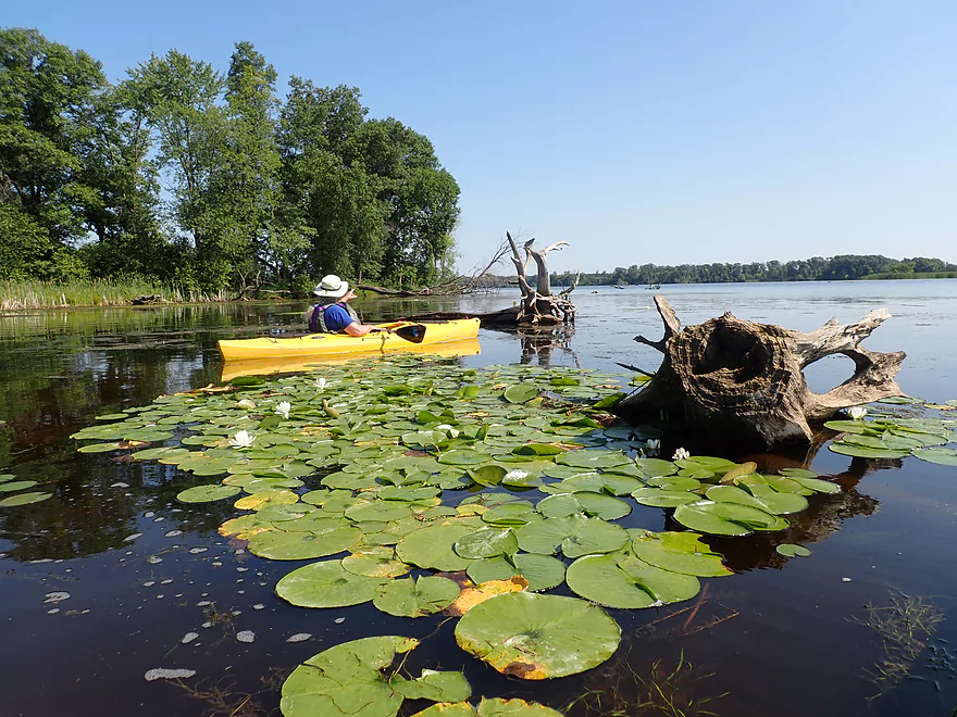
Passing one of several large islands
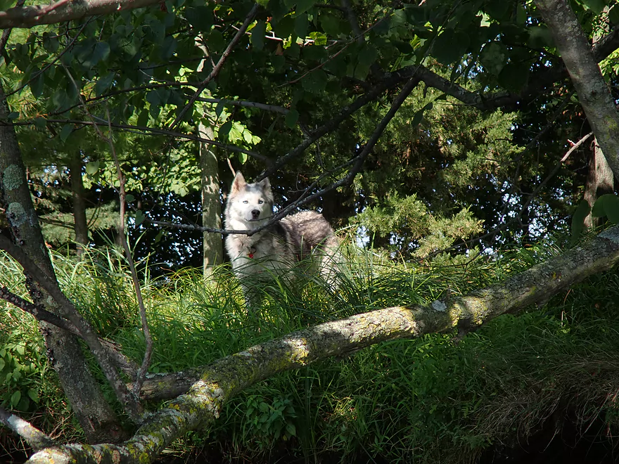
I thought this was a wolf…but it was a dog
This is the Devil’s Elbow area of the river
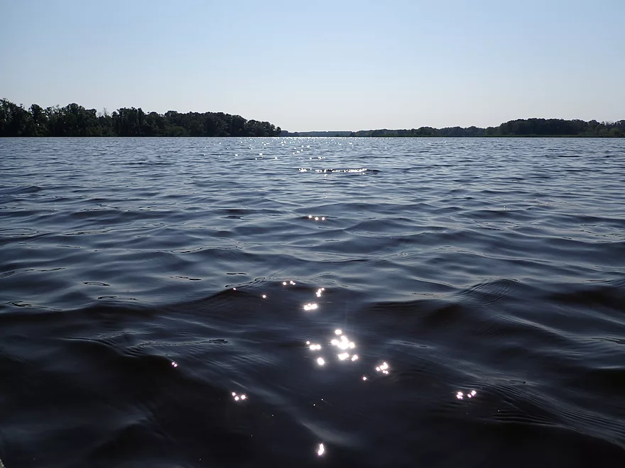
Cool sunlight reflections
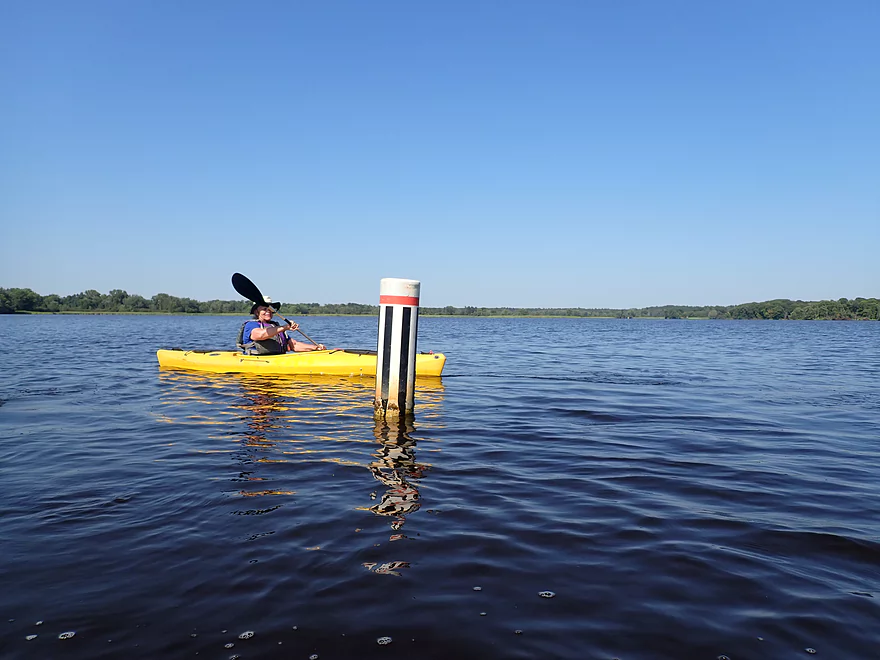
Buoys sort of mark the way to the take-out
Much of the land to the left was planted with pine plantations
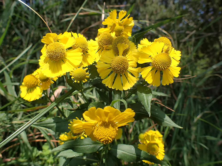
Sneeze Weed
Taking out at Chester Creek Landing
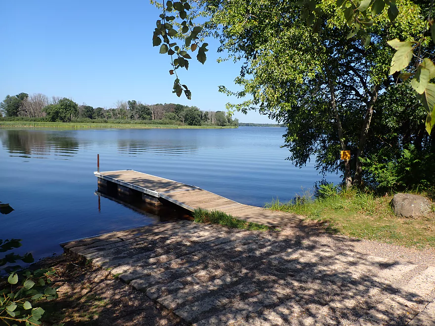
Nice access
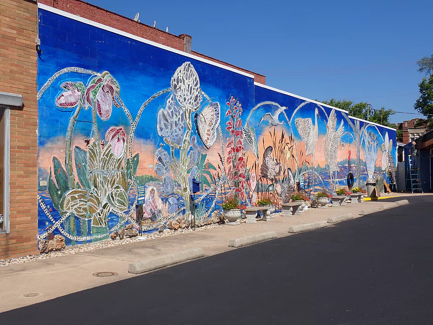
Checking out a nearby mural “Celebrating Nature’s Web”
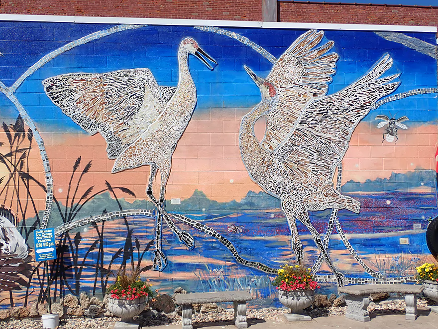
It features a number of animals like these cranes
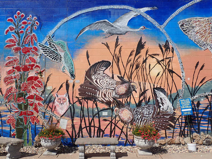
And these prairie chickens
Scouting alternate put-ins…this is Jim Freeman Boat Landing
The Hwy AA pull-off below Nekoosa is a good option
Wisconsin River – Plank Hill

The Wisconsin River between Wausau and Petenwell Lake doesn’t get many paddlers due to its many dams and paper mills. But there are neat stretches to explore. The goal for this trip was to check out one such obscure leg just prior to Petenwell Lake to see how viable and interesting it would be for kayaking.
The trip started at the Plank Hill boat ramp which was a good put-in. Despite its namesake, there’s no hill near the landing…just a large cranberry bog accross the road.
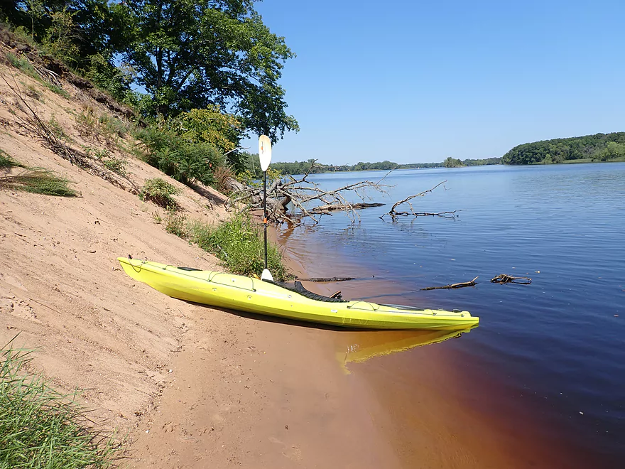
The river here was very deep and root beer-colored, with almost no current. Satellite view shows many iterations or repeating contours of old channels–a product of a very sandy river bottom that has been shifting and moving for hundreds of years.
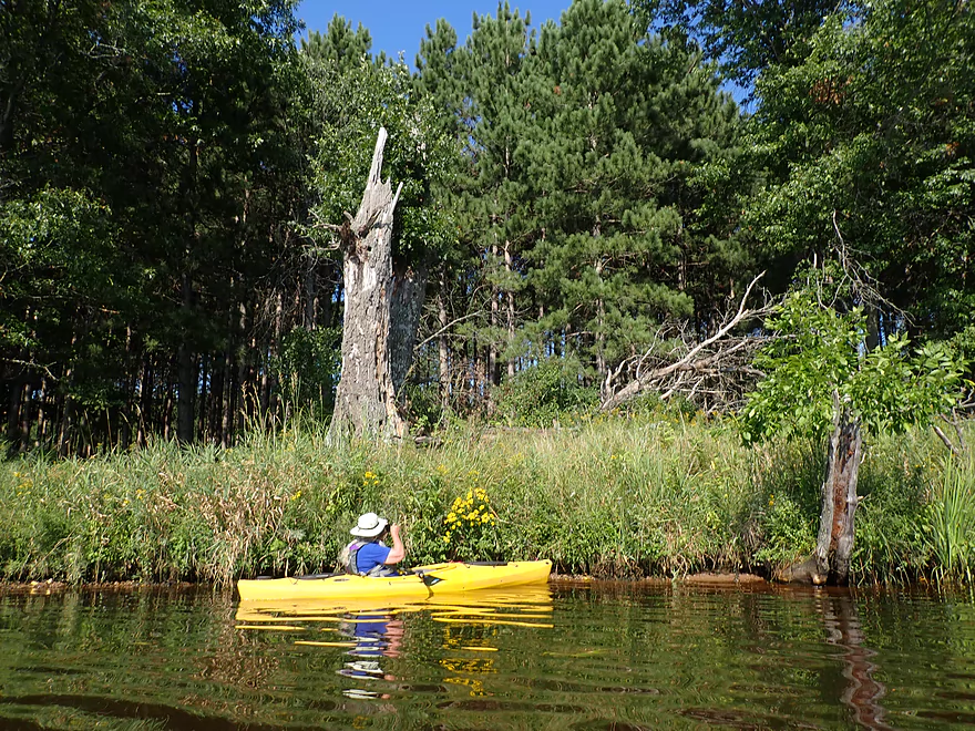
One of the first landmarks was “Lynn Creek” which actually looked navigable, but perhaps a bit weedy (it’s maybe more open in spring). Adjacent to Lynn Creek is the Plank Hill Bank Fishing Area, which is also a canoe/kayak access. An open trail leads along the bank through a dry sand prairie with numerous flowers.
Just downstream from the creek, was one of the trip highlights in a huge sand bank (40-50′ high and 700′ long). It was quite steep and in several spots detached trees were sliding down as if suspended in time (or until the next storm).
After that, the river honestly was a little boring. The channel was deep and wide…perhaps already influenced by the Petenwell dam despite being located far downstream. Much of the shoreline consisted of generic flood bottom forests that weren’t super interesting. I had hoped for sandbars, but we didn’t see much. In several instances it appeared powerboats just gave up trying to find one, and simply anchored in the shallows.
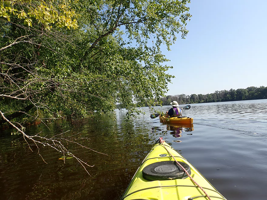
The river does split into several side-sloughs and islands, which can present some interesting choices for paddlers. We stuck to the main channel, but in hindsight should have chosen the smaller channels which likely were more scenic. We did check out one of the far eastern islands, which was nice. It was preceded by a nice bed of lilies and had one of the few sandbars of the trip.
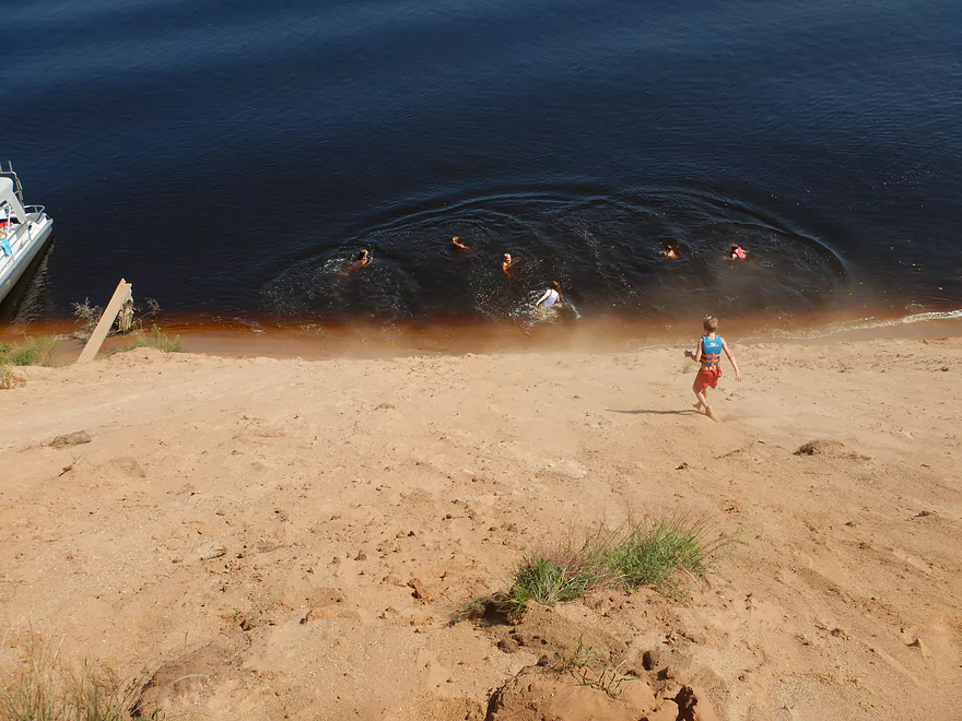
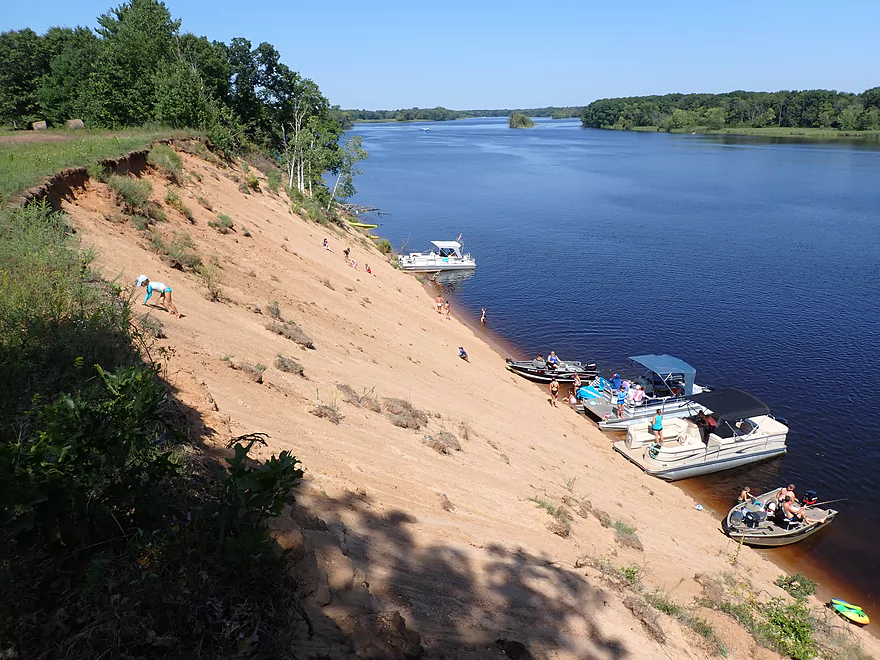
We then encountered a second huge sand bank that was even more impressive than the first. It was not as long (400′ vs 700′) but was a bit taller (50-55′) and the face wasn’t obstructed by as much brush. This huge “sand cliff” against the river was quite the sight. It was also a popular pit stop for local motorboats and had 6-7 anchored at its base. “Sand monkeys” (little kids) would climb up the steep slope on all fours to get to the top. Monkey see monkey do….so we followed them up to the top where there was an impressive vista of the river.
After the second sand bank, the river broke up into a series of islands and large sloughs as it prepared for its transformation into Petenwell Lake. We had a choice to make…we could have followed the main channel out onto the lake which would have been a more direct shot to our landing. But Petenwell (Wisconsin’s second largest lake) isn’t a super exciting paddle and can be infamous for its strong winds. Instead we turned east onto an “off-ramp” into one of the larger sloughs and away from the boat traffic.
This backwater area is I believe referred to as Devil’s Elbow and featured a number of attractive islands and marshes. We just explored a few, but the area is quite large and a paddler could spend an entire day exploring the Devils Elbow backwater. One does have to be careful not to get lost in this archipelago though as it can be confusing without telltale current (I brought two GPS units with to be safe). Some of the islands are officially designated for camping by the WRPCO Recreation Plan and we did see a tent on one of the islands. Although these islands were kind of weedy and lacking in sand, so I’m not sure they would be inviting spots to camp.
We ended the trip at the Chester Creek landing where buoys roughly guided our way to shore.
In summary, this was a two star trip that had a few five star elements (hence the three star compromise). The river itself was mostly pretty boring…generic, flat, runty woods, with a wide deep channel. But the two sand banks were fantastic and rivaled those I’ve seen on the Eau Claire and Black Rivers. The other highlight was the attractive marshy regions located in the backwaters.
This is a trip that can change dramatically depending on the channels you choose to take. IMO the smaller back channels were more interesting and I wish we had explored more of them. To this end, taking out at “Devil’s Elbow Boat Launch” would have allowed us to explore more of the eastern backwaters. Conversely taking out at at a western landing (say the 4th Street launch) would have provided a few more epic sand banks to paddle past, but would have included open water paddling. For a future trip, I definitely want to explore more of the the northwestern shore of Petenwell Lake by the Yellow Banks region. This likely has 3-5 more sand cliffs (remnants of Glacial Lake Wisconsin) and could be an interesting paddle.
Sites include large osprey nests, eagles, flopping carp, tiger beetles scurrying around on the sand banks, but not much else. I wonder if pollution from upstream paper mills has something to do with that. I thought I saw a wolf, but on close inspection it looked like a domestic dog (which maybe was part wolf though).
Celebrating Nature’s Web: This is a nice done building mural in nearby Nekoosa that IMO is worth checking out. It features a river scene and wildlife (cranes, butterflies, grouse, and a fox). What’s really unique is part of it was constructed with broken glass. In the right conditions (late afternoon and sunny) the mural will create a dazzling light effect. I’m sure it’s also impressive at night as glow-in-the-dark paint was used.
Plank Hill Small Boat Access: This was a great public boat ramp. No launch fees are required (that I saw) and an outhouse is on site. The main launch is at the west end, but there is actually a cool sand pit at the east end that is a much nicer put-in area for paddlers (if it’s not occupied by fishermen).
Alternate Put-ins:
- Glendale Lane: 2.9 miles upstream of Plank Hill. Below the Nekoosa dam there is a nice public pull-off which would be a good launch option for paddlers. This upper stretch of the river isn’t super interesting, but if levels are low you can paddle upstream close to the dam and see some neat geology (granite boulders and sandstone cliffs on the east bank). Exploring the western millrace might also be intriguing as you would get an up-close view of the busy Domtar Paper Plant.
- Jim Freeman Memorial Boat Landing: 2.2 miles upstream from Plank Hill. This is a huge boat landing and requires a $5 launch fee (there is a pay station on site). For kayakers, I recommend another access.
- Lynn Creek Access: 0.3 miles downstream from Plank Hill. In theory you could launch here, but you would have to drag your kayak 300′ from the parking lot to the water and the shoreline has irregular riprap that isn’t kayak launch friendly. There is a nice trail south of the parking lot that parallels the river and a dry sand prairie.
Chester Creek Landing: This is a good public boat ramp and I don’t recall any launch fees. Note this is located on the east side of the river, while the main put-in options are on the west side, which can mean a long bike shuttle (heck it’s even a long car shuttle).
Alternative Take-outs:
- Devil’s Elbow Boat Launch: 2 miles north of Chester Creek. This is a nice little public launch. Taking out here require backtracking a bit through sloughs and past islands, but it is a scenic part of the river with attractive marsh plants.
- Third Street Boat Launch: 2.3 miles west of Chester Creek. This should be a nice public launch tucked inside an inviting slough. Because this is on the west side of the river this would be more viable for bike shuttlers.
- Fourth Street Access: 2.7 miles southwest of Chester Creek. This is a neat public area atop a steep sandbank. Steep stairs lead down to the river. It’s also conveniently on the west side of the lake (better for shuttling) and you pass “Yellow Banks” which feature several large sand banks. The downside is it does require a bit of open water paddling which can be dangerous in windy conditions.
Bike Shuttle – Chester Creek to Plank Hill: 11 miles with 52′ of ascent. This is a mostly flat route, but is quite long…too long for most bike shuttlers. If you really want to bike shuttle, I actually suggest using another take-out on the west shore instead (say 3rd Street – 4.4 miles or 4th Street – 5.3 miles).
Wind: This trip featured open water paddling that is vulnerable to the wind (especially the last part on Petenwell Lake). Be mindful of forecasted wind speed and direction.
Waves: The upper portion does feature some powerboats which will produce waves to deal with. These aren’t as bad as say Lake Wisconsin because the channel is so deep preventing them from breaking, but you should be mindful. The last part of the trip is on Petenwell Lake and that can be infamous for its big waves. You can avoid these by mostly paddling when the wind is slow, when few powerboats are on the water, and by sticking to the side sloughs that are more protected.
Current: It really wasn’t noticeable.
Wisconsin River @ Wisconsin Rapids: 3400 CFS or 3.01′ (note this gauge is located past several dams so my estimates could be off)
- 0-3000 CFS: A low depth. Some minor small sandbars will appear in spots.
- 3001-5000 CFS: Average depth. Likely no sandbars.
- 5001-9000 CFS: High depth.
- 9000+ CFS: Likely navigable, but water quality may not be as good. Some of the back sloughs may become flooded.
Quick Overview
- Upstream of Stevens Point: I don't have information yet on these stretches.
- Stevens Point to Lake Petenwell: ~42 miles. This stretch in Central Wisconsin used to have many natural rapids, but most have been buried under 8 dams, some of which are now difficult portages. Despite this there is still some good paddling to be had in this region.
- Lake Petenwell: 14.9 miles. This is a large flowage lake that is challenging for paddlers because of frequent strong winds and big waves.
- Castle Rock Lake: 14.5 miles. Another large flowage lake that is likely too big for enjoyable paddling.
- Castle Rock Lake Dam to Lemonweir River: 9.4 miles. This pre-Dells leg isn't elite, but is a pleasant stretch.
- Lemonweir River to Indian Trails Landing: 21.7 miles. This includes the famous Upper Dells and Lower Dells which feature many scenic sandstone outcrops.
- Indian Trails Landing to Portage: 16 miles. This is an overlooked section sandwiched between the Dells and Portage. While the scenery isn't top-notch, it does have many sandbars and few people, which is a nice combination.
- Portage to Lake Wisconsin: 14.3 miles. This is a neat stretch of the river with many sandbars and cliffs, but the shoreline is very developed and motorboat traffic can be heavy on weekends.
- Lake Wisconsin: 14.5 miles. This is a challenging lake for paddling because of the huge and frequent waves created by motorboats.
- Prairie du Sac Dam to Port Andrews: 57 miles. This is the first half of the famous Lower Wisconsin Riverway. This is a super popular stretch for paddlers with the highlights being large sandbars, big bluffs, occasional cliffs, and fun side sloughs to explore.
- Port Andrews to Wyalusing: 40 miles. This is the second half of the Lower Wisconsin Riverway which has far fewer paddlers and sandbars. But the bluffs and sloughs are larger and more interesting.
Detailed Overview
- Upstream of Merrill: I don't have enough information yet on these legs to comment.
- Merrill Dam to Riverside Park: 0.5 miles. Might include some light rapids below the dam.
- Riverside Park in Merrill to Wisconsin River Forest Landing: 8.6 miles. A good prospect.
- Wisconsin River Forest Landing to Brokaw Boat Landing: 5.7 miles.
- Wisconsin River Forest Landing to Jesse Park: 1.4 miles. A terrific stretch with small boulder gardens, one set of Class 1-2 rapids, gravel bars and a nice sand bank.
- Jesse Park to Brokaw Boat Landing: 4.3 miles. A good stretch with scenic wooded banks and occasional gravel bars.
- Brokaw Boat Landing to Gilbert Park: 5.1 miles. River slows down and becomes hillier. This stretch is an ok prospect and goes past the old Brokaw paper plant that has been shut down. Paddlers must navigate Class 1 rapids and a 2' drop where the old Brokaw dam used to be.
- Gilbert Park to Wausau Boat Dock: 1.5 miles. An impounded stretch through Wausau. There are numerous alternate access options to choose from.
- Wausau Boat Dock to Oak Island Boat Ramp: 1.2 miles. A nice stretch that includes Barkers Island and Isle of Ferns Park. But the Wausau dam does require a portage. This stretch parallels the famous Wausau Whitewater Park.
- Oak Island Boat Ramp to Rothschild Dam Access: 5.8 miles. Likely mostly uninteresting flowage paddling. There are many alternate access options to choose from.
- Rothschild Dam Access to Zimpro Park: 1.0 miles. This might be a nice stretch.
- Zimpro Park to River Road Boat Landing: 7.6 miles. The first half of this leg is likely nice river paddling, but the second leg is probably just an uninteresting flowage.
- Chucks Landing/Mosinee Dam to Bean's Eddy Boat Landing: 2.8 miles. Likely a nice leg. You might be able to launch by the dam where there should be some nice rapids and boulders.
- Bean's Eddy Boat Landing to Seagull Boat Landing: 5.1 miles. Mostly uninteresting flowage paddling. Although there might be some nice sand banks on the eastern shore.
- Seagull Boat Landing to Dubay Dam Access: 5.3 miles. Mostly uninteresting flowage paddling.
- Dubay Dam Access to River Road Landing: 5.5 miles. This could be a nice stretch of river.
- River Road Landing to Old US 10 Landing: 2.3 miles. Likely an ok leg.
- Old US 10 Landing to Stevens Point Dam: 5.6 miles. Probably uninteresting flowage paddling. Many alternate access options closer to Stevens Point.
- Stevens Point Dam to Blue Heron Boat Landing: 4.2 miles.
- Steven Point Dam to Whiting Dam: 2.6 miles. Starts slow and uninteresting, but the river becomes very scenic after the Hwy HH bridge. The rock formations below both dams are very striking. Many alt access points.
- Whiting Dam to Kimberly Clark Dam/Al Tech Park: 0.6 miles. Incredible scenery with exposed bedrock and boulder gardens below the Whiting Dam. Some rapids, but nothing major. The Kimberly Clark Dam is a dangerous low-head dam and should be treated carefully.
- Kimberly Clark Dam to Blue Heron Landing: 1.0 miles. Class 2 rapids below the dam, but after that the river slows dramatically and splits into many sub-channels and islands. Round trips on this leg are possible. I chose the far western channel where there were some nice rocky stretches.
- Blue Heron Landing to Mill Creek Landing: 4.1 miles. Likely a mediocre paddle with nothing special. Galecke Park is an alternate access.
- Mill Creek Landing to Biron Dam North Gate: 7.6 miles. Mostly uninteresting flowage paddling. Several alternate access options on route.
- Biron Dam North Gate to Veteran's Memorial Park: 4.5 miles.
- Biron Dam North Gate to Biron Landing: 1.0 miles. Super scenic stretch by two islands with many granite boulders.
- Biron Landing to Legion Park: 3.0 miles. A nice stretch by Big Island. The west channel is more undeveloped...but the east channel has several scenic granite islands.
- Portage through Legion Park: 680'. A steep wall separates the park from the river but in two locations the wall is short enough to get over (see map). Paddlers may want to consider a longer portage to bypass some of the shallow rocky stretches by Legion Park.
- Legion Park to Veteran's Memorial Park: 0.4 miles. A scenic stretch that features a large boulder field and the powerhouse for a large paper mill.
- Veteran's Memorial Park to Port Edwards Landing: 3.8 miles
- Veteran's Memorial Park to Demitz Park: 0.8 miles. A pleasant stretch that includes Belle Island.
- Demitz Park to Ben Hansen Park: 1.2 miles. This leg goes by Garrison Island and Edwards Island. Lyon Park is located across the river from Demitz Park and is another access option.
- Ben Hansen Park to Port Edwards Landing: 1.8 miles. Above the Centralia dam there are several small but nice islands. Portage the dam on the left bank (follow the 1000' trail through the golf course). Below the dam there are scenic rock formations. Close to the Port Edwards dam are a few more scenic islands you can explore.
- Port Edwards Landing to Nekoosa/Riverside Park: 3.6 miles.
- Port Edwards Landing to Port Edwards Powerhouse: 1.3 miles. A half-mile portage is required (east bank). A very scenic boulder field is located below the dam. At high levels, the rocks are submerged and produce a half-mile stretch of rapids (some strong).
- Powerhouse to Moccasin Creek Landing: 1.8 miles. A generic wooded stretch that isn't super interesting.
- Moccasin Creek Landing to Riverside Park: 0.5 miles. During the Nekoosa dam drawdown, this stretch had nice boulder fields and rapids.
- Riverside Park to Hwy 73: 0.8 miles. An ok stretch of the river. There are scenic cliffs south of Hwy 73, but these are past the dam warning line. Hwy 73 is not a good access option.
- Hwy 73 to Point Basse Ave (Portage of the Nekoosa Dam): 1.5 miles. A difficult 1.5 mile portage through downtown Nekoosa. Don't try to portage the south bank. There is a steep hill, cliffs, and large Domtar paper mill fences to deal with.
- Point Basse Ave to Jim Freeman Memorial Boat Landing: 0.8 miles. A generic stretch going by historic Point Basse. If you're willing to backtrack to the dam, you can see scenic boulder fields (during low flows) and a few cliffs. Point Basse Ave is a somewhat speculative access, but it seems public and doable for launching.
- Jim Freeman Memorial Boat Landing to Plank Hill Small Boat Access: 2.0 miles. A generic stretch.
- Plank Hill Small Boat Access to 19th Drive Landing: 5.3 miles. Features two epic sand banks. The main channel has some minor sandbars. Several of the side sloughs can provide fun side adventures.
- 19th Drive to the Petenwell Dam: 14.9 miles. This is Lake Petenwell which is a large and challenging lake for paddling. Waves and strong winds are frequently an issue. But when calm there are nice sandbanks on the northwest shore, hidden sloughs, and large islands to explore. See the overview map for more info.
- Petenwell Dam to Ganter Lane Landing: 3.8 miles. This stretch isn't too impacted by dams and may have nice sandbars at low levels.
- Ganter Lane Landing to Castle Rock Lake Dam: 10.7 miles. Castle Rock Lake is likely too big (wind/waves) for enjoyable paddling. There are many alternate launch options along the shore.
- Castle Rock Lake to the Lemonweir River: 10 miles. An ok section.
- Lemonweir River Mouth to River Bay Landing: 7 miles. The first half of the classic Upper Dells.
- River Bay Landing to Blackhawk Island: 6.5 miles. Second half of the classic Upper Dells, known for its fantastic outcrops. Note, the Blackhawk Island landing is no longer accessible without special permission from the Upham Woods Outdoor Learning Center.
- Black Hawk Island to Wisconsin Dells Dam: 2.0 miles. More nice sandstone outcrops. You can take out at a public ramp off Indiana Ave or portage the dam and take out SW of the dam by a launch off Wisconsin Dells Pkwy/Hwy 12.
- Dells Dam to Indian Trails Landing: 6.2 miles.
- Dells Dam to Newport Park: 2.2 miles. This is the heart of the famous Lower Dells with many scenic outcrops. Unfortunately jet boats are a serious plague on this stretch.
- Newport Park to Indian Trails Landing: 4.0 miles. Features the famous "Sugar Bowl" formation and four super cool caves. The outcrops soon disappear and this stretch is mostly uneventful (but peaceful) big river paddling.
- Indian Trails Landing to Pine Island Boat Ramp: 9.8 miles. Few paddle this stretch as it isn't as interesting. But...it does have a good concentration of sandbars and few competing paddlers for them.
- Pine Island Boat Ramp to Portage/Hwy 33 Access: 6.0 miles. Not an elite section that is lacking in cliffs and bluffs. It does have good sandbars though.
- Portage to Dekorra Park: 7.7 miles
- Portage to Baraboo River/Thunderbird Road: 5.2 miles. A good section with great sandbars. Close to Portage there are few motorboats.
- Baraboo River to Dekorra Park: 2.5 miles. River splits around massive Lib Cross Island. West channel has nice sandbars. St Lawrence Bluff has scenic sandstone outcrops and includes a cave you can paddle into.
- Dekorra Park to James Whalen Memorial Park: 6.6 miles.
- Dekorra Park to Camp Rest Park: 5.1 miles. A terrific section with rock outcrops, large island deltas, hidden sloughs, and nice sandbars. Unfortunately this part of the river is popular with motorboats and jet skis which can be a plague. Multiple alternate access options.
- Camp Rest Park to James Whalen Memorial Park: 1.5 miles. Not a great section because of the open water paddling, powerboats and big waves. The west shore though does have nice outcrops.
- James Whalen Memorial Park to Merrimac Memorial Park: 4.4 miles. River turns into "Lake Wisconsin". Generally speaking this isn't ideal for kayaking as motorboat traffic can be heavy and waves can be surprisingly big. The most direct route is the north shore which has a few bluffs, but generally speaking isn't that interesting.
- Merrimac Memorial Park to Veterans Memorial Park/Prairie du Sac: 9.6 miles.
- Merrimac Memorial Park to Moon Valley Landing: 3.3 miles. Includes a lot of developed shoreline. The ferry, railroad bridge, and Moon Bay are highlights.
- Moon Valley Landing to Veterans Memorial Park/Prairie du Sac: 6.3 miles. Other than Moon Bay and the dam, this is a boring stretch. There are numerous alt access options on this route.
- Prairie du Sac to Mazomanie: 8 miles. An ok section of the Wisconsin but lacking in sandbars.
- Mazomanie to Arena: 9.7 miles. A great section with nice sandbars and scenic bluffs.
- Arena to Hwy 14: 8.0 miles. Good section with a high concentration of sandbars. One of the more popular legs on the Lower Wisconsin.
- Hwy 14 to Hwy 23/Spring Green: 2.2 miles. Neat mini-section with sandstone outcrops. Very popular in the summer.
- Spring Green to Lone Rock: 7.4 miles. Another fine sandbar/bluff section with some nice rock outcrops too.
- Lone Rock to Gotham: 8 miles. This stretch has super impressive rock outcrops and sand banks.
- Gotham to Muscoda: 7.6 miles. This leg includes more large sandbars and great outcrops. Bonus highlights include fast current and not seeing as many people.
- Muscoda to Port Andrew: 7 miles. A good stretch with many islands and sandbars.
- Port Andrew to Boscobel: 9 miles. Wooded islands start to get massive.
- Boscobel to Woodman/Big Green River: 9 miles and start of the less paddled stretch of the Lower Wisconsin. Far fewer sandbars from here to the mouth, but good bluffs and side sloughs to explore.
- Woodman to Millville: 7.7 miles. A good stretch with large bluffs and sandbars.
- Millville to Bridgeport: 5.3 miles. Huge islands, bluffs and sandbars are the highlight on this second-to-last leg on the Wisconsin River.
Bridgeport to Wyalusing (the mouth): 9 miles.
Trip Map
Overview Map
Video
Photos Size: