
Eau Claire River – Wausau Area


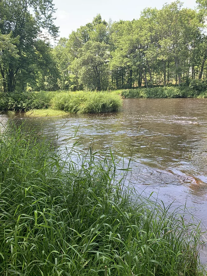
Great Trip. Went on it two days in a row. Went with a brand new paddler and he did great. The first half of the trip is just as good as the second half after the County J Bridge. What a great river when it is around 400 CFS. We zipped right along in about 2.25 hour’s times. No troubles because the river was at the right height. The current is fast and you need to be careful around some of the curves. The river does split in many places and we did choose the wrong path once and had to portage and backtrack and got into some burning nettle. We did get some advice from a walker on the trail to rub sand on our legs and it worked like a charm. Choose the river route that seems to have the best flow, but one never knows. The second day we knew the route better. Rapids were all Class One and they were loads of fun at a good 400 level. Taking out at Ross Bridge can be a little tricky because the river was moving pretty good. Get on the left side of the river when you see the bridges. This final 400 meters before the bridge was so fun!
The parking areas are the best I’ve seen and I have to commend the Weston Parks Department for their work. This stretch is amazing and I highly recommend it. Just make sure you don’t go when the river is above 450 CFS. I would like to hear more about after the Ross Road Bridge takeout to the next bridge at Camp Phillips Road (2.7 miles). Little is talked about this stretch although it has been reported to have debris and snags.
Thanks Daniel for the review! Note, if other readers of WisconsinRiverTrips.com want to submit reviews you can do so at:
https://www.wisconsinrivertrips.com/trip_submission.php
Detailed Overview
Click here to see an overview of the Eau Claire River.
East Branch:
- Upstream from Wayside Park: The river this far upstream might be small and brushy, but should be mostly navigable.
- Hwy 45/Wayside Park to Cty I: 5.1 miles.
- Wayside Park to Cty B: 1.3 miles. Upstream from Cty C the river flows through an attractive residential area with a few nice boulder gardens. There is one logjam to portage. Downstream from Cty C the river is more brushy and less attractive. This is the weakest part of the East Branch IMO.
- Cty B to Bluebell Road: 1.7 miles. This is a nice wooded stretch with some alders, but also some pines and spruce.
- Bluebell Road to Cty I: 2.1 miles. This leg starts narrow and deep, flowing past mostly submerged boulders, then widens out and becomes more shallow. This is a solid stretch that is popular with trout fishermen.
- Cty I to Hwy 64: 6.1 miles.
- Cty I to River Road: 1.1 miles. This is brushy and IMO not that interesting with one major logjam.
- River Road to Cty H: 1.1 miles. A bit more open than the preceding stretch, but still brushy and not super interesting.
- Cty H to Spring Road: 2.0 miles. The first half is a bit overgrown, but the second half is really nice with some boulder gardens, attractive woods, and fun rapids.
- Spring Road to Hwy 64: 1.5 miles. More open and not as rocky as the previous sections, but nice with attractive meadows.
Main Branch:
- Hwy 64 to Cty Y: 2.7 miles. West Branch joins up, significantly enlarging the river. Thick woods and canopies crowd the river. There might be some logjams on this stretch.
- Cty Y to Hanson Road: 1.7 miles. A very dense and wooded section. Maybe a few light rapids but nothing major.
- Hanson Road to Hwy G: 4.3 miles. More dense woods and some light rapids. Possibly a logjam....otherwise should be a nice stretch.
- Cty G to Bear Lake Road: 3.0 miles. A good prospect, but I don't believe there are rapids.
- Bear Lake Road to Hwy 52: 3.6 miles. A great five star section with many boulder gardens and rapids (a few Class 2s and one Class 3).
- Hwy 52 to Dells of the Eau Claire Park: 4.1 miles. Really neat section with rapids and fantastic rock walls. Rapids are less serious than the upstream leg, but do include a Class 2 I believe.
- Dells of the Eau Claire Park to Cty Y: 0.2 miles. This section is called "The Ledges" and is typically Class 2, but is Class 3 in higher water. The dam should be portaged river right (there are downed trees in the water to contend with below the dam).
- Cty Y to Cty N: 6.6 miles.
- Cty Y to Cty Z: 2.0 miles. This starts with the famous Dells that should be portaged. There is a portage path (right/north) but it is steep. I recommend instead launching from either the south or north trails. After the Dells is a great section which includes very scenic rock walls and Class 2 rapids.
- Cty Z to Cty N: 4.6 miles. More flatwater, but still many rapids, including a Class 3 by Lower Dells Island. Badger Road is a steep but alternate access point.
- Cty N to Clubhouse Road (aka Edwin's Park): 3.5 miles. Pleasant, but I suspect this lacks any serious rapids. Popular with locals and the liveries.
- Edwin's Park to Ross Ave: 7.8 miles.
- Edwin's Park to Cty J: 4.1 miles. A nice section with a few rapids and boulder gardens. The Mountain-Bay State Trail pull-off is an alternate access option.
- Hwy J to Ross Ave: 3.7 miles. A great section with more rapids and boulder gardens.
- Ross Ave to Yellowbanks Park: 2.7 miles. I don't know much about this section...there are some rapids.
- Yellowbanks Park to Eau Claire River Conservancy: 2.7 miles. A narrow wooded section. Not sure if the Conservancy is accessible during low water.
- Eau Claire River Conservancy to the Brooks & Ross Dam (aka Drott Street): 1.5 miles. Probably boring flowage paddling. After the dam you are on the Wisconsin River (and another flowage).
Trip Map
Overview Map
Photos Size: