
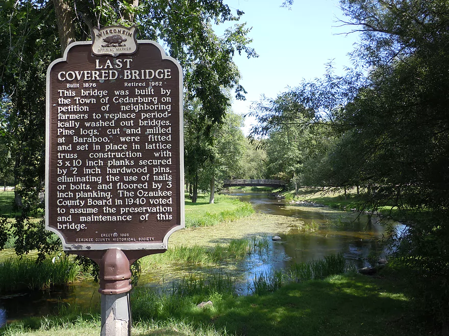
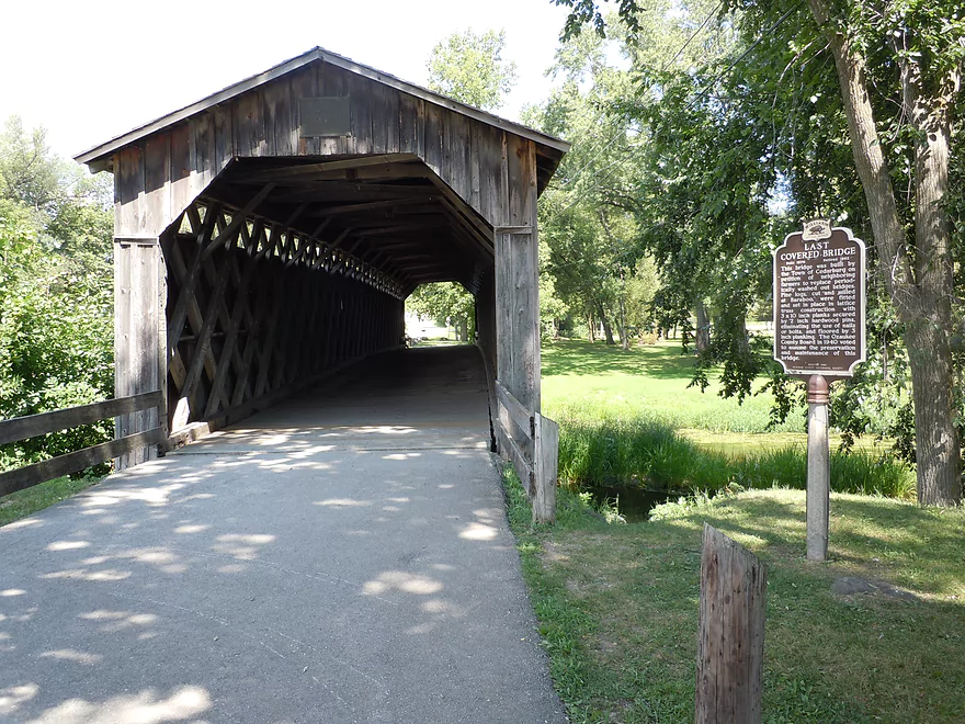
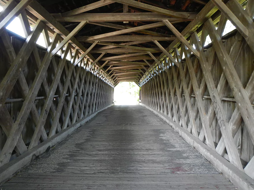
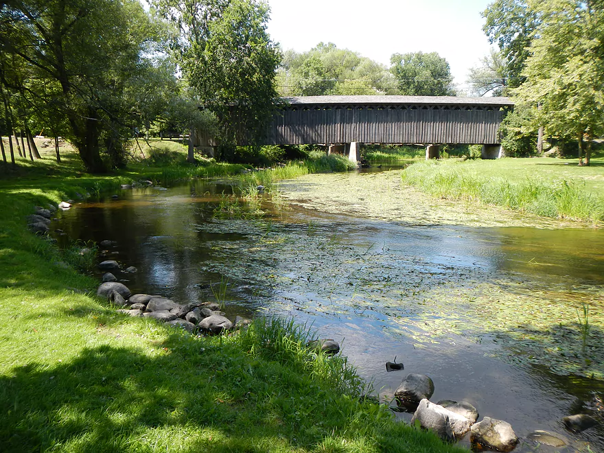
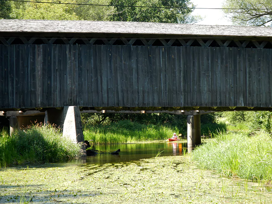
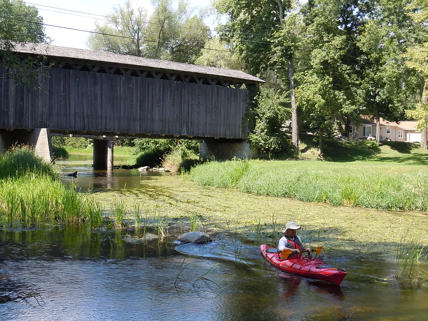
Only original covered bridge in Wisconsin
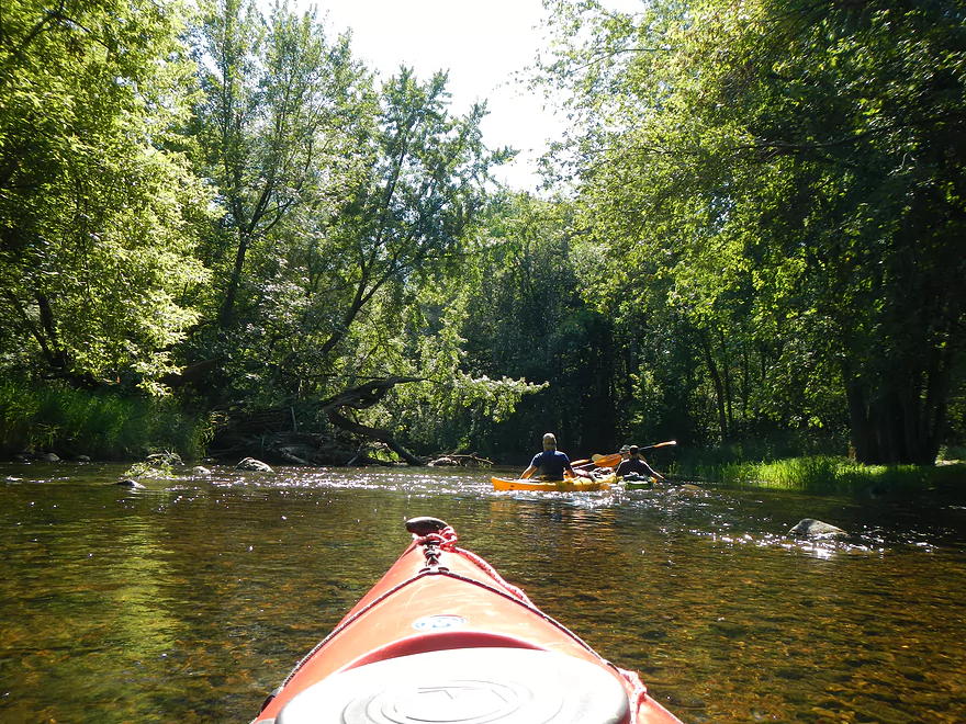
Looking down…terrific water
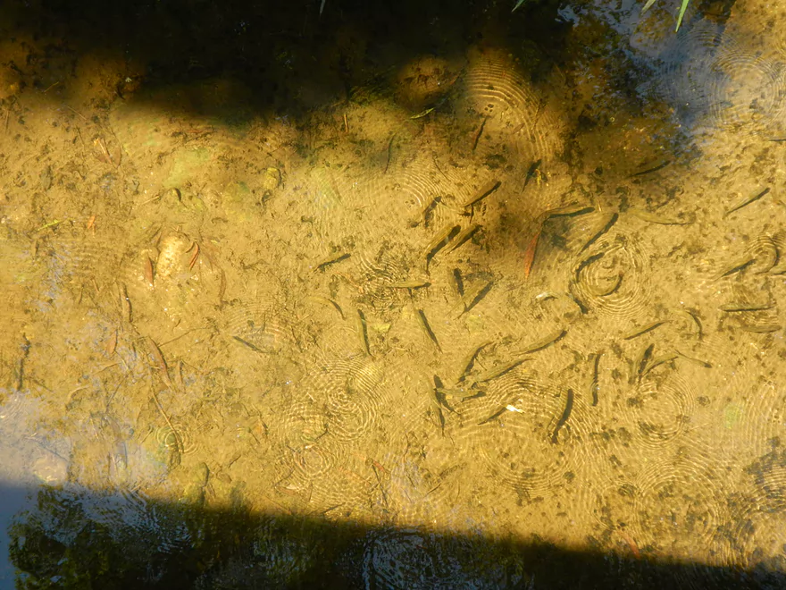
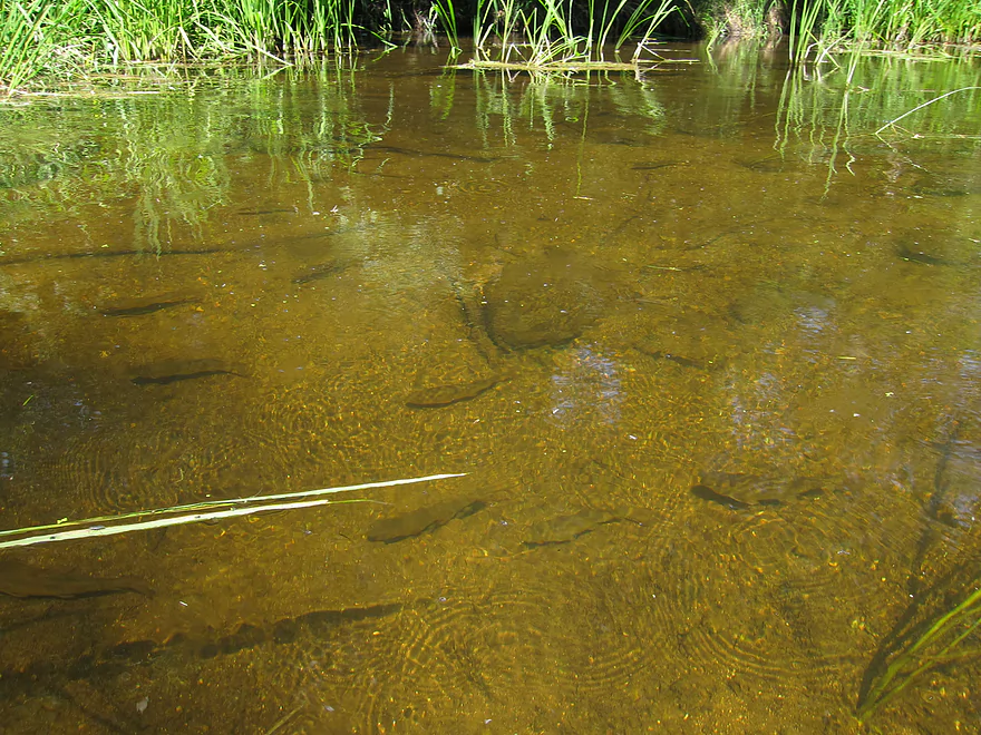
Oodles of fish
Favorite spot for photographers
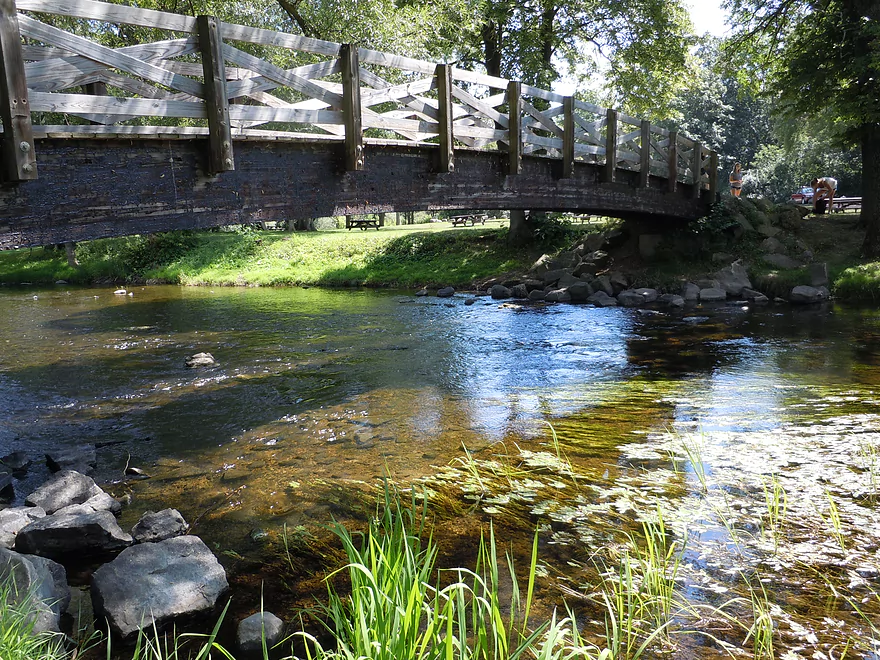
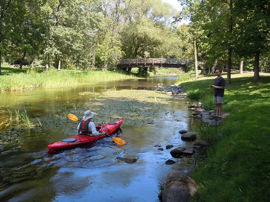
Nearby walk bridge…also scenic
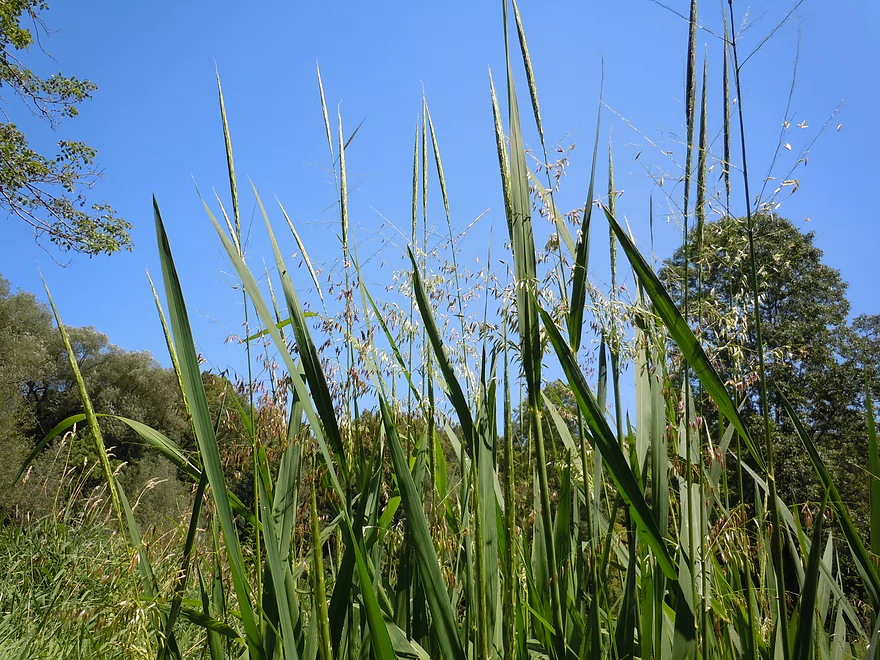
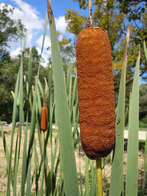
Wild rice
Wild corn dogs
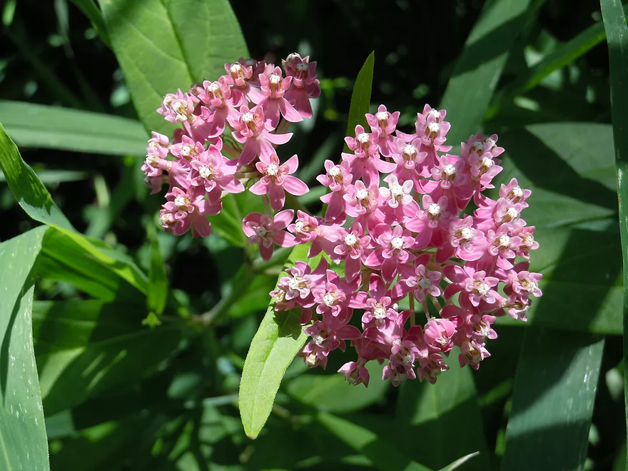
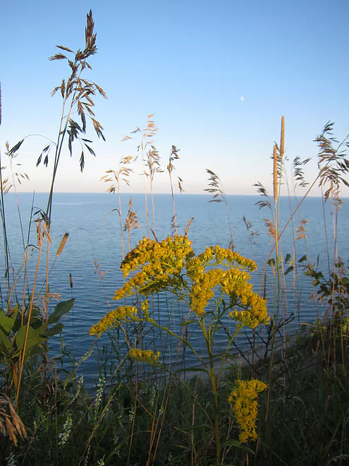
Swamp milkweed
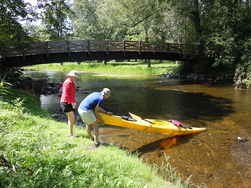
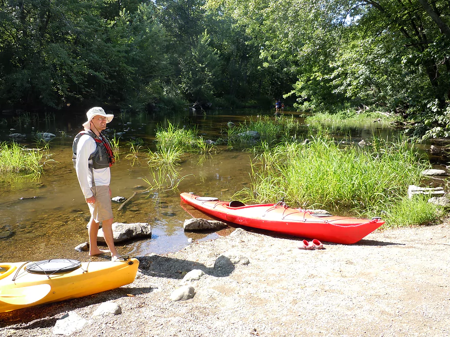
Nice put-in area
I put in further up
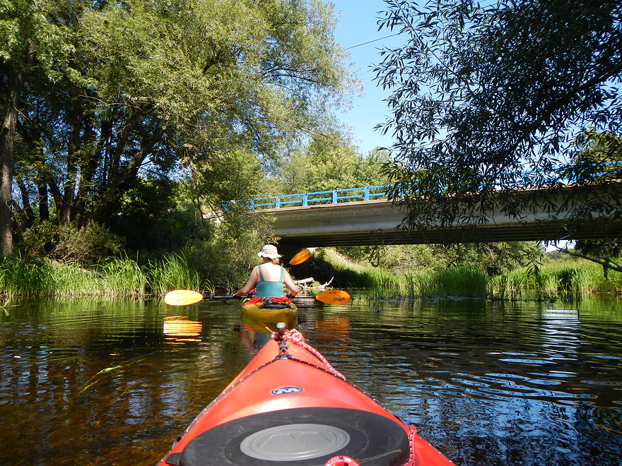
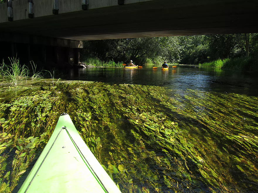
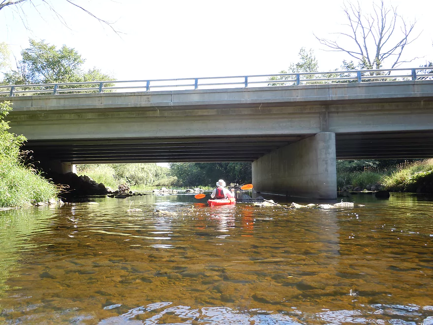
Chance to paddle under the bridge
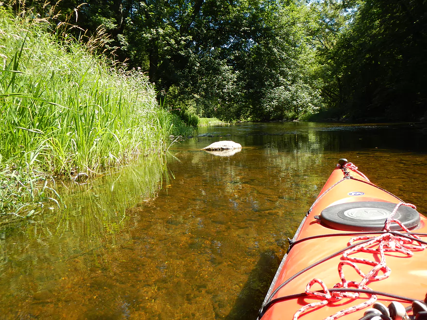
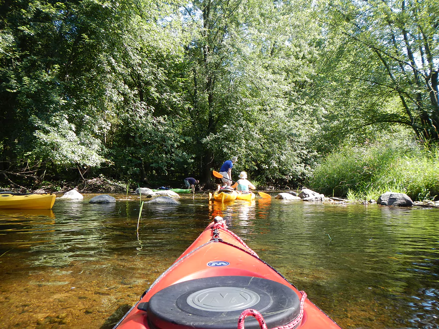
This is a shallow area relative to the entire segment
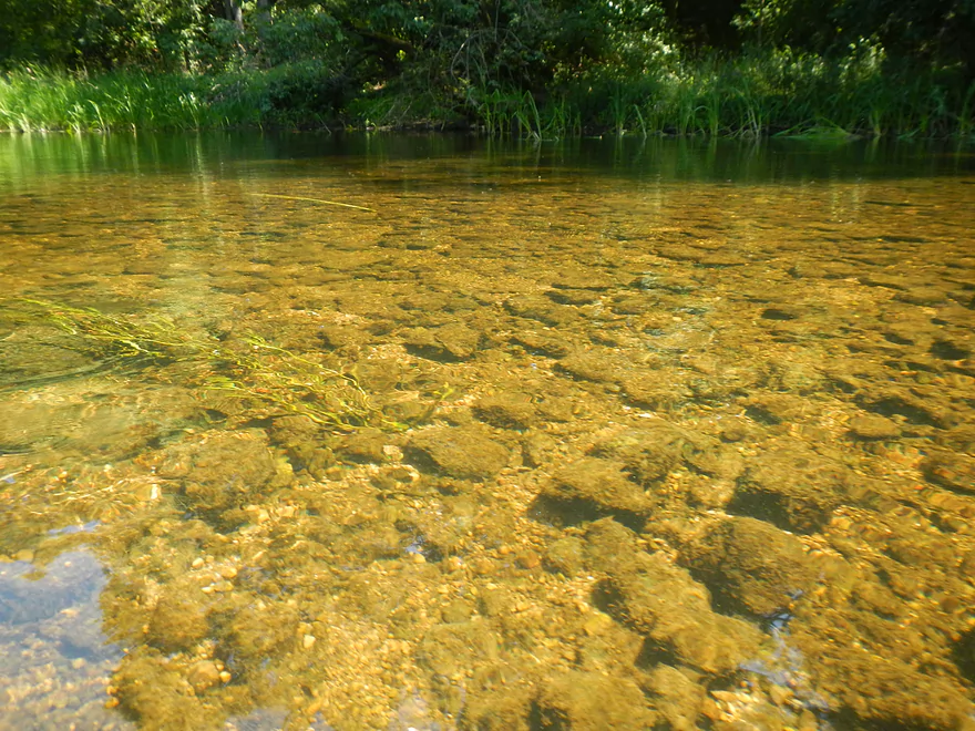
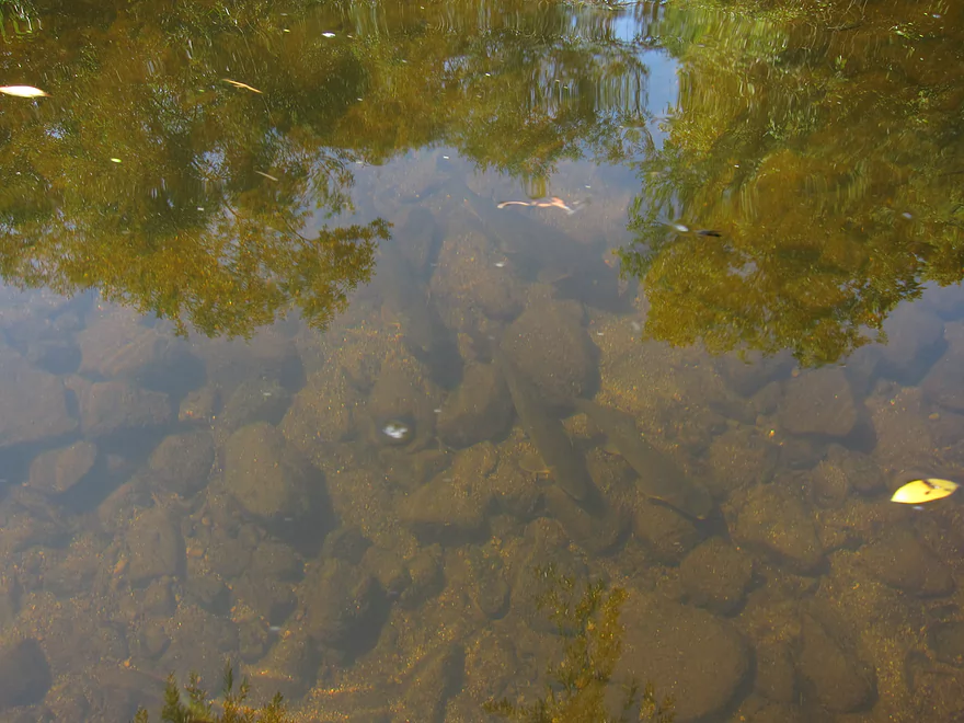
Potamogeton (pondweed)
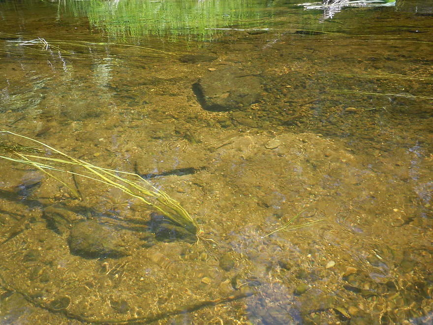
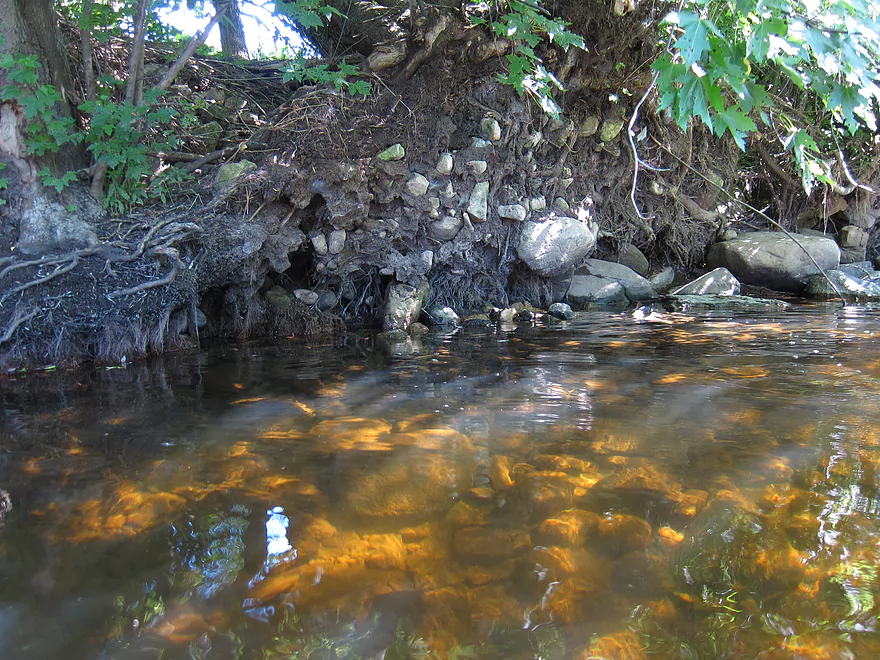
More clear water
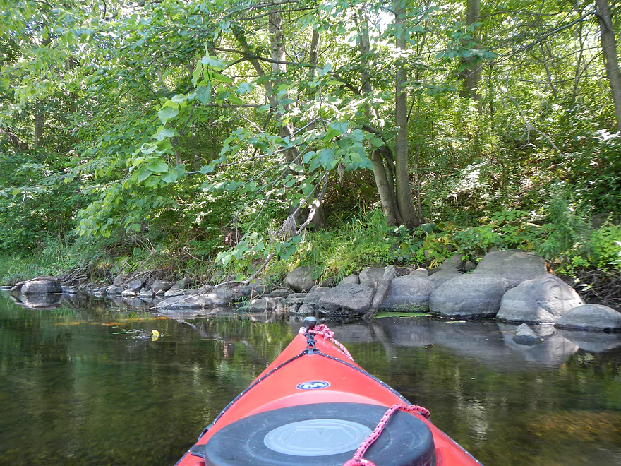
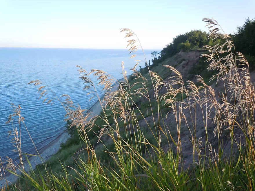
Rocky shoreline in spots
First bridge after park

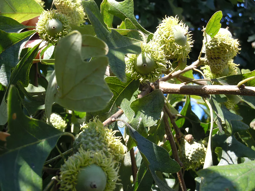
Bur Oak acorns
Bridge #2
Wild rice consumed the channel
Easy to plow through
Bridge #3
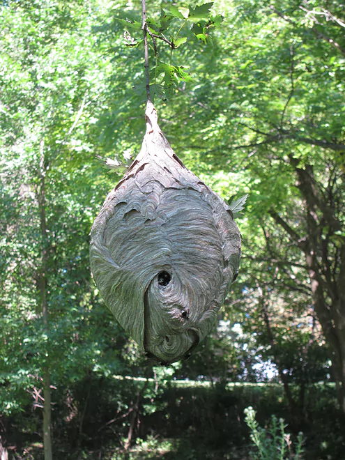
Large paper wasp nest
Larger fish
Nice mini-boulder gardens
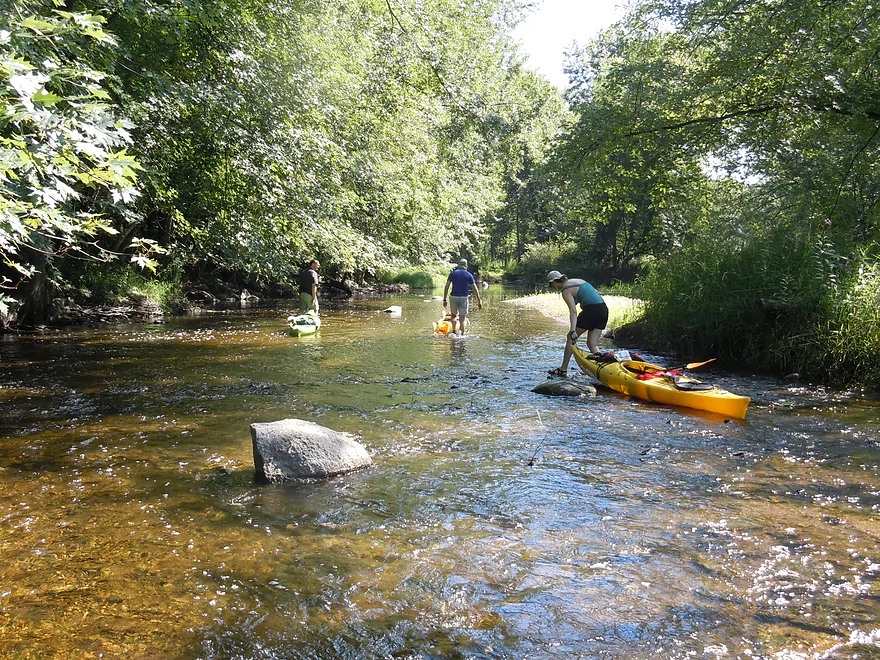
Time to get out
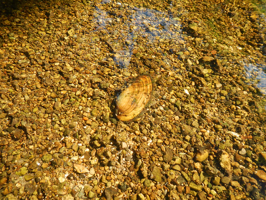
Number of clams on this creek
4th bridge
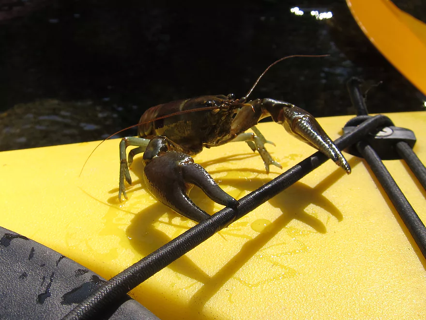
Clampy, the trip mascot
Nice landing
Bit of a hike…might be able to drive down
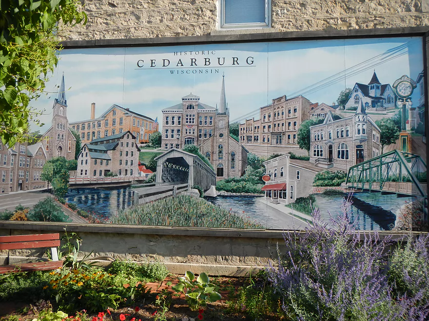
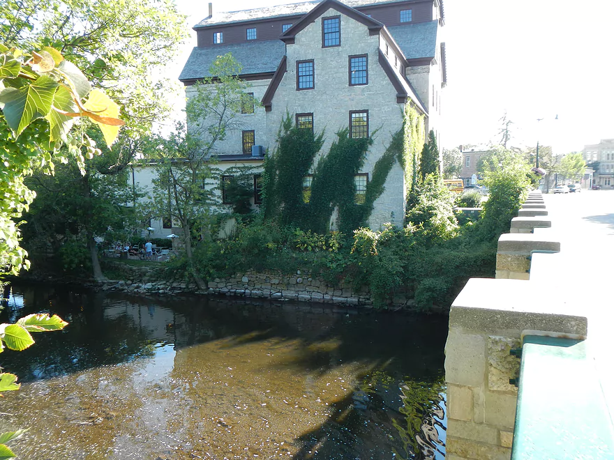
Time to go touristing in Cedarburg

Kind of an artsy downtown
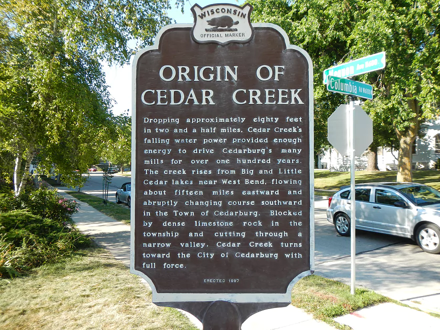
80′ in 2.5 miles! Means wonderful rapids/falls hidden under flowages.
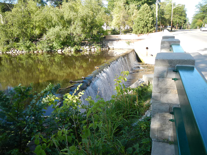
One of the dams in town
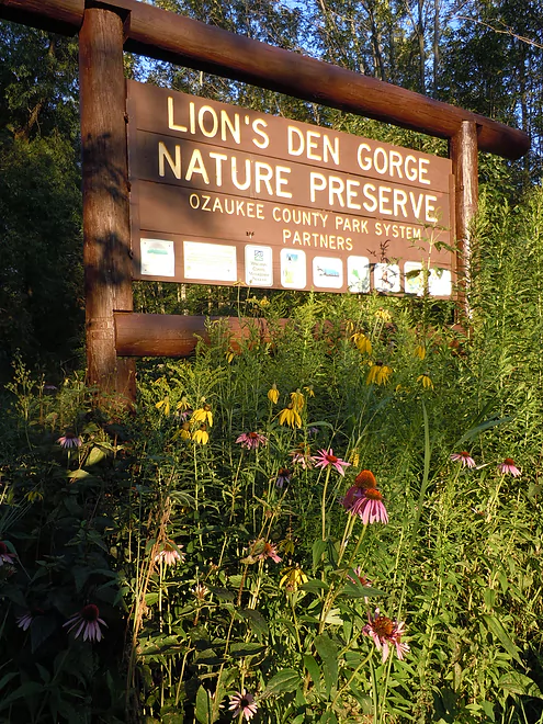
Time to go touristing in Lion’s Den Gorge
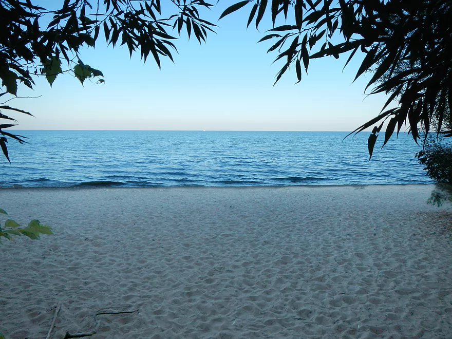
Nice beach overlooking Lake Michigan
Even nicer overlook
Cedar Creek

Cedar Creek is a decent-sized tributary of the Milwaukee River that runs through the small town of Cedarburg just 30 minutes north of Milwaukee. While not widely known state-wide, the locals know all about it, and it is a popular paddling location for Milwaukee area residents.
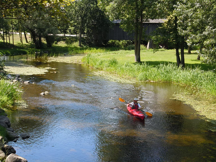
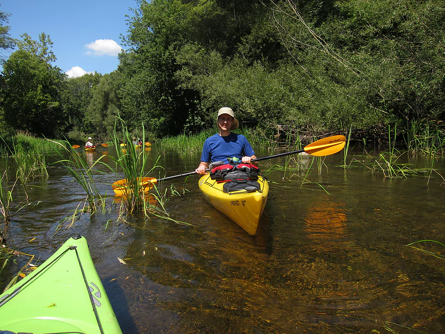
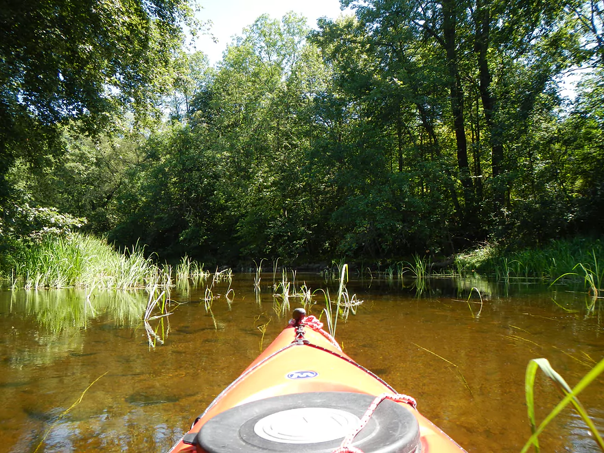
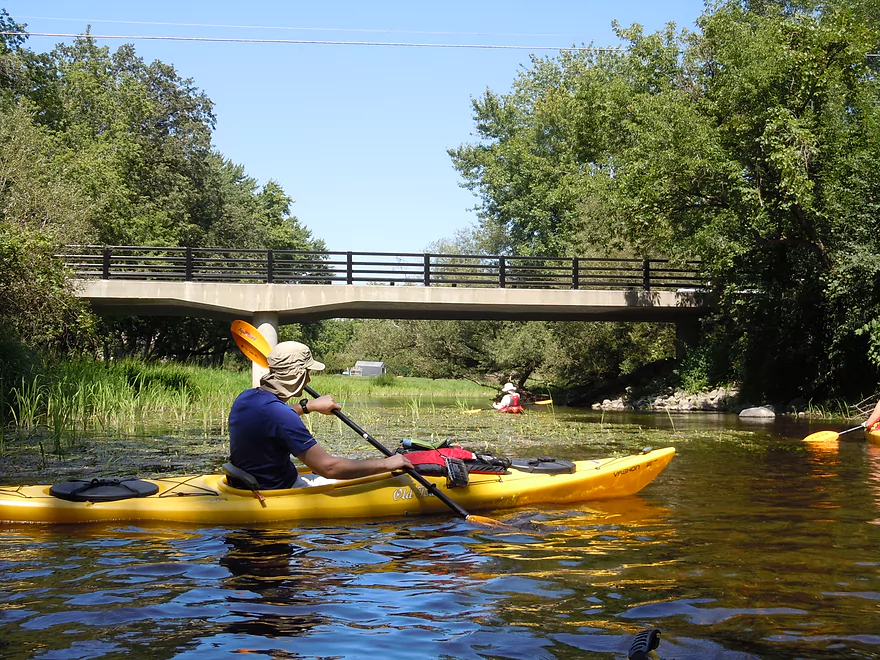
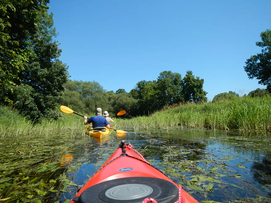
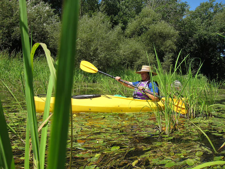
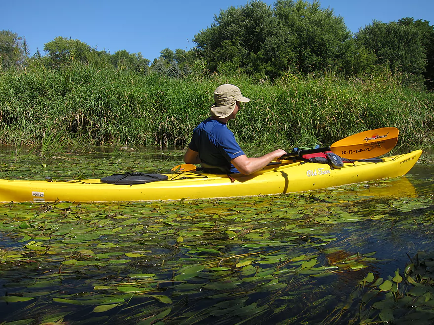
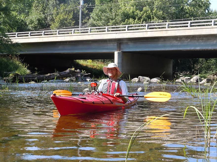
There are a number of put-in options (see map), but because I was worried about water levels (more on that later), I opted for a short 3.6 mile stretch from Covered Bridge Park to Grafton Lion’s Park (ending roughly where Cedarburg starts). Covered Bridge Park is an ideal put-in. Nice parking, bathroom, and launch area. This is a crowded park, however…and not because of paddlers. Here resides the historic “only original covered bridge” in Wisconsin. It’s very pretty going over the creek, and people love to take pictures there. There is a second walk bridge just a little downstream that is scenic as well, and it is worth it to take the time to walk around the park before you paddle.
The water level at Covered Bridge is low relative to the rest of the segment that we did. Don’t be discouraged by how shallow it is, as it gets deeper shortly after. We went at 30 CFS/5.24′, which is considered low, but probably around normal for August. Generally speaking, there were some bumps around Covered Bridge…the middle section of the river was fine…and the last 1000 yards to Lion’s Park were very bumpy and we had to get out a couple of times. Not a big deal IMO, as I have a high tolerance for low water portages (log jams are a different story). Others may disagree…if you have a tight cockpit or v-bottom boat, this may be more of an issue. I originally got the idea to do the trip from a “Treasures of Oz” tourism site which has a nice guide to the creek that I suggest reading. They describe 5.5′ as scrapey and that above 6.5′ as fast and only for experienced boaters. They also stated there were rapids (1 to 1.5) but at our water levels, they were just minor riffles (maybe 0.5 rapids). It is an interesting contrast to think that the creek we ran, which was so mild, could be so fierce during high water, but it is believable and should be a cause for concern for potential boaters.
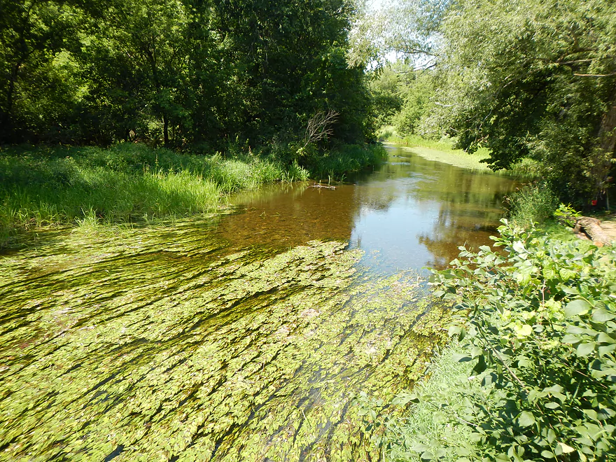
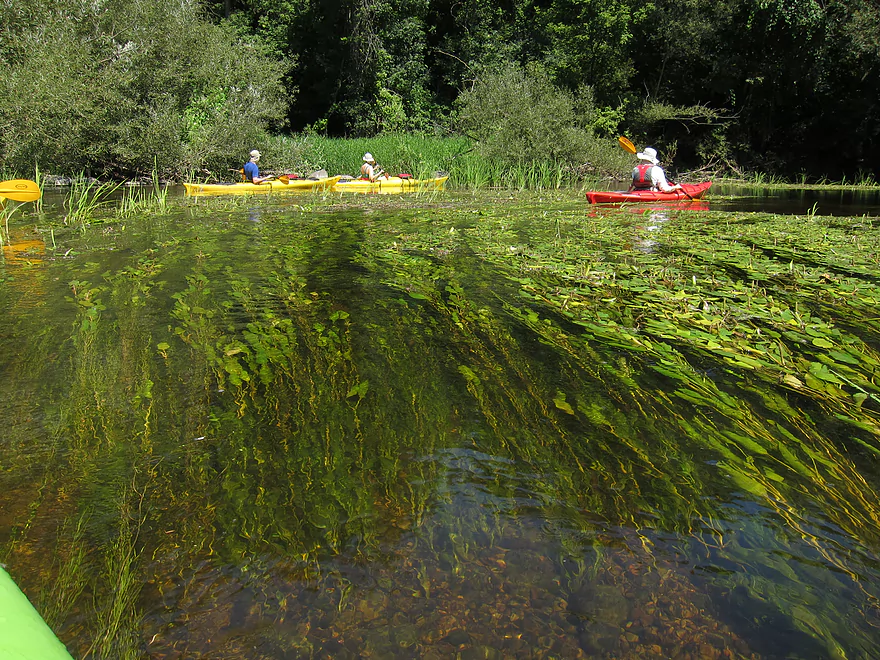
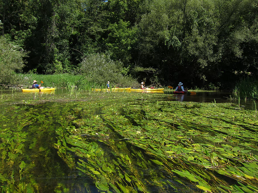
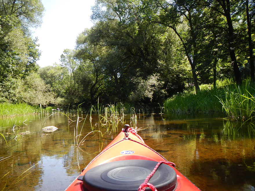
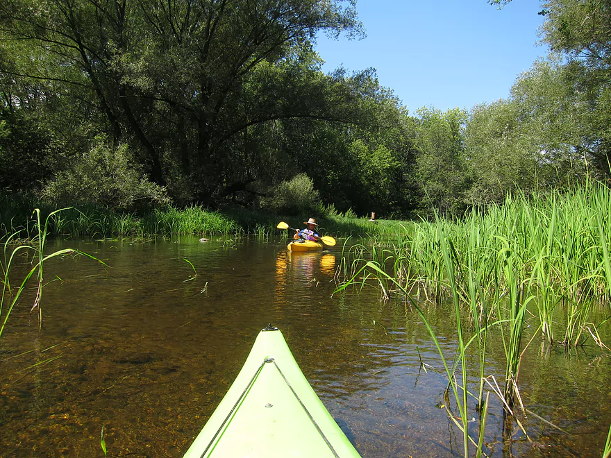
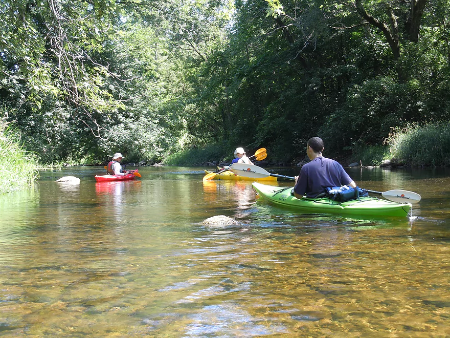
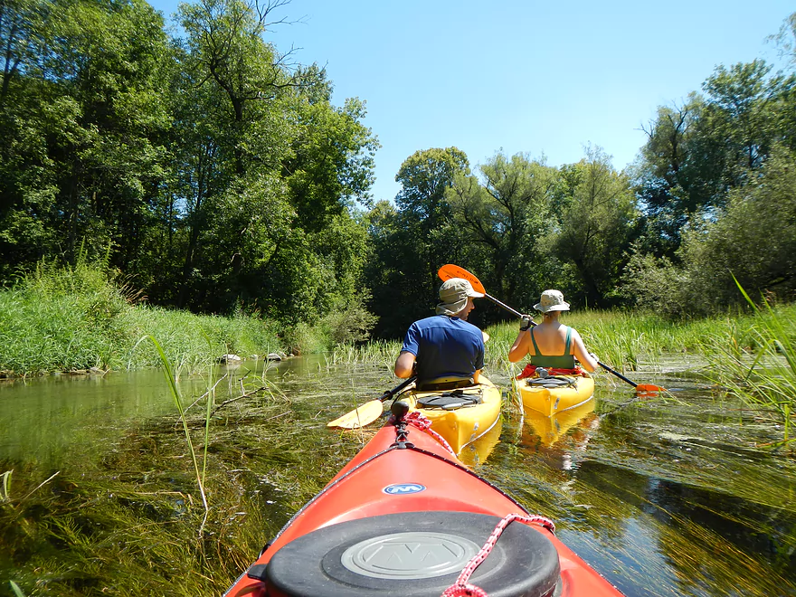
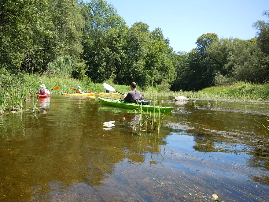
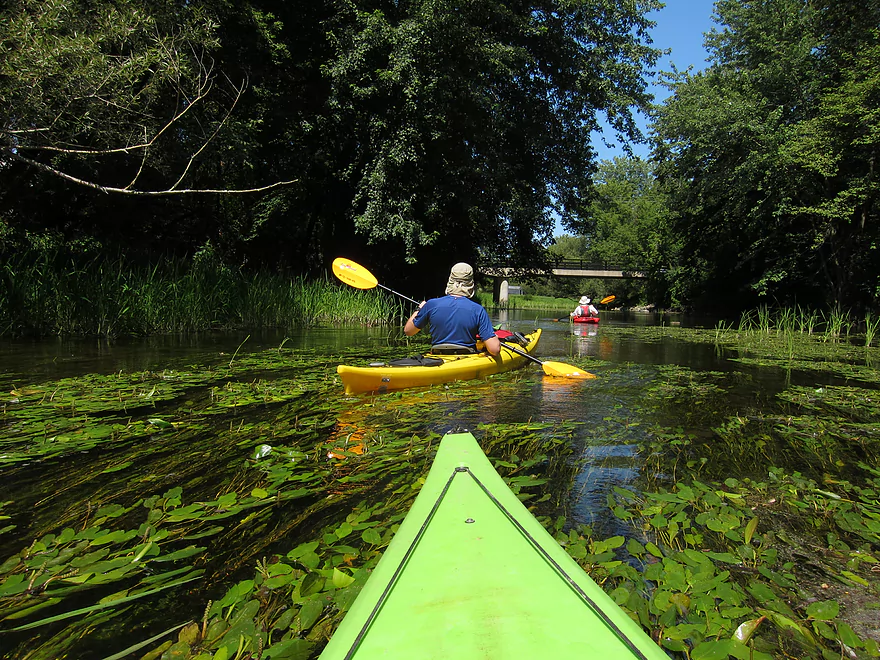
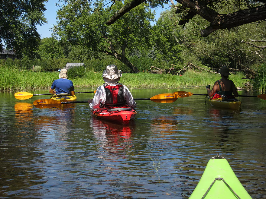
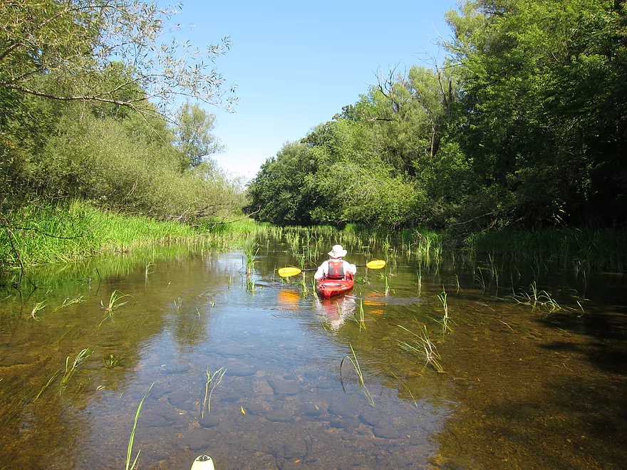
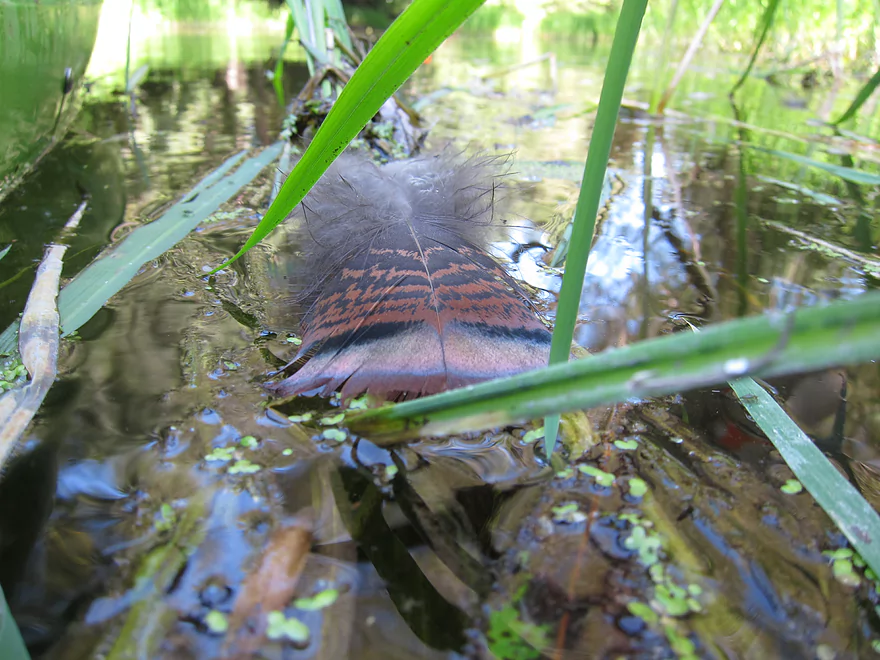
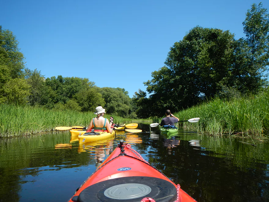
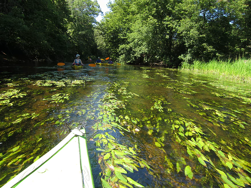
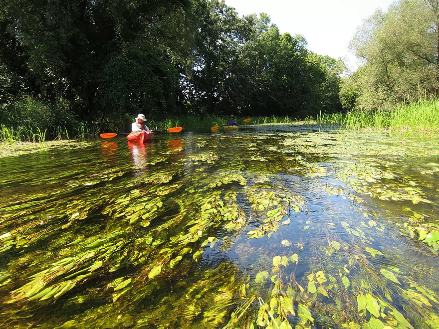
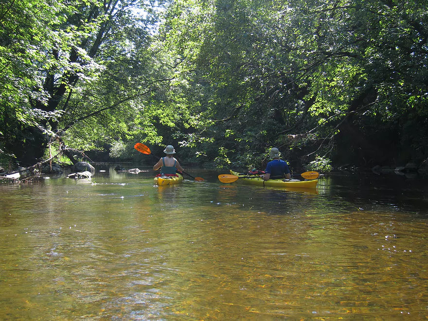
The highlight of the trip (along with the covered bridge) was the incredibly clear water. I’ve paddled a number of rivers/creeks and this might be the clearest I’ve ever run. This might be seasonal…most rivers lose water levels and flush out springtime flood sediment by August, so tend to be much cleaner than in spring and early summer. A neat thing about this is that the creek has a lot of fish which are fun to track from your vantage point on a kayak. There was one section of the creek where I was herding fish around trying to get a nice picture…which is so novel because you just can’t do this on so many other water bodies. Fish aren’t the only things that look great through clear water…the clams, crayfish, and Potamogeton (aka pondweed) were amazing as well. Very surreal paddling through Potamogeton forests.
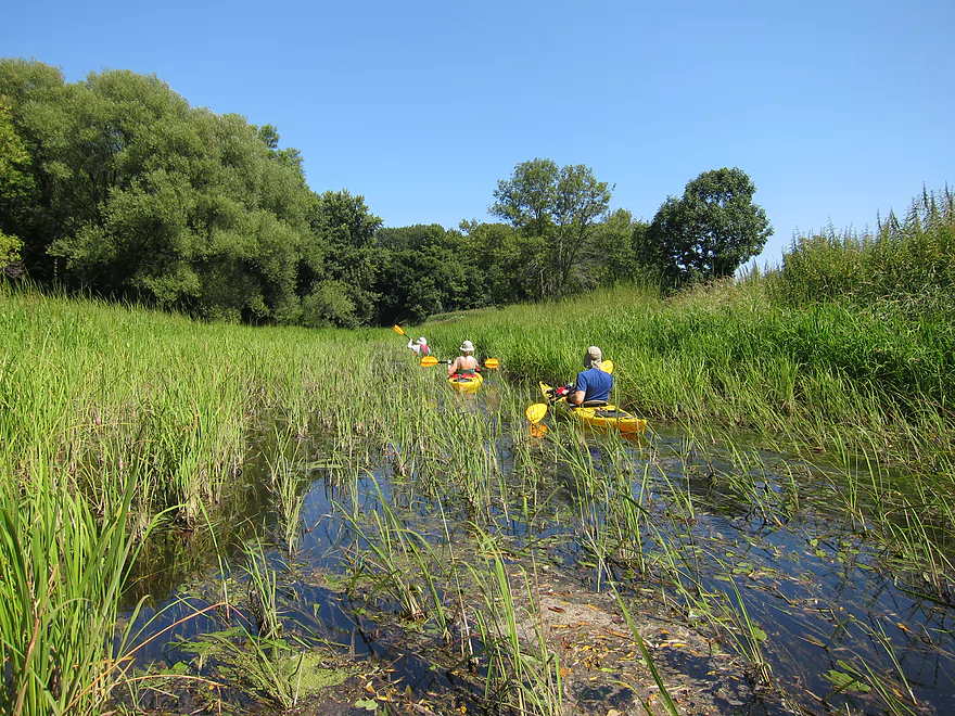
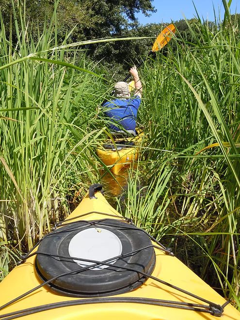
The other interesting plant on the trip was the abundant wild rice, which I’m sure you could harvest during fall. It was quite thick in spots and in one area spanned the width of the creek. Not a big deal, as this was easy to ram through and didn’t extend very far.
Again, the take-out close to Lions Park is THE most shallow area. Bring aquatic footwear as there are sharp rocks in the substrate. While for the most part this trip was pretty remote, close to Lions Park houses start to pop up, which is unfortunate. Lions Park (like Covered Bridge) is popular, but also has bathrooms and nice parking. It is a bit of a hike from the parking lot to the landing, but you might be able to drive down on an access road to reach the landing. Not sure. In hindsight, I would not have taken out at Lions Park but rather at Boy Scout Park (all marked on the map). This would extend the trip to 5 miles total (roughly) and you would take out by the dam. While I’m sure the river after Lions Park is still quite shallow (perhaps unbearably), the flowage will kick in soon and depth would be a mute issue.
There are other paddling options below Boy Scout Park, but things get tricky from there on out. Cedarbarg (which the subsequent section flows through) has a steep drop of 80′ in 2.5 miles (that’s fast!). Unfortunately, about half this gradient is submerged under four flowages. If Cedarburg were to ever wise-up and remove their dams, they could restore some wonderful falls/rapids that used to exist their natively. After the second dam and to Highway T is a whitewater route and you can learn more about it from https://www.americanwhitewater.org/content/River/detail/id/2652/#main. In a nutshell, this route is probably class 2 normally…class 1-2 late summer/fall and class 3-4 during high water. The flowages are scummy (in contrast to the nice creek upstream) and filled with PCBs (as long as you don’t wade in the mud you’ll probably be fine). Do your research before running this section. The first dam they refer to (actually the 3rd dam in Cedarburg) is probably best portaged on the right. There could be property owner issues here (but paddlers have portage rights in state law). The second (4th) dam is very steep and tricky to traverse. Rope is recommended and I believe there is a permanent support rope on one side of the dam.
After Hwy T, I think the serious rapids die off and while I don’t know much about the area, think that locals like to start segments here and end further downstream on the Milwaukee River (at this point we’re close to the mouth). There may be nice ways to extend the trip upstream of Covered Bridge park as well. I can’t be certain, but the new high-def satellite images show most of the upstream bridges to have good potential as possible landing areas.
For local rental options, REI and Laack and Joys rent out kayaks/canoes within range of the Cedar. Aqua Guides and Outfitters will rent kayaks, do shuttles and is based I think in Cedarburg (but they don’t have an office, so you have to schedule trips in advance).
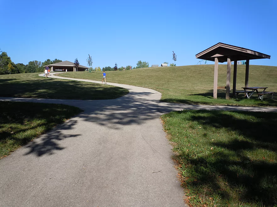
It’s always fun with paddle trips to explore non-paddling diversions if you have time after a trip. Cedarburg is a tourist town and the downtown (Washington Ave. along the Creek) is very historic and artsy. In Cedarburg, there is a nice riverwalk that is part of the larger Ozaukee Interurban Trail–one of the most popular bike trails in the Milwaukee metro area. Somewhat close to Cedarburg is Lion’s Den Gorge Nature Preserve, which has a nice trail system that leads to a wonderful overlook of Lake Michigan and another segment that cuts through a gorge (and micro-creek) onto a beach at the lake.
- Upstream of Hickory Lane: I suspect downed trees make paddling impractical.
- Hickory Land to Hwy 60: 0.7 miles. Short wooded section followed by an open stretch through a corridor created for power lines. Maybe a few jams.
- Note: Hickory may not be a good put-in.
- Hwy 60 to Division Street Landing: 1.5 miles. Creek here is artificially straightened, channelized, and runs through farm fields. Might be a jam or two.
- Division Street to S. Church Road Landing: 1.2 miles. Might be a jam or two…but it is a good sign that the start/end points are public landings.
- S. Church Road to County Aire Drive: 2.1 miles. Mostly an open marsh paddle. Might be a downed tree.
- County Aire Drive to Covered Bridge Park: 6.4 miles. Future trip idea.
- County Aire Drive to Granville Road/Hwy Y: 2.4 miles.
- Granville Road to Hwy NN: 1.4 miles. Good prospect. Might be an alternate landing halfway by Cedar Creek Road.
- Hwy NN to Kaehlers Road: 2.0 miles. Good prospect. At Hwy NN, you might need permission from “The Hub” diner to launch.
- Kaehlers Road to Covered Bridge Park: 0.6 miles.
- Covered Bridge Park to Grafton Lions Park: 3.6 miles.
- Covered Bridge Park to Robin Ct. Landing: 2.3 miles. Shallow but very scenic section.
- Robin Ct. Landing to Grafton Lions Park: 1.3 miles. Launch is SW of W. Cedar Creek bridge. Good section.
- Grafton Lions Park to Boy Scout Park: 1.6 miles. Half of the section is flowage paddling. Take-out NE of the dam or north of Bridge Road.
- Boy Scout Park to Rebellion Brewing Company/Cedar Creek Park: 0.4 miles. Simple flowage paddle.
- Cedar Creek Park to BMO Harris Bank: 0.8 miles. Scenic put-in with the option to run Class 3 rapids. This is followed by a millpond that has had recent PCB remediation. There is a dam by Highland Drive which may be a difficult portage (scout before running). This is followed by some rapids including a Class 2 and then another millpond.
- BMO Harris Bank is a speculative access. There is a large parking lot by the bank which directly faces the creek. The shore is steep here, but it seems viable.
- BMO Harris Bank to Nails Factory Dam: 0.2 miles. Simple millpond paddle.
- Note: The Nail Factory Dam is not a viable access.
- Note: The Nail Factory Dam is a difficult portage. Getting out (south bank) isn’t bad, but the bank is steep by the re-entry. Rope and good shoes are recommended. You could bypass the steep reentry by launching a few hundred yards downstream…but then you miss the scenic dells.
- Nail Factory Dam to Pioneer Road: 5.0 miles.
- Nails Factory Dam to Estate Bridge: 0.2 miles. Stunning scenery…best on the entire creek if not all of SE Wisconsin. Includes limestone dells, steep valley walls, exposed bedrock and many rapids. Rapids are mostly Class 1, but there is a Class 2 just above the Estate Bridge.
- Note: The Estate Bridge is not marked as private, but it is likely near private property so be considerate. This may not be a suitable access.
- Estate Bridge to Lakefield Road: 1.1 miles. There a few more Class 2’s before and after the railroad bridge. No more serious rapids after that, but tons of Class 1s. There is a large island where the east channel is sealed shut by logjams. The west channel has a series of three downed trees in a row that may require a super portage (easily done at shallow depths).
- Note: Lakefield Road is a bit steep but should be doable (northeast corner) and other paddlers have used this as an access.
- Lakefield Road to Green Bay Road: 1.0 miles. Starts with a scenic section of cedars followed by a large boulder garden. Neat artsy section after the removed dam that features fun Class 1 rapids.
- Note: The best access for Green Bay Road is northwest of the bridge by a bar parking lot. Get their permission before using their parking lot or maybe use the Hamilton Park parking lot instead.
- Green Bay Road to Mouth on Milwaukee River: 1.4 miles. Scenic wooded section with plenty of Class 1 rapids. Opens up later by a residential neighborhood. At the island fork, go left/north. The north channel is clear of logjams.
- Mouth to Garrison’s Glen Park: 1.3 miles. A surprisingly nice section of the Milwaukee River…clear, rocky, wooded and even had some light riffles.
- Nails Factory Dam to Estate Bridge: 0.2 miles. Stunning scenery…best on the entire creek if not all of SE Wisconsin. Includes limestone dells, steep valley walls, exposed bedrock and many rapids. Rapids are mostly Class 1, but there is a Class 2 just above the Estate Bridge.
Trip Map
View Cedar Creek in a larger map
Overview Map
Video
Photos Size:
Hi,
Do you know of any where to rent kayaks near Cedarburg, WI?
Thank you,
Michael
There are no kayak rentals availabe in Cedarburg, because it is still illegal to wade, swim, or use any kind of boat within city limits due to the dangerous pollution perpetuated by the dams.
I am quite curious … do you have any source that you can point to in support of the assertion that it is “…illegal to wade, swim, or use any kind of boat within city limits”?
Especially since, just downstream of Cedar Creek Park, in (what is marked on maps as) “Cedarburg Pond 121”, almost every homeowner has a canoe, kayak, or paddleboat tied to a tree or pier.
Yes, for a year, while remediation was being done on this pond and the next one downstream (the ‘Nail Factory’ pond) boating on those ponds was restricted (but only for the temporary safety issues while that equipment was active in the area).
There were (and likely still are) warnings about eating any fish from the creek, but I have never seen any indication of a general widespread ban on boating anywhere in Cedarburg.
RCS – I had it wrong about boats. They are only prohibited on the lagoons.
Swimming, wading etc is still prohibited within the city of Cedarburg by ordinance.
Hi Michael,
I’m not 100% sure, but try Aqua Guides and Outfitters.
262-618-4868 or 262-339-2664
Hi! We’re looking at purchasing land on Cedar Creek in the township of Cedarburg, so N/NW of city limits. Does anyone have safety data on those waters? Thanks for any info!
I think that is upstream of the pollution, but I advise contacting the DNR to be sure.
On April 23, we launched from Creekside Park on Cedar Creek Rd. and took out 8 miles downstream at Boy Scout Park. Here’s a link to map of shuttle route.https://goo.gl/maps/nHgVkjD8fF2Fe9KV6
Water was turbid after heavy rains the night before,360 CFS at 6.8ft on the gauge. No scraping, but still some rocks to avoid. This stretch was cleared on 22Apr2022.
Wildlife: Mink, woodchuck, muskrat, red-tailed hawks, flickers, wood ducks, Canada goose with 5 eggs in the nest.
Thanks for the feedback. I actually think that stretch of the Cedar Creek is best done on the lower side for the cleaner water (but not too low!).