
Nice park at the put-in
One of the springs is dammed to create a fishing pond
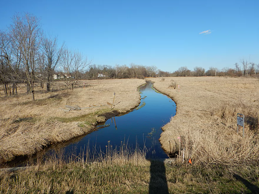
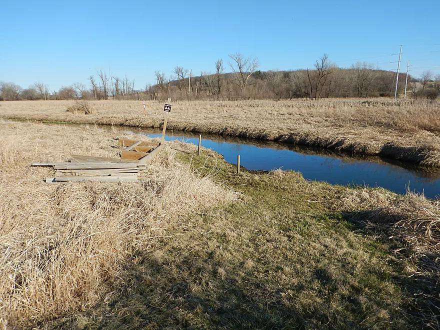
850′ hike to the water but not bad
They seemed to be chasing mice
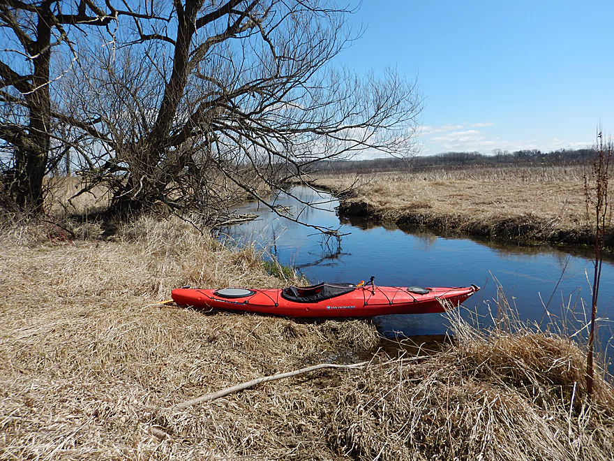
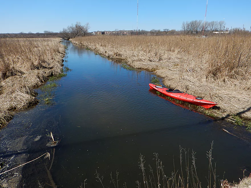
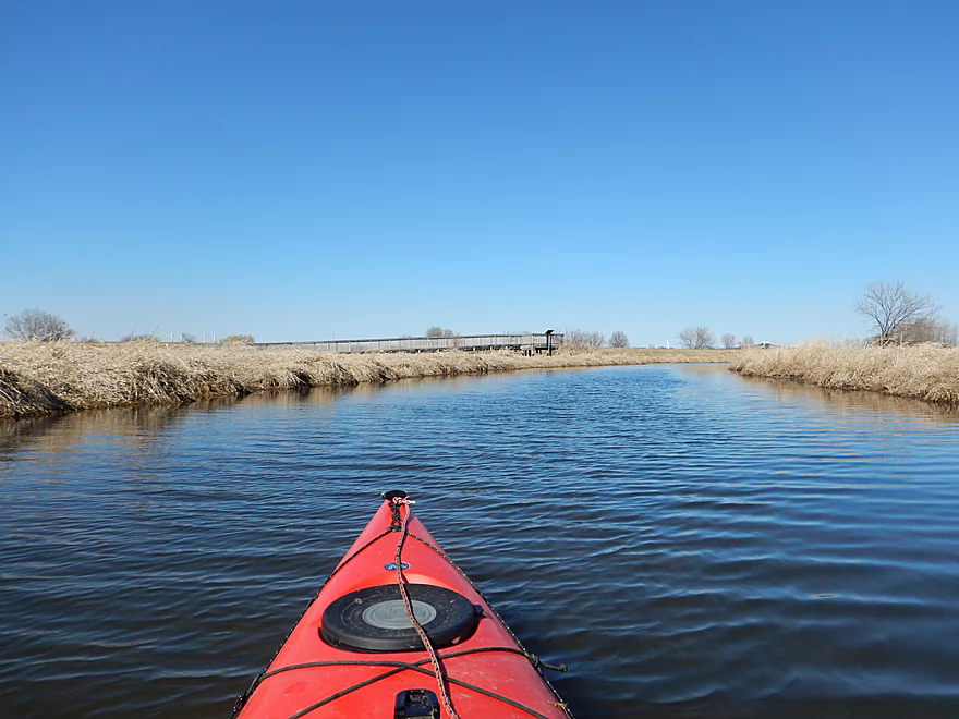
Launching at last

Some long stems of grass
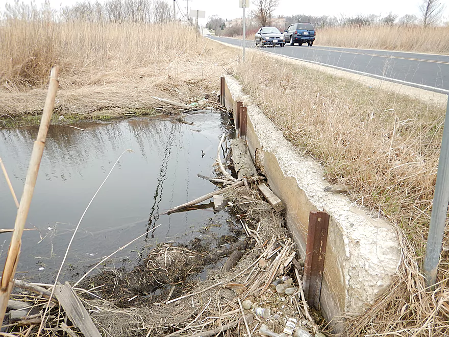
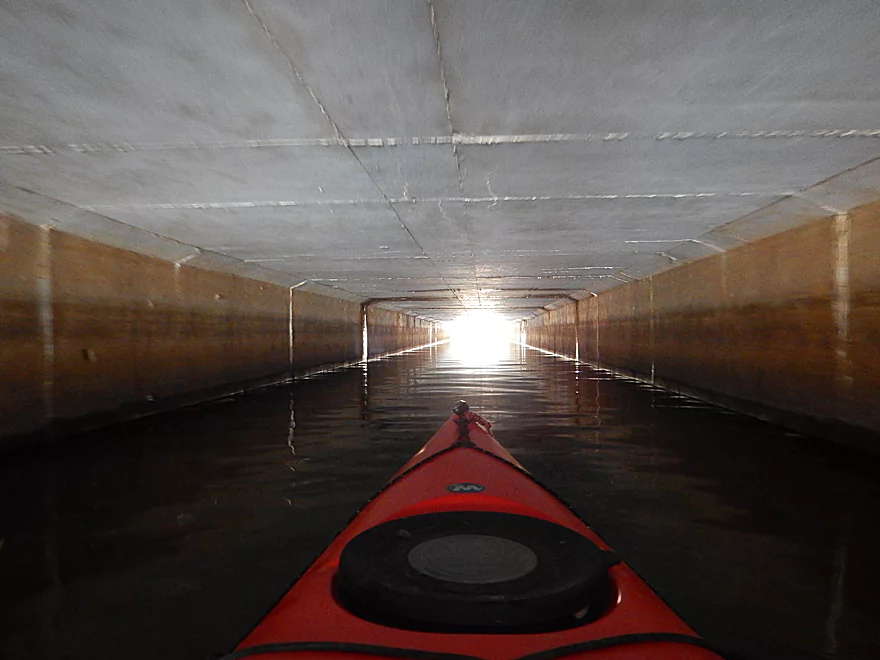
You will not fit under Syene Road
So time to portage
This is a starting option
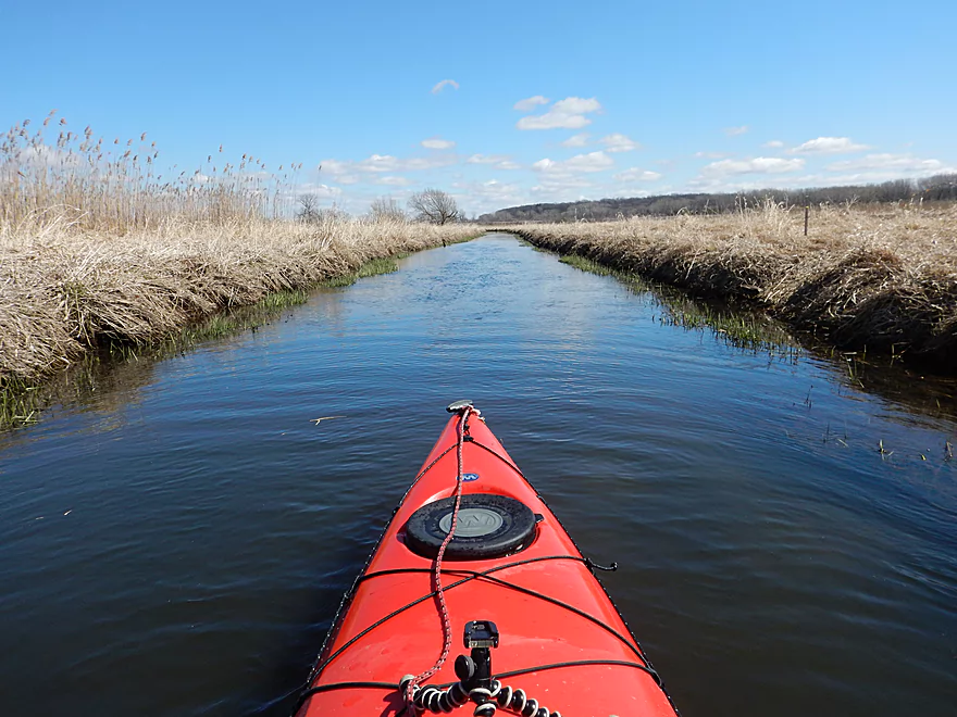
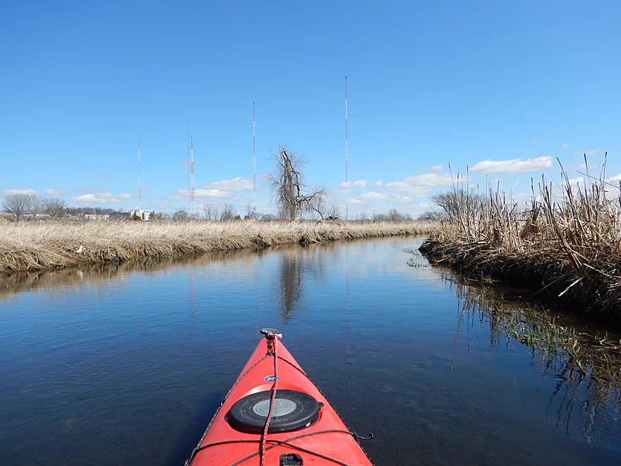
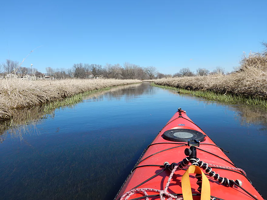
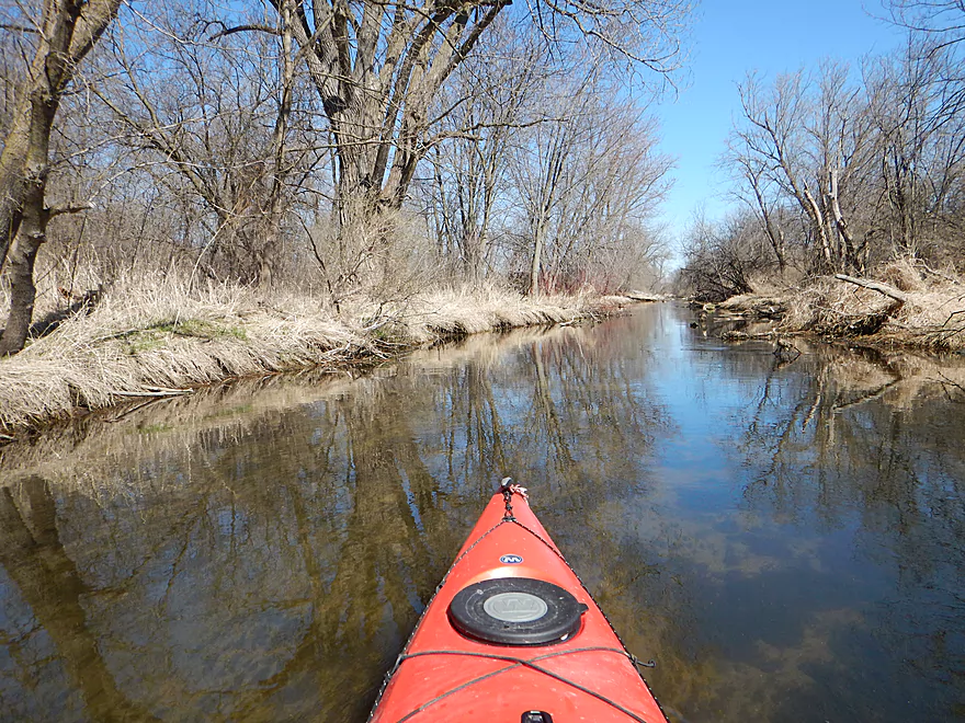
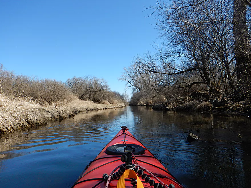
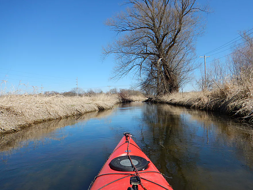
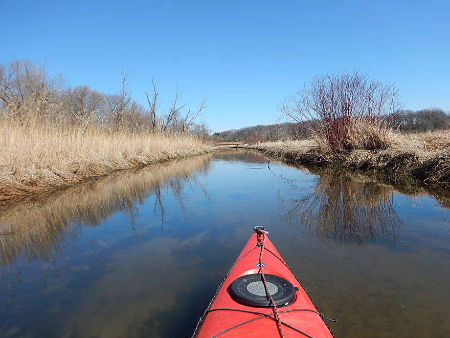
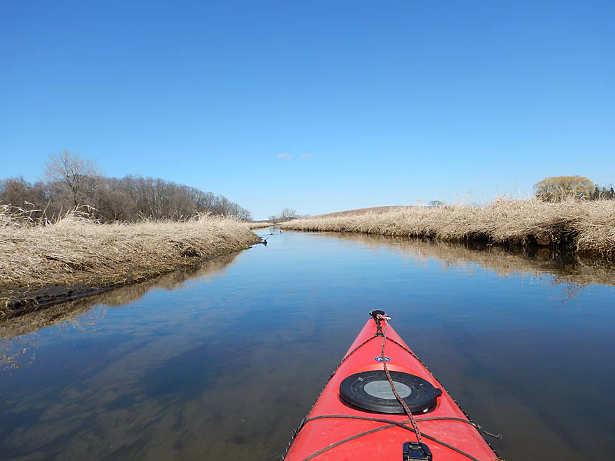
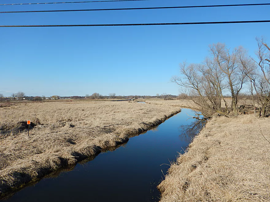
The creek is channelized in part
At your first intersection, turn left
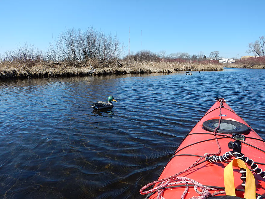
An oddly friendly duck
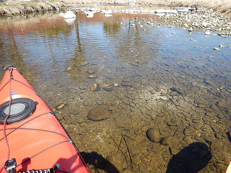
Amazing water clarity by one of the springs

Of all the springs, this is the best one
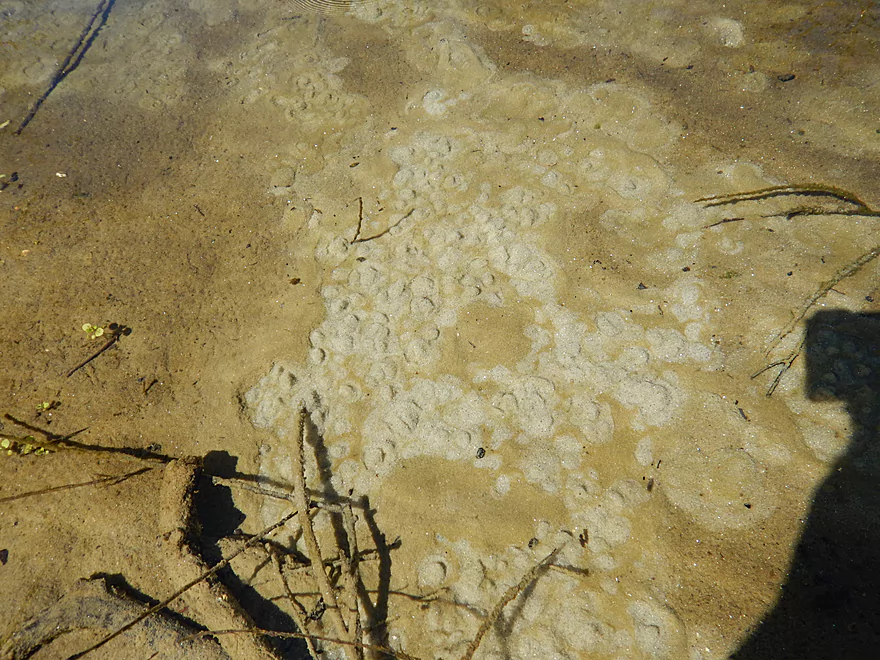
You can see the water bubbling out of the ground
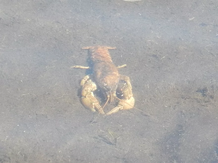
Friendly crayfish
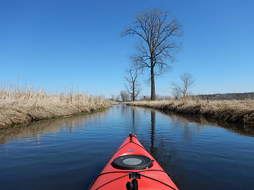
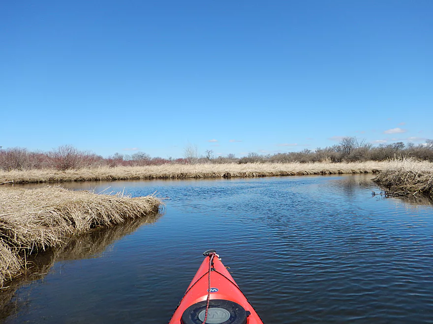
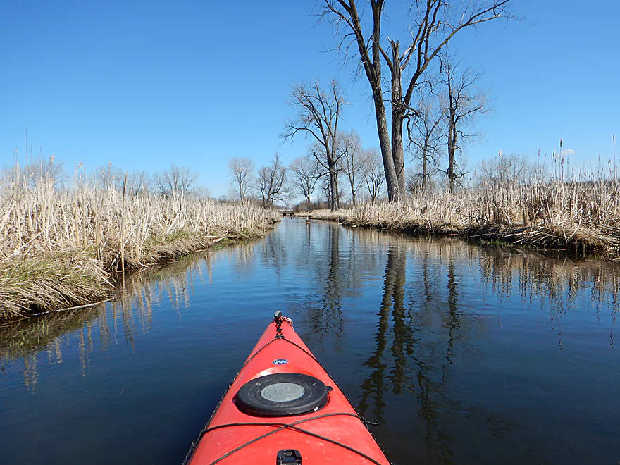
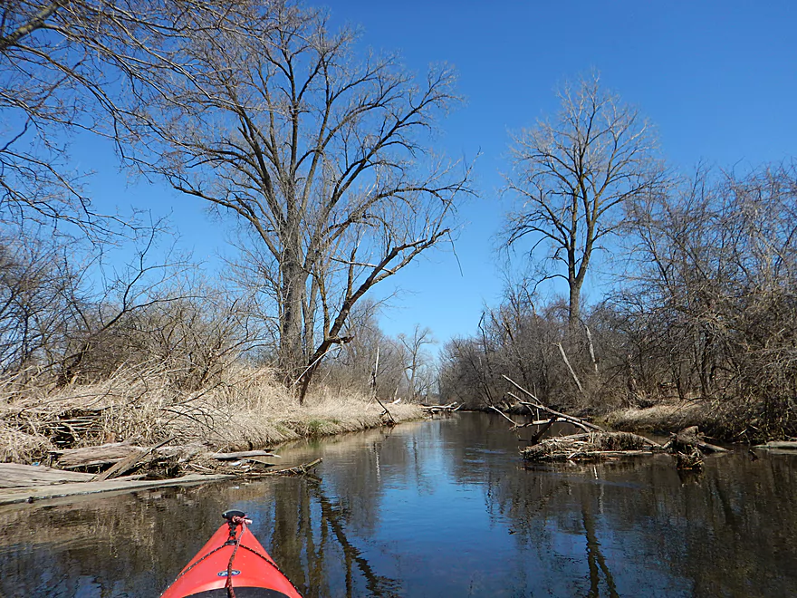
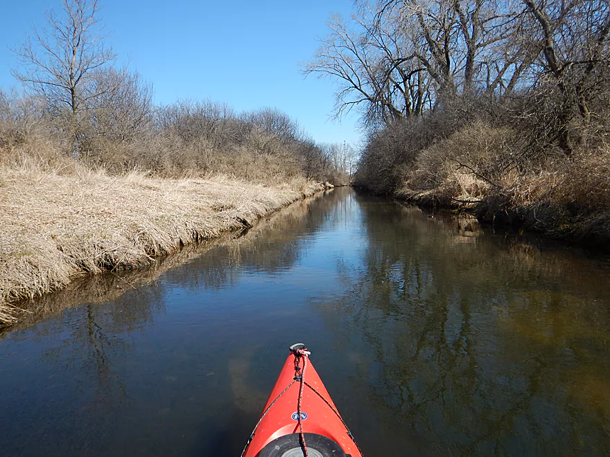
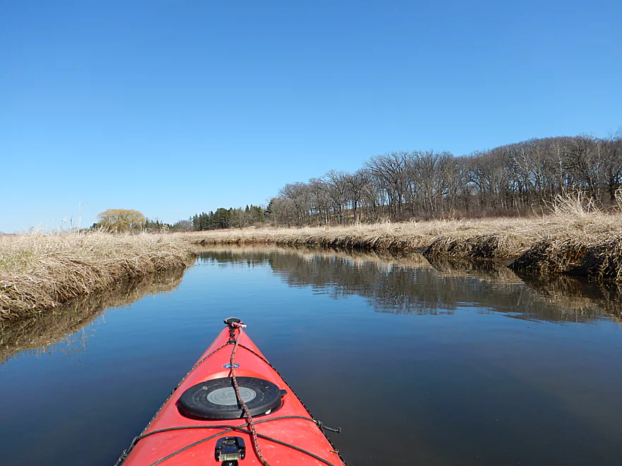
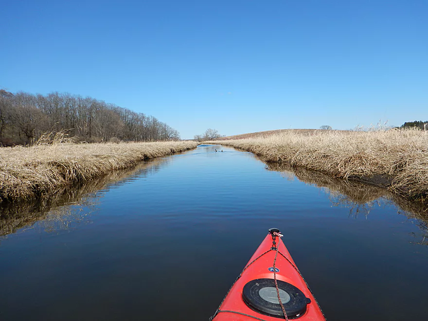
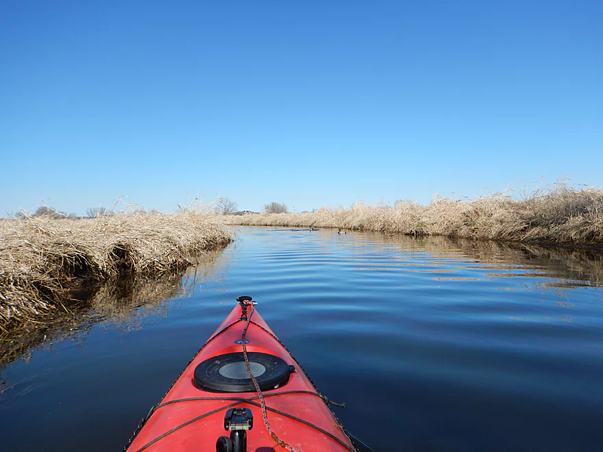
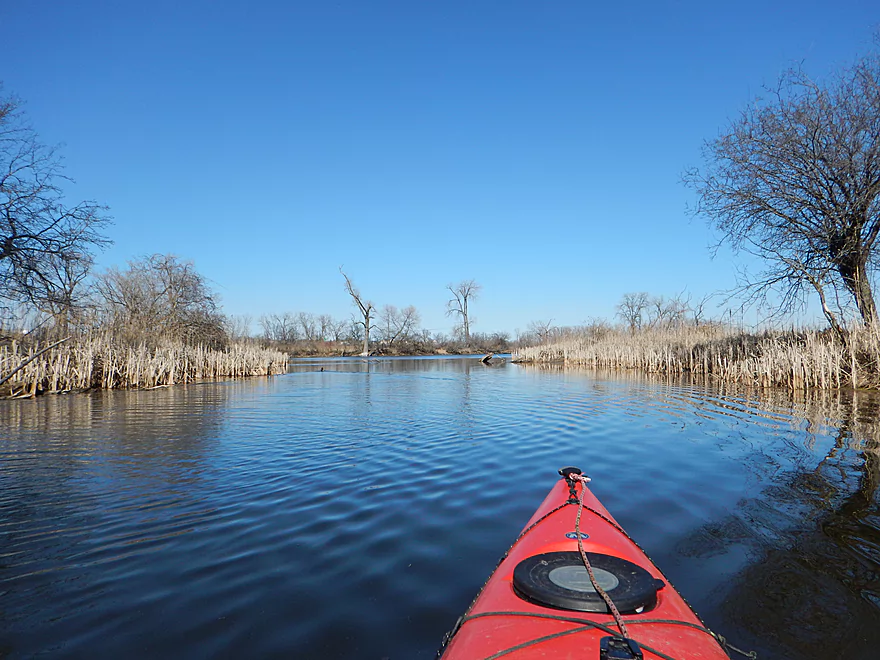
Very serene
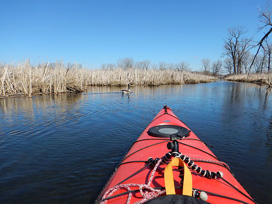
Lot of geese
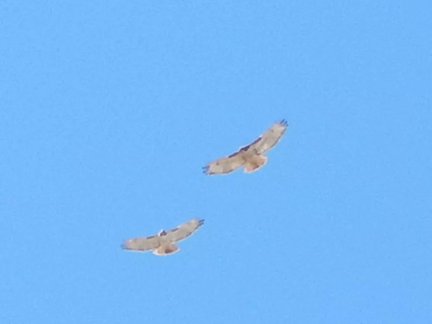
Birds of prey that appeared to be courting
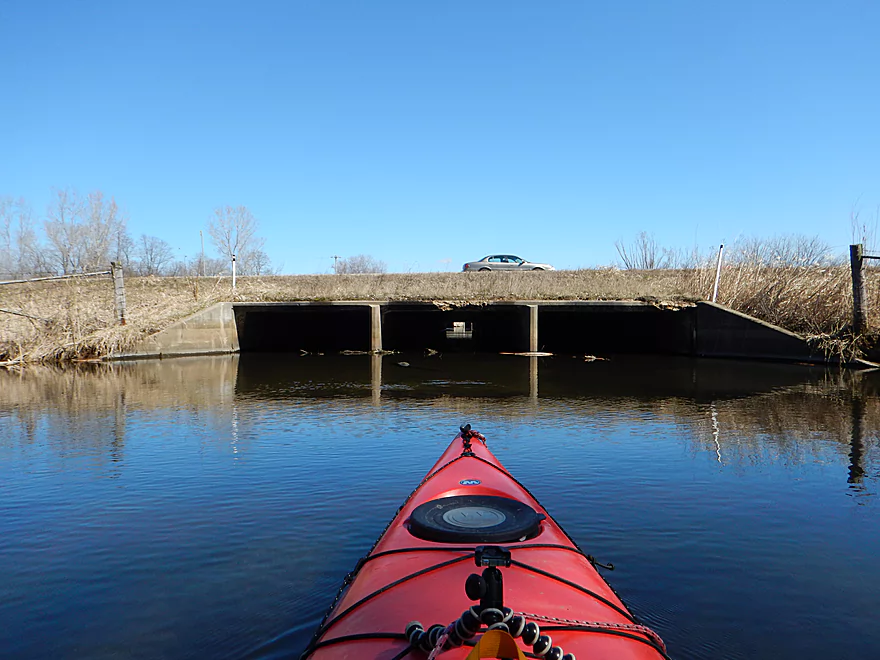
Very busy hwy 14
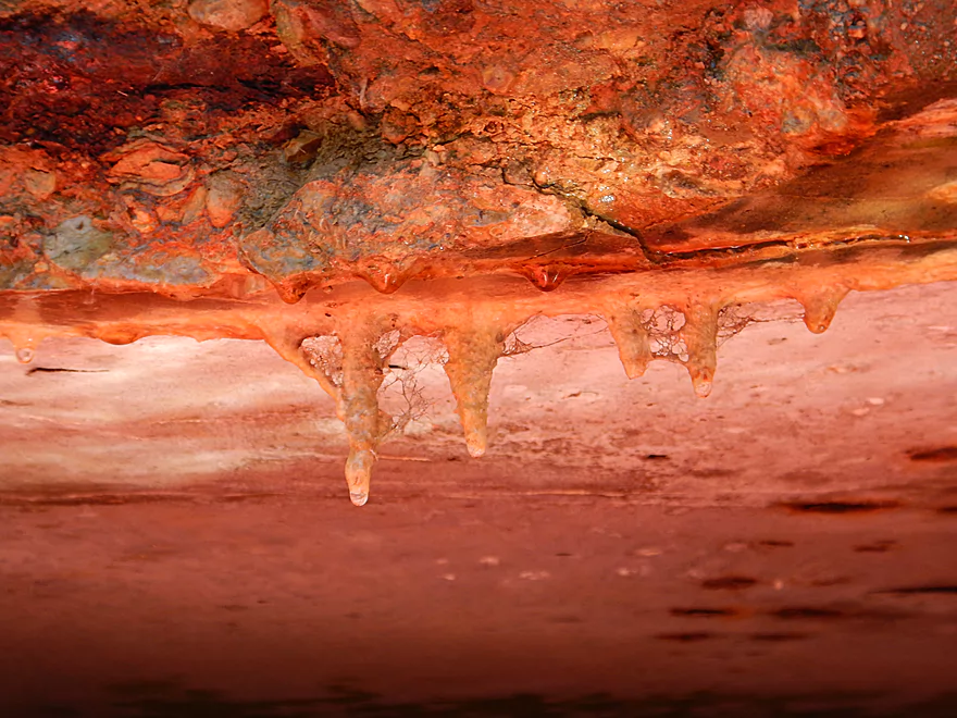
Some interesting stalactites
Engage warp
Disengage warp
Nice scene by hwy MM
There is a new landing here (partly under construction)
Another spring (not as nice as the other one)
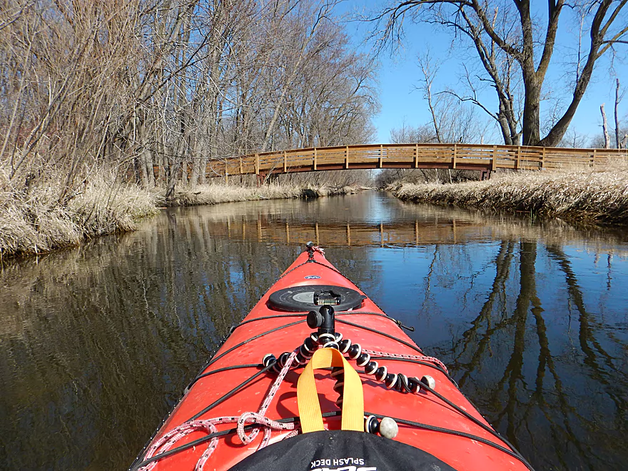
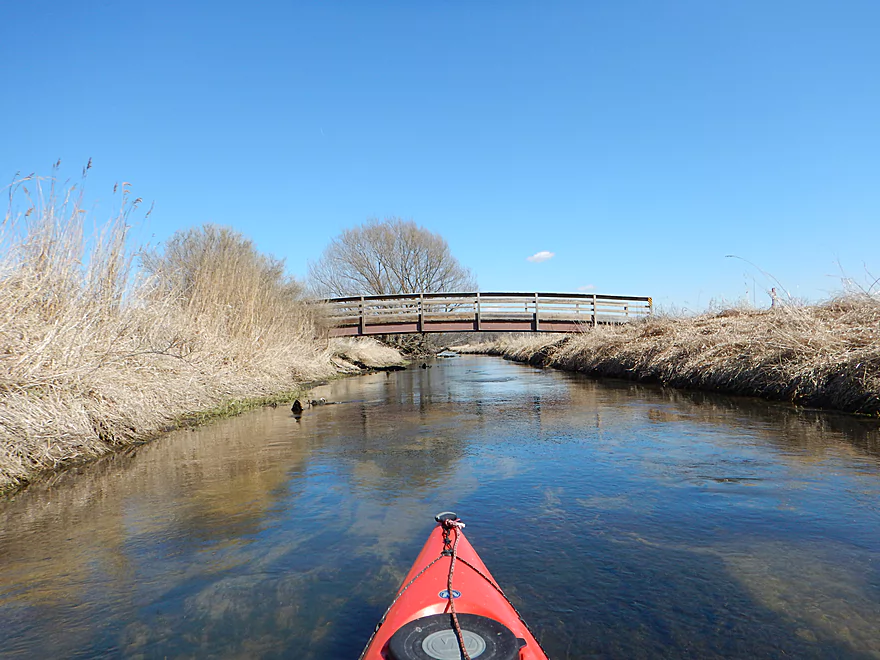
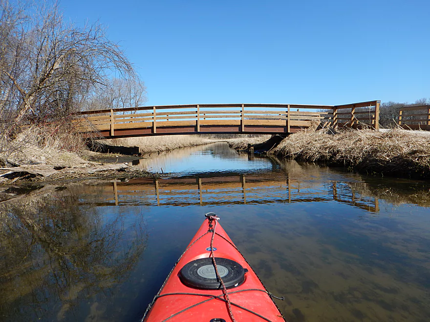
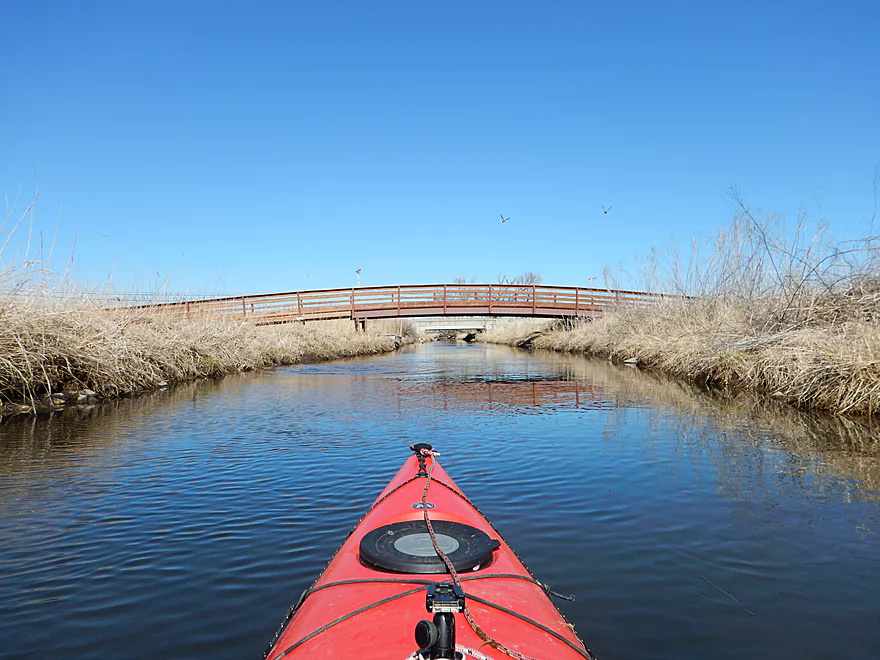
Pedestrian bridge from Indian Springs Park
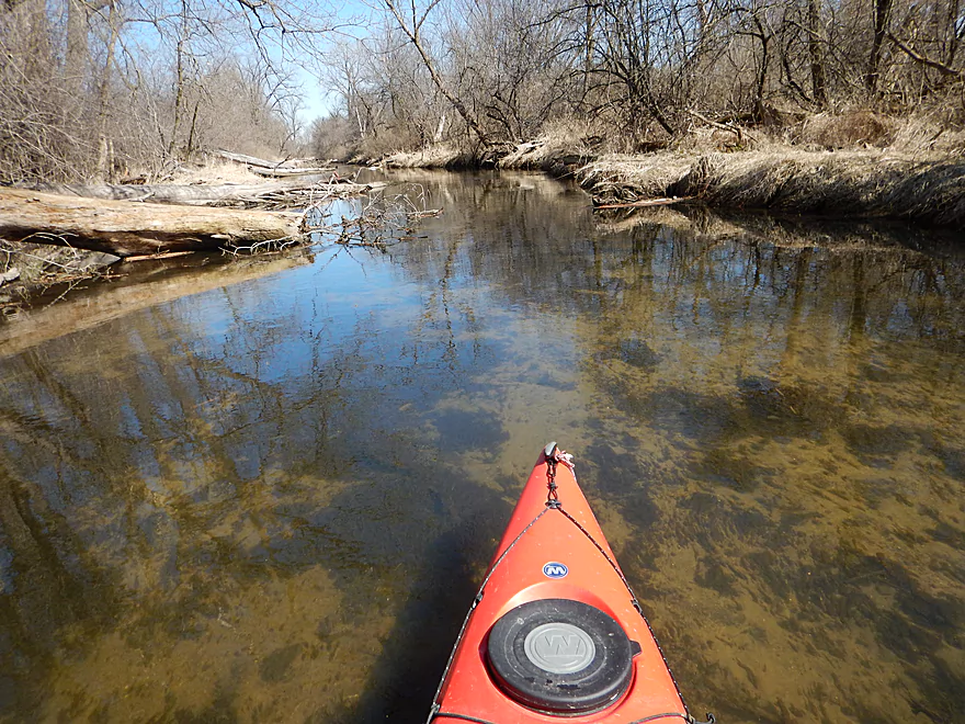
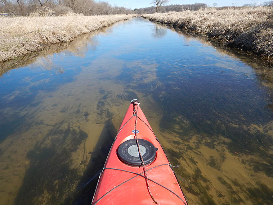
Surprisingly good clarity
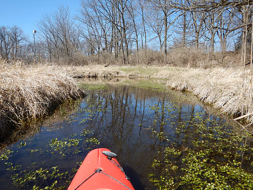
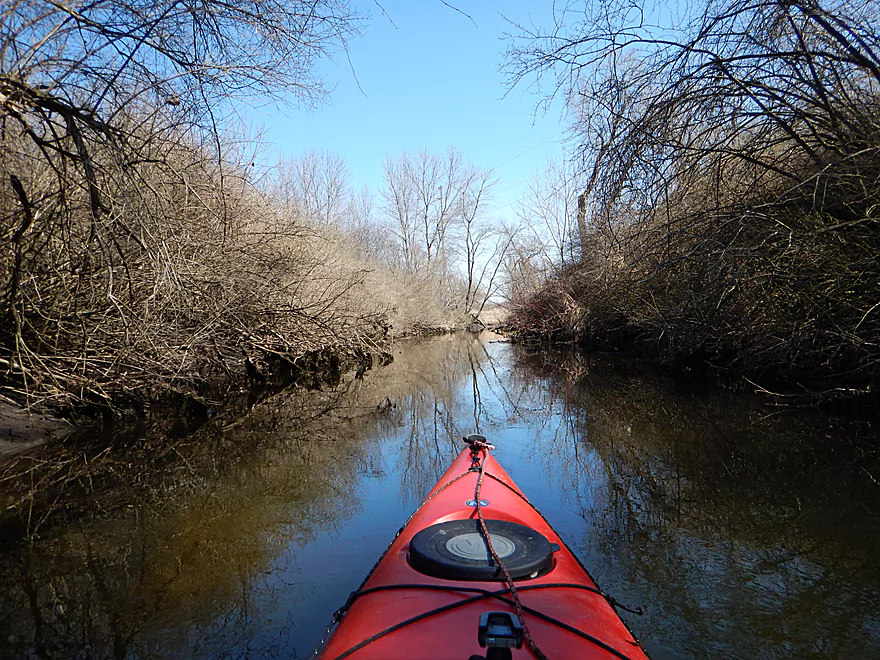
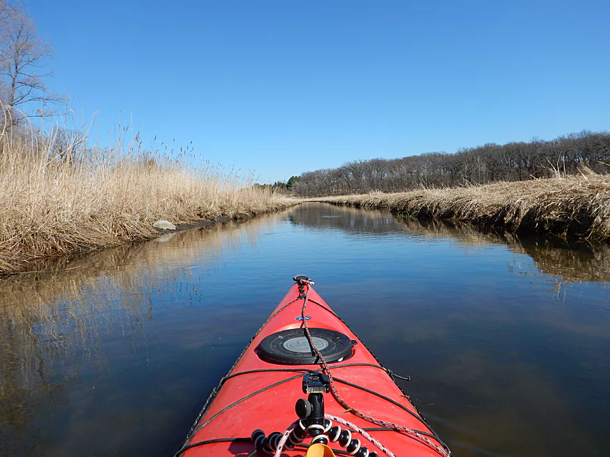
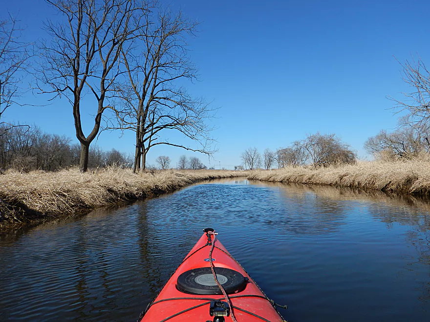
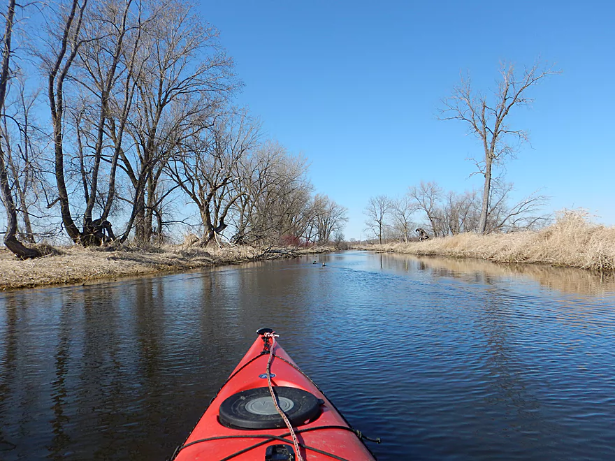
Marsh is replaced by woodlands
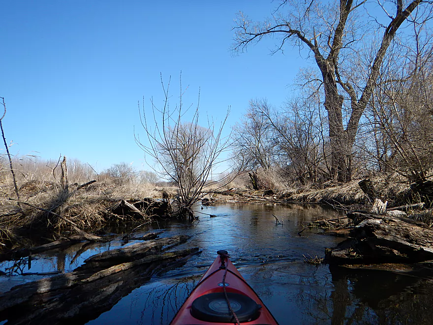
Log jams were never an issue
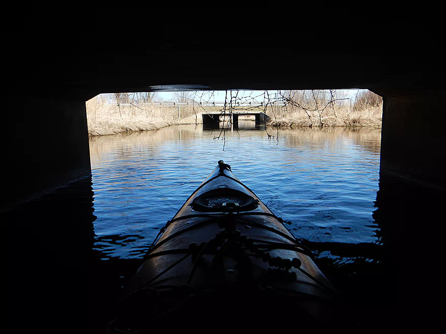
Bridge by Rustic Park
So cool
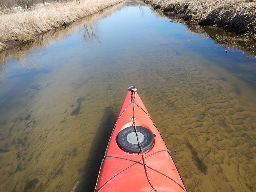
Surprisingly sandy
Second Rustic Park bridge
Drumlin in the distance (hard to see)
Mooreland Road canoe launch
Many take out here
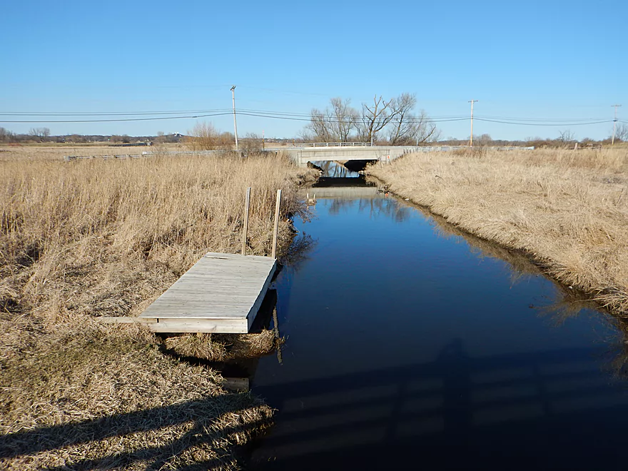
Nice launching pier
An observation and boardwalk
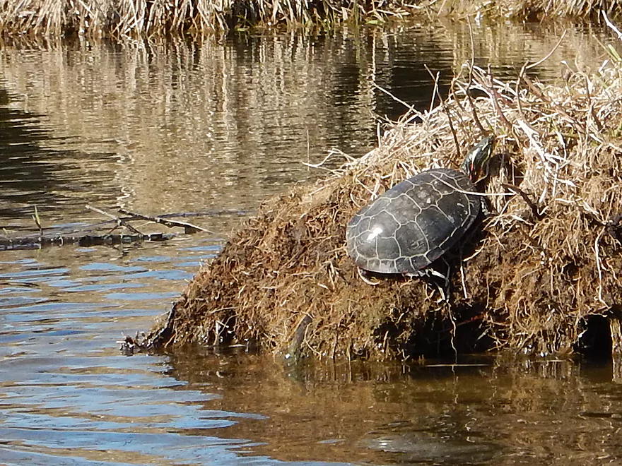
Painted turtle
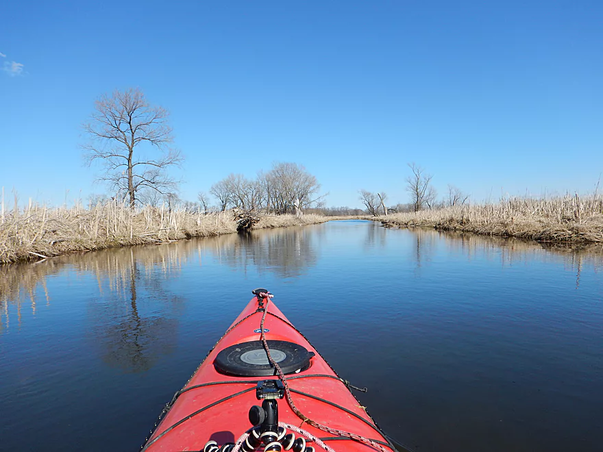
Creek really starts to get bigger
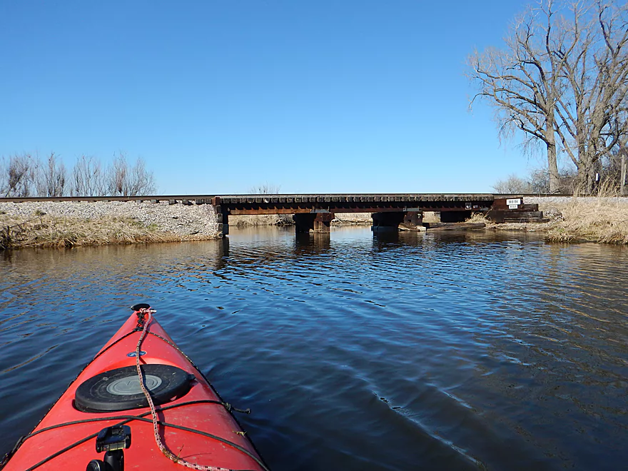
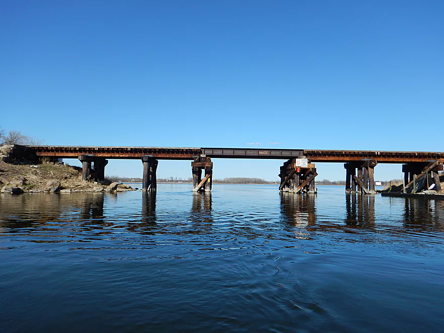
At the intersection with the railroad bridge, go right
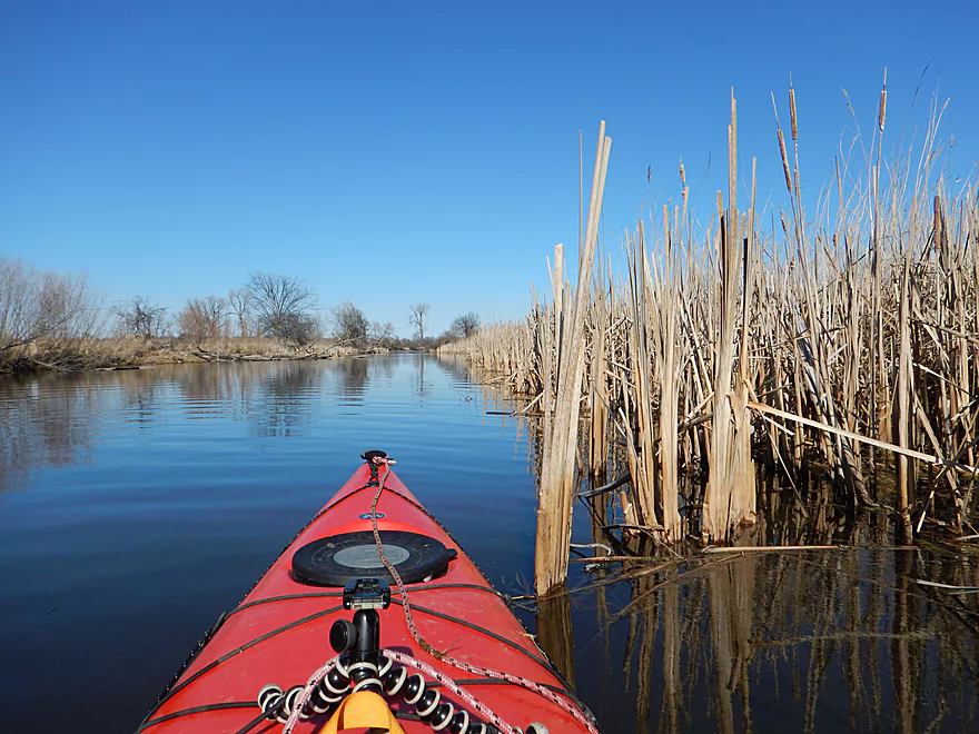
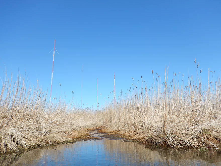
Many cattails
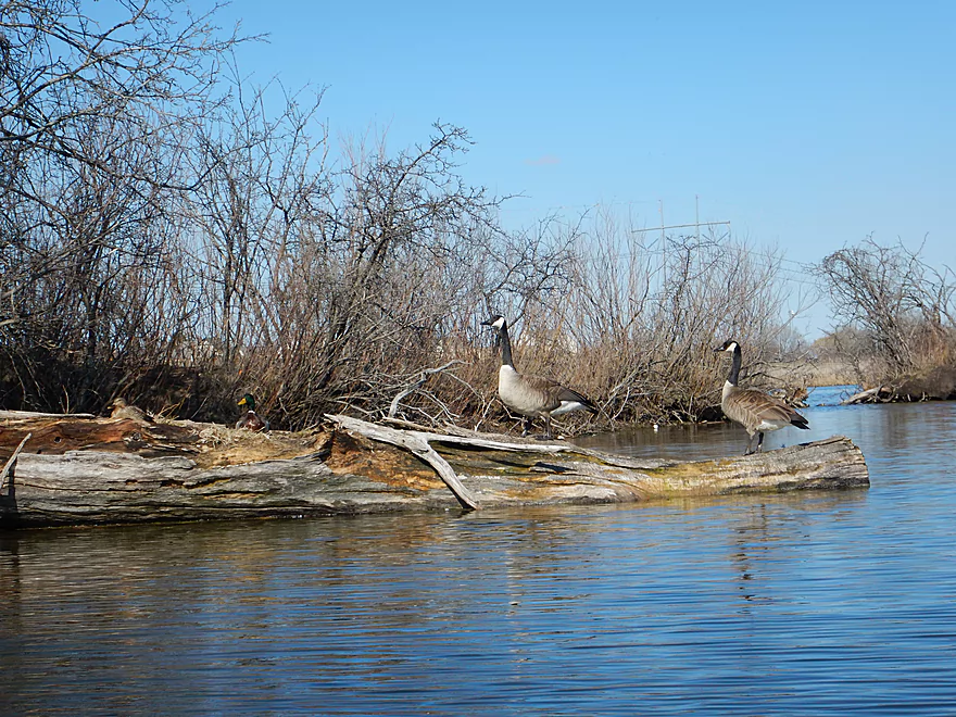
Geese standing guard
Gateway to Mud Lake
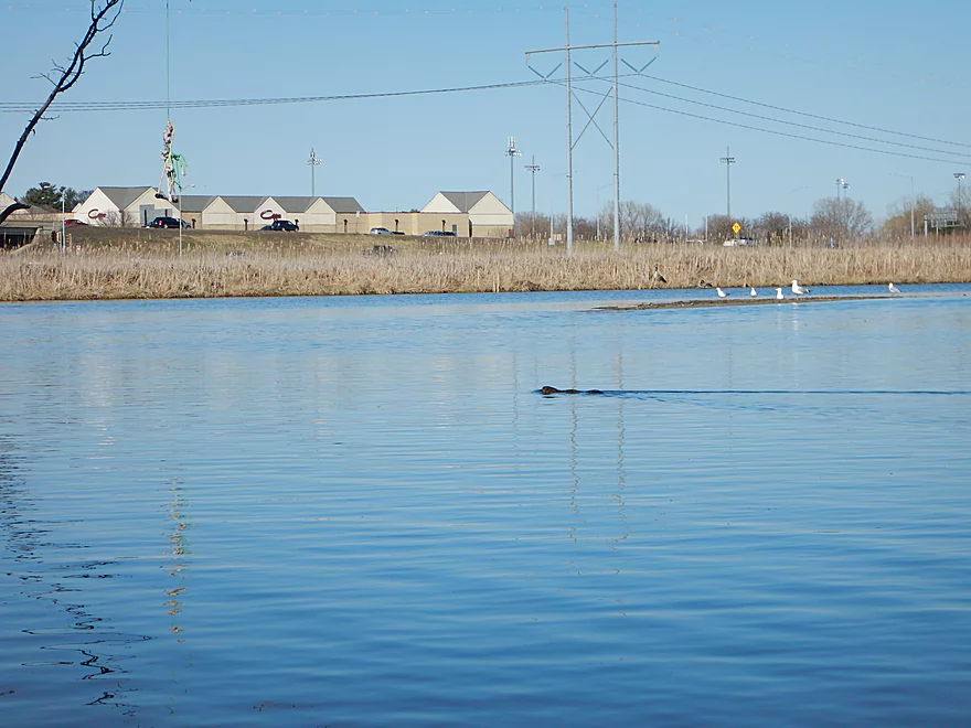
A beaver escorts me to the Beltline
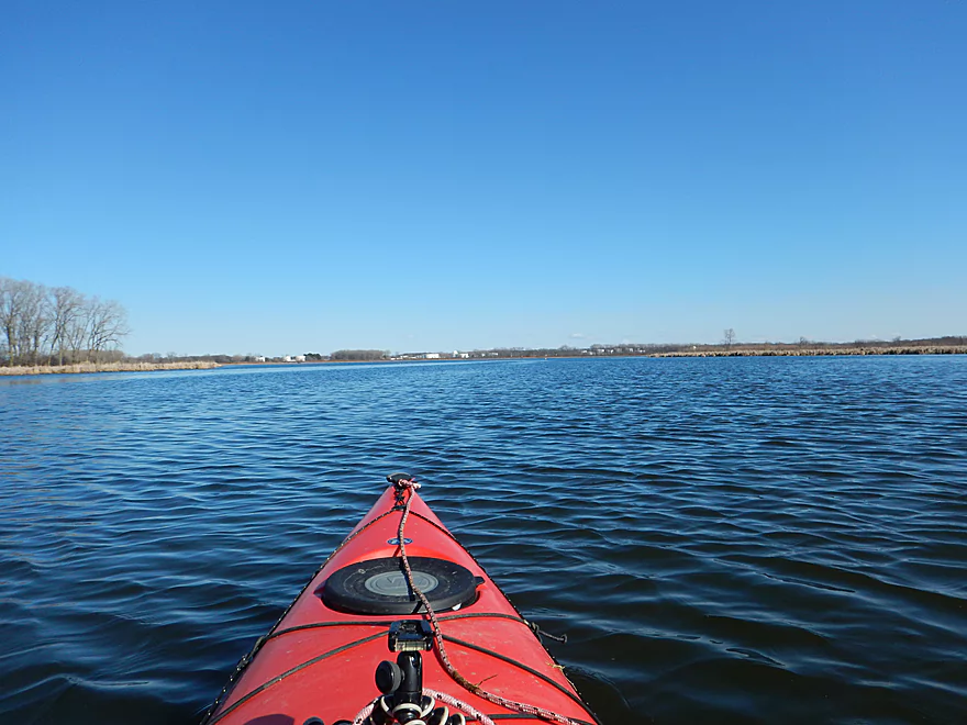
Heading south on Upper Mud Lake
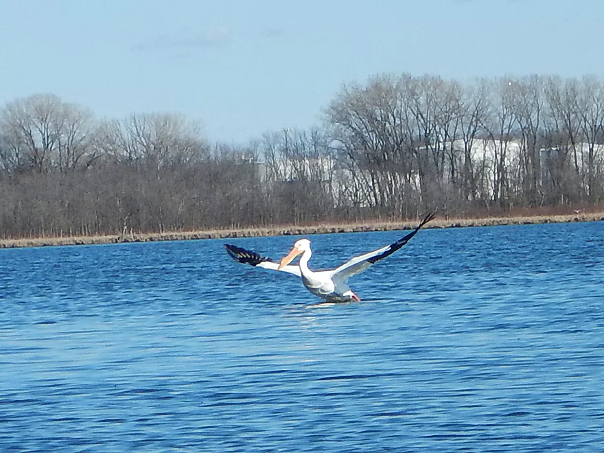
Got to see a pelican eating a fish
Gateway to Lake Waubesa
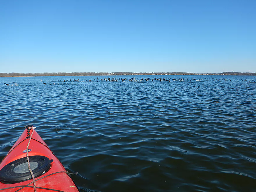
Huge flock of loons
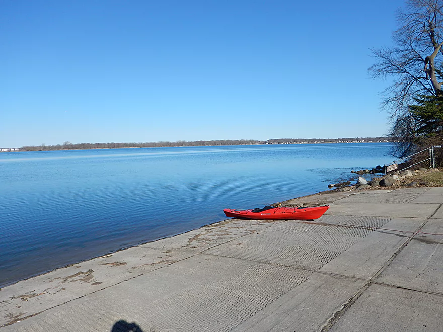
Taking out at Lake Farm County Park
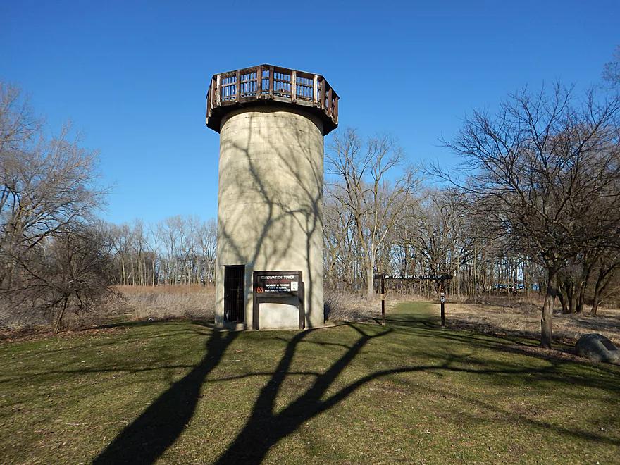
There is an observation tower in the park
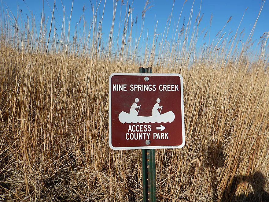
Nine Springs Creek


This is a newer water trail located south of Madison that is a favorite with locals. It’s a simple creek paddle though an open wetland but is pleasant, with great water clarity and abundant wildlife.
Despite being next door to Madison, much of the creek corridor is undeveloped. There are a series of parks (city, county and even a new state park) that flank the creek and provide options to explore the Nine Springs area by foot, but the best experience is by water.
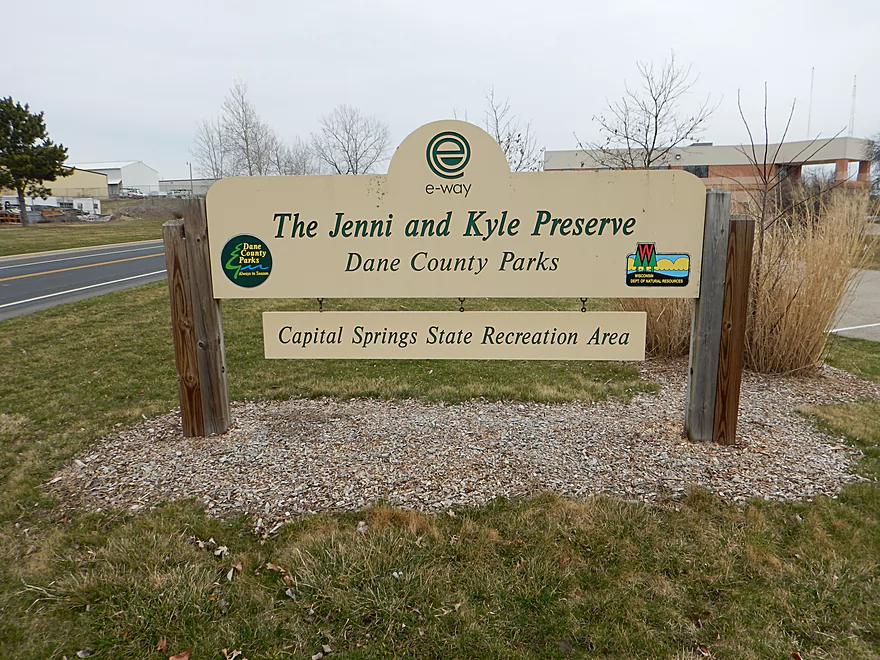
What makes “Nine Springs Creek” special are the springs. I do not know where they are all located, but I found four and marked several on the map. The first spring is by the “Jenni & Kyle Preserve”, but this has been dammed to create a public fishing pond. This is unfortunate as it obscures the bubbling springs and creates a lot of pond weeds.
The second natural spring is located east of Syene Road and was the highlight of the trip. When the creek forks, go left! Here you’ll see crystal clear water and a very active underwater volcano chain bubbling new water through the sand and into the watershed. Sometime gas bubbles would float up to the surface as a neat effect. If you skip ahead to 45 seconds into the video, you will see this. There is another spring east of Hwy MM that you can paddle up to, but this is relatively uninteresting, as is the nearby inland spring in Indian Springs Park.
A popular take-out option is at the Moorland Road bridge, but if you disembark here it will be a short trip. The next mile and a half runs by the Madison sewage plant where the creek really opens up. The mouth empties into Upper Mud Lake right by the Beltline. I think there is a nearby boat ramp by Lottes Lane (next to Rutabaga), but I chose to paddle the extra mile though Mud Lake and to Lake Farm County Park off Lake Waubesa.
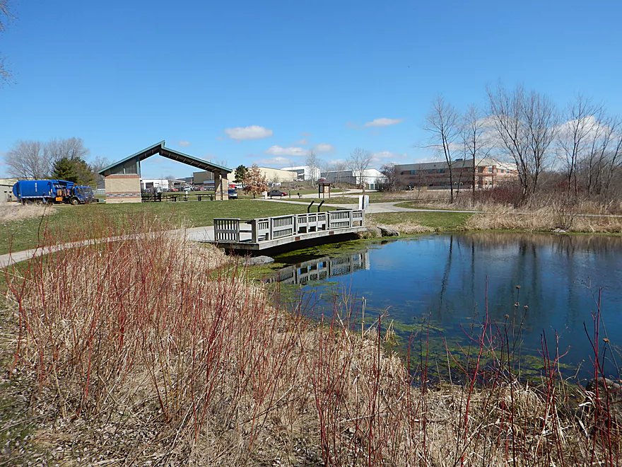
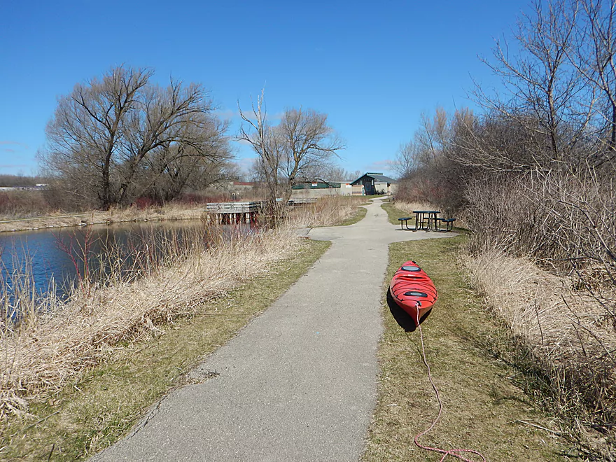
There are a number of put-in options, but I chose to launch from the “Jenni & Kyle Preserve”, which is a county park located west of Syene Road. The advantage of this access spot is that there is good parking, no fees (that I could see) and it is secluded (always handy when locking bikes and boats). There is an outhouse which is open seasonally (which is not March). The downside of this option is you have to drag your boat 850′ south along a grass trail to the water.
If you don’t mind facing some log jams, you might be able to put in further upstream at the Nevin State Fish Hatchery.
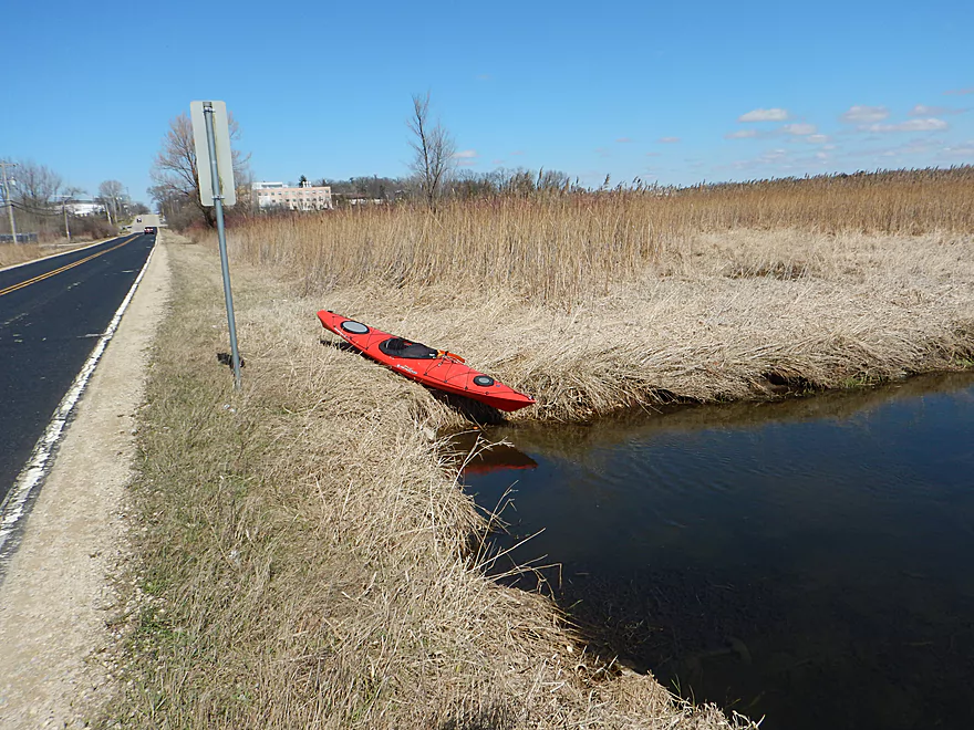
A popular put-in is at Syene Road. This is a very busy road with a small area to pull off on, but it is an option.
The most popular put-in is an established canoe launch by the Hwy MM bridge. A good option, but to me this cuts the trip a little short and leaves off the best part (more on this later).
Lake Farm County Park is located on Lake Waubesa and is a good take-out option. There is plenty of parking, an outhouse and established boat ramp. Do note this is a fee area that is regularly patrolled, so you must purchase a Dane County park sticker or pay seven dollars at the self-pay station for a daily pass.
A more popular take-out is off Moorland Road which is an established canoe landing. This park has good parking, outhouses and also requires a Dane County Park Sticker.
I don’t believe there are any nearby liveries. However, this makes for a fantastic bike shuttle. Much of its 4.8 mile length can be done along the paved(!) “Capital City Trail“. Do note, this trail requires a state trail pass which can be purchased at most state parks.
No hazards nor log jams. This is a great paddling option for beginner paddlers. “Friends of Capital Springs Recreation Area” deserves a lot of credit for clearing the creek of obstructions and establishing canoe landings. Do be mindful of wind direction and speed, as the end of this trip will be on exposed water.
Note, Syene bridge must be portaged which was easy when I did it, but a comment from a reader (see below) noted this was now somewhat mucky. Also another reader noted that the Hwy 12 tunnel could be short in high water (see notes in comments).
Creek levels stay relatively stable because it is located in a wetland. I doubt it ever gets too low nor too high to paddle. There is a shallow section by the first natural springs and during extremely low levels, you might not be able to paddle up to this.
There is little current, but it is noticeable and appreciated.
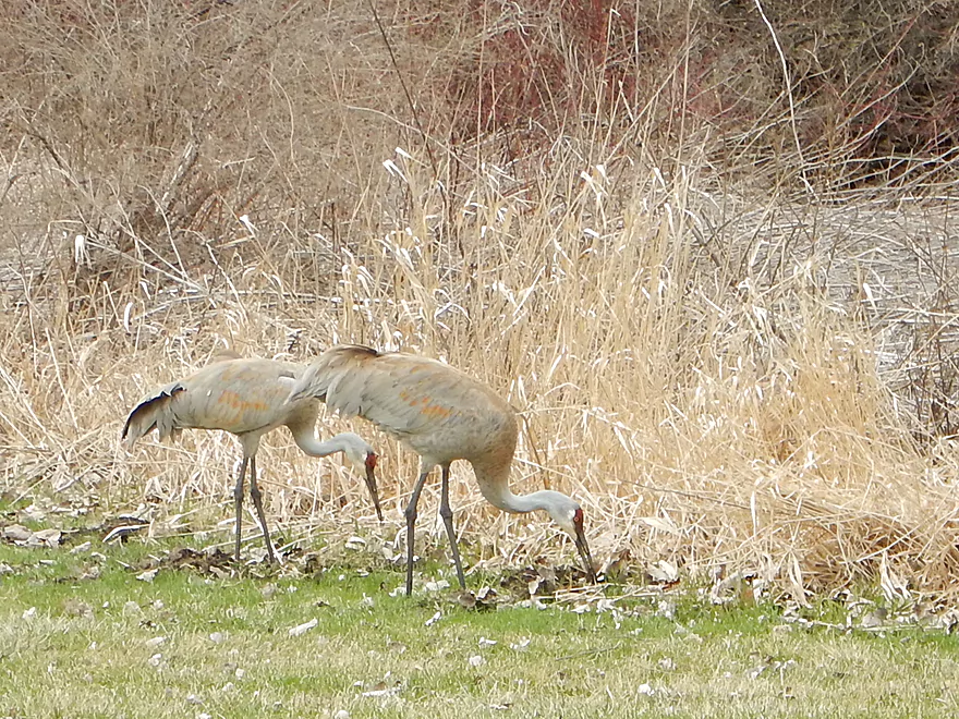
This was a great trip for wildlife. Many geese, ducks and cranes (several of which seemed to be eating mice). Also a painted turtle, several raptors, numerous songbirds, a crayfish, a large flock of loons, four muskrats and the highlight was seeing a pelican on Upper Mud Lake.
- Nevin State Fish Hatchery to Jenni & Kyle Preserve: 1.2 miles. A theoretical option. Put-in might be questionable and logjams might be an issue.
- Jenni & Kyle Preserve to Syene Road: 0.25 miles. A short simple section.
- Syene Road to Hwy MM Landing: 1.0 miles. A neat stretch with some amazing natural springs, but Hwy 14 might be tricky to get under for bigger boats in higher water (reviewed here).
- Hwy MM to Moorland Road Landing: 2.0 miles. A good stretch (reviewed here).
- Mooreland Road to Mouth: 1.4 miles. More open but still a nice stretch (reviewed here).
- Yahara River Take-out Options:
- Mouth to Lake Farm County Park: 1.5 miles. An open water paddle on Mud Lake and Lake Waubesa (reviewed here).
- Mouth to Lottes Park: 0.3 miles. If you paddle north under the Beltline, you can take out at Lottes Park (close to Rutabega).
- Additional Yahara adventures: See my previous review which has an overview of almost all access options.
Trip Map
Overview Map
Video
Photos Size:
A word to the wise: fitting through the very low clearance bridge/tunnel at Highway 12 is pretty tricky and definitely not appropriate for the claustrophobic. You will need either to limbo all the way back or bend forward as far as possible. It’s 200 feet long and too narrow to paddle. So you just have to drift in a squatting position and try to relax. If the creek is high, then this could well be impassable…and crossing Highway 14 with a kayak and gear would be ridiculously unsafe — there’s a whole lot of traffic blazing by at 70+ mph.
Thanks Tim for the heads up. I didn’t have any problems but the creek wasn’t flooding and I was in a low riding kayak. What paddlers perhaps could do is prior to the trip is park at the Anderberg Drive canoe ramp, hop over MM and eyball the culvert and determine for themselves if it looks dicey.
I just did a spring to spring paddle today (8/9/17), put in at the J and K preserve, and headed up stream about 3/4 of a mile to another big spring area just off the Capitol City bike trail, I then turned around and floated back past the preserve and on to the other spring area, and then up stream back to the preserve. Other than a few small “scootable”snags and one small log jam in the area upstream from the preserve, it was a great trip. I only had to get out of the boat once to pull it over the log jam. With a little work it would be a very nice trip. Lots of birds and wildlife.
Appreciate the comment Eric. It it interesting to hear that there is another nice spring upstream of J&K. Would be curious to know if a route from the Fish Hatchery is viable.
We tried this trip on May 27, 2018. Gage at McFarland was 5.7′. Unfortunately, the bridge at Syene road was impassable. The water level was too high and the openings were packed with dead fall and trash. Since we are a bunch of middle-aged women, we weren’t able to portage our boats due to very mucky conditions on the banks. We didn’t see this mentioned as a problem or we would have put in on other side of Syene or at MM. Just a heads up.
Thank you for the update Melissa. I should have clarified but yes, you will have to portage Syene Road. I’ll update the main write-up. As for the muck, this is likely the byproduct of our very wet May and I assume it is typically much nicer. I thought it was a really easy portage when I did it…so I assume this will dry out and be better.
I’ve done the creek twice in the past 2 weeks,once upstream from he J & K preserve and once downstream. The trip upstream is a was a difficult at first, decent current and not much water, but only for about 1/4 mile then there are two small blockages (old beaver dams?) and the creek widens and deepens. the rest of the paddle, although upstream, was very easy. The creek here is channelized but surprisingly pretty with lots of wildlife and little small ponds and channels to explore. In about 300 yards there is a large tributary coming in from left (South)if you paddle up this you will find a very scenic large spring area with several springs and some nice water cress. Back on the main part of the creek you can continue up stream for about another 1/4 mile, to where 3 tributaries come together, I explore two of them but ran out of somelight to explore the other. Looking at google maps now it looks like the one I didn’t explore looks the most promising to get close to Fish Hatchery Rd or the DNR service center, but not sure about access. The trip downstream was OK,with the section between M and the take out at Moorland road was the pretty part. There is a nice and easy bike shuttle using the Capital City trail almost all the way with just a short jog on Syene Rd.
I now regret not doing the section upstream from J&K…sounds really good. If you ever find out if the DNR Service Center is a viable access let us know. From there to Lake Farm would be very ideal.
I did the section from the k & J perserve up stream to the Capitol Springs, to the DNR land and explored a few of the side tributarires. While probably not everyones cup of tea, for the adventerous type who wants a short,local, out and back paddle, this ight just surpise you with how nice it is. Although it is cartainly an urban paddle, and you can almost always hear the sounds of the city, this trip has a surprisingly wild and adventurous feel. I have done this trip several times and have never seen another person on the water or signs that anyone else dose it. Although the water calrity is generally very good, the river bottom is mostly muddy and weedy, except for the area around the springs. As I stated in an early review the first part is upstream, but if you stay to he side it is not difficult to paddle against the current. after about 1/4 mile you will get to a narrow area with an old beaver dam,depending on the water levels you may be able to scoot over/through this or it is an easy portage on river right. After this the river deepens and slows down, expect to see fish, muskrats, Sandhill Cranes, geese , ducks and if you go in the mornings or evening and are lucky maybe a beaver. Watch for a large tributary on your left marking the entrance to Capitol Springs,certainly worth checking out. Back on the main channel and heading upstream you will come to an area where three tributaries come together, the right most on is fairly straight, has many down trees to deal with and heads to the old DNR fish Hatchery, there is a fence across the creek at his point and signs saying, no hunting,no fishing… but it did not say no trespassing, so it is unclear to me as if one is legally allowed to access this by water. The middle fork, which I think is he prettiest snakes through an open marsh area and then into a wooded area. This is a really pretty area with small ponds and a lot of wildlife. Ive christened this Snapper Alley as every time I’ve been here I’ve seen at least three big snapping turtles sunning themself and I have been able to get quite close. This is also a nice area for native water plants like Marsh Marigold and Blue Flag Iris (I haven’t seen them in bloom yet so not sure) here are links to a map and some photos
https://www.google.com/maps/d/drive?state=%7B%22ids%22%3A%5B%221294ilFzcMoYkfnETnJaHaRsQIEWmF3pR%22%5D%2C%22action%22%3A%22open%22%2C%22userId%22%3A%22112103843064565365657%22%7D&usp=sharing
Lot of great info…thanks again Eric!
Just did this trip today, putting in at MM and going to Lake Farm park. Thanks for all the info – this is the best resource I’ve found on the web about this paddle! It would’ve been an enjoyable trip, except from just before Lake Farm Road, a maybe 12″ PVC pipe began snaking down the entire stream, wandering back and forth between the banks – and each time it did, you’d be pinched to the bank and forced to portage around it. Really chapped my hide, as there was no mention of it at the put-in, but there was a sign about it at the launch by Lake Farm Road. Forced us to do probably six or so unanticipated portages, including one over the train bridge (which we probably wouldn’t have fit under anyway). We did see probably close to 20 muskrats, which was great – but I’d put off doing this trip until the sediment management program is wrapped up. I understand that it’s probably needed, but a head’s up at the put-in that downstream stretch was temporarily ruined would’ve been nice.
Thanks Steve for the update. Yeah…those pipes are new. Hopefully they are removed soon.
We found this route online and decided to try it for a leisurely afternoon outing with our 17′ lightweight canoe. This route was not leisurely, unfortunately, and we probably should have read a few of these reviews. We parked at Jenni & Kyle parking lot and carried it to the stream; a bit more of a hike than anticipated. A short distance after putting in, the first obstacle was a concrete wall completely blocking the stream at Syene Rd. There we portaged up and down steep embankments on both sides of the road through knee-deep grass on uneven, porous ground. Not a great start. After this I lost track of the order of things, but along the route there were three very low, one of them VERY long and claustrophobic, concrete overpasses that I would claim we barely made it through by having to lie almost flat in the canoe. Along the route there were two downed trees laying fully across the stream, one of which was massive and compounded with a second smaller but substantial tree also laying across the stream just behind it. With nowhere to portage, we had to step into the stream to get out of this predicament and both quickly sunk to our knees in the muck bottom, struggling for quite a while to pull ourselves out. The only way to get through was to force-thread the canoe under this truly massive tree, muscle it through, then heave it over the second tree, causing the canoe to become wedged between the two of them, until one last desperate heave. The next downed tree, also completely across the stream, required that we step out again into the false muck bottom and climb onto the grass embankment to drag the canoe around it. If there’s a plus side, we have a story to share with friends and family and saw some belted kingfishers, cranes, and a heron, which were beautiful. But I wouldn’t recommend this route to people I care about! For the record, I am 60 yrs old, dad is 80+, and we are both in darned good shape.
Thanks for your comment and I’m sorry about your experience. A 17′ canoe is quite big and rides very high…I wouldn’t suggest that or any canoe for tight bridge clearances. Personally I didn’t have a problem with my kayak. There is a note in the main write-up about clearance issues. Thanks again.
I paddled the section from the preserve up to the springs and back on 4/11/22, unfortunately the creek was very low (about 4.5 ft on the Lake Waubesa gage) which was too low for enjoyable paddling, but not bad if you wanna take you boat for a walk. Fortunately the low section is only about 1/4 mile and then you reach a small beaver dam, which is new since the last time I did this trip in the fall. The dam has created a large pond that is 1-2 ft deep and has a few bays and inlets to explore, because it is all spring water it is very clear, and because it is early in the season there were no weeds yet. Thanks to the new dam there are some new areas open to paddling and more water at the springs. I did not have time on this trip but it may now be possible to paddle all the way to the DNR Fish Hatchery property. The wildlife on this trip was simply amazing, ducks, geese, cranes, hawks, owls, eagles, snapping turtles, spring peepers galore, and my first dragonfly of the year. I would suggest doing this trip at 4.8 ft or above on the Lake Waubesa gage. A map and pics of my trip can be found here https://www.relive.cc/view/vxOQo4pDDMq
Thanks as always for the water trail updates!
Did this today on a standup paddleboard with a 4 inch fin from the Jenni & Kyle Preserve… Waubesa was at 5.22ft and had no problems on the SUP.
A few portages but not too bad a bit stanky in a few places… the water under highway 14 seemed full of debris and did not attempt it. Turned around and Went up stream until 43°01’12.8″N 89°24’18.2″W and was blocked by a lot of downed trees.
Not bad, had fun, will come back in the fall when the cold weather knocks down some of the algea/stankness.
Thanks for the update. Late summer is a tough time to paddle many slow moving rivers because of the weeds/algae.
I put in at Jenni & Kyle, headed upstream until I came to some tree obstruction…it’s a nice area..I should have gotten out and paddled beyond that. My main trip was to head out to Lake Waubesa so I turned and headed back downstream.
I managed the Syene portage fine..yes, mucky and smelly but that’s nature. I made my way eastward and came across far too many, very old and large, downed trees that completely blocked my way. I did make it over about three and then saw a fourth ahead near Indian Springs Park and decided that was that.
Question: Does the DNR (or proper authority) ever clear these obstructions? I know paddling isn’t the main reason to do so but just curious. I would like to try it again if they ever do get cleared.
Thanks for the comment. It’s too bad to hear about all those downed trees…they weren’t a problem during my trip, but I guess times change. I doubt the DNR would clear out logjams for paddlers, but private groups sometimes do. http://www.capitolwatertrails.org/ has helped out on cleaning out local Madison area streams. If I hear anything further I’ll post an update.
Did Lewis nine Springs Creek today. Easy put in highway MM. Drove down to the water just drop the kayaks in. There is a small parking lot. If you could call that.
it was a beautiful but incredibly windy day . The wind just pushed us along the creek. Water level was good. A few logjams .One we had to do a small portage around. We also had to portage the kayaks over the railroad tracks. It’s a very peaceful paddle until you hit the lake because the wind was so strong.
all in all,very enjoyable. saw turtles, birds and very large fish, We think we’re northern pike. I would recommend this paddle.
Thanks for the feedback. It’s good to hear that MM to the lake is (mostly) in good shape…I was worried about this section.
Did this on May 16th 2025… Started at Lewis Nine Springs E-Way Parking Lot and went up stream to Hwy14 and came back – nice 2 hours.
Only 2 very minor log jams – no actual portage required. Lake Waubesa was measuring at 4.7 inches and there was no Scraping on the bottom.
2 Kayaks and 1 SUP – no problems – lots of fun!
LATE in 2024 – some legend went through solo on a Canoe and DID A LOT of chainsaw work so its a pretty nice paddle now :)
I appreciate the update!