
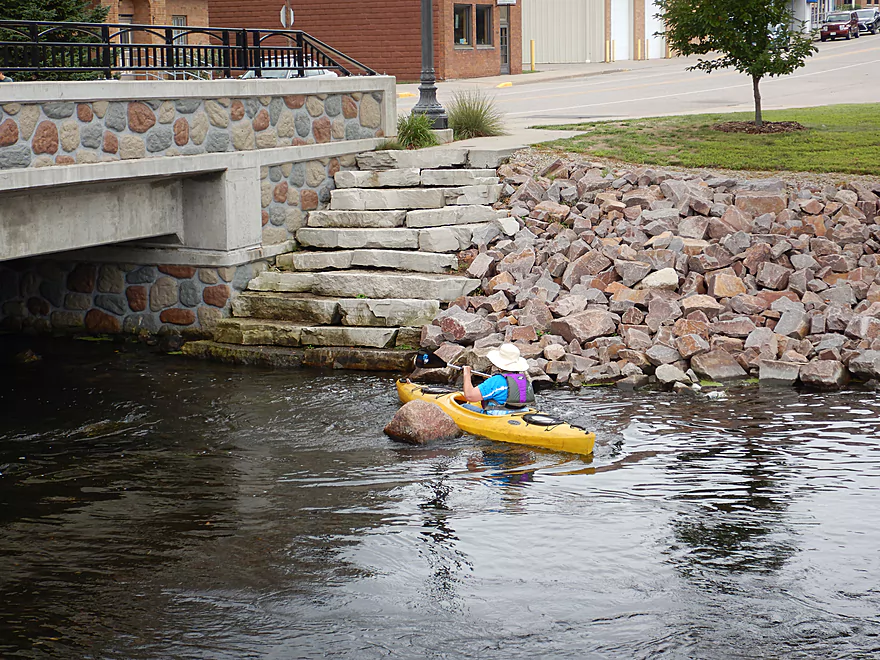
Starting the trip at Mill Street in Amherst
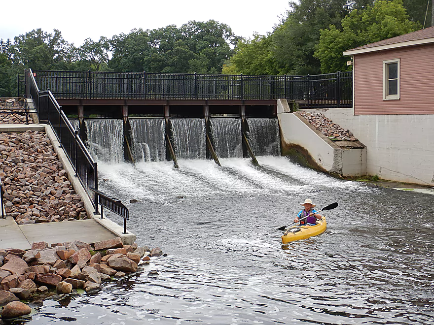
Just below the Tomorrow River dam
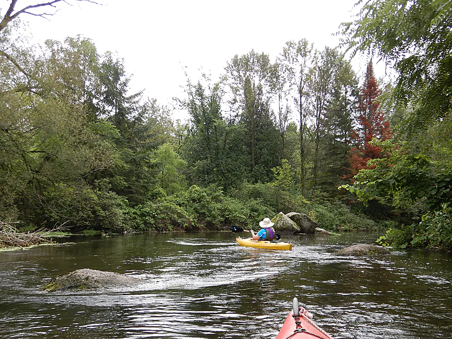
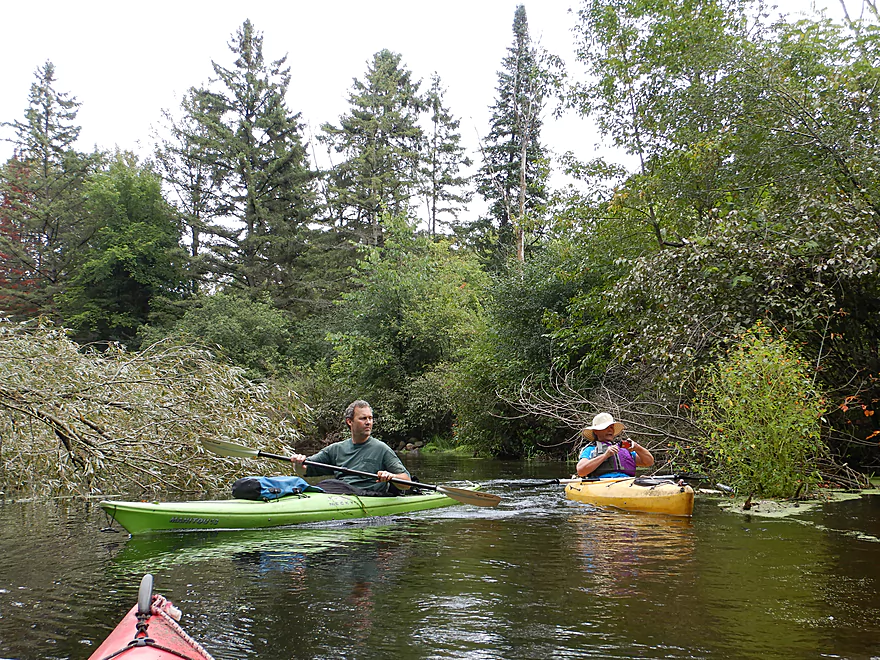
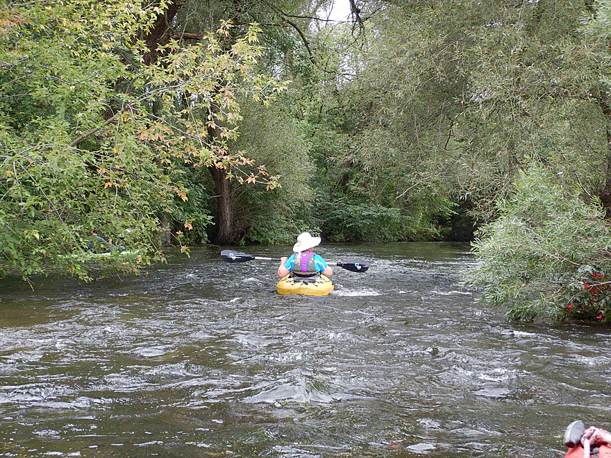
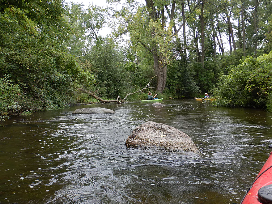
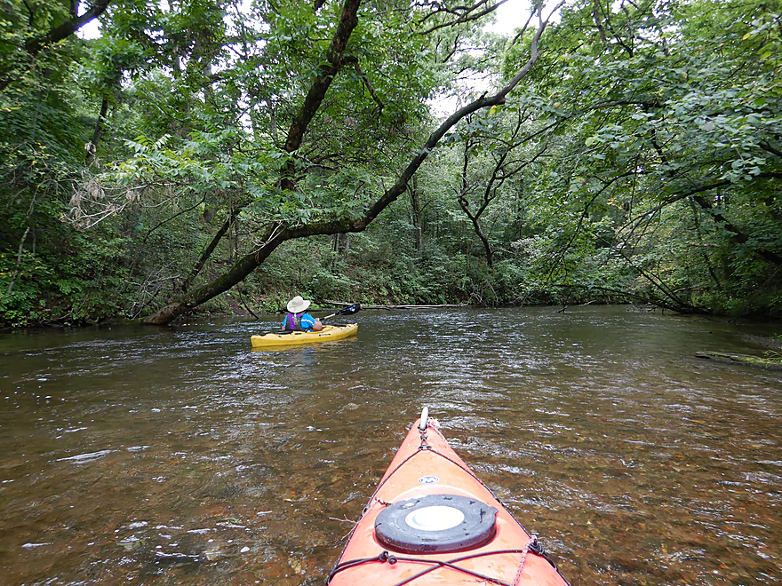
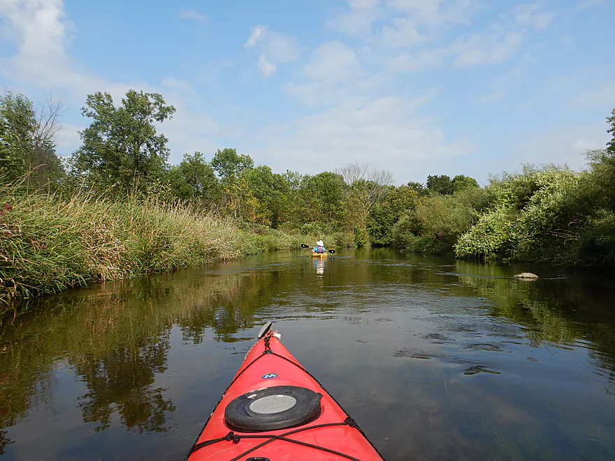
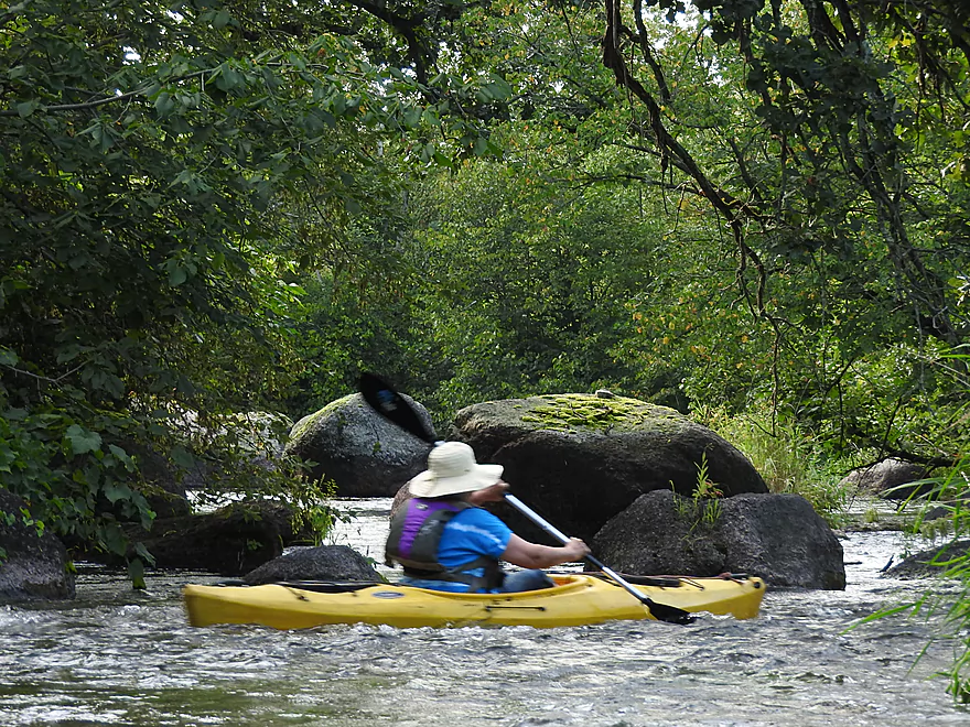
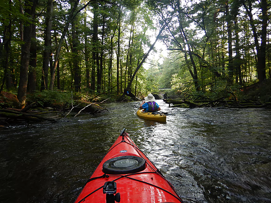
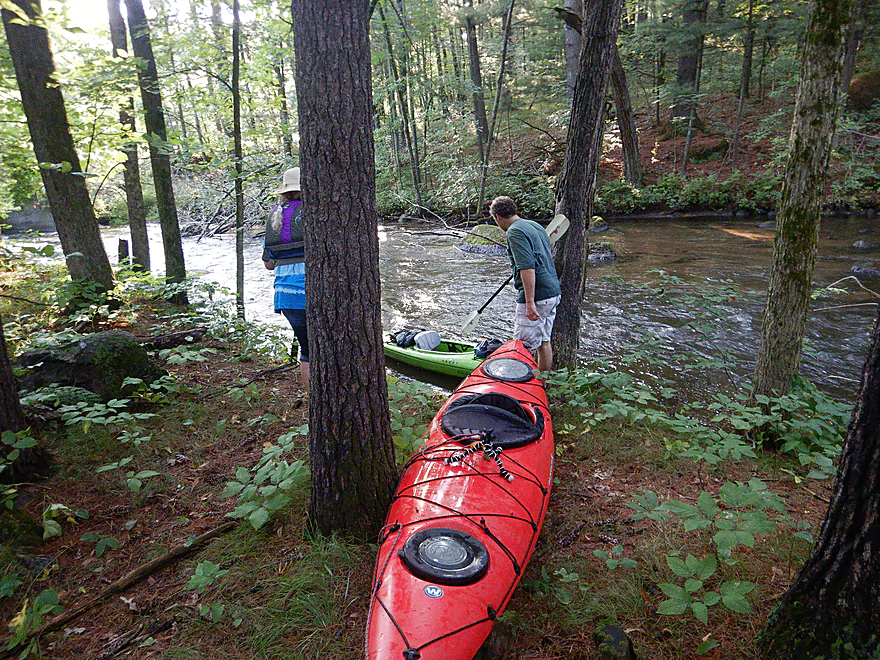
The put-in area is very scenic
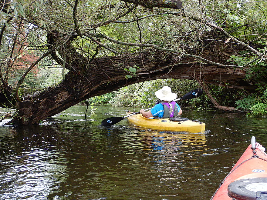
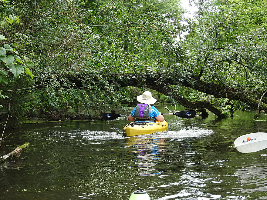
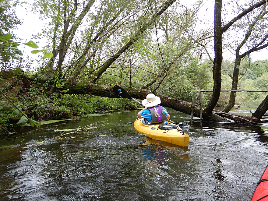
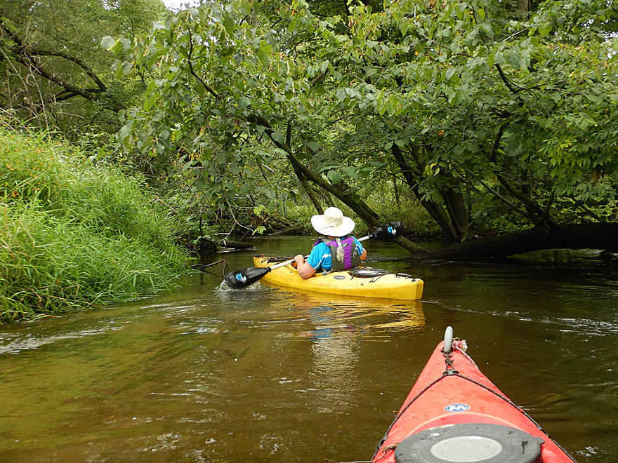
The first of many low squirrel bridges
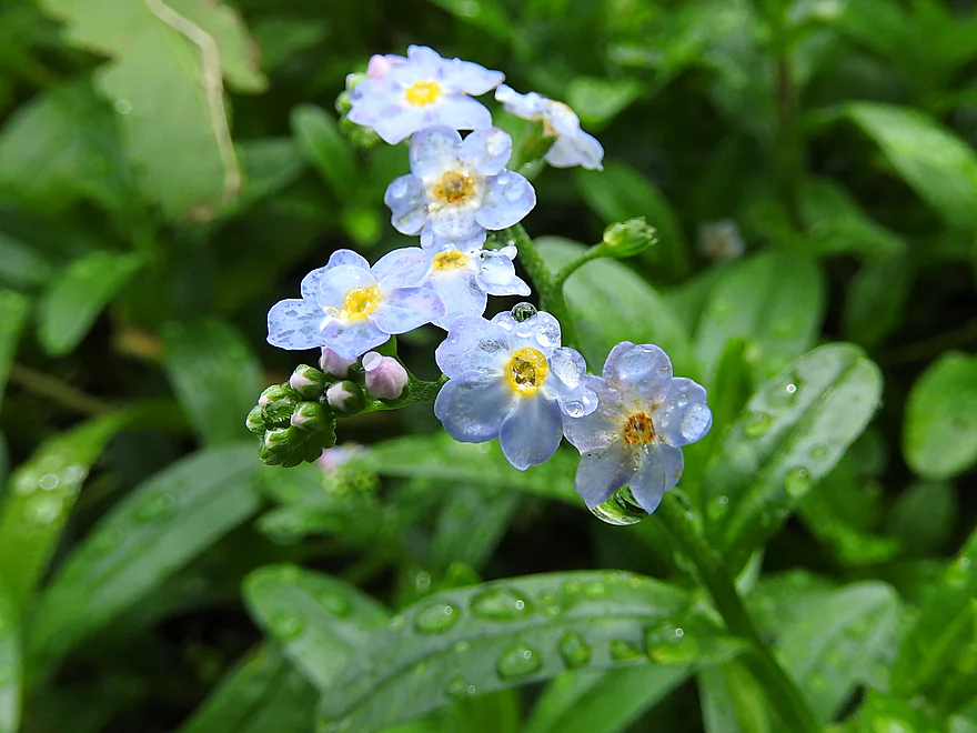
Forget-me-nots
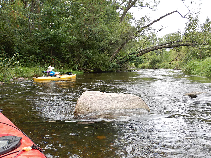
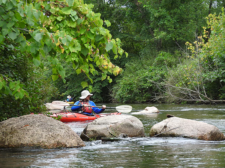
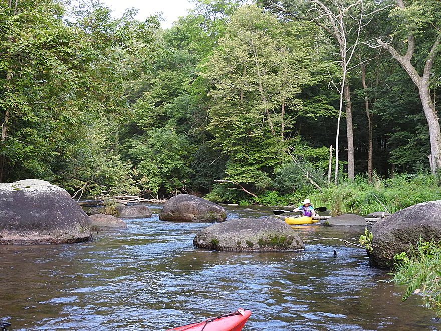
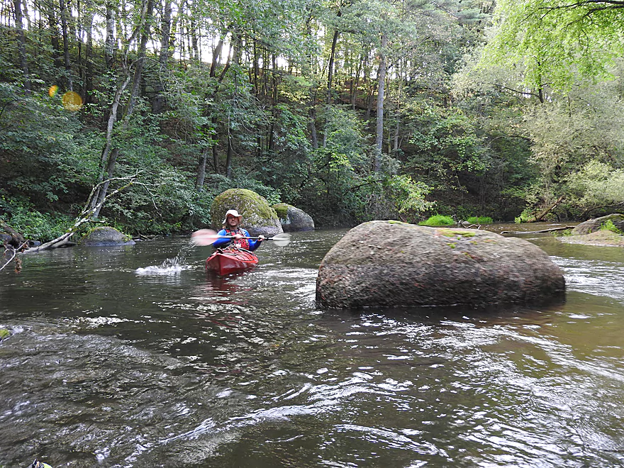
Attractive granite boulders
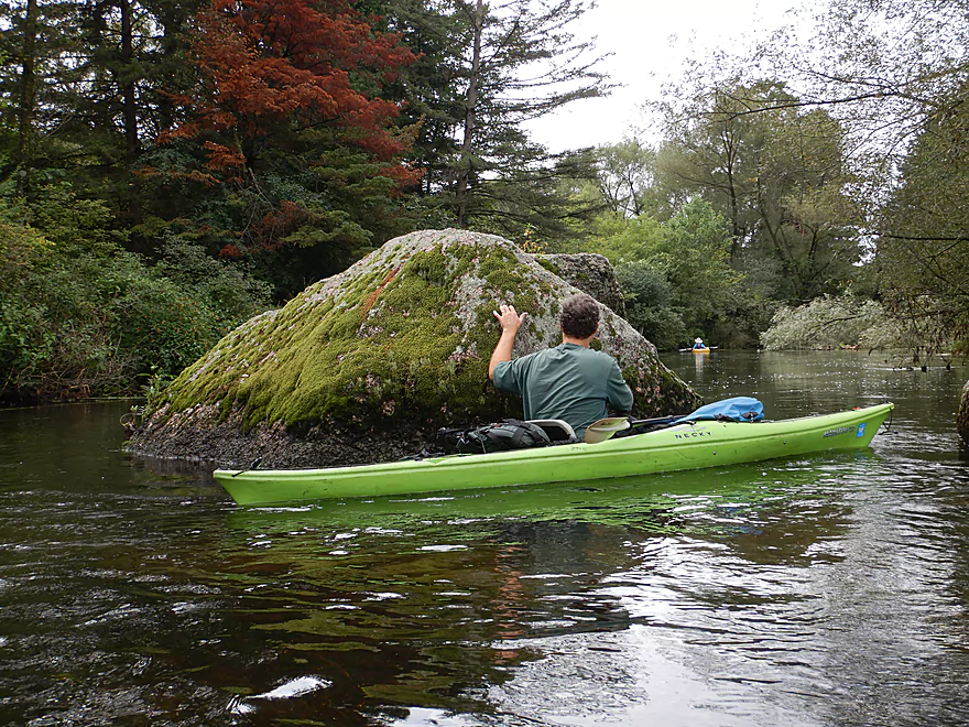
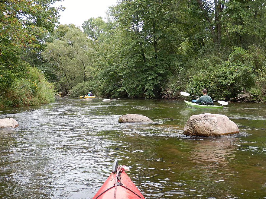
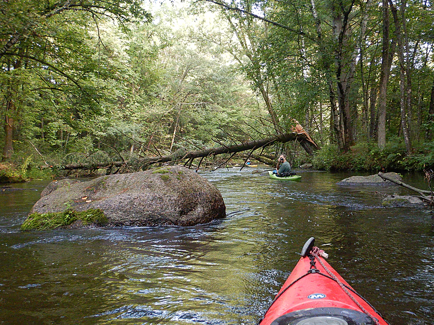
Many boulders on the river were huge
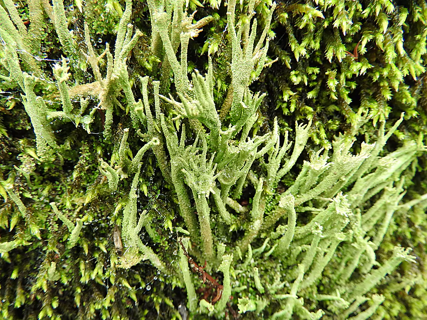
An interesting lichen
A mixture of fir and spruce
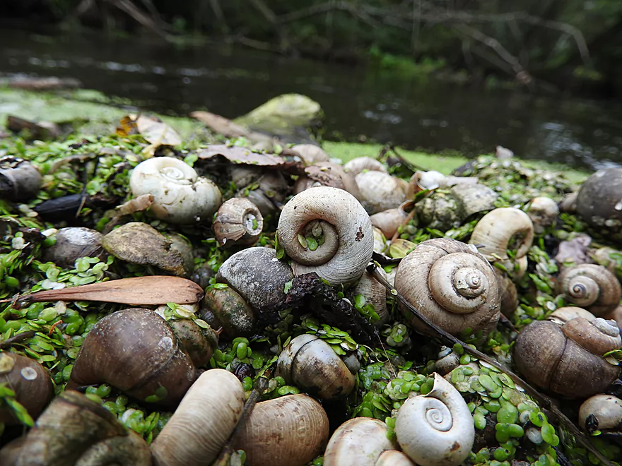
Different species of snail shells caught in a pile of duckweed
Water level was slightly higher than normal
The downed trees actually gave the river unique character
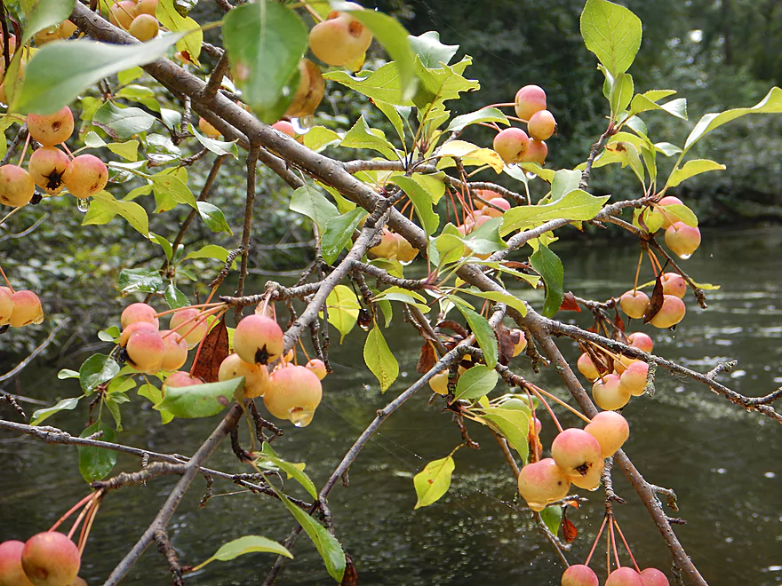
Some free snacks growing along the banks
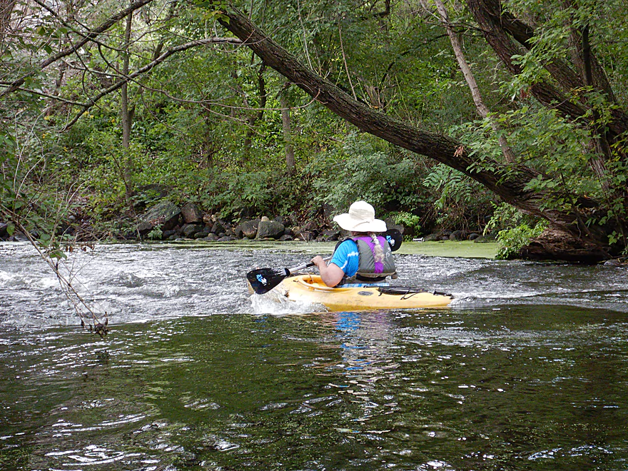
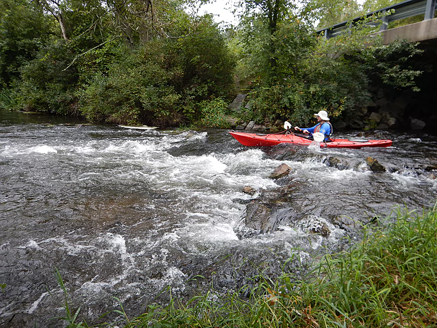
Our first noteworthy rapids at Washington Street
Pretty easy
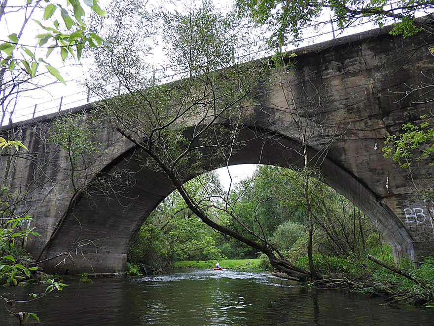
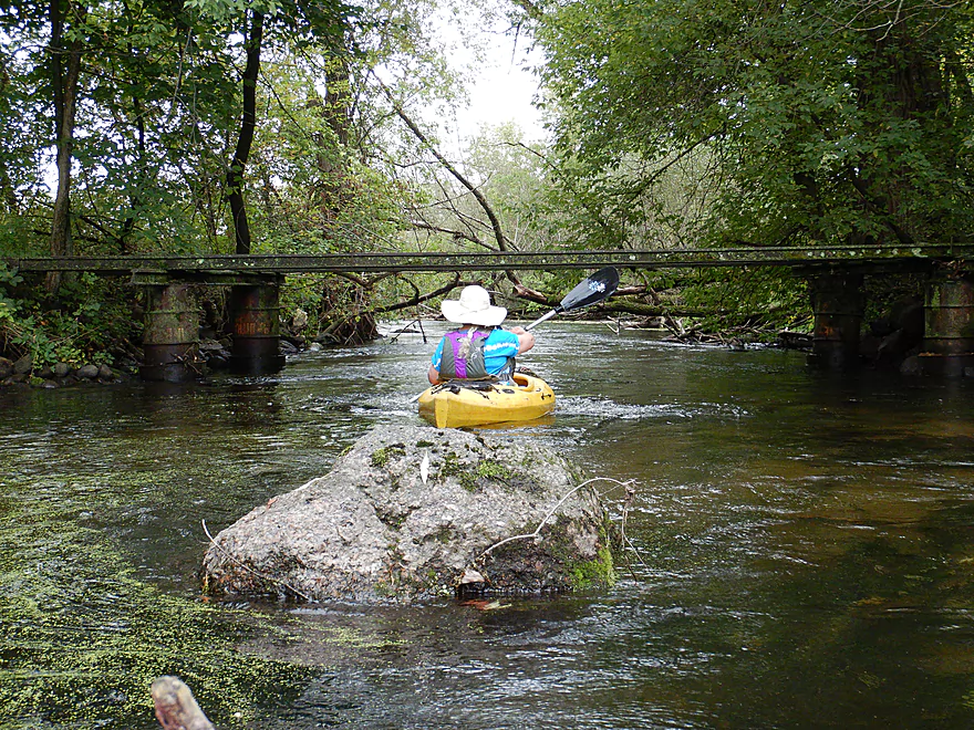
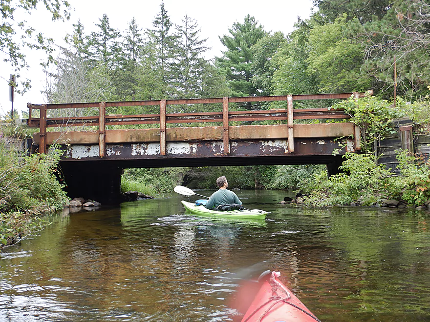
A scenic railroad bridge
Some tight maneuvers required
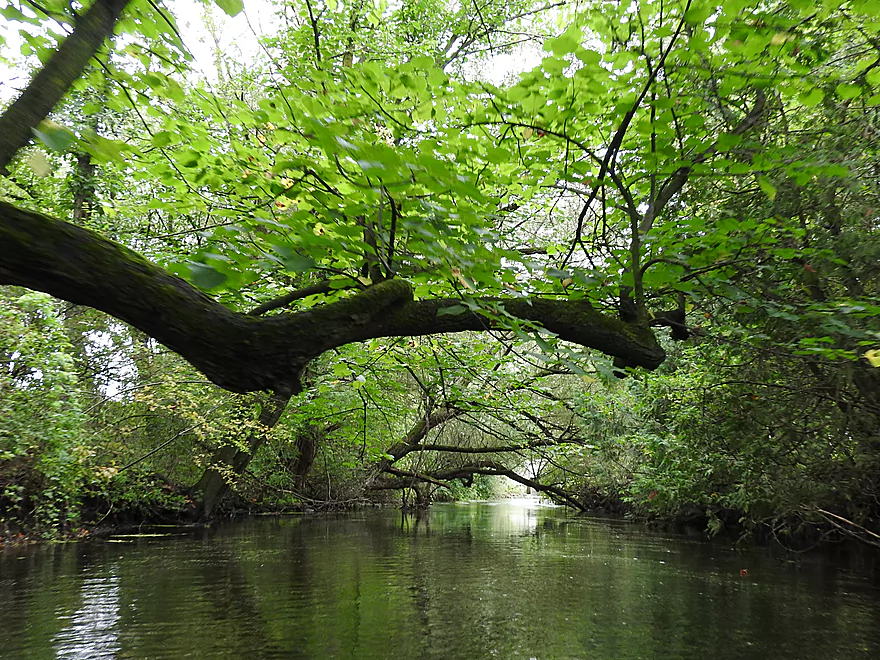
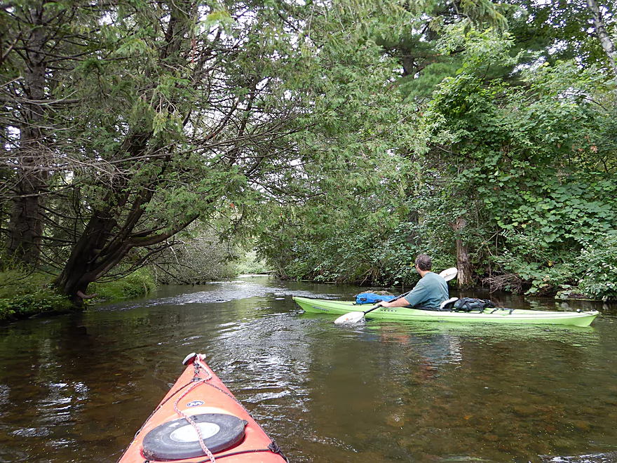
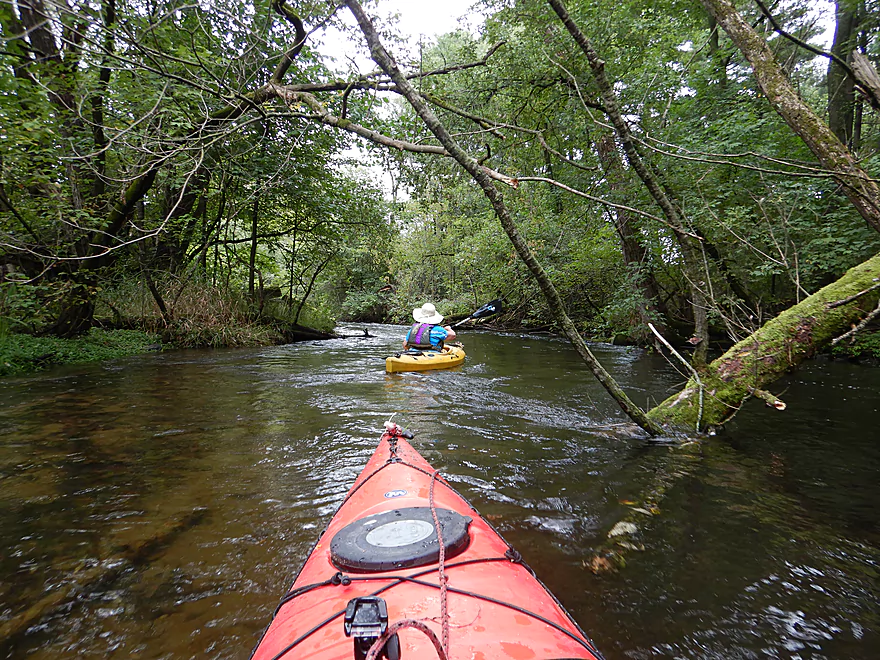
A tree ceiling over the river
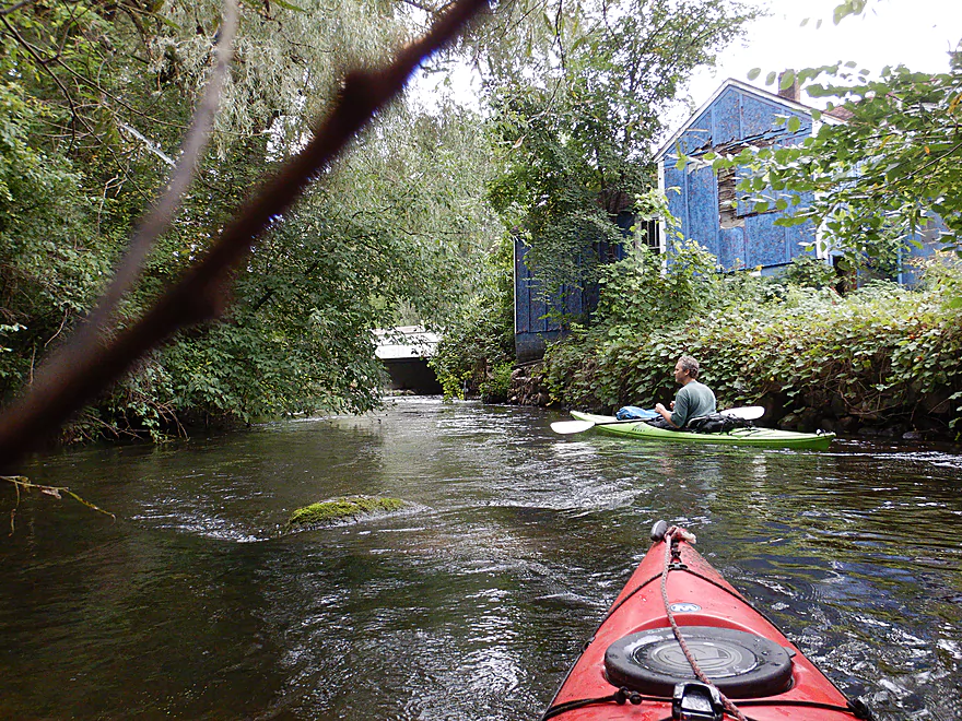
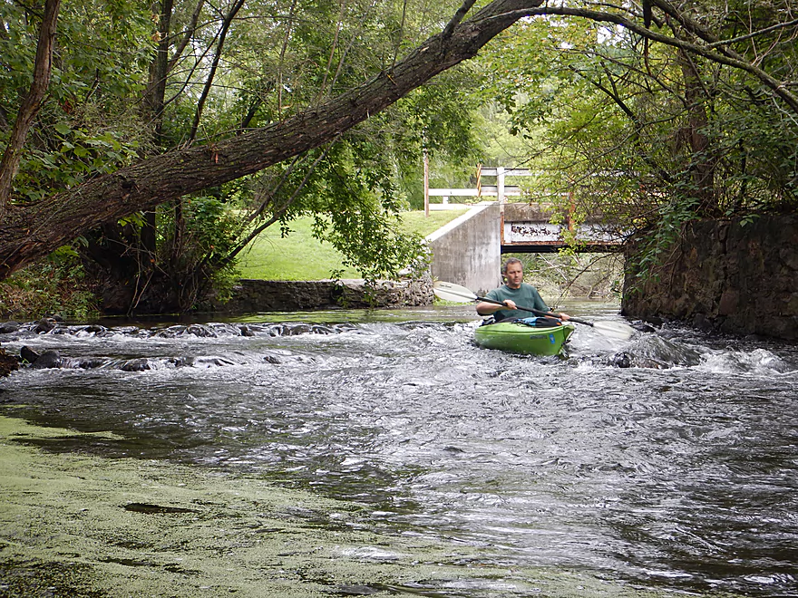
Remnants of an old mill by Hwy KK
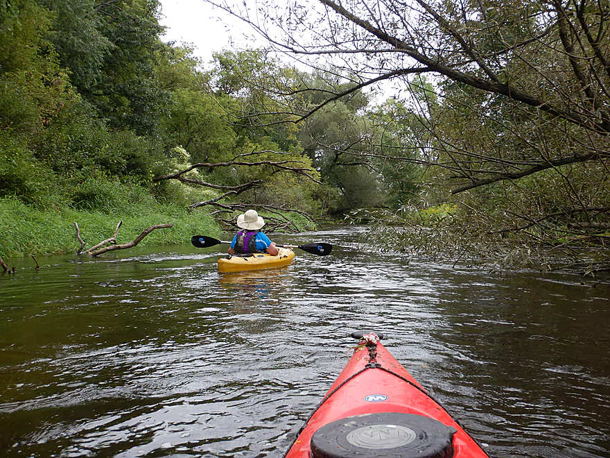
One of countless riffles
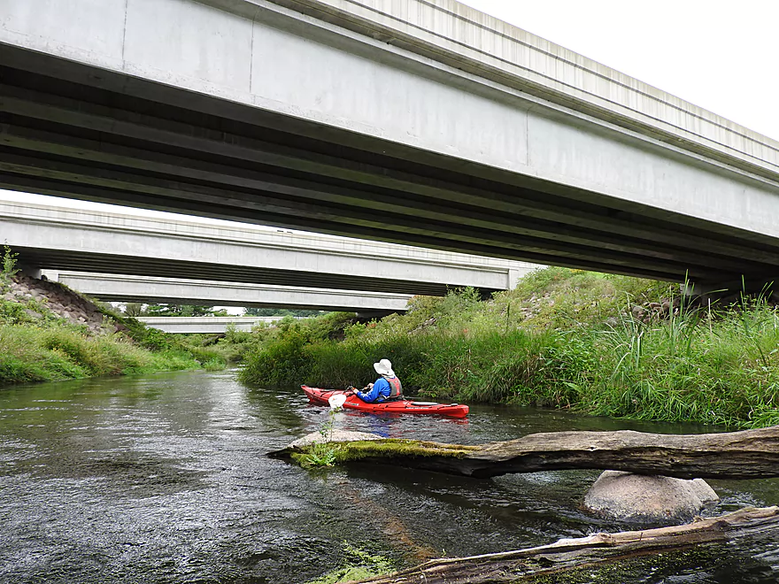
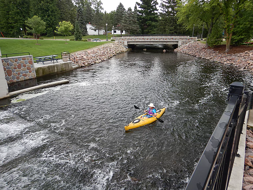
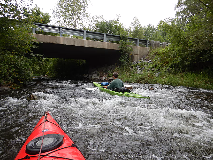
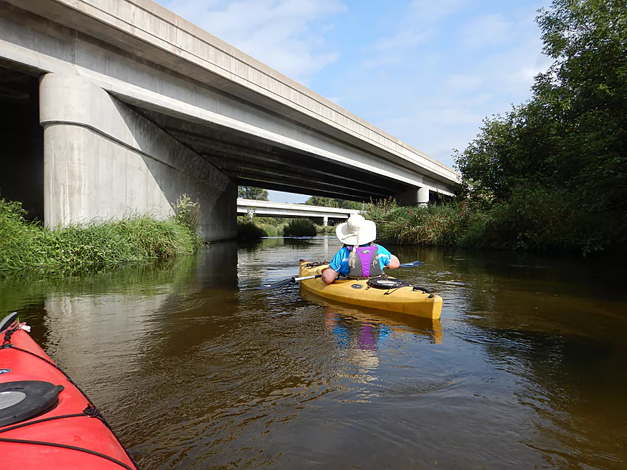
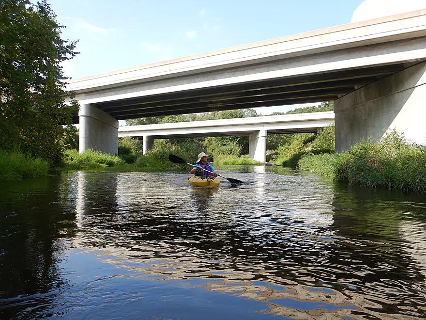
Paddling under four bridges!
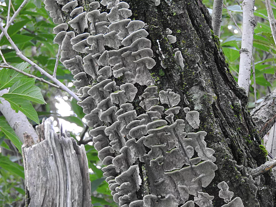
Shelf fungi
An up-north like scene by Hwy A
A white cedar corridor reminiscent of the Bois Brule
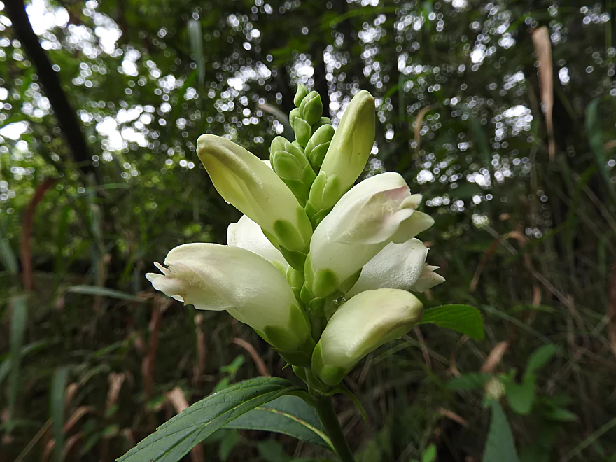
Turtlehead flowers
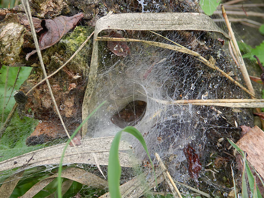
A funnel-web spider home
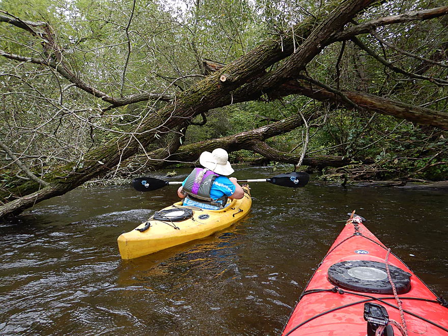
More ducking required…but nothing major
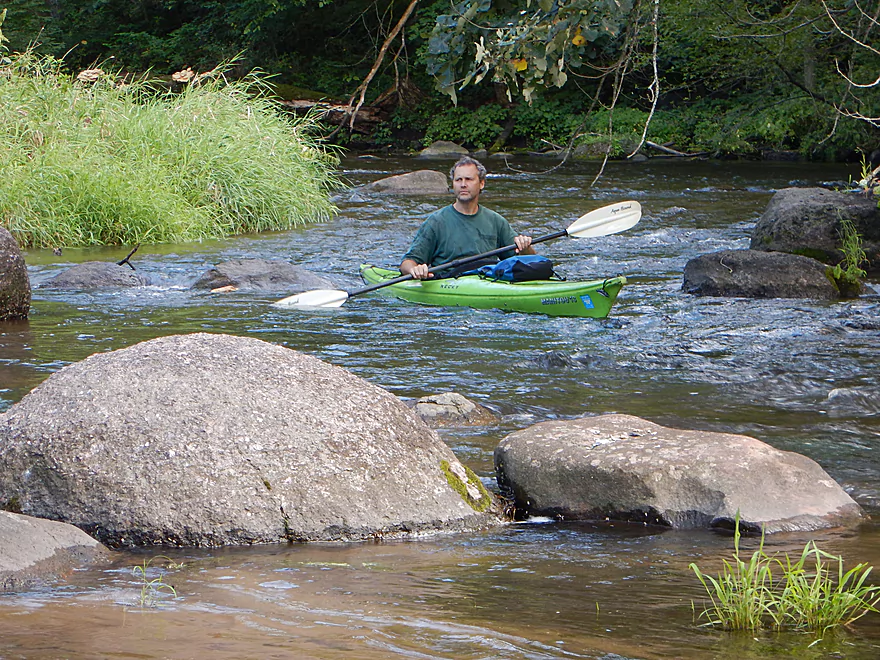
A faster part of the river
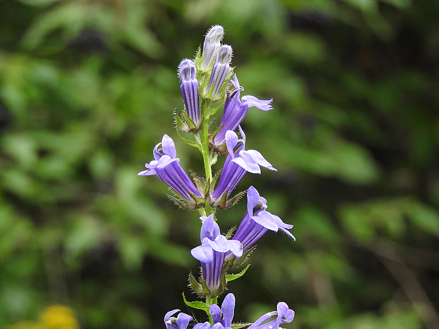
Blue Lobella
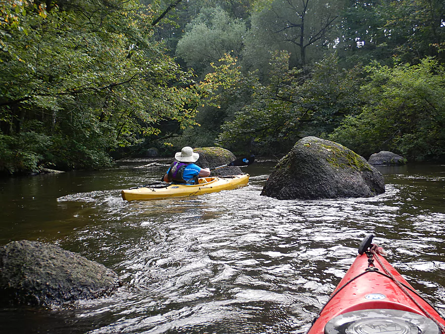
Another small boulder garden
Some Class 2 rapids
Keener Road is an access option
More granite boulder gardens
I had to get a running start to get over this log
Paddling over red gravel
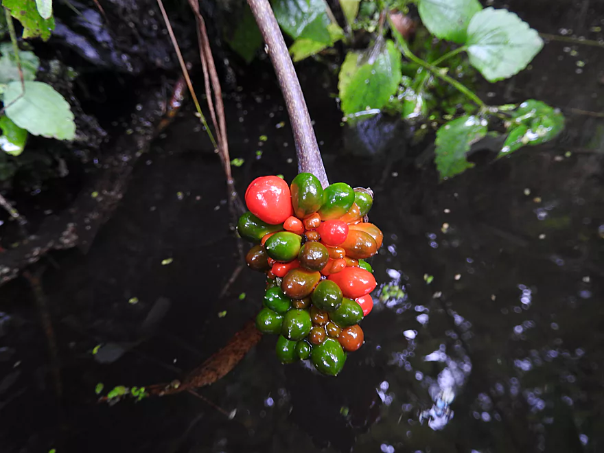
Jack-in-the-pulpit fruit
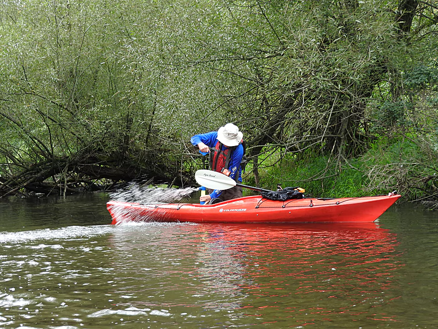
Bailing after being tipped over by a strainer
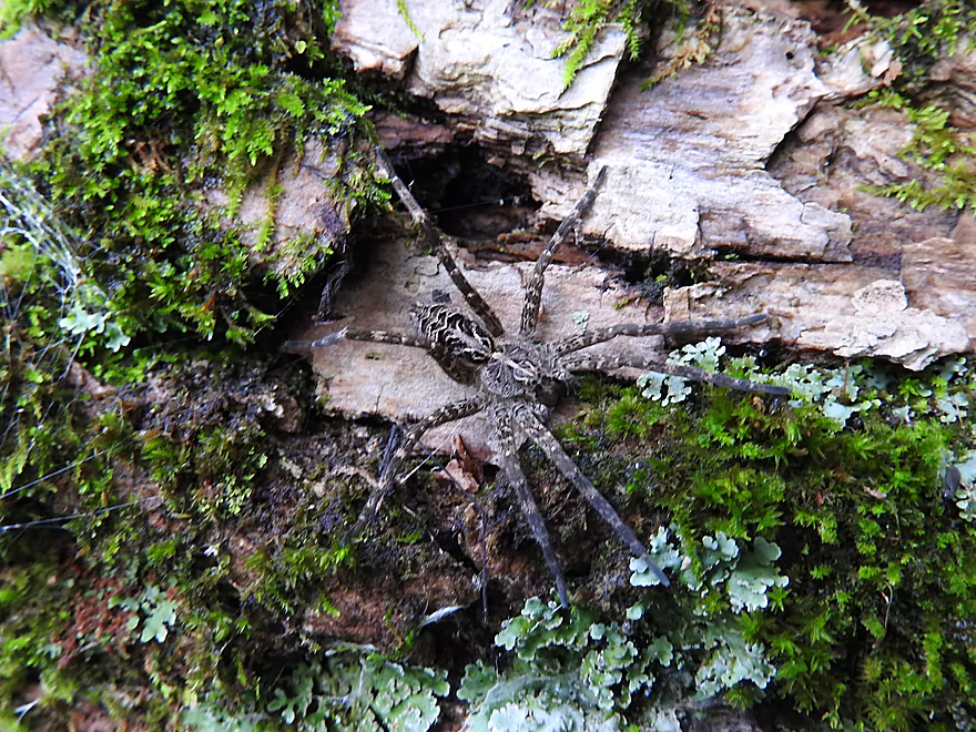
A large fishing spider
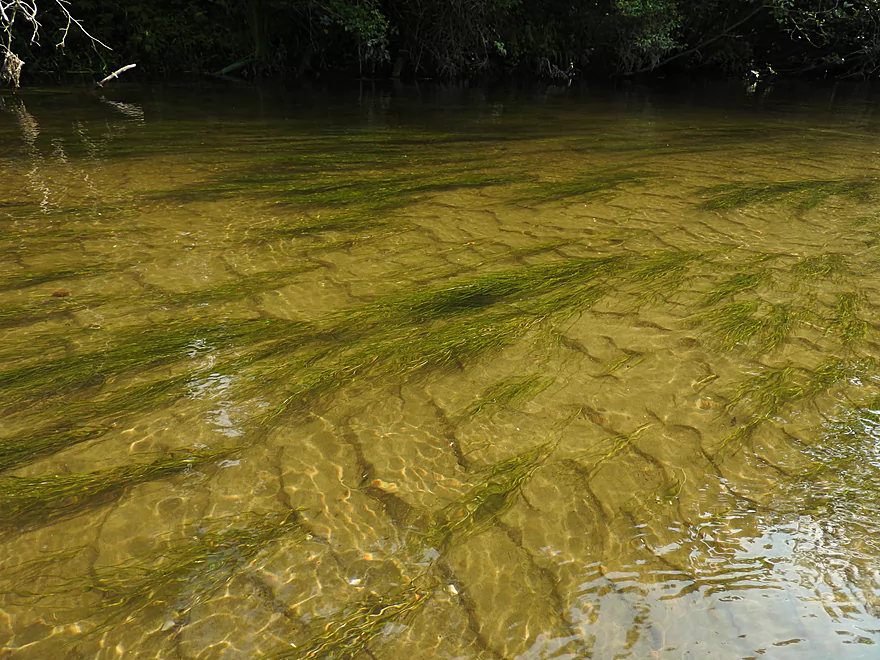
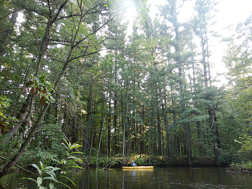
A sandy portion of the river
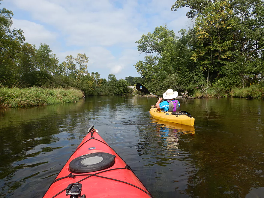
The river really opened up at this point
Passing under Hwy 10 (again)
An access option off Buchholz Road
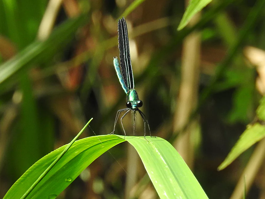
Damselfly posing for the camera
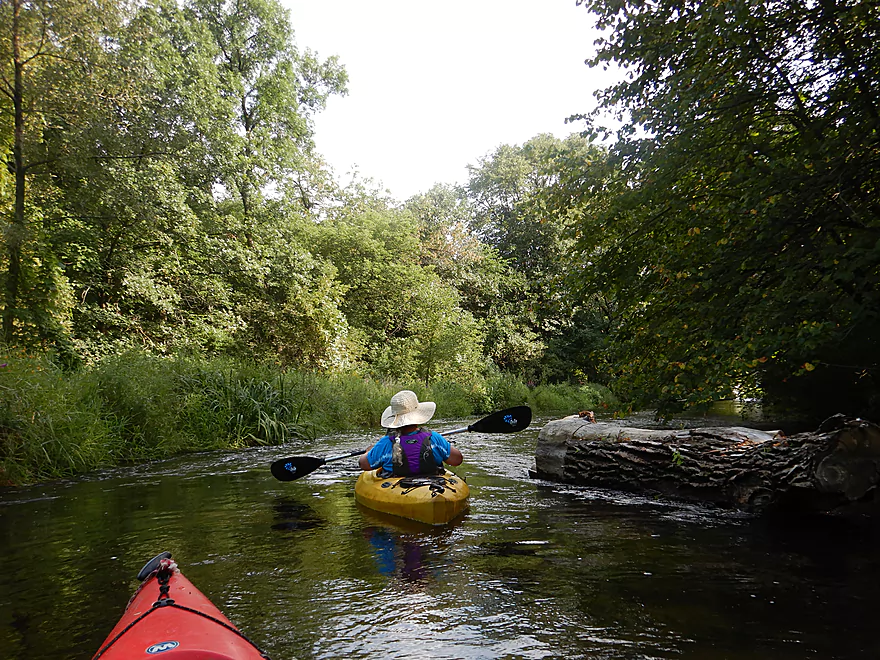
The chainsaw work on this creek was incredible
Passing under Hwy 10 (again)
Start of a cool boulder garden
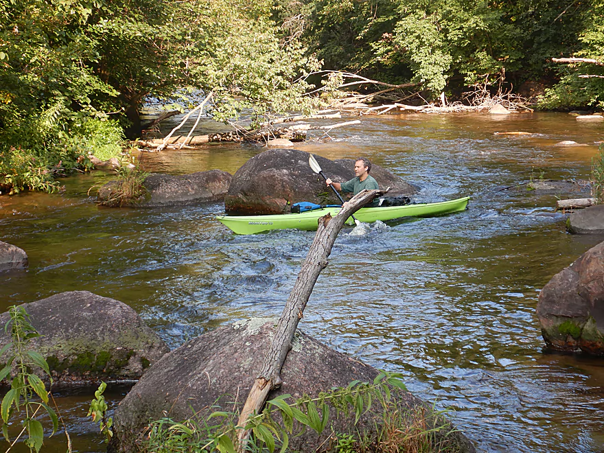
These were the largest of the trip
Even more just around the corner
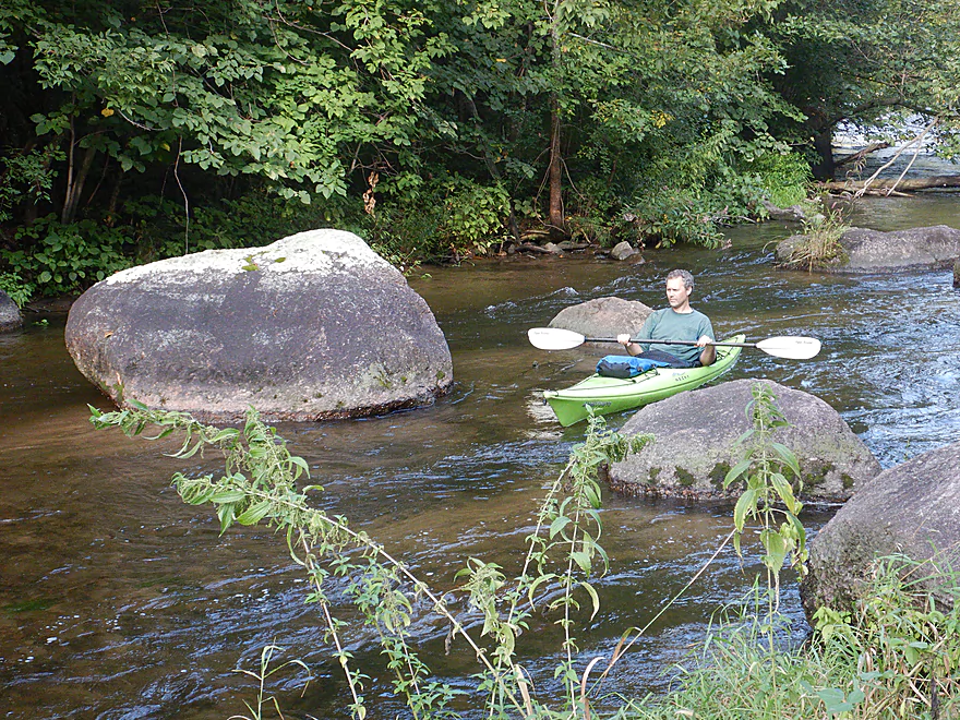
Accompanied by light rapids, this was really cool
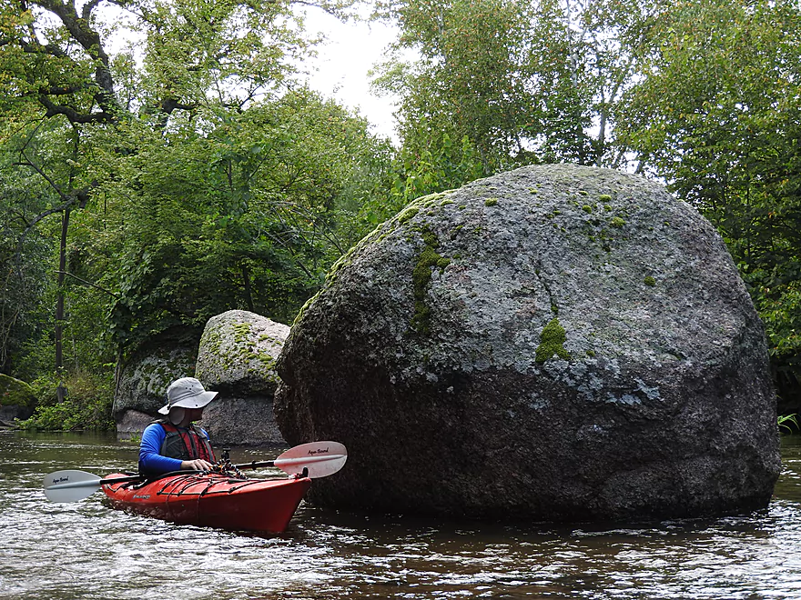
The biggest one of them all
Entering a smaller boulder garden
Looks tricky, but easy to get through
River flows by a scenic hillside
A fantastic white pine stand
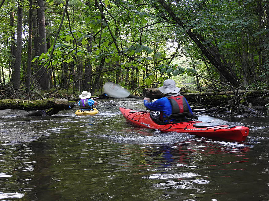
This river would have been difficult without all the cleanup work
The white pines make this an attractive portion of the creek
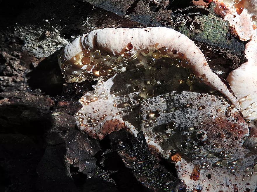
A weeping fungus…aka fungal guttation
Very nice take-out by Otto Road
Waupaca River: Amherst to Otto Road

Located in Central Wisconsin just east of Stevens Point, the Waupaca River is among the state’s best water trails. Strangely enough the river has two names, as the upper portion is called the Tomorrow River, while downstream from Amherst it is known as the Waupaca River (although some feel the demarcation actually takes place by Bear Creek). While the Tomorrow River sees moderate paddling traffic, as does the Waupaca River by the city of Waupaca, the segments in between see few paddlers. This is likely because historically these sections have suffered from logjams. But recently locals cleared them out making these obscure sections of the Waupaca finally navigable.
We started the trip in Amherst right below the dam where we soon encountered attractive red granite boulders and multiple light riffles. Apple trees grew along the banks in the first mile and we could have picked their almost-ripe fruit from our kayaks. Past Washington Street we came upon our first set of noteworthy rapids where it looked like an old mill had been removed. These were no more than Class 1, but still pretty fun. Shortly after the rapids we paddled under a large concrete arch bridge that supported the local rail line. Built in 1913, this was a very striking bridge, but was showing serious signs of age as large cracks had formed along the sides.
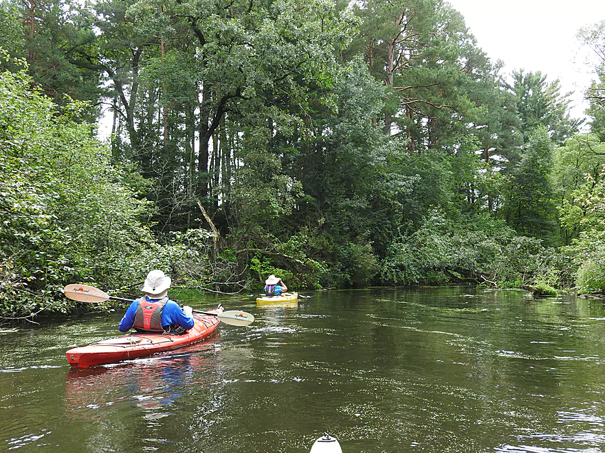
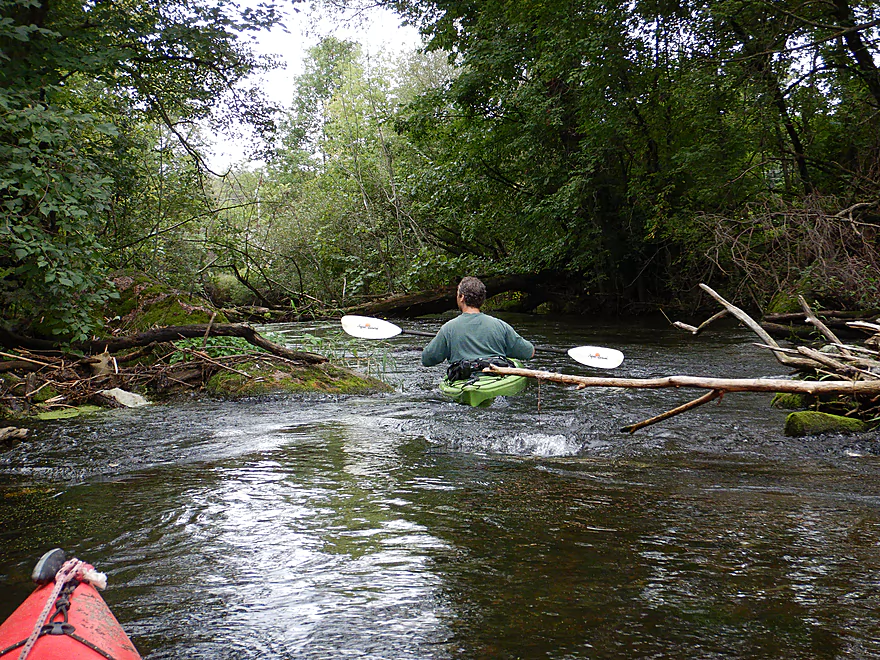
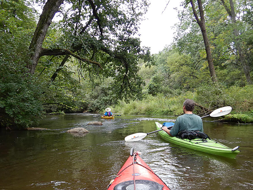
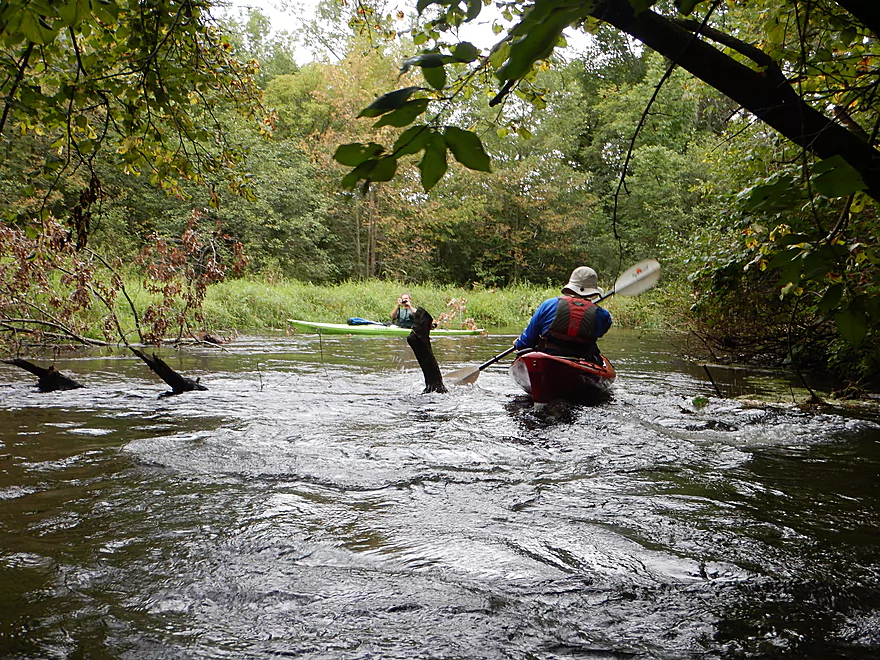
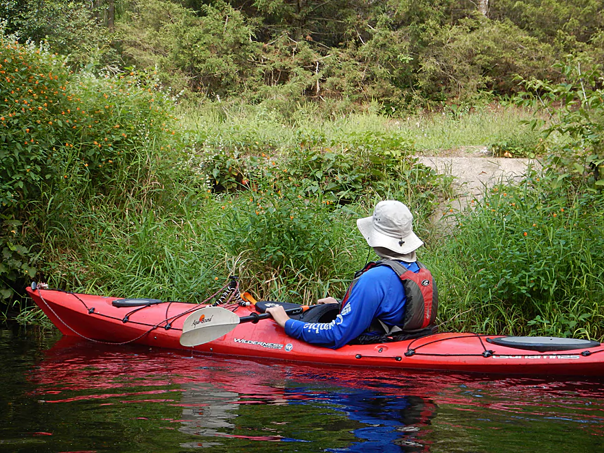
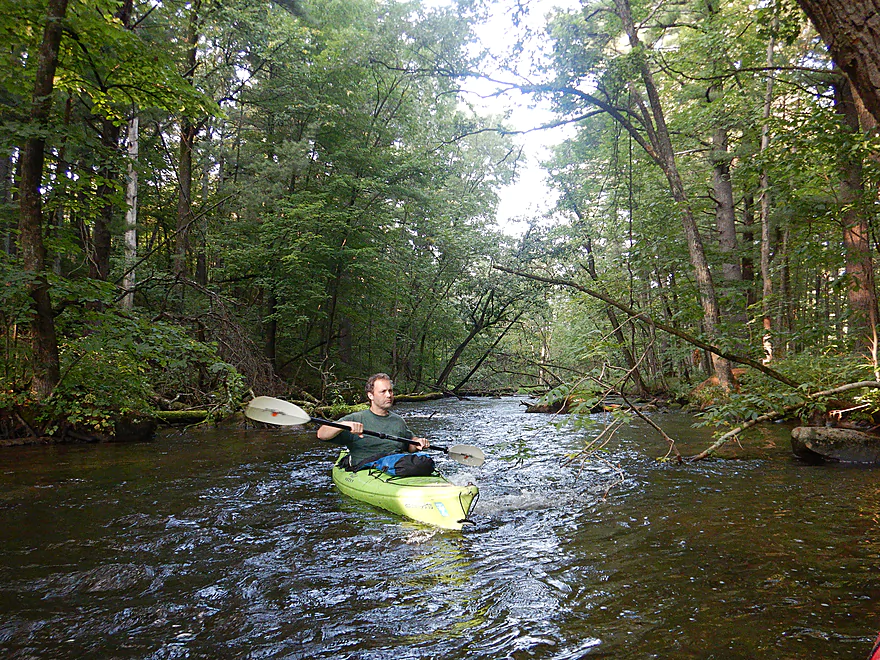
The next mile was a lot of fun because of the good current, surprising turns, and scenic tree ceilings that occasionally sheltered the river. While yes, the major logjams were removed and we never had to portage, there were still occasional snags that required careful navigation. Nearly all weren’t too problematic and added character to the river…especially the numerous low “squirrel bridges” we had to duck under.
One of the few downers to the trip was the occasional road noise coming from the Hwy 10 freeway. The river will pass under this freeway three times, and in the first case there are actually four bridges to paddle under (because of the adjacent ramps) which was a unique sight. Following Hwy 10, the river stays varied and interesting with small boulder gardens and light rapids. At Keener Street we encountered the strongest rapids of the trip which were Class 2 and entailed a 2′ drop. These were pretty easy to run although we did get a bit wet here. North of the rapids and by the bridge, there was evidence that paddlers use this location as an access.
A series of small but attractive boulder gardens followed Keener Road, but after that the river really changed in character as it slowed, widened, and opened up. For about a half mile, the river paralleled Hwy 10 and the scenery just wasn’t as interesting. In fact, perhaps because of that or my fiddling with camera settings, I was taken by surprise by a pointy strainer which stabbed me in the chest at an awkward angle. The boat kept going, but I didn’t and went for a swim. Thankfully the water was clean and not too deep which made recovery much easier. While generally speaking I don’t think of the Waupaca as a dangerous river, it shouldn’t be taken casually because of its fast current.
We crossed under Hwy 10 (again) and paddled by Buchholz Road which I had used as a put-in two years ago. This is a suitable landing…but I was a bit worried about tight parking, so opted for a longer trip and a downstream take-out instead. We then paddled under Hwy 10 (third time) and encountered a larger and slower section of the river.
Following a farm bridge, the river narrowed, picked up speed and we started seeing boulders in the water. This was the start of a huge boulder garden (perhaps the best in the state) which was spectacular because of its size and number of boulders. In some cases the boulders were over 6′ tall! Perhaps these are glacial erratics from our last ice age. Following the large boulder garden the river stayed interesting with small boulder gardens and more light rapids. Here the river had a very “up-north” feel to it accented by the white pines that grew along the banks (which always make a paddle more attractive).
We took out at Otto Road which is an attractive access area frequently used by trout fishermen. It was a neat scene by the take-out because of the adjacent rapids, boulders, pines and because it lacked the mud and weeds you typically find by southern Wisconsin access points. In summary this was a great trip we really enjoyed and was superior to my Tomorrow River trip and my Waupaca trip by the city of Waupaca. In fact I would rank this as one of the more underrated paddles in the state. Had we budgeted more time we would have paddled an additional mile and taken out at Hwy T which would have included a really scenic section of woods.
There were a few fish, a turtle, an otter, several beaver slides and a family of deer that crossed the river directly in front of us. The highlight was the countless number of snail shells which were easy to spot through the clear water.
The beginning of the trip was rich with fruiting shrubs–dogwood and wild crabs, while the adjacent trees were a mix of hardwoods and conifers (white pine, scotch pine, fir, and white cedar). The middle section lost the conifers and gained more oaks, but the white pines came back with a couple of wonderful stands close to the take-out.
We put in below the Amherst Dam which was a good access option. Street parking is available in Nelson Park or along the shoulder of Mill Street. Between the dam and Nelson Park there is rock fill with multiple steps leading to the water…so a lot of easy launch options.
An alternate access 4 miles upstream would be at the old mill in Nelsonville (between Hwy SS and 1st Street). That is a classic section of the Tomorrow River. Reviewed here.
An alternate access 1.7 miles downstream would be at Hwy A. But by launching here, you miss out on a great part of the river. Hwy A might not be a great launch option.
An alternate access 2.3 miles downstream would be at Keener Road by the rapids. This might be a better take-out than a put-in as the subsequent 3.4 miles aren’t as interesting.
We took out at Otto Road where there is a popular trout access northeast of the bridge. This was a good take-out and very scenic….just don’t wait too long to pull ashore, as the current is fast. A faint trail leads from the water to the road where shoulder parking is possible. Be mindful of the poison ivy.
An alternate access 1.5 miles upstream would be off the shoulder of Buchholz Road. This is an ok access option, but parking is tight for large vehicles and the locals do not appreciate paddlers who park on the road. The big issue with taking out here is you miss a fantastic stretch of boulder gardens.
An alternate access 0.9 miles downstream is at Hwy T. This access is not nearly as good as Otto Road and parking can be a bit tight…but the mile-long stretch between Otto and T is really scenic with more boulder gardens and light rapids.
The bike shuttle would not be too difficult…3.7 miles with no significant hills.
Current: The current was quite fast with a number of light rapids.
Noteworthy Rapids: Almost all the rapids are just Class 1. The only Class 2 rapids are located under Keener Road which should be fairly straight forward to run.
Logjams: While historically this section has been clogged with logjams, somebody has cleared them out. For the entire trip, we never had to portage a single logjam. However, there were multiple instances in which we had to “hop over” several logs and duck under others. This mostly wasn’t difficult but could be problematic for large boats or during high water.
Strainers: There are numerous strainers along the shore which coupled with the fast current can be a problem. If you are paying attention, you shouldn’t have any issues…but I wasn’t and did get tipped over.
There is a gauge on the Waupaca River which read 250 CFS, which is about 50 CFS above normal…but this was a decent depth. The following is a rough depth guide:
- 0-120 CFS: Extremely low flow-rates. Superb clarity, but likely too shallow to paddle.
- 121-180 CFS: Slightly below average depth. Many locations will likely be very bumpy and you may have to walk several parts.
- 181-240 CFS: An average depth. Likely a good target range, but bumpy in spots.
- 241-290 CFS: Clarity is reduced from excellent to good at these depths. Getting over the rapids and shallow areas will be very easy.
- 291-340 CFS: Above average depth that will be pushy in locations.
- 341-390 CFS: A high depth that could be problematic for getting under some of the low trees. The current will be very strong at this range.
- 391-440 CFS: Likely only suitable for experienced paddlers in maneuverable boats.
- 441+ CFS: Likely too high for enjoyable and safe paddling.
Detailed Overview
- Clementson Road to Hwy Q: 0.9 miles. Possible prospect, but the river is very small here.
- Hwy Q/Rolling Hills Road to Hwy 161: 1.2 miles. A good prospect.
- Hwy 161 to Amherst Dam: 5.4 miles. More of an oversized creek than a river, the Tomorrow River is still a nice paddle known for its clear water.

- Hwy 161 to 1st Street: 1.3 miles. Great trip.
- 1st Street to the Amherst Dam: 4.1 miles. Great put-in and trip.
- Hwy 161 to 1st Street:
- Amherst Dam to Buchholz Road: 5.7 miles. This section was great fun because of its many rapids, clear water, narrow channel, boulder gardens and wooded banks.
- Amherst Dam to Hwy A: 1.7 miles. Great segment through Amherst.
- Hwy A to Keener Road: 0.6 miles. A short but good section with a nice boulder garden.
- Keener Road to Buchholz Road: 3.4 miles. Aside from some Class 2 rapids at Keener Road and a few boulders, this is a more open and less interesting section.
- Amherst Dam to Hwy A:
- Buchholz Road to Stedman Park: 6.1 miles. A fantastic paddle that was narrow, fast, rocky, and scenic.
- Buchholz Road to Otto Road: 1.5 miles. Great stretch with some huge boulder gardens.
- Otto Road to Hwy T: 0.9 miles. Another great section with some boulder gardens and light rapids.
- Hwy T to Stedman Park: 3.7 miles. Good stretch with some great rapids and boulder gardens at the end.
- Buchholz Road to Otto Road:
- Stedman Park to Durant Road: 2.1 miles. A really nice leg. Starts with some terrific boulder gardens, rapids and pine stands by Stedman Park. River then flattens out for the middle portion and becomes a bit less interesting. The final leg features some terrific pine stands.

- Durant Road to Cobbtown Road: 1.4 miles. A nice section, but not as good as upstream parts with less boulder gardens and rapids. Maybe one logjam.
- Cobbtown Road to Frost Valley Road Access: 1.7 miles. Starts nice with fun rapids and a decent boulder garden. But satellite images suggests 3-5 logjams that might require portaging.
- Frost Valley Road Access to County Q Canoe Landing: 2.0 miles. Satellite images suggest a number of logjams (maybe 8). I would wait for this stretch to get cleared out before attempting.
- Hwy Q Launch to Brainard's Bridge Park: 7.8 miles. A great trip that is very popular with paddlers.
- Brainard's Park to Elm Street Dam: 0.8 miles. Half of this is a nice river paddle, half a boring flowage. There is a portage path around the dam.
- Elm Street Dam to Kiwanis Park: 3.3 miles. Great prospect, but perhaps a logjam or two. The Mill Street dam is VERY dangerous and preceded by Class 2 rapids. This is also a difficult portage. Scout before committing to a trip.
- Kiwanis Park to Harrington Road: 7.7 miles. A good prospect.
- Harrington Road to Weyauwega Dam: 4.4 miles. Maybe 3 miles is open flowage paddling.
- Weyauwega Dam to Decker Memorial Park (and the Wolf River): 6.2 miles. A mediocre prospect.
Trip Map
Overview Map
Video
Photos Size:
My wife and I ran the section of the Waupaca from Keener Road to Otto Road on July 29, 2019. The storms from a bit more than a week ago really changed this section. Many, many downed trees that you have to portage around. It was still fun, but a lot of work. I would avoid this section of river for now.
That stupid storm caused so many problems…many rivers in central Wisconsin are in bad shape because of it. I appreciate your update.
We did from Amherst to Otto Road today and it was absolutely awesome. No other paddlers, not a single Portage was necessary, as someone had cleared a path through all of the snags. Not a paddle for novices, but we are far from expert, and still had a blast navigating through and around all the cut areas and the boulder Gardens. I couldn’t get the grin off my face.
That’s great news! The Waupaca did endure some nasty wind storms…and this stretch is truly special. It does amaze me that the nearby Crystal River is packed with a crazy amount of people when the next door Waupaca is just as scenic.
I did this trip on 6/25/20 with a bike shuttle. Since the USGS is no longer operating a gauge on this river I don’t know the exact level, but I think it is safe to say it was high as there had been a decent amount of rain in the last week, the river looked high, and the few fisherman we saw all agreed it was relatively high. We had a fantastic trip, the water was surprisingly clear, rootbeer colored, but clear. The current was fash, bordering on pushy, but as there were no complete blockages, it was just challenging in a fun way. There were several tight duck unders, and a lot of maneuvering around and through branches, trees, and other obstacles,in a pretty decent current, so we needed to stay on out toes and have good boat control, but we never had to get out of out of our boats. A great trip, but probably not for beginners or longer boats. The trip took us about 2 hrs and 15 mins, and the bike shuttle was about 25 mins with the only big hill being right at the take out. The next section down looks intriguing including a class II-III drop at the DD Bridge/Steadman Wayside park that looked runnable at this level
Thanks Eric for the update. Note NOAA has taken over some of the gauges discontinued by USGS. For example the Waupaca gauge can be found at: https://water.weather.gov/ahps2/hydrograph.php?wfo=grb&gage=wpcw3 Your trip was done at 2.59′ which should be roughly 600 CFS (which yeah is high). Unfortunately NOAA usually doesn’t use CFS…so I’ll have to convert all my estimates to feet eventually). Great to hear you didn’t portage…I feared the worst after last year’s storms.
We did this section of the river today, 9/26/2020. Water level was probably on lower side but we did not have to get out at all. Impressed with the path that someone clearly made through the deadfall with a chainsaw – it was not an issue, no portaging necessary. The last stretch of this (last mile?) was the best – the boulder gardens and white pine and fall colors were beautiful. No issues with takeout at Otto Road.
Thanks for the update Sarah. That might be one of the better fall water trails in the Central Wisconsin.
Has anyone done this stretch of the river this year? Wondering whether it’s still blockage-free.
Just went from Hwy A to otto road on fathers day 2023, everything is trimmed nicely for kayaks, canoe will have to portage around a couple trees that were a tight fit under with kayak. all in all it was a great trip
That’s good to hear!