
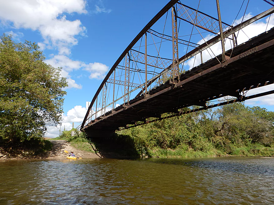
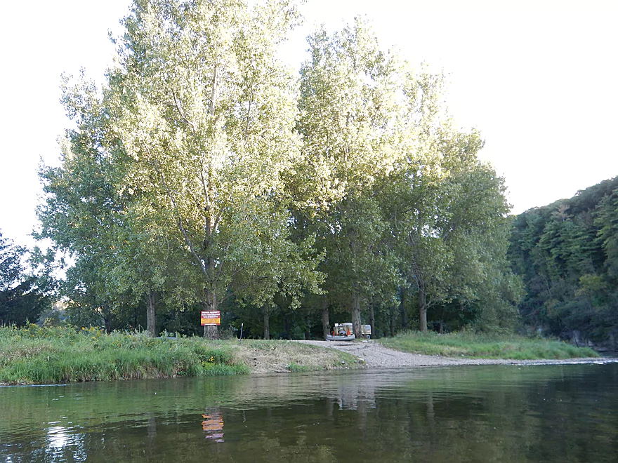
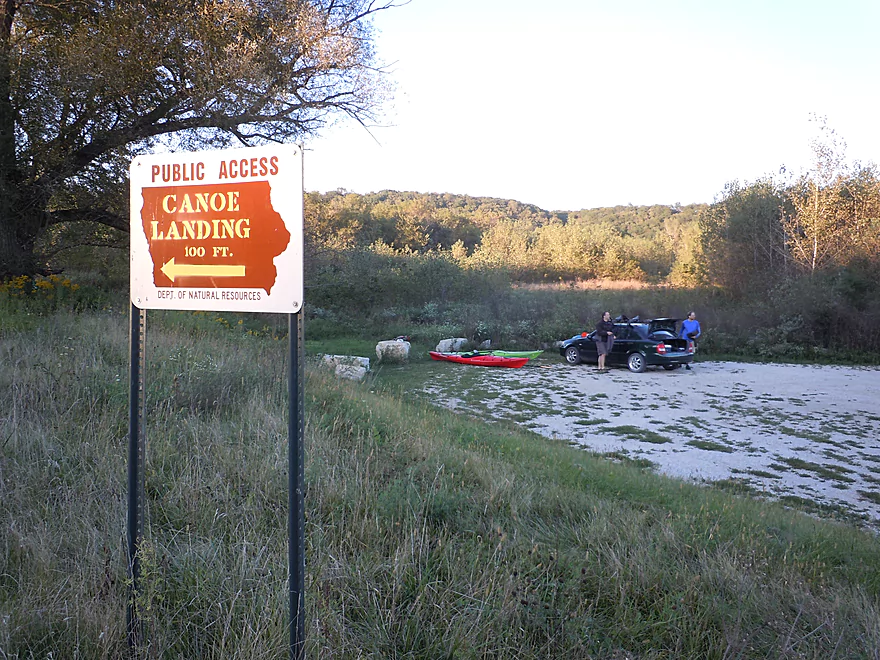
Good access by Cattle Creek Road
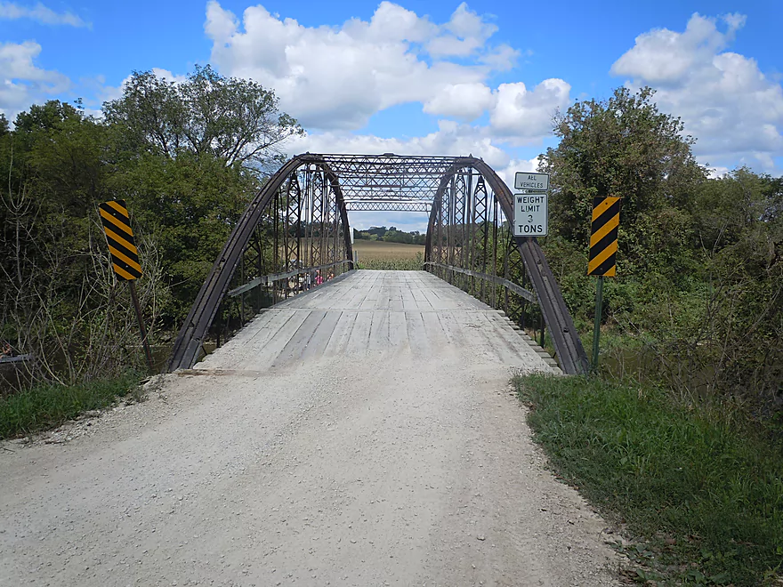
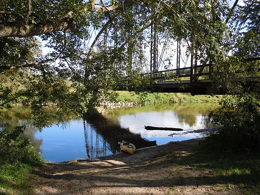
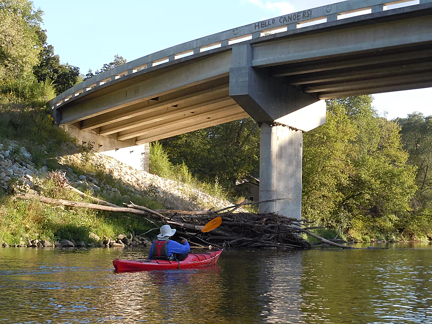
A bridge with wooden planks!
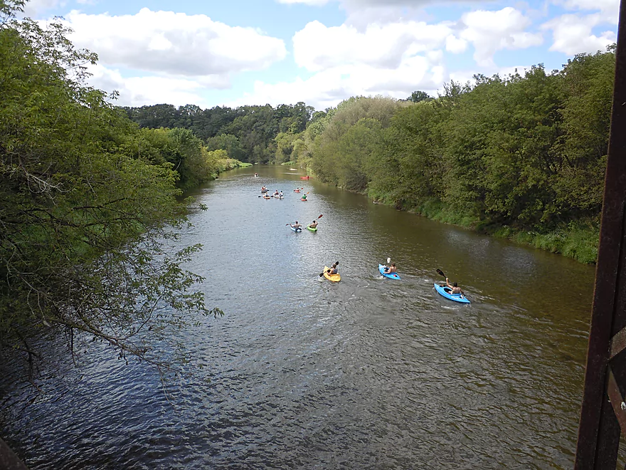
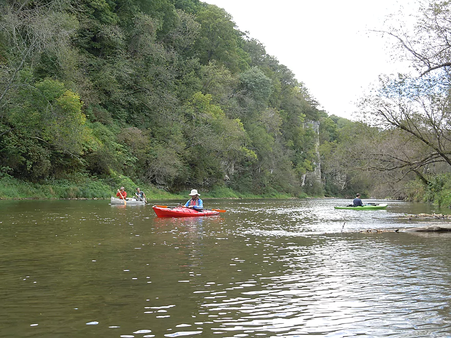
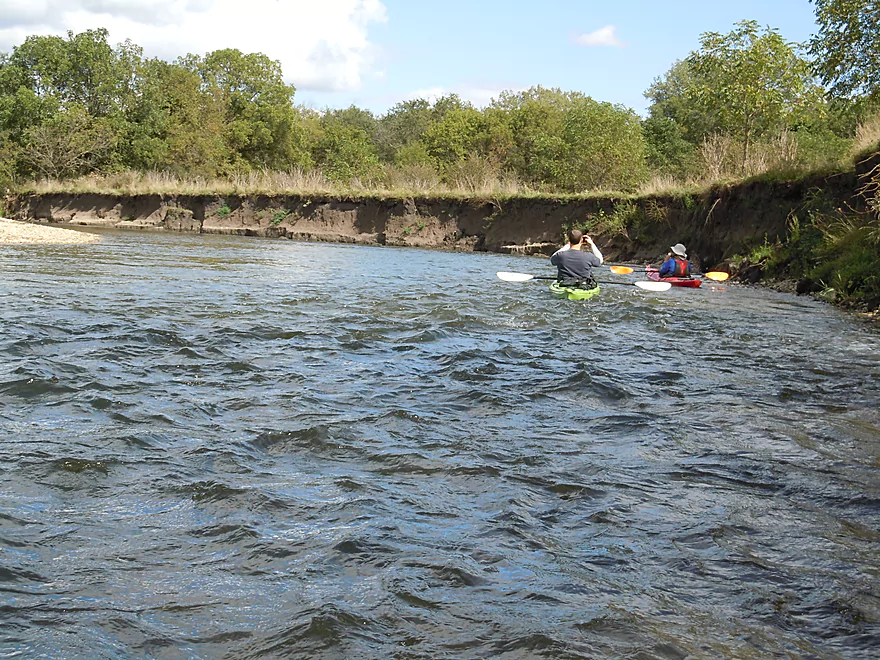
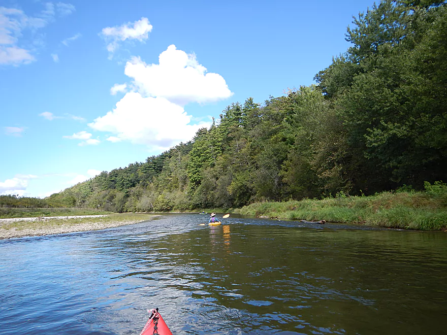
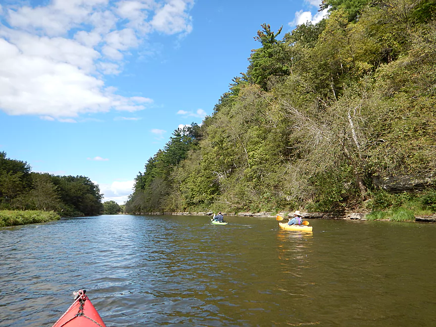
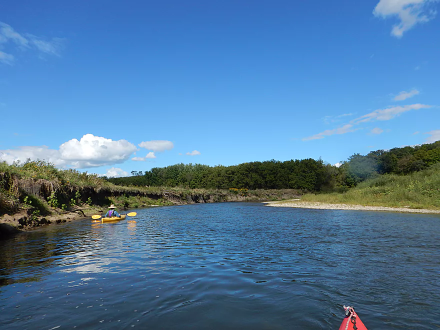
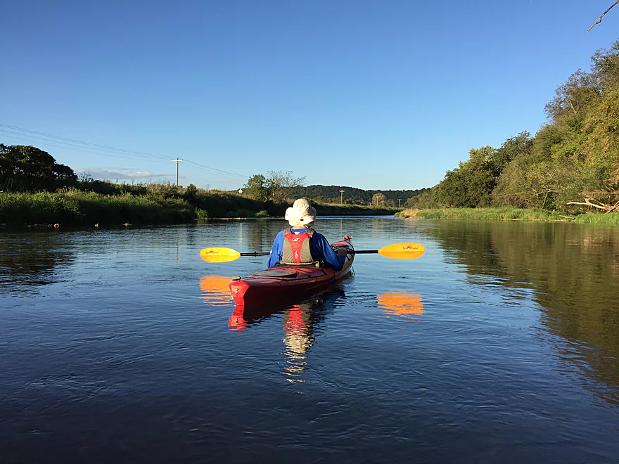
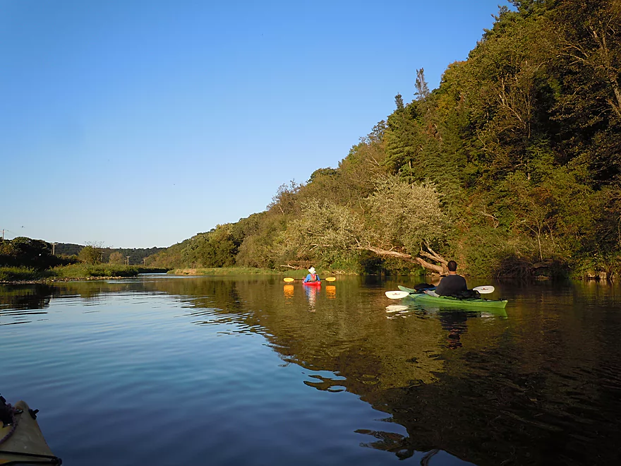
This is a VERY popular river
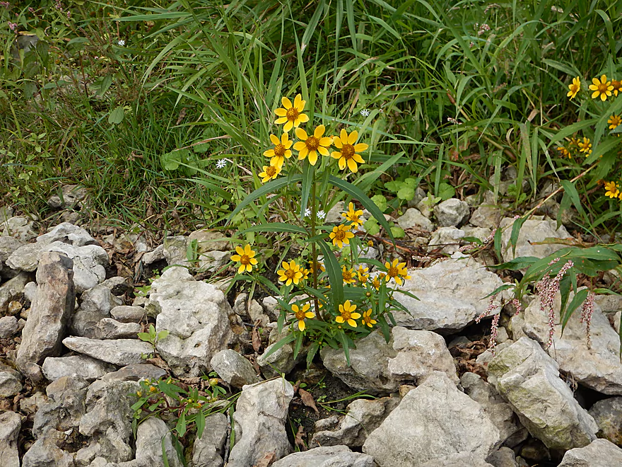
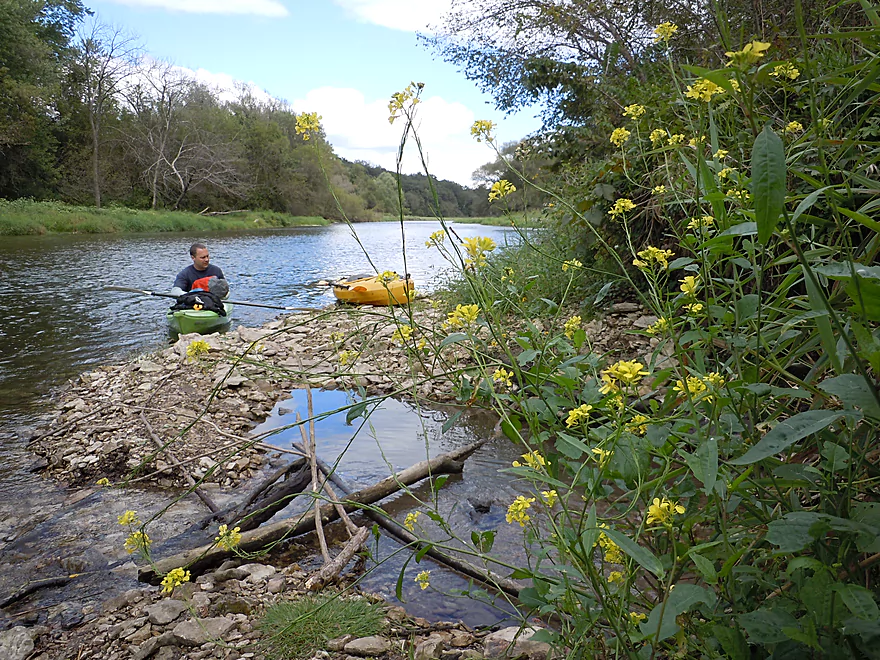
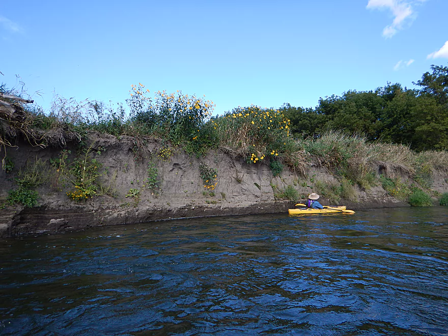
Beggar-tick flowers
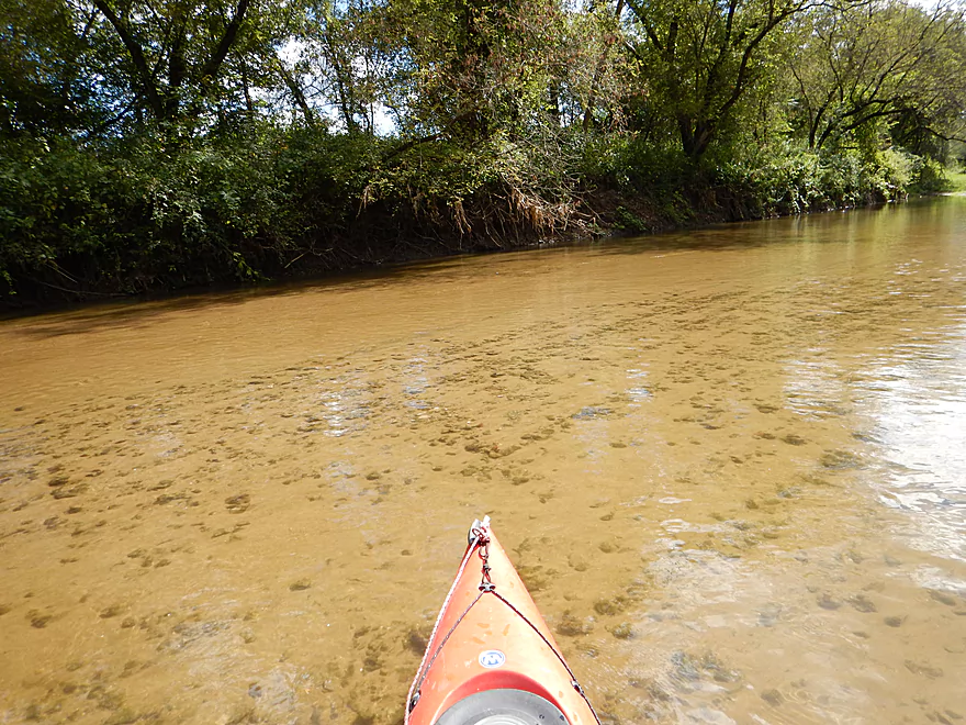
Terrific water clarity
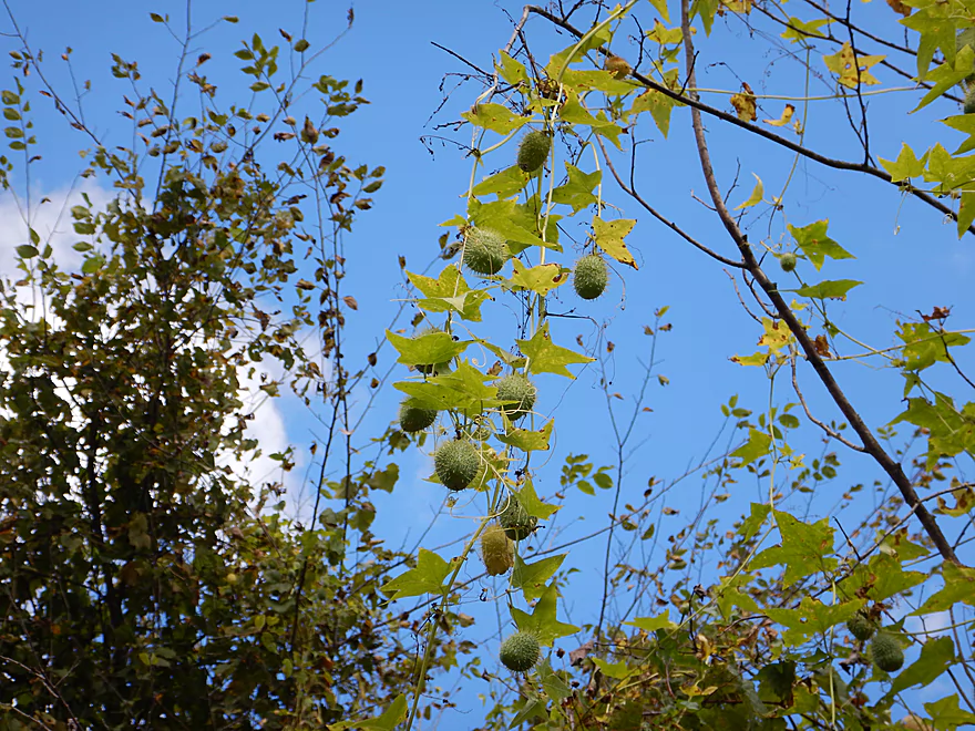
Wild cucumber
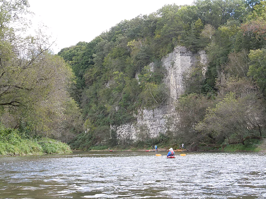
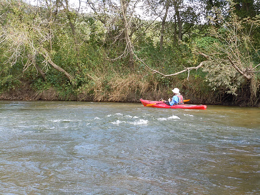
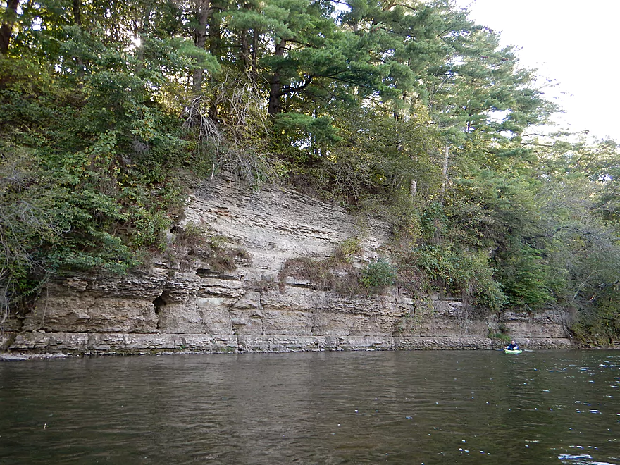
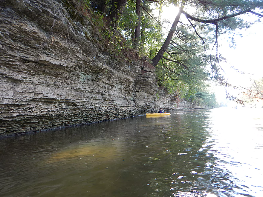
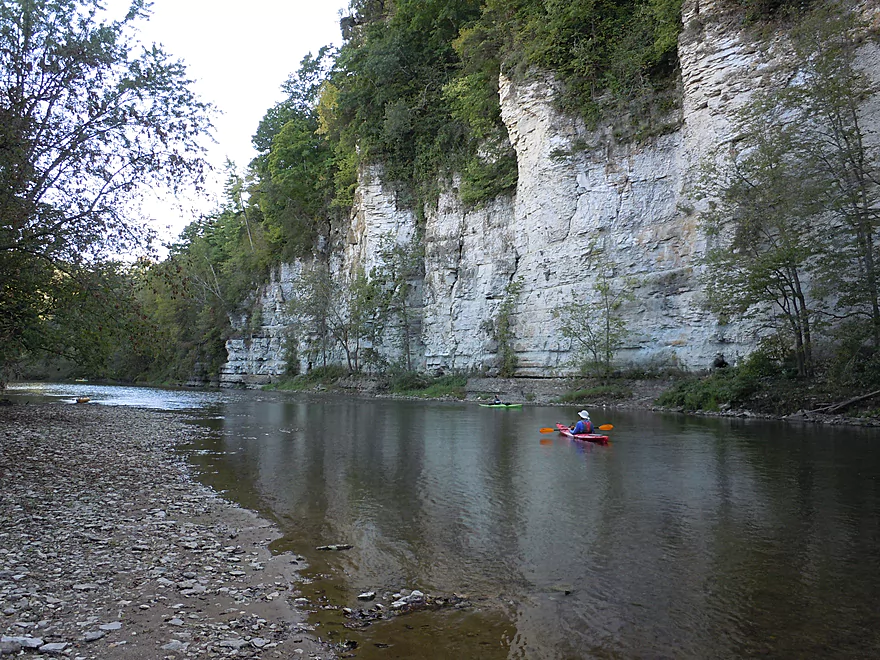
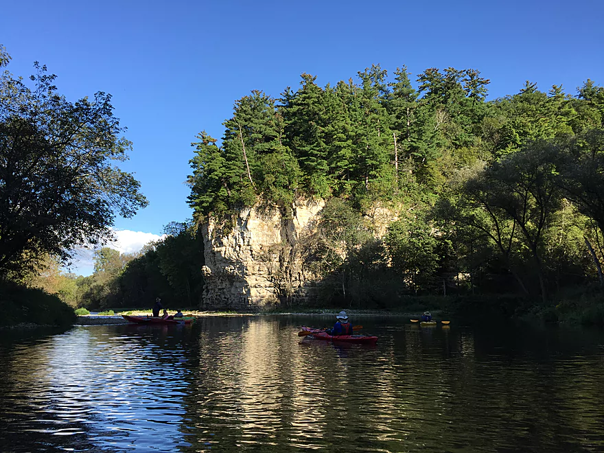
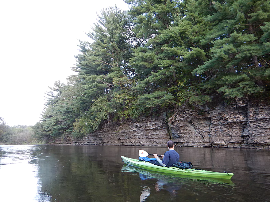
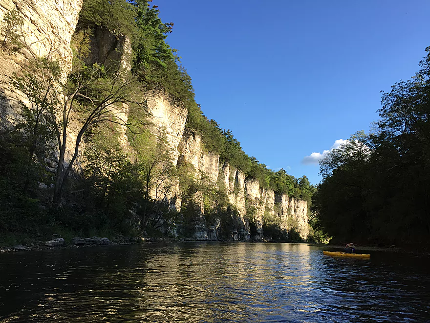
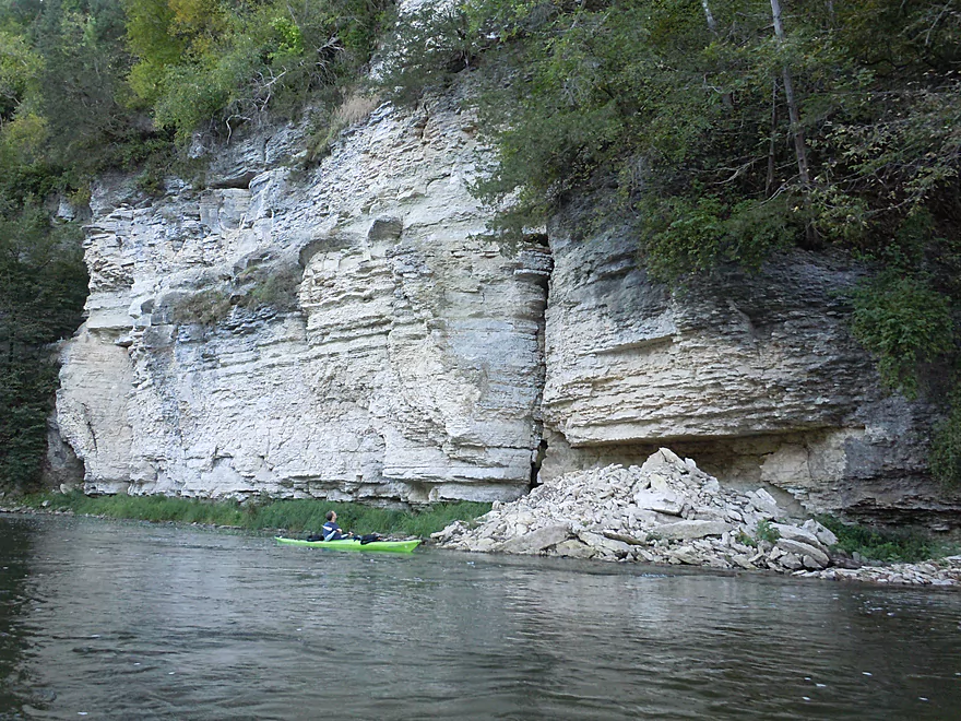
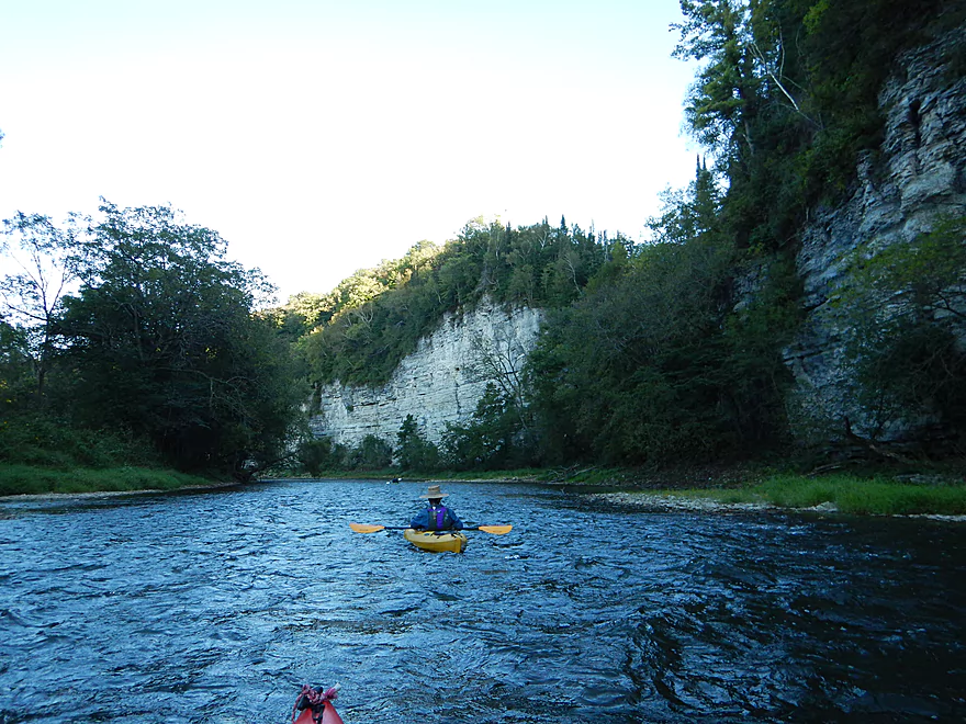
First major bluff is not far from put-in
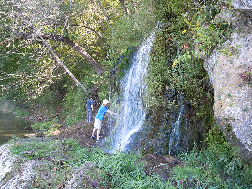
A really cool spring flows into the river here
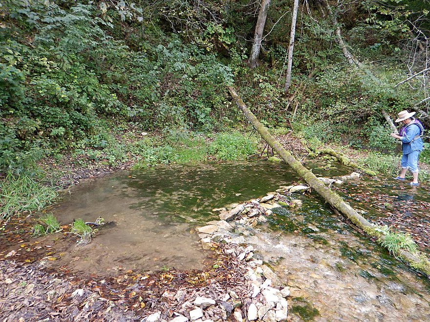
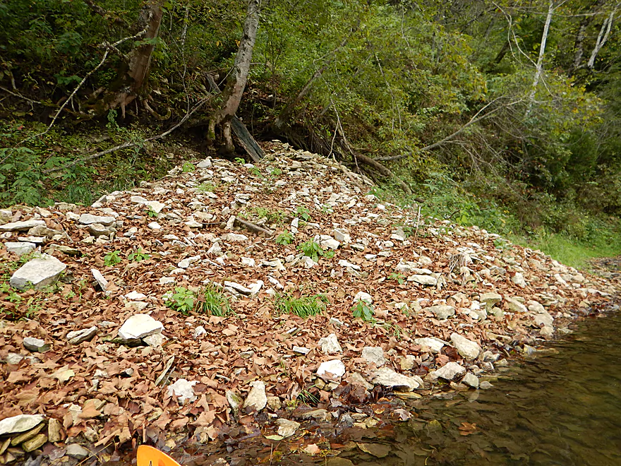
Paddlers have dammed up this artesian well
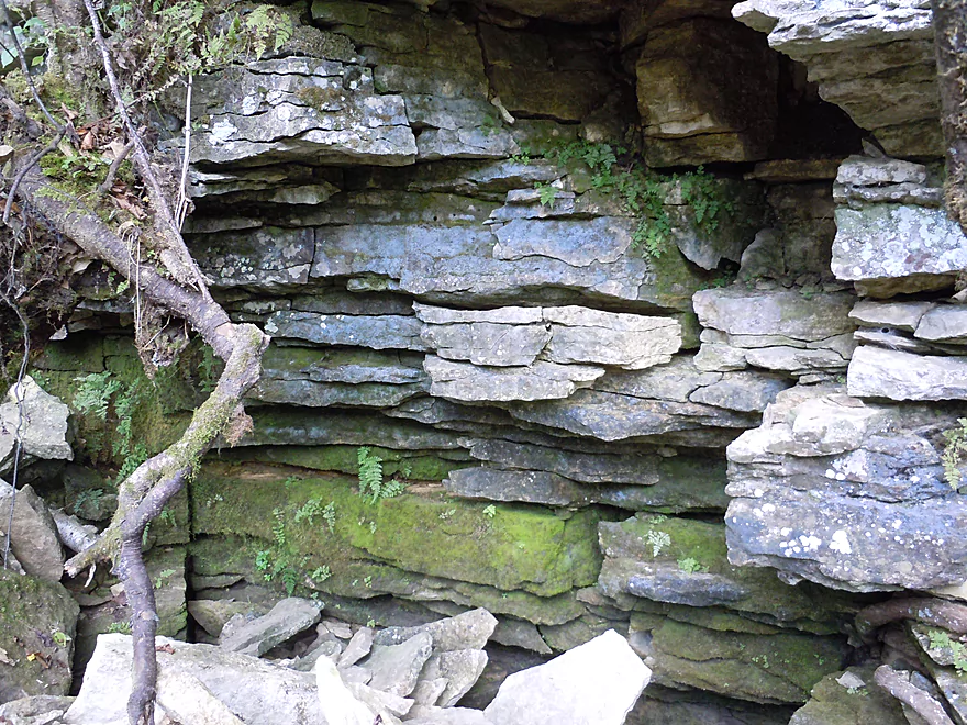
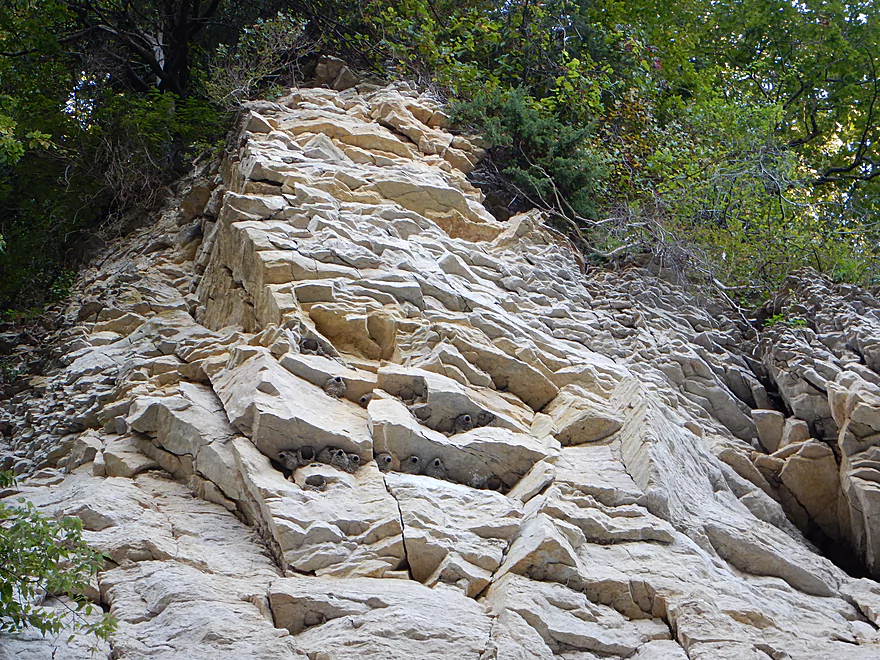
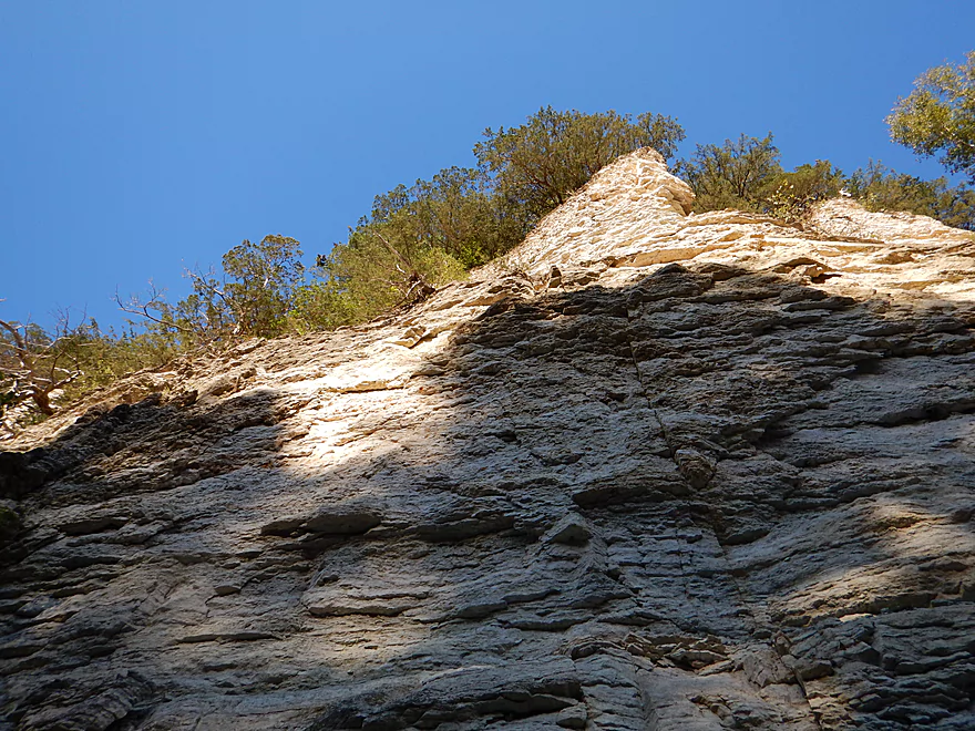
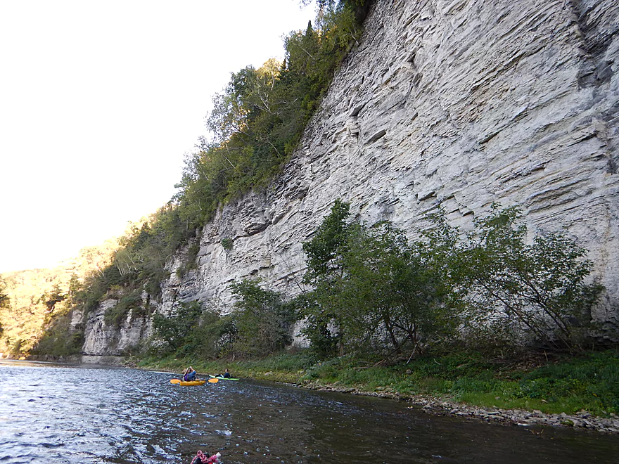
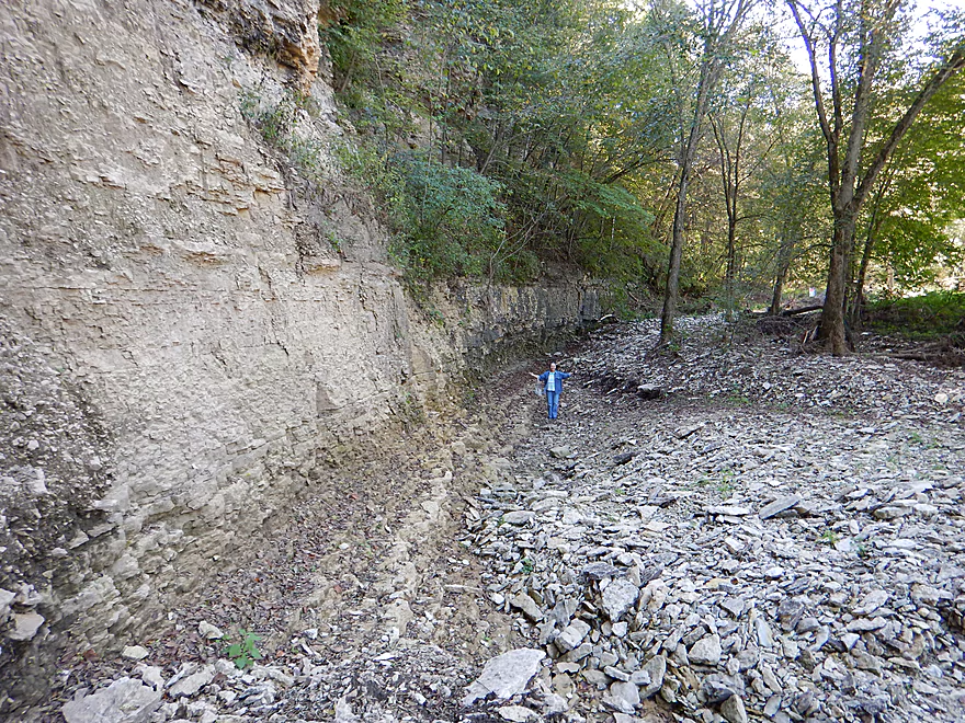
You can see how water can get through limestone so easily
A second and nearby artesian well
Very cool
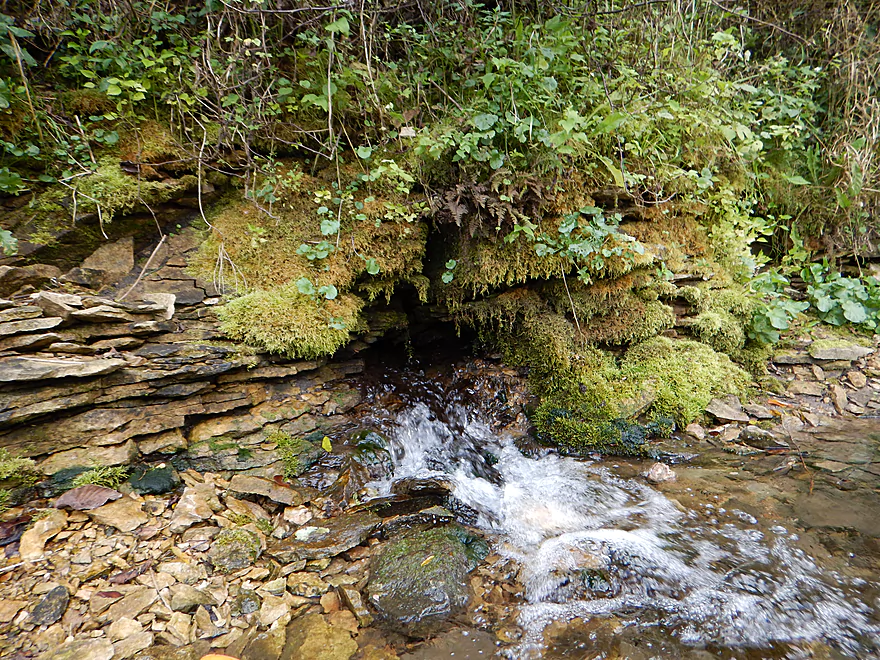
A third spring just gushes out of a hole in the bluff
Busy beavers
Iowa beavers like corn…
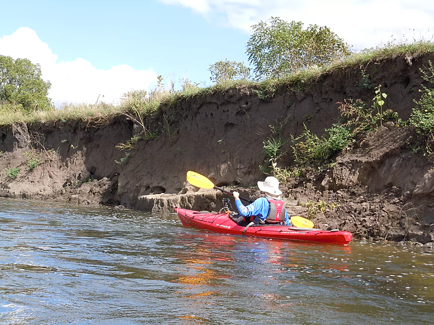
The bluffs are constantly being eroded
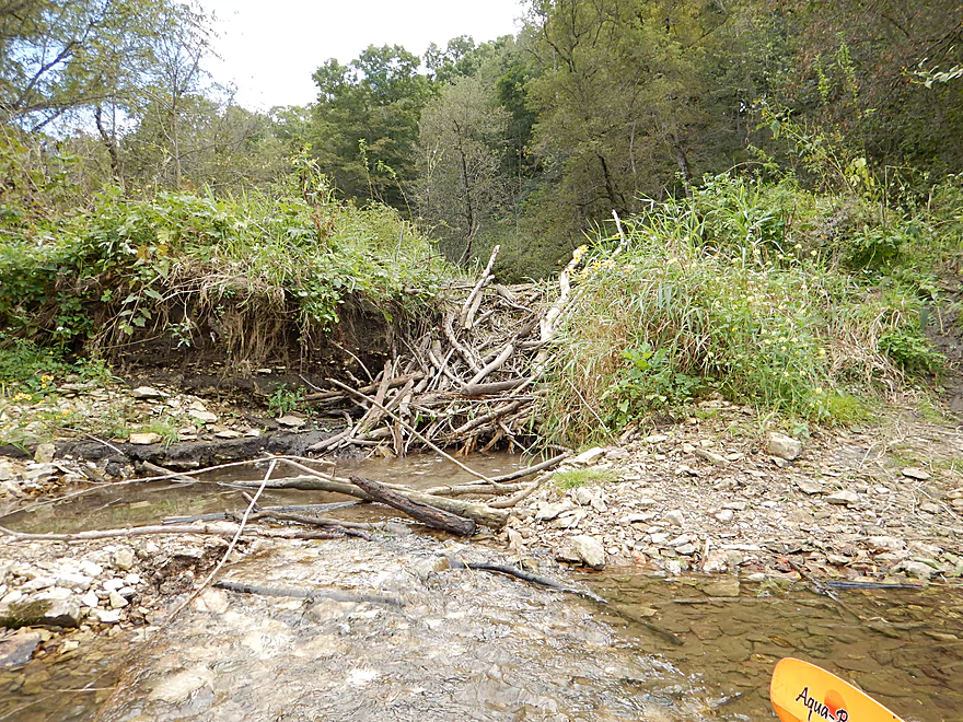
An impressive beaver dam backing up another spring
One of many riffles
Decades of topsoil erosion
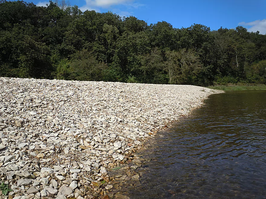
An impressive gravel bar
Poorly managed banks
All these pines in Iowa??
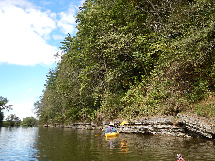
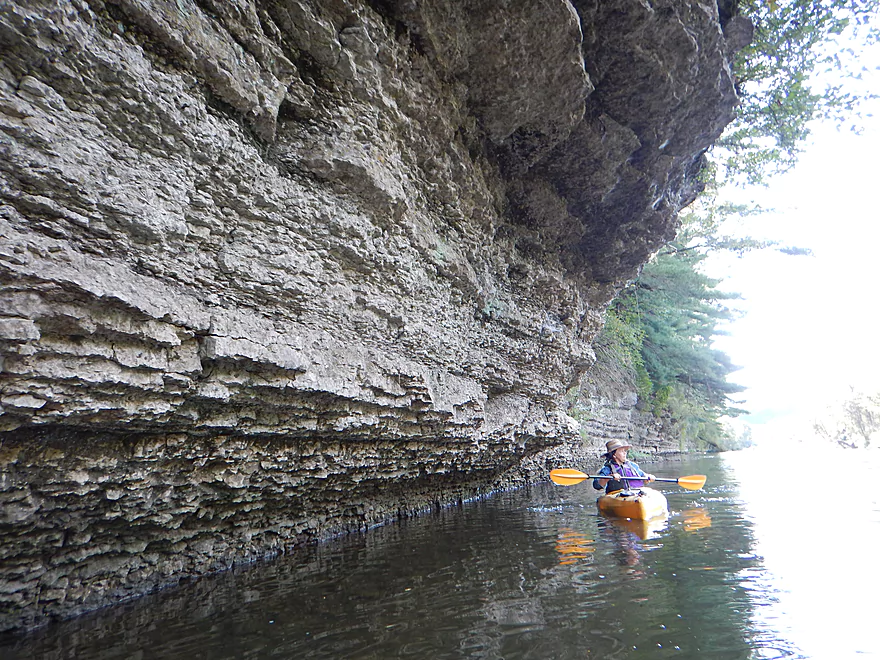
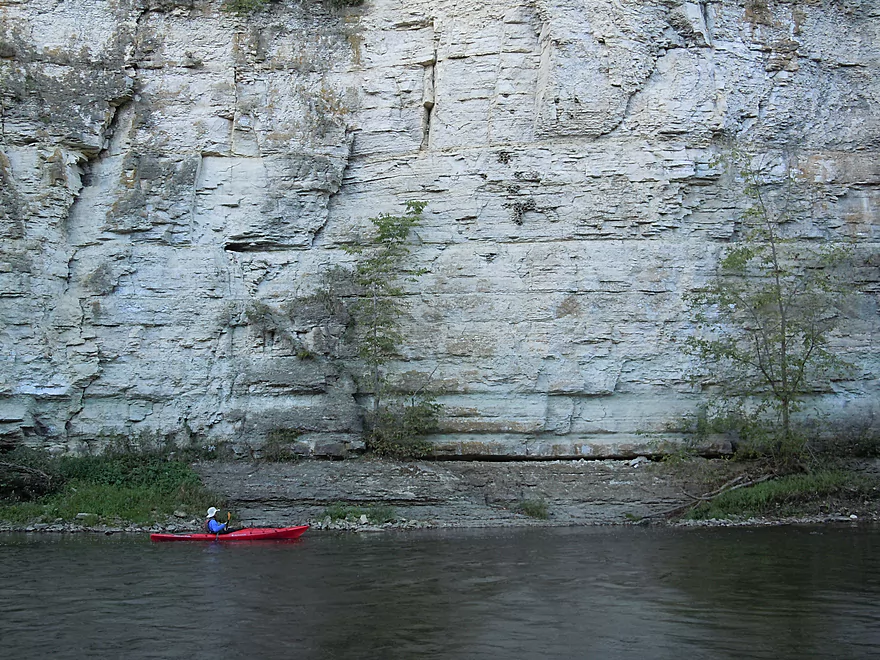
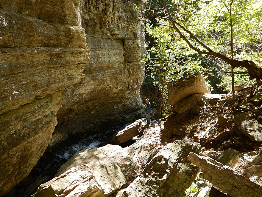
Cool limestone stratifications
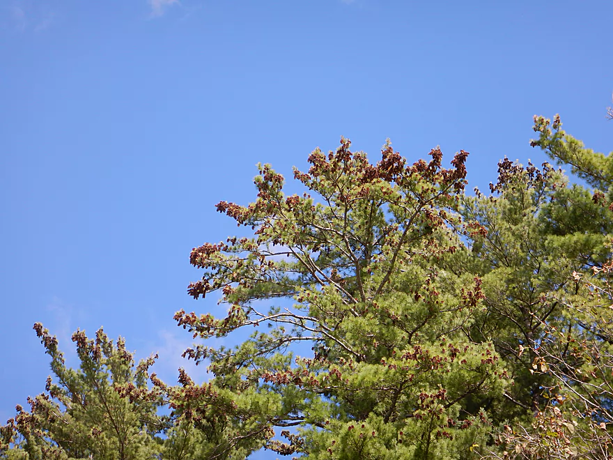
Quite the bounty of pinecones
Deja Platte River
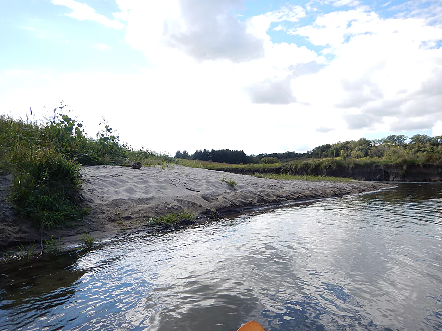
The only nice sandbar on the trip
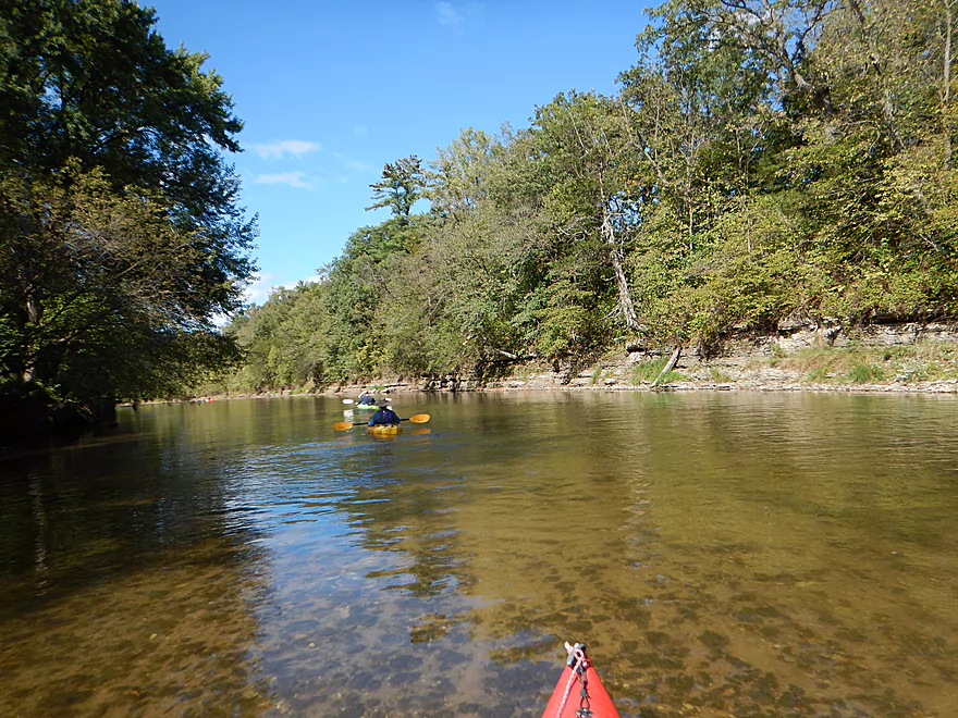
Again, great clarity
Rapids were never more than class 1
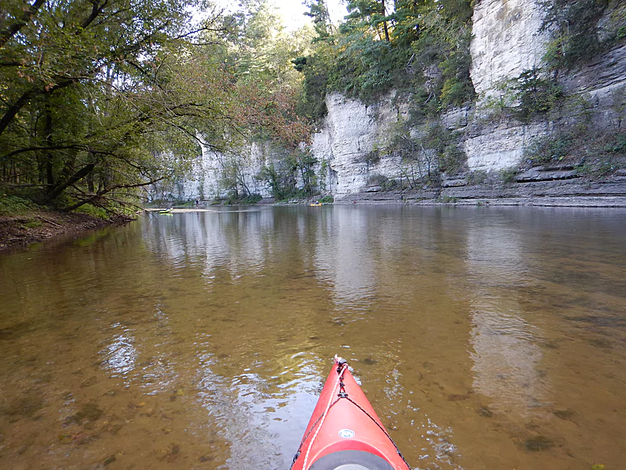
The Chimney Rock horseshoe
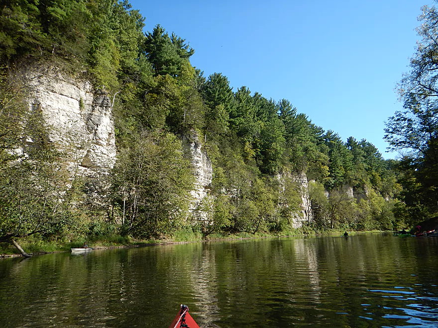
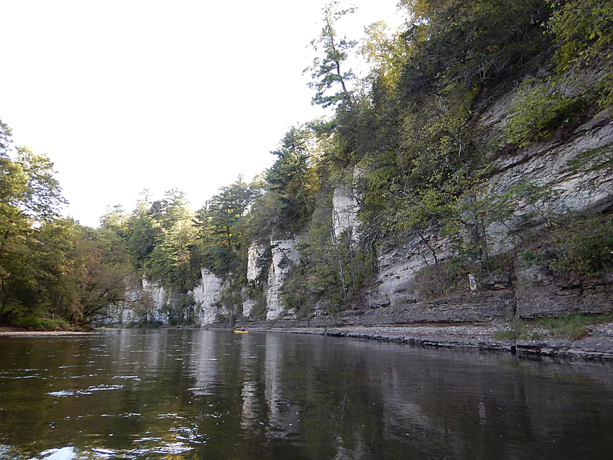
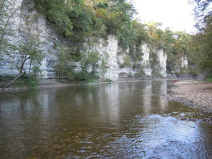
Spectacular bluffs
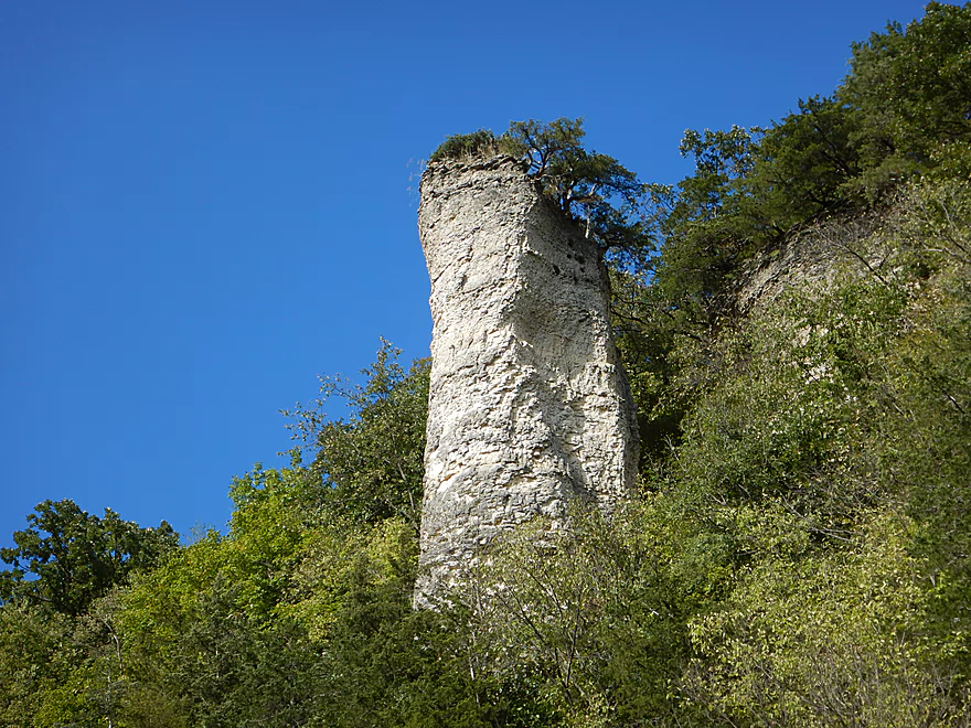
And here is the chimney
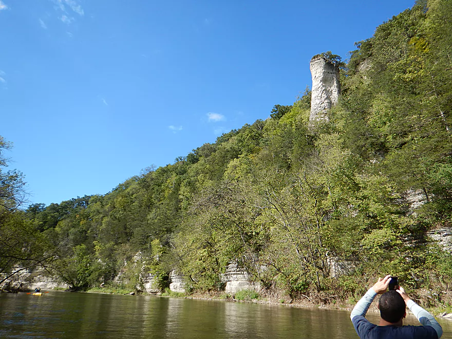
Different view
Good access option at Chimney Rock Road
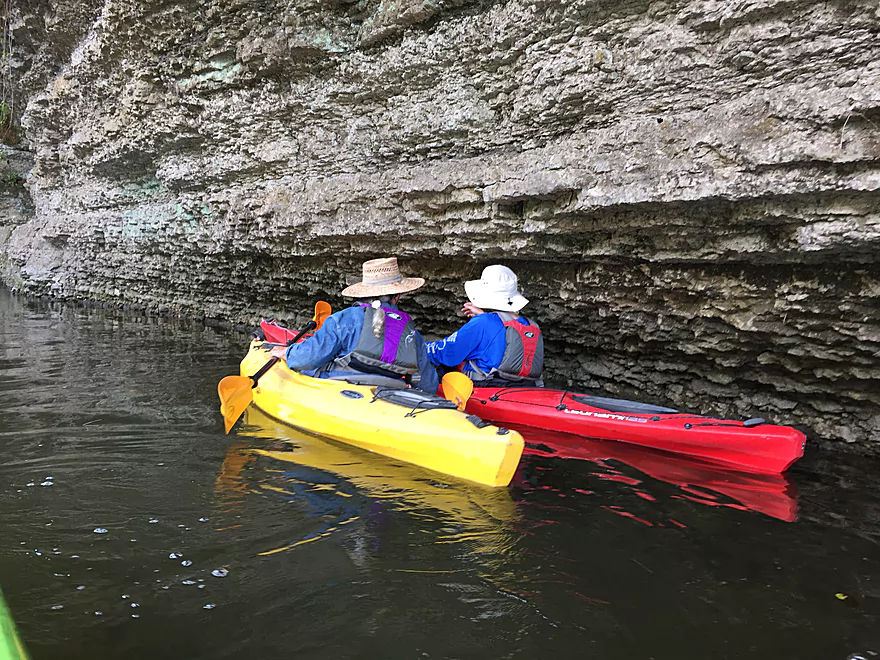
Any other river, these bluffs would be the highlight
The second major set of bluffs by Chimney Rock Campground
A popular but private access option

Reverse view
They just keep wrapping around the corner…
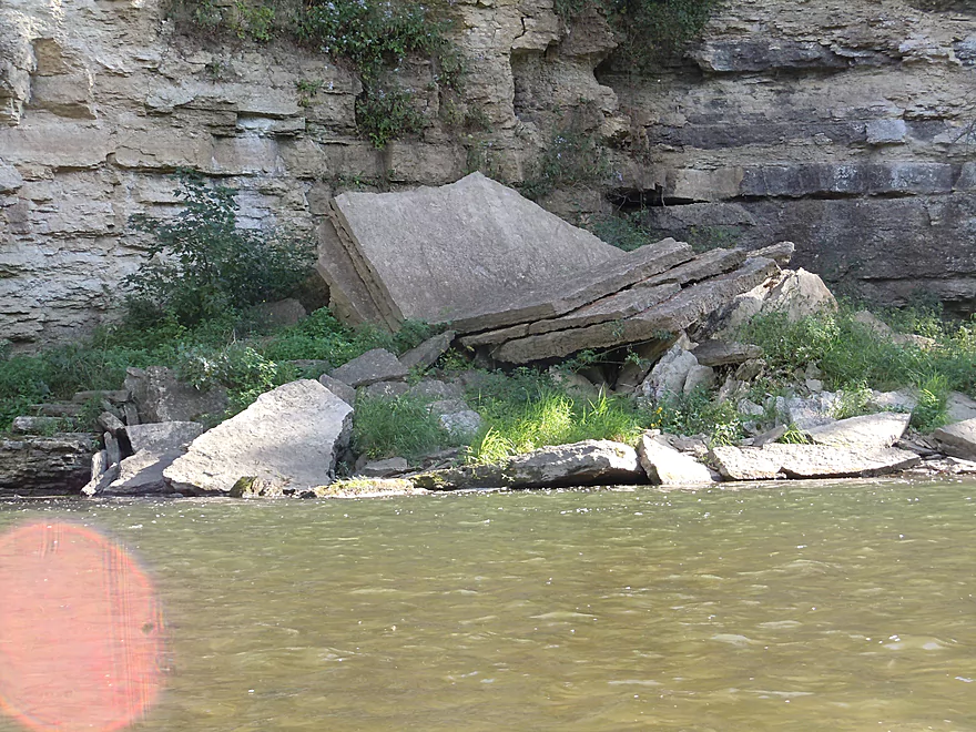
Like broken plates
Never-ending bluff…
Very cool
Attractive limestone layering
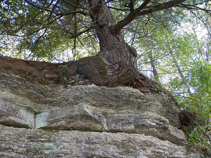
Tree growing at a 90 degree angle
The third major set of bluffs
Great scene with the clear water and chalky-colored bluffs
Cool gravel bar
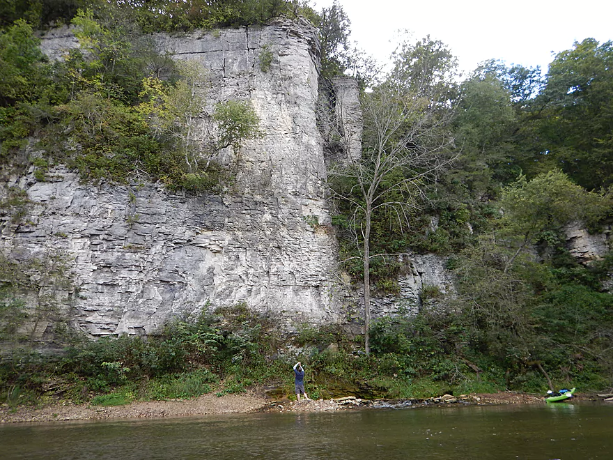
Scale shot to show how big these were
Think these cliff swallow nests are safe from raccoons
Another scale shot
Deja Grant River
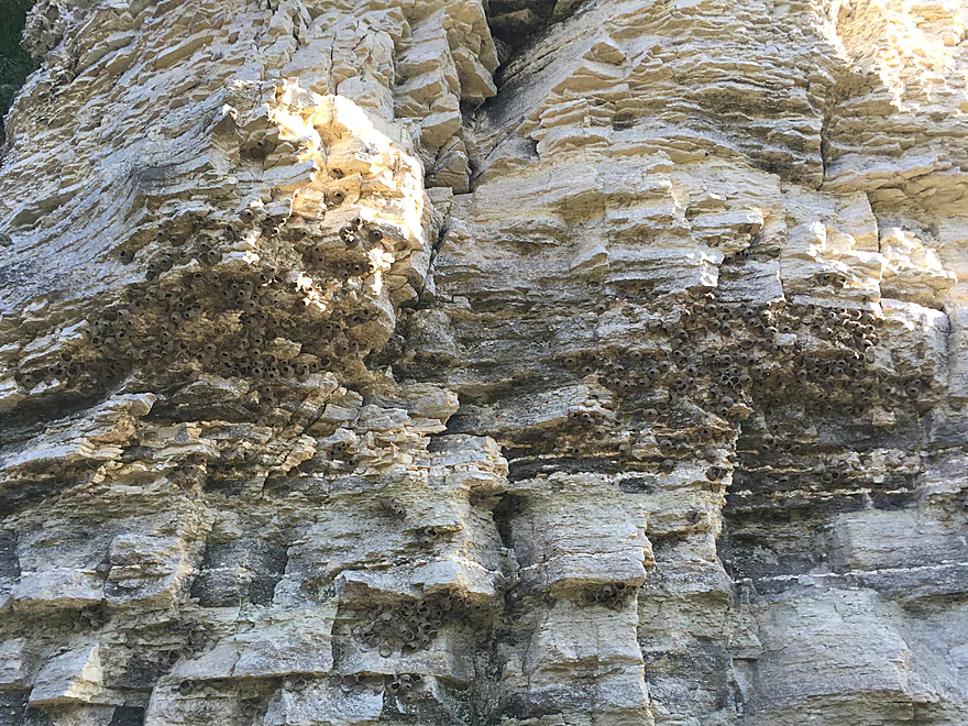
Where cliff swallows nested before concrete bridges
The most serious rapids (still easy)
Many minor but cool bluffs
The fourth major set of bluffs or palisades
Lot of photos, but the palisades just kept wrapping!
Reverse view
Trying to convey their height
Tasteful graffiti
Entering Bluffton where there are private launches
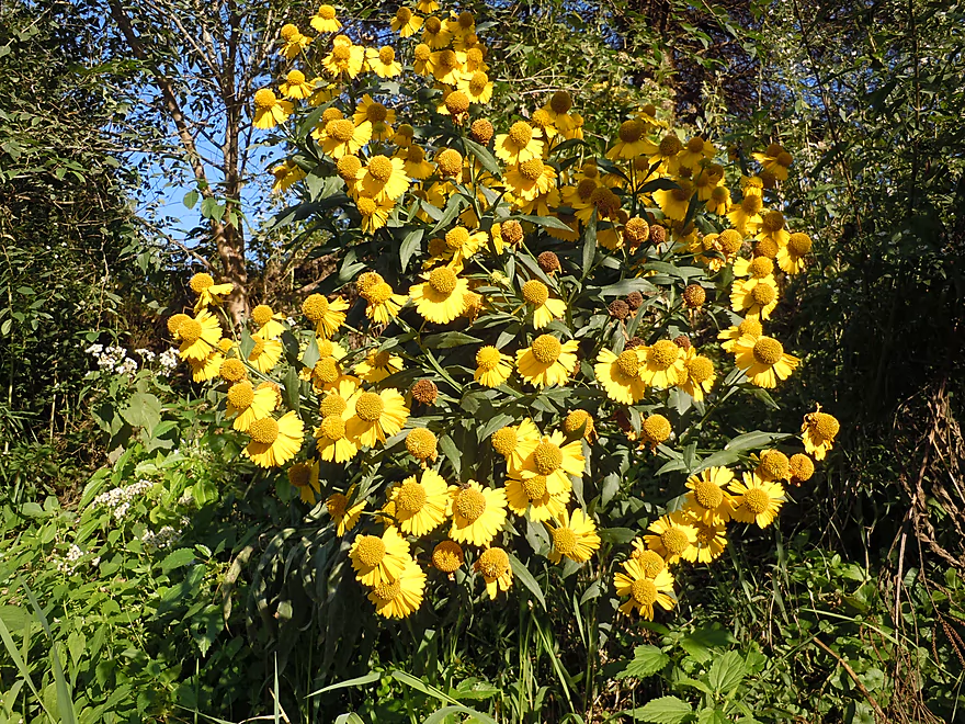
A bright spot of sneezeweed
Really cool erosion mound
The fifth and final set of major bluffs with spires of balsam fir
Why you do not want to take out at Bluffton
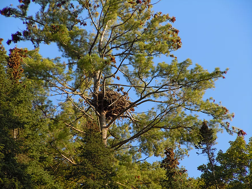
Eagle nest
On the home stretch

Still some rapids (not dangerous…)
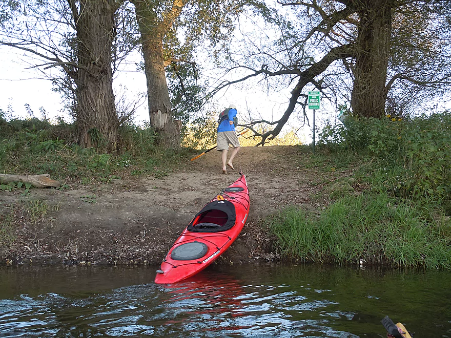
Taking out at the Hwy W20 landing
Good access and good parking
Exploring time…this is Malanaphy Springs
This is an impressive dry creek bed at the Seed Savers Exchange farm
From out of this rock wall…
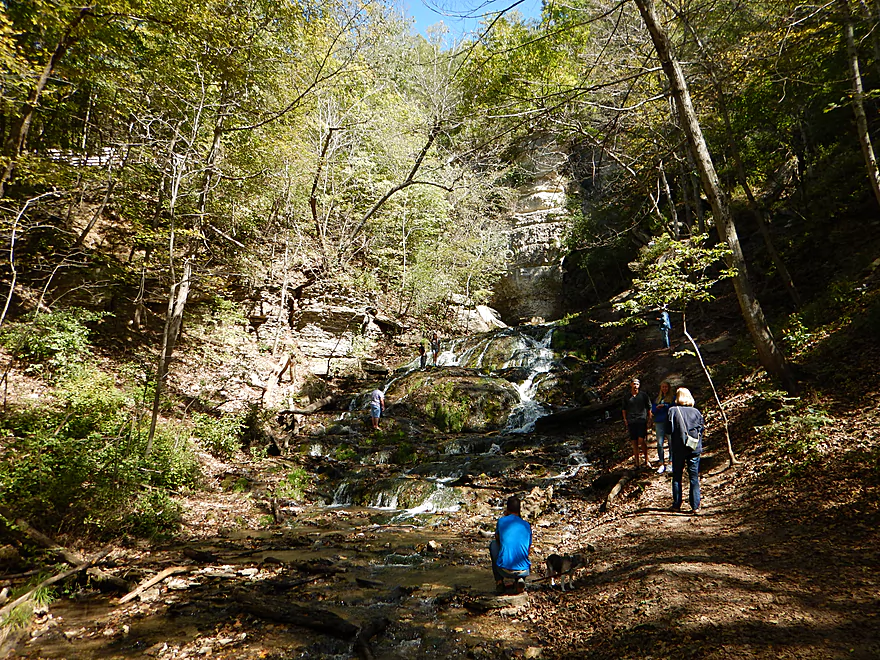
…flows the very impressive Dunning Springs
Upper Iowa River

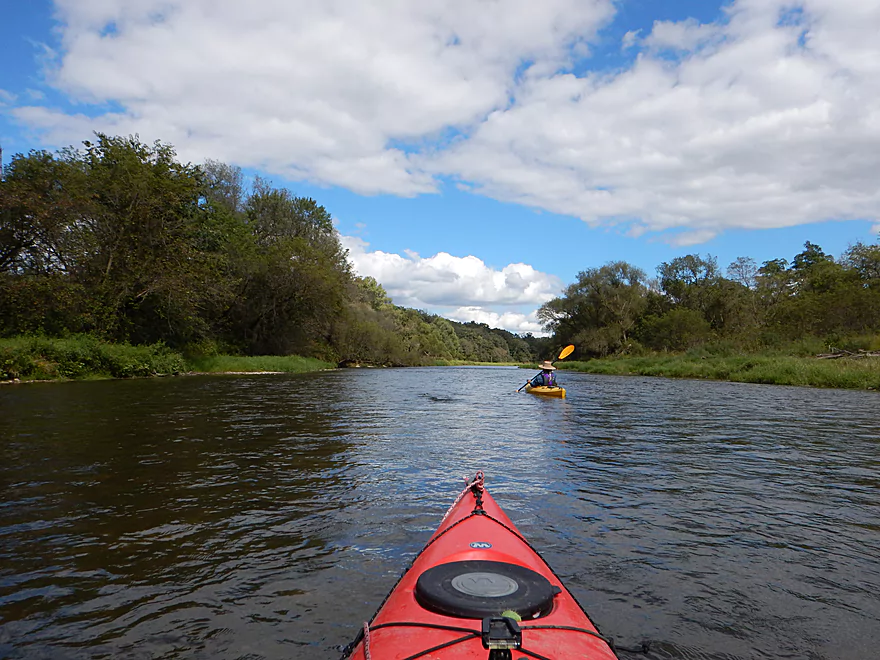
This is probably the best segment on the best river in all of Iowa. Despite being just an hour drive northwest of the Prairie du Chien bridge, I don’t think that many in Wisconsin know about the Upper Iowa River. What makes this unique? Good current, clear water, little development, pine trees (a surprise for Iowa), but most of all, massive limestone bluffs called palisades which tower over 300′ high above the river.
Great trip…so what’s the downside? A LOT of people. We went in September during an Iowa/Iowa State game and there were still a lot of paddlers! During summer weekends it is much worse though, and I do suggest doing this trip outside of summer and/or on a weekday if possible. Also, be wary that this is Iowa which, unlike Wisconsin, has a law that you must register and sticker boats over 17′.
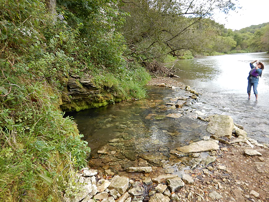
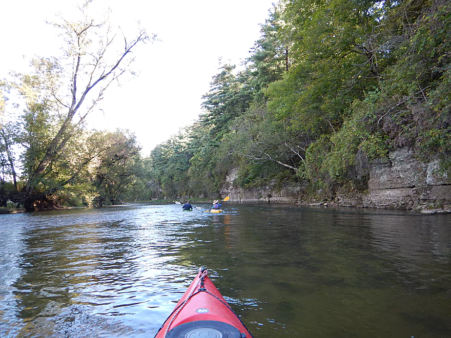
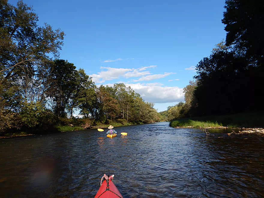
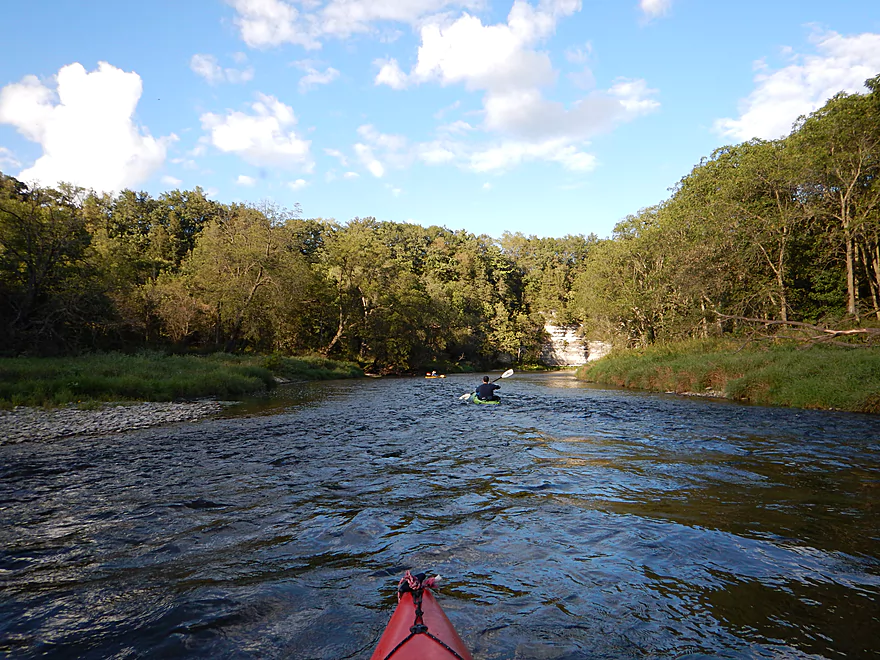
Trip starts on a good note, where there is a rustic wood-planked bridge that spans the river by the put-in. Right away bluffs are visible from the access and will be for much of the trip. I’ll for the most part just refer to the major bluffs from here on given how numerous the small bluffs were. The other early observation was how clear and fast the water was, yet wide and relatively shallow.
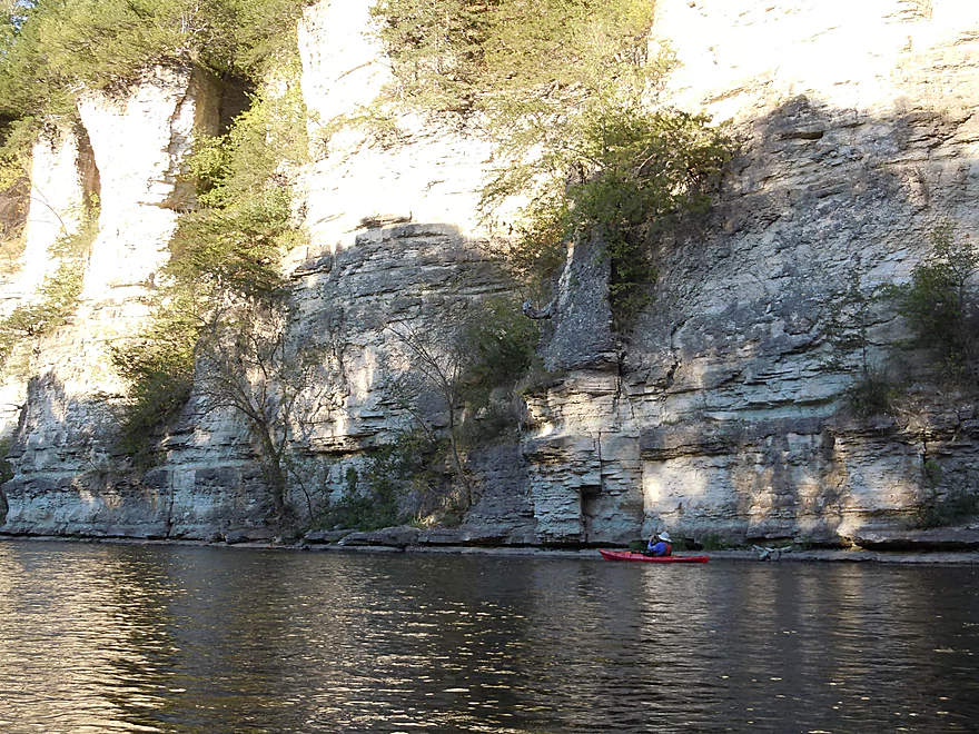
Soon you’ll come to some medium-sized bluffs which most paddlers will obliviously just paddle by. Their loss though, as there are three incredible springs hiding at the base of the bluffs. The first two have been “dammed” by paddlers and are quite the sight (see pictures below). The Upper Iowa River is known for its artesian wells because of how porous the limestone bluffs are and how the elevation changes create the pressure needed to get the water above ground.
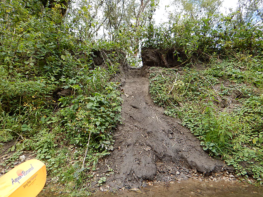
It’s unfortunate that such a nice river (and in fact eligible for a nationally designated Wild and Scenic River designation) has cow problems, but this does. In a couple of spots you’ll see mud banks from upstream erosion and you’ll see in other spots where cows are destroying the banks directly along the river. At times you’ll smell the manure, but I don’t want to overstate the issue as the majority of the river is free of agriculture.
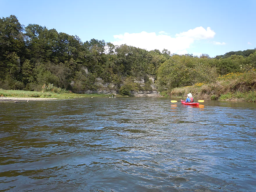
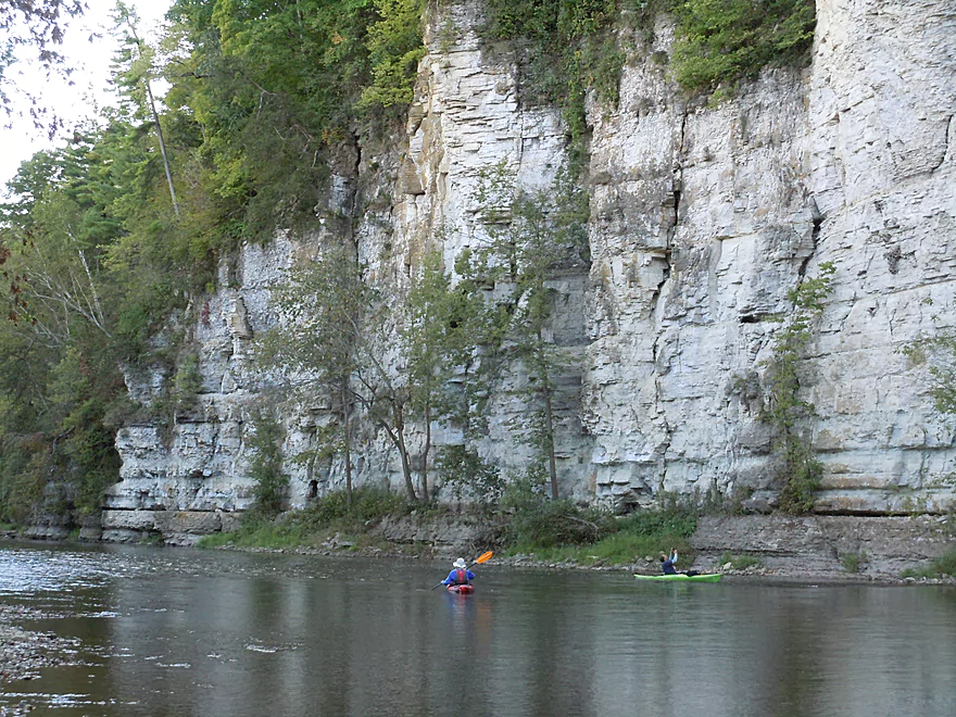
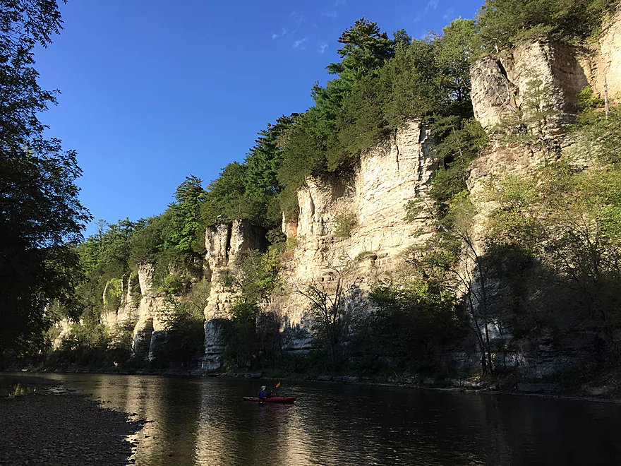
The advantage of putting in at Cattle Creek Road (and you do have a bevy of access options) is that you will get to paddle by Chimney Rock, a free-standing rock pillar rising out of the bluffs. But even more impressive are the Chimney Rock bluffs, which are at least 200′ high and wrap around the river for almost a mile.
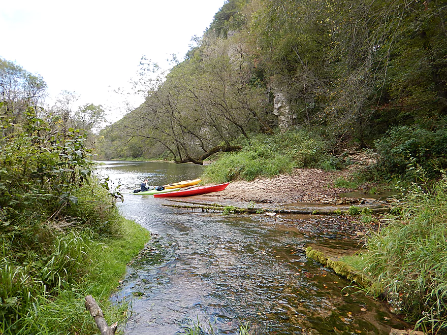
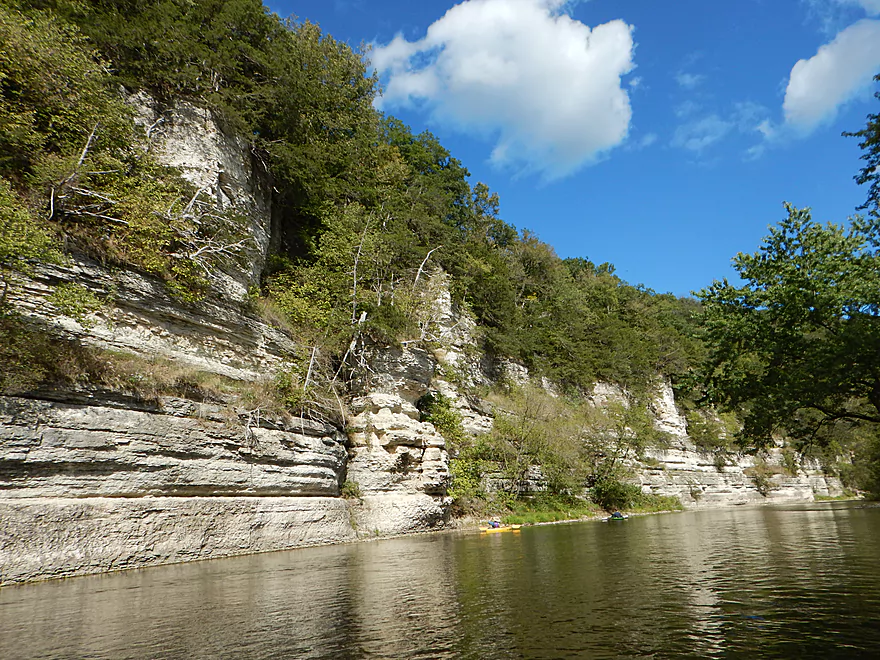
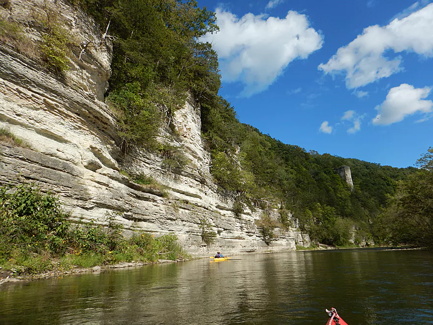
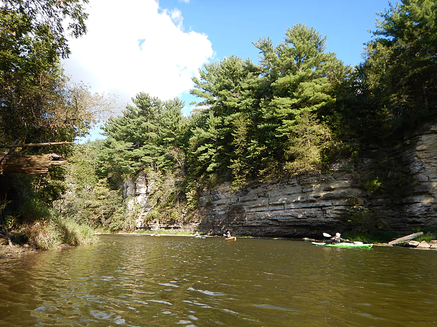
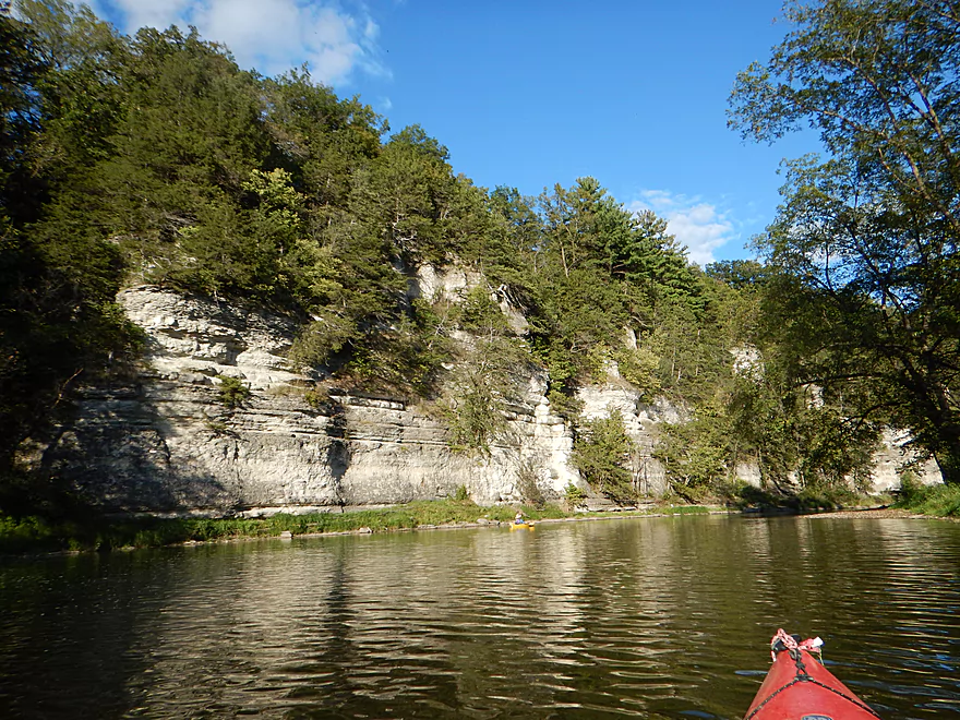
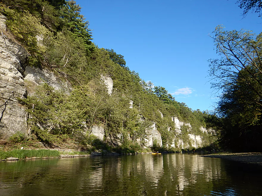
If you don’t want to see Chimney Rock, you can put in at Chimney Rock Road where there is a nice public put-in. From Cattle Creek Road to Chimney Rock Road was a great stretch at 4.5 miles, but the section from Chimney Rock Road to Bluffton is the best segment on the entire river (if you have to shorten and pick a subtrip). This second section is almost nonstop rock bluffs for 5.2 miles, with four sets of major palisades.
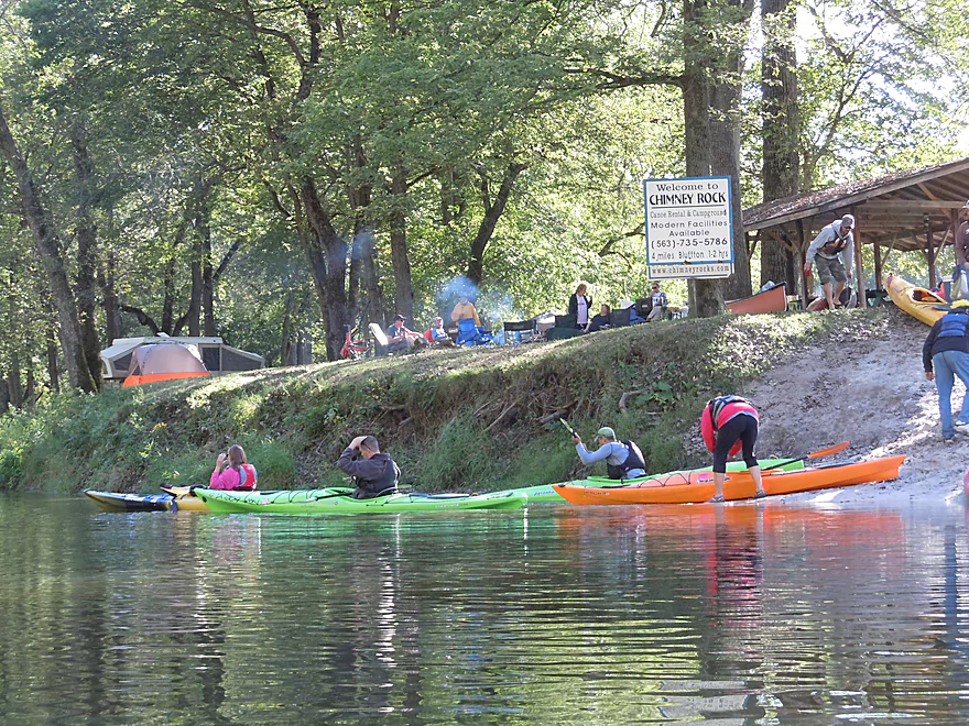
The first palisade you’ll encounter (in “section 2”) is by Chimney Rock Campground, which is quite impressive, but swarming with people. You’ll see private campsites right by the river which I wasn’t used to and wasn’t thrilled to see. Nice rivers need wilderness buffers along the banks…
The second major bluff is another impressive horseshoe because of how sharp the river turns. Not as nice as the Chimney Rock horseshoe, this is still amazing and there is a nice gravel bar in the middle where you can take panoramas. These horseshoes (or S-turns) are referred to as “entrenched meanders” and are quite amazing with their white-ish color and coniferous trees lined along the top.
The third set is, I believe, the tallest and most famous set of palisades (if you see a picture of the Upper Iowa, chances are it is of these very bluffs). Do consider paddling on a cloudless day for lighting as it really makes the bluffs more vibrant.
Many will take out at either private campground in Bluffton, but again, this is a mistake as there is a fourth set of major bluffs after this small town that are worth checking out. A unique section because of the attractive balsam firs that line the top of the bluffs here. From here to the take-out on W20 is just a short paddle, so it doesn’t lengthen the trip too much.
So, all in all, a fantastic trip I think all serious paddlers in southern Wisconsin should consider. Minor side-note though…chances are if you drive out here, you’ll stay the night. But (as we found out) the local hotels and motels fill up quickly and completely. Most paddlers instead will camp. So something to consider.
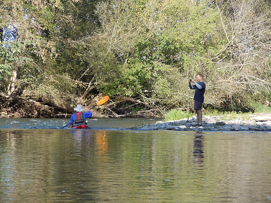
The bridge at Cattle Creek Road is a very good and busy access spot. Ok roadside parking, good launch ramp, but no facilities.
Just downstream from Bluffton Road (aka W20) there is a good public canoe launch with lots of parking. No outhouse though.
I highly discourage bike shuttling the 6 miles from take-out to put-in. Much of the shuttle route is very hilly, has rough gravel and the few paved sections have poor shoulders.
There are plenty of rental and livery options in the town of Bluffton (roughly close to the take-out).
- Hruska’s Canoe Livery & Bluffton Campground – (563) 735-5633
- Randy’s Bluffton Store – (563) 735-5738
- Chimney Rock Canoe Rental – (877) 787-2267
- Harvest Farm – (563) 883-8562 (a bit further upstream, but they should service this section, too)
Most liveries are pretty affordable. Randy’s, for example, shuttled three of us and our boats to the put-in and dropped our car at the take-out for just 30 dollars. Note: It is easier for the liveries to have you take out in the tiny town of Bluffton so they can use their private launches, but if you do this, you miss some nice rock outcroppings (and light rapids) that run through town. I highly suggest paddling just a bit further and taking out at the Bluffton Road bridge.
No hazards and no log jams. A river well suited for beginners and bigger canoes.
The river moves along at a very good pace with many minor riffles. These are all easy and should not be an issue for beginners.
We went at 305 CFS according to the local Bluffton gauge, which was more than plenty. 200 CFS is considered low and 150 CFS scrapey, but paddlers will regularly run the river below these levels. I would guess that 700 CFS and up would be too pushy. This river can have good water clarity at lower depths, so IMO lower is better.
Surprisingly little. An immature bald eagle, great blue heron, kingfisher, songbirds and some minnows. The highlight was seeing some impressive beaver handiwork. There were multiple slides and partly eaten corn by one of the beaver holes (must be an Iowa thing). One of the side springs had a large beaver dam, which was quite cool.
If you have time, there are cool natural areas nearby that are worth exploring.
- Malanaphy Springs: Accessible via a one-mile trail along the river from the W20 bridge (see map). The water comes gushing out of the rock face near the top of a bluff and tumbles into the river as a splendid small waterfall.
- Palisades Park: A park that sits atop large rock bluffs overlooking the city of Decorah. Honestly, a little disappointing because you could hardly see the bluffs or water from the overlooks.
- Ice Cave Hill Park: A cave in Decorah that apparently is so cold it has ice in the summer. Did not get a chance to explore this.
- Dunning Springs: Much larger than Malanaphy Springs, this is easy to access in Decorah and is well worth the visit…but is absolutely crawling with people.
- Twin Springs Park: A nice little spring west of Decorah that we didn’t get a chance to check out.
- Seed Savers Farm: A famous farm known for preserving rare heirloom species. It has a store on-site with a lot of natural and organic items (including seeds!). In addition to extensive display gardens, there is a large trail network that is open to the public and a really cool dry creek bed you can explore.
Starting upstream and working downstream, here is a segment guide to the Upper Iowa River. Thanks to the Book “Paddling Iowa” and the website Northeast Iowa RC&D for much of this information.
- Chester/River Street to Lidke Park: 7.5 miles. Pleasant paddle. Navigation could be difficult during low water. Maybe some logjams and snags.
- Lidke Park to Florence/Victory Ave: 14.8 miles. Few paddle this section. Will be some minor bluffs. Perhaps some electric fences to deal with.
- Florence to Hwy 30 Wayside: 1.7 miles. Some riffles. Odessa Springs is located near the take-out.
- Hwy 30 to A14: 5.8 miles. It looks like there are some decent bluffs on this stretch.
- A14 to 370th Street: 1.0 miles. Mostly a straight section with some larger sandbars.
- 370th Street to Kendallville Park: 5.6 miles. Likely good bluffs. I believe this stretch is serviced by “Harvest Farm”.
- Kendallville to Cattle Creek Road: 8.4 miles.
- Kendallville Park to Plymouth Rock Access: 4.2 miles. Start of the famous Kendallville to Bluffton stretch. Good part of the river with scenic bluffs.
- Plymouth Rock Access to Cattle Creek Road: 4.2 miles. Good stretch with scenic bluffs.
- Cattle Creek Road to Bluffton Fir Stand Access: 9.8 miles.
- Cattle Creek Road to Chimney Rock Access: 4.5 miles. Great section with several nice bluffs with the best being Chimney Rock.
- Chimney Rock Access to Bluffton Bluff Access: 4.0 miles. The most popular and most scenic section perhaps on the entire river. The best bluffs and palisades are located here.
- Bluffton Bluff Access to Bluffton Fir Stand Access: 1.3 miles. One final nice bluff followed by a pleasant open section.
- Bluffton Fir Stand Access to Malanaphy Springs: 8.7 miles. Good current and riffles, but not as many of the nice bluffs.
- Malanaphy Springs to Will Baker Park in Decorah: 6.1 miles. Pleasant with good riffles and some bluffs. Several intermediate access options.
- Will Baker Park to Freeport access: 6.1 miles. A pleasant paddle through the city of Decorah with good views of the bluffs.
- Freeport Access to River Road: 4.1 miles. Considered scenic.
- River Road to Upper Dam: 3.0 miles. Considered scenic, but with some flowage paddling.
- Upper Dam to Lower Dam: 4.9 miles. Not as popular a segment. Some flowage paddling.
- Lower Dam to Ferris Mill Road: 4.8 miles. Starts with some nice wooded sections before widening out.
- Ferris Mill Road to Ellingson Bridge Drive: 4.5 miles. Possibly a decent stretch for sandbars and gravel bars.
- Ellingson Bridge Drive to Hwy 76: 13.5 miles.
- Ellingson Bridge Drive to Red Bud Drive: 0.8 miles. Short stretch that goes around a large island.
- Red Bud Drive to Iverson Bottoms Access: 5.0 miles. Some nice hillsides but lacking in cliffs.
- Iverson Bottoms Access to Iverson Bridge Access: 1.2 miles. Short stretch that includes part of Iverson Bottoms Wildlife Area.
- Iverson Bridge Access to Hwy 76: 6.3 miles. Decent, but not a spectacular stretch.
- Hwy 76 to Kumpf Access/Upper Iowa Access: 3.5 miles. Probably a generic stretch.
- Upper Iowa Access to Iowa River Drive: 4.0 miles. Likely a generic section.
- Iowa River Drive to Ray’s Landing/Morgan Bridge: 5.7 miles. Likely a generic section.
- Ray’s Landing to Black Hawk Point: 2.2 miles. Likely slow and channelized.
- Black Hawk Point to Mouth on Mississippi: 3.2 miles. Mostly channelized floodbottom.
- Mouth to Blackhawk County Park: 0.6 miles. Trip across the Mississippi to reach a take-out in Wisconsin.
Trip Map
Overview Map
Video
Photos Size:
I want to kayak the upper iowa river. I need to rent 2 kayaks, tent camp, and will need a company to help with put-in. Can you advise? I will do this during the summer months, however, I am able to do this during the week, as opposed to weekend. I understand it can be very busy on the river. I am from CA and need to experience some wilderness here in IOWA.
Hi Joli,
I’m not an expert on the area and likely who you want to contact are the local liveries which can answer all your questions. The main ones are:
– Hruska’s Canoe Livery & Bluffton Campground – (563) 735-5633
– Randy’s Bluffton Store – (563) 735-5738
– Chimney Rock Canoe Rental – (877) 787-2267
– Harvest Farm – (563) 883-8562 (a bit further upstream, but they should service this section, too)
Despite the cfs being on the low side, just under 200, we had a wonder float here yesterday with paddleboards and inflatable kayaks.
Truly a majestic stretch that lives up to the five star rating.
Thanks so much for posting this blog! The information provided here provides us with new adventures every summer from our vacation home base in La Crescent, MN.
Glad you had a nice trip and that you appreciate the site!
The following is a GPS/Image slideshow of a recent kayak trip on the Upper Iowa from Eric: https://www.relive.cc/view/vNOPYwNjgY6
Enjoyed your review and checked it out for myself. This river is spectacular! Since the review the Cattle Creek Rd and Chimney Rock Rd bridges have been replaced. There appears to be more parking available at Cattle Creek Rd now than what appears in the picture.
Thanks for the update. The situation with the bridge was tragic. It was kind of an antique…but an over-weight truck drove over and destroyed it.
Pine trees are not a surprise, but balsam fir is.
The access at Chimney Rock road is much improved with the new bridge. Good parking, toilets. We did Kendallville to here on 8/30 at 800cfs in about 4 hours including a half hour stop for lunch and two short breaks. We saw a heron, a couple eagles, kingfishers, cedar waxwings, kingbirds, phoebes, orioles… a spring at the base of the cliffs river right just before the balsam fir on the river was bubbling away. Have run this anywhere from 150 to 1500cfs and 700 is about ideal to me for my paddling style and skills. Seemed to be fewer sweepers than some times and not too many cows. Midweek we saw no campers, and at most only one other vehicle at the access points. On the river we passed a group of maybe 8 rented tandem aluminum canoes.
Just read the main discussion on this route. There’s a lot of misinformation here. Since this is in Iowa rather than Wisconsin suggest you correct the inaccurate and outdated information by removing this entry.
Hi could i run this mid late june in a kevlar canoe? Or is water getting low
You can definitely run this stretch in a kevlar canoe. June should be a great time to run the river as then it will be a bit above normal. Typically the river can get a bit low by late summer/fall.
I’m interested in a 2-day float on the Upper Iowa. Where’s the best put-in and camping for a night? My boys are 13 and 7 and would love an adventure on the river. Appreciate your thoughts…
Hi Flint,
I don’t know the rules for shoreside camping…but I do recall seeing campgrounds along the river. Here is a map: https://www.google.com/maps/search/camping/@43.4301437,-92.0192198,12z?entry=ttu A number of options depending on your endurance. eg Cattle Creek > Bluffton (camp there), then Bluffton to Malanaphy Springs. For a longer trip you could start earlier and take out later.