
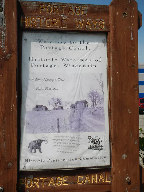
Nice historic sign
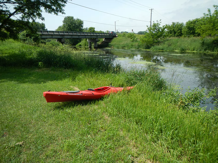
Not ideal put-in (east landing by the Fox is better)
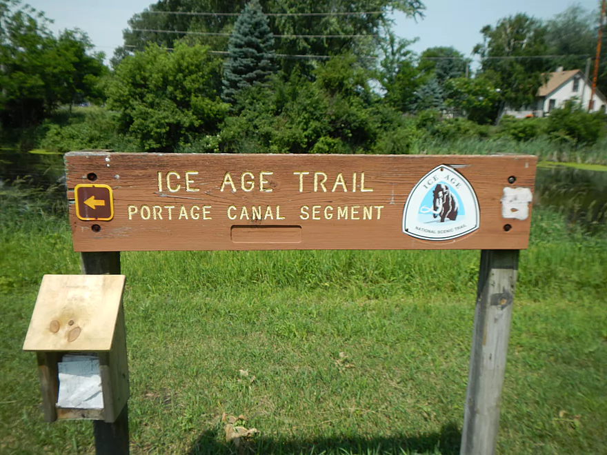
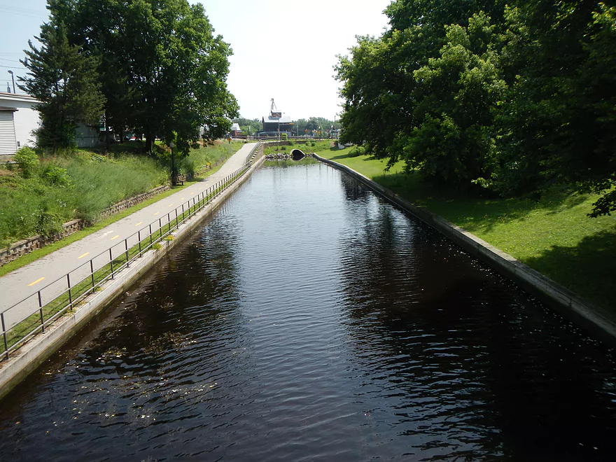
Nice trail system
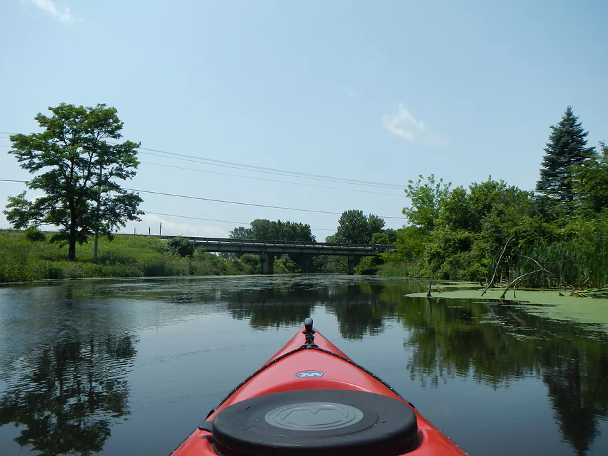
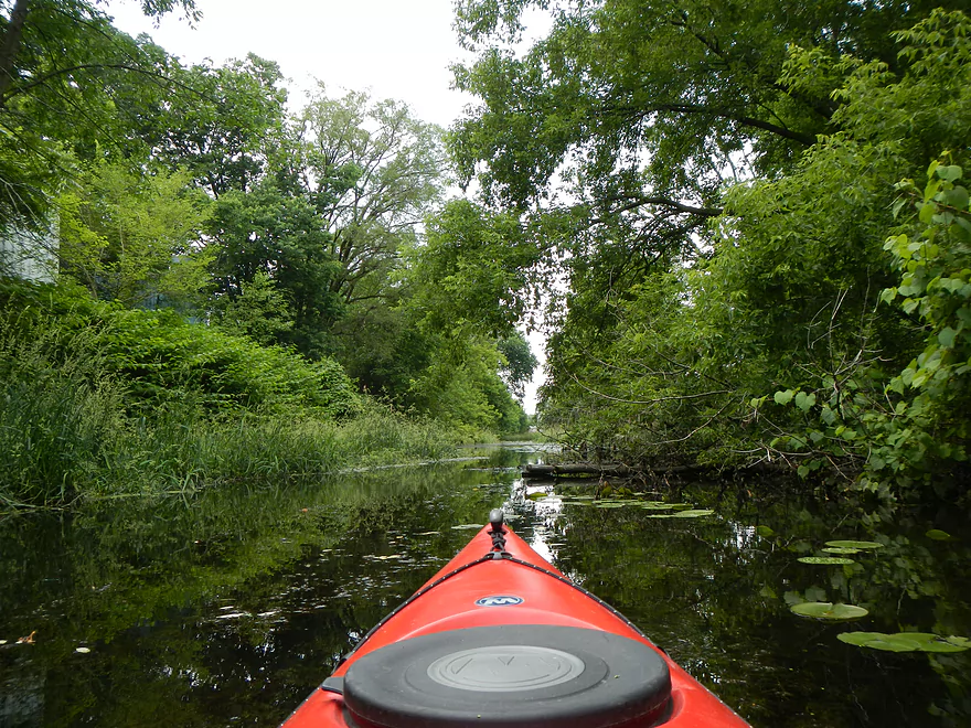
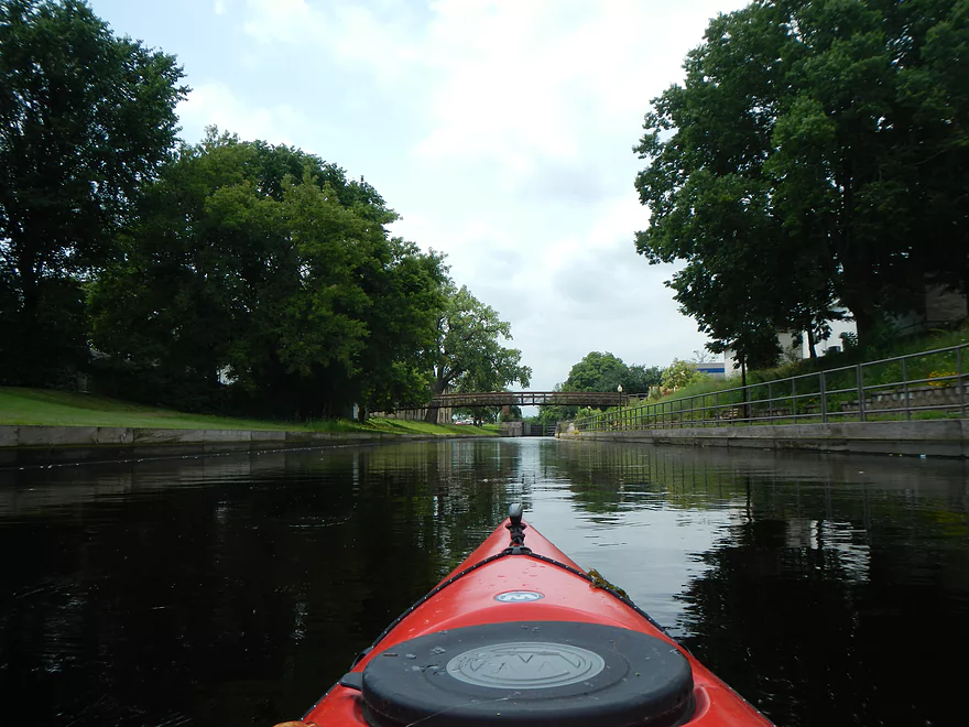
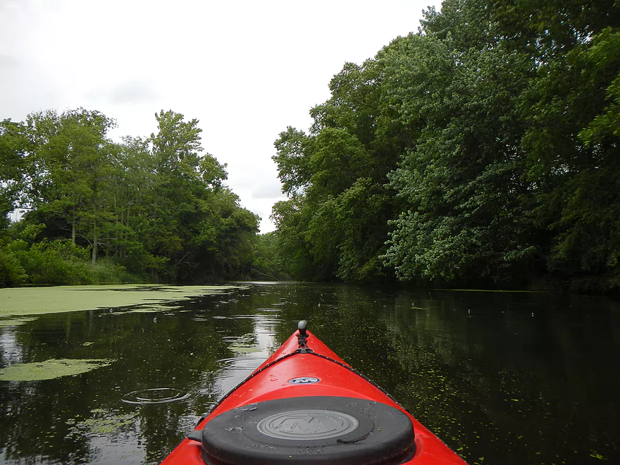
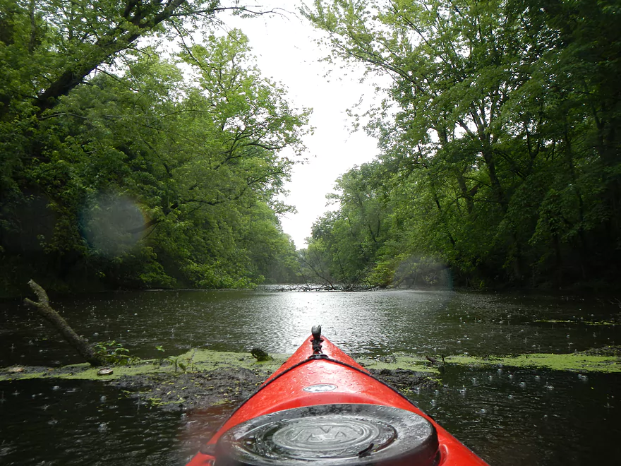
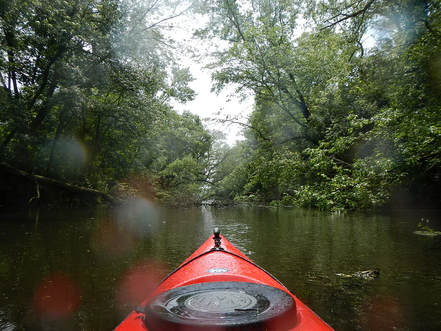
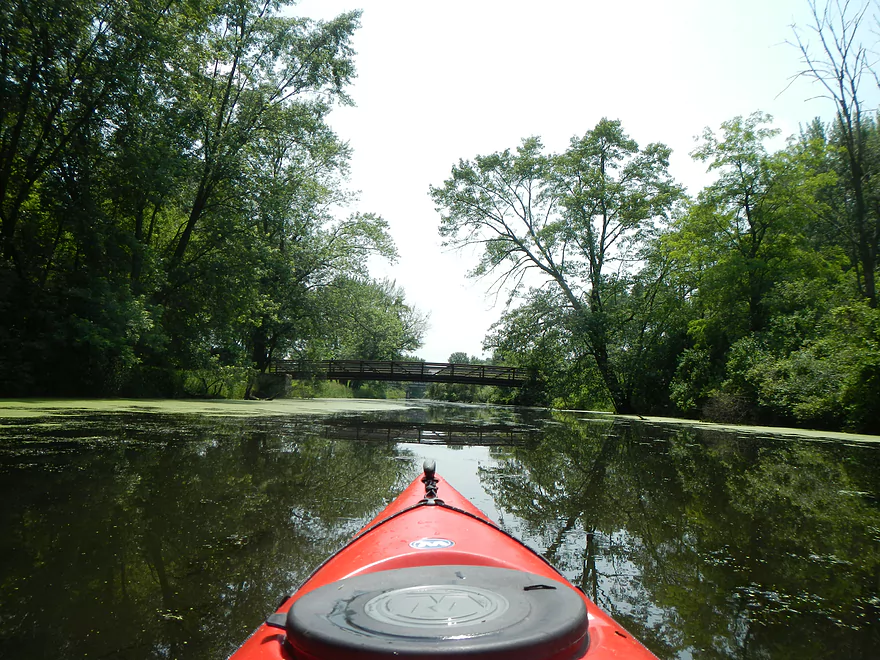
Heading west toward the Wisconsin
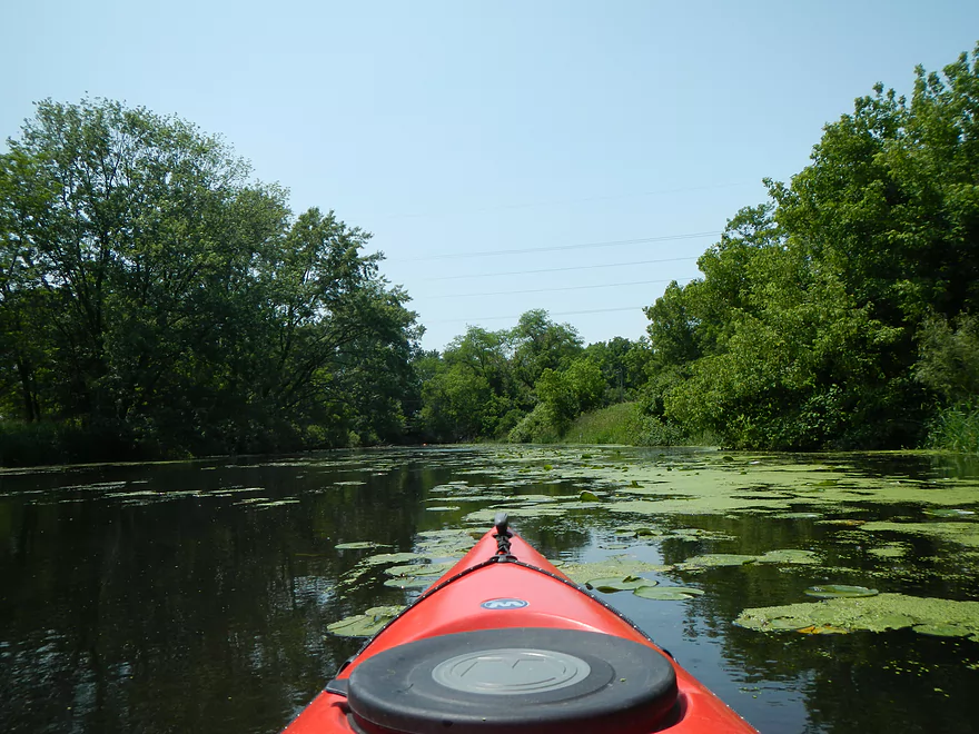
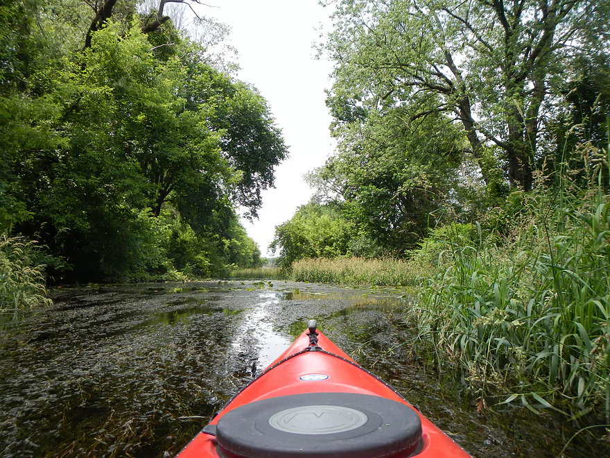
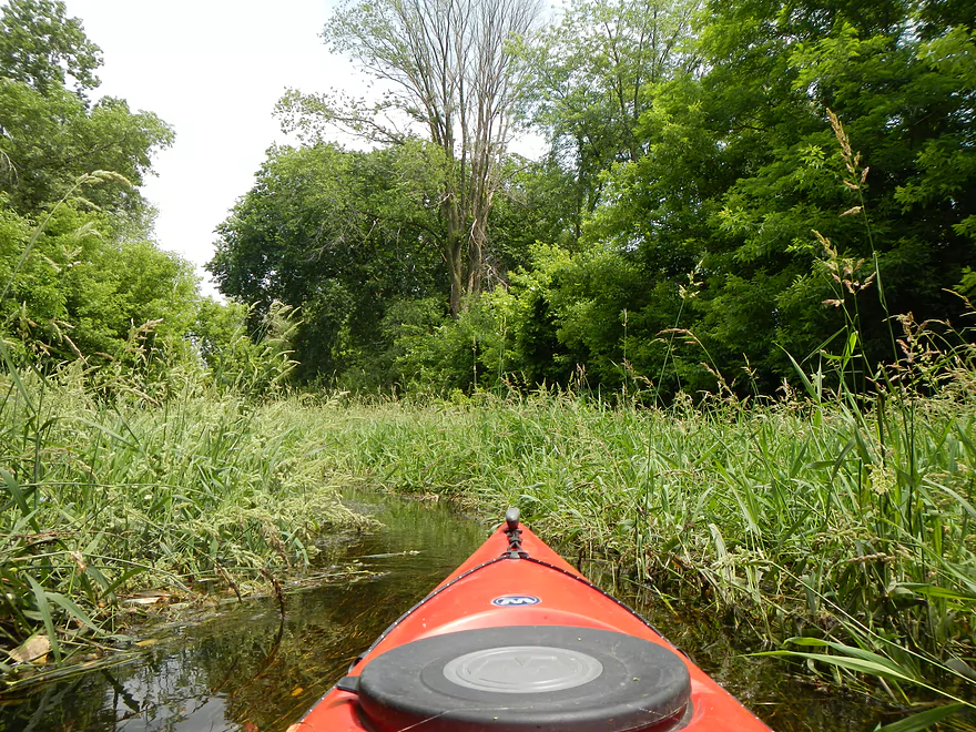
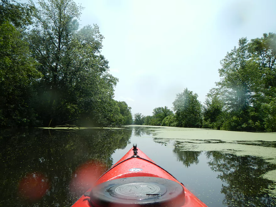
Weed city in lower water conditions
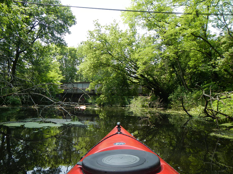
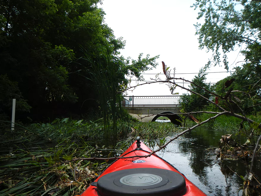
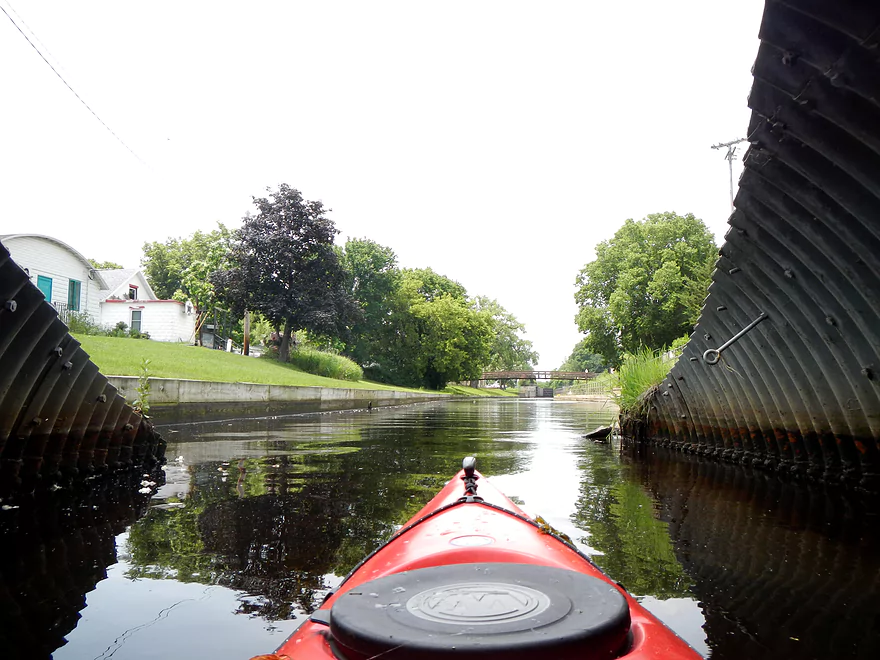
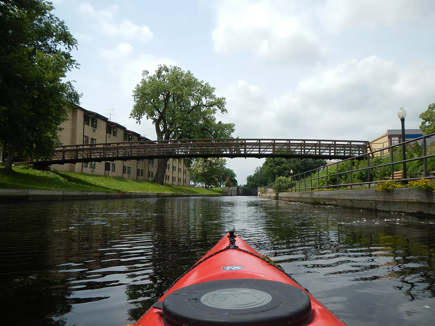
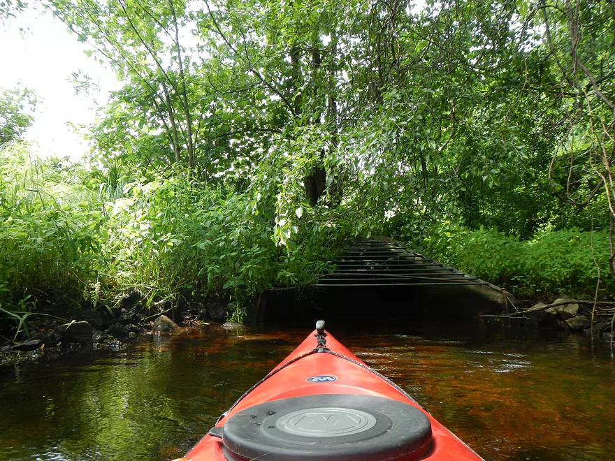
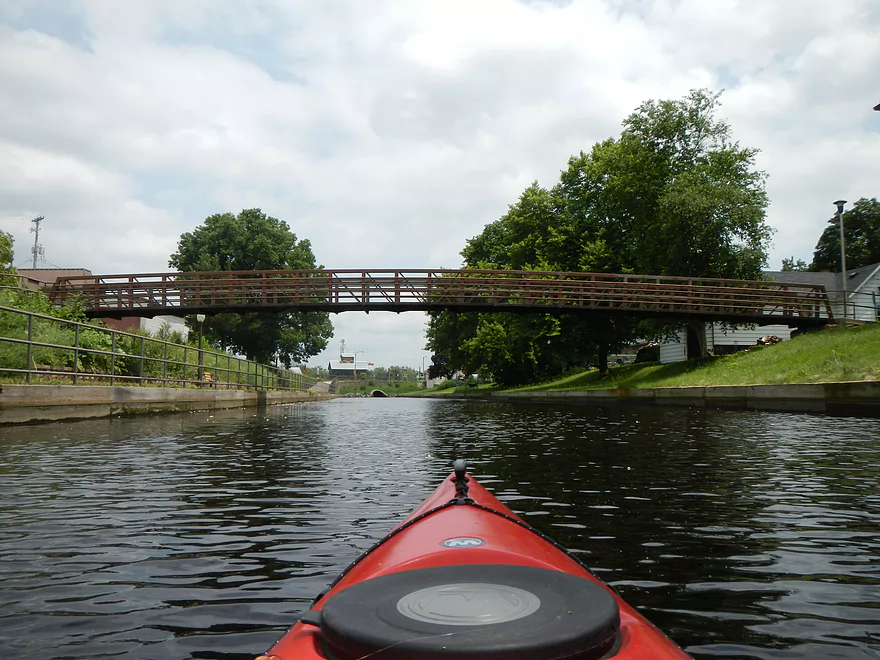
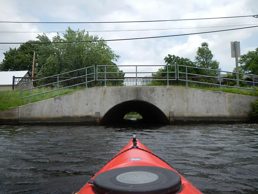
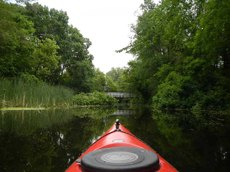
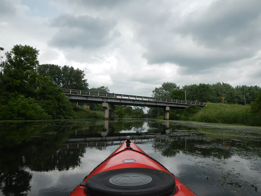
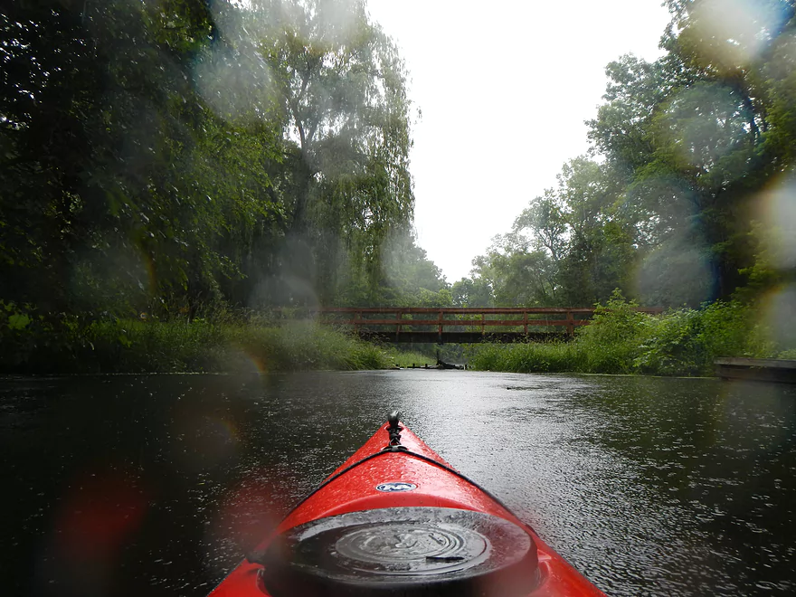
Railroad bridge
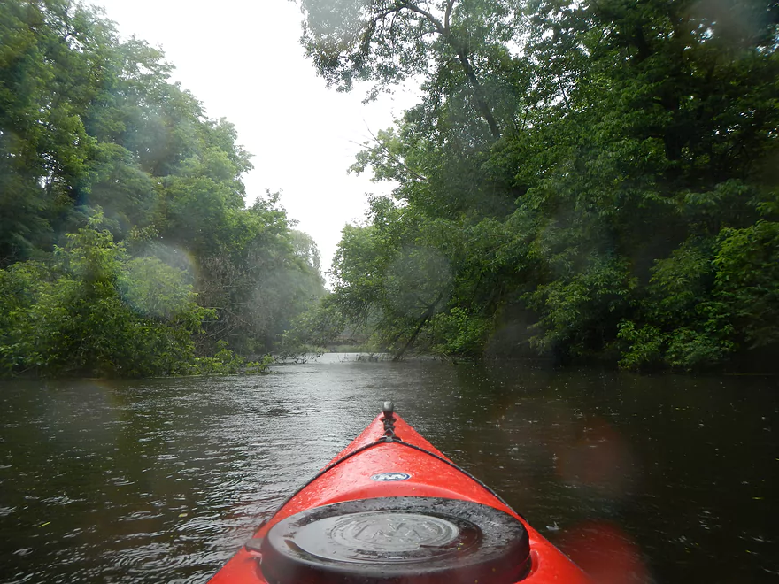
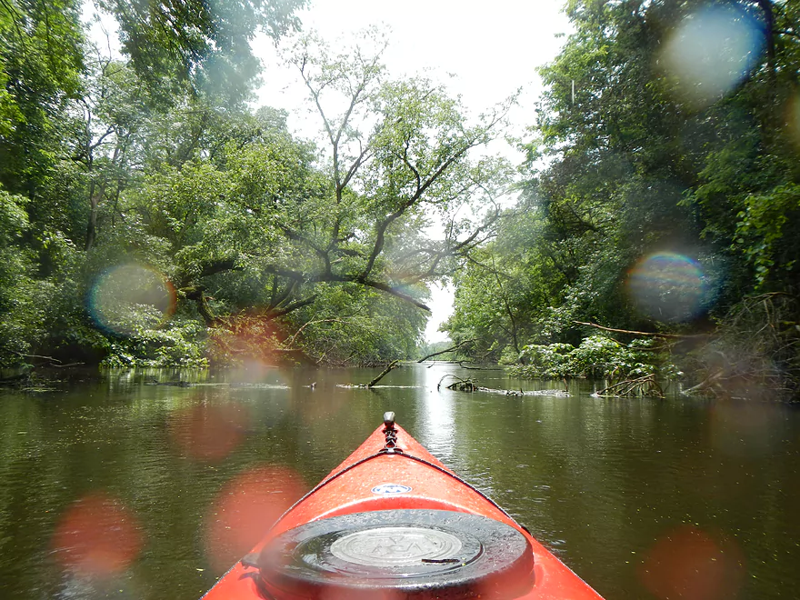
Channel gets smaller and smaller…
Noticeable current
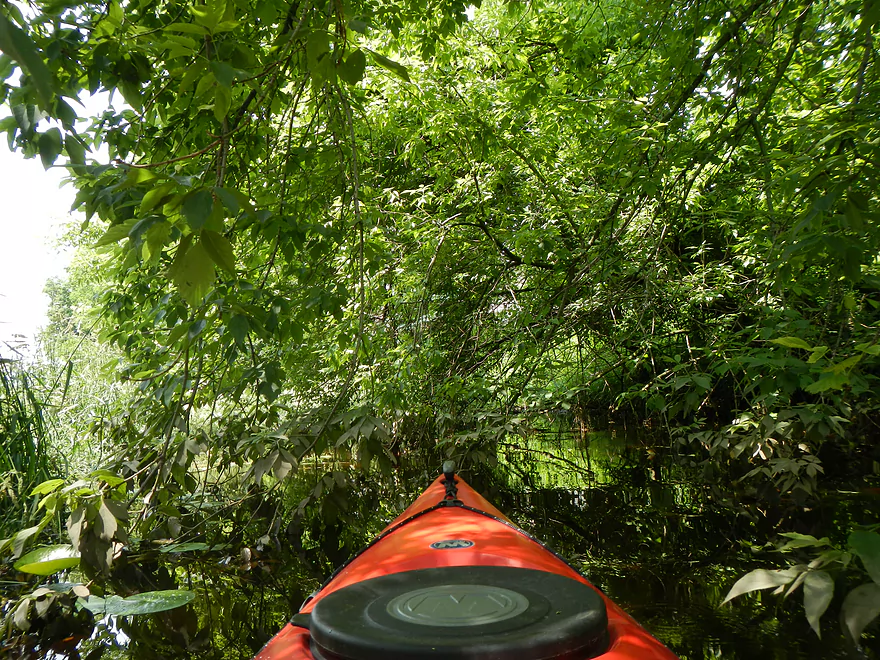
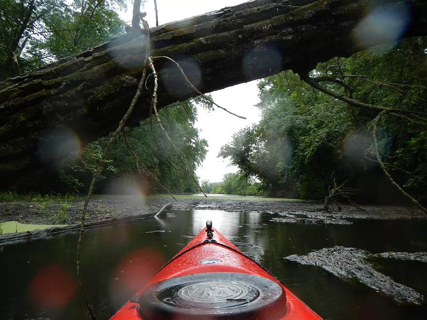
Some ducking required
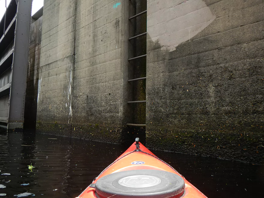
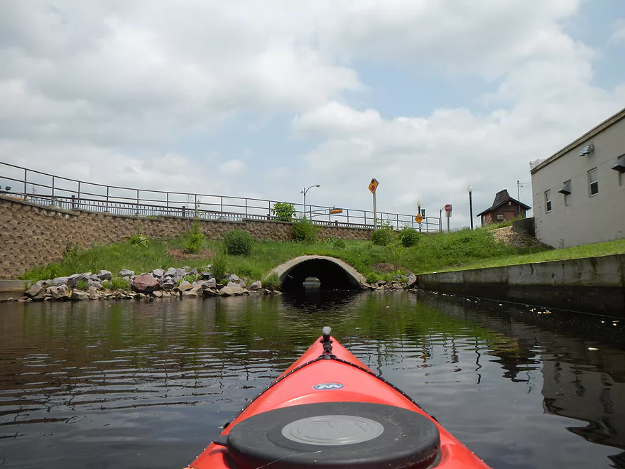
Most silted in section of the canal (just east of the small tunnel)
Not sure if this is navigable during low water
Possible portage path (normally there is a ledge here)
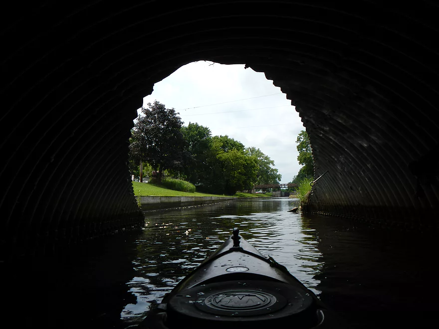
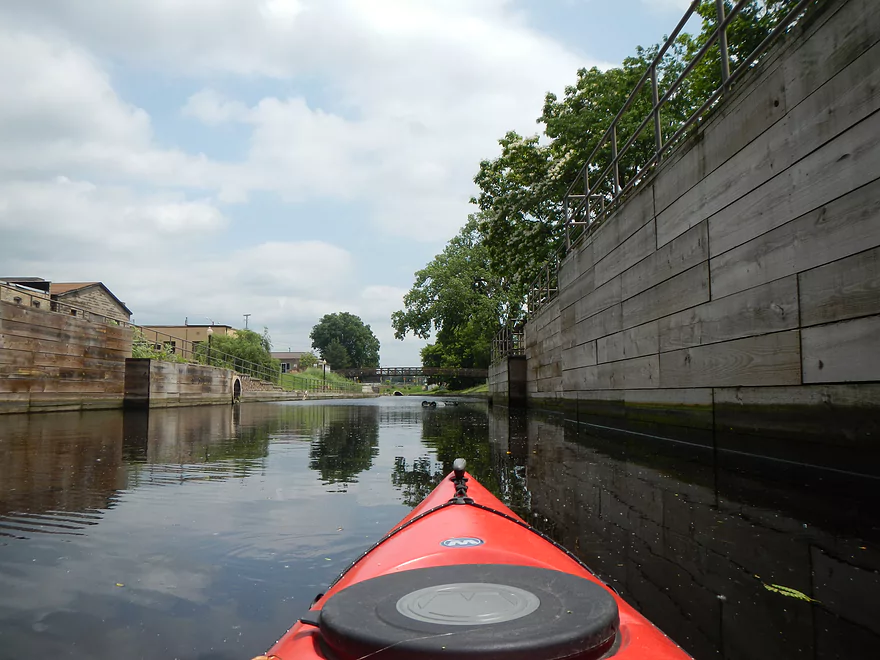
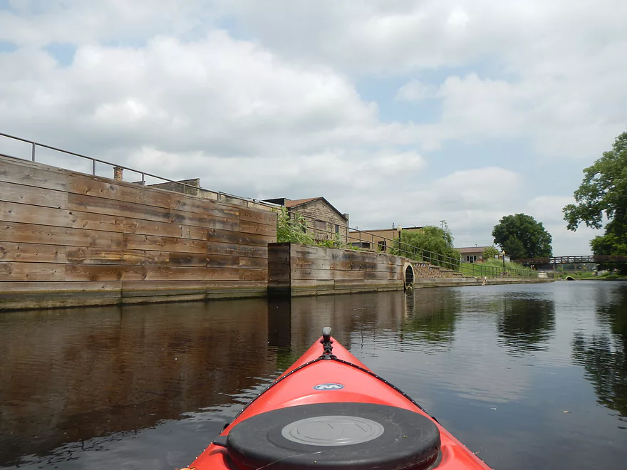
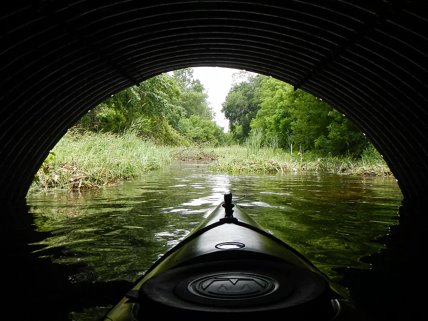
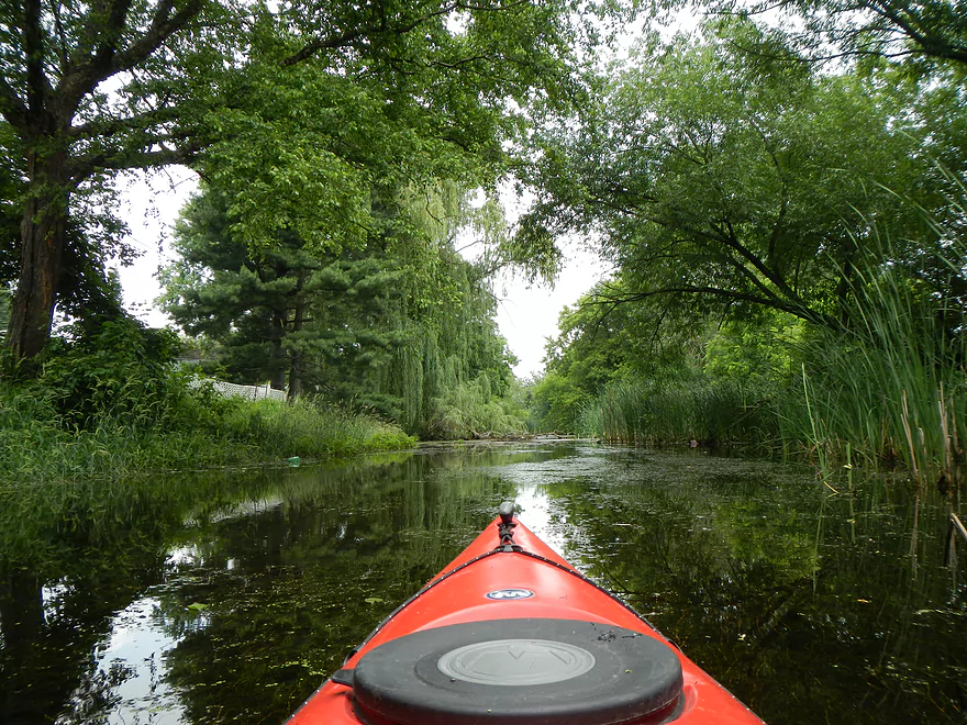
Nice section between the tunnels
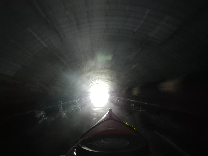
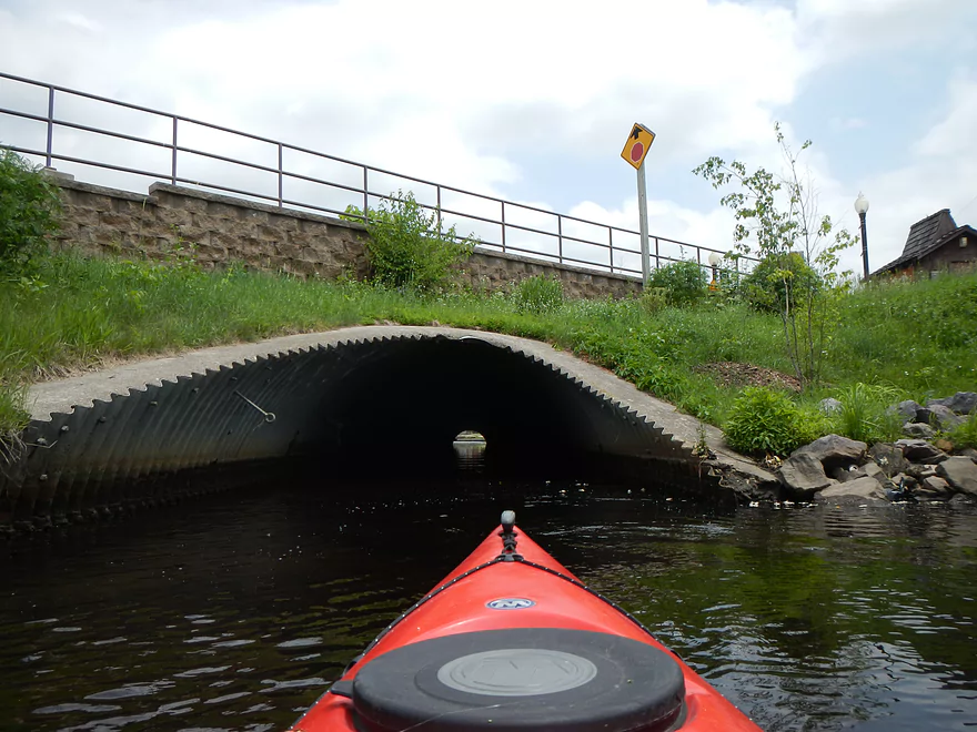
Long tunnel
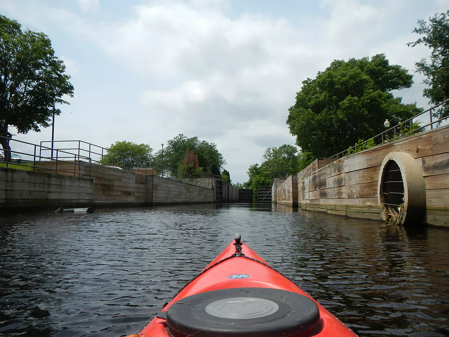
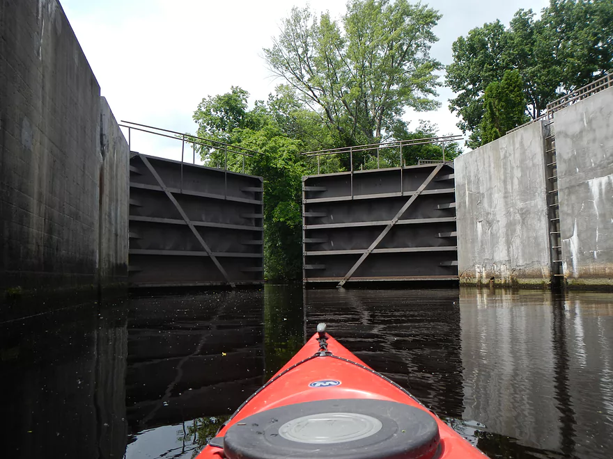
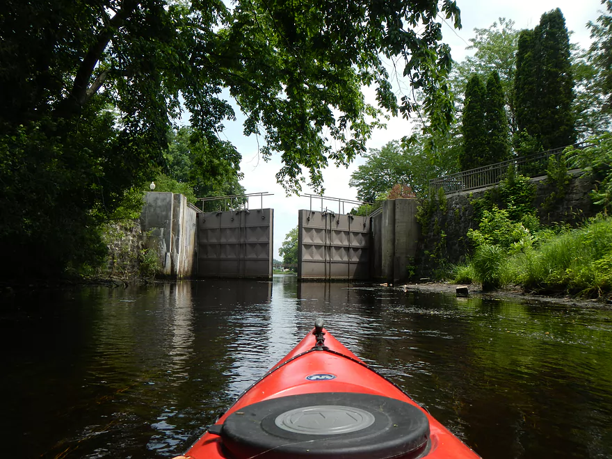
The old gates to the Wisconsin
Kept open
The “great divide” (because the current flows toward the Fox)
Heading back toward the Fox
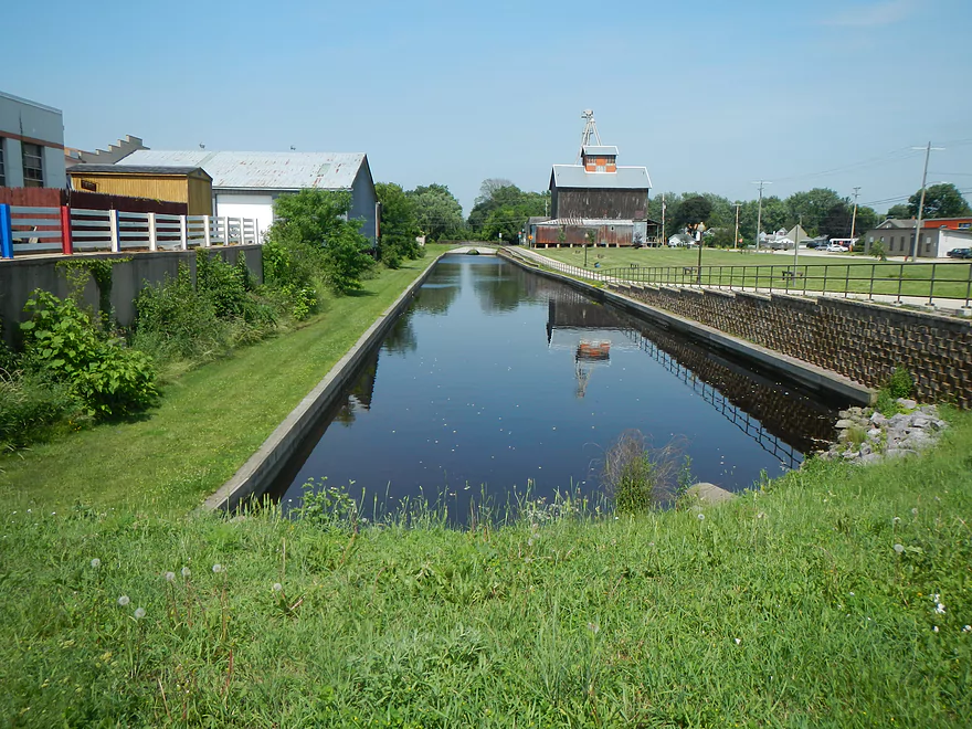
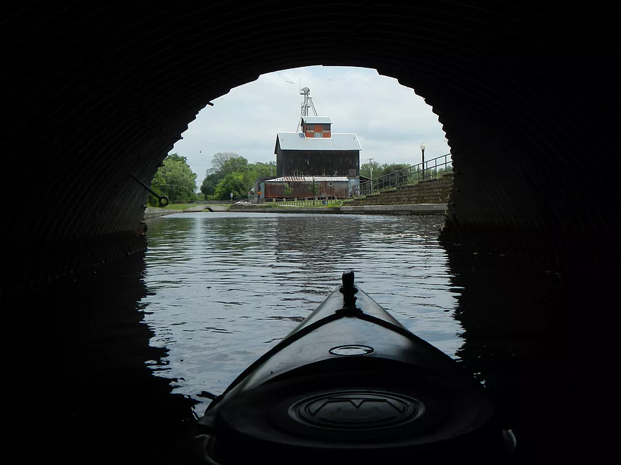
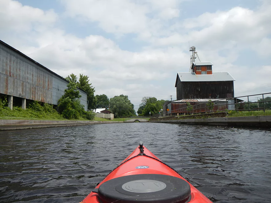
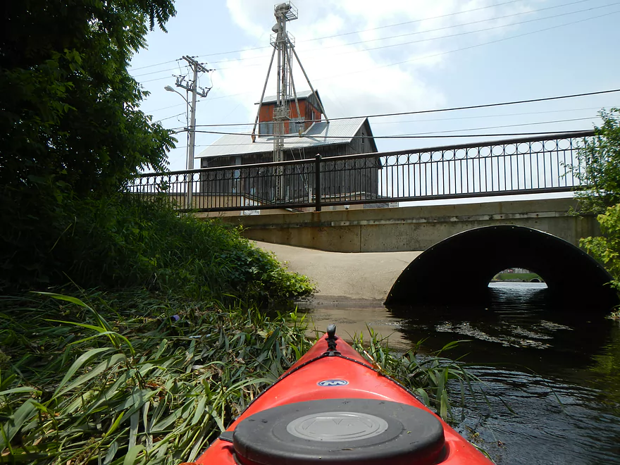
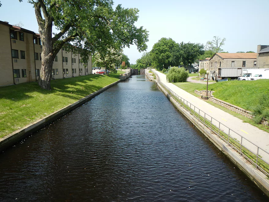
Photogenic and historic feed-mill
Normal portage path (not needed in high water)
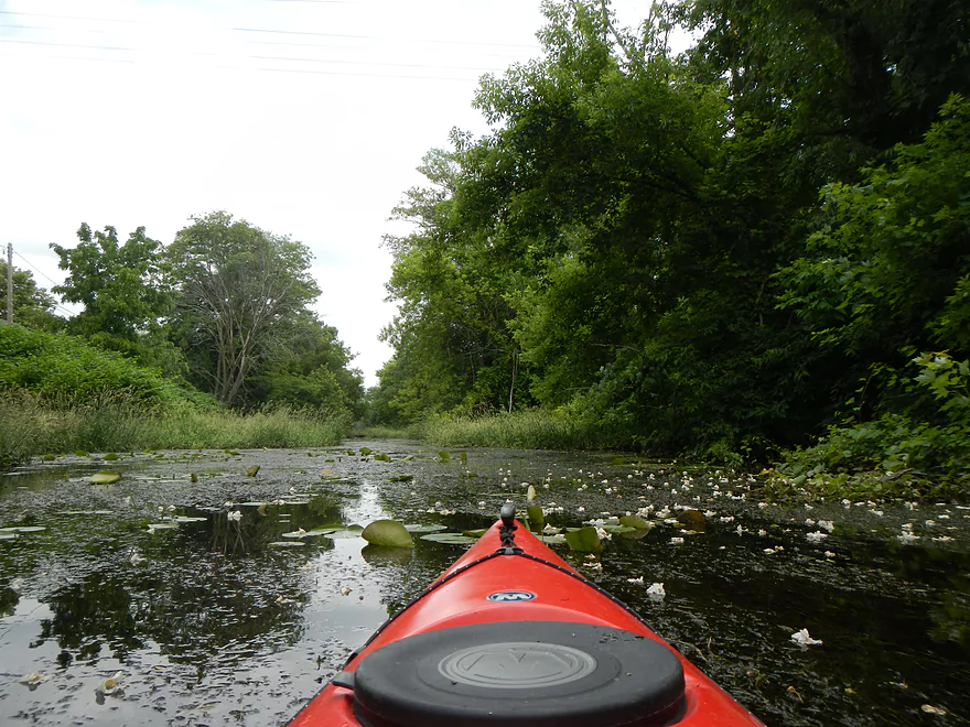
Returning to weed city
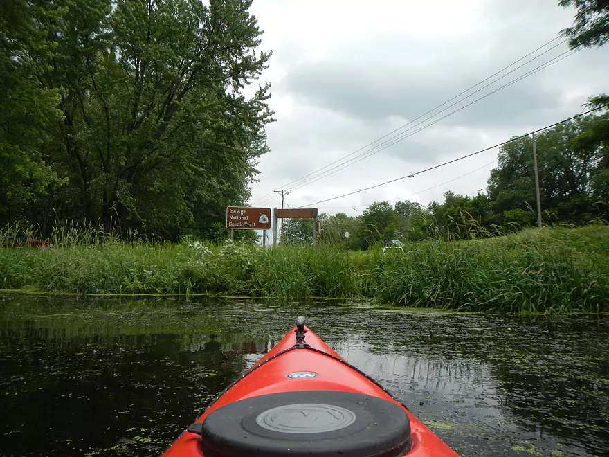
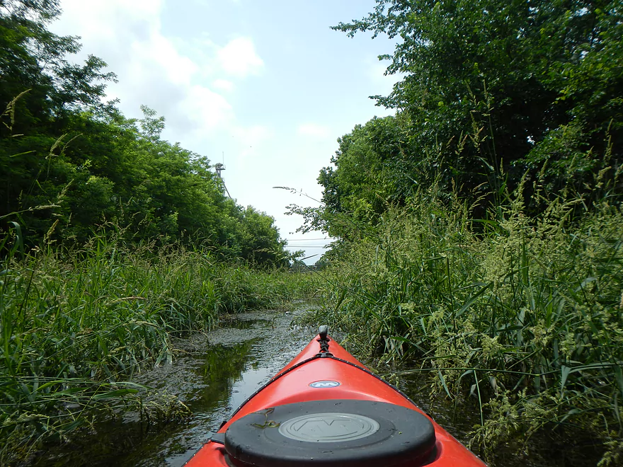
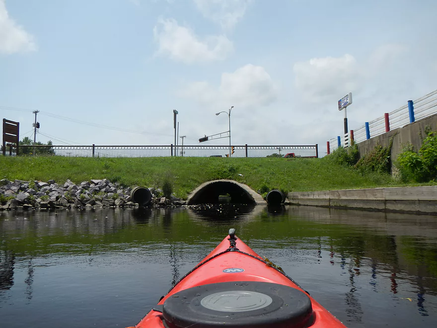
Passing the Ice Age Trail wayside
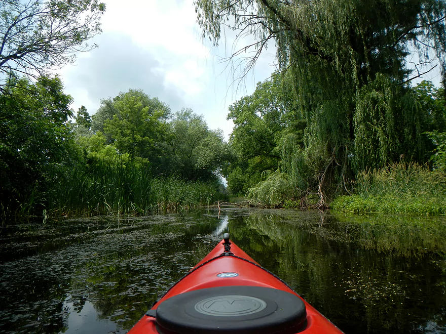
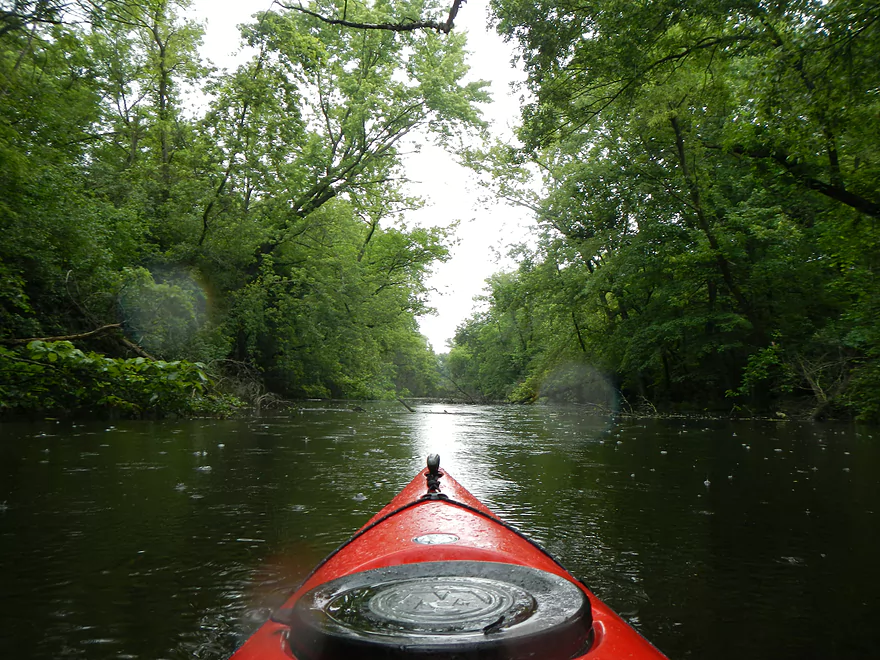
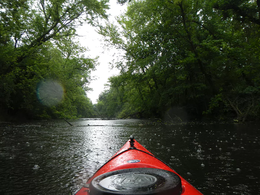
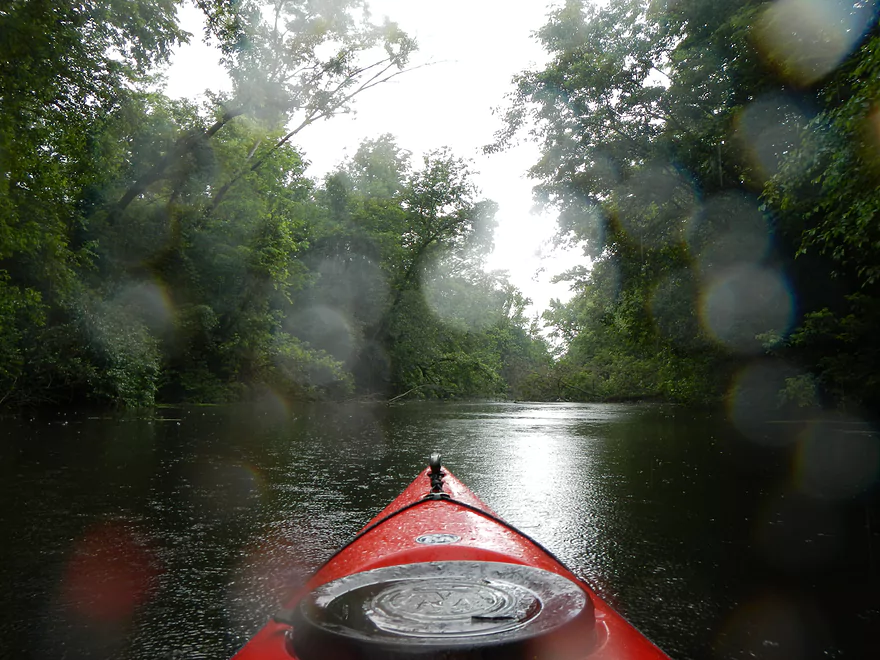
Caught in the rain
Tough to pass layer of muck
On the other side of the ledge is the Fox River
Turning back
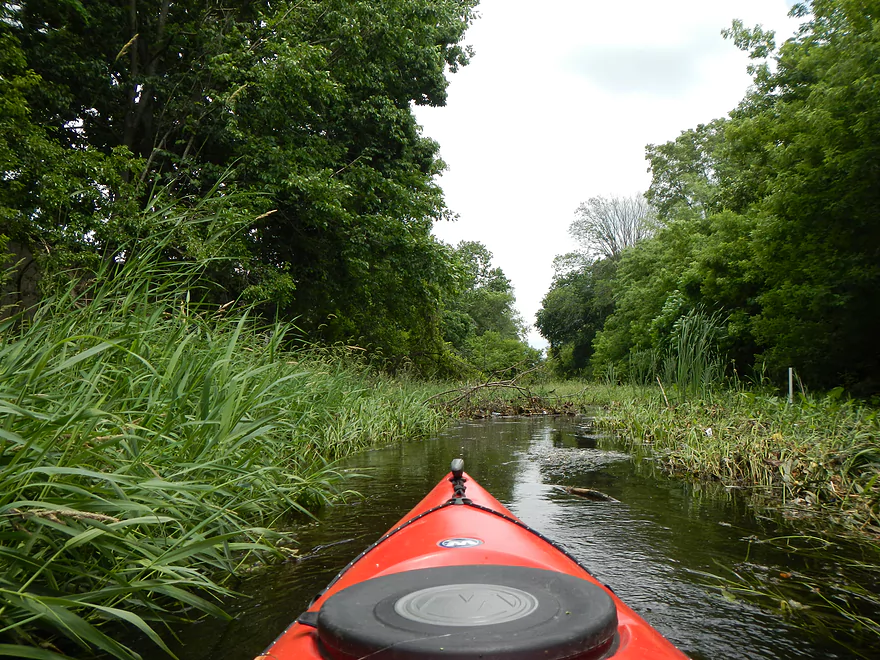
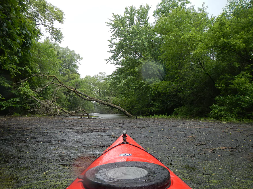
Some deadfall to paddle around
Revisiting evil muck
Back to the put-in
Scouting the east end of the canal
Nice portage/put-in area for the Fox to Canal divide
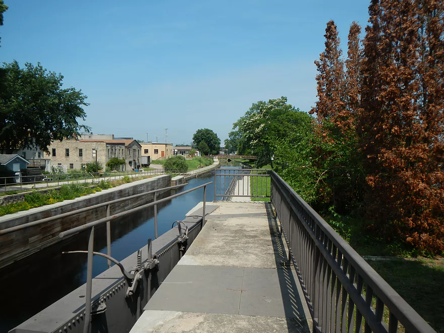
Portage Canal

This used to be a much more popular paddle destination than it is now. But unfortunately, the Wisconsin River end of the canal was permanently sealed and the main locks left open. Silt, weeds, and even logs have invaded certain sections, which makes this difficult to paddle in low water. The ‘main’ access point to the SW end (Wisconsin end) of the canal is poor, as parking is away from the canal, the local canoe dock is in disrepair, and an iron fence separates the canal from potential access (doable, but not handy). All this being said, the canal does have its charms and is a positive experience if done right.
The most common time to paddle the canal is during ‘Portage Canal Days’. The city puts on a festival and there is a lot of historical context. Over the years they usually paddle the canal from Hwy 33 (Fox River put-in, not the canal put-in), up the Fox, through the canal, and into the Wisconsin River. There are also festival trips from the far upper Fox, upstream of Swan Lake and starting in Indian Trails Campground (private livery). My personal preference would be to not paddle during this event but to do it on your own when things are more peaceful and you can be absolutely sure the water level is high enough (more on this later).
For my route (which I would do differently in hindsight), I put in at the Hwy 33 Ice Age Trail/Canal access pull-off. No bathrooms and not great put-in conditions, but free parking. As a side note, there is a nice trail system that runs most of the length of the canal which makes a hiking shuttle somewhat feasible (it’s just 2.5 miles in length). A bike shuttle would be a great idea here as well, or just doing a complete loop because it is so short (my vote). When I scouted this last year after doing the Mecan, the canal was absolutely filled with weeds to the point where navigation looked close to unfeasible. Thankfully, with the high water (which, yes, the canal is affected by), the weeds were mostly underwater, which was a huge relief.
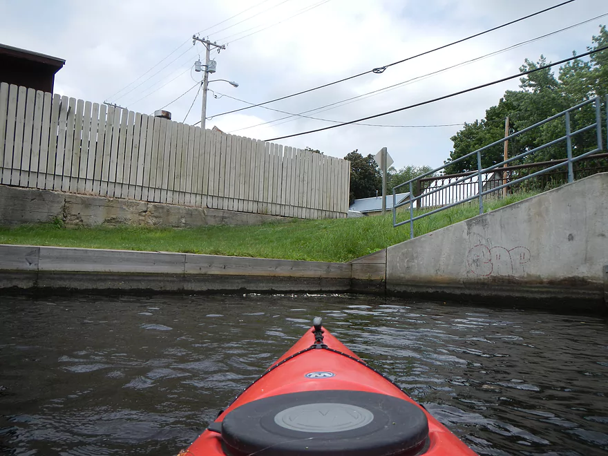
So, after putting in at Hwy 33 (the middle of the canal), I scooted toward the Wisconsin River side to the west. The first thing I noticed was the current, which took me by surprise. Not strong, but you did feel it (coming from the Wisconsin River and flowing into the Fox). As you paddle upstream, the channel narrows and you’ll go under a major railroad bridge. Keep scooting along through a somewhat wooded bank/residential neighborhood and you’ll encounter one of the trickier areas of the canal. Here the current is at its strongest (but still mild) and the silted-in channel gets to be its worst, giving you very little room. Dodge some fallen trees and sneak though a weed path on the right to reach the first tunnel. I barely was able to squeeze through and am not sure this would be possible in lower water. Most of the time, paddlers will portage the first tunnel because of the silt issues and there is a noticeable portage route on top of the bridge as well as a put-in on the opposite side. I didn’t see a put-in on the east side, so am unsure where paddlers would take out. The other reason paddlers normally portage the first tunnel (it’s all marked on the map) is because there is a ledge (normally) on the east side of the tunnel. Which, thankfully, didn’t exist for me because of the high water.
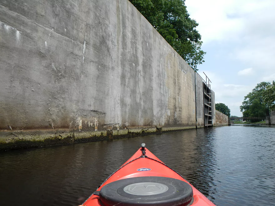
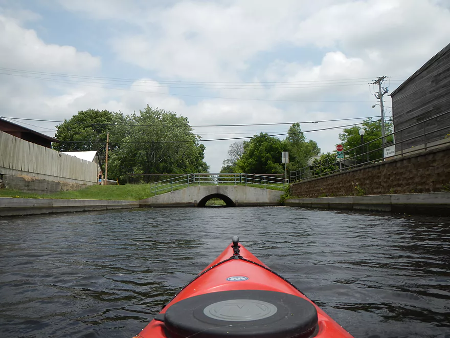
The first tunnel was very cool but filled with massive spiders and huge webs, which to me demonstrated that I might have been the first paddler in a while to go through this tunnel. Sneak though the tunnel and your vision of weeds and trees is replaced by bustling Portage and a clear blue (and well maintained) section of the canal. Keep going forward to sneak though the longer tunnel (this is normally navigable at all times). Then this leads to the last segment, where the historic locks are (kept open) and the filled-in access point to the Wisconsin. I paddled though the gates and got as close as I could to the end. Here, had I wanted to do a segment on the Wisconsin, I could have gotten out and done a portage to the Wisconsin River. (not great, but a so-so area to take-out). This is probably and technically the location of the actual great divide, as the canal flows downstream into the Fox. So it is somewhat novel being in an area where a rain drop will end up in either the Gulf of Mexico or St. Lawrence Seaway.
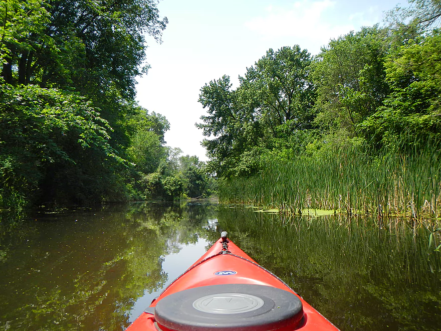
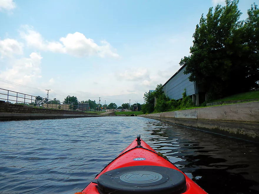
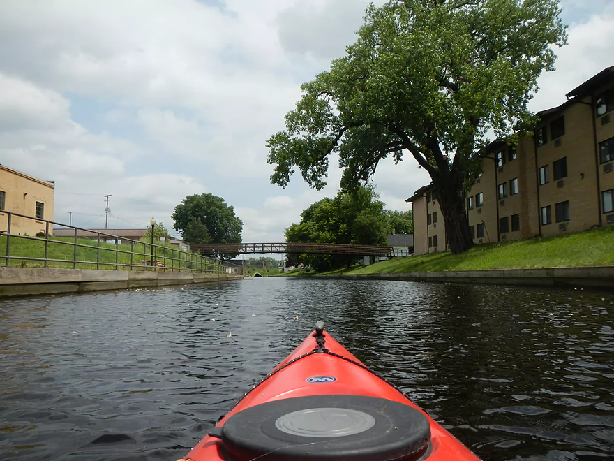
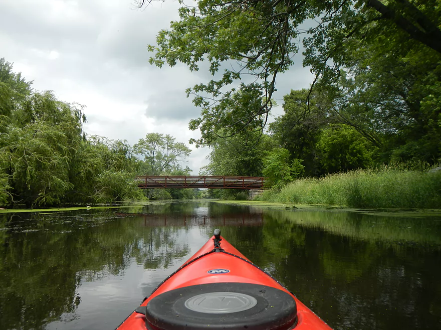
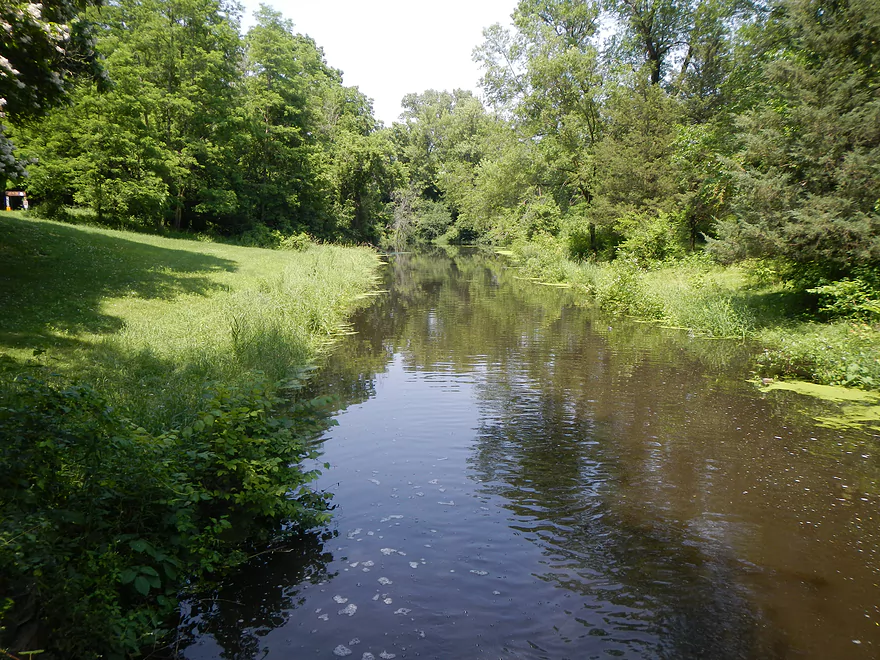
Instead of portaging into the Wisconsin, I headed back and retraced my footsteps downstream toward the other end of the canal. After passing my car at the halfway point, I kept paddling east to the Fox end. This middle-east section is very open and is kind of boring to paddle honestly. Make sure to bring your DEET-free mosquito repellent as there are a number of those buggers in this area. After a while the open area goes away and trees start to hug the banks, which makes the far east end more attractive than the middle end. I guessed wrong with the forecast and got a brief dousing that actually was a nice change of pace. There are a couple of log situations that might be problematic in lower water…but in high water I was able squeak through.
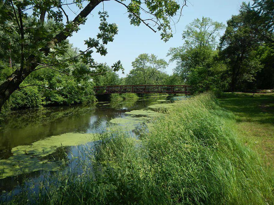
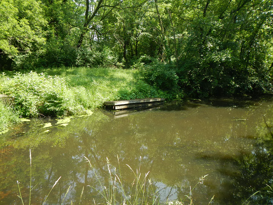
Close to the far east end there was a large mysterious blob of weeds floating on the surface with an absolutely repugnant odor. It was quite difficult, actually, to muscle my way through this 20-foot section of floating death weeds that spanned shore to shore. Finally, after scooting through a log situation (never once had to portage the whole trip), I came to the Fox River (well, kind of). The Portage Canal doesn’t interface directly with the Fox, but rather the Fox comes in a bit and they meet at an old canal lock. This is largely degraded and just a foot or two ledge remains, which did not look runnable because of the rocks below. There is a decent portage path around the ledge, so it would have been easy to sneak into the Fox and introduce invasive species had I wanted to, but not today. This area actually would have been a more ideal put-in in hindsight. The launch spot is much nicer and there is decent parking (still no bathrooms). There is also a bridge over the canal and connections with segments of the Ice Age Trail (which, I believe, is hikeable the length of the canal, but am not 100% sure). The hiking trail does run to the Fox, which allows you to take a peak at the main channel (a paddle prospect in its own right, but a little high that day).
If you’re into history, you may consider checking out the Indian Agency House at the East end of the canal. In summary, while this wasn’t a five star trip, it was kind of novel, outside of the weeds. If you go, try to go during high water. You might try calling the Portage Chamber of Commerce to inquire about the water levels (they do run Portage Canal Days so should have some idea). Going after a heavy rainfall isn’t a bad idea, as there is at least one decent-sized culvert that empties into the canal. Your best bet is to probably go when the Wisconsin is high though, as I think that is where most of the canal’s volume comes from (underground?).
Trip Map
View Portage Canal in a larger map
Video
Photos Size:
The DNR has announced plans to start dredging the Portage Canal this fall. https://dnr.wi.gov/news/releases/article/?id=5196 .
Attempted to paddle this today. Considered putting in at the suggested northeast junction with the Fox, but couldn’t find an easy access and returned to the Ice Age Trail parking at 33. Heavy weeds prevented easy access, but there was a trail cut to the bridge where 33 crosses the canal – was able to get boats in the water under the bridge and headed towards the Wisconsin River. Suspect the water level was very low, only 8-12″ deep in some areas, very little current, and it appears the dredging mentioned above has not yet been completed. Quite heavy underwater flora through most of the canal provided a nuisance, but no blockages required a portage around. Made it to the tunnel under Thompson St, but there was a much higher ledge – it didn’t appear to be navigable, if the water was high enough to float the ledge there wouldn’t be enough clearance above. Wife didn’t want to try going around, so turned back and returned uneventfully to 33.
Thanks for the update. This is very helpful information.