
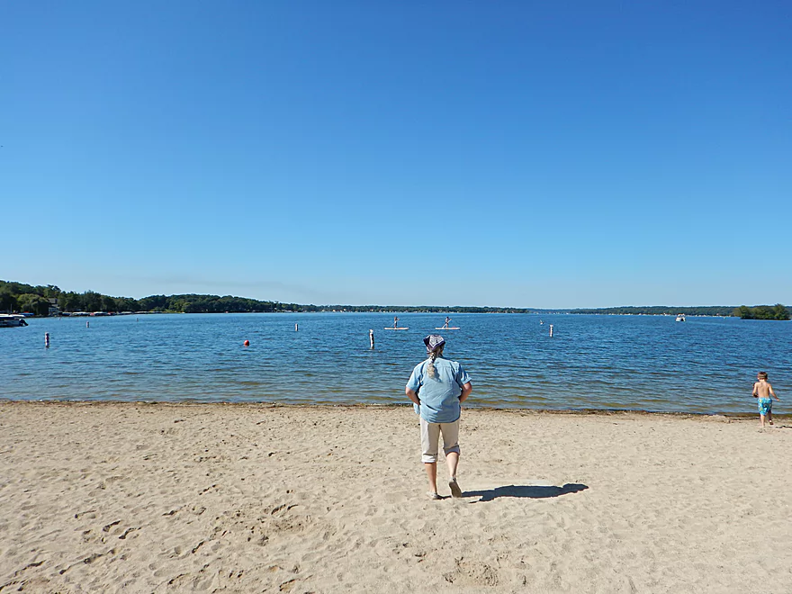
View of Pewaukee Lake from Lakefront Park
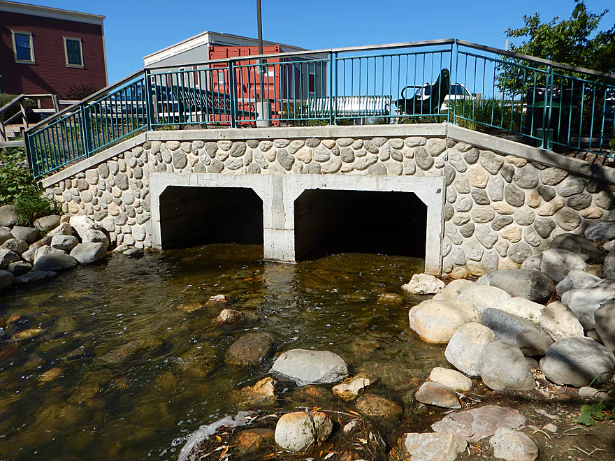
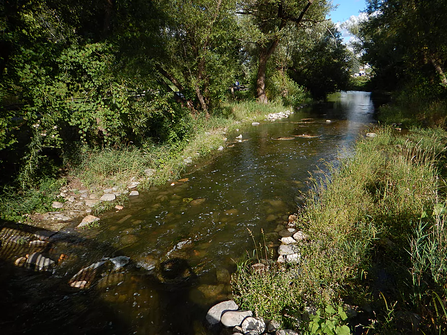
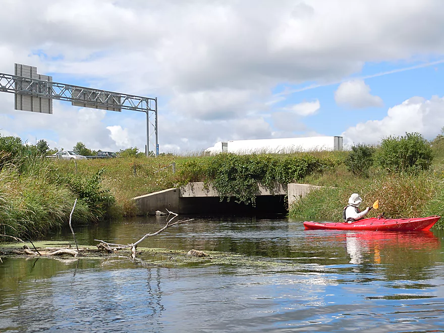
It is actually a flowage and this is the dam outlet
Which makes for a good put-in
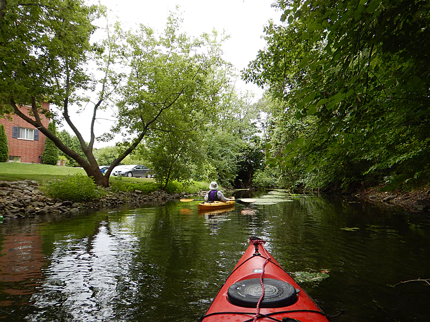
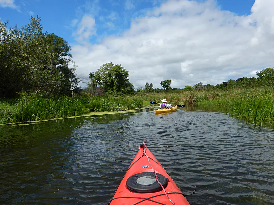
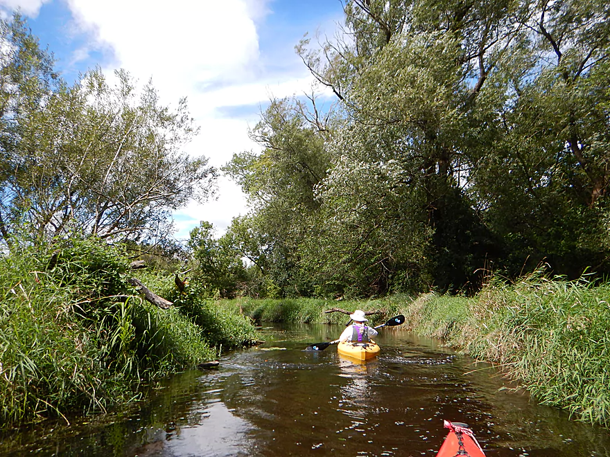
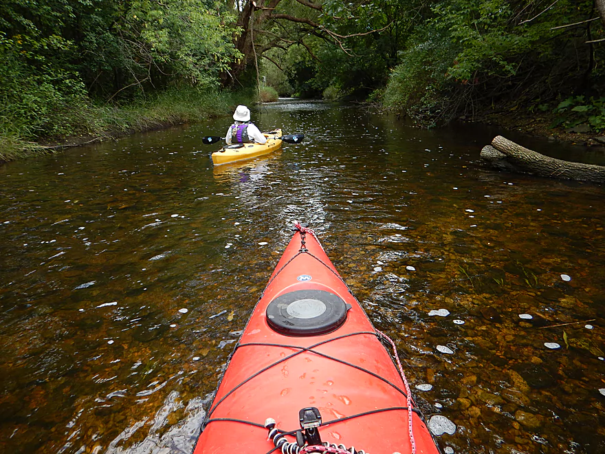
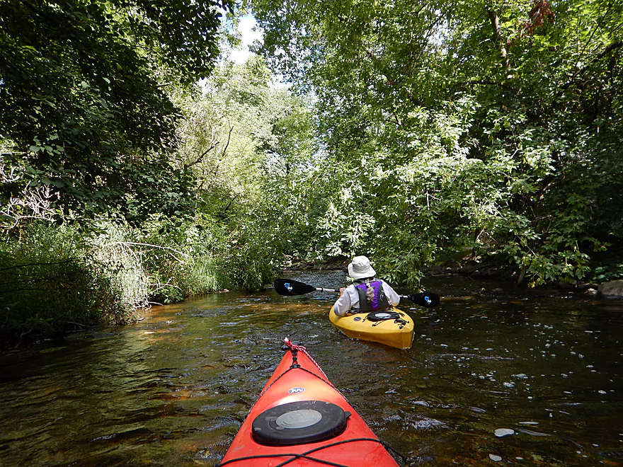
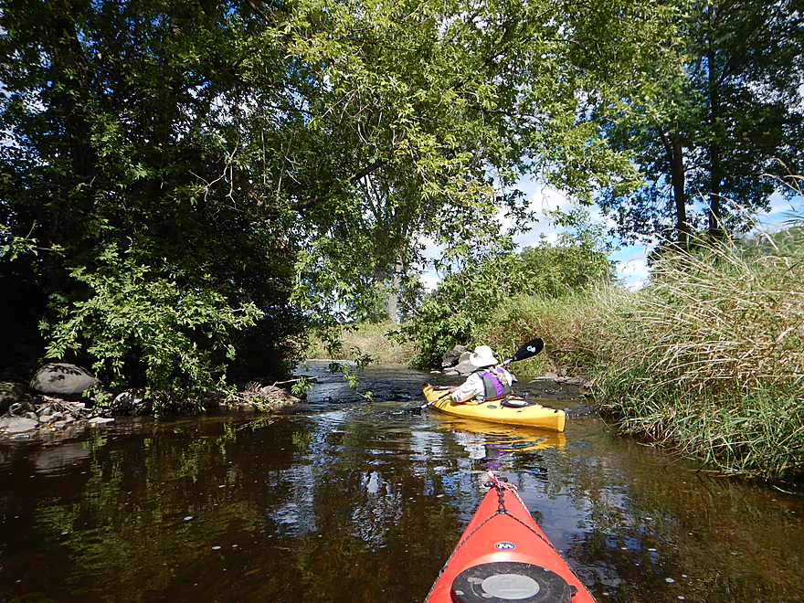
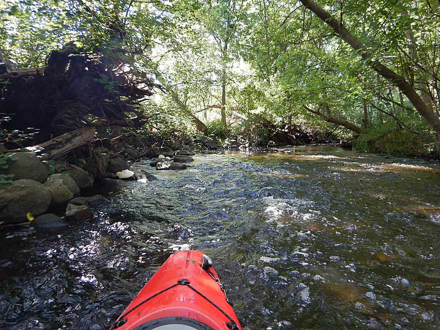
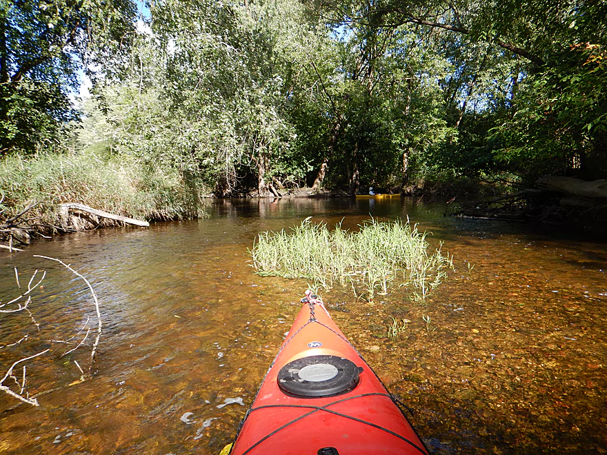
Starting the trip on the west branch of the Pewaukee
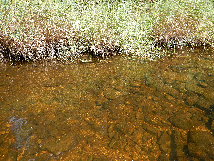
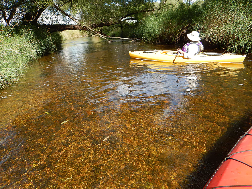
Which is shallow
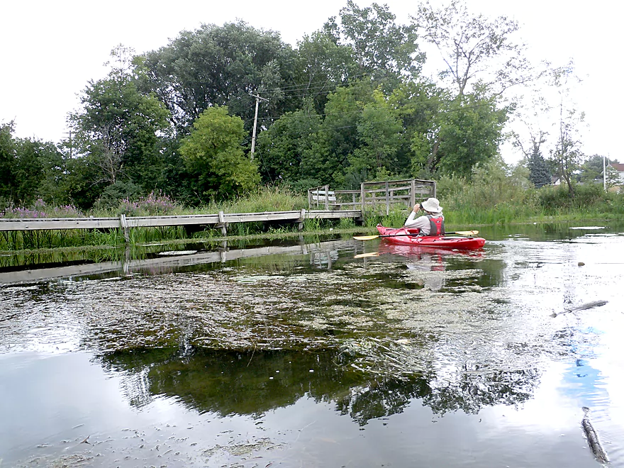
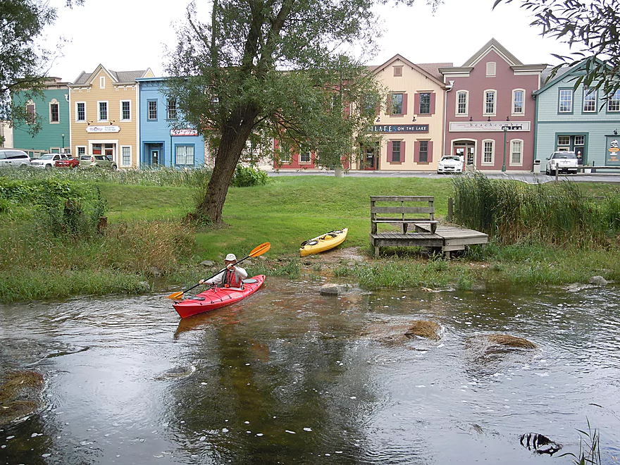
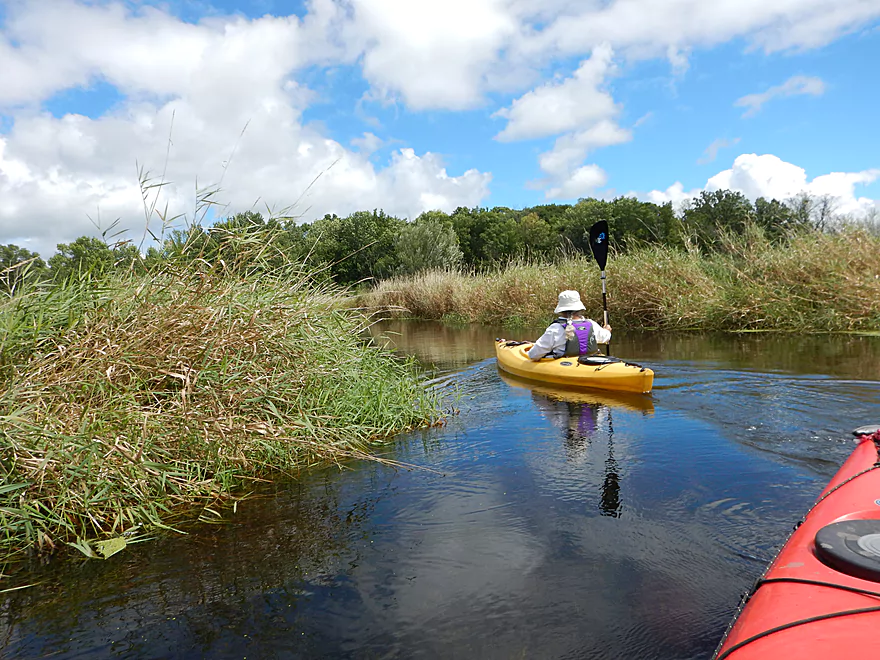
Public boardwalk at the junction of the river branches
River more than doubles in size
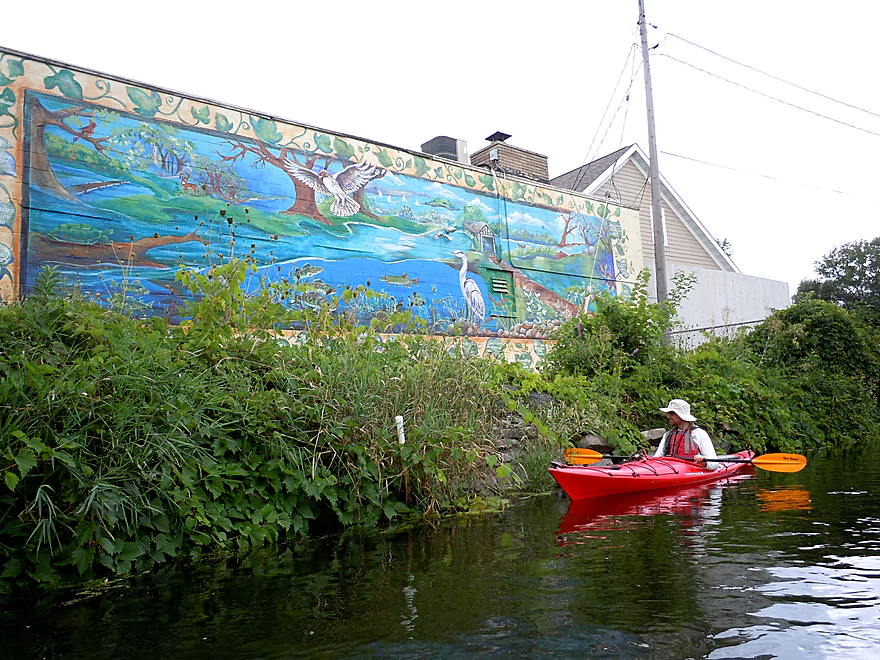
Nice riverside mural
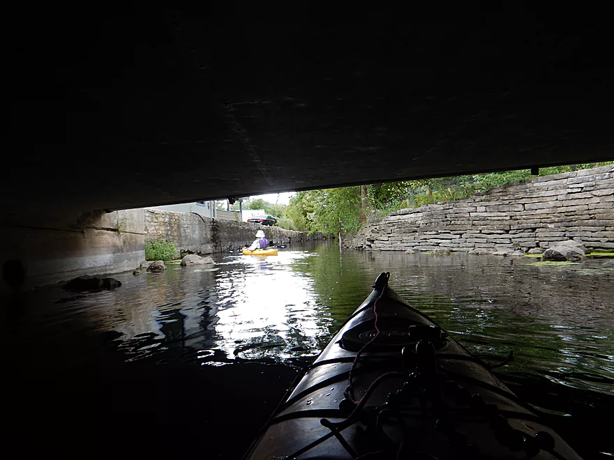
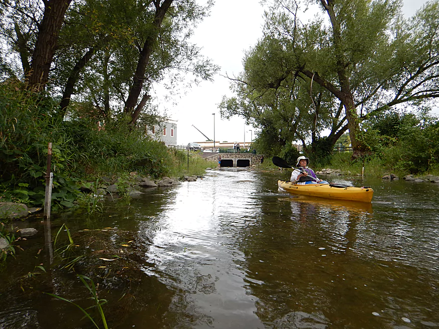
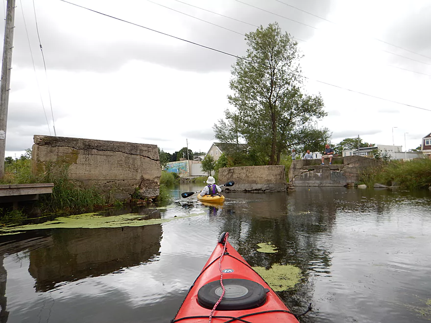
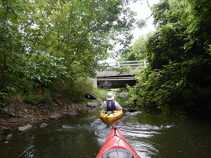
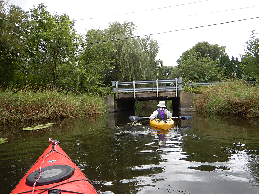
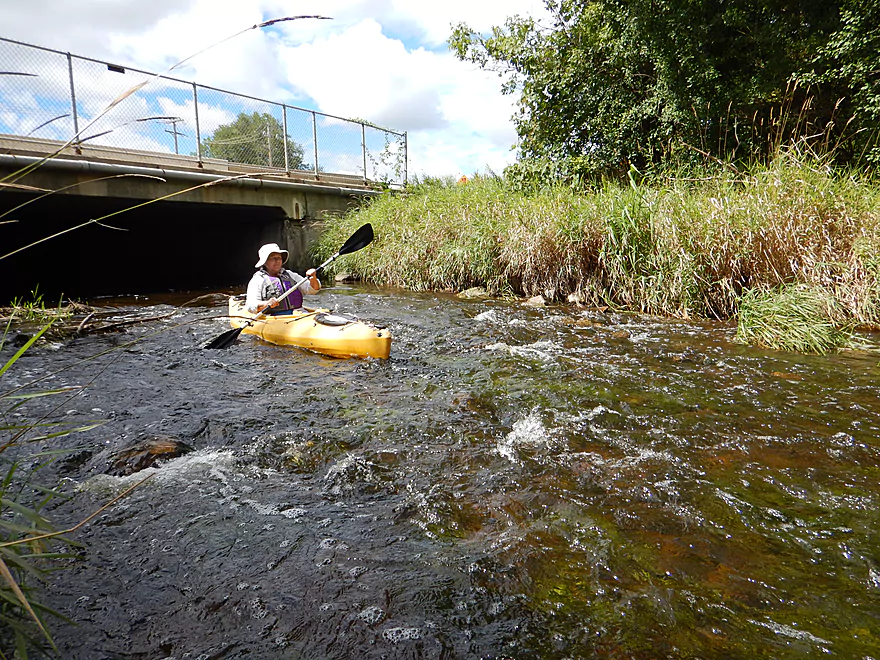
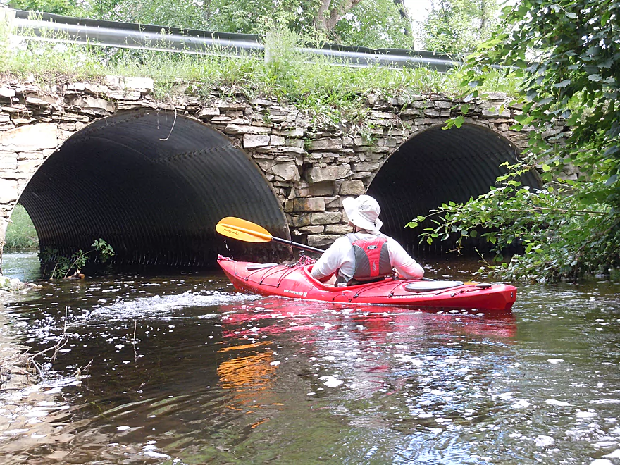
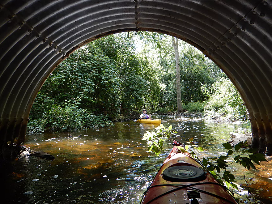
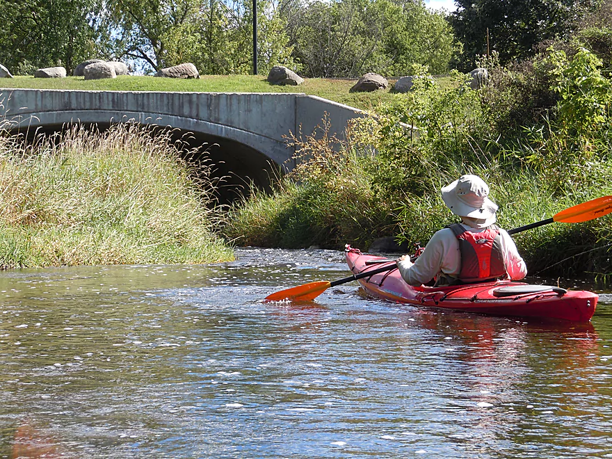
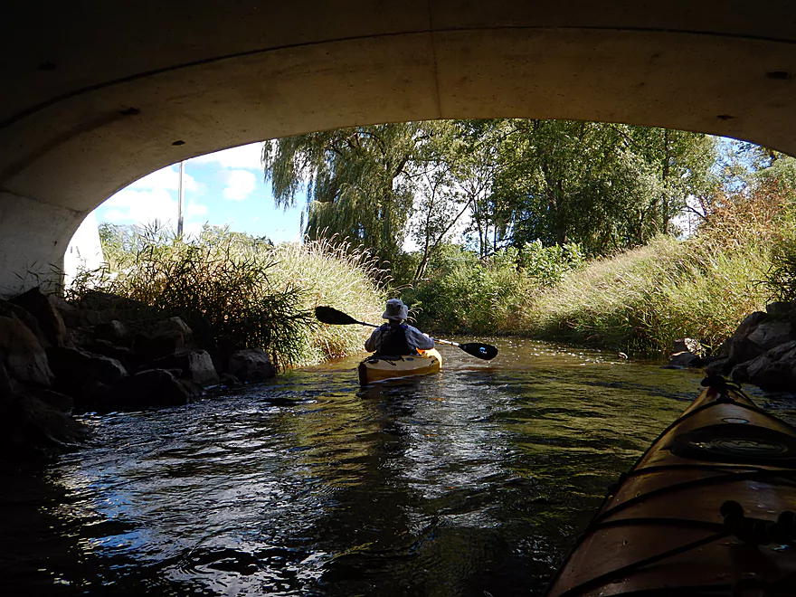
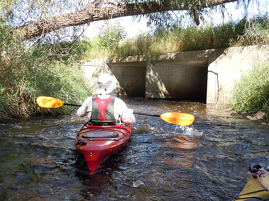
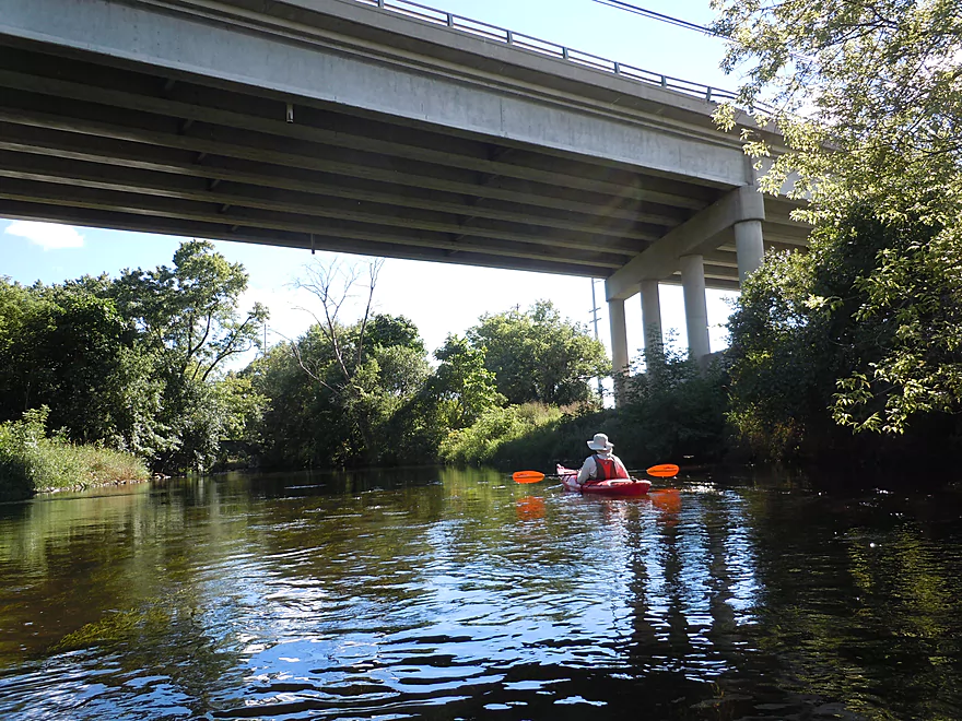
Paddling under Oakton Ave
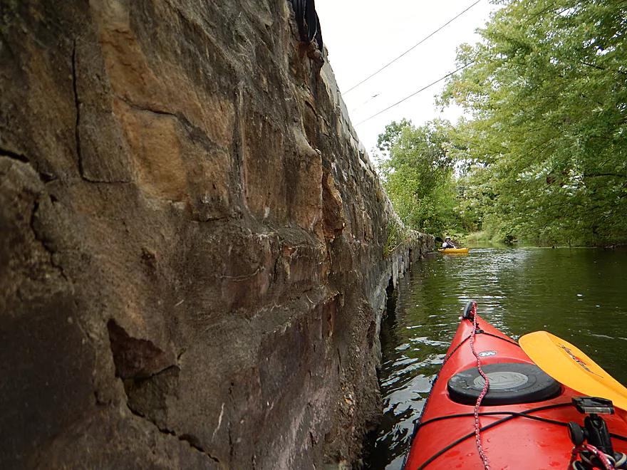
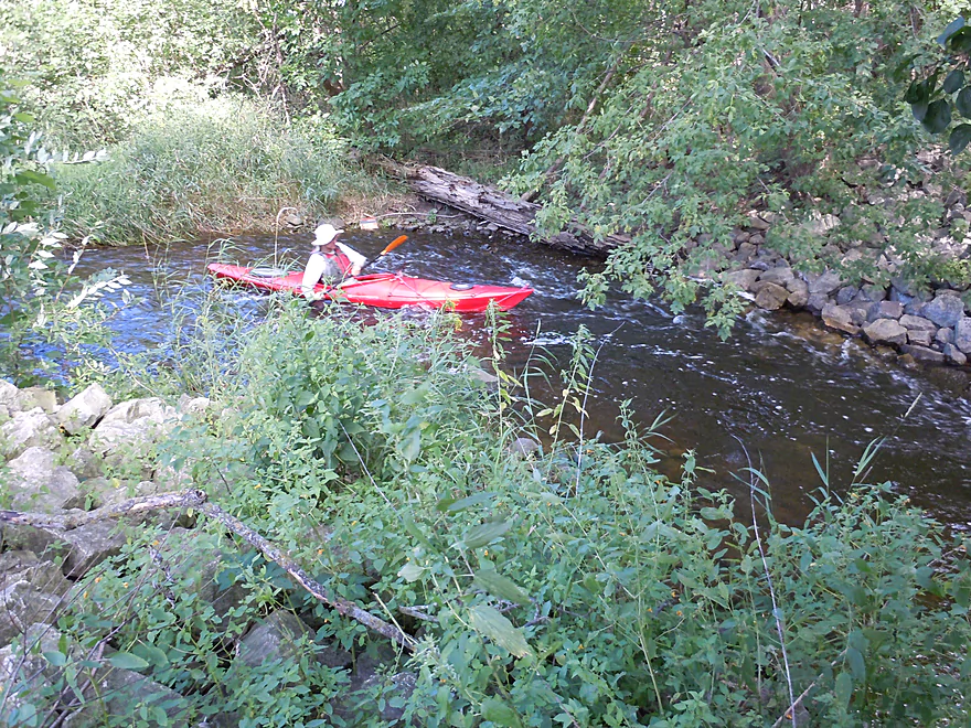
River runs along an old stone wall
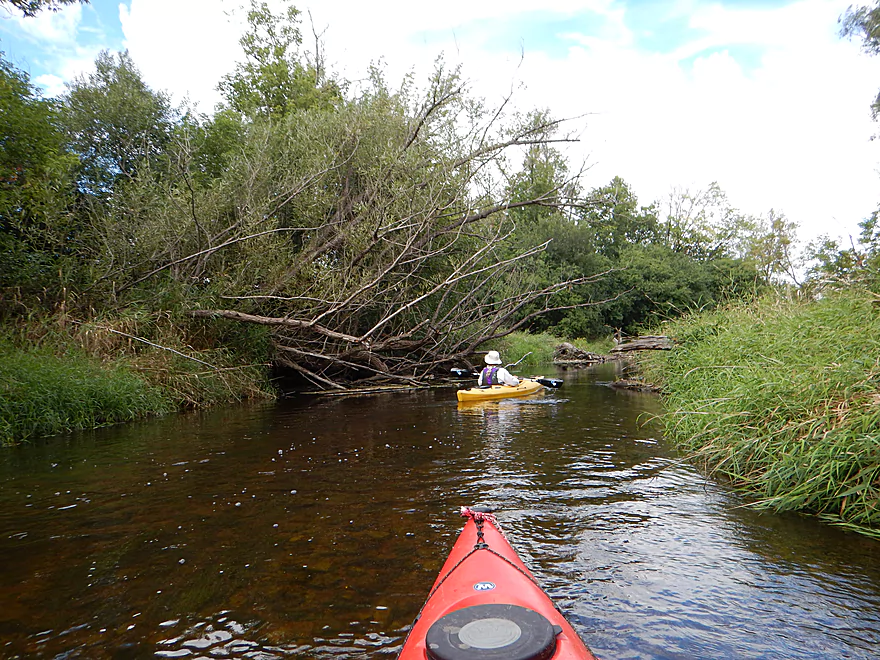
At times open
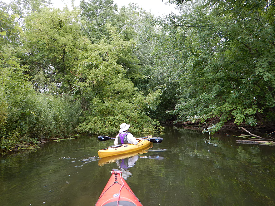
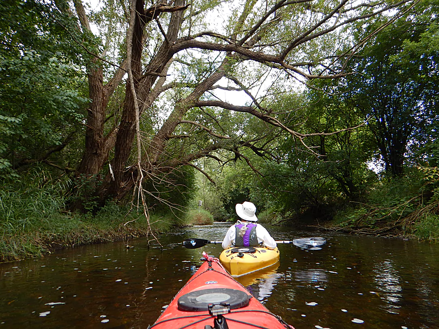
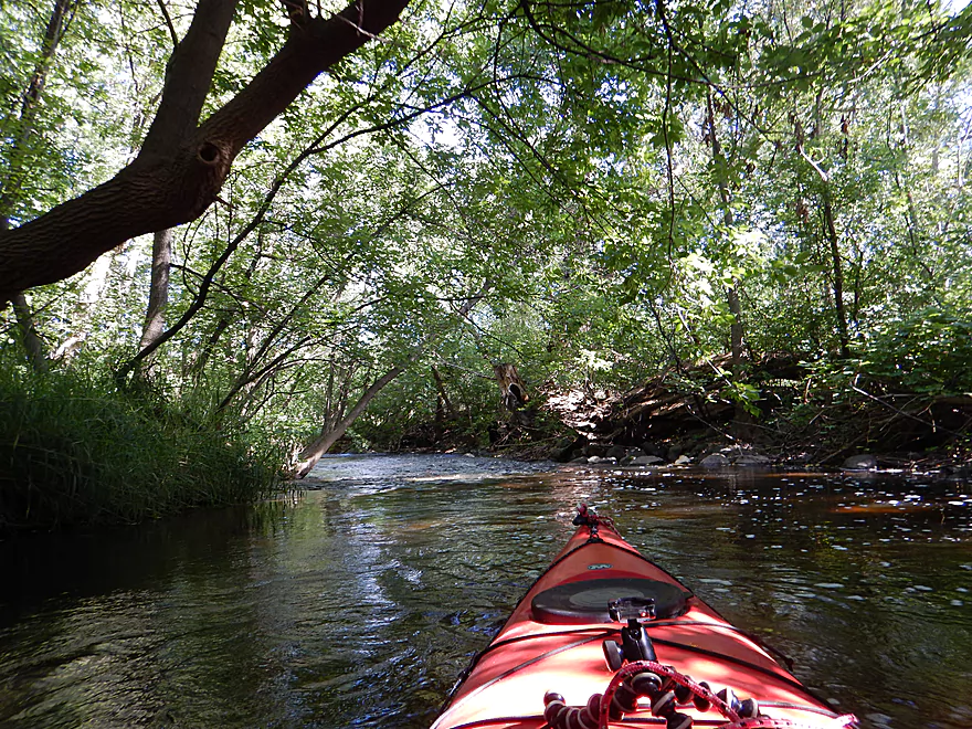
At times heavily wooded
The overhanging trees created a neat effect
Clark Street
Pond weeds increase after the sanitation plant
A very noisy Hwy 16
But scenic as it passes over the river
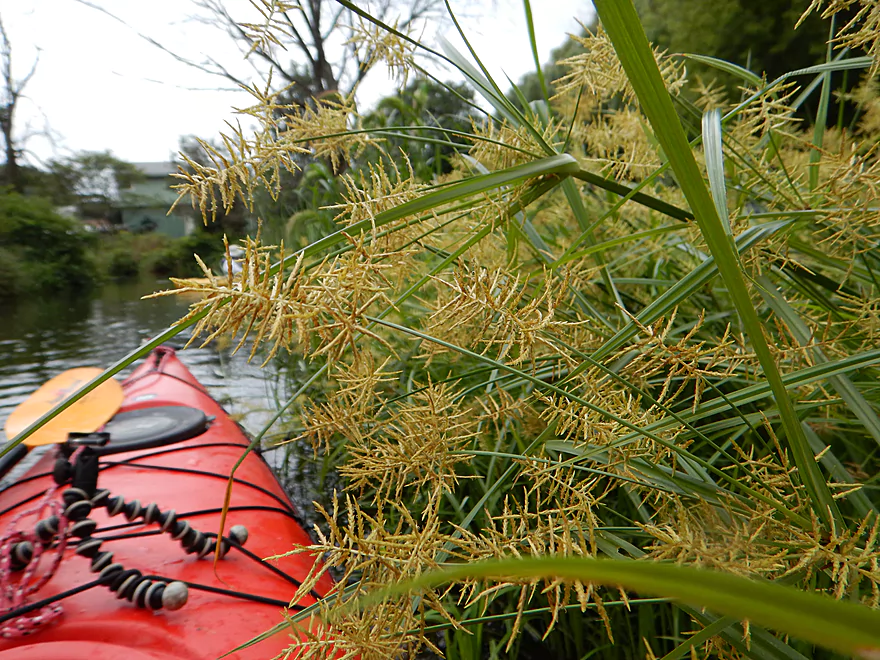
Prickly yellow nutsedge
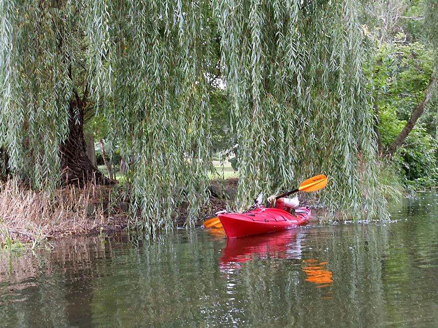
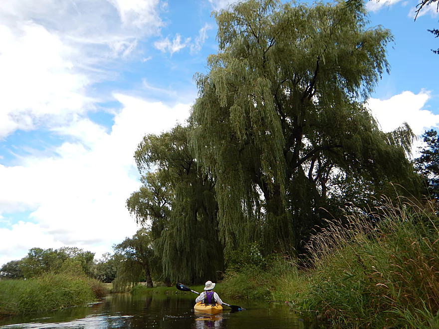
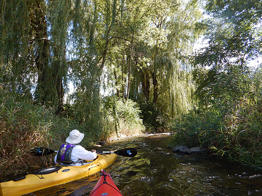
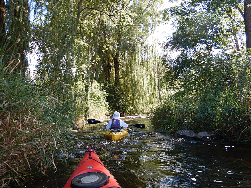
Bathed by weeping willow tears
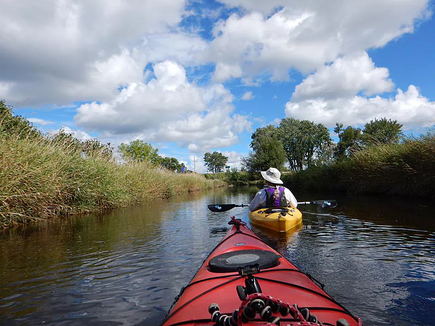
Hwy M is a popular access option
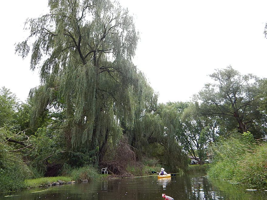
One of several majestic weeping willows
Rip-rap that was actually attractive
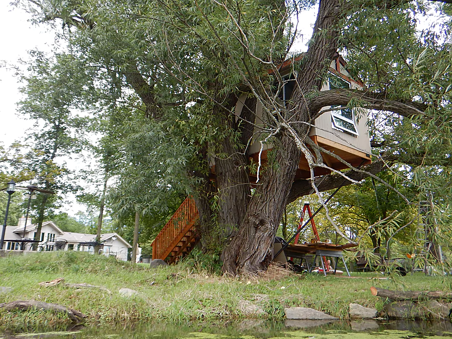
Quite the tree house…
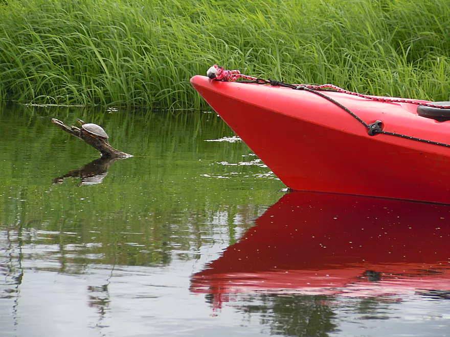
So many tame painted turtles on the trip
Bottlebrush barnyard grass
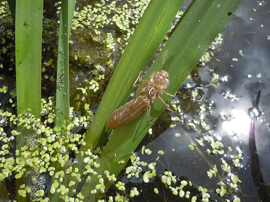
Fresh dragonfly exuvia
Leaving the city behind for a while
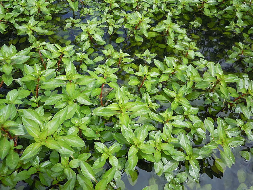
A mat of water purslane
Cattails replacing the grasses
One of several scenic inlets
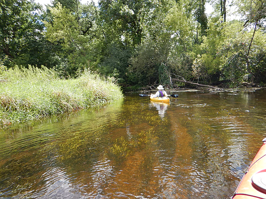
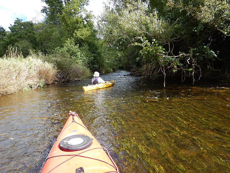
Much of the upper river was plenty deep
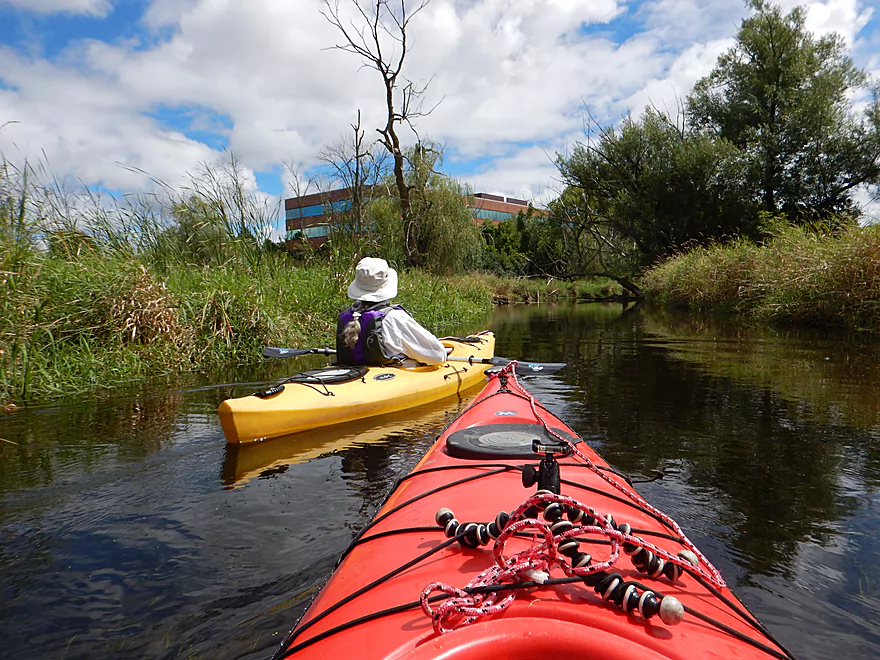
Alien-looking office building rises up out of the marsh
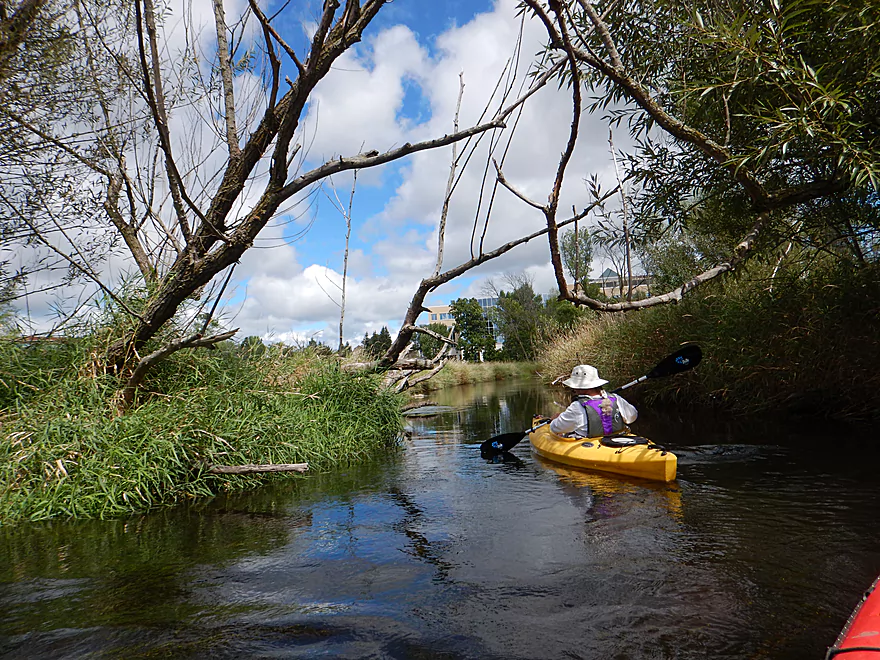
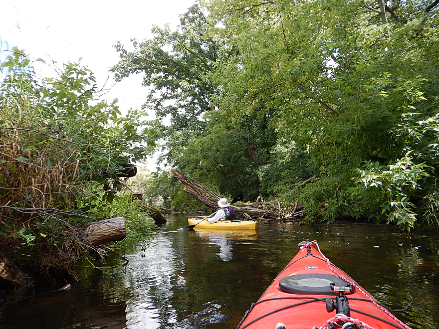
Hardwoods return to the river
Clarity increases dramatically
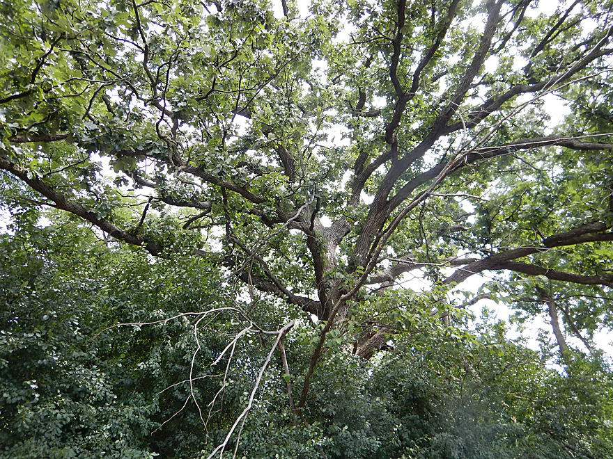
A fantastic bur oak
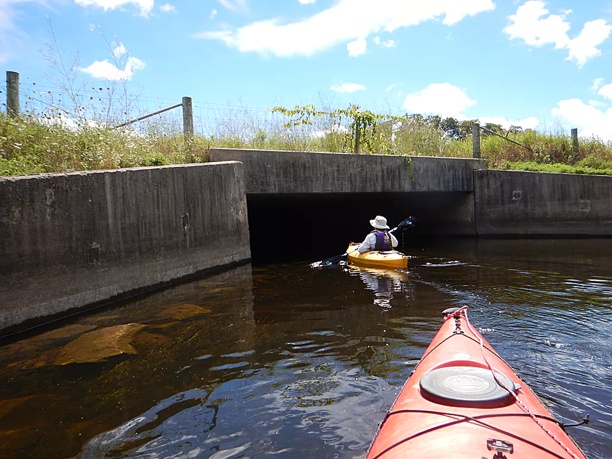
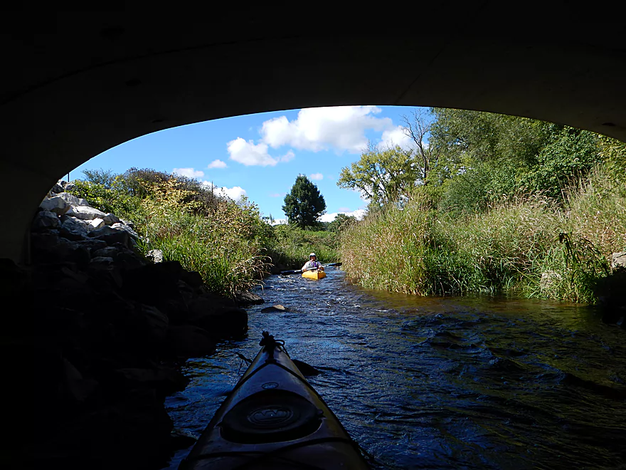
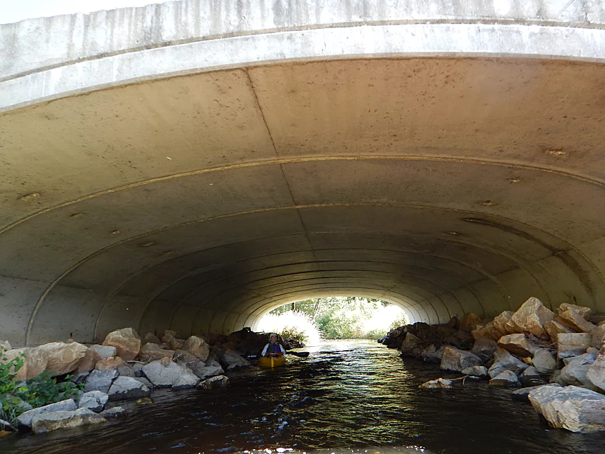
Time to cross under 10 lanes of traffic (I-94)
Deja Elroy Sparta
The exit is lower than the entrance
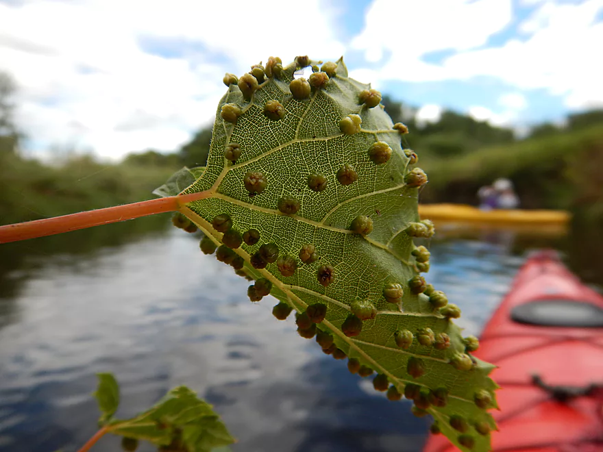
Plant galls caused by small insects
Current picks up now
Fantastic cleanup work by locals
Another majestic weeping willow
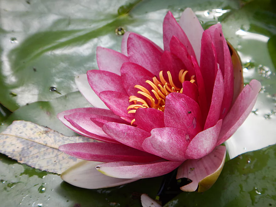
Probably not a native lily
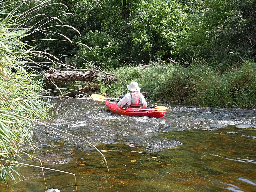
First of many rapids
Rapids by Pewaukee Road
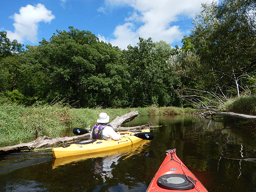
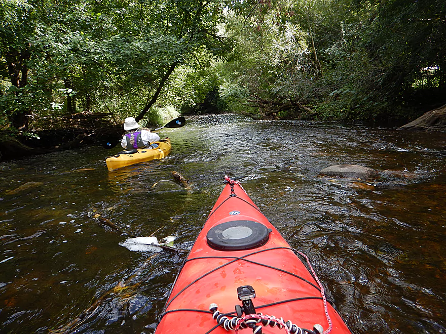
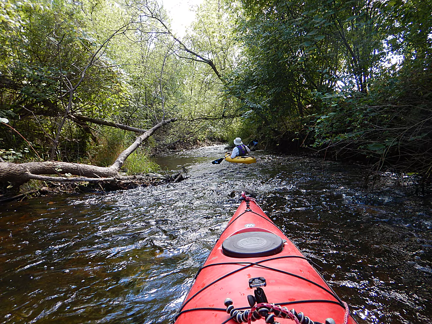
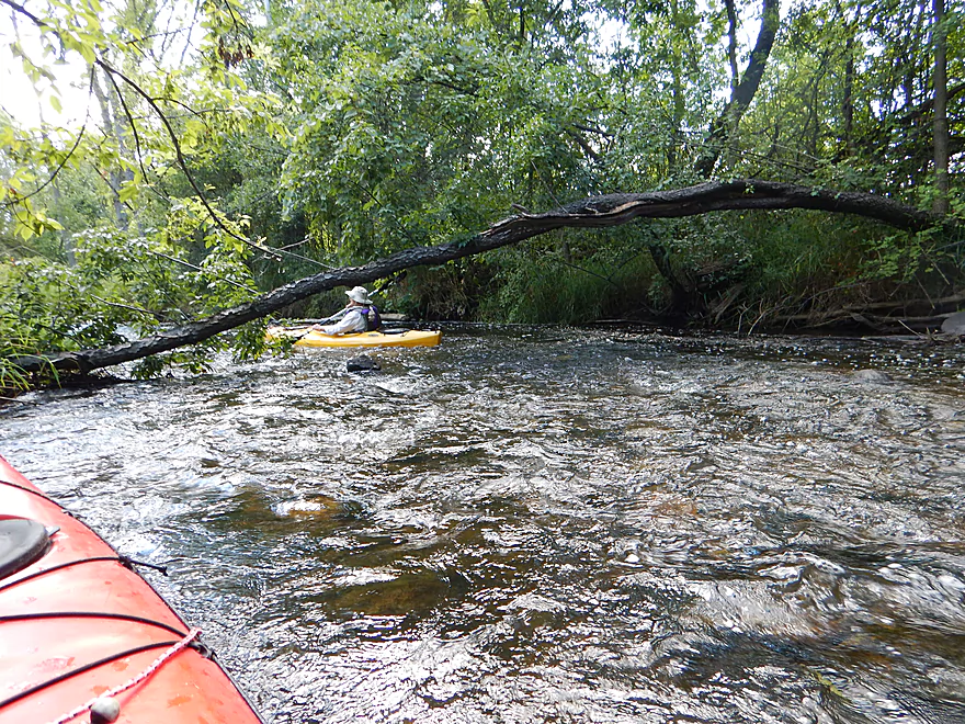
Many downed trees, but never a problem
Paralleling a noisy I-94
Substrate loses its mud
Another fun riffle
But shallow…
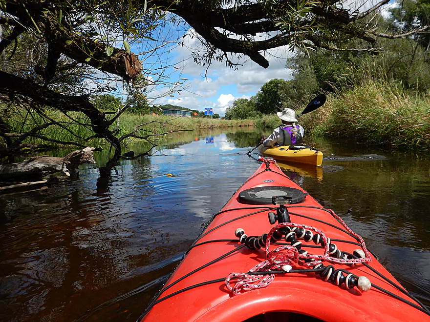
Always cool to paddle under branches
Fine craftsmanship on Busse Road
Water clarity gets even better
An open area by Steinhafels
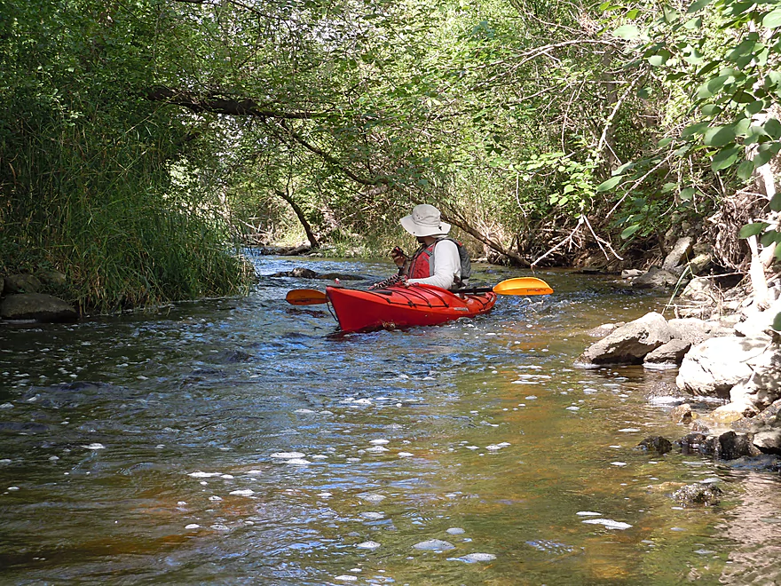
Some of the faster rapids are located here
Very tame at shallow levels
Perhaps the biggest rapids of the trip
Easy peasy
Unfortunately kind of shallow
Coming up on Steinhafel’s drive
Scooting along in a narrow chute
Neat bridge
Plenty more rapids
In high water, this bend is difficult for big boats
Almost constant riffles to the finish line
The final mile is the shallowest part
Paddling under Hwy F
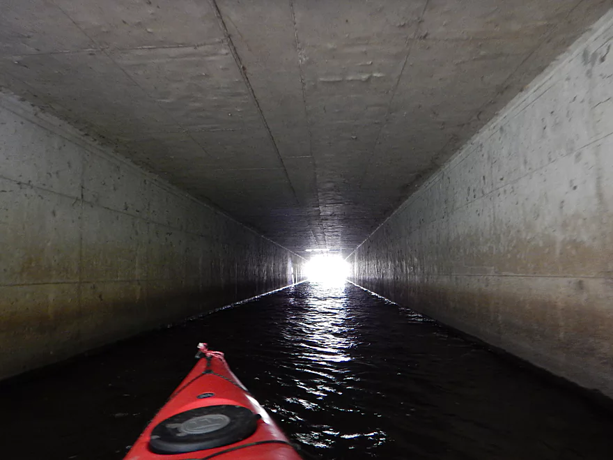
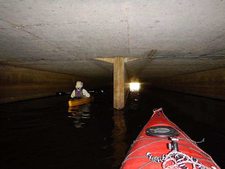
Light at the end of the tunnel
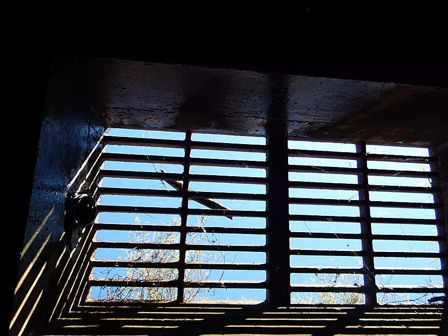
And at the top too…a skylight for paddlers
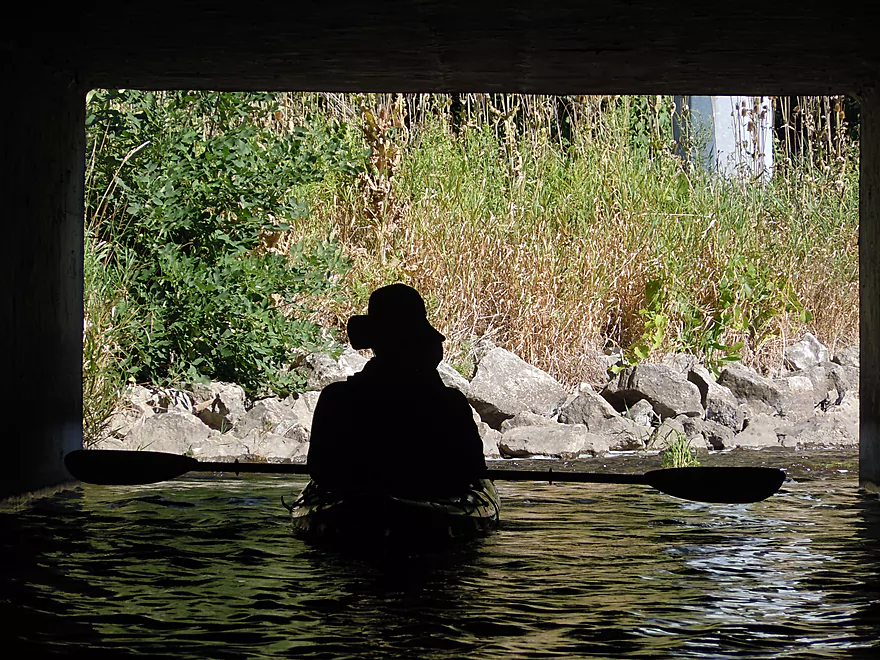
Always fun to photo tunnel silhouettes
Paddlers bonk their head on this bridge in high water
Entering the Illnois Fox
Just a short paddle on the Fox until the take-out
Decent take-out at Wonderland Tap
Just do not park close to the river (per management)
Pewaukee River

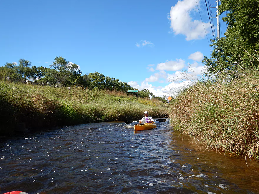
The Pewaukee River is a nice stream located in suburban Milwaukee. Typically, this runs shallow, so the trick is catching it when the water levels are right. If you can, you’ll enjoy a nice mix of town paddling, marsh paddling, woodland paddling, and even some fun rapids.
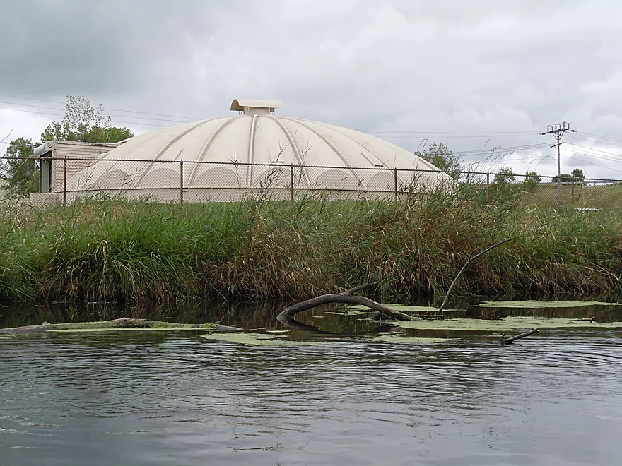
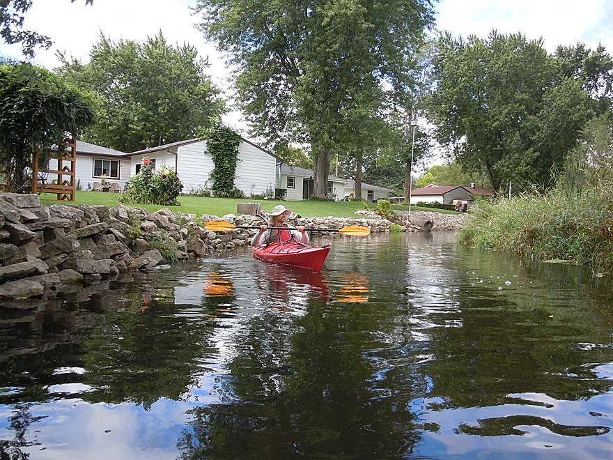
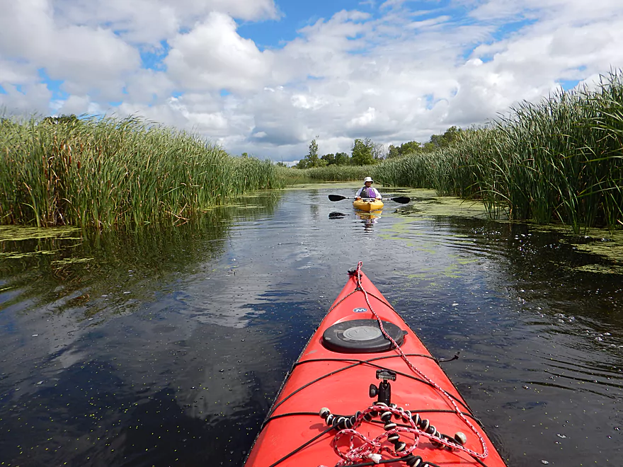
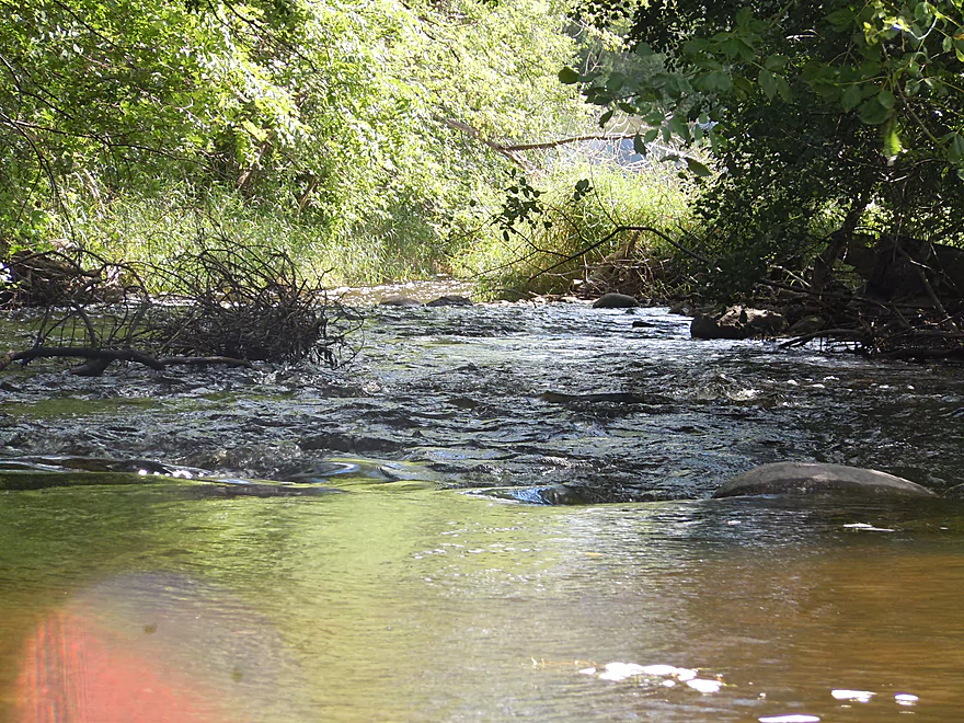
We launched downstream of the Pewaukee Lake dam, just east of the “Chocolate Factory.” Parking is reserved for plaza customers, but we asked and were told it was ok to park here for launching. The launch area is very nice and is popular with fishermen. While shallow here, it doesn’t remain this way for long as 500′ downstream the main branch joins up and the river is plenty deep for the next four miles.
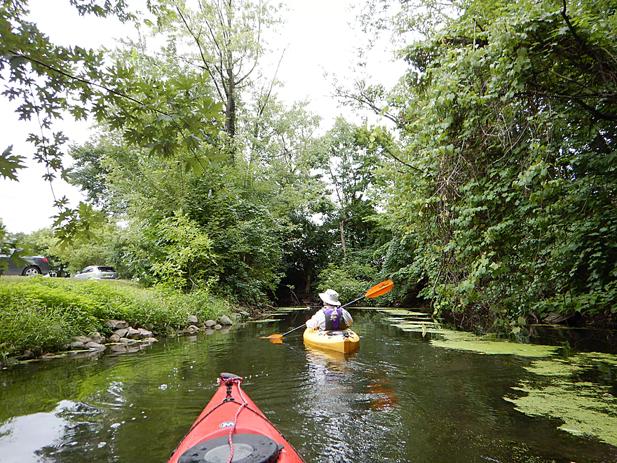
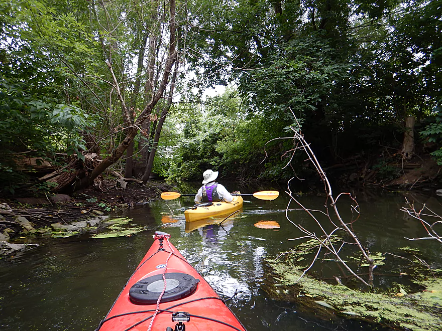
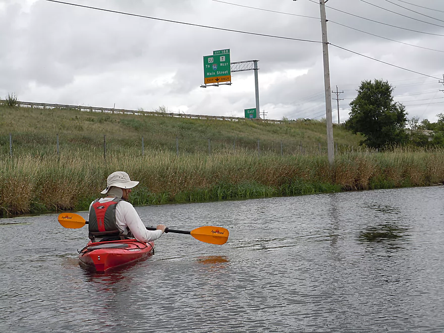
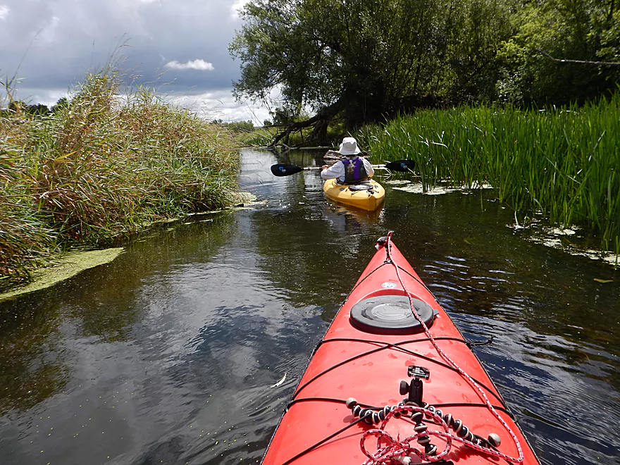
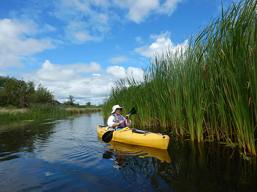
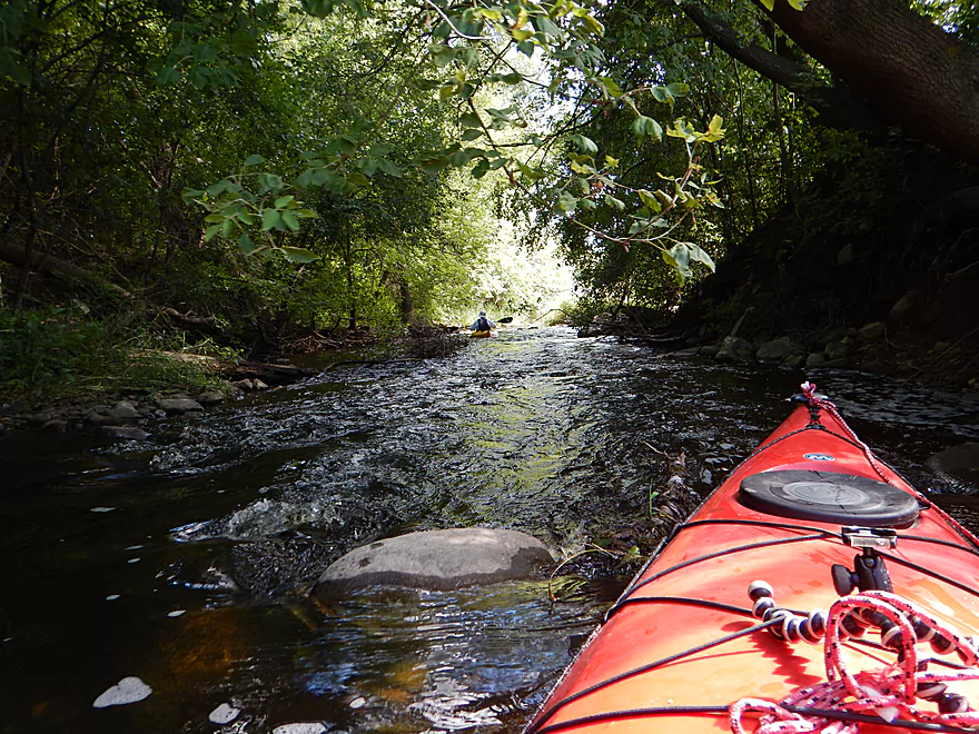
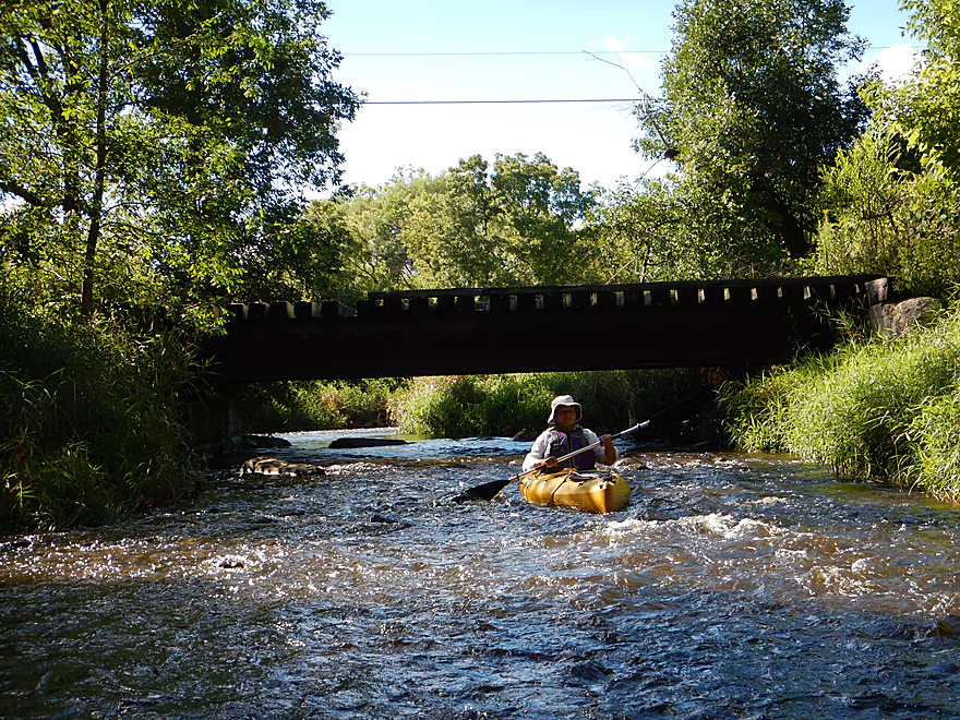
The first 1-2 miles of the trip run through downtown Pewaukee, which I found very pleasant. Among the highlights were a scenic river mural, stone bridges, and large trees smothering an already narrow channel and giving this stretch an enclosed feeling.
An annual tradition in May is the Pewaukee Kiwanis RiverRun. The race runs from Hwy M to Frame Park in Waukesha, and shuttles are provided for paddlers. On a humorous note, this group hands out an award each year to the slowest paddler. The most recent “winning” time was 3 hours 33 minutes, which we easily smashed with our 5 hour 38 minute trip (taking pictures is a good trick for lengthening trips). While the race is launched from the Hummel Machine Products parking lot, signs mark this as private, so I’m not sure if this is permitted outside of the race. I suggest putting in further upstream for better launch options and because I thought the upper section was scenic.
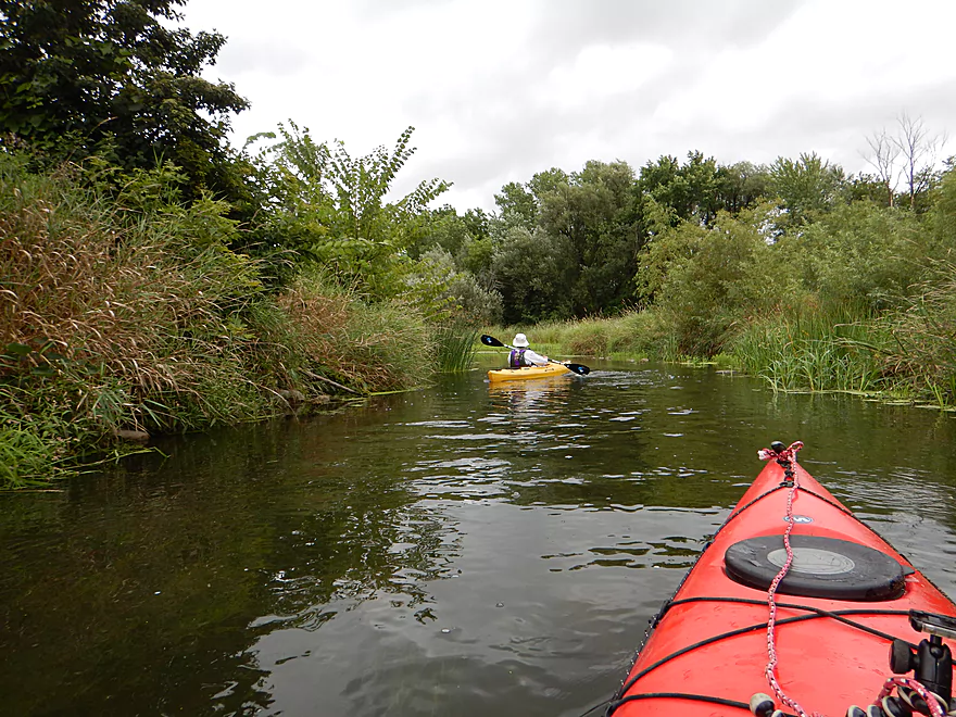
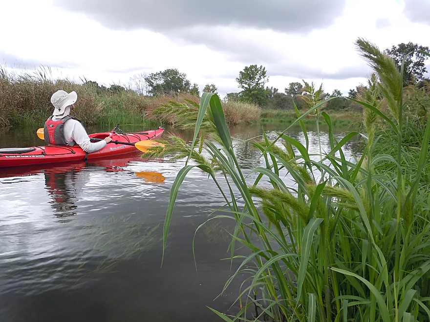
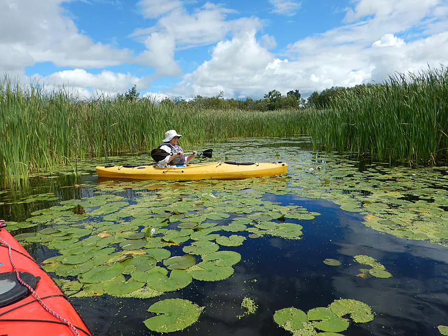
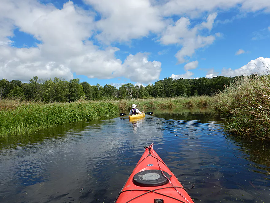
Shortly after the Hwy M bridge, the river changes significantly. The houses and trees recede into the distance and the trip for the next ~4 miles flows through a pleasant cattail marsh. This is not a five-star section, but was attractive with many nice marsh plants. Given the heavy urban development surrounding this watershed, having a chance to paddle through such a large, contiguous wilderness area was a treat.
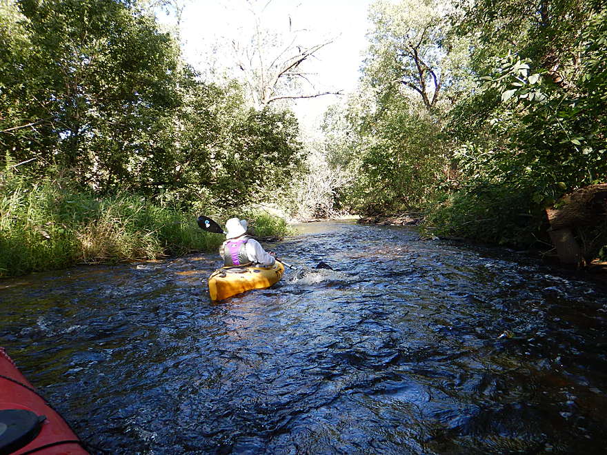
Slowly the wilderness feeling wears away as you approach I-94. Large office buildings, like alien monoliths, appear on the horizon. The channel actually gets more interesting though as it picks up speed near the interstate. The mucky substrate is replaced with an attractive gravel bottom, clarity improves significantly, and hardwoods start to return to the river banks.
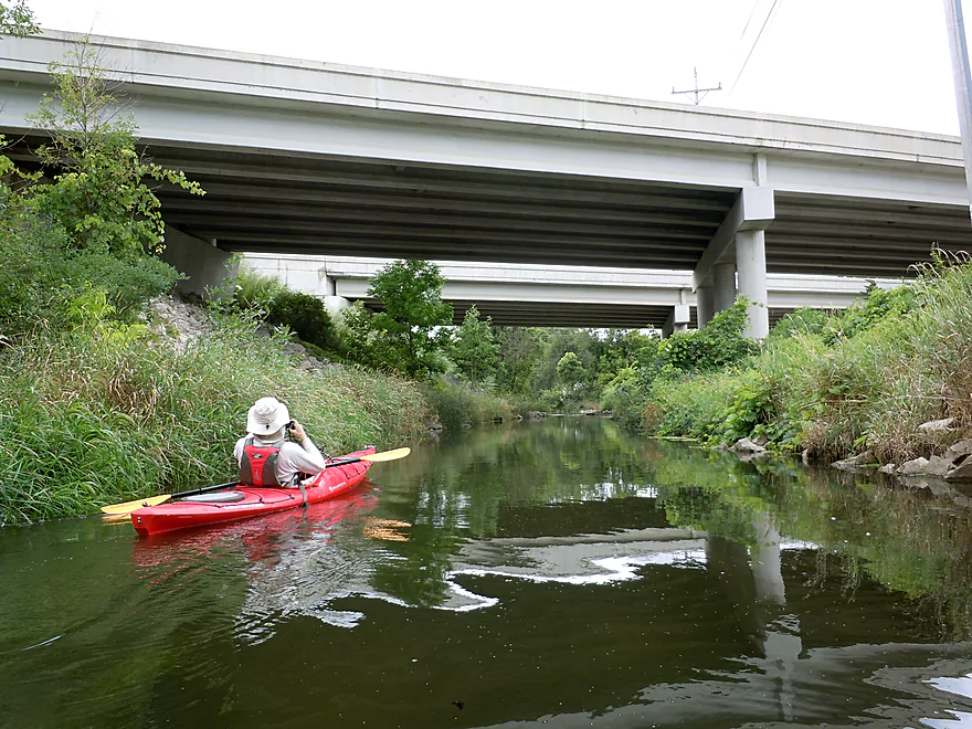
Going under I-94 is actually a highlight in and of itself. Quite long and massive, this reminded me of biking through the Elroy-Sparta tunnels. Note, this bridge is not super high. The Kiwanis warn that boats could get stuck under here in high water. I’m assuming this would be when the banks are overflowing but am not sure. Portaging I-94 would NOT be fun.
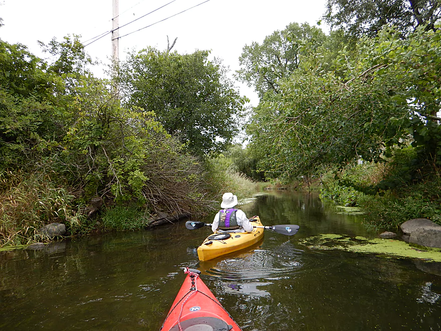
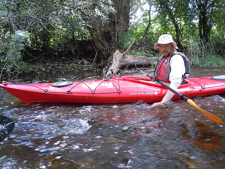
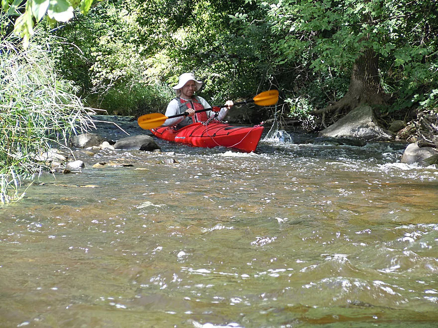
The next mile to Steinhafels was a wonderful section on the river. Here you’ll zip through a narrow channel past thick woods with occasional small boulder gardens and light riffles. Yes, you’re in an urban environment, with the occasional sights and sounds of the nearby interstate, but it was worth the experience and you surprisingly enough don’t see that many houses. While a great section, you will finally encounter shallow spots near the riffles. Most we could scootch through, but I do suggest bringing rope and aquatic footwear in case you need to get out and walk.
By Steinhafels the river narrows and speeds up significantly. This is one of the most scenic sections of the river, with glacial erratics sprinkled throughout, but also one of the shallowest. In high water, this stretch can contain Class 2 rapids, which you’ll want to scout beforehand. Some of the rapids wrap around switchbacks which can be an issue for longer boats, but are otherwise great fun.
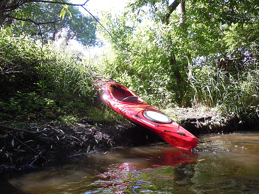
From Steinhafels to the Illinois Fox is the most scenic but most frustratingly shallow part of the trip. Don’t let this deter you though, because if you are willing to walk your boat for brief sections, you’ll still have a neat experience.
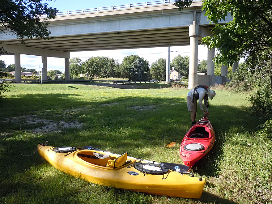
From the mouth, it was only a short paddle on the Illinois Fox before we took out at Wonderland Tap (a local bar). For more information about the upper Illinois Fox, you can read the review I did on this last year.
We launched east of The Chocolate Factory, just downstream of the Pewaukee Lake dam. Parking is for customers only, but we asked and were told we were ok to park here. The launch is shallow and not indicative of the river for the next four miles.
Alternatively you can launch on the east/main Pewaukee branch off Capitol Drive in the Pewaukee Village Park.
A third nearby option is a large parking lot at the junction of the west and east branches. There is a dock for launching canoes on the northwest side.
During the annual Kiwanis race, paddlers launch northeast of the Hwy M bridge. This is private and you may need permission to launch here.
Good take-out at Wonderland Tap. This is a private bar, but they do permit paddlers to use the adjacent bank for access. They do ask however that you park north of the establishment and facing Redford Blvd.
Another mile or so and you can take out at Frame Park in Waukesha. If you are willing to paddle further, you can reach the dam and paddle some fun rapids below that. For further information on this, check out my previous Illinois Fox review.
If you go during the annual RiverRun, you can use the Kiwanis shuttle.
For bike shuttlers this is a mostly flat 5 miles, but consists of largely urban peddling, so car dodging will be an issue.
There are no logjams! These used to be quite plentiful by and south of I-94, but the Kiwanis have done a great job clearing these out.
The I-94 bridge can be a hazard in very high water. Quite long, it is possible for boats to get stuck under here at high depths, as the downstream exit is smaller than the upstream entrance. At our depth this was not an issue. Portaging I-94 and its 10 lanes would be evil.
Most of the riffles on this trip were super easy at our depth. At high flow rates these can turn into Class 2 rapids and shoot around tight curves. The strongest sections are southeast of Steinhafels and can be scouted beforehand.
Lastly, the railroad bridge just before the Illinois Fox (after Redford Blv.) is low. Many paddlers who have not ducked sufficiently here have suffered head lacerations.
The current starts slow to moderate and continues this way until I-94. Past I-94, things pick up with occasional riffles. The fastest section with the most noteworthy rapids are located close to the mouth.
There is no local gauge on the river, which is frustrating. The marker on the Bark River at Delafield is probably your best bet. We went at 22 CFS, for what it is worth. At this depth practically everything upstream of I-94 was easily navigable (and should be no matter how shallow it gets). The one exception was a brief hundred-foot section on the west branch of the river, which was shallow. There is a visual marker here which read 6 cm.
After I-94, the river was mostly navigable at 22 CFS, but we did run aground sometimes and had to do kayak push-ups to get through. Deeper drafting boats (canoes and whitewater kayaks) will have a rougher time. By and after Steinhafels the channel is the shallowest (and fastest), and we did have to walk out boats here and there (well worth it IMO).
If you go during the Kiwanis race, the dam operator will release water from Pewaukee Lake into the river to ensure adequate depth.
In summary, my unscientific guess would be that anything below 20 CFS would require too much walking. Above 30 CFS the river might be too ugly and pushy, and getting under I-94 might be an issue. These are just guesses.
Several red-tails, ducks, a green heron and many blue herons. The highlight was the many baby painted turtles on the trip that were quite tame. For vegetation, there were many gorgeous hardwoods along the banks, including quite a few weeping willows and some fine bur oaks. The marsh had abundant amounts of bottlebrush barnyard grass (a very furry grass) which was unique. The Pewaukee River Partnership is a local group that has worked to clean the river of trash, which is very much appreciated.
Trip Map
Video
Photos Size:
Super fun paddle in 55 CFS (12.90 gage height) nothing blocking the river just small sticks and logs to go over. I started at the Elm st. Park and had to almost lay down and use my hands under Oakton bridge, not a problem for me. There were a couple other bridges, including under 94 that I had to use my hands to guide me through, really no problem at the exit of the underpass though just had to lay low. Upon the rapids, amazing! A little water in the boat but navigate-able. Took out at the ‘Wonderland Tap’ and stopped in for a beer. Really nice staff let me keep the kayak behind the bar while I bike shuttled back to my car. 4.5 star rating for this one!
Thanks Cody for the information about the depth and the bridges which will be very useful to other paddlers. Definitely interesting to hear the river is navigable at 55 CFS.
I loved the Pewaukee and its rapids too, and am somewhat mystified why it isn’t a more popular water trail with locals.
Kayaked today at 56 cfm. The water level is significantly higher than the last time I paddled it on July 3rd when the flow was 85+ cfm. Severe storms in mid-July caused flooding that piled up trees and debris to create about 3 “dams” that are keeping the water level up. The water was fast and the rapids were awesome. No scraping on rocks at all. There are several 1-2 ft drops now. A couple spots where I had to scoot my boat over logs in the river.
There are a few notable dangerous spots:
1. I94 BRIDGE: A large tree blocking 80% of the width at the start of the bridge where it splits into two sections. Stay far left and go slow. The water is very high under the bridge. At the end my head was maybe 6 inches from the ceiling when I leaned as far forward as I could. A canoe would not have made it under today.
2. NEAR STEINHAFELS: Theres a downed tree that bridges across the whole river. Your boat could potentially get stuck under it if you aren’t careful. Portage left.
3. REDFORD BLVD BRIDGE: Do not go in the right channel. It is not 100% blocked and there’s a 2 ft drop that looks fun but there is a downed tree that would smack you in the face if you try that side. Go left and portage over the downed tree.
One more note: the alt access on Riverside Drive is public. There is now a sign saying Riverside Canoe Launch.
Thanks Mike for the information. That will be very helpful for other paddlers on this great water trail.
I love this river, but it all depends on when you catch the higher water. From downtown Pewaukee to 94, the levels are higher. Once you cross 94 though it can either get way more exciting, or really frustrating. I last went on the river 5/19/18 and this was one of those low water days, my buddy and I were pretty disappointing. There were also 2 very large fell trees past highway F, but we assumed they were fresh providing the river run was the week before.
It was not mentioned here, but the river actually begins behind cosco. The first time I took this river, my buddy and I actually went upstream starting at Village Park. It is pretty cool back there, and really a whole different animal. There is some portaging required, but that is all good. We ended up just giving up toward the end and realized we were like 3 blocks from the parking lots, so I cannot give an exact launch point for the actual beginning of the river. Soon though I will figure that out and share!
It’s too bad to hear about the new logjams and the low water…wonder if my Bark gauge reference is really off. As for the upstream portions by Costco being navigable, if true that is a good find. Perhaps you could launch from the main parking lot? If you find out anything more, definitely let me know.
I think I am going to try to find a launch near the parking lot and run the river again from the start. Yeah, someone will have to get out there with some large chainsaws to take care of those jams. We were a bit let down, having not yet completed the river. There is a gauge at the bridge under Oakton, right where the 201 Oakton launch is (which I prefer). Will update soon.
Does it cost money to launch? Can we come back up river?
It doesn’t cost money to launch at either put-in. But the plaza parking lot does say for customers only and technically you should get permission before leaving your car here. If in doubt, you can simply launch at the downstream pier and not have to worry about this.
A warning to paddlers…kayakers trying to go I94 almost got stuck. They posted a video online: https://www.facebook.com/damian.meredith/posts/pfbid0DZVGsmTypkf7rMJbHC1PchunjDXGsYAn46WWyA2bKscEAT2fpMewTCgcJJmt7q8kl Do NOT paddle this river when high. The exit end of the tunnel lower than the entrance. You can get stuck.