
A launch option off the shoulder of Cranberry Drive
You could also launch at the ATV trail
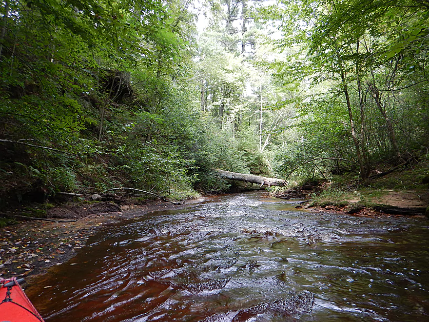
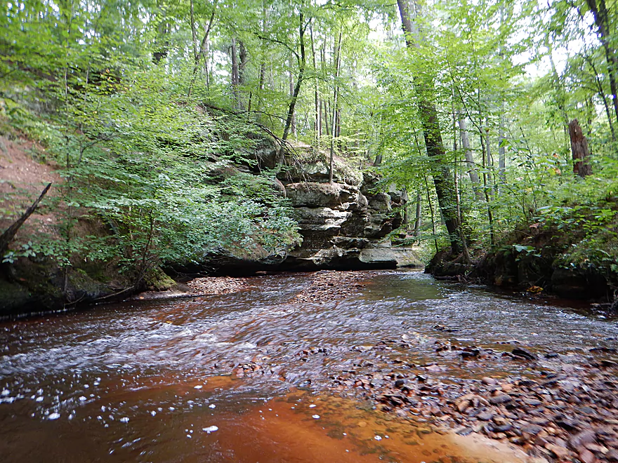
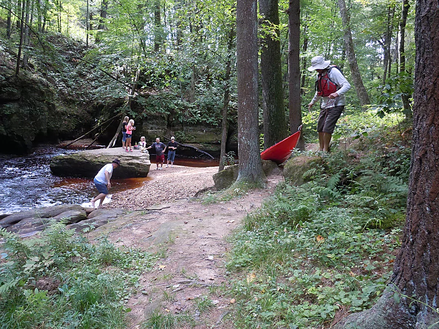
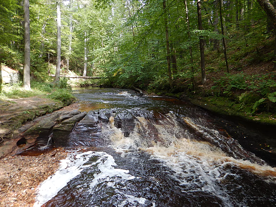
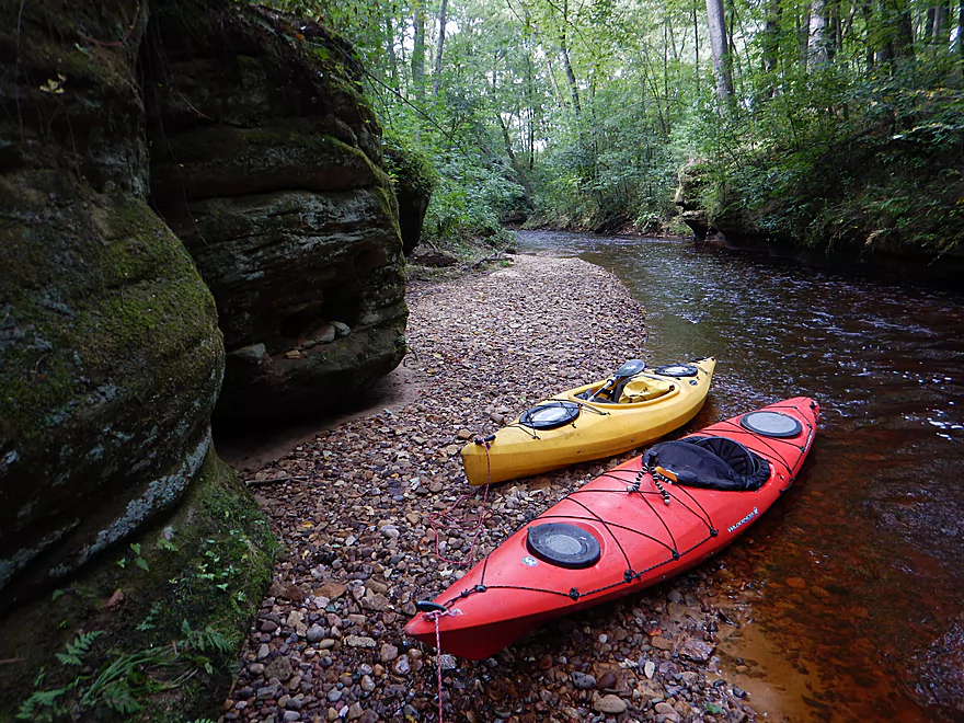
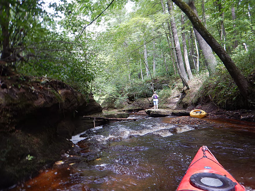
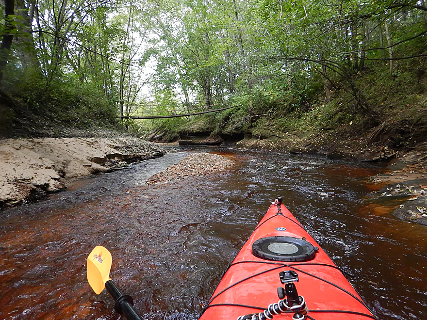
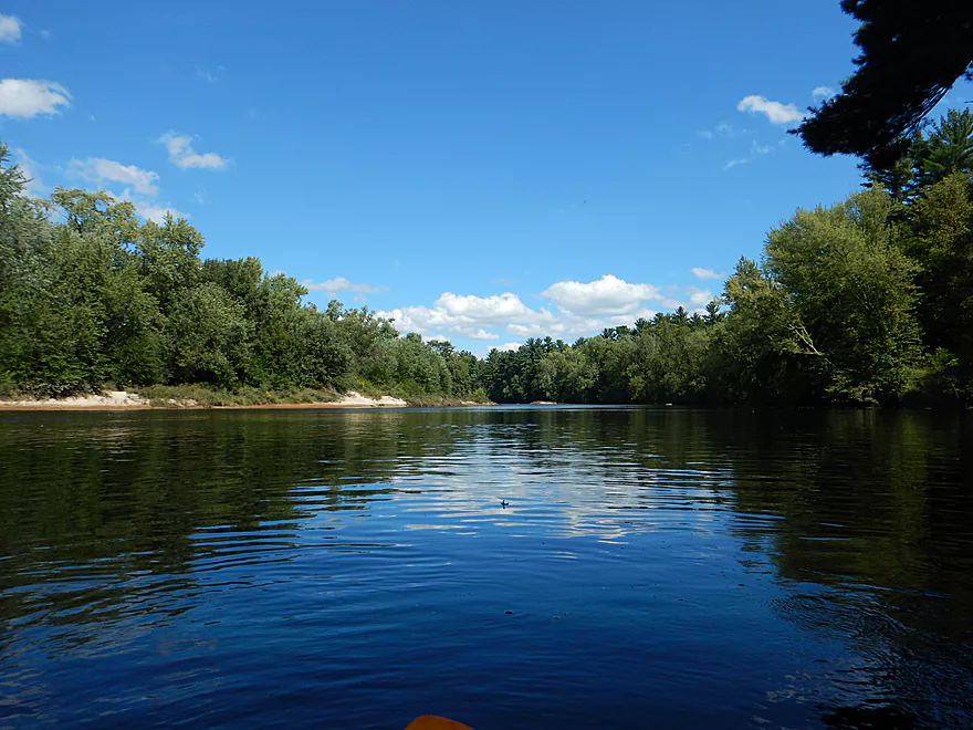
Upstream starting point of trip
Coming up on some super sandstone
Most hikers miss this
Reverse view
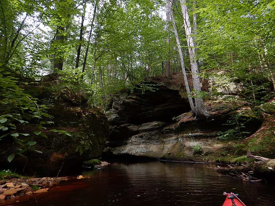
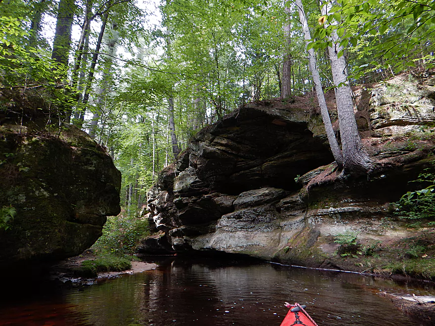
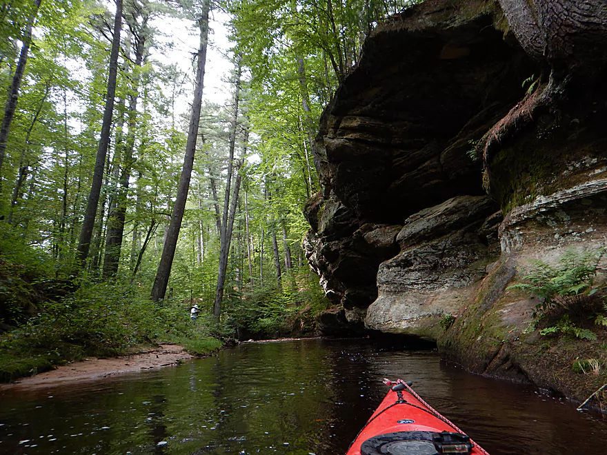
A cave is hiding in the 2nd story
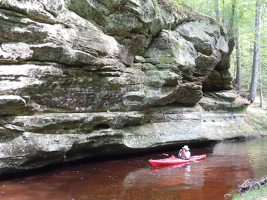
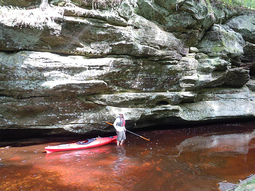
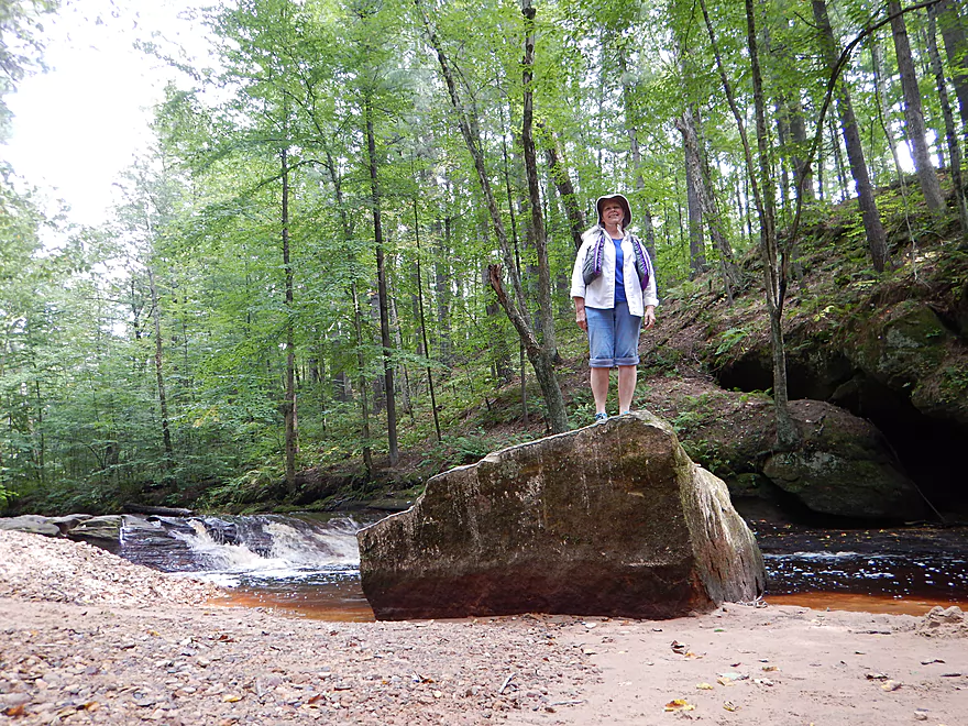
A scale shot
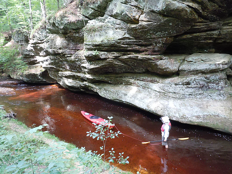
Walking back upstream to run this again
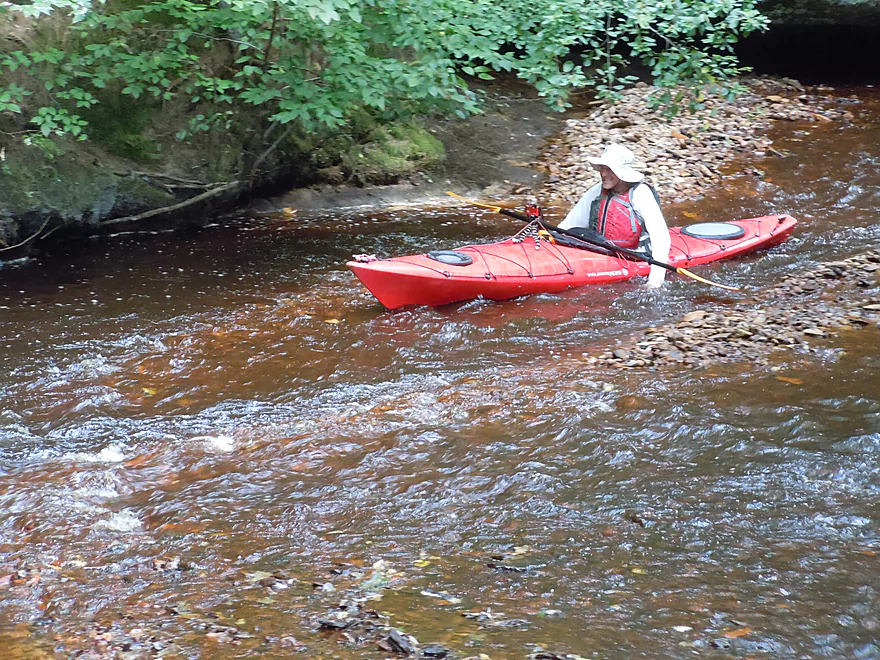
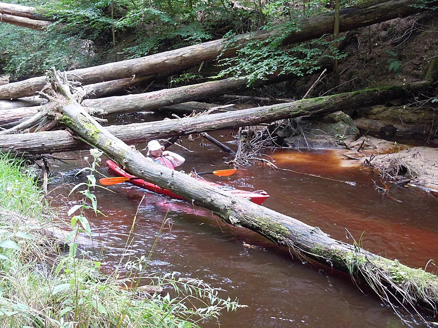
And I am stuck…
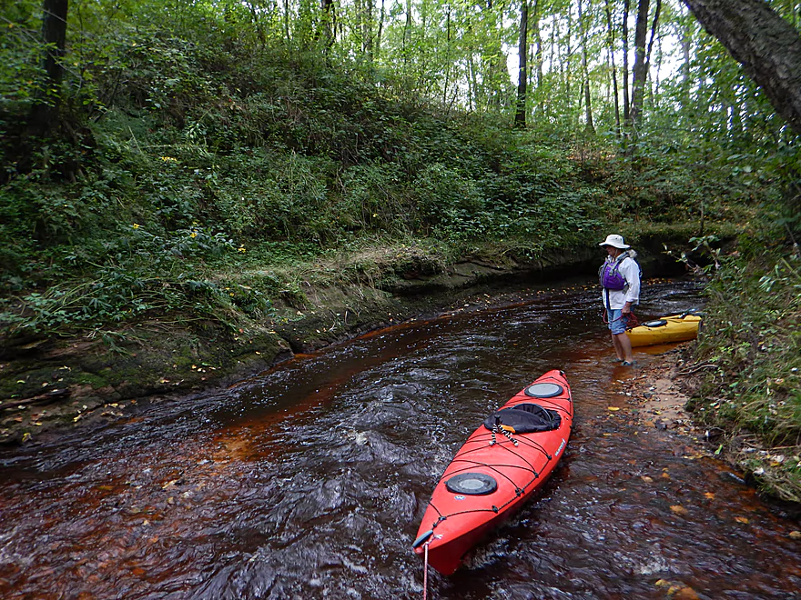
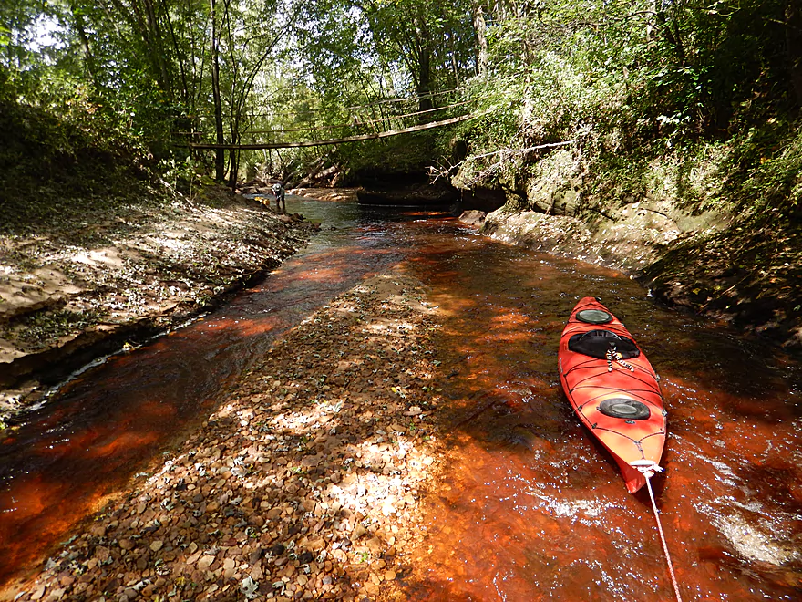
Attractive gravel bar
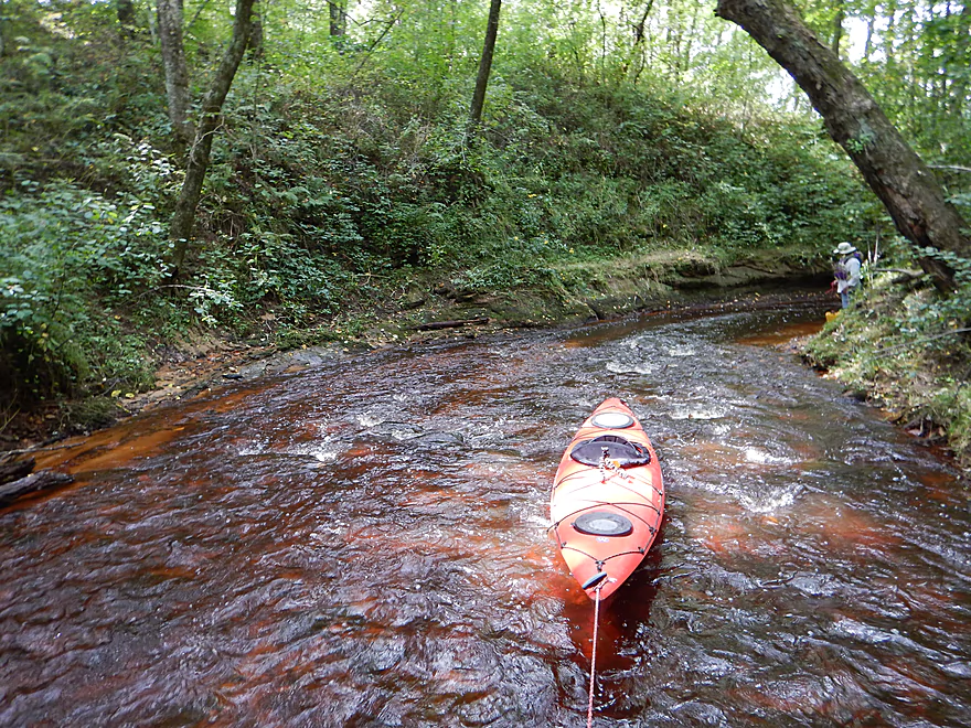
Current stays fast
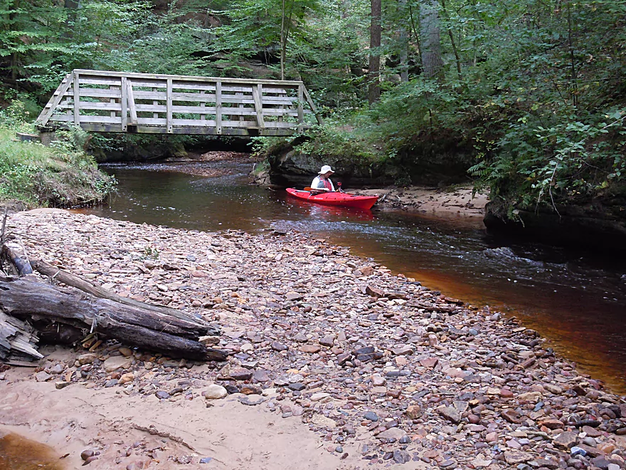
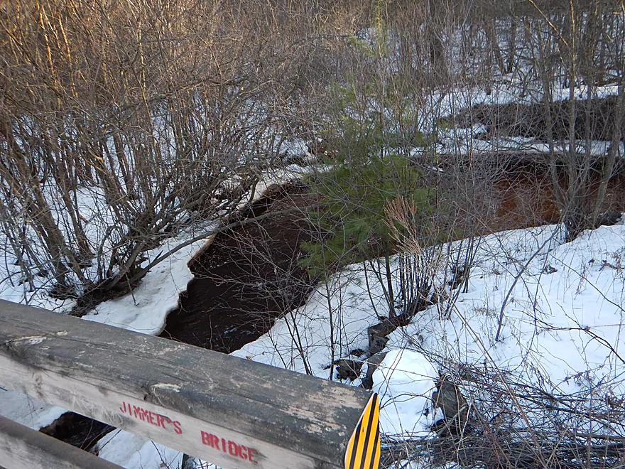
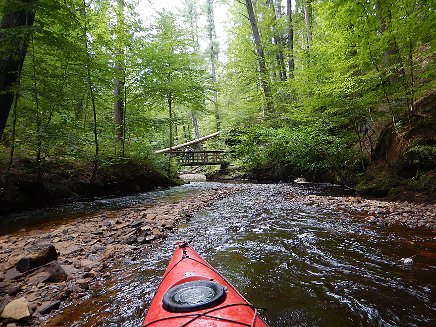
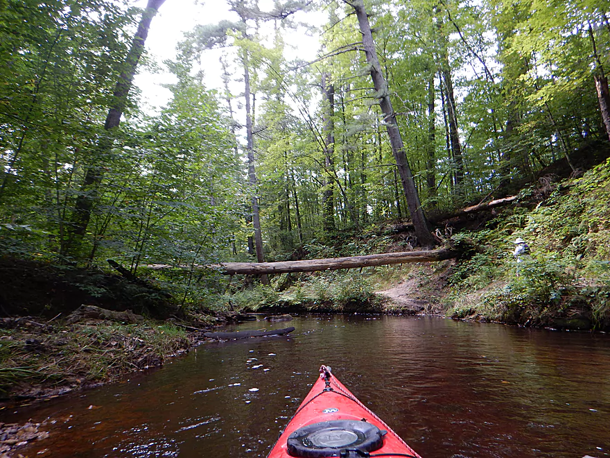
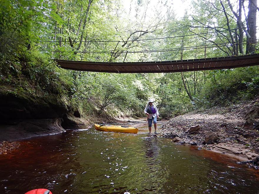
This is the upstream pedestrian bridge
Coming up on some squirrel bridges
I barely fit under
Current is getting faster
It is easy to portage these sections if need be
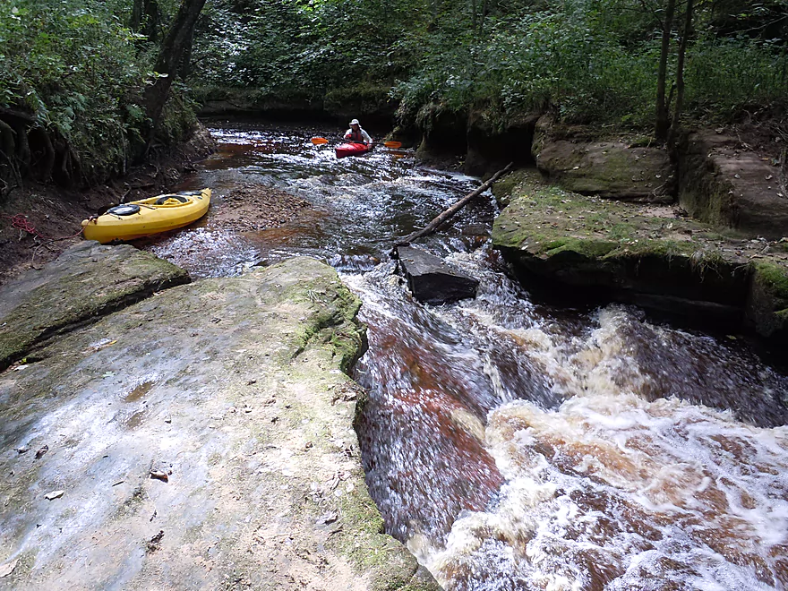
But then you miss fun ledges like this
Which unfortunately was shallow
Finally unstuck…
Reverse view
A cool little alcove
A great climbing rock
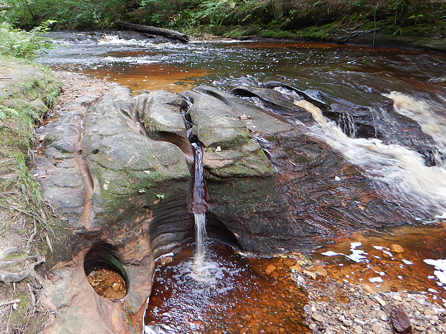
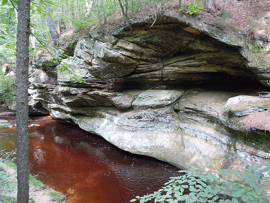
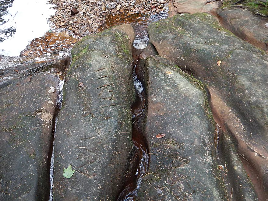
Exquisite erosion patterns
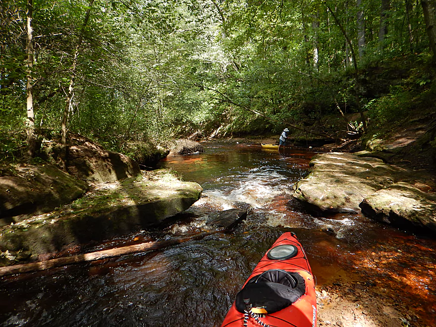
Looking downstream
Beautiful gravel bar
More shallow riffles
An attractive hairpin turn
Coming up on another ledge
Hopefully I will fit here…
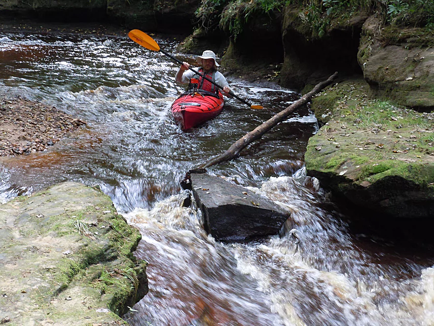
I do fit…but it is too shallow
A more sensible option
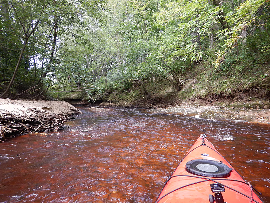
Fantastic clear red water
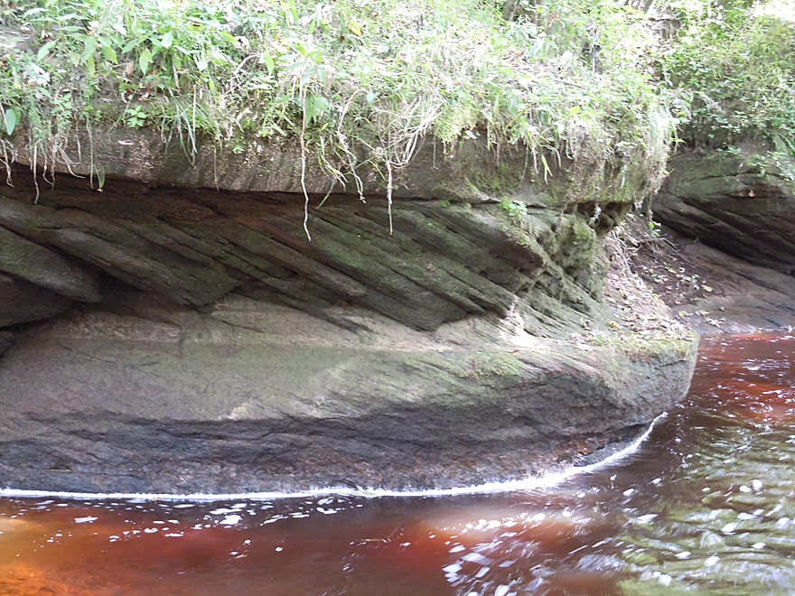
Interesting stratification
Last of the sandstone outcrops
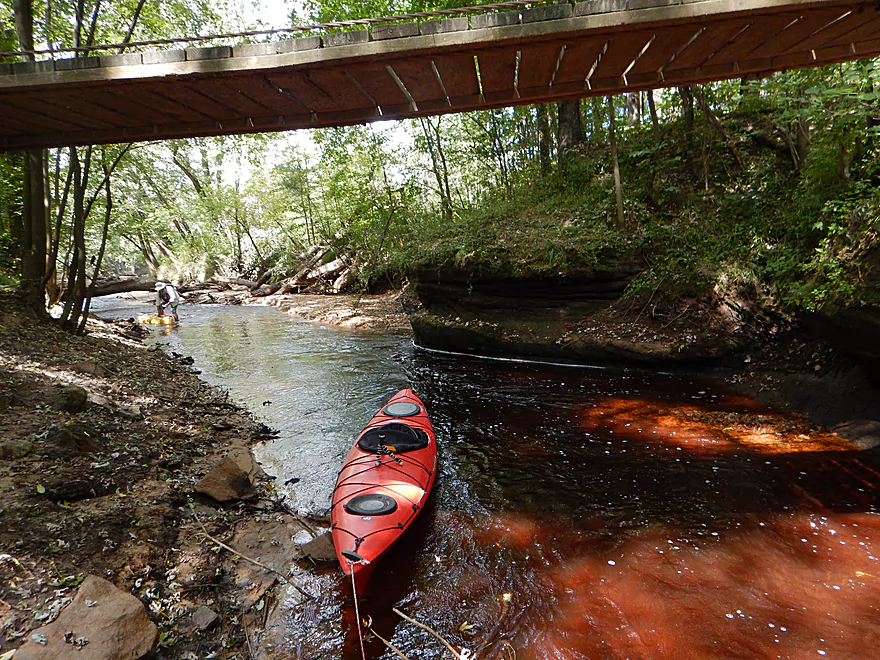
The downstream pedestrian bridge
An easy portage
Debris shows how high this creek can flood
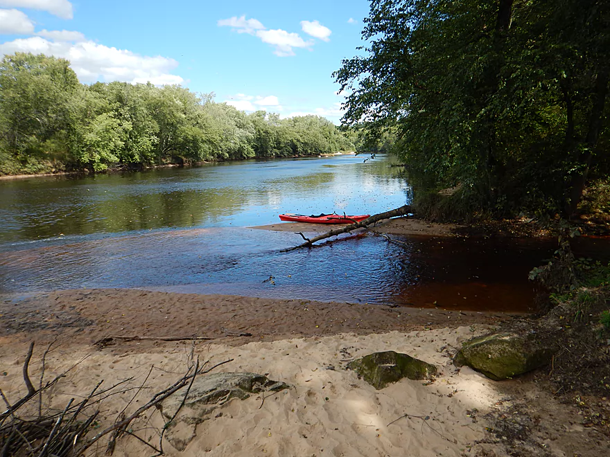
Mouth on the Black River
A great paddling prospect in its own right
Good launch option
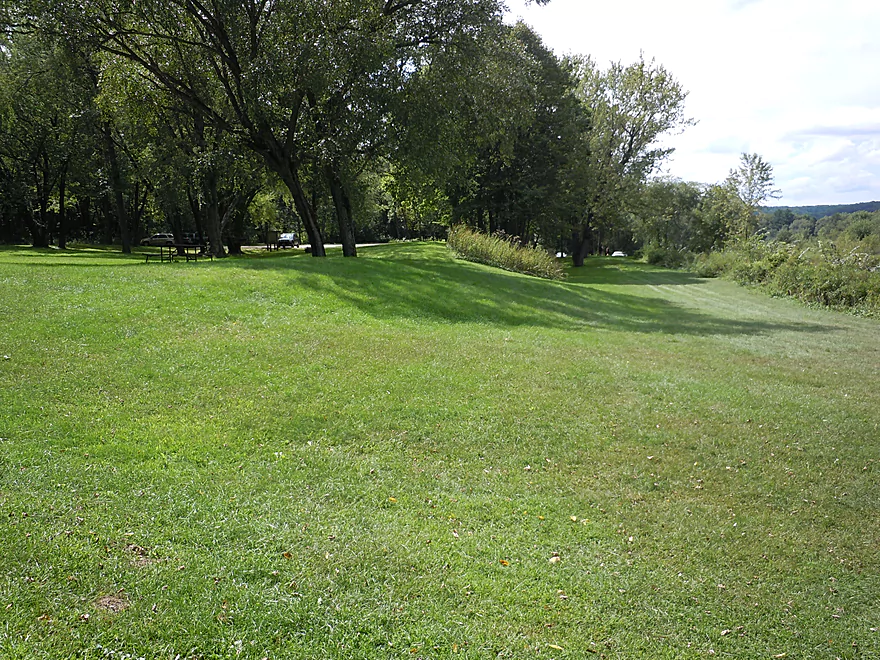
A nice picnic area in Perry Creek Park
Part of the Perry Creek trail system which is worth checking out
Perry Creek

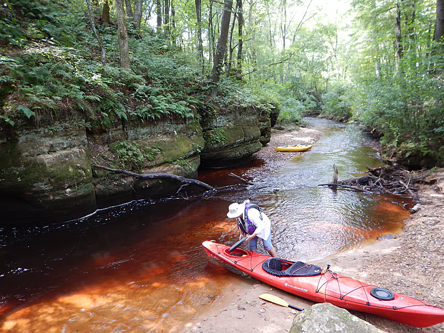
Root beer red water pools and tumbles by carved sandstone bluffs in this incredible tributary to the Black River located just south of Black River Falls. But practically speaking this can be a difficult stream to float. IMO it is worth the effort though.
There are three ways to experience the creek:
- You can start on the Black River, wade as far upstream as you can, and then float back to the landing (what we did).
- You can put in by the cranberry bog and float down to the Black River.
- You can skip the paddling and just hike the trail that accompanies the lower portion (trailhead located at Perry Creek Park).
For hardcore paddlers who want to do a longer stretch, you just have a couple of put-in options. The cranberry bog itself is gated and private, but most of the land immediately west is part of the Black River State Forest and open to the public. Close to the bog gate, the creek bends near the road, and here you could park and launch (marked on the map). A third of a mile to the west, there is an ATV parking lot where you could alternatively park and then drag your boat 1200′ to a small bridge over the creek. I scouted Hwy 27 and this did not look like a great access option, but if you are willing to drag your boat down a long embankment, it could work (the land all to the west of the road is public).
The contents of the creek upstream of Hwy 27, I can’t speak authoritatively on as I haven’t floated it, however I have scouted three of the access points and studied the relief maps. It is extremely likely that there are nice sandstone outcrops and canyons on this stretch. There may be downed trees to contend with though. Additionally, the tunnel under Hwy 27 is not large and may need to be portaged (which would be a longer portage because of the embankment).
Downstream of Hwy 27 is where the good stuff is, but I only had time to explore part of this and doubtless, I missed a lot of the best parts of the creek.
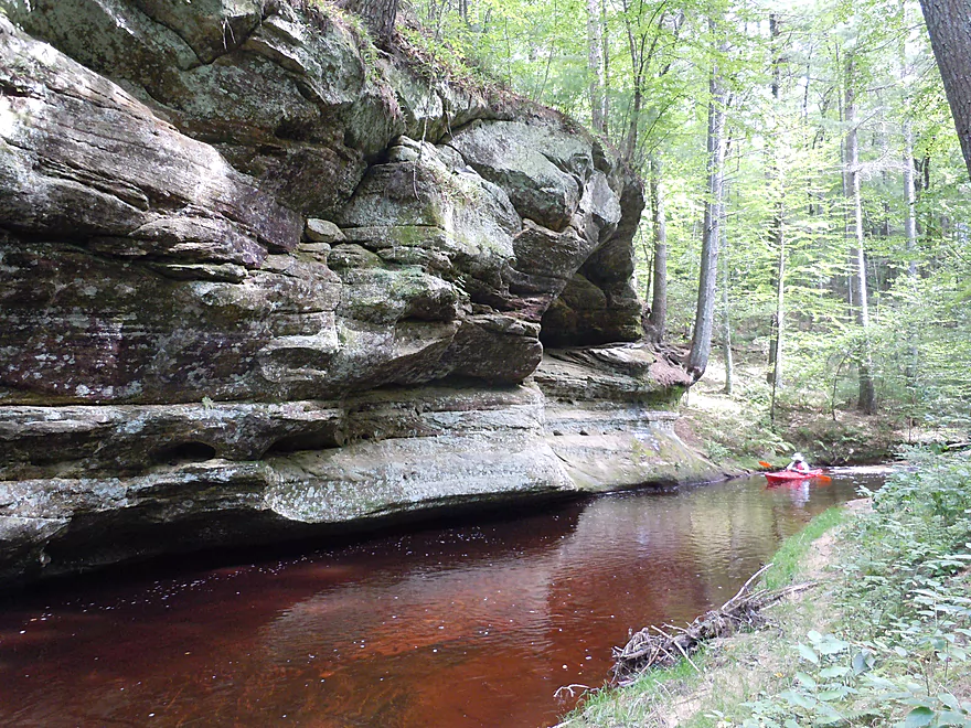
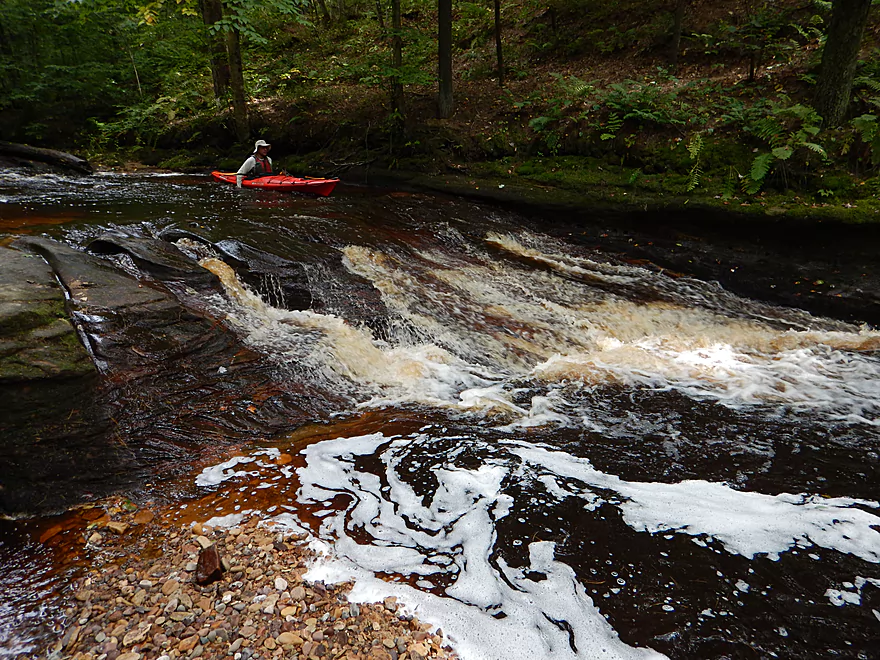
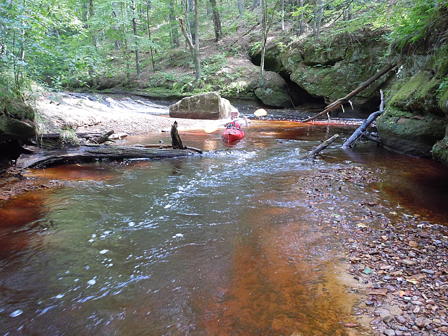
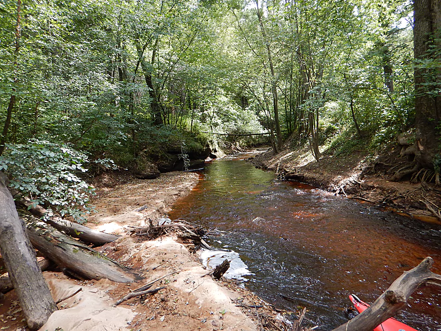
The creek itself is very reminiscent of Robinson Creek (its sister creek to the south, which is one of the best paddles in southern Wisconsin). The water is super clear, but tinted root beer red by tree tannins. The substrate is mostly solid bedrock (super cool), and the current is riffly with several fun chutes and ledges. Like Robinson, the banks are flanked by towering white pines, ferns, and scenic sandstone canyons and walls.
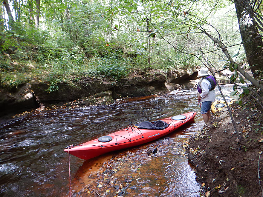
Our trip “started” a little upstream of where the public trail ends. It was easy to get to this point by wading upstream in the shallow water and past the ledges and falls using rope. This would not be doable in high water though as the current would be too strong. Most of the trail hikers do not make it far enough upstream to see the best feature of the creek–a very large sandstone cliff that wraps around a tight turn in the river just upstream of the end of the trail. Very scenic (pictures in the photo section).
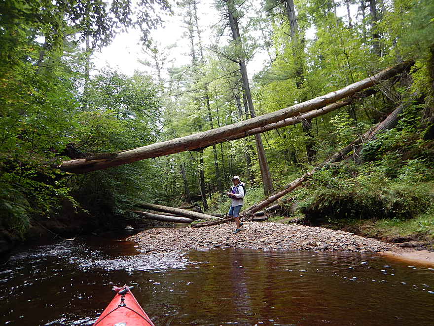
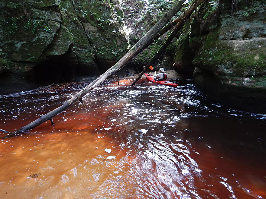
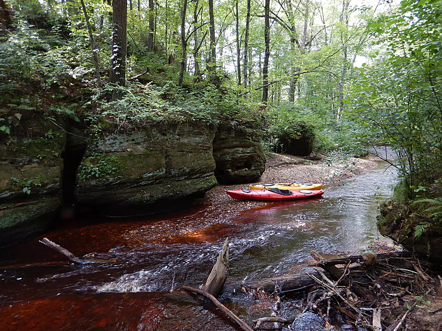
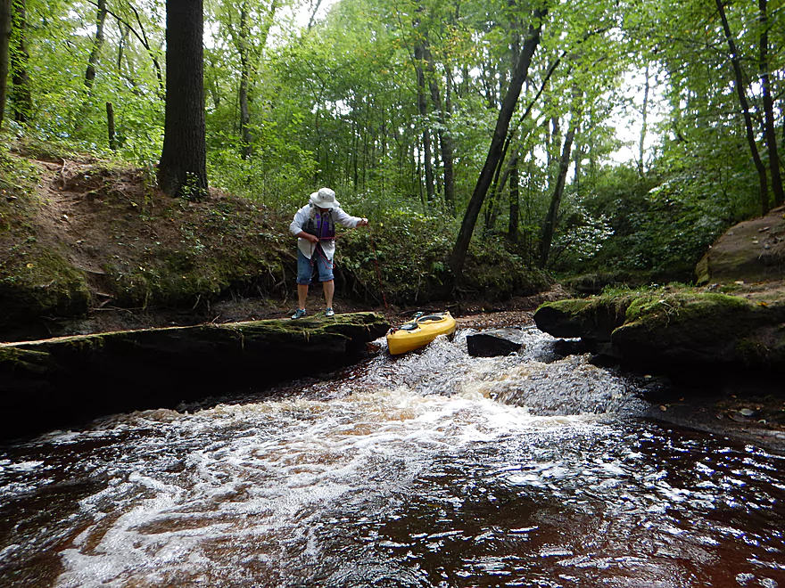
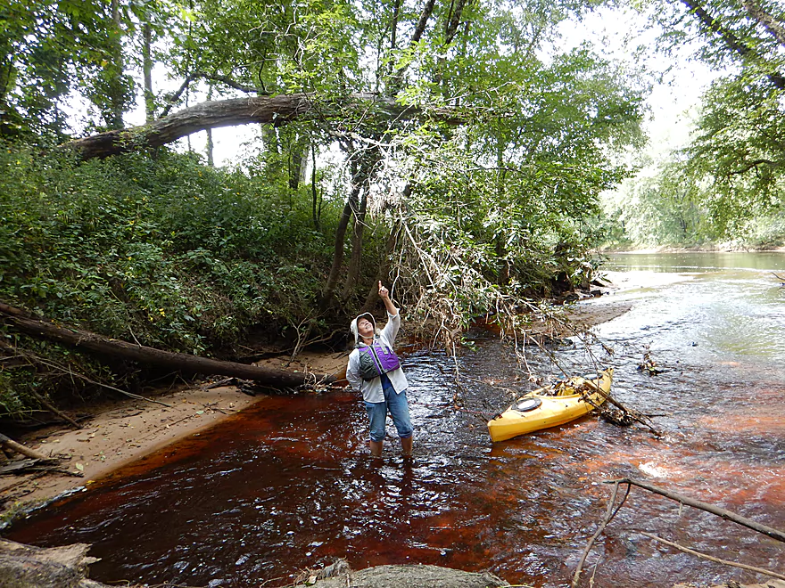
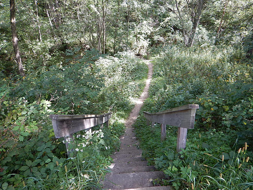
Following the “super cliff,” there is an attractive pedestrian bridge that spans two sandstone rocks and is part of the hiking trail. Just downstream there are several large white pine logs blocking the creek that I was barely able to squeak under. The book “Great Wisconsin Walks” ominously describes a mega logjam and I’m not sure if this is it, or if it is further upstream.
“(The stream was) blocked where a spring flood piled debris 12 feet high across the creek bed. White pine, 2 to 3 feet in diameter, lie crossed, jammed against one another and other flotsam. A 9-inch iron I-beam juts out of the jumble. It’s part of a bridge that used to cross the creek just 50 yards upstream. If the big trees and jumble of debris don’t attest to the water’s fury, the bend in the I-beam does.”
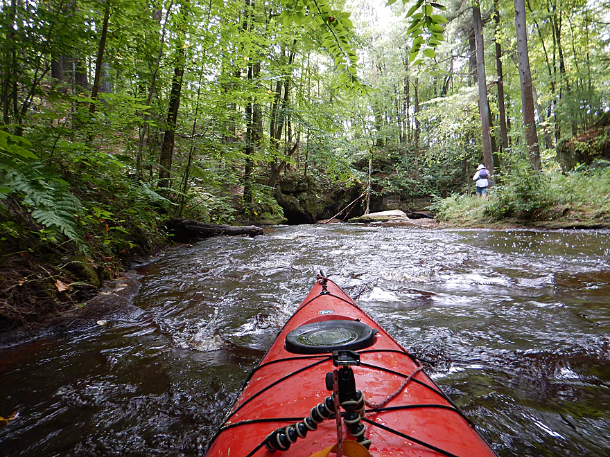
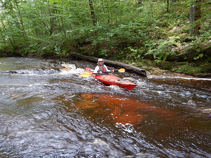
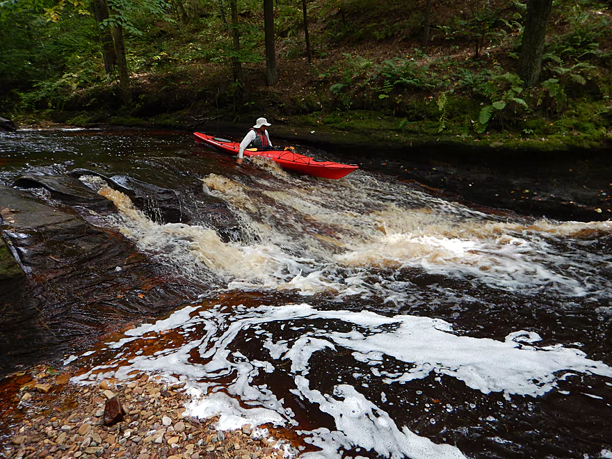
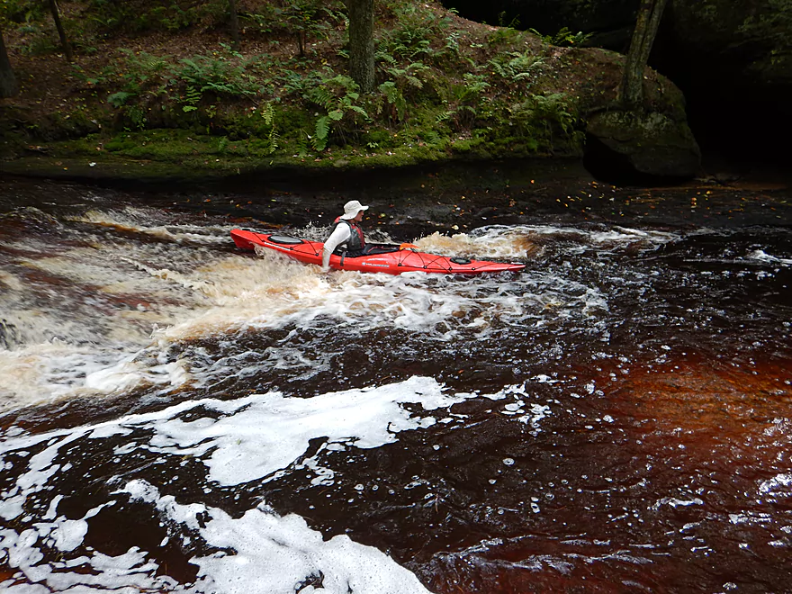
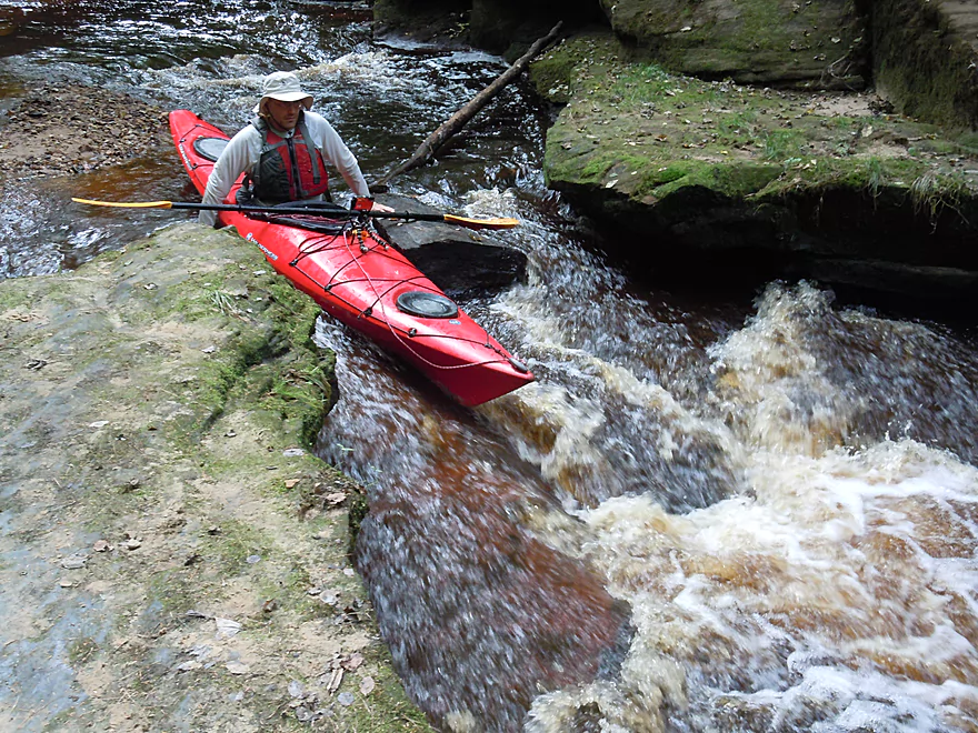
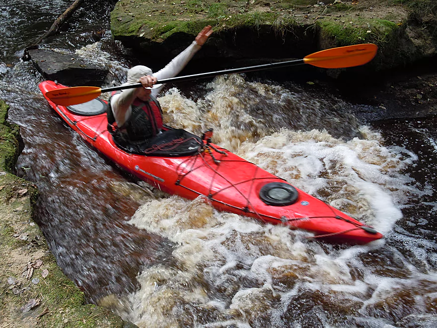
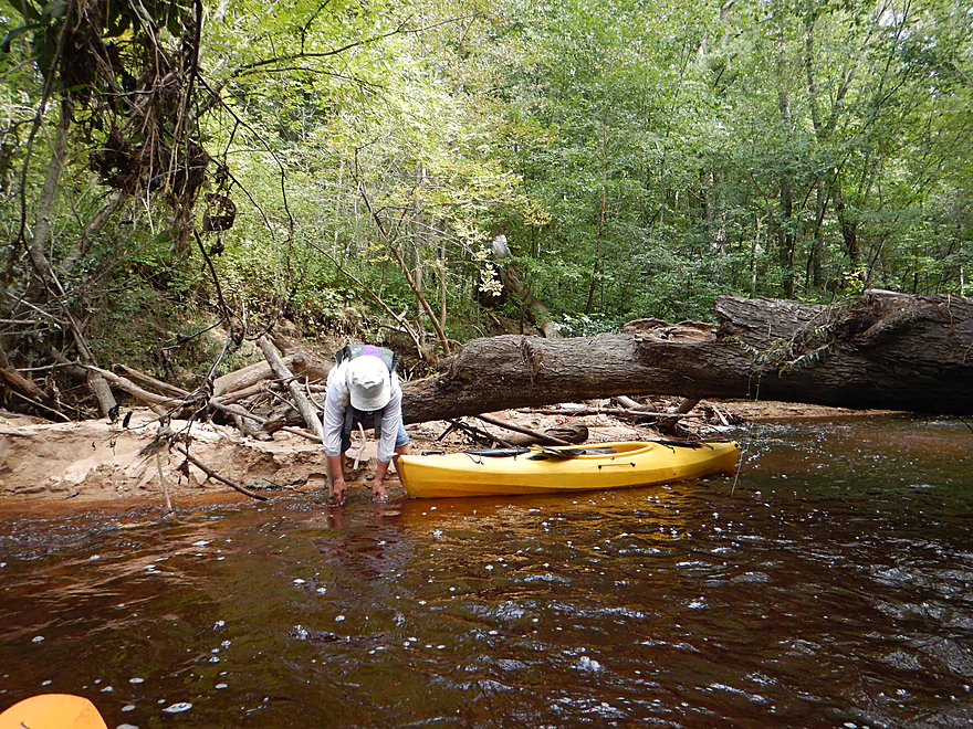
Downstream of the wooden pedestrian bridge, you’ll see the other highlight in a super scenic two-foot falls that runs over slanted bedrock. I tried running this, but it was so shallow I got stuck and had to push my way through. At the side of the falls you can see extraordinary erosion patterns where small channels have cut exquisite patterns through the rock (see photo section below).
The creek rushes on and wraps right around a scenic sandstone wall. Then you’ll see another ledge that you can run, and I did, but it was shallow and I kind of got stuck. It is certainly easy to lead your boat over it with rope though. After this, it is a short scenic stretch through the glen, under another pedestrian bridge, and to the mouth on the Black River.
So, an amazing trip with stunning scenery, but shallow and really in need of more water to keep from constantly getting stuck.
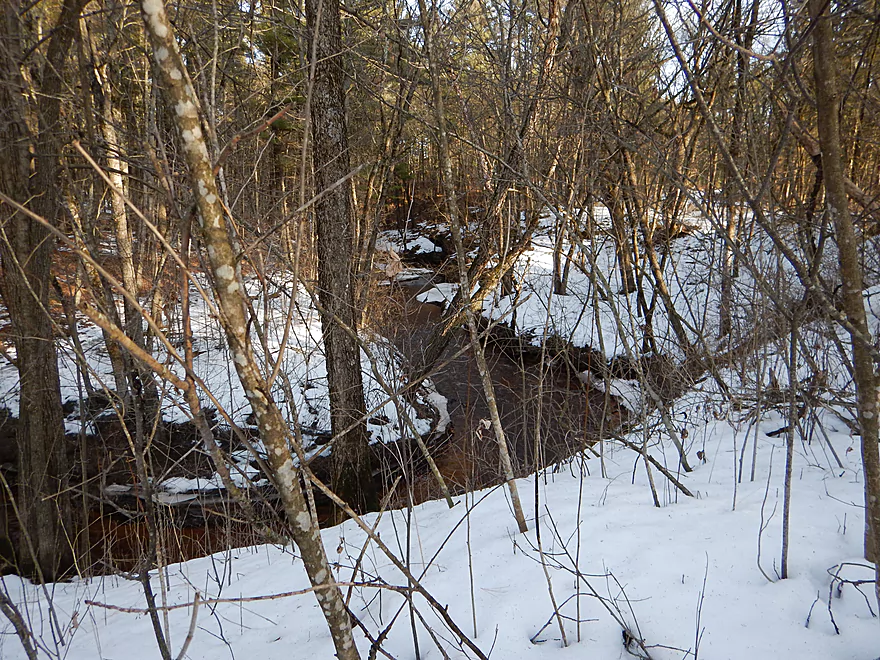
- Option #1: Launch west of the cranberry marsh gate, on Cranberry Drive. The creek gets close to the river here and you can park on the shoulder (all this land is part of a state forest).
- Option #2: Park at the ATV trail on Cranberry Drive, drag your boat 1200′ over the public ATV trail to a small bridge and launch from there.
- Option #3: Launch at the Hwy 27 bridge. There is a steep embankment here, but at least the land west of the road is all public.
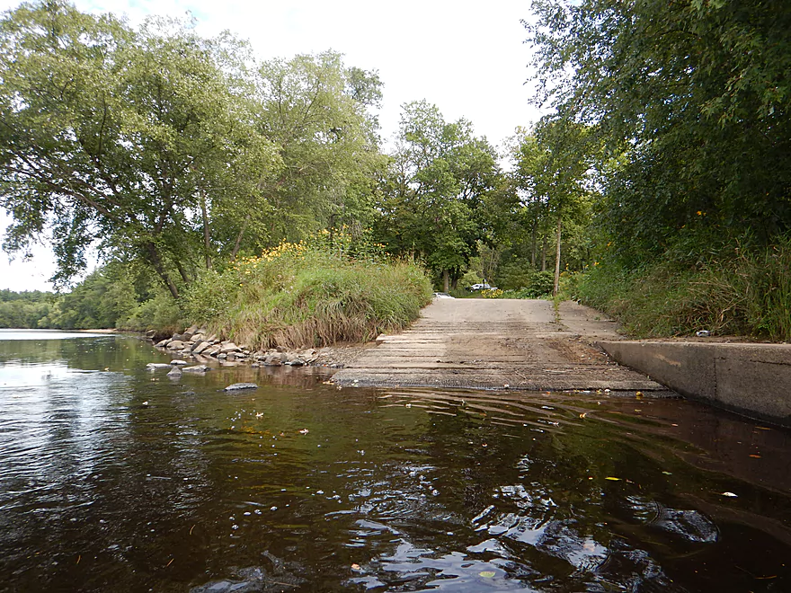
- Option #4: Do a round trip. Launch at the Perry Creek landing on the Black River, wade your boat up as far as you want and float back to the mouth.
There is a public boat launch (Perry Creek Landing) just below the mouth of the creek which is a good access option. I can’t recall if there is an outhouse, but there is plenty of parking and this doesn’t appear to be a fee area.
No shuttle if you do this as a round trip (wade/hike upstream, float downstream).
Otherwise, this is an easy 2.9-mile bike shuttle.
Logjams
- There was a jam close to the mouth that was easy to portage
- There is a logjam by the wooden walk bridge that I was able to squeak under, but it wouldn’t be difficult to portage.
- It is rumored there is a very large logjam further upstream that I did not see.
- In all probability there are many more jams further upstream but “generally” shouldn’t be difficult to portage in shallow water because of the lack of mud.
Rapids
- Upstream of the hanging walk bridge is a small chute that is pretty easy
- A bit further upstream is a much larger falls that is perhaps Class 3 in higher water. This would be easy to portage.
- Much of the creek is riffly. I wouldn’t be surprised if there were more ledges hiding upstream. Some of these could be VERY dangerous in high water.
- Do note, this is a small creek and is only suitable for smaller boats
This is a fast creek that drains quickly. It typically needs a good rain to be runnable…but with too much rain it will flash flood and could be VERY dangerous. There is no local gauge, but a guestimate can be obtained from the Black River Gauge. I don’t know what the ideal figures are. We went at 180 CFS, which was way too low. 4-600 CFS might be better? 800-1000 CFS is probably too high. These are just guestimates, too.
I can’t recall any wildlife, but this is a popular recreational area and there is a good chance you’ll see people.
- Robinson Creek: One of the best paddles in all of Wisconsin. Reviewed here.
- Halls Creek: Also one of the best and with amazing sandstone walls. Reviews: Part 1 & Part 2.
- Morrison Creek: Very scenic creek with some fun whitewater. Reviewed here.
- Wedges Creek: Great paddle with amazing boulder gardens. Reviewed here.
- East Fork of the Black River: Some fun riffles and unique granite geology. Reviewed here.
- Perry Creek: Shallow but super scenic creek. Reviewed here.
Trip Map
Video
Photos Size:
I wanted to ask if I could add some of your photos to the new Google Maps location I created for the Perry Creek Trail? I absolutely love your extensive and amazing content you provide on your site. I don’t even kayak and enjoy coming here to learn about new places to explore on foot until I finally buy a kayak! I wouldn’t use the photos for anything else, just did not take enough photos myself when I was there last! Thanks either way!
Thanks for asking. Yes you can use my Perry Creek photos.
In September 2023 Perry creek from Option one, cranberry drive at bog, was unnavigable. Too shallow to float over ledges and gravel bars. Continuous log jams and low brush. Took 4 miserable hours of wading, climbing, and dragging to get to option 2 put in, ATV trail off cranberry drive. Scenery unremarkable. Beaver dams throughout. Cannot recommend until high flow and creek restore. Aborted our trip early with many cuts and bruises and no paddling done.
Thanks for the update (and warning).