
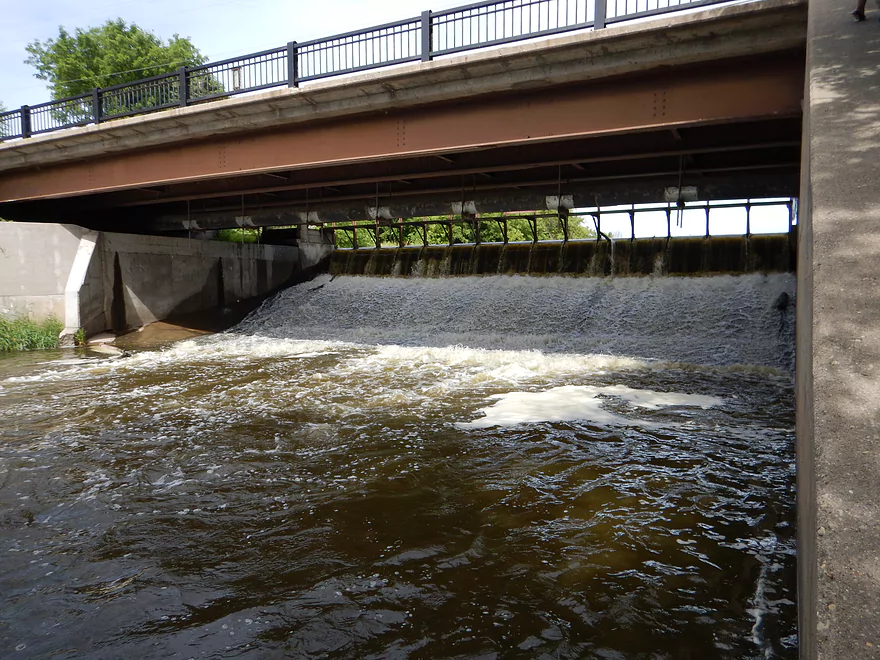
Trip starts below the dam at Marshall
Good public access nearby
The access road is VERY muddy though
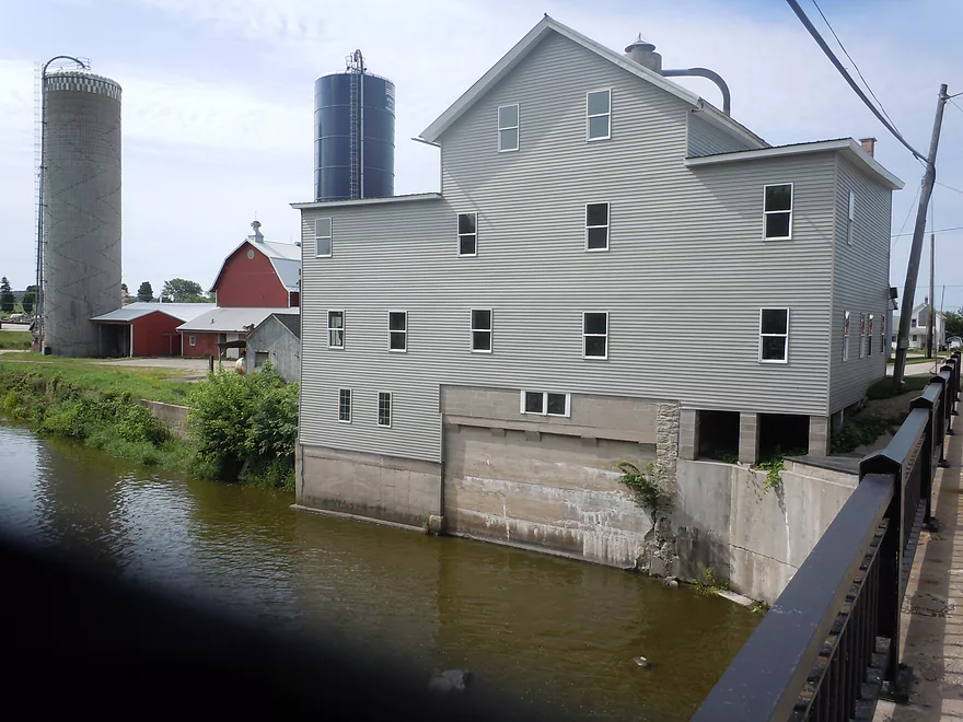
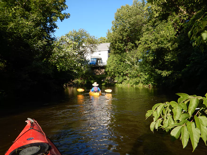
Scenic old mill and farm at put-in
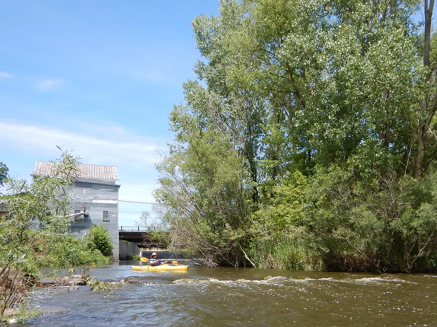
A fun little ledge to get the trip started
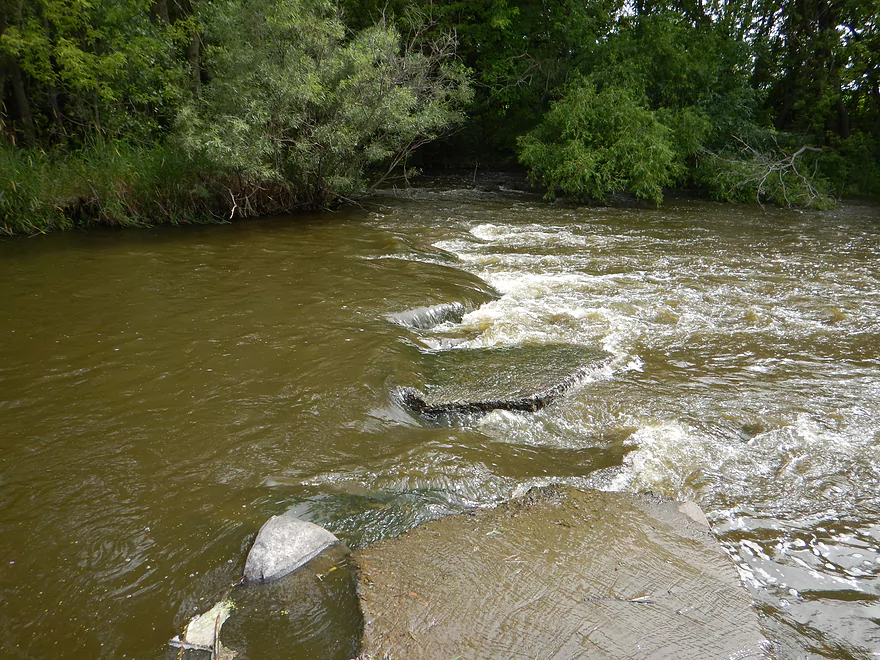
The top side of the ledge is best
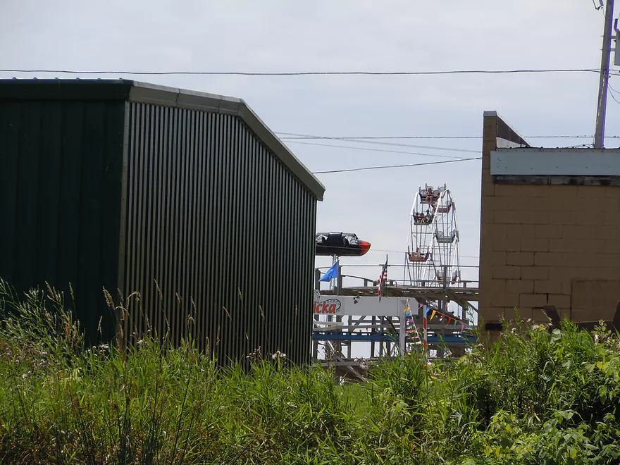
You could hear Little Amerricka for miles
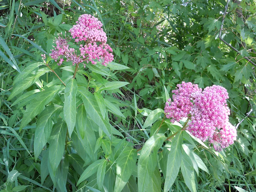
Swamp milkweed
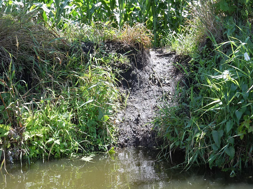
Mud slide for some animal
Taking a detour to check out Spring Creek
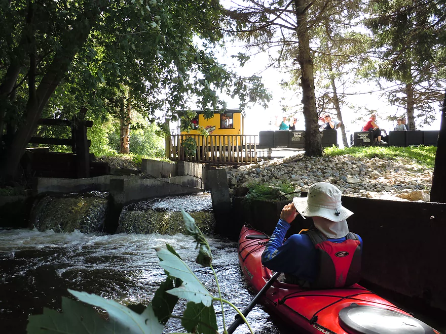
Got to see a Little Amerricka train go over the Spring Creek dam
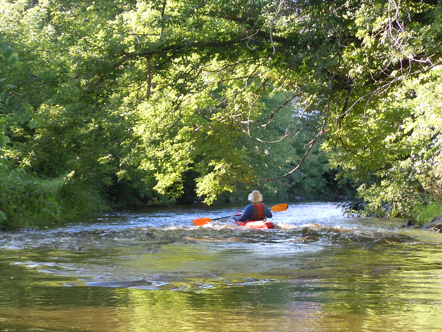
An occasional fun riffle (fast river)
Never get turned sideways in rapids (a bit of foreshadowing)
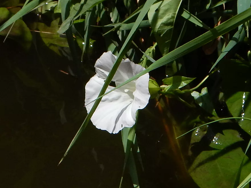
Wild morning glory or bindweed
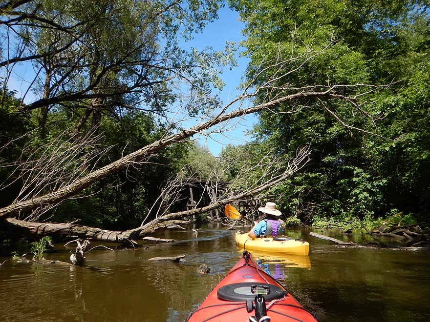
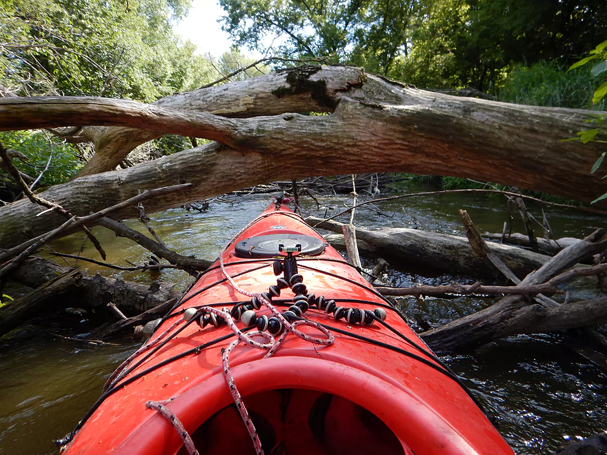
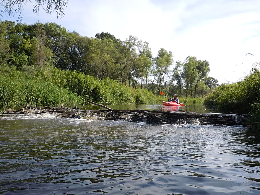
Log jam #1 of 8 is a tough duck-under
Then requires some hopping
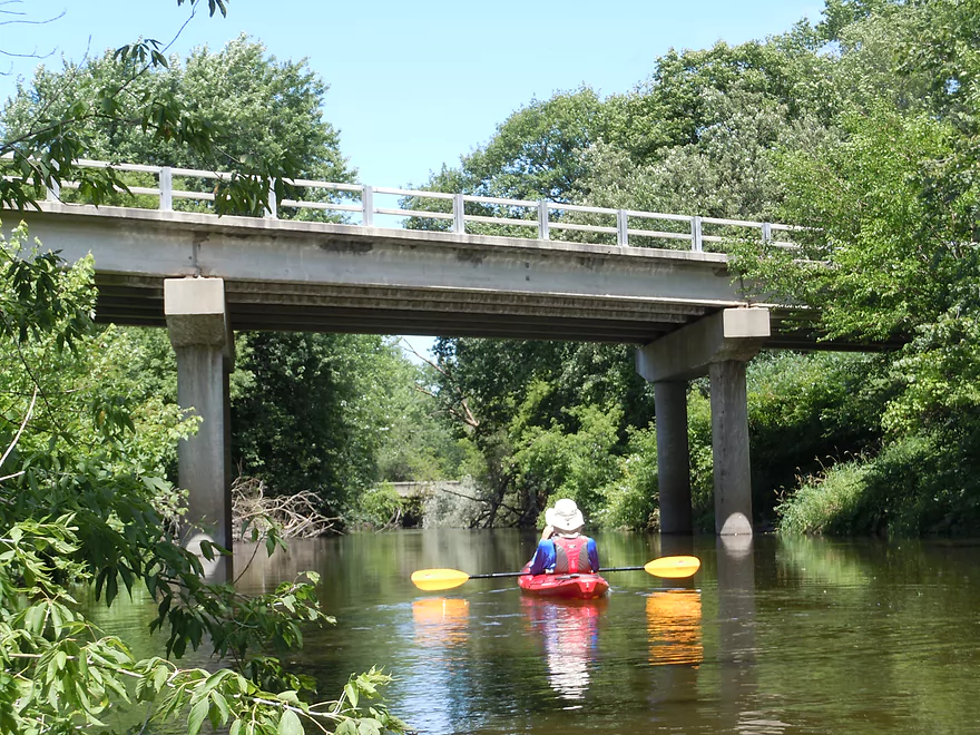
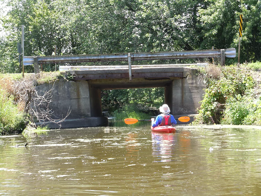
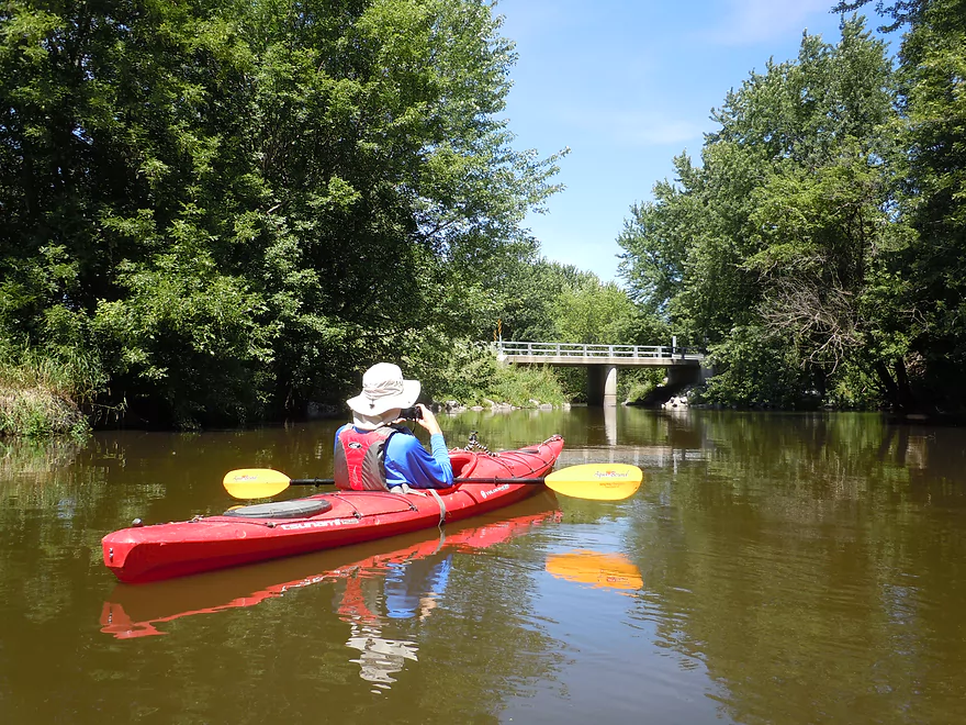
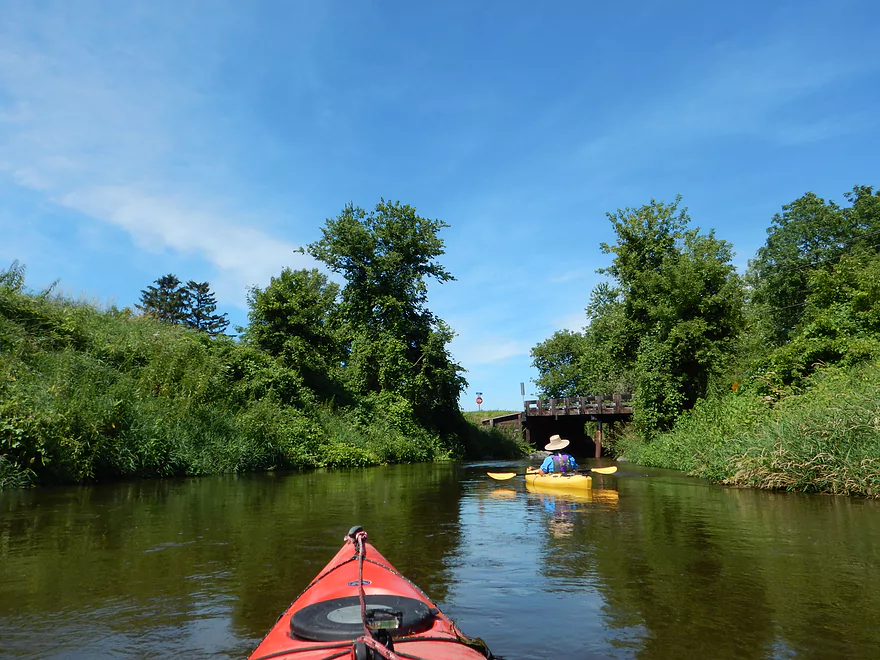
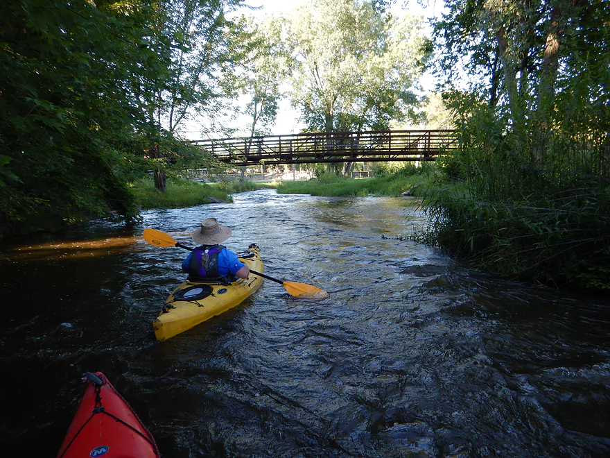
Hwy 19 and Koch Drive bridges right next to each other

Log jam #2 of 8 is a doable hop-over
Doctor Who didn’t survive the Maunesha
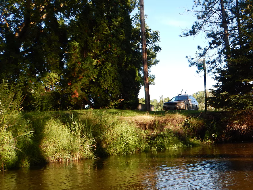
Waterloo Road is an alternate access option
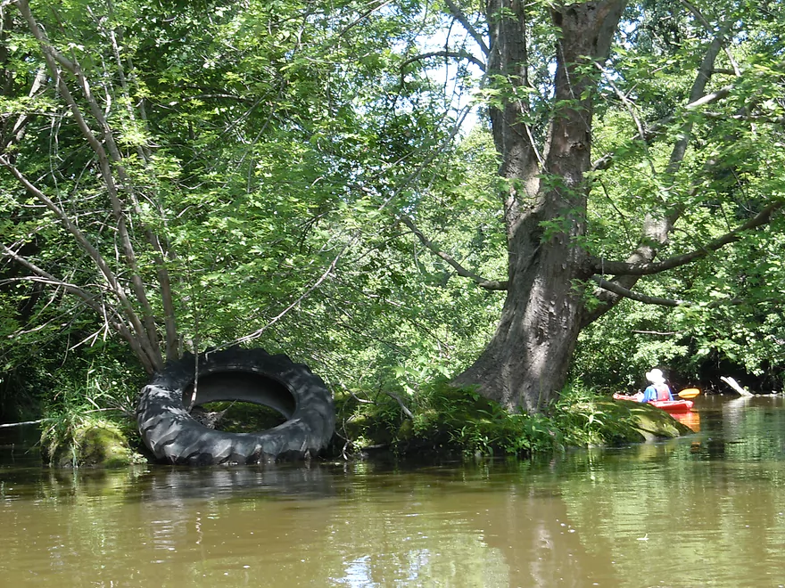
An ugly tire on an attractive moss island
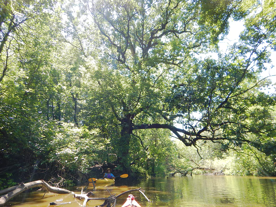
This bur oak would be a great spot to hang a tire swing
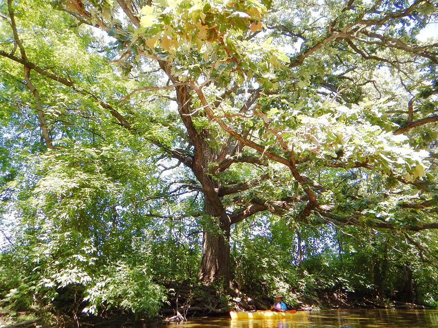
The bur oaks on the trip were fantastic!
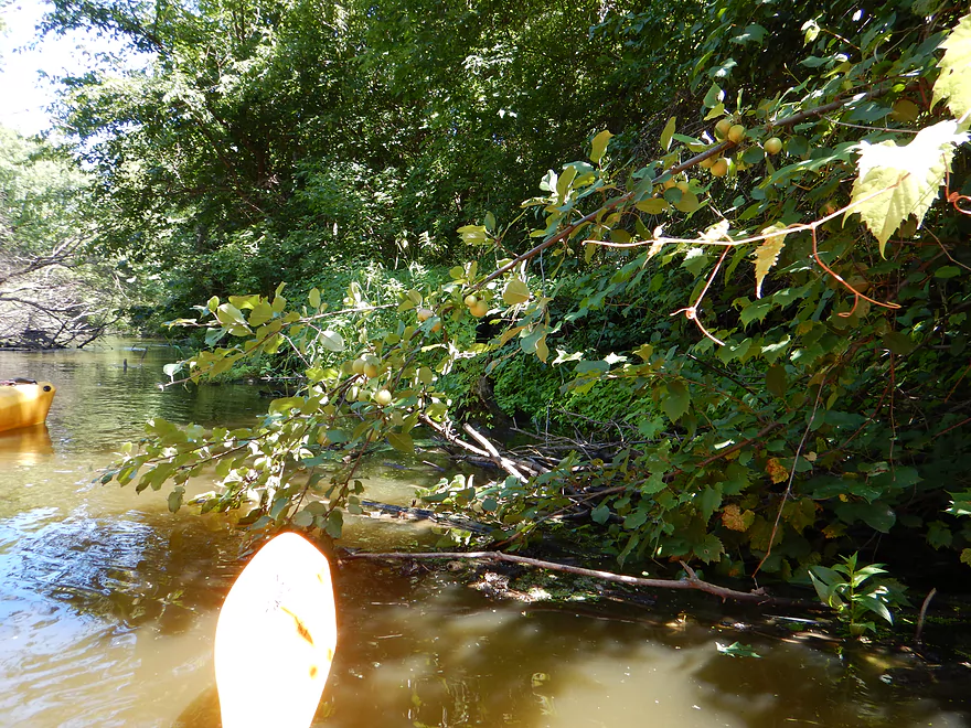
A wild apple tree with apples (snacks for fall paddlers)
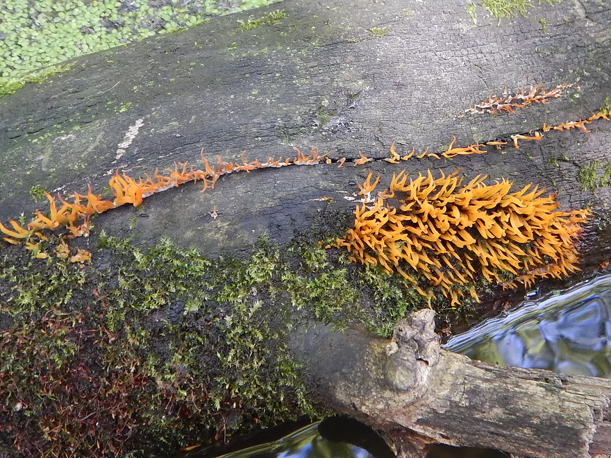
Coral fungus (looks like a sea anemone)
Are these supposed to crackle?
Log jam #3 of 8 is an easy hop-over IF you get a running start
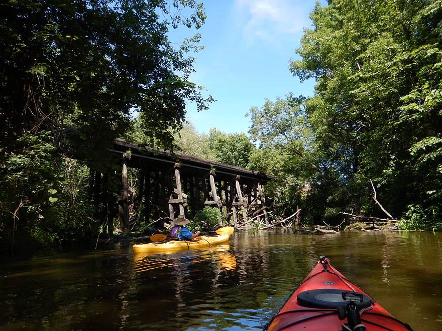
First of three railroad bridges
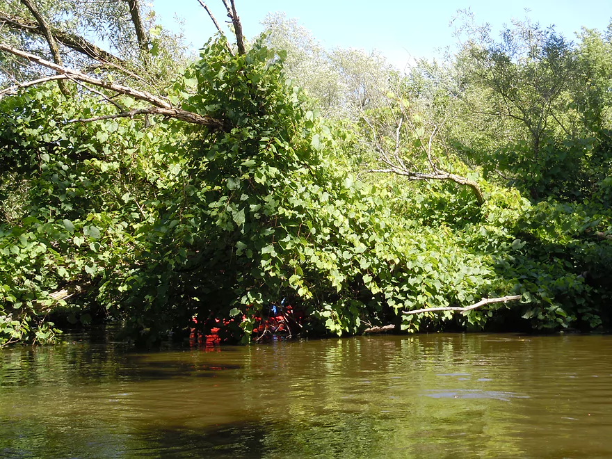
A log jam, but a scenic one with huge grape vines
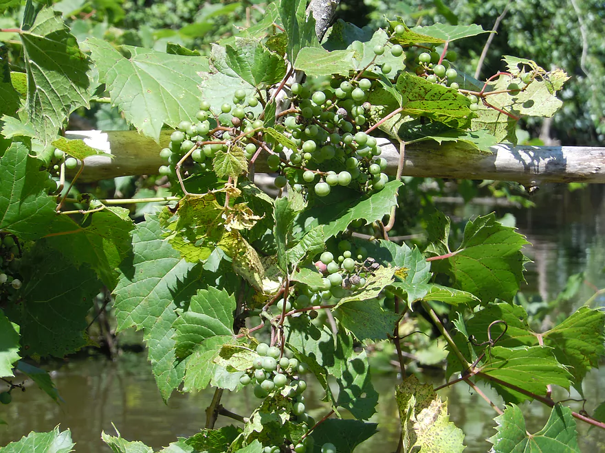
And grapes

I am not portaging log jam #4 of 8
I do not recommend this with most boats
In theory, you could access the river from Cherry Lane
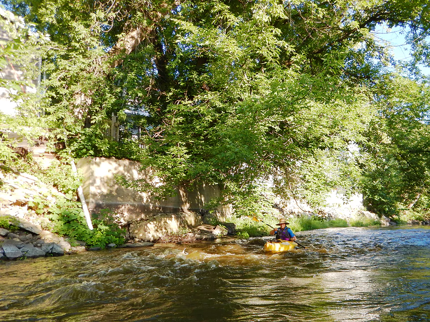
Still an odd riffle or two
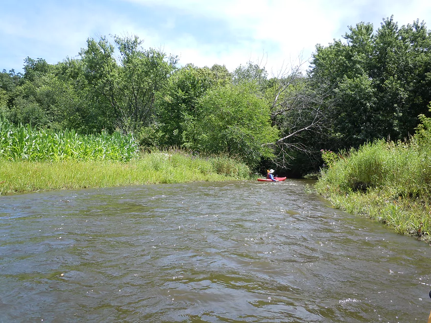
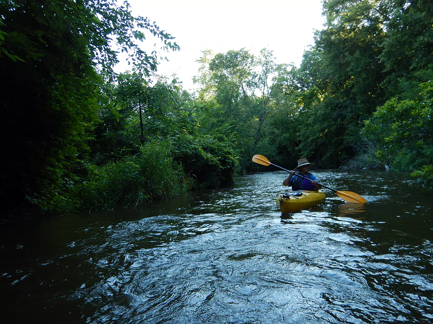
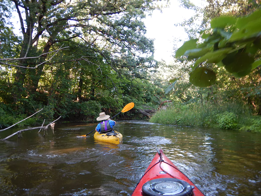
First half of the trip was very wooded
Plant life here has been destroyed by a mysterious beast
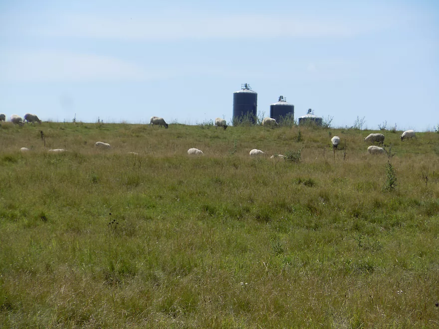
Say hi to the local unfenced sheep
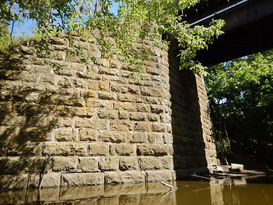
Fantastic stonework on railroad bridge #2 of 3
Log jam #5 of 8 (I slipped through, no problem)
Log jam #6 of 8 (an easy hop-over at these water levels)
Log jam #7 of 8 was a very tough hopper AND ducker (very difficult)
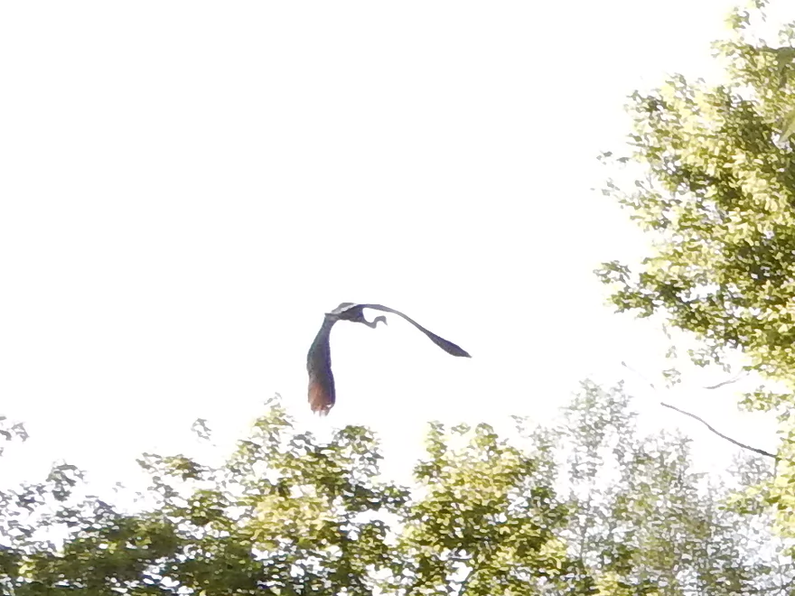
Great blue heron
Log jam #8 of 8 will be my only portage of the trip
That actually was an easier portage
But the banks were steep enough, I preferred to otter in
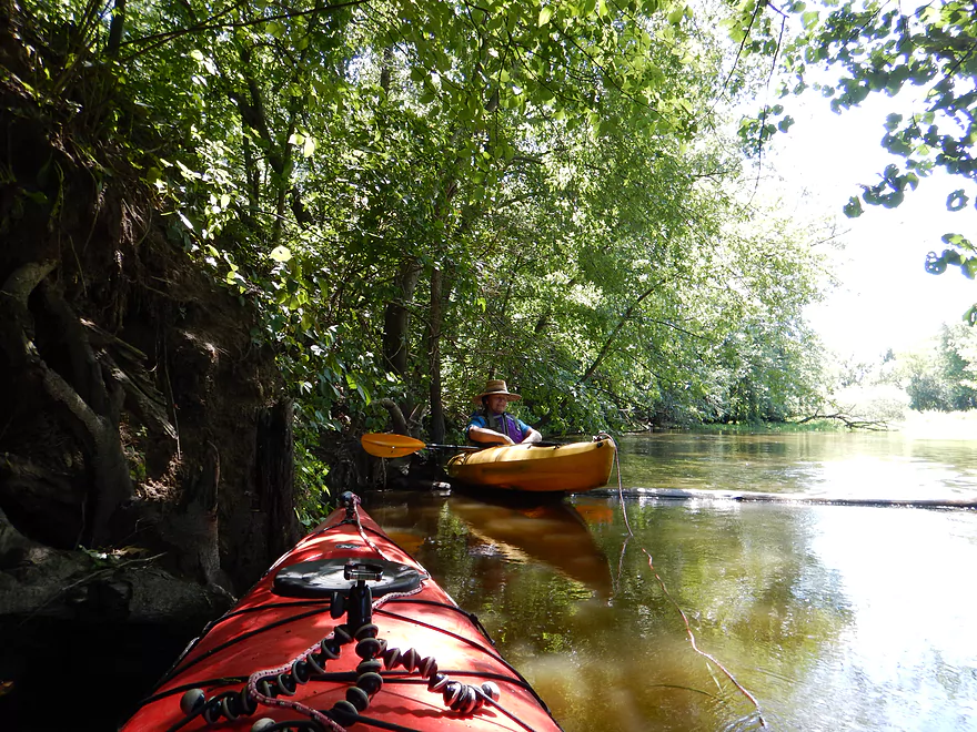
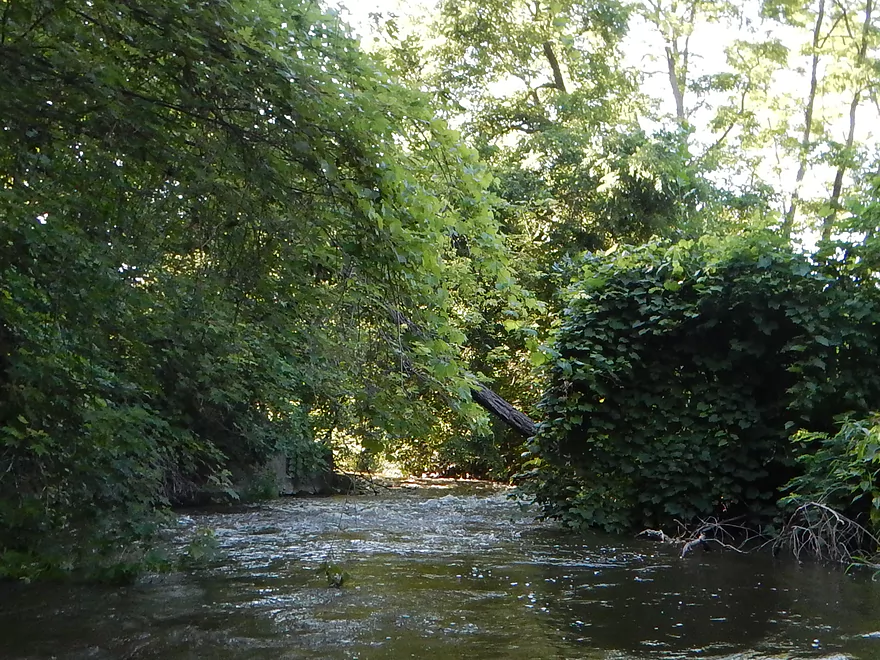
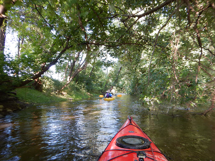
At times, you are enclosed by thick tree canopies (cool!)
The Maunesha River is part of the Rock River watershed
Still some dodging, but we are mostly done with serious jams
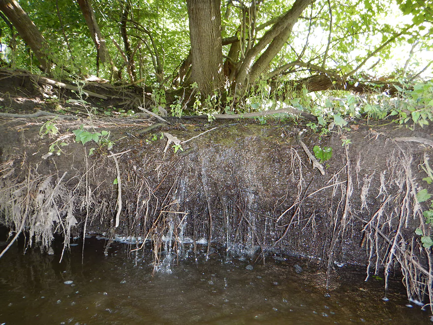
A cool seep
Some nice lighting for a change of pace
A nice open paddle where the old mill pond used to be
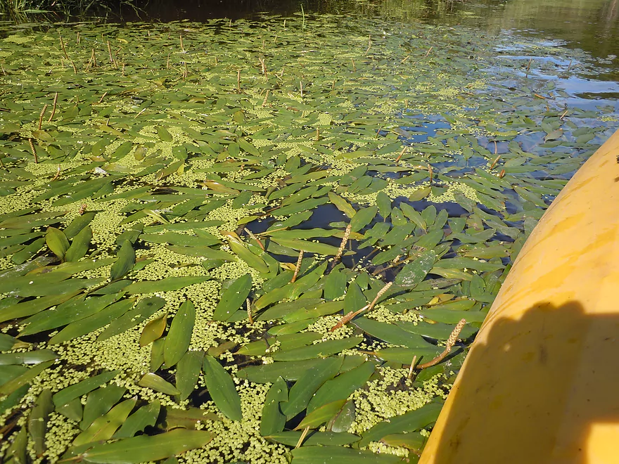
Potamogeton sprinkled with duckweed
A beaver dam on one side of a split channel
Hopefully I did not create too much repair work (saw the beaver swimming nearby)
The Dock is a local bar that might be a good access location
The third railroad bridge is very majestic
It had a tricky 3-4′ chute with a spring like stick that shoves you into the pylons
Do portage this (I did not though)
Immediate rapids after the chute
From here to the finish line there are a lot of rapids
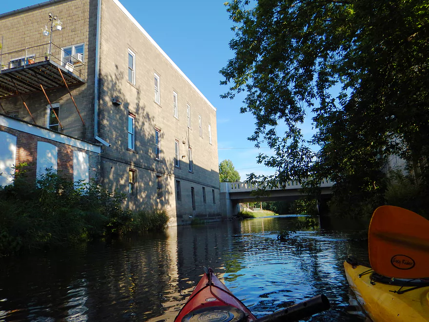
The local malt plant (massive)
I think this is the old dam and one of the fastest sections on the river
You will probably get wet
Reverse view
Traveling very fast toward West Madison Street
This is a great five star section
Avoid getting turned by the pylons (very fast current)
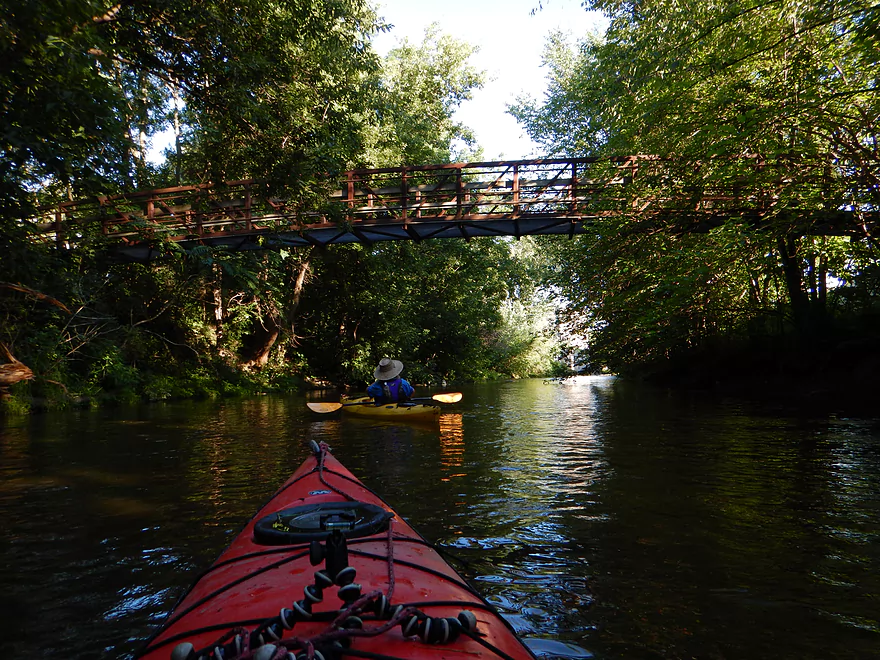
Scenic walk bridge
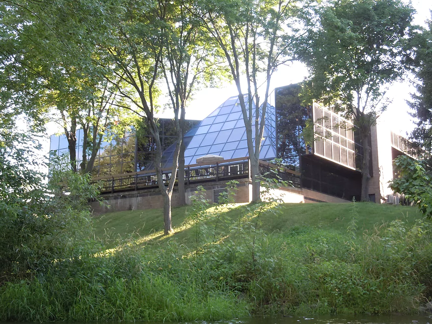
Unique glass roof (supposedly it leaks though)
Starting to lose light

Guess it’s waiting for high tide
Another attractive pedestrian bridge (an uncompleted bike trail)
More evidence the Maunesha is a rough river (not my paddle)
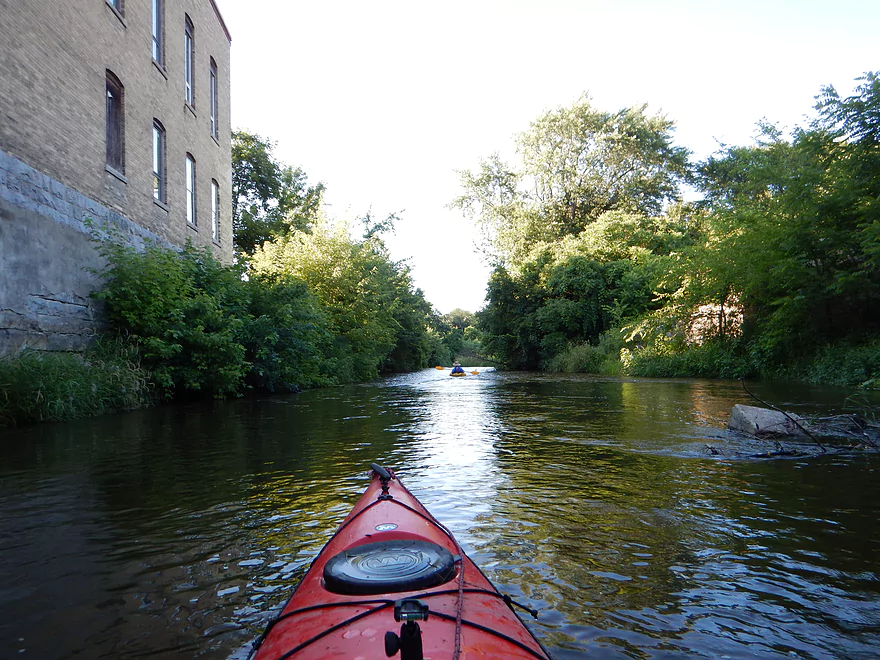
Attractive riverside buildings
Perhaps the biggest rapids on the trip (quite doable)
This probably would be rougher at higher water levels

Current stays fast and riffly
There is a buried boulder garden under the high water
Coming up on Fireman’s Park
Very nice, attractive park
The take-out is marked by a sign with parking nearby
Steep ledge for a public take-out though
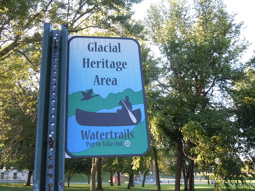
The sign you will be looking for
Scouting time…this is the flowage in Marshall
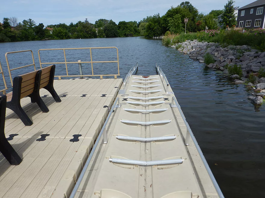
It is a kayaking option and there is a terrific kayak launcher in Lions Park
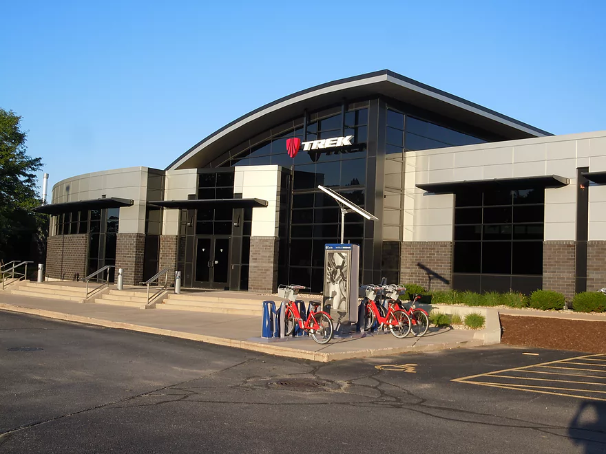
A pilgrimage to see where my bike was hatched
Maunesha River

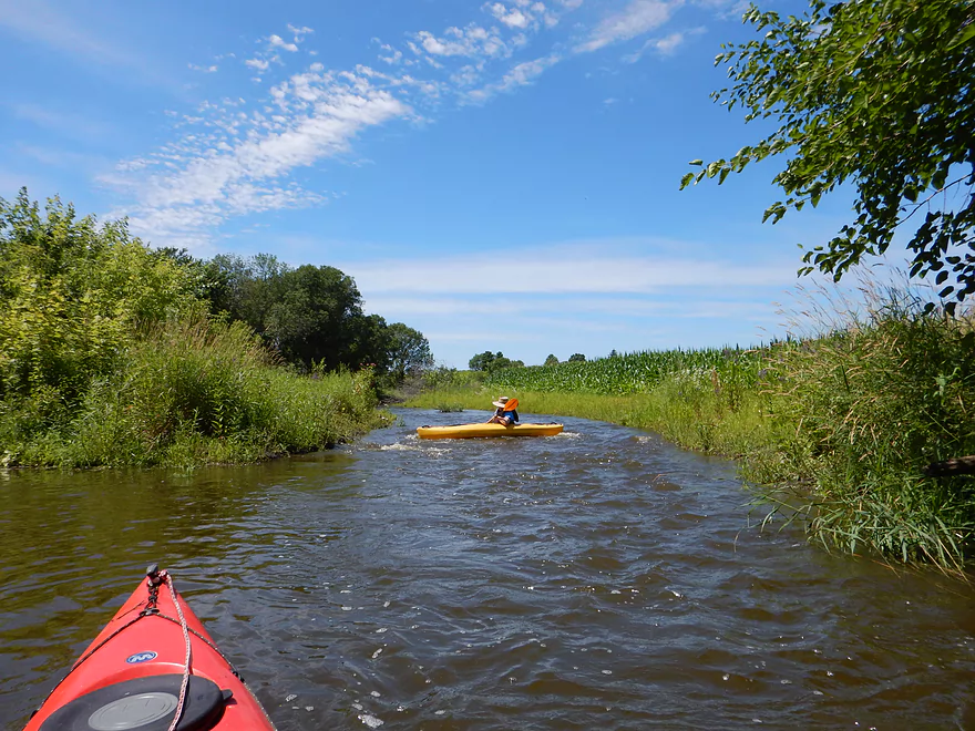
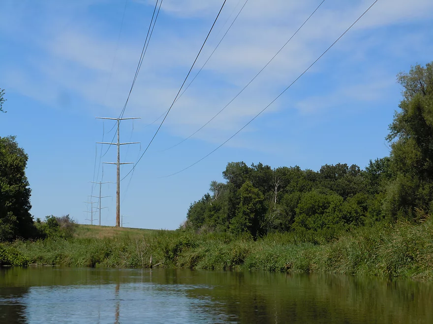
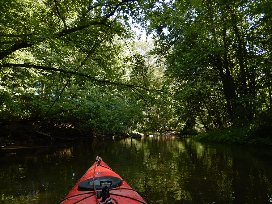
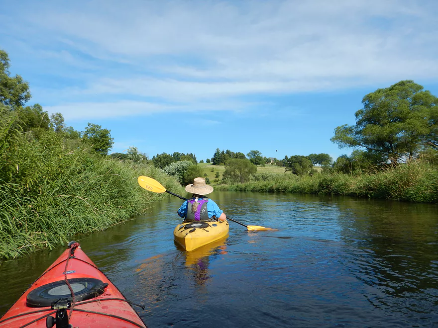
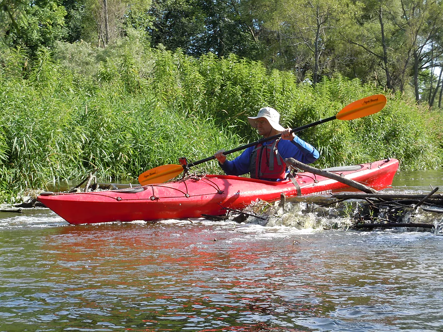
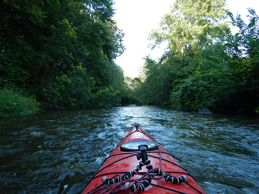
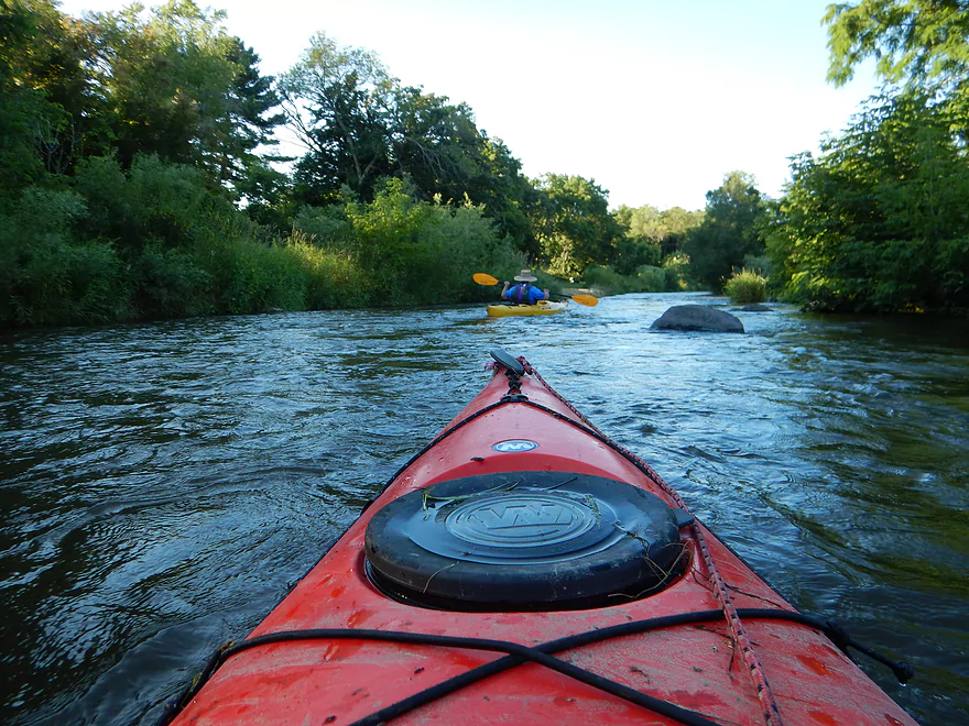
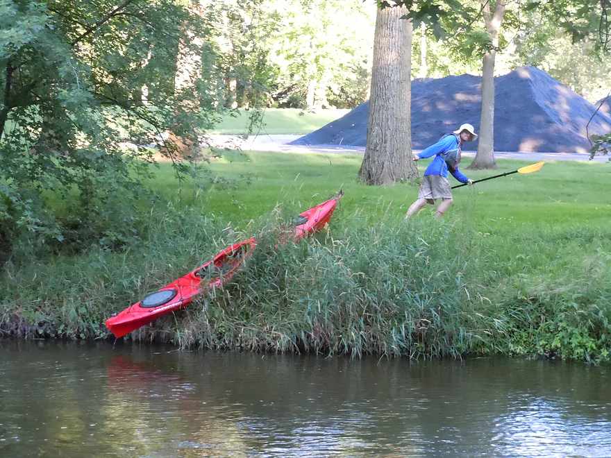
A good put-in and start to the trip below the dam at Marshall. Right off the bat, there is a minor ledge you’ll get to paddle over which foreshadows that this is not a lazy river. Stay right of the island, but cross the rapids on the far left so you don’t get hung up on the concrete debris (0:05 in the video).
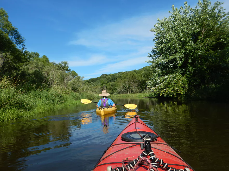
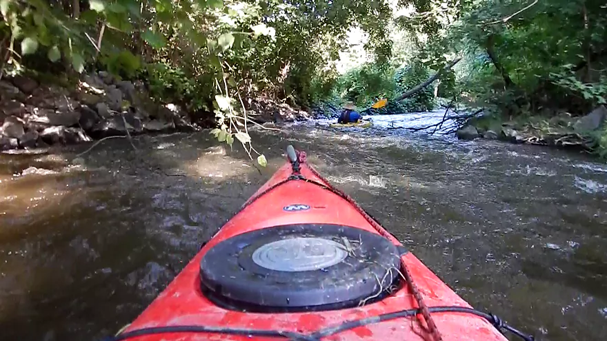
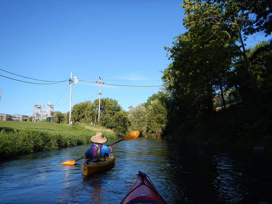
The first mile of the trip is pretty open and mostly flanked by farmland. Not too exotic. You’ll paddle by the amusement park “Little Amerricka” to start the trip (and will be able to hear it the roller coaster screams for two miles). If you paddle upstream on Spring Creek, you can actually see the park train pass over the Spring Creek dam (0:39 in the video).
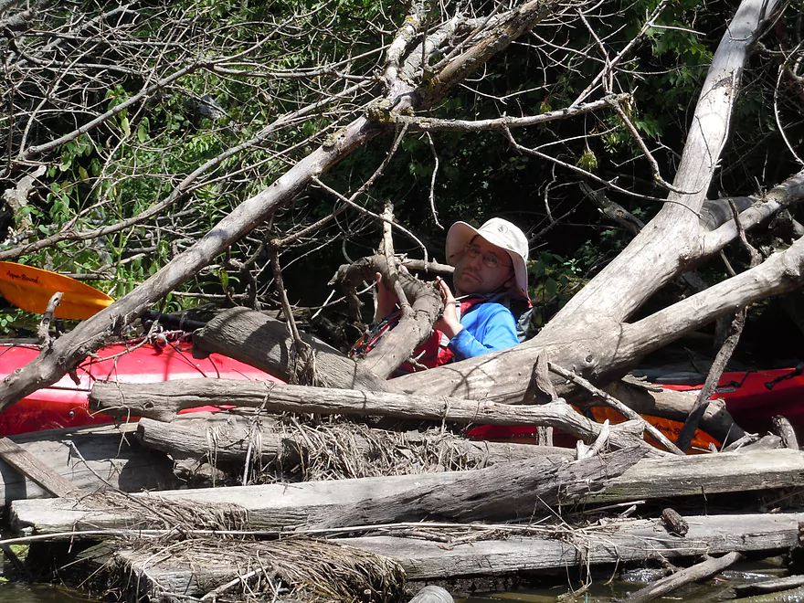
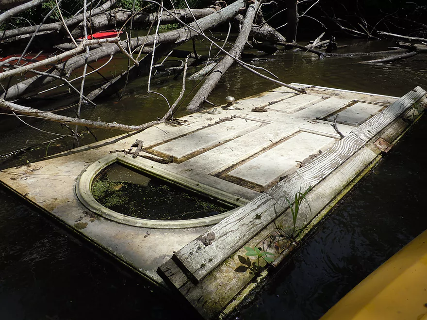
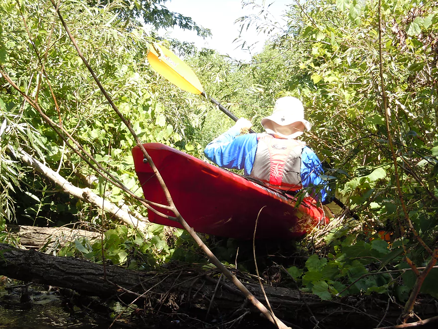
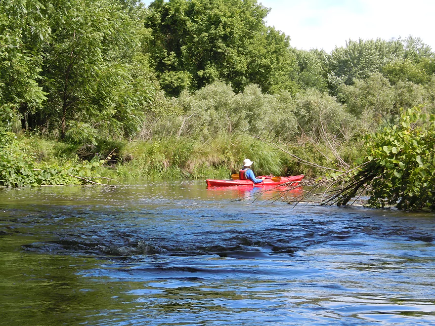
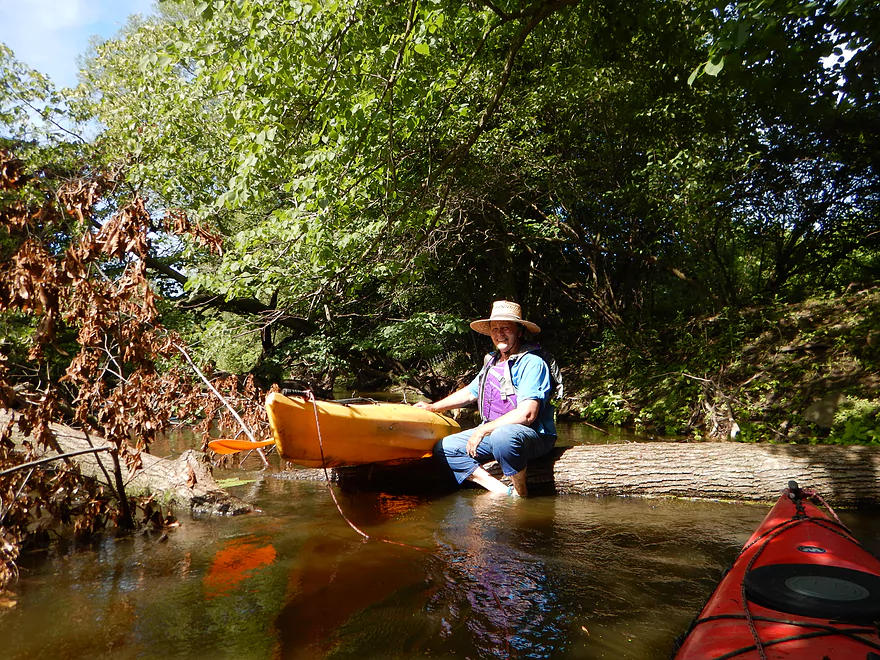
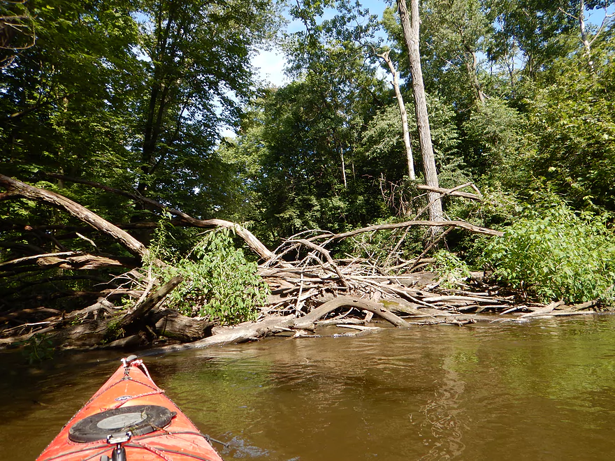
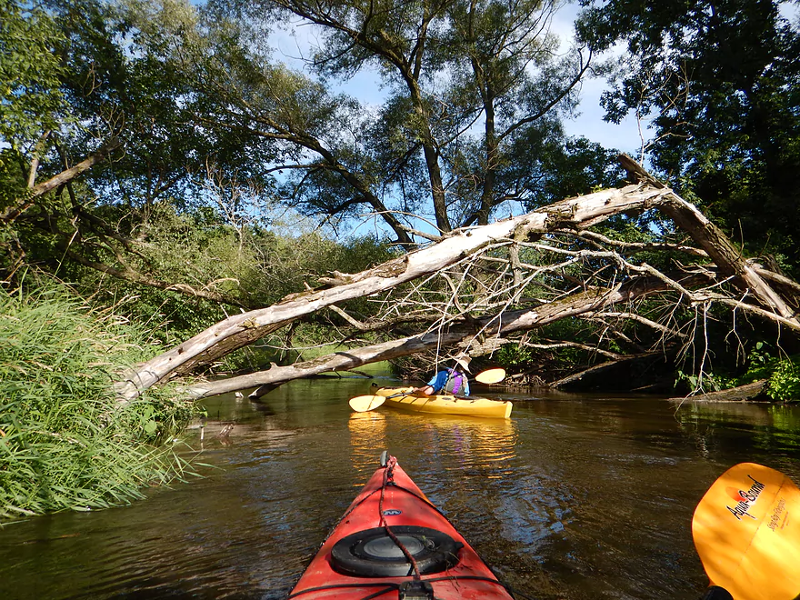
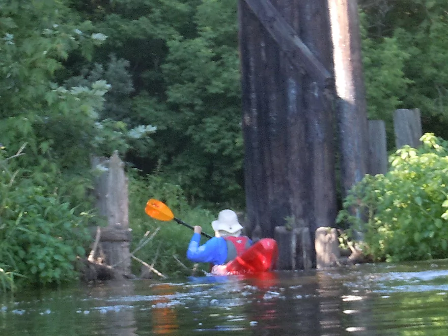
Shortly after Spring Creek, you’ll encounter the first of eight log jams. I’ve meticulously marked these on the map with details of how severe they are for reference. I only had to get out of my boat once for a portage, but this is only because I’m very experienced at this. I’m able to get under and over logs that most cannot. I suspect your typical paddler doing this section will have to do 4-5 portages and 3-4 annoying squeakers. On top of this there were numerous “hat lifters”, “pokers”, “shovers” and “strainers” that added to the stress on an already fast, deep and dirty river. So that was the downside of the trip. One of the more interesting log jam adventures was when we encountered a large jam buried under gorgeous grape vines. It was unassailable. …unless you were willing to hop over two logs maybe a foot above water. It made for an interesting picture (see below).
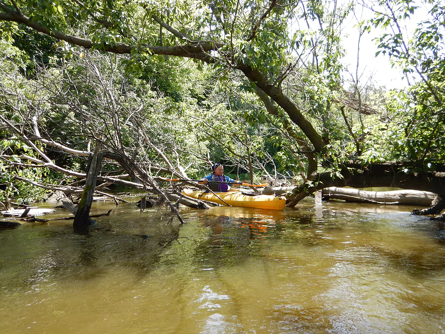
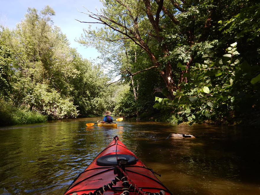
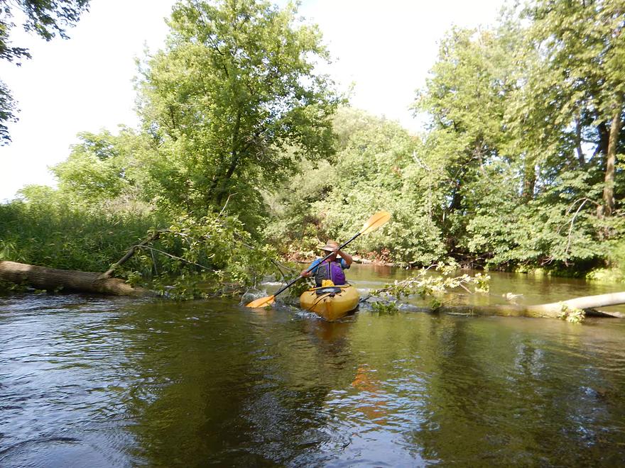
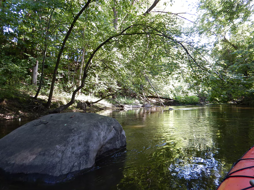
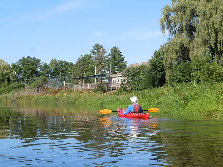
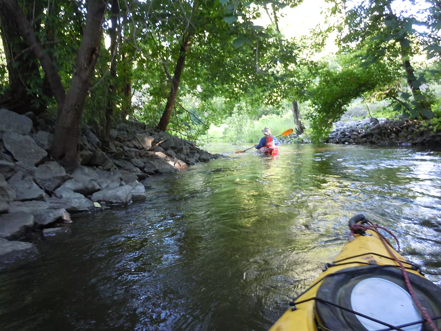
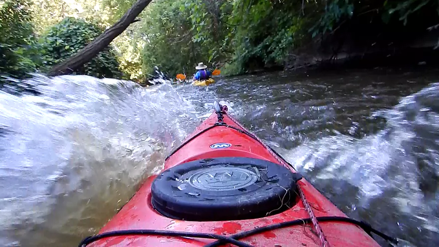
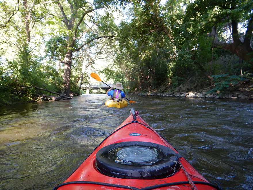
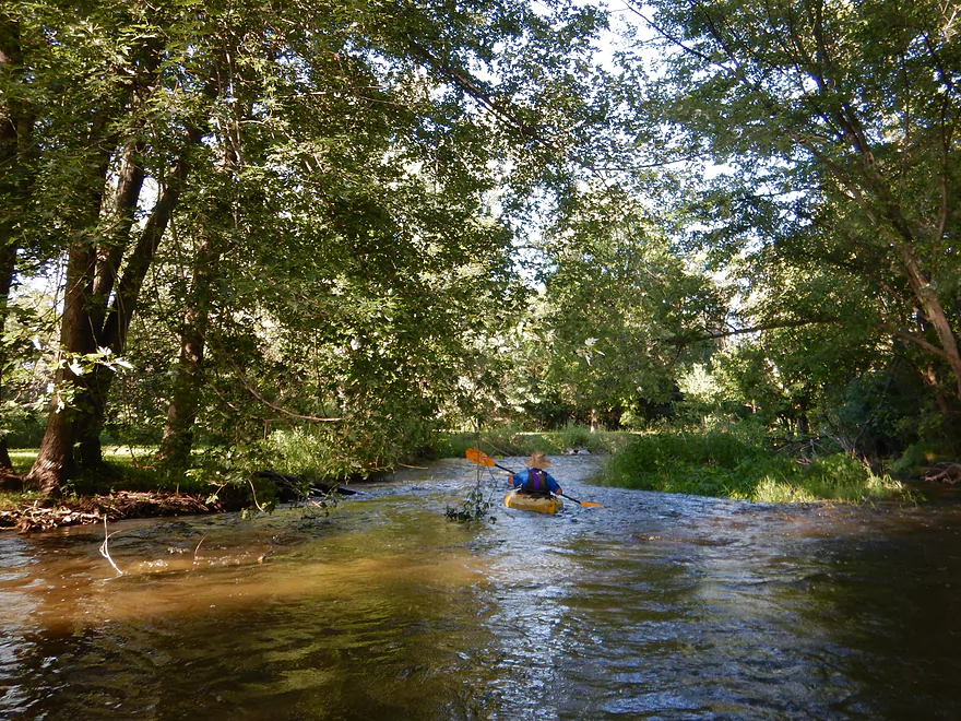
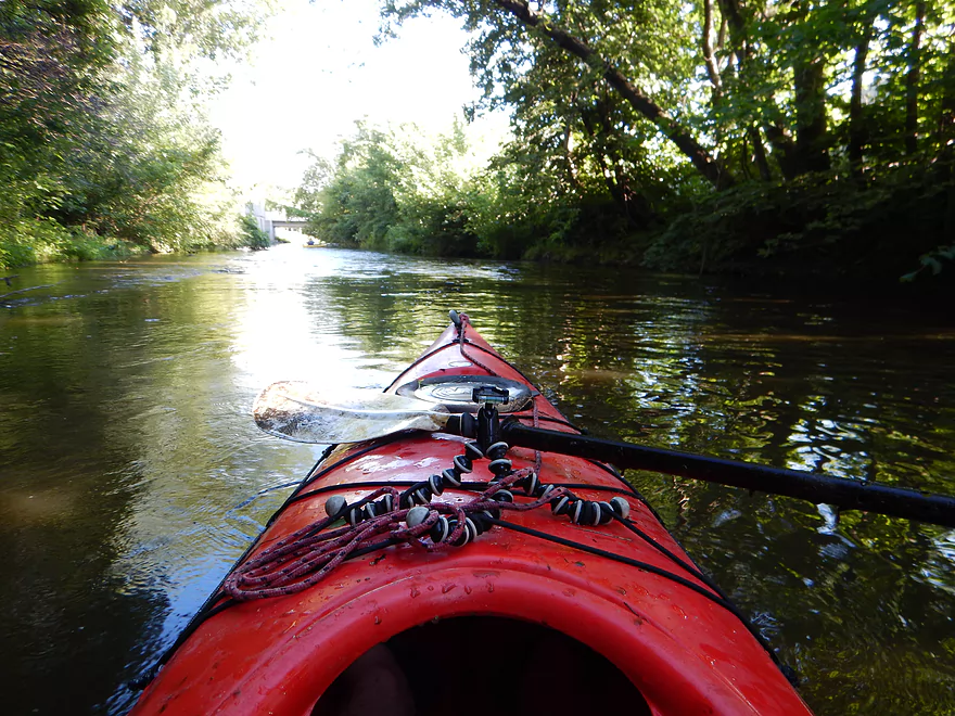
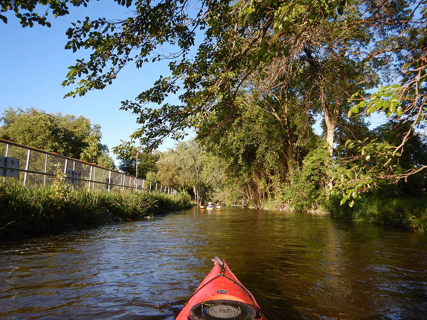
Aside from the log jams, dirty muddy water and occasional trash in the water this was actually a pretty cool paddle. Good current with many frequent riffles. Pretty much from the second Hwy 19 bridge for 3 for the next three miles, is mostly a woodland paddle. The trees really enclose the river giving it a cozy and mysterious feel (you might not need your sunscreen for this trip).
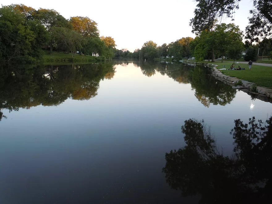
After the 8th and final log jam (marked on the map), the river opens up where the old flowage used to be. I really liked this section as it was very peaceful and scenic with the green rolling hills in the background. The highlight was getting to see a 1-2′ beaver dam (and the owner furiously swimming away from us). This was easy to get over and hopefully we didn’t cause too much damage (2:13 in the video). There is a bar nearby called “Whispers Bar and Grill”, that may be a good alternate access to avoid the jams, but still be able to run the Waterloo rapids. Call (920) 478-9787 for access options.
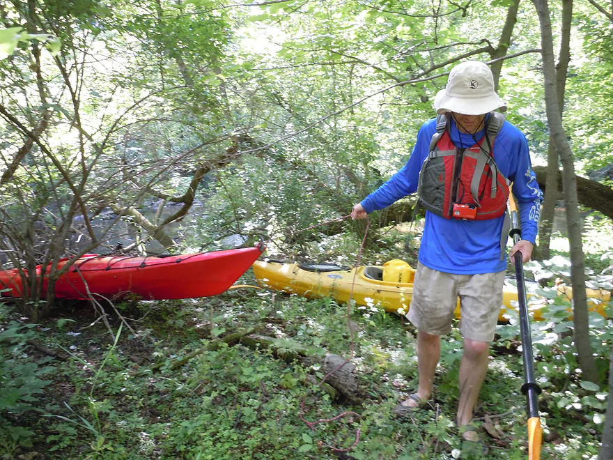
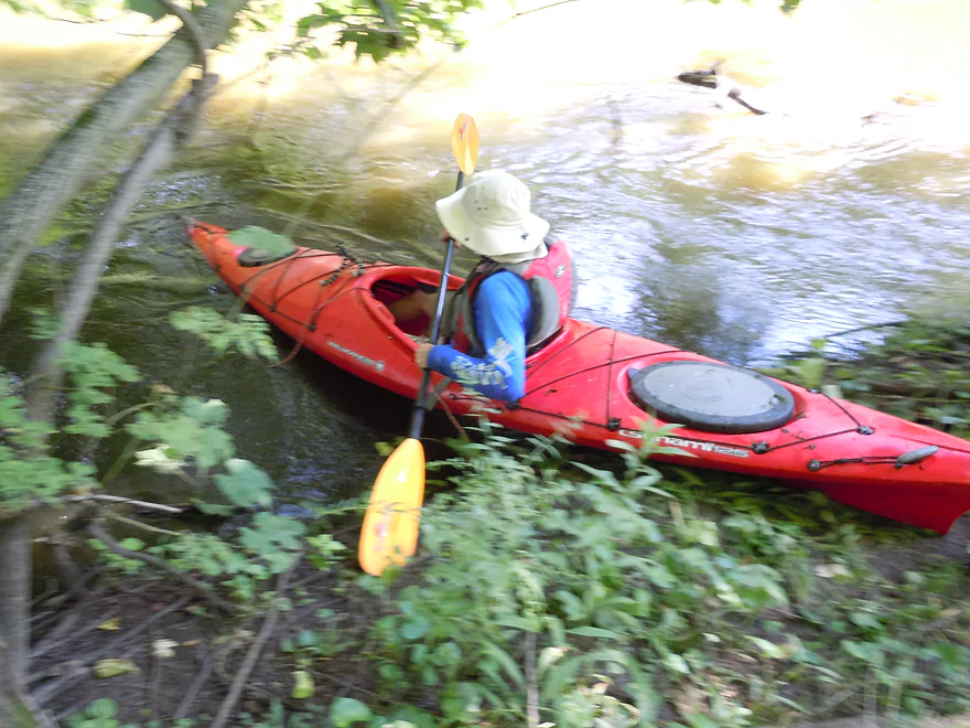
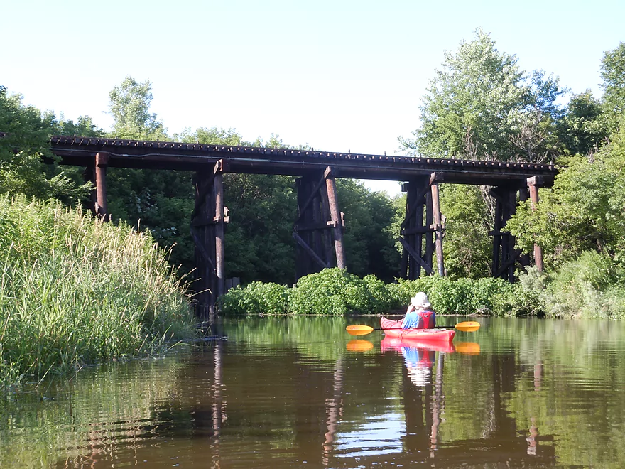
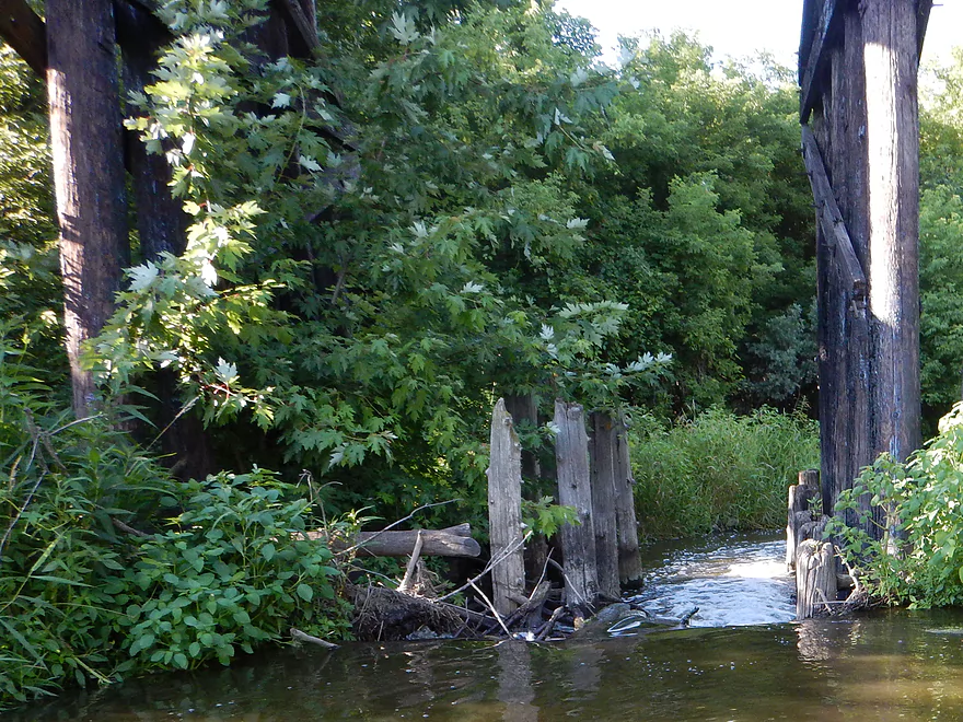
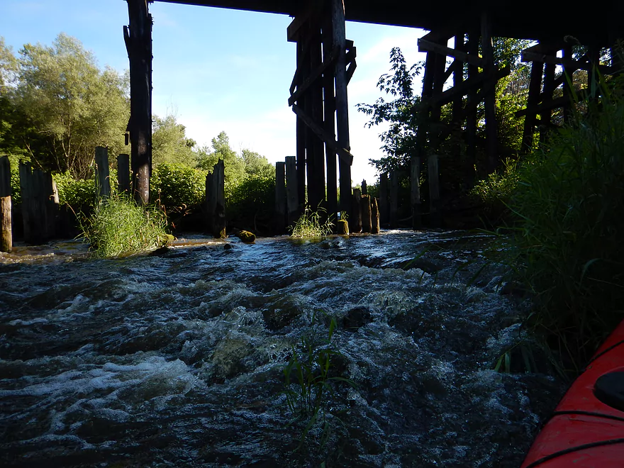
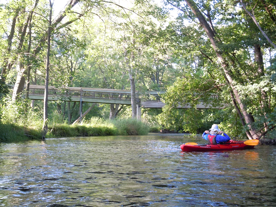
You’ll see a lot of bridges on this trip including many road bridges and scenic pedestrian bridges, but the coolest are three massive railroad bridges. Very historic, majestic and high up. The third of which has a problem though. The wooden pylons are mostly sealed shut by log jams with just one open chute on the far left. This is an impressive drop of 3-4 feet and made very tricky as the open pylons can trap your kayak and turn it sideways unless you go down it PERFECTLY straight. I made it through no problem, but my paddling companion paddled over a stick which acted like a spring and shoved the nose of the kayak behind a pylon on the right trapping the kayak in the fast current. It was an adventure getting unstuck. Needless to say I do recommend just portaging this instead (left bank). Hopefully in the future this can be properly cleared out.
After that nasty chute is the good part. A 2.5 mile paddle with mostly rapids through scenic Waterloo. While you still need to dodge obstacles in fast water, there are no major log jams for the rest of the trip. This was actually one of the better light whitewater experiences I’ve ever had and was a lot of fun. If the trip had been just Waterloo, it would have been five stars. Most of the many rapids are safe class 1’s, but there are say two class 2’s to be mindful of.
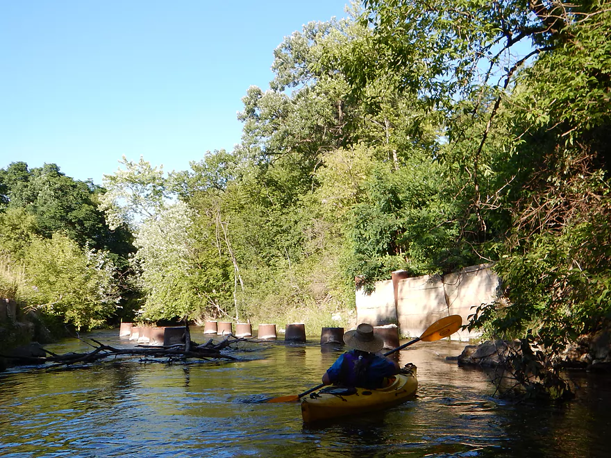
One is where the old dam used to be and requires some quick turning in bouncy water (funnest rapids of the trip 3:24 in the video). The second of which is just prior to the Madison Street bridge (it seemed pretty safe at these water levels 5:26 in the video). With the bridge right there, it is easy to scout these rapids ahead of time to know if you’ll have enough water (most days in the summer you won’t). Shortly after the dam, you’ll see odd pylon concrete stumps which you should stay well away from. The very fast current wraps around them and could pin your boat sideways.
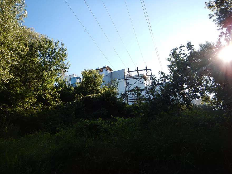
The scenery in Waterloo is very cool. You’ll see some unique architecture and bridges at times, but mostly you’ll be paddling under a dense canopy of trees (very cool with rapids and rocks). Even the towering malt factory (and its mysterious effluent seeping into the river) add an exotic touch to this stretch.
Take-out was at Fireman’s Park which is a nice park, but was more difficult than expected because the parking wasn’t obvious (the no-parking signs were) and the banks were steeper than anticipated.
So a frustrating trip because of the jams, the mishap under the railroad bridge and many other incidents which I won’t mention (it was a jinxed day). But…the river has a lot of potential and hopefully Capitol Water Trails and the Maunesha River Alliance can finish the garbage and log jam cleanup they both started as it so would be worth it. Until then, I do suggest this river…just put in by “The Whispers Bar and Grill” (ask permission first), portage the railroad bridge and run the 2.5 miles through Waterloo to Fireman’s Park which will be a lot of fun (if you have enough water). If you hear of any further cleanup work on the river, definitely add a comment below.
Webmaster’s Update…as of 2019-11-13, all of these logjams have been cleared out thank to the Maunesha River Alliance!
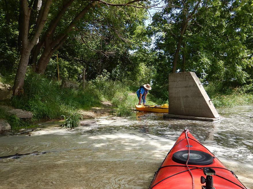
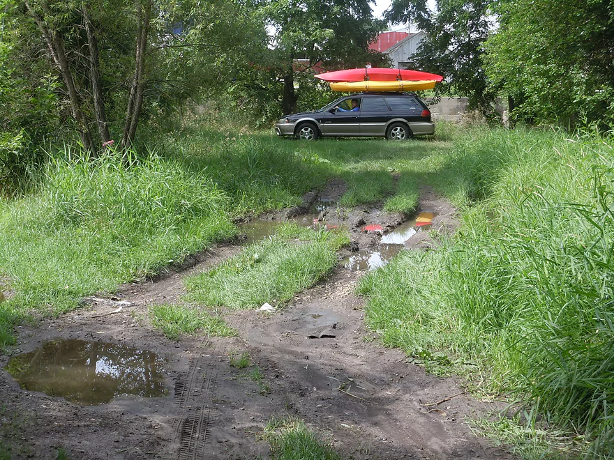
Below the dam in Marshall is a very nice public launch on the north side of the river. It’s accessible via a hidey dirt road off of Waterloo Road. Do park on the street and drag your boat down to the water as the road is in poor shape and you can get stuck (don’t ask me how I know this). There is a nearby outhouse in Lions park (north of the dam off Hubbell Street).
The take-out is in Fireman’s Park Waterloo just prior to the Hendrick Street bridge. The bridge has no parking signs everywhere which is unfortunate. You can park west of the bridge and south of the river by the local sanitation plant where there is a decent parking lot and local water trail signs mark where you can access the river. The water is deep here for an access with steeper banks, so this isn’t ideal.
I car shuttled, but a bike shuttle should be quite manageable at 4.9 miles with 56′ of climbing and 7′ of descending.
Many. Detailed in the write-up above. I had presumed they had been cleared out based on the reports from Capitolwatertrails.org and the Maunesha River Alliance. But this was not the case. Granted, I just had to portage once myself, but this doesn’t tell the whole story as you’ll find out. I’ve marked the major hazards on the map so locals reading this review will have the information needed to find and clear them out.
Webmaster’s Update…as of 2019-11-13, all of these logjams have been cleared out thank to the Maunesha River Alliance!
Crawfish River @ Milford – 1700 CFS: The Maunesha River lacks a gauge so it is difficult to provide an accurate depth guide. I suspect the best gauge is the Milford gauge on the Crawfish River located just downstream from the mouth. But obviously this isn’t accurate because it includes the much larger Crawfish.
- 0-300 CFS: A low depth. Upstream from the Malt Factory the river is likely fine for paddling. Downstream where the rapids are it might be too shallow.
- 301-400 CFS: An average depth. The rapids downstream from the Malt Factory would be pretty bumpy but likely doable.
- 401-600 CFS: Above average depth…a good target range.
- 601-800 CFS: A high depth with poor water clarity. A good target range for the rapids (although you’ll still hit a few rocks).
- 801-1100 CFS: A very high depth. Current may be pushy in spots and the river likely isn’t as attractive. The downtown rapids stretch though would be fun to do at this level.
- 1101+ CFS: Perhaps too high for enjoyable paddling.
Many of the usual suspects: a beaver, muskrats, dragonflies, carp, a softshell turtle, ducklings and a great blue heron. There were a lot of wild grapes growing on the banks and also a random apple tree hanging over the water nowhere near civilization which was cool.
Trees were mostly silver maple (the one tree that doesn’t mind getting flooded), but unfortunately silver maples have a tendency to end up as log jams. There were also walnuts, boxelders, willows, red oaks, and white oaks. But the highlight of the trip were the bur oaks (mostly between Waterloo Road and Cherry Road). Very majestic and grand, with one specimen having limbs that nearly spanned the width of the river…a nice contrast to some of the other messy trees along the banks.
Detailed Overview
- Elder Lane to E. Branch Road: 1.8 miles. Likely too many logjams.
- E. Branch Road to Twin Lake Road: 1.1 miles. Likely too many jams.
- Twin Lake Road to Greenway Road: 1.4 miles. Likely too many jams.
- Greenway Road to Hwy TT: 4.0 miles. Passes through the Deansville State Wildlife Area. Logjams are likely a major concern, but some of these should be cleaned out in the process of being cleaned out. Greenway Road is likely NOT a feasible access.
- Hwy TT to Lion's Park: 3.0 miles.
- Hwy TT to Charles Langer Family Park: 1.4 miles. Slow current, a bit muddy and partly wooded. This was recently cleared of logjams.
- Charles Langer Family Park to Lion's Park: 1.5 miles. A lake paddle on Marshall Millpond. The banks are heavily developed but still somewhat interesting.
- Marshall Dam to Cherry Lane: 4.0 miles.
- Dam/Waterloo Road Access to Waterloo Road Bridge: 1.4 miles. A wider and more open section of the river.
- Waterloo Road Bridge to Cherry Lane: 1.6 miles. Nice wooded section.
- Cherry Lane to Waterloo Firemen's Park: 5.3 miles. A very nice stretch. The first third flowed through a nice woods with thick gravel substrate. The second third is a more open paddle through a former flowage. The last third flowed through downtown Waterloo and contains many fun rapids.
- Waterloo Firemen's Park to Hubbleton Road Landing: 6.4 miles.
- Waterloo Firemen's Park to Hwy 19(1st bridge): 1.2 miles. A scenic wooded stretch.
- Hwy 19(1st bridge) to Hwy 19(2nd bridge): 2.0 miles. A very cool wooded stretch that is quite scenic.
- Hwy 19(2nd bridge) to Hubbleton Road Landing: 2.3 miles. River is wider, more open, and somewhat less interesting compared to upstream sections.
- Hubbleton Road Landing to Hwy BB: 0.9 miles. A short but simple stretch on the Crawfish. There are nice boulders in the river near BB.
Trip Map
Overview Map
Video
Photos Size:
Wow! What a great video and great pictures. I’ve kayaked the Maunesha from the Marshall Dam to Hwy TT before I ran into plenty of blockades. Fellow Marshall Village Board Trustee Jason Pitzer and I are trying to get the word out on two upcoming Maunesha River Cleanup days. The days are March 10 & March 24, both Sundays. The river cleanups both start at 9am and will last till about 4pm. We are starting in the Langer Park area in Marshall and hope to clear debris, cut down trees, etc. in an effort to improve kayak and canoe navigation, while possibly increasing water flow and oxygen levels. This is a grassroots effort to start and there are 10 people signed up, but another 20 on the Facebook event I created. We hope to make your kayak experience even better in the future. We’ll be starting at 6200 Hwy TT, and probably working down rive to Waterloo throughout the spring and summer. The Maunesha River Alliance and several of the members are helping us out. If you go back on the Maunesha, please share with us how your experience went. Thanks so much for your time and sharing with us the beauty of what we have.
Sorry for the delay in getting back to you…I just now found and approved your comment. Your cleanup plan sounds great! Let me know how it turns out and I can post an update on this site. I’ll see if I can get your event on my facebook page here as well later today.
No worries. I’m excited for it and excited to keep getting more and more people to help out each day. Will do. I can post a mini update later in March as we make progress. That would be great if you can share it (I have two Facebook events), and I hope the weather cooperates for us.
Amazing day on the Maunesha! The river is clear from the Marshall Dam on Hwy 73 all of the way to the Deansville Marsh. Now it’s time to get those canoes and kayaks out. We had an awesome 12 man crew (split in two groups today) for the April 13 cleanup. One crew worked on clearing blockages in the water in front of and behind the first Trestle Bridge on Canal Rd. The other crew cleaned up the shoreline (removed Buckthorn and other invasive species, and cut tree stumps and treated them) along the shoreline upriver near the Hwy TT bridge where we worked on March 10 & 24 (11 & 13 workers on those days respectively).
Pictured in the group photo were: Joe Greene, Jeff Steele, Jason Pitzer, Jeff Page, Paul Wehking, Steve Falter from Capitol Water Trails, Lee Hellenbrand, and Terry Bradshaw. Not pictured were Brandon Millner, Tyson Pitzer, and Jack Hellenbrand.
And thanks to Lyndsay Ampe and her bosses at the Fox for the great meal after the workday! I appreciate everyone and everything that made today a success. This group is hosting a Maunesha River Cleanup Workday on June 29, and is trying to organize a cleanup day sometime in May. For more information email Ryan Frey at freyr33@gmail.com
Great news Ryan! I’ll definitely paddle that upper part this summer.
Hi Aaron. Just thought I’d drop you a line about our river cleanups. We’ve got a lot done since we last chatted…and we have another cleanup coming up this Saturday (9/28). After Saturday, the Maunesha should be passable from below the Marshall dam to the Dock bar between Marshall and Waterloo. A fellow Maunesha River Alliance officer and his wife our putting in at the Dock bar and kayaking through Waterloo to document the blockages between the Dock and Waterloo. Then on Oct. 19 we are headed to Waterloo to start clearing out this river in that area. Everything related to our cleanups and events is available on our website (www.mauneshariveralliance.org).
We are also hosting a fundraiser/event on Oct. 5 in Marshall. Just a reminder to signup online or register via paper form for our October 5 Propel Dry-Tri at Fireman’s Park in Marshall. The event starts at 9am and kayaking or canoeing is an option if you aren’t interested in biking or running.
OR
– One person can complete all portions in a series (paddle, run, bike).
– A relay can be formed where 2 to 3 people compete as a team. A team of two people can have one person complete two of the three sections (1,2 or 1,3 or 2,3), and the other being filled by the other person.
– Or a partner team could participate (like a 2 person relay team)
Paper & Online Registration forms can be found on this link. https://www.mauneshariveralliance.org
This event will serve as a fundraiser for the cleanup work we have been doing on the Maunesha River. Please support us by participating or volunteering. Message us at propel@mauneshariveralliance.org if you are interested in volunteering on Oct. 5.
You guys are doing great work! I’ll see if I can promote your Oct 5th event tomorrow on my social media feeds.
Hi Aaron,
The Maunesha River is now passable from the Marshall Millpond Dam to Waterloo Fireman’s park! We’d love to have you come out for another trip sometime in the near future if you have the time. You’re documentary of your trip down the Maunesha really inspired us to improve our local water trail. Thank you!
Best,
Jason Pitzer
Maunesha River Alliance Treasurer
Thanks for the update! I’ll post an update on social media letting others know of this development.
Aaron, possible updates? 1)The link in your write-up https://www.facebook.com/mauneshariveralliance/ doesn’t link to a photo. Aaron wrote:”Here is an interesting picture of what the old Waterloo dam and flowage used to look like”
2)In my opinion the Beaver Dam gauge is unlikely to be useful because its level fluctuates with dam releases in BD (as described in your review of the BD).
3)The Dock is now Whispers Bar and Grill (no phone). Whispers is supporting the Maunesha Meander on May 23, 2021, and is one of the takeout options: https://www.mauneshariveralliance.org/
I’ve never paddled this stretch and am looking forward to it. Looks like the MRAlliance is doing great things. Thanks for your always helpful website!
Thanks Jon for the update. Yeah this write-up is kind of out-of-date. The other is much more helpful: https://www.wisconsinrivertrips.com/segments/maunesha-river-cherry-lane-to-waterloo If I get a chance here later today, I’ll try to update this.
Good news. As of July 15, 2023 the Maunesha from to Waterloo is open again. https://www.facebook.com/mauneshariveralliance/posts/pfbid0UQxzaWxTeYugqEExfgvqiZxi5hpdT79CDebH7wLgKcN5SDq4dS6Lu1zjHN3ZDwoVl