
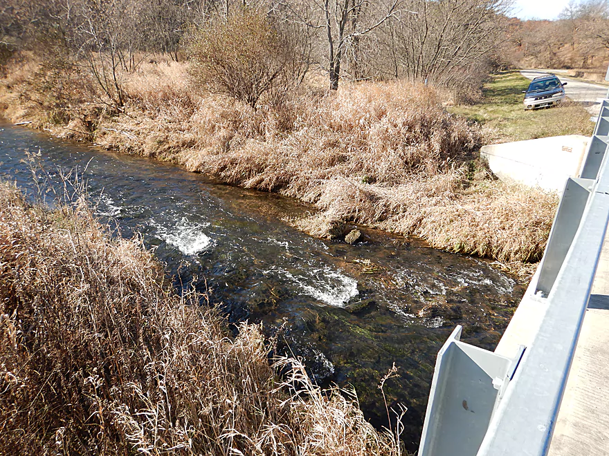
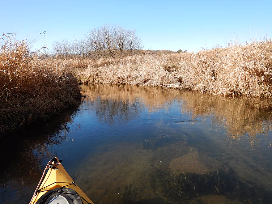
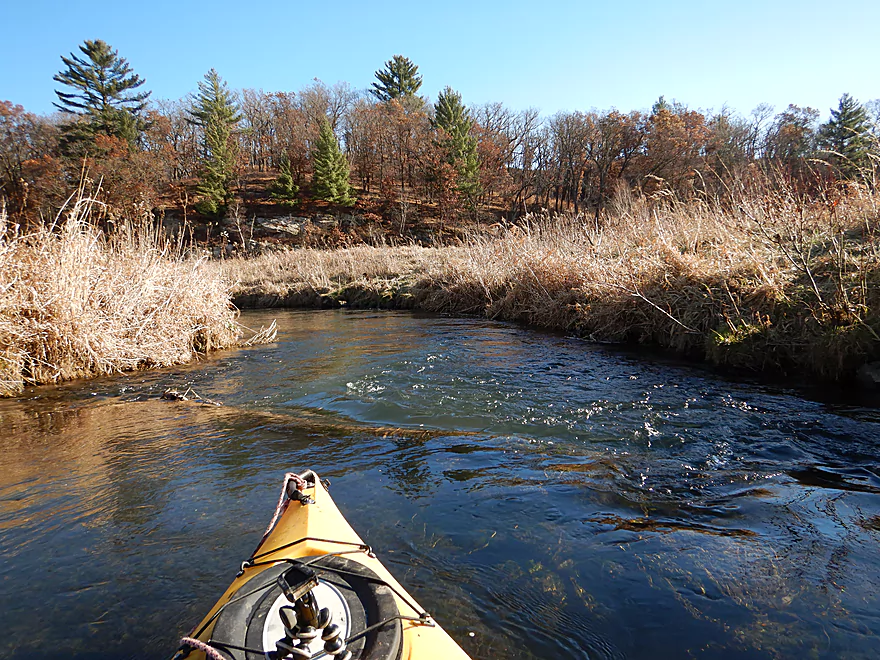
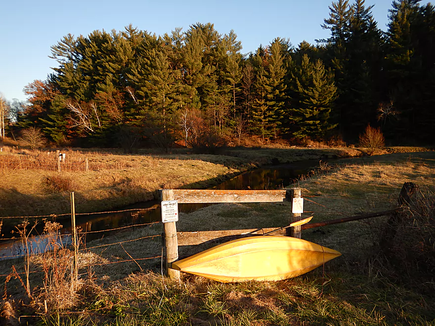
Starting the trip at Sandy Rock Road
Great launch site
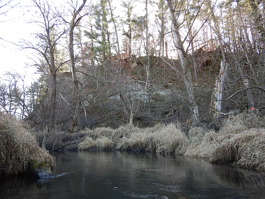
Coming up on a small bluff
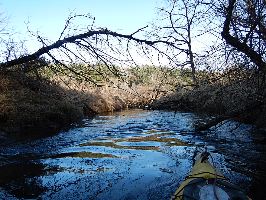
A very fast creek
With great clarity
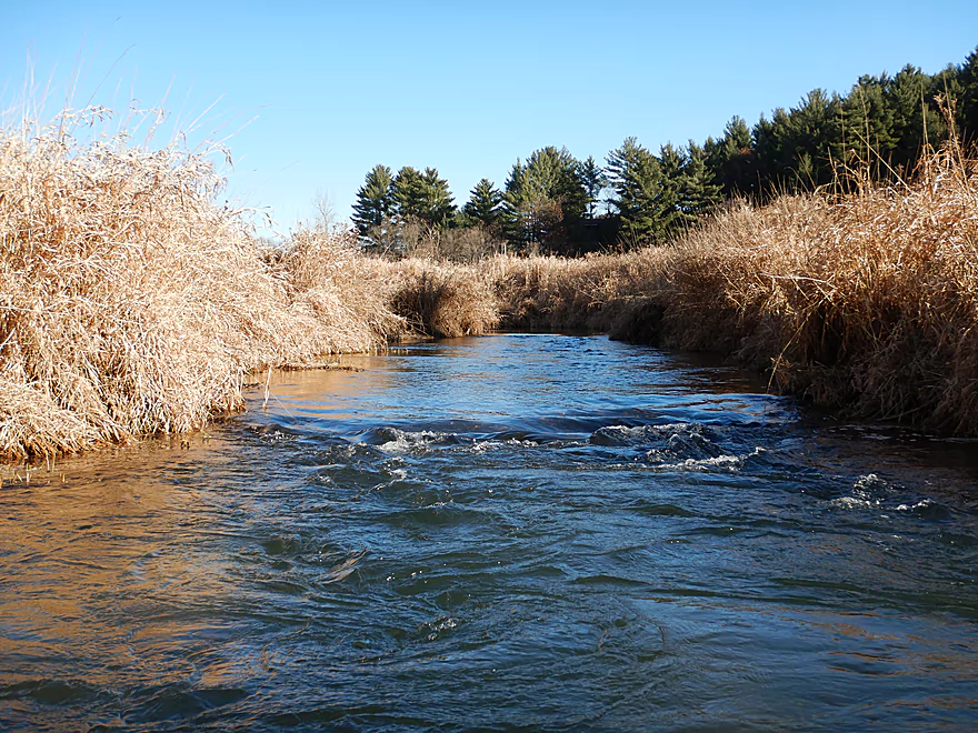
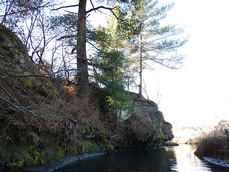
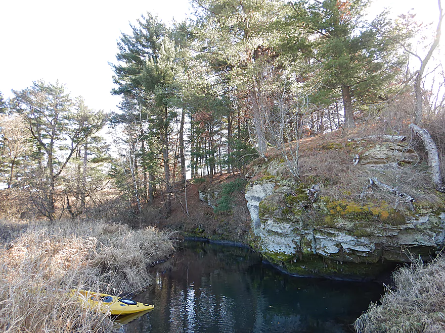
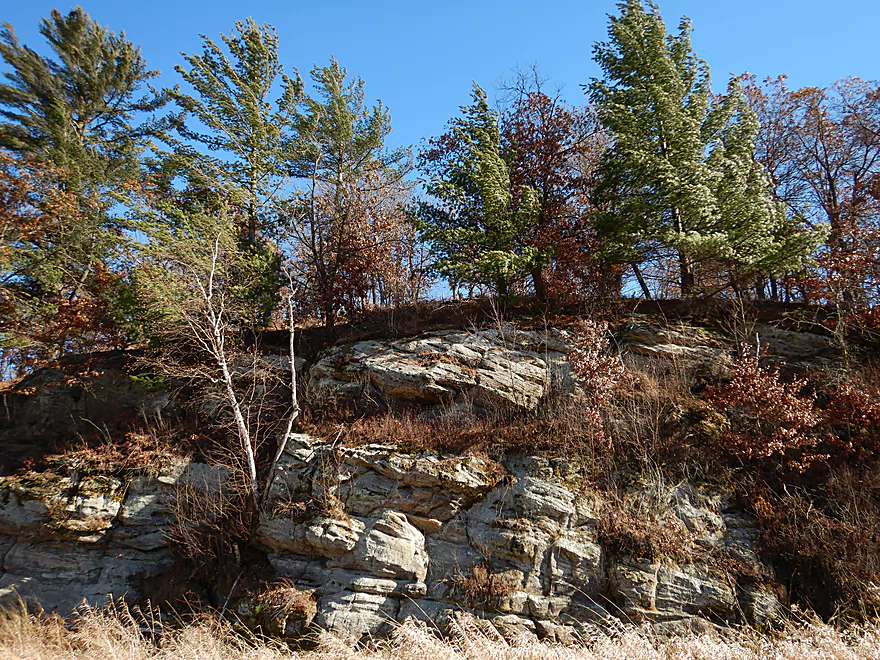
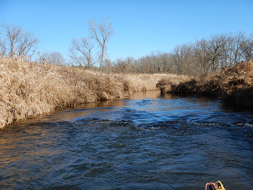
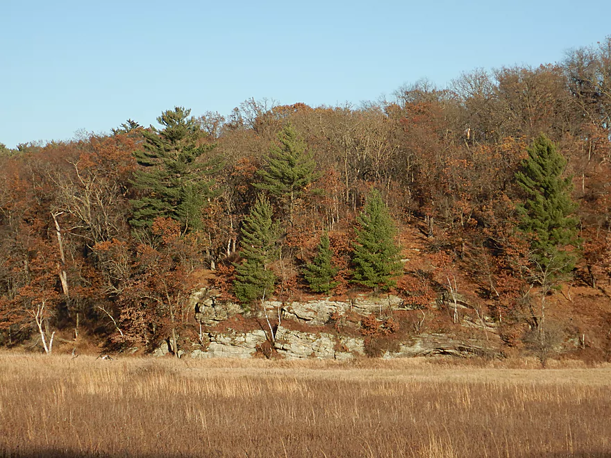
The first noteworthy outcrop
Quite nice
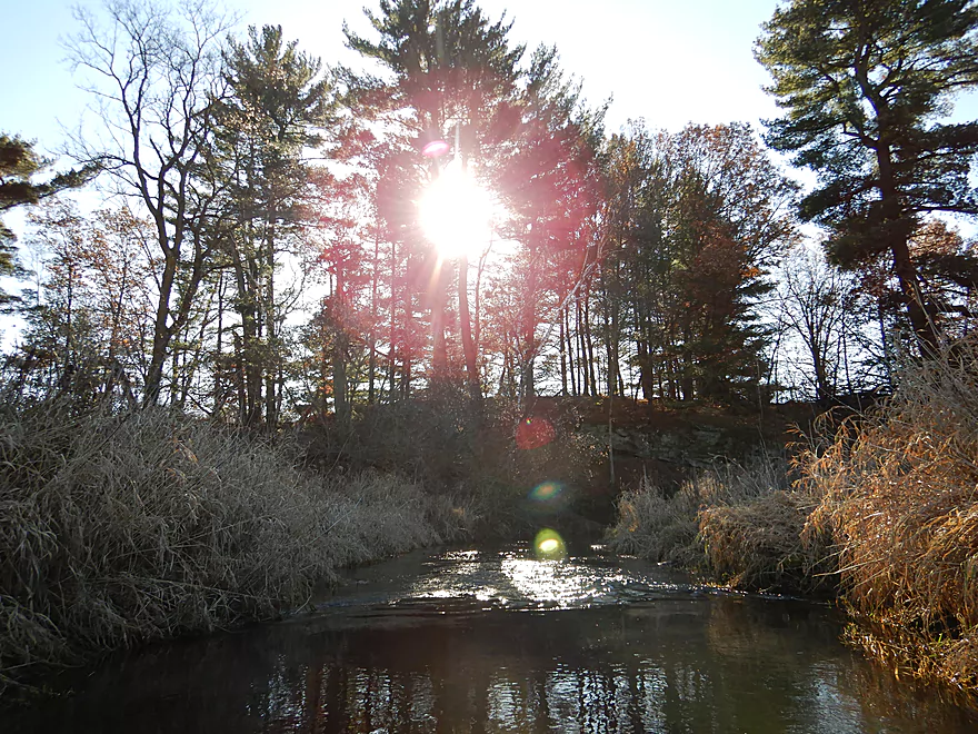
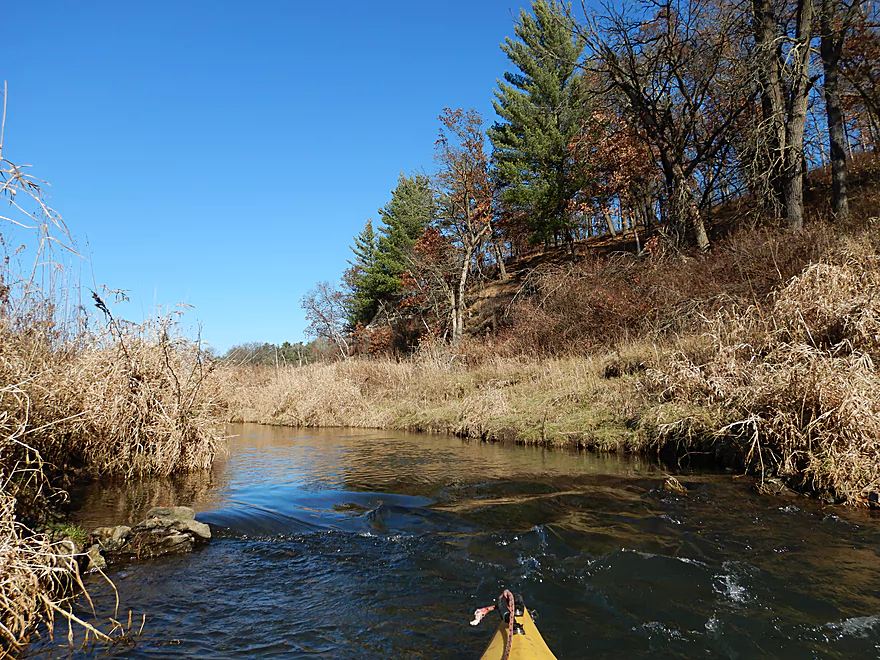
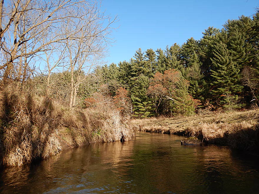
Scenic white pines
Another nice outcrop
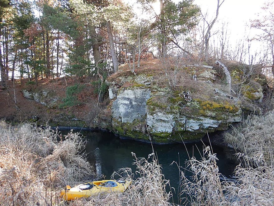
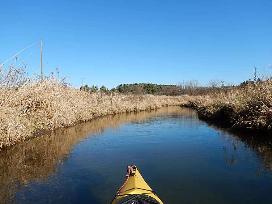
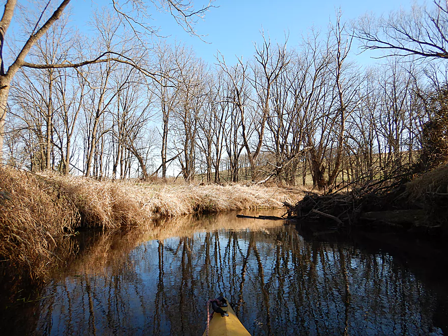
This was my favorite
Reverse view
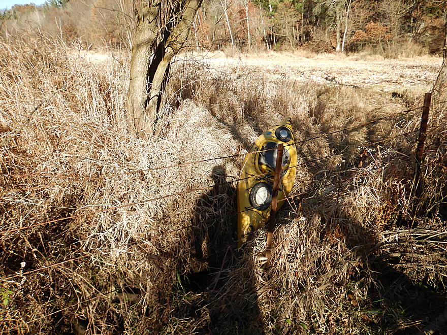
A low swing gate
Speeding along…
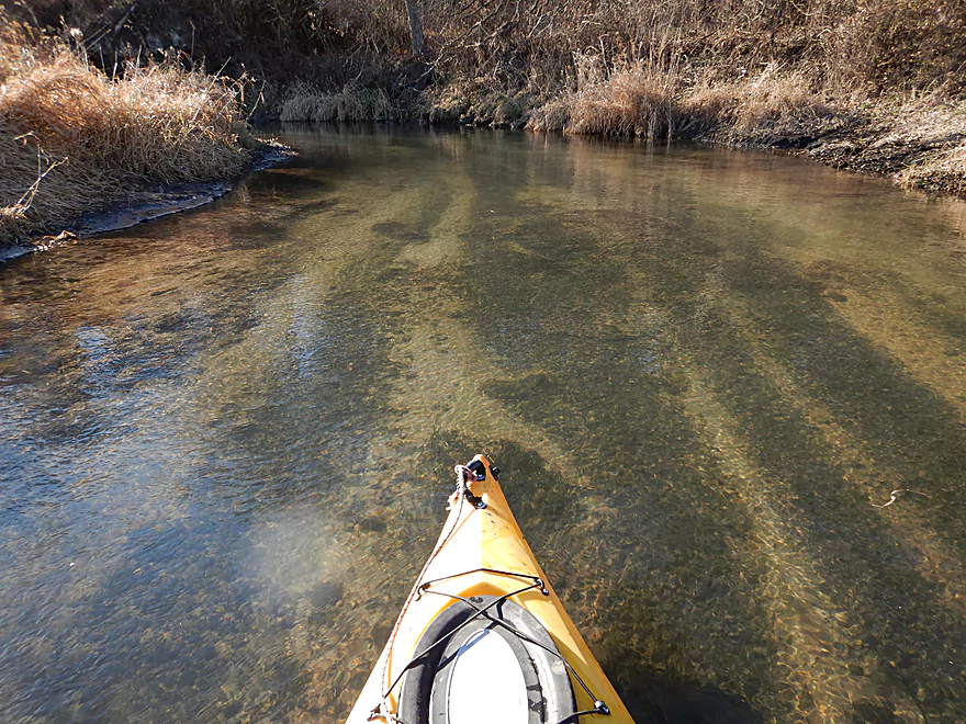
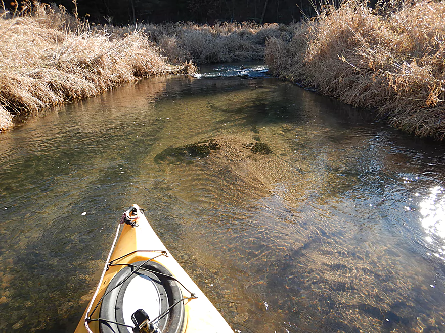
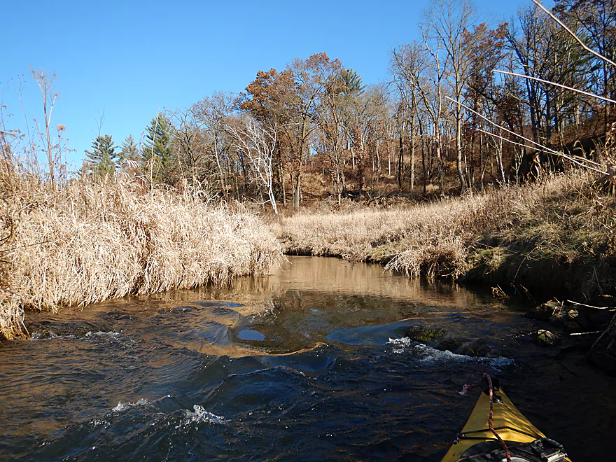
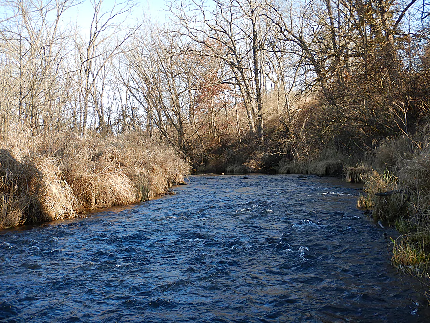
Water clarity was great
Some of the ledges looked engineered for trout
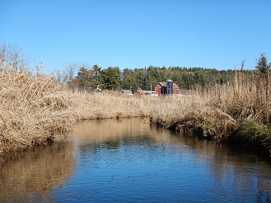
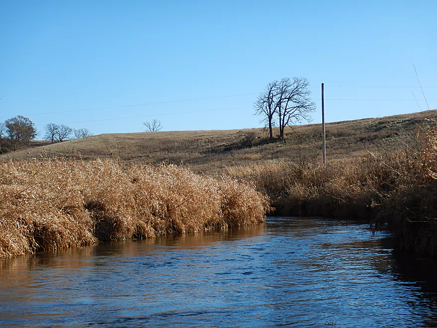
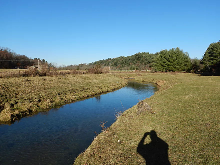
Cool pastoral scene
The Driftless Area Land Conservancy protects much of this area
Another nice outcrop
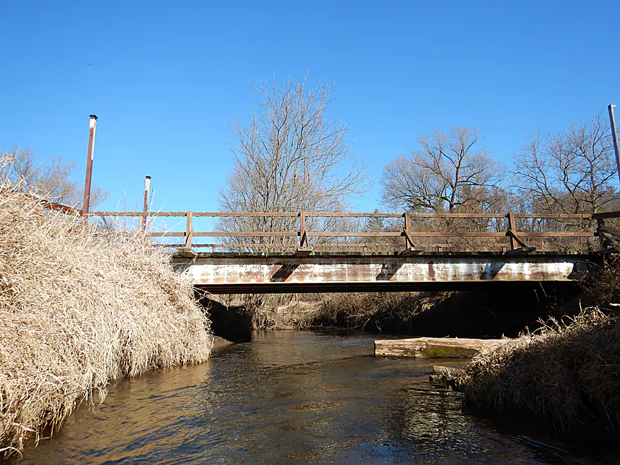
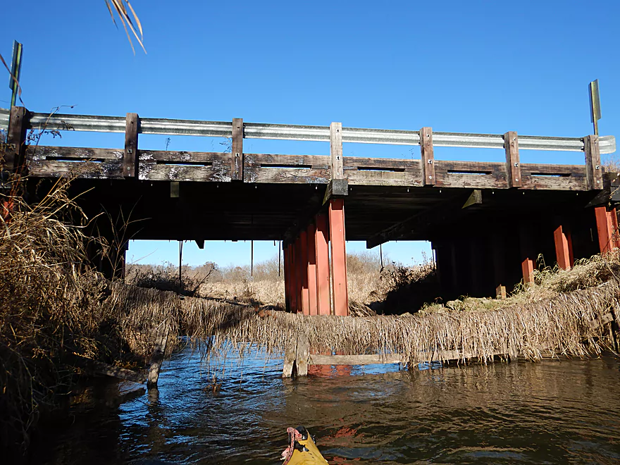
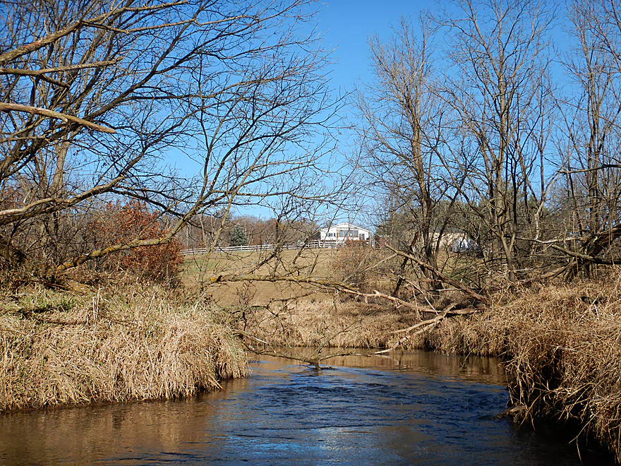
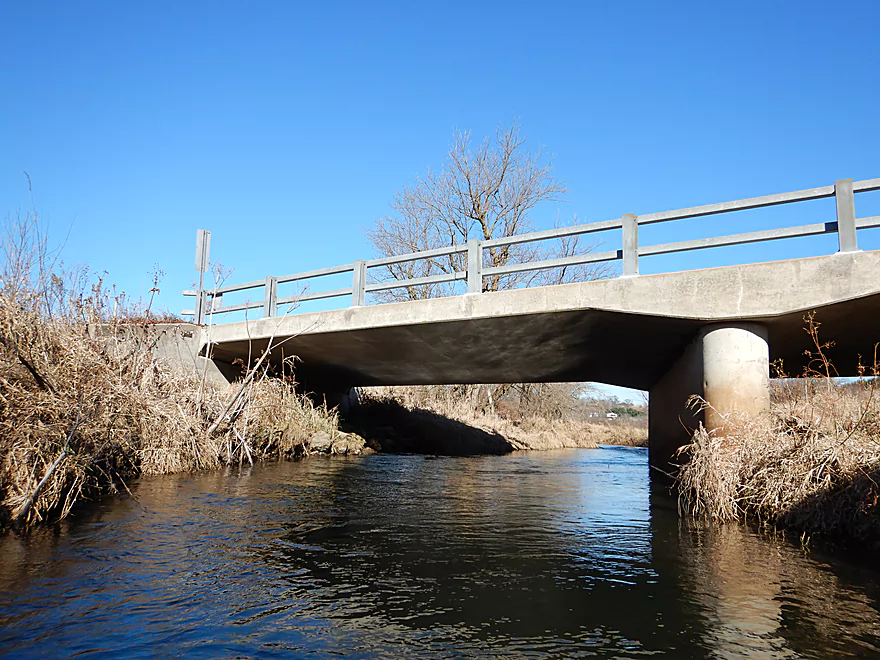
A private drive bridge
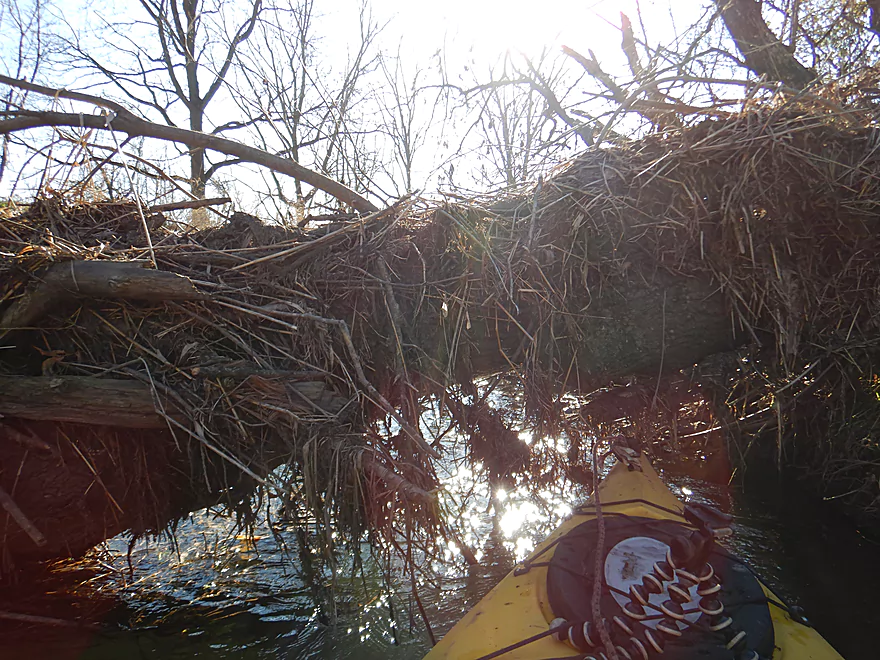
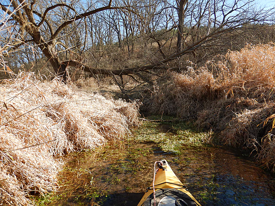
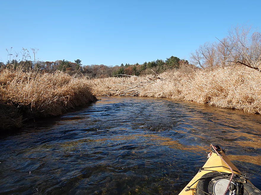
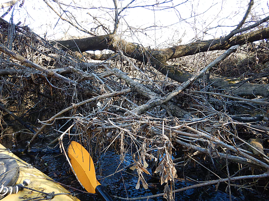
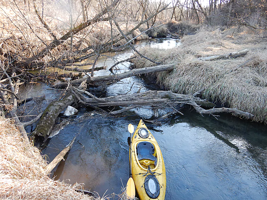
The first logjam
The second
And the third (all easy portages)
Probably a completely different creek in the summer
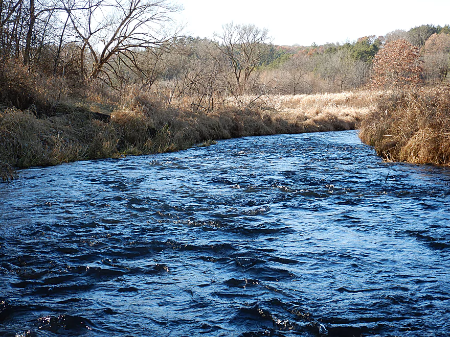
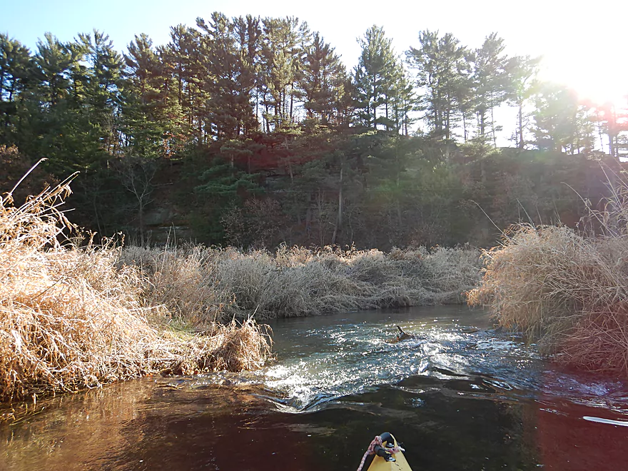
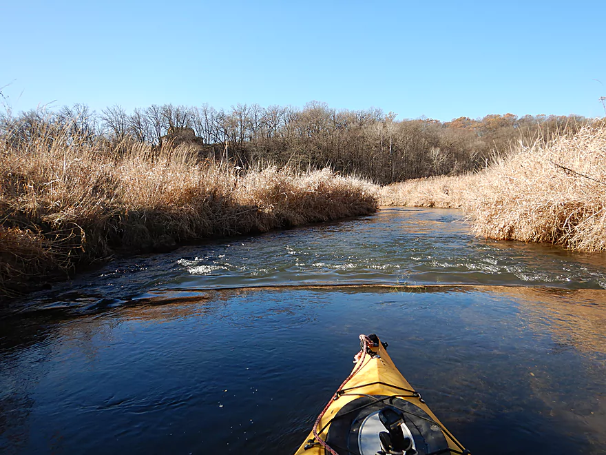
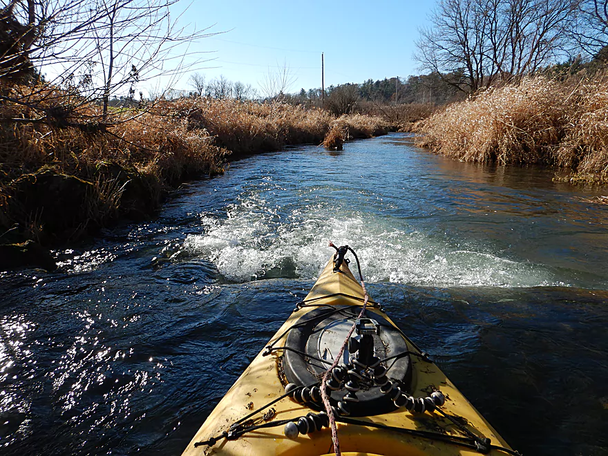
Coming up on a longer section of rapids
Very scenic
A natural spring feeds the creek
Another artificial ledge
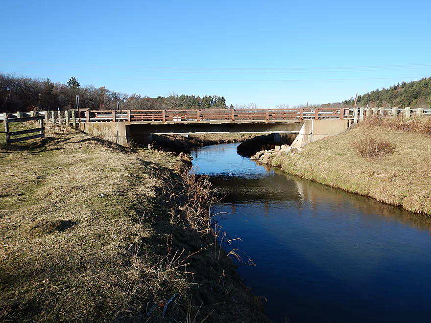
Brue Road bridge
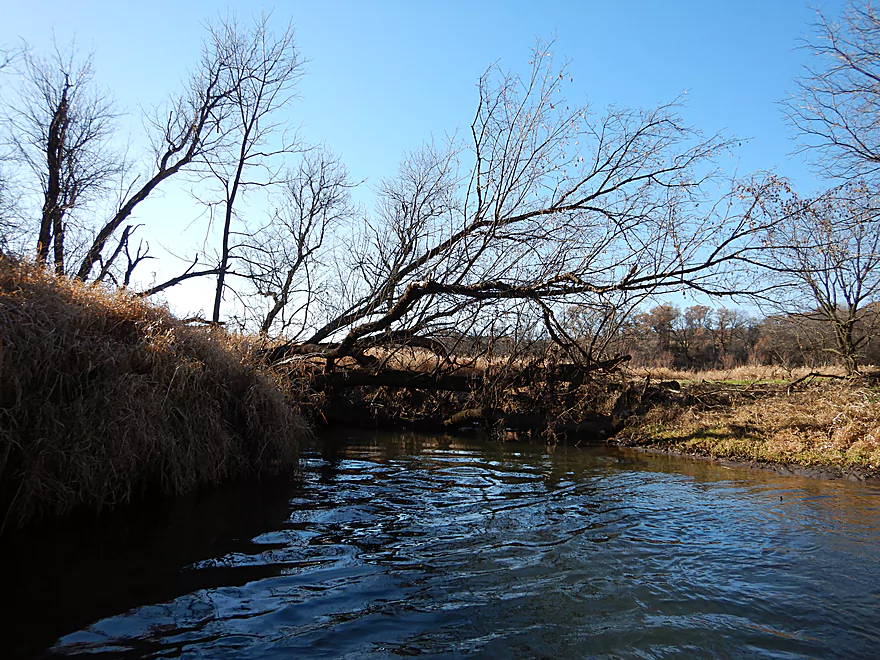
Post Brue, it starts nice…
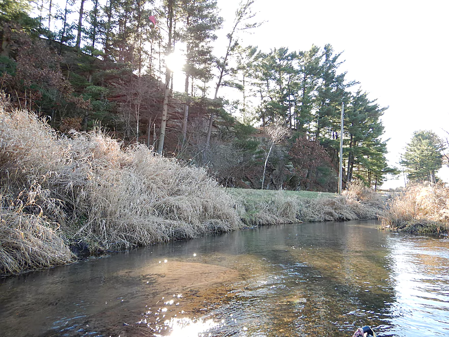
Scenic white pine bluffs to the west
Scenic prairie restoration to the east
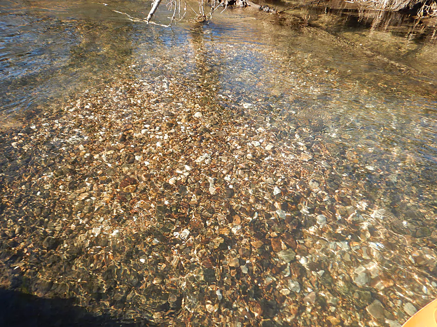
Scenic gravel bottom
But then this
And this
And a lot of this
Still a few nice outcrops
This was the last straw
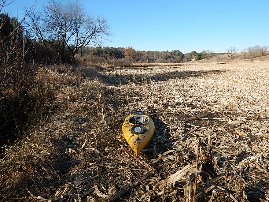
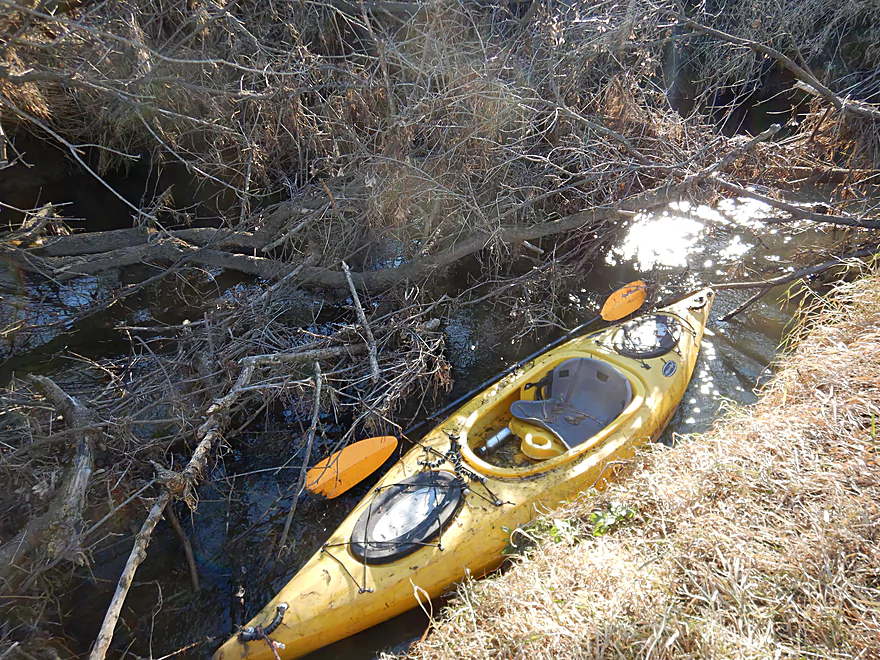
A very long portage
Even on land there is an annoying obstruction
Past the fence, there are no more jams
Nice little section
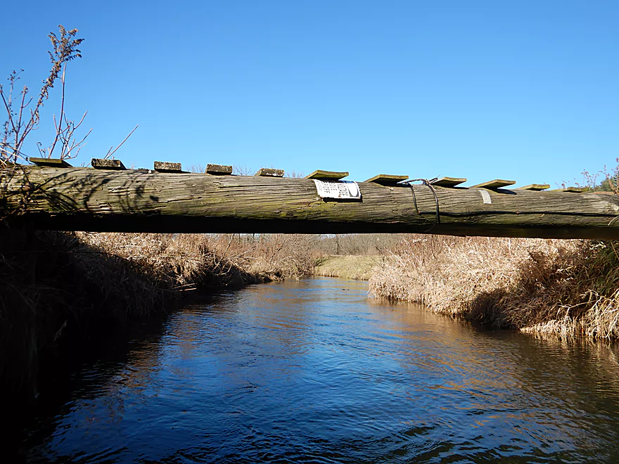
Good use for power line poles
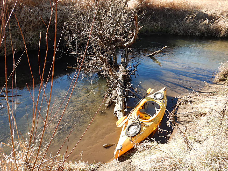
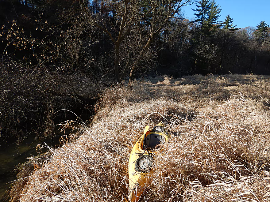
My take-out at Hwy A
Great scene to the north
Part of a public fishing corridor
Looking downstream
Extending my trip a bit to check out the rapids and bluffs
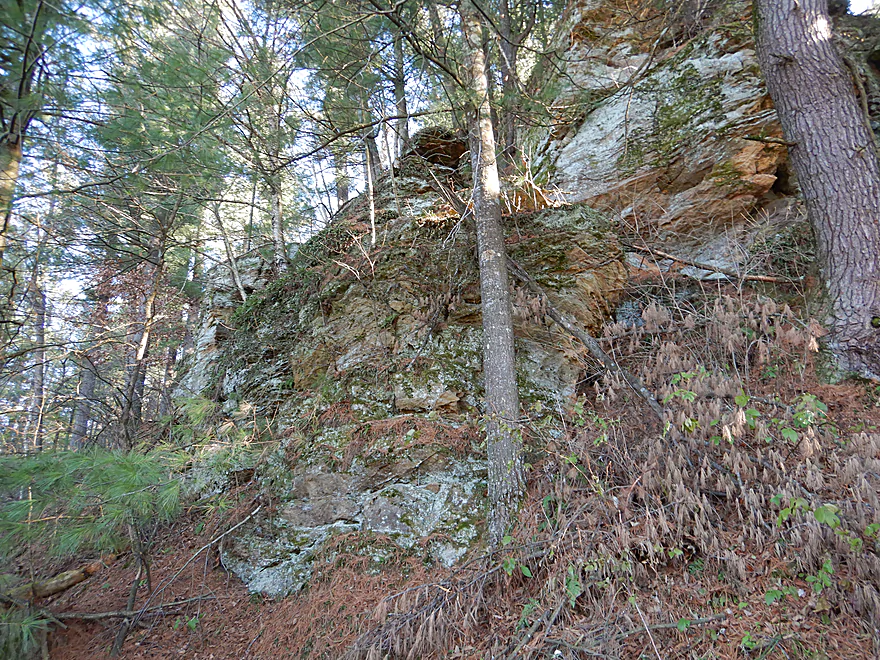
A few outcrops as well
Wading back to the take-out
A stile allows you to get through the fence

A hunter spying on me
The shuttle was really scenic
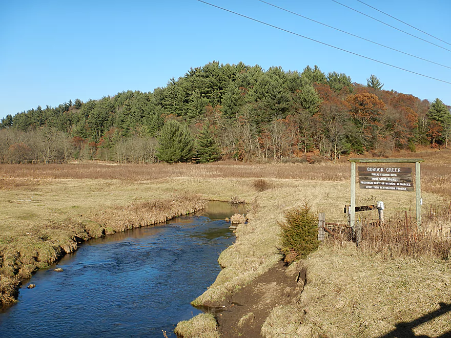
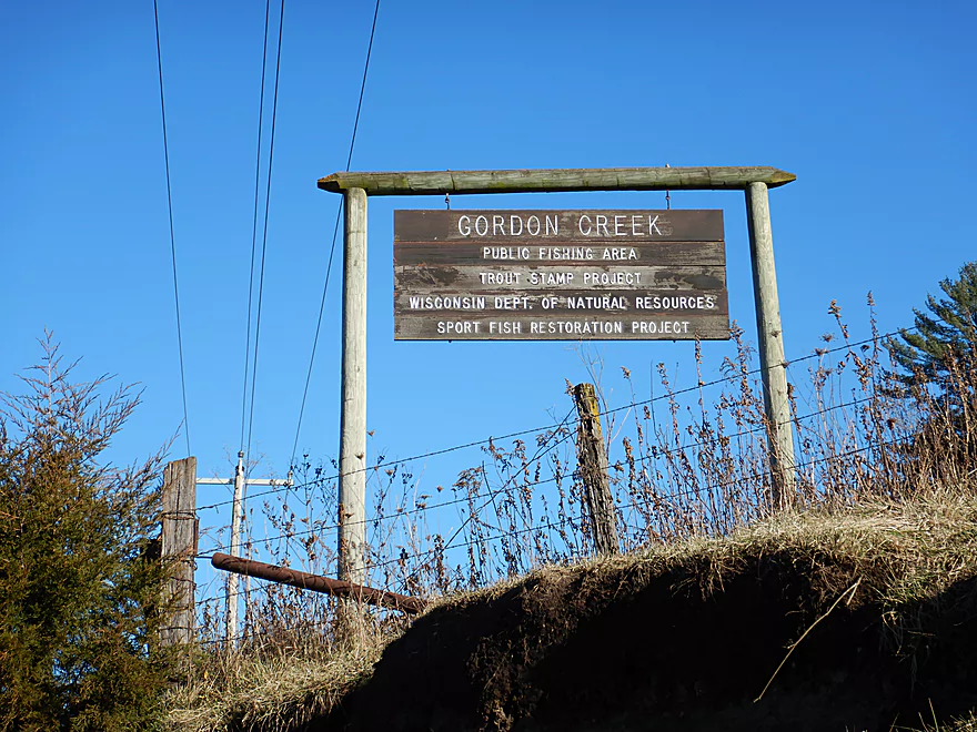
Gordon Creek

Gordon Creek is a small tributary of the East Branch of the Pecatonica River and is located about a half hour west of Madison. This creek initially caught my attention when a trout blogger talked about how much he liked the creek…but had yet to catch any fish. That’s a noteworthy contradiction…so last week I scouted it for a future 2018 trip and liked what I saw. One week later, a surprise 64 degree warm front rolled in which allowed me to paddle this a little ahead of schedule.
For paddlers, the creek can be divided into three sections. The far upper part is too small and clogged to run, while the far downstream section is too muddy and filled with logjams. The middle section however is viable with fewer logjams and the best outcrops. This part of the creek is popular with fishermen and public easements provide great access.
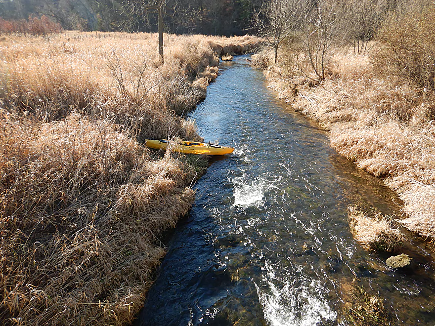
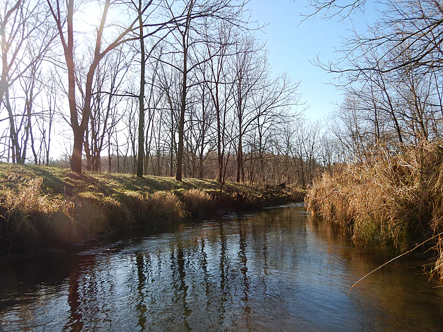
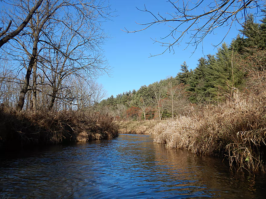
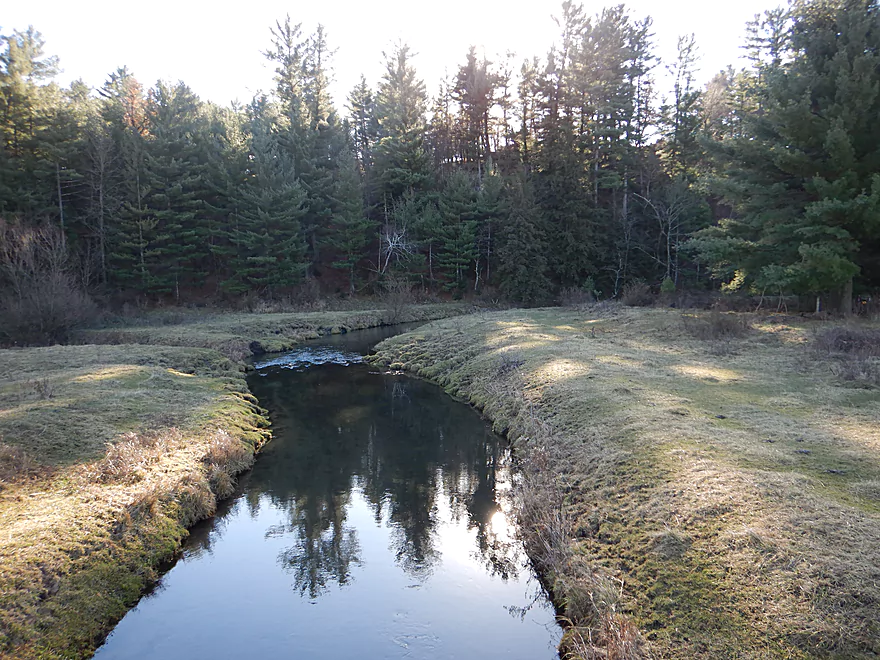
The first third of my trip was a 0.9 mile leg from the first Sandy Rock Road bridge to the second Sandy Rock Road bridge. Immediately after launching I encountered a few shallow riffles which had me worried that much of the creek would be annoyingly bumpy, but after a 1000 feet or so, the creek really fills in and this wasn’t much of a concern. Most of the creek was narrow, riffly, fast, and flanked by grassy banks…kind of reminded me of Black Earth Creek (a neighboring watershed to the north). The water was quite clear and you could see the many fish darting to and fro along the pebble substrate. There were a few runty outcrops along the west bank, but after about a half mile you’ll see some much nicer sandstone formations along the east bank. Topped with white pines and back-dropped by driftless hills, this was my favorite part of the creek. This scenic part of the creek is protected by the Driftless Area Land Conservancy and their work is very much appreciated.
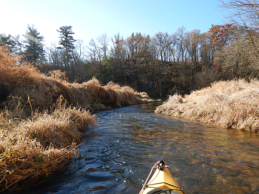
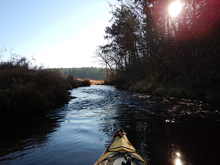
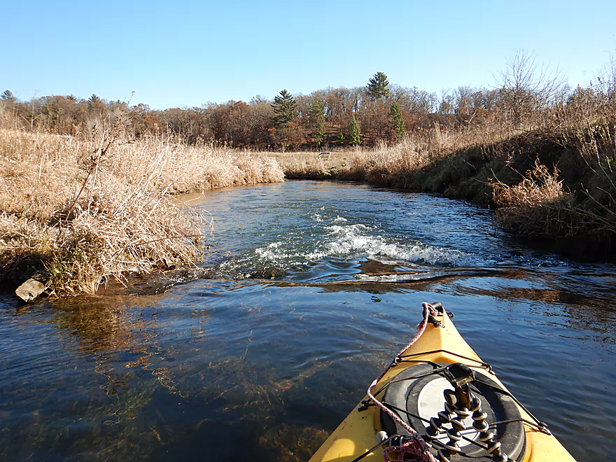
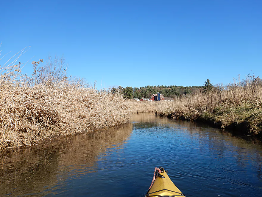
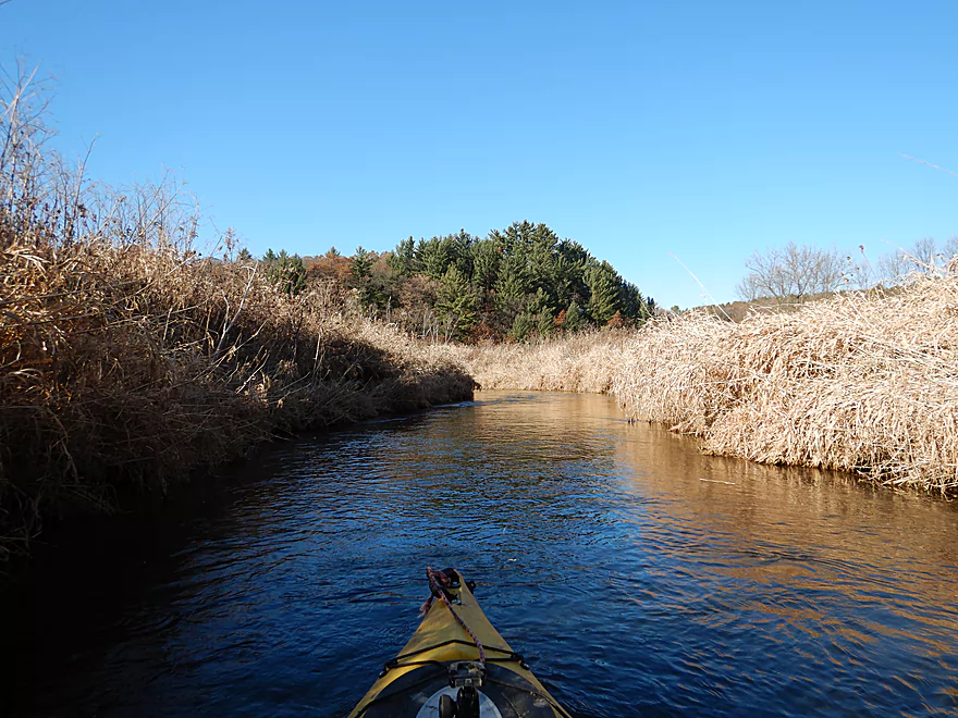
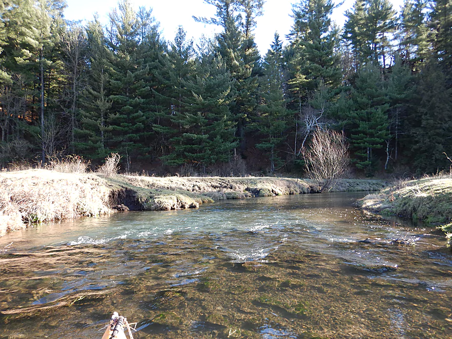
The second third of the trip started at Sandy Rock Road (second bridge) and continued to the Brue Road bridge (1.3 miles). Here the creek really opens up into a flat, wide grassy corridor which was very pleasant and peaceful. As I approached the east bank, I encountered some larger sandstone outcrops topped with white pines…these kind of reminded me of a poor man’s Willow Creek (a nice trip I did last spring). While the trip had been pretty much dead-fall free up to that point, this does change once you cross a private drive bridge. Here trees finally start to crowd the banks and there are a few downed logs to duck and dodge. Three jams have to be portaged, but are easy to do as the banks aren’t very big nor muddy. After a while the trees thin back again revealing a terrific oak savanna to the east. Under the subsequent hill, a spring seep popped up out of nowhere and fed the creek. Soon after I encountered a 150′ section of Class 1 rapids that were fun but bumpy. This section concludes at Brue Road, which would be a great take-out option.
The third section spanned from Brue Road bridge to Hwy A for roughly 1.4 miles. This leg I was particularly looking forward to as relief maps indicated there could be some large outcrops and in my head I envisioned something like the Kickapoo River. At first this started nice…the creek stayed open with great views of oak savannah hills to the east and white pine topped bluffs to the west. But once the creek got close to the westerly bluffs things started to go wrong. The banks which used to be small started to get much larger and muddier, and downed trees were everywhere. I portaged the first few, but soon realized I was wasting my time as often the next serious logjam would appear shortly after I would complete my last portage. At that point, me and my boat were quite muddy and filthy…and I was bleeding from several portage wounds. The next logjam had very steep, muddy banks with nothing to step on, which forced me to dig my hands and feet into the mud to climb out like a rock climber. A royal pain…on top of this I was pulling my kayak up with rope when the paddle broke free from its holder. I had to completely descend back down to rescue my paddle which was floating away and reascend all over again. At that point I gave up on the creek and portaged the next half mile along a farmer’s recently cut corn field. Needless to say, that wasn’t fun either. The whole point of doing this section was for the outcrops and while there were a few, most were quite recessed and hard to see…definitely no Kickapoo.
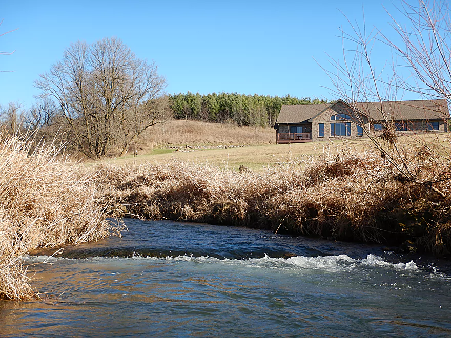
At the end of the corn field, a barbed wire fence provided some difficulty in getting past, but once on the other side I was finally able to get back onto the water and there were no logjams for the rest of the trip. This final stretch was actually quite nice with a fantastic white pine bluff to the east and another to the south. The take-out was at Hwy A which was plenty doable. From the bridge you have a fantastic vista of the creek (north and south) and you would never guess that there were such horrible logjams hiding upstream (and downstream).
Being curious, I intentionally overshot my take-out to explore the immediate downstream section of the creek for an additional 1000 more feet. Here the creek flows though a horse pasture and a public trout easement. The channel flattens out into some shallow rapids and is flanked by some small outcrops and bluffs. It’s a neat scene, but I was getting tired so waded back to the take-out to end the trip prematurely. Had I continued maybe 1000 more feet, I would have seen among the biggest and best outcrops on the creek (which you can see partly from Hwy A).
In conclusion, this is a neat creek and was a fun adventure. But if you do this, you must skip the section from Brue Road to Hwy A…just too many logjams. But still…consider driving by the Hwy A fishing access to check out the scenery, which is quite striking, and perhaps wade downstream along the fishing easement to see the sandstone outcrops.
Webmaster’s note… In my previous review, I wrote a wrap-up and eulogy for the 2017 season thinking that would be my last. Oops… Hopefully that wasn’t too confusing to readers. If you are looking for 2017 closure, just read my last Blue River Review.
Great access by the first Sandy Rock Road bridge (not to be confused with the second Sandy Rock Road bridge just a little downstream). This is a public access area created for fishermen, and it is easy to park along the shoulder and launch onto the creek below some light rapids.
Hwy A is an ok take-out option. Decent shoulder parking, but a longer guardrail will require you to drag your boat 180′ to reach your car. This immediate area is grazed by horses and you’ll have to negotiate a fence to reach your car…but this is doable as a stile has been constructed for trout fishermen. Immediately downstream, there is a scenic ridge with a few outcrops and white pines that you can explore if you wish (it is along a public fishing easement).
I do not recommend paddling the 2.8 miles to the next bridge (Hwy 39) as that leg likely has too many logjams. In fact, you shouldn’t even paddle up to Hwy A because of those preceding logjams as well (unless they get cleared out). Instead, stop your trip at Brue Road….but still drive by Hwy A after your trip to check out the area from the road.
The bike shuttle from Hwy A to Sandy Rock Road1st is 3.8 miles and includes 312′ of climbing and 289′ of descent. My front bike tire sprang a leak and I did have to walk this entire section unfortunately. This wasn’t so bad as the shuttle from Brue Road to Sandy Rock Road is quite scenic with a number of outcrops and great vistas of the creek. While typically I prefer to bike shuttle, hiking shuttles are certainly an option for paddlers. Figure 10 mph for a bike and 2.5 mph for a hike…if that math agrees with you, then don’t discount the idea of a hiking shuttle (especially if there are steep hills).
The current is quite quick and there are a number of riffles and light rapids. But nothing serious though… Maybe 2-3 Class 1’s and many Class .5’s.
There is a low swing gate spanning the creek immediately past the second Sandy Rock Road bridge that I was able to sneak under, but paddlers in bigger boats may need to portage this. The only other noteworthy fence is maybe a quarter mile upstream of Hwy A. This barbed wire fence is a bit tricky to get over (even on land).
Then there are the logjams. For the first half of the trip, there weren’t any. But after the private driveway bridge (about halfway between Sandy Rock Road and Brue Road), there are three logjams that will likely require portages, but these are pretty easy and two of the portages can be combined.
After Brue Road, it is a different story. There are maybe ~15 logjams along the west bluff. Some of these portages are quite difficult because the banks are steep and muddy here. I ended up doing a monster portage (~2000′) that wasn’t fun. Once you reach the barbed wire fence, that will mark the end of the logjams until Hwy A.
Here is a super rough guestimate depth guide based on the Black Earth gauge (a watershed just to the north):
- 0-30 CFS: Near drought conditions. Likely too shallow.
- 31-40 CFS: Pretty shallow, but should be runnable.
- 41-60 CFS: Good depth. Trip done at 54 CFS and while there are a few shallow areas most of the creek was plenty deep.
- 61-80 CFS: Higher depth, but should be navigable.
- 81-100 CFS: High depth…some low duckers might have to be portaged.
- 101+ CFS: Very high depth…current might be too pushy at this point.
Not much typical for late fall. The creek itself had a surprising number of fish (likely trout) and there were a number of eagles that soared above the white pine bluffs. At the take-out there was a large flock of turkeys looking for snacks from a recently harvested cornfield.
Blue Mound State Park is just 7 miles to the north and if you haven’t visited it before, it is worth checking out. While the park has a great hiking and cross country trail system, the highlights are its two lookout towers atop the largest hill in Southern Wisconsin. Bring your binoculars! From the east tower, you can see the state capitol and the Wisconsin River valley including Ferry Bluff. On the west tower (which can have spectacular sunsets), you can see parts of Illinois.
- Upstream of Clay Hill Road: I suspect all sections this far upstream are too clogged to run.
- Clay Hill Road to Sand Rock Road1st: 1.8 miles. Ok put-in used by trout fishermen. There might be ~15 logjams in the first half of the stretch, but likely 0 in the second half. I believe there is public access right where the logjams stop, but I’m not sure.
- Sand Rock Road1st to Hwy A: 3.7 miles. Reviewed here.
- Sand Rock Road1st to Sand Rock Road2nd: 0.9 miles. Great section…small, fast, and with several nice outcrops.
- Sand Rock Road2nd to Brue Road: 1.3 miles. Good section with a few more scenic outcrops, but 2-3 logjams to portage (easy).
- Brue Road to Hwy A: 1.4 miles. There are too many logjams to recommend this section. Otherwise there is some nice geology here and the take-out is scenic.
- Hwy A to Hwy 39: 2.8 miles. Likely too many logjams to recommend. The most scenic sections are near Hwy A.
- Hwy 39 to W. Moscow Road: 2.9 miles. Likely some scenic parts, but maybe 8 logjams.
- W. Moscow Road to Hwy 78: 1.1 miles. Maybe 9 logjams. There appears to be a scenic ridge along the west bank.
- Hwy 78 to Blanchardville: 1.0 miles. Maybe 16 logjams…looks awful. Take-out is on a public boat ramp directly on the mouth of the East Branch of the Pecatonica.
For more information on the East Branch of the Pecatonica, see my 2014 review.
Trip Map
Video
Photos Size:
Hi Fellow Creek Dweller. I really like your informative site. Your videos and descriptions are really well done. All should enjoy – and learn!
To point: Gordon Creek is a pretty small creek, as are many others in Wisconsin, especially in the driftless region. On such small streams, how do you handle the situation where an angler is say right there in the middle when you come upon him/her?
The angler is there first, and has a sort of temporary “dibs” on the spot – trying not to disturb things, keeping quiet to not scare trout, preparing tackle and setting-up to cast, hoping another angler won’t just barge on in for the brief while they are there (before they soon move on to the next fishy looking spot).
But then the kayaker comes into the picture and changes or “complicates” the game. Who has the right of position or “control”, so to speak, in these situations? Should the angler just throw in his hat and not say a word when the fishing (and “his” spot) is now upset? (given trout are skittish creatures). Is the kayaker now like someone in the movie line who jumps ahead and gains an advantage over the other?
Please inform if you will, the “official” protocol (if there is one, which I think there should be) for this now-more-frequent on-stream meeting. An old Trout Angler wanting to know how to play the new game. Thanks, Dennis
I don’t think there is an official protocol. I usually say hi or something so the fishermen knows I’m there and won’t tangle with their lines.