
Put-in off Old Stage Road
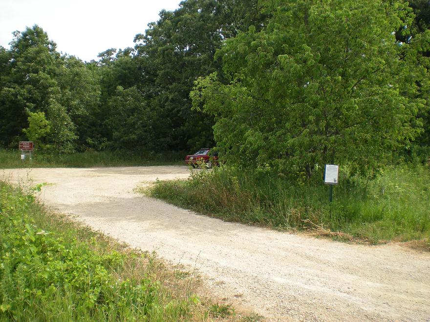
Nearby parking
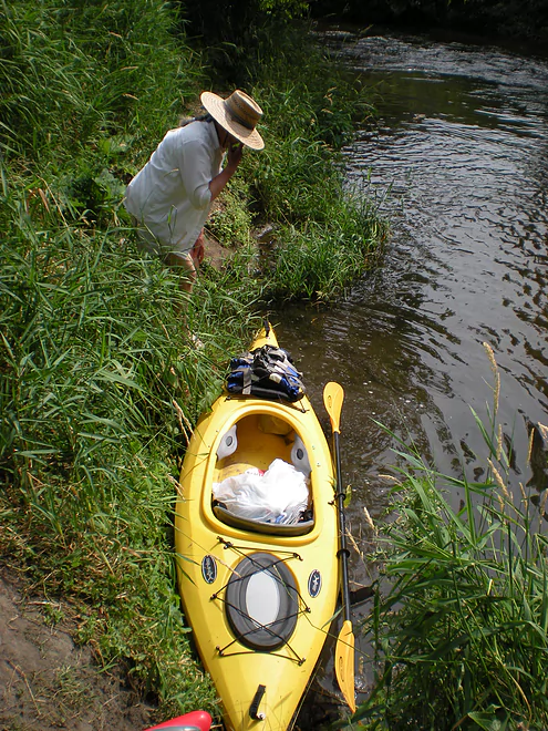
Brushy launch area
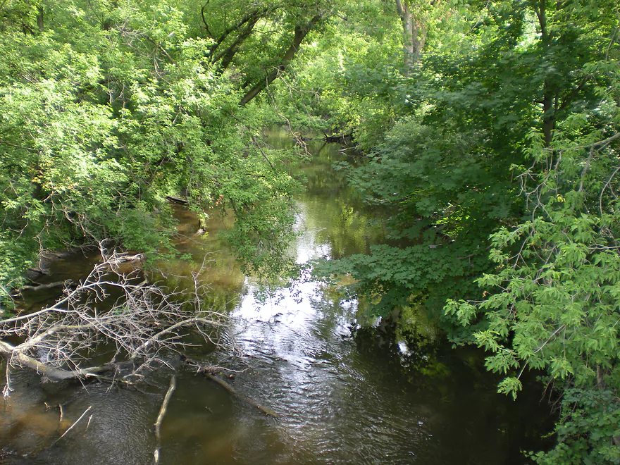
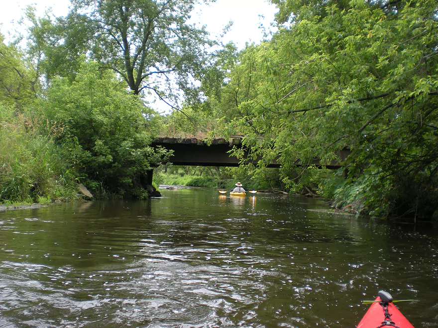
View from bridge
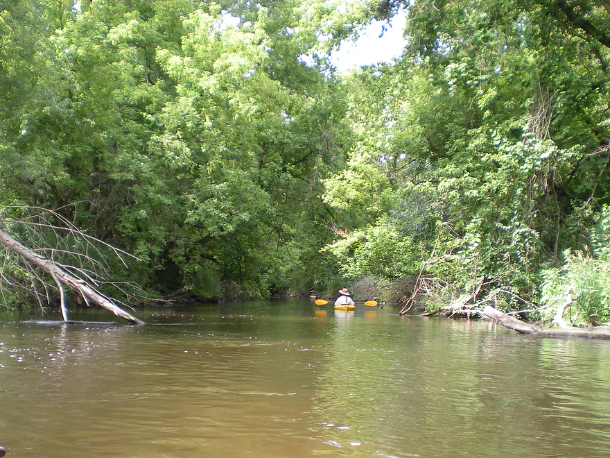
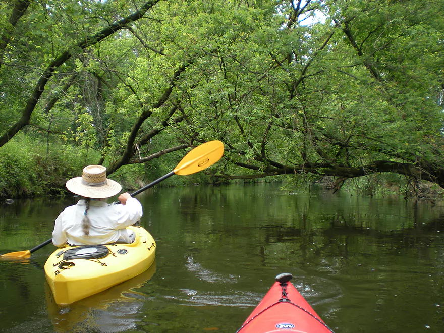
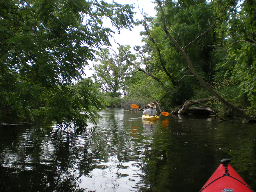
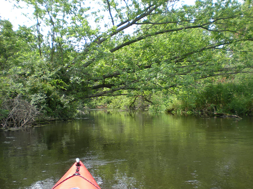
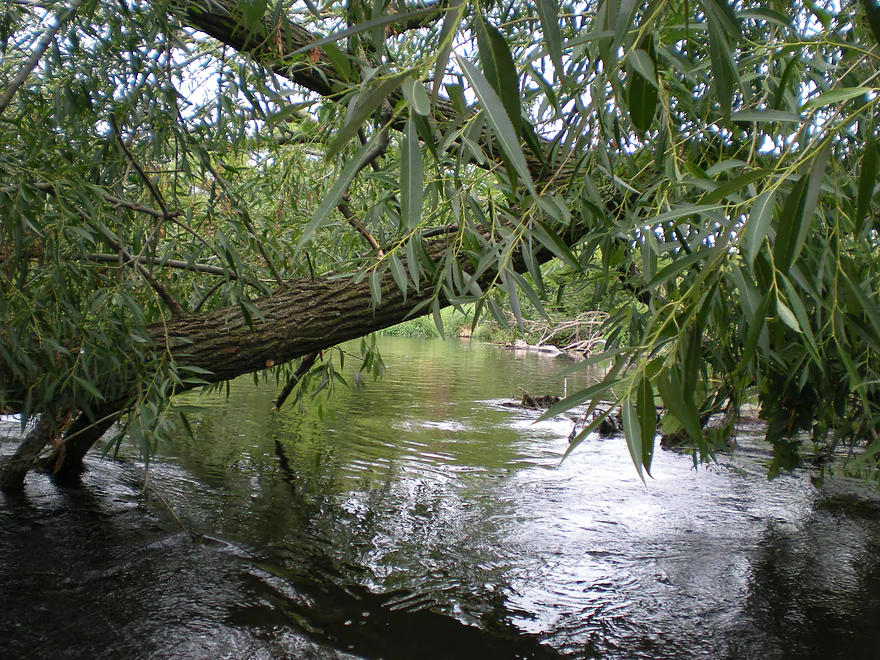
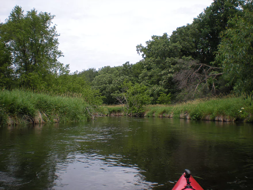
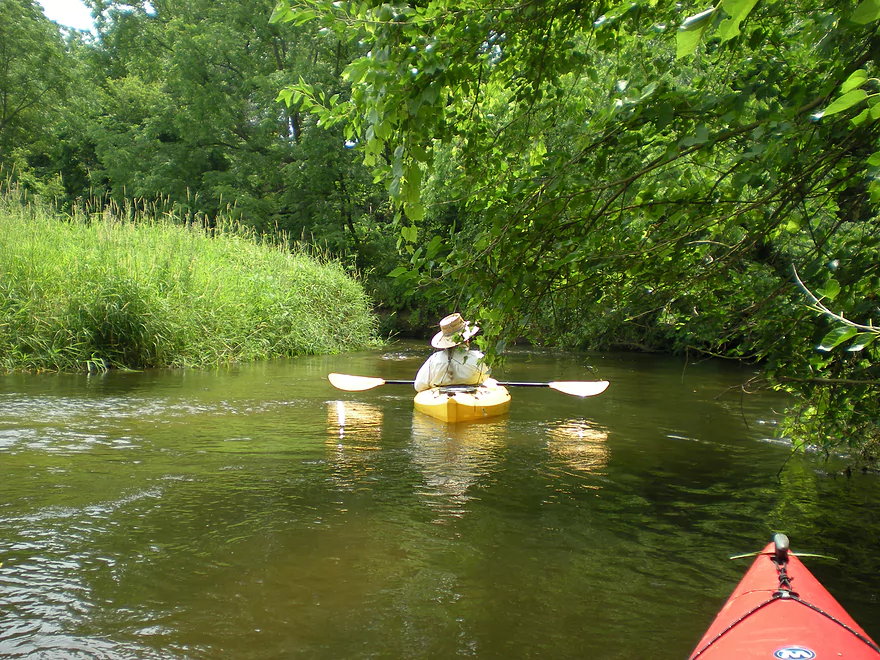
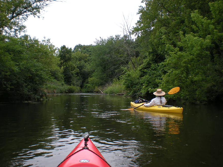
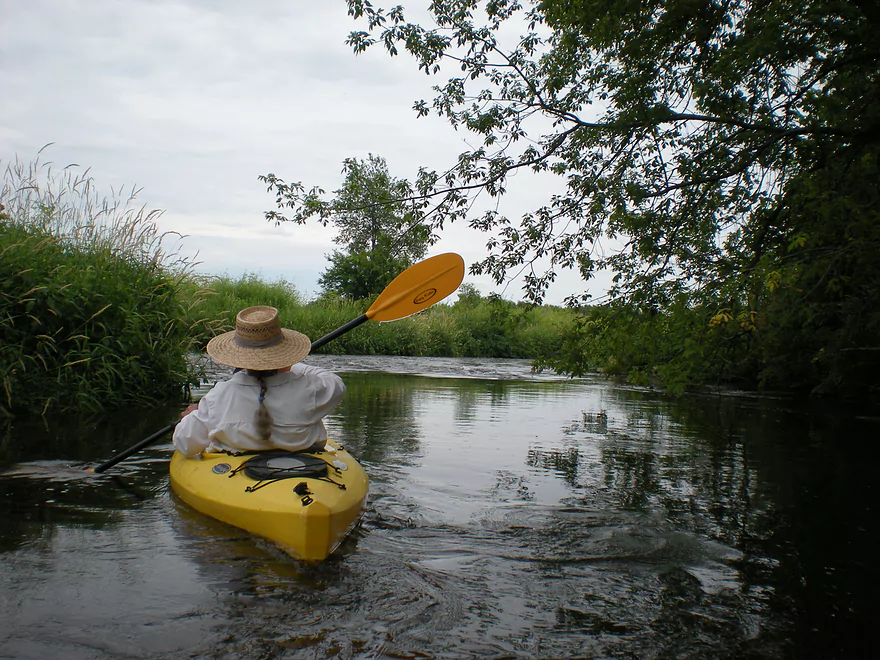
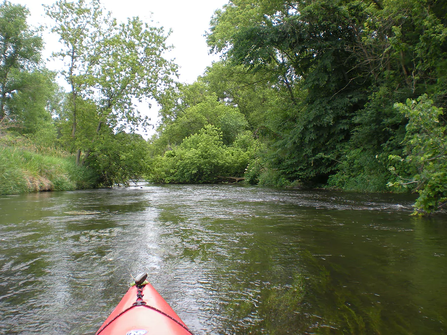
Thick overhanging canopies to start
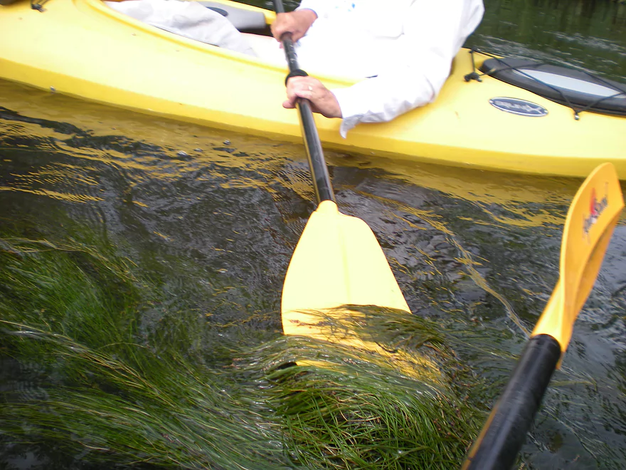
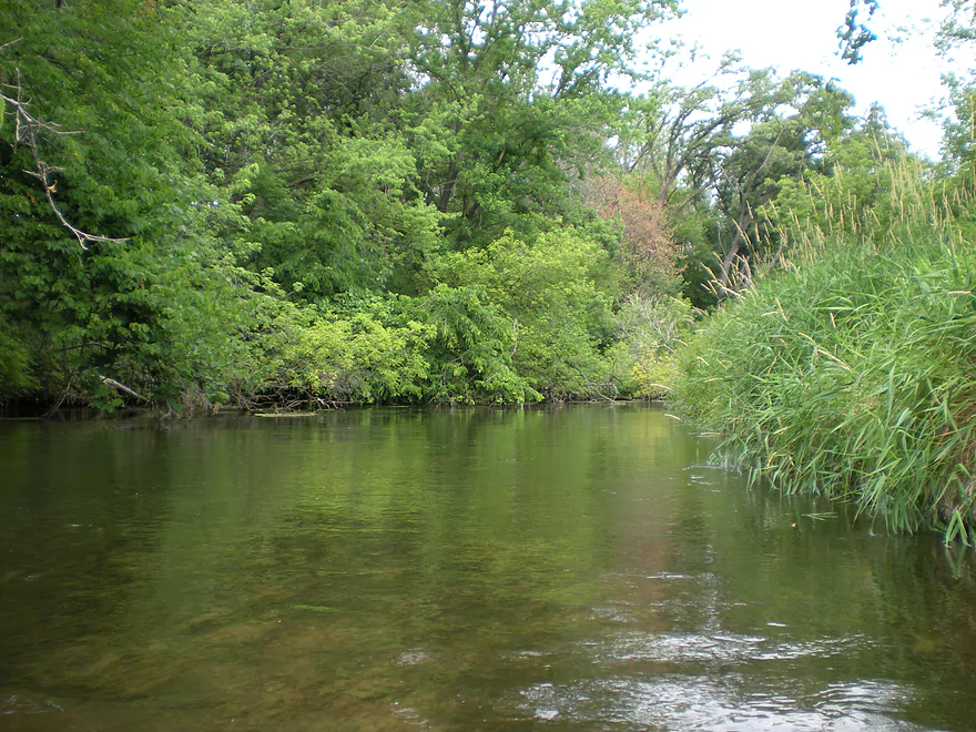
Many flowing pondweeds
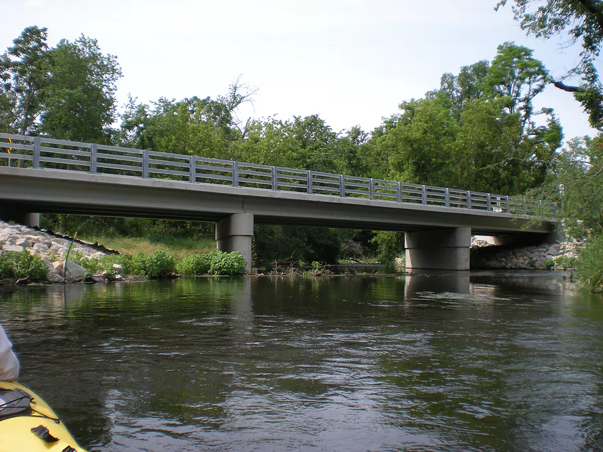
W. Leedle Mill Road
Evidence of cleanup work
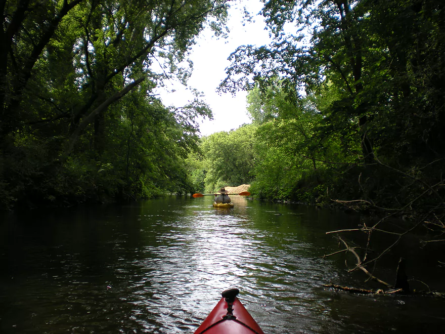
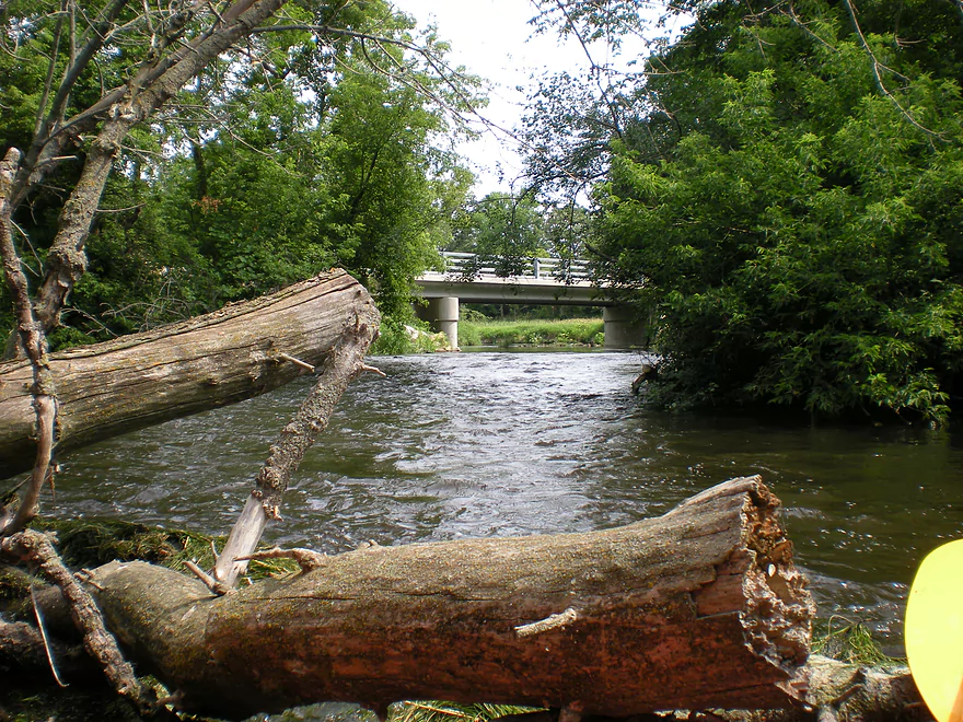
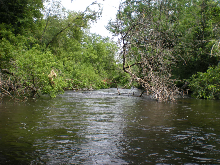
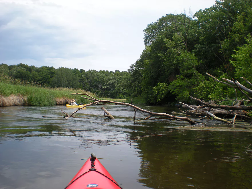
Some tree dodging but not jams
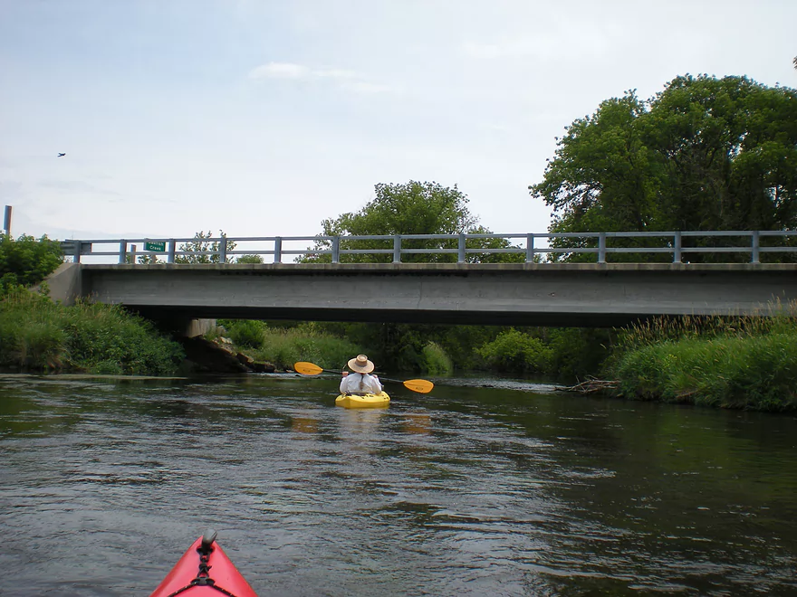
Hwy 138
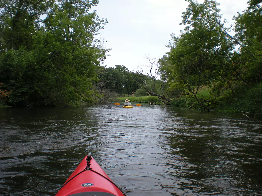
Always a way through
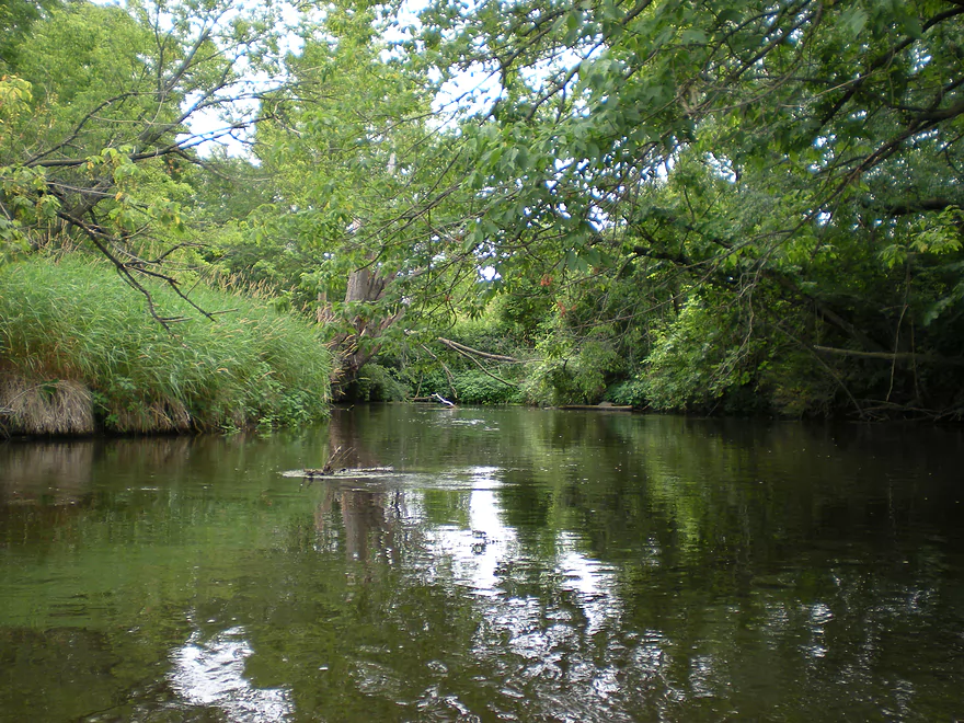
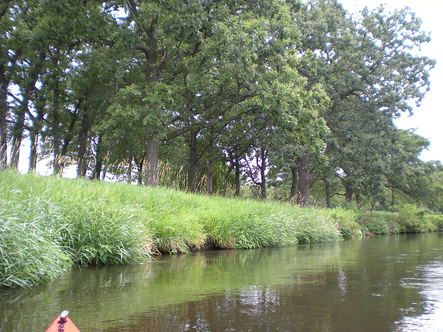
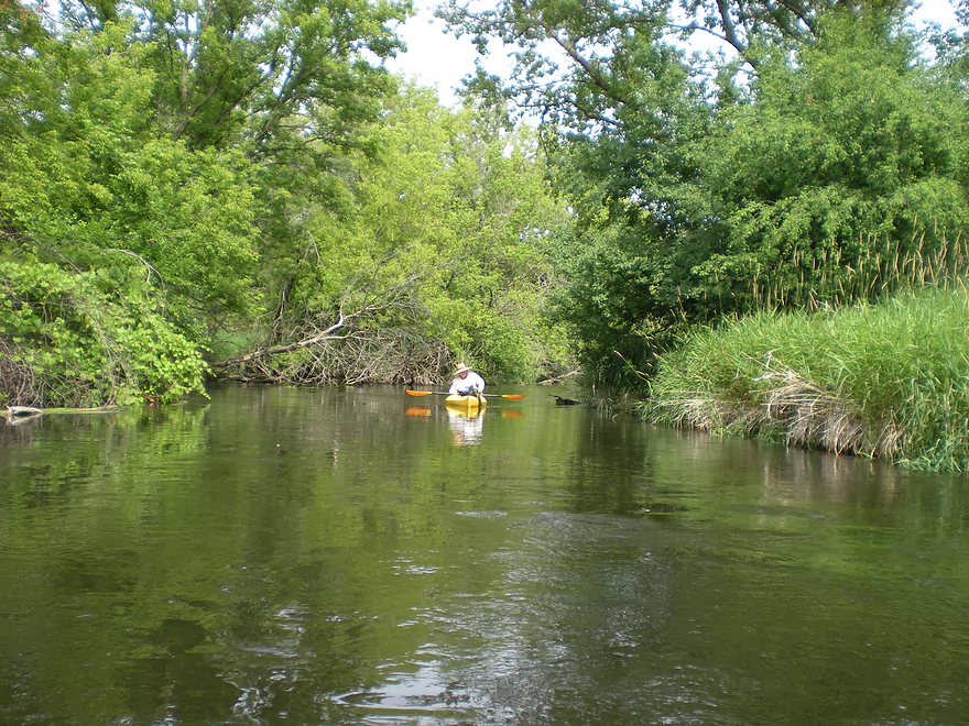
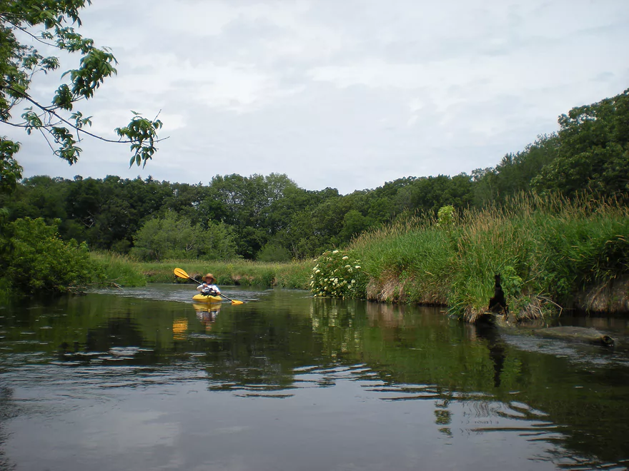
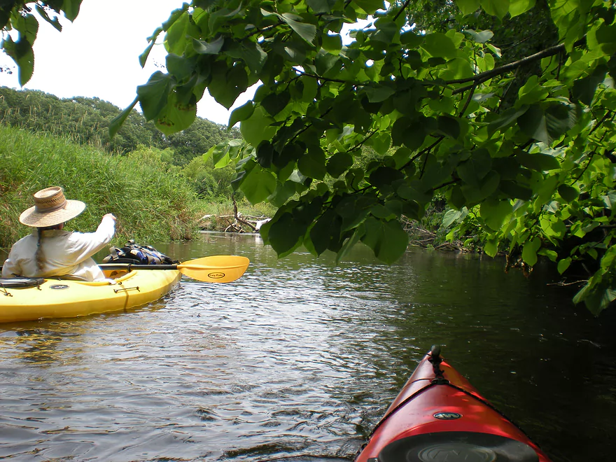
An oak savanna
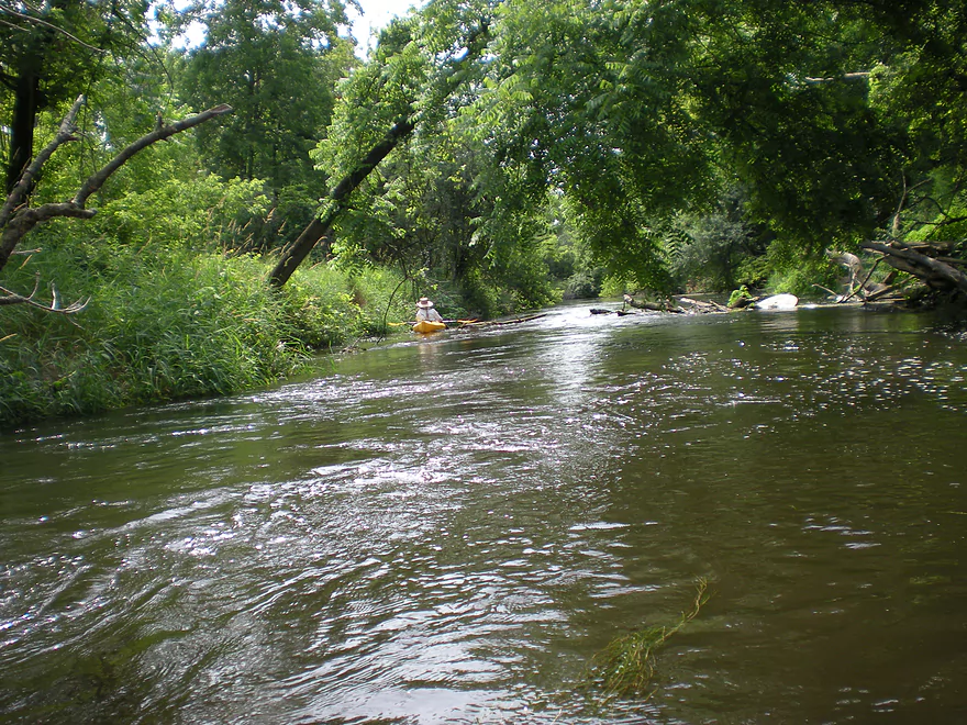
Current is always moving along
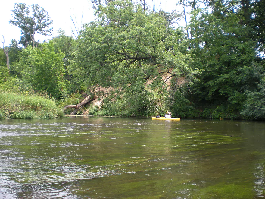
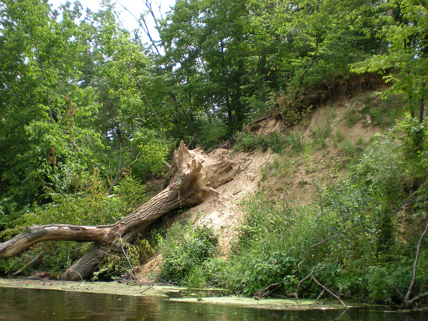
Large sand bank
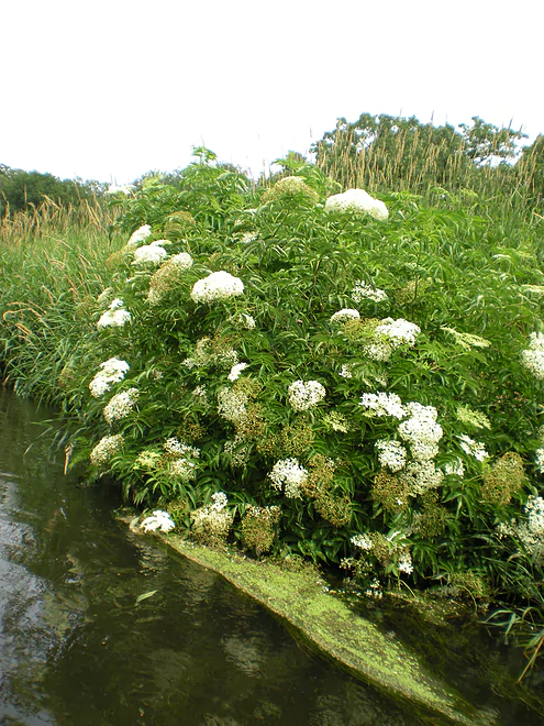
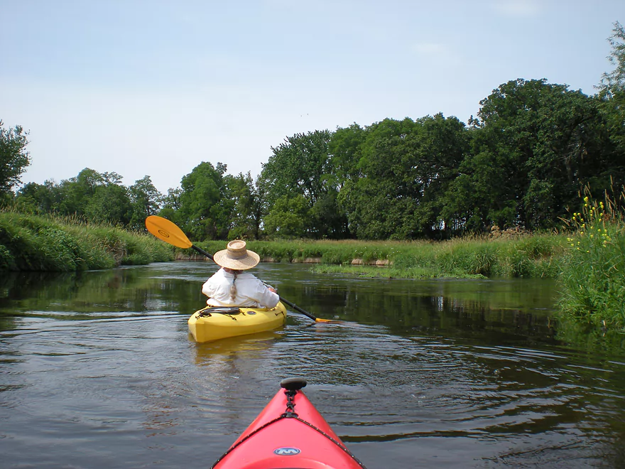
Wildflowers on the banks
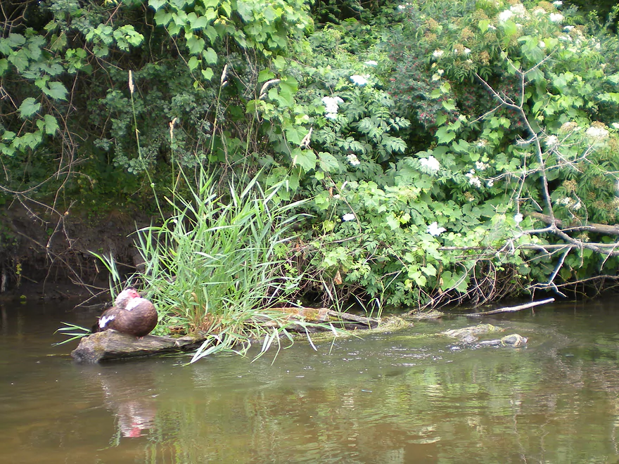
An unhealthy looking duck
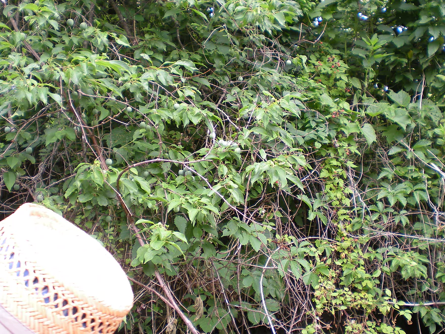
Wild plumbs and berries
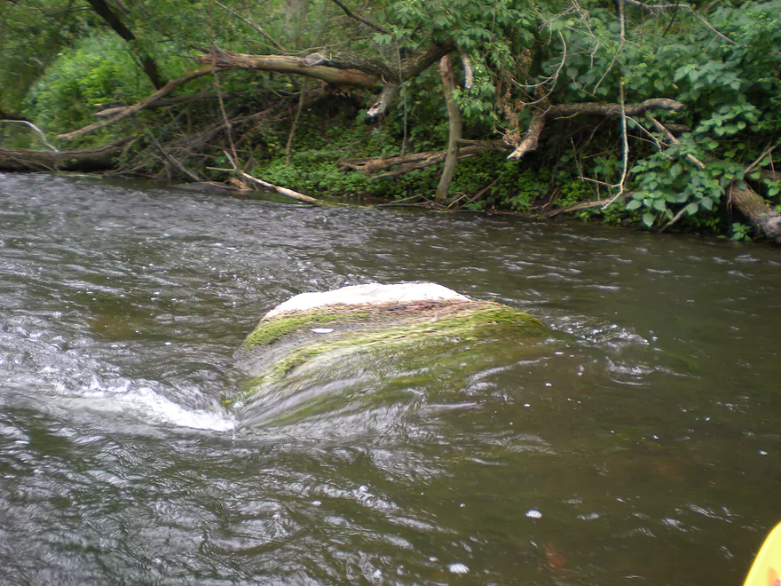
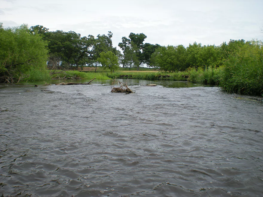
A visual representation of the current
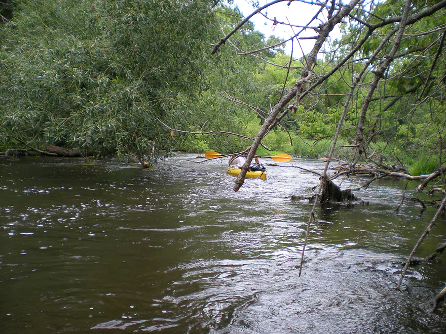
You do need to stay on your toes
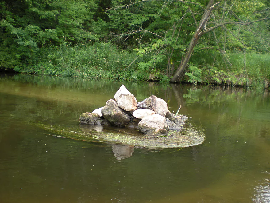
Does not look natural

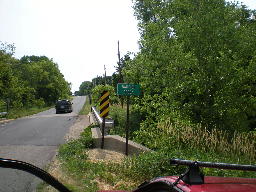
Taking out by N. Casey Road
Badfish Creek

This ‘creek’ is probably one of the best kayaking prospects in southern Wisconsin. Quite large, the Badfish Creek should perhaps instead be referred to more accurately as Yahara West. This was kayaked during the height of the 2012 drought, and we had little problems with navigation. The key thing to know, of course, about this creek is that it gets a significant percentage of its water from Madison’s sewage plant (which uses elaborate canals to divert the discharge west of the Yahara before emptying into the Badfish. Despite this…the Badfish is actually cosmetically extremely clean. I don’t know if you would want to go swimming in it…and it is recommended to do any trips early in the morning so you are off the water by 2:00 (when Madison discharges their waste water). But, despite this contradiction, the Badfish is one of the cleanest ‘rivers’ I’ve been on. The bank quality is excellent and is probably due to the discharges, which keep water levels stable even during droughts.
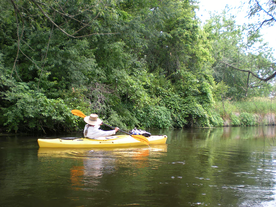
One of the best things about the Badfish is the current. It is quite swift, but never really dangerous for a competent kayaker. There are many riffles that are fun to scoot through. The banks tend to be varied…with diverse grass lands, oak savannas and forest corridors hugging the creek. There were black raspberries and wild plum trees on the banks, which can provide snacks when in season. Wildlife is decent in the area…we saw a doe and lots of insects (the good type–like dragonflies an damselflies–as opposed to mosquitoes/horse flies). We saw a pretty sickly duck…and hope that wasn’t because of the water. The pond weeds in the water are quite cool…you’ll have to see them for yourself.
The first section of the trip is probably the nicest. You are swiftly propelled through a forest canopy and soon meet up with riffles. You can see evidence of former log jams that other boaters have cleared away. There is still some ‘head-ducking’ and sharp maneuvering here and there, but all in all, nothing that you have to get out of your boat for. The Badfish then opens up a bit into more grassland…but soon returns to riffles and pockets of forest. Near the end of the trip, it’s mostly grassland, but there are still occasional riffles. I read reviews that described sandbars, but I didn’t really see any.
You can extend the trip by putting in earlier (see the map) but there are apparently a couple of serious log jams up there. You can extend the trip after Casey Road (very popular) and take out on the Yahara…but I believe there might be some obstructions on this section (probably cleared out by now) and this section is not as scenic. Again, don’t let the sewage references scare you away from this as it is very much worth doing. Some reported smelling an odd chlorine smell…which we absolutely didn’t. Then again we went early in the morning before the discharge…which we highly recommend. On the subject…bathrooms are not to be found at either the main pick-up or take-out…so plan accordingly. I believe if you want to split the trip in ‘half’ (the first half is better) you can possibly do so at Hwy 138 near Cooksville.
Editors Update — I received the following update from Dave concerning creek conditions:
I’ve paddled Badfish Creek dozens of times and assure you it is not just cosmetically clean. Since improvements were made in sewage treatment and disposal, the fish populations in Badfish have rebounded, which is why kingfishers and great blue herons are commonly seen.
Detailed Overview
- Hwy B to Rutland Dunn Town Line Road: 2.5 miles. A challenging section because of the steep put-in, low clearance bridge and logjams.
- Rutland Dunn Town Line Road to Sunrise Road: 2.5 miles. A good prospect with one dam to portage.
- Sunrise Road to Hwy 138: 1.4 miles. A good prospect with maybe a few jams, although Hwy 138 might not be a good access point.
- Hwy 138 to Hwy A: 2.8 miles. A good prospect, but again Hwy 138 is very busy.
- Hwy A to Old Stage Road: 4.2 miles.
- Hwy A to Old Stone Road Landing: 1.6 miles. A mediocre section...good clarity and current, but uninteresting scenery and poor bank quality. One logjam just above the put-in.
- Old Stone Road Landing to Old Stage Road: 2.6 miles. Starts open and channelized...not as interesting. The last half through dense woods in the Badfish Creek State Wildlife Area is terrific though.
- Old Stage Road to North Casey Road: 5.0 miles.
- Old Stage Road to Hwy 138: 1.9 miles. The best section on the entire creek.
- Hwy 138 to Riley Road: 3.1 miles. Probably the second best leg on Badfish Creek.
- Riley Road to Yahara River/Hwy 59: 5.0 miles.
- Riley Road to North Casey Road: 2.0 miles. A more open stretch but still very nice with great current and clear water.
- North Casey Road to Hwy 59: 3.1 miles. The final stretch on Badfish Creek. Starts open but then flows through a more wooded stretch. Not as scenic as previous legs, but still very nice.
Trip Map
View Badfish Creek in a larger map
Overview Map
Video
Photos Size:
I’ve paddled Badfish Creek dozens of times and assure you it is not just cosmetically clean. Since improvements were made in sewage treatment and disposal, the fish populations in Badfish have rebounded, which is why kingfishers and great blue herons are commonly seen. Please update your review to reflect this more accurate state of affairs.
Thanks again Dave for the comment. I’ve included your update of the creek conditions in the writeup above.
Any idea what fish species are in here? Different fish in different sections? I live very close and enjoy the scenery on this creek. I’d love to wade and fish it. Thanks!
Wish I knew, but am unfortunately not good with fish species. You might check with the Dane County Conservation Department: https://www.countyofdane.com/lwrd/contact.aspx
Has anyone gone through Badfish creek this early in the season (Spring 2015)? Trying to figure out if the creek is clear or if portaging is necessary.
Can people rent canoe/kayak for these creek trips or do we need to have our own equipment?
THANKS!
Depends on the location. In many cases you can rent (like with Badfish Creek you could certainly rent from Rutabega, although they don’t have a shuttle service). For a list of liveries/rentals throughout the state checkout my liveries page: https://www.wisconsinrivertrips.com/livery-map.html
This is a great guide- thank you! I love the photos & video.
Thanks for the comment!
Curious if anyone has taken a canoe down this stretch. Doable?
Hi Dan,
I haven’t heard anybody doing this but think it would be possible…especially a shorter canoe in lower water.
I’ve used my Mad River solo on this stretch, plus other sections many times over the years. Love it. Just enough of a challenge.
Aaron,
The Badfish is great with a canoe, there is always enough water, but you will have to be good at controlling the boat
to avoid obstacles and shallow spots.
I did this today, and really enjoyed it. It was challenging (as noted in the report: swift current, some shallow areas, light rapids and sharp turns) but a good skill builder. And there’s a wooden ladder at the take out–how cool is that!!
Appreciate the comment Marsha!
I did this today & enjoyed the challenge of swift current with light rapids. It took me just over 2 hours. The 5 mile bike shuttle on country roads was fine. And at the take out, there is a wooden ladder–how cool is that?!
Oops, sorry for the duplicate posting. I didn’t think the first one went through as I messed up on the “I am not a robot” verification
Caution: Always check the USGS gauge to see how fast Badfish is flowing.
https://waterdata.usgs.gov/wi/nwis/uv/?site_no=05430150&agency_cd=USGS
Normal summer flow is 100-150 cfs. At 200 cfs it starts getting to be fun. I paddled it once at 525 cfs and I needed every tool in my toolbox, in particular the backferry, to keep from getting slammed into the banks. At that level I’d say it was a solid Class II. Lots of fun, but if you don’t have basic whitewater skills paddle the Yahara instead.
Appreciate the depth references Dave!
We paddled our 17′ canoe from Hwy 138 to Casey Road last night. It was great: lots of wildlife (saw over a dozen deer, all down in the creek, plus herons, cranes, snakes, turtles, etc.), challenging but not too challenging riffles, some overhangs but no jams, and swift current. It took us 2 hours with a dinner break pulled up on a sandbar. Put in at 138 was rocky but take-out at Casey was fine, even with a two-person canoe. Don’t take your $1000 kevlar canoe down here, though, as you will bump some rocks and sand bars, even with a shallow draft.
Thanks Scott for the comments. Great to hear a 17′ canoe can make it through he creek!
There’s a newly developed put-in via the parking lot northwest of Old Stage Rd. Link to map: https://goo.gl/maps/qKevmKJuPnN2
Here’s a link to a news story: http://www.unifiednewsgroup.com/oregon_observer/news/badfish-friends-celebrate-boat-landing-opening/article_f4195af1-3b9d-5a11-991c-8f8bf8af29c9.html
The stretch from Old Stone Rd. to Old Stage Rd. has been cleared for paddling. Some tight turns, but no portaging when we paddled it on July 8, 2018.
Great info! I’ve updated the main write-up and am now very interested in doing the upper Badfish. Hopefully later this summer…
I did this section Fri 9/7/18, the creek was higher than usual after several weeks of heavy rains (230 CFS, 5.9 ft), but was very runnable. No obstructions and almost constant riffles and light rapids, plus the trip was fast,took us less than 2 hours. If anyone wants a fast fun trip I’d strongly recommend doing this trip soon before the levels return to normal. All this week should be good
Thanks for the update!
Paddled from Old Stage to N.Casey, with Jon. Lovely outing. New signage on 138, that says “Canoe Landing”, which directs you to Old Stage. Be wary of the wild parsnip! Its sap is phototoxic, which burns the skin, especially with sun exposure.
Thanks for the update! I definitely need to get back to the Badfish.
Just did this section of the Badfish. Cool day (about 60 degrees) started sunny turned cloudy. Fast paced row with one portage. One limb has fallen over the channel about 2 miles after the put in. My son and I gave it the old heave howe but it would not budge. I will be back with a saw by the middle of May unless others can remove it. The portage was super easy. Saw a big turtle, pan fish, possible bass, ducks, geese, blue heron, hawks plenty of spring birds. Saw nobody today on the creek. Always take a saw if you can. Today I learned my lesson.
Thanks for the update on that logjam. Any updates on this situation feel free to post a comment here which will help out other paddlers.
I will be kayaking from Hwy A to N. Casey Rd. this weekend for the first time. Any insight into current creek conditions would be helpful. Also, are there any livery shuttle services to bring us back to Hwy A. from N. Casey Rd. once our trip is done? Or will we simply have to Uber it back? That’s our biggest unknown at the moment. Thanks
Hi Joey, I’m not familiar with any shuttle options. You’ll likely have to self-shuttle or take an Uber. As for conditions, the creek is fine now but may spike after today’s big rain. I advise keeping an eye on: https://waterdata.usgs.gov/wi/nwis/uv/?site_no=05430150&PARAmeter_cd=00065,00060
We did the Badfish on Sunday, 7/12, from Hwy A to N. Casey Rd, an 11-mile stretch. The river was at ~220 cfs and it took us 4 hrs, no doubt helped by a nice current. It was a good stretch with nice stretches of shade in the earlier sections but also open meandering and winding river stretches towards the end. The occasional riffles were enjoyable, too.
We’d recommend putting in on the NE corner of the Hwy A bridge, as there’s no thick overgrowth at all there, just a bit of a steep bank, but nothing too bad. Exit at N. Casey Rd. was a breeze as well as there’s a decent landing area there.
While there were some tree and branch obstacles, we never had to get out of our boat to navigate through.
Because we don’t live in the area and only had one vehicle, we contacted Clark at Drift Away Paddle (608-295-4348) for a lift (with our kayaks) back to our car once we got out at N. Casey Rd. Their rates are VERY, VERY reasonable and certainly helped us in our situation.
Thanks Badfish, this website, and to all those who’ve posted before to help make our planning considerably easier!
Thanks for the update and the kind words!
We ran this Saturday 5/29 at around 120 CFS. The bike shuttle was an easy 5 miles on lightly traveled roads. The paddle took us about 2 hours and was great boat control practice for our 17′ canoe. Lots of beautiful views and a few nice sandbars to hang out on. Saw some sort of weasel and of course ducks and geese. Love the large bur oaks along this reach!
I’m shocked that you were able to run this in a 17′ canoe…great to hear you had a nice trip though!
Thank you SO much for the great rundown of this trip. The trip map was super helpful. What a fun run! We have pretty long kayaks, so it took some maneuvering but it was a great time. Will do again.
Glad you had a good time.
we took advantage of a sunny and usually warm (50!) February day to do this section. The river was low 4.9 ft (USGS CFS gauge was indicating ice, but was probably low as well) so getting in and out was a bit more difficult and muddy than usual. We saw a group of four eagles, hawks, geese, deer, and one trout fisherman, but no other paddlers. However,there were a few vehicles at the put-n and on Hwy 138. Lots of sun, blue sky, and some interesting ice formations and frozen seeps made for a good day for pics. Short video of our trip can be seen here https://www.relive.cc/view/v1Ow3XXNDXO
I’m surprised how open your trip was…snow is still everywhere where I live. Hopefully it warms up soon here…but long range forecast says we are in for a cold March which is bad news. Nice pictures!
I made this trip yesterday, April 21st. There were quite a few strainers and near complete jams. The bridge at Leedle Mill Rd was nearly completely jammed up except for a spot on the southwest corner that I managed to squeeze through. There was another area just downstream of 138 that would’ve been completely jammed if the water level had been any lower. Managed to hop over the log in the middle, but just barely. It was at 130 CFS when I went. Definitely a nice little challenge for a novice/recreational paddler though and I couldn’t have asked for better weather.
Appreciate the update!
Just did the old stage coach rd to Casey route. No jams, good current. Water did seem lower than normal, lots of scooting. Weather was a little chilly but doable. 40s to 50s F. Saw a bald eagle flowing all around us. Leaf colors were amazing.
Thanks for the update!
I try to paddle this section once a month all year, so I took advantage of a “warm” and sunny 40 degree day to get my December paddle in. The creek was at 70 CFS, a bit lower than I like, but if you pay attention to where the chanel is you should be OK. We bumped a bit in a few of the rapids and scraped bottom in a few shallow spots, but never had to get out and walk. I was a bit surprised to see both duck and pheasant hunters at the Zelensky on Old Stage Rd, bit now I know that the upriver section is a public hunting area. Fairly good day for wildlife, deer, geeses, ducks,1 racoon,1 opossum,1 muskrat, great blue herons, kingfishers, and lots of fresh sings of beaver activity, including a new (to me at least) beaver dam on the little creek at the take out. Video/pics and map of our trip https://www.relive.cc/view/vXOdeAX1146
Nice pictures and video. Creek looks good even with all the trees bare!
Because of a recent tornado, the Rock County Sheriff’s is warning kayakers of heavy debris in both Badfish Creek and the Yahara River: https://www.facebook.com/photo/?fbid=780990557396496&set=a.296819319146958
Friends of Badfish Creek Watershed have created an online map where they post logjam updates. https://www.google.com/maps/d/u/0/viewer?mid=11cOAj9gXogyzwB8I0lB-LkXPXZY&ll=42.85153847029705%2C-89.24477477758796&z=14
So if I’m reading this map correctly, they’re saying it’s clear of log jams right now? I used drift Away paddle company as a shuttle over the weekend, he told me that he drops some people on the bad fish last week and they said there was at least one bad portage.
I believe the map is outdated. There are I believe a few logjams upstream from the mouth. Hopefully they get cleared out pretty soon here.
Paddler Luke Kester lost important belongings on the Badfish on July 14th when it was high. If you kayak this stretch, keep an eye out for them and report findings to https://www.facebook.com/luke.kester.5. “This last weekend we took a bad spill in bad fish creek. We lost everything our keys and kayaks and paddles and one phone. If anyone happens to find them please reach out, we have spares for some vehicles but definitely need the set of keys. We got caught up on a tree and sucked under between old stone and old stage road but are hoping they floated down stream and could be found. We know it’s probably a low chance but wanted to throw it out there. To note what we lost 2 tan kayaks, had “Luke Kester” wrote on both 1 black and green paddle should have my initials. One set of keys on a red Milwaukee lanyard. One blue and black iPhone”.
Water trail update. As of Sept 16h, 2024, Mad City Paddlers cleared Badfish Creek from Old Stage to the mouth on the Yahara. It should be clear sailing now.
Thank you mad City paddlers! Going to attempt Old stage to North Casey this morning. And if anybody is interested in shuttle service, I have been using Drift Away Paddle Company all summer. He will take you anywhere in the area. I used him for the Yahara and I’m going to use them for the Badfish today.