
Welcome to North Wood County Park
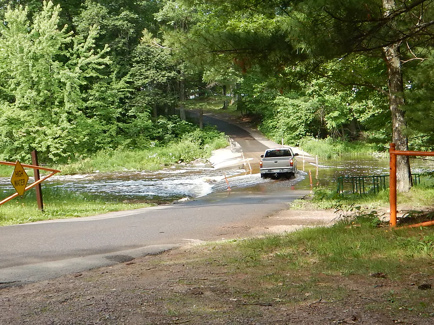
Where daredevils cross flooded bridges to reach their campsites
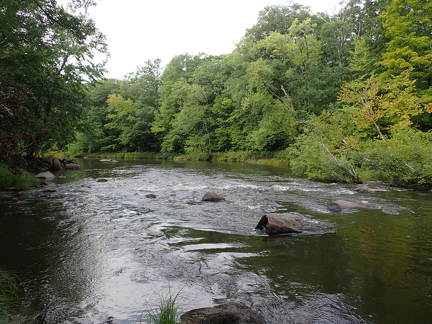
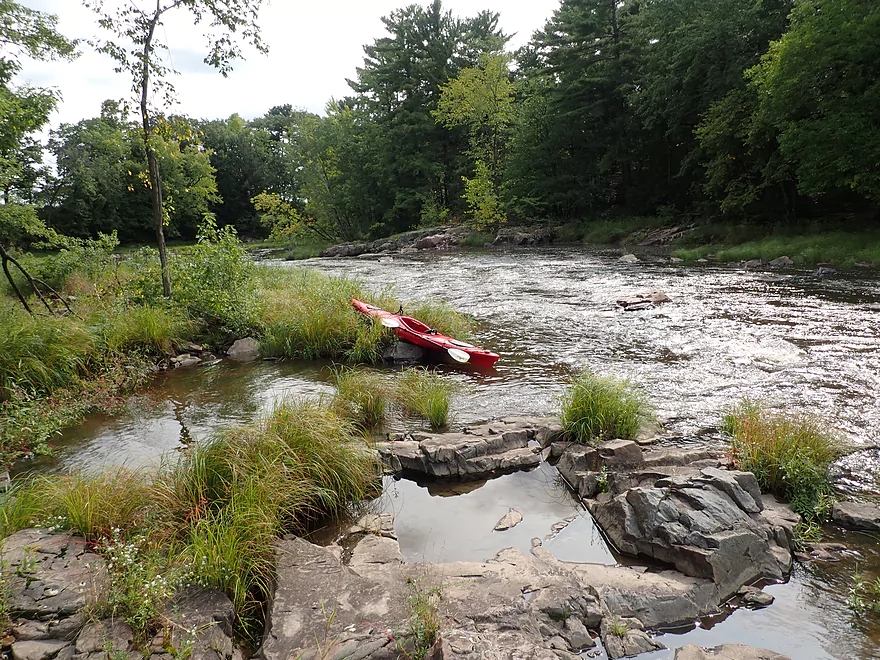
I’m putting in at the south dam
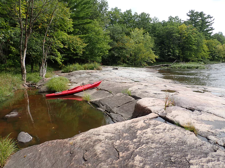
Good access
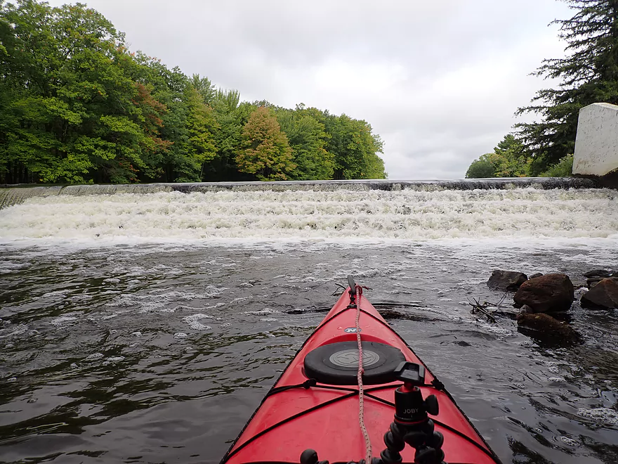
This dam has “stair steps” and doesn’t look runnable
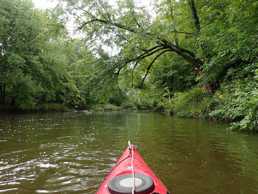
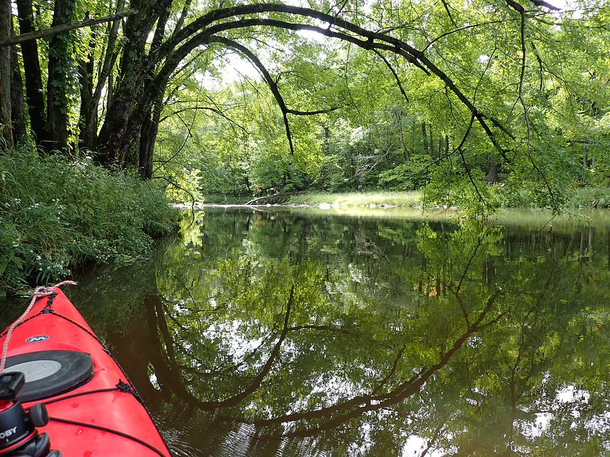
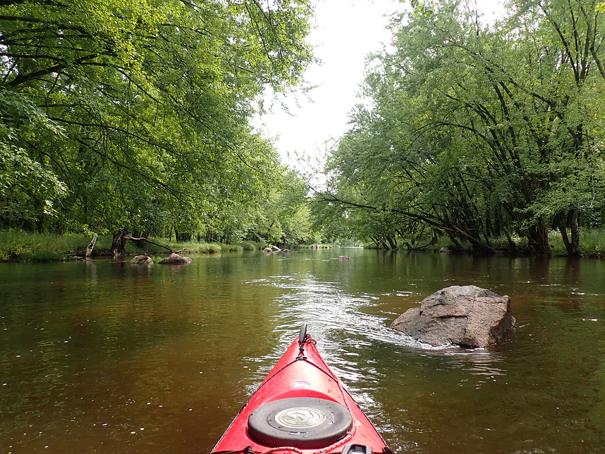
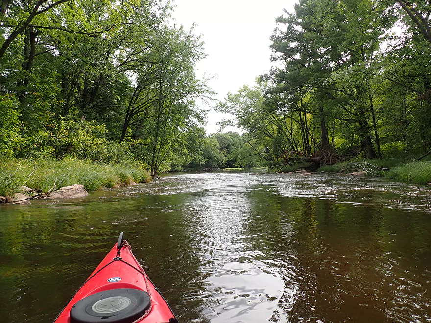
Very wooded stretch
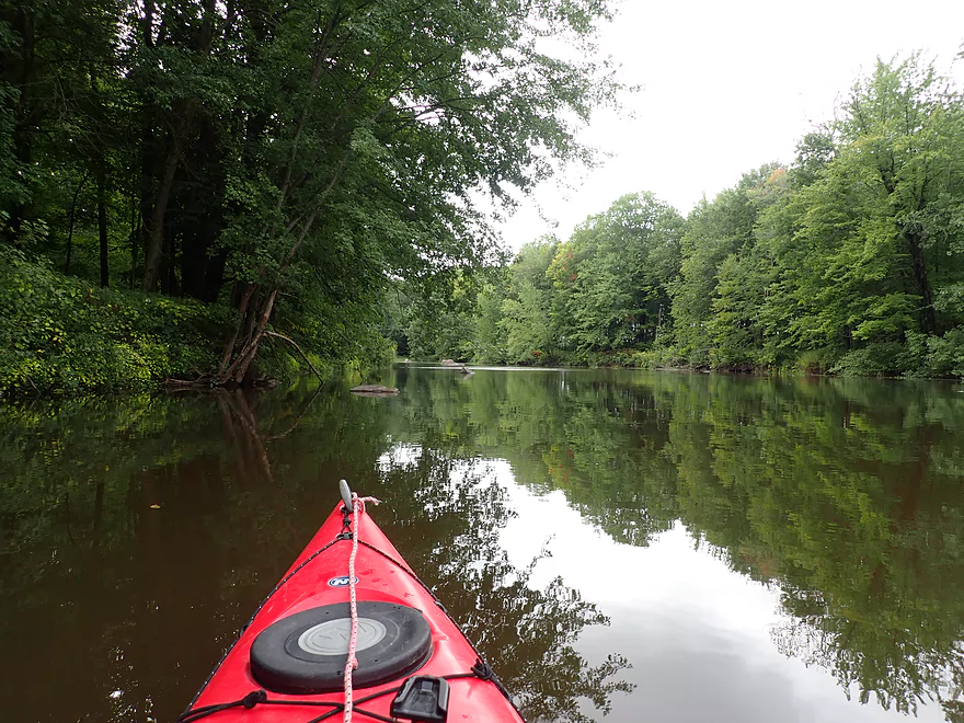
Nice reflections
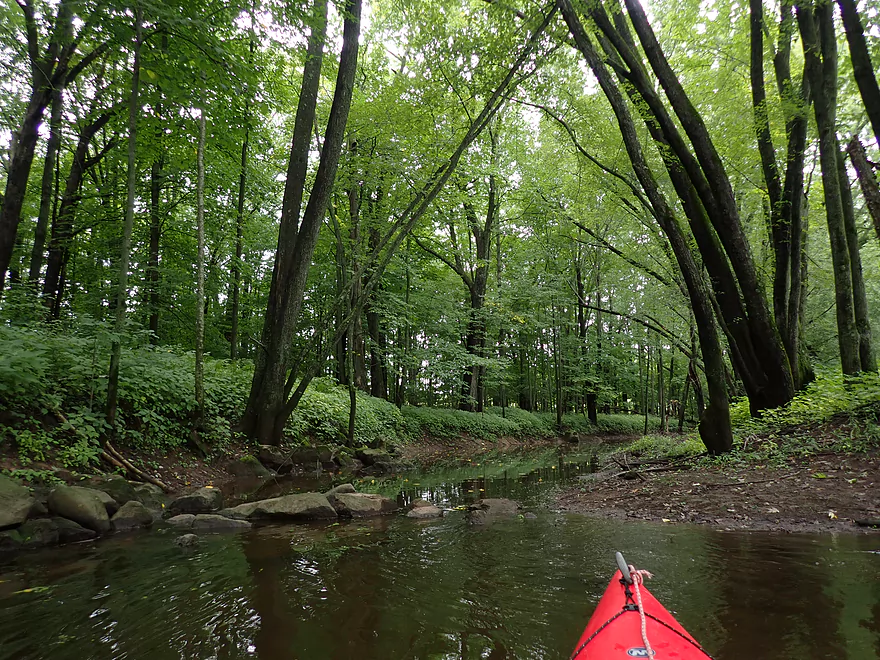
A small tributary
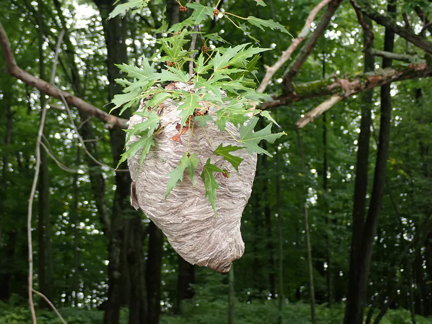
Another trip, another hornet nest
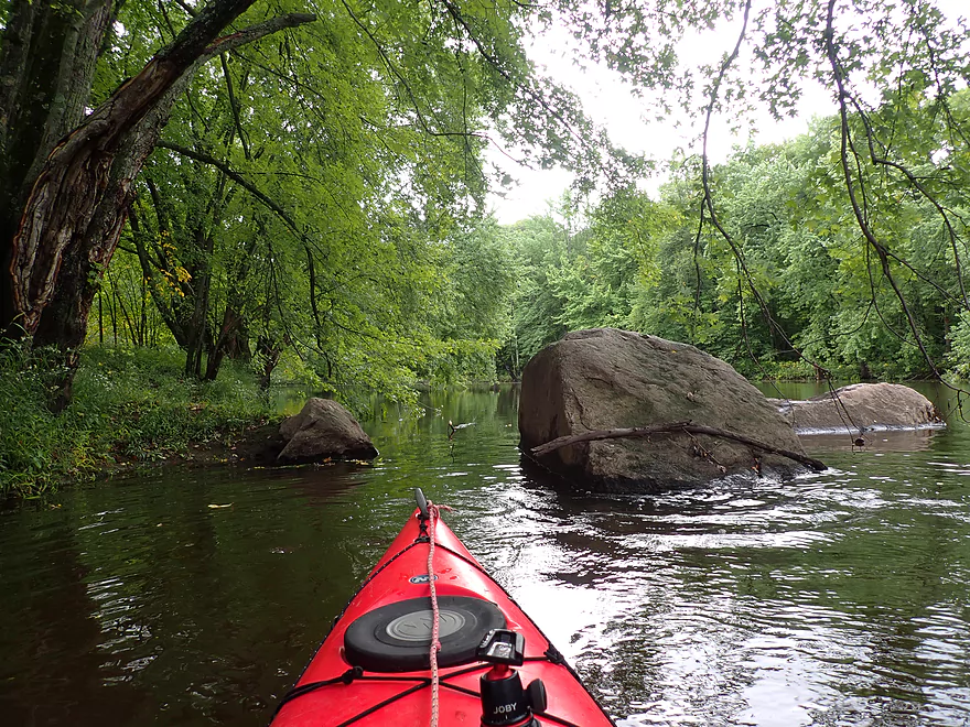
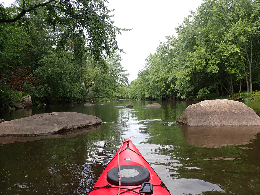
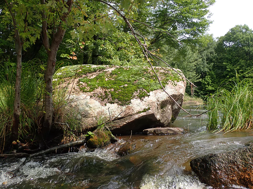
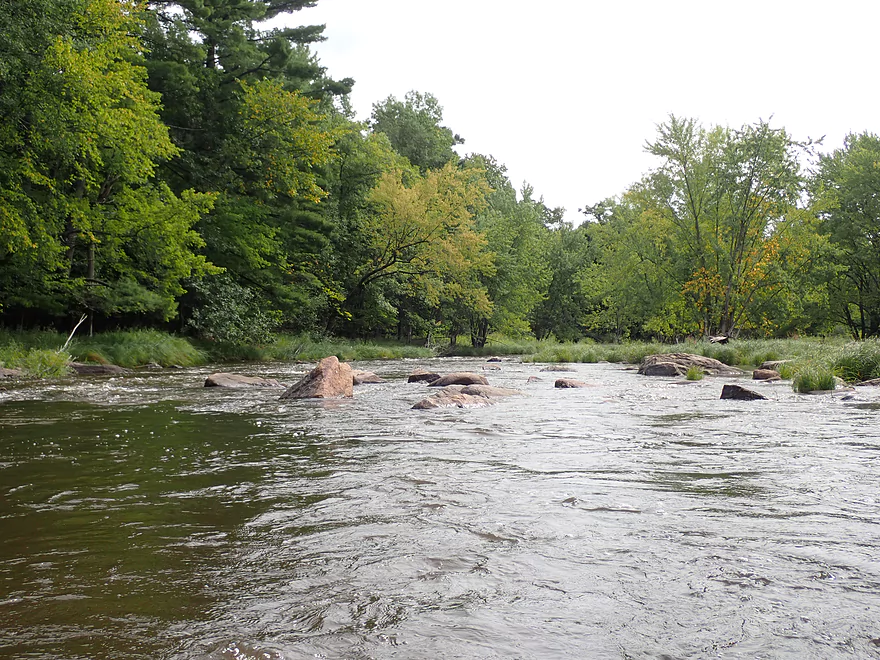
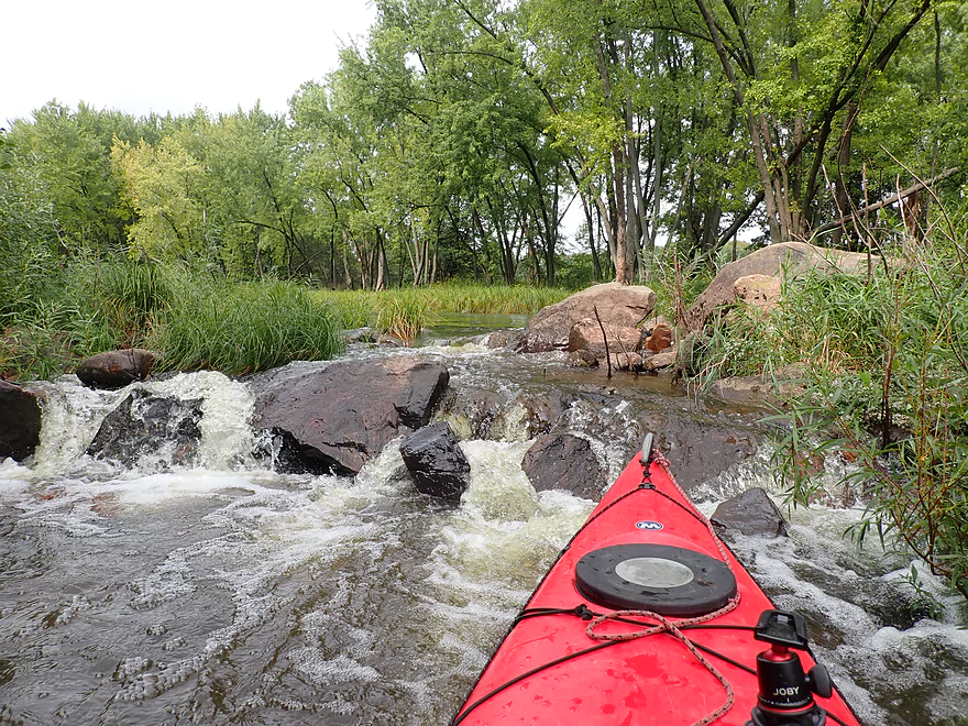
Number of boulders on this trip
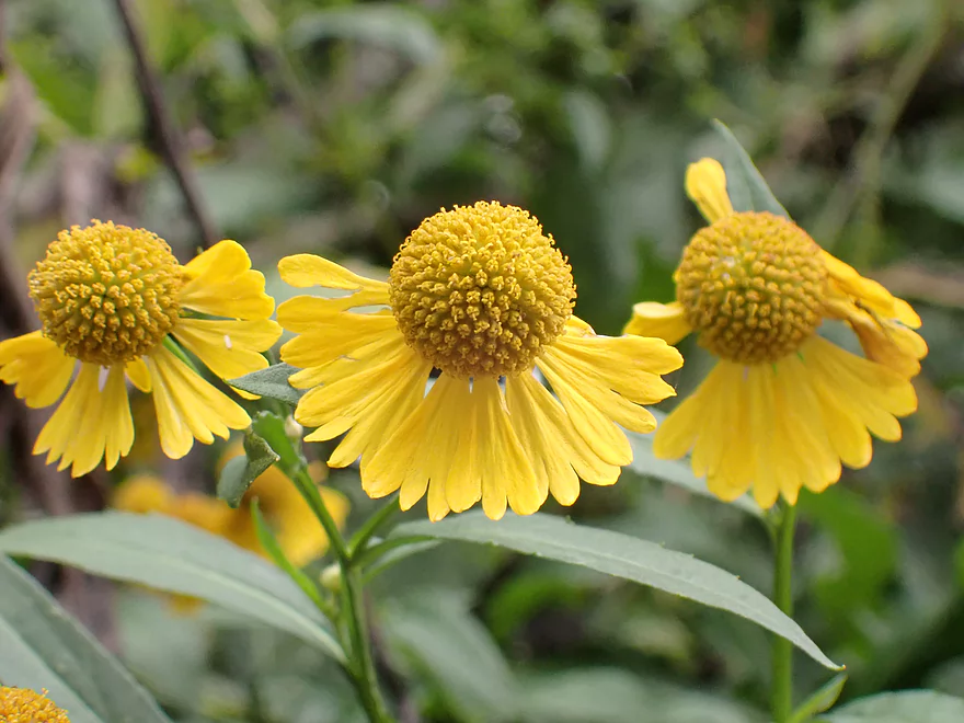
September is a great time to see riverside sneezeweed
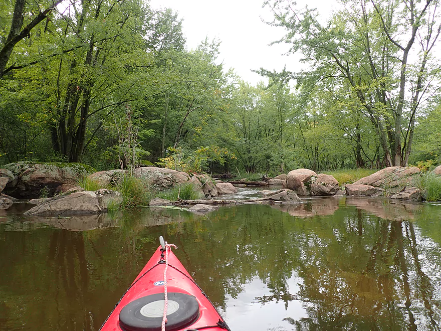
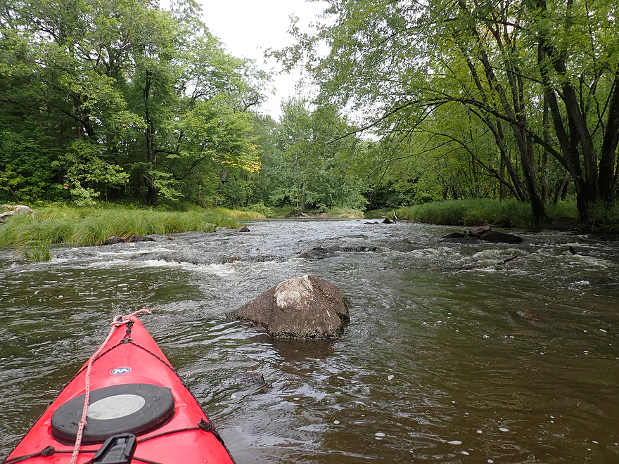
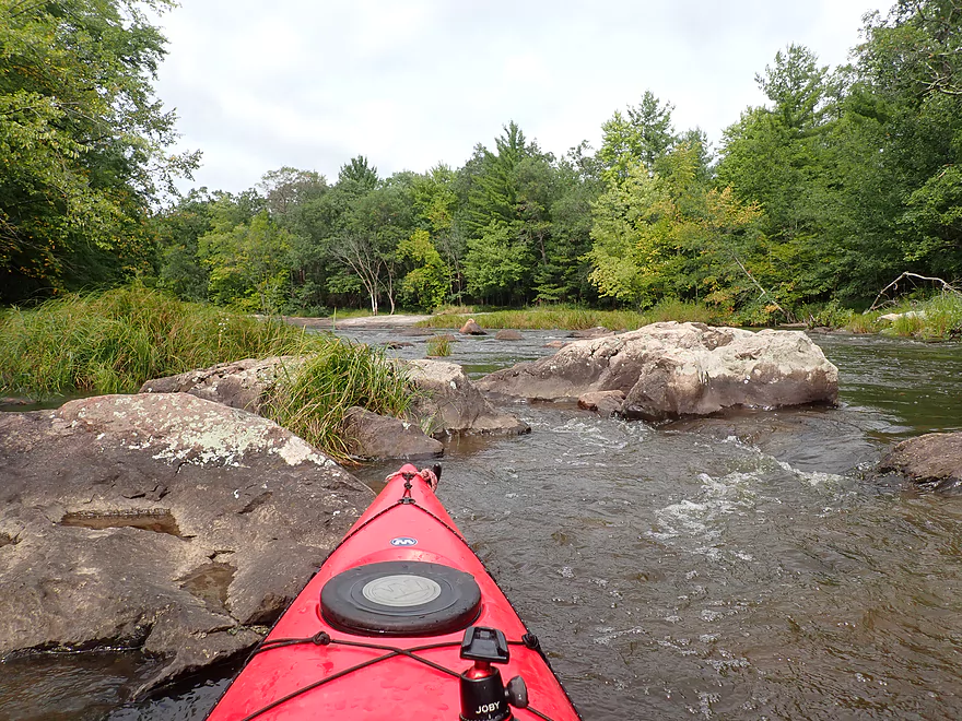
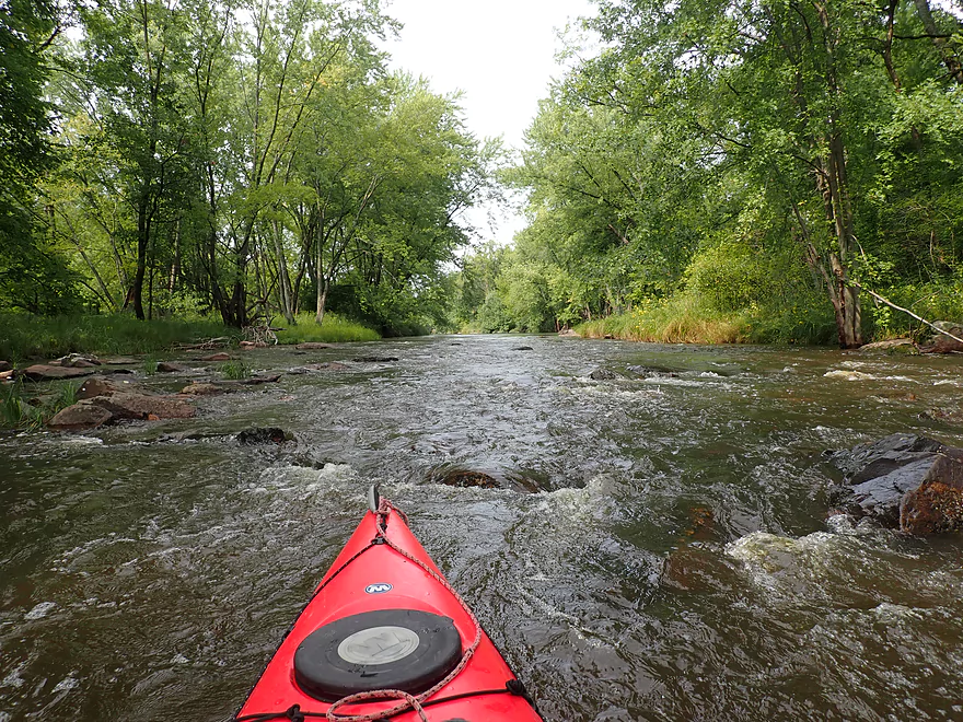
First decent boulder garden of the trip
A fun little chute around the island
View from island
Rapids get more serious after the island
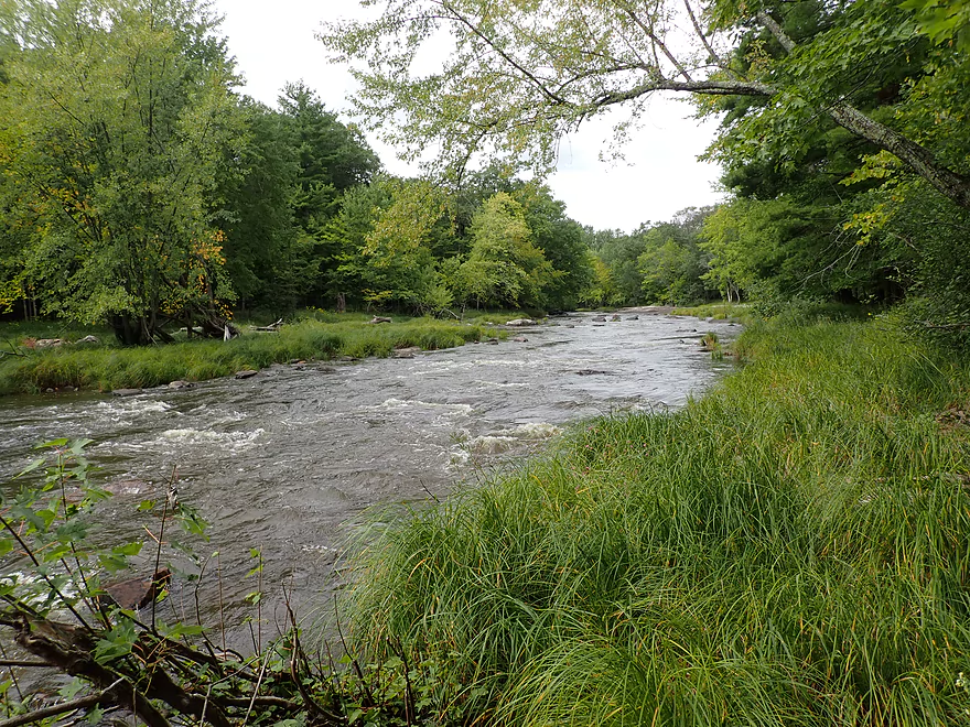
Very scenic
There are lot of maple…would be a good fall color trip
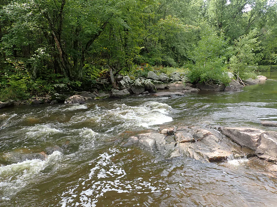
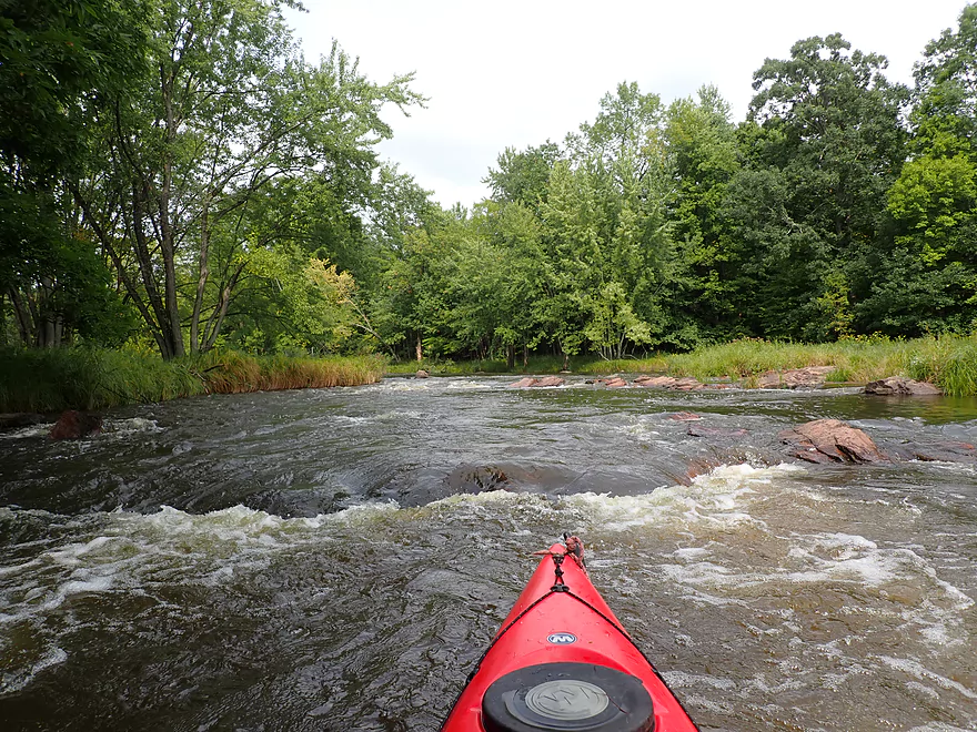
Some of the more congested rapids
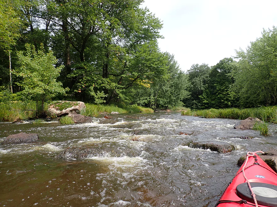
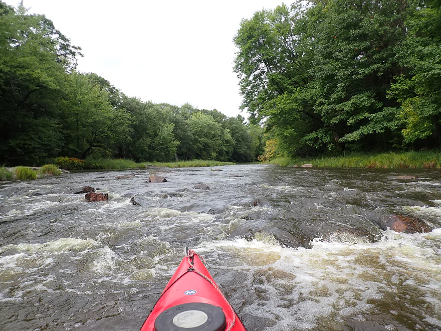
Too many rapids to count
East to get past this logjam
Neat reflection
Most rapids had enough padding…these were shallow though
The other side of the island was more navigable
A number of big boulders
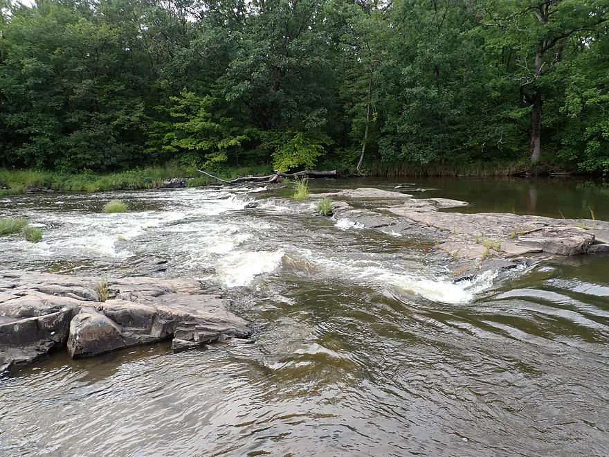
In high water, this rock is submerged creating “Jenny Falls”
Jenny Falls is just a side chute at low levels
But still rough (notice the badly positioned boulder)
A number of Class 2 rapids after Jenny Falls
Not many pines, but some
Part of a very long stretch of rapids
He jumped into my boat at one of the rapids
Hwy C
Some brief flatwater paddling…
Then lots more rapids
I’m going around what I refer to as “logjam island”
A tricky logjam
Is followed by a tricky strainer
In high water you can bypass the logjams (I should have portaged)
Another brief respite from the rapids
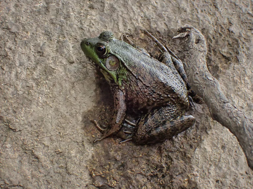
A green frog
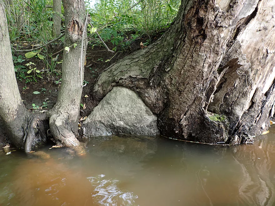
Tree laying a rock egg
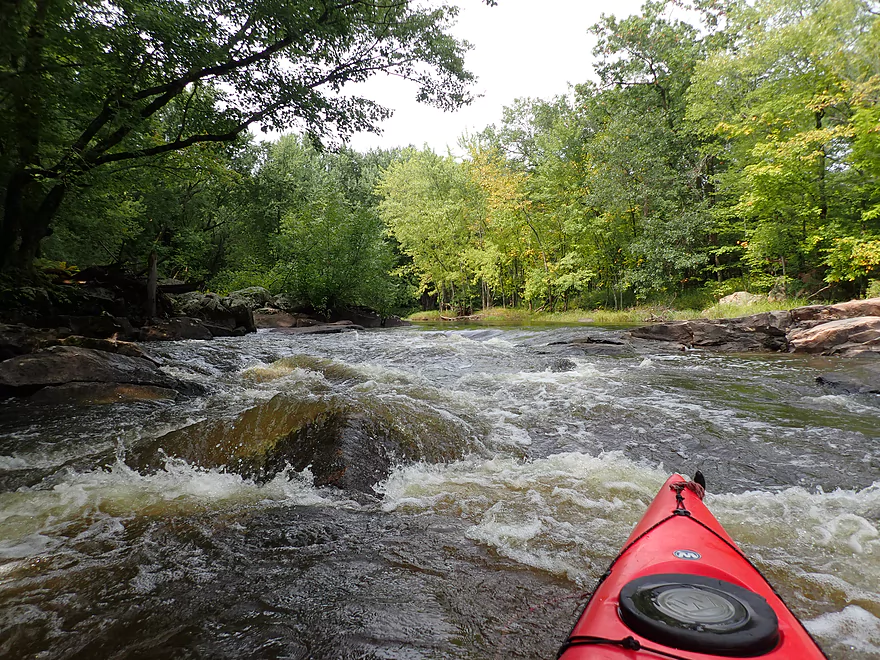
Rapids gradually getting stronger
A Class 3 ledge
A tricky run that requires a tight turn
The Class 3 is followed by a Class 2
Same scene, Nov 6th, 2016
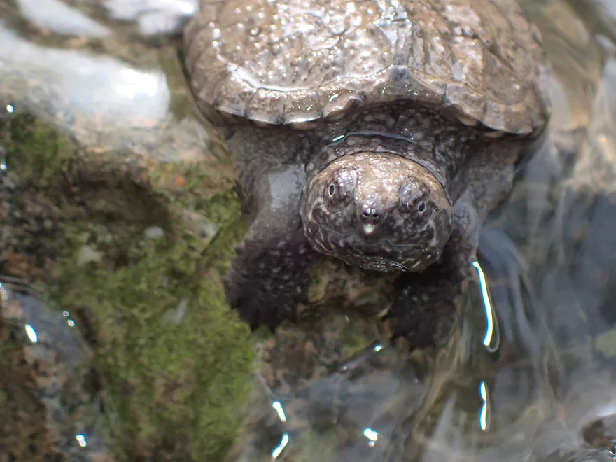
A baby snapper…he seemed pretty angry
I’m out of my boat to portage upcoming Little Bull Falls
Main chute slams into a rock creating a rooster tail (I rate this Class 4)
There is a bypass…but it wasn’t deep enough
Bottom view of Little Bull Falls
Same scene, Nov 6th, 2016
Side view
Looks completely different in shallow water (Nov 6th, 2016)
My take-out was just by the falls
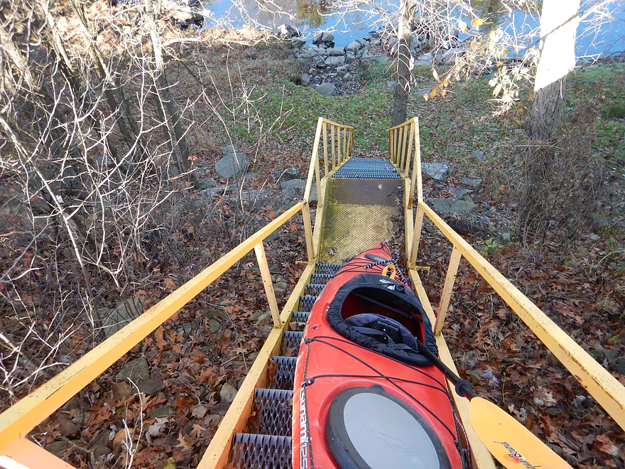
A steep climb up the yellow stairs
The owner was nice enough to unlock these for me
Great view of the falls from up top (Nov 6th, 2016)
Same view, June 18th 2016 (notice the dangerous hole on the left)
In between levels (September 16th, 2020)
A pair of Carolina grasshoppers
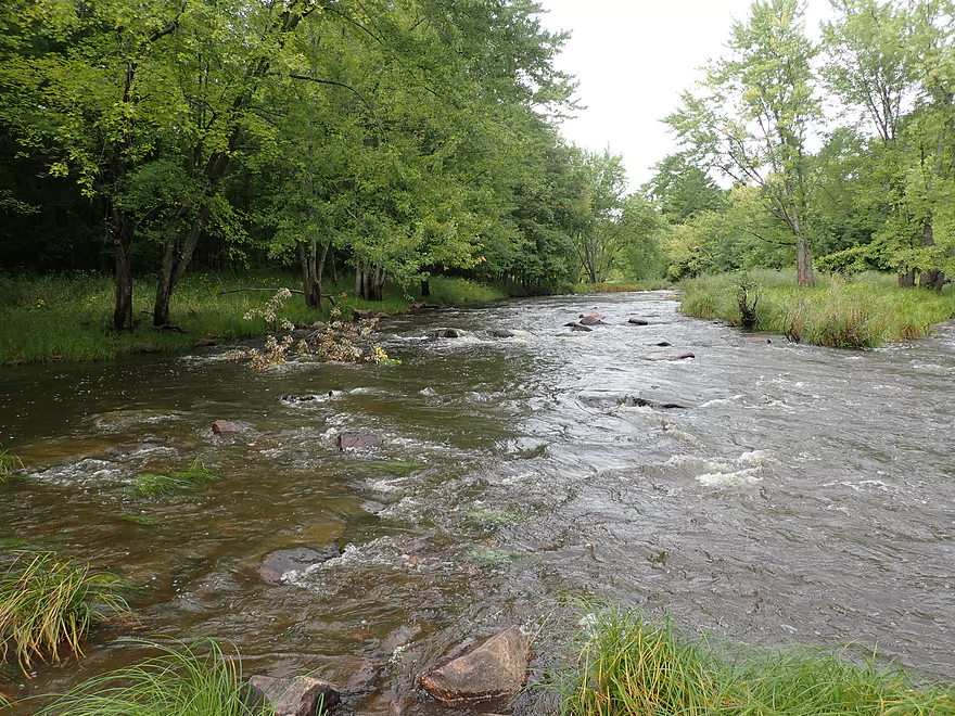
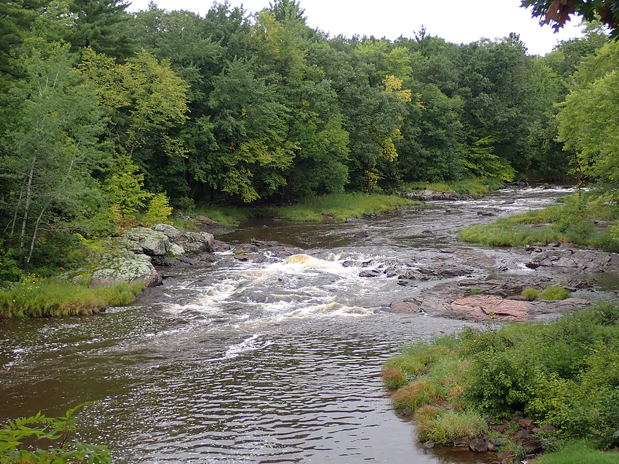
Yellow River – North Wood County Park

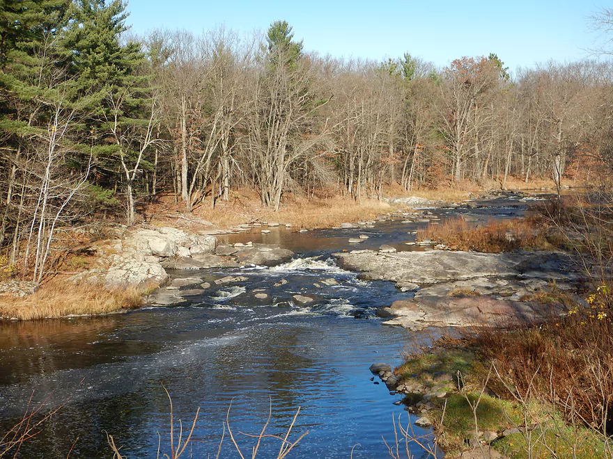
Located about a half hour west of Wisconsin Rapids, the Upper Yellow is a very scenic river, but a difficult one to kayak as it is usually either too high or too low. For most of this summer it was a shallow boulder field, but a window opened up after an inch of rain hit the area, and I decided to finally attempt this particular stretch known for its whitewater.
Before starting the trip, I wanted to scout levels by Little Bull Falls. This is a prudent precaution as the downstream Babcock gauge is made pretty worthless by the Dexter dam. There is a private bar overlooking the river where there is a stunning vista of the falls. Water levels definitely looked up from my 2016 trip…but seemed manageable.
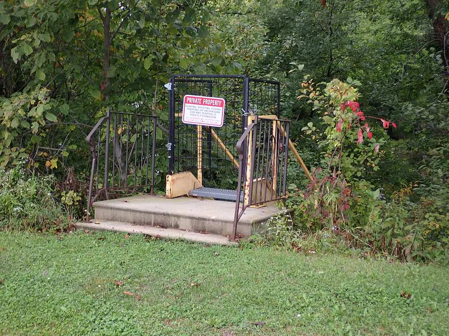
My other concern was whether I could take out at Little Bull Falls, as the shoreline here is 100% private. Thankfully the management had the bar open at early hours and I was able to talk to somebody and get permission. It is imperative that other paddlers also do this. Since my 2016 report (where I put in at the bar with permission), this area has seen a surge in local sightseers and paddlers who have neglected to get permission. This got so bad that the owner actually padlocked shut the main ladder leading down to the shoreline (they were nice enough to unlock this for me).
After getting the green light to end the trip at Little Bull Falls, I left my car at the bar and biked up to North Wood County Park to start the trip. It wouldn’t have been the end of the world had I not gotten the ok to take out at Little Bull Falls. I simply would have taken out at the next bridge (Hwy 80), which would have been a scenic add-on to the trip.
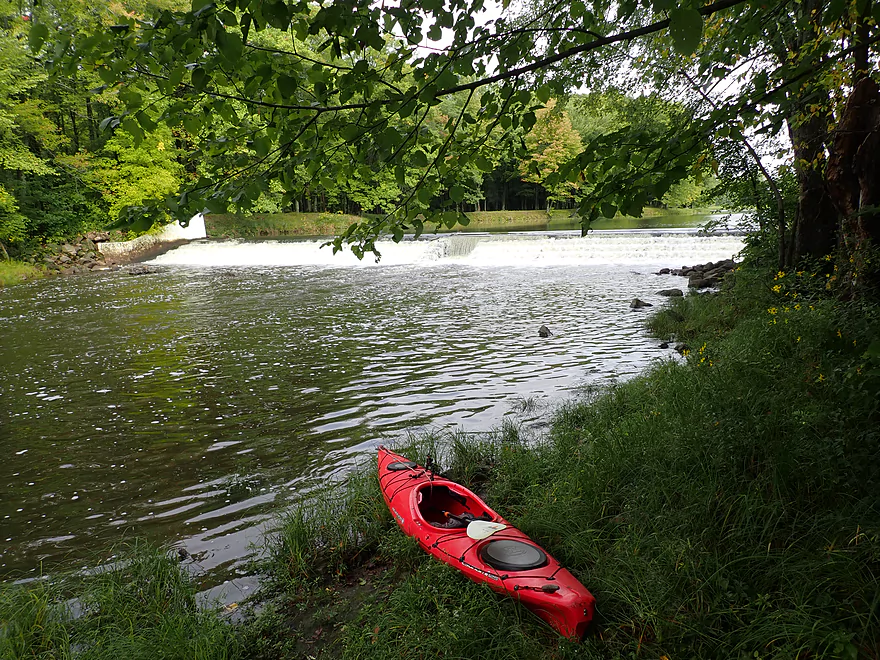
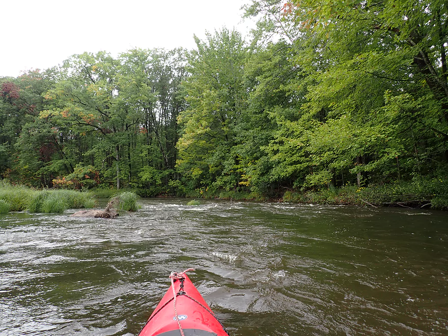
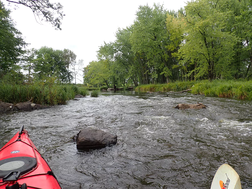
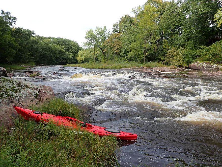
North Wood County Park is an attractive little park that runs along the Yellow River and consists of two dams. I launched below the second dam which was a pretty easy launch option.
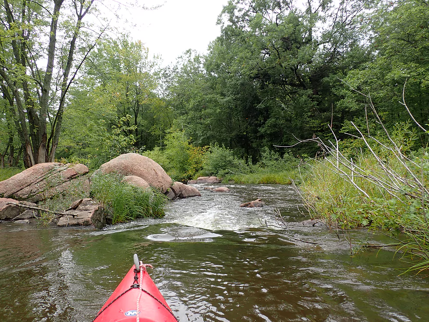
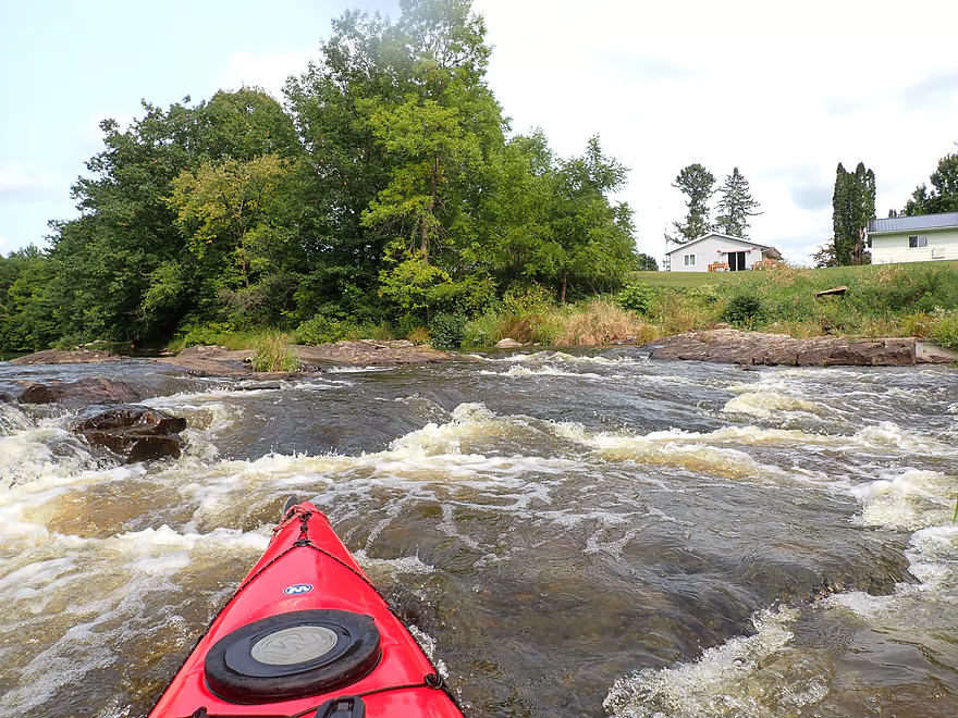
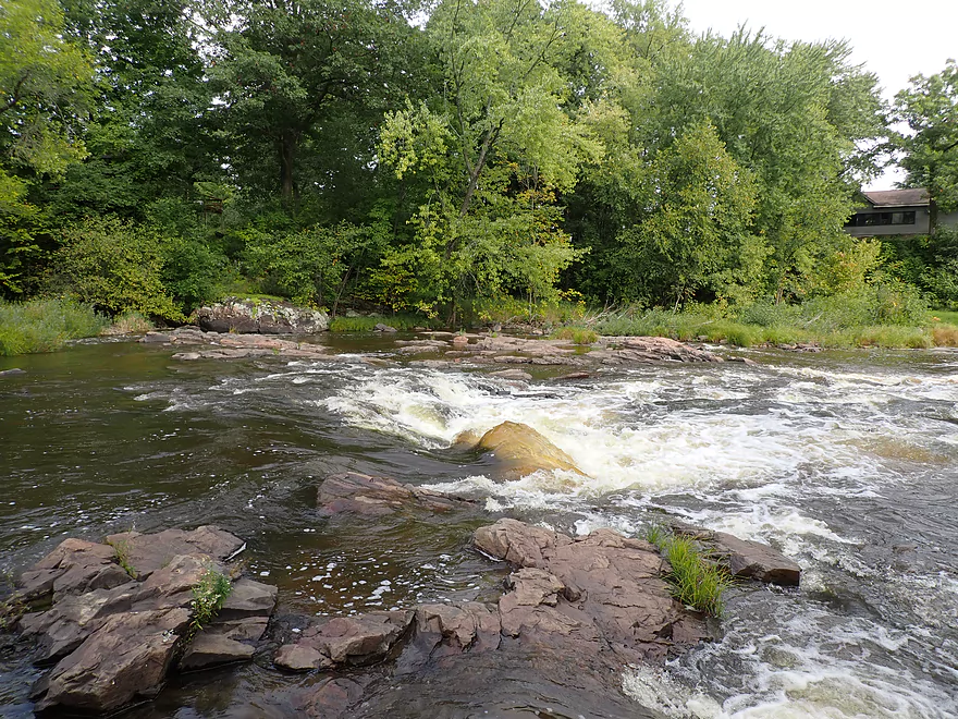
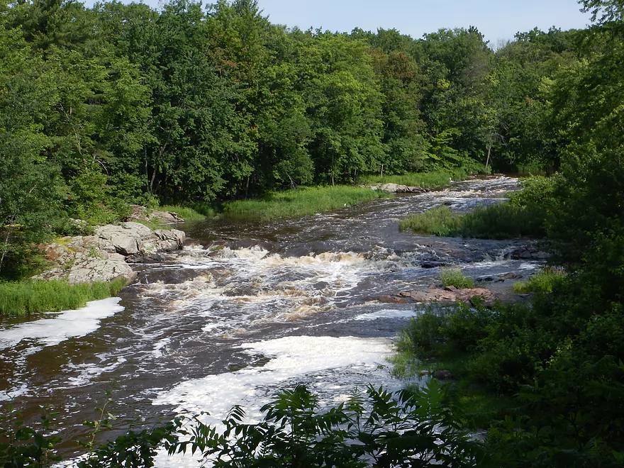
My first impression of the Yellow was how much higher, faster, and muddier it was compared to my 2016 trip. This provided good padding for the rocky stretches and rapids, but did obscure some of the really cool boulder gardens. The first mile of the trip was honestly somewhat disappointing. There weren’t really any noteworthy rapids and it was mostly a generic flatwater paddle. Here and there boulders appeared in the channel…but (as of yet) there were no spectacular boulder gardens. Perhaps at lower water levels there would have been.
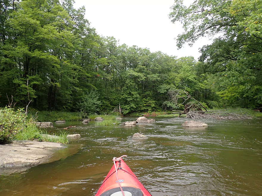
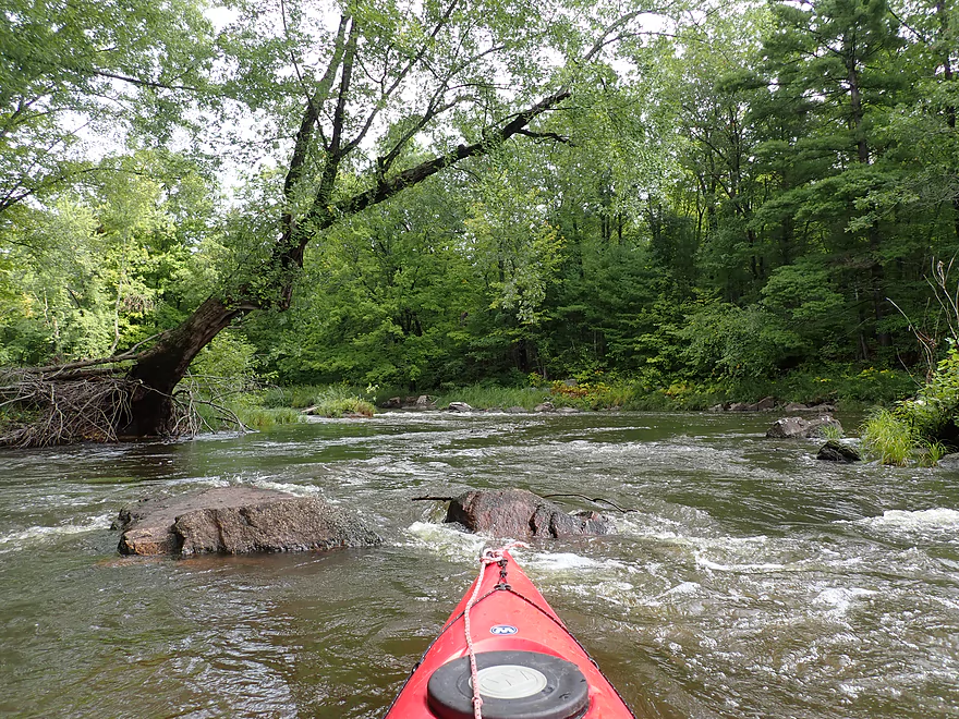
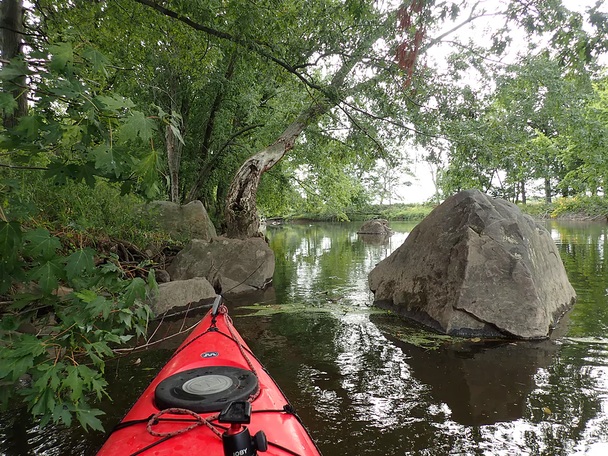
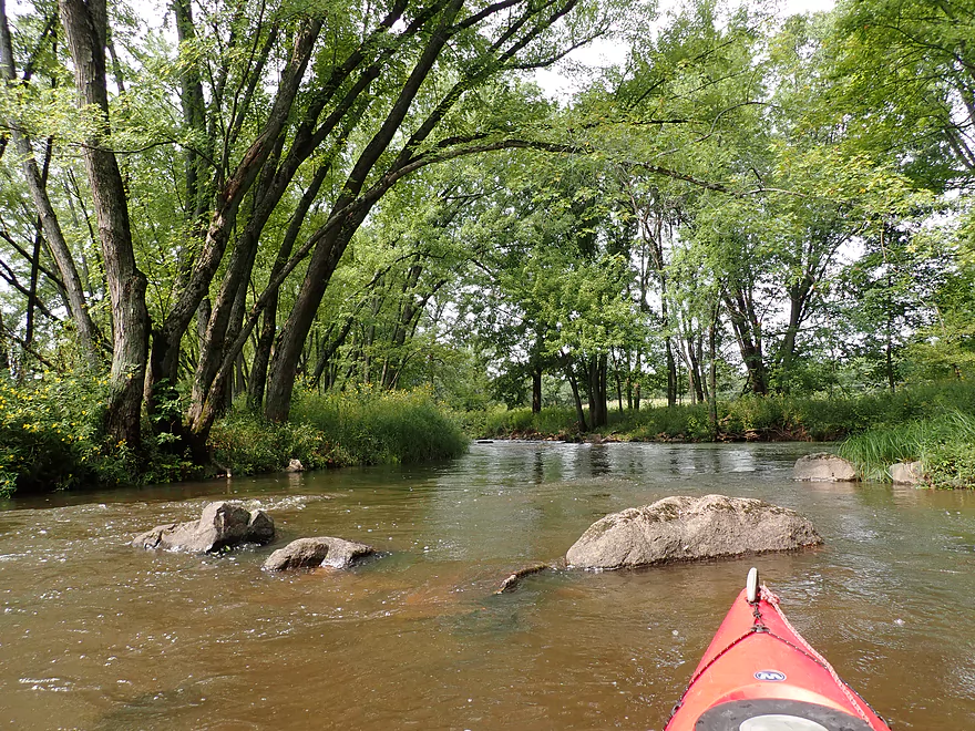
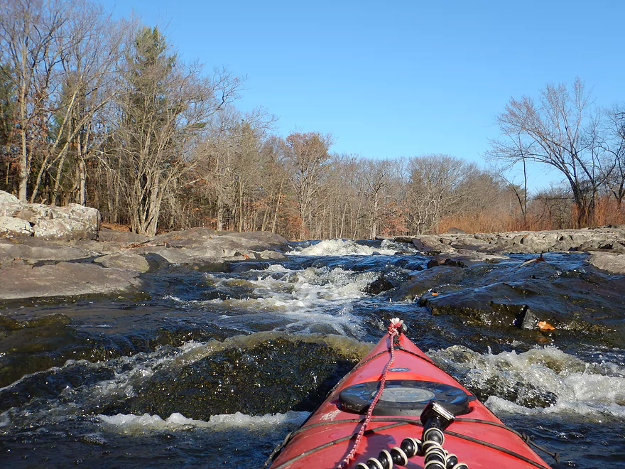
The river really changed after the first island. Along the left channel was a fantastic boulder garden and in the right channel a finally satisfactory stretch of rapids. I actually chose to run the left channel as it had a cool chute that snuck past some larger boulders.
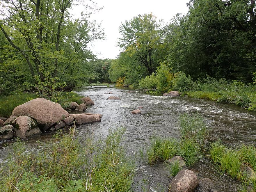
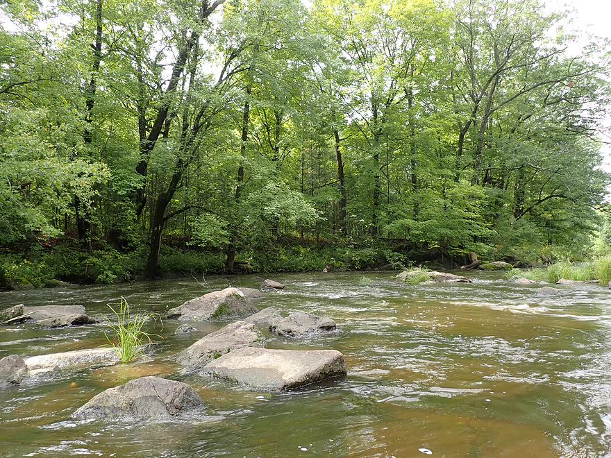
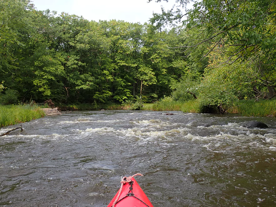
After the island everything changed and rapids became quite common. I figured maybe a pitch every 500’…which was a lot! In fact I would consider this trip to have among the most rapids I’ve ever done.
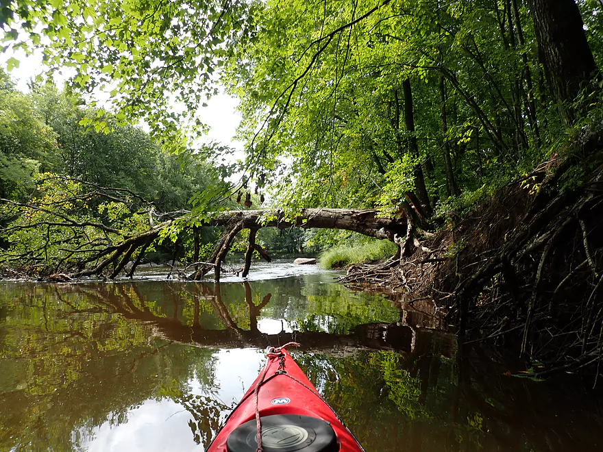
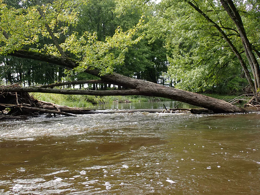
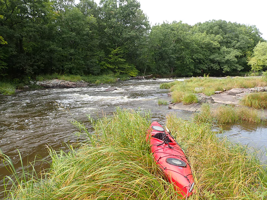
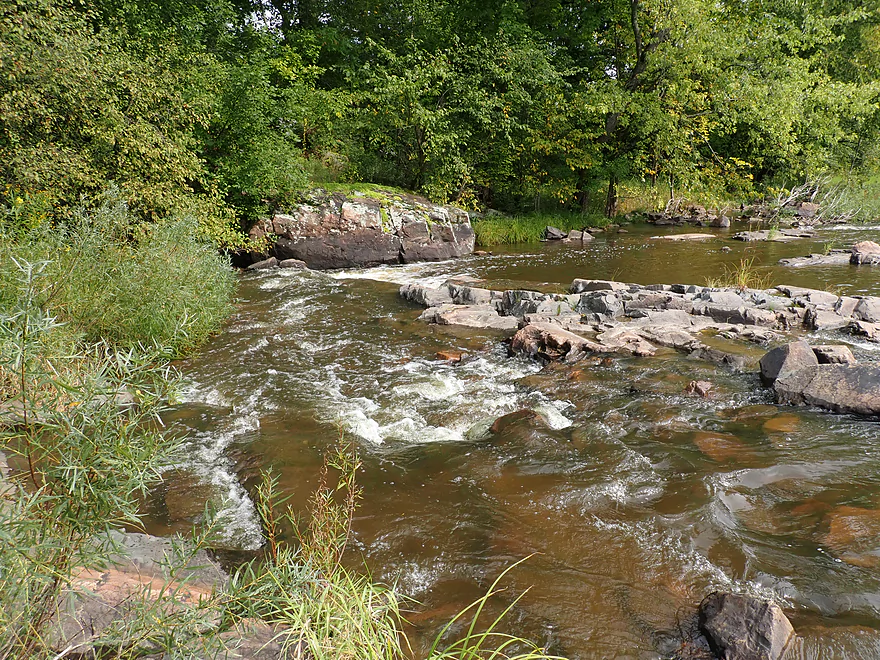
The shoreline was quite wooded and filled with a surprising number of maples. This would have been a fantastic fall color paddle, which I likely missed by two weeks. Despite the number of trees, there weren’t too many logjams to worry about. Upstream of the Hwy C bridge there were two downed trees, but it wasn’t difficult to get around them. There were also two strainers, but I managed to get by these ok. It would have been very easy to simply wade past if they looked too dangerous or simply portage along the shoreline. In general Central Wisconsin rivers tend to have less mud, fewer weeds, and flatter banks which makes any portages pretty easy (usually).
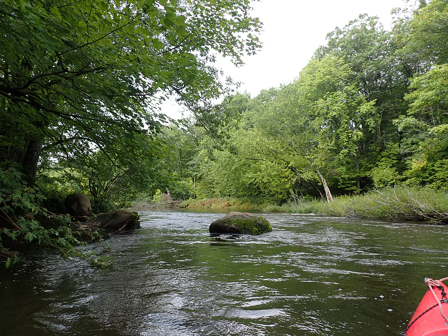
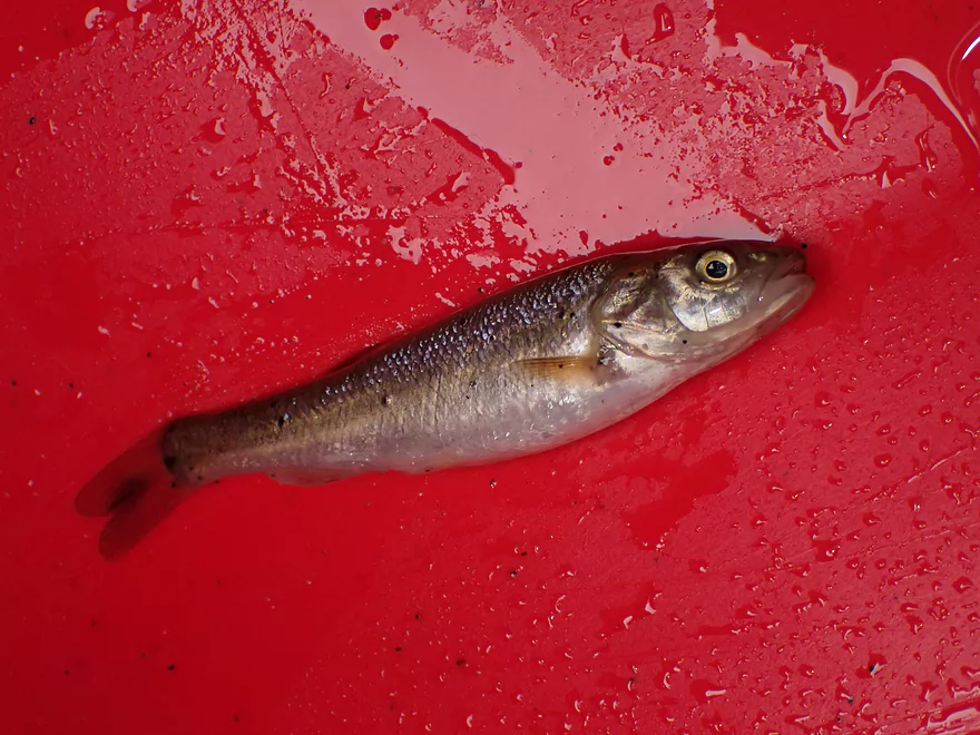
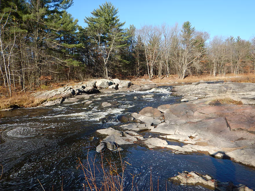
For the entire trip I had been anticipating “Jenny Falls” which AmericanWhitewater.org warned was a Class 3. I finally found it just upstream of Hwy C…but the “falls” looked dramatically different from what AmericanWhitewater.org had described and photographed. The marquee feature of the falls is a large ridge of exposed granite bedrock that in high water acts as a natural dam, and the river sheets over it to create the “falls”. But at my medium levels, the granite was almost completely exposed and dry…in fact I was able to walk on it and get some nice pictures. The river just flowed through a narrow side chute, which is important to scout as there is an inconveniently placed rock that requires a sudden and difficult left turn to avoid. I could have portaged this easily enough had I wanted to, but I decided to go for it which turned out ok minus a bit of water in my cockpit.
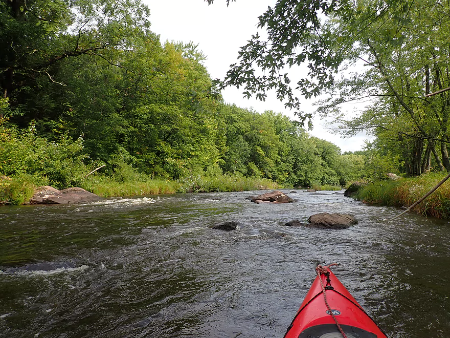
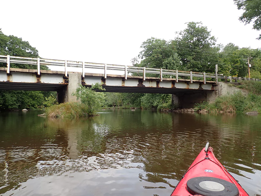
Jenny Falls was followed by a long stretch of Class 2 whitewater leading all the way to Hwy C. Unfortunately the river bends sharply just prior to Hwy C so paddlers can’t really use the bridge to scout the preceding rapids even though they are very much nearby.
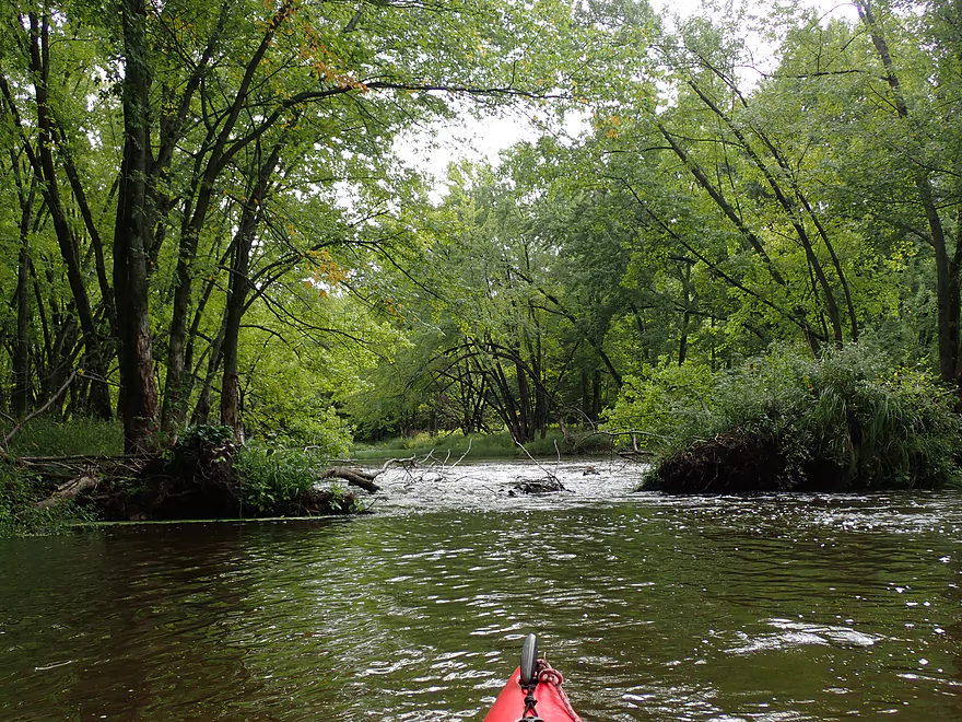
The rapids take a break after Hwy C with a longer stretch of flatwater. About 900′ downstream from the bridge was an island where there were the first serious logjam issues of the trip. The west/right channel was too shallow to run. However, the east/left channel went through a logjam sandwich (one that requires hopping and ducking at the same time in fast current) and then was followed by a strainer in more fast current. I made it through ok, but in hindsight should have portaged along the other island channel which would have been super easy. Hopefully locals in the future will simply wade down from Hwy C and clean this up.
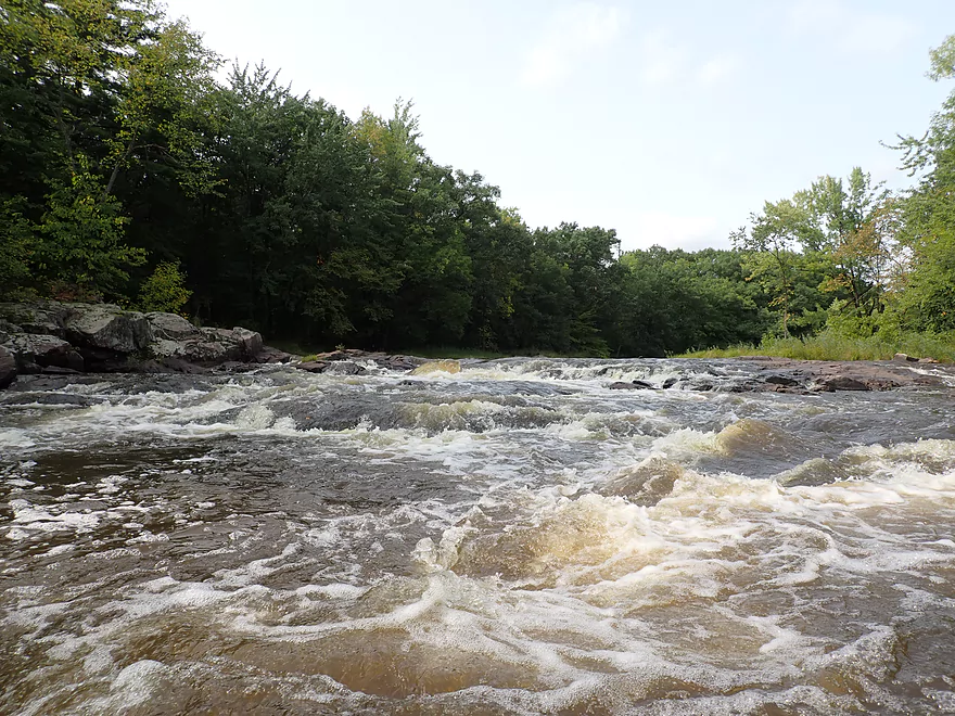
From here on the rapids would become progressively stronger and more intense. The strongest rapids of course were at the end of the trip at Little Bull Falls, but these were preceded by some tough rapids in their own right (a Class 3 and Class 2) that required careful navigation to get through.
Finally I made it to Little Bull Falls. I got out plenty early to scout and determined early on that I wouldn’t run them. The main chute slammed into a rock, creating a “rooster tail”. There was a good chance my boat would have been upended had I made the attempt. I’m not sure higher water would have made this safer, as a dangerous hole can develop on the right bank (looking downstream) which could have been tough to escape from. There is a bypass channel of sorts along the left bank, but it was shallow and required an unrealistically tight right turn by a rock wall.
I portaged, but this proved to be an adventure in and of itself as the left/east bank was a bit too steep and overgrown to navigate. Instead, I carefully waded down the few exposed sections of granite I found and pulled my boat after me. In hindsight I should have bee-lined for the right/west shore ASAP as that would have been a significantly easier portage.
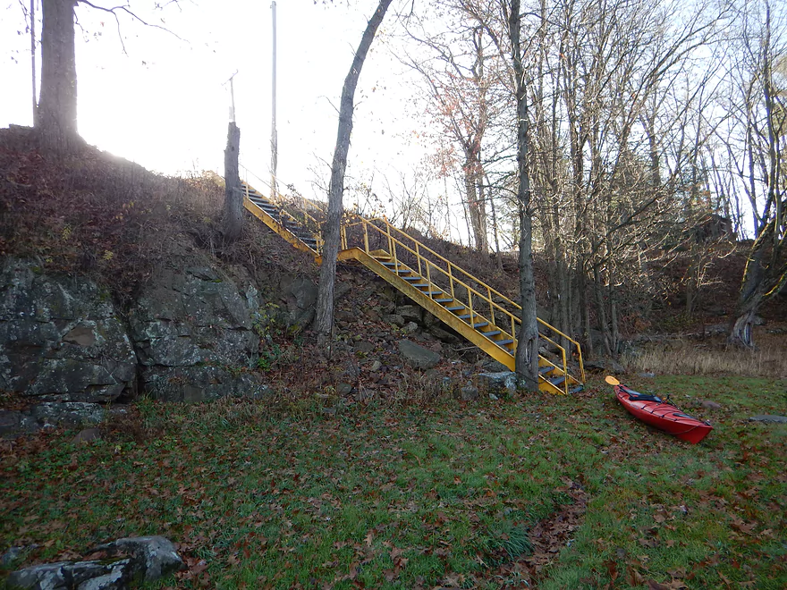
I took out below the bar where a post-Packer game crowd had watched me portage Little Bull Falls (they were probably disappointed I didn’t run them). Steep stairs led from the shoreline to the bar parking lot and it was surprisingly difficult to haul my heavy boat up them. In hindsight, I should have paddled the extra 1.6 miles to Hwy 80 and taken out there.
In summary this was a trip that I really enjoyed. It’s not a trip for casual rec paddlers…there are countless rapids, and even though most are just Class 1 or Class 2 you need good boat control to get through. Rec paddlers can do this stretch, but only at lower levels and only if they are willing to scout/portage what they can’t handle. You can’t go too low though as the Upper Yellow is often just an impassable series of shallow boulder fields. If water levels are right though, it’s worth it as it is a very scenic river.
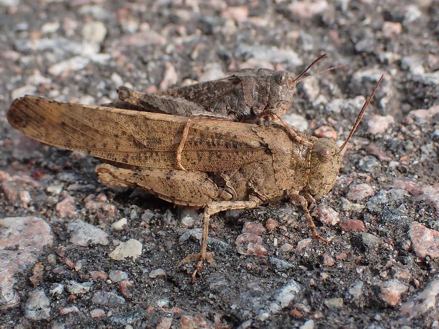
Sites included a hornest nest, some flopping fish, one eagle, and a muskrat that swam fairly close to my boat. The highlight was a small fish that jumped into my boat after I ran Jenny Falls. I scooped him up with my sponge and put him back in the water.
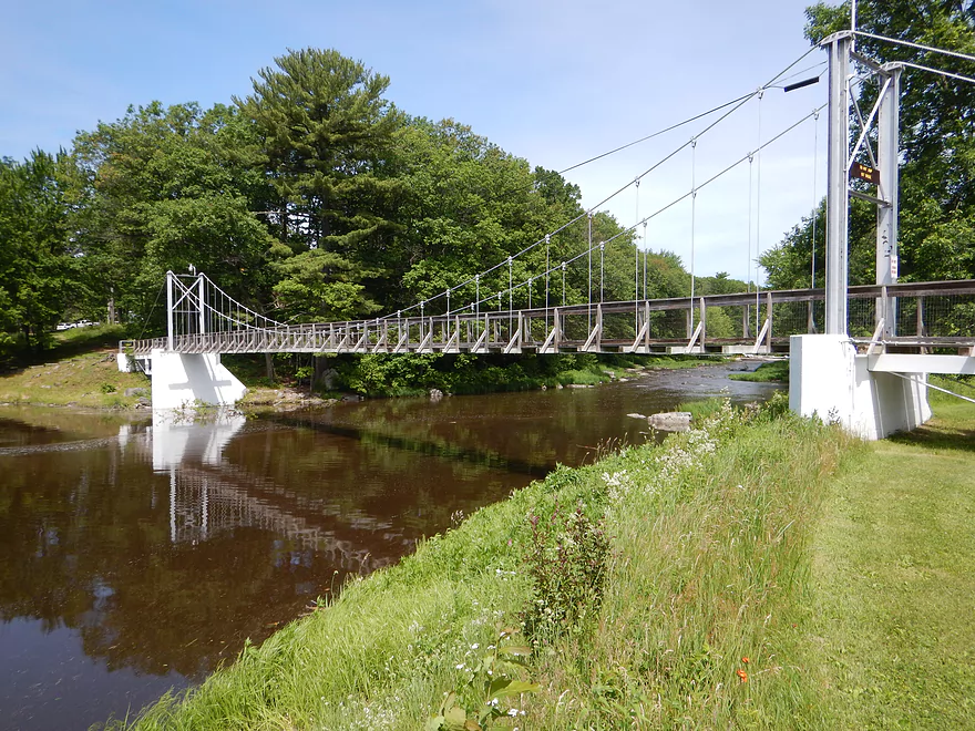
North Wood County Park: This is a nice county park. Highlights include a campground and a suspension pedestrian bridge. The Yellow River is dammed twice in the park and it’s not uncommon to see campers paddle between the dams where there is a small impounded lake. The entrance to the park is on the east side of the river, yet the campsites are located along the western shore. The only connection for campers is a very low bridge that frequently is overtopped with water. When this happens it can strand campers on the wrong side of the river…or force them to drive across a dangerously flooded bridge.
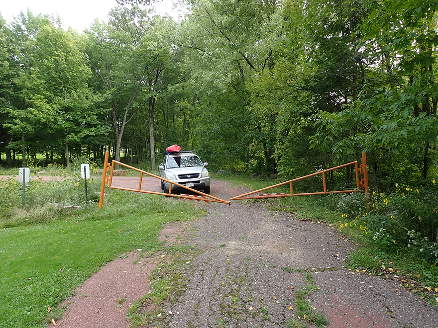
North Wood County Park – South Dam: This was a decent put-in option. A fishing trail leads below the dam where it’s easy to launch. Note, a gate bisects the road by the dam creating two deadends…but this isn’t an issue. You can come from either side and park on either side….just not by the fire hydrant. Bathrooms are available in the park but not immediately by the dam.
Alternate Put-ins:
- Hwy N: 2.9 miles upstream of the South Dam. This is a suitable bridge access. But note this upstream stretch is very rocky and rough and includes rough Class 3 rapids (but is scenic with some dells).
- North Wood County Park – Walk Bridge: 0.7 miles upstream of South Dam: This is a good access option with a nearby parking lot and restroom. It’s not uncommon for campers to launch here and simply paddle Lake Manakiki. Those continuing downstream will need to portage two dams (both manageable portages).
- Hwy C: 2.8 miles downstream of the south dam. Hwy C has tight parking but is not a bad bridge access…but if you put in here you miss out on my favorite stretch of the river which includes a lot of boulder gardens and rapids.
Little Bull Falls: I took out at a private bar overlooking the falls. Very steep stairs lead up from the shoreline to a parking lot by the bar. This is completely private. You absolutely must get permission to use this as an access. I did (and I also did 4 years ago), but many paddlers do not which has frustrated bar management. They’ve locked the stairs because of these trespassers which is unfortunate. If you simply ask, they will likely let you use this access (although you may need to patronize the bar). Note, they may be closed when you want to do a trip…so you should call in advance (715-884-6066) if you plan an off-hours trip or simply use another bridge as an access. The great thing about taking out here is there is a fantastic vista of Little Bull Falls from the bar parking lot.
Alternate Take-outs:
- Hwy C: 1.2 miles upstream of Little Bull Falls. Hwy C is a suitable bridge access but parking is kind of steep. You might be able to park on the shoulder along the southeast corner…maybe. By taking out here you do miss out on some rapids…but you also avoid a Class 3 and a Class 4 set of rapids.
- Hwy 80: 1.6 miles downstream of Little Bull Falls. Hwy 80 is a suitable bridge access…it’s a longer hike from the water to the shoulder but not bad. Had I been denied permission to take out at Little Bull Falls I was planning on taking out here. From the Falls to Hwy 80 is a neat stretch with mostly Class 1 rapids and some scenic outcrops.
- Riverside Park: 3.1 miles downstream of Little Bull Falls. The park is a great access option. The preceding stretch is super cool with scenic outcrops and fun rapids that aren’t too dangerous.
Little Bulls Falls to North Wood County Park: 3.6 miles and 46′ of ascent. This was a very easy bike shuttle.
Note, this is not a stretch for beginners. Rec paddlers with appropriate experience and boat control can paddle this part of the river, but only when it is not too high. Only whitewater paddlers should attempt this river when it is very high.
Logjams:
- Upstream of Hwy C: There were two downed trees and one noteworthy strainer. Thankfully there is a big gap through the trees and the current wasn’t swift…so these were easy to get past. The strainer however is over fast current…but if you take a side channel you can go around it.
- Downstream of Hwy C: Just downstream from the bridge is a nasty logjam which is followed by an even worse strainer. I threaded my way through very carefully…but in hindsight I should have portaged…which would have been super easy as there’s an island here.
Rapids:
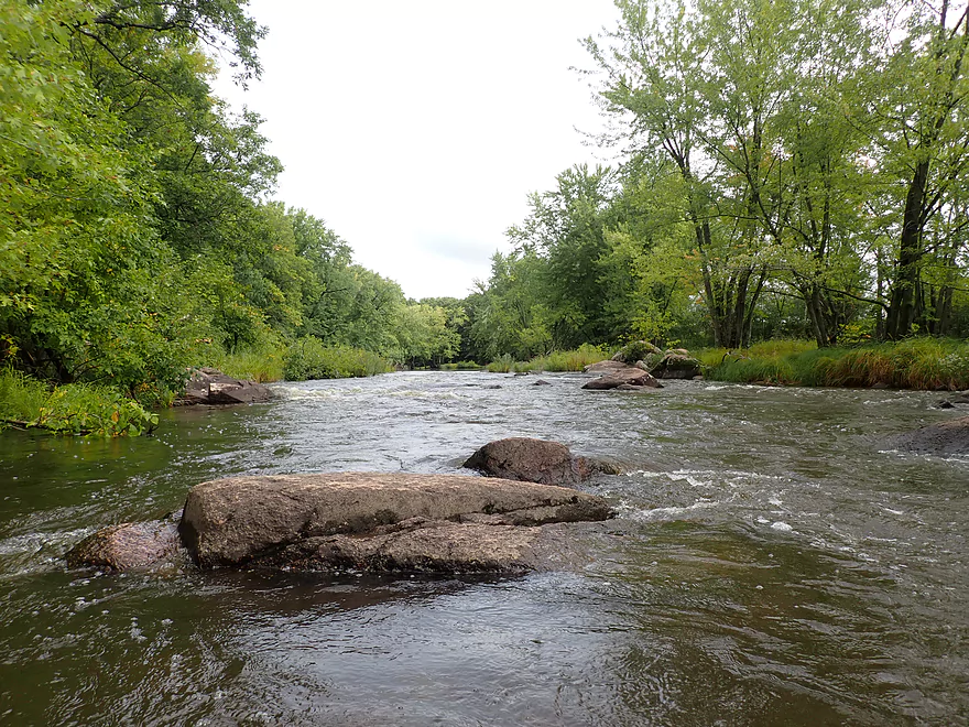
- Upstream of Hwy C: There are numerous Class 1 and Class 2 rapids. Most are pretty easy. The most difficult Class 2’s are immediately upstream of Hwy C. There is a Class 3 near Hwy C called Jenny Falls. Here there is a large ridge of raised granite bedrock. In high water the water flows over the granite creating the “falls”. At medium flows (my trip), you can walk on the granite and scout the rapids (which I advise doing). There is not a clean line through…you have to make a hard left turn to avoid a rock in the middle. This is a super easy portage.
- Downstream of Hwy C: There are several Class 1 and Class 2 rapids on the main stretch that aren’t bad. Prior to Little Bull Falls there is a Class 3 drop (which you just can’t see from the bar). You can avoid the ledge by taking the left edge of the river…but there is a tough chute here with a rock in the middle that takes some tricky maneuvering to get around. This is followed by Class 2 rapids…and then Little Bull Falls itself, which I rate as a Class 4. There is a rock in the main chute of Little Bull Falls which creates a rooster tail and makes it difficult for paddlers to take a straight line through. In high water this rock will create a dangerous hole. Most paddlers can portage this (and the Class 3) using the right/west bank. I tried portaging the left/east bank but met a granite wall…and ended up climbing down a granite island which wasn’t easy.
Big Eau Pleine @ Stratford: 350 – 270 CFS. Note, this isn’t a great gauge…paddlers should ultimately do a visual scout when they arrive and plan on a backup paddle in case conditions look bad.
- 0-100 CFS: Very low flow rates and mostly too rocky for paddling. Very scenic boulder gardens.
- 101-200 CFS: Low flow rate. Perhaps navigable but with some bumpy stretches.
- 201-300 CFS: Perhaps a good target range for rec paddlers.
- 301-400 CFS: You shouldn’t ground out anywhere at this range. Some of the rapids will be a bit pushy.
- 401-500 CFS: A higher level that may be dangerous for rec paddlers.
- 501+ CFS: Very high flow rates….likely only suitable for whitewater paddlers.
Alternate Gauges:
- Yellow River @ Babcock: Trip done at 90-110 CFS. I just simply don’t trust this gauge. My 2016 trip was WAY more shallow…yet was roughly the same CFS. The Dexter dam also does erratic releases and buildups which unfortunately makes the Babcock gauge kind of useless for the Upper Yellow.
- Yellow River @ Pittsville: Trip done at 5.05′ (just an estimate…as that exact day the gauge was down). This is a terrifically positioned gauge…however it lacks historical data so I don’t have a good reference to make accurate depth forecasts. I think 4.9-5.1′ is an ok target range. 4.8-4.9′ might be doable…less than 4.8′ is likely too low. On the up side, 5.1-5.2′ is getting a bit rough for rec paddlers. Maybe 5.2’+ is only for whitewater paddlers.
- Visual Scouting: The best spot to scout is from Little Bull Falls (with permission from the bar owner). If the bedrock is mostly exposed and Big Falls just a narrow chute…then things will be on the shallow side. If the rocks to the left of the chute are overflowing with water, it will likely be a very high run.
Detailed Overview
- Eagle Road to Yellow River Road: 4.3 miles. Background provided by WisconsinRiverTrips.com contributor Daniel Akin.
- Eagle Road to Hwy HH: 2.2 miles. This is a dangerous section with Class 3 and 4 rapids. There’s also a wire fence across the river to deal with.
- Hwy HH to Yellow River Road: 2.1 miles. A more wooded stretch that I don’t know much about. Nice street view image.
- Yellow River Road to Hwy 10: 4.3 miles.
- Yellow River Road to Hwy BB: 1.3 miles. A nice wooded stretch with no major rapids.
- Hwy BB to Robin Road: 0.8 miles. A scenic stretch of the river. The South Branch joins up by the BB bridge and adds significant volume.
- Robin Road to Hwy 10: 2.1 miles. A great stretch featuring several fun rapids and small outcrops. Much of this flows by a large golf course which can be scenic in the fall because of all the maple trees.
- Hwy 10 to Hwy 80: 4.0 miles.
- Hwy 10 to Lincoln Ave: 2.2 miles. Very narrow and wooded. At times little light reaches the river, which is really cool. Neat boulder gardens and a great stretch, but there are two logjams.
- Lincoln Ave to Hwy 80: 1.7 miles. Good stretch with a number of scenic boulder gardens and one nice outcrop.
- Hwy 80 to Hwy N: 3.4 miles. Starts slow, but ends with nice boulder gardens and rapids.
- Hwy N to North Wood County Park (2nd Dam): 2.9 miles. A rocky stretch with some rough whitewater, including a Class 3 near the put-in by the “dells”.
- North Wood County Park (2nd Dam) to Little Bull Falls Grill: 4.2 miles.
- North Wood County Park (2nd Dam) to Hwy C: 2.8 miles. Scenic stretch with many boulder gardens and rapids. The most serious rapids are near Hwy C and include Jenny Falls, which is a Class 3.
- Hwy C to Little Bull Falls: 1.2 miles. More rapids and boulder gardens. There is a logjam shortly after Hwy C. Little Bull Falls is a Class 4 and is preceded by a Class 3.
- Little Bull Falls to Dexter Park: 7.5 miles.
- Little Bull Falls to Hwy 73: 1.6 miles. Many rapids on this stretch with some nice rock outcrops. Launch below the falls and at a private access.
- Hwy 73 to Riverside Park: 1.7 miles. More rapids and the biggest and best outcrops. Hwy 73 is a weedy but doable access option.
- Riverside Park to Dexter Park: 4.2 miles. Far fewer outcrops and rapids, but a nice wooded section. Two miles in the flowage kicks in which is less interesting.
- Hwy 54 (Dexter Park) to Hwy 80 (Babcock): 9.7 miles. While you could launch by the park, your best bet will be to launch SW of the dam off Hwy 54. Paddling author Frank Piraino liked this section and said it had no logjams, but I think it has since filled in...could have 10+ logjams. Can be pushy when high and only for adventurers. Not too many sandbars.
- Hwy 80 to Hwy F: 10.6 miles. Good sandbars. Am not sure about jams....maybe 6.
- Hwy F to 9th Street: 8.3 miles. A nice stretch with good sandbars. 2024 update...this stretch now has many logjams (~8?) because of recent storms.
- 9th Street to the dam (Necedah): 16 miles. A lot less sandy and many oxbows. Jams are a question mark. I suspect this is a weak section.
- Necedah to Yellow River Bay: A nice stretch with good sandbars.
- Castle Rock Lake: Blah. A big , open and dangerous flowage (3rd largest in the state).
- Buckhorn State Park: You can explore the back channels and they seem nice, with interpretive signs…but with no current and only 1.5 miles. Here is a map of the official water trail in the park.
Trip Map
Overview Map
Video
Photos Size:
There are a number of places to put in on the Yellow River including Yellow River Road, Hwy 10, Lincoln Bridge, and Hwy 80 Bridge, each one lessoning the trip to County N Bridge. I highly recommend taking out under the County N Bridge because from County N Bridge to North Wood County Park is very treacherous with numerous Class 2+ and a Class 3+ Dells on the Right Side about 600 Yards below the County Bridge. If the road is closed at the Park, then the water is high enough for this stretch. But be careful. Prepare to empty out rec. kayaks a few times on this short stretch.
Also, a couple of my friends put in way north of the race track on Eagle Road and they were shocked by the Class 3 and 4 Rapids just before County H, just north of Marshfield Speedway that totally took them surprised and they both lost their kayaks in an April voyage a couple years back. Also, there was a wire fence across the river up there too. This is a dangerous section and no mention of it at all in any literature that I’ve seen.
My favorite run is the Yellow River Road to Hwy 10 Bridge (Country Pines Supper Club) past Ebee Park Bridge and Robyn Road Bridge. Put in on the right side of the road near the YRR Bridge and ask permission, if possible. This route starts out easy with some twists and turns during the first mile or so to Ebee Park. You might seem some ducks in the river on this stretch. There have been snags/debris through here in the past but it was all clear this year. A few riffles and some rocks, but good fun if the water is high enough. Once again, this river loses its water level fast in the summer so you have to go on a moments notice! I have to check the spelling of Ebbee. Once the East Branch and West Branch Merge at Ebbee Park (a snowmobile club private park), the river widens and gets a bit more fun. One note is that there is a ledge at Ebbe Park from the Western Fork and this is about two feet high. This is passable at higher water but should be scouted first. The west branch looks passable at high water levels and one could put in west on Eagle Rd or elsewhere. Not many log jams through this latter section because the river gets wider and takes on a new look. We have taken out here, but putting in could be an option as well. Don’t park in Ebbe Park as it is private, park on the County Road.
After Ebbe Park, the river slows down for about a mile or so until after Robyn Road Bridge where there is a big rock after the bridge, stay left of the rock in the middle of the river. If you see a lot of exposed rock, the river is too low, if you can’t see the rock, the river is bit high. You can hear the hum the huge electric lines that pass over the river and this year there was a huge jam of logs at this bridge. This bridge is wide, at least 100 feet. I called the Lincoln township and they cleared this all out about a week after calling. Hang a sharp right after the bridge and some class ones await around the corner. This is a fun stretch of water. This stretch you can see the river going down hill for about 200 yards. The river quiets down and one more patch of Class Ones before the Riveredge Golf Course. After the golf course bridge, some riffles await and if the river is pushy, the current can be a little tricky after the clubhouse as it is windy and narrow and some debris on the sides. Only 1/2 mile until the Hwy 10 bridge and this is a pretty part with a Bald Eagle sighting, some small rapids, and a few curves. I love this last 1/2 mile after the clubhouse and am usually sad that when I see the Hwy 10 bridge. Ask permission to park at the supper club and take out under the bridge on the right side. Go inside for some apps. and a beer to help support the cause.
The stretch from Hwy 10 Bridge to Lincoln Bridge and Hwy 80 Bridge are quite wooded, not many rapids, but fairly scenic. This can almost seem a little spooky with little sunlight penetrating this stretch of 3 miles. A number of people put in and take out at Lincoln Bridge and Hwy 80. After Hwy 80, it get desolate with little housing and no roads to speak of. This is about a five mile stretch heading South East. Be careful, the river can be tricky with some debris waiting around a corner and it can catch one off guard after a big rain. This stretch features a lot of turns and no rapids to speak off. A portage may occur without warning around a corner. Later on, with about a mile left, the river widens and a cabin is seen on the left. Then, some fun rapids await in the last stretch of 800 yards. Three sets of Class One+ with a particular fun section right before the takeout at the bridge. This is worth the wait in this section, my buddies love this stretch but it’s too long for me before getting to the fun stuff. This stretch from Lincoln Bridge to County N is a couple hours, if the current is too low, it’s longer.
Now, the County N to North Wood County Park is spectacular, but dangerous. Be careful! I’ve only done this stretch once, and I had a blast, but others have not had much fun as they were not prepared for the rapids, the Dells about 1/2 mile in and the push of the river. We had to dump our rec. kayaks at least three different times. One of my friends lost his car keys, got his legs scraped up pretty good and was not a happy camper. I don’t recommend doing this stretch in the spring when the water is cold. There are about four lengthy sections of Class 2+ to 3 Rapids and the Dells. I’ve been told to stay to the right. This section needs to be scouted.