
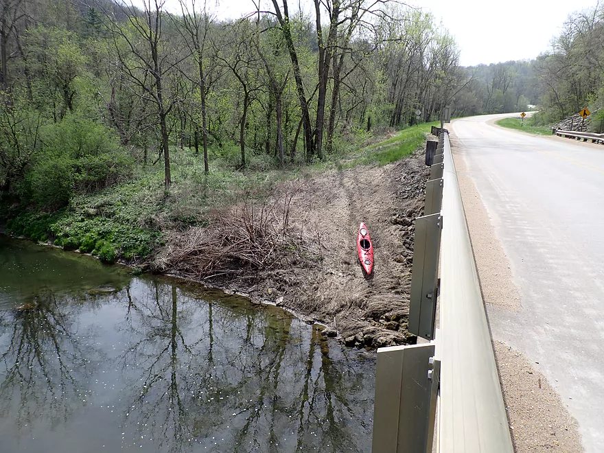
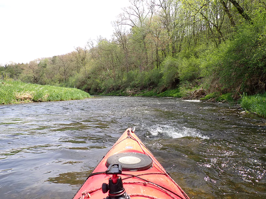
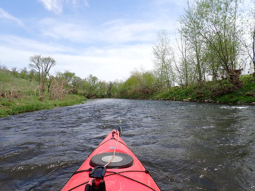
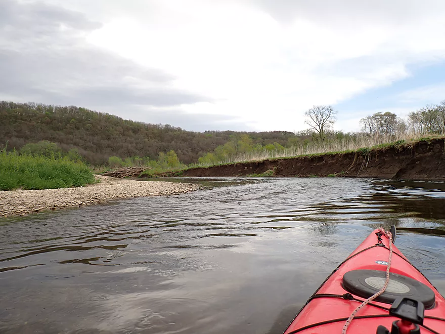
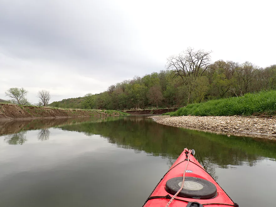
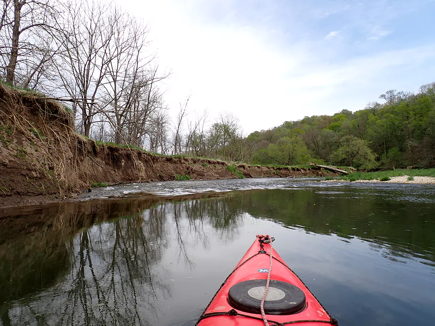
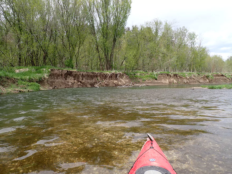
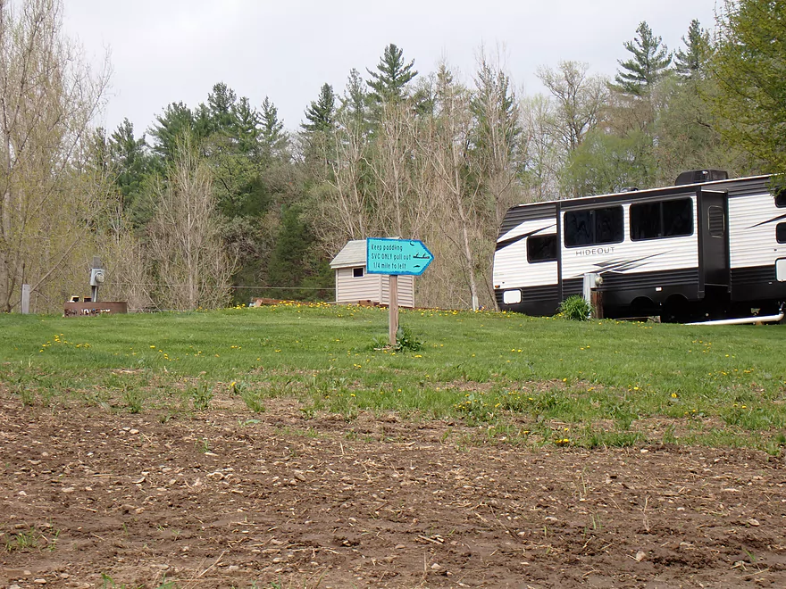
Starting at Volney Road bridge
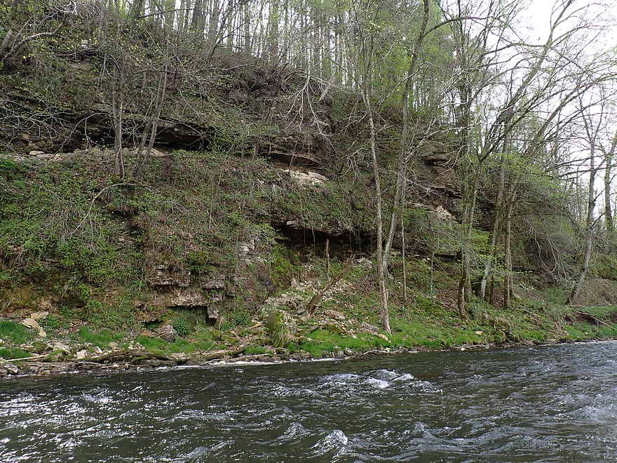
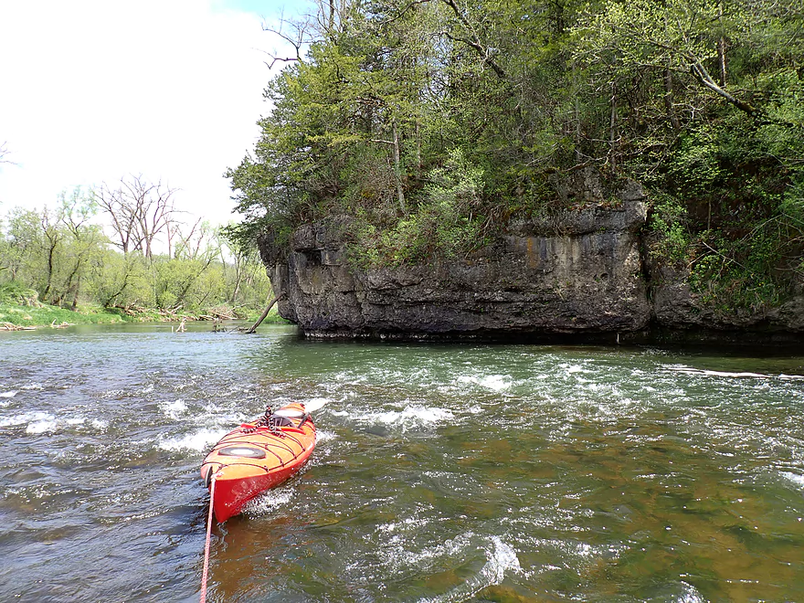
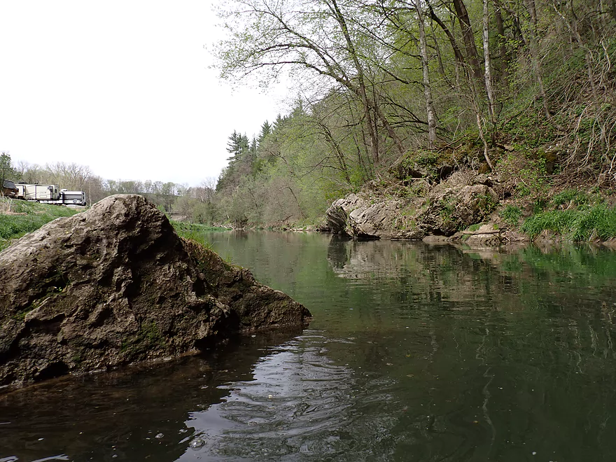
Nice outcrop + rapids combo
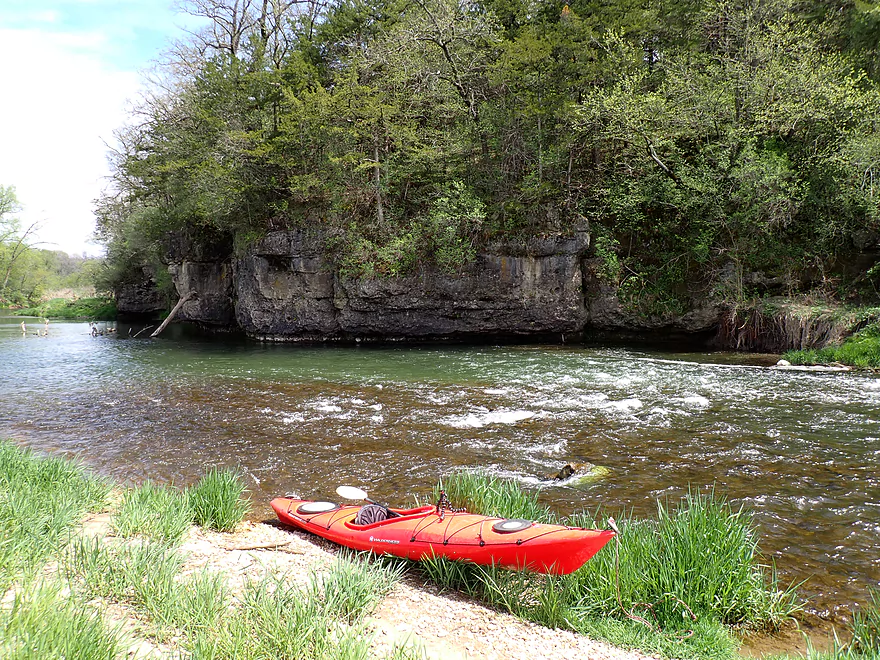
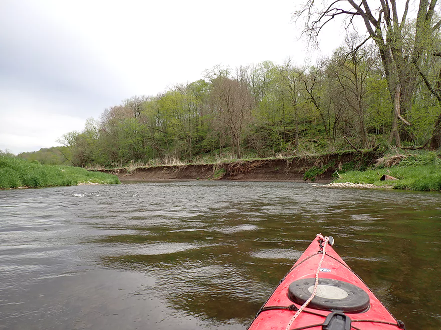
Reverse view
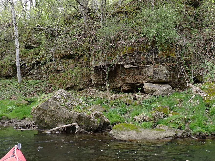
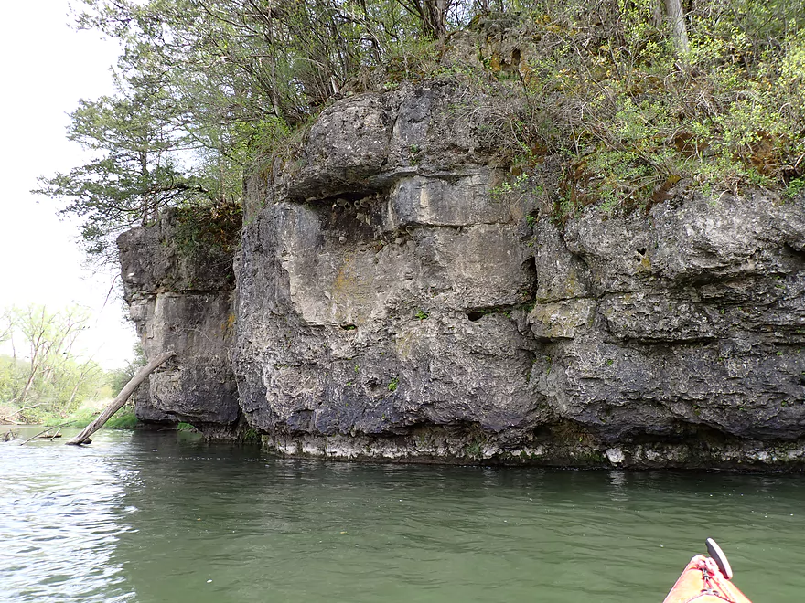
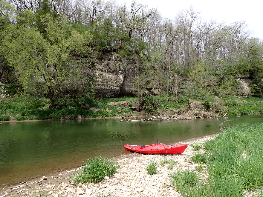
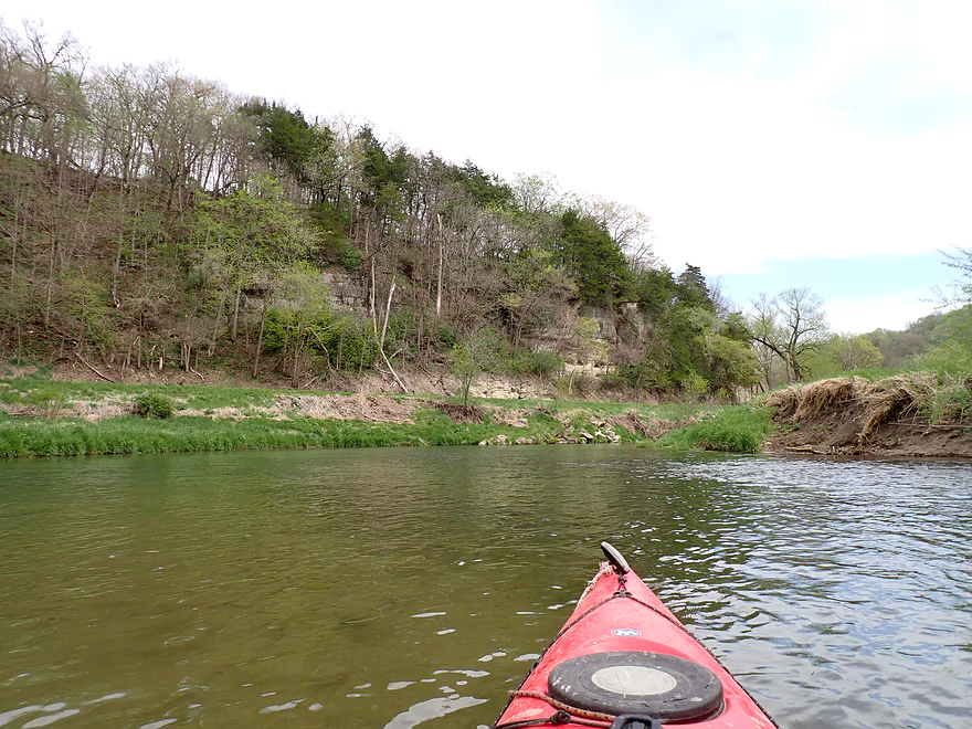
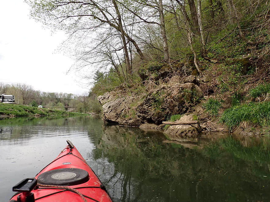
Better view of the cliff
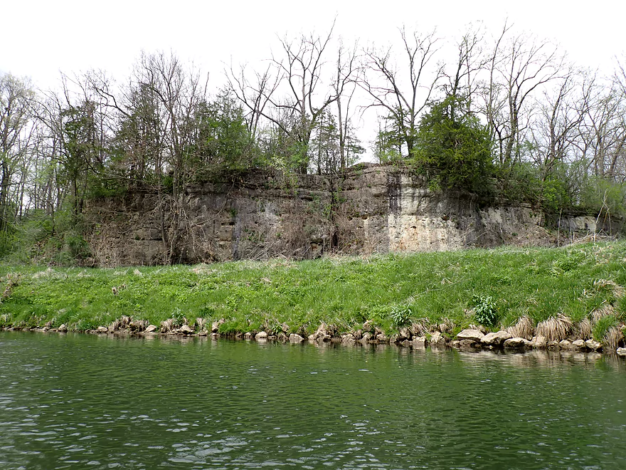
Interesting geology
In a few more weeks this will be covered with vines and mosses
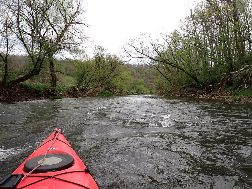
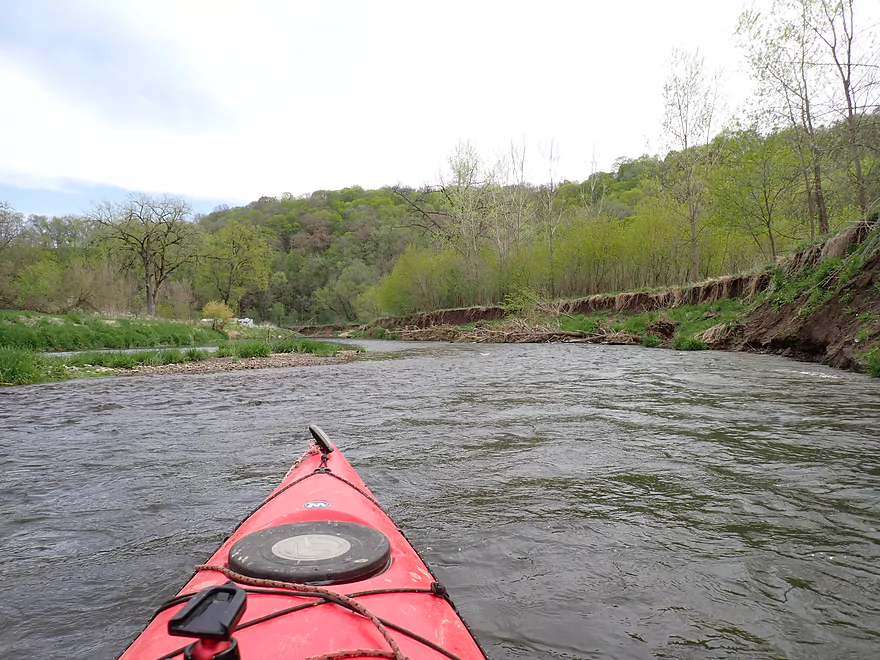
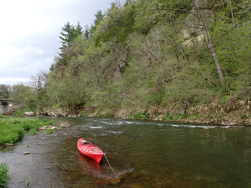
One of countless rapids
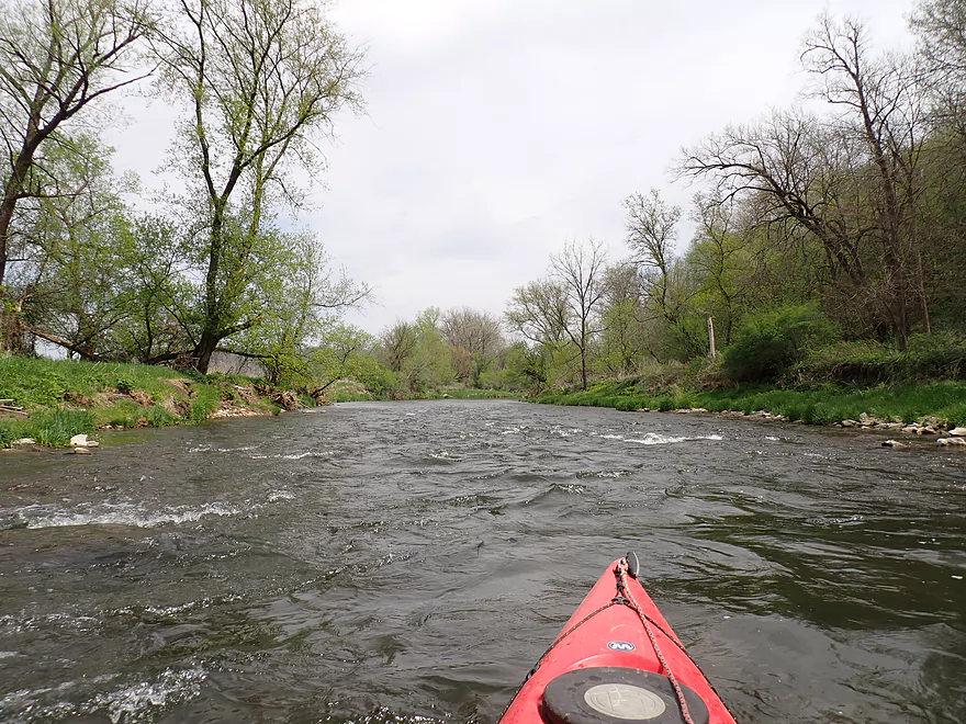
A longer stretch of whitewater
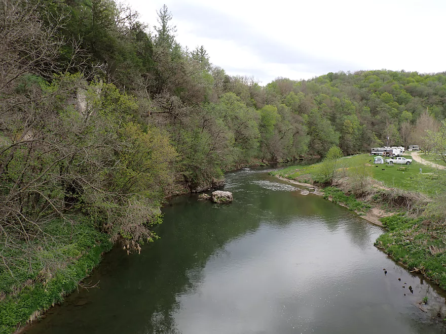
The Volney Canoe Launch (most paddlers put in here)
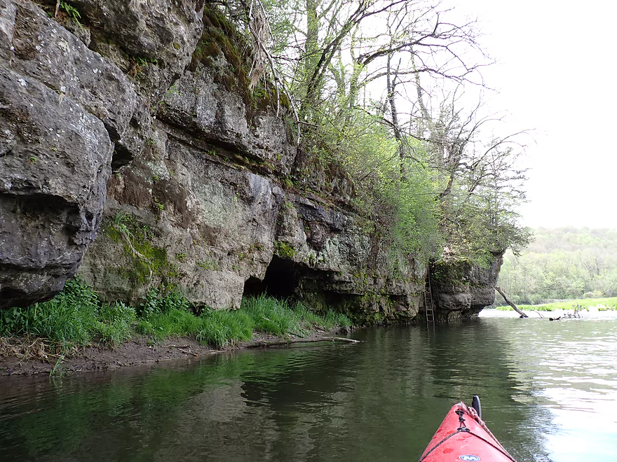
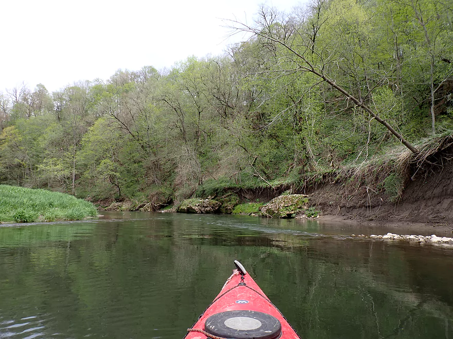
Several small but nice outcrops
Layers of limestone
This stretch has been riprapped for erosion control and trout management
Looks nice…should help trout
Passing some fly fishermen
Mini standing waves
One of the most scenic parts of the trip
Very cool
Getting out to run the rapids again
A limestone version of the Kickapoo
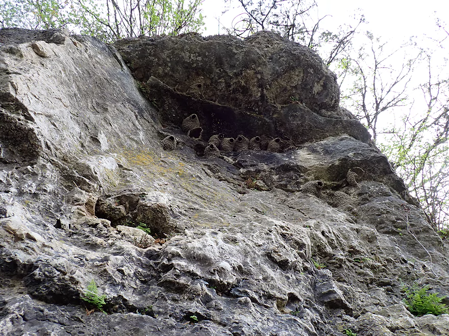
Looking up at swallows looking down at me
Looks like the locals use this rock as a diving board
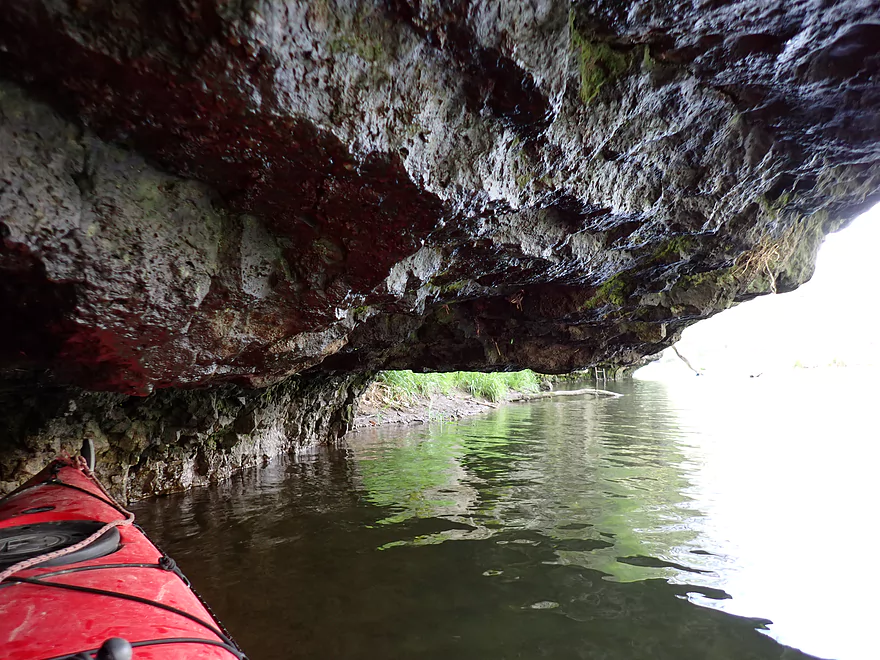
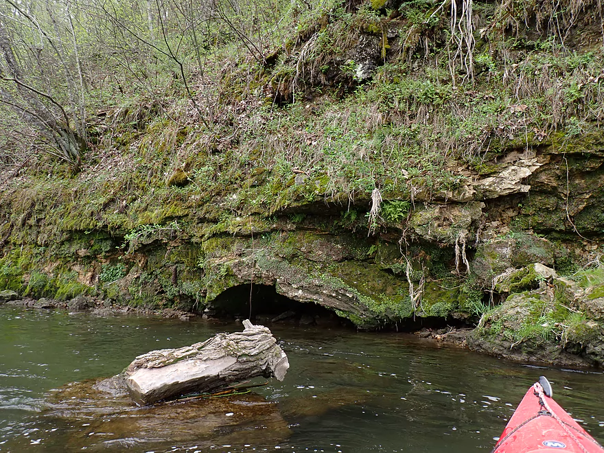
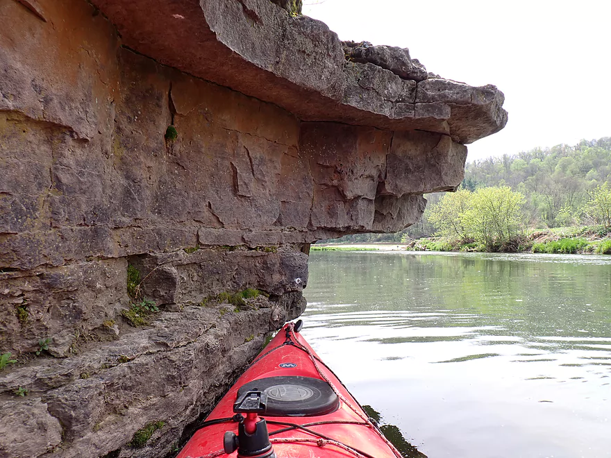
Nifty overhang
One last picture
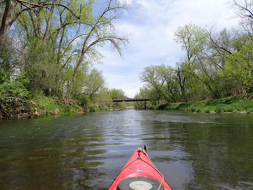
Coming up on the Suttle Creek Road bridge
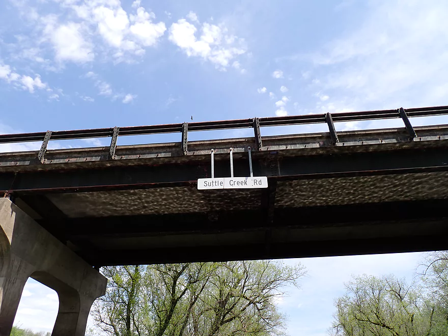
The bridges are conveniently labeled for paddlers
Mirror photo
Most rapids were well padded but these were shallow
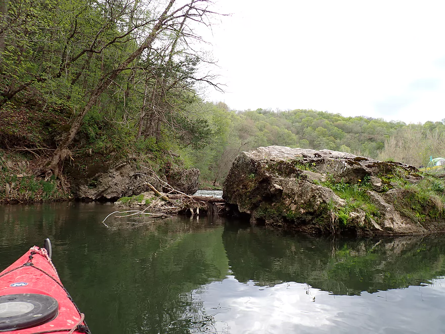
One of several strainers to avoid on this trip
Some mud banks
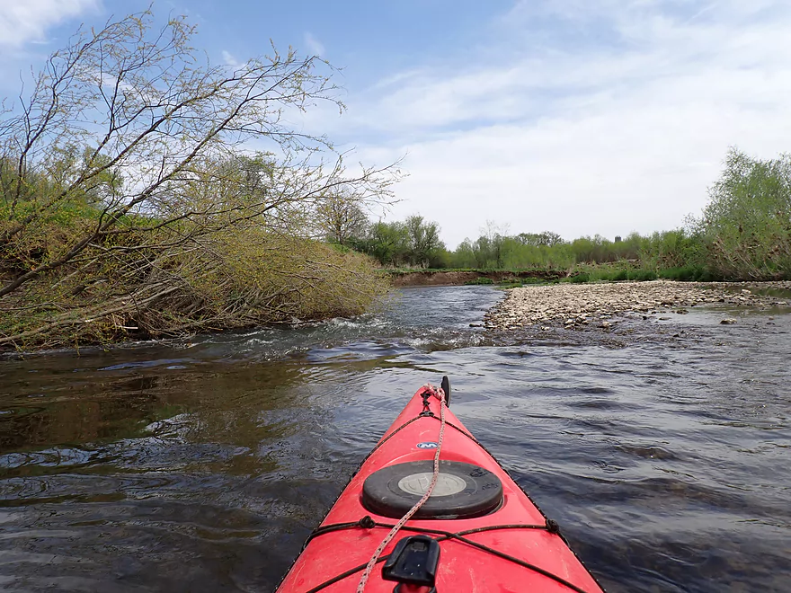
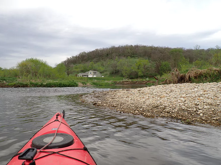
One of many gravel bars
Coming up on a long bluff
With some hidden outcrops
And nice boulders
Smoke on the water (right shoreline is being clearcut and burned)
Some more tall (and unstable) mud banks
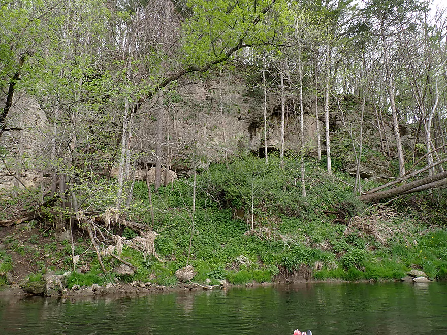
One of the larger outcrops on the trip

The front face looks like it was sliced off with a giant knife
Very scenic
Trees are starting to bud out–a soft green scene
Taking a break by another outcrop to change camera batteries
Interesting mineral stains
This strainer warranted a portage
Super easy portage
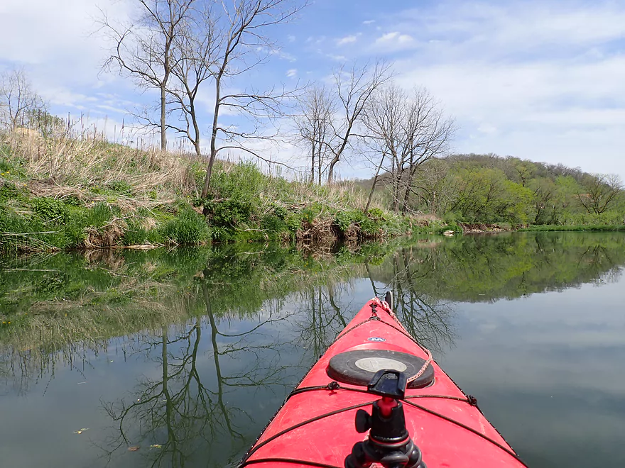
River has good clarity
Many of the outcrops were partly hidden by trees
Approaching a large horseshoe bend in the river
A sign on the north shore warns paddlers not to take out here (private campground)
Tumbled boulders
A great scene, topped off with some surprise white pines
The take-out bridge is coming up
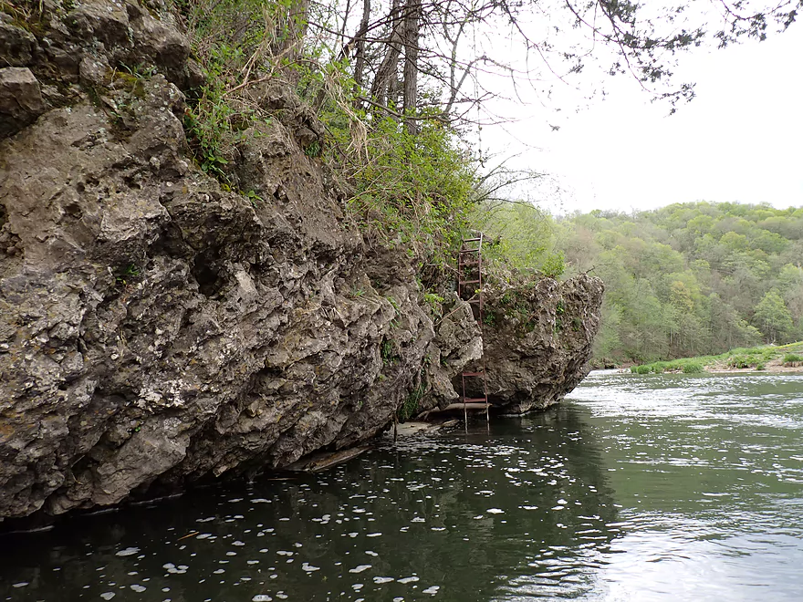
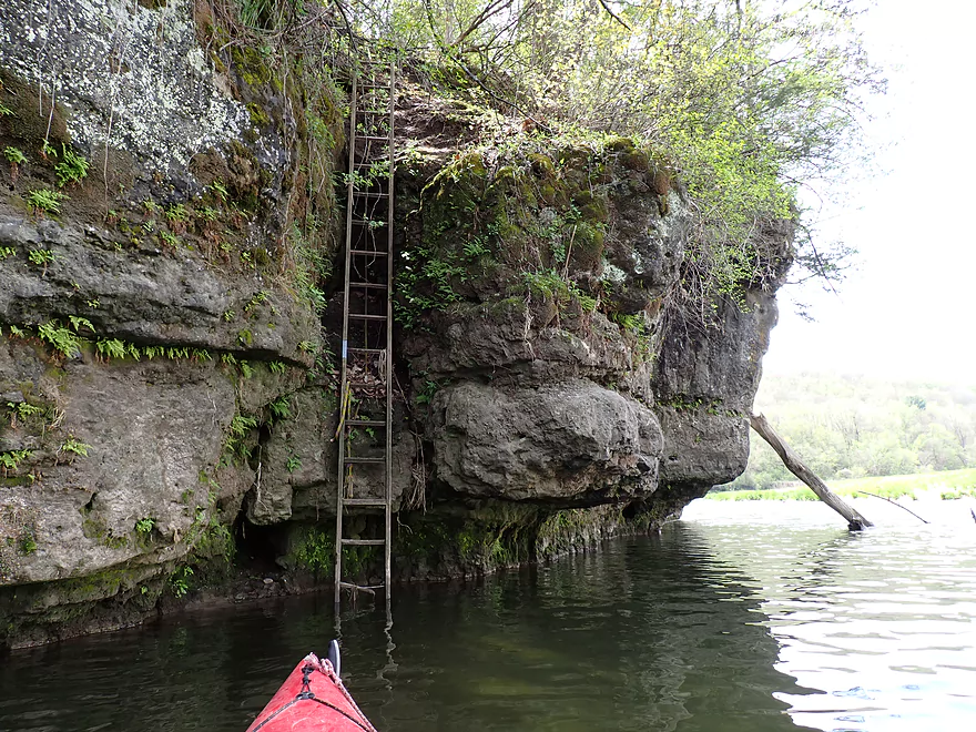
Another “diving board” ladder
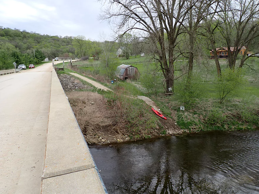
The Sixteen Bridge take-out
View upstream from the bridge
Yellow River – Volney Iowa

The Yellow River in Northeast Iowa is known for its rapids, clear water, limestone cliffs, rugged wooded bluffs, springs, and clay-tinted waters. It is unique among Iowa rivers in that it is the longest coldwater trout stream in the state and has one of the highest gradients. This is a good paddling river, with its most popular leg being between Volney and Sixteen Bridge which is what I planned for this trip.
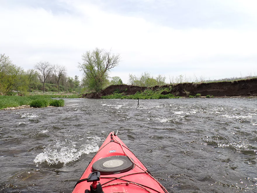
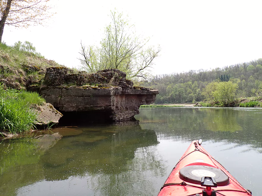
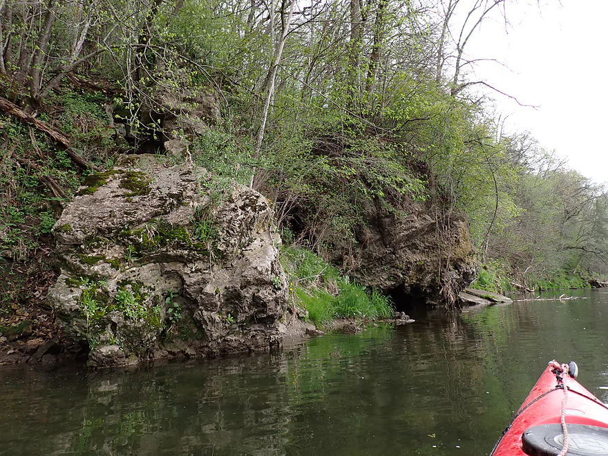
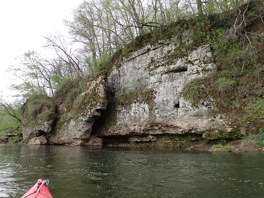
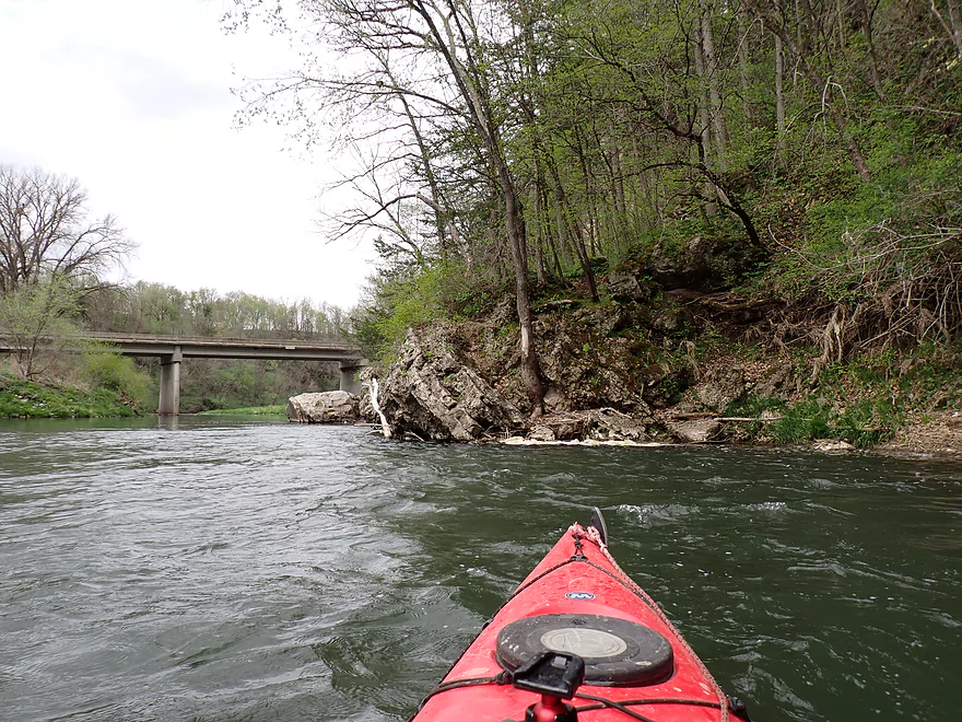
Because I didn’t bike shuttle this trip (the roads are steep and filled with gravel), I had my shuttle driver (Bigfoot Canoe Rental) drop me off at the next bridge upstream from the community of Volney for a longer (+1 mile) trip. Not many paddlers put in at the bridge, but it worked well and was an attractive area of the river. Just below the bridge was a fun set of Class 1 rapids and a scenic limestone outcrop that really reminded me of the Grant River. This “bonus leg” contained a few more minor outcrops and several fun rapids, and I was glad I did it.
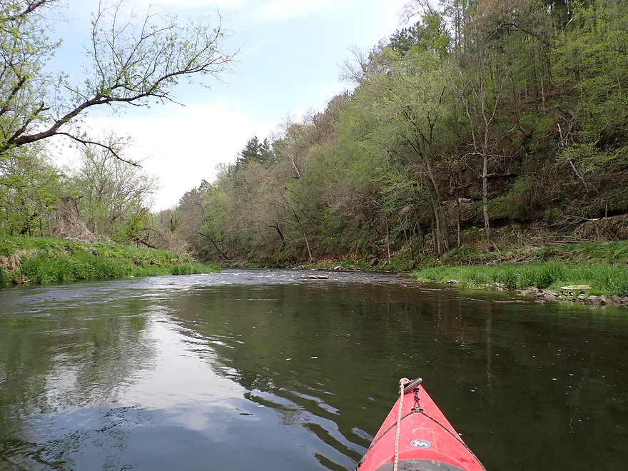
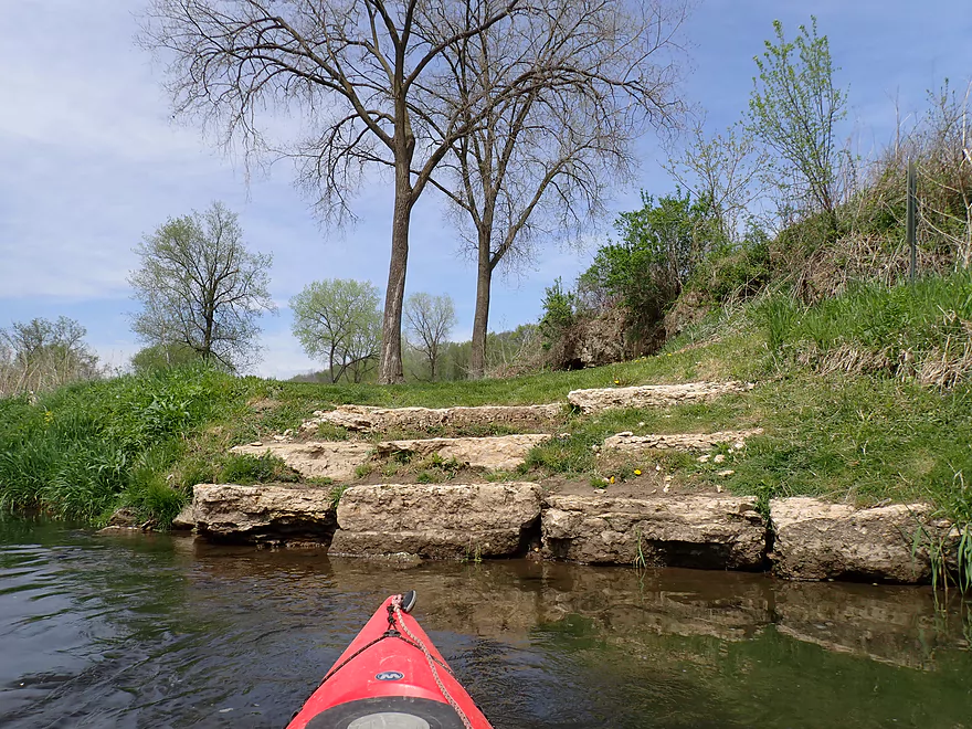
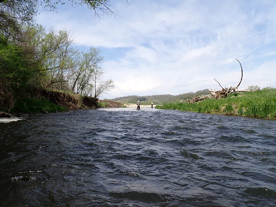
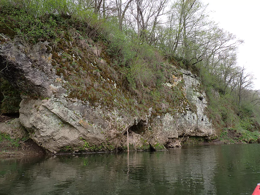
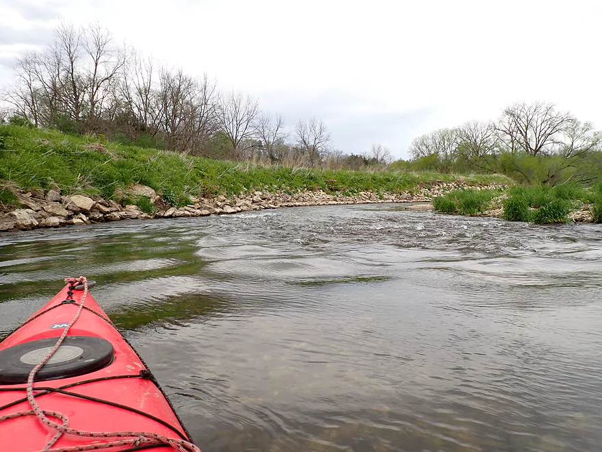
I soon passed the launch in Volney/James Drive where most paddlers start their trips. It’s also a great public access with attractive limestone steps leading to the water. Just downstream from the launch and on the left bank were a series of short but interestingly textured limestone outcrops. This was followed by a riprapped stretch of the river. Often bank work like this is done for trout, as the rocks can help prevent erosion and faster current helps oxygenate the water. Past three fly fishermen I encountered a few of the more stronger rapids on the trip, but they were still only Class 1.
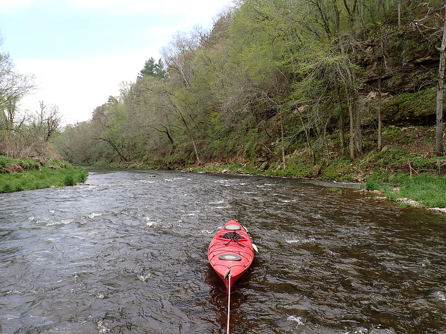
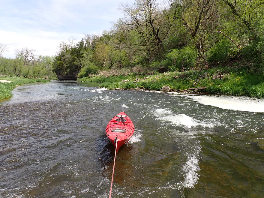
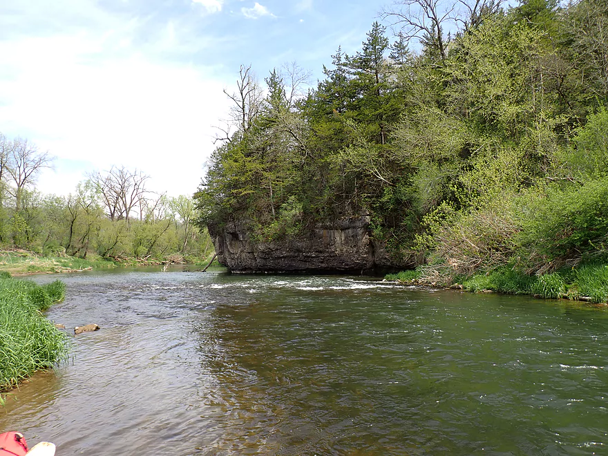
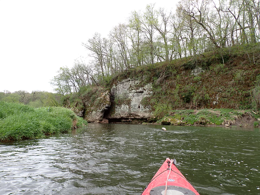
Just upstream from the Suttle Creek Road bridge is one of the more iconic spots on the river which is featured in a lot of online pictures of the river. Here rapids descend into an incredibly scenic cliff. I took a number of photos and was grateful to a local fisherman who used my camera to take a video of me running the rapids (2:31 in the video).
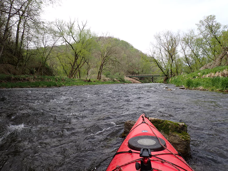
As I passed under Suttle Creek Road, I was impressed that it (like other bridges on the Yellow) had an upstream facing sign identifying the road name. This makes it easy to orient yourself and I wish more counties would do this.
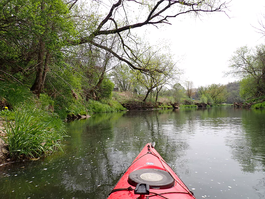
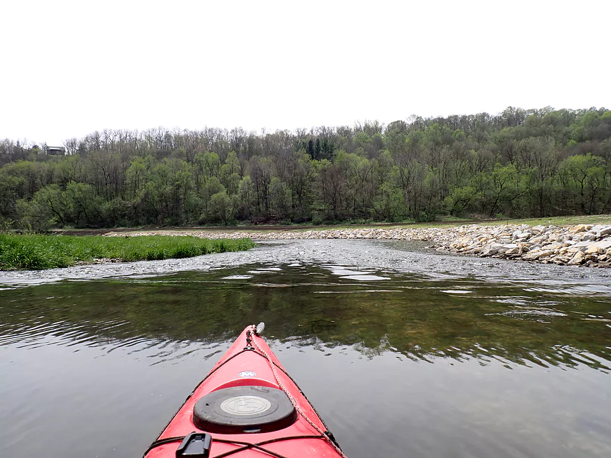
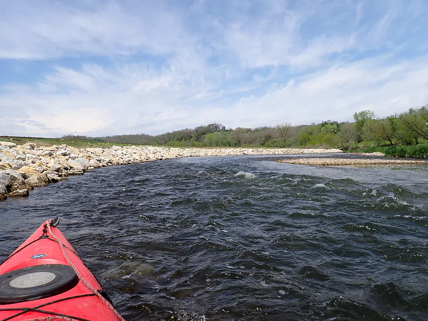
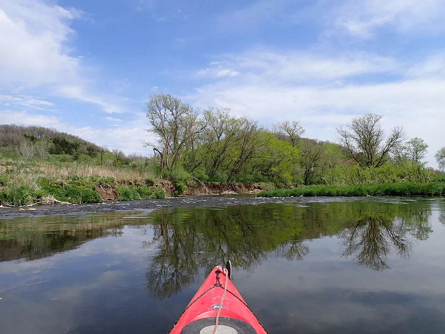
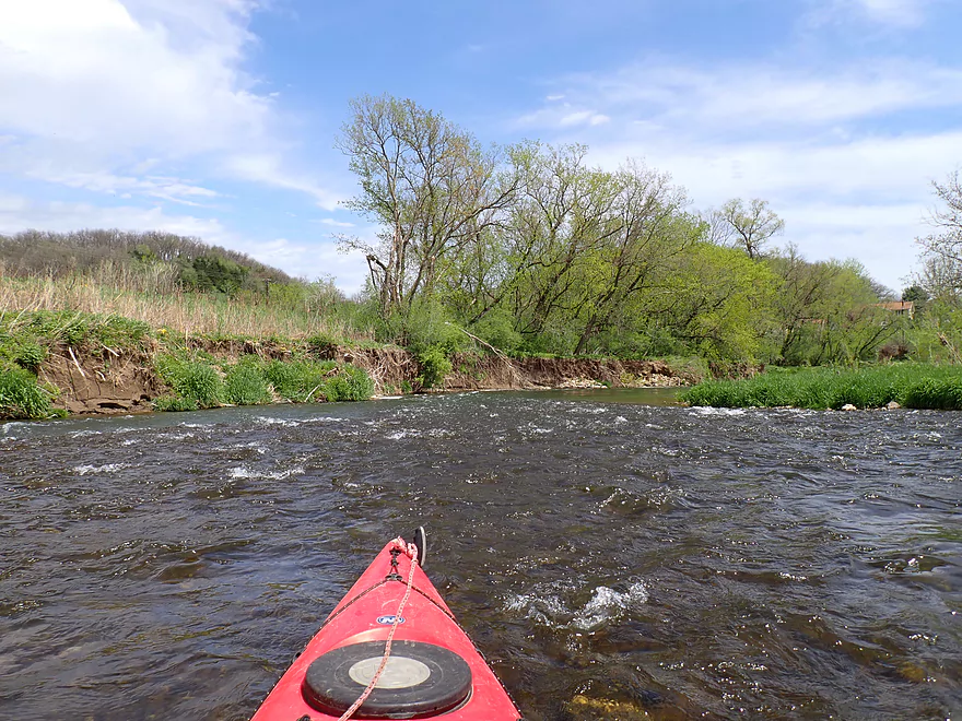
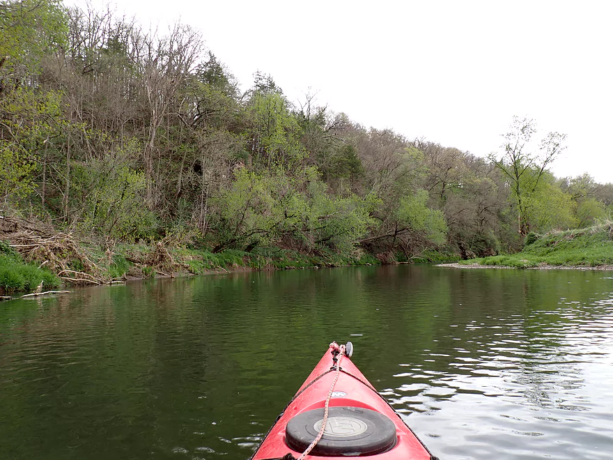
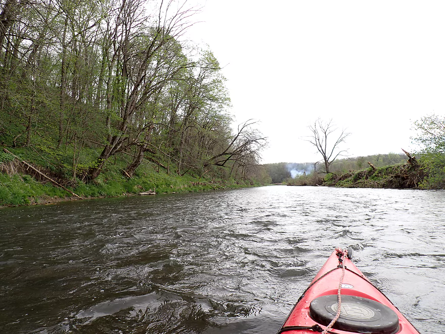
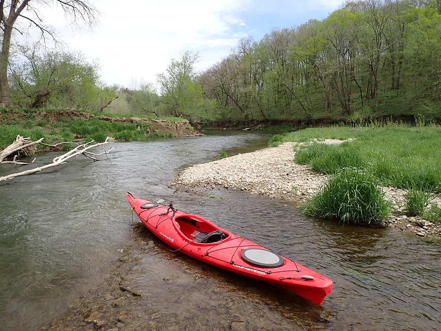
For the next half mile the sun came out which provided some nice blue skies and the ability to see through the clear water. The river here was more open with numerous gravel bars, rapids, and some steep mud banks.
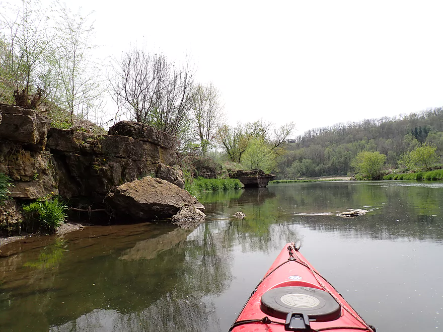
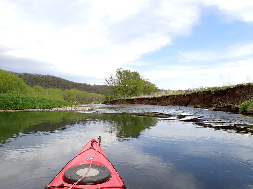
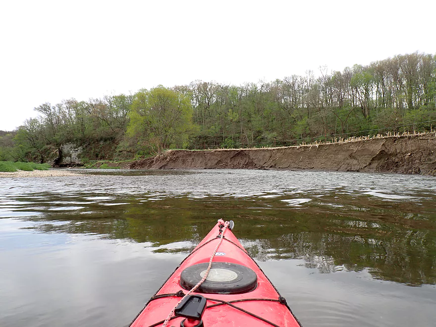
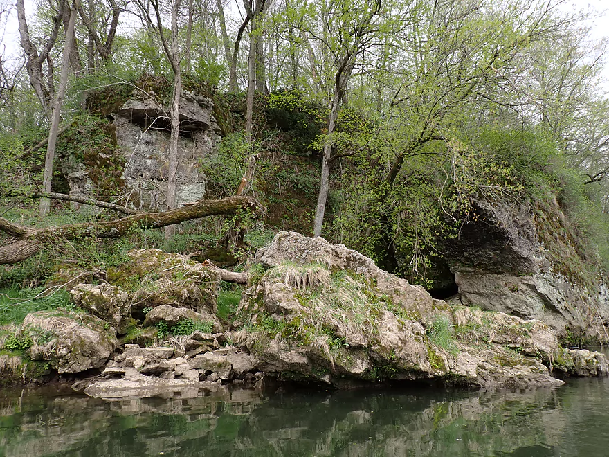
The next major feature of the river was a long north-south bluff that redirects the Yellow sharply south. This was an attractive stretch with large boulders and limestone outcrops on the hillside. Trees were just starting to bud which partially obscured the rock faces. In a few weeks, much of the river will become overgrown which will limit what paddlers can see. Doing trips like this in April or late October can be ideal.
While the east side of this stretch had the nice bluff, the west side was mostly open pasture and farm fields. A farmer was clearcutting and burning the tree line along the river which I think is a mistake. Trees do a good job of preventing shoreline erosion. With these gone, the farmer will lose valuable topsoil to the river, and the river could start to meander into and eat away at the fields. Topsoil erosion also usually means downstream mud banks, less gravel bars, more meandering, and more logjams as trees won’t have stable ground to grip.
After the farm, was one of the largest and more impressive cliffs of the trip. The front face was detached as if a giant knife had split it off from the main face like a slice of limestone cheese.
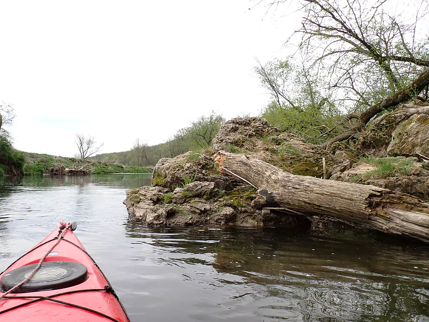
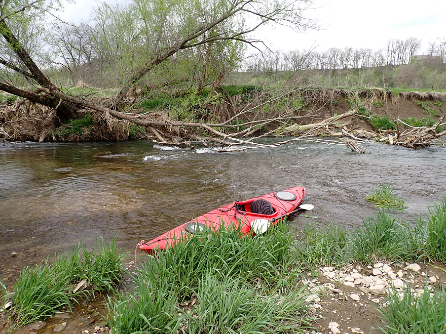
The scenery stayed good for the next mile with more rock faces, rapids, and gravel bars. One of the few downsides of the river is it does have occasional strainers. Most are pretty easy to avoid, but one near the end of the trip had to be portaged, which was easily done along a shallow gravel bank.
One of the best parts of the trip actually is near the take-out at Sixteen Bridge. Here the river is redirected first south, then east, and then north in a sharp horseshoe bend. Along the outside of the bend is an impressive bluff with large boulders and even some white pines growing on it. Located on the inside of the bend is “Scenic View Campground” (a private campground). Multiple signs warn paddlers not to take out in the campground and that the bathrooms are for campground patrons only. That’s ok as there is a public take-out just north/downstream of the Sixteen Bridge. As one last hoorah, there is a terrific set of rapids, boulders and outcrops at the end that was quite scenic. I took out at the Sixteen Bridge launch which was a bit steep and muddy (from recent high water), but was plenty doable.
In summary this was a great trip that I highly recommend. While popular in the summer, I still consider this an underrated river in the paddling community. For most in Southwest Wisconsin it is easily within a two hour drive and is just 20 minutes west of Prairie du Chien. I look forward to returning in the future which will likely mean Sixteen Bridge to the Yellow River State Forest. This downstream leg should be more rugged, faster and have bigger rapids.
Notable trip wildlife included a muskrat, eagles, many cliff swallows (nesting both on the cliffs and the bridges), and lots of singing toads. The highlight was a large number of flopping fish (so many I lost count). Many were carp, but some weren’t. Several fish were putting up some valiant fights to swim upstream against the rapids.
Spook Cave: What’s unique about this cave is it is partially underwater and you can take a boat tour into it. Unfortunately the tour is geared for kids with a Halloween/haunted house theme, but the cave seems impressive enough that it may still interest adults. Here’s a sample video of the boat tour.
Effigy Mounds National Monument: This is Iowa’s only National Park and features a number of effigy mounds. For some the real highlight are the trail overlooks which provide a nice view of the Mississippi.
Pikes Peak State Park: Located across from the mouth of the Wisconsin River, this park has one of the most scenic views of the Upper Mississippi.
Volney Road/X32 Bridge: Few paddlers put in here (most prefer the public canoe launch in Volney a mile downstream). But it is a decent and suitable bridge access.
Alternate Put-ins:
- Volney Canoe Launch (0.9 miles downstream from the Volney Road Bridge): This is an excellent public access. Putting in here (as opposed to the upstream bridge) however does omit some fun rapids and a scenic cliff.
Sixteen Bridge/X32: Downstream from the Sixteen Bridge is a public launch for paddlers. It’s a bit steep and muddy, but plenty suitable. Note, “Scenic View Campground” is located nearby. Multiple signs warn you NOT to use their take-outs or bathrooms unless you are a paying customer. Again just take out downstream/left of the bridge and you’ll be fine.
Alternate Take-outs:
- Ion Road Shoulder (7.1 miles downstream from Sixteen Bridge): The shoulder upstream of the X36 bridge is private, but supposedly the owner lets paddlers launch from the shore here. This bonus leg is very good with stronger rapids and more rugged scenery.
- Old Mission Drive Access (9.7 miles downstream from Sixteen Bridge): There is a nice pull-off and access off of Old Mission Drive. This stretch flows through the Yellow River State Forest and should be nice.
- Yellow River Landing (17.8 miles downstream from Sixteen Bridge): This is a decent public landing located on the Mississippi near the mouth of the Yellow. The leg beyond Old Mission is a bit slower and less scenic, but is still a good prospect. Some paddlers canoe/camp the Lower Yellow as it can be a long haul. If you do this, be mindful of where you can do this legally. Here is a map that shows one public canoe/campsite.
Bike Shuttle – Sixteen Bridge to Volney Road Bridge: 5.1 miles with 413′ of ascent. This would be a difficult gravel shuttle with a major hill to climb. That is why I paid for a shuttle instead. For those determined and in shape, it would be doable if you perhaps walk the big hill and keep your bike on the packed down areas of gravel. Bikers can also shorten their shuttle by a mile by simply putting in at the Volney Public Launch (instead of the upstream bridge).
Kayak Rentals/Shuttles:
- Bigfoot Canoe Rental: Located near Volney, this is a good service that provides canoe rentals, kayak rentals and shuttle services for the entire length of the Yellow River. If you have your own boat, a simple shuttle/car drop should cost $25-$30. All of this is worth it as the bike shuttling in the area is very difficult.
- Scenic View Campground: The campground also has boat rentals and shuttles.
Rapids/Current: This is a fast river with many rapids. Most are Class 1, pretty easy, and well suited for beginners. At high water levels, some of these rapids might approach Class 2 in difficulty.
Logjams: There are no logjams on this stretch.
Strainers: There are 3-4 strainers to keep an eye out for. Most are easy to avoid with good boat navigation. But one near the end of the trip did require a portage. All of the strainers are easy to portage.
Closest Gauge: Yellow River @ Ion
Trip Depth: 210 CFS or 6.17′
- < 50 CFS: Likely too low for paddling.
- 51-100 CFS: A very shallow depth maybe only suitable for flat bottom boats.
- 101-200 CFS: A shallow depth but should be doable. River should have good clarity.
- 201-300 CFS: An average depth and a good target range for a well padded river.
- 301-400 CFS: Above average depth but still likely suitable for paddling. Clarity might not be good.
- 401-600 CFS: A higher depth. Rapids should be well padded. Some of the strainers could become difficult and dangerous.
- 601-1000 CFS: A very high depth perhaps only suitable for expert paddlers.
- 1001+ CFS: Maybe too high for kayaking?
- Upstream from Stonebrook Park: I assume the far upper Yellow contains navigable sections, but I don’t know much more.
- Stonebrook Park to Williams Creek Road: 1.0 miles. The south shoreline is a steep bluff and part of the “Driftless Area National Wildlife Refuge” (I think that means it is scenic).
- Williams Creek Road to Forest Mills Road: 3.0 miles. A more open stretch with larger gravel bars. Likely not many outcrops, but maybe 1-2.
- Forest Mills Road to Smithfield Drive: 1.5 miles. River parallels a long and steep bluff.
- Smithfield Drive to Volney Road: 5.3 miles. Likely a scenic stretch with multiple rock outcrops.
- Volney Road to Sixteen Bridge: 5.3 miles.
- Volney Road to Volney Canoe Launch: 0.9 miles. Includes great Class 1 rapids and several nice outcrops include a really scenic one just downstream from the Volney Road bridge.
- Volney Canoe Launch to Sixteen Bridge: 4.6 miles. The most popular leg on the river. This is a great stretch with many Class 1 rapids, gravel bars, and outcrops.
- Sixteen Bridge to Ion Road: 7.2 miles. A more rugged stretch of the river with faster current and bigger Class 2 rapids. This is likely more scenic than the Volney leg, but isn’t as popular because it is a longer trip.
- Ion Road to Old Mission Drive Access: 2.6 miles. This leg enters a state forest and should be decent.
- Old Mission Drive Access to Yellow River Landing on the Mississippi: 8.1 miles. The river slows and enters a floodbottom forest. There aren’t as many outcrops, but the bluffs should be nice.
Trip Map
Overview Map
Video
Photos Size:
Paddled from bridge 16 to Old Mission. The area had received ~ 1.5 – 2.5 inches of rain on May 14th,
2023. The river rose that day, from 200-2000 cfs, in as little as 12hrs. When got there, some 6 days latter, there had been little to no rain. The level was 440-6.8ft, but as you’re water levels indicate, the water was cloudy, even with the absence of rain.
This was disappointing, and the take out at Old Mission was a mud slog. Thanks for the reports
and especially the water levels, which is the most important “know before you go” information
That’s too bad as one of the highlights of the river is the clear water. Appreciate the info and the update.