
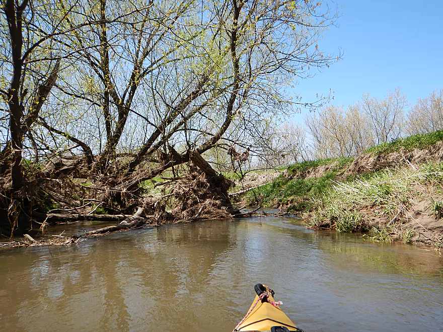
Scouting the 1st Hwy 58 bridge…too many jams
Scouting Hwy D…looks too shallow
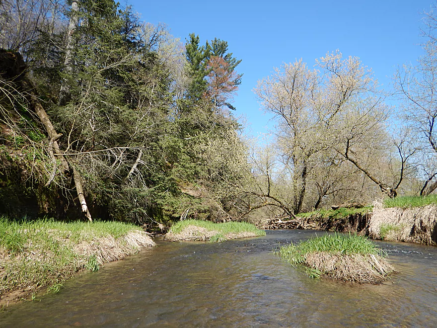
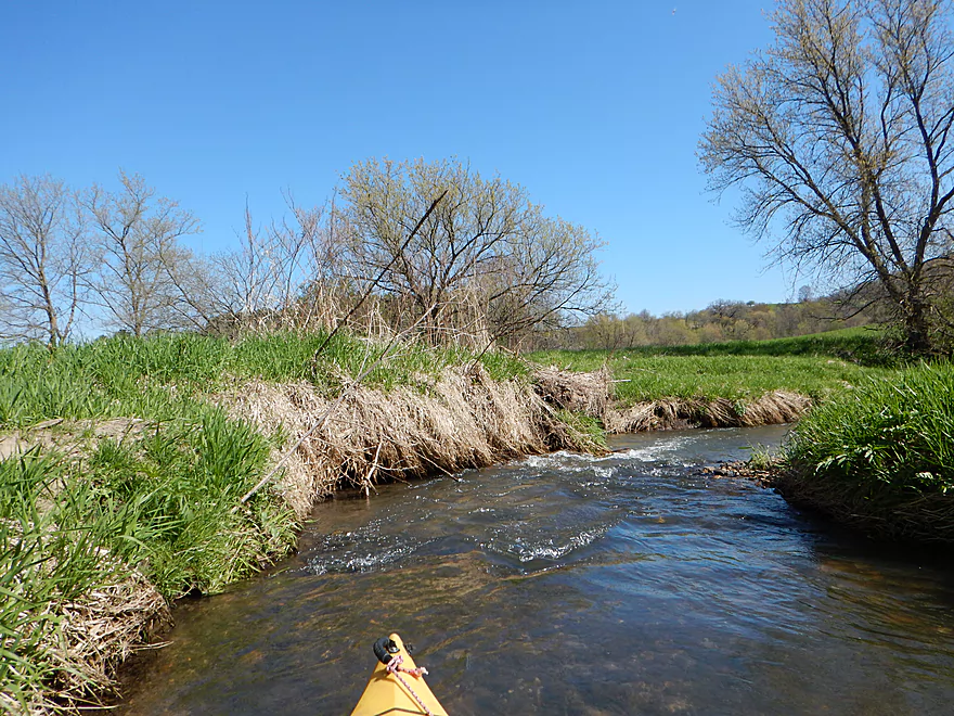
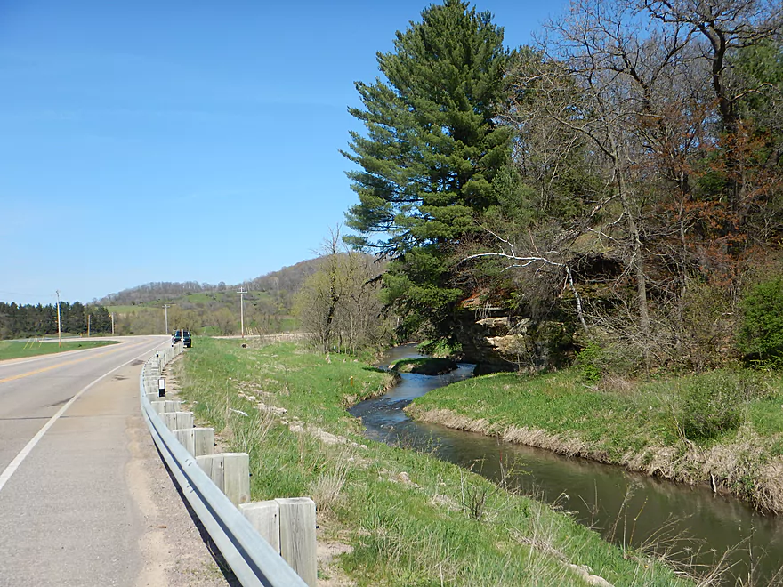
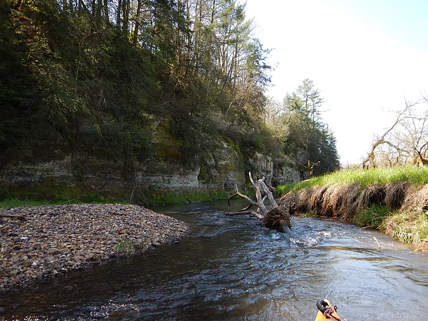
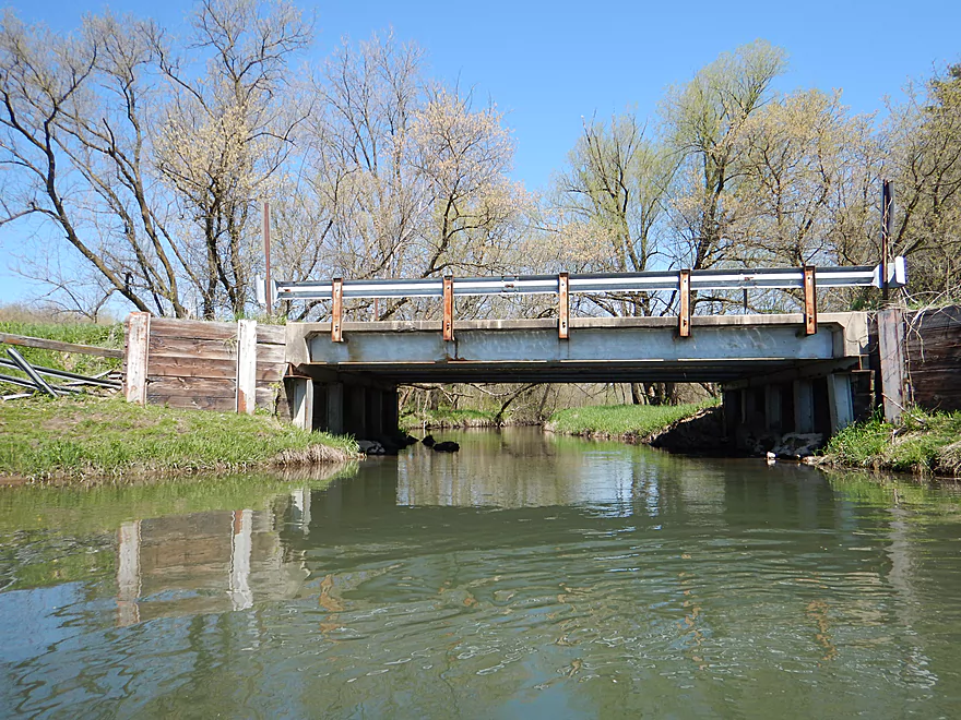
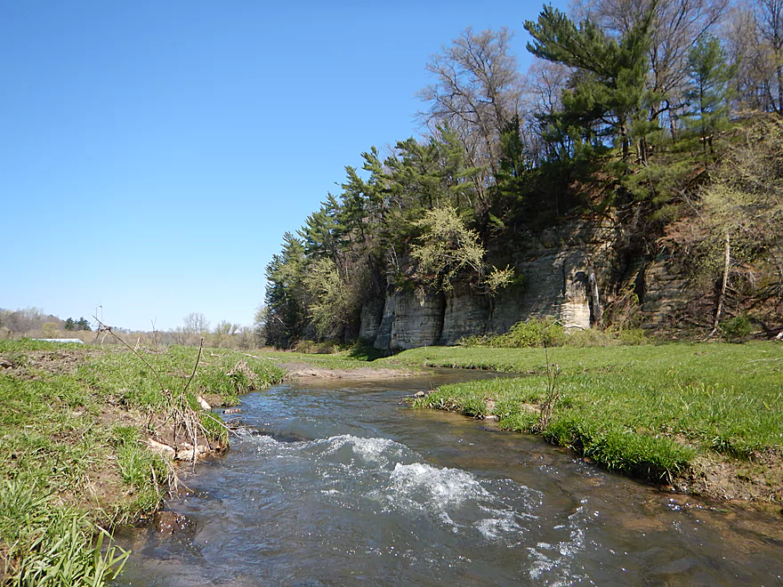
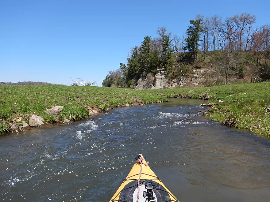
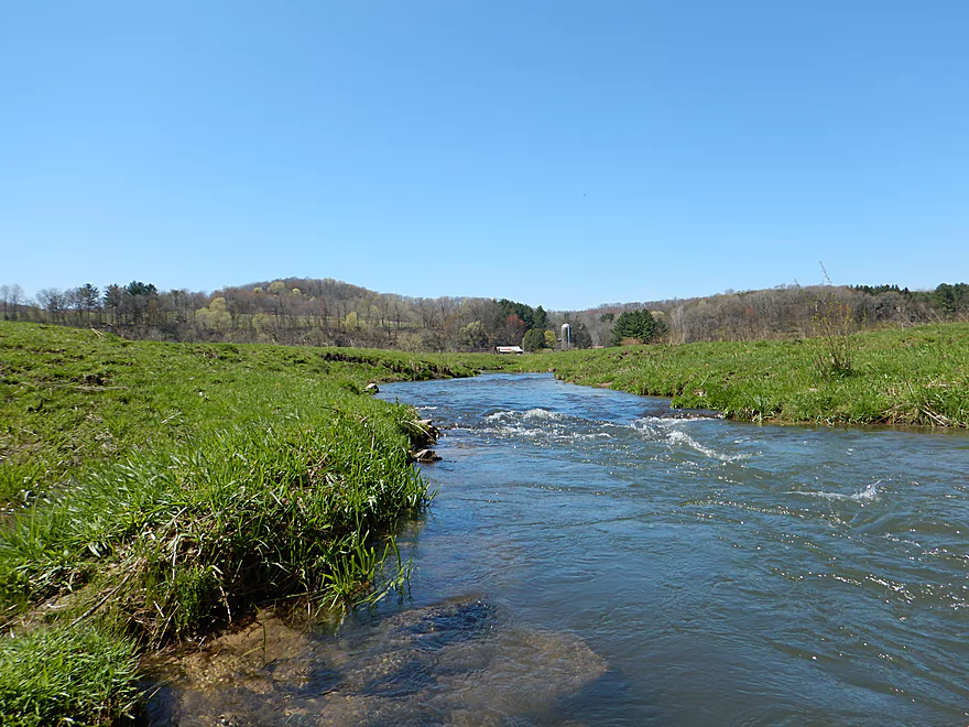
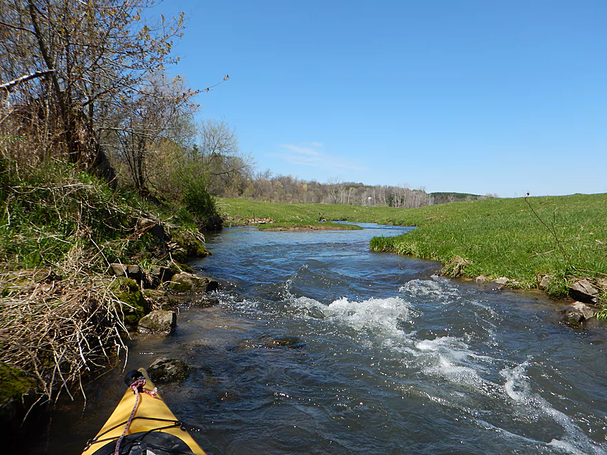
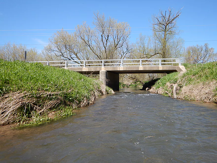
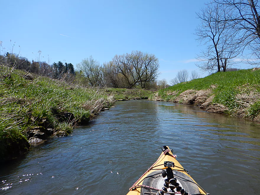
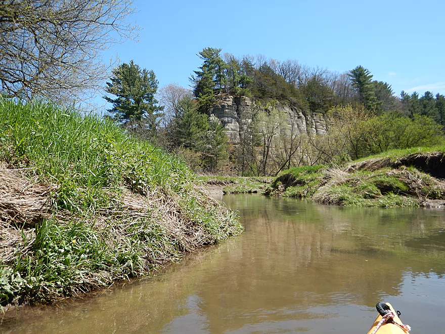
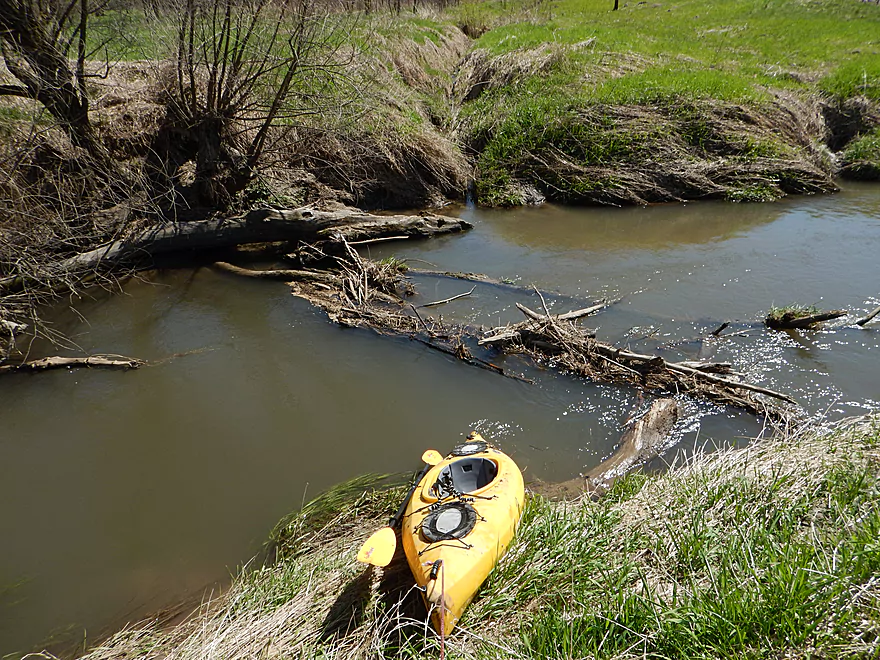
The 2nd Hwy 58 bridge is a perfect put-in
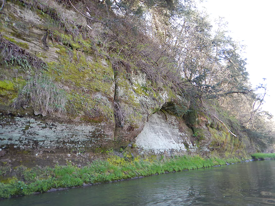
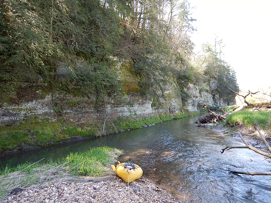
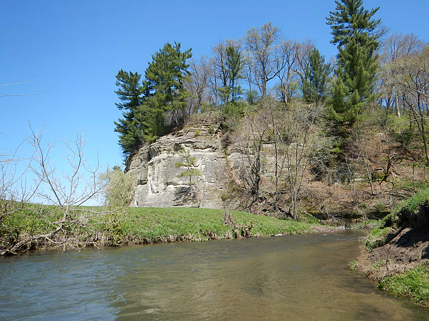
Backdropped by some scenic sandstone
If you are willing to paddle a bit upstream…
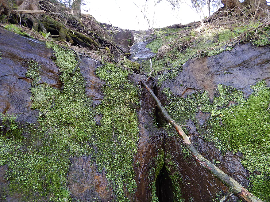
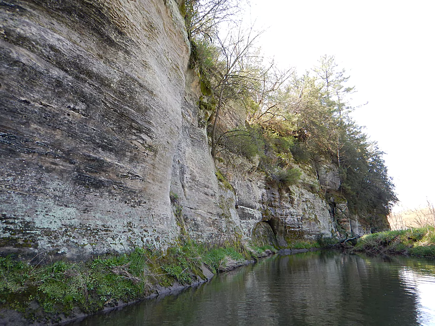
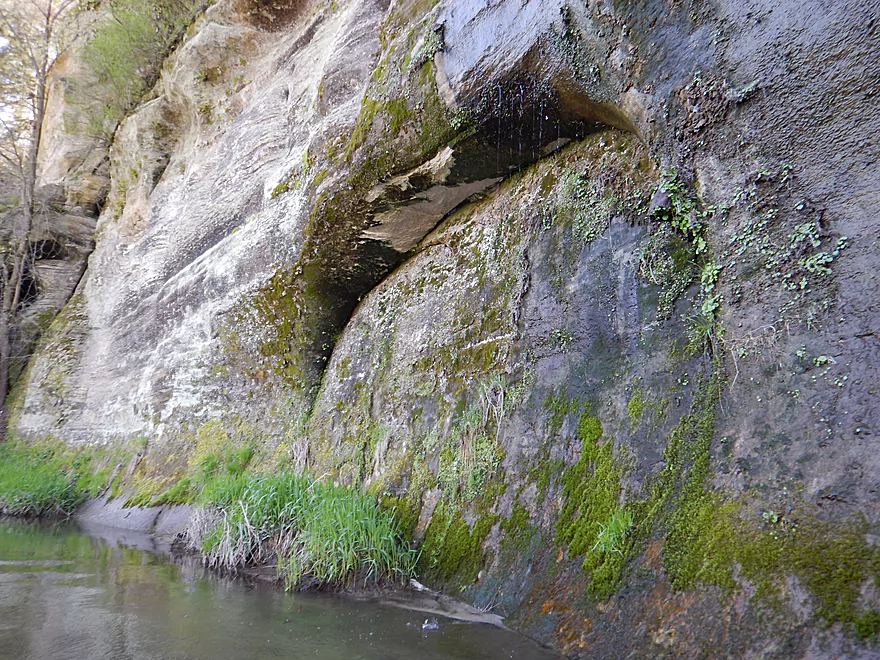
You can see a neat seep
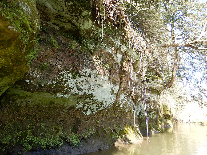
And more outcrops
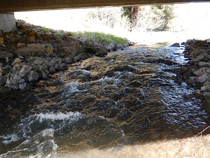
Bumpy rapids under the Hwy 58 bridge
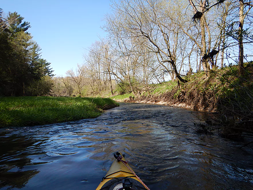
This is a very fast creek
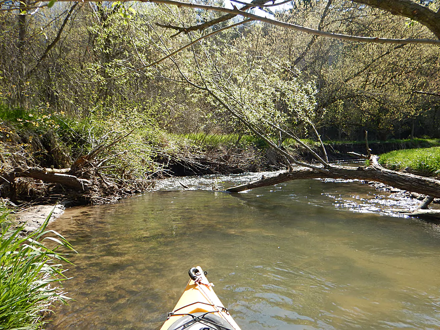
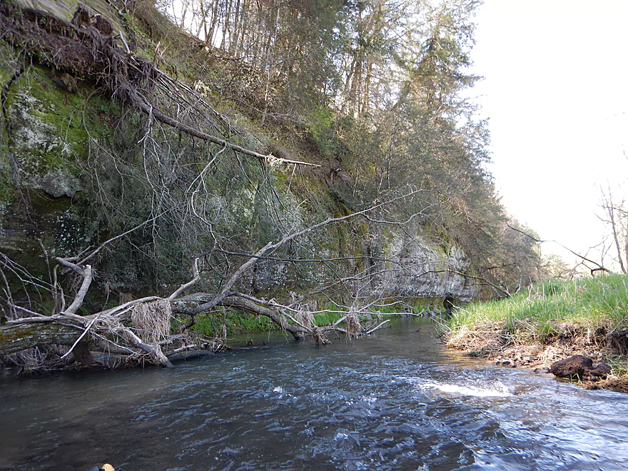
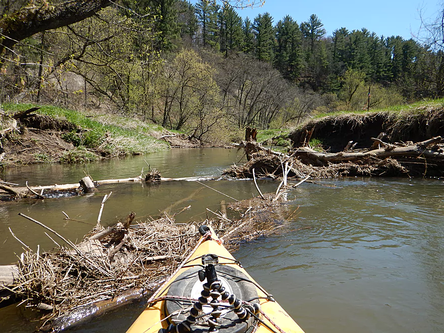
A few snags early on, but all negotiable
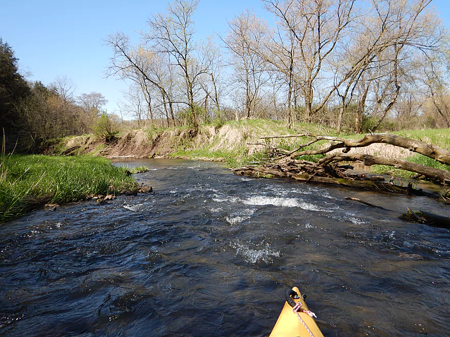
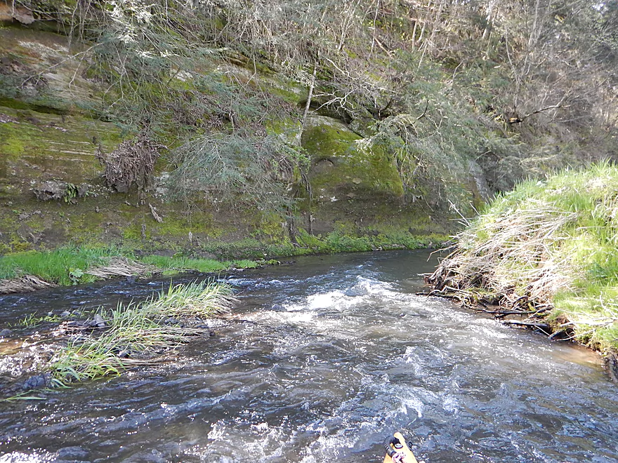
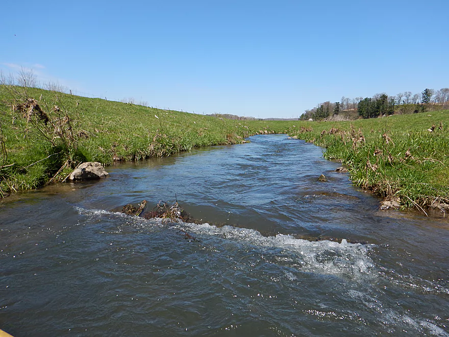
One of countless light rapids
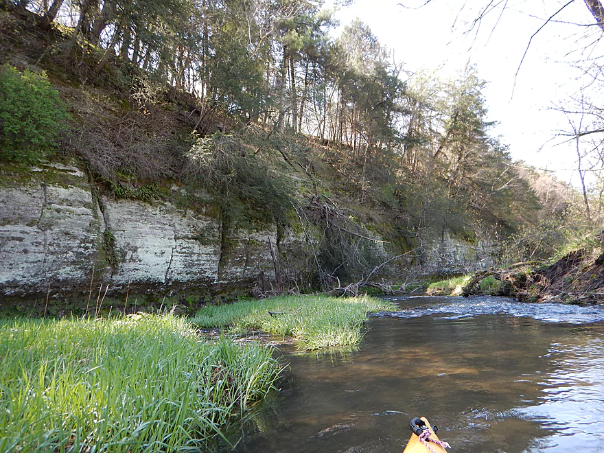
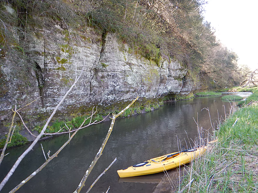
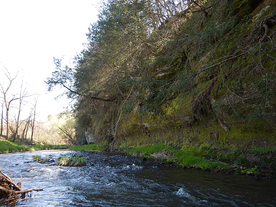
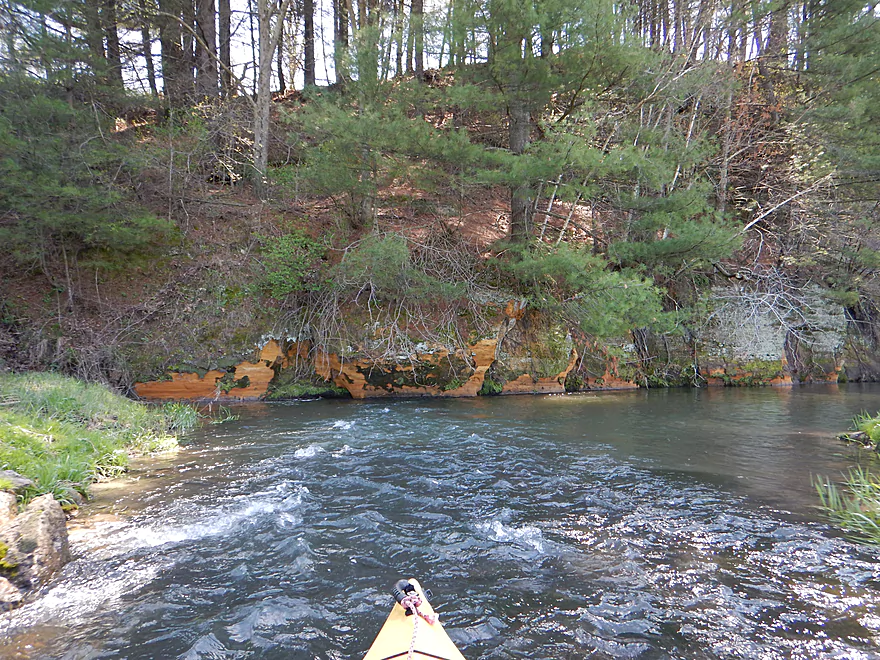
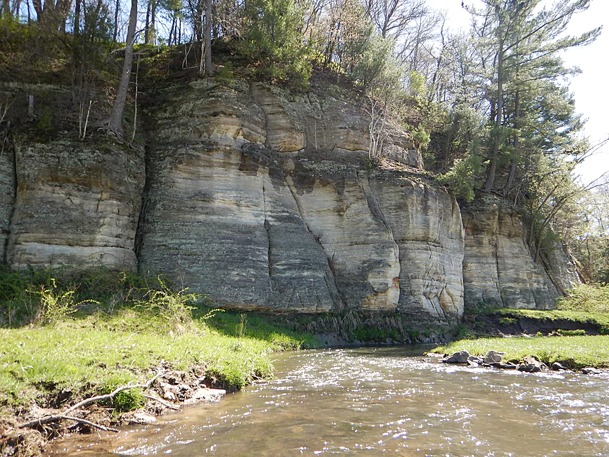
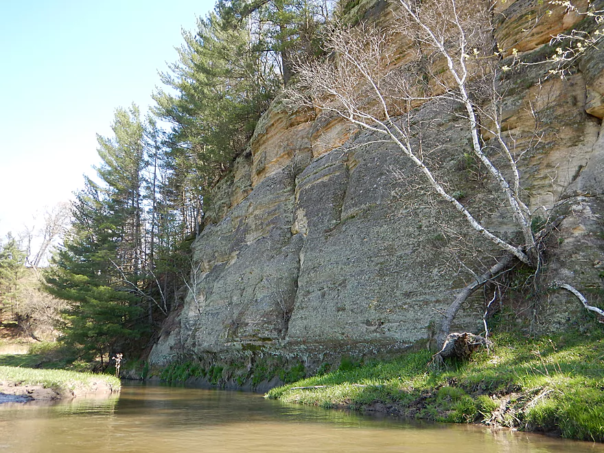
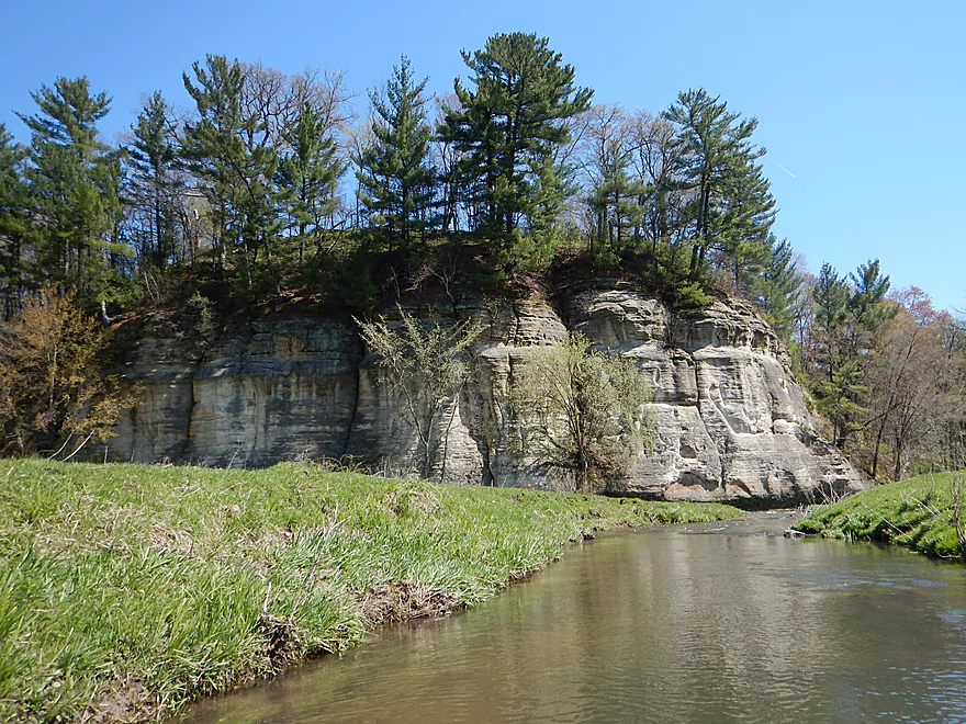
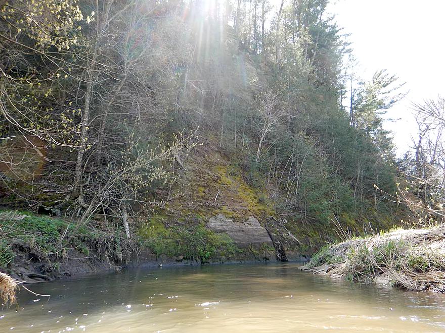
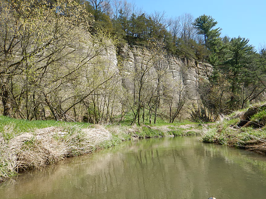
First major sandstone bluff
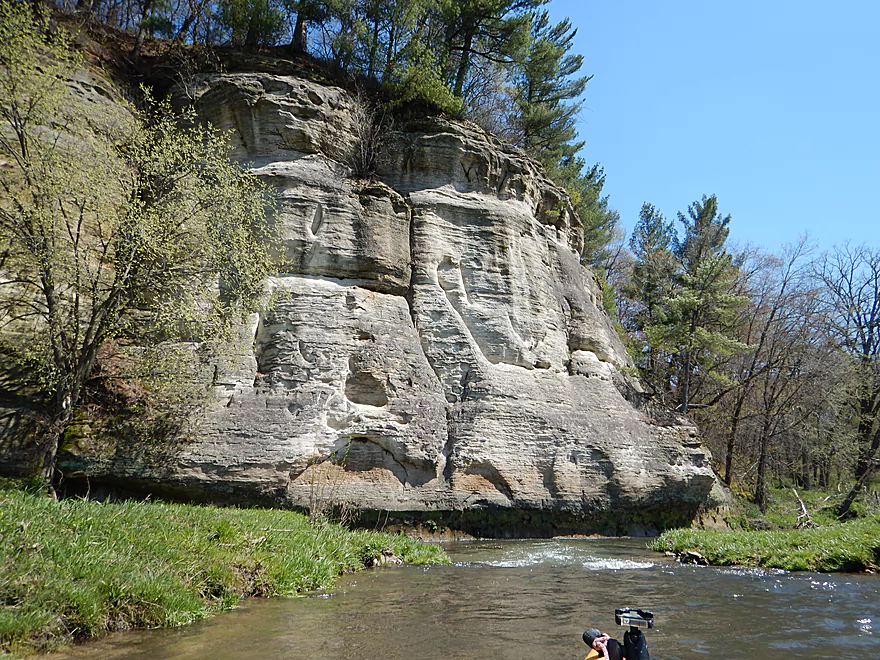
Extra scenic with the rapids
Time to get out for pictures
Another neat scene downstream
Looking back
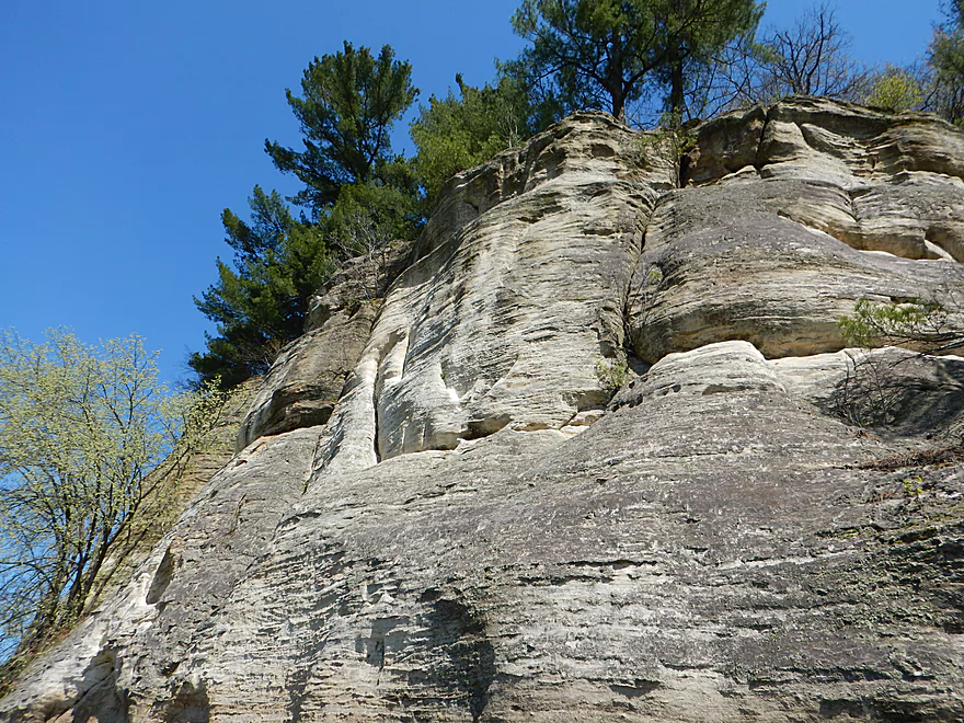
Future cave in the making

A popular wayside used by fishermen
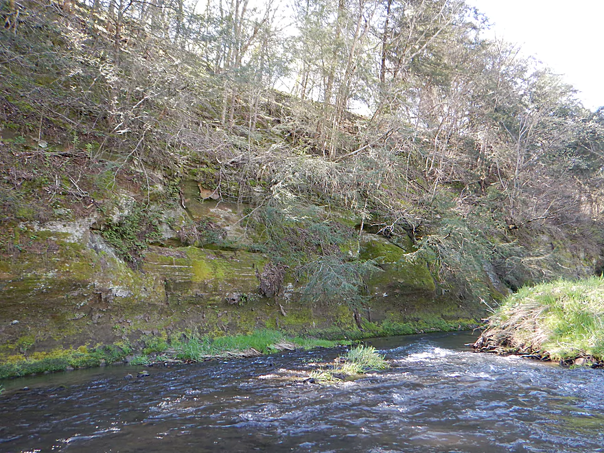
One of several ledges on the trip…all easy
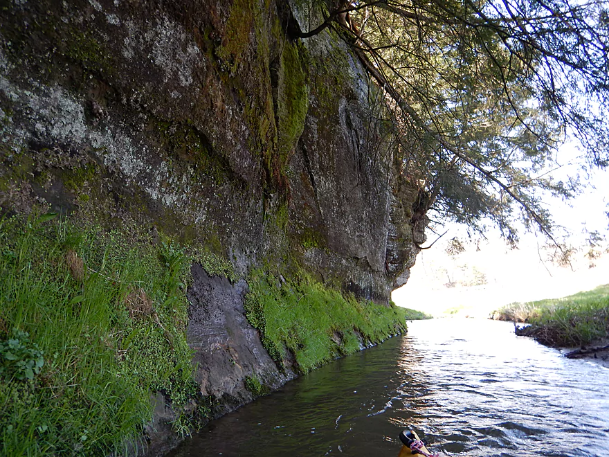
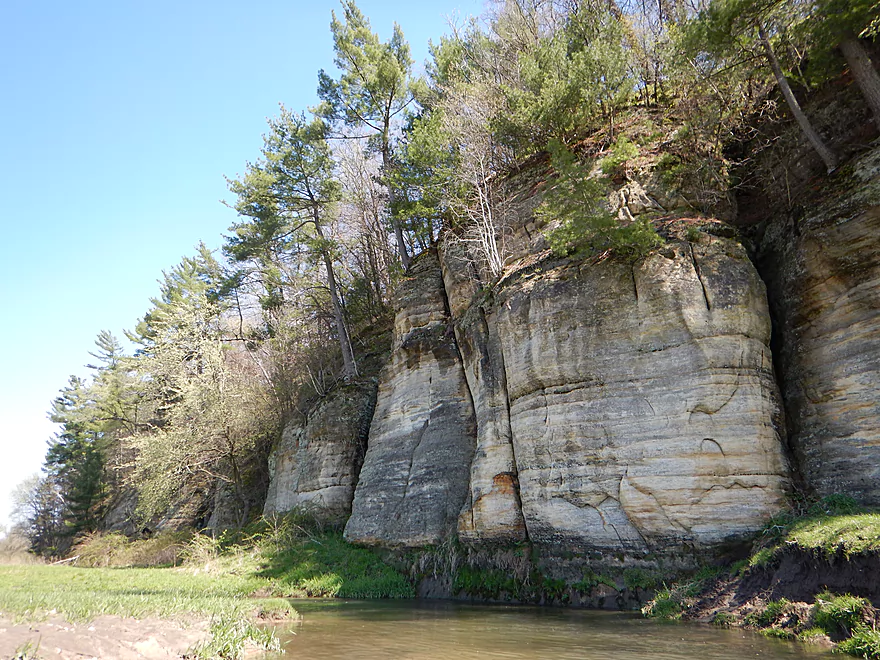
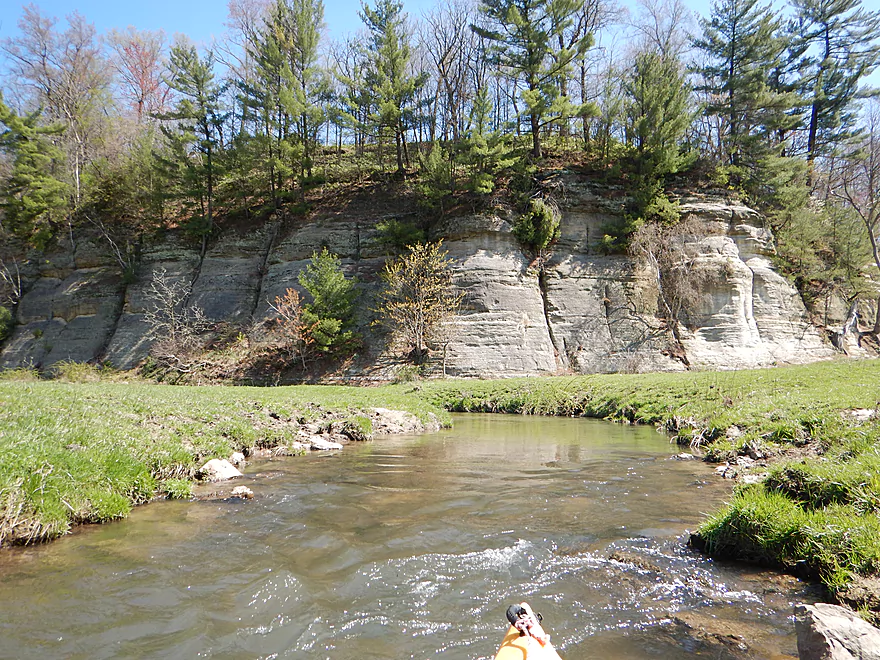
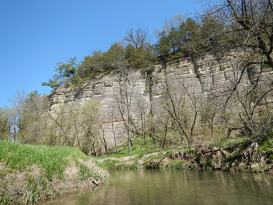
Coming up on the 2nd major sandstone cliff
Using my kayak to demonstrate scale
Quite impressive
Gateway to the Mines of Moria
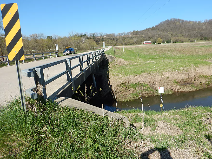
Doolittle Drive is an access option
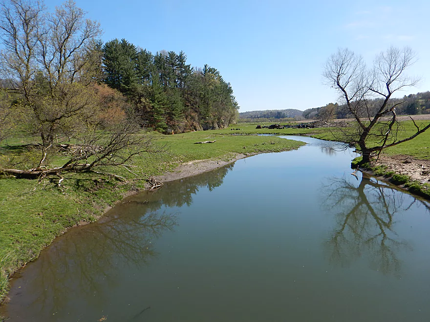
View from bridge
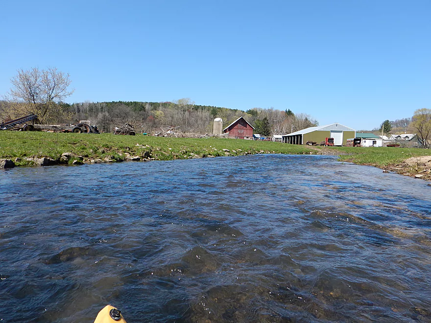
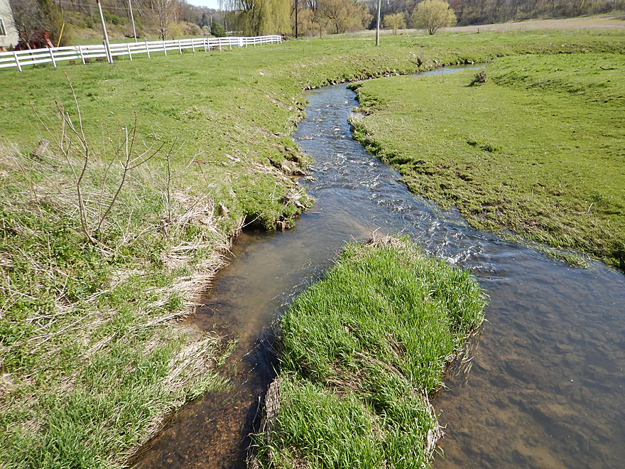
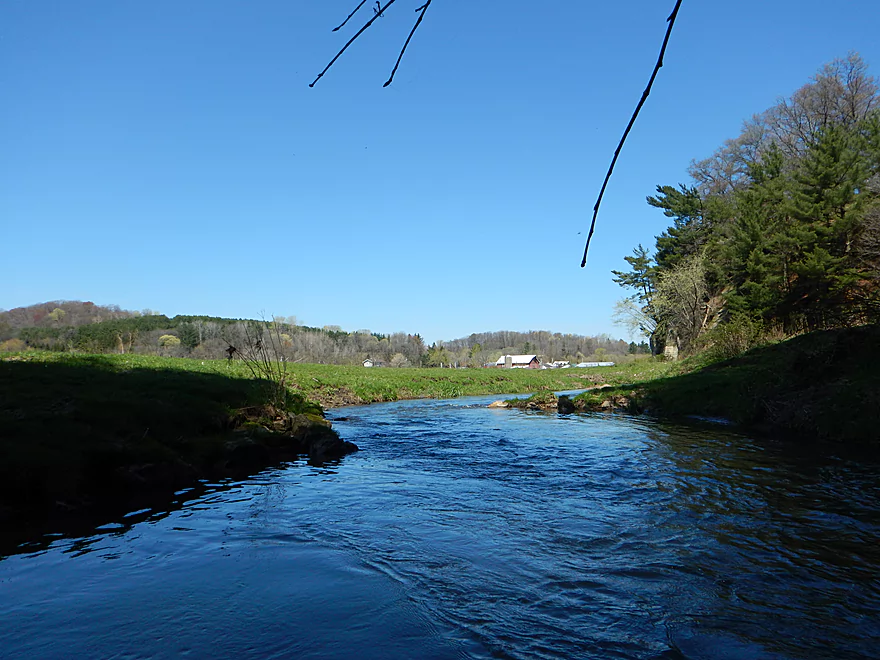
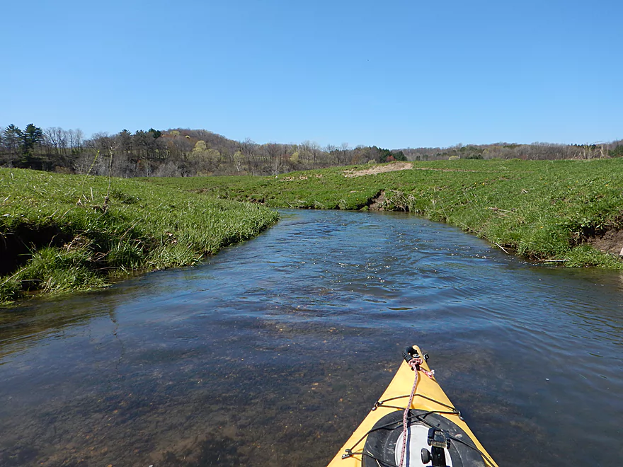
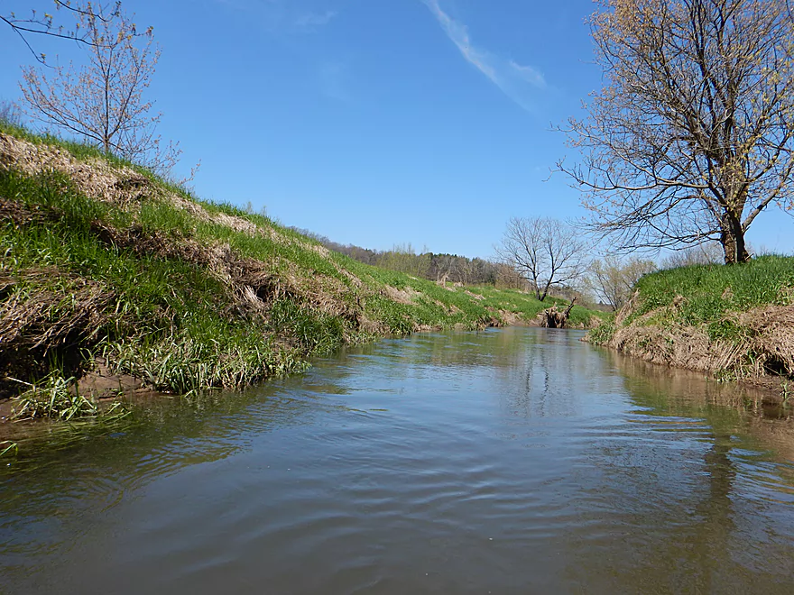
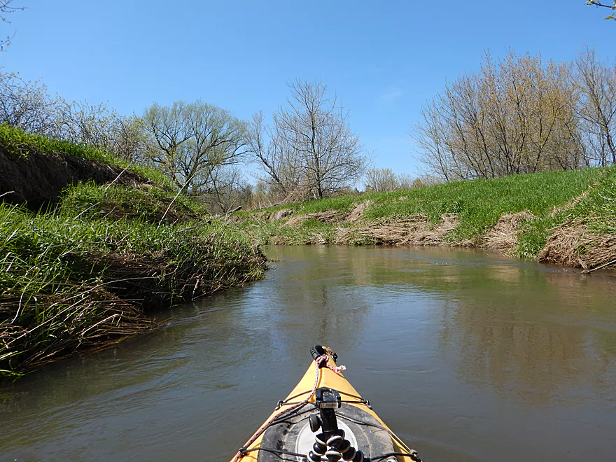
Next few miles are mostly open pasture
A sandstone outcrop under attack by tree roots
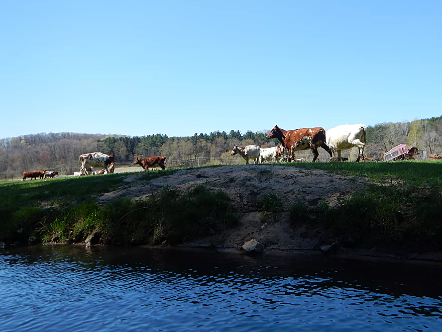
Cows finding me curious
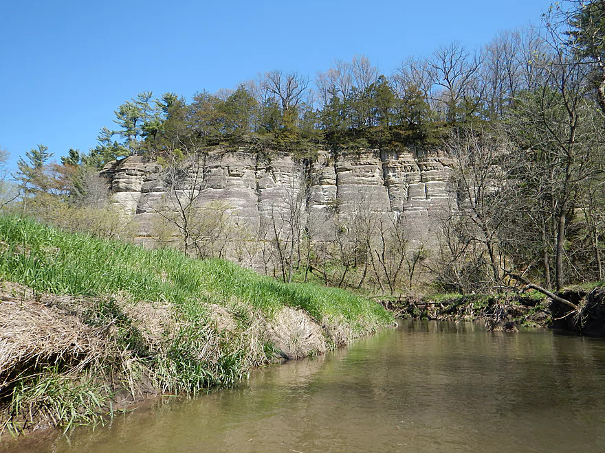
The first major sandstone outcrop on this leg
Quite impressive (about 50 feet)
Looking back
Second major outcrop on this leg
Best viewed from afar
Current stays fast
The third major sandstone outcrop on this leg
The white pines add a nice touch
When low, the creek has very good clarity
We lost our outcrops, but not the rapids
Small but fun chute
Entering a wooded section
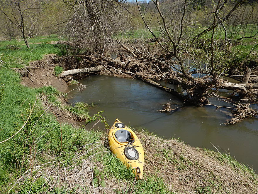
Portage #1 – Not too bad because of the shallow water
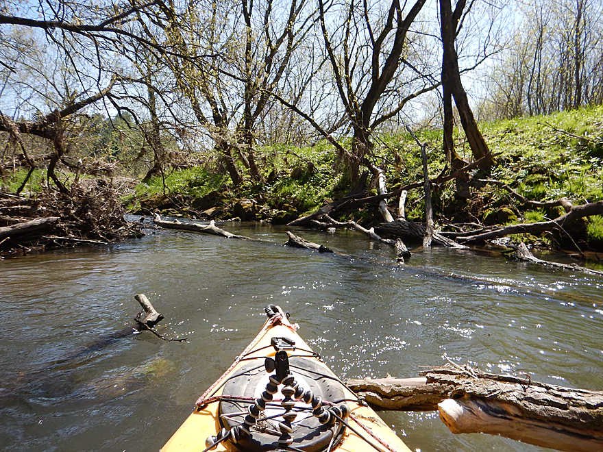
There are several snags that have to be hopped over
Smyth Hollow Road is an access option (not great)
Local creek significantly increases Willow Creek
The creek changes quite a bit…much deeper and muddier
Still some riffles
Looks like artificial bank work perhaps for trout
Another nice outcrop
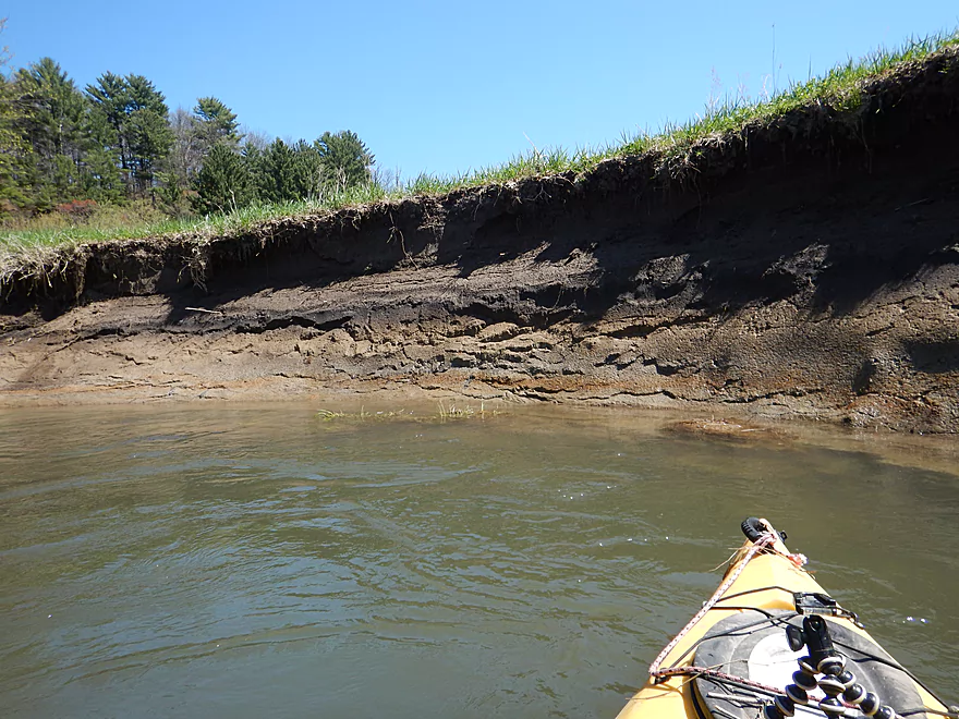
Big mud banks
Boxelders among the first to bud in spring
Most paddlers will probably want to take out at Lost Hollow Road
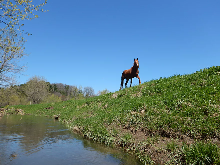
This horse kept following me…
Technically the largest outcrop of the trip
Reminded me of the Upper Iowa
Last mile has a number of snags to hop and sneak through
This is the second portage of the trip
Yet another outcrop
More debris dodging
The third portage
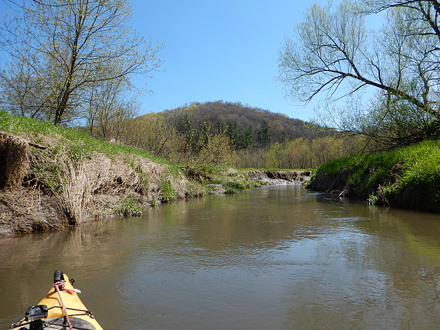
Might be scenic in the fall
The fourth portage
Happens to be at the take-out
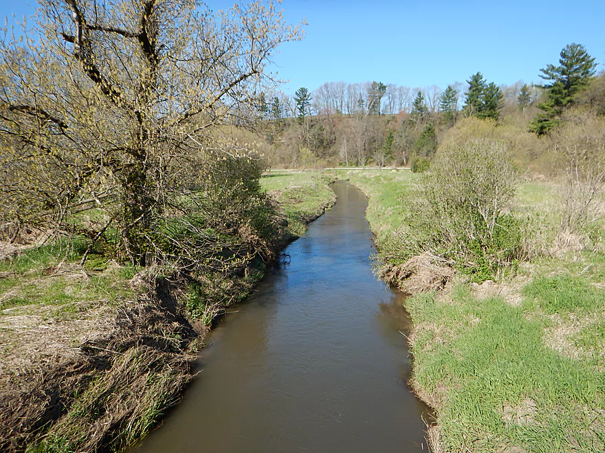
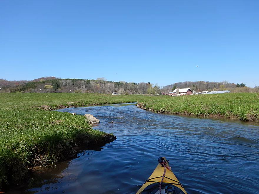
Looking downstream. The next 4 miles are a decent prospect.
Even the bike shuttle is scenic
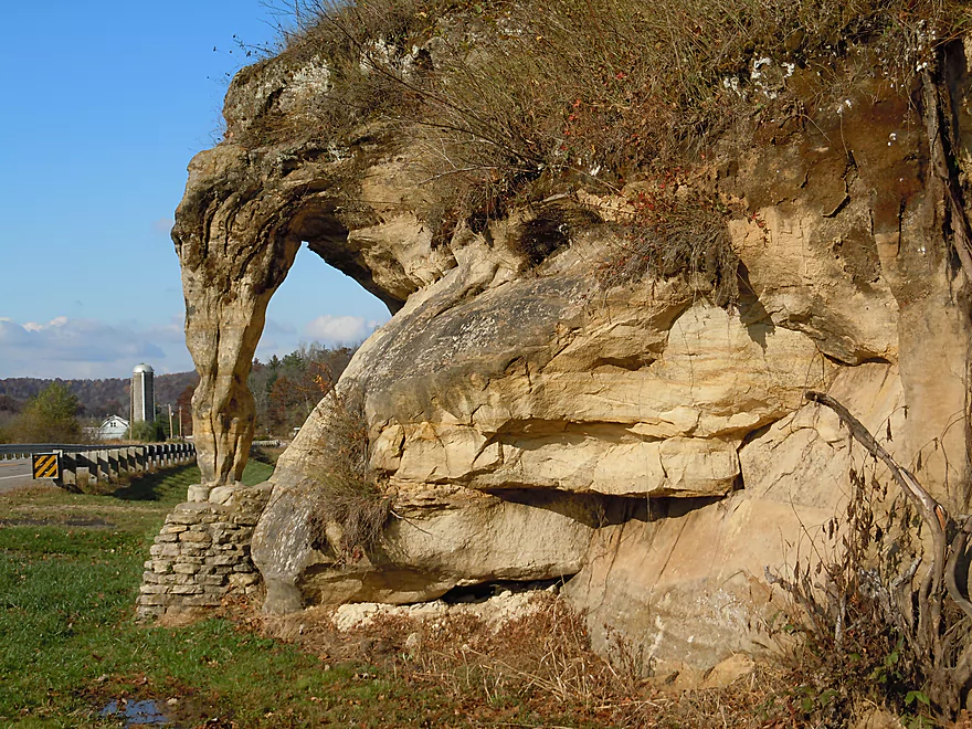
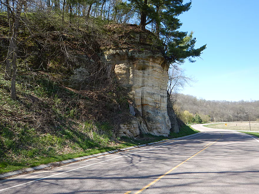
Make sure to check out Elephant Rock (just a mile to the south)
Willow Creek – Richland County

All week I had diligently planned out a trip I was going to do in western Wisconsin, but…after driving over Willow Creek and seeing what I thought were perfect water levels, I made a spur of the moment decision to paddle the Willow instead. Located halfway between Reedsburg and Richland Center, Willow Creek is a tributary of the Pine River known for its trout fishing, swift current, and scenic sandstone outcrops, but not for paddling.
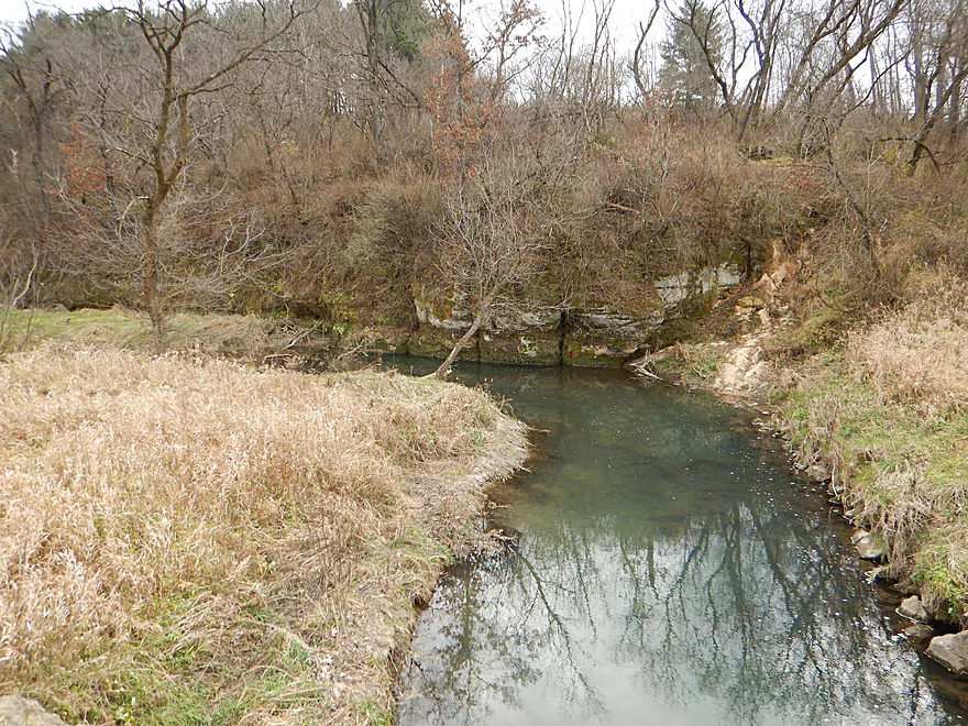
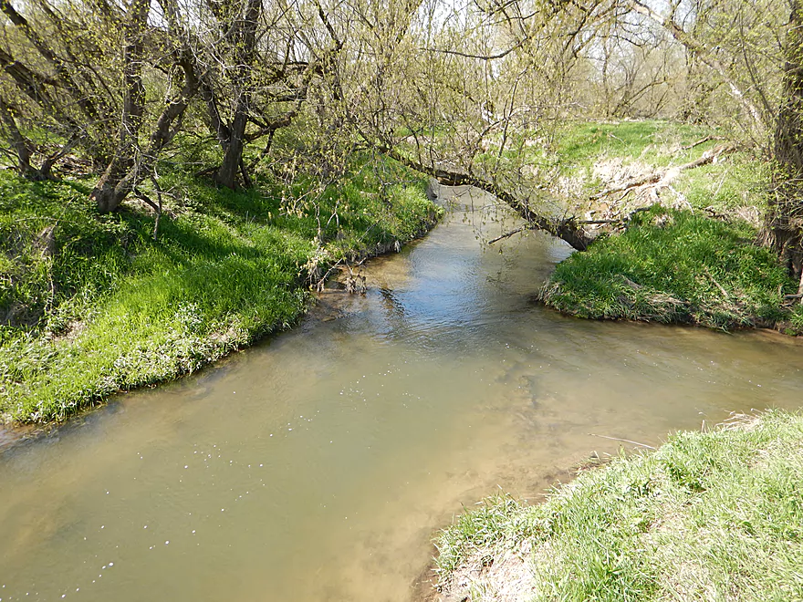
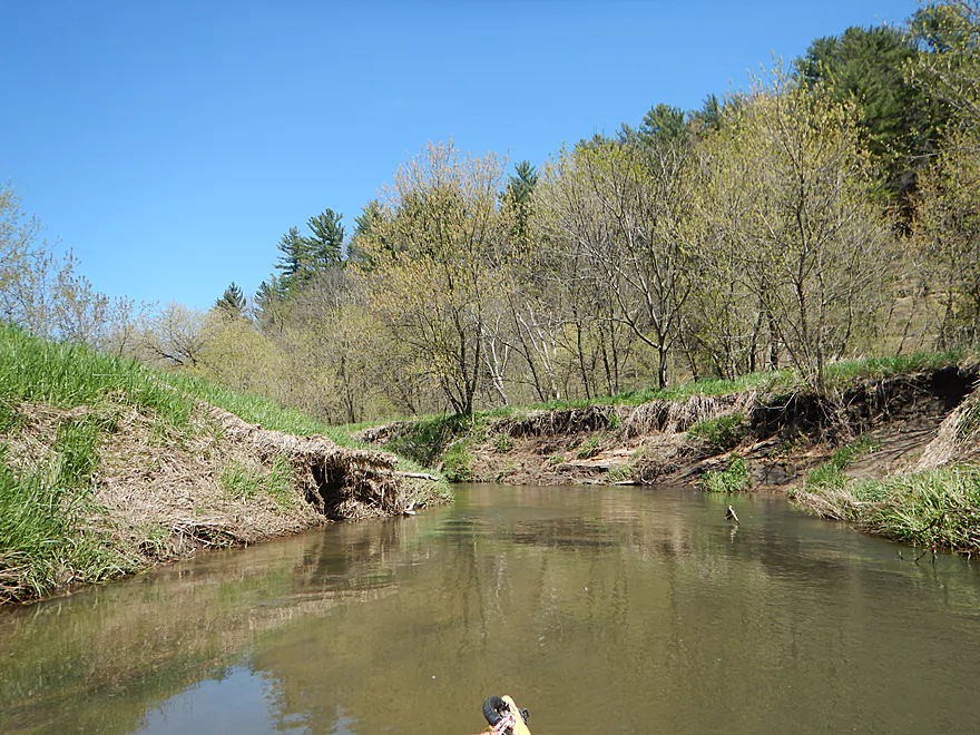
I launched from the 2nd Hwy 58 bridge (upstream bridges looked too shallow and downstream bridges miss out on good sections). Here the creek is pretty small but navigable, and starts with a nice sandstone outcrop. There is more neat geology including a seep raining from rock walls just a couple hundred yards upstream if you are feeling adventurous.
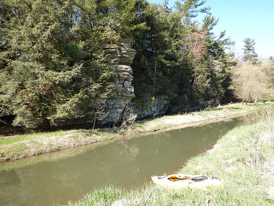
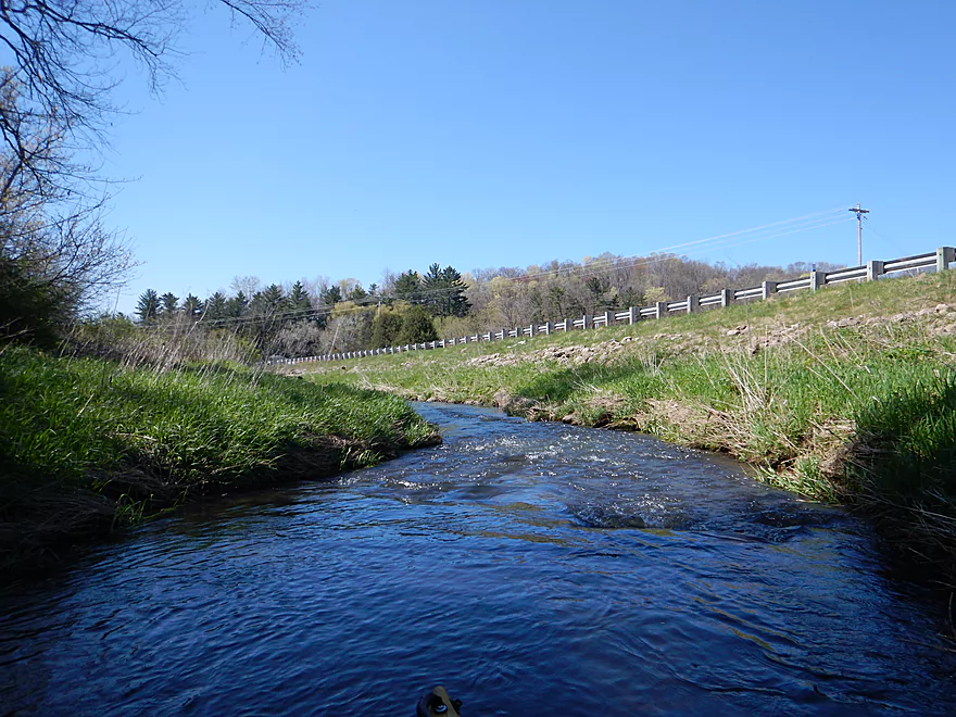
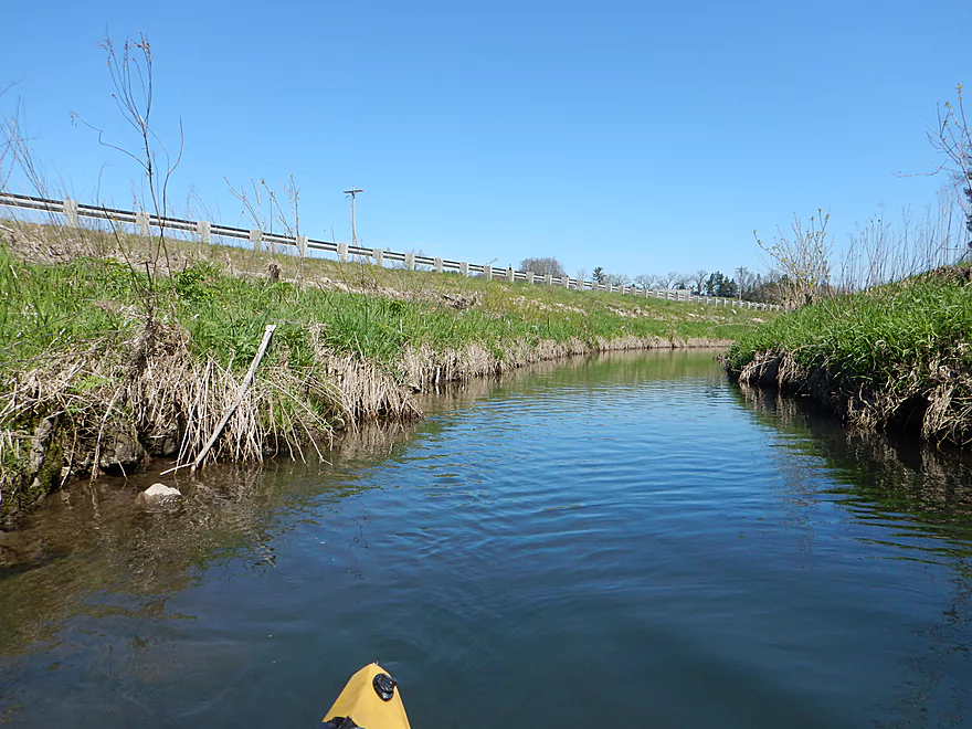
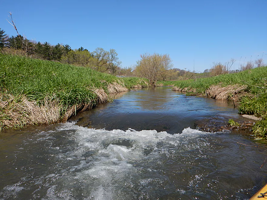
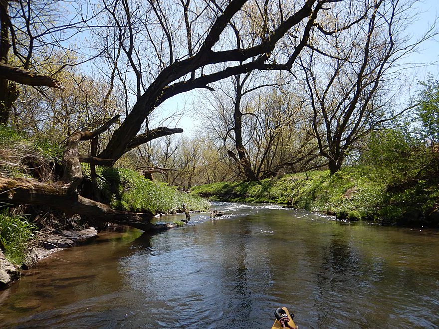
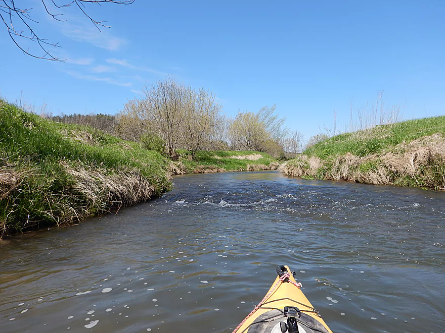
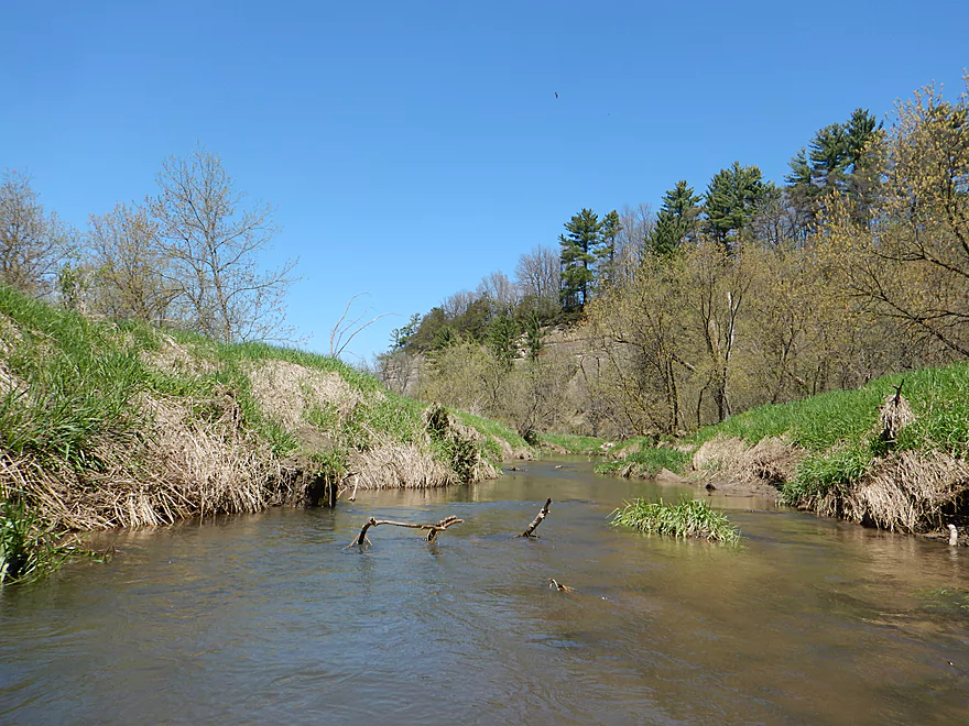
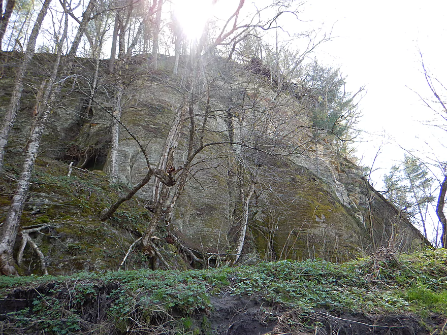
One of my first impressions of the creek was how fast it was and I got splashed pretty good early on. Past the put-in you’ll scoot along a fast, narrow chute with shallow rapids before being rewarded with a shady sandstone wall around the corner flanked by woods and light rapids. The sandstone wall is impressive and runs continuous for a quarter mile. Soon after, the creek opens up with occasional riffles and ledges before running smack into another massive sandstone wall just prior to Doolittle Road.
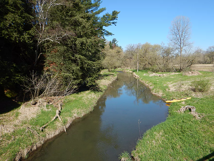
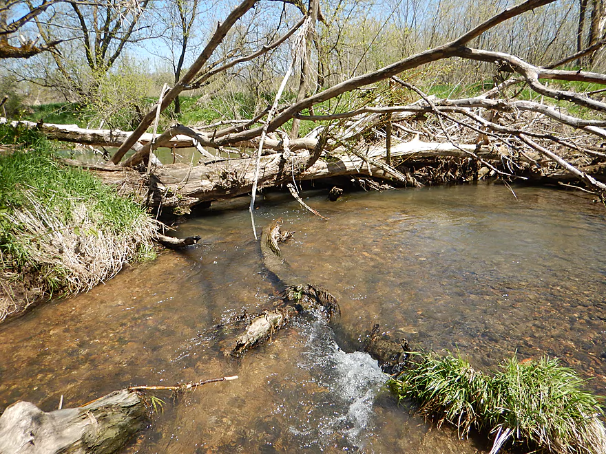
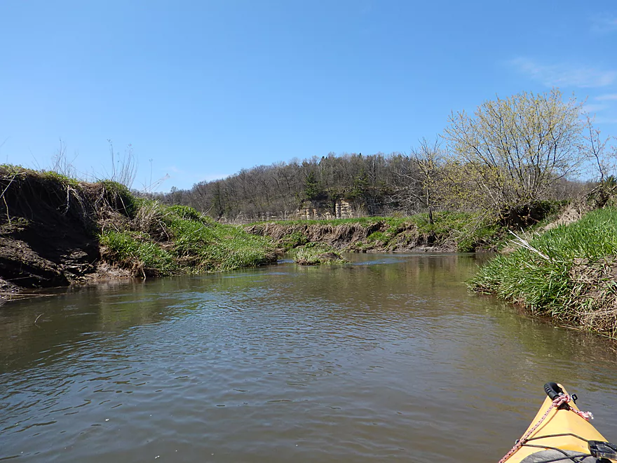
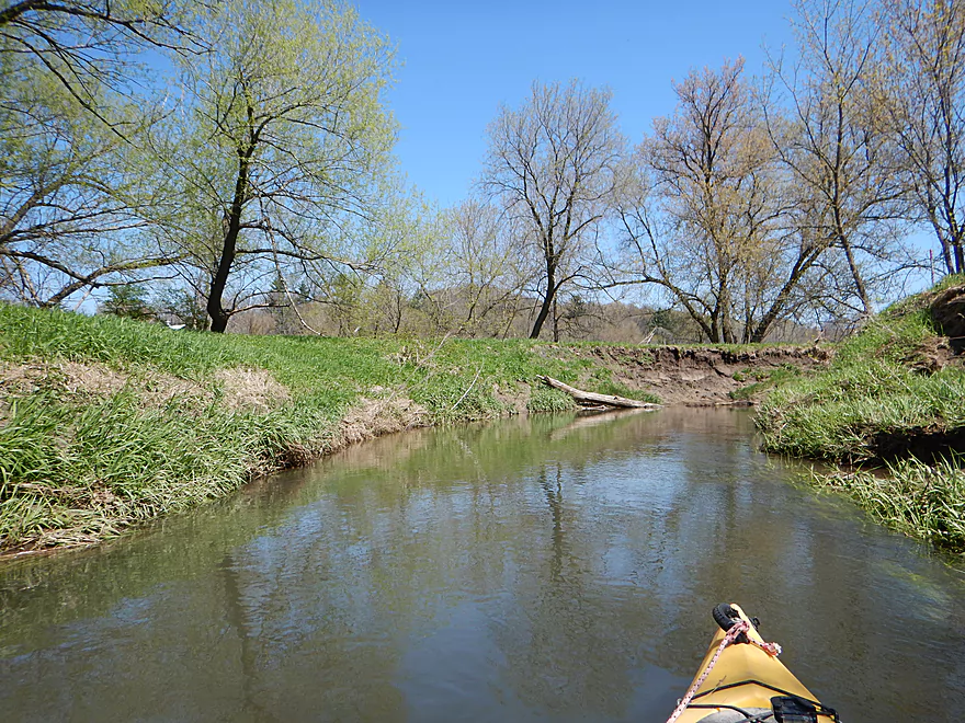
The next leg runs from Doolittle Road to Smyth Hollow Road and is the best part of the trip. The nice wooded sections recede for open pasture land with many cows…but what makes this special are the large number of huge and unique sandstone outcrops. Maybe 50-60′ high on average, these are big boys and had a “birthday cake”-like structure to them. These “cakes” would rise as tall, round sandstone plateaus crowned with towering white pines. All in all very striking, but difficult to photograph given the many Class 1 rapids. Eventually the creek veers away from this “mountain range” and continues as a simple pasture paddle before entering a pleasant woods. There is one major logjam to portage here, but I didn’t think it was too bad. Much of the substrate is still rocky and the water had a milky, translucent quality to it.
Prior to Smyth Hollow Road the trip was 5 stars, whereas afterwords it was just 3 stars. From Smyth Hollow Road to Lost Hollow isn’t bad though… I never had to portage and there are two minor outcrops, but the rapids die off, the rocky substrate gets buried and the creek becomes very muddy. The mud banks grow to be quite large (maybe 4-5′ on average) and are a bit of an eyesore. What’s interesting is the debris line is well above the bank line which means this creek floods with a fury. A pleasant but not a special section.
I assume most paddlers will want to take out at Lost Hollow Road. From Lost Hollow to the next Hwy 58 bridge there are 2.5 portages, several serious squeakers and numerous annoying strainers in fast current. Your reward for doing this last mile, however, will be the biggest sandstone walls of the trip. These rise to over 100′ and are backdropped by 200′ high hillsides. A little Upper Iowa here in Wisconsin.
I took out at Hwy 58, but ambitious paddlers can continue for another 4 miles to Dog Hollow Road. This would be a pleasant open stretch with fewer obstructions but probably is not special. After the trip make sure to check out Elephant Rock, which is just a mile south on Hwy 58.
Special thanks to Mark from Pine River Paddle and Tube for his suggestion to do this trip and the notes he provided. If you, the reader, have suggestions you would like to see reviewed, please let me know. The upper White River, the other Willow Creek, and Beaver Dam River were all reader suggestions and these tips were much appreciated.
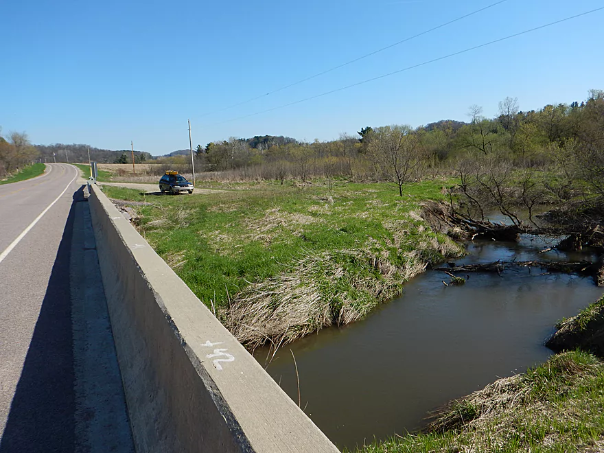
Many of the bridges along the creek are part of public fishing easements and good access options. I think the 2nd Hwy 58 bridge is the best option, which is what I chose. Good parking, launch access, and it is scenic. If you put in at Hwy D or further upstream, the creek is really starting to get too small to run. If you put in at Doolittle or the other downstream bridges, you are missing out on some of the best parts of the creek.
I took out at the 3rd Hwy 58 bridge. At first it seems like a nice access option with a public parking area, but the issue is the steep and muddy banks. Compounding this, there is actually a logjam by the bridge. You can get around this by simply taking out a bit earlier. This bridge is certainly doable for access, but relative to the other bridges it is much more difficult. I assume most paddlers will prefer to take out at Lost Hollow Road (much better access) to avoid the logjams in the final mile.
Power paddlers can continue an additional four miles to Dog Hollow Road. This stretch is a good prospect, has few if any jams, and is popular with fishermen, but I doubt it has sandstone cliffs.
Super easy bike shuttle. Only 2.6 miles and mostly flat. Scenic too, with sandstone outcrops along the road.
Just to the west, Mark from Pine River Paddle and Tube runs a kayak rental and livery service for the Pine River. He is willing to do shuttles on the Willow Creek, but make sure to call in advance to inquire about availability (608-475-2199).
This is a fast creek with many riffles and light rapids, but nothing greater than Class 1. No farm fences to worry about on this trip.
Logjams are kind of an issue. Most you can squeak by. Below are the ones that require portages.
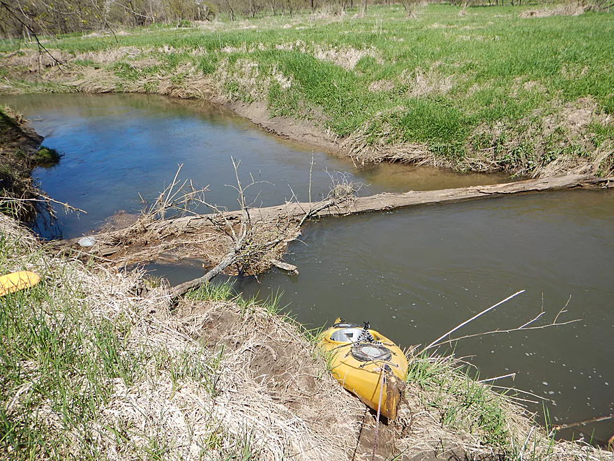
- Jam #1: Just prior to Smyth Hollow Road there is a large downed tree that must be portaged. Once you get out, you do have to pull your boat through the branches, but re-entry is pretty easy in the shallow rocky water.
- Jam #2: Maybe a mile prior to the take-out (between Lost Hollow Road and Hwy 58) is a portage up a steep muddy bank. I wasn’t phased and was able to use rope to make this easier but I could see many paddlers finding this very frustrating. In the summer the long grass will make portages much worse.
- Jam #3: Maybe a half mile prior to the take-out is a nasty cluster. Similar to #2, it requires a portage up a steep muddy bank.
- Jam #4: This is actually at the take-out. If you are dexterous you can get through this without portaging, otherwise you simply take out a bit earlier.
In much lower water, I could easily see there being twice as many portages. On top of this, there are many cases in which the current moves very quickly through debris fields which can be difficult if you are not experienced. But really 95% of the logjam and strainer issues are from Lost Hollow Road to Hwy 58, and I assume most paddlers will simply take out before then at Lost Hollow Road.
This is a volatile creek with low lows and flash flood highs. During flash floods, the channel can rise 4-5′ (based on the debris line) and would be quite dangerous given the creek’s rapids and debris. When low, the rapids upstream of Smyth Hollow Road will have to be waded, but I don’t think this is a big deal myself. Downstream from Smyth, the creek is plenty deep and is probably always navigable. There is a lot of debris in the water after Lost Hollow Road, so if you do this, you might wait for higher depths to get over some of it (but too much depth would be dangerous). The best gauge nearby is the upper Kickapoo River at Ontario but this is flawed as the Willow will rise and fall much quicker than the upper Kickapoo.
- 0-70 CFS: You might be able to do the lower portions. Great water clarity, but probably best to wait for more water.
- 71-100 CFS: Decent depth, but you might have to walk some of the rapids upstream of Smyth Hollow
- 101-130 CFS: Very ideal depth. My trip was done at 117 CFS and while the pre-Smyth Hollow rapids were bumpy, it didn’t seem like a big deal.
- 131 to 170 CFS: Current starts to become pushy here. Probably only recommended for experienced boaters. Alternatively this might be a perfect depth for the far far upper sections.
- 171+ CFS: I assume these are near-flood conditions and not recommended.
Several muskrats and fish. The eagles would roost on the white pines atop the bluffs for an impressive view of the entire creek. There were many cows and horses on the trip. One curious horse by Lost Hollow Road kept following me and almost entered the water to join me. I didn’t see any trout fishermen during the paddle but did see several after the trip.
- Upstream of Pregal Hill Road: The creek splinters and I suspect it is too small to be navigable.
- Pregal Hill Road to Hwy 581st: 2.7 miles. Mostly open section through cow country, but some nice outcrops. Maybe a handful of logjams and perhaps fence issues. Only runnable in high water. Pregal Hill Road is a good put-in option used by fishermen.
- Hwy 581st to Hwy D: 0.3 miles. Brief section with maybe 2 logjams. Some sandstone outcrops just upstream from Hwy 58. Hwy 58 is an ok put-in. This section is shallow.
- Hwy D to Hwy 582nd: 0.6 miles. Fast narrow section with maybe 1 logjam. Some nice outcrops prior to the take-out. Hwy D is not a good put-in. It is too close to a house and a wire straddles the creek.
- Hwy 581st to Hwy 583rd: 4.8 miles. Good trip reviewed April 2017.
- Hwy 581st to Doolittle Road: 0.8 miles. Neat section with fantastic outcrops, clear water and good scenery. Some of the rapids are a bit shallow, but at worst are easily wadable. Hwy 58 is the start of a long public access stretch along the creek for fishermen.
- Doolittle Road to Smyth Hollow Road: 1.3 miles. Woods make way for open pasture but still a terrific section with light rapids and many scenic outcrops. Just one portage near the end, but pretty manageable. Doolittle Road is a doable access option used by fishermen.
- Smyth Hollow Road to Lost Hollow Road: 1.1 miles. Smyth Hollow is a divider…upstream is 5 stars and downstream 3 stars. Still some outcrops, but the creek is less interesting here. Much deeper, muddier, huge mud banks, and far fewer outcrops. Smyth Hollow is a doable access, but steep and not ideal.
- Lost Hollow Road to Hwy 583rd: 1.3 miles. Several portages plus a few nasty squeakers. Kind of a weak, muddy section…except for the outcrops. The bluffs are 200′ higher and the the sandstone outcrops at least 100′. Lost Hollow Road is a decent access.
- Hwy 583rd to Dog Hollow Road: 3.8 miles. This segment flows through public DNR land and is the most popular portion for fishermen. Mark did the trip and thought it was pleasant. I don’t think there are outcrops on this leg though. Maybe 1-2 logjams, but mostly very open. A future trip idea.
- Dog Hollow Road to Willow Creek Road: 4.7 miles. Probably way too many logjams.
- Willow Creek Road to Hwy N: 1.3 miles. Mostly open. Maybe 1 jam.
- Hwy N to Benben Lane: 0.5 miles. Maybe 2-3 jams.
- Benben Lane to Hwy 58: 2.1 miles. Likely way too many jams.
- Hwy 58 to Hwy 14: 4.7 miles. Maybe 5 logjams.
- Hwy 14 to Mouth: 0.6 miles. Likely many logjams.
Trip Map
Overview Map
Video
Photos Size:
was wondering how high the water was coming up in about a week for little canoeing and trout fishing thinking about willow and the pine
any info would be greatly appreciated.
thanks
The Richland Center creeks are at normal levels now but may rise here in the new few days because of forecasted rain. I think the Willow would be great condition for paddling this weekend, but it may be a bit small for canoeing. The Pine will be somewhat above normal, but should be plenty navigable. Contact https://www.facebook.com/PineRiverPaddleAndTubeLlc/ for more info. For fishing and scenery, the Willow will be a much better experience…but again it is small for a big canoe.
I essentially grew up on Willow Creek, living in the village of Ithaca. My grandparents had a farm up Lost Hollow. Excellent trout fishing, although I never canoed or kayaked the creek. I always wanted to. I know the scenery is beautiful, especially the sandstone bluffs mentioned. I do have quite a bit of experience watching the spring flood waters turn Willow Creek into a dangerous waterway every year. Maybe some day I’ll get a chance for an adventure where I grew up.
If you do this trip, let me know how it turns out!