
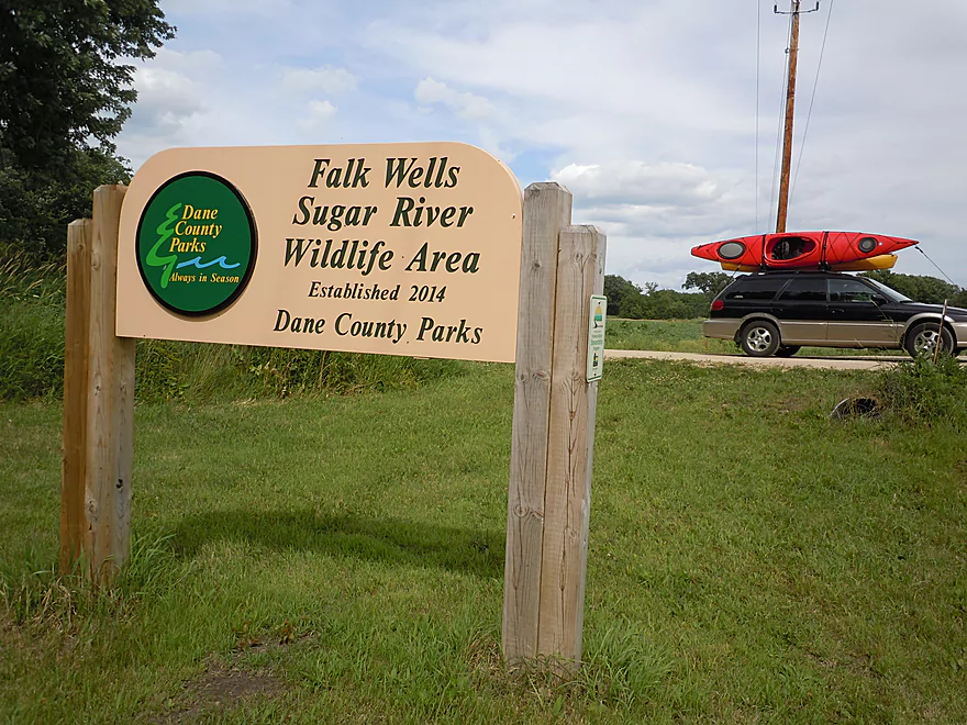
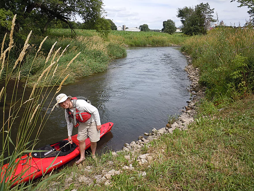
Very nice public access off Hwy 69
Nicely mowed with good parking
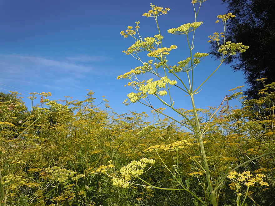
Just don’t touch the wild parsnip
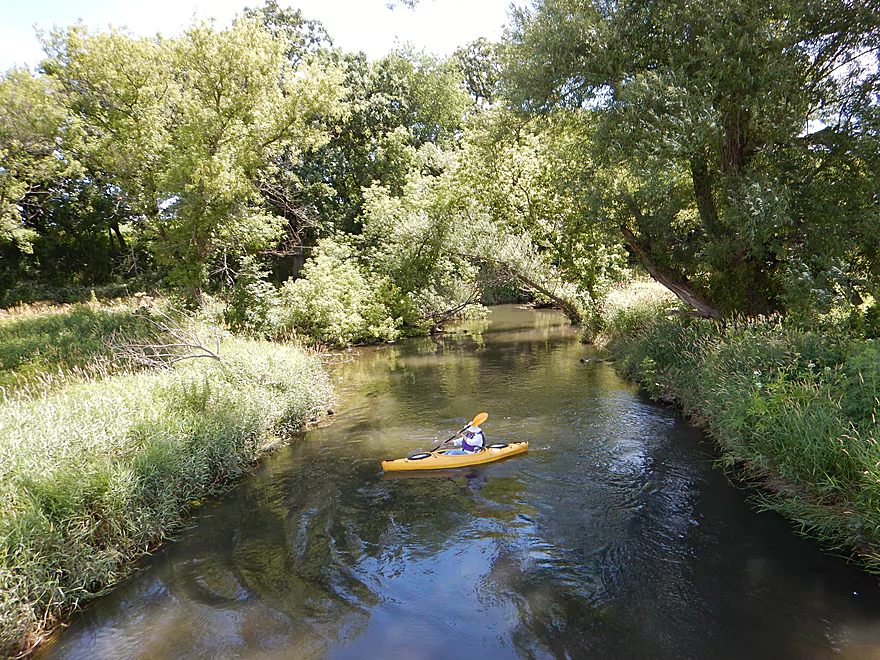
Lazily floating along
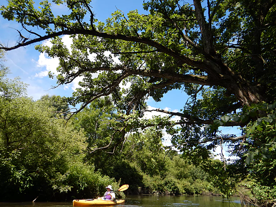
Bur oaks have fantastic horizontal limbs
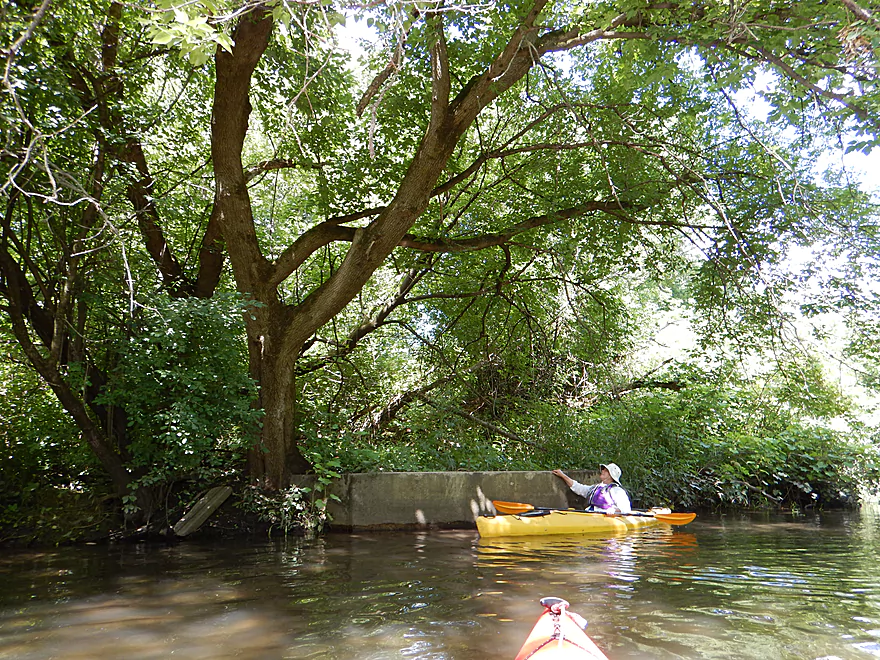
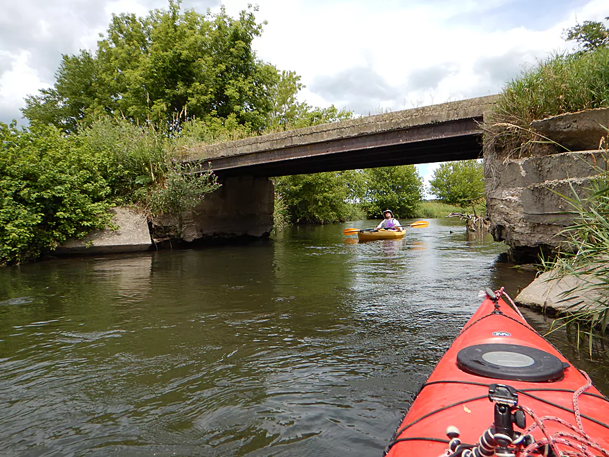
One of many, many old concrete bridge abutments along the river
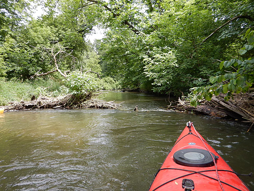
Volunteers have done great work clearing out the river
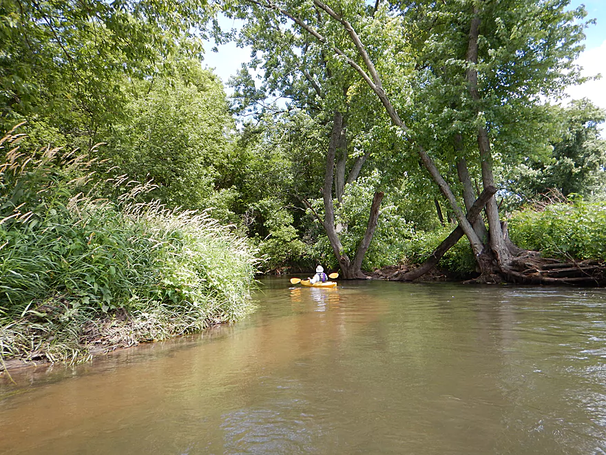
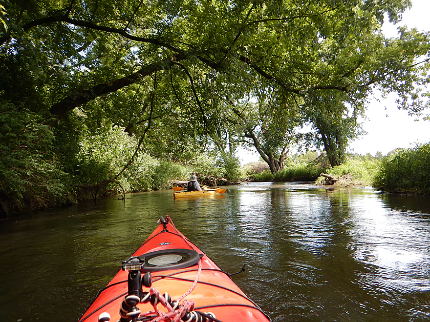
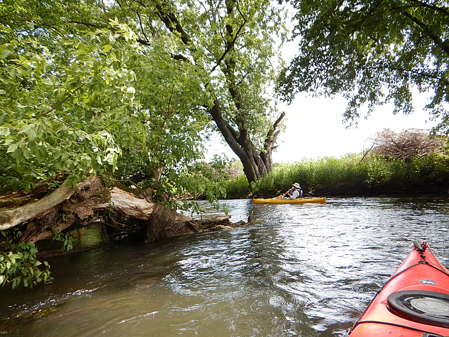
Very lush banks
Some sections had good clarity
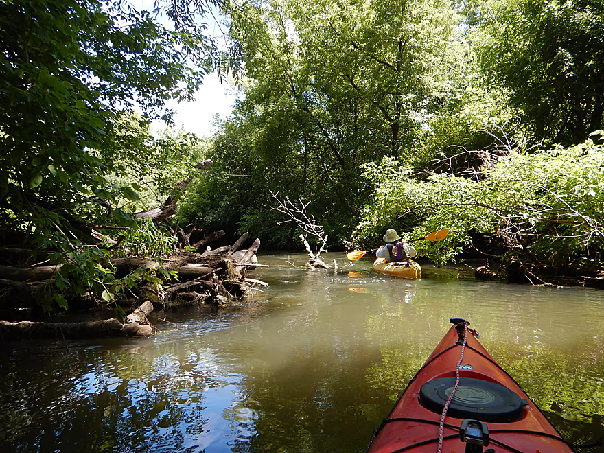
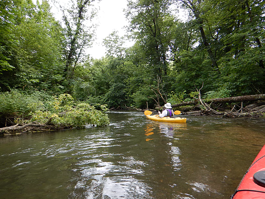
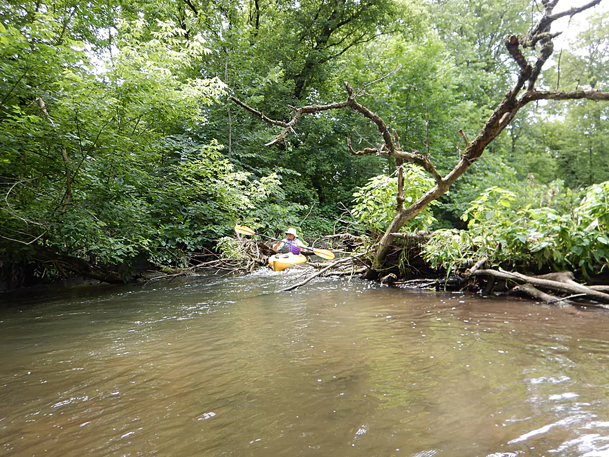
Many trees would fall down but not die
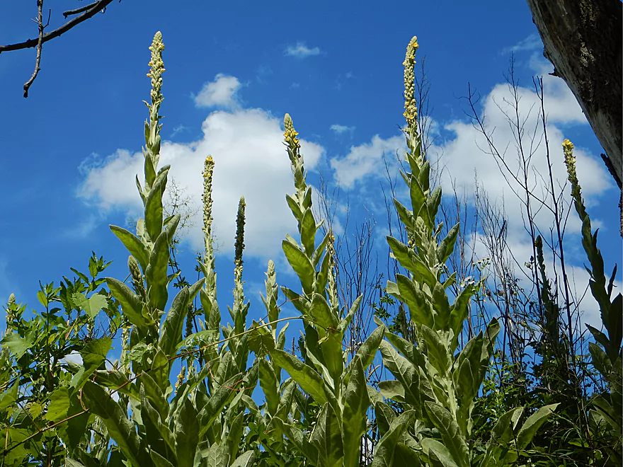
Stalks of mullein weed poke towards the sky
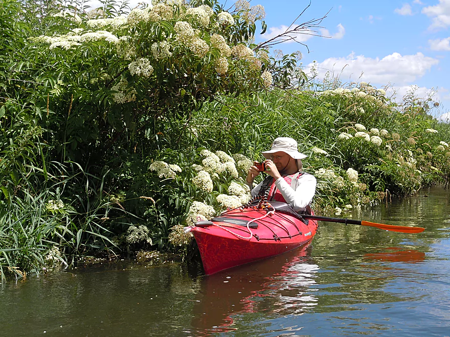
Flowering elderberry bushes decorate the river banks
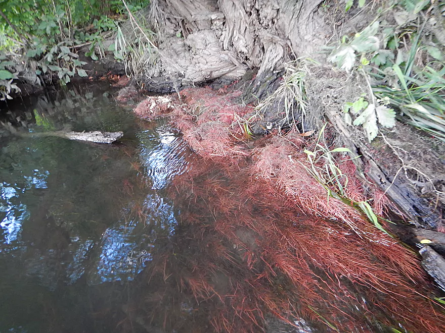
The red underwater roots of a willow tree
Red building is part of a massive Bruce Company tree nursery
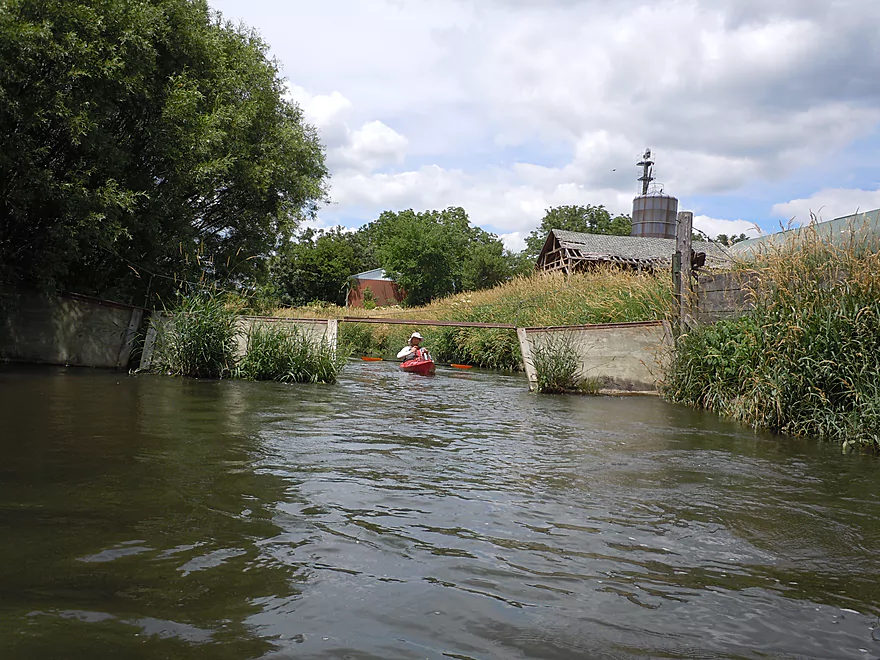
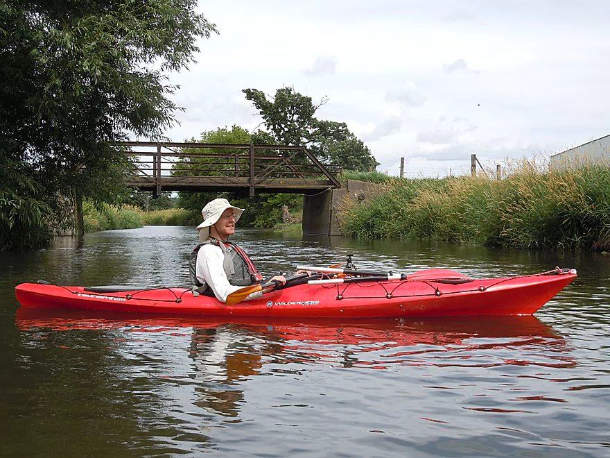
Farm bridge used by the Bruce Company
One of many little riffles
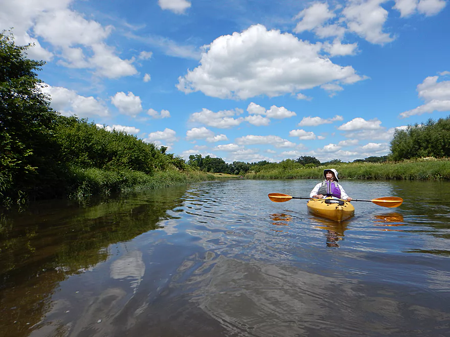
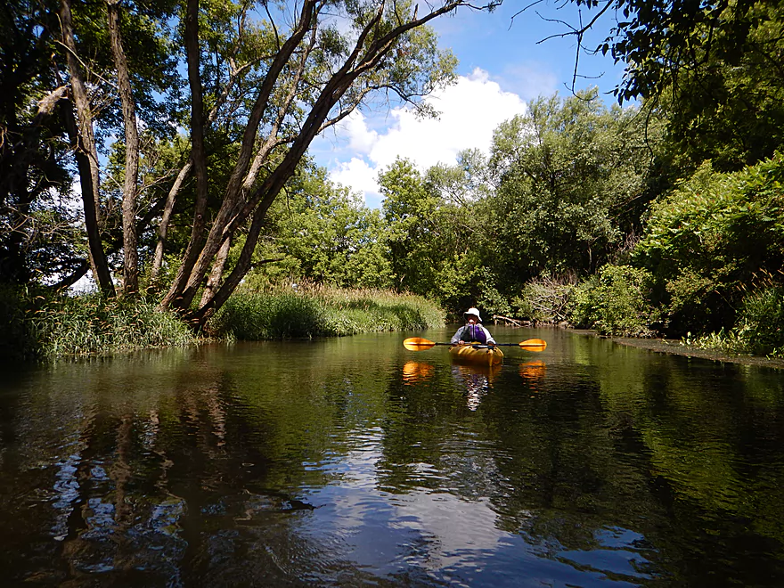
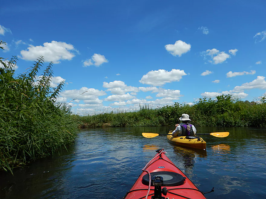
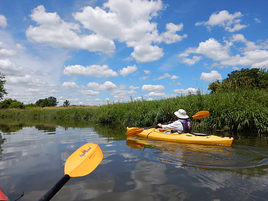
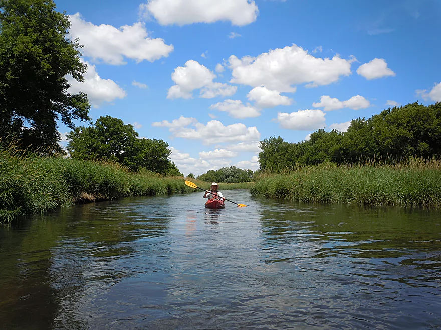
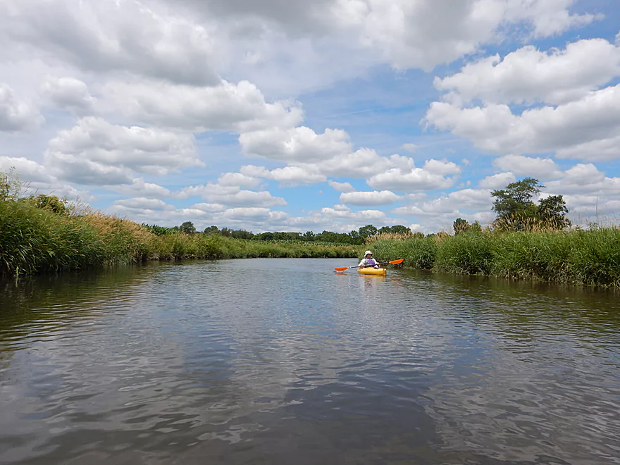
Perfect beautiful blue sky for kayaking
Mile 2 was very open and grassy
Trees start to return
Eep…
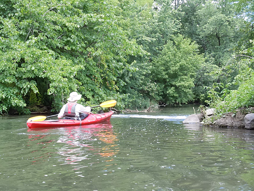
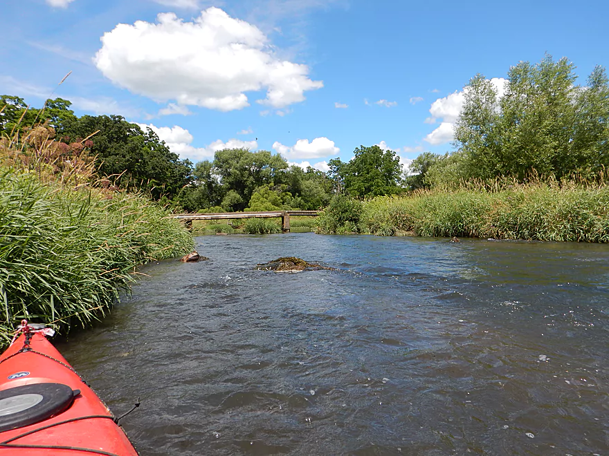
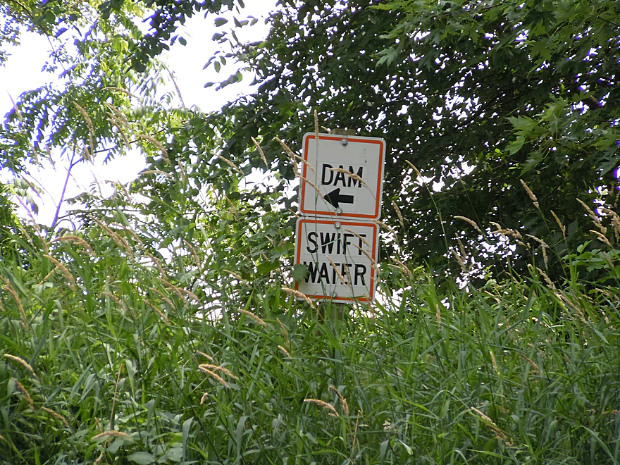
Coming up on the old dam
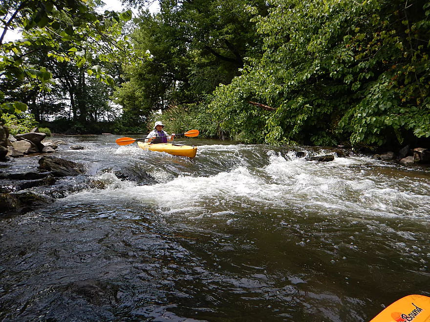
Pretty fun class 2 rapids
Easy to portage if you want…or run a second time
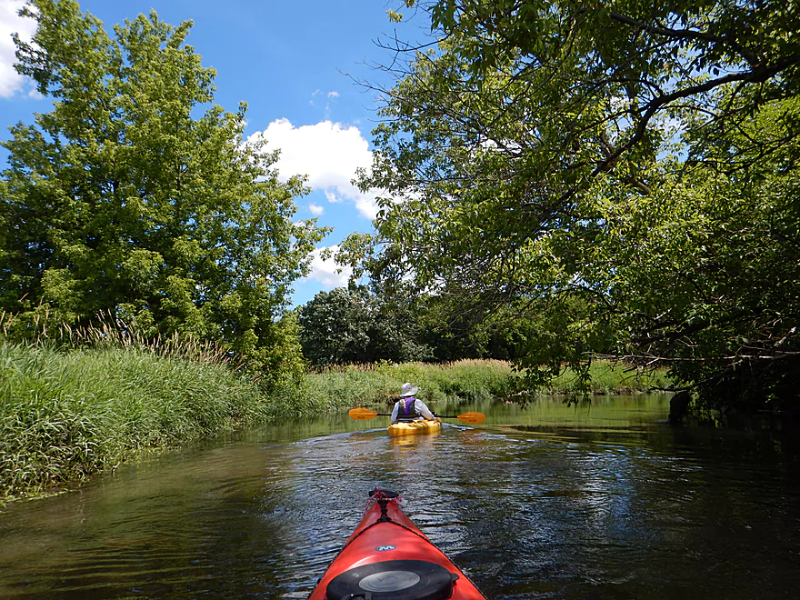
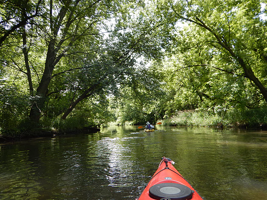
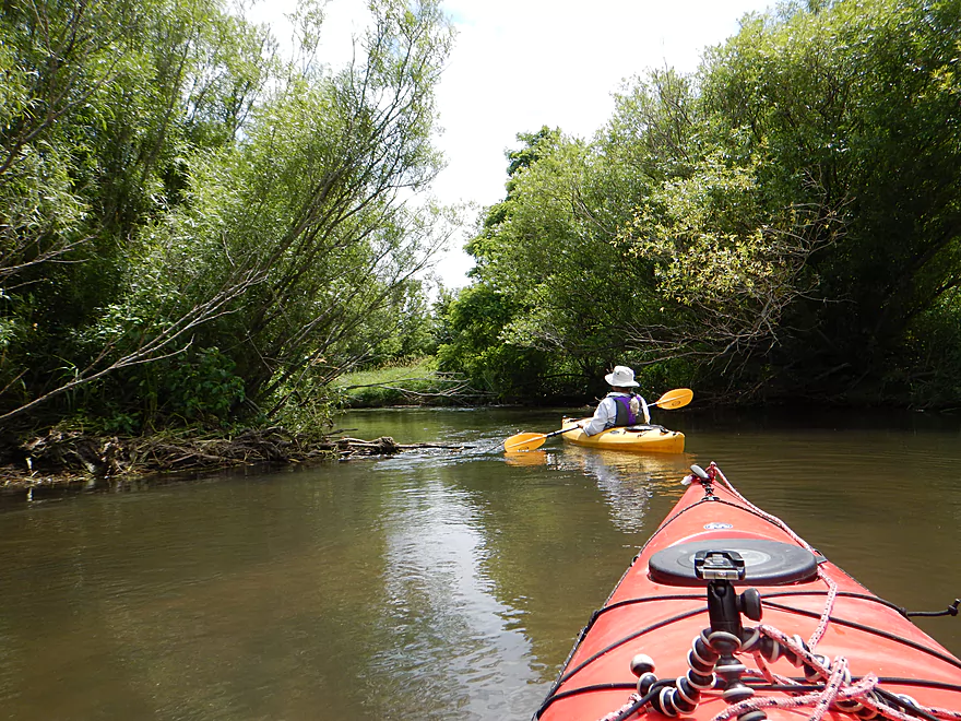
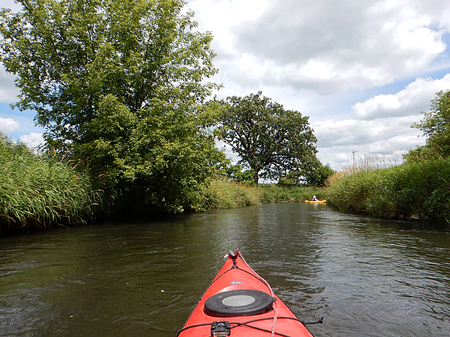
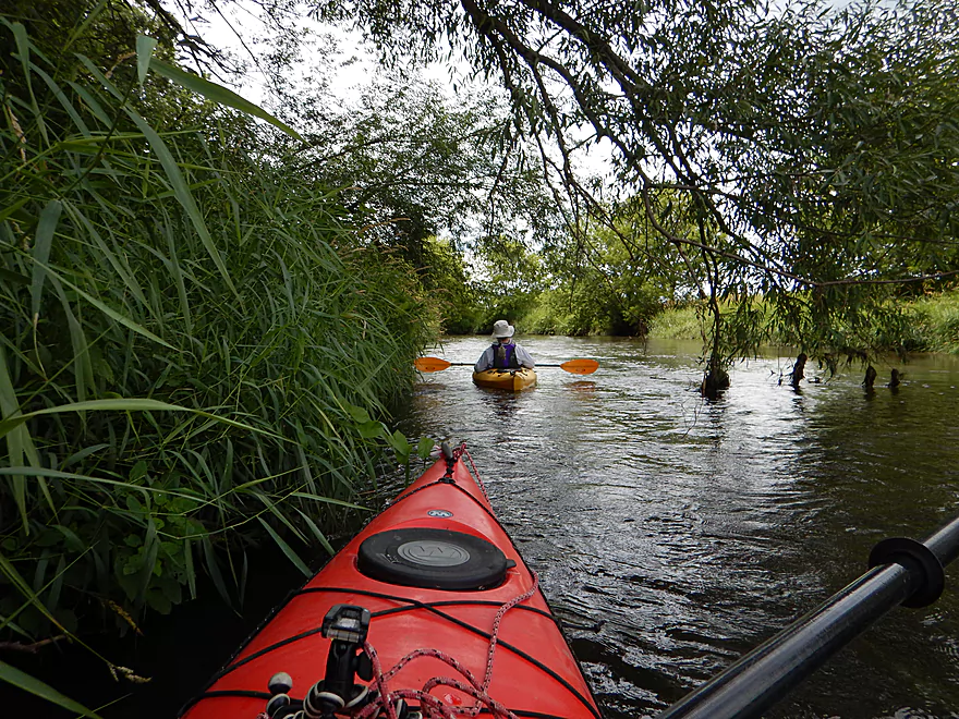
A really nice wooded section follows
Down tree but easy to get through
If you really wanted to, you could take out at Range Trail Road
Current starting to pick up
Corn planted too close to the water
A river of many horizontal trees
A bigger riffle
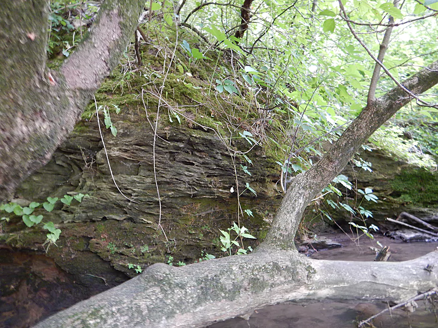
A small sandstone outcrop on the Sugar
Zippy current and overhanging branches create a neat effect
A tree that fell down…then recovered!
The historic mill in Paoli
The attached millrace
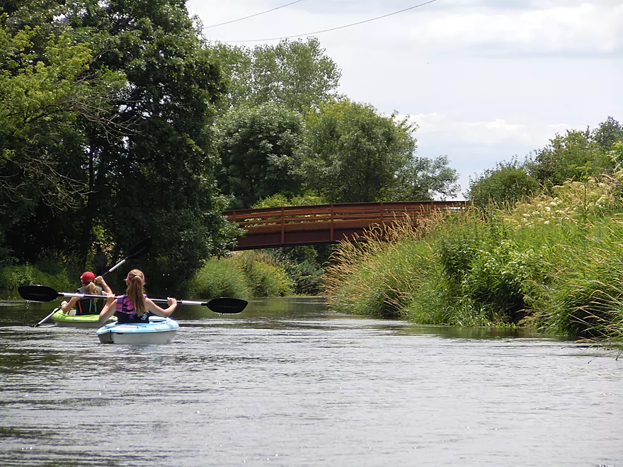
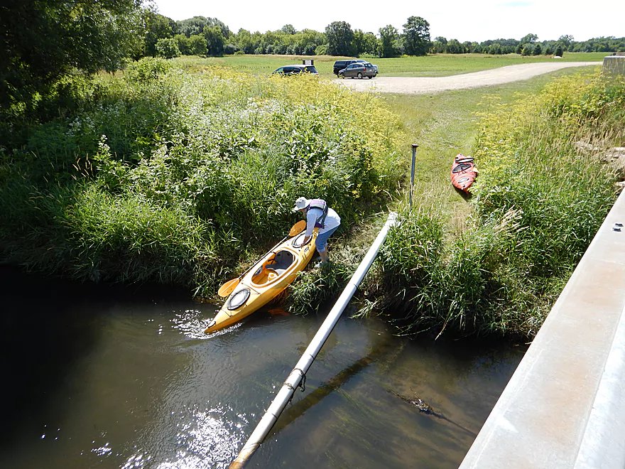
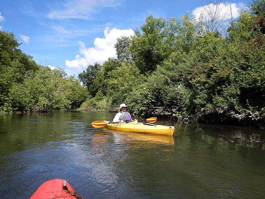
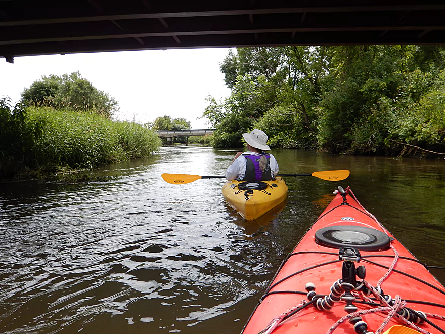
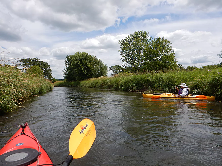
Two of several paddlers we saw on the river
Upstream and east of the snowmobile bridge (river left) is the town hall take-out
Some rare clarity
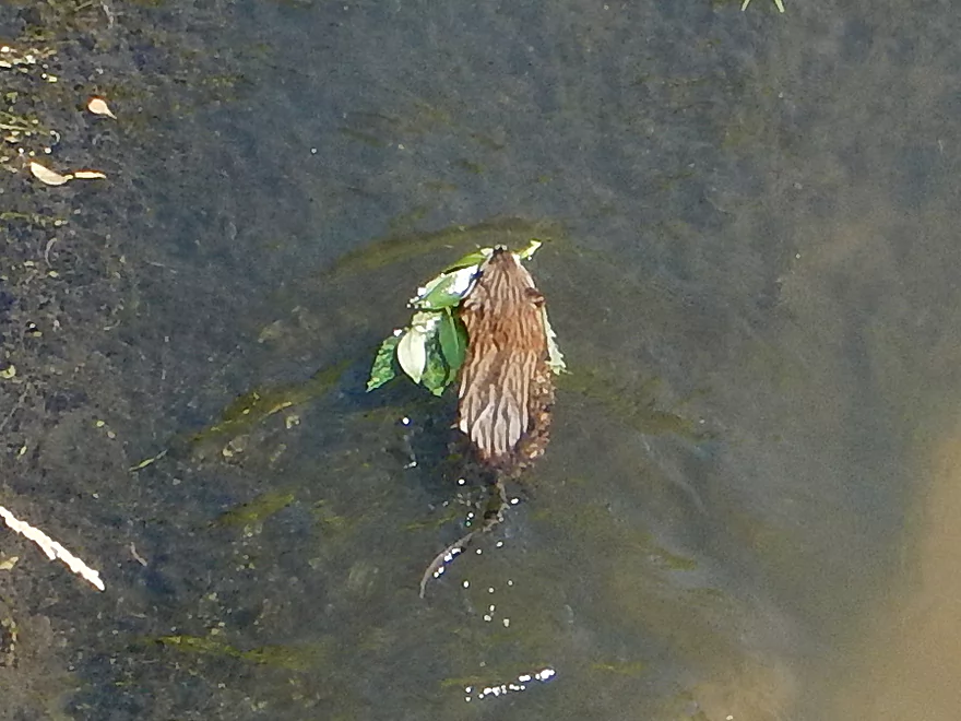
A muskrat dragging lunch upstream to his den
Second half of the trip is more open
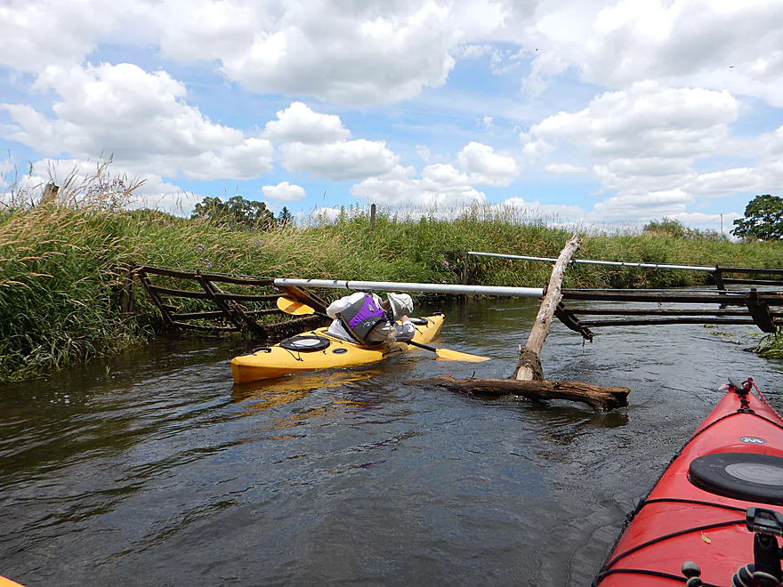
First swing gate (actually two)
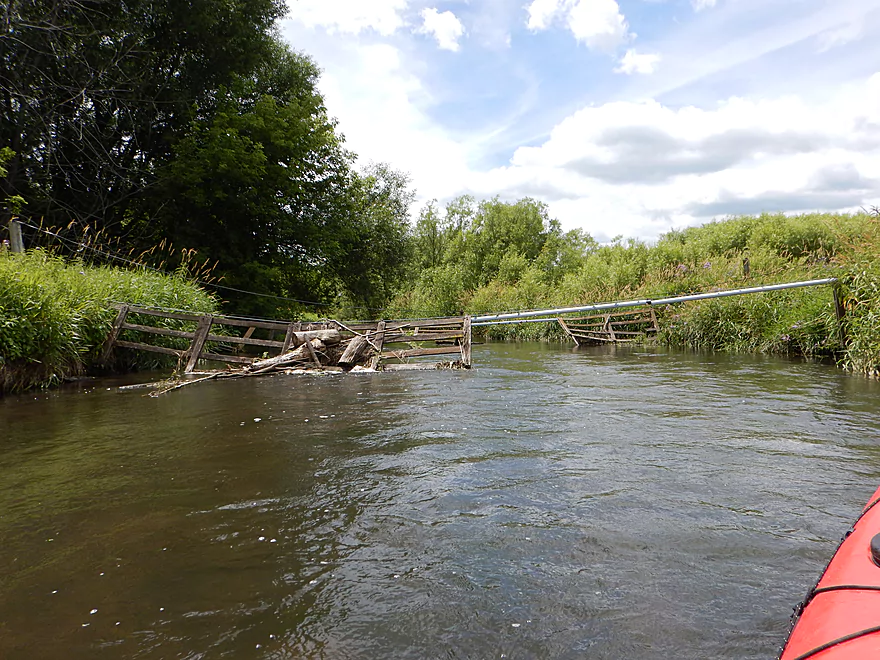
Easy to duck under
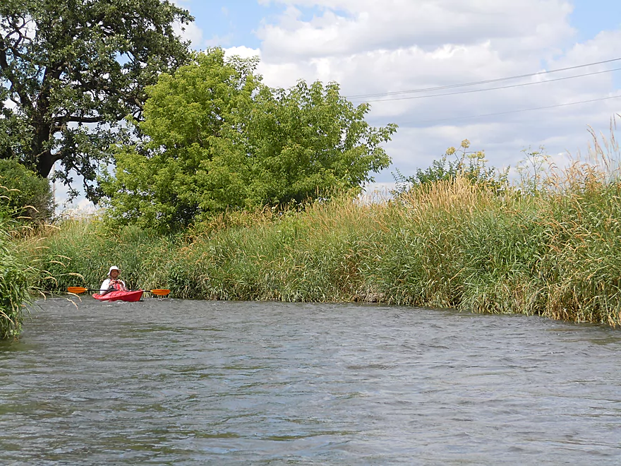
A very grassy section of the trip
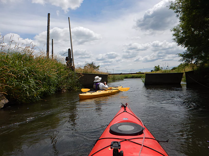
Second swing gate
Also easy to get through
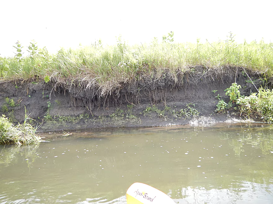
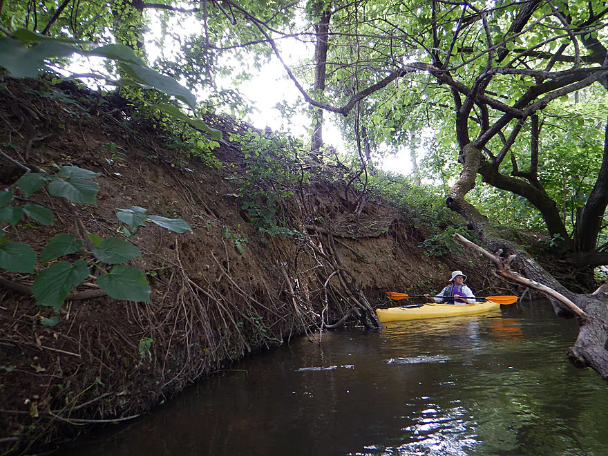
River has suffered from erosion
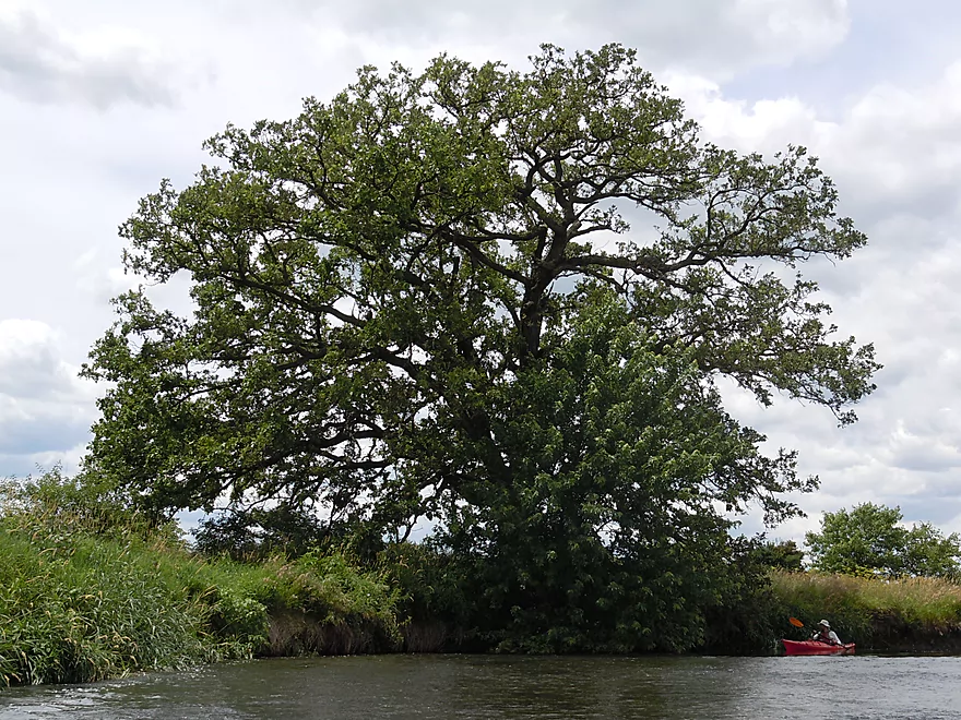
Magnificent bur oak
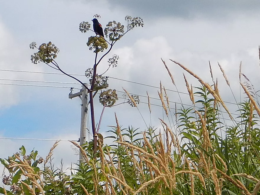
Red-winged blackbird perched on Angelica
One of several farm bridges
Entering a really nice woods
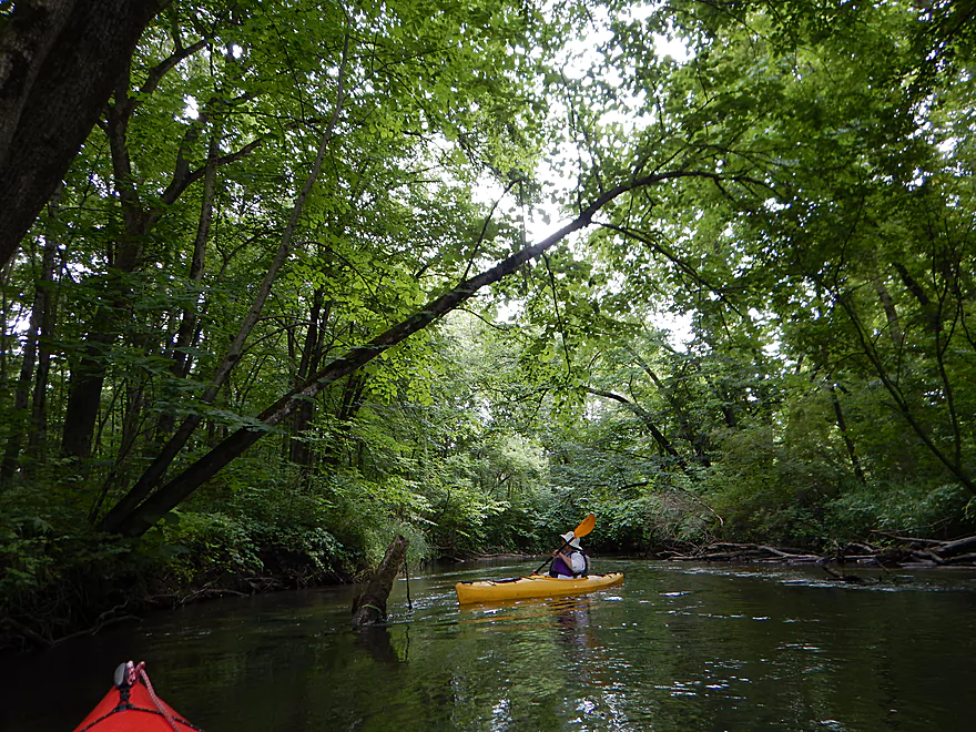
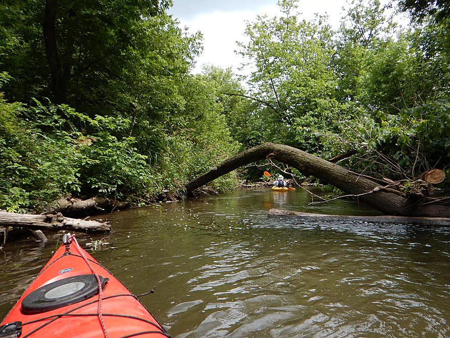
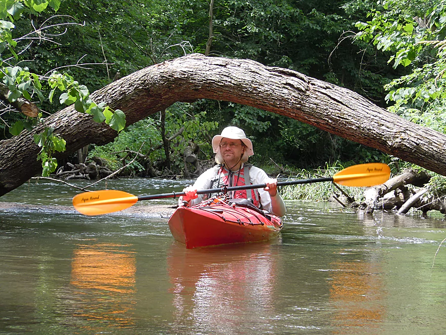
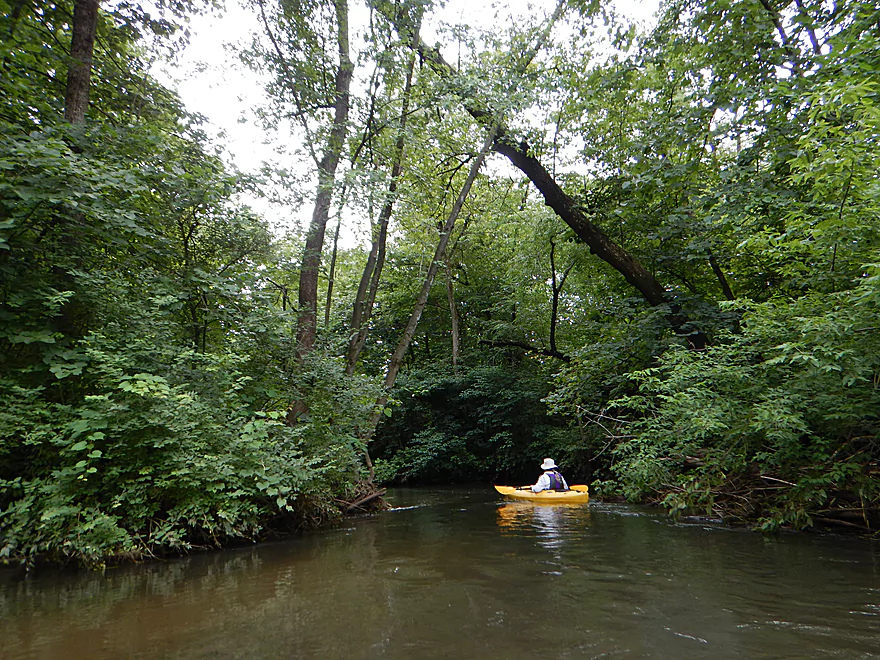
So many fun arches to paddle under
A little congested
But okay to get through
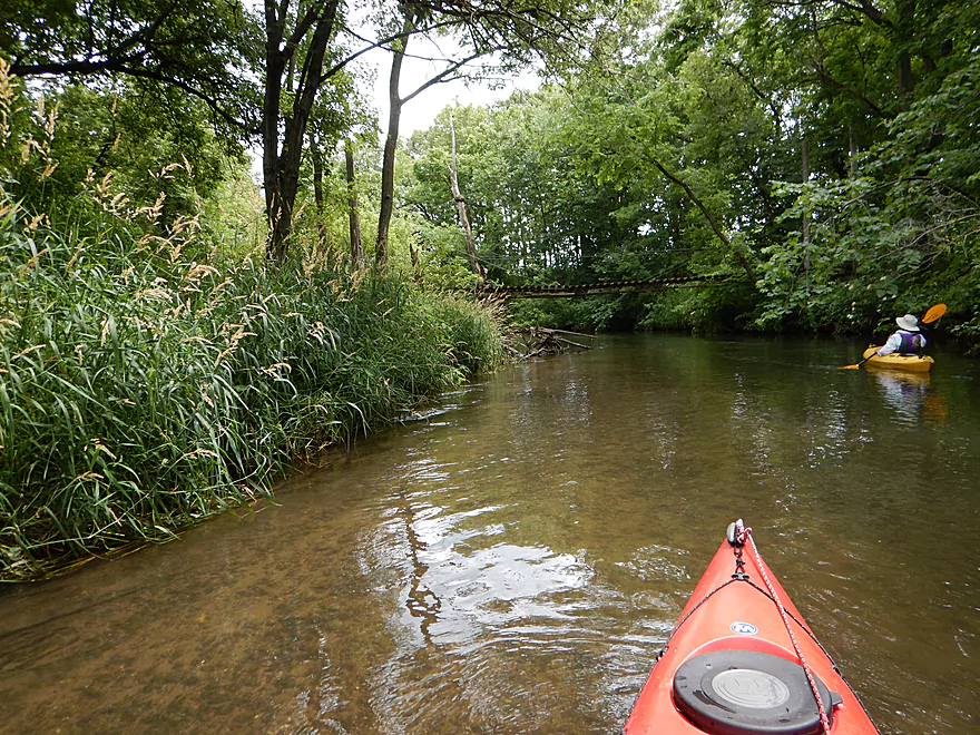
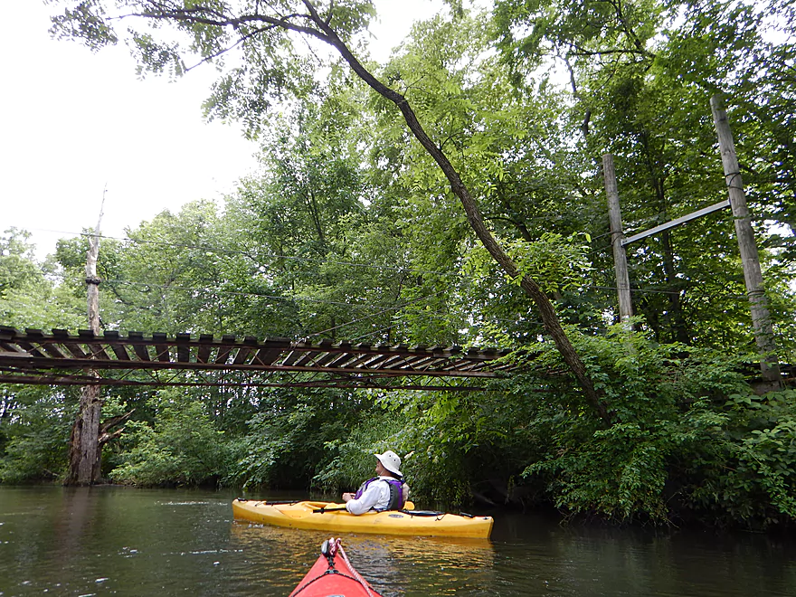
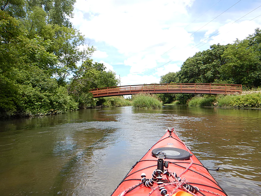
Pedestrian suspension bridge
So glad we did not have to portage this
A kayak-eating tree
Another horizontal Sugar River tree
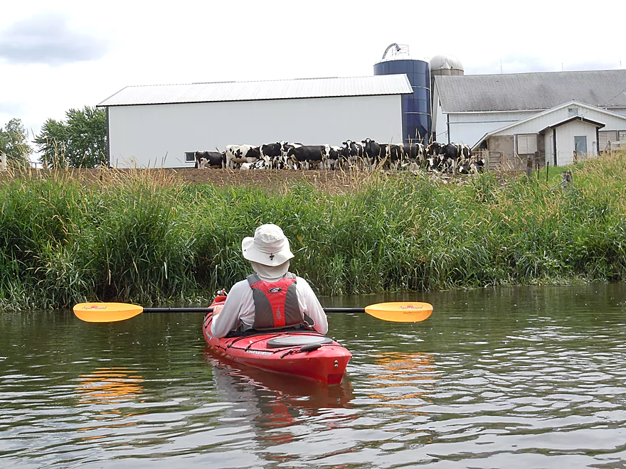
You will never win a staring contest with cows
Mud banks getting bigger
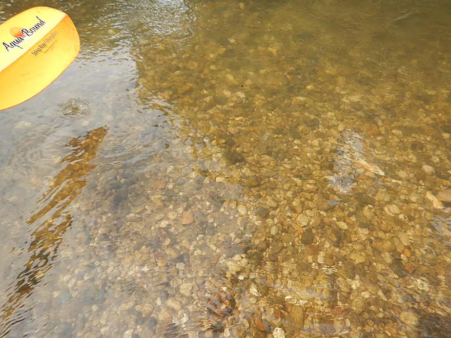
Really cool pebble substrate
Easy to miss your off-ramp in fast current
Nice take-out area before the bridge
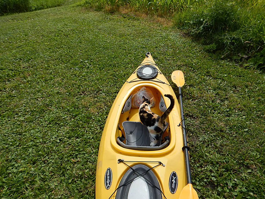
Feline greeting committee at the take-out
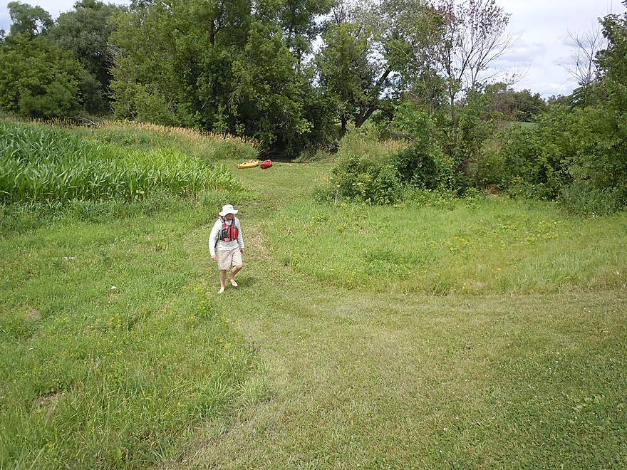
Mowed path for paddlers
Looking upstream from Hwy A (landing is on left around bend)
Sugar River

Despite its close proximity to a large population of eager Madison paddlers, the Sugar has always suffered from limited access, poor water quality, lots of deadfall, and dangerous cattle fences. However, recent land acquisition by Dane County Parks, new landings, yearly clean-up efforts by volunteer groups, and improved cattle gates have given a facelift to this great local resource.
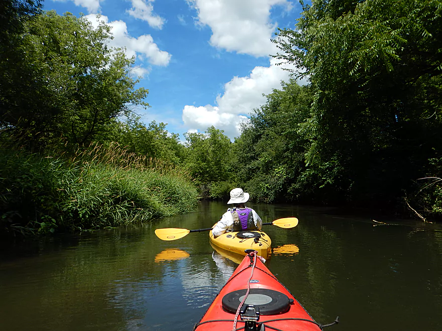
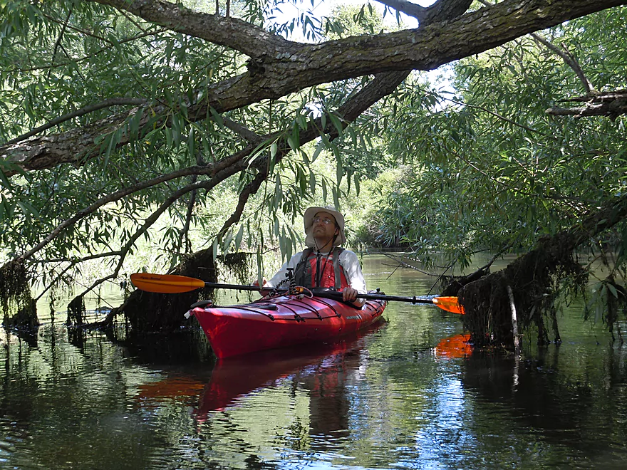
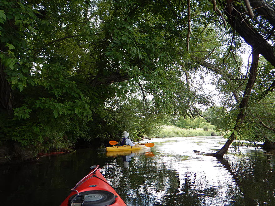
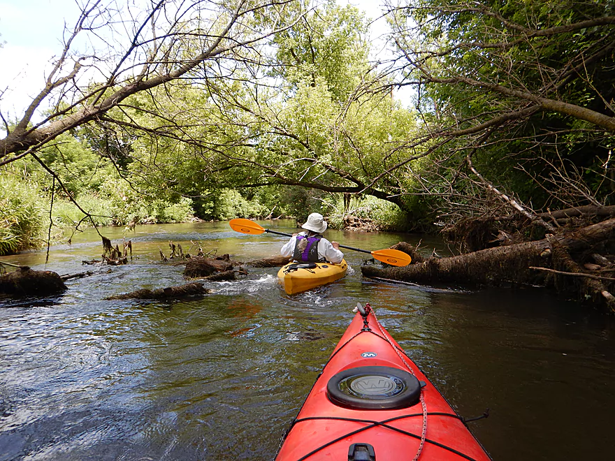
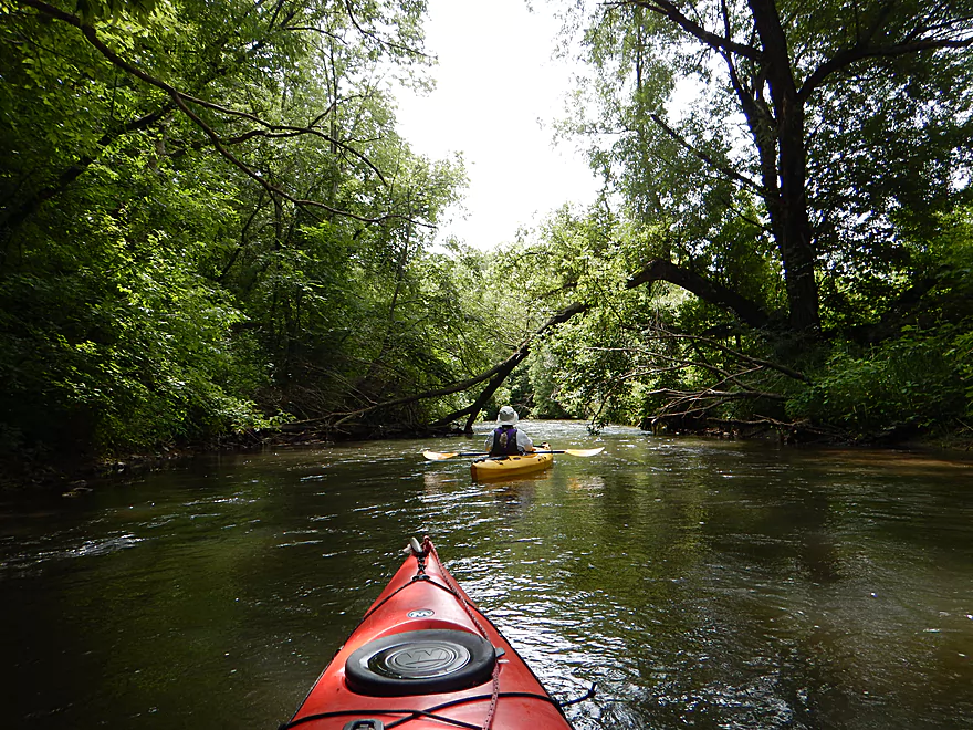
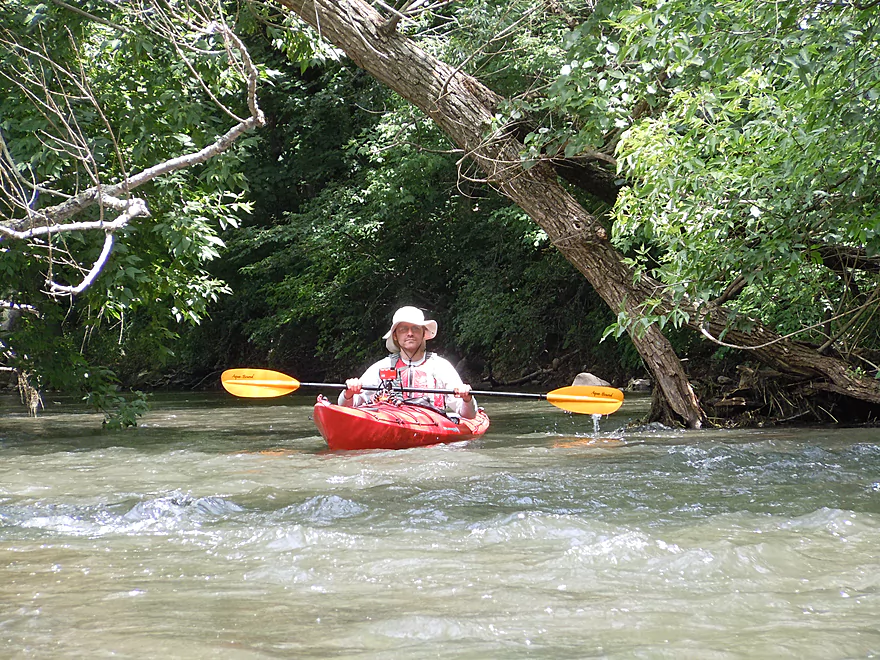
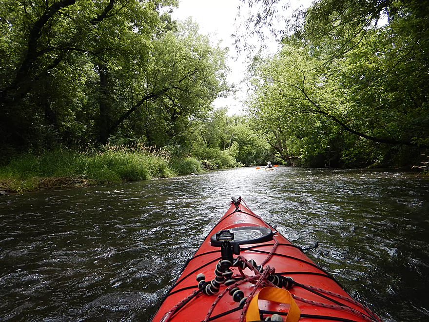
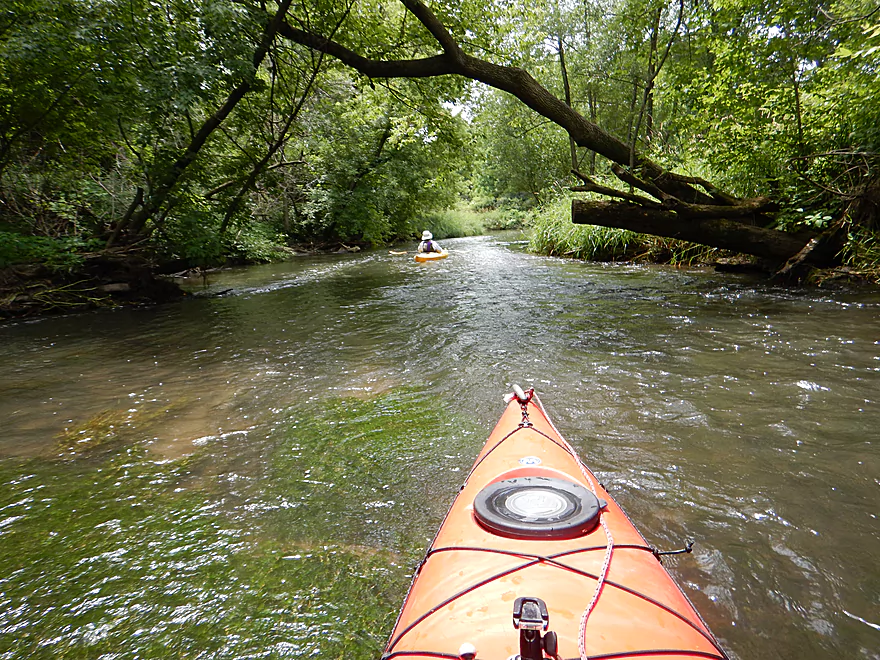
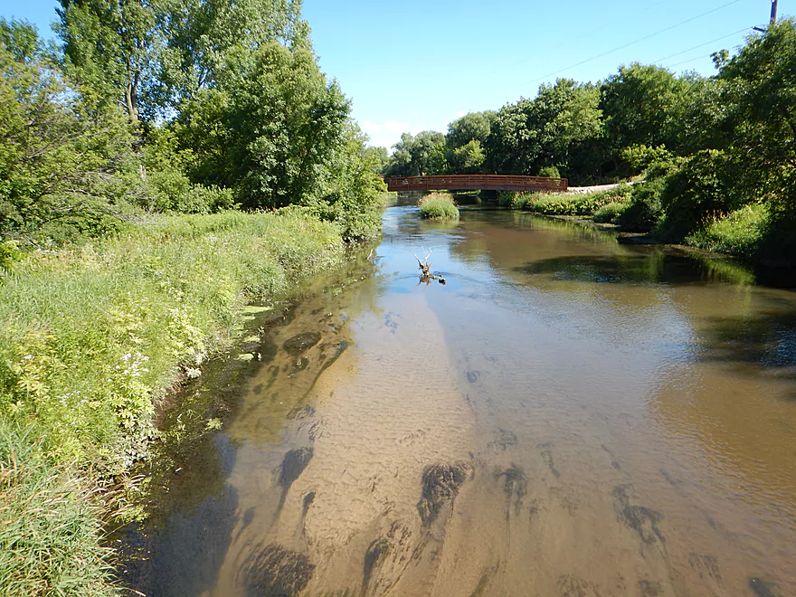
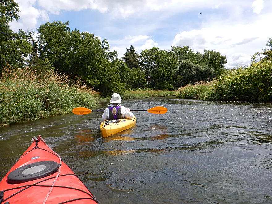
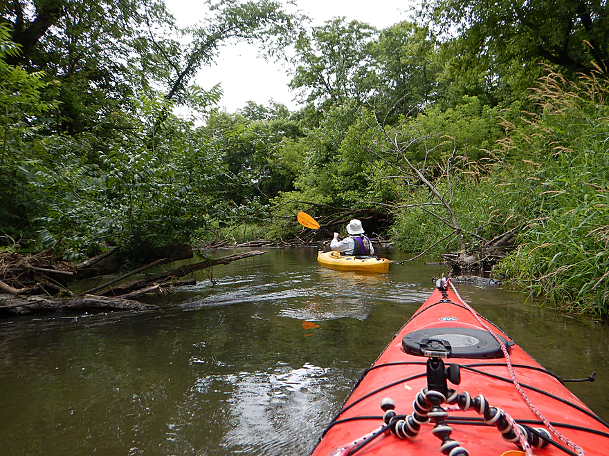
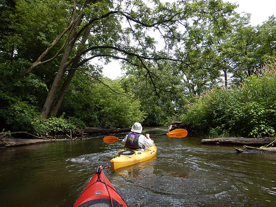
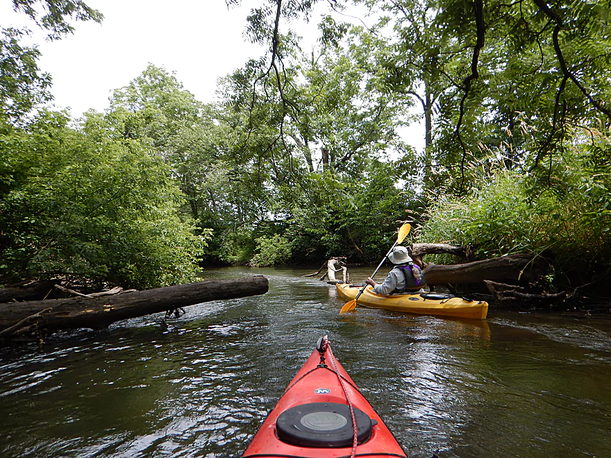
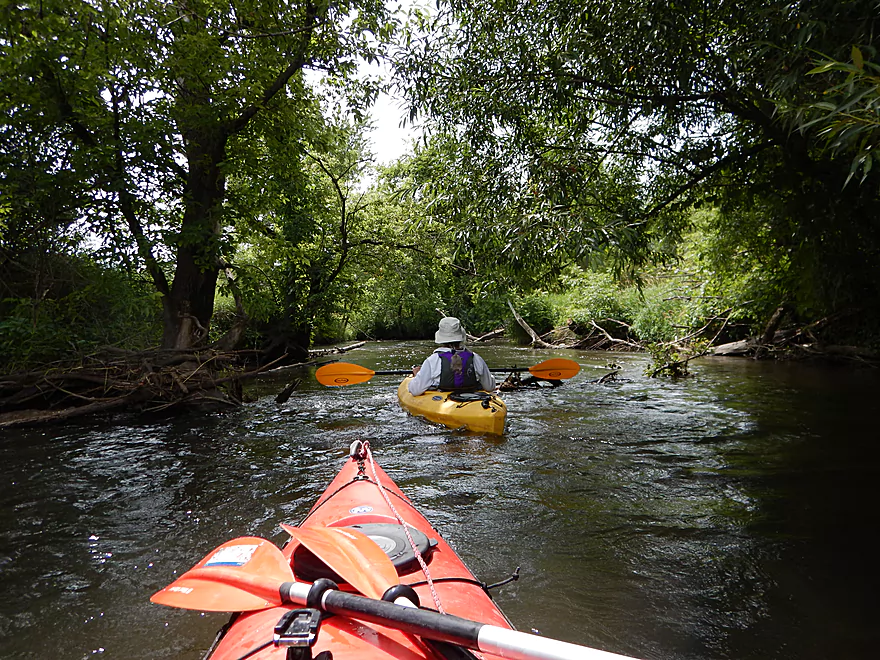
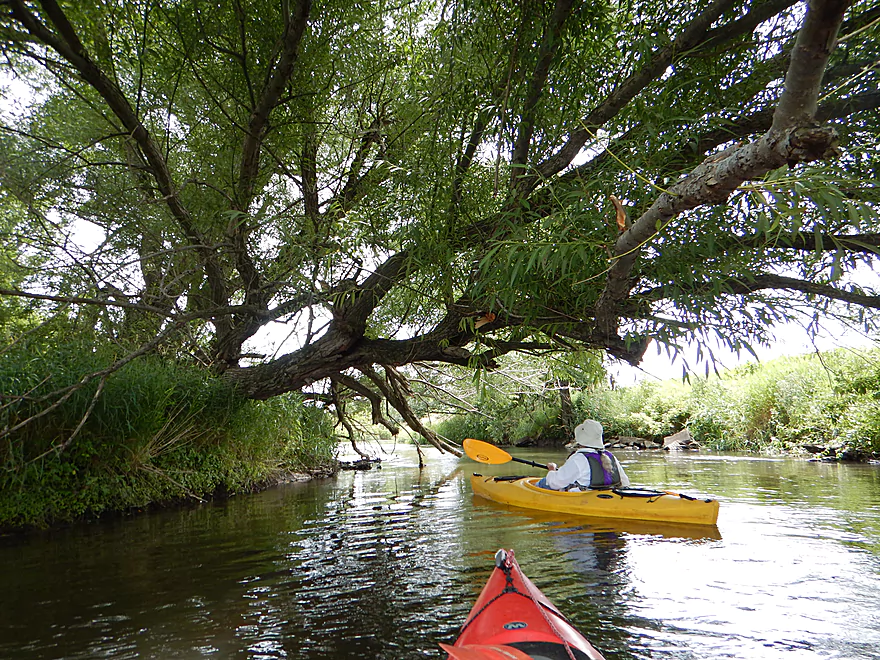
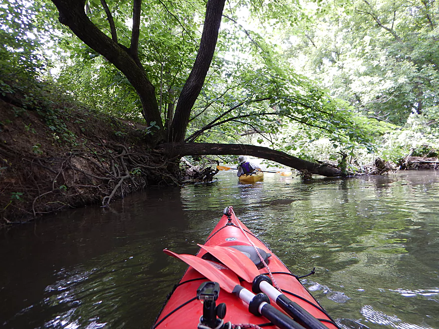
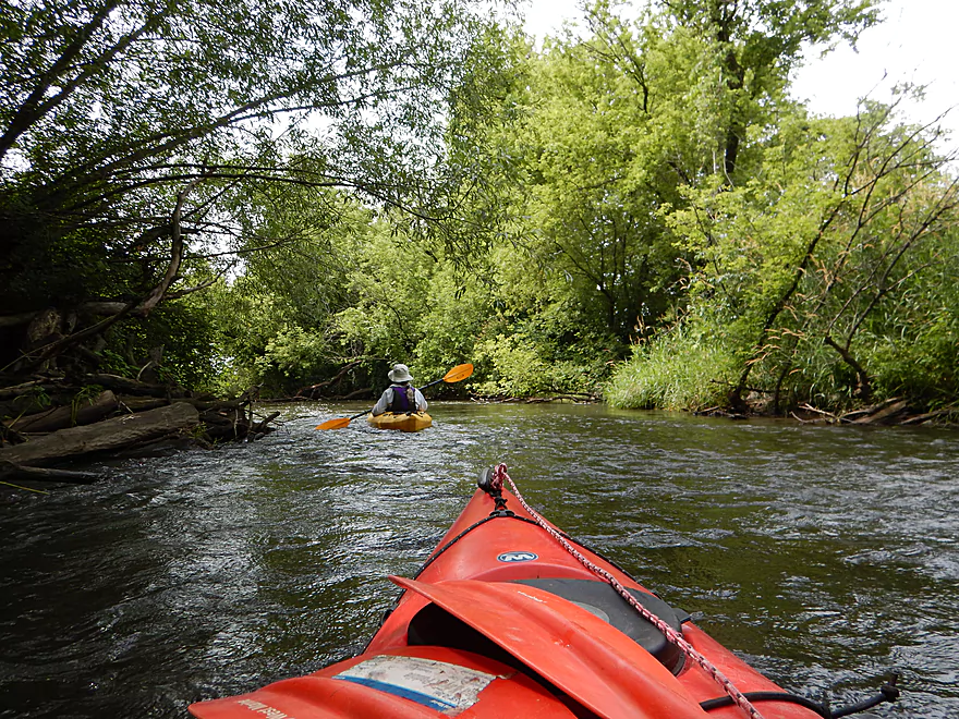
The trip starts on a great note at the Falk Wells Sugar River Wildlife Area off Hwy 69 where a well developed canoe landing gives paddlers three path options to the water. The first mile of the river is really nice. While mathematically this shouldn’t be a fast river, it scoots along at a good pace with occasional riffles. The channel here is narrow and flanked by lush trees and vegetation. While there are down trees here and there, these are never a problem and the locals have done a great job of clearing this out. I went at slightly above normal levels, but could still at times see through to the bottom, which frequently consisted of nice sand and small gravel substrate. An odd quirk with the river is the huge number of what appeared to be incompleted or washed out bridge abutments…of which I lost count.
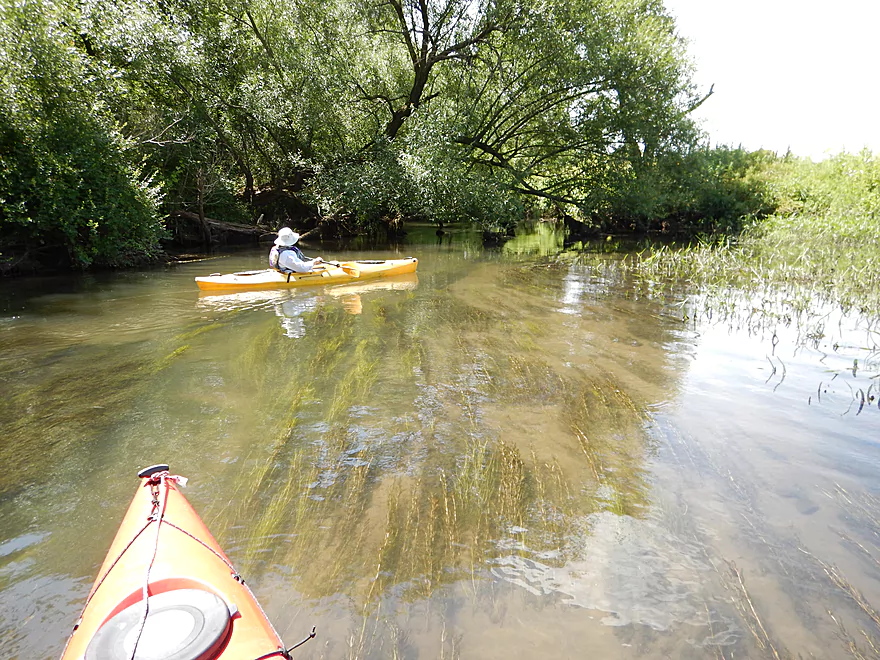
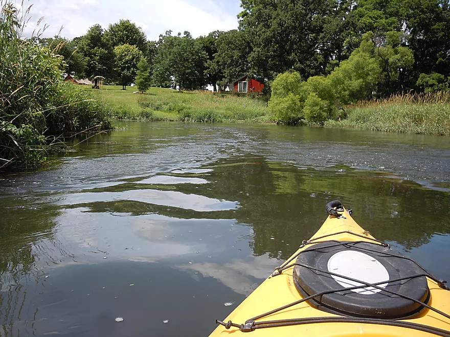
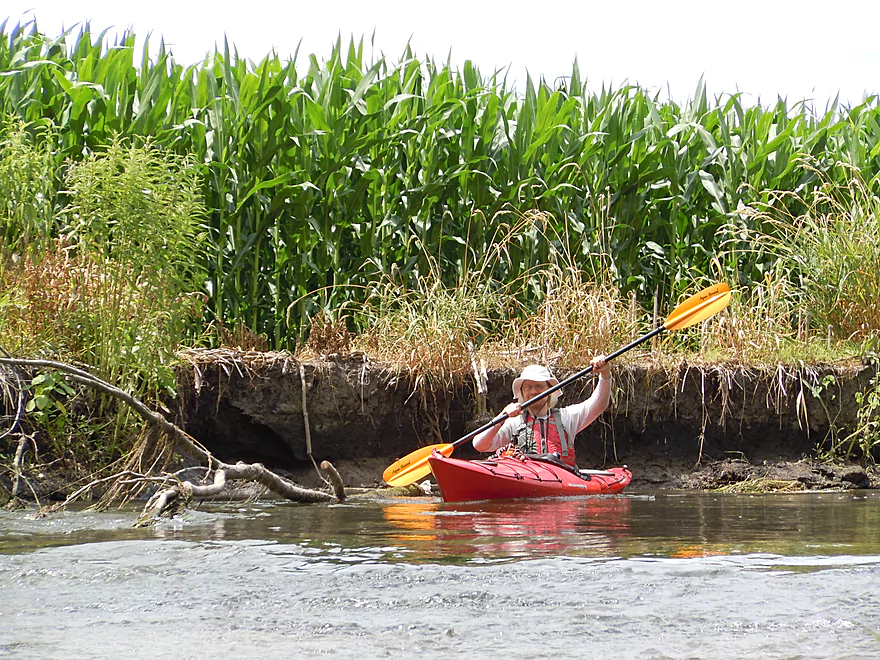
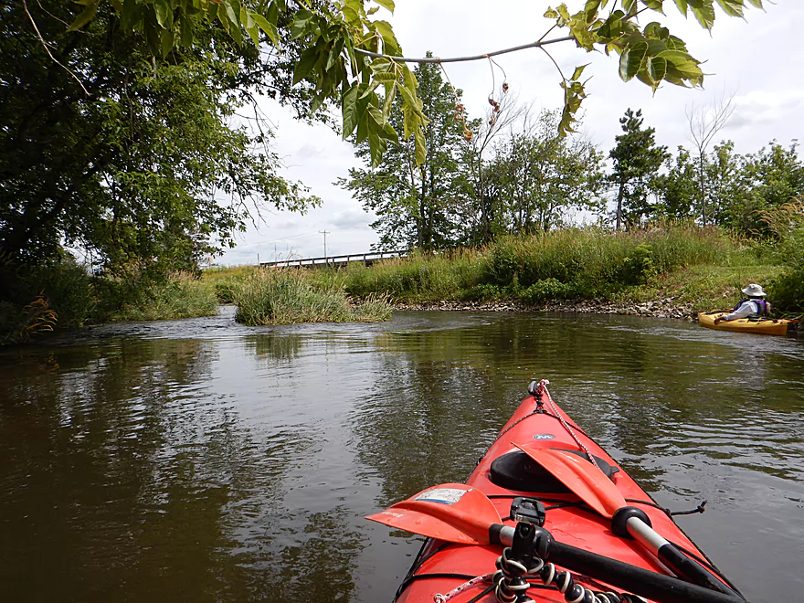
At about mile 2 you’ll pass under a bridge used by the Bruce Company, which has a massive tree and shrub nursery along the river. The Bruce Company has sold over 2.5 miles of riverfront land to the county for waterfront conservation. After this, the river opens up, farm fields and grassy banks replace trees and the channel slows down. Pleasant, but not as interesting.
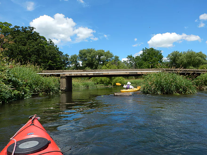
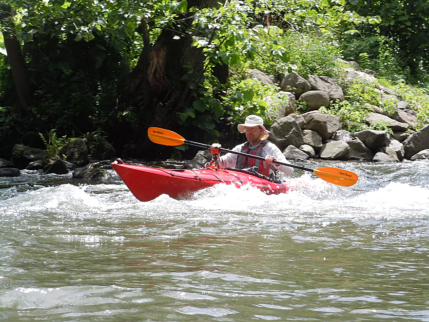
At about mile 3, you come across another nice Dane County “Falk-Wells” landing off Paoli Road. The highlight here is a partially removed dam that creates some fun class 2 rapids you can run. I thought these were easy, but you can easily use the landing path to portage around this if you want or to run the rapids again (very fun!).
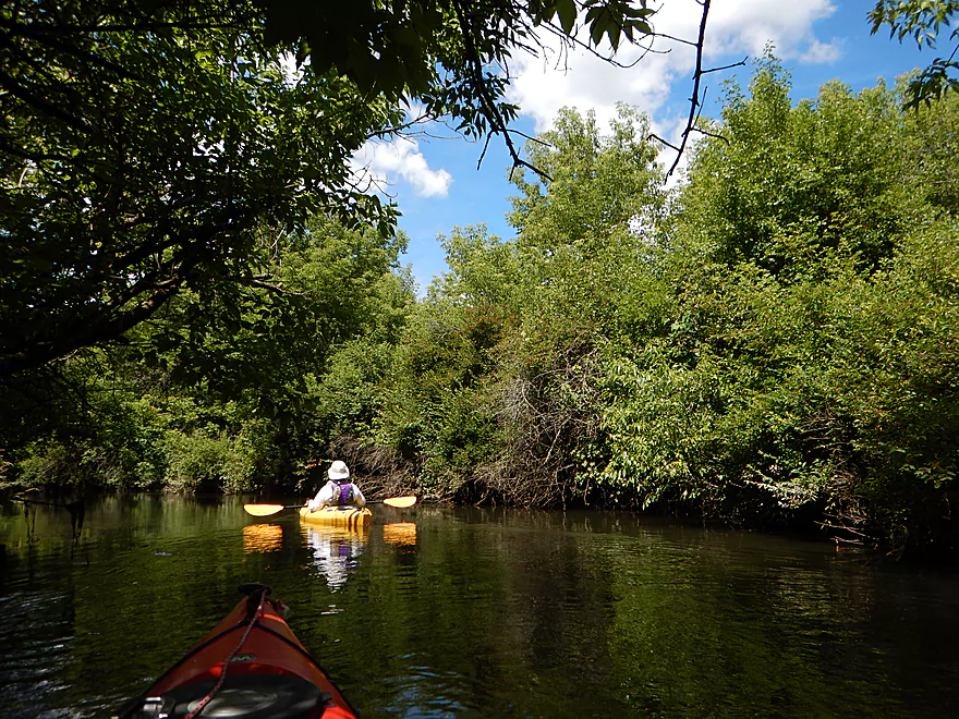
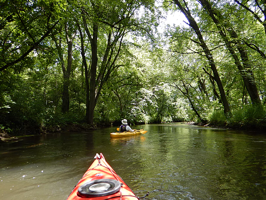
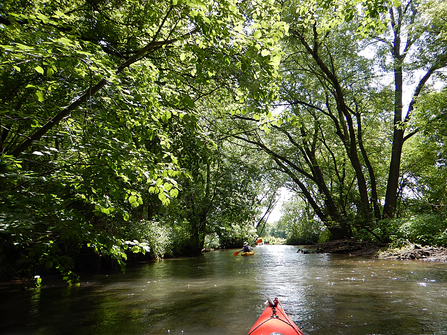
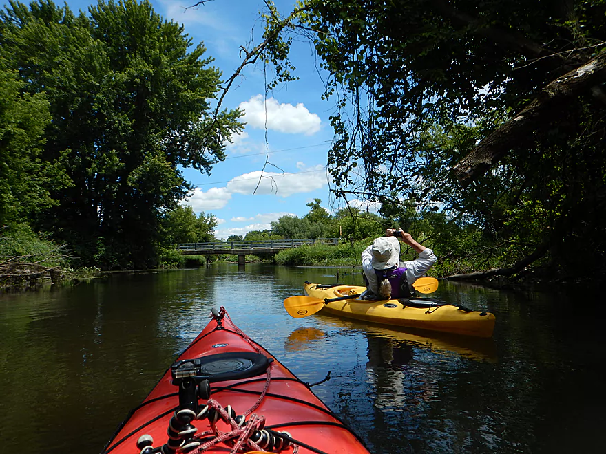
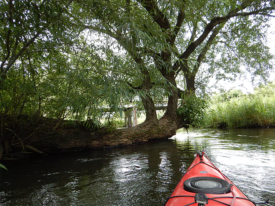
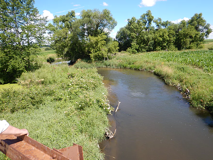
From Paoli Road to the town of Paoli is a really nice section. The trees come back and hug the river and the current picks up with some more riffles. While this is more of a creek than a river, it is plenty feasible for canoes and we saw many on the water.
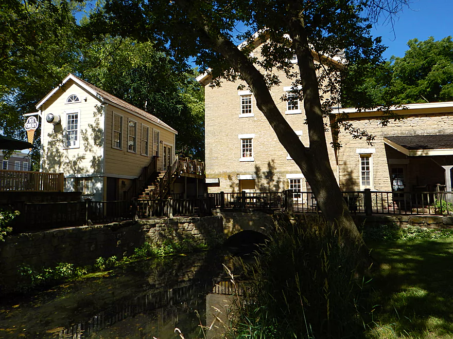
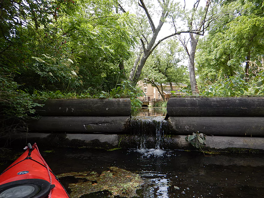
The city of Paoli marks about the halfway point in the trip (~3.5 miles) and you could certainly get out here if you wanted. Paoli is a neat little town with small attractive shops. The town highlight is a four-story limestone block mill house located just west of the river. The millrace upstream that used to connect with the dam has been filled in, but in town you can still see what remains of the canal.
The next two miles after Paoli are not as interesting. The farm fields return and the trees vanish, really putting this river’s four star rating in jeopardy. There are two swing gates to contend with, but these are easy to duck under (they weren’t always).
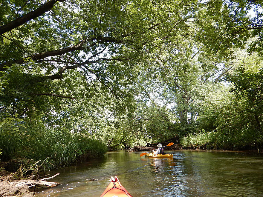
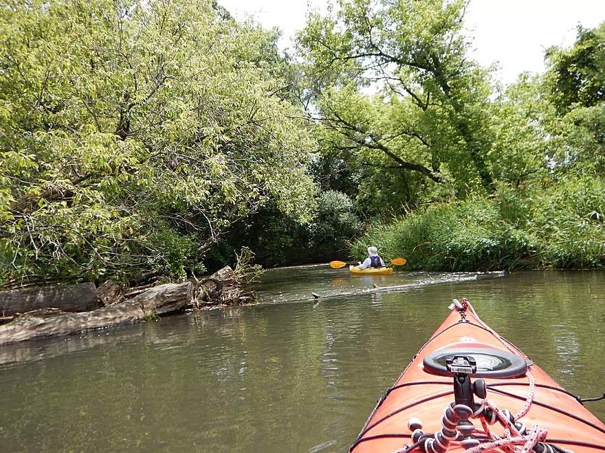
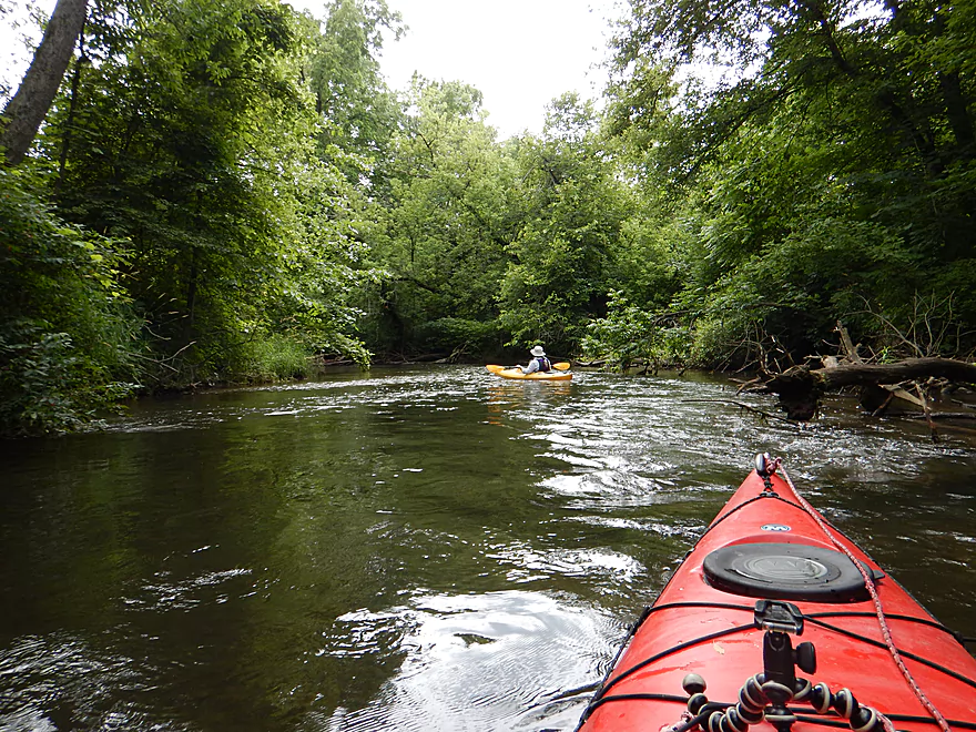
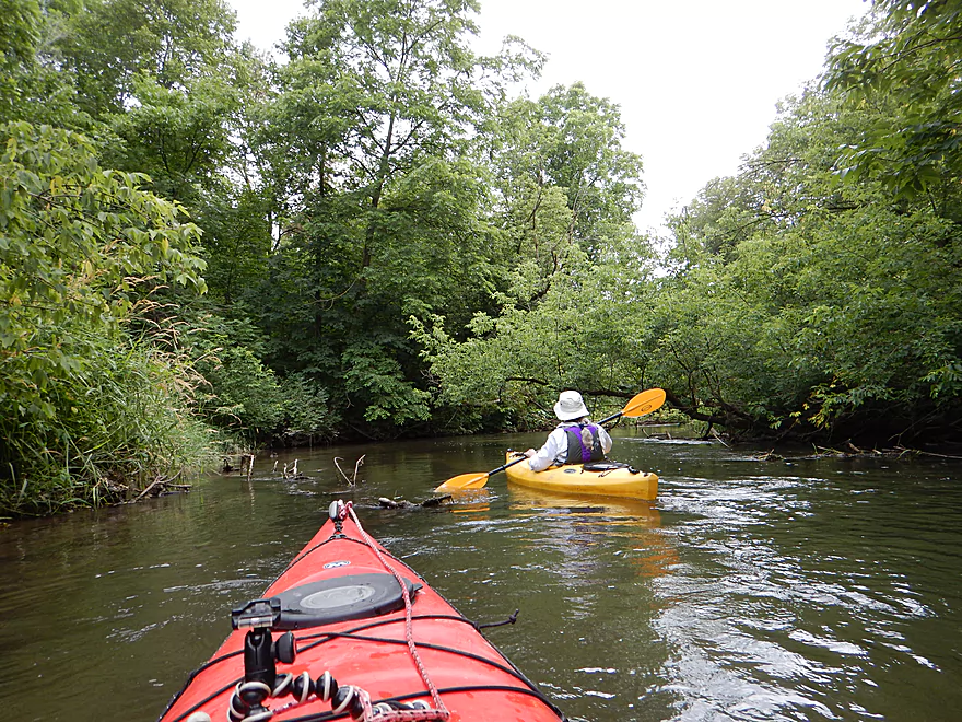
The last two miles of the trip were my favorite part. Here the current picks up dramatically, the river narrows, and thick tree canopies shade the winding channel. Typically this section would have had the most deadfall, but thankfully this has been all cleared out. Do be mindful that while the locals clear out the river, things can change after a big wind storm, so be vigilant regardless.
Very nice canoe launch off Hwy 69. While this is a Dane County park, this does not appear to be a fee area. Three paths give you plenty of options for launching and there is good parking to boot. The only downsides are the lack of an outhouse and a lot of wild parsnip, which can cause skin blisters, so avoid touching this.
Alternative downstream put-in options include the Paoli Boat Launch off Paoli Road (great canoe landing by the dam remnants) and Range Trail bridge (a marked canoe access spot but unimproved).
For some history about the Falk-Wells landings, click here.
Webmaster’s Update – As of 2024-08-05, there is a large logjam downstream from Paoli.
If you cut your trip short like many paddlers do and take out in Paoli, there are several landing options.
- Many paddlers use a mowed path from a park by the Hop Garden (northwest of Paoli Road). This is private, but the owner lets paddlers use this (unless there is a wedding).
- Another option is the lawn east of the river by the Artisan Gallery. This is also private, but I’m told the owner is relaxed and lets paddlers take out here.
- My preferred option would be to take out at the Montrose Town Hall. Basically, you can disembark upstream/northeast of the snowmobile bridge (river left) and park by the Montrose Town Hall, which is public.
For my trip, I took out 4 miles downstream of Paoli at Hwy A. The south side of the bridge is clearly marked no-trespassing, but the north side has a nice mowed path leading to the water for paddlers to use.
Relatively flat, this would be an easy bike shuttle at 4.4 miles. In fact, the area is popular with bikers because the Badger State Trail is next door (but maybe just a tad east to be included for a kayak shuttle).
Brand new in 2017, “Sugar River Outfitters” is now a rental and livery option for the Upper Sugar River.
None. There used to be plenty, but these have been cleaned out, thanks to the efforts of volunteers. Stay on your toes as the current is peppy and with some down trees, but alert paddlers shouldn’t have an issue. Remnants of the old dam do create some small rapids (~class 2), but they are super easy to portage if you want to.
Note: At least one boater lost their paddle though which I recovered. If you’re missing a kayak paddle from the Sugar, contact me below and I’ll see if I can arrange to get it back to you.
Webmaster’s Update – As of 2024-08-05, there is a large logjam downstream from Paoli.
The gauge just upstream of our leg, read 64 CFS. A local I talked to thought the river was above normal, but it didn’t seem too high and was a good depth. The river is pool and riffle in nature with many of the pools being consistently 3′ deep. I doubt the river ever gets too low to run. Lower levels should help with clarity. I am not sure what flood stage is. 100 CFS is probably a pretty full river. 200 CFS and 300 CFS levels happen infrequently and only after heavy rains. Because of the fast current and number of down trees, I’m not sure I would suggest going when the river is high.
An eagle, many kingfishers, and a turtle. Highlight was a muskrat fighting the Sugar’s current to take a mouthful of weeds back to its den. Plants included many honeysuckle bushes with red berries, elderberries in flower, and pondweeds waving in the water.
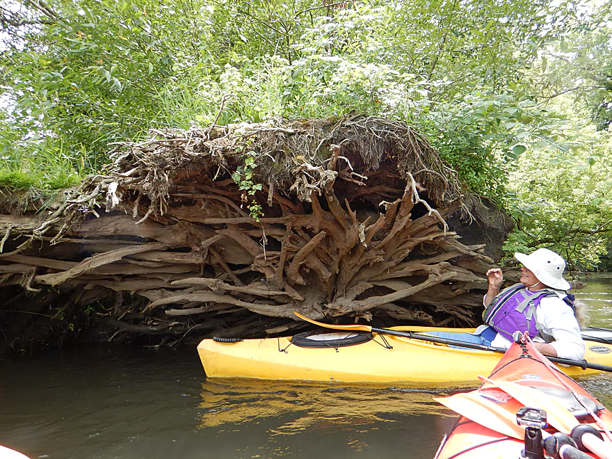
What was unique about the trees on the Sugar was that many were very “horizontal.” Some, like bur oaks, have naturally horizontal limbs, but many other trees would lean over the channel for extra sunlight. Even those that went down continued to live, creating fun little arches to paddle under.
As Madison bikers on the “Paoli Loop” have long known, half the fun of the trip is visiting the historic little town of Paoli–a hub for bikers, artisans, and organic food producers. A Wisconsin State Journal article describes how the county’s Falk Wells land purchase may also add large numbers of paddlers to this mix.
This examiner.com article surveys Paoli history and lists some of the stores, galleries, and restaurants in the town, which include an organic food store and restaurant and an ice cream shop (perfect for an after-paddle snack!).
Detailed Overview
- Upstream of Hwy PD: Likely too many logjams.
- Hwy PD to White Crossing Road: (0.4 miles) Mostly straight and likely channelized. Perhaps a few logjams. Could be a tight fit during low water.
- White Crossing Road to Valley Road: (4.9 miles)
- White Crossing Road to Bobcat Lane: (2.2 miles) Open, straight and channelized…this is a simple but pleasant paddle with frequent vistas of Epic Systems (at the edge of Verona). There are a few logjams here that can be hopped over in high water.
- Bobcat Lane to Valley Road: (2.7 miles) Slower, twistier and more wild than the upstream section, but less interesting. No noteworthy logjams.
- Valley Road to Riverside Road: (1.8 miles) There might be a logjam or two, as well as a problematic cattle fence.
- Note from Wade at Uppersugar.org: “The fence has been redesigned to be more paddling friendly. Both sections of the fencing now have a gap with vertically hanging PVC pipes that boats can pass through. It’s my understanding that this has worked well, but if you go down the river and have a different experience, please let me know.”
- Riverside Road to Hwy 69: (1.6 miles) There were fences and logjams here, but I think they have been cleared out.
- Hwy 69 to Hwy A: (7.7 miles)
- Hwy 69 to Paoli (Montrose Town Hall): (3.5 miles) Fantastic section.
- Paoli to Hwy A: (4.2 miles) Good section….but not as scenic as the previous leg.
- Hwy A to Belleville Park: (6.6 miles) Trip starts nice but becomes less interesting at the end by Belleville where the river is impounded by a dam.
- Belleville Park to Exeter Park: (4.8 miles) Nice paddle with scenic put-in and take-out. Highlights include a few sand and gravel bars and an attractive wooded section with good current.
- Exeter Park to Hwy X: (5.4 miles) A good prospect.
- Hwy X to Hwy C (Attica): (5.0 miles) A simple leg. There is nothing really scenic about it...but it's not a bad paddle.
- Hwy C to Hwy EE: (6.4 miles) A mediocre prospect. Maybe logjams.
- Hwy EE to Albany Boat Ramp: (2.5 miles) A weak prospect because of the lake paddling.
- Albany Boat Ramp to Decatur Albany Road: (2.9 miles) A weak prospect.
- Decatur Albany Road to Decatur Park: (4.5 miles) A weak prospect with some flowage paddling.
- Decatur Park to Hwy F: (2.2 miles) Good prospect.
- Hwy F to Clarence Bridge Park: (4.6 miles) Good prospect with an exposed rock outcrop.
- Clarence Bridge Park to Hwy T: (5.9 miles) A good prospect.
- Hwy T to W. Beloit Newark Road: (1.9 miles) A good prospect.
- W. Beloit Newark Road to Nelson Road Boat Ramp: (4.6 miles) Avon Bottoms Wildlife Area is probably nice but there might be some downed trees to negotiate.
- Nelson Road Boat Ramp to Haas Road: (6.6 miles) Good prospect.
- Haas Road to North Street: (4.1 miles) Good prospect.
- North Street to Harrison Road: (5.0 miles) Good prospect which ends at the Pecatonica River.
Trip Map
Overview Map
Video
Photos Size:
This is a really nice river to paddle. The only reason I give it 4.5 instead of 5 stars is the put-in at Bobcat Rd. It is extremely muddy, and not a lot of room to maneuver. We hired Kelly from Sugar River Outfitters LLC to shuttle us with our Eddyline kayaks to Bobcat Rd. He is prompt and professional, and very knowledgeable about the river and the area. Volunteers clean up the river, so one can easily maneuver around some downed trees. The current is good, and the water deep enough so that we didn’t have to get out and portage. It is approximately 8 miles from put-in to take-out in the village of Paoli. The best part of the trip is that upon take out you can have a beer and listen to music on the patio at the Hop Garden Tap Room ! It doesn’t get any better than that!
Put-in: Bobcat Road
Take-out: Paoli
Time: 3.5 Hours
Date Paddled: 07/02/2017
Depth: 3 feet
I am looking for people to go kayaking with. I have one friend in town that kayaks with me but would like to get with other people who enjoy the same thing I do. Madison is too far for me to drive and have checked with Dubuque and Platteville about kayak groups but know luck. If u have any suggestions please let me know thank you-
Hi Michele, I highly recommend joining a paddling club. Madcitypaddlers.org is the largest in southern Wisconsin and they frequently do trips in the SW part of the state.
We have a kayak group based out of Platteville but kayak everywhere within a 2 hour radius. There are usually 3-10 paddlers every week. We would love to include you. We usually paddle in Mondays but fit in a few weekend paddles too. We have lots of info on great options. Please contact me!
Love your website! I’m very happy to have stumbled upon it last year. I’ve done this stretch multiple times and lost a black whisper paddle. Does that fit the description?
Hi Lauren, unfortunately no, that missing paddle wasn’t that brand or color.
Ok. Thanks, anyway.
Really appreciate the review!
Did the section from Falk Wells to the County A takeout on 8/17/2019. A number of deadfall trees that needed to be portaged, including a section where a large screen TV was dumped in the river. One of the cattle gates is no longer passable and had to be portaged. A deadfall tree has landed in the middle of the section of the cattle gate and forces a tricky portage to the paddler’s left. Due to water levels and deadfall I wouldn’t recommend this section at the present time. Riverside road to Paoli is still in good shape.
Ugh…pretty bad news. The Sugar has been beat up pretty bad by highwater this year. Hopefully this will improve in the future. Thanks for the feedback.
I did the section from 69 to A today and had a great time. The river was 85 CFS/ 3.45 ft, and was very cloudy which was surprising because it has been a while since our last good rain. The section from the Paoli landing to Bosco was surprisingly nice, lots or rifles, good mix of open farmland and tree lined banks. There was only one cattle gate that was easy to duck under but could be a problem at higher levels as it is not just a wire or cable but a flat piece of metal that could be dangerous if hit at speed or unaware. But other than a few duck unders, some low hanging limbs and one easy mandatory portage at a small log jam, the river is open all the way to Bosco. We did a shuttle that was easy and pretty thanks to the Ice National Scenic trail that is right there and is an alternative to using hwy 69 or PB to get back to Paoli, you can then take Ridge Rd to Sunset Lane which will take you to 69 just north of the put-in . There is a shortcut you can take off the trail right before the bridge under Scenic Valley Parkway. As soon as you see the bridge start looking for a small dirt path on your right, it leads to an unnamed farm road that will take you up to Scenic Valley Parkway, if you miss it don’t worry, there is a driveway 200 yards past the bridge that will also take you up to Scenic Valley Parkway
Great to hear this section is in good shape. I believe the preceding section might have a cattle fence that might not be circumnavigable though. As always, I appreciate the updates.
We paddled from Riverside Rd. to Canal Street in Paoli on 17July2020, 115CFS at 3.6 ft. More folks on the river than I would have expected on a Friday afternoon, including two people in a giant float tube. Paddling time was a little under two hours.
I was impressed by the water quality improvement projects, brush along the streambank and large rocks for erosion control downstream from the Bruce Company. An angler we passed reported catching two brown trout near Paoli.
Sugar River Outfitters says Valley View Rd. to Paoli is clear, but he hasn’t heard first hand reports about Bobcat Ln. to Valley View.
Here are links to maps. The Capitol Water Trails one shows a hiking trail that I plan to walk. (Walkable shuttle route for a patient paddler??)
https://uppersugar.org/Maps
http://www.capitolwatertrails.org/maps/sugarR_6/map6_big_Color.gif
Appreciate the update. If viable a hiking shuttle on the Sugar would be pretty cool.
Webmaster’s Update – As of 2024-08-05, there is a large logjam downstream from Paoli.
Mike Duchek reports a logjam just downstream from Oak Grove Road (but upstream from Hwy 69).
Update from Mad City Paddlers: The Sugar should now be free of major logjams between Valley Road to Paoli. Thanks to Jared and company for all their hard work!