
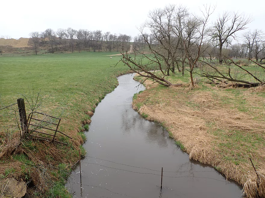
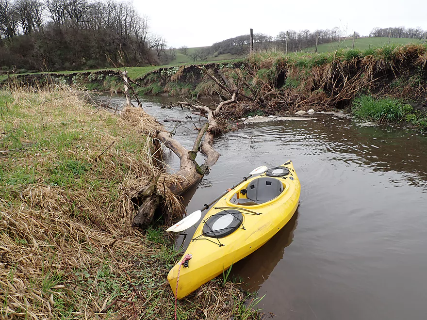
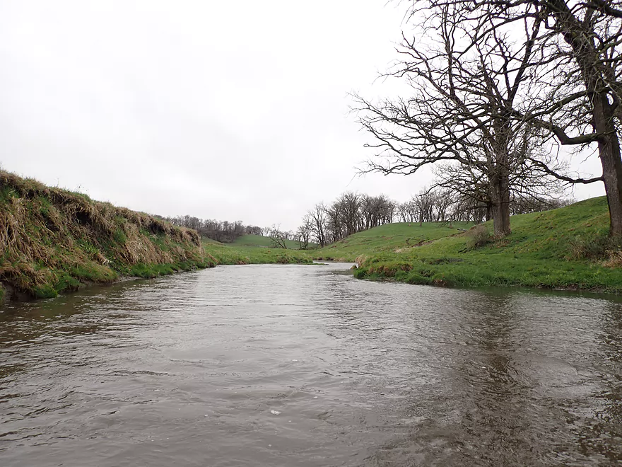
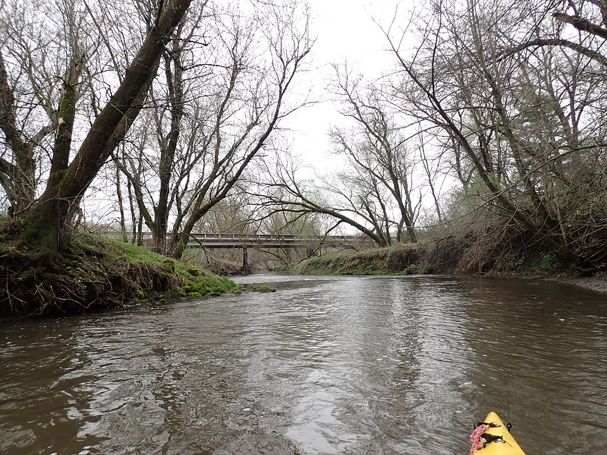
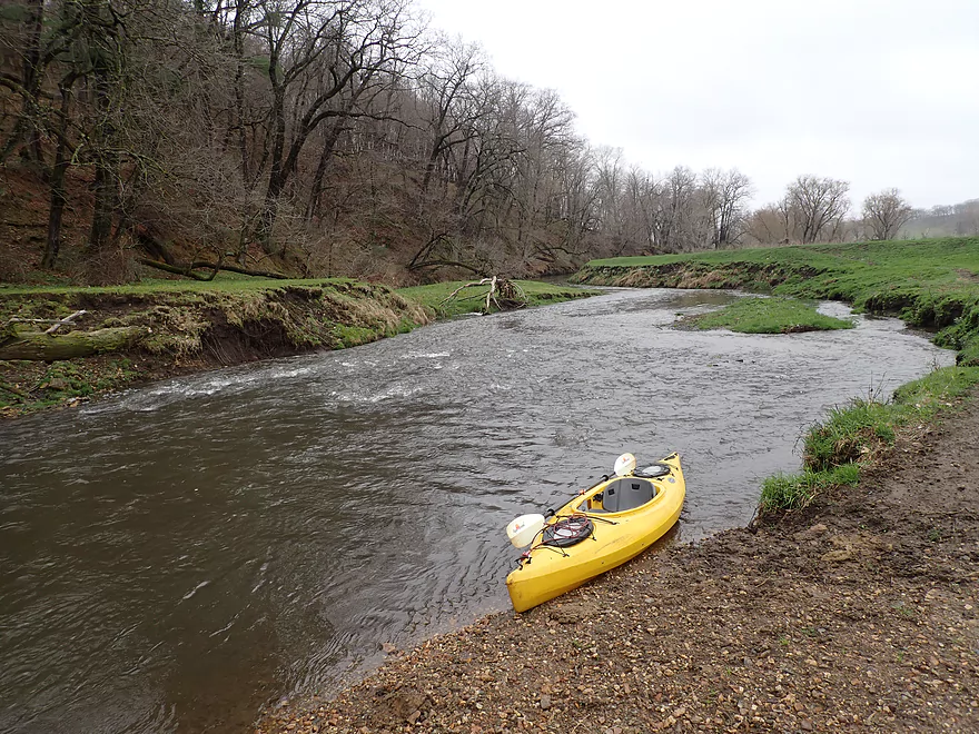
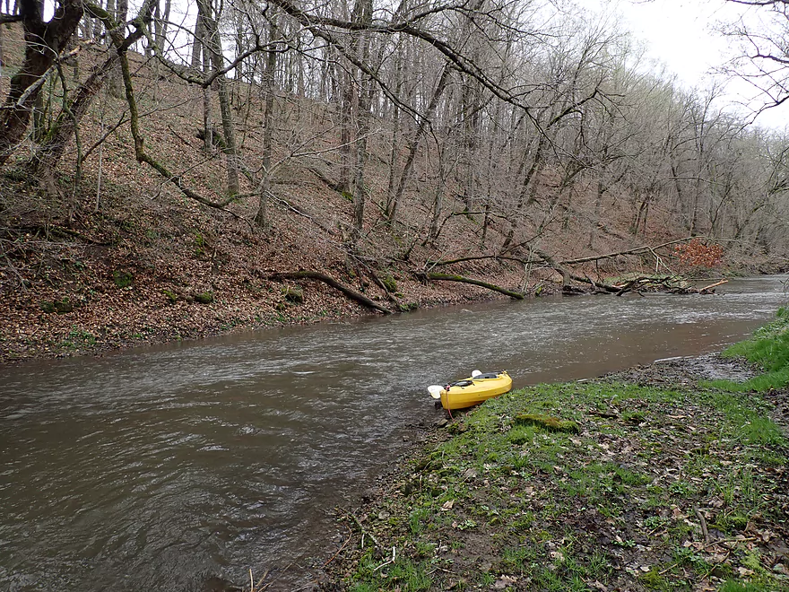
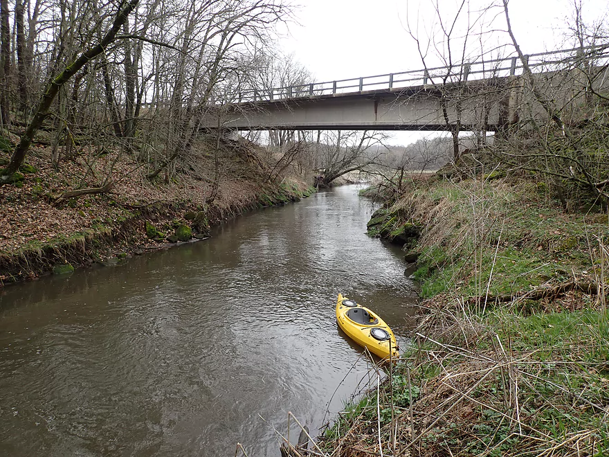
Starting the trip at Cave Rd
Ok bridge access
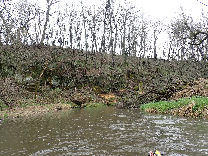
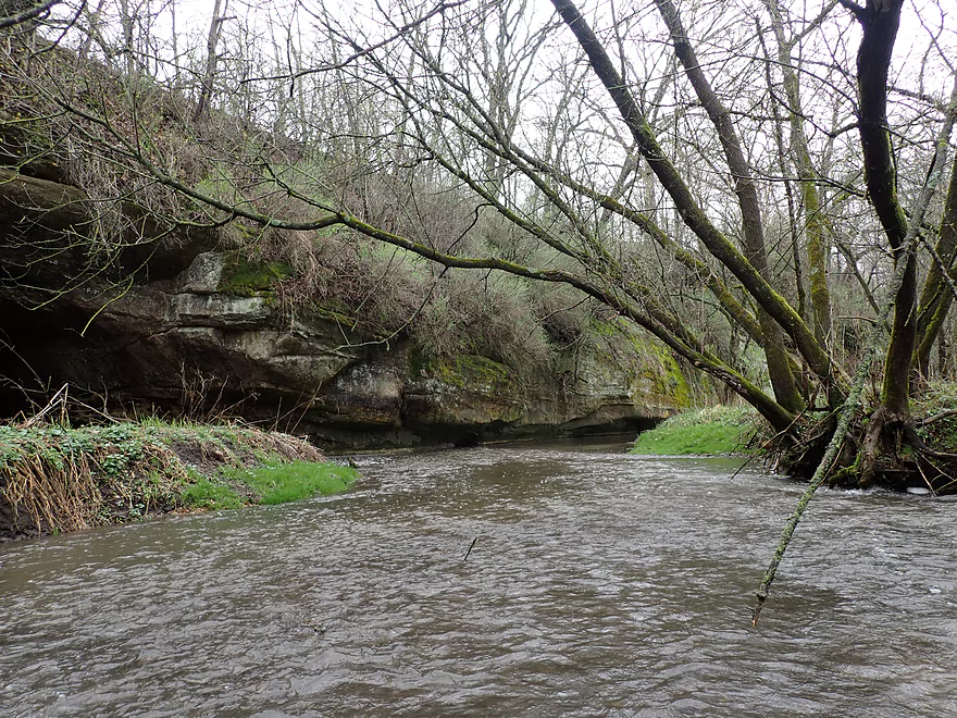
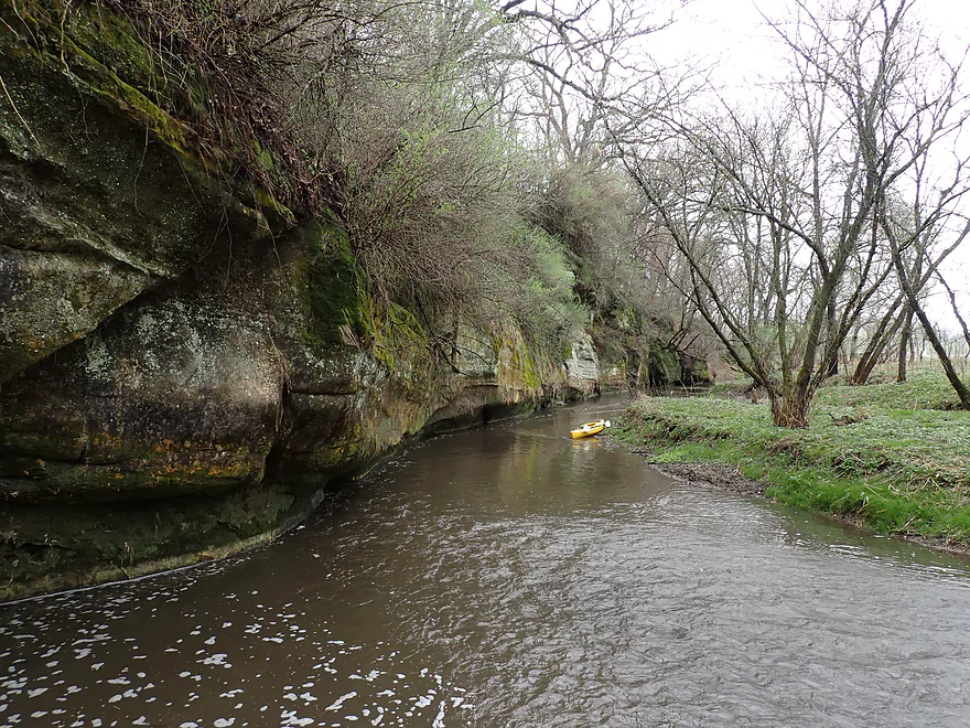
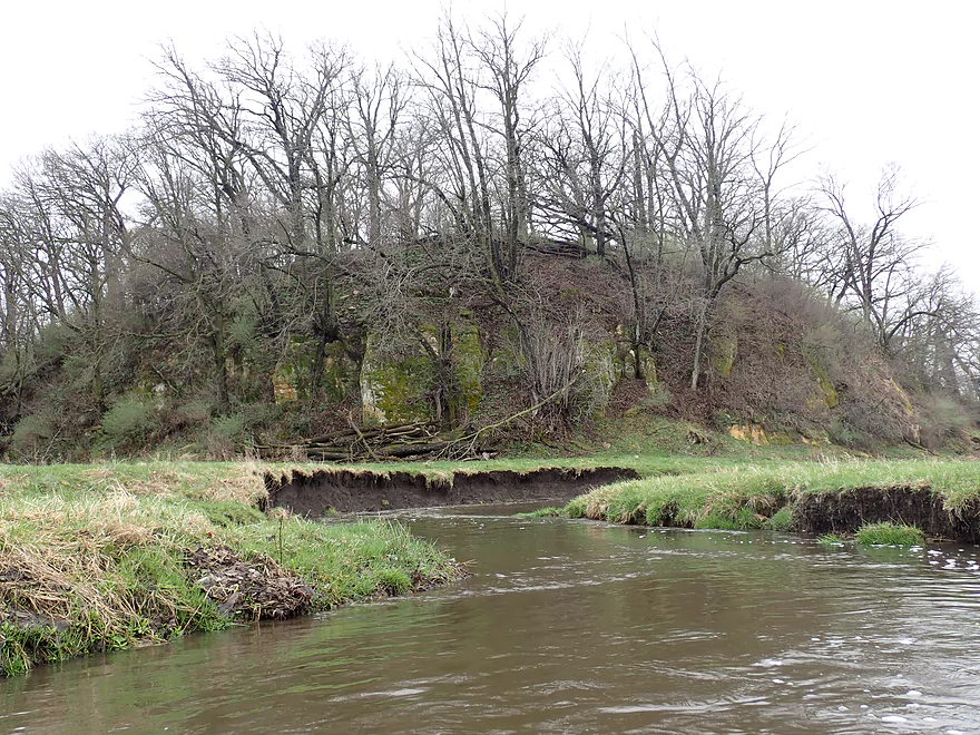
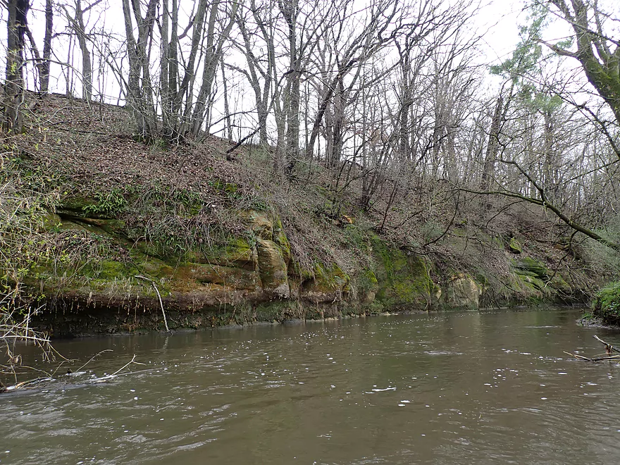
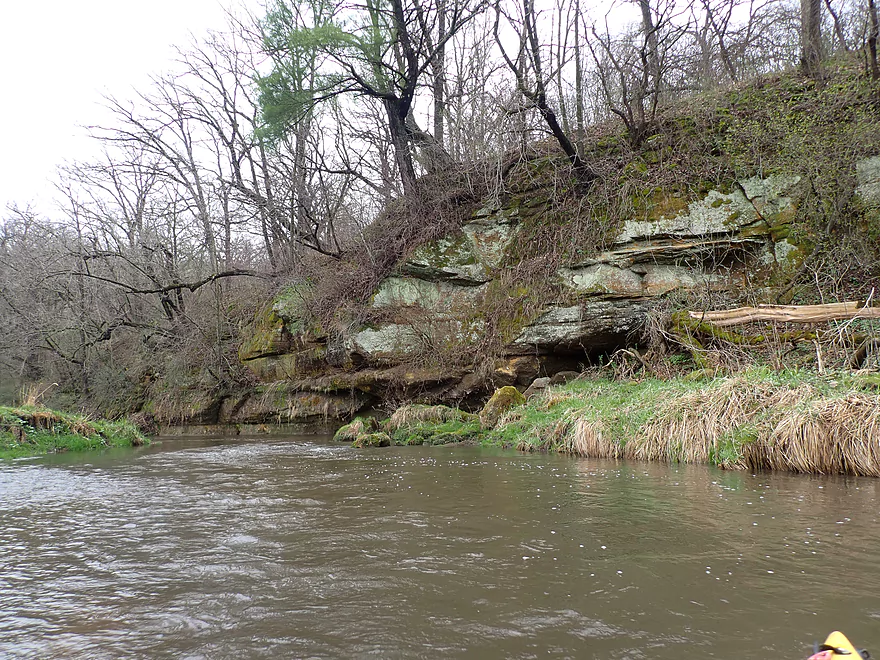
Approaching a rocky bluff
Cool area
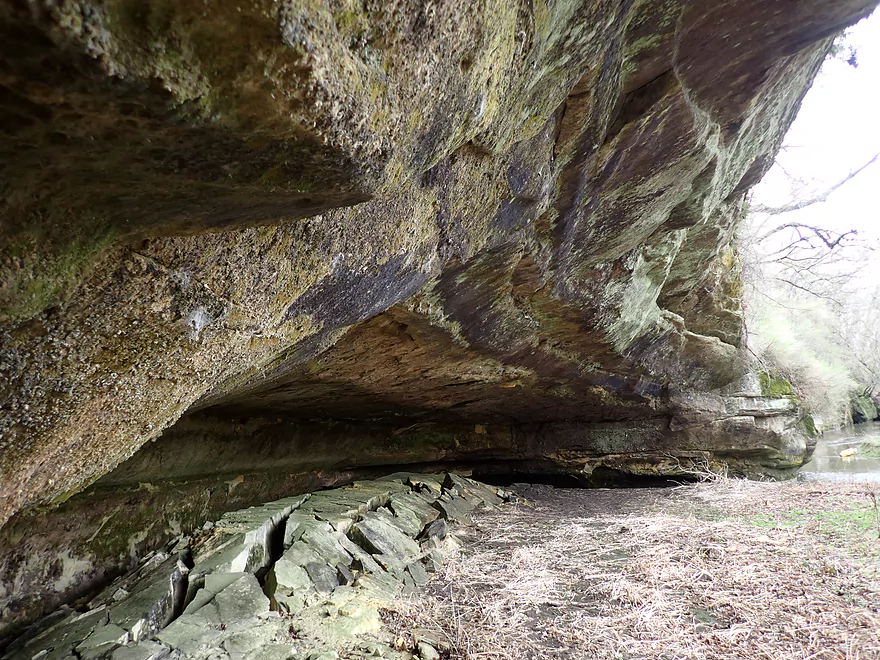
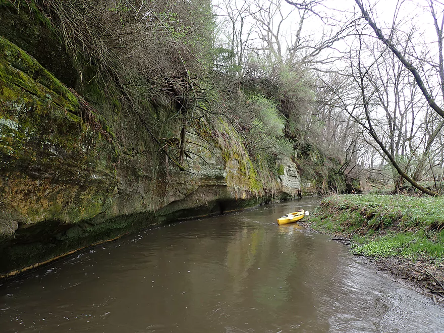
On the left is a large cave
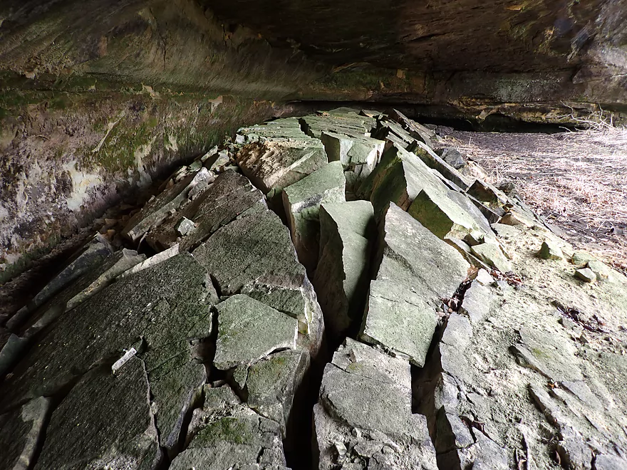
Whose floor is erupting from below
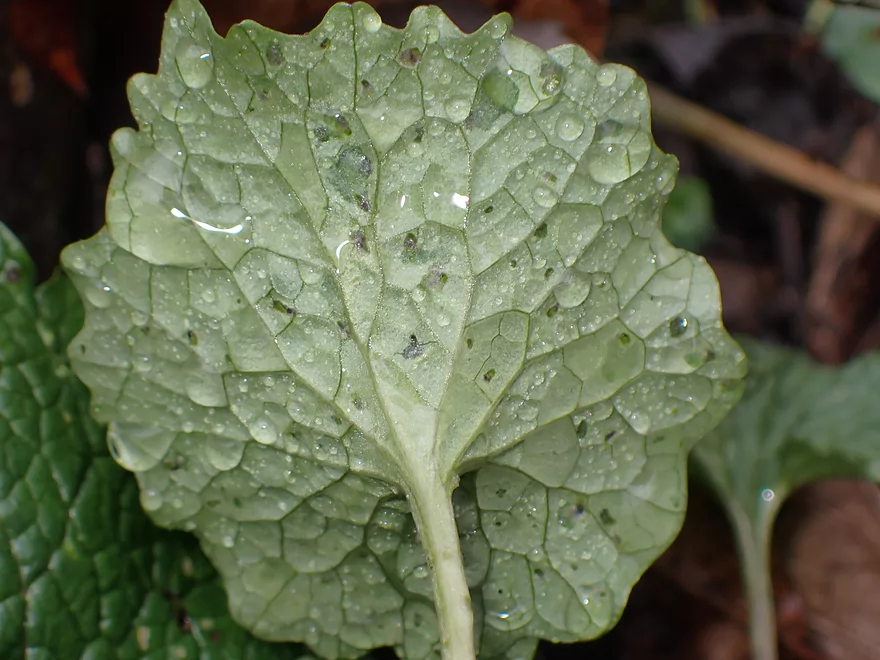
Light rain was causing everything to get wet
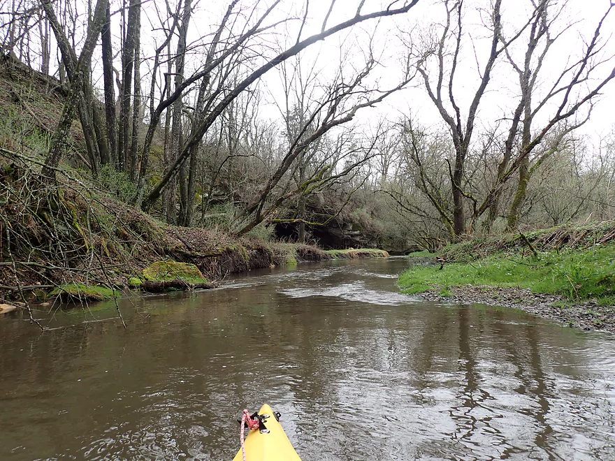
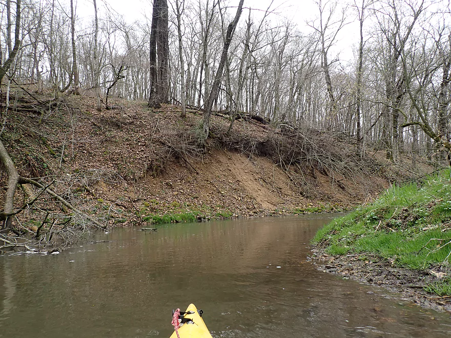
Part of a long outcrop
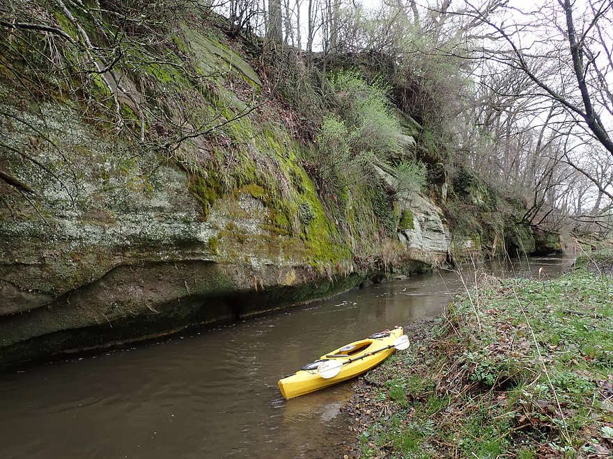
Very scenic
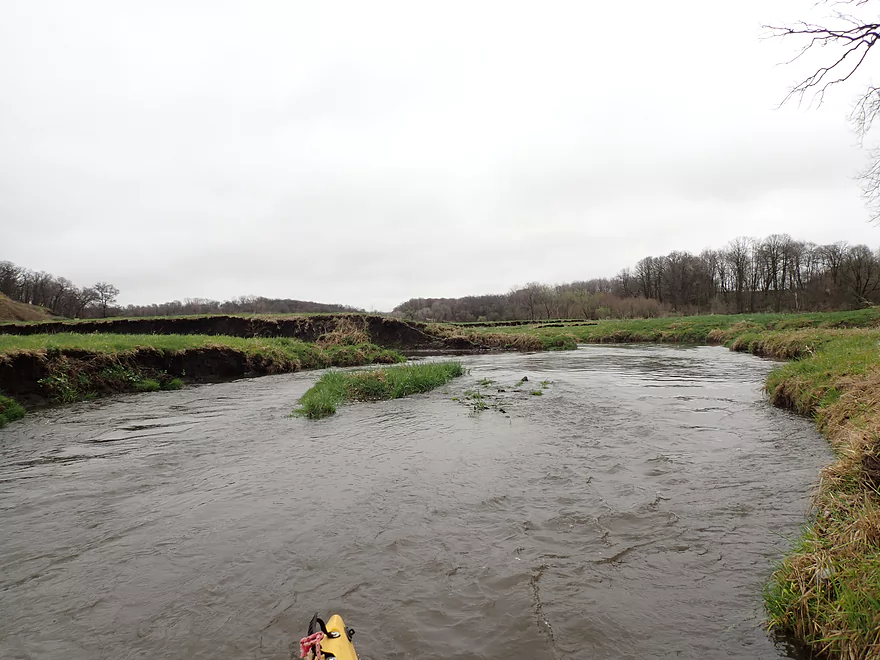
Laxey Creek starts to open up
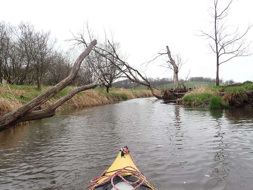
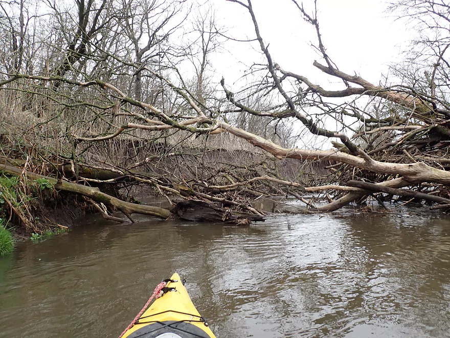
First logjam portage
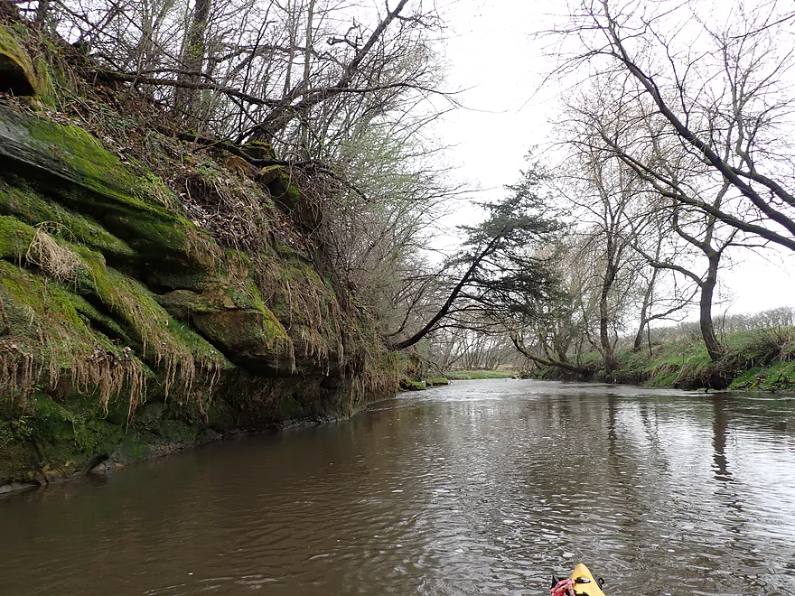
Nice outcrop
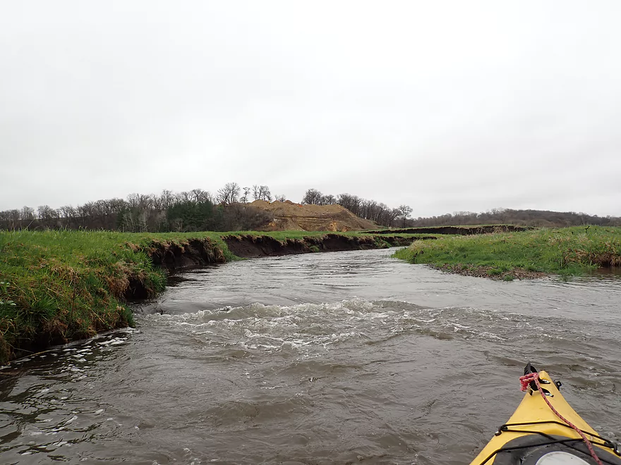
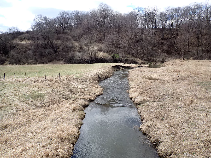
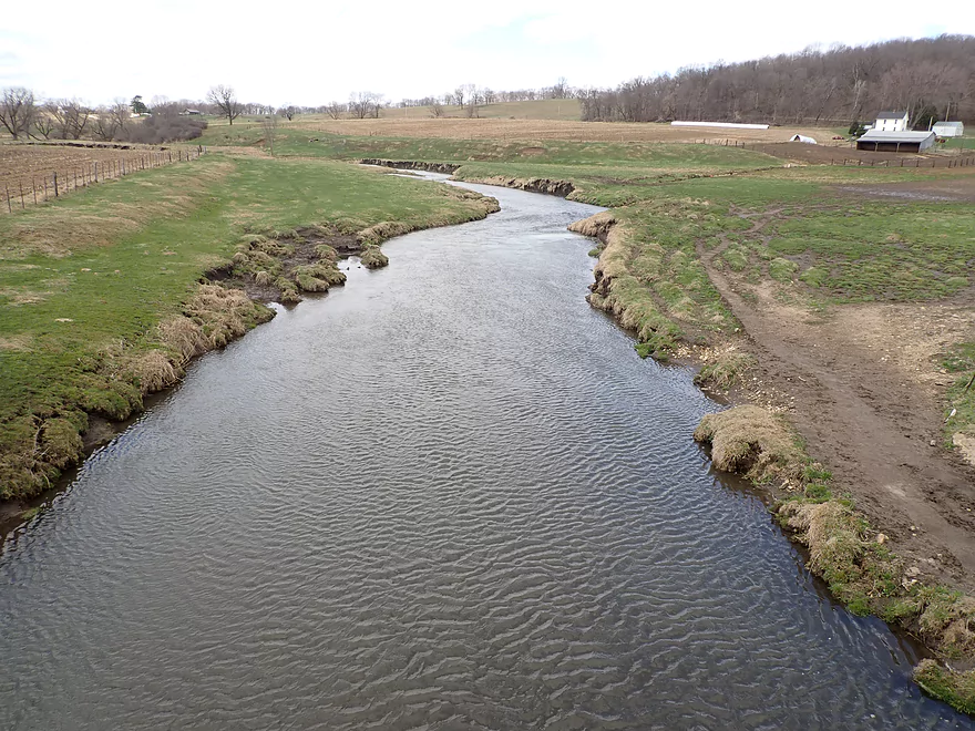
Sudan Branch (left) joins Laxey Creek (right)
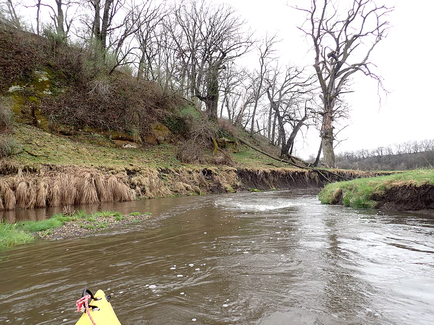
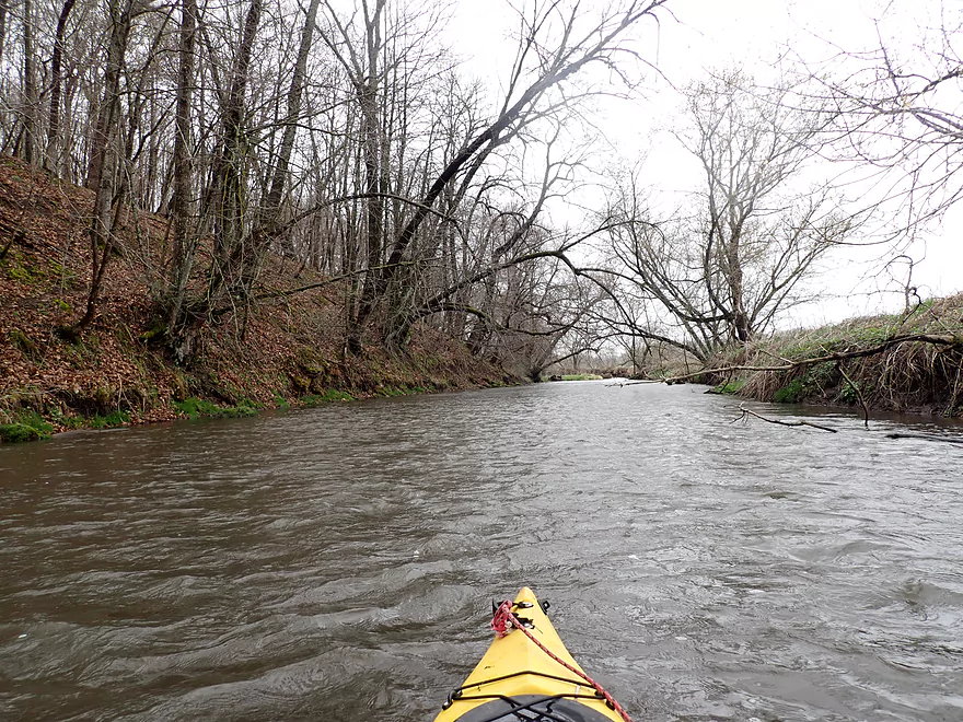
Some rapids on this trip (only Class 1 though)
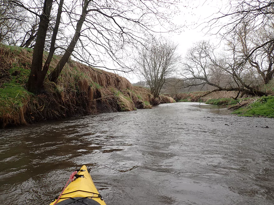
This stretch looks like it has been artificially straightened
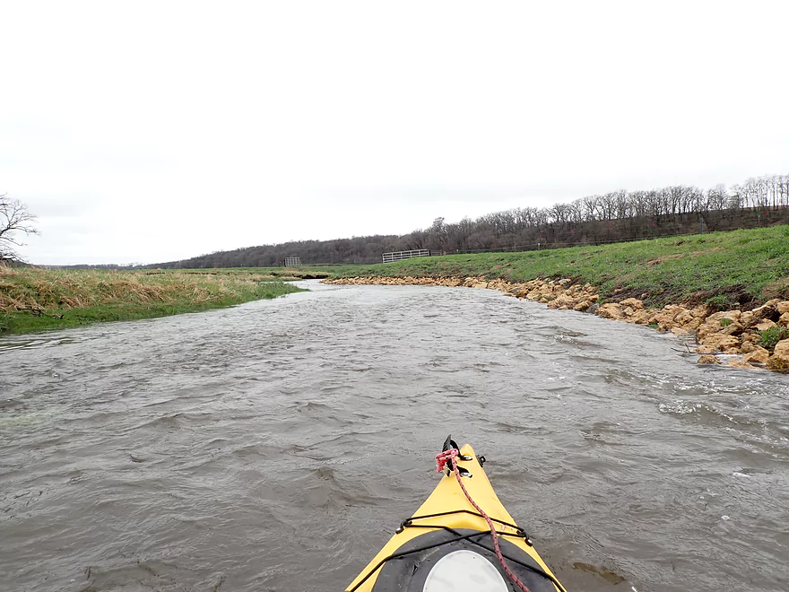
Lot of pastoral scenery in the first mile
The hills and everything here are heavily grazed
Another outcrop
I was able to hop over this fence
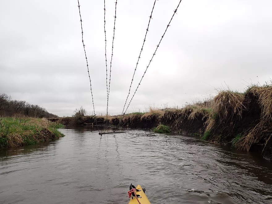
And duck under this one
This I easily lifted over my head
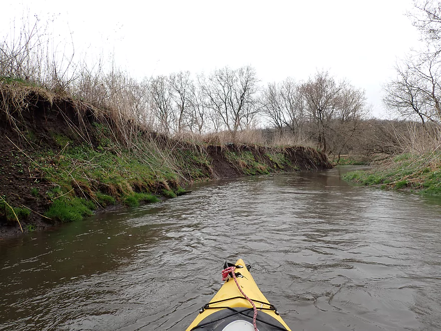
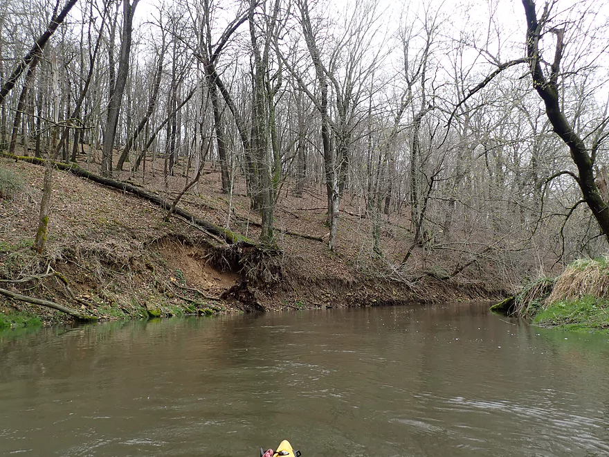
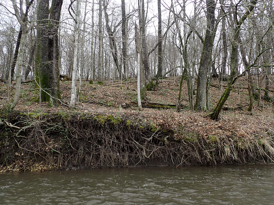
Bank erosion was a big problem
Example of a jam I was able to sneak over
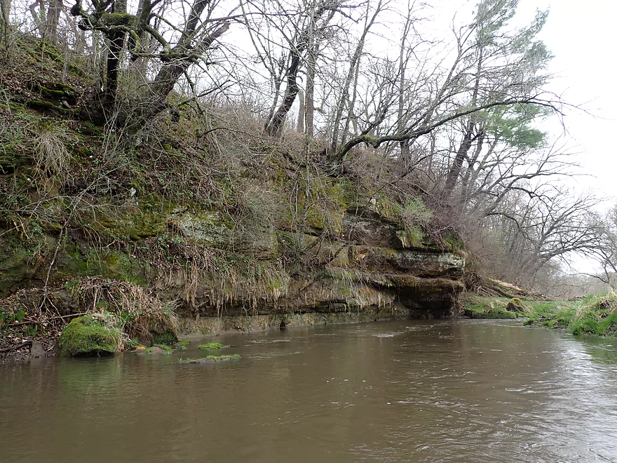
Another nice outcrop
A lone red cedar
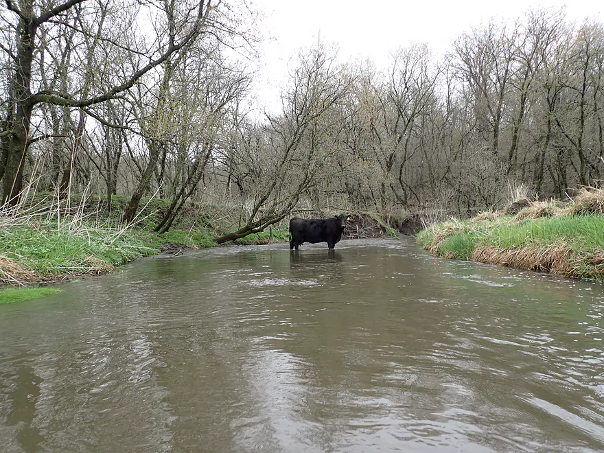
Cow blocking my route
Another outcrop
Reverse view
This was a difficult logjam–I barely sneaked through
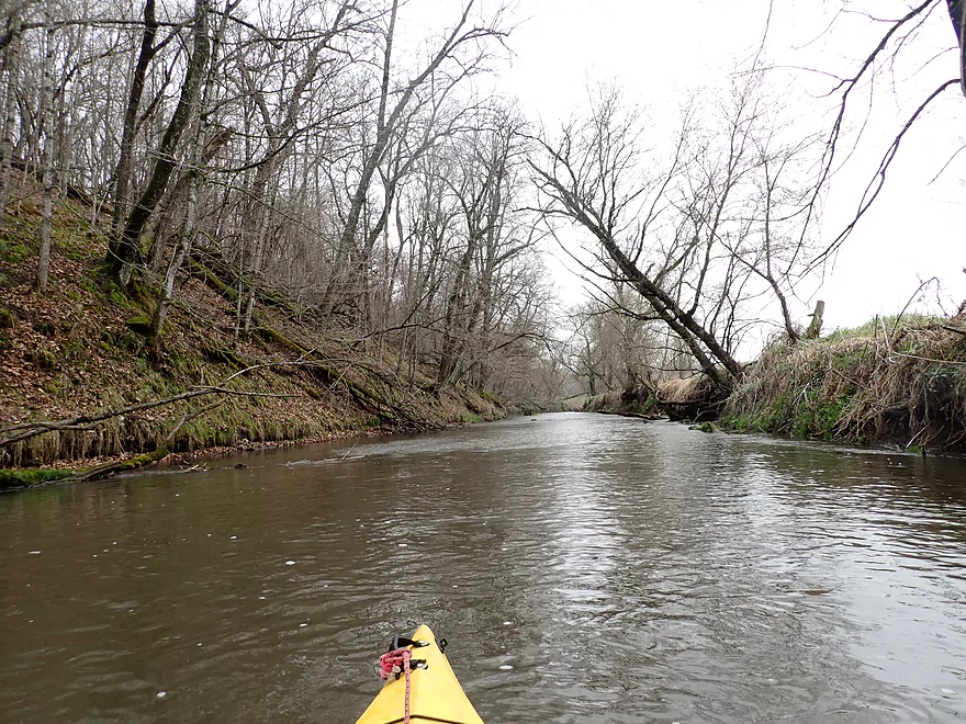
More fast current
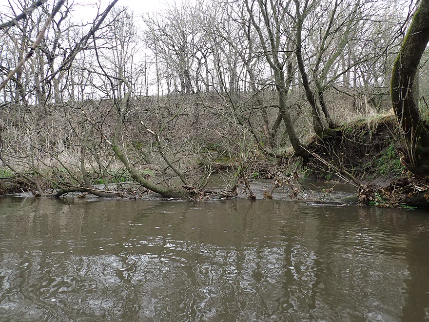
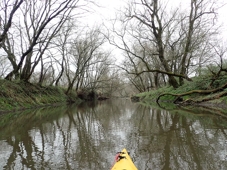
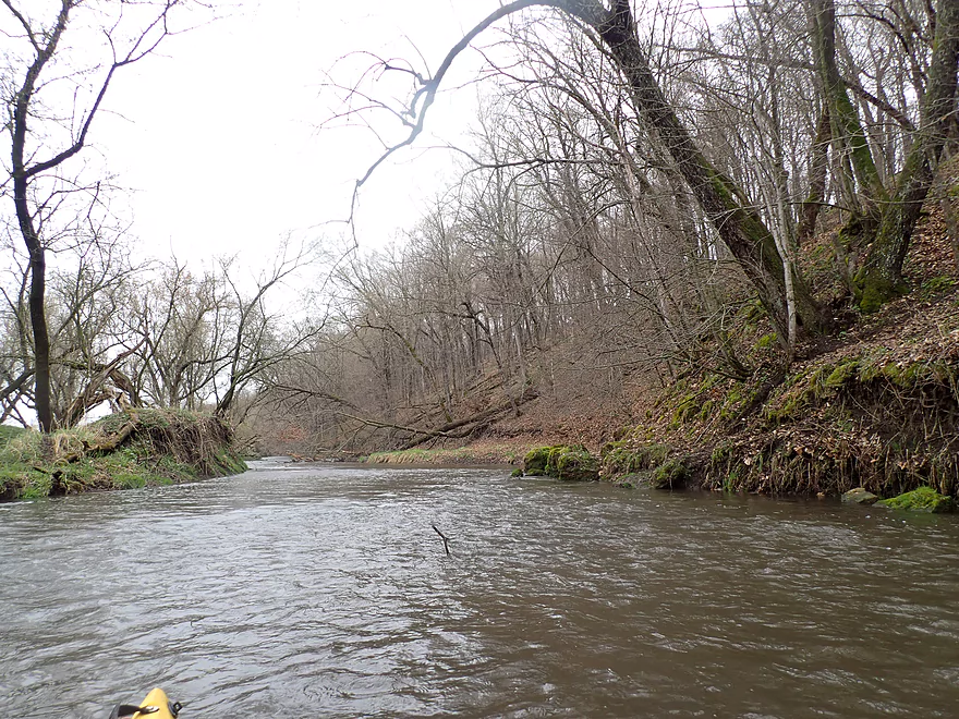
Entering a more wooded stretch
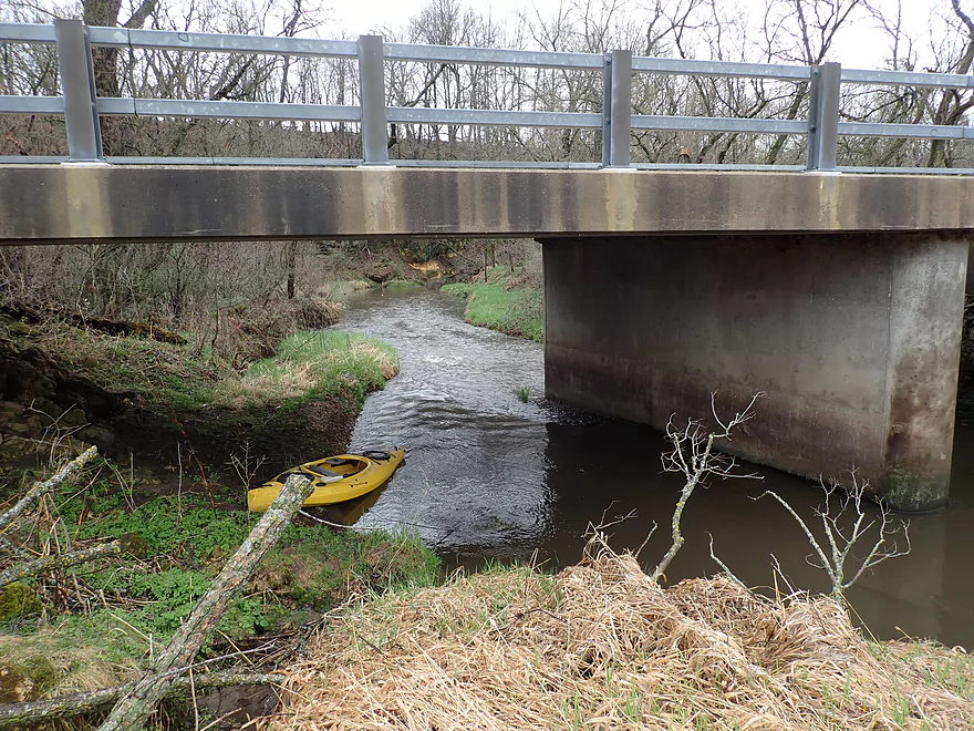
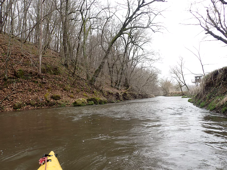
Approaching Hwy E
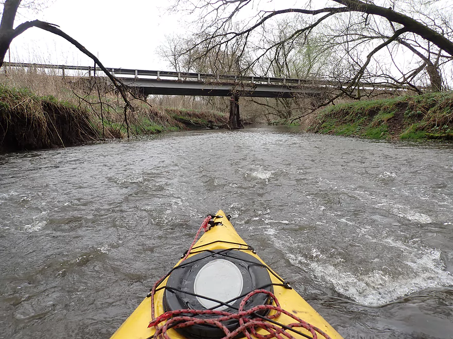
This is a decent bridge access option
But I’m continuing on
Fence marks the start of a long bluff
Scenic rapids
Reverse view
Another fence I was able to hop over
Exposed clay banks
An easy portage
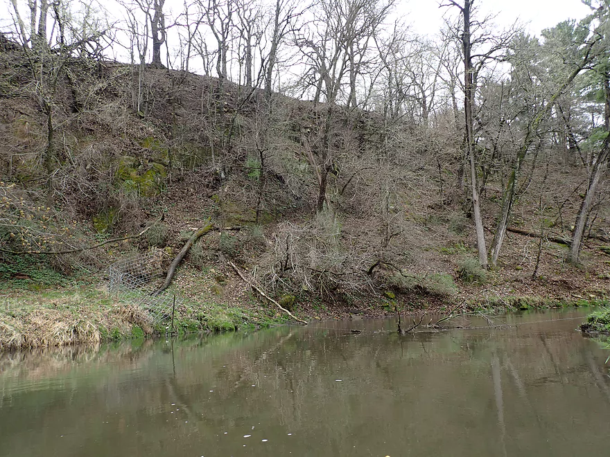
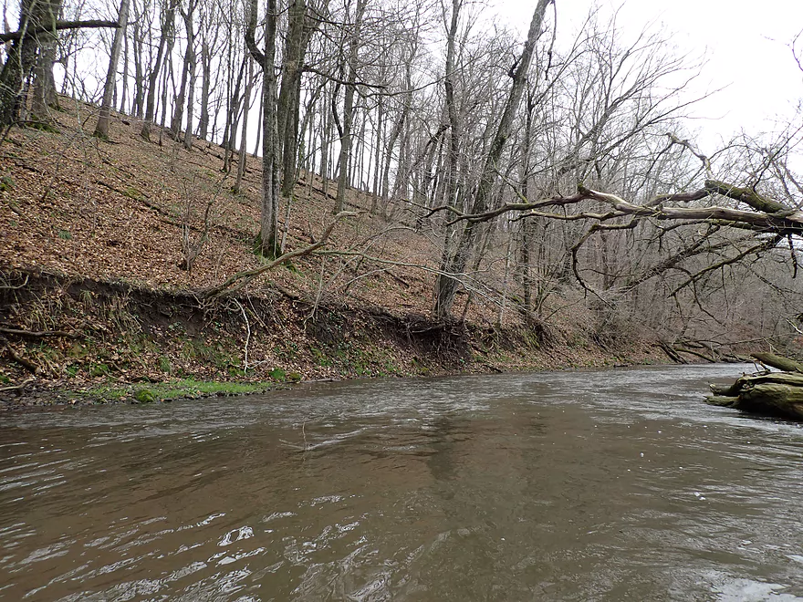
Part of a very long south bluff
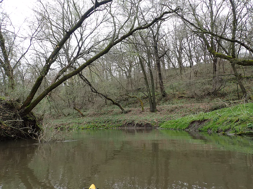
Nice woods…would be a good fall paddle
Neat scene
Taking out at Harker Station Rd
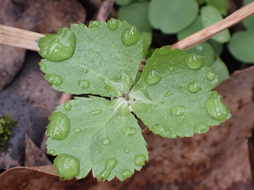
Raindrops on a new spring leaf
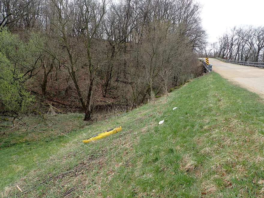
A bad take-out because of the steep banks
Scouting Hwy 39…looks nice outside of the local fence
Scouting Lost Grove Rd…bad access because of a fence
Pecatonica River – Sudan Branch


The Pecatonica River is Southwest Wisconsin’s largest watershed and contains many branches and tributaries. Most are relatively unknown and mysterious to paddlers. One of which is the “Sudan Branch” located west of Mineral Point. I had scouted it two weeks prior and it looked really intriguing. But it also looked a bit shallow, so I put it on my “high water todo list”.
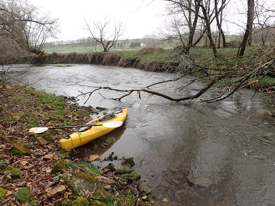
My initial plan was to launch at Hwy 39 on Laxey Creek. But given the cold weather and light rain, I decided to scrap those plans and launch instead at a downstream bridge (Cave Rd). Technically this too was “Laxey Creek” which wasn’t super big but was suitable for paddling.
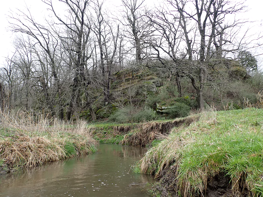
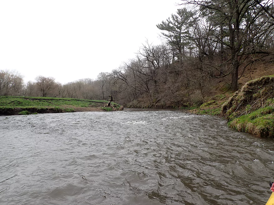
Just downstream from the bridge I was greeted by some light rapids and a long rock wall. Along the south shore was a wide cave (which explained the nearby road’s name). I got out to explore and was pretty impressed by the scene. At the base of the cave was a long block of shattered rock. It was if a giant fist had punched the ground…but from below. I’m sure there is an interesting geological backstory to this cave. Back on the creek, I continued downstream past a ~500′ long rock wall before Laxey Creek started to open up.
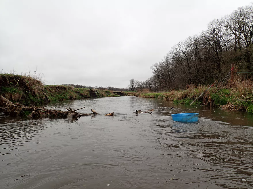
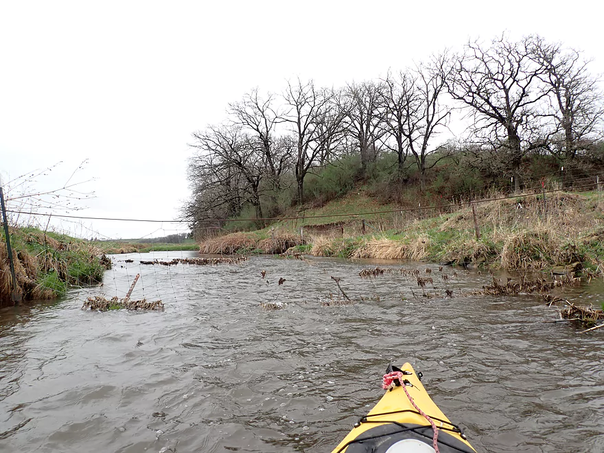
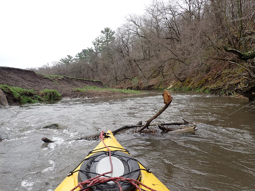
Shortly after, I encountered my first logjam. This had me a bit rattled as I worried it would be the first of many, and I wasn’t in the mood for many portages given the cold weather and light rain. Thankfully it would be just one of only three serious logjams for the trip, and its portage wasn’t difficult.
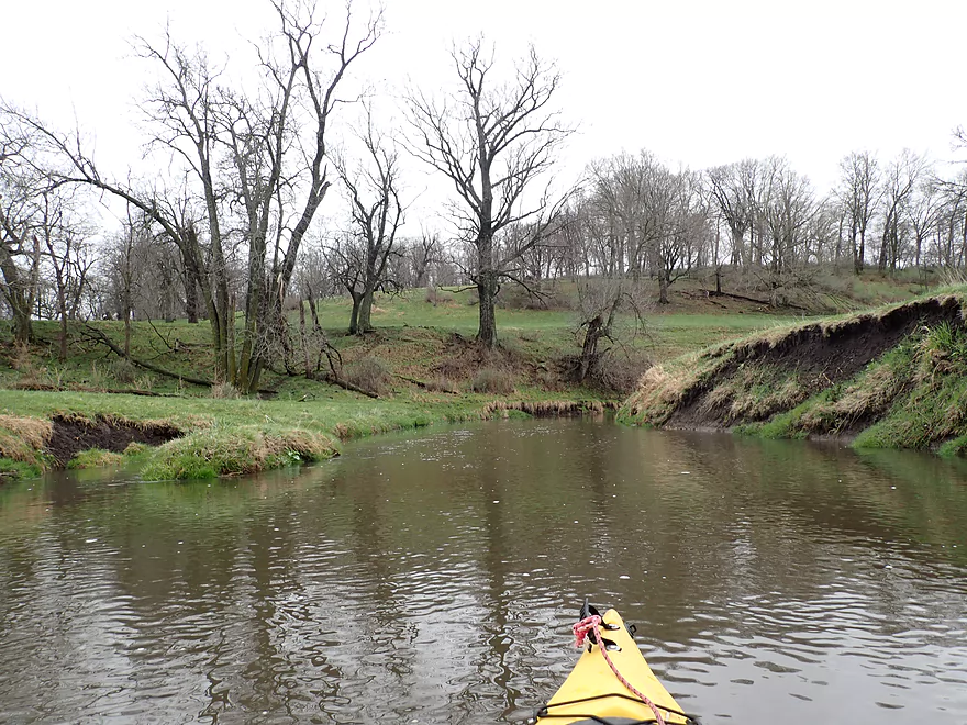
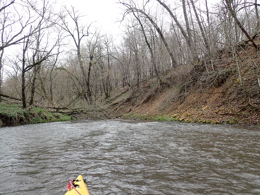
Up ahead I encountered my second outcrop which was shaped like an oversized “birthday cake”. Seeing the solitary plateau surrounded by open and flat pastures suggested another interesting geological backstory but I couldn’t guess as to what that was. Laxey Creek would wrap around the base of this outcrop and be joined by the Sudan Branch which roughly doubled the size of the river.
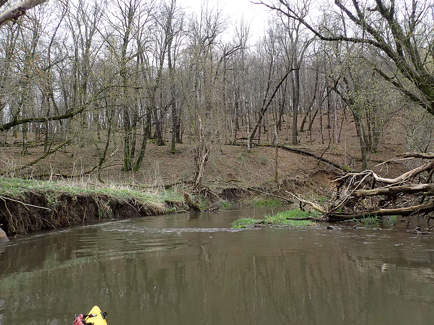
The next mile or so was “pasture country”. Here the river was open and flowed swiftly around tight muddy oxbows. The shores were well-grazed and heavily eroded by cows. Topsoil erosion was a big problem here (and really is for the entire Pecatonica watershed). This resulted in large and unsightly mud banks.
One of my major concerns for this trip was the possibility of dealing with problematic fences. These often occur in areas where farmers allow their cattle in the river. Unlike most of Wisconsin, in the southwest part of the state fences can be quite common and are sometimes a serious impediment to paddlers depending on how low they are. For this trip I did encounter three fences upstream of Hwy E, and two downstream. Most were not difficult, but one required a bit of a low limbo to get under. With fences come cows and a I saw a few that who found me perplexing. One cow blocked the river by standing the middle, but eventually relented and let me pass.
All this talk of fences, mud banks, and over-grazed shorelines may sound a bit dire…but the Sudan Branch was still scenic. Along the eastern shore the river played touch and go with a huge two-mile bluff. At its base were a series of sandstone outcrops, four of which I considered noteworthy.
About a half-mile upstream from E, farm fields replaced pasture, which changed the character of the river. Here the shoreline became more wooded. I encountered the second significant logjam which was kind of a big mess…but I was able to barely squeak past with some clever maneuvering.
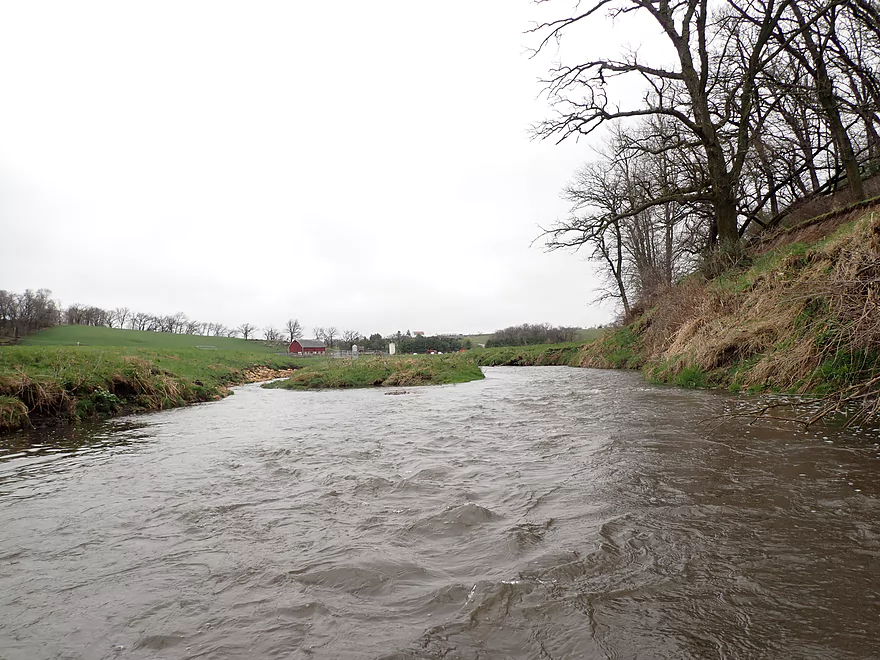
Hwy E roughly marked the halfway point in the trip. It’s not a bad access option (relatively speaking) and I initially planned to take out there, but instead decided to paddle to the next bridge as I thought that next leg could be scenic.
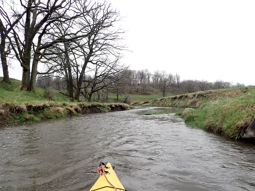
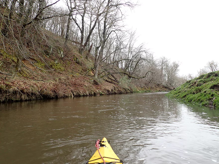
Indeed it was. The next two miles were mostly free of pasture and the river flowed by a very long and steep hillside. While this lacked the outcrops of the first half of the trip, it was actually more scenic. Here the trees were larger, taller, and further spaced apart (likely meaning they hadn’t been logged in a while). At the base of the steep hillside was a thick leaf carpet that included many maple. I kept thinking what an incredible fall color paddle this could be.
I ended the trip at Harker Station Rd which was a bad take-out (too steep + no parking). But…it was IMO better than the next bridge at Lost Grove Rd (partly fenced in + close to a farm).
In summary this trip was a mixed bag. I almost gave it four stars, and the bluff in the second half of the trip was fantastic as were the six outcrops upstream of E. And of course there was the really cool cave. But I just couldn’t rate it too high because of the stupid fences, the few logjams, and the unsightly mud banks. This is more of a trip for adventurous paddlers that don’t mind a little adversity. Hopefully the locals will spruce up the river in the future and it will be made into a more viable water trail. If you do this trip, I suggest doing it in early spring or later fall otherwise tree leaves will block some of the best scenery.
Sights included ducks, geese, muskrats and cows. The highlight was a very plump groundhog I spotted at the take-out. I suspect he had a den under the bridge.
Cave Rd: This wasn’t a bad bridge access.
Alternate Put-ins:
- Hwy 39: 1.8 miles upstream from Cave Rd. Access to the river from Hwy 39 is partly blocked by a fence, but there is a gap and this is otherwise not a bad access. This leg is a nice prospect with maybe one logjam and one outcrop.
Harker Station Rd: This was a bad bridge access. Practically speaking there is no room to park or leave your car and I had to double park to load up my boat. Also the shoreline here is quite steep which requires strenuous effort to get your boat from the water to the road.
Alternate Take-outs:
- Hwy E: 2.0 miles upstream from Harker Station. This is a suitable bridge access, but taking out here leaves off a really scenic part of the trip.
- Lost Grove Rd: 1.8 miles downstream from Harker Station. This is a bad bridge access. It’s close to a farm and heavily grazed. Fences mostly block access to the river, but there is a gap in the southwest corner.
Harker Station Rd to Cave Rd: 4.4 miles with 249′ of ascent. This is a very hilly shuttle which includes a strenuous climb of over 200′ over a mile long hill.
Fences: There are three fences upstream of E and two fences downstream from it. Most are in poor shape and relatively easy to get past. One required some low ducking to get under. A map with fence locations can be seen here.
Logjams: There are two significant logjams upstream of E and one minor logjam downstream from E. Click here for a map of locations.
Rapids: This river is mostly pool and riffle with a number of light rapids. None of which I consider serious or over Class 1.
Strainers: There were a few minor strainers, but I don’t recall this being a major issue on this trip.
Closest Gauge: Pecatonica River @ Darlington
Trip Depth: 350 CFS.
Navigability Estimates: Parts of the Sudan Branch (and especially Laxey Creek) likely are often too shallow for enjoyable paddling. The gauge I’m referencing in Darlington is ~30 miles downstream and likely not super accurate. All that said, the following are my best guesstimates.
- 0-200 CFS: Likely too shallow.
- 201-300 CFS: Perhaps doable but could be quite bumpy.
- 301-500 CFS: A good target range. Water quality will get pretty bad at this depth. The highish water should allow you to get over several downed trees and low fences.
- 501-700 CFS: The river is pretty high. You should only paddle it if you really know what you’re doing.
- 701+ CFS: The banks may partly overflow at this point. Only suitable for expert paddlers.
Did you know the Pecatonica River has a ridiculous number of branches? Can you name them all? A surprising number are navigable and I’ve already done a handful (see my trip map).
Complete List: Ames Branch, Blue Mounds Branch, Bonner Branch, Cottage Inn Branch, Dodge Branch, East Branch, Gribble Branch, Jones Branch, Livingston Branch, Mineral Point Branch, Mud Branch, Pleasant Branch, Ridgeway Branch, Simons Branch, Vinegar Branch, Williams Branch, and Wood Branch.
Click here for an overview map.
- Hwy 39 to Cave Rd: 1.8 miles. Mostly open, but maybe one logjam. Technically this is Laxey Creek. Maybe one outcrop. Hwy 39 has a fence to get through which is doable.
- Cave Rd to Harker Station Rd: 4.9 miles.
- Cave Rd to Confluence on Sudan Branch: 0.6 miles. A great stretch with two nice outcrops and one cave. There is one fence/logjam combo, but it wasn’t a difficult portage.
- Note, upstream of the confluence, Laxey Creek (what I paddled) is more navigable than the Upper Sudan. The Upper Sudan (upstream of the confluence) is likely too small and has too many fences to be navigable.
- Confluence to Hwy E: 2.3 miles. A good stretch with 5 outcrops, but also three fences and one significant logjam.
- Hwy E to Harker Station Rd: 2.0 miles. A very scenic along a long bluff. There are two fences and one logjam to deal with. Harker Station Rd is a bad access (because of a steep embankment).
- Cave Rd to Confluence on Sudan Branch: 0.6 miles. A great stretch with two nice outcrops and one cave. There is one fence/logjam combo, but it wasn’t a difficult portage.
- Harker Station Rd to Lost Grove Rd: 1.8 miles. I estimate 2 outcrops, 2-3 serious logjams and 2-3 fences. Lost Grove Rd is a bad access (because of a farm fence).
- Lost Grove Rd to Confluence on Mineral Point Branch: 4.8 miles. Very open with maybe 1 logjam and 7 outcrops. A very good prospect that I would have done already if not for the bad put-in and difficult bike shuttle.
- Confluence to Oak Park Rd: 3.0 miles. A solid prospect with one likely outcrop.
Trip Map
Overview Map
Video
Photos Size: