
Welcome to Otter Creek
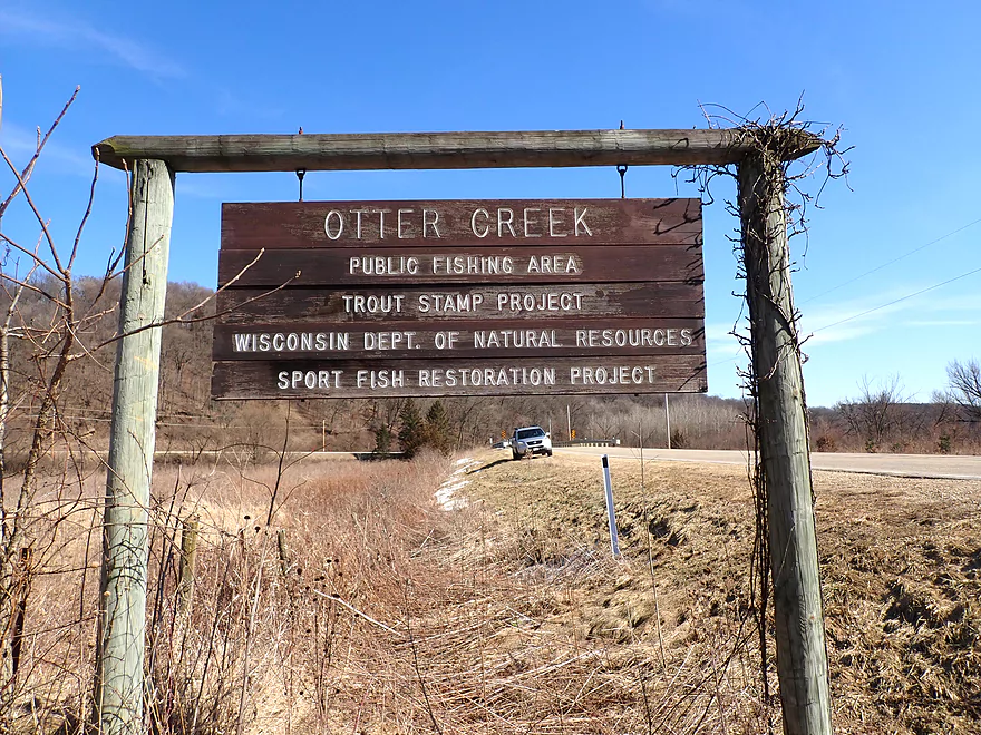
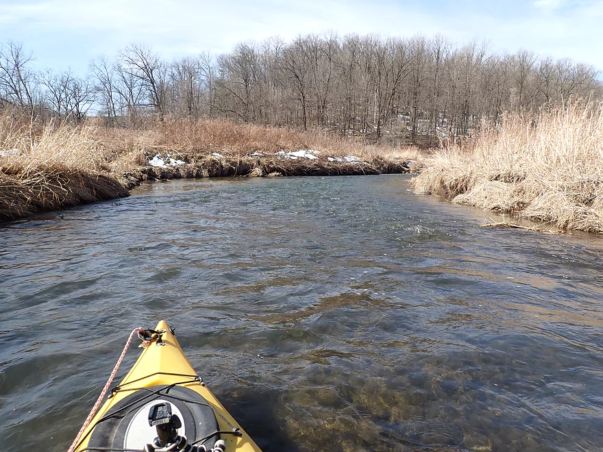
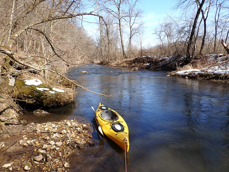
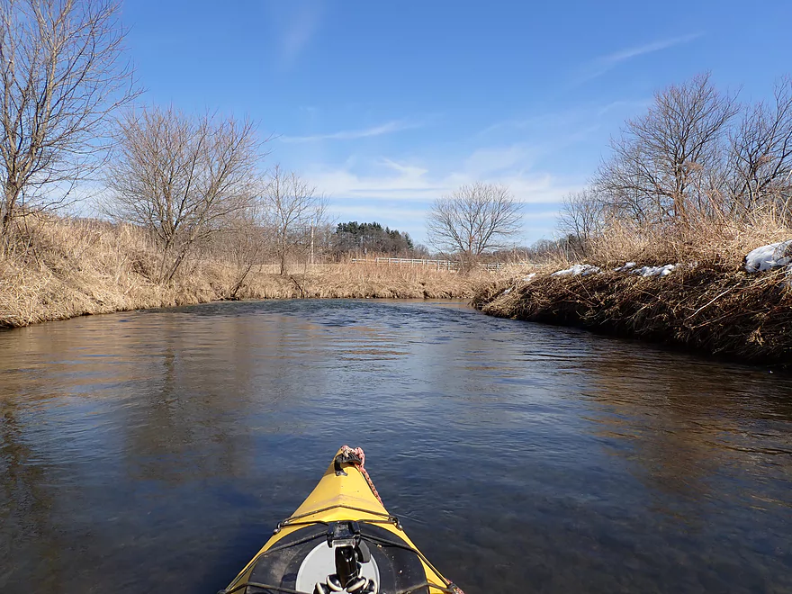
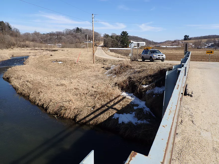
Starting the trip at Hwy Q
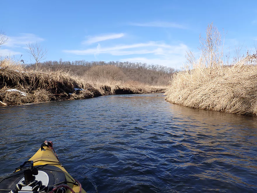
Convenient access
Nice open grassy area to start
Part of a public fishing corridor
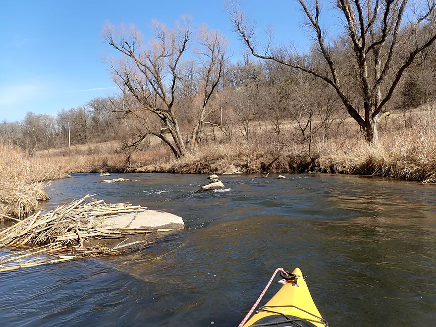
Small boulder garden
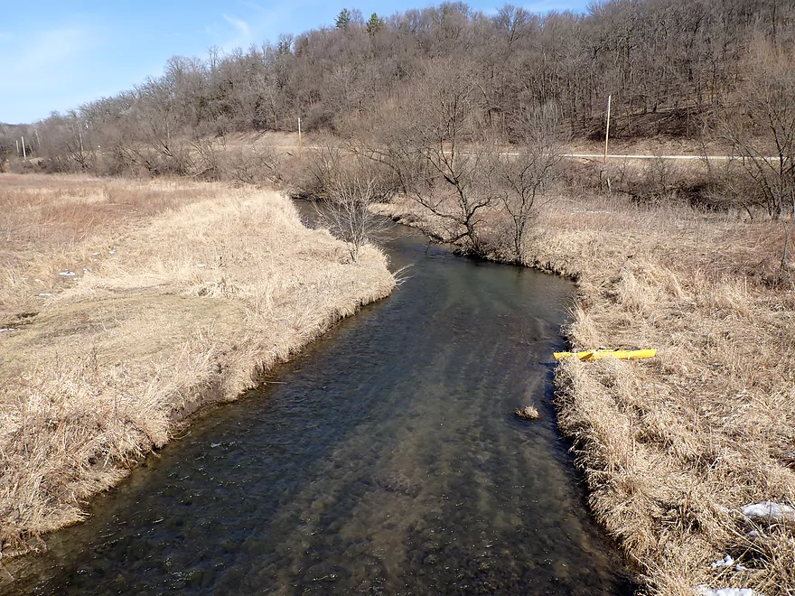
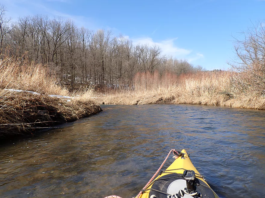
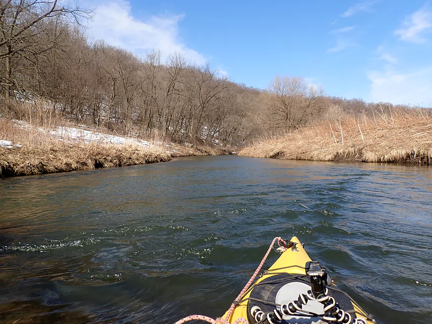
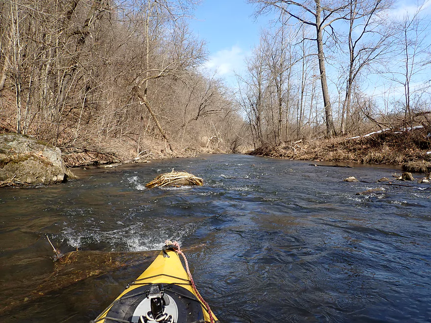
This is a fast creek
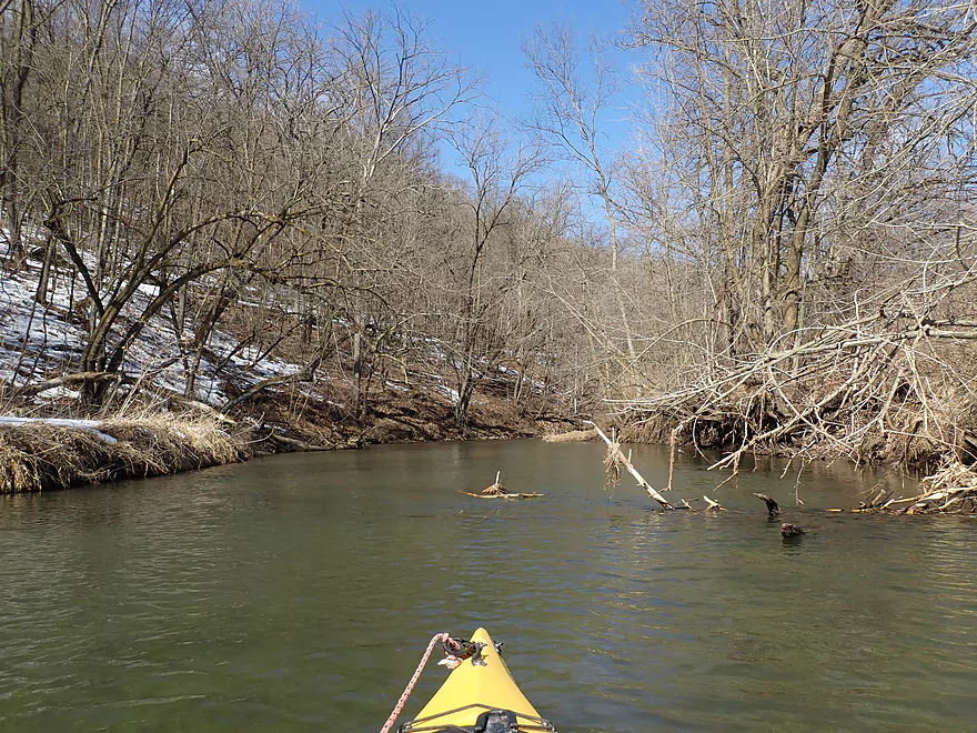
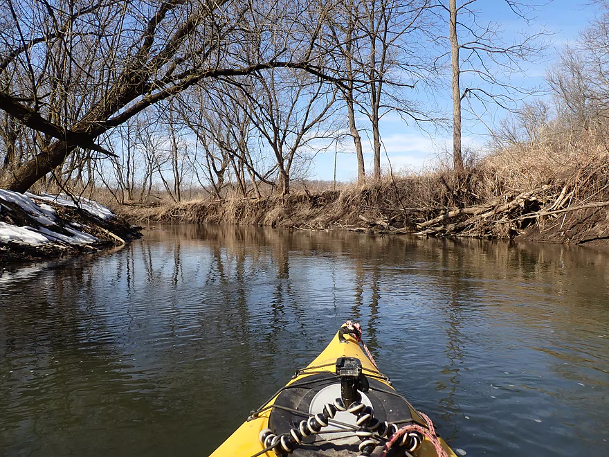
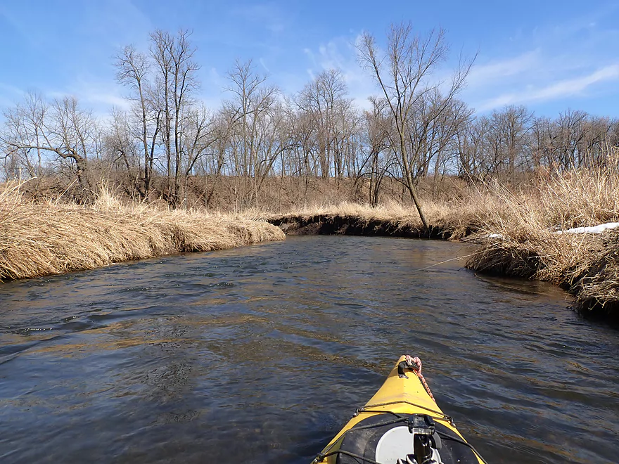
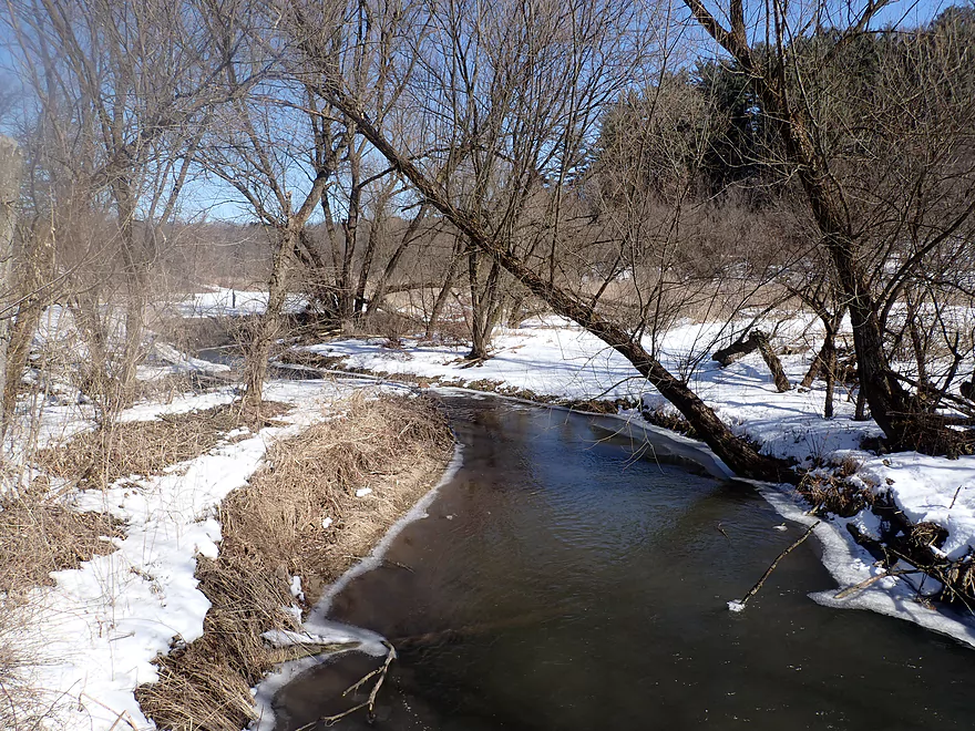
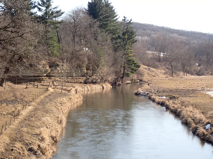
Coming up on a steep bluff
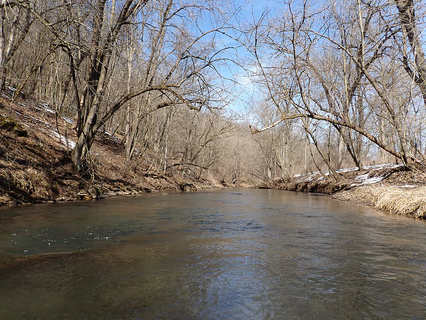
The nicest part of the trip
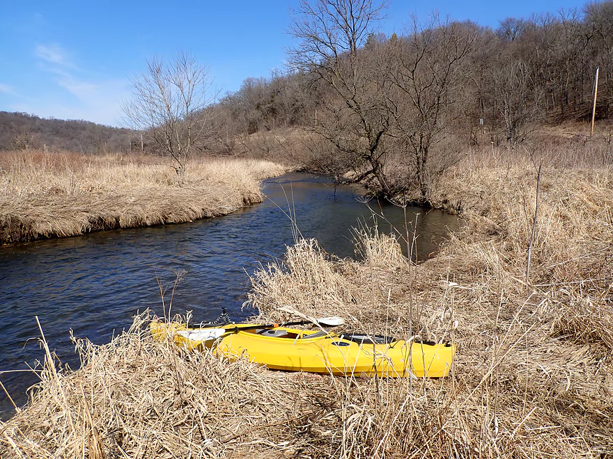
Getting out to explore…
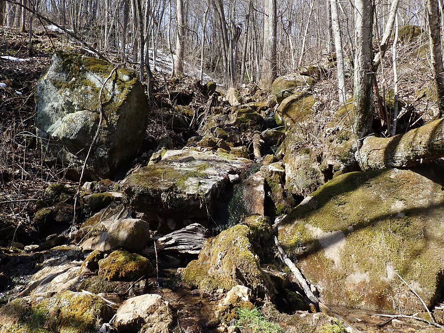
A natural spring
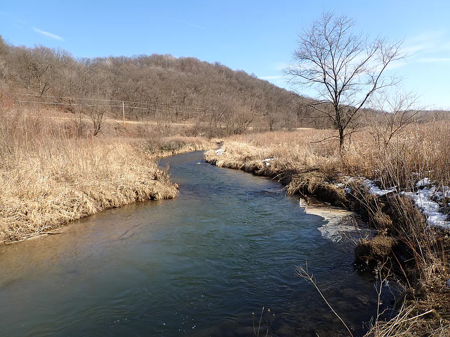
Very scenic area
Tumbled boulders lying in the creek
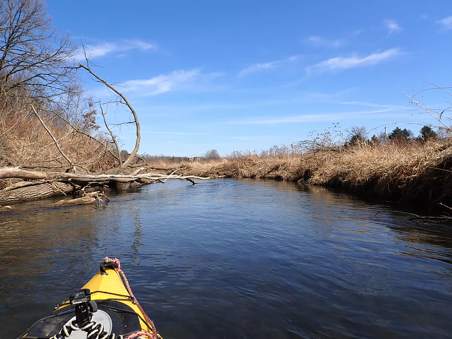
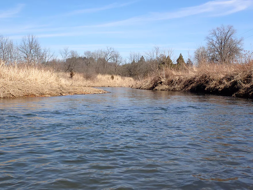
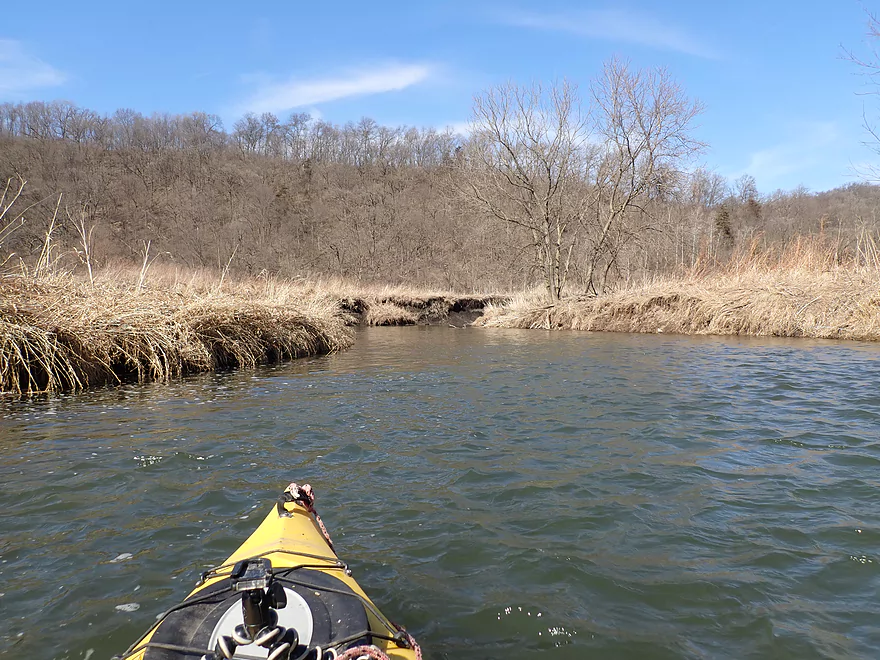
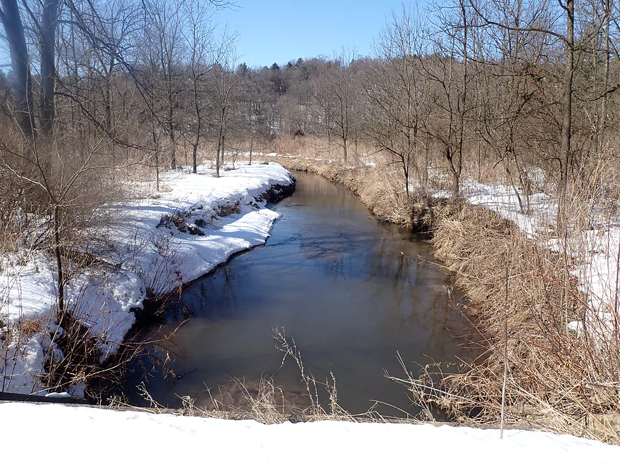
Creek starts to open back up
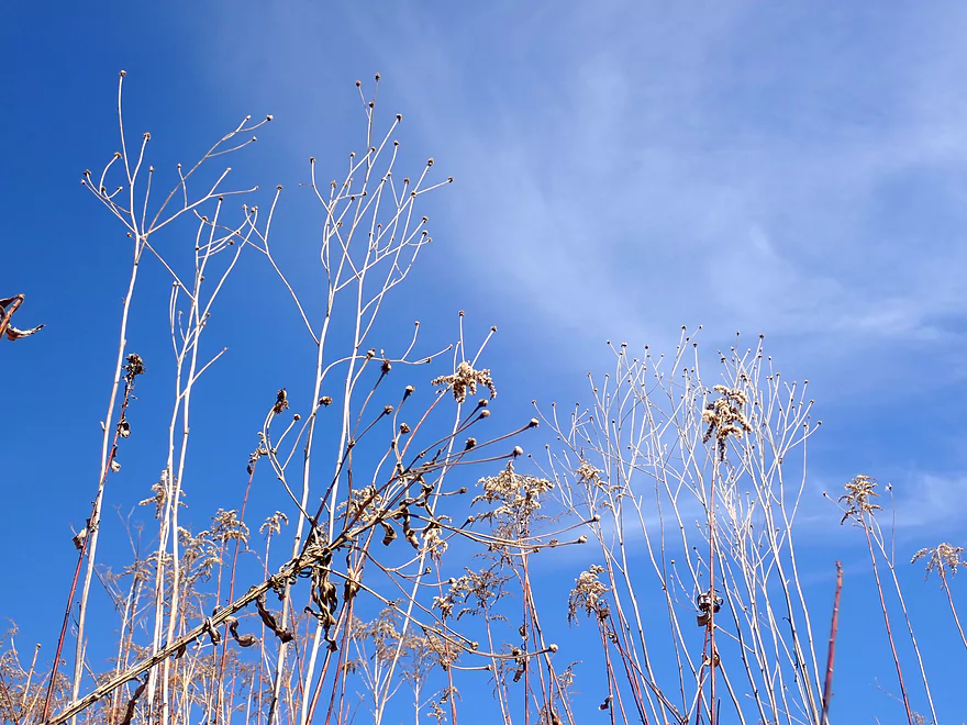
Goldenrod skeletons
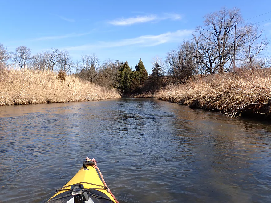
Approaching another hill
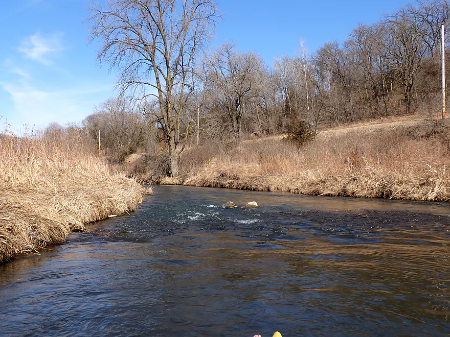
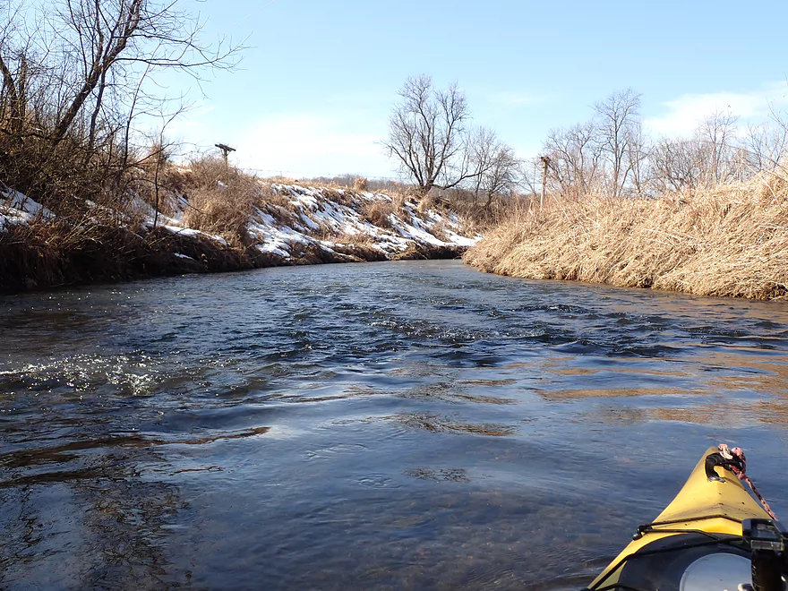
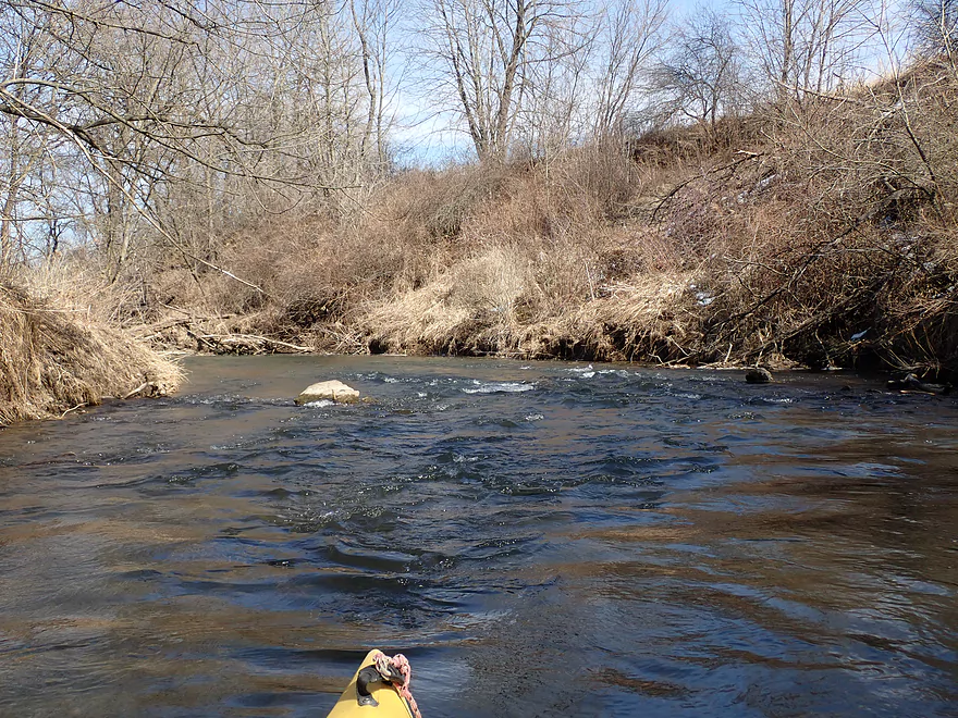
Zippy rapids
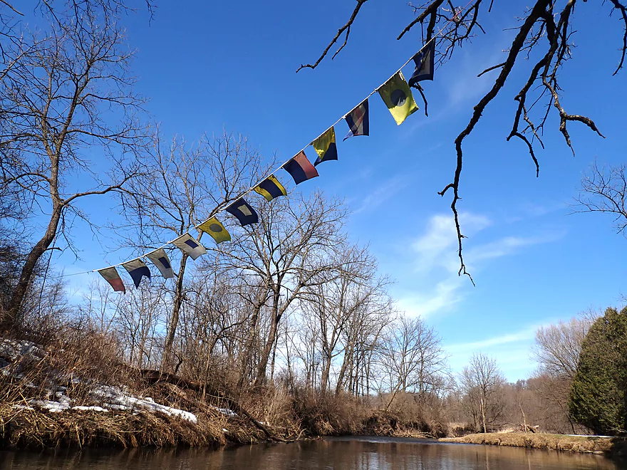
Not sure what these flags meant, but they looked cool
One of the shallower parts
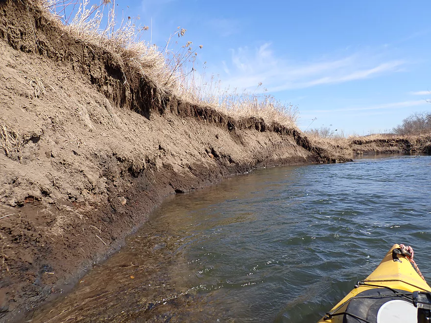
Creek getting a bit muddier
Mud banks starting to grow
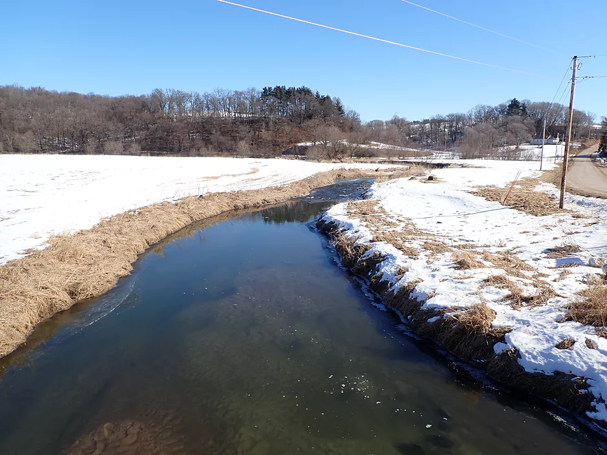
Still quite a bit of snow
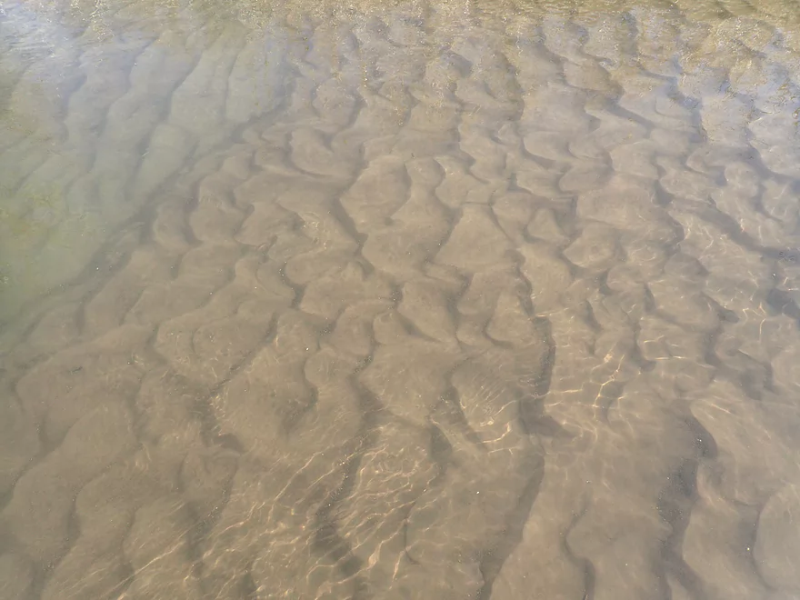
Good clarity and sand (there is likely sandstone on upstream legs)
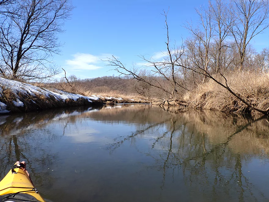
Attractive reflections
Driftless hills in the background
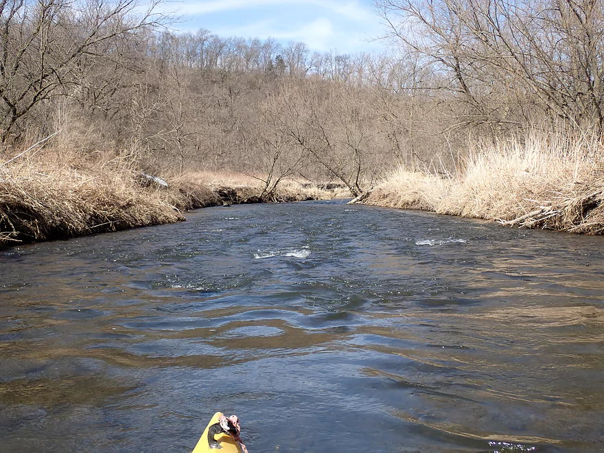
Some of the faster rapids
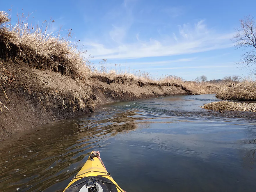
Some of the bigger mud banks
These are nothing compared to those much further downstream
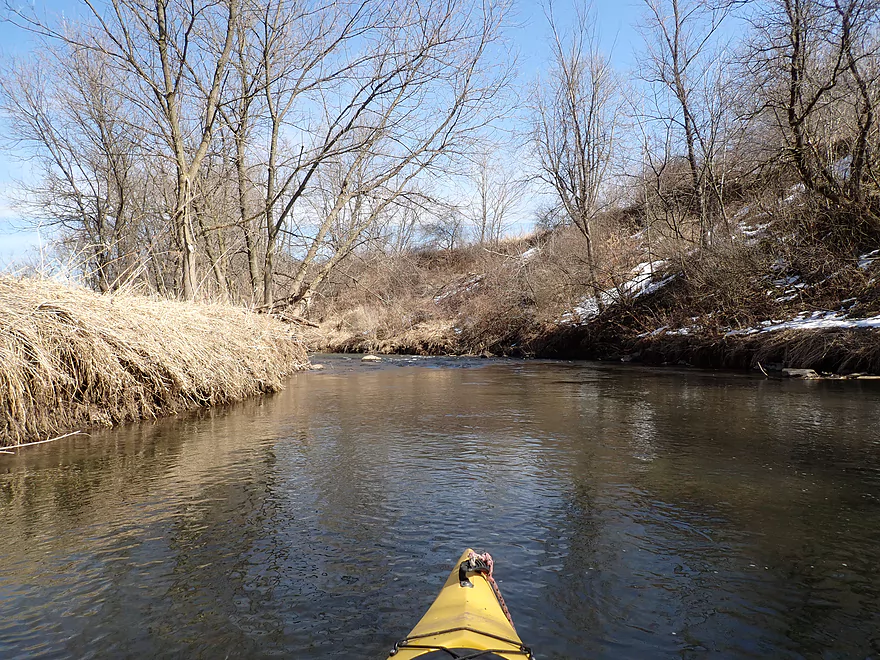
Still rugged
Final turn
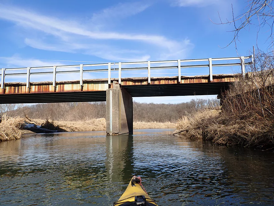
Hwy II
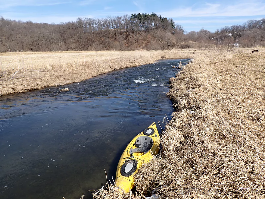
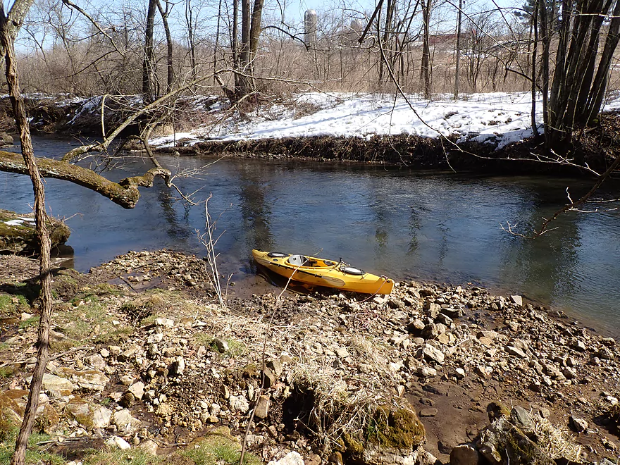
Getting out just above the rapids
Take-out is tricky but doable
Looking downstream from the bridge…a future paddle
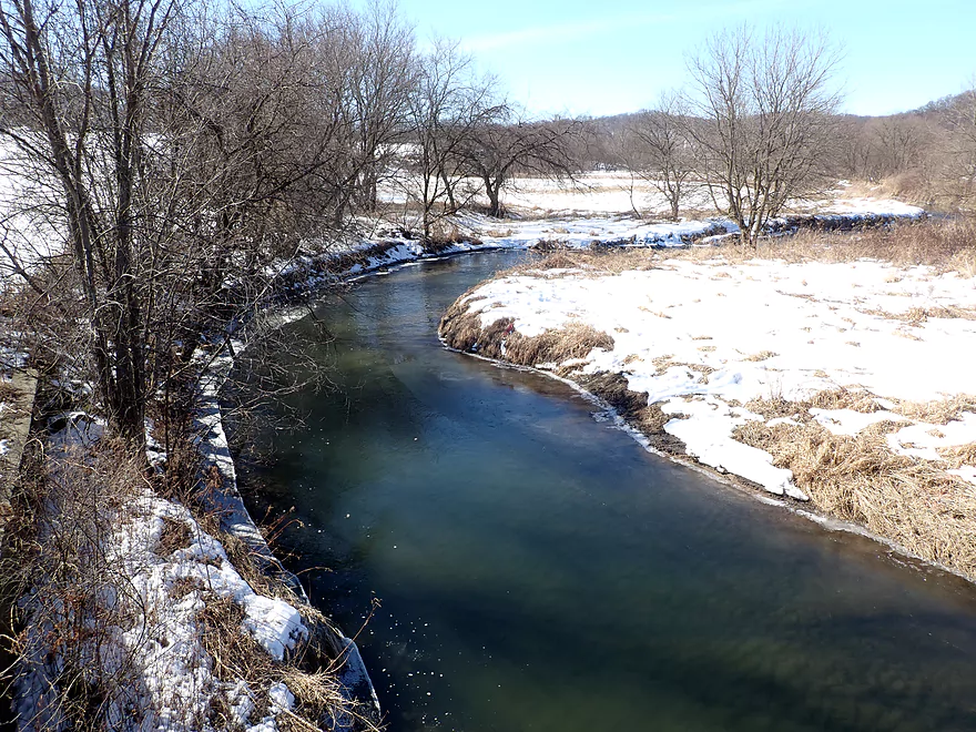
Scouting more of Otter Creek…this is Union Valley Rd
The view from the next downstream Union Valley Road bridge
Cave Hollow Rd (great access here)
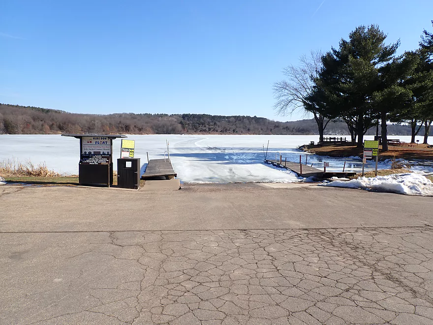
Blackhawk Lake
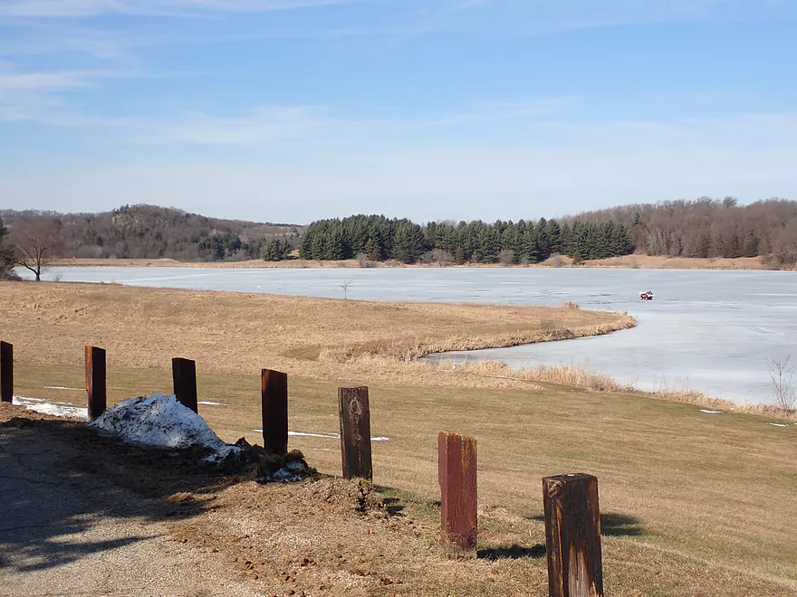
The north shore is scenic
Plank Rd and the dam (great access here)
Spring Valley Rd
Hwy C (very difficult access)
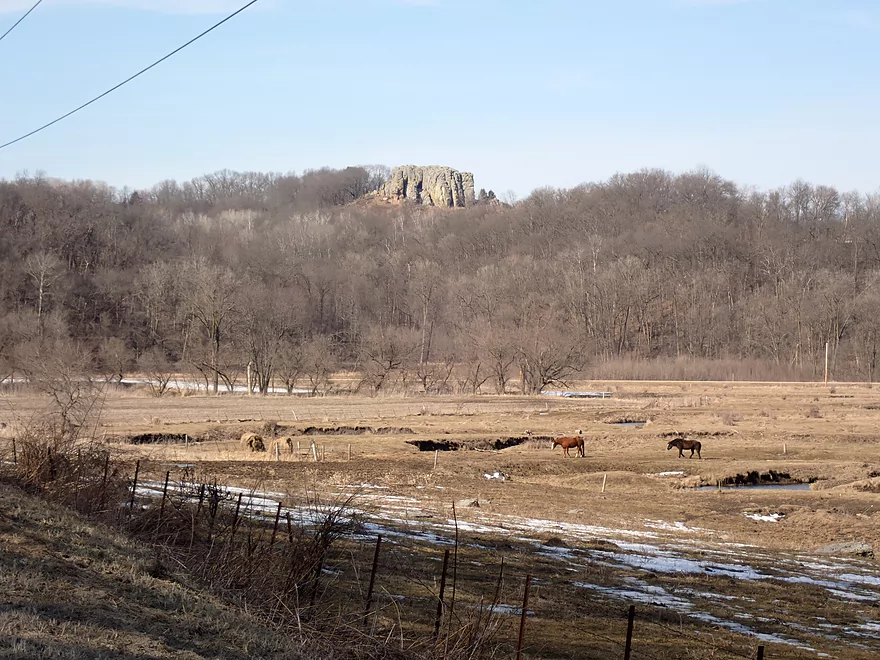
Pompey’s Pillar…a local landmark
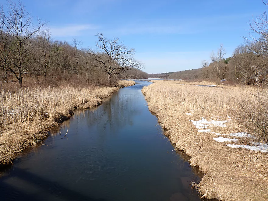
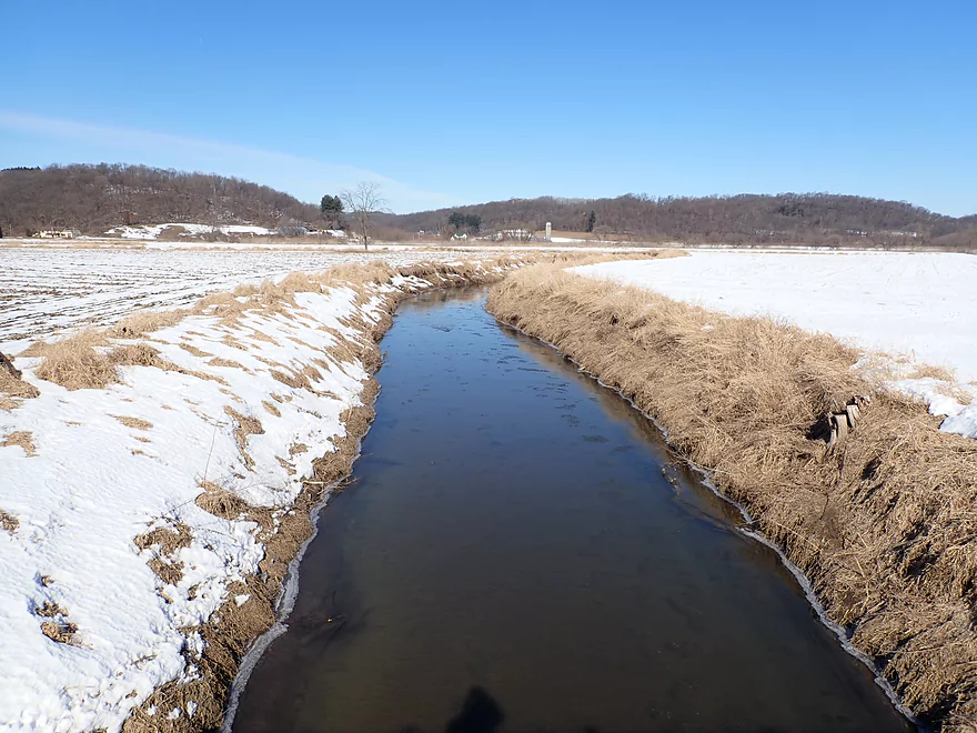
Otter Creek – Hwy Q

Otter Creek is an obscure driftless stream located about 5 miles west of Governor Dodge State Park. Coming from Spring Green, I had driven over the creek’s lower portions multiple times, but always had dismissed it as a cow country paddle because of its tall muddy banks, logjams and cow fences. Recently however I scouted upper Otter Creek and was pleasantly surprised to see how clean and inviting it was. Otter Creek was quickly promoted to the top of my long paddling todo list and would become my inaugural paddle for 2020.
My initial plan was to paddle part of the creek and adjacent Blackhawk Lake, but unfortunately the lake was completely frozen over. Instead I rolled the dice on a short leg from Hwy Q to Hwy II. This part of the creek is frequented by local trout fishermen and sits adjacent to several public easement corridors. In my experience good trout streams = good paddling creeks…as often fishermen clear out logjams to prevent water from stagnating and losing oxygen.
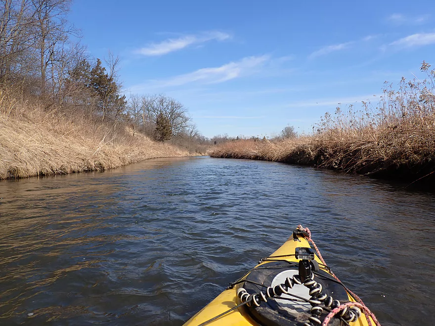
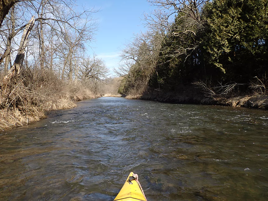
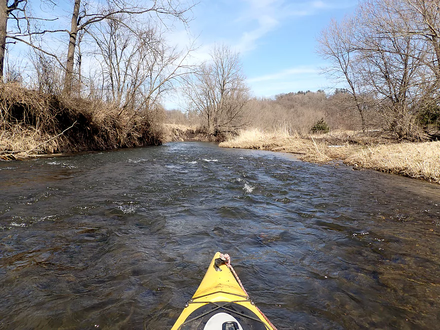
The trip got off to a great start with fast current, clean banks, and surprisingly clear water. In the first mile there wasn’t that much mud, and the substrate had a nice rocky bottom. There were many light rapids that were good fun and never dangerous.
Soon the creek meandered by a steep wooded bluff, which turned out to be the best part of the trip. Here boulders were “falling” in slow motion down the hillside and onto the creek, while trees arched overhead and light riffles ran over the rocks. On my left was what appeared to be a natural spring that trickled down a series of moss-covered boulders. This was a five star part of the trip and very reminiscent of Snow Bottom State Natural Area (another fantastic paddle just 10 miles to the west).
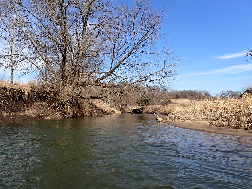
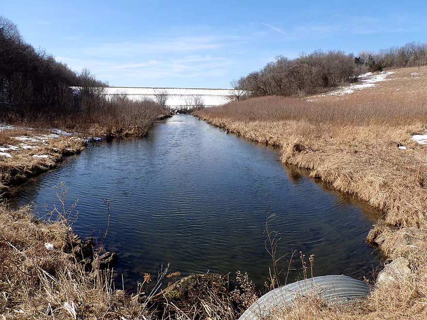
Following the bluff, the creek started to open up, flowing between grassy banks intermixed with occasional light woods. Unfortunately the character of the creek started to change at this point…large mud banks sprouted up and I demoted the trip from five stars to 4 stars. It was still pleasant though with occasional rapids and no logjams(!), but the creek had lost some of its charm. I took out at Hwy II, which was a bit difficult but was doable. I had cut the trip short at just under 3 miles because I didn’t know what to expect…but in hindsight I should have continued to Spring Valley Road. That would have added 4 miles to the trip and maybe some logjams…but would have included more fun rapids and scenic bluffs.
This is a trip that I highly recommend, but with some caveats. You will need to wait for higher flow rates to get over the rocky rapids (see depth guide below). Because this is one of those rare Wisconsin streams that flows north, I highly recommend saving it for a sunny day so you can paddle away from the sun and onto frontlit scenery with vibrant blue skies. Much of upper Otter Creek appears to be a viable paddling prospect and I look forward to returning to explore other sections.
Hwy Q was an excellent bridge access. It’s the start of a DNR easement corridor used by trout fishermen and there is a mowed path that leads to the water.
An alternate put-in 2.4 miles upstream would be Plank Rd (just below the dam). This upstream leg though is very small with likely a few logjams, but is very scenic.
Hwy II is a tricky access because the steep shoulders make parking difficult. Also the nearby farm fields have No Trespassing signs, so you can’t wander too far from the bridge. Ideally, I would have disembarked on the upstream side where there is a public easement but parking was impractical. Instead I took out below the bridge (east bank) and dragged my boat up a steep bank to my double-parked car. It’s all doable….just scout the bridge and come up with a plan before starting your trip.
Adventurous paddlers can continue another 4.2 miles to Spring Valley Rd. I don’t know much about this leg, but think it is a good prospect with scenic bluffs…but also some logjams.
The bike shuttle was a bit hilly (128′ of climbing) but was otherwise relatively easy at only 1.8 miles.
All in all a pretty safe and easy stretch.
- Current: Pretty zippy with a number of light rapids.
- Rapids: All Class 1 and super easy.
- Logjams: None
- Strainers: Just a few minor ones…nothing to be concerned about.
- Fences: None
There is no gauge on Otter Creek. IMO the best analogue is the Black Earth Creek gauge.
- 0-40 CFS: Likely too low…you’ll hit rocks on almost all the rapids.
- 41-65 CFS: Very low. Likely manageable but still bumpy.
- 66-100 CFS: An above-average depth and a good target range. I did the trip at 80 CFS and while I hit a few rocks, I thought the rapids were sufficiently padded.
- 101-125 CFS: A high depth. Likely doable, but water clarity won’t be as good.
- 126-160 CFS: The banks might be close to bursting at this point. I believe this would be a manageable paddle but should be attempted only by experienced paddlers.
- 161+ CFS: This might be too high.
Detailed Overview
For additional information on access options, see my overview map.
- Union Valley Rd (1) to Plank Rd: 2.9 miles.
- Union Valley Rd (1) to Union Valley Rd (2): 0.7 miles. Very tight, narrow and shallow section. Unless there is very high water, this likely isn't viable. There is one major logjam.
- Union Valley Rd (2) to Cave Hollow Rd: 0.6 miles. This is typically too low to be a viable paddle. There are 2 logjams on this stretch. Highlights include a beaver dam and some nice boulders.
- Cave Hollow Rd to Plank Rd: 1.6 miles. A flatwater paddle over Blackhawk Lake. This is a scenic quiet lake surrounded by steep wooded hills. Highlights include a rocky stretch in the northeast corner and a beaver dam in the northwest corner. To continue downstream, a portage over a 30′ high dam is required but is not too bad. There is an alternate access on the western shore.
- Plank Rd to Hwy Q: 2.4 miles. A neat creek prospect with attractive rocky sections, but very small. Maybe four logjams, but they should be easy portages.
- Hwy Q to Hwy II: 2.8 miles. Good section with many light rapids and boulders reminiscent of Snow Bottom. Bank erosion is an issue near the end. No logjams.
- Hwy II to Spring Valley Rd: 4.2 miles. Maybe 5 logjams, but a good prospect. Creek flows by a long bluff with the potential for multiple outcrops.
- Spring Valley Rd to Hwy I: 6.0 miles. Downed trees and tall mud banks start to become an issue. Maybe 16 logjams. If you can take out at Conway Road you may be able to avoid the worst of it.
- Hwy I to Hwy 130: 2.0 miles. More steep muddy banks. Maybe 6 logjams.
- Hwy 130 to Hwy C: 1.8 miles. Mostly open, but heavily eroded with maybe 3 logjams. Should be one nice outcrop. Perhaps one difficult fence to paddle under by Hwy C. Hwy C is a very difficult access because of the steep banks and farm fences.
- Hwy C to Wisconsin River/Otter Creek Boat Landing: 2.9 miles. A congested leg…maybe 7 logjams.
Trip Map
Overview Map
Video
Photos Size:
I’ve had my eye on Otter creek for years. Always wondered how the stretch from 130 to the Lone Rock landing was but your paddle sounds much better! Gotta check it out ASAP!
If you do Otter Creek, let us know how it turned out.
Launched on Q and ran the creek to Spring Valley Road. There was one tree we were barely able to scoot over about a half to a mile down stream after II. A barbed wire fence spans the creek and all the way up the banks on both sides as you approach the first farm after II. We were able to pull the wire apart and float our boats through. One more tree about a mile after this but was an easy portage. I will also mention that there is a very cranky farmer in the area. He accused us of trespassing and scaring his cattle which was not true. He went on to tell us another paddler came through before us that he told off as well. The stretch from II to Spring Valley is a nice addition but beware of silly locals.
Thanks Lauren for the update.
Sure thing. Love your website, by the way. Thank you for what you do!
Did this stretch of otter at 53 CFS…beautiful paddle, in my top 5. Definitely could have used a few more inches [I walked the stretch by the spring which was nice because I was able to check that out for a bit]. Water was crystal clear. Regardless of the scraping on rocks it was well worth it. I took out on the north? Side of the II bridge which was very easy.
Glad you liked it! I thought it was a neat creek myself and hope to explore more of it in the future.
The nautical flags across the Otter spelled “Wicked Pissah” when looked at from the north. I took them down this summer after a fisherman referred to the flags a “dirty laundry”. They probably shouldn’t be across the creek anyway. The flags may return on occasion to the OCYC.
Those flags were yours? I thought they looked really cool…especially when flapping in the wind. Kind of reminded me of Tibetan prayer flags.
So I actually live right next otter creek on Mill Road. I’m in highschool but I love being outdoors and kayaking especially. Me and my friends have kayaked a large portion of Otter Creek and I just got back from doing a new portion (Conway Road to Highway I). I’ve kayaked all the way from Highway Q down to Highway I now and the whole creek is beautiful. I love the natural spring you talked about, there’s a little walking trail further up the hill if you get out and explore. The stretch from II to Spring Valley was gorgeous and I only had to get out 3 times. From Spring Valley to Conway there’s two vet bad log jams, and one of them you cannot get out due to the banks being very steep. (The bridge on Conway is an excellent swimming hole, I recommend actually jumping off the bridge into the water). And the stretch from Conway to highway I is beautiful as well, it takes you past some sandy cliffs, fields, and a lot of woods. The first mile is clear of jams but the second mile is log jams after lot jam. Had to get out of my kayak quite a bit but it was a lot of fun none the less. Just look out for spiders!
Thanks for the all info! I definitely want to explore some of those sections you just described.