
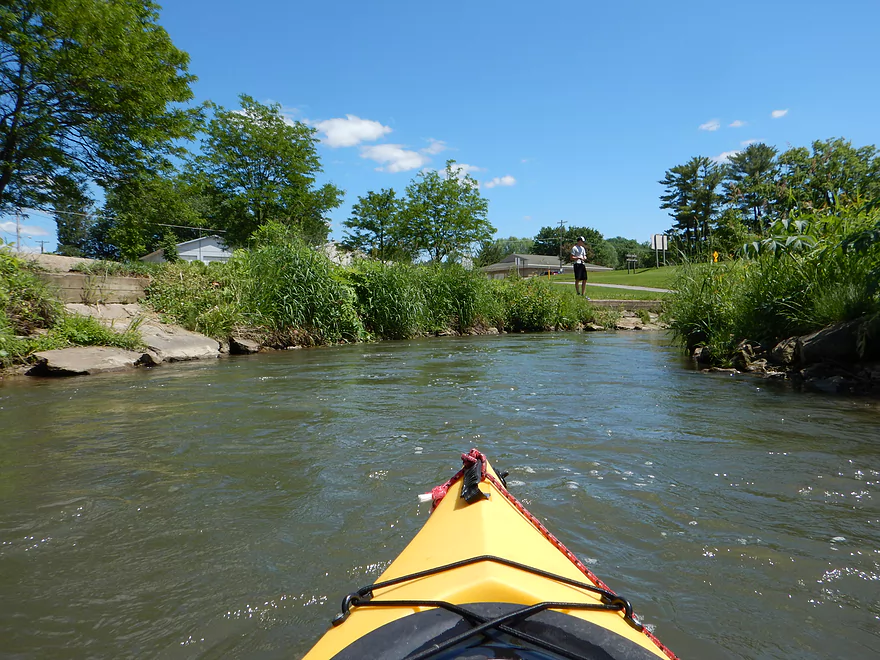
Public fishing access & put-in (see map)
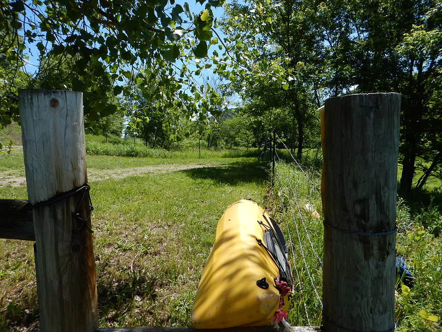
Fun dragging kayak over the fence
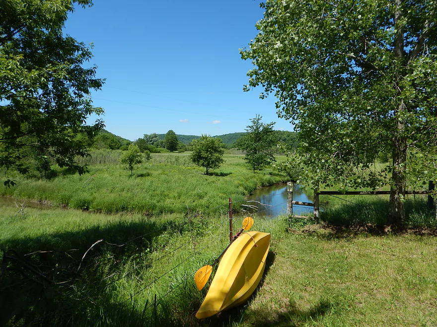
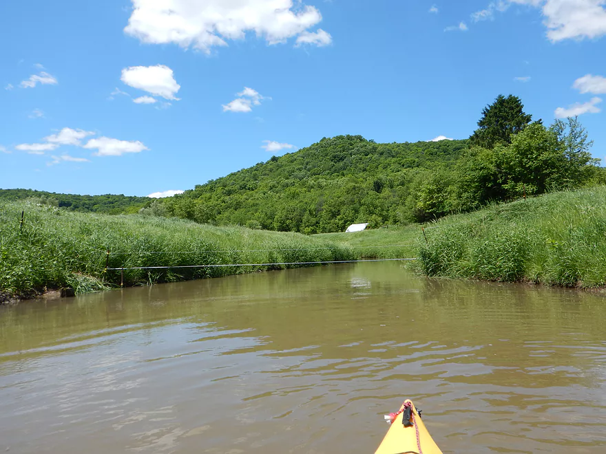
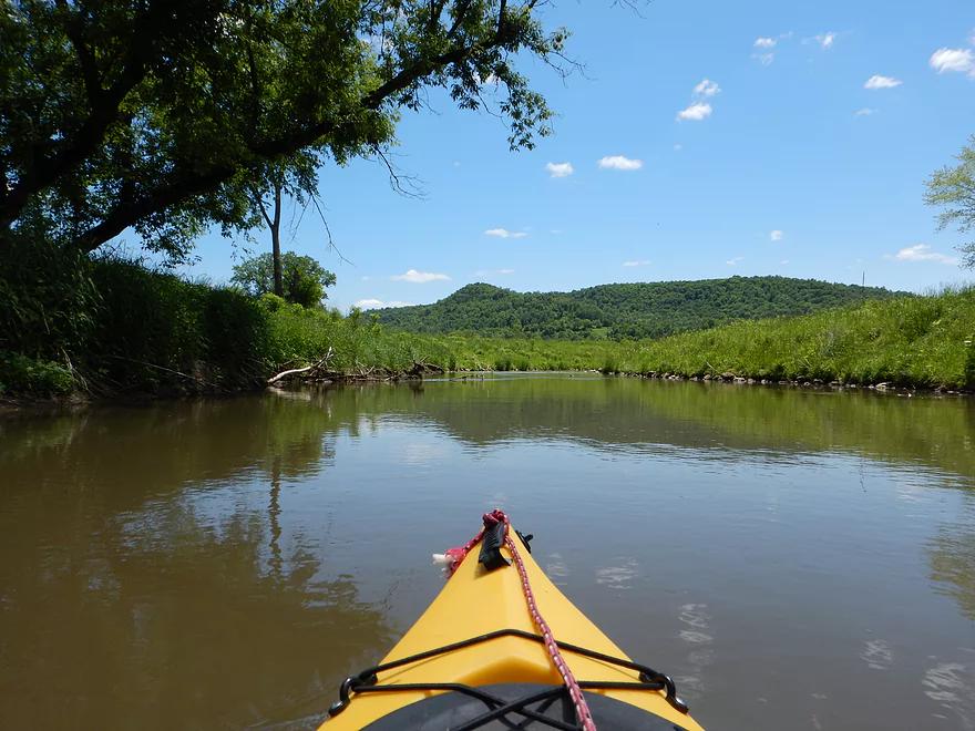
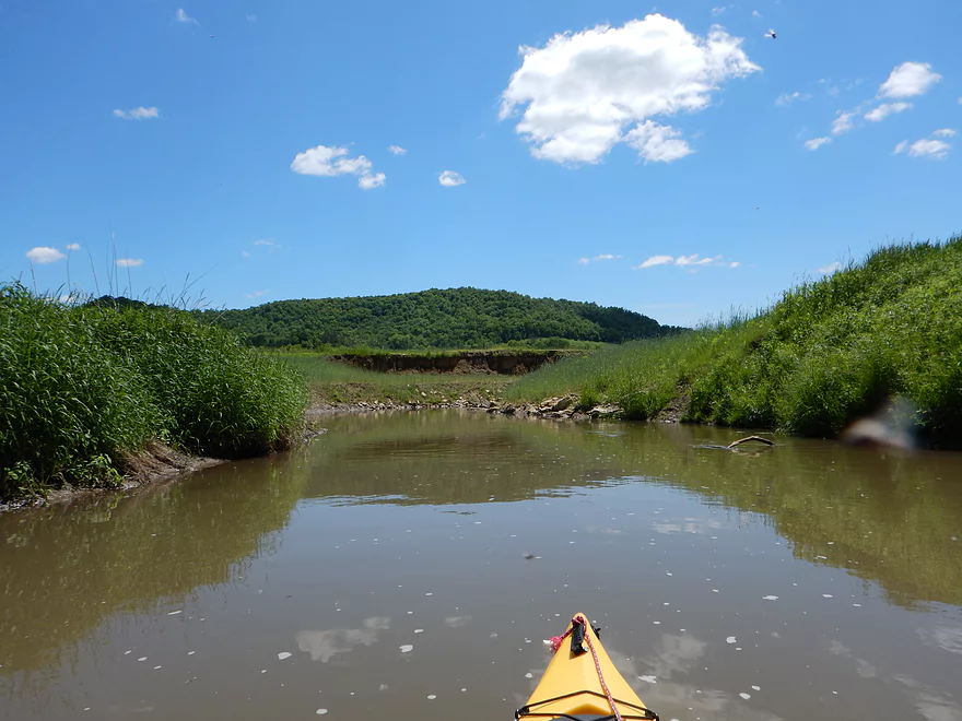
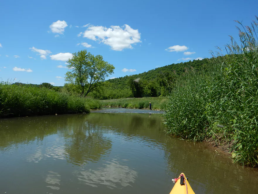
Ok launch area
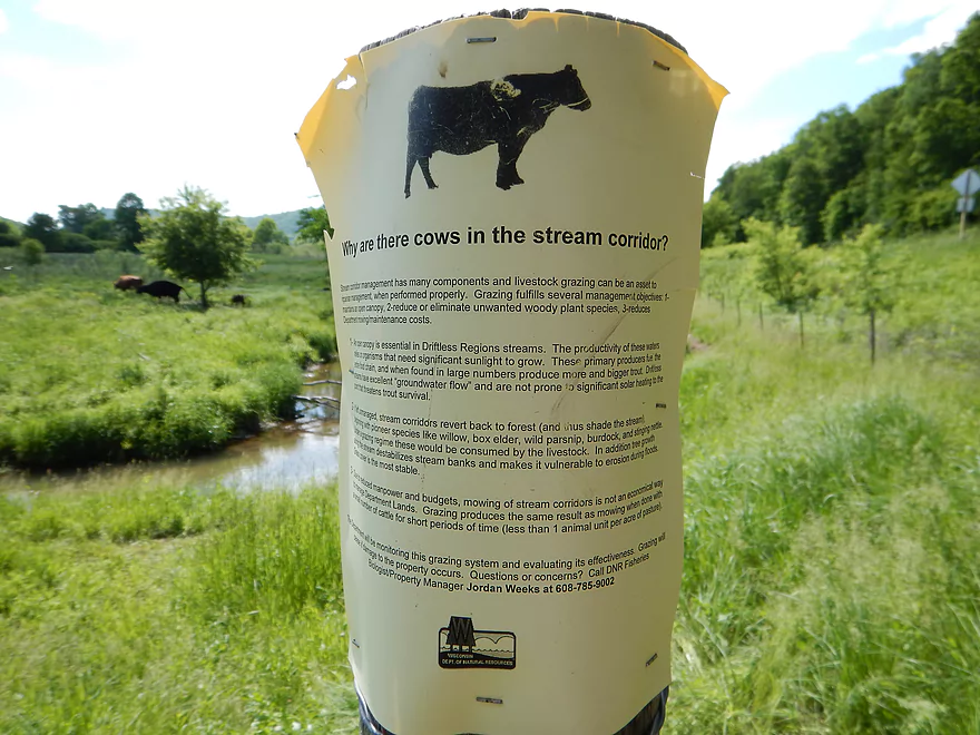
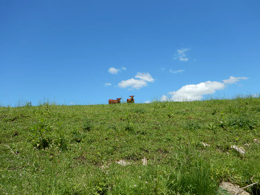
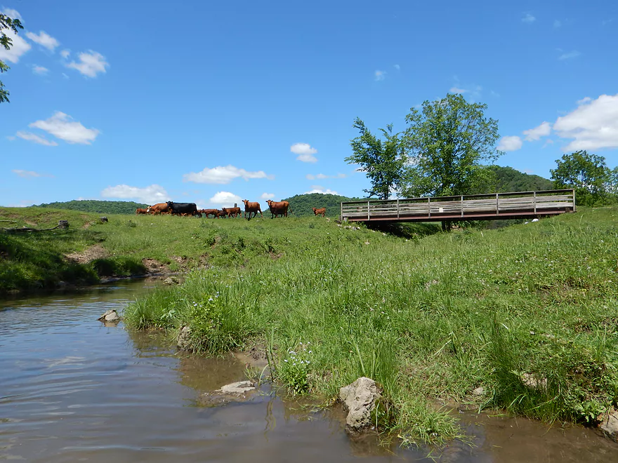
Why are there cows in the stream corridor!
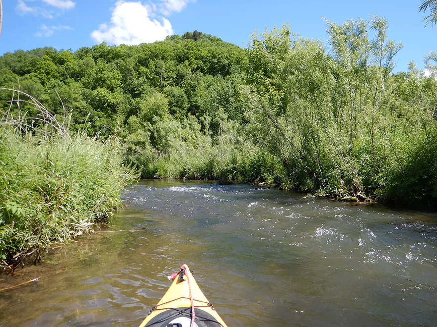
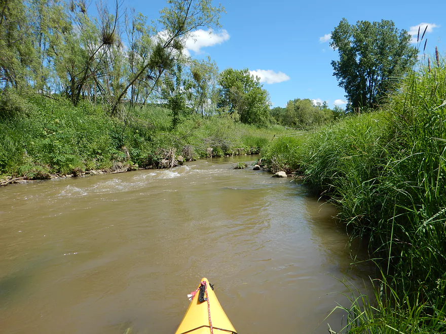
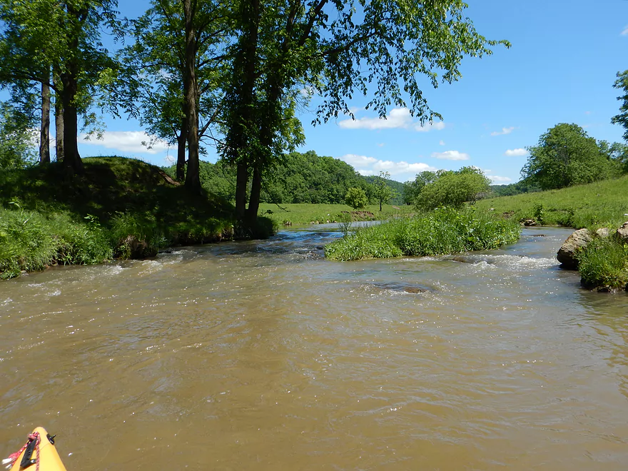
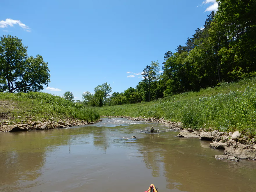
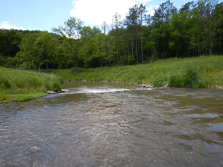
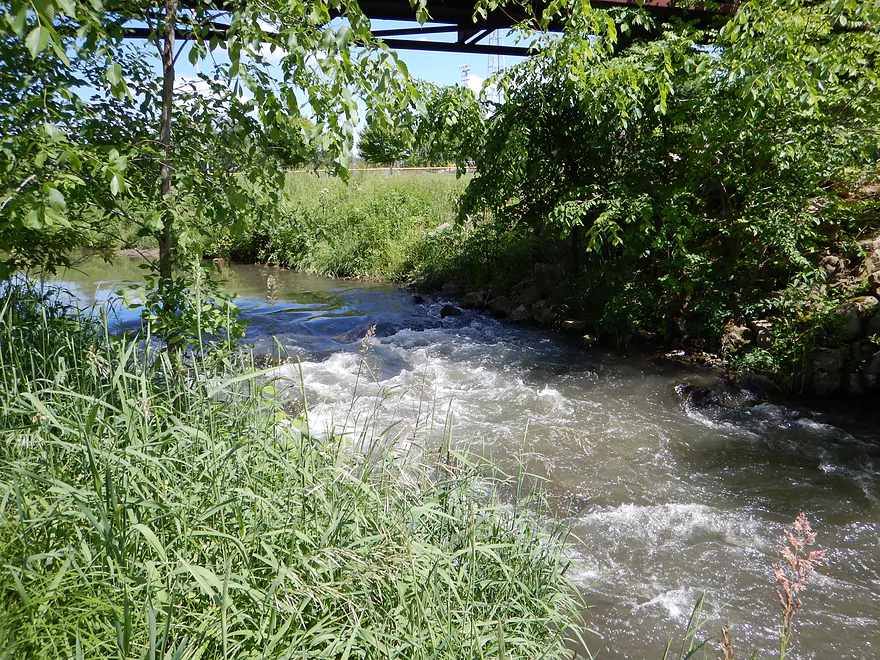
Lots of riffles on this trip
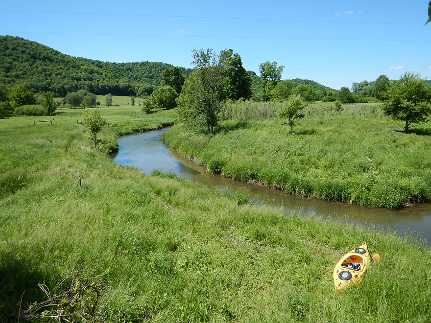
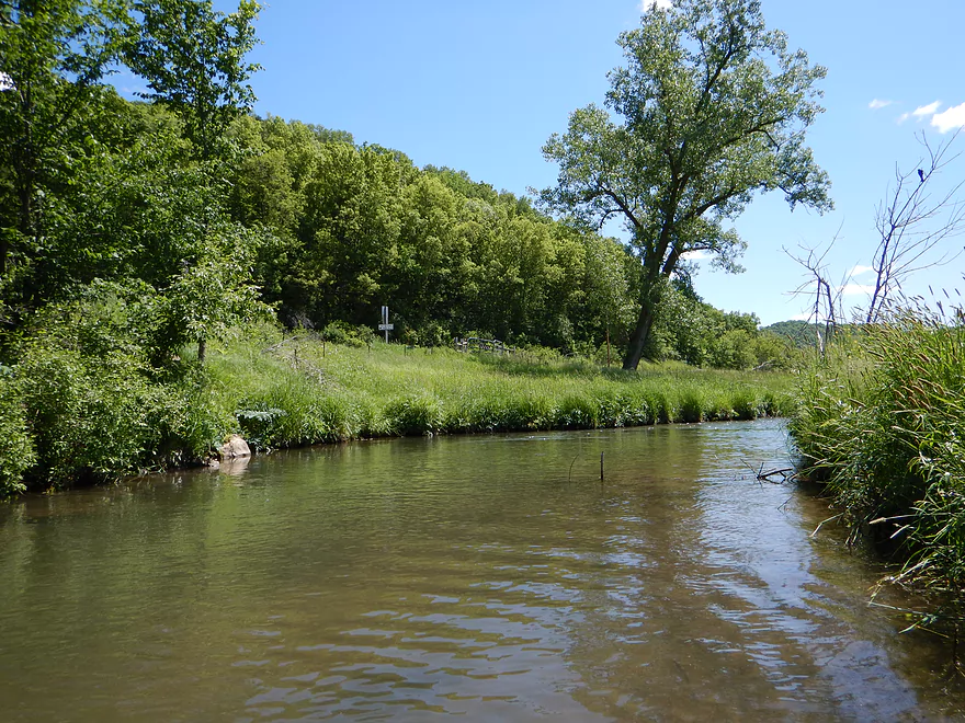
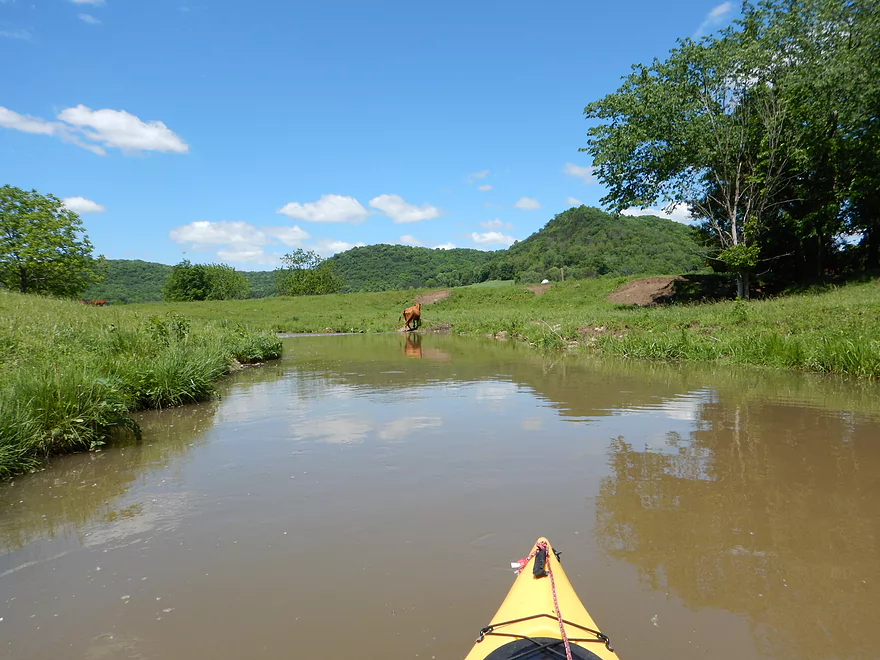
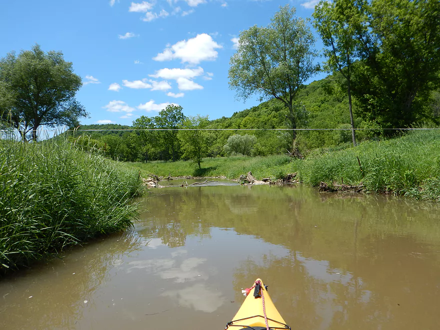
Technically this is Timber Coulee Creek now
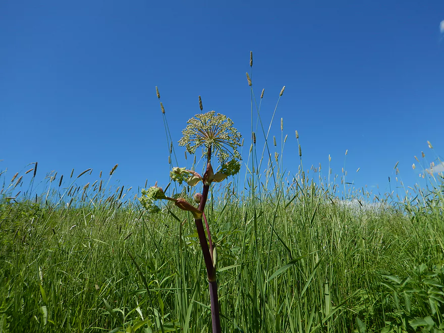
Lot of cow plants…some attractive
Another fishing access area (see map)
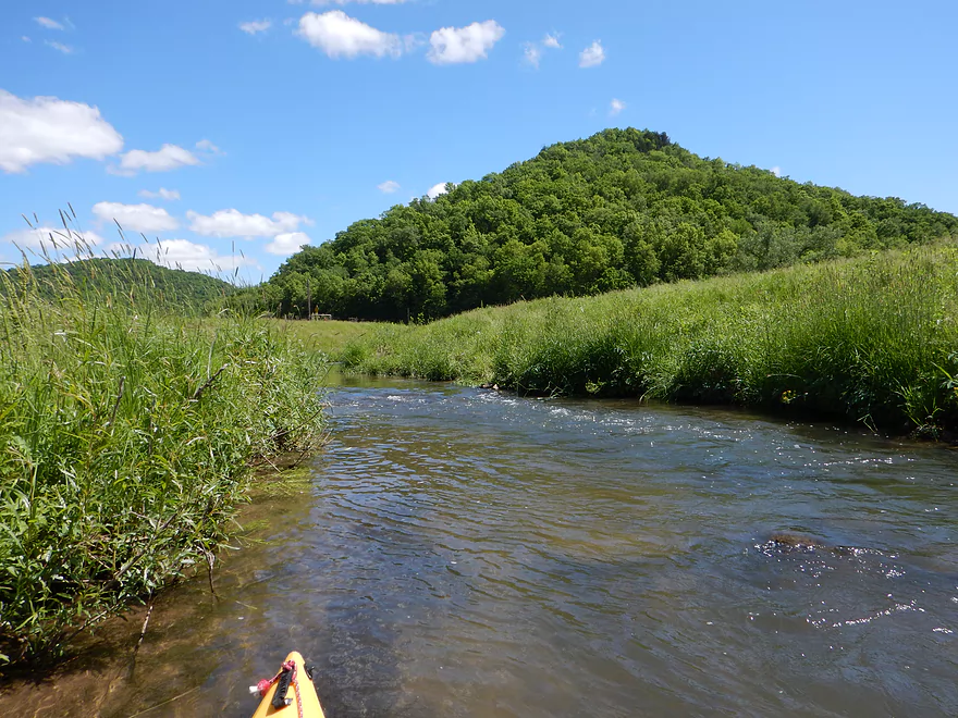
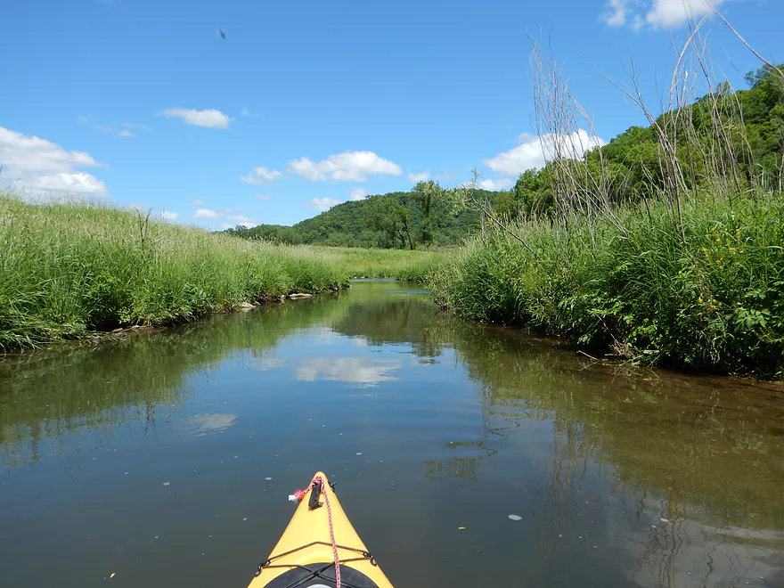
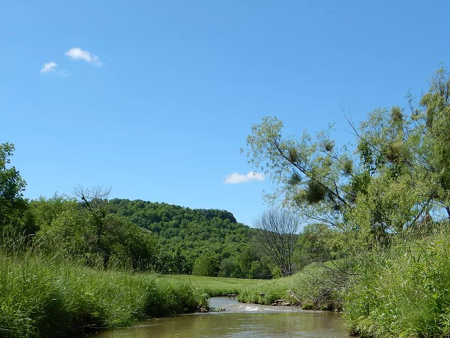
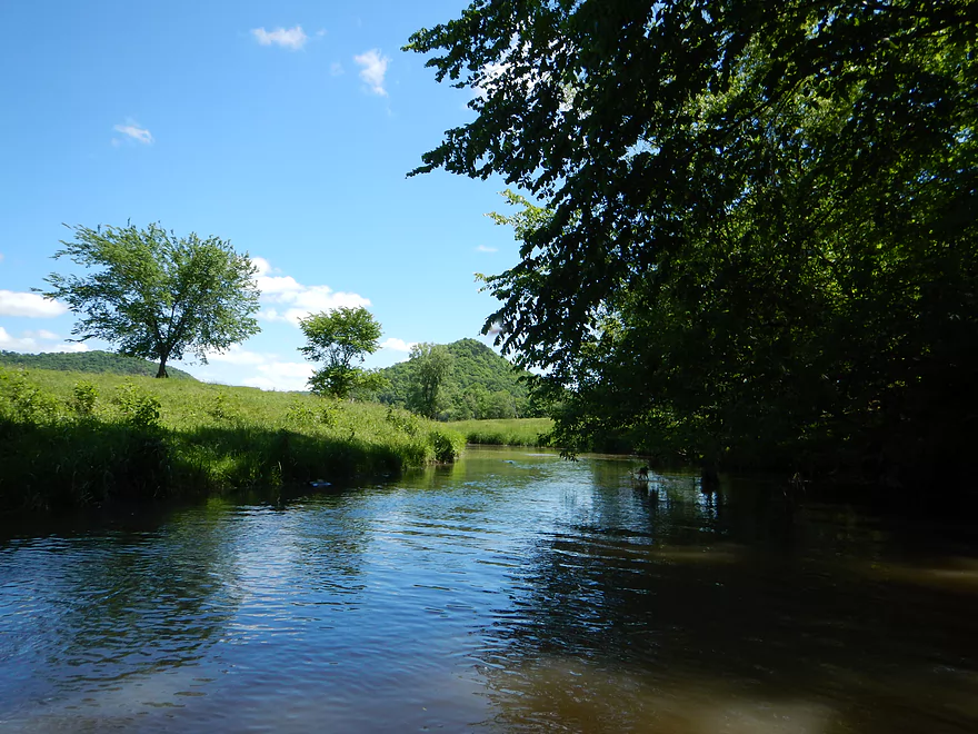
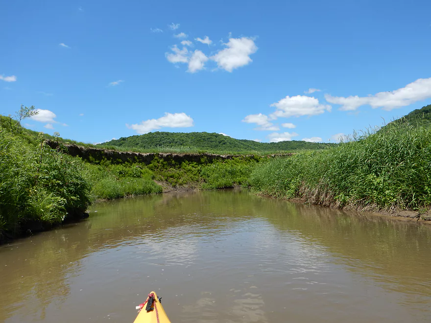
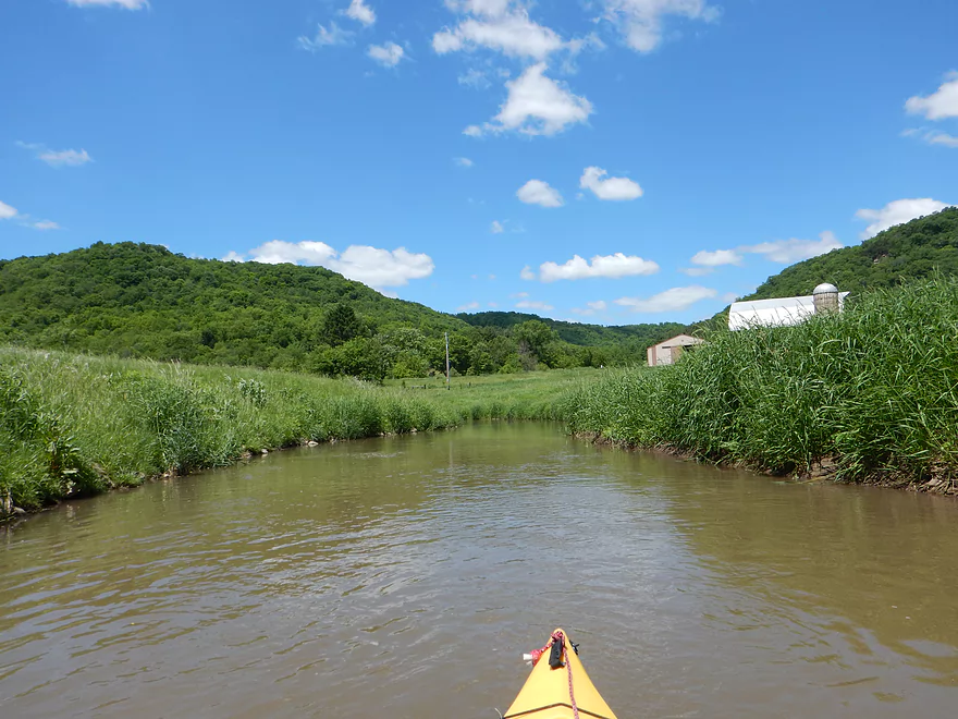
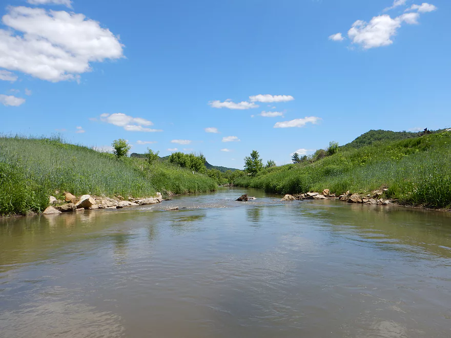
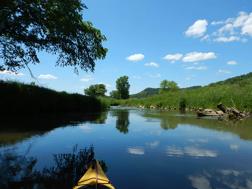
Terrific hilly vistas
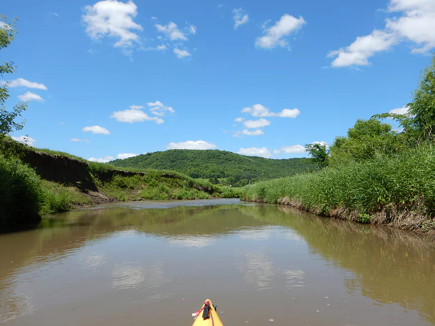
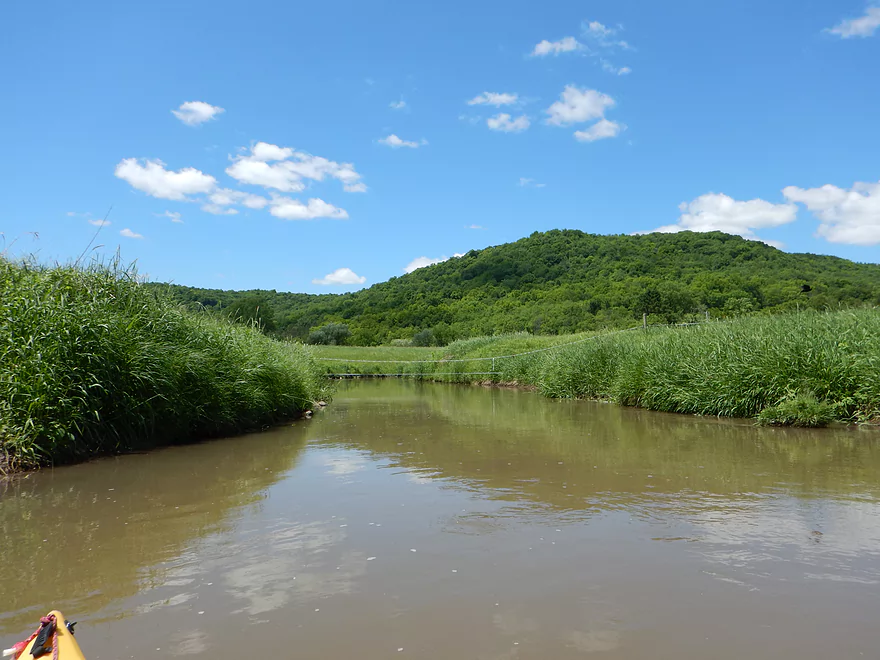
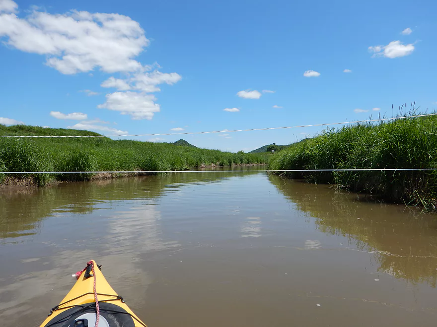
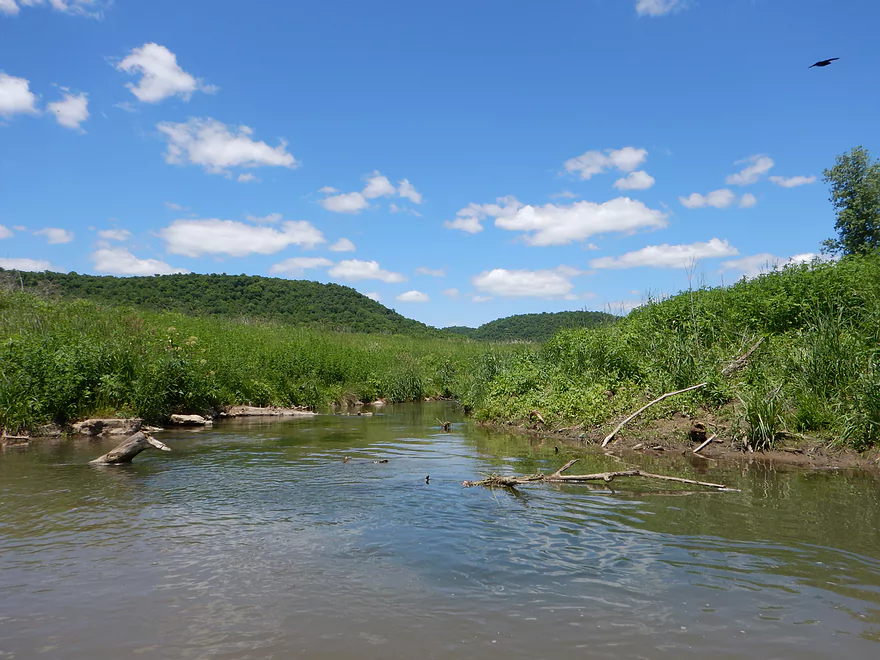
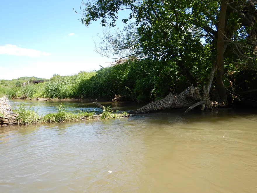
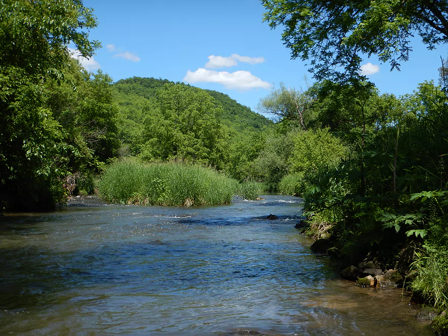
Muddy Coon Creek enters the larger Timber Coulee Creek
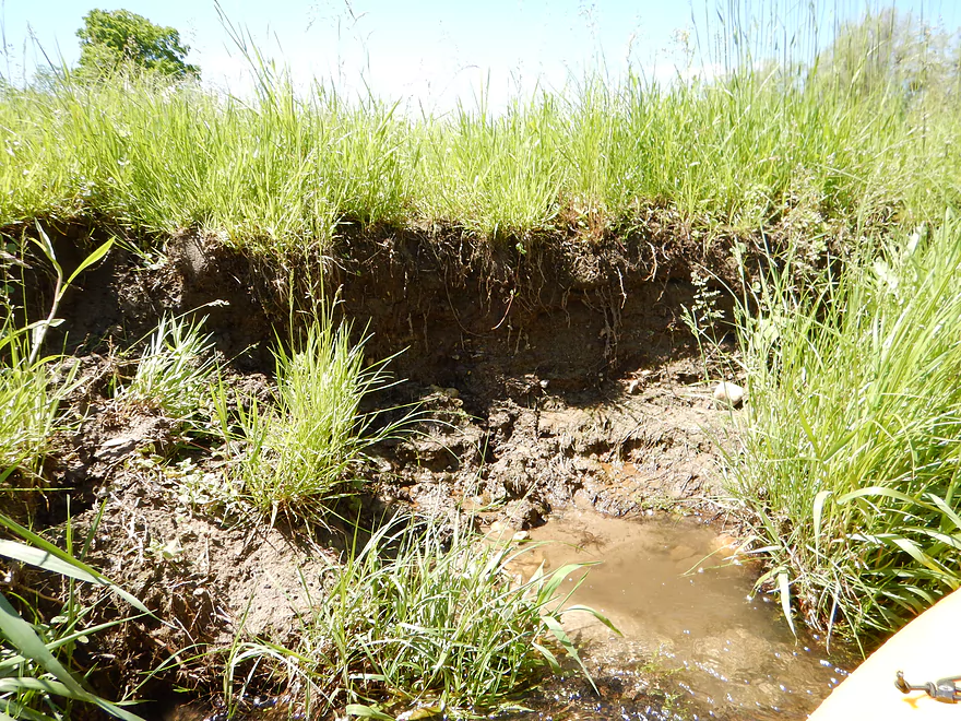
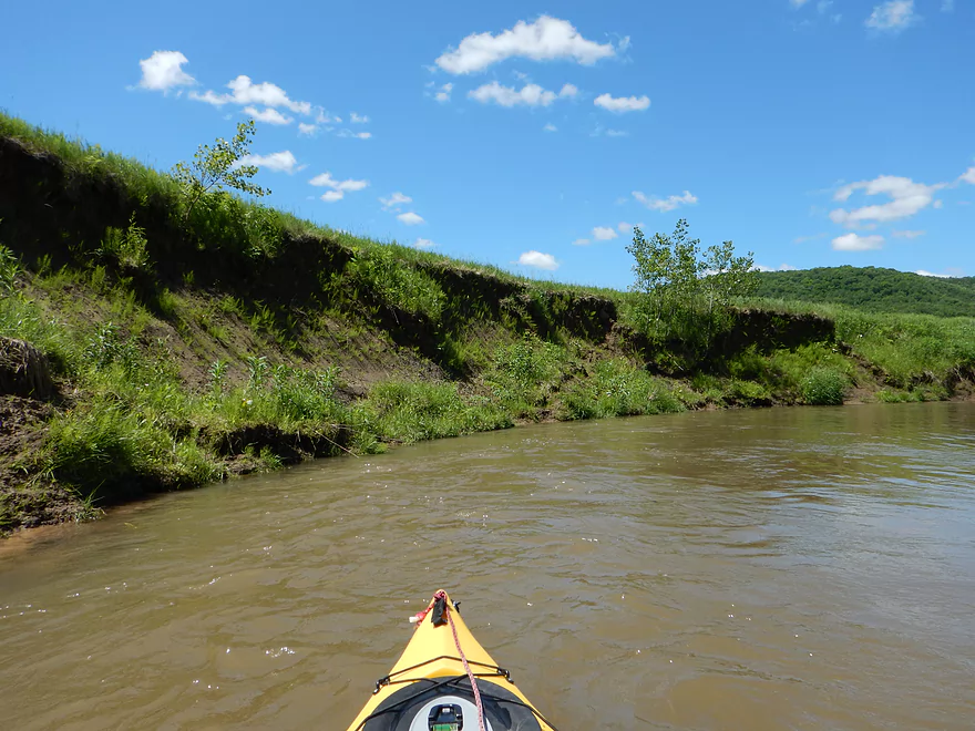
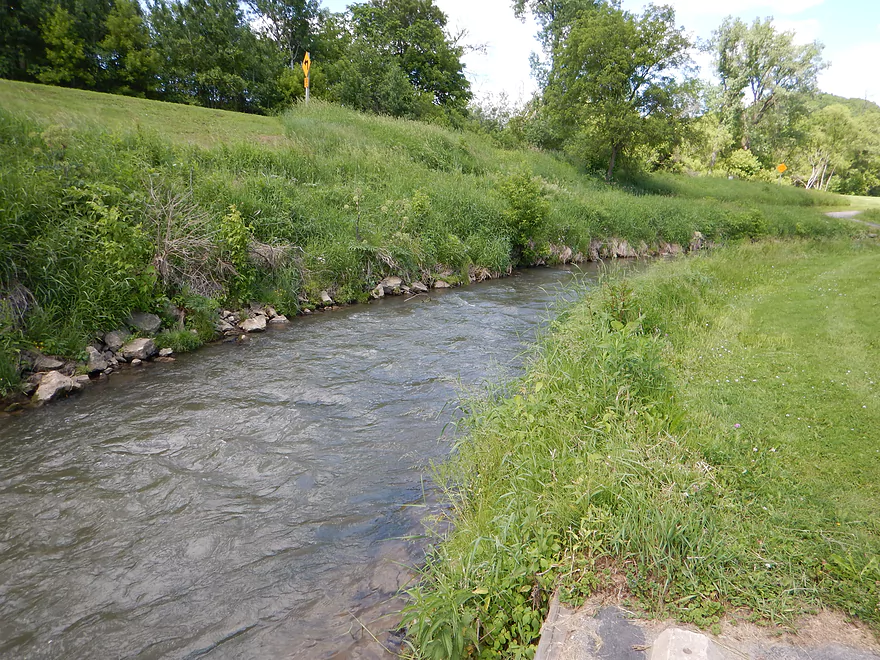
Lots of cow erosion
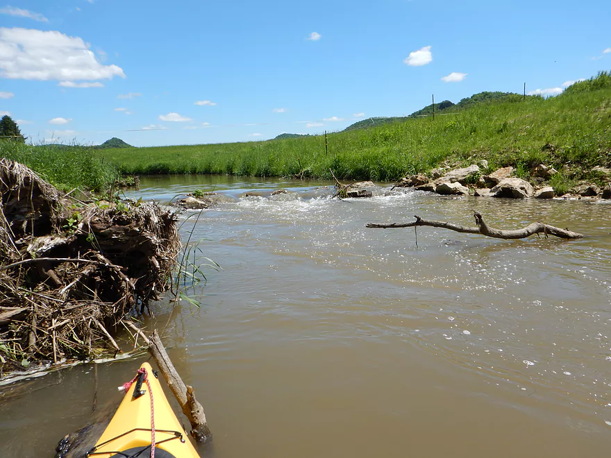
Rapids going under low cow wire
Not cool
More nice cow plants (Mullein)
Cow was defecating in the stream
Lots more erosion
The culprits
You could smell these for much of the trip
Rapids going under low branches (tricky!)
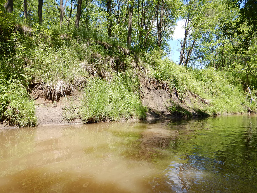
Erosion from invasive species (cows)
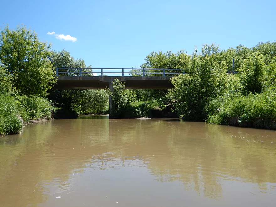
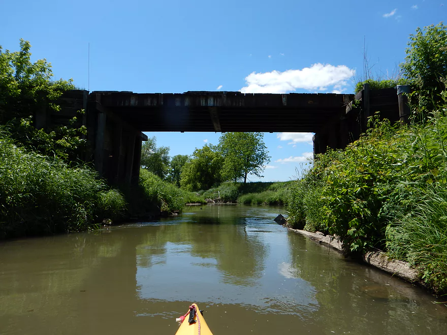
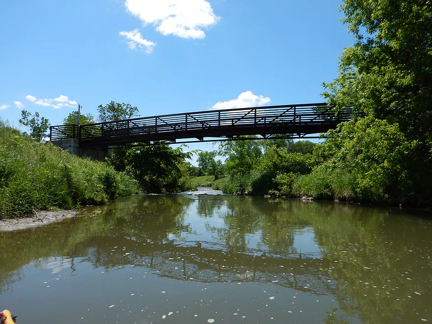
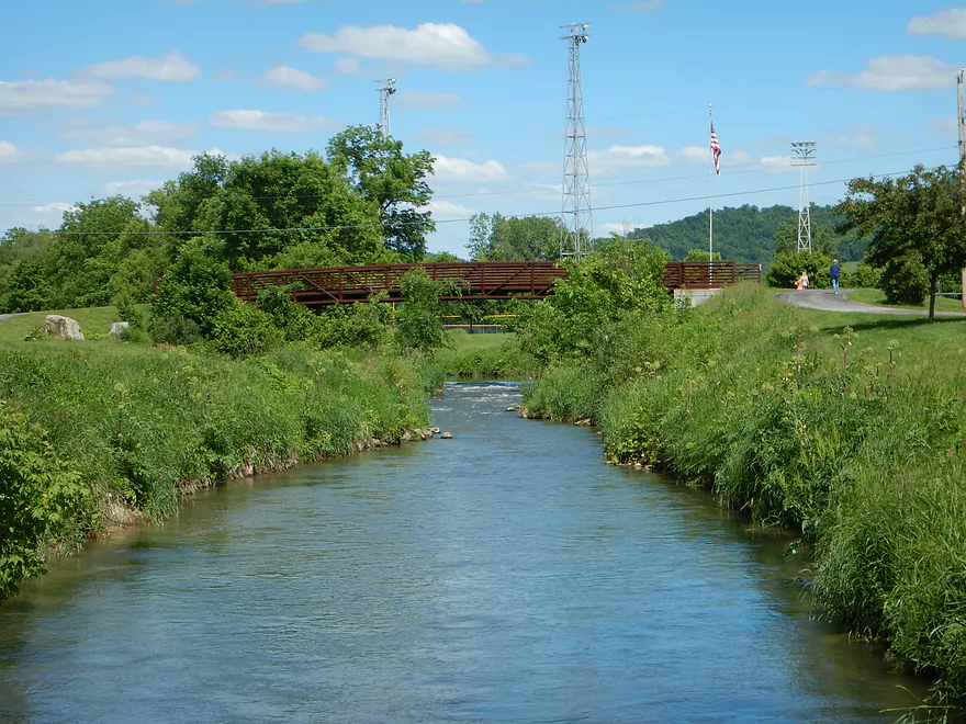
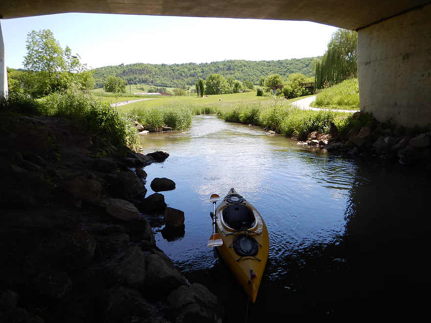
Hwy P bridge…not terrific but doable for access
Start of epic mud banks
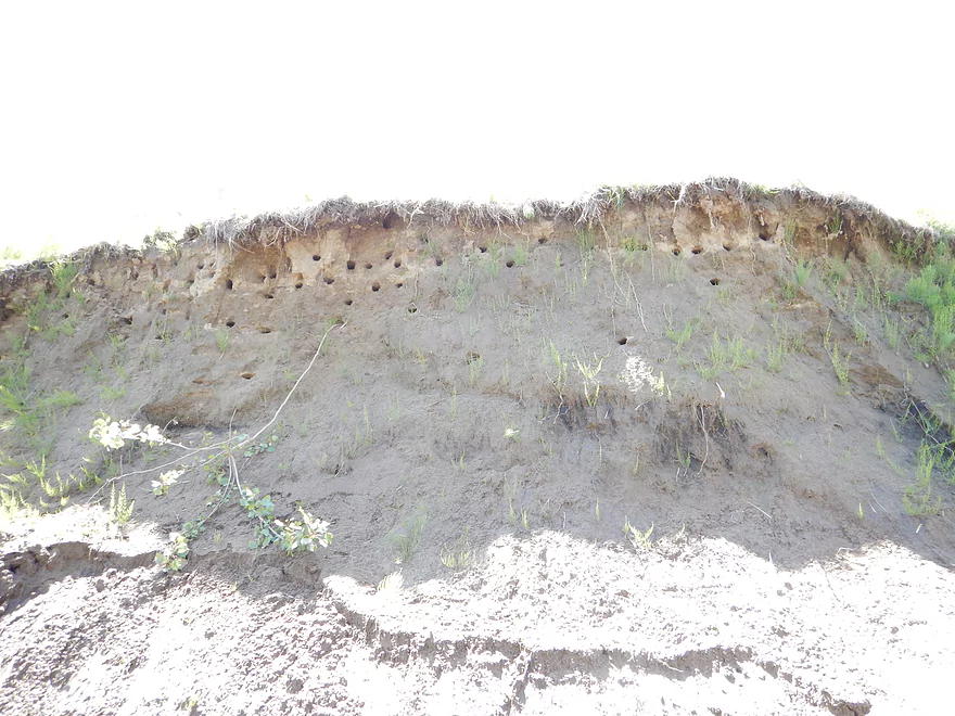
Bank Swallow Nests
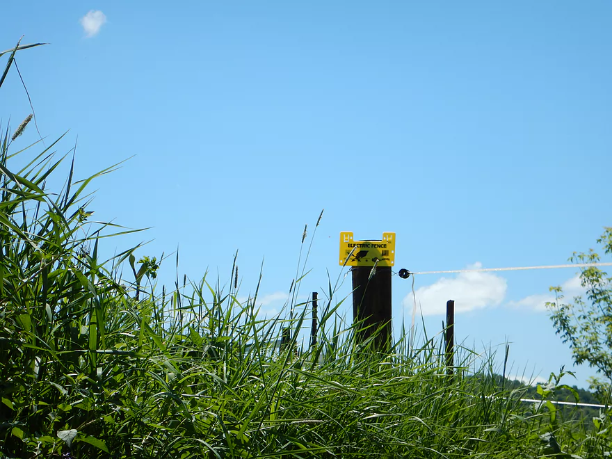
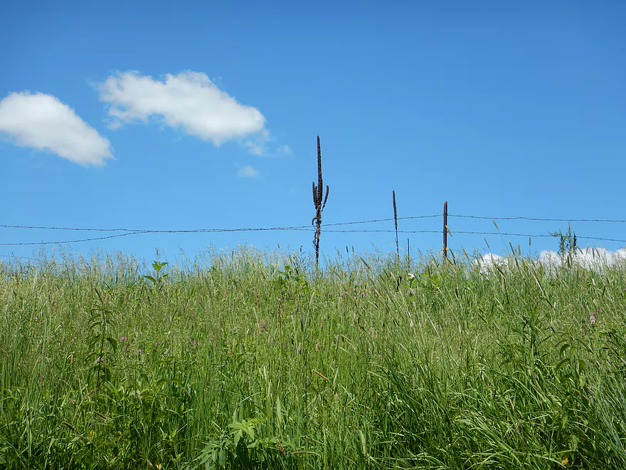
First electric fence

VERY low…and possibly dangerous to portage
Electric fence #2 (lower)
Electric fence #3 (slight shock from lower ribbon)
Electric fence #4 is thankfully well above the rapids
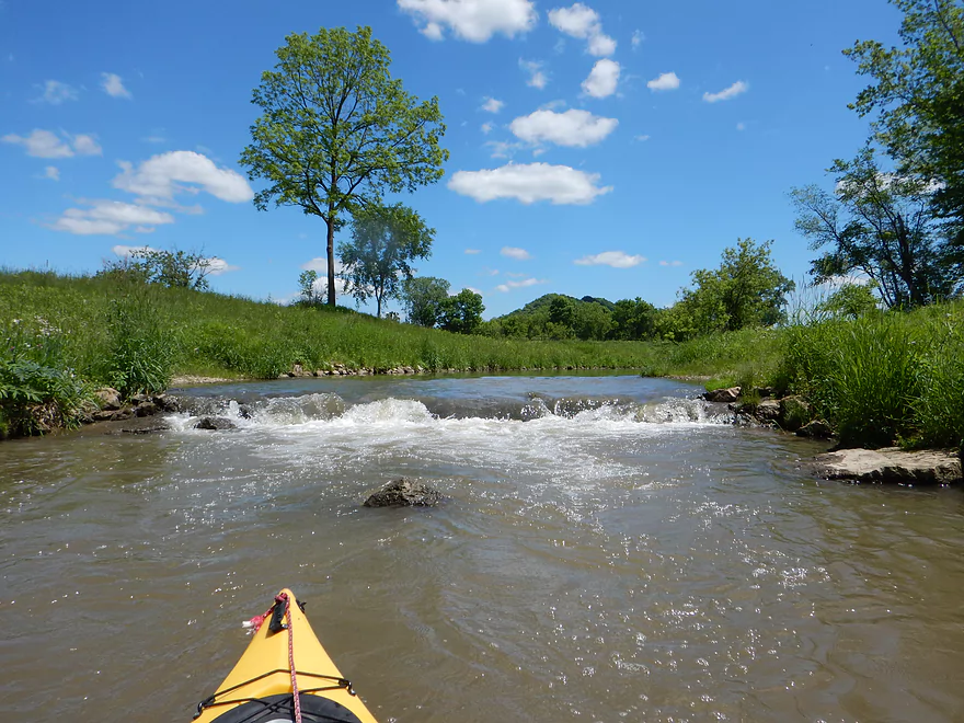
Riffles getting more serious
Very artificial stream work
Old dam remnants and decent ledge
Maybe class 2
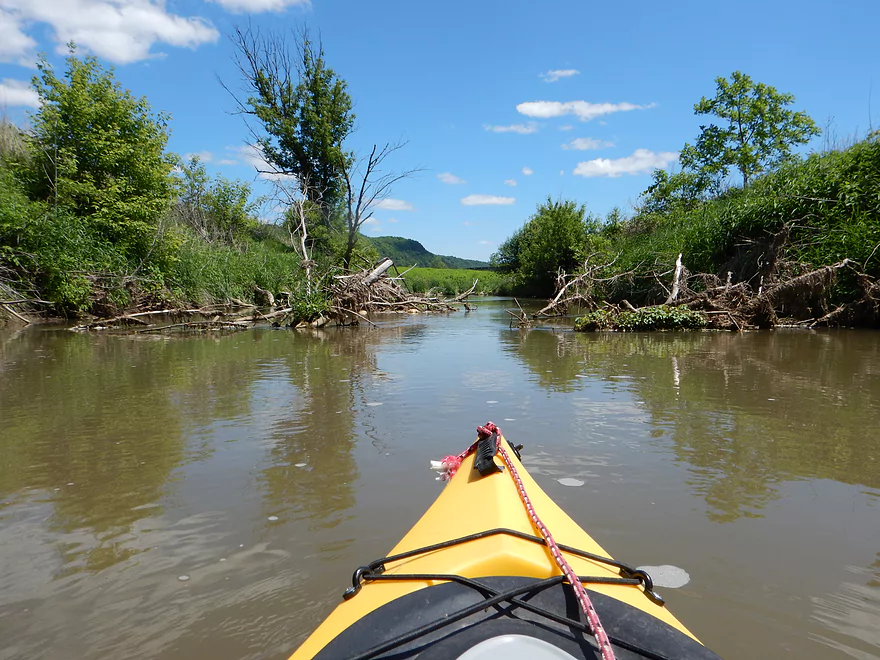
Log debris starts to be an issue
DNR dumping random trout rocks into stream
Creates hazards…rapids push you into the dumped rocks
One of multiple log dams (tricky)
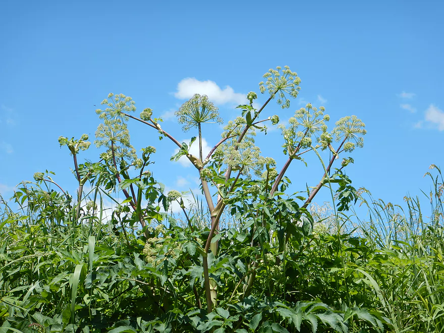
Angelica
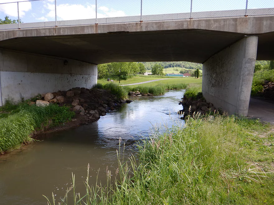
Private drive bridge
Log jam that I had to hop over
Was difficult..not recommended
Nasty snag
Super tough ducker…most would not fit
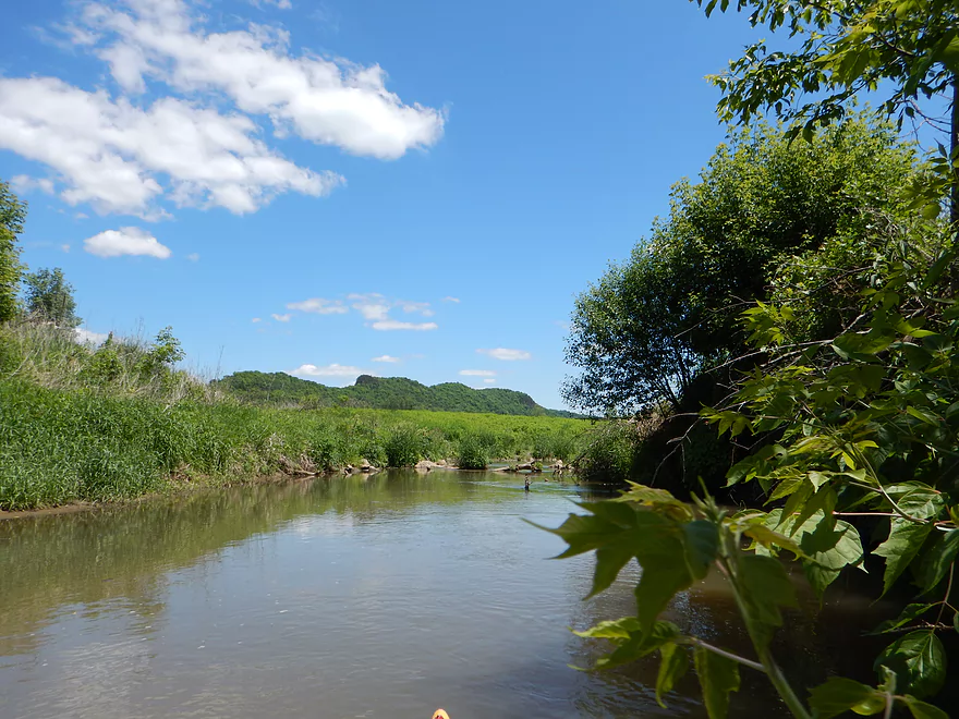
Second fly fisherman
Rapids getting more intense
Nice park bridge (serious rapids below)
Easily a class 2 and tricky with rocks
Kept reminding me of Pine River at Richland Center

Lots of fishermen in the park
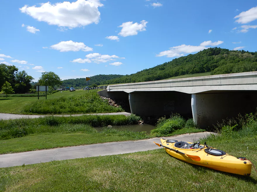
Hwy 14/61/162 bridge
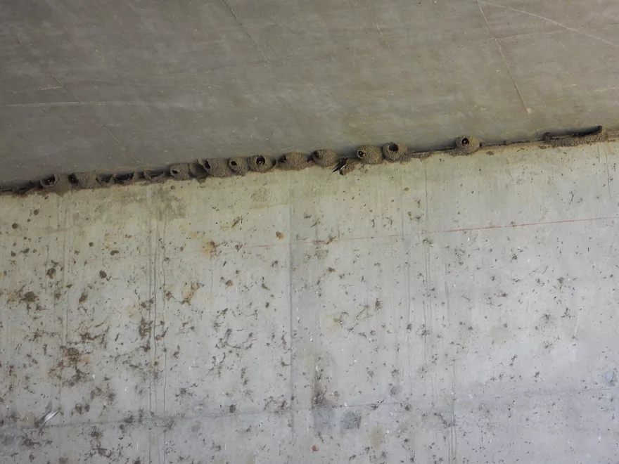
Cliff swallows
Taking out (tough in fast current)
Yes, car is on the wrong side of bridge
Bit of a drag to the parking area
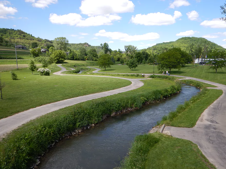
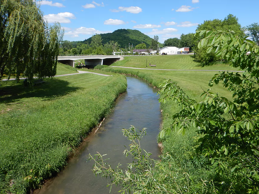
Attractive park with fishing parking lots?
Exploring far upstream of Timber Coulee
I had hoped my trip would have been more like this
Coon Creek – Hwy P


An obscure paddling prospect with nice riffles, scenic hilly vistas, and no technical portages…but with some serious obstacles to contend with. In paddling circles, few will have heard of Coon Creek or its main tributary, Timber Coulee Creek, but for fishermen this is one of the most famous watersheds in all of Wisconsin and is in fact nationally recognized. Timber Coulee Creek is one of three southern Wisconsin streams to earn Trout Unlimited’s “100 Best Streams” recognition (the other two being Black Earth Creek and the West Fork of the Kickapoo River). You’ve probably already seen pictures of Coon Creek and not realized it, as it is popularly featured in many outdoor sections of newspapers and magazines.
Given that this creek is so popular with fishermen, it is surprising more people haven’t kayaked it. It turns out it used to be a popular canoe creek and, in fact, there used to be an annual canoe race here that attracted participants nationally. Supposedly, this took place from the “Village” (presumably Coon Valley) to Conservation Club Road (not sure where that is). It wasn’t the creek’s fault, but the race got a bad reputation from the after-race partying that took place in the bars in nearby La Crosse. Following the infamous Coon Creek Riots, where rowdy students overturned cars and challenged police, the event was sadly canceled (I think around 1994) and the main race corridor has since (supposedly) filled in with log jams.
After asking some locals and doing some satellite view research, I determined there was a runnable section (in terms of log jams) of Coon Creek upstream from the village of Coon Valley…and, in fact, I could start a trip on the famous Timber Coulee Creek and then finish the trip on Coon Creek. After a scenic hilly drive through driftless country, with plenty of Amish and “Organic Valley” farms, I knew I was entering a unique and special area of the state. As I approached the headwaters of Timber Coulee, fishermen could be seen everywhere. Access is easy for fishermen, as there are numerous public pull-offs, trails, and DNR-purchased private easements. These weren’t casual fishermen either…a lot of out-of-state license plates, expensive cars, and special fly fishing roof racks. A bit of a letdown to see so many people, since, when I do bike shuttles, I hate to think of of too many people eyeing my unattended bike/kayak when away (even if locked).
My first put-in option, while marked public on a map, turned out to be too far from the stream (and the direct access was marked as private). The next downstream access was good though with nice parking, a grassy area, and was clearly public (all marked on the map). The big issue though was the barbed fence(!) that surrounded the parking lot. Bit of a pain, but I hoisted my kayak over the fence and down the slight hill to the waiting Timber Coulee Creek.
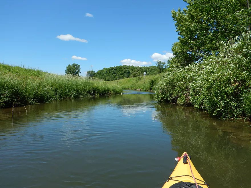
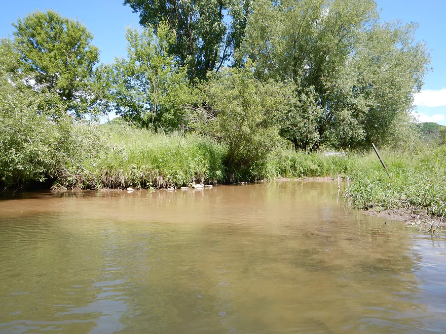
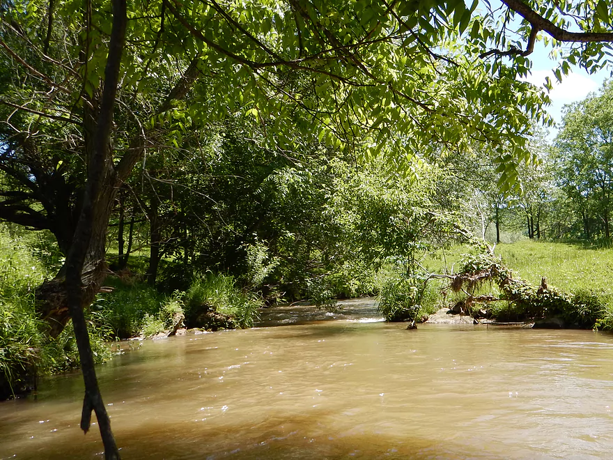
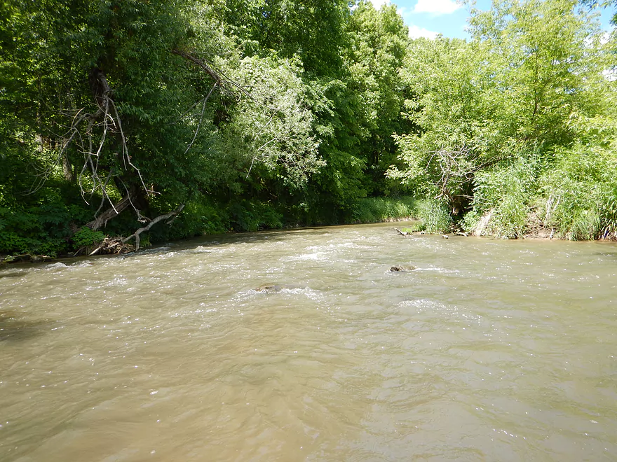
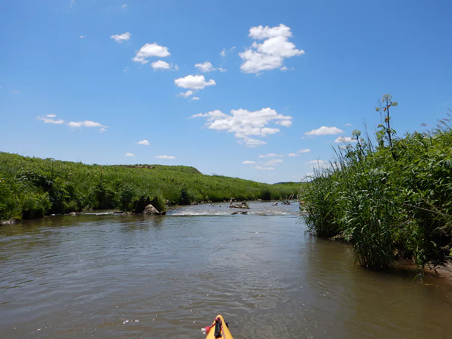
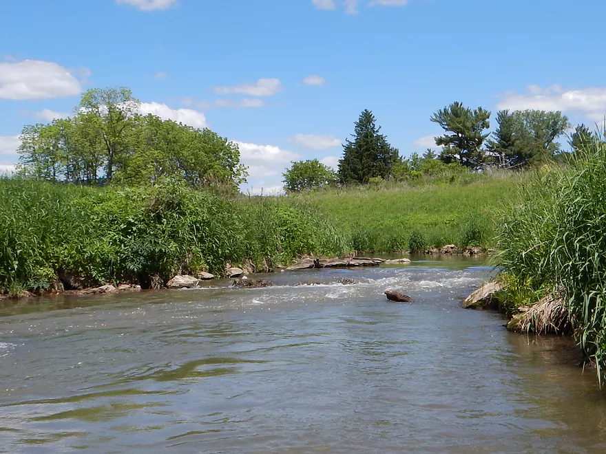
The creek itself is one of those pool-riffle-pool streams that constantly alternates between fast riffles and slow pools (like a number of streams in Wisconsin). The banks were generally open and grassy (intentionally so for trout). The big plus right off the bat was the terrific views of the Coon Valley hills that flank this small creek. The riffles started easy enough, and I scoffed at the notion of comparing these to the rapids on Morrison Creek, which I did last week (that would change). Right off the bat the water quality was a disappointment. I’ve done ~9 water trails this year already…and this might have been the dirtiest.
Back at the put-in, the DNR had posted a sign titled “Why are there cows in the stream corridor?” To sum it up, the DNR states that cows help reduce erosion and save the DNR money so they don’t have to mow the banks. … It wouldn’t take me long to encounter my first cow, which was standing in the middle of the creek and defecating straight into this nationally famous trout stream. Saw plenty of her friends–and the damage they were doing to the banks by exposing open soil to this very fast creek. It was no wonder this creek was so incredibly filthy. Granted, it had rained the day before, but it hadn’t rained much and the creek wasn’t close to its bank line or even its “plant line,” so while I assume the creek runs cleaner in the fall, this was still a very unusually dirty watershed. It was odd to see the DNR so proud of the cows for being cost-efficient lawn mowers when the better portions of the creek that couldn’t be accessed by cows were spared these “improvements” (not sure I buy into the argument that creeks need managing…even for trout). It is also strange that in, say Dane County, biologists are so concerned about manure runoffs creating fish kills, whereas these cows were allowed free reign to desecrate this nice creek. For a good portion of this trip, I could smell the cow manure. Normally I like to drag my hands in the water to clean them off…not on this trip.
Wildlife wasn’t top-notch on this stream–a couple of blue herons, two muskrats (or maybe beavers) and some fish splashing. Plant life was a typical pasture ecosystem (deja-Platte River), but there were some unique plants I had the opportunity to photo.
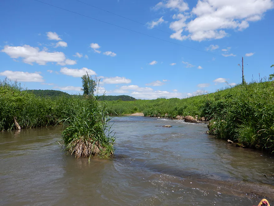
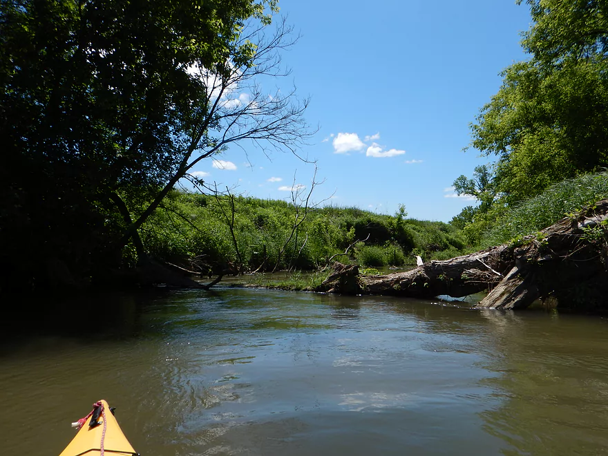
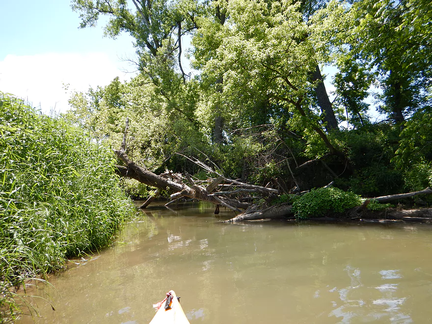
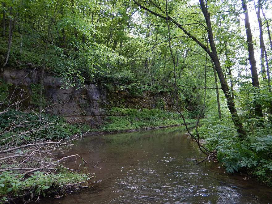
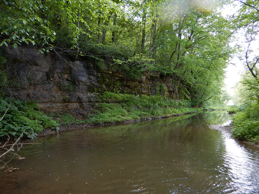
Where there are cows…there are fences…and this would prove to be an issue. After a half mile paddling on Timber Coulee, a very muddy (well, more so) Coon Creek enters Timber Coulee and shortly thereafter is a low-hanging barbed wire fence with riffles underneath (all fences marked on the map). This is a bad combination, but I was able to run it okay. Maybe a half mile later there is a tough riffle that goes under some low-hanging branches that is not fun. You really have to power paddle to the right to avoid getting snagged. After the P bridge (an alternate landing I rejected because it would make the trip too short), you’ll encounter mammoth dirt banks–that, while evidence of poor land use, are kind of cool in their own right. From the black and white pictures I’ve seen, these banks actually used to be MUCH larger when the valley was first clear-cut, but the creek has, to a certain point, recovered somewhat from those days.
After a half-mile past the P bridge, you will find reason enough to question even doing this trip. Not one, not two, not three, but four electric fences in a row (maybe spaced 50′ apart). I’ve encountered electric fences before…and normally you can duck under them. These were set low though…very low. Thankfully, my kayak has an open hatch and I was able to twist myself in so my back was actually on my seat. I then lined myself up and with a push let the current carry me under the electric fence like an upside-down turtle. Not cool lying on your back and watching an electric fence glide inches over your nose. The second fence was even lower. The third fence, I noticed, didn’t have a wire on the bottom, but just a white ribbon. I reasoned this was okay to touch…but did receive a very light shock when I pushed the ribbon above my head as I passed under. The forth fence was okay to go under, but had some fast riffles underneath.
So what are paddlers to do? That is tough. Most paddlers would not be able to get as low as I did because of my kayak design (though the water might be lower, which would help). The fences, I believe, continue past the shore…so I’m not sure if portaging would even help. It might be a good idea to bring rubber dishwashing gloves so you can push an electric fence over your head (not 100% sure this is a good idea). Electric fences can be dangerous so you may ask an expert about how to deal with these (as I’m not).
After all these electric fences, I was constantly dreading what could be around the corner, but thankfully that would be the last of the fences I would have to deal with. The next issue would be the current. Again, the creek starts out with fun little riffles…but they gradually get bigger and more serious. Maybe halfway into the trip you’ll hear the roar of water going over maybe a foot drop. This is, I believe, where an old dam was and is an easy portage if you don’t want to run it. I did run it but had to dodge rocks at the bottom of the ledge.
The DNR and various groups have probably spent millions on this creek, and one of their main efforts is to increase oxygen for the trout by decreasing temperature, decreasing depth, and adding turbulence to the water. You’ll see plenty of evidence of this along the creek, and some sections of the creek have been completed moved from where they used to be. Normally, stream rocks are round, smooth, and have maybe algae growing on them, making them more tolerable to bounce over in a boat. Not these rocks…they were cube-shaped, mean, and tough on the kayak–looked more like construction debris than nice stream rocks, and it was a pain dodging these in fast current. Some sections of the creek were extraordinarily deep, and the DNR may have underestimated the dam effect from their artificial fill (deep water is bad for trout, as it warms up the creek).
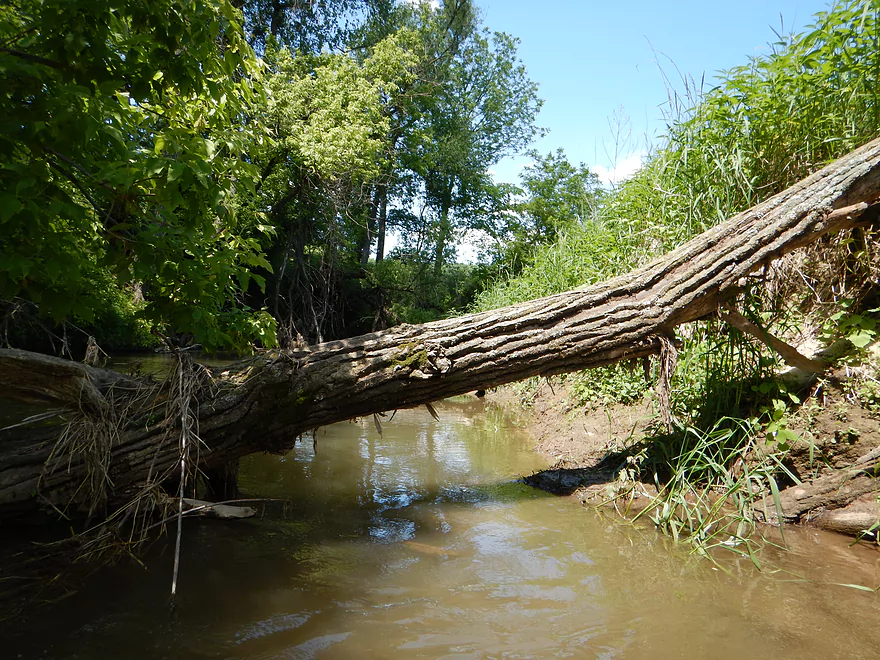
For the most part, this was a log jam-free trip. That would change. After a while, random debris starts popping up in the creek and there are log dams you’ll have to go over. Technically, I never once portaged this entire trip (a shame, as I was half looking forward to one so I could get my lunch that had slid to the bow tip of my kayak!). There are some serious log obstacles though. The first was a log jam that was above water line (by a couple of inches) and I had to do some serious hopping to get over that (not recommended, as you can lose your balance this way). The second jam had a very low hanging branch in decent current that was oh so tough to get under…but using my skills acquired from going under the electric fences I did prevail. Most sensible paddlers will portage this instead.
As you approach the village of Coon Valley, the water gets more pushy and the rapids more serious. There are a couple of good almost class 2 runs. Then you’ll come up on a walk bridge going to the ballpark…and here is decent-sized class 2 stretch that you’ll have to run (or portage). The youtube video I post below shows this so you can get an idea of how serious they are. The tricky part while running this chute is dodging the rocks in fast current (would be tough to do in a boat longer than my 10.5′ kayak). Something to keep in mind was that I ran this and the other rapids in slightly higher than normal water. The creek would probably be bonier (but less pushy and more safe) in lower water.
The rapids/riffles continue through the town park (a good possible take-out) until you get to the Hwy 162 bridge. Not the easiest take-out, as the bank height is high, so I ended up taking out below the bridge and on the opposite side of where I parked. Guess this is an okay bridge spot, with a pull-off for parking and a nice grassy area to drag your kayak on, but taking out a little upstream in the town park would be preferred (better parking, take-out area, and facilities).
The bike shuttle is nice, at just over three miles. A little busy on main street, and a tad roly-poly for Hwy P…but after doing gravel roads by the Black River, this was a breeze.
I don’t know if I’ll ever do any downstream sections of Coon Creek because of the rumors of log jams and steep mud banks. But I did talk with an individual who had done Coon Valley to Koll Road and said it was attractive, with just a few riffles, and the few barbed wire fences were easy to duck under. They did say there was a serious log jam between Knudson Road and Kull Road, and they regretted not taking out earlier at Knudson (actually looks like a better bridge for taking out anyways).
I might, however, run Coon Creek upstream of what I did in the heart of Timber Coulee country. Here the creek is more like I initially envisioned it, with cleaner water, less pushy current, less muddy banks, and even some cool rock walls I was able to photo while driving back. I might put in upstream of Rulland’s Coulee on Hwy P and float down to where I put in…google terrain mode shows the potential for nice rock outcroppings, and the area “seems” generally clear of log jams. It would be more shallow and would necessitate some shallow water portages or even a shallow water boat…but in my book this is not a bad deal.
All in all, I can’t recommend Coon Creek–and specifically not the section I did. This creek does have its redeeming values (nice scenic hills and fun riffles), but the low electric fences will make this a deal-breaker for most folks. A much better “trout stream” paddling experience can be had on Black Earth Creek, which, despite its serious paddling issues, is a much better and far cleaner prospect. I’m not done trout streaming though…and hopefully I can find more gems I can share with readers of this website.
Specials thanks to Eric Rauch (founder of the Coon Creek Trout Festival) and Markie (of Three Rivers Outdoors) for their tips about the creek!
Webmaster’s Update: It appears those nasty fences and logjams were removed and this is now a viable water trail. In fact locals held a successful race in 2019 on almost the exact same route I did…and they plan to hold another race in 2020. Click here for more information.
Detailed Overview
- Upstream of Rullands Creek Junction: I believe this far upstream Timber Coulee is too congested to run.
- Hwp P (by Rullands Coulee) to Hwy P Fishing Wayside: 1.2 miles. Tricky put-in. Either park on Oakdale Ave and launch in Rullands Coulee Creek and negotiate a serious electric fence. Or park east of the Coon Creek bridge/Hwy P and launch there. The latter lets you float by scenic outcrops. Electric fences and shallow water can be issues.
- Hwy P Wayside to 2nd Hwy P Wayside: 3.8 miles. A future trip.
- Hwy P Wayside to Olstad Road: 1.2 miles. Creek here is small, shallow, open and fast. Maybe one logjam.
- Olstad Road to Hwy P Wayside: 2.6 miles. Interesting prospect I might do in the future. Mostly pasture but perhaps some outcrops. Public fishing access at Olstad.
- Hwy P Wayside to Coon Valley/Veterans Park: 5.3 miles.
- Hwy P Wayside to Hwy P Bridge: 1.4 miles. Scenic stretch with fun rapids. Note this stretch used to have difficult fences, but I believe per a source they are no longer an issue.
- Hwy P Bridge to Hwy 14: 3.9 miles. This stretch used to have very challenging electric fences, but I'm 99.99% sure they were all removed or raised. This is a scenic leg with many rapids and rocks. An annual canoe/kayak race also takes place along this route.
- Coon Valley/Veterans Park to Koll Road: 4.5 miles.
- Coon Valley to Knudson Lane: 3.7 miles. This is a surprisingly scenic stretch with nice Driftless vistas and rapids. Note, this leg does contain some Class 2's, one logjam, and a few strainers that can be tricky for beginner paddlers.
- Knudson Lane to Koll Road: 0.7 miles. Aside from a sheep farm and a fun two foot ledge, this leg isn't as scenic/interesting as the preceding one.
- Koll Road to Swain Street: 4.8 miles.
- Koll Road to Hagen Lane: 0.6 miles. A short open stretch with only one minor obstruction.
- Hagen Lane to Dodson Hollow Road: 1.3 miles. Mostly an open section through farm pastures. Solid stretch but not spectacular. One major logjam to portage.
- Dodson Hollow Road to Hwy KK: 2.1 miles. Scenic leg with great vistas of the nearby wooded hills.
- Hwy KK to Swain Street: 0.8 miles. Nice leg that wraps around Chaseburg and parallels a fantastic trail. One logjam, but a super easy portage.
- Swain Street to Hanson Lane: 2.0 miles. This stretch has more deadfall with maybe four major logjams.
- Hanson Lane to Hwy 162: 2.2 miles. An open stretch with maybe one logjam.
- Hwy 162 to Hilltop Road: 3.3 miles. A very eroded stretch with maybe 11 logjams.
- Hilltop Road to Hwy 35: 6.3 miles. Scenic, but I suspect too many jams (~14). A short ways after, you are on the Mississippi.
Trip Map
View Coon Creek in a larger map
Overview Map
Video
Photos Size:
In 2014, I paddled Coon Creek. It was a beautiful creek but had some serious logjam and electric fence issues. It turns out these have since been cleaned out and this is now a viable water trail. In fact the locals held a race on almost the exact same stretch I did in 2019 and will do so again in 2020. Considering signing up for the race!
https://www.facebook.com/cooncreekcanoeraces/
https://www.facebook.com/events/626134481278925/
You obviously were on the creek after heavy rain because these streams are the clearest you will find with some of the best fishing to be had. Sorry about “jagged” rocks, but they are excellent habitat for fish. DNR spends money on restoration for fish, not kayaks. The funds come from license fees. The streams is this area are the among the top in the state. I assure you that normal water conditions are crystal clear.
I did go after a heavy rain and your comment is interesting. I’ll have to return again to do the segment after Coon Valley when the creek is more clear.